Banff National Park - Skoki, Egypt Lake Area and various peaks

LakeLouiseArea_Map_V.png

Mount Bourgeau

Mount Bourgeau

Mount Bourgeau

Mount Bourgeau

Mount Bourgeau

On Mt. Weed

Mt. Weed

The Twin summits of Mt. Weed

IMG_4716.jpeg
Deception Pass - view to the Skoki Mountain

Deception Pass - view to the Skoki Mountain

Redoubt Mountain

Redoubt Mountain

Deception Pass

Deception Pass

Mount Richardson and Ptarmigan Peak

Mount Richardson and Ptarmigan Peak

Hidden Lake and Ptarmigan Peak

Hidden Lake and Ptarmigan Peak

Hidden Lake

Hidden Lake

Mount Richardson

Mount Richardson

Mt. Richardson

Mt. Richardson

The ascend ridge on Mt. Richardson

The ascend ridge on Mt. Richardson

Mt. Richardson summit 3,086m

Mt. Richardson summit 3,086m

The view east of Ptarmigan Peak, Hidden Lake from Mt. Richardson

The view east of Ptarmigan Peak, Hidden Lake from Mt. Richardson

IMG_4880.jpeg
Summit panorama from Mt. Richardson

Summit panorama from Mt. Richardson

Mount Hector from Mt. Richardson

Mount Hector from Mt. Richardson

Lake Louise, Mt. Lefroy and Mt. Victoria from Mt. Richardson

Lake Louise, Mt. Lefroy and Mt. Victoria from Mt. Richardson

Merlin Lake from Mt. Richardson

Merlin Lake from Mt. Richardson

IMG_4822.JPEG
The view to Yoho NP from Mt. Richardson

The view to Yoho NP from Mt. Richardson

The Wall of Jericho from Mt. Richardson

The Wall of Jericho from Mt. Richardson

Mt. Richardson

Mt. Richardson

Descending from Mt. Richardson with Lake Louise on the horizon (left)

Descending from Mt. Richardson with Lake Louise on the horizon (left)

Mt. Richardson and the Hidden Lake

Mt. Richardson and the Hidden Lake

Hidden Lake

Hidden Lake

Hidden Lake area

Hidden Lake area

The trail between Lake Louise ski area and Skoki

The trail between Lake Louise ski area and Skoki

Healy Pass

Healy Pass

Egypt Lake

Egypt Lake

Egypt Lake

Egypt Lake

Egypt Lake

Egypt Lake

IMG_6342.jpeg
The view from the Sphinx

The view from the Sphinx

Egypt Lake and The Pharaoh Peak  from the Sphinx

Egypt Lake and The Pharaoh Peak from the Sphinx

The Pharaoh Peak and Egypt Lake

The Pharaoh Peak and Egypt Lake

IMG_6365.jpeg
IMG_6374.jpeg
IMG_6396.jpeg
The View from the Pharaoh Peak.  The smoky haze is from the terrible 2020 forrest fires in the USA.

The View from the Pharaoh Peak. The smoky haze is from the terrible 2020 forrest fires in the USA.

IMG_6413.jpeg
IMG_6418.jpeg
The profile view of the steep Pharaoh Peak

The profile view of the steep Pharaoh Peak

The Pharaoh Peak

The Pharaoh Peak

IMG_6462.jpeg
Haiduk Lake and Mt. Ball from The Lesser Pharaoh Peak

Haiduk Lake and Mt. Ball from The Lesser Pharaoh Peak

The Panorama from the Lesser Pharaoh Peak

The Panorama from the Lesser Pharaoh Peak

IMG_6499.jpeg
The Pharaoh Peak from my tent

The Pharaoh Peak from my tent

Healy Pass

Healy Pass

IMG_6516.jpeg
The start of the steep climb up Cory Mountain near Banff townsite

The start of the steep climb up Cory Mountain near Banff townsite

Cory Mountain

Cory Mountain

Cory Mountain with Mt. Assinibone on the horizon

Cory Mountain with Mt. Assinibone on the horizon

The summit ridge of Cory

The summit ridge of Cory

The view from Cory

The view from Cory

The view from Cory

The view from Cory

Mt. Cory

Mt. Cory

Mt. Cory

Mt. Cory

Mt. Cory

Mt. Cory

New6.jpg
Mt. Cory

Mt. Cory

An abandoned mining cabin on the way to Protection Mountain

An abandoned mining cabin on the way to Protection Mountain

An abandoned mine on Protection Mountain

An abandoned mine on Protection Mountain

The view towards Mount Temple from the slopes of Protection Mountain

The view towards Mount Temple from the slopes of Protection Mountain

The 5 km long ridge of Protection Mountain

The 5 km long ridge of Protection Mountain

Protection Mountain, you can see Mt. Assiniboine far in the distance.

Protection Mountain, you can see Mt. Assiniboine far in the distance.

Protection Mountain

Protection Mountain

Armor Peak in the distance

Armor Peak in the distance

Protection Mountain

Protection Mountain

X1.jpg
X2.jpg
TV 10.jpg

Mount Edith

Mount Edith

Mount Edith

Mount Cory from Mt. Edith

Cory Pass

Siffleur Wilderness Trekking

Siffleur Wilderness area has been on my radar for a long time. Finally, during the 2020 summer I managed to get int here to do some hiking and exploring. It is definitely a seldom visited part of the Rockies despite good trail access and short distance. It is a spectacular area reminding me of the Lake O’Hara a little. We decided to go up the Maramota Peak as it would take us all across the Siffleur Plateau. The views are amazing all the way and the hiking is challenging enough to keep things interesting. The view from Maramota Peak is also amazing as it is a mountain with the elevation of over 3,100m.

central_alberta-map2-bow_lake.jpg
20101117_Siffleur_Wilderness_TR_v3.jpg
Looking back to Mount Chephren and Howse Peak from the Totem Creek Valley

Looking back to Mount Chephren and Howse Peak from the Totem Creek Valley

Part of the Lower Totem Lake

Part of the Lower Totem Lake

Lower Totem Lake and Mount Chephren

Lower Totem Lake and Mount Chephren

South Totem Peak 3,050m, an easy scramble with a spectacular view

South Totem Peak 3,050m, an easy scramble with a spectacular view

Totem Creek Valley

Totem Creek Valley

IMG_4456.jpeg
Lower Totem Lake

Lower Totem Lake

Our bivi at the Upper Totem Lake under the Totem Tower

Our bivi at the Upper Totem Lake under the Totem Tower

Mount Murchison towers above the Upper Totem Lake

Mount Murchison towers above the Upper Totem Lake

IMG_4292.jpeg
Totem Tower en route to the Maramota Peak

Totem Tower en route to the Maramota Peak

Looking back at the Totem Tower and Murchison

Looking back at the Totem Tower and Murchison

The towers of Mt. Murchison

The towers of Mt. Murchison

The upper slopes of Maramota Peak

The upper slopes of Maramota Peak

IMG_4342.jpg
On the summit of Maramota Peak 3,150m. It was a 11km trek from our bivi site and a 21 km trek from the car.

On the summit of Maramota Peak 3,150m. It was a 11km trek from our bivi site and a 21 km trek from the car.

Looking south from the Maramota Peak

Looking south from the Maramota Peak

IMG_4402.jpeg
IMG_4359.jpg
IMG_4405.JPEG
Totem Tower and Mount Murchson from Maramota Peak

Totem Tower and Mount Murchson from Maramota Peak

IMG_4379.jpg
Upper slopes of the Maramota Peak

Upper slopes of the Maramota Peak

Upper Totem Lake at sunset

Upper Totem Lake at sunset

En route to the South Totem Peak

En route to the South Totem Peak

The view of Mt. Chephren and beyond from the Maramota Peak

The view of Mt. Chephren and beyond from the Maramota Peak

The Murchison Towers and the Totem Tower from the Maramota Peak

The Murchison Towers and the Totem Tower from the Maramota Peak

IMG_5671.jpeg
IMG_5711.jpeg
DJI_2957.jpg
IMG_5618.jpeg
WTEI2427.jpeg
Spalding Peak from the South Totem Peak

Spalding Peak from the South Totem Peak

Looking east from Totem Peak - the ridge of Maramota is on the left

Looking east from Totem Peak - the ridge of Maramota is on the left

IMG_5676.jpeg
Bison Peak from the South Totem Peak

Bison Peak from the South Totem Peak

IMG_5693.jpeg
Upper Totem Lake where we camped en route to Maramota Peak

Upper Totem Lake where we camped en route to Maramota Peak

Abraham Lake

Abraham Lake

Siffleur Wilderness

Siffleur Wilderness

Kootenay National Park - The Rockwall Trek

2015-kootenay-map_acc.jpg
Kootney Valley and the Rockwall in the distance

Kootney Valley and the Rockwall in the distance

The trail to Numa Pass

The trail to Numa Pass

Floe Lake

Floe Lake

IMG_3644.jpeg
Above Numa Pass on the way to Numa Mountain.  Floe Lake is in the distance.

Above Numa Pass on the way to Numa Mountain. Floe Lake is in the distance.

On Numa Mountain

On Numa Mountain

The view North from Numa Mountain summit

The view North from Numa Mountain summit

The Panorama of the Rockwall Trail from the summit of Numa Mountain

The Panorama of the Rockwall Trail from the summit of Numa Mountain

The view to Numa Creek and Tumbling Pass from Numa Mountain

The view to Numa Creek and Tumbling Pass from Numa Mountain

Foster Peak

Foster Peak

P1220364.jpeg
The view south from Numa Mountain

The view south from Numa Mountain

Mt. Whymper from Numa Mountain

Mt. Whymper from Numa Mountain

The view East towards Banff NP and Ball Pass

The view East towards Banff NP and Ball Pass

Tumbling Peak and Tumbling Pass from Numa Mountain

Tumbling Peak and Tumbling Pass from Numa Mountain

The peaks in the Lake Louise area from Numa Mountain

The peaks in the Lake Louise area from Numa Mountain

Mount Temple, Mout Fay and Quadra from Numa Mountain

Mount Temple, Mout Fay and Quadra from Numa Mountain

Mount Temple from Numa Mountain

Mount Temple from Numa Mountain

IMG_3824.jpeg
The view of Numa Mountain (left) and Numa Pass from Tumbling Peak.  The pointy Mountain is Foster Peak.

The view of Numa Mountain (left) and Numa Pass from Tumbling Peak. The pointy Mountain is Foster Peak.

CR2A2520.jpeg
The Wolverine Pass and Tumbling Creek campsite from Tumbling Peak

The Wolverine Pass and Tumbling Creek campsite from Tumbling Peak

The Rockwall from the Tumbling Peak

The Rockwall from the Tumbling Peak

Tumbling Mountain

Tumbling Mountain

IMG_5763.jpeg
Tumbling Mountain and the icefall

Tumbling Mountain and the icefall

IMG_5780.jpeg
Tumbilng Mountain from the Wolverine Pass

Tumbilng Mountain from the Wolverine Pass

Tumbling Mountain and icefall

Tumbling Mountain and icefall

Wolverine Pass

Wolverine Pass

CR2A2552.jpeg
Wolverine Pass

Wolverine Pass

IMG_5815.jpeg
The Rockwall

The Rockwall

The Rockwall

The Rockwall

The Rockwall

The Rockwall

Helmet Falls

Helmet Falls

Helmet Falls

Helmet Falls

Goodsirs Pass

Goodsirs Pass

Goodsirs Pass

Goodsirs Pass

The Goodsirs Towers

The Goodsirs Towers

IMG_5944.jpeg
Sharp Peak

Sharp Peak

The Goodsirs Towers

The Goodsirs Towers

CR2A2621.jpg
CR2A2656.jpg
CR2A2663.jpg
Looking back at the Rockwall Trail from the Goodsirs Pass

Looking back at the Rockwall Trail from the Goodsirs Pass

Closeup of the Rockwall Trail

Closeup of the Rockwall Trail

Mount Oke in the Lake O’Hara area

Mount Oke in the Lake O’Hara area

CR2A2596.jpeg
CR2A2653.jpeg
Helmet Falls in the distance with the Helmet Mountain looming above from the Helmet Creek Trail

Helmet Falls in the distance with the Helmet Mountain looming above from the Helmet Creek Trail

Mount Vermilion from the Helmet Falls trail near Paint Pots

Mount Vermilion from the Helmet Falls trail near Paint Pots

Paint Pots and the Rockwall far in the distance

Paint Pots and the Rockwall far in the distance

Mount Vermilion and the Marble Canyon

Mount Vermilion and the Marble Canyon

The View from the summit of Mt. Vermilion

The View from the summit of Mt. Vermilion

Mt. Whymper and the Marble Canyon below from Mt. Vermilion

Mt. Whymper and the Marble Canyon below from Mt. Vermilion

Mt. Ball and Hafner Creek trail from Mt. Vermilion

Mt. Ball and Hafner Creek trail from Mt. Vermilion

Paint Pots and the Helmet Creek trail

Paint Pots and the Helmet Creek trail

The summit ridge of Mt. Vermilion

The summit ridge of Mt. Vermilion

Ochre Spring Peak - actually it is a 1400m ascent!

Ochre Spring Peak - actually it is a 1400m ascent!

Storm Mountain and Mt. Stanley from Mt. Vermilion

Storm Mountain and Mt. Stanley from Mt. Vermilion

IMG_3474.jpeg
Mt. Stanley from Mt. Whymper

Mt. Stanley from Mt. Whymper

Mt. Vermilion from Mt. Whymper

Mt. Vermilion from Mt. Whymper

Mt. Whymper summit looking east

Mt. Whymper summit looking east

IMG_2811.jpeg
IMG_2814.jpeg
Mt. Whymper summit - looking north-west towards the Goodsirs

Mt. Whymper summit - looking north-west towards the Goodsirs

Storm Mountain, Mt. Ball and Stanley from Mt. Whymper

Storm Mountain, Mt. Ball and Stanley from Mt. Whymper

IMG_2902.jpeg
The Rockwall peeking from above the ridge.  The Goodsir Towers are on the right.

The Rockwall peeking from above the ridge. The Goodsir Towers are on the right.

whymper2.jpg
IMG_2893.jpeg
P1220186.jpg
Sharp Mountain and the Goodsir Towers

Sharp Mountain and the Goodsir Towers

Numa Mountain

Numa Mountain

Mt. Ball

Mt. Ball

IMG_2834.jpeg
IMG_2829.jpeg
Boom Mountain

Boom Mountain

Storm Mountain

Storm Mountain

Kootenay River Valley and Highway 93

Kootenay River Valley and Highway 93

The view towards Lake Louise mountains from the Ochre Spring Peak

The view towards Lake Louise mountains from the Ochre Spring Peak

Descending Ochre Spring Peak with Mt. Vermilion in front.  Highway 93 winds below

Descending Ochre Spring Peak with Mt. Vermilion in front. Highway 93 winds below

The view of Mt. Storm (left) and Stanley (the highest peak in the centre) from Ochre Spring Peak

The view of Mt. Storm (left) and Stanley (the highest peak in the centre) from Ochre Spring Peak

IMG_4583.jpeg
IMG_4585.jpeg
Windy on top of Ochre Spring Peak 2,849m - October 2, 2021.  The Rockwall is on the horizon.

Windy on top of Ochre Spring Peak 2,849m - October 2, 2021. The Rockwall is on the horizon.

The Rockwall is on the horizon - from the Ochre Peak

The Rockwall is on the horizon - from the Ochre Peak

IMG_4604.jpeg

Boom Lake

Boom Lake

Boom Mountain and Boom Lake

Boom Mountain and Boom Lake

On Boom Lake

The approach trail to Boom Mountain involves serious bushwhacking.

Mt. Whymper from the slopes of Boom.

Boom Mt Panorama

Mt. Whymper from Boom Mt.

Boom Lake from Boom Mountain summit

Storm Mountain from Boom Mountain summit

Storm Mountain from Upper Twin Lake

Storm Mountain from Upper Twin Lake

Boom Mountain and Mt. Whymper

Boom Mountain and Mt. Whymper

Boom Mountain and Boom Lake Valley

Boom Mountain and Boom Lake Valley

Lower Twin Lake and Mt. Storm

Lower Twin Lake and Mt. Storm

Storm Mt. in June

Arnica Lake and Mt. Storm outlier

Arnica Lake and Mt. Storm outlier

Arnica Lake in June

Yoho National Park

2020 is a CRAZY year.  All my travel plans have been cancelled due to the pandemic.  This gave me the opportunity to spend quality time in my own back yard and explore the places that were on my to-do list for a long time.  In the prior years, the campsites booked early and were always full.  This year, due to the travel restrictions, booking campsites was easy. 

I visited Yoho valley many times before.  However, I decided to explore some more remote corners (Watervalley) and scramble a few peaks.  This is one of the most spectacular areas of the Canadian Rockies.  What makes the Iceline Trail so special is its high location.  The trail follows a line of glaciers descending from Mt. President.  The trail is high above the Yoho Valley and provides spectacular views all around.  It can be easily done as a day trip.  To spend some quality time in the backcountry though, it is advisable to camp further up the Yoho Valley. 

Yoho NP has 3 very distinct areas: the Yoho Valley (where the Iceline trail is located), Lake O’Hara area and Emerald Lake. There are some more remote parts that are seldom visited as access is difficult. Some of the most spectacular peaks of the Rockies are located here (for example the Goodsirs).

Source:  Gov of Canada

Source: Gov of Canada

Yoho Valley

Yoho Valley

The overview of the entire Iceline Trail from the Whaleback Mountain. The trail follows the glaciers descending from Mt. President.

The overview of the entire Iceline Trail from the Whaleback Mountain. The trail follows the glaciers descending from Mt. President.

Mount Balfour as seen from the Iceline Trail

Mount Trolltinder as seen from the Iceline Trail. Mount Balfour towers over it and makes it look smaller and less impressive.

CR2A2827.jpeg

Trolltinder Mountain

Trolltinder Mountain 2917m

Along the Iceline Trail

Along the Iceline Trail

CR2A2809.jpeg
IMG_6944.jpeg
IMG_6982.jpeg
Looking towards Mount Victoria in Lake Louise

Looking towards Mount Victoria in Lake Louise

CR2A2907.jpeg
The trail runs above the main Yoho Valley

The trail runs above the main Yoho Valley

Yoho Mountain

Yoho Mountain

CR2A2920.jpeg
The closeup of Mount Victoria north peak

The closeup of Mount Victoria north peak

Mount Rhonda on the Wapta Icefiled and the Yoho Glacier

Mount Rhonda on the Wapta Icefiled and the Yoho Glacier

CR2A2937.jpeg
CR2A2939.jpeg
CR2A2952.jpeg
IMG_7017.jpeg
IMG_6943.jpeg
Mount Daly and Takakkaw Falls

Mount Daly and Takakkaw Falls

Laughing Falls

Laughing Falls

Isolated Peak from The Whaleback

Isolated Peak from The Whaleback

The view from Isolated Peak

The Whaleback from Isolated Peak

Watervalley from the Whaleback

Watervalley from the Whaleback

Mount President and Vice-President from the Whaleback

Mount President and Vice-President from the Whaleback

IMG_6811.jpeg
IMG_6834.jpeg

Whaleback Mt

Isolated Pk from Whaleback

Whaleback Panorama

The Presidents from the trail to Isolated Peak

Isolated Peak

McArthur Glacier near Isolated Peak

McArthur Glacier

The view from the slopes of Isolated Peak

The Presidents from the trail to Kiwetinok Pass

The Presidents from the trail to Kiwetinok Pass

The view of the Presidents from the Pass

The view of the Presidents from the Pass

Looking down the Little Yoho Valley from the Pass

Looking down the Little Yoho Valley from the Pass

Kiwetinok Pass

Kiwetinok Pass

Kiwetinok Pass

Kiwetinok Pass

Kiwetinok Pass

Kiwetinok Pass

Mount Kerr

Mount Kerr

Mt. Kerr

Mt. Kerr

Mt. President from Mt. Kerr

Mt. President from Mt. Kerr

<untitled> 22.jpeg
CR2A2778.jpeg
Twin Falls

Twin Falls

IMG_6766.jpeg

Water Valley

Yoho Peak on the left and Water Valley

Mont Des Poilus and Des Poilus Glacier

Mont Des Poilus and Des Poilus Glacier

Mont Des Poilus and Des Poilus Glacier from the slopes of Yoho Peak

Mont Des Poilus and Des Poilus Glacier from the slopes of Yoho Peak

Mount Temple from Yoho Peak

Mount Victoria from Yoho Peak

The summit of Whaleback and The Presidents from Yoho Peak

Isolated Peak from Yoho Pk

Isolated Peak from Yoho Pk

Water Valley from Yoho Peak

Mt. Des Poilus from Yoho Pk

Mt. Des Poilus 3161m

Mt. Collie 3116m

Wapta Icefield

Yoho Glacier and Wapta Icefield from Yoho Mt

The view from Yoho Peak

Yoho Pk

Mt Balfour from Yoho Pk

Guy Hut from Yoho Pk

The Guy ACC Hut

IMG_6774.jpeg
Natural Bridge - a rock formation that forms a natural bridge over the Kicking Horse River River

Natural Bridge - a rock formation that forms a natural bridge over the Kicking Horse River River

The Kicking Horse River

The Kicking Horse River

On the Narao Mountain

On the Narao Mountain

On the Narao Mountain

On the Narao Mountain

Sherbrook Lake and the Yoho from the Narao Peak

Sherbrook Lake and the Yoho from the Narao Peak

Cathedral Mountain from the Narao Peak

IMG_2618.jpeg
IMG_2622.jpeg
The ridge of the Narao Mountain with the Trans-Canada Highway below

The ridge of the Narao Mountain with the Trans-Canada Highway below

Paget Peak

Paget Peak

Paget Peak, Narao Peak and Victoria North

Paget Peak, Narao Peak and Victoria North

Narao Peak and Mt. Victoria Noth

Narao Peak and Mt. Victoria Noth

Mt. Daly

Mt. Daly

Sherbrook Lake

Sherbrook Lake

Sherbrook Lake

Sherbrook Lake

Lake Oesa and Mt. Lefroy from Yukness

Lake O’Hara

The view from Yukness to Glacier Peak

Ringrose Peak and Mt. Hungabee

Mt. Victoria from Yukness

Mt. Huber and Mt. Victoria

Mt. Biddle

Mt. Victoria and Lefroy from Yukness

Mt. Schaffer from Yukness

Mt. Huber (right)

Mt. Yukness 2847

The Grand Mustang Circuit - Trip Report

October 17, 2019 Kathmandu

I arrived in Kathmandu after a 4-hour flight from Doha.  I was mentally prepared for a long wait to get the visa on arrival in Kathmandu, but the process was surprisingly smooth and quick.  The baggage area was as chaotic as ever with mountains of luggage all over the arrival room.  The airport is too small and cannot handle the increasing amount of flights.  I almost lost my bag in the chaos as there were many North Face duffels and mine looked the same as a few others.  The scary thing is that no one checks if you got the right bag and the mistake would only be realized after arriving at the hotel. Rajendra was waiting for me outside with a Kata and a garland of marigolds.  We took a private car to the Nirvana Garden Hotel – my home away from home.  After buying a few last-minute things I crashed in the room for a couple of hours.  The plan is to leave tomorrow at 7 am for a drive to Chame on the Annapurna Circuit, apparently, an all-day affair. 

Monks in Bhaktapur in the Kathmandu Valley

Monks in Bhaktapur in the Kathmandu Valley

October 18, 2019 Chame 2720m

We left Kathmandu at 7 am and arrived in Basiskar at 1pm.  The paved road ends in Basiskar and the crude 4x4 track to Chame begins. It was very hot in the car (over 30C) as the driver does not believe in air conditioning or even a ventilator.  In Besishar we met up with the missing members of the team who arrived here the night before on a local bus with the supplies for the trek.   The crew seemed nice and it would transpire later that they were all related.    The cook (Niram, a brother of my guide Samip) hired a jeep to take us to Chame.  There is a little cottage industry here with the Mahindra jeeps making the run between Basiskar (where the paved road ends) and Manang (Chame is on the way).  Our driver was a very nice local fellow.  He was competent and a skilled driver and bravely negotiated hairpin turns and steep cliffs. 

The road is in a terrible state with barely passable sections but very spectacular with phenomenal views of the valley of Bhote Khola.  The road follows the old Annapurna circuit trail that is still walked by some hardy souls.  It takes 3 to 4 days of walking to get to Chame.  I walked part of it in 2011 from the Manaslu trail intersection to Chame, a two-day affair.  The Bhote Khola gorge craves its way between the Annapurna and Manaslu Himals.  Some sections are literally chiseled into sheer cliff faces.  It is extremely spectacular with many waterfalls on both sides of the Bhota River.  The spectacular views made up for the bone separating shaking that we had to endure for 5 hours. 

IMG_8467.jpg
Notice the crashed jeep in the river

Notice the crashed jeep in the river

On the way we passed Dharapani where the Manaslu trail links with the Annapurna Circuit.  I remember coming from that valley with Kumar, Kamsing and Suri.  It was my first solo trip and I am here solo again, almost a decade later.  We passed the hotel that we stayed in 2011 where Kamsing killed all the spiders for me. 

It got dark along the way and we were still a long way from Chame.  We finally arrived at the Eagle Nest Hotel after 7.30pm tired and shaken.  The hotel seemed deserted and had only another 3 guests from Europe (Holland?).  We chatted a little over dinner.  I can’t help but be aware of how old I am compared to most trekkers who are half my age!  It was too late to set up camp and organize the food.  Tomorrow our plan is to walk to Upper Pisang.

October 19, 2019 Upper Pisang 15km, 3300m 680 elevation gain

I woke up early (due to jet lag) at 4.30 am.  Most of the tea houses in Chame were almost empty and there were more Nepali trekkers than foreigners.  It is quite a contrast to 2011 when it was so crowded that we had to wait in line to climb a hill along the trail.  We left at 8.30 am after nice breakfast served in the dining room of the Eagle Nest tea house.  The crew organized the loads and supplies for the next few days, at least until we reach Kagbeni.  We had a group photo taken and we were off.  At first, we walked on the road but it did not matter much as we were in a deep gorge of the Mahiati River.  Somewhere near Chame was the end of the Nar-Phu trail that we may exit the trek in 30 days or so. 

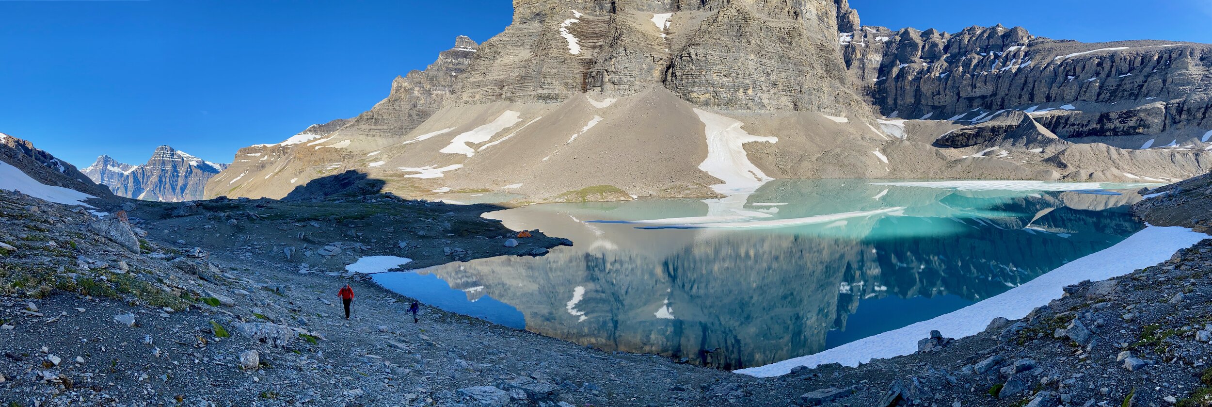
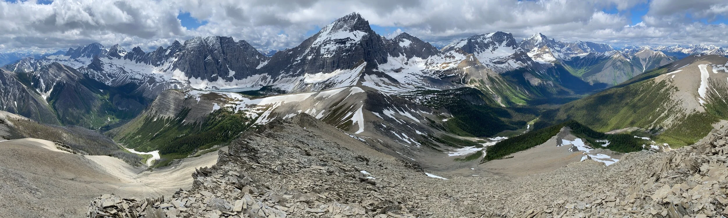
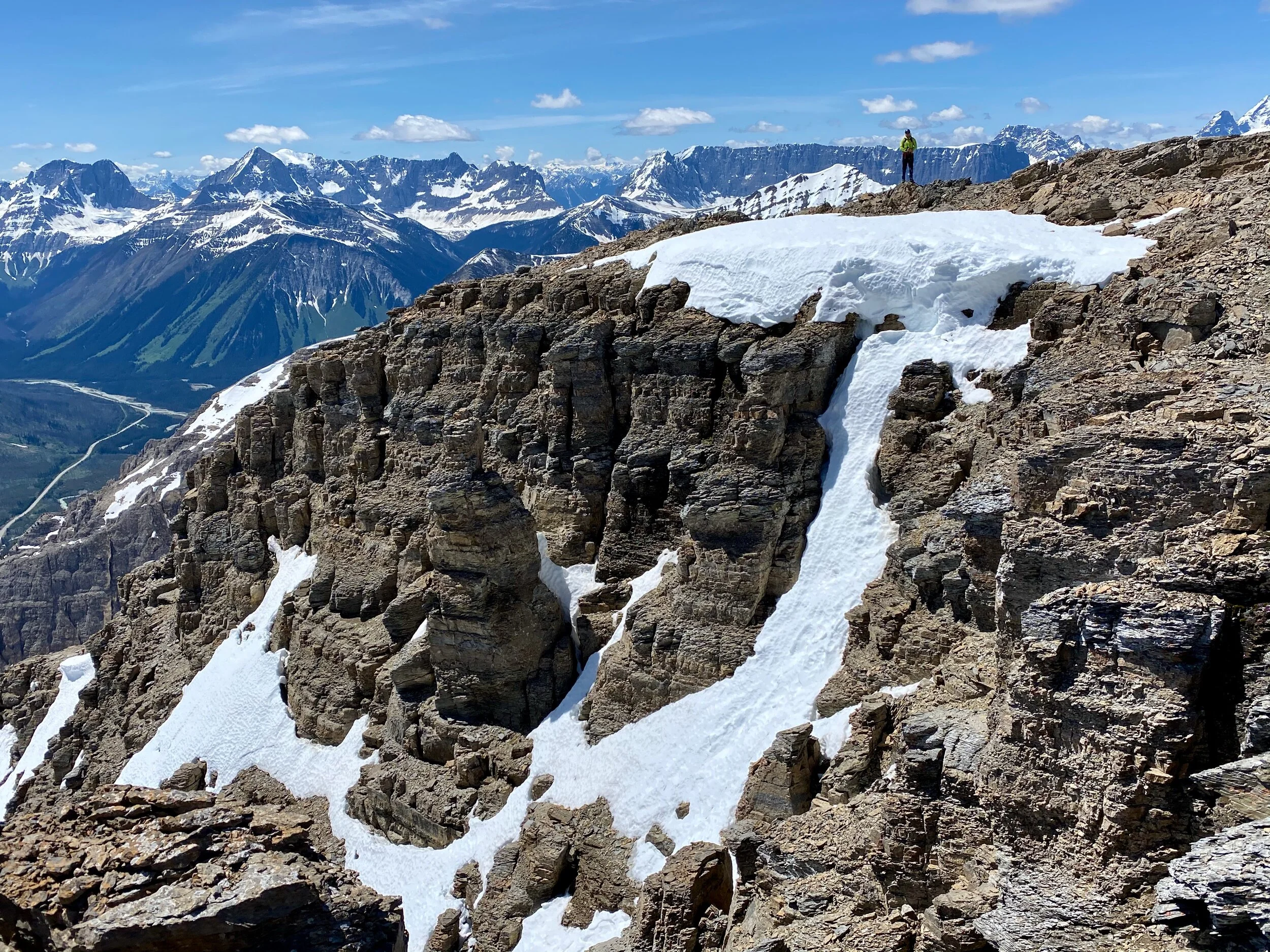
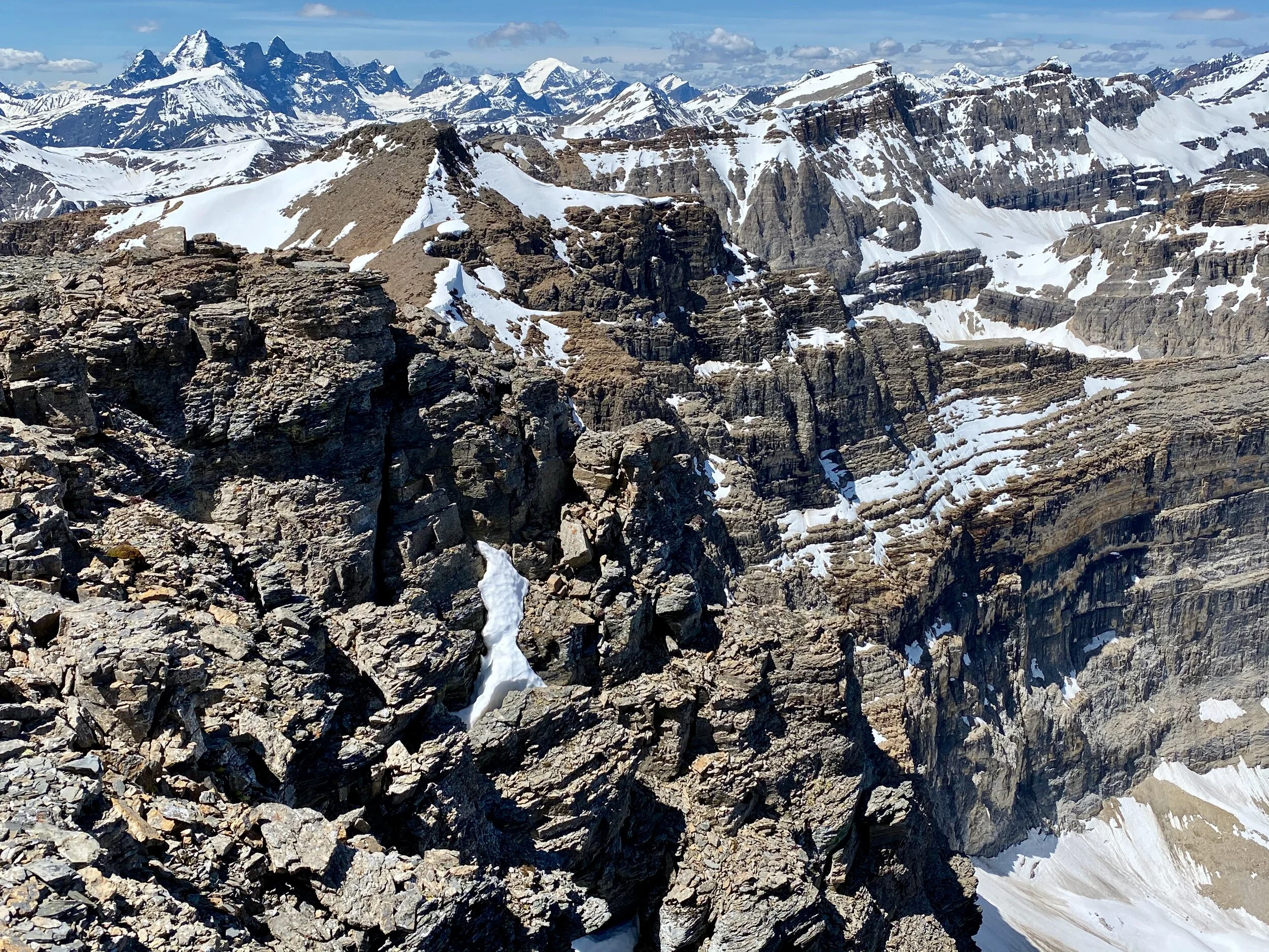
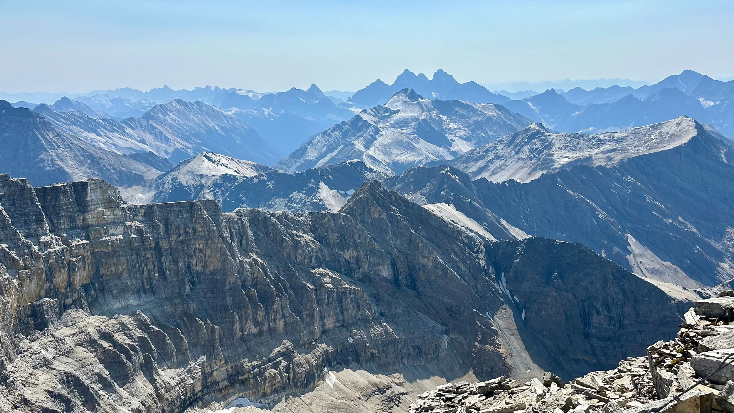
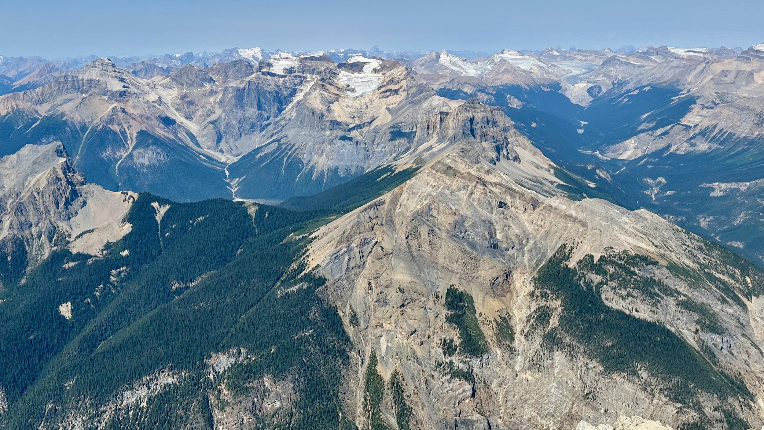
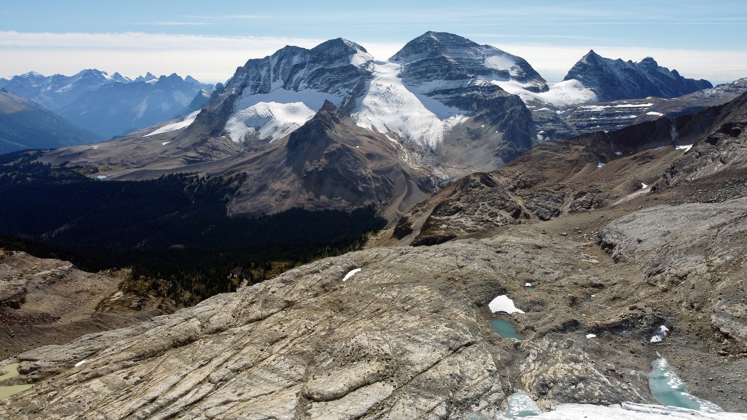
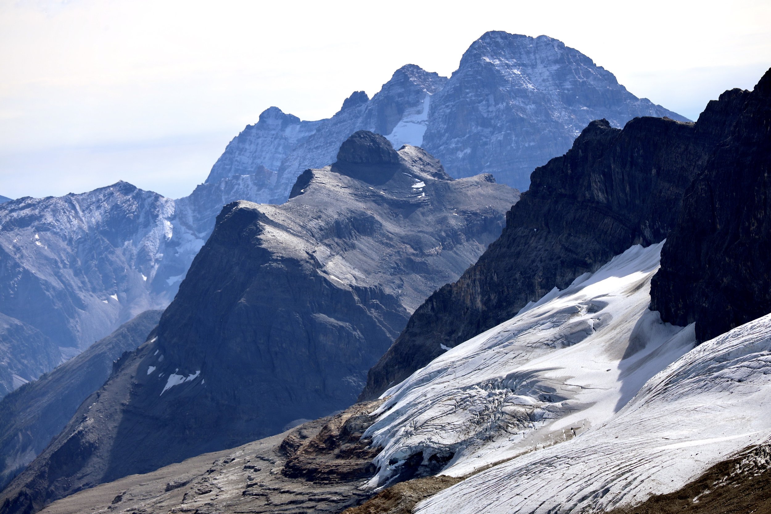
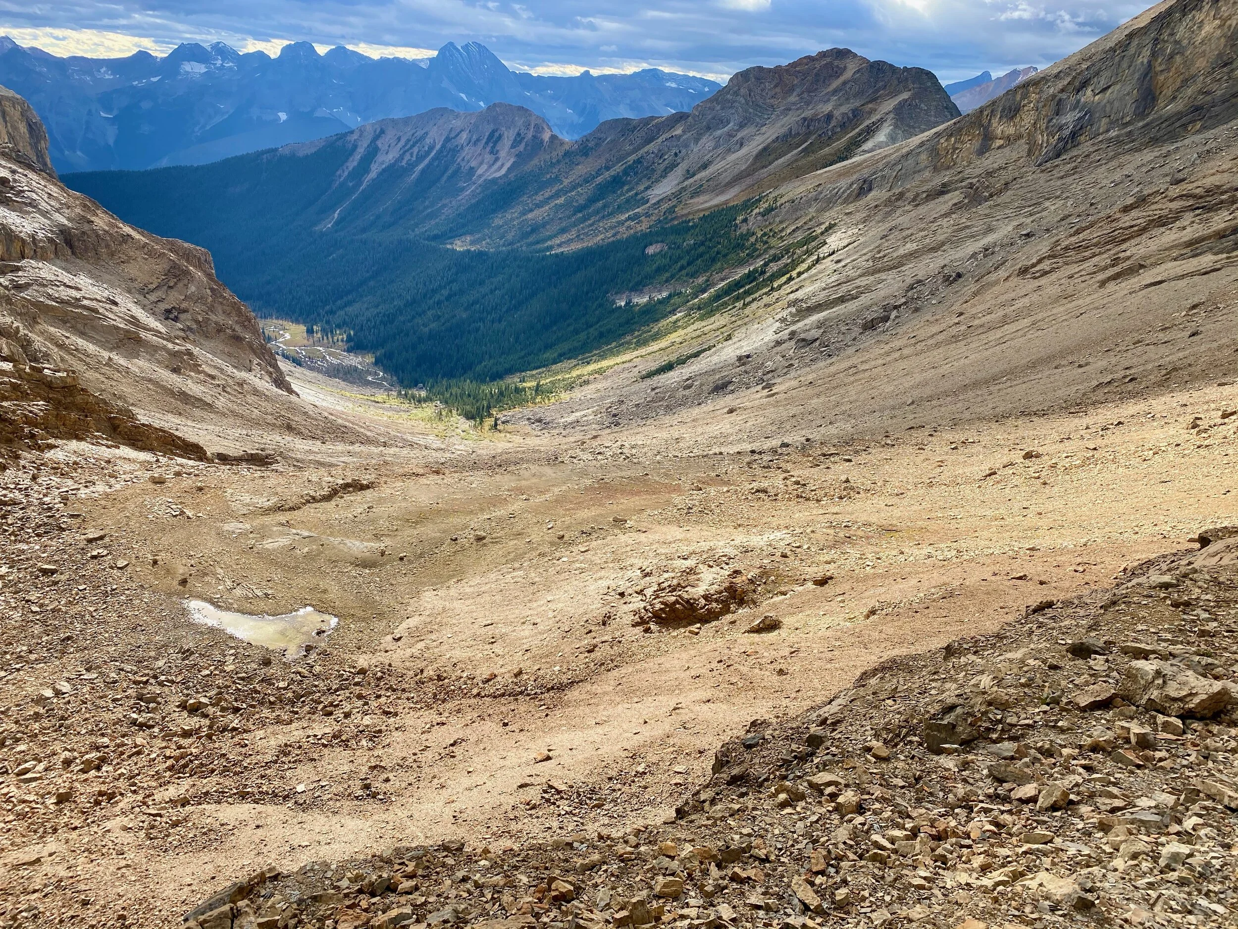
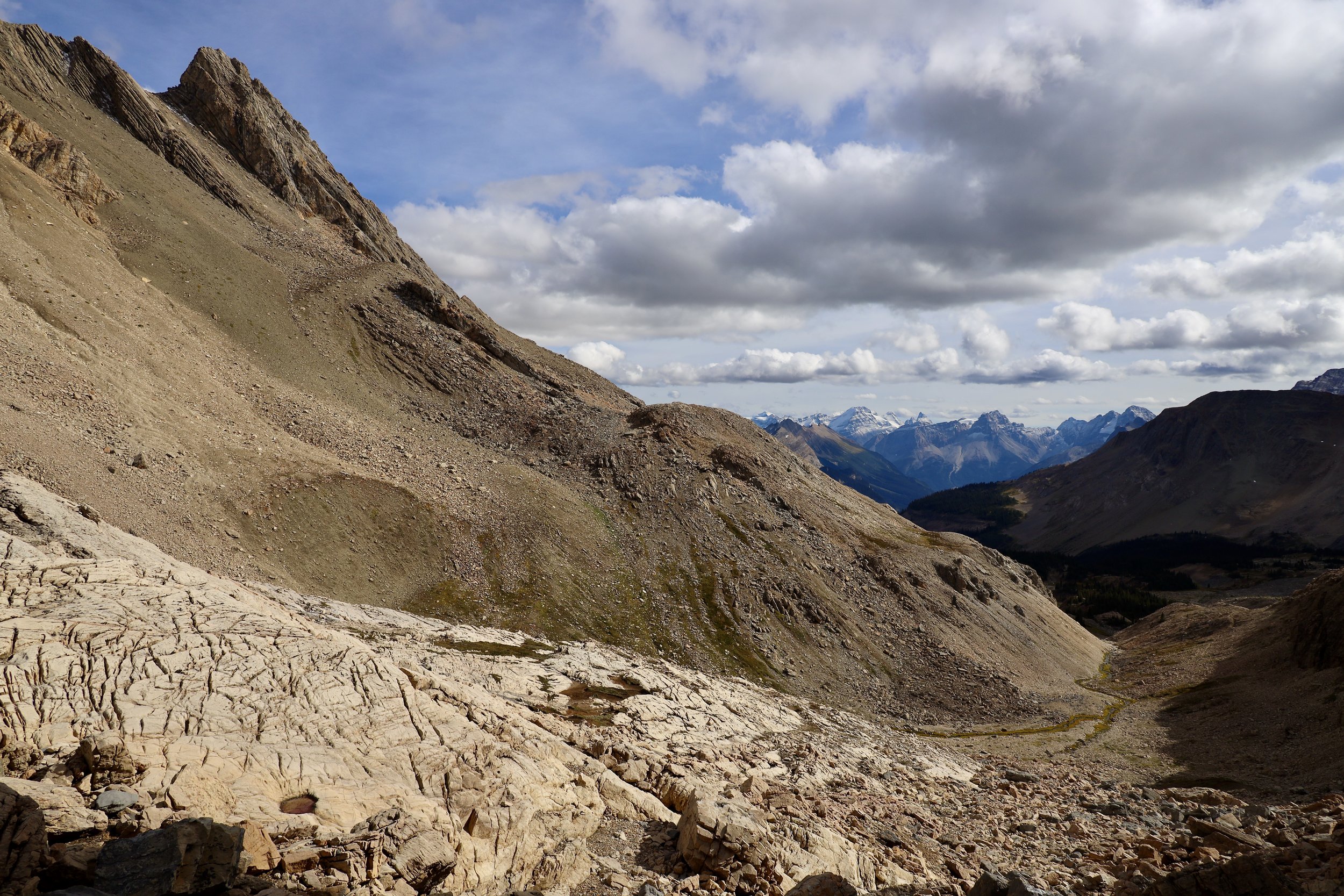
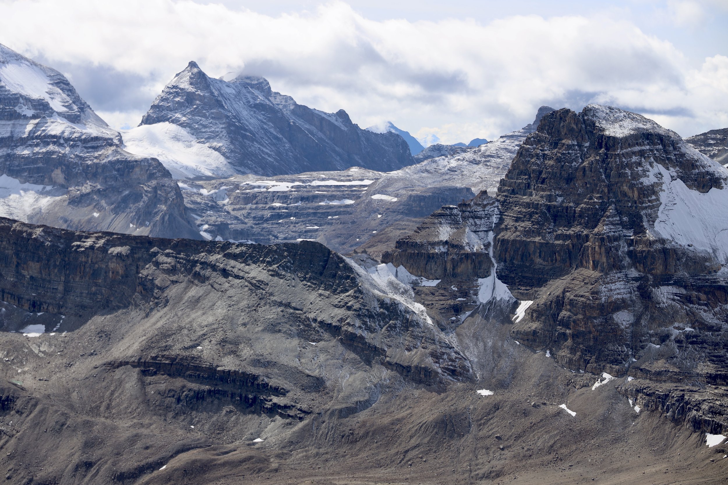
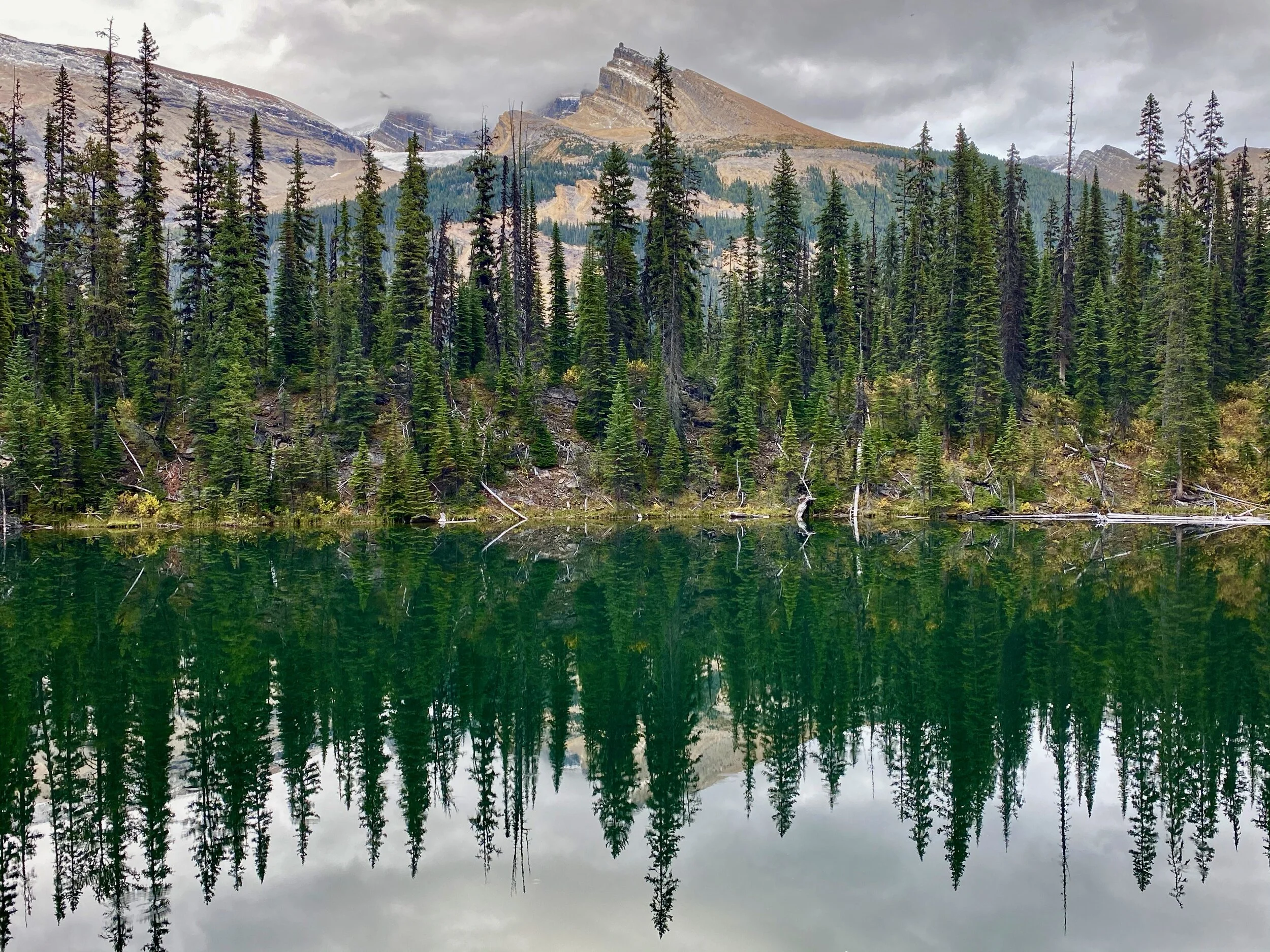
We had some beautiful views to of the Lamjung Himal along the way.  I missed those views in 2011 due to bad weather.  We came across a large apple farm that sold us some good apples, cinnamon rolls and apple juice.  It is a local business initiative providing work for the villagers and taking advantage of the newly constructed road.  It seemed to be well organized and professionally run.   We walked along the road blasted of a vertical rock face (I remember walking here as the road was being built).  We were mainly alone and did not run into many other trekkers.   We had a nice tea break in an empty tea house with the Annapurna 2 ridges towering above us.  After crossing the river and a final short uphill push we arrived in Upper Pisang at 11.30am.    The entire section of the trail seemed deserted (which I guess was nice for us as I was psyched for crowds). 

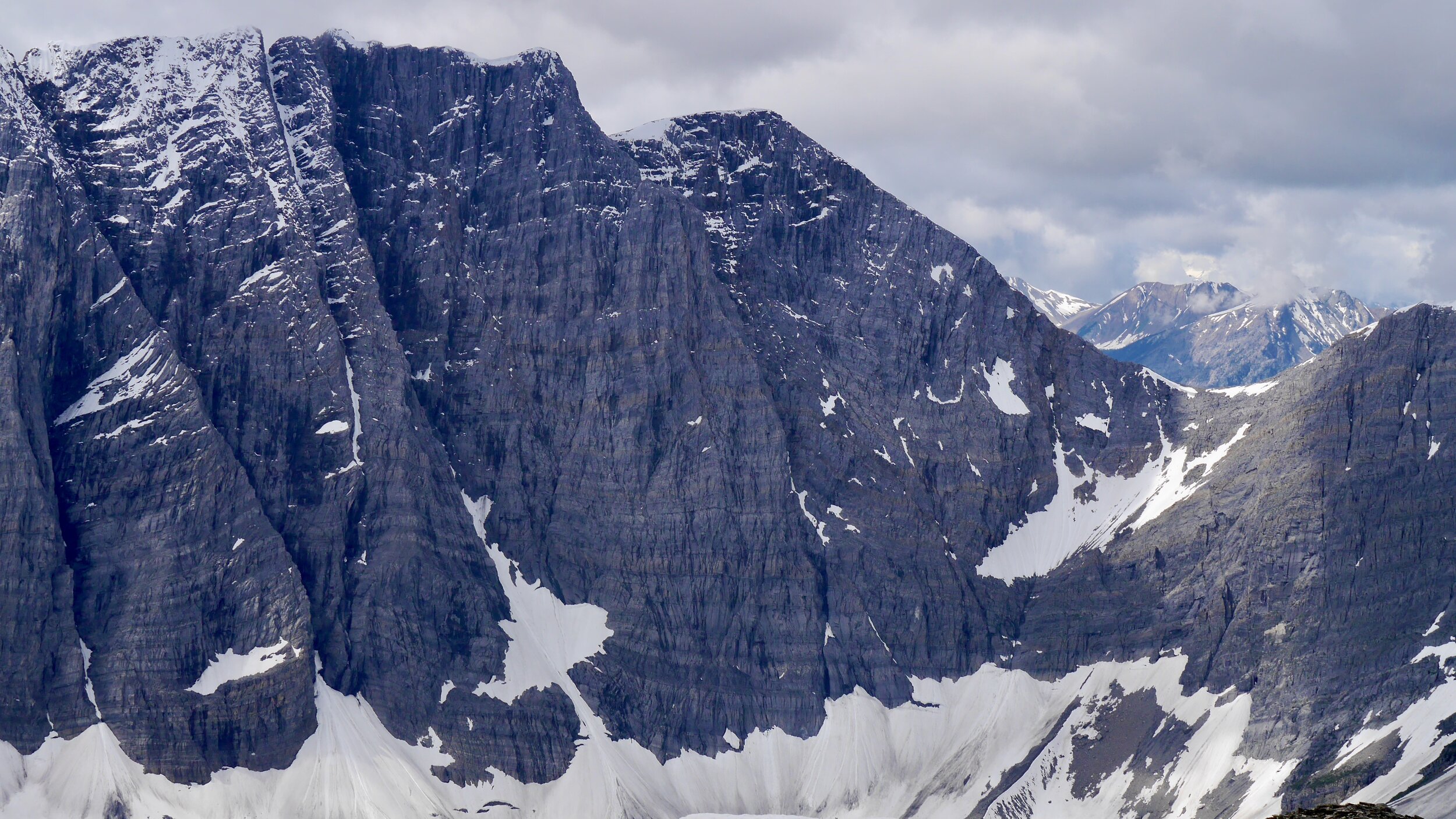
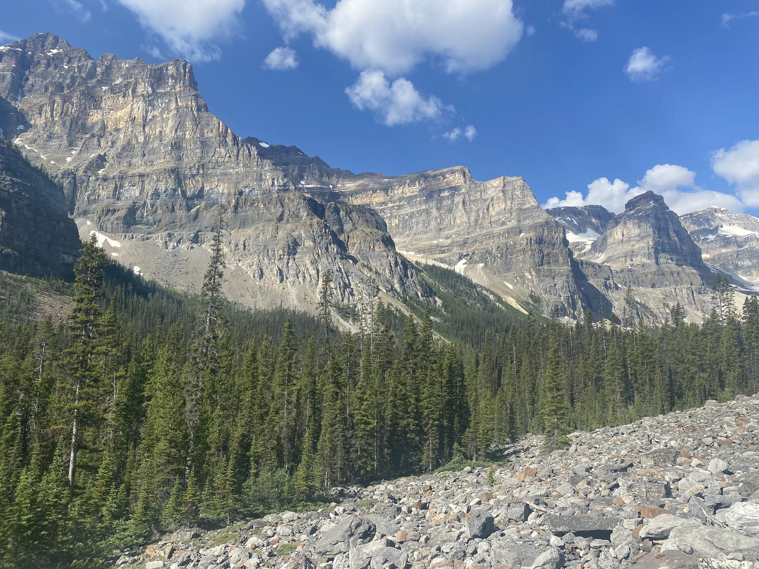
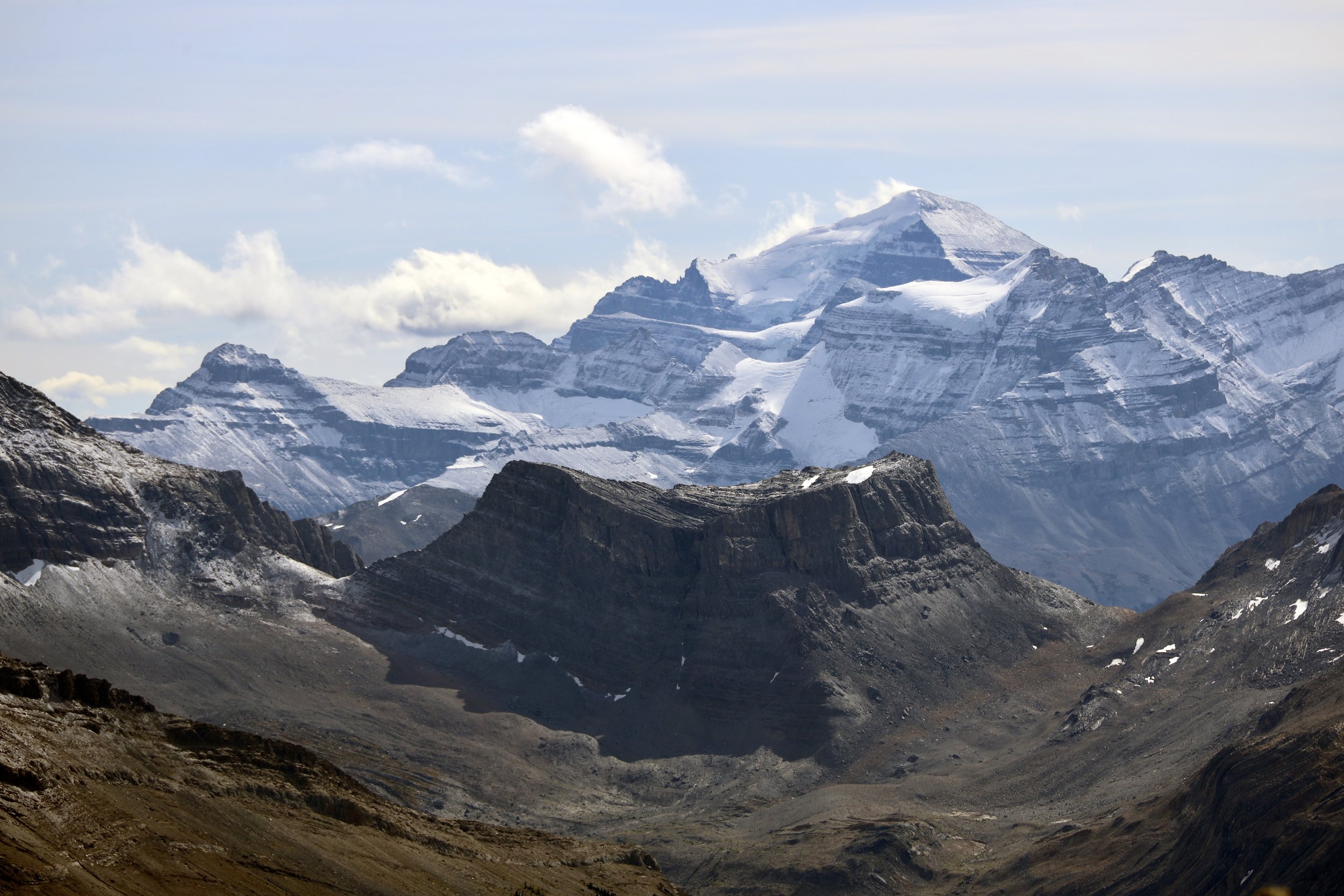
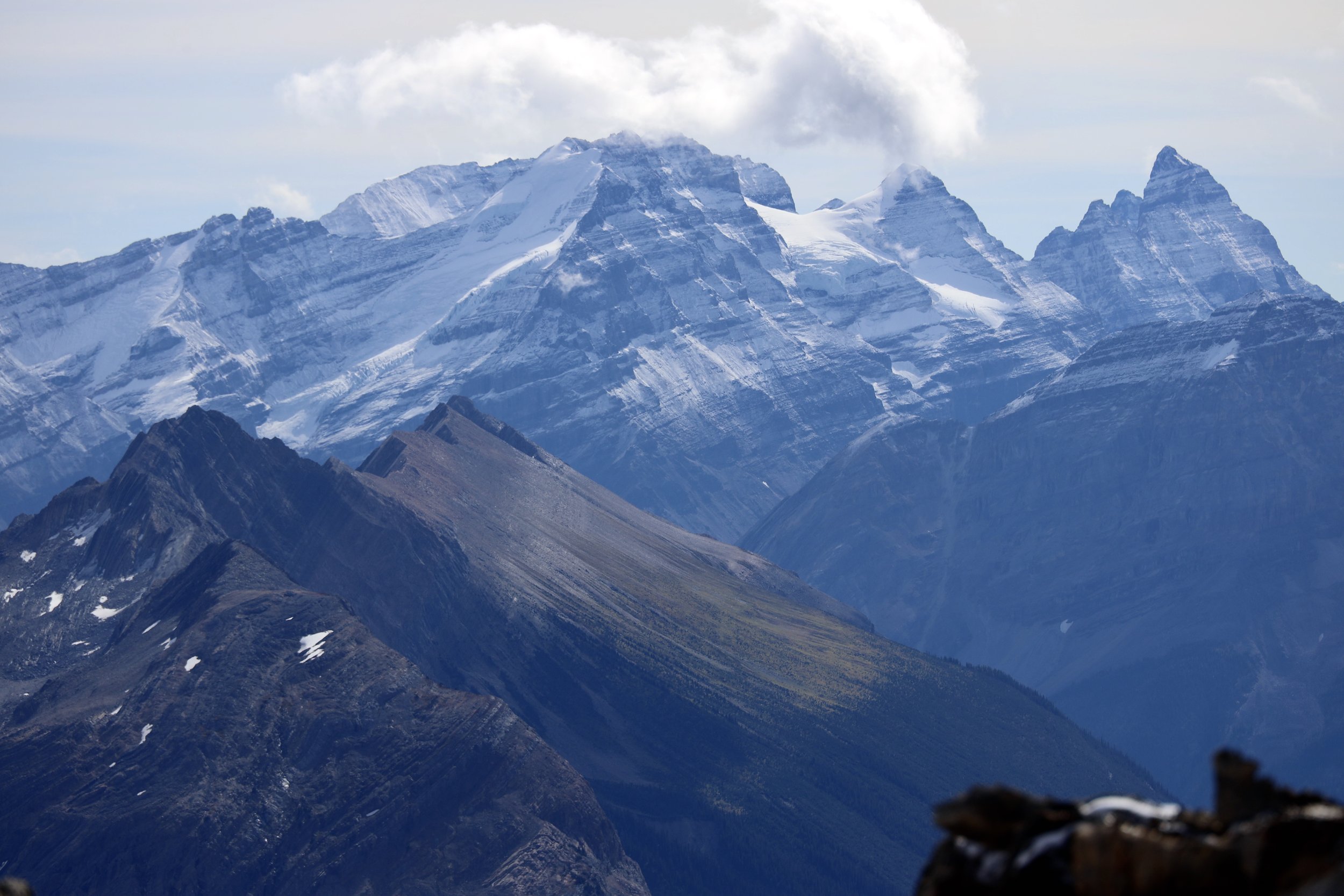
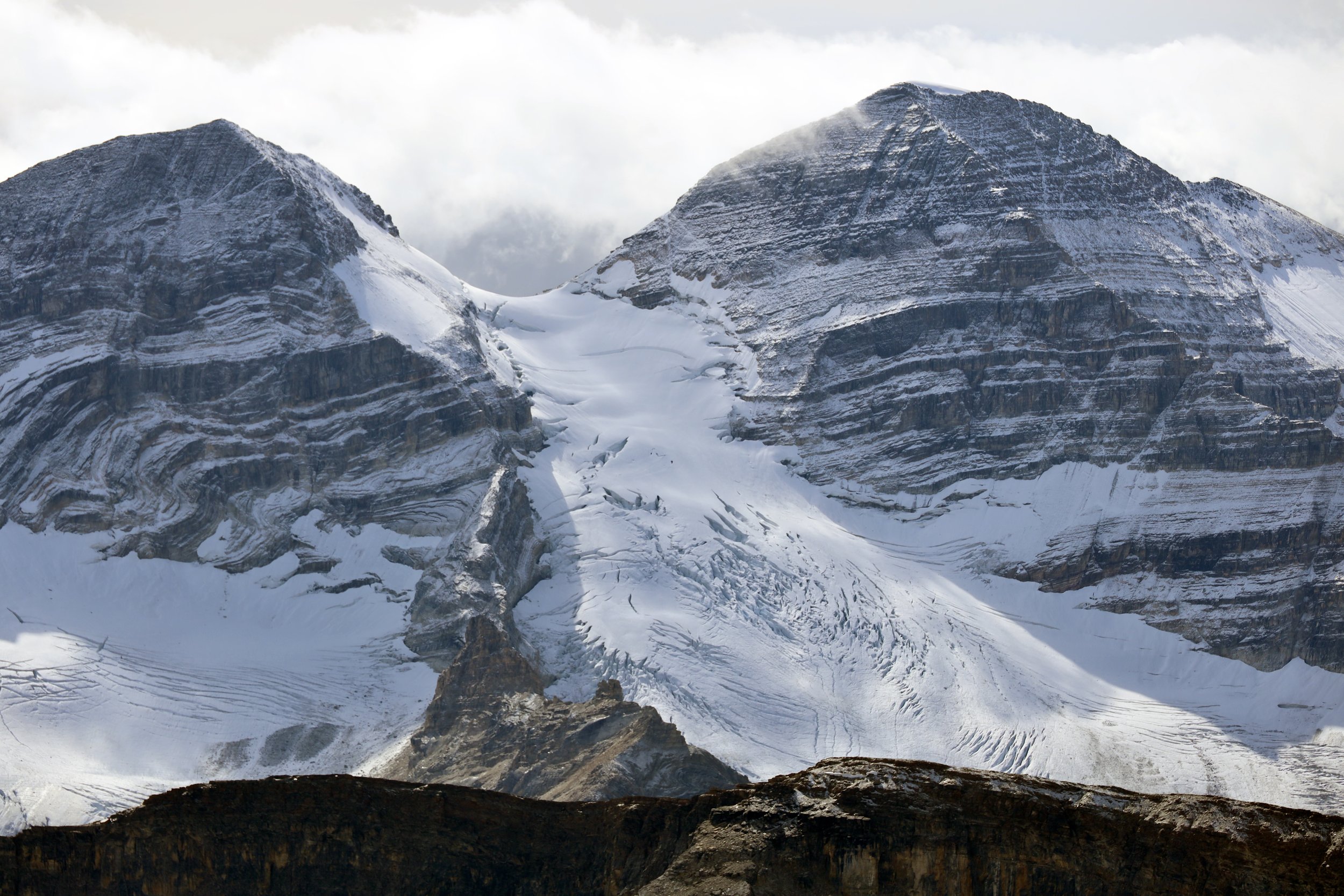
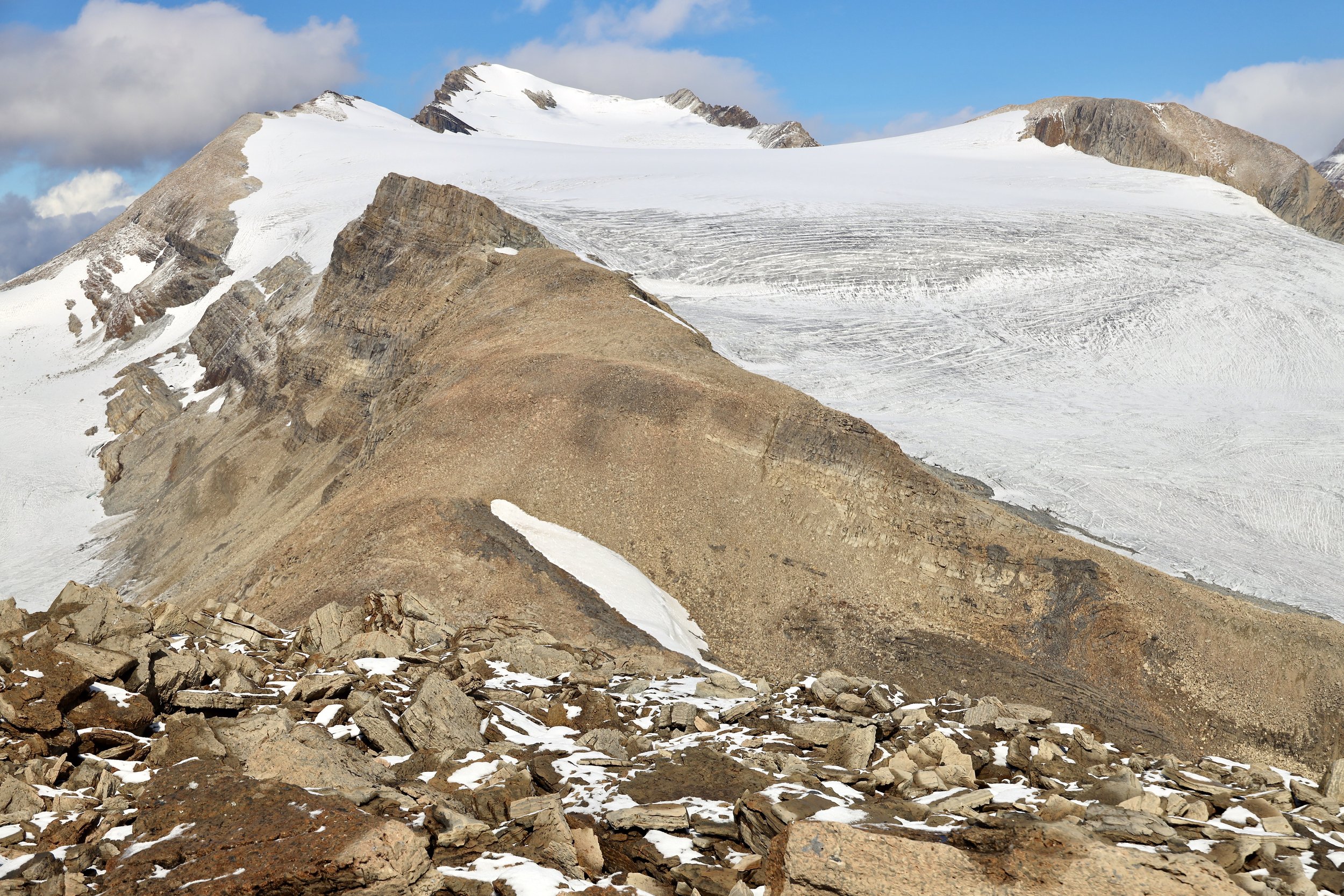
After arriving in Upper Pisang, I started to feel the elevation.  We walked with a good pace and maybe it was too much for the first day? The view from Upper Pisang towards Annapurna 2 is quite spectacular.  We were camping in a large field next to a local school.  Not a very scenic spot but the view made up for it.  I started to enjoy doing nothing, just resting and being in the moment.  It is so nice to be outside, hiking and surrounded by magnificence away from the noise of everyday grind. 

In the evening at 6 I went to the local gompa for puja ceremony.  Some young Americans took it all in assuming lotus poses and becoming one with Panchenmama.  They did not last through the ceremony though and left halfway through.  The ceremony with chanting and gongs was very atmospheric given the surroundings and location.  The gompa was newly built entirely with local labor and donations from the villagers.  After the prayers we had a good dinner and off to bed at 6.30pm.  I was so tired mainly due to the jet lag.

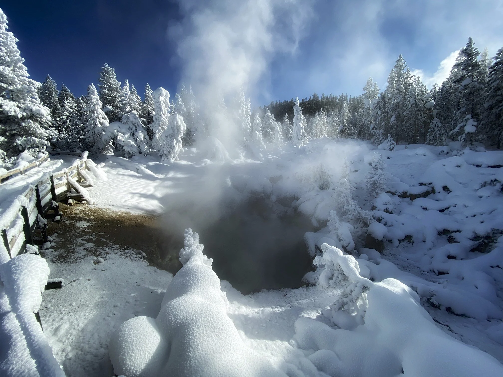
October 20, 2019 Barga 3465m 19.5 km, 681m elevation gain

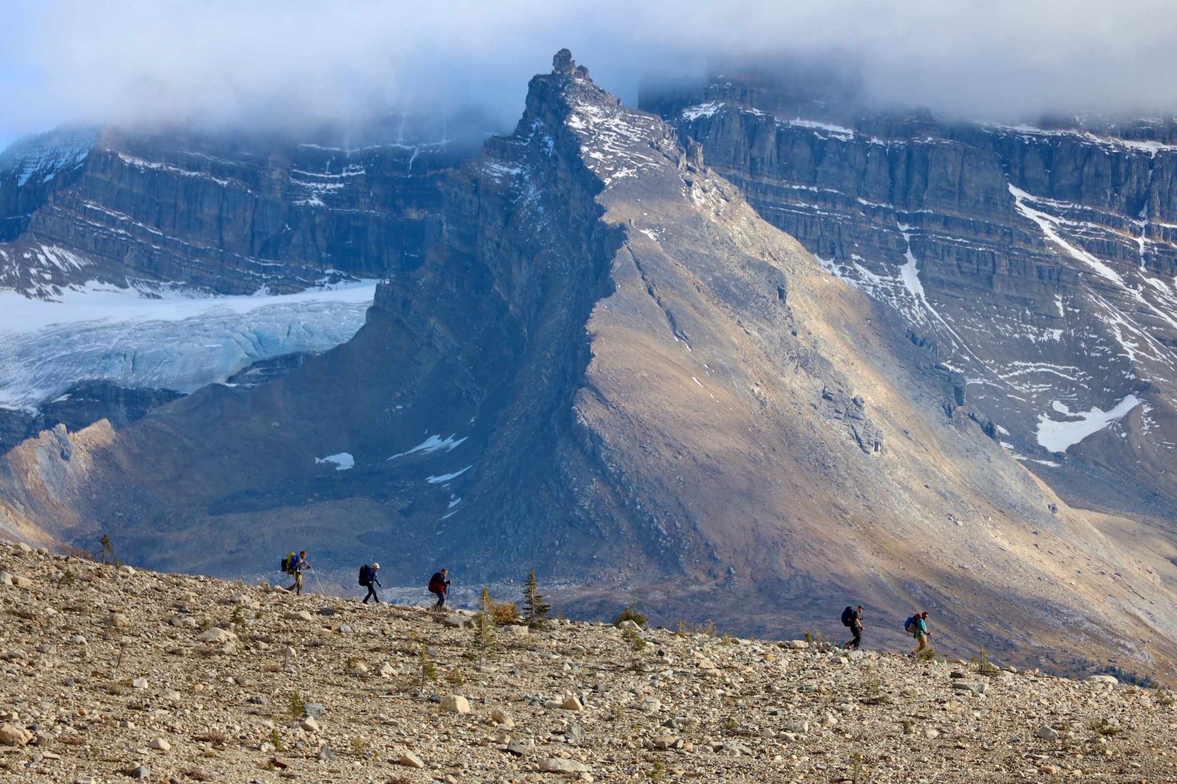
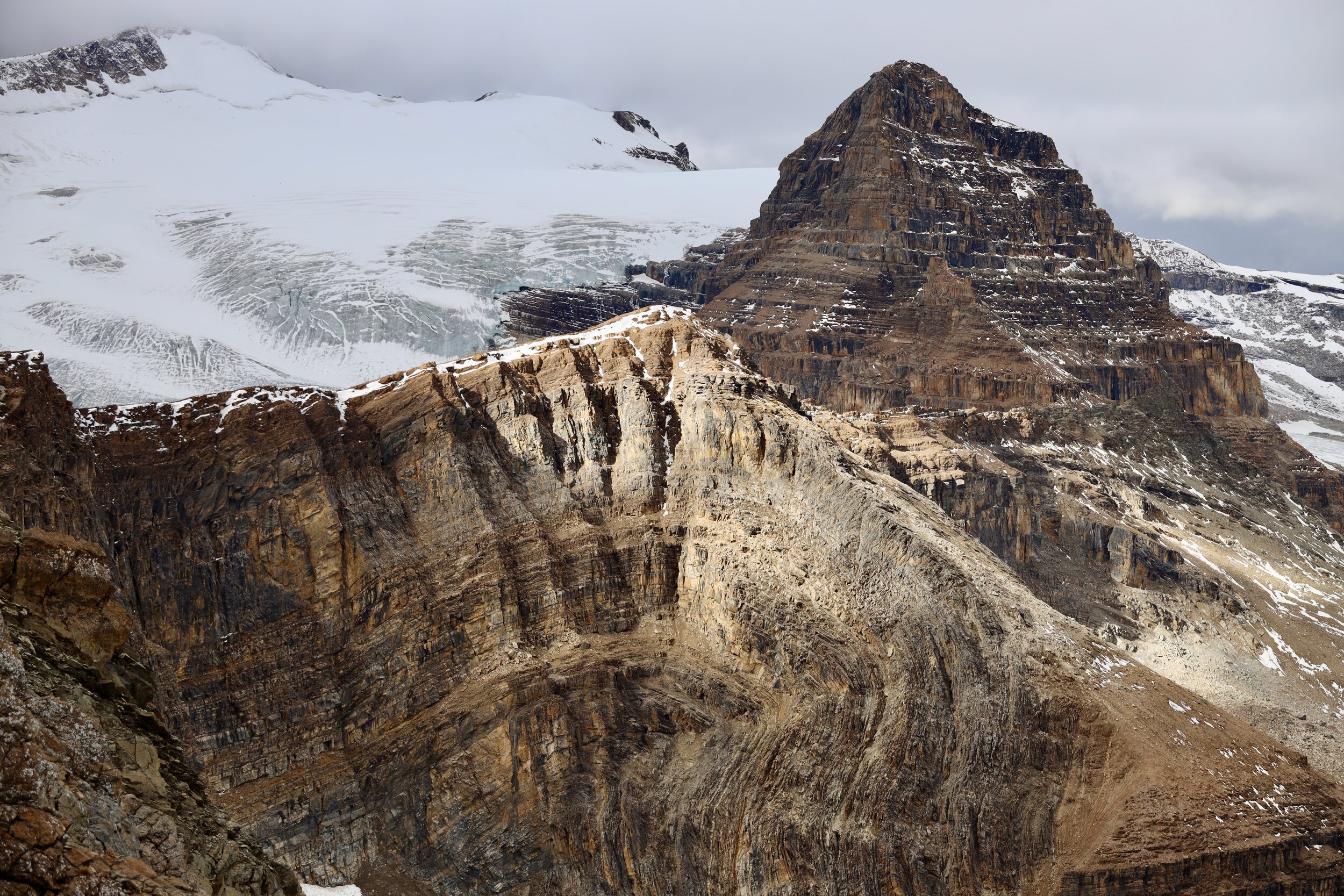
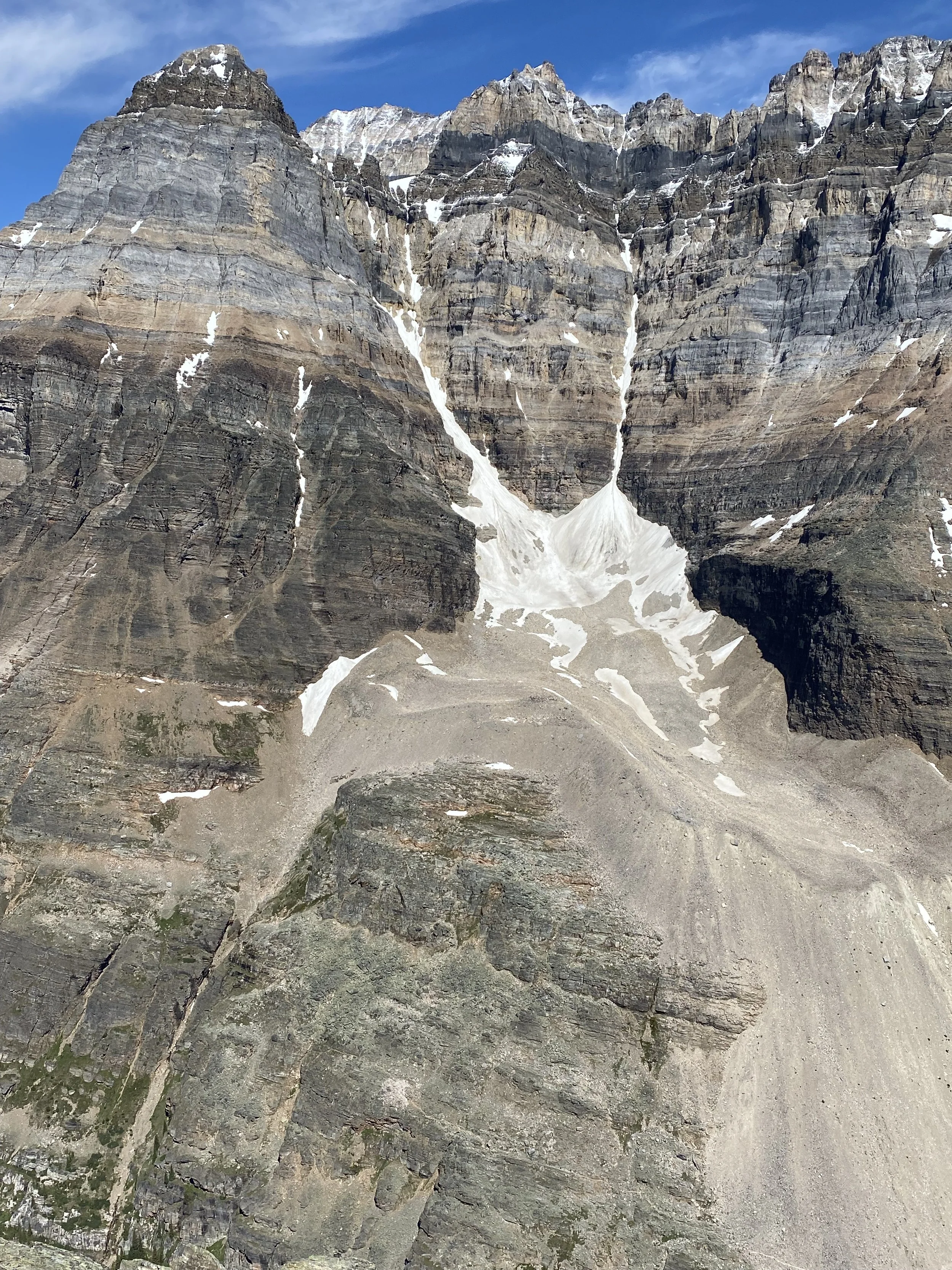
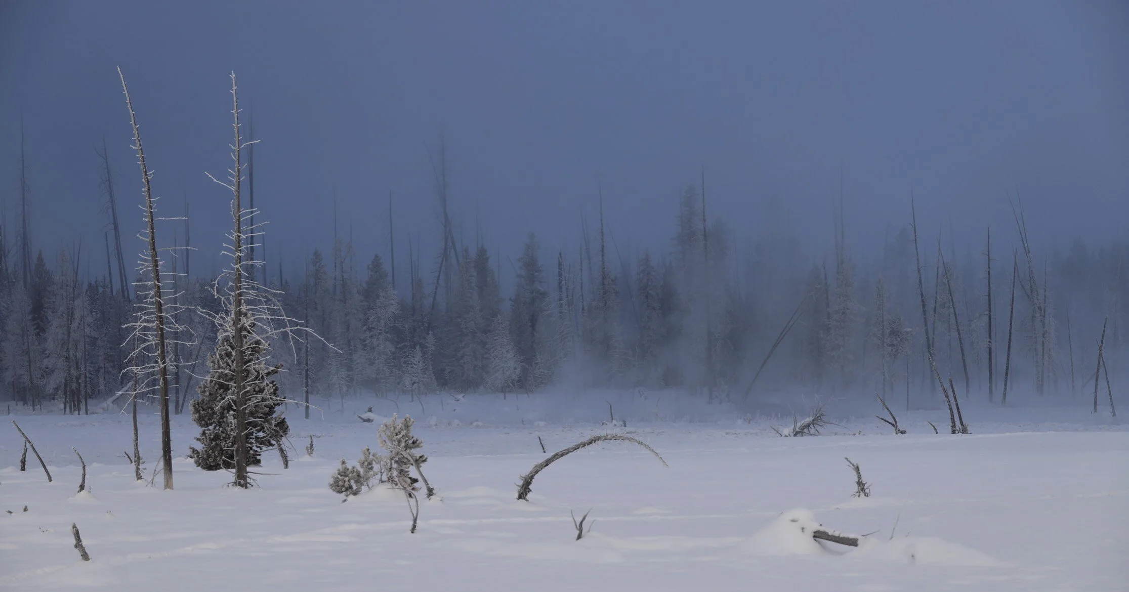
During the night I had some mild altitude symptoms:  a headache, a dry mouth and oddly my tongue hurt (it was a really weird sensation).  I got up at dawn to grey sky. Low clouds surrounded us and mist was covering the peaks.  The last time I was here it was also overcast although it cleared up later in the day revealing beautiful views of the valley.  Today, at least we can see the 7000m peaks in front of us.  We knew from the forecast and empirical evidence that there was no hope for good weather today. It all looked gloomy and soaked in.  On the way to Barga we walked through 3 old villages.  In one of them, an old lady asked me for money, so I asked her for a photo – a fair exchange I thought.  She posed for me without hesitation or resentment. 

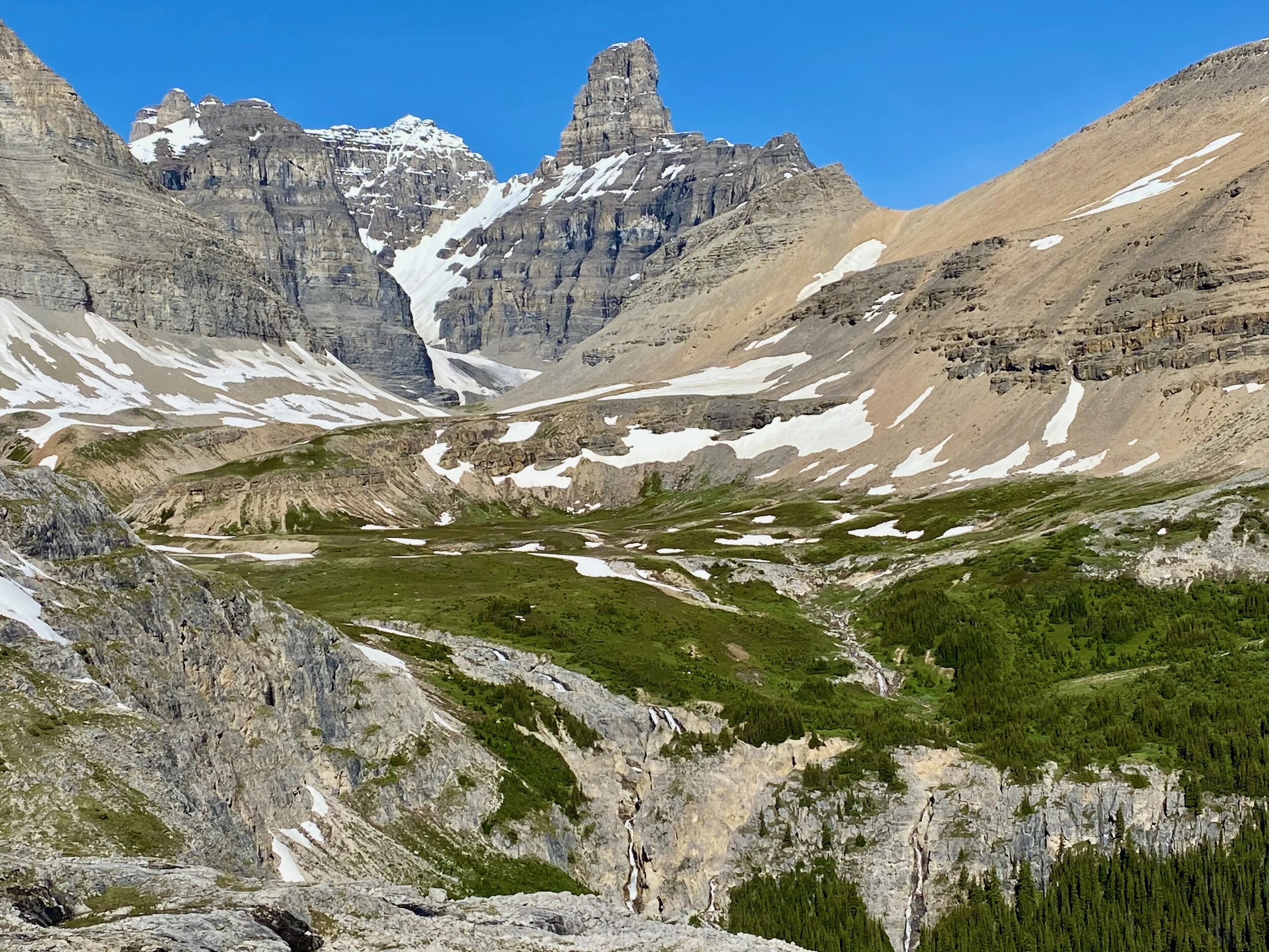
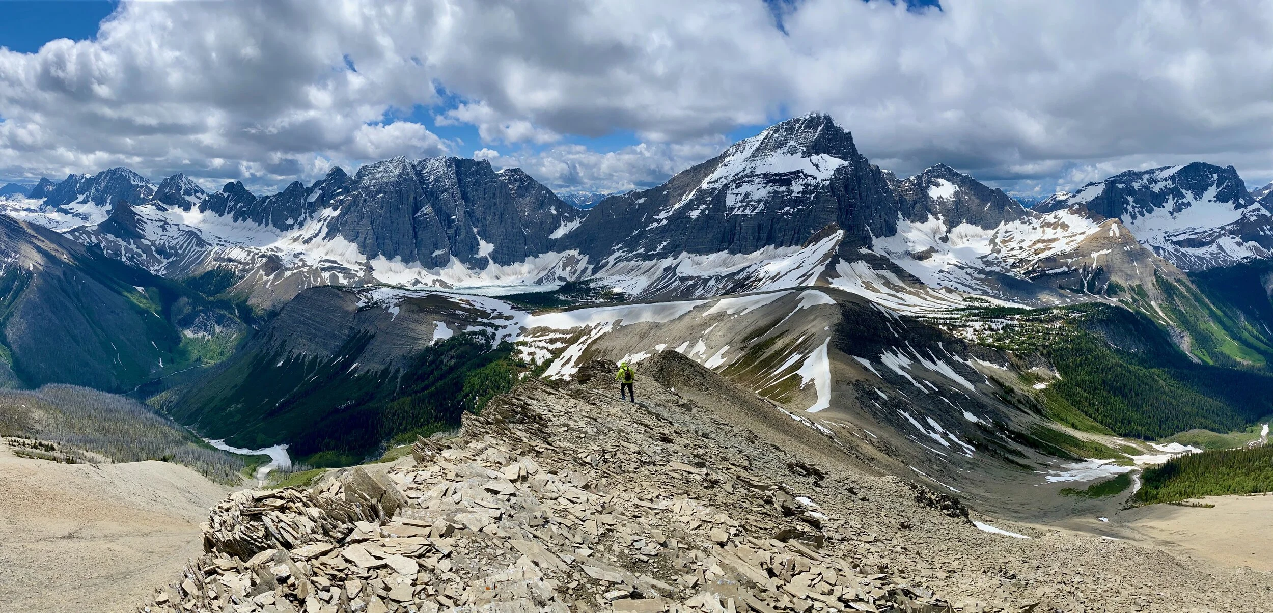
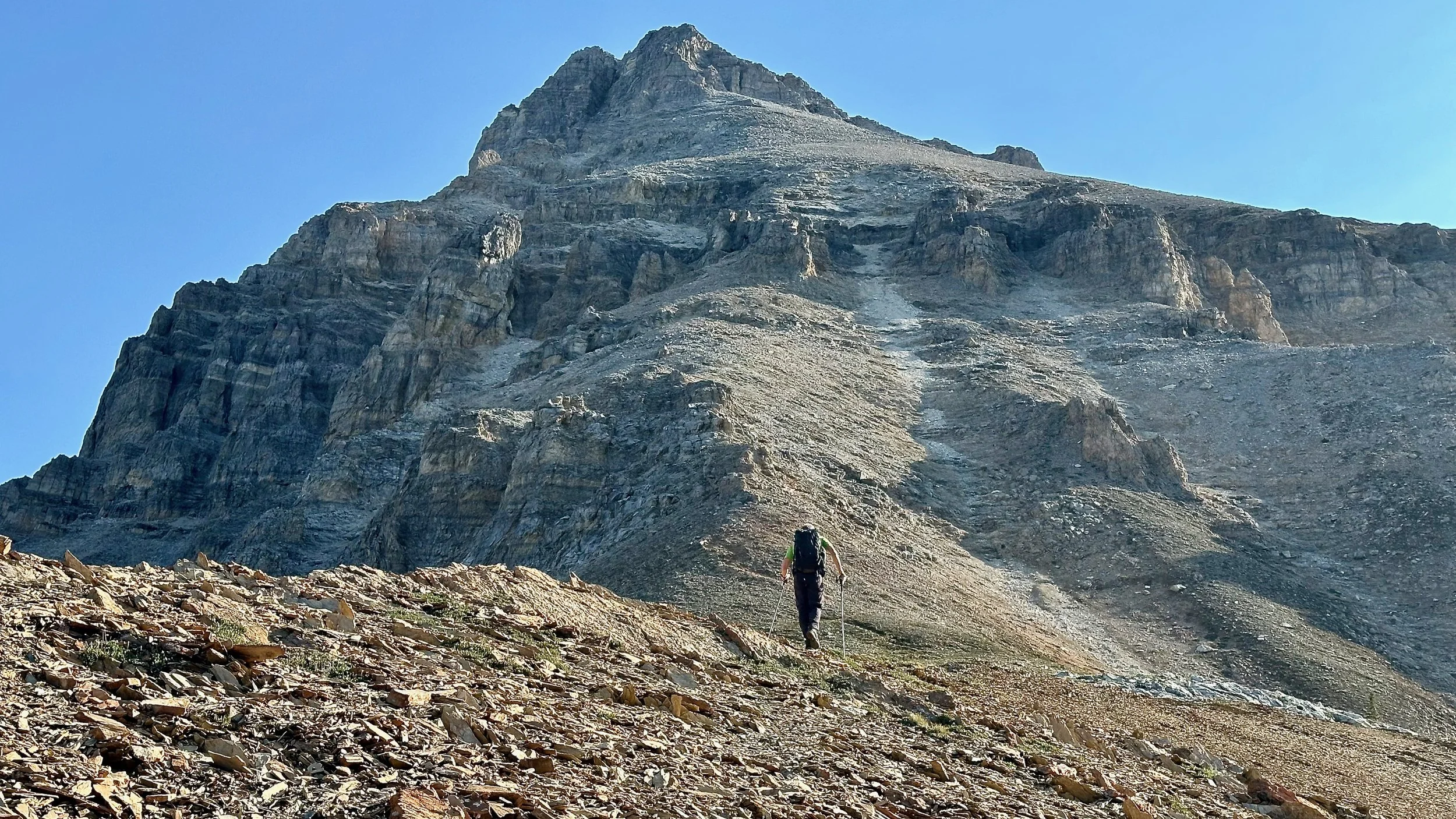
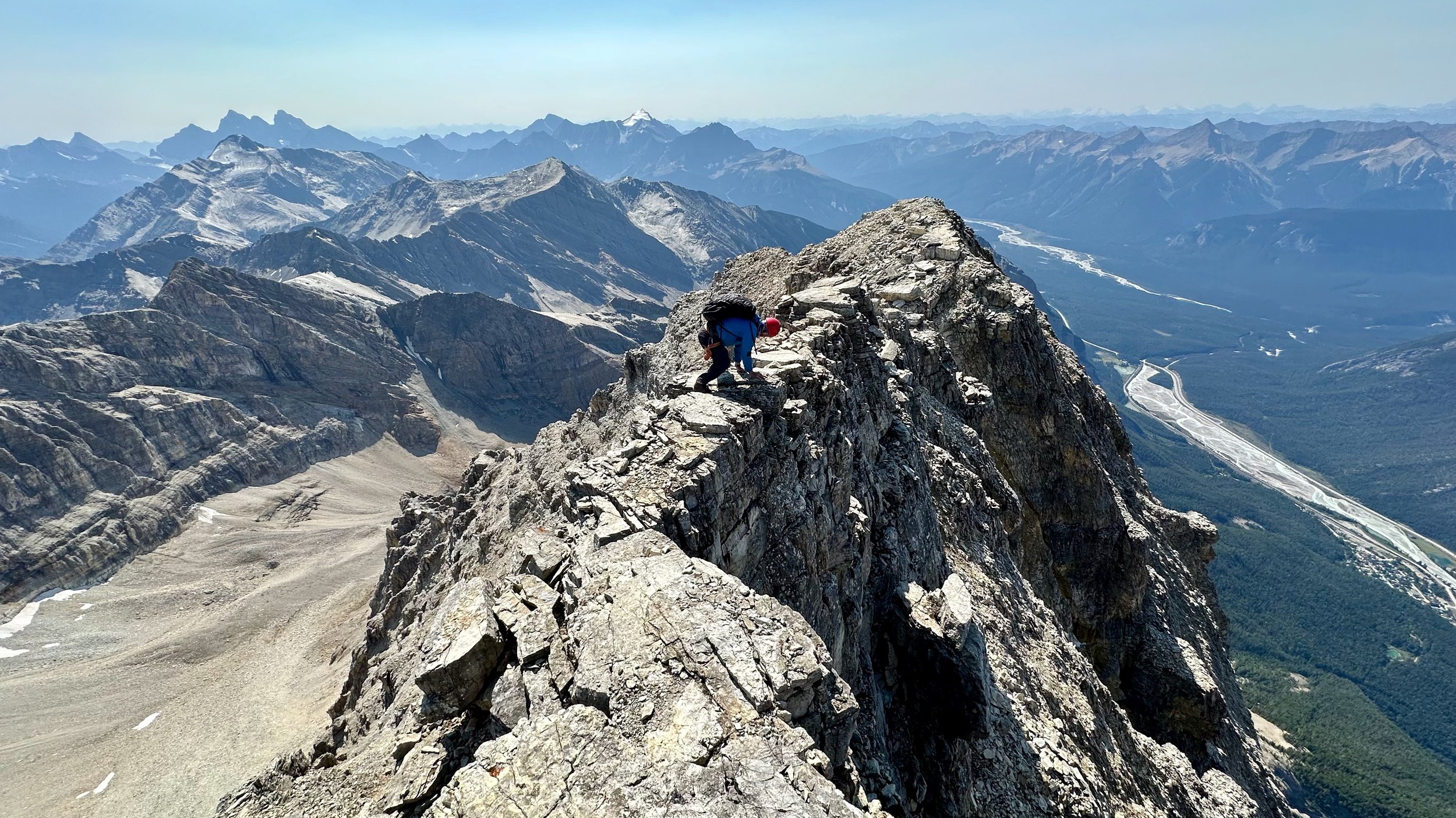
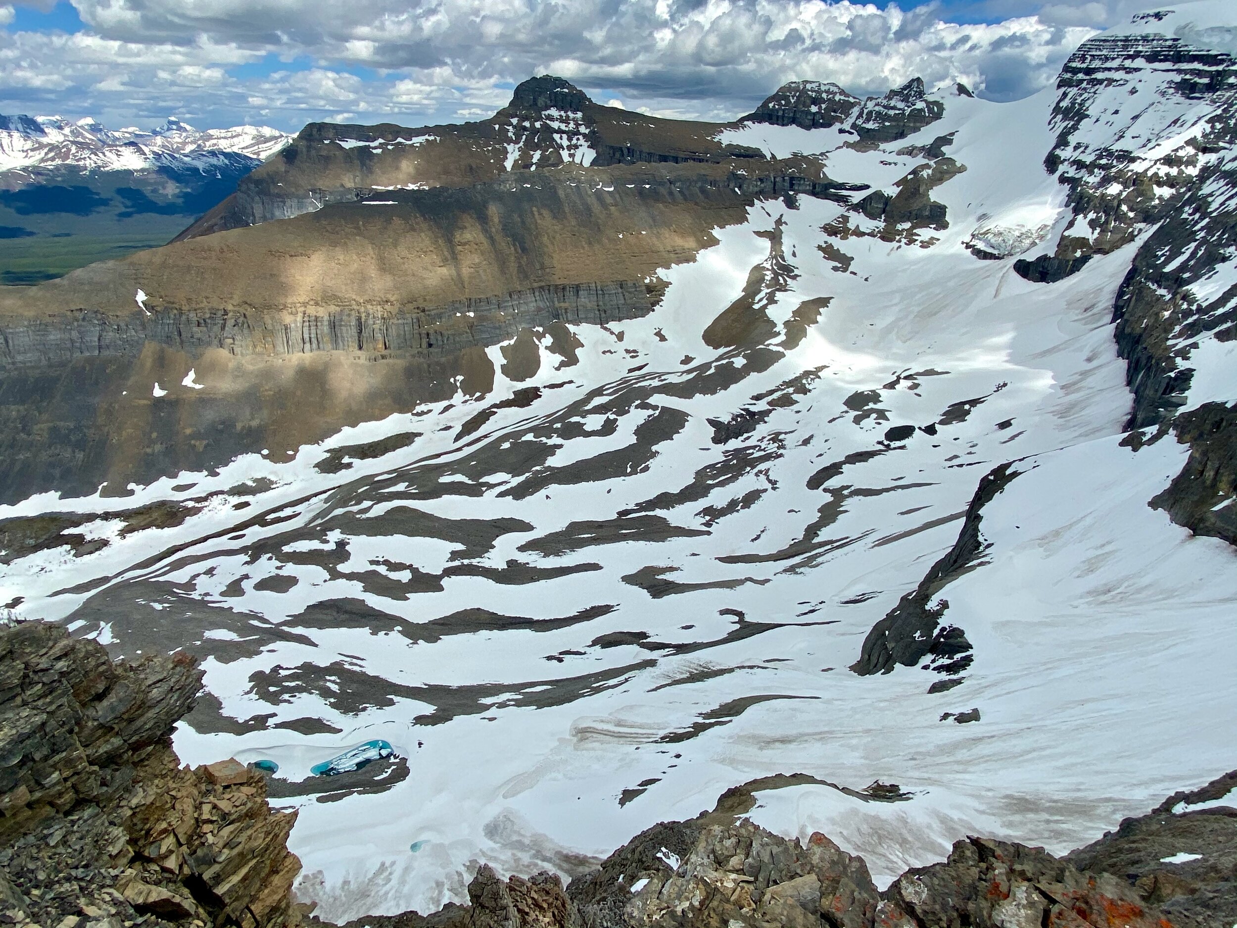
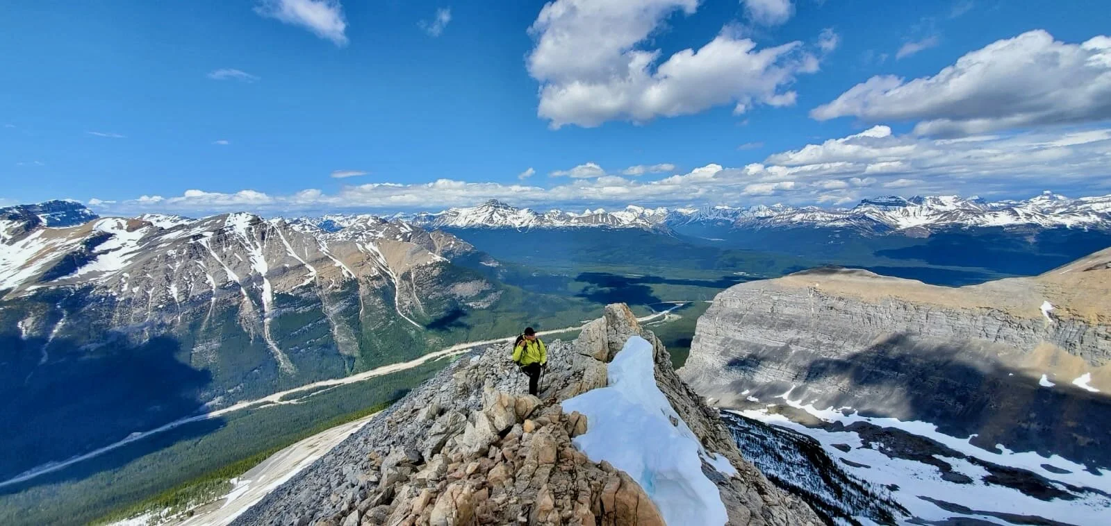
Soon after leaving Upper Pisang we had to climb up a steep hill for 300m+ to 3700m.  I am slowly adjusting to the altitude.  From the hill, we had great views of the hanging bridge and the misty Annapurna 2.   We walked along the beautiful valley with no views and yet the spectacular mountains were all there behind the curtain of grey clouds.  I remember the views from this section from 2011.  I am glad that we will be returning here at the end of our trek via Kangla Pass.  As we approached Barga it started to rain.  We found a tea house, which seemed better than camping in the rain.  I do not like camping next to lodges or tea houses.  Given a choice I will always take a bed over a tent.  The going rate for a room was $5/day.

After arriving at the tea house, I rested a bit and after lunch, I went to explore the monastery of Barga.  It is an ancient structure built into a spectacular eroded sandstone hillside.  I did not have enough time to see it properly during my last visit in 2011 so I made a point of staying here for the night so we would have enough time to see it.  When I arrived at the main hall of the monastery, I run into a tour in progress being led by a local fellow who now lives in Kathmandu.  He provided us with explanations of the history of the structure and the artifacts inside the main hall.  Surprisingly, there are 3 halls in the complex.  We went to see the other two and had to climb ladders to a flat roof from where there was a good view of the village below.  The key to the second hall did not work so off we went to see the third chamber.  The third chamber had a large statue of the Buddha inside and the familiar murals in the foyer.  We walked down with the group discussing some aspects of the Buddhist religion. 

After parting ways with the group, I made my way across the filed to take photos of the village nesting against the sandstone pillars with a herd of yaks grazing in the field below it.  Tomorrow we leave the familiar trail and turn to ascend the Thorong La.   Last time we turned left towards the Tilicho Lake.  This time we go right to the Thorong La.  I am looking forward to seeing the new ground!

October 21, 2019 Yak Kharka 4050m 17.3km 675m 4 hours

Barga with the Annapurna Range behind

Barga with the Annapurna Range behind

I woke up at 3.30am but considering that I went to bed at 7.30pm last night it is acceptable.  I read, tossed in my sleeping bag and then at 6am went for a walk to see the sunrise.  I foolishly committed to be back at 7.30am for breakfast so I could not linger and enjoy the sunrise.  The weather has cleared up and the view of the Annapurna 3 and Gangapurna was magnificent.  It was cool to see the mountains again from the north after having visited the south Annapurna BC and taken the helicopter ride.  I was getting a good sense for the geography of the range.  Although incredibly high, the main spine of the Himalaya is surprisingly narrow and small, unlike the Karakorum, that seem to stretch forever. 

After breakfast I packed my bag and before leaving for Yak Kharka, Samip and I went for a walk to the hills above the Barge village.  I wanted to take photos of the village with Gagapurna and Annapurna 3 as backdrop.  We spent a good hour hiking up and then across the hill next to the village.  We then descended on the trail that led to a lake higher up passing some trekkers on the way.  The weather was clear, and the views were magnificent.  We went on to Manang were had an overpriced pastry and coffee.  We made another short detour to the Gangapurna Lake, which was rather disappointing.  From the shore we could not see the ice fall as it was hidden behind an old moraine.   We took some photos and promptly left for the higher ground. 

From Manang the trail splits.  We followed the right-hand fork towards the Yak Kharka and Thorong La beyond.  The views of the Annapurna Range from the trail to Yak Kharka got more and more spectacular the higher we climbed.  The Mesocanto trail did not have such a great view.  This trail climbs right in front of the Annapurna Range giving the unobstructed view from the Annapurna 3 to the Great Barrier.  We stopped 3 times for tea.  I felt tired from the altitude.  We walked almost 50km in three days and climbed 1400m in elevation. 

Gangapurna

Gangapurna

I find it amazing that almost every tea shop has access to Wi-Fi and Internet.  We walked a long way from Manang and the terrain is very different from what I imagined/expected.  At around 2pm we arrived at Yak Kharka and camped in a courtyard of a tea house.  It all felt deserted and empty of tourists.  It is a nice place to spend my 49th birthday.  I received a card from Dreena and Johnny and the usual package of goodies.  It always warms my heart.  It seems to be a tradition as I have spent many of my birthdays in Nepal. 

In the tea house everyone is on his or her phones:  the server, the kid of the owner, the guests.  The kid plays video games, the young server watches TV shows.  It is like a sickness that has infested even the most remote parts of the globe.  No one talks as they used to, the phone is their only companion.

Glacier Dome

Glacier Dome

Thorong La BC (Thorong Phedi) 4850m 12km 650m 4 hrs

Last night I slept in my tent for the first time.  It was not too bad.  We got up early before the sun hit the valley floor.  The rising sun illuminated the peak of Gangapurna in various hues of orange and yellow.  The morning temperature was minus 5C so thankfully I could eat my breakfast inside the tea house.  My new sleeping bag (rated to -29C) works great! 

The trail to Thorong La Phedi is very beautiful with Annapurna 3 and Gangapurna dominating the view.  The trail climbs gently up the valley, across some hanging bridges to the altitude of 4500m.  At 4500 there is a cluster of tea houses.  We stopped there for a cup of tea and a good conversation with a fellow trekker from Germany.  Most trekkers on this trail are in Nepal for the first time. 

From Thorong La Phedi the trail climbs steeply for 350m to the BC.   At 4850 there is one large tea house that serves as a launching pad for the pass that is at 5436m.  The location of the BC is very spectacular, like an eagle’s nest in the middle of great mountains with a commanding view of the Annapurna Range and Domodar Himal.  I climbed a small hill behind the tea house that offered good vantage point for photos.  It was interesting to think that our trek would take us directly behind the mountains that I was looking at.  The Teri La was a short distance away behind the 6000+ high peaks.  So close yet so inaccessible from where I was standing. 

Thorongla phedi is fas below us

Thorongla phedi is fas below us

From the hill I had a 360 panorama of great mountains.  The weather was clear, and one could see for miles.  It was very different from the Mesocanto Lake trail that I did in 2011.  So far, I have no more altitude related issues and can only feel the effects of the elevation gain when walking uphill.  My strategy is to go slow and take breaks and let my body adjust slowly.  Tomorrow we go over the pass and it will be my first time above 5000m on this trip.  The altitude of 5000m is always a good measure of acclimatization for me. 

IMG_5224.jpg

October 23, 2019 Thorong La 5436m Muktinagh 3500m and Khagbeni 2920m, 21km, 580m up and 1500m down!

The guys insisted to get up early for the pass crossing apparently to avoid the winds (despite the fact that Narim hiked to the pass in the evening before and encountered no wind). I went to bed at 7pm and slept really well until 11.30pm when I woke up with a dull headache (altitude related).  We came to 4800m rather fast, so it was normal.  I am always apprehensive of these headaches before going up as I do not know if they will pass or get worst.  I did not have any other altitude symptoms, only the headache.  I drank a lot of water, peed 3 times in the night and kept more severe problems at bay until 4am.  During the cold night the inside of the tent got covered with frost from condensation.  

We got up at 4am to a cold and clear morning.  I packed up my bag quickly and moved to the kitchen tent for some hot beverage.  I had something to eat and a coffee and we left at 5am.  We were behind some groups that left before us.  I felt that I was taking this pass rather lightly despite the elevation of 5400m and its deadly legacy of killing over 50 people few years back.  At the same time the trail was like a highway and it had a feeling of one of the passes for the masses (it is after all one of the most popular passes in Nepal). I was wearing my running shoes and did not even bother with boots.  The temperature was “comfortable” -10C so my feet got cold despite walking.  It got colder the higher we went.  

The trail to Thorong La

The trail to Thorong La

We passed most people and I was going really slow and was not yet fully acclimatized.   As we ascended, the sun rose in the east illuminating the surrounding snowy mountains with a pink and then orange glow.  Once the sun emerged from behind the ridges the temperature rose quickly and it got warmer.  The views to now distant Annapurna 2 were very impressive and my zoom lens came in handy.  After two hours of slow ascend we arrived at the pass ahead of the pack.  The pass is marked with a large cairn made from rocks and draped with numerous prayer flags.  It also has a congratulatory sign with the elevation of the pass.  And to my surprise, and the first on any mountain passes I crossed – a tea house!  We had some tea of course. 

IMG_5315.jpg
Thorong La looking west

Thorong La looking west

After about an hour on the pass in the warm sun on this windless day, we started the descent to Muktinagth.  It was an endless down for 1,5km.  There was no break from going down and it was all at a relentlessly steep grade.  I think that wearing boots may have helped a little.  We stopped for a quick packed lunch and then much lower down for a tea.  We arrived at a nice viewpoint above Muktinagth at 11am.  The view of Muktaingh with Dhaulagiri towering over the landscape was very memorable and of postcard quality. 

Muktinagth is a holy town located at an altitude of 3800m attracting Hindus and Buddhists alike for its holy waters.  I was curious to see it as I heard and read a lot about it.  It is a destination for pilgrims from India and Nepal with many sadhus among them.  I was looking forward to meeting some of the sadhus and taking some good photos.  First, we came across a large Buddhist temple.  It was new and not very interesting.  It was, however, surrounded by an insane amount of prayer flags strung on the hill above the temple. 

IMG_0692.jpg

A short walk down from the Buddhist temple brought us to the famed Hindu temple of 108 holy taps.   There were a lot of people milling about.  Some were stripped down tot heir briefs ready to immerse themselves into the pool of holy and cold water.   Others were lined up to enter the small temple and part with some cash along the way.   Everyone seemed very devout and “in the moment”.    The pilgrims were making offerings, getting tika from some holy man, becoming holy man, putting tika on statues etc.  The ticket table was full of action, the coffer was overflowing with cash and there was no shortage of pilgrims. 

From the temple we went on to another small Buddhist temple with a holy fire (that comes from a gas seepage in the ground) but it is considered holy (they should visit Yellowstone or Kamchatka for some serious holy action!).  What was really silly was a group of Russians prostrating before the fire and looking quite serious.  Why do white people fall for this stuff and forget their own roots and spirituality that has very deep and rich tradition?  Crassly, right above the “holy” flame was a large Donation Box overflowing with cash.  How can one take this seriously? 

Today I was very tired, and my shins and hips hurt from walking over 20km with the killer 1500m descent.  I hope that I can do this whole trip (seems like a lot) and I also hope that Mustang will be less intense.  So far, we covered 85km. 

After visiting the temples, we made our way across the dumpy and chaotic town. At the exit point from the temples there were some sadhus. 

When we got to the jeep park on the other side of the town, the jeep was all packed and ready to go.  We picked up an extra passenger, a guide for a Ukrainian dude that I shared the Mustang permit with (what happened to the group of Germans that I was supposed to enter Mustang with???).  The guide brought my passport (I had to leave it in Kathmandu to get the permit for Mustang), so I was happy to see him.  We crammed into a small jeep and took a fast 10km ride down to Khagbeni.  By the time we got to Khagbeni the afternoon, the wind so common in this valley was already in full swing stirring up large clouds of dust in the dry riverbed of Kali Gandaki River.   This river carves the deepest canyon in the world between the Annapurna and the Dhaulagiri mountains.  The hills on the horizon were dry and colorful – it was Mustang to where we were heading.  It was exciting and had a feel of adventure!

In Khagbeni where Guest is God!

In Khagbeni where Guest is God!


I was staying in the Paradise Lodge while my crew was across the alley in another small hotel.  I bought a bucket of hot water to take an improvised shower and do some basic laundry.   The wind was now blowing into the dirty windows of the lodge.  The town was very tightly built with narrow passages between the homes – a protection from the fierce winds.  As such, there was not too much in the town aside from the large gompa.  The location of the gompa on a promontory above the Kali Gandaki River is very spectacular.  A young monk was my guide and explained the wheel of life painting in the gompa.  I could not find a place serving apple pies or any restaurants for that matter.  The town seemed empty and deserted.   The silence was broken by the gusts of wicked wind and the occasional herd of goats being moved from one pasture to another through the narrow streets of the village.  Tomorrow we enter Mustang proper! 

October 24, 2019 Chele Mustang 3155m 22.1km 450m

I developed a little bit of cold during the crossing of the Thorong La. The hotel we stayed in in Khagbeni had spotted electricity that would come in the middle of the night.  I could charge my batteries then.  I got up at 5.30am, packed and we set off for our first day of walking in Mustang. 

As we were leaving Khagbeni, I came across a bakery that had apple pies!  I bought a piece and shoved it in my backpack for later.  As soon as we left the village, the views of the river gorge were spectacular.  Wild rock and dry sandstone formations towered above the river valley.  The sandstone was shaped into tall pipe-like towers that looked quite out of this world.  The soft morning light made the photos quite stunning.  I could see little villages dotting the side valleys across the main river channel.  The small plots of green were definitely irrigated in this very dry landscape.  The small towns that we passed are not developed at all.  There are no shops and no guesthouses.  We started to see the chortens painted in typical colours of Mustang of red and grey.

We took two hours to get to the village where we had lunch.  From here, the crew will go to our destination and Samip and I will take a detour up a side valley.  I read that there is an interesting village up the side valley, a short walk from where we are.  The village is supposed to be in a great setting with a medieval look to it and therefore quite photogenic.  The locals we passed to get to the village did not seem very friendly.  They did not even reply to a common Namaste.  On the way to the village we passed by a cave monastery that I wanted to see. We could not locate the man with the key as he was harvesting. The attractions here are all closed and one needs to find the key keeper first. Easier said than done.

Tetang

Tetang

Our destination village of Tetang was quite interesting.  The village, a home to a few families, consists of towered houses perched on a sandstone hill in the middle of narrow valley.  We walked through the village through a series of narrow passages.  There was little sign of life and it looked as if no one lived there.  This was not the case as there were some domestic animals milling about.  After walking through the village, we down climbed to the riverbed and made our way to the main valley.

On the way to Chele, we came across a lone man collecting fossils in the riverbed of Kali Ghandaki.  He showed us his finds and I bought one of them. 

October 25, 2019 Syangboche 3825m 18.2km 1,137m

Today was a huge day – the hardest of the entire trip so far.  It was not the distance but the amount of climbing we had to do.  We climbed an equivalent of an 11,000er in the Rockies, but all at the elevation above 3500m.  The night in the tent was surprisingly warm.  The tent site was like a private patio, a flat roof overlooking the Kali Ghandaki Valley with Nilgiri Peak towering above it.  Last evening, I watched “The Italian Job” with the porters.  The family that owns the tea house lives in the USA except for the daughter that is working here.  Her sister finished college in the US and sponsored her parents and brother to live in the USA. 

Leaving Chele behind

Leaving Chele behind

We started the day by walking up, up, up, to 3650m along the dirt road with incredible views all around. We walked for along time with no vehicles in sight but when we were near the top, jeeps and motorcycles started to appear.   We were passed by a convoy of motorcycles that were part of an organized tour from Sweden (180 Adventures).  One of the members was a Pole living in London but originally from Jelenia Gora.  He was a friend of Rafal Fronia whose book I read on the way to Nepal.    We chatted for a while, took photos and exchanged emails.  Nice people.  Once we parted ways, we resumed our climb to the true top of the ridge for some spectacular 360-degree views.  To the north was our destination – Upper Mustang, to the east, beyond multitude of smaller rugged and dry hills were the mountains of Damodar Himal that we would be crossing in two weeks time and to the south, the Great Annapurna Range with the Great Barrier, Rock Noir, Annapurna 1 and Nilgiri Peak.  The view was absolutely fabulous.  This is a special and spectacular place and it is very different from any other place in Nepal that I have visited.

The scenery is more reminiscent of Central Asia and the north side of K2.  I guess it makes sense as we are now behind the Great Himalaya Range. From the viewpoint we descended to Samar where we had good relaxing lunch in a courtyard of a teahouse. 

After lunch, our crew took the shortest route to our final destination while Samip and I took a longer detour to visit the Chungsi Cave monastery.  We left the road behind and soon started climbing to 3860m to Bhena La Pass and then to 3800m to Yamola La Pass.  The trip over the passes involved a steep descent to the river valley and then a long climb up in the dry and arid landscape.  Finally, we reached the pass with prayer flags flapping in the now increasing wind.  From the pass we had another fantastic view of the Annapurnas, the Damodar Himal and the dry hills of Mustang.  Our descent route put us at the edge of an incredible canyon reminiscent of Southwestern USA.  The canyon was very narrow and deep; we could not even see its dark bottom.  We contoured along the canyon for some distance to a side canyon where we had to climb again to get to the Chungsi Cave.  I was quite tired and did not feel like climbing again!

The view from a 4000m pass

The view from a 4000m pass

Deep canyons en route to Chungsi Cave

Deep canyons en route to Chungsi Cave

The cave monastery is quite unbelievable due to its location.  The cave is suspended halfway a steep mountainside with numerous prayer flags strung among the rocks.  The cave is natural and half of it is open and the other half is built over with living quarters for the resident monk.  The open half has a natural rock pillar in the middle that can be walked around.  There are carvings on the rocks around the pillar and 3 chortens were built next to it.  The chortens have paintings of Buddha on them, prayer flags and butter lamps.   As I approached the cave, the resident monk appeared.  I did not expect to see anyone in such remote place and yet here he was.  The monk offered me tea and apples.  Samip was behind me as he went inside another, smaller cave on the way to the Chungsi monastery.  Once Samip appeared, he told me that the monk did not speak Nepali but Tibetan.  Since Samip knew a little Tibetan, we learned that the monk was from Lhasa; he was 40 years old and has lived in this cave for the past 10 years.  He gets supplies from his family in Tibet every now and then.  The monk had a nice cat for company making the atmosphere even more peaceful than it already was.   I enjoyed his brief company and the visit to this spectacular and special place. 

Chungsi Cave Monastery

Chungsi Cave Monastery

Chungsi Cave

Chungsi Cave

We left close to sunset as we still had some way to go before we arrived ay Syanboche, our destination for today.   We descended back to the canyon and made our way, slowly to the village or rather a collection of few houses.   I was quite tired.

Tonight we solidified our plan for the rest of the trip.  I asked to spend more time in Lo Mantang and visit Tserang along the way skipping the higher route that passed some 4000m passes.  I wanted to visit Tsernag due to its spectacular location and the caves of Chosar that require a full day trip from Lo Mantang.  Our itinerary is somewhat fluid but at least we had a plan for the next few days. 

Walking through canyons near Chungsi Cave

Walking through canyons near Chungsi Cave

October 26, 2019 Ghami 3520m 17.9km 480m

Today we got up a little later than in the previous days and had breakfast at 7am.  It was nice to sleep in the lodge and not in the tent.  It is easier to get up from the bed and I do not have to crawl through the narrow door of the North Face tent.  Our walk today was quite short as the village of Ghami was near. Of course, the day started with a climb to reach the village of Geling and the Ghemi La Pass 3765m only to drop down to Ghami. 

Ghami is a nice small village in a spectacular location.  It is flanked by massive sandstone pillars dotted with ancient caves.  The pillars look like massive organ pipes.  Behind the pillars were multicolored rocks.  The entire country is desolate and dry devoid of vegetation (unless irrigated near human settlements).  The various wild rock formations break up the otherwise dull brown hills and ridges that stretch out all the way to the highlands of Tibet beyond the horizon.   The view to the east extended all the way to Thorong La and the Terli La passes that would take us back to the Annapurnas.  The Teri La Pass area looks dry and desolate but Samip, who has been there before, claims that it is very nice.  Thankfully we arrived in Ghami early, so we have the time to explore the surroundings and especially the old caves. 

The cliffs above Ghami

The cliffs above Ghami

We took a hike to the sandstone towers.  The caves were located in an impossible location and looked quite dangerous to climb up to due to crumbling rock.  Samip disappeared on me and despite shouting for 45 min or so I could not locate him.  I was very concerned that he climbed to one of the caves and got hit by a rock or fell.  I looked for him, climbed up the steep hill towards the caves but to no avail.  I was ready to go back to the village to summon his brother to look for him further when Samip appeared.  He went for a climb of one of the narrow canyons between the sandstone towers.  I have to admit that I was very relieved to see him.   While I was looking for him, I noticed two huge vultures checking me out from above.  I observed them for a while and noticed that their nest was in one of the ancient caves. 

The hotel we were staying in was very interesting.   The owner is a descendent of the royal family of Mustang.  The house is very large, has a nicely furnished dining room in the traditional Tibetan style, a private chapel and a large courtyard in its interior.   The house is over 100 years old.  The owner’s uncle was a lama monk who was praying in the chapel with bells and prayer beads.    The owner is the chief of the Upper Mustang district and his office is located in Tserang.  The private chapel had some beautiful murals and a library of old sacred books arranged on the wall next to an altar with statues of Buddha.  The uncle had his spot by the altar where he performed puja ceremonies twice a day.  The room was also used to display various objects for sale to tourists at appropriate prices that go with the ambiance and the story.  The owners claim that the objects were smuggled from Tibet etc. while most of them come from the Kathmandu high street. 

IMG_5910.jpg
The old lama in the house chapel in Ghami

The old lama in the house chapel in Ghami

After exploring the private chapel, hanging out with the uncle lama and spending some cash, I went to visit the small local gompa.  It was quite compact but had a good view from the roof.  In order to visit the gompa, the owner of the lodge had to summon the key keeper first.  He then took us to the little chapel.  There are no resident monks in the village (aside from the uncle lama).  The village is small but very atmospheric and pretty.  My room had a private patio with a great view of the village and the mountains beyond. 

Ghami

Ghami


October 27, 2019 Tserang 15.8km 3595m 531m 4.5 hours

Another fabulous day!  I feel tired and going uphill seems slow and hard.  The FOMO propels me forward however and does not let me stop to rest.  I plan to relax a little in Lo Mantang. 

We left the very pleasant village of Ghami at 7.30am and of course, right out of the gate we had to climb to 3800m to a small pass with fabulous views.  We then walked by spectacular red rock formations to the village of Dagmar.  We stopped by the red rock formations to explore some of the more accessible caves that dotted the sandstone pillars.  We managed to get into one of the caves – an empty blackened chamber with a view of Annapurna range from its door. 

IMG_5997.jpg

We then passed the village, the longest mani wall in the world  and arrived at another narrow red rock canyon with more caves to explore.  After spending some time and effort exploring the caves, we cut right through the wild rock formations to a pass at 4000 to take us to Tserang.  Initially it was difficult to see the trail cutting through the rock pillars, but it sure snaked its way through narrow passages among the rocky outcrops.  The trail was unusual and quite scenic.  Again, it was reminiscent of the American southwest but on much grander scale.  From the 4000m pass we had fantastic view of the wild rock area and the near and distant mountains all around.  We could see now distant Annapurna’s 1 north-west face that is invisible from Tilicho Lake. 

IMG_1167.jpg
IMG_1411.jpg
IMG_6062.jpg

From the pass, we traversed a small plateau and descended to Tserang at 3600m.  We could see the distinct red monastery of Tserang and the Royal Palace from far away.   The town is nested against spectacular rock formations.  In fact, the monastery and the palace are situated above a canyon and have a commanding view of the entire area.  

Given that Tserang is an administrative capital of the region, I was expecting it to be busier and more developed but it turned out that it was just like all the other towns that we passed with few people and many cows wandering the streets. 

Our hotel “Maya’s Inn” belongs to the same owner as the “Mustang Mistique Guesthouse” in Ghami where we stayed last night.  The owner made an appearance once we arrived.  The house has a similar layout with a private chapel and a courtyard in the middle.   There is a puja taking place all day today in the private chapel.  Three monks are sitting in the chapel filled with incense smoke, butter lamps and other religious decorations.  It is very atmospheric.  I sat and listened for a while, took some photos and a short video of this private affair.  The monks were performing the puja for world peace and the prosperity of Tserang and the inhabitants of the house.

Tserang

Tserang

I was quite tired but after lunch I decided to head out to see the beautiful gompa called Thubten Shedrup Dhargyeling and the fort.  The monastery is situated on a promontory at the confluence of two river canyons with fantastically shaped rock formations providing the backdrop across the river valley.  Far in the distance is the Annapurna Range, a perfect backdrop for this beautiful scene.  Next to the gompa is the abandoned and dilapidated palace.  The palace houses a small museum, which is closed most of the time.   There are very few, if any, other tourists here and I walk alone on the trail 99.9% of the time.  I spotted some prayer flags on a small promontory at the end of a small ridge behind the palace, so I decided to walk over there.  The view from the promontory was fantastic:  the palace, the monastery against the backdrop of the white Himalaya.   Postcard-perfect view.  After admiring the view, I made my way to the gompa and sat at the puja ceremony.  Apparently, this is the time for pujas across Mustang so the ceremonies were taking place in all places of worship.  Since the monastery is very close to our guesthouse, I returned to it a few hours later to tour its main hall.  A young monk opened the door for us for 200Rs ($2) and gave us a small tour.  The hall has a fabulous 1000 Buddha mural and many bronze statues.  It is very atmospheric and grand.  Since the interior is quite dark, a flashlight is necessary to see the murals and the statues are hidden in dark alcoves.  The monastery houses over 60 monks of various ages from all over the Mustang region and even from Tibet. 

IMG_1764.jpg
Tserang Monastery

Tserang Monastery

After the tour of the monastery I returned to the guesthouse and sat in the puja in the private chapel.   The monks played trumpets on the roof of the house with the view of the mountains in the setting sun.   The entire scene pays big on the imagination!  I am tired but if I finish this epic journey, it will be one to remember!  Tomorrow we walk to Lo Mantang!

Tserang

Tserang

October 28, 2019 Lo Mantang 17.7km 330m

The spectacular location of Tserang from the trail to Lo Mantang

The spectacular location of Tserang from the trail to Lo Mantang

We left Tserang for the last stretch to Lo Mantang and of course there was a climb right out of the gate.  The trail descended into a deep ravine and then climbed back up on the other side to the road.  We followed the road for a short distance to a small ridge with a fantastic view of Tserang, the gorge, the monastery and the fort.  It was probably the best view of the entire trip.  The total walking time to Lo Mantang was little over 4 hours.  The trail passed a famous chorten and meandered among desolate hills.  We walked by a remote army outpost (probably the border police given the 20km proximity to the border with Tibet).  The high Himalaya that we crossed just a few days before were now far in the distance.  From the distance it was clear which mountain was the highest in the range:  Annapurna 1.  Almost half of its bulk rose above the ridge of the Great Barrier.  We could also see the upper part of Annapurna 2 above Pisang.  We camped there just 10 days before and we are going back there.  The trail climbed gradually to a pass called Lo La at 4000m.   The pass was quite windy but had a fabulous view of the walled city of Lo Mntang and far in the distance was Chosar, our destination for the following day.  To the west, above Lo Mantang, we could see the Mustang Himal, a range of 6000m peaks.  The landscape around Lo Mantang was very colorful and rugged.  There was a triangular white mountain with the backdrop of red and orange eroded hills with fantastic shapes and hues.  We admired this weird and photogenic landscape.  Cobalt blue sky without a singe cloud stretched as far as we could see.    Tibet was just beyond the brown hills over the horizon 20km away.  We drove through that area in 2007 on our way back from Mt. Kailas. 

On the way to Lo Mantang

On the way to Lo Mantang

Annapurna 1

Annapurna 1

After admiring the view for some time, we descended to Lo Mantang.  For a capital of the region it was not very developed and not busy at all.  There was a nice upscale hotel in the distance and we even came across some other tourists.  They most likely got there by jeep as this is now the most popular way to visit Lo Mantang.  We arrived at the Himalayan Guesthouse where I met the Ukrainian/Russian with whom I shared the permit.  He was from Crimea and his name was Constantine or Costco for short.    He told me about his travels on the Annapurna Circuit (he crossed Thorong La 5 times).  Nice guy and it was nice to have a conversation after prolonged period of time with my guide only.

The old city of Lo Mantang is surrounded by newer buildings.  The walled city reminds me of Timbuktu in Mali: grubby and remote yet mysterious and fascinating.   It is tightly packed with buildings and chortens.  On the approach to the main gate of the city, there is a large chorten group consisting of 3 chortens and a long wall of prayer wheels. Once through the main gate, the city is a maze of whitewashed buildings like the old Kashgar.  Cows and dogs (some of the vicious, like in Tibet) wander the empty streets.  Most shops were closed.  There are three monasteries in this tightly packed city.  Some of the are very old and house some serious works of art and treasures.  They doe not have the beautiful and dramatic location of the Tserang gompa though. 

The three gompas are:  the 13th century Chale Gompa, the 14th century Jampa Monastery (the home of the two-story Buddha and the amazing mandalas) and the Thupchen Gompa with its massive pillars. 

The process of visiting the gompas is poorly organized.  I had to purchase a ticket for all three from the smallest and newest monastery.  The ticket counter was inside the monastery but when I approached the gate, the locals warned me not to go inside as vicious dogs from the monastic courtyard would attack me.  I had to wait a while for the dogs to disappear before I could enter.  One inside, no one seemed to know where or from whom to purchase the tickets.  Some other people arrived and finally tickets materialized.   We then needed to find the key keeper who would take us around and show us the monasteries.  Finally, a young monk was chosen for the task and off we went. 

The gompas were in general state of disrepair and chaos.  Considering that they represent the treasures of the region, the Tibetan culture and Nepal, it was surprising to see.   It would not take much effort from the young monks to clean up the buildings and make them worthy of their reputation. 

Each monastery had a statue of the Buddha with cash stashed into its hand.  I found it curious and contrary to the teachings.  On the throne was usually a photo of the lead or head lama – usually a pudgy fellow with a round face like the moon cake.  Nevertheless, I found the old gompas fascinating to visit.  I was especially impressed by the intricate mandala paintings in the Jampa Monastery (very detailed and intricate work).  The main hall with the mandalas is very dark and one needs a good flashlight to see the mandalas.  The walls are black and there is very little light entering the chamber.  The room felt like a dark cave.  It was in this gompa where there was most rubbish and litter.  Right by the main entrance, the entire courtyard was full of old discarded building materials and rubbish.  A group of gregarious local ladies had a picnic of sorts among the trash. 

Another impressive sight was the   Thupchen Gompa.  The entrance to this gompa was below the street level.  Once the young monk opened the door, a forest of massive pillars rising to the very high celling made a strong first impression.  The gompa’s interior was being renovated so the middle of the room was cleared out and the statues were covered with plastic.  At the far wall there was a line of very high statues of Buddha and the protectors.  Some of the wall murals were already restored and because of the on-going restoration there were strong lights illuminating the walls.  We could see the paintings well in their full detail.

After visiting the gompas, I walked to the main square in front of the closed royal palace.  Some of the locals were loafing around killing time and watching life pass them by.  They seemed bored.  I think that this way of life has not changed for centuries here.  The royal palace was closed as the king has passed away a few years back and there is no one to take his place.  I then went to a small tanka shop and spent more money on paintings. 

Landscape around Lo Mantang

Landscape around Lo Mantang

The view of Chosar from LoLa Pass 4100m

The view of Chosar from LoLa Pass 4100m

October 29, 2019 Lo Mantang/Chosar 17.4 km

Lo Mantang from the trail to Chosar

Lo Mantang from the trail to Chosar

Today was technically a day off but we went to Chosar instead.  So much for rest.  It did not look too far away so we passed on hiring a jeep for $60US.  It was actually nice to walk as the views on the way were pretty good.  We started at 9am in nice sun and strong wind that was surprisingly cold.  Overlooking Lo Mantang are two ruins of old forts set high on a barren mountain.  Costco went there the day before and showed me the photos of the beautiful view from the top.  I did not have the time to do both Chosar and the forts.  I picked Chosar as it has more cultural interest for me.   On the way, we walked along a very long mani wall painted red and yellow.  On the horizon was a yellow cliff with many caves like a honeycomb.  The problem is that most of the interesting places are closed and finding the person with the key to gain access is a major undertaking. 

Ticket office in Chosar

Ticket office in Chosar

We got to the village of Chosar and had to purchase the ticket for the three main attractions in the area.  The ticket was $10US (free for Nepalis).  The ticket office was a rickety table set up on a muddy street.  Reminded me of the border crossing office between Togo and Benin.  The first place to see was the Sija Jong Cave, a short walk from the ticket table.  The cave was a multi-storied collection of caves similar to many we have passed in Mustang.  The location is quite spectacular, at the mouth of a canyon of red badlands and overlooking the 6000mt high Mustang Range on the horizon.  The cave complex is fully accessible thanks to the series of ladders set up inside and a good staircase on the outside.   It was fascinating to walk through the cave although all the rooms were empty and there were no explanations of anything inside. 

Sija Jong Cave in Chosar

Sija Jong Cave in Chosar

From the cave we walked across the canyon to the Lo Nifu Gompa built into a rock face.  The location was again very impressive and furthermore, there is an actual monastery inside.  A resident monk gave is tour of a small chapel.  The murals were badly damaged by years of smoke from the butter lamps.  He asked for a donation to the nearby monastic school.  From the cave monastery we walked to the village of Gurfu to see the small gompa which was the lease interesting of the three sites.  Notwithstanding the sites, the location was really special.  Eroded multicolored hills, dry mountains and a definitely Tibetan in style and character.  On the way back to Lo-Mantang was walked by a cliff full of cave chapels some of which had doors and windows.  There was no one in sight though so we could not even start asking for a key to see them.  The entire area had a deserted feel to it as the residents often leave for Kathmandu or Pokhara for winter.  This area has a lot of tourist potential but unfortunately it is not utilized.  The sights are dirty and dilapidated, the ticketing system is disorganized, there is very little information available about the places.  My guide and the monks that lead the tours in individual monasteries do not seem to know much about the places we visit. 

IMG_6549.jpg

October 30, 2019 Yara 18.8km 300m

Today is the start of the third part of the trip.  First one was the Thorong La, second was the Kagbeni to Lo Mantang and the third is Lo Mantang to Naar.  The morning was cold with high clouds.  It was sunny but the sun was not as intense as during the cloudless days with cobalt blue sky that we have had so far.  After leaving Lo-Mantang we retraced our steps to the Lo La Pass where we had our last look at the area we hiked through the day before.  From the pass the trail turned to the east and followed a narrow ridge gradually rising to a viewpoint and a “wildlife spotting area) at 4170m.  The view was quite spectacular encompassing the entire Mustang region from the Dhaulagiri Range in the south to the Chinese border in the north.   We then proceeded in the south-east direction towards the village of Dhee.  We passed a spectacular canyon reminiscent of the sections of the Grand Canyon but on the smaller scale.  The canyon was multicolored and highly sculptured.  We descended to the village of Dhee through a dramatic narrow passage in the sandstone formations of the canyon wall.  We again passed numerous caves cut into the sandstone pillars high above the trail.   As we came to the river, the views were less dramatic and finally we arrived at the Potala Guesthouse in the village of Dhee.

IMG_6639.jpg

The guesthouse owner came to say hello and introduced himself as a guide who gives tours of the local area.  He is also related to the people from Ghami that we met along the way.  We purchased apples from him and in addition to that he threw some more in my pack.  I had enough fresh apples to last me to the end of the trek!

IMG_6744.jpg

After a two-hour lunch and siesta we departed for Yara.   The trail followed a stream and tributary of the Kali Ghandaki River.  I came across many fossils and started to collect them.  Some were broken but I did come across some beautiful specimens.  I walked with my head down and my eyes peeled to the rock bed of the river.  I collected enough for me, and the entire crew.  As we progressed upstream, we entered a canyon with walls rising higher and higher further we went.  The scenery was reminiscent of the Shakskam River in the Karakoram but without the large peaks above us, or the camels.  We rounded a corner and 100m large pillars came to view.  They were very spectacular with caved carved into the lower section.  We could see Yara in the distance. We passed by another group of French trekkers that was surrounded by the locals selling them trinkets at the entrance to the village.   We ended up in a very basic hotel.  The lady running the hotel was quite nice and had two small kids playing in the courtyard.  They were dirty and left to their own devices.  At one point the small kid smacked the older one with a rock on his head.  The older kid nearly took revenge, but I managed to stop him from hitting the young one on the head with even bigger rock (and more force).   We have two nights here as tomorrow we plan to visit two cave monasteries.  After we leave Yara, we will start camping for a week while crossing the Teri La Pass. 

IMG_6726.jpg

I am quite filthy, covered in dust as we are walking through pulverized rock that is like powder and gets into everything.  The dust covers everything with a fine film.   I managed to take a bucket bath here and there.  I can’t wash my clothes though as I am afraid that they will not dry in time and I only have one change of them. 

October 31, 2019 Yara – Luri Cave 3670m 10.4km 300m

During our day in Yara we explored two ancient cave monasteries.  The first one was the Luri Cave.  It took us 2 hours to get there on a road and then a good trail. The location of the cave temple is very impressive.  It is perched high on rock pillars like a bird’s nest.   A rugged trail and a suspended bridge lead to its entrance.  Many prayer flags are strung among the rocks surrounding the temple.  We had to wait for the local lady (the key keeper) to let us in.  She was accompanied by her son.  She opened a small wooden door and a set of two ladders led us into the foyer of the temple. The temple consisted of two rooms:  the first one had the altar and a small praying area, the second housed a large chorten built inside a rocky cavern.  The first room was dark and it was hard to see the contents.  There was a small altar with statues on it and many prayer flags and scarfs on them.  The second room had the large chorten that filled up the entire space leaving a small passage for a thin person.  The room had many murals around the chorten.  There only available light was from a small window decorated with yellow prayer flags, so it was hard to see and take photos.  The outside of this old temple was painted red which contrasted nicely with the yellow rock into which the temple was built.   From the temple we could see a small nunnery below with spectacular shark teeth-like sandstone formations in front of it.   The formations are on the bank of a small river that descends from the area of the Saribung Pass (which we could have crossed on this trip).  The gompa on the side of the river is in a state of decay but it is interesting to see.  The state of the gompas is consistent with the general state of the villages and the lifestyle of the inhabitants of Mustang.  The monks should take better care of their temples, not the villagers.  We had a look around the old gompa.  Again, the lady with the kid opened the door for us. 

Luri Cave

Luri Cave

Luri Cave area

Luri Cave area

After visiting the old gompa, we walked down the riverbed looking for the next cave monastery:  the Teshi Gaon. After some searching, we spotted it on the right side high on the bank of the river.   Samip had a key to open the door from the hotel keeper where we were staying in Yara.  The Teshi Gaon gompa was not as old or elaborate as the Luri Cave.  It did have some interesting murals and the chorten built inside the sandstone cave.  We have seen a lot of different things in Mustang considering that we only have a 10-day permit. Most of the interesting places are scattered around a very large territory and not easily accessible.  Getting to them is one thing but finding your way inside once you get there is another.   Most places are far away from one another and require extensive time and effort to get to. Once you get there you may realize that the door is locked and the key in is the village few hours of walking away.

Between Luri Cave and Yara

Between Luri Cave and Yara

After visiting the Teshi Gaon we returned to Yara by following the riverbed with some impressive sandstone cliffs along the way.  We had fantastic weather all day.  On the way we had good lunch in the hot sun.

November 1, 2019 Tange 3385m 20km 720m

From Yara, we had to climb (of course) to get to the top of the sandstone cliff.  It was the same cliff that we saw on the way in, with wild and impossibly tall pillars.  From the top of the cliffs we had a fantastic view straight down to the valley and over the entire area that we hiked the day before.  The views were fantastic in all directions.  Once we reached the top of the cliffs, we were on a large and very flat table-like mesa.  I walked along the rim of the cliff for some spectacular views of the surrounding area.  We then headed in southerly direction on a roller coaster trail that climbed down and up across many eroded water drainages.  We had fantastic views of the eroded and jagged land to the west where we walked just a week before.   It was difficult to see exactly were we walked as we were actually quite far away from our old trail.  We hiked to the edge of much larger river canyon with a very long hanging bridge spanning its width.  On the horizon, the peaks of Dhaulagiri and Annapurna were now coming closer.  We descended a way down to the bridge, crossed it and arrived in a small settlement for lunch.  The settlement was inhabited by people from a village that run out of water forcing its relocation. 

Yara

Yara

IMG_7154.jpg

The little tea house where we had lunch had fossils for sale but at very high prices.  After great lunch we headed off again and right out of the gate, another climb.  We climbed steady for 1.5hr to 4000m pass.  The weather was hot, it was a windless day and the views were fantastic.  From the pass, we walked down to another great plateau and then to the edge of yet another canyon.  Finally, the village of Tangey was down below.  From the edge of this final canyon we could also see the approach trail (or a small initial part of it) to the Terila Pass that we would follow for the next few days.  It looked dry and desolate yet beautiful and remote.  Samip was getting tired and lagged behind more frequently.  The village of Tangey was very quiet, no people except some kids.  There are no shops of any kind and only one home-stay hotel.  The village is known for some impressive chortens.  The chortens are grouped in a cluster of 11 structures big and small. It was very picturesque and made for some great photos in the setting sun.  The valley was very beautiful with steep canyon walls and high mountains with the king of them all: Dhaulagiri, on the horizon.  It was our final stop in Mustang, a nice send off!

IMG_7181.jpg
Tangey and the trail to Terila Pass beyond

Tangey and the trail to Terila Pass beyond

I enjoyed the company of the Mustang people very much.  They are kind and welcoming.  We are now sitting in the kitchen of the small hotel where people come and go.  They sit down, drink some tea or chang and chat for w while.  It is entertainment for them, like a local TV reality show.  It is very enjoyable social life.  The people of Mustang (at least those with money), live in Kathmandu during winter months.  The run their hotels in the summer and then relocate lower down for winter.  Their kids go to school in Pokhara or Kathmandu.  Life seems to be good for them. 

November 2, 2019 Yak Kharka end route to Terila Pass 4350m 10.6 km 770m

From Tandey, as every day, we started with a huge climb: 1000m up with no flat sections.  As we climbed the sun appeared from behind the walls of an enclosed valley.   The view of the entire Upper Mustang with Tibet on the horizon was spread below us.  The great mountains of Annapurna and Dhaulagiri were on the horizon like a lighthouse guiding us towards them.  We could also see the series of deeply cut hills and canyons that we crossed just two weeks before.  It was hard to believe that we did that because the terrain looked very rugged and barren.   It all seems like a distant memory now since we saw so much since then.  After climbing for some time, we arrived at a mountainside camp called Yak Kharka.  We are sharing this spot with two goat herders whose camp is a few hundred meters away.  The lack of water is of concern as the small stream nearby is muddy.  There is one resident yak in the Yak Kharka.  The yak is posing for us in front of the magnificent Himalayan panorama.  Tomorrow is supposed to be a long day as we want tor each the low camp for the pass. 

Yak Kharka

Yak Kharka

Herder’s tent

Herder’s tent

Before the sunset, I went to see the herder’s camp.  It was quite atmospheric.  The herders were starting their evening fires and herding the animals to the camp.  I struck up a conversation with one of the herders by showing him my see pendent that I purchased in Yara.   We compared them and of course, his was much better and “real”.  Mine was cheap and “fake”.  The pendant is a good conversation starter and establishes an initial connection with the locals. 

IMG_7396.jpg

In the evening we made a great dung fire that kept us warm.  We had a fabulous sunset over the Dhaulagiri range.  The sun illuminated the mountains and the evening sky in all hues of orange and purple.  After the sunset we built a huge dung fire.   The sky was clear and there were many stars and planets visible:  Venus, Mercury and Mars aligned on both sides of the moon.  I asked the guide and Joseph, the porter, if they knew the names of the planets of the Solar System?  To which Joseph replied:  my village?  I asked Samip to translate for me and ask Joseph the question.  After a short pause and reflection, Samip replied on behalf of Joseph:  Yes, he does, we have solar power system in our village, so he does.  Hahaha!

November 3, 2019 4700m 20.7m 810m

Today started with a 300m climb to a beautiful spot with great view all the way up the valley almost to the Terila Pass.  Then a huge drop all the way to the bottom of the valley whereby we lost all the altitude and descended to an elevation lower than the camp.  Then back up again to the same elevation as the initial climb!  Then down again, same loss of elevation to below 4200m.  The back up to 4700m.  What a roller coaster! It was not too good for views and a little of a slog.  The distance was long: 20km.  Once we entered a canyon at the final stages of the day, the sun disappeared behind the high ridge.  The temperature dropped considerably, and the wind picked up.  After a long and tiring slog, we got to the camp for the night.  It was cold!  We had to wait for the porters (and the tent) for almost 2 hours, in the cold.  I could tell that the porters are definitely tired carrying such big loads.

Upper Mustang from above Yak Kharka

Upper Mustang from above Yak Kharka

IMG_7433.jpg

We shared a camp with lovely couple from Denmark who were on their 46-day trek from the Langtang to Dolpo.  The lady had problems with altitude and was looking forward to going down.  It was her 15th time in Nepal but she has not done most of the treks that I did.  I sat with them in their tent and we chatted for a while.   

We are getting close to the end and I have to decide what to do with the extra time we have.  Go home early or go to Phu and Naar?  I am getting tired and going to Phu is a detour with two 5000m passes along the way.  Let’s see how I feel after Terila Pass.  Today I was quite bagged and tired as we are approaching the record for my distance in trekking during one trip.

November 4, 2019 Terila BC 5000m 7.4 km 300m

Today was the shortest day of the whole trip.  We started with a 300m climb straight from the tent’s door.  The views were quite spectacular as we climbed higher.  I had no altitude issues at all and covered the distance quite fast waiting for everyone along the way.  The porters were again much slower.   Once we got to the high camp, they set up the kitchen tent and let the cold air blow through.  We could have gone to the pass, but they wanted to stop here.  The camp is quite desolate.  We are surrounded by rocky barren peaks with a frozen steam below us.  The weather looks unsettled with light snow and angry clouds swirling about.  We have a good view down the valley, but the high snow peaks are not visible. 

IMG_7457.jpg
IMG_7460.jpg
IMG_7472.jpg
Terila Pass BC 5000m

Terila Pass BC 5000m

Tomorrow is the pass.

November 5, 2019 Terila Pass 5750m, 25km 750m

Today was a killer day in all respects!  Killer effort, killer views, killer tired.

We got up at 5am to a cold and clear morning.  The tent had a lot of frost inside from condensation.  We had a quick breakfast of porridge and coffee.  I hate porridge – tasteless goo with consistency of a slop.  I packed all my stuff and noticed that it is starting to smell funky. 

We started to climb immediately from the tent as usual.  We climbed in the cold and the sun did not hit us until we were almost at the pass.  We climbed all the way to the pass at 5600m.  No altitude issues.  I went slow but steady and I was not tired at all.  Finally, we reached the pass at 5600m, but the views were not as spectacular or grand as I was expecting.  We were still surrounded by hills that obscured the grander vista.  Since we had time and it was early, I decided to climb to the top of one the surrounding hills for better scenery and asked Samip to come with me. 

After a short slog, I reached an end of a ridge at 5750 and the magnificent panorama opened up before me.  I was surrounded by a range of high mountains on all sides.  In the distance I could see the Manaslu Himal, Annapurna 2, Chulu Peaks and the peaks of Damodar Himal.  I could also see Himlung and the mountains of the Saribug group.  Down below, the entire valley we climbed to get here with Upper Mustang beyond.  To the west the peaks of Dolpo stretched along the western horizon into China.  The weather was perfect and there was no wind.  I stayed for over an hour and took it all in. 

Terila Pass

Terila Pass

Terila Pass

Terila Pass

Terila Pass

Terila Pass

Terila Pass

Terila Pass

When we started our descent from the pass at 5600m to the high camp (or so I thought),  I was already tired.  The descent route crossed large boulder field and we passed by some half frozen green lakes.  We then entered a long narrow canyon with a small river that we had to cross several times from one side of the canyon to the other.  The canyon was very colorful with red and orange rock and some geothermal features.  We then arrived at our intended camp spot and to my surprise, there was no sign of the porters.  They went ahead. 

We went on and on, up and down, crossing numerous drainages of smaller rivers flowing to the main valley.  It went on for another 10km at least.  At one-point Samip decided to run ahead to catch up with the porters and stop them.  We thought that they would go all the way to Naar!

It is officially the longest trek for me as we have already walked 315km and climbed 9km!  My prior record was 300km in 2011.  Despite all the distance I am not tired of the Himalaya! Crossing Terila was a major threshold of this trip making the Grand Mustang Circuit a reality. 

November 6, 2019 12 km 300m 4470m

IMG_7745.jpg
IMG_7787.jpg

November 7, 2019 Naar 10.1 km 400m 4400m

Got up early as usual.  It is overcast but the site is very spectacular.  We are camped on the side of a mountain in a spectacular valley with jagged rocky peaks across form us.  In the distance we can see Pisang Peak and the plateau where Naar is.  We were approximately 6 km away from Naar but getting there involved a steep descent to the bottom of the canyon that we have been following for the past 30km, and a climb of 400m at the end.    

IMG_7717.jpg

The walk along the deep canyon is very scenic.  The canyon is very deep with sharp drop offs and towering peaks with glaciers higher up invisible to us.   We descended quite a way, crossed a hanging bridge and started our climb to Naar. The climb was steep but not bad and before we knew it, we arrived in the village. 

Naar has a fabulous location with the pyramidal Pisang Peak towering above the village.  Naar has a lot of charm and character.  It is a medieval looking village surrounded by mountains on all sides.  It has the distinction of being the highest village in Nepal at 4400m.  At first, I did not see any other tourists as the trekking season was almost over (the hotel lady had to reopen the hotel just for us as it has been shut down for the season).  The following day I run into a large French group going to the Saribung Pass.

Naar

Naar

I rested a bit as the cough I got during the 25km descent from Terlila Pass still nagged at me.     Then about 4pm I went for a walkabout to see the village and to take photos of the incredible scenery.  There were domestic animals everywhere!  Cows, goats, and horses.  At one point I saw one of the villagers dropping her pants and dingier business in the cow pasture in front of the entire village (I guess this is the way of life here).  I like the animals and living with them.  There is something to be said about being close to them all the time and being surrounded by grand nature.  This kind of life is far different from the artificial fishbowl of modern cities, devoid of the spirit of the natural world. 

Puja in Naar

Puja in Naar

I stumbled upon puja in progress yet again (just like a few times before in Mustang).  The puja was taking place in a very small chapel that one would not even notice when passing by.   The chapel was really a small concrete room with an altar and some artifacts like a gas mask (used as a mask during ritual dances)!  I sat, listened, ate the offered food.  There were five old lamas performing the puja and it all felt very special in a way.  The room was so small that there was enough space just for me in addition to the lamas.  The youngest of the lamas (still old but most fit) was running in and out with offerings, prostrating and doing all the “heavy lifting”.   I took some photos of the proceedings and a short video.  One of the old lamas showed me trumpets made from human femurs (I saw a similar artifacts fro sale in a shop in Lo Mantang). 

The traditional ceremonial Tibetan masks

The traditional ceremonial Tibetan masks

I had a good supper of momos with spicy dipping sauce.  I retired to bed at 8pm.   

November 8, 2019 Naar – the first day off of the trip!  4400m

The weather was damp and cold in the morning.  Low clouds obscured the mountains around the village.  It was misty and the aura was very moody.  I felt good though.  This was our first rest day of the trip.

Naar - cloudy day

Naar - cloudy day

The same spot on a sunny day! Pisang Peak towers above the entrance to Naar.

The same spot on a sunny day! Pisang Peak towers above the entrance to Naar.

After getting up at 6am, I went for walk in the hills above the village mainly to see the chortens at the entrance to the village.  Moment of pure bliss – carefree and light like a feather in the wind! There were beautiful views of angry clouds.  A passing storm was battering Kangru Himal 6981m.   There was no one in sight, just mountains and me! I was surrounded by massive peaks and a stormy sky – I felt like I was inside a painting.  From the top of a hill I climbed (what felt like the top of the world), I went to see the line of impressive chortens down below.  One of the chortens was very large, multi tier structure, each level representing different facet of Buddhism.  I spent 1.5hr milling about.  Just looking at the line of chortens, taking photos.  I was all alone.

IMG_7950.jpg

On the way back to the hotel, I stumbled upon a wedding and was invited to participate.  I was given some Tibetan butter tea and some chang.  I quickly disposed of the chang – not my thing.  It is a cloudy fermented alcoholic drink with really strong taste.  Ever since my porter on the Knjendzonga trek got violently ill from drinking chang, I was careful with it. The wedding proceedings were taking place on the roof of one of the houses.   After I joined the crowd, I sat myself on the side and no one really paid much attention to me (which was great).   I made a new friend, Pemba, who explained the proceedings to me.  Apparently, I was expected to purchase a Khata (a decorative scarf) and present it to the couple.  Unfortunately, I only had few rupees and I spent it all on a scarf that I promptly gave to the newlyweds.   In the corner of the roof, next to where I was sitting, two men were cooking a meal for the guests in a giant couldron.  Of course, it was dahlbat.  I met another man, Punto who became my best friend of the moment after a few servings of Arak (local hooch).  It was a chaotic scene full of action and great for photos.  The mountain of wedding gifts (mostly very utilitarian household goods used in everyday life) was piled up high in the middle of the roof.  The gifts were adorned with clumps of yak butter. The men of the family were sitting at the head table and the married couple was placed at a smaller table in front of them.  People were coming along and presenting Khatas to the newlyweds along with cash.  A scribe was noting who gave what and how much.  Occasionally there was some excited discussion between the guests that unfortunately I could not understand.

The wedding

The wedding

I had some arak, a potent hooch that did not sit well with me as it was just 11am.  I was getting slightly abuzz.  People were coming and going all the time, there seemed not to be any structure or order to the event (although it perhaps made some sense to them).  It was controlled chaos with a lot of alcohol.  It was a great opportunity to get a glimpse of the local life and observe the people in more relaxed and traditional environment.  Everyone was very friendly and welcoming. I enjoyed this event very much.

The newlyweds

The newlyweds

The marriage was between a man from Naar and a girl from Phu.  Since Naar only has 65 families and Phu is even smaller, there is a danger of inbreeding.  The couple already had a baby so the whole marrying a virgin thing did not apply here.  They asked me to divide my meager financial donation between the bride, groom and the baby.  Since I only had a small amount, I gave it all to the groom and pleaded ignorance of the customs.  Naar was good to me.  During my short stay I saw the puja and the wedding. 

In the afternoon, I wanted to rest and relax (it was supposed to be a rest day after all!).  I could not sit still for too long though and after lunch I made a small climb to the hill behind the village for some views. I spent the evening by the kitchen fire.  Tomorrow we go to Kangla Pass BC.  The trip is coming to the end.  I am sad but also relieved as I am tired after walking nearly 360km!

November 9, 2019 Kangla Pass BC 4,620m 11km 350m

Today morning was a lazy day.  I spent most of the morning basking in the hot sun.  After lunch we set of to the Kangla Pass BC.  The BC is located at the end of a valley at the end of which is Naar. The views from the walk were fantastic in all directions.  The views got better the higher we climbed.  The BC was close, only 1.5 hrs of walking.  We basically walked up a valley along the wall of Pisang Peak.  The base camp was a very clean Kharka (locals from Naar maintain it and charge for its use).  We had dinner and then tent for the last time!  It was -20C during the night.  We were alone in the camp. We had a clear cold night with a canopy of million stars sparkling above.

Leaving Naar

Leaving Naar

Kangla Pass BC

Kangla Pass BC

Kangla Pass BC

Kangla Pass BC

November 10, 2019 Kangla Pass/ Nawal 14.2km 5360 720m and 2km down!

We got up at 5am.  It was still dark.  I packed the wet tent and the wet sleeping bag (condensation!).  We had a quick breakfast of Chinese noodles with an egg.  We then started the climb to the pass at 5360.  First, we went up a dry valley and then up in the snow.  The views from higher up extended all the way to Manaslu and even Ganesh far in the west.  The trail climbed on and on through some steep sections on a well-defined trail.  We finally crested the pass and the impressive panorama was in front of us:  Annapurna 2, Annapurna 3 and Gangapurna.  It was sunny and not windy so we could linger and truly take all of it in.  I only had my phone for a camera so I could not zoom in on many fantastic peaks.  I was glad to have taken the helicopter flight from the Annapurna BC as it gave me great sense of the geography of this magnificent range. The pass reminded me of the Amphu Labtsa pass with the bulk of Lhotse dominating the view (I crossed that pass in 2012).   I took photos of the sign at the pass and then climbed a little higher to see the view around the massive rock face blowing the views west from the pass.    From that higher point I could see the entire Annapurna Range from Tilicho Peak to the Lamjung Peak.  Even Annapurna 1 and Manchapuchare made an appearance.  We spent some time at the top admiring the vista after which we started the 2km descent.   Down, down, down and the views got even better.  We could see Tilicho Peak, the Great Barrier and even the Dhaulagiri Range.  I have covered the entire Annapurna and Dhaulagiri regions now. I was initially going to skip the Kangla Pass crossing, but I am glad that I did not.  Unfortunately, we only missed Naar and Phu passes from our very ambitious itinerary and this was mostly because we lost one porter after Terila Pass (his wife was ill and he had to return to his village). 

On the way up to Kangla Pass

On the way up to Kangla Pass

IMG_8215.jpg
Kangla Pass - looking north

Kangla Pass - looking north

Kangla Pass - looking south towards the Annapurna Range

Kangla Pass - looking south towards the Annapurna Range

IMG_8319.jpg
Kangla Pass and Annapurna Range

Kangla Pass and Annapurna Range

Narim and I

Narim and I

Wow!  What a trip! I can’t believe that I actually finished it!  375km of walking - it seemed daunting when we started three weeks before.

We descended to the village of Nawal on the Annapurna circuit. We passed this village during our second day of trekking. In Nawal, I had a shower and good lunch. I chatted with a German tourist who traveled all the way from Germany but was against traveling (?).   We then had a rakshi-fueled evening in a newly opened tea house where we proclaimed our friendships and love for one another.  It was a nice way to wrap up the trip. 

November 11, 2019 Nawal Besishar 7 hr of very bumpy jeep ride

In Newal I also met a couple friendly Americans from Jackson Hole.  The guy has been to Nepal in 1988 and did the Annapurna Circuit.  It was interesting for him to see how it changed.  He remembers it being totally different. 

I Nawal we hired the jeep to take us back to Beiseshar. We had the same nice man who drove us here. We spent many hours in the jeep on a bumpy road.  Thankfully we did not have any incidents unlike the jeep that fell of the road killing the passengers soon after we drove in to Chame.  We got to Beiseshar at 3.30pm.  On the way we stopped for dhalbat at the waterfall restaurant with a great view of a large and impressive waterfall. 

This was a fantastic trip and very different from all the other treks in Nepal. It was definitely more focused on culture and not on snowy peaks and glaciers. It was not easy though. The rugged and remote terrain and constant up and down make for challenging trekking. Despite the road to Mustang, the area is still very unique and worth visiting. The road actually cuts down the number of trekkers as most visitors just jeep from Jomsom to Lo Mantang bypassing many fantastic places. We did not run into many trekkers at all and I spent many hours and days without a company of another trekker.