Haramosh La is one of the more challenging passes to cross in the Karakoram. It is situated in the Lesser Karakoram Range but there is NOTHING lesser about it. The altitude is gained very rapidly (from 2000m to 5200m in 3 days), the ascent is dotted with crevasses and the descent is a 1800m+ drop on day 1 and another 1500m on day 2. The descent slope is a 50 degree mass of loose rocks that is just waiting to be dislodged and catapult down to the valley. One has to descent the slope diagonally to avoid dropping rocks on anyone below in the party. We had a very competent local guide Hussain from Arando. He was incredibly fast, strong and knew the best way up the Haramosh Glacier and down to the Kutwal Valley. The upper section is quite steep but nothing overly serious. The loose terrain was the biggest challenge with our large group of porters. If the upper section is iced up or snow covered, a fixed rope would be required. We were fortunate to have dry conditions.
Haramosh La is considered the most technical, difficult and dangerous pass in Pakistan.
It is considered a very difficult trek as the glacier on the upper Chugolangma is heavily fissured with the danger of avalanches. The ascent is steep on the west side, requiring the use of rope almost 600/700 meters. It is a challenging trek and is only suited to experienced trekkers with technical mountaineering experience.
The temperature went from -10C on top of the pass to +45C at 2200m in the narrow valley with heat radiating walls. The ever-changing and unpredictable weather adds to the challenge as the pass can only be crossed in clear weather. Crossing it in a snowstorm or rain would be quite dangerous on the descent.
It is not a popular trek and the pass is crossed very rarely (once or maybe twice per year, in a good year). I had it on my radar since 2013 and I finally made it. It is an incredible place with absolutely stunning scenery. Not easy to get to but definitely worth the effort.
Thanks to Adventure Karakoram Pakistan and Ghulam from Mountain Travels Pakistan for their assistance, hospitality and great service!

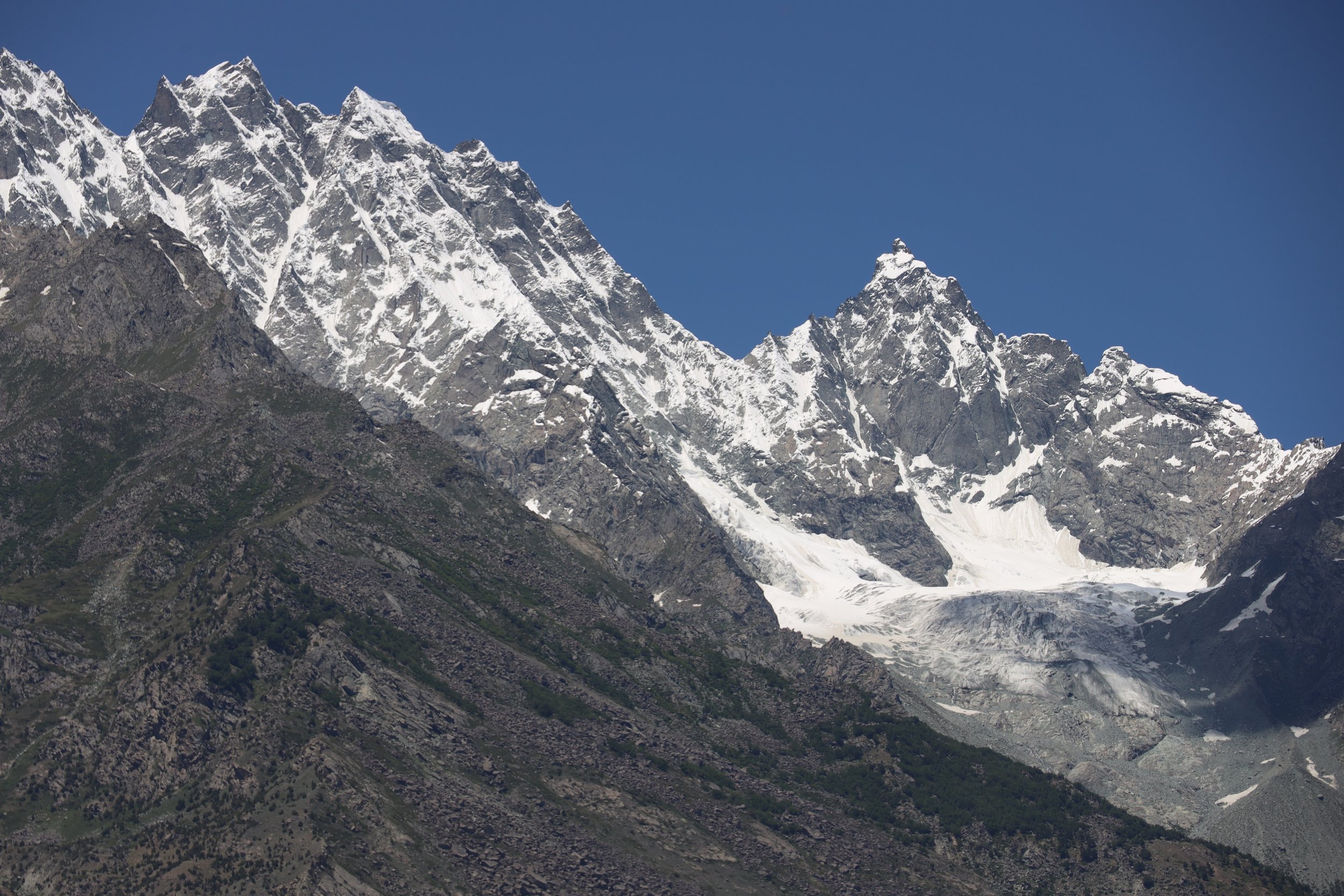
The overview of the Lesser Karakorum. Rakaposhi, Haramosh and Diran are situated in that range. All are over 7000m high.

Map of the Haramosh Glacier and Haramosh La (lower left).

Starting point of the trek is Arando, a 6 hr drive from Skardu.

Map of Chogolugma Glacier, Haramosh Glacier and Haramosh La.
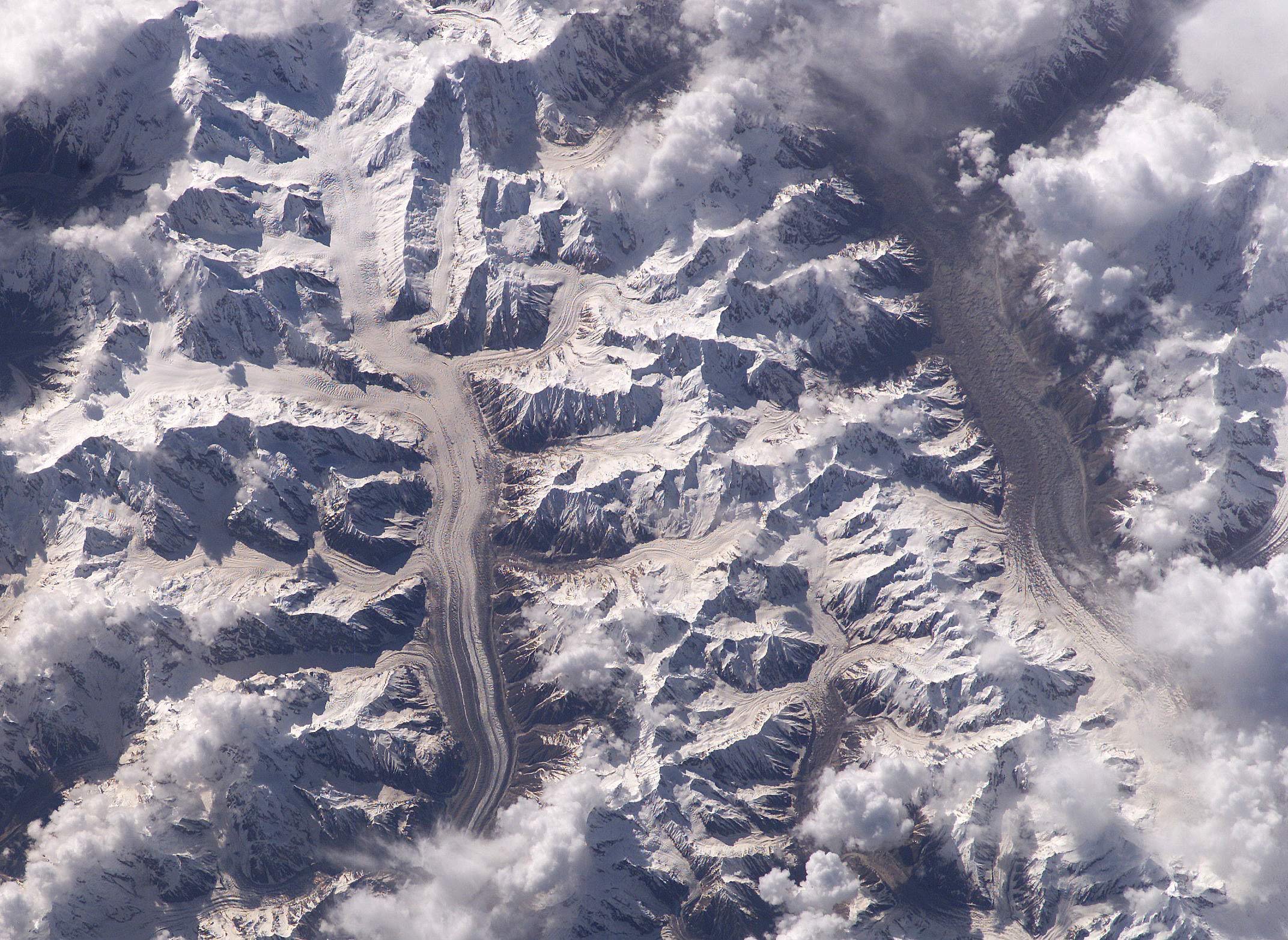
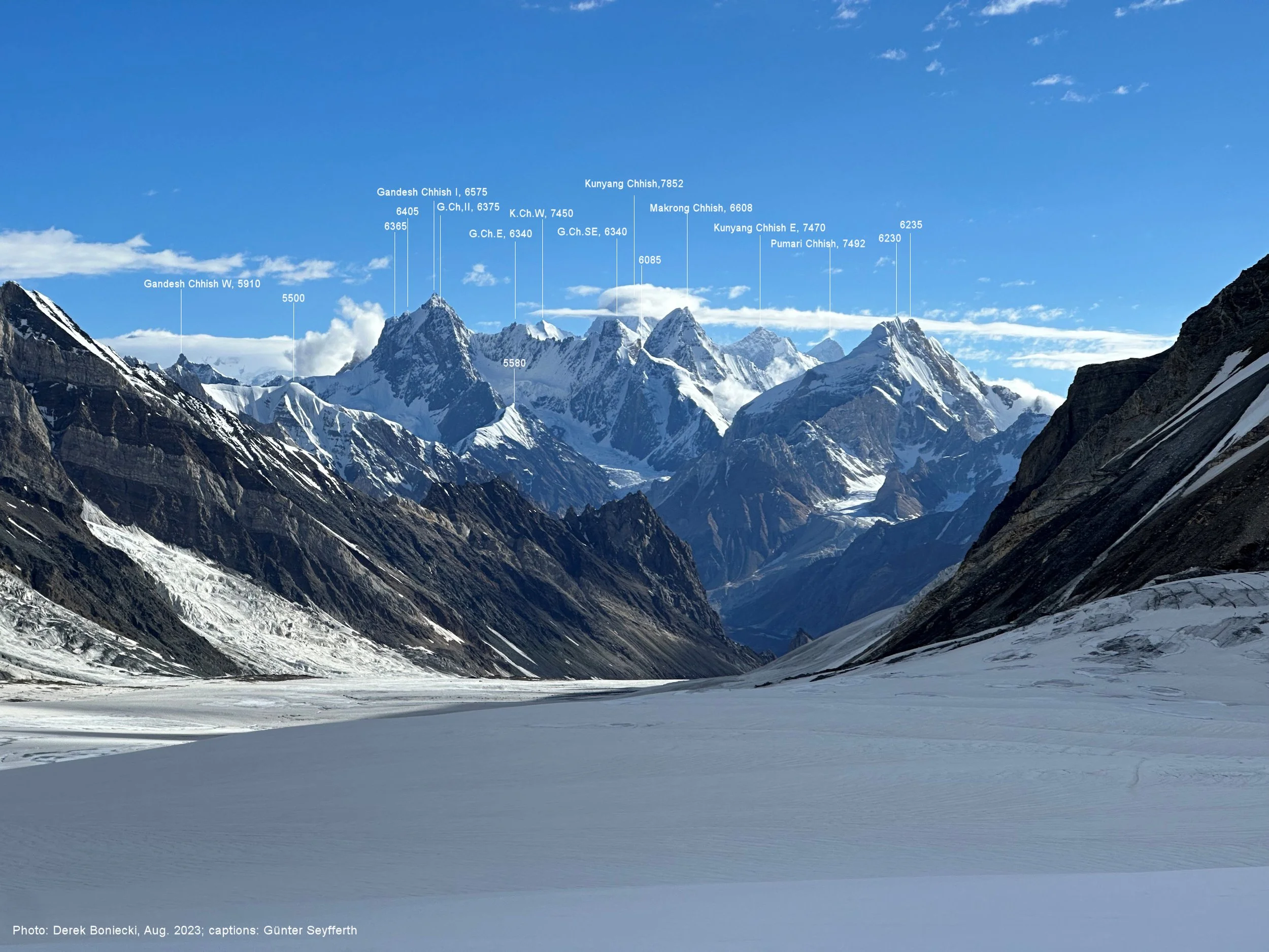
The long glacier on the left is Chogolugma. The Glacier on the right is Hispar. Haramosh Glacier is on the left side flowing into the Chogolugma Glacier in the middle left of the photo.


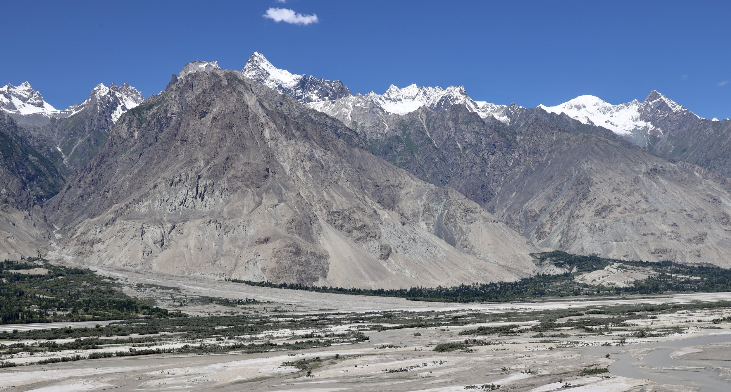
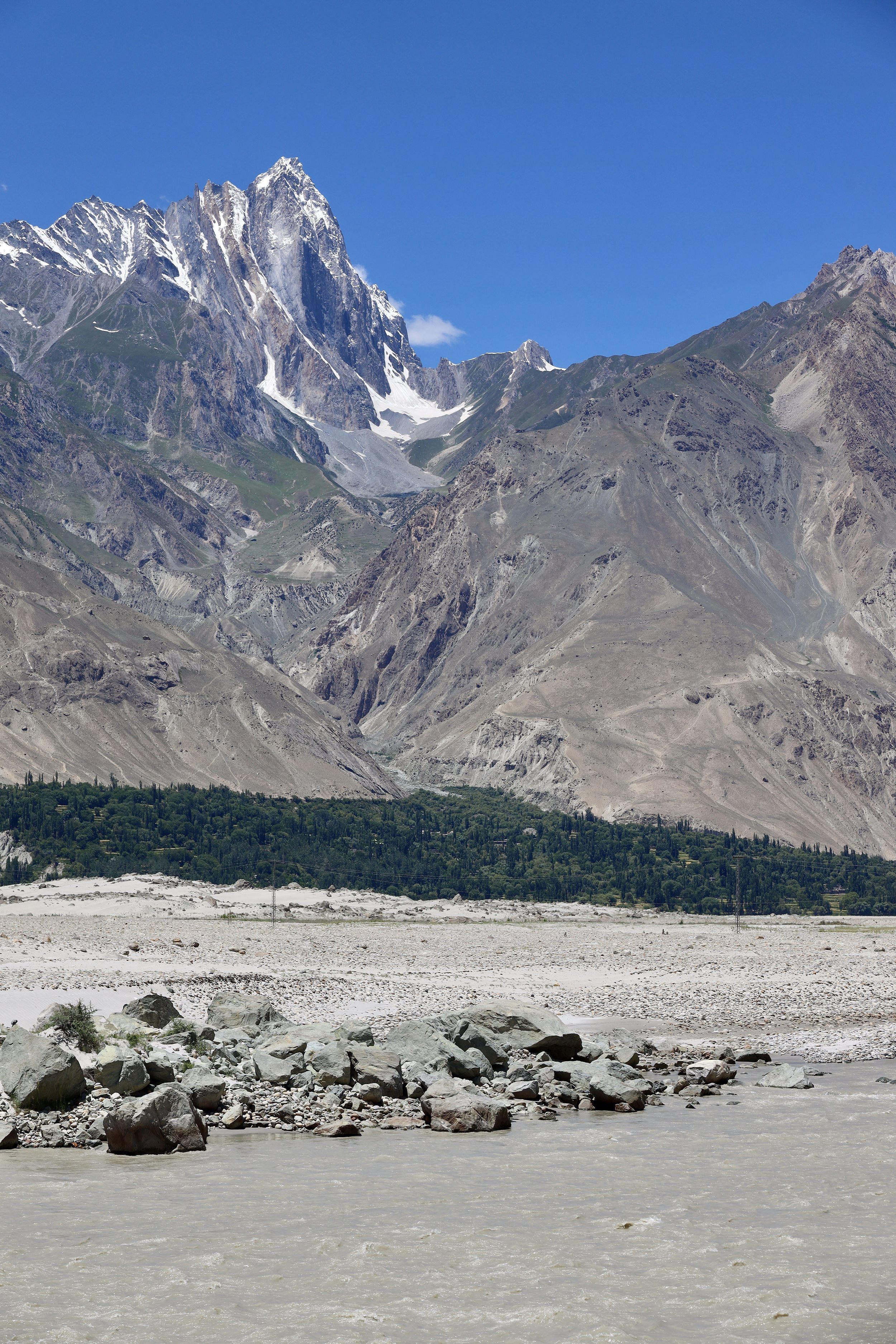
The Indus River and Shigar Valley
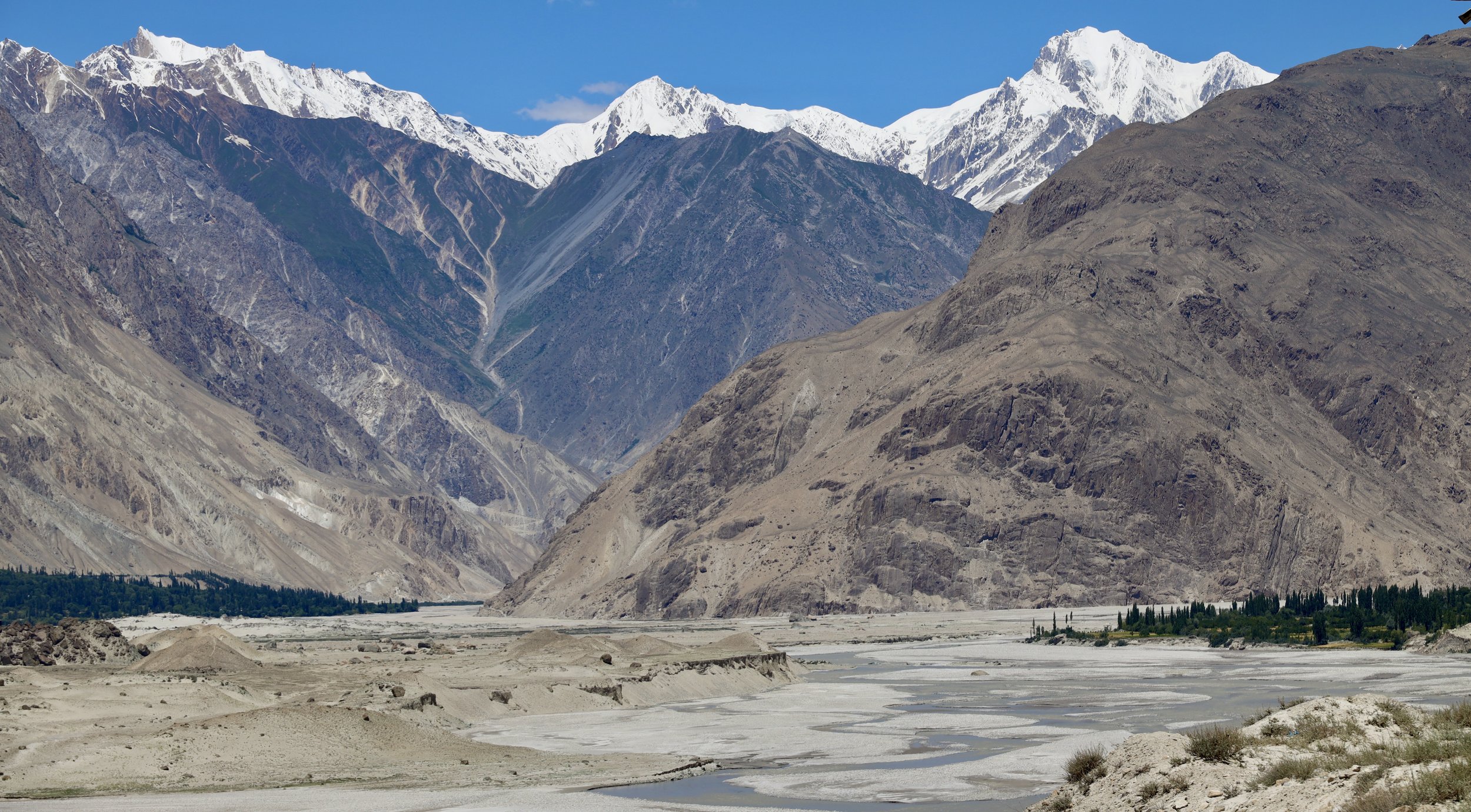
Shigar Valley
Shigar Valley

Shigar Valley

Shigar Valley
Shigar Valley

Shigar Valley

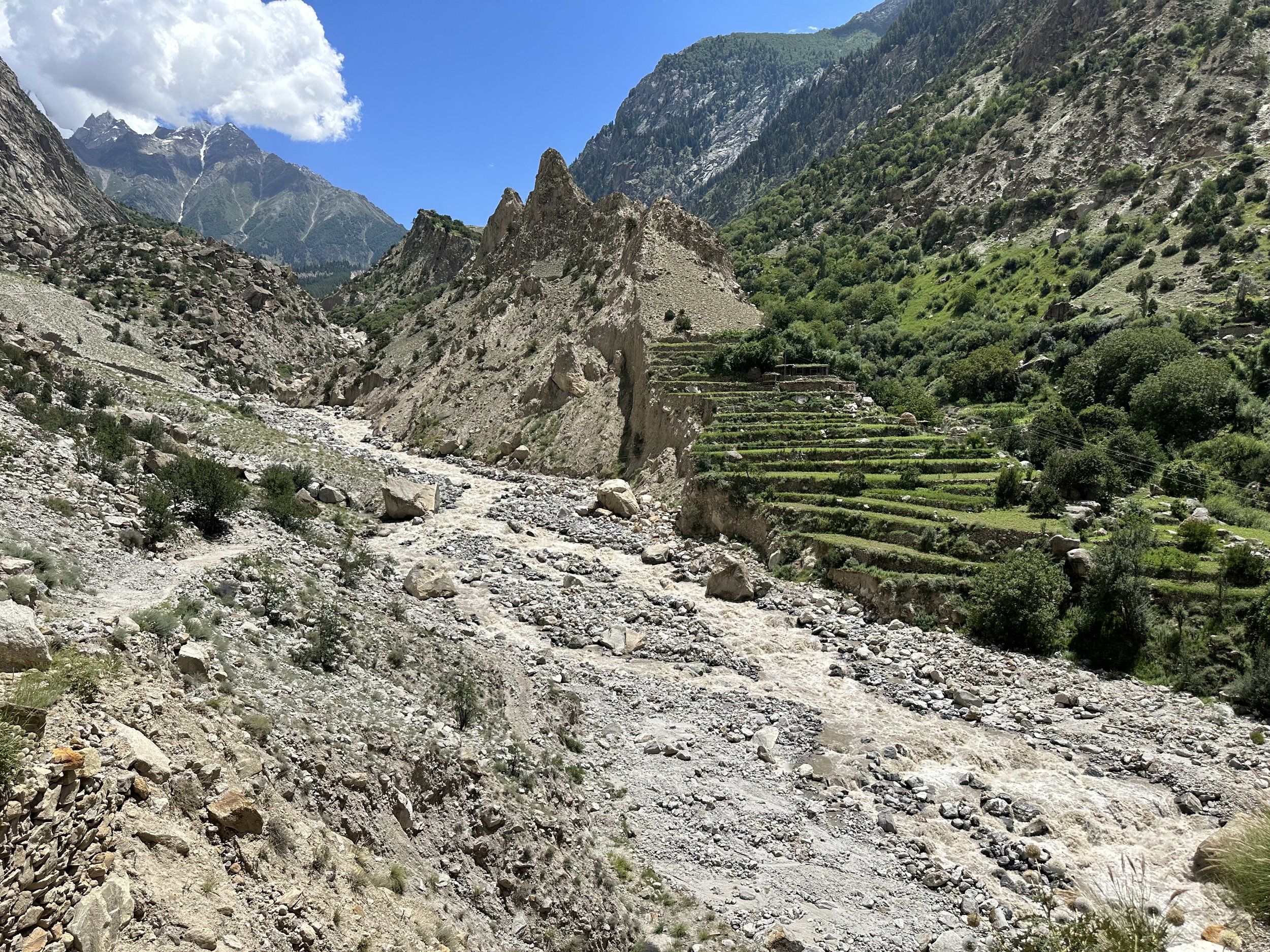
The confluence of Shigar and Basha Rivers. We are going into the valley ahead. The road to Askole turns right.
Basha River Valley. The high mountain on the right is Bargincho 5790m.
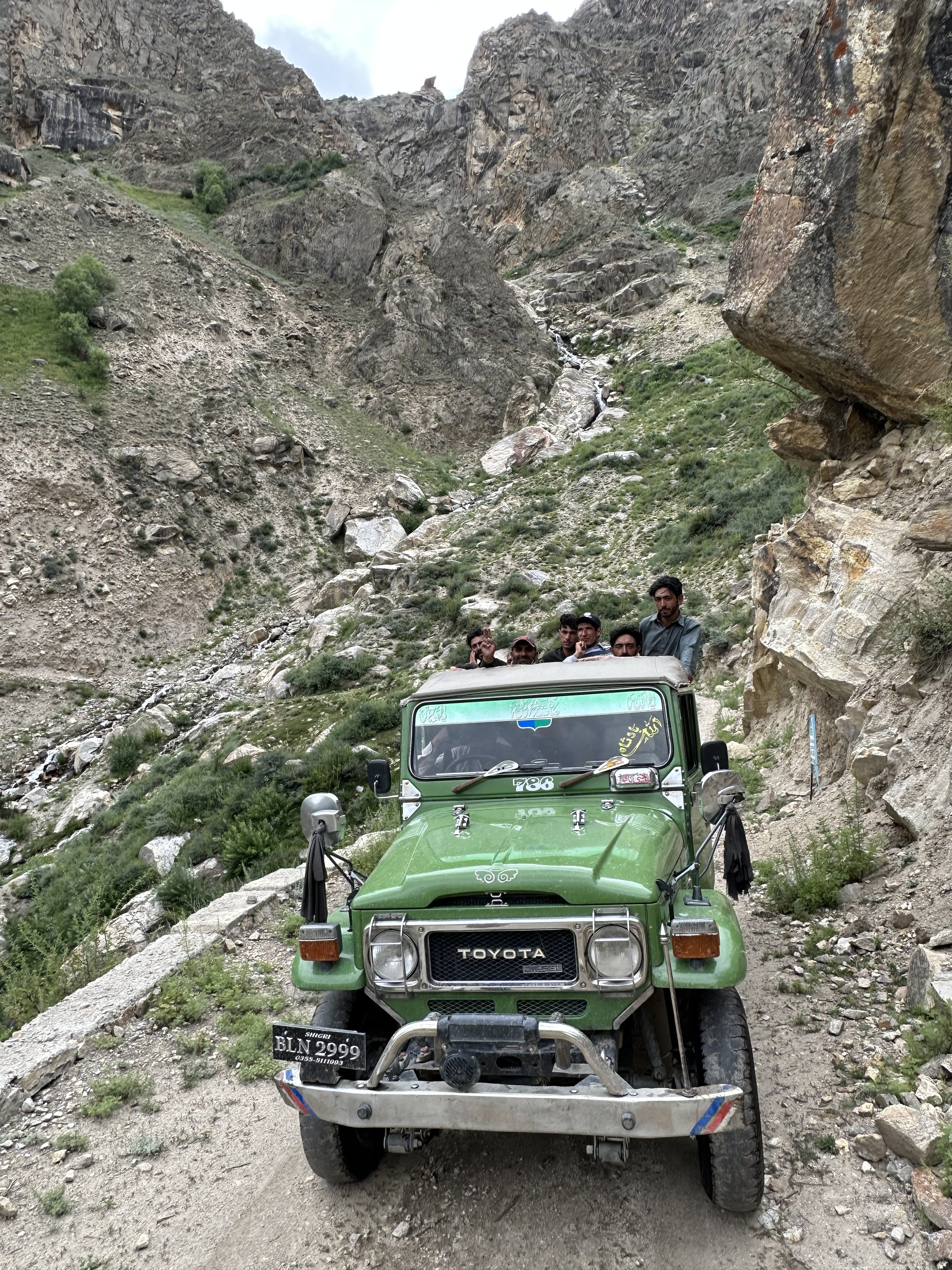
Driving to Arando

Camp 1 in Arando

Negotiating with porters in Arando

Arando, bridge over Basha River

Arando
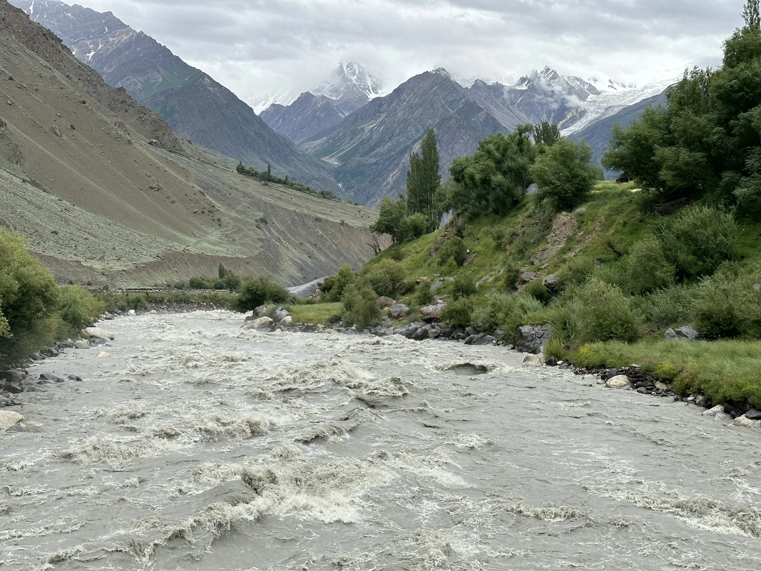
Arando, Basha River

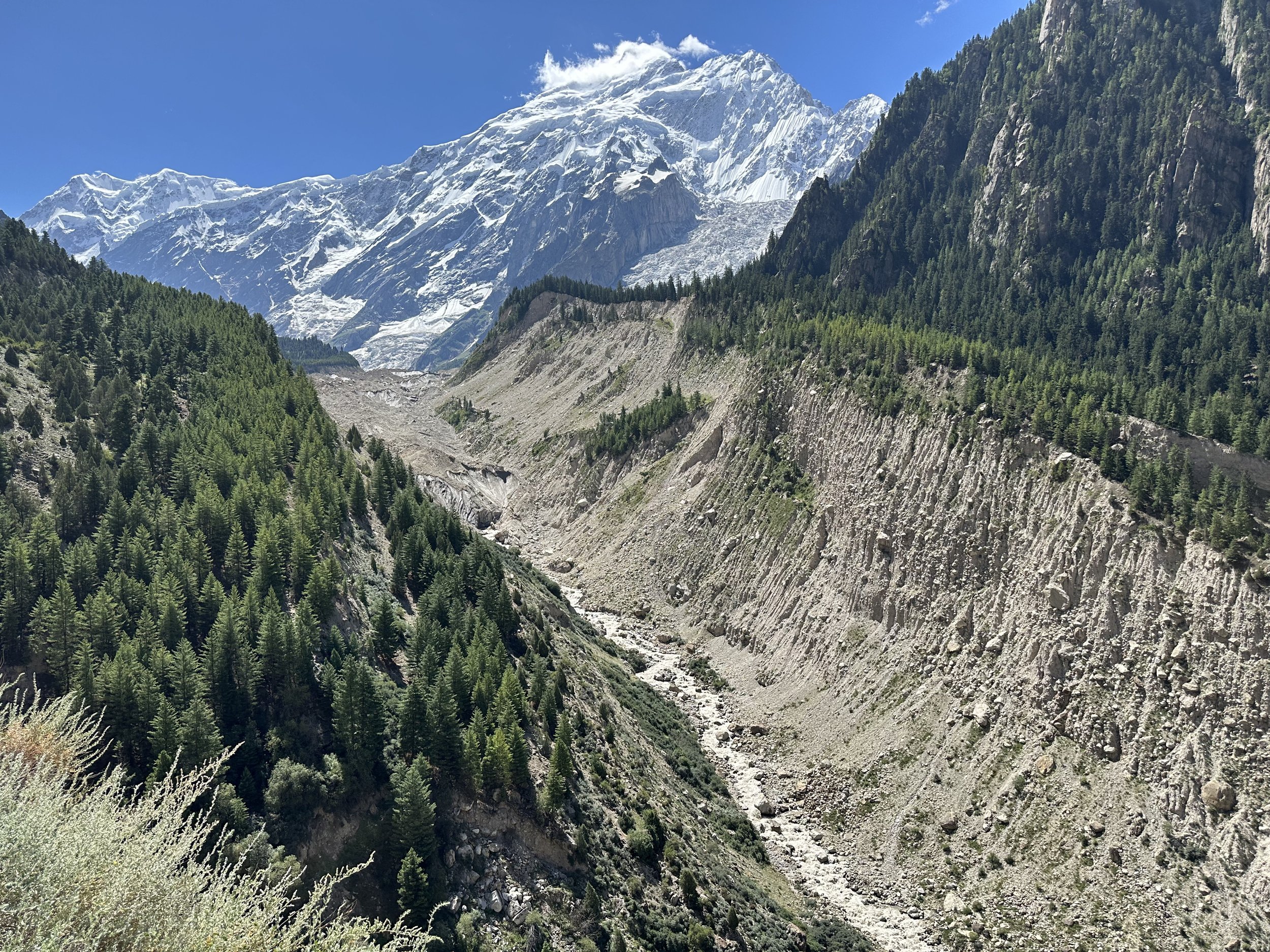
Arando is very close to the terminal moraine of the Chomolugma Glacier and the source of the Basha River.
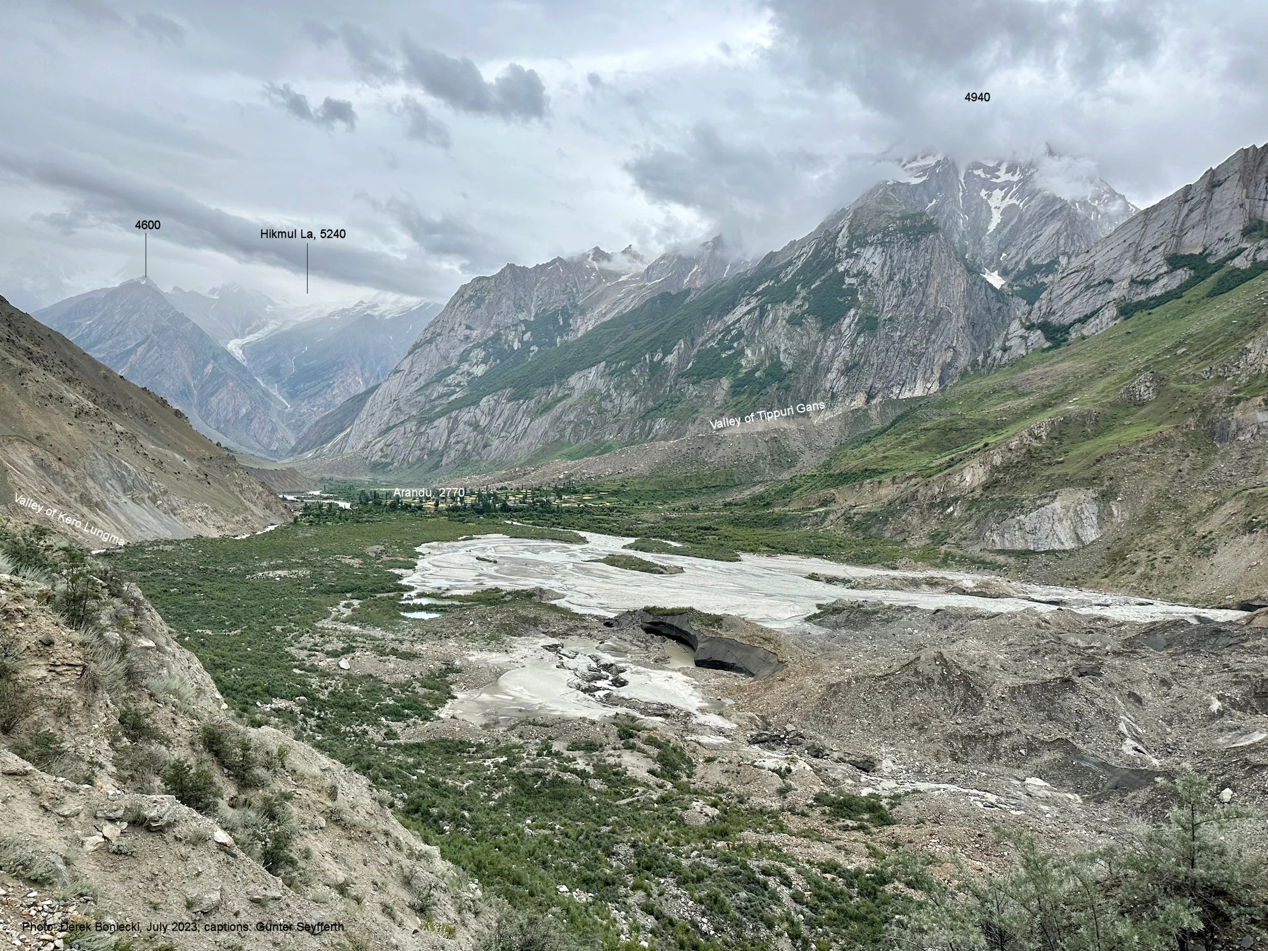

The terminal moraine of the Chomolugma Glacier

We climbed quite high on day 2. Day 3 and 4 we stayed put to wait out the rain.
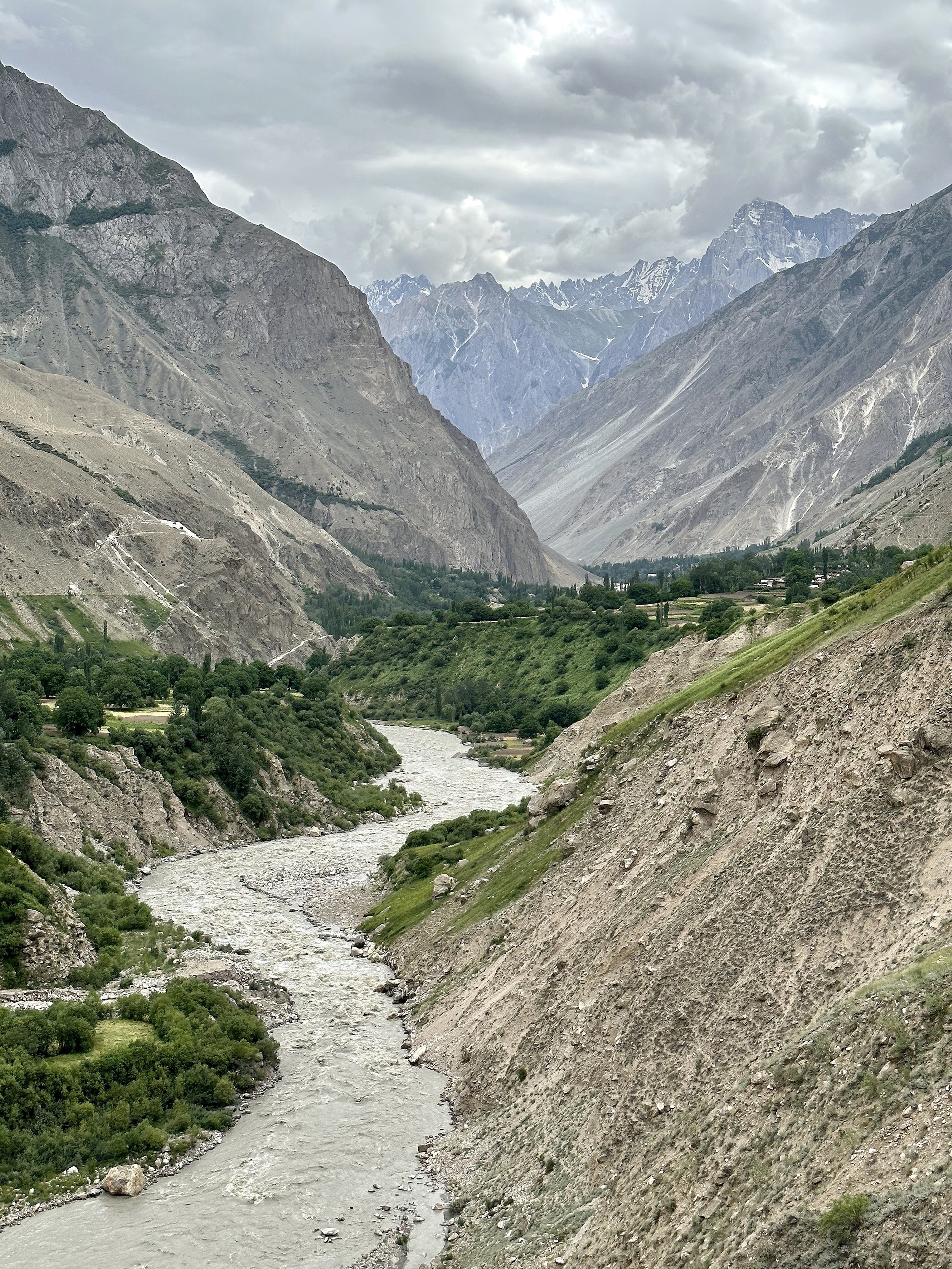
The road to Arando and Basha River
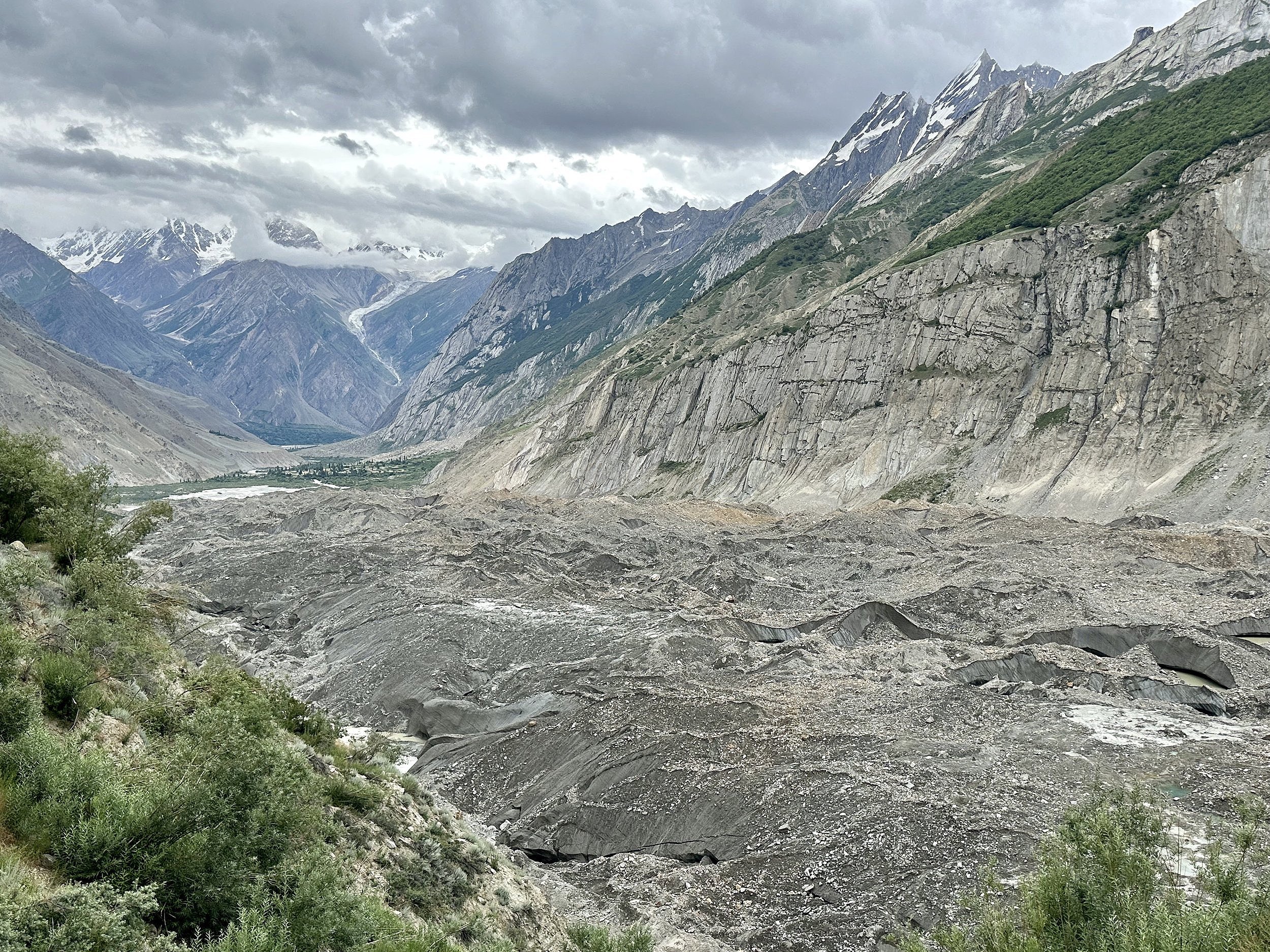
Arando village and the terminus of the Chgolugma Glacier.

Our first camp on the Chogolugma Glacier. We stayed here for two nights to wait out the rain. Since it was a cow pasture we had hundreds of flies in our tents.


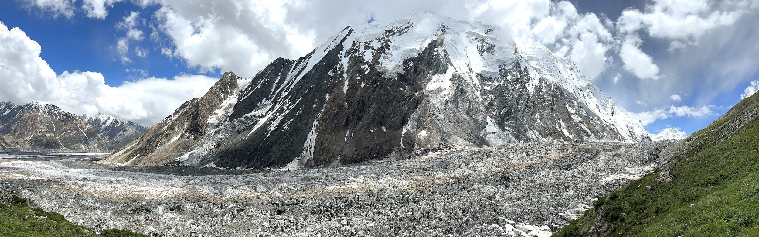
Chomolugma Glacier

Day 5 was long but the march was along a flat side valley next to the Chomolugma Glacier.
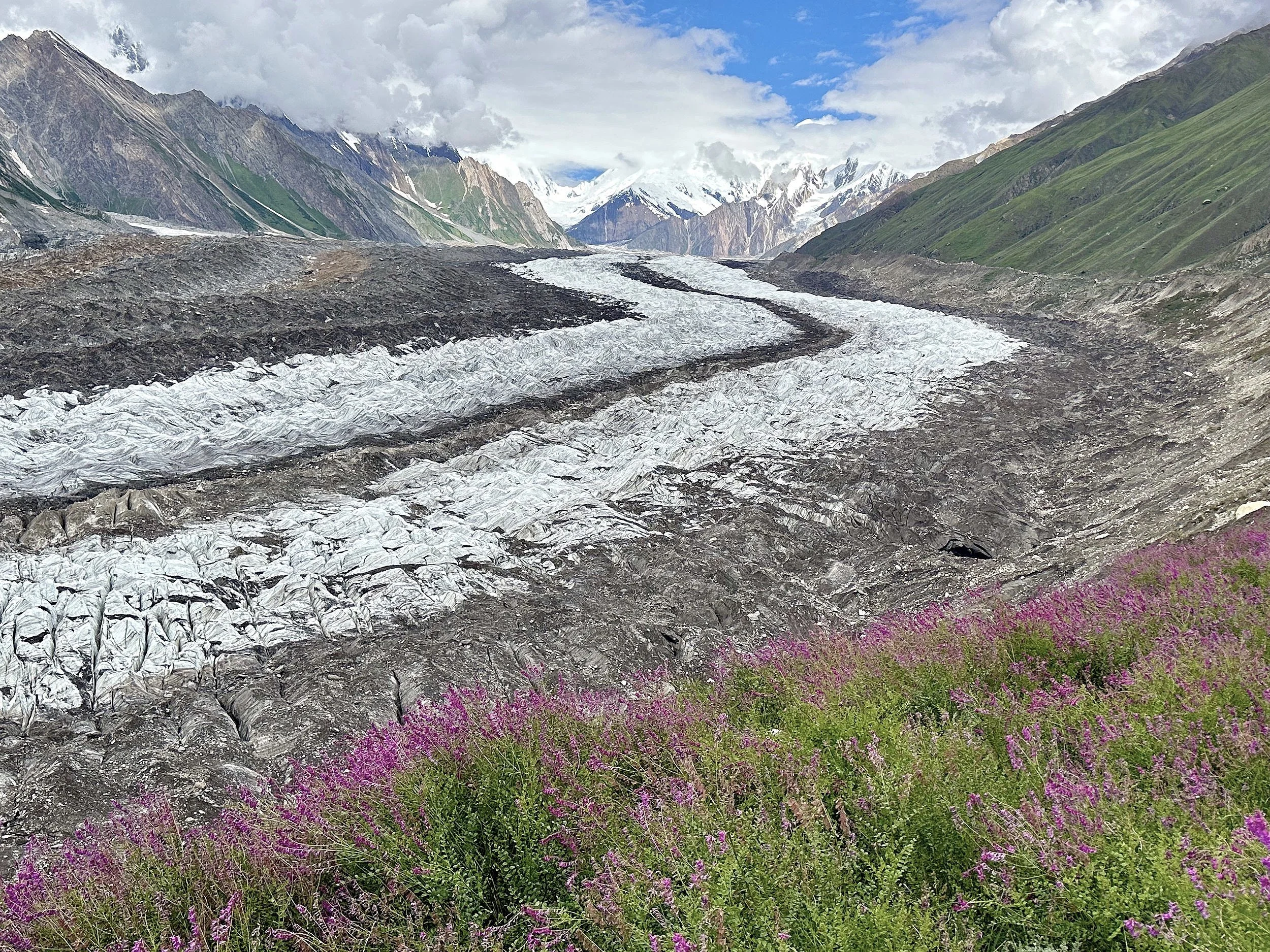
A beautiful flower filled side moraine of the Chogolugma Glacier. Spantik is directly ahead.


Second East Haramosh Glacier and Paraber Peak 6,315m.
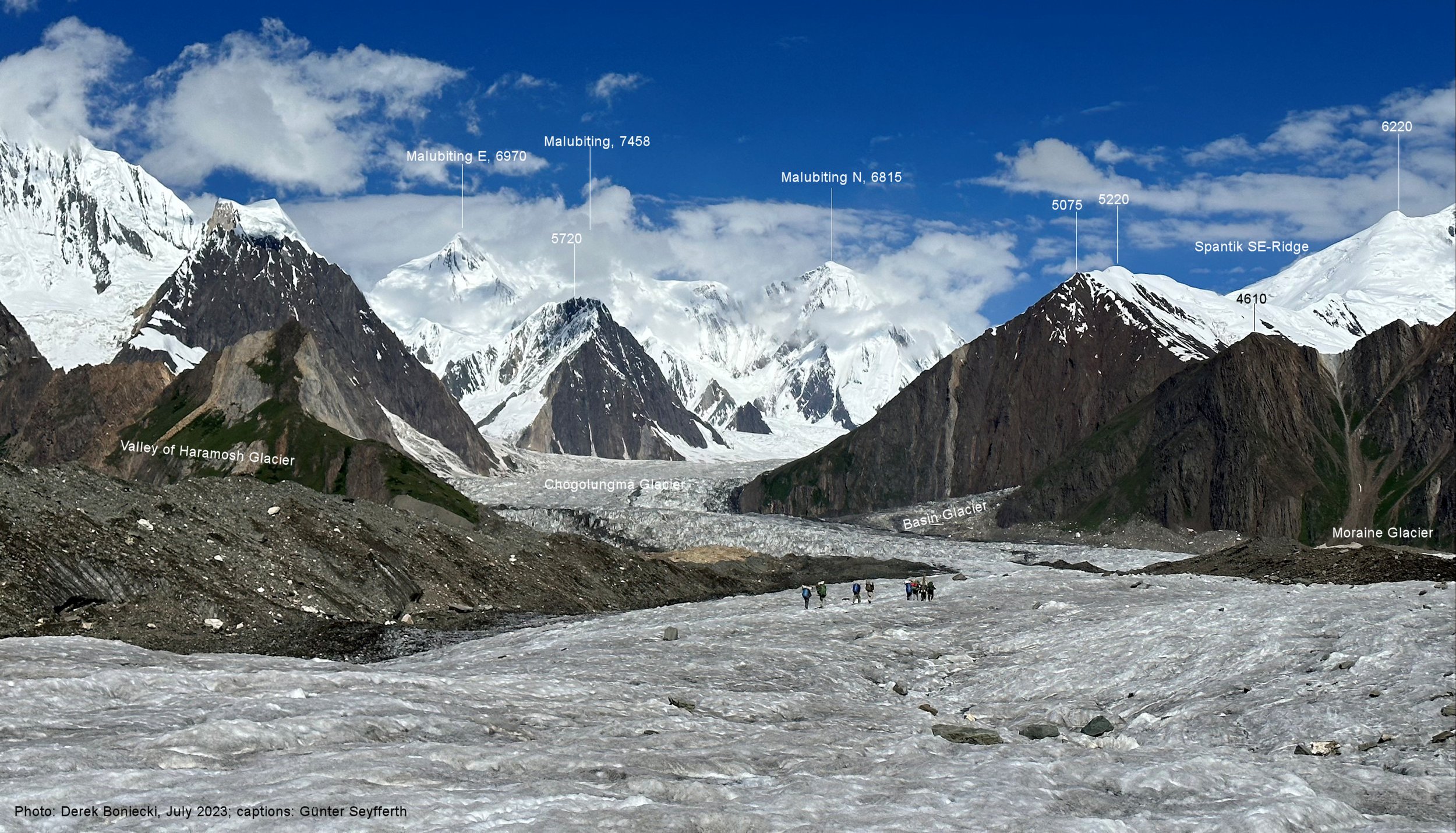
Chomolugma Glacier with Malubitung Peak 7453m on the horizon.

Our camp before we veered off onto the Haramosh Glacier seen in the distance on the left.

Chomolugma Glacier

On the Chomolugma Glacier


Chomolugma Glacier

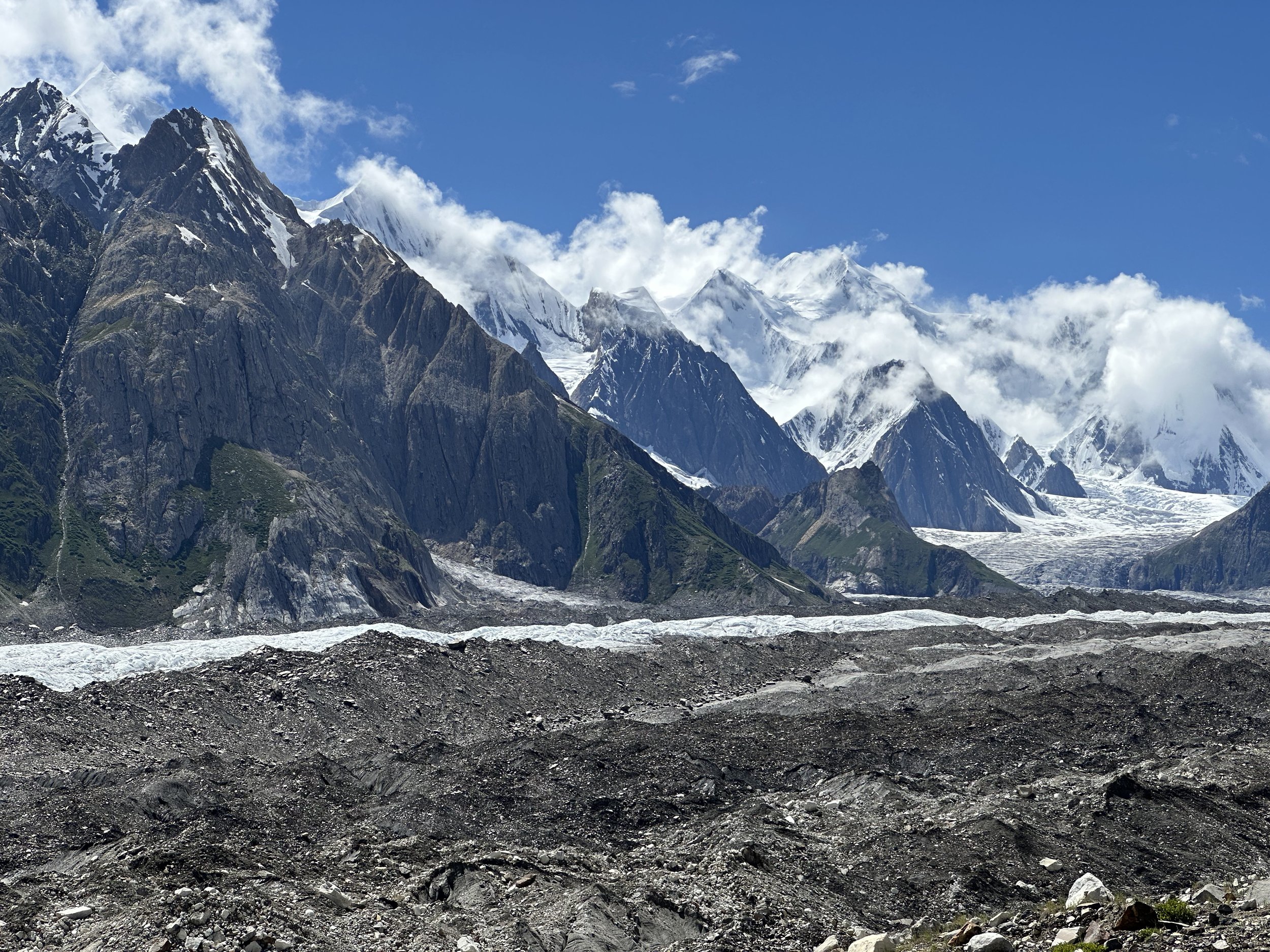
Malubiting 7453m

Upper Chomolugma Glacier

Malubiting 7453m

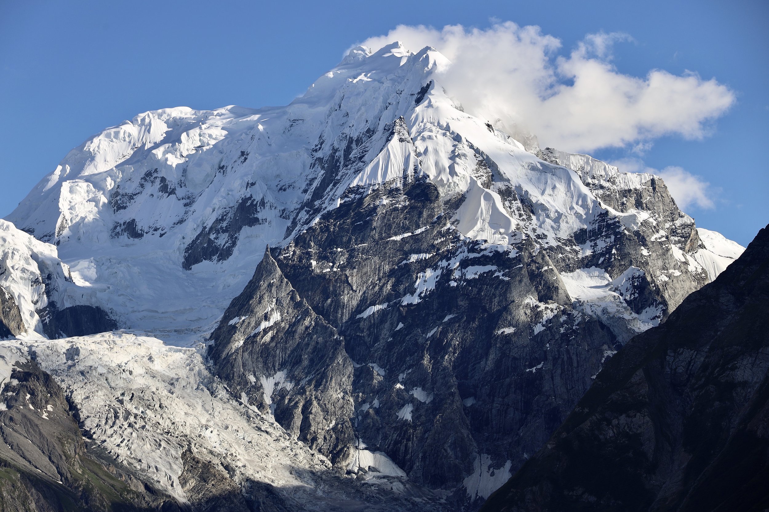
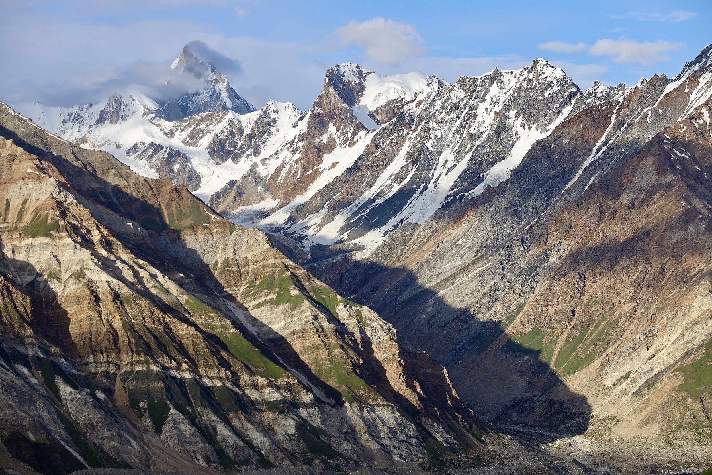
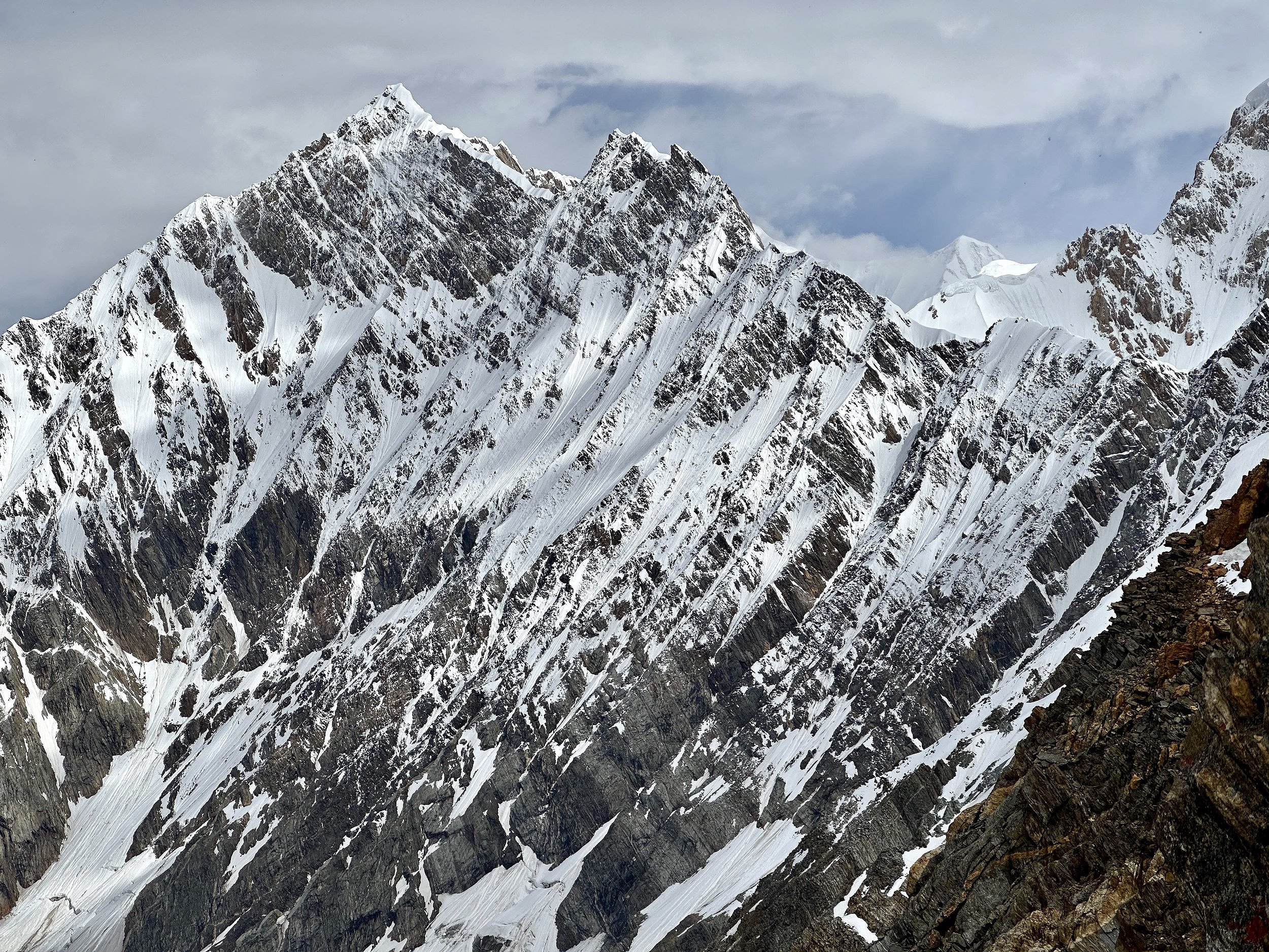
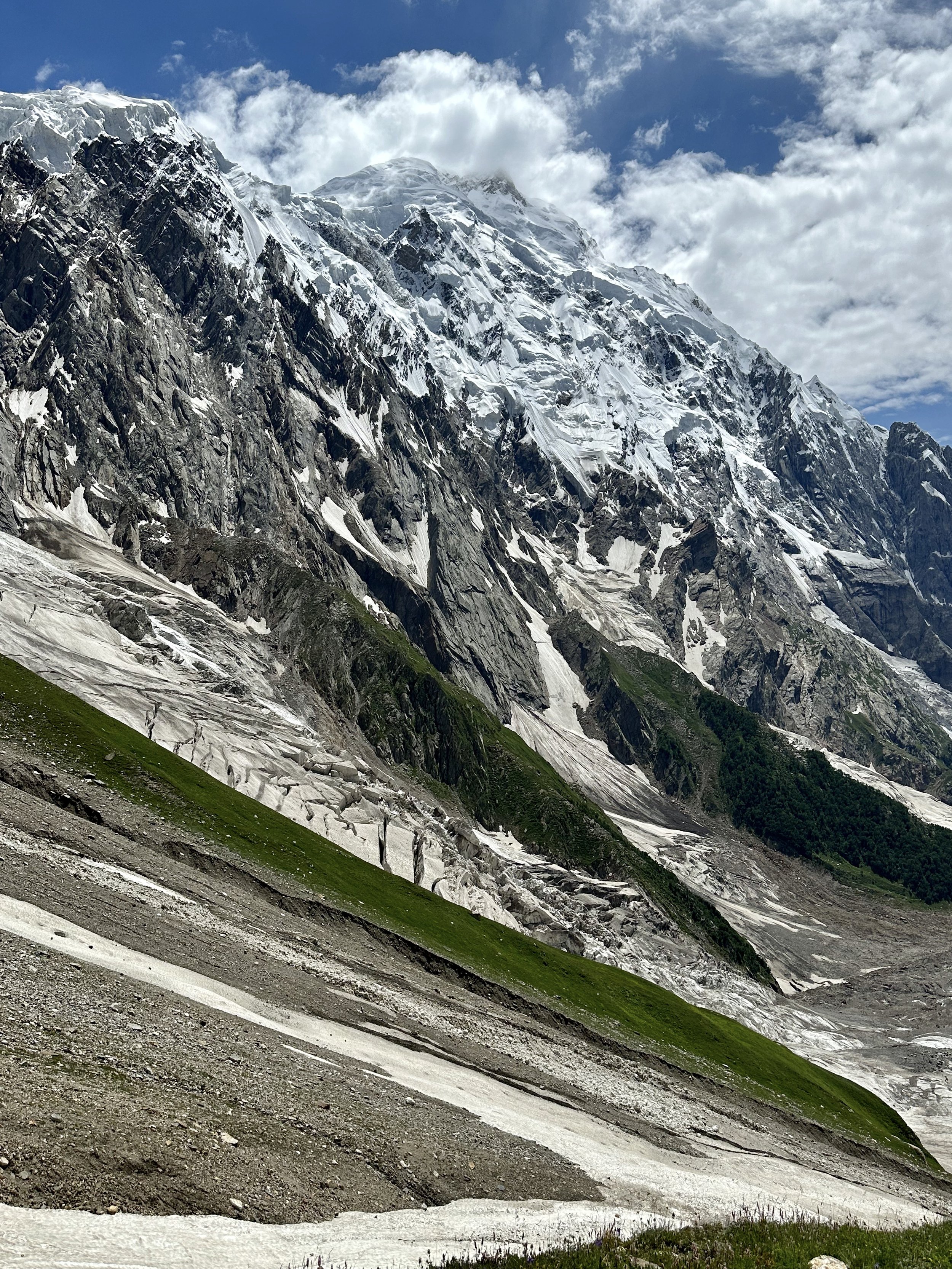
Haramosh 2 with its summit in the cloud.
Spantik is right in front. You can see the ascent ridge and the entire route of the climb.


On Haramosh Glacier

On Haramosh Glacier.

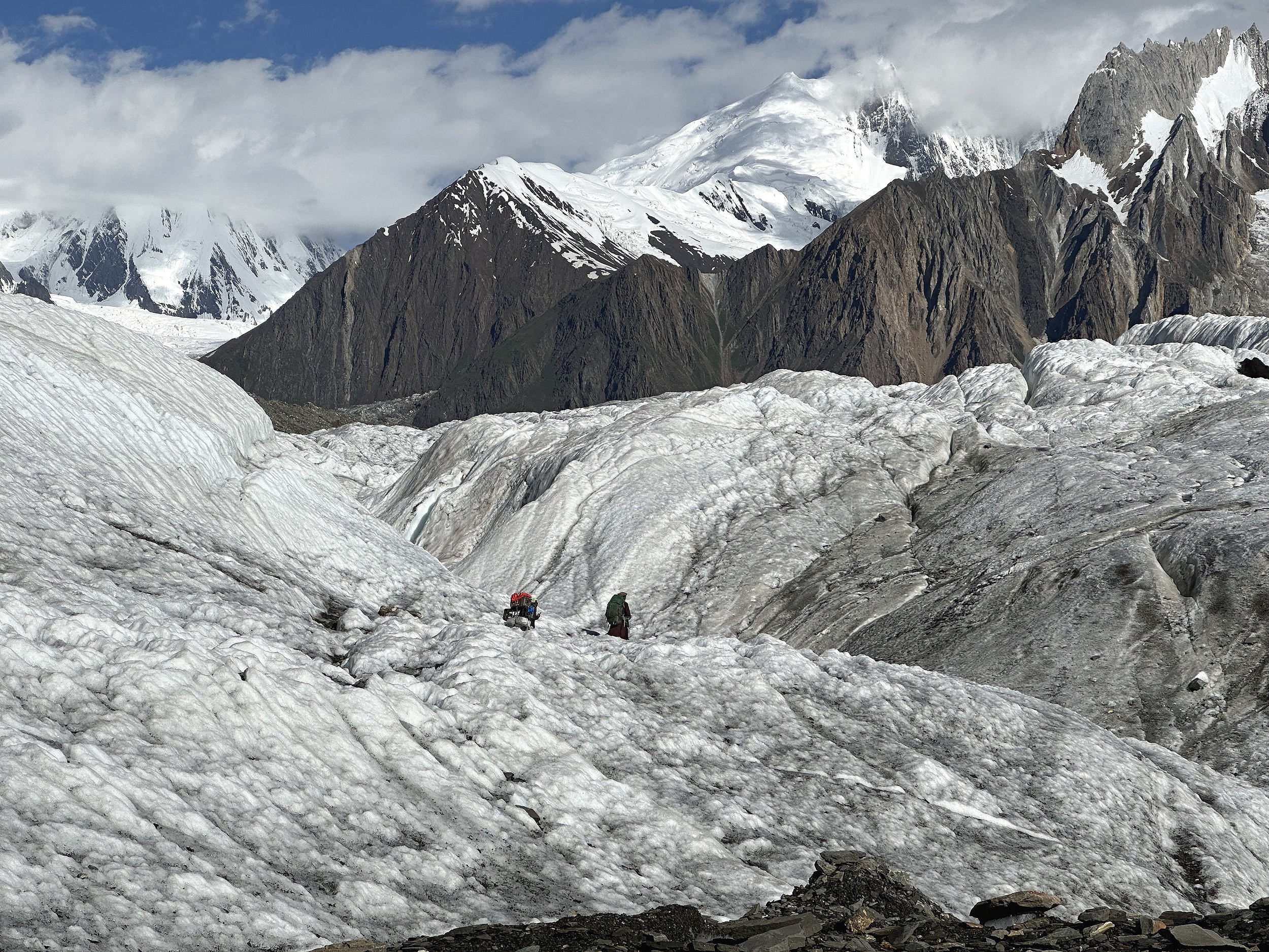
Haramosh Glacier. We had to bypass the heavily crevassed frontal section of the Haramosh Glacier.
Haramosh Glacier

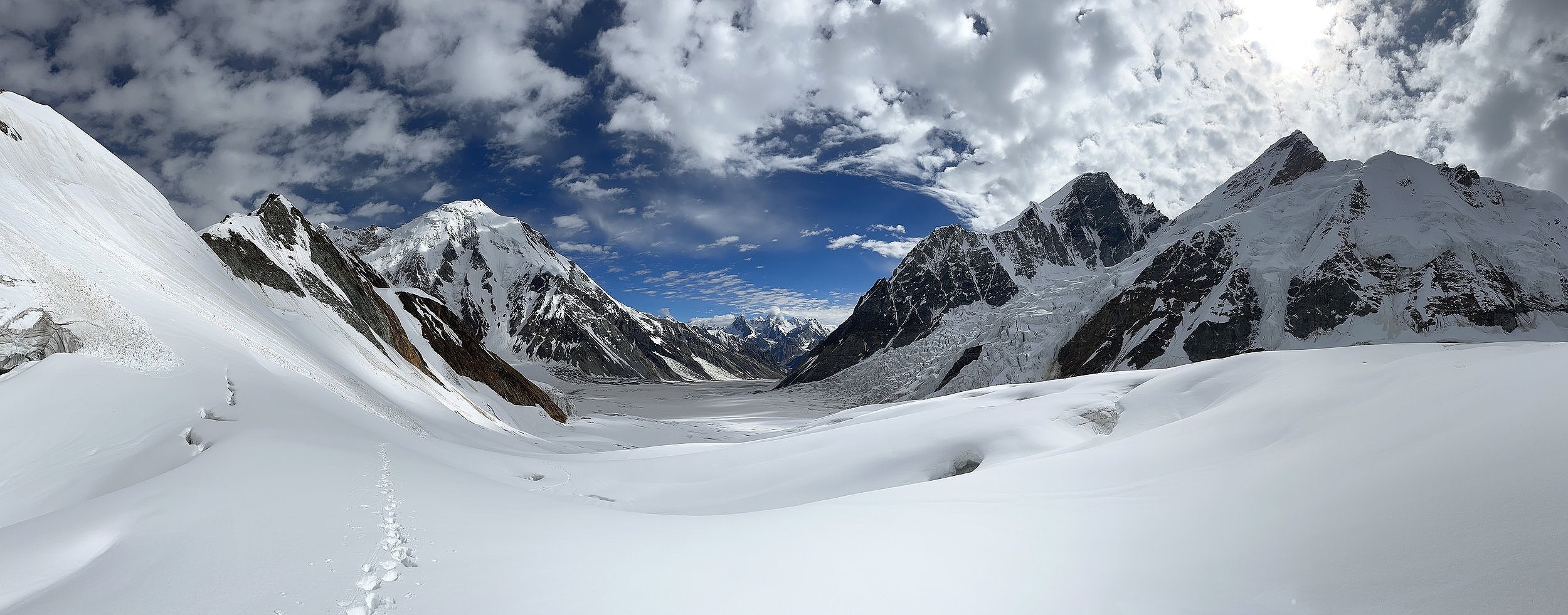
The confluence of the Haramosh and Chomolugma Glaciers.
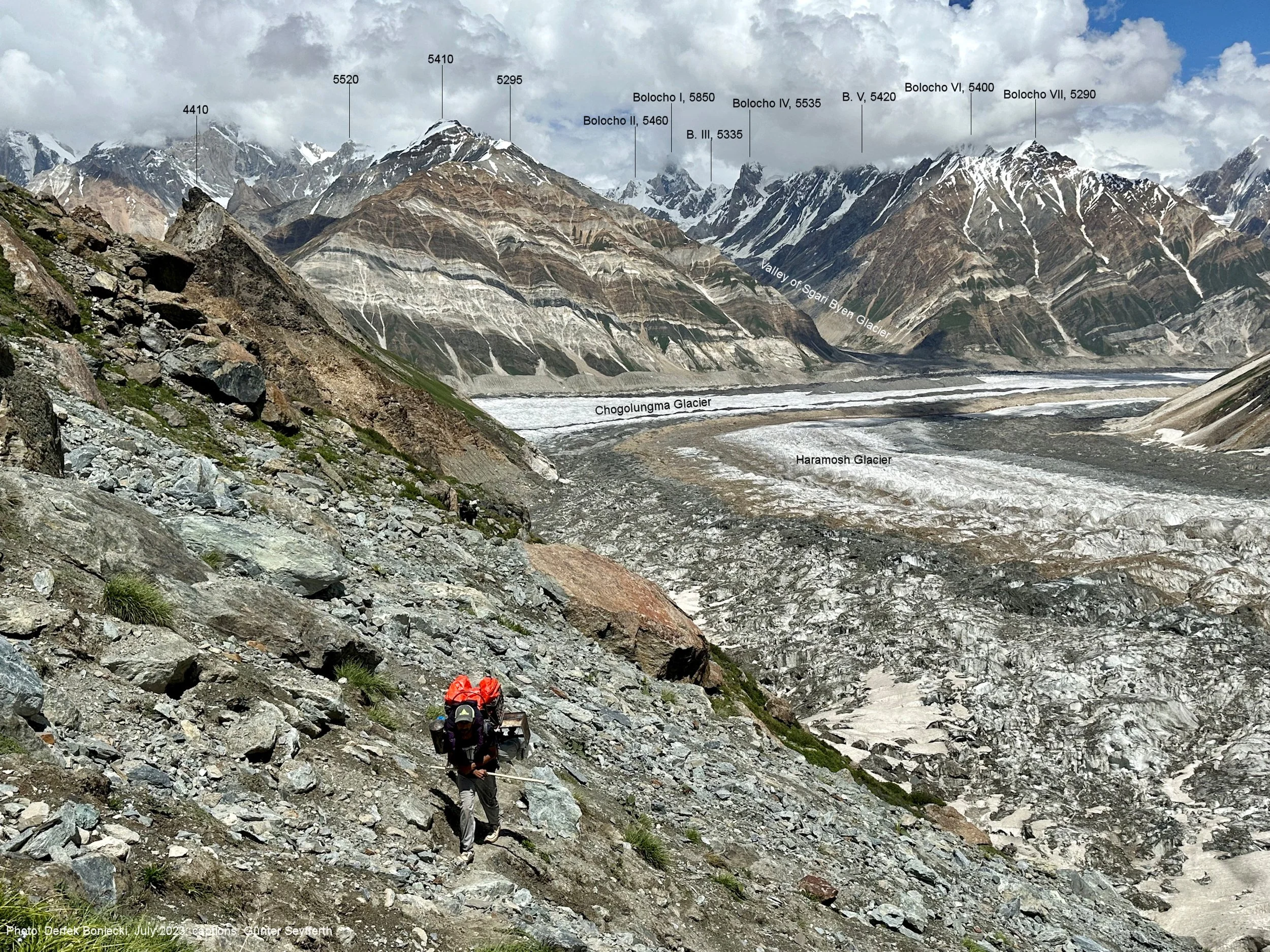
Sgari Glacier and Bolocho 1 (high peak on the left 5850m).
Bolocho 1

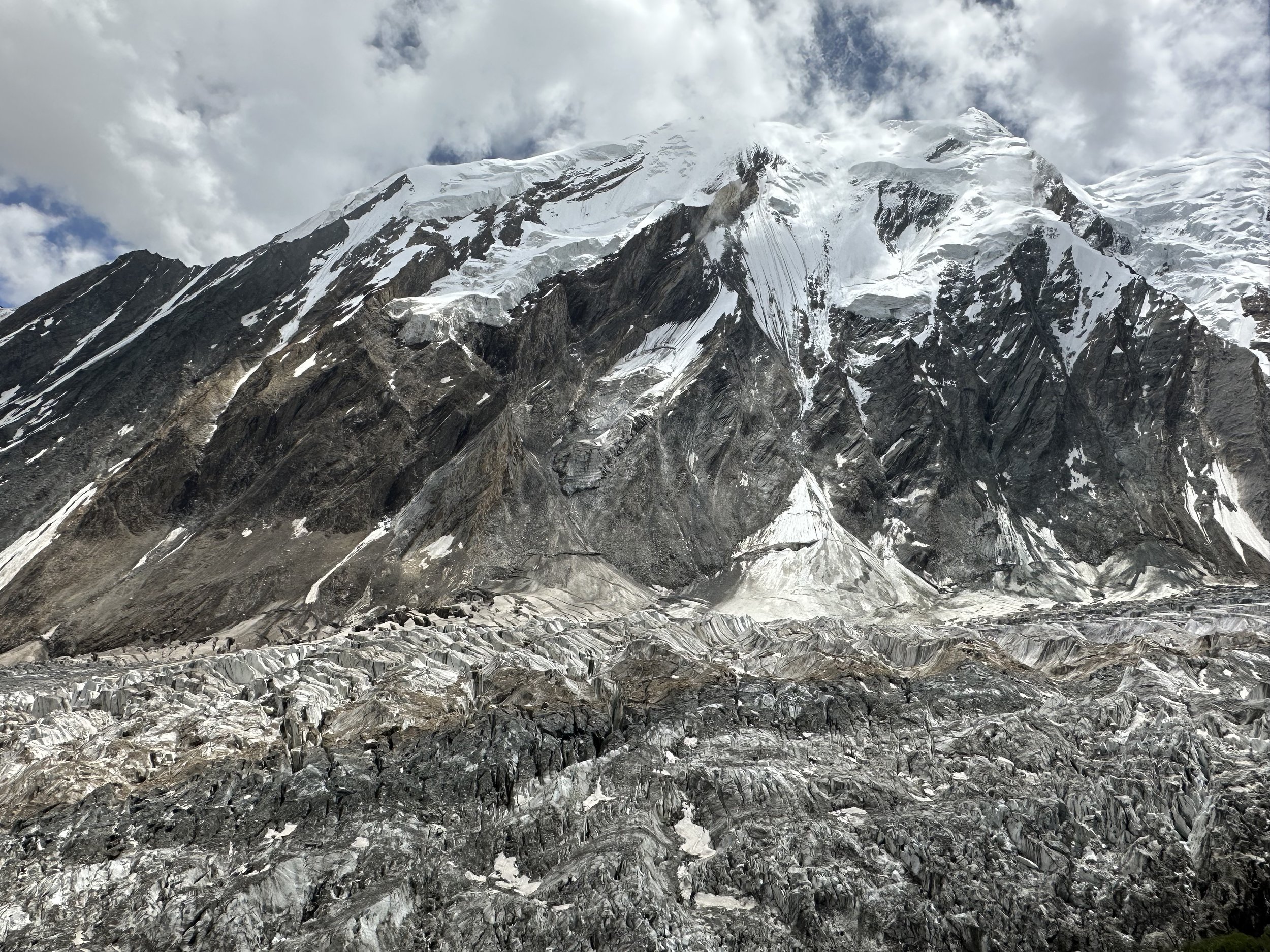
The heavily crevassed Haramosh Glacier.
Haramosh Glacier
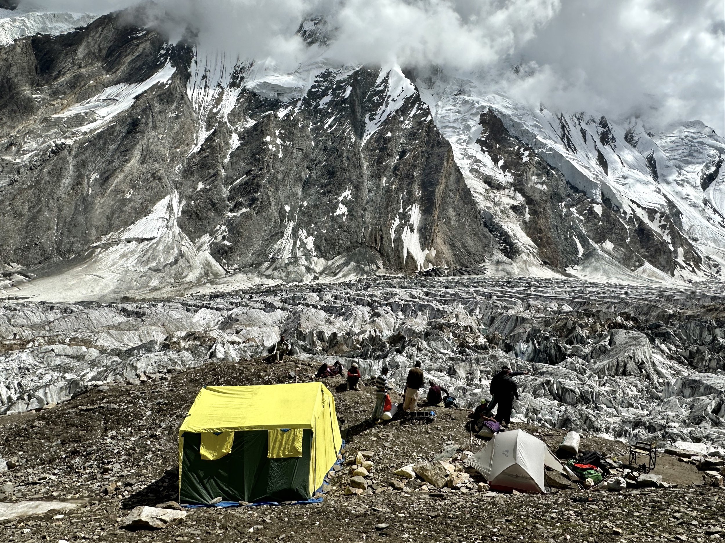
Our incredible camp on the Haramosh Glacier. This is the bc for the Pass.

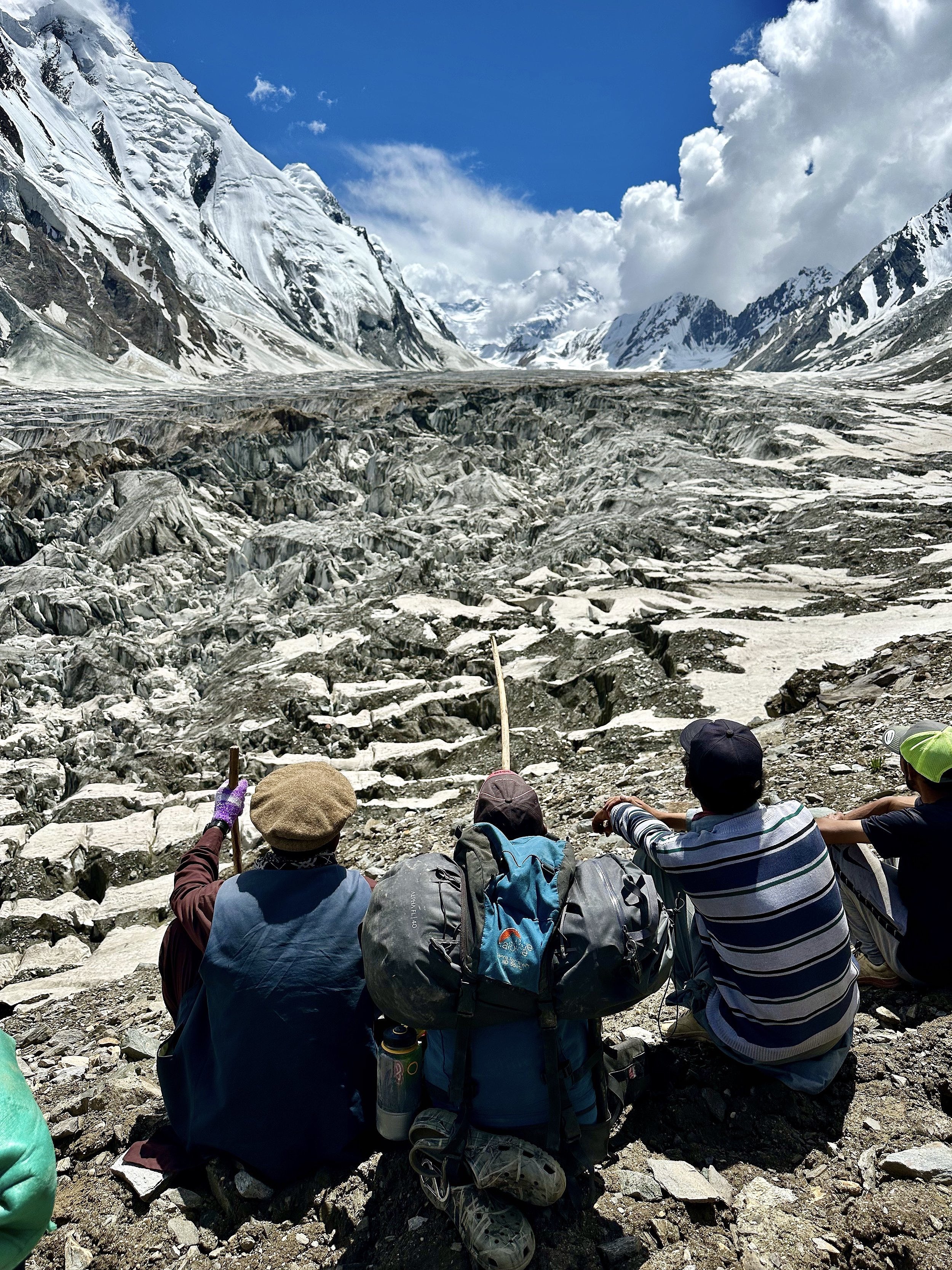
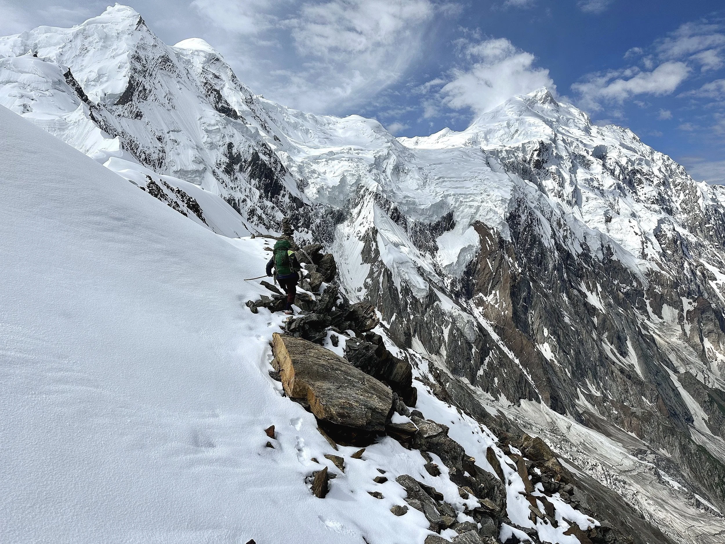
Pointing at the pass 12 km away and another 1000m up along the upper reaches of the Haramosh Glacier.

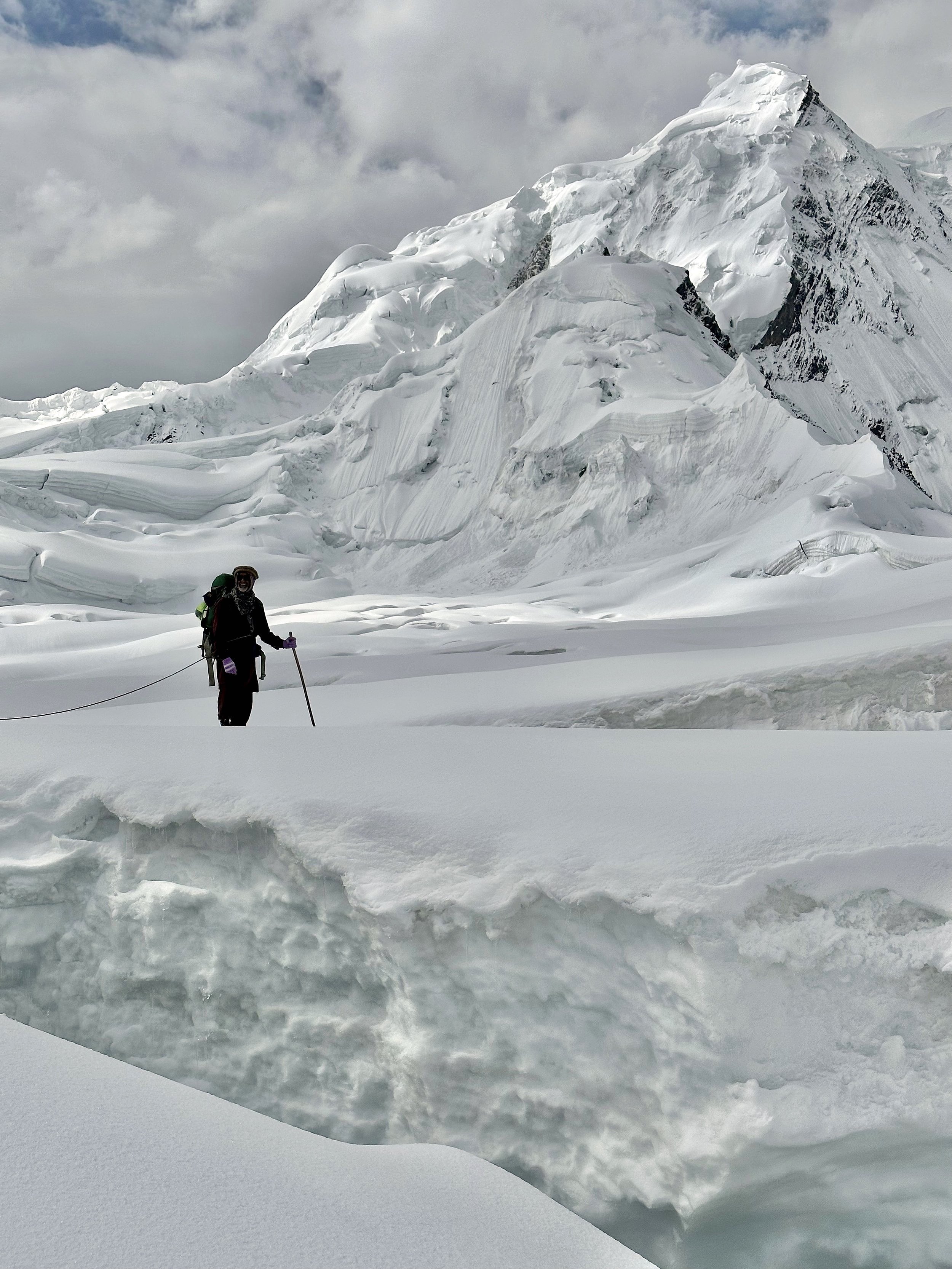
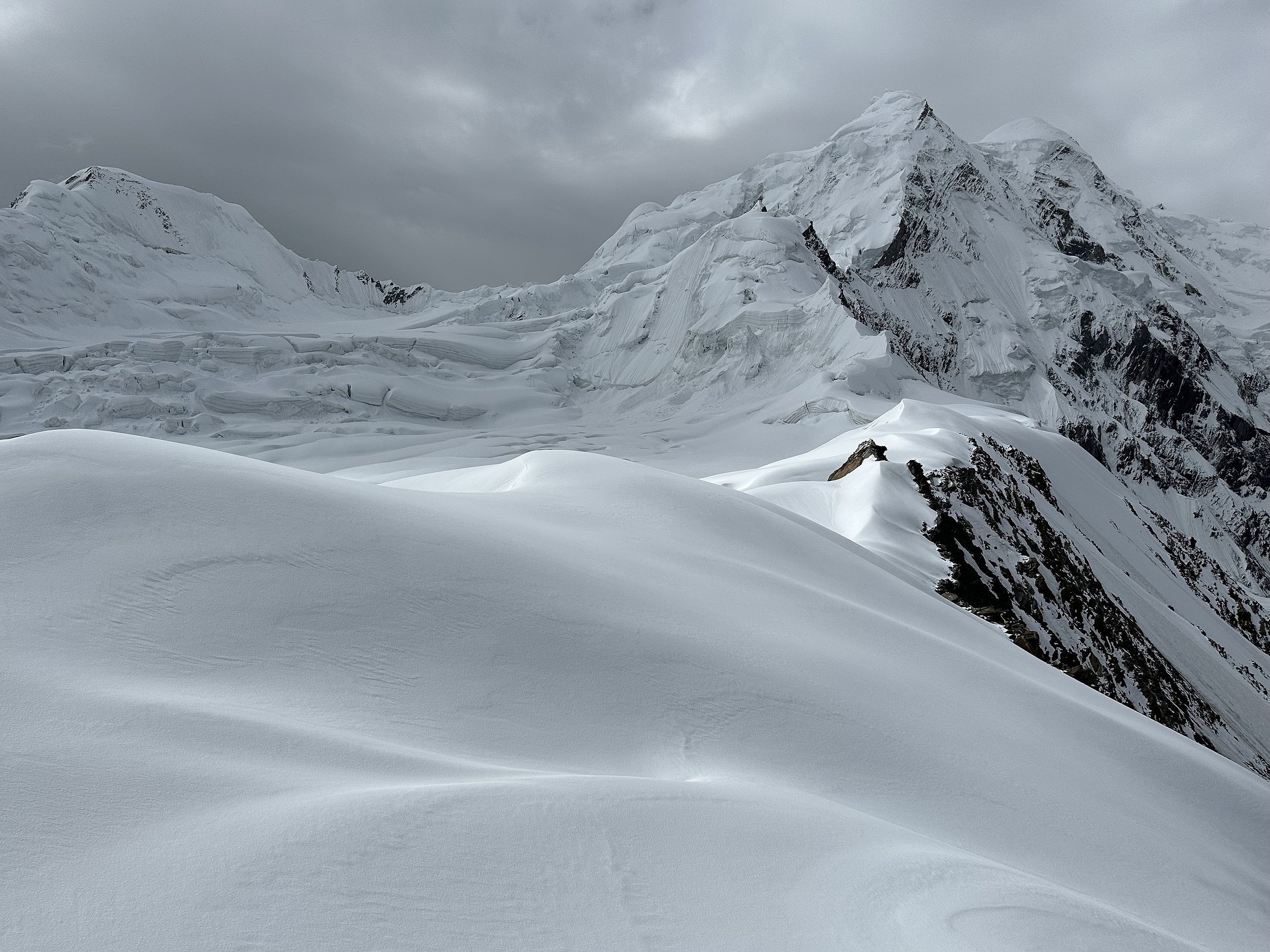
Early morning on the upper Haramosh Glacier


The sunrise on the Haramosh Glacier

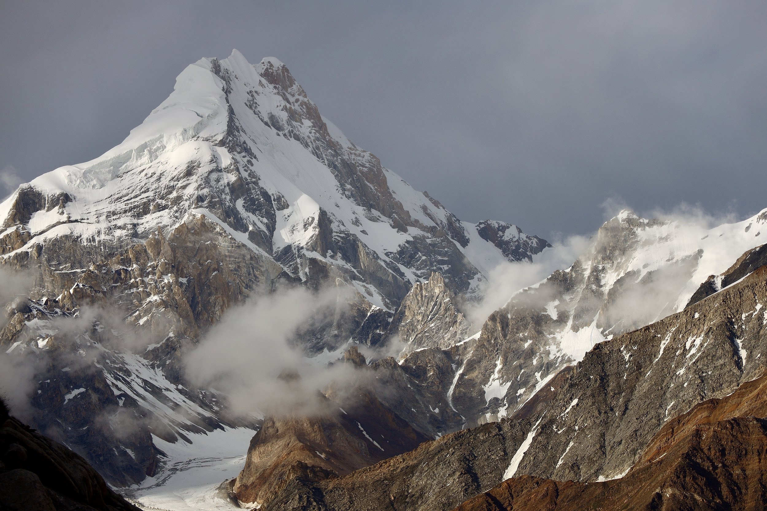
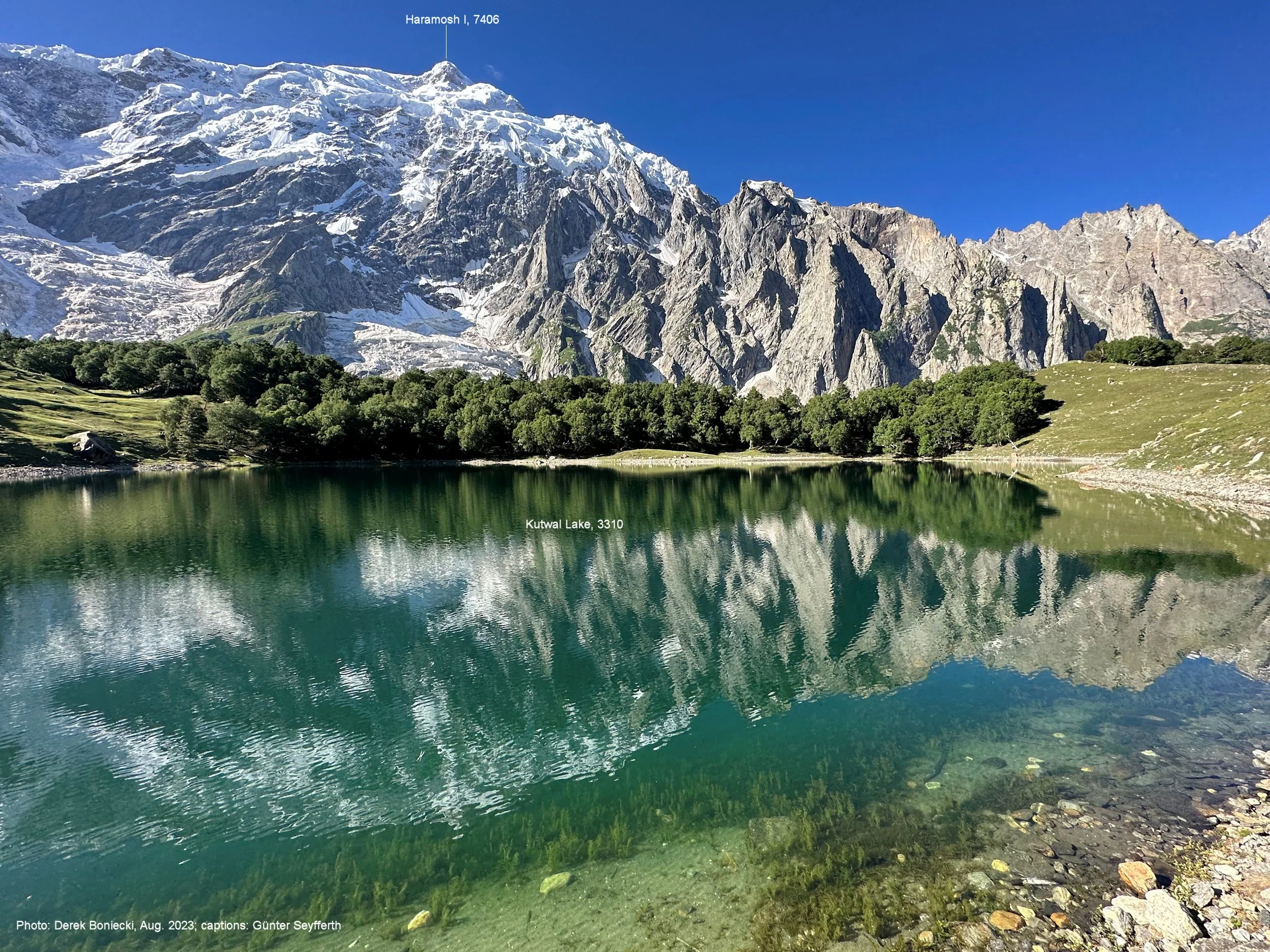
Sunrise on Haramosh 1 7406m.
Laila Peak icefall with Laila Peak 6986m above.

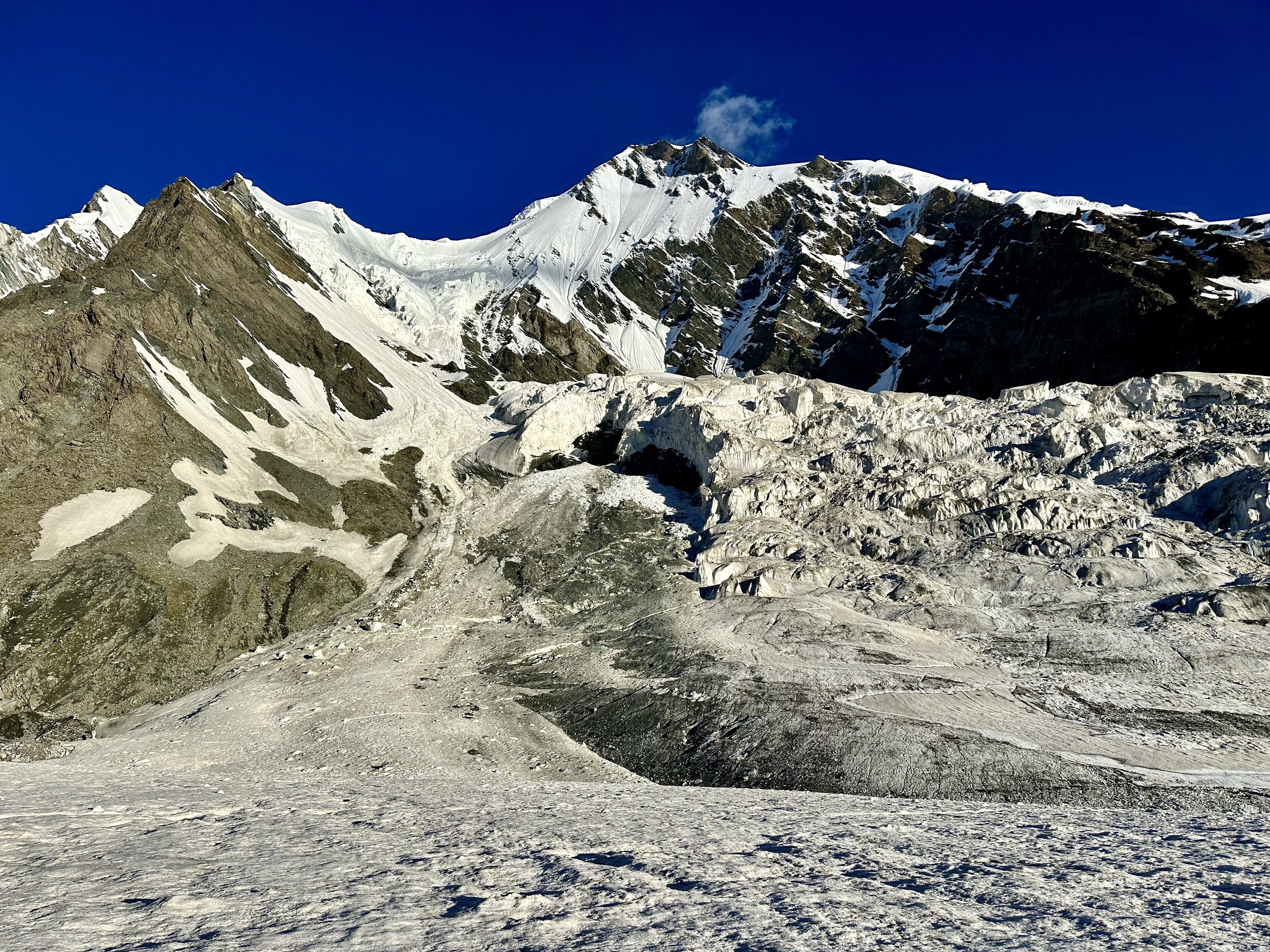
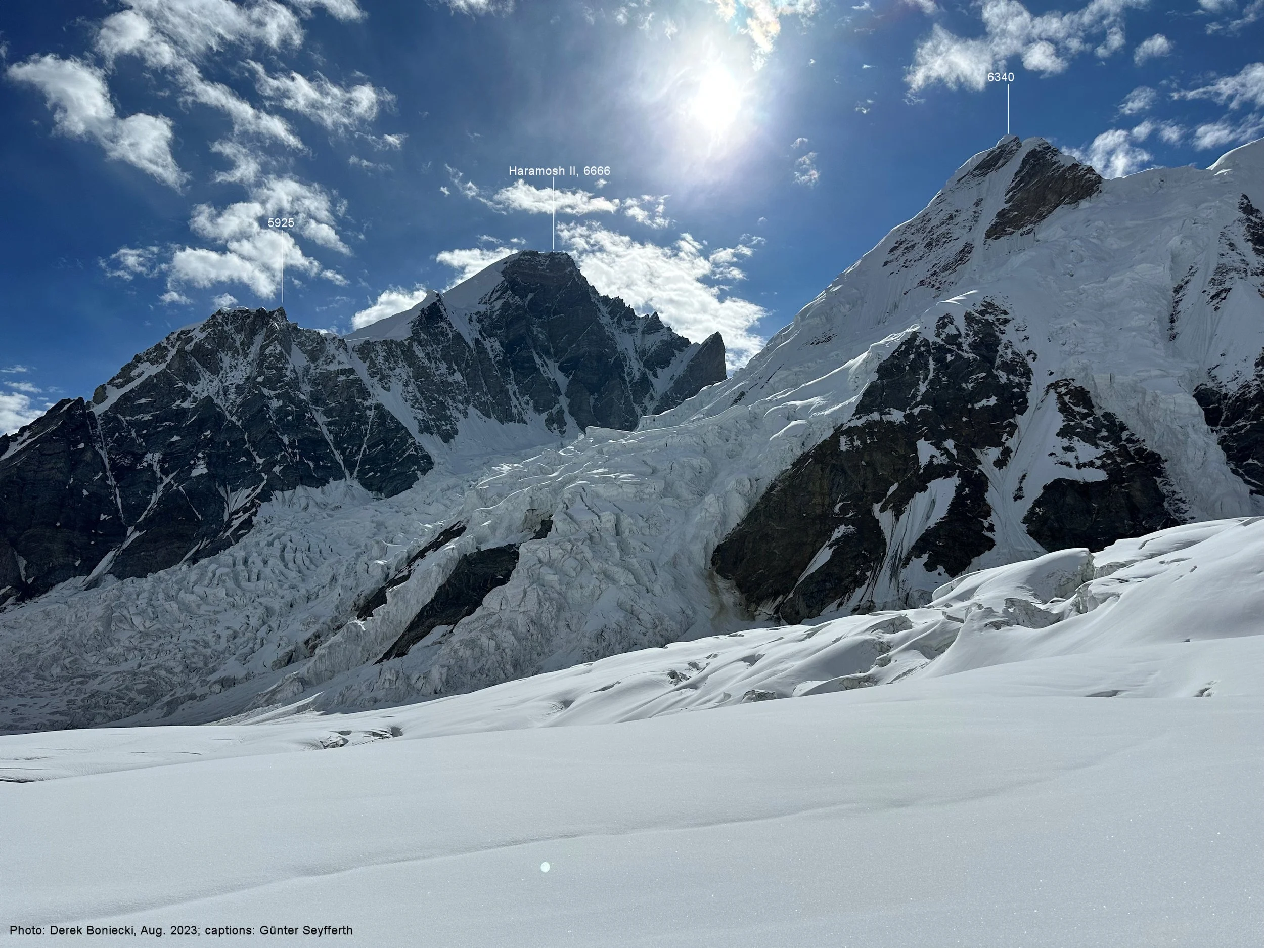
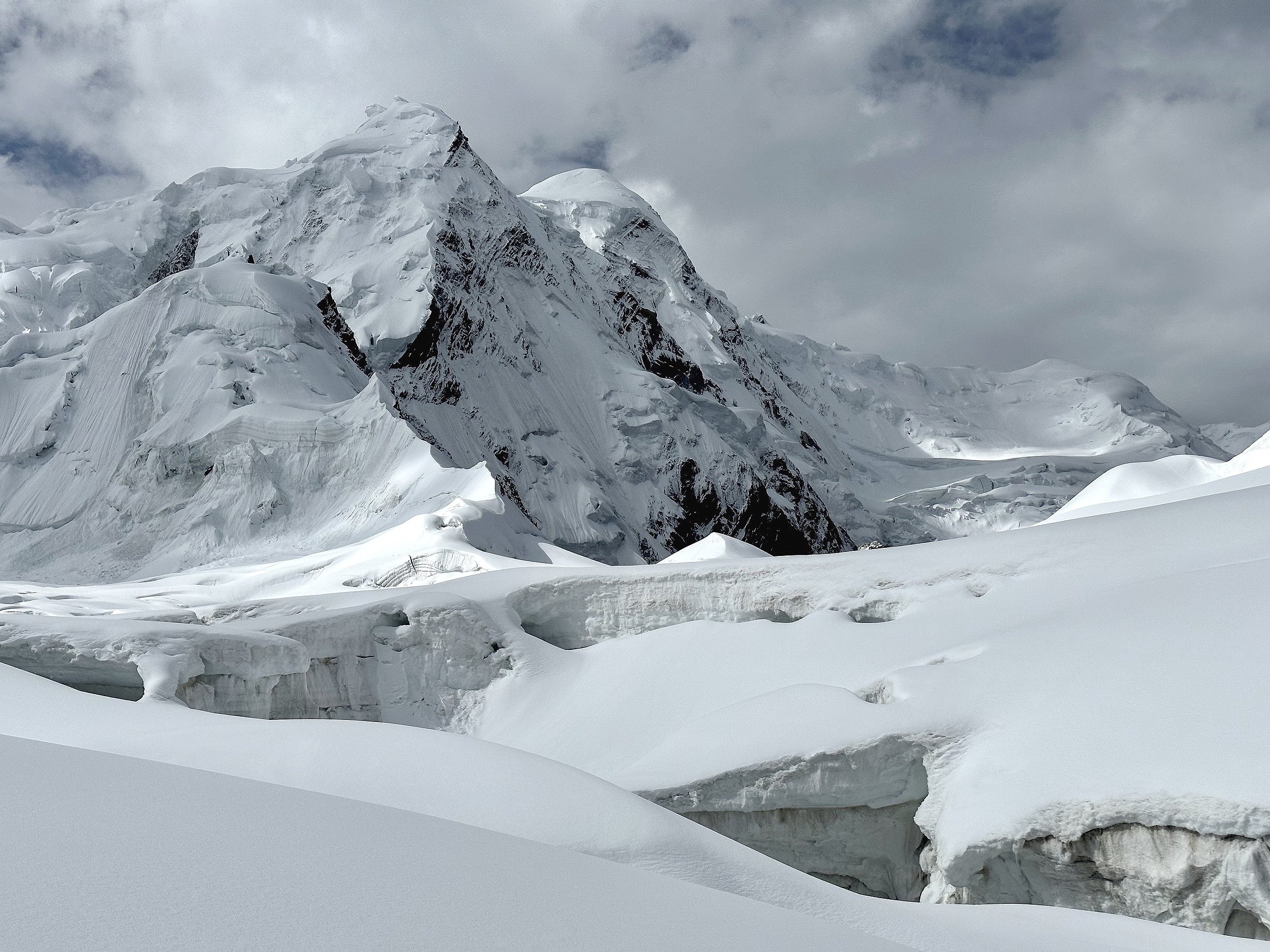
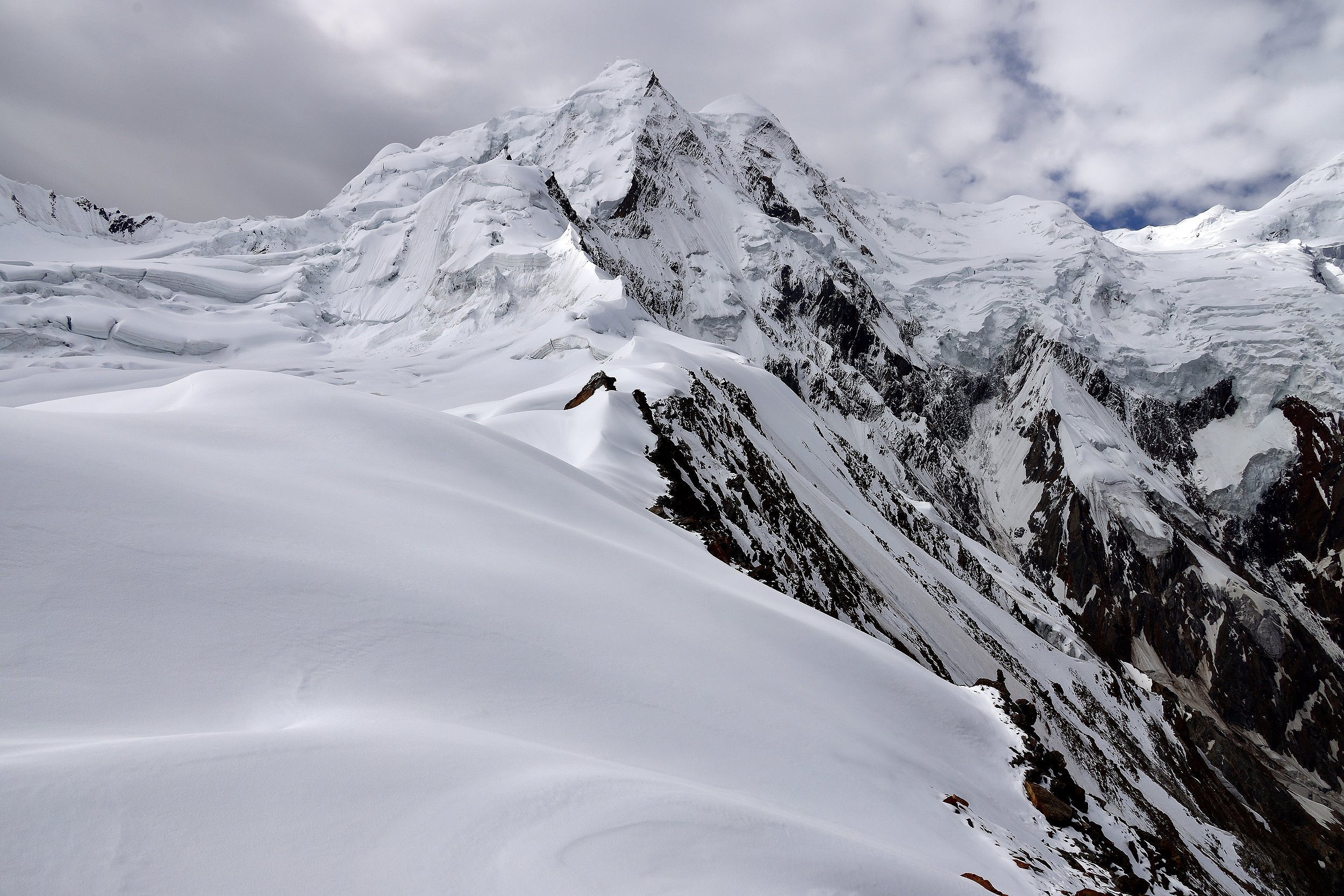
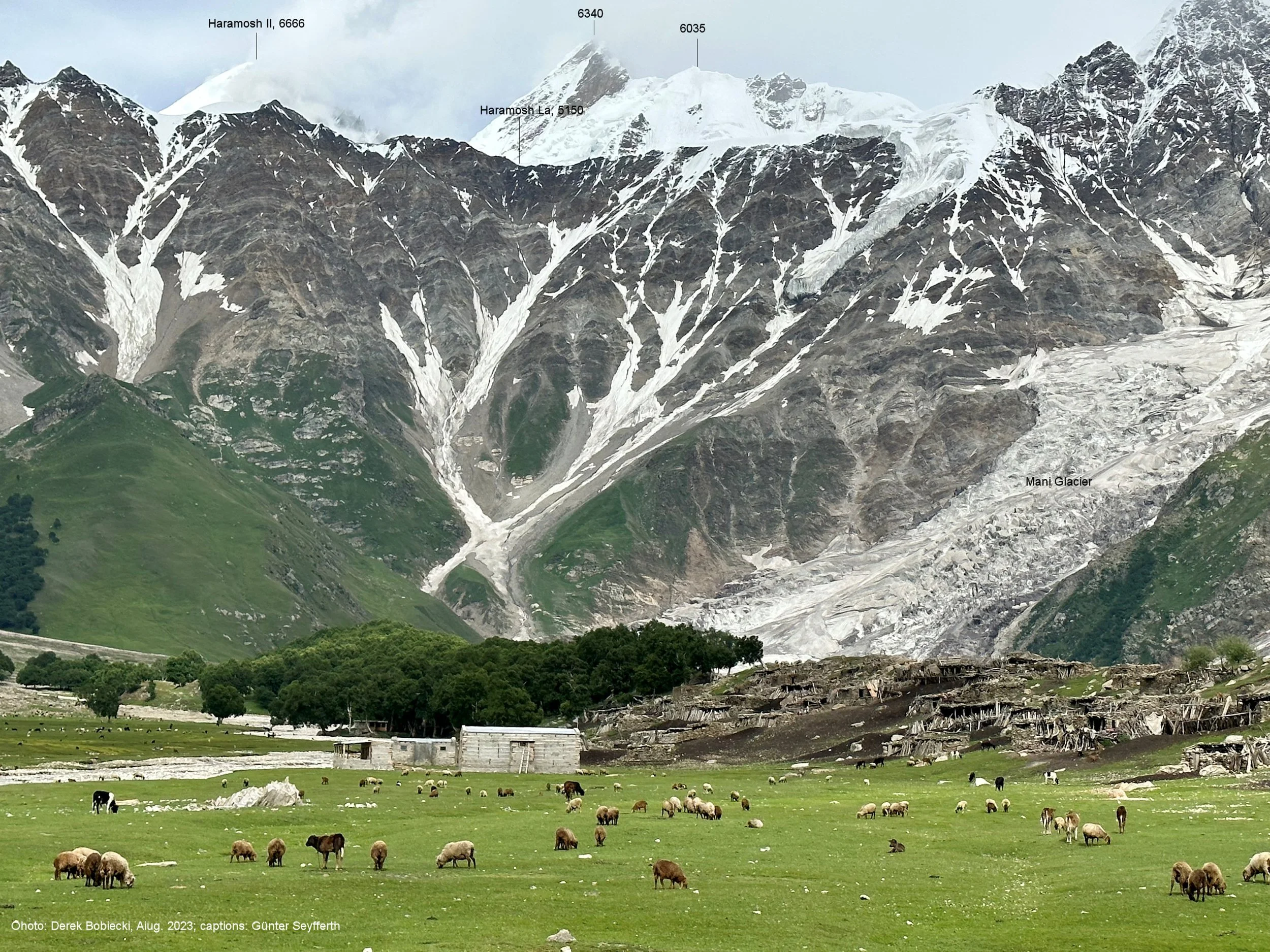
Haramosh 2 6666m.

Haramosh 2

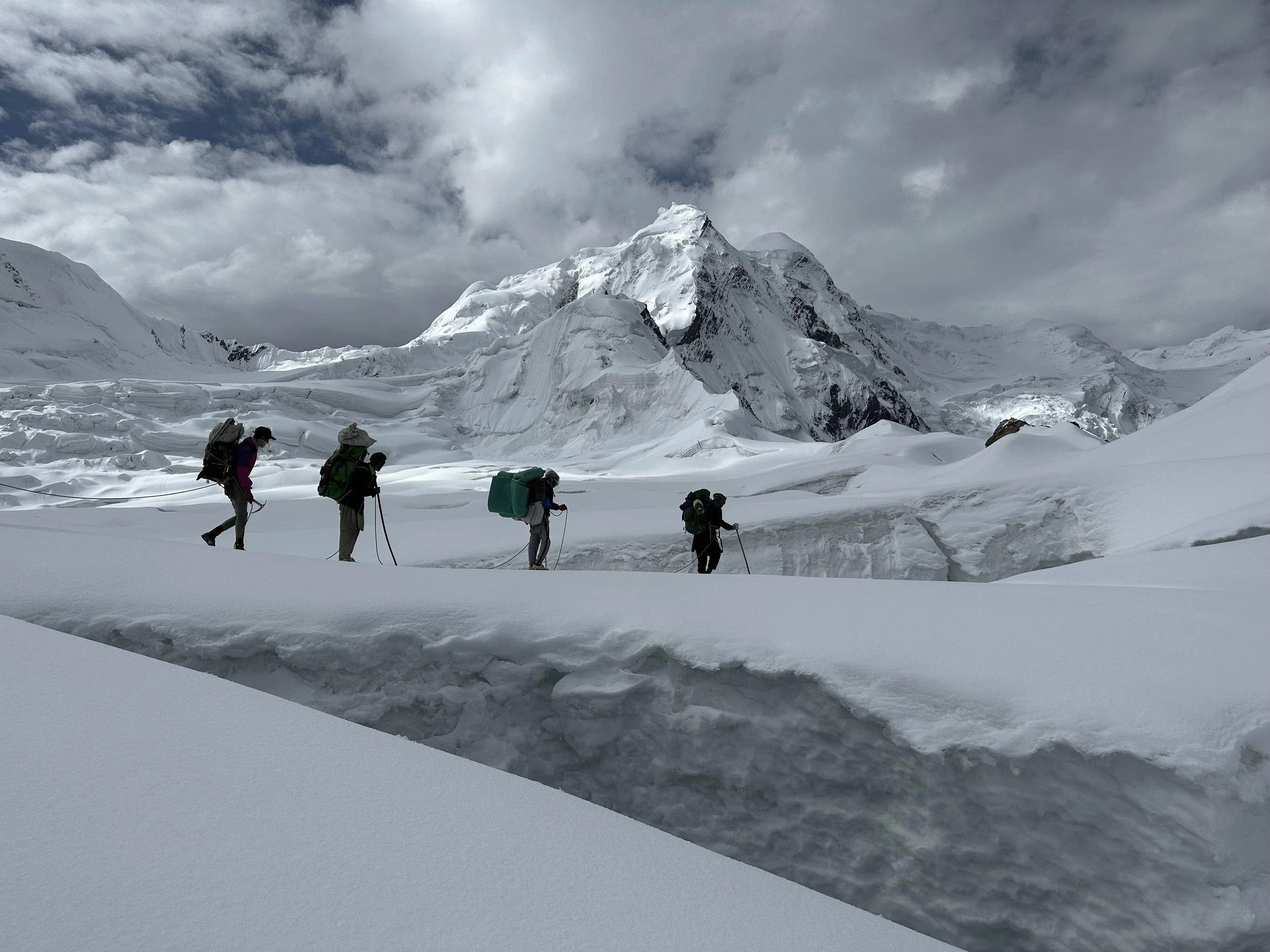
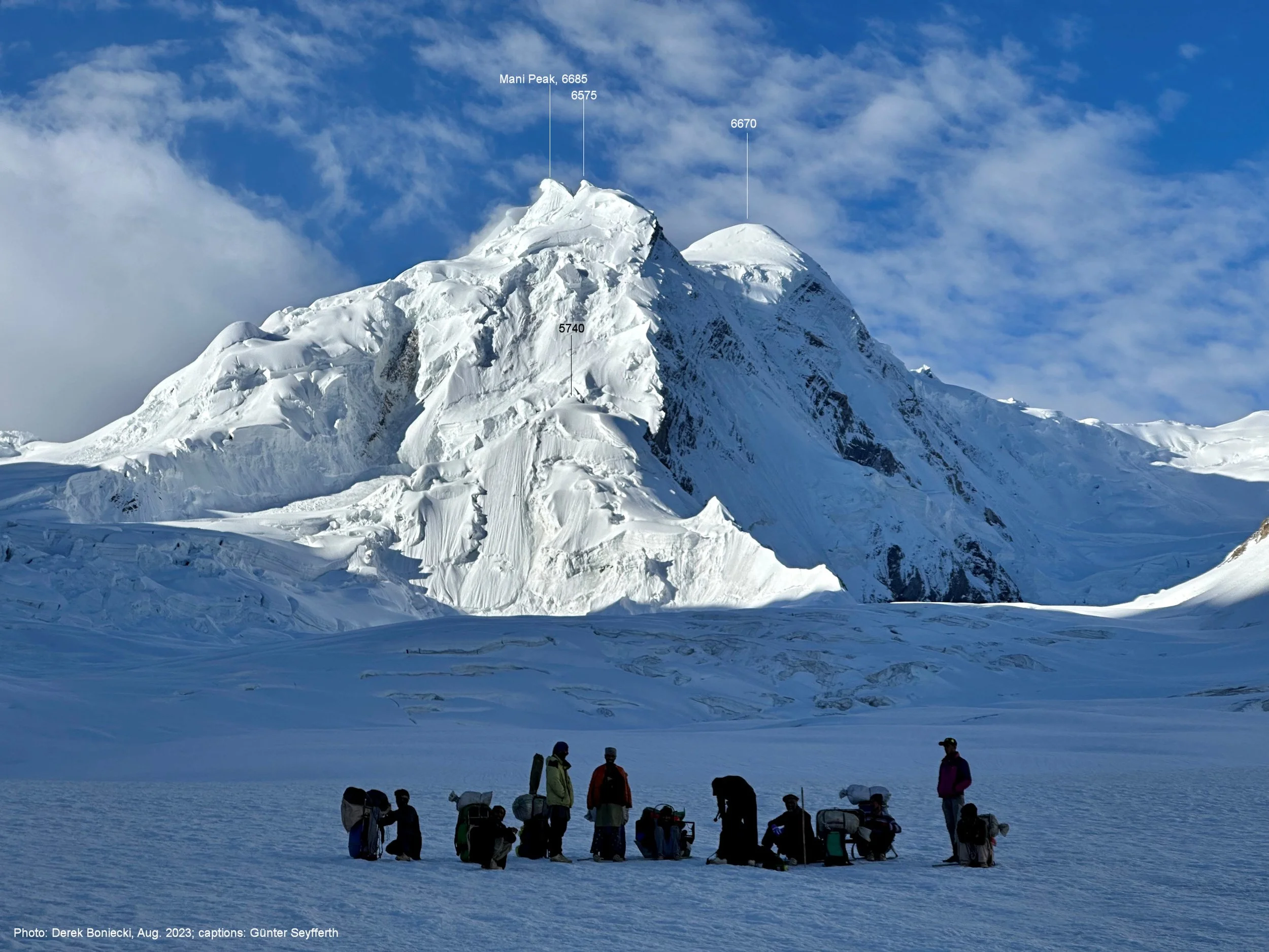
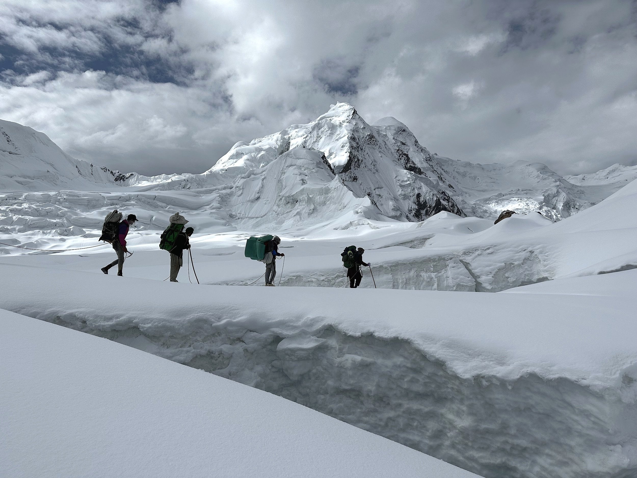
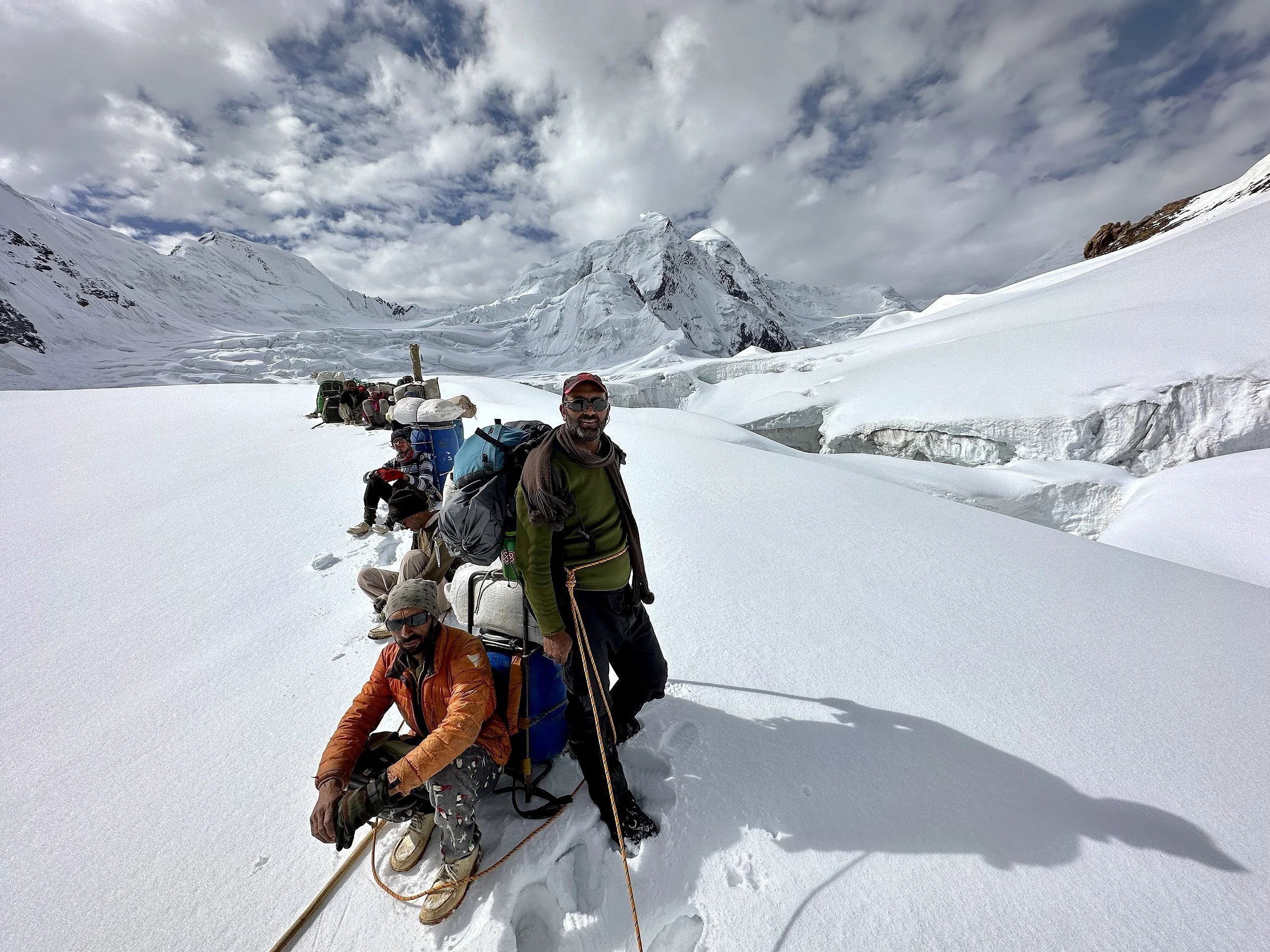
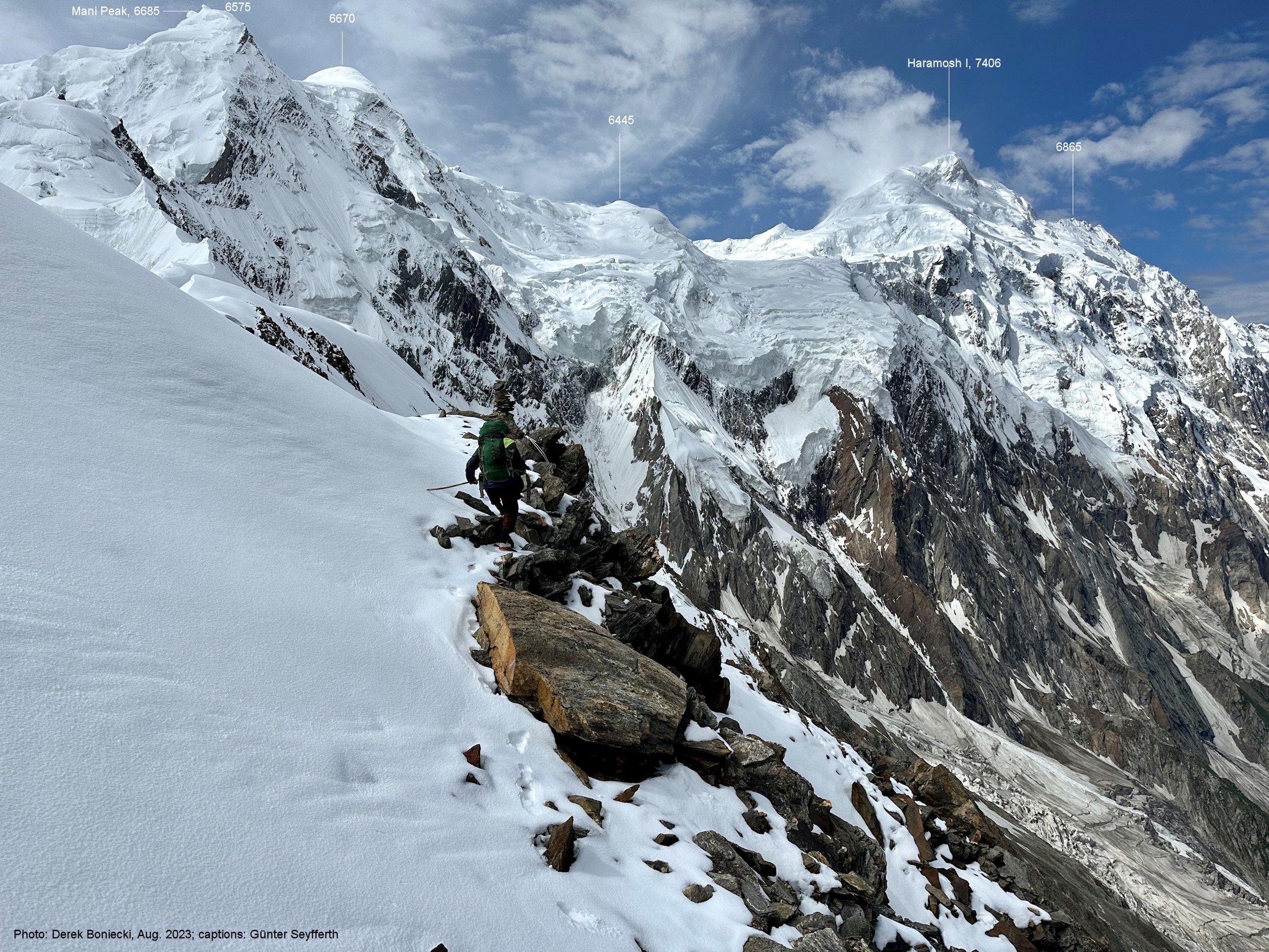
Mani Pk and Haramosh La. See the porters for scale.
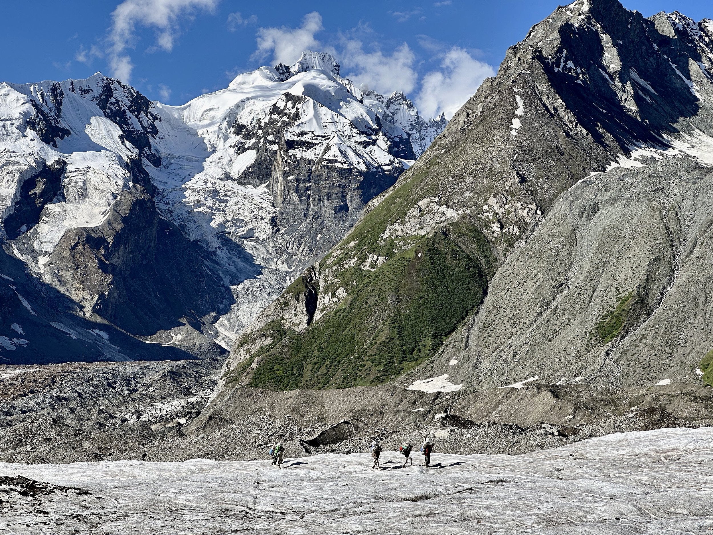
Taking a break before roping up on the Haramosh Glacier.

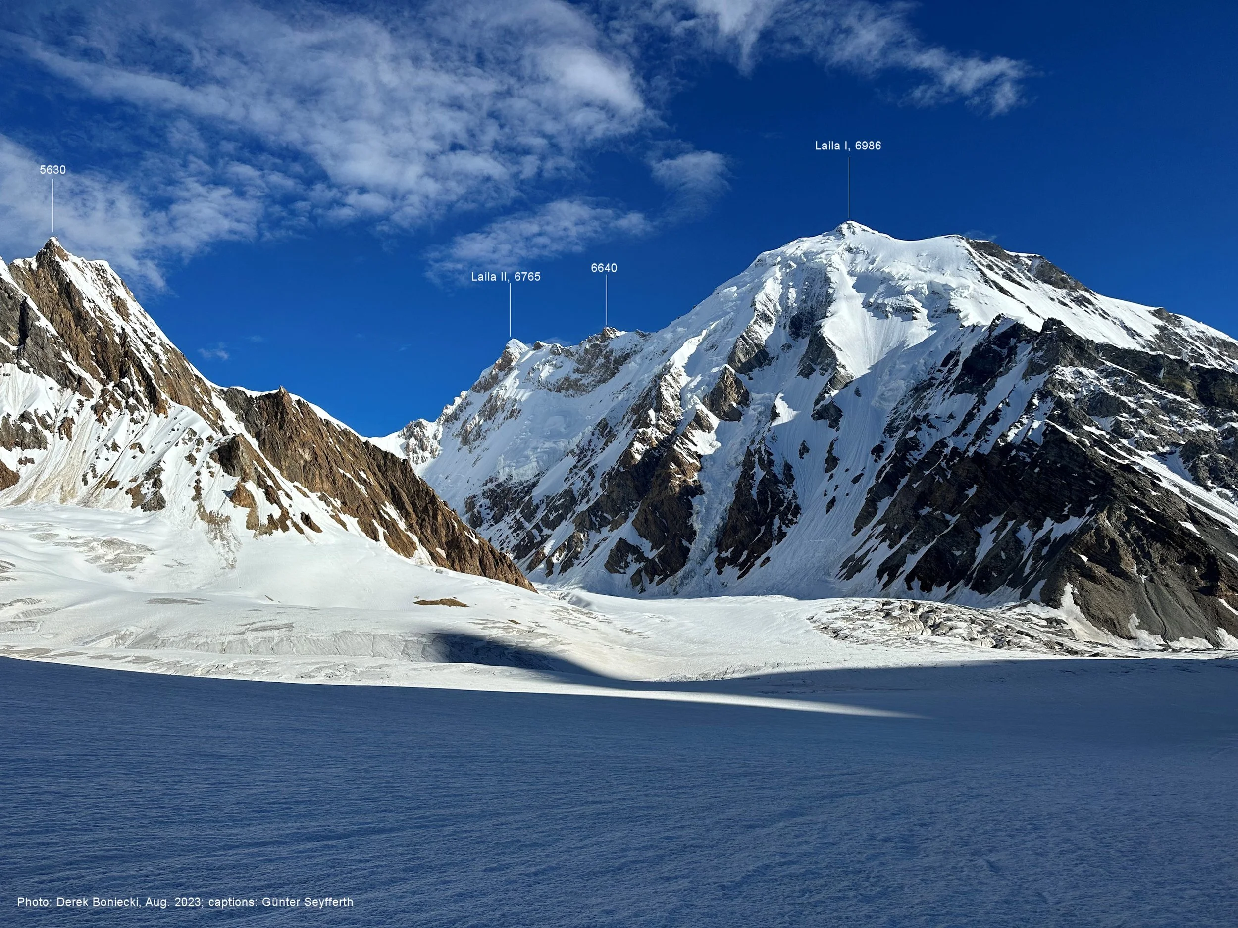
Laila 1 Peak 6985m

Unnamed Peak along the upper Haramosh Glacier.

Sun halo on Haramosh 2


Looking down the Haramosh Glacier. Laila Pk on the left and Haramosh 2 on the right.

Mountains of the Hispar Glacier area above the Chgolugma Glacier


Haramosh 2 from Haramosh La

Haramosh La. Haramosh 1 is on the right.
Add another 100m

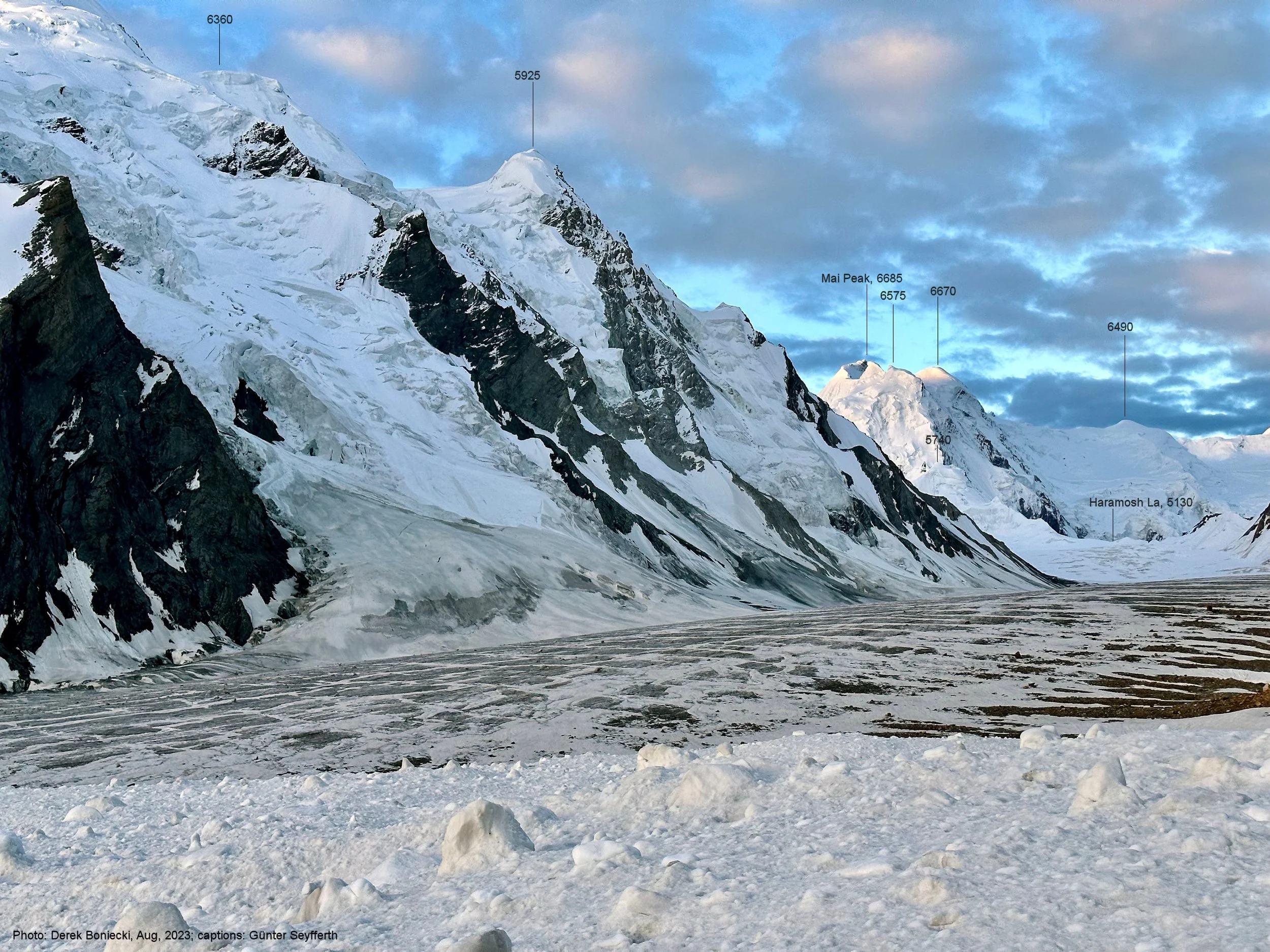
Mountains above Haramosh La
Mani Pk and Haramosh La

Haramosh La, Mni Pk and Haramosh Pk.
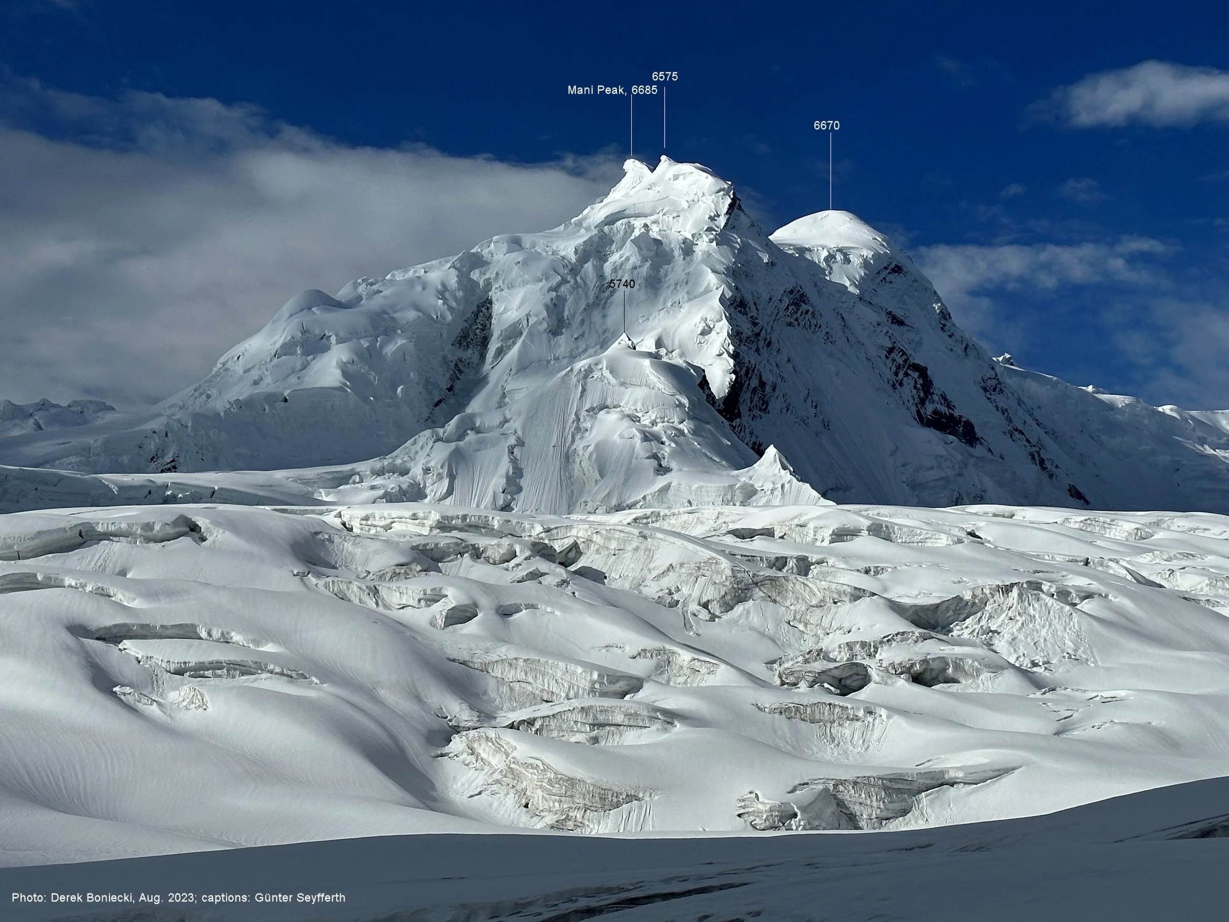
Mani Pk 6685m and Haramosh La 5200m


Mani Pk 6685m, Haramosh La and the steep descent slope

Haramosh 1 Pk 7,406 and the descent slope from Haramosh La.
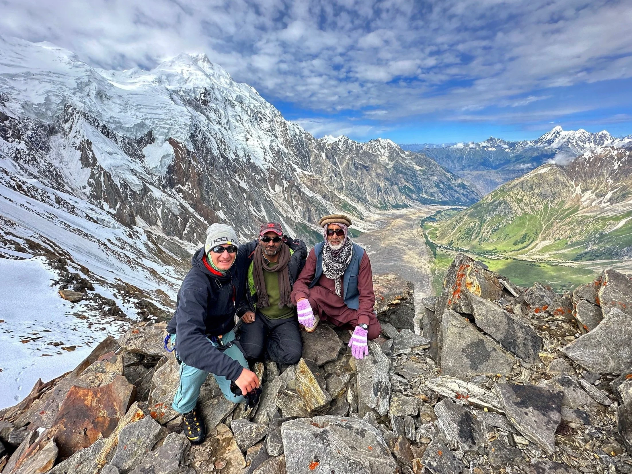
My guide Essan and my guide’s guide Hassan from Arando.

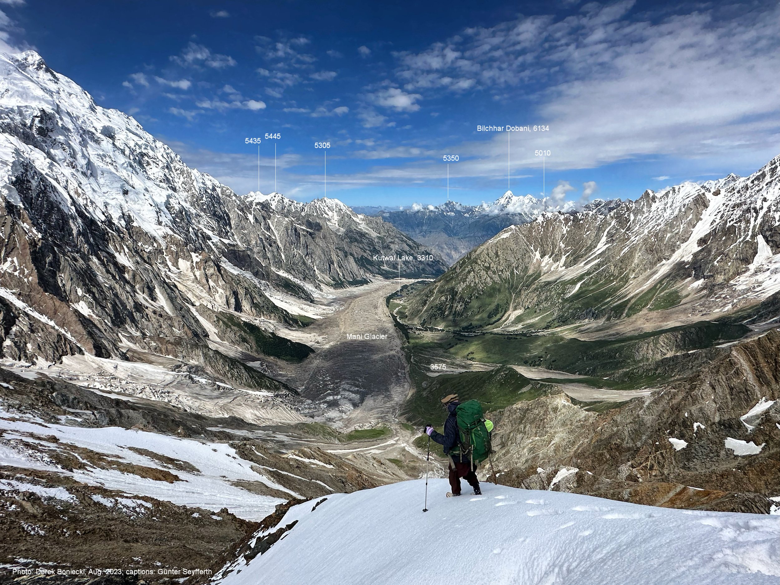
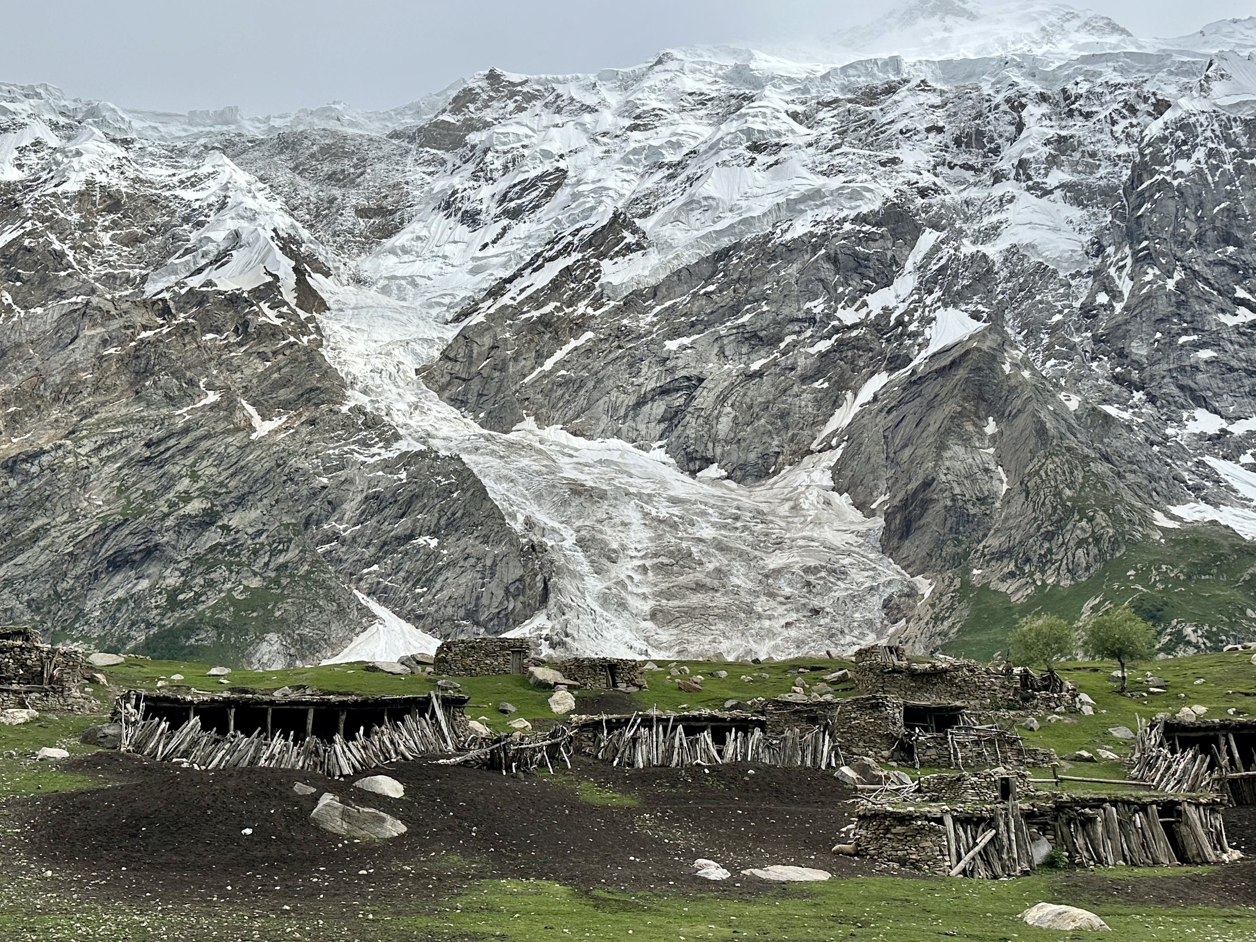
Mani Glacier and the Kutwal Valley. Kutwal Lake (our destination for the day) is 1800m below and 8 km away.

Laila 2 and Rakaposhi on the horizon.
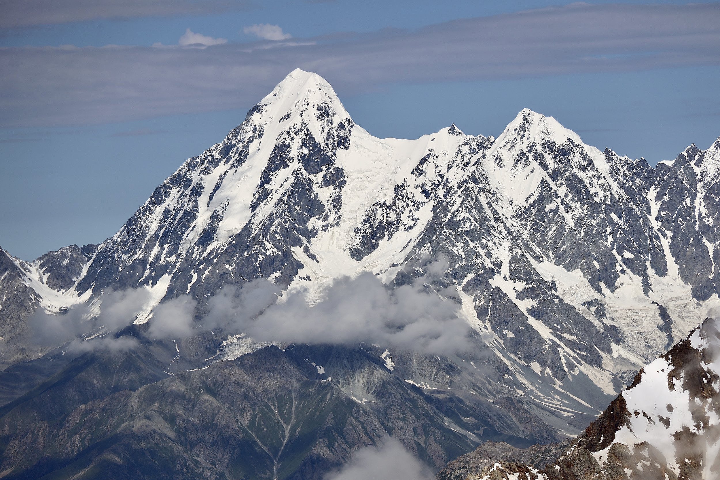
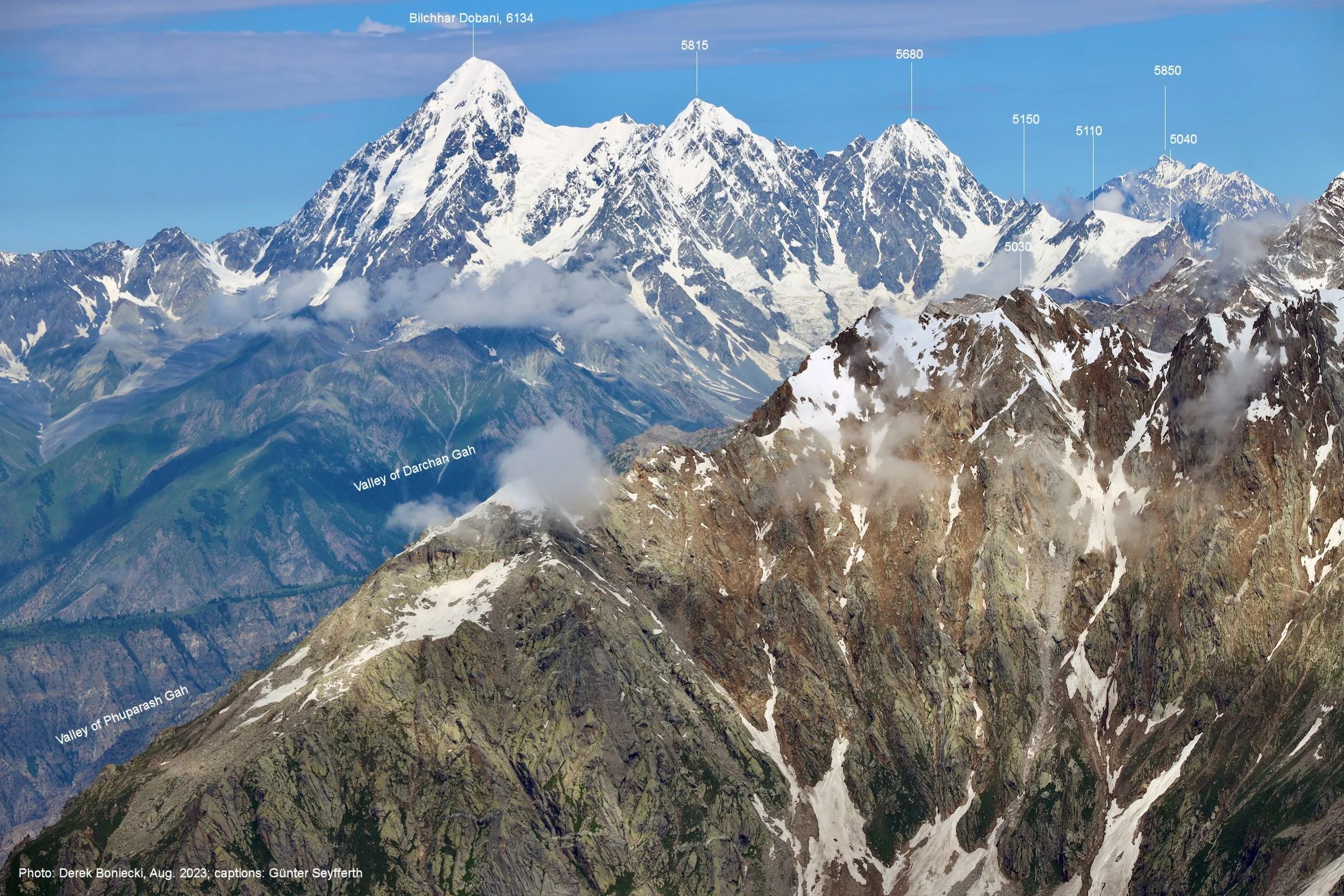
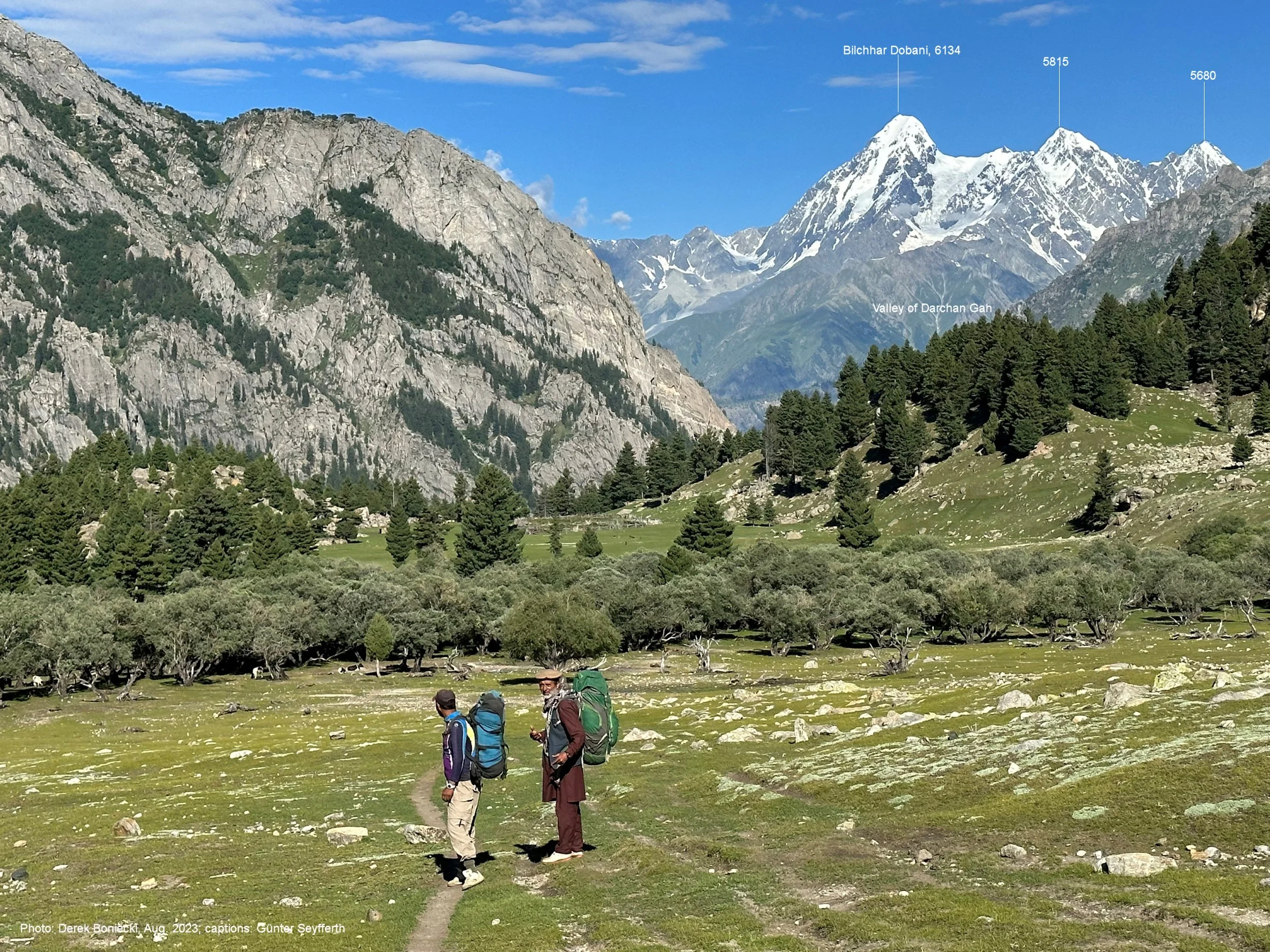
Bilchar Dobani 6134m

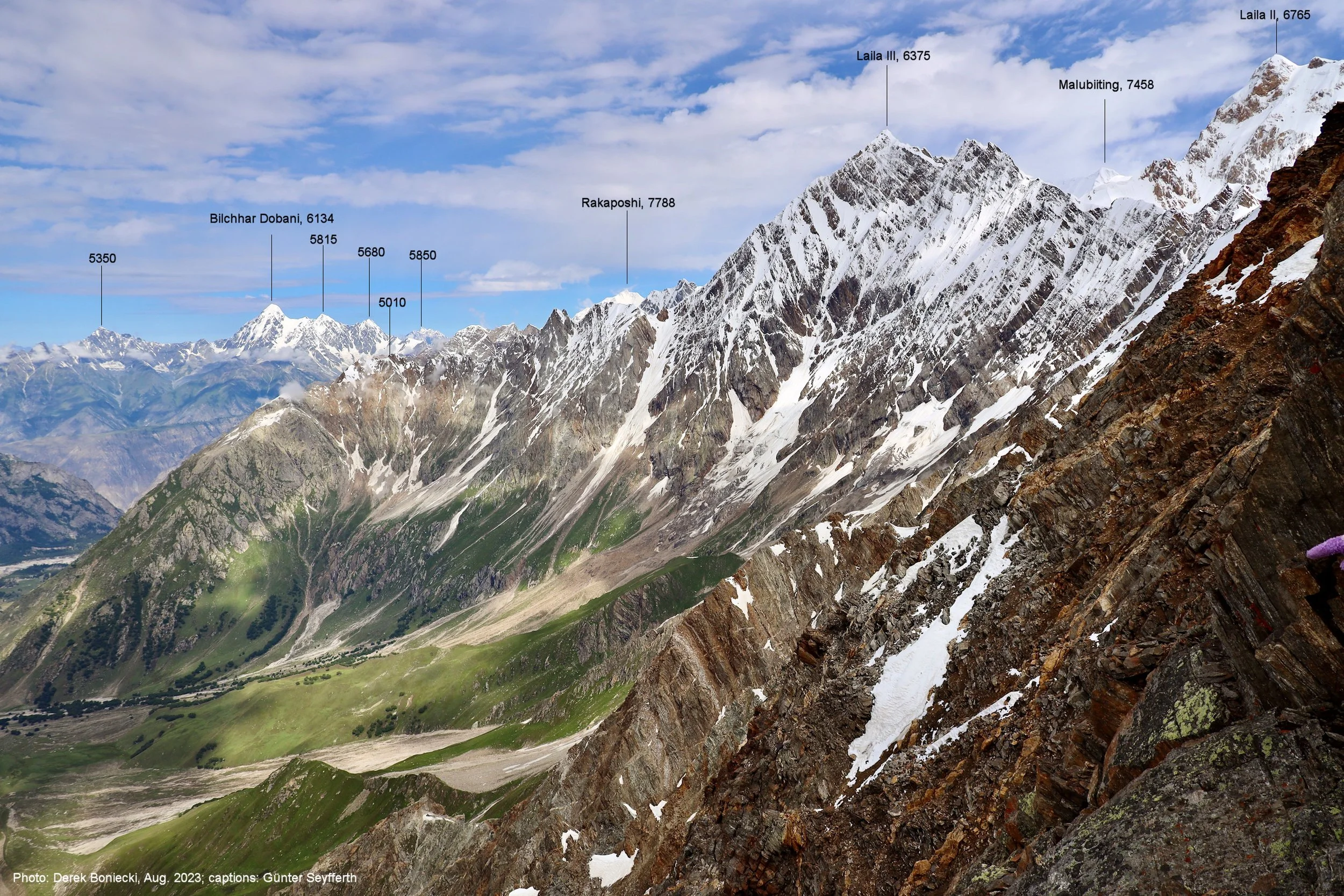
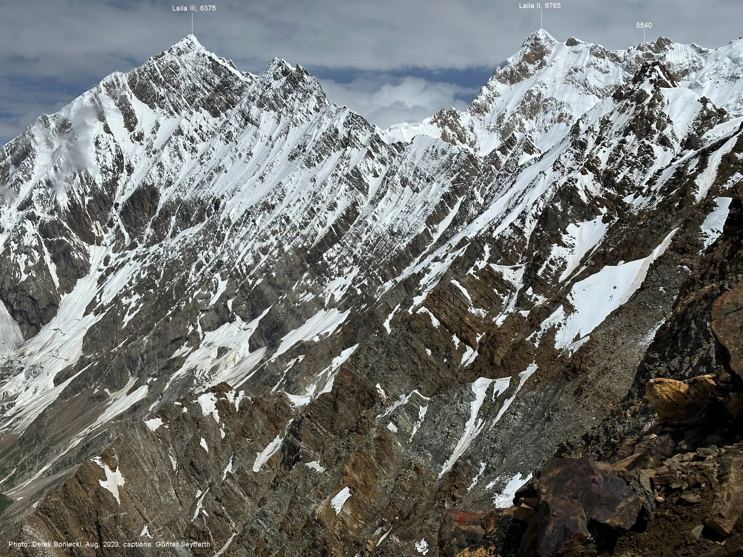
Laila 3 6375m from Haramosh La
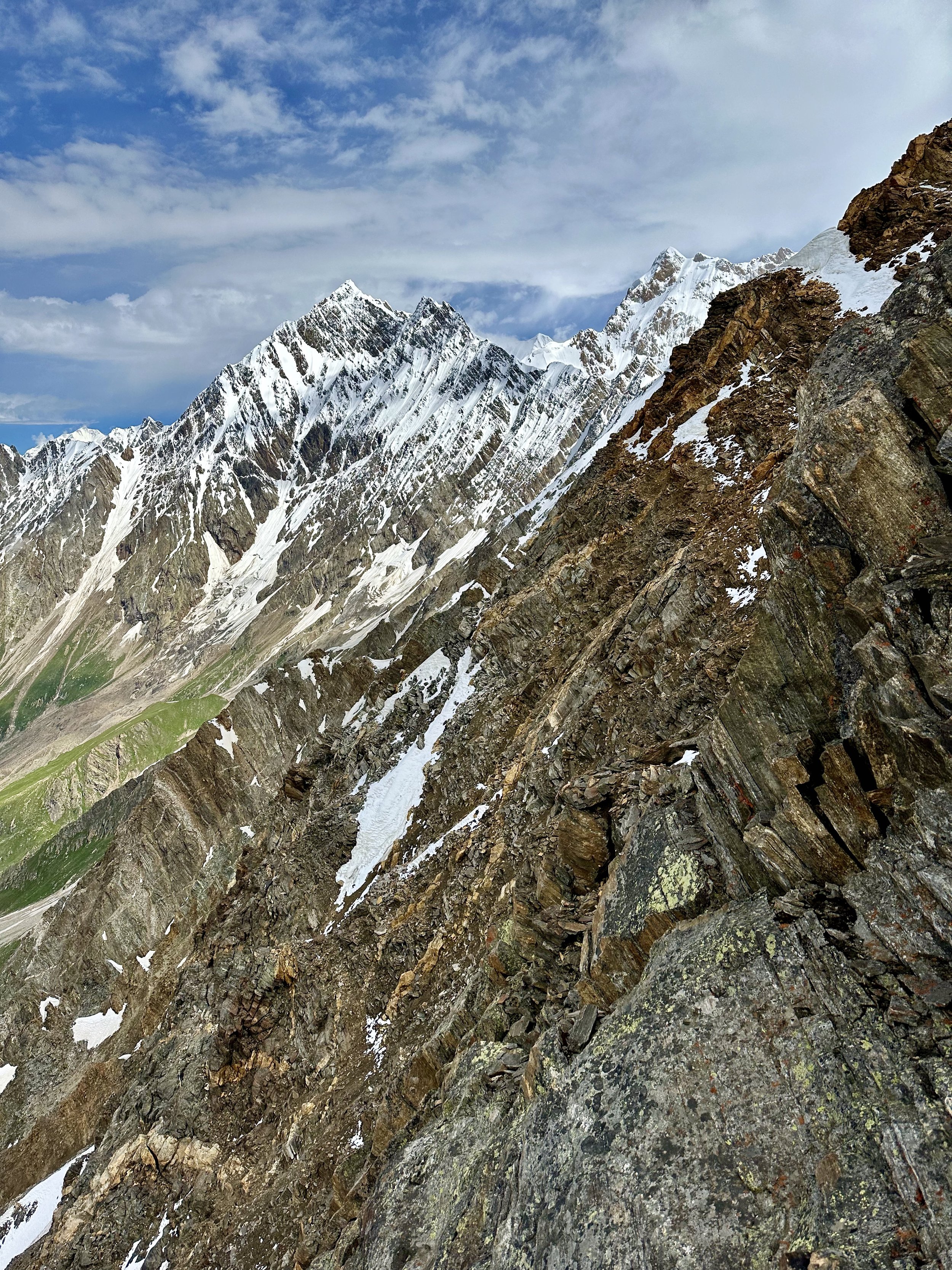
The descent slope. Laila 3 and Laila 2 tower over our route.

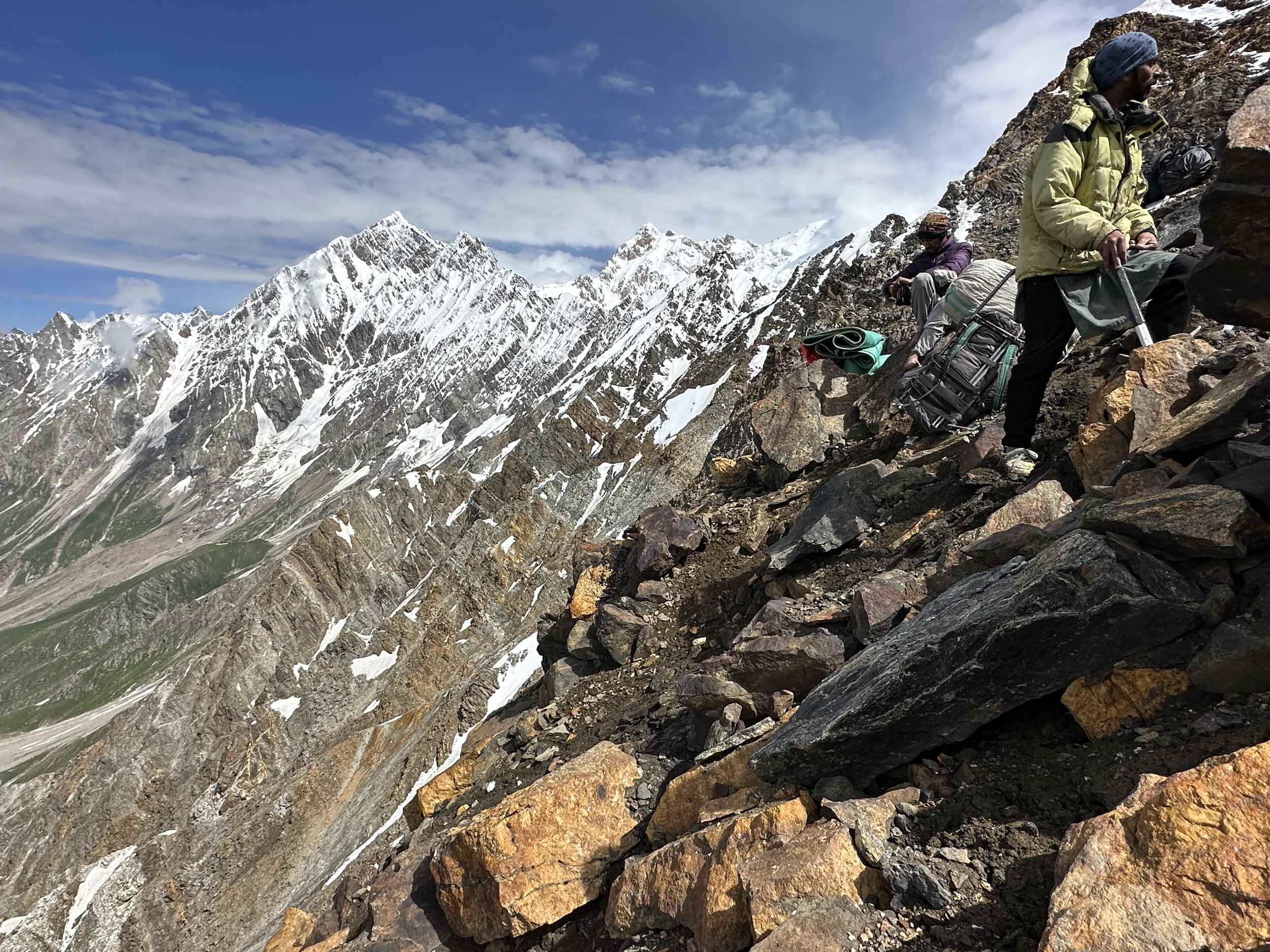
The porters had to be extra careful with the loads.

The descent is quite steep at the top
The grade of the descent slope
Haramosh La 5150m and Haramosh Mountain 7409m ( on the right).

Hassan the guide from Arando is looking up to check on the the descending porters.

Coming down Haramosh La. Mani Glacier is below.

Hassan has balls of steel - no rope or ice axe, in plastic shoes with steep drop-offs on both sides. I was watching this and slowly realizing that I was next to follow him.
Haramosh 1 Mountain 7409m half way down from the pass.
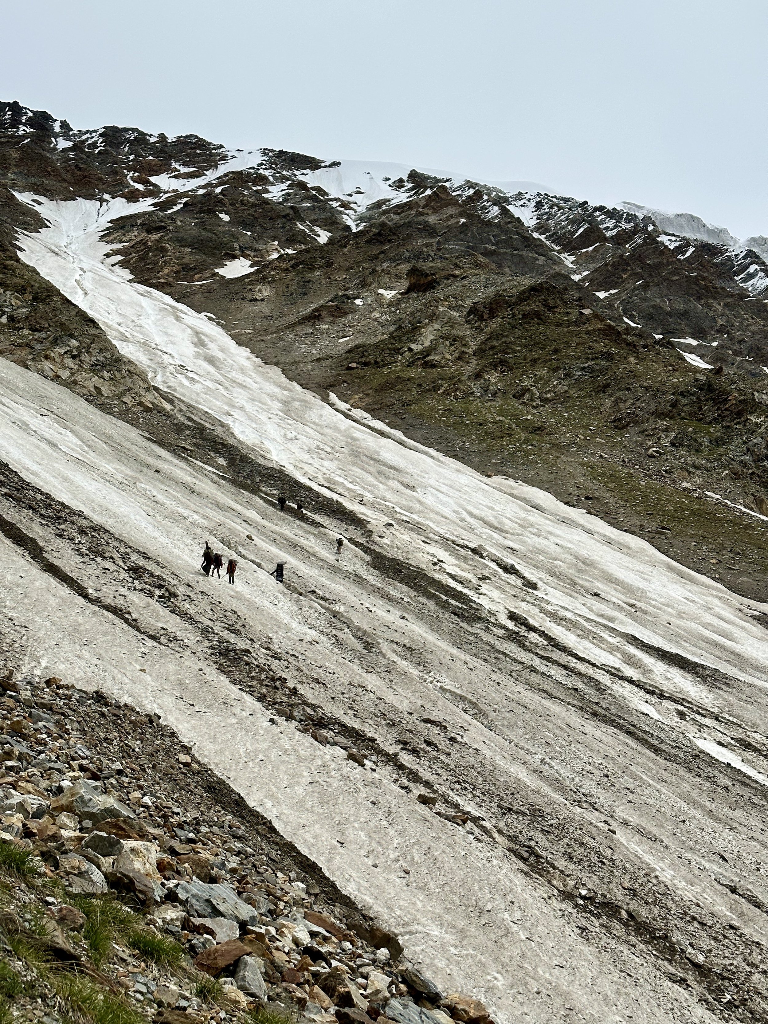
Lower section of the descent slope. We descended from the top of the pass diagonally to avoid rockfall. The slope was very loose and we sent rocks flying many times. Crossing the snow gullies in plastic shoes was quite challenging for the porters but no rope was used at any point.
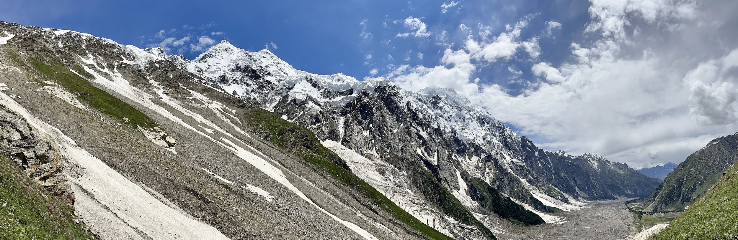
Mani Pk and Haramosh from the descent of the Haramosh La

Mani Pk and the Haramosh La from the bottom of our descend route.

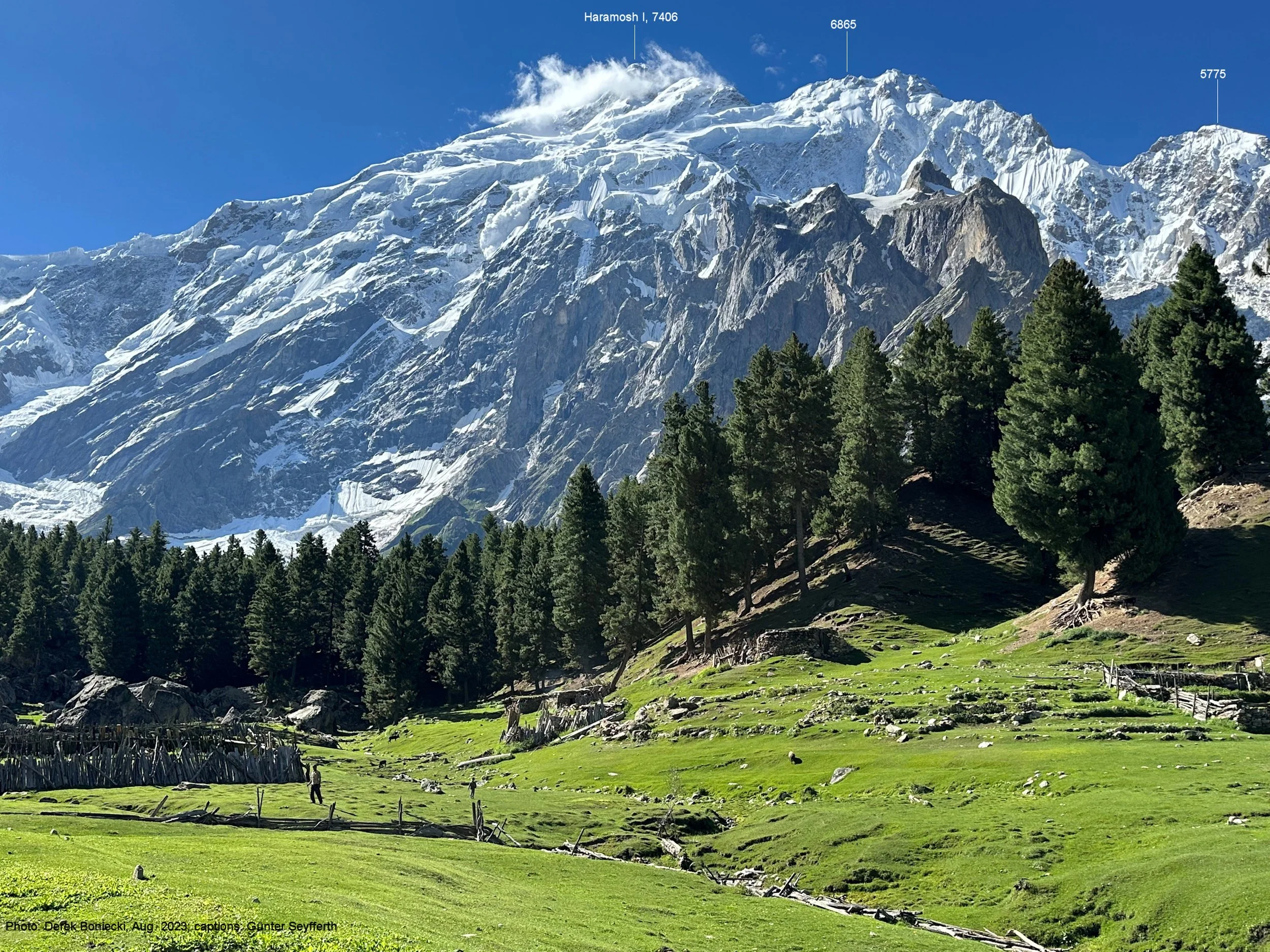
Haramosh 1 Mountain and the head of the Kutwal Valley.
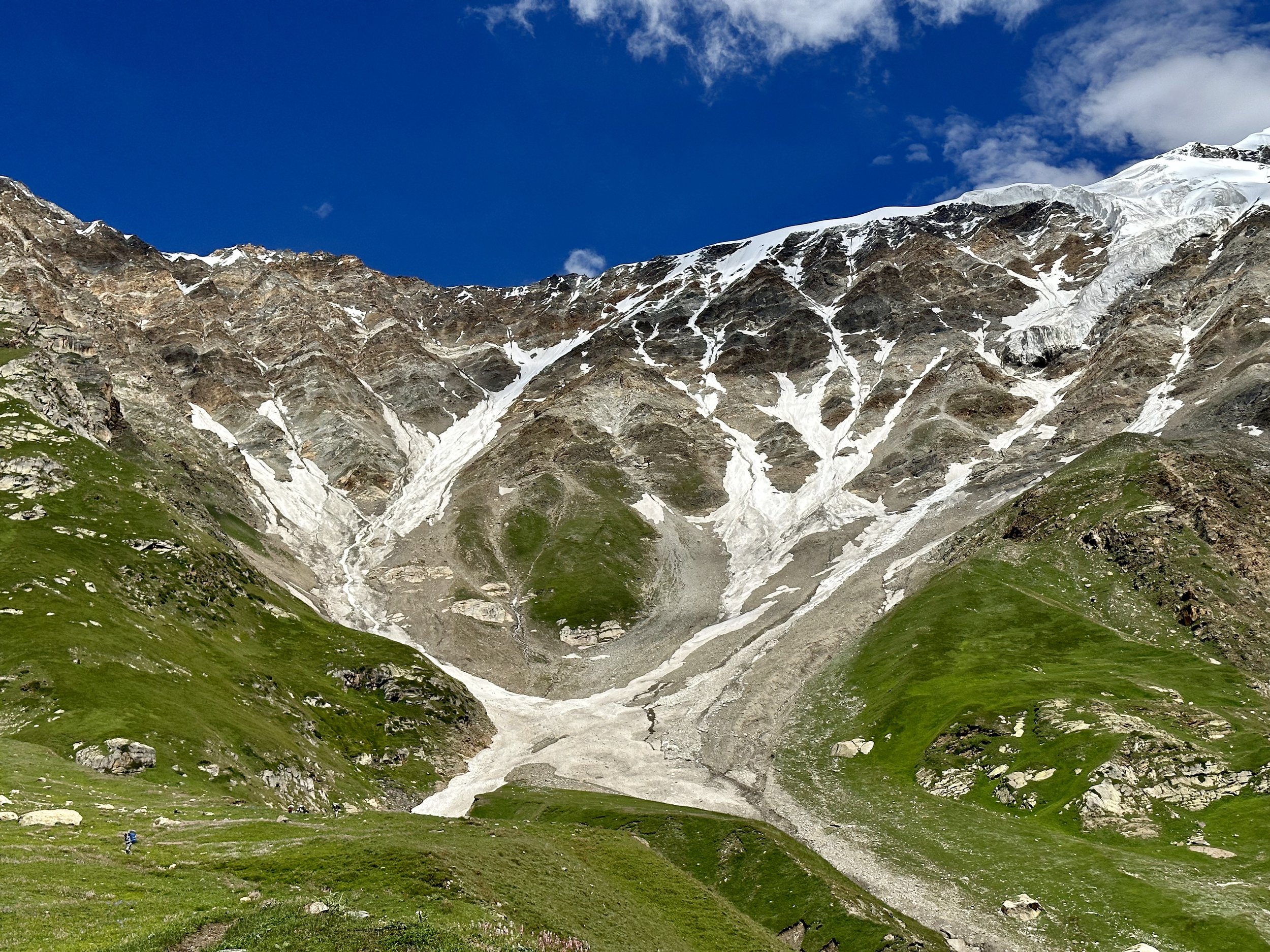
Haramosh La 5150m and our descent route.
Haramosh 1 Mt 7409m
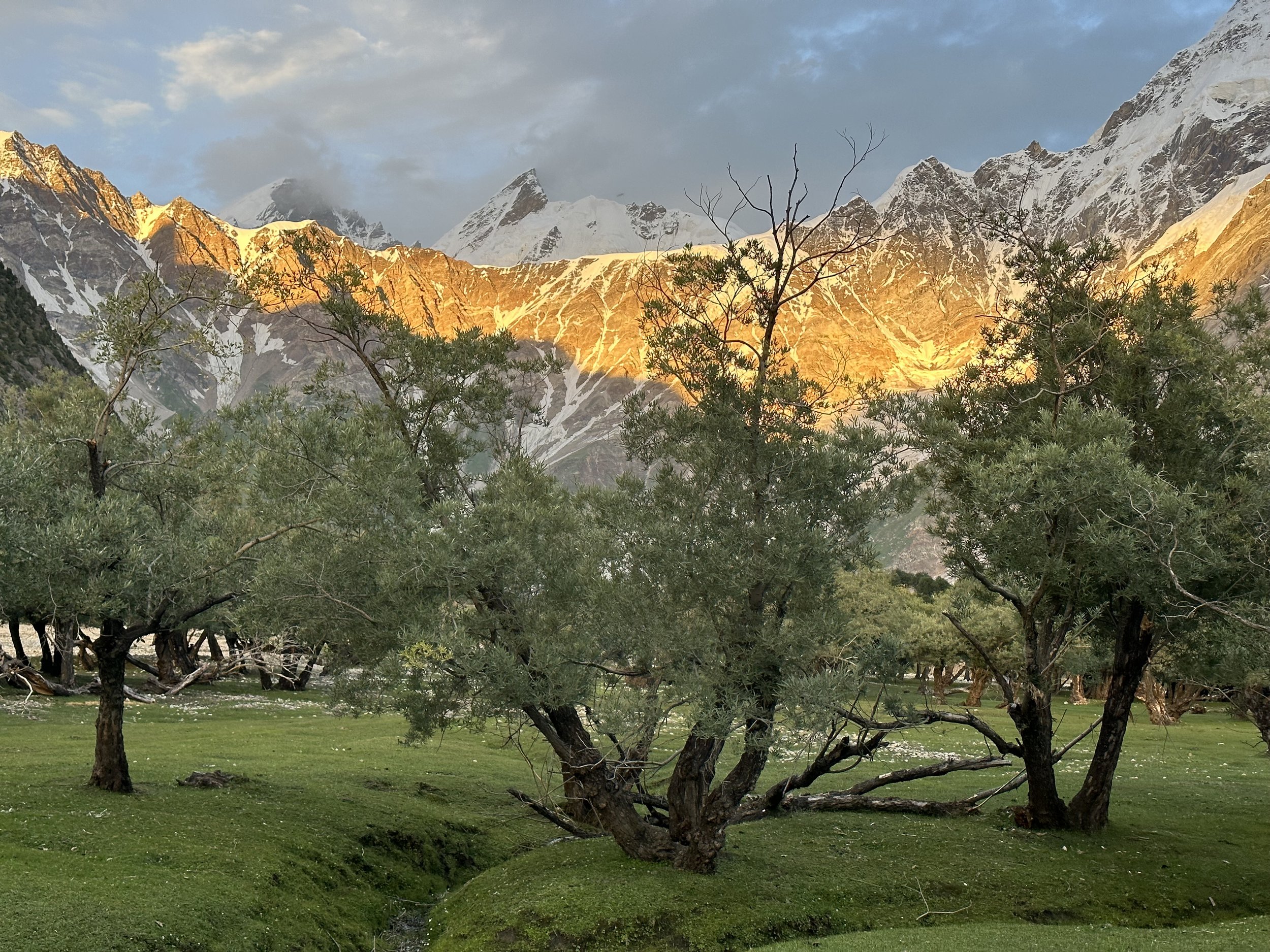
Beautiful sunset on the Haramosh La from our camp at the Kutwal Lake.
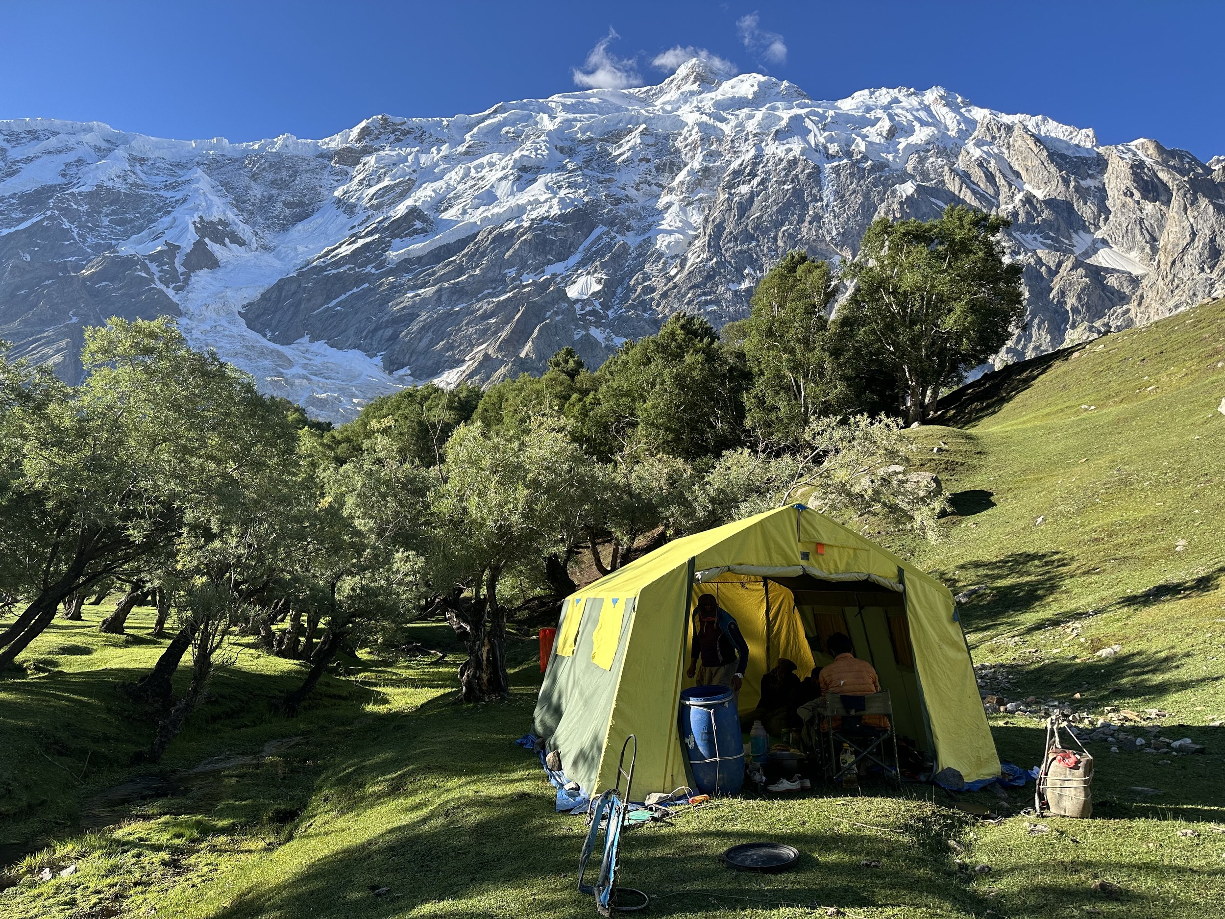
The camp at the Kutwal Lake with Haramosh 1 towering above.
Our Haramosh La team with Malubiting 7453m behind.
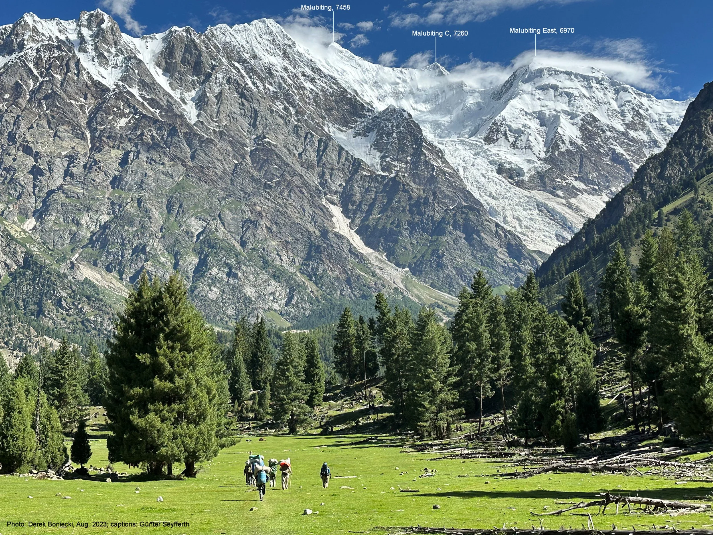
The incredible scenery of the Kutwal Valley. Malubiting West 7458m (centre), Malubiting Centre and East 6970m (right). The glacier flowing from Malubiting is Baskal Glacier. What an incredible place!

Pastures of the upper Kutwal Valley
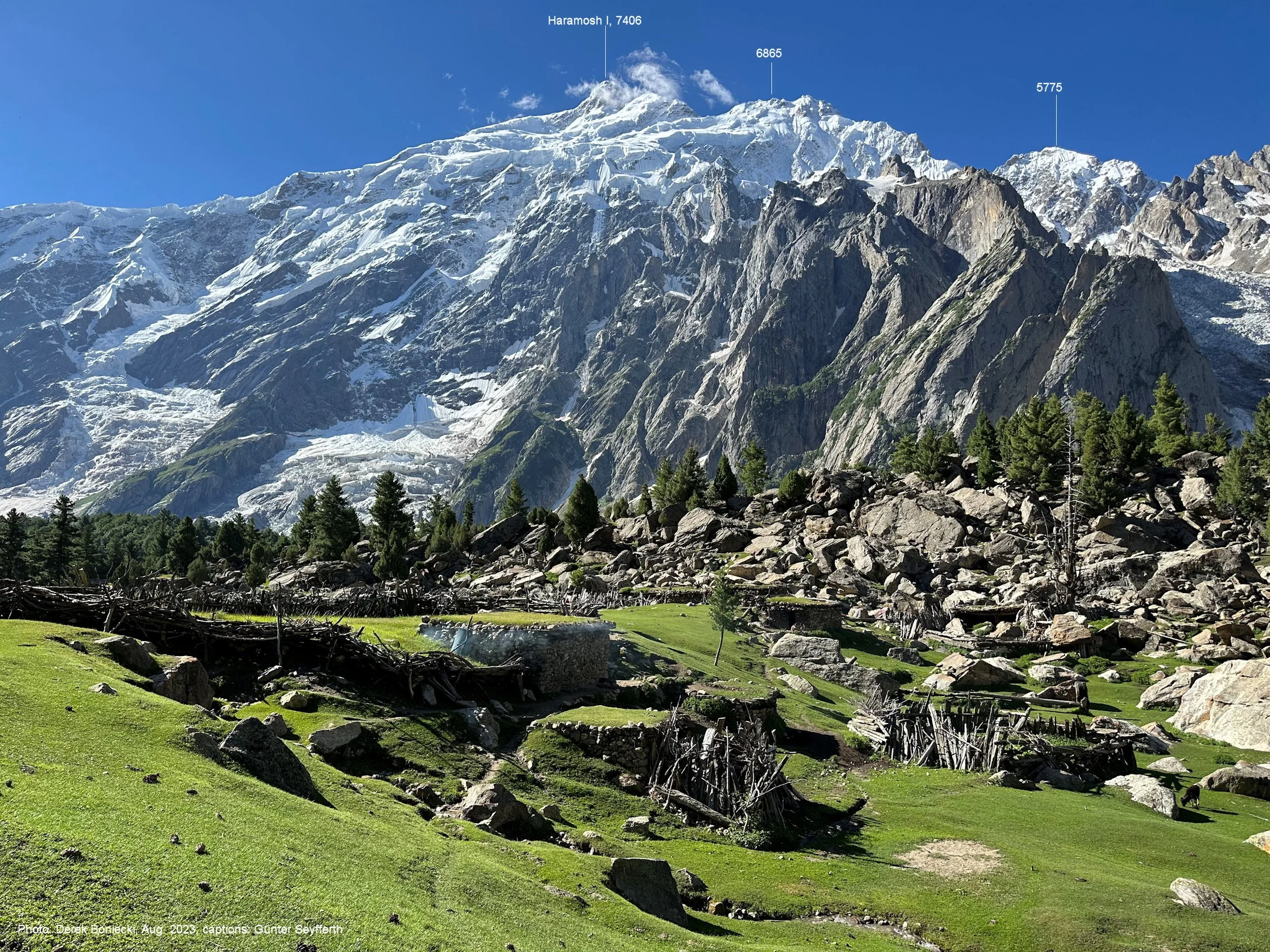
Haramosh 1 and the terminal moraine of the Mani Glacier.

The crazy road to the KKH!
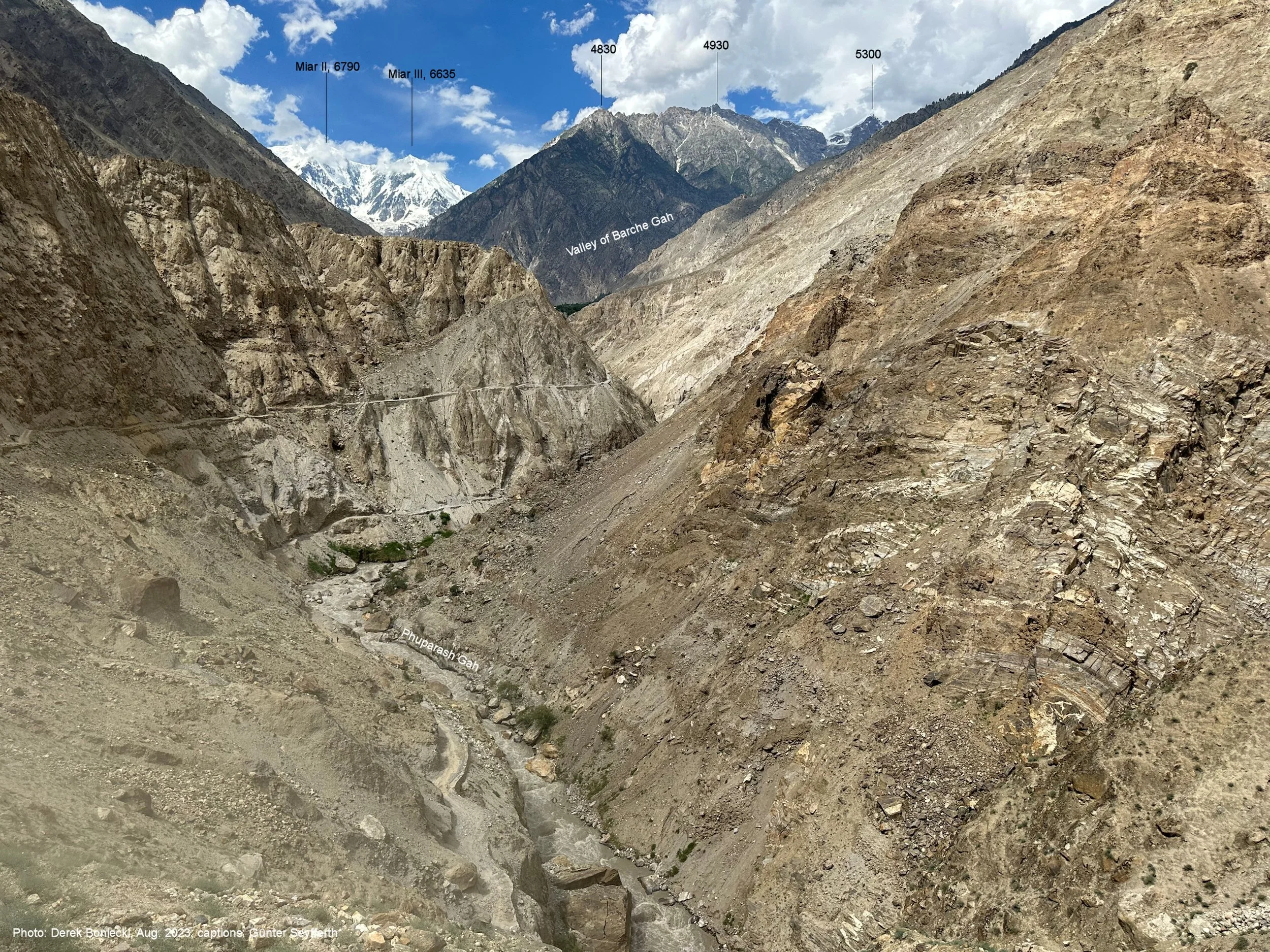
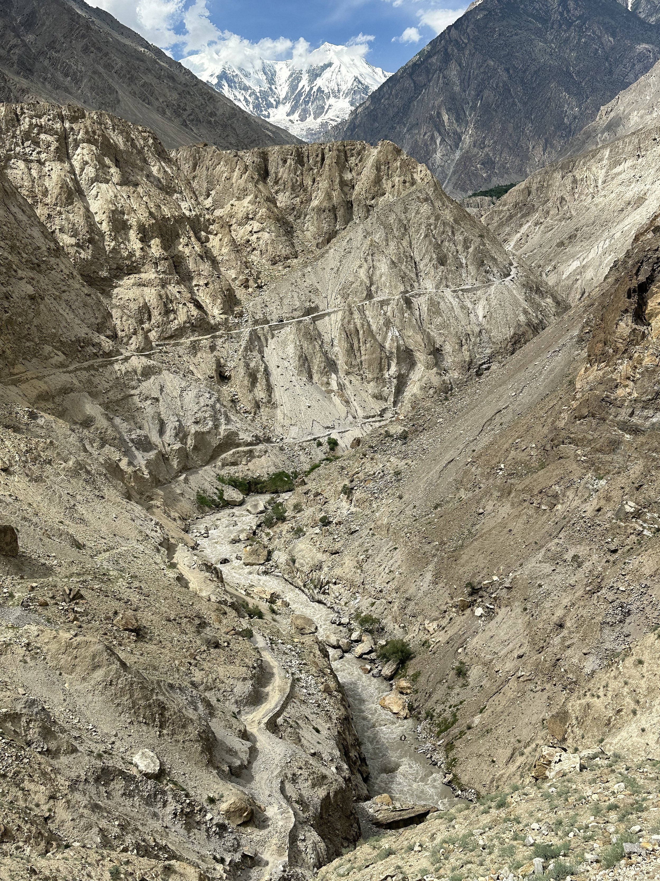
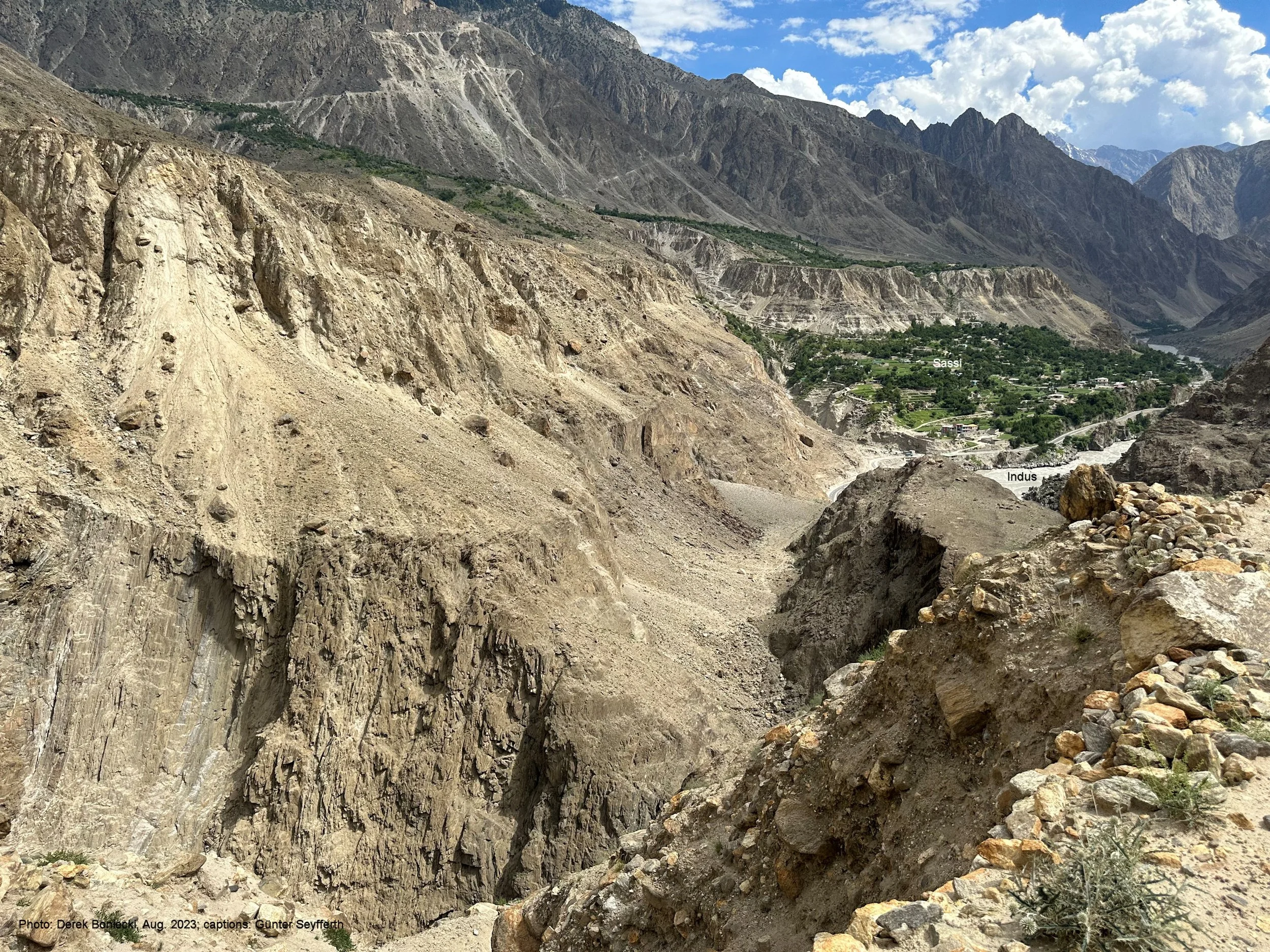
Miar 2 6,790m and 3 Mt 6,635m and the crazy road to Sassi and the KKH.

Sasso and the KKH can be seen below. KKH follows the Indus River Valley