

Thanks to Andes World Travel for putting the Colombia trip toghether for me! I was able to do a lot in a short period because of their excellent assistance.
The first time I have ever heard of the Lost City was in June of 2021 while in COVID government imposed quarantine after my trip to Mexico. Since Colombia is one of the few open countries, I thought: why not check it out?
The Lost City is not really “lost”. It is located in the mountain range of Sierra Nevada de Santa Marta on the Caribbean coast of Colombia. The mountain range is the highest rising mountain range in the world in terms of distance from 0m to 5800m in 20 miles. It is separate from the Andes and much older in geological terms. It is also wilder and some areas are very hard to access either because of the closures by its inhabitants or the due to its inaccessible terrain.
As it turned out, the trek is fairly popular and well known, at least in Colombia. The best time to visit is in December and January. I picked the rainy season. In addition to the heat and humidity of 85%, we were met with a crazy amount of rain and very high rivers. At one point it became doubtful whether we would be able to get to the archeological site as the rivers were just too high. I was told by the guide that it does happen especially during the rainy season.
For me the main appeal of the experience was the opportunity to trek through the hot and humid jungle and to meet the local Kogi Indians who live in these mountains. They have an interesting and sobering outlook on human relationship with nature. We, the younger brothers as they call us, are destroying the natural world and upsetting the balance causing many natural ills. They have been saying that for the past 30 years or more but no-one seems to listen…(See the BBC documentary From the heart of the world, the elder brother’s warning.)

Sierra Nevada de Santa Marta from the air


We were supposed to cross this river the following day. It did not look promising…

On the way to the trailhead from Santa Marta. Stocking up on some fruit!


The coastal range of Santa Marta Mountains is lush and full of life!

You can see the ocean in the distance.

We crossed the mountain ridges on the horizon. The Lost City is located at an altitude of 1200m somewhere beyond the mountains on the horizon.


At the trail head. The colourful machetes are very common in Colombia. The rubber boots would definitely be useful for walking!

The trailhead is located at the village of Machete Pelado (which translates as Drawn Machete - apparently dating to the times when local differences were resolved with the liberal use of a machete). One can hire a horse but I am not sure how far would the horse go or how comfortable the ride would be. I think if you need to hire a horse, you probably should not be doing this trek.

One of the locals

The trail is carved by water from huge and frequent rains. At some spots the trail resembles a small canyon a few meters deep! The water just runs in the bottom of the canyon and one has to walk right in it.

Walking through the trail/creek. Everything is wet and nothing dries until the sun comes out.

Our first camp. We reached it in a torrential rain - I have never seen such an amount of water come from the heavens. And it rained for hours. Rain jackets are useless as everything is just soaked through. We changed into dry clothes for the night but had to put the wet ones back on in the morning.

Normally this is a small creek but after the rain it is like a flush flood!

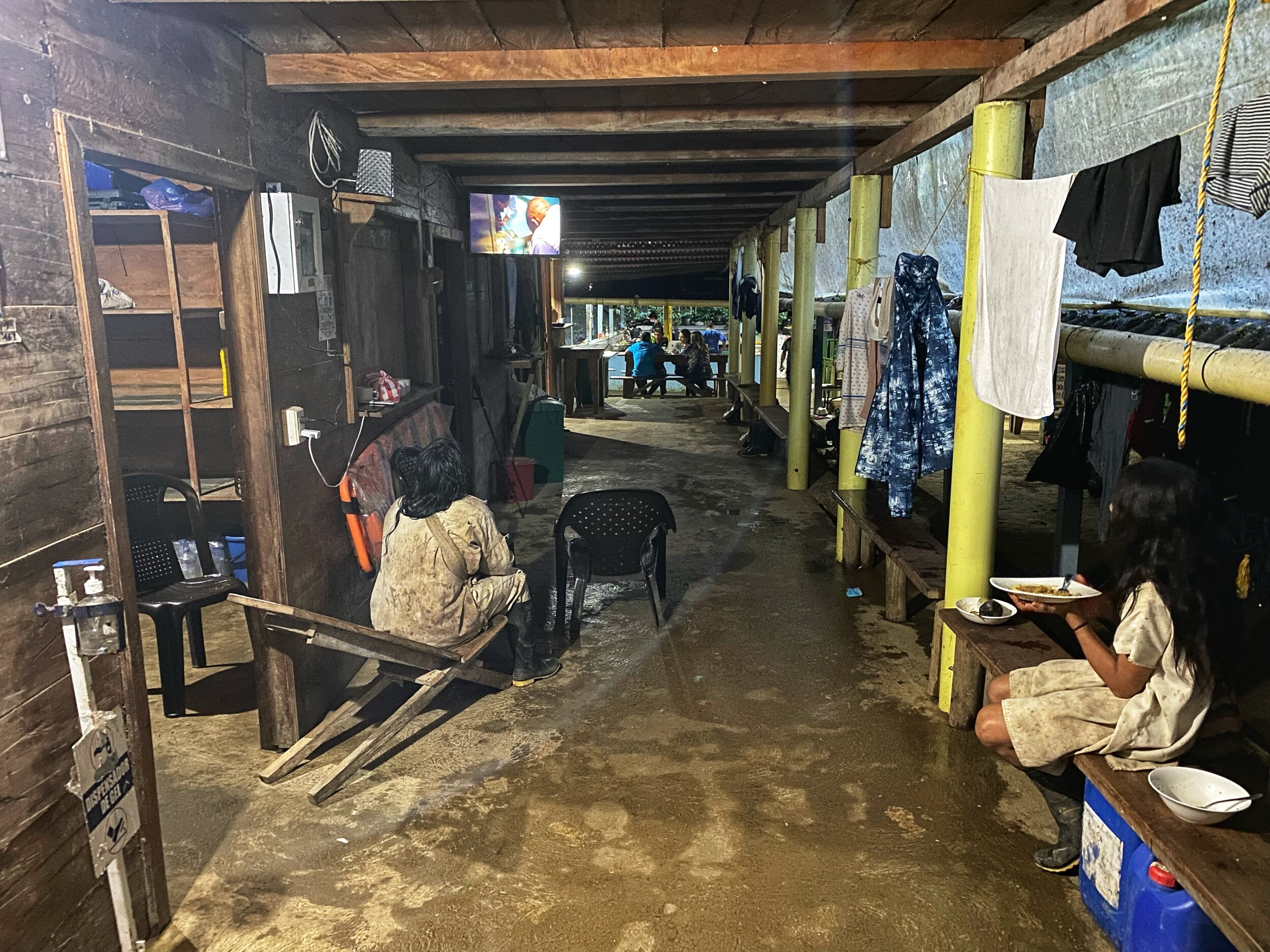
The shop at the camp. It has all the basics including cold beer.

Dinner!

The sleeping arrangements in the camps are under these mosquito nets. It is quite comfortable and warm and the temperature hardly drops below 20C. You need to watch out for bed bugs though.
In one of the camps.
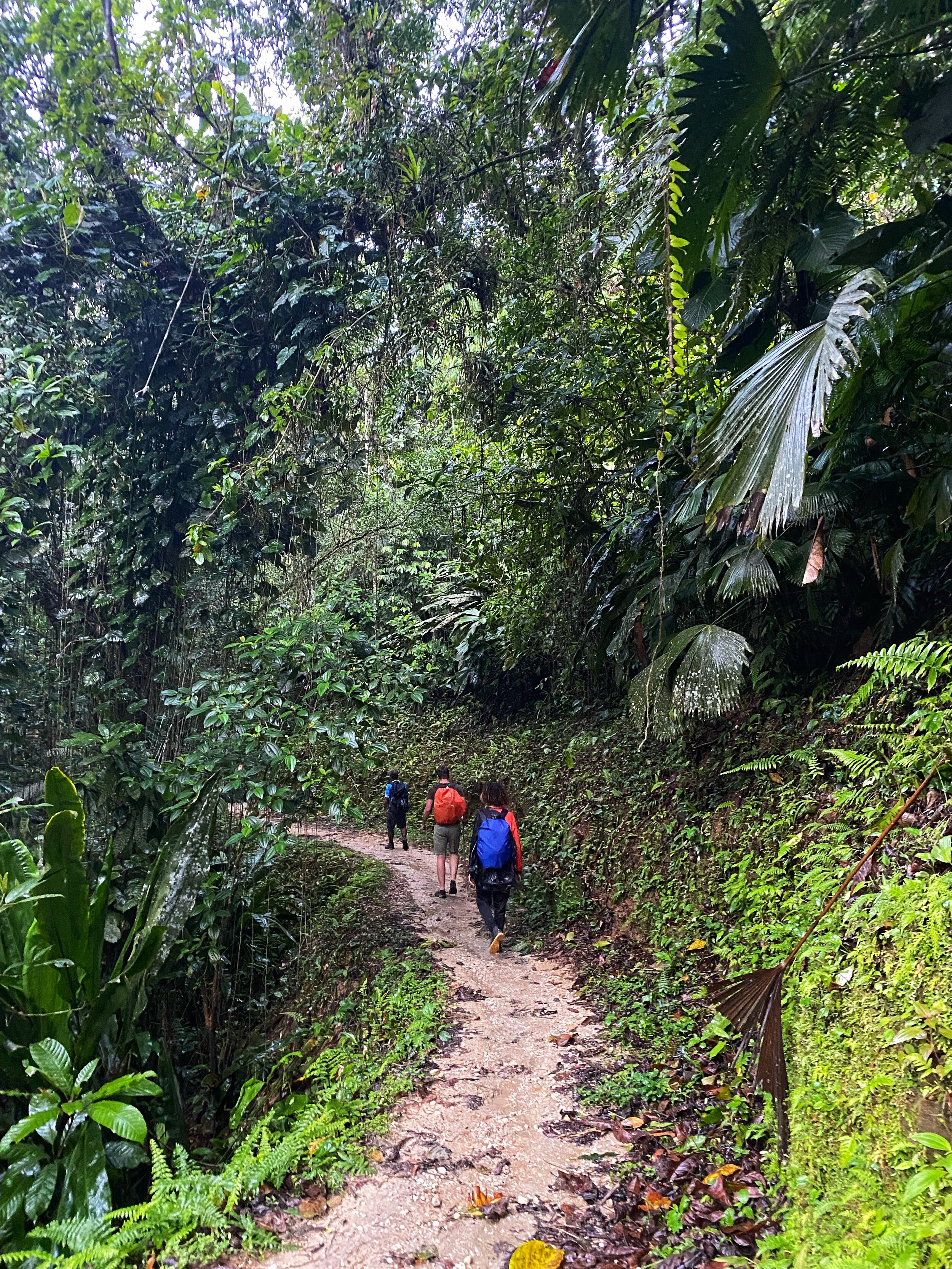
Beautiful jungle hiking


The trail when dry

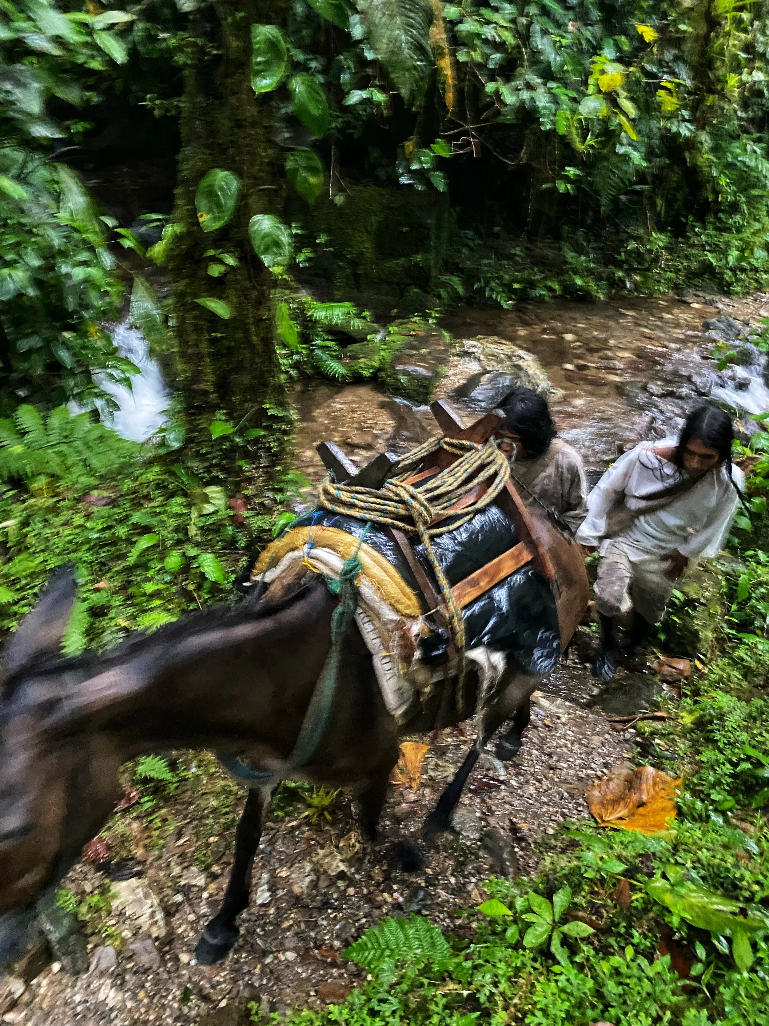
Horses are used to ferry supplies. It is hard walking for them and we saw them getting stuck. When a horse is stuck, it has to be unloaded and freed. It is a lot of work for the horseman and stressful for the animal.

One of the indigenous inhabitants of the Santa Marta Mountains (belonging to the Arhuaco group). He is holding a poporo which is a sign of maturity and a personal identification. It also holds lime made from sea shells that is used to interact with the coca leaf. The lime from the poporo is mixed with the coca leaf and chewed. Since lime is caustic, an excess will burn the mouth. Without any formal knowledge of chemistry, the indigenous are extracting the alkaloids from the leaves by making them alkaline. They know that the lime is the mechanism by which absorption of the alkaloids could be controlled. Thus, if while chewing the leaves a little too much alkaloid is released, one has only to ease up on the lime and let the saliva wash out some of the excess lime into the stomach. The lower concentration of lime would result in a slower absorption of alkaloids. Interestingly, cocaine alkaloid content is not the prime factor in choice of leaves. The Indians consistently chose leaves with a lower cocaine content but a high concentration of sweet, aromatic compounds which give the wad of coca better flavour.

An Arhuaco boy

For sale: coca leaf and cacao seeds. Cacao seeds are dried and sometimes sweetened by honey. They are a good source of energy! So is the coca.

A cacao plant - the first stage of chocolate!

The dwelling of the indigenous people of the Arhuaco tribe in the Santa Marta Mountains

A Kogi village. These villages are used mostly for meetings and gatherings. The individual Kogi families are scattered throughout the mountains cultivating land.

In the Kogi village

A Kogi boy

A young Kogi - you can tell the boy from a girl because boys carry bags over their shoulders.

A Kogi village


A Kogi boy with a group of young girls

The Buritaca River before the crazy rain higher up the range. The river level rises and drops dramatically and sudenly. The rains can be falling at higher elevations and the river downstream will rise very fast and become dangerous to cross. This is amplified by the steep incline of the Santa Marta range. This reminds me of the flash flooding in the canyons of the American South-West.


A Kogi family

A young Kogi mother

Kogis seem to be constantly on the move from one settlement to another. We passed many families along the way. They seem to share their settlements.

A Kogi man with his poporo


Arhuaco dwellings


A young Kogi boy
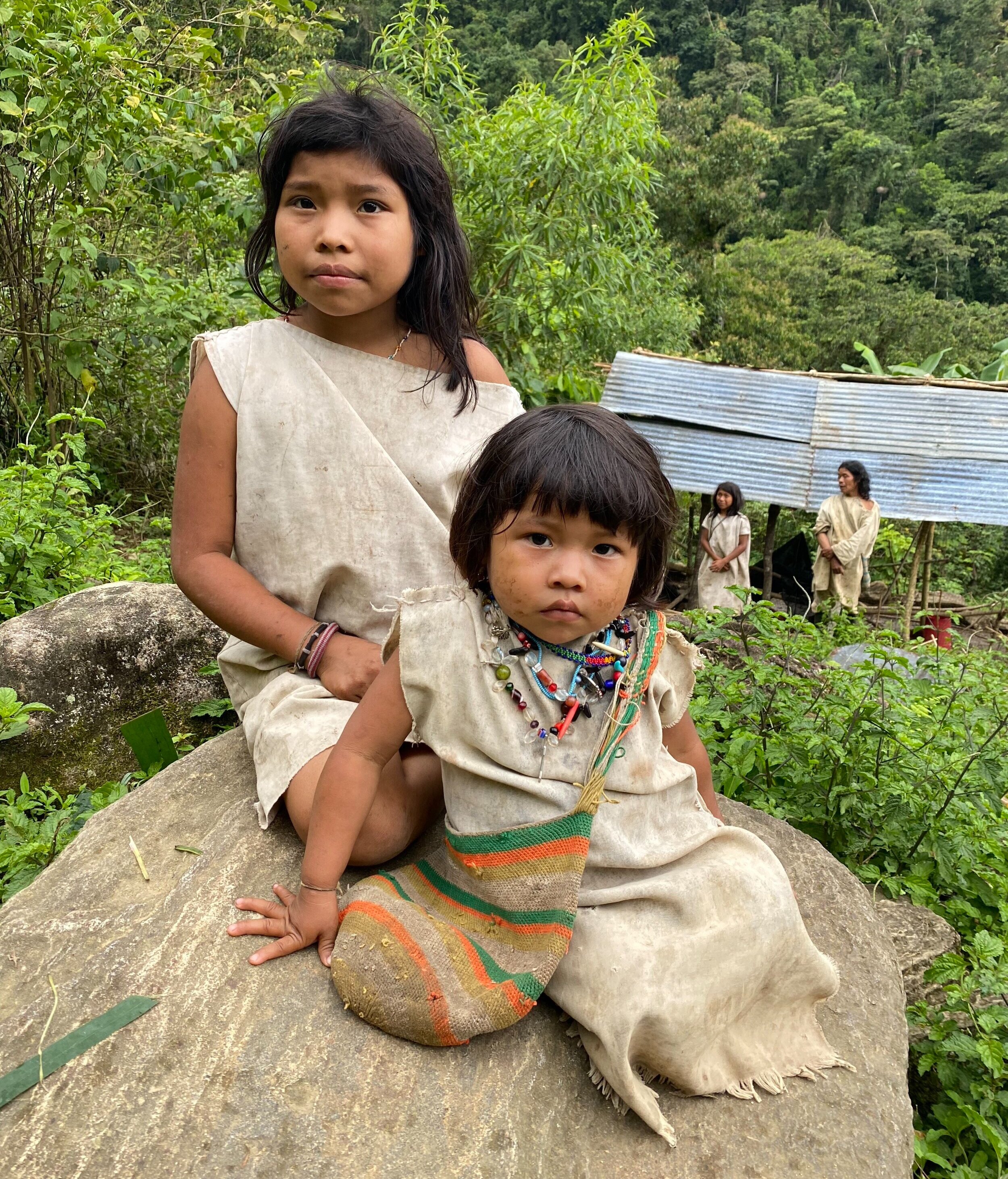
Young Kogis. Without the bag identifying the child as a boy it would be impossible to tell the gender.
Kogi men on the move. They navigate these trails very efficiently.

It always rained in the afternoons. We could tell the approaching rains by the clouds rolling up from the ocean.


The crazy high Buritaca River and the torrential rain.

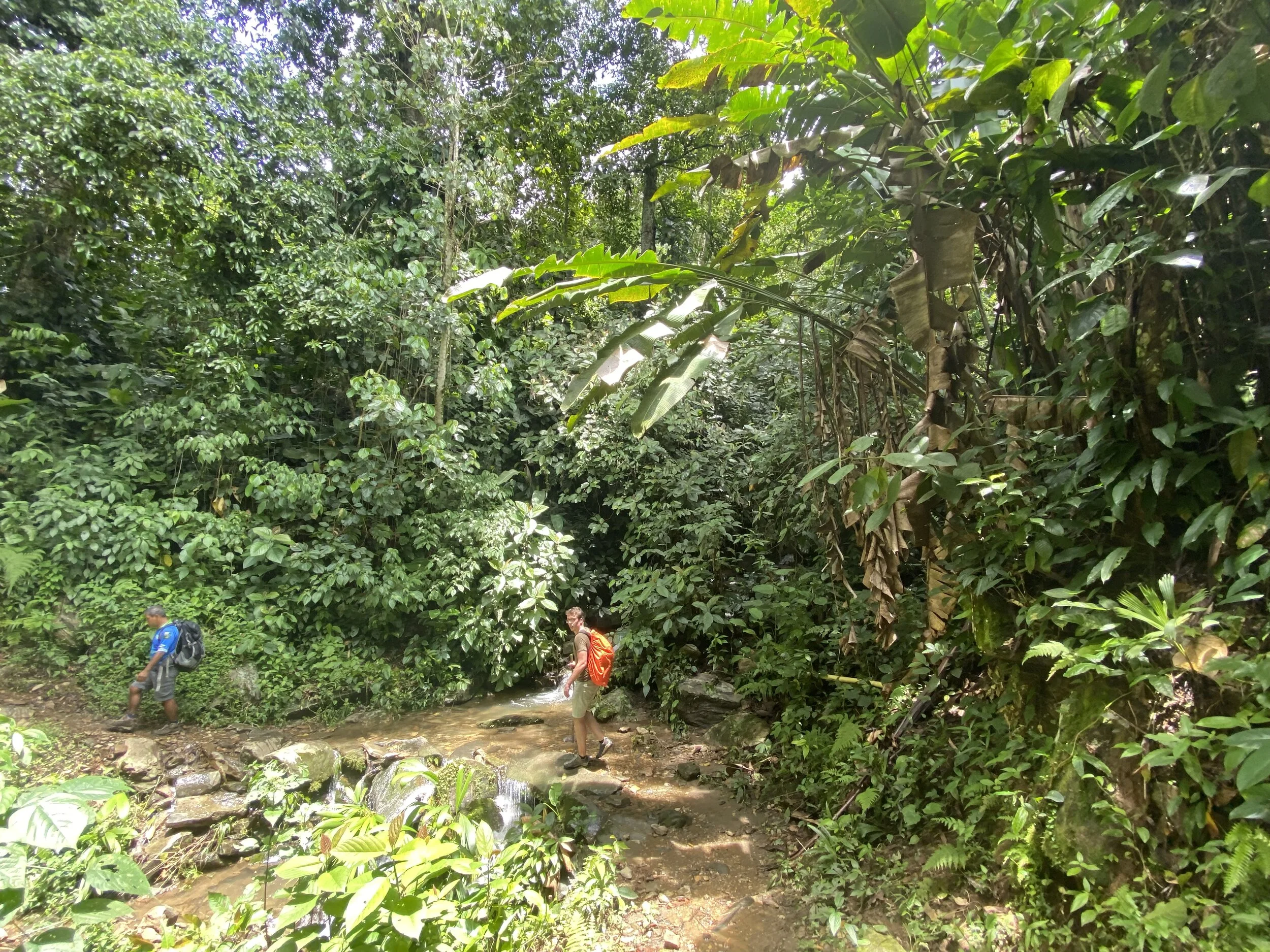
Even crossing smaller streams was a challenge. It was easy to loose footing on slippery rocks hidden under the torrent. You could not see the bottom as the water was silty.

We had to cross the Buritaca River to get to the 1200 steps leading to the Lost City. Without the rope it would be impossible. For a short distance the water was 1.5m deep and fast flowing. Although much lower than the day before, it was still high enough to be swept by its force.


The 1200 steps to the Lost City. In the heat and humidity, physical effort feels so much harder.

After the exciting crossing we only had to climb 1200 slippery steps in order to get the ridge where the Lost City is located.

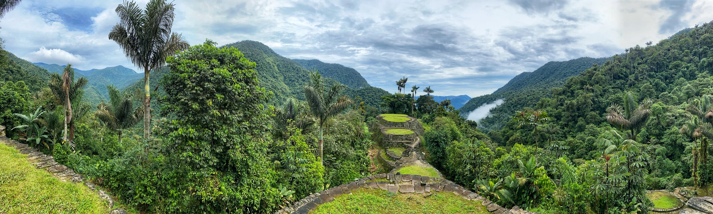
At first sight, the Lost City is not a very impressive site in terms of architecture (it does not have the Wow! Factor of Machu Picchu). It consists of a series of terraces similar to Kuelap in Peru. However, it is its spectacular location and the magnificent surroundings that make it special. Also the mystery of the little known Tayrona civilization who built it adds to its mystique. After making the trek, crossing the rivers and meeting the local inhabitants of these mountains, the Lost City feels very special.

The lower section of the Lost City. It once housed between 2000-3000 people. Up to 2005 the trek was off limits due to paramilitary activities.


It is actually quite amazing that 2000-3000 people lived here at some point. It is quite remote and hard to access. The amount of work that was involved in building it was quite astonishing.


There is a small Kogi settlement in the Lost City. They are the custodians of the site which is considered sacred. One of the elders or a Mamo, lives there and it was very interesting to meet him.

The elder Kogi

The Kogi people believe that everything buried in La Ciudad Perdida contributes to the peace, harmony, and balance of the world. After teaching one of their members Spanish, they presented this case to the Colombian government and successfully reclaimed the rights to their ancestral land.


A typical Kogi house

The small Kogi settlement in the Lost City. The site is a sacred place to the Kogi. The Santa Marta Mountains is the centre of the universe to all the indigenous tribes inhabiting these ranges.


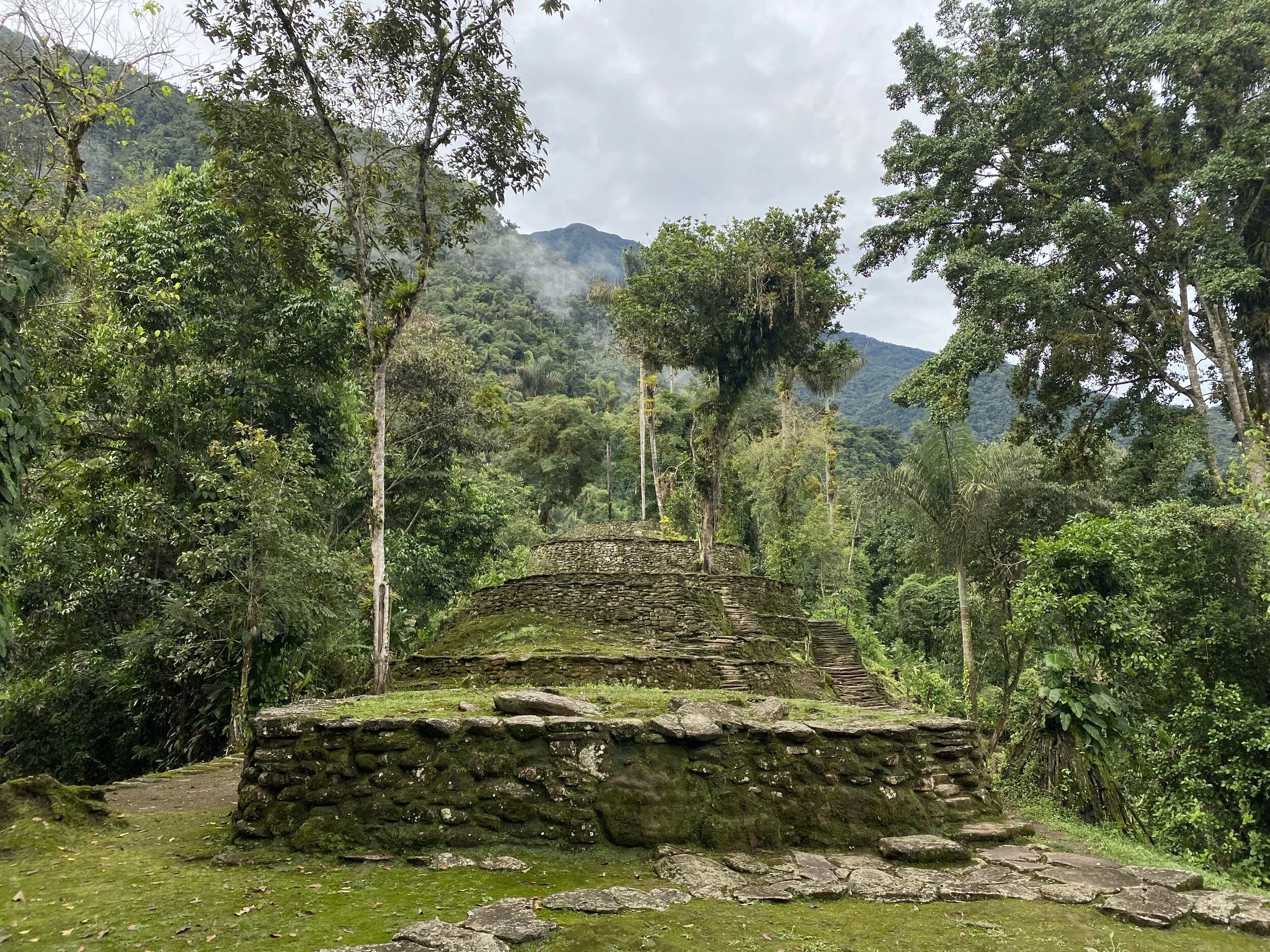
The main part of the Lost City. This was the living or ceremonial place of the high priests or leaders. In the Kogi tradition, the most important person in the community lives at the highest elevation relative to the others.


The heart of the Lost City

Teyuna-Ciudad Perdida was laid out over the hilltop in such a fashion that its administrative and political center covers a narrow ridgeline, with residential wards located towards the slopes. The ridgeline and slopes were leveled out using a combination of rammed earth and masonry terraces, and round buildings with stone foundations were set upon them. A 10,000 square foot terrace, for example, has multiple round or oval buildings and is connected to adjacent terraces via paved walkways or staircases.

Wikipedia: “Ciudad Perdida was discovered in 1972, when a group of local treasure looters, Los Sepúlvedas, found a series of stone steps rising up the mountainside and followed them to an abandoned city which they named "Green Hell" or "Wide Set". Los Sepúlveda was a small family of looters in Colombia; their story leads to the beginning of one of the greatest archaeological discoveries in modern times. The family went hunting in the forests of Colombia when they shot down a wild turkey. Upon retrieving the turkey, they noticed it had fallen on a piece of an exposed staircase. This staircase would lead them to find La Ciudad Perdida. For years after its discovery by the looters, “Treasures from the site, including gold figures and ceramics, soon began to appear on the black market”. After fights broke out among the looters due to the murder of one of the Sepúlveda sons at the site of Ciudad Perdida, and gold figurines and ceramic urns from this city began to appear in the local black market, archaeologists headed by the director of the Instituto Colombiano de Antropología reached the site in 1976 and completed reconstruction between 1976 and 1982. Although La Ciudad Perdida is one of the most impressive sites, it's not alone, only about 30-40% of the sites in the Sierra Nevada region have actually been explored.”

The archeological camp is on the lower left.

The spectacular surroundings of the Lost City

This was some form of a throne. I had to try it out!


The main axis of the city.

This is called the map stone. It is thought to be some sort of a map of the surrounding settlements. There are many unexcavated settlements in the surrounding mountains.


The beautiful surroundings of the Lost City