
The Sierra Nevada of Mexico. Pico de Orizaba is the highest summit in the range and the 3rd highest in North America (after Denali and Logan). It is also one of the most prominent volcanoes. It is isolated from other high mountains in the range (like Popo and Izta). In order to climb Pico de Orizaba one needs to acclimatize and it is best done by climbing smaller mountains in the area.


Puebla is a wonderful basecamp for the volcanoes surrounding it. The city is very walkable. It offers many interesting points of interest. Some are very spectacular such as the main cathedral - the second largest in Mexico.

The wonderful Puebla with its colourful streets from the roof of the AMPARO museum. Check out their online exhibits at MUSEO AMPARO. The Museum has the second largest collection of the pre-hispanic art in Mexico (second to the Anthropology Museum in Mexico City).


The amazing Capilla del Rosario in Puebla. It is one of the most beautiful churches that I have ever been to.

Puebla has so many churches that it is said that there is a church for each day of the week.
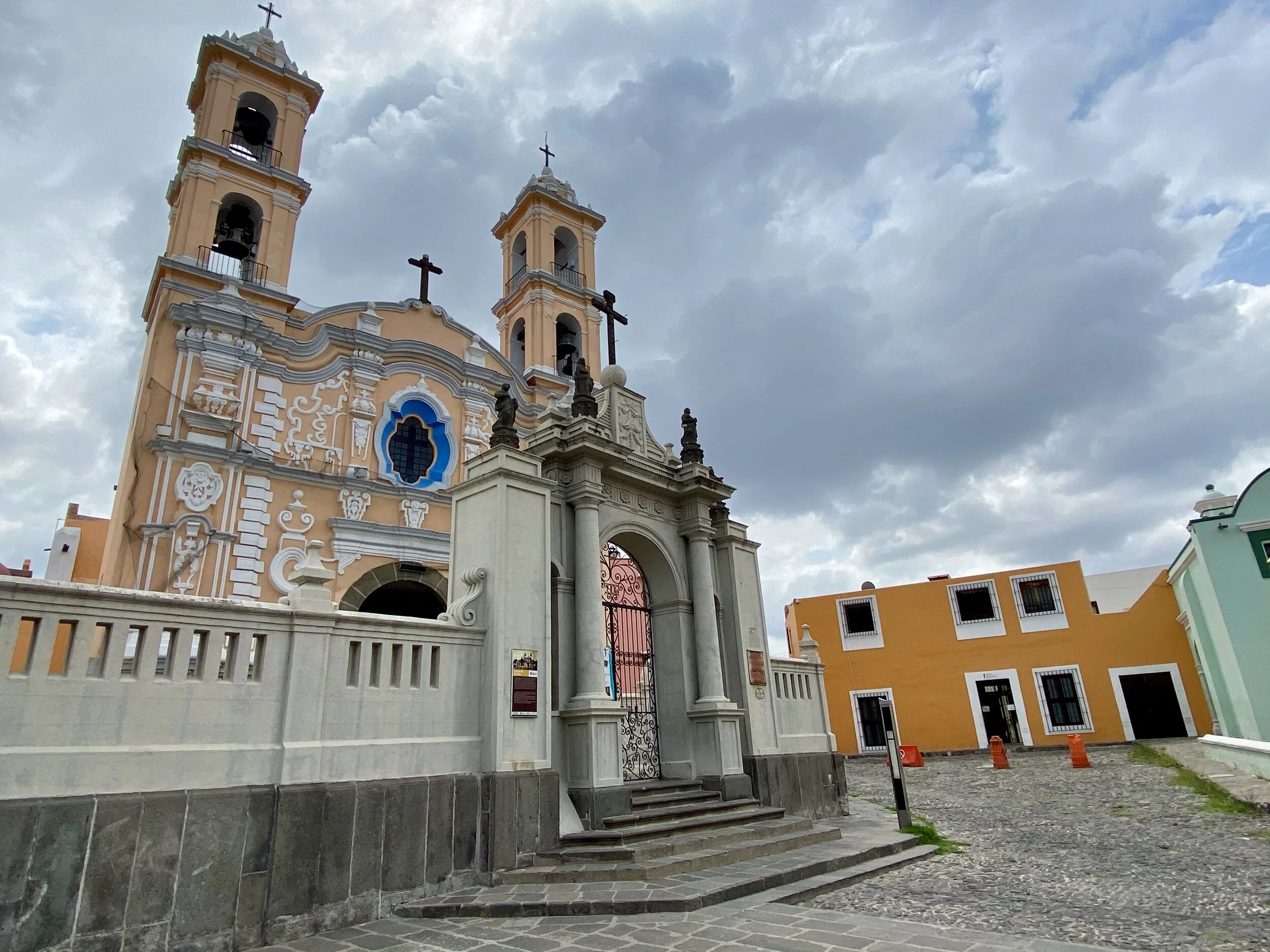
Another wonderful old church in Puebla.

A beautiful church and the Vulcan Popocatopetl

It is very common to see such beautiful decorations in most churches throughout Puebla region. Some of them are truly exquisite!

Traditional dancers in the streets of Puebla

The drive from the city of Puebla to Pico de Orizaba is 2.5 hours through a large valley on an old lake bed.
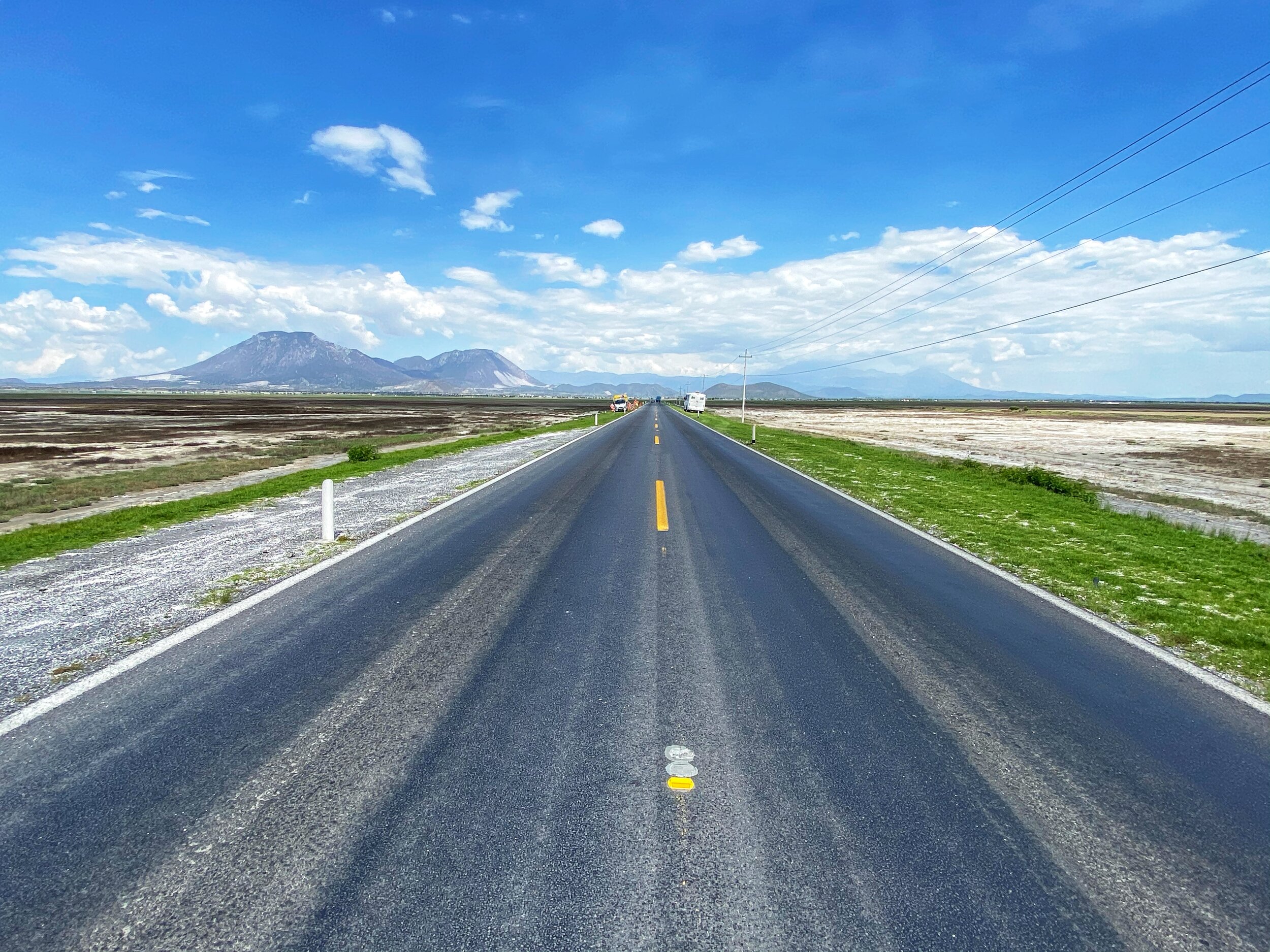
Driving through a dried up lake. The scenery is very different from Pico de Orizaba National Park.
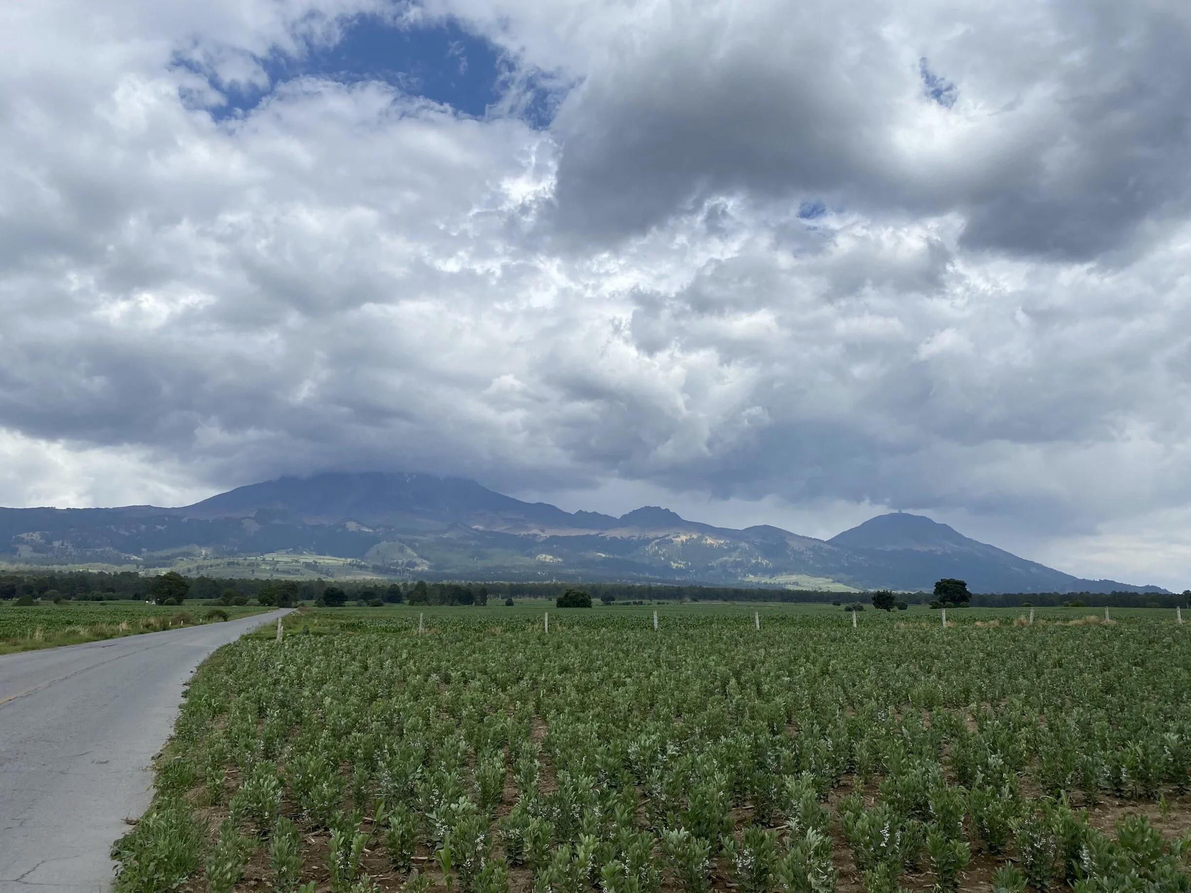
Pico de Orizaba is on the left (in the cloud) and Sierra Negra, its close neighbour, is on the right. You can see the massive astronomical antenna on top of Sierra Negra. Pico is a very different mountain in character than Izta. It is a conical volcano with a straight ascent. Izta is a complex mountain with multiple summits. Pico is only 60 miles from the Gulf of Mexico and is affected by its weather.

The beautiful forest on the way to Hidalgo

Hidalgo

Our basecamp in the village of Hidalgo. We stayed in this hostel where the owner made us a delicious supper. We were the only guests.

In Hidalgo. Apparently it is the highest community in North America at 3,400m.

The sunset in Hidalgo
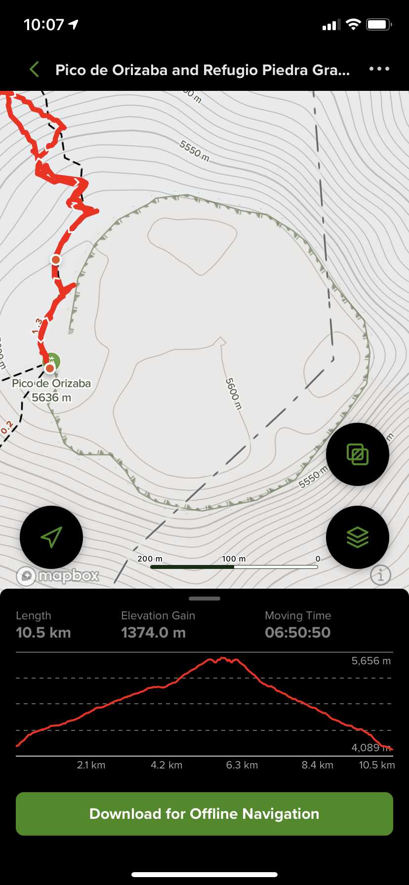
From Hidalgo it takes one hour to drive to the starting point. We started our preparations at 10.30pm and left Hidalgo at 11pm. We arrived at the trailhead at midnight and started climbing right away. By the time the sun started to appear, we were very high up on the mountain. We were on the crater rim for sunrise.

The last 400m of the climb involves an ascend of the Jamapa Glacier. We had excellent snow conditions on the glacier with all the crevices covered. There was no exposed ice, the ascend was very pleasant and the descend fast.

The grade of the Jamapa Glacier slope. The sun is rising and the fantastic views are starting to appear.

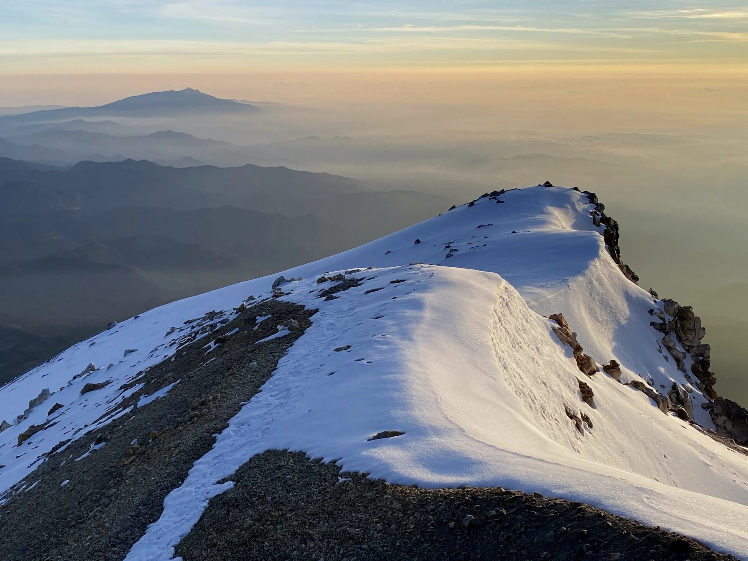
The crater rim is just above.

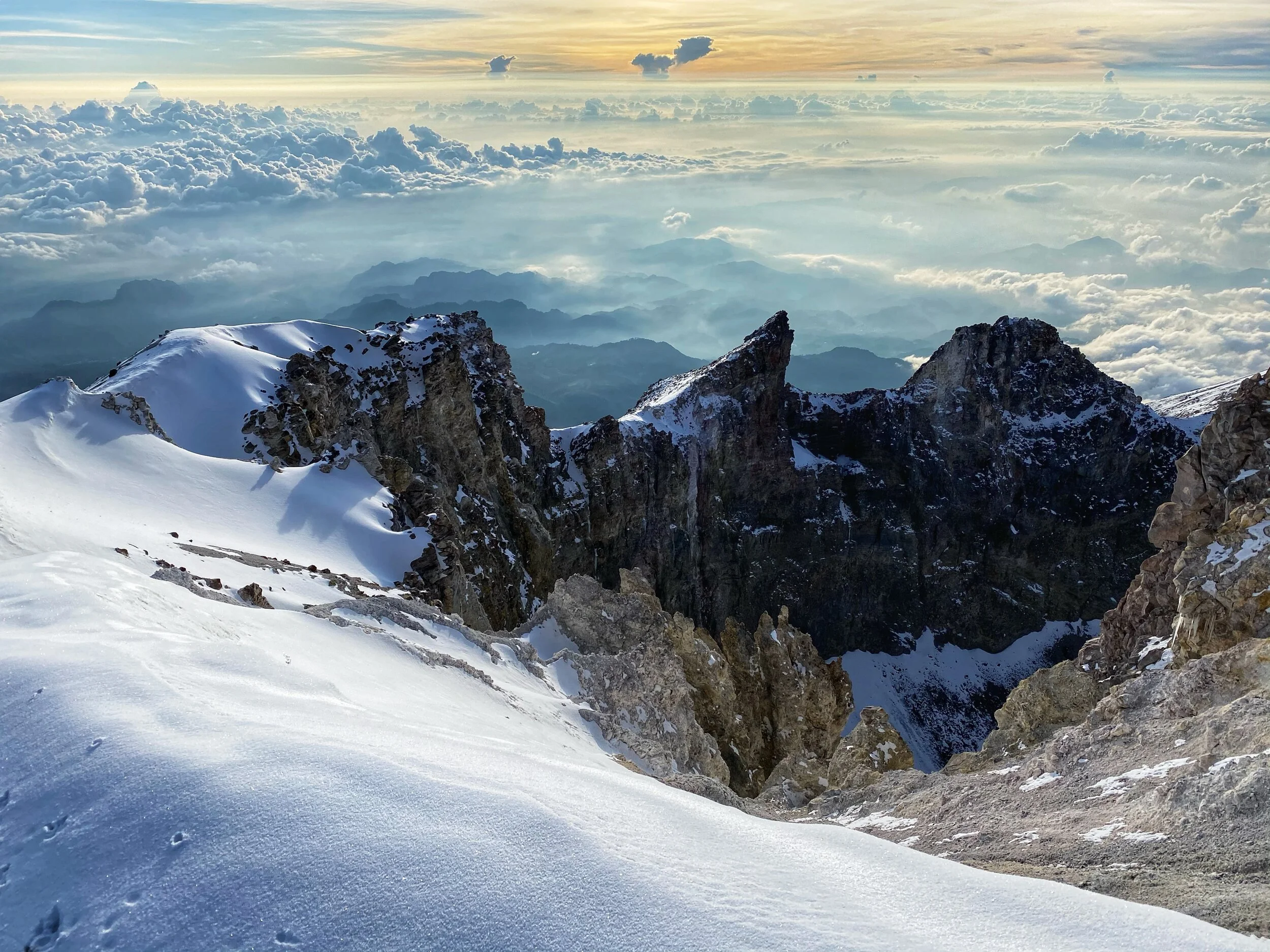
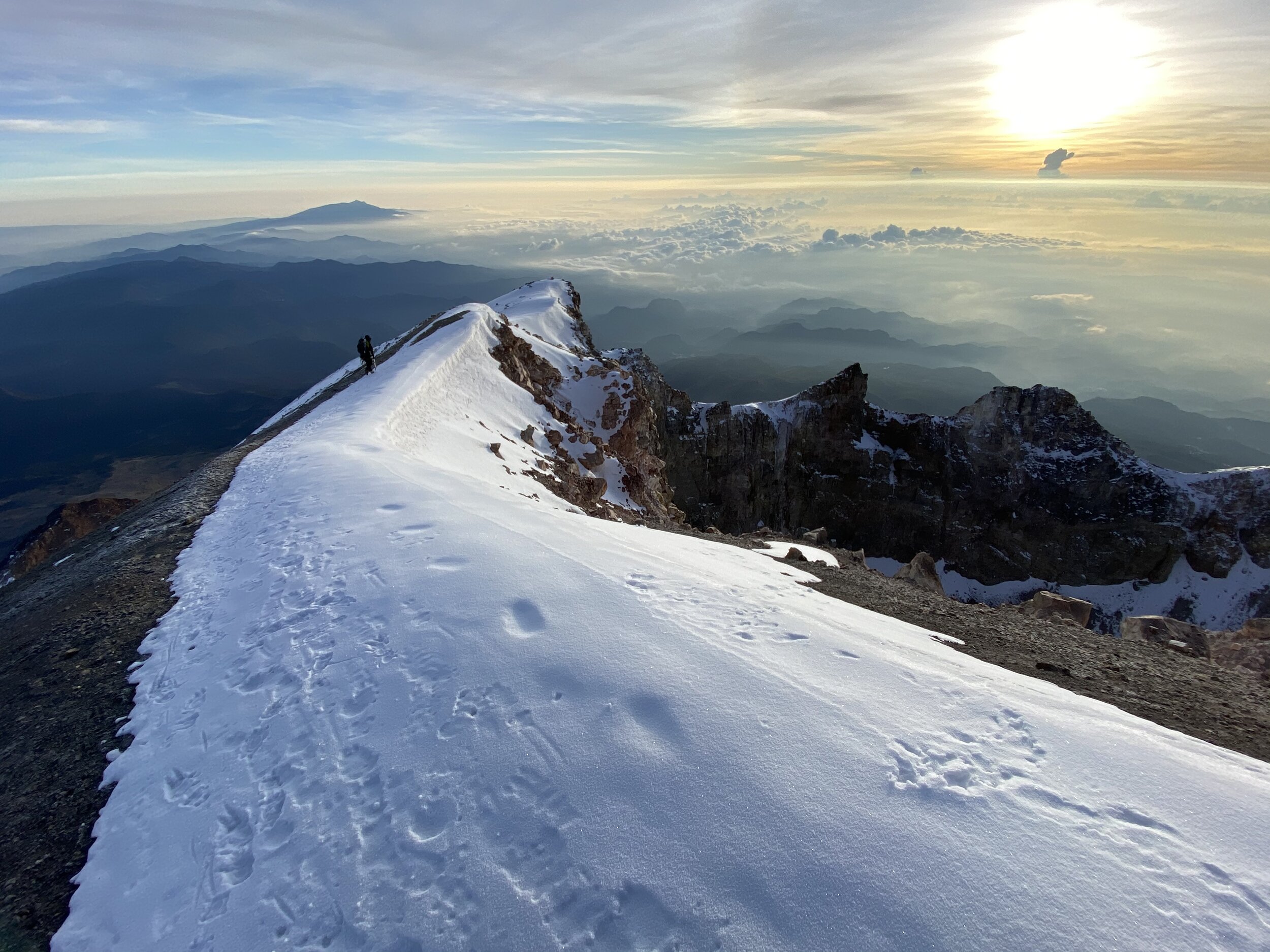
The sunrise at the rim of the crater. Pico has a perfectly round and jugged crater.

The sunrise at the crater rim of Pico. The summit is the highest point on the rim on the right.


The summit of Pico on the right.

A beautiful sunrise on the crater of Pico

Looking down our ascent route. You can see the basecamp hut far below.

The crater of Pico

The large shadow of Pico projected onto the valley below.

Last steps to the summit

The summit ridge


The summit of Pico de Orizaba

Sierra Negra looks small and is now far below. The large antenna is visible. The summit of Sierra Negra is 1 km below the summit of Pico.
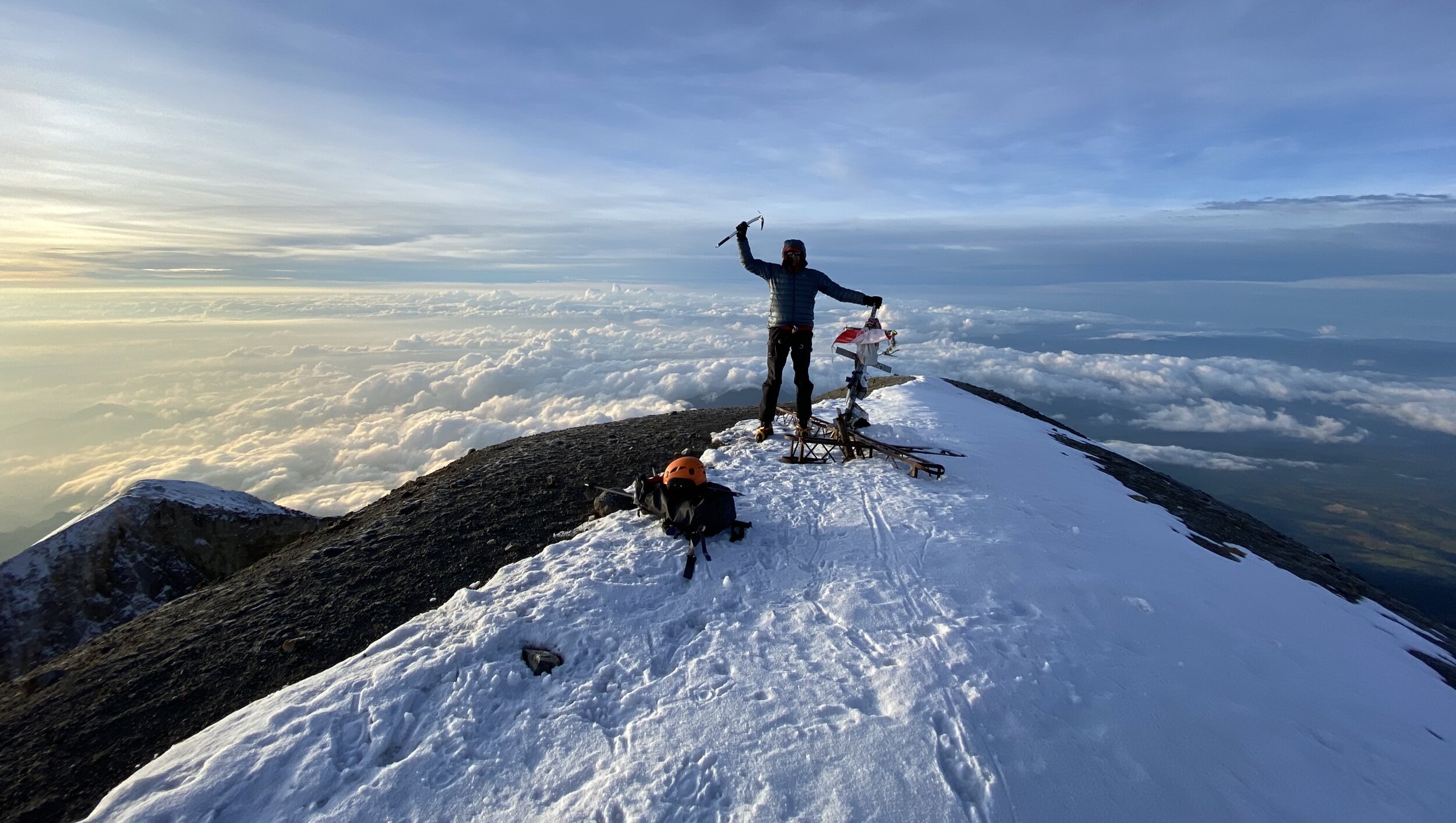
The summit of Pico de Orizaba 5,630m

The summit elevation is 5,636m or 18,491ft. Add 150m to my watch. We were on the summit in 6.45 hrs.

The views from the summit


The panorama from the summit of Pico. The forecast called for rain and clouds at the summit. Instead we got this! Again, we were very lucky with the weather. During the night we were surrounded by bright flashes of electrical discharges in the surrounding clouds. Thankfully we did not have any issues with thunderstorms.


Absolutely fantastic views that exceeded my expectations. We were on top Mexico!

The path of our descend down the glacier.


Happy to be off the glacier and from here on it is all down to the hut on a trail.

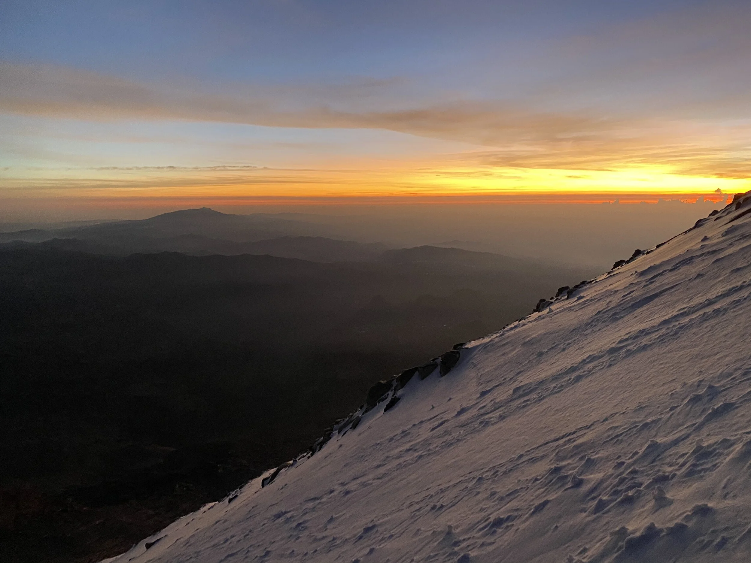
The views we missed during the night. On one hand I do not like to climb at night as there is nothing to see. On the other hand, the climb goes fast and it is less mentally taxing as one can’t see the objective dangers (crevasses or seracs).

The views were fantastic all the way down to the start of the route. What a beautiful day!

Looking back at the glacier and the summit of Pico from around 5000m.


The alpine hut that serves as the formal basecamp is below us.


Surprisingly, around 60 people died on Pico over the years. The success rate is 50%. It is all about the conditions. I found this mountain to be easier than Itza for me. It was faster to climb and shorter in distance. We had excellent conditions on the glacier. I think that an assistance of a guide is essential as the night climbing is in complete darkness and there are no route markers. It would be tiring and time consuming to find the way in the dark in the lower part of the mountain called the labyrinth. Overall it was a very, very pleasant outing. We were the only two persons on the entire mountain.
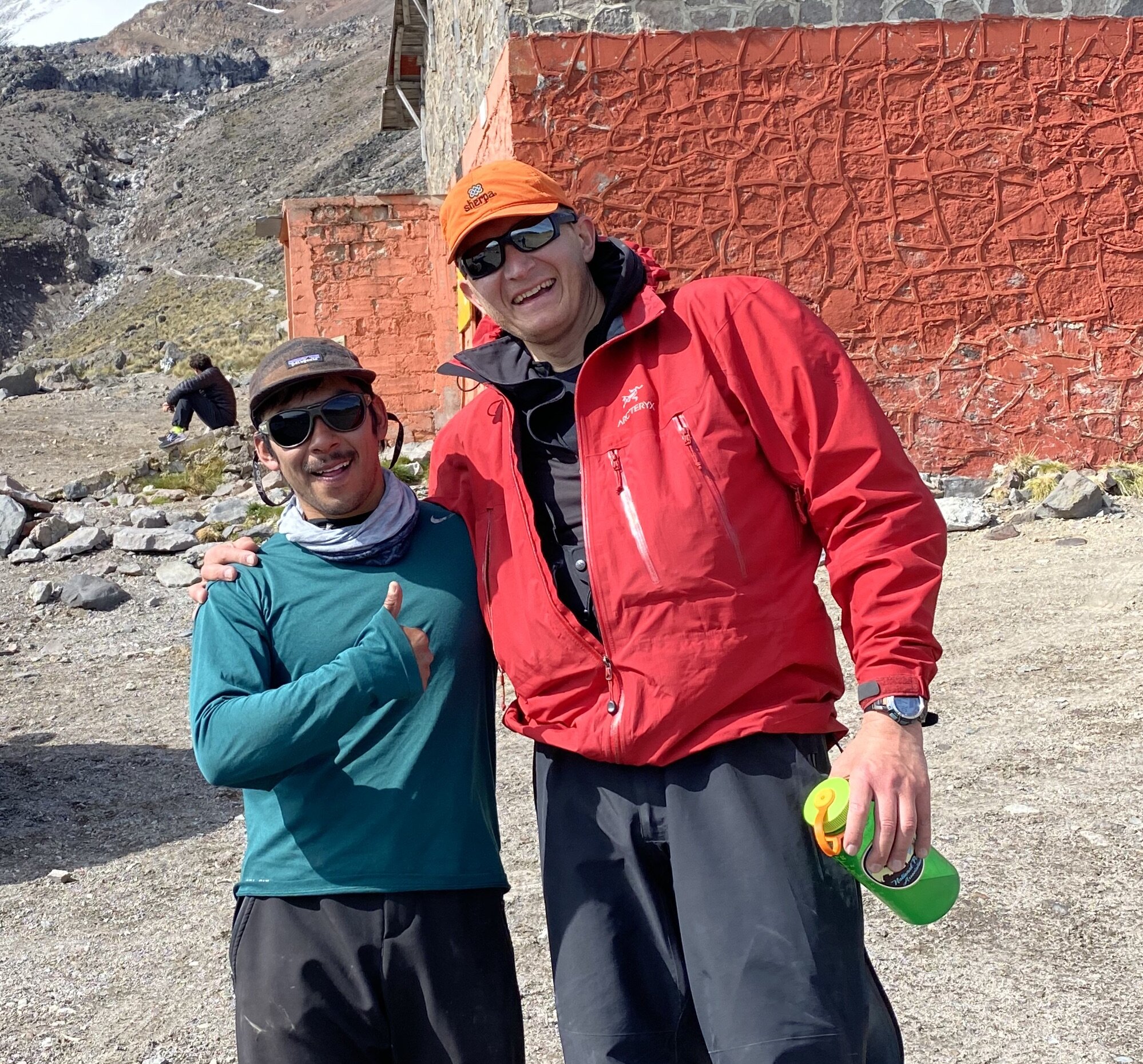
My guide Mesh and I after the climb

Looking back at Pico from our drive back to Hidalgo.

The beautiful Pico de Orizaba National Park

Photo courtesy of Juan Plaza. (www.aopa.org/news-and-media/all-news/2021/may/17/mapping-the-tallest-volcano-in-north-america).
The line of our ascent is on the right.