
I had an opportunity to participate in the Calgary Mountain Film Festival (cmff). It was a lot of fun and a great experience to share some of the stories from trekking in Nepal. Thanks to www.spiritwest.ca for inviting me.
Langtang, Tilman Pass and Ganjala Trip Report
Nepal Tilman Pass and Ganja La Pass
October 16, 2018 – November 11, 2018
Participants: Derek and David. Shyam (the guide), Niranjan (#2), Milan, Roshan, Santosh and Sanchaman. We could not have done it without those great guys!
October 18, 2018 Kathmandu
I am back in Kathmandu, Nepal after a long, long flight. The visa process on arrival was as chaotic as ever. I am not sure how is Nepal going to double the number of visitors, as already the authorities have a tough time coping with the traffic as is? 2 hours aver arriving in Kathmandu, I am finally out of the airport.
Raj, the owner of Mountain Sun Valley Trekking (organizing our trip) met me at the gate and we went to his house for dhal bat and some good cheer. I know his family and they are so very nice and great. I appreciate very much being treated as a friend and not only as a customer. While at Raj’s house, Shyam our guide on this trek, came over. He brought his brother Niranjan with him. I like Niranjan very much, he is tough, very competent and always smiling. He is one of the few people that I would not hesitate to take with me on any trip! After greetings and some beer, we reviewed our gear and checked the tents. There will be 8 of us all together and it is unlikely that we will come across many trekkers on this trip.
After a good lunch, Raj took me to Hotel Nirvana. I checked in, dropped my stuff, and went for a walk around Thamel, the tourist district of Kathmandu. A lot of shops were closed due to the festival of Dashan. I was tired from all the flying and went back to Nirvana Hotel for a 2-hour nap before David’s arrival. After David arrived, we went for some Tibetan momos (dumplings) and then off to bed by 8.30pm.

Early morning in Kathmandu

Thamel, Kathmandu
October 19, 2018 Okhrani 2,400m
We left Kathmandu at 8am on a road leading north. The state of infrastructure in Kathmandu is falling further and further behind. I am frankly not sure how the residents of this city can put up with the state of roads? The entire way out of Kathmandu was through a torn up track full of holes, dust and mud. I would not even call it a road. It was more of a track.
On the way to the trailhead, we drove through the village of Malamchi where we had lunch in a local establishment. The 70km distance took up the entire day. From Malamchi the road climbed up and it was in even worse shape (if this is possible!) than earlier in the day. We were rocking and jolting all the way from Malamchi to Okhreni. One really needs a good 4x4 with high clearance and good traction. I would imagine that during the monsoon season these tracks are not passable. Some of the ruts were over two feet deep!
We arrived in Okhreni, our starting point for the trek, which is in the middle of nowhere and has a deserted feel to it. Once we arrived and unpacked, we realized that along the way we lost some of our provisions, as our load was not tied up properly to the roof railings. The road was so bumpy that the packages containing, most importantly, a month supply of porridge was lost! David was unimpressed but soldiered through with gusto. It was very un-British of him to let the porridge dream go so easily.

Initially, our general plan was to hire a porter in Kathmandu who would know the route to the Tilman Pass. Unfortunately, the elusive porter could not make it due to some nebulous reason and we were left without any idea where we were going except to follow a ridge to Panch Pokhari (a popular Hindu holy site in the foothills of the Langtang Range of the Himalaya). One would assume that following a ridge should be intuitive but there are many tracks along the way and it is actually quite easy to lose one’s way. The biggest problem that we were anticipating was finding the way later on among glaciers and moraines in the high mountains. Not knowing the way gave me some anxiety. The non-existent gear of the porters compounded this. We would be faced with far simpler but equally serious problems sooner than that…
After we arrived in Okhreni, Shyam set out on a mission to find out which way to go? Some serious looking locals congregated around our map and offered some very serious suggestions. I was a little apprehensive about going on a multi day trek without knowing how to get to the destination. I guess this would be more of an exploratory trek.
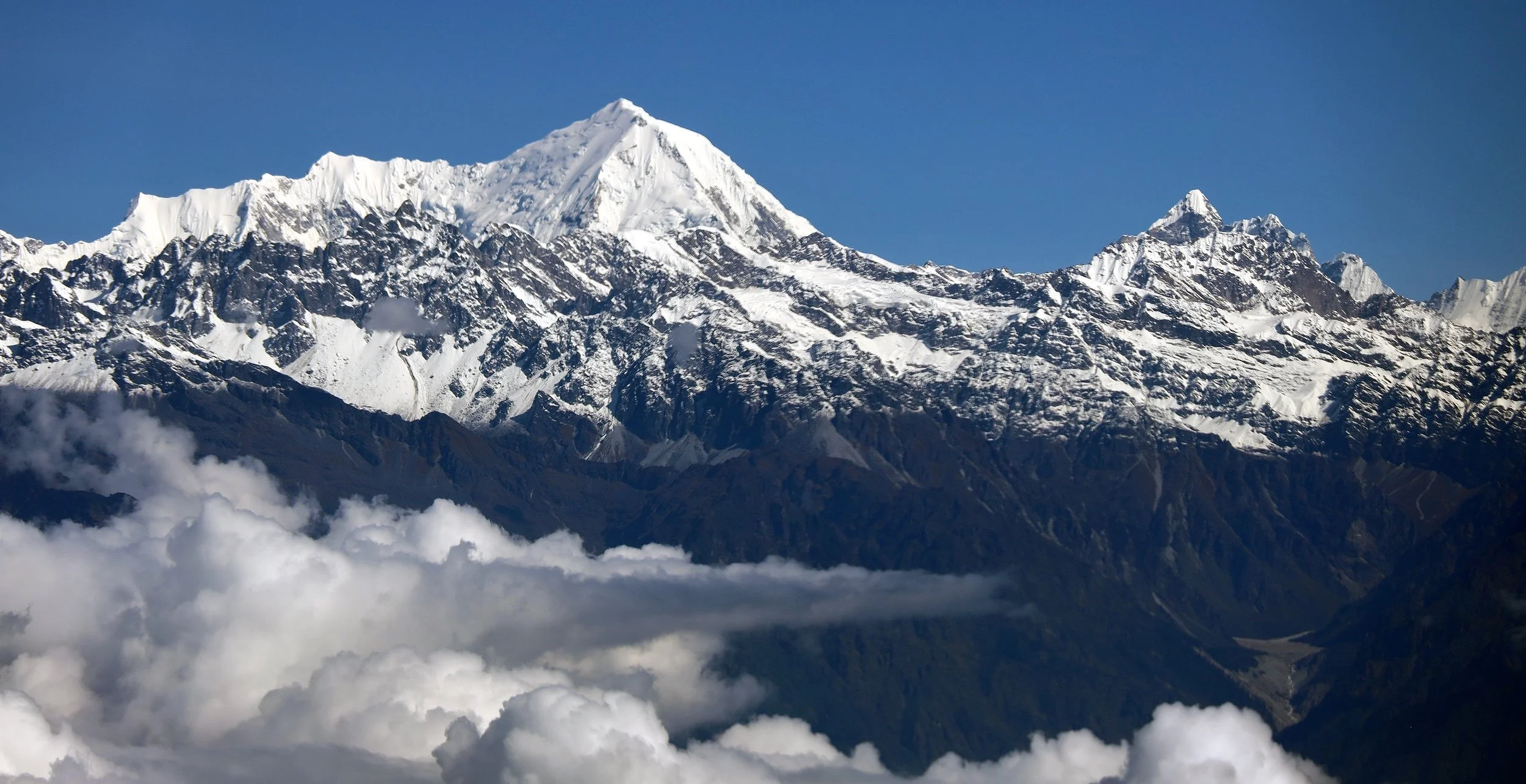
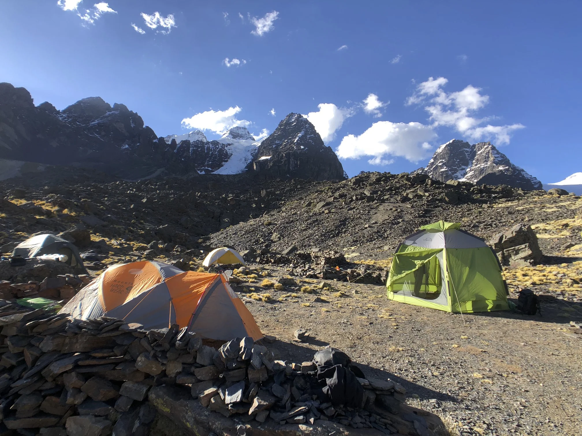
Okhreni is located on a beautiful ridge overlooking other ridges descending from the Langtang Range. The village consists of 5 houses. The Langtang Range dominates the horizon and glows beautifully at sunrise and sunset. It was not cloudy but the humidity provided ample condensation for freezing, and it actually felt as if it rained at night (it did not) making everything wet.

Today we start the walk. I am not yet “into it” and it will take me some time to warm up both mentally and physically. It usually takes me a few days to switch from the city mode to the hill mode.
October 21, 2018 3,450m
I totally missed my birthday on October 21. It was the first day of the hike. We started at 2,400m on a well-camouflaged trail through a thick forest. After a few hours of forest walking we reached a clearing where we had lunch. We had a tough time finding water (this would continue to be our most serious issue on the way up and down the ridges). The guys would set out looking for water and it would take a long time before they could locate even a small stream or seepage among some well hidden rocks.
After lunch we continued for another 2 hours mostly uphill to a prominent treeless ridge. At the top of the ridge, at 3,400m, there were chortens and a cluster of prayer flags flapping in the wind indicating a pass. From this point, we had some great views to the valley below with cumulus clouds milling about. The view was almost the same as from an airplane flying above the clouds. We descended from the pass to a treeless meadow where we set up our camp for the night. We had extensive views from the edge of the meadow to the Langtang Range in the northwest and the valley below. It looked like we were following the correct ridge to Panch Pokhari and the Tilman Pass beyond.
So far, we have not come across any villages, people or even animals. We cannot ask for directions and have to rely on our intuition (and a general map). So far so good though! We had good dinner in a stone kharka that provided nice shelter from the wind and cold. Off to bed at 7 pm.
October 22, 2018 Hille Banjang 3,545m
In the morning I took a walk to the top of a ridge looming over our camp. As I neared the crest of the ridge, the sun just came up from behind the Himalayan range in the east iluminating the landscape in early morning glow. It was very beautiful and I felt on top of the world with the Himalayan Range stretched before me and the valleys below. The rising sun illuminated the entire Langtang and Jugal Ranges. It was stunning. After taking some photos, I hiked back to the tent. The tent was in the shade so it remained wet and covered with frost throughout the morning. The sun would not hit it until much later so we had to pack the wet tent and damp sleeping bags “as is”.

The Langtang Range

The Jugal Range in the morning glow
We started walking north and rounded the end of a ridge to some much welcome sunshine. After a short while though, a thick layer of clouds obscured all the views that we were so much enjoying and dropped the temperature by several degrees. The clouds stayed with us for the remainder of the day. As we progressed north and higher, the clouds got thicker and at some point we were walking in the fog with the ends of our boots providing the only view.
The trail dropped down 300m to a nice spot where we could find water and have lunch. Again, availability of water dictated our lunch and camping spots. After lunch, we ascended to 3,750m then down to 3,500m. A true rollercoaster.
It seems that along this route, each campsite was full of trash and was in general state of disrepair. Mainly Hindu pilgrims on the walk to the 5 holy lakes called Panch Pokhari use this trail each summer. They seem to just throw things around without any regard for others. At some spots we felt as we were camping in the middle of a garbage dump.
So far, we did not meet anyone along the trail (animals or people). The place has a very remote feel to it. Today, the porters were quite tired as it was a long day with many ups and downs (maybe 18km). They are also carrying double loads to make more money. A double load was 40 to 50 kg! Shyam had to run back and help one of the porters bring the loads to the camp. It was just too much for the young porter. It was very nice of Shyam to help.
October 24, 2018 Nashimpati 3,680m
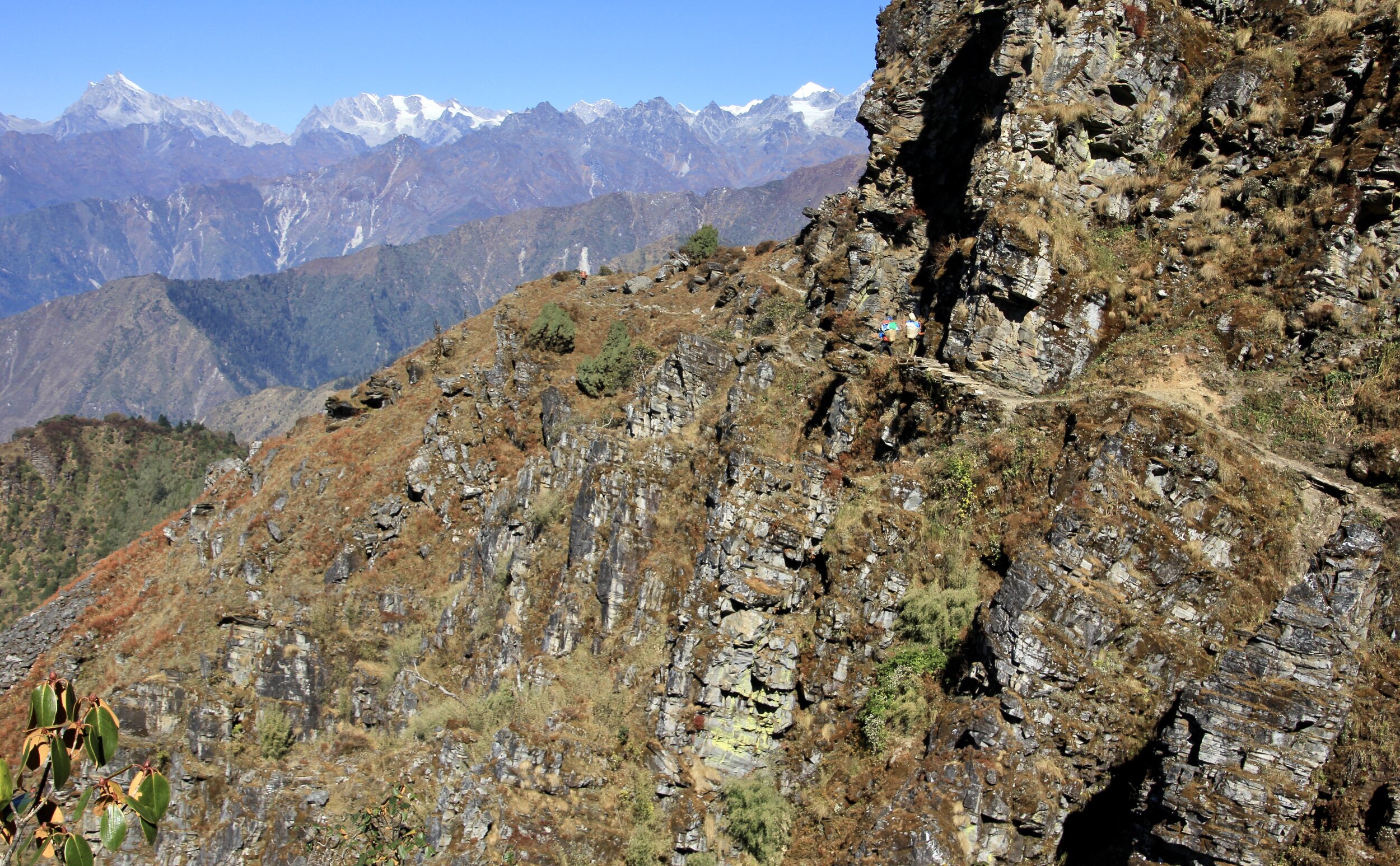
Today we had a clear sky and good visibility all day. We started in the shade again, cold and dark, but soon emerged onto the sunny side of the track. David and I climbed to the top of a small ridge for some fine views of the Jugal Himal in China and Gauri Sankar in the Rowaling region that we traversed in 2010. We were walking parallel to the Friendship Highway in Tibet. Neylam (a town in Tibet and the starting point for the approach to Mt. Shishapangma) is somewhere below from where we were. After a short break in the sun, we started to climb up on a good trail with some steep drop offs. At one point, wood planks hanging above a 50m drop reinforced the trail.

Notice the wood planks on the trail!
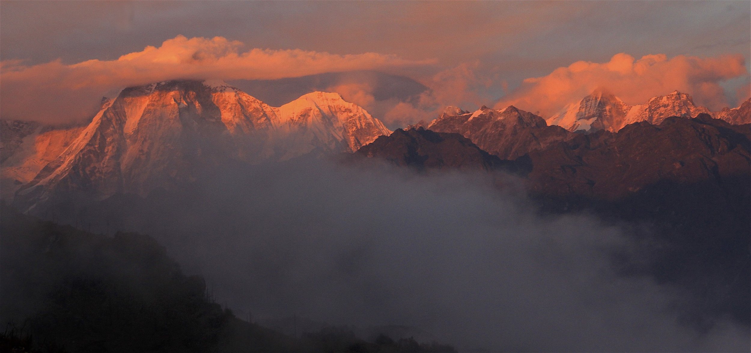
After a 3-hour hike we arrived at Nashimpati, a spectacular spot. There was a teahouse there run by a family with 4 kids and a friendly dog. The views in all directions were absolutely spectacular. As the day progressed, the views got better and better and reached a crescendo at sunset when all shades of orange were projected on the snowy peaks that we would soon be crossing. This was the best sunset spot I have ever been to in the entire Himalaya. The light on Mt. Dorje Lakpa to the north was fabulous. As the sun was setting in the west, a full moon rose over the Himalaya to the northeast.

Moonrise over TIbet

Mt. Dorje Lakpa in the last rays of the setting sun.
We had a good dinner and a cold evening. I was concerned that the night would be freezing in my 3-season MSR tent but it was quite fine. The hot water bottle in my sleeping bag sure made the difference.
I had a light headache due to the altitude or dehydration. I was starting to adjust to the rhythm of the trek and go with the flow of things.
October 25, 2018 Panch Pokhari 4,050m
We had a short day today. The walk from Nashimpati to Panch Pokhari was only 2 hours long with a 500m-elevation gain. After following a well defined trail along a side of a mountain, we crossed the Lubrina Pass (4,000m). The climb to the pass required some climbing but going slow and steady made the effort negligible.
Once we arrived at Panch Pokhari we met a group of 4 Korean ladies with 14 porters who were also going over the Tilman Pass. This was such luck for us considering my anxiety about not knowing the way! The ladies were doing the Great Himalaya Trail in 2-month long sections at a time. They were slow but methodical and seemed determined. They arrived from Lukla after crossing the Teshi Laptsa Pass. During this 2-moth long trip, their plan was to walk all the way to the Larkya Pass in the Manaslu region. Most importantly for us though, they had porters with gear and someone in their group that apparently knew the way. I thought that we were in luck and I told Shyam that under no circumstances should we part company with them until we cross the pass! Given that we did not know the way, had no gear and relied on luck for most of our success, this seemed like quite a serendipitous encounter.

Panch Pokhari
Our crew had no proper clothing, no boots, and no crampons. Basically nothing. Our porters were dressed for a beer party in Kathmandu and not for the Himalayan trek. We needed good weather to be in luck yet again! I hate to leave everything to chance and luck but I just go with the flow (as I have no choice really – a metaphor for life in a condensed format). It seems that on every trek, luck plays the first fiddle.
During our approach, I was not looking forward to being on the trek where the porters would be climbing ice in tennis shoes and torn jeans, using baby blankets for warmth and bamboo sticks for ice axes. However, having the Koreans gave us strength in numbers and, with their help, our motley crew would stand a chance of success. In retrospect, if we had poor weather, we would have had no chance of success on our own. LUCK or KARMA was on our side though!
Panch Pokhari was a dumpy place full of trash situated in a shaded bowl with no views. The resident limping goat provided limited entertainment. The toilets were disgusting and filled up to the rim. We could shit and pee everywhere except the holy lakes. I guess the trash is fine, just not the pee.
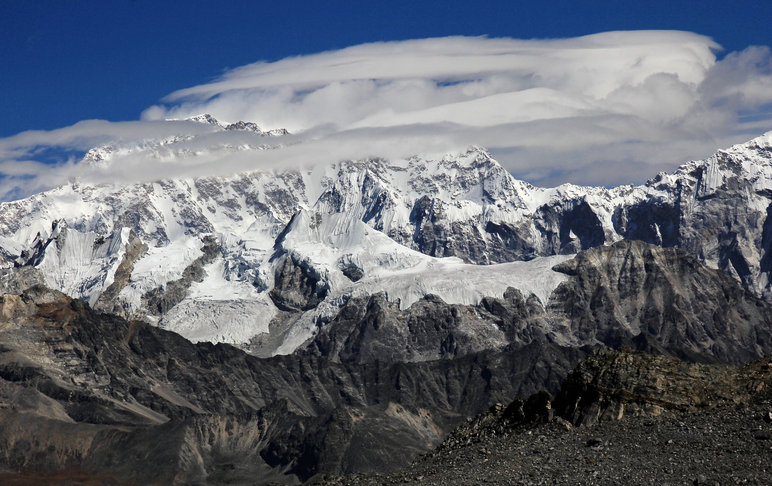
A short walk from the camp, one can ascend a ridge with splendid panorama of the now closer Langtang and Jugal Ranges. From the ridge we could see the trail leading to our next camp closer to the Tilman Pass. The pass itself was hidden behind the high mountains. From our vantage point, the trail looked like a rollercoaster: up and down for the entire way. The view extended to all high peaks of the Langtang Range including Dorje Lakpa (a 7,000m mountain with a 4,000 relief) and Jugal Range. The viewpoint was marked with numerous prayer flags and few chortens. We spent a short while on the ridge admiring the view until the clouds moved in and obscured the panorama.
It gets dark at 6 pm making the night long and cold. We go to bed at 7 or 7.30 pm and get up at 5 am. It is cold at night and frost covers the inside of the tent by morning. I sleep in my down jacket, hat and a hot water bottle in my sleeping bag for warmth.

Beautiful view from the ridge above Panch Pokhari. The Langtang and Jugal Ranges are on the horizon 30km away.
October 26, 2018 Tin Pokhari 4,200m
I felt like saying: Thank you God for the Koreans! We left Panch Pokhari in brilliant sunshine under a blue sky following the Koreans like a homeless Himalayan dog. We quickly ascended the ridge and stopped to admire the spectacular panorama of the Langtang and the Jugal Himals. After taking many photos, we descended on a good trail that we saw the day before.
Around 11am we stopped for a 2-hour lunch. We noticed very dark clouds moving in our direction from the lowlands. The clouds were thicker and darker than those of previous afternoons and looked ominous. Sure enough, it soon started to snow! As we moved on after lunch (north and up), the snow increased in intensity until it was full on winter. Now we could not see the trail and, with minimal visibility, we had no idea of the location of our final destination for the day. Everything was white and we could not see ahead of us or around. Thanks to the Koreans though, one of their men knew the trail and the general location of the camp at Tin Pokhari. This gave us the confidence to push on and not stop in some random spot. Without his help we would be guessing and wasting time. Perhaps not the end of the world, but it would make us unsure of what was ahead.
I we plodded through the deep and wet snow, I noticed that some of the Korean porters had no shoes and were wearing flip-flops! By now the snow was 5 inches deep and I felt cold just looking at the porters with their bare and wet feet in the snow. This added a sense of urgency for the porters and we did not linger. Obviously no one expected the snow or the wide out. It turned out to be a long and quite cold day and we covered quite a distance to get to the Tin Pokhari camp. We arrived at our destination at around 4 pm sliding down a slippery slope without being able to see any of the surroundings. It was getting dark and we were tired, wet and cold. I was concerned that we would have snow on the pass making it harder to navigate for our crew. We pitched our tents and crashed right after dinner at 7pm. We shared one tent and it was quite a cold night.

Frosty morning at Tin Pokhari
October 27, 2018 – Attempt to get to the high camp 4,600m
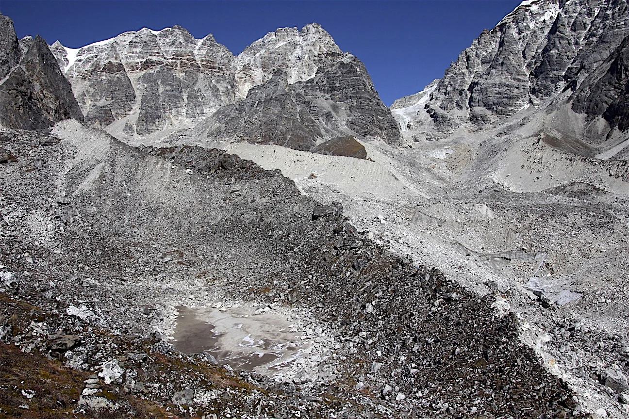
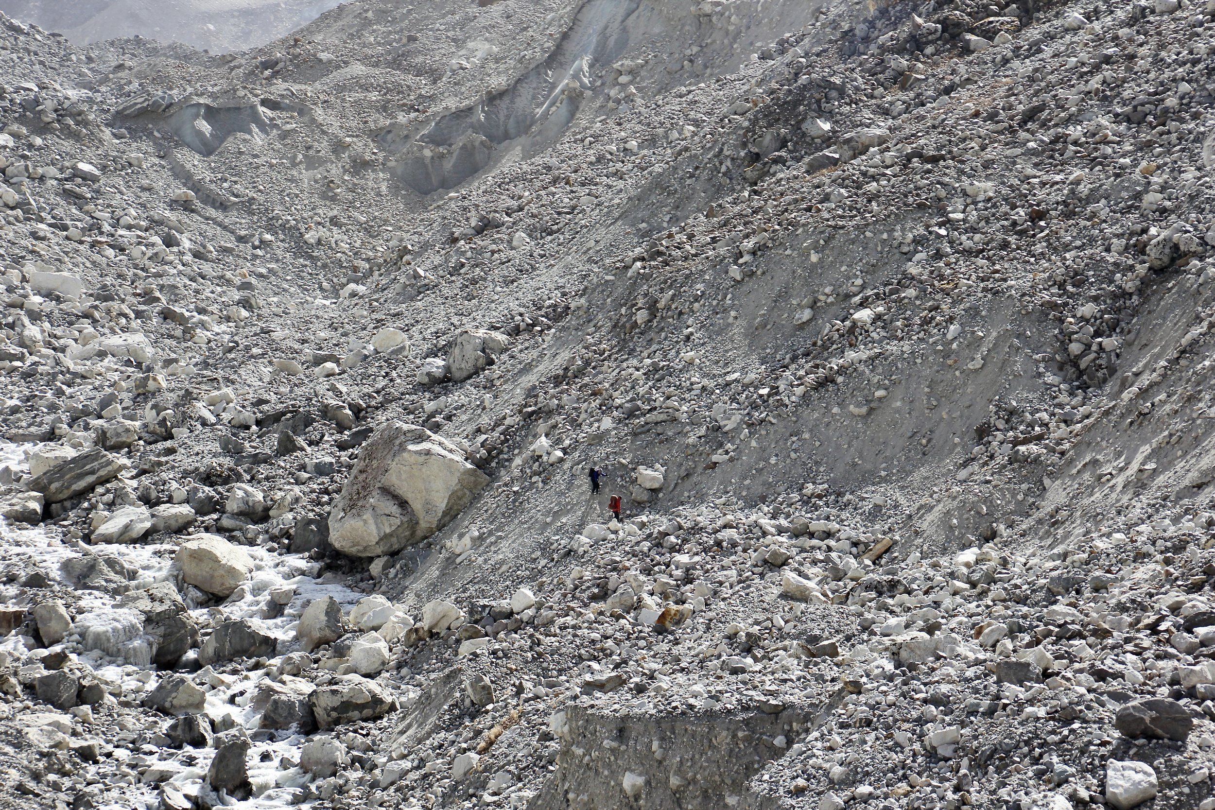
We woke up to a winter wonderland. Everything around us was covered in white and it was very pretty. The mountains were white and snow plumes were being blown off their tops by the wind. It was also cold! We had breakfast in a cold shade. After breakfast, we packed up and left for the Tilman Pass high camp, or so we thought. We followed the trail and trail markers put up by the Nepal Mountaineering Association. Unbeknownst to us, one of the markers was turned 90o in the wrong direction and we veered off towards the Tilman Pass East, up the wrong valley and towards the wrong glacier. We ascended for a few hours to 4,600m and hiked 10km before we realized our error. We basically hit a dead end. We reached a crest of a near-vertical moraine that did not have a way of letting us descend 100m down to the stone-covered glacier. The guys realized that something was not right and we consulted the map. So much for the Koreans knowing the way! On the flip side though, this provided us with a good opportunity to explore a beautiful valley and have a good look at the approach to the Tilman Pass East. We could see the large icefall descending from Mt. Dorje Lakpa across the glacier from our high point. We retreated down the glacier and came back to the sign that caused the confusion. We decided to camp nearby as it was getting late. This is such a beautiful area. Any opportunity to hike and explore it is great!

We set up camp and had a great fire and nice evening. We were now confident of the correct route to the Tilman Pass.
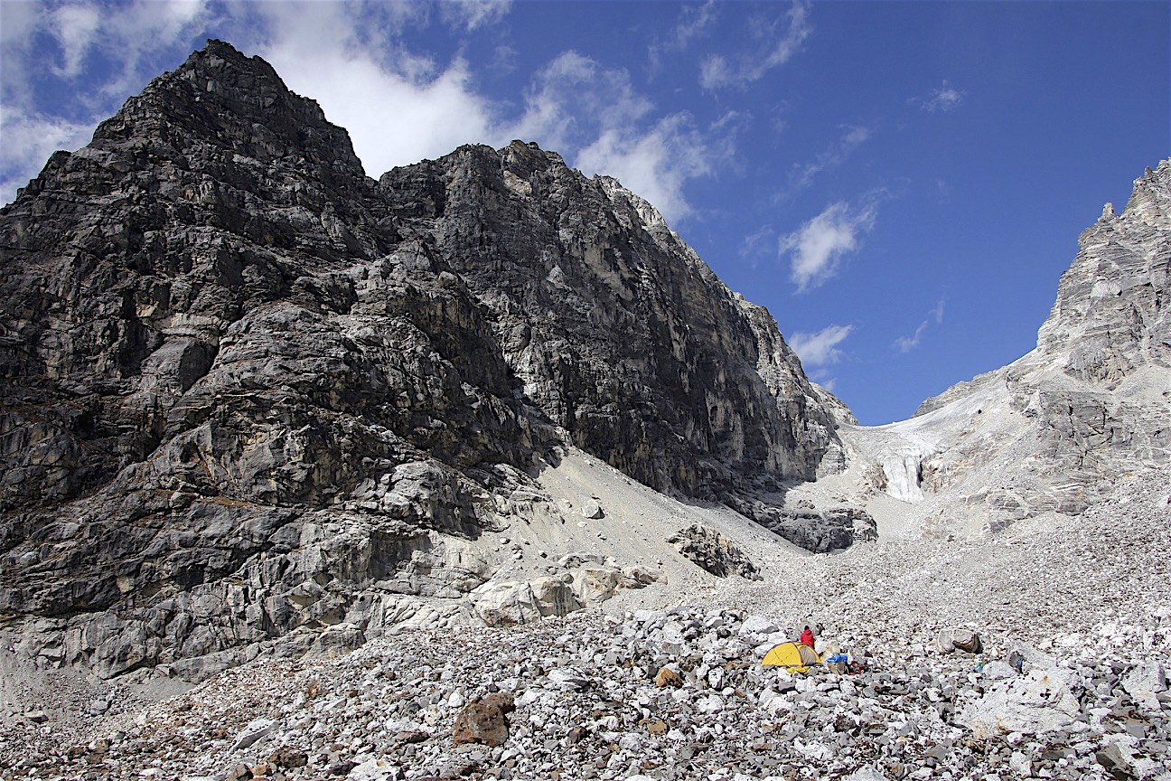
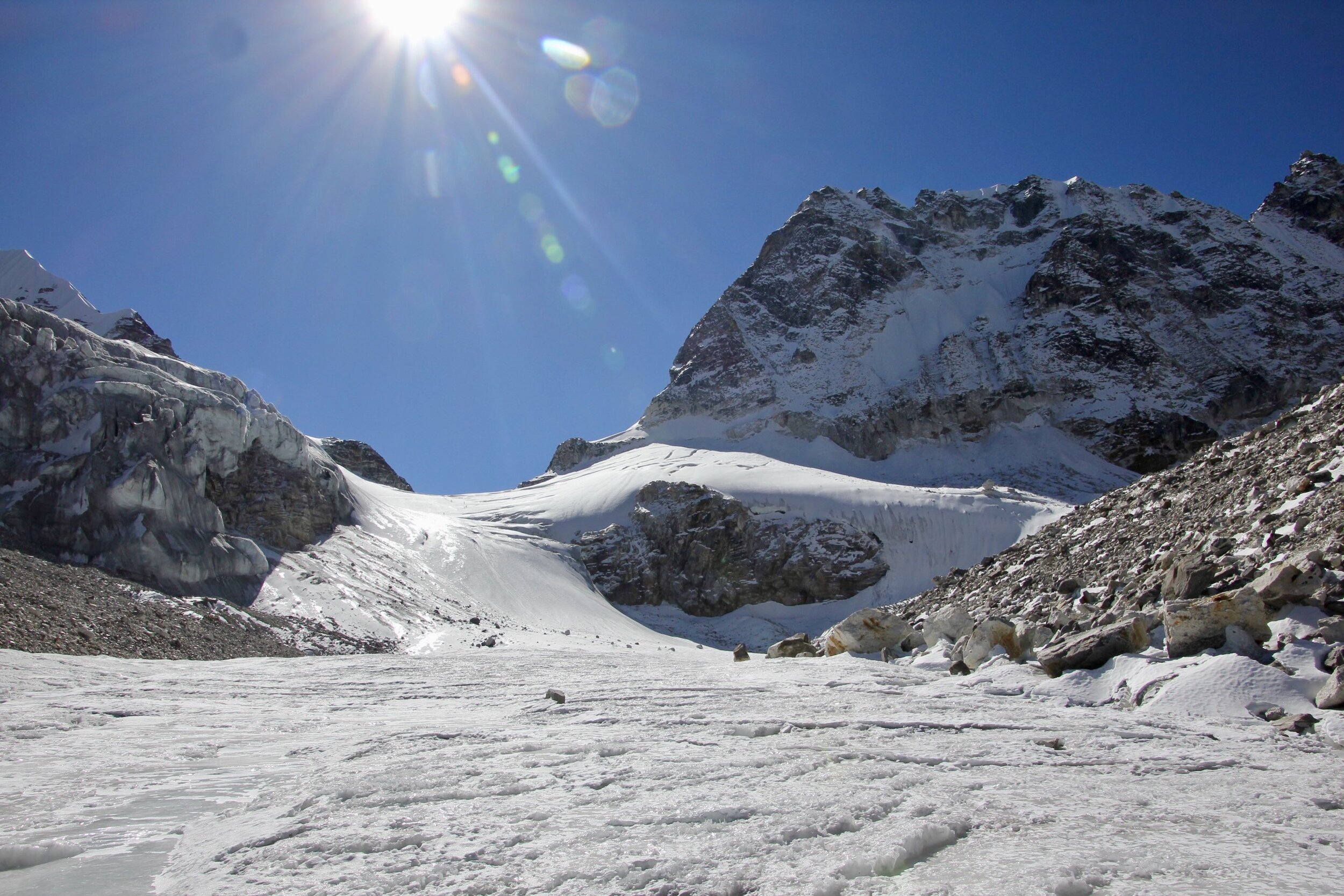
October 28, 2018 Tilman Pass High Camp 4,820m
We woke up to a brilliant and sunny day. The sun dried the tent and the sleeping bag before we left the camp. After breakfast we started to ascend the moraine to the correct glacier. After two hours of following the lateral moraine, we came to a spot where we could “safely” descend to the glacier itself. The descent was quite tricky with loose rocks and not much to hold on to. The exit point was marked with cairns but it would be easy to miss. It was actually quite dangerous as the moraines are unstable and rock fall was a real hazard.

We then followed the glacier covered in loose and unstable boulders for few more hours. It seemed endless. We walked on wobbly rocks and among great boulders all the way up to 4,800m. The route required concentration not to slip or break a leg. Our group split into two with each team ascending the opposite sides of the glacier. We finally arrived at the high camp consisting of some flat rocks on top of an ice crest. It was easy to miss. Shyam found it as the Koreans had no idea where the camp was. The scenery was spectacular and reminiscent of Pakistan. From the high camp we had a direct look at the Tilman Pass.

Tilman Pass high camp
So far, it is not an easy trek and it feels more like a mountaineering expedition than a hike. There are no teahouses or resupply points. It feels remote and far away from anywhere. We did not run into any other trekkers other than the Koreans.
David was very tired today, mainly to the problems with ascending the moraine. He collapsed into the tent after arriving at the high camp and did not re-emerge until dinner. The high camp is surrounded by high mountains very close by and has a very alpine feel to it. In the evening Shyam and some of the Korean guides went for a reconnaissance of the pass. I think that the Korean porters are as poorly equipped as ours and it turns out that they also do not know the way very well either… Strength in numbers and good Karma though.
October 29, 2018 crossing the Tilman Pass 5,330m
We had a very cold night in the high camp. As soon as the sun went down behind the nearby ridge, it got progressively colder. The camp is like a bird’s nest situated high at the head of the glacier at an altitude of 4,800m. The view from the camp extends down the glacier to the south and directly to the Tilman Pass’ icefall to the north. High rocky ridges on the east and west surround the camp. It is very beautiful but rocky and barren.
We got up at 4 am to cross the pass. It was dark and very cold. We had something to eat and departed at 5.30 am at dawn. The walk to the bottom of the icefall was short. It was mainly through a boulder field. We ascended to the right of the icefall on a steep boulder slope for approximately 200m of elevation gain. We then took a sharp turn to the left (north) and gained the dry glacier at around 5,100m. The sun was still hidden behind the mountain to our east, making it a cold ascent. For that reason, we did not stop and linger. There was no wind though and we had a clear blue sky. How lucky considering our memories of the ferocious winter storm on the Dhampus pass in 2017 (see the 2017 Dhaulagiri Trip Report).

Ascending the Tilman Pass
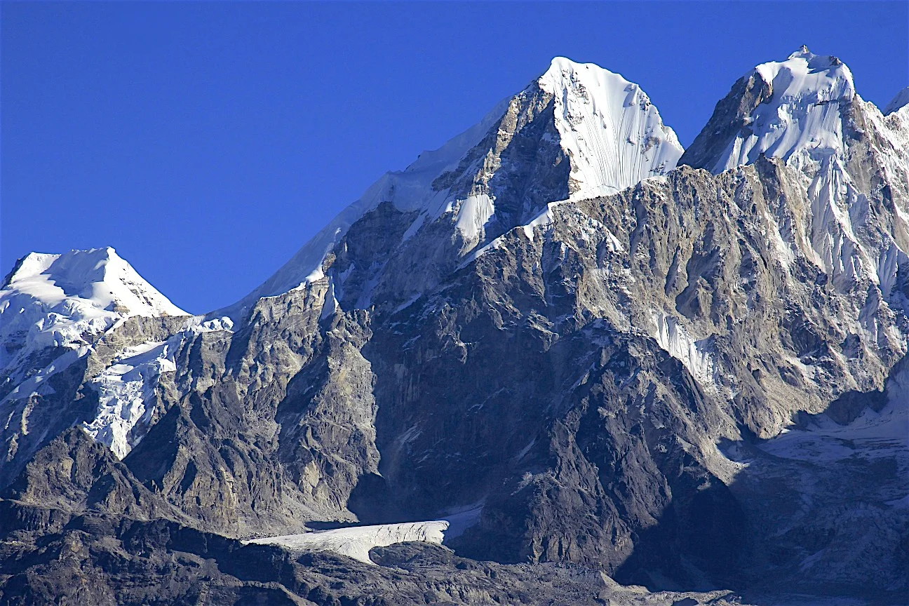
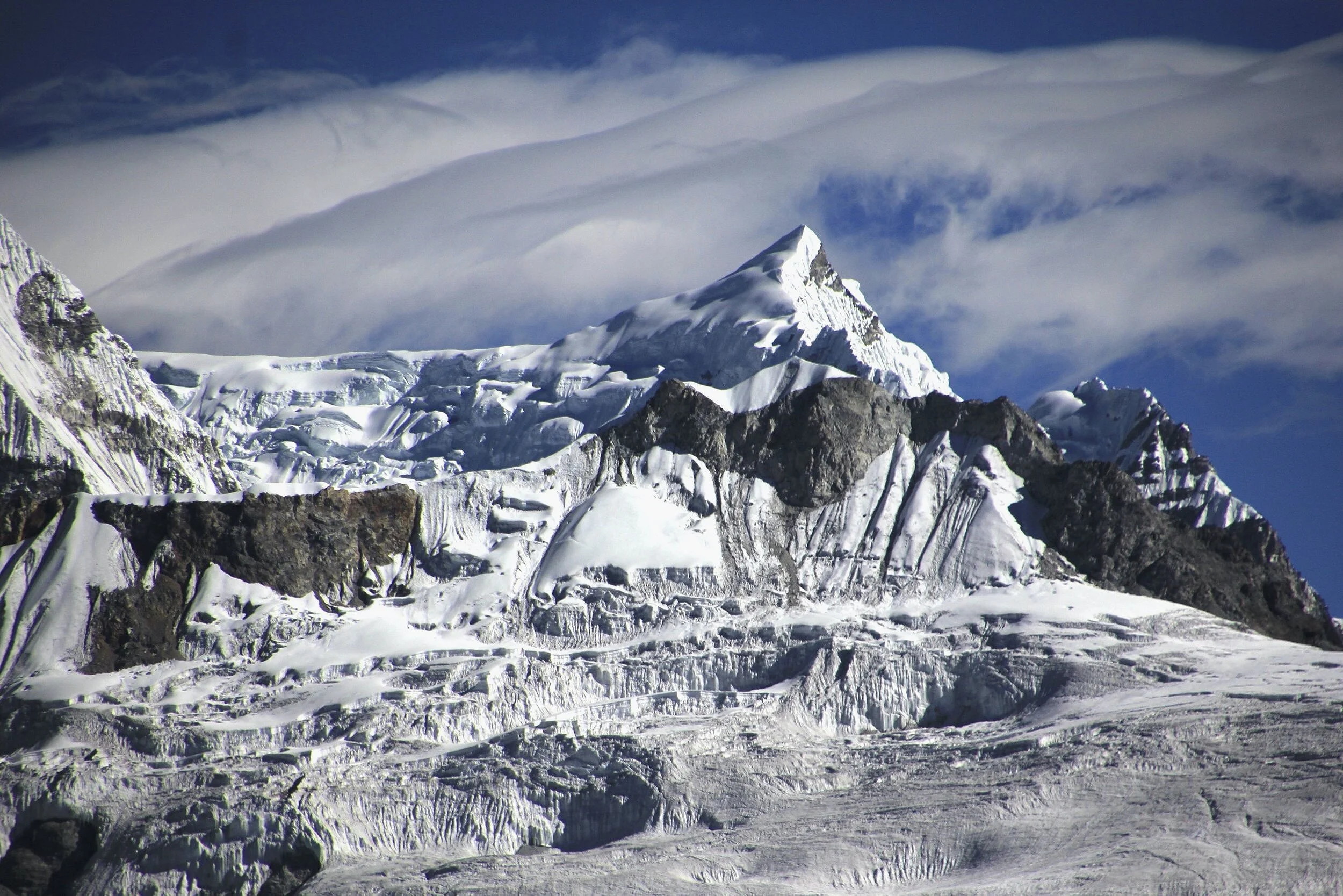
We continued our ascent for another 200 vertical meters between two steep mountains. We could see the crevasses and easily walked around them. After a short time we arrived at the pass located in a narrow cleft. To the north, the glacier opened up a lot more and the view was grander than to the south (where we came from). We were now at 5,300m, directly on the backside of Mount Ganchempo (6,387m). The view was not as grand as other passes we crossed. We were surrounded by rock and ice on all sides. Regardless, we did enjoy every minute of the windless time we spent on the pass. We took photos of the surroundings and the distant peaks of the Langtang Range. The most impressive though were the mountains immediately next to the pass. The icefall flowing from Mt. Urkinmang (6,151m) next to us was most impressive. The summits seemed so close, less than 1,000m of vertical gain from the pass.
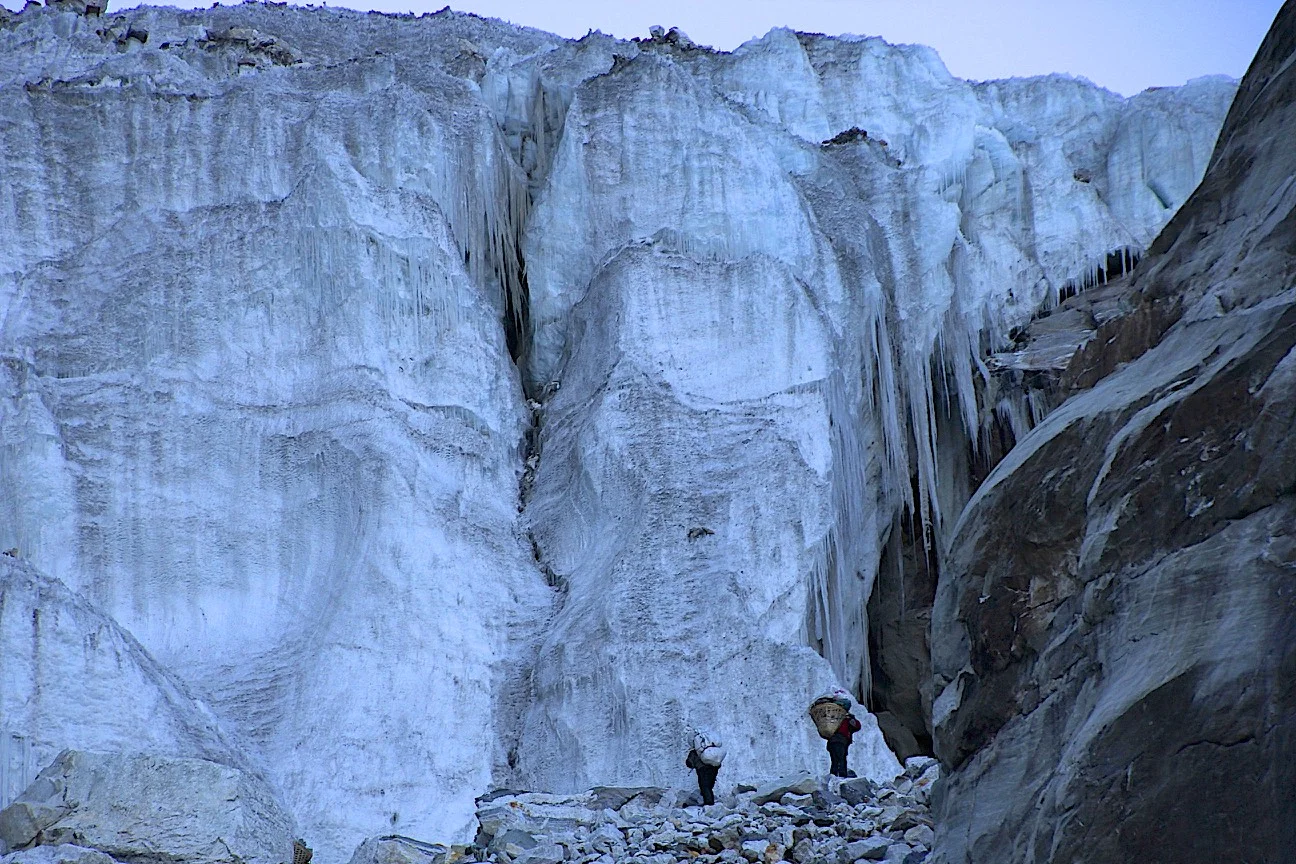
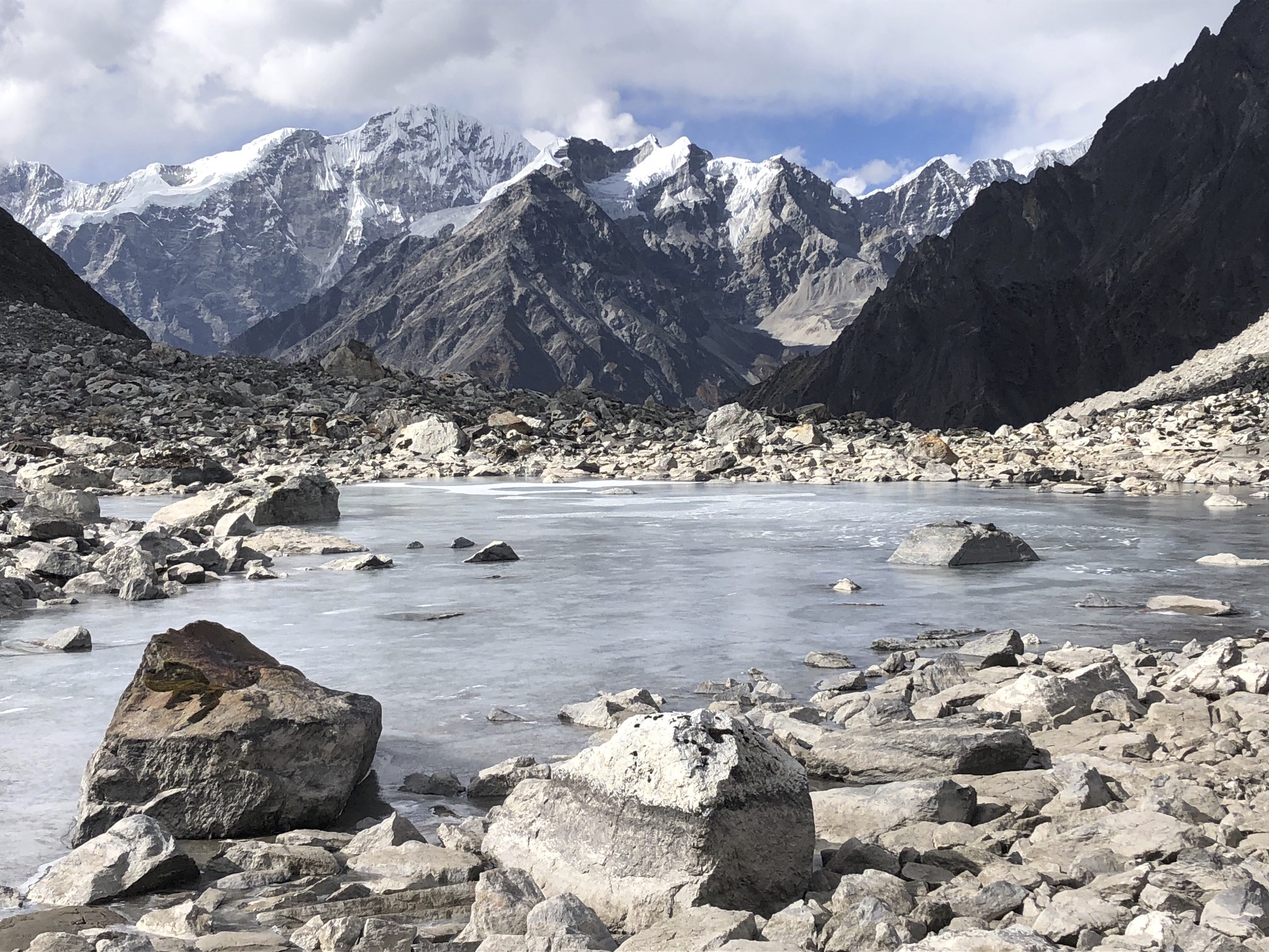
To the north, the main glacier flowing from the pass dropped down steeply. There was a fixed rope placed by the Koreans and another one placed by us, to descend on. The porters had no crampons and a slip would result in a 500 m slide to the bottom of the glacier. Shyam had a rope but no anchors apart from our ice axes. He found a piece of old rope under a rock and tied that around his boot for some very limited purchase on the ice. The descent was pretty straight forward and after we had some tea, we were walking on the flat part of the glacier. The glacier gave way to rocky and icy boulders and the descent became more tricky. We could now see a large green frozen lake below. The north high camp was located by that lake and was our destination for the day. We had to down climb a tricky boulder field and steep slopes in order to get to the lake. The going was not easy and I had to concentrate to avoid slipping.

The frozen green lake - the site of our camp.
Our campsite was located on the edge of the frozen lake. It was a beautiful spot. The lake was surrounded by high and glaciated mountains on three sides and the moraine of the Langshisa Glacier on the north side. It was the High Himalaya at the finest.

Almost there! Approaching the Tilman Pass north camp site.
After lunch I took a long walk to the top of the moraine of the Langshisa Glacier. I had a fantastic view up and down the glacier and to the surrounding peaks at the head of the valley. Down below, to the north and across the Langtang River, I was looking directly up the Shalbachum Glacier and the Shalbachum Mountain (6,707). To the left of the Shalbachum Glacier I could see the Yala Peak and the ridge leading to Dangpache Mountain (6,567m). I ascended the Yala Peak in 2010 with David. The visibility was great; the weather was superb but windy. At sunset, there was quite a lightshow. Various shades of orange light from the setting sun projected onto the clouds and glaciers surrounding the camp. I took many fabulous photos of the reflections of the Langtang peaks in the small tarns near our camp.
The surrounding landscape was very grand, dramatic and beautiful. Massive moraines, 7,000m peaks all around us with steep glaciers dropping down precipitously. We were in the middle of high Himalayan peaks in the heart of the Langtang Range! The sun soon hid behind the steep mountain to the west of our camp and it became quite cold. The wind also picked up.

Tilman Pass high camp on the north side of the pass

Langshisa Glacier
We had a long and cold night. I was very happy to have crossed the Tilman Pass and be in this beautiful spot. I could stay here for a few days and explore the surrounding valleys and peaks. This was the last of the high and technical passes of the Great Himalaya Trail proper for me. I have basically finished all the interesting and alpine sections of the GHT between Kangchendzonga and Dhaulagiri (including the Dhaulagiri circuit that is not part of the GHT). I have not done the section between Gunsa (Kangchendzonga) and the Arun Valley (Makalu), the section between Rowaling and the Panch Pokhari Ridge (Langtang) – a low altitude hill slog, and the section from Syabrubesi to Arugat in the Ganesh region – another low altitude slog. I do not want to spend the time and money walking for the sake of connecting dots without any interesting or challenging objectives along the way.

Langshisa Ri
October 30, 2018 Langshisa Kharka
We left early to go down to Langshisa Kharka where David and I were in 2009. The descent down was the most dangerous part of the Tilman trek, down a steep and very loose moraine. The entire moraine consisted of consolidated mud with rocks and huge boulders protruding from it. They seemed ready and waiting to roll on top of us at any moment. We went down fast to avoid any accidents. We then walked down the Langshisa Glacier on a conveyer belt of rocks and boulders. Finally we arrived at the snout of the glacier with a cool ice cave spitting a rushing glacial stream.

Looking for safe descent to Langshisa Glacier. Langtang River Valley is below.

Departing the north Tilman Pass high camp

Langhisa Glacier - we descended the steep moraine on the right
Rounding the corner revealed the Langtang Valley and the terminal moraine of the Langtang Glacier to the north of us. We were now in the familiar terrain. To my surprise, there was a bridge across the Langtang River, which enabled us to cross without having to ford the cold rushing water. It was windy. Numerous prayer flags at Langshisa Kharka welcomed us by flapping loudly in the afternoon sun. Nothing changed at the Langshisa Kharka campsite from 10 years ago. We set up our camp in one of the stone huts to shelter us from the increasing afternoon wind. The boys built a roaring fire and were looking forward to the first day off since we started. The Koreans left us and moved on to complete the Manaslu section of the GHT.

Half of our fantastic crew!
October 31, 2018 Langtang Glacier 4,600m
One of my objectives on this trip was to explore the Langtang Glacier. I remember David and I going to the glacier in 2009. I regretted that we did not have enough time to explore further.
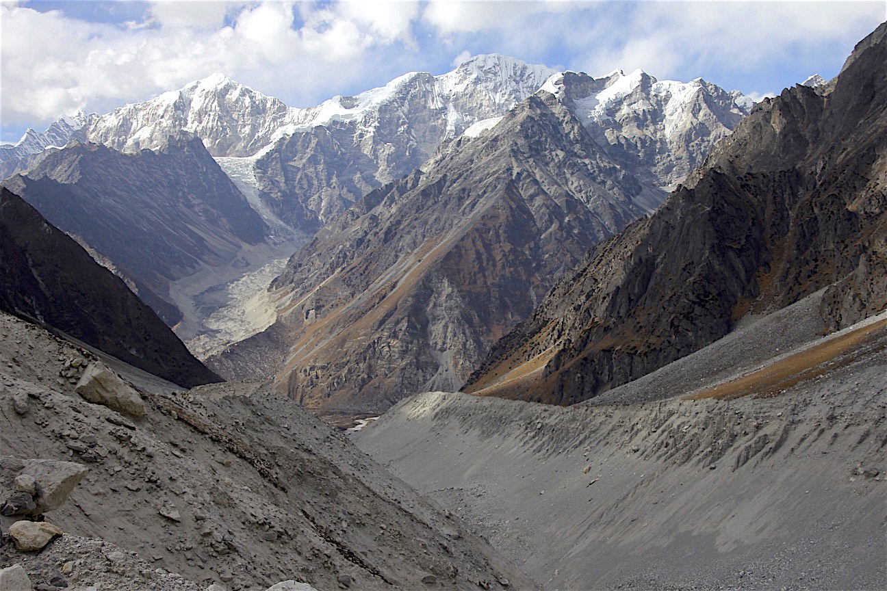
Shyam and I left the Langshisa Kharka camp in the morning (David took a day off). Along the way, we noticed a few landslides that were caused by the 2014 earthquake. We had cold and strong wind blowing at us from the north. We ascended to the terminal moraine of the Langtang Glacier and then got onto the glacier itself. We were going up and down high and loose mounds of ice covered by rocks. The going was tedious and slow. It soon became apparent that we would not be able to advance very far this way. We saw another trail along the lateral moraine of the Langtang Glacier in the distance. We decided to retrace our steps and gain the moraine to continue up the Langtang Valley as far as we could. We passed the Morimoto basecamp at 4,600 with a threatening herd of big yaks checking us out and continued further up the moraine.

On the Langtang Glacier - the wall of 6,000m is blocking the view of Mt. Shishapangma hiding right behind them.

Langshisa Ri’s north aspect from the Langtang Glacier
The rocky wall of Pemthang Karpo Ri was directly ahead, close and imposing. We wanted to see around the corner, around the spot where the Langtang Glacier takes the turn to the northwest. I was hoping to catch a glimpse of Mt. Langtang Ri and perhaps the 8,000m Mt. Shishapangma itself! The closer we got to the corner the higher and more imposing the Pemphang Karpo Ri wall appeared. The glacier was curving gently and there was no view. We were standing directly across the 1,500m high wall of huge mountains looming above us. We have walked very far and were getting quite tired. The wind was also increasing and we were running out of water. We walked for at least 10km up the valley. We learned later that the Langtang Glacier continues for another 15 km from that point! It apparently takes 3 days to get to the end of the glacier (and the basecamp of Langtang Ri). I had to admit defeat and leave the quest for another time. We turned around and headed down the valley to arrive back at the Langshisa Kharka camp around 3pm.
I was quite tired but very satisfied with our effort. We did not have any days off since the start of the trek on October 20th. While Shyam and I were on the glacier, Milan, one of the young porters, took a 6-hour hike to Kianjing Gompa to recharge his phone! He did not even bring any beer with him on the way back. Obviously we were quite disappointed!
November 1, 2018 Kianjing Gompa 3,825

Looking towards Langtang Glacier from Langshisa Kharka. We went all the way to the distant ridge 10-15km away! Pemthang Karpo Ri is on the right.
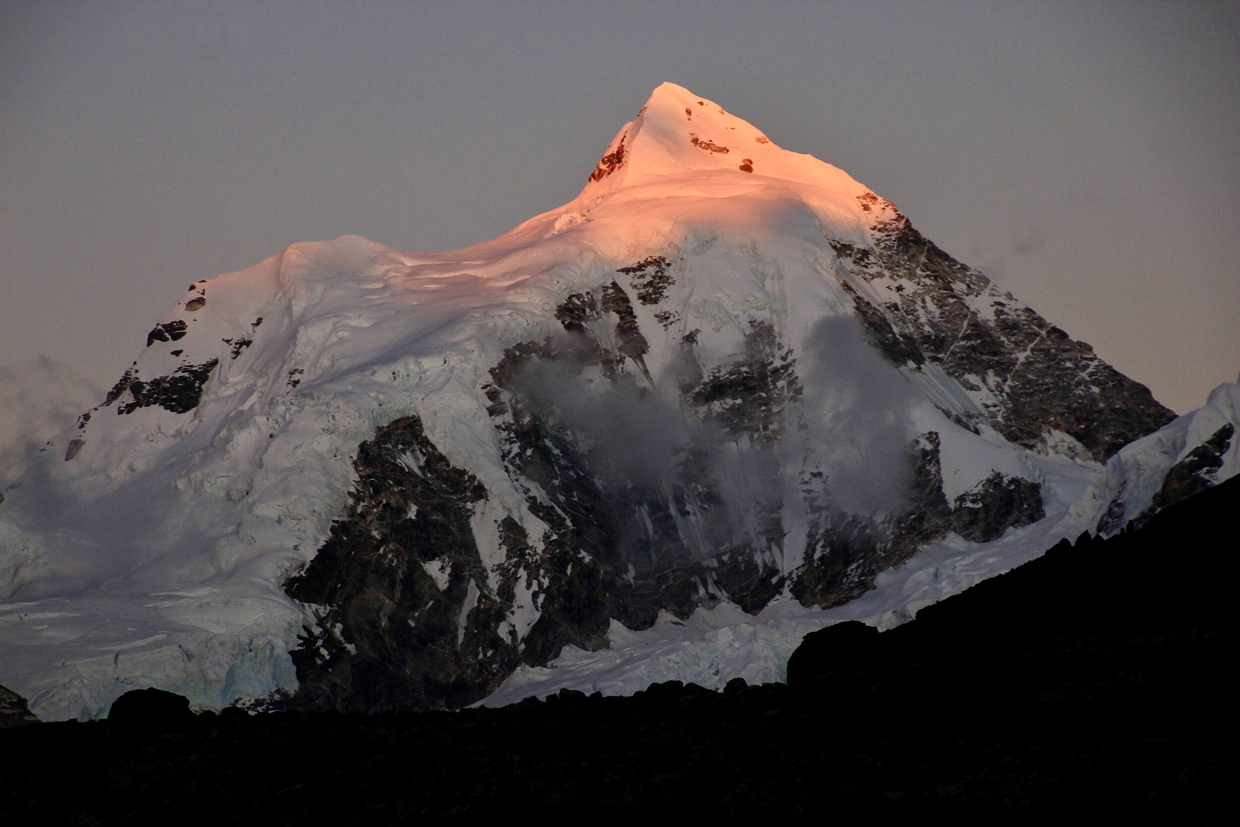
Our objective was to get to Kinjang Gompa. We were looking forward to a warm shower and a cold beer. We walked down the Langtang River Valley retracing our steps from 2009. We crossed remnants of massive landslides caused by the 2014 earthquake. The walk was fast and very scenic. After 3 hours, we rounded the final corner and the massive bulk of Langtang Lirung appeared before us. It is such a beautiful and massive mountain. We could not see the village of Kianjing Gompa until we were almost there.

Approaching Kinjang Gompa with Langtang Lirung looming above
Surprisingly, the village of Kinjang Gompa has expanded considerably since the 2014 earthquake! The foreign aid money allowed the locals to build big hotels and coffee shops. The western not-for-profit was turned into a big profit! The village was very expensive and one enterprising gold-toothed fellow appropriately fleeced us. The prices in the village are shockingly high especially for food and beer! He is a sneaky one and managed to cheat us at every turn with a big smile and proclamations of his unconditional friendship. He looked shifty from the moment I met him and my initial suspicion was confirmed by the time we left the village. One good thing about our association with the shifty entrepreneur was the helicopter ride we managed to arrange through him (although he cheated us in that transaction as well).
In Kianjing Gompa village we heard that many groups attempting the Tilman Pass from the Langtang Valley side turn around, as they cannot cross the moraine of the Langshisa Glacier. This is the moraine that we also found to be the most challenging and dangerous part of the entire Tilman Pass route.
From the dining room of the hotel we were staying at, we had a fantastic view of Mt. Langtang Lirung.
November 2, 2018 Langtang Lirung Basecamp 4,350m
Today I decided to go to the base camp of Langtang Lirung. Although the option of sitting and doing nothing for a day seemed like a great idea, the FOMO got better of me. I was quite tired climbing the hill from Kianjing Gompa village to the basecamp. It looked much closer than the 5 km each way. Along the way, Shyam and I passed a Buddhist shrine located in a small cave. We also ran into our young porters picking up cow patties as a side gig for some quick money on their day off.
At the Langtang Lirung (LL) base camp (BC) I was looking for the memorial to Tomas Humar who died there in 2009. The BC is located by the moraine of the LL Glacier. It is surrounded by LL (7,227m), Changbu (6,251m), Kinshung (6,781m), Langtang Yubra (6,048m) and Yubra (6,264m). It is all very impressive and grand. The view down the LL glacier to the Kanjala Himal is also quite beautiful. From the LL BC we could see the ascent route to the Yala Peak. To my surprise, the glacier we climbed 10 years ago is almost completely gone! We had a windless and sunny day. At times it was even hot! I would have loved to climb higher to maybe 5,000/5,500m but I had no energy left in me. My legs hurt and my lungs hurt as well. The following day, we were going still higher to the Ganjala Pass at 5,130m. Being conscious of that, I decided to conserve my energy.

Langtang Lirung looming over the basecamp

Langtang Lirung Glacier as seen from the drone
Back in Kianjing Gompa, over a beer, David implied that perhaps we should go down the valley but I thought that since we were already here we should at least try to cross the Ganjala Pass. David agreed at the end as we concluded that the chance of us returning to the Langtang valley any time soon was pretty slim.
November 2, 2018 Ganjala Pass Basecamp 4,300m
Thanks to our enterprising local “friend” and some hard cash, we managed to get a helicopter ride up the Langtang Valley. Some tourists were flying from Kianjing Gompa to Kathmandu (KTM) and we asked for the helicopter to bring more fuel and give us a 20-minute ride up the Langtang Valley over the Langtang Glacier. I wanted to see the Langtang Glacier that I did not get to see by walking to its end a few days prior. I knew that this would be a spectacular experience based on my memory from the Annapurna flight in 2017. Luckily, the day was sunny with no wind, making the conditions for flying perfect.
The helicopter was supposed to come by 8am but it showed up at 10am due to air traffic congestion at the KTM airport. The helicopter pilot was from Australia and had limited experience with flying beyond the Kianjing Gompa village. There was some confusion regarding the amount of flight time we paid for (of course the Kianjing man making the arrangements was trying to cheat us). Finally we sorted out the confusion and off we went. Flying in helicopters is the ultimate ride and an exhilarating experience. Flying in the Himalaya is the ultimate!
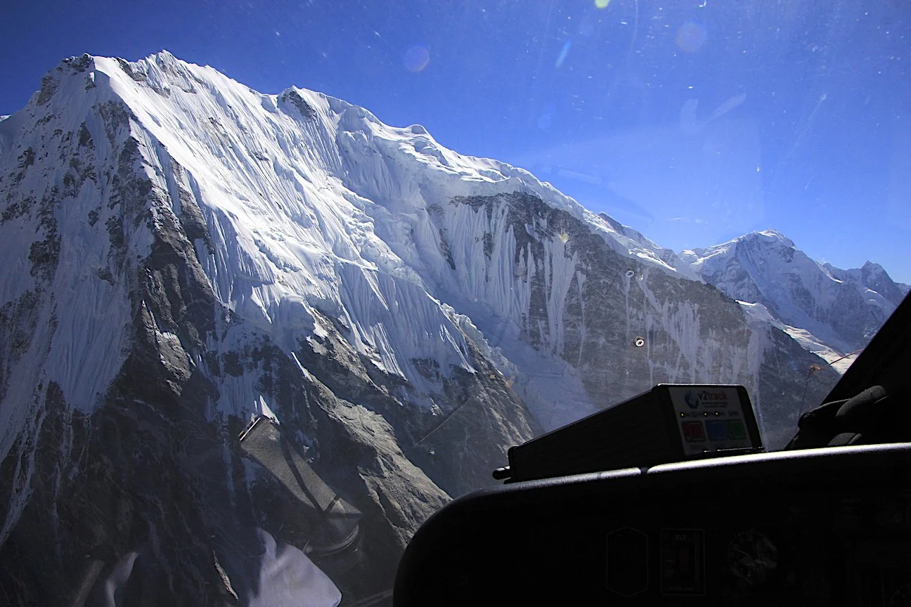
The machine started up and we lifted off and flew north. We gained altitude as we went further. We could see Mt. Morimoto, Shalbachum, Langshisa Ri, Penthang Karpo Ri, many glaciers and deep valleys below. We were flying at 19,000 feet. Soon the bulk of Shishapangma in Tibet rose majestically from behind the ridges of Goldum (6,447m), Peri (6,174m) and Risum (7,050m) – the very wall that blocked our view during the exploration of the Langtang Glacier. Mt. Shishapangma (8,013m) towered above all other Langtang peaks. Beyond Shishapangma, we could see the brown flats of the Tibetan Plateau. We could see the entire Langtang Glacier with Langtang Ri at its end. We had great visibility and there was very little wind. As we reached 19,000 ft of altitude, the helicopter was struggling a little. As we turned, we flew directly towards Pemthang Karpo Ri. The pilot was surprised that although he was at 19,000 feet, the top of the peak was still way above him. The summit is at 22,522 feet or 6,865m (another 1,000m or 3,500 feet higher). The pilot took a 180 degree turn at Pemthang Karpo Ri, approximately 10km from Shishapangma, and flew back. On the way back, we flew in front of the Langshisa Glacier with the entire Tilman Pass trekking route visible below. We could see the pass we crossed, the frozen lake where we camped, and the entire route we walked on just a few days before. The flight was very impressive and David and I were both very satisfied! I wish it could had been longer!

Ready to fly!

The Langtang Glacier, Mt. Shishapangma far away (on the left) and Mt. Pemthang Karpo Ri (22,500ft) on the right.

Looking northwest from 19,000 feet. The point peak is Mt. Chusmdo 6,508 in Tibet (China).

Mt. Lanshisa Ri (left) and Naya Kanga (right)

Mt. Dorje Pahad 6,979m at the end of the glacier. The wall of Mt. Langhisa Ri on the right.
After landing back in Kianjing, we had another overpriced coffee and dry apple pie before we took off for the Ganjala Pass.
The Ganjala Pass basecamp is 1,300m vertical climb from Kianjing Gompa. The going was easy on a well-established trail with fantastic views to the Langtang Lirung and all mountains surrounding it. The basecamp sits on a promontory overlooking the beautiful Langtang Valley and the high peaks. It was a great day with little wind and great visibility. The evening was cool and there was no wood for a fire so we all drank hot tea to stay warm.

Hiking to the Ganjala Pass with Kinjang Gompa below.
We intended going further to the high camp at 4,800m but this was not possible owing to the lateness of the hour and the reported absence of water at that camp.

Looking up the Langtang Valley.
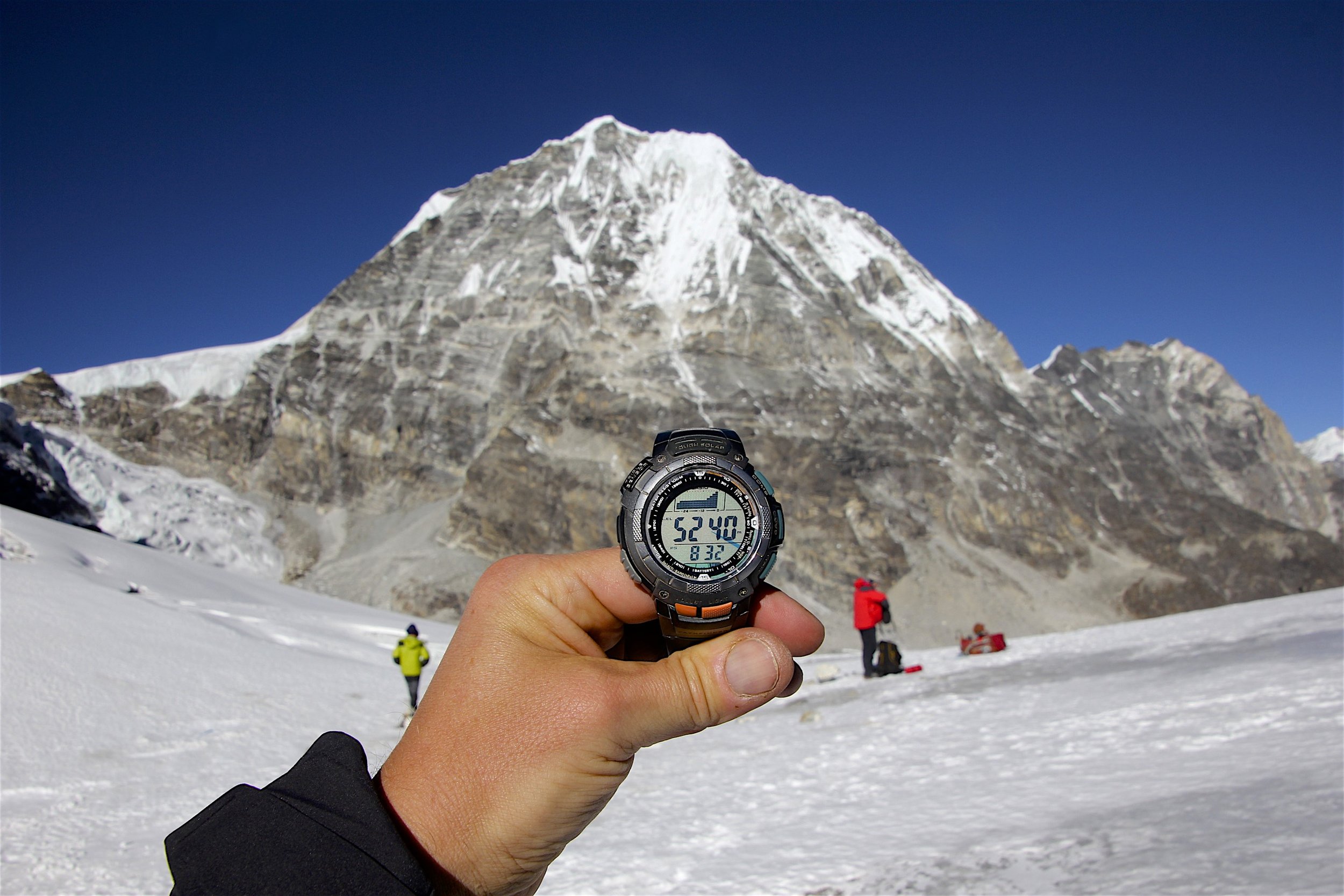
November 3, 2018 Ganjala Pass 5,130m
We got up at 5 am and left the camp at 6am. We had a 1,000m vertical ascent right ahead of us straight from the camp. I was a little tired from the continuous 16 days of adventuring with no rest days. Right out of the gate we climbed steeply for about 500 meters before the trail levelled off. The higher we ascended the better the views got. We could now see all the way to Shishapangma and above the ridges of the Langtang Himal. It was another beautiful day with great visibility and sunshine. The climb to the pass over a glacier was long and it felt tedious, more glacier rock and moraines. The moraines were all dry though and we did not have any snow to worry about. The pass became visible early on and we just gradually ascended the long valley to get closer to it. The pass itself was very steep on the north side, basically a vertical drop of 100 m or so. In order to get to the pass it was necessary to skirt the ridge that forms part of the pass and approach it from the left side via a rocky shelf with some great exposure. There was a long ladder for the porters and a steel rope on the shelf for safety. I could just imagine the increased degree of seriousness if there was snow and ice on this route. Again, our poorly equipped crew would struggle in case of poor weather.

Climbing to the Ganjala Pass with the Langtang Velley below.
The Ganjala Pass is situated at 5,150m. It is a fantastic viewpoint for the entire Langtang Range. Mt. Shishapangma, the highest mountain of the range, dominates the skyline. The pass is quite narrow and marked with numerous prayer flags. The Ganjala Pass reminded me a little of the Renjo La Pass in the Khumbu Region. The Ganjala Pass is steeper though and more remote than the Renjo La Pass.

On the Ganjala Pass
The descent from the pass to the south was also steep but not long. We descended on some loose scree and rocks to the bottom of the glacier at 5,000m. Surprisingly, there was a good trail not too far from the bottom of the descent gully. I refilled the water bottle with some glacial melt water. We were all very tired, including the porters. When we reached the bottom of the descent slope, we were still about two hours away from the camp. The trail was quite easy but long. It was down, down, down to 4,400m where we camped by a stream. At the end it was a 10-hour day with 1,000m up and 700m down over challenging terrain and high altitude. A good workout.
November 4 and 5, 2018 Descent from Ganjala Pass from 4,400m to 3,780m to Tarkeghyang
The descent from Ganjala Pass high camp was quite long. Basically, we descended back into the clouds (like the ascent to the Tilman Pass two weeks before). This made for a cold and grey experience without any views. The descent was not gradual but had many long and steep climbs. I am not sure how many meters we climbed that day but it was easily close to 1,000m. So much for descending!
On the second day of our descent we could not find any water and we were forced to go much further than we intended (we hiked for over 17 km) to a place named Dorjeling. In order to get water, Shyam and the boys went from the ridge down to the river at the bottom of the valley (a 700m down climb) and then all the way back up with the heavy jugs of water. They sure deserved a medal for that! Without water, no one eats. The porters were very tired and hungry after the long day.

Looking for a shortcut to the village below. Our crew and Dhalbat the dog.
The waterless campsite was beautiful and had a fantastic view of the sunrise. The rising sun dried our tents and sleeping bags. From the campsite, we ascended another few hundred meters, then down, up and down. Finally, we just went down all the way to the village in the valley far below to the “Tourist Paradise” teahouse.
At this point, David and I were basically done with the trip as we were just going back to the road. There was nothing else left to see. At the “Tourist Paradise” we washed our clothes, took a hot shower and just relaxed in the hot sun. We were definitely back on the main trekking route as quite a few trekkers arrived later in the afternoon.
This trek has been quite epic. We both agreed that it was one of the finest in Nepal (I say the same about every one of them, but this one really was one of the finest). This route was wild and remote, yet close to Kathmandu. We saw hardly any other trekkers or locals for that matter. It was also COLD! We had some really cold nights and, since the sun disappeared by the afternoon almost every day, we had cold days too. The altitude was consistently above 4,000m for most of the trek. I did not have any days off and each day I walked for more than 10km,
I had no altitude or health issues at all. I felt fit and strong all the way. I was tired but not to the point of slowing me down. I found it difficult to sleep mainly due to the cold. I would wake up just about the time my water bottle cooled down (usually at 2am; we would go to bed at 7.30) and I had hard time falling asleep again. I would then wake up at 4 or 5 am and the day would then start. We could not linger in the kitchen tent in the evenings or mornings, as the boys needed it to sleep and eat in. This forced us to retire to our sleeping bags early.
This trip was also marked by some incredible luck. No one from our crew knew the way or had proper gear. It was almost a miracle that we ran into the Koreans given how infrequently the Tilman Pass is crossed. This strength in numbers gave us the confidence and made the experience more enjoyable. We would have struggled with finding the key points along the way: the descent point to the glacier, the ascent route to the pass and the descent gully to the Langshisa Glacier. We were also very lucky to find the helicopter in the right spot and on the right day. Also, on the flight day, the weather was perfect. Although the gold-toothed man from Kianjing is a shifty bastard, the flight was worth it. We were also lucky with the great weather we enjoyed. Had we had any snow on any of the two passes, the experience would have been epic but in the wrong way.

The trip reinforced by conviction that David is the best company for me. We really are a perfect team for such endeavours. He is mentally and physically strong although this trip did tire him out a bit. I think that he was close to his limit a few times but pulled through with gusto and a smile.
November 6, 2018 Kokani 2,045m
Today we walked on a nice trail for the final 15km from Tarkeghyang to Kokani. We had lunch in Semartang at a nicely appointed house of a local lady. We also attracted a local mutt. I named him Dhalbat and he dry humped me to show me his love. Then he followed us for some distance and hung around until we left the following day. I was glad that we were done but also sad that we were going back to the chaos of the valleys.

Almost done and still smiling!
The drive from Kokani to Kathmandu was tiring and long although the distance is only 70km. The state of roads in Nepal is beyond basic as I mentioned. We stopped for lunch in a town called Zero Kilo and had probably the best dhal bat in Nepal so far. Then onto the Arniko Highway (the road connecting Nepal and Tibet) and back to dusty and polluted Kathmandu. And just like that, it all ended in the Hotel Vaishali. In the lobby we were greeted by an exhibit of photographs from the golden era of Polish Himalayan climbing. We had a nice couple of days decompressing in Kathmandu and enjoying Raj’s hospitality again for which we are very grateful! Yes, we will return!
Distance traveled: 200km
Elevation climbed: 7.5 km or more

David, Derek and Dhalbat! I wished that I could take the dog with me!
Langtang Trek - Tilman Pass
In October of 2018, we traveled to Nepal to complete the Tillman Pass and Ganjala Pass trek. We approached the Tillman Pass from the south side via the Panch Pokari Ridge. We then descended to the Langtang Valley, explored the Langtang Glacier and exited the Valley via the Ganjala Pass. We also managed to take a helicopter tour of the Langtang Valley north of Kyanjing Gomba. All in all, it was a wild and challenging trek through a wild and remote area of the Langtang Himal.
Thanks again to mountainsunvalley.com for all the support and help with putting this together.
See the wonderful page HERE with detailed annotations of various mountains in the Langtang and Jugal Ranges from this trek.
Also, see the page HERE with detailed annotated photos from our helicopter flight in the Langtang Range.
For photos from the Yala trekking peak see the page HERE. It is one of the best spots for the panoramic views of the Langtang Range because of its central location.


See the Link for the Annotated photos of the Langtang Himal from Helicopter
See the Link for the Annotated photos from Yala Peak - a trekking peak in the Langtang

The Langtang Range. Langtang Lirung is on the left and Shishapangma is on the right.

The Langtang Range. Shishapangma is the tallest mountain in the photo.

West side of the Langtang Himal
Langtang Lirung

Langtang Himal

Langtang Himal

Langtang Himal

Langtang and Jugal Himal

Jugal Himal

Tilman Pass is on the top right and the Langshisa Glacier is in the middle - our route down from the Tilman Pass.

Tilman Pass and the high camp (by the frozen green lake).

Closeup of the Tilman Pass from the helicopter.


Second day of the approach to the Tilman Pass. We were in thick clouds during the day on this section of the trek.

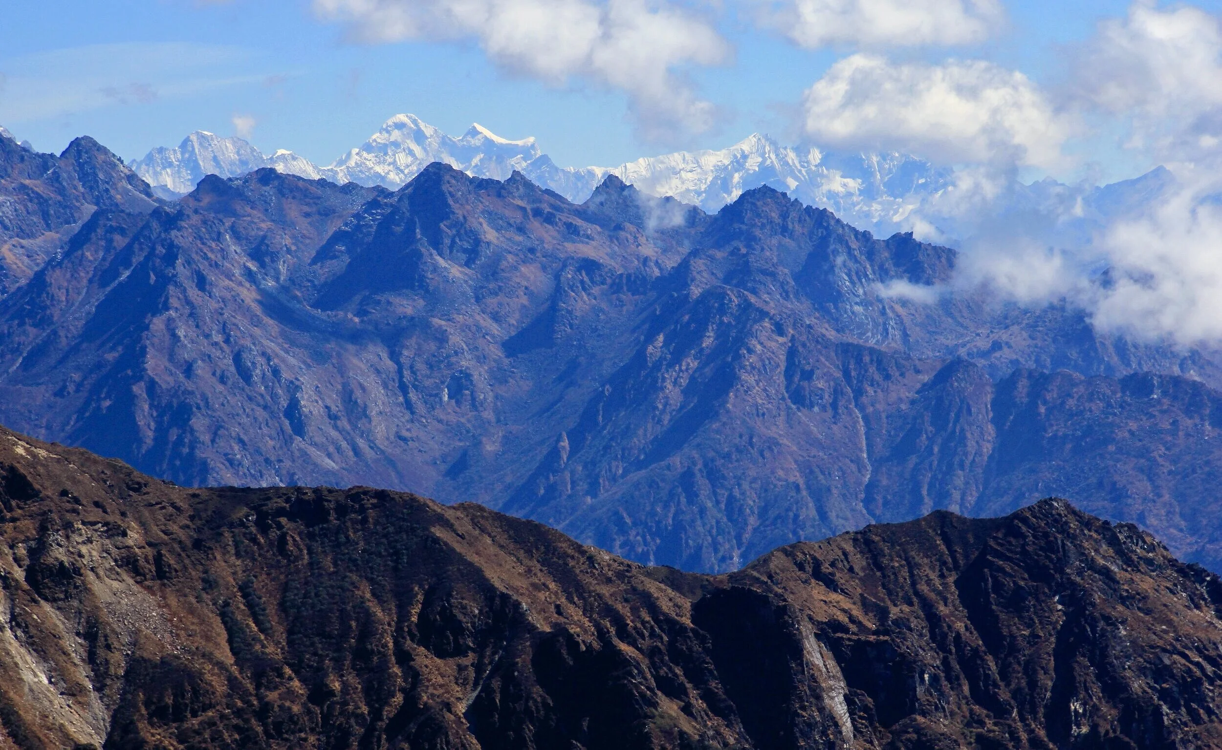
Beautiful sunrise over foothills of the Himalaya. This region is called Helambu.

Looking to the Ganja La Pass and Langtang Lirung

Another campsite with a fantastic view and no water

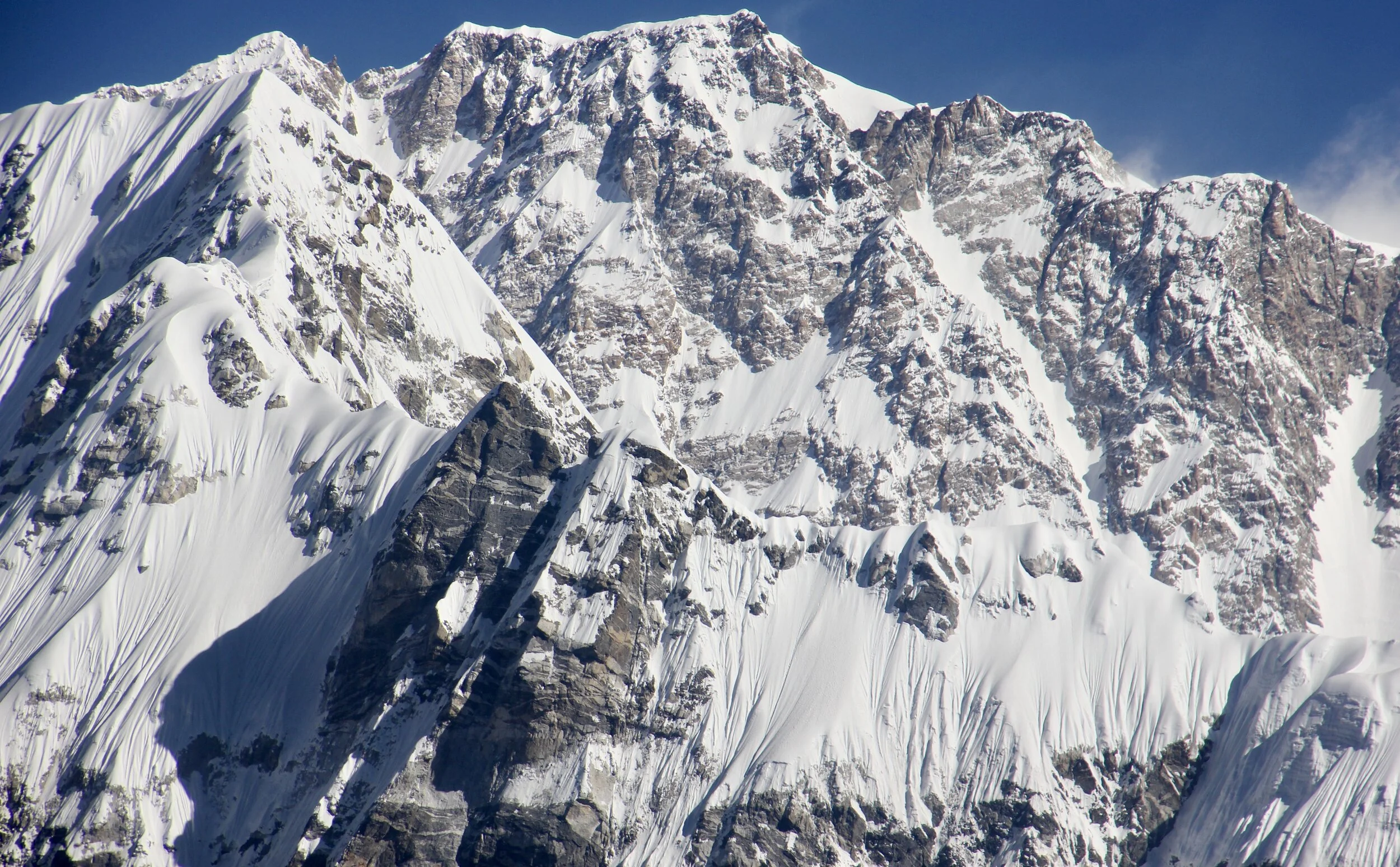
Gur Karpo Ri, Dorje Lakpa and Jugal Himal from the south. These mountains are located in China.

Shishapangma peaking from behind the ridges of the Langtang Himal as seen from the south, still a long way away from where we were!

Langtang Lirung and Ganjala Pass (on the left) from the south.

Looking at the Jugal Himal in Tibet

A funky trail over some steep terrain.

Our final camp before Panch Pokhari. This was one of the most scenic campsites on this trek.

Our Chef in action! It is quite unbelievable what can be made in these conditions.

One of many spectacular campsites.

High on the ridge near Panch Pokari during a spectacular sunsent.

A mani wall and Buddhist prayer flags. Mani walls are walls built by followers of Buddhism. The walls consist of hand-crafted tablets inscribed with Buddhist prayers and images of the Lord Buddha.

Amazing sunset from our camp.

Langtang and Jugal Himals the sunset.

Langtang Himal


The view of the Langtang Himal (the high peak is Dorje Lakpa) from far away. We approached the pass on the long ridge in the centre of this photo, with very little water available along the way. The lack of water was a big problem in finding suitable spots for camping.

The Langtang and Jugal Himals from the south. The ridge we followed offered spectacular views in the morning and evening. During the day, massive clouds obscured all views. On the left is Gurkarpo Ri 6,889m, to its right is Dorje Lakpa 6,966m and then the unnamed sister peak 6,563m.

Jugal Himal from the south (the mountains in this photo are located in Tibet).


Unnamed Mountain with an altitude of 6,563m - a sister peak to Dorje Lakpa

Phurbi Chyachu 6,637m

Our entire crew in front of the magnificent panorama of the Jugal Himal from Panch Pokari at 4,250m.

Panch Pokari - a pilgrimage site for the Hindus


Mt. Dorje Lakpa

Our campsite at Tin Pokhari. We had one but very intense snow storm. Thankfully, the snow did not extend beyond Tin Pokari.


Cold night! -10C inside the tent.

The approach glacier to Tilman Pass from Tin Pokari. The pass is hidden behind the mountain in the forefront.

The approach glacier to Tilman East Pass from Tin Pokari. It looked like a spectacular route. We walked to the end of the moraine int he photo by accident. It was an exploratory trip half way up to the East Tilman Pass.

Looking back at Tin Pokhari en route to the Tillman Pass East. We ascended the wrong glacier and did not realize our mistake until we were 10km in and at 4,600m! It did however give us an opportunity to explore the approach to the Tilman Pass East. This basically took up the entire day.

The glacier leading to Tilman Pass East. We went all the way to the end of the moraine before we realized our mistake! The flat top mountain is Gur Karpo Ri 6,892m. The large mountain on the right is Dorje Lakpa 6,966m.

Gur Karpo Ri 6,892m and the Tilman Pass East - close up of the pass. It looks very doable!

The final stretch to the Tilman Pass East from the high point of our sortie. Dorje Lakpa Glacier with Mt. Dorje Lakpa on the left.

The glacier leading to the Tilman Pass - now we are on the right path!


Ascending the long moraine before gaining the glacier to approach the Tilman Pass.

Looking back towards the Jugal Himal in China. We came from behind the ridges in the centre of the photo.

We needed to get to the end of this glacier. The pass is the little white speck at the very end of the glacier on the left side of the photo.
Half way up the glacier. The Tilman Pass, now clearly visible, is still a few hours away.

Descending from the moraine to the glacier was steep and tricky. We were concerned about possible rockfall.

Shyam, our guide and fearless leader - facing the unknown with a smile!

Approaching the Tilman Pass high camp. The camp is located between the pass and the the white lip of the glacier.

Tilman Pass high camp - looking south.
The Tilman Pass - south high camp with the pass ahead.

The high camp for the Tilman Pass.

The Tilman Pass high camp

Scouting the route trough the Tilman Pass. We were lucky with the right weather conditions. For the sense of scale, spot the people on the right above the rock shelf.

Ascending the Tilman Pass at 7am.


The Tilman Pass ice fall.

The Tilman Pass ice fall. We had to ascend the rocks to the right to bypass the icefall.


The upper secion of the icefall.

Almost there, reaching the crest of the Tillman Pass. The glacier we came from is visible below.


Tilman Pass 5,300m. Mount Ganchempo looms above.
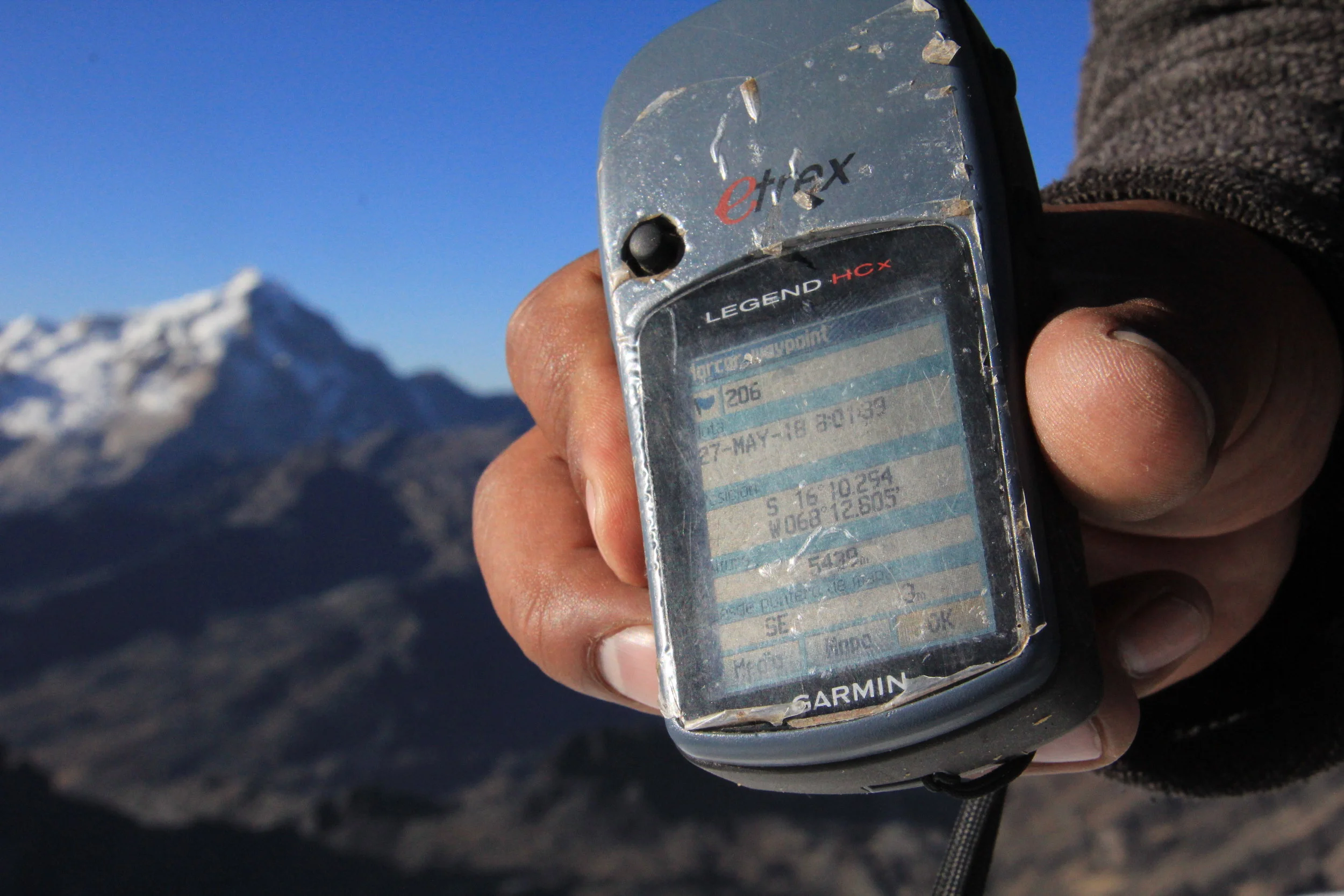
The elevation of the Tilman Pass

Tilman Pass 5,300m.

Looking back south from the top of the Tilman Pass.


Tilman Pass, view to the north. The mountain in the centre of the photo is Langshisa Ri.

The Langtang Himal from the pass. The Tilman Pass is not the best for the views of the Langtang range. However, the area around the high camp and Langshisa Glacier is fabulous!

The crevices were visible so it was easy to navigate around them.


Descending the glacier using the fixed rope.

The steeper section had a fixed rope for the porters as they had no crampons. The fixed rope made for an easy and quick descent for everyone.

Descending from Tilman Pass glacier to the high camp. This section was steep, icy and unstable. Negotiating the endless moraines was the biggest challenge for the porters.


The high camp was by the frozen lake. Mount Langshisa Ri and Langshisa Glacier are behind the lake.

The High camp on the north side of the Tilman Pass

The High camp on the north side of the Tilman Pass

Langshisa Glacier Valley
Looking towards Langshisa Kharka and the Langtang Valley from the high camp of the Tilman Pass. This was a very beautiful area to explore.
Langshisa Glacier - our descent route down to Langtang Valley.

The Yala Peak is on the rock ridge on the left - it is hard to believe that it is 5,500m high!

The pointy peak is the Yala Peak

Our camp at the north side of the Tilman Pass


The view from the moraine of the Langshisa Glacier to the high camp of the Tilman Pass.


Around the north high camp of the Tilman Pass.


Langshisa Glacier. On the left is Gur Karpo Ri 6,892m, in the middle is Loempo Gang 6,979m and on the right is Dorje Lakpa 6,966m.

Langshisa Glacier


Looking at the Tilman Pass


Descending to the Langshisa Glacier on loose, unstable and steep moraine.

Steep and loose; this area is prone to rock fall and turns many people around if they are trying to approach the pass from the north. The rocks were falling with high frequency.

Crazy moraines! After the sun hits this slope, the bombardment starts. The rocks are held by consolidated frozen mud. Mount Dorje Lakpa 6,966m dominates the end of the valley.

We descended the crazy moraine on the right! It was like walking through a giant rock quarry.

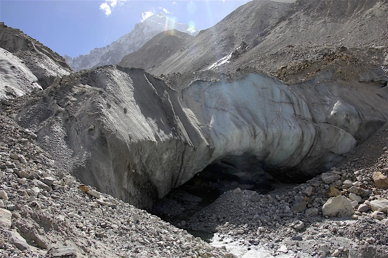
The snout of the Langshisa Glacier with an impressive ice cave. Neither David nor Shyam were keen to explore the inside of it!


Lower part of the Langshisa Glacier. Almost off the rubble! The snout is now in the distance.

We were ready to ford the Langtang River but to our surprise there was this beautiful bridge. The snout of the Langtang Glacier is in the distance.

Langshisa Kharka

Gangchempo towering above the Langshisa Glacier

Looking down the Langtang Valley
Langtang Trek - Ganjala Pass
In October of 2018, we traveled to Nepal to complete the Tilman Pass and Ganjala Pass trek. We approached the Tilman Pass from the south side via the Panch Pokari Ridge. We then descended to the Langtang Valley, explored the Langtang Glacier and exited the Valley via the Ganjala Pass. We also managed to take a helicopter tour of the Langtang Valley north of Kyanjing Gomba. All in all, it was a wild and challenging trek through wild and remote area of the Langtang Himal.
Thanks again to mountainsunvalley.com for all the help with putting this together.
For Annotated Photos from the Ganjala Pass see here.


See the Link for Annotated photos from Langtang Himal from the Helicopter
We were lucky again and managed to get in a helicopter in Kynjang Gomba. So it happened that a group of trekkers were taking a helicopter back to Kathmandu while we were there. We hired the helicopter for a tour of the upper Langtang Valley.
Pemthang Karpo Ri’s North-west ridge from 19,000ft!

Langtang Lirung

Panoramic view of the Langtang Valley. The Langtang Glacier is in the middle. Shishapangma in Tibet is on the horizon. Penthang Karpo Ri is on the right.

Shishapangma

On the left is Shalbachum Glacier, and on the right is the Langtang Glacier with Mt. Shishapangma looming above in the centre.


Langtang Himal from the helicopter. Kyunggari 6,599m on the left and Shaishapangma 8,013 on the right. The Shalbachum Glacier is in the middle.

The Langtang Himal from the helicopter. The high mountain on the left/centre is Shalbachum 6,707m and the pointy peak on the right is Kyunggari 6,599m.

The point peak is Kyunggari 6,599 and the one on the horizon is Lantang Ri.


Kyungari 6,599m

Langtang Ri and the end of the Langtang Glacier. The langtang Glacier is 35 km Long. It is actually a multi day hike to get to the base of the Langtang Ri. Although the glacier is in Nepal, all the surrounding mountains are in Tibet.

Shishapangma 8,013m in Tibet

Shishapangma south face 8,013m located entirely in Tibet.

Langshisa Glacier and Ganchempo Peak.

Lanshisa Glacier in the middle and the Tilman Pass in the right upper corner of the photo.


A close up of the Tilman Pass and the high camp by the green lake. This was our route. Down the glacier to the green lake.


Yala Peak on the right (high point of the rocky ridge) and the Langtang Lirung group on the left.


Lantang Lirung (Yala Peak is on the right)

Looking down the lower Langtang Valley


Exploring the Langtang Glacier. It is deceptively long and apparently it takes 3 days to get to the end of it from Langshisa Kharka.

The Langtang Glacier. I am standing across from Langshisa Ri.

Langshisa Ri north face and the Langtang Glacier.

Mount Ganchempo

The wall along the Langtang Glacier.


The mountains on the border between Nepal and China along the Langtang Glacier.

Langtang Lirung (LL) Glacier from the LL BC

Standing below LL

Langtang Lirung

Langtang Lirung BC - looking south


Langtang Lirung Glacier - Looking at the Langtang Valley 5 km away and 800m below.

Langtang Lirung Icefall

Langtang Lirung

Kianjing Gompa

Looking back at Langtang Lirung Glacier from the ascend to Ganjala Pass

Kianjing village is now down below

The entire approach to Yala Peak is on the left with Shishapangma towering on the horizon.

The BC for Ganjala Pass


Ascend to Ganjala Pass

Langtang Valley

Langtang Lirung and the LL Glacier

The Langtang Panorama from the ascent to the Ganjala

Langtang Valley, Mt. Langtang Lirung (left) and Mt. Shishapagma (in the distance with a line of clouds above it) from the climb to Ganjala Pass.

Langtang Lirung from the basecamp for Ganjala Pass at 4,300m.

Morimoto 6,150m and Dragmarpori 6,578m.
Kyungari 6,599m

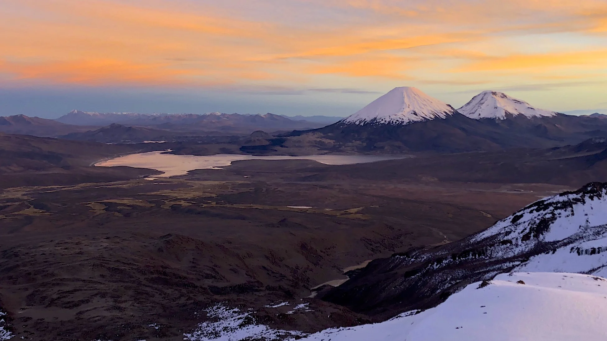
Shishapangma 8,013m

Shishapagma

Shishapangma 8,013m is the only 8,000m mountain located entirely in China’s Tibet

Ascend to Galjala Pass. Naya Kanga is on the right.

Naya Kanga

We still can’t see the pass - it is behind the slope on the right.


Looking back at the Langtang Himal from near the Ganjala Pass. Shishapangma dominates the view. We hiked from 4,300 to 5,130m in 4 hours.

Rocky approach to the Gajala Pass. It was dry but wobbly and steep.

Dragmarpori 6,578m

Pemthang Karpo Ri 6,865m.

Shishapangma 8,013m


The steep final approach to the Ganjala Pass.

Ganjala Pass, the approach is via the snow covered shelf on the upper right. Chains have been installed for safety and a ladder for the porters.

The steep and exposed Ganjala Pass 5,150m

The final ascend to Ganja La Pass


The altitude of Ganjala Pass.

This was our 20th major trip! A true milestone for David and me. I am lucky to have a good friend in David to share the interest and passion for travel to wild places.

Ganjala Pass 5,150m. It is a surprisingly beautiful pass and yet not very popular! It is so close to Kathmandu and near such popular trekking route. It did remind me of Renjo La a little.

Looking down at the approach route to the Ganjala Pass from the now distant Langtang Valley.

Ganjala Pass and back side of Naya Kanga.

Looking south from Ganjala Pass. The south high camp is located by the two small lakes below at an altitude of approx 5,000m.

Looking south from Ganjala Pass.

The view from the pass. The Yala Peak is the rocky ridge on the right. It was sad to see how the glacier retreated in the last decade. We went there in 2009 (see the post) and most of our hiking was on ice.

Morimoto 6,150m from the Pass.

Pemthang Karpo Ri 6,865m.

Pemthang Karpo Ri and Langshisa Ri.

Shishapangma 8,013m.

The rocky ridge extending from Ganjala Pass

Coming down the steep south side of the pass.

Looking back at the rocky descent from the Ganjala Pass. You can spot our porters on the left!

Distant view of the Ganjala Pass area from the south.

The Jugal Himal in Tibet right before the sunrise seen from our descent round from the Ganjala Pass.

Looking back to where we came from. We crossed the range on the horizon via the Tilman Pass.
The fantastic view of the Langtang Range from the hills of Helambu. The trek down was not really down at all. We had to cross numerous ridges. 1000m up and 1200 down. We were tired and every ridge seemed much harder the lower we went. We were happy to arrive at the road end - flat ground!

The end. Packed and ready for our 75 km 10 hour drive back to Kathmandu and home. What a FANTASTIC trip it was!

Paria River Wilderness - USA, Utah
In September of 2018 we did a short trip to the Paria River Canyon. Since September is considered a “monsoon season” in Southern Utah, we had the Canyon to ourselves (not counting snakes). The area is absolutely spectacular and the feel of remoteness adds to the sense of adventure. The entire Paria Canyon crossing is 34 miles long. Since we had limited amount of time, we hiked to the Paria River and Buckskin Gulch confluence from the Whitehouse campground (12 miles) and back. It really gave us a sense of what the entire crossing would be like. Since the river is very silty, water is a major concern. We carried 5 litres each. Since it is very hot, 5 lites is good for max 2 days. The nearest spring is 13 to 14 miles from the start. Because of the massive flooding in the summer of 2018, parts of the Canyon were completely submerged and dotted with deep water holes. This forced us to swim across long stretches in some spots. In other places, the water was up to our armpits but walkable. After the hike, everything was covered in filmy mud that required serious scrubbing with soap to wash off. Thankfully, we did not get caught in any quick sand.


The Whitehouse campground area


The entrance to the canyon proper


We encountered MUD and a lot of it!

constantly sliding through pools of liquid mud


Spectacular scenery of the Paria River Canyon


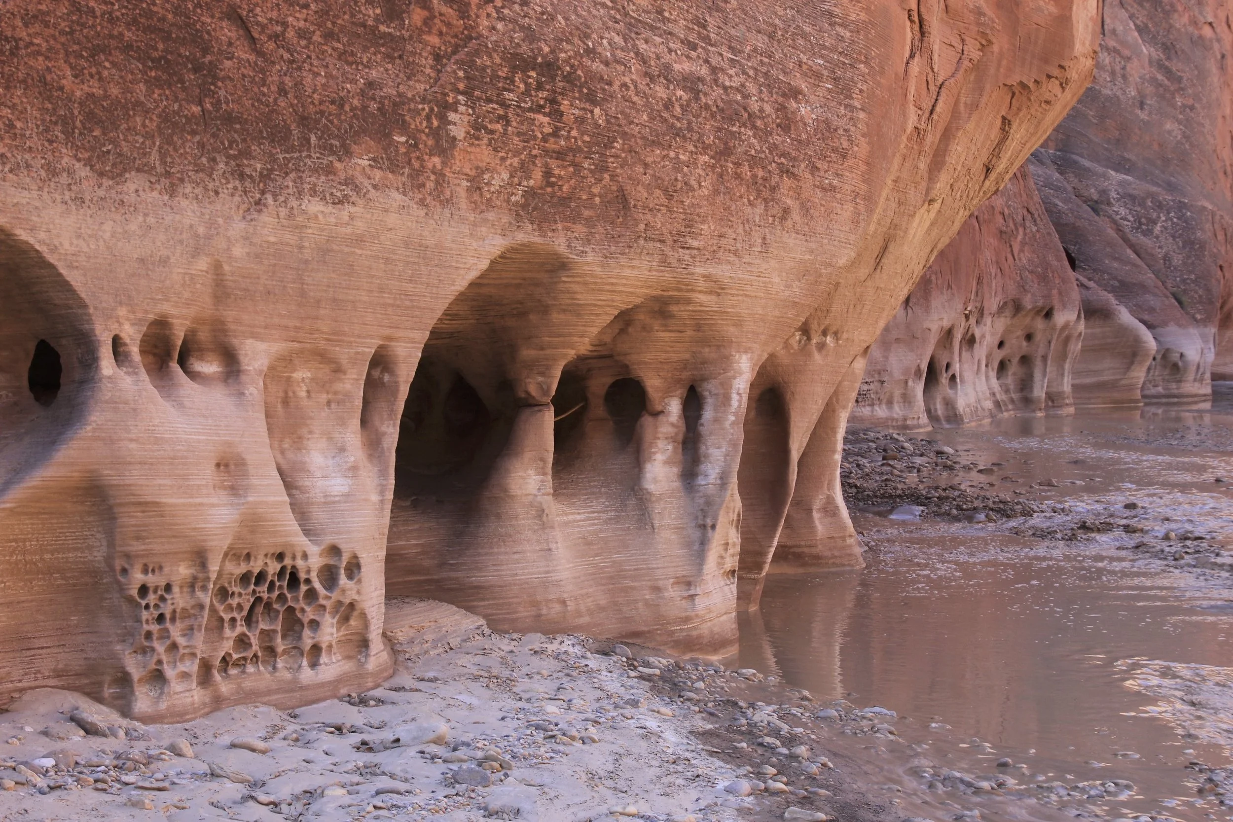
Caverns made by rushing Paria River. When we were there, the river was running at 2 cubic feet per second. We encountered a small flash flood and the river flow increased to 9 cubic feet per second. It was already hard to swim against the current and our packs got washed away. During the severe flooding in July of 2018, the river was punching 10,000 cubic feet per second!!!! Wow!

Small side slot canyon along the Paria River Canyon

The gift from nature


The sun bakes the soil. It was very hot in the sun.

Our campsite on the banks of the Paria River.

Drying out in the blazing sun - it was at least 40C


Preparing to swim through a deep pool of liquid mud. I did not realize that there were snakes in the water! One got logged inside the pack after it was washed away by the river during a small flash flood.


Exploring the Paria Canyon. We left our packs behind and during our exploration the river flow quadrupled. The packs got washed away. We found them downstream from where we left them. One of them had a snake stuck in it. When the river is flowing high, the snakes flow with it :-). After our hike, we received a lecture from a local on the types of snakes in the canyon. Apparently, the bad one has eyes of a cat. It is hard to check when you are freaking out after finding one in your pack!

In the Paria River, crossing one of the deeper sections

Photo by David Holberton


Near the confluence of the Paria Canyon and the Buckskin Gulch


The Whitehouse campsite run by the BLM

Escalante NP/Paria Wilderness

The badlands of the Paria Wilderness/Escalante

Slot Canyons - USA, Arizona


Rattlesnake Canyon

Rattlesnake Canyon


Rock window in the Rattlesnake Canyon


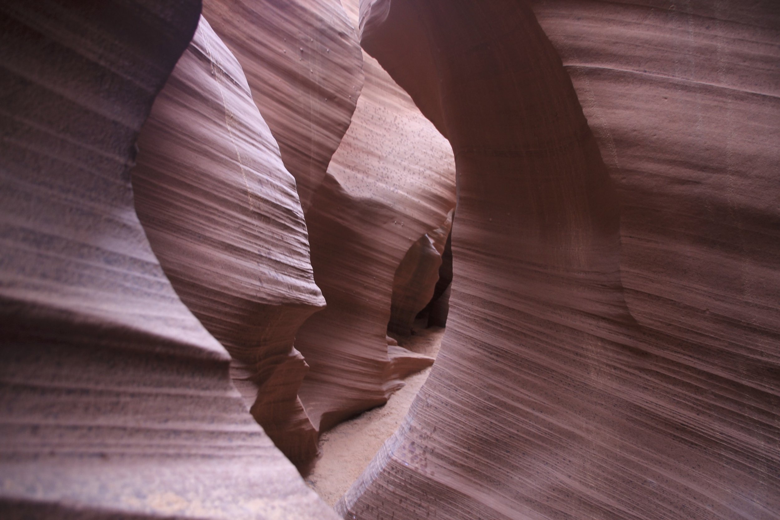


Antelope Canyon

Antelope Canyon


Antelope Canyon


Antelope Canyon

Antelope Canyon


Rattlesnake Canyon
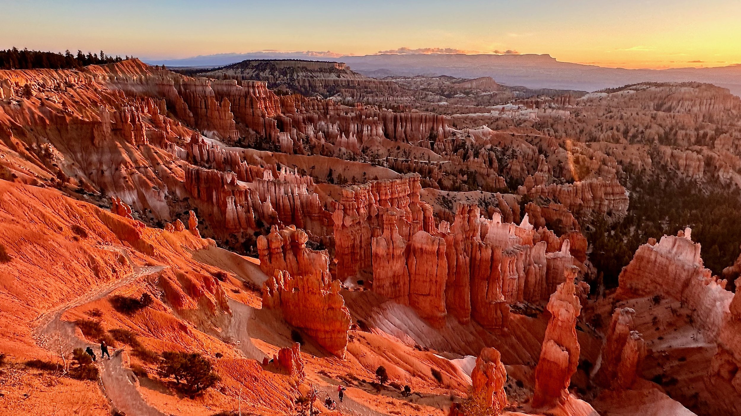
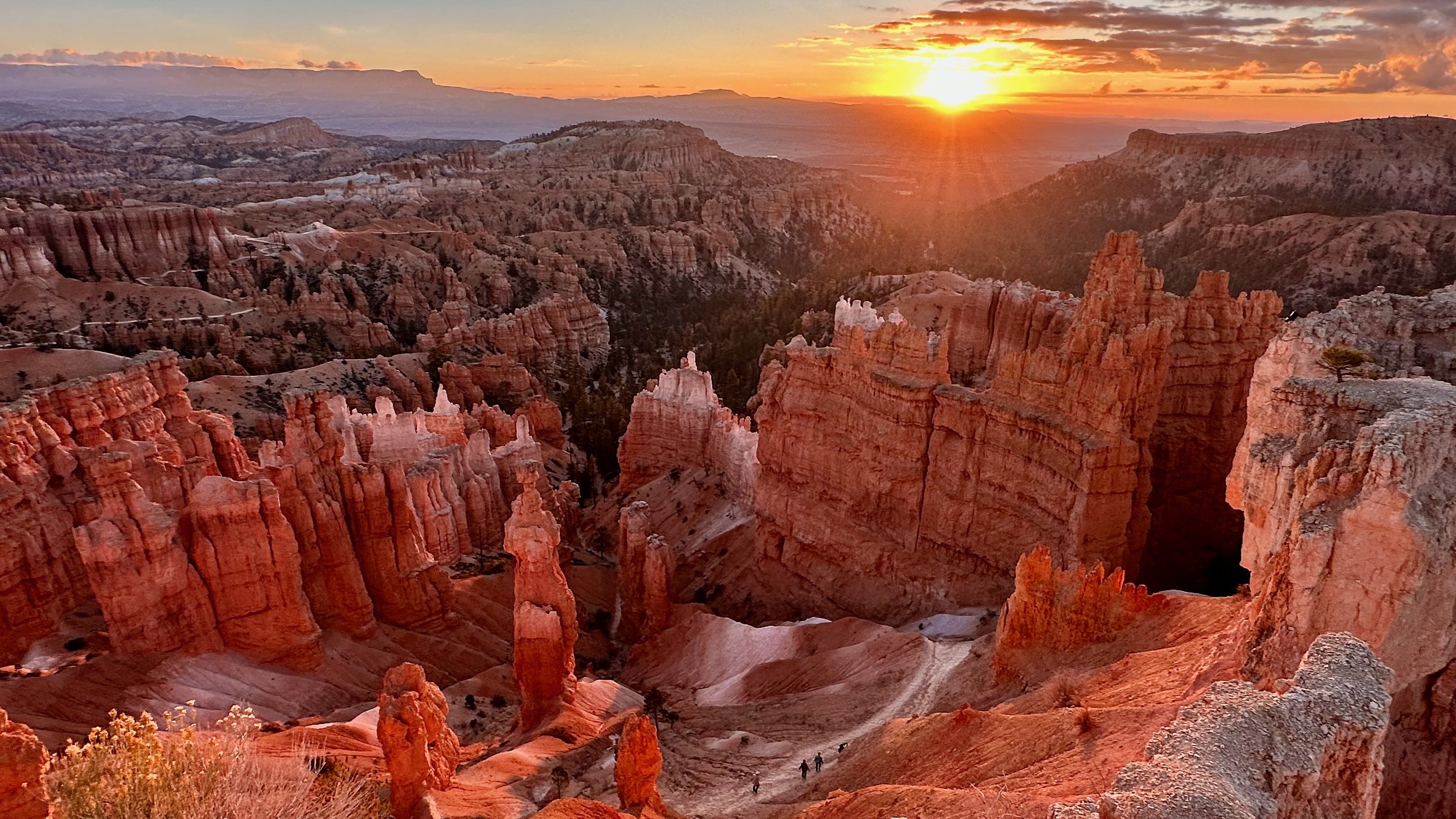
Bryce National Park - USA, Utah


Zion National Park and Cedar Breaks - USA, Utah


The Zion main valley of the Virgin River from the trail to the Observation Point


Red Rock Canyon


Cedar Breaks at 10,000 ft elevation

Cedar Breaks Canyon

Cedar Breaks Canyon


The incredible colours of the Cedar Breaks Canyon


Looking down at the Cedar Breaks Canyon

Hiking the Narrows of the Virgin River in the Zion NP

In the Narrows


One of the tight sections of the Narrows


The Narrows


Virgin River and the Narrows


Virgin River Valley from the Observation Point

The Narrows Canyon from the Observation Mountain


The Parks Service Bus negotiating the road up the Virgin River Valley


Norway
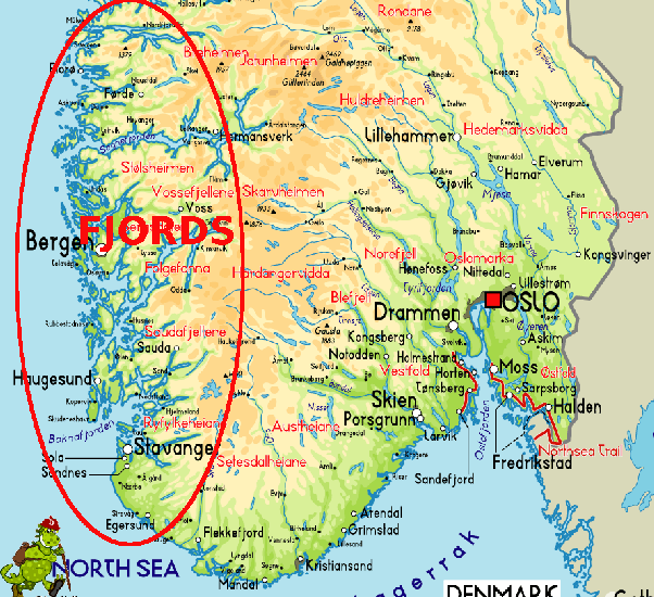


Near Flam


Kayaking near Flaam

The Pulpit Rock near Stavenger

Sitting at the edge of a 600m drop on top of the Pulpit Rock near Stavenger


600 m down...

The Pulpit Rock and Lysefjord near Stavenger


AAlesund

Sugerloaf Mountain in Aalesund


Pretty Allesund

Allesund


Hinking down from Myrgal to Flam


Hiking above Bergen

Bergen and the oncoming storm. 10 minutes later I was engulfed in a complete fog...
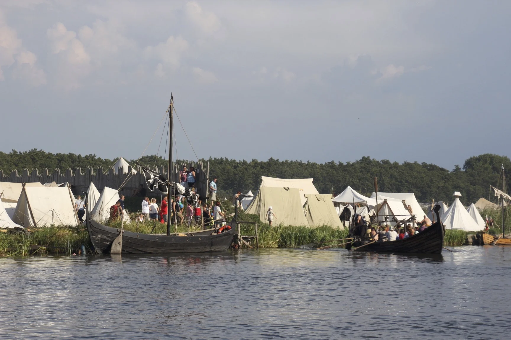
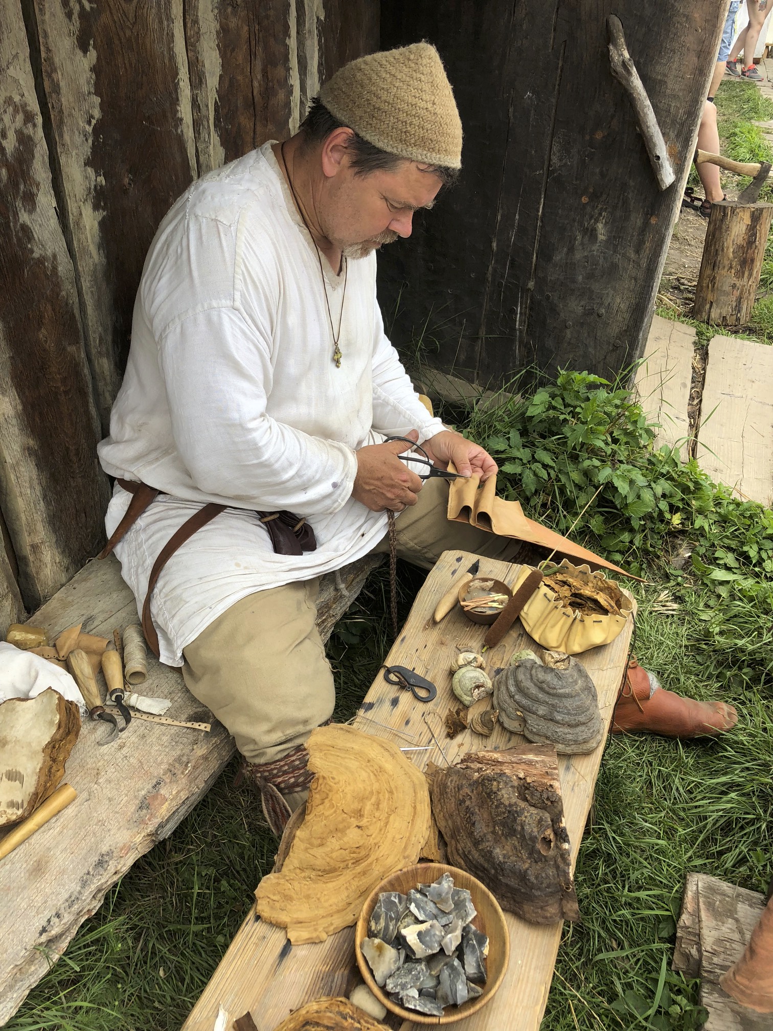
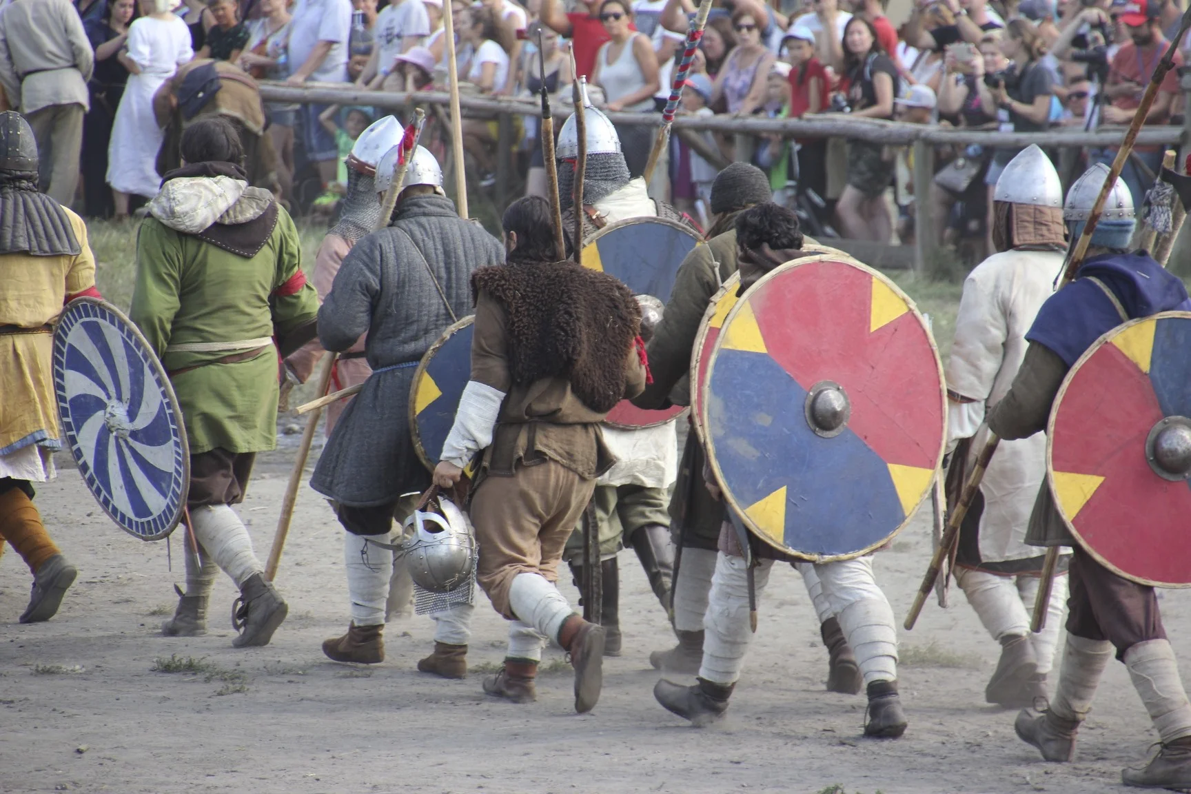
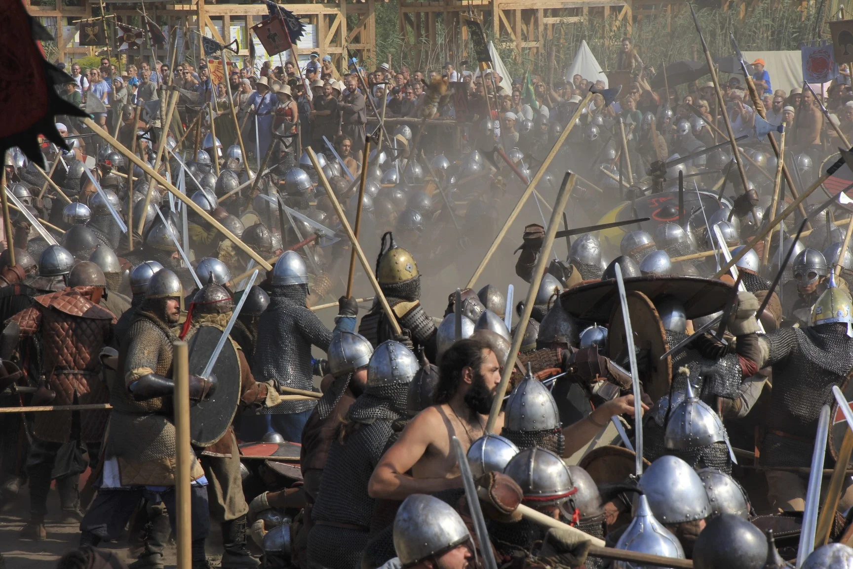
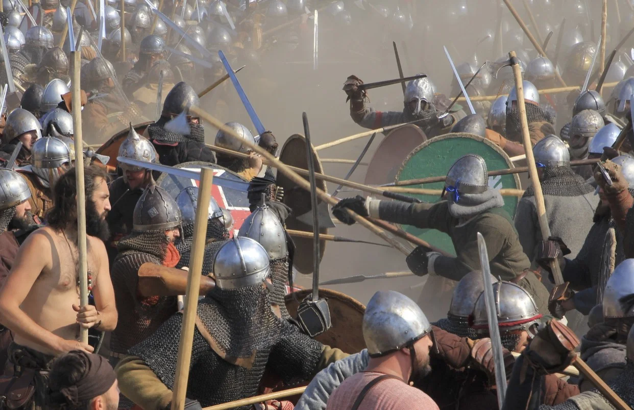
Poland - The Slav and Viking Festival in Wolin


Location of Wolin - north of Szczecin and about 20 km from the Baltic Sea


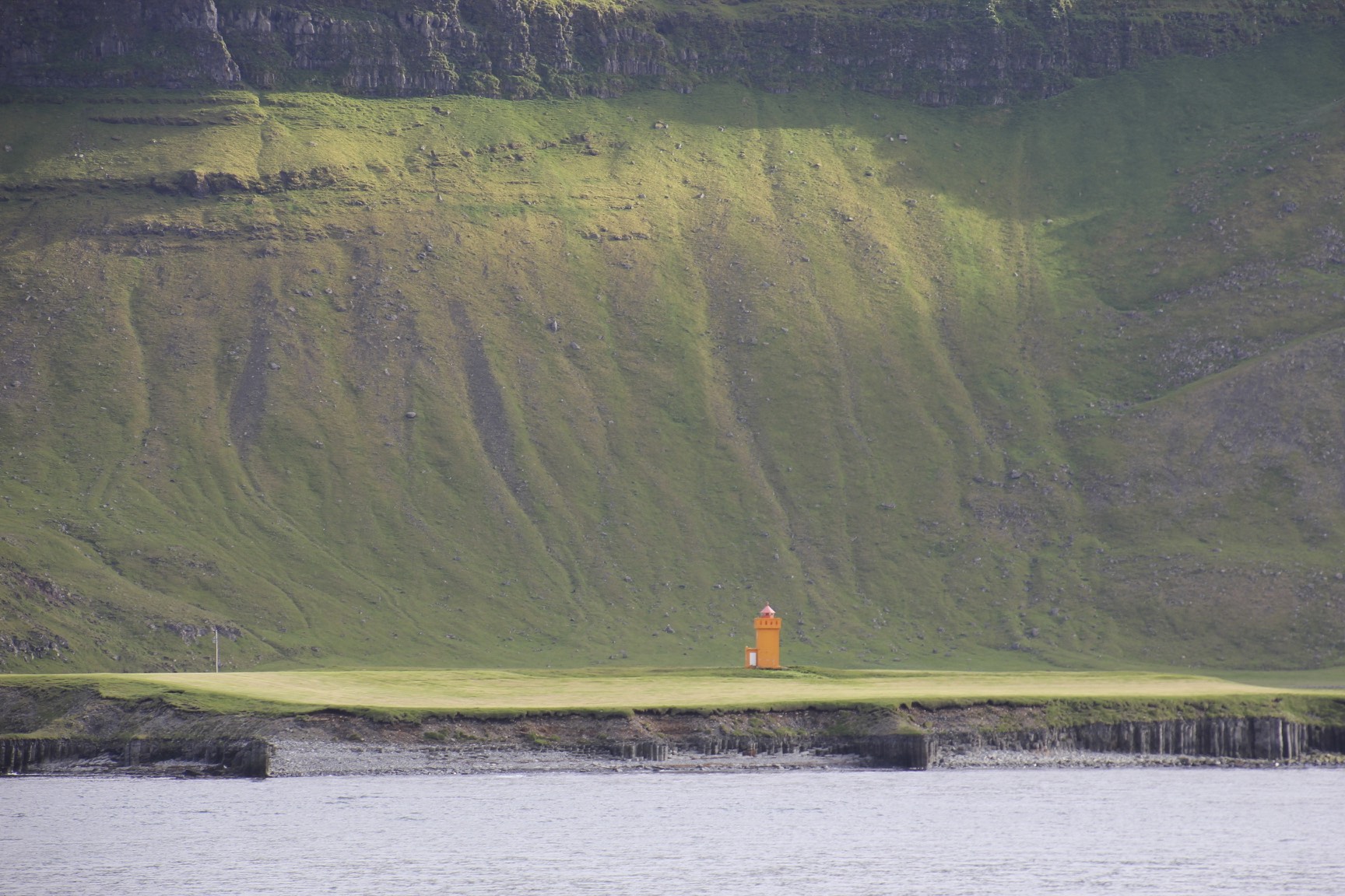
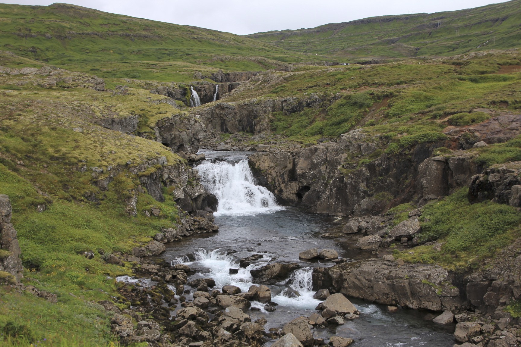
Iceland


Sejdylsfjordur in the east part of Iceland

Sejdylsfjordur

Grundarfjordur

Grundarfjordur

Hiking up one of the mountains around Grundarfjordur

Grundarfjordur

Grundarfjordur
Grundarfjordur

Grundarfjordur

Near Gullfoss

Near Gullfoss

Near Gullfoss

Near Gullfoss

Near Gullfoss

Sejdylsfjordur

Sejdylsfjordur

Grundarfjordur

Grundarfjordur

Grundarfjordur

Grundarfjordur

Grundarfjordur


Grundarfjordur

Grundarfjordur

Grundarfjordur

Grundarfjordur

Grundarfjordur

Grundarfjordur

Grundarfjordur

Grundarfjordur

Gullfoss

Gullfoss

Gullfoss

Gullfoss

Gullfoss

Gullfoss


Bolivia Cordillera Real and Sajama National Park

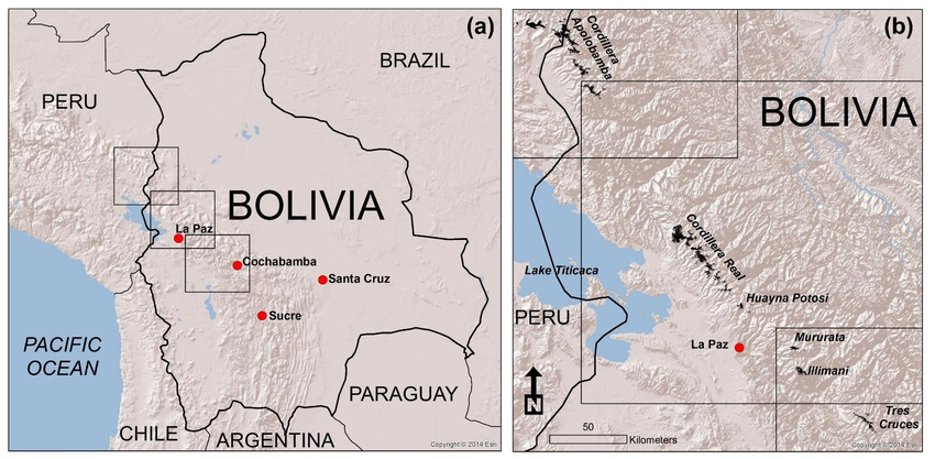


For information about climbing in Condoriri Area see here.

Photo by Eduardo from the Bolivian Mountain Guides


Huayna Potosi and an old cemetery of miners
Basecamp for Pequeno Alpamayo and Condoriri


Looking towards Lake Titicaca and the Cordillera Real from Peak Austria


The top pf Pico Austria

Huana Potosi

Condoriri

Condoriri 5,648m from Pico Austria 5,350 also known as the Matterhorn of Bolivia.

View from Pico Austria with annotations

Our team at BC

sunrise on the Pequeno Alpamayo 5,434m.


Sunrise from Pequeno Alpamayo

Pequeno Alpamayo - direct route

The summit of Pequeno Alpamayo
Summit of Pequeno Alpamayo 5,438m

Acohuma and Chachacomani from the summit of Pequeno Alpamayo.

The large bulky mountain is Chachacomani 6,074m fromt the summit of Pequeno Alpamayo.

Innominado 5,320m seen from the summit of Pequeno Alpamayo.

View of the Cordillera Real looking north from Pequeno Alpamayo.

Approaching the top!

Gregorio and me on top


Huana Potosi

Huana Potosi and Ilimani in the distance

The summit ridge of Pequeno Alpamayo 5,434m.

Pequeno Alpamayo 5,434m - a fine isolated peak


En route to Sajama National Park

Volcan Sajama 6,520m


Sajama and interesting volcanic formations of the Altiplano

Volcanoes Parinacota and Pomerade on the border between Bolivia and Chile

Sajama - the highest peak in Bolivia

Laguna Atla in Lauca National Park in Chile

Volcan Sajama


Sajama Village with Volcan Sajama in the background

Volcan Acotango from Sajama Village and the Bolivian Altiplano

The base camp of Volcan Sajama at 4,800m

The road to the trail head on Acotango. The road was built and is maintained by the government owned sulfur mine.

Volcan Sajama and sunrise on Acotango
Volcanoes Parinacota and Pomerade and Chungara Lake in Chile from Acotango


Sajama from Acotango


Volcan Acotango


Sajama

The trail to the BC of Sajama. I met Cholitas Escaladoras who were climbing Sajama.

Cholitas Escaladoras - Bolivian women mountaineers

On the border of Chile and Bolivia - exploring the Sajama NP

Sajama NP

Sajama NP - great geothermal formations

Geothermal formation of the Sajama NP

Sajama NP

Sajama NP

Volcan Sajama


Bienvenidos a Bolivia!
Bolivia - Tiwanaku and La Paz
The ancient ruins of Tiwanaku are located in Bolivia, near Lake Titicaca, at an altitude of almost 13,000 feet (4,000 meters) above sea level, making it one of the highest urban centers ever constructed. The city reached its peak between roughly A.D. 500 and A.D. 1000 and had at least 10,000 people living in it. At this point only a small portion of the city has been excavated.
Some remarkable artifacts have been discovered and examined at Tiahuanaco, not the least of which was a large monolithic Sun Gate which must have been an important part of the Kalasasaya, the chief temple of the ancient city. Its upper part is covered with an intricate sculpture that has been described as a calendar almost as long as the monolithic gateway. In fact, the Sun Gate has also been called the Calendar Gate. This calendar sculpture depicts a solar year, but not one that fits into the solar year as we know it.


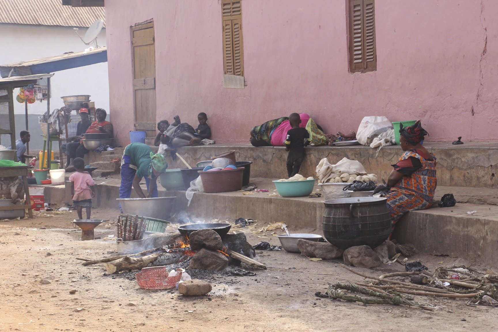
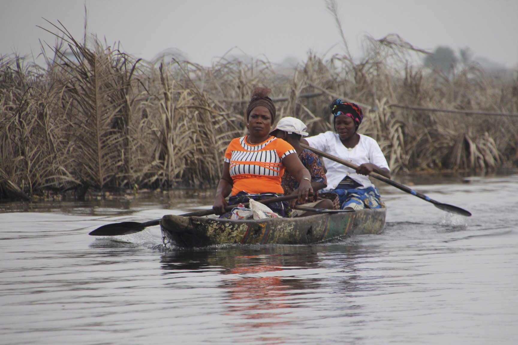
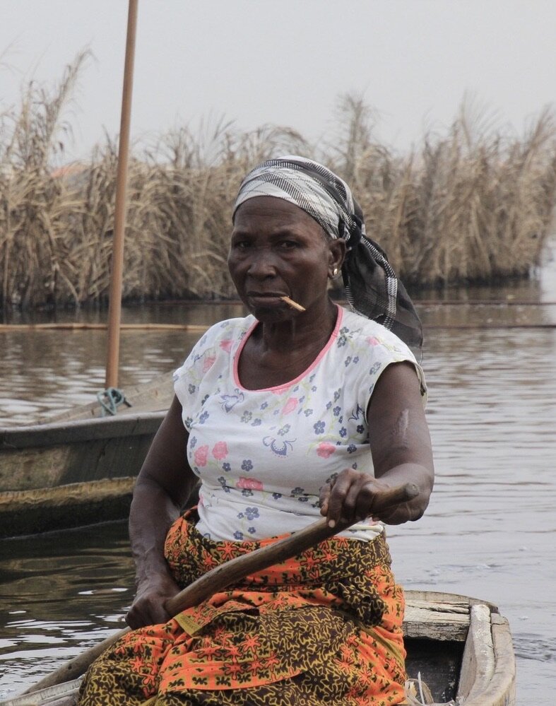
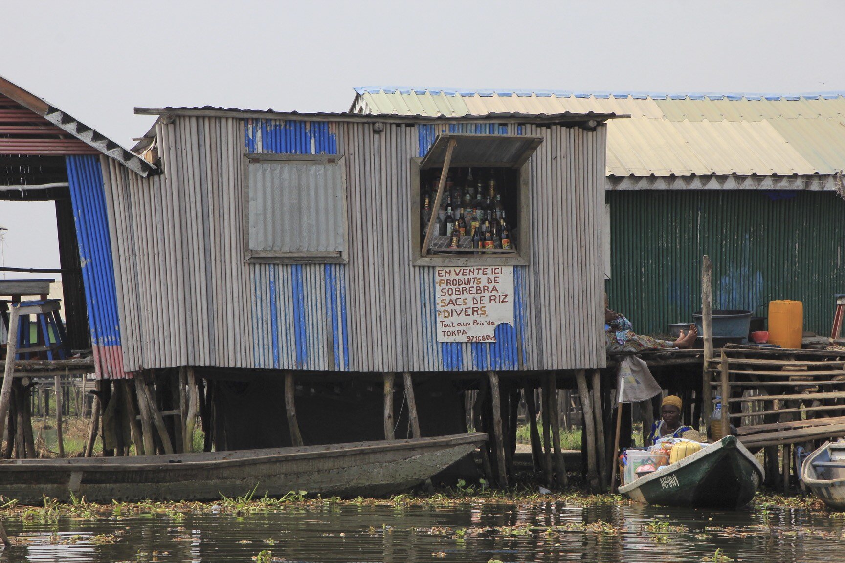
Togo and Benin


Benin

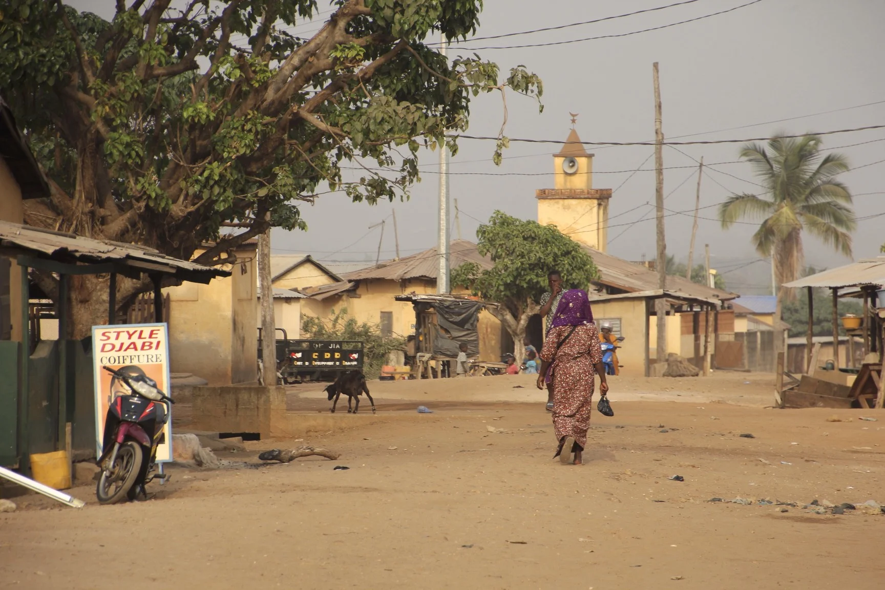
Sokode, Togo

Lome, Togo


Street Vendor Lome

Lome, Togo

Lome, Togo


Lome, Togo

Togo

Gas/petrol Station

Gas/petrol station


Togo

Togo


Sokode, Togo

Petrol station in Sokode serving small motorbikes and mopeds


Kola nuts - the currency of Sahel


Sokode food stand


Sokode, Togo

Sokode, Togo

Local market in Sokode, Togo

Sokode, Togo

Sokode, Togo

Main square in Sokode, Togo

Sokode, Togo

Sokode, Togo

Dental office in Sokode

Sokode, Togo
Sokode, Togo

Sokode, Togo

Sokode, Togo

Sokode, Togo

Sokode, Togo

Sokode, Togo

Togo

Togo

Ouidah, Benin

Togo

Sokode, Togo

Sokode, Togo

Sokode, Togo

Sokode, Togo

Sokode, Togo


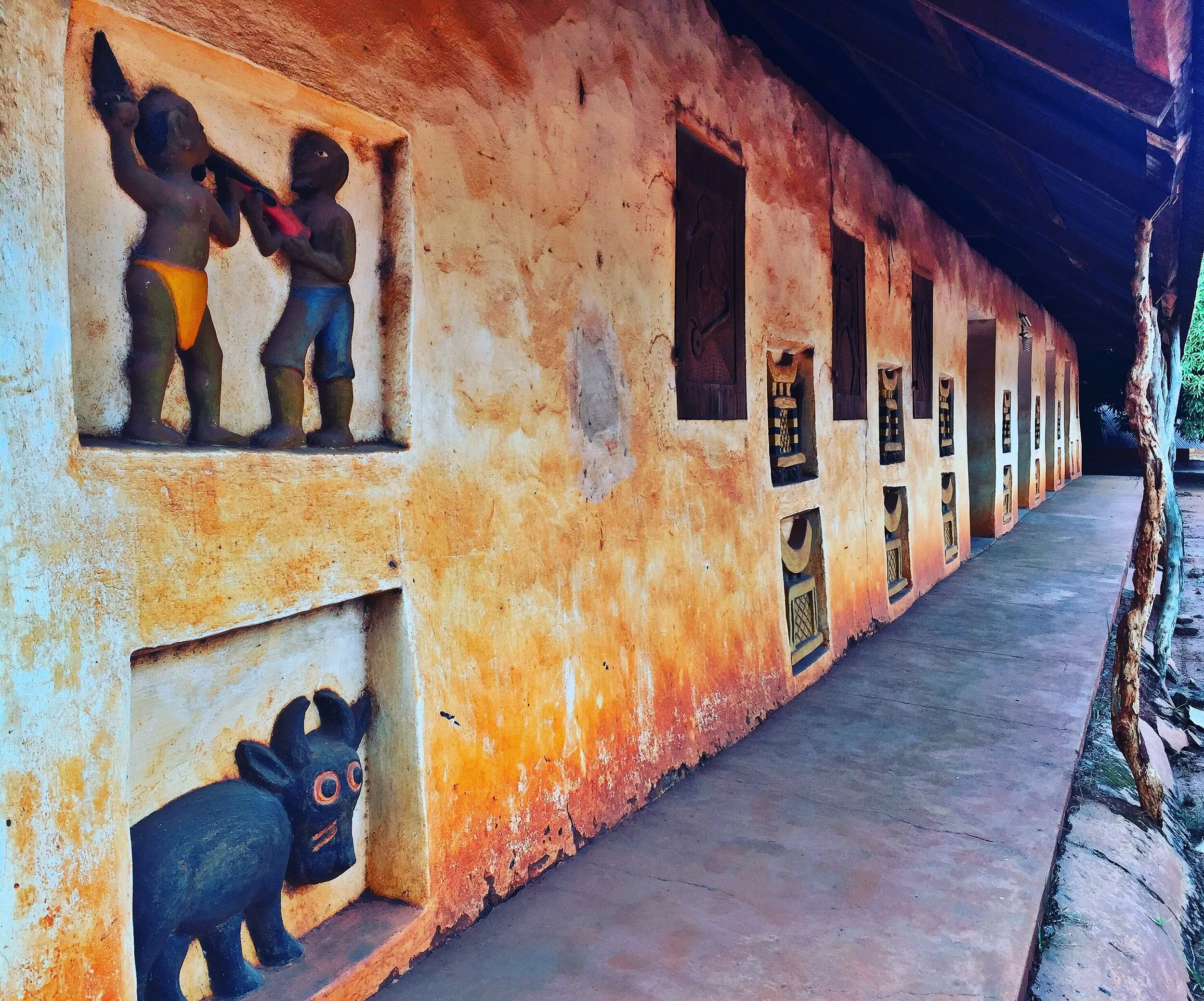
The Royal Palaces of Dahomey, Togo


Ouidah, Benin

Benin

Ghana

Mother and son in Northern Benin

Ouidah, Benin, the road of no return


Ouidah, Benin

Benin


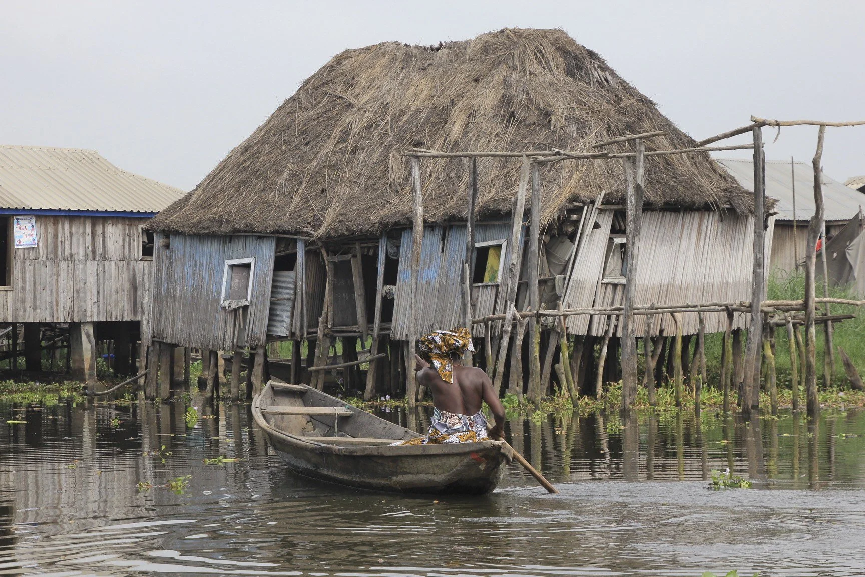
Gamvie, Benin

Gamvie, Benin

Gamvie, Benin
Benin

Benin

Benin


The sand of the African Gold Coast

Kumasi, Ghana

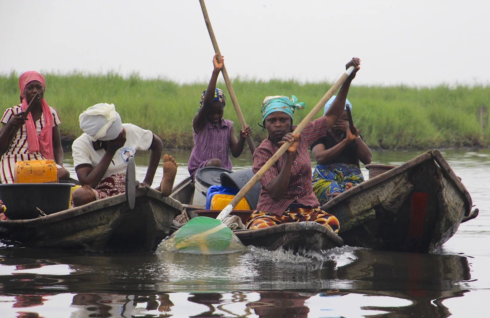
Volta River, Ghana
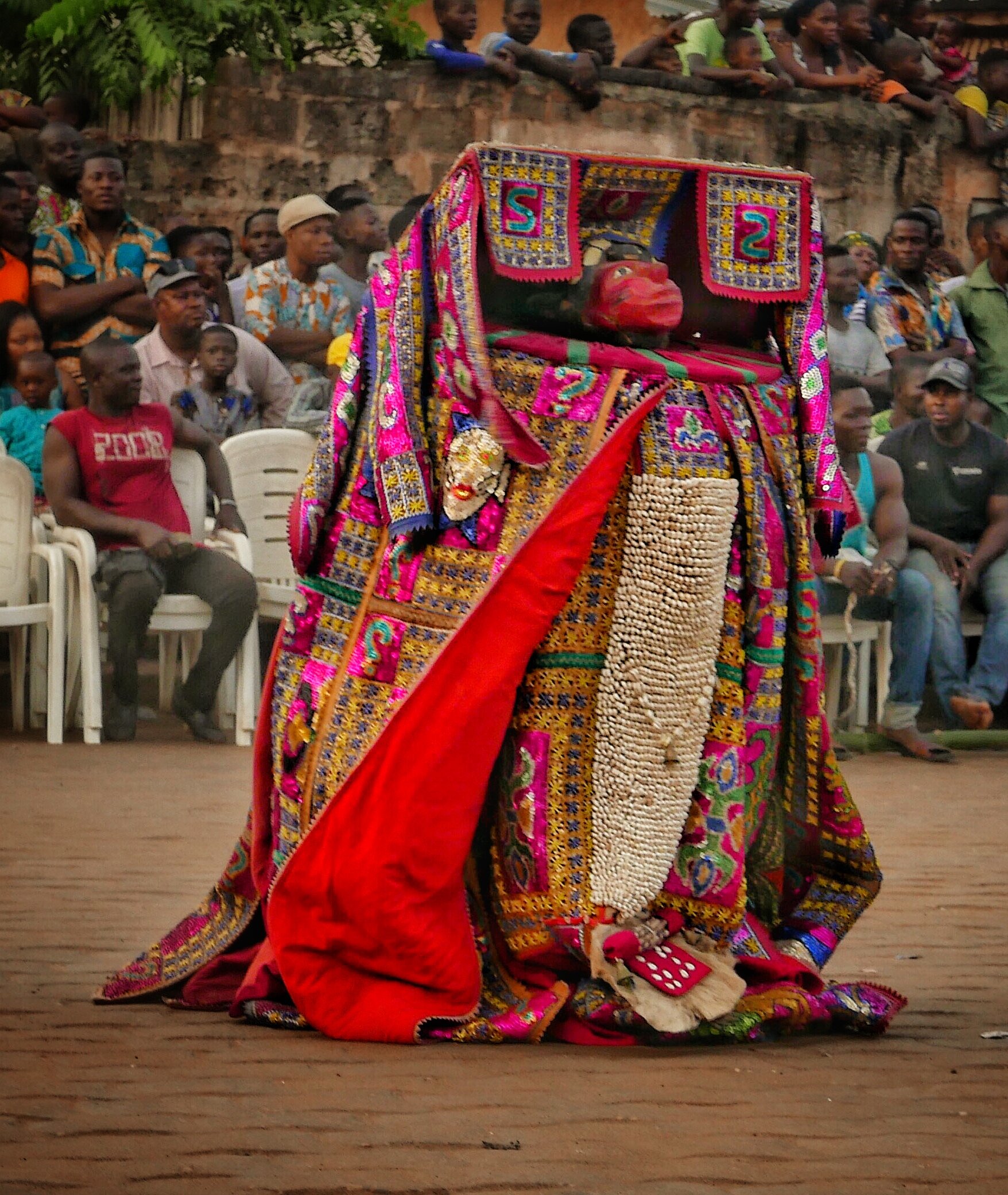
Benin - Egungun Masquerade
The Egungun is a secret society of masqueraders of the Yoruba People who live in the area of Western Nigeria and Eastern Benin. The Egungun worship the ancestors and provide a means of contact with the ancestral spirits. The masks worn by the Egungun represent a spirit of a particular person.
This is a good summary of the ceremony by James Dorsey (www.perceptivetravel.com):
To the adherents of traditional African voodoo there is no difference between the waking world and that of spirits, they are the same, co-existing in what a westerner might call a parallel universe. The living and the dead are in constant communion, aiding each other just as they did in physical life. It is the job of the mambo, or griot, the West African version of a priest, to oversee this union, to guide it using established traditions that allow the living to navigate among the dead without being totally drawn into that void. While they believe the deceased are constantly among us, they also believe a living person can enter the twilight world for brief periods if under careful guidance, and of course depending on the personal power of the metaphysical traveler. The witch doctor or shaman are nothing more than spiritual guides who facilitate communication between those who have gone before and those who still occupy the material world.
The ceremony is presided over by a council of griots, or mambos as they are known locally; there are usually several in attendance, but the uninitiated will not know who they are. They are secret masters of ceremony, making sure all goes according to plan, and ready to make judgment calls if things get out of hand, as I was about to find out.
The Egun Gun are a secret society of men who spend most of their adult life learning an archaic set of rituals, prayers, and ceremonial traditions, that include their own private language and dances. They spend great amounts of time creating surreal looking outfits that hide not only their true identity, but emphasize the fact that the wearer is in a special place and not of this world.
They are so secretive that fellow tribal members do not know who is a member or not, and that days before a ceremony an Egun Gun dancer secrets his homemade ceremonial costume in the woods and makes excuses to disappear so no one will know where he is going and no one will ask why. During this time he prepares himself through fasting and prayer. Even more fascinating is the fact that once the ritual begins, he becomes the living dead. The Egun dance is tradition and religious rite simultaneously, as much theater as ceremony, part Kabuki and part melodrama, but deadly serious.
Once in costume and mask the dancer is no longer a member of the material world. He enters a trance like state, becoming a conduit for a deceased relative to enter his body. When this is achieved the dancer will begin to gyrate and contort in ways not normally doable in a waking state. The idea is that the dancer mimics all he has seen from his fellow tribesmen during the period since the last dance, showing the spirit inside him what everyone has done lately. This in turn allows the spirit to know who has been good or bad and who needs to be punished or rewarded. Ancestors, who are never far away, are the keepers and arbitrators of how their families should live and this dance is their periodic checkup. But being spirits, benign or not, they all hold a "terribelita" that once unleashed could wreak havoc if not properly controlled by ceremony.


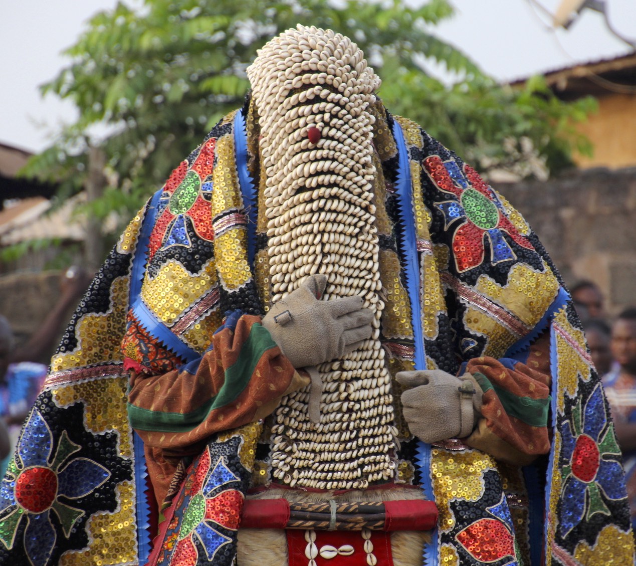
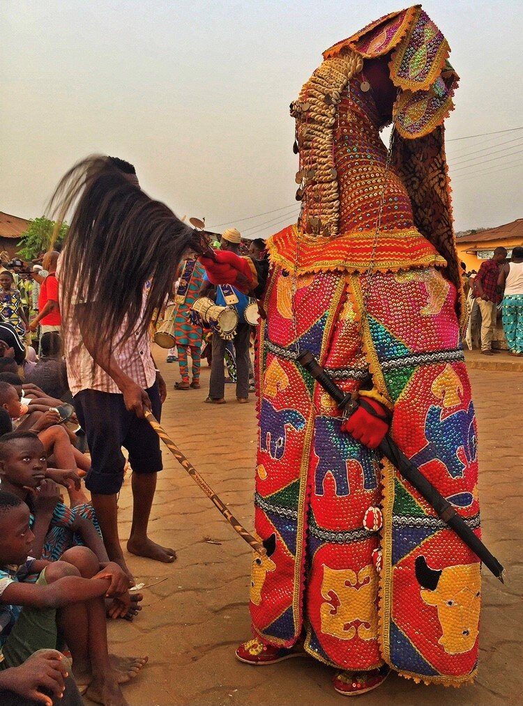
Having any contact whatsoever with an Egungun can prove deadly for both the Egungun and the other person, so each Egungun is accompanied by a 'minder', also a member of the Egungun society, who carries a long stick to drive individuals away. It is believed that even seeing a part of a body of the dancer can result in death.

Egungun is a dance performance that opens a portal between the realm of the dead and the living. During the dance, the ancestors send blessings to the spectators and the entire community.


An Egungun man has an elaborate flowing coat which is sewn all the way to the top over his head with beads and shells. Masqueraders enter in a state of ecstasy when they perform and their anonymity is of the upmost importance in the Egungun. Once wearing the costume, the performer ceases to be himself and become the ancestor. The Yoruba concept of spirit is that it exists before birth and continues after death. The corporal life is therefore a temporary state. The spirit can be evoked as it exists independent of the body.


Bata drums are associated with Sango - the god of thunder - and they are usually played during celebrations held in honor and praise of him. The drums have different uses and functions in Yoruba society; some of these functions include enriching and vitalizing certain traditional practices and ceremonies such as Egungun festivals. One of the most important parts of Egungun dancing is "communication and the language of the drums.” Dance in Yoruba religious traditions is of utmost importance because it is one of the methods through which the gods can be contacted and engaged with. For instance, during Egungun ceremonies, the Bata drums are used to communicate with Sango.

The Egungun conceal their faces with layers of cloth, animal skin and strange structures of shells and baubles. Their many layers of colored cloth, embroidery, leather, animal skin, shells and beads, and their masks, completely obliterate the human form. It is through concealment of the human body that the spirit is revealed.


The dancers dress elaborately to reflect the prestige of the ancestor they portray, and exquisite cloth is used in their distinctive outfits to honor the grandeur of those the represent. On many of their draperies animals are embroidered into the fabric as part of their representation of the dead.


Egungun are escorted by other members of the Egungun society who act as crowd controllers. People try to hide or run away from them because they fear that if touched they will die shortly after.


Egungun wear a base layer made of Aso-Oke, which resembles the shroud in which the dead are wrapped. They also wear netting for the face and hands, which hides features which may reveal their identity. Only men can participate as masked ancestors, although women still play an integral role in dancing and helping to create the costumes.


The layering is a mark of the owner’s prestige; it also makes the transformation of the dancer possible. Skilled and energetic dancing results in the cloth panels flaring out, exposing the multiple layers and coloured under-surfaces, and completely transforming the appearance of the Egúngún. The movement of these cloths generate what researchers have termed a ‘breeze of blessing’ through the crowd.


When the performance is completed, the performers as Egungun give messages, warnings and blessings to the assembled spectators. Here a man uses a stick packed with animal fur to waft the knowledge of the dead and his blessings onto a townsman.


The identity of the dancer is concealed – Egúngún can be translated as “powers concealed” – the work of the performer is to bring the costume to life and in doing so, to lose his identity in that of the ancestor whose powers will be brought forward.
Men perform the Egúngún; women participate in the ritual dances and sing praise poems.
‘Believed to be the embodiment of ancestral sprits, an important context for these masks is to provide a farewell visit following the death of any senior men in families that belong to the mask society. A few weeks after the burial, a mask will emerge from the dead man’s room, dressed in his old clothes, to rebuke any quarrelling family members, say farewell to his wives and children, and perhaps accuse someone of responsibility in his death. Other Egúngún perform at an annual town festival, parading thorough the streets with a gang of followers, often surrounded by a posse of excited young men, with sticks who chase and beat each other and youths in the crowd. As embodiments of the ancestors, the more important of these masks are thought by many to have healing powers and often women who are having problems, especially relating to fertility, will kneel and supplicate the spirit for assistance. Small gifts of money are made to the mask’s attendants, and if the problem is subsequently resolved a chicken or some other sacrifice may be given. Certain masks will achieve reputations for successful intercession and ay accumulate a growing power, visibly represented on the mask itself by a growing encrustation of black sacrificial residues.’ (D. Clarke 1998)


There are different types of Egungun masquerades: onidan, idomole, and alubata. Onidan can be said to mean “owner of miracles.” The masquerades within this category exist mainly for entertainment purposes. They usually depict a wide variety of characters including priests, policemen and prostitutes. Idomole, on the other hand, translates to something which pleases the eye. Idomole masquerades can be considered as Egungun’s children. Their purpose is to honor the ancestors and their spirit(s). Finally, Alubata translates to "the one who plays the Bata drum."
This title can be said to refer to the Bata drummers who are present at the ceremonies where alubata masquerades perform. The alubata masquerades often wear very colorful shrouds and are the highest ranking masquerades. That they rank the highest and have a name which is associated with Bata drummers can be considered as being quite significant. Perhaps it implies that the collaboration between the alubata masquerades and Bata drummers is necessary for effective communication with the spirits and gods through vibrant sounds and elaborate movements.


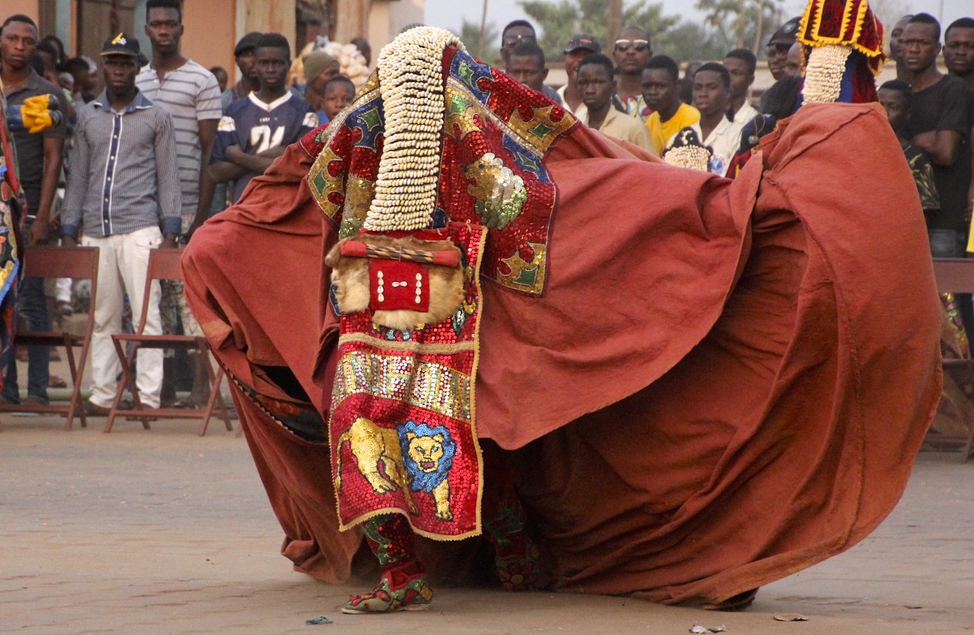


A Egungun chases men around the square, with his minder trailing behind holding a massive stick to ensure that order is preserved. The Egungun chase people throughout the ceremony. Once you show fear, the tribesman will hold and scare you till you give them some money.


Benin - Voodoo Festival
Voodoo or vodun is officially a national religion in the coastal West African state helmed between Nigeria and Togo. During Matthew Kerekou’s Marxist military rule of 18 years which ended in 1991, voodoo was suppressed and outlawed in the country, even though about 60% of Beninese are devotees of the faith.
With the exit of Kerekou from power, the practice began to thrive freely again. Following his return to power as a democratic elected President in 1996, Kerekou capitulated to the people’s wish when taking his oath of office by acknowledging ancestral spirits, and the government declared January 10th as public holiday in celebration of Fête du Vodoun (Voodoo Festival).
In times past, Ouidah served as a major port where African slaves were shipped to the Americas and Caribbean. The festival often starts with the slaughter of a goat to the python spirit at the Temple of Python. This is followed by a 3km trek from the old slave auction block down to the harbor as devotees are led by the voodoo pope (voodoonou) who stops to offer prayers at specific points on the way.


Vodun means ‘spirit’ in the local Fon and Ewe languages. The divine creator in voodoo is Mawu or Mahou. She is an older woman, a mother, gentle and forgiving. She is the god who owns all other gods.
Mawu’s masculine counterpart is Legba, believed to be a very old wise man who walks with crutches. In statues and images, he is represented as a phallus or as a man with a prominent phallus. Legba is the most powerful of all voodoo divinities. He is the guardian of the door of the spirits so it is only through Legba that it’s possible to contact other gods.
There are about 100 other voodoo divinities who all represent different phenomena. For example, there is Gou, the god of war and blacksmiths, and Sakpata, the god of illness, healing and earth.


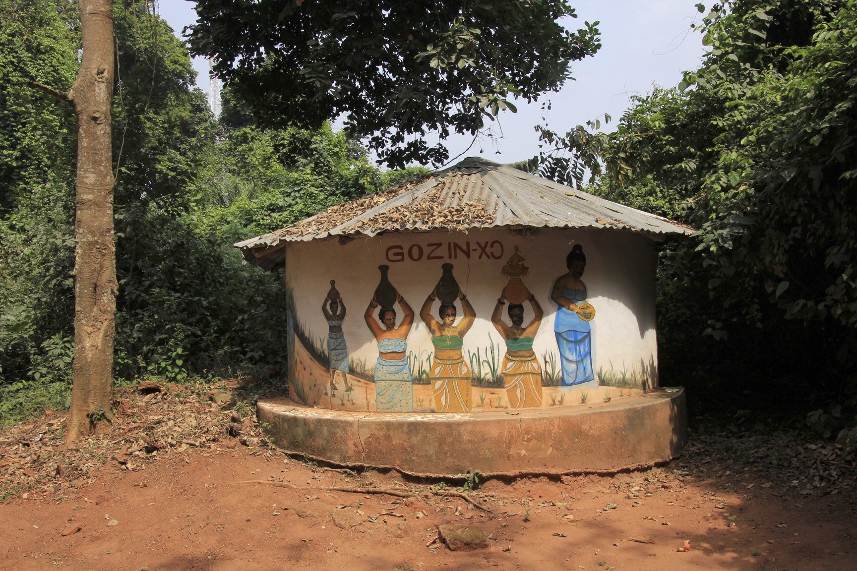
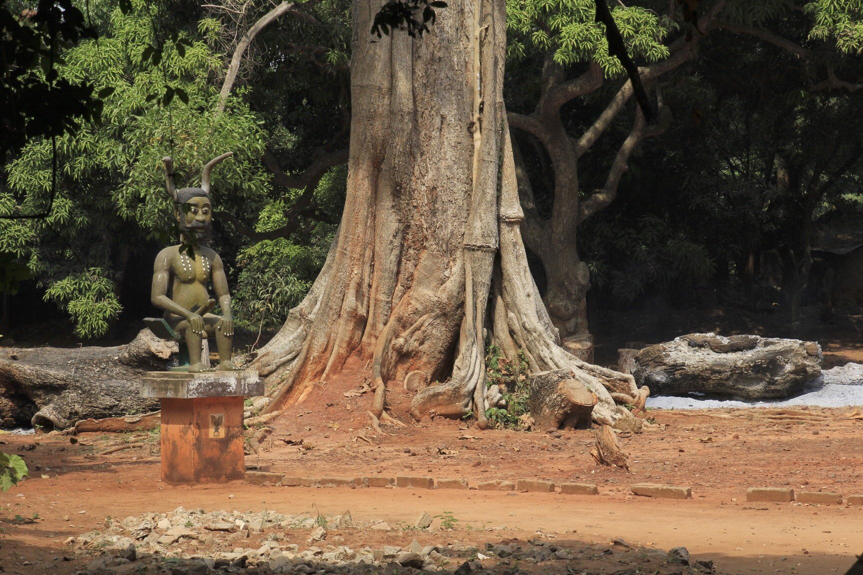


There is a legend that King Kpasse, the first king of Ouidah, turned himself into a tree. Over the centuries, this tree has gained religious and spiritual significance. In 1991, ahead of the first International Voodoo Festival, the area around the tree was landscaped and statues of voodoo gods were erected. It is now a place of pilgrimage for adherents of voodoo from Benin and further afield.


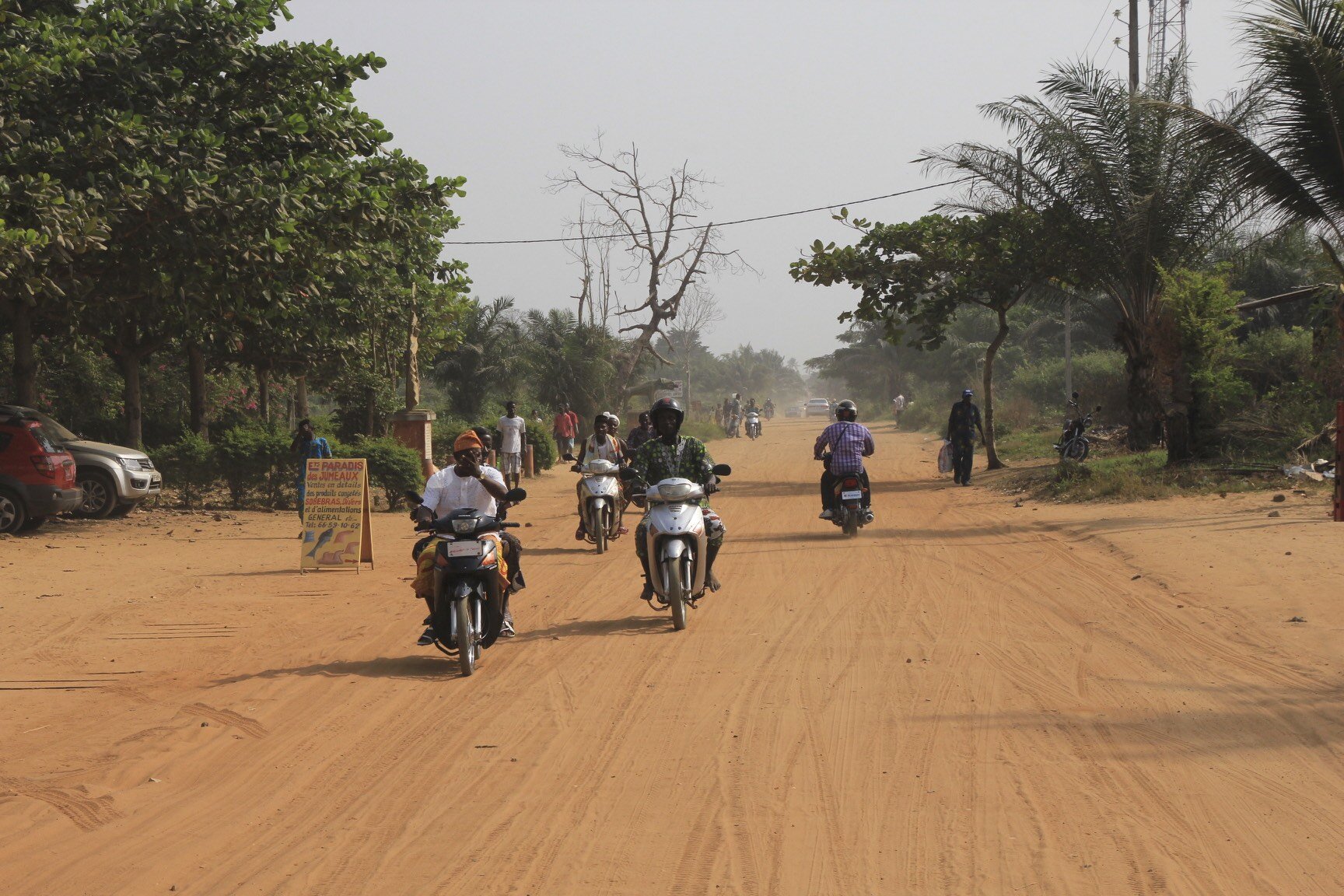


Zangbeto - the guardians of the night in the Voodoo religion. According to the Yoruba tribe tradition, there are no people under the haystack costume, only the spirits of the night. Zangbeto are a source of wisdom and continuity.

Zangbeto guarantees protection against bad spirits and malicious people. The spinning movement of the mask symbolizes the spiritual cleaning of the village and Zangbeto also performs miracles to prove its powers.


Zangbeto and his minder


The King of Allada and his wives

Voodoo priestess

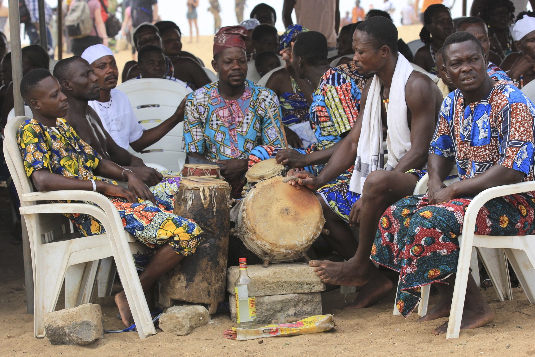
Drummers waiting for their turn in the voodoo ceremony

The Voodoo Pope

Voodoo priest
Vodun talismans (statues, human and animal body parts), called fetishes, are often combined in the construction of shrines or altars used to call forth specific deities and their associated powers. These shrines often ooze with candle wax, palm oil, feathers and the blood of sacrificed animals. The fetish origins of worship which form the basis of voodoo, predate most religions by as much as 10,000 years.
Voodoo priests ask the divinities to intervene on behalf of ordinary people. They sometimes ask for offerings to sacrifice to the god; a chicken, a goat, or a sheep, perhaps. Each animal is used for a specific ceremony. Other more mundane objects are also used in religious ritual. This is explained by the fact that all creation is considered divine and, therefore, contains the power of the divine. This is how herbal remedies are understood. No object possesses any sort of power, though, until it has been blessed by a voodoo priest.
Followers of voodoo hire a voodoo priest once every seven years to perform a good fortune ritual for themselves and their family.


Some spirits are maleficent, and speaking with the spirit world is quite dangerous unless you take necessary precautions. Most of the time, the only people allowed to communicate with the spirits are Vodun priests, who surround themselves with protective fetishes/amulets, but sometimes ‘lay people’ are invited to join a ceremony. In this case, the priest will often either anoint the attendee with water, or get them to drink some out of a suitably protected bottle.


Twins, dwarves and albinos are amongst the most revered people in voodoo and are feted wherever they go. Twins, in particular, are considered a huge blessing for a family. People who have lost a twin sibling gather together to remember their brother or sister and give thanks for their lives. It is thought that, that many women lie about losing a twin.


Each of the Vodun spirits is invoked by means of a ‘fetish’, or specific object, and each spirit has their own specific object, which relates in some way to what they do. This may sometimes be a anthropomorphic representation of the spirit in question, or it could be an object that relates to their remit in some way. However the fetish itself is usually not enough – a ‘preparation’ has to be applied. This is a special ‘mix’ of liquid, powder, and detritus that is either smothered onto the fetish, poured into a vessel atop the spirit’s representative form, or otherwise ingested, applied, or burned as necessary.


The possessed


The use of talcum powder in Vodou rituals is used to embody or summon spirits.


Ghana - The Gold Coast and the Land of the Ashanti


Street furniture store in Accra, Ghana


Fancy coffins made to order in Ghana - this one is for a photo enthusiast

A coffin for a beer enthusiast

One of many colourful street vendors in Accra, Ghana

Accra, Ghana

Accra ocean front

Accra, Ghana

Accra Street


Ghana, the land of smiles

Accra, Ghana

Strong core in Accra, Gahana

Street vendor in Accra

Largest recycling dump in the world. All sorts of appliances, computers, cars etc are taken apart and resold for scrap. It is a toxic and tedious job.


Recycling 101


The workers burn plastic cables to separate copper wiring for scrap. Toxic and dangerous.


Accra water front


Fishing boats in Accra

Mending the nets

Local girls getting water in the morning from the River Volta

Volta River

Volta River

Morning water duty at the Volta River

Religious signs like this one are everywhere in Gahana


The Land of the Ashanti in Kumasi, Ghana

The King of Ashanti

At the audience with the Ashanti king

An Ashanti chief with a big umbrela

An Ashanti elder

Ashanti chiefs, the bigger the umbrella, the more important the chief.

Chiefs and the Kente cloth

The King's musicians

? (a walking salad bar) ?

Ashanti King's procession, the keys to the kingdom

The King is coming - the horn blowers

King's advisors
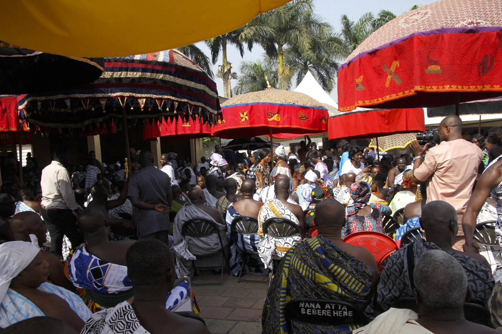
The King has the biggest umbrellas!

King's guard

King's gold

Chewing gum for the chiefs


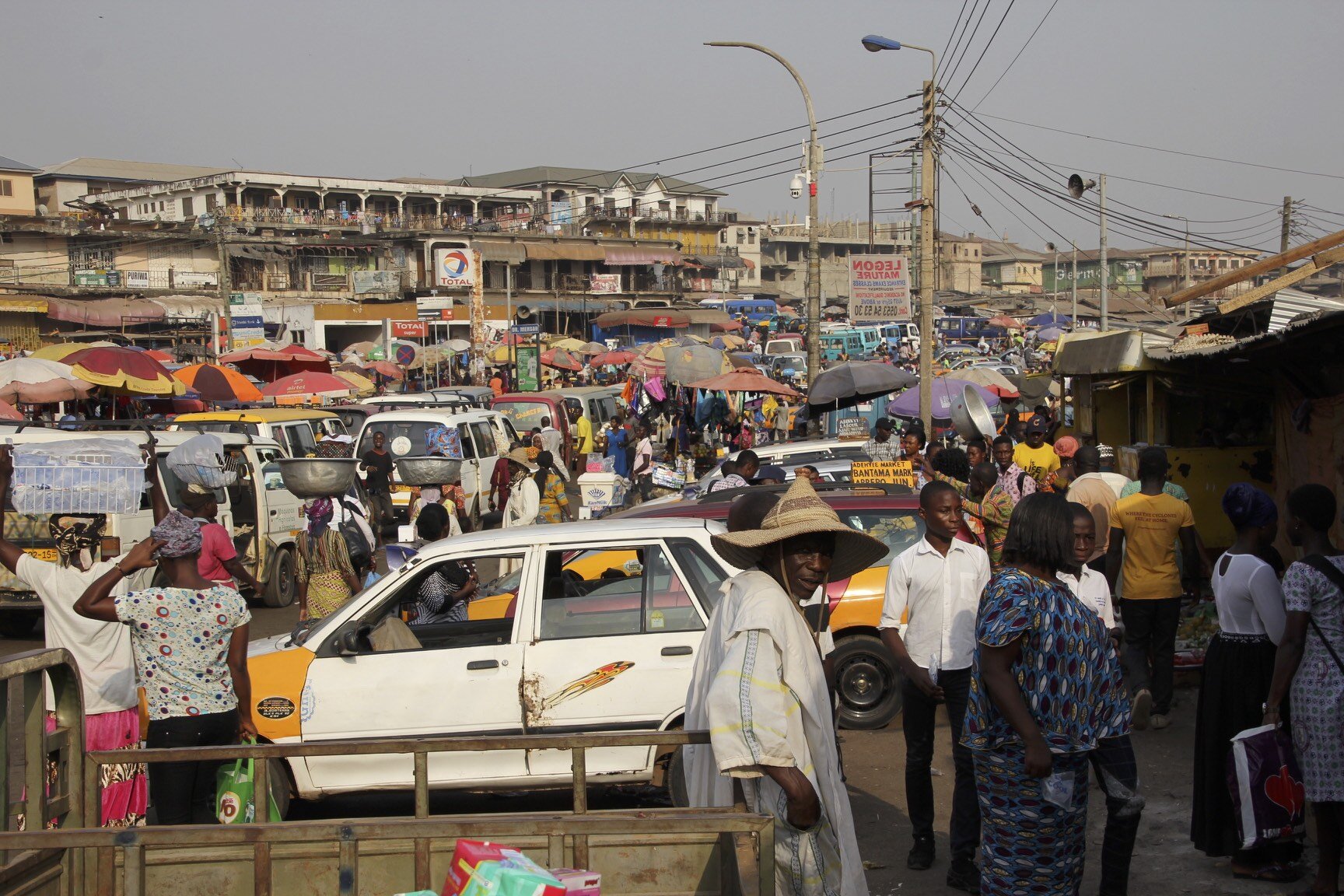


The largest market in Africa is in Kumasi


Local barber shop


After hours, the streets of Kumasi turn into one huge open market. Recycled clothing from Europe and the USA is everywhere.

Trying to make a living by selling used clothing in Kumasi

Kakum National Park Canopy walk


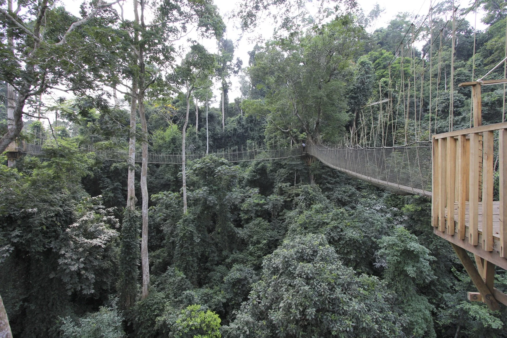

Bush meat for sale by the road side

Bech sports in Elmina

The Gold Coast of Ghana, the source of slaves for 400 years. A beautiful coast but too dangerous for swimming due to strong currents and sharks.

Finishing is a big business in Elmina, Ghana

Drying fish in Elmina, Ghana; the Elmina slave castle is in the background

The Elmina slave castle built by the Portuguese in 1481


The slave castle of Elmina. It was used as a set in the movie "Cobra Verde" by Werner Herzog.


Koffi, our leader

The cell of death where rebellious slaves were starved to death in the Elmina slave castle

Slave holding cells from where they were led to waiting ships in the Elmina slave castle

Salve holding cells in the Elmina slave castle

Salve branding iron, Cape Coast slavery museum

Elmina

Elmina

Elmina

The slave castle of Cape Coast built and operated by the British
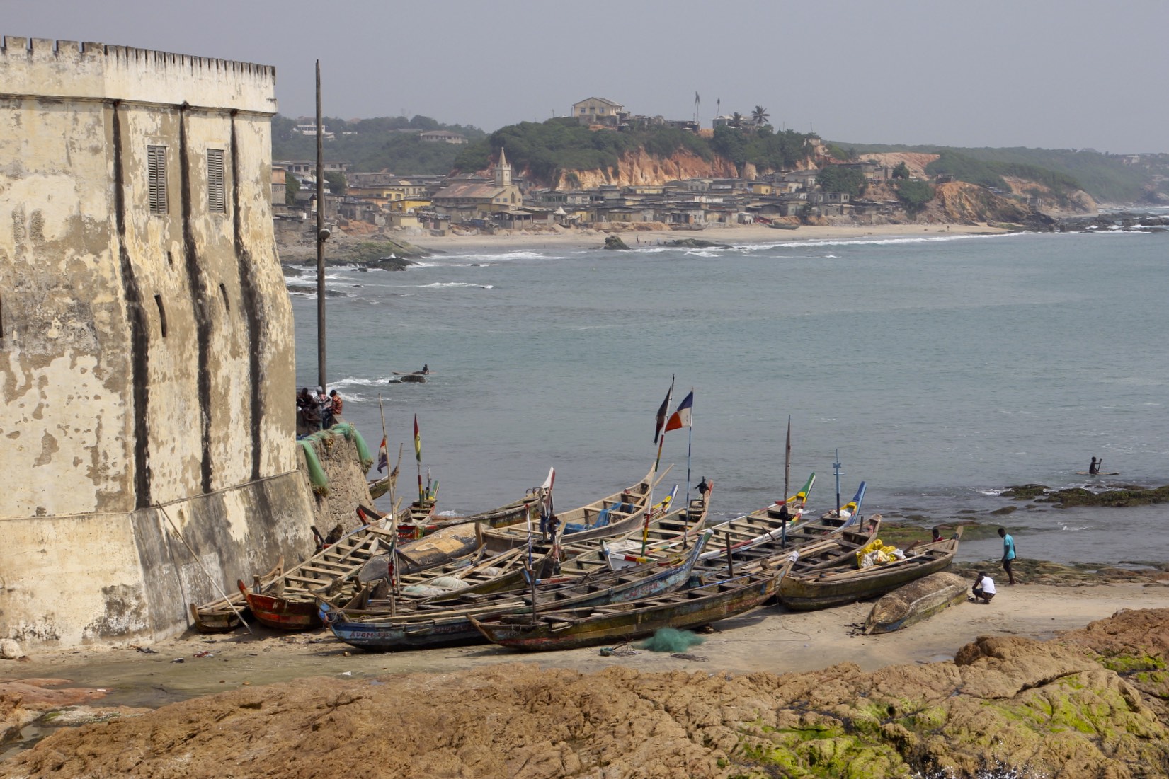
Cape Coast

Cape Coast
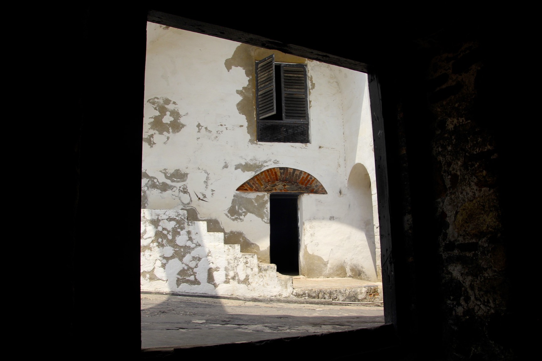
The slave castle of Cape Coast

Cape Coast

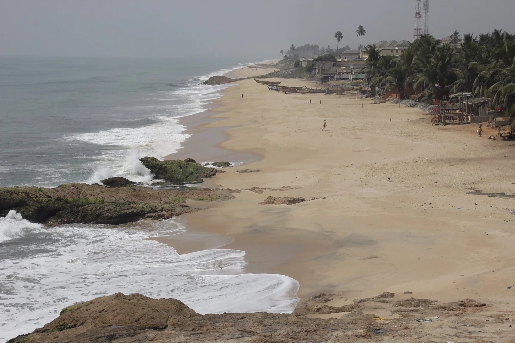
Cape Coast

Kids doing acrobatic tricks


Elmina


Elmina fishing port

Elmina fishing port


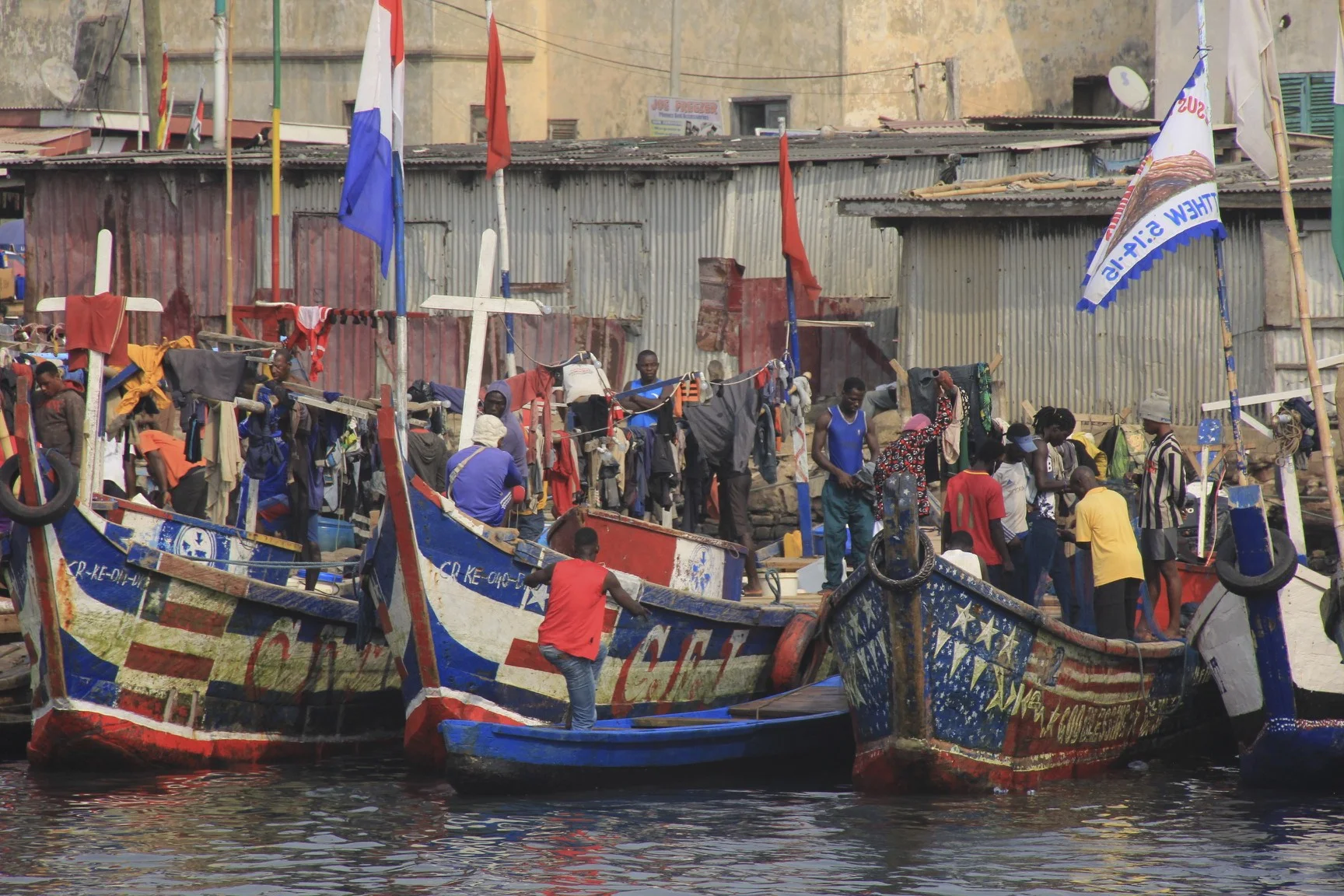


The fishing port on the market day in a busy place

A balancing act


Business women


St. James Castle in Elmina


St. James Castle in Elmina

The view of Elmina Fort from the St. James Castle in Elmina


Ghana - the land of smiles


Bossman or Bad Man haircut?

The beautiful coast of Ghana
