
In July of 2005 our small group traversed the Biafo and Hispar Glaciers in the Karakoram Mountains of Northern Pakistan. The two glaciers are connected by the 5,128 Hispar Pass. Along the way, we camped and explored the Snow Lake, one of the largest expanses of ice in the Karakoram Mountains.


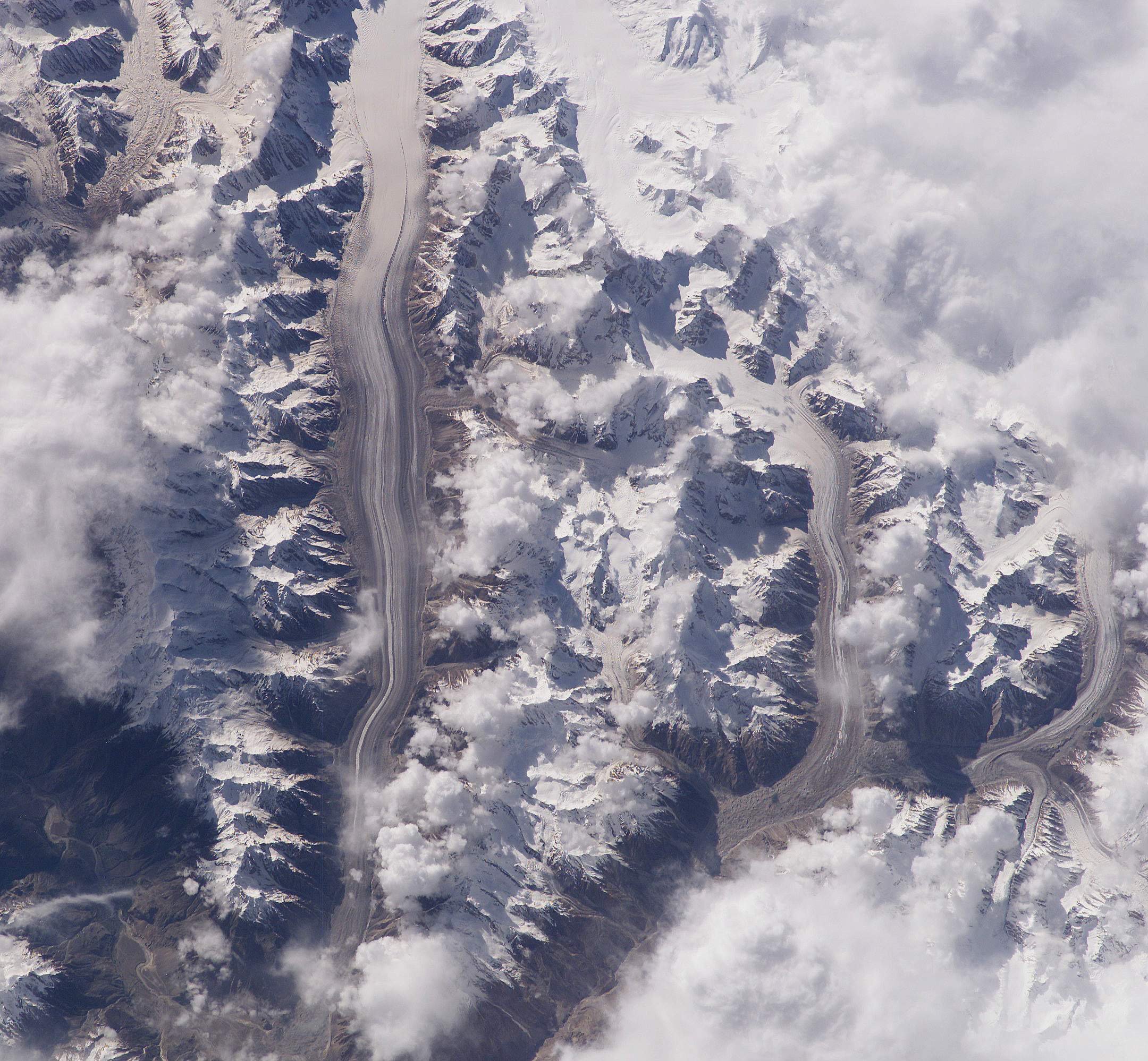
Biaffo, Choktoi and Nobade Sobande Glaciers.

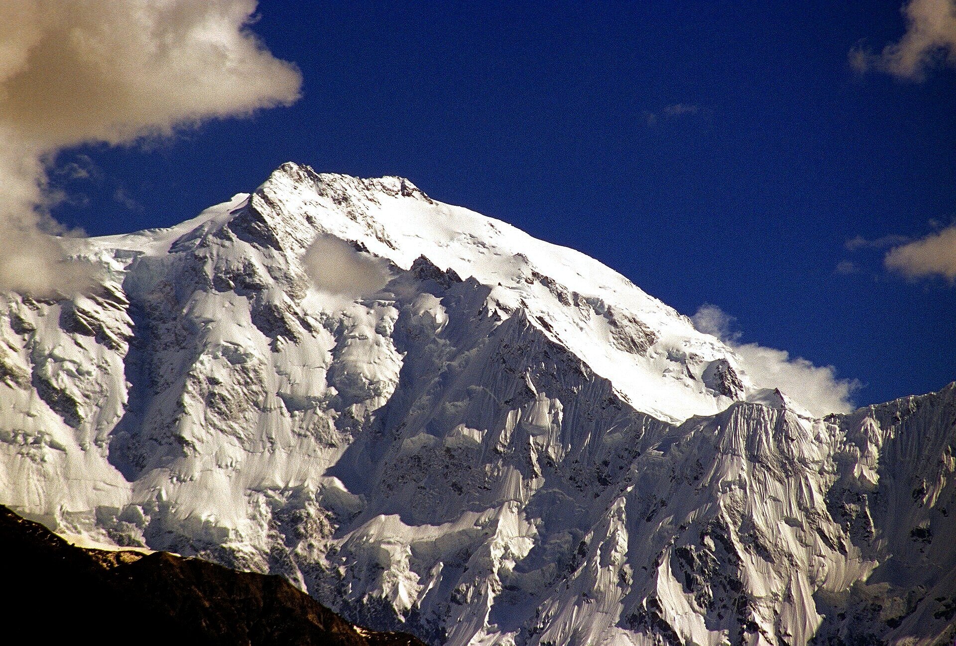
Nanga Parbat, we arrived in Islamabad on June 19. We were unable to get on the flight to Skardu in Baltistan and drove in a big private bus instead. We stopped in Chilas at the K2 Motel after a 12 hours drive at the half way point between Islamabad and Skardu.

Nanga Parbat - the view from near Chilas.
Nanga Parbat

Nanga Parbat

The meeting point of the Hindu Kush, Karakoram and the Himalaya mountain ranges

Remains of the Buddhist culture in northern Baltistan (a point of interest along the ancient Silk Road)

Karakoram Highway

Balti fast food in Skardu. We arrived in Skardu on June 20th. We got up early the following morning to take photos of Indus River sand dunes. In Skardu, we stayed at the Pioneer Hotel.
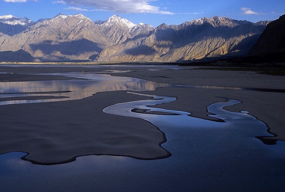
The Indus River valley near Skardu in the evening.

The Indus River near Skardu

The early morning light on the sand dunes of the Indus River near Skardu.

The sand dunes of the Indus River


Sand dunes of the Indus River


We drove from Skardu to Askole. The drive is 6-7 hours long and follows the Shigar and Braldu River Valleys. The road was blocked by a rock fall but the locals blasted the passage open. The photo is of a bridge over the Braldu River near Askole.

The bridge over the Braldu River near Askole.


Jeep track from Skardu to Askole. We were blocked by a rockfall.

The road from Skardu to Askole along the Braldu River. Askole is at 2,965m.

The spot where the trail to the Baltoro Glacier and K2 meets the trail to the Biafo Glacier, a 3 hours walk from Askole. During Day 1 on June 22, we hiked on a steep trail through a narrow notch in the cliffs before we could descend to gain the glacier proper.

Day 1. The view to the Biafo Glacier before we descended to it. Our destination for the day was Namla camp at 3,263m. We hiked for 7 hours from Askole. On the way, we got lost in the middle of the Biafo Glacier.

Day 1. Hike from Askole to Namla Camp.

Day 1. Hike from Askole to Namla Camp.

Day 1. Hike from Askole to Namla Camp.

Day 1. Hike from Askole to Namla Camp. Biafo Glacier is visible below.

Dai 1. This was our lunch spot. After lunch we descended to the Biafo Glacier.

Day 1. Biafo Glacier - en route to the Namla camp.

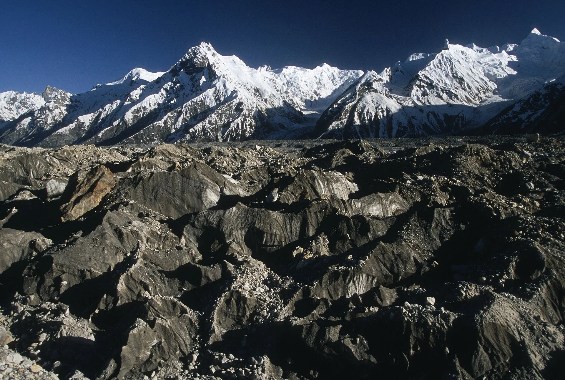
Day 1. The frontal part of the Biafo Glacier.

Day 1. Our crew taking a rest on the Biafo Glacier


Glacial stream on the Biaffo Glacier.

The view from Namla Camp at 3,263m.

Day 2. En route to Banta camp. We initially had to follow the rubble of the lower glacier but soon we started walking on the medial moraine.

Day 2. En route to Banta camp. Walking up the 67 km long Biaffo Glacier

We arrived at the Banta I camp at 3,263m. From here we hiked up to the hills above the camp. We had fantastic views of the Ogre and the Latok mountains. The prominent tower on the left is the Ogre's Thumb, to its right is the Ogre 7,285m. Ogre II 6,960m is the triangular peak to the right. On the left is the Latok group. From the back: Latok 2, 7,086m, Latok 1, 7,151, and small peak of 6,034m.

The Ogre and the Latoks above Banta I camp.
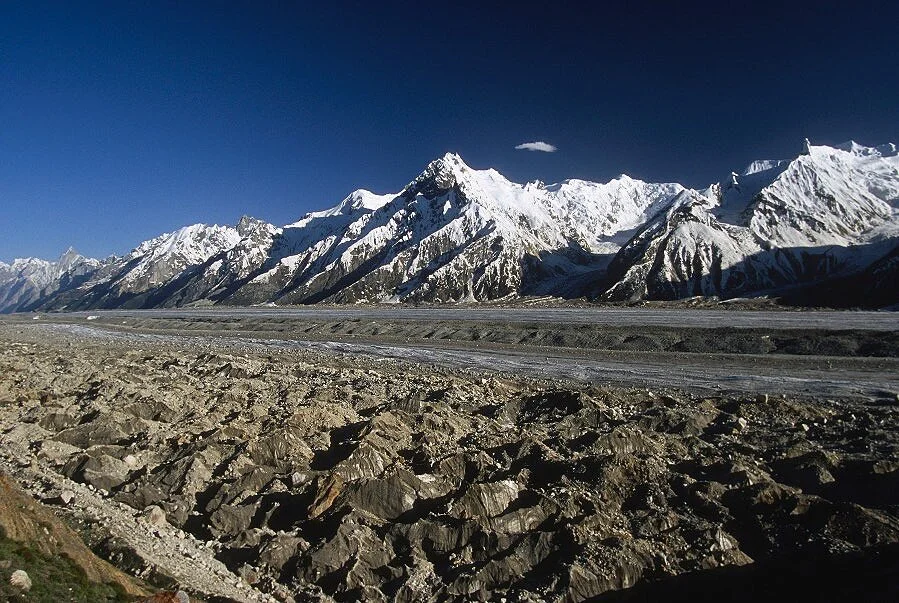
The Biafo Glacier. The Banta Camp is below.

The Biafo Glacier.

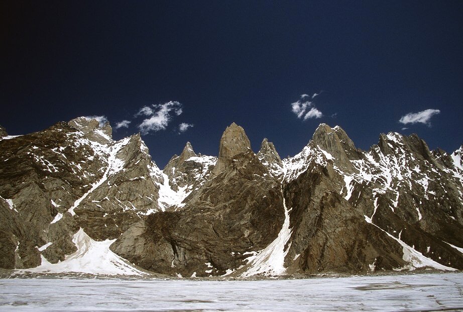
The Latok Group.

The Ogre and the Ogre's Thumb

Latok 2 - 7,076m and the triangular pyramid of Latok 3 in the back.

The Ogre 7,285m and Banta Brakk II (Ogre II), 6,960m

The Uzun Brakk Glacier from the hills above the Banta I Camp. Ogre 1 and 2 are on the left.

The Ogres and Latoks from the hill above Banta camp.

Day 3. We could not find a safe way along the glacier. One of the porters climbed a large boulder to find the way. We slogged all day along the Biafo. We encountered deep snow and the going got tough for the porters. We decided to wait until the following morning for the soft snow to freeze. Furthermore, our guide got ill with a stomach ailment.

Day 3. On June 26th and June 27th we camped at rocky ridge in the middle of the glacier at 4,385m.

Our camp on Day 3 and Day 4 in the middle of the Biafo Glacier at 4,385m. We needed a rest day to allow our guide to recover from his illness. We could not hike anywhere during the rest day as we were surrounded by hidden crevasses.

During Day 3, we were trying to negotiate soft snow in the blazing sun.

Negotiating soft snow on the Biafo Glacier during Day 3.
The peaks along the Biafo Glacier.

The morning of Day 4, we had a cold but clear morning on the Biafo Glacier. We were now at 4,385m. The sunrise was quite spectacular illuminating the peaks lining the Biafo Glacier to the north of our camp. We decided to take a rest day to allow our guide to recover from his stomach ailment.

Sunrise on Day 4 at 4,385m

Sunrise on Day 4

Day 5, June 28th. We started early to avoid soft snow again. It was quite cold as we were walking in the shade. We passed below Nagpogoro (black rocks) and Marpogoro (red rocks).

Upper Biafo Glacier

Looking back from the trail between the Biaffo Camp and Lukpe Lago camp on Day 5.

Day 5. En route to Snow Lake (Lukpe Lawo).


Biafo Glacier, looking towards the Latok Peaks. Biafo Glacier here is at the altitude of 4,428m


Day 5, en route to Lukpe Lawo.


Ghur from Biafo Glacier and Game Sokha Lumbu (6,282m)

Day 5, we can now see the Snow Lake ahead. Sosbun Brakk 6,413m is on the left.

Day 5. Approaching the camp on the Snow Lake at 4,745m. We were intending to stay there for a few days to explore the area. The hidden crevasses posed a threat though as the snow would get soft in the intense sun.

Biafo Glacier, approaching the Snow Lake.

Approaching the Snow Lake. The Hispar Pass is hidden on the left.

Broad Tower (5,063m) and Solu Peak (5,901m)


On the Snow Lake. Broad Tower (6,063m) and Solu Peak (5,901m)

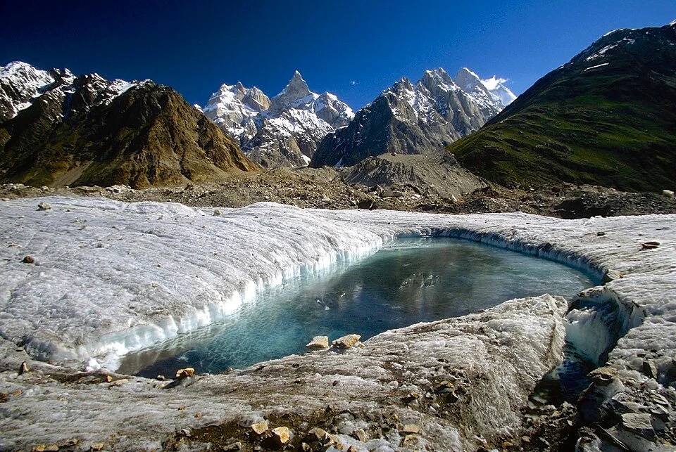
Day 5 and Day 6. Our camp on the Snow Lake at 4,745m.

Snow Lake, looking north east.

The view from our camp at the Snow Lake at 4,745. Day 5 and Day 6.

Cooking area on the Snow Lake

Shirkan in our camp at Snow Lake at 4,745m.


The Snow Lake, looking back at the Biafo Glacier.

The Snow Lake, looking North West

The Ogre from our camp at the Snow Lake.

Sunrise from our camp at the Snow Lake.


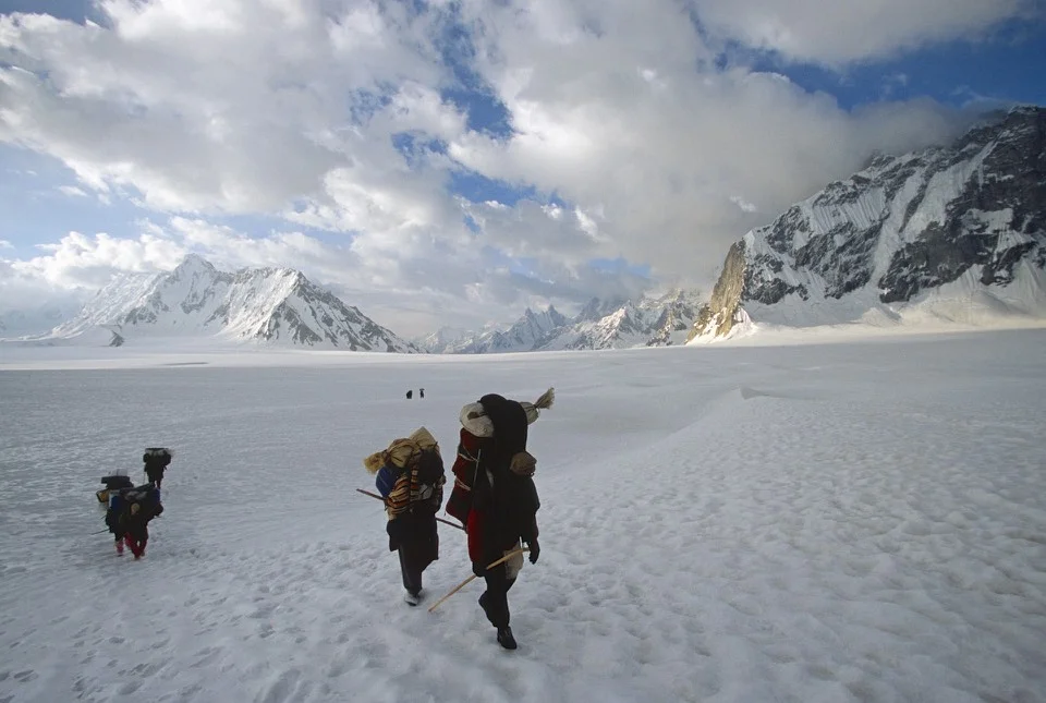
Day 7, we departed our camp at Snow Lake to cross the Hispar Pass. We started very early to take advantage of the frozen snow. The area of the Hispar Pass has a lot of hidden crevasses.

Approaching the Hispar Pass on the horizon, Skam La Pass and to the right (around the buttress) is the Biafo Glacier.

Climbing to Hispar Pass.

Hispar Pass 5,151m The pass is actually a large and levelled snow field like a large plateau. We were planning to camp there but due to high winds we decided to camp further down.

The Hispar Pass 5,151m


The Hispar Pass

Looking back at the Snow Lake

Snow Lake

Snow Lake

Snow Lake


Approaching to the top of the Hispar Pass 5,151m

Skam La Pass on the left in the clouds. Below it, the Snow Lake.

At the top of Hispar Pass


Hispar Pass 5,151m

Looking back from Hispar Pass to the Snow Lake


The Top of Hispar Pass 5,151m


Looking down the Hispar Glacier from the top of Hispar Pass. We camped by the green lakes below. The campsite was near Khani Basa Glacier at 4,530m. As we approached the camp, the snow got progressively softer making walking difficult.

The surface snow melt on the Hispar Glacier which is 49km long. Our campsite near the Khani Basa Glacier at 4,530m.

Our camp at 4,530m


Day Hispar Glacier, the night of Day 7 at 4,530m

Hispar Pass from Hispar Glacier side and our camp right below the Hispar Pass on Day 7 at 4,530m.

Camp on Day 7

Our porters descending from Hispr Pass

Day 8, we hiked for 5 hours from the Khani Basa camp to Shikambarish Camp at 4,170m. We traversed the Jutmo Glacier and finished the day in a downpour. On the way, we had to traverse a hill/moraine of liquid mud that made our progress slow and tedious.

En route to Shikambarish camp on Day 8.


Hispar Pass on the left and the Hispar Glacier on Day 9

Yutmaru Glacier

Yutmaru Glacier and Yutmaru Sar 7290m in the centre.

Looking down the Hispar Glacier from our camp near Dachigan at 4,000m on Day 9

Crossing the Pumari Chish Glacier en route to the camp near Dachigan at 4,000.

Day 9 en route to Dachigan camp.

On the Hispar Glacier.

On the Hispar Glacier


The view from Dachigan camp on Day 9 at 4,000.

The view across the Hispar Glacier from Dachigan.


Steep climb after crossing the Pumari Chish Glacier.

Day 9, Dachigan. From Dachigan, we walked to Hispar Village on Day 10 for 6 hours. We camped at the Huru Village. We had to walk from Hispar to Huru for some distance. The walk was longer than normal due to landslides. On this trek, we walked the total distance of 132km and ascended only 2,750m in total.
From Huru, we took a jeep to Karimabad we were hang our for a day in the Hunza Baltit Inn. On July 7 we drove to Chilas via Gilgit. We were now back on the Karakoram Highway. On July 8, there were serious terrorist attacks in London. This necessitated an armed escort for our group from Abbottabad to Islamabad. We did not know what was going on. The police with guns showed up and wisked us through all the intersections and red lights along the way. Only after arriving at the hotel in Islamabad we found out what had happened in London. We stayed in Islamabad on July 9th and flew home on July 10th.