Mount Victoria and Lake Louise
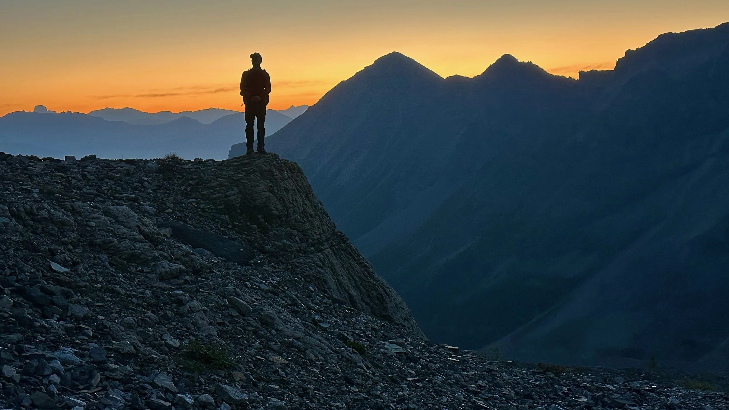
Sunrise on the way to Mt. Victoria North
Sunrise on Mt. Victoria main summit
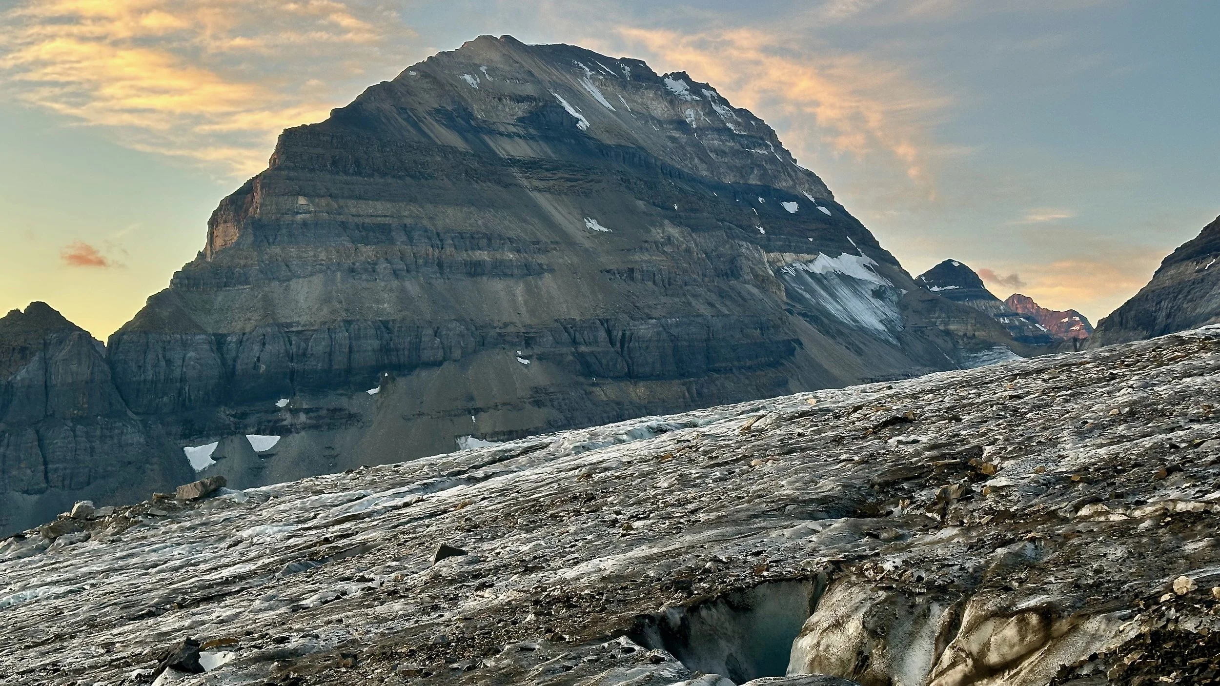
Mt. Lefroy from Victoria Glacier
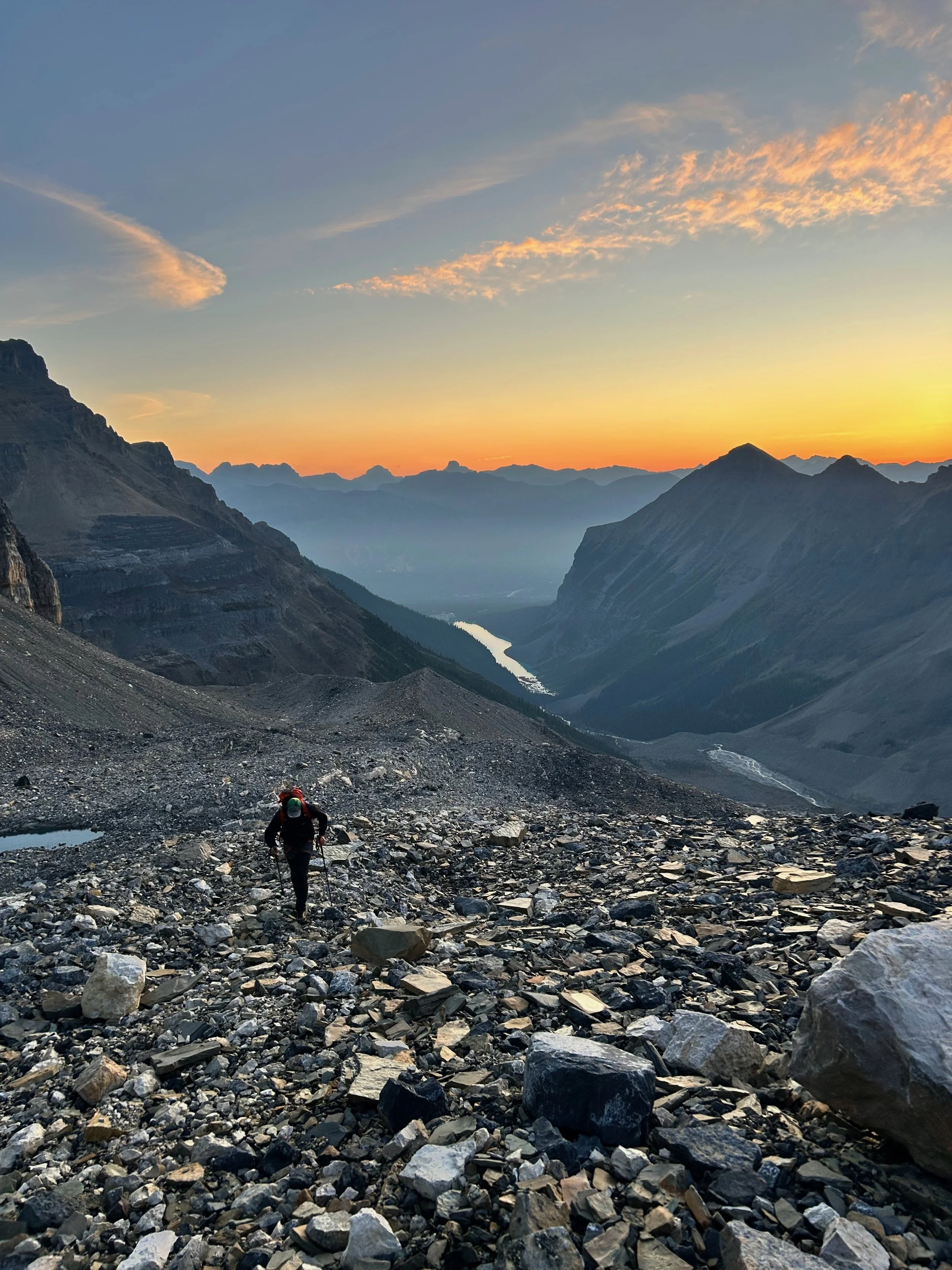
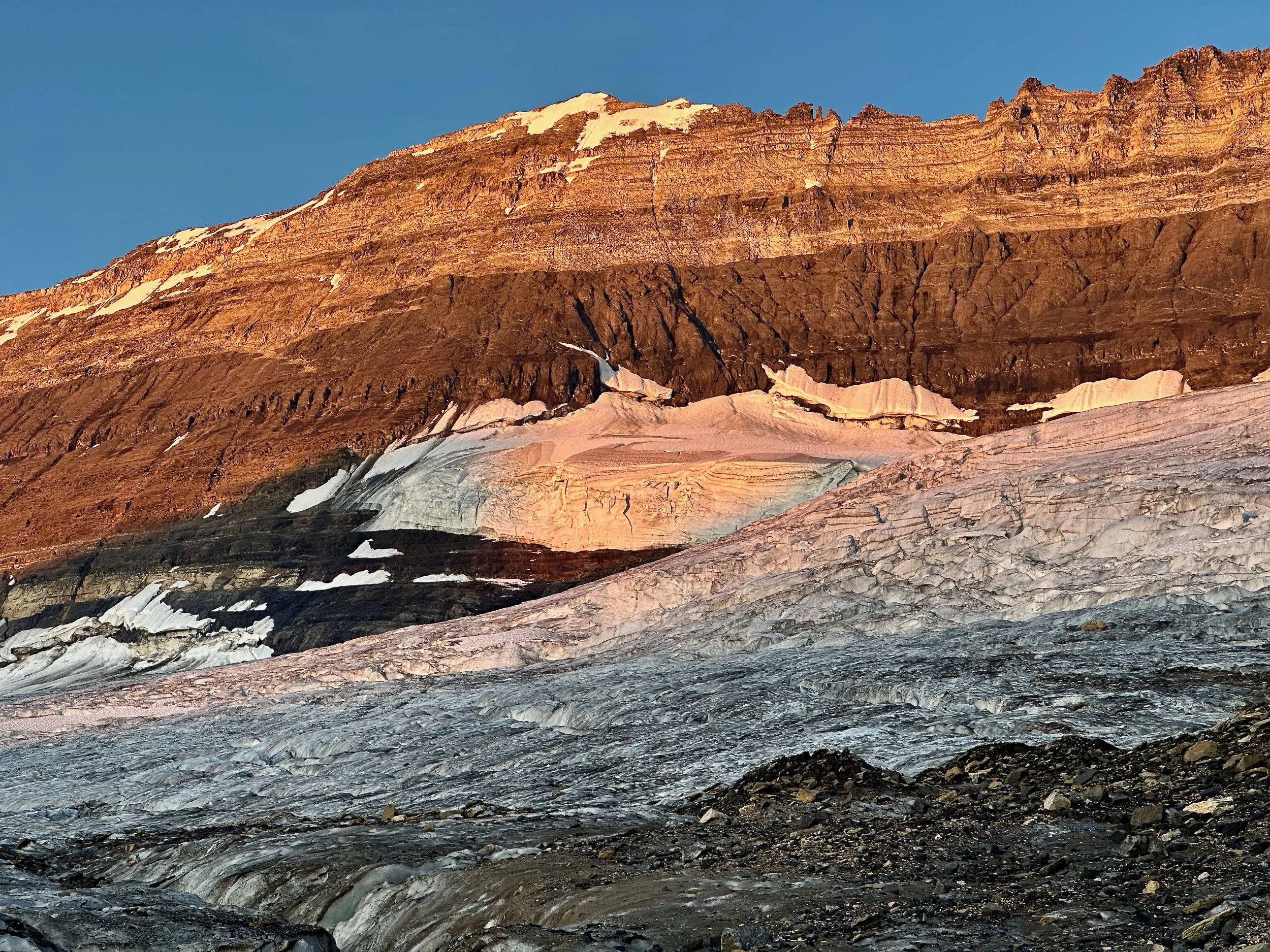
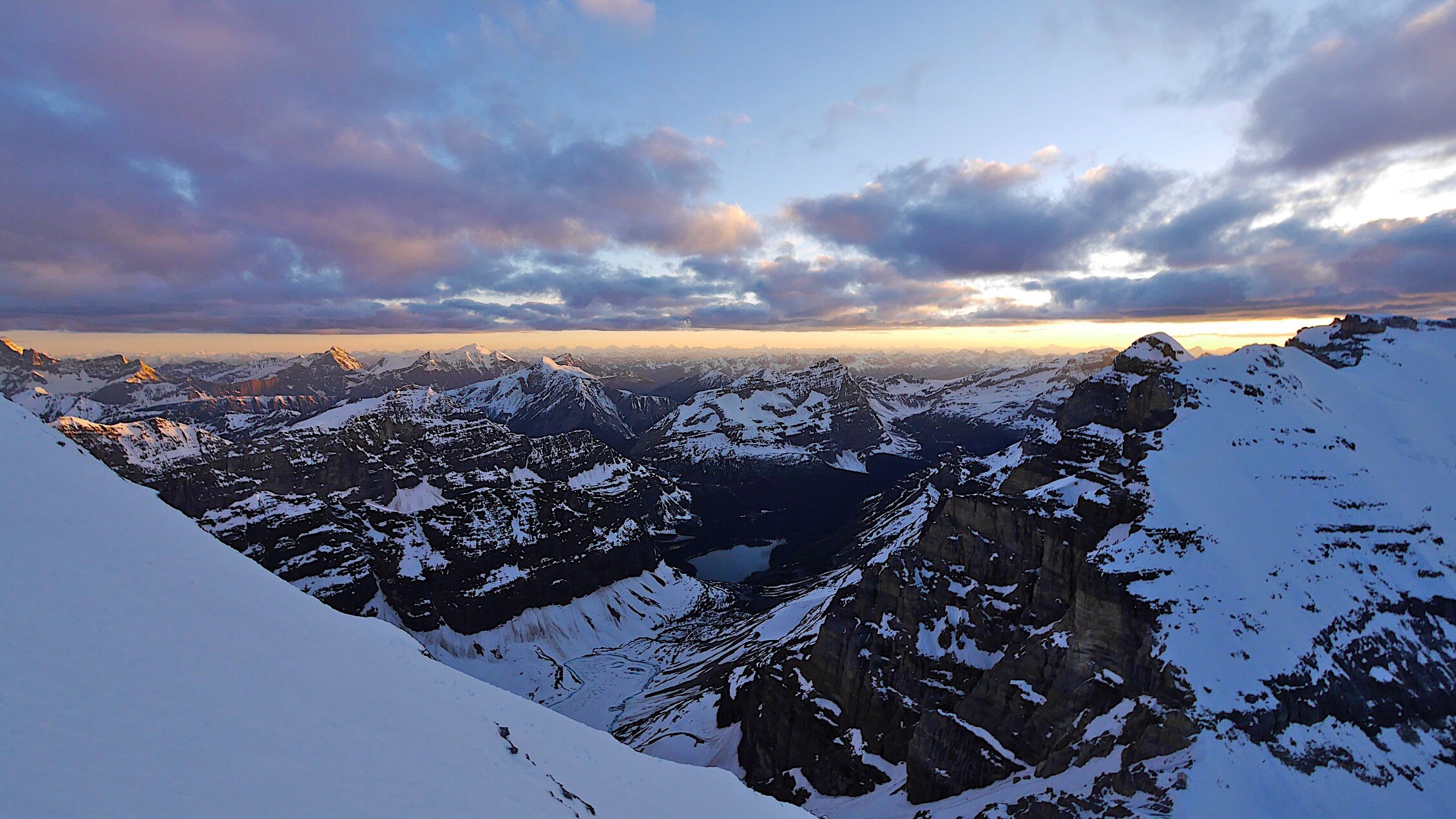
Sunrise on the Victoria Glacier. Lake Louise is waking up in the distance.
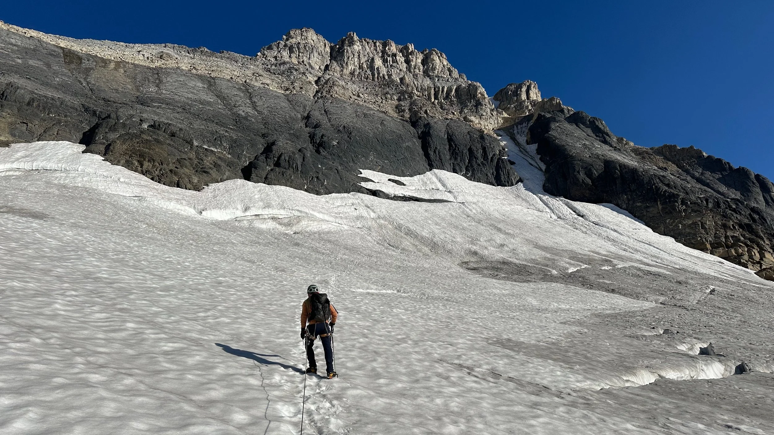
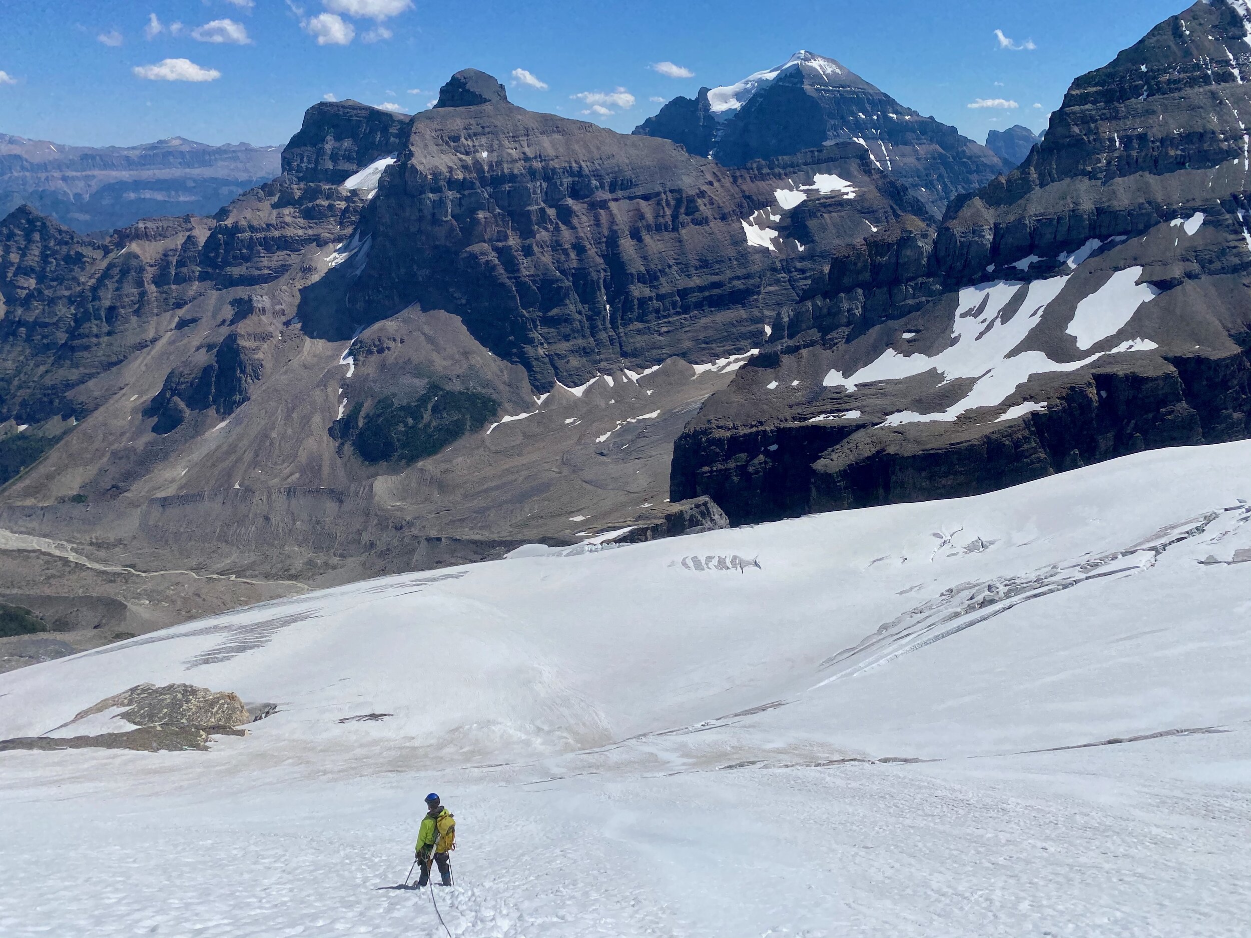
Ascending the Victoria Glacier from Lake Louise
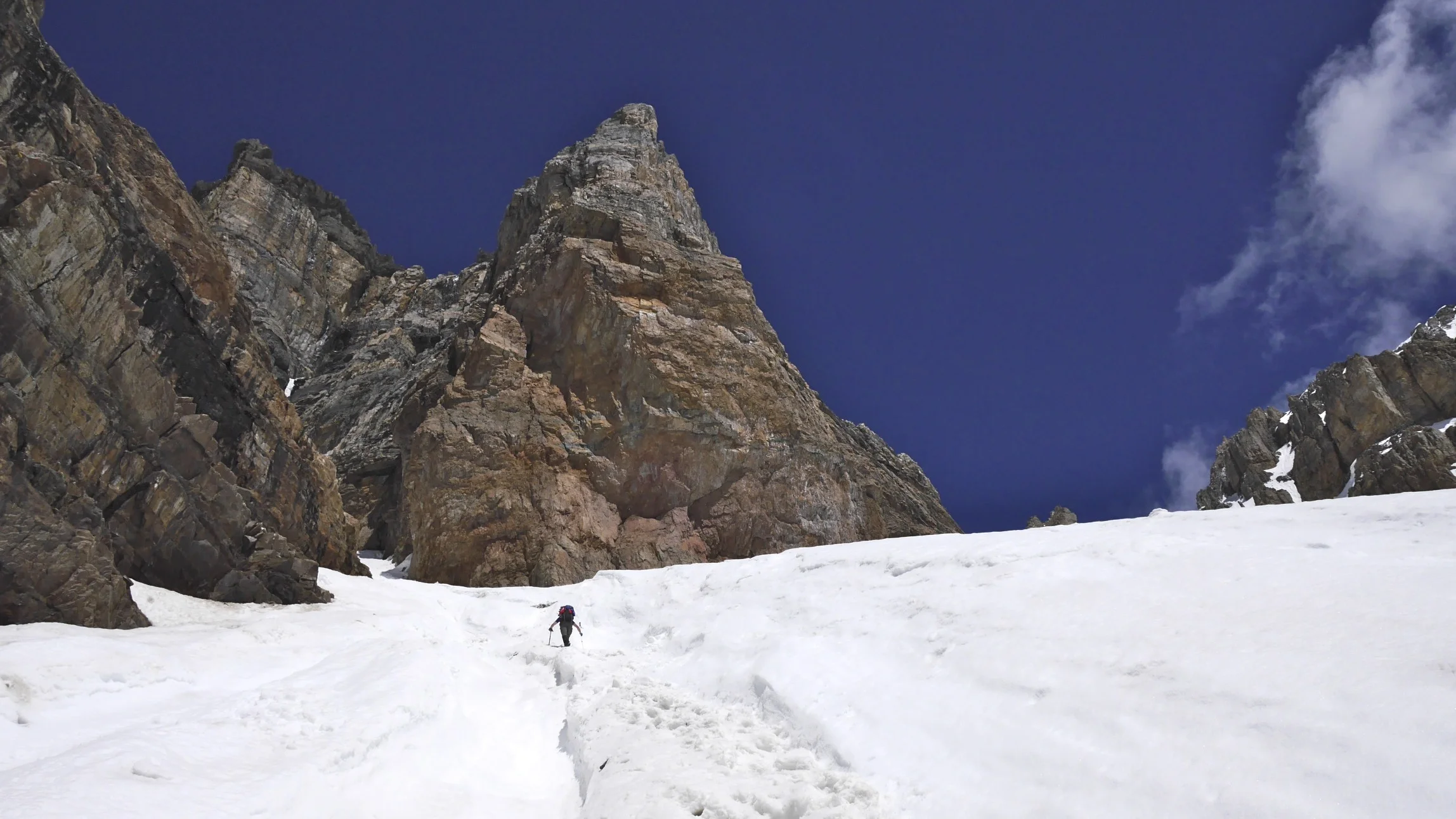
Mount Victoria - Collier Pk col
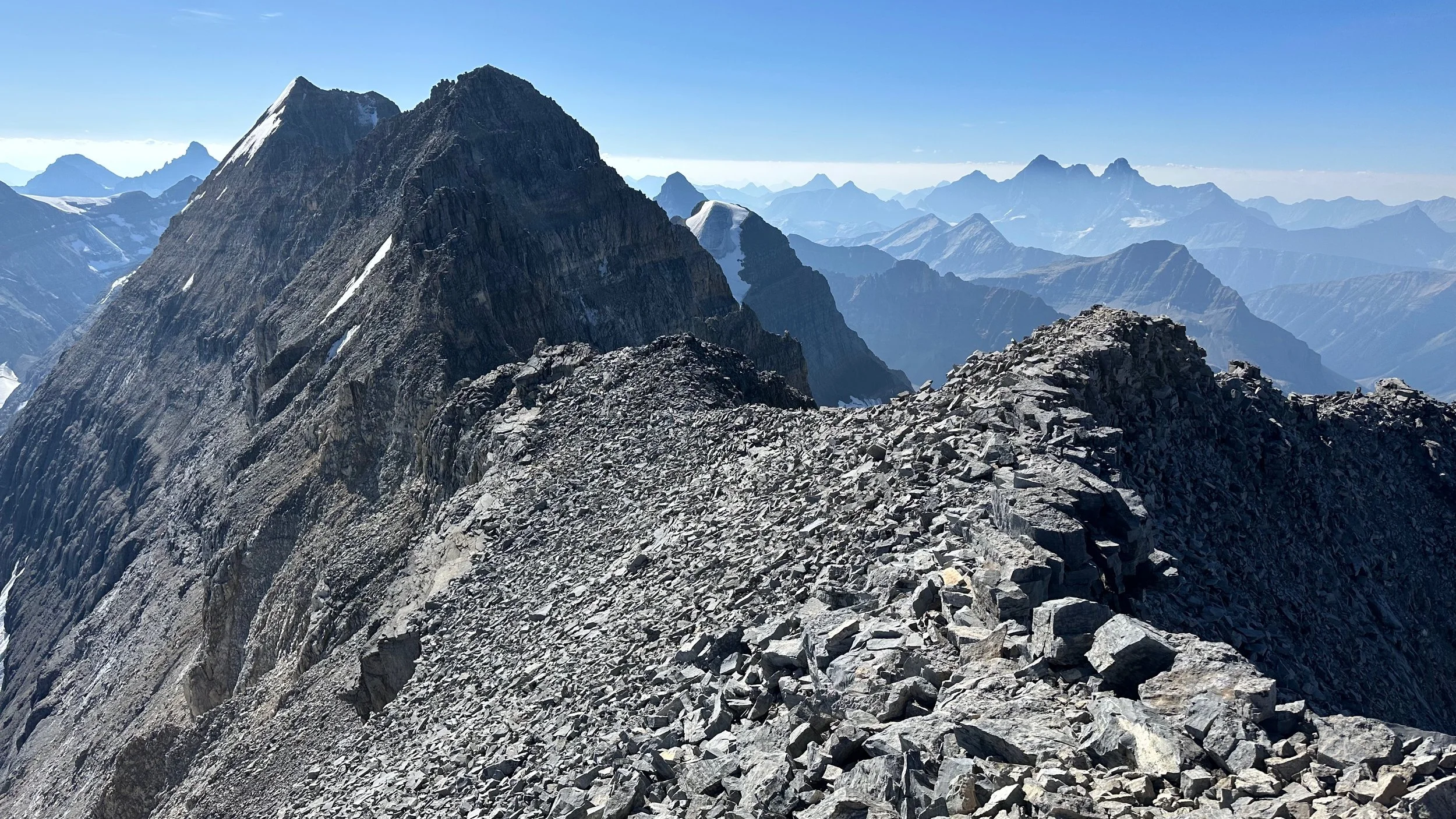
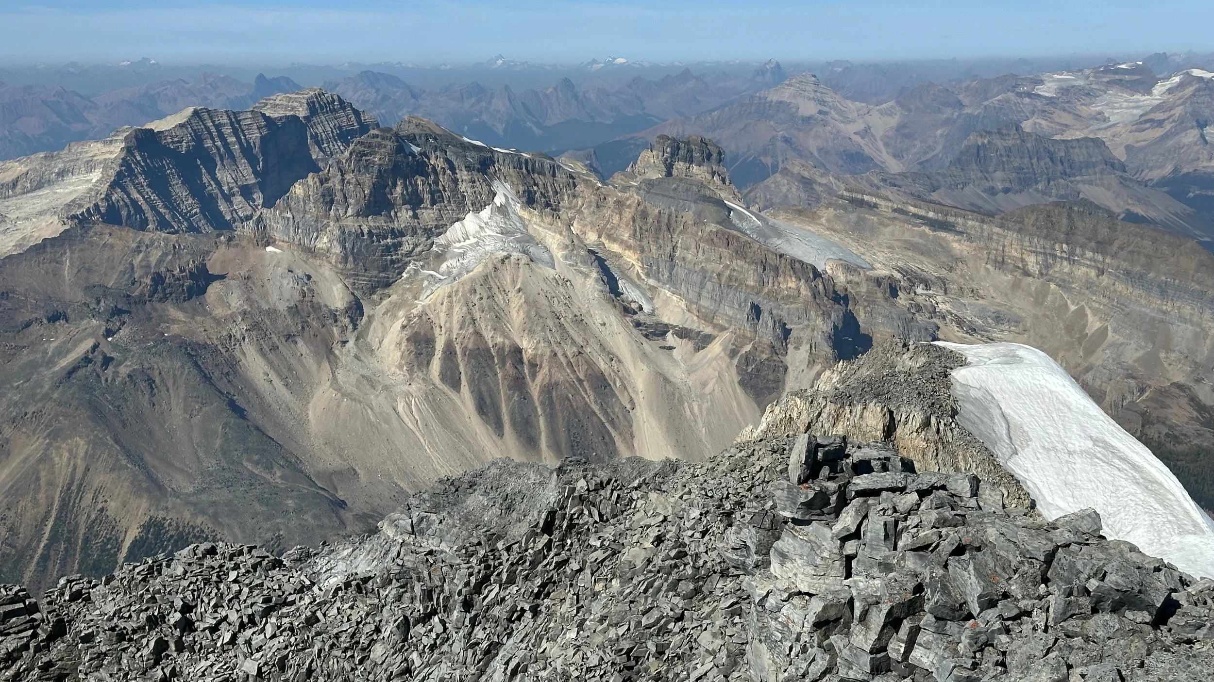
Summit ridge from Mt. Victoria - Collier Pk
Collier Pk. 3,232m
Looking north from Victoria - Collier Pk col
Final push to the summit
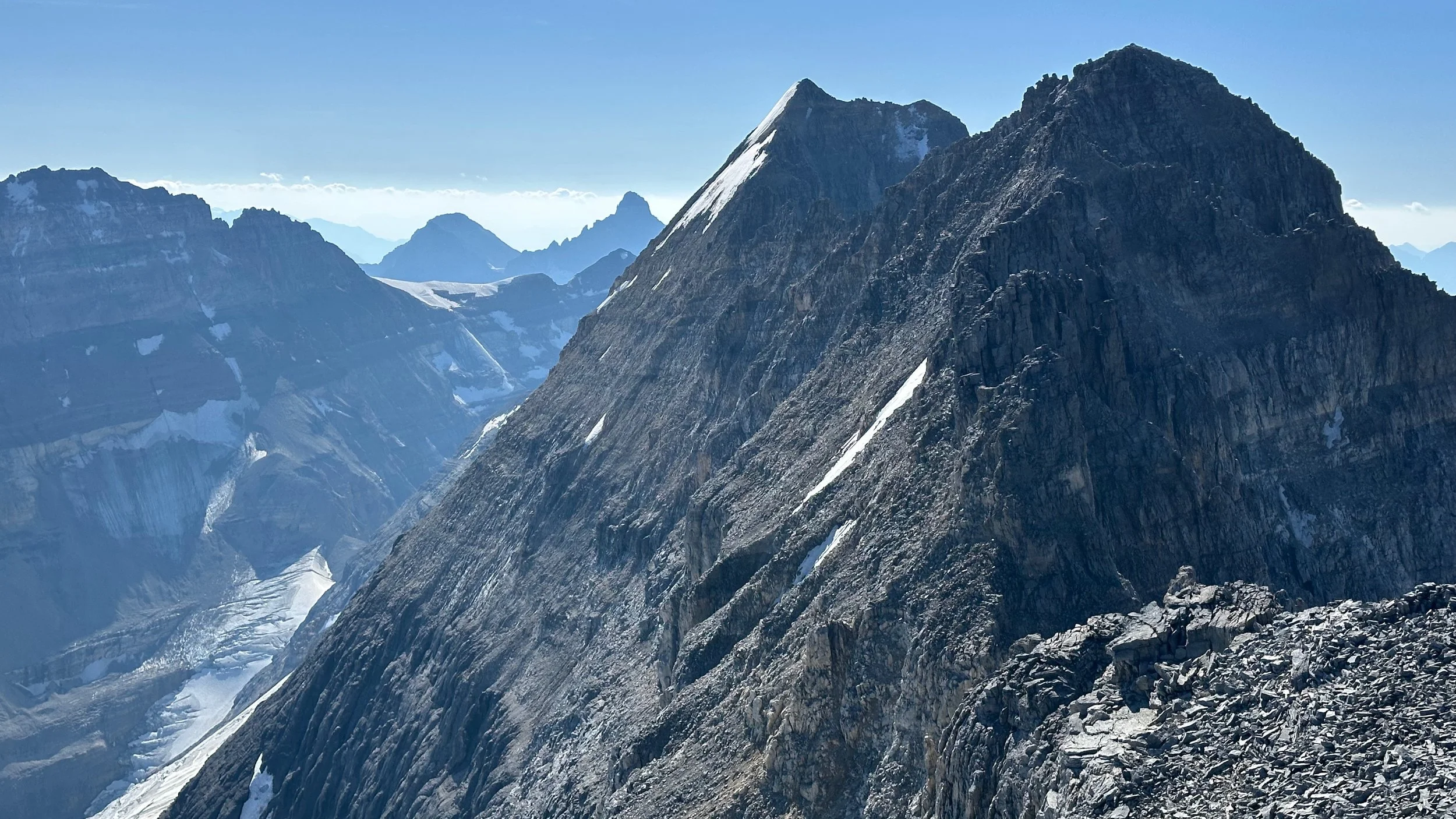
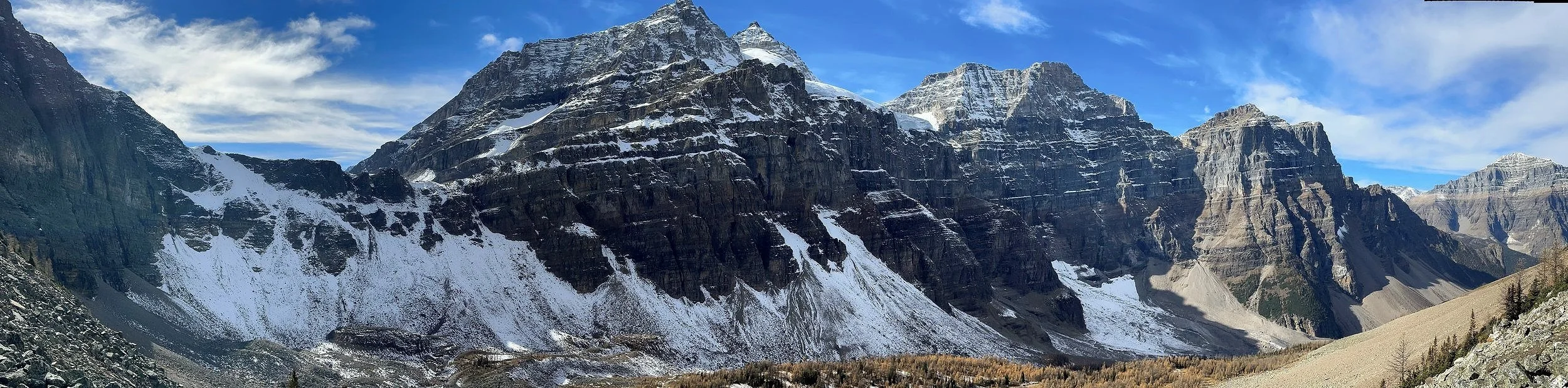
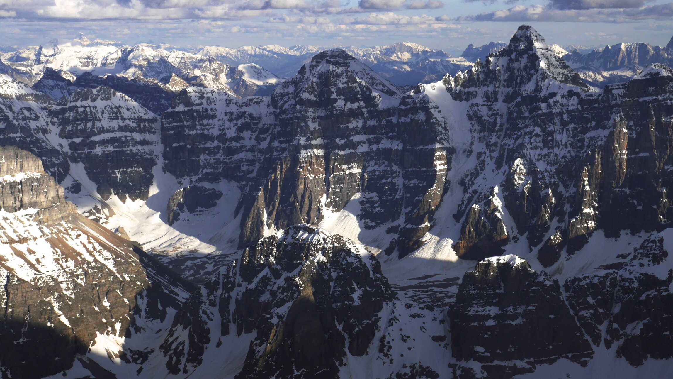
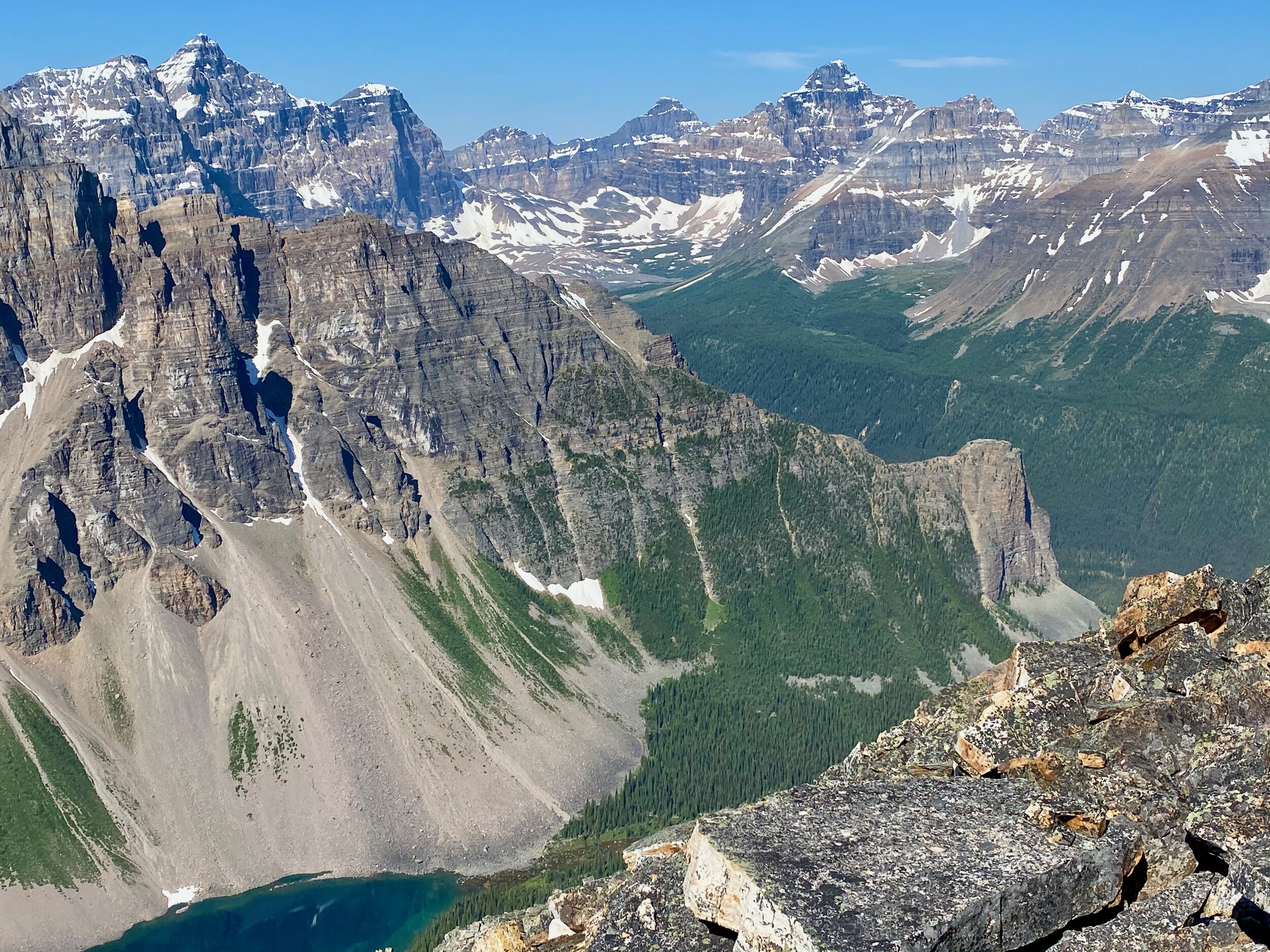
From left: Mt. Temple, Mt. Lefroy and Victoria South
The summit of Mt. Victoria North looking to the ridge connecting to the summit of Vitoria Main
Looking towards Lake O’Hara
South summit of Mt. Victoria
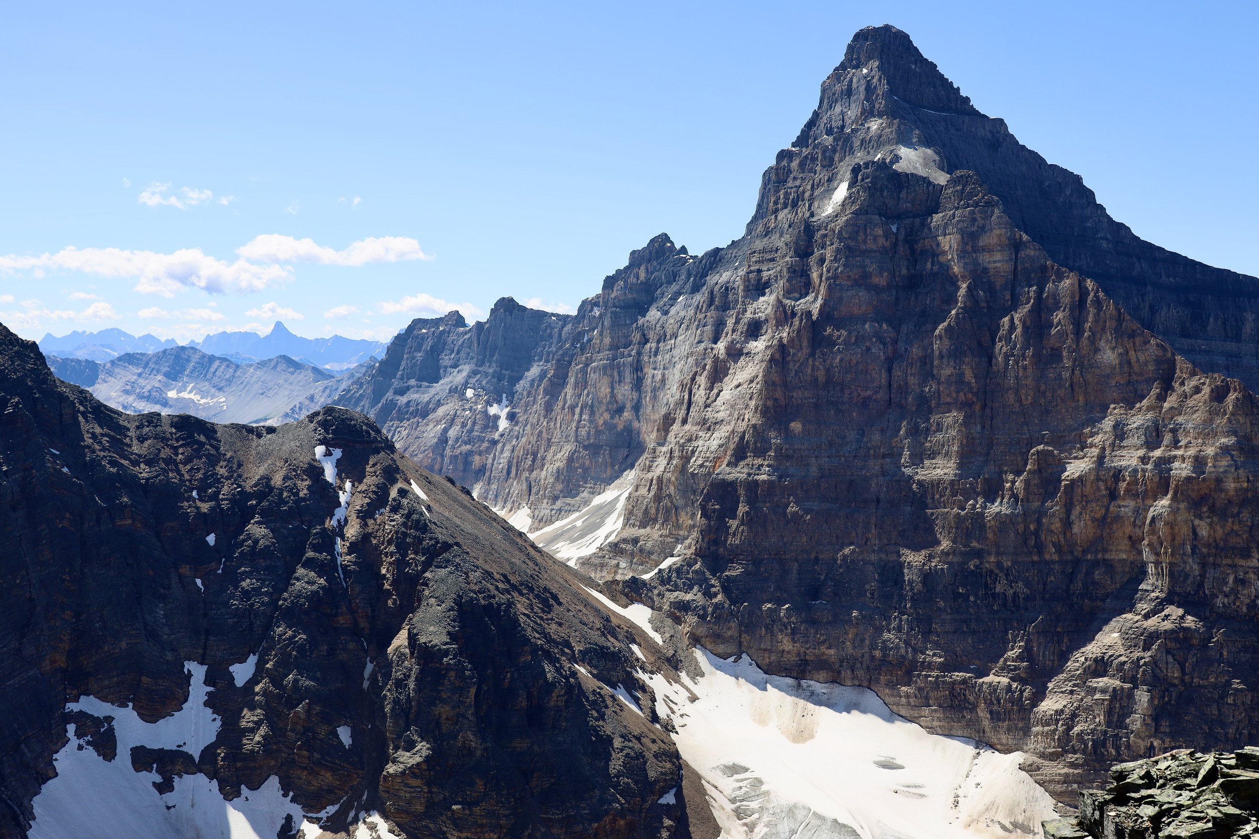
Mt. Lefroy 3,423m
Looking west to Mt. Stephen 3,199m
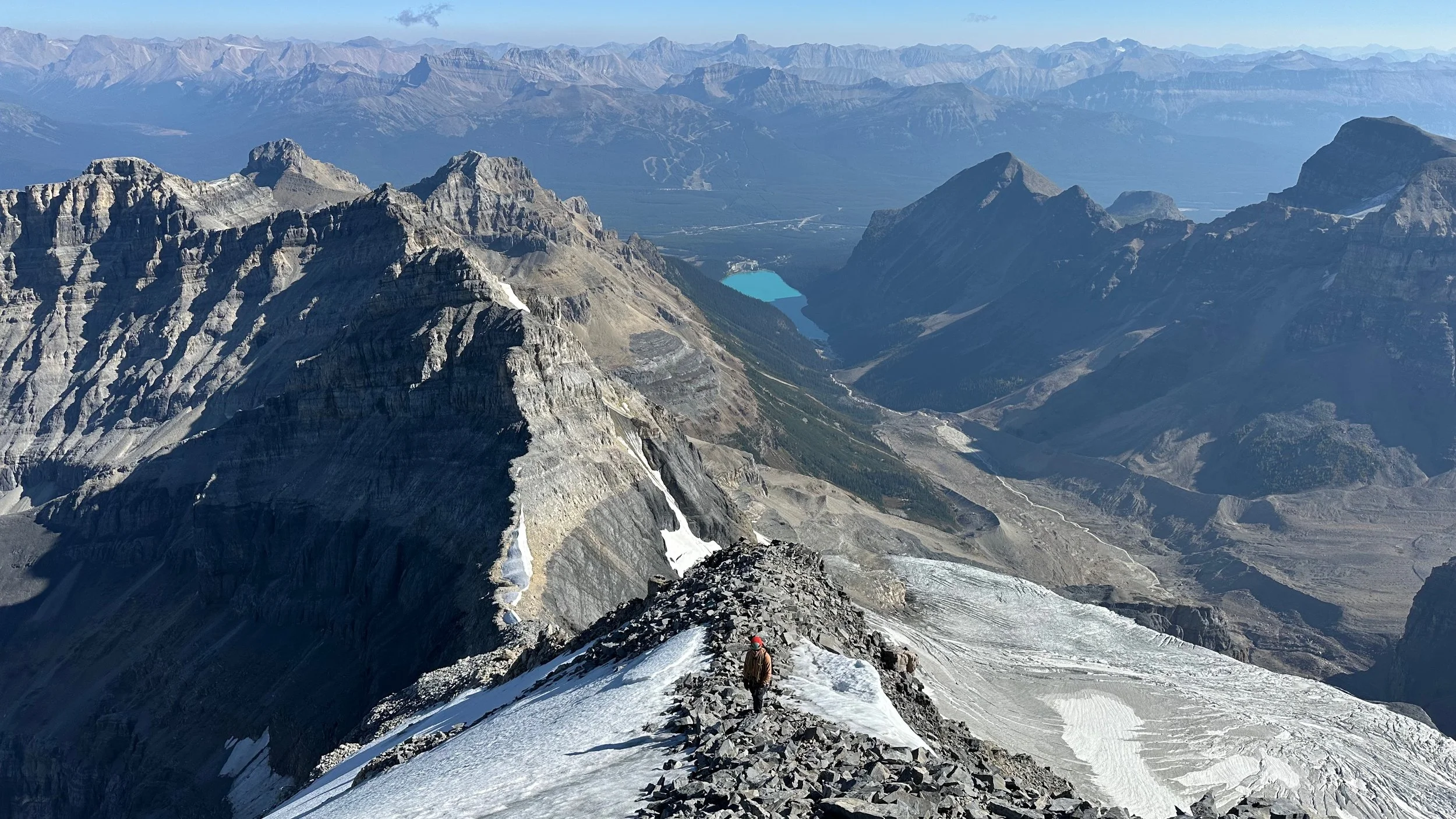
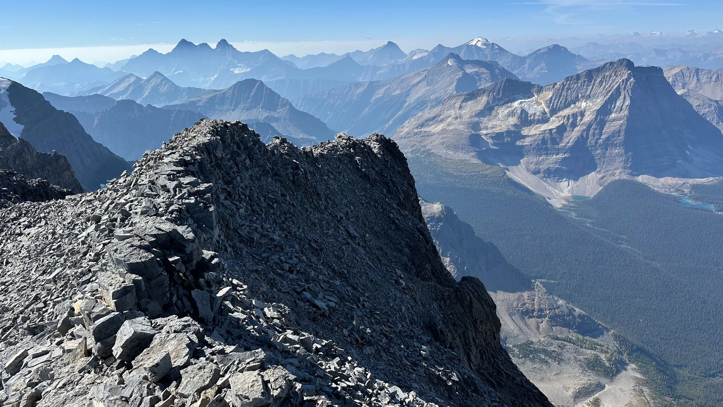
Collier Pk is now way below. Lake Louise is far away.
Summit ridge of Victoria North
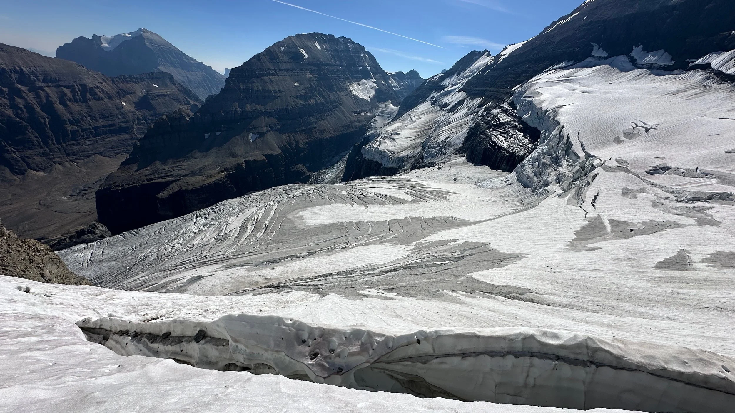
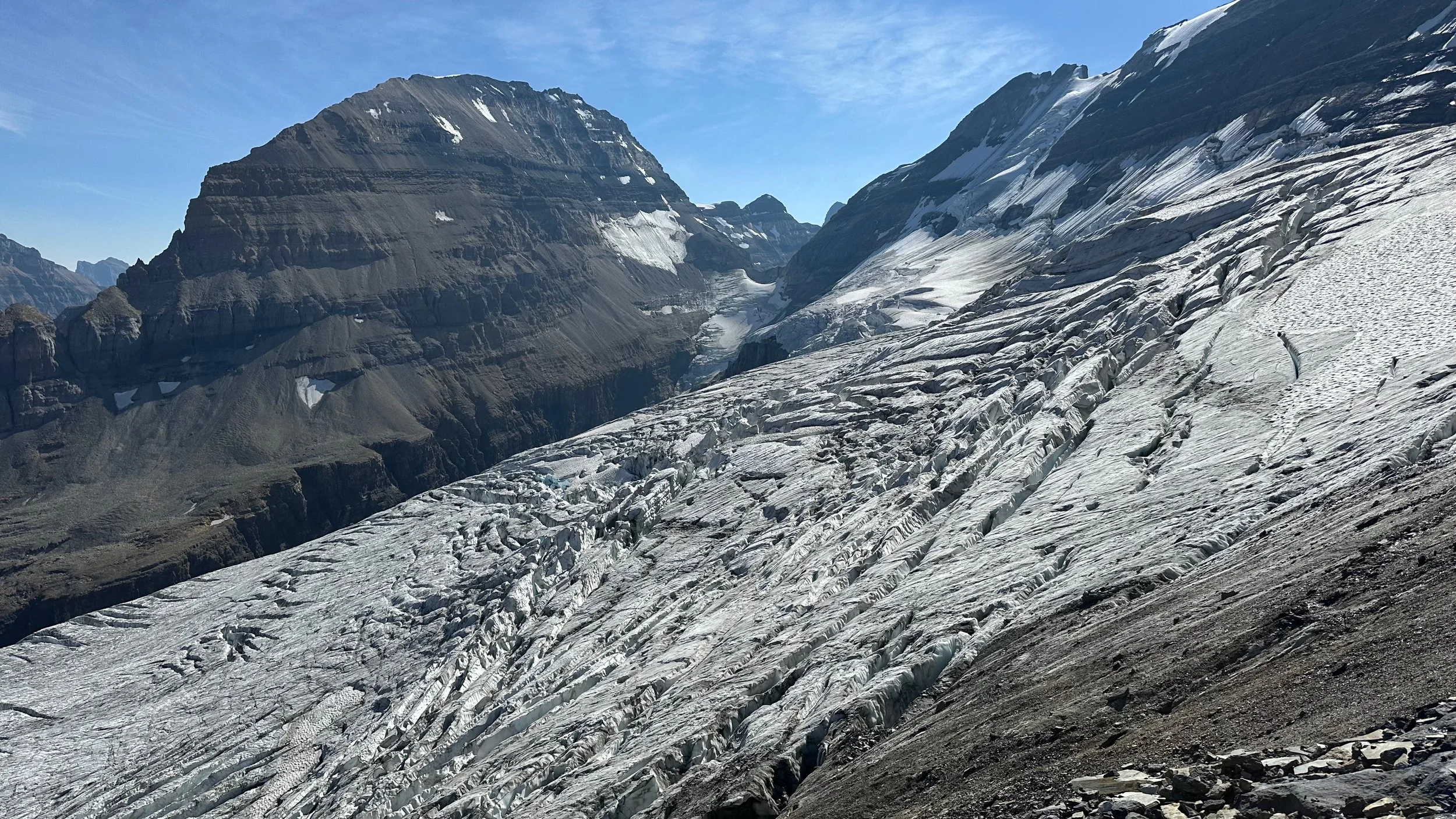
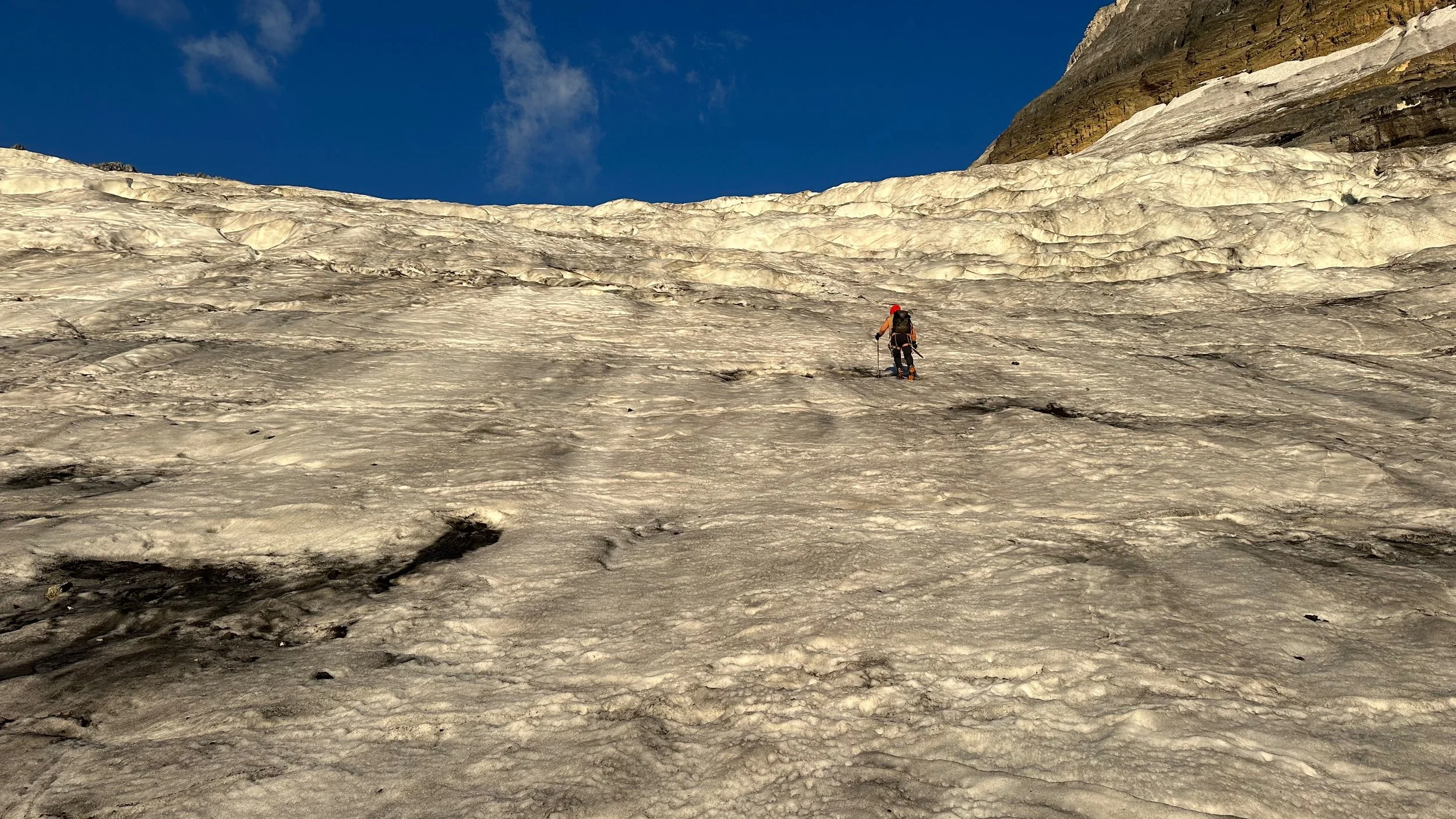
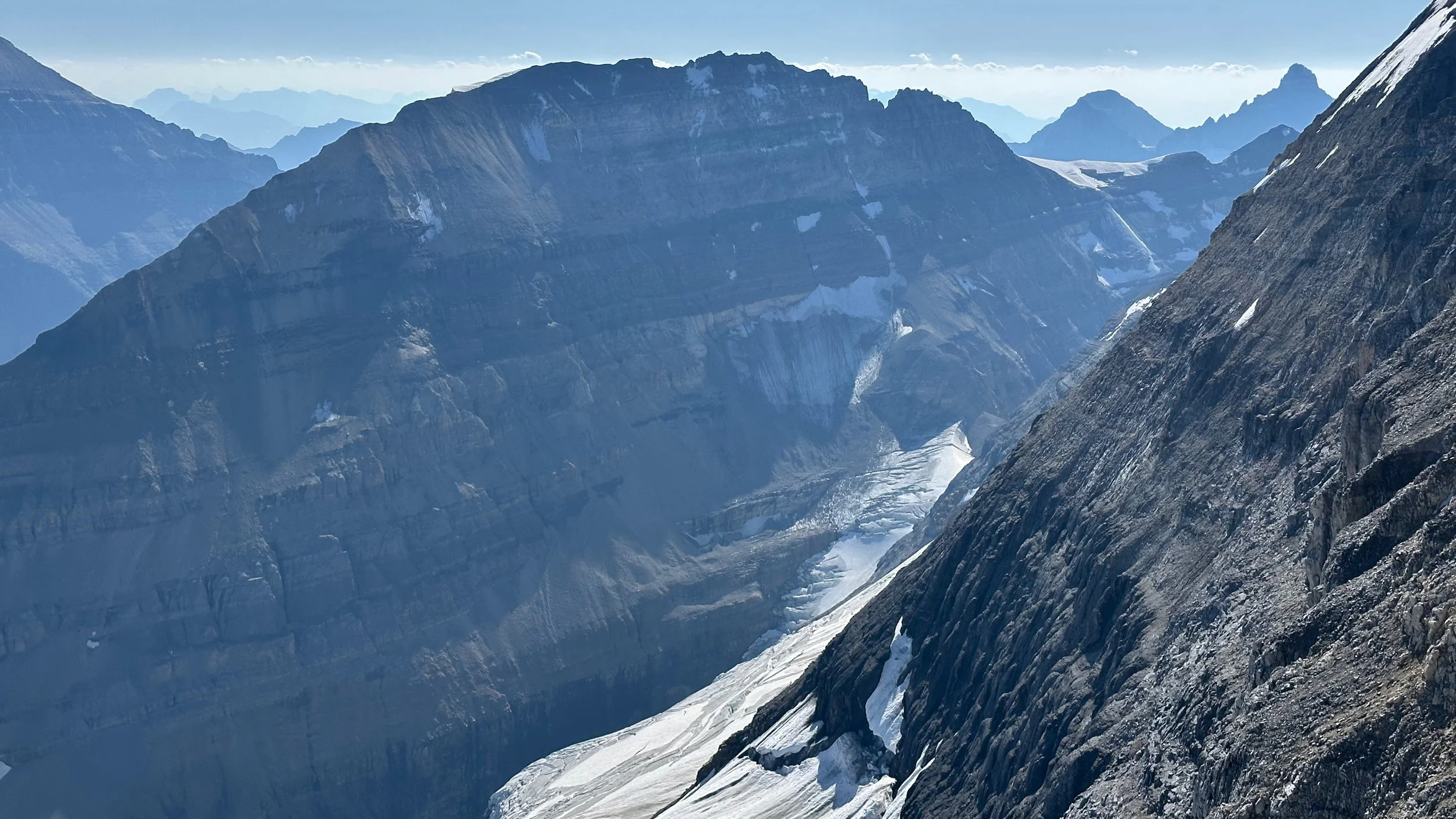
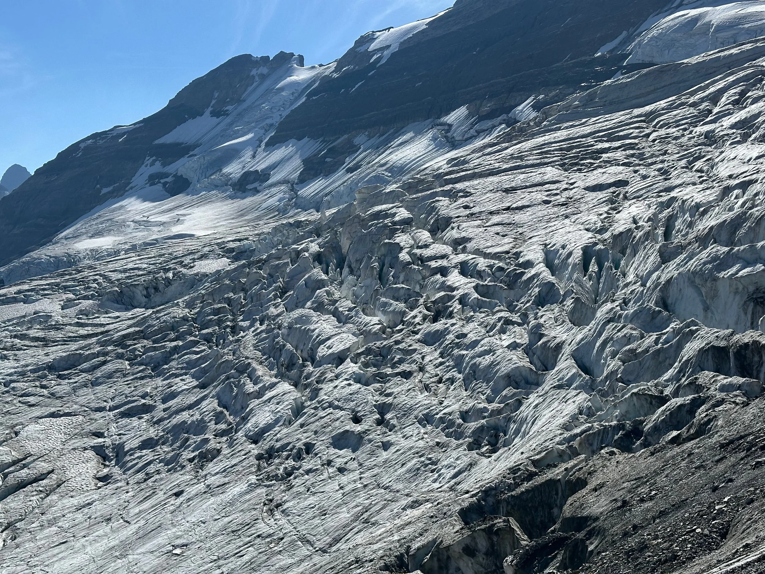
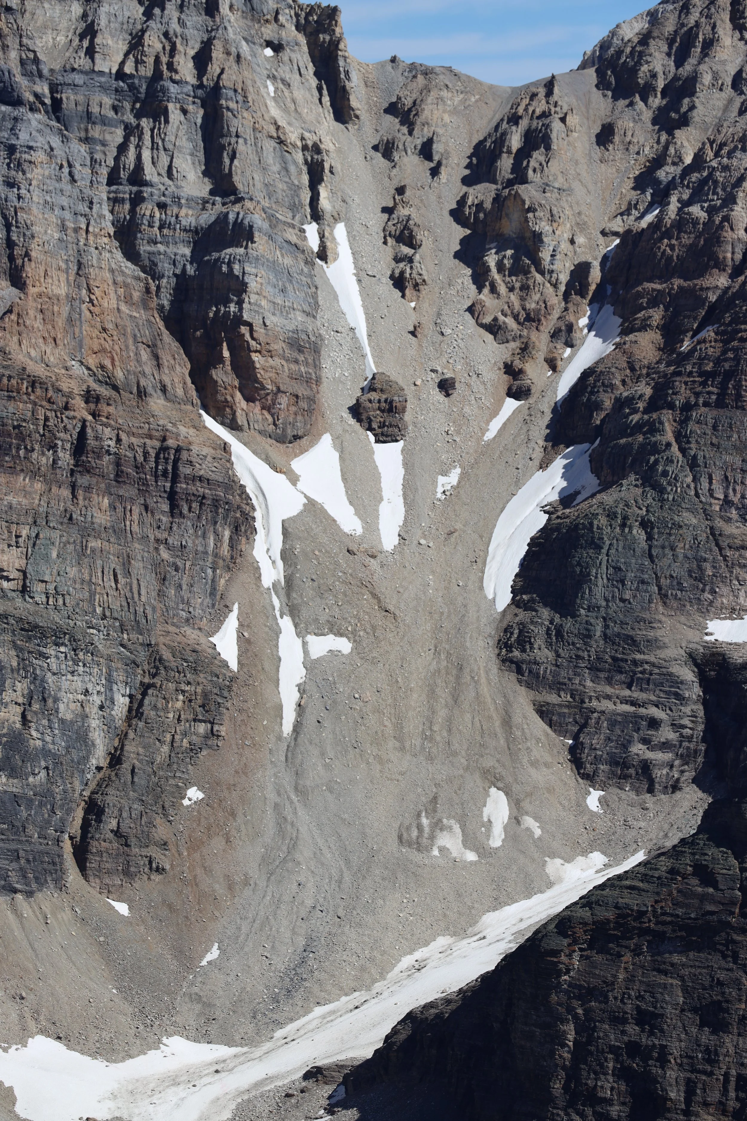
The broken Victoria Glacier
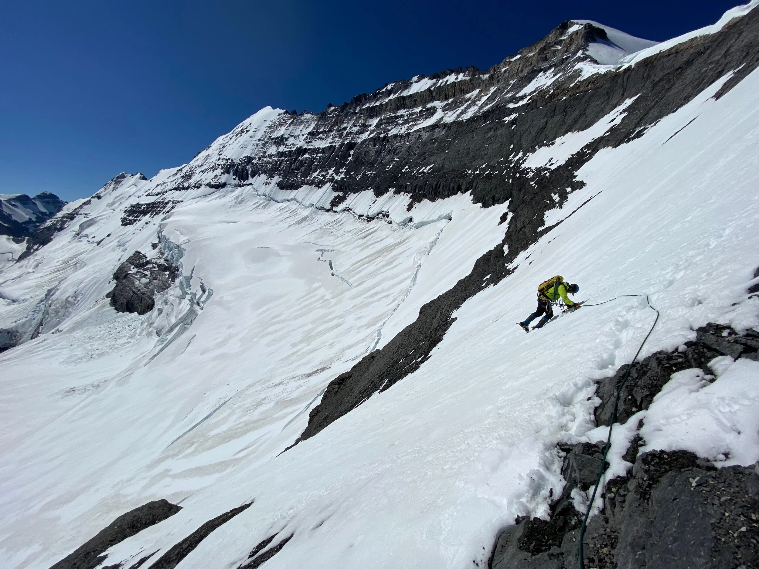
The Victoria Glacier Icefall that we had to ascend. It was more acrobatics than climbing.
Mt. Aberdeen (left) and Mt. Lefroy (right)
Consolation Valley from Taylor Lake Pass

Mount Fay

Consolation Lake

Consolation Lake and Mount Quadra

The Valley of Ten Peaks from Eiffel Tower

Paradise Valley and Mount Temple from Eiffel Tower

The Wakchemna Pass from Eiffel Tower

Eiffel Tower - looking back to Moraine Lake

Mount Hungabee and the Paradise Valley from Eiffel Peak

Mount Temple from Eiffel Tower

Mount Hungabee from Eiffel Tower
Mount Lefroy from Eiffel Peak

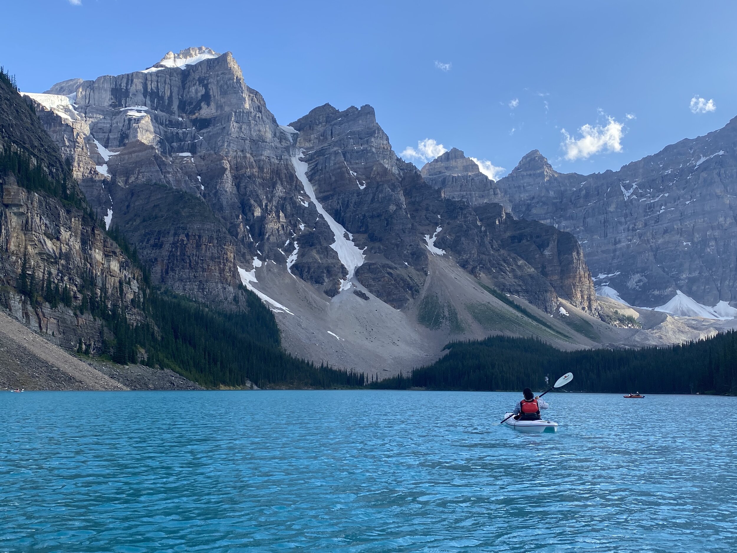
Moraine Lake

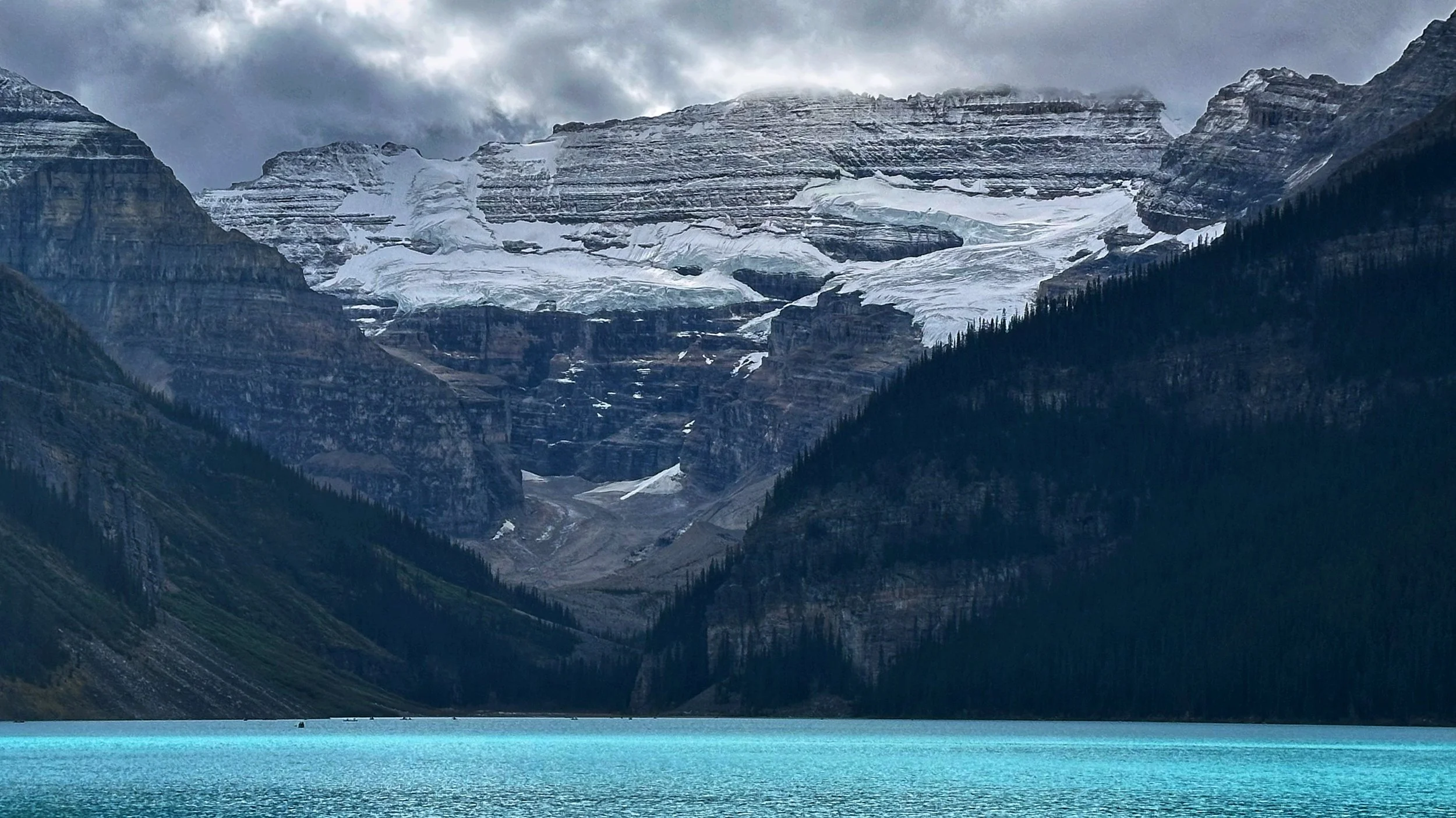
Lake Louise

Lake Louise


The east face of Mt. Temple

1996, one of my first outings to the fabulous alpine in the Lake Louise area. Mount Aberdeen and Aberdeen Glacier are in the background. Behind Mt. Aberdeen is Mt. Lefroy and Mt. Victoria. Andrzej, the man in the photo with me, is the Polish Himalayan climber from the golden days of Polish alpinism (1980s), full of fantastic stories of, at that time, lands yet to be discovered by me. At that time I could not have possibly imagined in my wildest dreems what would follow and how absolutely fortunate I would be to have the opportunity to do what I am doing. People like Andrzej, among many others have contributed to this wild journey!

The same spot - 25 years later!

Panorama from Mt. Fairview - a million dollar view for the effort

Mount Aberdeen, Lefroy and Victoria from Mt. Fairview

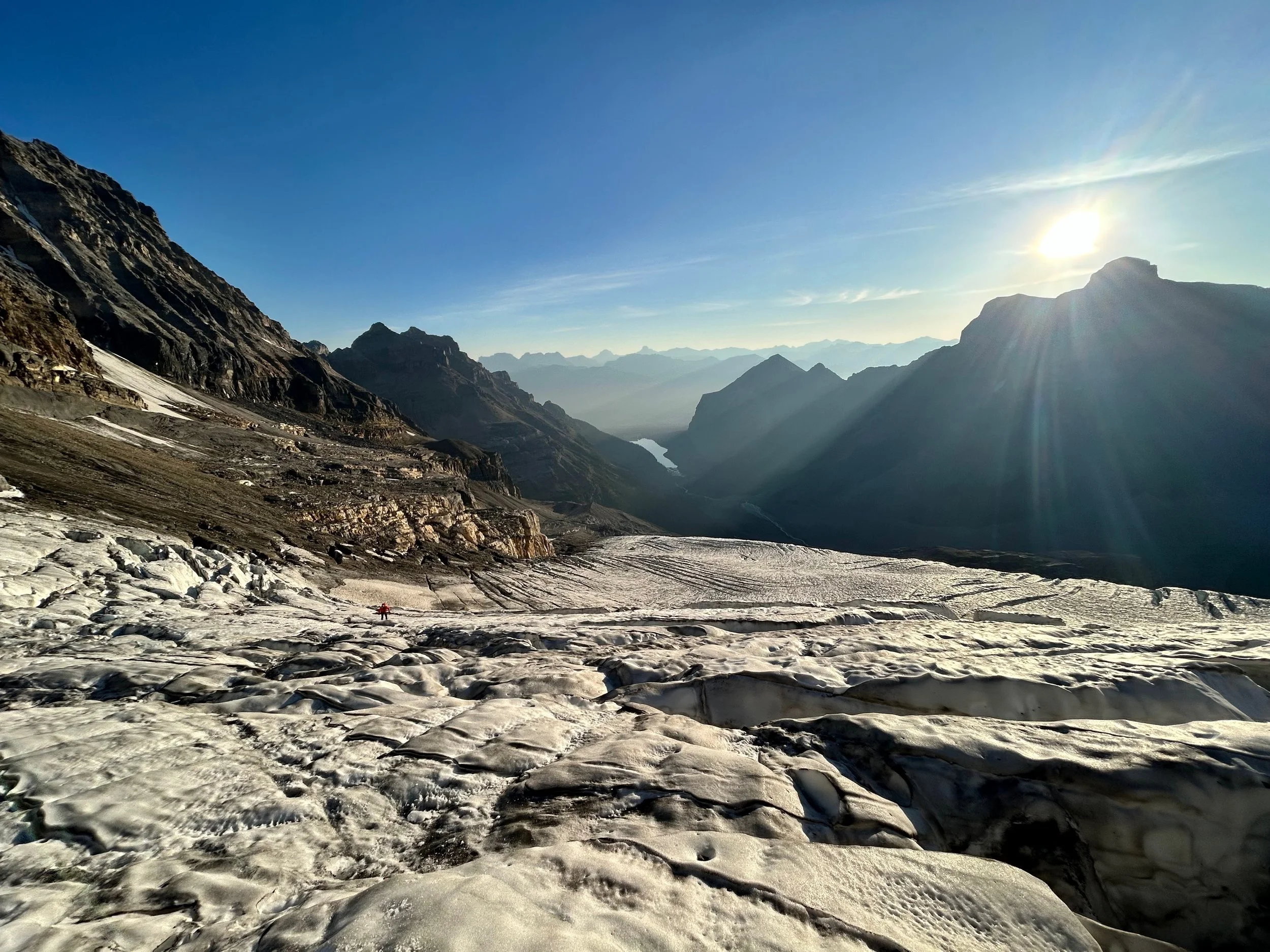
North Victoria Glacier from Mt. Fairview

The ridge of Mt. Victoria and the main summit

Mt. Victoria from Fairview in winter

Mt. Temple and the Paradise Valley from Mt. Fairview

LL ski hill, Skoki and Mt. Richardson from Mt. Fairview

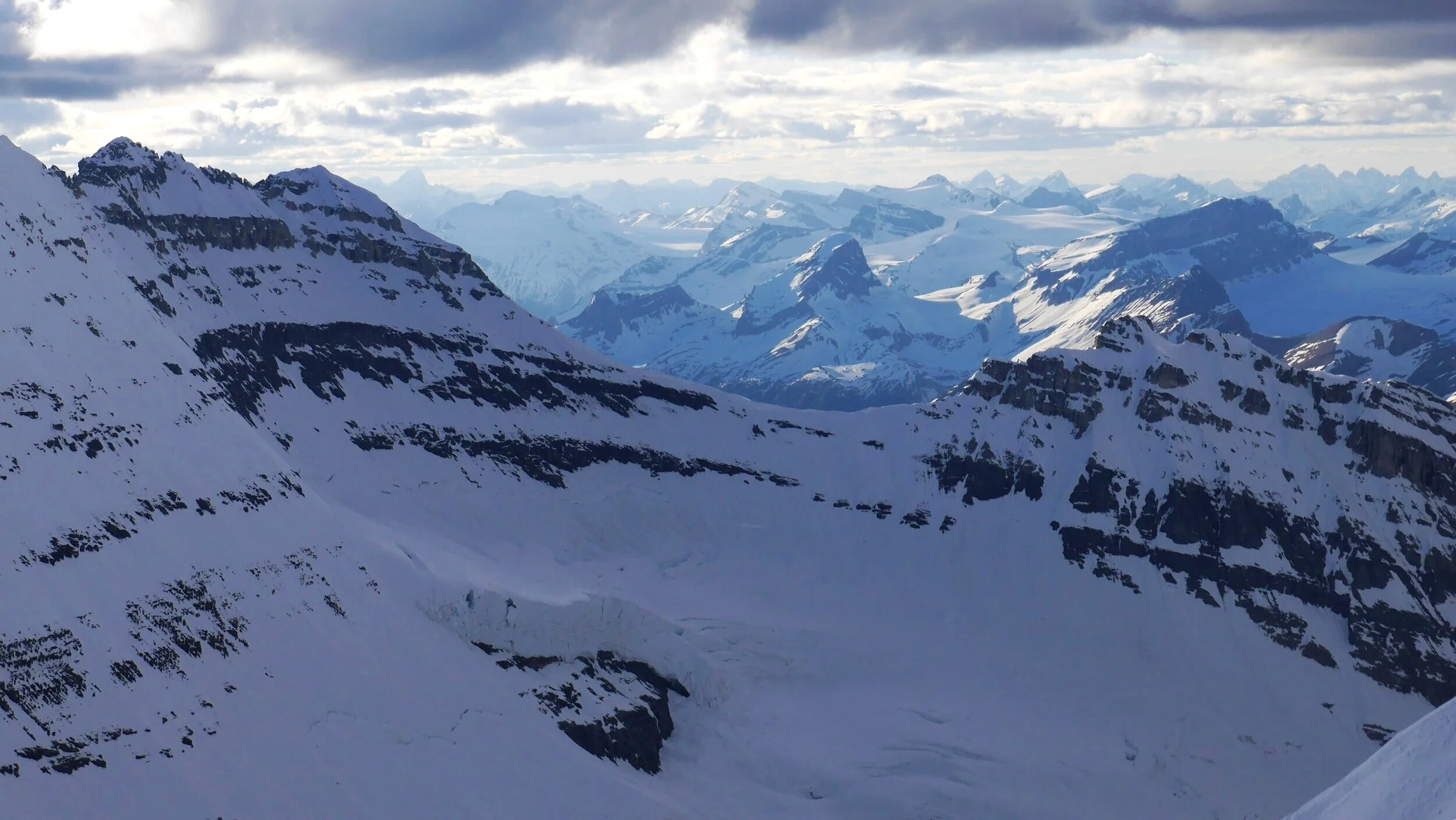
Mt. Lefroy and Abbott Pass

Mt. Lefroy and the Abbot Pass from North Victoria Glacier

Victoria Glacier and Abbott Pass - notice the small Abbott Hut (the Alpine Club of Canada mountaineering hut) on the pass between Mt. Lefroy and Mt. Victoria.

Paradise Valley from Mt. Temple


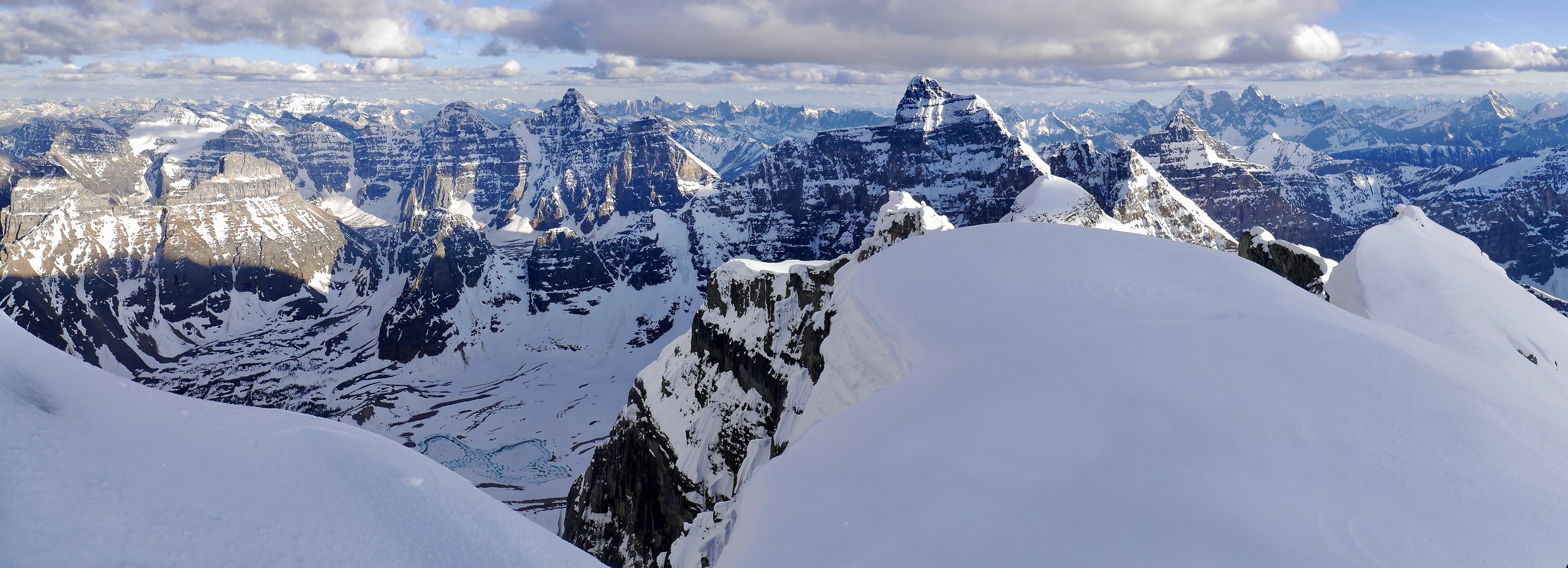
The summit of Mt. Temple with Lefroy, Victoria, Aberdeen and the Wapta Icefield beyond.

Valley of Ten Peaks from the summit of Mt. Temple

The summit ridge of Mt. Temple

Mt. Temple summit ridge

The summit of Mt. Temple - the view south towards Quadra, Storm and Consolation Lakes

Looking west from Mount Temple - the Goodsirs dominate the horizon

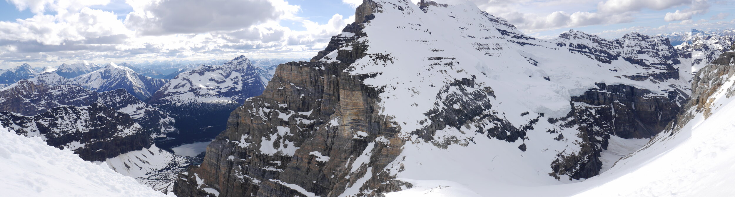
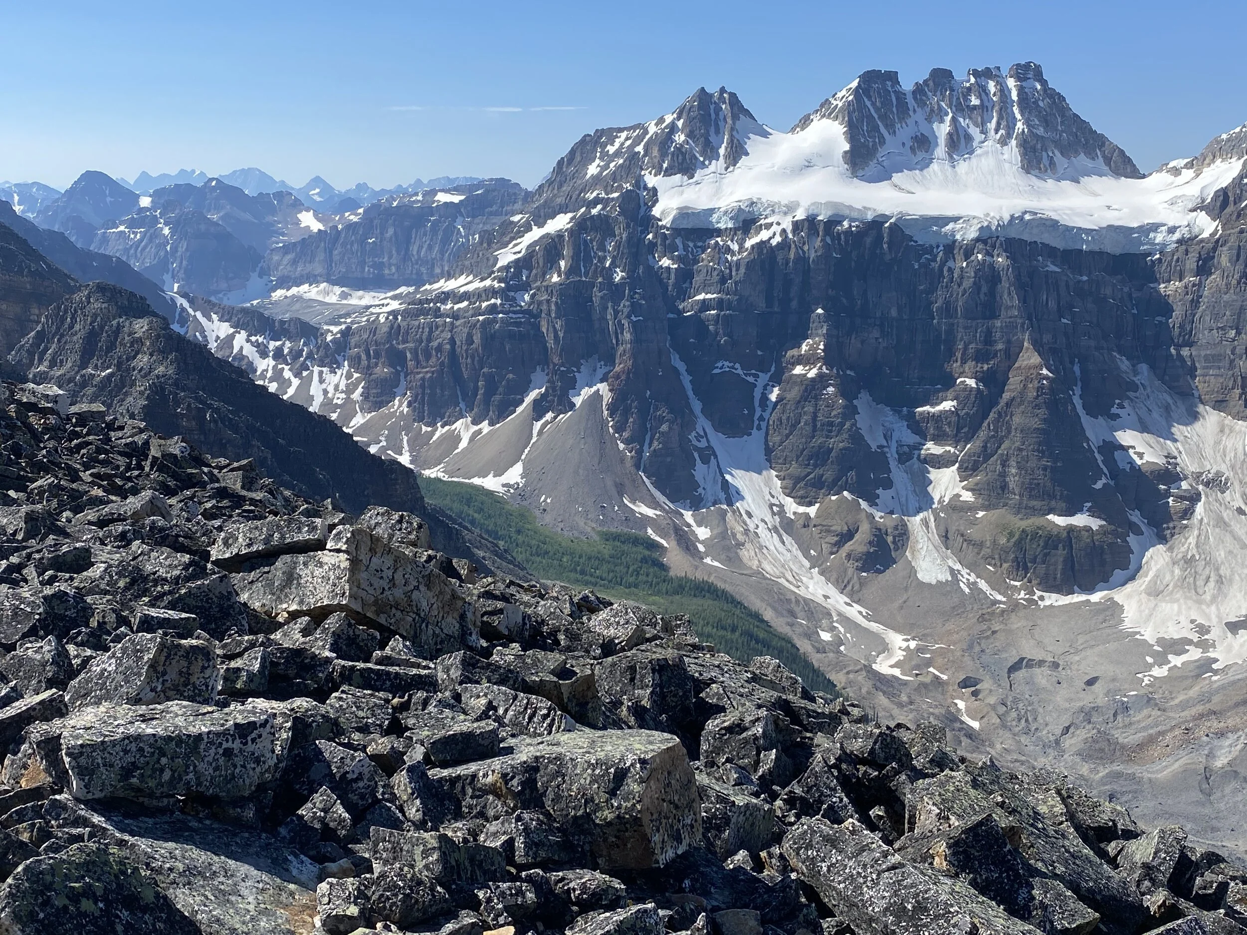
The east glaciated face of Mt. Lefroy and the entire ridge of Mount Victoria with the main and north summits

Mount Victoria and North Victoria Glacier

The closeup of the North Victoria Glacier

Mt. Fay 3,234m

Looking down on the Panorama Ridge and the Consolation Lakes, Moraine Lake is on the right

The glaciated peak on the horizon is Mt. Ball. On the right is Mt. Stanley. Quadra is in the forefront.

Mt. Bident on the left and Quadra on the right

Looking north from Mt. Temple towards the Wapta Icefield. Mt Daly and Nigel Peak are on the horizon on the right. Mount Aberdeen is is the forefront.

The summit panorama from Mt. Temple

Mt. Temple wintery summit

Mt. Temple in the fall


The view from Mt. Temple in the fall

Mount Babel 3,101m

Mt. Bowlen. The mountains of the Rockwall trail are on the horizon


Eiffel Peak

Looking down from the slopes of Mt. Temple, the descent route. Minnestimma Lake is down below.

Looking at Mt. Fay from the slopes of Mt. Temple.

Mt. Temple

Tower of Babel

Consolation Lakes

Lake Louise and Mt. Victoria

Mt. Victoria and Mt. Huber from Lake O’Hara side. The Abott Pass is on the right.

Lake Ohara

Lake Oesa in the Lake Ohara area

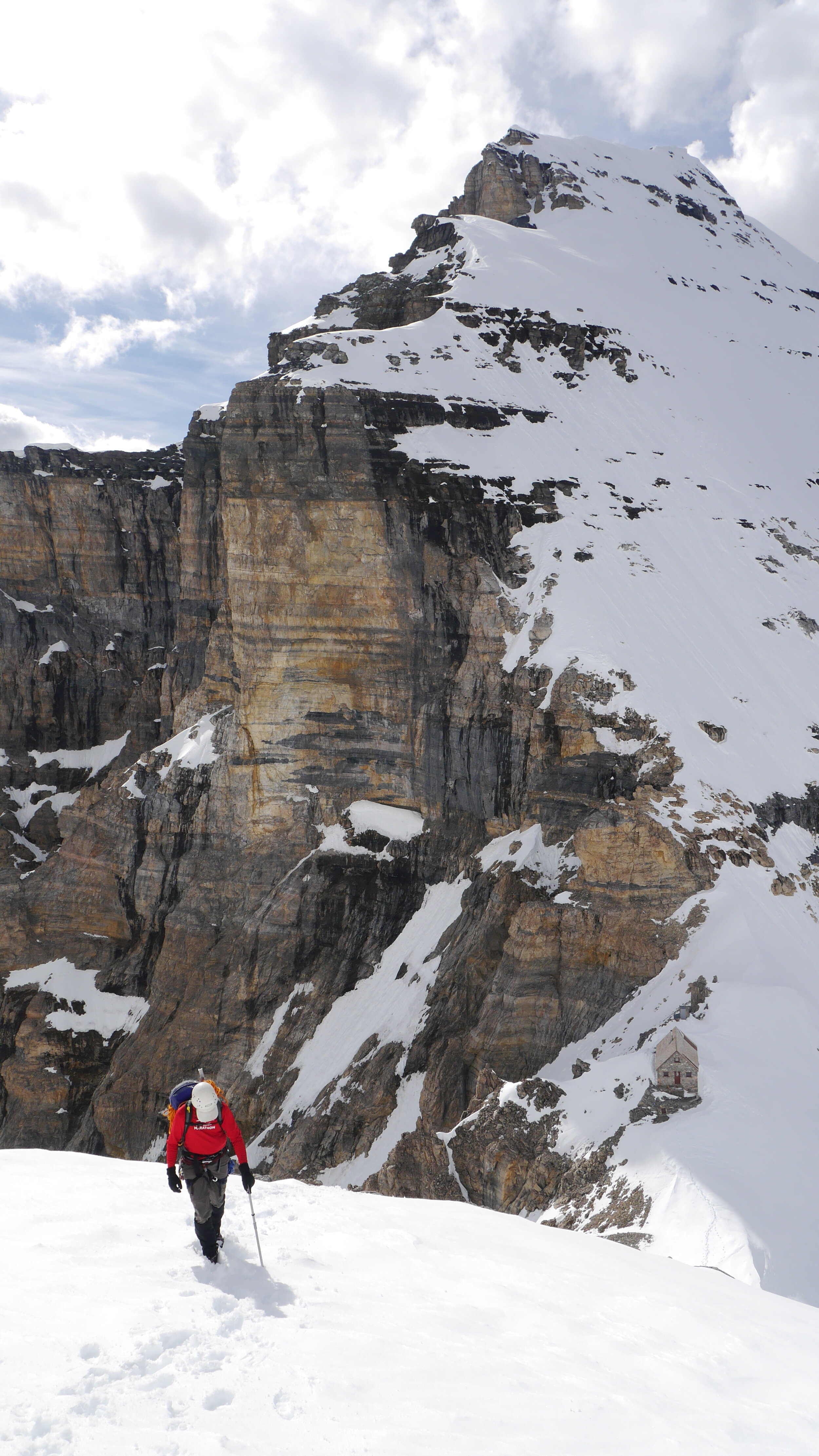
On the way to the Abbot Hut

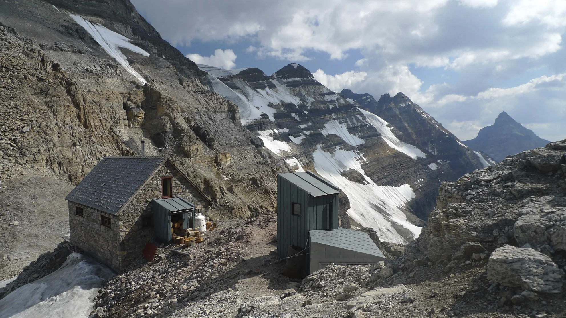
The Abbot Hut 2,926m

The Abbot Hut


Looking down the Death Trap from the Abbot Pass. We came this wain 1996 from Lake Louise on my first try to climb Mt. Lefroy. We had to abandon the climb due to rockfall.

Looking down the west approach gully to the Abbot Pass. You can see a group of climbers down below for scale.

Summit ridge of Mt. Victoria in the terrible smoke from the fires in BC that year.

On Mt. Victoria

Mt. Huber - the Huber ledges

On Mt. Huber ledges

Huber Ledges

On Mt. Huber, Lake Ohara below

Lake O’Hara below - ascending to the Victoria/Huber col

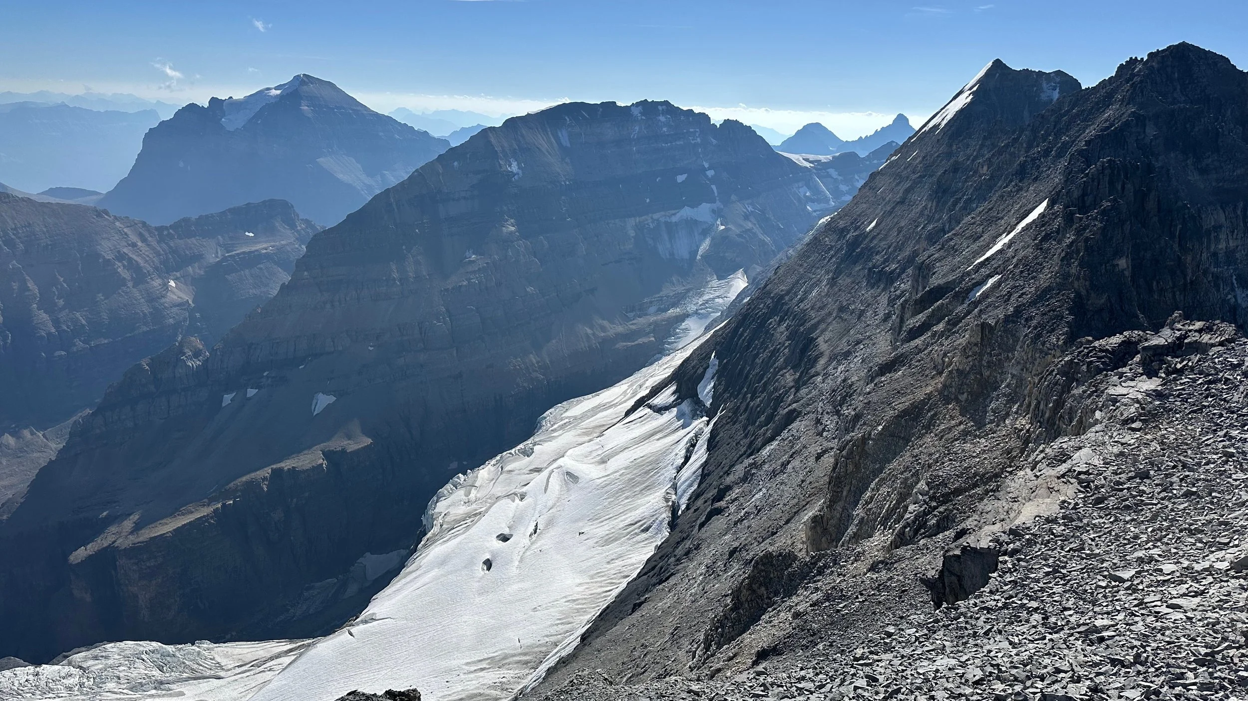
Huber/Victoria Glacier


On Huber/Victoria Glacier

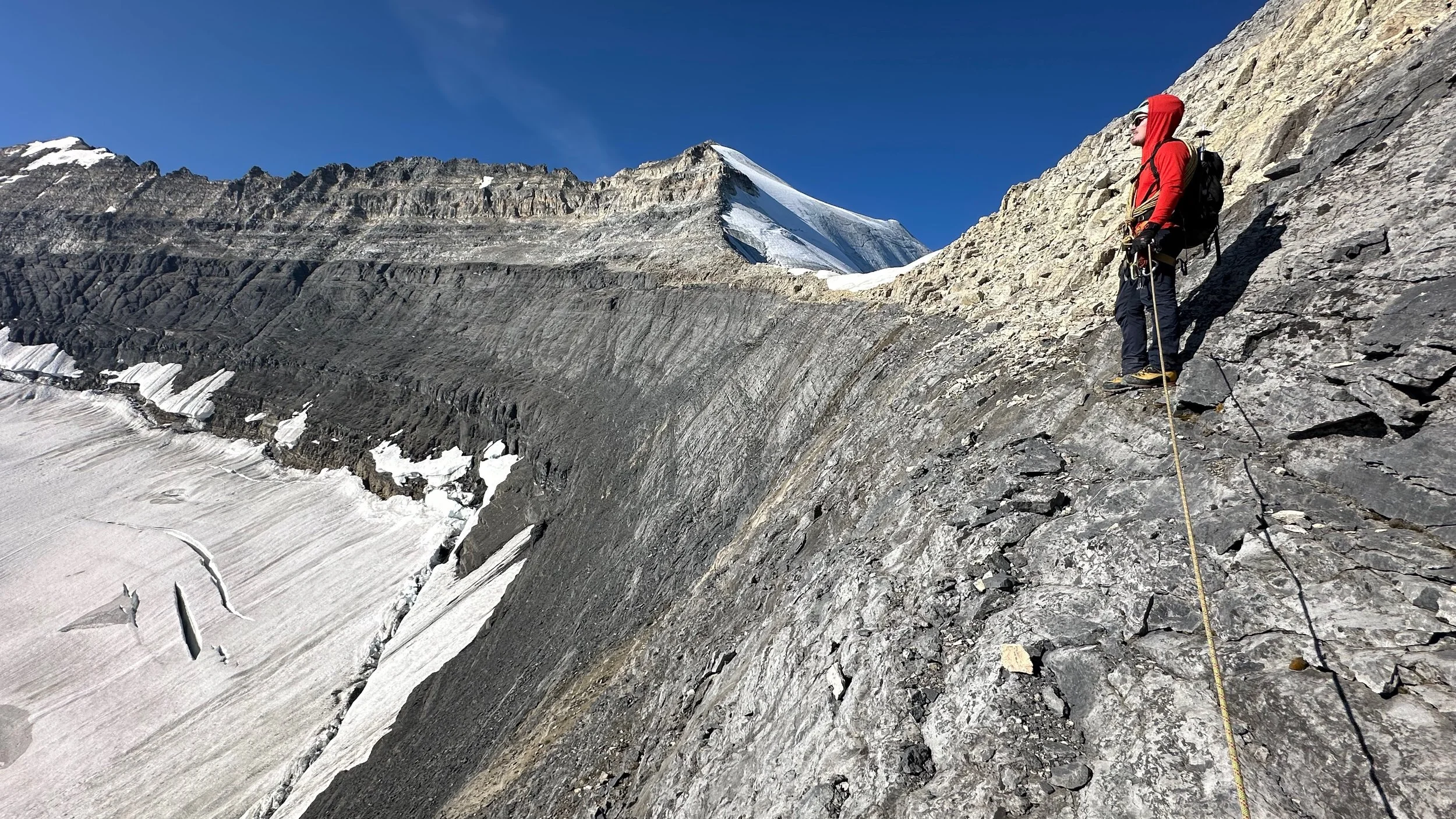
Looking southwest from the Victoria/Huber col

Huber Victoria Col

The view to the Presidents and the Wapta Icefield from the Victoria/Huber col


Mt. Huber 3,348m at sunrise. The Goodsirs are on the horizon.

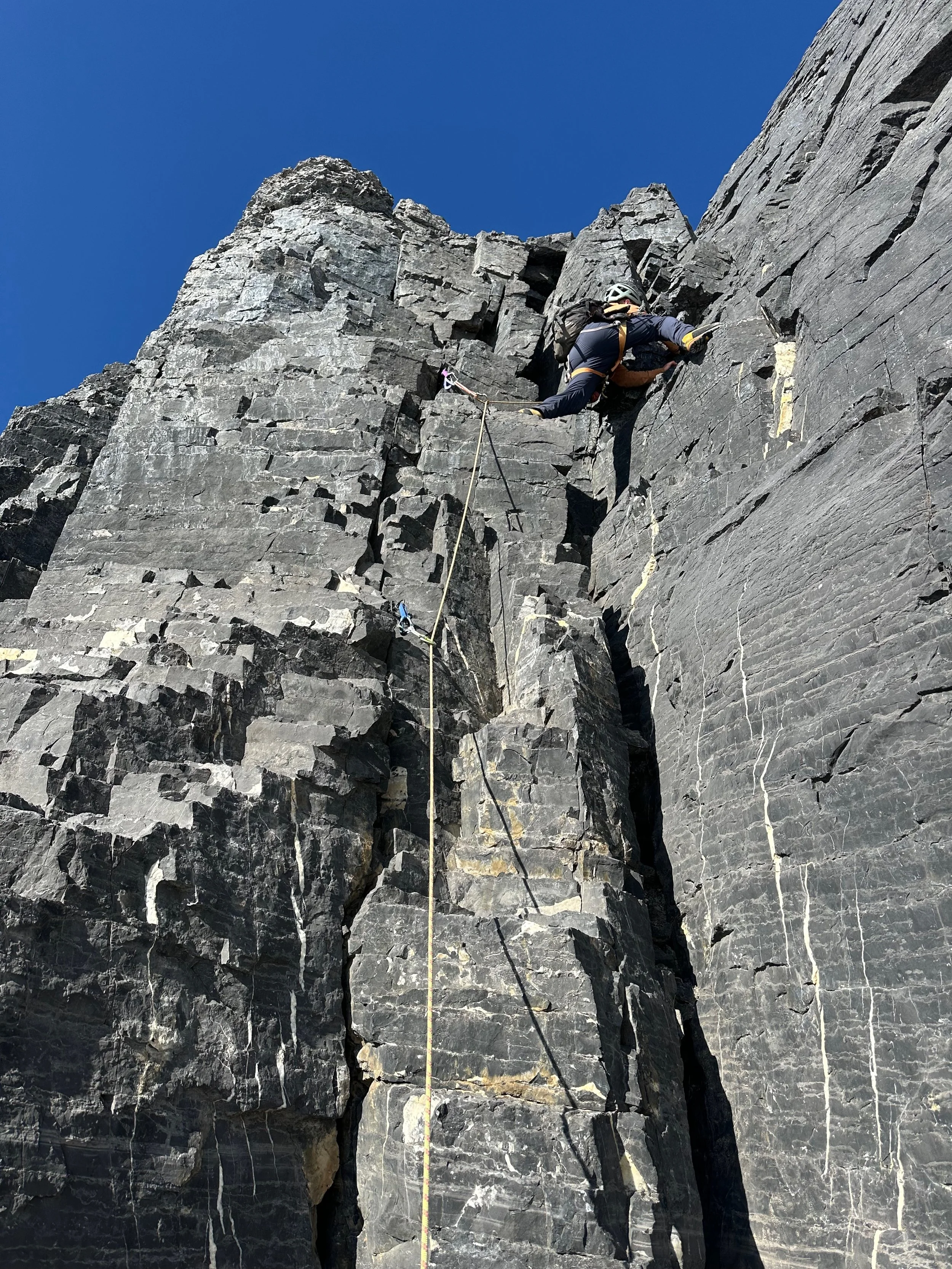
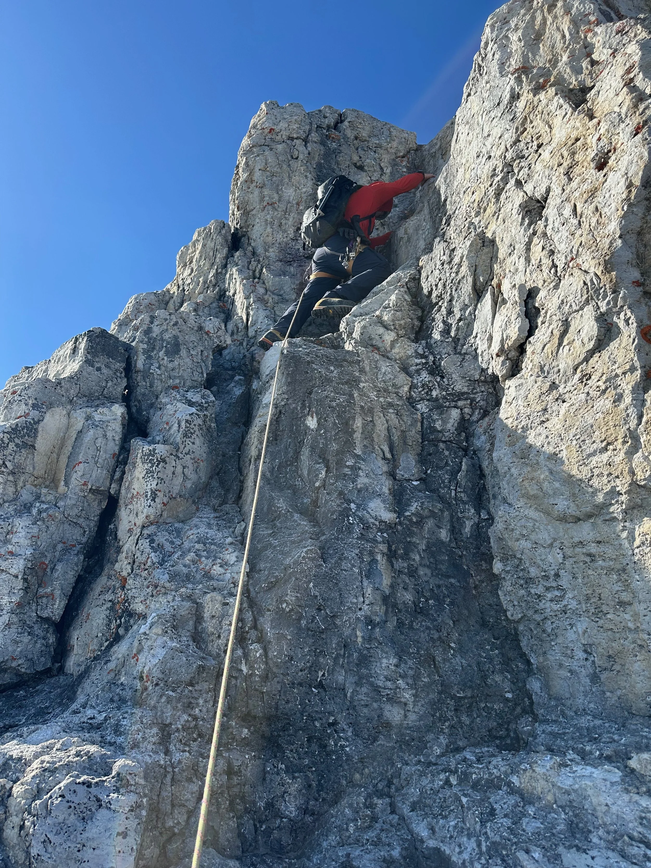
On Mt. Victoria - ascending the west face

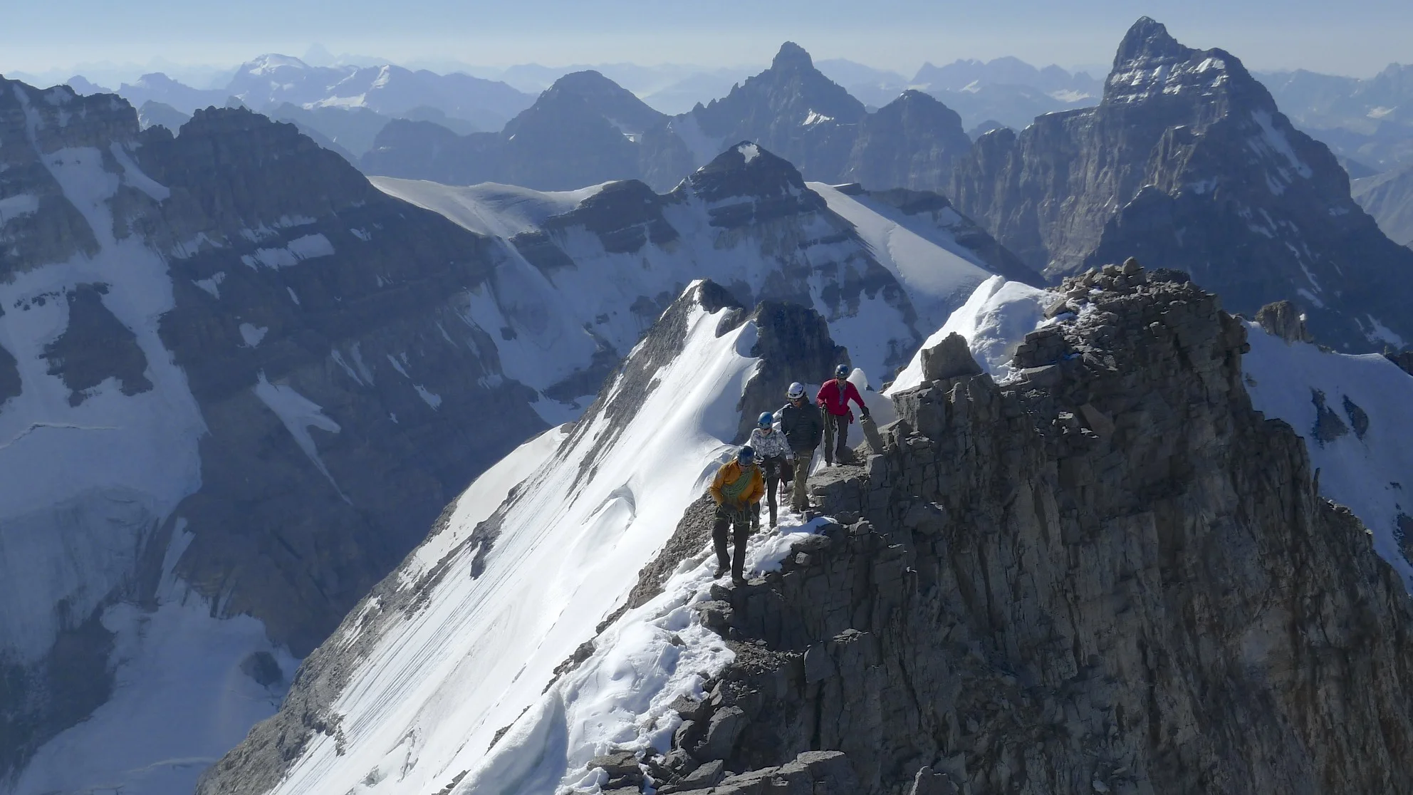
Mt. Victoria summit Ridge

On Vitoria summit ridge

Victoria summit ridge - a walkway in the sky!


he summit of Mt. Victoria

The summit of Mt. Victoria 3,464m

Looking west from Victoria

Mt. Huber from Victoria

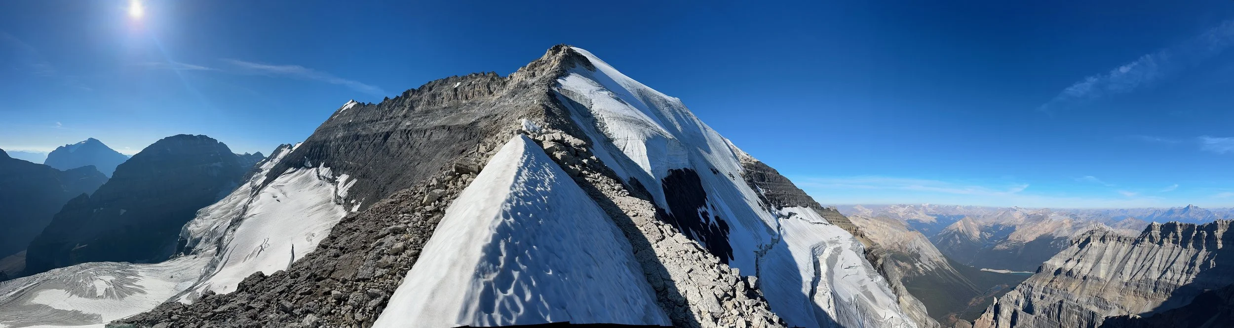
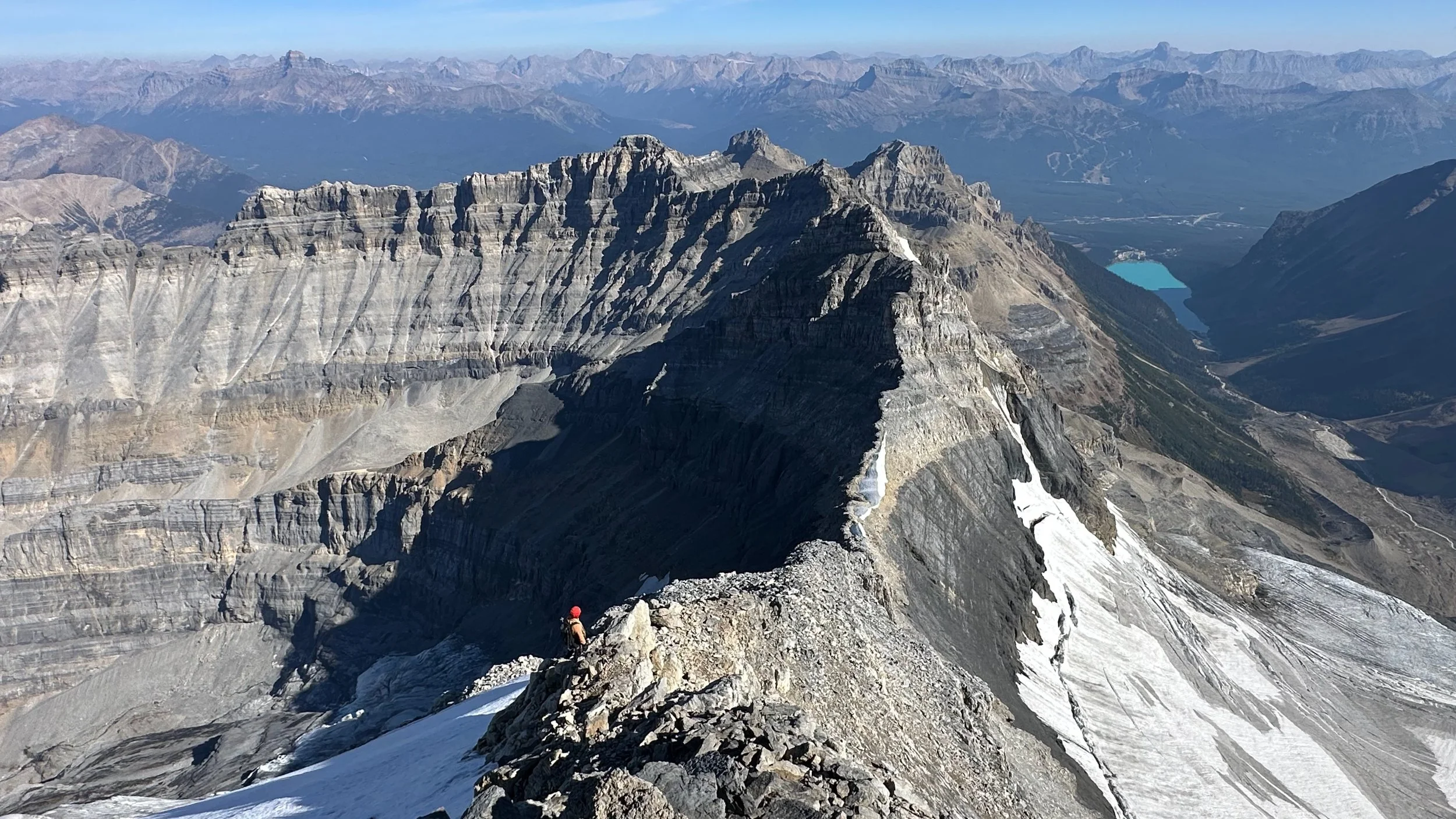
The ridge connecting Mt. Victoria main summit and the north summit

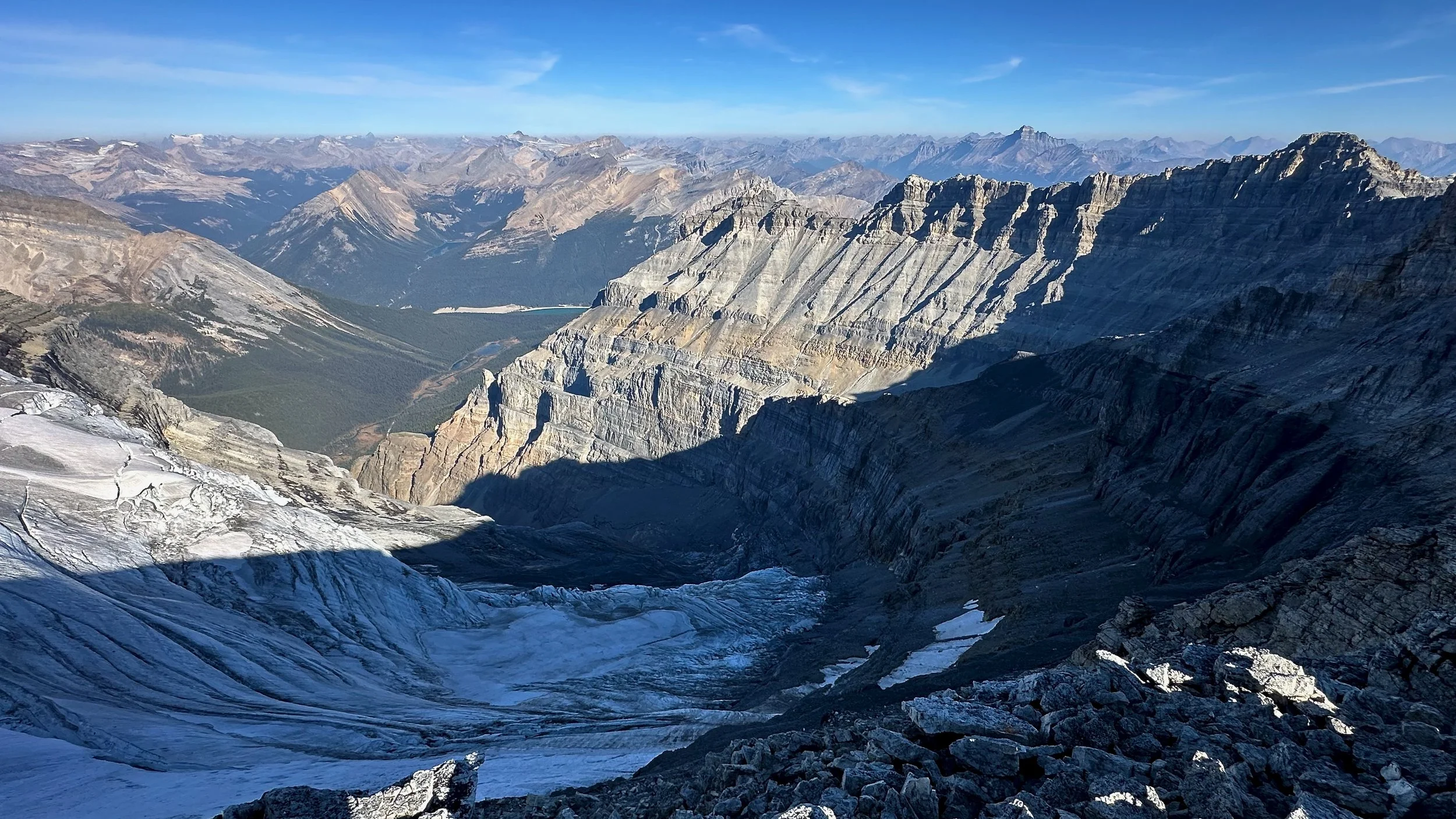
The North Victoria glacier and the summit of North Victoria

The Presidents and the Iceline Trail from Victoria

North Victoria Glacier

North Victoria Glacier and Lake Louise from Mt. Victoria 3,464m


Summit of Mt. Victoria


Mt. Temple on the left, Mt. Lefroy in the center and the summit ridge of Mt. Victoria

The ridge of Mt. Victoria

Mt. Huber


The ridge of Mt. Victoria

Mt. Victoria - the Sickle

One of the few steep sections along the ridge of Mt. Victoria summit ridge


In the Sickle

South side of Mt. Huber dropping all the way down the the approach gully to the Abbott Pass

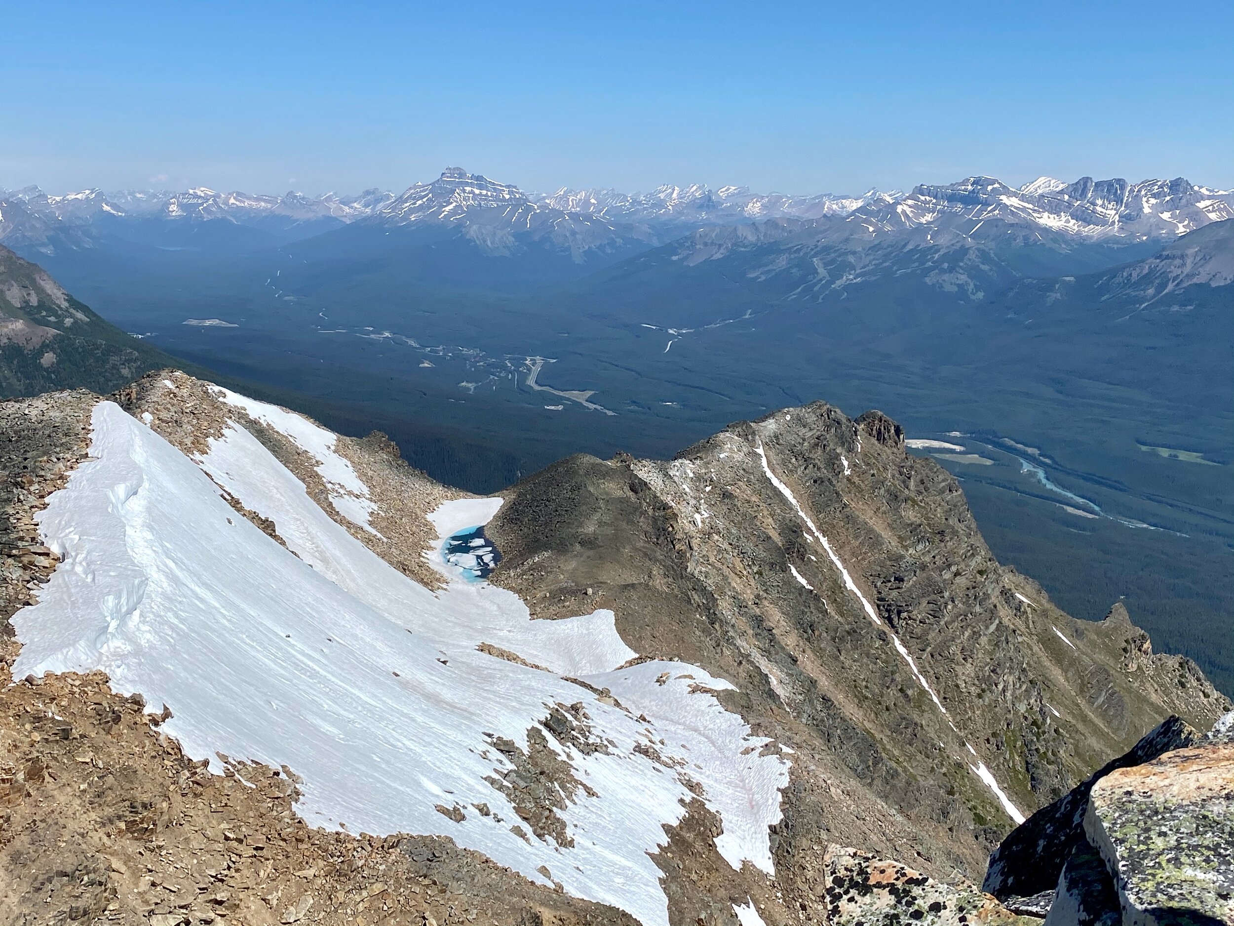
Lake Louise and the Chateau are 10km away long way down

ooking back at Mt. Huber (left) and the summit ridge of Victoria that we just walked from

Steep east face of Victoria

Lake Oesa

Descending to Lake Oesa from the Abbot Pass

Walking up the Death Trap from LL to the Abbott Pass

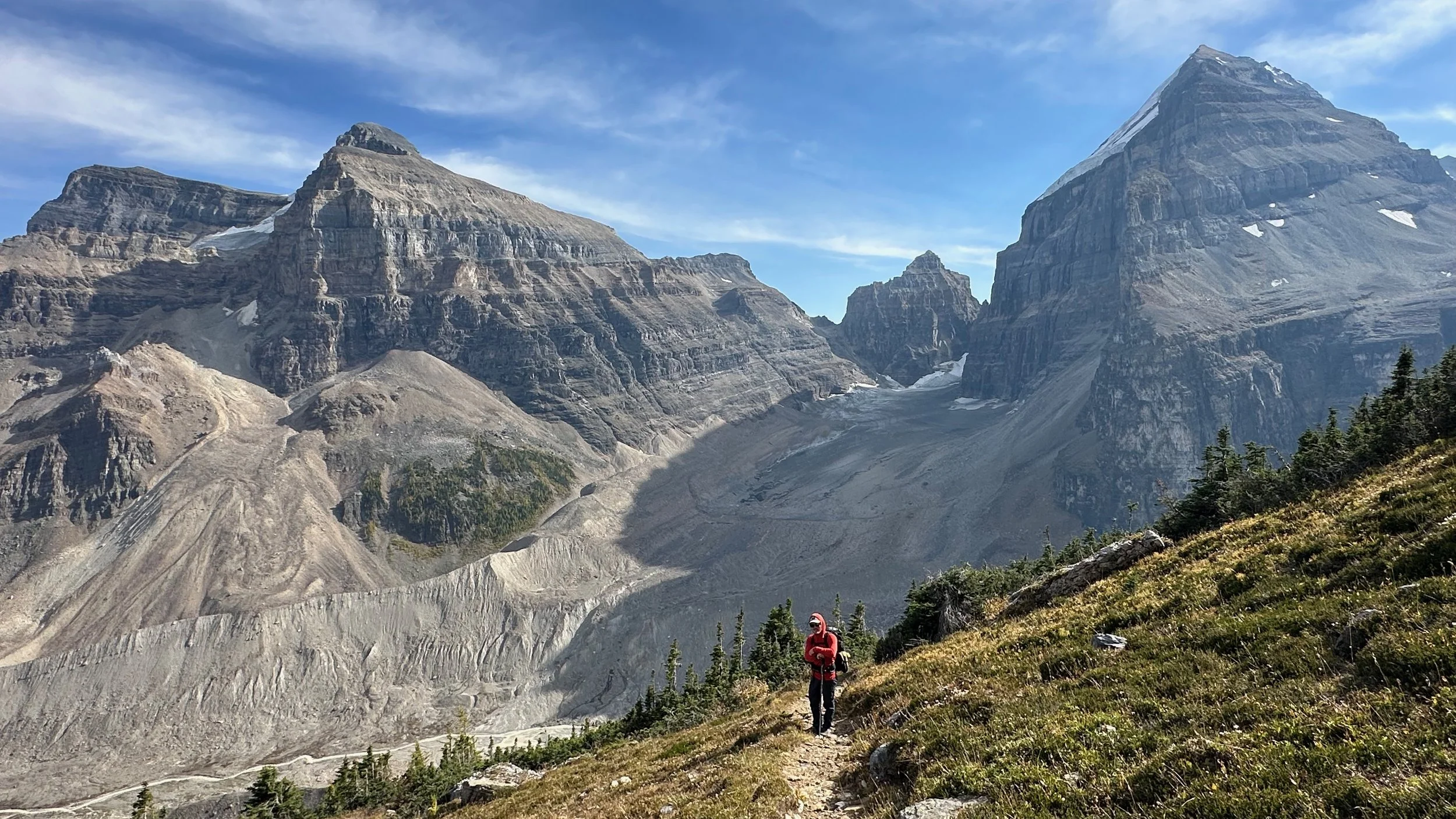
Valley of Ten Peaks - Moraine Lake to Lake Ohara traverse

Wenkchemna Pass - we traversed from Moraine Lake to Lake O’Hara through the Wenkchemna and Opabin passes

Moraine Lake to Lake Ohara traverse


Wenkchemna Peak and Pass

Ascending the Opabin Pass

Opabin Pass from Mt. Yukness

Opabin Pass


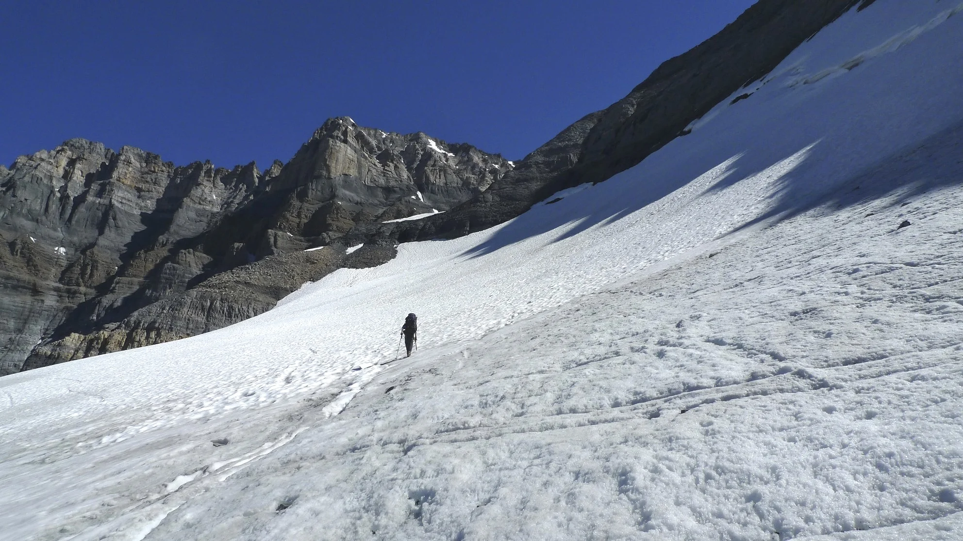
Looking back at the Opabin Pass. The Pass is quite easy with a small glacier. Crampons are required though…
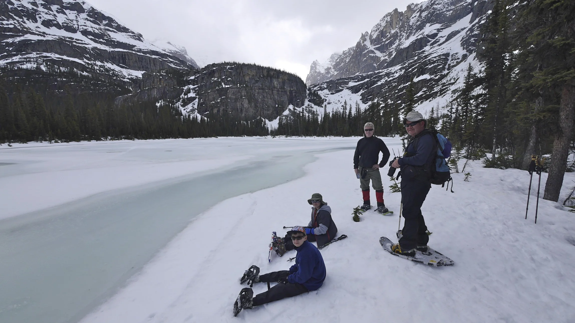
Lake Ohara

Lake Ohara

ACC hut at Lake Ohara. Mt. Lefroy in the centre

Near Lake Ohara. Mt Victoria on the left and Mt. Huber on the right.

Lake Ohara

ACC hut Lake Ohara

Near Lake Ohara

Lake O’Hara

Moraine Lake

Moraine Lake and Valley of 10 Peaks

Valley of Ten Peaks from near the Sentinel Pass

Sentinel Pass

Sentinel Pass

Valley of 10 Peaks from Sentinel Pass

Paradise Valley between Lefroy and Mt. Temple.

Mt. Temple in the fall

Mt. Temple


Summit of Mt. Temple 3,544m

The summit of Mt. Temple

View from Mt. Temple

High on Mt. Temple

View to the valley of 10 peaks from Mt. Temple - Deltaform Mountain

The summit of Mt. Temple

The Valley of 10 Peaks from Mt. Temple

Mount Lefroy and Lake Oesa. We climbed Lefroy in a single push from Lake O’Hara

A closeup of Mt.Lefroy upper section
Abott Pass (with the Abott Hut removed)

On the way to Abbot Pass

On the way to The Abbot Pass

Mt. Victoria and the Abbot Hut

Mt. Vaux in the distance (centre)

The Abbot Hut and the Abbot Pass from Mt. Lefroy

On Mt. Lefroy, view of the Goodsirs

On Mt. Lefroy. Mt. Hector in the distance.


The face of Mt. Lefroy - we climbed it on June 21 (the longest day of the year). We started at 5pm and returned to the hut just before midnight. It was light up to around 11.30pm!


The evening light on Mt. Victoria from Mt. Lefroy


On the snowy ridge of Lefroy

Mt. Victoria


Summit Ridge of Mt. Lefroy with large cornices


Paradise Valley in the evening light from Mt. Lefroy


The cornices on the summit ridge of Lefroy


Summit ridge of Mt. Lefroy at sunset

Summit ridge of Mt. Lefroy on the longest day of the year. 10pm on June 21.

Mt. Lefroy near the summit ridge

Lake Ohara from Mt. Lefroy in the evening light


Near the summit of Mt. Lefroy
North Victoria summit and the North Victoria Glacier with he Wapta Icefield glowing in the late evening light on the longest day of the year!

The sunset behind Mount Victoria from Mt. Lefroy

The entire ridge of Mt. Victoria

Lake O’Hara is a long way down!

The steep face of Lefroy. The small Abbot Hut is far way down.

Beautiful sunset from Lefroy


Inside the Abbot Pass Hut - I just love this place!
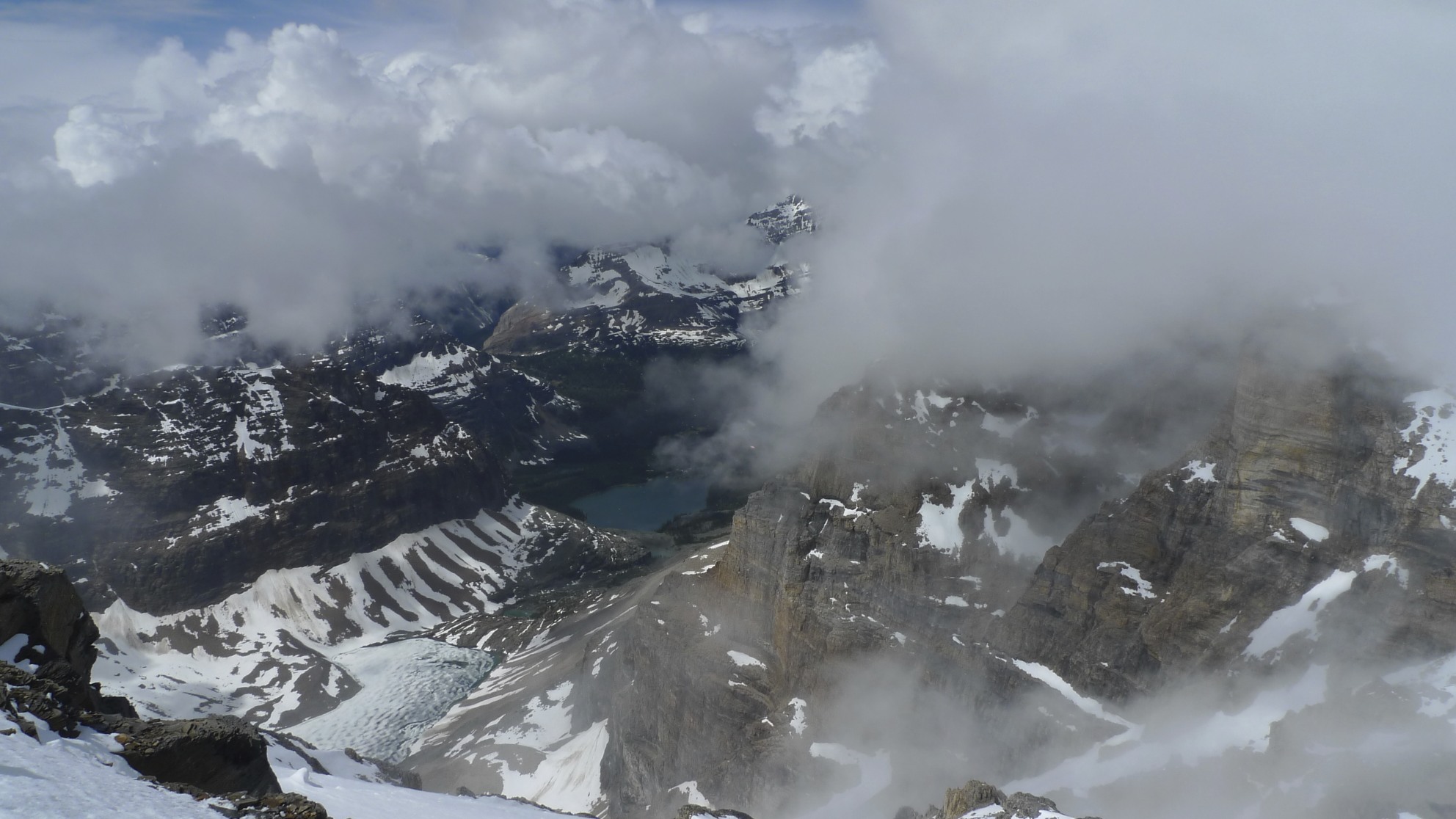
Lake Ohara from Mt. Lefroy. This was on another outing. We were engulfed in thick clouds.

On Mt. Lefroy with Lake O’Hara below

The approach gully to the Abbot Pass in cloudy weather.

Storm Mountain from Mt. Whymper

Mt. Whymper from Storm approach

The approach to the summit of Storm is on the left


The view of Goodsirs from Storm Mountain on the left. Mt. Whymper is on the right.

The summit of Storm Mountain 3,100m

Moraine Lake and Lake Louise area summits from Storm Mountain

Looking south from Storm Mountain, Mount Assiniboine is on the horizon to the left.

Mt. Ball from Storm Mountain


Mt. Ball and Mt. Stanley from Storm Mountain

The view to the west from Storm Mountain

The summit of Storm Mountain. The large bulk of Mt. Temple dominates the horizon.


Mt. Assiniboine and the Egypt Lakes area from the summit of Storm

The Egypt Lakes area in Banff NP from Storm. The Whistling Pass from Storm. Haiduk Lake is visible below.

Mt. Assiniboine on the horizon. Healy Pass is visible below (center)

Pilot Mountain and Mt. Bourgeau are in the center of the photo on the horizon.


The Upper Twin Lake is below the east face of Storm

The East face of Storm

Highway 93 from Storm. Arnica Lake is visible below.

Looking towards the Goodsirs, the Lake Louise group of summits, and Mt. Whymper from the summit of Storm Mountain


The Rockwall and the Wolverine Pass from Mt. Storm. Highway 93 is below.

Mt. Saint Piran with Lake Louise below.

View from Mt. Saint Piran with Mt. White on the left.

Lake Louise from Mt. Sanit Piran with Lake Louise and Lake Agnes below. Mount Temple towers in the center of the photo.

The summit of Mt. Saint Piran. Mt. Hector is visible in the distance.

Panorama Ridge

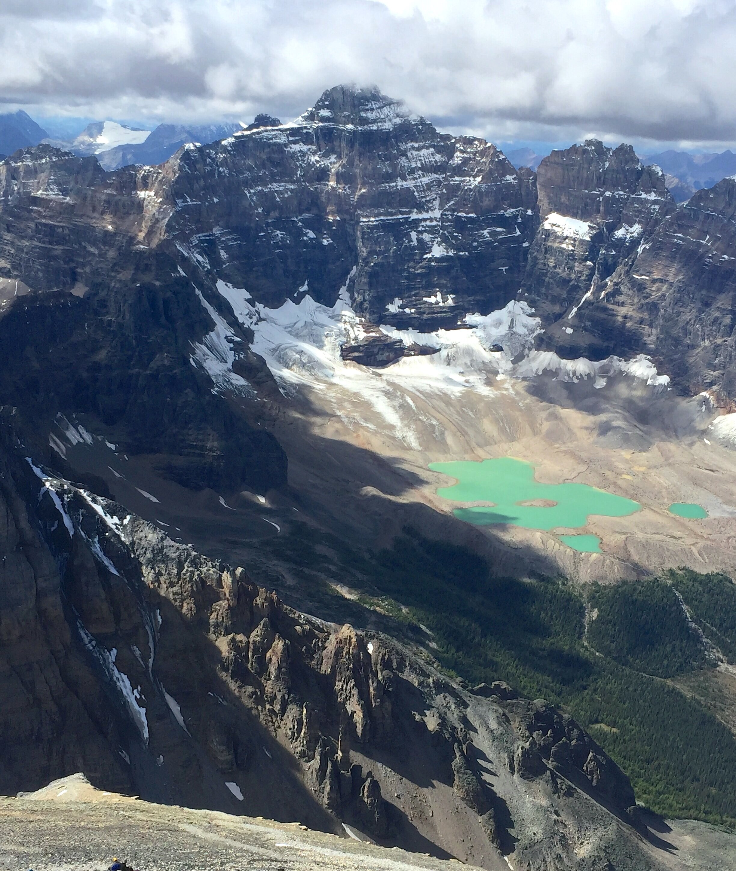
Consolation Lakes from Panorama Ridge. From left to right: Mt. Quadra, Fay and Babel.
Mt. Quadra from Panorama Ridge

Mt. Bident and Mt. Quadra.


Mt. Whymper is on the left. The mountains along the Rockwall trail are on the horizon.

Mt. Fay (left) and Babel (right)


The summit panorama from the Panorama Ridge

Mt. Babel and the Consolation Lakes


Looking north to Mt. Hector from the Panorama Ridge. Mt. Richardson in the Skoki area of Banff NP is on the right. LL ski area is below Mt. Richardson.


Mt. Temple

Mt. Victoria - North Glacier

On Mt. Victoria

Mt. Lefroy from Mt. Victoria

Lake Louise from Mt. Victoria North

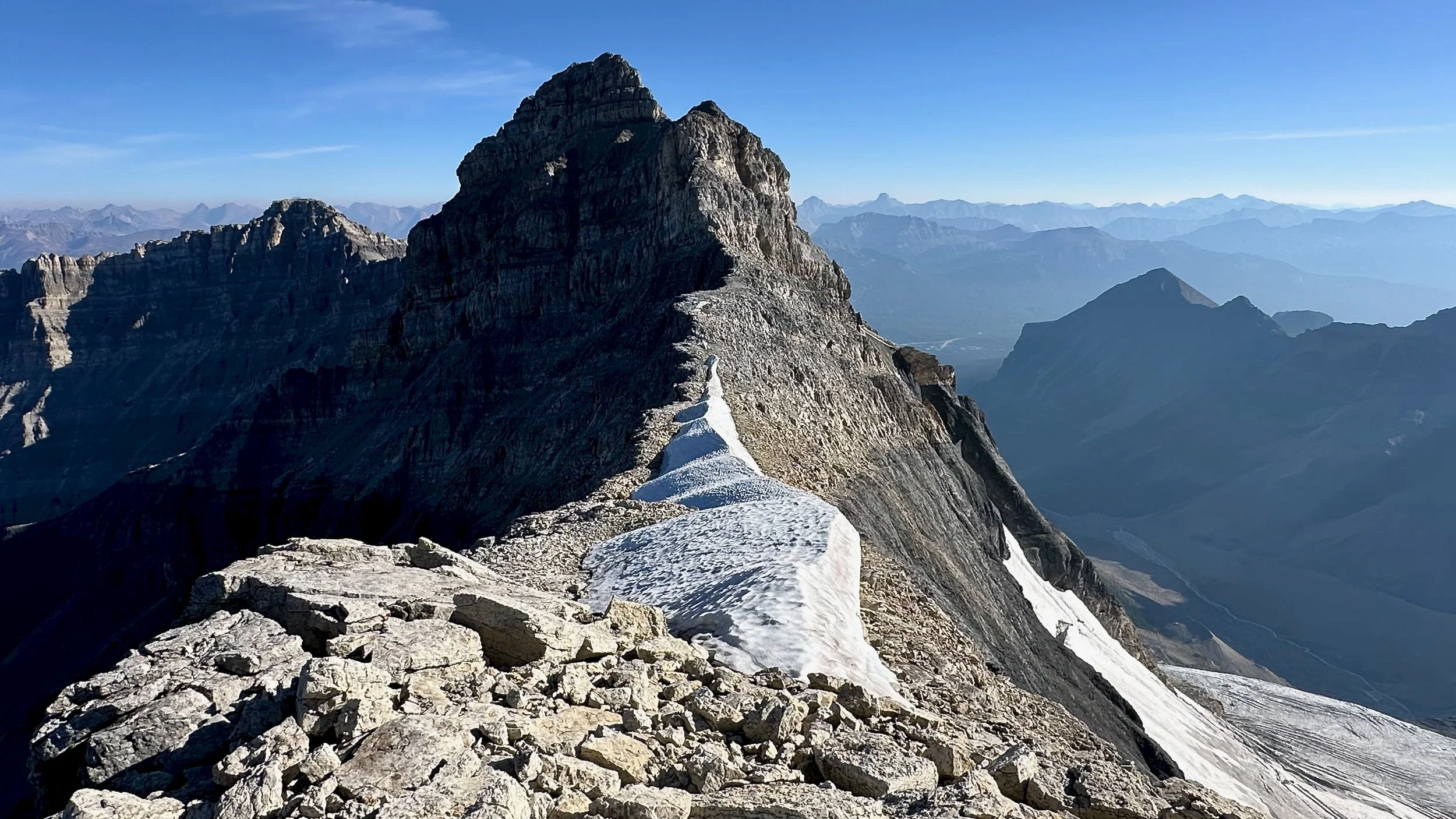
The summit of Mt. Victoria North towers above the col

Panoramic view of Mt. Victoria
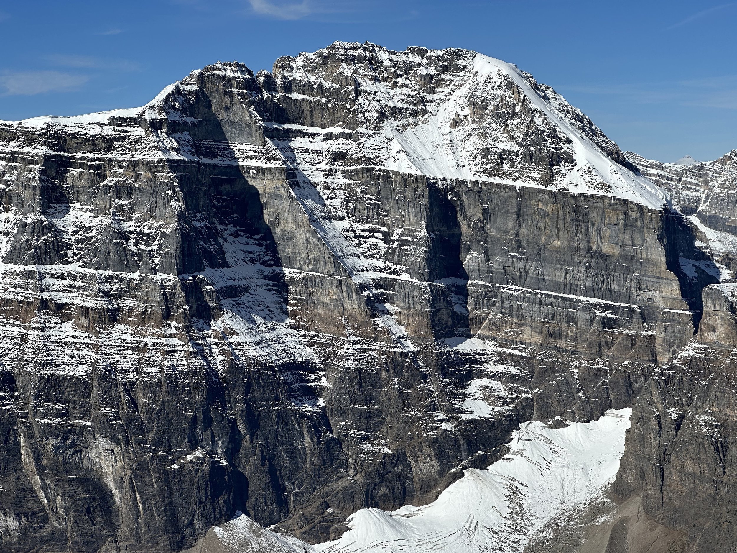
Mount Victoria’s spectacular east face


The spectacular Abbot Pass and the tiny Abbot Hut between Mount Lefroy and Mount Victoria

Mt Temple and Mt Lefroy from Mt. Victoria North
Mt. Aberdeen and Mt. Temple from Mt. Victoria North Glacier


Mt. Wastach