The Grand Mustang Circuit - Part 1: Chame to Kagbeni via Thorong La Pass

The Grand Mustang Circuit is a combination of the Annapurna Circuit (or what is left of it), the classic Mustang trek, the Terila Trek and the trek trough the Naar/Phu region. To finish things off in “style”, we returned to the starting point via Kangla Pass. The total distance of this EPIC trek was 380km which we walked over 24 days. We climbed 12km in total elevation (probably descended the same) and crossed 3 passes over 5,000m and a quite a few passes over 4,000m. Half of the trek is through sparsely populated regions requiring camping and self sufficiency. It is a spectacular route through some of the most culturally interesting areas of the Buddhist Nepal with a thriving culture. Again, many thanks to the Mountain Sun Valley and Rajendra for putting this together.

It is not technically difficult but it is long. It also has a lot of ups and downs, especially in the Mustang region, where one has to constantly climb into and out of river gorges that cut through the landscape. The trek offers spectacular scenery that is very different from what I have seen in other parts of Nepal. It is a truly unique experience both visually and culturally.

This part of the trek was a warmup for things to come. We went from 2500m to 5400m in 4 days. Fortunately we did not have any altitude issues. It took us 6 days to go from Chame to Kagbeni.

annapurna-circuit-trekking-map.jpg
mustang-map3.jpg
Ready to go! Taking care of last minute supplies in the town of Beisishar, the “end of the paved road” and the former starting point of the Annapurna Circuit.

Ready to go! Taking care of last minute supplies in the town of Beisishar, the “end of the paved road” and the former starting point of the Annapurna Circuit.

The road from Beisishar to Manang takes the entire day to travel. It is a rough track that will separate meat from the bone and cover you and your bags in a layer of thick dust.

The road from Beisishar to Manang takes the entire day to travel. It is a rough track that will separate meat from the bone and cover you and your bags in a layer of thick dust.

In some places the road is literally chiseled from the side of the mountain. The jeep in the river below did not quite make it…I walked through this area in 2011 when the road was being built.

In some places the road is literally chiseled from the side of the mountain. The jeep in the river below did not quite make it…I walked through this area in 2011 when the road was being built.

We passed many beautiful waterfalls.

We passed many beautiful waterfalls.

In Chame, still clean and ready to go!

In Chame, still clean and ready to go!

The north side of the Annapurna Circuit passes through many places of worship. We are now in the land of Buddhism.

The north side of the Annapurna Circuit passes through many places of worship. We are now in the land of Buddhism.

The trail between Chame and Lower Pisang.

The trail between Chame and Lower Pisang.

Ridges of Annapurna II from Lower Pisang

Ridges of Annapurna II from Lower Pisang

IMG_E4717.jpg
Upper Pisang and Annapurna II

Upper Pisang and Annapurna II

The new gompa in Upper Pisang. The gompa was built 100% from the contributions from the locals.

The new gompa in Upper Pisang. The gompa was built 100% from the contributions from the locals.

C2A06859-D7D6-416C-8AC4-CFA1DC311895.jpg
5EBE7775-AA8B-4EE9-AEC8-9D838F707EEC.jpg
IMG_E4792.jpg
Upper Pisang and Annapurna II

Upper Pisang and Annapurna II

DTMQ0825.jpg
Beautiful paintings inside a chorten gate to Upper Pisang.

Beautiful paintings inside a chorten gate to Upper Pisang.

A mandala on the ceiling of the chorten gate.

A mandala on the ceiling of the chorten gate.

The chorten gate

The chorten gate

IMG_4785.jpg
From Upper Pisang the trail to Manang climbs a steep hill from where there are extensive views of the entire valley. Unfortunately this year the weather did not cooperate. I had more luck in 2011.

From Upper Pisang the trail to Manang climbs a steep hill from where there are extensive views of the entire valley. Unfortunately this year the weather did not cooperate. I had more luck in 2011.

Annapurna III 7,555m from the village of Barga

Annapurna III 7,555m from the village of Barga

Annapurna III 7,555m from Barga

Annapurna III 7,555m from Barga

The village of Barga is nested against wild rock formations. The monastery (gompa) is over 1000 years old. It consists of 3 separate prayer halls. We were lucky to get a tour by a visiting former monk who had the keys to the various chambers. It is …

The village of Barga is nested against wild rock formations. The monastery (gompa) is over 1000 years old. It consists of 3 separate prayer halls. We were lucky to get a tour by a visiting former monk who had the keys to the various chambers. It is definitely the cultural highlight of the Annapurna Circuit.

On the trail to Manang

On the trail to Manang

The panoramic view of the village of Barga and the Annapurna III/Gangapurna mountains. Tilicho Peak can be seen far in the distance on the right. See my 2011 trek to the tilicho Lake for some fantastic views of these mountains.

The panoramic view of the village of Barga and the Annapurna III/Gangapurna mountains. Tilicho Peak can be seen far in the distance on the right. See my 2011 trek to the tilicho Lake for some fantastic views of these mountains.

Mount Gangapurna and the village of Barga.

Mount Gangapurna and the village of Barga.

The monastery of Barga

The monastery of Barga

The “protector” at the entrance to the Barga monastery.

The “protector” at the entrance to the Barga monastery.

Old prayer wheels at the entrance to the Barga monastery.

Old prayer wheels at the entrance to the Barga monastery.

The main and oldest prayer hall in the Barga monastery.

The main and oldest prayer hall in the Barga monastery.

The Buddhist prayer books are stored in the gallery above the main prayer hall.

The Buddhist prayer books are stored in the gallery above the main prayer hall.

IMG_E4882.jpg
WAHD3812.jpg
The village of Manang and Annapurna II.

The village of Manang and Annapurna II.

The selection of movies is definitely Himalaya focused!

The selection of movies is definitely Himalaya focused!

Mount Gangapurna and the glacial lake formed by water from the Gangapurna icefall. This small lake is a short walk from Manang.

Mount Gangapurna and the glacial lake formed by water from the Gangapurna icefall. This small lake is a short walk from Manang.

The trail between Manang and Thorong La basecamp. Gangapurna, Annapurna III dominate the view.

The trail between Manang and Thorong La basecamp. Gangapurna, Annapurna III dominate the view.

Gangapurna 7,455m

Gangapurna 7,455m

Annapurna III 7,555m

Annapurna III 7,555m

Glacier Dome

Glacier Dome

Gangapurna 7,455m from Thorong La basecamp at 4,800m

Gangapurna 7,455m from Thorong La basecamp at 4,800m

The Great Barrier and Glacier Dome from the Thorong La basecamp. See the 2011 photos.

The Great Barrier and Glacier Dome from the Thorong La basecamp. See the 2011 photos.

The Great Barrier above the Tilicho Lake from the Thorong La basecamp at 4,800m

The Great Barrier above the Tilicho Lake from the Thorong La basecamp at 4,800m

We were lucky to see some wildlife!

We were lucky to see some wildlife!

The short steep climb to the Thorong La basecamp from Thorong La Phedi. The climb is from 4200m to 4800m. If you are not fully acclimatized like me, slow and steady does the trick.

The short steep climb to the Thorong La basecamp from Thorong La Phedi. The climb is from 4200m to 4800m. If you are not fully acclimatized like me, slow and steady does the trick.

As I approach the Thorong La basecamp, the views are getting better.

As I approach the Thorong La basecamp, the views are getting better.

IMG_E5146.jpg
Thorong La basecamp at 4,800m.

Thorong La basecamp at 4,800m.

The view of Annapurna III 7,555m, Gangapurna 7,455m and the Great Barrier from the Thorong La basecamp at 4,800m.

The view of Annapurna III 7,555m, Gangapurna 7,455m and the Great Barrier from the Thorong La basecamp at 4,800m.

IMG_E5166.jpg
IMG_E5224.jpg
The Damodar Himal from the Thorog La basecamp.

The Damodar Himal from the Thorog La basecamp.

The view of the Thorong La basecamp at 4800m and the trail to the Thorong La pass at 5430m

The view of the Thorong La basecamp at 4800m and the trail to the Thorong La pass at 5430m

The Thorong La basecamp.

The Thorong La basecamp.

We started our hike to Muktinagh via Thorong La pass before sunrise. The view to the Annapurna Range was beautiful in the morning light. We had little wind and no snow. The bulky mountain on the horizon is Annapurna II and Annapurna IV. It is hard t…

We started our hike to Muktinagh via Thorong La pass before sunrise. The view to the Annapurna Range was beautiful in the morning light. We had little wind and no snow. The bulky mountain on the horizon is Annapurna II and Annapurna IV. It is hard to believe that this place was the location the worst trekking disaster in Nepal’s history.

The 2014 Nepal snowstorm disaster occurred in central Nepal during the month of October and resulted in the deaths of at least 43 people of various nationalities, including at least 21 trekkers. Injuries and fatalities resulted from unusually severe…

The 2014 Nepal snowstorm disaster occurred in central Nepal during the month of October and resulted in the deaths of at least 43 people of various nationalities, including at least 21 trekkers. Injuries and fatalities resulted from unusually severe snowstorms and avalanches on and around the mountains of Annapurna and Dhaulagiri.

Annapurna II 7,937m

Annapurna II 7,937m

Annapurna IV 7,525m and the gap between Annapurna III and Annapurna IV. It is the only low point in otherwise uninterrupted ridge between Annapurna I and II.

Annapurna IV 7,525m and the gap between Annapurna III and Annapurna IV. It is the only low point in otherwise uninterrupted ridge between Annapurna I and II.

As we approached the pass, the sun rose from behind the Chulu Peaks. On 14 October 2014 a snowstorm and series of avalanches occurred on and around Annapurna and Dhaulagiri in the Manang and Mustang Districts of Nepal within the Himalaya range. Acco…

As we approached the pass, the sun rose from behind the Chulu Peaks. On 14 October 2014 a snowstorm and series of avalanches occurred on and around Annapurna and Dhaulagiri in the Manang and Mustang Districts of Nepal within the Himalaya range. According to an unnamed expert the storm arose from Cyclone Hudhud and was the worst in a decade with almost 1.8 metres (5 ft 11 in) of snow falling within 12 hours. See the article in outsideonline about the disaster.

Thorong La pass. There is even a tea house serving tea! What luxury! Thorong Peak towers over the pass.

Thorong La pass. There is even a tea house serving tea! What luxury! Thorong Peak towers over the pass.

Our small team sipping hot tea at the Thorong La pass - the first pass, one of many more to come.

Our small team sipping hot tea at the Thorong La pass - the first pass, one of many more to come.

IMG_0638.jpg
Annapurna II 7,937m

Annapurna II 7,937m

Looking west from the Thorong La Pass to the Dhaulagiri Himal. Dhaulagiri II is the large pyramidal peak in the background and Tukche Peak is the highest one of the three smaller peaks. The Dhampus Pass is visible directly below Dhaulagiri II. We cr…

Looking west from the Thorong La Pass to the Dhaulagiri Himal. Dhaulagiri II is the large pyramidal peak in the background and Tukche Peak is the highest one of the three smaller peaks. The Dhampus Pass is visible directly below Dhaulagiri II. We crossed the Dhampus Pass in 2017 during the Dhaulagiri Circuit trek in less than ideal conditions.

Dhaulagiri II 7,751m and the Dhampus Pass. See The Dhaulagiri Circuit Trek for more photos of these mountains.

Dhaulagiri II 7,751m and the Dhampus Pass. See The Dhaulagiri Circuit Trek for more photos of these mountains.

Thorogla Pass from Dhampus Pass

Thorogla Pass from Dhampus Pass

Ascending Thorong La Pass from the west. You get a better view of the Thorong Peak from this angle.

Ascending Thorong La Pass from the west. You get a better view of the Thorong Peak from this angle.

The massive Dhaulagiri I 8,167m from the trail between the pass and Muktinagh.

The massive Dhaulagiri I 8,167m from the trail between the pass and Muktinagh.

Tukche Peak and the Dhampus Pass. See The Dhaulagiri Circuit Trek .

Tukche Peak and the Dhampus Pass. See The Dhaulagiri Circuit Trek .

Looking west from the descent from Thorong La pass. The village below is Jharkot. Unfortunately we did not have the time to explore it.

Looking west from the descent from Thorong La pass. The village below is Jharkot. Unfortunately we did not have the time to explore it.

Looking back to the Thorong La pass. The pass is beyond the visible low point between the mountains. It is over 10km from the spot from which this photo was taken.

Looking back to the Thorong La pass. The pass is beyond the visible low point between the mountains. It is over 10km from the spot from which this photo was taken.

We could see the Upper Mustang from the trail from Thorong La Pass. Soon we would cross these dry hills and valleys!

We could see the Upper Mustang from the trail from Thorong La Pass. Soon we would cross these dry hills and valleys!

The town of Muktinagh and the Dhaulagiri massif.

The town of Muktinagh and the Dhaulagiri massif.

Muktinath is a Vishnu temple, sacred to both Hindus and Buddhists. It is located in Muktinath Valley at the foot of the Thorong La mountain pass in Mustang, Nepal. It is one of the world's highest temples (altitude 3,800 m).The prakaram (outer court…

Muktinath is a Vishnu temple, sacred to both Hindus and Buddhists. It is located in Muktinath Valley at the foot of the Thorong La mountain pass in Mustang, Nepal. It is one of the world's highest temples (altitude 3,800 m).

The prakaram (outer courtyard) has 108 bull faces through which water is poured. The sacred water that flows in 108 pipes around the temple complex denotes the sacred Pushkarini waters (Temple Tanks) from the 108 Sri Vaishnava Divya Desams, where devotees take their sacred bath even in freezing temperatures.

The waterway downstream from Muktinath along Kali Gandaki is the source of the Silas or Shaligrams that are required to establish a temple of Vishnu. It is considered to be one of the holiest places of pilgrimage for Hindus and Buddhists.It has 108 …

The waterway downstream from Muktinath along Kali Gandaki is the source of the Silas or Shaligrams that are required to establish a temple of Vishnu. It is considered to be one of the holiest places of pilgrimage for Hindus and Buddhists.

It has 108 water springs, a number that carries great significance in Hindu philosophy. As an example of the mystery surrounding the number 108, Hindu astrology mentions 12 zodiacs (or Rashi) and 9 planets (or Graha), giving a total of 108 combinations. 27 lunar mansions (or Nakshatras) are divided into four quarters (or Padas) each giving a combination of 108 Padas in total.

Hindu and Buddhist traditions claim this site to be the only place on Earth to host all five elements (fire, water, sky, earth and air) from which all material things in the universe are made.The riverbed of the Gandaki river has Shaligram stones th…

Hindu and Buddhist traditions claim this site to be the only place on Earth to host all five elements (fire, water, sky, earth and air) from which all material things in the universe are made.

The riverbed of the Gandaki river has Shaligram stones that are used to worship Lord Vishnu.

According to Sri Vaishnava philosophy, it is considered to be one of the most-sacred places of worship of Lord Vishnu

Dhaulagiri 1 and the Tibetan prayer flags

Dhaulagiri 1 and the Tibetan prayer flags

One of the sadhus in the temple in Mugtinagh. A sadhu is an holy man who pursues a sadhana or path of spiritual discipline. Usually, a sadhu is an ascetic who has renounced material attachments in order to practice yoga and meditation. The term in I…

One of the sadhus in the temple in Mugtinagh. A sadhu is an holy man who pursues a sadhana or path of spiritual discipline. Usually, a sadhu is an ascetic who has renounced material attachments in order to practice yoga and meditation. The term in Indian religions means to “accomplish.” Although the sadhu may not have accomplished the complete realization of spirit, he perseveres wholeheartedly in his spiritual pursuit.

Nevertheless, encountering temptations, a sadhu may fall from his noble spiritual calling. For example, spiritual pride may delude devotees for many lifetimes. Intellectual or spiritual doubts, fears, and self-involvement may also sway the sadhu in his path. Delusion itself, or the Satanic force, may arise in countless manifestations. But the sadhu who commits himself to overcoming ego limitations and attaining spirit will surely reach his end. As Paramhansa Yogananda said, “A saint is a sinner who never gave up.”

Go to Part 2 Kagbeni to Lo Mantang

The Grand Mustang Circuit - Part 2: Kagbeni to Lo Mantang

The Grand Mustang Circuit is a combination of the Annapurna Circuit (or what is left of it), the classic Mustang trek, the Terila Trek and the trek trough the Naar/Phu region. To finish things off in “style”, we returned to the starting point via Kangla Pass. The total distance of this EPIC trek was 380km which we walked over 24 days. We climbed 12km in total elevation (probably descended the same) and crossed 3 passes over 5,000m and a quite a few passes over 4,000m. Half of the trek is through sparsely populated regions requiring camping and self sufficiency. It is a spectacular route through some of the most culturally interesting areas of the Buddhist Nepal with a thriving culture. Again, many thanks to the Mountain Sun Valley and Rajendra for putting this together.

It is not technically difficult but it is long. It also has a lot of ups and downs, especially in the Mustang region, where one has to constantly climb into and out of river gorges that cut through the landscape. The trek offers spectacular scenery that is very different from what I have seen in other parts of Nepal. It is a truly unique experience both visually and culturally.

This section of the trek was particularly interesting from the cultural perspective. Numerous villages, each offering interesting sights and surroundings. The fantastic Tsarang and the historical walled city of Lo Mantang. Unfortunately our permit did not allow us to see all the signs so we had to choose the most interesting ones. There are 1,104 households in the Upper Mustang and 3,834 inhabitants. The highest number of foreign visitors to Upper Mustang was in 2014 (before the earthquake). 4,4146 foreigners visited Upper Mustang That year.

mustang-map3.jpg
The town of Kagbeni (2,810m) is the beginning of Upper Mustang. You need a permit to go beyond Kagbeni. The permit costs $500 US and is valid for 10 days. Each additional day costs $50/day.The town is located in the Kali Gandaki valley. The Kali Gan…

The town of Kagbeni (2,810m) is the beginning of Upper Mustang. You need a permit to go beyond Kagbeni. The permit costs $500 US and is valid for 10 days. Each additional day costs $50/day.

The town is located in the Kali Gandaki valley. The Kali Gandaki Valley is the deepest valley in the world. It cuts the Himalaya Range between Annapurna I and Dhaulagiri I, both peaks being over 8,000m in height. You can see the Kag Choede Gompa on the right of the photo. The large mountain in the photo is Nilgiri North 7,061m which forms part of the Annapurna massif.

The Kali Gandaki Gorge and the Kag Choede Gompa in Kagbeni. The sanctuary was founded in 1429. It contains many old paintings and artefacts.

The Kali Gandaki Gorge and the Kag Choede Gompa in Kagbeni. The sanctuary was founded in 1429. It contains many old paintings and artefacts.

Fantastic location of the Kagbeni Gompa - it faces north and south the Kali Gandaki valley.

Fantastic location of the Kagbeni Gompa - it faces north and south the Kali Gandaki valley.

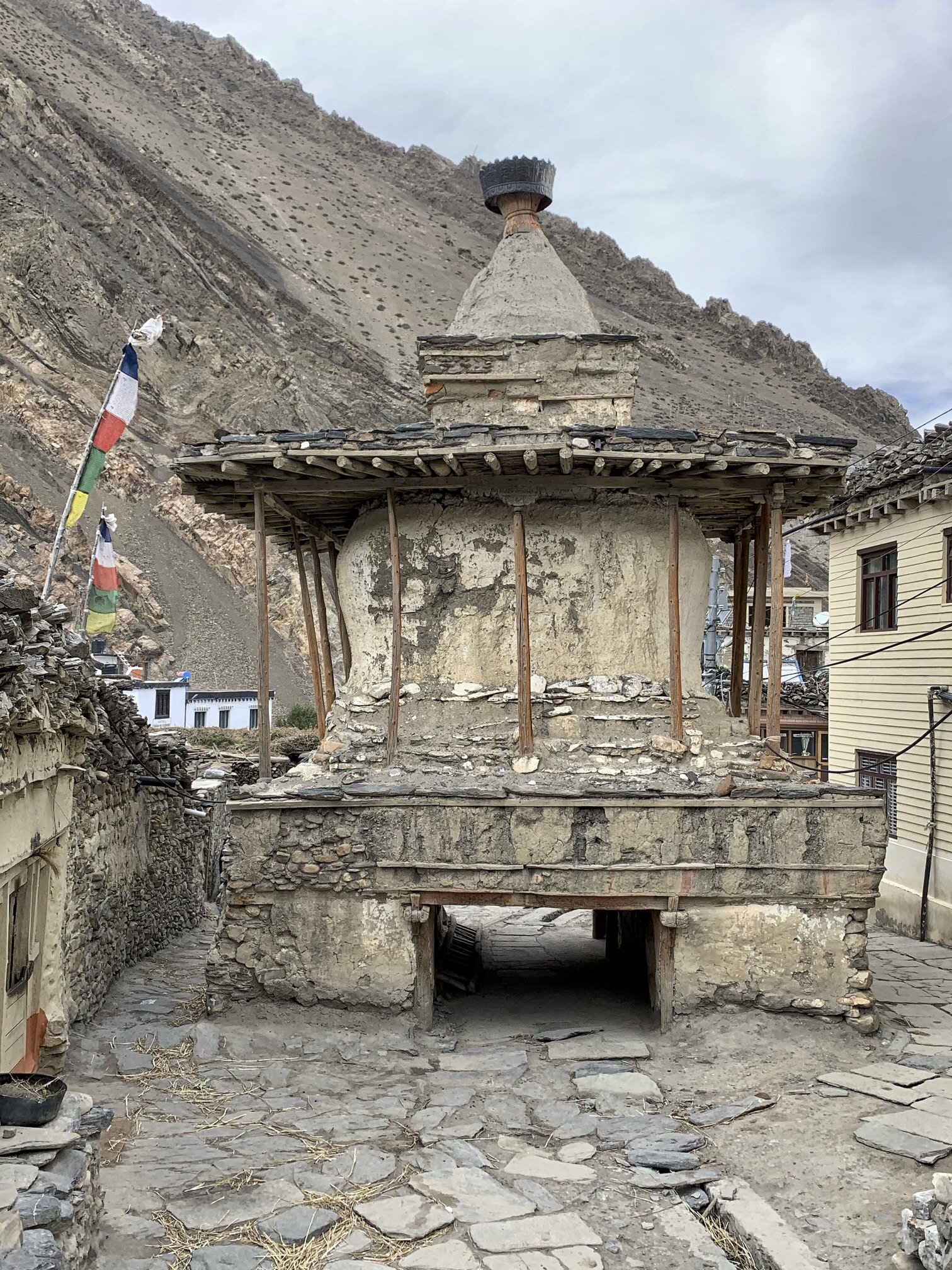
Kagbeni - a large old chorten at the entrance to the village.

Kagbeni - a large old chorten at the entrance to the village.

The Kag Choede Gompa in Kagbeni

The Kag Choede Gompa in Kagbeni

The beautiful Kag Choede Gompa in Kagbeni. The ritual masks are used in various festivals held in the Gompa’s large courtyard.

The beautiful Kag Choede Gompa in Kagbeni. The ritual masks are used in various festivals held in the Gompa’s large courtyard.

IMG_E5422.jpg
The Bhavachakra, the Wheel of Life or Wheel of Becoming, is a mandala - a complex picture representing the Buddhist view of the universe. To Buddhists, existence is a cycle of life, death, rebirth and suffering that they seek to escape altogether. T…

The Bhavachakra, the Wheel of Life or Wheel of Becoming, is a mandala - a complex picture representing the Buddhist view of the universe. To Buddhists, existence is a cycle of life, death, rebirth and suffering that they seek to escape altogether. The Wheel is divided into five or six realms, or states, into which a soul can be reborn. It is held by a demon or a god of death. Around the rim are depicted the twelve stages of dependent origination. The outer wheel depicts a blind man or woman (representing ignorance); potters (formation); a monkey (consciousness); two men in a boat (mind and body); a house with six windows (the senses); an embracing couple (contact); an eye pierced by an arrow (sensation); a person drinking (thirst); a man gathering fruit (grasping); a couple making love (becoming); a woman giving birth (birth); and a man carrying a corpse (death).

At the center of every Wheel of Life are a cock, a snake and a pig, which represent greed, anger and ignorance. In Buddhism, greed, anger (or hate) and ignorance are called the "Three Poisons" because they poison whoever harbors them. These are the forces that keep the Wheel of Life turning, according to the Buddha's teaching of the Second Noble Truth.

The village of Chusang (2,980m). Chusang is an interesting old village consisting of a walled, enclosed structure that looks like a fort. It is in fact a conglomeration of houses tightly packed together to protect from the vicious winds that blow th…

The village of Chusang (2,980m). Chusang is an interesting old village consisting of a walled, enclosed structure that looks like a fort. It is in fact a conglomeration of houses tightly packed together to protect from the vicious winds that blow through the valley every afternoon. The wind reaches speeds of 100km/hr and can blow small stones like bullets.

The Kali Gandaki River and fantastic rock formations surrounding the village of Chusang. The Kali Gandaki valley is the source of shaligrams, spherical, black-coloured Ammonoid fossils of the Devonian-Cretaceous period which existed from 400 to 66 m…

The Kali Gandaki River and fantastic rock formations surrounding the village of Chusang. The Kali Gandaki valley is the source of shaligrams, spherical, black-coloured Ammonoid fossils of the Devonian-Cretaceous period which existed from 400 to 66 million years ago. The fossils are a representation of the Hindu god Vishnu and the Hindu Universal Principle. The Universal Principle is the Ultimate Reality in the universe. In major schools of Hindu philosophy, it is the material, efficient, formal and final cause of all that exists.

The harvest in the village of Chusang. Somewhere below is the missing key keeper for the temple of Mentsi Lhakhang (see below).

The harvest in the village of Chusang. Somewhere below is the missing key keeper for the temple of Mentsi Lhakhang (see below).

From Chusang, we hiked to an interesting village of Tetang (3,040m). It is another walled village with a large monastery that was unfortunately closed. We also walked by a cave temple of Mentsi Lhakhang that was also closed. The man with the key was…

From Chusang, we hiked to an interesting village of Tetang (3,040m). It is another walled village with a large monastery that was unfortunately closed. We also walked by a cave temple of Mentsi Lhakhang that was also closed. The man with the key was working in the fields and was unavailable. This sanctuary is over 1000 years old. I got to see part of it but the main hall holding the most ancient artefacts was closed. I quickly realized that each village has a gompa or a place of interest that is usually closed. One needs to locate the key keeper to gain access. This is not always easy.

The medieval walled village of Tetang.

The medieval walled village of Tetang.

Inside the walled village of Tetang

Inside the walled village of Tetang

The Buddhist society of Upper Mustang is divided into groups comparable to the castes of Hindu culture. The occupational castes (the lowest) comprise blacksmiths, butchers and musicians. The highland nomads called the Dokpa take a slightly higher st…

The Buddhist society of Upper Mustang is divided into groups comparable to the castes of Hindu culture. The occupational castes (the lowest) comprise blacksmiths, butchers and musicians. The highland nomads called the Dokpa take a slightly higher status. The middle class consists of the Phalwa who call themselves Gurung.The highest class is the Kudakpa and it includes the nobility and the royal family of Lo.

Large chortens outside Tetang

Large chortens outside Tetang

Tetang

Tetang

Ancient meditation caves around Tetang

Ancient meditation caves around Tetang

The chortens of Tetang

The chortens of Tetang

The walled village of Tetang can be seen on the hill in the distance. Surprisingly, only 5 families live there.

The walled village of Tetang can be seen on the hill in the distance. Surprisingly, only 5 families live there.

The village of Chele (3,100m). The road in the photo leads to the first pass of Bhena La 3,840m. The trail between Chele and Syangboche passes by the Rangchyung Cave Chorten (Chyungsi Cave). We wanted to see it and took the detour to reach it. It wa…

The village of Chele (3,100m). The road in the photo leads to the first pass of Bhena La 3,840m. The trail between Chele and Syangboche passes by the Rangchyung Cave Chorten (Chyungsi Cave). We wanted to see it and took the detour to reach it. It was the longest day of the entire trek and involved the most climbing over 3 passes.

On the road from Chele. Since it is an actual road, we were passed by jeeps and motorcycles on their way to Lo Mantang kicking up enormous clouds of fine dust. Thankfully it was only in the morning as the jeeps leave Jomsom (where tourists arrive by…

On the road from Chele. Since it is an actual road, we were passed by jeeps and motorcycles on their way to Lo Mantang kicking up enormous clouds of fine dust. Thankfully it was only in the morning as the jeeps leave Jomsom (where tourists arrive by plane from Pokhara) early for a long drive north. After a couple of hours we left the road behind and did not see it until Lo Mantang.

The Annapurna Himalayan range from Bhena La (3,830m). On the left you can see Tilicho Peak (above Tilicho Lake) and to the right of it, Nilgiri North.

The Annapurna Himalayan range from Bhena La (3,830m). On the left you can see Tilicho Peak (above Tilicho Lake) and to the right of it, Nilgiri North.

Looking east from the Bhena La Pass to the Terlila Pass. We crossed the snowy mountains on the horizon through the Terila Pass (5,600m) several days later.

Looking east from the Bhena La Pass to the Terlila Pass. We crossed the snowy mountains on the horizon through the Terila Pass (5,600m) several days later.

The Annapurna Himalaya from the Bhena La Pass. Thorong La pass is on the left of the photo.

The Annapurna Himalaya from the Bhena La Pass. Thorong La pass is on the left of the photo.

On the way to Rangchyung cave we had to cross two more passes of 4,000m. It was the longest day of the trek so far. The nature of the terrain necessitates a lot of climbing!

On the way to Rangchyung cave we had to cross two more passes of 4,000m. It was the longest day of the trek so far. The nature of the terrain necessitates a lot of climbing!

IMG_E5676.jpg
Respite from climbing! A 50m stretch of flat trail.

Respite from climbing! A 50m stretch of flat trail.

The Roc Noir of the Annapurna Range from one of the passes en route to the Rangchyung cave. The ridge from Roc Noir connects to Annapurna I which can be seen on the right upper part of the photo.

The Roc Noir of the Annapurna Range from one of the passes en route to the Rangchyung cave. The ridge from Roc Noir connects to Annapurna I which can be seen on the right upper part of the photo.

The canyon-land on the way to the Rangchyung cave.

The canyon-land on the way to the Rangchyung cave.

The Rangchyung Cave (Chyungsi cave) is located at an altitude of 3,900m. The cave temple is said to be founded in the 8th century by a Tibetan mystic Padmasambhava who used the cave for meditating. The centre of the cave is dominated by a natural pi…

The Rangchyung Cave (Chyungsi cave) is located at an altitude of 3,900m. The cave temple is said to be founded in the 8th century by a Tibetan mystic Padmasambhava who used the cave for meditating. The centre of the cave is dominated by a natural pillar rock with images of Buddha painted on it. A natural ambulatory leads around the rock to the naturally formed image of an Indian Guru Atisa.

Chyungsi Cave temple

Chyungsi Cave temple

The chortens built into the natural rock pillar inside the cave.

The chortens built into the natural rock pillar inside the cave.

IMG_1099.jpg
IMG_E5730.jpg
The monk and the temple custodian of the Chyungsi cave has lived here for the past 10 years. The cave, in addition to the main sanctuary, is divided into various rooms and areas. One room is used for reading, praying and meditations. There is also a…

The monk and the temple custodian of the Chyungsi cave has lived here for the past 10 years. The cave, in addition to the main sanctuary, is divided into various rooms and areas. One room is used for reading, praying and meditations. There is also a kitchen area and storage. The monk in the photo is from Tibet and does not speak Nepali or English. We were welcomed by tea and fresh apples! He gets his supplies from the locals and occasionally from his family in Tibet. He was very gracious and showed us around.

On the way from Chyungsi cave to Syabgboche (3,773m) we had to pass through a narrow canyon that blocked all sunlight.

On the way from Chyungsi cave to Syabgboche (3,773m) we had to pass through a narrow canyon that blocked all sunlight.

The trail between Syangboche and Ghemi (3,520m) crosses yet another 4,000m pass.

The trail between Syangboche and Ghemi (3,520m) crosses yet another 4,000m pass.

The wild rock formations around Ghemi

The wild rock formations around Ghemi

The village of Ghemi (3,520m). The pillar shaped rocks behind the village are dotted with caves. We explored them the following day.

The village of Ghemi (3,520m). The pillar shaped rocks behind the village are dotted with caves. We explored them the following day.

The view from a pass before Ghemi.

The view from a pass before Ghemi.

Ghemi and one of the residents.

Ghemi and one of the residents.

In Ghemi

In Ghemi

The roofs of Ghemi with the Damodar Himal on the horizon. The Damodar Himal is located north of the Annapurna Range and is relatively little visited compared to the main trekking areas of Nepal.The locals pile the wood on the edges of roofs for deco…

The roofs of Ghemi with the Damodar Himal on the horizon. The Damodar Himal is located north of the Annapurna Range and is relatively little visited compared to the main trekking areas of Nepal.

The locals pile the wood on the edges of roofs for decoration, for wood storage purposes and as a wind breaker.

Old caves above Ghemi. We spent an afternoon exploring them. The cliffs are rather dangerous as the loose rocks dislodge with regular frequency. We spotted many Himalayan vultures that nest in the old caves. They were checking as out as a potential …

Old caves above Ghemi. We spent an afternoon exploring them. The cliffs are rather dangerous as the loose rocks dislodge with regular frequency. We spotted many Himalayan vultures that nest in the old caves. They were checking as out as a potential source of food.

Inaccessible caves high on the cliff. Most of the caves in Mustang bear testimony of prehistoric settlers. Little is known of their origin and life. The Tibetan and Ladakhi chronicles have mentioned Lo (the kingdom of Mustang) since the 7th century …

Inaccessible caves high on the cliff. Most of the caves in Mustang bear testimony of prehistoric settlers. Little is known of their origin and life. The Tibetan and Ladakhi chronicles have mentioned Lo (the kingdom of Mustang) since the 7th century AD. The carbon dating of some the caves has dated their origin to 3000 years BC.

Ghemi and the Damodar Himal. Terlila pass can be seen on the left of the photo.

Ghemi and the Damodar Himal. Terlila pass can be seen on the left of the photo.

The cliffs next to Ghemi.

The cliffs next to Ghemi.

The view of Damodar Himal from Ghemi.

The view of Damodar Himal from Ghemi.

In Ghemi. Marriage of women with two or more brothers in order to avoid the splitting up the family’s farmland and livestock herd is still practiced in some villages including Ghemi.

In Ghemi. Marriage of women with two or more brothers in order to avoid the splitting up the family’s farmland and livestock herd is still practiced in some villages including Ghemi.

We stayed at the Royal Mustang Teahouse in Ghemi. The teahouse belongs to a relative of the Mustang Royal Family. His house is quite old and has an attached private chapel. While there, the monks from nearby gompa were performing a puja ceremony tha…

We stayed at the Royal Mustang Teahouse in Ghemi. The teahouse belongs to a relative of the Mustang Royal Family. His house is quite old and has an attached private chapel. While there, the monks from nearby gompa were performing a puja ceremony that lasted an entire day. A puja is a special ceremony in which prayers are offered to the Buddha to request their blessings or invoke their help. Pujas are performed to avert and clear the three types of obstacles which arise due to the lack of merit, which prevent us from achieving our worldly and spiritual goals. Removing these obstacles will help us to achieve happiness and good fortune in all our activities. The three obstacles are: Worldly obstacles - affecting our day to day life, relationships, business, and finances. Inner obstacles - affecting mental and physical health in the form of strong emotions, confusion, and associated physical problems. Secret obstacles - obstructing the attainment of wisdom, experienced as difficulties in Dharma practice (to practice Dharma means to apply Buddha's teachings in your daily life).

The puja ceremony.

The puja ceremony.

Reciting prayers during the puja ceremony.

Reciting prayers during the puja ceremony.

Sacred texts stored at the private chapel in Ghemi.

Sacred texts stored at the private chapel in Ghemi.

IMG_E5923.jpg
The Ghemi Gompa. After a long search we located the key keeper who took us inside the little temple. The small grey chorten to the left of the man in the photo is the most interesting artefact.

The Ghemi Gompa. After a long search we located the key keeper who took us inside the little temple. The small grey chorten to the left of the man in the photo is the most interesting artefact.

The murals inside the Ghemi Gompa. On the left is the Tibetan wheel of life.

The murals inside the Ghemi Gompa. On the left is the Tibetan wheel of life.

Large prayer wheel in Ghemi.

Large prayer wheel in Ghemi.

One of the friendly locals. Note his pendent. It is the Dzi stone (pronounced Zee). Dzi is a Tibetan word used to describe a patterned bead, usually agate, of mainly oblong, round, cylindrical or tabular shape pierced lengthwise called Heaven's Bead…

One of the friendly locals. Note his pendent. It is the Dzi stone (pronounced Zee). Dzi is a Tibetan word used to describe a patterned bead, usually agate, of mainly oblong, round, cylindrical or tabular shape pierced lengthwise called Heaven's Bead (tian zhu) in Chinese.

“The meaning of the Tibetan word "Dzi" translates to "shine, brightness, clearness, splendour". The beads originate in the Tibetan cultural sphere and can command high prices and are difficult to come by. They are found primarily in Tibet, but also in neighbouring Bhutan, Ladakh and Sikkim. Shepherds and farmers pick them up in the grasslands or while cultivating fields. Because dZi are found in the earth, Tibetans cannot conceive of them as man-made. Since knowledge of the bead is derived from oral traditions, few beads have provoked more controversy concerning their source, method of manufacture and even precise definition. This all contributes to making them the most sought after and collectable beads on earth.

Dzi stones are said to do a number of things. Some protect its wearer from negative energies or accidents, some attract wealth or wisdom, while others might bring you love and happiness.

One thing to remember concerning these curious little stones is this, a Dzi stone may repel things, but it also can store them. When a negativism comes at you, your stone may block it or absorb it. They can also give very positive energies to you, while absorbing a bit of your energy in the process. In other words, a bit of them goes into you and a bit of you will go into them”.

Ghemi from the trail to Tserang.

Ghemi from the trail to Tserang.

Looking back to the trail we walked on to get to Ghemi, The Annapurna Himal is further away,

Looking back to the trail we walked on to get to Ghemi, The Annapurna Himal is further away,

On the way between Ghemi and Dhakmar, we passed by spectacular red cliffs full of caves. We decided to stop and explore some of the caves as they looked more accessible and safer than the ones around Ghemi.

On the way between Ghemi and Dhakmar, we passed by spectacular red cliffs full of caves. We decided to stop and explore some of the caves as they looked more accessible and safer than the ones around Ghemi.

IMG_1370.jpg
Spectacular scenery on the way to Dhakmar.

Spectacular scenery on the way to Dhakmar.

IMG_1393.jpg
The caves in the red cliffs above Dhakmar (3,820m)

The caves in the red cliffs above Dhakmar (3,820m)

The ancient cave complex. One would need ropes or really high ladders to access them.

The ancient cave complex. One would need ropes or really high ladders to access them.

The old village of Dhakmar (3,820m)

The old village of Dhakmar (3,820m)

Exploring the caves of Dhakmar.

Exploring the caves of Dhakmar.

IMG_E6028.jpg
The path from Dhakmar village to Tsarang climbs to a 4,000m pass.

The path from Dhakmar village to Tsarang climbs to a 4,000m pass.

From Dhakmar we traversed the high sandstone formations to get to Tsarang. The trail looked impassible until one rounded a corner and the path revealed itself. This part of the trek was very spectacular.

From Dhakmar we traversed the high sandstone formations to get to Tsarang. The trail looked impassible until one rounded a corner and the path revealed itself. This part of the trek was very spectacular.

We ascended to yet another 4,000m pass between Dhakmar and Tsarang. The view of the red cliffs and rock formations was quite impressive.

We ascended to yet another 4,000m pass between Dhakmar and Tsarang. The view of the red cliffs and rock formations was quite impressive.

The view from the pass between Dhakmar and Tsarang looking north-east.

The view from the pass between Dhakmar and Tsarang looking north-east.

An old way to get around Mustang.

An old way to get around Mustang.

From the pass we could see the north-east wall of Annapurna 1 towering above the Great Barrier (the glaciated white ridge). This view is not visible from the Tilicho Lake or any other location closer to the mountain. We are now more than 60km away f…

From the pass we could see the north-east wall of Annapurna 1 towering above the Great Barrier (the glaciated white ridge). This view is not visible from the Tilicho Lake or any other location closer to the mountain. We are now more than 60km away from Annapurna. There is a short trek to the west side of Annapurna 1.

Tsarang and its incredible backdrop. Notice the red Gompa on the right side of the photo and the old palace on the centre of the photo.

Tsarang and its incredible backdrop. Notice the red Gompa on the right side of the photo and the old palace on the centre of the photo.

The royal palace and the monastery of Tsarang. Out of all places in Mustang, I wanted to visit Tsarang the most mainly because of the gompa and its spectacular location. It did not disappoint!

The royal palace and the monastery of Tsarang. Out of all places in Mustang, I wanted to visit Tsarang the most mainly because of the gompa and its spectacular location. It did not disappoint!

The door chorten of Tsarang (3,560m).

The door chorten of Tsarang (3,560m).

The chorten in front of the Thubten Shedrup Dhargyeling monastery of Tsarang. The monastery was founded in the 16th century and has 60 resident monks of various ages. There is a monastic school next to the monastery. The monks come from Mustang, oth…

The chorten in front of the Thubten Shedrup Dhargyeling monastery of Tsarang. The monastery was founded in the 16th century and has 60 resident monks of various ages. There is a monastic school next to the monastery. The monks come from Mustang, other areas of Nepal and even Tibet.

The spectacular monastery of Tsarang.

The spectacular monastery of Tsarang.

The main prayer hall of the Tsarang monastery. It is not a museum but a functioning religious institution and one needs to ask for a key and a guidance of one of the monks to see the inside of the building. The wall paintings date to the 16th centur…

The main prayer hall of the Tsarang monastery. It is not a museum but a functioning religious institution and one needs to ask for a key and a guidance of one of the monks to see the inside of the building. The wall paintings date to the 16th century. Unfortunately some parts of the monastery are left in ruins and are used as storage for building materials.

IMG_1661.jpg
The roof of the Tsarang monastery. The eight-spoked wheel represents the first turning of the dharma wheel by the Buddha. The male and female deer on the right and left represent the male and female disciples who one-pointedly enjoy and take pleasur…

The roof of the Tsarang monastery. The eight-spoked wheel represents the first turning of the dharma wheel by the Buddha. The male and female deer on the right and left represent the male and female disciples who one-pointedly enjoy and take pleasure in listening to the teachings of the holy dharma.

The interior eight spokes represent the moral conduct of discipline from among the Three Trainings. The intermediate eight spokes represent the training in wisdom and the noble eight-fold path. The outer eight spokes represent the training in meditative concentration.

The entirety of the Buddha’s teachings are contained within the Three Trainings and noble eight-fold path. The pair of deer represent skillful means and wisdom, and based upon the unity of skillful means and wisdom, buddhahood can be attained.

The view from the roof of the Tsarang monastery. Soon we will cross the mountains on the horizon. The Terila Pass is on the left of the photo. The Thorogla Pass that we already crossed on on the right.

The view from the roof of the Tsarang monastery. Soon we will cross the mountains on the horizon. The Terila Pass is on the left of the photo. The Thorogla Pass that we already crossed on on the right.

The town of Tsarang. The chorten in the village is one of the biggest in Upper Mustang.

The town of Tsarang. The chorten in the village is one of the biggest in Upper Mustang.

The view of the gorge next to the monastery of Tsarang.

The view of the gorge next to the monastery of Tsarang.

Thubten Shedrup Dhargyeling monastery of Tsarang against the spectacular backdrop of the Himalaya.

Thubten Shedrup Dhargyeling monastery of Tsarang against the spectacular backdrop of the Himalaya.

IMG_1768.jpg
The main prayer hall of the Tsarang monastery.

The main prayer hall of the Tsarang monastery.

The Royal Palace (mostly in ruins after the 2015 earthquake) and the Tsarang monastery.

The Royal Palace (mostly in ruins after the 2015 earthquake) and the Tsarang monastery.

The spectacular location the Tsarang monastery with the Annapurna mountain range on the horizon. This is the view I was hoping to see!

The spectacular location the Tsarang monastery with the Annapurna mountain range on the horizon. This is the view I was hoping to see!

IMG_6294.jpg
IMG_E6308.jpg
Spectacular Tsarang

Spectacular Tsarang

Tsarang monastery, Tilicho Peak and Nilgiri Peak.

Tsarang monastery, Tilicho Peak and Nilgiri Peak.

The Sumda Chorten is half way between Tsarang and Lo Mantang. The mountains of Thorogla Pass (see Part 1) are right above it.

The Sumda Chorten is half way between Tsarang and Lo Mantang. The mountains of Thorogla Pass (see Part 1) are right above it.

The road between Tsarang and Lo Mantang, the capital of Mustang. The mountains on the horizon are part of the Mustang Himal and form the border with Tibet. The mountains are all over 6000m in height.

The road between Tsarang and Lo Mantang, the capital of Mustang. The mountains on the horizon are part of the Mustang Himal and form the border with Tibet. The mountains are all over 6000m in height.

The LoLa Pass 4,000m between Tsarang and Lo Mantang.

The LoLa Pass 4,000m between Tsarang and Lo Mantang.

The view from LoLa Pass towards Chosar. The area north of Lo Mantang is called Chosar and has many old caves, cave monasteries and old villages. It is only a short distance from the Tibetan border. Apparently you need a special permit to go there bu…

The view from LoLa Pass towards Chosar. The area north of Lo Mantang is called Chosar and has many old caves, cave monasteries and old villages. It is only a short distance from the Tibetan border. Apparently you need a special permit to go there but no one asked for it.

The incredible rock formations around Lo Mantang.

The incredible rock formations around Lo Mantang.

The walled city of Lo Mantang seen from Lola Pass. The city is located at an altitude of 3,840m. Its fame is mainly attributable to its remote location and inaccessibility. It reminded me of Timbuktu in Mali. Equally difficult to get to and has many…

The walled city of Lo Mantang seen from Lola Pass. The city is located at an altitude of 3,840m. Its fame is mainly attributable to its remote location and inaccessibility. It reminded me of Timbuktu in Mali. Equally difficult to get to and has many treasures that are not evident at the first glance.

The now deceased King of Lo, Jigme Palbar Bista. Mustang was once an independent kingdom, although closely tied by language and culture to Tibet. From the 15th century to the 17th century, its strategic location granted Mustang control over the trad…

The now deceased King of Lo, Jigme Palbar Bista. Mustang was once an independent kingdom, although closely tied by language and culture to Tibet. From the 15th century to the 17th century, its strategic location granted Mustang control over the trade between the Himalayas and India. At the end of the 18th century the kingdom was annexed by Nepal and became a dependency of the Kingdom of Nepal since 1795.

The chortens and prayer wheels at the entrance to the city of Lo Mantang.

The chortens and prayer wheels at the entrance to the city of Lo Mantang.

The city gate.

The city gate.

Byams-pa Lhakhang is the oldest temple in Lo Mantang founded in 1447. It is home to the incredible collection Mandala paintings (the best and most impressive I have ever seen). A mandala is a symbolic picture of the universe. It can be a painting on…

Byams-pa Lhakhang is the oldest temple in Lo Mantang founded in 1447. It is home to the incredible collection Mandala paintings (the best and most impressive I have ever seen). A mandala is a symbolic picture of the universe. It can be a painting on a wall or scroll, created in coloured sands on a table, or a visualisation in the mind of a very skilled adept.

The mandala represents an imaginary palace that is contemplated during meditation. Each object in the palace has significance, representing an aspect of wisdom or reminding the meditator of a guiding principle. The mandala's purpose is to help transform ordinary minds into enlightened ones and to assist with healing.

The Tibetan mandala contains deities, with the principal deity in the centre of the pattern. The deities who reside in the palace embody philosophical views and serve as role models.

The courtyard of the Byams-pa Lhakhang gompa. The door to the lower sanctum was closed and only the upper gallery was open.

The courtyard of the Byams-pa Lhakhang gompa. The door to the lower sanctum was closed and only the upper gallery was open.

Lazy afternoon in the centre of Lo Mantang.

Lazy afternoon in the centre of Lo Mantang.

Hanging out and passing time…

Hanging out and passing time…

The narrow alleys of Lo Mantang

The narrow alleys of Lo Mantang

IMG_1947.jpg
IMG_1952.jpg
Two large prayer wheels at the entrance to Lo Mantang

Two large prayer wheels at the entrance to Lo Mantang

Lo Mantang was very quiet. Apparently many locals leave the town for winter and go to Pokhara or Kathmandu. They return in the spring.

Lo Mantang was very quiet. Apparently many locals leave the town for winter and go to Pokhara or Kathmandu. They return in the spring.

The Shakya Chyodi Gompa - founded in 1710 and known as “the new gompa”.

The Shakya Chyodi Gompa - founded in 1710 and known as “the new gompa”.

The entrance to the Shakya Chyodi Gompa

The entrance to the Shakya Chyodi Gompa

The impressive image of the Maitreya Buddha. The temple is also known as the Mandala Temple of Lo Mantang. The walls are painted with 47 magnificent mandalas some of which date back to 15th century. The mandalas are undergoing extensive restoration …

The impressive image of the Maitreya Buddha. The temple is also known as the Mandala Temple of Lo Mantang. The walls are painted with 47 magnificent mandalas some of which date back to 15th century. The mandalas are undergoing extensive restoration work by an Italian restorer Luigi Fieni who worked with restoration of the Sistine Chapel in the Vatican.

The massive statues of the Thubchen Lhakhang, the biggest assembly hall in Mustang. The height of the hall is 7.6 meters. The hall is very immersive and on entrance the massive pillars look like a forest.

The massive statues of the Thubchen Lhakhang, the biggest assembly hall in Mustang. The height of the hall is 7.6 meters. The hall is very immersive and on entrance the massive pillars look like a forest.

The murals of the Thubchen Lhakhang temple. The murals are undergoing restoration.

The murals of the Thubchen Lhakhang temple. The murals are undergoing restoration.

The entrance to the Thubchen Lhakhang temple with massive pillars and statues in the back of the temple.

The entrance to the Thubchen Lhakhang temple with massive pillars and statues in the back of the temple.

Inside the Thubchen Lhakhang temple.

Inside the Thubchen Lhakhang temple.

Thubchen Lhakhang temple.

Thubchen Lhakhang temple.

Large shortens inside the walled city of Lo Mantang.

Large shortens inside the walled city of Lo Mantang.

IMG_E6414.jpg
Lo Mantang

Lo Mantang

Lo Mantang

Lo Mantang

North of Lo Mantang on the way to Chosar.

North of Lo Mantang on the way to Chosar.

Long mani wall north of Lo Mantang

Long mani wall north of Lo Mantang

Large chorten between Lo Mantang and the cave monastery of Nyiphu.

Large chorten between Lo Mantang and the cave monastery of Nyiphu.

Near Garphu, the Mustang Range dominates the horizon. The peaks are around 6,000m in height. There is some remote trekking in the range.

Near Garphu, the Mustang Range dominates the horizon. The peaks are around 6,000m in height. There is some remote trekking in the range.

Jhong Cave complex. It is around 3,000 years old. One can explore the caves by series of ladders and narrow passages. There is, unfortunately, not much to see inside but the view from the cave complex is spectacular!

Jhong Cave complex. It is around 3,000 years old. One can explore the caves by series of ladders and narrow passages. There is, unfortunately, not much to see inside but the view from the cave complex is spectacular!

The entrance to the Jhong Cave complex.

The entrance to the Jhong Cave complex.

IMG_E6481.jpg
The view from one of the caves of the Jhong Cave complex.

The view from one of the caves of the Jhong Cave complex.

Exploring the cave complex

Exploring the cave complex

IMG_6488.jpg
Nyiphu Gompa built into the side of a mountain. It is also known as “the cave of the sun”. The monastery dates back to 16th century.

Nyiphu Gompa built into the side of a mountain. It is also known as “the cave of the sun”. The monastery dates back to 16th century.

The interior of the Nyiphu temple. The old murals are badly damaged from the smoke from butter lamps.

The interior of the Nyiphu temple. The old murals are badly damaged from the smoke from butter lamps.

The view of the Nyiphu temple and the monastic school.

The view of the Nyiphu temple and the monastic school.

The entrance to the small Graphu Gompa.

The entrance to the small Graphu Gompa.

Inside the Graphu Gompa

Inside the Graphu Gompa

The large cave complex of Gharphu. Unfortunately all caves and temples were closed and the key keeper was impossible to find. It would take a good part of the day to locate the key keeper and explore various caves int he area.

The large cave complex of Gharphu. Unfortunately all caves and temples were closed and the key keeper was impossible to find. It would take a good part of the day to locate the key keeper and explore various caves int he area.

Garphu cave complex

Garphu cave complex

Garphu cave complex

Garphu cave complex

One of many caves that would be fascinating to explore

One of many caves that would be fascinating to explore

Garphu

Garphu

The Grand Mustang Circuit - Part 3: Lo Mantang to TeriLa Pass

The Grand Mustang Circuit is a combination of the Annapurna Circuit (or what is left of it), the classic Mustang trek, the Terila Trek and the trek trough the Naar/Phu region. To finish things off in “style”, we returned to the starting point via Kangla Pass. The total distance of this EPIC trek was 380km which we walked over 24 days. We climbed 12km in total elevation (probably descended the same) and crossed 3 passes over 5,000m and a quite a few passes over 4,000m. Half of the trek is through sparsely populated regions requiring camping and self sufficiency. It is a spectacular route through some of the most culturally interesting areas of the Buddhist Nepal with a thriving culture. Again, many thanks to the Mountain Sun Valley and Rajendra for putting this together.

It is not technically difficult but it is long. It also has a lot of ups and downs, especially in the Mustang region, where one has to constantly climb into and out of river gorges that cut through the landscape. The trek offers spectacular scenery that is very different from what I have seen in other parts of Nepal. It is a truly unique experience both visually and culturally.

This part of the trek took us to more remote part of Mustang and more spectacular. We left Mustang by ascending the remote Terla Pass. The pass is 40km from the last village in Mustang and 40km from Naar. It takes between 6 to 8 days to cross this pass between the two villages. There is an alternative route further north through the Saribung pass. The route requires glacier crossing for which we did not have proper equipment. The Saribug Pass route is of the same distance and ends in the village of Phu. The Saribung Pass is 400m higher from our maximum elevation reached.

mustang-map3.jpg

See the Teri La Page with Annotations and Maps on www.Himalaya-Info.org

The walkway in the sky! We followed this trail at the altitude of 4100m. The views were quite incredible.

The walkway in the sky! We followed this trail at the altitude of 4100m. The views were quite incredible.

IMG_E6653.jpg
Looking towards the Annapurna Range

Looking towards the Annapurna Range

The Valley of Kali Gandaki

The Valley of Kali Gandaki

IMG_E6687.jpg
The village of Dhi is below us at the elevation of 3390m. From Dhi we ascended the valley of Puyung River to Yara.

The village of Dhi is below us at the elevation of 3390m. From Dhi we ascended the valley of Puyung River to Yara.

IMG_E6698.jpg
IMG_E6727.jpg
IMG_E6760.jpg
The Puyung River valley is full of Saligrams. We spent a few hors looking for the fossils and found a boat load! Some of them were quite spectacular.

The Puyung River valley is full of Saligrams. We spent a few hors looking for the fossils and found a boat load! Some of them were quite spectacular.

As we ascended the Puyung River valley the cliffs got higher and the canyon became narrower.

As we ascended the Puyung River valley the cliffs got higher and the canyon became narrower.

As we approached Yara, the magnificent organ pipes (over 100m tall) came into view. There were numerous caves carved into the pillars. I wish we had more time to explore them further.

As we approached Yara, the magnificent organ pipes (over 100m tall) came into view. There were numerous caves carved into the pillars. I wish we had more time to explore them further.

The fantastic towers of Yara.

The fantastic towers of Yara.

IMG_E6809.jpg
The surroundings of the Yara village are quite unique.

The surroundings of the Yara village are quite unique.

The village of Yara.

The village of Yara.

Life in Yara

Life in Yara

IMG_7025.jpg
From Yara we ventured further up the valley to explore some famous cave temples. We passed the village of Ghara along the way.

From Yara we ventured further up the valley to explore some famous cave temples. We passed the village of Ghara along the way.

IMG_E6868.jpg
The Luri Gompa and Luri Monastary (4060m)

The Luri Gompa and Luri Monastary (4060m)

The Luri Gompa is built on top of the rocky outcrop like a birds nest. The gompa is also known as “the sanctuary of a white chorten”. There is an actual white chorten built inside the cave.

The Luri Gompa is built on top of the rocky outcrop like a birds nest. The gompa is also known as “the sanctuary of a white chorten”. There is an actual white chorten built inside the cave.

IMG_E6884.jpg
IMG_E6890.jpg
The entrance to the Luri Cave

The entrance to the Luri Cave

Old murals at the entrance to the cave temple.

Old murals at the entrance to the cave temple.

IMG_E6898.jpg
The white chorten inside the cave temple. The paintings above the shorted date to 13th century.

The white chorten inside the cave temple. The paintings above the shorted date to 13th century.

IMG_E6907.jpg
IMG_E6910.jpg
IMG_E6921.jpg
IMG_E6919.jpg
The view from the Luri Cave to the Luri Nunnery.

The view from the Luri Cave to the Luri Nunnery.

IMG_E6950.jpg
IMG_E6964.jpg
The Luri Nunnery

The Luri Nunnery

The key keeper of the Luri Cave and Luri Nunnery. There are no permanent monks in the cave or the nunnery.

The key keeper of the Luri Cave and Luri Nunnery. There are no permanent monks in the cave or the nunnery.

The Tashi Kabum Cave. The key has to be obtained from the Yara village and if one person takes it, no other people can visit at the same time/day. Thankfully, very few people venture out here.

The Tashi Kabum Cave. The key has to be obtained from the Yara village and if one person takes it, no other people can visit at the same time/day. Thankfully, very few people venture out here.

The murals of the Tashi Kabum cave. The murals date to 13th century.

The murals of the Tashi Kabum cave. The murals date to 13th century.

The 13th century painting of a monk in Tashi Kabum cave.

The 13th century painting of a monk in Tashi Kabum cave.

The valley around the Tashi Kabum cave is full of caves.

The valley around the Tashi Kabum cave is full of caves.

The valley of Puyung River.

The valley of Puyung River.

IMG_E7039.jpg
The cliffs of Yara. We had to climb to the top of the plateau and then traverse numerous river valleys to get closer to the trail to Teri La Pass.

The cliffs of Yara. We had to climb to the top of the plateau and then traverse numerous river valleys to get closer to the trail to Teri La Pass.

Looking down from the plateau above Yara.

Looking down from the plateau above Yara.

for a sense of scale notice the person standing on top of the cliffs.

for a sense of scale notice the person standing on top of the cliffs.

Looking down to Yara.

Looking down to Yara.

IMG_E7071.jpg
Looking down to the Valley of Kali Gandaki.

Looking down to the Valley of Kali Gandaki.

As we walked towards Tange, the scenery became very impressive!

As we walked towards Tange, the scenery became very impressive!

IMG_E7101.jpg
The valley of Dhechyang River

The valley of Dhechyang River

HCXN9588.jpg
IMG_E7149.jpg
IMG_E7181.jpg
Mustang - looking south-west with Dhaulagiri 1 on the horizon.

Mustang - looking south-west with Dhaulagiri 1 on the horizon.

SWUK2783.jpg
Looking south from the trail to Tangey with Dhaulagiri 1 on the horizon.

Looking south from the trail to Tangey with Dhaulagiri 1 on the horizon.

The valley of Tannge River

The valley of Tannge River

The village of Tangey and the Terila Pass approach on the horizon above the village.

The village of Tangey and the Terila Pass approach on the horizon above the village.

IMG_E7244.jpg
Tangey Village

Tangey Village

The magnificent chortens of the Tangey Village

The magnificent chortens of the Tangey Village

Tangey 3240m. Terila Pass is 2.5km above us!

Tangey 3240m. Terila Pass is 2.5km above us!

The biggest group of chortens in Mustang. There are 17 chortens in the group and numerous mani stones.

The biggest group of chortens in Mustang. There are 17 chortens in the group and numerous mani stones.

IMG_E7324.jpg
The gate chorten of the group. The murals inside the chorten date back to 15th century.

The gate chorten of the group. The murals inside the chorten date back to 15th century.

Very old prayer wheel

Very old prayer wheel

A beautifully carved mani stone

A beautifully carved mani stone

IMG_E7320.jpg
On the way to Terila Pass. We left the village of Tangey below.

On the way to Terila Pass. We left the village of Tangey below.

As we got higher we could see the entire Upper Mustang below us.

As we got higher we could see the entire Upper Mustang below us.

Looking south with Dhaulagiri 1 on the horizon.

Looking south with Dhaulagiri 1 on the horizon.

Looking back to where we came from - Upper Mustang and the mountains of Dolpo.

Looking back to where we came from - Upper Mustang and the mountains of Dolpo.

Camp 1 on the way to Terila Pass at 4000m

Camp 1 on the way to Terila Pass at 4000m

We camped close to the local herders with large number of goats.

We camped close to the local herders with large number of goats.

The Dhaulagiri Himal and the herder’s camp below.

The Dhaulagiri Himal and the herder’s camp below.

Sunset over Dhaulagiri.

Sunset over Dhaulagiri.

Teri La N 4130 nach WSW.jpg
Teri La N 4350 Pass 4640 Panorama S.jpg
Scoping out the way to Terila Pass. We had to descend from his small pass only to reclimb the lost altitude plus more!

Scoping out the way to Terila Pass. We had to descend from his small pass only to reclimb the lost altitude plus more!

IMG_7436.jpeg
Between camp 2 and camp 3 on the way to Terila Pass at 5000m

Between camp 2 and camp 3 on the way to Terila Pass at 5000m

Teri La N 5090 Panorama NO bis W.jpg
Teri La N 5100 nach W.jpg
Approaching the basecamp for the Terila Pass at 5000m

Approaching the basecamp for the Terila Pass at 5000m

IMG_E7487.jpg
The basecamp for the Terila Pass at 5000m

The basecamp for the Terila Pass at 5000m

IMG_7494.jpg
Approaching the Terila Pass 5600m

Approaching the Terila Pass 5600m

Terila Pass at 5600m

Terila Pass at 5600m

The view from 5800m above the Terila Pass. The view from the hills above the pass was much more impressive. We could see all the way to Manaslu.

The view from 5800m above the Terila Pass. The view from the hills above the pass was much more impressive. We could see all the way to Manaslu.

Terila Pass

Terila Pass

My inaccurate altimeter. Add another 160m.

My inaccurate altimeter. Add another 160m.

IMG_7533.jpg
Teri La P 5742 nach OSO_1.jpg
Teri La P 5742 nach OSO_2.jpg
IMG_7550.jpg
IMG_7542.jpg
IMG_7557.jpg
IMG_7564.jpg
IMG_7573.jpg
Teri La P 5742 Panorama SO bis SW.jpg
IMG_7628.jpg
IMG_7658.jpg
IMG_7663.jpg
Teri La nach O.jpg
Teri La nach NO bis SO.jpg
IMG_7688.jpg

The Grand Mustang Circuit - Part 4: Terila Pass to Chame via Naar and Kangla Pass

The Grand Mustang Circuit is a combination of the Annapurna Circuit (or what is left of it), the classic Mustang trek, the Terila Trek and the trek trough the Naar/Phu region. To finish things off in “style”, we returned to the starting point via Kangla Pass. The total distance of this EPIC trek was 380km which we walked over 24 days. We climbed 12km in total elevation (probably descended the same) and crossed 3 passes over 5,000m and a quite a few passes over 4,000m. Half of the trek is through sparsely populated regions requiring camping and self sufficiency. It is a spectacular route through some of the most culturally interesting areas of the Buddhist Nepal with a thriving culture. Again, many thanks to the Mountain Sun Valley and Rajendra for putting this together.

It is not technically difficult but it is long. It also has a lot of ups and downs, especially in the Mustang region, where one has to constantly climb into and out of river gorges that cut through the landscape. The trek offers spectacular scenery that is very different from what I have seen in other parts of Nepal. It is a truly unique experience both visually and culturally.

This final part of the trek took us down from Terila Pass to the village fo Naar. The village of Naar has spectacular location and is culturally fascinating. I was lucky to attend a puja ceremony in the local gompa and a wedding between a man from Naar and a lady from Phu. These experiences allowed me to meet some friendly locals and learn about the local culture and customs. I really appreciated the hospitality and friendliness of the residents of Naar. It was a wonderful experience! We returned to our start point through the spectacular Kangla Pass with phenomenal views of the entire Annapurna range. We had great weather and visibility. Overall this trip was very different from the other treks i did in Nepal that were more Himalaya focused. This trek exceeded my highest expectations.

See here for a good report of Kang La Pass

annapurna-circuit-trekking-map.jpg
mustang-map3.jpg
coming down from Terila Pass

coming down from Terila Pass

IMG_7706.jpg
The dry Domodar Himal, descending from Terila Pass

The dry Domodar Himal, descending from Terila Pass

Looking back to the Terila Pass area.

Looking back to the Terila Pass area.

IMG_7712.jpg
The Valley of Labtse Khola.  We followed this river all the way to Naar.

The Valley of Labtse Khola. We followed this river all the way to Naar.

IMG_7714.jpg
After walking for 25km, we set up the first camp after the pass.

After walking for 25km, we set up the first camp after the pass.

IMG_7721.jpg
IMG_7731.jpg
Walking from Terila Pass. It is 40km to Naar along the Labtse Khola. .

Walking from Terila Pass. It is 40km to Naar along the Labtse Khola. .

IMG_7738.jpg
The trek is very spectacular among the rugged mountains that feel remote and isolated.

The trek is very spectacular among the rugged mountains that feel remote and isolated.

Camp 2 on the way between Terila and Naar. Pisang Peak 6,091, a popular trekking peak, is on the horizon.

Camp 2 on the way between Terila and Naar. Pisang Peak 6,091, a popular trekking peak, is on the horizon.

Pisang Peak from our camp.

Pisang Peak from our camp.

IMG_7766.jpg
IMG_7767.jpg
IMG_7769.jpg
Approaching Naar.

Approaching Naar.

IMG_7776.jpg
The village of Naar is across the bridge and 700m up the ridge.

The village of Naar is across the bridge and 700m up the ridge.

We had to climb the ridge int he background to get to Naar.

We had to climb the ridge int he background to get to Naar.

IMG_7787.jpg
Climbing the 800m ridge to Naar.

Climbing the 800m ridge to Naar.

The chortens at the entrance to Naar.

The chortens at the entrance to Naar.

The shape of the stupa represents the Buddha, crowned and sitting in meditation posture on a lion throne. His crown is the top of the spire; his head is the square at the spire's base; his body is the vase shape; his legs are the four steps of the l…

The shape of the stupa represents the Buddha, crowned and sitting in meditation posture on a lion throne. His crown is the top of the spire; his head is the square at the spire's base; his body is the vase shape; his legs are the four steps of the lower terrace; and the base is his throne.

Although not described in any Tibetan text on stupa symbolism, the stupa may represent the five purified elements:

The square base represents earth

The hemispherical dome/vase represents water

The conical spire represents fire

The upper lotus parasol and the crescent moon represent air

The sun and the dissolving point represent wisdom

The impressive chorten group before Naar.

The impressive chorten group before Naar.

IMG_7971.jpg
I was lucky to attend the puja ceremony in this small chapel in Naar. The puja was held for prosperity and safety of Naar and is performed once a year.

I was lucky to attend the puja ceremony in this small chapel in Naar. The puja was held for prosperity and safety of Naar and is performed once a year.

The small gompa and puja of Naar.

The small gompa and puja of Naar.

The lama reciting sacred mantras.

The lama reciting sacred mantras.

According to the Tibetan Buddhism , ringing the holy bells and gongs have always been the matter of showing affection towards the “Buddha “ and all the Bodhisattvas (a person who is able to reach nirvana but delays doing so out of compassion in orde…

According to the Tibetan Buddhism , ringing the holy bells and gongs have always been the matter of showing affection towards the “Buddha “ and all the Bodhisattvas (a person who is able to reach nirvana but delays doing so out of compassion in order to save suffering beings). This is a ritual of accumulating positive karma. The bell is a representation of “wisdom”.

In ancient Sanskrit, the conch is known as Shankha meaning “a shell holding the sacred water.” Vedic myth says the conch appeared from the water after the great churning of the ocean.  According to mainstream Buddhism and Hinduism, the conch shell i…

In ancient Sanskrit, the conch is known as Shankha meaning “a shell holding the sacred water.” Vedic myth says the conch appeared from the water after the great churning of the ocean. According to mainstream Buddhism and Hinduism, the conch shell is also associated with truthful speech and strength. Whilst the above meaning offered by mainstream religion is not wrong, it only reveals part of the truth. The spiral pattern at the tip of the conch shell represents the beginning of existence. The conch is made by nature, not man, & sounds in all directions, as do the teachings of the Buddha. Consequently, the conch is seen as a vehicle fearlessly proclaiming the truth of dharma in all directions. It is also seen as an emblem of power & authority & is thought to banish evil. A white conch shell was presented to Sakyamuni by the great sky god Indra.

Ancient trumpets made from human bones.  Kangling — a trumpet made out of a human thigh-bone for use in Tibetan Buddhism rituals, such as Chod. The otherworldly sound of the instrument celebrates generosity and connection to other people and creatur…

Ancient trumpets made from human bones. Kangling — a trumpet made out of a human thigh-bone for use in Tibetan Buddhism rituals, such as Chod. The otherworldly sound of the instrument celebrates generosity and connection to other people and creatures in a world where life and death are intertwined. The femur of a criminal or a person who died a violent death is preferred. Alternatively, the femur of a respected teacher may be used. The kangling may also be made out of wood.

The kangling should only be used in chöd rituals performed outdoors with the chöd damaru and bell. In Tantric chöd practice, the practitioner, motivated by compassion, plays the kangling as a gesture of fearlessness, to summon hungry spirits and demons so that she or he may satisfy their hunger and thereby relieve their sufferings. It is also played as a way of cutting off of the ego.

One of the lamas from the Naar gompa.

One of the lamas from the Naar gompa.

I was also lucky to be included in the wedding in Naar. Being one of the very few tourists in the village I was invited by the groom’s family. It was a great way to experience the local culture and see the Naarians in the social setting,

I was also lucky to be included in the wedding in Naar. Being one of the very few tourists in the village I was invited by the groom’s family. It was a great way to experience the local culture and see the Naarians in the social setting,

The wedding created a lot of excitement among the neighbours.  Notice the large turquoise stone worn by the ladies.  All the ladies of Naar wear the large stone with the two corals.  Tibetan Turquoise is most sought after by Nepalese and Tibetan peo…

The wedding created a lot of excitement among the neighbours. Notice the large turquoise stone worn by the ladies. All the ladies of Naar wear the large stone with the two corals. Tibetan Turquoise is most sought after by Nepalese and Tibetan people for its spiritual powers as well as its beauty. ... "Gyu" (pronounced "yu") is the name for Turquoise to the Tibetans, it is indigenous and they feel knowledge from the mineral comes from within the Turquoise and not through outside influences. To the ancient Tibetans- the final destination of much of the ancient Mediterranean's coral- the gem's auspicious red color made it highly esteemed as a charm against disease and danger. Besides its ability to bring luck and keep away calamities and the 'evil eye,' red coral was also considered a valuable harbinger of illness or poisoning, believed to pale in color if the wearer was ill or had even been exposed to illness or darken as the wearer began to recover.

During the festivities people were just coming and going all the time. I think the entire village was there at some point or another. It was interesting that I could stay, hang out, then leave and come back later.

During the festivities people were just coming and going all the time. I think the entire village was there at some point or another. It was interesting that I could stay, hang out, then leave and come back later.

The pile of wedding gifts for the young couple.

The pile of wedding gifts for the young couple.

The fathers of the groom and the bride were placed at the head table.

The fathers of the groom and the bride were placed at the head table.

The mother of the bride gives blessing and the symbolic khata scarf to the young couple.  The khata symbolizes purity and compassion. Its main colour is white, symbolizing the pure heart of the giver, though it is also quite common to find yellow-go…

The mother of the bride gives blessing and the symbolic khata scarf to the young couple. The khata symbolizes purity and compassion. Its main colour is white, symbolizing the pure heart of the giver, though it is also quite common to find yellow-gold, blue and red khata as well in Tibet. They are often placed around the necks of statues and hung on the top of Thangka paintings. It is an ancient custom to bring a Khata when visiting a temple, shrine, guru, or teacher. This is a way of showing gratitude for the kindness of your teacher and the gems of their teachings.

Chang (the local fermented beer) and arak (hooch) were flowing freely from morning to night,

Chang (the local fermented beer) and arak (hooch) were flowing freely from morning to night,

Drinking arak and chilling out.

Drinking arak and chilling out.

Making food for the wedding guests.

Making food for the wedding guests.

Presenting Khata scarf to the newlyweds.  Tibetan people see khata as a very important gift, so offering Khata has its own ordination. People usually fold the khata into a double layer and hold it with two hands to offer. They usually bend 90 degree…

Presenting Khata scarf to the newlyweds. Tibetan people see khata as a very important gift, so offering Khata has its own ordination. People usually fold the khata into a double layer and hold it with two hands to offer. They usually bend 90 degrees and put their hands above their head when they offer to respected and honored people, such as the Buddha, a parent, teachers and elders. You can put the khata in their hands if giving it to a parent or elder. You can put it in front of the throne if it’s Buddha. If elders present Khata to young people, elders can put the Khata around the neck or on the hand of the young people.

Sitting at the men’s table and enjoying the arak.

Sitting at the men’s table and enjoying the arak.

The newlyweds.  The guests placed the Khata around the bride and groom and also place money as a gift in front of them.  An amount would be placed for the bride, the groom and their baby!

The newlyweds. The guests placed the Khata around the bride and groom and also place money as a gift in front of them. An amount would be placed for the bride, the groom and their baby!

The women’s table.

The women’s table.

The fantastic village of Naar.  It was very interesting and surprisingly not touristy,  For example, there were no souvenirs being offered for sale anywhere.  In fact, there were no shops in the village.

The fantastic village of Naar. It was very interesting and surprisingly not touristy, For example, there were no souvenirs being offered for sale anywhere. In fact, there were no shops in the village.

Naar and the local goats.

Naar and the local goats.

The view of Naar from one of the roofs.

The view of Naar from one of the roofs.

IMG_7901.jpeg
The mani stone.  he Mani stone is the one of the most popular forms of prayer and ritual in Tibetan culture. It’s originally from Bon’s stone worship.  They are intentionally placed along the roadsides and rivers or placed together to form a big stu…

The mani stone. he Mani stone is the one of the most popular forms of prayer and ritual in Tibetan culture. It’s originally from Bon’s stone worship. They are intentionally placed along the roadsides and rivers or placed together to form a big stupa, temple and mountain shapes. People also place the Mani stones along walls, as an offering to spirits of a place. The first word, Om, symbolizes the practitioner’s impure body, speech, and mind; it also symbolizes the pure exalted body, speech, and mind of a Buddha. Mani, meaning jewel, symbolizes the factors of method: altruistic intention to practice compassion and love.

Padme, meaning lotus, symbolizes wisdom. Purity must be achieved by an indivisible unity of method and wisdom, symbolized by the final syllable hum, which indicates indivisibility.

Thus the six syllables, om mani padme hum, mean that in dependence on the practice of a path which is an indivisible union of method and wisdom, you can transform your impure body, speech, and mind into the pure exalted body, speech, and mind of a Buddha.

IMG_E7924.jpg
The large group of stupas at the entrance to Naar.

The large group of stupas at the entrance to Naar.

Pisang Peak 6,091m and the stupas at the entrance to Naar.

Pisang Peak 6,091m and the stupas at the entrance to Naar.

The Psang Peak (left), the valley leading to Kangla Pass (centre) and Naar (right).

The Psang Peak (left), the valley leading to Kangla Pass (centre) and Naar (right).

Naar and Kangru Himal 6,981m

Naar and Kangru Himal 6,981m

Naar and Kangru Himal 6,981m

Naar and Kangru Himal 6,981m

IMG_E8073.jpg
OOLK3785.jpg
IMG_E8111.jpg
Trekking to the Kangla Pass basecamp from Naar.  It is a short walk from Naar.

Trekking to the Kangla Pass basecamp from Naar. It is a short walk from Naar.

Our last view of Naar with the Kangru Himal looming above the valley.

Our last view of Naar with the Kangru Himal looming above the valley.

Approaching the Kangla basecamp.  A very clean khaki maintained by the village of Naar.  It is located at an altitude of 4,620m making the trip to the pass shorter and more enjoyable.

Approaching the Kangla basecamp. A very clean khaki maintained by the village of Naar. It is located at an altitude of 4,620m making the trip to the pass shorter and more enjoyable.

The ridge of Yungregang Danda.  The peaks of the ridge are only 500 - 600m above us.

The ridge of Yungregang Danda. The peaks of the ridge are only 500 - 600m above us.

The Pisang Peak.

The Pisang Peak.

The Kangla Himal seen from the Kangla Pass basecamp.

The Kangla Himal seen from the Kangla Pass basecamp.

IMG_8158.jpg
IMG_E8160.jpg
Sunrise at the Kangla basecamp.

Sunrise at the Kangla basecamp.

The Kangru Himal 6,981  on the left.  Behind, Manaslu and Peak 29,  on the right is Pisang Peak.

The Kangru Himal 6,981 on the left. Behind, Manaslu and Peak 29, on the right is Pisang Peak.

IMG_E8173.jpg
You can see Nemjung on the left.  The Kangru Himal 6,981 on the left-centre. Behind, Manaslu and Peak 29, on the right is Pisang Peak.

You can see Nemjung on the left. The Kangru Himal 6,981 on the left-centre. Behind, Manaslu and Peak 29, on the right is Pisang Peak.

IMG_E8221.jpg
JGRN3529.jpg
IMG_8215.jpg
Approaching the crest of the pass.

Approaching the crest of the pass.

The Kangla Himal from the pass.

The Kangla Himal from the pass.

IMG_8357.jpg
IMG_E8235.jpg
The panoramic view from the Kangla Pass.  The Annapurna Range dominates the view.

The panoramic view from the Kangla Pass. The Annapurna Range dominates the view.

Looking west.  On the left is the Annapurna Himal, on the right are the Chulu Peaks.

Looking west. On the left is the Annapurna Himal, on the right are the Chulu Peaks.

The ridge leading to the Pisang Peak.

The ridge leading to the Pisang Peak.

Lamjung Himal on the left and Annapurna II 7,937m.

Lamjung Himal on the left and Annapurna II 7,937m.

On the left is Annapurna IV 7,525m, centre is Annapurna III 7,555m, next is Gangapurna 7,454m and on the right is Annapurna I 8,091m.

On the left is Annapurna IV 7,525m, centre is Annapurna III 7,555m, next is Gangapurna 7,454m and on the right is Annapurna I 8,091m.

On the left is Annapurna III 7,555m, next is Gangapurna 7,454m and on the right is Annapurna I 8,091m.  You can even see the very top of Machhapuchhre on the extreme left.

On the left is Annapurna III 7,555m, next is Gangapurna 7,454m and on the right is Annapurna I 8,091m. You can even see the very top of Machhapuchhre on the extreme left.

IMG_E8321.jpg
IMG_E8332.jpg
Annapurna II 7,937m

Annapurna II 7,937m

IMG_8402.jpg
The village of Nawal.

The village of Nawal.

Nawal 3,660m and Annapurna III.

Nawal 3,660m and Annapurna III.

Nawal

Nawal

Our last dinner of the trek.  Everyone was happy for the successful finish to our adventure.

Our last dinner of the trek. Everyone was happy for the successful finish to our adventure.

The group photo at the end in Nawal.

The group photo at the end in Nawal.

Kangla Pass seen from he road between Chame and Manag.

Kangla Pass seen from he road between Chame and Manag.

Annapurna III from the Manang road.

Annapurna III from the Manang road.

Kamchatka Trip Report

July 31, 2019 Vladivostok

So it begins.  I arrived in Vladivostok and moved through stark customs and passport control.  I am officially in Russia!  

The morning was gloomy with thick fog blanketing the city; somewhat fitting.   First, I found the hotel and put my bags in the storage, as the official check-in time is 2pm. The city has a cool vibe to it.  It is Russia so it looks European but the location is in far-east Asia. Vladivostok is the terminus of the trans Siberian railway so the old railway station is one of the main points of interest.  At the railway station, there are many informative displays about the trans Siberian railway and the marker for the final mile 9,288km from Moscow placed by the old steam locomotive.  Unfortunately most of the interesting displays are in Russian.  From the railway station I walked to the main square and made my way to the WWII submarine that has been converted into a museum.  It was $1.50 to get in and once through the gate, you can wander inside at will.  The submarine was cramped inside with 4 torpedo bays adorned with Soviet era stars and really tight living quarters.   Again, there were numerous interesting displays unfortunately only in Russian. Above the submarine museum was a massive memorial to solders that died during WWII.  There were hundreds if not a few thousand names.  All were young men.   

IMG_2077.JPG


During my wanderings I stumbled upon a gun shop selling machine guns, pistols and knifes.  I bought a knife in case of a bear attack in Kamchatka.  I did not have a bear spray and I was concerned about the possibility of a bear encounter especially during a night.   I also relied on our guide’s assertion that he had a secret way of dealing with bears that did not involve knifes or sprays.  

After a delicious meal of pelmeni and a beer in a local cafe, I made my way back to the marine terminal and met up with Dreena and Johnny who were signed up for a city walking tour.  I joined the tour and it was actually very interesting.  The young guide took us to spots that I would not have been able to find on my own such as the old China town that used to be full of opium dens.  We also visited the museum of local history.  The museum was very well done with very interesting displays of artifacts pre dating 1917, among other things.   There were pictures of the Czechoslovakian Battalion participating in the Russian Civil War and instrumental in the lead-up to the killing of the Czar.    

After parting ways with the tour and Dreena and Johnny, I found an old funicular and made my way to the observation hill from where I could see the 180-degree panorama of the city and the port.  It was very interesting to see.   The city was clean, had a nice mix of modern and old and overall it was very interesting.  I enjoyed it very much.  

I managed to get back to the marine terminal for the sail away and waived to Dreena until the ship turned around.  From there, I went back to the hotel for a delicious dinner of Russian food and off to bed for a 3.45 am wakeup call for the morning flight to Pertopawlowsk- Kamchatsky.  

August 1, 2019 Petropawlowsk-Kamchatsky

I got up at 3.45 am and took a taxi to the airport 1-hour drive from the city.  The driver was very grumpy (maybe because it was such an early call).  The airport is modern and comparable to any other modern airport in Europe or North America.  The airline operating this route is called AURORA and it is a subsidiary of Aeroflot.  All in all it was a very smooth flight with good service, cramped seat notwithstanding.  During the 3.5-hour flight I sat next to a Polish guy who was on his way to Kamchatka to do some fishing for 6 days.  He paid $3,500 euro for a 6-day fishing trip!  It is also a very long way to go from Poland for 6 days. 

On the approach to land in Petropawlosk-Kamchatsky (PK) we had fantastic views of the Avachynski Volcano and the green fields along the coast of Kamchatka.  The top of the volcano was sticking above the clouds and it was all very exciting for me.  I was very excited to be finally in Kamchatka. I wanted to visit Kamchatka since I was a kid and it was always an impossible dream.  Based on my first impression, Kamchatka seemed wild and vast – my kind of place. 

The airport in Petropawlowsk-Kamchatsky is both civilian and military.  I could see many military planes as we were taxing to the arrival gate.  PK is famous for the large nuclear submarine port of the Pacific fleet of the Russian Navy.  I presume that this is one of the reasons for the large presence of many military jets at the airport.  

The arrival area of the PK airport is situated inside a blue greenhouse-like structure, which apparently is a great improvement from a few years before, when the passengers had to collect their bags in the open (rain, snow or sunshine).

IMG_2157.JPG

After collecting my backpack I met Evgeny our guide.  Evgeny is from Moscow but he spent the previous three weeks in Kamchatka guiding other tourists.  Since we needed to wait for David, we ended up in a nearby café for some good borsch and coffee.  David arrived an hour or so after me.  He arrived from Moscow after a 10-hour flight.  He had to deal with 11-hour time difference.  Thankfully, I was already adjusted.  

We drove from the airport to the city in one hour and it already looked different from Vladivostok:  poorer, less developed reminiscent of a frontier town.  There were some remains of old Siberian wooden houses intermixed with the brutalist Soviet architecture.  The city is beautifully located among green hills on the shore of the picturesque Avacha Bay.  It has a small port with a lot of fishing trawlers some of them in an advanced state of decay.  David and I were tired but suffering from FOMO we went for a long walk around the “old” city by the bay.  It felt surreal to be in Kamchatka as it seemed so remote.  It did not register yet that I was finally in Kamchatka.  We walked up to a small hill with nice view of the bay.  

Evgeny told us that we had a 600km drive the following day to get to the start of our hike!  I could not believe how far we had to drive.  I was happy though that we would see so much of Kamchatka.  The road that we would drive on is the only road in Kamchatka and we would cover 85% of its total length.  The plan was to drive to the trailhead and camp before we would start walking the following day.  Now all we needed was good weather! 

It took some time to process where we were and what we were about to do.  The place had a remote feel to it already and we were not even in the woods yet.  In a local shaman/souvenir shop we saw a mounted brown bear with huge claws.  This was the only bear that I want to see on this trip, as I would like to stay as far from them as possible.   I hoped that Kamchatka bears did not fancy lava fields and volcanoes but prefer rivers full of fish.

IMG_2187.JPG

August 2, 2019 Camp 1, 5 km

We got up at 8am to a cloudy and gloomy day.  We had great breakfast with familiar foods.  I really enjoy the Russian food as it reminds me of Poland.  I feel certain familiarity and kinship with the people and the general surroundings.  We had to wait until 9.30am for the car to take us on the 600km ride.   Finally our driver Sergey showed up in a 4x4 Mitsubishi.  First we went to a local bank as Evgeny had to do some business and then off for the “fun” day in the car.  The drive was through a valley separating two main mountain ranges that run along Kamchatka coasts:  the Central Range and the East Range.    The weather cleared and we could admire great vistas of wild mountains and rivers.  The scenery was reminiscent of Alaska and even Alberta in some places.  

IMG_2213.JPG

After we crossed the Kamchatka River, the last 35 km of the journey was on a progressively deteriorating forest track.  The car was leaning 35 degrees or more.  The feeling of remoteness was amplified and caused a slight anxiety in me.  The place was very wild and remote!  We stopped briefly and I opened the car door to be immediately surrounded by a cloud of buzzing mosquitoes.  Sergey continued with full confidence entertaining Evgeny with numerous stories about the region, volcanoes, history etc.  He was very talkative and had a wealth of knowledge about the region.  He worked as a hydrologist in the Tolbachik area during the 70s and 80s.  Once the Soviet system collapsed, he lost his job and started a car rental company with driving people like us as a side gig.  He knew all the forest roads from his days in the field.  He said that all the tracks were developed by the forest industry that was dominant in this region during the Soviet days.  The loggers would transport tree trunks to the coast along the Kamchatka River.   The logging in the 70 and 80 basically destroyed the old growth forest of this part of Kamchatka.  I understood more than 60% of what he said and got the general gist of his stories.  Since neither Evgeny nor David talked much, I was happy for Sergey’s company.  

As we progressed uphill through the thick taiga towards our final destination, the massive bulk of the Tolbachik Volcano came into view.   I got quite excited about the prospect of hiking on it and forgot about the remoteness and possible problems. 

We were lucky with the weather and arrived at the camp in blue skies and sunshine about 4.30pm.  We set up camp and were immediately surrounded by clouds of mosquitos.  They did not bite too much but became annoying more than anything.  The bulky Tolbachik Volcano was very close and we could see its conical summit covered in snow and ice.  We took a 5km walk to the hills above the camp to get a better view of the surrounding landscape.  We could see the other large volcanoes in the distance but the Tolbachik stole the show.  It looked beautiful in the setting sun with low light illuminating the glaciers.   

IMG_E2250.JPG

August 3, 2019 Camp 2, 9.50 km

I just got back from watching a giant Grizzly bear (or as they call them here, brown bear) circle our camp.  First, the bear appeared above the camp checking us out.  As he disappeared behind the bushes, we climbed a little hill for a better view and watched him eating berries a few hundred meters away.  He was a giant bear with a square snout – nothing I would care to see much closer.  Earlier in the day, along our hike to the camp, we saw the shaking dugs of another bear as he was running away from us.  Thankfully he was running in a right direction – away from us.  

But back the beginning of the day. We got up early at 6am as the rowdy group of Russians was making a racket.  They arrived the night before and also made a lot of noise with their giant Kamaz roaring its engine right above our tent!  David was not amused and had he spoke Russian he would have set the Russian ladies straight!  I would love to see that!   An Englishman vs. the team of field-hardened Russian women with bear hands!  Guess the outcome!

We had breakfast under a canopy in the rain, packed up and hit the trail.   The pack was heavy (30kg) and we had to climb uphill right from the start.  We were walking in a fog with limited visibility.  We did not have to walk far and after running into the bear we came to a ridge, which we descended to camp 2.  

When we arrived at the camp 2 at 10.30 am, a group of 20 Russians was already there drying from the rain.  They arrived from the opposite direction and it was their second last day of the trip.  As soon as we arrived and set up our tents it started to rain heavily and continued for a few hours until 4 pm.  The open shelter was very crowded because of the rain as there was nowhere else to hide.  

IMG_2251.JPG

Some of the members of the Russian group were foraging mushrooms and dwarf pinecones.    They made a large pot of mushroom soup.  The cones are used for medicinal purposes by boiling them and mixing them with alcohol.  

My tent was holding up surprisingly well in the heavy rain.  I hoped for good weather as we were hoping to see the views.  This was why we came here after all.  We were anticipating the following day to be difficult, as we had to walk for 16-20km with heavy packs.  

August 3, 2019 Camp 3, 18 km low cloud, wind, cold – no rain

Today was the first day of real walking – 18km with a big pack.  Every little thing weighs and it all adds up to the heavy load.  We split the food for 10 days 3 ways: cans of pashtet, macaroni, rice, kasha, etc.  There is nothing freeze-dried and no one here seems to use this type of foods to save weight.  Our typical evening meal was rice, macaroni or kasha with canned fish, meat or peas. 

We walked out of the camp with the Volcano Tolbachik visible in the distance.  The view made for a fine backdrop.  We could even see the steaming Bezimienny far above the low clouds for a while.  Soon, we started walking on old lava fields with wonderful green moss covering black lava rocks.  The black sand, green moss and the white of the volcano made for fantastic contrast.  We walked among frozen towers of old lava that looked like a Salvador Dali painting.   The trail climbed and dropped a lot.  We stopped at a small slot canyon and made a quick detour to check it out.  Unfortunately we could not descend into the canyon as it was filled with the rain runoff. 

We crossed a large plateau dotted with remains of an old lava filed.  The wind picked up and it got rather cold so sitting and resting became unpleasant.  We could see the rain falling in the distance but it never got close to us.  After crossing the never-ending plateau, we followed a small river to a pass that took us to the basecamp for the volcano Bezimienny.  

IMG_E2259.JPG

The basecamp is located by an old 1960s hut built by the Russian Academy of Science.  This hut was constructed to study the volcano Bezimienny after its explosive eruption in the late 1950s.  It has been abandoned and is now used as a shelter by trekking groups.  It is rather dilapidated but provides a welcome shelter from the frequent wind and rain.  The weather today was much better than the day before – it did not rain, it was only very windy and cold.  When we arrived at the hut, we had the place to ourselves so we decided to sleep inside.  Soon after though, a large group of Russians arrived with some shady guys that gave us an evil eye for sleeping inside the shelter.  

IMG_2318.JPG

We met a gregarious fellow from the UK who was a member of the large Russian group.  He was teaching English in Yakuck and came to Kamchatka on his vacation.  He described a trip that he took back around Yakuck to the famous basalt towers of the river Lena:  5 hours in a bumpy bus, 10 minutes for the photo of the towers, and then 5 hours in the bumpy bus back to Yakuck.  We all shared a laugh.  

For the Russians, Kamchatka is like Alaska for the Americans.  The Russians come here from all over Russia.  It is surprising how few of them can speak English.  They are mostly young and well to do to be able to come here yet they do not know English well or at all.  

The evening was clear with a beautiful sunset boding well for tomorrow’s planned ascent of the Bezimienny Volcano. 

August 4, 2019 Camp 4, 18km, ascent of 1200m

We got up at 5am, had quick breakfast of instant porridge and departed for the volcano.  There was no wind and the sky was clear!  We had perfect conditions.  We followed an easy trail to a rim of the caldera at 2,800m.   We had great views of the surrounding area along the way with great visibility for miles.  The view got better the higher we climbed and it was exactly what I imagined Kamchatka to be like.  Many volcanoes dotted the surrounding landscape.  From where we were, a cluster of 3 large volcanoes dominated the view right across from us.  To the right, the bulk of Tolbachik and Ostry Tolbachik towered above the never-ending plane we crossed the day before.   We could see the entire distance covered so far and the distance we would walk for the following two days.  

IMG_E2351.JPG

We spent 3 hours on the top admiring the views, flying the drone and taking it all in.  The Bezimienny Volcano is active and the cloud of volcanic ash rose from the crater above us.  The crater looked unstable, full of steaming vents and we did not want to chance an accident by walking on the crater’s floor.   The cloud of ash partly obscured the view of the massive Volcano Kamen that towered for another 1500m above Bezimienny.  The crater of Bezimenny had steep red walls surrounding it with a small dent in its defenses where we were standing.  It was a scene from the time of creation.

After some hesitation, curiosity won and Evgeny descended to the bottom of the crater but returned quickly not wanting to chance an accident.  Evgeny’s drone gave us a better view of the steaming crater and the surrounding volcanoes of Kamenny and Kluchewskaya that we could not see from where we were.  It was absolutely fantastic!  After 2 hours or so, the low clouds started to roll in and the curtain was dropping fast.  We decided to descend and as we went down, the visibility decreased to 50m or so.  We could not see any distinguishing features so we got slightly lost but soon regained the trail.  When we descended below the clouds, we could see the hut and the tents of the Russian group.  I was surprised that none of the Russians made it to the top in such perfect weather.  

IMG_E2423.JPG

After a quick lunch, we left for the next camp as the Russian group was crowding us out. 

We were tired but walked for 8 km to the next camp located on Marsove Pole.  The Marsove Pole camp is very beautiful with wonderful vistas of all the volcanoes in the park.  We set up our camp and cooked good dinner under the shelter.  We had the entire place to ourselves until a small group of 3 friendly Russians arrived.  The evening was spectacular with wonderful views of the volcanoes in the setting sun.   I walked to a small spur behind the camp for great view of the Tolbachik Volcano and the extensive old lava fields.

We were amazed with the cleanliness of the trails, the shelters and the park in general.  There was no garbage, or human waste.  All the shelters were clean and tidy with no sign of vandalism of any kind.  Despite the presence of large groups, everyone was very respectful of the others and the environment. We did not see one piece of garbage anywhere along the 100+ of the distance we covered.  

August 6, 2019 Camp 5, 16 km 

We got up at 5 am again to get to the Tolbachik pass early.  The weather was clear again!  Evgeny was very keen to fly the drone and set the pace at maximum.  We were very lucky for this weather window.  There was no wind and we had good visibility allowing us to appreciate and admire the magnificent surroundings of this unique place.  From the top of the pass we had great views of the volcanoes Kamienny, Kluchewskaya and steaming Bezinienny in the raising sun.   The 4700m high Kamienny was especially striking – steep and imposing.  Right behind it was Kluchewskaya at 4900m it is the highest active volcano in the park and free of snow because of the heat (like the Bezimienny crater.  When Evgeny descended into it, the rocks were hot).  The views from the Tolbachik Pass were fantastic!  We could see a panorama of the entire park with 14 major volcanoes dotting the landscape.  We stayed there for an hour or so taking it all in.

IMG_8877.jpg

We then walked towards a distant volcano with a plan to go no further than 10km for the day.  We walked on hard snow for some distance and then on the green tundra in the middle of a huge valley.  Along the way, we could admire the trio of high volcanoes in the rear view mirror.  The valley we walked across was covered by thousands of beautiful and colorful flowers and it was very green but there was absolutely no water anywhere!  We needed the water for cooking and could not camp without it.  We could not find any water for another 13 km and had to walk much further than we planned.  Finally we arrived at the base of the distant volcano that we saw from the pass and spotted a clear stream originating from the snow patch above.  

IMG_E2513.JPG

When we arrived, the temperature was quite hot, the hottest day we experienced so far.  We were also tired from the forced march that we did not anticipate and were not psyched for.  The heat did not last though as the wind picked up and low clouds obscured all views.  All the wonderful scenery that we saw disappeared.  It is a pity that the weather here is so fickle…

August 7, 2019 Camp 6, 9.5 km Talud Campsite

Today we slept in as it was quiet and we did not have anyone sharing the camp with us.  We had a good night sleep and got up at 8am.  We had breakfast in the field in a wonderful setting with good clean water.  The clouds came down even further overnight and we were now engulfed in a fog.  After breakfast we hiked for two hours mainly down a long river channel filled with black sand and loose rocks.  It drizzled a little but before we knew it, we were in the Talud campsite.  We passed some people along the way but it does not seem customary to chitchat with the passers by. 

At the Talud camp there is another dilapidated Russian Scientists’ hut from 40 years ago.  The place has a creepy feel to it and I would not stay there after dark.  I did not even want to enter it during the day.  The hut also dates back to the Bezimienny eruption of 1957.  The eruption was as large as the Krakatoa eruption and it was this event that started the scientific interest in this area. 

IMG_2611.JPG

The Talud camp is also besieged by thousands of mosquitoes.  I could not see them all but I could hear their buzzing like a swarm of WWII airplanes waiting to attack.   

Thankfully they do not bite too much.  We had a relaxing afternoon here – time passed by quickly despite miserable weather.  We made a nice fire and enjoyed each other’s company.  

August 8, 2019 Tolbachik Basecamp, 12.5 km

We arrived in the Tolbachik campsite late afternoon in pissing rain.  It rained all night and finally stopped in the morning. The MSR tent was holding amazingly well in constant rain and wind.  We decided not to climb the Tolbachik Volcano as it was shrouded in a thick cloud.  Some Russians made the effort only to return wet and deflated from the failed attempt.

Instead of climbing the volcano, we decided to explore the extensive eruption area that this place is famous for.  The most recent eruption was in 2009 and 2012.   It was one of the largest fissure eruptions in the world producing astronomical amount of lava.  

We left early in the morning and as soon as we reached the first lava field it started to rain again.  It was very windy and it rained for the entire time that we were in the eruption area.  Without proper rain gear, it would have been very cold due to the strong wind.  

IMG_E2672.JPG

The lava field is massive and very interesting.  The lava has many shapes and colors and it looks like glass art or roots of a giant tree all twisted and roped.  The colors are amazing:  different shades of silver, grey, red, yellow and maroon.  As it cooled, the lava formed into fantastic shapes and looks like frozen glass or glue.  It is light in weight but extremely strong.  We walked on large lava tubes and channels and I was afraid to break through and fall into the chasm.  The lava is also very sharp and any fall would cut through skin like a razor.  The lava that is close to an active area is yellowish or bright red in color.  One can feel the heat radiating from the earth below.  Some of the active areas on this field are over 100C hot and can burn skin if touched.  

We went further afield to climb two volcanic cones from which the lava erupted during the 2009-2012 eruption.  The cones were covered in light red pumice.  The pumice is very light and good to walk on as it provides good traction.  The range of shades of pumice was amazing:  from bright red to fluorescent yellow.  The colors were very vivid in the rain.  At the top of the first crater there were many active vents and sulfur gases were coming out of the fissures in the rocks.  This kaleidoscopic landscape was situated at the base of the massive Tolbachik Volcano covered in snow and ice making for striking contrast.   It was truly amazing and fascinating to see.   It was all very wild and untamed – raw nature that is still forming in front of us.   All of this in the rain and wind – totally wild!   

We then climbed to the top of the second massive crater.  The crater was a huge gapping hole with steam of gas coming from its bottom.   The colors of the rocks were amazing and very vibrant as well.  The smell of carbon and sulfur was in the air despite the wind.  I have never seen anything like this on such a massive scale in such a wild and remote setting.  From the top of the crater we could see the distant volcano where we camped two days prior.  The black field of lava extended as far as we could see.  

IMG_2805.JPG

On the way back we walked into a huge lava cave that seemed to extend for some distance.  We did not walk very far as we did not bring a flashlight with us.  We also looked for a hot lava cave that was somewhere in the area but we could not find it.  We did find a lot of thermal areas some of them so hot that Evgeny burned his hand when he touched the rock.  

After a few hours of exploring we were wet and cold and decided to return to the camp.  During lunch a wicked wind suddenly picked up by making a loud punch to the roof of the shelter.  I had to go back inside the tent to anchor it down, as I was afraid that it would get blown away by the wind.  The poles of the tent started to fold with each gust all the way to the floor and I had to hold them up to prevent them from breaking. As the wind increased in intensity, I decided to move the tent behind the hut.  As soon as I moved my tent, a group of Russians set up one of their large dining tents in the very spot that I vacated oblivious to the gale force wind.  Needless to say, their tent did not survive the night.  

IMG_E2809.JPG
IMG_E2880.JPG

August 10, 2019 20 km 

During the night the gale force wind increased even more and eventually destroyed the entire campsite.  The Russians were running like crazy chasing their tents all around the desolate campsite in the dark.  All night long, the wind was twisting and pushing my MSR tent onto me.  And I was sheltered behind the hut!  The tents out in the open did not stand a chance including Evgeny’s.  I could not sleep until 3am due to the noise from the wind although I was exhausted.  I finally fell asleep after 3 am and I was up at 7 am.   

After meager breakfast (we were running out of food), Evgeny and I returned to the active zone for more exploring.  I was fascinated by the entire area and could spend hours just walking around.  I was far more interested in exploring this area than in climbing the Tolbachik volcano that frankly looked like any other snowy mountain to me.  During our exploration, the wind was still very strong but it did not deter us.  We climbed the two large craters again and Evgeny flew his drone for wonderful areal photography.   I was surprised that he could fly the drone in such strong wind.  From the air, the area was even more magical than I could appreciate from the ground.  After much exploring, we returned to the camp around noon.  

derektolbachik30.JPG

After meager lunch consisting of a candy bar we walked for another 6km to the rendezvous point with our ride.  The way to that spot passed though very desolate landscape of black sand and low calderas.  I was apprehensive about our ride being there as we were very far away from the road and civilization.   We finally arrived at the designated spot.  Thankfully there was a shelter to hide from the wind and rain.  Regardless, we were wet, tired and hungry.  I started to get quite cold.  To stay warm, I climbed to the top of a small volcano behind the shelter.  It was quick and very enjoyable as the crater was also active and had many wonderfully colored rocks.   The views from the top were also wonderful despite the low clouds and wind.  I really like this landscape and find it very photogenic and intriguing.  Along the way to the top, I could feel the heat of the earth through my boots and I could smell sulfur despite the wind.  

IMG_E3020.JPG

Our plan was to meet up with Sergey, the driver at 3pm.  He did not show up at 3pm and as the hours passed, we were getting concerned.  We did not have any food left, there was no water nearby, we were tired and it was really miserable (cold and wet).  We also had no way of communicating with the outside world.   Our only other was to hitch a ride with one of the larger groups and take a bus back to Petropawlosk-Kamchatsky from the village of Kozierowsk 100km away.  

Finally Sergey appeared at 7pm apologetic that the approach track was blocked by fallen trees, which he had to chainsaw to get through.  

IMG_3046.JPG

We packed up, got in the car and drove a short distance to the area called Dead Forrest.  The area is not really dead as there are new trees all around and beautiful bushes of lupine everywhere.  The contrast of green trees, black sand and purple flowers were quite striking.  

As soon as we arrived, Sergey sprang into action:  made a fire to keep the mosquitos away, cut wood for more fire, unpacked loads of baked salmon, malosolne, cold beer (!), and excellent samogon (the Russian hooch).  We started to eat the delicious salmon and drink the beer and the hooch.  Despite my good intentions, the hooch sent me back to the tent very quickly.  I passed out and did not wake up until the next morning.

Well, this part of the trip was over.  Mosquitoes, rain, hunger (never enough food as we could only carry so much), wonderful views, volcanic wonders, it was all part of the wild adventure in the vast and unforgiving land of Kamchatka.  We walked well over 100km covering a large part of the Kluchewskaya National Park.  The effort was totally worth it and it exceeded my wildest expectations.   It is one of a few remaining wild and unique places in the world that exists despite the encroaching civilization.  There are not many places like this left.  

August 11, 2019 Drive from Tolbachik to Paratunka 

Today we drove for 11 hours!  After the hooch-fueled evening everyone was asleep until 8.30am so we did not start until 10 am.  The morning was foggy and with the back sand of the volcanic desert, it looked bleak.  We made a fire, brewed good cowboy coffee and ate the leftover salmon and rice from the previous evening.  

On the way we stopped to help a stranded jeep in very muddy and almost impassable road.  Then we turned into a barely-visible forest track known only to Sergey (we could not see it and thought that he was turning into the bushes).  We drove through this overgrown track for an hour or so bulldozing our way across the new-grown taiga.  We finally emerged onto a large river, crossed its main channel and then hit the main road 30kms beyond.  We stopped at the Kamchatka River for our last view of the volcanic giants peaking from above the clouds.  It was very beautiful and a great way to say goodbye to this wonderful place.  Despite the fickle weather and hard work, I was sad to leave this special place.  

IMG_3108.JPG

We then had a few hours of driving to the village of Milkovo where we had borsch at the gas station and actually not too bad pastry. After, hours of driving to Petropawlosk.  In PK we stopped at a local supermarket to stock up on food for our next leg of the trek.   We also bought some beer from a dispensary in the store.  The lady operating the dispensary pours beer to a large plastic bottle for $1 per litter!  Cheap and very good.  We also stopped to photograph the beautiful volcanoes surrounding PK.  

IMG_3116.JPG

We checked into a nice hotel in Paratunka, a hot spot for thermal baths.  We were very tired but had enough energy for a nice soak in the hot pool.  The facilities were clean and modern.  The water was bathtub comfortable.  We retired back to the room at 11.30pm, had quick dinner and were off to bed at 12.30!  It was a long day.

August 12, 2019 Goriely Volcano 20km

We got up at 7am and had great breakfast at the hotel.  Good Russian food again.  After breakfast, Sergey picked us up and drove us to the base of the Goriely Volcano along a bumpy and rocky road.  The weather was great and decided to go up the top of the volcano to take advantage of it.  It was such a contrast from the fog, cold and rain of the Tolbachik area two days prior.  

The hike is quite easy and we climbed 800m in 1 hour.  At the top, a splendid panorama of two huge craters opened up. One crater has a lake in it and the other is still active.  The entire double crater looks like a giant hole, jagged and colorful.  I walked along the narrow rim of the crater to the true summit slightly above 2,000m.  Soon after arriving, David joined me and we continued our exploration by walking along the entire rim of the volcano.  We were both amazed with the incredible scenery and the beauty of the area.  We walked through some active thermal areas with smoke steaming from between the cracks.  The crater had a “Wow” factor similar to the Bryce Canyon in the USA.  We were lucky with the weather again when it counted most!  We walked a long way and were both tired and hungry.  

IMG_E3191.JPG

Once we got back to the camp it was still sunny but it became very windy making it unpleasant to sit outside.   Thanks to the wind though we had no mosquitoes! 

This area is very beautiful and very different from the Kluchewskaya Park.  It is also much busier due to its proximity to PK (only 2 hours away).  Because of the beautiful weather we hiked with many locals of various shapes and ages. Everyone was enjoying the scenery and the warm windless summit.  

August 13, 2019 Mutnowski Volcano 23.5km

In the morning we left the Goriely campsite and walked 11 km, mainly on the 4x4 road to the Mutnowski camp.  It took us 3.5 hours to walk the distance and we were quite tired.  The walk on the road seemed tedious to me.  We were passed by many day-trippers on their way to the Mutnovsky Volcano from PK.  We walked in nice sunshine with little wind.  We set up the camp, had lunch and took off to explore the Mutnovsky Volcano.  We wanted to take advantage of the good weather.  

IMG_E3264.JPG

To my surprise the Mutnowski geological area is located inside the crater (I was not expecting this).  What an entrance!  Through the gates of hell – yellow steep walls of volcanic rocks bring you inside a giant caldera.  We entered the realm of smoke and sulfur.  As we entered the crater, we started to see smoke rising from various vents.  Inside the crater there are numerous fumaroles spewing gases.  Some gases emanate from the earth with violent force like a jet engine.  Some are so toxic that one cannot breathe.  The crater’s colors are of various shades of yellow and brown blending into each other like a painting.   There are numerous sulfuric vents and holes, liquid mud, boiling water, geysers etc.  It is a fabulous and amazing place, interesting and dynamic.  I walked around in wonder.  It was hard for me to believe that it was real.   The Mutnovsky crater is quite huge and there is also a glacier inside above the active zone.  The contrast of ice and fire is quite amazing.  Blue ice seracs lean above hot vents spewing sulfuric gasses.  

IMG_E3317.JPG

We hiked still higher to the rim of another crater that is hidden from view until the moment that you stand at its edge.  This hidden crater is very active spewing a huge tower of smoke continuously.  The crater’s walls are vertical and on its bottom there is a red lake.  There were quite a few Russian day-trippers and we all stood there amazed at the display of raw power of the earth.  We stayed inside the Mutnovsky crater for 4 hours and of course it started to rain as we started walking back to the camp.  The weather window was closing fast.   I was amazed that we could wander around such dynamic and violent active area without any restrictions or safety measures (in Yellowstone there are walkways, barriers and rangers to watch the people.  Here nothing at all.). 

OVCX3064.JPG

It was too cold, wet and windy to cook outside so Evgeny cooked inside the tent.  After the rain, the moisture was evaporating from the warm ground around us, which looked quite amazing.  The mountains in the distance looked very dramatic in the rain and swirling clouds.  The weather has turned again.  

August 14, 2019 12km

We got up to a cloudy sky and cold.  By now the weather felt familiar so no one was complaining.  Thankfully we camped close to the small pass that we had to cross that day so we did not have to retrace any distance.   We did not have many kilometers to cover to our meeting point with Sergey.  We slogged up the small pass from where we had a view of the Mutnowski Volcano and in the distance the geothermal power plant that was our final destination.   I was beginning to feel quite tired from the cumulative days of carrying the heavy pack.  We stopped along the way to check out geothermal installations that were all over the valley that we were crossing.  We ended our walk on a disused road with multicolored hills towering above it.  It was all very beautiful.   The scale of the landscape here is very big and mountains stretch into the distance.  

IMG_E3400.JPG

When we arrived at the power plant, the weather became warm and sunny.  Since we arrived a day early and had no obvious means of contacting Sergey, we asked for a ride but everyone refused.  Finally I realized that I could use my cellphone as the power plant had a cell tower.  We called Sergey and he could pick us up at 5pm.  Since we had some time to kill, David and I went for a walk to a nearby thermal area with numerous geysers and fumaroles.  The area was small but quite impressive.  We could walk among the fumaroles and geysers to our heart’s content.  Unlike the Yellowstone or Iceland, the thermal areas here are wild and we had unrestricted access.   

We were amused by the Russian families that came for a day hike.  They all had very similar routine.  Before the hike, they would have a large amount of food with vodka.  Then, dressed in camo gear (entire families wearing camo, including kids) and with a large knife attached to the side, the patriarch would lead everyone into the wild.  After the hike, the family congregated at the table, the food was again consumed along with more vodka.  I noticed that the alcohol was consumed in very limited quantities more for social bonding than drinking.   

Finally Sergey showed up and took us back to Paratunka.  We stayed at the same hotel with the wonderful thermal pool. We had great BBQ dinner at the restaurant adjacent to the hotel.  The food was excellent and the beer was cold.  In addition to successful conclusion of our adventure, it was also David’s 25th birthday so we had two good reasons to celebrate.  After the dinner we soaked in the warm water for 2 hours.  The pool was open until midnight so we enjoyed every last minute of it!  We were all happy not to be in the tent.  The trip was coming to the end.  

IMG_E3541.JPG


IMG_2682.JPG


Камча́тка, Russia - The Mutnowski and Gorely Volcanoes

Please see my comments on the Tolbachik Volcano Circuit page. After our incredible adventure in the Kluchewskaya Cluster National Park, we drove for 11 hours back to Petropawlowsk or rather to nearby Paratunka, a spot full of hot springs!

Our next objective was the Mutonvsky Volcanic Plateau and its two active volcanoes: Mutnowsky and Gorely. We needed good weather and we were lucky again. We had sunny weather during crucial days and then the rain returned. We hiked out in a cold wind and rain.

This area is quite different from the Tolbachik Circuit. The volcanoes are not as steep and majestic but they have incredible craters with lakes and active vents. The Mutnovsky crater is almost unbelievable. It felt like walking into another world through a narrow gap in the rocky crater. I was truly awe struck and could not believe that the place was real.

We felt that it was an incredible experience to see the magnitude of geothermal formations in such a small place. Furthermore, one can wander around without any restrictions and get close to some very spectacular places.

Evgeny’s drone provided us with a completely different perspective and allowed us to see the grandeur from high above without having to rent a helicopter. We left tired but happy to have been able to see such an unbelievable spot.

kamchatka map.jpg
kamchatka map 2.jpg
The Koryaksky Volcano near Petropawlowsk Kamchatsky (PK). It is 3,456m high. It belongs to the Avachinskaya group of Volcanoes. It had a small eruption of ash in 2009 forcing landing aircraft to change course. the upper part has a 35 degree slope an…

The Koryaksky Volcano near Petropawlowsk Kamchatsky (PK). It is 3,456m high. It belongs to the Avachinskaya group of Volcanoes. It had a small eruption of ash in 2009 forcing landing aircraft to change course. the upper part has a 35 degree slope and some exposed rocky sections.

The Avachinsky Volcano 2,751m high is the closest volcano to PK and apparently quite easy to ascend.

The Avachinsky Volcano 2,751m high is the closest volcano to PK and apparently quite easy to ascend.

The closeup of the upper section of the Koryaksky Volcano.

The closeup of the upper section of the Koryaksky Volcano.

The Vilyuchinsky Volcano 2,173m. It is 1.5 hr away from PK by car on a so-so road. The sign at its base indicated that it required 6 hours for an ascent.

The Vilyuchinsky Volcano 2,173m. It is 1.5 hr away from PK by car on a so-so road. The sign at its base indicated that it required 6 hours for an ascent.

The viewpoint for the Vilyuchinsky Volcano.

The viewpoint for the Vilyuchinsky Volcano.

The road from PK to The Plateau of the Mutnovsky Volcano. The area of the Mutnovsky Volcano is located about 70km south from PK and is on the edge of the Mutnovsky National Park. The volcanic plateau is 600 to 900m high where cones of active volcano…

The road from PK to The Plateau of the Mutnovsky Volcano. The area of the Mutnovsky Volcano is located about 70km south from PK and is on the edge of the Mutnovsky National Park. The volcanic plateau is 600 to 900m high where cones of active volcanoes tower above the alpine tundra, free of snow only for three months of the year. There are three volcanoes in the area: the active Muntovsky and Gorely and the dormant Vilyuchinsky. The area receives over 15m of snow in winter! The road is not muddy but very rocky and dusty,

We set up our camp at the base of the Gorely Volcano. The hike to the top of the crater takes an hour (850m elevation gain) but the hike around the entire crater takes a few hours.

We set up our camp at the base of the Gorely Volcano. The hike to the top of the crater takes an hour (850m elevation gain) but the hike around the entire crater takes a few hours.

The dormant Vilyuchinsky Volcano. At the base of the Gorely Volcano you can see the parking for the day-trippers from PK.

The dormant Vilyuchinsky Volcano. At the base of the Gorely Volcano you can see the parking for the day-trippers from PK.

The upper section of the Gorely Volcano. The ascent has an easy gradient but it is long in distance.

The upper section of the Gorely Volcano. The ascent has an easy gradient but it is long in distance.

Photo by Evgeny Androssov. Going up the Gorely Volcano. The high Mutnovsky Plateau is beyond. You can even see the Pacific Ocean in the distance.

Photo by Evgeny Androssov. Going up the Gorely Volcano. The high Mutnovsky Plateau is beyond. You can even see the Pacific Ocean in the distance.

Almost at the top! The Gorely Volcano is located in a large caldera 13 x 12 km in size. The Volcano has 11 craters! The craters are strung one after another. The variety of craters and ease of access make this volcano one of the most spectacular in …

Almost at the top! The Gorely Volcano is located in a large caldera 13 x 12 km in size. The Volcano has 11 craters! The craters are strung one after another. The variety of craters and ease of access make this volcano one of the most spectacular in Kamchatka.

The main crater with a beautiful lake inside. The Gorely Volcano had 9 explosive eruptions in the past. Next to this lake crater is the eruptive crater with an active gas vent. The top of the mountain is the prominent fin in the distance.

The main crater with a beautiful lake inside. The Gorely Volcano had 9 explosive eruptions in the past. Next to this lake crater is the eruptive crater with an active gas vent. The top of the mountain is the prominent fin in the distance.

drone photo by Evgeny Androssov

drone photo by Evgeny Androssov

The active crater of the Gorely Volcano with the active gas vent on the lower right side. The gas vent has a temperature of 900C. The activity began in 2010 and is still ongoing. The drone photo by Evgeny Androssov.

The active crater of the Gorely Volcano with the active gas vent on the lower right side. The gas vent has a temperature of 900C. The activity began in 2010 and is still ongoing. The drone photo by Evgeny Androssov.

One of the main craters of the Gorely Volcano seen from the drone. Photo by Evgeny Androssov.

One of the main craters of the Gorely Volcano seen from the drone. Photo by Evgeny Androssov.

The edge of the crater and the beautiful volcanic lake. Photo by Evgeny Androssov.

The edge of the crater and the beautiful volcanic lake. Photo by Evgeny Androssov.

The path around the crater is very spectacular. It is like a walkway in the sky!

The path around the crater is very spectacular. It is like a walkway in the sky!

Fantastic formations of the main crater.

Fantastic formations of the main crater.

The edge of the main crater.

The edge of the main crater.

IMG_9542.jpg
The entire main crater of the volcano is quite large and requires a few hours to traverse. It is a great hike though providing views of various craters, the surrounding plateau, and distant volcanoes.

The entire main crater of the volcano is quite large and requires a few hours to traverse. It is a great hike though providing views of various craters, the surrounding plateau, and distant volcanoes.

The path around the Gorely craters.

The path around the Gorely craters.

The bulky Mutnovsky Volcano towering over the plateau.

The bulky Mutnovsky Volcano towering over the plateau.

The Mutnovsky Volcano seen from the top of the Gorely Volcano. To access the active crater of the Mutnovsky, we walked through the canyon break in the crater wall. The existence of a glacier inside an active volcano was quite incredible.

The Mutnovsky Volcano seen from the top of the Gorely Volcano. To access the active crater of the Mutnovsky, we walked through the canyon break in the crater wall. The existence of a glacier inside an active volcano was quite incredible.

The top of the Gorely Volcano is 2000m high.

The top of the Gorely Volcano is 2000m high.

The view from the top of Gorely.

The view from the top of Gorely.

The elevation of the highest point on the Gorely Volcano.

The elevation of the highest point on the Gorely Volcano.

One of the active areas and the steaming ground.

One of the active areas and the steaming ground.

The active main crater of the Gorely Volcano.

The active main crater of the Gorely Volcano.

IMG_3216.jpg
The view from the top of Gorely to the Mutnowsky Volcanic Plateau.

The view from the top of Gorely to the Mutnowsky Volcanic Plateau.

Walking on the rim of the Gorely crater with the Opala Volcano in the distance (2,475m).

Walking on the rim of the Gorely crater with the Opala Volcano in the distance (2,475m).

This side of the mountain was quite hot. Even on this warm day, the steam was visible (and smell-able).

This side of the mountain was quite hot. Even on this warm day, the steam was visible (and smell-able).

An unnamed crater of the Gorely Volcano and Mutnowski Volcano behind.

An unnamed crater of the Gorely Volcano and Mutnowski Volcano behind.

On the edge of the Gorely crater with Mutnovsky in the distance.

On the edge of the Gorely crater with Mutnovsky in the distance.

The active crater of Gorely, We walked by numerous active vents and the smell of sulfur was in the air.

The active crater of Gorely, We walked by numerous active vents and the smell of sulfur was in the air.

The closeup of one of the vents of the Gorely Volcano.

The closeup of one of the vents of the Gorely Volcano.

One can take a day trip to the Gorely crater from PK for around $700 US per person. The large Mi8 helicopter takes about 24 passengers. It has max cruising speed of 225km/h and a flight range of 900km. It is the most popular twin engine helicopter i…

One can take a day trip to the Gorely crater from PK for around $700 US per person. The large Mi8 helicopter takes about 24 passengers. It has max cruising speed of 225km/h and a flight range of 900km. It is the most popular twin engine helicopter in the world. We observed their approach and landing. On the next photo, see the helicopter parked in front of the crater for scale!

The Mi8 helicopter parked at the rim of the active crater on Gorely Volcano.

The Mi8 helicopter parked at the rim of the active crater on Gorely Volcano.

The Mutnovsky Volcano 2,323m is 15km away.

The Mutnovsky Volcano 2,323m is 15km away.

The Gorely Volcano from our camp.

The Gorely Volcano from our camp.

Walking through the remains of the 15m snow drifts!

Walking through the remains of the 15m snow drifts!

The bears and us shared the path. Thankfully not at the same time!

The bears and us shared the path. Thankfully not at the same time!

The bulky Gorely in the distance.

The bulky Gorely in the distance.

Approaching the Mutnovsky Volcano, still 4km away. We camped here and hiked to the crater without our heavy packs.

Approaching the Mutnovsky Volcano, still 4km away. We camped here and hiked to the crater without our heavy packs.

The Mutnovsky Volcano has a complex structure. It is really formed from four separate stratovolcanoes with a common top and a double crater of 2 x 1.5km in size. The Vulkannaya River broke through the wall of the crater creating a gorge and provided…

The Mutnovsky Volcano has a complex structure. It is really formed from four separate stratovolcanoes with a common top and a double crater of 2 x 1.5km in size. The Vulkannaya River broke through the wall of the crater creating a gorge and provided an access point to the inner crater.

The campsite for the Muntovsky Volcano.

The campsite for the Muntovsky Volcano.

The gap in the crater walls formed by the Vulkannaya River. The trail goes along the crater walls. It feels like walking into a castle!

The gap in the crater walls formed by the Vulkannaya River. The trail goes along the crater walls. It feels like walking into a castle!

The gorge of the Vulcannaya River. There is a wonderful waterfall further down.

The gorge of the Vulcannaya River. There is a wonderful waterfall further down.

Day-trippers from PK. It is a full day excursion with a long and shaky drive on both ends of the trip.

Day-trippers from PK. It is a full day excursion with a long and shaky drive on both ends of the trip.

The local operators use these monster trucks to negotiate the rough road from PK to Mutnovsky. There seems to be a monster truck cult in PK as some of them were incredibly large.

The local operators use these monster trucks to negotiate the rough road from PK to Mutnovsky. There seems to be a monster truck cult in PK as some of them were incredibly large.

The general map of the Mutnovsky crater, Aside from this warning, there are no restrictions or barriers preventing a thorough exploration the crater. I am sure that in time, as the number of visitors grow, there will be walkways and barriers (like t…

The general map of the Mutnovsky crater, Aside from this warning, there are no restrictions or barriers preventing a thorough exploration the crater. I am sure that in time, as the number of visitors grow, there will be walkways and barriers (like the Yellowstone NP). It is good to be here before it happens!

Walking into the crater.

Walking into the crater.

As we got closer, it felt unreal to be here! It was hard to imagine that a place like this exists and that we can explore it freely.

As we got closer, it felt unreal to be here! It was hard to imagine that a place like this exists and that we can explore it freely.

Massive walls of the crater. It felt like we were inside a castle from the Lord of the Rings.

Massive walls of the crater. It felt like we were inside a castle from the Lord of the Rings.

A big glacier lies inside the crater stopping at two vast fumarole fields: Donnoye and Verkhneye. An active funnel over these fields emits powerful gas and steam jets, which rise up to 1.5km above the volcano.

A big glacier lies inside the crater stopping at two vast fumarole fields: Donnoye and Verkhneye. An active funnel over these fields emits powerful gas and steam jets, which rise up to 1.5km above the volcano.

The pano view of the fumarole fields.

The pano view of the fumarole fields.

Inside the active fumarole field.

Inside the active fumarole field.

IMG_E3288.jpg
The pano view of the active fumarole field inside the crater. The filed is full of gas vents, boiling mud, small geysers and other active formations.

The pano view of the active fumarole field inside the crater. The filed is full of gas vents, boiling mud, small geysers and other active formations.

Beautiful pool close to the active vents.

Beautiful pool close to the active vents.

The “Boiling River” Vulkannaya. There were some boiling water pools next to the river.

The “Boiling River” Vulkannaya. There were some boiling water pools next to the river.

Fumaroles rich in sulfurous gas create various domes of brimstone. I inhaled the gas accidentally and could not breathe as long as I was near it!

Fumaroles rich in sulfurous gas create various domes of brimstone. I inhaled the gas accidentally and could not breathe as long as I was near it!

Brimstone formations - loud and smelly

Brimstone formations - loud and smelly

Another brimstone dome emitting steam with a jet-like force.

Another brimstone dome emitting steam with a jet-like force.

Brimstone

Brimstone

The edge of one of the two active craters.

The edge of one of the two active craters.

Two active craters are visible.

Two active craters are visible.

This is also an active crater. The much larger lake disappeared after 2003.

This is also an active crater. The much larger lake disappeared after 2003.

The glacier and the edge of the fumarole filed.

The glacier and the edge of the fumarole filed.

The active crater of the Mutnovsky Volcano.

The active crater of the Mutnovsky Volcano.

IMG_E3361.jpg
At the bottom of the 150 deep crater, there is a red lake.

At the bottom of the 150 deep crater, there is a red lake.

The red lake of the active crater.

The red lake of the active crater.

A large cloud of gas emanating from the active crater.

A large cloud of gas emanating from the active crater.

The active crater of the Mutnovsky. Notice the people in the gap. Drone photo by Evgeny Androssov

The active crater of the Mutnovsky. Notice the people in the gap. Drone photo by Evgeny Androssov

The active crater of the Mutnovsky and the fumarole field. drone photo by Evgeny Androssov

The active crater of the Mutnovsky and the fumarole field. drone photo by Evgeny Androssov

The small green lake is also the bottom of an active crater. Drone photo by Evgeny Androssov

The small green lake is also the bottom of an active crater. Drone photo by Evgeny Androssov

The 150m deep active crater of the Muntovsky. Drone photo by Evgeny Androssov

The 150m deep active crater of the Muntovsky. Drone photo by Evgeny Androssov

The double crater of the Muntovsky with two colored lakes! Drone photo by Evgeny Adnrossov

The double crater of the Muntovsky with two colored lakes! Drone photo by Evgeny Adnrossov

The large glacier and the fumarole field of the Muntovsky Volcano from the drone. Photo by Evgeny Androssov.

The large glacier and the fumarole field of the Muntovsky Volcano from the drone. Photo by Evgeny Androssov.

The fumarole fields of the Mutnovsky from the drone. Photo by Evgeny Androssov.

The fumarole fields of the Mutnovsky from the drone. Photo by Evgeny Androssov.

Hiking back! We leave the interesting Mutnovsky Volcano behind.

Hiking back! We leave the interesting Mutnovsky Volcano behind.

The north side of the Mutnovsky Volcano. We were lucky with the weather again. Low cloud and rain moved in as we left the area.

The north side of the Mutnovsky Volcano. We were lucky with the weather again. Low cloud and rain moved in as we left the area.

Hiking from the Mutnovsky Volcano to the Mutnovskaya Geothermal Station.

Hiking from the Mutnovsky Volcano to the Mutnovskaya Geothermal Station.

The Mutnovskaya Geothermal Station in the distance. The power plant uses the geothermal heat to produce electricity. The gas reserves provide power to the station. Numerous wells channeling hot steam to the station dot the landscape. The plant can w…

The Mutnovskaya Geothermal Station in the distance. The power plant uses the geothermal heat to produce electricity. The gas reserves provide power to the station. Numerous wells channeling hot steam to the station dot the landscape. The plant can withstand an earthquake up to magnitude 9!

The Mutnovka Electric Station. It produces 30% of all electricity in Kamchatka. The deepest well drilled for the purpose of extracting steam is 2.2km.

The Mutnovka Electric Station. It produces 30% of all electricity in Kamchatka. The deepest well drilled for the purpose of extracting steam is 2.2km.

Old part of the station

Old part of the station

One of the 90 wells of the station.

One of the 90 wells of the station.

IMG_3464.jpg
The Dachnye Hot Springs. There are numerous boiling and pulsating springs, fumaroles the temperature of which can reach up to 250C.

The Dachnye Hot Springs. There are numerous boiling and pulsating springs, fumaroles the temperature of which can reach up to 250C.

IMG_3445.jpg
IMG_3462.jpg
Nature’s steam room

Nature’s steam room

This wonderful campsite has hot springs nearby.

This wonderful campsite has hot springs nearby.

Some of the more exotic souvenirs in PK.

Some of the more exotic souvenirs in PK.

PK souvenirs…

PK souvenirs…

Камча́тка, Russia - The Tolbachik Volcano Circuit and Volcano Bezimienny

Great thanks to Evgeny Androssov, our guide who made this trip a reality for us! It was a pleasure (again) to share this experience with my long-time trekking buddy David.

In August of 2019, we traveled to explore the volcanic landscapes of Kamchatka in Eastern Russia. Volcanoes are not the only reason to go to Kamchatka. Many people go there for fishing and hunting as well. It is also known for its hot springs and senatoria.

Kamchatka is quite remote and it was closed to all tourists until 1992 due to militarily sensitive areas. The landscapes of this peninsula are very unique not only in Russia but the world. Volcanoes are Kamchatka’s biggest attraction and you can see them even before you land in Petropawlowsk-Kamchatsky, the capital city of the region. Since the region has only one main road, getting to some of the remote volcanoes requires planning and can get quite expensive.

Our primary goal was to explore the large Kluchewskaya Cluster National Park. The Park is located 600 km from Petropawlowsk-Kamchatsky and it takes around 10 hours of non-stop driving on progressively deteriorating roads to get there. The final stretch from the main road to the park is on old Soviet logging tracks (one of the primary industries of the region back in the USSR days). The experience of the driver and the quality of the 4x4 are very important as getting stuck in this remote region could basically put an end to the trip. Thanks to Evgeny, our industrious guide, we engaged the help of Sergey, a former hydrologist who worked in the region and knows the forest tracks very well.

Another minor annoyance are the mosquitos and very unpredictable weather (prolonged periods of rain and strong tent-damaging winds). One needs luck to be able to see the beautiful views that Kamchatka has to offer. We were very lucky indeed.

kamchatka map.jpg
On the Kamchatka Peninsula, there are over 200 volcanoes, 30 of which are active and erupt frequently.

On the Kamchatka Peninsula, there are over 200 volcanoes, 30 of which are active and erupt frequently.

There only one road on the Peninsula. Thankfully it takes you to some beautiful places!

There only one road on the Peninsula. Thankfully it takes you to some beautiful places!

The map of the trails inside the Kluchevsky Cluster Park. Our journey was 120 km long, one of the longest in the park. One can also ascend most of the volcanic peaks without major difficulties except the weather.

The map of the trails inside the Kluchevsky Cluster Park. Our journey was 120 km long, one of the longest in the park. One can also ascend most of the volcanic peaks without major difficulties except the weather.

The summit cone of one of the volcanoes near Petropawlowsk-Kamchatsky from the landing airplane. I was so excited to be in this mysterious land!

The summit cone of one of the volcanoes near Petropawlowsk-Kamchatsky from the landing airplane. I was so excited to be in this mysterious land!

Kamchatka - wild and green - looks splendid!

Kamchatka - wild and green - looks splendid!

The modern airport of Petropawlowsk-Kamchatsky.

The modern airport of Petropawlowsk-Kamchatsky.

On the road from Petropawlowsk-Kamchatsky to the trail. It is a long drive through pristine tajga forests full of bears and mosquitoes.

On the road from Petropawlowsk-Kamchatsky to the trail. It is a long drive through pristine tajga forests full of bears and mosquitoes.

IMG_9419.jpg
The Kamchatka River is the largest river on the peninsula. You can see the Volcano Kameny above the tajga forest. It is at least 80 km away through the mosquito infested tajga.

The Kamchatka River is the largest river on the peninsula. You can see the Volcano Kameny above the tajga forest. It is at least 80 km away through the mosquito infested tajga.

The Kamchatka River

The Kamchatka River

The Kamchatka River and the Kluchewskaya group of volcanoes from the drone. Photo by Evgeny Androssov.

The Kamchatka River and the Kluchewskaya group of volcanoes from the drone. Photo by Evgeny Androssov.

The Kamchatka River from the drone. Photo by Evgeny Androssov.

The Kamchatka River from the drone. Photo by Evgeny Androssov.

The Kluchewskaya Sobka 4,750m Volcano and Krestowski Volcano 4,057m and the endless taiga forest from the drone. We had to drive through this forest first to get to the trails. Photo by Evgeny Androssov.

The Kluchewskaya Sobka 4,750m Volcano and Krestowski Volcano 4,057m and the endless taiga forest from the drone. We had to drive through this forest first to get to the trails. Photo by Evgeny Androssov.

Driving through the taiga - home to billions of mosquitoes!

Driving through the taiga - home to billions of mosquitoes!

The old Soviet logging roads can be quite challenging. We helped out the Nissan to get out of the mud. Some of the old tracks have been further damaged by the Tolbachik eruptions in 2012. The local drivers just cut alternative tracks through the thi…

The old Soviet logging roads can be quite challenging. We helped out the Nissan to get out of the mud. Some of the old tracks have been further damaged by the Tolbachik eruptions in 2012. The local drivers just cut alternative tracks through the thick bush. The roads are not maintained.

IMG_3105.jpg
Some larger groups charter these industrial KAMAZ trucks. A KAMAZ truck can take up to 20 passengers and it costs 3,500 Euro for the round trip from Petropawlowsk-Kamchatsky. We met a few large Russian groups that traveled this way. Some were overla…

Some larger groups charter these industrial KAMAZ trucks. A KAMAZ truck can take up to 20 passengers and it costs 3,500 Euro for the round trip from Petropawlowsk-Kamchatsky. We met a few large Russian groups that traveled this way. Some were overlanders and some were trekking in the park. The KAMAZ drivers deflate the tires to handle the tracks.

Our starting point. We started at the Stolnik hut. The forrest track ends here and it is walking from this point on. The large cone of the Ostry Tolbachik Volcano towers above the camp. See the ubiquitous mosquito in the photo frame!

Our starting point. We started at the Stolnik hut. The forrest track ends here and it is walking from this point on. The large cone of the Ostry Tolbachik Volcano towers above the camp. See the ubiquitous mosquito in the photo frame!

The simple shelters provide a welcome escape from the frequent and intense rain. The air temperature can vary by a lot in the matter of hours. The Ostry Tolbachik 3,672m dominates the view.

The simple shelters provide a welcome escape from the frequent and intense rain. The air temperature can vary by a lot in the matter of hours. The Ostry Tolbachik 3,672m dominates the view.

Our first view of the Ostry Tolbachik Volcano 3,672m.

Our first view of the Ostry Tolbachik Volcano 3,672m.

On the left is the distant Kluchewska Volcano 4,750m (the highest active volcano in Eurasia). On the right is Kamen Volcano 4,580m, more imposing and with permanent snow. The Kluchewskaya has no snow as it is active and hot.

On the left is the distant Kluchewska Volcano 4,750m (the highest active volcano in Eurasia). On the right is Kamen Volcano 4,580m, more imposing and with permanent snow. The Kluchewskaya has no snow as it is active and hot.

The beautiful tundra and the Ostry Tolbachik Volcano. The little cones in the photo are picked by the locals for medicinal purposes. They are boiled and often mixed with tea or alcohol to create a healing concoction.

The beautiful tundra and the Ostry Tolbachik Volcano. The little cones in the photo are picked by the locals for medicinal purposes. They are boiled and often mixed with tea or alcohol to create a healing concoction.

During our first day we had two bear encounters. We almost walked into one young bear (he run away promptly) and this old one came quite close to our camp checking us out. He lingered around eating berries but eventually left and went on. We have no…

During our first day we had two bear encounters. We almost walked into one young bear (he run away promptly) and this old one came quite close to our camp checking us out. He lingered around eating berries but eventually left and went on. We have not seen any other bears after that but they sure came close to our tents during the night.

IMG_8240.jpg
IMG_8243.jpg
Best seen from the distance!

Best seen from the distance!

Beautiful surroundings of the lower parts of the Kluchewskaya Park.

Beautiful surroundings of the lower parts of the Kluchewskaya Park.

Our first view of the Bezimienny Volcano.

Our first view of the Bezimienny Volcano.

Bezimienny Volcano in the distance

Bezimienny Volcano in the distance

Evgeny Androssov, our guide, is an outdoorsman from Moscow who works as a guide in Kamchatka and other interesting places in Russia.

Evgeny Androssov, our guide, is an outdoorsman from Moscow who works as a guide in Kamchatka and other interesting places in Russia.

That day, we trekked for 18 km along the Tolbachik massif. We walked through some beautiful old lava fields with bizarre formations. The contrast between black soil and green vegetation was very striking.

That day, we trekked for 18 km along the Tolbachik massif. We walked through some beautiful old lava fields with bizarre formations. The contrast between black soil and green vegetation was very striking.

Old lava fields and towers.

Old lava fields and towers.

Volcanic bombs from ancient eruptions The black soil seems to be very fertile for various kinds of mosses.

Volcanic bombs from ancient eruptions The black soil seems to be very fertile for various kinds of mosses.

The water made these deep channels and caverns in the soft volcanic rock. There is a narrow slot canyon that one can walk trough during the dry periods.

The water made these deep channels and caverns in the soft volcanic rock. There is a narrow slot canyon that one can walk trough during the dry periods.

This slot canyon is about 20m deep and quite narrow.

This slot canyon is about 20m deep and quite narrow.

Bizarre and high lava formations. This one was at least 10m high!

Bizarre and high lava formations. This one was at least 10m high!

IMG_8329.jpg
IMG_8330.jpg
Easy walking through beautiful surroundings. If the weather is good of course.

Easy walking through beautiful surroundings. If the weather is good of course.

IMG_8346.jpg
The vast land and a volcanic desert.

The vast land and a volcanic desert.

Lower slopes of the Tolbachik Volcano. The old lava fields stretch over wide area.

Lower slopes of the Tolbachik Volcano. The old lava fields stretch over wide area.

Ahead is the small mountain pass we need to cross to get to the base of the Bezimienny Volcano.

Ahead is the small mountain pass we need to cross to get to the base of the Bezimienny Volcano.

Rain and drizzle were our companions (photo by Evgeny Androssov). Good rain gear is essential.

Rain and drizzle were our companions (photo by Evgeny Androssov). Good rain gear is essential.

On our way to the base of the Bezimienny Volcano, we had to cross a small pass. We were carrying 50-60lb packs so any “up” was hard work.

On our way to the base of the Bezimienny Volcano, we had to cross a small pass. We were carrying 50-60lb packs so any “up” was hard work.

Old Soviet geo marker on top of the small pass that we had to cross.

Old Soviet geo marker on top of the small pass that we had to cross.

In some areas snow lingers all year round. The summers are very short here and it can snow at any time of the year. Walking on these snow fields was tricky as sometimes there was a hidden channel of melt water. It was easy to punch right through and…

In some areas snow lingers all year round. The summers are very short here and it can snow at any time of the year. Walking on these snow fields was tricky as sometimes there was a hidden channel of melt water. It was easy to punch right through and fall into a wet crevice.

The weather did not look good, and we were supposed to be going up a volcano the next day!

The weather did not look good, and we were supposed to be going up a volcano the next day!

Apparently there are volcanoes behind this cloud!

Apparently there are volcanoes behind this cloud!

Zimina Volcano is ahead. Often, the peaks were obscured by low clouds.

Zimina Volcano is ahead. Often, the peaks were obscured by low clouds.

The Volcano Zimina 3,081m seen from the basecamp of Bezimienny during the evening.

The Volcano Zimina 3,081m seen from the basecamp of Bezimienny during the evening.

Bezimienny Volcano exploded violently in 1956. It was very unexpected as the volcano was considered dormant. The explosion was extremely violent and the ash cloud circled the planet twice. After that event, the Soviet volcanologists started to study…

Bezimienny Volcano exploded violently in 1956. It was very unexpected as the volcano was considered dormant. The explosion was extremely violent and the ash cloud circled the planet twice. After that event, the Soviet volcanologists started to study the caldera. This hut belongs to the Volcanology Institute of the Russia Academy of Sciences. It is no longer in use and provides shelter for hikers and trekkers and serves as a basecamp for the Bezimienny Volcano.

Miraculously the weather cleared and we decided to ascend the Volcano Bezimienny 2,882m. It is active and the smoke is rising from the caldera. The ascent is quite steep in places and walking on sand and loose small rocks can be challenging.

Miraculously the weather cleared and we decided to ascend the Volcano Bezimienny 2,882m. It is active and the smoke is rising from the caldera. The ascent is quite steep in places and walking on sand and loose small rocks can be challenging.

Shiveluch Volcano, 3,283m is 80km away! It is the northernmost active volcano of Kamchatka that exploded quite recently in 2019. The volcano has the greatest edifice of all volcanos (70 x 40km). It consists of Old Shiveluch and New Shiveluch with ne…

Shiveluch Volcano, 3,283m is 80km away! It is the northernmost active volcano of Kamchatka that exploded quite recently in 2019. The volcano has the greatest edifice of all volcanos (70 x 40km). It consists of Old Shiveluch and New Shiveluch with newly formed lava dome 500m high. The wide caldera on the opposite side of the mountain is 9km wide. It erupts twice a year. It also has catastrophic eruptions every 100 years or so.

The fantastic views extending over the park. From let to right: Volcan Ostry Zimina 2,743m, Volcano Ovalny Zimina 3,081m, Volcano Udina 2,921m, Volcano Plotsky Tolbachik 3,085m and Volcano Ostry Tolbachik 3,672m.

The fantastic views extending over the park. From let to right: Volcan Ostry Zimina 2,743m, Volcano Ovalny Zimina 3,081m, Volcano Udina 2,921m, Volcano Plotsky Tolbachik 3,085m and Volcano Ostry Tolbachik 3,672m.

Ostra Zimina 2,743m and Ovalna Zimina 3,081m. In the distance, Udina 2,921m.

Ostra Zimina 2,743m and Ovalna Zimina 3,081m. In the distance, Udina 2,921m.

The Zimina Volcanoes

The Zimina Volcanoes

Ovalnaya Zimina 3,081m

Ovalnaya Zimina 3,081m

Ostry Tolbachik 3,672m

Ostry Tolbachik 3,672m

The edge of the active crater of the Bezimienny Volcano. The lava dome, 100m higher was steaming and seemed unstable to climb. Not worth the risk for another 100m of elevation gain. We had the drone to provide us with a peak into the crater, thanks …

The edge of the active crater of the Bezimienny Volcano. The lava dome, 100m higher was steaming and seemed unstable to climb. Not worth the risk for another 100m of elevation gain. We had the drone to provide us with a peak into the crater, thanks to Evgeny who carried it in a separate pack!

The view from the edge of the crater. The final 200m is steep and loose. We were very lucky to have such clear day!

The view from the edge of the crater. The final 200m is steep and loose. We were very lucky to have such clear day!

Our trekking route between the volcanoes.

Our trekking route between the volcanoes.

The height of the crater.

The height of the crater.

Evgeny and I from the drone (photo by Evgeny Androssov). We spent 3 hours on top taking in the incredible panorama!

Evgeny and I from the drone (photo by Evgeny Androssov). We spent 3 hours on top taking in the incredible panorama!

IMG_2399.jpg
Evgeny’s drone - max height has been reached but the volcanoes still tower above!

Evgeny’s drone - max height has been reached but the volcanoes still tower above!

Drone photo by Evgeny Androssov. The Volcano Kamen 4,580m and active Kluchewskaya 4,750m, they are very impressive! Between these two volcanoes, there is a pass at an elevation of 3,000m from where an ascend can be made. The trick is to get there in…

Drone photo by Evgeny Androssov. The Volcano Kamen 4,580m and active Kluchewskaya 4,750m, they are very impressive! Between these two volcanoes, there is a pass at an elevation of 3,000m from where an ascend can be made. The trick is to get there in good weather.

The rim of the crater, this is as high as we could go without descending into the crater itself.

The rim of the crater, this is as high as we could go without descending into the crater itself.

Drone photo by Evgeny Androssov. This is the crater of the lava dome of the Bezimienny Volcano. It would be a tricky ascent given numerous active vents and ash.

Drone photo by Evgeny Androssov. This is the crater of the lava dome of the Bezimienny Volcano. It would be a tricky ascent given numerous active vents and ash.

Drone photo by Evgeny Androssov. Active crater of the Bezimienny Volcano. We could smell the smoke from the crater as we were hiking up the mountain.

Drone photo by Evgeny Androssov. Active crater of the Bezimienny Volcano. We could smell the smoke from the crater as we were hiking up the mountain.

Drone photo by Evgeny Androssov. The crater of the Bezimienny Volcano seen from the opposite side to us. The height of this “new” dome is 500m. It grew out of the larger crater formed by a large explosion in 1955. It is like a mountain giving birth …

Drone photo by Evgeny Androssov. The crater of the Bezimienny Volcano seen from the opposite side to us. The height of this “new” dome is 500m. It grew out of the larger crater formed by a large explosion in 1955. It is like a mountain giving birth to another mountain.

View over the park and half of our trekking route. We basically started on the extreme right and circled the Tolbachik Volcanoes (the mountain on the right).

View over the park and half of our trekking route. We basically started on the extreme right and circled the Tolbachik Volcanoes (the mountain on the right).

The smoking crater of the Bezimienny Volcano and the Kamienny Volcano towering above it. The Kamenny is obscured by volcanic ash.

The smoking crater of the Bezimienny Volcano and the Kamienny Volcano towering above it. The Kamenny is obscured by volcanic ash.

The upper part of the active crater of Bezimienny.

The upper part of the active crater of Bezimienny.

Kamienny Volcano 4,580m.

Kamienny Volcano 4,580m.

The active lava dome of the Bezimienny Volcano. The sulfur fumaroles were very active and smoke would come out with varied intensity.

The active lava dome of the Bezimienny Volcano. The sulfur fumaroles were very active and smoke would come out with varied intensity.

The outer shell of the volcanic dome of the Bezimienny Volcano with active sulphuric fumaroles.

The outer shell of the volcanic dome of the Bezimienny Volcano with active sulphuric fumaroles.

The old volcanic craters seen from the top of Bezimienny and the view of the small pass we had to cross the day before.

The old volcanic craters seen from the top of Bezimienny and the view of the small pass we had to cross the day before.

The Tolbachik Volcano. We were going to climb the Plotsky Tolbachik but decided not to due to inclement weather.

The Tolbachik Volcano. We were going to climb the Plotsky Tolbachik but decided not to due to inclement weather.

Evgeny is dwarfed by the walls of the crater.

Evgeny is dwarfed by the walls of the crater.

Evgeny inside the crater of the Bezimienny Volcano. The ground and the rocks were quite hot. There were a lot of fumaroles on the bottom of the crater.

Evgeny inside the crater of the Bezimienny Volcano. The ground and the rocks were quite hot. There were a lot of fumaroles on the bottom of the crater.

Interesting colors in the lower section of the Bezimienny Volcano.

Interesting colors in the lower section of the Bezimienny Volcano.

The lower slopes of the Tolbachik Volcano.

The lower slopes of the Tolbachik Volcano.

The beautiful camping spot on the Fields of Mars (Massive Pole)

The beautiful camping spot on the Fields of Mars (Massive Pole)

Bezimienny and Kamen seen from the campsite called The field of Mars (Marsove Pole).

Bezimienny and Kamen seen from the campsite called The field of Mars (Marsove Pole).

The view of the volcanic ash cloud from the crater of Bezimienny at sunrise.

The view of the volcanic ash cloud from the crater of Bezimienny at sunrise.

The campsite at the Marsove Pole. I think that this spot is the most beautiful of all the campsites in the park.

The campsite at the Marsove Pole. I think that this spot is the most beautiful of all the campsites in the park.

The park has these shelters at each campsite to provide an escape from the rain for cooking and warming up by the fire.

The park has these shelters at each campsite to provide an escape from the rain for cooking and warming up by the fire.

The Field of Mars and the high volcanoes of the Kluchewskaya Cluster.

The Field of Mars and the high volcanoes of the Kluchewskaya Cluster.

IMG_E2506.jpg
Ascending the Tolbachik Pass.

Ascending the Tolbachik Pass.

Tolbachik Pass with Kamen and Bezimienny behind.

Tolbachik Pass with Kamen and Bezimienny behind.

The Tolbachik Pass is an excellent view point from which all the major volcanoes of the park can be seen. From left to right: Ushkowsky Volcano 3,943, Krestowky Volcano 4,057m, Kamenny 4,580m, smoky Bezimienny 2,800m, Ziminna 3,081m, Udina 2,921m an…

The Tolbachik Pass is an excellent view point from which all the major volcanoes of the park can be seen. From left to right: Ushkowsky Volcano 3,943, Krestowky Volcano 4,057m, Kamenny 4,580m, smoky Bezimienny 2,800m, Ziminna 3,081m, Udina 2,921m and Plotsky and Ostry Tolbachik 3,085k and 3,672m.

Drone photo by Evgeny Androssov. Ushkowsky V 3,943m and Krestowsky V 4,057m (left). Kamenny V and Bezimienny V (right).

Drone photo by Evgeny Androssov. Ushkowsky V 3,943m and Krestowsky V 4,057m (left). Kamenny V and Bezimienny V (right).

The view of Plotsky and Ostry Tolbachik Volcano from the pass.

The view of Plotsky and Ostry Tolbachik Volcano from the pass.

Early morning on the Tolbachik Pass. We were lucky again to have such nice weather. The weather changed later that day and remained rainy and overcast for the rest of our stay in the park.

Early morning on the Tolbachik Pass. We were lucky again to have such nice weather. The weather changed later that day and remained rainy and overcast for the rest of our stay in the park.

Ushkovsky Volcano together with Krestovsky Volcano are the biggest volcanic massif in Kamchatka. It is 3,943m high and 4,057m high and the base is 70 x 40km.

Ushkovsky Volcano together with Krestovsky Volcano are the biggest volcanic massif in Kamchatka. It is 3,943m high and 4,057m high and the base is 70 x 40km.

I am standing on top of a small mound. The Udina Volcano towers in the distance. That day we hiked to its base some 15km away. The large open space had no water, yet it is covered with flowers and vegetation! We were looking for streams all day and …

I am standing on top of a small mound. The Udina Volcano towers in the distance. That day we hiked to its base some 15km away. The large open space had no water, yet it is covered with flowers and vegetation! We were looking for streams all day and could only find water from the snow melt at the base of the Udina Volcano. Apparently all water flows underground in the old lava channels. The porous volcanic rock is conducive to existence of underground rivers.

As we went further away from the large volcanoes, we could see them better in their full majesty. Kamenny, Kluchewskaya and Bezimienny. Notice the 500m high dome of the Bezimienny Volcano that grew from the crater after the 1955 explosion.

As we went further away from the large volcanoes, we could see them better in their full majesty. Kamenny, Kluchewskaya and Bezimienny. Notice the 500m high dome of the Bezimienny Volcano that grew from the crater after the 1955 explosion.

Hiking down from the Tolbachik Pass.

Hiking down from the Tolbachik Pass.

Going towards the Udina Volcano. Our plan was to go for 8km but we ended up doing twice as much due to lack of water and a suitable camping spot.

Going towards the Udina Volcano. Our plan was to go for 8km but we ended up doing twice as much due to lack of water and a suitable camping spot.

IMG_8854.jpg
Fellow trekkers camping at the base of the Zimina Volcano.

Fellow trekkers camping at the base of the Zimina Volcano.

The Kamenny Volcano and the active Kluchewskaya.

The Kamenny Volcano and the active Kluchewskaya.

Volcano Bezimienny that we climbed, looks so small in front of the 4,500+ giants! The Bezimienny Volcano is very similar in its nature to Mt. St. Helen in Washington State, USA. Both had very similar explosive eruptions and both have large lava dome…

Volcano Bezimienny that we climbed, looks so small in front of the 4,500+ giants! The Bezimienny Volcano is very similar in its nature to Mt. St. Helen in Washington State, USA. Both had very similar explosive eruptions and both have large lava domes forming inside their craters. Volcanologists study the behavior of Bezimienny to predict the explosions of Mt. St. Helen. Volcano Bezimienny exploded on March 30, 1955 submerging the entire area in darkness. The cloud of ash rose to 45km and burned all trees in the 25km radius. The blast created a 700m deep crater 1.3 x 2.8km large. Over the past decade, the dome inside the crater rose to the height of 500m.

The 4,750m high Kluchewskaya Volcano is the largest volcano in Eurasia. It is the most powerful and most productive in Kamchatka. It erupts 60 million tons of rock per year! Powerful eruptions occur every 25 years. The volcano started growing from 1…

The 4,750m high Kluchewskaya Volcano is the largest volcano in Eurasia. It is the most powerful and most productive in Kamchatka. It erupts 60 million tons of rock per year! Powerful eruptions occur every 25 years. The volcano started growing from 1,700m 3,000 years ago. Now it is 4,750m high.

Taking it all in!

Taking it all in!

A dwarf species of rhododendron flower during the short summer.

A dwarf species of rhododendron flower during the short summer.

The base of the Udina Volcano and our camping spot for the day!

The base of the Udina Volcano and our camping spot for the day!

Another hut built by the Soviet volcanologists. Sadly, the old Soviet books from the hut are used as a fire starter. The hut provides extremely rustic shelter from the wind and rain.

Another hut built by the Soviet volcanologists. Sadly, the old Soviet books from the hut are used as a fire starter. The hut provides extremely rustic shelter from the wind and rain.

IMG_8919.jpg
These ground squirrels were everywhere and were unafraid of people. They were very plump!

These ground squirrels were everywhere and were unafraid of people. They were very plump!

Distant Sredinny Range one of the two main mountain ranges of the Kamchatka Peninsula. It is rugged and remote with no road access.

Distant Sredinny Range one of the two main mountain ranges of the Kamchatka Peninsula. It is rugged and remote with no road access.

IMG_8934.jpg
There are extensive fresh lava fields on the opposite side of the Tolbachik Volcano from where we started. They were formed during the 2012-2013 eruptions. The Tolbachik Volcano is the only volcano outside Hawaii that erupts through fissures and not…

There are extensive fresh lava fields on the opposite side of the Tolbachik Volcano from where we started. They were formed during the 2012-2013 eruptions. The Tolbachik Volcano is the only volcano outside Hawaii that erupts through fissures and not from the main crater.

Small waterfall over red volcanic rock.

Small waterfall over red volcanic rock.

The exposed volcanic rock

The exposed volcanic rock

The Udina Volcano and the black soil of the Tolbachik lava fields.

The Udina Volcano and the black soil of the Tolbachik lava fields.

Hiking towards the Tolbachik Volcano.

Hiking towards the Tolbachik Volcano.

The basecamp of the Tolbachik Volcano is 100km away from the main road. It is accessible via an old logging track and many people come to climb the volcano. It is a desolate place without vegetation and is covered in volcanic dust and old lava. The …

The basecamp of the Tolbachik Volcano is 100km away from the main road. It is accessible via an old logging track and many people come to climb the volcano. It is a desolate place without vegetation and is covered in volcanic dust and old lava. The wind here was so strong that it damaged two of our tents (one completely). The basecamp is also home to the “Inspector” - the Park warden.

The Inspectos’s hut. One can obtain maps and commemorative pins. The inspector also collects fees for the use of the kitchen facilities by large groups.

The Inspectos’s hut. One can obtain maps and commemorative pins. The inspector also collects fees for the use of the kitchen facilities by large groups.

Our camp before the wind storm. The wind got so intense that I had to move my tent to a more sheltered spot. The small green tent got totally trashed by the wind.

Our camp before the wind storm. The wind got so intense that I had to move my tent to a more sheltered spot. The small green tent got totally trashed by the wind.

My tent taking a beating during the wind and rain storm. The lava rocks provided solid anchors as it was impossible to peg the tent in the volcanic sand. I was quite amazed that the tent withstood the onslaught while all the other tents got blown aw…

My tent taking a beating during the wind and rain storm. The lava rocks provided solid anchors as it was impossible to peg the tent in the volcanic sand. I was quite amazed that the tent withstood the onslaught while all the other tents got blown away or trashed. I was fully prepared for the poles to snap as the wind “flattened” the tent on top of me during the gusts.

We spent the day exploring the extensive lava fields and old volcanic craters. It was all very fascinating! The cooled lava made wonderful formations. Some looked like coiled rope or roots of trees. We walked through lava caves and lava tubes. Many …

We spent the day exploring the extensive lava fields and old volcanic craters. It was all very fascinating! The cooled lava made wonderful formations. Some looked like coiled rope or roots of trees. We walked through lava caves and lava tubes. Many areas are still active and, in some places, the ground temperature is in excess of 100C!

The edge of the lava flow. The lava moved very slowly and just “froze” once it cooled.

The edge of the lava flow. The lava moved very slowly and just “froze” once it cooled.

Wild lava formations

Wild lava formations

The volcanic plugs sticking from the field of ash.

The volcanic plugs sticking from the field of ash.

Fresh lava field. We were often walking on top of lava channels. I was concerned to break through. The lava is very sharp and hard and can cut through like a knife. It is also very easy to walk on as the surface is abrasive and provides excellent fo…

Fresh lava field. We were often walking on top of lava channels. I was concerned to break through. The lava is very sharp and hard and can cut through like a knife. It is also very easy to walk on as the surface is abrasive and provides excellent footing. The lava is black on top but has numerous shades of reds and browns underneath. It forms beautiful shapes like glass art. If placed in an art gallery, many people would not be able to guess what it was.

Negotiating the extensive lava fields. Photo by Evgeny Androssov.

Negotiating the extensive lava fields. Photo by Evgeny Androssov.

When the color of lava was yellowish, it usually indicated a hot and active area. The ground was more brittle in those spots.

When the color of lava was yellowish, it usually indicated a hot and active area. The ground was more brittle in those spots.

The ground was hot enough to warm up and dry our wet gloves.

The ground was hot enough to warm up and dry our wet gloves.

Incredible lava formations.

Incredible lava formations.

The distant hills are the active volcanic craters that were the epicenter of the most recent eruption in 2012-2013.

The distant hills are the active volcanic craters that were the epicenter of the most recent eruption in 2012-2013.

Frozen lava

Frozen lava

IMG_9020.jpg
As the lava cooled the carbon exposed to oxygen remained black. Underneath the lava has different colours.

As the lava cooled the carbon exposed to oxygen remained black. Underneath the lava has different colours.

IMG_9044.jpg
Inside a volcanic bomb the lava is like a frozen sticky glue but hard like a rock.

Inside a volcanic bomb the lava is like a frozen sticky glue but hard like a rock.

Incredible colours of the volcanic rock near an active area.

Incredible colours of the volcanic rock near an active area.

Exploring lava caves - huge caverns that held liquid magma during the 2012-2013 eruptions.

Exploring lava caves - huge caverns that held liquid magma during the 2012-2013 eruptions.

Inside the lava cave.

Inside the lava cave.

Evgeny marching to the top of the lava crater. Notice the basecamp on the left.

Evgeny marching to the top of the lava crater. Notice the basecamp on the left.

The pumice rock is very light but walking uphill on it can be hard as it slides from under the feet.

The pumice rock is very light but walking uphill on it can be hard as it slides from under the feet.

Brittle volcanic rock. Still hot.

Brittle volcanic rock. Still hot.

The slopes of a volcanic crater. What an incredible place!

The slopes of a volcanic crater. What an incredible place!

Fresh volcanic crater. It is still hot!

Fresh volcanic crater. It is still hot!

Despite the rain, we really enjoyed exploring this area; it was a kaleidoscope of colors.

Despite the rain, we really enjoyed exploring this area; it was a kaleidoscope of colors.

Drone photo by Evgeny Androssov

Drone photo by Evgeny Androssov

IMG_2805.jpg
Many craters of the recent Tolbachik eruption. Notice David in a red jacket standing above the crater. It gives the sense of scale of the vastness of this area. In the distance is the Udina Volcano.

Many craters of the recent Tolbachik eruption. Notice David in a red jacket standing above the crater. It gives the sense of scale of the vastness of this area. In the distance is the Udina Volcano.

One of the craters.

One of the craters.

IMG_E2877.jpg
IMG_E2901.jpg
The slopes of the Tolbachik Volcano obscured by the clouds. Poor weather and lack of visibility prevented us from going to the top although it was our plan.

The slopes of the Tolbachik Volcano obscured by the clouds. Poor weather and lack of visibility prevented us from going to the top although it was our plan.

The volcanic crater in front of the Tolbachik Volcano.

The volcanic crater in front of the Tolbachik Volcano.

Walking on ash created by the 2012-2013 eruptions.

Walking on ash created by the 2012-2013 eruptions.

Our final day of trekking. We walked through a volcanic desert. It truly felt as if we were on another planet. It was very desolate.

Our final day of trekking. We walked through a volcanic desert. It truly felt as if we were on another planet. It was very desolate.

IMG_9245.jpg
Like walking on another planet! This place of “nothing” went on for over 20km!

Like walking on another planet! This place of “nothing” went on for over 20km!

Just ash and volcanic sand - not a trace of vegetation is sight. This was completely different from the other side of the mountain.

Just ash and volcanic sand - not a trace of vegetation is sight. This was completely different from the other side of the mountain.

Massive volcanic bombs. Some of them were size of a small car! The crater above exploded in the 1970s. I hiked to the top of it and the crater is still active with smoke and hot areas.

Massive volcanic bombs. Some of them were size of a small car! The crater above exploded in the 1970s. I hiked to the top of it and the crater is still active with smoke and hot areas.

IMG_E3022.jpg
We were waiting for Sergei, our driver, and I hiked up to the top of a volcanic cone next to the shelter. From the top, the desolate landscape spreads out as far as the eye can see. I hiked to the top to warm up as we are getting really cold in the …

We were waiting for Sergei, our driver, and I hiked up to the top of a volcanic cone next to the shelter. From the top, the desolate landscape spreads out as far as the eye can see. I hiked to the top to warm up as we are getting really cold in the mist and rain.

Old Soviet “Zil” adapted to overland travel. According to the driver, there are not many original parts from the old truck left on it.

Old Soviet “Zil” adapted to overland travel. According to the driver, there are not many original parts from the old truck left on it.

Another volcanic lava flow from an old crater. This lava flow dates back to 1970s. It is old for us but very recent in geological terms.

Another volcanic lava flow from an old crater. This lava flow dates back to 1970s. It is old for us but very recent in geological terms.

Multitude of colours inside the volcanic crater.

Multitude of colours inside the volcanic crater.

A lava bomb

A lava bomb

Lava rocks and moss.

Lava rocks and moss.

Our final stop in the park was in the Dead Forest. The forest was killed by the volcanic eruption leaving only charred tree trunks. The life is returning though and the forest is regrowing.

Our final stop in the park was in the Dead Forest. The forest was killed by the volcanic eruption leaving only charred tree trunks. The life is returning though and the forest is regrowing.

IMG_3070.jpg
A wreck of a Soviet helicopter belonging to the Russian Academy of Science that crashed here in the 1970s.

A wreck of a Soviet helicopter belonging to the Russian Academy of Science that crashed here in the 1970s.

The Dead Forest

The Dead Forest

IMG_9293.jpg
IMG_9316.jpg
Sergiey, a true Kamchatka man. He met us after our 10 day hike with beer, home baked salmon, samogon and other goodies! He knows a lot about Kamchatka, the geology of the land, the history and the stories of the people of the region. He can also dri…

Sergiey, a true Kamchatka man. He met us after our 10 day hike with beer, home baked salmon, samogon and other goodies! He knows a lot about Kamchatka, the geology of the land, the history and the stories of the people of the region. He can also drive through some pretty remote and obscure tracks that are almost fully overgrown by the Tajga. He is equipped for all eventualities. He had a chainsaw in his truck and used it to clear fallen trees from barely visible forest roads. He provided us with some good tips and suggestions. Thanks to him we saw places that otherwise we would not have visited.

A wall of lava advancing through the tajga. The lava is higher than the trees!

A wall of lava advancing through the tajga. The lava is higher than the trees!

Marveling at the extensive lava flow.

Marveling at the extensive lava flow.

Massive lava field

Massive lava field

Massive lava field dwarfing the forest. The height and volume of the lava is staggering.

Massive lava field dwarfing the forest. The height and volume of the lava is staggering.

The lava mowing down the forest just “froze” in its tracks. The eruption happened during winter and because of this, the forest did not burn down.

The lava mowing down the forest just “froze” in its tracks. The eruption happened during winter and because of this, the forest did not burn down.

Drone photo by Evgeny Androssov of the massive lava field

Drone photo by Evgeny Androssov of the massive lava field

Drone photo by Evgeny Androssov - notice our car in the bottom centre

Drone photo by Evgeny Androssov - notice our car in the bottom centre

IMG_2695.jpg

Taiwan

taiwan.gif
The most prominent historical landmark in Taiwan, the CKS Memorial Hall was erected in honor and memory of Generalissimo Chiang Kai-shek, the former President of the Republic of China, and was opened in 1980 as part of a national park and gathering …

The most prominent historical landmark in Taiwan, the CKS Memorial Hall was erected in honor and memory of Generalissimo Chiang Kai-shek, the former President of the Republic of China, and was opened in 1980 as part of a national park and gathering area. The characters behind Chiang's statue read "Ethics", "Democracy", and "Science", and the inscriptions on the side read "The purpose of life is to improve the general life of humanity" and "The meaning of life is to create and sustain subsequent lives in the universe".

The name of the square is officially Liberty Square (自由廣場), as seen above the front gate, however the name change was politically motivated and most people in practice still refer to the entire complex as CKS Memorial Hall.

The name of the square is officially Liberty Square (自由廣場), as seen above the front gate, however the name change was politically motivated and most people in practice still refer to the entire complex as CKS Memorial Hall.

The name of the square is officially Liberty Square (自由廣場), as seen above the front gate, however the name change was politically motivated and most people in practice still refer to the entire complex as CKS Memorial Hall.

The name of the square is officially Liberty Square (自由廣場), as seen above the front gate, however the name change was politically motivated and most people in practice still refer to the entire complex as CKS Memorial Hall.

TWIB6962.jpg
The octagon-shaped white building rises 76 meters and is covered with blue tiles and red accents, echoing the flag of the Republic of China. The eight sides represent the Chinese cultural symbolism of the number eight which is traditionally associat…

The octagon-shaped white building rises 76 meters and is covered with blue tiles and red accents, echoing the flag of the Republic of China. The eight sides represent the Chinese cultural symbolism of the number eight which is traditionally associated with fortune and wealth. The two sets of 89 steps represent Chiang's age of death and lead up to main hall housing a large bronze statue of Chiang protected by military personnel which change hourly.

IMG_1545.jpg
IMG_7590.jpg
National Concert Hall

National Concert Hall

IMG_7587.jpg
Originally constructed in 1742 as a wooden shrine, the Bao'an Temple is a Taiwanese folk religion temple. Throughout Taiwan's history, the temple was renovated and reconstructed numerous times, leading to a 2003 induction into UNESCO for cultural he…

Originally constructed in 1742 as a wooden shrine, the Bao'an Temple is a Taiwanese folk religion temple. Throughout Taiwan's history, the temple was renovated and reconstructed numerous times, leading to a 2003 induction into UNESCO for cultural heritage conservation.

Dedicated to the Taoist saint Baosheng Dadi (保生大帝), the 900 SQ METRE large temple faces south, in line with Feng-Shui practices, and houses the front, main, and rear halls, along with the east and west halls. The buildings also run from tallest to shortest in that order, in observance of Confucian principles. The temple also houses a drum tower.

Important architectural elements around the temple grounds include stone carvings, stone lions, dragon columns, stone bamboo windows, and wood, stone, and clay carvings.

IMG_7526.jpg
IMG_7525.jpg
IMG_7531.jpg
IMG_7533.jpg
IMG_7538.jpg
IMG_1596.jpg
IMG_1557.jpg
JQJE1444.jpg
IMG_7602.jpg
IMG_7622.jpg
IMG_7619.jpg
IMG_7624.jpg
IMG_7626.jpg
IMG_1570.jpg
IMG_1571.jpg
IMG_1574.jpg
The Confucius Temple

The Confucius Temple

IMG_7508.jpg
IMG_7510.jpg
IMG_7513.jpg
IMG_7517.jpg
The Confucius Temple

The Confucius Temple

IMG_1466.jpg
IMG_1479.jpg
IMG_1482.jpg
IMG_1483.jpg
GEIH2312.jpg
IMG_1490.jpg
IMG_1495.jpg
IMG_1500.jpg
IMG_1504.jpg
IMG_1509.jpg
IMG_7550.jpg
IMG_7548.jpg
IMG_7553.jpg
IMG_7558.jpg
IMG_7564.jpg
IMG_7530.jpg
IMG_1522.jpg
IMG_1527.jpg
IMG_1422.jpg
IMG_7475.jpg
IMG_1408.jpg
IMG_7479.jpg
IMG_7480.jpg
IMG_7481.jpg
IMG_7485.jpg

Ancohuma 6,427M Bolivia

Ancohuma is the highest peak of the northern part of the Cordillera Real Range. It is 6,427m high. It was our main reason for coming on this trip. It is a six day round trip excursion from the town of Sorata (140km from La Paz). The route has 3 camps: at 4,000m, 5,100m and 5,450m. The climb is not technical (via normal route) but it is LONG! The glacier is also very crevassed and the hidden slots present a real danger so being roped up is a must. We had fantastic weather and very good conditions. We were stopped 150m from the summit by a large crevasse that was too dangerous to navigate for us. Never the less, it was a fabulous experience and a great adventure!

The locals believe that the gringoes go to the top to find gold. According to them, there is a little lake on top of Ancohuma with gold deposits in it and we are on the mission to get it. Why would anyone go up there otherwise?

Bolivia_0000_map_Cordillera_Real.jpg
Ancohuma.8.gif
central-andes-of-bolivia-1-1024.jpg
effective-amount-of-oxygen-at-different-altitudes1.jpg
The road from La Paz to Sorata. The town of Sorata is at an altitude of 2,800m. I was there in 2010 and always wanted to come back to climb Ancohuma.

The road from La Paz to Sorata. The town of Sorata is at an altitude of 2,800m. I was there in 2010 and always wanted to come back to climb Ancohuma.

The Illampu/Ancohuma massif. The beautiful Illampu towers over the road below.

The Illampu/Ancohuma massif. The beautiful Illampu towers over the road below.

Another view of the Ancohuma/Illampu massif. Ancohuma is the round summit on the left. The massif consists of many sub peaks and many glaciers.

Another view of the Ancohuma/Illampu massif. Ancohuma is the round summit on the left. The massif consists of many sub peaks and many glaciers.

The road ends and the walking starts. We had mules help carry our stuff to the first camp.

The road ends and the walking starts. We had mules help carry our stuff to the first camp.

The first camp at Laguna Chillata at 4000m. It is a beautiful and clear lake which is sacred to the local people.

The first camp at Laguna Chillata at 4000m. It is a beautiful and clear lake which is sacred to the local people.

Our camp at Laguna Chillata.

Our camp at Laguna Chillata.

Then the clouds rolled in and we did not see anything until the morning.

Then the clouds rolled in and we did not see anything until the morning.

The fantastic panorama at sunset from Laguna Glaciar. You are standing literally at the edge of the world looking over the Altiplano and the Lake Titikaka.

The fantastic panorama at sunset from Laguna Glaciar. You are standing literally at the edge of the world looking over the Altiplano and the Lake Titikaka.

IMG_E1883.JPG
Looking over the Royal Range from Laguna Glaciar.

Looking over the Royal Range from Laguna Glaciar.

IMG_1895.JPG
The trail between camp 1 and camp 2. We could not use mules on this section and had to rely on porters.

The trail between camp 1 and camp 2. We could not use mules on this section and had to rely on porters.

These are the trail sections impassible for the animals.

These are the trail sections impassible for the animals.

A small pass at 4,300m.

A small pass at 4,300m.

Approaching Laguna Glaciar. Pico Schultze towers above. We are now entering the world of glaciers and moraines.

Approaching Laguna Glaciar. Pico Schultze towers above. We are now entering the world of glaciers and moraines.

Beautiful Pico Schultze is right in front. We saw a few condors circling above and checking us out.

Beautiful Pico Schultze is right in front. We saw a few condors circling above and checking us out.

Our camp at Laguna Glaciar at 5,100m. This is a very beautiful spot with high Andes all around. This is how far we made it in 2010. I always wanted to come back and explore more of this fantastic corner of the Cordillera Real.

Our camp at Laguna Glaciar at 5,100m. This is a very beautiful spot with high Andes all around. This is how far we made it in 2010. I always wanted to come back and explore more of this fantastic corner of the Cordillera Real.

Laguna Glaciar and Illampu. Illampu is the most difficult mountain to climb in the entire range. The standard climbing route is on the opposite side of the mountain.

Laguna Glaciar and Illampu. Illampu is the most difficult mountain to climb in the entire range. The standard climbing route is on the opposite side of the mountain.

Compare the glacial retreat to my photo from 2010 (click)! The icefall between Illampu and Ancohuma. In a decade, the glacier moved back considerably. The melting of the glaciers makes the climbing more difficult as crevasses open up making routes i…

Compare the glacial retreat to my photo from 2010 (click)! The icefall between Illampu and Ancohuma. In a decade, the glacier moved back considerably. The melting of the glaciers makes the climbing more difficult as crevasses open up making routes impassible.

The upper section of Illampu. The glacial changes make the climbing more challenging,

The upper section of Illampu. The glacial changes make the climbing more challenging,

Sunset on Illampu. This is the star mountain of the entire area.

Sunset on Illampu. This is the star mountain of the entire area.

Drone photo of the Laguna Glaciar and Illampu.

Drone photo of the Laguna Glaciar and Illampu.

Laguna Glaciar

Laguna Glaciar

IMG_1848.JPG
IMG_1864.jpg
Ancohuma from the moraines around the basecamp

Ancohuma from the moraines around the basecamp

The trail from Laguna Glaciar to the High Camp at 5,450m. We are now on permanent snow/ice.

The trail from Laguna Glaciar to the High Camp at 5,450m. We are now on permanent snow/ice.

The views were getting quite spectacular as we approached the high camp.

The views were getting quite spectacular as we approached the high camp.

One of our porters approaching the high camp. Illampu is in the distance.

One of our porters approaching the high camp. Illampu is in the distance.

IMG_1408.jpg
The high camp is on the edge of the high moraine. It is a fantastic spot with great views. There are a few flat platforms for tents.

The high camp is on the edge of the high moraine. It is a fantastic spot with great views. There are a few flat platforms for tents.

Looking down to the Altiplano from 5,350m near the high camp.

Looking down to the Altiplano from 5,350m near the high camp.

Panoramic view from the door of our tent.

Panoramic view from the door of our tent.

The altitude of the high camp. My altimiter is off by 180m so it is really 5,465m.

The altitude of the high camp. My altimiter is off by 180m so it is really 5,465m.

The high camp.

The high camp.

Our camp! What a view!

Our camp! What a view!

Illampu

Illampu

We would soon be well above this peak on the way to Ancohuma.

We would soon be well above this peak on the way to Ancohuma.

We had to negotiate this maze of ice - not too difficult as you could see the obstacles. The real challenge was higher up where everything was flat and snow covered!

We had to negotiate this maze of ice - not too difficult as you could see the obstacles. The real challenge was higher up where everything was flat and snow covered!

IMG_1431.jpg
Gregorio scouting the route for the following night. We wanted to follow our own trail and not wander in the dark.

Gregorio scouting the route for the following night. We wanted to follow our own trail and not wander in the dark.

IMG_1457.jpg
At sunrise we were above the ice maze and on the large plateau. This part was the most dangerous for the hidden crevasses.

At sunrise we were above the ice maze and on the large plateau. This part was the most dangerous for the hidden crevasses.

Illampu at sunrise.

Illampu at sunrise.

Plodding up. It was so very cold! My water froze in my pack. We were waiting for the sun to come out but it would be a long time. Once the sun came out, the temperature shift was 50C! It became unbearably hot and the glacial radiation was very inten…

Plodding up. It was so very cold! My water froze in my pack. We were waiting for the sun to come out but it would be a long time. Once the sun came out, the temperature shift was 50C! It became unbearably hot and the glacial radiation was very intense.

Well above 6,000m. Approaching the final section fo the climb. the summit is just above us.

Well above 6,000m. Approaching the final section fo the climb. the summit is just above us.

MVGN1664.JPG
The summit part of the mountain. We are 150m below the summit.

The summit part of the mountain. We are 150m below the summit.

Looking down to where we came from.

Looking down to where we came from.

Coming close the the summit ridge.

Coming close the the summit ridge.

This is where we encountered the impassible crevasse. We made the decision to bail.

This is where we encountered the impassible crevasse. We made the decision to bail.

IMG_2109.JPG
Looking down to our route. The camp is well below!

Looking down to our route. The camp is well below!

IMG_2121.JPG
The rocky summit that towers over the Laguna Glaciar is now very small and well below us.

The rocky summit that towers over the Laguna Glaciar is now very small and well below us.

Add 180m - our approximate high point.

Add 180m - our approximate high point.

One of the hidden crevasses… Rope is an absolute must!

One of the hidden crevasses… Rope is an absolute must!

Working our way across one of the crevices with the summit bulk of Ancohuma behind.

Working our way across one of the crevices with the summit bulk of Ancohuma behind.

IMG_2199.JPG
IMG_2164.JPG
IMG_1492.jpg
IMG_2208.jpg
IMG_1501.jpg
IMG_1496.jpg
IMG_1502.jpg
IMG_2185.jpg
IMG_1506.jpg
Illampu

Illampu

IMG_2207.jpg
IMG_1510.jpg
IMG_2218.jpg
IMG_1487.jpg
Our camp is on the lower left by the last rocky outcrop

Our camp is on the lower left by the last rocky outcrop

Illampu

Illampu

Our camp from the glacier

Our camp from the glacier

IMG_1525.jpg
Going back to Laguna Glaciar

Going back to Laguna Glaciar

Above Laguna Glaciar

Above Laguna Glaciar

IMG_2252.jpg
Our small team; Gregorio, Ricardo, Gilles and I

Our small team; Gregorio, Ricardo, Gilles and I

IMG_2260.JPG
Lake Titikaka from 5,000m

Lake Titikaka from 5,000m

IMG_2275.JPG
Back where the plants grow!

Back where the plants grow!

And just like that, it is all over! Until the next time! It was a fabulous adventure yet again.

And just like that, it is all over! Until the next time! It was a fabulous adventure yet again.

Huayna Potosi 6,088m Bolivia

Huayna Potosi was our second acclimatization step on the road to Ancohuma. You will see the name “Huayna Potosi” on the window of every agency in La Paz offering a 3 day climb to a 6,000m mountain for novices. It is a surprisingly beautiful experience. The mountain is not technical but it is high. On our way up we saw quite a few people turning around due to altitude problems some of those people could barely walk. Some of the people did not even leave the high camp. The agencies in La Paz claim that the climb is not a big deal just to sell the trip. The altitude makes it a big deal though and if you are not acclimatized it can be an experience you will not forget for a long time, but for the very wrong reason.

The mountain towers over El Alto and it is only a short distance from the city. It has a good basecamp at 4,700m and a high camp at 5,150m. Both camps are permanent structures offering bunk beds and meal service. The climb is really just a high altitude hike with crevices being the main danger. Unfortunately for us we picked a day with high winds (65km/hr) and upon reaching the final ridge at the top, we decided to turn around. The wind was just too strong and it was almost knocking us over. It was a fun climb though and we enjoyed the experience very much.

central-andes-of-bolivia-1-1024.jpg
Bolivia_0000_map_Cordillera_Real.jpg
Huayna-Potosi.8.gif
We followed the combination of (2) and (5)

We followed the combination of (2) and (5)

effective-amount-of-oxygen-at-different-altitudes1.jpg

Crazy wind near the summit part of the mountain

Our objective from the road. The route is on the opposite side of the mountain.

Our objective from the road. The route is on the opposite side of the mountain.

IMG_1427.jpg
The accommodation at the base camp at 4,700m.

The accommodation at the base camp at 4,700m.

En route from the basecamp to the high camp. The main summit is in the cloud.

En route from the basecamp to the high camp. The main summit is in the cloud.

The trail to the high camp.

The trail to the high camp.

IMG_1252.jpg
IMG_1013.jpg
The high camp at 5,150m, the views are quite spectacular!

The high camp at 5,150m, the views are quite spectacular!

The view from the high camp.

The view from the high camp.

We started at 5 am and by the time it started to get light we were quite high at 5,700m.

We started at 5 am and by the time it started to get light we were quite high at 5,700m.

The rope is required for potential danger with hidden crevices.

The rope is required for potential danger with hidden crevices.

The final push to the summit is ahed. We are now close to 6,000m and the wind is picking up!

The final push to the summit is ahed. We are now close to 6,000m and the wind is picking up!

IMG_1293.JPG
The final section leading to the summit. The wind became too much for us here.

The final section leading to the summit. The wind became too much for us here.

Illimani, the highest peak in the Royal Range, from the upper slopes of Huayna Potosi.

Illimani, the highest peak in the Royal Range, from the upper slopes of Huayna Potosi.

Upper section of the mountain dissected by many crevices.

Upper section of the mountain dissected by many crevices.

Panoramic view of the upper part of the mountain with the summit visible on the right.

Panoramic view of the upper part of the mountain with the summit visible on the right.

Coming up to 6,000m

Coming up to 6,000m

XZYT1884.JPG
Looking towards the Jungas and the Amazon basin.

Looking towards the Jungas and the Amazon basin.

We are now well above the clouds!

We are now well above the clouds!

Big glaciers at the upper part of the mountain and Illimani in the distance.

Big glaciers at the upper part of the mountain and Illimani in the distance.

IMG_1083.jpg
IMG_1089.jpg
Illimani, the highest peak in the Royal Range.

Illimani, the highest peak in the Royal Range.

IMG_1095.jpg
IMG_1109.jpg
IMG_1117.jpg
El Alto from the upper mountain.

El Alto from the upper mountain.

We had to negotiate one steeper slope and some crevices along the way.

We had to negotiate one steeper slope and some crevices along the way.

IMG_1145.jpg
Beautiful views to the countless peaks below.

Beautiful views to the countless peaks below.

The view of the lower part of the glacier from near the high camp. It is quite a long way to the top from here! The main summit is in the cloud. We had lousy weather with high winds and the cloud obstructing the summit.

The view of the lower part of the glacier from near the high camp. It is quite a long way to the top from here! The main summit is in the cloud. We had lousy weather with high winds and the cloud obstructing the summit.

High camp at 5,100m

High camp at 5,100m

This small section just before the high camp was the most treacherous. The rocks were covered with ice and it would be an easy slip.

This small section just before the high camp was the most treacherous. The rocks were covered with ice and it would be an easy slip.

Happy to be down: Gregorio and Gilles.

Happy to be down: Gregorio and Gilles.

Ausangate Trek Peru

The Ausangate trek is a “little” gem among the attractions of the Cusco region of Peru. It is not very popular among millions of tourists that visit the more famous Inca Trail and Machu Picchu. The full circuit (“la vuelta” in Spanish), is a six day affair although it can be done in a shorter time. There are a few variations of the trak, one ends at the Rainbow Mountain, another cuts across the front of the range. There is also a longer varsion that traverses the entire range of Cordillera Vilcanota.

Our main objective was to acclimatize to the altitude of 6,000 in order to climb Ancohuma in Bolivia. This trek gave us a perfect combination of climbing to high passes and sleeping at lower elevations. We did not see many other hikers along the way and for the most part, we had the entire place to ourselves. Action Treks Peru from Cusco organized the support for us. The service provided to us was first class. We had a fantastic guide, Odon who told us many interesting things about the region, culture, history and customs of the local people. Yes, one can do the trek without the help of the local guide but, it is nice to give back to the people of the region that we visit and, it is a great opportunity to learn a lot about many interesting aspects of the life on the Altiplano.

ausangateperu.gif
map-ausangate.jpg
ausangate altitude.png
The entire Ausangate Range. The large mountain on the right is Apu Ausangate 6,372m.

The entire Ausangate Range. The large mountain on the right is Apu Ausangate 6,372m.

In order to get to the trek, we needed to travel on the Interoceanic Highway connecting the Pacific and Atlantic Oceans.

In order to get to the trek, we needed to travel on the Interoceanic Highway connecting the Pacific and Atlantic Oceans.

The lower slopes of the Vilcanota Range are inhabited by the Quechua people. Their traditions are very colourful and lively. They live in communes consisting of many villages. Each commune has its own laws and rules. The members do not own land or p…

The lower slopes of the Vilcanota Range are inhabited by the Quechua people. Their traditions are very colourful and lively. They live in communes consisting of many villages. Each commune has its own laws and rules. The members do not own land or property and all the income from work or trade is shared among the people from the commune.

Our first day with Mt. Ausangate right in front of us. It was a nice short hike to our first campsite at 4.400m in Upis.

Our first day with Mt. Ausangate right in front of us. It was a nice short hike to our first campsite at 4.400m in Upis.

Alpaca and Mt. Ausangate

Alpaca and Mt. Ausangate

Our first campsite at Upis at 4,400m

Our first campsite at Upis at 4,400m

Ausangate at sunset from the hills above Upis.

Ausangate at sunset from the hills above Upis.

Mt. Jatunpunta that we would pass by on our 5th day.

Mt. Jatunpunta that we would pass by on our 5th day.

From Upis it was a gentle climb to the first pass at 4,800m - Abra Pass

From Upis it was a gentle climb to the first pass at 4,800m - Abra Pass

Abra Pass

Abra Pass

At Abra Pass, the scenery changed to colourful mountain rich in mineral deposits.

At Abra Pass, the scenery changed to colourful mountain rich in mineral deposits.

Ausangate from the Abra Pass

Ausangate from the Abra Pass

Dry hills around the Abra Pass, a photo from a drone.

Dry hills around the Abra Pass, a photo from a drone.

The Abra Pass at 4,800m

The Abra Pass at 4,800m

IMG_0409.jpg
From the Abra Pass we passed by many beautiful lakes and many local families tending to their llamas and alpacas.

From the Abra Pass we passed by many beautiful lakes and many local families tending to their llamas and alpacas.

IMG_0429.jpg
IMG_0431.jpg
Lake Pucacocha and the spot for our second night’s camp at 4,800m. From here the trail divides: one continues around Ausangate and the other leads to the Rainbow Mountain.

Lake Pucacocha and the spot for our second night’s camp at 4,800m. From here the trail divides: one continues around Ausangate and the other leads to the Rainbow Mountain.

The impressive icefall of Ausangate. The same face of Ausangate is visible from the Rainbow Mountain.

The impressive icefall of Ausangate. The same face of Ausangate is visible from the Rainbow Mountain.

IMG_0571.JPG
Our second camp

Our second camp

IMG_0626.JPG
OYQH2433.JPG
IMG_0638.JPG
IMG_0651.jpg
IMG_0664.JPG
En route to the second high pass Apacheta Pass 4,850m

En route to the second high pass Apacheta Pass 4,850m

The mountains are becoming more mineral rich. The kaleidoscopic colours are out of this world!

The mountains are becoming more mineral rich. The kaleidoscopic colours are out of this world!

From the Apacheta Pass we had to descend 500m only to re-climb 800m to Palomani Pass 5,080m.

From the Apacheta Pass we had to descend 500m only to re-climb 800m to Palomani Pass 5,080m.

Hiking up to Palomani Pass with fantastic views.

Hiking up to Palomani Pass with fantastic views.

Almost at Palomani Pass looking back from the valley we came from.

Almost at Palomani Pass looking back from the valley we came from.

IMG_0717.JPG
IMG_0729.jpg
Finally, the Palomani Pass - our first time at 5,000m!

Finally, the Palomani Pass - our first time at 5,000m!

IMG_0548.jpg
The view from Palomani Pass

The view from Palomani Pass

The Palomani Pass and the mini Rainbow Mountain

The Palomani Pass and the mini Rainbow Mountain

The hills of Palomani Pass

The hills of Palomani Pass

From Palomani Pass we could see this unusual red lake with icebergs. It was very beautiful! The mountain above the lake is Nevado Santa Catalina.

From Palomani Pass we could see this unusual red lake with icebergs. It was very beautiful! The mountain above the lake is Nevado Santa Catalina.

IMG_0566.jpg
IMG_0581.jpg
Drone photo of us and Nevado Santa Catalina

Drone photo of us and Nevado Santa Catalina

Nevado Santa Catalina 5,808m

Nevado Santa Catalina 5,808m

More views from the Palomani Pass

More views from the Palomani Pass

Mineral rich mountains around the Palomani Pass. In 2016 we hiked by the Rainbow Mountain and the Red Valley. A spectacular hike!

Mineral rich mountains around the Palomani Pass. In 2016 we hiked by the Rainbow Mountain and the Red Valley. A spectacular hike!

Ausangate from the Palomani Pass

Ausangate from the Palomani Pass

The wild snow formations on the summit of Ausangate at 6,372m

The wild snow formations on the summit of Ausangate at 6,372m

Ausangate

Ausangate

Ausangate from the descent trail from the Palomani Pass to out third camp at Pampakancha

Ausangate from the descent trail from the Palomani Pass to out third camp at Pampakancha

Descending from the Palomani Pass

Descending from the Palomani Pass

Alpaca and Ausangate

Alpaca and Ausangate

From Pampakancha camp, the trail leads to the fourth high pass Jampa Pass at 5,050m

From Pampakancha camp, the trail leads to the fourth high pass Jampa Pass at 5,050m

Nevado Puca Punta on the way to Jampa Pass

Nevado Puca Punta on the way to Jampa Pass

The fantastic Jampa Mountain

The fantastic Jampa Mountain

IMG_0717.jpg
IMG_0738.jpg
Approaching Jampa Pass at 5,000m and the scenery changed yet again. Every day on this trek we had different scenery!

Approaching Jampa Pass at 5,000m and the scenery changed yet again. Every day on this trek we had different scenery!

IMG_0920.JPG
Finally at Jampa Pass - a wonderful view and beautiful mountains. We had such great weather!

Finally at Jampa Pass - a wonderful view and beautiful mountains. We had such great weather!

Juampa Pass at 5,050m

Juampa Pass at 5,050m

IMG_0777.jpg
IMG_0838.jpg
IMG_0958.jpg
Jampa Pass 5,050m

Jampa Pass 5,050m

IMG_0966.jpg
From Jampa Pass, we descended to our fourth camp at Pucacocha.

From Jampa Pass, we descended to our fourth camp at Pucacocha.

IMG_0843.jpg
The Action Treks Peru team. Note our Chef in a very formal outfit. His meals were of restaurant quality and I can honestly say that I have never had better meals on any treks in the past 20 years!

The Action Treks Peru team. Note our Chef in a very formal outfit. His meals were of restaurant quality and I can honestly say that I have never had better meals on any treks in the past 20 years!

The beautiful sacred lakes surrounding our last camp. The locals revere the mountain (“Apu” means God - Apu Ausangate) and the lakes. Some of the lakes can only be touched by the local shamans.

The beautiful sacred lakes surrounding our last camp. The locals revere the mountain (“Apu” means God - Apu Ausangate) and the lakes. Some of the lakes can only be touched by the local shamans.

IMG_0999.jpg
Salkantay mountain on the horizon (left) - another popular hike on the way to Machu Picchu.

Salkantay mountain on the horizon (left) - another popular hike on the way to Machu Picchu.

IMG_0851.jpg
On our way to Pacchanta and the hot springs! More beautiful lakes and no people! Everyone is on the Inca Trail!

On our way to Pacchanta and the hot springs! More beautiful lakes and no people! Everyone is on the Inca Trail!

IMG_0857.jpg
Beautiful lakes and Ausangate

Beautiful lakes and Ausangate

IMG_0888.jpg
Crystal clear lakes at the foot of Ausangate

Crystal clear lakes at the foot of Ausangate

IMG_0911.jpg
Sacred lake at the foot of Ausangate. Most likely the source of the water is from an underground spring. The glacial meltoff would not be so crystal clear. This lake remineded me of the Yellowstone NP.

Sacred lake at the foot of Ausangate. Most likely the source of the water is from an underground spring. The glacial meltoff would not be so crystal clear. This lake remineded me of the Yellowstone NP.

Beautiful scenery of the front ranges of Ausangate

Beautiful scenery of the front ranges of Ausangate

Glacial lake at the foot of Ausangate

Glacial lake at the foot of Ausangate

Ausangate and Cerro Wamanticaya

Ausangate and Cerro Wamanticaya

Ausangate

Ausangate

Ausangate from Pacchanta at sunset. We had this magnificent view while soaking in the hot spring. It does not get any better than that!

Ausangate from Pacchanta at sunset. We had this magnificent view while soaking in the hot spring. It does not get any better than that!

The wonderful hot springs at Pacchanta - the temperature was perfect for lingering and soaking in the views. The local lady even sells cold drinks. The hot pool belongs to the community. Different family looks after the pool each week. Earlier in th…

The wonderful hot springs at Pacchanta - the temperature was perfect for lingering and soaking in the views. The local lady even sells cold drinks. The hot pool belongs to the community. Different family looks after the pool each week. Earlier in the day, the pool was full of local people who come to the nearby warm river to bathe.

The small village of Pacchanta. Cold Coke and Beer is available!

The small village of Pacchanta. Cold Coke and Beer is available!

Local ladies selling their creations at our last camp. The ladies weave the cloth and make various things from it. The quality is high and the prices are very fair. This was a wonderful trek and a perfect way for us to acclimatize to altitude. And, …

Local ladies selling their creations at our last camp. The ladies weave the cloth and make various things from it. The quality is high and the prices are very fair. This was a wonderful trek and a perfect way for us to acclimatize to altitude. And, it is only 4 hours away from Cusco! Another fabulous experience in Peru!

Yellowstone National Park in Winter 2019

In January of 2019 we went cross country skiing to Yellowstone National Park in Wyoming, USA. The park is closed to vehicles and the only way to get in is via a snowcoach or snowmobile. A snowcoach is a large van or a small bus with huge inflated tyres that allow it to travel in deep snow. There are very few people in the park and even less on ski trails. The animals are close to the thermal pools and easy to spot. It was a beautiful experience and I concluded that the park is more beautiful in winter than during any other season of the year. You get a sense of how difficult it is for the animals to survive in the extreme winter conditions. Yet they preserver in this game of survival. This was my fifth time in the park but my first time during winter and I left with a renewed sense of appreciation for this unique corner of the world.

yellowstone-map.jpg
IMG_9457.jpg
IMG_9266.JPG
IMG_8149.jpg
IMG_8150.jpg
IMG_8151.jpg
IMG_7528.jpg
IMG_7605.jpg
IMG_7624.jpg
IMG_7640.jpg
IMG_7653.jpg
IMG_8027.jpg
IMG_8028.jpg
IMG_7331.jpg
IMG_7225.jpg
IMG_7243.jpg
IMG_7950.jpg
IMG_7602.jpg
IMG_7597.jpg
IMG_7706.jpg
IMG_7989.jpg
IMG_7723.jpg
IMG_7388.jpg
IMG_7447.jpg
IMG_7464.jpg
IMG_7497.jpg
IMG_7510.jpg
IMG_7521.jpg
IMG_7530.jpg
IMG_7544.jpg
IMG_7539.jpg
IMG_7546.jpg
IMG_7556.jpg
IMG_7558.jpg
IMG_7590.jpg
IMG_7745.jpg
IMG_7833.jpg
IMG_7852.jpg
IMG_7871.jpg
IMG_7926.jpg
IMG_7948.jpg
IMG_7924.jpg
IMG_7919.jpg
IMG_7964.jpg
IMG_7783.jpg
IMG_8002.jpg
IMG_8009.jpg
IMG_8063.jpg
IMG_8250.jpg
IMG_7586.jpg
IMG_8132.jpg
IMG_8169.jpg
IMG_8257.jpg
IMG_8294.jpg
IMG_8344.jpg
IMG_8312.jpg
IMG_8369.jpg
IMG_8367.jpg