

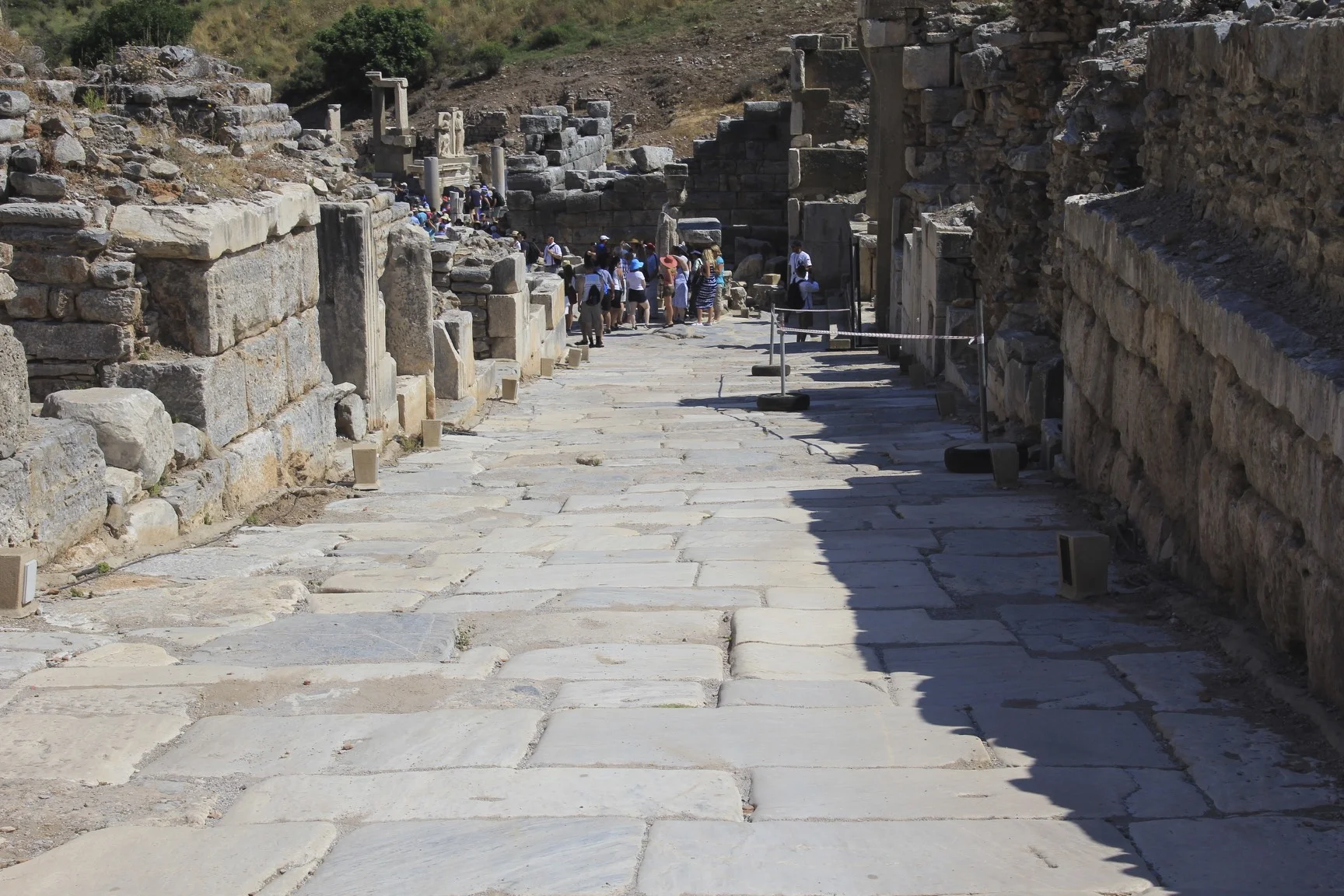
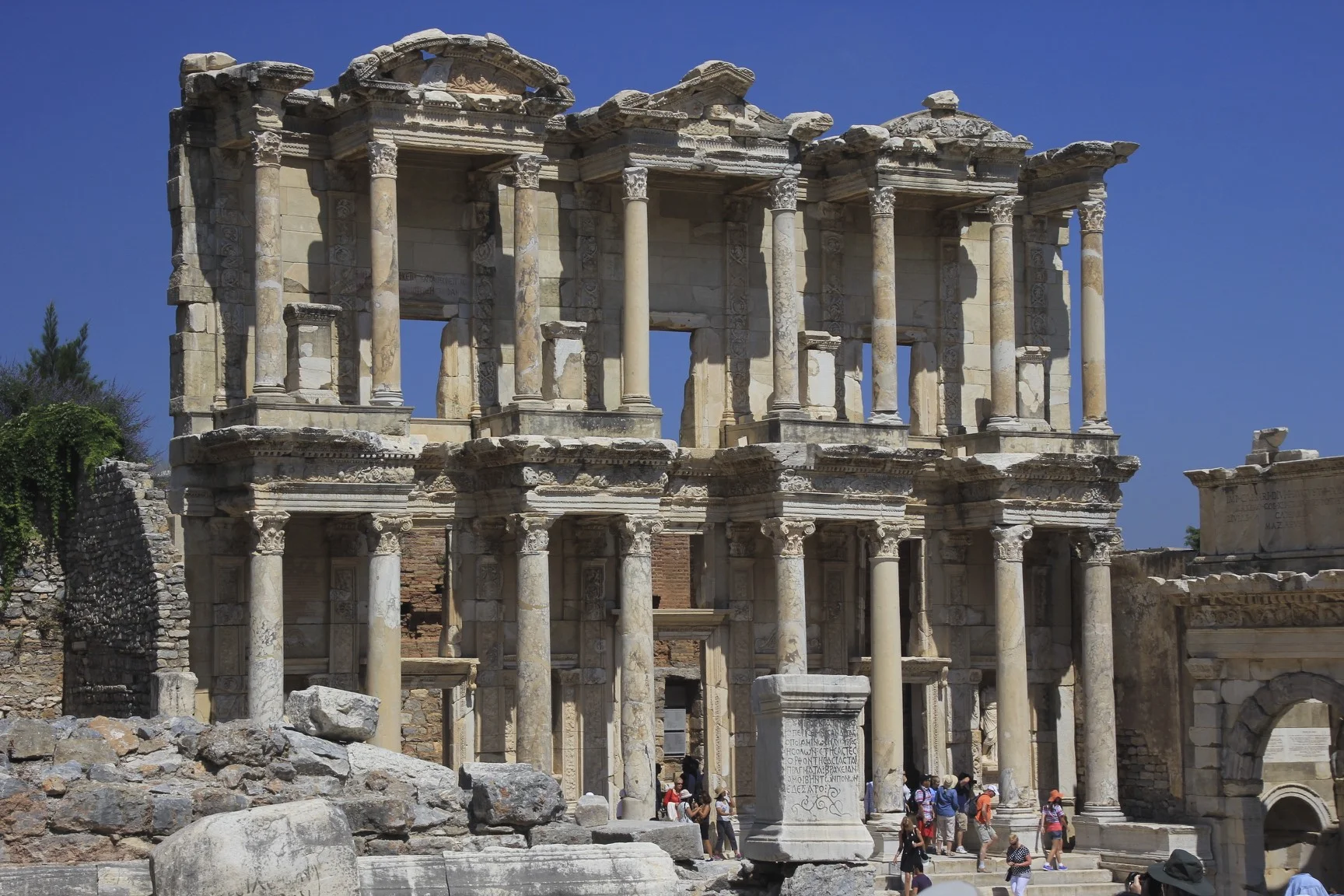
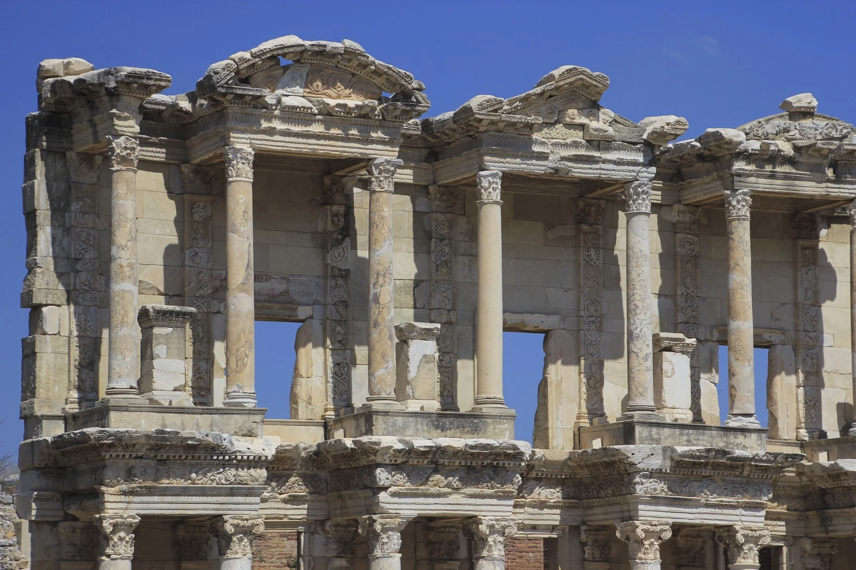
Ephesus, the old port of the Romans


Mt. Kailash, Simikot to Kailash in Tibet Photos
The 6,714m high Mt. Kailash raises above the Plane of Burang and has is the world's most holy place at the same time that it is the least visited. Hindus believe Mt.Kailash to be the abode of Lord Shiva. The Jains call the mountain Astapada and believe it to be the place where Rishaba, the first of the twenty-four Tirthankaras attained liberation. Followers of Bon, Tibet's pre-Buddhist, shamanistic religion, call the mountain Tise and believe it to be the seat of the Sky Goddess Sipaimen. The Buddha is believed to have magically visited Kailash in the 5th century BC. Tibetan Buddhists call the mountain Kang Rimpoche, the 'Precious One of Glacial Snow', and regard it as the dwelling place of Demchog and his consort, Dorje Phagmo. Three hills rising near Kang Rimpoche are believed to be the homes of the the Bodhisatvas Manjushri, Vajrapani, and Avalokiteshvara.


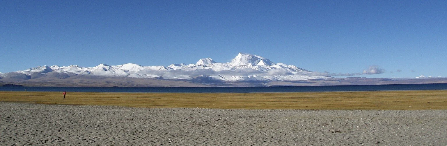
Mt. Kailash, the mountains in the border of Nepal/India/China and Gurla Mandata

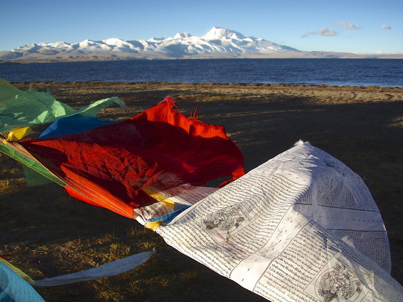
Lake Manasarovar and Mt. Gurla Mandata

Swayambhunath or "The Monkey Temple" in Kathmandu
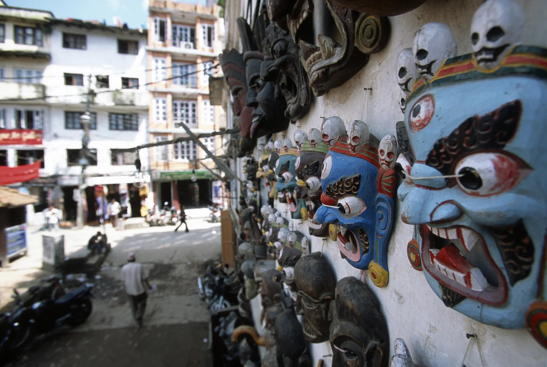

Human skull at the Kathmandu market

Swayambhunath or The Monkey Temple in Kathmandu

Kathmandu

Swayambhunath or The Monkey Temple in Kathmandu

In the Tibetan part of Kathmandu

Swayambhunath or The Monkey Temple in Kathmandu

Nepalganj

Flying to Simikot


Simikot dirt airstrip

Simikot

The start of the trail to China from Simikot

Western Nepal - a village close to Simikot


The distinct look of people from Western Nepal


Salt traders - little goats carry bags with salt from Tibet


The traders use horses and mules for their trade with Tibet

Navigating steep trails can be difficult for the mules

Hospitality along the trail

Smoking a traditional pipe

Smoking something stronger than the traditional pipe


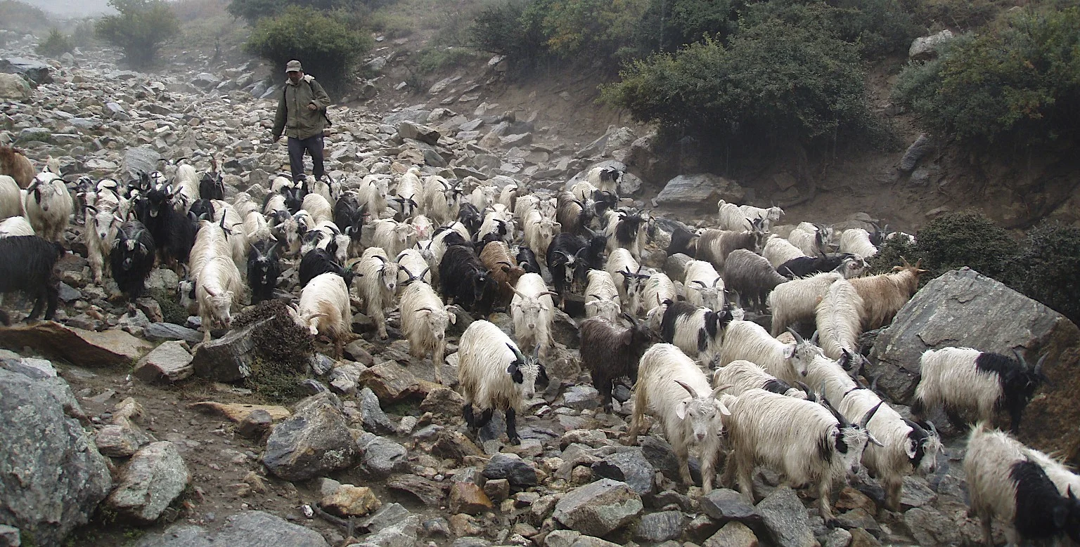
Goat herder


At the military checkpost - we are approaching the border area close to China


Dinner time - it was very wet and cold. We were all very appreciative of little heat.

We had wet and cold conditions. Also muddy!


The approach to the Nara La Pass, the mud and rain turned into snow and ice.


Top of the pass - wideout and blowing wind

Nara La Pass 4,507m - the last pass in Nepal. The traders use Yaks to transport goods from Tibet to Nepal

Nara La Pass 4,507m and the caravan of yaks returning from Tibet.


We arrived in Hilsa cold and wet.


Descent from Nara La Pass 4,507m to Hilsa, the border outpost in Nepal

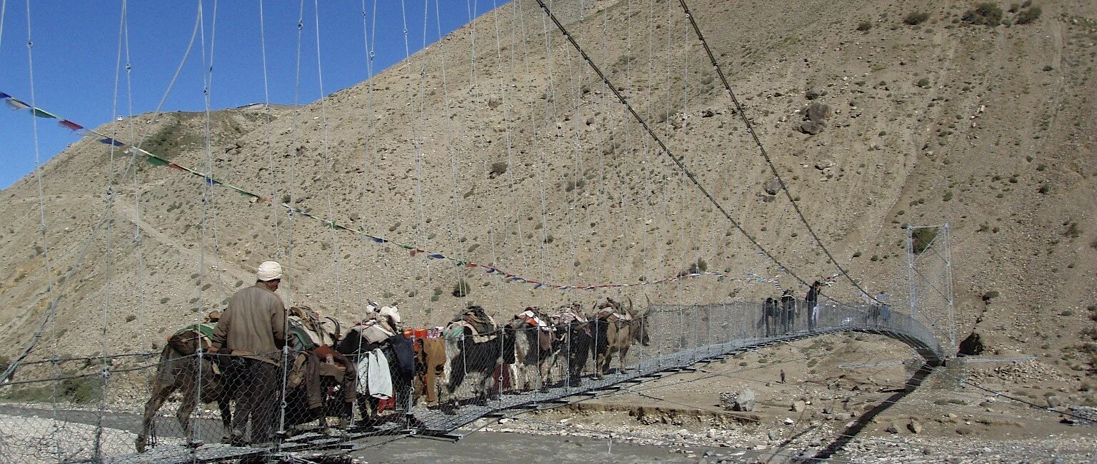
Hilsa and the bridge to China

Bridge to China

Local porters lining up for work with Indian pilgrims.

Tibetan roads back then. The road from Hilsa to Burang.


The Himalayas on the border of Nepal, India and China


An old stupa and the Himalayas on the border with Nepal, India and China

Dhaulagari 6,838m in Western Nepal on the border of Nepal, China and India

Jokopahar 6,744m in Western Nepal on the broder of Nepal, Tibet and India

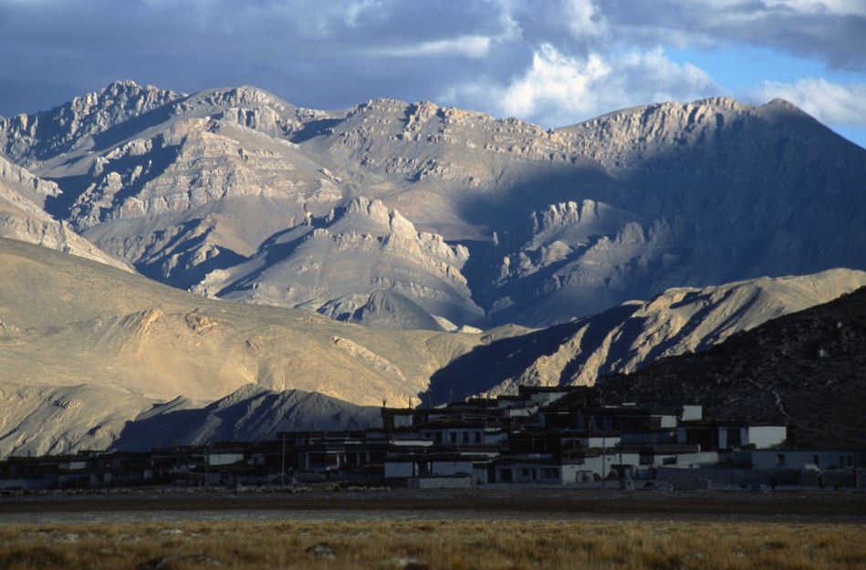
The Chinese outpost of Burang

Gurla Mandata

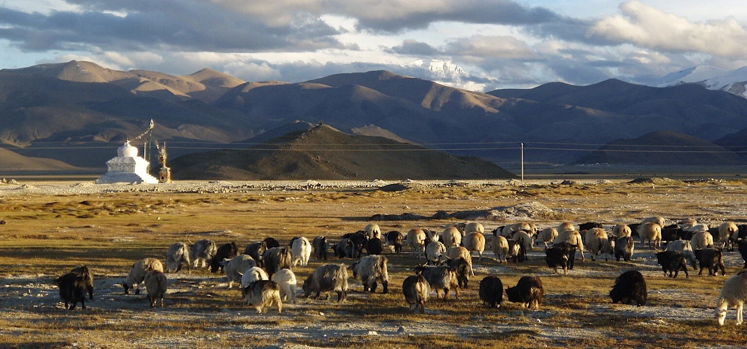
Lake Rakshastal at 4,590m which is connected to Lake Manasarovar

Lake Rakshastal at 4,590m which is connected to Lake Manasarovar


Lake Manasarovar at 4,590m. According to the Hindus, the lake was first created in the mind of the Lord Brahma after which he manifested on Earth.

Lake Manasarovar. The Buddhists beleive that this is where the Lord Buddha was conceived. The lake has a few monasteries on its shores, the most famous is the ancient Chiu Gompa built on a steep hill overlooking the lake. Swimming in the lake is supposed to wash away all the sins. Many Indian pilgrims come to this lake to swim.

Lake Manasarovar and the barren hills of Tibet

Lake Manasarovar

The stupas and a lone guesthouse on the hills overlooking Lake Manasarovar


Chiu Gompa built in the 8th century.

Chiu Gompa


Chiu Gompa - the main gate


Chiu Pompa


Prayer flags above the Chiu Gompa.

The solitary monk at the Chiu Gompa who showed us around.

Inside the Chiu Gompa

The view from Chiu Gompa. Mt Kailash was in the clouds.


The view of the Lake Mansowar from Chiu Gompa


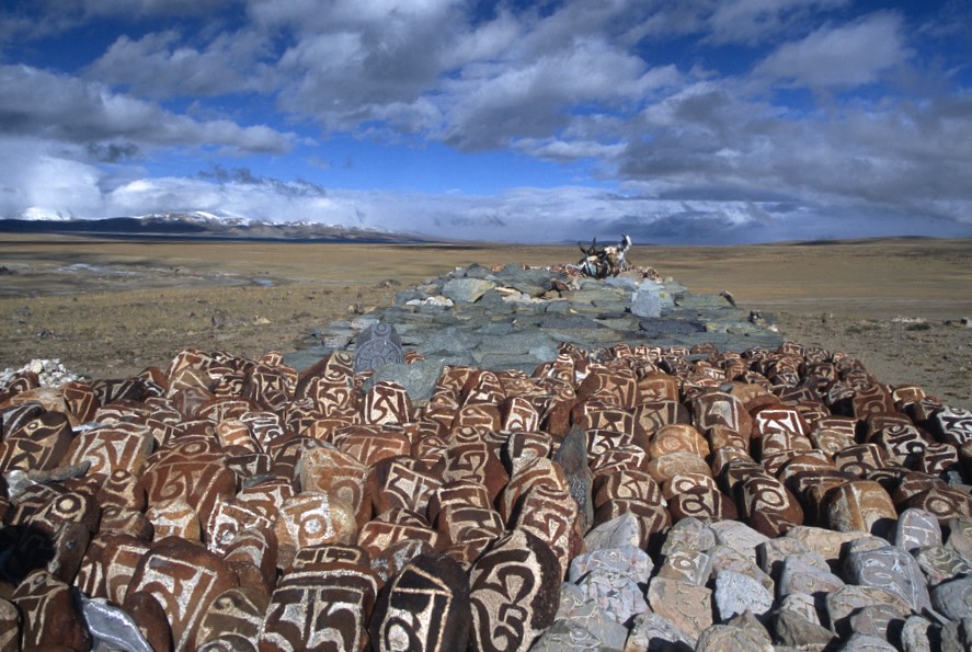
The stupas overlooking Lake Manasarovar. The stones have inscriptions of Buddhist prayers (they are called Mani Stones). The yak horns are also carved with prayer inscriptions (Om Mani Padme Hum).

Mani stones on the shore of Lake Marasoravar

Prayer wheels


An old prayer wheel powered by wind blades. The silence is broken by the sound of the wind and the squeaks of the wind-powered prayer wheel. For one of the holiest places on Earth it had a very remote and secluded feel.

The symbol of Tibetan Buddhism. Emptiness and the wind.
Endless horizons


The endless horizon of Western Tibet - a very special place - Nanda Devi is very close. It is another holy mountain located on the Indian side of the range.


Our camp at Lake Mansowar

Gurla Mandata

Darchen

Darchen and our hotel.

The ceremonial area of Mt. Kailash.


Mt. Kailash. A place where the sky burial ceremonies are performed. A sky burial is a dismemberment of a dead body with knifes and feeding it to the vultures. In this part of Tibet, there is no wood to burn the dead.

Mt. Kailash on the right. The beginning of the outer Kora.

One of a few monasteries dotting Mt. Kailash.

Mount Kailash, the western flank.

Mt. Kailash - western flank. It has these unreal rock formations.


The yaks carrying supplies to the monastery at the back side (north) of Mt. Kailash.


A tea house on the Kora of Mt. Kailash.


Om Mani Padme Hum - approaching the north side of Mt. Kailash

The Dirapuk Monastery at the north side of Mt. Kailash.

Mount Kailash north side

At the Dirapuk monastery at the north side of Mount Kailash at 5,080m.


At the Dirapuk Monastery, a typical western Tibetan attire and facial features of the Tibetan Khampa (nomad).

Young monks at the Dirapuk Monastery


North/North east side of Mount Kailash at sunrise

Mt. Kailash - north east face

The north face of Mt. Kailash

Last view of Mt. Kailash from the north

Along the Kora of Mt. Kailash


Mt Kailash in the distance

At the Lake Mansowar


Roads in western Tbet back then...We had many flat tires.

Gurla Mandata

The North face of Mt. Kailash

The plane of Burang and the Gurla Mandata massif

A Tibetan monk on the Mt. Kailash kora

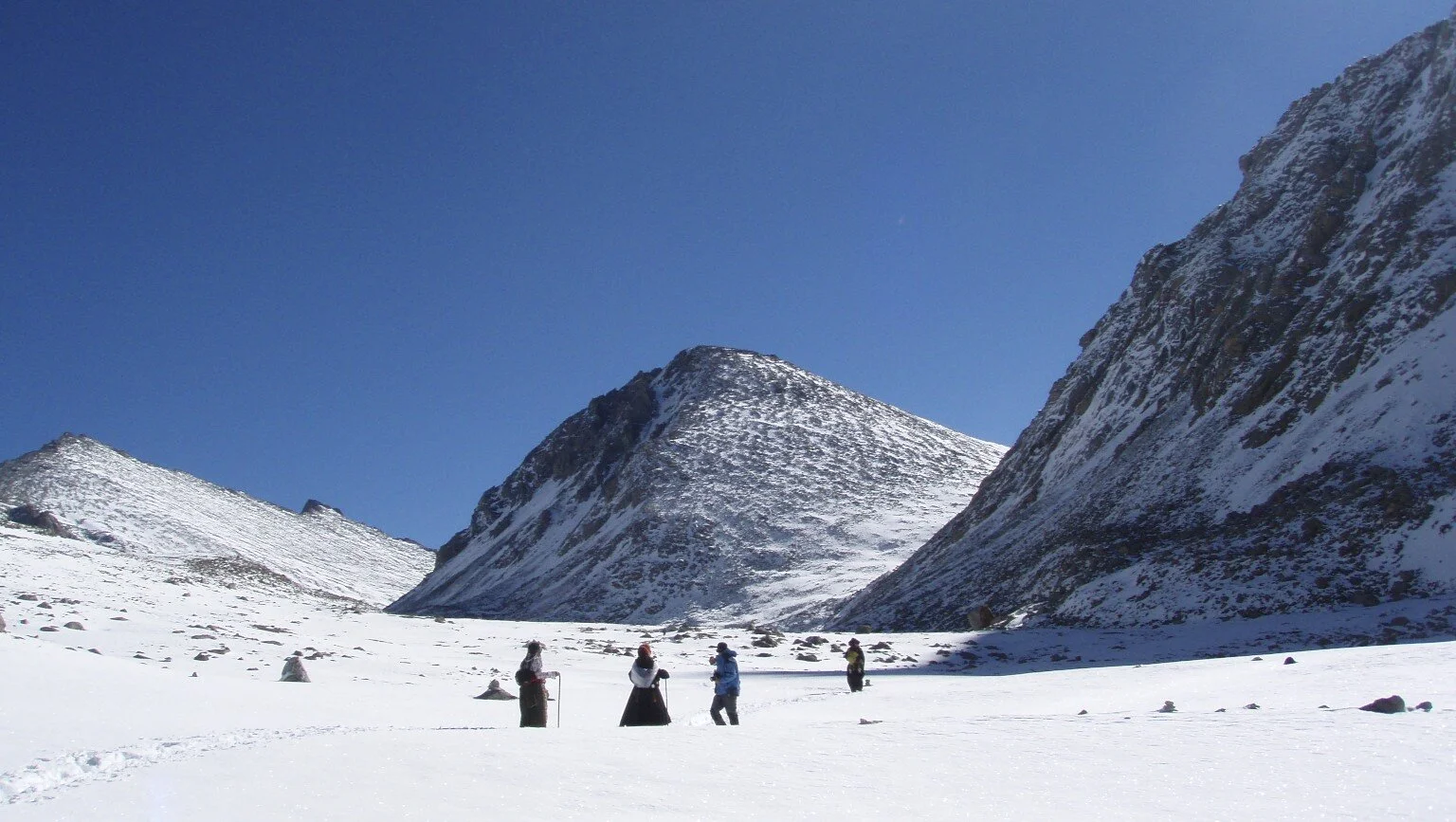
A Tibetan monk/pilgrim approaching the Dolma La Pass at 5,648m

Tibetan pilgrims on the kora of Mt. Kailash

The view of the Langtang Range from Tibet near Lake Paiku Tso

Old Tingri close to Cho Oyu
Tibet


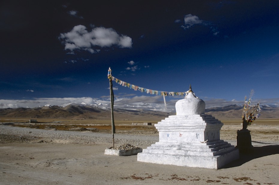
Burang, Tibet

Burang, Tibet

Darchen, Tibet. Mt. Kailash in the distance.

Darchen, Tibet

Darchen, Tibet. Gurla Mandata is in the distance.
Lake Mansowar and Gurla Mandata

Pit stop by Lake Mansowar.

Close to Mt. Kailash on the Plane of Burang.
Plane of Burang and Girl Mandata

In Western Tibet

Western Tibet


The Langtang Range from the Tibetan side. The large mountain on the left is Gang Beng Chen 7,281m

Pilgrims on the way to Mt. Kailash


Near Tingri


Everest Basecamp area in Tibet
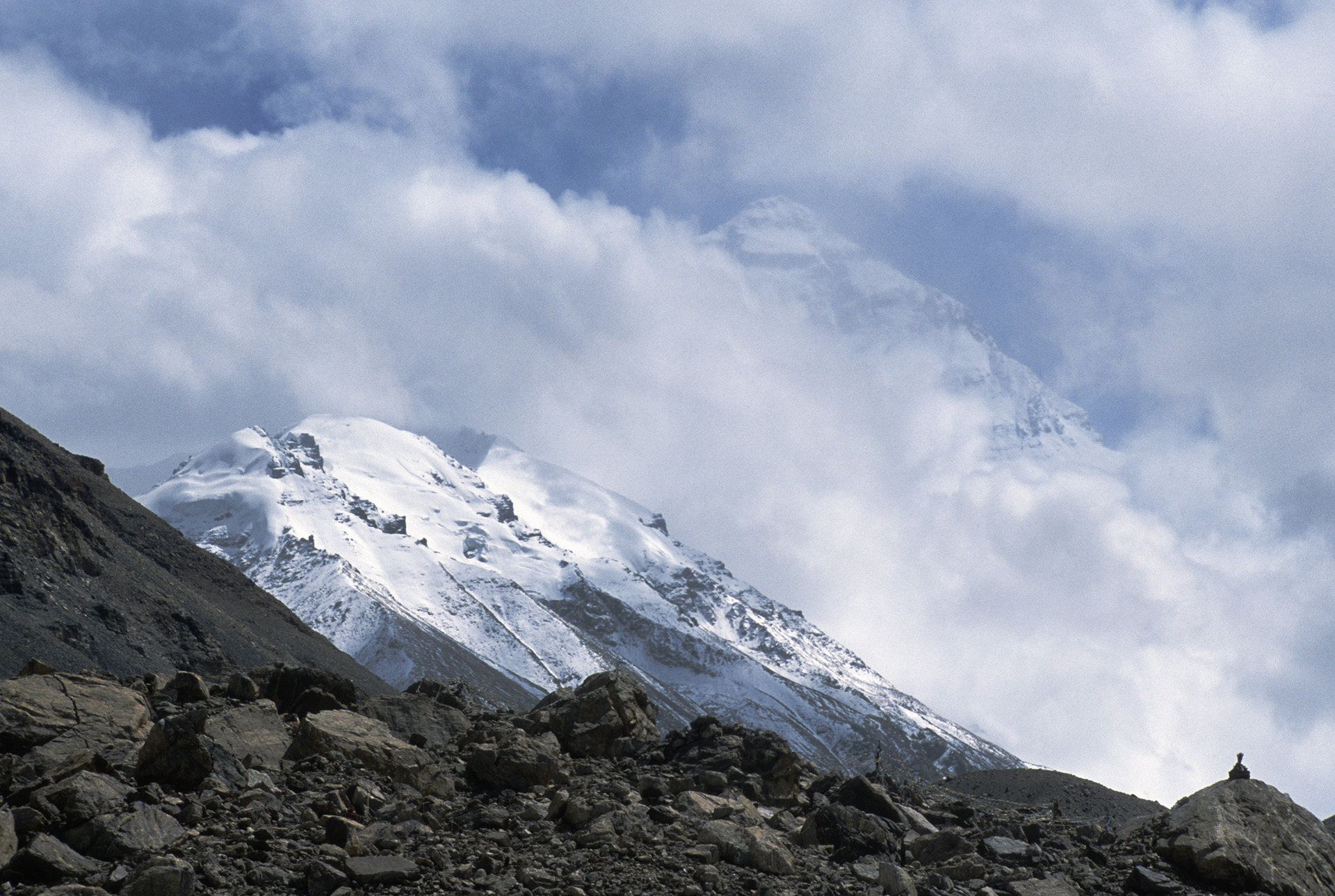
Mt. Everest

The Chinese side of Everest

Old mediation caves close to Everest

Old meditation cave close to the Rongbuk Monastery


Rongbuk Monastery on the north side of Mt. Everest


Rongbuk Monastery

Rongbuk Monastery close to North side of Everest


North of Shishapangma


Mt. Everest from Tibet


Approaching the Langtang Range

Gang Beng Chen 7281m and the Tibetan Plateau


Somewhere north of the Nepal Mustang


The Himalaya Range from the Tibetan Plateau. The mountains on the horizon are the Domodar Himal close to Mustang in Nepal.

The Dolpo Himalaya seen from Tibet

The Himalaya from Tibet


Gurla Mandata and Lake Manasovar

Gurla Mandata


Mt. Kailash and the Plain of Burang

The Pass between Nepal and Tibet along the Friendship Highway


Mt. Kailash

Mt. Kailash

Lake Mansovar


Lake Mansovar


Gurla Mandata

On the way to north side of Everest


Close to Cho Oyu

The Langtang Range from Tibet


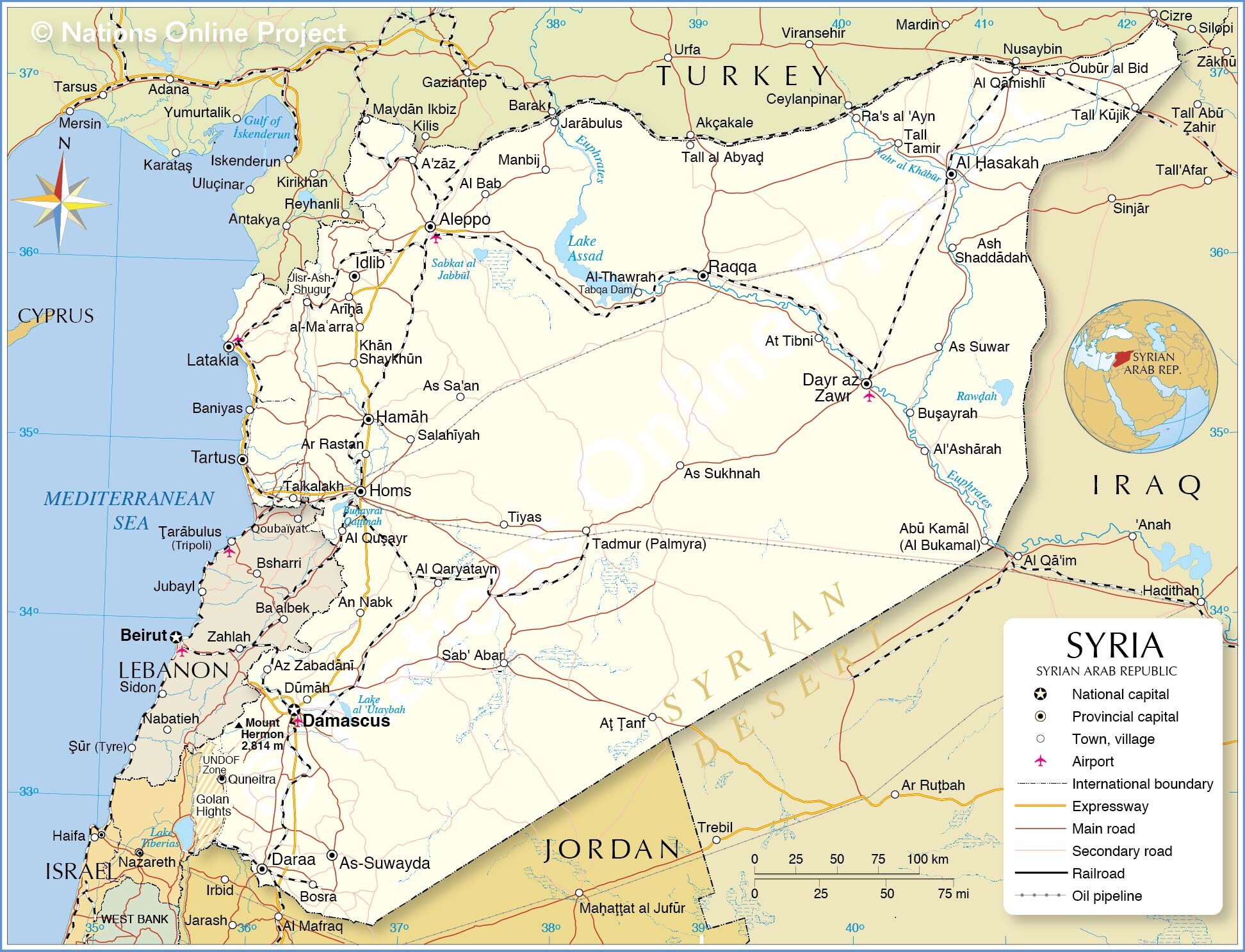
Syria


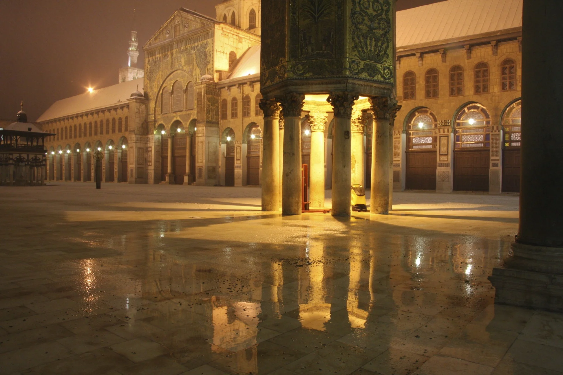
Umayyad Mosque in Damascus

Umayyad Mosque in Damascus

Umayyad Mosque in Dmascus


The Souq of Damascus

Umayyad Mosque

Umayyad Mosque


The place where the head of John the Baptist is held, inside the Umayyad Mosque. Built in the year 706 on the site of early Christian temple dedicated to John the Baptist.

Umayyad Mosque

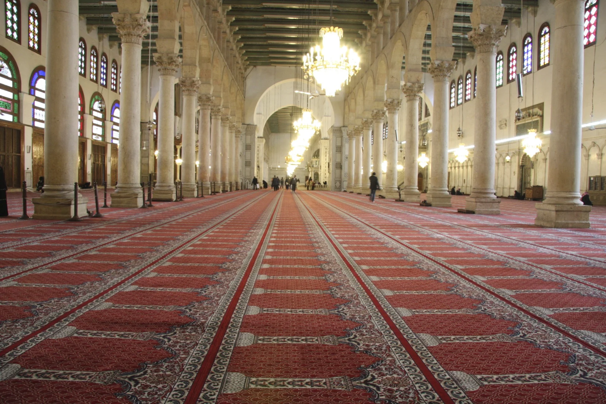
Umayyad Mosque


The souq of Damascus


Damascus


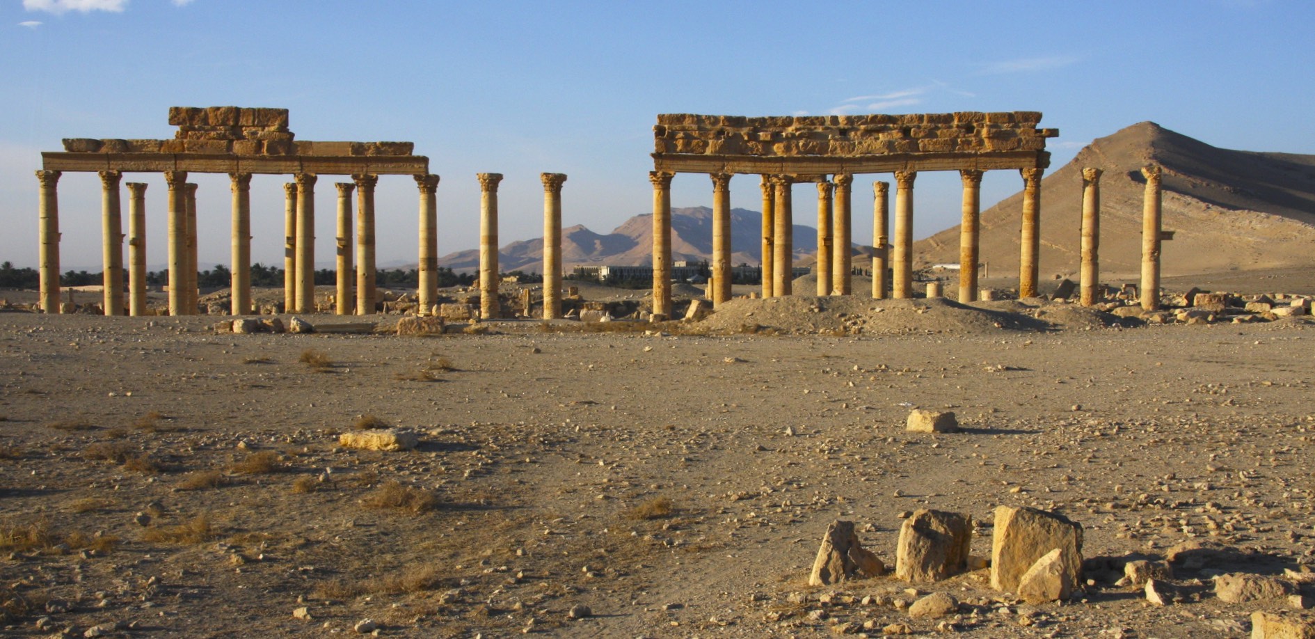
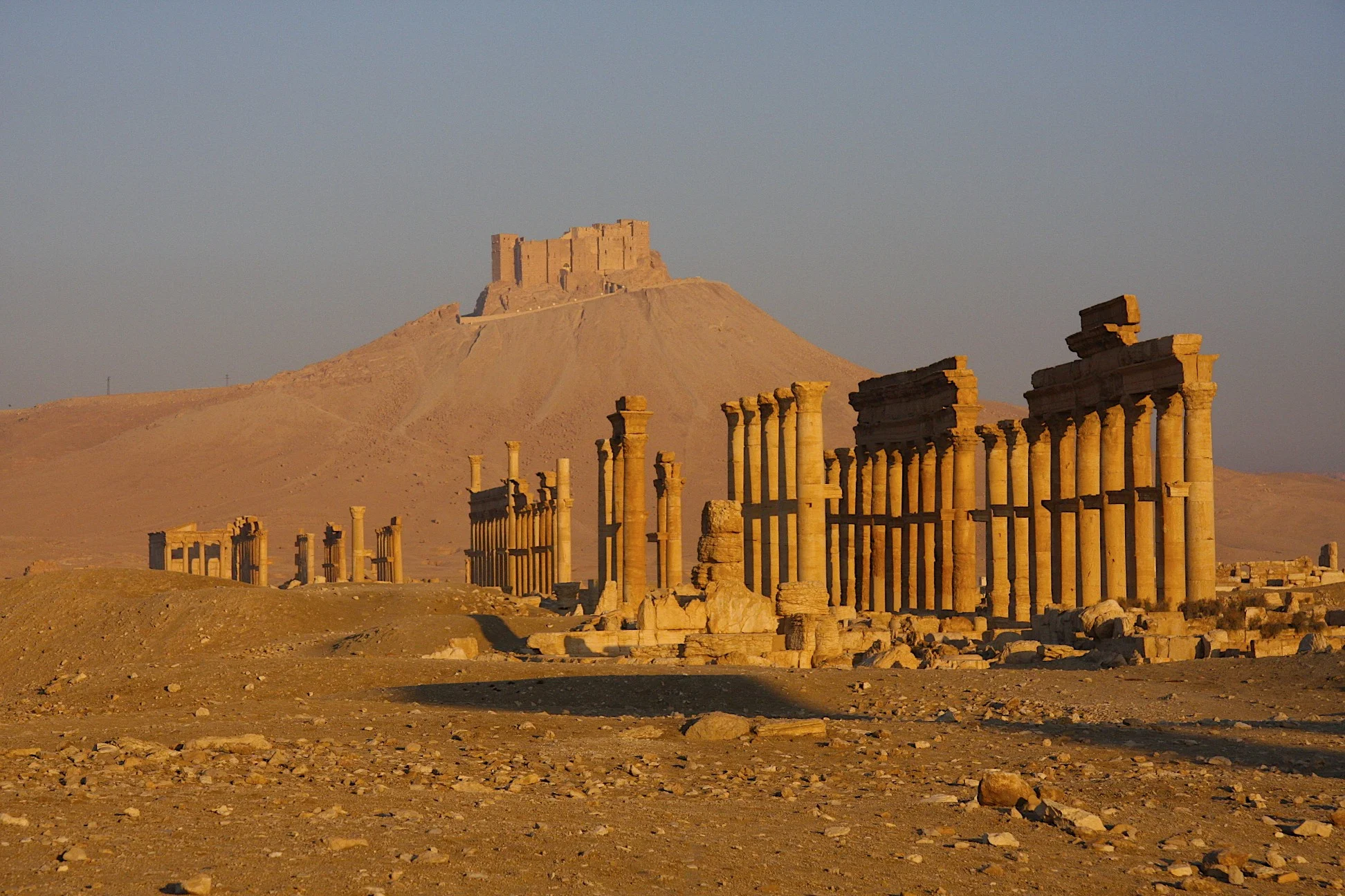
Palmyra - the ancient Silk Road city

Palmyra

The citadel of Palmyra


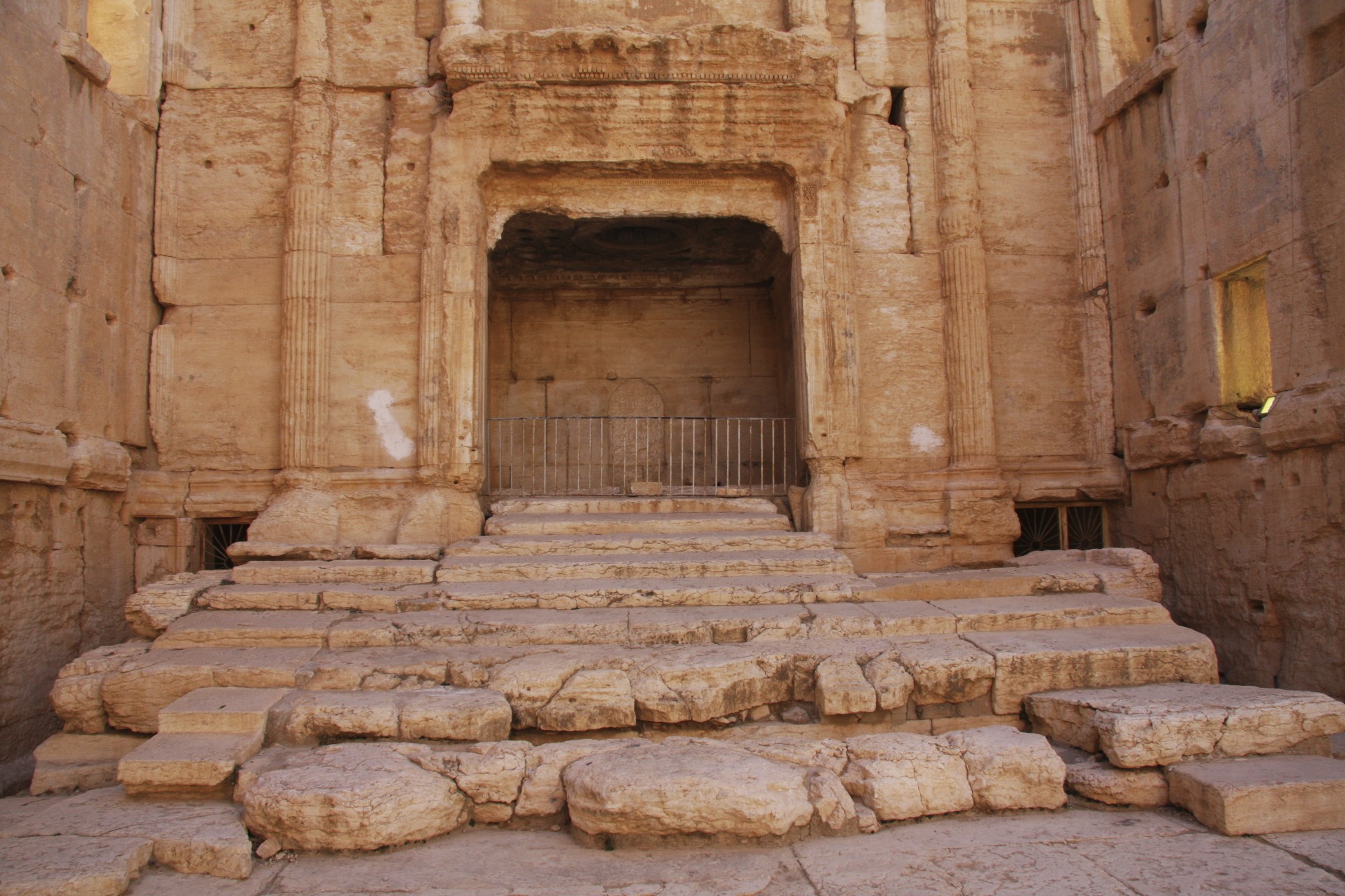
The Temple of Bel built in 32 AD

The Temple of Bel

The Temple of Bel built in 32 AD and destroyed in 2015


Arch of Triumph destroyed in 2015


Palmyra Theatre destroyed in 2015


The Baths of Diocletian


Valley of Tombs


Crusader's castle Crack de Chavalier


Some of the oldest Christian churches in the world are in Syria. Some were built during the times of the apostles.


The ancient Roman city of Bosra


The Roman theatre built in year 150 AD


The ancient Roman City of Apamea established in 300 BC.

Roman city of Apamea

The great colonnade built in 300BC.


Aleppo


The Aleppo Citadel


Aleppo


The Great Mosque of Aleppo built in the year 717. The minaret was built in the year 1090. It was destroyed recently.


The souq of Aleppo.

The souq of Aleppo.


Inside one of the old Roman houses.