Near Puerto Chacabuco
Near Puerto Chacabuco
Punta Arenas
Valparaiso


Near Puerto Chacabuco

Near Puerto Chacabuco


Punta Arenas


Valparaiso


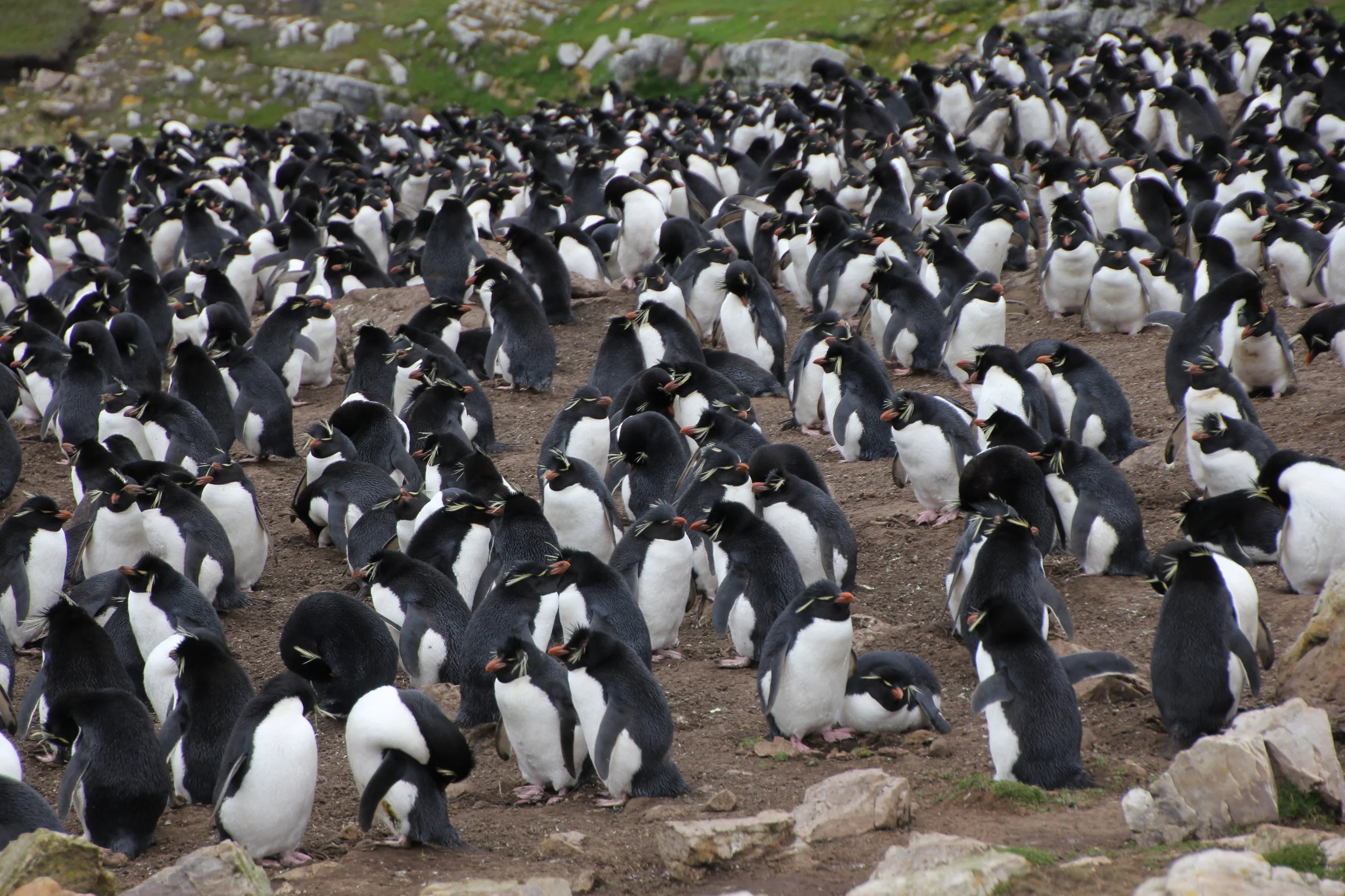
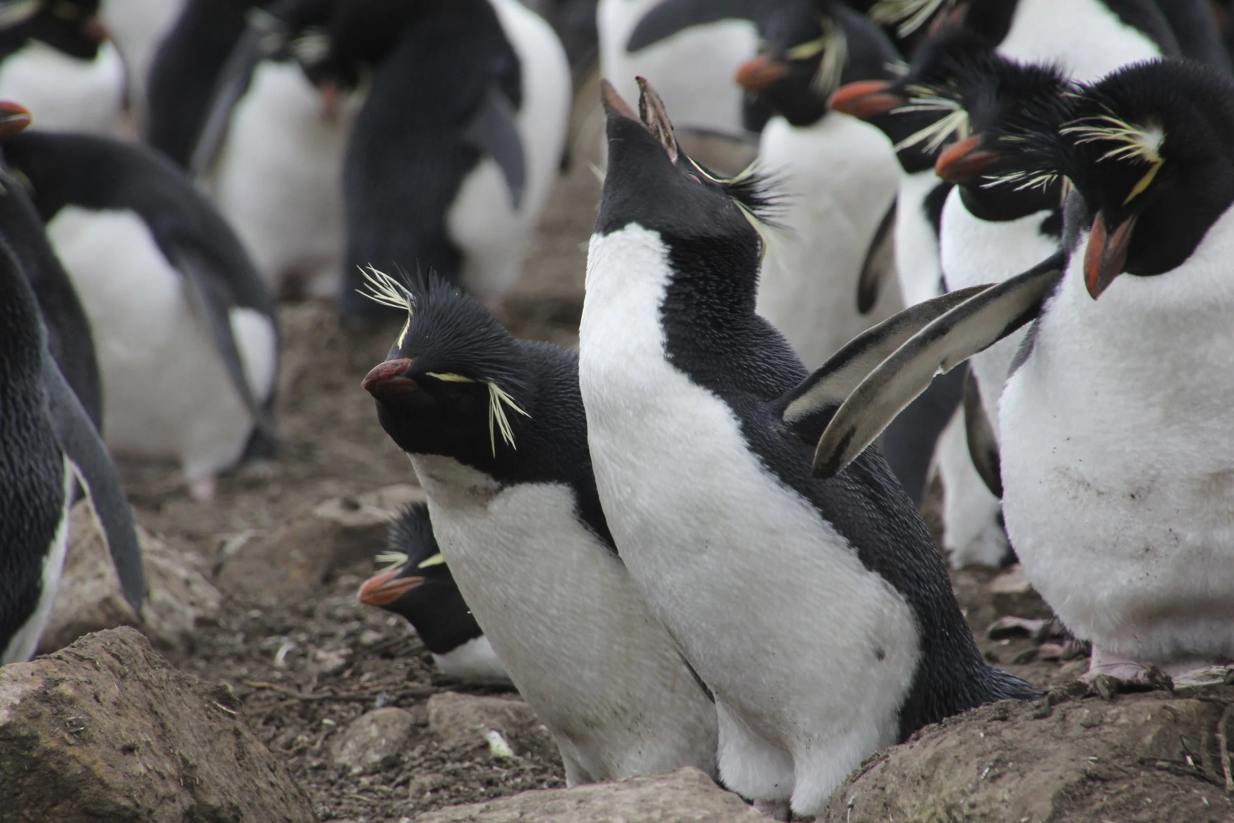


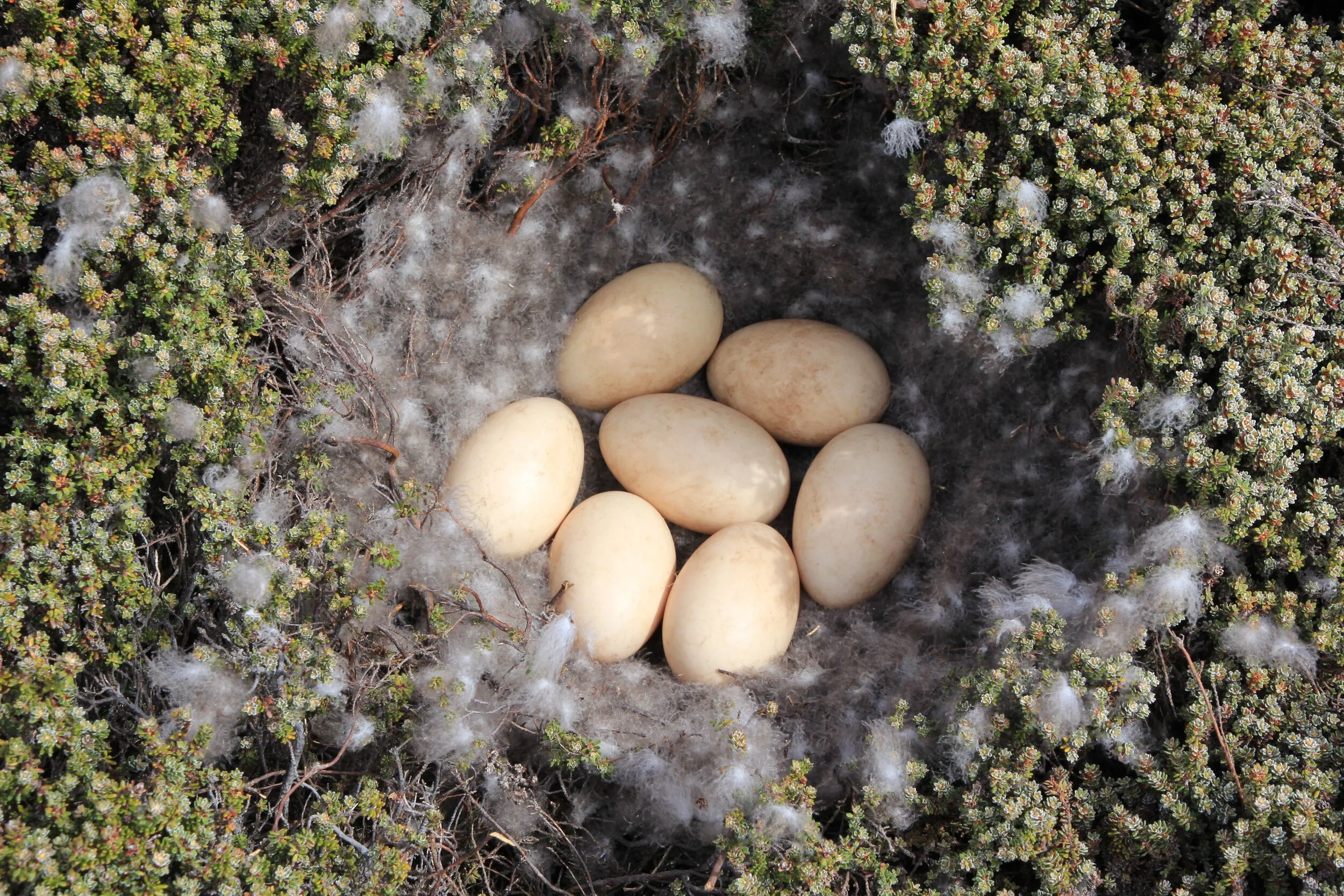


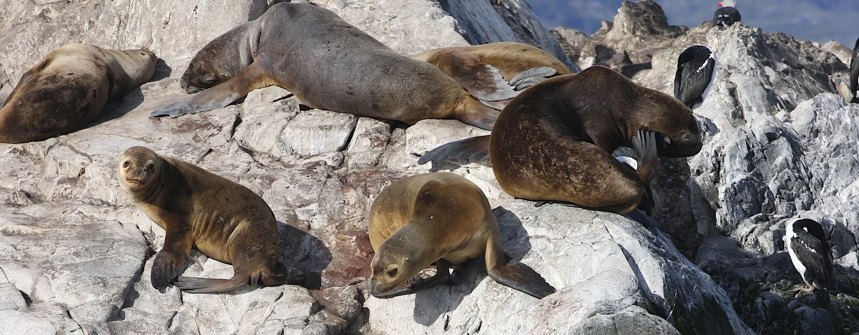
In 1833, during the voyage of the HMS Beagle, Charles Darwin found himself in a corner of the world he didn’t particularly care for, an archipelago near the southern tip of South America called the Falkland Islands, whose windswept moorlands he described as “desolate and wretched.” The local birdlife didn’t help matters. An unusual species of falcon seemed to derive pleasure from tormenting him and the ship’s crew. “A large black glazed hat was carried nearly a mile, as was a pair of the heavy balls used in catching cattle,” Darwin wrote of the avian thieves, “and a small Kater’s compass in a red morocco leather case, which was never recovered.” Crew members complained about the birds’ “boldness and rapacity,” and a lookout was posted to prevent them from picking apart the ship’s rigging. Whalers who had visited the Falklands previously had likewise cursed the creatures as “flying devils” and “flying monkeys,” although science would ultimately settle on the name striated caracara, or, informally, Johnny rook. Outside Magazine


Darwin Range from the air

On the Southern Ocean

Our position on the Southern Ocean - crossing from the Falklands to the southern tip of South America

Our first sighting of South America

Southern Ocean
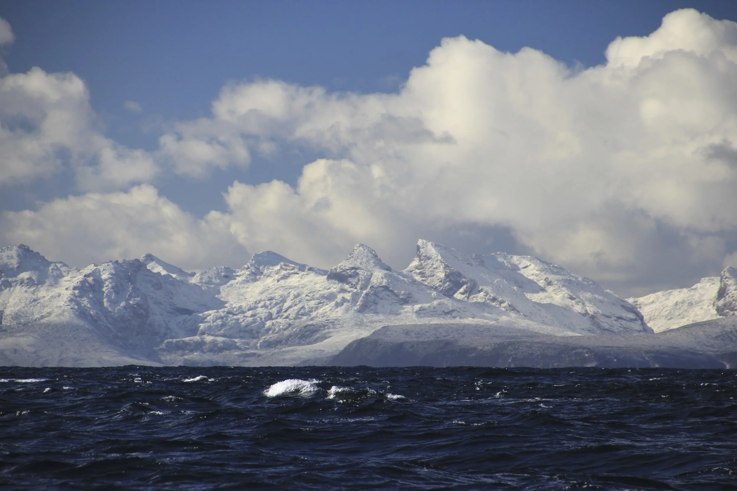
Southern tip of Patagonia


We are now in Patagonia!

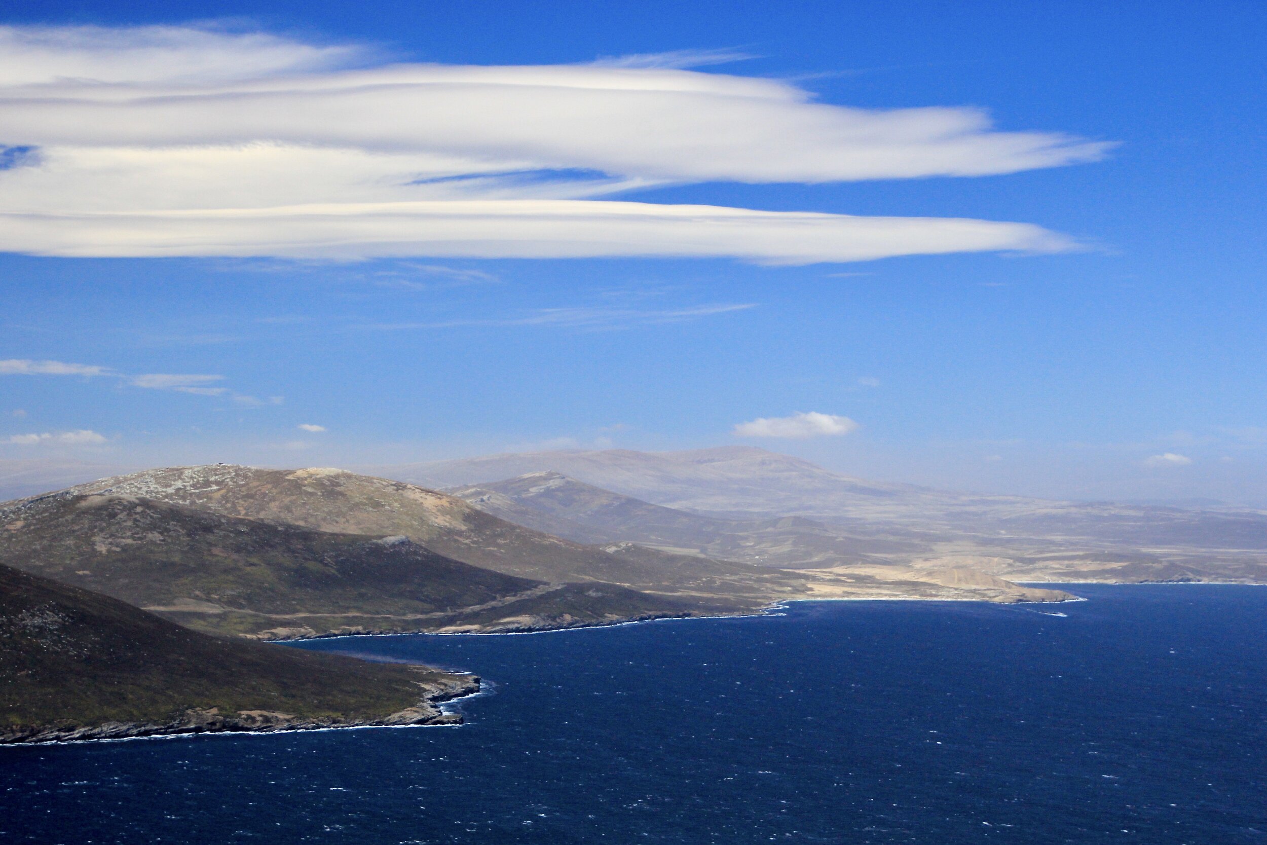
Chile - our destination is Puerto Williams

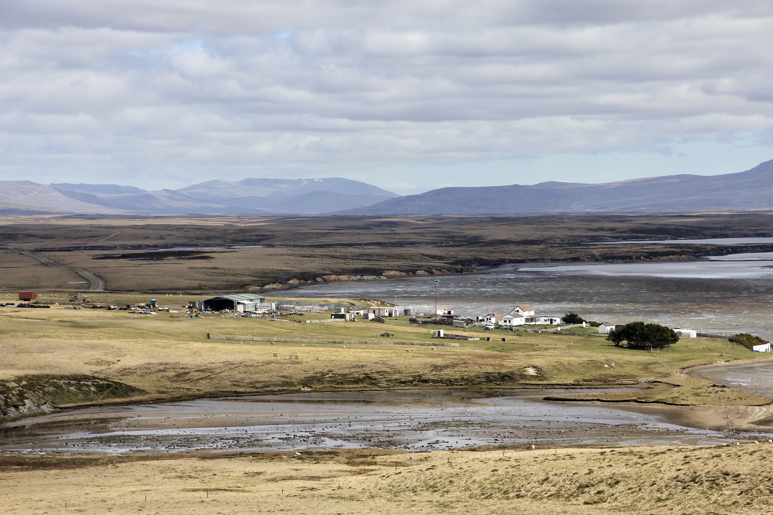
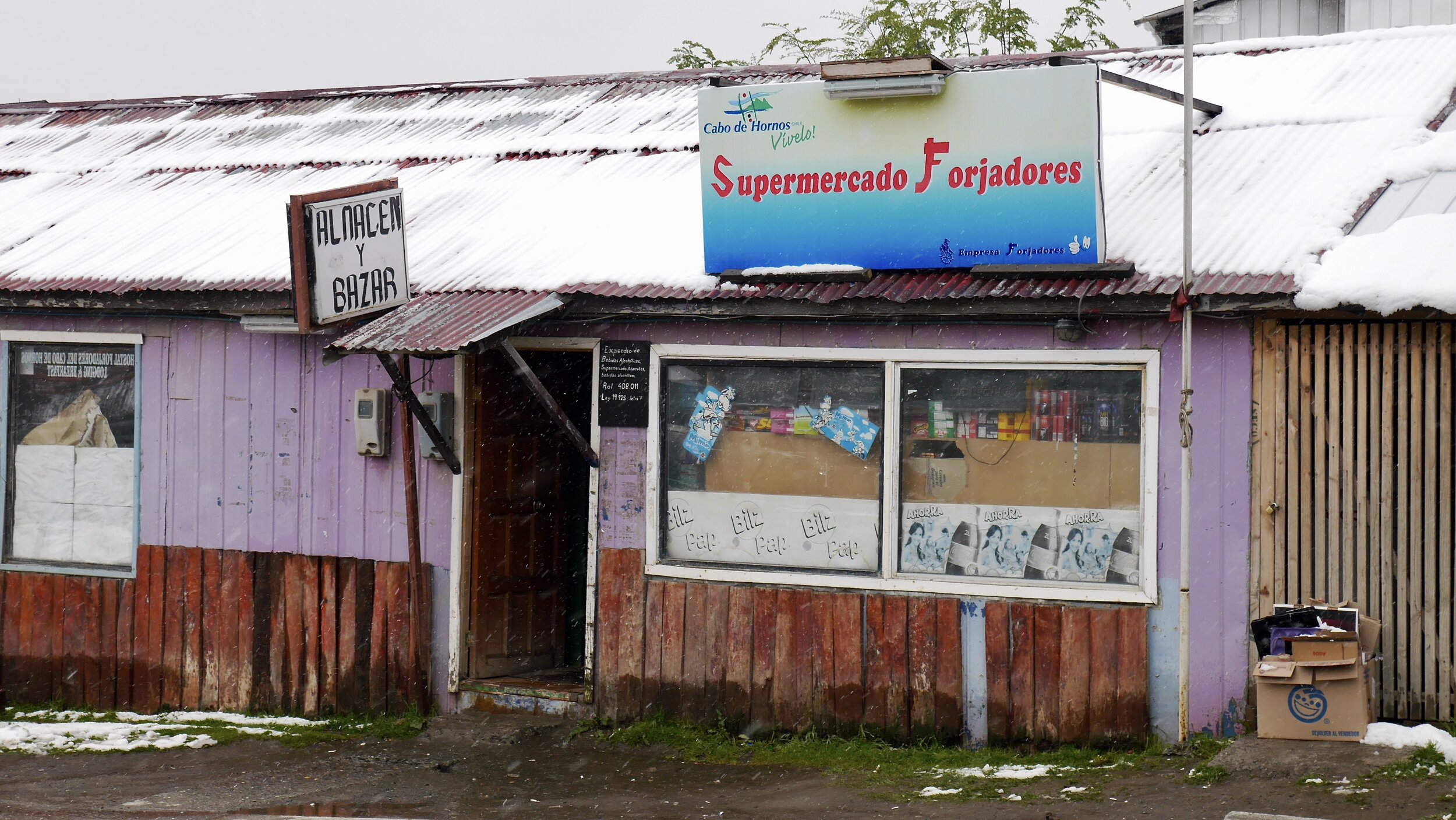
Puerto Williams is a small town at the end of the continent. In the early spring it is a little grim…

The Beagle Chanel
Puerto Williams vibes
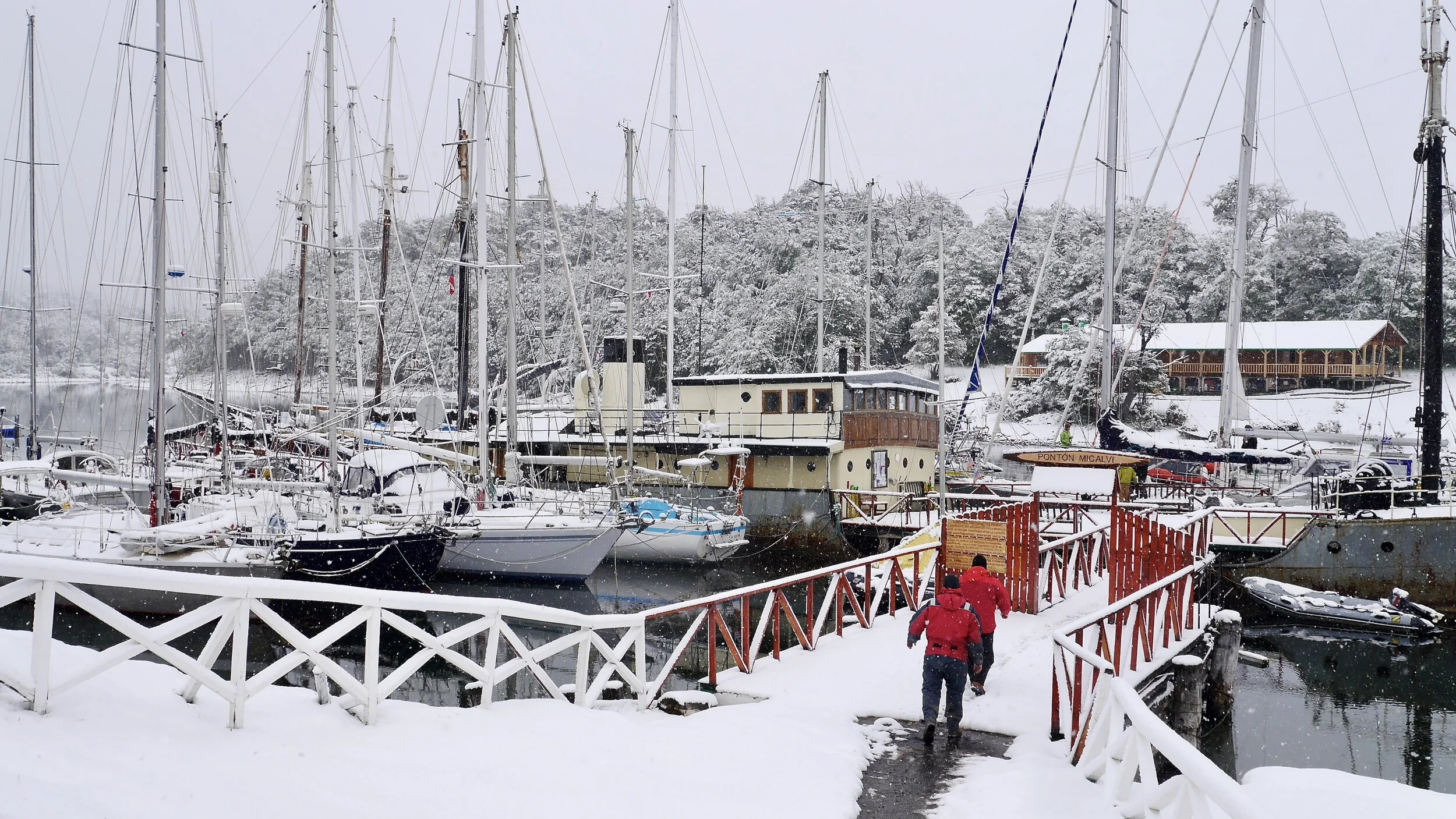
The famous marina of Puerto Williams. This is the staging marina for Cape Horn and Antarctica. Many famous yachts and sailors passed through this place over the decades.

The famous marina in Puerto Williams. We need to get the approval of the Chile Armada to proceed.


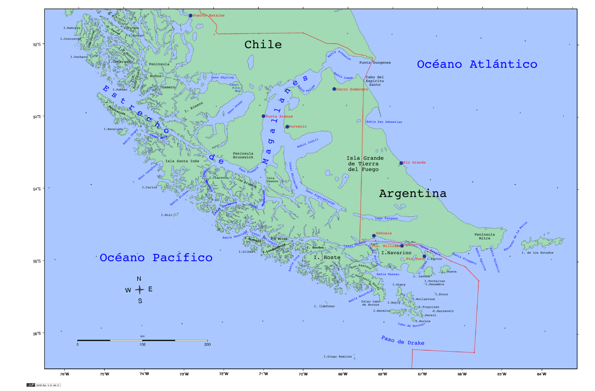
Planning our route through Tierra del Fuego. We would sail from Puerto Williams to Punta Arenas over two weeks stopping along the way for hikes and exploration.

I ended up sleeping and living on this shelf. It was literally in the living room of the boat so I had no privacy and could not linger. Furthermore it was rather tight as you can see. First class all the way!

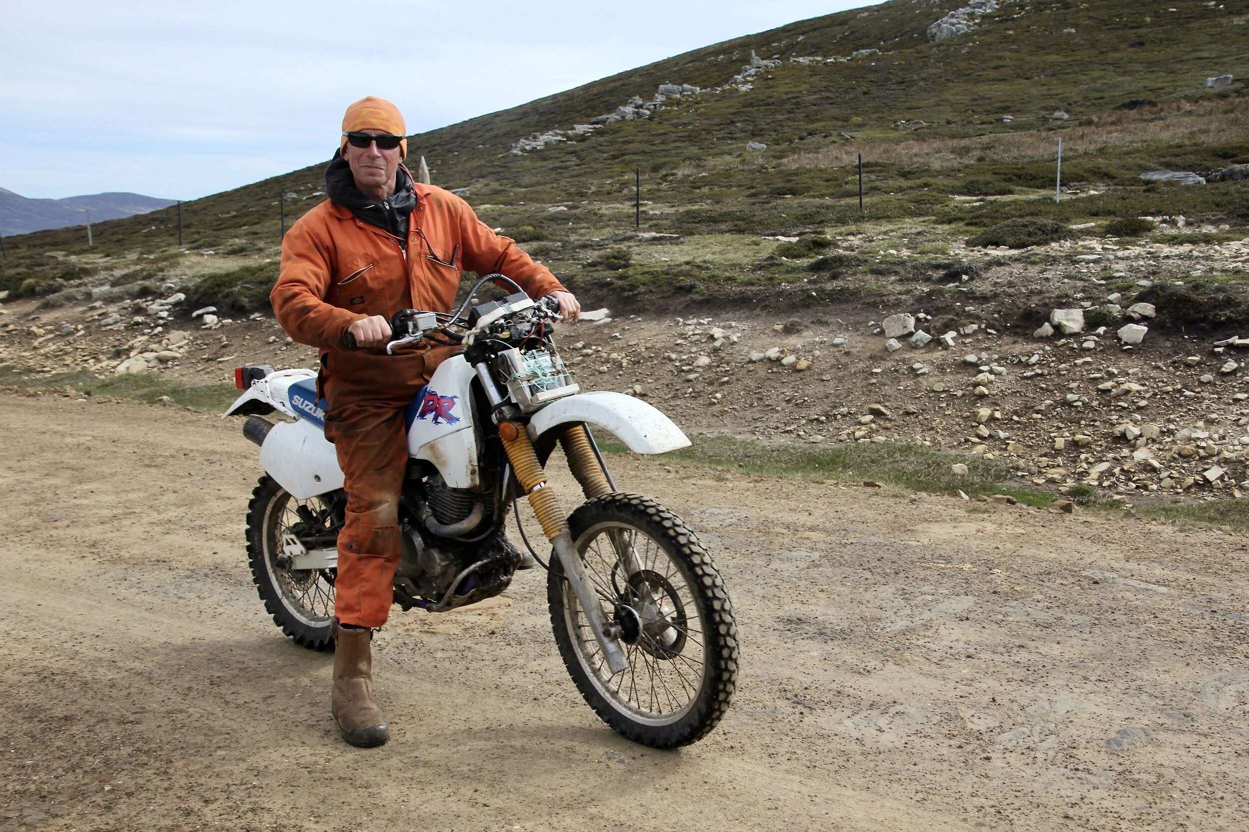
Trail to Los Dientes from Puerto Wiliams on Isla Navarino

Chilean fishermen in the wintery Beagle Chanel near Puerto Williams.

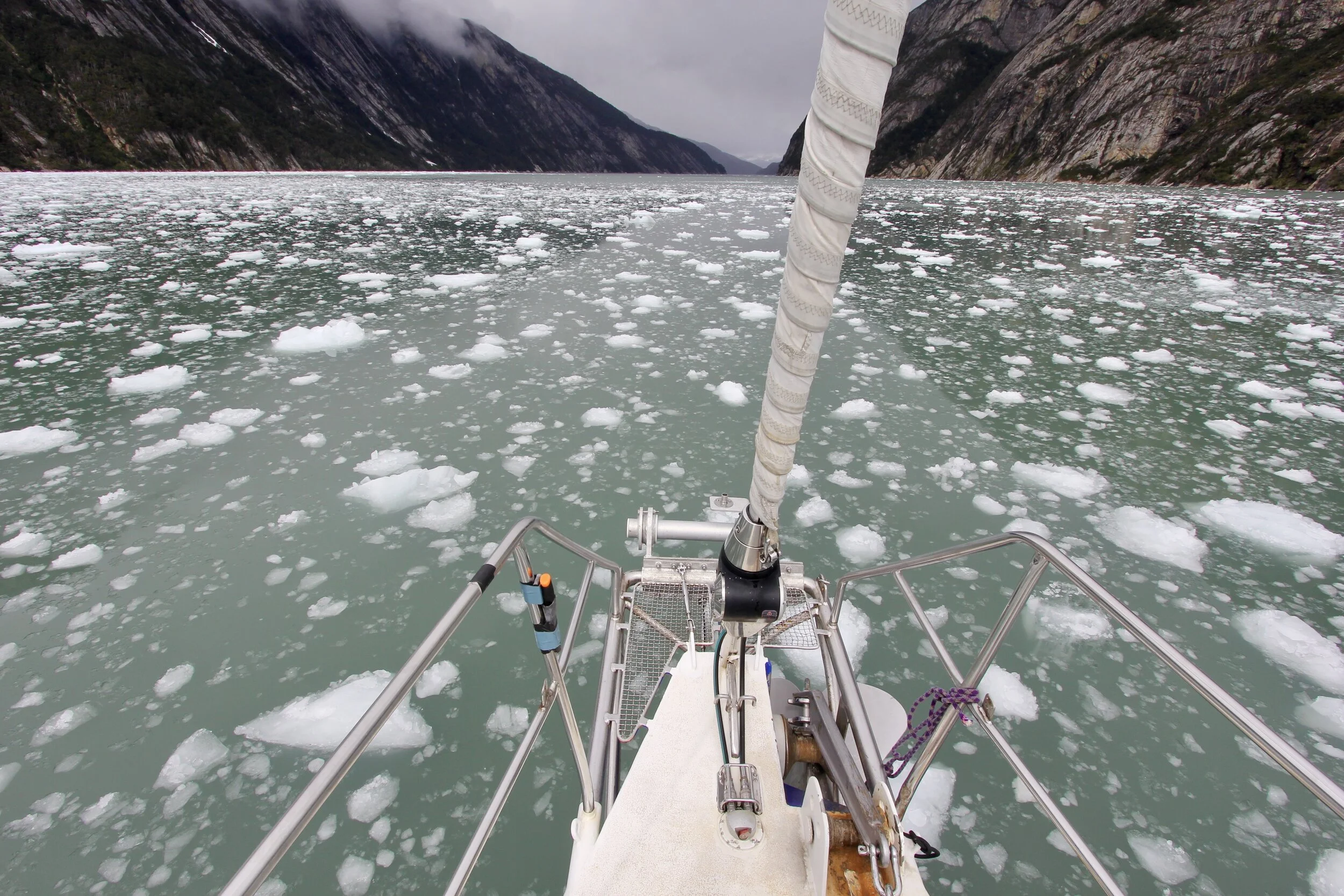
In the Beagle Chanel in Patagonia

Monte Frances. The mountains of Tierra del Fuego - wild and remote

Monte Bove 2,279m above Glacier Frances

Monte Frances 2,261m

Monte Frances 2,261m

An anchorage along the Beagle Channel


Glacier Holanda and Monte Frances 2,261m on the left

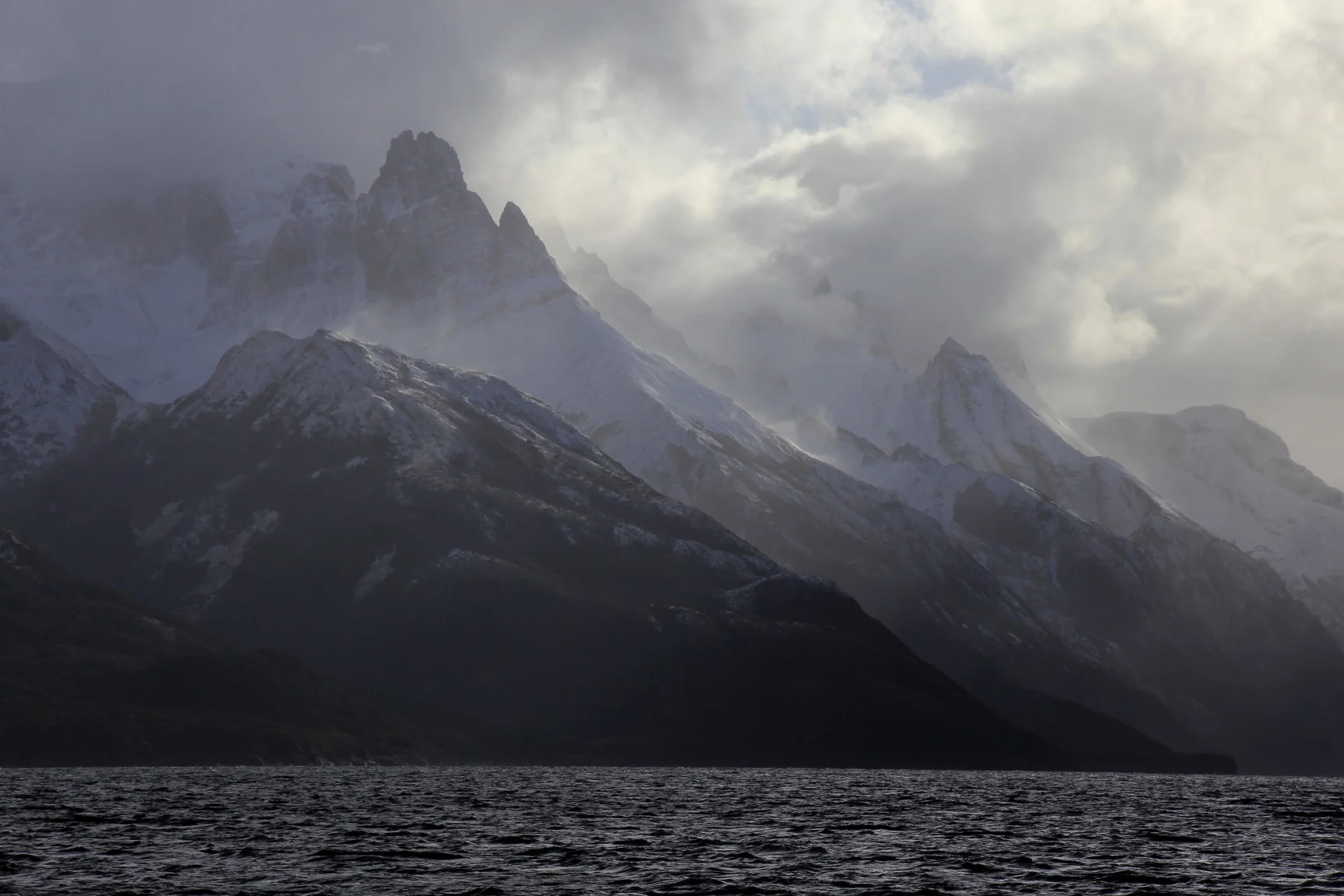
Tierra del Fuego, Patagonia

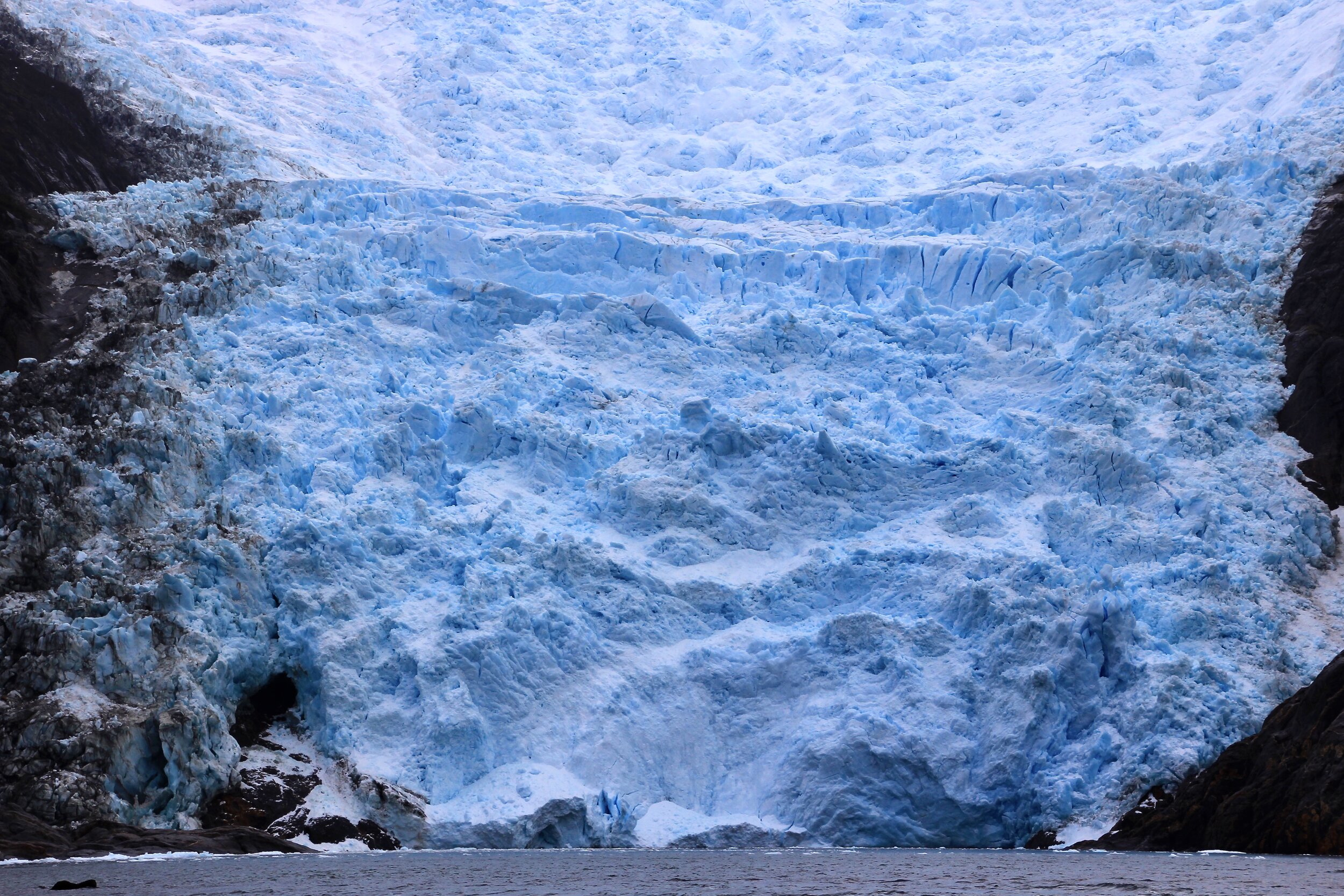
The glaciers of the Darwin Range on the Tierra del Fuego - Glacier Frances

Glacier Frances

Glacier Frances

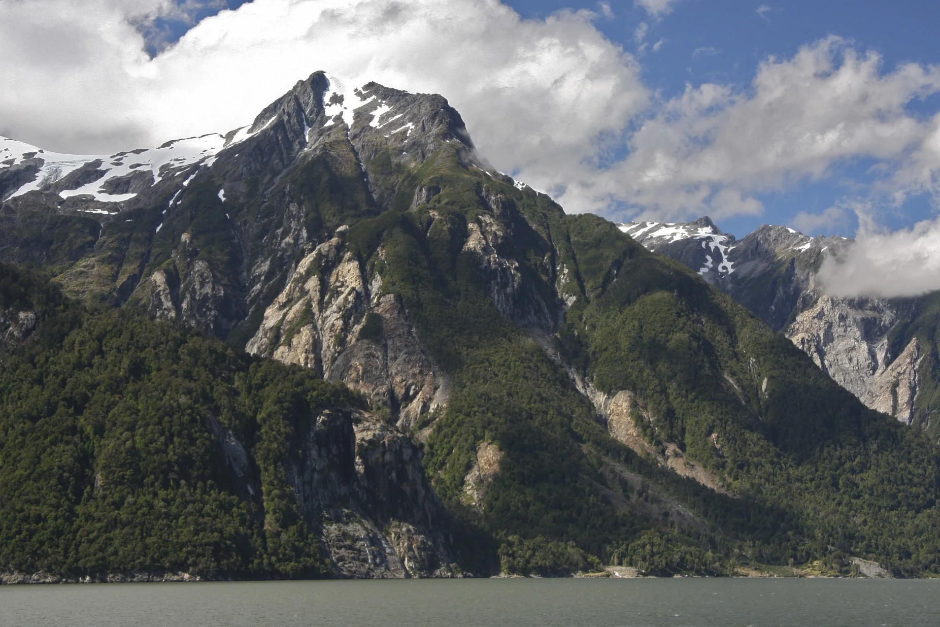
Darwin Range on the Tierra del Fuego

Condor

In the Darwin Range of Tierra del Fuego


Beagle Channel

Beagle Channel

Beagle Channel and the southern Patagonia


The Darwin Range on Tierra del Fuego. Laguna Frances and Monte Frances


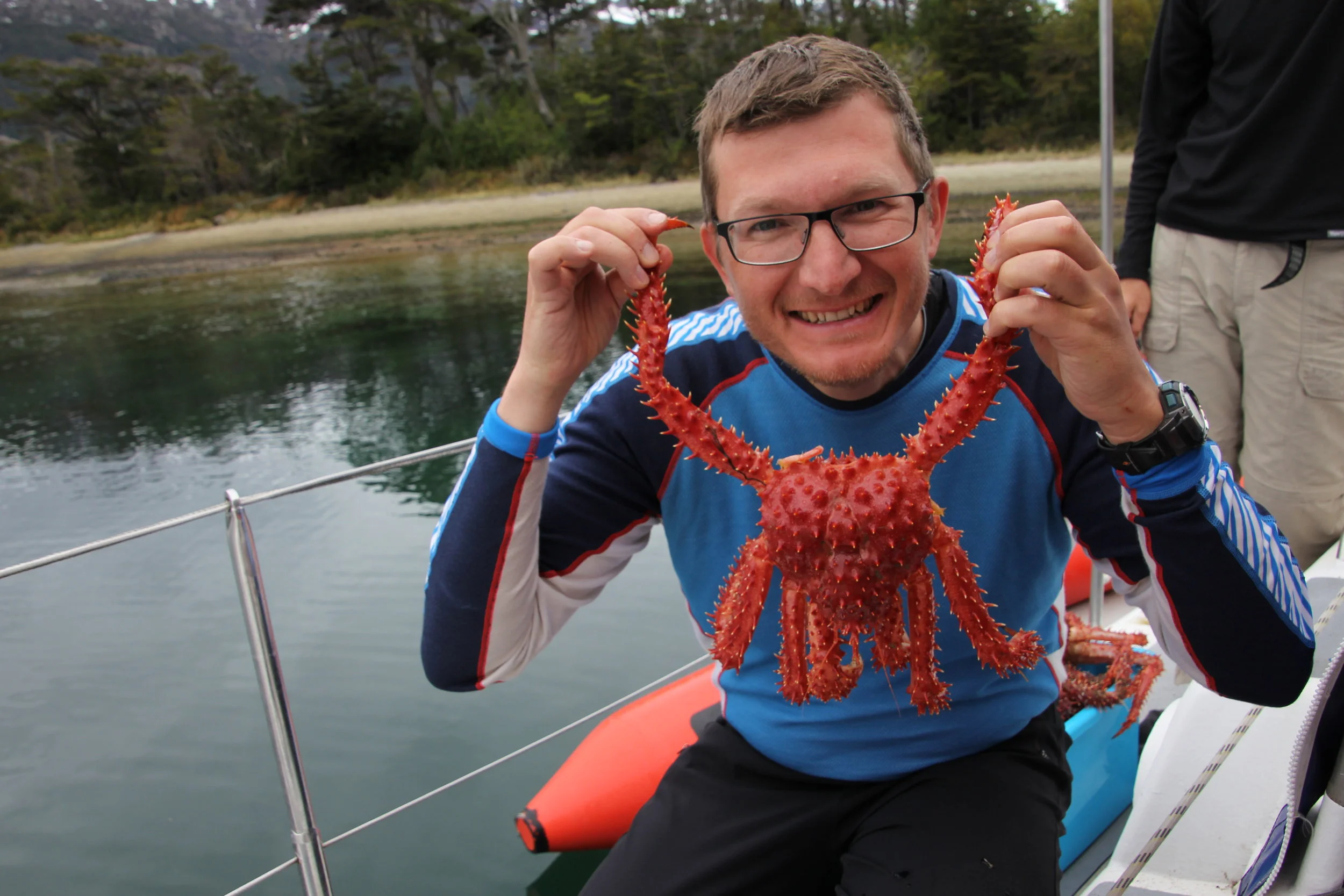
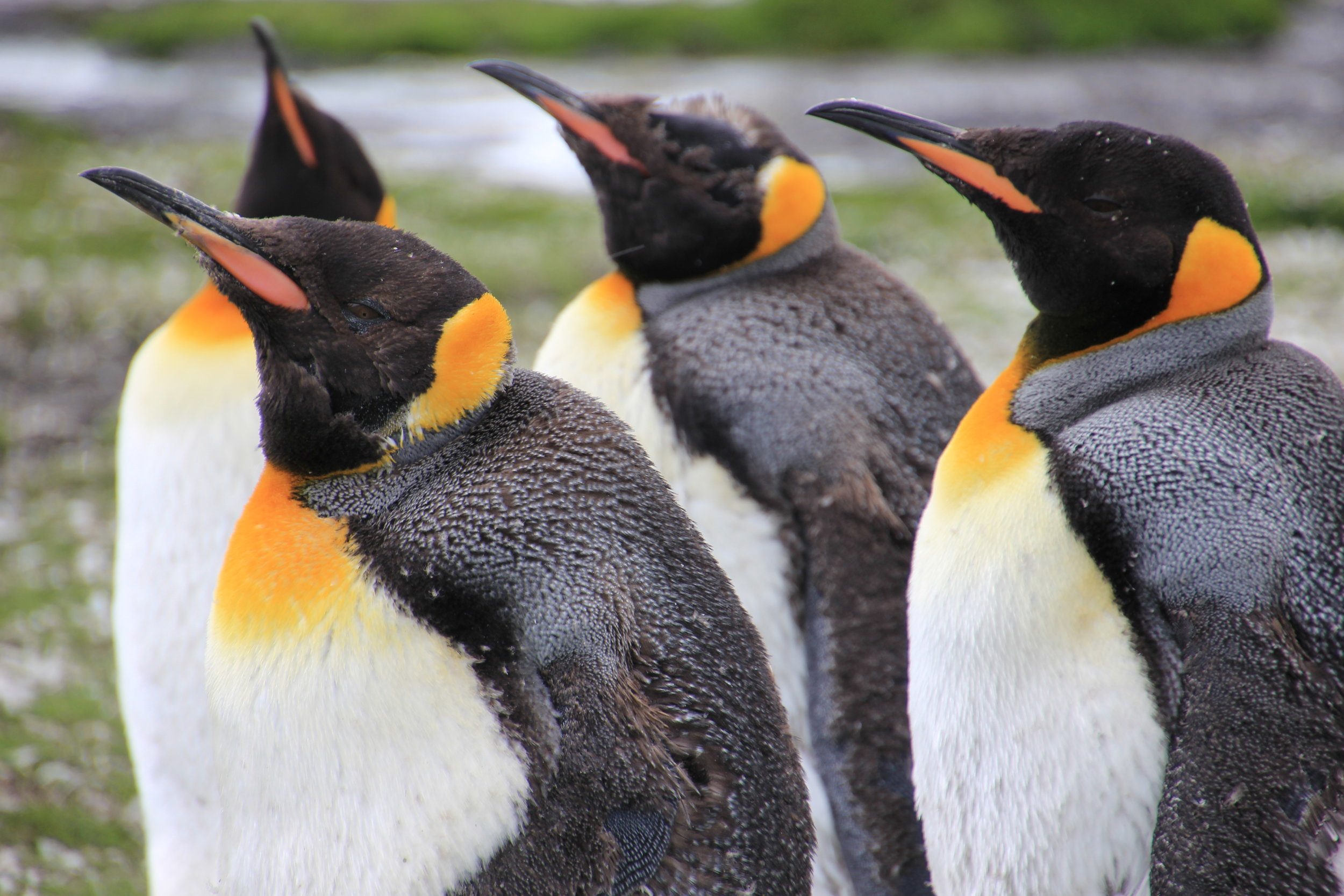
Crabs from the local fisherman


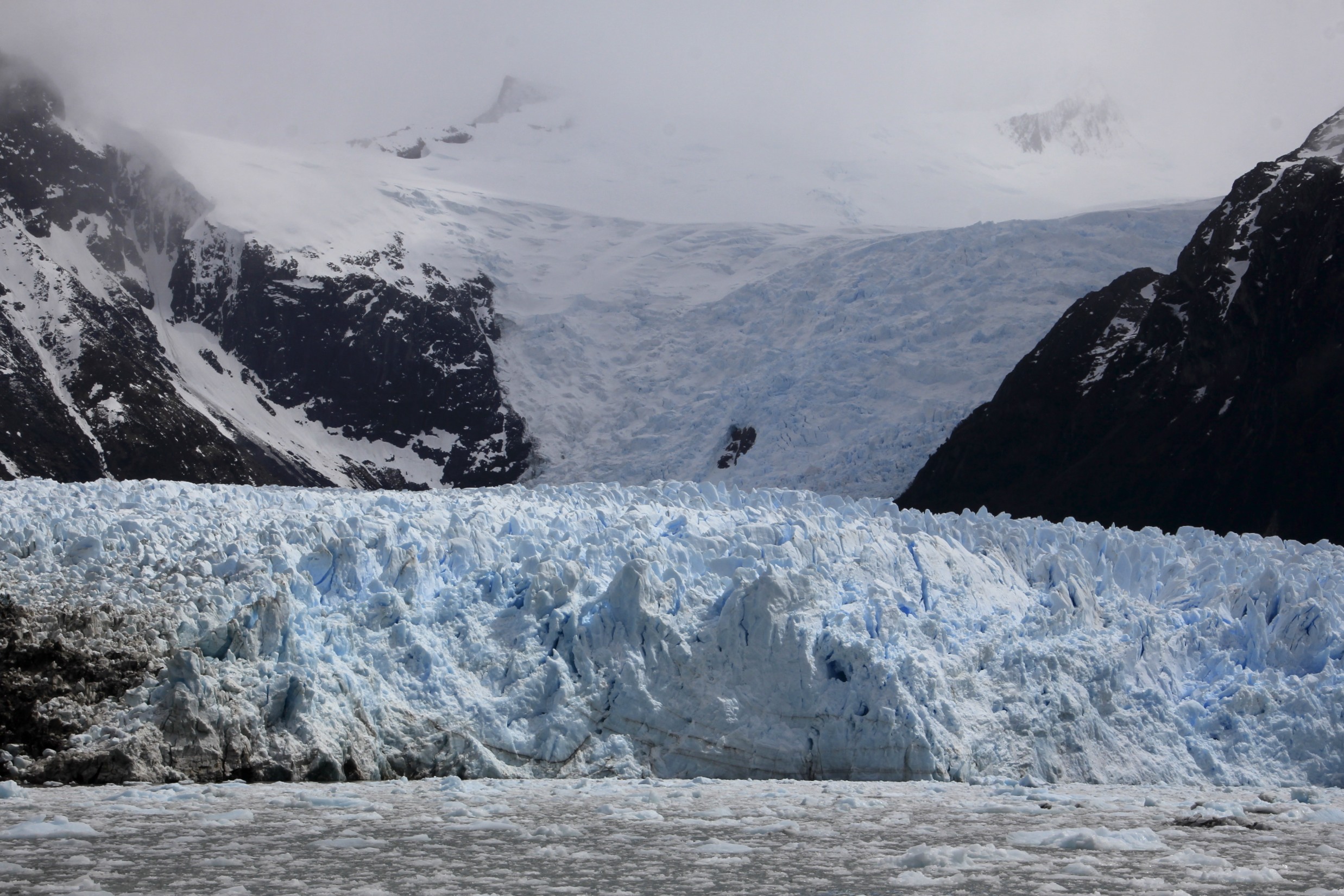
The glaciers of the Tierra del Fuego
Fjord Pia (Brazo Pia Oeste)

Fjord Pia (Brazo Pia Oeste) Glacier Guilcher

Fjord Pia (Brazo Pia Oeste) Glaciar Guilcher

Glaciar Guilcher, Cerro Lady Jane 2,257m and Cerro Iorana 2,020m

The spectacular glacier in one of the fjords of the Tierra del Fuego - Glaciar Guilcher

Darwin Range on Tierra del Fuego - Glaciar Guilcher

Watching the glacier action in the narrow fjord in the Tierra del Fuego

Glaciar Guilcher


Darwin Range in Tierra del Fuego from Brazo Pia Este, Southern Patagonia in Chile

Hiking in the mountains in the Brazo Pia Este

Hiking in the southernmost tip of Patagonia in the Brazo Pia Este

Spectacular Patagonia - the Brazo Pia Este and Glaciar Kalv

Photo by Keri Pashchuk - hiking in the Darwin Range in Patagonia


Glacia Kalv

Seno Fjord and the Darwin Range. Glaciar Porter Oeste is visible.

Seno Fjord

Seno Fjord

In Patagonia in the Seño Fjord


Brazo Pia Este, Monte Darwin on the right

Darwin Range from the Beagle Chanel. Monte Darwin is on the right 2,261m.


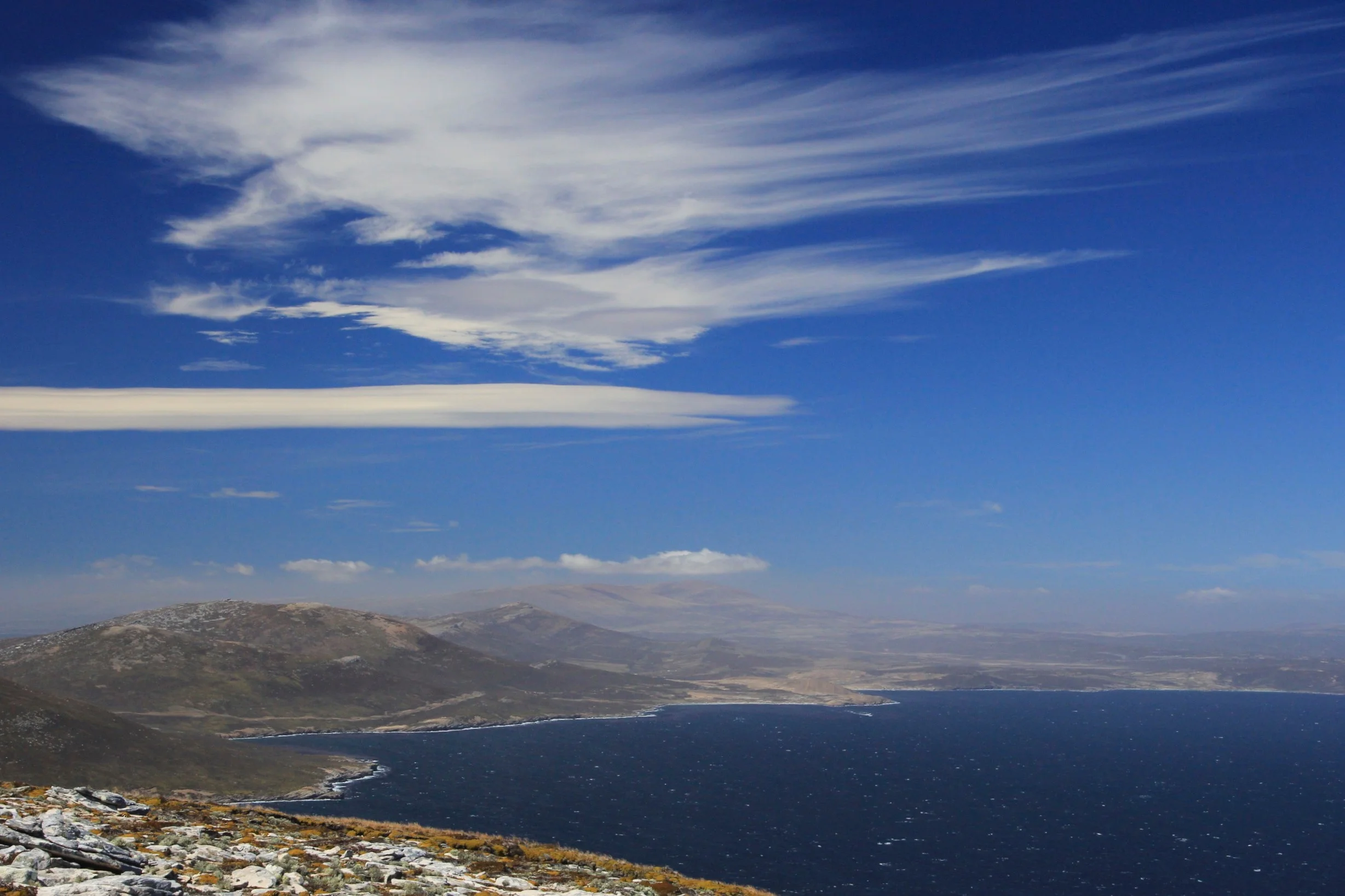
Our position in the Tierra del Fuego
Southern Patagonia

Crab fishermen in southern Patagonia

Chilean Armada patrolling the Patagonian Chanels


Looking back at the Darwin Range

Beagle Channel and the Darwin Range in southern Patagonia

Southern Patagonia


Fickle weather in southern Patagonia


Brockneck Island

Awesome mountains and spectacular hiking in southern Patagonia - Brockneck Island

Brockneck Island

Brockneck Island

The remote and windswept mountains of southern Patagonia - Brockneck Island

Our anchorage in the Brockneck Island

Monte Sarmiento from far away

The glaciers of Monte Sarmiento from Canal Magdalena.

Glaciar Schiaparelli next to Monte Sarmiento from Canal Magdalena.

Glaciar Schiaparelli and Sarmiento

Mount Sarmiento 2,187m, the highest peak of the Tierra del Fuego. Due to very fickle weather in this part of the world, this mountain is often obscured by clouds. We were lucky to see it on such a beautiful day! The view is from Canal Magdalena.

Monte Sarmiento

Mount Sarmiento 2,187m is located within Alberto de Agostini National Park, in the Chilean portion of Tierra del Fuego. It rises abruptly from the east shore of the Magdalena Channel and marks the western border of the Cordillera Darwin.

Monte Sarmiento

The double summit of Monte Sarmiento


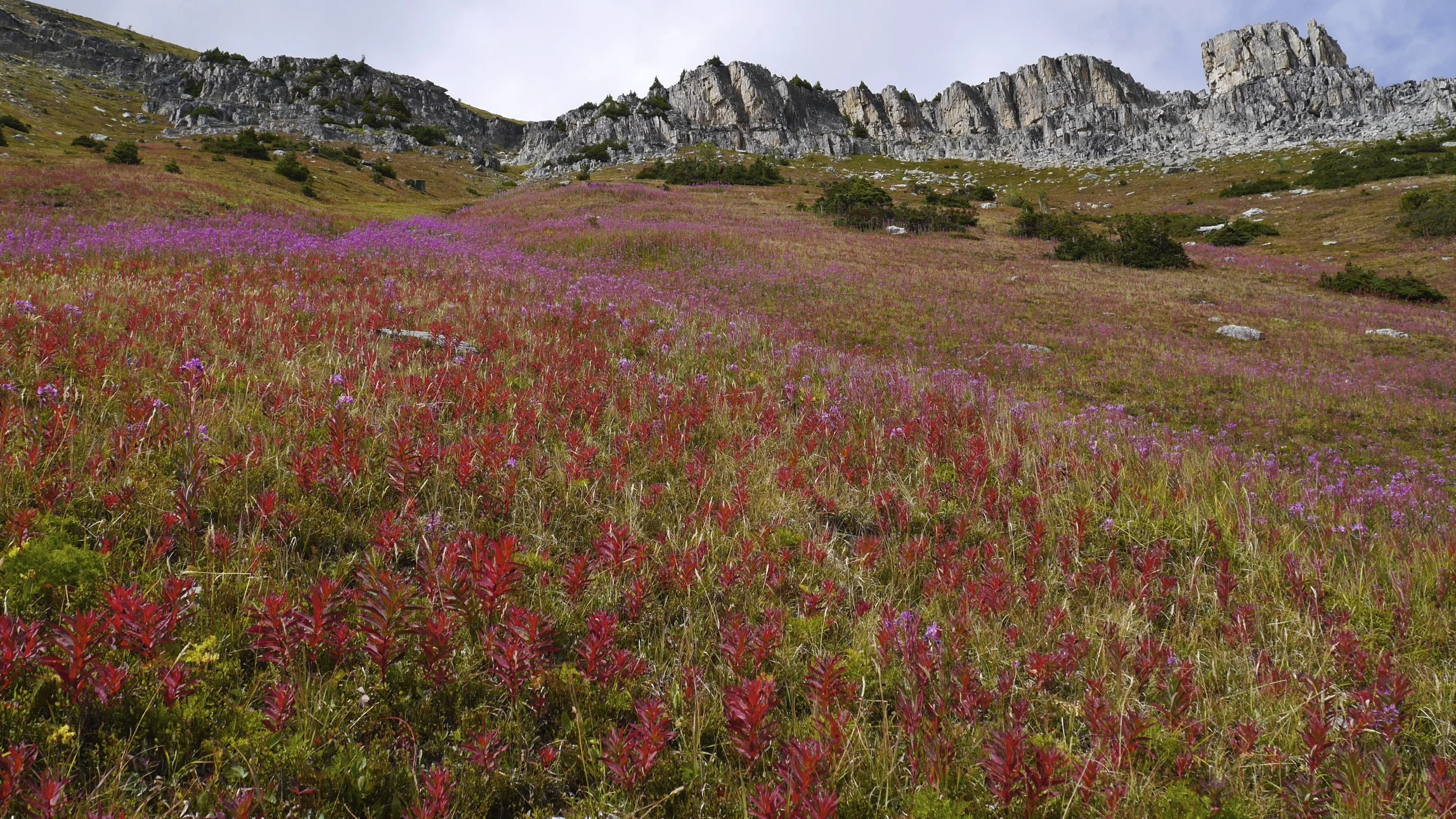
Tierra del Fuego, Patagonia. 1000m peaks (Cristal, Taurus, Outland) along Fjordo Keats.


Southern Patagonia

Condor


Southern Andes - Tiera del Fuego

Southern Andes - Tierra del Fuego

Southern Andes - Tierra del Fuego. Monte Backland from Fjord Agostini.

Southern Andes - Tierra del Fuego. Fjordo de Agostini.

Southern Andes - Tierra del Fuego

Southern Andes - Tierra del Fuego


Fickle weather of southern Patagonia

Southern Andes - Tierra del Fuego


Southern Andes - Tierra del Fuego

Southern Andes - Tierra del Fuego


Southern Andes - Tierra del Fuego


Southern Andes - Tierra del Fuego

Southern Andes - Tierra del Fuego. Along Fjord Keats.

Fjord Keats
Fjord Keats


Monte Buckland in the Agostini Fjord - Main summit is 1,800m

Monte Buckland

Monte Buckland

Glaciar Rugidor in Fiordo Hyatt


Straight of Magellan


The wind blown forrest of the Straight of Magellan

Straight of Magellan

Volcanic formations of the Straight of Magellan

Straight of Magellan

Straight of Magellan


Straight of Magellan. The wind makes the trees grow sideways. Tierra del Fuego in the distance.


Ushuaia, Argentina - the Beagle Channel

The Beagle Channel

Ushuaia and the Beagle Channel

Beagle Channel near Ushuaia

Argentina’s shore along the Beagle Channel

Beagle Channel

Beagle Channel

Cape Horn

Cape Horn, Chile Station - the southernmost point of South America

Cape Horn

Chile station on Cape Horn

Puerto Wiliams

Puerto Williams and Los Dientes mountains on the Navarino Island

Navarino Island

Beagle Channel

Beagle Channel


Ushuaia, Argentina

Ushuaia and the Beagle Channel


Along the Beagle Channel

Beagle Channel

Beagle Channel


Beagle Channel

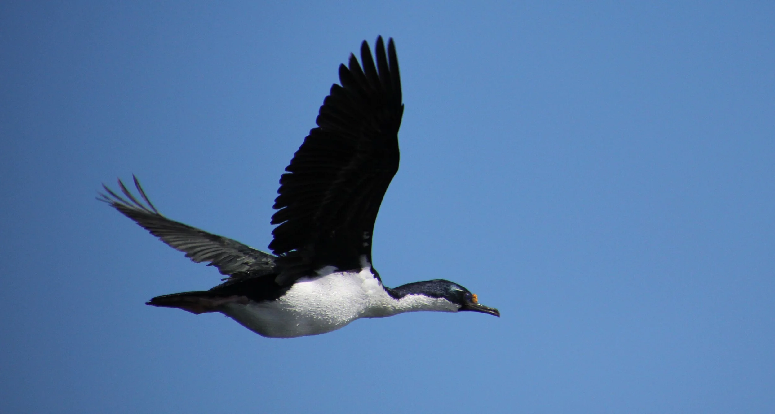
Mountains of Patagonia and the cormorants of the Beagle Channel


Southern Patagonia

Southern Patagonia with the mountains of Tierra del Fuego on the horizon


In August 2014 we hiked the 70km trail connecting Banff National Park with the Kootney National Park through the Mount Assiniboine Provincial Park in British Columbia, It was a fabulous week- long trip with quite a few peaks climbed along the way. We hardly had any company and sometimes we had the entire place to ourselves. We started in Sunshine Meadows in Alberta. The trek culminated with epic bushwhacking through the wet and thick BC forest for some 10km.


Citadel Pass


Nub Peak


Nub Peak


Wander Peak

Wander Peak

Wander Peak


Wander Pass


Mt. Athabasca

The summit of Mt. Athabasca
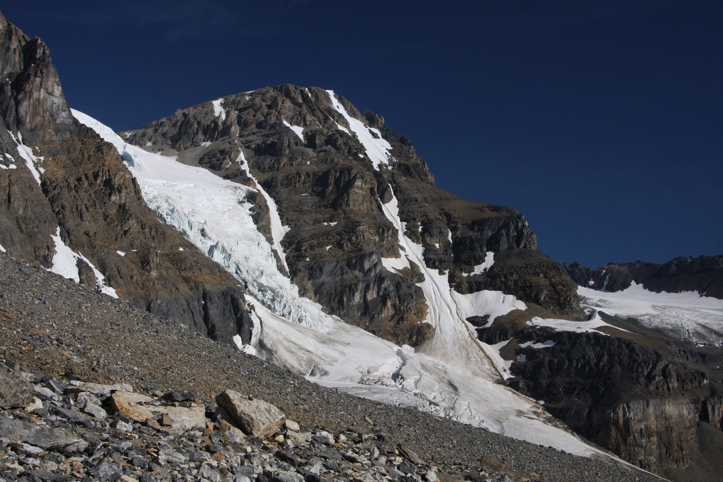
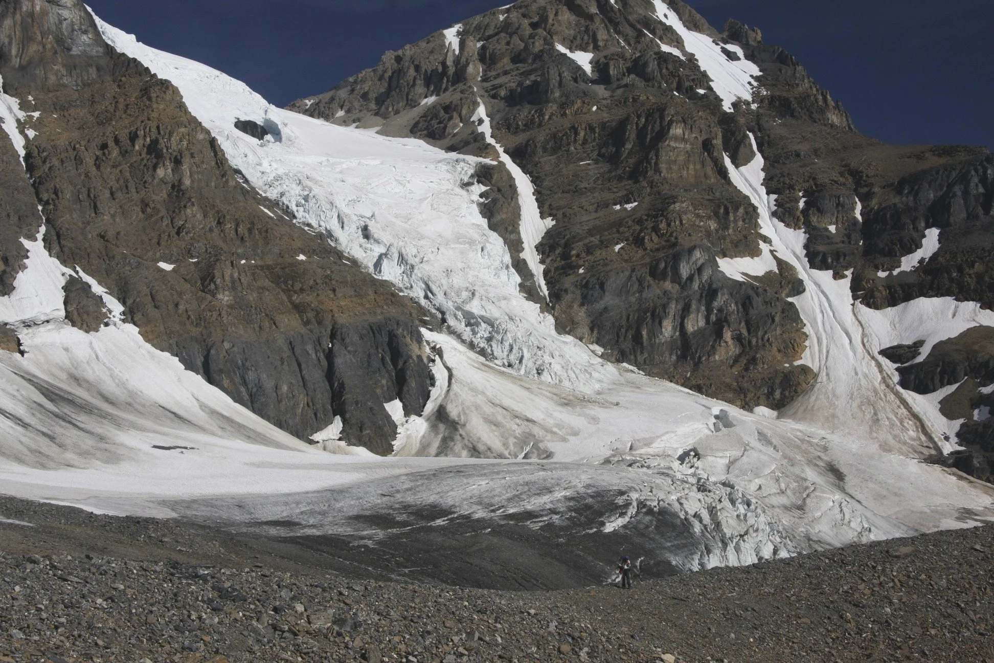
Saskatchewan Glacier from Mt. Athabasca

Mt. Athabasca AA col

Crossing Athabasca River en route to Mt. Alberta area

Crossing Athabasca River


En route to Mt. Wooly and Mt. Diadem base camp


Mt Wooly on the left and Mt. Diadem on the right


Directly ahead is the Wooly’s shoulder, the pass leading to Mt. Alberta. It is a SLOG!

Working our way up the Wooly’s Shoulder

Twins Tower from the Wooly’s Shoulder Pass

Mount Alberta and approach to the ACC hut

ACC hut in front ot Mt. Little Alberta

The ACC hut and Mt. Alberta

The north side of Mt. Wooly

Mt. Alberta from Wooly/Alberta col


Mt. Alberta


Mt. Wooly

Mt. Alberta


The Twins, Twins Tower and Mt. Columbia (on the right)

Mt. Alberta

Mt. Little Alberta

Mt. Kitchener and Snow Dome


Mt. Little Alberta and ACC hut

Ascending Mt. Little Alberta


Mt. Kitchener


Summit of Little Alberta 2,956m and Mt. Wooly behind

The summit of Little Alberta


Mt. Alberta

ACC Hut and Mt. Diadem

The Twins and Twins Tower


Mt. Athabasca

Mt. Athabasca and Mt. Andromeda

On Nigel Peak

Nigel Peak 3,211m

View from the summit of Nigel Peak

Mt. Athabasca from Nigel Peak 3,211m

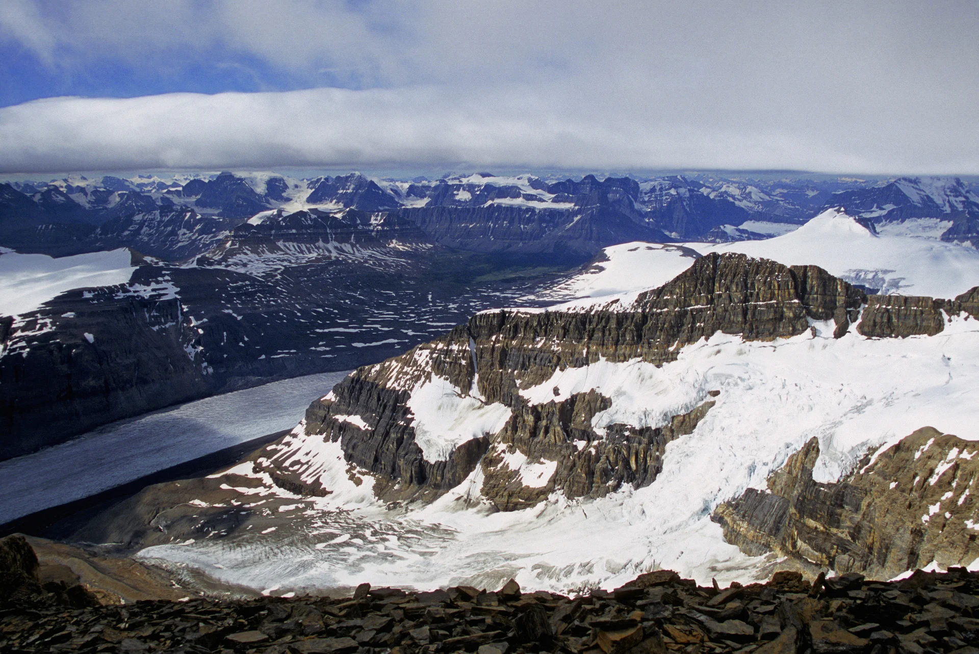
Athabasca Glacier and Columbia Icefield from Nigel Peak 3,211m

Athabasca Glacier and Snow Dome from Nigel Peak

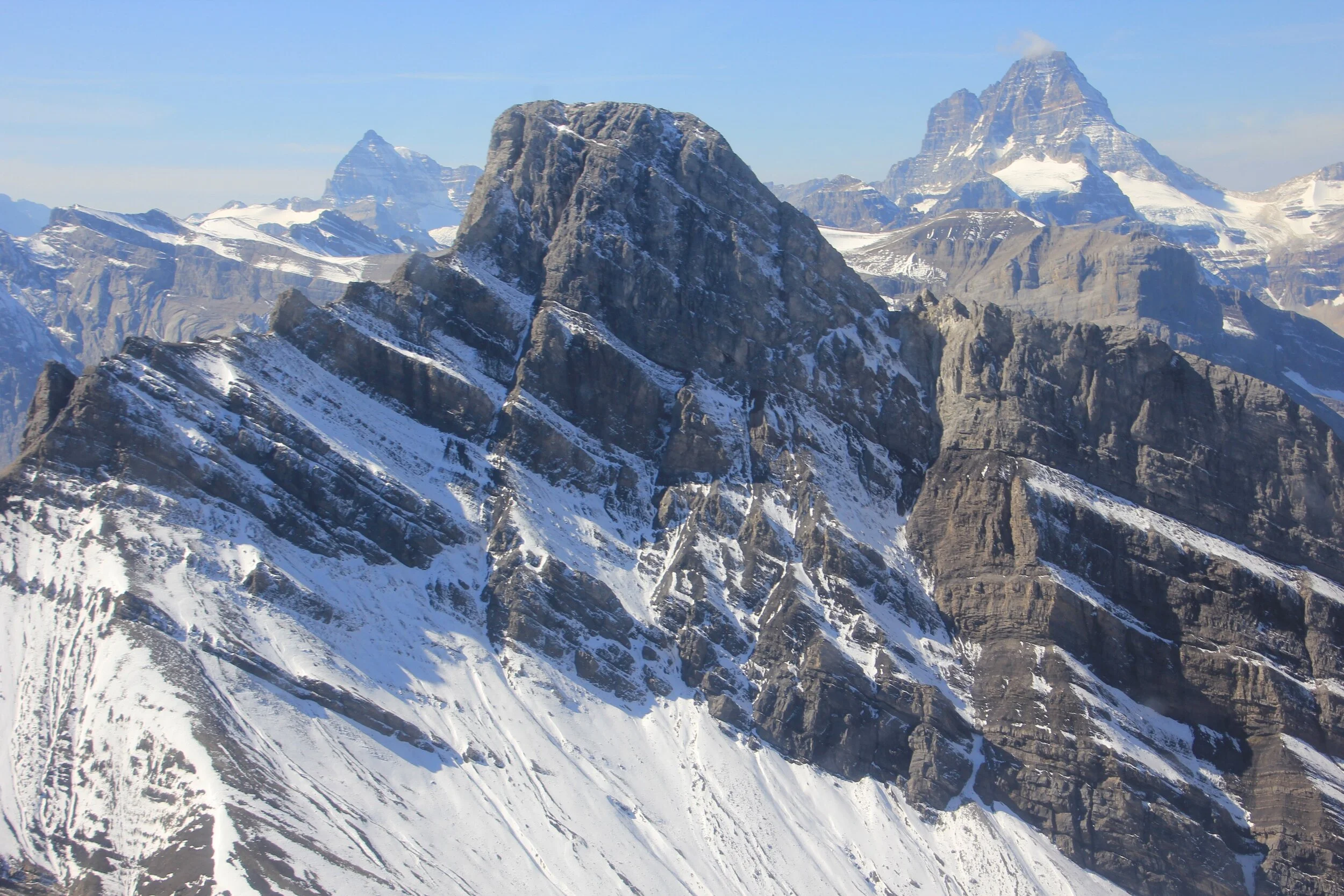
Mt. Alberta, Mt. Wooly and Mt. Diaden from Nigel Peak

Looking south from Nigel Peak

The Icefield Parkway from Nigel Peak


The summit of Nigel Peak 3,211m


Nigel Peak is the mountain on the horizon on the right


The summit of Sunwapta Peak 3,315m

View to Mt. Brazeau (high peak in the centre) from Sunwapta Peak 3,315m

Snow Dome (left), Mt. Alberta, Mt Diadem (right) from Sunwapta Peak


Sunwapta Peak

Mt. Edith Cavell in the distance (high peak left of centre) - looking north from Sunwapta Peak


Nigel Peak from Sunwapta Peak 3,315m

Mt. Athabasca and Mt. Andromeda from Sunwapta Peak 3,315m

Mt. Columbia from Sanwapta Peak 3,315m

Sunwapta in winter

Sunwapta in winter

Mt. Brazeau from Sunwapta in Winter

Mt. Edith Cavell from Sunwapta in winter

Mt. Athabasca and Andromeda from Sunwapta


Sanwapta Peak from Mt. Brazeau
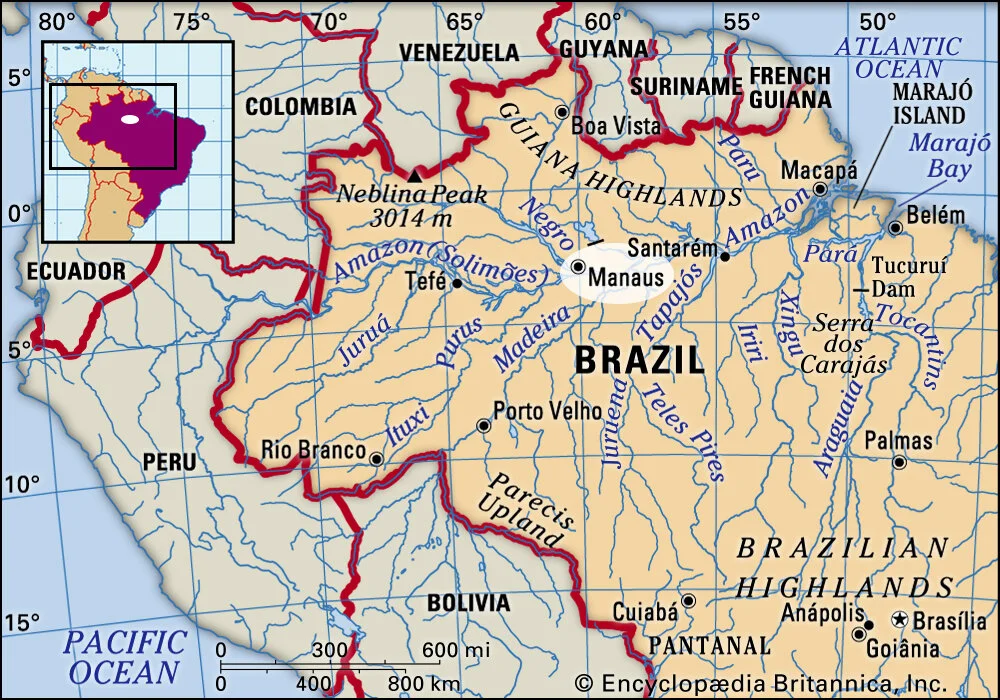
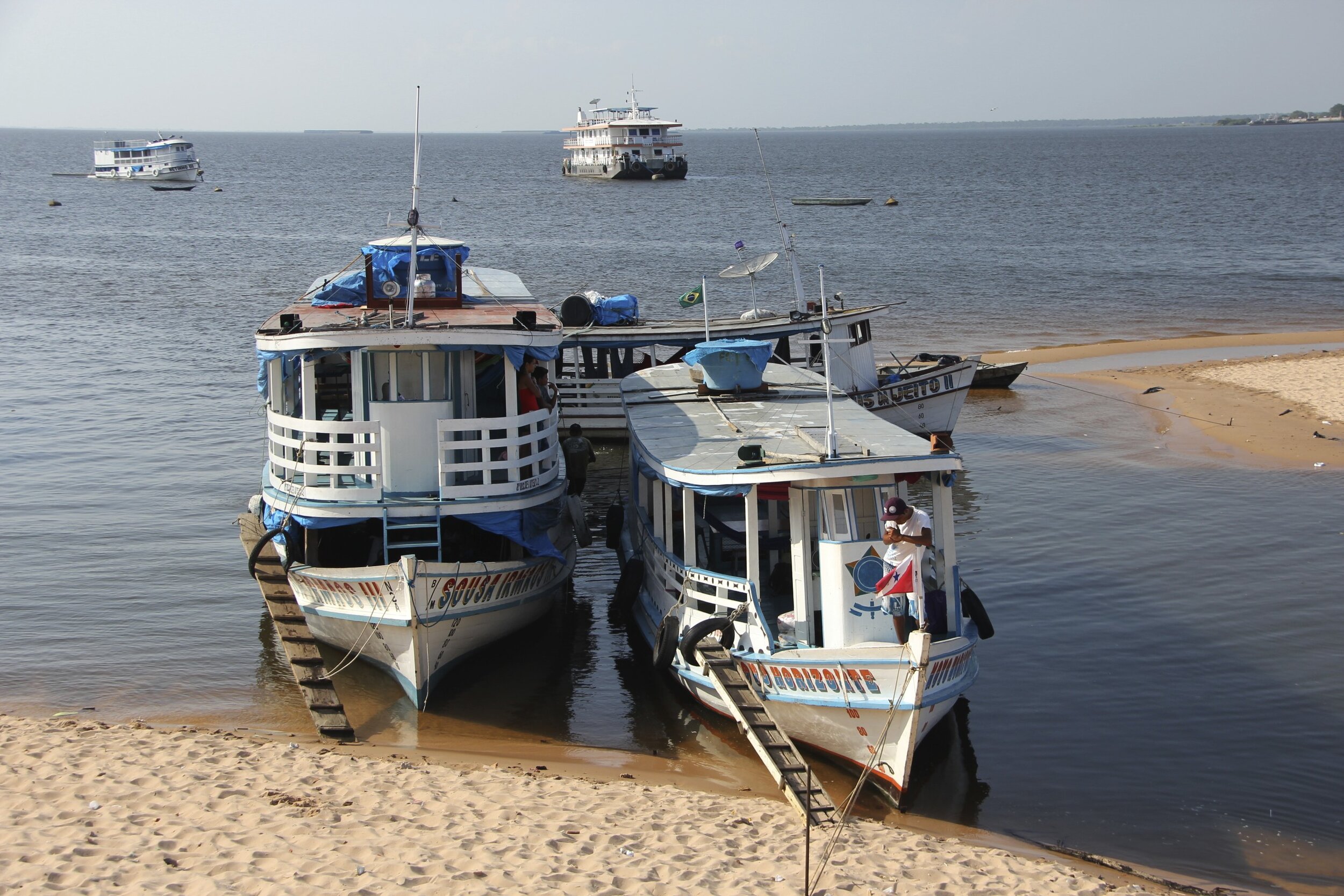
We traveled from the mouth of the Amazon River to Manaus, Not even half-way up the mighty Amazon!


The mouth of the Amazon River. The water is discolored 50miles out into the Atlantic.