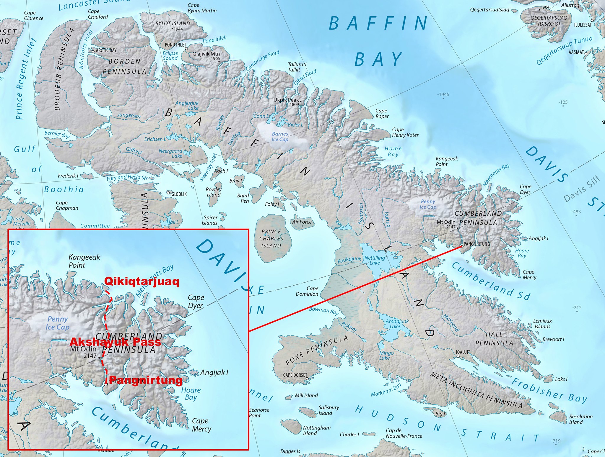
Auyuittuq National Park is located on eastern Baffin Island between the communities of Pangnirtung and Qikiqtarjuaq. Our plan was to traverse the Akshayuk Pass, a 97 kilometre traditional Inuit travel corridor that crosses the park. The trail starts at sea level and rises to 420 metres at Summit Lake. We also intended to explore many glaciers that dominate the park.


In 2003, my first trip to the Canadian Arctic. I met these Inuit who invited me to go seal hunting with them during the Arctic night.

The most common backpacking route in the park is known as Akshayuk Pass, and follows the Weasel and Owl rivers via Summit Lake. In 2008, heavy rain and warm weather caused Summit Lake to burst through its banks, flooding the Weasel River and washing away the Windy Lake bridge. As a result, the hiking routes in the pass are limited to either side of the Weasel River.

I was lucky to do this traverse in 2003 as it can not be done any more due to washouts.


An Inuit carver with his creation

Qikiqtarjuaq; formerly known as Broughton Island until November 1998, is a community located on the island of the same name in the Qikiqtaaluk Region of Nunavut, Canada.

Qikiqtarjuaq

Qikiqtarjuaq

Qikiqtarjuaq - a polar bear hide


The rugged coast of Baffin Island


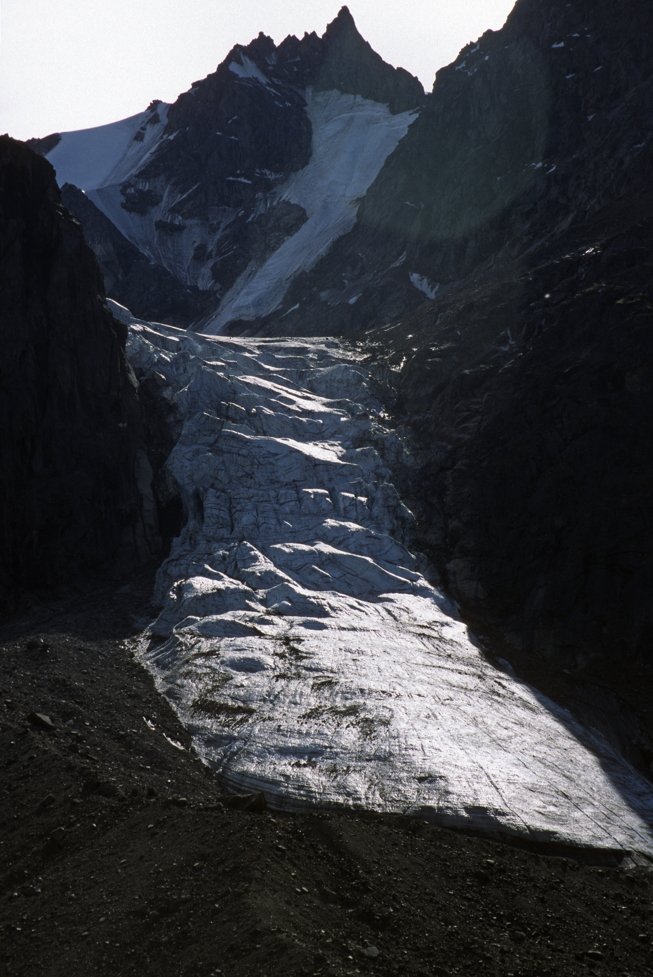
Turner Glacier and Mt. Asgard (shown in the Bond film The Spy Who Loved Me) with an 800 m (2,600 ft) face.


Fording the river flowing from the Turner Glacier

Summit Lake


We had numerous river crossings every day

In 2008, heavy rain and warm weather caused Summit Lake to burst through its banks, flooding the Weasel River and washing away the Windy Lake bridge.

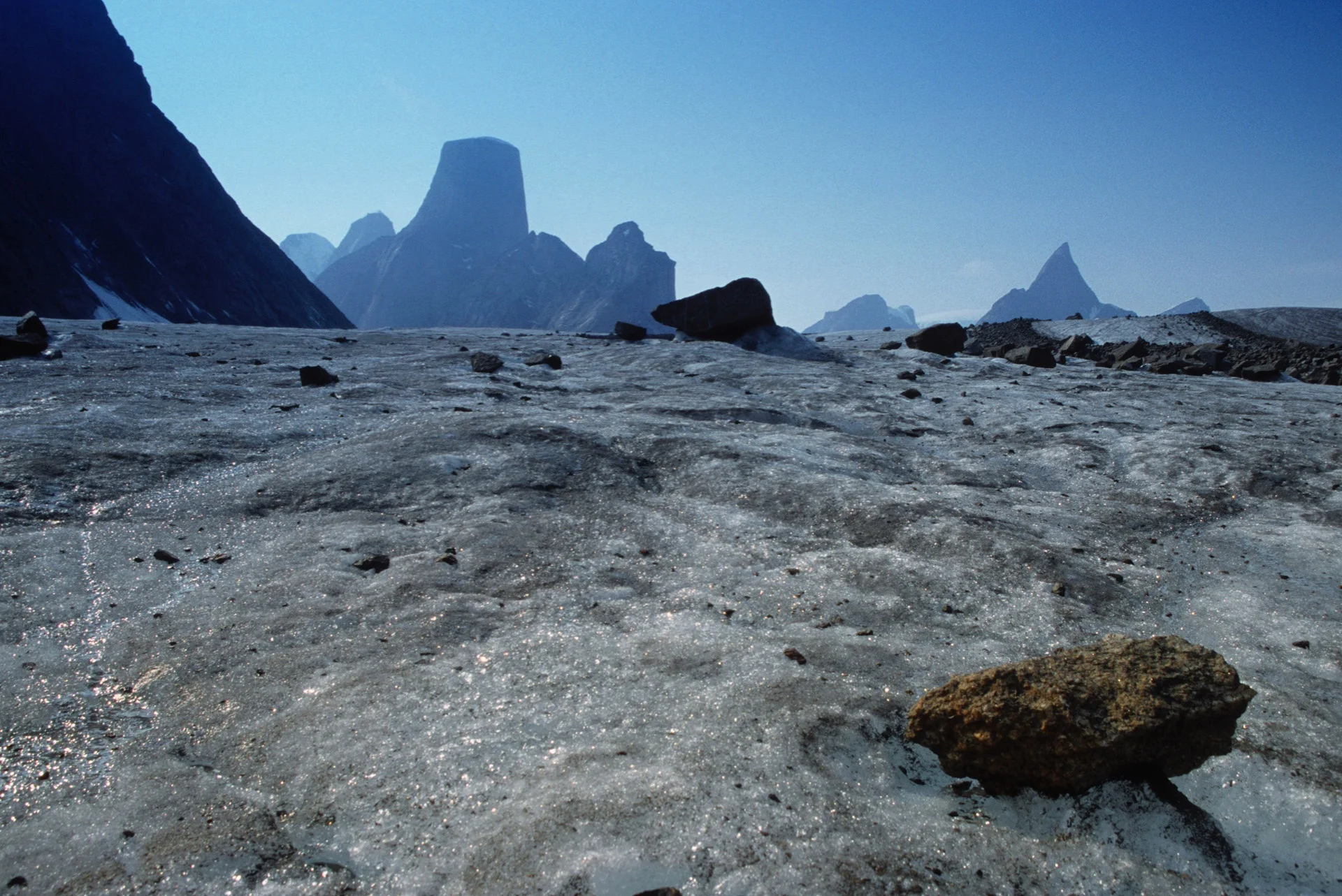
Mt. Thor in the distance.

Mt. Thor's 1250m face


Mt. Thor