July 28 Arando 15km 800m gain
We left at 9 am for Arando. It was the height of the Ashura Muslim Festival and everything was closed. The weather was overcast and with everything closed and no people around, it seemed a little grim. Everyone we met was dressed in black. The entire festival is a solemn affair and not very cheerful to visitors. It felt like attending a funeral. It is what is it is but from a tourism perspective maybe it is not the best time to visit. Because of this festival no one works, everything is closed, there are no cars on the roads, there are no drivers for hire, there are no porters available. The entire affair lasts 12 days and it is smack in the middle of their 2-months long tourist season.
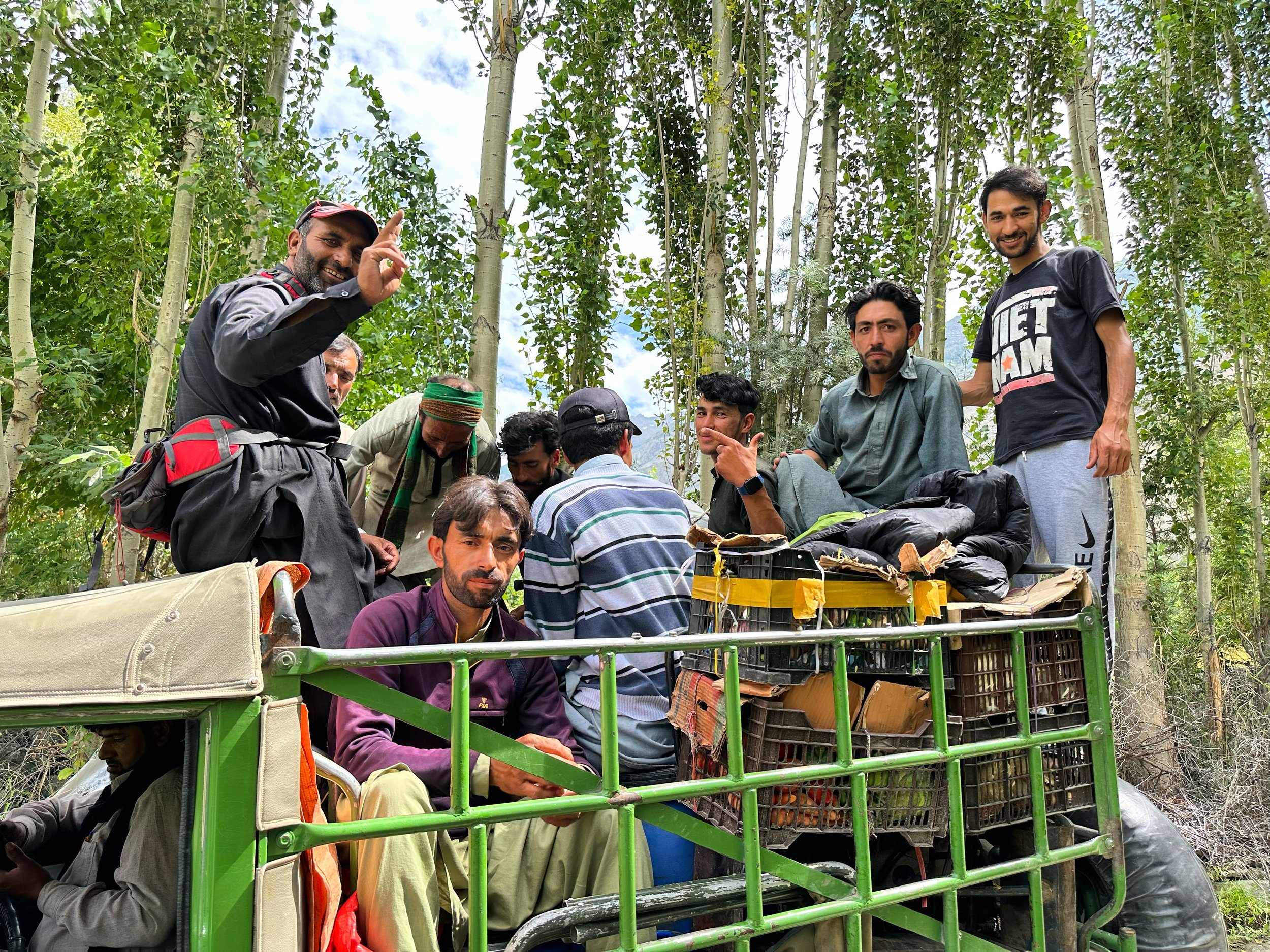
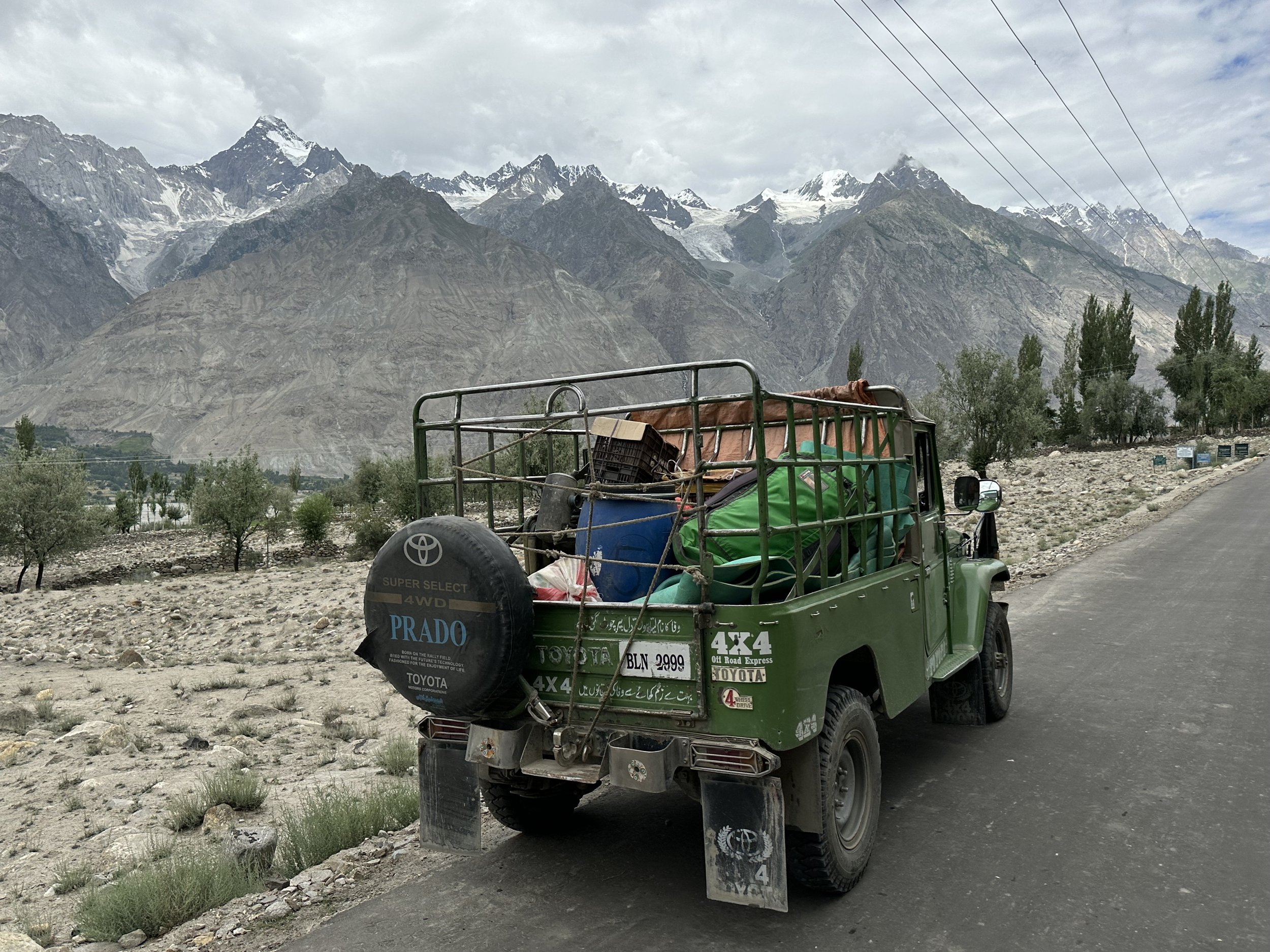
We drove down the Shigar Valley again and purchased some live chickens, fuel and other supplies on the way. There were very few cars or jeeps on the road. In Dasso we crossed the Shigar River and drove to Tissar, Essan’s home village. Essan invited us to his home for lunch. He hired the same crew plus his shop assistant as we were short on porters. Essan’s brother was visiting from Iran with his family. The brother is an Islamic scholar and works in Quam, Iran in a madrassa. We were seated in a large room, on the floor with pillows for support. The food was served on the floor on a plastic mat like in the camp.
After lunch we moved on to Arando. We stopped at a commercial hot spring which was a little dirty and unkept. There was garbage in the water and the pools were used as a communal bath. We then drove on a narrow and exposed dirt road to Arando. The views were great but there was big exposure to the river below taking the focus away from the enjoyment of the surroundings. The road was quite terrible in places and the jeep tilted dangerously over the sharp drop off to the river a few hundred meters below. During a few short sections, I was afraid that the 4x4 would flip over and roll to the raging river. Thankfully, the drive from Tissar to Arando was not too long and after 2.5 hours of shaking we arrived in the campsite on the outskirts of Arando village. It was cloudy and on the verge of raining, so it did not feel pleasant to be outside. As a matter of fact, it soon started to rain steadily. I pitched my tent and after dinner went to bed. The crew held night prayers to commemorate Imam Hussain.
The next day, we got up early. It was raining on and off. The mountains were obscured by low grey clouds, and it felt somber. We packed up and were short one or two porters due to the festival which was now in its final and most important stage. No one wanted to work and even if some individuals did the peer pressure in the village would prevent them from accepting work during the festival. Conformity is strong here in these small villages.
From the small campsite (I think developed by the Czechs) we walked a short distance to the medieval village of Arando. The village has the end of the world feel to it. A lot of men gathered around to witness my guide’s futile efforts to hire a porter or two. There were all these able men, but the ancient Hussain from 500 years before stood between them and a job. Women were all dressed in black and were leaving bowls of rice on the ground. Random men would swoop down and eat the food. All this in pouring rain. These were some strange customs for me to witness.
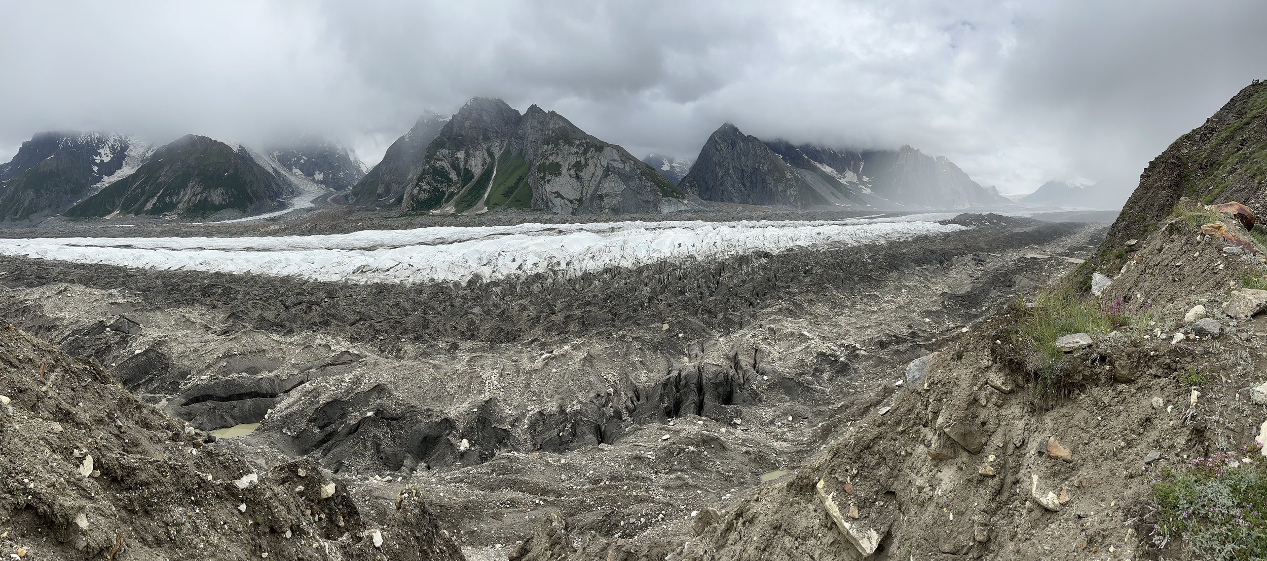
Not being able to hire anyone, we left for the first camp site. We walked across the turbulent river which emerges from the Chomolugma Glacier nearby. We started the long climb for 700 vertical meters to the first campsite. The walk was 15 km long following the frontal section of the Chomolugma Glacier. This is another massive glacier of the Karakorum running parallel to the Hispar Glacier. Some peaks were visible, but overall, it was overcast and grey. The rain would come on and off. We stopped for tea along the way and a passing man gave us good cheese. We arrived in the camp around 2 pm. Once we set up our camp it started to rain, and it rained for the next 3 hours.
July 29 Forced rest day – rain
Today it rained 20 hours straight. It started around 8 pm last night and it went on until noon of the following day. During the night the rain was very intense with lightening and strong wind.
Trekking in Pakistan as compared to Nepal is rough. The weather is very unstable and changes all the time. Pakistan does not have a nice weather period like Nepal. During the rain you get pinned down in the tent. There are no tea houses, and you cannot dry anything until the sun comes out again. The rain makes it for some long hours in the tiny tent. We were camped in a cow enclosure with a lot of cow shit around. The cow shit meant a lot of flies. The flies would get into the tent by dozens, and I could not leave the door open. The flies also get into the kitchen and get into everything that is lying around uncovered which is most of our food. It does not make it for an appetizing ambiance in the food tent.
Since we left Arando, the weather has been poor. The forecast calls for improvement, but the forecasts have been notoriously wrong here. The big issue for me is not being able to cross the pass and having to walk back to Arando and Skardu. Such return journey would require more time to be able to catch my flight home from Islamabad. The crossing of the pass is much faster, but it cannot be done in poor weather or after heavy snow fall. As we progress on, I am running the mental math calculating the days needed and the ultimate turn around point. I find this uncertainty quite stressful. No one knows the conditions of the pass until we get there.
It is truly a wild country with some wild people. It grinds you down slowly. Mentally I find it tough to have the rain all day with nothing to do, not even a conversation as I am alone here. I think that trekking in Nepal is a summer holiday compared to Pakistan. Here is remote, wild and very unforgiving. Like someone said: the Karakorum is either heaven or hell. But it is also a total adventure in the most spectacular mountain range in the world. There are no other people, no one. Nepal is overrun with trekkers and climbers. No so here. There is only serious mountaineering and trekking in Pakistan. The Nepalese understand the western expectations of the mountain Shangri-La and make the experience of visiting their country a version of it. Pakistan is as it is, you adjust to it not the other way around. I like both for different reasons, but I am drawn more to the Karakorum then the Himalaya.
July 30 Bolocho Camp 18.5 km
We got up early again. The weather and the forecast look promising with some morning clouds. In the morning, we packed up and left quickly. The clouds were still obscuring the mountains, but the visibility was definitely improving. The walk was flat and easy following the large glacier. After 10 km we had to descend onto the broken and chaotic Chomolugma Glacier to bypass a large and powerful creek gorge that gouged its way through the mountain side. As we progressed, I noticed dark clouds on the horizon in the valley below slowly chasing us up the glacier. Is the forecast wrong again?! After km 15 we descended back onto the glacier and then the storm hit us with full force. Heavy rain, I quickly had to put on my gortex pants and jacket. Porters were all wet. I was seriously concerned about our prospects. How can we cross the Haramosh Pass when everyone is wet? They have no change of clothing. Is there too much snow higher up? If we go too far, our retreat will be much longer. The possibility of crossing was becoming more and more uncertain in my mind. This added to my foul mood, the weather, the dirt and I was so tired. It was 18.5 km day, long walk. If we had to retreat, it would be all for nothing. I think that lack of proper food was also affecting me, I couldn’t eat, I had no appetite and I had poor recovery. I was not sure why!? Essan was constantly nagging me to eat more but I just couldn’t, I gaged. I couldn’t pinpoint the reason why my appetite was so poor. Ultimately, I lost 23 lb on this trip in one month. More than 10% of my body weight!
We pitched the tents in a small muddy campsite called Bolocho. Bolocho is located behind the lateral moraine of the Chomolugma Glacier. I set up the tent and lied down. I was thinking about whether this would be a successful trek considering the weather. Should we go back to Arando? I was calculating in my head the number of days required in order to catch my flight back home. The window was narrowing, and the decision had to be made.
As I was resting, within one hour the weather went from full on rain to clear blue sky. Wow! Finally, we could see the surrounding mountains and everyone’s spirit lifted. I climbed the moraine, and all the crew was already there enjoying the warm sun and drying out. In the distance the 7000m giants Leila, Spantik, Mulubiting. It was a beautiful view from the top of the moraine. Everyone was drying their wet clothing and blankets. General mood improved, and it looked like tomorrow we were continuing even though I was so tired.
July 31 Haramosh La Basecamp 12 km 4400m
The plan was to get to the Leila basecamp which we could see across the glacier. It was supposed to be an easy 3-hour day. I was looking forward to an easy day. As it turned out, nothing was easy.
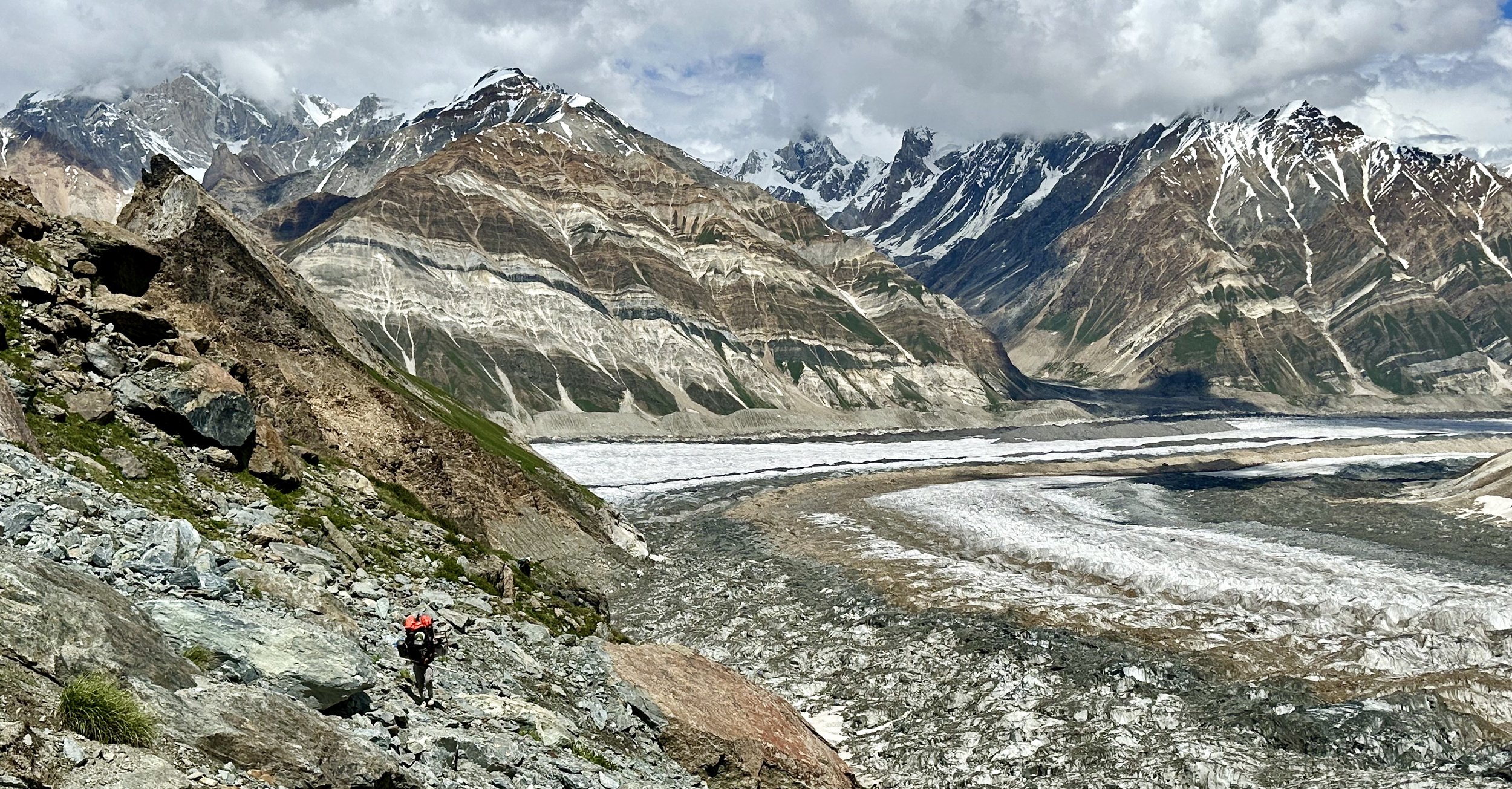
First, we had to cross the Chomolugma Glacier and join the Haramosh Glacier which connects with the Chomolugma. This was the easy part, the white glacier highway. We followed it for an hour or so. The Spantik BC was visible in the distance.
The difficulties started at the confluence of the Chomolugma and Haramosh Glaciers. The area was a jumbled mess of ice ridges and crevasses. Really jumbled and fragmented. We had to cross this mess carefully to get to the hillside which would allow us to bypass the chaotic icefall looming ahead and blocking the access to the upper Haramosh Glacier. We exited the broken glacier, climbed up a steep hill and stopped for a tea on a grassy hillside. I thought that I was done with glaciers after the first trek! The memories of boulder hopping on the Nobande Sobande were too fresh. We had tea and on the insistence of Essan, I had some noodle soup that I puked out soon afterwards. Essan watched me puke it out with bewilderment, but I told him that I was not hungry. Just couldn’t eat, the chapattis tasted gross with Happy Cow cheese. After the tea, big climb up, up, up. The views of the icefall and the towering white mountains were incredible. This was absolutely wild and spectacular area. We were walking on beautiful green grass full of summer flowers. I was tied and it dulled the enjoyment. As we climbed higher, we came across a cave camp of folk from Kutwal Valley looking for precious stones in the mountains above. They were super nice, friendly and welcoming guys. They were staying in a hillside cave with various chambers covered with plastic tarp. They made us tea and we rested with them for a while.
They advised us to stay at the Haramosh La bc another 20 min away. This made me very happy. Essan the guide wanted to go to the pass and said that it was only 2 more hours (it was 12 km in reality). It would have been 7 hours in soft snow and bad conditions. I insisted that we stay in the base camp although fresh water was a little bit of an issue. What a campsite it was! Wow! Perched like an eagle’s nest on the edge of the Haramosh Glacier icefall. The views were absolutely spectacular and exceeded my expectations. It made all the effort worth it. From our campsite, the pass was still 10-12 km away. Essan hired a man from Arando to show us the way.

We settled in the camp with anticipation of the crossing which looked more certain by the hour. The plan was to wake up at 2 am and be on the way by 4 am. The gem people came to see us for dinner and reassured us that the descend was safe (ie no snow or ice issues so we would not need a fixed rope which we did not have anyway). This made the crossing almost certain.
August 1 Haramosh La to Kutwal Lake 5200m 20 km
I woke up at 2am, it was a clear night with full moon. I could see million stars and the milky way. I was looking forward to the crossing and going down. I was tired but had to carry on as it was the fastest way out of there. I did not want to retrace my steps back to Arando and Skardu. We had some tea and small amount of food in the mess tent at 3 am. The porters made the usual chapatis for the day ahead. I did not eat much because it was the middle of the night, I was tired, and I did not have the appetite.
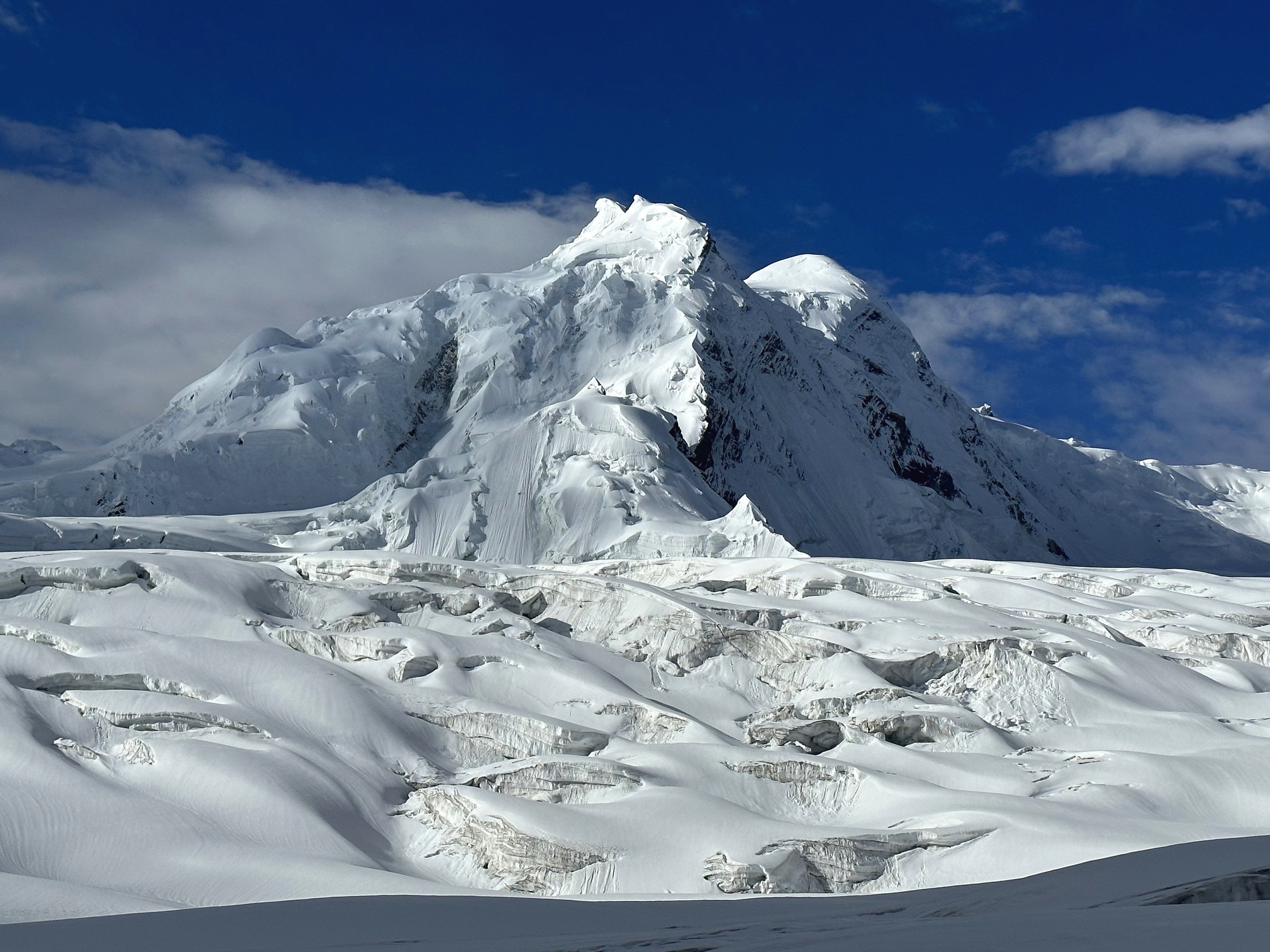
We packed up and started by walking in the dark up the hill right behind the camp to bypass the jumbled icefall. At 5.30 am we could turn off the head lamps as we could see the lay of the land. After bypassing the icefall, we gained the upper glacier. At first the glacier was easy to walk on with some visible crevasses. The ice was hard and grippy. The distances here are so deceiving. Only when we saw the porters far away, we could appreciate the scale of the terrain. The sun finally came out from behind Haramosh 2. It was a brilliant day but not clear! We walked by Leila Peak on the right and Haramosh 2 and the left, both faces foreshortened and encased in massive icefalls. Incredible scenery. Hard to believe that it was real and that I was there.
It was a good climb from 4400 to 5200m. I was in surprisingly good shape considering my earlier struggle. We walked fast and caught up to the porters. There was another icefall ahead between us and the pass. The ice was all broken up and fragmented with massive holes. There were hidden crevasses as the entire upper glacier was snow covered. We roped up before the final stretch of heavily crevassed section before the pass. The porters were wearing pinguin pyjamas and plastic shoes. The rope was mandatory. There were 10 of us on a 50m rope. The Arando man was in the lead probing the way in the snow. He was fast, efficient and confident.
Ahead was the heavily glaciated Mani Peak glowing in the morning sun and next to it was the 7000m Haramosh after which the pass is named. The mountains were on another scale of imposing. Large, glaciated and steep.
Before we roped up, I asked the crew to walk slow and stop from time to time just in case the altitude got to me. We were all roped up together so if one person wanted to stop, we all stopped. I did not feel overly tired or in need of rest though. Some guys punched through snow but nothing serious. It was sunny and bright but heavy clouds rolled above Haramosh Peak. Aslam forgot his sunglasses and put a plastic bag over his head to avoid the snow blindness.
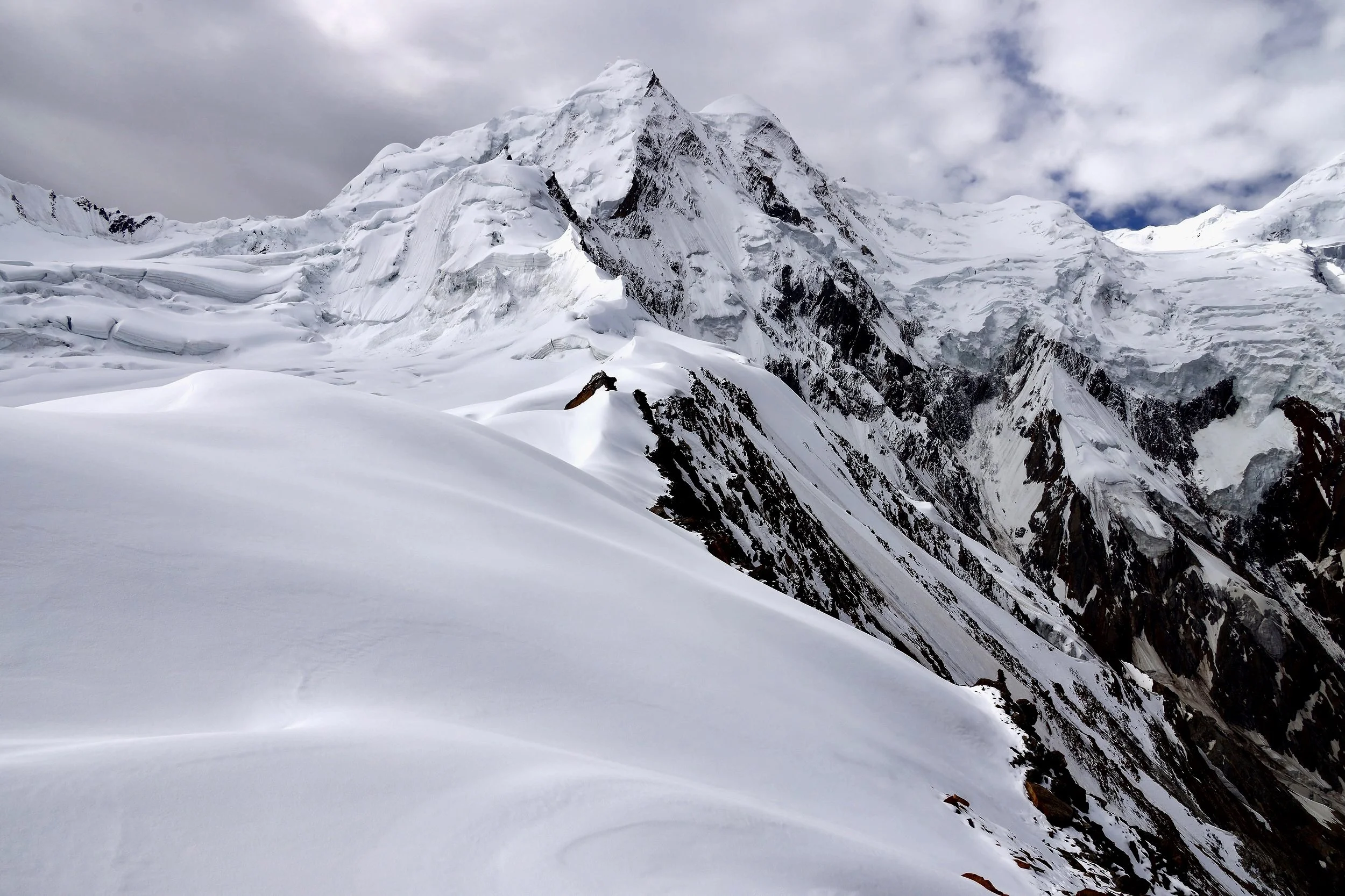
Finally, we got to the pass. What a grand place, what a view! The drop to the other side was 2 km straight down to the valley below. It looked very steep, but it did not intimidate me. In front of us was the massive Mani Peak and next to it was the Haramosh Mountain. Leila 2 and subsidiary summits were on the right. We could not see Leila 1 from the pass itself but could see Leila 2 and 3. We were in the middle of a mountain cirque surrounded by high peaks and massive glaciers. The Mani Glacier flows down to the Kutwal Valley like a river. From the pass we could see the Kutwal Lake (our destination for the day). We could also see Rakaposhi far away on the right. Looking back where we came from, we could see the peaks separating Chomolugma valley from the Hispar Glacier valley. This is the wild side of the Karakorum – spectacular and seldom visited!

The Arando man, Hassan, scoped out the safest descent route. It is a long way down and in the absence of snow, falling rocks were the main problem. The plan was to go down diagonally to avoid triggering rockfall on one another. The descent looked steep, but I felt that it was very doable. The Haramosh La reminded me a little of the Mesocanto Pass in Annapurna, Nepal, but it was much higher and longer. The descant was 1500m or more.
The views of the surrounding peaks were also on another level. What a place! I was not even that tired now. Not hungry, I couldn’t eat more chapatis. The porters boiled water and made some tea with sugar. We stayed 30 minutes or so on the pass and decided to move on. The porters were a little freaked out about the steepness of the slope.
We started our descent towards a little cairn slightly lower down the snowy crest of the pass. Then Hussain, the pink gloved Arando man went straight down a snow ridge without a rope with steep drops on both sides. It was maybe a 50-100m descent. He kicked steps in the snow quite confidently and called for us to follow. This section freaked out the porters as they had loads to contend with and no boots. The descent on the arête felt airy and exposed. The porters, assisted by Essan, slowly made their way down. After the initial snow section, the descent was a never-ending series of side traverses on rocky spurs and ridges. It was smart to do it this way to avoid the relentless rockfall on this insanely loose slope. Every step dislodged a rock that cascaded down 1500m. It was tiring and relentless. One had to pay attention to every step. At one point I grabbed a large boulder for balance and quickly dislodged it as it was delicately perched on top of another loose rock. The large boulder almost crashed my foot but thankfully I jumped out of it way and it rolled down the slope to the valley far below. The descent went on and on. We had to regroup and wait for everyone to continue together. Everyone was tired and eager to get down. Almost at the end of the slope, we had to cross some large and wide snow gullies. They were quite steep and in order to cross them diagonally steps needed to be kicked in. For me with the mountaineering boots it was OK, but the porters struggled with their plastic shoes. One of them lost his balance and started sliding down. It did look scary for a moment until, thankfully, he arrested his fall. The weather cleared up to perfect, and the views were amazing. It was hard to enjoy the surroundings though as everyone was concentrating on the tricky descent. It was one of those days that is remembered forever though.

Finally, we got down to the green grass and the rockfall danger was now behind us. I was tired but we still had a way to go to reach the Kutwal Lake. We were now at a spot where everyone could relax and make some tea. We could also refill the empty water bottles with deliciously cold fresh water. After an hour of rest, it was another 5 km to Kutwal Lake.
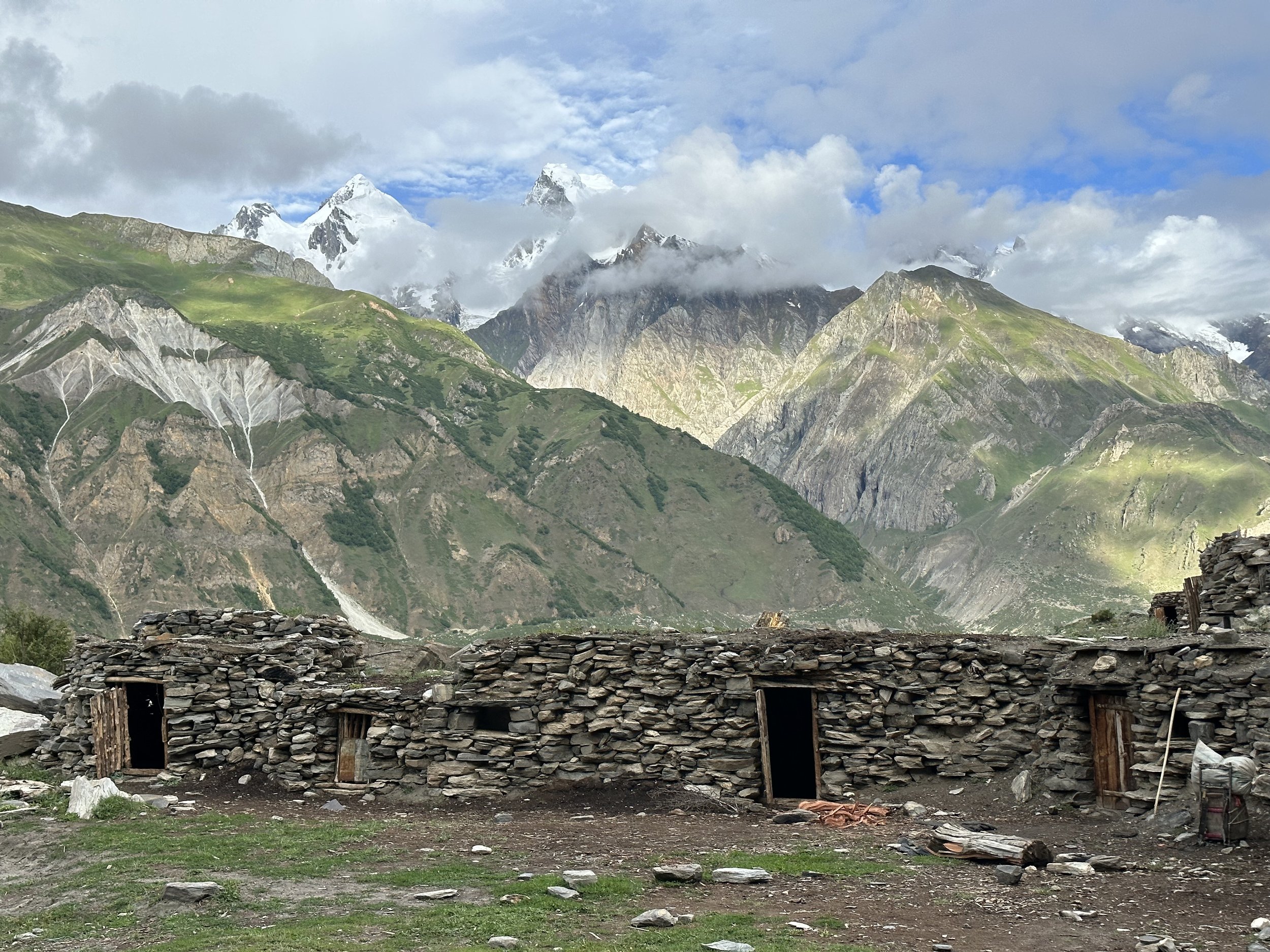
When we reached the pastures below, the porters bought a goat (I bought a goat) for a celebratory feast planned for that evening. The valley was full of animals and people from villages down the Kutwal Valley. This area is a summer pasture in spectacular surroundings with lots of fresh water from the surrounding glaciers and plenty of green grass for the animals. This upper valley is dominated by the massive Haramosh Mountain that towers 4000m above the glacier and dislodges avalanches as soon as the morning sun hits its frozen slopes. The ice avalanches cascade to the glacier below producing a big plume of snowy dust.
In the evening, the happy and excited porters killed and cooked the goat. The goat was boiled and had a rancid smell to it. I could not eat it. The smell of the boiled goat made me gag. The porters were quite happy though and relieved to be down on green grass and done with danger. There were a lot of grasshoppers in this camp. They got into everything, and the tent needed to be zipped up. In the evening some local young guy brought fresh kefir to us. The locals were quite intrigued to have a foreigner here as not many make it to the valley or cross the pass. This pass does not see many crossings at all although some Pakistanis trek to the Kutwal Lake. It is known as one of the most beautiful spots in the Karakorum. A group of Pakistani ladies crossed the Haramosh Pass a month before us, and made it to the national news. I was very happy to have done this pass. It was on my to do list for a decade and the YouTube video I saw was spectacular but not as spectacular as the real thing. I was very happy with myself, and the effort required to do it was worth it.
Essan said that there was no more descending from here to the jeep. In reality, it was another 1500m down.
August 2 The last day of walking 12 km
I was happy that it was the final day of walking. I was told that it was only 3 hours to the jeeps.
The scenery around Kutwal Lake is spectacular. The massive, glaciated wall of Haramosh dominates the valley. The wall is exposed to the hot sun which results in frequent avalanches cascading to the glacier below. On the north side is the huge Malubitng Mountain and another very high and steep glaciated wall. The valleys are full of large green trees and summer pastures for the villagers from down valley. This area is also remote and does not receive many visitors. We went down, down, down. Another 1500m down. As we descended it became hotter and hotter. We took a break in a small village where a local girl served us tea and we had fresh apricots from a nearby tree.
Essan offered to take my bag and I took him up on it as I was so drained by the heat. It was close to 40C, and the heat was amplified by the surrounding rocks radiating it back into the canyon we were following. The canyon was narrow, dry and hot. There was very little water for drinking. We were following a jeep track that was blocked with a landslide ahead.
I was so happy to be going down as I was both physically and mentally spent.
I thought that Pakistan would be an easy trip but both treks were hard. Each in its own way. The uncertainty of the weather, the challenging glacial terrain, lack of appetite, the glaciers, boulders etc. What a crazy, hard but grand adventure! It challenged me physically and mentally. I learned quite a bit from this experience and satisfied my yearning for the Karakorum. This was my fourth trek in this range. I am sure it is not the last one.
We descended to a village with jeeps. The landslides took out a large chunk of the dirt road, so we had to cover extra distance to reach the village with transportation. We were supposed to meet our driver in that village. When we got there, there was no one waiting for us, and we had to hire a local jeep to take us down.
We packed up and started our drive. After 40 min or so we met our driver that Iqbal arranged for us. Consequently, we had to let the local guy go but he demanded full payment and the entire situation escalated to a standoff. He blocked the road and Essan had to negotiate hard to pass. We finally reached an agreement and continued on. The road was absolutely stunning. The weather was brilliant. The drop offs to the bottom of the valley must have been 1km or more. This road is considered as one of the most dangerous in the Karakorum. It was very spectacular dry country with high glaciated mountains towering above it all in the distance. After driving down for an hour and a half we reached the Jaglot-Skardu road.
I contacted Ghulam on Inreach the day before about our meeting point and arrival time. However, when we got to the arranged point, he was not there. We decided to wait for him in a small roadside eatery where we did the tip ceremony with the commensurate clapping and speeches. I was prepared this time and after an hour of waiting Ghulam arrived.
The plan was to drive to Naran. We passed the spectacular Nanga Parbat viewpoint. On the way I bought some fruit from kids by the side of the road and got a bad stomach bug from it. I spent the entire night in Naran on the toilet! Such was the conclusion of this grand adventure.
Total Distance of both treks: 240km