China Far West - Ancient Silk Road Trip Summary

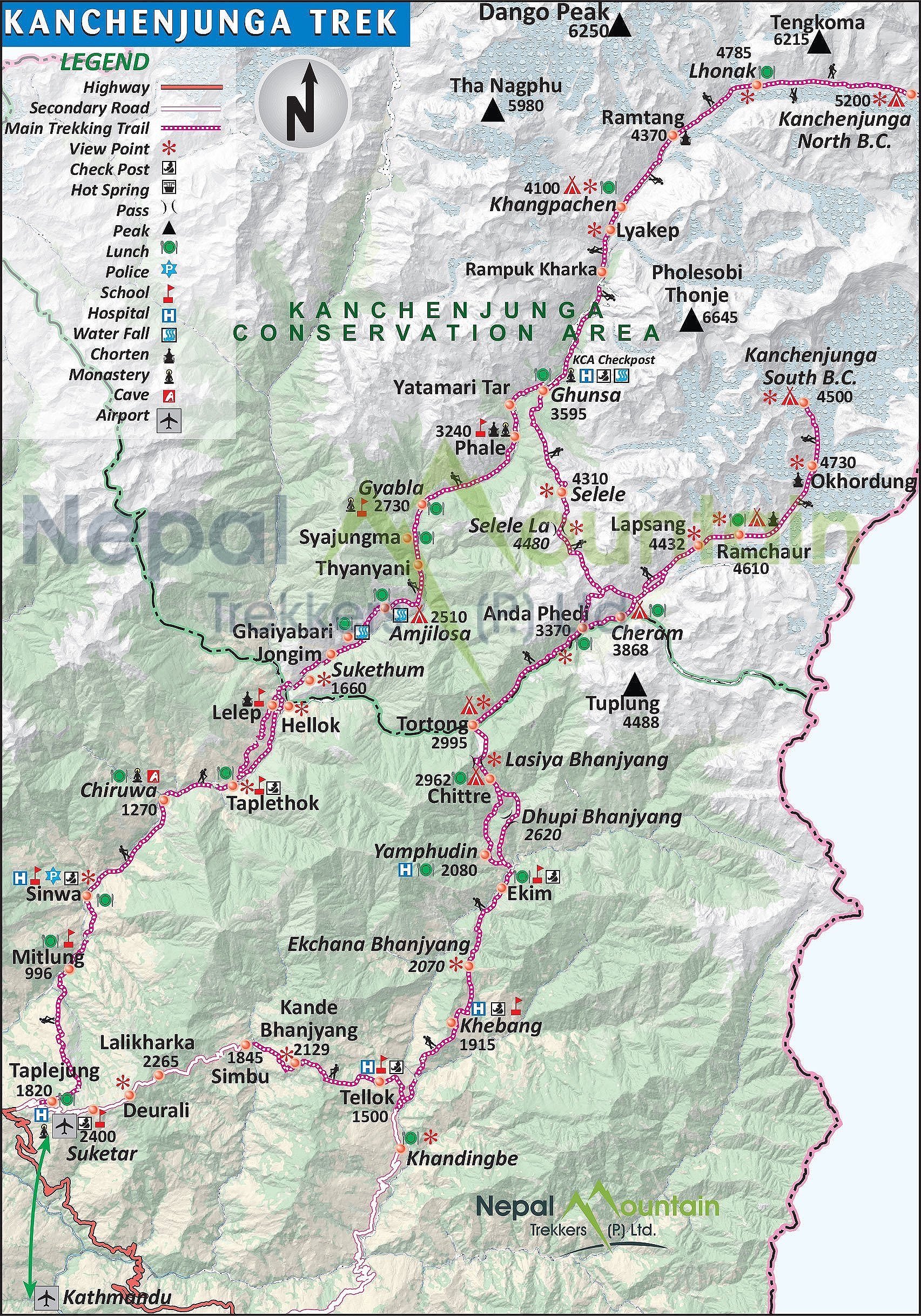
My own account of the journey is supplemented with the narrative and useful information from the travelchinaguide (www.travelchinaguide.com) unless otherwise noted.  

May 1 - 2, 2016

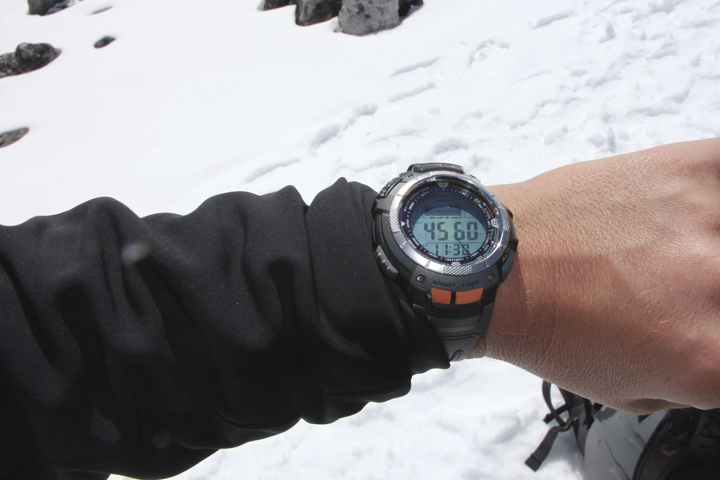
It is a beautiful sunny day.  I am at the airport in Calgary.  I am hoping for some beautiful views of the Rocky Mountains on the flight from Calgary to Vancouver.   I have a long journey ahead from Calgary to Urumqi via Beijing.   

Far East Russia from 35,000ft

Far East Russia from 35,000ft

During a long flight from Vancouver to Beijing we had beautiful views of northern Russia (probably the Magadan region).  It looked like a cold and desolate place with rolling barren hills covered in snow.  We finally landed in Beijing after 11 long hours.  The passport control and flight transfer were very fast and efficient.  I had to wait for 4 hours for the next flight to Urumqi. I was totally exhausted and crashed on the seats at the airport.  I was not looking forward to another 4-hour flight.  Finally, after a long wait, I got onto the Air China flight as the only white guy.  We arrived in Urumqi at 00.30 although the local time was 10.30pm.  The air in Urumqi, although cooler, was filled with a distinct small of soot.  

On arrival, I met Waheed, our Uighur guide who is also organizing the K2 trip for us in September of the same year.   He took me to the hotel where David was already waiting for me.  David arrived on Turkish Airlines flight from Istanbul in the morning.  Istanbul is only 5 hours away (almost as far as Beijing!).   Our centrally located hotel was very gaudy and tasteless in décor but very comfortable and provided me with a welcome rest considering how tired I was. 

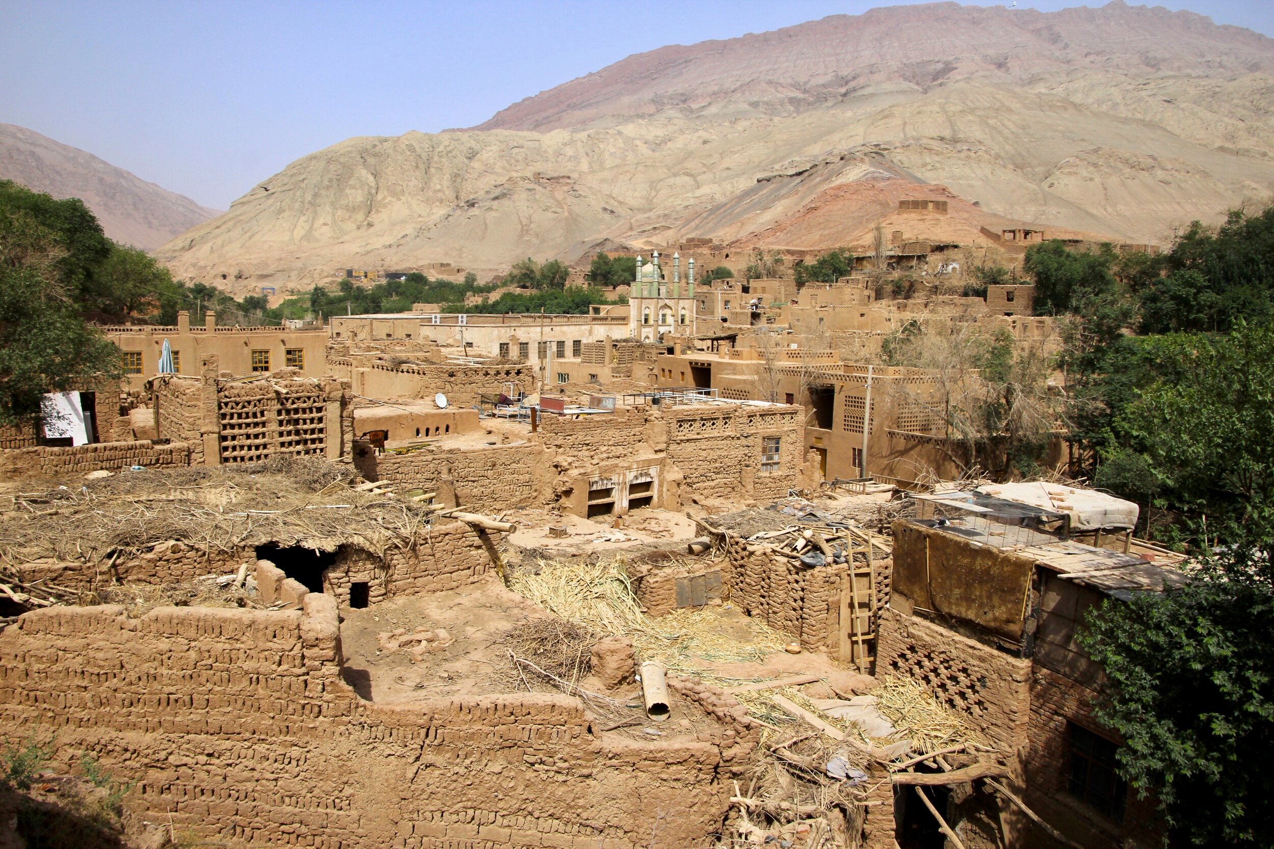
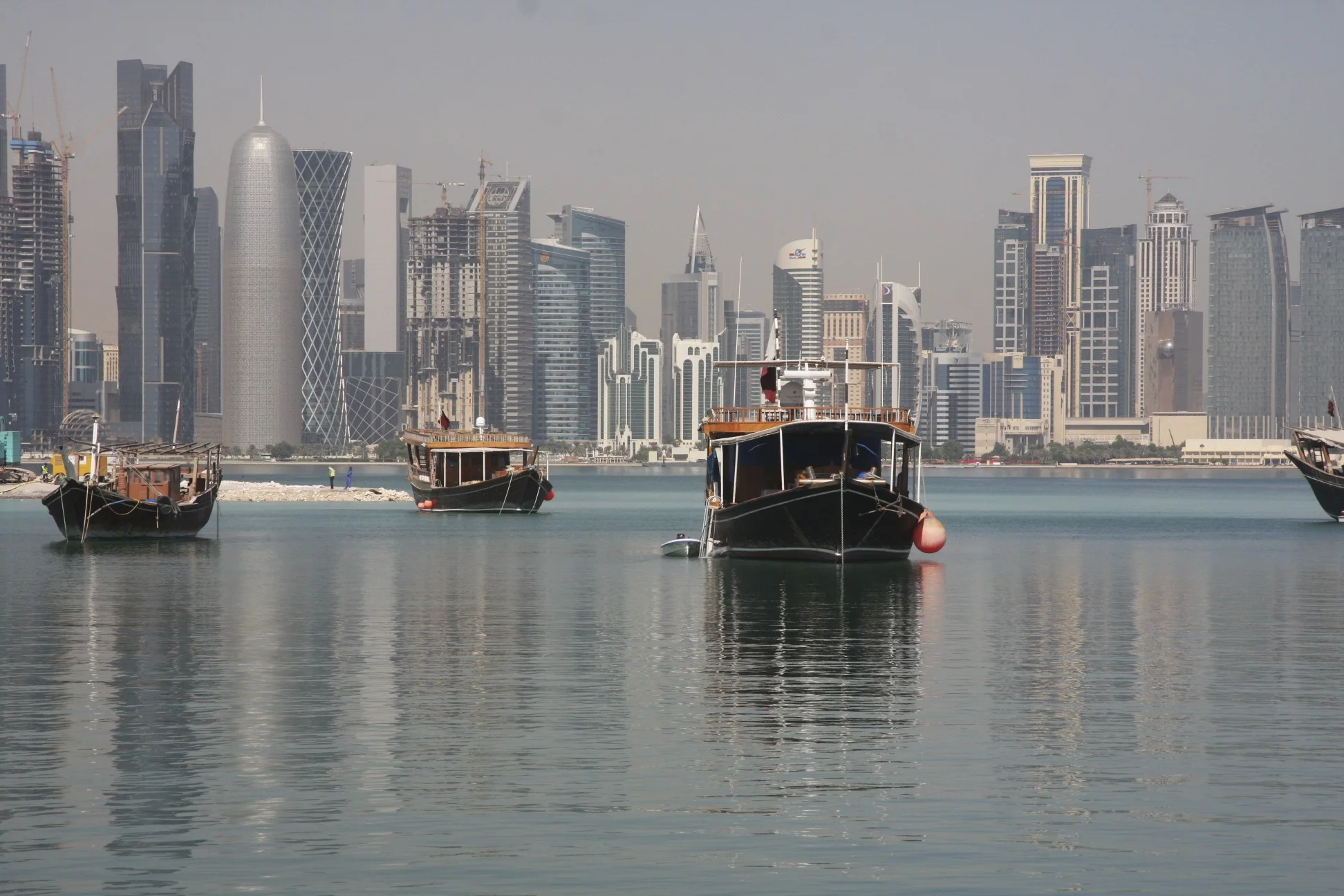
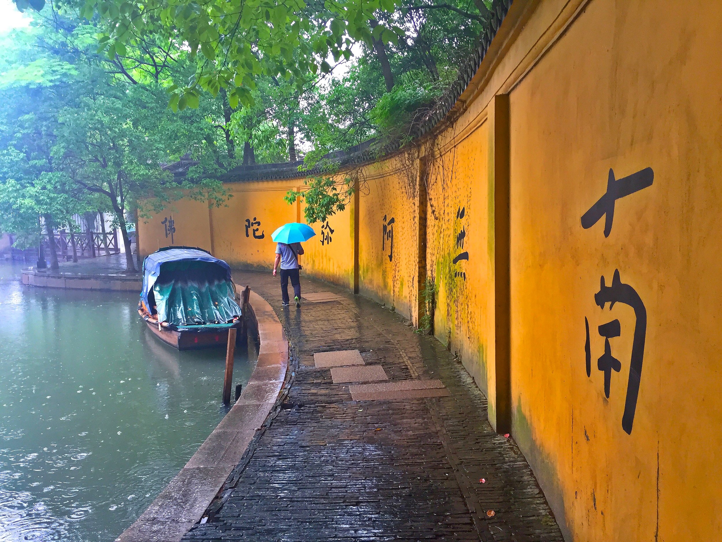
At first glance, Urumqi seemed like any other huge Chinese city.  It was full of concrete buildings and highways with little regards for beauty.  The city has 5 million inhabitants.  While driving around on the elevated expressways, we saw a forest of apartment buildings and office towers.   Apparently, this city is a hub of trade with all the Stans of Central Asia and part of the new Silk Road.    

IMG_2924.jpg
IMG_2934.jpg
IMG_2896.jpg

May 3, 2016 Urumqi – Turpan

We got up quite early and went for breakfast.  The breakfast food was somewhat unusual:  steamed buns with mutton and steamed buns with dates and raisins. It was actually very good, not the usual eggs and bacon or the Chinese buffet.   After the breakfast David and I went for a quick walking tour of the city near the main bazar and the hotel.   The part of the city that we were walking in had a very different feel to it.  The restaurants were serving the traditional foods with kebab grills outside.  The architecture was different too with more central Asian accents and design.  Since it was quite early in the morning, nothing was open so we decided to return to the hotel and meet Waheed.  

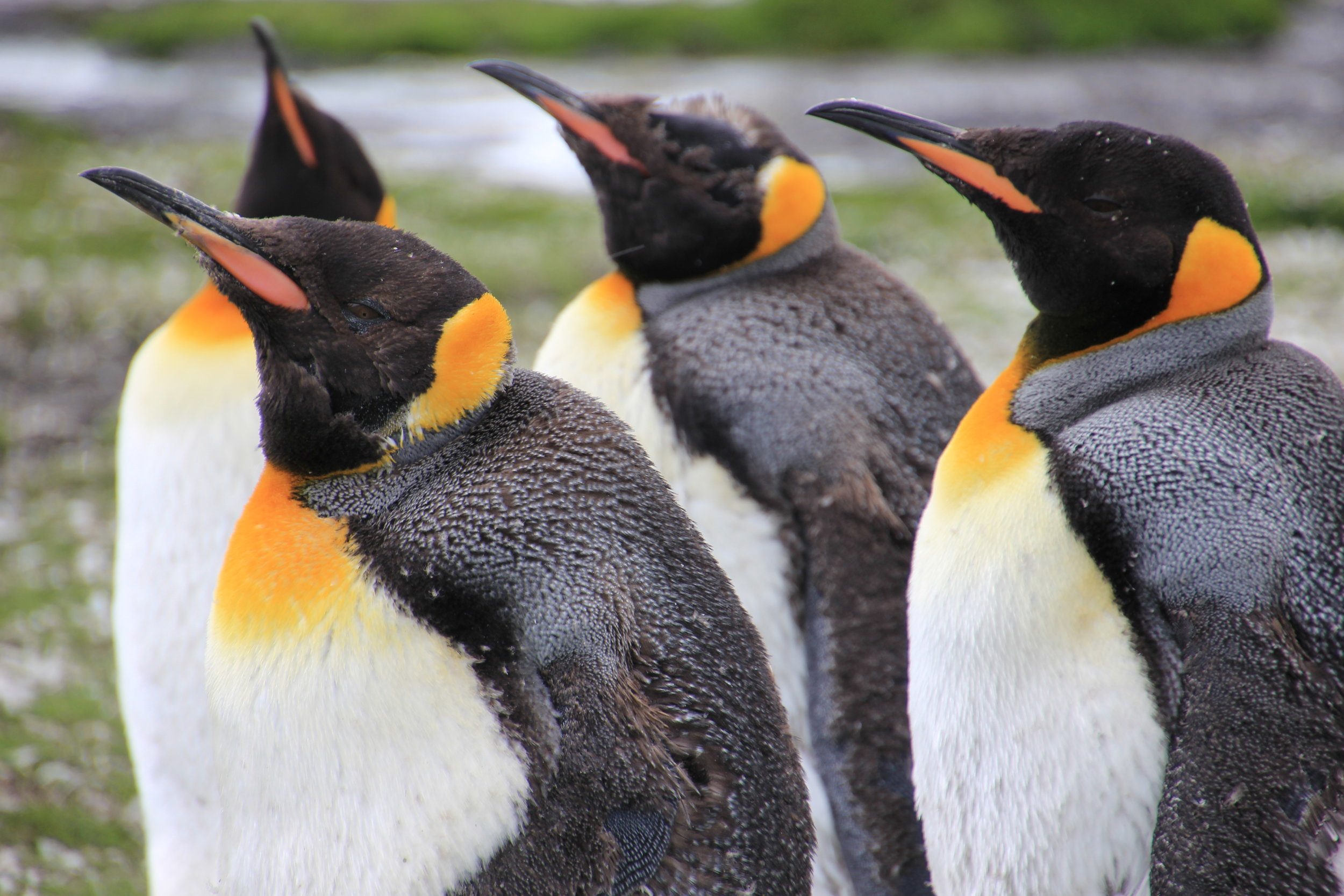
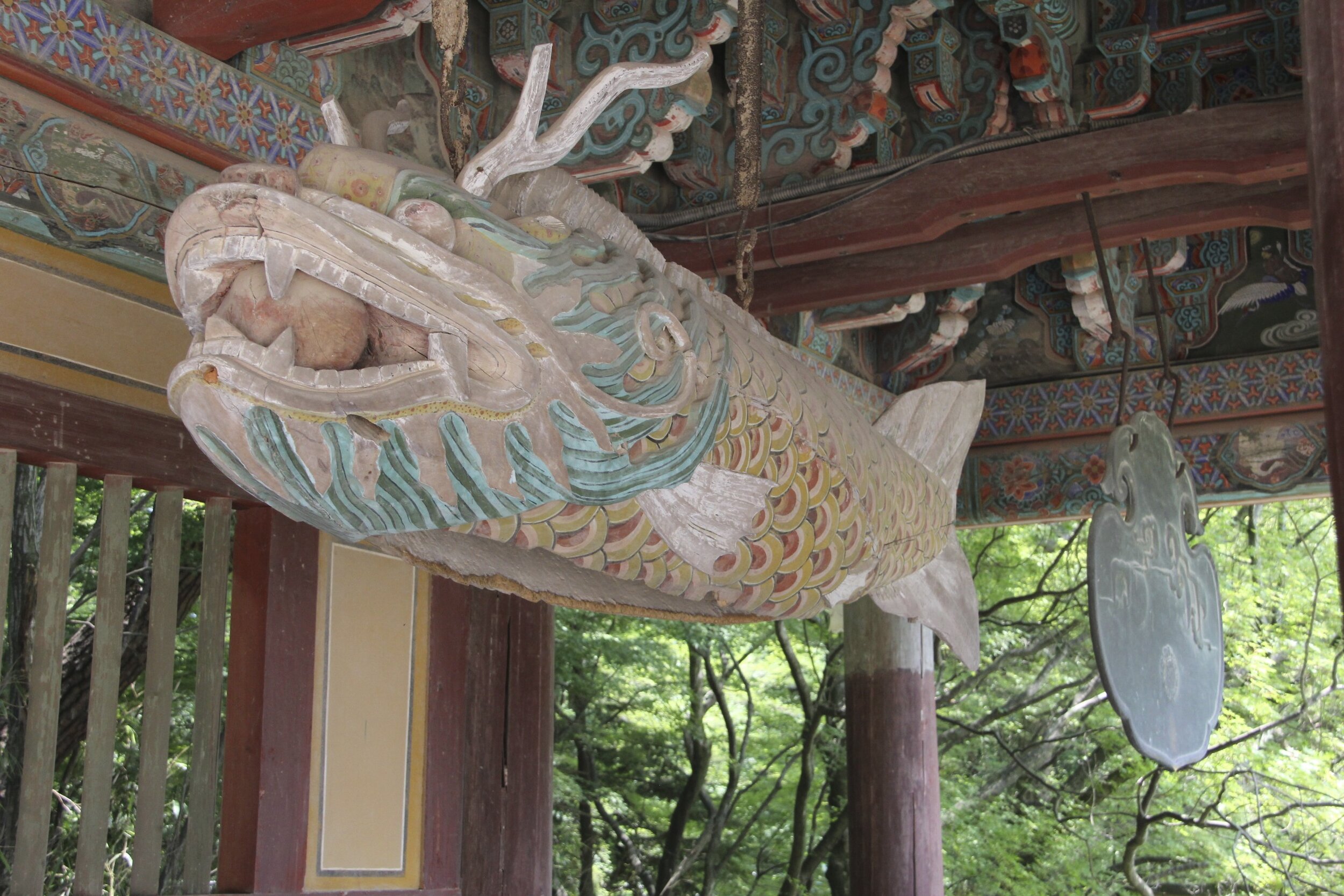
From the hotel, we drove to the Provincial Museum to see the main attraction:  the Tarim mummies.  The museum was excellent, clean and very interesting.  The main attraction were the Tarim mummies.  I read a book about these mummies and saw many photos of them over the years.  The display in real life had all the mummies from the book I read.  The museum had many displays in English although not all.   The mummies are shrouded in mystery.  They are very old and the origin of the people whose graves were discovered is unknown and subject to much speculation.  An analysis of their clothing revealed that the possible origin is somewhere in central or northern Europe.   

The Provincial Museum

The Provincial Museum

IMG_2865.jpg
IMG_2868.jpg

“One glimpse of the corpses was enough to shock Victor Mair profoundly. In 1987, Mair, a professor of Chinese at the University of Pennsylvania, was leading a tour group through a museum in the Chinese city of Ürümqi, in the central Asian province of Xinjiang, when he accidentally strayed into a gloomy, newly opened room. There, under glass, lay the recently discovered corpses of a family--a man, a woman, and a child of two or three--each clad in long, dark purple woolen garments and felt boots. "Even today I get chills thinking about that first encounter," says Mair. "The Chinese said they were 3,000 years old, yet the bodies looked as if they were buried yesterday."  

But the real shock came when Mair looked closely at their faces. In contrast to most central Asian peoples, these corpses had obvious Caucasian, or European, features--blond hair, long noses, deep-set eyes, and long skulls. "I was thunderstruck," Mair recalls. "Even though I was supposed to be leading a tour group, I just couldn't leave that room. The questions kept nagging at me: Who were these people? How did they get out here at such an early date?"  

The corpses Mair saw that day were just a few of more than 100 dug up by Chinese archeologists over the past 16 years. All of them are astonishingly well preserved. They come from four major burial sites scattered between the arid foothills of the Tian Shan ("Celestial Mountains") in northwest China and the fringes of the Taklimakan Desert, some 150 miles due south. All together, these bodies, dating from about 2000 B.C. to 300 B.C., constitute a significant addition to the world's catalog of prehistoric mummies. Unlike the roughly contemporaneous mummies of ancient Egypt, the Xinjiang mummies were not rulers or nobles; they were not interred in pyramids or other such monuments, nor were they subjected to deliberate mummification procedures. They were preserved merely by being buried in the parched, stony desert, where daytime temperatures often soar over 100 degrees. In the heat the bodies were quickly dried, with facial hair, skin, and other tissues remaining largely intact.“ discovermagazine.com

IMG_2864.jpg
IMG_2871.jpg
IMG_0139.jpg
IMG_0164.jpg
IMG_2881.jpg

From Urumqi we drove in the rain to Turpan through dry and jagged mountains. Once we left Urumqi the rain cleared and it became very windy and sunny.  The extremely strong and consistent wind is the reason for many wind turbines that dot the landscape in this area.

The landscape reminded me of Southern Alberta with wide open spaces, few trees and a lot of wind.  It had some strange beauty to it, and given where we were, also some mystique.  

After a two-hour drive through an increasingly dry and desolate landscape we spotted a line of green on the horizon.  It was the oasis of Turpan.   

Our first stop in Turpan was the Karez Water System which transports water from distant mountains through series of underground tunnels to the oasis of Turpan. The tunnels stretch for many kilometers and they have to be continuously maintained.   Given that this was all built 2000 years ago the task was monumental in its scale.  Working in the tunnels without natural light and in tight spaces was dangerous and difficult.  The displays in the museum were very well done.  The museum and the tunnels were located in a vineyard with beautiful walkways under a canopy of vines providing welcome shade from the blazing sun.  We went to one of the underground tunnels. It was cool, narrow and had a clear spring running through the middle of it.  

“In Xinjiang, the greatest number of karez wells are in the Turpan Depression, where today there remain over 1100 karez wells and channels having a total length of over 5,000 kilometres (3,100 mi). The local geography makes karez wells practical for agricultural irrigation and other uses. Turpan is located in the second deepest geographical depression in the world, with over 4,000 km2 (1,500 sq mi) of land below sea level and with soil that forms a sturdy basin. Water naturally flows down from the nearby mountains during the rainy season in an underground current to the low depression basin under the desert. The Turpan summer is very hot and dry with periods of wind and blowing sand.

Turpan's karez water system is made up of a horizontal series of vertically dug wells that are then linked by underground water canals to collect water from the watershed surface runoff from the base of the Tian Shan Mountains and the nearby Flaming Mountains. The canals channel the water to the surface, taking advantage of the current provided by the gravity of the downward slope of the Turpan Depression. The canals are mostly underground to reduce water evaporation and to make the slope long enough to reach far distances being only gravity fed.”

After Karez we drove to the Emin Minaret.  It was already late in the day and the sun was setting.  We were the last guests inside the minaret complex. The complex consists of the mosque and a cemetery.  The place had a beautiful feel to it and it looked very pretty in the low light of the setting sun.  The complex is located in a fertile oasis of vineyards and poplar trees.  It has a very Central Asian feel about it.   We left just before sunset.  

IMG_2956.jpg

“Emin Minaret is the largest old tower in Xinjiang and the only Islamic tower among the hundred famous towers in China.

Standing 2 km (1.24 miles) east of Turpan, it was built in 1777 in honor of the heroic Turpan general, Emin Khoja. He was an outstanding patriot who defended the unification of China throughout his life. He had eight sons but the eldest son died of illness at a young age. Influenced by him, all his remaining sons made contributions during the war against Jungar rebellions. It was Suleman, his second son, that built this minaret with his own money. This is the reason why the minaret is also named Su Gong Ta. Upon Emin's death, Suleman inherited his father's rank and became the second Turpan ruler.

At the entrance to the minaret, two steles were set up. On one is a Chinese inscription which explains that the purpose of building the minaret was to show gratitude to the Qing Dynasty (1644-1911) and to commemorate exploits of Emin Khoja while the Uigur inscription on the other stele gave thanks to Allah.”

On the way to the hotel we picked up a basket of sweet mulberries.  We stayed in the nice Huozhou Hotel in Turpan.

May 4 Turpan

We got up early again mainly due to the time change, had good breakfast in the hotel and left at 8am for another action packed day!

First we went to the Jiaohe Ancient Town.  It was aligned with Genghis Khan and then ruined by him.  The site was just sand ruins of an old city with very few recognizable buildings still standing.  It was similar to Palmyra in Syria although at the opposite end of the ancient Silk Road.  The ruins are perched on a mesa above two rivers that run around it.  Although we arrived there at 9 am, it was already very hot. Turpan is located in the Turpan depression and it is one of the hottest places of earth.  In its day, the city was quite large and it is relatively well preserved considering that the main material used for its construction was nothing more than mud bricks. It is so hot and dry here that one must wander why would anyone choose this as a location for a settlement?  After the walk around the ruins, we shared a juicy and sweet watermelon between all of us.  The watermelons and grapes here are the best in the world due to ideal climate. 

The ancient city located on a mesa

The ancient city located on a mesa

“One of the world's architectural wonders hides in Yarnaz Valley, 10 kilometers (6.2 miles) west of Turpan. Like a willow leaf, the ancient city of Jiaohe (Yarkhoto) with a history of 2300 years lies between two rivers on a plateau atop a cliff of over 30 meters (98.4feet). The largest, oldest and best-preserved earthen city in the world, Jiaohe is 1,650 meters (5,413 feet) by 300 meters (984 feet) at its widest; with an area of 220,000 square meters (2,368,168 square feet). It was included in the World Heritage List on June 22, 2014.
 
The ancient city was the capital of the former Cheshi State. An Indian proverb says, 'Intelligence is bound to exist where two rivers meet'.  Jiaohe, meaning in Chinese where two rivers meet, is such a place. According to historical records it was home to 700 households, 6500 residents plus 865 soldiers.

Jiaohe distinguishes itself from other ancient cities owing to three features. First, it had only two city gates, the South and East Gates. The main South Gate vanished long ago, leaving a huge breach. The East Gate cut by the cliff was virtually non-existent. Second, the city faces cliffs on three sides, so there are no city walls commonly seen in other ancient cities. Third, all the buildings were dug from earth, and wood was rarely used.”

IMG_2995.jpg
IMG_3003.jpg
IMG_3011.jpg
IMG_3052.jpg

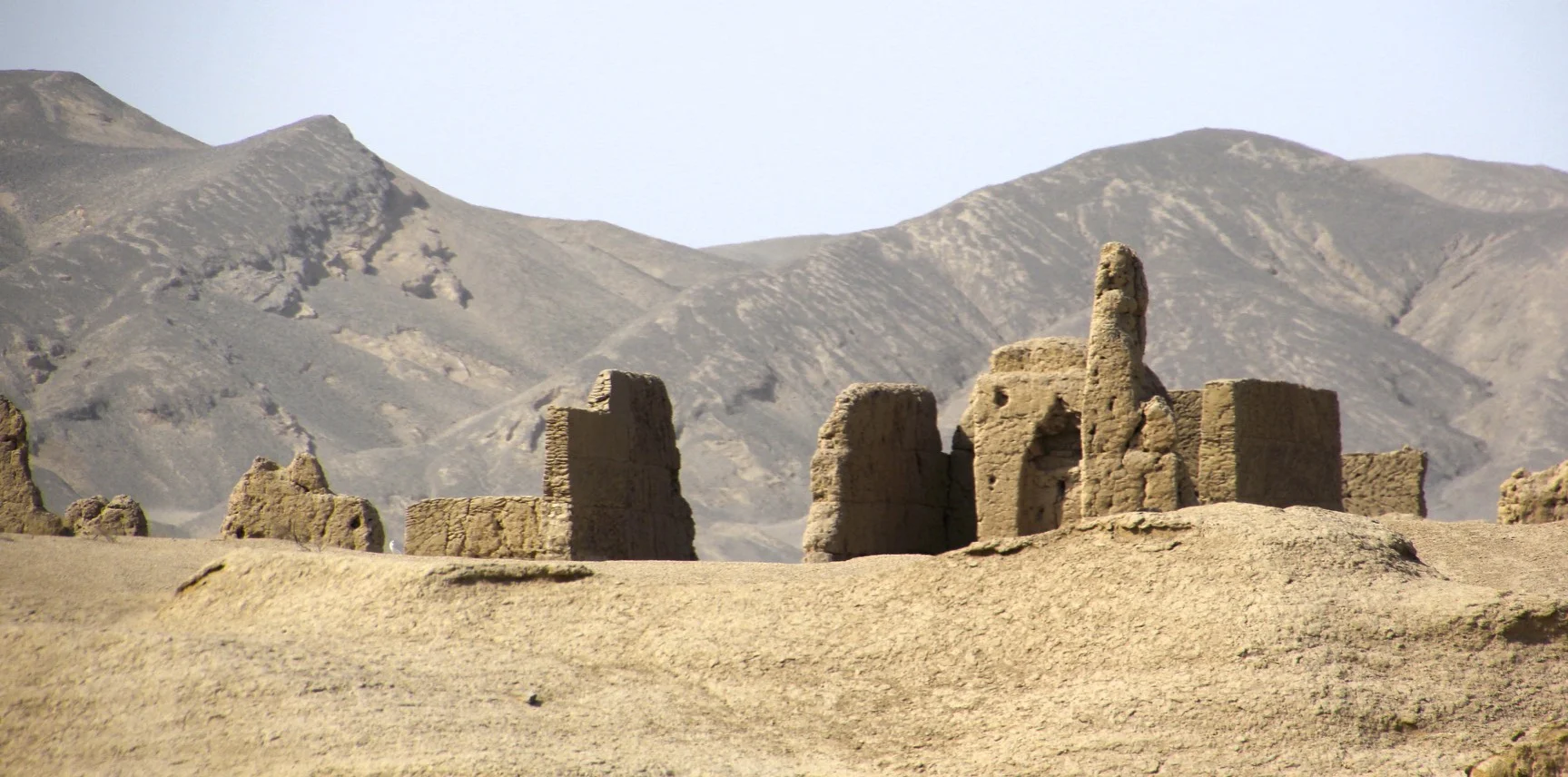
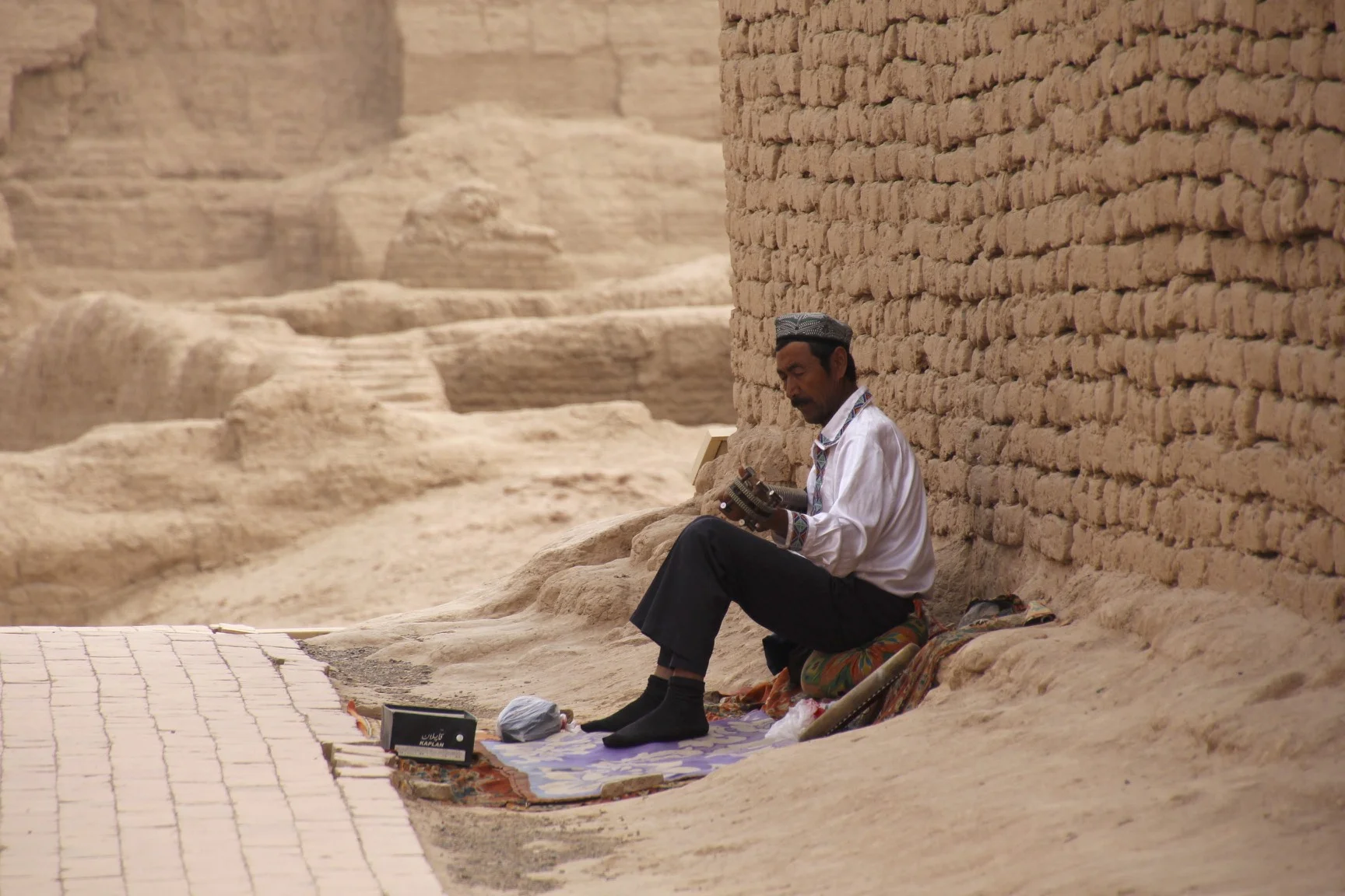
Driving back to Turpan we passed many vineyards.  From Jiaohe we went to even larger (although worst preserved) city of Gaochang.  This was the capital city of this region and aside from a few barely recognizable structures and massive walls, not much remains.  The Gaochang City was a major stop along the ancient trading route (the Silk Road).  Its prominence was between the 1st and 14th century.  This was the capital of the Uighur people.   The site is huge with massive city walls surrounding it.  Most of the buildings are gone though which is no surprise considering that it was built from mud.   We had the entire massive site to ourselves and we were surprised about how empty it was. We did run into a lone Uyghur man playing a traditional instrument among the ruins.  Walking around the city was a great experience and one could feel a great sense of history.  It was really hot though and it was difficult to walk around.  There was no shade and no trees.  

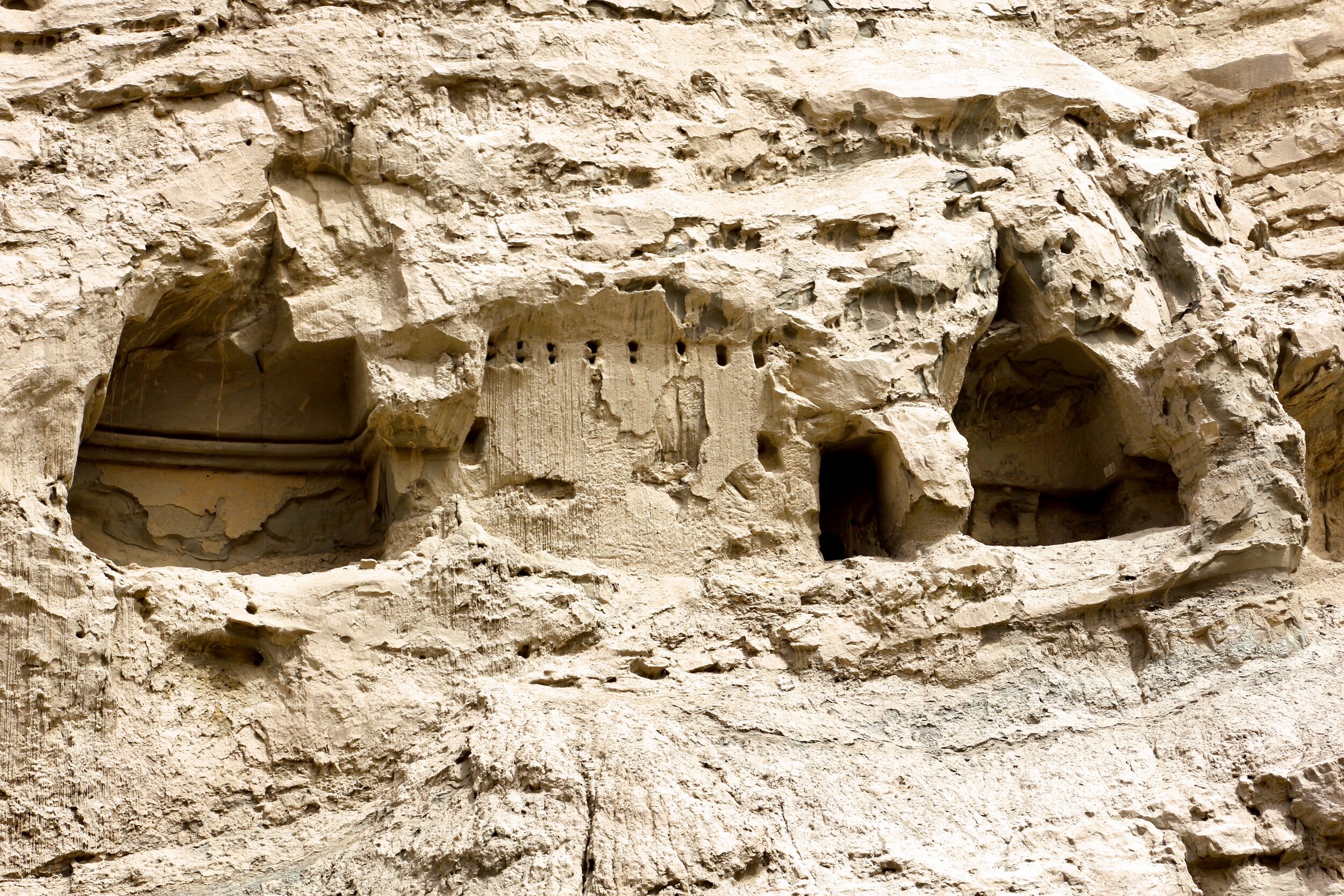
We also visited the Astana graves – the cemetery for the citizens of the Gaochang City.  The site was quite large but most artifacts that were found here were taken to the Provincial Museum in Urumqi.  We descended into one of the crypts that held the human remains.  Unfortunately, we did not have enough time to see the Turpan Museum which looks quite interesting.  

IMG_3150.jpg

“In the boundless desolate Gobi Desert stand the ruins of the ancient city of Gaochang, shining like a resplendent precious stone inlaid in the barren desert and shining on the Silk Road. It is located at the foot of the Flaming Mountain, about 46 kilometers (about 29 miles) southeast of Turpan. Withstanding the test of time and weather, the ancient city of Gaochang, and the ancient city of Jiaohe, are the best-preserved ruins of the ancient cities in China. These two cities were added to the World Heritage List on June 22, 2014.

The city was initially built as a garrison town in the first century B.C., called Gaochang Wall, and later renamed Kharakhoja, Kocho or King City. It was a key point along the Silk Road. During the successive dynasties, it was ruled as Gaochang Prefecture, Gaochang Kingdom and West Prefecture. By the 14th century, the city was damaged and abandoned due to warfare between Mongolian aristocrats and Uigurs. After 2,000 years, the weather-beaten ancient city still displays its past greatness and glory even though the walls are incomplete the magnificent outline remains.”

“The Astana-Karakhoja Ancient Tombs are part of the Underground Museum of Turpan and the Living Archives of Gaochang. Astana means capital in Uigur; Karakhoja was a Uigur hero who protected his people from a vicious dragon.

The tombs are located 42 km (26miles) southeast of Turpan city and 6 km (3.7miles) from the Ancient City of Gaochang. The tombs were the public cemetery of the ancient Gaochang residents, both aristocrats and commoners. Among the excavated 456 tombs, the Gaochang king's has not been found.

The tomb complex is 5 km (3.1miles) from east to west, and 2 km (1.2miles) from north to south. Gravel boundaries separate the tombs by family. The paternal family burial order was strictly followed, similar to the system in the Hexi Corridor (today's Gansu Province), and even in central China. Generally, husband and wife were buried together. In some cases, one man was accompanied by two or three women.

A slope of over 10 meters (32.8 feet) long leads down to the chamber. The chamber is 2 meters (6.6 feet) high with a flat ceiling or a dome. The dead are placed on an earthen or wooden bed in the back of the chamber. They had wood in both hands and wore cotton, linen or silk clothes. Around them are miniature pavilions, carts and horses, parades, musical instruments, chess sets, pens and ink, grapes, melons, dumplings and pancakes -- to be used by the dead in another world. Owing to the arid climate, the relics are very well preserved; dumplings are the same as today's, and the stuffing is as intact as it was when fresh. Murals with vivid pictures of humans, animals, flowers, mountains, and rivers decorate some chambers. A painting of ladies playing chess illustrates the happy life of aristocrats in the early Tang Dynasty (618-907).

Among the more than ten thousand cultural relics excavated are over 2700 books, epitaphs, paintings, clay figurines, and pottery, wood, gold and stone wares, ancient coins, silk and cotton textiles. The time recorded in the books ranges from 273 to 772.”

From Gaochang we drove to the nearby village of Tuyoq, which is a Muslim pilgrimage site for the local people.   The village is quite interesting and picturesque nested against the Flaming Mountains.   We had luch here in a small restaurant and the owner did not want any payment! We had very good local food finished by a serving of delicious mulberries.   The homes’ internal courtyards are shaded by a canopy of vineyards with large bed platforms in the yard for relaxing and sleeping outside.  It is a great invention from this part of the world.  We also had great mulberry juice and local yoghurt which was very refreshing on such a hot day.  

IMG_3131.jpg
IMG_3133.jpg
IMG_3144.jpg

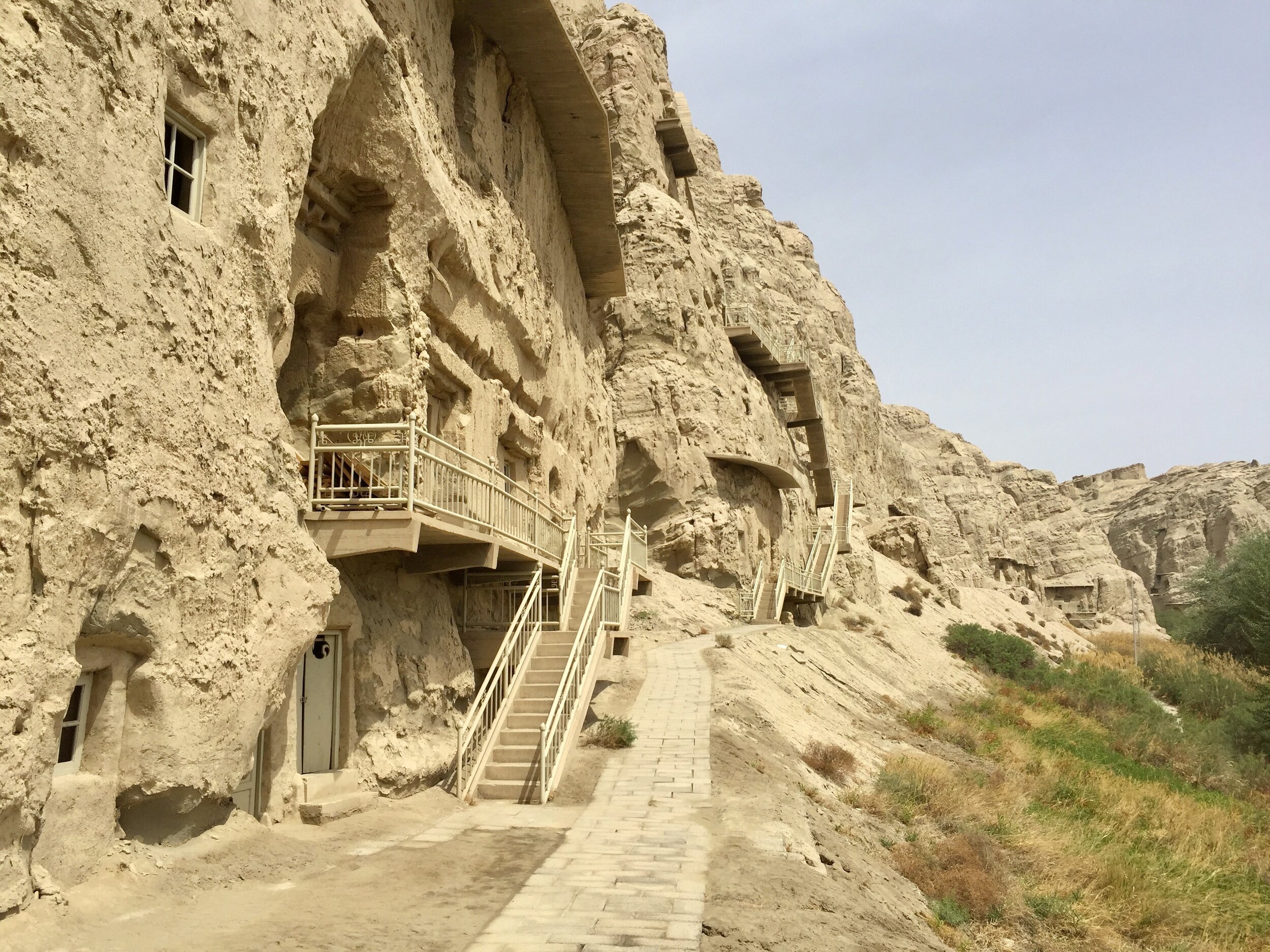
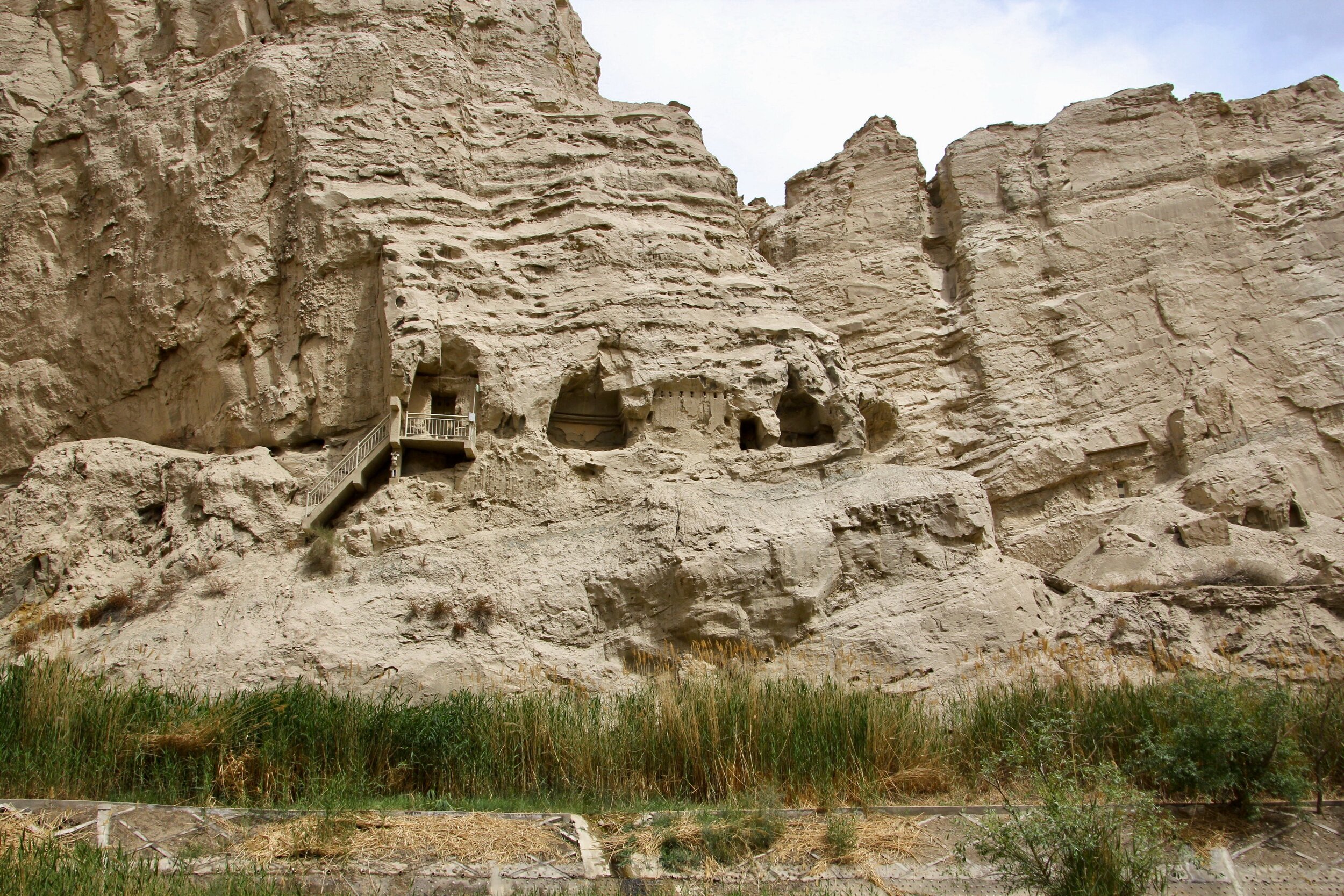
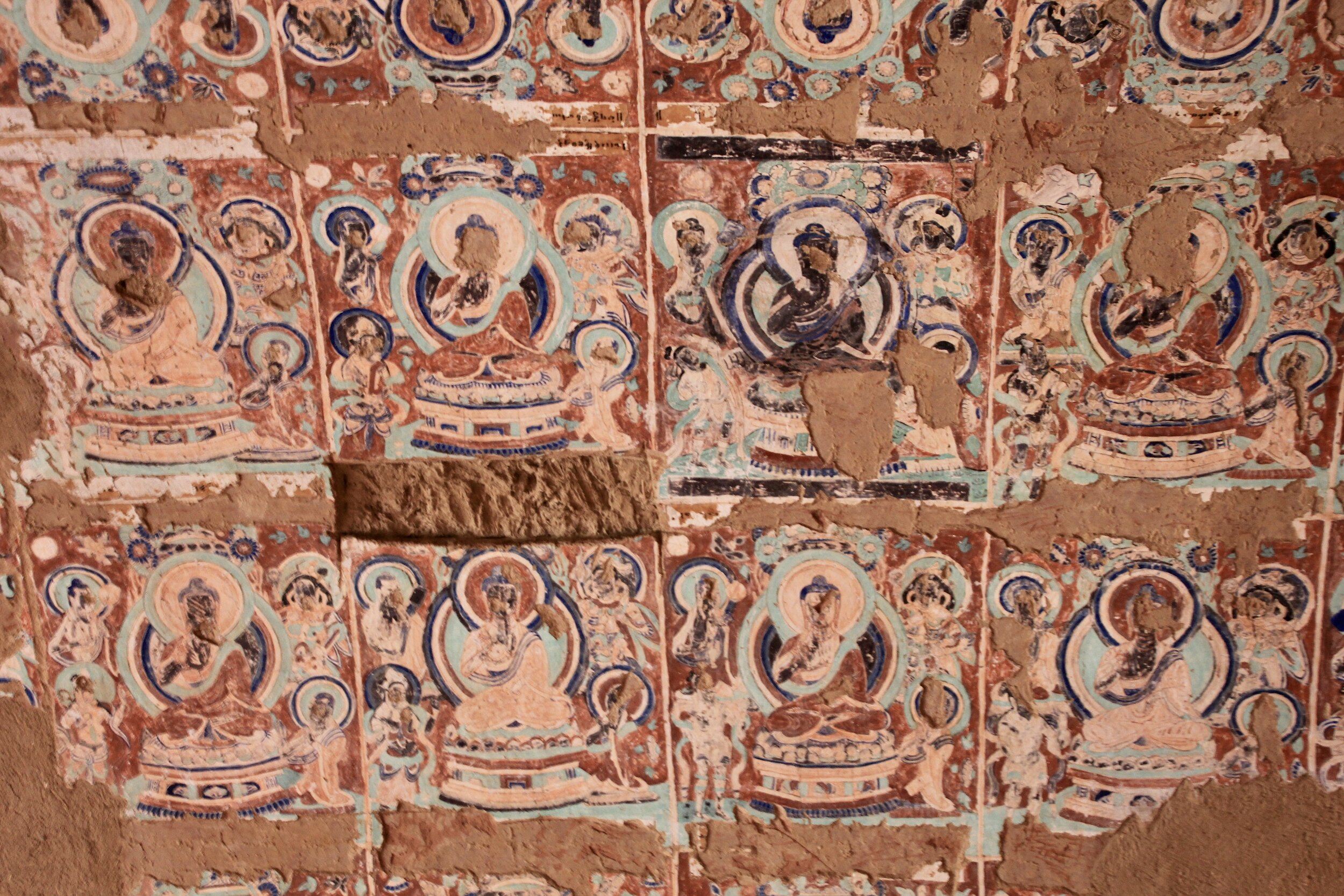
After wandering around Tuyoq minarets and small chapels, we drove like mad (which was a great improvement from the 40km/hr pace before lunch) to the Bezeklik Buddhist Caves.  

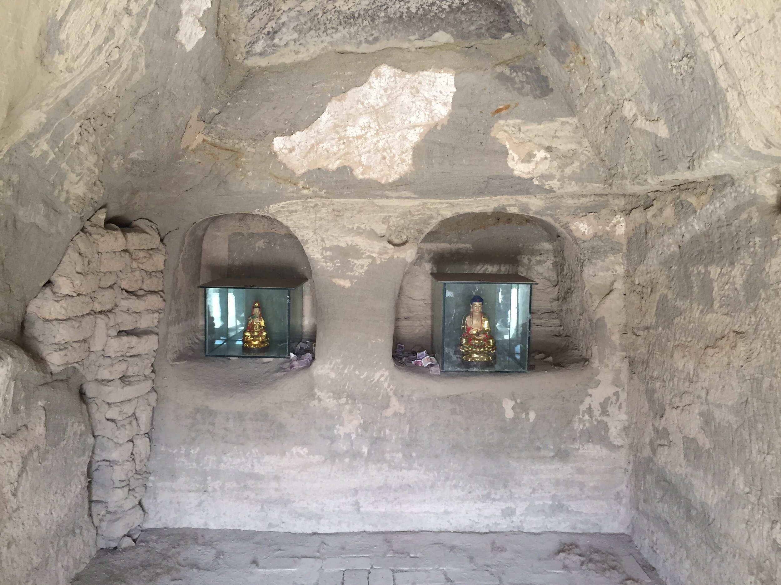
The cave complex is located in a spectacular spot dug into a cliff above a deep river canyon.  Across from the caves rise the Flaming Mountains.  Unfortunately only a few of the caves were open and the others were hidden behind metal doors.  The site was devoid of tourists with quite a few bored looking local security guards entertaining themselves with games on their mobile phones.  

What remains of the caves’ interiors is interesting to see.  The original frescoes were rudely cut out but Europeans in the early 1900s.  The views from the complex were very impressive especially in the low light of the setting sun.   

IMG_3154.jpg
IMG_3158.jpg
IMG_3162.jpg

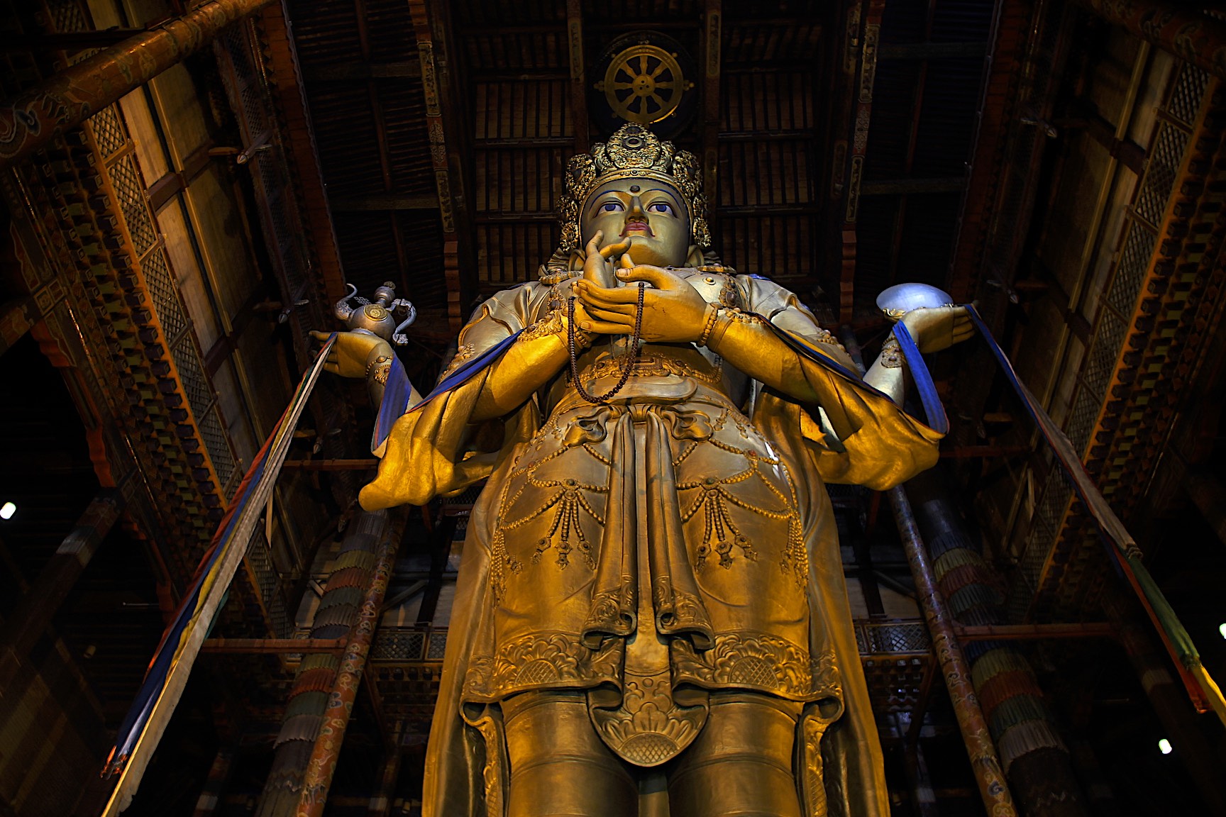
“Bezeklik Thousand Buddha Caves stand high on the cliffs of west Mutou Valley under the Flaming Mountain, 45 km (28miles) east of Turpan. Of the 83 original caves, 57 remain. In addition, the murals cover an area over 1, 200 square meters (12,917 square feet) in more than 40 of them.

Beginning in the Southern and Northern Dynasties, the construction experienced Tang, the Five Dynasties, Song and Yuan. The Caves had been the Buddhist center of Gaochang. Near the end of the 13century, the royal family of Gaochang moved to Yongchang, Gansu. Around this same time, Buddhism in Turpan began to decline in popularity with the introduction of Islam. Subsequently, the religious importance of The Bezeklik Thousand Buddha Caves became less apparent. Many of them were destroyed during the ensuing religious clashes. Vandals dug out the eyes of many of the portraits human figures contained in the murals. Later, at the beginning of the 20century, foreign explorers robbed the caves of much of the treasures. Despite all the destruction, the surviving parts, such as the delicate Buddha seat and the bright color of the murals, give us some idea of its past glory. 

Bezeklik Caves was the royal temple of Huihu (the predecessor of today's Uigur) State and the present remains were enlarged or renovated during that time. The murals take us back to the ancient Huihu State, where we can see the King and Queen and people from all walks of life. The inscriptions, written in ancient Uigar, Chinese and other languages, provide authentic reference for valuable historic research.”

From the caves, we drove 50km back to Turpan and ended up in the food market in the center of the city.  The stall owners were just getting started and were getting the coals going for the shashliks.  We had some good dumplings in a broth (like the Tibetan momos) and good shashliks with cold local beer.  We had a great dinner for less than $10 for 4 people.  We ate outside in a great setting among many local people milling about. The place was very busy!  

IMG_3193.jpg
IMG_3201.jpg
IMG_0356.JPG
IMG_0360.JPG

Overall Turpan is a very attractive city.  It is small and does not feel like a typical Chinese metropolis like Urumqi.  It really feels more Central Asian than Chinese.  At night it looks even more attractive than during the day:  cooler, less dusty and very colorful with neon lights and illuminated shops.  All in all it was a great day with many interesting sights.

May 5 – Turpan – Kuqa

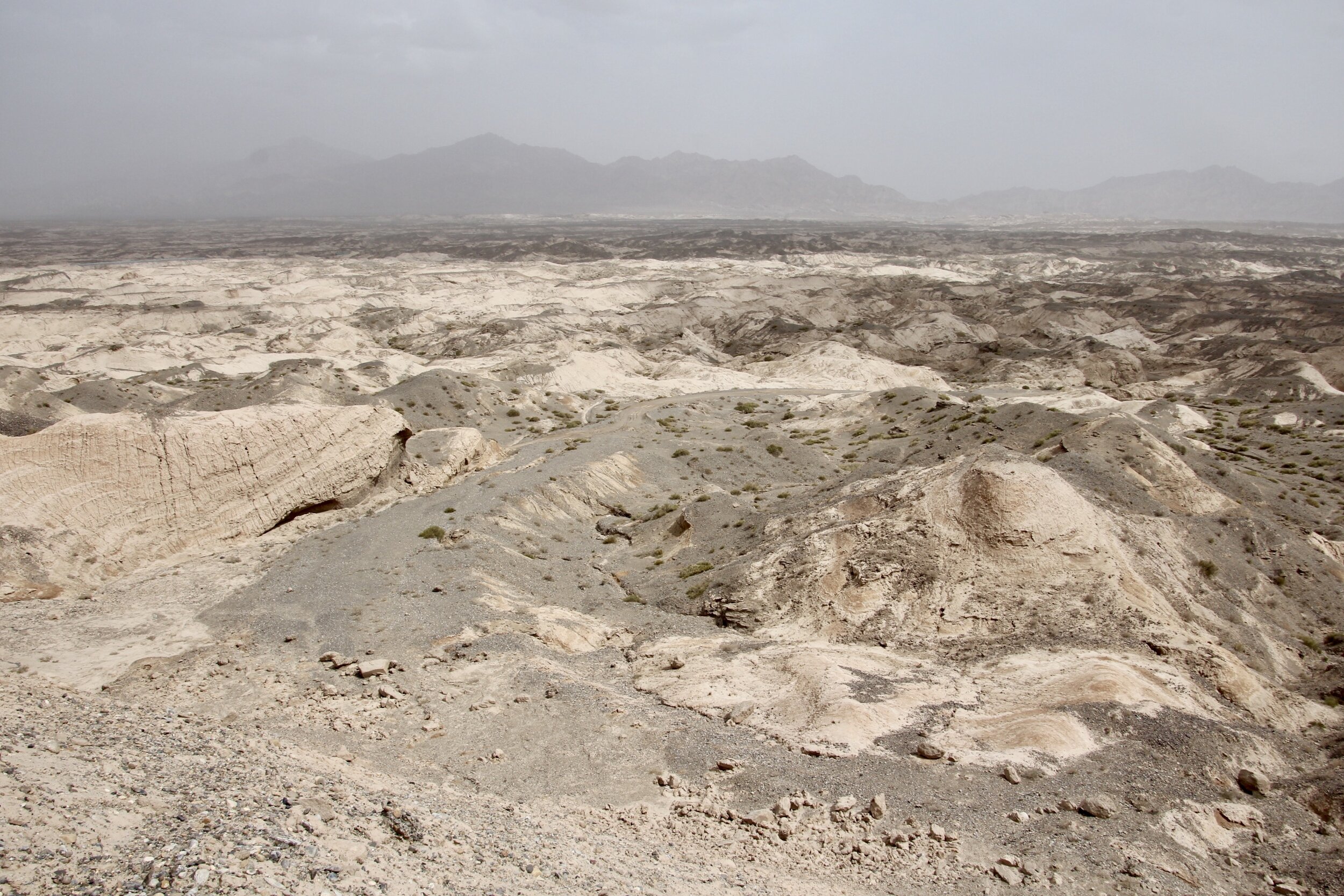
Today we drove 700km from Turpan to Kuqa (Kucha).  The quality of the highways is excellent here and such quick travel would be impossible even 10 years ago.  This is one of the positive aspects of the Chinese development.  The road passed the easternmost extremity of the Tien Shan Mountains.  It was extremely dry with massive sand dunes descending right to the road.   The sand was sandwiched between black rocks that rose vertically for 100m or more.  The road was winding through a dry river valley and it was a two-lane highway all the way.  We then crossed into even stranger looking plateau of eroded conical badlands and the southern end of the Tien Shan Range.   

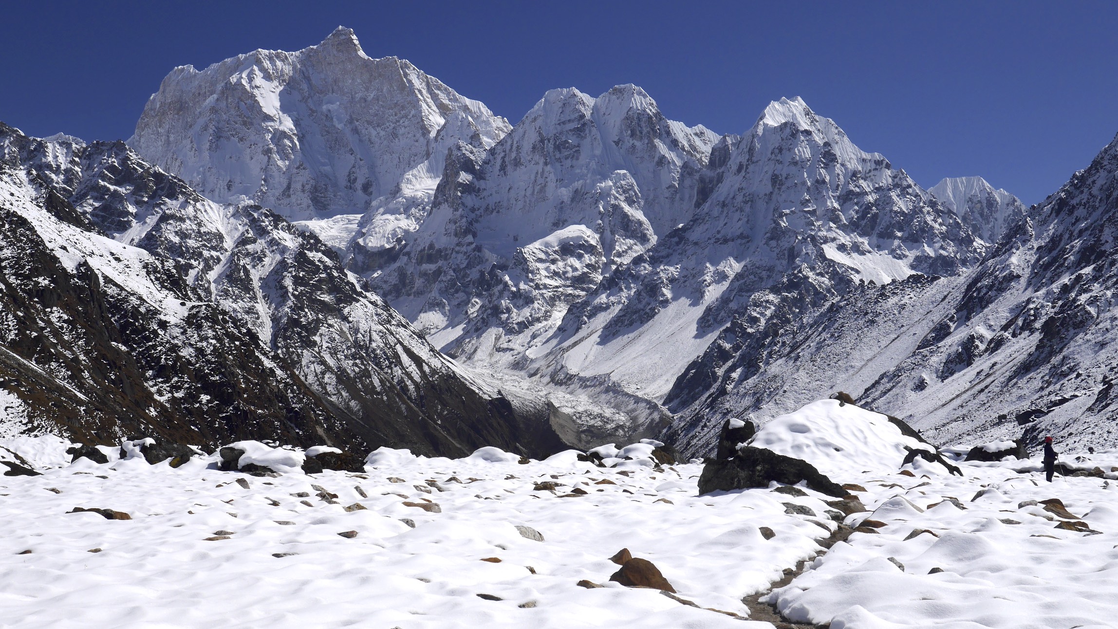
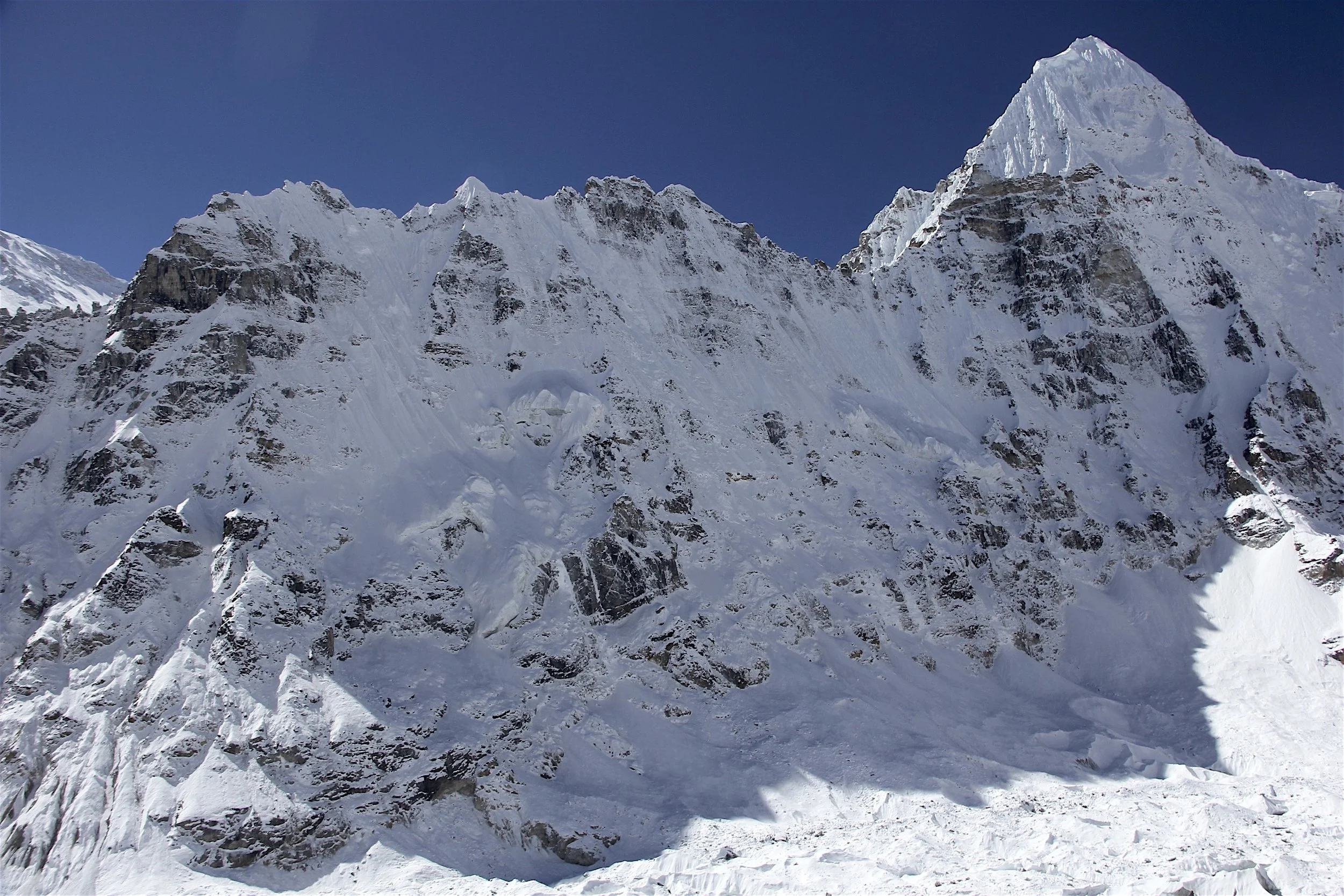
Today was a very long drive.  We stopped for lunch in Korla, the 3rdlargest city in Xinjiang.  It looked very Chinese with no distinguishing features. There were a lot of apartment buildings under construction.  Apparently the government gives incentives to the people from east China to move here by offering attractive prices for housing.   After rainy Korla we drove into the evening with fantastic distant views of the snowy Tien Shan Range.  The great white peaks were rising above the clouds with the setting sun illuminating colorful eroding rocks.  It was very beautiful – the open spaces with miles and miles of desert and the white peaks on the distant horizon.  

IMG_3458.jpg

After arriving in Kuqa at 6pm (too late for sightseeing), David and I went for dinner to a Chinese restaurant.  Unfortunately the menu had no pictures and it was all in Chinese. It was quite difficult to order anything and only after the help from one of the patrons we could choose something. Thankfully the 5 English words that the helping man knew were critical tour success:  chicken, spicy beef and beer.   It is very difficult to move around here without speaking Chinese. There are no English signs, no one speaks English and no maps are available in English.    

May 6 Kuqa (Kucha)

Today we had another action packed day.  We got up early again mainly due to the lingering effects of the time change.  After good breakfast in the oversized restaurant of the Grand Hotel where we were staying, we drove to Subashi Ancient Buddha complex outside Kuqa.  

It is a splendid site located in a beautiful spot.  Unfortunately, in the near distance there is a cement factory and a huge power plant surrounded by a forest of high voltage transmission lines. Never the less, the site was great and we had the entire place to ourselves.  We concluded that very few foreign tourists come here as we were being noticed a lot while walking around.  We did not see any other foreign tourists here.  The people here are very friendly, no one minds being photographed and readily poses for us.   This is really no surprise considering the difficulties with communication and accommodations.  

We spent the morning at the Subashi site admiring the beautiful landscape of eroded mountains surrounding the site.  After, we drove to a nearby watchtower with great views of the nearby badlands.  The landscape here is very dry and rugged.  We also saw more Buddhist grottos in the distance but like other places we passed, it was all locked up.  

IMG_3275.jpg
IMG_3287.jpg
IMG_3322.jpg
IMG_3358.jpg

“The Subashi Ruins occupy a relatively large area, divided by Kuqa River into eastern and western areas. The eastern area is over 530 meters (about 580 yards) long and over 140 meters (about 153 yards) wide and the western area is over 680 meters (about 744 yards) long and 170 meters (about 186 yards) wide. The extent of the ruins reflects the temple's past brilliance.

Subashi Temple witnessed the development and the height of splendor of Buddhism in this land. The temple was built in the first century and reached its peak during the sixth to the eighth centuries in the Sui and Tang dynasties. In the Tang Dynasty (618 - 907), on passing by on his way to India to obtain Buddhist sutra, the hierarch Xuanzang was so impressed by the splendor of the temple and the popularity of Buddhism in this area that he stayed for more than 2 months. During later years, the temple had over 10 thousand monks and many hierarchs came from the interior of China to promote and develop Buddhism. Unfortunately, wars of the ninth century destroyed the temple, and it never recovered. It was finally abandoned in the thirteenth to fourteenth centuries when Islam was introduced to Xinjiang and began to prevail.”

We continued on to the Kizil Grottos through the ancient pass in the Tien Shan mountain range.  The rock formations we passed were very rugged and strange.  They looked like the entire mountain was pushed vertically from the ground – like giant teeth of a dinosaur.  Further along, we passed through even more badlands and dry rocky landscape stretching to the horizon.  

The Kizil Cave complex is very large spread over cliffs of dry mountains. We had to leave our cameras behind while visiting the caves but were allowed to take our phones (that also had cameras in them?!).  Out of the 300+ caves, only 4 or 5 were shown to us and not even the best ones.  Again, we saw a lot of staff just sitting around, bored and not willing to make any effort to show us anything above the bare minimum.  Regardless, it was great to see the complex as the location was very spectacular.  It got very hot and hazy in the afternoon.  We walked around the site for another 2 hours after the initial tour.  We ended up in a side valley with many other grottos dotting the cliffs around us.    The path terminated at a spring coming out of the circular rock.  There were many prayer flags strung on the trees indicating that it was a significant site.    The presence of the prayer flags was unusual as this was a Muslim area and the Buddhist religion was no longer actively practiced here.  Each grotto had a security camera next to its entrance. Some caves were severely damaged with no obvious access point.    From Kizil we drove back to Kuqa and ended up in the old town.  Waheed and I went to explore as David was sick from the food he ate the day before. 

IMG_3401.jpg
IMG_0227.jpg
IMG_0255.jpg
IMG_0238.jpg
IMG_0224.JPG

“Sixty kilometers (37.2 miles) east of Baicheng County, the Kizil Thousand-Buddha Caves sit on the cliffs on the northern bank of the Muzat River, 7 kilometers (4.34 miles) southeast of Kizil town. Cut the third century to eight or ninth century, it is the earliest Buddhist art treasure trove in China, even one century earlier than the famous Mogao Grottoes. Currently there are 236 coded caves preserved, which are divided into west and inner valley and rear mountain areas extending to over 3 kilometers (1.86 miles). On June 22, 2014, it was included in the World Heritage List. 

The Kizil Thousand-Buddha Caves are corridor of murals surpassing other existing caves in China in its abundance in content, quantity and long duration. It is significant in Buddhism as well as in the history of Qiuci. Baicheng County, where these caves are located, used to be under the reign of ancient Qiuci (today's Kuqa). As a communication hub of the ancient Silk Road, Qiuci was the political and economic center of the West Region as well as the focal point of Central Asian and Indo-European cultures. Several facts support these. The earlier caves took the shape similar to Bamian Caves and the murals suggested the influence of Gandhara arts, a Buddhist visual art prevailing in today's Northwestern Pakistan and Eastern Afghanistan in First Century B.C. and Seventh Century A.D. The written documents discovered here were composed in Tocharian B language, a branch of the Indo-European language family that originated in central Asia during the first millennium.

Qiuci's geographic location became to be the center of Buddhism in the West Region as well as a key point for propagating Buddhism in the Central China. Before it was taken place of by Islam in 13th century, Buddhism prevailed in Xinjiang for more than one thousand years. This explained why caves or grottos, an important medium of Buddhist arts, which illustrated sutra by architecture and murals, have been found in Xinjing.

The Kizil Thousand-Buddha Caves come in two forms, one as living quarters with earthen bed and simple facilities, and the other one as temple for worshiping. Caves of different form and function were combined into one unit. It is assumed that one unit was one temple. This is to say that temples stood shoulder to shoulder in the Kizil Thousand-Buddha Caves at that time.

The murals in the Kizil Thousand-Buddha Caves are reputed as "The most beautiful murals in Central Asia". They are found in 81 caves with a total area of more than 10,000 square meters (11,960 yards). The diamond grid pattern is the most impressive feature. There is a story about Buddha's reincarnation in every gird. Each story was portrayed by a single picture instead of a series of pictures as in Mogao Grottoes.”

In the old Kuqa city, we had fantastic shashlik wrapped in the local bread. It was served by a very friendly man and his wife.  We then walked over to a large mosque which is second in size in Xingjang.  The old town was very original and maintained its Uyghur feel.  I got a shave and a haircut for $1.5 (10 yuan).  We walked though an endless market with many delicious looking and smelling food stalls.  It was great for photos and the experience.  I wanted to eat more of the delicious foods but I was still full from the late lunch we had.   The inhabitants of the old Kucha are all Uyghur with very few Chinese around.  The general feel of this place was reminiscent of the old Kashgar that I visited in 2001.  

We walked back to the hotel, which was at least 10km away.  It was a good way to see the city.   I like Kuqa a lot except the industrial sites on the outskirts of the city.  

IMG_3474.jpg
IMG_3476.jpg
IMG_3513.jpg
IMG_3544.JPG

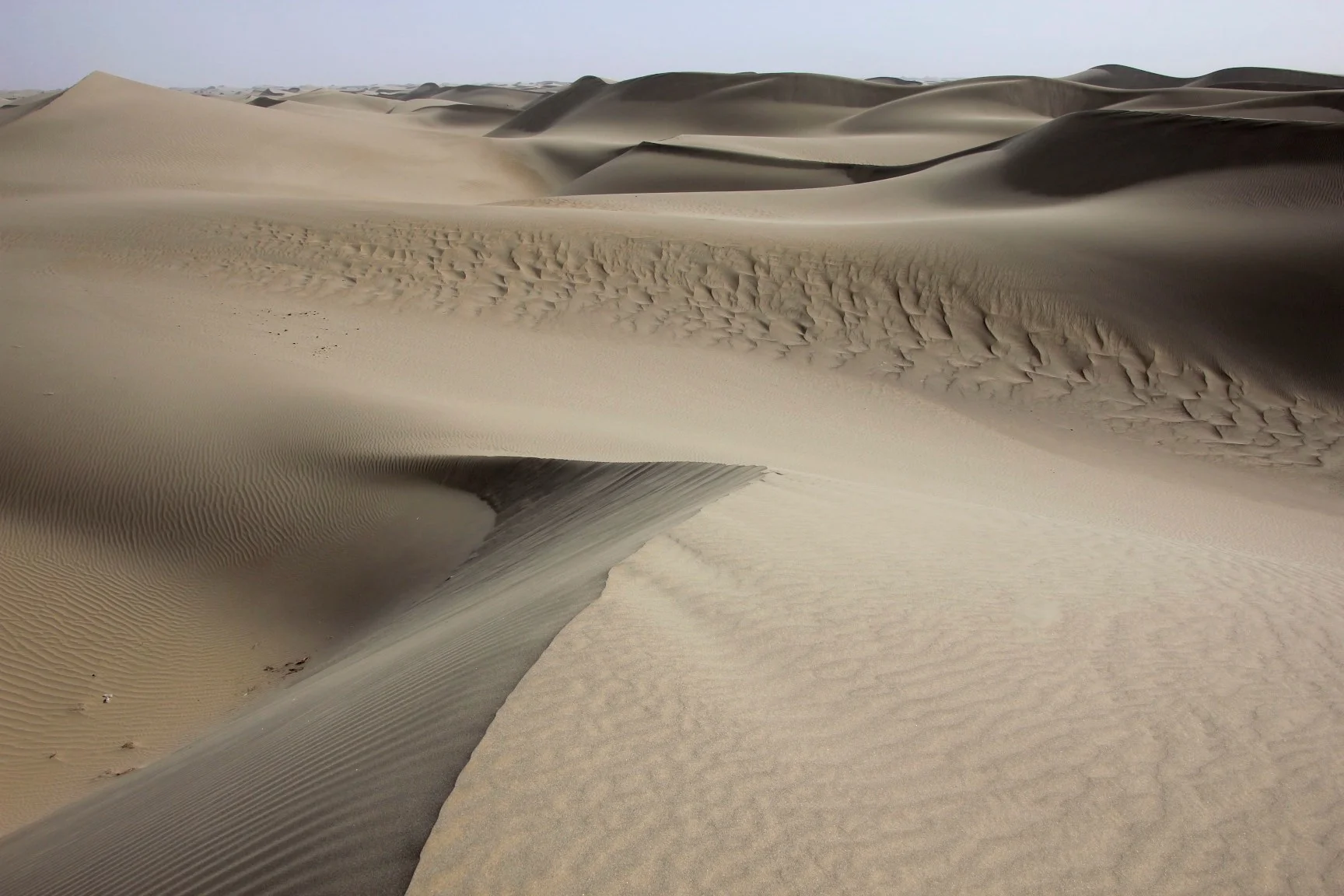
May 7 Kuqa – Hotan via Taklimakan

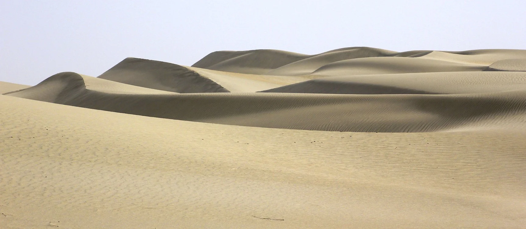
Today we started at 7 am for the long drive through the Taklimakan Desert. This desert is known for the extreme conditions and remoteness.  We drove for 100km from Kuqa before we started to see the encroaching desert. The Tarim River inner delta provides enough water to keep the Kuqa oasis green and fertile.  After about 200km the sand became more dominant and the true Taklimakan Desert began.  The scenery was bleak and foreboding – a true sand desert.   The road cut right through the middle of it in a straight line like a vain of life.  We stopped for lunch in a spot with a tin roof providing protection from the blasting sun and brisk wind.   

IMG_3553.jpg

Before Hotan, we stopped at the Rawak Buddhist Stupa – another example of the strong Buddhist influence along the ancient Silk Road.  The stupa is located among sand dunes in the most scenic part of the desert we have seen so far.   We stopped to take photos of the sand dunes.  They seem to stretch for miles into the horizon.  They are not as high as the Gobi dunes but they are larger and cover a vast area.  Again, the desert looked foreboding and remote.  

Rawak Stupa

Rawak Stupa

“The ruins of Rawak Vihara are situated in a completely uninhabited area of the Takla Makan desert. The more or less constant winds erode the monument steadily. According to the archeological accounts, sand dunes previously covered a large area of the site. In 1901 and 1906, Aurel Stein excavated at the southern/southeastern corner of the large, rectangular (ca. 50 × 44 m) wall that surrounds the stupa; in 1926 Emil Trinkler (1896-1931) excavated the southwestern part.  The wall is ca. 4 m high and 1 m thick. The stupa walls were completely covered with sculptures of Buddhas and Bodhisattvas, life-sized or a little larger. The coloring of the sculptures was of a deep red. The sculptures, of which Stein found 91 in number up to 1906, were modeled of unbaked clay on a wooden frame of branches of trees and fastened to the thick wall via wooden pins. After the rough sculptures were modeled, the outer surface was covered with fine stucco and was painted.” iranicaonline

IMG_3597.jpg
IMG_3621.jpg

We also stopped at the tomb of a Muslim scholar who died in the 10thcentury fighting Buddhism.  The place is called Mazar of Imam Asim.  He was from Bukhara or Kashgar (no one knows for sure).  Now this tomb is a place of pilgrimage and a mausoleum.  The area is dotted with many prayer flags.  Everyone was looking at us with curiosity and we seem to generate a lot of interest among the locals.   Some of the poles had sheep skins stuffed with straw and put vertically to make it look as if the animals were impaled.  The place had a weird feel to it. 

IMG_3652.jpg
IMG_3662.jpg

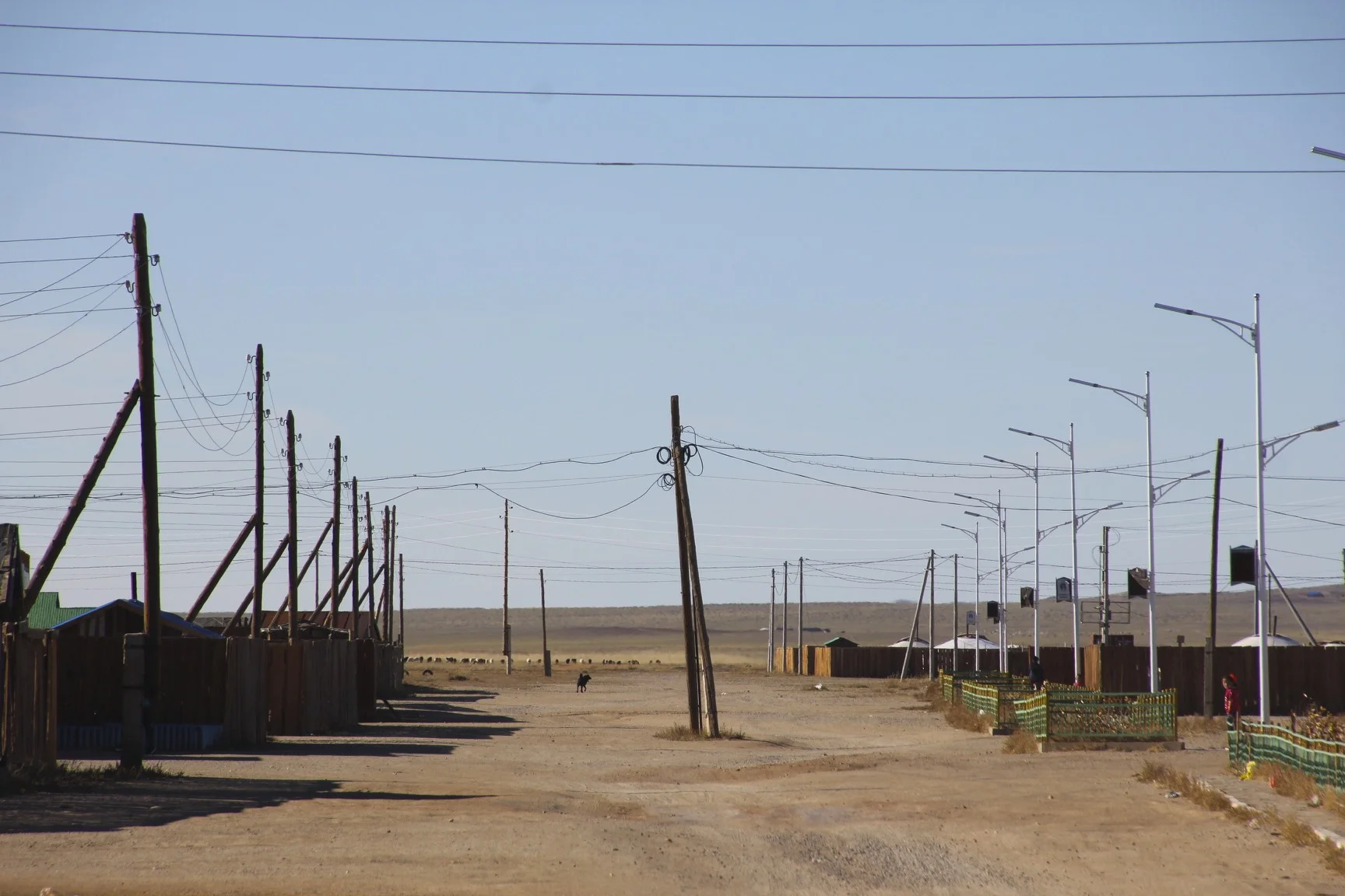
From Mazar we drove to Hotan and spent an hour checking into the hotel. We learned that in Hotan, foreigners are not allowed to stay in hotels independently, only as part of an organized group.  Without a guide there was no way to communicate with anyone.  The hotel was quite seedy.  Each room had condoms, red bull, change of men’s underwear and socks. It was most likely a front for a brothel.   

May 8 Hotan 

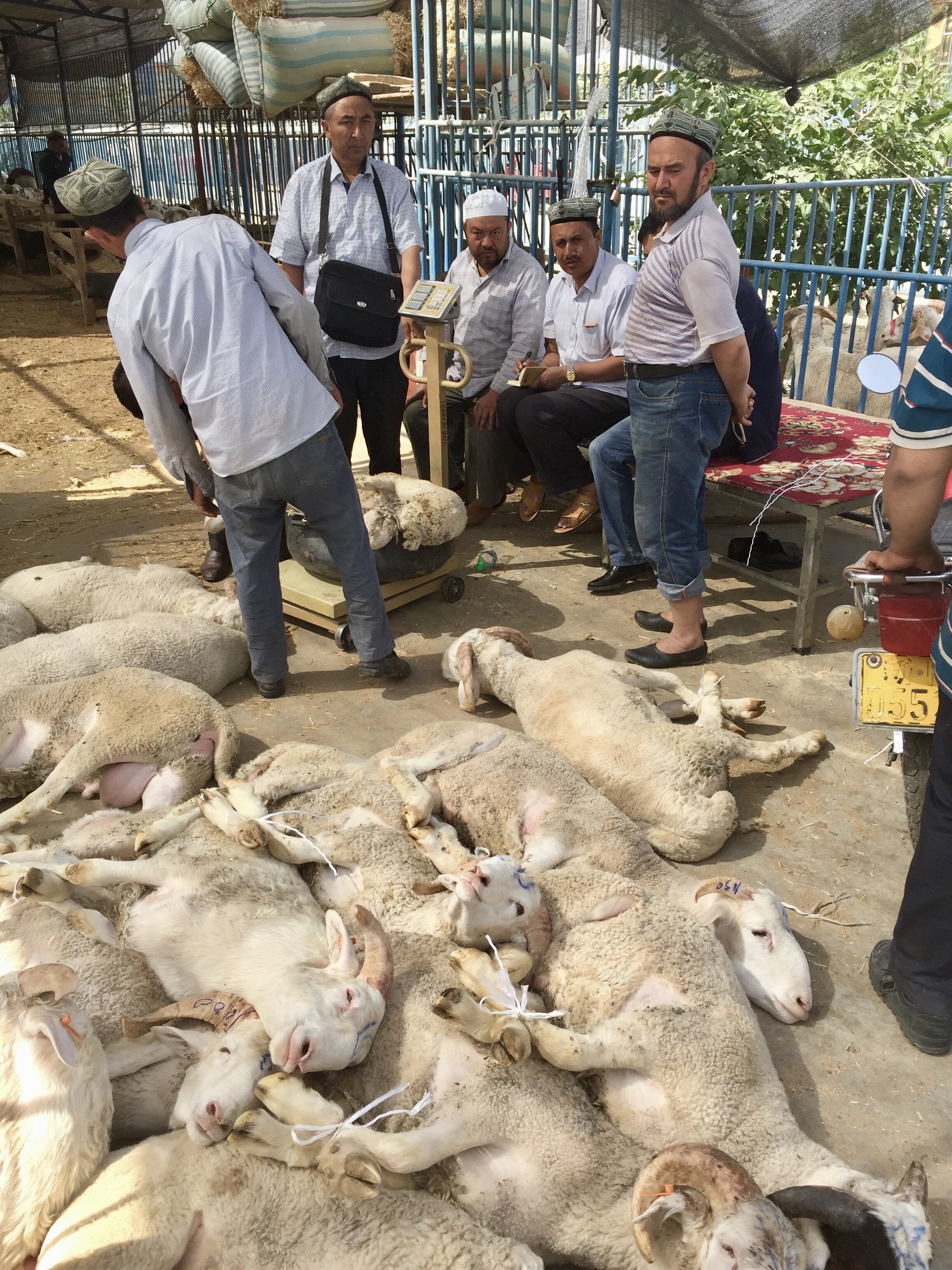
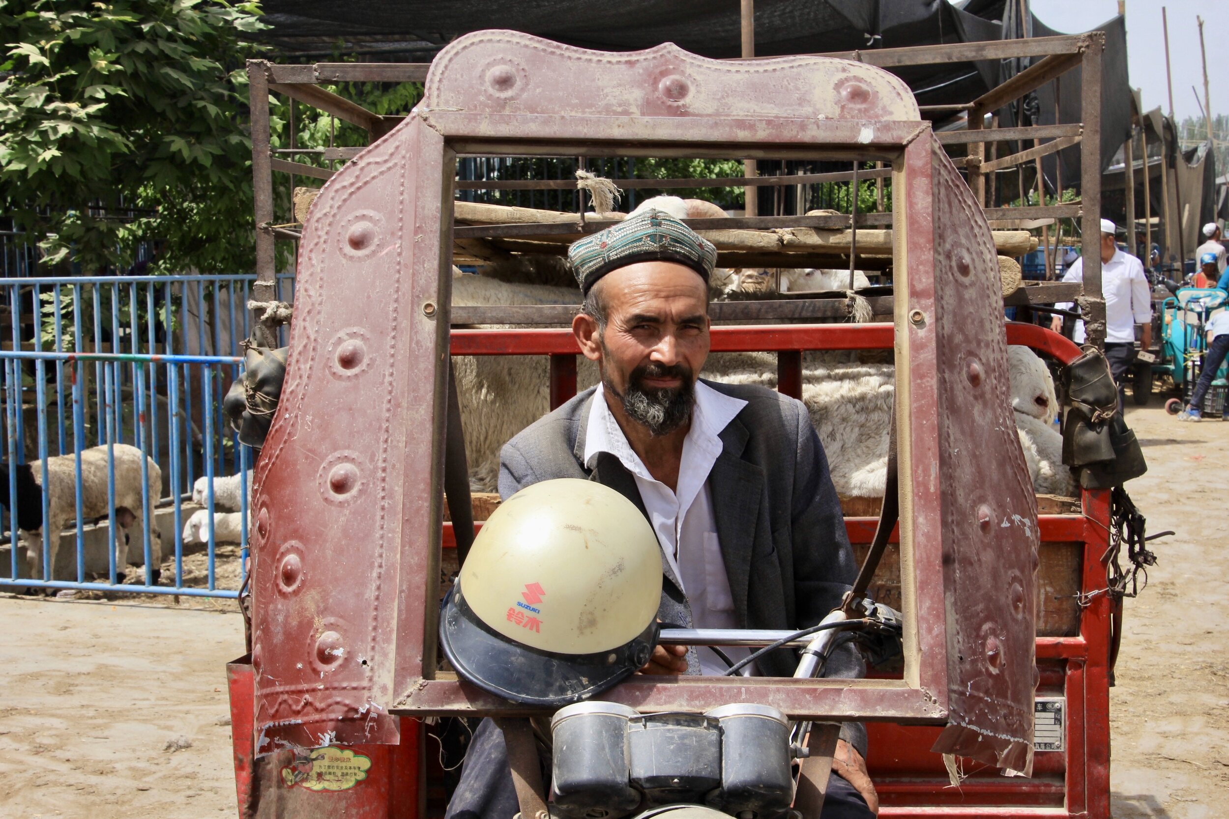
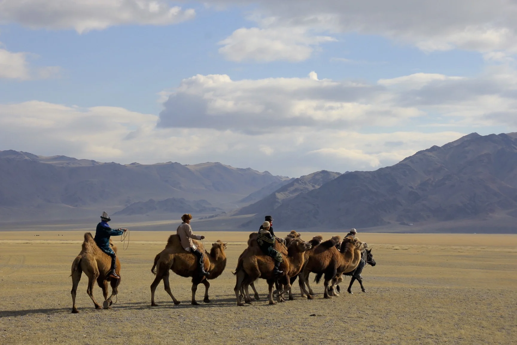
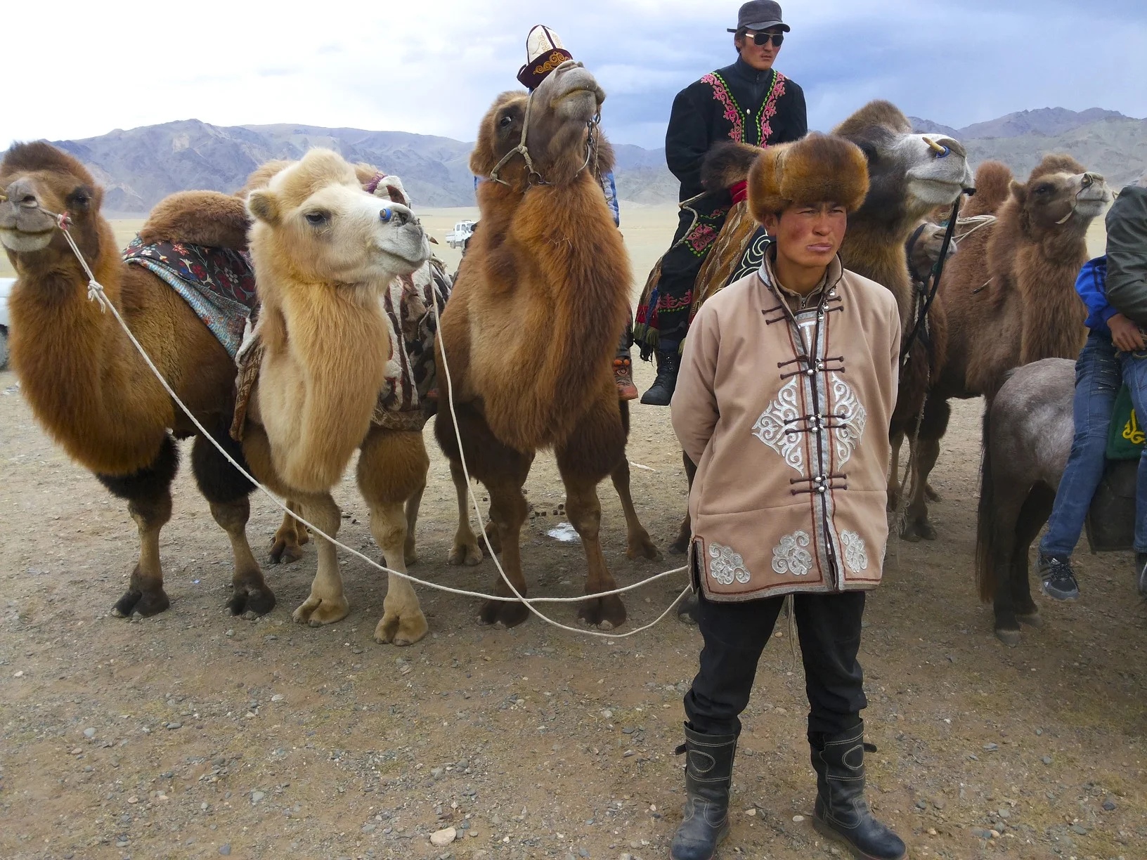
Today is Sunday, the day of the famous Hotan market.  We started a little later today.  At 9.30 we went to the animal market.  Frankly I was expecting the market to look like the animal market that I remember from my visit to Kashgar in 2001.  This market was much more organized with metal enclosures for the animals.  The small section of goat and sheep sellers was very lively though.  A good sheep sells for $500 and an average one for $200. We were the only tourists there and possibly the first tourists in a very long time.  People at the market were keen to pose for photos and engaged us in conversation asking where we were from etc.  Waheed had to translate quite a few times and he did a great job of bridging the gap between cultures.

IMG_3706.jpg
IMG_3776.jpg
IMG_3784.jpg

The Kashgar market that I remember was much bigger and located in a large field by the river.  There were many more people selling and buying all sorts of animals (from birds to horses).  The only advantage of the Hotan market were the camels, even though they were in enclosed pens.  Overall the Kashgar market was much better and I am happy to have seen it back in 2001. Today was also very hot (+37C) and walking in the heat and dust was rather tiring.   

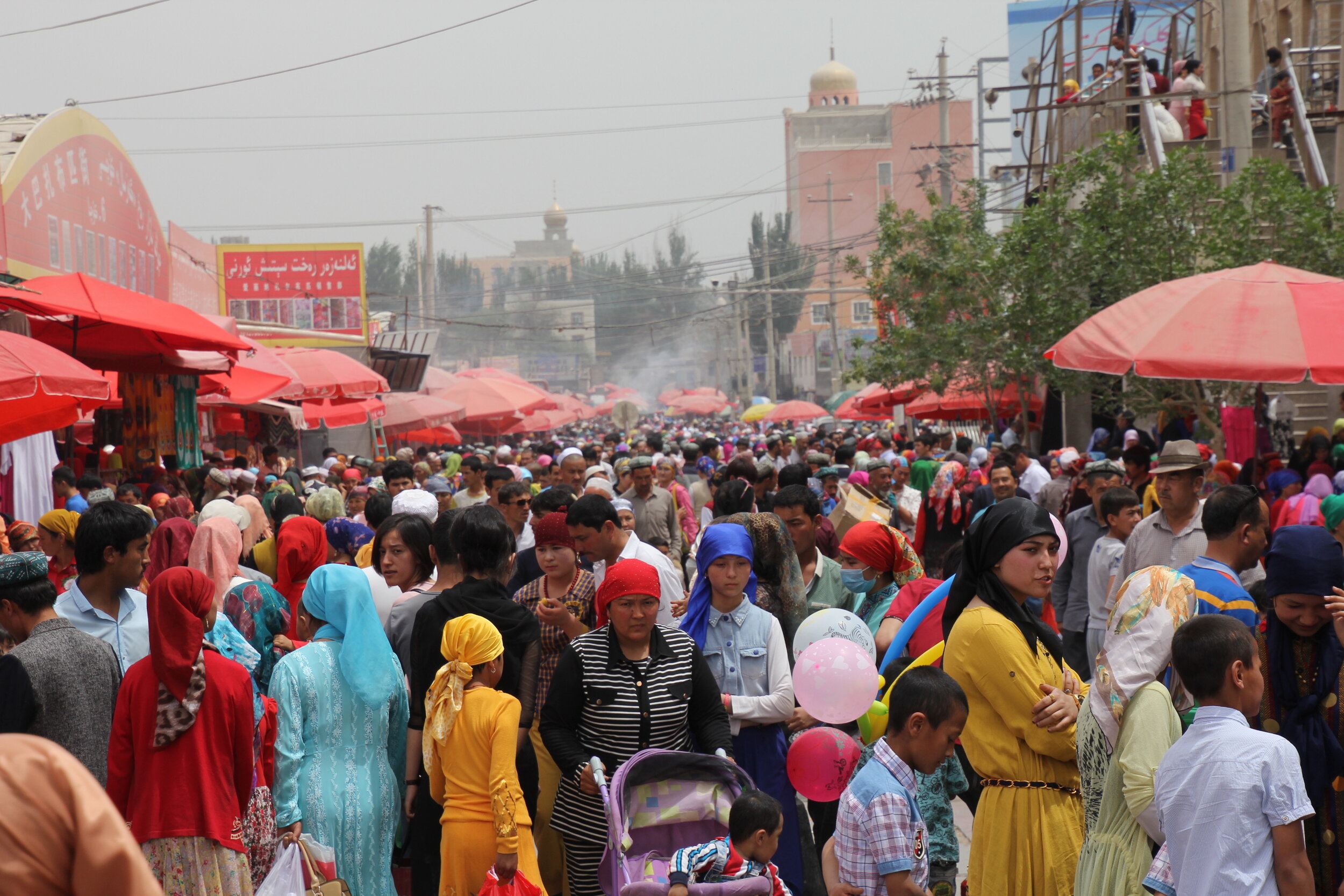
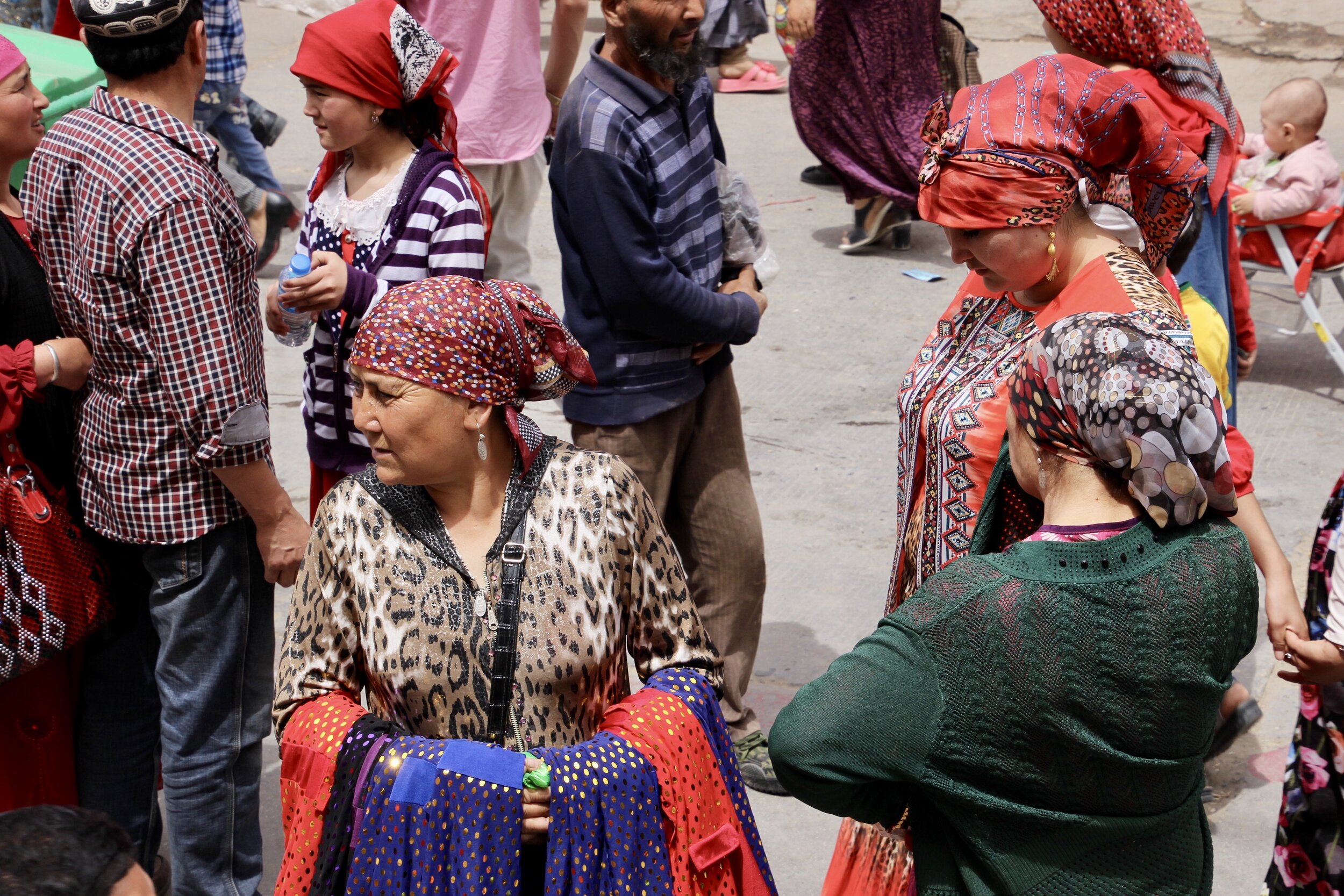
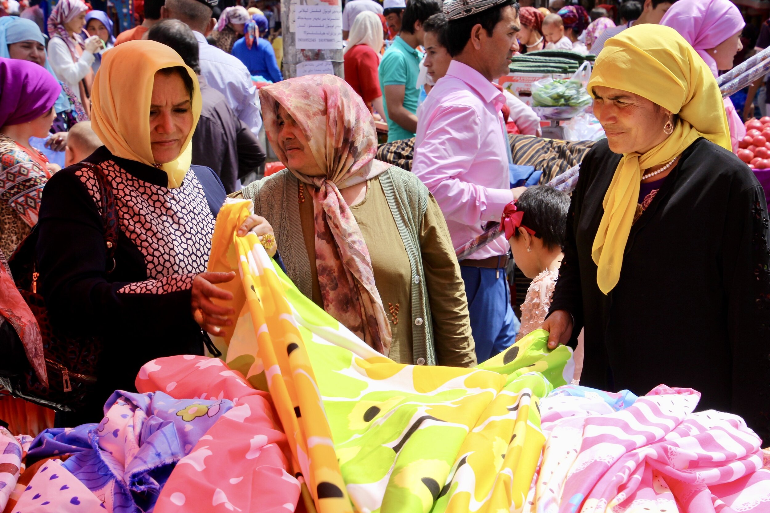
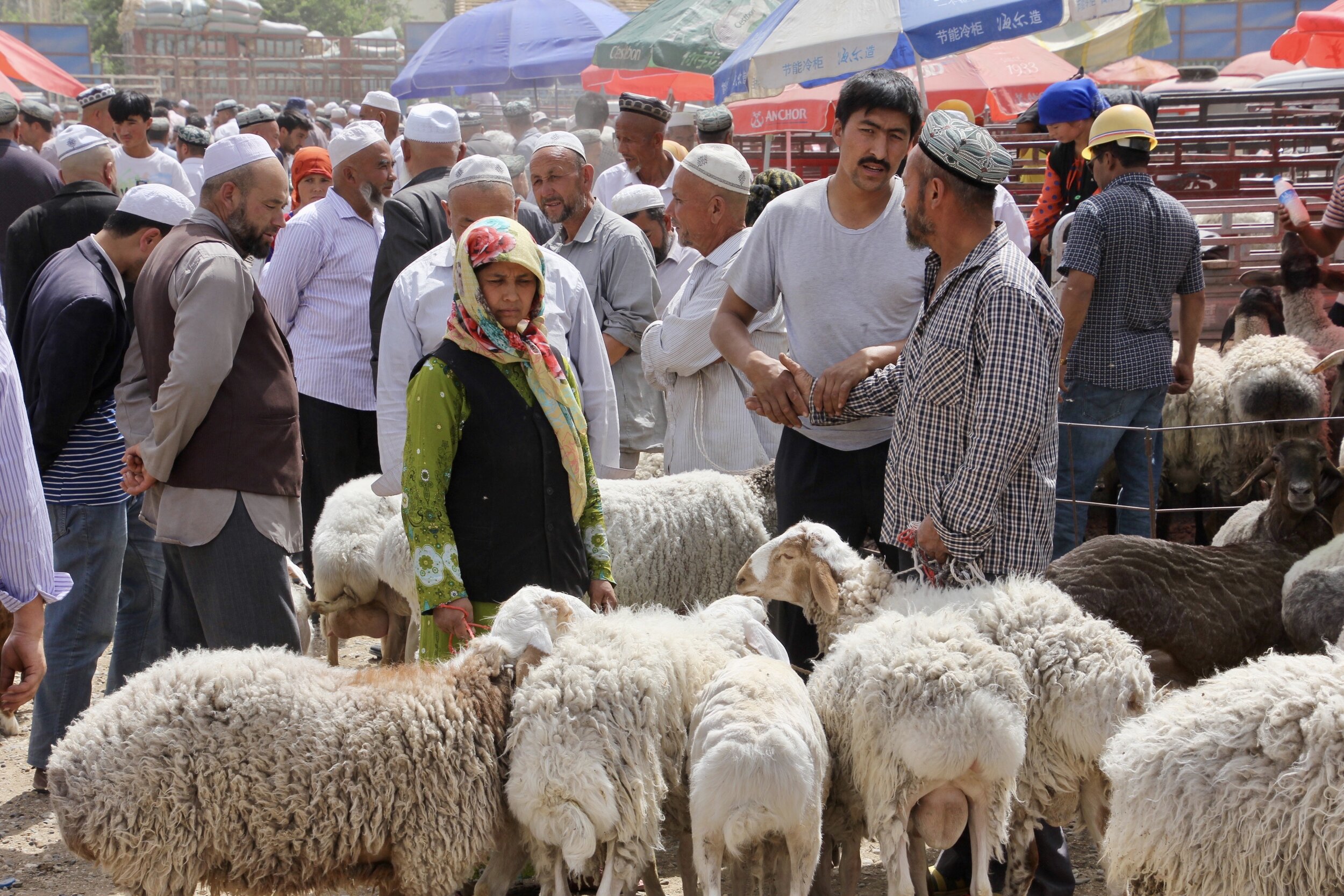
We left the animal market after 2 hours or so and drove to the Sunday bazar. The Sunday bazar in Hotan is huge! The streets surrounding the bazar are swarming with people.  Inside, ladies dressed in their Sunday best create a festival of colors.  There were crowds of women vendors dressed in bright and vibrant dresses swarmed by their customers pushing and shoving.  Hotan is known for silk and especially a certain pattern of print.  Most ladies were wearing garments made from a variation of that pattern.   The market had a great feel to it and it was a fantastic place to photograph people in their natural environment.   We also ate well, shashlyk and watermelons of course! The watermelons stands are great, just walk up and start eating slice after slice.  You pay $0.30 per slice!  There were also many sellers offering various types of remedies for afflictions such as skin conditions etc.  Normally a large crowd would gather around them listening intently to the sales pitch.  Others were selling skullcaps, pots, teapots (and making them), spices, nuts, ice, and many other things.  It was a great experience that had to be seen to be appreciated.  

IMG_3853.JPG
IMG_3862.JPG
IMG_3866.JPG

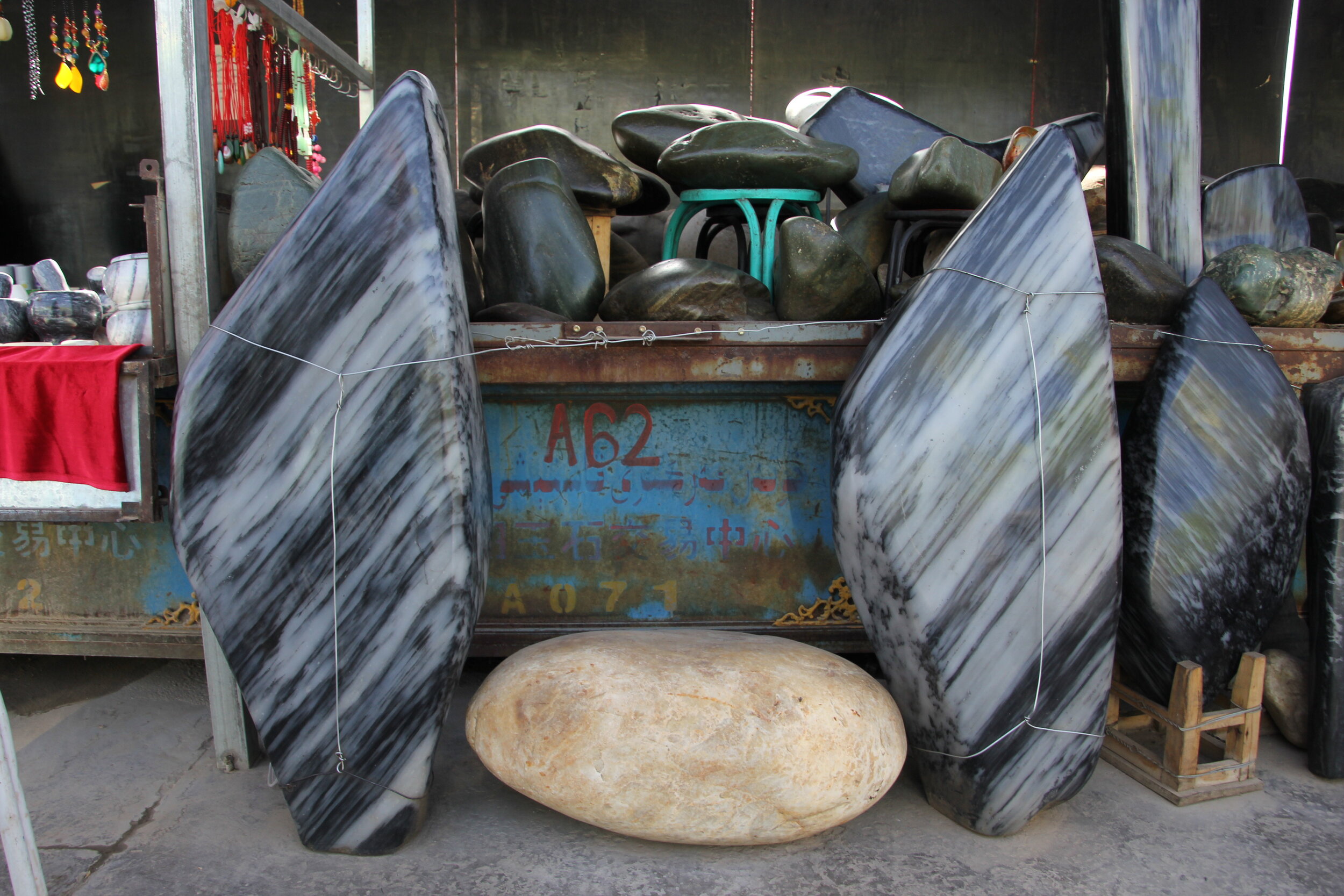
After the main bazar, we wandered into the carpet market.  It was empty and abandoned as compared to the action outside the carpet market.   The carpets on offer were mainly imports from Iran, made from silk and quite expensive.  We took a break from the oppressive head at a tea stall and since it was only 3pm, we decided to drive to the jade market.   The jade market is huge as well although by the time we arrived, the market action was wrapping up.  We saw some incredibly expensive jade rocks ($25,000 and up!).  To us they were just rocks so quite worthless.  To the Chinese though, they have a value of gold.   It is strange how the value of an object is determined by one’s culture and not by its intrinsic utility.   The Chinese come from all over China to this market to purchase jade for which this area is famous for.  Hotan’s jade trade dates back 2000 and this area supplied the entire country with jade from the Kunlun Mountains.  

IMG_3975.JPG

May 9 Hotan

In the morning we went to a carpet factory to see how the famous Hotan carpets are made.  The factory was small and located in a beautiful park.  A dozen or so women worked at the weaving stations making beautiful rugs.  The design of each rug is done on a computer and the weaver just follows the pattern on the loom.  The finished product is very expensive in hundreds if not thousands of dollars. This small tour concluded our visit to the beautiful corner of China.  

IMG_4001.jpg

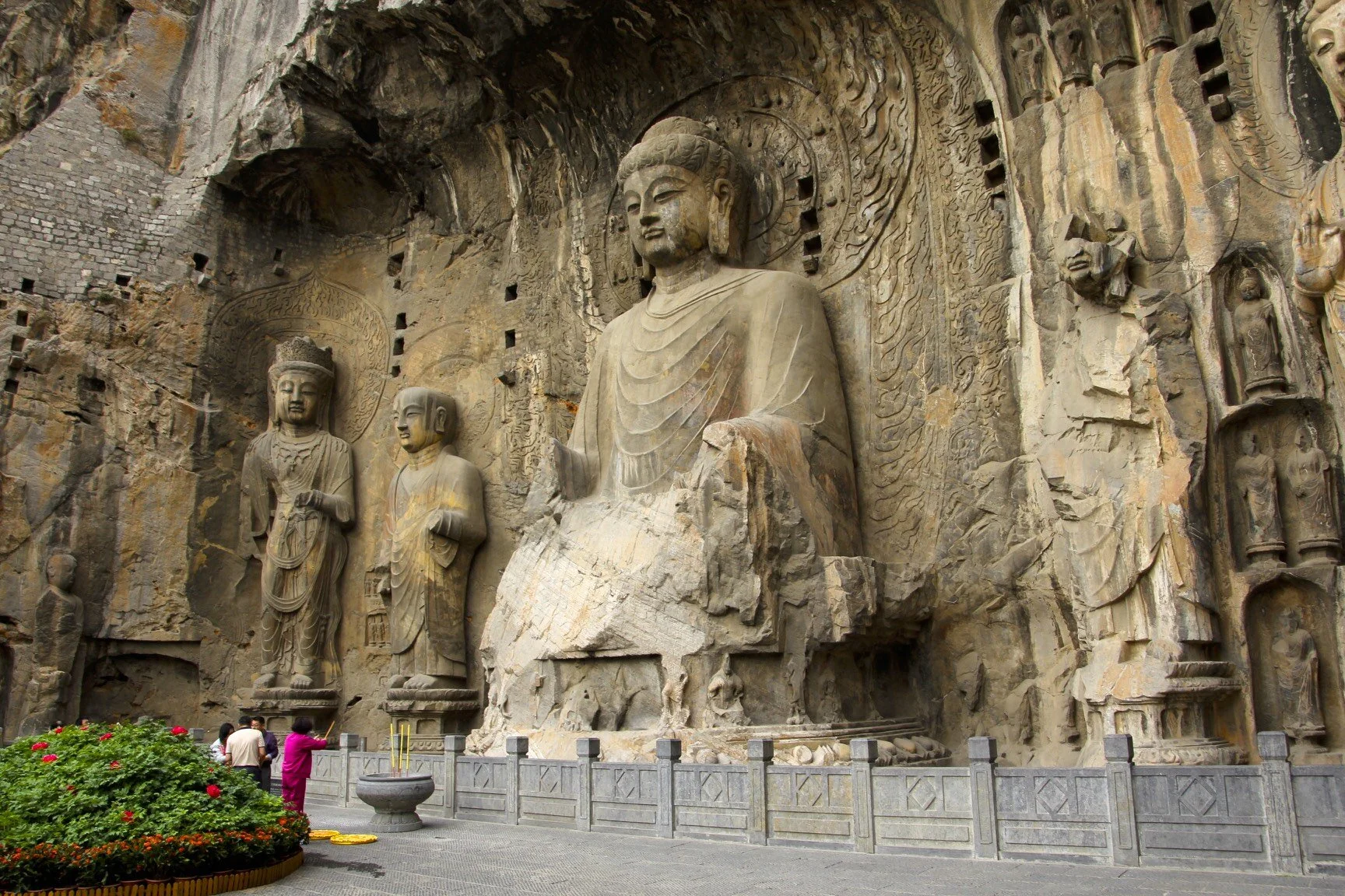
May 12 – Longman Caves (Eastern China)

After our tour of Western China, I went to Beijing and other cities in the eastern part of China.  While in Zhengzhou I booked a driver for a day trip to the famous Longman Caves.  The caves are located near ancient capital of China and represent the eastern extremity of the ancient Silk Road.  

We met the driver at 6am for 1.5 hr drive on an excellent highway between Zhengzhou and Xian.  The caves are situated at the foot of a rocky escarpment along a 1km stretch of rock on a river.  The site is very impressive and grand.  The honeycomb of caves and carved monuments is astonishing.  Each cave was carved out by hand leaving the lump of rock (attached to the mountain) from which the statue of Buddha would be carved out last (a monumental task).  The most amazing were the tall statues over 17m high. To carve those, the entire mountainside had to be excavated first and then the residual rock was made into the imposing statues.  The entire effort took over 200 years to accomplish.  Since we arrived early, we had the entire site to ourselves before the tour groups showed up.  We have not run into another white tourist while we were inside.  This seems to be the situation during my stay here.  

The east side of the site had fewer caves and it was less grand. 

The Longmen Grottoes, located on both sides of the Yi River to the south of the ancient capital of Luoyang, Henan province, comprise more than 2,300 caves and niches carved into the steep limestone cliffs over a 1km long stretch. These contain almost 110,000 Buddhist stone statues, more than 60 stupas and 2,800 inscriptions carved on steles. Luoyang was the capital during the late Northern Wei Dynasty and early Tang Dynasty, and the most intensive period of carving dates from the end of the 5th century to the mid-8th century. The earliest caves to be carved in the late 5th and early 6th centuries in the West Hill cliffs include Guyangdong and the Three Binyang Caves, all containing large Buddha figures. Yaofangdong Cave contains 140 inscription recording treatments for various diseases and illnesses. Work on the sculpture in this cave continued over a 150-year period, illustrating changes in artistic style. The sculptural styles discovered in the Buddhist caves of the Tang Dynasty in the 7th and 8th centuries, particularly the giant sculptures in the Fengxiansi Cave are the most fully representative examples of the Royal Cave Temples’ art, which has been imitated by artists from various regions. The two sculptural art styles, the earlier “Central China Style” and the later “Great Tang Style” had great influence within the country and throughout the world, and have made important contributions to the development of the sculptural arts in other Asian countries.”

IMG_4243.jpg
IMG_1168.jpg
IMG_1178.jpg
IMG_4110.JPG
IMG_4118.jpg
IMG_4134.jpg
IMG_4143.jpg
IMG_4164.jpg
IMG_4168.jpg
IMG_4180.jpg
IMG_4195.jpg
IMG_4204.jpg
IMG_4209.jpg
IMG_4236.jpg
IMG_4238.JPG
IMG_4247.jpg
IMG_4251.jpg
IMG_4258.jpg
IMG_4290.JPG
IMG_4308.JPG
IMG_4324.JPG
IMG_4325.JPG
IMG_4327.JPG


China Far West - Ancient Silk Road

sketch-map-of-silk-road.jpg
Map of Western China - Xinjiang Uyghur Autonomous Regions

Map of Western China - Xinjiang Uyghur Autonomous Regions

In the Kashgar market

In the Kashgar market

The Kashgar old tea house

The Kashgar old tea house

100 year old tea house

100 year old tea house

The story of the 100 year old tea house in Kashgar

The story of the 100 year old tea house in Kashgar

100 year old tea house

100 year old tea house

100 year old tea house

100 year old tea house

100 year old tea house

100 year old tea house

Kashgar shop

Kashgar shop

Streets of Kashgar

Streets of Kashgar

Tajik beauty

Tajik beauty

The Shiphton Arch near Kashgar

The Shiphton Arch near Kashgar

Tashkurgan old fort and the Pamir Mountains near the border of China, Pakistan and Afghanistan

Tashkurgan old fort and the Pamir Mountains near the border of China, Pakistan and Afghanistan

Old Fort of Tashkurgan

Old Fort of Tashkurgan

Old Fort of Tashkurgan

Old Fort of Tashkurgan

Tashkurgan

Tashkurgan

The Chinese Pamir

The Chinese Pamir

Near Tashkurgan

Near Tashkurgan

Muztagh Ata

Muztagh Ata

Karakul Lake and Muztagh Ata

Karakul Lake and Muztagh Ata

Mt. Kongur

Mt. Kongur

Mt. Kongur

Mt. Kongur

The Karakoram Highway (KKH) connecting Pakistan and Xinjiang

The Karakoram Highway (KKH) connecting Pakistan and Xinjiang

The Karakorum Highway

The Karakorum Highway

The Karakorum Highway

The Karakorum Highway

The Pamir Mountain Range along the Karakoram Highway

The Pamir Mountain Range along the Karakoram Highway

The Kunlun and Karakoram near Hotan

The Kunlun and Karakoram near Hotan

Road through Kunlun Mountain Range south of Yarkand

Road through Kunlun Mountain Range south of Yarkand

Road through Kunlun Mountain Range south of Yarkand

Road through Kunlun Mountain Range south of Yarkand

The Subashi Temple near Kucha

The Subashi Temple near Kucha

An old stupa near Kucha

An old stupa near Kucha

The Emin Minaret or Emin Tower stands by the Uyghur mosque located in Turpan, Xingjiang, China. At 44 meters (144 ft) it is the tallest miaret in China

The Emin Minaret or Emin Tower stands by the Uyghur mosque located in Turpan, Xingjiang, China. At 44 meters (144 ft) it is the tallest miaret in China

IMG_2956.jpg
The Subashi Temple near Kucha

The Subashi Temple near Kucha

Near Turpan

Near Turpan

The Taklamakan Desert has very little water, therefore it is hazardous to cross. Merchant caravans on the Silk Road would stop for relief at the thriving oasis towns.

The Taklamakan Desert has very little water, therefore it is hazardous to cross. Merchant caravans on the Silk Road would stop for relief at the thriving oasis towns.

The dusty trans Taklamakan Highway

The dusty trans Taklamakan Highway

IMG_3581.jpg
The trans Taklamakan Highway

The trans Taklamakan Highway

Taklamakan Desert

Taklamakan Desert

The sea of sand - Taklamakan Desert

The sea of sand - Taklamakan Desert

Taklamakan Desert

Taklamakan Desert

IMG_3629.jpg
The Jiaohe Ruins, also known as Yar City near Turpan.

The Jiaohe Ruins, also known as Yar City near Turpan.

Goachang Ancient City near Turpan

Goachang Ancient City near Turpan

Goachang Ancient City

Goachang Ancient City

Goachang Ancient City

Goachang Ancient City

Near Turpan

Near Turpan

Near Turpan

Near Turpan

Small town near Turpan - the base for the Goachang Ancient City

Small town near Turpan - the base for the Goachang Ancient City

IMG_3123.jpeg
Mural in one of the Kizil Caves.

Mural in one of the Kizil Caves.

Inside one of the Kizil Caves. A central pillar design allows the pilgrims to circumambulate around a central column which is a representation of a stupa. Anti portrait Muslims had Buddhist portraits obliterated during the wars over hundreds of year…

Inside one of the Kizil Caves. A central pillar design allows the pilgrims to circumambulate around a central column which is a representation of a stupa. Anti portrait Muslims had Buddhist portraits obliterated during the wars over hundreds of years in which Buddhism was replaced by Islam

The desert surrounding the Kizil Oasis

The desert surrounding the Kizil Oasis

The Kizil Oasis

The Kizil Oasis

Kizil Caves

Kizil Caves

The Kizil Caves complex is the largest of the ancient Buddhist cave sites that are associated with the ancient Tocharian kingdom of Kucha.

The Kizil Caves complex is the largest of the ancient Buddhist cave sites that are associated with the ancient Tocharian kingdom of Kucha.

Kizil Caves complex

Kizil Caves complex

IMG_0259.jpg
Inside one of the Kizil caves

Inside one of the Kizil caves

The earliest caves are dated, based in part on radioactive carbon dating, to around the year 300.

The earliest caves are dated, based in part on radioactive carbon dating, to around the year 300.

The Kizil Caves - unfortunately most of them are closed

The Kizil Caves - unfortunately most of them are closed

The caves were probably abandoned sometime around the beginning of the 8th century.

The caves were probably abandoned sometime around the beginning of the 8th century.

Kizil caves

Kizil caves

Kizil Caves

Kizil Caves

Sad state of the Kizil Caves

Sad state of the Kizil Caves

This walkway led to a water spring which a holy site for Buddhists.

This walkway led to a water spring which a holy site for Buddhists.

In Hotan

In Hotan

Hotan

Hotan

In the market of Hotan

In the market of Hotan

The delicious bread at the Uyghur market in Hotan

The delicious bread at the Uyghur market in Hotan

Carpet shop in Hotan

Carpet shop in Hotan

Hotan Sunday Market - the grant main gate

Hotan Sunday Market - the grant main gate

Hotan Sunday Market

Hotan Sunday Market

Hotan Sunday Market

Hotan Sunday Market

The famous Hotan silk - this pattern is characteristic to the area of Hotan

The famous Hotan silk - this pattern is characteristic to the area of Hotan

Different types of watermelon seeds

Different types of watermelon seeds

At the Hotan market

At the Hotan market

Hotan Sunday Market

Hotan Sunday Market

IMG_3958.jpg
Hotan Sunday Market

Hotan Sunday Market

Hotan Sunday Market

Hotan Sunday Market

IMG_3885.jpeg
The famous silk of Hotan

The famous silk of Hotan

Hotan Sunday Market

Hotan Sunday Market

IMG_3905.jpeg
Hotan

Hotan

Hotan

Hotan

Hotan

Hotan

Yumm!  Fast Food at the Hotan Sunday Market

Yumm! Fast Food at the Hotan Sunday Market

Hotan

Hotan

Hotan

Hotan

Hotan

Hotan

Carpet shopping in Hotan

Carpet shopping in Hotan

It is plus 40C so a cup of crushed ice is nice

It is plus 40C so a cup of crushed ice is nice

The main mosque in Urumqi

The main mosque in Urumqi

Turpan

Turpan

Inside the Emin mosque.

Inside the Emin mosque.

In the Provincial Museum in Urumqi

In the Provincial Museum in Urumqi

Tarim Basin mummies in the Urumqi Museum

Tarim Basin mummies in the Urumqi Museum

The incredible Tarim Basin mummies in the Urumqi Museum

The incredible Tarim Basin mummies in the Urumqi Museum

The Tarim mummies are a series of mummies discovered in the Tarim Basin in present-day Xingjiang, China, which date from 1800 BC. 'The Beauty of Loulan" - the oldest Tarim mummy.

The Tarim mummies are a series of mummies discovered in the Tarim Basin in present-day Xingjiang, China, which date from 1800 BC. 'The Beauty of Loulan" - the oldest Tarim mummy.

IMG_2867.JPG
IMG_2872.JPG
Many of the mummies have been found in very good condition, owing to the dryness of the desert and the desiccation it produced in the corpses. The mummies share many typical Caucasian body features (elongated bodies, angular faces, recessed eyes), a…

Many of the mummies have been found in very good condition, owing to the dryness of the desert and the desiccation it produced in the corpses. The mummies share many typical Caucasian body features (elongated bodies, angular faces, recessed eyes), and many of them have their hair physically intact, ranging in color from blond to red to deep brown

The Emin mosque.

The Emin mosque.

The Jiaohe Ruins, also known as Yar City near Turpan. From 450 AD until 640 AD it became Jiao prefecture in the Tang Dynasty

The Jiaohe Ruins, also known as Yar City near Turpan. From 450 AD until 640 AD it became Jiao prefecture in the Tang Dynasty

The Jiaohe Ruins

The Jiaohe Ruins

The Jiaohe Ruins

The Jiaohe Ruins

The Jiaohe city Ruins

The Jiaohe city Ruins

The Jiaohe Ruins

The Jiaohe Ruins

Buddhist stupa at Jiaohe Ruins.

Buddhist stupa at Jiaohe Ruins.

The Jiaohe Ruins

The Jiaohe Ruins

Buddhist stupa at Jiaohe Ruins.

Buddhist stupa at Jiaohe Ruins.

Gaochang, also called Karakhoja, Qara-hoja, Kara-Khoja, or Karahoja, is the site of a ruined, ancient oasis city on the northern rim of the inhospitable Taklamakan Desert

Gaochang, also called Karakhoja, Qara-hoja, Kara-Khoja, or Karahoja, is the site of a ruined, ancient oasis city on the northern rim of the inhospitable Taklamakan Desert

IMG_3087.jpg
The Buddhist stupa of Gaochang city ruins.

The Buddhist stupa of Gaochang city ruins.

Gaochang ancient city.

Gaochang ancient city.

Gaochang ancient city.

Gaochang ancient city.

IMG_3085.jpg
Gaochang ancient city.

Gaochang ancient city.

Gaochang city was built in the 1st century BC, it was an important site along the Silk Road. The old city defensive wall.

Gaochang city was built in the 1st century BC, it was an important site along the Silk Road. The old city defensive wall.

Gaochang ancient city.

Gaochang ancient city.

The Bezeklik Thousand Buddha Caves near Turpan.

The Bezeklik Thousand Buddha Caves near Turpan.

There are 77 rock-cut caves at the Bezeklik site. Most have rectangular spaces with rounded arch celings often divided into four sections, each with a mural of the Buddha. The effect is that the entire ceiling is covered with hundreds of Buddha mura…

There are 77 rock-cut caves at the Bezeklik site. Most have rectangular spaces with rounded arch celings often divided into four sections, each with a mural of the Buddha. The effect is that the entire ceiling is covered with hundreds of Buddha murals.

IMG_3156.jpeg
IMG_0233.jpeg
IMG_3154.jpg
Old ruins near the Bezeklik Cave complex.

Old ruins near the Bezeklik Cave complex.

The old caves near the Bezeklik Cave complex.

The old caves near the Bezeklik Cave complex.

in Turpan, Xinjiang

in Turpan, Xinjiang

In Turpan

In Turpan

Kucha

Kucha

Kucha

Kucha

Kucha

Kucha

The old and new Kucha.

The old and new Kucha.

Kucha

Kucha

The Subashi Temple

The Subashi Temple

The Subashi Temple is a ruined Buddhist temple near Kucha in the Taklamakan Desert, on the ancient Silk Road, in Xinjiang, China

The Subashi Temple is a ruined Buddhist temple near Kucha in the Taklamakan Desert, on the ancient Silk Road, in Xinjiang, China

The Subashi Temple

The Subashi Temple

The Subashi Temple

The Subashi Temple

The Subashi Temple.

The Subashi Temple.

The Subashi Temple

The Subashi Temple

The Subashi Temple

The Subashi Temple

The Subashi Temple

The Subashi Temple

The Subashi Temple

The Subashi Temple

The roads around Kucha

The roads around Kucha

The road in Western China near Kucha on the way to Kizil Caves.

The road in Western China near Kucha on the way to Kizil Caves.

Old Kucha

Old Kucha

Kucha Grand mosque is the third largest mosque in the region, was rebuilt in 1932 on the site of original 16th century mosque.

Kucha Grand mosque is the third largest mosque in the region, was rebuilt in 1932 on the site of original 16th century mosque.

IMG_3481.jpg
The Grand Mosque of Kucha.

The Grand Mosque of Kucha.

The prayer hall of the Grand Mosque of Kucha.

The prayer hall of the Grand Mosque of Kucha.

IMG_0277.jpg
Kucha, Xinjiang

Kucha, Xinjiang

Kucha, Xinjiang

Kucha, Xinjiang

IMG_3462.jpg
IMG_3543.jpeg
Blacksmith shop in Kucha

Blacksmith shop in Kucha

The streets of Hotan

The streets of Hotan

IMG_2892.jpg
At a bakery in Hotan, Xinjiang

At a bakery in Hotan, Xinjiang

Xinjiang carpets in Hotan

Xinjiang carpets in Hotan

IMG_3637.jpg
Rawak Stupa near Hotan

Rawak Stupa near Hotan

Imam Asim Tomb near Hotan on the edge of the Taklamakan Desert

Imam Asim Tomb near Hotan on the edge of the Taklamakan Desert

IMG_3644.jpg
IMG_3648.jpg
IMG_3649.jpg
IMG_3657.jpg
IMG_3659.jpg
IMG_3662.jpg
Taklamakan is one of the largest sandy deserts in the world, ranking 15th in size in a ranking of the world's largest non-polar deserts.

Taklamakan is one of the largest sandy deserts in the world, ranking 15th in size in a ranking of the world's largest non-polar deserts.

Taklamakan - means: once you get in, you never get out.

Taklamakan - means: once you get in, you never get out.

Taklamakan

Taklamakan

Taklamakan is the paradigm of a cold desert. Given its relative proximity with the cold to frigid air masses in Siberia, extreme lows are recorded in wintertime, sometimes well below -20 °C

Taklamakan is the paradigm of a cold desert. Given its relative proximity with the cold to frigid air masses in Siberia, extreme lows are recorded in wintertime, sometimes well below -20 °C

At the Hotan animal market. Hotan is is a major oasis town in southwestern Xinjiang. Hotan has always depended on two strong rivers - the Karakash River and the White Jade River to provide the water needed to survive on the southwestern edge of the …

At the Hotan animal market. Hotan is is a major oasis town in southwestern Xinjiang. Hotan has always depended on two strong rivers - the Karakash River and the White Jade River to provide the water needed to survive on the southwestern edge of the Taklamakan Desert.

IMG_3695.JPG
IMG_0572.jpg
IMG_3698.JPG
IMG_3715.jpg
IMG_3727.jpg
IMG_3817.jpg
IMG_0519.jpeg
IMG_0526.jpeg
IMG_3745.jpeg
IMG_3827.jpeg
IMG_3674.jpg
IMG_3688.jpg
IMG_3696.jpg
IMG_3739.jpg
IMG_3756.jpg
IMG_3776.jpg
IMG_3790.jpg
IMG_3800.jpg
IMG_3801.jpg
Once ubiquitous but now seldom seen pigeon keeping.  In Hotan.

Once ubiquitous but now seldom seen pigeon keeping. In Hotan.

IMG_0464.jpeg
IMG_0575.jpg
Road near Kucha

Road near Kucha

Jade processing in Hotan - Hotan jade is famous all over China

Jade processing in Hotan - Hotan jade is famous all over China

Karglik

Karglik

Karglik main mosque

Karglik main mosque

Karglik mosque

Karglik mosque

In Karglik

In Karglik

The Grand Mosque of Yarkand

The Grand Mosque of Yarkand

Yakrand

Yakrand

IMG_1131.jpeg
IMG_1120.jpeg
IMG_1132.jpeg
IMG_1082.jpeg
IMG_1077.jpeg
IMG_1078.jpeg
Old Yarkand

Old Yarkand

Old Yarkand

Old Yarkand

Old streets of Yarkand

Old streets of Yarkand

IMG_1107.jpeg
Yarkand

Yarkand

Mongolia Trip Report Part 2 - Golden Eagle Festival and The Gobi

September 19, 2015 Sagsai Golden Eagle Festival Day 1

We set off at 9 am from Olgi to Sagsai for the Golden Eagle Festival with much anticipation and curiosity.  In reality, this festival was our main reason to come to this part of Mongolia.   We were not quite sure whether this event would be a genuine local festival or one put on exclusively for tourists. 

Arriving for the Festival

Arriving for the Festival

We arrived in Sagsai early as the organizers were just starting to set up.  Although the festival was supposed to start at 10am it really did not get going until after 11.30am.  While we were waiting around for the festival to start, we were watching the participants (eagle hunters) arrive on horseback from all directions.  They were arriving from their gers (round Kazakh tents), which dotted the flat planes around Sagsai.  One of the participants was our guide Baku’s uncle whose ger we visited the day before on our return trip from Mt. Khuitan.   It was all very exciting for us to see.  The eagle hunters rode slowly across the plain with their majestic eagles perched on their arms. 

Once all the participants gathered (there were around 40 of them) they had a parade that culminated with a gallop across the festival grounds.  They were all dressed in traditional Kazakh winter clothing made from felt and fox fur.  They were also wearing the traditional Mongolian or tall Kazakh hats made form fox feet fur.  Their large eagles were perched on their arms supported by wooden stands resting on saddles.  As they were galloping, they raised their eagles in the air forcing the birds to spread their wings as if getting ready for flying.   

IMG_7398.jpg
IMG_7419.jpg

After the parade, the eagle hunting competition began.  Each eagle hunter launched his bird from the top of a small hill situated behind the festival grounds.  The bird was being called to swoop down and grab the bait that was being pulled on a long line by the assistant’s horse down below.  The assistant was on a horse and the bait was a dead fox attached to a long line.   To an eagle, viewed from above, the dead fox looks like the real animal running through the field below.  The assistant called the eagle with a special whistle-like “call” to get the bird’s attention.  If the eagle made an accurate landing, it was rewarded with raw meat.  The speed of the flight and the accuracy of landing were judged and tabulated.  The winner and his eagle were awarded a medal and a cash prize. 

Ready to fly!

Ready to fly!

IMG_7588.jpg
The panel of judges

The panel of judges

I went up to the top of the hill and watched the eagles being launched by their owners.  They took great pride in their birds.  They also took great pride in their appearance and their culture.  It was definitely a men’s world.  They seemed to relish each other’s company.  It was wonderful to see and experience.  I took some great photos of this rather wild and surreal scene.  We were also surrounded by fantastic scenery that provided a backdrop for the whole event and the photos.   The morning competition was not very successful due to high wind.  The wind’s noise was blocking calls from the assistants to the eagles from the plain below.  It also made the flight difficult for the birds.  Once the morning part concluded we headed for lunch of shashlyk on the festival grounds. 

Shashlyk stand

Shashlyk stand

The best shashlyk in Mongolia

The best shashlyk in Mongolia

After lunch, the weather changed from sunny and clear to overcast.  The wind became even stronger with powerful gusts.  Goat-pulling contest was the main afternoon event.   In this event, two horsemen pulled a carcass of a goat from one another until one person successfully took possession of it.  The pulling can take a long time and extends to fields around the main stage.  The entire thing is very unpredictable, involves some serious horse acrobatics and much strength.  It is fun to watch, as the audience has to run away from the horses.  There is much cheer, dust and action. 

The goat pulling contest

The goat pulling contest

The goat pulling contest

The goat pulling contest

As this event was taking place, the wind picked up even more and we decided to depart around 4 pm.  On the way out, I purchased a hat from one of the eagle hunters.  The hat is made from fox legs and unfortunately 6 of them were required to make one hut.  As much as I felt sorry for the foxes, it is the culture here and the foxes are hunted mainly for the pelts.  

Day 1 was a great success and we really enjoyed it.  It definitely did not disappoint.  Although other tourists were there, the festival was definitely a local affair with the participants and the local audience really getting into the competition and the spirit of things.    

September 20, 2015 Golden Eagle Festival Day 2

We were excited to see what Day 2 would bring after very enjoyable Day 1. We arrived at the festival grounds at 10am.  We did not expect for the proceedings to commence any sooner than the day before.  As we were arriving, we saw many camels arriving for the camel race.  We were happy that the events were different from the day before and not a repeat of the same.  At the end we missed the camel race – it was supposed to take place in the afternoon but was moved to first thing in the morning.   The festival is somewhat chaotic but this is what makes it special too. 

IMG_7779.jpg

The second day of the festival was less showy as most tourists were gone and the place filled with the locals.  The locals came from nearby villages and settlements.  The locals were a motley crew for the most part:  mostly country folk on horses.  Most of them quite rough looking.  With a bit of local hooch, the sparks would fly pretty fast with these guys.  In order to fit in and make it in this environment, one has to be tough.  Kids start riding horses at 5 or so and can handle animals with confidence.  There was a boy among the participants, maybe 10 years old who had his own eagle and was riding a horse like a pro.  The women are also physically tough and can ride horses very well.  Despite the rough looks, everyone was extremely nice and welcoming.  They were always smiling and made us feel very welcome.    

The Old and the young

The Old and the young

In the morning, the eagle-hunting contest was held again.  This time, the birds were flying better, catching foxes and making a good performance.  I stood down below the hill watching the assistants on horseback pulling foxes.  While this part of the festival was going on, a local bus arrived with the entertainers.  The bus arrived while the eagle hunting competition was still under way so the entertainers just interrupted the eagle-hunting contest and got on with their part of the show.  The performance was held in front of a large truck parked in the empty field.   The area soon filled up with old women and kids.  The men on horses and camels ringed the seated spectators.  Many of them had eagles perched on their arms.  It was all very surreal.    The entertainment consisted of three local singers, two of them dressed as medieval princesses and one old less attractive one.  One of the princesses roused the crowd with a lamenting song about Kazakhstan.  Considering that ethnically all the participants and spectators were Kazakhs, their hearts must be more Kazakh than Mongolian. At the key moment of the song (when the word Kazakhstan was sung), the men on horses would lift their eagles in the air and then lower them quickly forcing the birds to spread their wings.  This was accompanied by loud cheers and some really bad quality audio from large speakers set up on the bed of the large truck.  The song was so popular that the princess had to sing it again to great cheer from the crowd.  All of it took place in the strong wind with clouds of dust blowing around.

IMG_8128.jpg
IMG_8288.JPG
IMG_8225.jpg

There was also a young artist playing a traditional Kazakh guitar-like instrument.  Although enjoyable, the boy’s performance was not at the same level of excitement as the princesses.  As the concert was winding down, a large brawl broke out among the horseman.  Suddenly the crowd became very agitated with many people running away from the stage.  Groups of men on horses with eagles perched on their arms started galloping around.  Some guys on horses and camels were chasing someone.  It was all very wild.  A man got into a car and sped away.  As the car was driving away, the locals pelted it with large rocks.  Apparently, a sponsor of the event, a representative of a company called “Blue Woolf”, kicked an 80-year-old local in an argument and others got very upset.  As the fight abated, the entertainers packed up their instruments and the bus left as quickly as it arrived.  Wild.

The festival continued with sheep pulling, horse races and prize ceremonies.  The winner of the eagle-hunting contest got a medal and $50!  He was very proud and posed for a photo for me with his eagle sitting on his arm. 

The Winners of the 2015 Golden Eagle Festival

The Winners of the 2015 Golden Eagle Festival

One the prizes were handed out, the festival wrapped up pretty quickly.  Also, the wind started to blow really hard with large clouds of dust (we needed a long shower to wash it all off afterwards).  On the way back to Olgi, Secon run out of gas in his Łaz.  The Łaz was a total piece of shit.  None of the gauges work, there were no seat belts, and the engine jolts, vibrates and overheats.  The abhorrent condition of this “vehicle” did not stop Secon from driving it at 100km/hr (while the gas lasted) on bad roads while passing others in clouds of dust.  It was Mongolian Wild West driving!

We ran out of gas…

We ran out of gas…

Overall the festival has exceeded our expectations.  It was wild, authentic with a total feel of an exotic remote central Asian culture. The people were great. They take great pride in their culture.  Everyone participate eagerly in the competitions and gave their 110%.  It was great to have had this opportunity to participate in such an authentic event.  We met some visitors from Kazakhstan who told us that the Kazakh culture survives in Mongolia.  In Kazakhstan, the Soviets killed the culture and the current government modernized the country that finished the nomadic traditions off.  Nothing of what we saw in Sagsai exists in Kazakhstan.  Overall coming to the festival was worth all the effort! 

IMG_7491.jpg

September 21, 2015 Olgi and Lake Tolba

We had some time to spend in Olgi so we decided to go on the town.  In the morning we walked to the local museum.  It was a rubbish museum located in unkempt grounds in an old and dirty building.  The museum had a couple of bored but nice employees who eagerly sold us tickets and turned on the lights for us.  The main floor had an exhibit of old, dilapidated insane looking stuffed animals in rickety dioramas made in the 1970s.  On the walls were some faded old photos with explanations in Mongolian.  The room smelled musty and there was a cover of dust and old age on all of it. 

The second floor paid homage to the glory of communism.  It included an array of goods produced in the 60s and 70s by local factories.  In contrast to the glory and pride proclaimed by the museum’s exhibit, one has to look at Olgi and it is difficult to see the bright side of the legacy of the communist era. Other gems of the exhibit were numerous medals, photos of pioneers, cosmonauts, a carpet weaving of Brezhnev, old people posing with local apparatchiks and plenty of medals.  It was pretty clear that no one ever comes here and that the story of self-congratulating was all b/s.   The top floor had a ger and a swing.  Overall it took us 30 min to take it all in and we both concluded that the quality of the museum is consistent with the overall vibe of Olgi. 

The people responsible for the socialist disaster

The people responsible for the socialist disaster

After the museum, we wandered into the market area of Olgi (called “The Black Market”).  The “market” is made up of many shipping containers of all ages and sizes sitting side by side in a muddy field.  It looks like a scene from the Mad Max movie.  Many container shops were closed so we did not have had a chance to browse what was on offer.  Perhaps some other day…

The Black Market

The Black Market

We then wandered to the Grand Mosque, which is “grand” only in the name.  The small building in is the advanced stage of decay.  Everything in Olgi is unkempt, dirty, dusty and half finished.  We saw a wall being constructed:  a bunch of poor fitting bricks piled one of top of another without any cement.  The “builders” did not even demolish the broken parts of the old wall but piled the new bricks on top of its ruin.  Everything here is so dilapidated and brutalist and feels like the inhabitants just gave up on life.  In winter, the place is very cold and even greyer.  Everyone heats up homes or gers with coal, and this town must feel and look, like a Russian gulag.  Yet, the people living here make it their home and miss it when they leave and long to go back.  They have beautiful memories associated with Olgi and its dilapidated surroundings.  I do understand this very well as once I also lived in a grey and dilapidated city, like Olgi, that I remember fondly and nostalgically.  I think that it just shows you that what makes a place special is not how pretty it is but family, friends and a sense of belonging. 

The Grand Mosque

The Grand Mosque

The Wall

The Wall

After the city tour, Secon took us to Lake Tolba.  The scenery along the way was beautiful.  Vast expanses dotted with distant peaks and ridges some of which were already dusted with snow.  At Lake Tolba, there was a permanent encampment belonging to “Altai Expeditions” and a small house of the caretaker whom we visited.  David and I hiked to a nearby hill for a great view of the lake and the surrounding area.  The sky looked dark and ominous.  The view of the green lake from the summit was fantastic and we also saw three little petroglyphs on the summit. 

Small petroglyphs on the summit

Small petroglyphs on the summit

After the hike, we had lunch with the family of the caretaker.  The meal consisting of Plov was served in a large bowl and placed in the middle of the table.  We all ate from the same bowl with spoons.  After eating lots, Secon and the host belched loudly proclaiming that it was indeed a good meal.  I like this custom, belching sends a clear and unmistakable message to the host that one has enjoyed the meal.  I did belch too, wanting to fit in with the locals.  David could not overcome his Britishness and despite my encouragement, did not participate in the belch fest. 

IMG_8493.jpg

After much belching and slurping, we left for Olgi. Secon drove uncharacteristically slow putting me to sleep with the jolting Łaz. He drove in the middle of the road following the dividing line.  We were all full of food and comatose.  I was concerned that Secon would veer off into a ditch.  Along the road we were driving on, there were many random traffic signs and the road markings made no sense.  For example, passing was allowed in most dangerous spots and forbidden on long and clear stretches.  In another spot, the speed limit would go from 50 to 20 to 10 in a span of 25 meters for no apparent reason as we were on a straight and clear section of the road.  We were back in the concrete hotel in no time.  In the evening the wind picked up considerably creating a dust storm and loud noise. 

In the late evening a trio of already drunk Russians arrived and continued drinking vodka until late hours of the night.  This was after we had two nights of drunk and loud Chinese screaming and yelling all night in the hallway.  The sound of drunken parties resonated loudly among the empty concrete building. 

As I was lying awake on the bed that was the hardest of all beds in Mongolia. I was wandering how would we fly off tomorrow in the strong gale?   At this point we had no guide so if we did not fly, we would be stuck here on our own. 

The entire organization of our trip here felt very “Mongolian”.  At that point I had not even paid for the trip and there was no one making the effort or expressing interest in collecting the payment.  We seemed to be bouncing from place to place with no oversight but somehow sticking to the original plan.  It seemed that like everything in Mongolia, it was all left to chance and the wind (which there is plenty of here).

September 22, 2015

We woke up at 6am ready for our departure from Olgi to UB.  On the way to the airport we needed to stop at a gas station to be even able to get to the airport.  There was no gas left in the car.  Once we arrived at the airport, the building was dark and looked completely abandoned.  The only sound was the strong wind blowing around and there was no one in sight to ask about the situation.  There were no signs posted anywhere.  Our driver called someone on his mobile and told us that the departure time was changed to 17:00.  We went back to Olgi to the concrete hotel.

Our ride to Kovd

Our ride to Kovd

To kill time, we took a walk around Olgi again, sent some postcards and had a good lunch at the Turkish restaurant where we met Sophie Howarth from Australia.  By accident we overheard some people at the table next to ours talking about the flight to UB.  Evidently, the flight has been cancelled. The flight would now take off from Kovd, a city 6 hours away.  Apparently, the airline provided a free bus that would depart at 1:30pm.  We quickly paid and left to collect our bags from the concrete hotel.  As we were walking back to the hotel, a car pulled up with our bags and took us to the bus.  The bus was a dilapidated throwback to the 70s with hard and torn seats and scruffy windows. 

We took off from Olgi and soon after the road became quite bad.  The views were fantastic tough and I was glad that we had a chance to see this part of Western Mongolia.  We drove by Lake Tolba again, over a high mountain pass and through canyons and rivers.  It is a stunningly beautiful country with great vistas and great people.  After 10 hours of bone shaking ride, we arrived in Kovd that seemed cleaner and much more organized than Olgi.  We had a good late dinner and were taken to the airport for a 2.30am flight.

Lake Tolba

Lake Tolba

Western Mongolia

Western Mongolia

The flight finally took off at 3.45am.  We were very tired once we arrived in UB at 7.30 am.  We met J, our new guide and went to the hotel to repack.  We would soon leave for the Gobi.    

September 23, 2015 Karakorum – on the way to the Gobi

After quick repack, we checked out and took off for the Gobi.  The drive from UB to Karakorum, the old capital of the Mongolian Empire, was rather boring as compared to the beautiful Western Mongolia the day before.  We drove through a series of rolling green hills and arrived in Karakorum at 5pm.   Karakorum is the ancient capital of Ghingis Khan’s empire.  There is not much left of the original city.  There is a small monastery, massive walls and a few small structures inside the walls.  There is also a good museum that displays a model of the ancient city.  The display is very educational and we discovered that Ghingis’ Empire was actually quite open to the world.  He imported artisans and architects from as far as Italy.  Now the site feels abandoned.  The temples are not restored and do not seem to be used for religious purposes.  We walked around the site, took some photos and retired to the ger hotel nearby.  We had a nice night in our private ger with hot fire stove providing heat until 2 am.  Once the fire died, it was another cold Mongolian night.   

Our setup for the night

Our setup for the night

Five star Ger

Five star Ger

September 24, 2015 Gushinus = “Paris,Texas”

From Karakorum, we drove all day on a boring and shaky road.  The scenery reminded me of Southern Alberta and Eastern Montana – flat prairie and big sky.  We stopped at a grand horse memorial in the middle of nowhere with many skulls of horses.  The memorial is apparently dedicated to a famous race horse named Arvagarkheer: “local authorities decided to build on this equestrian reputation by constructing a large complex of stupas, or Buddhist shrines, in the center of Arvaikheer valley. These 108 stupas, collectively called “Morin Tolgoe” or “Horse’s Head,” surround a painted statue of Arvagarkheer” (www.patrickinmongolia.worldpress.com)

IMG_8814.jpg

Many horse owners come here and leave the skulls to ensure that their horses are as effective as the one to which the memorial is dedicated to. 

We stopped for the night at Gushinus, a small village in the middle of nowhere.  It felt like the end of the world.  The village looks like a Stalinist gulag.  I can just imagine what it looks like in the winter.  Everything here is broken and ugly.  The hotel is a Soviet dump with hard beds and a stinking shitter outside.  The little place where we ate was the only place in town to eat, but it did have Wi-Fi!!!!  The roads are covered in thick layer of dust that is blown around by cold wind. 

Gushinus

Gushinus

The Centre of Gushinus

The Centre of Gushinus

Gushinus

Gushinus

September 25, 2015 The Gobi

Today we drove for 7 hours from Gushinus to the Gobi.  It turns out that the Gobi is VERY, VERY far away from anywhere (including UB) and it is not easily accessible at all.  Majority of driving is on remote tracks through remote country.  There is no other way of getting there. 

IMG_8980.jpg

We had great scenery right after we left Gushinus and, as we approached the Gobi, the scenery got progressively better.  We arrived at the large sand dunes named Khongor, in time for sunset.  The dunes were very impressive and huge, stretching into the horizon.  The mountain range surrounding them provided an excellent backdrop.  There was a river and a lot of greenery right by the massive sand dunes.  The Gobi National Park is very large, open and barren.  To get from one end of the park to the other takes a number of days.  The park is very varied in scenery but it takes a long time and a lot of driving to get from one place of interest to another.

Approaching the Gobi

Approaching the Gobi

We climbed 300m to the tallest dune in the area.  The climb to the top of the massive dunes was not hard although climbing sand hills with 45 degrees incline is not easy.  Once I crested the ridge of the dunes, a great vista appeared before me.  The wind was blowing hard picking up sand with force.   We waited for 1.5 hours for the sunset admiring the wonderful views all around us.  Due to the blowing sand, we felt like we were being sandblasted.  I had to cover my face tight to prevent fine sand from being blown into my eyes, ears and mouth.  I walked along the crest of the massive dunes for some distance.  The walking was not easy and the sand would slide from under my feet as I walked.  The sliding sand would make a singing-like sound hence the name “singing sand dunes”.  The wind was strong and created a plume of sand blown across the ridge of the sand dune like snow.  Finally the sunset came at 7.45pm and provided us with beautiful orange light for photos.  After the sunset we ran/slid down the sand back to the car.  I had a kilo of fine sand in each shoe and inside my socks. The views and the experience were worth all the long driving to get here.  It is truly an amazing spot.  Mongolia has amazing nature but the towns and villages are quite the opposite.

IMG_8984.jpg
IMG_8985.jpg
Climbing the sand hills

Climbing the sand hills

Strong wind across the 300m high dunes

Strong wind across the 300m high dunes

We seem to have the wind accompanying us in Mongolia everywhere we go.  The wind is strong and cold and it is always blowing hard.  It is the nature of open and barren spaces though and it is a part of the Mongolia experience.     

After admiring the dunes, we drove to our hotel for the night.  The hotel was another ger camp.  It was a nice and spacious complex and we seemed to be the only guests there.  The food was excellent and the service was first class.

September 26, 2015 Flaming Cliffs

We got up at 6.30am to go see the sunrise at the dunes.  The spot we chose was much closer and lower than the dunes we visited the day before.  It was still dark when we left the camp and it took a while to get to the dunes.  We had to cross a small river and hike across a scrub field to get to the sand.  The morning was windless and the silence rang in my ears.  As the sun came up, the soft light illuminated the sand changing from pastel to bright orange.  The low light accentuated all the ripples and wind formations on the rolling dunes.  Within 45 minutes it was all over and the light became flat and bright. 

Morning light…

Morning light…

On the way back from the dunes David rode a camel back to the camp.  I could not do it as my ass was still in pain after the horse riding incident.  I sat on the camel for a photo and his spine wedged up my ass preventing me from continuing.   I had a vivid flashback of the excruciating horse ride in the Altai.    I was good with 5 minutes on the camel.  David, our guide and a local camel driver rode back to the camp surrounded by a herd of goats.  It all looked very biblical.  I left the guys to enjoy the pilgrimage and I returned to the ger camp for a great breakfast.  After David returned to the camp, we showered and left for the Flaming Cliffs. 

My 5 minutes of fun

My 5 minutes of fun

The distances in the Gobi are huge!  The space is wide open and grand and the sky is big!  As we drove, we watched massive rain clouds emptying their watery load over distant mountains.  The views were superb and the light was changing every ten minutes.  This place reminded me of the Burang Plain near Mount Kailas in Tibet. 

On the way between the ger camp and the Flaming Cliffs we stopped at Bulgi.  Bulgi is famous for tomatoes.  I was very surprised that anything could grow in this inhospitable and barren place.  We got invited to a ger of a local lady who wanted to sell us some tomatoes.  Her daughter was breastfeeding in front of us and paid no attention to the three strange men coming into her house.  A Japanese comment I heard somewhere applies here:  Mongolians have shame but no modesty while we, in the West, have modesty but no shame.  We purchased tomatoes and 16 km later we arrived at the Flaming Cliffs.  The camp was located on top of a barren plateau with grand vista in all directions.  The entrance gate to the complex had a metal dinosaur attached to it.  Considering the fame of the spot for the dinosaur fossils, it made sense.  I recall reading “Bolek I Lolek in the Gobi” when I was a kid!

The Gobi

The Gobi

The Flaming Cliffs is a famous escarpment at the edge of a large plain of the Gobi Desert.  It is famous for dinosaur fossils and it is the first place in the world where extremely well preserved dinosaur eggs were found.  The escarpment is very eroded and has steep edges and indentations like small canyons with numerous sandstone formations.  The rock is composed of red sandstone reminiscent of the Utah Canyons of the USA.  The place looks beautiful in the sunset light when the entire cliff glows red and orange, hence the name “Flaming Cliffs”.   We spent two hours walking around the edge of the cliffs waiting for sunset.  After sunset we went to the dinosaur ger camp.  It was a very cold night!

The Flaming Cliffs

The Flaming Cliffs

IMG_9720.jpg

September 27, 2015 Yalyu Am – Vulture Cliffs

In the morning we took a car tour of the Flaming Cliffs.  We went to a small desert forest and walked among the cliffs and rock formations.  It was very beautiful.  We could see condor nests high on the cliffs.  This was our last day for seeing new things.  It was amazing how fast the trip went by and how action packed, unpredictable and wild it was.  Mongolia is an extremely photogenic and wild country.  It has a lot of wide-open spaces with animals grazing everywhere and distant mountain ranges on the horizon.  Towns and cities are rather unattractive and uninspiring.  They have a Soviet feel to them.  The country is difficult to get around but seems very safe.  The roads are not well maintained and the country roads are in poor condition with very little traffic. 

Ger Hotel at the Flaming Cliffs

Ger Hotel at the Flaming Cliffs

The Mongolians are tough, resourceful and hardy.  They remind me of the Tibetans.   They were all very trusting, kind and welcoming to us.  Everywhere we went, we were met with smiles and kindness. 

The day of driving to Yalyu Am, our final destination in the Gobi, was uneventful.  Our guide, a city boy, was ready for return to civilization.  David and I were also tired and ready to go back home.  Mongolia is not an easy country to travel in.  In the Gobi, the beautiful spots are hundreds of kilometers apart along poor roads taking many hours of travel.  According to our guide we had a 10-hour drive back to UB with nothing to see along the way. 

The Yalyu Am or the Vulture Cliffs is a long a dark canyon with icy spots. We did not see any vultures though. We hiked through the canyon and visited the local museum where some dinosaur eggs were on display.  Overall it was the least interesting spot of the Gobi but worthwhile seeing nevertheless.  We spent the last night in a nice hotel.  The following morning, we got up before sunrise and commenced our daylong trip back to UB.  Indeed there was nothing to see although a dead horse with vultures on the side of the road provided a welcome distraction. 

Petrified Dinosaur Eggs

Petrified Dinosaur Eggs

Vulture Canyon

Vulture Canyon

We stopped in a small town for lunch and I snuck out to visit the local museum nearby.  The town was nice but had nothing of interest to us. 

September 30, 2015 

During our last evening in UB, I finally met the owner of the agency and paid for my trip!  We did some last minute shopping in the Central Department Store, which had the best section for locally made goods.  UB was easy to get around and our hotel was in a very convenient location. 

The flight from UB to Beijing was less than 2 hours.  In Beijing I was picked up and delivered to a hotel near the airport.  I slept for 12 hours – my first good night in at lest two weeks – soft bed, warm and no wind!

My final observations about Mongolia:

1.     UB is a crowded city with horrible traffic jams. 

2.     The further away from UB the more basic the conditions.  Outside the capital city, Mongolia is like a time warp to the 1950s. 

3.     Mongolian people are very nice and honest.  The country is very safe.  In dealing with people everything is honest, upfront and clear.  There was no shifty business.

4.     The distances are long and the lack of good roads makes everything very far. There are countless tracks in the desert and it would be very easy to take a wrong way. 

5.     The wind always blows and in the evenings it blows hard.

6.     It is a cold country.  Sleeping in gers is cold!

7.     Central Mongolia is not as scenic and interesting as Western Mongolia and the Gobi.  The Kazakh culture of Western Mongolia is very interesting and unique.  The Kazaks are very different from Mongolians.  They are rougher and livelier.  They seem to be more passionate people while the Mongolians seem to be more passive and reserved.

8.     Hiking here is good but maybe not worth the effort and expense of multiple visits.  It is not a cheap place to visit and travel in.   Once needs a good car and a driver.

9.     Travelling independently in Mongolia would be very difficult and time consuming.  Very few people speak English outside UB although some speak Russian.  There is VERY limited infrastructure for tourists although home stays are an option.  The food in villages is mainly mutton based.

10.  Good meat and grill were hard to find in Mongolia (surprisingly!).  The best shashlyk was at the Eagle Festival at a makeshift BBQ stand.

11.  Leather goods and wood products were very cheap and of excellent quality.  

10 hours of nothing…

10 hours of nothing…


Mongolia Trip Report - Part 1 - Beijing, the Great Wall of China and the Altai

Part 1: Mt. Khuitan (Cold Mountian)  

September 1, 2015 – September 30, 2015 

Participants:  David and Derek 

The overriding feeling about this trip is the unknown factor and the difficulty in dealing with the Mongolians.  We will see how it all works out as I have a gut feeling that they are a shifty bunch (it turned out that they are not shifty but extremely disorganized and random).   

September 2, 2015 

Prior to the departure from Canada I had a lot of headaches with various minor issues related to this trip.  My plan was to take the train (part of the Trans Siberian railway) from Beijing to Ulaanbaatar.  The train ticket turned out to be a problem though.  The process of purchasing the ticket online via the Mongolian office turned out to be quite difficult.  After 30 e-mails the office still issued me the wrong ticket.  So I decided to fly from Beijing to Ulaanbaatar on Air China instead.  I was disappointed, as I was looking forward to sitting on the train for 36 hours and looking at the flat and feature-less Mongolian steppe go by.  The main difficulty was poor knowledge of English on the Mongolian side during my email exchanges.   

Before leaving Calgary, I was contacted by Tracey who arranged for me to met Isaac, the Chinese CA office rep, upon my arrival in Beijing.  Isaac met me at the airport and brought me to the Friendship Hotel.   Originally, I booked a hotel closer to the center of Beijing but unknown to me at the time of booking, the reservation was going to be cancelled due to the military parade that was to take place during my stay in China. Of course, I was not told that the reservation was cancelled and without Isaac’s help, I would have been stranded without a hotel.   After I arrived in Beijing, Isaac and I went for a nice Peking Duck dinner.  I was very tired after the 10.5 hour flight (with all the extras, it took 14 hours to get to Beijing).  During the flight, I had a spectacular view of the Denali Range in Alaska. We flew right in front of Denali in perfect weather.   On the same flight I also met a guy who taught English in Beijing and gave me some good ideas for things to see and explore since I did not have had the time or energy to read up about Beijing before I left.  I just left it to chance.  

September 3, 2015 Beijing  

Today was the date of the great parade and the entire city was on lock down.  I decided to take advantage of it and went to the Great Wall of China.  

One of many parks in Beijing

One of many parks in Beijing

I realized very quickly that in China, in general, people do not speak English.   I went to the part of the Wall called Mutyanahu located relatively close to Beijing.  The drive did not take long on the modern highway through a concrete city. Beijing’s suburbia look like many other large cities in the world.  The same drab concrete warehouses.  The concrete city lacked any soul or character. The mass of concrete blocks and office buildings, the foreign stores, the people dressed in western clothing.  There seemed to be nothing uniquely Chinese about it at all.     

We arrived at the Wall at a modern looking complex full of souvenir shops and western fast food joints.  Even the Burger King was there.  Again, there was nothing Chinese about this place.  

To get to the Wall proper, one has to take the cable car.  The cable car takes people to the ridge between two sections of the Wall.  The Wall is build on ridges spanning a few mountains at an elevation of 1000m.   The guard towers and the wall seemed to go on for a very long distance.  After a 5 hour walk, I passed through the restored section and got to the old part of the Wall that was just a foot path on top of a heap of rubble that long time ago was a solid wall.   

The entrance to the Wall trail was in the middle of the restored section.   First, I had to go all the way in one direction. After I reached the end (blocked off) I had to go back all the way to the mid point and repeat the process in the other direction.  The ruined watchtowers, in various stages of disintegration, dot the ridges into the distance.  Those sections are not accessible and are purposely blocked off by the officials.   

IMG_3565.jpg

Since the Wall trail follows the ridges, the views in all directions are very spectacular.  The trail along the Wall is quite steep in places – 70 or 80% like climbing a ladder.  The trail is like a roller coaster, up and down on a giant staircase.  In the heat of plus 30C it was quite a workout (I spent a little bit of money on water from many happy vendors capitalizing on the heat applying a 400% markup).   There were not too many people at the Wall (almost empty) as it was the parade day.  Consequently, I had the entire Wall to myself.  Also, due to the parade, the factories around Beijing were closed (so the sky could look blue on the TV broadcast) which meant that the sky also was blue for me.   I really enjoyed the trip to the Wall and decided to go back again.   

We got back to Beijing after a short drive and I asked the driver to drop me off by the local supermarket near the hotel so I could stock up on the essentials. On the way to the hotel, I passed a “Bruce Lee” fast food restaurant and an Exquisite Merchandise Shopping Centre. Under the veneer of modernization the old China was surviving. 

Friday, September 4, 2015 Beijing – Temple of Heaven

Today I went to China’s National Museum since it was raining.  I took the clean and efficient subway to the main shopping street in central Beijing and had to walk from there to the Tiananmen Square as the subway stations around the Square were closed due to the parade.  The museum is located right by the Tiananmen Square.   In order to enter the Square, I had to go through an airport like security screening complete with x-rays and body search.  Once in the museum, x-rays again.  

IMG_3926.jpg

The architecture around the Square is rather Soviet Brutalist in style.  It was all very interesting to see for me.  The building housing the National Museum is huge. The museum displays the history of China from the ancient to modern.  Some of the artifacts were 5000 years old.  By the time I got to the year 1200 of the modern era, the exhibit was almost over – this is how old and rich the Chinese history is.   I really enjoyed this museum.  The bookshop had very limited amount of books or materials in English (like everywhere in Beijing).  The lack of exposure to English (no printed materials, TV or radio at all) explains why so few people speak it.  Even the young people working in places frequented by tourists do not speak any English.  

IMG_4110.jpg

After the museum, I made my way to the south section of the very large Tiananmen Square.   I found a good Chinese restaurant and had nice spicy Chinese dishes:  Cashew Chicken and Duck Hearts.  I waited the rain out in the restaurant and then made my way to the Temple of Heaven and Earth that was quite a ways away (looked close on the map).  The temple is located in a huge beautiful park.   The temple is restored and is very beautiful.  It is however a museum and lacks a soul of a real temple.  

IMG_4125.jpg

After the Temple of Heaven, I took a motorbike taxi back to the Tiananmen Square.  

September 5, 2015 Jinshaling Great Wall

After my first excursion to the Wall, I decided to go again as it was quite spectacular.  At 7 am in the morning, I met Mr. Personality to take me to the Jinshaling Wall located 120 km outside Beijing in Hebai Province.  The highway was very good but it costs $10US each way to travel on it.  It seems to me that most things here cost and sometimes cost a lot.  To get to the Wall was $10 plus $15 for a cable car ride to the ridge.  The main problem is that it is very difficult to get any information without knowing how to speak Chinese.  At the Jinshaling Wall, there is a huge building with “Tourist Centre” sign.  The cable car seemed to move at the speed that was slower than walking.  

IMG_4735.jpg

All the nuisance was soon forgotten though.  The location and scenery of this sight is absolutely spectacular.  The views span for miles in all directions along many ridges and peaks of green mountains.  It was fantastic.  I walked towards Senatai section of the Wall but was stopped by the gate (I did not know why as I could see the Senatai section close by).  I wanted to climb the steep hill on the Senatai side with the guard tower at the very top.  Since I could not go there, I went back the other way.  I had the entire wall to myself as there were no people there. After some distance, I was again stopped by a gate and prevented from continuing on the other direction as well. Unknown to me at that time, it is a military area.  The gate had a barbed wire and signs that it was a “closed military area”.  I spent 5-6 hours walking along the wall as far as I could in both directions.  I had a great time but was disappointed by the limited area I could cover.  The concept of walking the wall as far as one wants is not possible as it is closed off.  

IMG_4582.JPG
IMG_4470.jpg

We drove back to Beijing in gridlock traffic.  

September 6, 2017 Summer Palace in Beijing

Today was my last day in Beijing.  Being tired from my Great Wall explorations the day before, I decided to go back to the Forbidden City to take some photos but after meeting Isaac for a coffee in the morning, I learned that the Forbidden City was closed due to the Parade (maintenance was the official reason).  So I decided to go to the Summer Palace instead.  The Summer Palace was located only a couple of subway stops away from my hotel.  The light was very harsh for photography and the Palace was quite crowded for Monday. The Summer Palace covers a huge area consisting of a very large park and a large lake.  Inside the park, there are numerous pavilions and temples.  My first impression of the place was not the greatest – contrived, crowded and run down.  However, after some exploration, the place turned out to be very interesting and varied.  The large pagoda was brilliant with very elaborate and beautiful architecture. The Garden of Eternal Harmony was another beautiful spot in the complex.  I spent the entire day walking around and still did not see all the places in the complex.  The complex was full of Chinese tourists and I did not run into any foreigners at all! The lack of English makes navigating in China very difficult.  

Dressing up for a family photo

Dressing up for a family photo


Summer Palace

Summer Palace

China is still a mysterious land for me.  I dreamt of visiting it when I was 14 years old and back then, it seemed like an impossible dream.  I am glad to have had the opportunity to see it and experience it for myself.    

September 8, 2015 Ulaanbaatar, Mongolia 

After a 2 hour flight from Beijing, I arrived in Ulaanbaatar at 11 am.  On the approach to the airport, the Mongolian landscape looked very pretty with rolling green hills and yurts.  It was exactly what I expected Mongolia to look like. Ulaanbaatar from the air looked like a mid size city with two large electricity power plants right in the middle of town.  The smoke stacks were very large spewing smoke over the residential buildings. The city was surrounded by a forest of gers (a ger is a yurt or a local round tent).  I was supposed to meet David in a hotel in Ulaanbaatar. 

On arrival, I was met by an old guy that looked like he just got off a horse.  He took me to his rickety car and we spent the next 1.5 hours stuck in a horrible gridlock that seems to be permanent in the city. We went to the hotel and after a small confusion I met David in the room.  We left almost immediately after I arrived as he had an appointment with the eye doctor who works in the hospital that is supported by a charity that David is involved with.  We got a tour of a public hospital in UB and it was quite interesting.  All staff were female as apparently, in Mongolia, a doctor is a female profession that is low paid.  After the hospital tour we ended up in a Japanese restaurant where we had dinner of Mongolian meat skewers.  

David and the strange monument in UB

David and the strange monument in UB

We walked around UB and it was an interesting experience.  The city looked different from other cities I have been to. The economic growth was quite evident by the amount of new construction.  The center was full of cafes, shops and modern office buildings. There was a sense of progress in the air.  We visited the State Department Store that had an excellent Mongolian craft section. The Department Store was probably the most attractive place to shop in the entire country under the communist rule. 

Mongolian wedding - dressed in their finest

Mongolian wedding - dressed in their finest

September 9, 2015 Ulaanbaatar

After breakfast, we started our city tour.  We got picked up at 9am and our first stop was a large Soviet monument of the Mongolian and Soviet bromance.  The monument was located on top of a hill and it was quite grand although neglected (a closed chapter in Mongolian history for the new capitalist regime).  From the hill we had a great view of the city partially covered by smog from the two power plants.  UB looked like a mix of new and old.  The old had a grim communist look.  The infrastructure in UB was quite old and crumbly as well: sidewalks were broken or non-existent, the infrastructure seemed poor and inadequate for the number of people.  At the bottom of the monument, there were some souvenir sellers and army veterans, decked out with medals from the Great War, reminiscing about the good old times.  There was also a T34 tank that apparently made it all the way to Berlin in 1945!

From the monument we drove a short distance to the Winter Palace of the Mongolian religious and political leader before the communism.  It was an interesting place (a rare example of old Mongolian architecture) but run down and unkept. The museum had an interesting display of old items and a great photo of an elephant that was walked to Mongolia and unfortunately did not last long after arriving.   

After the Palace, we went to the Gaydan Temple, the main temple of the Yellow Hat Buddhism sect in Mongolia.  The temple was full of very unfriendly and fat monks milling about.  They were quite nasty, unpleasant and outright hostile at times.  The temple complex consisting of a few buildings and a large concrete parking lot was not large and could use some fixing up.  There were “No Photos” signs everywhere as if they were holding some secrets there.  Since there were no tourists, the standoffish attitude was rather ridiculous and uncalled for.   The largest building of the complex houses a large statue of Buddha that was quite impressive.  At the entrance to the hall, a monk was collecting cash for even a greater statue that was to be taller than the Statue of Liberty.  One can dream! One has to wander what was the point of such megalomania while the local population was scrapping by on an average monthly income of $400 per month.  It was an interesting place but lacked the feeling of the Tibetan temples, which follow the same lineage of Buddhism.  

We already have a great tall Buddha, but wait…

We already have a great tall Buddha, but wait…

Our Buddha will be bigger than your Statue!

Our Buddha will be bigger than your Statue!

Gaydan Temple UB

Gaydan Temple UB

After visiting the temple, we went to the National Museum that had was stale and dead and had an abandoned feel about it.  We walked through the dusty exhibits and were done in 20 minutes or so.  We walked over to the Ghingis Khan Square and had a bad coffee and a stale cake.  After a fantastic cultural performance, we ended up back in the hotel at 10pm.  We repacked and went to bed to wake up at 4 am for our flight to Olgi In Western Mongolia on Aero Mongolia.

The booming UB

The booming UB

September 10, 2015 Olgi – Western Mongolia

We took the 6 am flight from UB to Olgi in Western Mongolia on Aero Mongolia on Fokker F28.  As we flew west, the landscape changed considerably to large barren hills with snow capped mountains in the distance.  It all looked very dry.  We landed after the 3 hour flight in Olgi airport consisting of a runway and a old rundown building.  The town, although looking large from the air, turned out to be an outpost with dirt roads and goats running around.  

Olgi

Olgi

We were picked up by Gangama (our mountain guide), Baku and Secon (the fearless driver who took particular liking to David).  We all pilled up into a Russian łaz and drove  to collect our cook lady.  The plan was to reach the gate of the Tavan God National Park that day.   The National Park is located 180 km west from Olgi at the end of a dirt road.  

IMG_5765.jpg

We drove through beautiful landscapes dotted with gers and grazing animals. There were a lot of animals as the nomads were in the process of collecting them from remote pastures and returning to their winter homes closer to Olgi.  We stopped at a mountain pass from where we had a fantastic view of the panorama of the entire Mongolian section of the Altai Range.  The range spans China, Russia and Mongolia.  Mt Khuitan is the tallest mountain in Mongolia but not the tallest in the Altai Range (It is Mount Bielucha located in Russia). The clouds indicated that bad weather was coming. After 5/6 hours of driving, we arrived at the gate of the national park.  Our cook made a fantastic meal and we went for a stroll in nearby hills.   The white peaks of the Altai Range seemed very close rising from behind the brown hills.  

Little Laz vs Mongolian roads

Little Laz vs Mongolian roads

September 11, 2015 Mt. Khuitan base camp

Two camel drivers arrived in the morning.  The Bactrian camels used by them are very common in Central Asia. The camels can carry loads of 200kg each which is much more than 50kg for a horse.  The camels are very large and graceful.  Their noses are pierced with a large spike which is used to control the animal.  When pulled, the spike is quite uncomfortable for the animal.  Before the loads were placed on each camel, we had a quick ride around our camp.  

The Mongolian cowboy

The Mongolian cowboy

We left on foot before the camels for the trek to the basecamp 15 km away.  The walk is quite easy, on rolling hills through easy terrain and partially on a jeep road.  After an hour we reached the top of a hill with a large chorten.  The chorten had many blue prayer flags and food offerings.  I hang the Nepali prayer flag I received from Rajendra on it.  

IMG_5930.jpg


From the chorten, we had a great panorama of the Altai and the large glaciers.  The peaks, although not too high (Khuitan is 4,340m), were ice and snow covered and looked impressive.  There were no trees around us and it was difficult to judge the distances.  What seemed close was actually far away.    We took our time and arrived at our camp site after the camels.  We took some photos of the camel caravan along the way.  The weather was still very beautiful with clear blue sky.  We made the decision to climb Khuitan next day to take advantage of the weather.  The forecast for the days after was not good.  We were also joined by some American women who had limited time as well and wanted to climb Mount Khuitan with us.  They had porters and we had the guide. 

IMG_20150914_085401.jpg

September 12, 2015 Naraam Dal 4,180m

We got up at 5.30am under a clear sky.  We left the camp after breakfast with the objective to reach Mt. Khuitan’s advanced BC on the glacier at the altitude of 3,600m.  Usually, the climb of Mt. Khuitan is done over 2 days.  The first day is from the BC to the ABC – 5/6 hours to 3,600m.  The second day is from 3,600m to the summit and back to BC.  I was under the impression that the climb was basically a walk on an easy grade slope.  The walk from the BC to ABC was on a large snow covered glacier for 10km.  The confluence of glaciers form a massive snowfield surrounded by five holy mountains.  The snowfield has some crevasses and had quite a bit of fresh snow.  The walk was easy but the wind was ferocious and right into our faces.  The wind was so strong that at times it would push me over.  As we got closer to the ABC we caught up with the porters who left some time before us.   The porters were huddling from the strong wind uncertain whether to continue.  

P1180686.jpg

Most of the group decided to retreat as it became obvious that climbing Mt. Khuitan in this wind would not be possible.  One of the American ladies, Linda, asked me if I would climb Naraam Dal with her.  It is slightly lower than Khuitan (second highest in Mongolia) and one of the 5 holy mountains.  The summit seemed quite close to us so I agreed without hesitation.  I parted with David and the porters and we set off. After an hour or so, Ganga became quite sick to the point that she would stop and just kneel over in pain.  She decided that she would not continue and unclipped from the rope leaving Linda and I to finish the climb on our own.  Linda led the way through the wind and snow.  The wind increased in intensity as we ascended.  The climbing against the wind was quite something.  I also had to stop every 30 to 40 steps to rest due to the altitude (we were not acclimatized at all).  

P1180731.jpg

I dropped my backpack below the summit ridge and we continued on.  We reached the middle summit of the 3 summits forming Mt. Naraam Dal after some scrambling on wind blown rocks.  Since we were now above the main ridge of the range, the wind became crazy strong.  The visibility was good though and we could see far into Russia and China.  We could see Mt. Bielucha, the highest mountain in the range located in Russia maybe 100km away.   The last summit along the ridge was 100m away but once we peaked over the ridge, the wind became absolutely ferocious.  It was difficult to keep upright and I started to get really cold.  I took photos from the high point and quickly descended to where I left my backpack.  The views all around were very grand, we could see the entire face of Mt. Khuitan and the large glaciers flowing down into the valleys below.  We were now right on the border with China and Russia above Mt. Malpuchin.  I did not realize that we were at 4,180m, which explains why I felt so tired and winded once we reached the top.  After the photo stop, we descended to meet Ganga lower down trying to navigate back among hidden crevaces.  

We headed down together and arrived back at the camp at 5pm or so.  Ganga was so sick that she asked for a horse to take her back to the camp.  The porters used horses to ferry the loads to the start of the glacier.  After I got back to the camp, I was really tired but happy to have done the second highest peak in Mongolia.  The wind seemed to have calmed down a bit and the sky was still blue without a cloud.  

September 13 and 14, 2015 Khuitan BC

We woke up to the sound of rain falling on the tent.  So the weather forecast was accurate after all and it was a good decision to have done the climb of Naraam Dal the day before.  The caravan of the Americans departed in the morning in the rain giving us an opportunity to take some good photos of the packed camels.  

cold

cold

After lunch the rain changed to snow and by the evening, it snowed a lot.  We had a lot of time to talk as we were now snow bound. We learned that our cook’s family kills a lot of animals for the winter:  6 sheep, 2 goats and one yak.  They eat all the meat between November and August.  An average Mongolian nomad family has between 400 to 500 goats or sheep but no more than 3,000 animals.  Ganga comes from a family of 11 kids.  She grew up in the southern Mongolia, the coldest part of the country. Her family killed more animals for the winter.  

We were trapped in our tents due to the snowstorm and the severity of the storm was much more intense than we had expected.  It definitely put a dent in our plans and forced us to wait it out.  It was cold and wet – a full on winter.  

Burried and cold

Burried and cold

Burried

Burried

IMG_6068.jpg
IMG_6098.jpg

September 15, 2015 Malpuchin 4080m

Last night snowed and blew hard for many hours.  When I got up to pee in the middle of the night it seemed that we would get totally buried.  The tents were almost covered under the cover of thick snow.  In the morning, the first signs of clearing up made us feel optimistic. We could spot some blue above our heads but the mountains were still behind a thick layer of clouds.  

Buried!

Buried!

Although the wind was still blowing hard though, we decided to hit the trail feeling tired of sitting around.  We had breakfast at 8.30 and hit the trail at 10 am.  First we walked to the Russia/Mongolia border signpost.  It was a cool place with great views into Russia and back to the Altai on the Mongolia side with swirling clouds all around.  We then decided to go up Mount Malpuchin.  This was another one of the 5 holy mountains. 

The border between Russia and Mongolia

The border between Russia and Mongolia

We ascended the ice/snow slope of 45 degrees incline that sheltered us from the wind. As soon as we cleared the ridge, the wind picked up considerably. At -10C the wind felt like -20C.  We walked up the snow-covered ridge to the summit. The views were obstructed partially by the clouds and we could not see Mt. Khuitan at all.  The only good view was to the south down the long glacier.  David struggled a bit but made it to the top. I did not have any problems and found the ascent quite easy.  I did not cough or had any other usual problems with the elevation.  I was a little tired but nothing like the Naramdal experience a few days prior.  Evidently the acclimatization was progressing.  

IMG_6255.jpg

The wind on the summit was oppressive – cold and super strong, almost knocking us over. The wind formed mini tornadoes and a huge plume across the summit ridge.  The climb down was fast but I was concerned about the hidden crevasses under the fresh snow.  The entire ice slope was covered by a foot or more of fresh snow, making us feel concerned about possible avalanches.    

IMG_6348.jpg
Summit ridge of Malpuchin with strong winds

Summit ridge of Malpuchin with strong winds

We punched through one hole in the snow to reveal the blackness of a crevasse under our feet.  The problem was that the snow slope was smooth and we could not tell any undulations usually formed by a crevasse.   Ganga pressed on and since we could not communicate due to the wind we pressed on behind her.  If it was not for her pushing on, I would have turned around due to the wind.  On the summit ridge the wind was blowing really hard.  On the summit, I sent a SPOT message and took some photos.  We got out of there pretty fast.  Right behind the summit, a dark cloud threatened us ominously with more snow. As we descended the sky darkened and it got colder.  

IMG_6424.jpg

One thing about our experience here is the constant wind and cold.  I am cold in the morning with cold boots and feet, cold in the afternoon and cold in the evening.  At night it is freezing in the tent.  The wind blows all the time so stopping during hiking or climbing is not pleasant.  We are alone in the great wilderness and have the entire place to ourselves.   We do not seem to be able to escape from the cold though.

September 16, 2015 White River

We got up to under a blue sky and white blanket of fresh snow all around us.  The scenery was very alpine.  It looked much more beautiful than the brown grass and brown hills when we arrived.  It was also -10C inside the tent and much colder outside.  The inside of the tent was covered with frost and the outside was encrusted in hard frozen snow.  My boots were completely frozen and it took some time to work my feet into them.  The evening before we were treated to a spectacular light show of the setting sun and the storm clouds.  Fantastic for photos.  

The glaciers of the Mongolian Altai

The glaciers of the Mongolian Altai

We packed up everything after digging our tents from the snow and ice and left the basecamp with camels for the lower camp at White River.  On the way, we stopped to photograph the caravan of camels carrying our gear.  It was brilliant and worth all the snow and cold.  It was picture perfect with white all around except the camels and horses carrying our stuff.  We could see a wall of the Altai Mountains in front of us with large glaciers flowing from the north.  One of the peaks at the head of one of the large glaciers has not yet been climbed. It looked quite doable. 

IMG_6532.jpg

The descent to the White River was boring at first crossing a large plateau.  Once we got closer to the White River, the view became spectacular with gers and grazing animals dotting the landscape. Behind the meadows, a wall of white peaks surrounded the valley.  It all looked especially pretty with the recent snow on the peaks.  We descended to the flats of the meadow and had lunch in one of the gers. I tried the local brew made from fermented horse milk and also local yogurt.  After lunch, the wife of the ger owner was selling little wool camels.  After lunch we walked down for another half kilometer and stopped in another ger where we spent another cold and freezing night (it was minus 3 inside the ger).  The ger was heated by a stove fueled with shit of the animals grazing all around us. It is strange that the Mongolians will not allow us to burn garbage not to upset the fire god but they will burn bag-loads of shit.  There must be a dispensation for shit burning in the Mongolian heaven.  

September 17, 2015 White River

Today, Ganga had a brilliant idea to go and explore rock carvings in the nearby valley. Since the valley is 10 km away, the idea was to utilize the Mongolian horses.  Riding this bloody horse was the MOST unpleasant, painful and horrendous experience EVER.  It had long lasting nerve damaging consequences for me.  After I got off the horse, I was in such excruciating pain that I could not stand up on my feet or walk.   I was stiff, in pain.  My legs and my ass were in pain.  No matter how I would turn in the small saddle, my ass hurt.  My legs hurt due the circulation being cut off.  The horse was too small, the saddle was too small and I was just too bloody big for this horse! And then there were the horse farts!  The farts just finished it all.  They placed me on the small horse and, since I was too big and heavy for the small horse, he refused to move (his load is usually 50kg and I weigh almost double that).  So to give him some encouragement, the Mongolian tied my horse to his horse and pulled it.  As his horse was pulling my horse, his horse started to fart away from all the effort. The farting was so intense that I was engulfed in the oppressive cloud of horse methane.  It was discomfort all around!  The small saddle would wedge up my ass, and as the horse went down to cross rivers or up the hill, the pain intensified.  I could not feel my legs and I had pain up my ass (with bloody wounds due to the saddle ramming me).  I asked to dismount an hour before we reached our camp as I could not stand it any more.  I collapsed and then sat on the ground for at least 40 minutes regaining the circulation in my legs.  I then limped back to the camp in pain.  The experience left a numb feeling in my feet due to nerve damage that eased with time but still lingers on 3 years later.  It was the most painful thing I have ever experienced and worst than a dentist drilling my teeth without an anesthetic. 

Crazy! Poor horse and poor me. We were just not meant to be together…

Crazy! Poor horse and poor me. We were just not meant to be together…

P1180976.jpg

On the way to the petroglyphs we passed a mysterious gravesite with headstones. The gravesite was quite large with tall gravestones (like markers with faces carved in the obelisks) pointing to the sky.  There were four principal gravestones with male faces that looked like leaders or army men. The setting was beautiful in a narrow valley with beautiful larch trees changing colors.  The only trees for many miles around!  The trees make this place special and auspicious. 

Mysterious gravestones

Mysterious gravestones

The petroglyphs were very interesting as well.  There were many of them depicting animals and hunting scenes.  Apparently some of them are over 10,000 years old!   There were carved into a large reddish rock overlooking a large valley.  It was a very beautiful and worthwhile excursion minus the horse.  

In tow and engulfed in farts!

In tow and engulfed in farts!

the petroglyphs

the petroglyphs

September 18, 2015 Drive back to Olgi

I am done with this part of the Altai and the cold/wind especially.  We saw the same view for a week as we camped in the basecamp.  We had snow, wind and cold, which made hiking around impossible and unpleasant.  I was surprised with the intensity of the cold and the ferociousness of the wind especially on Naramdal.  I was not expecting it nor was I prepared for it. The elevation seemed to be quite low (low 4000m) for such extreme conditions.  It will be good to sleep in a normal building and take a hot shower. 

On our drive back to Olgi our Łaz kept breaking down with astonishing regularity. The driver, Secon, would fix it “in the field” by first removing the front seat and tinkering with the large engine buried beneath.  He would strike the engine with small rocks and slowly replace the radiator fluid with our supply of drinking water.  As were leaving the White River camp, Secon could not start the engine at all.  He crawled under the car in his bulky coat and tried to blow life into the dead lump of metal.  

Please God! Please! Do not let it break down again!!!! Secon focusing on the road ahead.

Please God! Please! Do not let it break down again!!!! Secon focusing on the road ahead.

Regardless of the dead engine, and not to put any dent into our plans, we loaded up the Laz  and rolled down the hill hoping that the engine would engage by the force of gravity. And to our surprise, it did!  Once started, we had no problems with it except with constant overheating.   

IMG_7013.jpg

As we drove, the views were absolutely spectacular with changing light.  We came across a horseman with his animals.  He posed for photos and seemed to enjoy the attention.  Thanks to the constant breakdowns and the need to tinker with the engine, we had plenty of time and opportunities for spectacular photography.  Along the way, we stopped in Tsingle Village to visit our cook’s mother who was 68 but looked 88.  She had 12 children and received many medals from the government for such fine production efforts.  The first medal was for kid #4 and then one more medal for each additional kid.  She was also mentioned in a locally published book as one of the top 10 child producing females (the winner had 18 kids!). We had lunch, looked at some felt carpets for sale and then took off. On the way to Saksai, the Laz broke down few more times.  

IMG_7069.jpg
IMG_6882.jpg
IMG_6883.jpg

We arrived in Saksai at a ger of a local Kazakh family.  The family head was an eagle trainer and one of the participants in the Eagle Festival we came to see.   We had some tea and partook in a feast of goat head.   The head was placed in the middle of the table and we all shared the meal with eyeballs being the biggest delicacy.  

Eyeball anyone?

Eyeball anyone?

After the goat head experience, we proceeded to Olgi, which took an hour instead of 20 minutes due to numerous breakdowns.  We arrived in Olgi at sunset at the Eagle Nest Guesthouse.  It is a Soviet style concrete building with poor design and horrible sound proofing.  We had a dinner with Ganga at a Turkish restaurant Pemulke.  Ganga was going back to Ulaanbaatar on the 19th.  She showed us a photo of the frozen Polish climber Tomek Kowalski on Broad Peak in Pakistan.  She took the photo while climbing there the year prior. The Polish climber was just sitting there, slightly tilted over, frozen solid looking like he was about to get up any second.  He was dressed in the red Orlen polar down suit with a yellow climbing rope tied around him.  It was a very sad thing to see…

During the night, the hotel was loud with drunken Russians and Chinese fighting and screaming until 3am.  

IMG_7122.jpg

See Part II for The Golden Eagle Festival

and adventures inThe Gobi 


Mongolia - The Altai and the Gobi

mongolia 4.jpg
mongloia 3.jpg
mongolia 2.png
Our objective was to climb Mt. Khuiten. Instead we climbed Mount Nairamdal and Mount Malchin.

Our objective was to climb Mt. Khuiten. Instead we climbed Mount Nairamdal and Mount Malchin.

The confluence of the Potaniin and Alexander Glaciers.

The confluence of the Potaniin and Alexander Glaciers.

IMG_6479.jpeg
The confluence of the Potanin and Alexander Glaciers

The confluence of the Potanin and Alexander Glaciers

Mt. Khuitan at sunrise

Mt. Khuitan at sunrise

P1180645.jpeg
P1180711.jpeg
Approaching Mount Khuitan on the Potaniin Glacier.

Approaching Mount Khuitan on the Potaniin Glacier.

On the Potaniin Glacier.

On the Potaniin Glacier.

Potaniin Glacier

Potaniin Glacier

P1180691.JPG
Mout Khuitan from the summit ridge of Mount Nairamdal 4,180m

Mout Khuitan from the summit ridge of Mount Nairamdal 4,180m

P1180729.jpeg
Looking down to Potamiin Glacier from Mount Nairamdal 4,180m

Looking down to Potamiin Glacier from Mount Nairamdal 4,180m

Mount Malchin 4,050m from Mount Nairamdal 4,180m

Mount Malchin 4,050m from Mount Nairamdal 4,180m

P1180731.jpg
Russian Altai - Mount Bielucha from Mount Narimdal

Russian Altai - Mount Bielucha from Mount Narimdal

P1180754.jpg
Potiamiin Glacier

Potiamiin Glacier

P1180777.jpg
P1180783.jpg
Mount Khuitan

Mount Khuitan

P1180797.jpg
P1180801.jpg
Potiamiin Glacier

Potiamiin Glacier

P1180824.jpg
IMG_5930.jpg
Mount Malchin 4,050m

Mount Malchin 4,050m

Mount Malchin

Mount Malchin

IMG_6322.jpg
Summit ridge of Mount Malchin and the Potiamiin Glacier

Summit ridge of Mount Malchin and the Potiamiin Glacier

IMG_6329.jpg
Potianiin Glacier

Potianiin Glacier

IMG_6423.jpg
IMG_5664.JPG
Entrance to the National Park of Tavan Bogd in Western Mongolia

Entrance to the National Park of Tavan Bogd in Western Mongolia

IMG_6069.jpg
After the storm on the Potiamiin Glacier

After the storm on the Potiamiin Glacier

IMG_6085.jpg
After the storm on the Potiamiin Glacier

After the storm on the Potiamiin Glacier

IMG_6055.jpeg
IMG_6053.jpeg
IMG_6152.jpeg
IMG_6158.jpeg
IMG_6148.jpg
IMG_6187.jpg
IMG_6191.jpeg
Russia - Mongolia border

Russia - Mongolia border

IMG_6268.jpeg
IMG_6310.jpeg
IMG_6254.jpeg
IMG_6237.JPG
Mount Mulchin

Mount Mulchin

Mount Mulchin - the summit at 4,050m

Mount Mulchin - the summit at 4,050m

IMG_6419.JPG
IMG_6479.jpg
IMG_6483.jpg
IMG_6490.JPG
IMG_6504.JPG
IMG_6234.jpeg
IMG_6519.jpg
IMG_6546.JPG
IMG_6532.jpeg
IMG_6545.jpeg
IMG_6561.jpeg
IMG_6576.jpg
IMG_6603.jpg
IMG_6598.jpeg
IMG_6648.jpeg
P1180977.jpeg
IMG_6692.jpeg
IMG_6704.jpeg
IMG_6700.jpeg
IMG_6717.jpeg
IMG_6731.jpeg
IMG_6728.jpeg
IMG_6750.jpeg
IMG_6751.jpeg
IMG_6761.jpeg
IMG_6832.jpg
IMG_6815.jpeg
IMG_6965.jpg
IMG_7022.JPG
IMG_7052.jpeg
IMG_7053.jpeg
IMG_7177.jpeg
IMG_7061.jpg

 Nick Kirkpatrick wrote in the Washington Post: In parts of China, Kazakhstan, Russia and Mongolia, using eagles to hunt is deeply rooted in a culture in which men worked with birds of prey as early as the 15th century. It’s a rite of passage for Kazakh boys in western Mongolia who learn the craft as early as 13. Passed down through generations, the tradition has a strict set of rules and practices. The hunts happen during winter, when teams of hunters chase their prey by horseback and release an eagle to make their kill. Hunting once provided furs and meat during harsh winters, but the tradition is battling a dwindling number of hunters. [Source: Nick Kirkpatrick, Washington Post, February 10, 2015]

IMG_7191.jpg
IMG_7202.jpg

The tradition of eagle hunting is more than a thousand years old. Genghis Khan is believed to have engaged in the sport. Marco Polo described it. In the Mongol era, it is said, a fine eagle and good horse cost the same price and both lent prestige to their owner. The Kazakhs inherited the sport from their Turkic and Mongol ancestors and were practicing it when they emerged as an ethnic group in the 15th century. As one falconer told National Geographic, “When Kazakhs came into the world, they were eagle hunters.”

IMG_7203.jpg
IMG_7210.jpg
IMG_7217.jpg

The Kazakh eagle (golden eagle), according to Reuters, “is one of the world's fiercest, with a wingspan of 6.6 ft, razor-sharp talons and the ability to dive at the speed of an express train -- up to 190 mph.” Hunters prefer females because they are larger and regarded as more aggressive. Females weigh up to seven kilograms, which is a third heavier than males. It takes a great deal of strength to hold one of these large birds in your arm. When horses are on the move the eagles unfurl their wings for balance.

 A quality golden eagle is worth $12,000 or more and can hunt for 30 years or more. Many hunters train and keep several birds in their lifetimes, generally releasing them to the wild after 10 years. Golden eagles are skilled hunters. In the nest of one large female, scientists found the remains of 27 foxes, ten gazelles, two eagle owls and one marmot. Golden eagles are struggling in the wild in some places because there is not enough wildlife for then to eat.

 Golden eagles can be very dangerous. They occasionally become out of sorts and even dangerous to their owners. Golden eagles have known to vent their anger from a lost kill on a hunter or its horse. People have lost eyes.

IMG_7270.jpg
IMG_7289.JPG

Hunting takes place riding a specially trained horse, (called a "bercut”). To allow a rider to carry an eagle a special device (a “baldak”) is fitted onto the saddle to support the rider’s arm. A skilled pair, berkutchi (hunter) and bird, can typically catch 50 or 60 foxes, a dozen badgers, a couple of lynx and 4 or 5 wolves in a normal 4 month season, which starts in the late autumn [Source: advantour.com]

 Maria Golovnina of Reuters wrote: “When it snows on the steppes of eastern Kazakhstan, hunters saddle up and gallop off with eagles on their arms in search of prey. The men follow the animal tracks in the snow then release their giant eagles into the air to snatch up foxes and rabbits. "Hunting is my life," said Baurzhan Yeshmetov, a 62-year-old man in an embroidered velvet tunic, his eagle perched on his arm staring menacingly into the foggy hills. When he is not hunting he works as a taxi driver in Kazakhstan's financial center Almaty. [Source: Maria Golovnina, Reuters, December 6, 2009 \^/]

IMG_7296.jpg
IMG_7301.JPG
IMG_7304.jpg
IMG_7352.jpg
IMG_7355.jpg
IMG_7384.jpg
IMG_7393.jpg
IMG_7399.jpg
IMG_7419.jpg
IMG_7423.jpg
IMG_7448.jpg
IMG_7334.jpeg
IMG_7476.jpg
IMG_7541.jpeg
IMG_7485.jpg
IMG_7491.jpg

Sent out to hunt fawns, foxes, or other small animals, the eagle dives down on them and kills them. But often it is also capable of killing young wolves when they cannot negotiate the deep snow. Sometimes the eagles hunt in pairs, just as they would in the wild. Eagles rarely fail to catch their prey, which it quickly kills, usually by breaking the neck in its powerful claws. [Source: advantour.com]

Eagles hunters mainly hunt hares, marmots and foxes. The hunter works on horseback. The primary object of the eagle is to catch the prey and grasp it long enough until the hunter shows up and clubs it to death. The eagles are given a piece of meat as a reward after each hunt. They are kept hooded when they are not hunting to keep them calm. During winter hunts, when temperatures can drop to forty below, a hooded eagle is swaddled in leather and carpets to keep warm.

IMG_7564.jpg

Describing a hunting eagle, Sebastian Allison of Reuters wrote, “High on a hillside overlooking the sweeping central Asian steppe, a horseman gazes down on the snow-dusted plain....At his signal a gigantic golden eagle glides effortlessly from the horseman’s arm towards the plain, circling once or twice as it soars higher...Movement on the steppe. A new urgency in the eagle’s flight. A tilt of wings as its seeks out the things that caught his eyes. The fox is in its sights. The hunt is on....The bird of prey swoops like lightning and with a tearing of its terrifying, razor-sharp talons the fox’s run is over.”

 “You don’t really control the eagle,” Asher Svidensky, whose photographs of hunting with eagles were published by BBC. “You can try and make her hunt an animal — and then it’s a matter of nature. What will the eagle do? Will she make it? How will you get her back afterwards?” [Source: Nick Kirkpatrick, Washington Post, February 10, 2015]

IMG_7571.jpg
IMG_7635.jpg
IMG_7650.jpeg
IMG_7688.jpeg
IMG_7672.jpg
Saksai Golden Eagle Festival

Saksai Golden Eagle Festival

“Although eagles can live for thirty years, the hunters keep each one for only about ten years, then release it to live out its last years in the wild. The bird is taken far away, and the hunter sometimes has to hide, or wait for darkness, to keep it from following him home. When Mohan talked to Shuinshi, in 2012, the old man had released his last eagle the year before. “It was as if a member of my family had left,” he said. “I think about what that eagle is doing; if she’s safe, and whether she can find food and make a nest. Have her hunts been successful? Sometimes I dream about these things.”

IMG_7708.jpg
IMG_7783.jpg
IMG_8065.JPG
IMG_8117.jpg
IMG_8264.jpg
IMG_8425.jpg
IMG_8415.jpeg
IMG_8386.jpeg
IMG_20150920_184046.jpg
IMG_8437.jpg
20150920_171056.jpg
IMG_8471.jpg
Hiking in Western Mongolia

Hiking in Western Mongolia

Western Mongolia

Western Mongolia

Western Mongolia

Western Mongolia

IMG_8574.JPG
Olgi - the capital of Western Mongolia

Olgi - the capital of Western Mongolia

Mongoilan long distance bus service

Mongoilan long distance bus service

Western Mongolia

Western Mongolia

Western Mongolia

Western Mongolia

The site of Karakorum may have been first settled about 750. In 1220 Genghis Khan, the great Mongol conqueror, established his headquarters there and used it as a base for his invasion of China. In 1267 the capital was moved to Khanbaliq (modern Peking) by Kublai Khan, greatest of the successors of Genghis Khan and founder of the Mongol (Yüan) dynasty (1206–1368) in China. In 1235 Genghis Khan’s son and successor, Ögödei, surrounded Karakorum with walls and built a rectangular palace supported by 64 wooden columns standing on granite bases. Many brick buildings, 12 shamanistic shrines, and two mosques were once part of the city, which also was an early centre for sculpture, especially noteworthy for its great stone tortoises.

In 1368, Bilikt Khan, the son of Togon Timur, the last emperor of the Mongol dynasty of China, who had been banished from Peking, returned to Karakorum, which was partly rebuilt. It was then known as Erdeni Dzu (the Mongol name for Buddha), because during the 13th century lamaistic Buddhism had made progress under Kublai Khan. In the Battle of Puir Nor in 1388, Chinese forces under the leadership of the emperor Hung-wu invaded Mongolia and won a decisive victory, capturing 70,000 Mongols and destroying Karakorum. Later it was partially rebuilt but was subsequently abandoned. The Buddhist monastery of Erdeni Dzu (built 1585), which today remains only as a museum, was built on the city site.

In 1889 the precise location of Karakorum was discovered by two Russian Orientalists working in the area, and in 1948–49 the ruins were explored by members of the Academy of Sciences of the U.S.S.R. Among their discoveries were the site of Ögödei’s palace (in the southwestern part of the city) and the remains of a late 12th- or early 13th-century Buddhist shrine.

Karakorum - the capital of the Genghis Khan Empire

Karakorum - the capital of the Genghis Khan Empire

IMG_8664.jpeg
IMG_8675.jpg
IMG_8692.jpg
The ancient capital of Genghis Khan - Karakorum

The ancient capital of Genghis Khan - Karakorum

The ancient capital of Genghis Khan - Karakorum

The ancient capital of Genghis Khan - Karakorum

The Gobi desert, one of the world's great deserts, covers much of the southern part of Mongolia. Unlike the Sahara there are few sand dunes in the Gobi; rather you'll find large barren expenses of gravel plains and rocky outcrops. The climate here is extreme. Temperatures reach +40° C. in summer, and -40 in winter. Precipitation averages less than 100 mm per year, while some areas only get rain once every two or three years. Strong winds up to 140 km/h make travel dangerous in spring and fall. Great Gobi National Park is one of the largest World Biospheres, with an area larger than Switzerland. It contains the last remaining wild Bactrian (two-humped) camels, wild ass, and a small population of Gobi bears, the only desert-inhabiting bear.

map-gobi.gif
IMG_9085.jpg
The Gobi sand dunes

The Gobi sand dunes

The Gobi sand dunes

The Gobi sand dunes

IMG_9273.jpg
IMG_9371.jpg
IMG_9373.jpg
IMG_9396.JPG
IMG_9460.jpg
The Gobi

The Gobi

The Gobi

The Gobi

The Gobi

The Gobi

The Gobi

The Gobi

During a pause in a snow storm in the Altai Mountains

During a pause in a snow storm in the Altai Mountains

IMG_8177.JPG
Western Mongolia

Western Mongolia

The Gobi

The Gobi

The Altai Range

The Altai Range

IMG_5542.jpg
The Gobi

The Gobi

Flaming Cliffs in the Gobi

Flaming Cliffs in the Gobi

The Gobi

The Gobi

Ancient markers and grave stones in Western Mongolia

Ancient markers and grave stones in Western Mongolia

Falkland Islands

IMG_4378.jpeg
IMG_2834.jpeg
IMG_2887.jpeg
P1060158.jpeg
IMG_2874.jpeg
IMG_5215.jpeg
IMG_3443.jpeg
IMG_0504 - 2011-01-12 at 21-42-42.jpg
IMG_4249.jpg
IMG_4706.jpg
IMG_2884.jpeg
IMG_2912.jpg
IMG_2919.JPG
IMG_3068.JPG
IMG_3099.JPG
IMG_3316.jpeg
IMG_3114.jpeg
IMG_3205.JPG
IMG_3226.JPG
IMG_3229.JPG
IMG_3245.JPG
IMG_3183.jpeg
IMG_3012.jpeg
IMG_3290.JPG
IMG_3308.jpg
IMG_3378.JPG
IMG_3714.jpeg
IMG_3732.jpeg
IMG_3457.JPG
IMG_3466.JPG
IMG_3559.JPG
IMG_3727.jpg
IMG_3600.JPG
IMG_3607.JPG
IMG_3640.JPG
IMG_3644.JPG
IMG_3649.jpg
IMG_3660.jpg
IMG_3663.JPG
IMG_3690.jpeg
IMG_3693.jpeg
IMG_3695.jpg
IMG_3777.JPG
IMG_3918.JPG
IMG_3904.jpeg
IMG_3802.jpeg
IMG_3899.jpeg
IMG_3860.jpeg
IMG_3815.jpeg
IMG_3843.jpeg
IMG_3892.jpeg
IMG_3791.jpg
IMG_3929.jpeg
IMG_3945.jpg
IMG_3955.JPG
IMG_3960.JPG
IMG_4139.jpeg
IMG_3977.jpg
IMG_3980.JPG
IMG_4008.jpeg
IMG_3986.JPG
IMG_3992.JPG
IMG_4039.jpg
IMG_4053.jpg
IMG_4064.JPG
IMG_4077.JPG
IMG_4182.jpg
IMG_4178.jpeg
IMG_4212.jpeg
IMG_4375.jpeg
IMG_4219.jpeg
IMG_4253.JPG
IMG_4261.jpg
IMG_4259.jpeg
IMG_4266.jpeg
IMG_4288.jpeg
IMG_4297.jpeg
IMG_4300.jpeg
IMG_4318.jpeg
IMG_4369.jpeg
IMG_4315.jpg
In 1833, during the voyage of the HMS Beagle, Charles Darwin found himself in a corner of the world he didn’t particularly care for, an archipelago near the southern tip of South America called the Falkland Islands, whose windswept moorlands he desc…

In 1833, during the voyage of the HMS Beagle, Charles Darwin found himself in a corner of the world he didn’t particularly care for, an archipelago near the southern tip of South America called the Falkland Islands, whose windswept moorlands he described as “desolate and wretched.” The local birdlife didn’t help matters. An unusual species of falcon seemed to derive pleasure from tormenting him and the ship’s crew. “A large black glazed hat was carried nearly a mile, as was a pair of the heavy balls used in catching cattle,” Darwin wrote of the avian thieves, “and a small Kater’s compass in a red morocco leather case, which was never recovered.” Crew members complained about the birds’ “boldness and rapacity,” and a lookout was posted to prevent them from picking apart the ship’s rigging. Whalers who had visited the Falklands previously had likewise cursed the creatures as “flying devils” and “flying monkeys,” although science would ultimately settle on the name striated caracara, or, informally, Johnny rook. Outside Magazine

IMG_4426.jpeg
IMG_4633.jpeg
IMG_4412.jpg
IMG_5185.jpg
IMG_4419.jpg
IMG_4394.jpeg
IMG_4414.jpeg
IMG_4424.jpeg
IMG_4644.jpeg
IMG_4437.jpg
IMG_4451.JPG
IMG_4479.JPG
IMG_4532.jpg
IMG_4557.jpg
IMG_4577.jpg
IMG_4604.jpg
IMG_4683.JPG
IMG_4688.jpg
IMG_4708.jpg
IMG_4711.jpeg
IMG_4689.jpeg
IMG_4696.jpeg
IMG_4740.jpg
IMG_4798.JPG
IMG_4840.JPG
IMG_4868.jpg
IMG_4933.jpg
IMG_4922.jpeg
IMG_4995.jpeg
IMG_5050.jpeg
IMG_4963.jpg
IMG_4971.jpg
IMG_5036.JPG
IMG_5056.jpeg
IMG_5047.JPG
IMG_5060.JPG
IMG_5091.jpeg
IMG_5065.jpg
IMG_5072.jpg
IMG_5077.jpg
IMG_5118.jpg
IMG_5127.jpg
IMG_4809.jpeg
IMG_5148.jpeg
IMG_5171.JPG
IMG_5189.JPG
IMG_3406.jpg
IMG_3402.jpeg

Chile Patagonia - Tierra del Fuego Darwin Range

ice-cap-karte-all.jpg
Chile.estrechodemagallanes.png
Darwin Range from the air

Darwin Range from the air

On the Southern Ocean

On the Southern Ocean

Our position on the Southern Ocean - crossing from the Falklands to the southern tip of South America

Our position on the Southern Ocean - crossing from the Falklands to the southern tip of South America

Our first sighting of South America

Our first sighting of South America

Southern Ocean

Southern Ocean

Southern tip of Patagonia

Southern tip of Patagonia

IMG_5447.jpeg
We are now in Patagonia!

We are now in Patagonia!

Chile - our destination is Puerto Williams

Chile - our destination is Puerto Williams

Puerto Williams is a small town at the end of the continent.  In the early spring it is a little grim…

Puerto Williams is a small town at the end of the continent. In the early spring it is a little grim…

The Beagle Chanel

The Beagle Chanel

Puerto Williams vibes

Puerto Williams vibes

The famous marina of Puerto Williams.  This is the staging marina for Cape Horn and Antarctica.  Many famous yachts and sailors passed through this place over the decades.

The famous marina of Puerto Williams. This is the staging marina for Cape Horn and Antarctica. Many famous yachts and sailors passed through this place over the decades.

The famous marina in Puerto Williams.  We need to get the approval of the Chile Armada to proceed.

The famous marina in Puerto Williams. We need to get the approval of the Chile Armada to proceed.

IMG_5574.jpeg
IMG_5516.jpeg
P1060288.jpeg
P1060289.jpeg
Planning our route through Tierra del Fuego.   We would sail from Puerto Williams to Punta Arenas over two weeks stopping along the way for hikes and exploration.

Planning our route through Tierra del Fuego. We would sail from Puerto Williams to Punta Arenas over two weeks stopping along the way for hikes and exploration.

I ended up sleeping and living on this shelf.  It was literally in the living room of the boat so I had no privacy and could not linger.  Furthermore it was rather tight as you can see.   First class all the way!

I ended up sleeping and living on this shelf. It was literally in the living room of the boat so I had no privacy and could not linger. Furthermore it was rather tight as you can see. First class all the way!

Trail to Los Dientes from Puerto Wiliams on Isla Navarino

Trail to Los Dientes from Puerto Wiliams on Isla Navarino

Chilean fishermen in the wintery Beagle Chanel near Puerto Williams.

Chilean fishermen in the wintery Beagle Chanel near Puerto Williams.

In the Beagle Chanel in Patagonia

In the Beagle Chanel in Patagonia

Monte Frances. The mountains of Tierra del Fuego - wild and remote

Monte Frances. The mountains of Tierra del Fuego - wild and remote

Monte Bove 2,279m above Glacier Frances

Monte Bove 2,279m above Glacier Frances

Monte Frances 2,261m

Monte Frances 2,261m

Monte Frances 2,261m

Monte Frances 2,261m

An anchorage along the Beagle Channel

An anchorage along the Beagle Channel

IMG_6077.jpeg
Glacier Holanda and Monte Frances 2,261m on the left

Glacier Holanda and Monte Frances 2,261m on the left

Tierra del Fuego, Patagonia

Tierra del Fuego, Patagonia

The glaciers of the Darwin Range on the Tierra del Fuego - Glacier Frances

The glaciers of the Darwin Range on the Tierra del Fuego - Glacier Frances

Glacier Frances

Glacier Frances

Glacier Frances

Glacier Frances

Darwin Range on the Tierra del Fuego

Darwin Range on the Tierra del Fuego

Condor

Condor

In the Darwin Range of Tierra del Fuego

In the Darwin Range of Tierra del Fuego

IMG_5996.jpeg
Beagle Channel

Beagle Channel

Beagle Channel

Beagle Channel

Beagle Channel and the southern Patagonia

Beagle Channel and the southern Patagonia

IMG_6415.jpeg
IMG_6262.jpeg
IMG_6413.jpg
IMG_6444.jpeg
IMG_6459.jpeg
IMG_6513.jpeg
The Darwin Range on Tierra del Fuego.  Laguna Frances and Monte Frances

The Darwin Range on Tierra del Fuego. Laguna Frances and Monte Frances

IMG_6560.JPG
IMG_8787.jpeg
Crabs from the local fisherman

Crabs from the local fisherman

IMG_6608.jpg
IMG_6700.jpeg
IMG_6823.jpeg
The glaciers of the Tierra del Fuego

The glaciers of the Tierra del Fuego

Fjord Pia (Brazo Pia Oeste)

Fjord Pia (Brazo Pia Oeste)

Fjord Pia (Brazo Pia Oeste) Glacier Guilcher

Fjord Pia (Brazo Pia Oeste) Glacier Guilcher

Fjord Pia (Brazo Pia Oeste) Glaciar Guilcher

Fjord Pia (Brazo Pia Oeste) Glaciar Guilcher

Glaciar Guilcher, Cerro Lady Jane 2,257m and Cerro Iorana 2,020m

Glaciar Guilcher, Cerro Lady Jane 2,257m and Cerro Iorana 2,020m

The spectacular glacier in one of the fjords of the Tierra del Fuego - Glaciar Guilcher

The spectacular glacier in one of the fjords of the Tierra del Fuego - Glaciar Guilcher

IMG_7066.jpg
Darwin Range on Tierra del Fuego - Glaciar Guilcher

Darwin Range on Tierra del Fuego - Glaciar Guilcher

Watching the glacier action in the narrow fjord in the Tierra del Fuego

Watching the glacier action in the narrow fjord in the Tierra del Fuego

Glaciar Guilcher

Glaciar Guilcher

IMG_7214.jpeg
IMG_7364.jpg
IMG_6864.jpeg
IMG_8475.jpeg
Darwin Range in Tierra del Fuego from Brazo Pia Este, Southern Patagonia in Chile

Darwin Range in Tierra del Fuego from Brazo Pia Este, Southern Patagonia in Chile

Hiking in the mountains in the Brazo Pia Este

Hiking in the mountains in the Brazo Pia Este

Hiking in the southernmost tip of Patagonia in the Brazo Pia Este

Hiking in the southernmost tip of Patagonia in the Brazo Pia Este

Spectacular Patagonia - the Brazo Pia Este and Glaciar Kalv

Spectacular Patagonia - the Brazo Pia Este and Glaciar Kalv

Photo by Keri Pashchuk - hiking in the Darwin Range in Patagonia

Photo by Keri Pashchuk - hiking in the Darwin Range in Patagonia

IMG_7537.jpeg
Glacia Kalv

Glacia Kalv

Seno Fjord and the Darwin Range.  Glaciar Porter Oeste is visible.

Seno Fjord and the Darwin Range. Glaciar Porter Oeste is visible.

Seno Fjord

Seno Fjord

Seno Fjord

Seno Fjord

In Patagonia in the Seño Fjord

In Patagonia in the Seño Fjord

IMG_7668.jpeg
IMG_1008.jpeg
Brazo Pia Este, Monte Darwin on the right

Brazo Pia Este, Monte Darwin on the right

Darwin Range from the Beagle Chanel.  Monte Darwin is on the right 2,261m.

Darwin Range from the Beagle Chanel. Monte Darwin is on the right 2,261m.

IMG_7807.JPG
Our position in the Tierra del Fuego

Our position in the Tierra del Fuego

Southern Patagonia

Southern Patagonia

Crab fishermen in southern Patagonia

Crab fishermen in southern Patagonia

Chilean Armada patrolling the Patagonian Chanels

Chilean Armada patrolling the Patagonian Chanels

IMG_8830.jpeg
Looking back at the Darwin Range

Looking back at the Darwin Range

Beagle Channel and the Darwin Range in southern Patagonia

Beagle Channel and the Darwin Range in southern Patagonia

Southern Patagonia

Southern Patagonia

IMG_9086.jpeg
Fickle weather in southern Patagonia

Fickle weather in southern Patagonia

Brockneck Island

Brockneck Island

Awesome mountains and spectacular hiking in southern Patagonia - Brockneck Island

Awesome mountains and spectacular hiking in southern Patagonia - Brockneck Island

Brockneck Island

Brockneck Island

Brockneck Island

Brockneck Island

The remote and windswept mountains of southern Patagonia - Brockneck Island

The remote and windswept mountains of southern Patagonia - Brockneck Island

Our anchorage in the Brockneck Island

Our anchorage in the Brockneck Island

Monte Sarmiento from far away

Monte Sarmiento from far away

The glaciers of Monte Sarmiento from Canal Magdalena.

The glaciers of Monte Sarmiento from Canal Magdalena.

Glaciar Schiaparelli next to Monte Sarmiento from Canal Magdalena.

Glaciar Schiaparelli next to Monte Sarmiento from Canal Magdalena.

Glaciar Schiaparelli and Sarmiento

Glaciar Schiaparelli and Sarmiento

Mount Sarmiento 2,187m, the highest peak of the Tierra del Fuego. Due to very fickle weather in this part of the world, this mountain is often obscured by clouds.  We were lucky to see it on such a beautiful day! The view is from Canal Magdalena.

Mount Sarmiento 2,187m, the highest peak of the Tierra del Fuego. Due to very fickle weather in this part of the world, this mountain is often obscured by clouds. We were lucky to see it on such a beautiful day! The view is from Canal Magdalena.

Monte Sarmiento

Monte Sarmiento

Mount Sarmiento 2,187m is located within Alberto de Agostini National Park, in the Chilean portion of Tierra del Fuego. It rises abruptly from the east shore of the Magdalena Channel and marks the western border of the Cordillera Darwin.

Mount Sarmiento 2,187m is located within Alberto de Agostini National Park, in the Chilean portion of Tierra del Fuego. It rises abruptly from the east shore of the Magdalena Channel and marks the western border of the Cordillera Darwin.

Monte Sarmiento

Monte Sarmiento

The double summit of Monte Sarmiento

The double summit of Monte Sarmiento

IMG_0693 - 2011-01-20 at 05-53-44.jpg
IMG_0022.jpeg
Tierra del Fuego, Patagonia.  1000m peaks (Cristal, Taurus, Outland) along Fjordo Keats.

Tierra del Fuego, Patagonia. 1000m peaks (Cristal, Taurus, Outland) along Fjordo Keats.

IMG_1073.jpeg
Southern Patagonia

Southern Patagonia

Condor

Condor

IMG_0121.jpg
Southern Andes - Tiera del Fuego

Southern Andes - Tiera del Fuego

Southern Andes - Tierra del Fuego

Southern Andes - Tierra del Fuego

Southern Andes - Tierra del Fuego.  Monte Backland from Fjord Agostini.

Southern Andes - Tierra del Fuego. Monte Backland from Fjord Agostini.

Southern Andes - Tierra del Fuego.  Fjordo de Agostini.

Southern Andes - Tierra del Fuego. Fjordo de Agostini.

Southern Andes - Tierra del Fuego

Southern Andes - Tierra del Fuego

Southern Andes - Tierra del Fuego

Southern Andes - Tierra del Fuego

IMG_1126.JPG
IMG_9499.jpeg
Fickle weather of southern Patagonia

Fickle weather of southern Patagonia

Southern Andes - Tierra del Fuego

Southern Andes - Tierra del Fuego

P1060332.jpeg
Southern Andes - Tierra del Fuego

Southern Andes - Tierra del Fuego

Southern Andes - Tierra del Fuego

Southern Andes - Tierra del Fuego

IMG_1306.jpg
Southern Andes - Tierra del Fuego

Southern Andes - Tierra del Fuego

IMG_1315.jpg
Southern Andes - Tierra del Fuego

Southern Andes - Tierra del Fuego

Southern Andes - Tierra del Fuego.  Along Fjord Keats.

Southern Andes - Tierra del Fuego. Along Fjord Keats.

Fjord Keats

Fjord Keats

Fjord Keats

Fjord Keats

IMG_1389.jpg
IMG_1394.JPG
IMG_1440.jpeg
Monte Buckland in the Agostini Fjord - Main summit is 1,800m

Monte Buckland in the Agostini Fjord - Main summit is 1,800m

Monte Buckland

Monte Buckland

Monte Buckland

Monte Buckland

Glaciar Rugidor in Fiordo Hyatt

Glaciar Rugidor in Fiordo Hyatt

IMG_0907.jpeg
Straight of Magellan

Straight of Magellan

IMG_6871.jpeg
IMG_1573.jpeg
IMG_8814.jpeg
The wind blown forrest of the Straight of Magellan

The wind blown forrest of the Straight of Magellan

Straight of Magellan

Straight of Magellan

Volcanic formations of the Straight of Magellan

Volcanic formations of the Straight of Magellan

Straight of Magellan

Straight of Magellan

Straight of Magellan

Straight of Magellan

IMG_1889.jpeg
IMG_1901.jpeg
Straight of Magellan. The wind makes the trees grow sideways. Tierra del Fuego in the distance.

Straight of Magellan. The wind makes the trees grow sideways. Tierra del Fuego in the distance.

IMG_1656.jpeg
IMG_1934.jpeg
IMG_2026.jpeg
IMG_2057.jpeg
IMG_2105.jpeg
IMG_1972.jpeg
Ushuaia, Argentina - the Beagle Channel

Ushuaia, Argentina - the Beagle Channel

The Beagle Channel

The Beagle Channel

Ushuaia and the Beagle Channel

Ushuaia and the Beagle Channel

Beagle Channel near Ushuaia

Beagle Channel near Ushuaia

Argentina’s shore along the Beagle Channel

Argentina’s shore along the Beagle Channel

Beagle Channel

Beagle Channel

Beagle Channel

Beagle Channel

Cape Horn

Cape Horn

Cape Horn, Chile Station - the southernmost point of South America

Cape Horn, Chile Station - the southernmost point of South America

Cape Horn

Cape Horn

Chile station on Cape Horn

Chile station on Cape Horn

Puerto Wiliams

Puerto Wiliams

Puerto Williams and Los Dientes mountains on the Navarino Island

Puerto Williams and Los Dientes mountains on the Navarino Island

Navarino Island

Navarino Island

Beagle Channel

Beagle Channel

Beagle Channel

Beagle Channel

<untitled> 9.jpg
Ushuaia, Argentina

Ushuaia, Argentina

Ushuaia and the Beagle Channel

Ushuaia and the Beagle Channel

<untitled> 22.jpg
<untitled> 25.jpg
Along the Beagle Channel

Along the Beagle Channel

Beagle Channel

Beagle Channel

Beagle Channel

Beagle Channel

<untitled> 38.jpg
<untitled> 39.jpg
<untitled> 42.jpg
Beagle Channel

Beagle Channel

Mountains of Patagonia and the cormorants of the Beagle Channel

Mountains of Patagonia and the cormorants of the Beagle Channel

<untitled> 59.jpg
<untitled> 61.jpg
<untitled> 66.jpg
<untitled> 76.jpg
Southern Patagonia

Southern Patagonia

Southern Patagonia with the mountains of Tierra del Fuego on the horizon

Southern Patagonia with the mountains of Tierra del Fuego on the horizon

Mount Assiniboine Provincial Park BC

In August 2014 we hiked the 70km trail connecting Banff National Park with the Kootney National Park through the Mount Assiniboine Provincial Park in British Columbia,  It was a fabulous week- long trip with quite a few peaks climbed along the way.  We hardly had any company and sometimes we had the entire place to ourselves.  We started in Sunshine Meadows in Alberta.  The trek culminated with epic bushwhacking through the wet and thick BC forest for some 10km.  

Assiniboine_map.png
ass1.jpg
P1050724.jpg
P1050324.jpg
P1050327.jpg
P1050342.jpg
P1050362.jpg
P1050366.jpg
P1050374.JPG.jpeg
P1050419.JPG.jpeg
P1050426.JPG.jpeg
P1050368.jpg
P1050392.jpg
P1050403.jpg
Citadel Pass

Citadel Pass

P1050419.jpg
P1050447.jpg
P1050450.jpg
P1050453.jpg
P1050462.jpg
P1050465.jpg
P1050482.jpg
P1050503.jpg
P1050511.jpg
P1050517.jpg
P1050530.jpg
P1050534.jpg
P1050537.jpg
P1050544.jpg
IMG_2920.jpeg
IMG_2932.jpeg
IMG_2949.jpeg
IMG_2960.jpeg
ass3.jpg
P1050565.jpg
P1050605.jpg
P1050607.jpg
Nub Peak

Nub Peak

P1050612.jpg
Nub Peak

Nub Peak

P1050656.jpg
P1050670.jpg
IMG_2986.jpeg
P1050706.jpg
ass2.jpg
P1050732.jpg
P1050741.jpg
P1050752.jpg
P1050755.jpg
P1050771.jpg
Wander Peak

Wander Peak

Wander Peak

Wander Peak

Wander Peak

Wander Peak

P1050784.jpg
P1050790.jpg
P1050808.jpg
P1050812.jpg
P1050814.jpg
Wander Pass

Wander Pass

P1050822.jpg
P1050835.jpg
P1050872.jpg
P1050877.jpg
P1050881.jpg
P1050886.jpg

Columbia Icefield Area in Alberta, Canada

Mt. Athabasca

Mt. Athabasca

The summit of Mt. Athabasca

The summit of Mt. Athabasca

Saskatchewan Glacier from Mt. Athabasca

Saskatchewan Glacier from Mt. Athabasca

Mt. Athabasca AA col

Mt. Athabasca AA col

Crossing Athabasca River en route to Mt. Alberta area

Crossing Athabasca River en route to Mt. Alberta area

Crossing Athabasca River

Crossing Athabasca River

2013-08-09 at 08-52-17.jpg
En route to Mt. Wooly and Mt. Diadem base camp

En route to Mt. Wooly and Mt. Diadem base camp

2013-08-09 at 11-30-21.jpg
Mt Wooly on the left and Mt. Diadem on the right

Mt Wooly on the left and Mt. Diadem on the right

2013-08-09 at 13-34-45.jpg
2013-08-09 at 13-41-21.jpg
Directly ahead is the Wooly’s shoulder, the pass leading to Mt. Alberta. It is a SLOG!

Directly ahead is the Wooly’s shoulder, the pass leading to Mt. Alberta. It is a SLOG!

Working our way up the Wooly’s Shoulder

Working our way up the Wooly’s Shoulder

Twins Tower from the Wooly’s Shoulder Pass

Twins Tower from the Wooly’s Shoulder Pass

Mount Alberta and approach to the ACC hut

Mount Alberta and approach to the ACC hut

ACC hut in front ot Mt. Little Alberta

ACC hut in front ot Mt. Little Alberta

The ACC hut and Mt. Alberta

The ACC hut and Mt. Alberta

The north side of Mt. Wooly

The north side of Mt. Wooly

Mt. Alberta from Wooly/Alberta col

Mt. Alberta from Wooly/Alberta col

2013-08-10 at 12-54-57.jpg
Mt. Alberta

Mt. Alberta

2013-08-10 at 14-13-09.jpg
Mt. Wooly

Mt. Wooly

Mt. Alberta

Mt. Alberta

2013-08-10 at 14-27-56.jpg
The Twins, Twins Tower and Mt. Columbia (on the right)

The Twins, Twins Tower and Mt. Columbia (on the right)

Mt. Alberta

Mt. Alberta

Mt. Little Alberta

Mt. Little Alberta

Mt. Kitchener and Snow Dome

Mt. Kitchener and Snow Dome

2013-08-10 at 17-38-09.jpg

Mt. Little Alberta and ACC hut

Ascending Mt. Little Alberta

Ascending Mt. Little Alberta

2013-08-11 at 11-45-26.jpeg
Mt. Kitchener

Mt. Kitchener

2013-08-11 at 13-40-32.jpeg
2013-08-11 at 13-42-34.jpeg
2013-08-11 at 14-02-52.jpeg
Summit of Little Alberta 2,956m and Mt. Wooly behind

Summit of Little Alberta 2,956m and Mt. Wooly behind

The summit of Little Alberta

The summit of Little Alberta

2013-08-11 at 15-56-17.jpeg
2013-08-11 at 15-43-34.jpg
2013-08-11 at 15-56-10.jpg
2013-08-11 at 17-04-32.jpg
Mt. Alberta

Mt. Alberta

ACC Hut and Mt. Diadem

The Twins and Twins Tower

The Twins and Twins Tower

2013-08-12 at 09-15-30.jpg
2013-08-12 at 09-27-08.jpeg
Mt. Athabasca

Mt. Athabasca

Mt. Athabasca and Mt. Andromeda

Mt. Athabasca and Mt. Andromeda

On Nigel Peak

On Nigel Peak

Nigel Peak 3,211m

Nigel Peak 3,211m

View from the summit of Nigel Peak

View from the summit of Nigel Peak

Mt. Athabasca from Nigel Peak 3,211m

Mt. Athabasca from Nigel Peak 3,211m

Athabasca Glacier and Columbia Icefield from Nigel Peak 3,211m

Athabasca Glacier and Columbia Icefield from Nigel Peak 3,211m

Athabasca Glacier and Snow Dome from Nigel Peak

Athabasca Glacier and Snow Dome from Nigel Peak

Mt. Alberta, Mt. Wooly and Mt. Diaden from Nigel Peak

Mt. Alberta, Mt. Wooly and Mt. Diaden from Nigel Peak

Looking south from Nigel Peak

Looking south from Nigel Peak

The Icefield Parkway from Nigel Peak

The Icefield Parkway from Nigel Peak

2013-08-31 at 12-25-24 (1).jpeg
The summit of Nigel Peak 3,211m

The summit of Nigel Peak 3,211m

2013-08-31 at 12-32-27.jpg
2013-08-31 at 12-33-21.jpg
2013-08-31 at 12-33-58.jpg
2013-08-31 at 12-33-49.jpeg
2013-08-31 at 13-21-14.jpeg
2013-08-31 at 12-43-43.jpg
Nigel Peak is the mountain on the horizon on the right

Nigel Peak is the mountain on the horizon on the right

P1190391.jpg
P1190399.jpg
P1190440.jpg
The summit of Sunwapta Peak 3,315m

The summit of Sunwapta Peak 3,315m

View to Mt. Brazeau (high peak in the centre) from Sunwapta Peak 3,315m

View to Mt. Brazeau (high peak in the centre) from Sunwapta Peak 3,315m

Snow Dome (left), Mt. Alberta, Mt Diadem (right) from Sunwapta Peak

Snow Dome (left), Mt. Alberta, Mt Diadem (right) from Sunwapta Peak

P1190433.jpg
P1190435.jpg
Sunwapta Peak

Sunwapta Peak

Mt. Edith Cavell in the distance (high peak left of centre) - looking north from Sunwapta Peak

Mt. Edith Cavell in the distance (high peak left of centre) - looking north from Sunwapta Peak

P1190454.jpg
P1190419.jpg
P1190421.jpg
Nigel Peak from Sunwapta Peak 3,315m

Nigel Peak from Sunwapta Peak 3,315m

Mt. Athabasca and Mt. Andromeda from Sunwapta Peak 3,315m

Mt. Athabasca and Mt. Andromeda from Sunwapta Peak 3,315m

Mt. Columbia from Sanwapta Peak 3,315m

Mt. Columbia from Sanwapta Peak 3,315m

Sunwapta in winter

Sunwapta in winter

Mt. Brazeau from Sunwapta in Winter

Mt. Edith Cavell from Sunwapta in winter

Mt. Athabasca and Andromeda from Sunwapta

Sanwapta Peak from Mt. Brazeau

Sanwapta Peak from Mt. Brazeau

Kangchendzonga Basecamp Trip Summary

Our route was the orange line

Our route was the orange line

2013-10-25 at 23-24-21.jpg

Participants:  Derek, Sangey (lot’s of enthusiasm, an angel of a man, did not know the way and understood 15% of what I said, always ready with hot tea), Kamsing (porter and cook, great guy), Dawa (Patrick Swazey of Nepal with his faux leather jacket)

October 10, 2013

So here I am again, it is hard to believe that a year has gone by so fast.  I left Calgary at 9.30 pm on October 8th on a BA flight to London.  It took me two days to get to Kathmandu.  The flight was much easier than last year due to the Dubai detour.   Calgary was hard to leave as always and everyone was sad to see me go for a month again.   I was sad to make everyone sad.  Johnny was the best about it.  He is a great kid and I could not ask for a better blessing in my life.  Once we all got over the collective sadness I went to the airport.  All went very smooth.  In London, I met with David and we went to central London.   I seem to experience London in bits and pieces over the years.  It is a true anthill.  Seeing the mass of grey suits move through the subway tunnels, all the people just running and rushing oblivious to their conditioning, it is like the end scene from the 1st Matrix movie that I just watched with Johnny before I left.   

The flight to Kathmandu went quick and at 5pm I was there.  Rajendra met me at the airport and we drove to the Nirvana Garden Hotel, my home away from home.  The same day, I went to Kumar’s for dinner.  He of course made the Dhal Baht.  I met with Ashok and Anupa again and gave them the small gifts I brought from Canada.  They showed me their schoolwork.  They are making good progress with English, as I can actually talk to them now.  The kids seem good and I am happy that I can be of help to them.  I was very tired so I just crashed and was up at 4.30 am due to the jet lag.

It is 5 am now in Kathmandu and it is Friday.  I am sitting in a room in the Nirvana Garden Hotel – the favorite of Rajendra. 

2013-10-10 at 18-22-09.jpg

October 11, 2013

Early in the morning I took a walk around the Dubar Square.  So it happens that I am here at the same time as last year and the festival of Dashan is taking place.  I already saw dead goats and many waiting to die. 

I took an early morning (9 am) Yeti Airlines flight to Briatnagar, the second largest city in Nepal in the southeast corner of the country.  I had a beautiful view of the Himalayas again all the way from Shishapagma to Kanchendzonga.  The flight takes 25 minutes.  It was very satisfying to realize that I walked through a large portion of this distance.  I arrived in Biratnagar and I parked myself in the cafeteria at the airport waiting for Sangey who was already 1 hour late.  At this point I was not sure what was going on as the guide and the crew were not here to meet me.  The good news is that Tapeljung (the starting point of the trek) is only 6 hours away, apparently on a good road.  

2013-10-10 at 22-18-23.jpg

I also have 100,000 Rs emergency cash from Rajendra for Sangey.  It all feels very loosy goosy, not what I am used to but I will go with the flow.  Everything seems to be fluid and flexible here this time around.  I am used to this by now.

October 12, 2013 Somewhere in Southeast Nepal 100m

Sangey, Kam and Dawa showed up at the canteen at the airport eventually.  It was really hot 35C and humid.  We took a rickshaw from the airport to a small guesthouse on the airport road 15 minutes away.  We needed to find a way to get to Tumlingtar.  The asking price was $350 which was quite expensive so the decision was made to go half way and try our luck from there.

The ride to the town at half way point was 3 hours. It was hot and not very comfortable in a small car but the road was good.  The town was like all the small Terai towns I have seen so far.  All the hotels were full because of the festival of Dashan so we stayed at a place of last resort.   A filthy concrete guesthouse with bed bugs.  I had to put the ground sheet from my tent on the bed before I put my sleeping bag on it.  The sheets, which are never changed, had bloodstains on them.  Kam and Dawa do not speak English.  Sangey’s English is rudimentary at best making my conversations very limited.  They are all very nice though and Sangey tries so hard to be a good guide. It will be a very meditative month if I do not run into any Westerners. 

2013-10-11 at 02-59-43.jpg

October 13, 2013 Suketar 2450m

We took another car arranged by the hotel owner from the small town we stayed in to Suketar, the trek’s starting point (where the old airport was at one point in time).  The airstrip in Suketar is still there but there are no more flights.  On the way we climbed up the hills of eastern Nepal covered in tea plantations.  The beautiful views in clear weather extended all the way to the Kanjendzonga massif.  All three Kanj peaks, Janu and other mountains were clearly visible.  In the distance, we could see the Everest group, Makalu and Chamlang were well visible as well.  It was very hot on the way. 

We arrived in Suketar and checked into the Everest View Hotel without the Everest view.  Actually in the afternoon, the clouds rolled in and obscured all views.  The trip so far was much more relaxed than last year.  It all seemed very fluid, we had no fixed itinerary and I was not sure if anyone in my little group knew the way to our destination (they did not).   It seemed that we would all rely on the large scale map that I bought in Kathmandu before we left.  In Nepal, when it all seems hopeless, somehow it all works out at the end.  I decided to let things just happen and we would figure it out eventually. In retrospect, a very good decision.

In the afternoon, after dinner, I took a walk to the abandoned airstrip in Suketar.  It was somewhat erie.  Next to the airstrip, there was an old Hindu shrine.  From the shrine, there was a nice view over the hills of eastern Nepal with green hills spreading below me.  For dinner we had momos and chow main.  I am glad that I brought my own snacks as eating Dhal Baht every day would get tiring. 

October 14, 2013

We got up at 5 am, and started walking at 7.30 am.  The sky was overcast and it started to rain soon after we left.  It is one of those miserable days with lots of rain, making the experience not very enjoyable.  The trail started on a road, which was quite easy.  After an hour or so, the trail descended 1,000m to the river (just like last year).  With the heavy rain, the slope became very slippery and 1,000m became a tedious and tiring affair, as I had to watch every step not to slip.  All the rain and slippery trail made me want to go to higher elevations.  We arrived in the village of Kunjan, a dirty hole.  We checked into the only lodge in town.  The term “lodge” and “town” are very generous here.  The “lodge” was a bed in a room without any windows but at least it was dry (unlike in a tent) as it rained all day.  The rain must be related to the low-pressure system in the Bay of Bengal that I was reading about before I left.   Later I learned that it was the following event:

“Cyclone Phailin strengthened into a Very Severe Cyclonic storm on October 10, followed by the upgrading the storm to a strong Category 4 status. Continuing its rapid intensification, the storm reached Category 5 status the following day, the first storm to do so in the North Indian Ocean since Cyclone Sidr in 2007.  The cyclone prompted India's biggest evacuation in 23 years with more than 550,000 people moving up from the coastline in Odisha and Andhra Pradesh to safer places, 44 deaths related to the cyclone were reported”

2013-10-13 at 18-33-40.jpg

We all slept in the same room so my earplugs came in very handy.  The kitchen was directly below the bedroom so the smoke filed the room quite fast during dinner.  Who puts a kitchen stove without a chimney directly under a bedroom?  There was no electricity so after dark it was candles and headlamps only.  I do not think that this place sees many tourists, as the facilities were very basic.   

October 15, 2013

Sangey, my guide, cannot communicate well as he speaks very basic English.  He leaves me sitting around once we get to a destination.  The porters cannot speak English either.  Sangey also does not know the route.  He did not even read about the route before we left (I sent them the detailed description of the route before I arrived in Nepal).   

As we walked today, I asked Sangey to buy some fresh vegetables.  He said that he could not buy anything in the villages we passed.  How can this be?  The fields are full of produce and we cannot buy anything, not even a cabbage or a tomato.  

October 16, 2013

Today it rained all night. It seems that on every trek in Nepal I get lots of rain or a snowstorm.  I am curious how long it was going to rain?  I was unaware of the Cyclone that parked itself over the Bay of Bengal and was causing all the rain. For breakfast we had chapattis, omelets and tea. 

Today seems like a watershed day.  It rained all day and the walking in the rain was not good.  There we many leeches and slippery rocks.  The rain was very heavy at times.  It rained all day without a break, relentlessly.   We did not reach our destination due to the rain.  We stopped one hour short of our destination in a home of a local family.  It was just a shitty day all around.   At lunch we stopped at a house by the trail.   Sangey parked my wet and sorry ass upstairs in a huge room.  I sat there by myself.  We are in the process of working out how we will interact.  

Sangey's lack of English makes our communication difficult and I cannot explain my intent well to him.  He is overzealous and checks on me all the time though.  He also walks with me through this shitty weather in the rain, leeches and all so God bless him as he is an angel of a man.  It feels like I am five and have my dad with me. 

On every trek, it is interesting for me to observe how my mind tries to control it all at the beginning, the process, the flow and the outcome.  The rain presents a good opportunity to test this attachment to control, as I cannot control the weather.  I do not know how long the rains will last and when they would end.  My mind tries to grasp some control, it needs certainty.  Check the forecast, call someone, do something!  It is difficult to just let go and accept the natural flow without the certainty of outcome.  I cannot quit this trek, as it would be giving in to the need for control.  This process enslaves me at home as all the time I have this compulsive need to control.  So there you have it, no quitting despite the continuous rain and the uncertainty. 

The conditions here are very poor compared to other parts of Nepal.  There are no vegetables or eggs available for purchase even though we walk through farms each day.  Perhaps they need to keep all the produce for themselves?  I am an outsider here and the people I meet look at me with much curiosity just as I look at them.  Two strange worlds collide. 

As we were walking today, the leeches made their way into my socks through the eyelids of my boots.  It was gross, when I took my boots off, the socks were soaked with blood.  The flow of blood is hard to stop as the leeches inject anticoagulant.  Apparently the same substance is used in operations to prevent the blood from clogging.  When we go higher the unpleasant aspects of the cloud forest will disappear.  

October 17, 2013 Yampuchin

This morning the rain stopped around 5am and the fog and clouds started to lift.  Slowly at first but as the day went on, the aura improved considerably.  It was still foggy in places but considering the 100mm of rain, it would be quite expected.  Last night the family killed a large pig.  I was lying down in the room so I only heard the desperate screams of the pig.  Once the kill was done, the villagers were butchering the pig all night in the rain.  This morning, I had a noodle soup with last night’s fired pig.  It was quite good and I did not get sick which is a bonus.  After breakfast we made our way to a village we were supposed to go to the night before.  It was 2.5 hours away.  From that point we did a normal stage planned for today.  We started at 7.20 am and finished the day a 4 pm so it was a full day. 

It was another day of leeches, which got into my boots.  Made the socks all bloody.  The walk was not particularly hard but it was a long day.  I was fortunate that the rain stopped and I did not have to negotiate any slippery steps. 

For lunch we stopped in Mymonkie.  We finally found some vegetables for sale! Kamsing made a delicious fresh salad from the vegetables in the garden next to the house we stopped at.   The vegetables were all fresh; he used salt and lime juice as dressing.  Since the white guy was eating, it qualified as a spectacle sport and quite a crowd gathered around me.  An old and very photogenic grandpa was making a racket and was talking to me about something with much agitation, to the bemusement of the people that gathered.  We all had many loughs and a good time without understanding one another. 

After lunch we proceeded to Yampuchin, which was a long way away.  On the way, Dawa developed a stomachache and I had to dispense some Imodium so that he could arrive at our destination without shitting his pants.  I am shocked that these guys go on a month-long trip with no medications at all.  Nothing.  I saw something similar last year. 

I noticed that the kids here are not pampered at all and are left to their own devices.  It sure helps in developing resiliency and self-reliance.  It also makes the Western race look rather wimpy.  The Nepalese are strong and resilient but the white guys excel in other departments I guess.  In the house we stayed in last night, there was a 9 month old baby crawling on the dirty floor almost naked and left to fend for itself.  No toys, no clothing, nothing.  No baby stuff at all.   In Canada, we spend a lot on the shit that no one needs.  In Nepal, by age 10, the kids work around the house:  clean dishes, clean the house, carry 50 lb bags of rice, and look after animals or younger siblings.  In Canada, by age 10, kids learn how to use an i Phone.

After the day was over I had a cold beer: ½ liter San Miguel for $4.  It was great!    Tomorrow is a hard day.  We have to cross two passes with the total elevation gain of 1,860m. 

2013-10-16 at 03-30-35.jpg

During the night Dawa must have gotten a lot sicker as Sangey slept with him in the same room and in the morning they went to visit a local clinic which was probably not a bad idea. 

Sangey cannot speak English well, he mispronounces words to the point that he is just making noise without any sense.  He could just say single words and it would make more sense to me.  Sangey also hides well what he does not know; I think it is safe to say that for the most part it is difficult to figure out what is going on here.   So the best strategy for me is to keep quiet and just go with the flow.  He is an angel of a man though!

I went to the clinic with Dawa again.  It was not much of a clinic though just a wooden bench and a bloke with a key to the drug dispensary.  Lots of health posters but no sink or water and also no lights.  Basic is an understatement.  Dawa was put on a saline drip and some medication to stop the stomach pain.  I sat with him in the clinic as he lied on the wooden bench.  I felt like I was a medic again, but I had to take responsibility for my crew.  The fact that I am responsible for the well being of the porters and the guide is a fact of the trip for me.  I think that if Sangey had his way, he would make Dawa walk with us further (sick or not).  Somehow they would force themselves to go on without complaining.  I cannot accept this and I will pay him his full wages for the whole trek and hire another person.  

2013-10-15 at 20-26-16.jpg

I made a decision for Sangey to ask Dawa to go down as he was completely out.  He was in a lot of pain as he had a strong stomach infection.  He was definitely in no condition to go forward.  Porters make 600-800Rs ($8) a day.  Dawa’s salary for the entire trek is 18,000Rs.  He apparently returned from the Thorong Pass before we left and had only 2 days rest.  This was probably not enough and walking in the rain for two days did not help either.  I instructed Sangey to pay him his full salary and send him down.  

Given the circumstances, we decided to stay put today and let Dawa rest.  Sangey was keen for Dawa to continue.  It was difficult to get any reasonable information out of Sangey as his just made senseless noise.  The Yellow Lodge that we were in was a good place to rest though.  It has a great garden by a river and is surrounded by lush green hills.  It was also a good day for washing and laundry. 

Watching the Nepalese, it was amazing for me to realize what a different flow life has here.  They have no sense of urgency, they maintain their cool and are calm in most circumstances.  In the West, we are always busy doing something, processing information, reading, etc.  They have so little stuff but a lot of time.  We have a lot of stuff but no time.  The classic “to have or to be” conundrum.    

The Kanchenjunga trek has a different feel from other areas of Nepal.  The people here are very friendly and nice, very different from the Khumbu that became the Disneyland-equivalent of the Himalaya – just a well-oiled tourist machine with very minimal opportunities to interact with the locals. 

After a full day of rest, I have maintained and stressed that Dawa had to go down.  This morning he was totally out.  His blood pressure was low (I am not sure what blood pressure had to do with food poisoning).   He will take with him our excess supplies brought mainly for camping.  We have a kilo of lemons, kilo of sugar, one liter of oil, a full big bottle of ketchup, whole log of salami, two or three bags of porridge and a few kilos of macaroni.   All that and one tent would be exactly what one porter would carry and we would not need these items as we would try to rely on teahouses along the way.  The basic food they serve to the porters would be fine.  So tonight we eat well, and tomorrow we go as three-person group. 

2013-10-16 at 19-25-59.jpg

For the Nepalese Patrick Swayze the Kanchenjunga trek is over.  How did he get sick?  It turns out that during our last stop two days ago he had some home-made rakshi (local alcohol that I also enjoy). The water in the weak alcohol was obviously contaminated and made him very sick and he is one of the locals.  Imagine if I had it! Wow!

How would being part of a big group differ form my solo endeavor?  On a group trek one does not worry about anything as it is all taken care of by the western guide.  One has only to focus on the walking.  No worries.  I think the experience is similar to being an employee vs. being self-employed.  Here I have to worry about the basic issues and overall logistics.  In addition to that, I feel responsible for the people who I employ to help me. 

October 17, 2012

This morning, it was still a toss in Sangey’s mind whether Dawa would stay or go despite my insistence that he goes down.  Finally, we paid him and he went down.  He crossed the bridge and disappeared into the green hills below. 

2013-10-17 at 02-01-43.jpg

We went the opposite way at 7am and immediately ascended 700m from the village.  Then down a little and up another 1,000m.  The total elevation gain in a short time was 1,800m to a kharka and a simple teahouse at 3,350m.  During the last two hours of our ascent it started to rain again.  The walking in the rain and clouds is getting old.  This evening though, there was no rain so hopefully the weather will change. 

At lunch we stopped at an animal shelter that was also a camp for an old man and his grandson.  It was one of the filthiest spots that I have ever seen humans living in.  On one side of the shelter, a stable for the cows.  The cows standing and lying in their own shit as cows tend to do.  Right next to it, on the other side of the small shelter, the old man’s bed, fire and food scattered all around.  We were invited in and it was difficult to find a shit free spot to sit in.  The stench was oppressive.  Sangey had some water left over form making butter, which gave him stomach problems later.  The offer of a lunch or any food in this place was a non-starter for me. The man was very nice and sold us some milk and tea.  What a spot though…

2013-10-16 at 23-25-51.jpg

Once we got to the teahouse at 3,350m, we needed to sort out where I would sleep as we had no tent.  This was not a standard teahouse but a large barn with a fireplace in the middle for the porters.  Since we run into another group (camped outside in the mud and rain) the shelter was full of rowdy porters from that group drinking rakshi in a thick smoke from the fire stove.  I had some of the rakshi as well and it was actually quite good, sweet in taste and smooth.   The large group camping outside was from the Canadian Himalayan Holidays.  They looked rather miserable camped in the rain in the mud in wet tents.  Everything was soaked as they camped in the rain we had during the last few days and did not have a chance to dry off.  It was nice to speak with someone in full sentences. 

2013-10-17 at 04-41-15.jpg

I ended up sleeping in the only room that belonged to the teahouse keeper.  He was kind enough to rent it out to me for the night.  The main hall of the shelter had around 40 men piled into it.  In the evening the porters were making quite a racket.  The night was loud with snoring, harking, talking.  Tomorrow, we apparently have a long day with a 900m ascent. 

2013-10-17 at 19-11-28.jpg

October 18, 2013 Tseram 3,850m

The day started disappointingly in the fog and rain again.  We walked at the top of the nearby ridge  half of which was taken down in a huge landslide.  It was cool to watch the porters disappear into the fog like the opening scene from Herzog’s Aguirre.  We walked in pissing rain for 3 hours to Toronton.  The trail was slippery on numerous roots and rocks.  We had a short break in Toronton where I run into the Canadians again.  I asked them how did they fare on this tricky terrain, as they were older than me by 20 years on average.  The answer to this was: with strong painkillers, knee braces and numerous other pills they carry with them.  They did not look like they were having a good time. 

2013-10-16 at 22-38-22.jpg

From Toronton we walked for another 4 hours along the river flowing from the South Kanchenjunga Glacier.  The walk was through a really old majestic forest with huge pine trees. The river banks were steep and rugged, battered by water runoffs, that were no doubt, very violent when they happened.  It rained all the way with mist and clouds milling around.  I would lie if I said that it was magical as at the time it was frankly shitty.  I was thinking how done I was with these forest walks in pissing rain for days.  We were clearing the tree line and getting into the alpine so my hope was that the aura would improve.  So far, this experience has been about rain, clouds, leeches, mud, dirt and thick forests.  This reminded my of the trek we did few years back in the western part of Nepal to Simikot.  Today is October 18th so I hope that the odds are that from this point on the weather should improve. 

2013-10-17 at 21-59-45.jpg

The teahouse in Tseram was very nice but crowded.  There were quite a few other trekkers there as it is the last major point before the Kanchenjunga South basecamp.  The elevation gain today was 800m and the distance between 12-14 km. 

October 19, 2013 3,830 Tseram

Again the rain was pissing all night long.  The shelter was loud and full of people, as they would rather sleep anywhere but in the wet tents in this incessant rain. In the evening the shelter got very loud.  The “room” was really a big box nailed together from sheets of plywood.  Lying in my sleeping bag, a mouse run across it and straight to the slab of cheese that Sangey left out on top of the bag.  Since the mice were feasting on it, the cheese had to be thrown out.  The shelter patrons were very loud and ill mannered (if I can even use this term in this context).  They hork, slurp, burp, fart and behave very loudly.   All of the preceding bodily noises increased in intensity with the amount of alcohol consumed.  We were stuck here for the time being due to the rain.  At least we had the luxury of time to wait it out.   Among the captors in the teahouse was a lovely couple from Belgium.  Their goal is to attempt the Kanch section of the Great Himalaya Trail.  We had a great talk about travels and many other things.  Then a nice guy Peter from BC, Canada joined us.  He was very knowledgeable about digital photography.  All in all the rain day went by nicely in good company with many momos consumed. 

As I was sitting out the rain, I thought that this would be my last trip to Nepal.  The charm has worn off and I was starting to focus on the negative aspects of the experience.  This felt wrong somehow.  I thought that, in order to get to the alpine, which was the objective and the reason for coming here, one had to navigate long, deep river valleys for days.  Passing through the villages seemed no longer interesting for me.  

October 20, 2013 Ramze 4,100, Oktang viewpoint 4,750m Kanchenjunga South basecamp

With the sun, my mood improved considerably! I am sitting outside in front of an incredible panorama of high mountains.  We started early in the morning and went up to Ramze at 4,100m.  Ramze is a name of a very nice stone shelter where, surprisingly, I was by myself. 

The day began, again, in a thick fog but soon after we left the teahouse in Tseram, the fog lifted and an outstanding panorama ahead was revealed.  So on we went.  Half way up, the fog and clouds reappeared but as we went higher the weather cleared up.   After we reached the stone hut at Ramze (where we would spend the next two nights) we took a short break.  In the afternoon, Sangey and I left for Oktang viewpoint to see the spectacular south side of Kanchenjunga along with Rotang and Kabru peaks.  Although Kanchenjunga seemed like the king of the valley, it was far away at the end of the long Yalung glacier.  Right in front of the Oktang viewpoint, where we were standing, was Rotang peak.  The mountains around us were shrouded in white wispy clouds that were parting as we arrived.  Due to the recent rain and snow the entire area was covered in fresh snow which added to the ambiance of the high mountains. 

2013-10-20 at 01-00-36.jpg

The Oktang viewpoint is situated on the crest of a moraine  of the Yalung glacier.  The Yalung Glacier flows from South Kanhendzonga, a short distance away.  Getting to the basecamp proper requires a few hours of glacier walking on a route marked with large yellow poles.   The Oktang viewpoint had many prayer flags and was surrounded by a wall of high peaks.  Sangey performed a small puja with biscuits and chanting.  I took many wonderful photos and it was time to walk back to Ramze.  Oktang is an awesome spot.  It was a shame though that it was such a wet slog to get here! 

In the evening, the sunset was spectacular illuminating the peaks in all shades of orange.  I had a private gallery to admire the wonderful views all around. 

2013-10-20 at 05-35-15.jpg

October 21, 2013 Ramze

The night was clear with a full moon.  The silver light of the moon illuminated the peaks around us.  I woke up on my birthday to a clear and sunny day.  I called home on the sat phone and after had a great breakfast al fresco with the panorama of the Himalayan peaks right in front of me.  I was here by myself again. What happened to all the people from the teahouse below? After the breakfast Sangey and I walked up 300m above the stone shelter for even a better view of the peaks and glaciers below.  It took us about two hours and we were now close to the 5,000m mark.  The Yalung glacier snaked its way down the valley.  In front of us, a wall of peaks formed the border between Nepal and Sikkim in India.  It was truly an awesome place and great way to spend my 43rd birthday. 

2013-10-20 at 22-33-03.jpg

As we walked, Sangey produced a thermos of hot tea at every turn.  He is a very nice man and is trying so hard to be of assistance the best he can.  After admiring the wonderful panorama for a while, we descended back to the stone hut of Ramze.  As were were getting ready to leave, we met the Canadian group again and had a nice chat.  We then went back to Tseram and after 2 hours we arrived in the same teahouse, which was much less crowded than two days before.  Tomorrow we will cross Sera La Pass to take us to the north side of Kanjendzonga massif. 

October 22, 2013 Sera La

2013-10-21 at 21-57-58.jpg

The climb to Sera La Pass was very spectacular.  The trail started right behind the teahouse.  We had a nice day again.  As we ascended higher the views over the valley got even more spectacular.  The view towards the Yalung Glacier was absolutely outstanding with a great panorama of peaks rising behind it.  We arrived at the first pass (Sera La Pass consists of three distinct passes), took photos of the Kanchenjunga group and all the other peaks. 

2013-10-21 at 22-26-01.jpg


The Sera La Pass is not really one pass but a broad mountain that needs to be traversed to get to the north side of Kanchenjunga.  We were concerned that we would not be able to find the way due to the recent snowfall as Sangey did not know the way and we were "winging it".  Thankfully, there was someone there before us and the trail was already made.  We arrived at the second pass with views extending in the westerly direction all the way to Makalu and Everest.  I wanted to see this view very much as I probably saw the spot that we were standing on from the Shiphton Pass that we crossed on the way to Makalu in 2012.  The weather gods were now smiling at us at last at the top of the pass.  We had a good lunch with many servings of tea from Sangey’s thermos. 

2013-10-21 at 23-33-46.jpg
2013-10-21 at 23-35-57.jpg
2013-10-22 at 00-04-54.jpg

On the descend, around 11.45 – 12.00, the weather gods stopped smiling.  The clouds moved in, it started snowing and the wind was now cold and strong.   We arrived at the Selele high camp frozen.  The Selele camp is high and cold.  During the evening two Israelis gave us an awesome performance of Klesmer music on traditional instruments that they carried all the way here! The Nepalis enjoyed it very much as Daniel (one of the two guys) was a very skilled musician. Then it got too cold for music and we retired to our sleeping bags. At night it was freezing cold.  I woke up at 3 am and could not sleep due to the cold. 

October 23, 2013 Gunsa 3300m, Kangabchen 4,000m

We got up at 5 am, mainly due to the cold temperature and had breakfast consisting of Tibetan bread and an oily omelet.  We then started the descent to Gunsa which is the main village on the trek to the north side of Kanchenjunga.    It was an uninspiring walk with nice views but nothing special.  In Gunsa, the surroundings were different from the other valley.  The fall was already here and the forest of golden trees surrounded us.  Gunsa is a lovely village with many traditional houses.  We had lunch in one such house belonging to a lovely Sherpa couple.  After lunch, we made an arrangement to leave some of our gear behind, and proceeded to Kangbachen. 

We also met a Turkish guy who escaped (literally) from the K BC in Pangpema. He got caught in the same storm that tormented us on the south side of the massif. Instead of rain, he experienced an epic snowfall that stranded him and his guide in Pangpema. They went there for a day hike and it started to snow heavily. The teahouse owner left but following the advice from his guide, the Turkish guy decided to wait out the storm. The storm lasted for a few days and produced snow drifts up to the roof line of the teahouse. The situation became quite desperate once the food supplies ran low and they tried to dig their way out. After 500m of digging they gave up and decided to make snowshoes from the wood planks of the teahouse walls. This way they crawled back to Lhonak over a two day struggle making it half way during the first day and all the way during the second day. An experience that shook him up and caused a major fallout between him and his guide.

2013-10-23 at 02-20-50.jpg

The walk to Kangbachen was great but long (10km).  The sun was hot and we walked passed larches that were changing their colors from green to gold.  It was a stark contrast to the jungle we passed just a few days before.  After the valley walk, we crossed a river and walked up a glacial moraine of the Janu glacier.  As we got higher the spectacular west side of Janu came into the view.  It was vertical wall of rock illuminated by the late afternoon sun.  Absolutely stunning.  We crossed a tricky section of the trail traversing a recent landslide with many loose rocks.  I would not want to be on this path in the rain.  

2013-10-23 at 02-55-37.jpg

It was getting late and the sun was setting when Kangbochen came into view.  The settlement is spectacularly located at the entrance to the Janu Glacier.  It consists of some simple stone huts and it is clean and tidy.  The teahouse was also clean with white sheets!  A first on any trail in Nepal.  The owner of the teahouse has an expedition drum that belonged to the 1974 Polish Kangbachen team.  A true artifact of mountaineering history.  Tomorrow we will take a day off as we have been going non-stop for 10 days.  I really need a good night sleep without the cold or the noisy Nepalese rising at 4.30 am.  After a good night I will feel better for Pangpema and the North Basecamp of Kanchenjunga.  It looks like the weather has stabilized. 

2013-10-23 at 04-29-03.jpg

October 24 and Oct 25, 2013 Kangbachen 4,000m

Today is the well-deserved rest day in Kangbachen.  We decided to go for a walk and explore the valley above the settlement.  As we walked up higher we got spectacular views of the entire Janu group.  It was very hot in the sun, although we were walking in deep snow (the remains of the recent epic storm).  Once the wind picked up though the cold was quite noticeable.  We walked up quite high (perhaps up to 5,000m or more again) and it just got too tiring to walk up any higher.  We spent the better part of the day exploring the valley above the camp.  

2013-10-24 at 00-42-25.jpg

Pangpema, the Kanchenjunga basecamp is 20 km away and we may try to get there in one day.   The food in Kangbachen is mediocre at best.  We spent $100 for the 3 of us here and I consider it very expensive compared to other places.  The Sherpa woman that runs the teahouse here reminds me of the Khumbu business women.  There is a girl in the kitchen that is working all the time form 5 am until the night.  Sangey claims that she was the daughter of the owner but he was not clear about it and I would not rely on his interpretation.  The Nepalese hiker we met said that she was a hired help from down below and judging by the way she was treated, I would agree.

2013-10-24 at 02-08-53.jpg

Every teahouse has a kid my son's age (10).  The kid works really hard, like a slave, from the morning until late evening.  The work involves fetching water, chopping wood, cleaning, washing, cooking etc.  By comparison, mo son has it so easy and he does not realize it.  I wander why do these kids do not go to school?  We passed a few schools and they were all empty. 

October 25 Lhonak 4,700m

Today we walked up from Kangbachen to Lhonak, as apparently there is no room in Pangpema.  We started the day early with the idea of walking all the way to Pangpema though.  Walking above 4,500m again became hard. 

2013-10-24 at 02-02-27.jpg

I am not that well acclimatized as majority of this trek so far has been on lower terrain.  We had to negotiate some tricky sections across boulder fields and loose moraines.  We also walked across frozen rivers and by some spectacular waterfalls.  The weather was spectacular and we had great views that were just getting better the higher we went.  We met a nice Nepalese guy from Ilam who is walking with us.  He was on his own but considering he is a local, it was understandable. 

2013-10-24 at 23-15-27.jpg
2013-10-24 at 23-29-07.jpg
2013-10-25 at 03-17-46.jpg

Lhonak is a lovely spot at the foot of a large mountain called Wedge Peak and behind the moraine of the glacier descending from the Kanchenjunga North side.   As we approached Lhonak, in deep snow, the scenery was becoming truly alpine.  High peaks, glaciers, high above the tree line by now.  It is funny, but I felt ambivalent about going to Pangpema (although I was very happy to have gone there).

Sangey’s English was frustrating me.  He is a really good guy and always there for me with a hot cup of tea from the thermos that he keeps inside his coat.  He tries hard.  However, there is no way of communicating with him about things that are more complicated than asking for one more cup of tea.  I do appreciate his assistance though and as a facilitator he does well.  I think given my relationship with Kumar, it is disappointing not being able to get to know the guy a little better and develop a deeper relationship with the guide. Especially that we spend so much time together.  

The prices on the north side of Kanchenjunga are much higher than on the south side.  It is a really long way to come to spend some time in the Himalayan wilderness.  One has to walk 6 days in the dirt and chaos of the Nepalese lowlands to get to the alpine. 

2013-10-25 at 03-19-59.jpg

The night in the hut in Lhonak was very cold and it was very cold in the morning too.  My boots were a block of ice.  My soft boots are quite useless for these conditions (wet and cold).  Tomorrow I will try to sleep in the kitchen regardless of the noise from the many porters that sleep there as well.

October 26, 2013 Lhonak 4,750m

From Lhonak we went to Pangpema for a day hike.  We started at 6.30 am anticipating a long day ahead.  It took 3.5 hours to get to Pangpema and in retrospect we should have stayed there are the teahouse was empty.  The location of the teahouse was spectacular overlooking the entire north face of Kanchenjunga.  I climbed up another 150 - 200m on a hill behind the teahouse.  I wanted to go to the top of it but the snow was too deep.  The north face of Kanchenjunga is huge. 

2013-10-25 at 23-23-09.jpg

On the photos it looks small and distant but in reality it is right in front of you.  It looks like a very formidable and difficult peak to scale from this side.   It is after all the third highest peak on Earth after Everest and K2.  I was thinking of Wanda Rutkiewicz who disappeared on the slopes of this mountain without a trace.  I am very happy to be here and to have an opportunity to see it. 

2013-10-25 at 23-20-38.jpg

Above Gunsa, this trek is great with fantastic views.  It reminds me a little of Pakistan. Kanchenjunga is as remote as K2 in Pakistan.  It is just a long way from the road.  On the way back from Pangpema to Lhonak we witnessed a huge avalanche from the peak across the glacier from where we were sitting.  The snow dust from the avalanche traveled across the glacier and engulfed us in no time.  This is a very dramatic landscape.  My boots are completely wet and I hope that I can dry them by the fire tonight.   

Kanchengunga%202013-393-Pangpema-KBS-p-2.jpg

We returned to Lhonak in late afternoon.  By the evening, the weather was clear and I admired the spectacular sunset from the top of the moraine overlooking the glacier.  The light was fantastic and the view was grand.  Silence, with towering peaks all around changing colors in the setting sun.  I spent the night in the kitchen, which was packed with porters sleeping everywhere.  The space next to ours was occupied by another group of porters and their kitchen.  The porters were up by 3.30 am making a lot of noise.  There is no regard for privacy here and no consideration for another.  Most of the porters smell of alcohol while walking on the trail first thing in the morning.  The Lhonak lodge is very remote and I am grateful of the warm place to sleep no matter how gross it is.  

2013-10-26 at 04-20-32.jpg

Sangey bought some meat for dinner from the teahouse lady.  The slab of freshly butchered yak was hanging off the rafters in the kitchen.  It is freezing here so the meat really hangs in the natural cooler.  The Canadian group arrived today as well. Only 6 of the 12 participants made it here.  The other members just could not make it and went back.  The gathered porters started drinking and smoking.  They start their day with a drink (maybe for warmth?).  By 5 pm they are already half gunned and one can smell alcohol on many of them.  Since some of them are still kids, it is really sad to see. 

2013-10-26 at 05-36-53.jpg

Today I also met a Japanese fellow who is 81 years old.  In contrast to all the people I meet I do not feel so tough. I met so many people who seem to do so much.  The locals, of course, are tough like oxen.  I seem to enjoy and do different kind of trekking from the others, with more focus on the alpine. 

October 27, 2013 Ghunsa 3,450m

We said goodbye to the beautiful setting of Lhonak and walked down to Ghunsa.   The weather was great; we quickly descended to Kangbachen through the boulder fields and moraines.  In Kangabchen, I bought a carpet from the owner of the lodge for 8,000 RS (original asking price was 15,000) where we stayed on the way up.  I also photographed the Polish Kangbechen drum.  After a good lunch by the river we arrived in Ghunsa (20km). 

2013-10-26 at 22-47-14.jpg
2013-10-26 at 22-56-57.jpg


We are staying in the Snow Leopard hotel with Dalai Lama looking over me with his angelic smile from the photo above the bed as I sleep.  I had a warm bucket shower and is feels great to be clean.  I am starting to look forward to the end. 

In Ghunsa I went to see an interesting Nepalese guy who mans a collection of remote cameras in the mountains above the village.  The cameras are used for research of the Himalayan snow leopard.  One of his cameras caught a black panther that has never been seen at these altitudes.  It was very interesting. 

October 28th Gyabla 2,750m

2013-10-27 at 20-58-46.jpg

We started our descent in the frosty morning in beautiful clear weather.   A light dusting of snow on hills and peaks all around us signaled the coming winter. 

2013-10-27 at 20-59-36.jpg

We had a lovely walk by the river down to a Tibetan village famous for carpet production.  We conducted some more carpet business with the locals.  It turned out that the price I paid to the lady in Kangbechen was about right. 

2013-10-27 at 22-17-41.jpg

The trail then descended quite steeply into the jungle.  The trail was up and down all day like a rollercoaster.  I am quite tired now and the day today just tired me out even further.  The final push to Gyabla was a big climb and a big descent to the river and then another big climb again.  When we go there, the owner of the teashop and his son started killing a large hog.  It was a total pandemonium as the local people wanted to kill it with a bamboo stake pushed through the pig’s heart and not with the knife.  In their opinion, the knife was not pure or traditional enough.  Since they could not poke the pig properly as it was fighting back and it was huge, the animal suffered a lot.  The pig did not want to die and the villagers just kept injuring it further.  It was like a bullfight with a lot of blood and grandstanding.  The ego and pride was now more important than anything.  It was all insane and very cruel. 

2013-10-28 at 02-59-22.jpg
2013-10-28 at 03-10-42.jpg

These people were very rough and did not seem to have any sensitivity or compassion towards the animal regardless of their religious believes.  Once the hog was finally killed, after an hour of struggling in the rain and mud, they set the animal on fire to burn off the hair.  They then cleaned it with cups and butchered it quite efficiently.  I was offered the final product later but I could not even look at it. 

Everything on me stinks like a wet dog.  I cannot wash anything, as it will not dry as it rains every day again.  Today it rained and snowed for 6 hours.  Yesterday it rained all night and snowed higher up.  The snow is literally chasing us down the valley.  It is now cold and damp at 2,700m.  Usually at this elevation is already hot and humid.  Apparently, it is an unusual fall in Nepal this year. 

October 29, 2013 Sukethum 1750m

Today we walked in the gorge of the Tamor River.  It was spectacular.  The nature was explosive all around us with vivid colors and abundant waterfalls of various shapes and sizes.   At one point, the trail went right by the river.  The trail was built from wooden planks and reinforced by rocks with the raging river flowing right under my feet.  The waterfalls were awesome; some of them were 100-200 m tall.  This was the most spectacular valley and the river walk I have seen in Nepal so far.  I have to admit that Kanchenjunga is one of the most beautiful treks in Nepal.  

2013-10-28 at 19-43-45.jpg

Yes, the villages and the homes and teahouses are very basic but I will have to say that they are authentic.  This is just how the life is here in these remote parts.  The nature, the views, and the mountains are some of the most beautiful in Nepal.  The region is undeveloped and not trampled by mass tourism like Everest or Annapurna regions.  The trek is tough and very long and the walking is difficult. 

2013-10-28 at 19-51-01.jpg

The trail by the Tamor River went up and down like a rollercoaster for 7 hours.  It climbs for 50 m and it drops for 50 m all day long, there are no flat sections.  The views of the gorge made up for it, as it was truly spectacular. 

2013-10-28 at 22-34-14.jpg

We got to the village and the owner of the guesthouse was not to keen to take us in.  He sent us up the hill to another place.  When we got there, its owner was also not very keen to take us in and offered a cold reception.  Sangey was persistent though (we were all tired) and we were allowed to stay.  

2013-10-29 at 02-12-09.jpg

Wen we were waiting for food I was observing the comings and goings in the kitchen.  Everything is done on the floor.  Why would they not build a table?  They squat and do everything this way.  For me, being so tall, it is very uncomfortable.  In this guesthouse, the owner, a father of 12 children, is sitting on the floor double fisting the tumba (a local beer like drink served in large wooden tumblers).   The locals start drinking tumba at 6 am and go all day, mildly buzzed.   The fellow is watching his wife and daughter without lending a hand.  I guess, the division of labor is very clearly defined and the kitchen is no place for a man to be involved.  This is a remote part of Nepal and it is an interesting to experience how real Nepalese live.  I think that it would be very difficult to change these people as the habits are so deeply ingrained and the behaviors are universal among them. 

2013-10-29 at 20-26-37.jpg

October 30, 2013 Sinwa 1,075m

Today was another fantastic day.  What a difference nice weather makes. We started at 7 am from Suketum and went down again.  We got lost initially as the trail branches off in different directions.  We passed Chirwa where we had great lunch of chow main, bamboo pickle and fresh fruit (guava, lemons and oranges).  We walked through farms with abundant crops.  The lower we got the lusher the forest until it became a thick jungle.  On the way, we saw a dead body being carried by the locals for burial.  The person died in the clinic in Tapeljung and had to be carried back home for burial.  The locals carried the wooden box on a bamboo frame on a very tricky trail.  I guess this is the way they would evacuate someone in case of an injury. 

2013-10-29 at 02-40-04.jpg
2013-10-29 at 03-33-03.jpg

We then walked through some thick forest to the village of Sinwa.  Sinwa is a typical Nepalese small town.  We lodged in a dingy dark hotel.  The room was a plywood cell the size of a bed with walls covered in newspapers for charm and atmosphere.  It filled up with smoke from the kitchen below, as the stove is not properly ventilated to the outside.  This is one of the reasons why everyone coughs here all the time.  They must suffer from respiratory afflictions after breathing the smoke from an early age. 

2013-10-29 at 22-56-42.jpg

Kamsing bought a scrawny chicken and we killed it right away to avoid the meat being tough.  After the pig experience a few days before, killing of a chicken does not seem like a big deal.  Tomorrow is Tapeljung and an official end to this grand adventure.  It was tough and I was upset with the weather many times but overall it was also wild and spectacular.  I think this was one of the most beautiful and varied treks in Nepal and honestly, I did enjoy being on my own again.  I think that many people would quit especially after the first week of rain.  By being alone, I was fortunate to meet many interesting people: Xavier, Marten, Daniel. They are all great and nice people. 

2013-10-29 at 22-35-53.jpg
2013-10-29 at 22-36-00.jpg

October 31, 2013 Tapeljung 1835m

This is it!  We covered 250km in record time (less than 20 days).  This was my last day on the trek.  The walk was not so good on a half finished road with a 900m climb from 920m to 1835m in the heat and humidity.  I was feeling very strong however and we made the distance in record time.  In Tepeljung we stopped for lunch and arranged a hotel where I met Marten form Belgium (we met in Tseram and Lhonak).  I insisted that Sangey and Kamsing share the room with me, as they could not find accommodations.  We both went to get a first class haircut and a massage for $1.20 and run into Xavier from Spain who I met in Pangpema.  He told us that in Gunsa, after we left, there was a lot of snow and higher up even more snow.  His plans for crossing to Olangchungnkola will have to wait for another time. 

2013-10-29 at 21-40-37.jpg

November 1 and 2, 2013 Ilam 1370

After a restless night due to Kamsing’s snoring and a Nepalese family hosting a reunion at 4am on the staircase of the hotel we got up at 4.45 am to catch a local bus to Ilam.  The bus station a far away on the edge of town.  We got there around 5.30am.  The place had trash all over the place.  The rickety bus left at 6 am and after 7 hours of crawling through the hills it dropped us off in Ilam at 12.30 pm.  We walked uphill to the Chiyabati Cottage, a nice clean place located among the fields.  I hope that the thick clouds life so that we can see the view.

2013-11-01 at 20-44-03.jpg
2013-11-01 at 20-44-39.jpg
2013-11-01 at 21-09-59.jpg

The following morning I went to look at the tea plantations.  Tea plants grow on all the hills surrounding Ilam.  The tea growing extends into Sikkim in India.  The region reminds me of Uganda.  I really liked the green rolling hills with perfectly manicured tea plats like a forest of Japanese bonsai trees.  In the middle of the tea plantations, a 100-year-old factory processes the harvest using traditional methods and antiquated equipment.  I purchased a few bags of tea for gifts.  Illam is a nice small town, very quiet and contained.  I visited the Nepalese fellow I met on the trail from Kangbachen.  He invited me to his house for tea where I met his family.  His family runs a clothing store on the main street of Ilam and they live above it.  Very nice and kind people. 

2013-11-01 at 22-20-28.jpg

November 4, 2013 Kathmandu

Last night at the Chibati Cottage, I wanted to be fancy and ordered a pizza for dinner.  It turned out to be big mistake as it made me violently ill.  I had terrible stomach cramps that culminated with me spending a lot of time on the toilet.  We changed the tickets to Kathmandu for an earlier flight that allowed me to get into a clean hotel and a functioning toilet.  

It is amazing how clean and organized Kathmandu seems after spending time in the Kanchendzonga area.  When I arrived in Kathmandu three weeks prior, it all looked chaotic.  

The trek was beautiful but also hard and tiring (perhaps also due to our pace – 19 days for 250km).  Last night in Kathmandu there was a festival taking place and Thamel was hopping.  Kathmandu is really a great city: vibrant and alive and there is nothing else like it.  It definitely has a positive and a negative side to it.  I am grateful to have head this experience and thankful that I did not get sick along the way.  And yes, I will return…

Kangchendzonga Basecamp Trek Photos

Thanks to Rajendra and Sangey from www.mountainsunvalley.com for making this trip happen for me! It was an adventure! I did this trip alone with my Nepali friends, I would not have done it any other way.

Kanchendzonga Map

Kangchenjunga from space. Nepal side KJ north side is on the upper left. South Nepal see is on the lower left. Indian side is on the right.

Mount Janu

Mount Janu

Kangchendzonga

2013-10-10 at 18-56-35.jpg

Kathmandu Monkey Temple

2013-10-10 at 19-07-01.jpg

Kathmandu Dubar Square

2013-10-10 at 19-16-10.jpg

The streets of Kathmandu

Every time I came to Kathmandu, this man sold me some small things. He was super nice. He died in 2015 and now his son sells the same trinkets from he same box in the same spot. Life is hard in Kathmandu.

Every time I came to Kathmandu, this man sold me some small things. He was super nice. He died in 2015 and now his son sells the same trinkets from he same box in the same spot. Life is hard in Kathmandu.

The streets of Kathmandu

The streets of Kathmandu

Jannu Peak from Ilam - the spectacular Kangchendzonga massif

Jannu Peak from Ilam - the spectacular Kangchendzonga massif

Kngbechen and Kangchendzonga 1, 2 and 3 from Ilam. We are not even close to the start point and the mountain already looks HUGE. It is the third highest mountain in the world after Everest and K2.

Kngbechen and Kangchendzonga 1, 2 and 3 from Ilam. We are not even close to the start point and the mountain already looks HUGE. It is the third highest mountain in the world after Everest and K2.

En route to the BC - we got caught up in an outer band of a big cyclone from the Bay of Bengal.

En route to the BC - we got caught up in an outer band of a big cyclone from the Bay of Bengal.

2013-10-14 at 00-42-49.jpg
Rain and leeches. But during brief breaks from the rain, spectacular views.

Rain and leeches. But during brief breaks from the rain, spectacular views.

Misty and wet. Walking through the tropical forest.

Misty and wet. Walking through the tropical forest.

2013-10-14+at+21-25-34.jpg
2013-10-14 at 22-44-23.jpg
an old man enjoying his Tumba - a traditional beer-like drink served in the wooden tumblers.

an old man enjoying his Tumba - a traditional beer-like drink served in the wooden tumblers.

Having a good time in the teahouse. Sangey, the tea house owner and Kam. There were only 3 of us on this trip.

Having a good time in the teahouse. Sangey, the tea house owner and Kam. There were only 3 of us on this trip.

2013-10-16 at 20-29-43.jpg
2013-10-16 at 22-38-22.jpg
Taking a break in the farmer’s hut. Sangey ate some cheese here and got quite ill.

Taking a break in the farmer’s hut. Sangey ate some cheese here and got quite ill.

More rain. After a few days of constant rain, we started to loose hope that we would see the sun again.

More rain. After a few days of constant rain, we started to loose hope that we would see the sun again.

Porters working for another group. This is a typical sleeping quarters for the porters.

Porters working for another group. This is a typical sleeping quarters for the porters.

Kangchendzonga South BC - surprisingly I was the only guest.

Kangchendzonga South BC - surprisingly I was the only guest.

Ridge of Ratong 6,679m, the summit of Kabru South 7,311m is behind

Ridge of Ratong 6,679m, the summit of Kabru South 7,311m is behind

Kanchendzonga 8,586m (left), Kanchendzonga Central (in the clouds) 8,482m

Kanchendzonga 8,586m (left), Kanchendzonga Central (in the clouds) 8,482m

Kabru North (left) 7,338m and Kabru Sounth (right) 7,311m on the border of Nepal and India

Kabru North (left) 7,338m and Kabru Sounth (right) 7,311m on the border of Nepal and India

Sangey and I exploring the upper Yalung Glacier

Sangey and I exploring the upper Yalung Glacier

Kabru North and South

Kabru North and South

South face of Kangchendzonga after the snow storm. The same storm dumped a few feet of snow on the North side stranding people for days. Due to the lower elevation of our approach trail, we experienced only rain.

South face of Kangchendzonga after the snow storm. The same storm dumped a few feet of snow on the North side stranding people for days. Due to the lower elevation of our approach trail, we experienced only rain.

Kabru 7,311m and Ratong 6,679m

Kabru 7,311m and Ratong 6,679m

Kangchenjunga Main 8,586m, Central 8,482m and South 8,476m

Kangchenjunga Main 8,586m, Central 8,482m and South 8,476m

Kanbachen 7,482m

Kanbachen 7,482m

Kokthang 6,148m

Kokthang 6,148m

Hiking above the base camp to above 5,000m. Yalung Glacier and view to the south.

Hiking above the base camp to above 5,000m. Yalung Glacier and view to the south.

2013-10-20 at 22-12-12.jpg
Kokthang 6,148m and Yalung Glacier

Kokthang 6,148m and Yalung Glacier

Ratong Peak 6,679m

Ratong Peak 6,679m

2013-10-20+at+05-32-19.jpg
IMG_5139.jpeg
The view from the Sinjon La Pass connecting the south and north side of the Kangchendzonga trek. The long ridge is Kabru North (left) 7,338m and Kabru South 7,311m. The peak on the right is Ratong 6,679m.

The view from the Sinjon La Pass connecting the south and north side of the Kangchendzonga trek. The long ridge is Kabru North (left) 7,338m and Kabru South 7,311m. The peak on the right is Ratong 6,679m.

The view from Sinjon La Pass

The view from Sinjon La Pass

Kangchenjunga Main, Central and South

Kangchenjunga Main, Central and South

Kabru North 7,338m

Kabru North 7,338m

Kabru and Ratong above the Yalung Glacier

Kabru and Ratong above the Yalung Glacier

2013-10-21 at 21-56-26.jpg
Kanbachen and 3 summits of the Kangchenjunga massif.

Kanbachen and 3 summits of the Kangchenjunga massif.

The Sinjon La Pass is not very high but the views are spectacular!

The Sinjon La Pass is not very high but the views are spectacular!

Sinjon La Pass 4.646m

Sinjon La Pass 4.646m

Sinjon La Pass 4,646m - looking at mountains India’s Sikkim

Sinjon La Pass 4,646m - looking at mountains India’s Sikkim

The view from Sinjon La Pass to Chulima Himal and its 6,000m peaks.

The view from Sinjon La Pass to Chulima Himal and its 6,000m peaks.

The view from Selele La Pass 4,480m to Everest, Makalu and Chamlang almost 100km away!

The view from Selele La Pass 4,480m to Everest, Makalu and Chamlang almost 100km away!

Selele La Pass 4,480m. I am pointing at Mt. Makalu where I was the year before.

Selele La Pass 4,480m. I am pointing at Mt. Makalu where I was the year before.

Sinelapche+La+to+Makalu+%2B+Everest.jpg
Hanging out with the porters at Selele La camp.

Hanging out with the porters at Selele La camp.

The valley to Kangchendzonga North

The valley to Kangchendzonga North

In Gunsa

In Gunsa

The Ghunsa Valley with Janu Glacier ahead. The pointy peak is Sarpu 6,158m.

The Ghunsa Valley with Janu Glacier ahead. The pointy peak is Sarpu 6,158m.

Looking back down the Ghunsa Valley.

Looking back down the Ghunsa Valley.

P1020765.jpeg
Kumbhakarma (Janu) 7,710m

Kumbhakarma (Janu) 7,710m

Pholesobi Thonje 6,645m and Sobi Thonje 6,670m along the Khumbakharna (Janu) Glacier

Pholesobi Thonje 6,645m and Sobi Thonje 6,670m along the Khumbakharna (Janu) Glacier

From left: Sobi Thongje 6,670, Pholesobi Thonje 6,645m and Temachungi 6,044m

From left: Sobi Thongje 6,670, Pholesobi Thonje 6,645m and Temachungi 6,044m

Sobi Thongje 6,670m and Pholesobi Thonje 6,645m in the Janu massif

Sobi Thongje 6,670m and Pholesobi Thonje 6,645m in the Janu massif

IMG_9681.jpeg
P1020837.jpeg
P1020869.jpeg
Janu Peak 7,710m, Sobi Thongje 6,670m, Pholesobi Thonje 6,645m and Temachungi 6,044m with the Kumbhakarma Glacier below - hiking above the Nupchu Valley and exploring the area.

Janu Peak 7,710m, Sobi Thongje 6,670m, Pholesobi Thonje 6,645m and Temachungi 6,044m with the Kumbhakarma Glacier below - hiking above the Nupchu Valley and exploring the area.

The view to Janu 7,710m from Nupchu Valley

The view to Janu 7,710m from Nupchu Valley

Himalayan Blue Sheep

Himalayan Blue Sheep

2013-10-24 at 21-03-51.jpeg
2013-10-24 at 21-12-16.jpeg
2013-10-24 at 21-33-09.jpeg
IMG_6754.jpeg
IMG_6716.jpeg
2013-10-24 at 22-42-01.jpeg
Kanbachen north face 7,802m and Ramdang Glacier from the trail to Lhonak.

Kanbachen north face 7,802m and Ramdang Glacier from the trail to Lhonak.

2013-10-24 at 22-19-45.jpg
Kangbachen 7,802 and Kanchendzonga North Face as seen above Ramdang Glacier

Kangbachen 7,802 and Kanchendzonga North Face as seen above Ramdang Glacier

Mera Peak 6,364m

Mera Peak 6,364m

Tent Peak 7,362m and Nepal Peak 7,177m above the Kanchendzonga Glacier.

Tent Peak 7,362m and Nepal Peak 7,177m above the Kanchendzonga Glacier.

Gimmigela 6,415m above the Kanchendzonga Glacier

Gimmigela 6,415m above the Kanchendzonga Glacier

Laser II 6,803m above the Lhonak Glacier. The Laser II peak is on the border with China (Tibet).

Laser II 6,803m above the Lhonak Glacier. The Laser II peak is on the border with China (Tibet).

Looking down the Kanchendzonga Glacier from the moraine above Lhonak.

Looking down the Kanchendzonga Glacier from the moraine above Lhonak.

Kangchendzonga Glacier Wedge Peak and Gimmigela Peak.

Kangchendzonga Glacier Wedge Peak and Gimmigela Peak.

Wedge Peak 6,802m and the Kangchenjonga Glacier.

Wedge Peak 6,802m and the Kangchenjonga Glacier.

P1030096.jpeg
IMG_6530.jpeg
Beautiful ridges above the Kangchendzonga Glacier.

Beautiful ridges above the Kangchendzonga Glacier.

IMG_6440.jpeg
2013-10-25 at 04-44-52.jpg
The camp at Lhonak

The camp at Lhonak

IMG_6389.jpeg
P1030114.jpeg
Our small team in Lhonak: Sangey (left) and Kamsing (right).

Our small team in Lhonak: Sangey (left) and Kamsing (right).

Going from Lhonak to Pangpema.

Going from Lhonak to Pangpema.

Gimmigela Chuli and the ridge of the Wedge Peak near Pangpema. The massive Kangchenjonga is starting to appear from behind the ridge.

Gimmigela Chuli and the ridge of the Wedge Peak near Pangpema. The massive Kangchenjonga is starting to appear from behind the ridge.

Gimmigela Chuli (The Twins) 7,350 and Kanchendzonga (on the right)

Gimmigela Chuli (The Twins) 7,350 and Kanchendzonga (on the right)

Kanchendzonga Main 8,586m and Kanchendzonga South 8,476m

Kanchendzonga Main 8,586m and Kanchendzonga South 8,476m

Kanchendzonga South 8,476m

Kanchendzonga South 8,476m

The Twins, Knchendzona North Face and the Wedge Peak above the Kanchendzonga Glacier

The Twins, Knchendzona North Face and the Wedge Peak above the Kanchendzonga Glacier

Kanchendzonga Glacier and Pangpema looking from the slopes above the Pangpema camp.

Kanchendzonga Glacier and Pangpema looking from the slopes above the Pangpema camp.

Wedge Peak 6,802m

Wedge Peak 6,802m

Kanbachen 7,802m

Kanbachen 7,802m

Kanchendzonga Main 8,586m

Kanchendzonga Main 8,586m

Kanchendzonga South 8,476m

Kanchendzonga South 8,476m

2013-10-25 at 23-23-37.jpg
The complex glacier of the Kanhchenjonga massif.

The complex glacier of the Kanhchenjonga massif.

2013-10-25 at 23-25-08.jpg
2013-10-25 at 23-25-17.jpg
2013-10-25 at 23-26-25.jpg
Pangpema

Pangpema

2013-10-26 at 00-32-25.jpg
2013-10-26 at 00-36-54.jpg
Kangchendzonga north side - a Spanish trekker took this photo of me and emailed it to me after the trip.

Kangchendzonga north side - a Spanish trekker took this photo of me and emailed it to me after the trip.

Returning from Pangpema

Returning from Pangpema

The view from Dromo Ri above Pangpema

The view from Dromo Ri above Pangpema

2013-10-25 at 23-24-21.jpg
On Dromo Ri above Pangpema

On Dromo Ri above Pangpema

2013-10-26 at 02-01-58.jpg
2013-10-26 at 02-13-10.jpg
2013-10-26 at 05-17-32.jpg
2013-10-26 at 19-41-28.jpg
2013-10-26 at 21-15-58.jpg
2013-10-26 at 22-57-04.jpg
2013-10-26 at 23-53-43.jpg
2013-10-27 at 19-14-22.jpg
2013-10-27 at 19-22-53.jpg
2013-10-27 at 20-18-11.jpg
2013-10-27 at 20-18-45.jpg
2013-10-27 at 20-19-46.jpg
2013-10-27 at 21-21-56.jpeg
P1030138.jpeg
2013-10-27 at 21-34-05.jpg
2013-10-27 at 21-00-16.jpeg
2013-10-29 at 03-33-03.jpg
2013-10-28 at 02-07-50.jpg
Child porters

Child porters

Preparing the pig for butchering - it is quite a process to see a pig killed by a bamboo stake. I could not eat it after it was cooked.

Preparing the pig for butchering - it is quite a process to see a pig killed by a bamboo stake. I could not eat it after it was cooked.

Going back to Kathmandu

Going back to Kathmandu

Kathmandu

Kathmandu

Kathmandu

Kathmandu

2013-11-05 at 20-39-29.jpg
2013-11-05 at 21-51-01.jpg