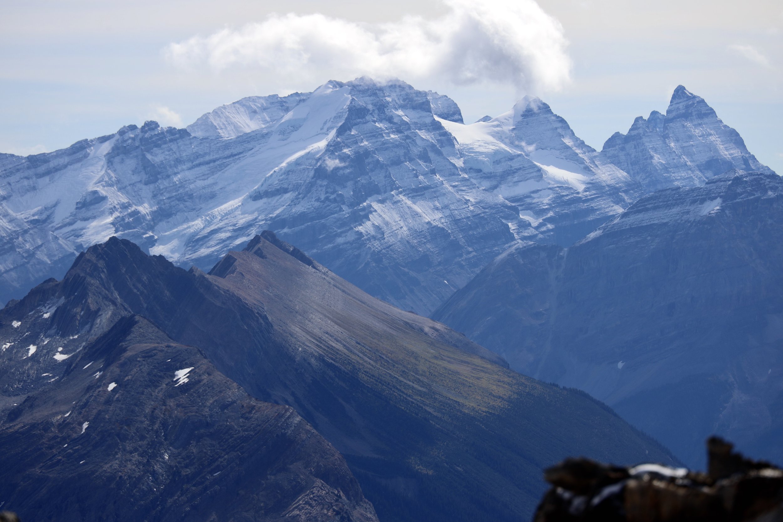
The Grand Teton Range at sunrise
The Grand Teton
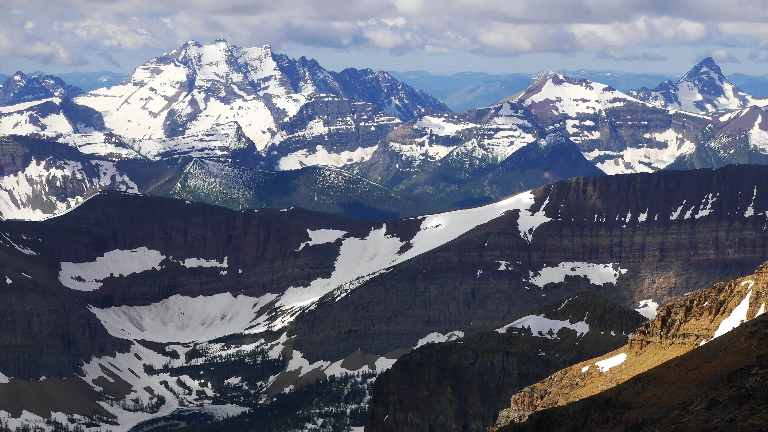
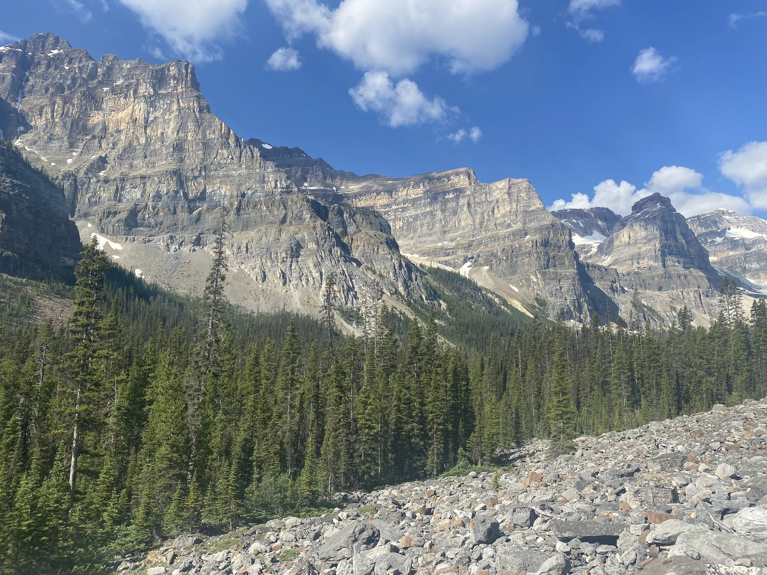
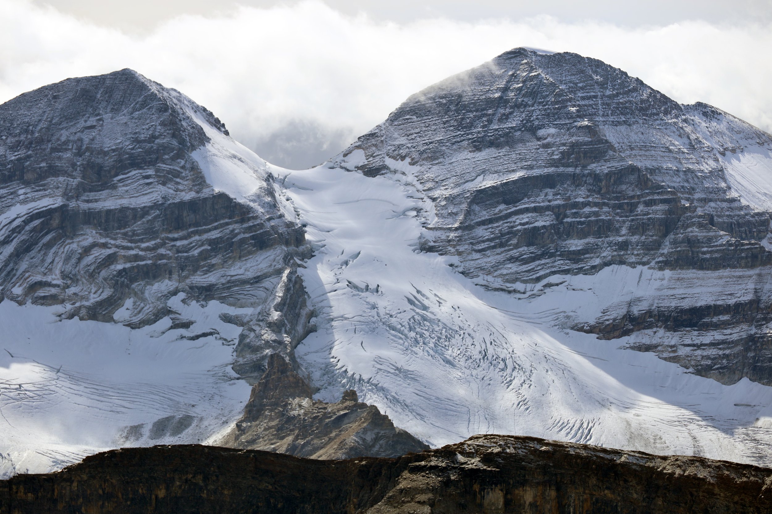
Glacier National Park in Montana


The Grand Teton Range at sunrise


The Grand Teton


Glacier National Park in Montana


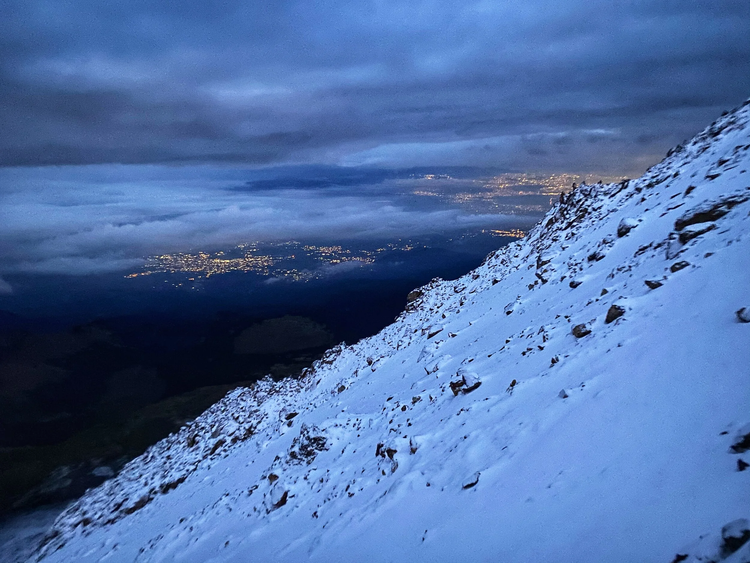
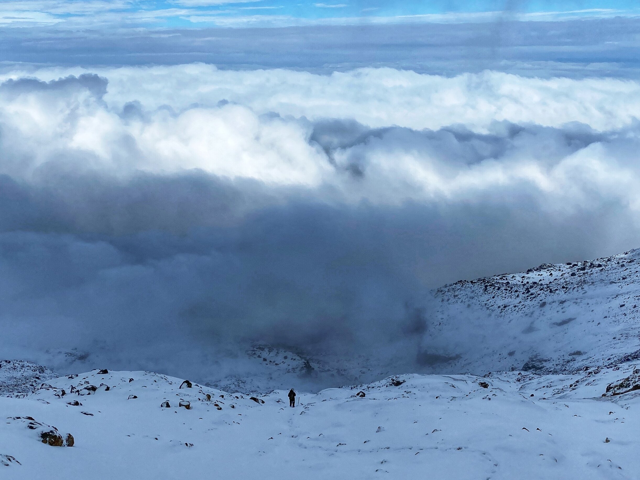
Southern Patagonia Argentina - The Southern Patagonian Icefield and Cerro Marconi Norte
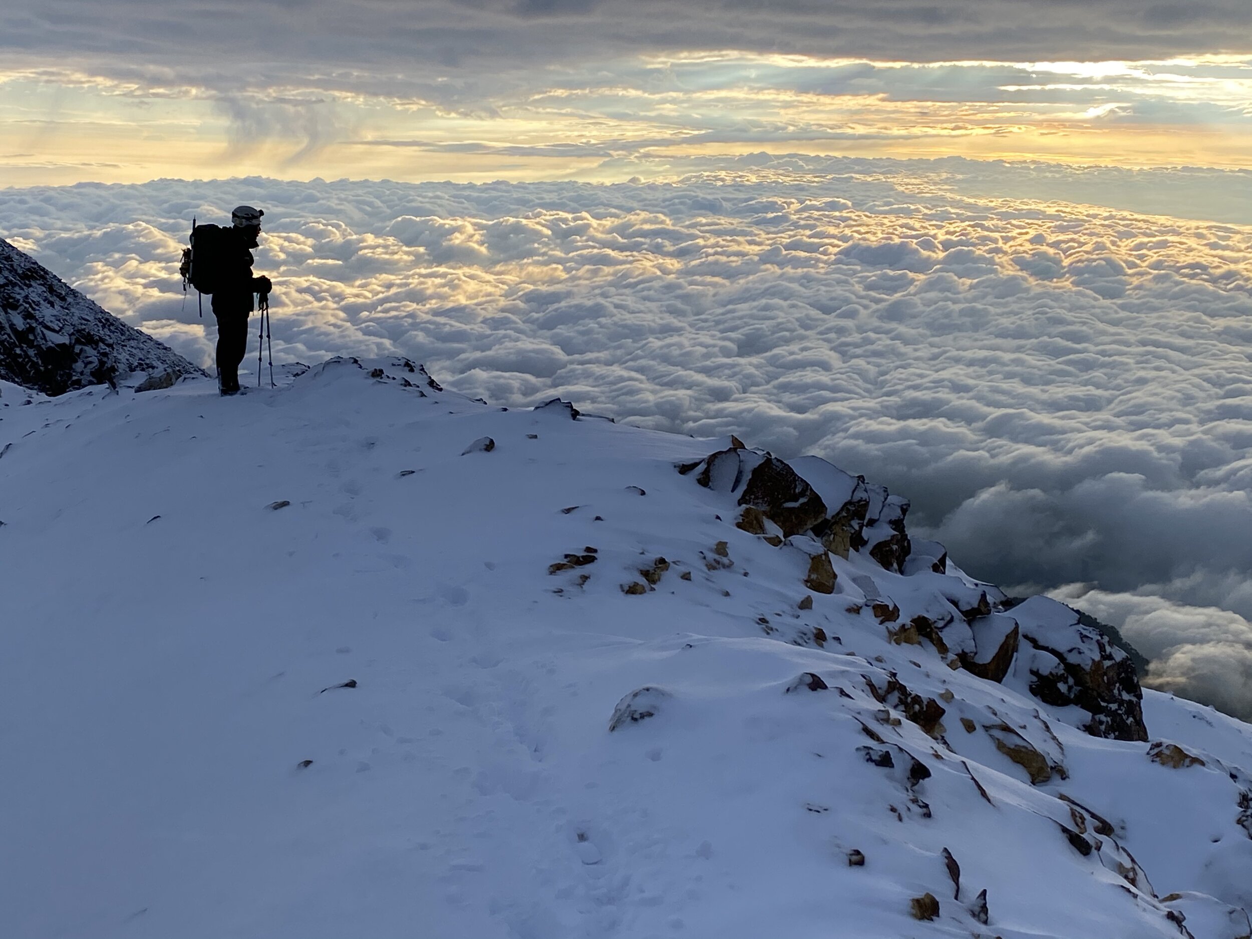
Cordillera Real Bolivia - Huayna Potosi and Ancohuma
Cordillera Vilcanota Ausangate Peru
Cordillera Blanca Peru
Los Nevados National Park Colombia
Sierra Nevada de Santa Marta Lost City Colombia
Tayrona National Park Colombia

Andes Central - Peru and Bolivia

Andes South Chile and Argentina
This where I live and spend a lot of time enjoying the stunning nature. I am blessed to be able to have all of this beauty within an easy drive from my home. After visiting many mountain areas of the world, I feel that Western Canada is one of the most beautiful and wild mountain environments left on Earth. The following pages contain more detailed account of each individual area of the Canadian Rockies. The photos on each page are a summary of many trips and are updated quite regularly as I continue exploring my backyard. Click on each link to go to the specific page:
Jasper National Park - Tonquin Valley
Jasper National Park - Mr Brazeau and Maligne Lake
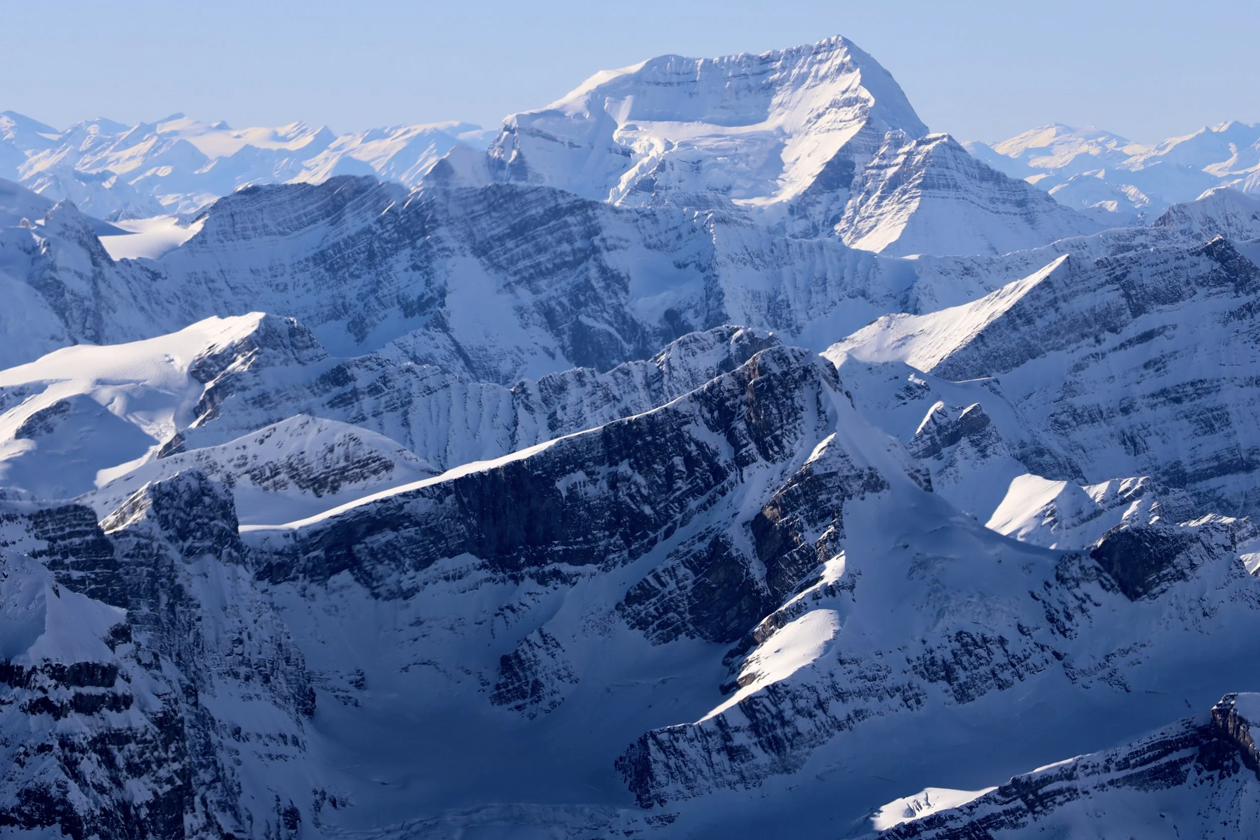
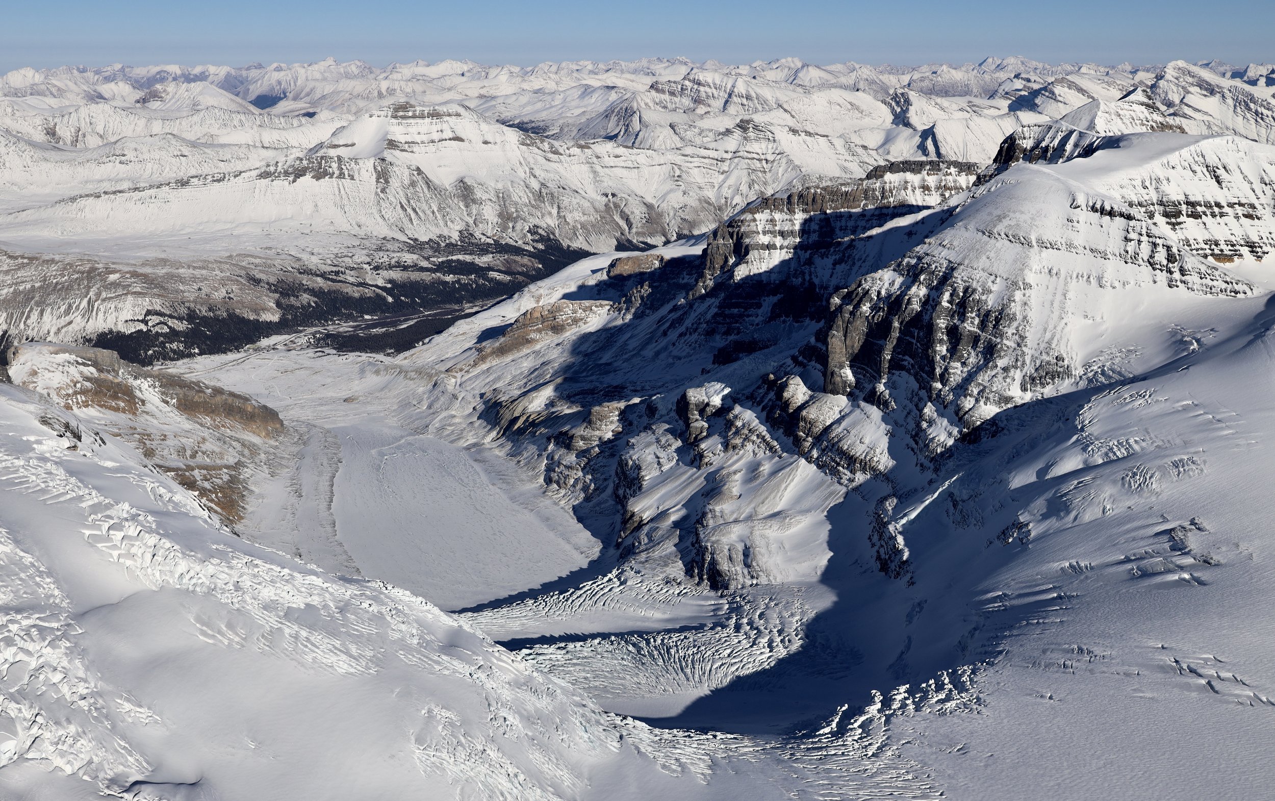
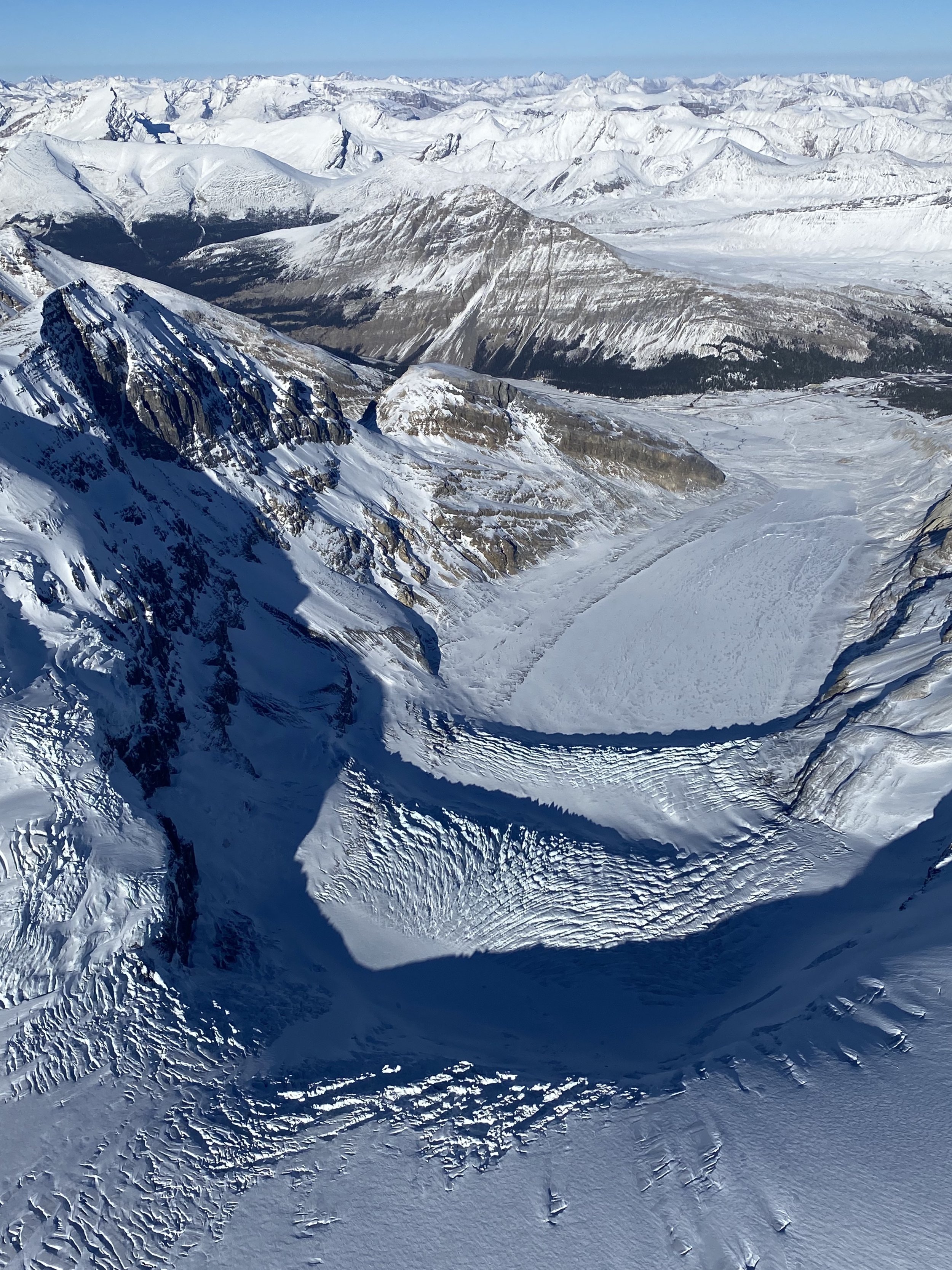
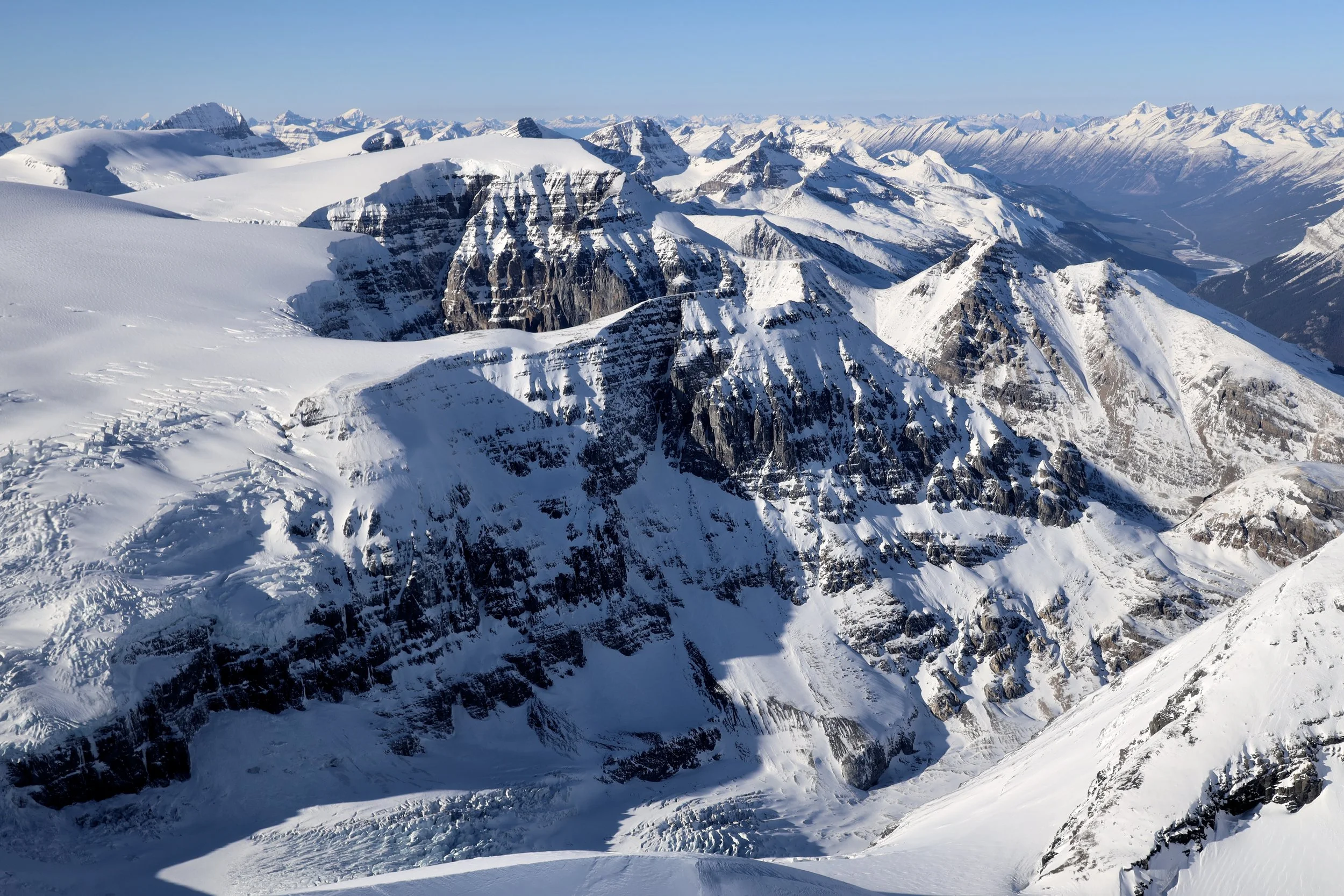
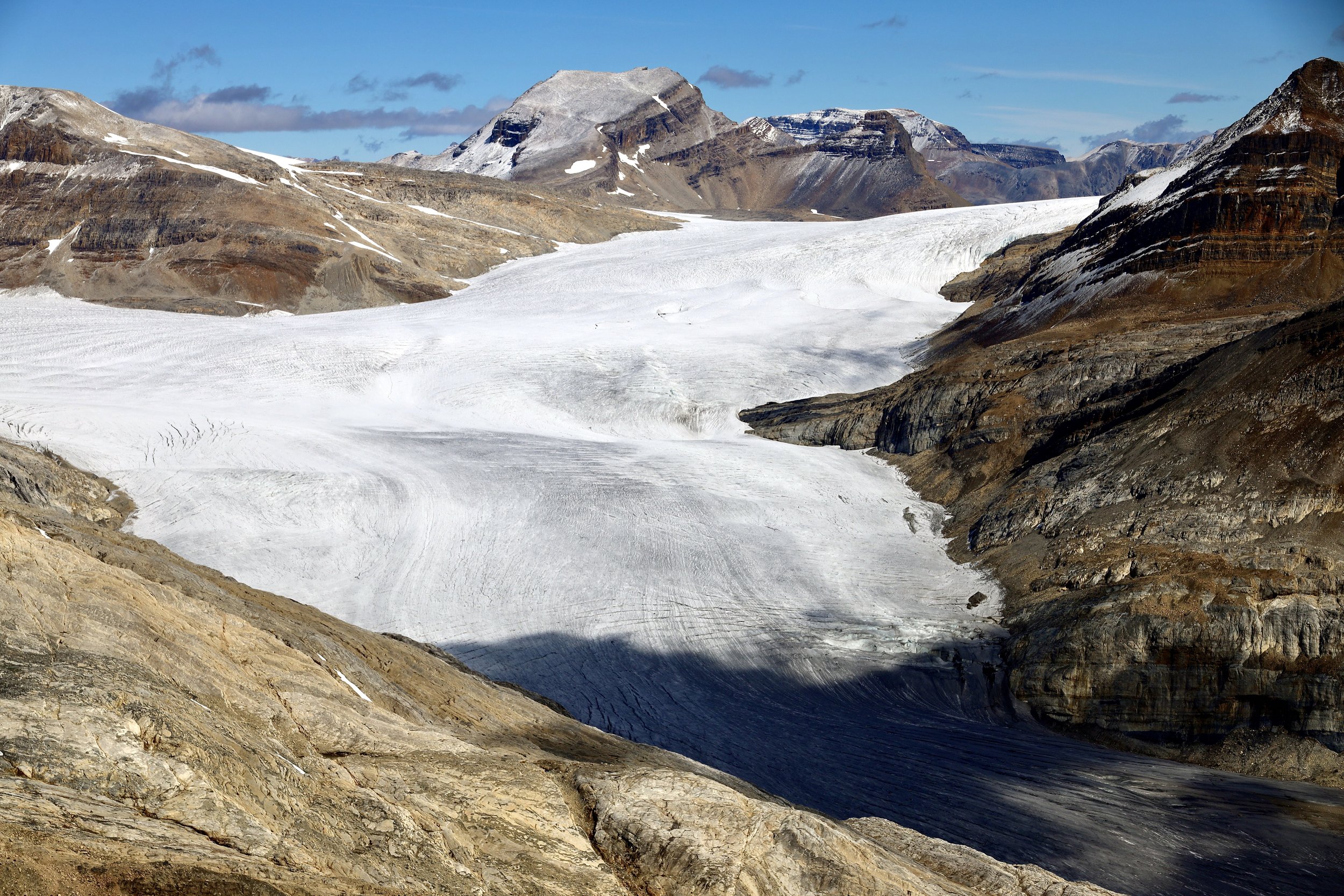
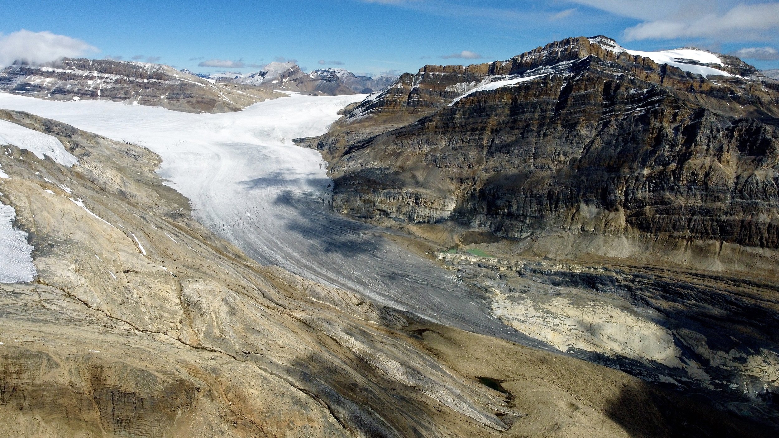
Jasper National Park - Columbia Icefield area
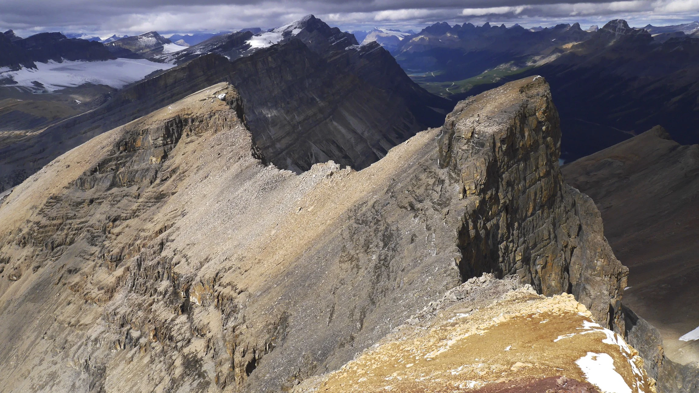
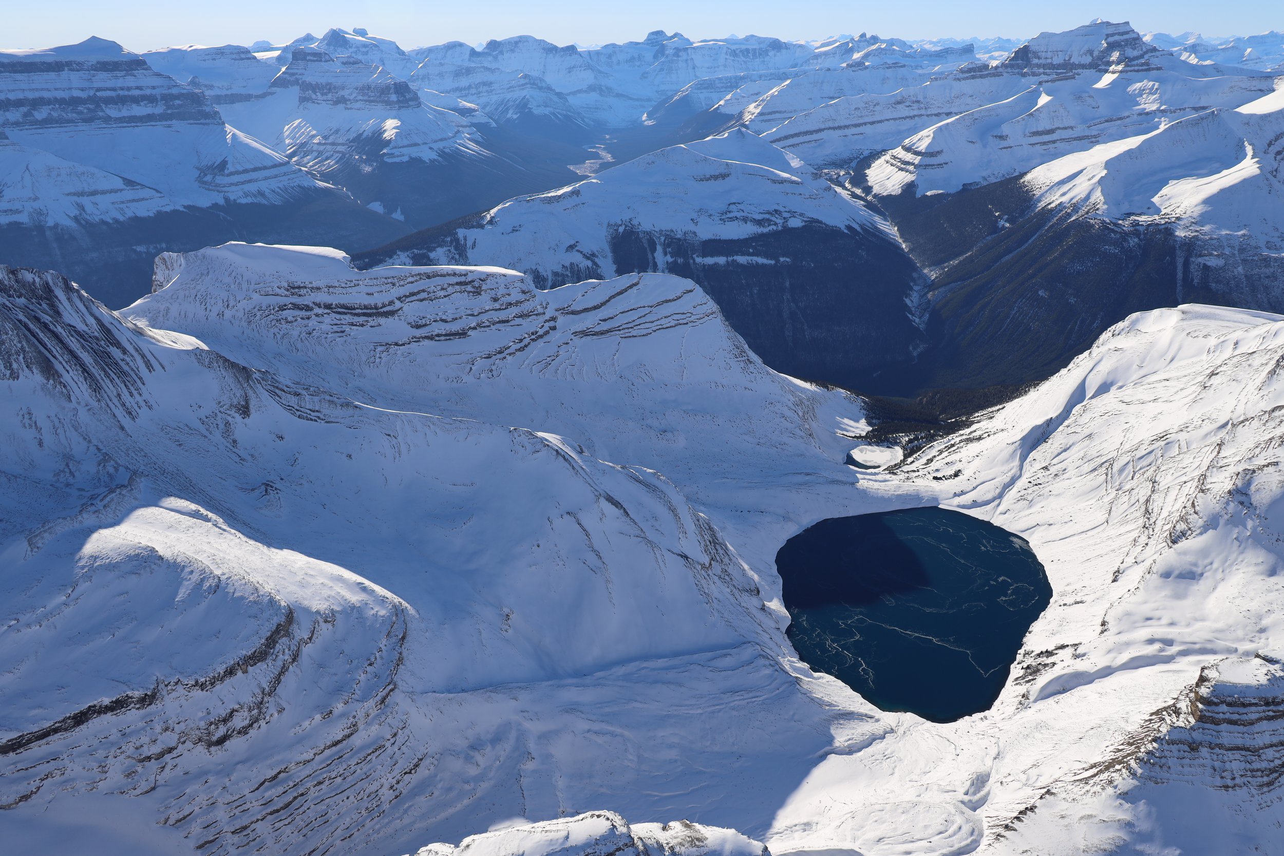
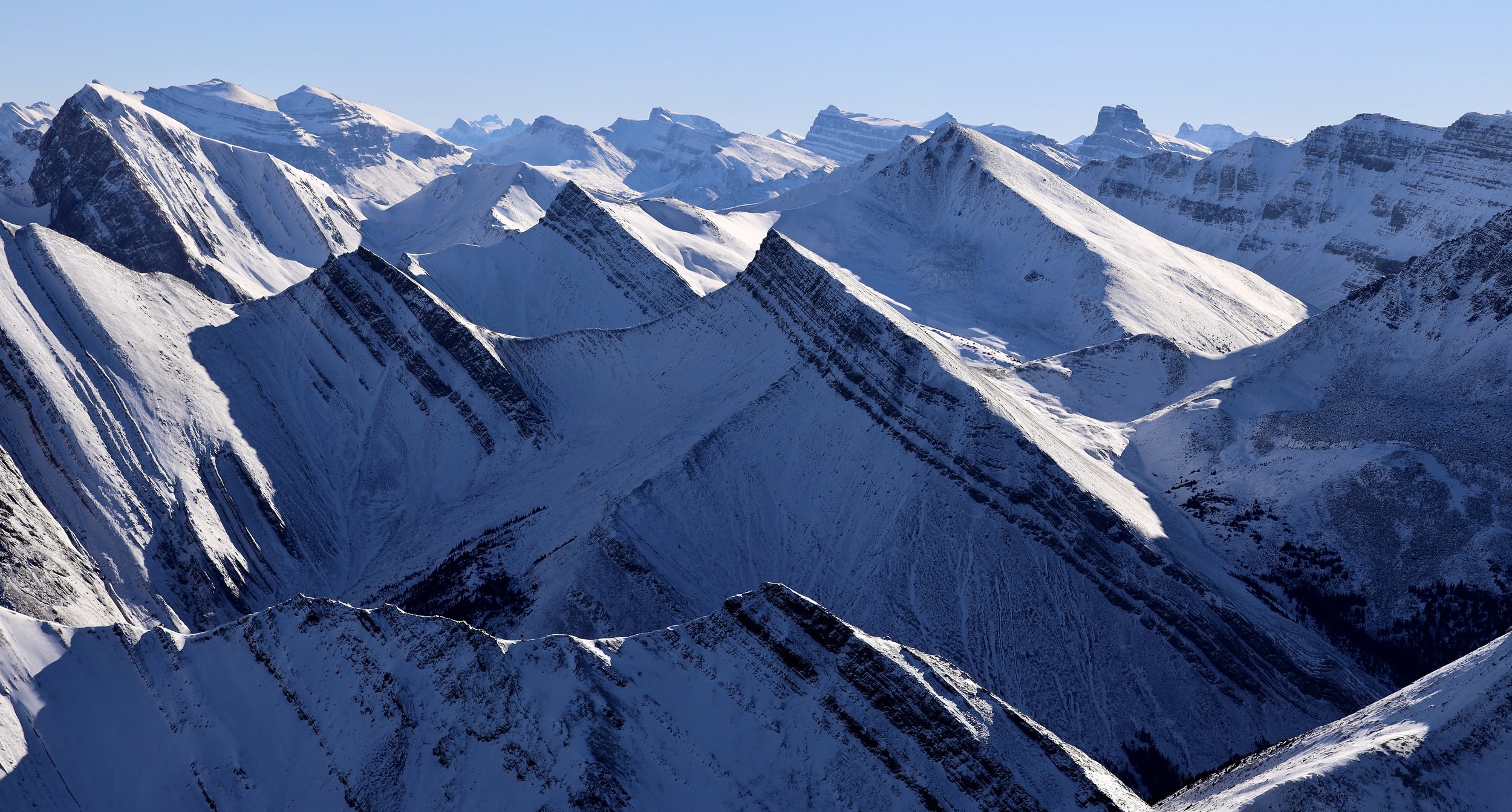
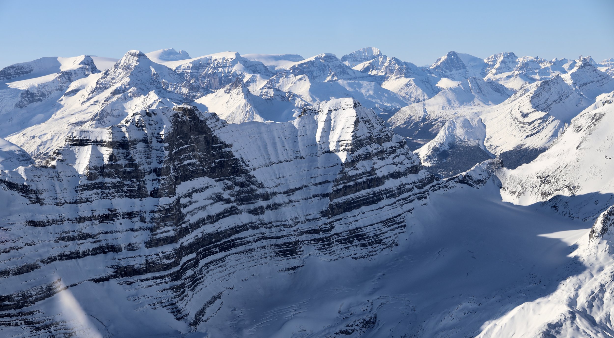
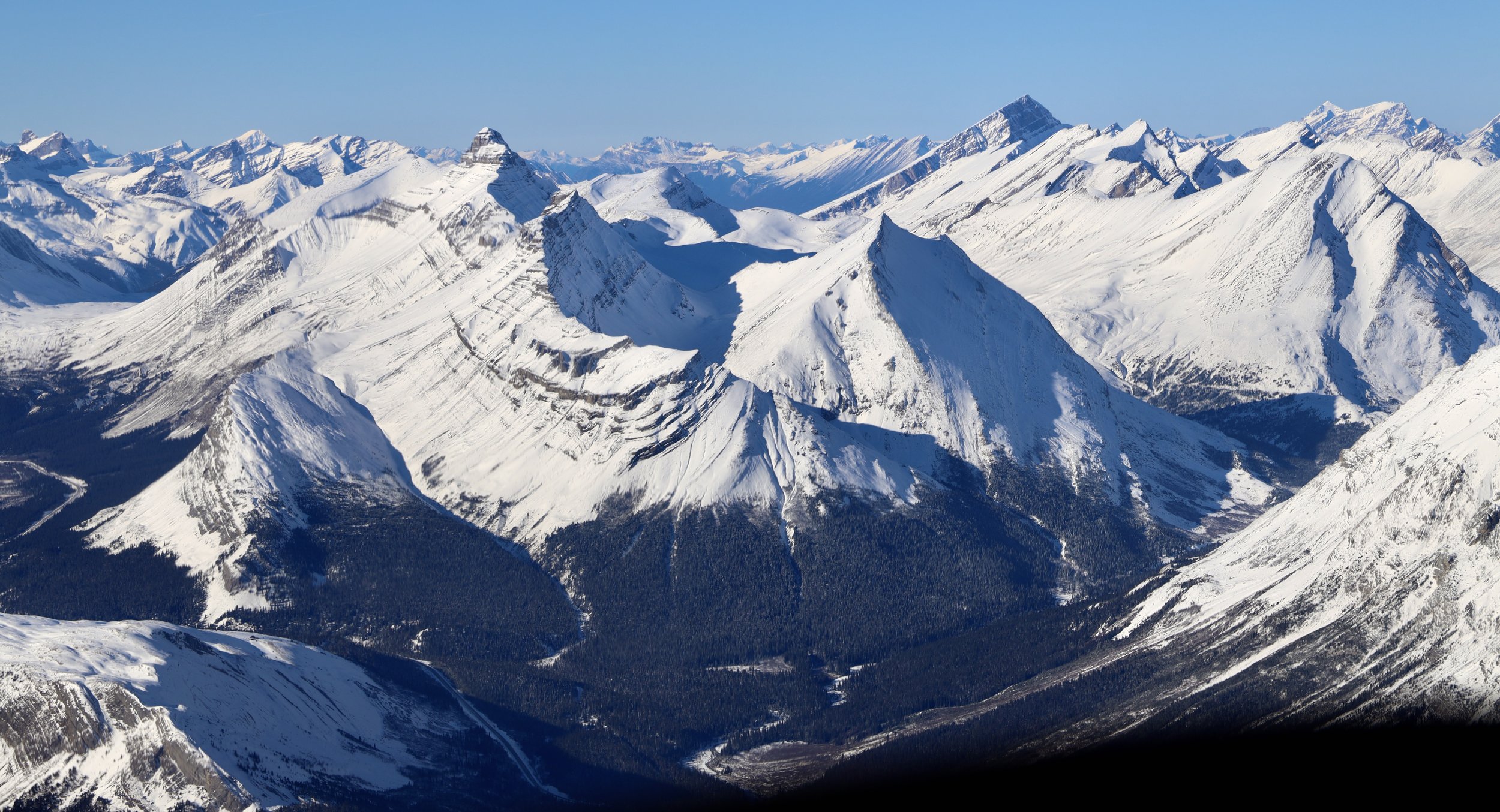
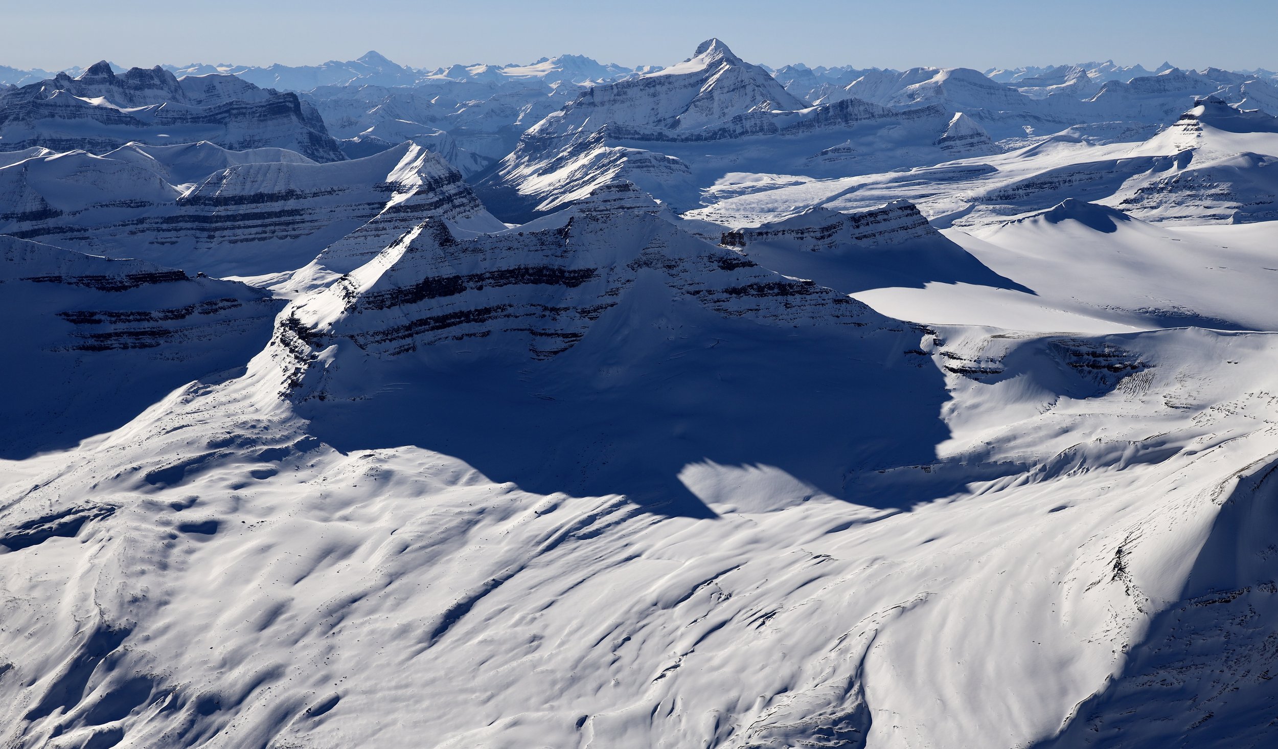
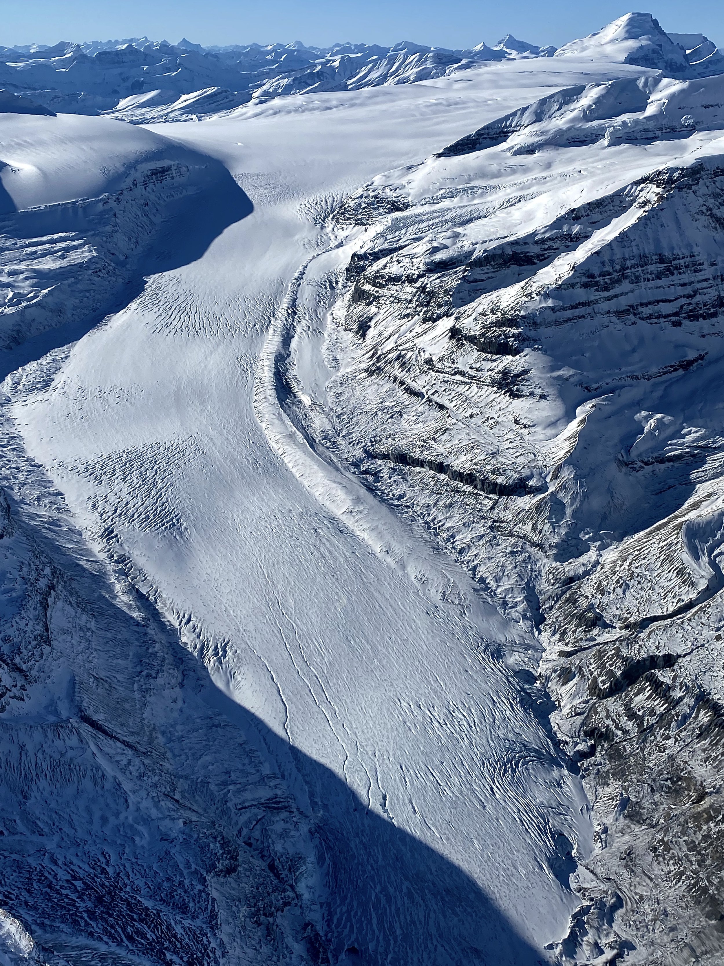
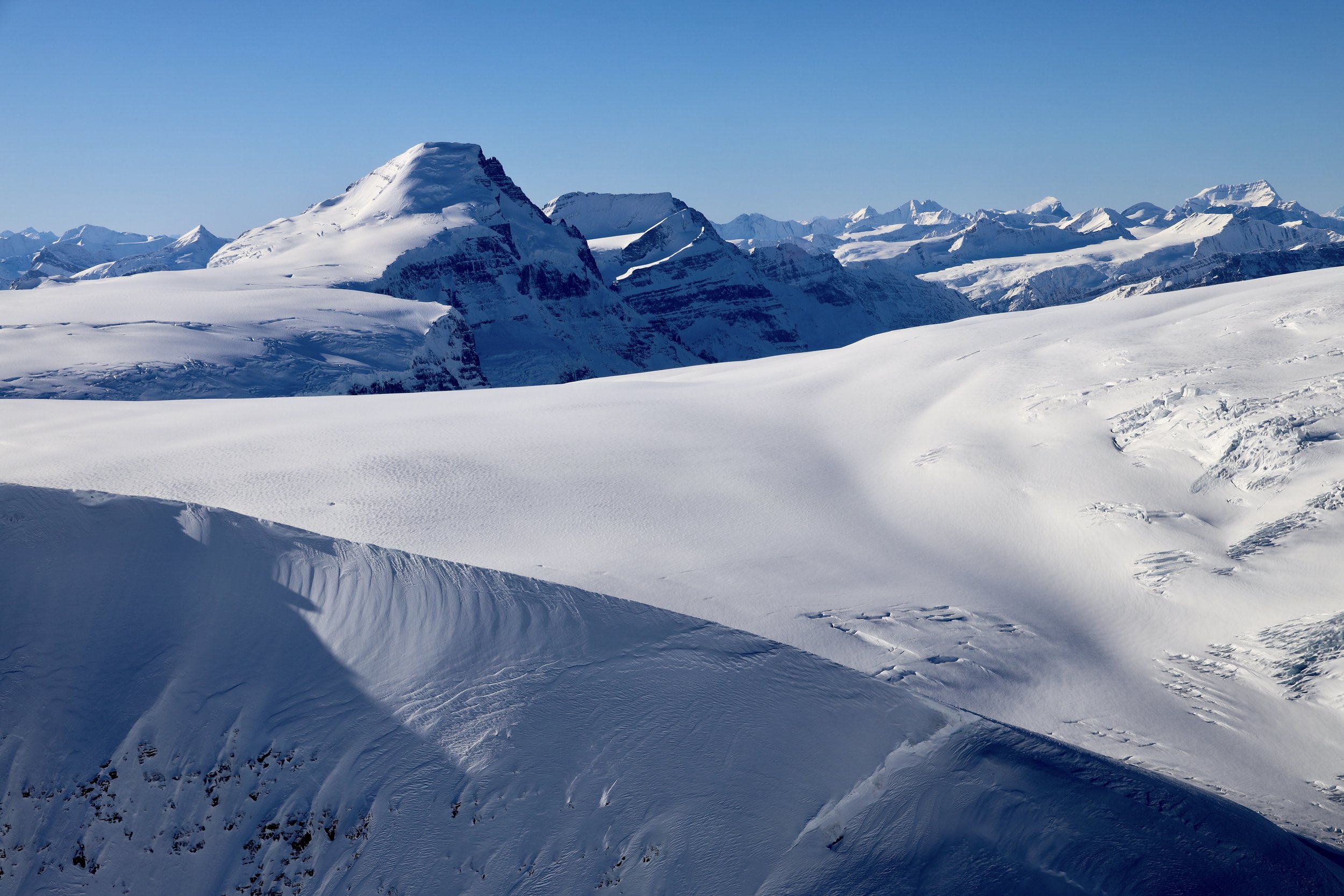
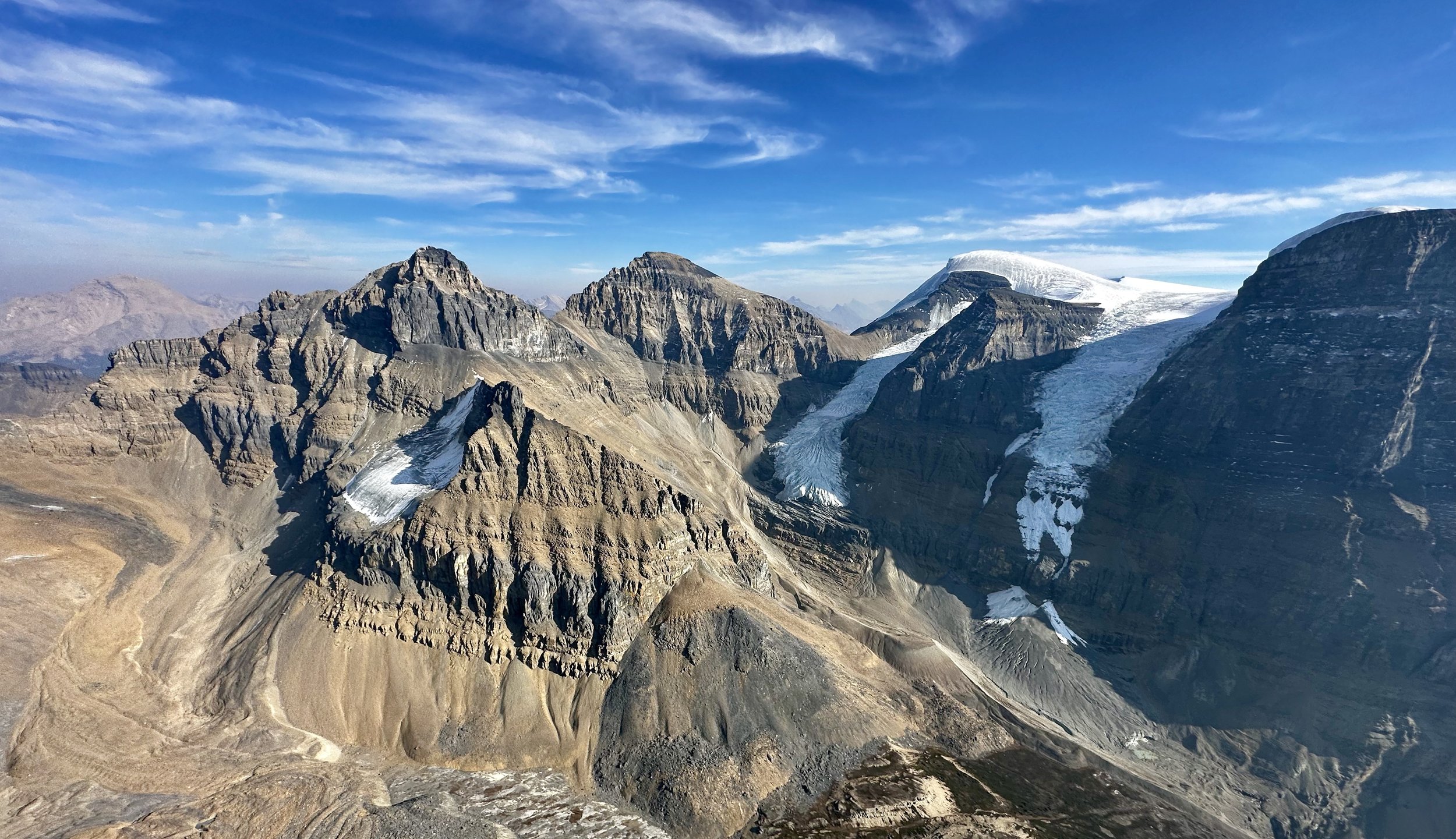
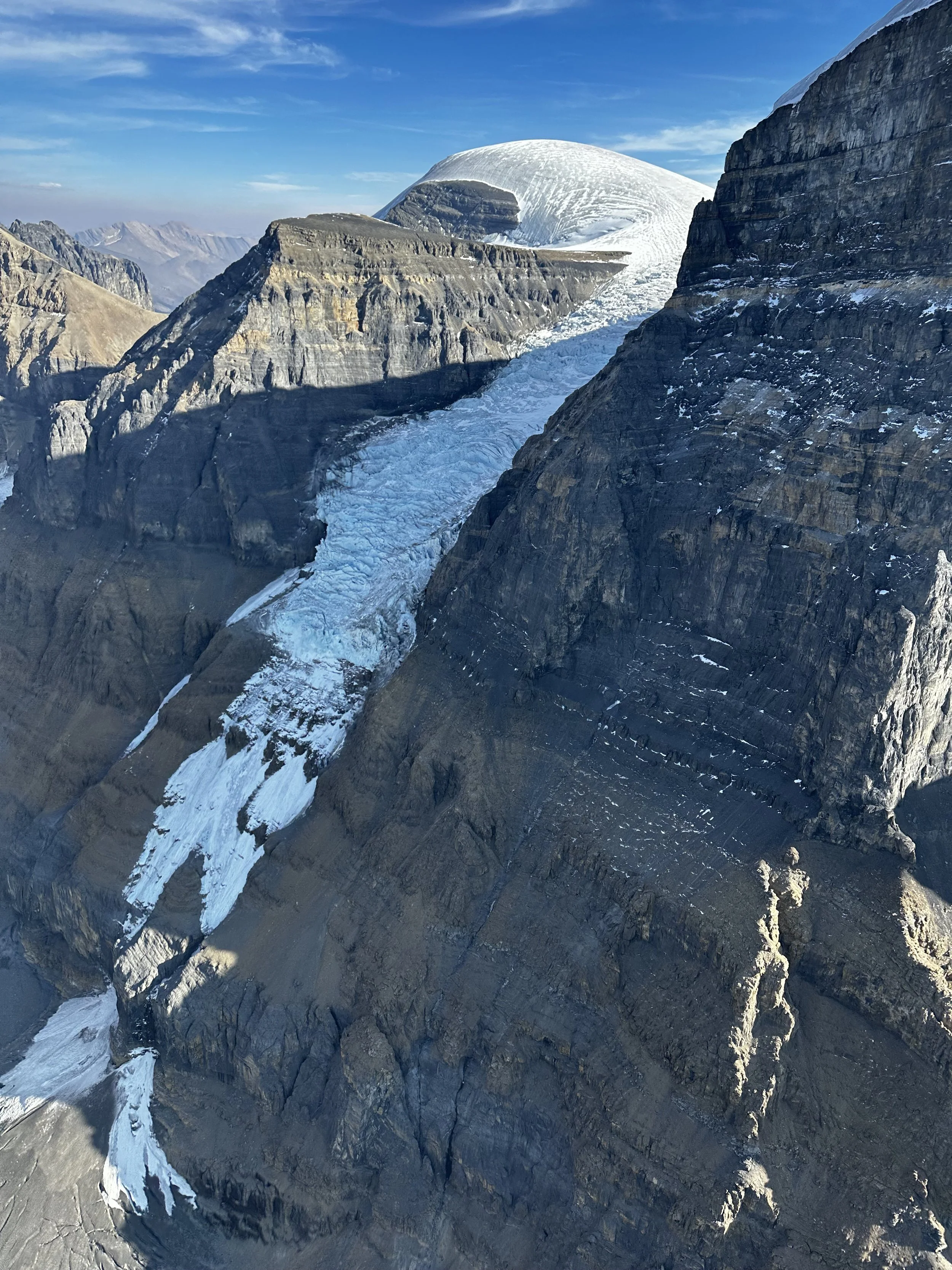
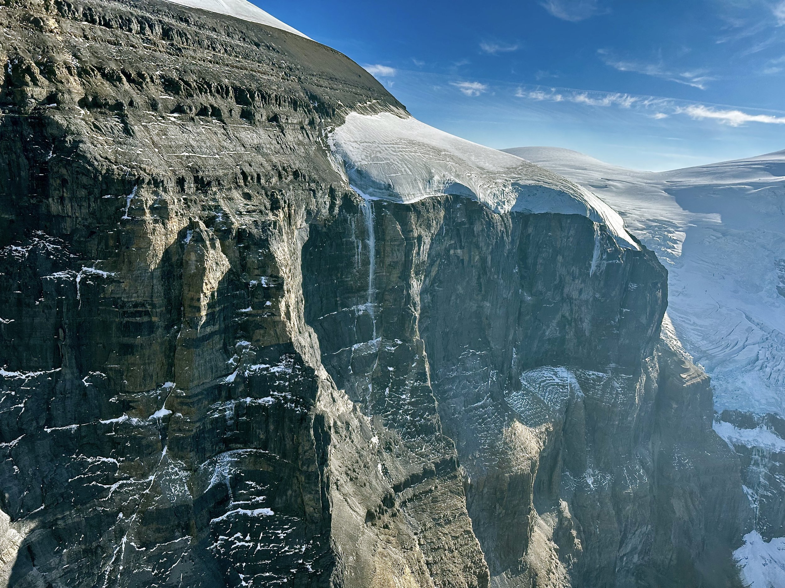
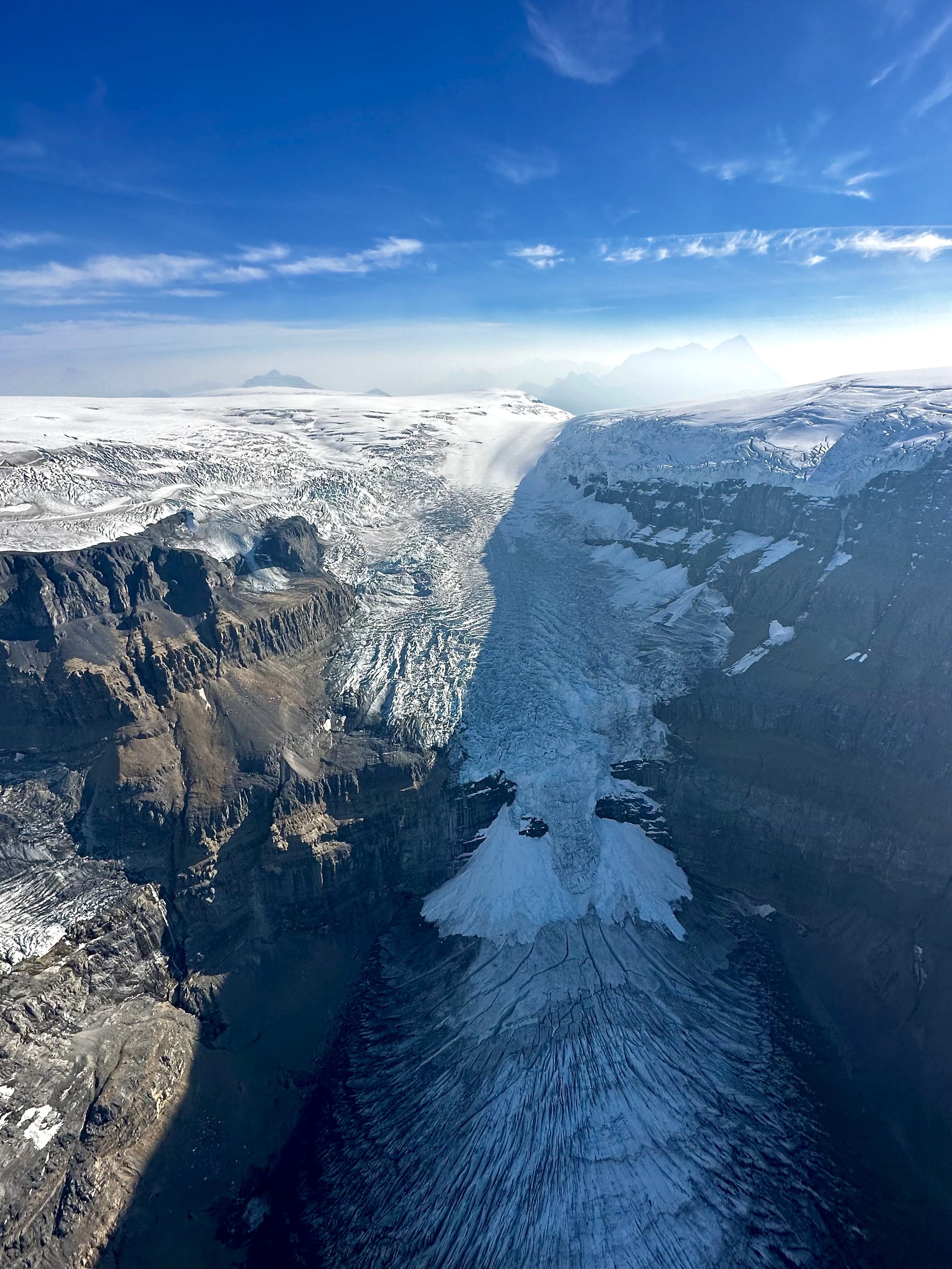
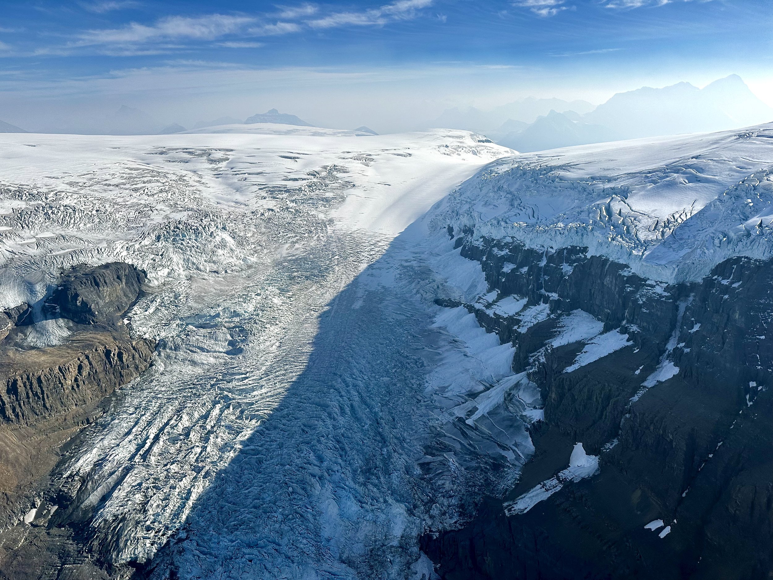
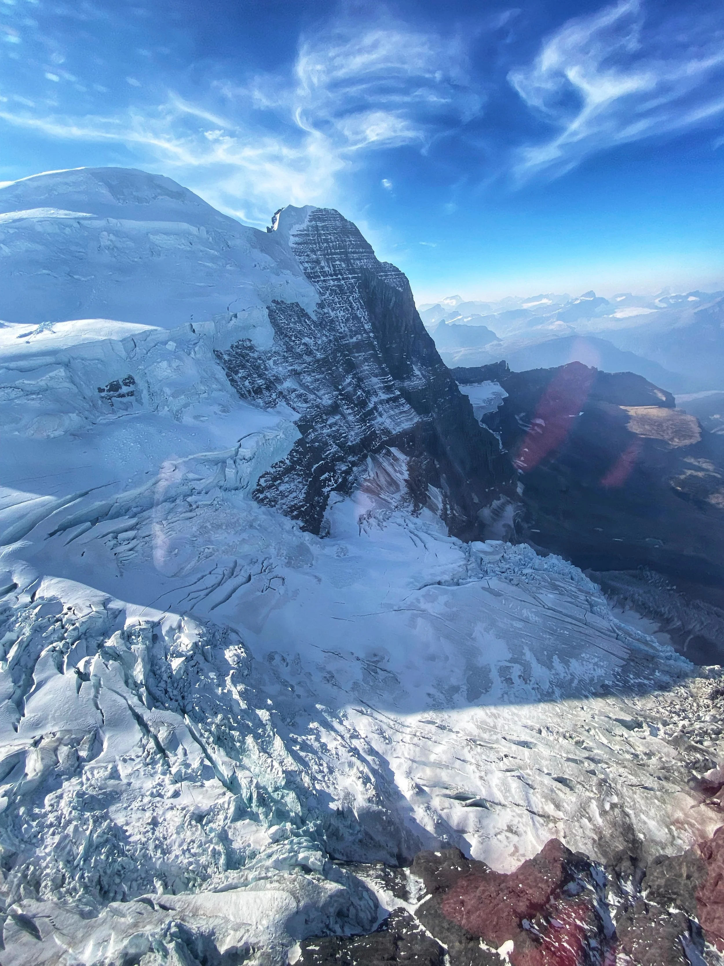
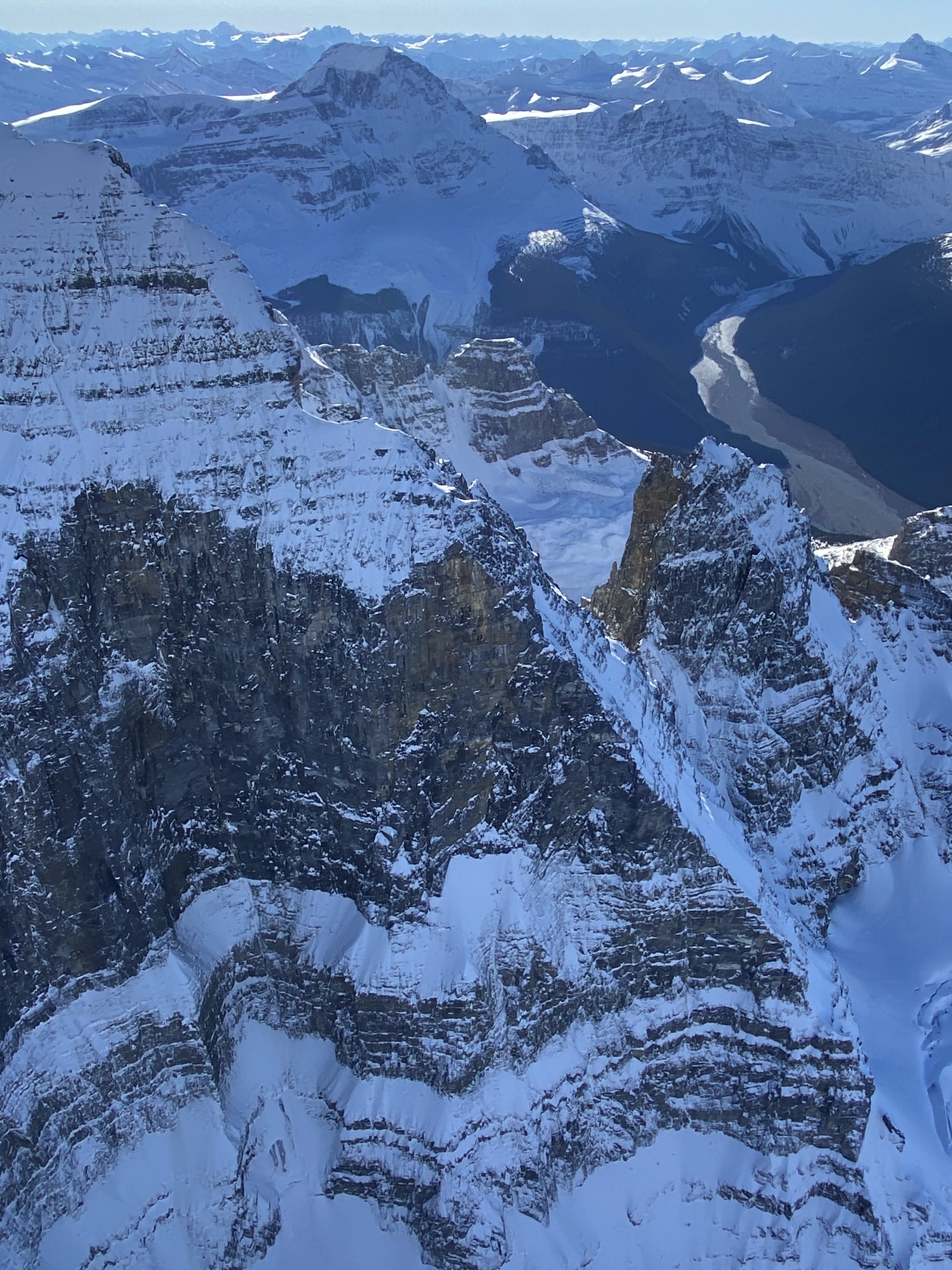
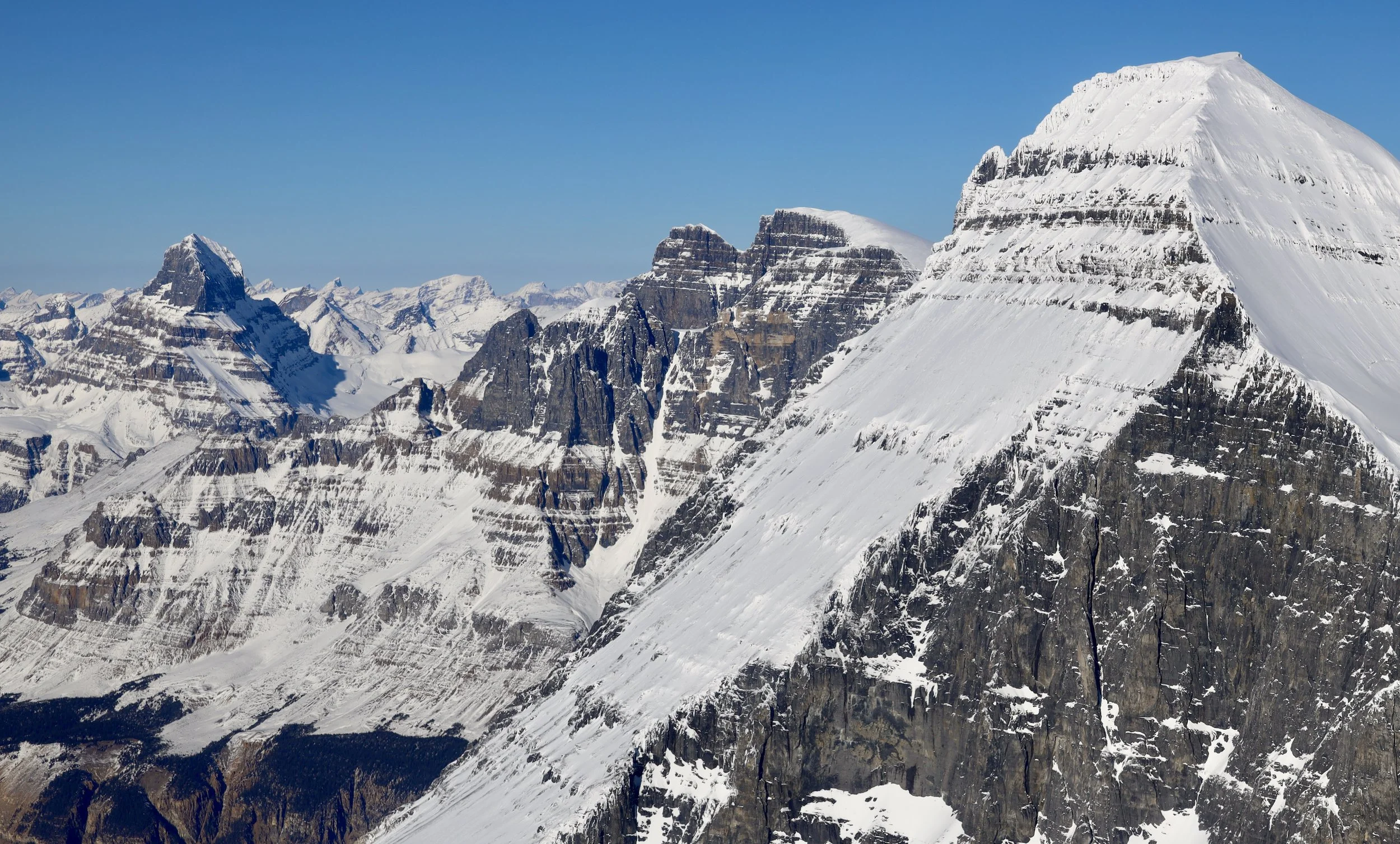
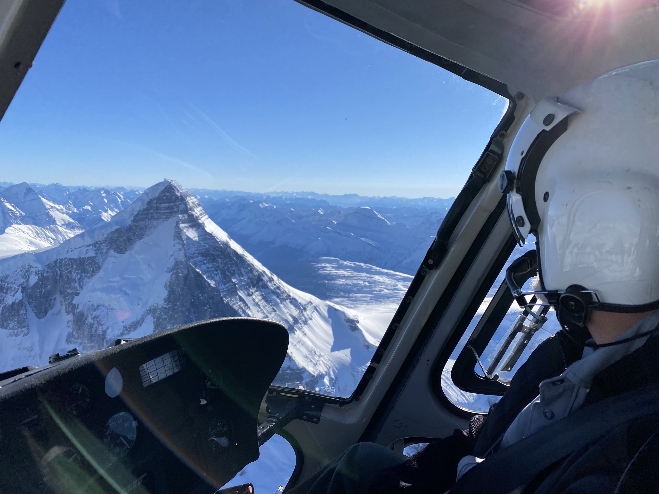
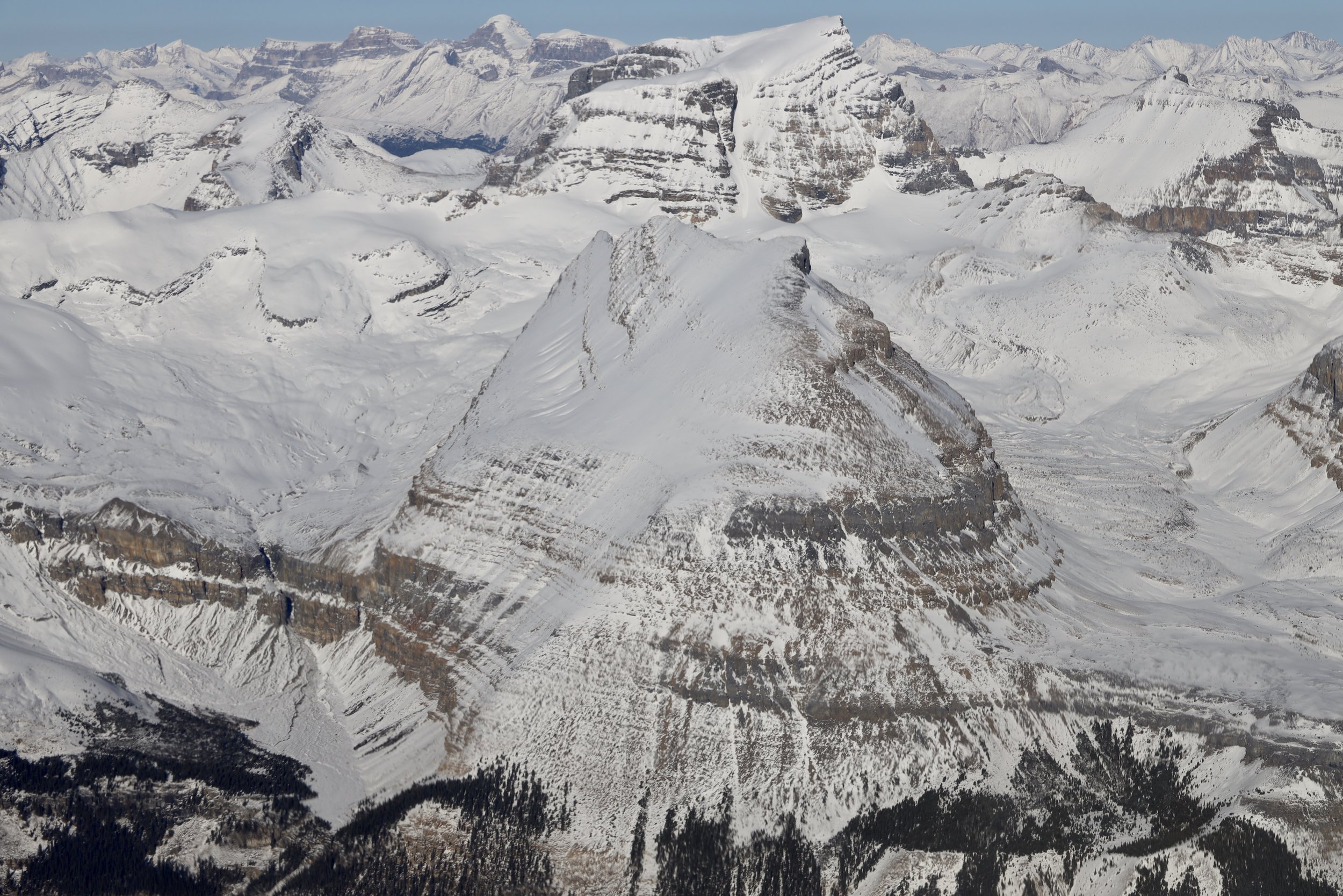
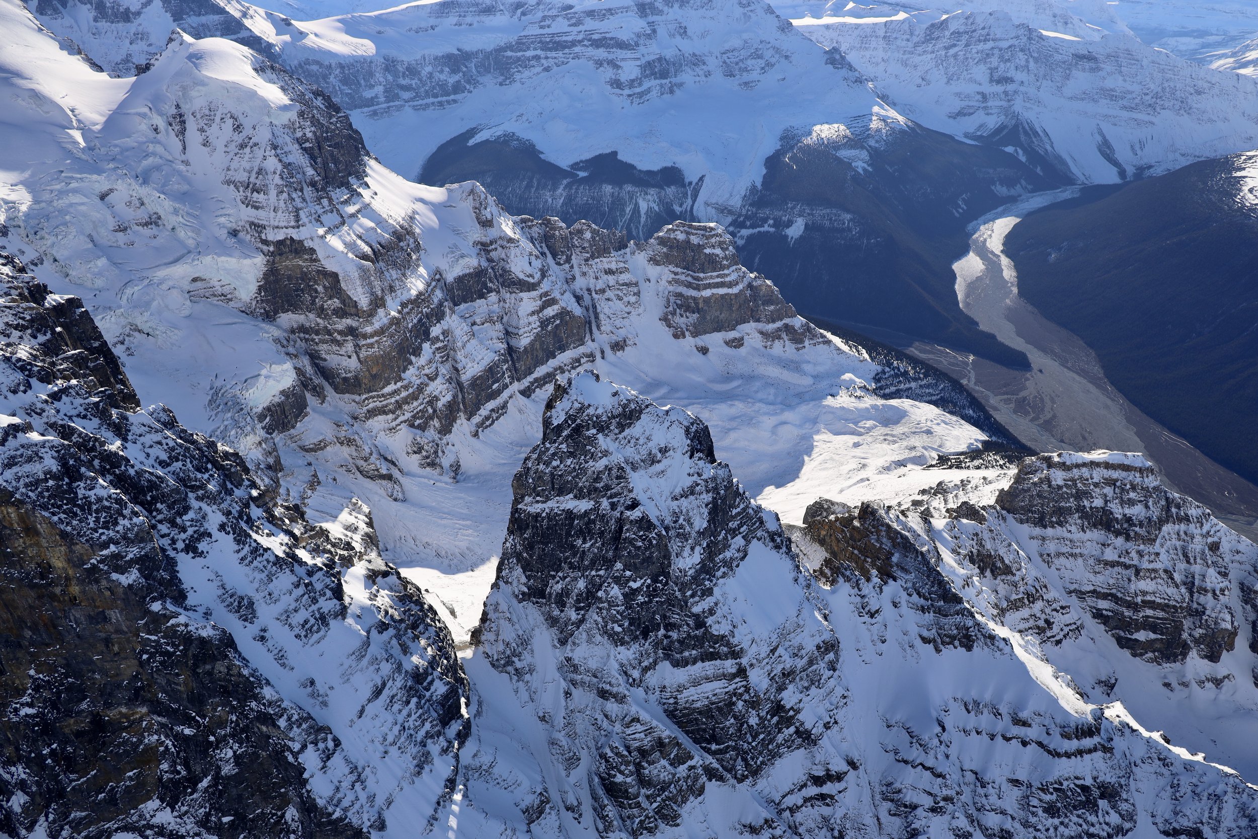
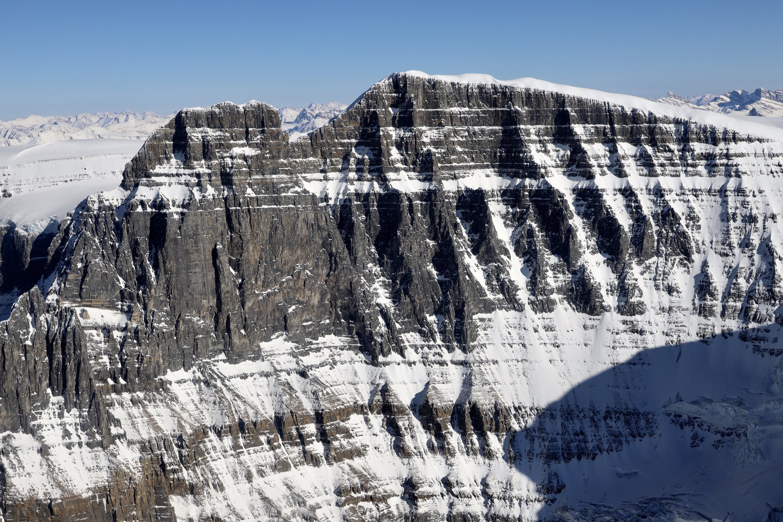
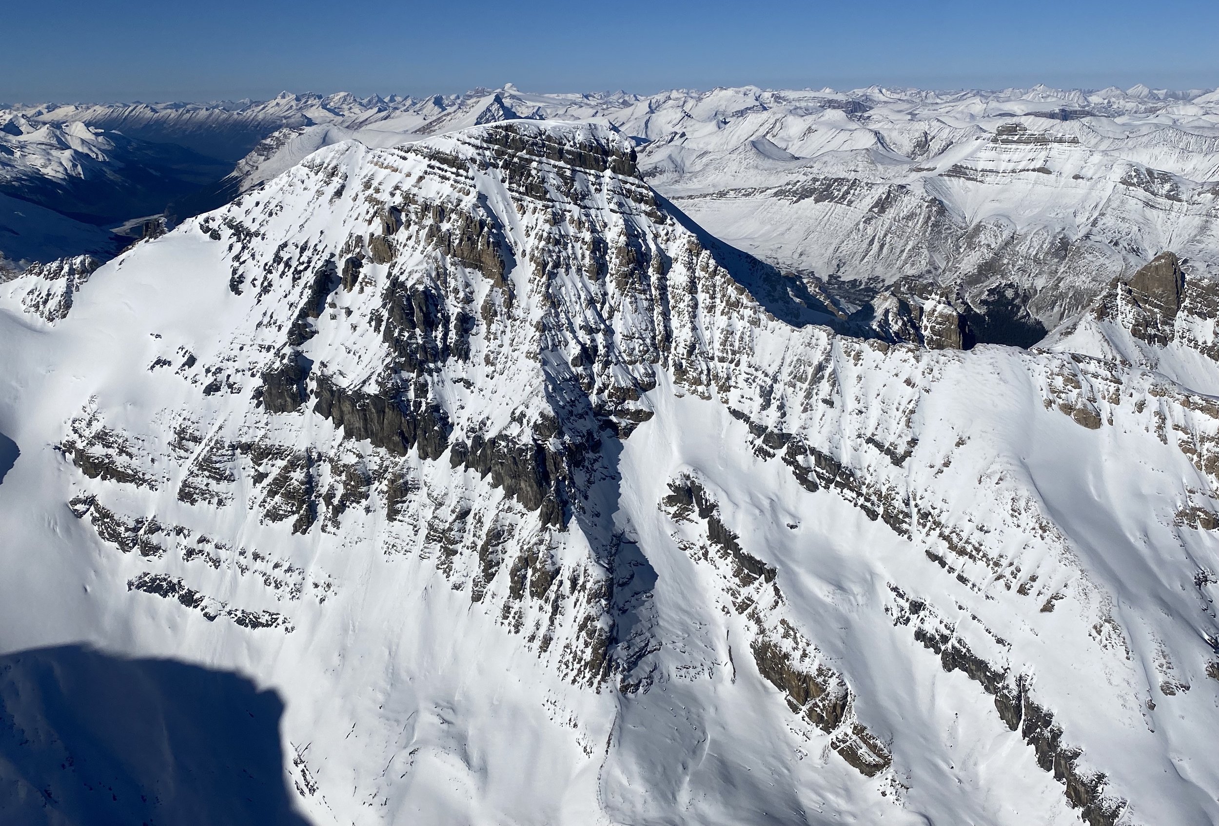
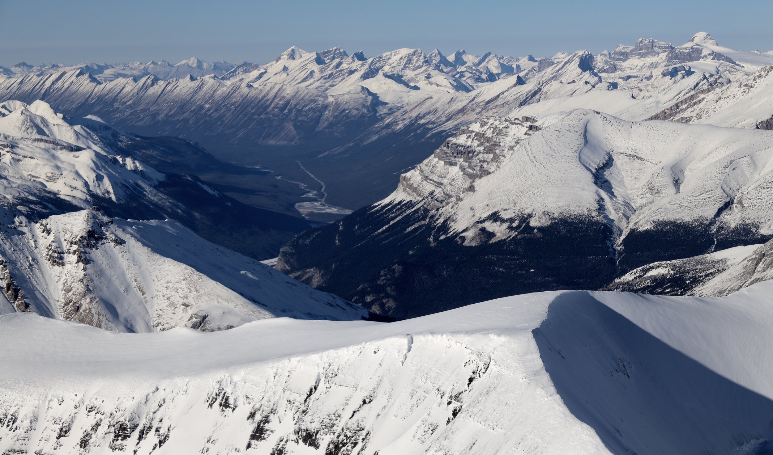
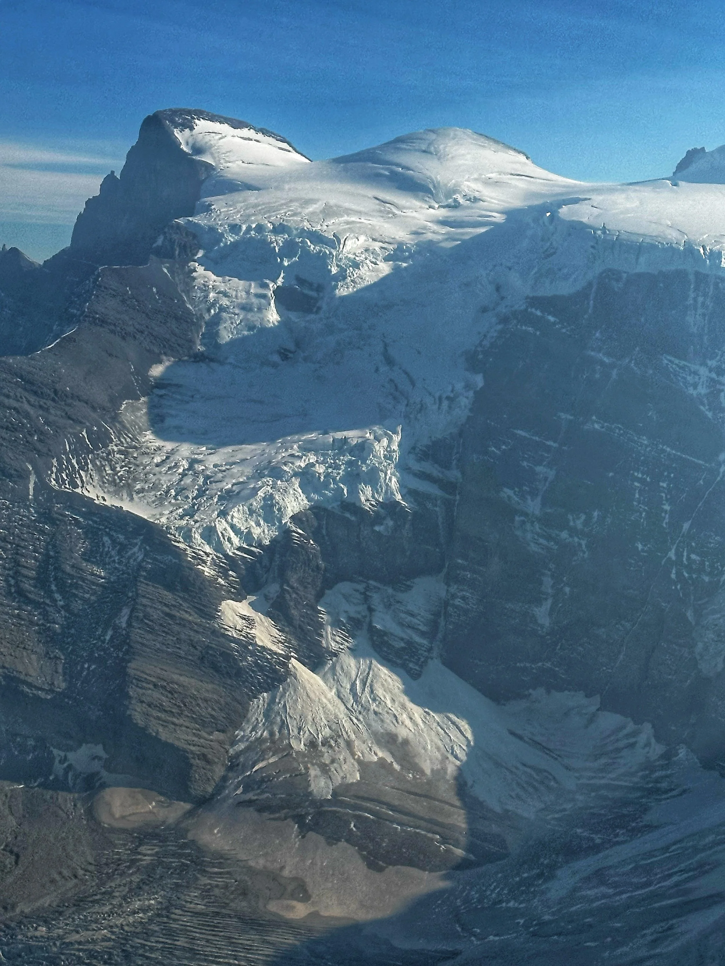
Columbia Icefield from the Air
Banff National Park - Wapta Icefield and Bow Lake
Banff National Park - Lake Louise and Moraine Lake
Mount Assiniboine Provincial Park BC
Here is a sample of various photos from the above folders:


Winter hiking around Canmore, Alberta in -30C

The view of the Bow Valley from Ha Ling in February

Grotto Mountain in February

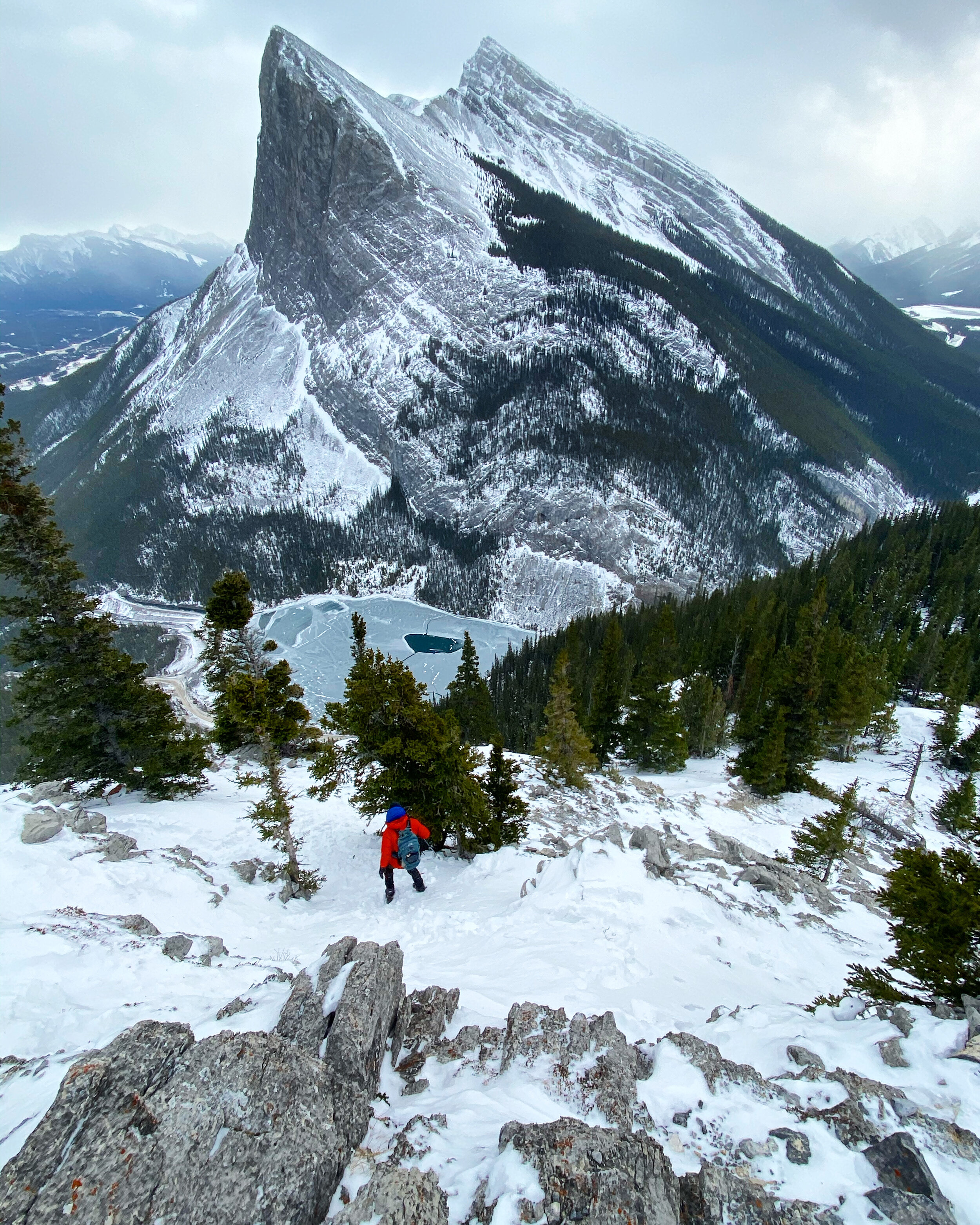
Mount Rundle in January. The pointy peak is the Ha Ling.

Bow Lake

Bow Valley and Ha Ling Peak from the Miners Peak

Mount Balfour from the Iceline Trail in Yoho NP

The Iceline Trail in Yoho NP

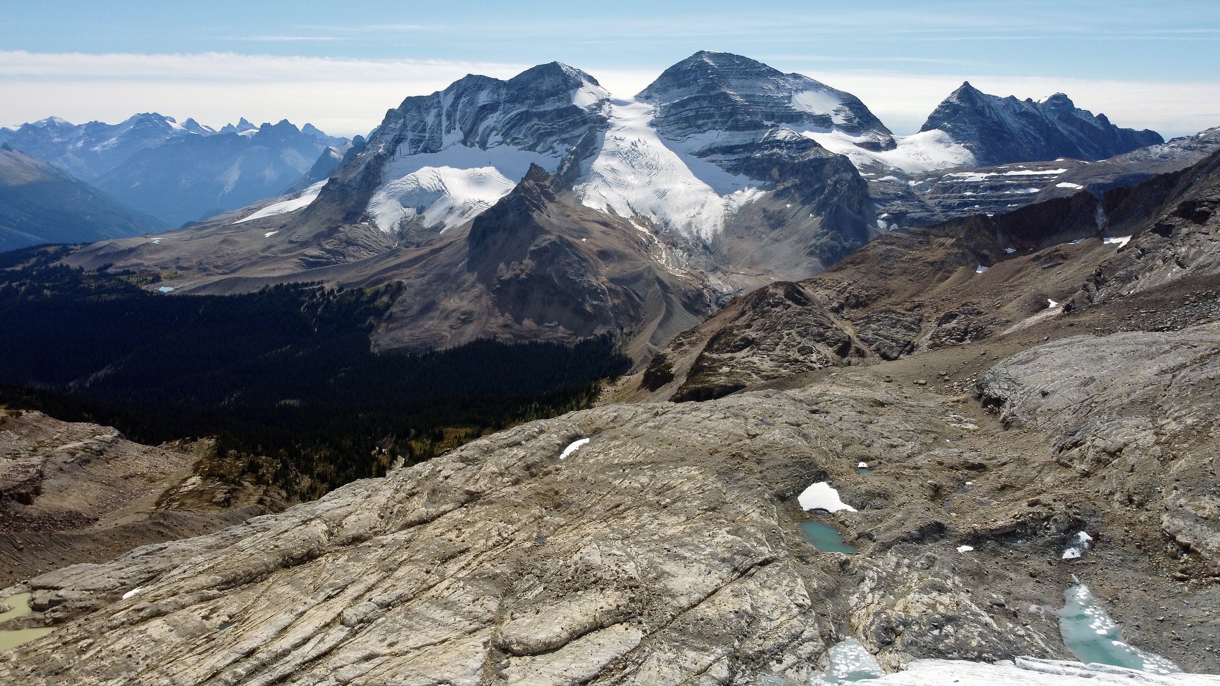
Mt. President and Vice President. Below is the Iceline Trail. The view from the summit of the Whaleback Mountain in Yoho NP.

The closeup of Mt. President from the summit of the Whaleback Mountain. The glacier is almost too dangerous to climb.

View of the Watervalley from the Whaleback

The view of the Little Yoho Valley, the Presidents and the Iceline Trail from the Whaleback Mountain

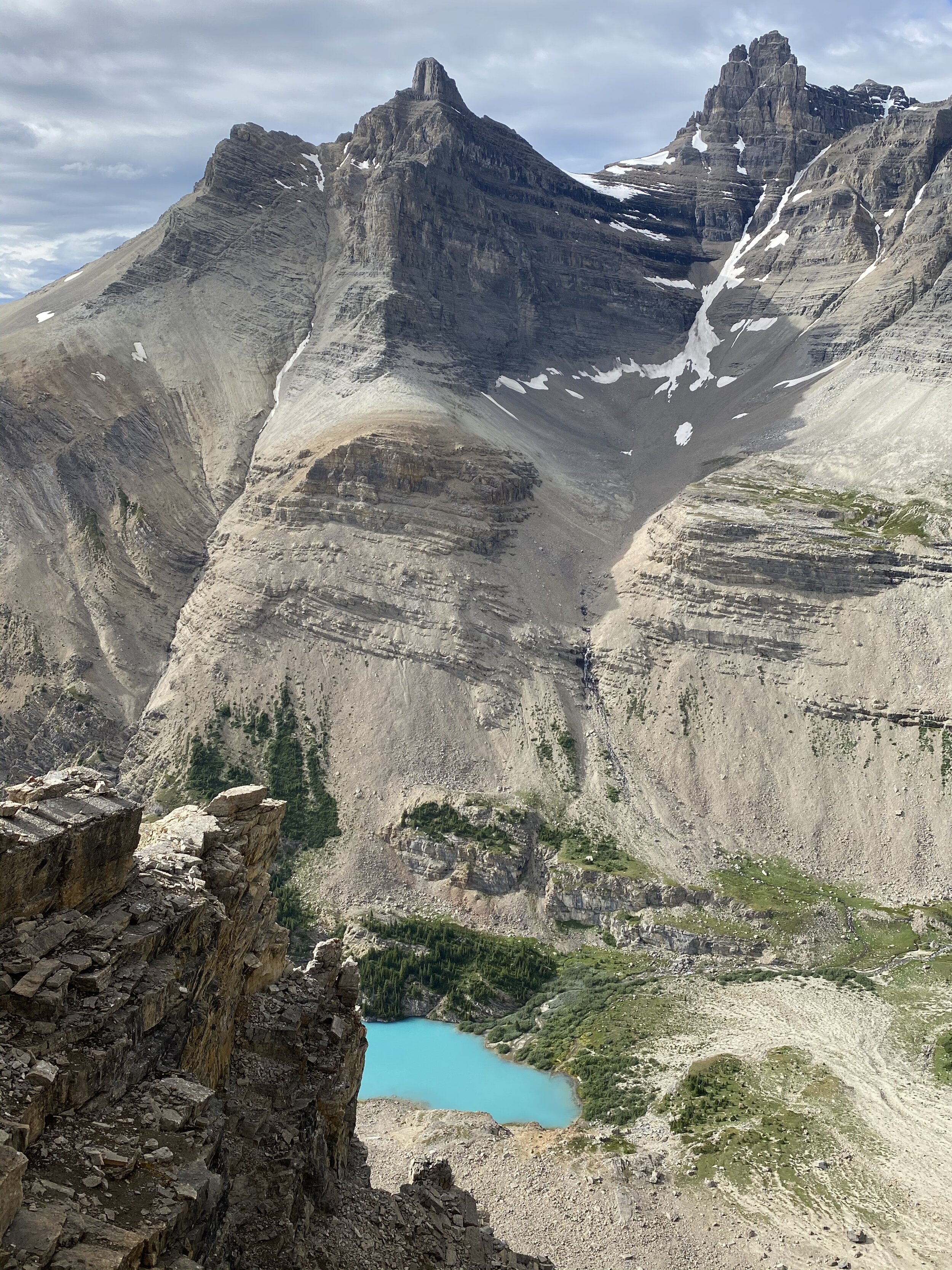
The view of the Pharaoh Peaks from the Sphinx Mountain with the Egypt and Scarab Lakes below.

The Mummy Lake and the Scarab Lake with the Scarab Peak looming above.

The view of the Sunshine Meadows and the Monarch in the distance.

The view from the Greater Pharoah Peak, notice the thick grey smoke in the south (left of the photo) from the forest fires in the USA.

The view from the Greater Pharoah Peak to the Pharoah Peak Middle and Lesser Pharoah Peak.

Crowfoot Mountain

Crowfoot Mountain

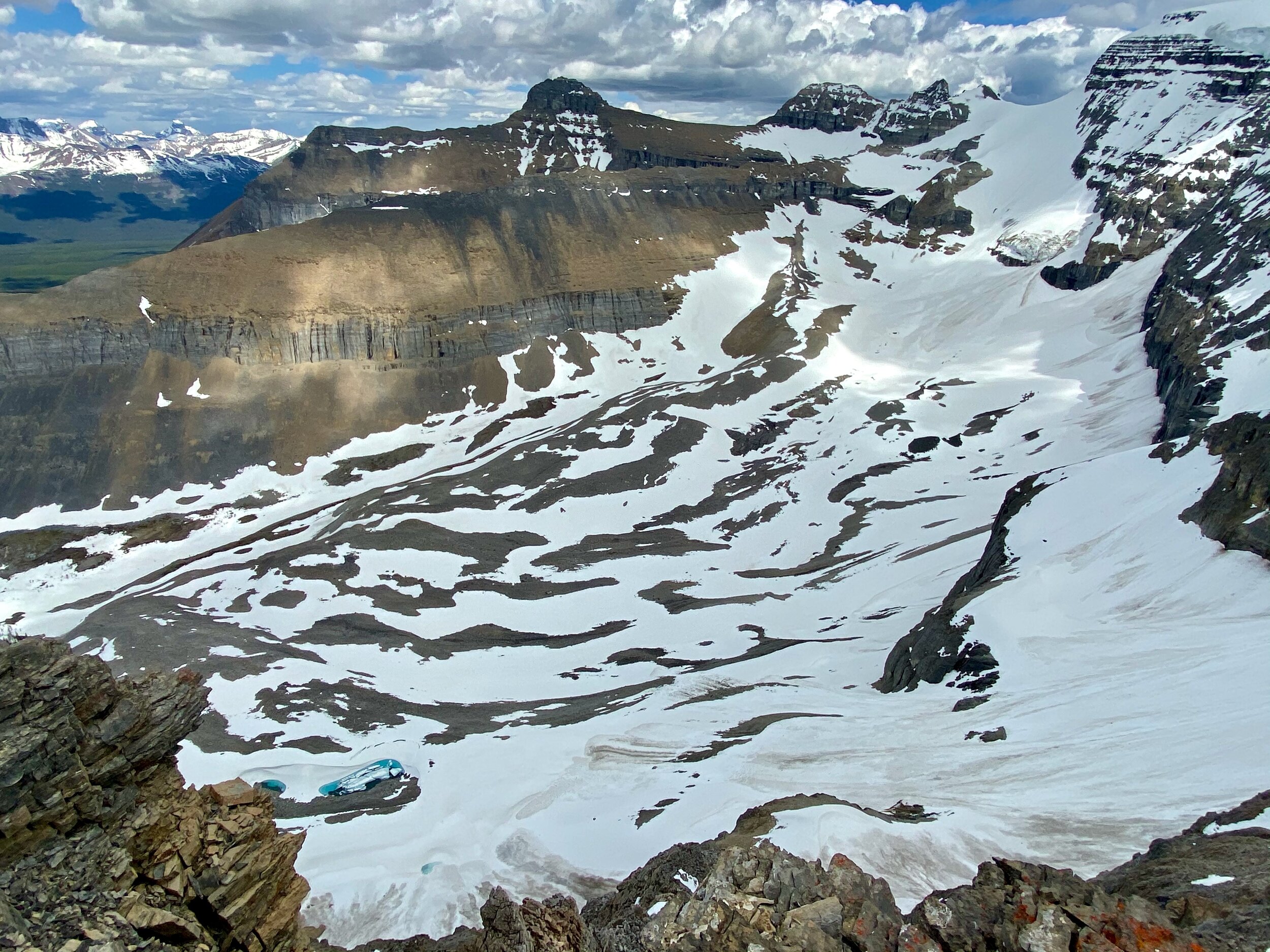
The Rockwall Trail - Goodsir Pass

The Rockwall Trail - Wolverine Pass

The Rockwall on the Rockwall Trail

The Rockwall Trail

The Goodsir Towers from the Goodsir Pass
Moraine Lake and Mount Temple towering above

View from the summit of Totem Peak

Totem Peak

Mt. Victoria

Mt Victoria (right) and Mt. Lefroy (left)
Abbott Pass and the ACC Abbott hut

Panorama from Mt. Richardson 3085m

Panorama from Mt. Fairview

Panorama Ridge

Maramota Peak

Maramota Peak


Upper Totem Lake

Lower Totem Lake

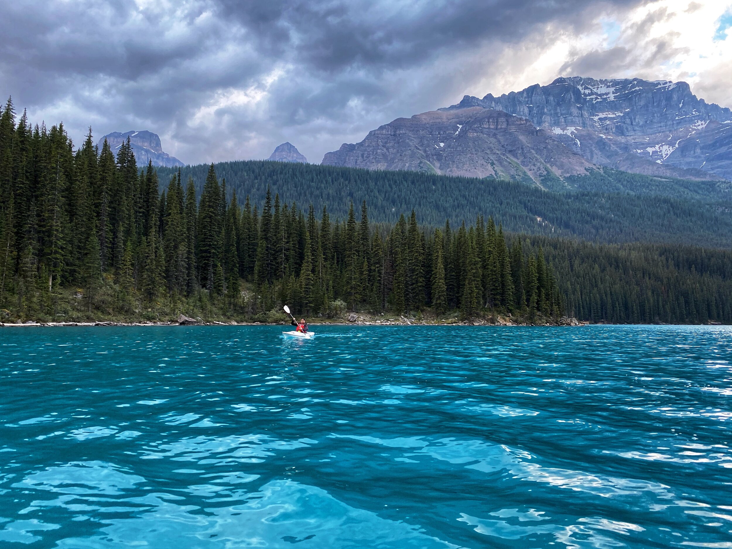
The beautiful Moraine Lake

Hector Lake

Hector Lake

From left to right: Pulpit Peak, Hector Lake, Bow Peak and Mt. Hector

Floe Lake and part of the Rockwall in Kootenay NP

The view of the Rockwall from the Numa Mountain
Numa Mountain

Numa Mountain in Kootenay NP

Numa Mountain

The view from the summit of Vermillion Peak

Vermillion Peak in Kootenay NP

Mount Whymper from the summit of Vermillion Peak

The summit ridge of Vermillion Peak

Rimwall Summit in Kananskis Country

View from the summit of Rimwall

Big Sister from Rimwall

Mt. Whymper from Vermilion Peak

The view from Mt. Whymper to Highway 93 and Mt. Stanley across the valley

The view from the summit of Mt. Whymper towards the Goodsirs (large mountains on the left)


The Goodsirs from Mt. Whymper

On Mt. Whymper

The view of Yoho from Narao Peak

Pope’s Peaks and Narao Peak in Yoho NP

The summit of Mt. Yamnuska

The front ranges of the Rockies from Mt. Yamnuska

Lake Louise

The incredible colours of Lake Louise, Banff NP, Alberta

Lake Louise and the backdrop of Mt. Victoria

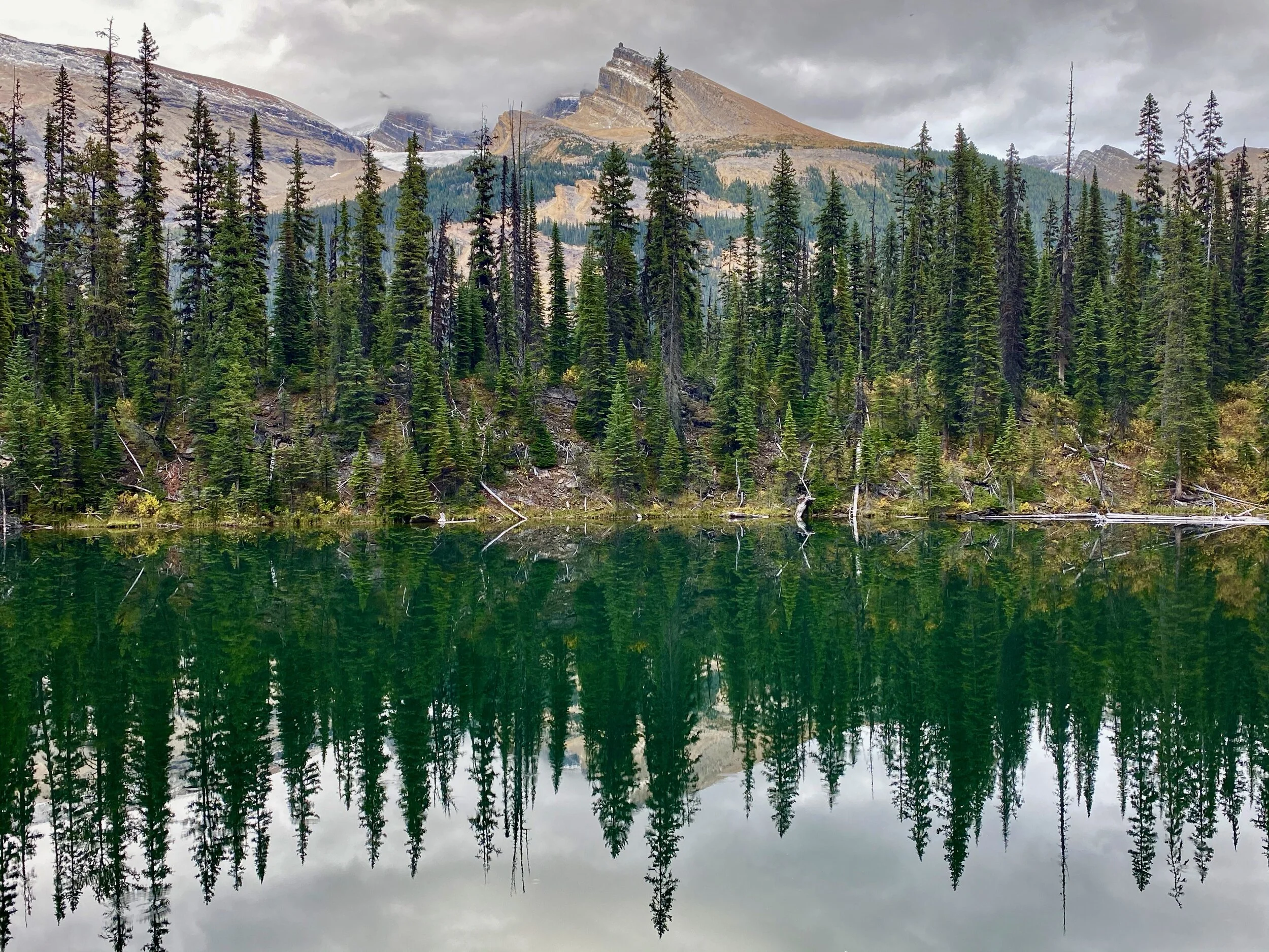
Emerald Lake

Emerald Lake BC

Mount Lougheed from the Windtower

The Spray Lake from the Windtower

Grizzly Peak

Grizzly Peak in early spring

Early spring in the Rockies. Aborted attempt on the Windotower.

Early spring on Lady McDonald in Canmore

Moraine Lake in Banff National Park

The beautiful Grassi Lakes in Canmore

Banff National Park

Mount Rundle

Banff National Park, Two Jack Lake

Banff National Park

Lake Minewanka in Banff National Park

Lake Minewanka Banff National Park


Herbert Lake

Banff NP

Banff NP

Bow Lake in Banff National Park

Bow River in Banff National Park

Bow River and Mount Temple in Banff National Park
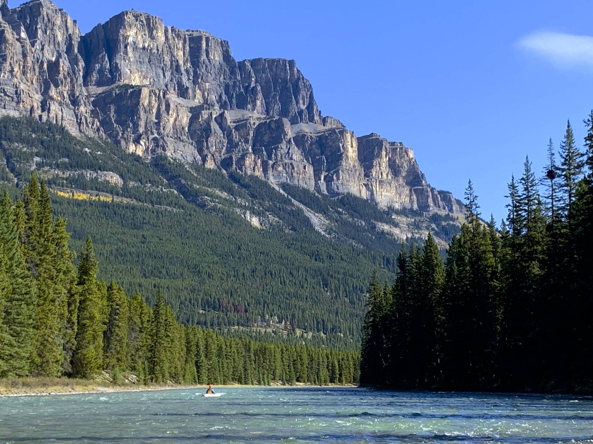
Castle Mountain and Bow River in Banff National Park

Bow River and the Castle Mountain

Bow River

Bow River

Bow Lake

Bow Lake

Bow Lake

Bow Lake


Grizzly Peak

Grizzly Peak

Upper Kananskis Lake

Upper Kananskis Lake

Upper Kananskis Lake

The Opal Range and the Upper Kananaskis Lake

Mount Lady McDonald

Mt. Athabasca summit 1996!

Mt. Robson

Valley of 10 peaks

Bow Lake

Bow Lake

Mt. Lady McDonald and Canmore

Mt. Rundle

Ha Ling in Canmore in winter

Mt. Nestor

Mt. Joffre

Mt. Joffre

Mt. Joffre

The summit of Mt. Joffre

The basecamp for Mt. Joffre

Cirque Peak

Wapta Icefield from Cirque Peak

Lake O'Hara from lower slopes of Mt. Huber

Mt. Huber

View from Huber Victoria Col

Basecamp for Mt. Huber and Mt. Victoria

Mt. Huber

The summit of Mt. Victoria

Mt. Victoria summit ridge

Lake Louise from the summit of Mt. Victoria

Lake Oesa

The summit of the Tower of Babel

Consolation Lakes and Panorama Ridge on the left

The Valley of 10 Peaks

Sentinel Pass

Kananaskis Country from the summit of Mt. Chester

Mt. Chester and Chester Lake area

Lake Louise and Mt. Victoria

Mt. Lefroy and the Death Trap glacier leading to the Abbot Hut

The summit of Mt. Joffre

Pink snow on the Wapta Icefield

Wapita Icefield

The Iceline trail and the Yoho Valley from Mt. Rhonda

Wapita Icefield from Mt. Rhonda

Peyto Lake from Mt. Rhonda, small blue Peyto hut is visible below

Mt. Rundle

En route to Mt. Woolley

The Twins Tower from the Woolley Shoulder

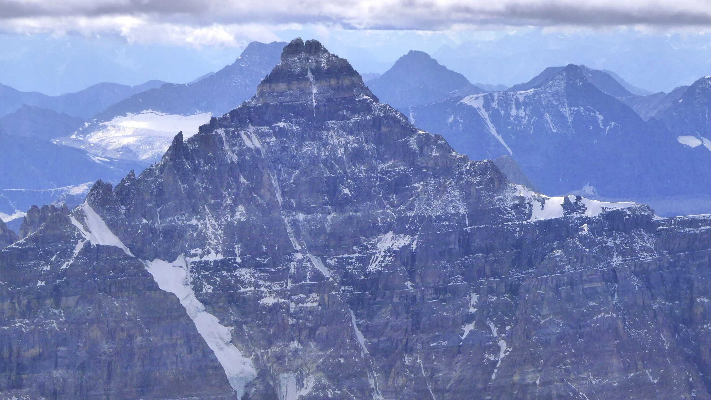
Mt. Alberta

Mt. Alberta

Mt. Alberta


Twins Tower and Mt. Columbia in the distance

Mt. Little Alberta

Mt. Athabasca from Nigel Peak

View to the north from Nigel Peak

Mt. Kitchener and Snowdme

Mt. Andromeda and the Athabasca Glacier from Nigel Peak

The pass between Moraine Lake and Lake McArthur


On the Abbot Pass

The Abbot Hut - Alpine Club of Canada

Lake O'Hara from the slopes of Mt. Lefroy

Mt. Lefroy

The large mountain in the distance is Mt. Hector. The view from Mount Lefroy.

The view west from Mt. Lefroy

Mt. Lefroy - the view of Mt. Victoria and Lake O’Hara

Mt. Victoria from Mt. Lefroy

The view from Mount Lefroy

The view of the Paradise Valley from Mt. Lefroy


The Goodsirs from Mt. Lefroy

Mt. Athabasca and Mt. Andromeda


Bow Lake from the Bow Summit

Bow Lake from the Observation PEak

Ha Lin Peak in winter

Moraine Lake

Mt. Temple summit in early fall

Mt. Temple

Photo by Tyler Stalman

Photo by Tyler Stalman

Bow Lake

En route to the Abbot Hut

The Grand Brazeau

Moraine Lake

Sentinel Pass

Bow Lake from Mt. Jimmy Simpson

Mt. Warren from the Maligne Lake

Grizly Peak in the Kananaskis Country


Peyto Lake

Peyto Glacier

Mt. Lougheed 1

Hector Lake from Mt. Little Hector

On the summit of Storm Mountain

Elizabeth Parker Hut at Lake O'Hara

Photo by Tyler Stalman

The view from Mt. Jimmy Simpson

Mt. Edith Cavell

Moraine Lake

Mt. Edith Cavell summit ridge. The Tonquin Valley is visible on the right.

Spirit Island on the Maligne Lake

Maligne Lake

The Iceline trail in the Yoho National Park. Takawa Falls is in the valley below.

Mt. Woolley and Mt. Diadem

The Ramparts of the Tonquin Valley

Mt. Alberta

On the Peyto Glacier

Mt. Aberdeen, Mt. Lefroy and Mt. Victoria from Mt. Fairview

Mt. Assinibone


The view from Mt. Temple, the Valley of 10 Peaks and the Paradise Valley

The summit ridge of Mt. Temple with Lake Moraine below

The view of Mt. Nestor and The Spray Lake in the Kananaskis Country from Mt. Buller

The view of Bow Lake from the Bow Summit

Mt. Hector and Little Hector from the Bow Summit

Mt. Rhonda from the Peyto Glacier

The Peyto Lake

The Basecamp for Mt. Brazeau

The Grand Brazeau

The view from the summit of Mt. Brazeau

Maligne Lake, Mt. Warren and Mt. Brazeau

The summit ridge of Mt. Edith Cavell

Upper Paradise Valley seen from Mt. Temple

Moraine Lake from Mt. Temple

En route to Lake O'Hara

Mt. Huber and Mt. Victoria

Mt. Lefroy and Lake O'Hara in winter


Ha Ling Peak and the Three Sisters from Mt. Rundle above Canmore

Mt. Rundle

Mt. Lougheed

Kananaskis Country from Mt. Lougheed 1

Spray Lake from Mt. Lougheed 1


Waterton Lakes National Park - Mt. Blakiston

Cameron Lake in the Waterton Park

Summer in the Waterton Park

Maligne Lake


Maligne Lake

Observation Peak

The summit ridge of the Observation Peak looking north

The view of Bow Peak and Mt. Temple (in the distance) from the Observation Peak

Bow Lake

Bow Lake

The view from Mt. Jimmy Simpson

Wapta Icefield from Mt. Jimmy Simpson
The view of the Peyto Glacier from Mt. Jimmy Simpson

Bow Lake

Bow Lake

Bow Lake

Mt. President in Yoho National Park

Ha Ling Peak in winter


I had a great opportunity to see one of the most spectacular corners of the Canadian Rockies from the helicopter, from a totally new perspective. After had the opportunity to fly in the Himalaya and was so impressed, I decided to see the mountains in my back yard. Have to admit that our Rockies are as spectacular as anything I saw in the Himalaya. I enjoyed every minute of this experience!

Mt. Cline

Mt. Cline

White Goat Wilderness Area
White Goat Wilderness Area

Icefields Parkway and Mount Nigel

Mt Nigel and Mt. Sunwapta

Nigel Peak and Mt. Brazeau with he Brazeau Icefield

Icefields Parkway looking south

Saskatchewan Glacier
Saskatchewan Glacier


Mt. Columbia and the Icefiled

Sonowdome

Mt. Columbia

Mt. Columbia


Mt. Columbia


Mt. Columbia

South Twin

South Twin

The summit cone of Mt. Alberta

Mt. Alberta

Mount Alberta north side

Mount Alberta

Mt. Wooly

Wooly’s Shoulder

Mt. Little Alberta


North Twin and Twins Tower


Mt. Columbia

Mt. Columbia

Mt. Columbia

Mt. Columbia

The Twins

The South Twin

Mt. Columbia

North Twin and Twins Tower

North Twin and Twins Tower

Twins Tower
From the left: Mt. Alberta. Twins Tower, North Twin, South Twin and the west face of Mt. Columbia

Mt. Alberta on the left and The Twins

South Twin

Twins Tower


The Glaciers of Mt. Columbia

Mount Columbia

Mt. Columbia

Mt. Columbia summit piramid

The Twins

Mount Alberta

North Twin

From the left: North Twin, Twins Tower, North Twin and Mt. Columbia

South Twin and Mt. Columbia

South Twin and Mt. Columbia


South Twin, North Twin
On the horizon is Mt. Clemenceau
Mt. Athabasca


Mount Saskatchewan


Mt. Castleguard. The pointy peak on the left is Mt. Forbes.


Waterton Landscapes

Chief Mountain in Montana
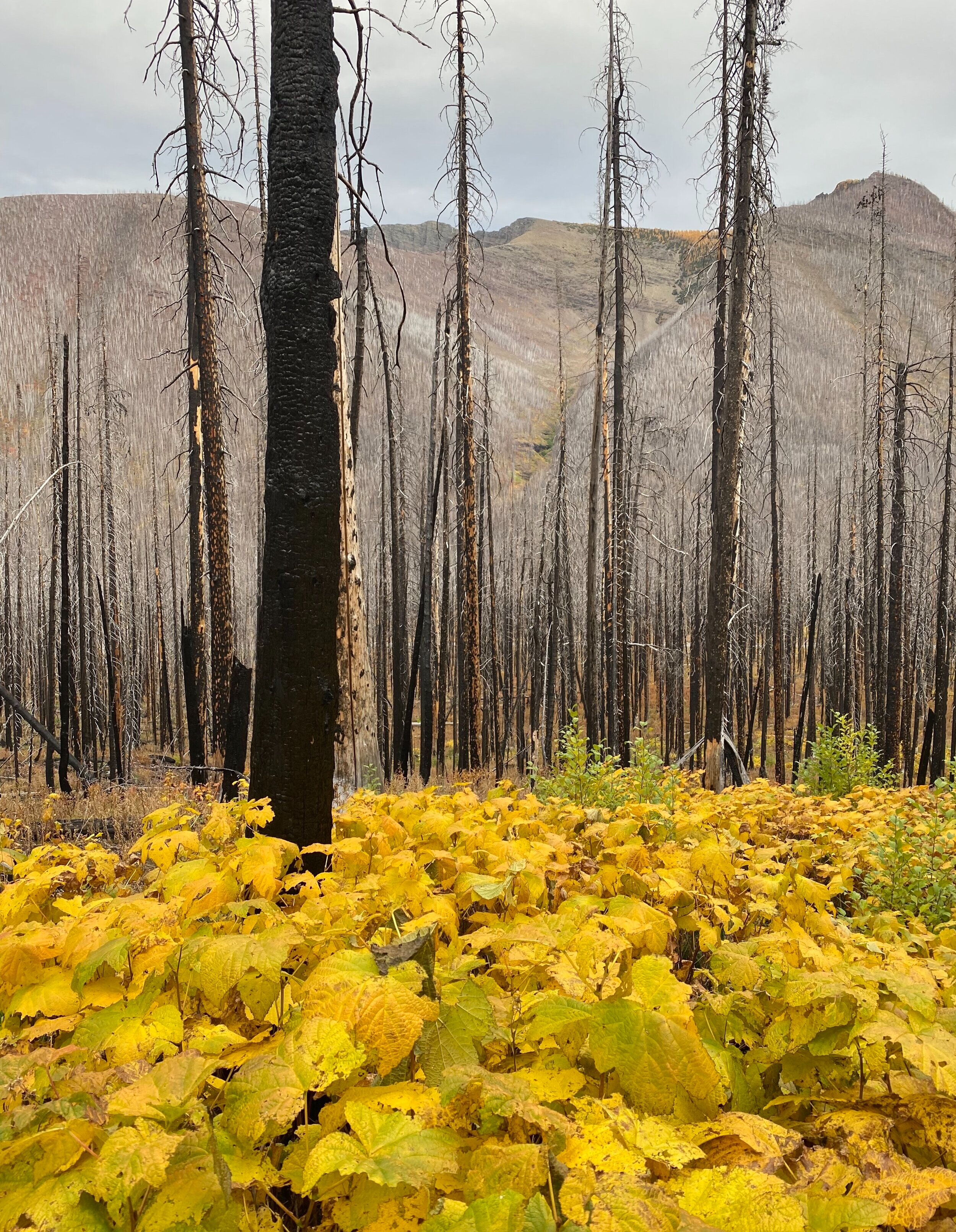
The Fall in Waterton. Waterton suffered a massive fire a few years back. The forrest is slowly growing back.


Beautiful Fall in Waterton alone the Akamina Ridge trail.

Forum Lake and Forum Peak

Forum Lake

Wall Lake and the Akamina Ridge

Approaching the summit of Forum Peak.

The view from Forum Peak into the Glacier NP in Montana.

Cameron Lake

Mt. Custer in Glacier NP in Montana from Forum Peak

Forum Lake from the Akamina Ridge

Long Knife Peak in Glacier NP in Montana from Akamina Ridge

The peak along the Akamina Ridge


The views into Glacier NP in Montana


Akamina Ridge

Incredible colours of Waterton NP.

Waterton Lake and the Prince of Wales Hotel

Waterton Lake


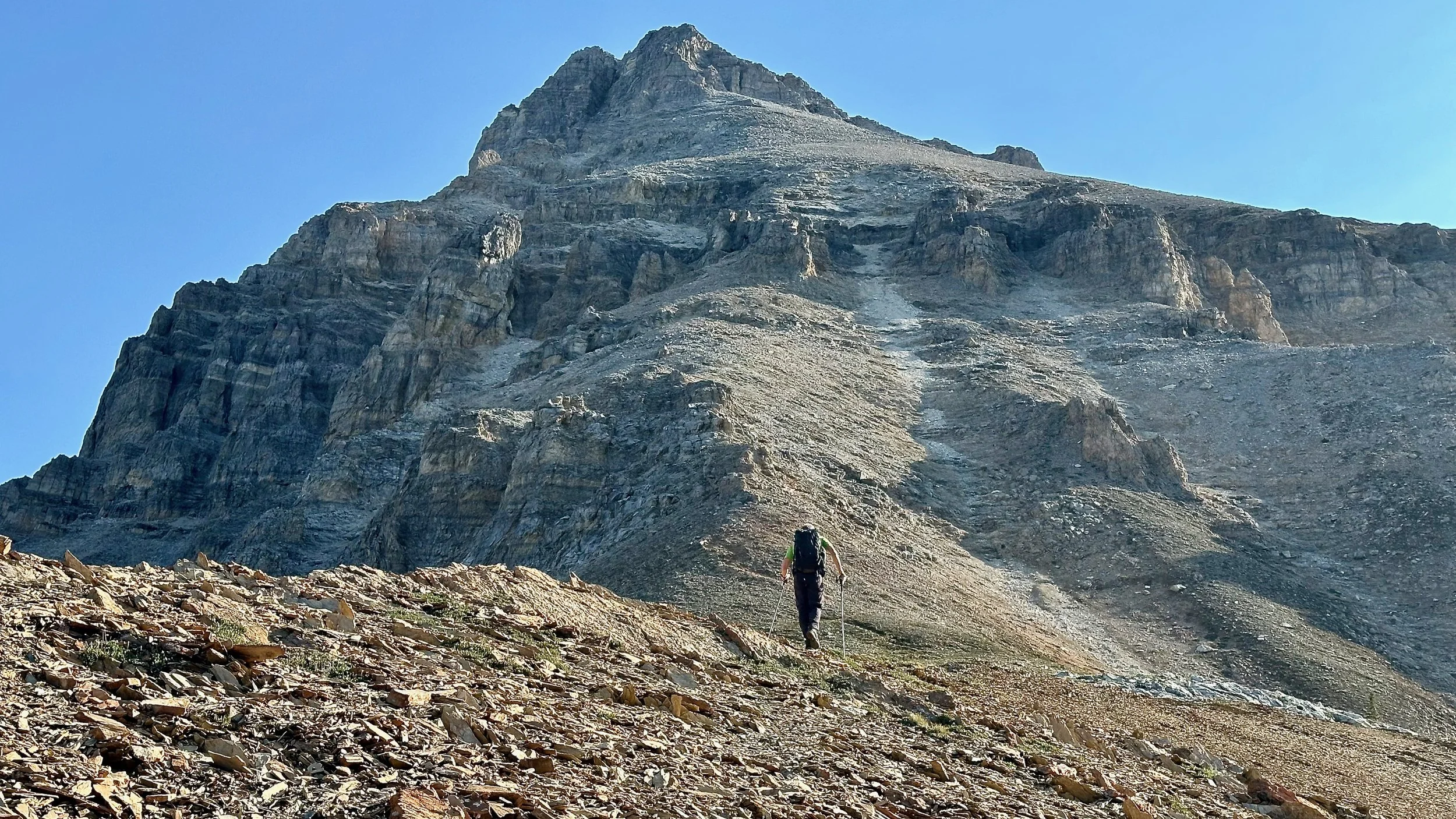
The ascent of Mt. Bakiston, 2,910m

The view to the peaks of the Glacier NP in Montana, USA

Lineham Lakes
The Long Knife Mountain (left) and other peaks of the Glacier NP, USA

Summit view from Mt. Blakiston 2,910m (the higest peak of Waterton). The view to the road to the Red Rock Canyon and Crandell Lake and Mt. Crandell behind.

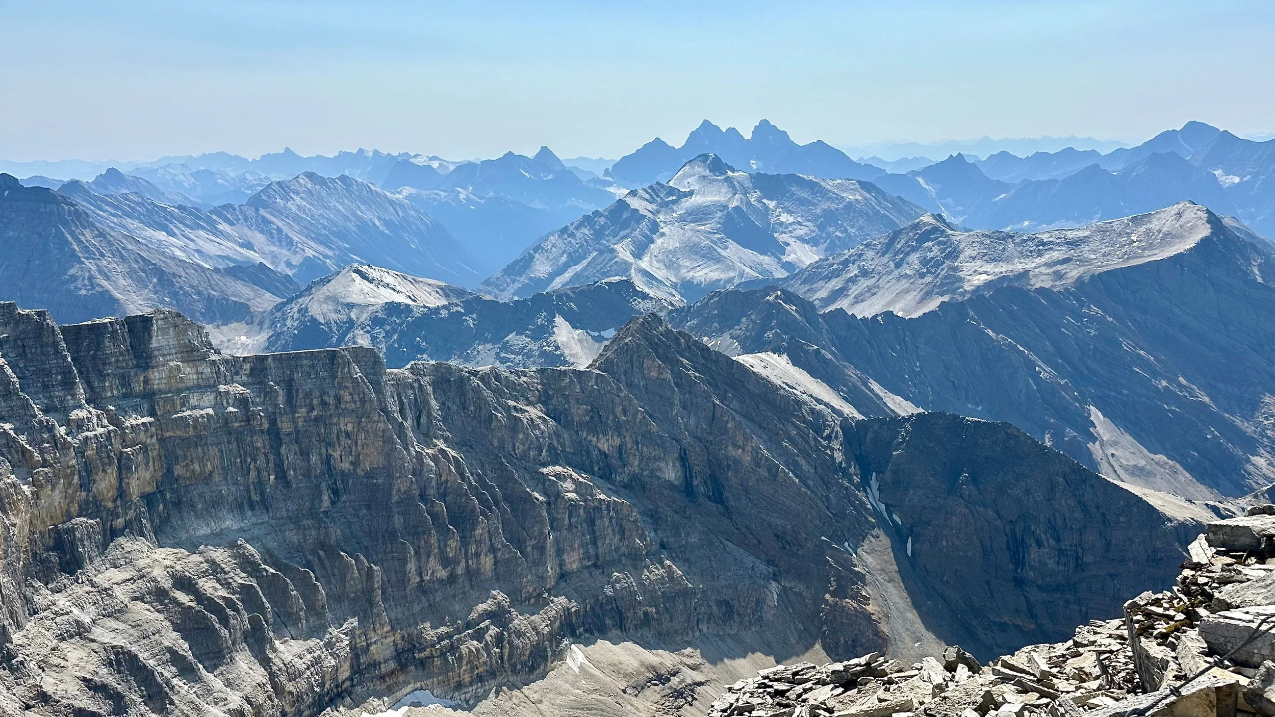
The view west to the peaks of BC from the summit of Mt. Blakiston


The start of the Lineham Ridge from the summit of Mt. Blakiston. The peaks of the Glacier NP in Montana dominate the horizon.

Lineham Lakes and Mt. Lineham

Mt. Blakiston

Lineham Ridge

The summit of Mt. Hawkins


Looking back at Mt. Blakiston

Mt. Blakiston, Lineham Ridge and Lineham Lakes

Red Rock Canyon


A pet rooster in the highlands of Colombia

In Suesca, Colombia Adventure Tourism Capital according to the Outside Magazine

Rock climbing mecca of Suesca

Rock crags of Suesca

Suesca - the rock climbing mecca

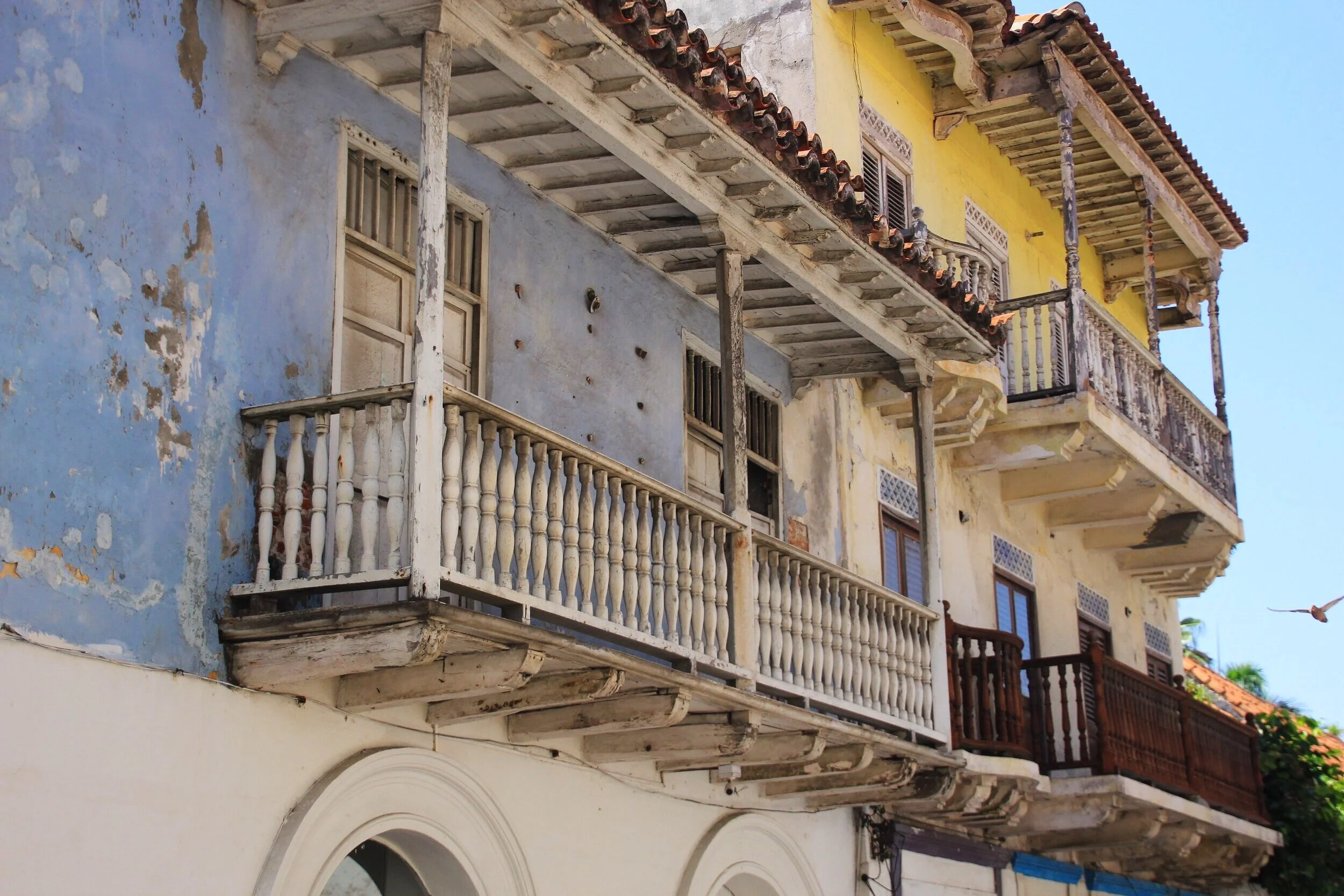
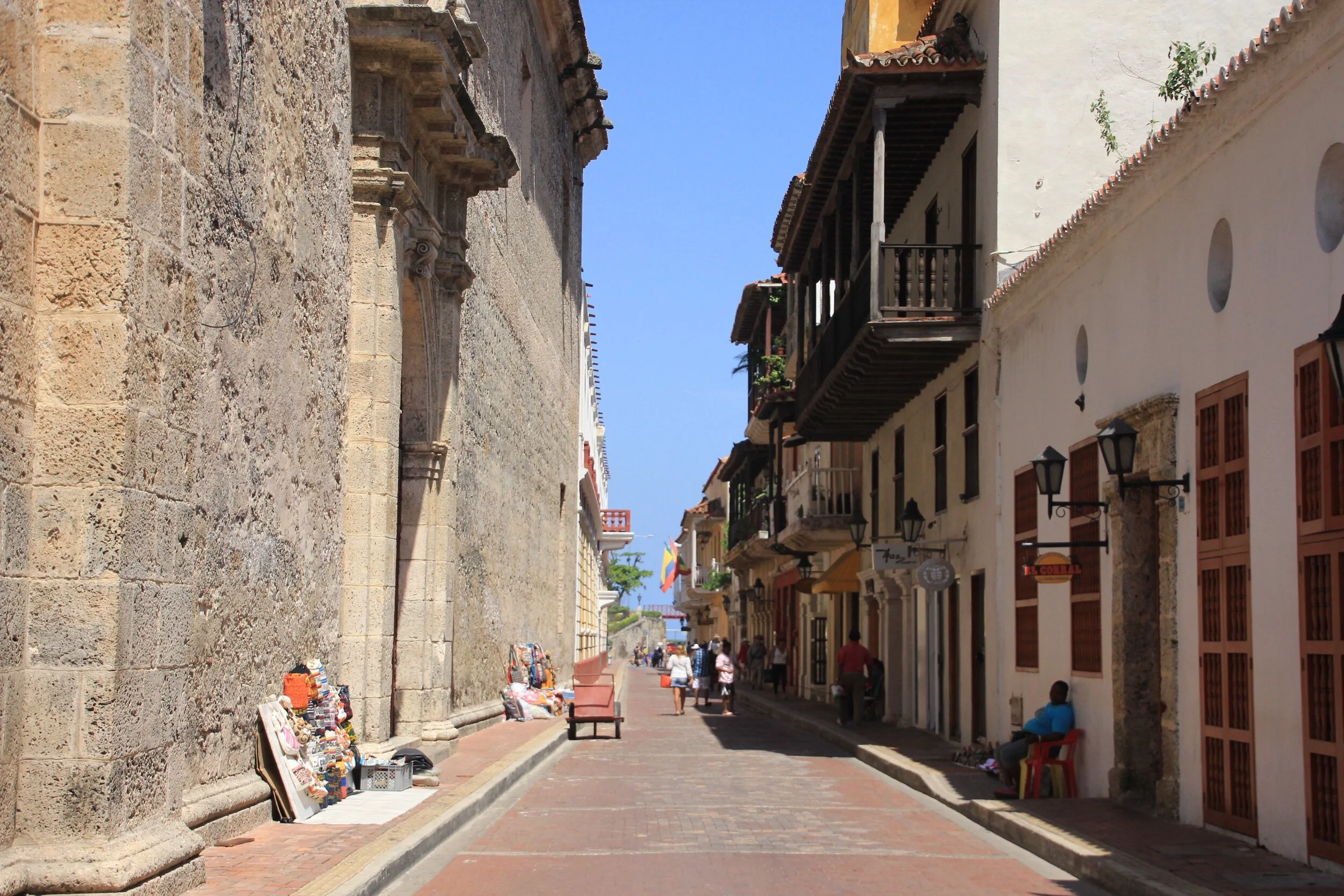
Old Cartagena
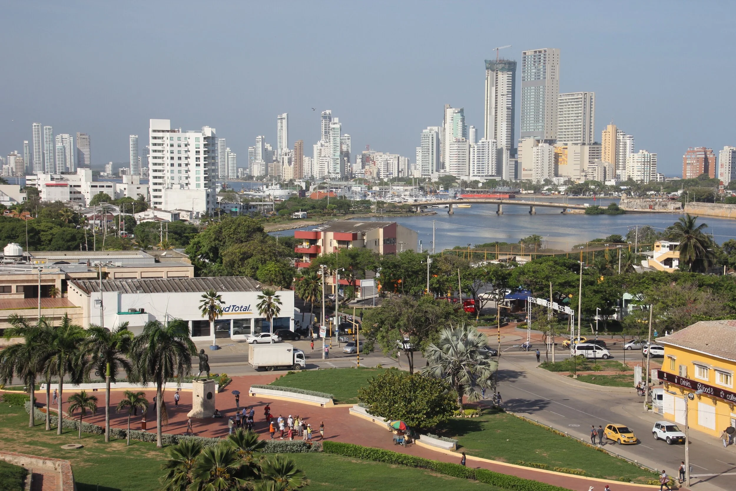
Cartagena


Old Spanish fort in Cartagena


Public Beach in Rodadero

Rodadero


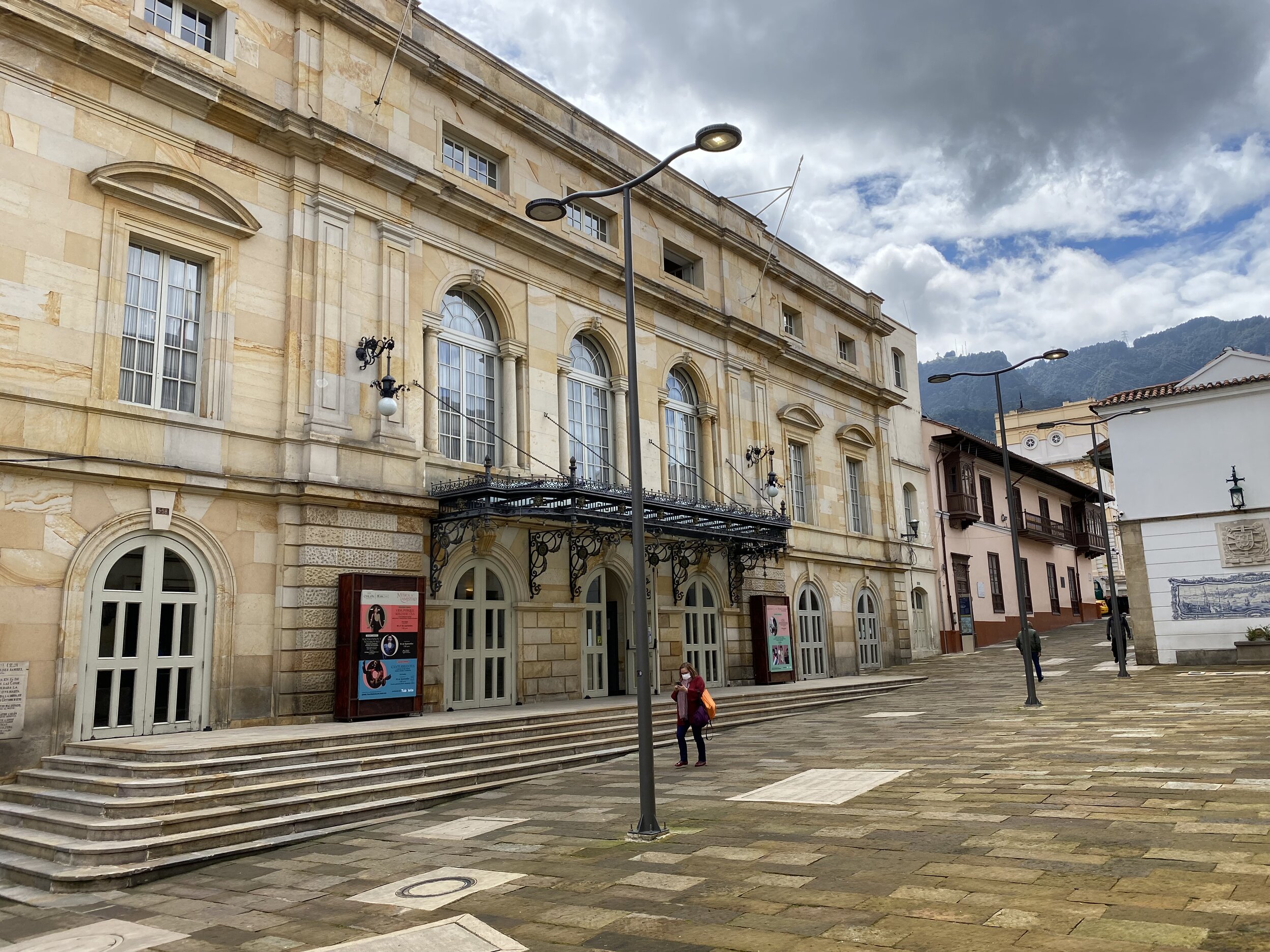
Bogota


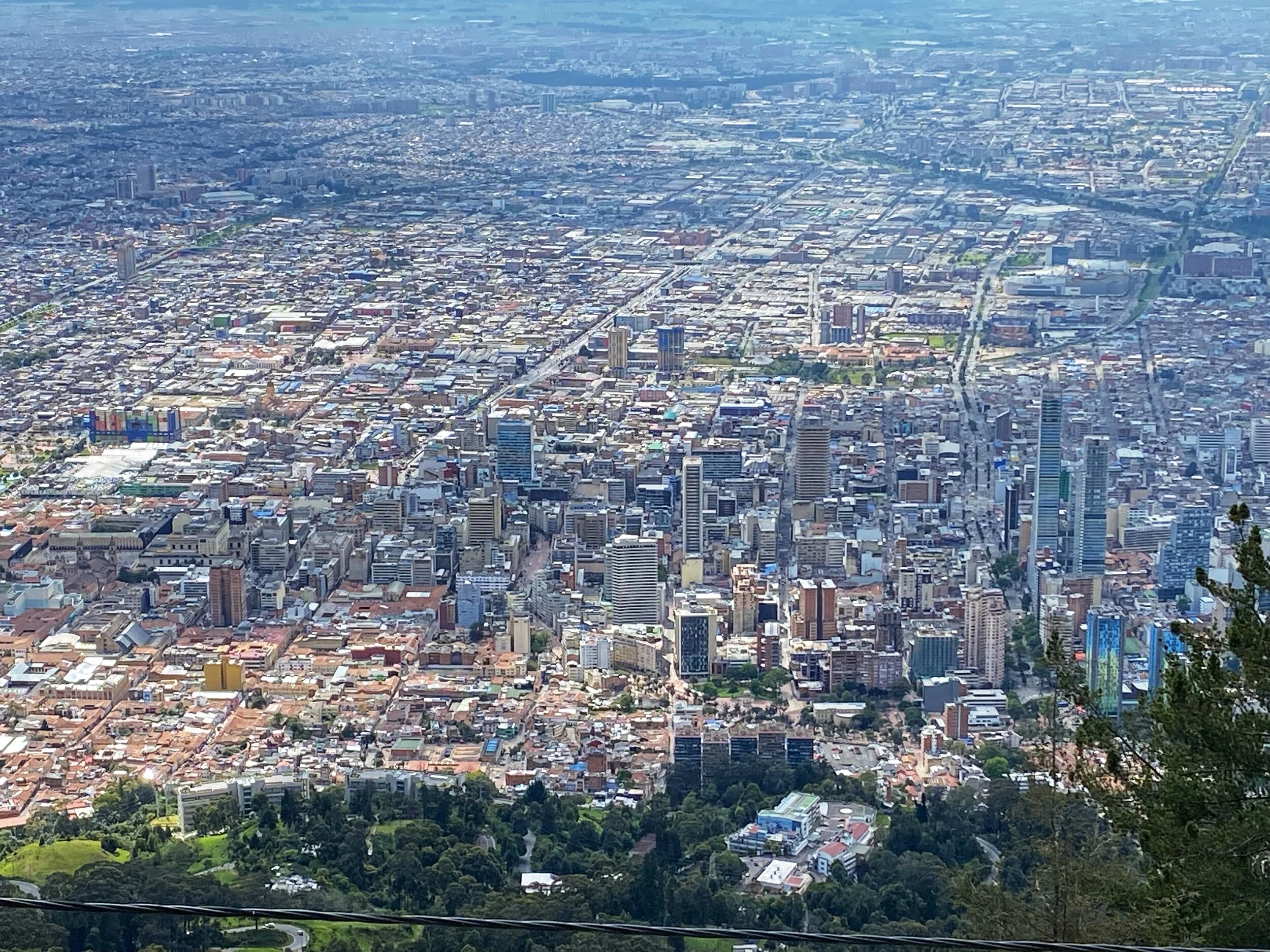
Bogota

The Sanctuary of the Virgen of Guadalupe
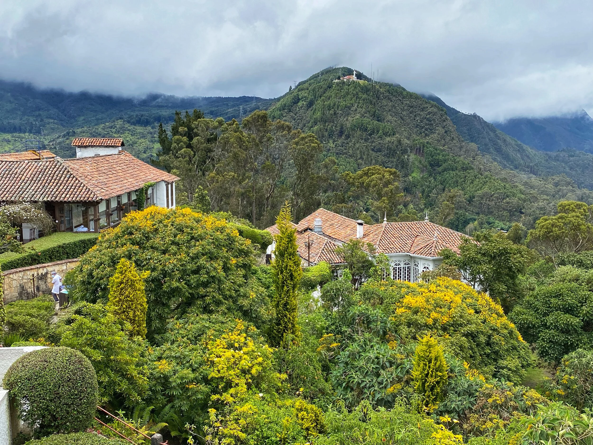
The Sanctuary of the Virgen of Guadalupe from Monseratte above Bogota 3,200m


Worthless Venezuela $

A hat shop in Bogota


The Botero Museum Bogota

The Botero Museum


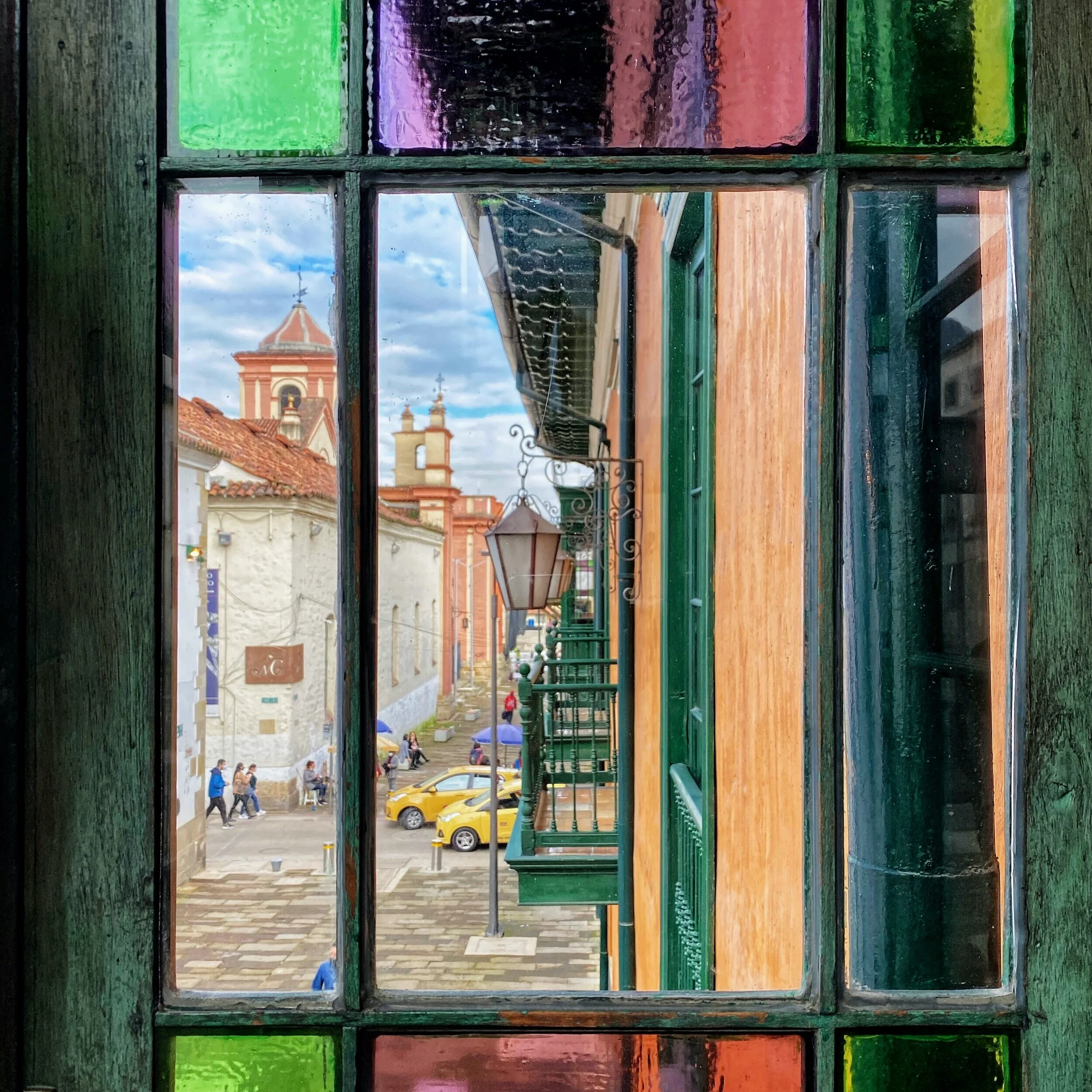
Old Bogota


Beautiful forrest of the Tayrona NP


Poison frog


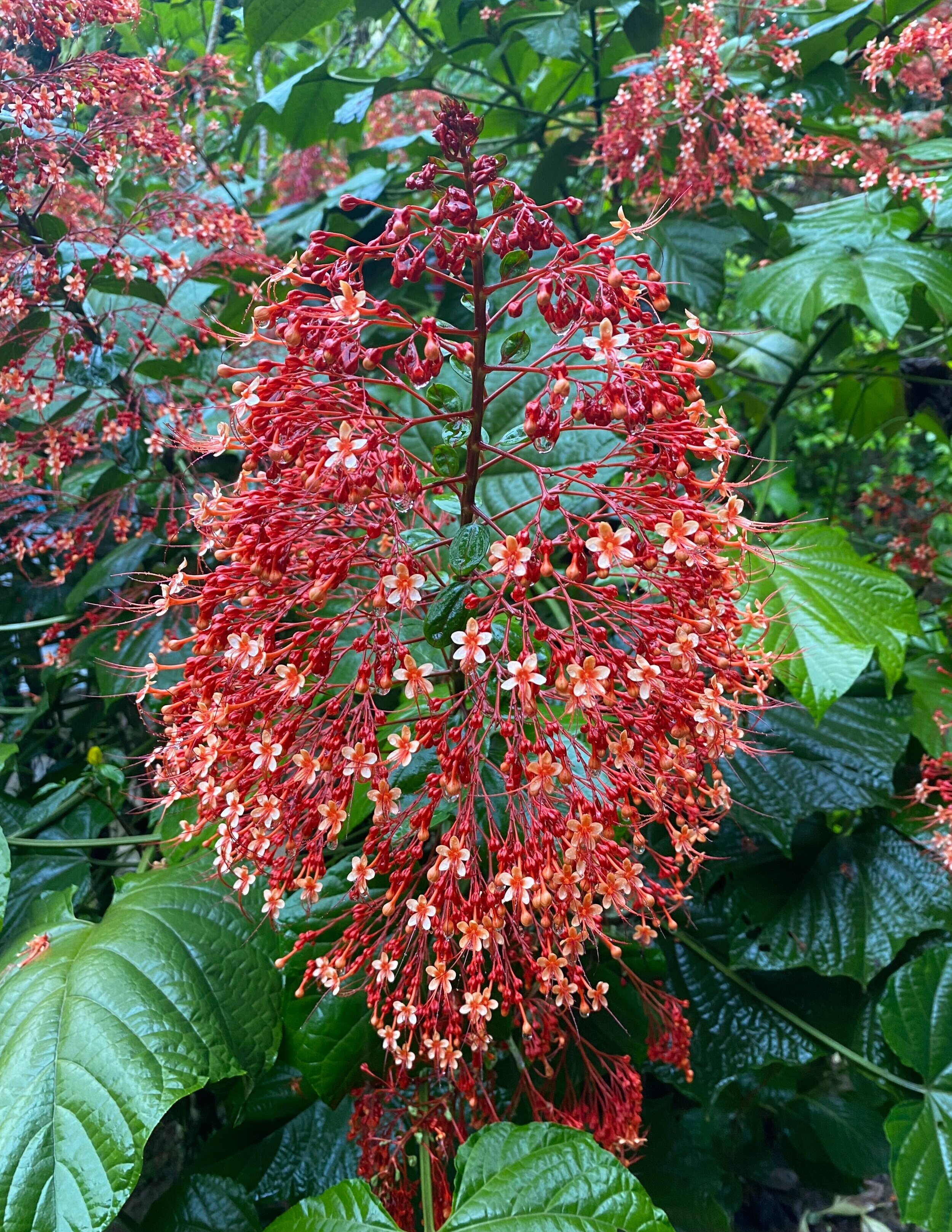


Tayrona NP is full of these massive boulders


The main beach of the Tayrona NP


The beautiful coast of the Tayrona NP


The Kogis selling coconuts in the National Park


Santa Marta water front

Santa Marta

Old Santa Marta

Santa Marta

The grave stone of Bolivar who died in Santa Marta


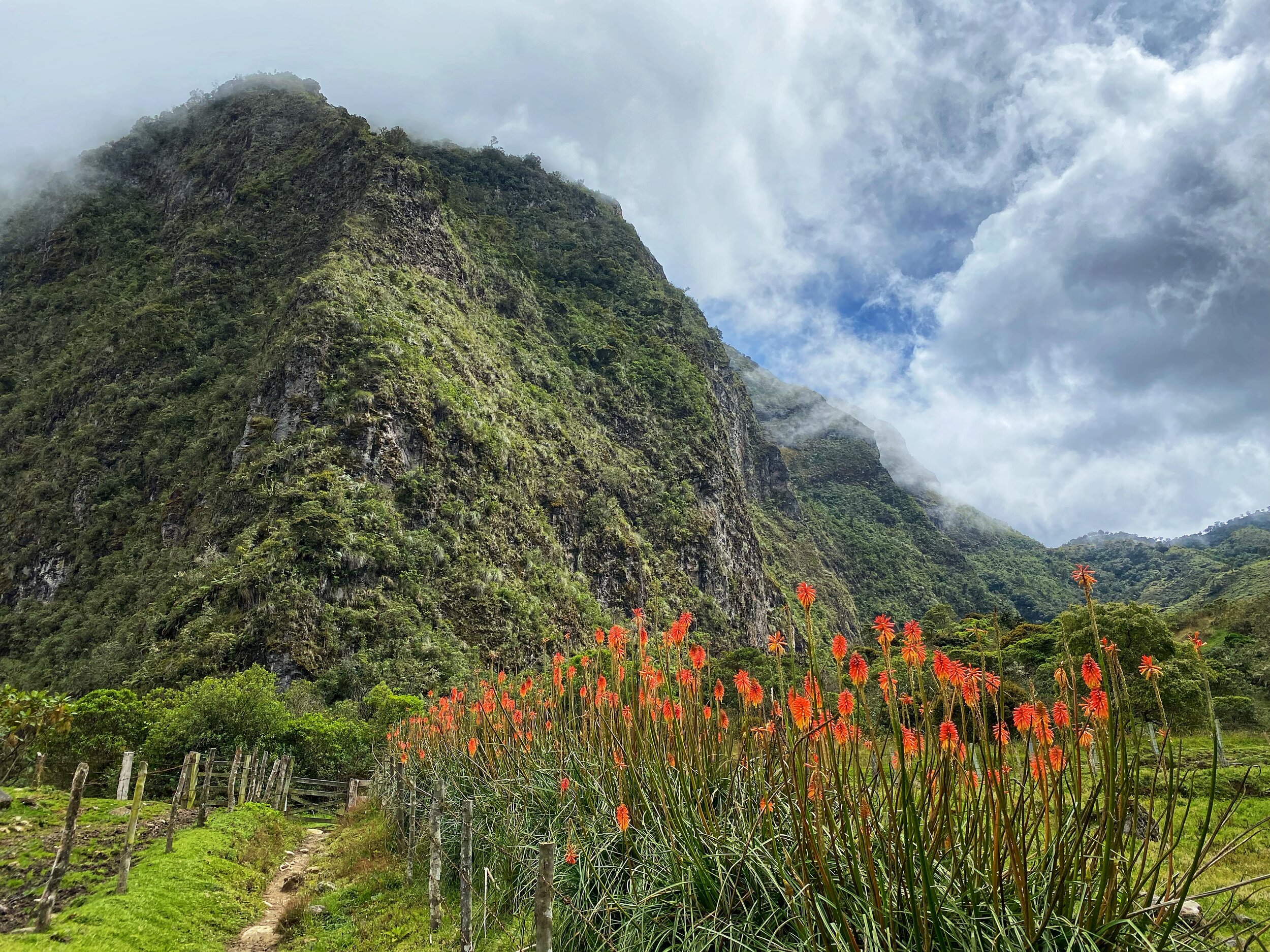
Los Nevados National Park is a large high plateau in the middle of the Andean Spine of Colombia. At present (2021), the other popular areas for trekking are closed (Nevado Cocuy and higher ranges of Sierra Nevada de Santa Marta). This leaves the Nevados NP as a good option for multi-day trekking.
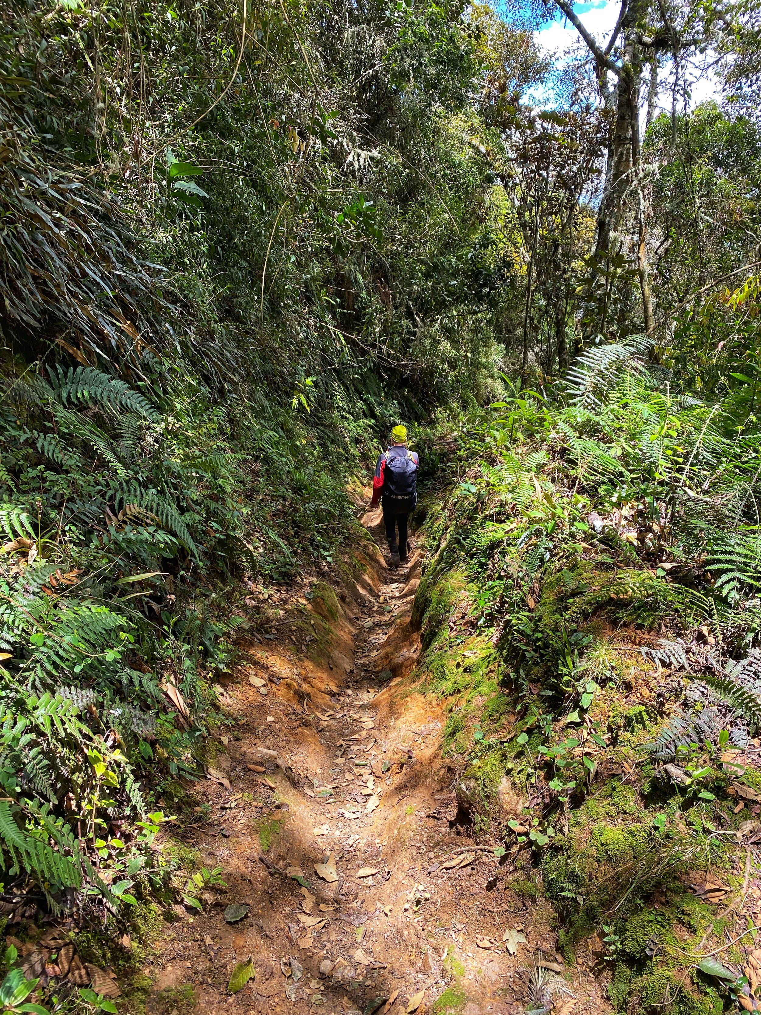
Our goal was to climb the Navado del Tolima, one of the volcanos on the plateau, with an altitude of 5,200m. My timing was not ideal as I was there outside of the normal climbing season of December - January. The mountain is quite isolated. It is 30-40km from the trailhead. Due to the amount of rain and the boggy nature of the high plateau, getting to the basecamp was quite an effort. It involved gaining 2,500m of elevation, liquid trails full of slippery volcanic mud, rain and fog, loosing trails and weather changes every 20min or so. All at an altitude of 4000m and above. Overall, it was a very hard trek for me due to the muddy conditions. We set out to climb the mountain only to be turned around by a snow storm at 4500m.
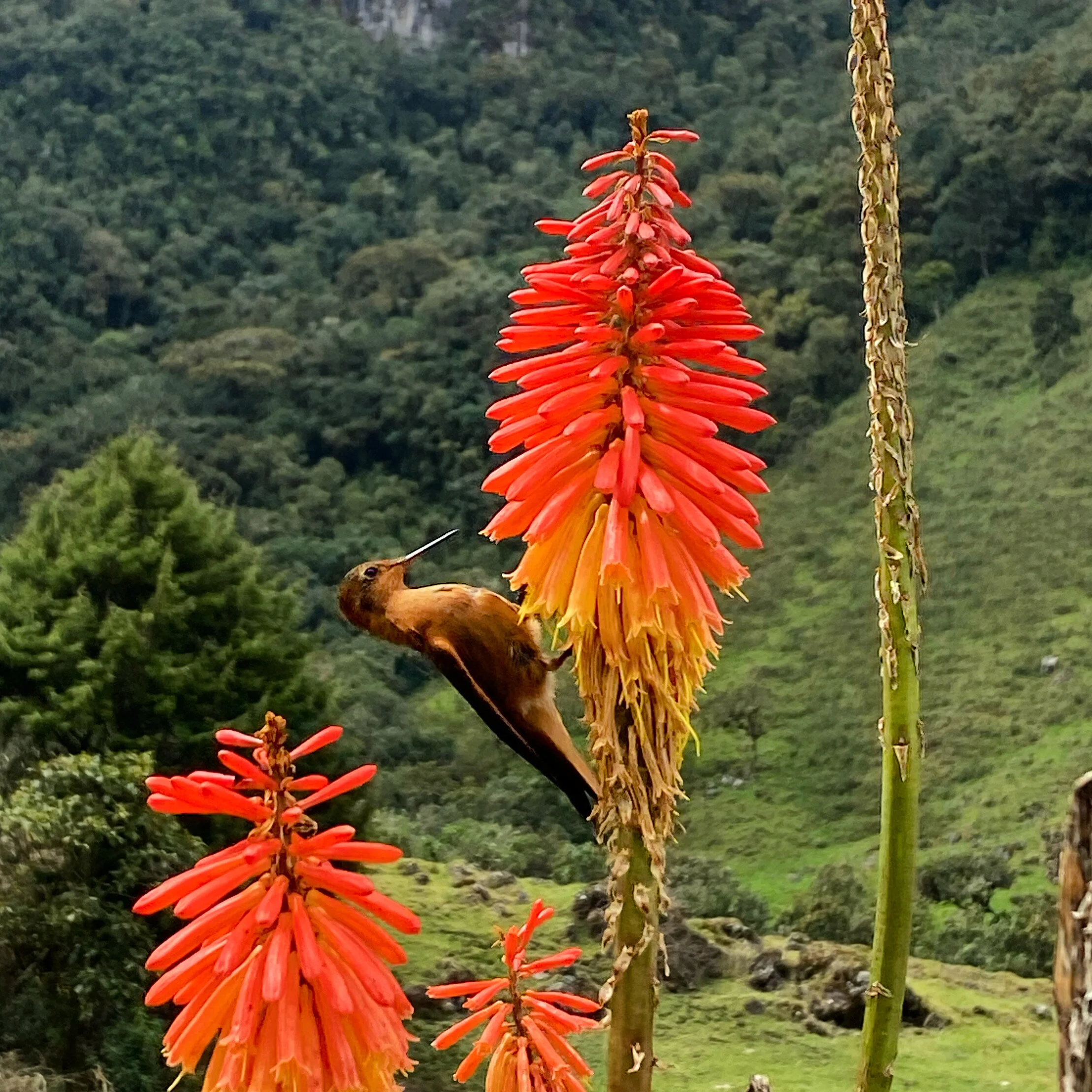
Despite the unsuccessful attempt to get to the top of Tolima, it was a fantastic trek through some very unique ecosystem of the high Paramo forest. The high Paramo forest is home to rare plants and trees that are found only in 3 countries in the world. Furthermore, the area is inhabited by cowboys who live is these very harsh conditions. The farms where they live have been there before the National Park was established. The locals are a small group of men and women who adopted to this extreme environment with very basic and limited use of technology. This was a very different experience for me from the other areas in the Andes further south.
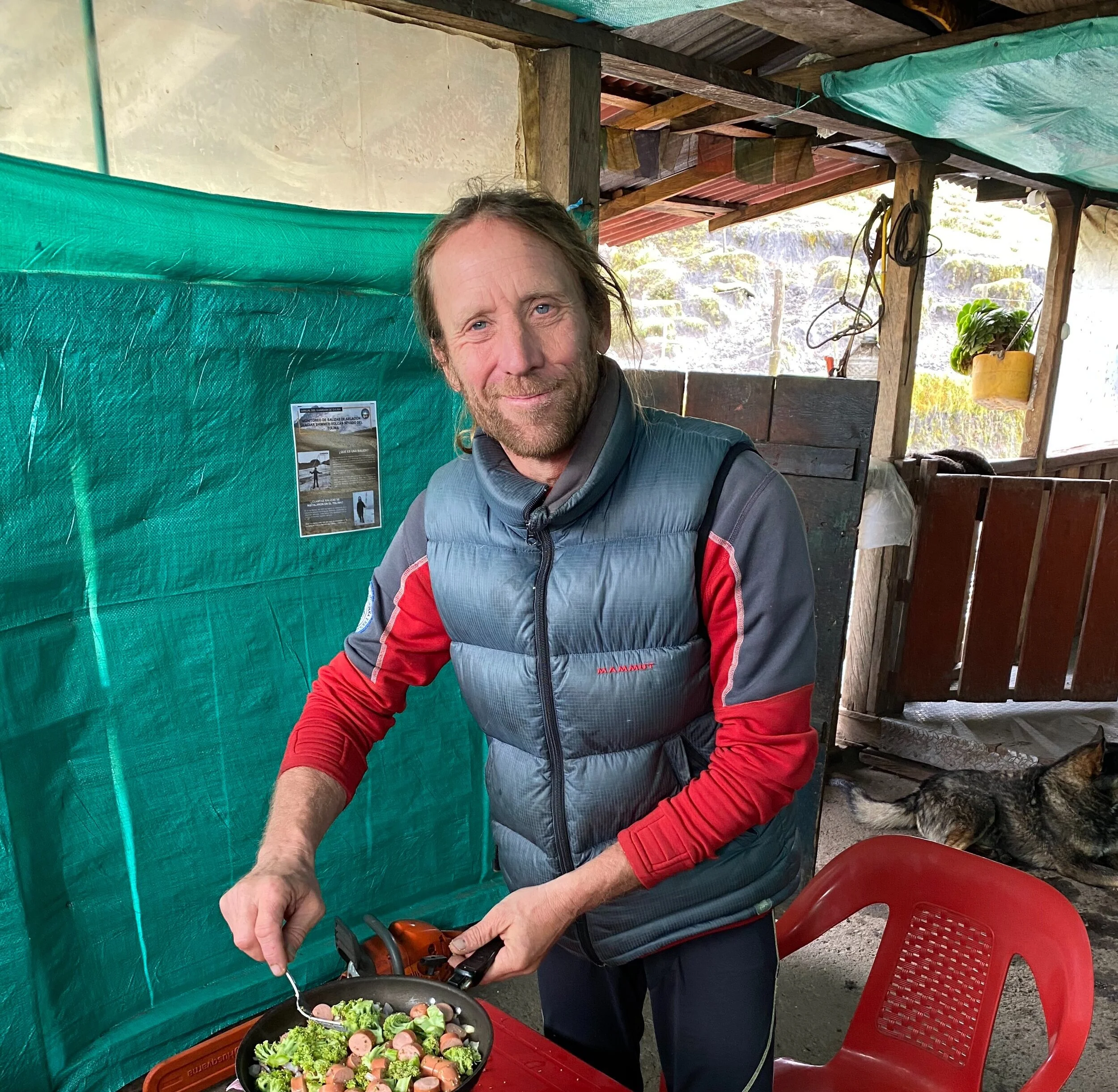
The outfitter Andes World Travels and my guide Herman Vike have made my experience great despite all the challenges of the rainy season in the high plateau.

At the trail head. Getting the bags ready for the horses who will transport them to the first camp.

The lower forest at 1800m was lush and thick.


Our first camp was in a community maintained hostel complete with a restaurant and a manicured garden!

Diego Machete, the horseman who transported our bags for the first half of the trek.

Numerous waterfalls drain the water from the high plateau to the forests below.


The first camp is located in this beautiful area.

Our second day was quite long, 21km and an elevation gain of 2,000m (from 1,800 to 3,800m). Our final destination was the farm called BERLIN.

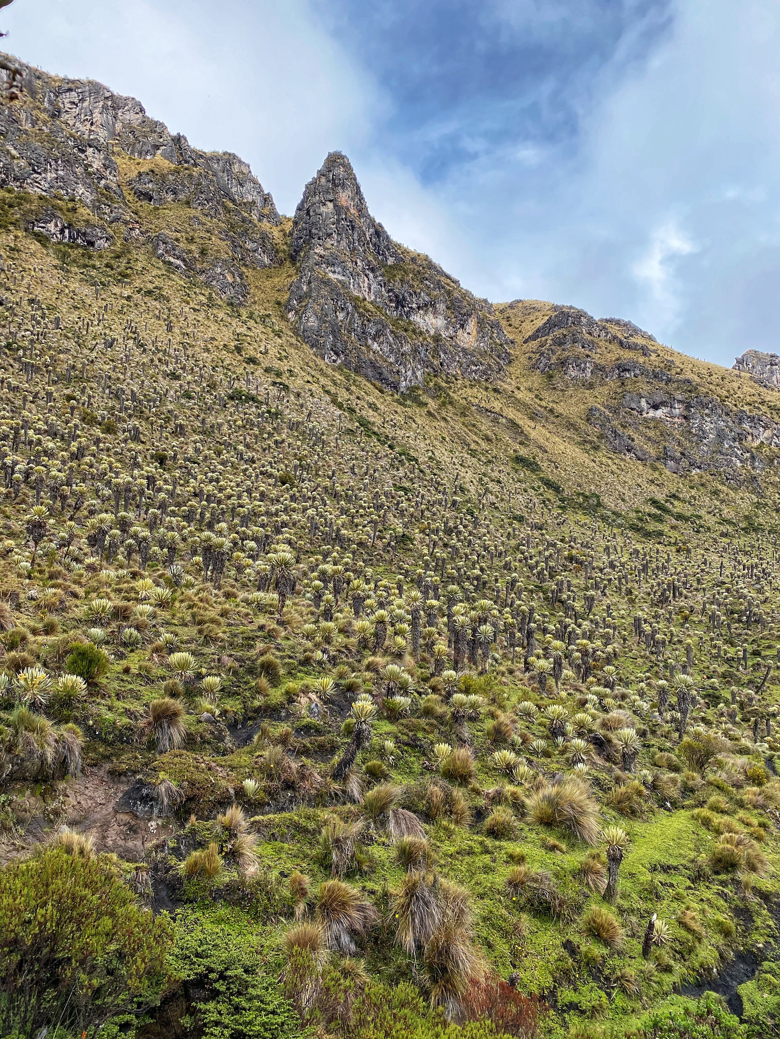
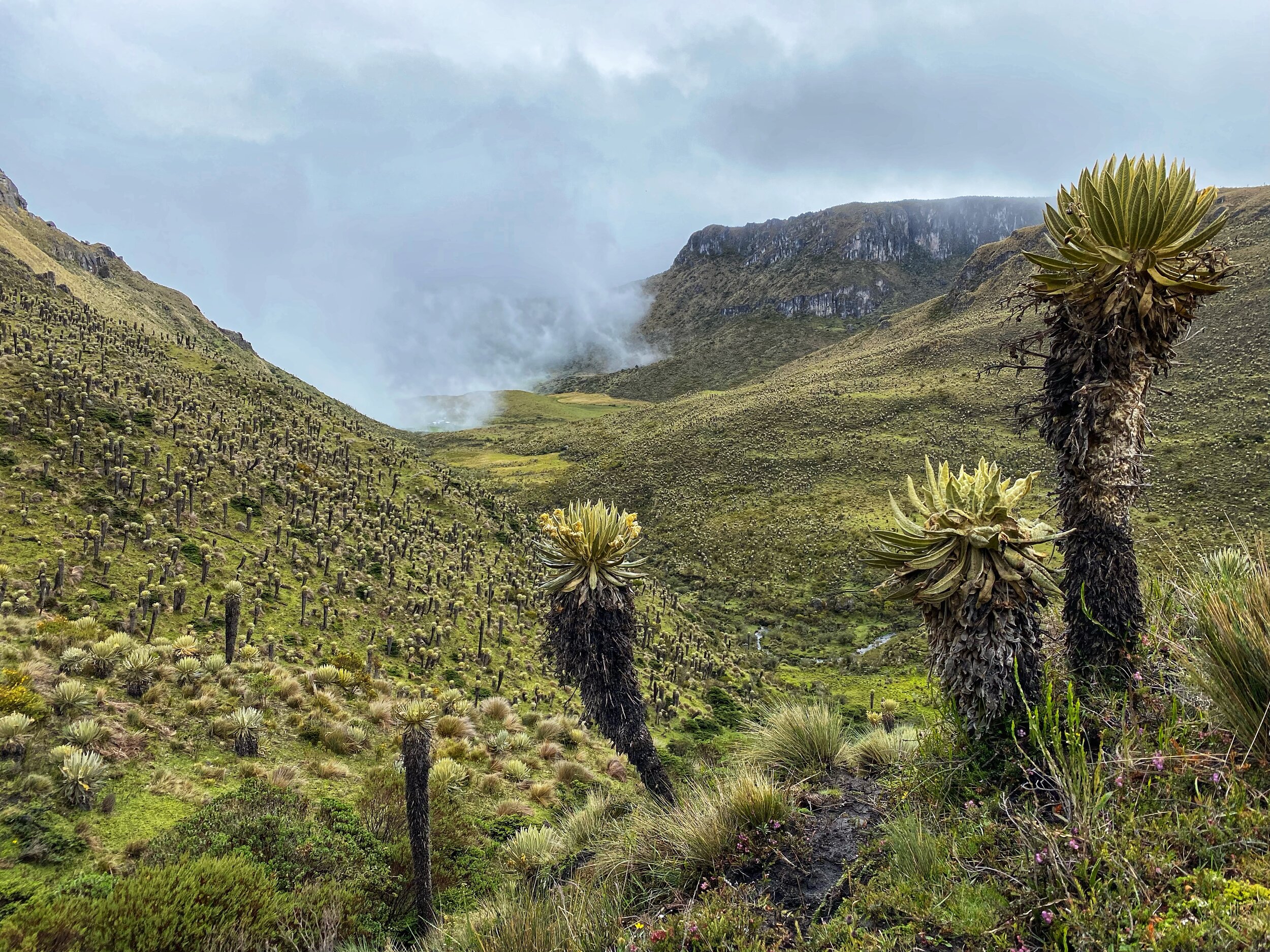
We had great views until we climbed into the clouds that seem to hang permanently at the edge of the high plateau of the Los Nevados National Park.
We passed by some beautiful but very simple farms as we climbed higher.

The vegetation started to change as we gained altitude

Finally, BERLIN came into view. It is located in spectacular surroundings at an altitude of 3,800m.


Diego and our stuff.

Another member of the Machete clan.

Saddles in the Berlin farm
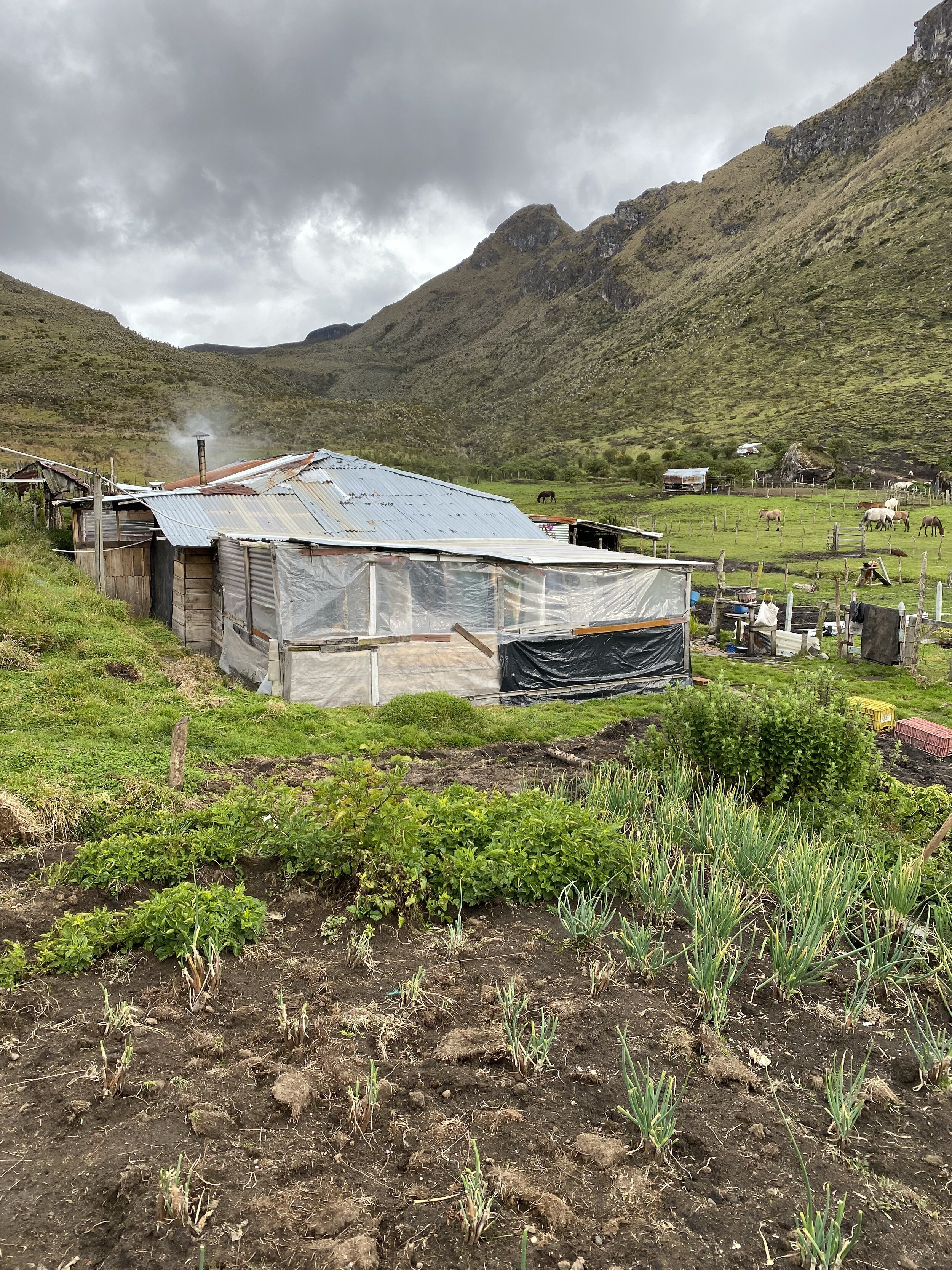
The very basic living at the Berlin farm. Despite the simple conditions, the farm is welcoming and comfortable.
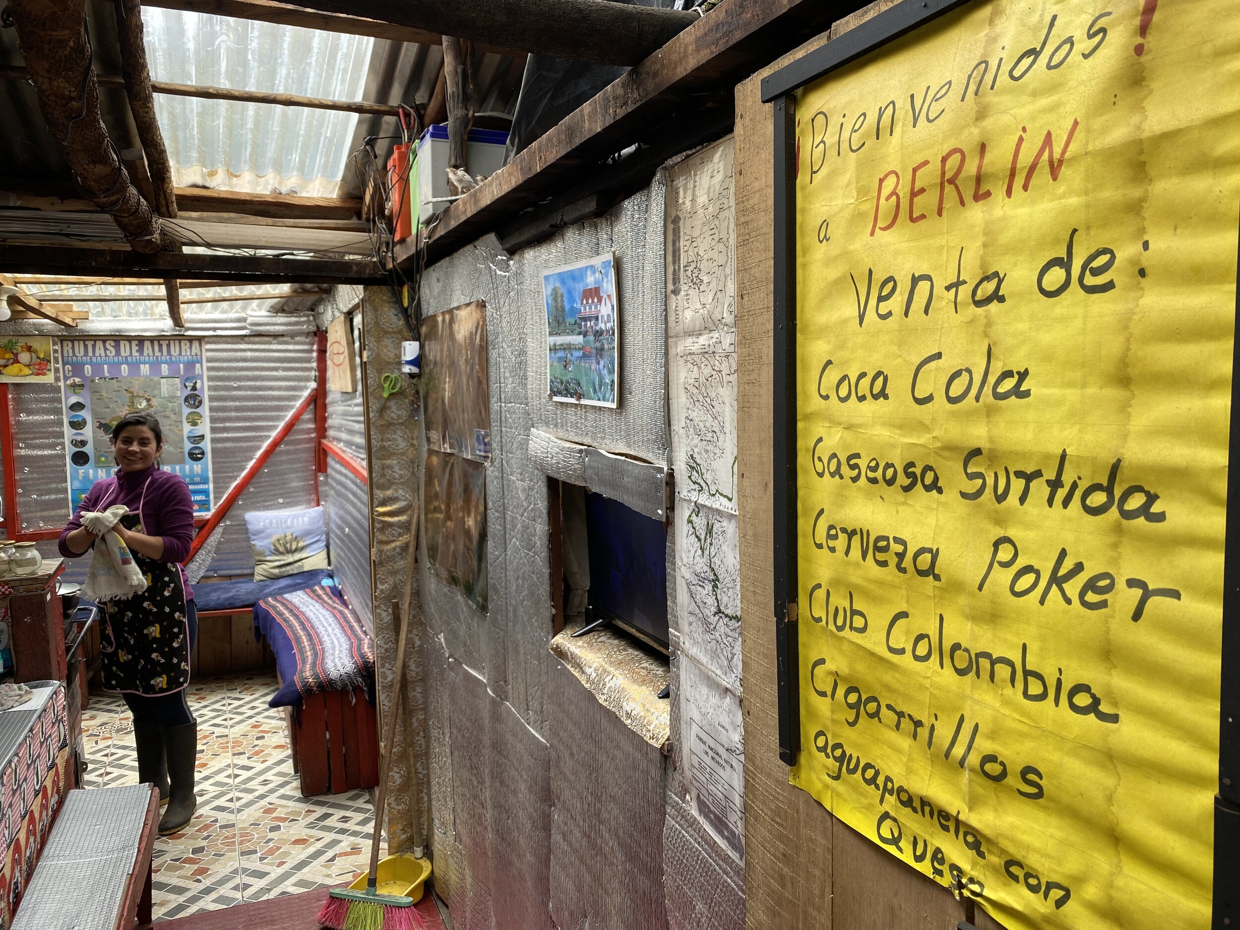
Maria runs the farm and provides all care to the visitors. The place is immaculately clean and the hospitality is fantastic. It reminded me of the Nepali tea houses where people sit around the kitchen fire and exchange stories.

The farm kids work hard from a young age. They get involved in animal work and seem to know their way around quite well.

We needed the help to find the trail through the Paramo in the fog and rain. Before we could depart, the cows had to be milked first. It is a real working farm. The farmers sell cheese that they make using methods dating two centuries. There is no machinery or modern equipment.

The high Paramo forest
From Berlin we climber higher to 4,000+. As we ascended the fog became thicker and it started to rain. The water and horses turn trails into a liquid. The volcanic ash is very slippery when wet and each step seems to be an effort.


Wet and dirty from the mud


The La Playa form at 3700.

Beautiful evening at the La Playa farm


Unnamed collapsed volcano near La Playa

Nevado del Tolima

Nevado del Tolima glaciated summit
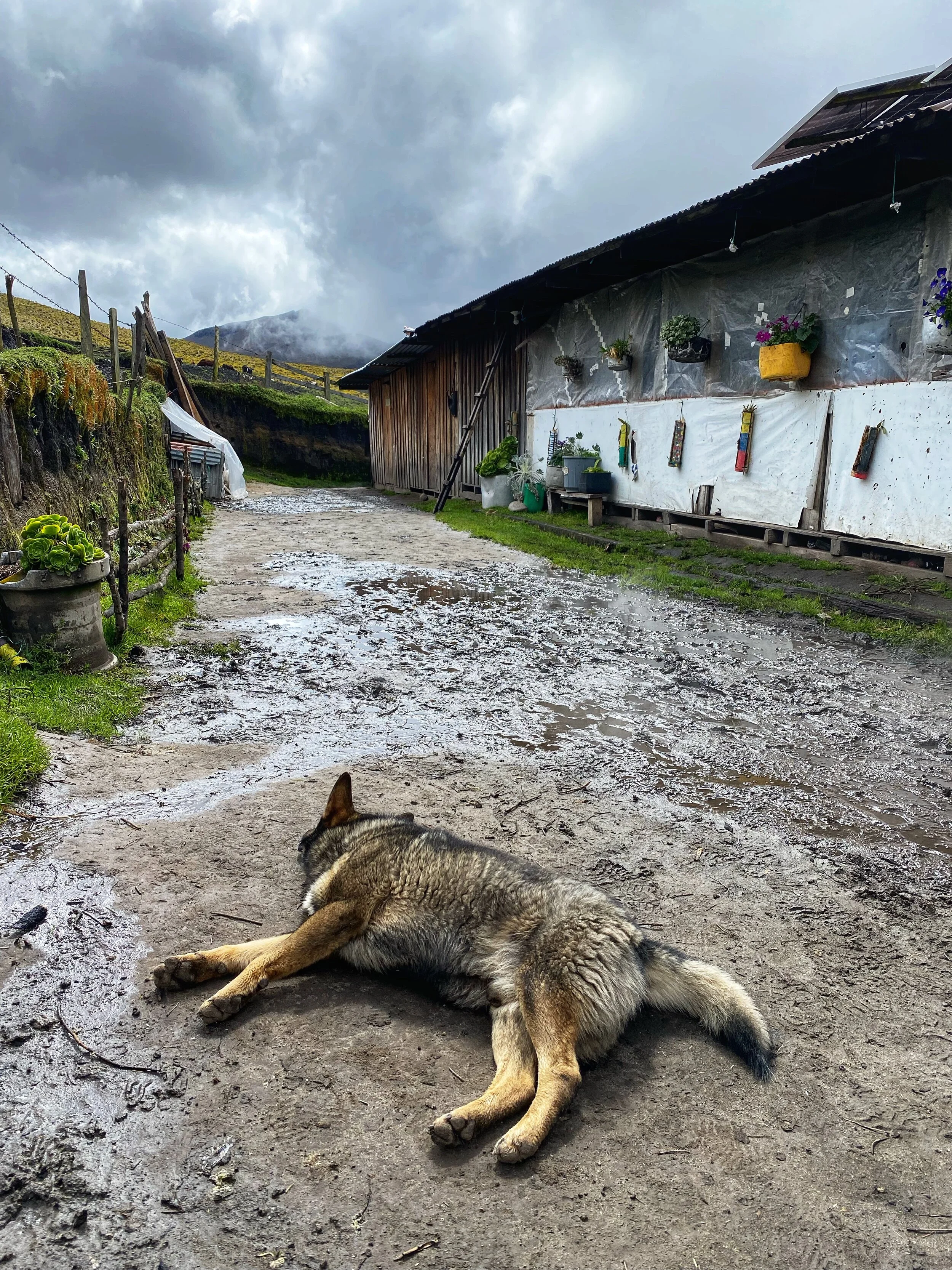
A dog’s day at La Playa

My futile attempt to dry my pants after a day of hiking to La Playa


Going to the basecamp for Nevado del Tolima


BC for Nevado del Tolima


The view from the BC. The weather looked promising. The weather turned in the night and we got snowed out at 4500m.


Carlos, our horseman and the owner of La Playa


Our final day was beautiful and clear!

The La Primavera farm

We had this spectacular view of the Nevado del Tolima and the surrounding area. If only we had weather like that the day before!


A beautiful view of the Nevado del Tolima 5,240m

Muddy trails


An incredible variety of vegetation


The view of the upper Cocora Valley


Cocora Valley

Cocora Valley and the famous Cocora palms


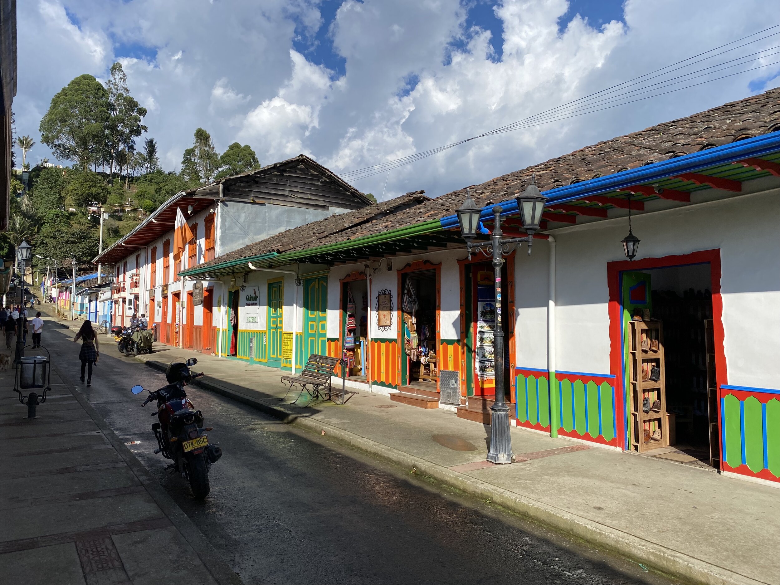
Salento

The view towards Los Nevados from the hill near Salento

Salento

Colourful Salento
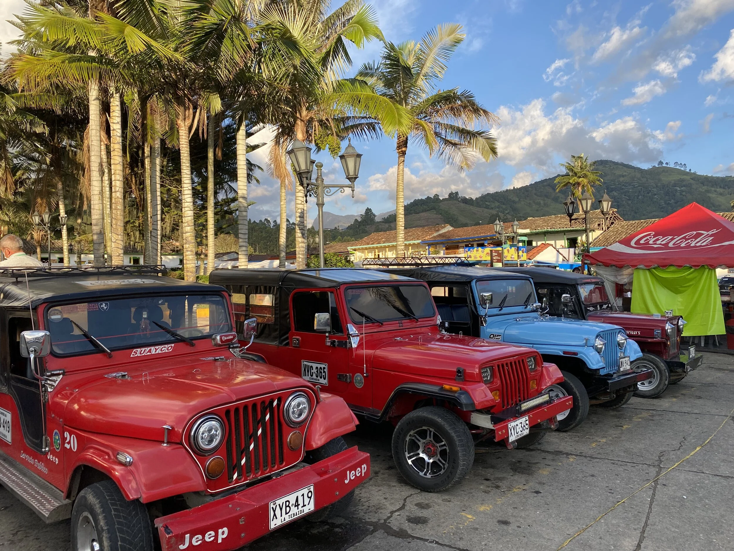
The old coffee plantation jeeps are used as taxis in Salento

Salento

Salento main square


Thanks to Andes World Travel for putting the Colombia trip toghether for me! I was able to do a lot in a short period because of their excellent assistance.
The first time I have ever heard of the Lost City was in June of 2021 while in COVID government imposed quarantine after my trip to Mexico. Since Colombia is one of the few open countries, I thought: why not check it out?
The Lost City is not really “lost”. It is located in the mountain range of Sierra Nevada de Santa Marta on the Caribbean coast of Colombia. The mountain range is the highest rising mountain range in the world in terms of distance from 0m to 5800m in 20 miles. It is separate from the Andes and much older in geological terms. It is also wilder and some areas are very hard to access either because of the closures by its inhabitants or the due to its inaccessible terrain.
As it turned out, the trek is fairly popular and well known, at least in Colombia. The best time to visit is in December and January. I picked the rainy season. In addition to the heat and humidity of 85%, we were met with a crazy amount of rain and very high rivers. At one point it became doubtful whether we would be able to get to the archeological site as the rivers were just too high. I was told by the guide that it does happen especially during the rainy season.
For me the main appeal of the experience was the opportunity to trek through the hot and humid jungle and to meet the local Kogi Indians who live in these mountains. They have an interesting and sobering outlook on human relationship with nature. We, the younger brothers as they call us, are destroying the natural world and upsetting the balance causing many natural ills. They have been saying that for the past 30 years or more but no-one seems to listen…(See the BBC documentary From the heart of the world, the elder brother’s warning.)

Sierra Nevada de Santa Marta from the air


We were supposed to cross this river the following day. It did not look promising…

On the way to the trailhead from Santa Marta. Stocking up on some fruit!


The coastal range of Santa Marta Mountains is lush and full of life!

You can see the ocean in the distance.

We crossed the mountain ridges on the horizon. The Lost City is located at an altitude of 1200m somewhere beyond the mountains on the horizon.


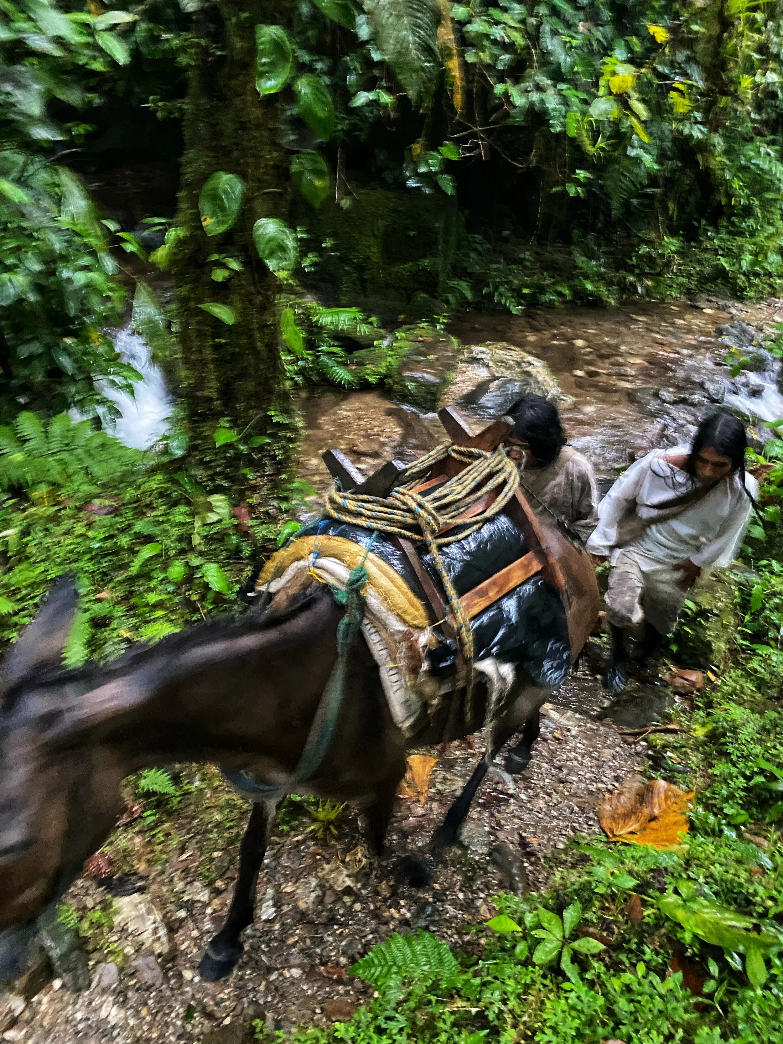
At the trail head. The colourful machetes are very common in Colombia. The rubber boots would definitely be useful for walking!

The trailhead is located at the village of Machete Pelado (which translates as Drawn Machete - apparently dating to the times when local differences were resolved with the liberal use of a machete). One can hire a horse but I am not sure how far would the horse go or how comfortable the ride would be. I think if you need to hire a horse, you probably should not be doing this trek.

One of the locals

The trail is carved by water from huge and frequent rains. At some spots the trail resembles a small canyon a few meters deep! The water just runs in the bottom of the canyon and one has to walk right in it.

Walking through the trail/creek. Everything is wet and nothing dries until the sun comes out.

Our first camp. We reached it in a torrential rain - I have never seen such an amount of water come from the heavens. And it rained for hours. Rain jackets are useless as everything is just soaked through. We changed into dry clothes for the night but had to put the wet ones back on in the morning.

Normally this is a small creek but after the rain it is like a flush flood!

The shop at the camp. It has all the basics including cold beer.

Dinner!

The sleeping arrangements in the camps are under these mosquito nets. It is quite comfortable and warm and the temperature hardly drops below 20C. You need to watch out for bed bugs though.
In one of the camps.
Beautiful jungle hiking


The trail when dry

Horses are used to ferry supplies. It is hard walking for them and we saw them getting stuck. When a horse is stuck, it has to be unloaded and freed. It is a lot of work for the horseman and stressful for the animal.

One of the indigenous inhabitants of the Santa Marta Mountains (belonging to the Arhuaco group). He is holding a poporo which is a sign of maturity and a personal identification. It also holds lime made from sea shells that is used to interact with the coca leaf. The lime from the poporo is mixed with the coca leaf and chewed. Since lime is caustic, an excess will burn the mouth. Without any formal knowledge of chemistry, the indigenous are extracting the alkaloids from the leaves by making them alkaline. They know that the lime is the mechanism by which absorption of the alkaloids could be controlled. Thus, if while chewing the leaves a little too much alkaloid is released, one has only to ease up on the lime and let the saliva wash out some of the excess lime into the stomach. The lower concentration of lime would result in a slower absorption of alkaloids. Interestingly, cocaine alkaloid content is not the prime factor in choice of leaves. The Indians consistently chose leaves with a lower cocaine content but a high concentration of sweet, aromatic compounds which give the wad of coca better flavour.

An Arhuaco boy

For sale: coca leaf and cacao seeds. Cacao seeds are dried and sometimes sweetened by honey. They are a good source of energy! So is the coca.

A cacao plant - the first stage of chocolate!

The dwelling of the indigenous people of the Arhuaco tribe in the Santa Marta Mountains

A Kogi village. These villages are used mostly for meetings and gatherings. The individual Kogi families are scattered throughout the mountains cultivating land.

In the Kogi village

A Kogi boy

A young Kogi - you can tell the boy from a girl because boys carry bags over their shoulders.

A Kogi village


A Kogi boy with a group of young girls

The Buritaca River before the crazy rain higher up the range. The river level rises and drops dramatically and sudenly. The rains can be falling at higher elevations and the river downstream will rise very fast and become dangerous to cross. This is amplified by the steep incline of the Santa Marta range. This reminds me of the flash flooding in the canyons of the American South-West.


A Kogi family

A young Kogi mother

Kogis seem to be constantly on the move from one settlement to another. We passed many families along the way. They seem to share their settlements.

A Kogi man with his poporo


Arhuaco dwellings


A young Kogi boy
Young Kogis. Without the bag identifying the child as a boy it would be impossible to tell the gender.
Kogi men on the move. They navigate these trails very efficiently.

It always rained in the afternoons. We could tell the approaching rains by the clouds rolling up from the ocean.


The crazy high Buritaca River and the torrential rain.

Even crossing smaller streams was a challenge. It was easy to loose footing on slippery rocks hidden under the torrent. You could not see the bottom as the water was silty.

We had to cross the Buritaca River to get to the 1200 steps leading to the Lost City. Without the rope it would be impossible. For a short distance the water was 1.5m deep and fast flowing. Although much lower than the day before, it was still high enough to be swept by its force.


The 1200 steps to the Lost City. In the heat and humidity, physical effort feels so much harder.

After the exciting crossing we only had to climb 1200 slippery steps in order to get the ridge where the Lost City is located.

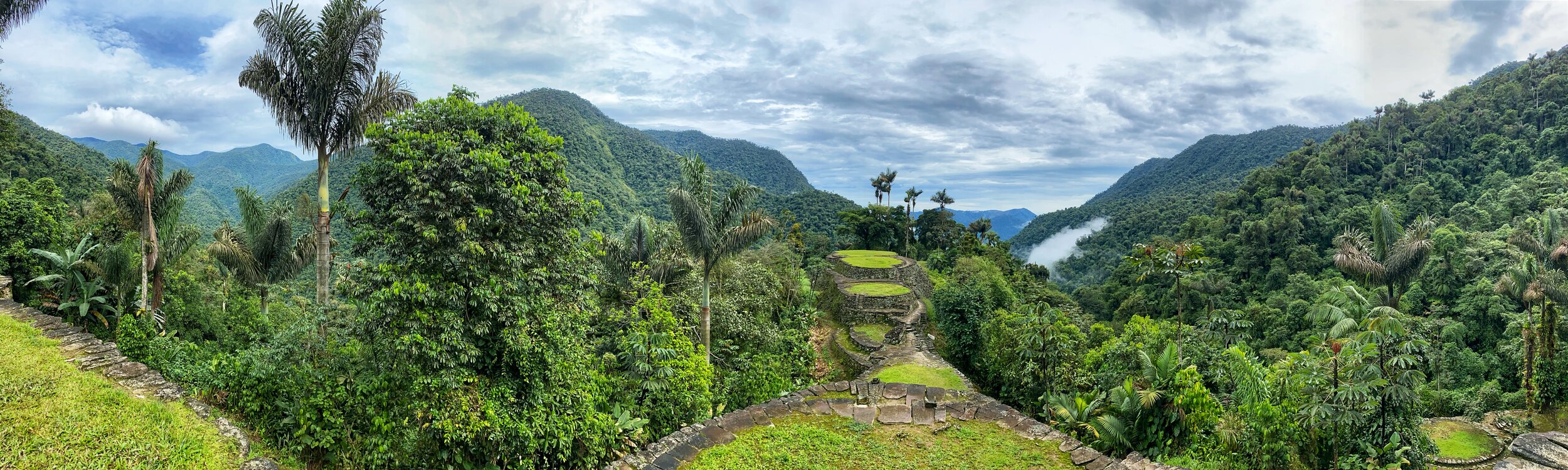
At first sight, the Lost City is not a very impressive site in terms of architecture (it does not have the Wow! Factor of Machu Picchu). It consists of a series of terraces similar to Kuelap in Peru. However, it is its spectacular location and the magnificent surroundings that make it special. Also the mystery of the little known Tayrona civilization who built it adds to its mystique. After making the trek, crossing the rivers and meeting the local inhabitants of these mountains, the Lost City feels very special.

The lower section of the Lost City. It once housed between 2000-3000 people. Up to 2005 the trek was off limits due to paramilitary activities.


It is actually quite amazing that 2000-3000 people lived here at some point. It is quite remote and hard to access. The amount of work that was involved in building it was quite astonishing.


There is a small Kogi settlement in the Lost City. They are the custodians of the site which is considered sacred. One of the elders or a Mamo, lives there and it was very interesting to meet him.

The elder Kogi

The Kogi people believe that everything buried in La Ciudad Perdida contributes to the peace, harmony, and balance of the world. After teaching one of their members Spanish, they presented this case to the Colombian government and successfully reclaimed the rights to their ancestral land.


A typical Kogi house

The small Kogi settlement in the Lost City. The site is a sacred place to the Kogi. The Santa Marta Mountains is the centre of the universe to all the indigenous tribes inhabiting these ranges.


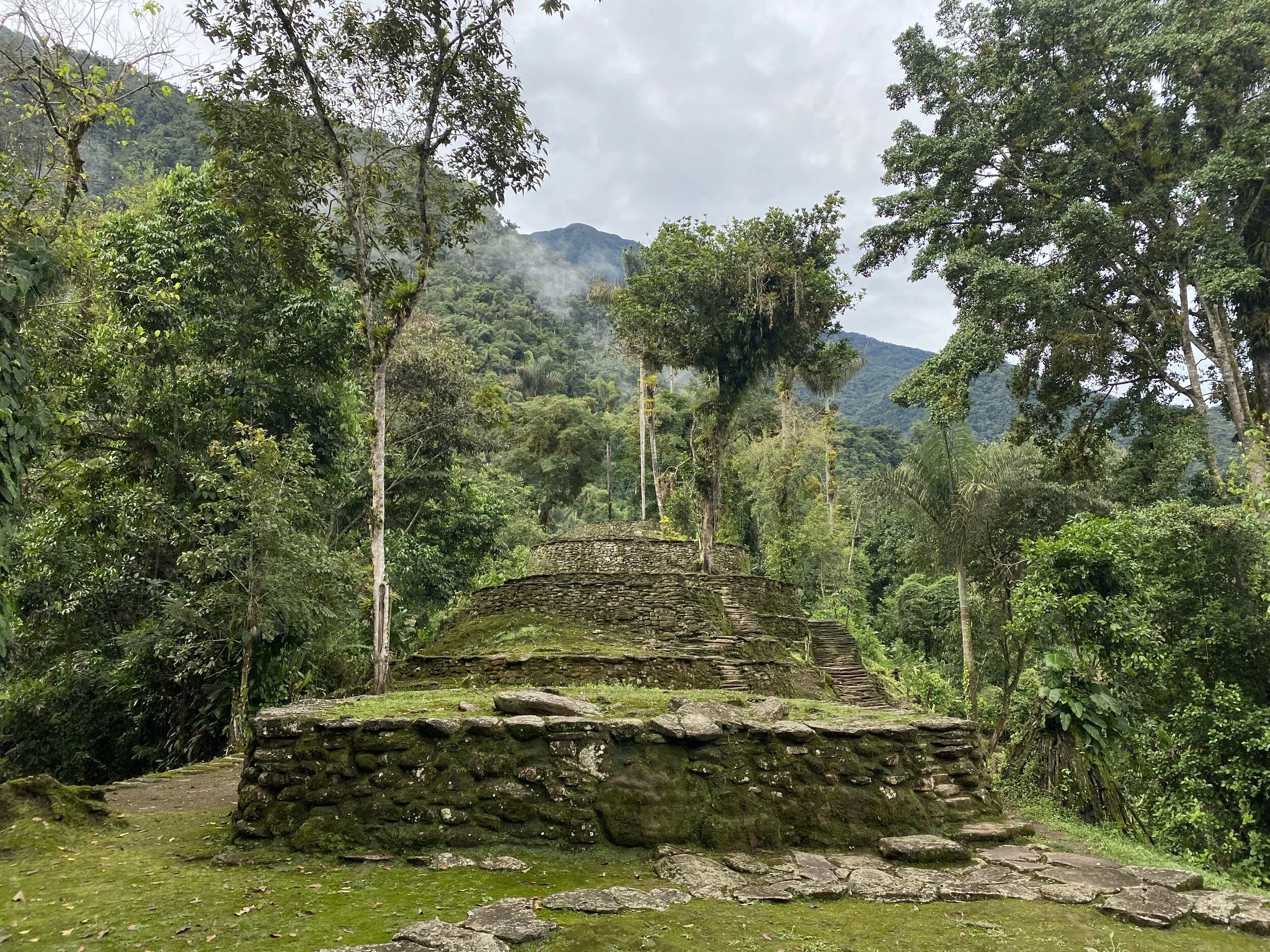
The main part of the Lost City. This was the living or ceremonial place of the high priests or leaders. In the Kogi tradition, the most important person in the community lives at the highest elevation relative to the others.


The heart of the Lost City

Teyuna-Ciudad Perdida was laid out over the hilltop in such a fashion that its administrative and political center covers a narrow ridgeline, with residential wards located towards the slopes. The ridgeline and slopes were leveled out using a combination of rammed earth and masonry terraces, and round buildings with stone foundations were set upon them. A 10,000 square foot terrace, for example, has multiple round or oval buildings and is connected to adjacent terraces via paved walkways or staircases.

Wikipedia: “Ciudad Perdida was discovered in 1972, when a group of local treasure looters, Los Sepúlvedas, found a series of stone steps rising up the mountainside and followed them to an abandoned city which they named "Green Hell" or "Wide Set". Los Sepúlveda was a small family of looters in Colombia; their story leads to the beginning of one of the greatest archaeological discoveries in modern times. The family went hunting in the forests of Colombia when they shot down a wild turkey. Upon retrieving the turkey, they noticed it had fallen on a piece of an exposed staircase. This staircase would lead them to find La Ciudad Perdida. For years after its discovery by the looters, “Treasures from the site, including gold figures and ceramics, soon began to appear on the black market”. After fights broke out among the looters due to the murder of one of the Sepúlveda sons at the site of Ciudad Perdida, and gold figurines and ceramic urns from this city began to appear in the local black market, archaeologists headed by the director of the Instituto Colombiano de Antropología reached the site in 1976 and completed reconstruction between 1976 and 1982. Although La Ciudad Perdida is one of the most impressive sites, it's not alone, only about 30-40% of the sites in the Sierra Nevada region have actually been explored.”

The archeological camp is on the lower left.

The spectacular surroundings of the Lost City

This was some form of a throne. I had to try it out!


The main axis of the city.

This is called the map stone. It is thought to be some sort of a map of the surrounding settlements. There are many unexcavated settlements in the surrounding mountains.


The beautiful surroundings of the Lost City

The Sierra Nevada of Mexico. Pico de Orizaba is the highest summit in the range and the 3rd highest in North America (after Denali and Logan). It is also one of the most prominent volcanoes. It is isolated from other high mountains in the range (like Popo and Izta). In order to climb Pico de Orizaba one needs to acclimatize and it is best done by climbing smaller mountains in the area.


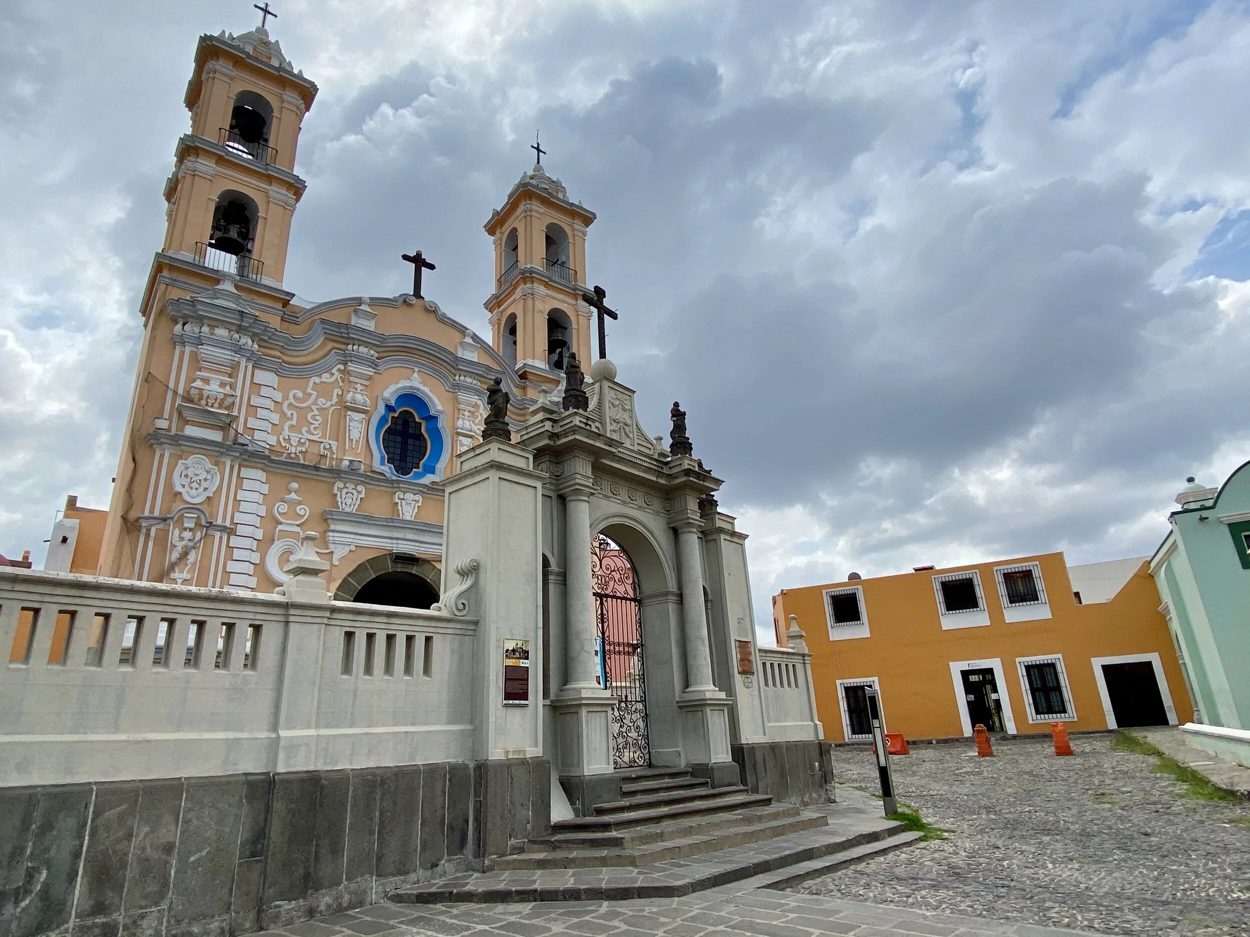
Puebla is a wonderful basecamp for the volcanoes surrounding it. The city is very walkable. It offers many interesting points of interest. Some are very spectacular such as the main cathedral - the second largest in Mexico.

The wonderful Puebla with its colourful streets from the roof of the AMPARO museum. Check out their online exhibits at MUSEO AMPARO. The Museum has the second largest collection of the pre-hispanic art in Mexico (second to the Anthropology Museum in Mexico City).


The amazing Capilla del Rosario in Puebla. It is one of the most beautiful churches that I have ever been to.

Puebla has so many churches that it is said that there is a church for each day of the week.
Another wonderful old church in Puebla.

A beautiful church and the Vulcan Popocatopetl

It is very common to see such beautiful decorations in most churches throughout Puebla region. Some of them are truly exquisite!

Traditional dancers in the streets of Puebla

The drive from the city of Puebla to Pico de Orizaba is 2.5 hours through a large valley on an old lake bed.
Driving through a dried up lake. The scenery is very different from Pico de Orizaba National Park.
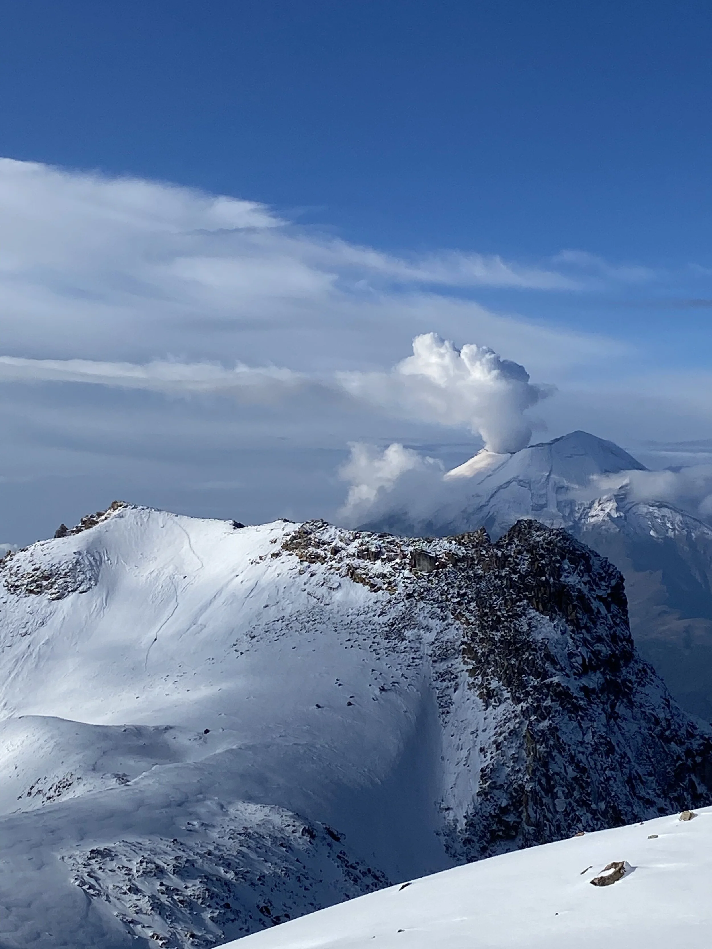
Pico de Orizaba is on the left (in the cloud) and Sierra Negra, its close neighbour, is on the right. You can see the massive astronomical antenna on top of Sierra Negra. Pico is a very different mountain in character than Izta. It is a conical volcano with a straight ascent. Izta is a complex mountain with multiple summits. Pico is only 60 miles from the Gulf of Mexico and is affected by its weather.

The beautiful forest on the way to Hidalgo

Hidalgo

Our basecamp in the village of Hidalgo. We stayed in this hostel where the owner made us a delicious supper. We were the only guests.

In Hidalgo. Apparently it is the highest community in North America at 3,400m.

The sunset in Hidalgo
From Hidalgo it takes one hour to drive to the starting point. We started our preparations at 10.30pm and left Hidalgo at 11pm. We arrived at the trailhead at midnight and started climbing right away. By the time the sun started to appear, we were very high up on the mountain. We were on the crater rim for sunrise.

The last 400m of the climb involves an ascend of the Jamapa Glacier. We had excellent snow conditions on the glacier with all the crevices covered. There was no exposed ice, the ascend was very pleasant and the descend fast.

The grade of the Jamapa Glacier slope. The sun is rising and the fantastic views are starting to appear.

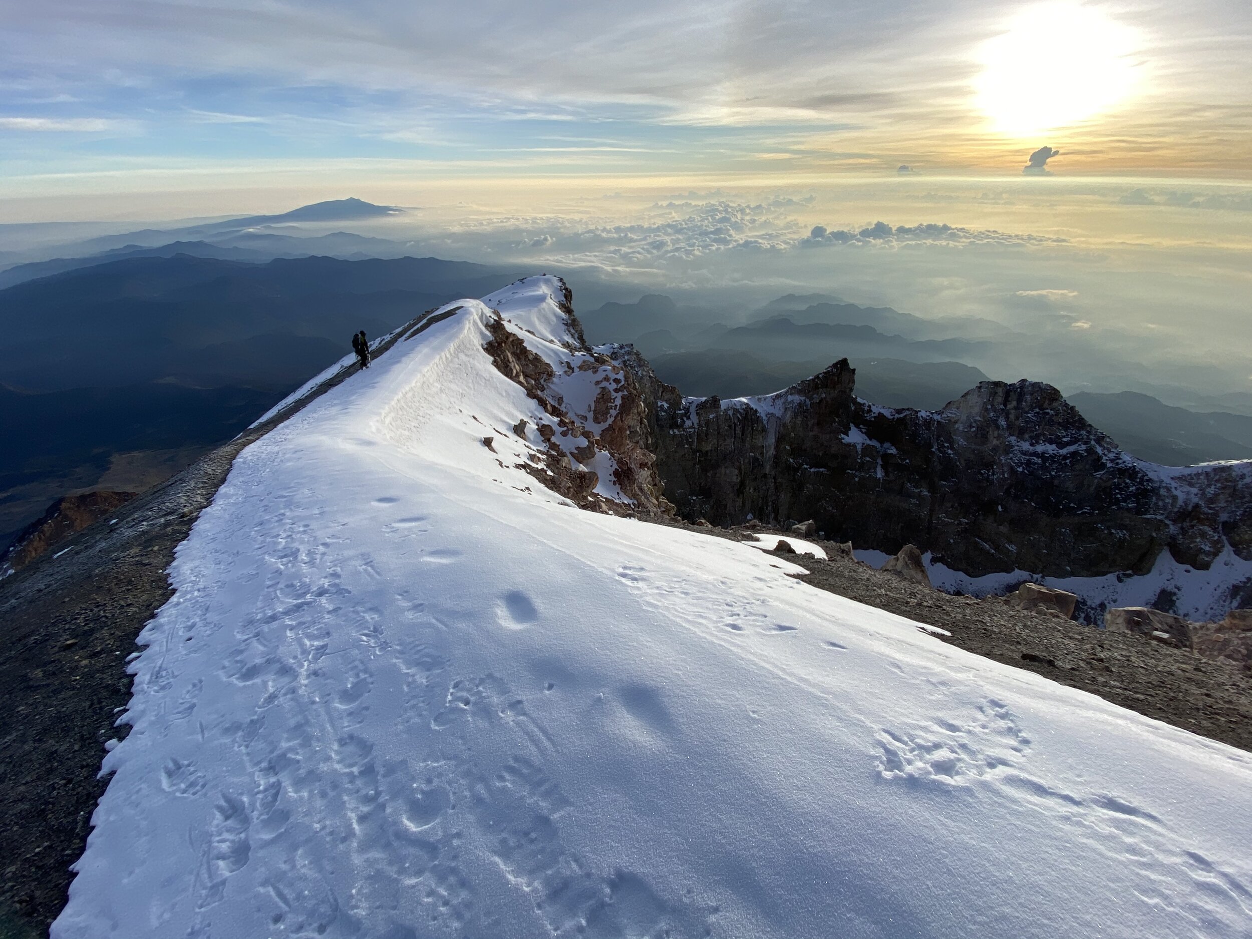
The crater rim is just above.

The sunrise at the rim of the crater. Pico has a perfectly round and jugged crater.

The sunrise at the crater rim of Pico. The summit is the highest point on the rim on the right.


The summit of Pico on the right.

A beautiful sunrise on the crater of Pico

Looking down our ascent route. You can see the basecamp hut far below.

The crater of Pico

The large shadow of Pico projected onto the valley below.

Last steps to the summit

The summit ridge


The summit of Pico de Orizaba

Sierra Negra looks small and is now far below. The large antenna is visible. The summit of Sierra Negra is 1 km below the summit of Pico.
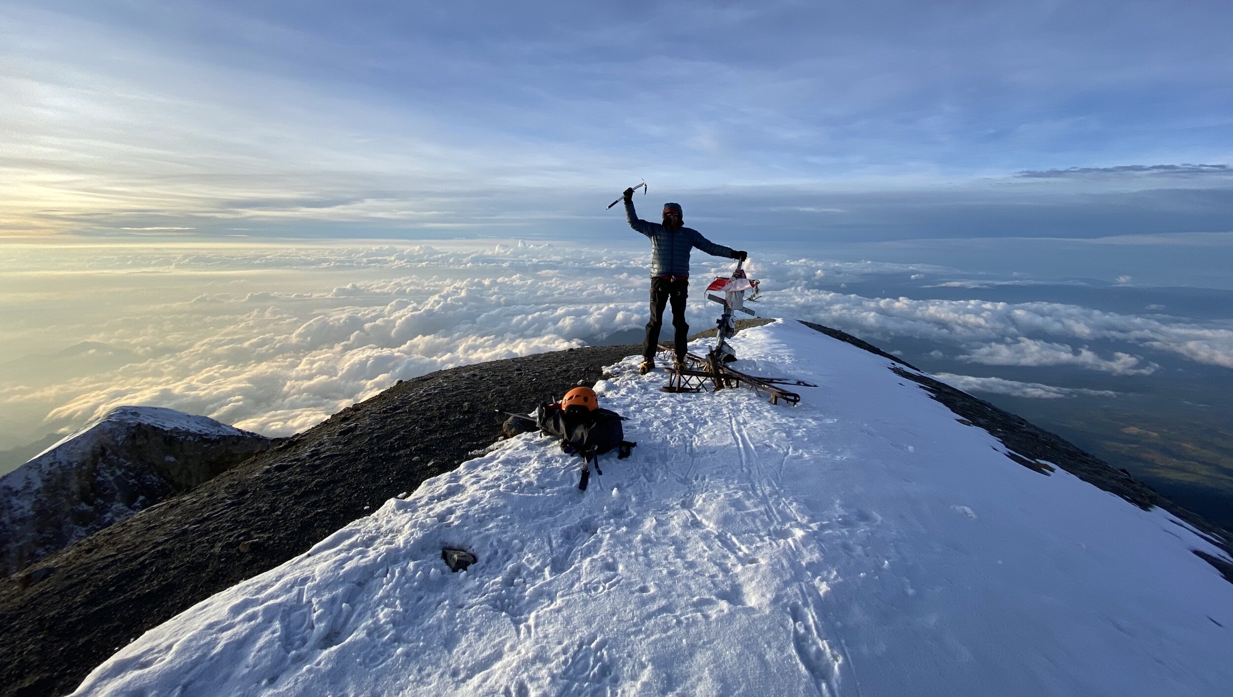
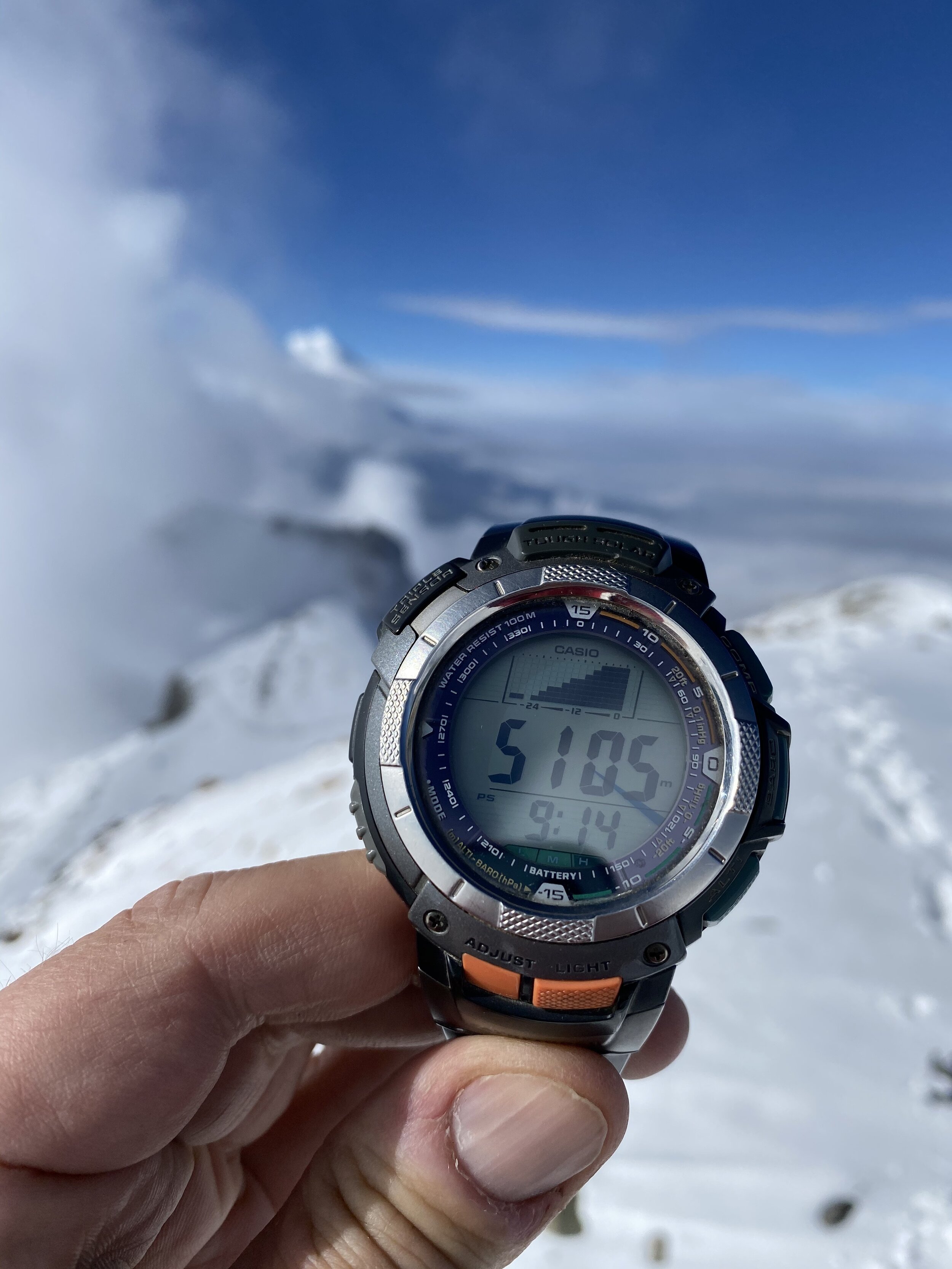
The summit of Pico de Orizaba 5,630m

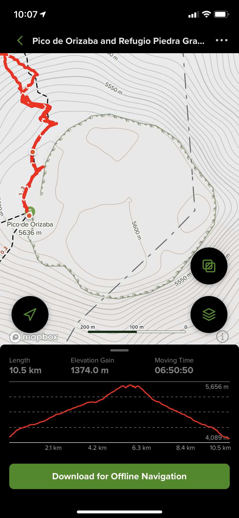
The summit elevation is 5,636m or 18,491ft. Add 150m to my watch. We were on the summit in 6.45 hrs.

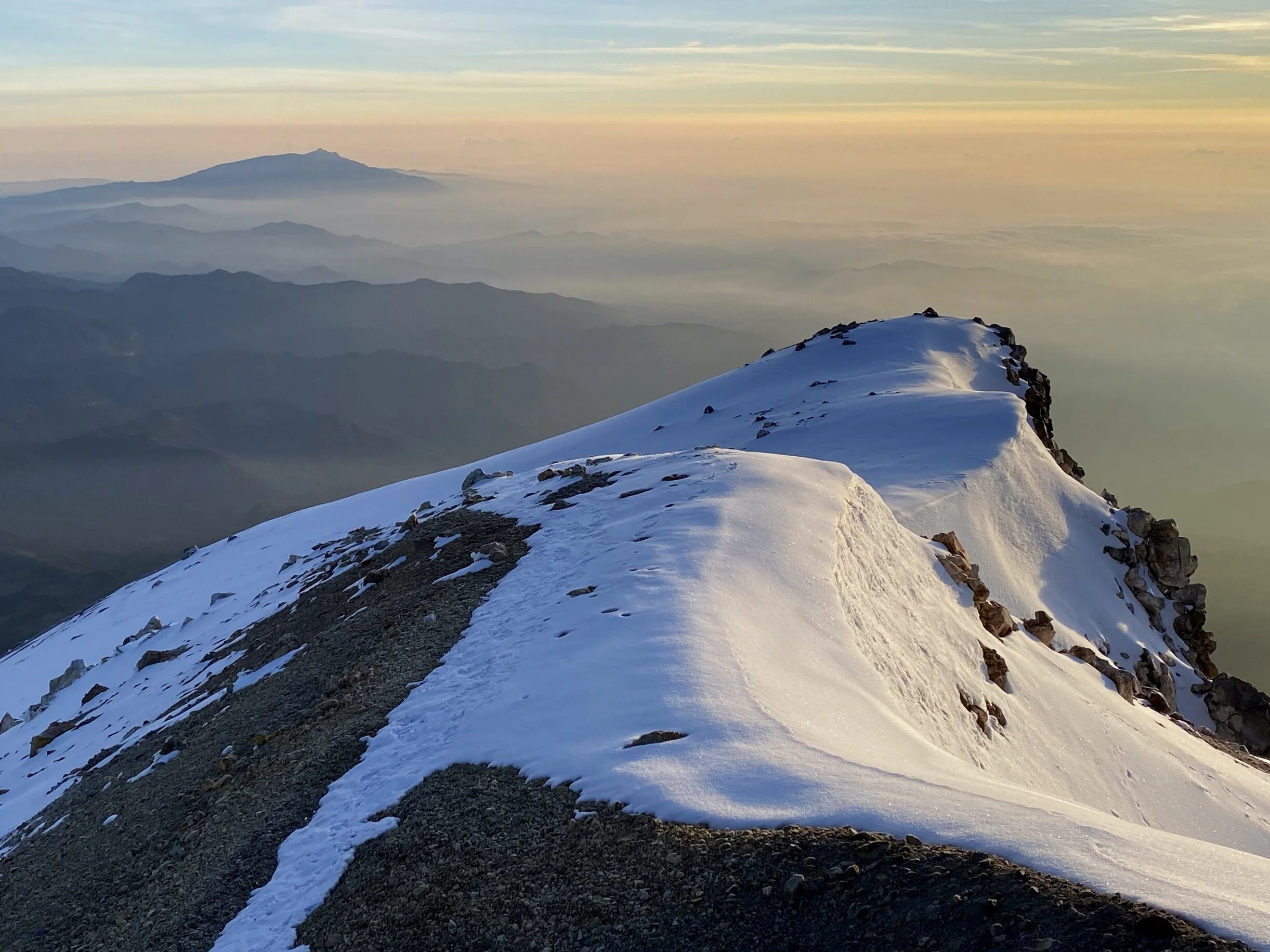
The views from the summit


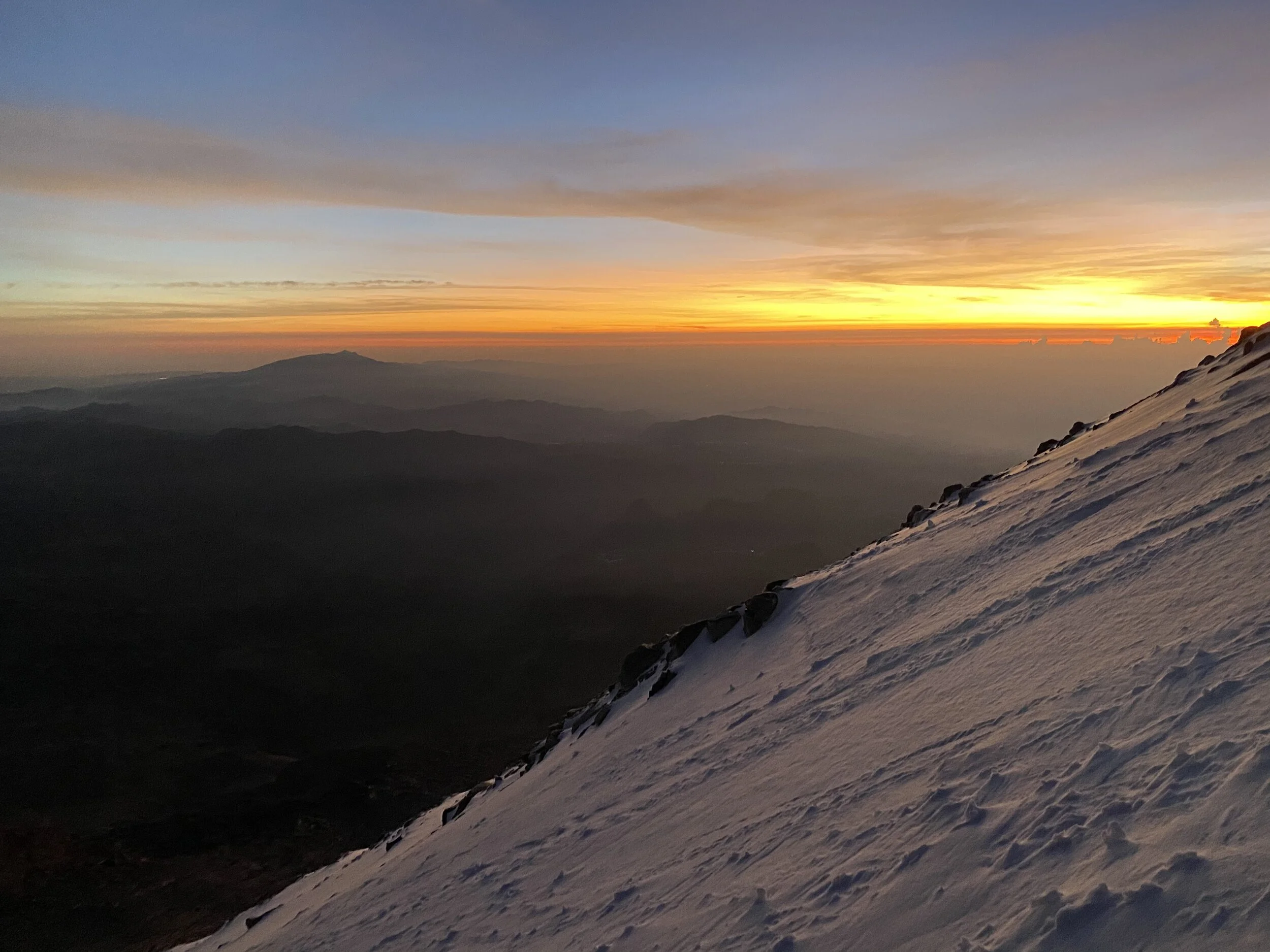
The panorama from the summit of Pico. The forecast called for rain and clouds at the summit. Instead we got this! Again, we were very lucky with the weather. During the night we were surrounded by bright flashes of electrical discharges in the surrounding clouds. Thankfully we did not have any issues with thunderstorms.


Absolutely fantastic views that exceeded my expectations. We were on top Mexico!

The path of our descend down the glacier.


Happy to be off the glacier and from here on it is all down to the hut on a trail.

The views we missed during the night. On one hand I do not like to climb at night as there is nothing to see. On the other hand, the climb goes fast and it is less mentally taxing as one can’t see the objective dangers (crevasses or seracs).

The views were fantastic all the way down to the start of the route. What a beautiful day!

Looking back at the glacier and the summit of Pico from around 5000m.


The alpine hut that serves as the formal basecamp is below us.


Surprisingly, around 60 people died on Pico over the years. The success rate is 50%. It is all about the conditions. I found this mountain to be easier than Itza for me. It was faster to climb and shorter in distance. We had excellent conditions on the glacier. I think that an assistance of a guide is essential as the night climbing is in complete darkness and there are no route markers. It would be tiring and time consuming to find the way in the dark in the lower part of the mountain called the labyrinth. Overall it was a very, very pleasant outing. We were the only two persons on the entire mountain.
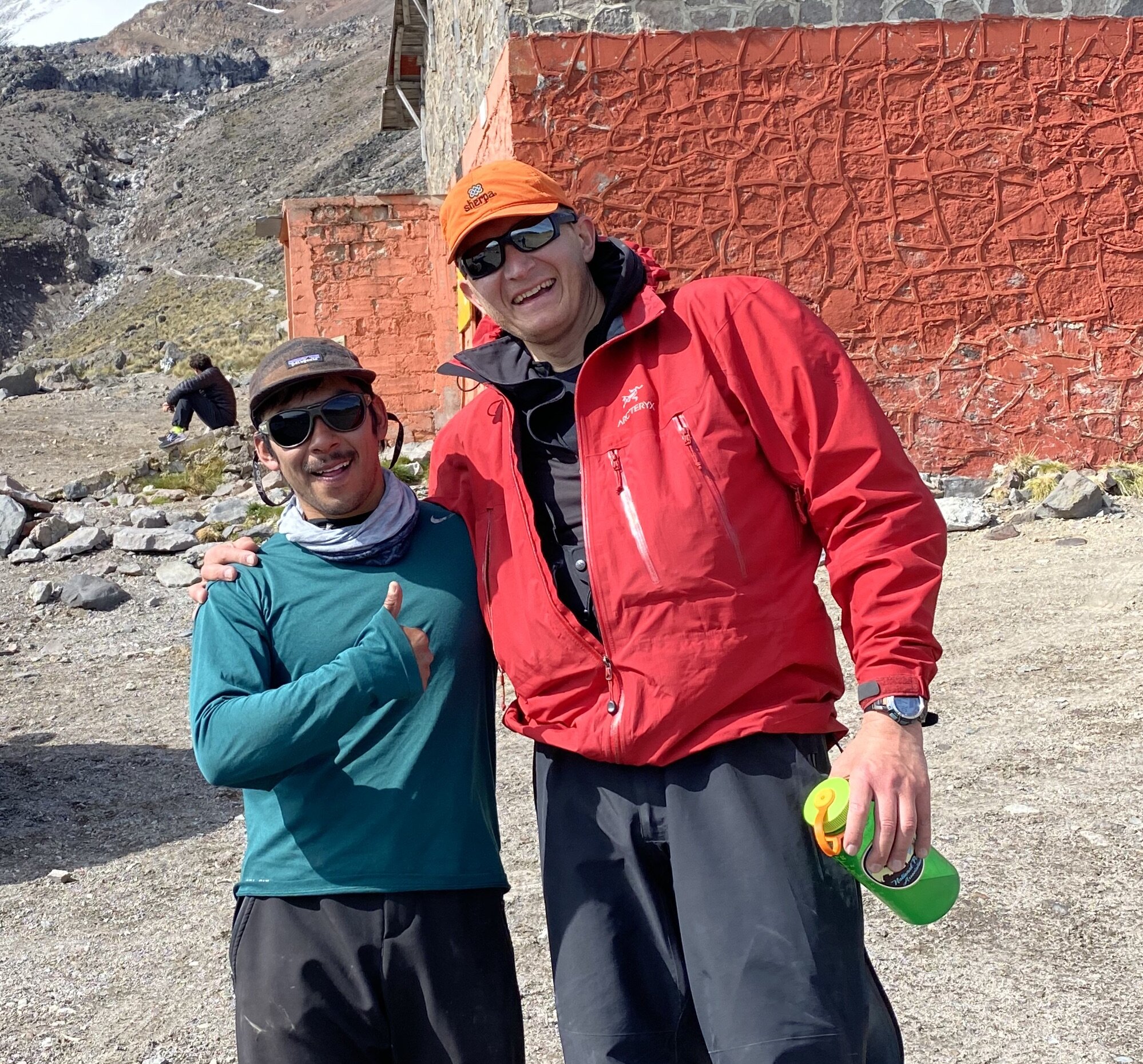
My guide Mesh and I after the climb

Looking back at Pico from our drive back to Hidalgo.

The beautiful Pico de Orizaba National Park

Photo courtesy of Juan Plaza. (www.aopa.org/news-and-media/all-news/2021/may/17/mapping-the-tallest-volcano-in-north-america).
The line of our ascent is on the right.

The Trans-Mexican Volcanic Belt or Sierra Nevada stretches 1000km across Mexico with the highest peak being Pico de Orizaba. In order to acclimatize and prepare for the altitude of Pico de Orizaba, I climbed two lower (although not easer) mountains: Sierra Negra and the companion of Popocatopetl, Iztaccihuatl. In addition to hiking and climbing, the region offers superb cultural and culinary attractions. The city of Puebla, a de facto base camp, is a UNESCO World Heritage site because of its historical center.


Izta and Popo from the airplane tower over smoggy Mexico City Valley

An atmospheric old church on the way to Sierra Negra
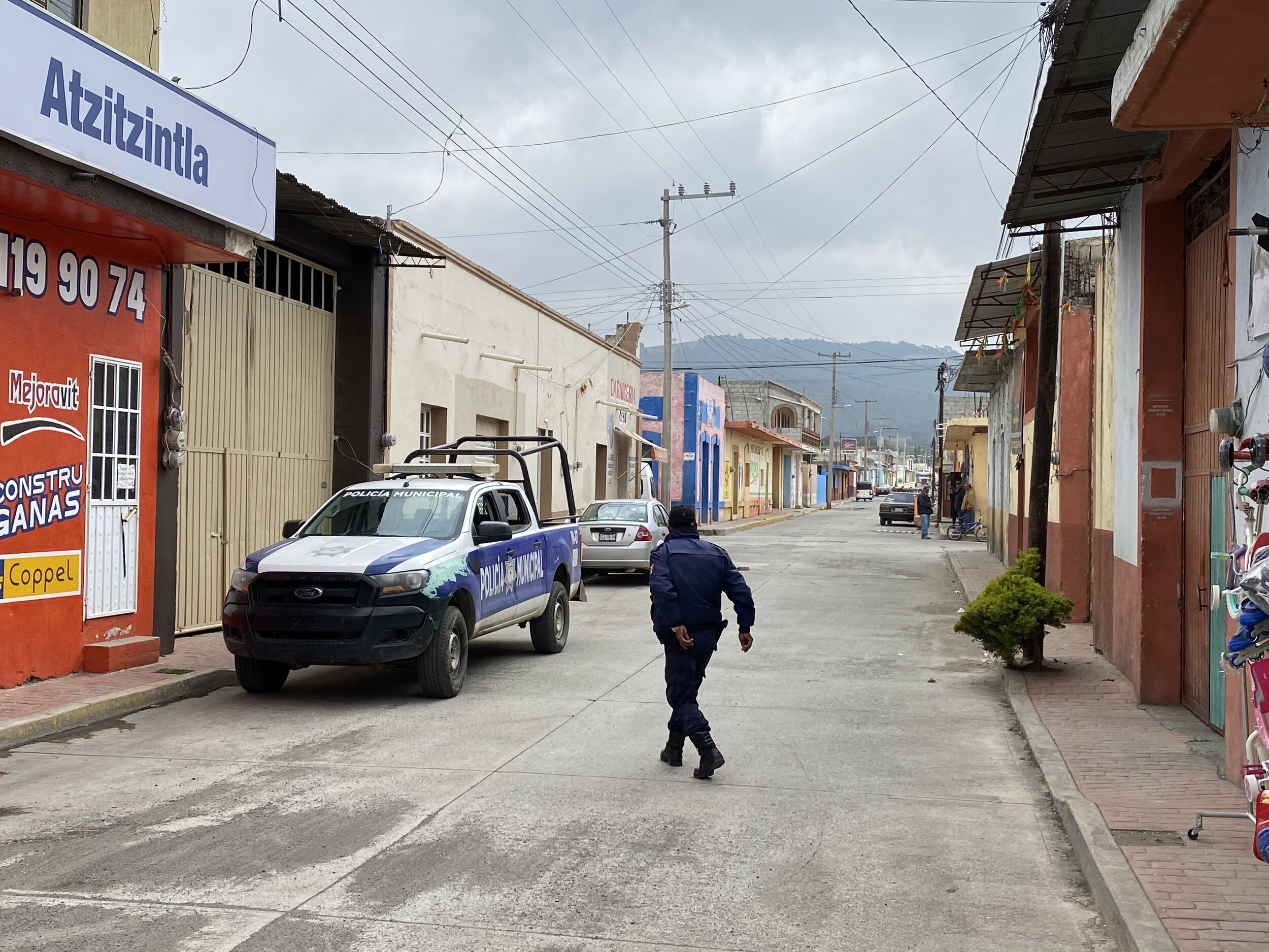
The small town of Atzitzintla at the base of the Sierra Negra Volcano


At a local bar

Small local church in Atzitzintla


The trailhead

The dormant volcano of Sierra Negra. It is a short hike really but at a high elevation. We were checking the weather forecast often and adjusting our plans because early June is not an ideal period for climbing. The mornings are usually clear but the clouds roll in before noon and massive thunderstorms rage all around in the evenings and nights.


Beautiful flowers in the Pico de Orizaba National Park. We had the place to ourselves.

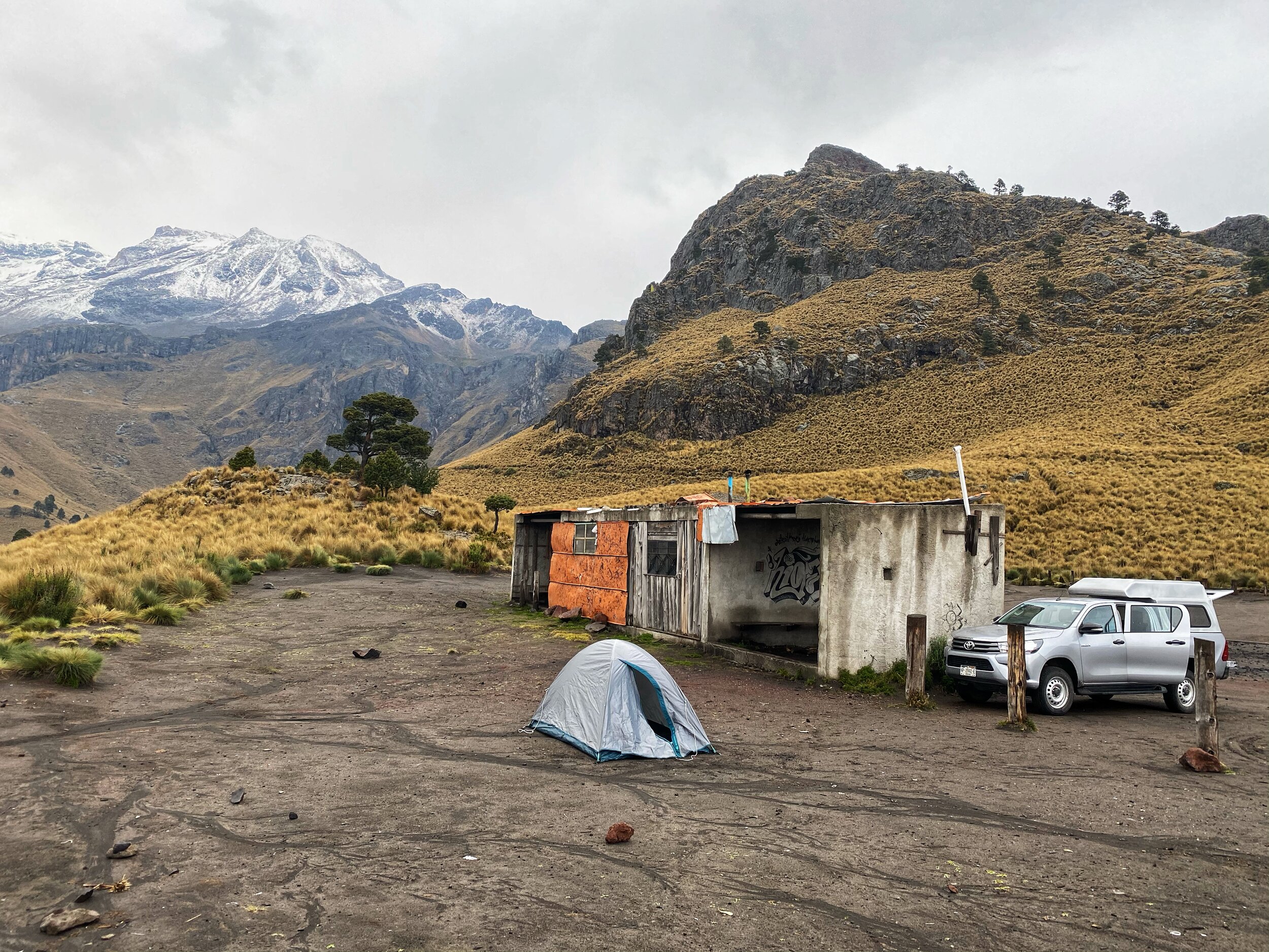
This was our camping site at the foot of Sierra Negra. Nice place for a camp fire.

From our camp site, we could see the south face of Pico de Orizaba. The south face is usually scree and free of snow. Being the beginning of the rainy season though, the snow starts to accumulate. The climbing route up the south face starts from the snow line in the center of the photo. It is shorter than the north side but steeper. It does not involve glacier travel though.

The closeup of the summit and the top part of the Pico de Orizaba’s south face


The sunrise mid way up Sierra Negra. It is a pleasant hike and it is excellent for acclimatization. The views from the summit are definitely worth the effort. The view of the entire south-east aspect of Pico de Orizaba is spectacular.


We are now high above the surrounding valleys.

From the summit of Sierra Negra the 3 volcanoes are visible: on the left is Popocatépetl, in the middle Izta and on the right is Malinche (very close to Puebla City).

The shadow of the mountain is projected onto the surrounding plane.

The summit altitude (add another 90m (my device is faulty :-)). The summit is 4580m or 15,030ft.

There is a massive astronomical observatory on the summit of Sierra Negra. It is run by the Government of Mexico and the University of Maryland in the USA.
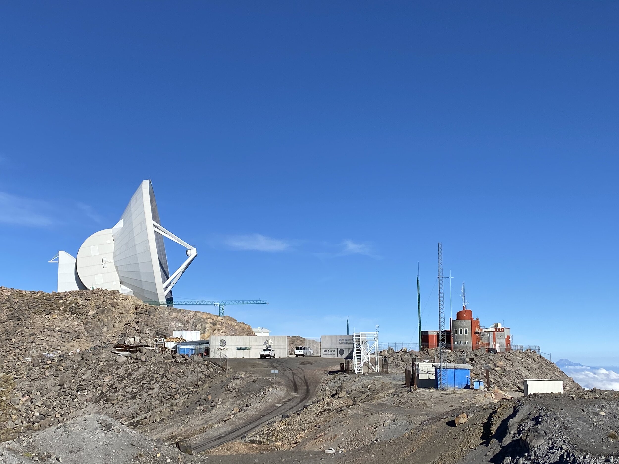
You can get a sense of the size of the antenna vis-à-vis the cars. Although there is a road to the summit to service the observatory, the hiking route comes from the opposite side.

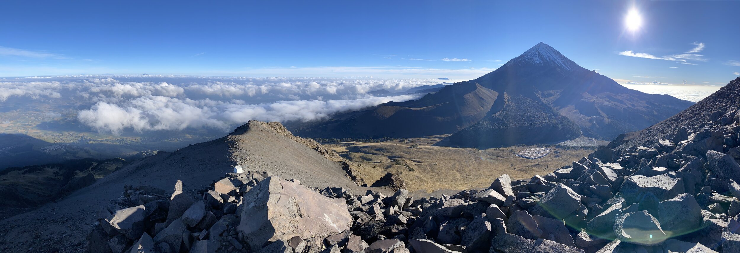
Panoramas from the summit. Pico de Orizaba is 1km higher than Sierra Negra.

An old lava flow on the Pico de Orizaba

A closeup of the hills surrounding Pico de Orizaba


Celebratory beers at 10am.
Our next objective was the volcano Iztaccihuatl. This is the base camp and the trail head called La Joya close to the Paso de Cortes. The route we followed is called La Arista del Sol (The Ridge of the Sun). We had an intense rain in the evening and the weather forecast called for a small window of clear weather in the early morning hours (at sunrise). We started at 1am and climbed all night to end up on the Knee at sunrise. We started out in the drizzle which morphed into blowing snow at 4500m. We took an hour break in the hut at 4800m to warm up although there was not much heat there but at least we were sheltered from the wind. We run into two other guys who decided not to proceed due to the amount snow accumulating on the higher slopes. While climbing in the dark, we were surrounded by intense lightning all around and then below us.

The basecamp

The Volcano of Iztaccihuatl. We traversed all the summits from right to left in order to get to the highest point.
In Aztec mythology, the volcanoes were once humans who were deeply in love. This legend features two star-crossed lovers, the young brave warrior Popocatepetl and the beautiful princess Iztaccihuatl. The father of Iztaccihuatl, a mighty ruler, placed a demanding condition upon Popocatepetl before he could take Iztaccihuatl as his bride. His mandate required that Popocatepetl first engage in battle against the tribe's enemy and return victorious. Variations of the legend include the added stipulation that Popocatepetl needed to return with the vanquished enemy's head as proof of his success.
The story continues with Popocatepetl setting off for battle with Iztaccihuatl waiting for her beloved's return. Treacherously, a rival of Popocatepetl's sends a false message back to the ruler that the warrior has been slain when in fact, Popocatepetl has won the battle and is ready to return to his Iztaccihuatl. However, the princess upon hearing the false news, falls ill and succumbs to her deep sorrow, dying of a broken heart. When Popocatepetl returns triumphant to his people only to encounter his beloved's death, his heartbreak is inconsolable.
He carries Iztaccihuatl's body to the mountains whereupon he has a funeral pyre built for both himself and his princess. Grief-stricken beyond measure, Popocatepetl dies next to his beloved. The Gods, touched by the lover's plight, turn the humans into mountains, so that they may finally be together. They remain so to this day with Popocatepetl residing over his princess Iztaccihuatl, while she lay asleep. On occasion, Popo will spew ash, reminding those watching that he is always in attendance, that he will never leave the side of his beloved Izta.
As we climbed higher, the lights of Mexico City spread below us. We had some heavy clouds and it did not look like we would get much of a view from the summit.

Approaching the knee at dawn. By now the cold of the night pushed the cloud cover down.

We finally reached the “Knee”, the first false summit of Izta, and the Popocatopetl Volcano appeared in all the glory. It is an active volcano and off limits for climbing or hiking.

From the Knee, there are three more false summits to traverse before the true summit is reached. I underestimated the length of the summit ridge. It is all above 5000m and involves down climbing and reclaiming the false summits. The ridge is long and tiring.

A spectacular sunrise from the Knee summit. It makes you forget the tiredness and the lack of O2.

El Popo and el Paso de Cortes at 3400m

The beginning of the long traverse of the ridge to the summit

Views like this make it all worthwhile!


The true summit is not even visible from this point. We have to get behind the highest bulky summit on the left.


The clouds started to part and we could see the crater of the Popocatopetl Volcano.

We have to traverse this basin that contains a glacier under the new snow. Then we have to re-climb the ridge on the horizon and traverse again to the main summit still not visible.


Looking back on the down climb and el Popo in the distance.

We were lucky to see the Popo in action. The volcano is very active and it had a large eruption in 2020.

Pico de Orizaba can be seen on the horizon

Looking back to our route. Our descent route is down from the saddle between the two false summits in the middle of the photo.


Finally we are close to the summit. I dropped my pack for the final stretch.
You can see our trail in the snow.

The false summits are now below us. Nearing the true summit.


Finally the true summit of the mountain! I was happy to be there and we were rewarded with a spectacular view for about 30min. Then the clouds rolled in and obscured the view completely. We descended in a fog. The twin of the main summit can be seen on the left. It has the same elevation.

Our entire route from the summit. The “Knee” is now the lowest pointy rock far below. We traversed the entire ridge and it was long! I guess once you know how long it is you can mentally prepare. No knowing, it seemed as the ridge would never end!

The summit of Izta. We were very lucky with the weather window and the views.
The summit elevation, but add another 180m (my watch is not calibrated). The true summit is at 5,286m or 17,343ft. It took us 8hr to get here (with an 1 hr break at the hut).

The twin summit and another traverse. We were the only two persons on the entire mountain!

The crater of Izta Volcano

The start of our descend into the cloud.
We dropped into the clouds. Mesh, my guide, knows the mountain well and decided to return via a shorter but steeper route.

Looking back at the slope of our descend. The walking was over the field of loose rocks covered in fresh snow and ice. No trail. One had to be careful with each step.

Looking back at the descend slope. There is a glacier up there in the mist.

Our fun descend

This is the entire ridge of Izta from the valley below. You can see how long it is. We started on the left and the summit is on the right.

Popocatopetl towering above the villages and the valley.

Chitwan National Park is the first national park in Nepal. It was established in 1973 and granted the status of a World Heritage Site in 1984. It covers an area of 952.63 km2 (367.81 sq mi) and is located in the subtropical Inner Terai lowlands of south-central Nepal in the districts of Nawalpur, Parsa, Chitwan and Makwanpur. In altitude it ranges from about 100 m (330 ft) in the river valleys to 815 m (2,674 ft) in the Churia Hills.


The Khorsor Elephant Breeding Centre is part of the Chitwan National Park. The government has set up this breeding centre with 20 elephants from India, Thailand and Myanmar in 1985 with the objective of breeding and rearing the elephants needed for patrolling in the forest and for research on conservation.
Since the establishment of the breeding centre, more than 50 elephants have been born and raised here. At present it has nine calves, eight of which are males.
Tourists visiting Sauraha also visit the Khorsor Elephant Breeding Center to watch the elephants and the frolicking cubs and also to feed them with bananas and other fruits they bring with them.


Mount Bourgeau

Mount Bourgeau

Mount Bourgeau

Mount Bourgeau

Mount Bourgeau
On Mt. Weed

Mt. Weed

The Twin summits of Mt. Weed


Deception Pass - view to the Skoki Mountain

Redoubt Mountain

Deception Pass

Mount Richardson and Ptarmigan Peak

Hidden Lake and Ptarmigan Peak

Hidden Lake

Mount Richardson
Mt. Richardson

The ascend ridge on Mt. Richardson

Mt. Richardson summit 3,086m

The view east of Ptarmigan Peak, Hidden Lake from Mt. Richardson


Summit panorama from Mt. Richardson

Mount Hector from Mt. Richardson

Lake Louise, Mt. Lefroy and Mt. Victoria from Mt. Richardson

Merlin Lake from Mt. Richardson


The view to Yoho NP from Mt. Richardson

The Wall of Jericho from Mt. Richardson

Mt. Richardson

Descending from Mt. Richardson with Lake Louise on the horizon (left)

Mt. Richardson and the Hidden Lake

Hidden Lake

Hidden Lake area

The trail between Lake Louise ski area and Skoki


Healy Pass

Egypt Lake

Egypt Lake

Egypt Lake


The view from the Sphinx

Egypt Lake and The Pharaoh Peak from the Sphinx

The Pharaoh Peak and Egypt Lake


The View from the Pharaoh Peak. The smoky haze is from the terrible 2020 forrest fires in the USA.


The profile view of the steep Pharaoh Peak

The Pharaoh Peak

Haiduk Lake and Mt. Ball from The Lesser Pharaoh Peak

The Panorama from the Lesser Pharaoh Peak


The Pharaoh Peak from my tent

Healy Pass


The start of the steep climb up Cory Mountain near Banff townsite

Cory Mountain

Cory Mountain with Mt. Assinibone on the horizon

The summit ridge of Cory

The view from Cory

The view from Cory

Mt. Cory

Mt. Cory

Mt. Cory


Mt. Cory

An abandoned mining cabin on the way to Protection Mountain

An abandoned mine on Protection Mountain

The view towards Mount Temple from the slopes of Protection Mountain

The 5 km long ridge of Protection Mountain

Protection Mountain, you can see Mt. Assiniboine far in the distance.

Protection Mountain

Armor Peak in the distance

Protection Mountain


Mount Edith


Mount Edith

Mount Edith

Mount Cory from Mt. Edith


Cory Pass
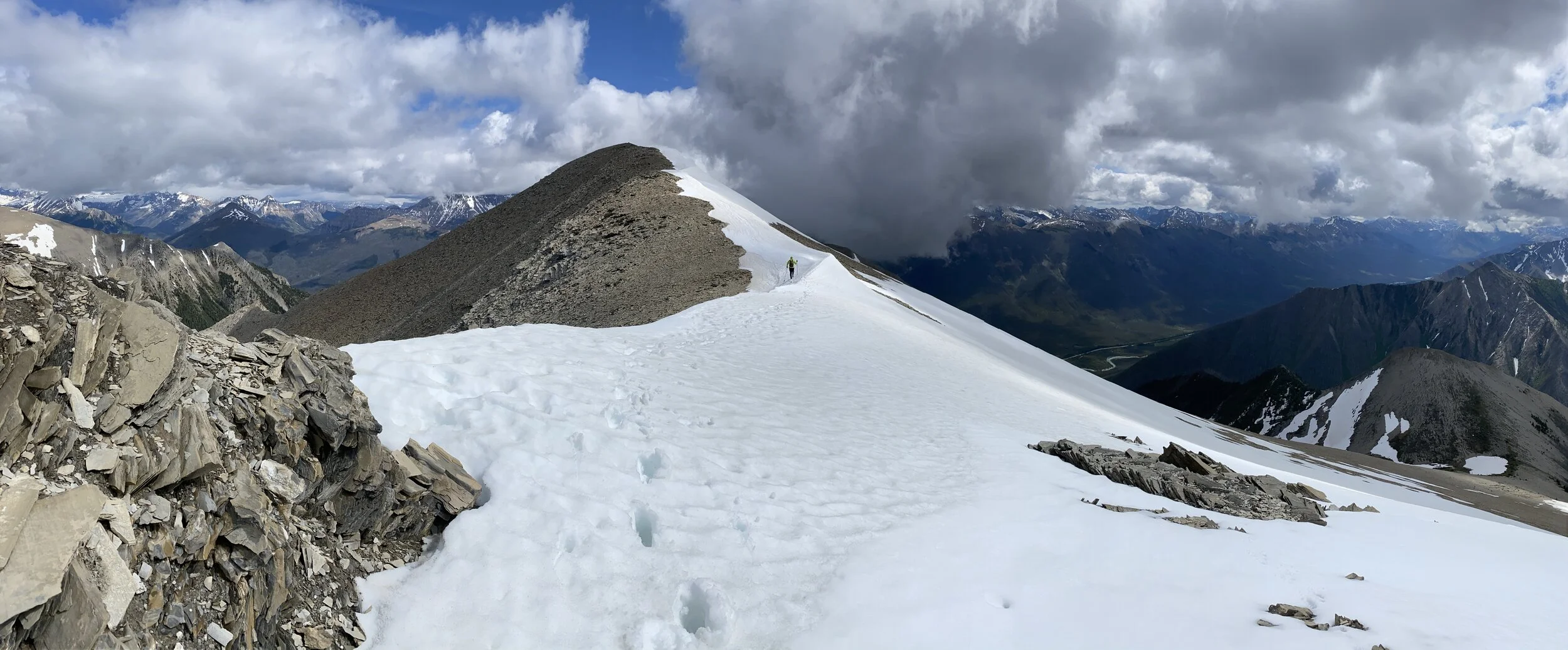
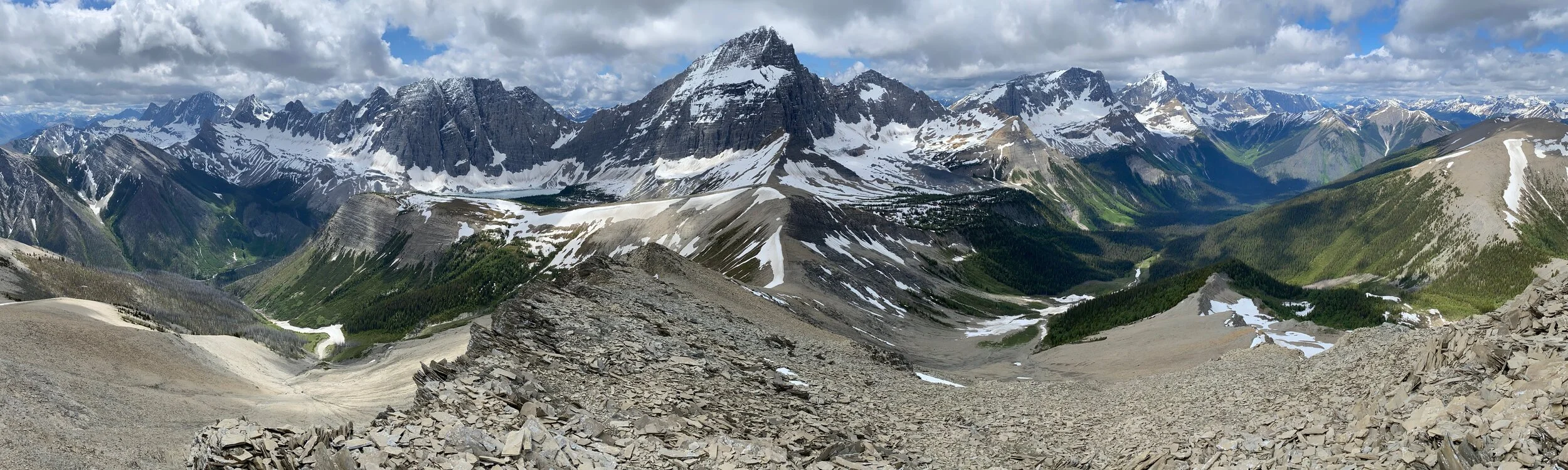
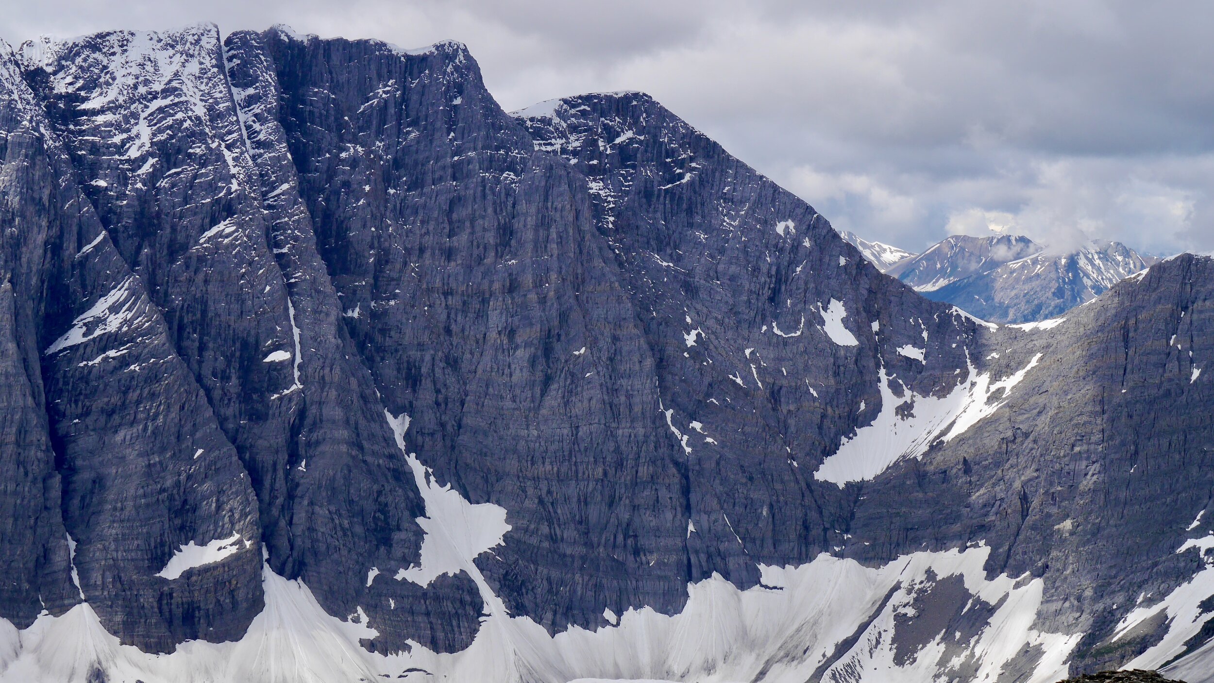
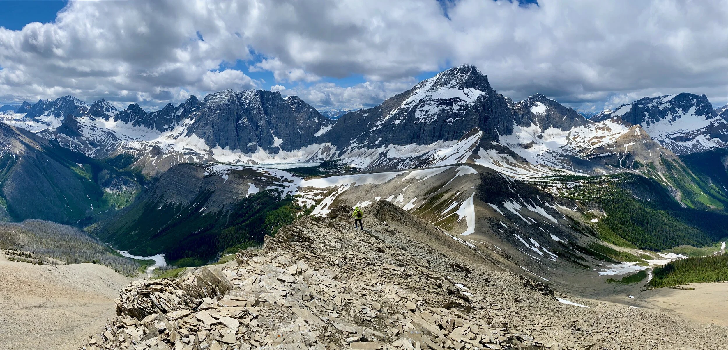
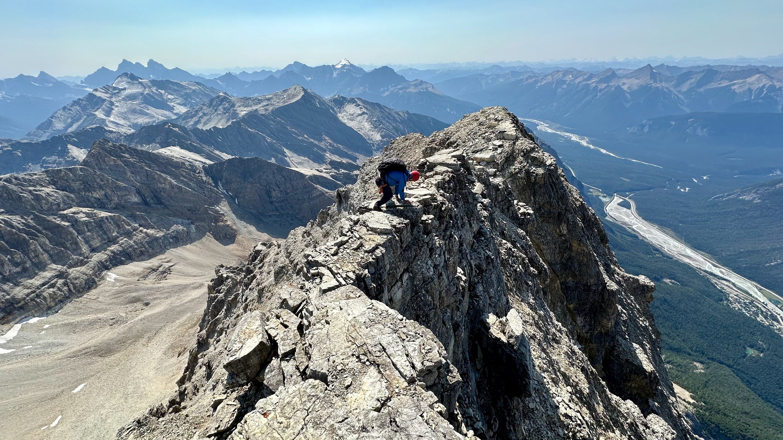
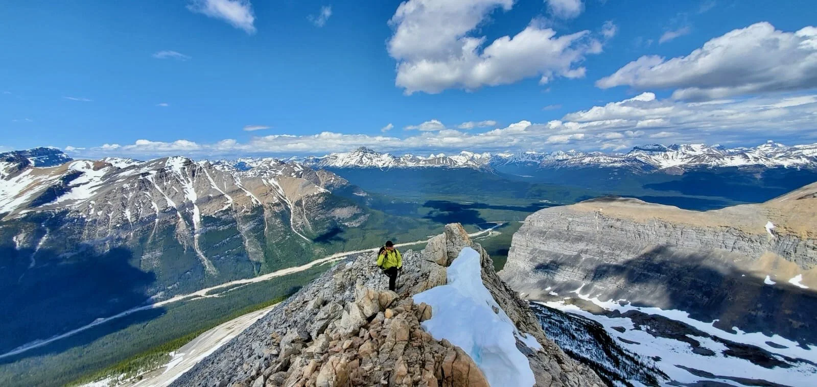
Siffleur Wilderness area has been on my radar for a long time. Finally, during the 2020 summer I managed to get int here to do some hiking and exploring. It is definitely a seldom visited part of the Rockies despite good trail access and short distance. It is a spectacular area reminding me of the Lake O’Hara a little. We decided to go up the Maramota Peak as it would take us all across the Siffleur Plateau. The views are amazing all the way and the hiking is challenging enough to keep things interesting. The view from Maramota Peak is also amazing as it is a mountain with the elevation of over 3,100m.


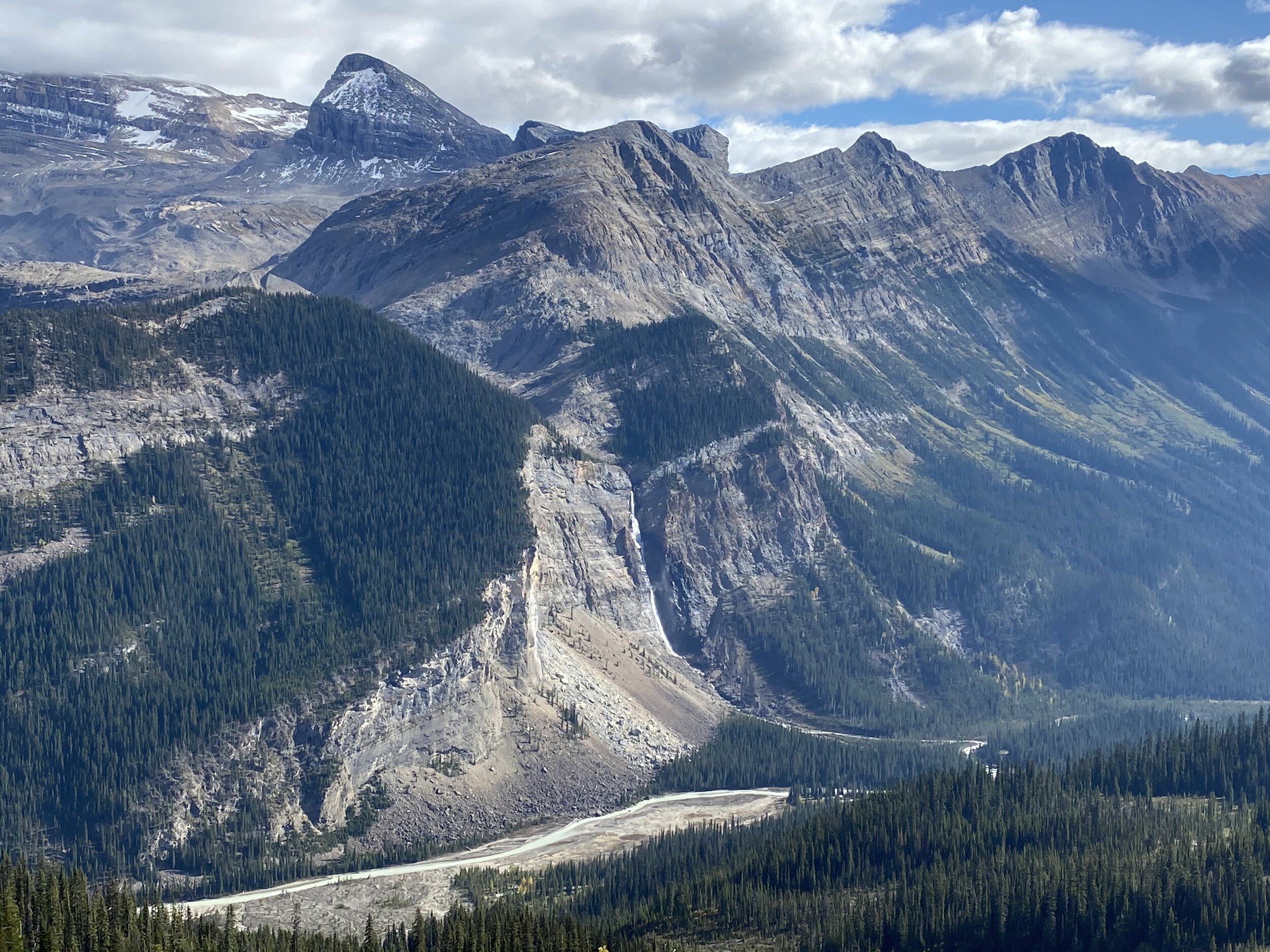
Looking back to Mount Chephren and Howse Peak from the Totem Creek Valley

Part of the Lower Totem Lake

Lower Totem Lake and Mount Chephren

South Totem Peak 3,050m, an easy scramble with a spectacular view

Totem Creek Valley


Lower Totem Lake

Our bivi at the Upper Totem Lake under the Totem Tower

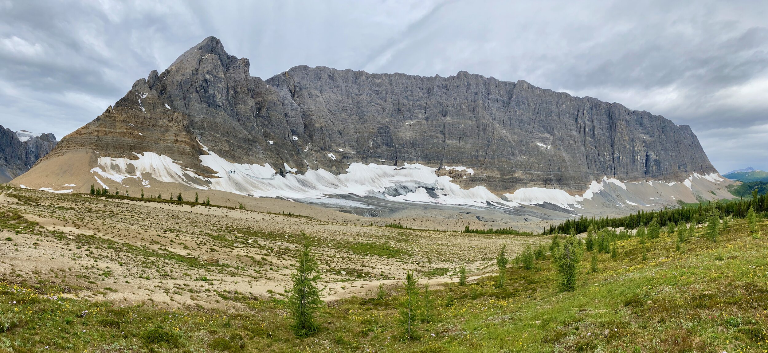
Mount Murchison towers above the Upper Totem Lake

Totem Tower en route to the Maramota Peak

Looking back at the Totem Tower and Murchison
The towers of Mt. Murchison

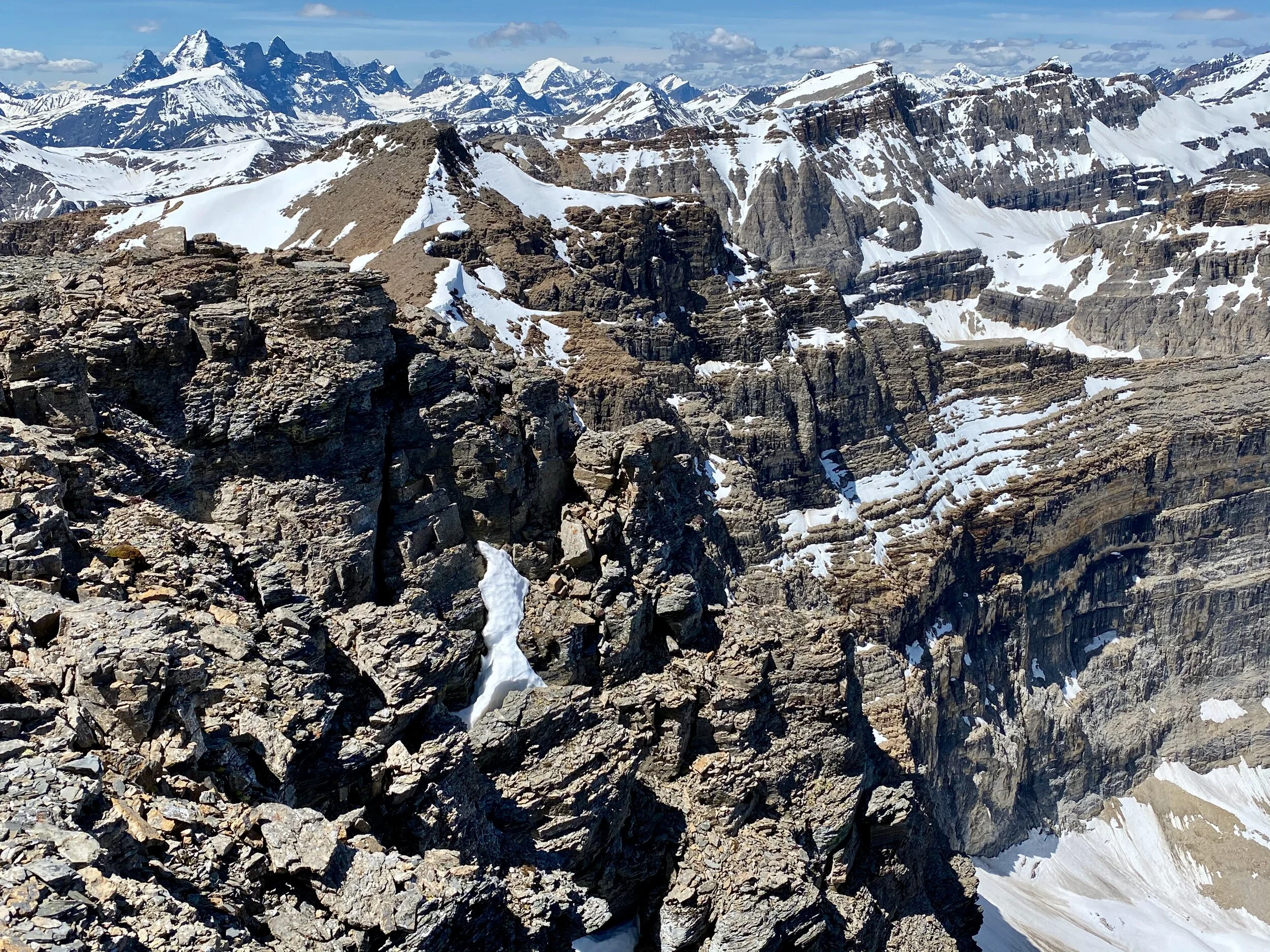
The upper slopes of Maramota Peak

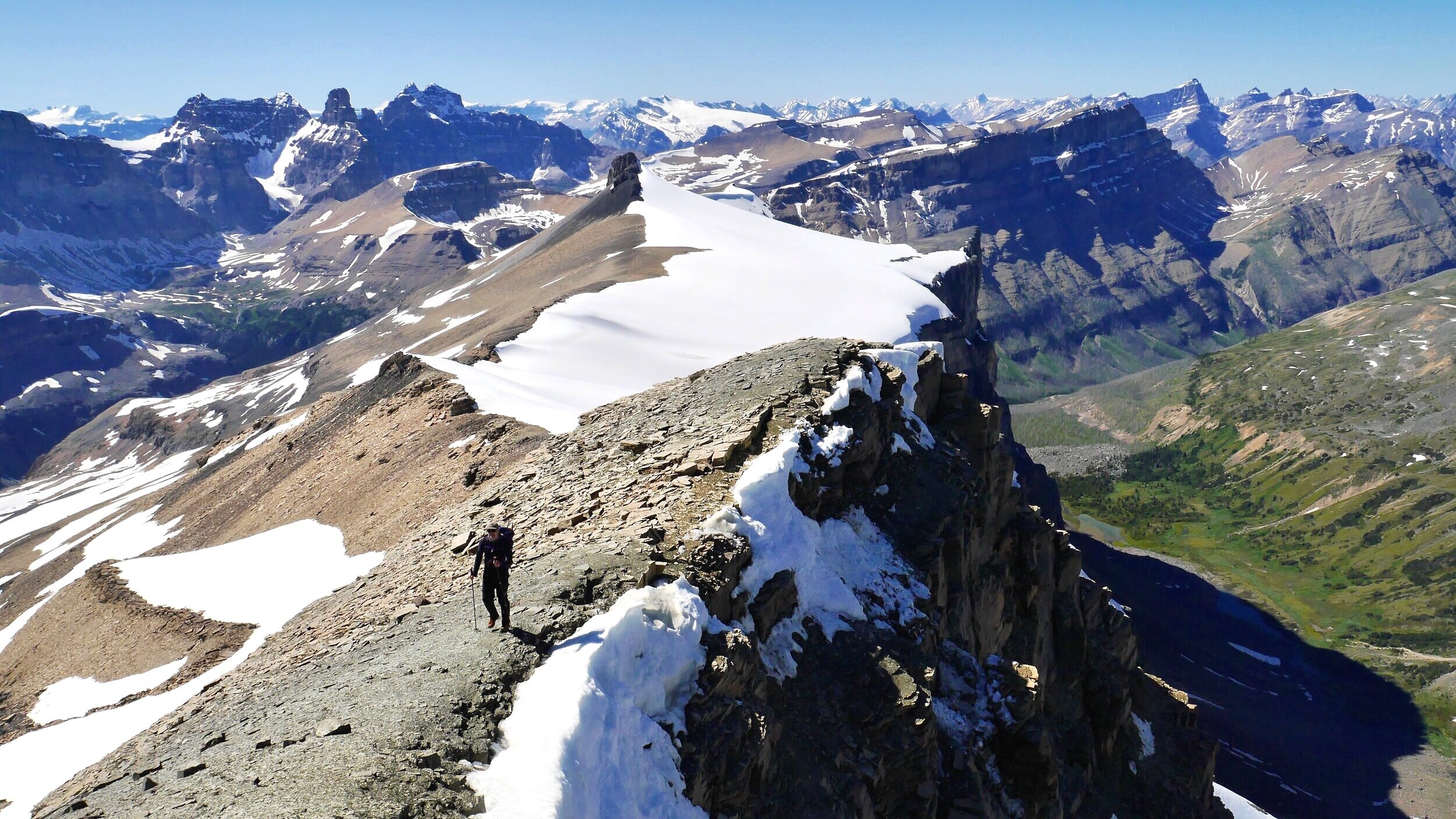
On the summit of Maramota Peak 3,150m. It was a 11km trek from our bivi site and a 21 km trek from the car.

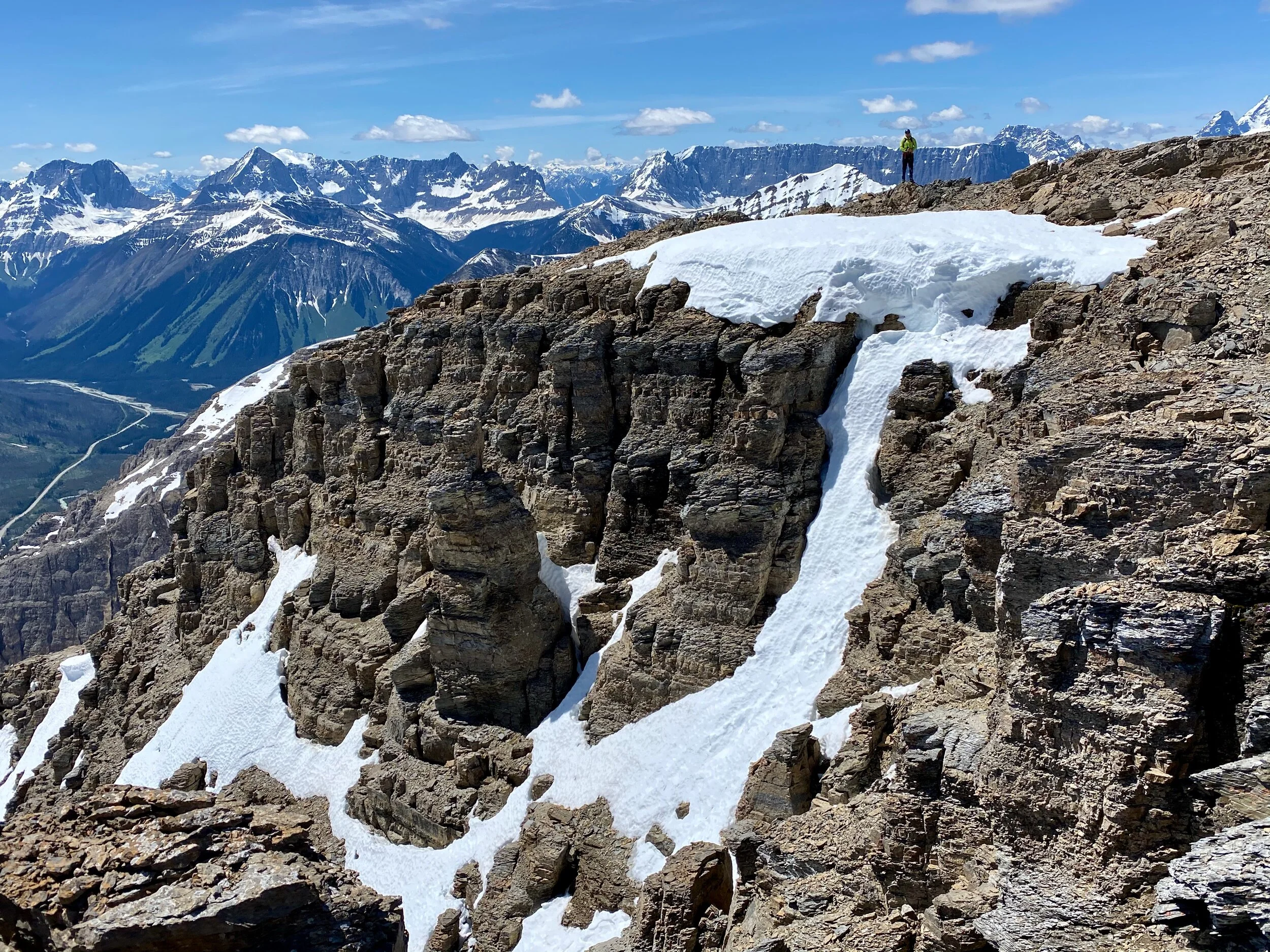
Looking south from the Maramota Peak


Totem Tower and Mount Murchson from Maramota Peak


Upper slopes of the Maramota Peak

Upper Totem Lake at sunset

En route to the South Totem Peak

The view of Mt. Chephren and beyond from the Maramota Peak

The Murchison Towers and the Totem Tower from the Maramota Peak


Spalding Peak from the South Totem Peak

Looking east from Totem Peak - the ridge of Maramota is on the left


Bison Peak from the South Totem Peak

Upper Totem Lake where we camped en route to Maramota Peak

Abraham Lake

Abraham Lake

Siffleur Wilderness

Siffleur Wilderness


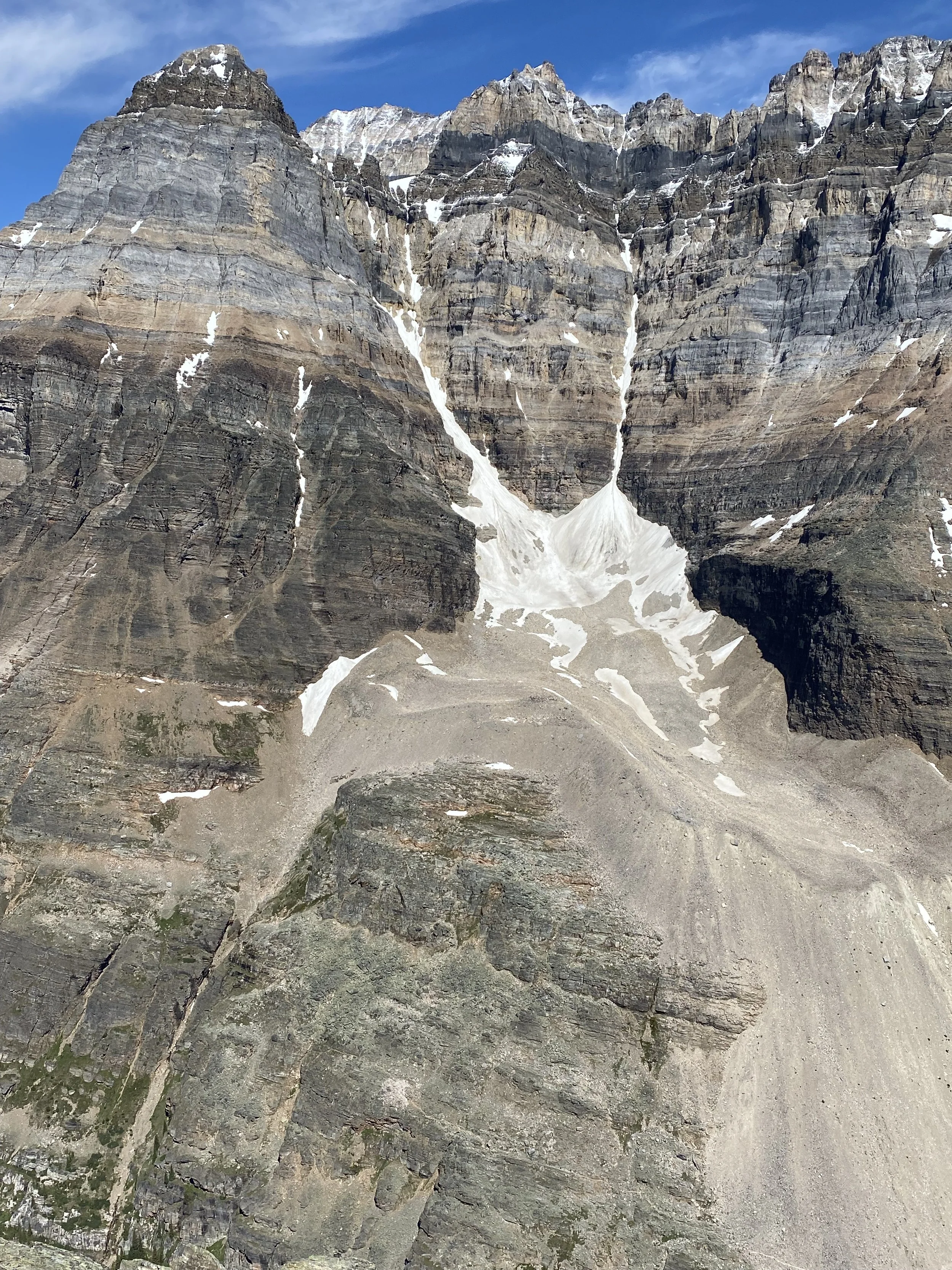
Kootney Valley and the Rockwall in the distance

The trail to Numa Pass

Floe Lake


Above Numa Pass on the way to Numa Mountain. Floe Lake is in the distance.

On Numa Mountain

The view North from Numa Mountain summit
The Panorama of the Rockwall Trail from the summit of Numa Mountain

The view to Numa Creek and Tumbling Pass from Numa Mountain

Foster Peak

The view south from Numa Mountain

Mt. Whymper from Numa Mountain

The view East towards Banff NP and Ball Pass

Tumbling Peak and Tumbling Pass from Numa Mountain

The peaks in the Lake Louise area from Numa Mountain

Mount Temple, Mout Fay and Quadra from Numa Mountain

Mount Temple from Numa Mountain

The view of Numa Mountain (left) and Numa Pass from Tumbling Peak. The pointy Mountain is Foster Peak.


The Wolverine Pass and Tumbling Creek campsite from Tumbling Peak

The Rockwall from the Tumbling Peak

Tumbling Mountain


Tumbling Mountain and the icefall


Tumbilng Mountain from the Wolverine Pass

Tumbling Mountain and icefall

Wolverine Pass


Wolverine Pass

The Rockwall

The Rockwall

The Rockwall

Helmet Falls

Helmet Falls

Goodsirs Pass

Goodsirs Pass

The Goodsirs Towers


Sharp Peak

The Goodsirs Towers


Looking back at the Rockwall Trail from the Goodsirs Pass

Closeup of the Rockwall Trail

Mount Oke in the Lake O’Hara area


Helmet Falls in the distance with the Helmet Mountain looming above from the Helmet Creek Trail

Mount Vermilion from the Helmet Falls trail near Paint Pots

Paint Pots and the Rockwall far in the distance

Mount Vermilion and the Marble Canyon

The View from the summit of Mt. Vermilion

Mt. Whymper and the Marble Canyon below from Mt. Vermilion

Mt. Ball and Hafner Creek trail from Mt. Vermilion

Paint Pots and the Helmet Creek trail

The summit ridge of Mt. Vermilion

Ochre Spring Peak - actually it is a 1400m ascent!

Storm Mountain and Mt. Stanley from Mt. Vermilion


Mt. Stanley from Mt. Whymper

Mt. Vermilion from Mt. Whymper

Mt. Whymper summit looking east

Mt. Whymper summit - looking north-west towards the Goodsirs

Storm Mountain, Mt. Ball and Stanley from Mt. Whymper


The Rockwall peeking from above the ridge. The Goodsir Towers are on the right.


Sharp Mountain and the Goodsir Towers

Numa Mountain

Mt. Ball


Boom Mountain

Storm Mountain

Kootenay River Valley and Highway 93

The view towards Lake Louise mountains from the Ochre Spring Peak


Descending Ochre Spring Peak with Mt. Vermilion in front. Highway 93 winds below

The view of Mt. Storm (left) and Stanley (the highest peak in the centre) from Ochre Spring Peak


Windy on top of Ochre Spring Peak 2,849m - October 2, 2021. The Rockwall is on the horizon.

The Rockwall is on the horizon - from the Ochre Peak


Boom Lake

Boom Lake

Boom Mountain and Boom Lake

On Boom Lake
The approach trail to Boom Mountain involves serious bushwhacking.

Mt. Whymper from the slopes of Boom.


Boom Mt Panorama


Mt. Whymper from Boom Mt.

Boom Lake from Boom Mountain summit

Storm Mountain from Boom Mountain summit

Storm Mountain from Upper Twin Lake

Boom Mountain and Mt. Whymper

Boom Mountain and Boom Lake Valley

Lower Twin Lake and Mt. Storm

Storm Mt. in June

Arnica Lake and Mt. Storm outlier

Arnica Lake in June
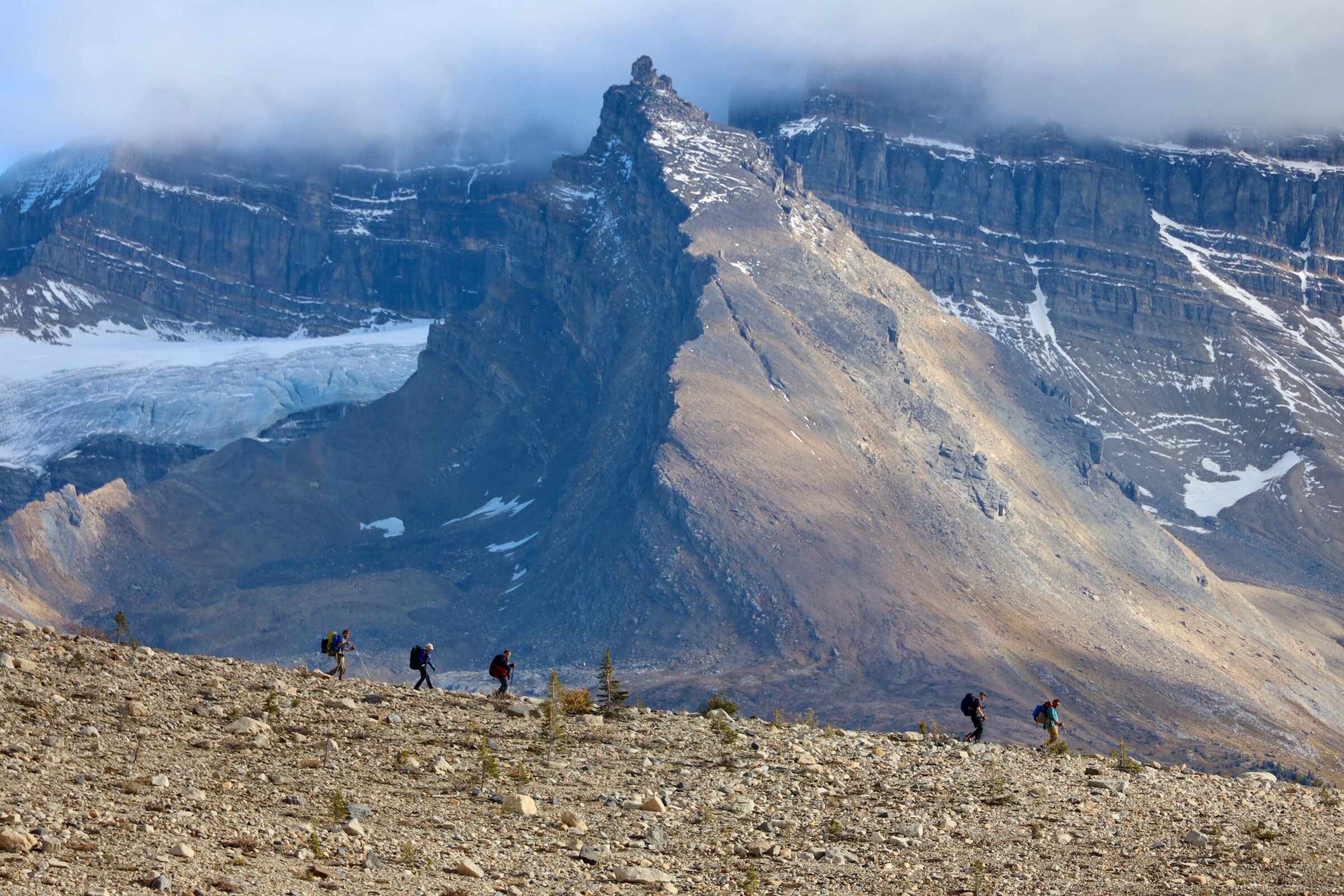
2020 is a CRAZY year. All my travel plans have been cancelled due to the pandemic. This gave me the opportunity to spend quality time in my own back yard and explore the places that were on my to-do list for a long time. In the prior years, the campsites booked early and were always full. This year, due to the travel restrictions, booking campsites was easy.
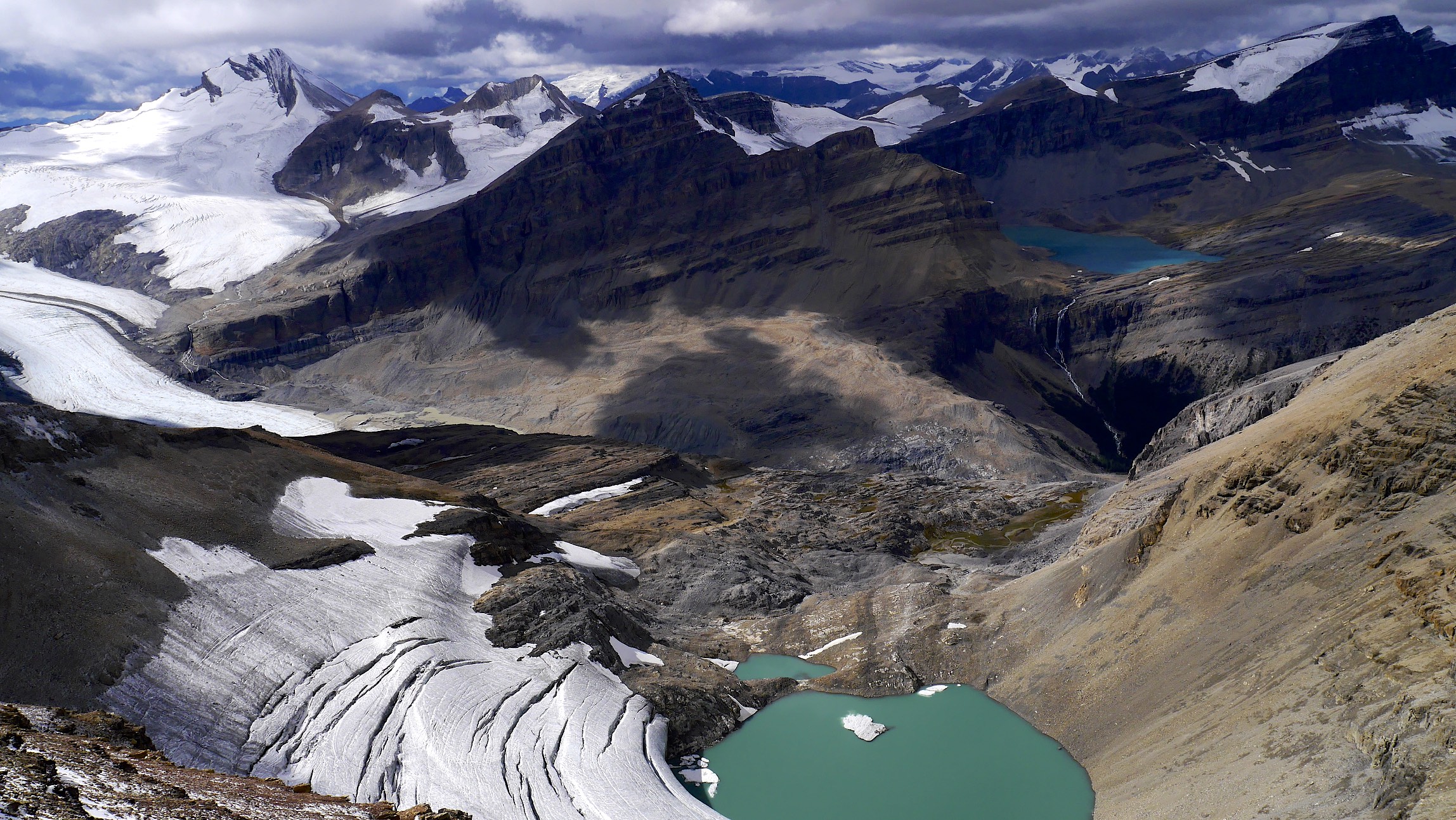
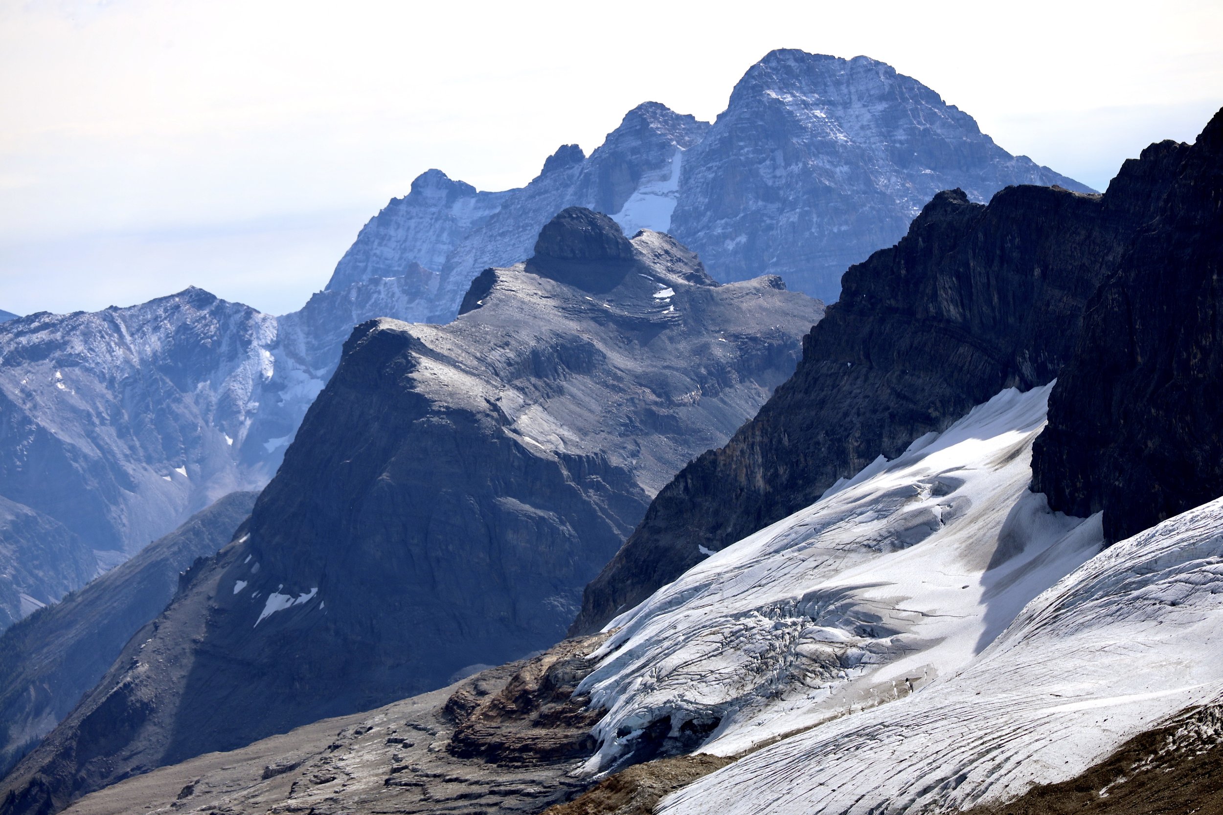
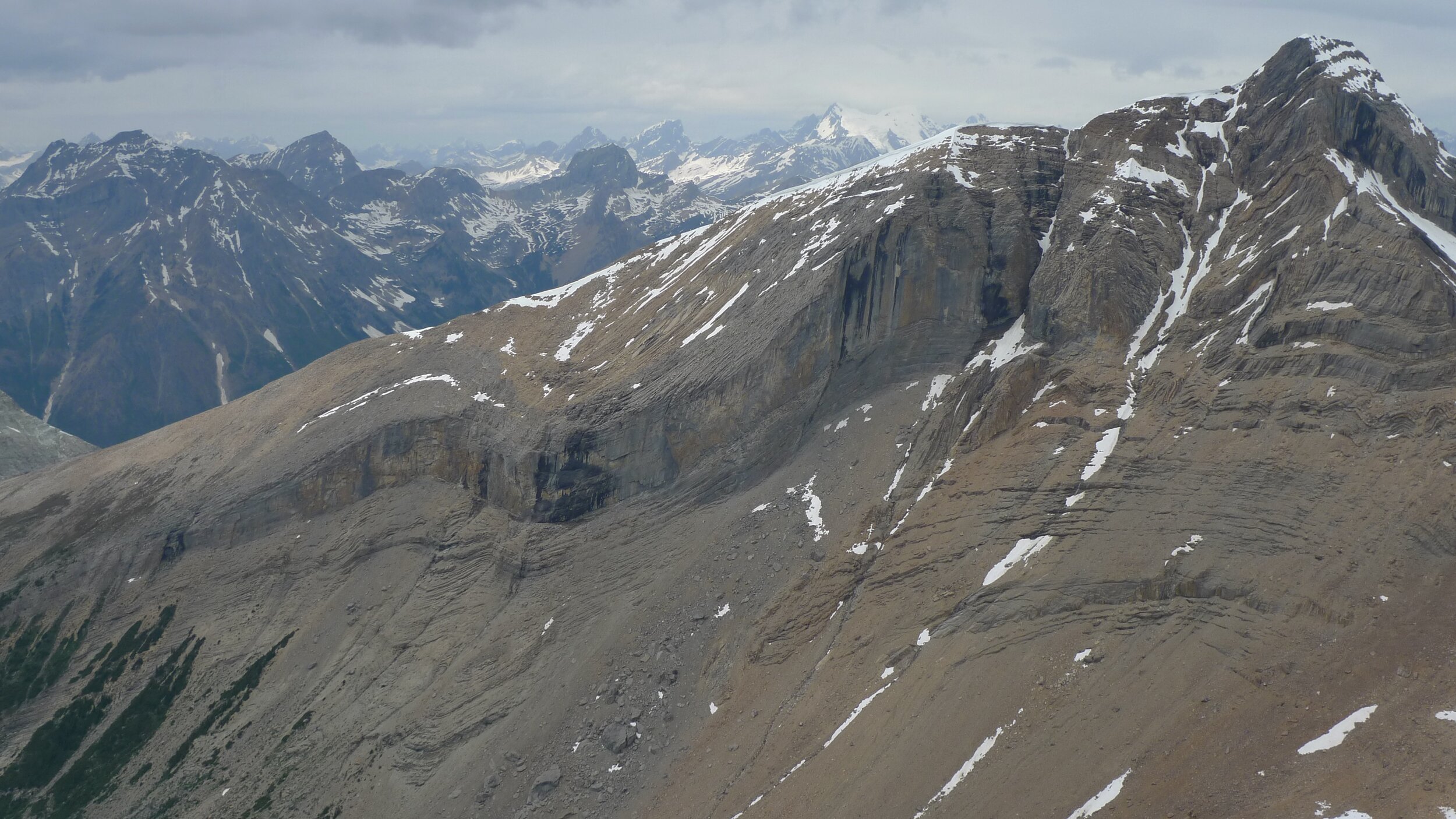
I visited Yoho valley many times before. However, I decided to explore some more remote corners (Watervalley) and scramble a few peaks. This is one of the most spectacular areas of the Canadian Rockies. What makes the Iceline Trail so special is its high location. The trail follows a line of glaciers descending from Mt. President. The trail is high above the Yoho Valley and provides spectacular views all around. It can be easily done as a day trip. To spend some quality time in the backcountry though, it is advisable to camp further up the Yoho Valley.
Yoho NP has 3 very distinct areas: the Yoho Valley (where the Iceline trail is located), Lake O’Hara area and Emerald Lake. There are some more remote parts that are seldom visited as access is difficult. Some of the most spectacular peaks of the Rockies are located here (for example the Goodsirs).

Source: Gov of Canada
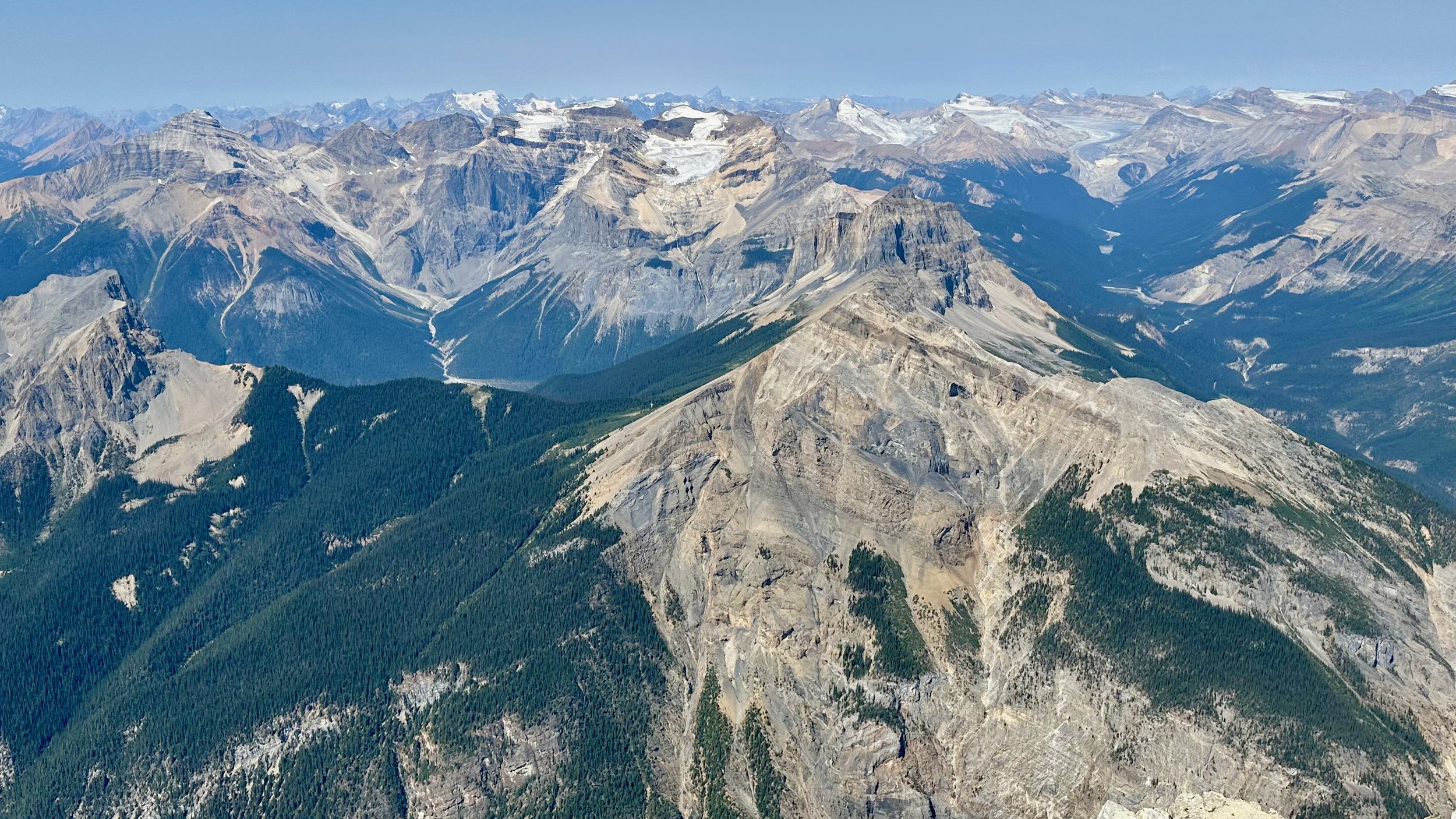
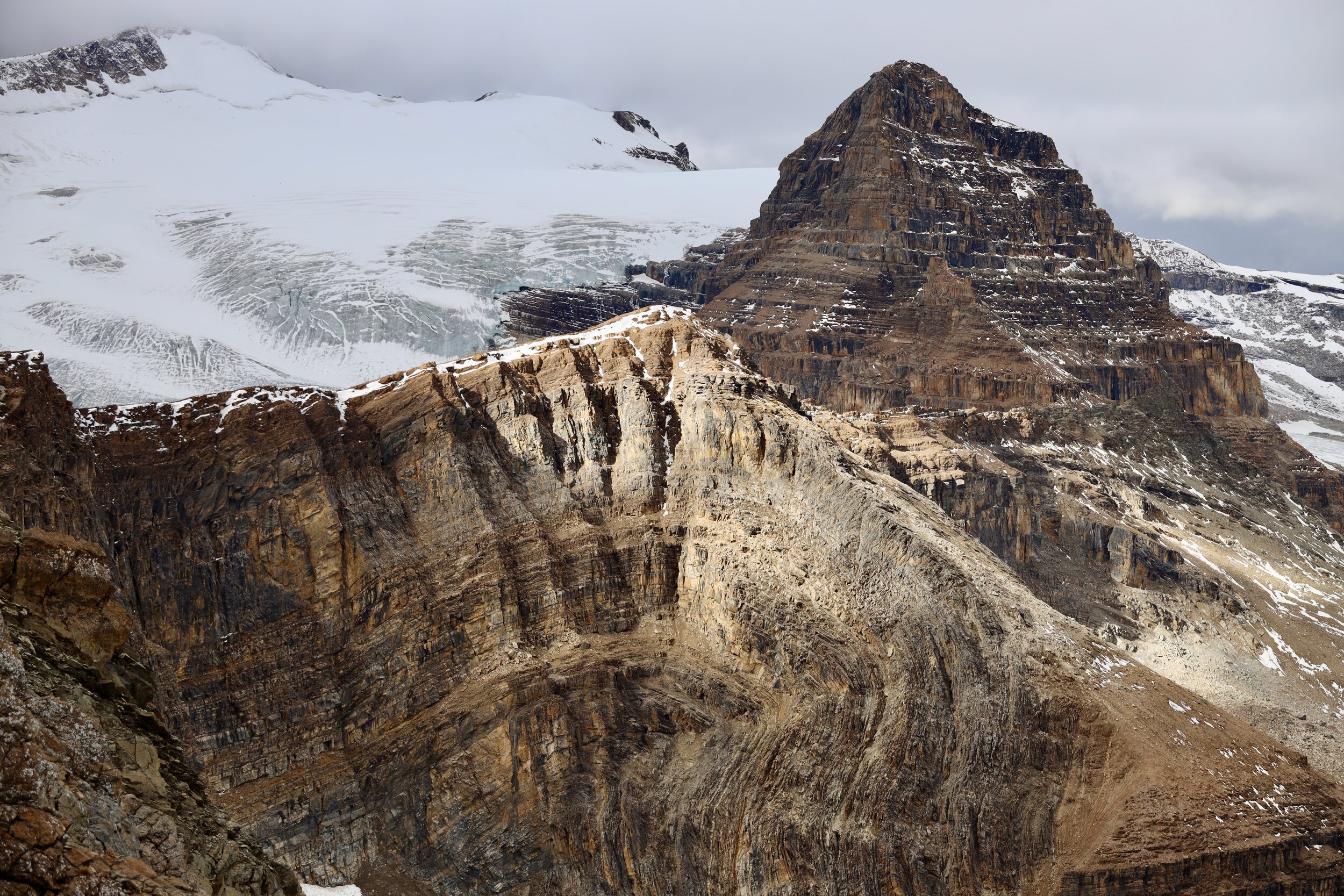
Mount Stephen. With close to 2000m elevation gain it is a BIG mountain.

The difficult part of ascending Mt. Stephen is in the last 250 m. The prominent peaks on the horizon are the Goodsirs.

The exposed summit ridge of Mt. Stephen.

Looking towards Mt. Victoria (left), Huber, and the peaks of the Lake O’Hara.
Looking towards the Rockwall and the Goodsirs.
Looking towards Wapta Icefield. The Presidents are in the centre. On the right is the road to Takawa Falls.

Looking towards Wapta Icefield from the summit of Mt. Stephen.

Trans Canada Highway from Mount Stephen.

The town of Field and the Trans Canada Highway from the summit of Mt. Stephen
The narrow and exposed summit ridge of Mt. Stephen. The town of Field can be seen on the right 2 km below.

Mount Stephen

Yoho Valley

The overview of the entire Iceline Trail from the Whaleback Mountain. The trail follows the glaciers descending from Mt. President.

Mount Trolltinder as seen from the Iceline Trail. Mount Balfour towers over it and makes it look smaller and less impressive.
Trolltinder Mountain

Trolltinder Mountain 2917m

Along the Iceline Trail


Looking towards Mount Victoria in Lake Louise


The trail runs above the main Yoho Valley

Yoho Mountain


The closeup of Mount Victoria north peak

Mount Rhonda on the Wapta Icefiled and the Yoho Glacier


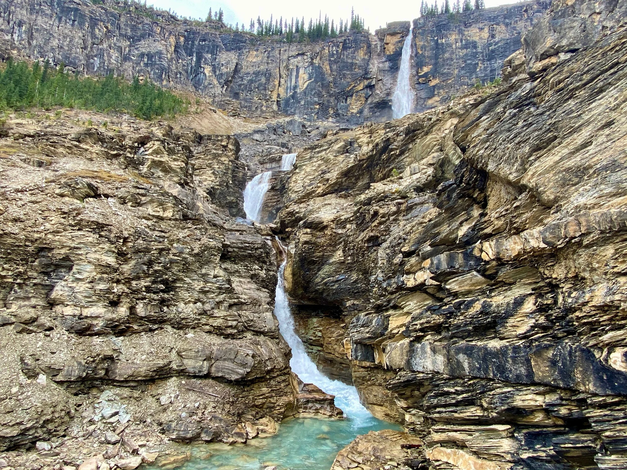
Mount Daly and Takakkaw Falls

Laughing Falls
Isolated Peak from The Whaleback
The view from Isolated Peak

The Whaleback from Isolated Peak

Watervalley from the Whaleback

Mount President and Vice-President from the Whaleback


Whaleback Mt

Isolated Pk from Whaleback

Whaleback Panorama

The Presidents from the trail to Isolated Peak

Isolated Peak

McArthur Glacier near Isolated Peak

McArthur Glacier
The view from the slopes of Isolated Peak

The Presidents from the trail to Kiwetinok Pass

The view of the Presidents from the Pass
Looking down the Little Yoho Valley from the Pass

Kiwetinok Pass

Kiwetinok Pass

Kiwetinok Pass

Mount Kerr

Mt. Kerr
Mt. President from Mt. Kerr

Twin Falls


Water Valley
Yoho Peak on the left and Water Valley

Mont Des Poilus and Des Poilus Glacier

Mont Des Poilus and Des Poilus Glacier from the slopes of Yoho Peak
Mount Temple from Yoho Peak
Mount Victoria from Yoho Peak
The summit of Whaleback and The Presidents from Yoho Peak
Isolated Peak from Yoho Pk

Isolated Peak from Yoho Pk

Water Valley from Yoho Peak

Mt. Des Poilus from Yoho Pk

Mt. Des Poilus 3161m
Mt. Collie 3116m
Wapta Icefield
Yoho Glacier and Wapta Icefield from Yoho Mt

The view from Yoho Peak

Yoho Pk

Mt Balfour from Yoho Pk

Guy Hut from Yoho Pk

The Guy ACC Hut

Natural Bridge - a rock formation that forms a natural bridge over the Kicking Horse River River

The Kicking Horse River

On the Narao Mountain

On the Narao Mountain

Sherbrook Lake and the Yoho from the Narao Peak

Cathedral Mountain from the Narao Peak

The ridge of the Narao Mountain with the Trans-Canada Highway below

Paget Peak

Paget Peak, Narao Peak and Victoria North

Narao Peak and Mt. Victoria Noth

Mt. Daly

Sherbrook Lake

Sherbrook Lake


Lake Oesa and Mt. Lefroy from Yukness

Lake O’Hara

The view from Yukness to Glacier Peak

Ringrose Peak and Mt. Hungabee

Mt. Victoria from Yukness
Mt. Huber and Mt. Victoria

Mt. Biddle

Mt. Victoria and Lefroy from Yukness

Mt. Schaffer from Yukness

Mt. Huber (right)


Mt. Yukness 2847

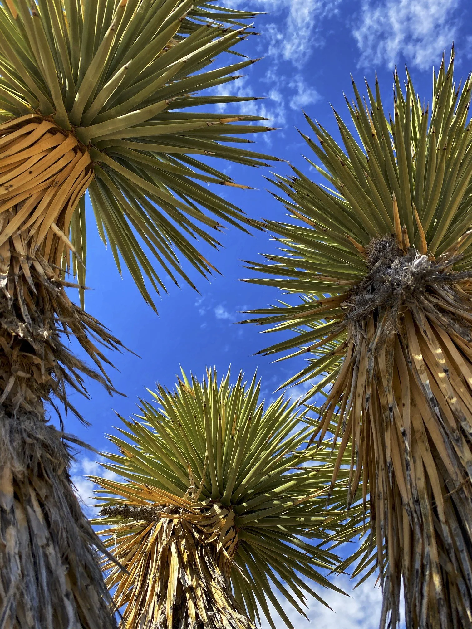
Joshua Tree National Park is a vast protected area in southern California. It's characterized by rugged rock formations and stark desert landscapes. Named for the region’s twisted, bristled Joshua trees, the park straddles the cactus-dotted Colorado Desert and the Mojave Desert, which is higher and cooler.