Rolwaling Valley and Teshi Labtsa photos

Thanks to Rajendra and Kumar from www.mountainsunvalley.com for organizing and running this trip. We were all very happy with the outcome!

Rowaling Valley from the air. From Left to Right: Gaurisankar, Menlungtse, Kang Nachugo, the peaks of Rowaling. Our route followed this range from left to right.

Rowaling Valley from the air. From Left to Right: Gaurisankar, Menlungtse, Kang Nachugo, the peaks of Rowaling. Our route followed this range from left to right.

Beautiful Gauri Sankar

Menlungtse in Tibet with Cho Oyu Behind

Menlungtse

Menlungtse and Rowaling Valley

Rowaling, Teshi Labtsa and Panchermo

Rowaling

Rowaling with the Cho Oyu massif behind

Rowaling trekking map

Rowaling trekking map

head smashed in jb 1099.jpg
head smashed in jb 1124.jpg
head smashed in jb 1193.jpg
head smashed in jb 1203.jpg
head smashed in jb 1204.jpg
head smashed in jb 1249.jpg
head smashed in jb 1258.jpg
head smashed in jb 1275.jpg
head smashed in jb 1276.jpg
head smashed in jb 1297.jpg
head smashed in jb 1301.jpg
head smashed in jb 1306.jpg
head smashed in jb 1311.jpg
head smashed in jb 1312.jpg
head smashed in jb 1315.jpg
head smashed in jb 1324.jpg
head smashed in jb 1326.jpg
head smashed in jb 1331.jpg
head smashed in jb 1334.jpg
head smashed in jb 1337.jpg
head smashed in jb 1339.jpg
head smashed in jb 1342.jpg
head smashed in jb 1344.jpg
Gauri Sankar

Gauri Sankar

head smashed in jb 1354.jpg
Menlungtse in Tibet

Menlungtse in Tibet

head smashed in jb 1360.jpg
head smashed in jb 1372.jpg
GauriSankar

GauriSankar

head smashed in jb 1387.jpg
Beding

Beding

The man who lost all of his fingers on Manaslu

The man who lost all of his fingers on Manaslu

Beding

Beding

head smashed in jb 1399.jpg
head smashed in jb 1409.jpg
head smashed in jb 3.jpg
head smashed in jb 10.jpg
IMG_0045.jpeg
Drainage Ri

Drainage Ri

head smashed in jb 65.jpg
head smashed in jb 67.jpg
head smashed in jb 73.jpg
Gauri Sankar north face

Gauri Sankar north face

head smashed in jb 101.jpg
head smashed in jb 22.jpg
IMG_0238.jpeg
head smashed in jb 30.jpg
The Rowaling Valley and Jugal Himal on the horizon. The Jugal Himal separates Rowaling from the Langtang region and it is located in China. It is not possible to cross from Rowaling to Langtang via Jugal and the GHT requires a long detour south and …

The Rowaling Valley and Jugal Himal on the horizon. The Jugal Himal separates Rowaling from the Langtang region and it is located in China. It is not possible to cross from Rowaling to Langtang via Jugal and the GHT requires a long detour south and then back north to the Langtang.

Jugal Himal between Rowaling and Langtang regions. The mountains on the horizon are located in Tibet, China.

Jugal Himal between Rowaling and Langtang regions. The mountains on the horizon are located in Tibet, China.

head smashed in jb 111.jpg
Tsoboye and Tso Rolpa Lake

Tsoboye and Tso Rolpa Lake

head smashed in jb 131.jpg
The head of the Rowaling Glacier

The head of the Rowaling Glacier

Kang Nachugo and Tso Rolpa Lake

Kang Nachugo and Tso Rolpa Lake

head smashed in jb 144.jpg
head smashed in jb 146.jpg
head smashed in jb 150.jpg
head smashed in jb 155.jpg
head smashed in jb 158.jpg
head smashed in jb 164.jpg
head smashed in jb 166.jpg
head smashed in jb 175.jpg
head smashed in jb 176.jpg
head smashed in jb 181.jpg
IMG_0440.jpeg
IMG_0453.jpeg
head smashed in jb 184.jpg
head smashed in jb 197.jpg
head smashed in jb 201.jpg
head smashed in jb 204.jpg
IMG_0535.jpeg
head smashed in jb 215.jpg
head smashed in jb 225.jpg
head smashed in jb 229.jpg
head smashed in jb 244.jpg
head smashed in jb 250.jpg
head smashed in jb 253.jpg
head smashed in jb 256.jpg
head smashed in jb 261.jpg
head smashed in jb 262.jpg
head smashed in jb 263.jpg
head smashed in jb 267.jpg
head smashed in jb 269.jpg
IMG_0666.jpeg
head smashed in jb 273.jpg
head smashed in jb 275.jpg
head smashed in jb 278.jpg
head smashed in jb 290.jpg
head smashed in jb 291.jpg
head smashed in jb 293.jpg
head smashed in jb 295.jpg
head smashed in jb 296.jpg
head smashed in jb 299.jpg
IMG_0731.jpeg
head smashed in jb 303.jpg
head smashed in jb 309.jpg
head smashed in jb 313.jpg
head smashed in jb 316.jpg
head smashed in jb 319.jpg
head smashed in jb 321.jpg
head smashed in jb 325.jpg
IMG_0766.jpeg
IMG_0767.jpeg
head smashed in jb 328.jpg
head smashed in jb 331.jpg
head smashed in jb 336.jpg
head smashed in jb 345.jpg
head smashed in jb 346.jpg
head smashed in jb 350.jpg

A view of the valley from Sunder Peak 5368m

head smashed in jb 355.jpg
head smashed in jb 360.jpg
IMG_0828.jpeg
IMG_0831.jpeg
IMG_0842.jpeg
head smashed in jb 378.jpg
head smashed in jb 389.jpg
head smashed in jb 391.jpg

Rolwaling Valley and Teshi Labtsa Trip Summary


rolwaling-trekking-map.jpg
Gokyo-Valley-Trek.jpg
head smashed in jb 1075.jpg


October 21, 2010 Kathmandu - Dolakha 1,000m

David, Tony and I left for Dolakha, the starting point of the trek the day after arriving in Kathmandu in a small bus that Rajendra rented for all of us.  We had a lot of gear and a large crew:  Kumar the guide, porters, cooks and us.  We knew Kumar from our 2009 Langtang trek.  He is a great guide with a good sense of humour and perpetual smile on his face.  We also had the same two porters (among others) from our 2009 trip:  Kamsing and Suri.  The drive was 7 hours long broken by a lunch stop in a spot that we knew from eben earlier visit back in 1996.  The town where we stopped for lunch was very busy and noisy.  The market and the streets were lined up with vendors selling Chinese goods.  We had lunch at a very dirty restaurant serving local food.   I did not want to risk getting sick at the beginning of the trip so I decided to pass on lunch.  After lunch, during the drive, one of the young porters puked his guts out on a particularly twisty part of the road.  The puke landed right in front of me and stank up the entire bus. 

We arrived in Dolaka and set up our tent on the edge of town by the busy road.  The tent bacame an instant focal point for the local kids that were attracted to the white guys like bees to honey.   It was October 21, my 40th birthday.  I had a bottle of a surprisingly good Indian wine that we shared in the evening while relaxing by our tents.   Although I felt sorry for myself to be turning the big 40, I could not imagine a better way to spend it than hiking in the Himalayas.

October 22, 23, 24, 25 2010 Dolakha – Singati Bazar 950m – Suri Dobhan 1,030m – Gonggar 1,440m

The trek started in the village of Dolaka with a 900m descent to the river flowing from Tibet down a deep., narrow valley between Langtang Himal and massif of a large mountain named GauriSankar.  We trekked along the river for 3 days. The campsites were: Singati Bazar, Suri Dobhan and Gonggar.  At first, our route was along a dirt road that was built for the purpose of developing a hydroelectric plant in a tunnel drilled into a solid rock.    The area is poor but not too remote as it is relatively close to Kathmandu with a daily bus connection.   The lowland towns of Nepal seem very far removed from the clean world of ice and snow that is visible on the horizon.  Unfortunately, many of the inhabitants of those towns have never ventured into the high Himalaya. 

October 25, 2010 Simian 2,100m

On the fifth day of our trek in the sunny weather, we passed series of spectacular waterfalls dropping steeply from the high hills above straight into the Tama Koshi River.  We crossed a hanging bridge and climbed steeply out of the Tama Koshi River valley with north to south orientation in order to join the Rowalling Valley with East to West orientation. 

head smashed in jb 1315.jpg

The climb out the narrow valley was up a steep staircase that in places seemed to ascend almost vertically.  The stairs were wet from the mist and overgrown with lush vegetation.  We arrived in a small village of Simigaon at the mouth of the Rowaling Valley.  From that spot we could see a 7,143m high mountain called Menlungtse in Tibet behind the ridge of lower peaks.  The main backdrop however was GauriSnkar, a massive 7,183m high peak dominating the head of the Tama Koshi Valley.  Although located close to Kathmandu and the road, it is not climbed often.  It is imposing and steep with granite walls too vertical to permanently hold ice or snow. 

head smashed in jb 1346.jpg

The people of Simagaon were very friendly. Our crew had a night party with porters from another group that was also going up to the Teshi Labtsa Pass.  We purchased a small goat for the porters who killed it and cooked the meat for all of us.  Since I saw the goat before it was killed, I could not eat it after.  The porters were totally drunk on chang (the local beer) and the party got rowdy after dark with much dancing and loud singing.  At sunset, we had a great view of GauriSankar from the village when the entire mountain was glowing bright yellow and then orange. 

October 26, 2010 Dong

On October 26th we trekked to Dong with a nice relaxing camping spot by a river.  It was an uneventful walk in the forest.  The weather was nice and sunny, a perfect day for hiking.   We enjoyed the relaxing pace and the sound of flowing river.  The river we were now following originates at Tso Rolpa Lake formed high up the valley by a collapsed moraine.  We would pass that lake in a few days and venture into the realm of ice beyond.  The lake presents a grave danger to the entire valley in an event of an earthquake.  It is constantly monitored and flood warning sirens can be seen in each village along the valley.  Although it is hard to believe that any of them work and that the local people, in case of an earthquake, would have ample time to run for a higher ground. 

October 27, 2010 Beding 3,700m

The following day we trekked to Bedding situated at and elevation of 3,600m.  Beding is the last major village before the trail ascends steeply to the Tso Rolpa Lake and the Teshi Labtsa Pass.  Bedding is situated at the bottom of the southeast flank of GauriSankar.  The steep rock of the mountain loom above the village with white glaciers high up.  At the entrance to the village, there is a small temple (gompa) at which David and I stopped to check it out. We were pulled into the gompa by a half drunk local guy who offered us boiled potatoes.  The man claimed to have been an extra in the Sven Years in Tibet movie and have met Brad Pitt.  He was missing all of his fingers and apparently lost them on a climb of Manaslu.  He also claimed to have climbed on Dhaulagiri with Chris Bonnington.  Inside the gompa, a group of old ladies were cooking up a storm.  David and I provided them with a welcome diversion and much laughter.  It seemed that we did not need to say or do anything to make them explode into fits of laughter just by looking at us.  After our visit to the gompa we walked around the town where we encountered more drunk locals, one old lady particularly drunk passed out in the middle of the road.  The village was quite poor and dirty with houses shared between people and animals.  The usual setup is for the people to sleep upstairs and for the animals to occupy the lower floor.  The flies from the animal quarters migrate to the upper salons and make the living conditions rather biblical.

October 28 and 29 2010 Nagaon 4,180m

From Beding, we ascended to Na at 4,180m where we spent two nights.  Na (or Nagaon) is situated directly at the base of Kang Nachugo, a prominent peak of 6,737m that is situated on the border between Nepal and Tibet.  Na serves as a summer pasture for the villagers from Beding and as such is not a permanently inhabited on year round basis.  In the winter it must receive significant snowfall blocking all access from the valley below.  Mount Chekigo 6,257m and Mount Kang Nachugo 6,737m form a steep rock wall hugging the entire village.  Looking at these peaks it is deceiving to assume that they are easy to climb and accessible.  The scale of the terrain is so massive and everything around is so big.  Without any point of reference, things look closer and smaller than they really are.  I experienced the same illusion during my travels in the high Arctic.  A valley that looked small and near, required an entire week to traverse.    Mt. Menlungtse in Tibet, is just behind Na and is accessible by an ancient pass between Mt. Chekigo and Mt. Kang Nachugo.   I would like to visit this area one day if possible.

On the way to Na, we passed an isolated Buddhist hermitage with a spectacular view of the entire Rowaling upper valley and the snowy peaks above it.  It would be a fantastic place to spend a week or two contemplating the nature of OM.  We passed by large boulders with paintings of Tibetan deities and guardians.  The prayer flags were also more common indicating that we were now entering the realm of Buddhism. 

The following day, we did an acclimatization walk to above 5,000m beside the Yalung Glacier in preparation for the time required at higher altitudes in the days ahead. The walk was very tiring as we ascended 1,100m to above 5,000m in short time.  When I get to 5,000m for the first time, I find the effort quite exhausting.  The tiredness creeps up quite suddenly and all of a sudden I am out of energy.  Every step higher is quite an effort and all I want to do it just sit and rest.  I do suffer from serious FOMO in situations such as this and the desire for a better view propels me higher despite better judgement.  Pushing harder, I hit the wall for the first time on the trip.   The views from the 5,000m spot were fantastic though and worth the effort.  We had clear blue sky and no wind.  On the left side was Mt. Chukiyma Go 6,258m, in the distance the backside of GauriSankar 7,135m.  Kang Nachugo blocked the view of the Menlungtse in Tibet.  We could see however, directly into a valley that is crowned by Dranag Ri, a 6,800m peak.  The glacier that flows from Dragnag Ri is called Rowaling Glacier like the glacier that we are going to follow to the Teshi Labtsa pass.  The valley we were looking at had many high peaks that lined the east side of the glacier.  On the east side, Tsoboye, a large 6,000m peak that was climbed by Tomas Humar dominates the confluence of the two Rowaling glaciers.  Had we climbed a little higher to a Yalung La pass located at 5,310m, we could had seen the summit of Cho Oyu peaking on the horizon.  Frankly, I did not have enough energy to go that last 200m.  

head smashed in jb 72 (1).jpg

After we got back to the tent in Na, I was very tired and all I could think of was drinking water.  In the evening we hiked up above the campsite to the bottom of Kang Nachugo to a spectacular waterfall.  We watched the clouds swirling up the valley from below.  The sunset was fantastic.  It illuminated the entire wall of Kang Nachugo in a full spectrum of colors from yellow to maroon. 

It was a fantastic spot to spend the acclimatization day in.  We were full of anticipation for what was ahead of us.

October 30, 2010 Kabug 4,561m

On October 30th we trekked to the last camp before the Rowaling Glacier that leads to the Teshi Labtsa pass.  We started ascending the old moraine leaving the Rowaling valley down below.  We could now see down the entire valley with the peaks of Jugal Himal forming the backdrop on the western horizon.  The trail climbs to the Tso Rolpa Lake and then snakes behind an old moraine that flanks the lake on its south side.  Mt. Tsoboye flanks the north side of the lake.  Tsoboye drops to the lake in loose and unstable slopes that bombard the trail below with rocks and ice making it impassable (an old apprach trail to the Teshi Labts pass was located on the north side of the lake long time ago). 

We reached the camp called Kabug at an elevation of 4,560m.  The camp is located behind the old glacier moraine by the Tso Rolpa Lake. The lake is formed by the melt from the Rowaling Glacier and is blocked at the west end by an old landslide.  The lake presents a danger to the settlements below.  It would flood the valley if that barrier was broken in an event of an earthquake.  There were some scientific instruments on that old landslide measuring the integrity of the wall blocking the lake.  In theory, If the instruments detect a leak, the settlements downstream would be alerted for immediate evacuation up hill by a system of sirens similar to tsunami sirens.   

head smashed in jb 141.jpg

We shared this camp with a French group that was heading in the same direction.  We never saw them again, and later found out that they were evacuated from that camp due to problems with high altitude.  In the evening we made a fire that warmed us up during the freezing evening.  We were now well above 4,000m and the evenings and nights were quite cold.   As we were standing by the fire, suddenly we saw lights in the distance flickering in the dark coming from the direction of the Teshi Labtsa pass.  A porter and a Sherpa guide from yet another group were coming down from the Teshi Labtsa pass and seemed quite distraught.  Kumar and the guys from our crew carried on an agitated conversation in passing with them.  We later learned that two of their crew died during the crossing of the pass due to problems with altitude.  Kumar did not share this information with us right away, as he did not want to alarm us before the crossing. 

October 31, 2010 Camp at the head of Rowaling Glacier 4,900m

The next day we had to ascend the moraine and find a way down to the Rowaling Glacier.  The trail ascended steeply towards a side valley (Valley of the Panga Dinga Glacier) that was flanked by the peaks that we saw from the other side on our acclimatization climb just two days before.  One of those peaks was Chukyima Go 6,258m.  The valley looked interesting but in order to get a full view, we would need to ascend higher.  We had no time to do so as our objective was the camp at the end of the long Rowaling Glacier.  We had to gain the glacier to approach the basecamp for the crossing the Teshi Labtsa pass.  The descent to the glacier was quite tricky down a steep, sandy and very unstable moraine with loose rocks.  I would encounter this type of terrain many more times.  The glacier was quite broken and required some navigating to get across.  Steep Ice ridges rolled up and down with many loose rocks of various sizes ready to dislodge on us.  We saw the head of the glacier valley in front of us, a great wall of ice falling from Mt. Bigphero Go Shar 6,799m.  This was our destination for the day.  The weather was sunny with fantastic views all around.  The scenery was reminiscent of great Pakistani glaciers.  Steep mountains with massive snow and ice slopes surrounded us and we felt dwarfed by the enormity of the terrain.  

head smashed in jb 178.jpg

When we stopped for lunch on the glacier, we noticed horsetail clouds forming in the southern sky indicating a change in weather.  The weather change was coming from the southwest.  This was quite unfortunate as the difficult crossing of the pass was ahead. 

We made it to the campside at the end of the Rowaling Glacier by late afternoon.  The campsite was located on a flat spot on the glacier surrounded by large rocks and ice.  To the left of us was the steep icefall of the upper Rowaling Glacier which we would need to ascend the following day.   To the right, we we surrounded by the steep ice walls of Gakosir Himal.  We were now at 4,980m and the surrounding peaks were 5,598m, 5,811 and 5,700m high.  They were not that much higher than us at this point and it all seemed very alpine.  We were literally right in the middle of the high and wild Himalaya.   

We set up our tents next to two guys from Australia that just arrived from the Makalu BC via Sherpani Col, West Col and the Amphu Labtsa Passes. Their trip was 30 days long and started at the Makalu BC and crossed via Renjo La Pass (the same pass we wanted to cross as well).  They liked the alpine feel and the remoteness of the Sherpani Col crossing and the fabulous views from the Renjo La Pass (Tony and I later concurred with their opinion).   They were tired, rugged and happy to be going down.  I was quite envious of their trip and the experience.  I would cross the same passes two years later.  I still would like to do the entire crossing as one long traverse though. 

During the night my mat deflated and I was forced to sleep (not much sleep though due to altitude, cold and rocks poking my ass from below) on the sharp rocks of the glacier and with no insulation from the freezing ice below.   I put on everything I had but it was still cold like a freezer. 

The evening was spectacular as the setting sun illuminated an ice walls around our camp.  The snow and ice had the most vivid glow of orange that I ever saw in the high mountains.  I was hoping that this impressive sunset would indicate clear weather for the following day. 

November 1, 2010 Top of Teshi Labtsa Pass 5755m

After the cold and sleepless night we got up at first light, packed up and started our ascend to the Teshi Labtsa Pass 5,755m.  At first we walked up a flat part of the glacier towards the headwall leading to the continuation of the Rowaling glacier coming from the valley above that would take us to the Pass.  The headwall was immediately next to the spectacular icefall coming down from Mt. Bigphero Go Shar.  We were right next to it and could almost smell the cold coming from the jagged and broken ice.  

head smashed in jb 225.jpg

The sky was grey and monochromatic.  The grey of the ice merged perfectly with the grey of the sky enveloping us in the cold aura. We needed to climb up a short but steep (almost vertical) section of rock to gain access to the glacier above, a continuation of the Rowaling Glacier ( number 3 of them in this area!).  The climb was difficult for the porters carrying heavy loads.  Our Sherpa guide set up ropes for the porters as the wall was around 20 meters high.  The aura was becoming more grey and gloomy as we climbed higher.  Low clouds were now descending towards the snow covered sharp peaks that now encircled us.  Ahead was a big icefall forming the head of the upper Rowaling Glacier.  We could not see what was ahead as the icefall formed a steep barrier blocking all views.  Behind us was a wall of rock, ice and snow crowned by Mt. Bigphero Go Shar 6,729m and Gakosir Himal.  We were now well above the 5,000m mark and the tops of the peaks of the Gakosir Himal to the south looked almost at the same level as us.   We climbed up the rock gully and passed by the Teshi Labtsa Phedi camp perched on a rocky shelf overlooking the glaciers below.  We then ascended another narrow rock gully to the ablation valley next to the upper Rowaling Glacier.  Due to loose rocks we decided to put on helmets.  We gained the upper Rowaling Glacier and started to our walk towards the base of the pass. 

head smashed in jb 267.jpg

We followed the side of the glacier in progresively deteriorating weather.  The wind increased, the clouds came lower and it started to snow.  The snow was blowing hard with increasing intensity.  It got grey and gloomy.  We could not see the surrounding peaks or the view at the head of the valley.  The way to the bottom of the pass was still a few hours of walking away but we did not have a sense of distance or the time required to get there.  I doubt that Kumar or anyone on our group had any idea of the time required to get to the top of the pass as they have not done this route before.  Since the wind picked up and the snow started to fall quite heavily, I put on my gortex pants, crampons and a wind jacket.  The walk was of the "head down" variety to avoid the blowing snow and hoping for the best.  The entire area was covered in fresh snow.  We proceeded slowly, walking on the east side of the glacier under spectacular icefalls coming from Pancharmo Peak to the east of us.  We were walking on snow covered icy rocks that required us to focus and pay attention.   

The views were not to be due to low clouds and the blowing snow.  We still could make out the surroundings of the Rowaling Glacier though that we were walking on.  The head of the glacier falling down from the Teshi Labtsa pass was ahead of us. 

head smashed in jb 274.jpg

As we go closer, we passed by a camp spot that is used by some groups before ascending the Teshi Labtsa Pass.  From his camp spot, the trail to the pass takes a 90-degree turn and starts to climb from the Upper Rowaling Glacier to the pass 500m or 600m above.  The terrain was now getting steeper on snow and ice.  We could not see the trail nor had any path to follow.  Everything was covered in fresh snow and we were enveloped in a blowing snow from above.  The Sherpa guide set up ropes for the porters.  The climbing was difficult for the porters due all the fresh snow and most of them had only running shoes.  The porters were not dressed or equipped for the weather and conditions at all and honestly, we did not anticipate the weather to deteriorate this fast and this bad.    

The ice slope ascending to the top of the Teshi Labtsa   Pass had huge crevasses that required crossing by narrow ice bridges.  This was quite unnerving, as a slip would result in a 30m fall into a cold crevasse on either side.  The bridges were narrow with not enough space to use trekking poles for balance.  They were not solid and were partially broken as well.  We were not roped and had to concentrate hard to maintain balance with the wind and blowing snow.  The ascent took some time due to fixing of ropes for the porters.  Their progress was slower due to loads, inadequate gear and really shitty conditions.  In Calgary I would not even think of venturing to the mountains in such weather but here we were ascending one of the most dangerous passes in the entire range in a snowstorm and diminishing daylight.  The new snow covered a lot of smaller crevasses that were now completely obscured from our view.  It felt like we were crossing a mine field.  We were unroped which added to the excitement and made me feel rather exposed.  The snow was getting deeper, the wind was increasing higher we went and the amount of falling snow was now in a full-on blizzard mode. 

It started to get dark as we slowly ascended the slope to the pass. We were now 30 minutes away from total darkness and still not at the pass. The sense of panic set in in our group.  The wind was increasing and the snow was now blowing horizontally right into our faces burying the trail behind us in minutes.  The increasing intensity of the snowstorm and the impending darkness made the porters and Kumar drop their packs and just run across the pass.  We passed by a deep crevasse that I briefly considered for an emergency camp to wait out the tempest.  Due to the wind and panic though, there was no one to discuss it with.  Kumar left his pack in the snow and run for the camp on the other side of the pass.  The situation seemed dire and we were now in a twilight and in a raging storm that was getting stronger by the minute.  In 20 minutes we made it across the pass, literally running at 5,900m and totally out of breath. 

With my peripheral vision, I noticed the prayer flags marking the top of the Teshi Labtsa Pass  arching in snow in the gale wind.  We crossed the narrow pass and run downhill to an overhanging campsite just before it got completely dark.  We quickly pitched the tents in the snow just to get away from the ferocious wind.  The wind picked up after dark, the blizzard and snowstorm intensified even further.  The tents were battered by the wind and the snow would blow into them through even a minor opening.  I got inside the tent with crampons on and just sat in the tent tired and cold. I was exhausted and high on adrenaline from running across the pass over hidden crevasses.  I was also becoming anxious about the weather conditions that we were now in.  Thankfully there was some food and the “dinner” consisted of one small cup of instant noodles.  It was a miracle that the guys had enough energy to even make it in these conditions.  After the long day of climbing in the cold and not eating anything, the noodle cup was hot and it felt good.  By that time, the strong blizzard and the wind were raging around us and I was dead tired as the run across the pass just finished me off.   We had a 14 hour day full of excitement! 

head smashed in jb 300.jpg

I tried to sleep but the mat was broken.  Sleep on sharp rocks, snow and ice was impossible due to cold, altitude, adrenaline and the noise from the storm.  When I opened the zipper of the tent the wind blew the snow in with force.  I kept the headlight on to feel more comfortable.  I could hear Tony panicking in the other tent that he shared with David and proclaiming that we were all going to die!  I was not that worried and found Tony’s musings rather funny but I had some anxiety about our predicament. How will we get down from the pass with all the fresh snow?  Obviously, climbing of Panchermo was out of the question due to the possibility of avalanches from all the new snow.  We did not know what was causing the sudden change in the weather and how long it would last.  If the storm lasted 48 or 72 hours, then what?  We could also encounter avalanches on the descent from the pass. 

We were perched on a ridge that was the pass with steep drops to the valleys below on both sides of the pass.  We were trapped high at 5,900m in the raging storm.  We gained the altitude to 5,900m quite fast.  In retrospect, the proper way to cross this pass and climb Pancharmo's 6,300m summit would be to camp at the bottom for at least one night to properly acclimatize. 

As the night went on, I was getting more and more dehydrated.  My tongue felt like a dry stick in my dry mouth.  I wanted to drink my remaining water but it half frozen.  We had enough food and fuel for all but we could not cook anything in this wind.  I was thinking of the steep descent ahead of us.  I was also concerned about the new snow covering the hidden crevasses along the way down.  It was a long sleepless night with ample time to think about all "whats" and "ifs". 

November 2, 2010 Teshi Labtsa Pass 5,800m – Thyangbo 4,230m

During the night on Teshi Labtsa pass the snowstorm was raging on with blowing snow and gale strength wind.  The tent zipper broke, and allowed me to open a 20 cm long sliver in the tent's door.  I needed to get out of the tent and pee.  If I broke the door and forced open the zipper, the tent would not zip up again.  With all the blowing snow and wind, the tent would fill up with snow quickly and the wind would make me even colder than I already was.  Since I had a metal cup from the noodle soup, I decided to pee in the cup and dump it outside.  I had to pee one small cup at a time.   It was a challenging task as the cup fills up fast and necessitates  “relay peeing” to empty the balder.  The main objective was not to urinate all over myself or the tent.  I must have done this relay 5 times in the night due to all the water I drank as one is supposed to do at the high altitude.  I could not sleep as the wind was howling loudly all night and rattling the nylon tent.  I also had to keep shaking off the snow that was accumulating fast and pressing on the tent walls. 

The following day, Kumar told us that two porters from another party died from altitude related sickness (AMS) on the Teshi Laptsa Pass two days before we crossed it.  We passed their bodies covered by blue tarps at the bottom of the pass without realizing it.  They developed an AMS quickly and due to the remoteness of the terrain, they were unable to go down or be evacuated.  All escape routes from this pass are high and long:  the route to Khumbu/Thyanbo is via avalanche gully that is steep and requires fixed ropes, the route we came from required two days of travel and many kilometers on walking on glaciers.  

We got up before sunrise.  The snow was still blowing and we were in a thick cloud.  When the sun rose, the clouds parted quite fast and it became all clear.  The view, that we had not seen the evening before, was spectacular.  Panchermo was right in front of us glowing with all the fresh snow in the intense rays of the rising sun.  The air was cold, crisp and clear at this altitude.  The peaks of Kongde Lho and Kongde Nup around 6,000m were almost at our level all covered in bright, thick fresh snow.  The rocks were plastered with white and everything looked high and alpine.  It was just the way the Himalayas are supposed to look.  Perfect.  We could also see into the Khumbu region that was hidden behind many peaks down below.  The Tengi Tagi Tau 6,938m was right behind us as we camped on its flank on a rock shelf that protected us from falling ice or rocks. 

head smashed in jb 82.jpg

We cooked up some breakfast while Kumar with the crew went back over the pass to retrieve the backpack that he dropped in a panic retreat the night before.  I followed them for a while but fear of hidden crevasses under the fresh snow prevented me from going further.  Kumar did not locate his pack under the snow.  The area was all white and covered with waist-deep snow.  In the panic of the night before, he did not even remember exactly where he dropped his pack. 

We packed up the camp and started our descent to Thyangbo at 4230.  A drop of 1670m.  At first we had to traverse a rocky shelf above the icefall falling from the pass. Everything was snow covered and icy so the porters had to be very careful.  The walking was on iced rocks hidden under the fresh snow.  I had to concentrate on where to step as it was easy to slip and break a leg or twist a knee.  I had blood in the sinuses and each time I would blow my nose the tissue was red with blood. 

head smashed in jb 319.jpg

After crossing the shelf, we had to abseil down a narrow gully to the glacier below.  The snow was literally waist deep in places.  The Sherpa guide fixed the ropes for the porters so that they could come down safely.  The total descent took us 7 hours.  By the time we got lower, I was exhausted.  Even walking down was tiring.  I walked very slowly and I was very tired due to 3 sleepless nights.  I also developed a usual cough (as I always do at these elevations) that I could not shake off.  The cough got especially intense in the cold morning air.  The cough made it difficult to walk, as the cold air would aggravate it. 

head smashed in jb 330.jpg

As we reached the glacier below, the trail started to undulate.  It would come down and then climb back up like a roller coaster.  I could not go fast and had to to rest often when going up hill on the moraines of the glacier we were walking on. As we progressed, I also started to rest when going downhill.  After a long walk on the flatter section we finally ended up in the single teahouse of Thyangbo.  It was a 1,670m descent and a few kilometers of distance.  It was another long day. 

A friendly sherpani lady ran the teahouse. We met two Polish climbers who were attempting Mount Kongde (a 6,000m wall immediately behind the tea house).  Due to the storm, they got stuck and had to wait out the avalanches.  One of the nice and friendly Poles, Krzysztof Sadlej,  died in 2012 on a rock climb in the Carpathian Mountains in Poland on a peak called Zamarla Turnia.   Krzysztof climbed Huascaran and Peak Lenin before he died.   Another life lost in pursuit of mountain glory. 

head smashed in jb 347.jpg

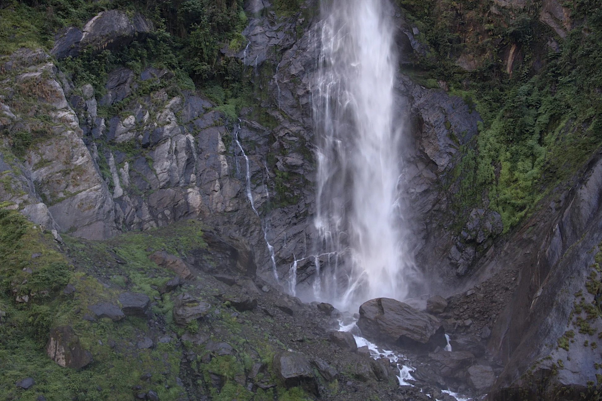
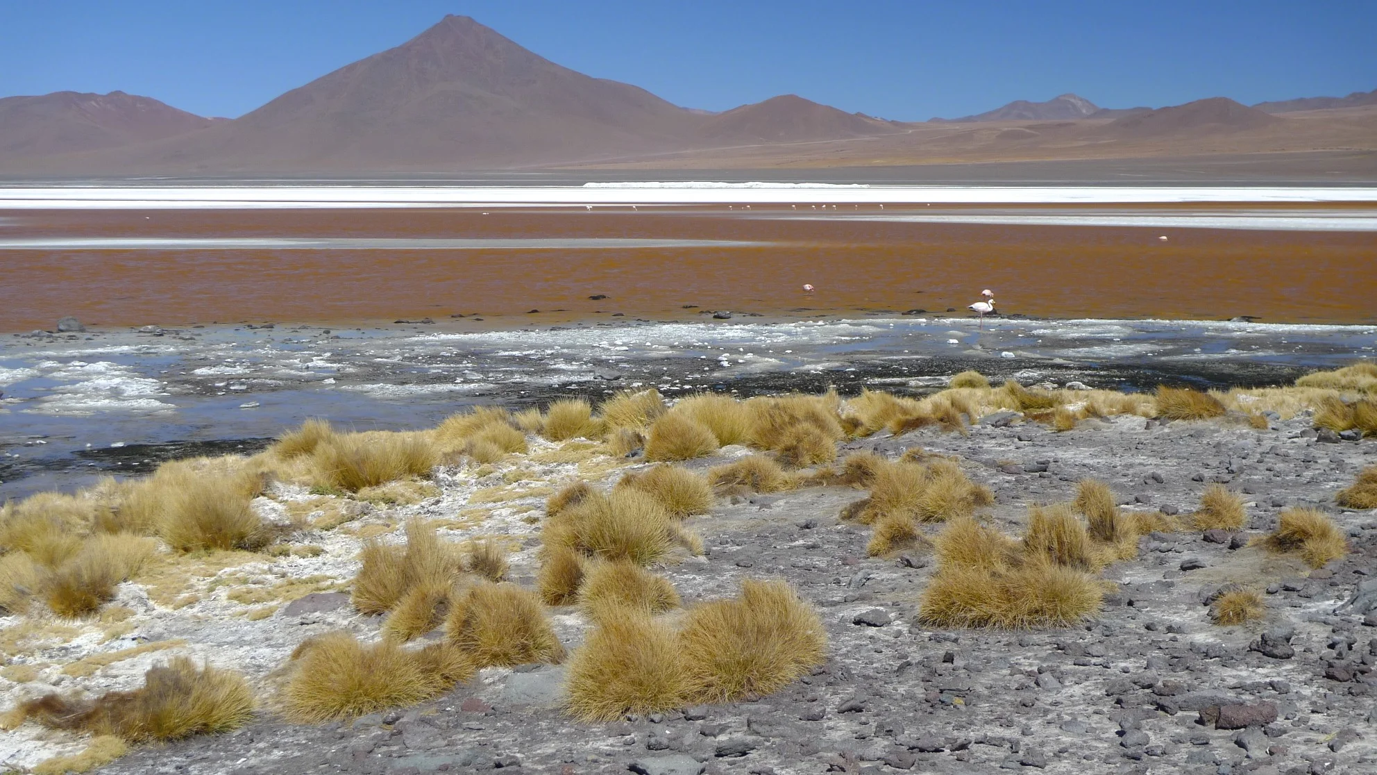
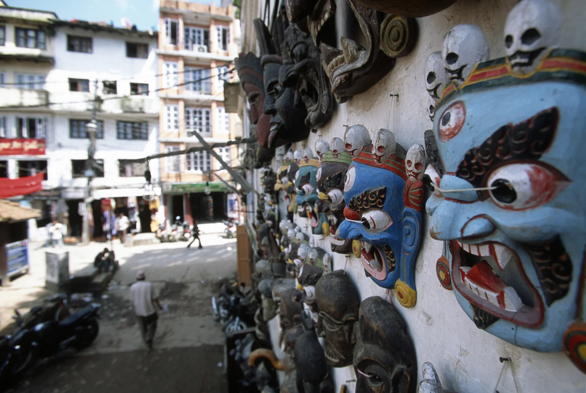
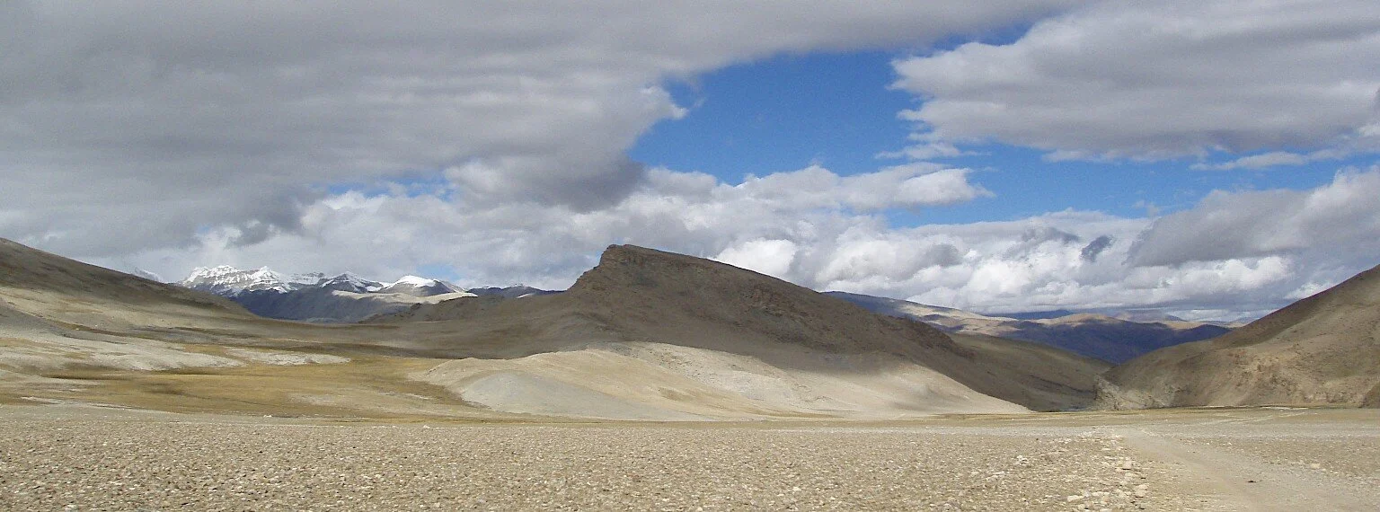
Some random thoughts about the realities of trekking in Nepal:  Nepal trekking consists of waking down and out of deep gorges from 900-1,000m to above 4,000m before being able to see any alpine scenery.  For the true alpine scenery (ice, glaciers, peaks) one usually has to go above 5,000m.  There is a lot of up and down referred to as "Nepali flat".  The main trekking routes are crowded.  On the popular trekking routes, the tourists are mainly older people.  Food and drinks in teahouses, especially in the Khumbu are more expensive than in Canada.  Phone calls are 300R ($4.5) per minute.  Rooms are very basic, concrete floor, plywood walls (can hear everything form adjacent room).  Inside, the room is as cold as a tent as the walls are not insulated.  The toilet is usually outside, cold, and often just a hole in the ground.  Sometimes it overflows.  The toilet is flushed with a water bucket but the water in the bucket is sometimes frozen.  It is difficult to sleep at the altitude above 5,000.  I usually can’t fall asleep until midnight, wake up at 4am can’t sleep until dawn.  The nights are long as the sun sets at 6.30 and rises at 6 am.   In the teahouses one can sit in the dining room until 9 pm or so to pass time.  While camping though, short days make for long nights in the sleeping bag. 

November 3, 2010 Thame 3600m

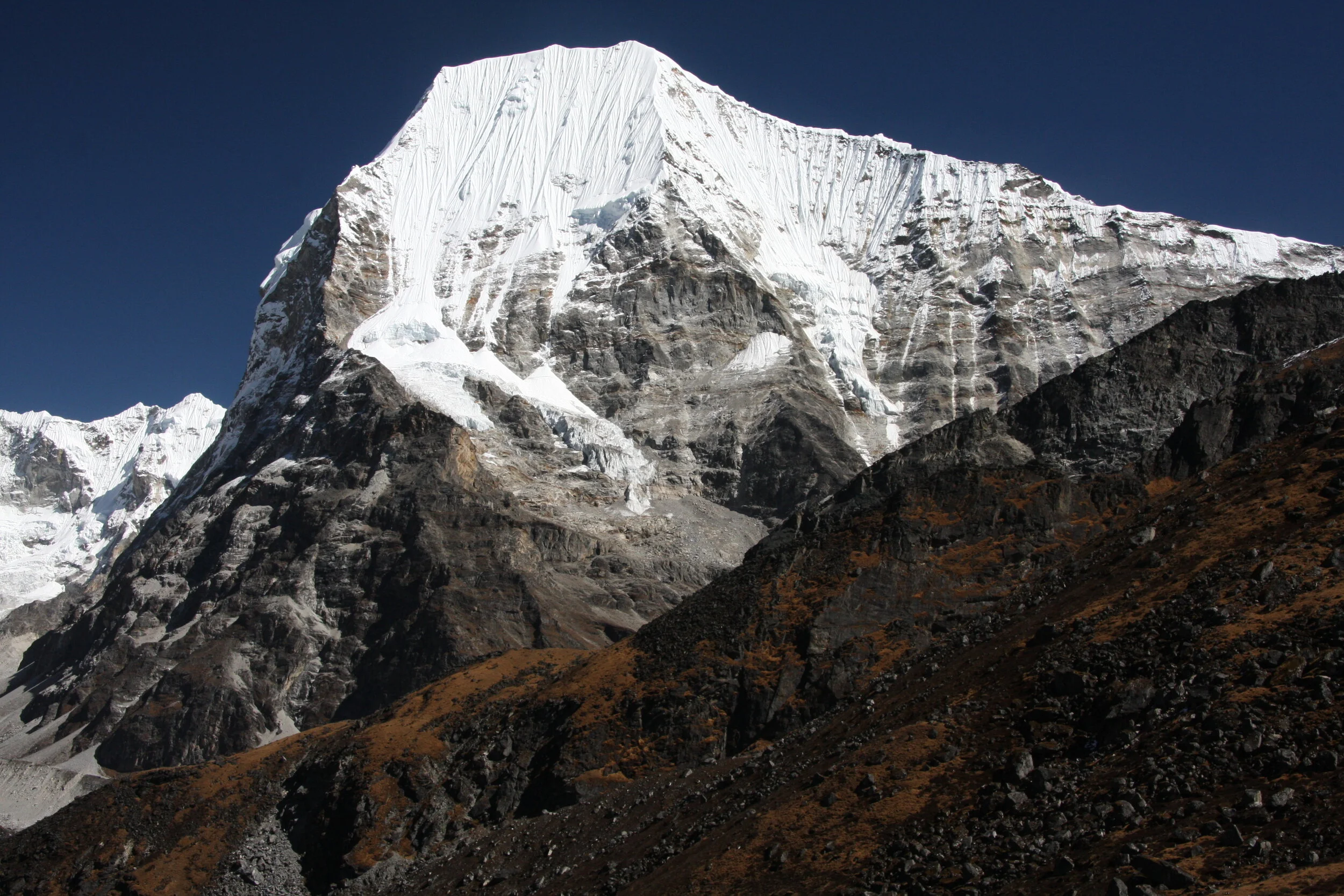
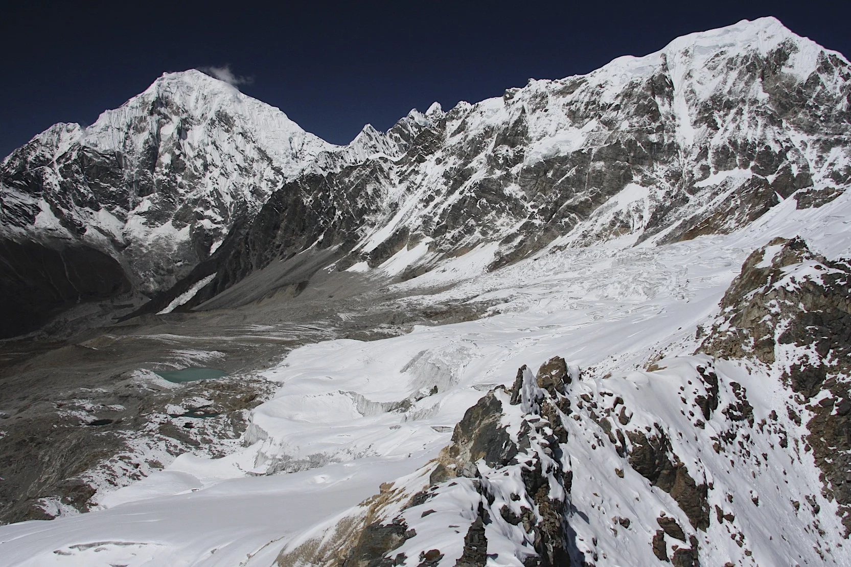
We got up to a brilliant sunshine and beautiful winter aura all around us.  We were right in the front of Mt. Thyangboche 6,482m and Mt. Kwngde 6,086m.  Those two peaks rise vertically right behind the teahouse.  Their walls were plastered with fresh snow from the storm we just experienced.  It was still and quiet.  We have not hit the main Everest trekking region yet so in the teahouse there were just us and the Polish climbers. 

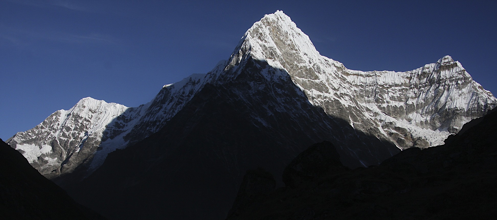
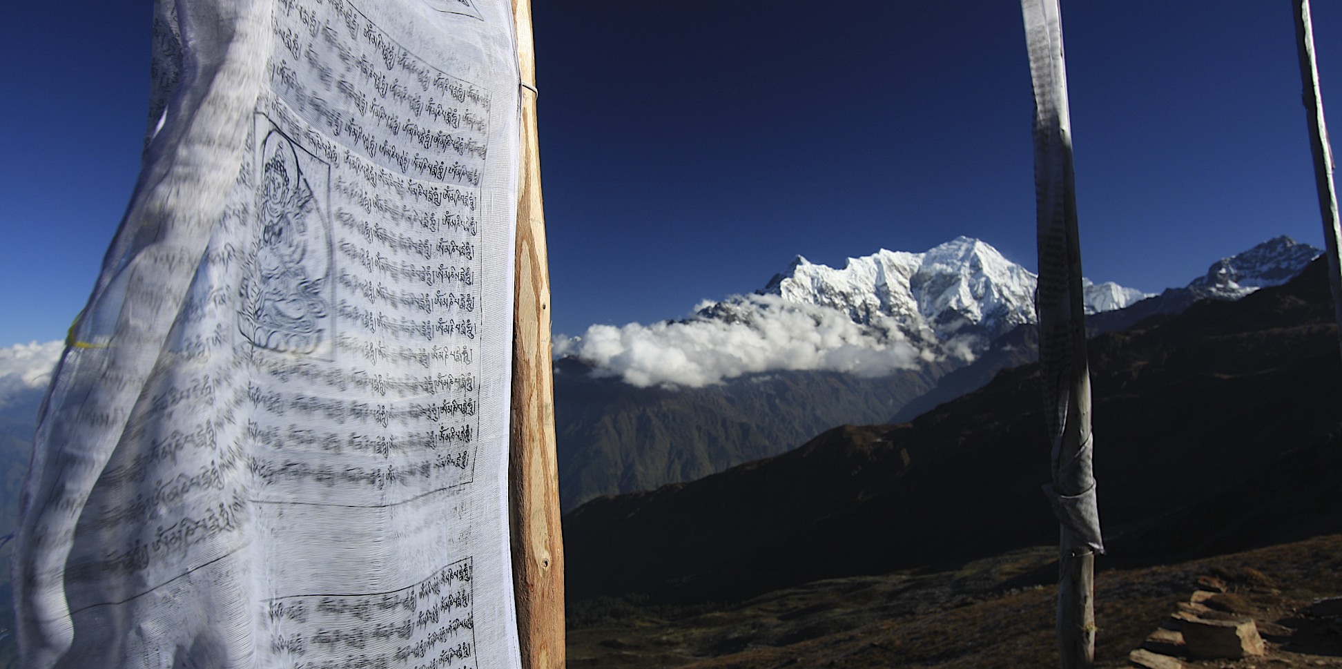
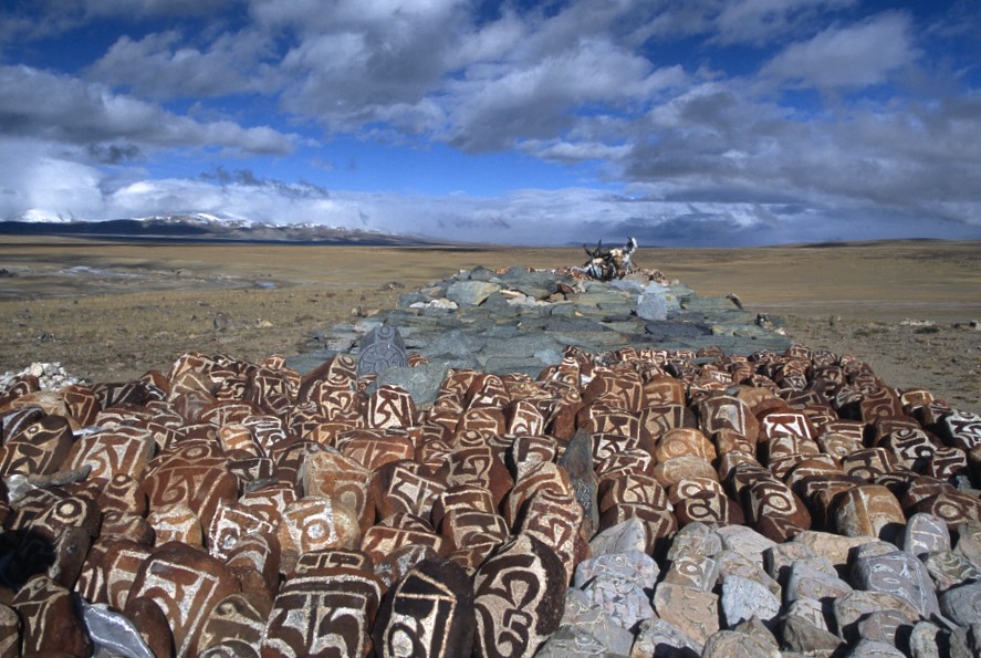
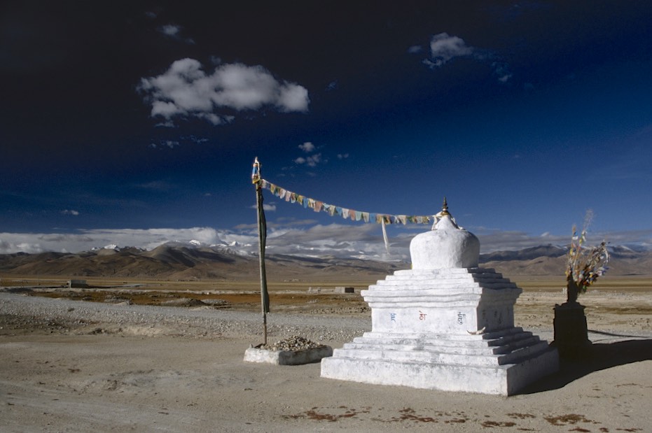
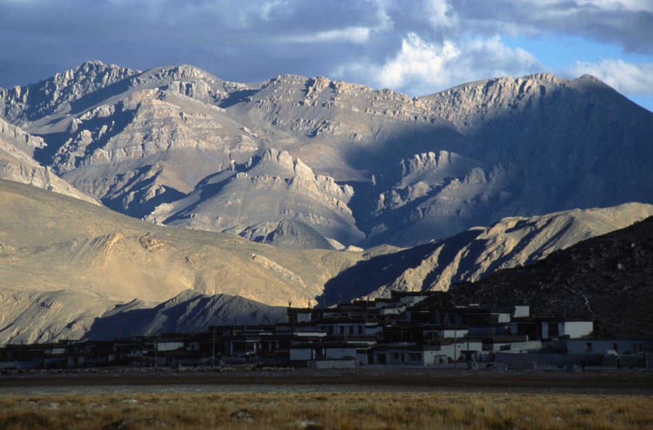
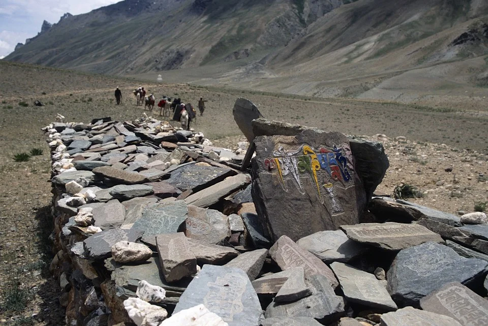
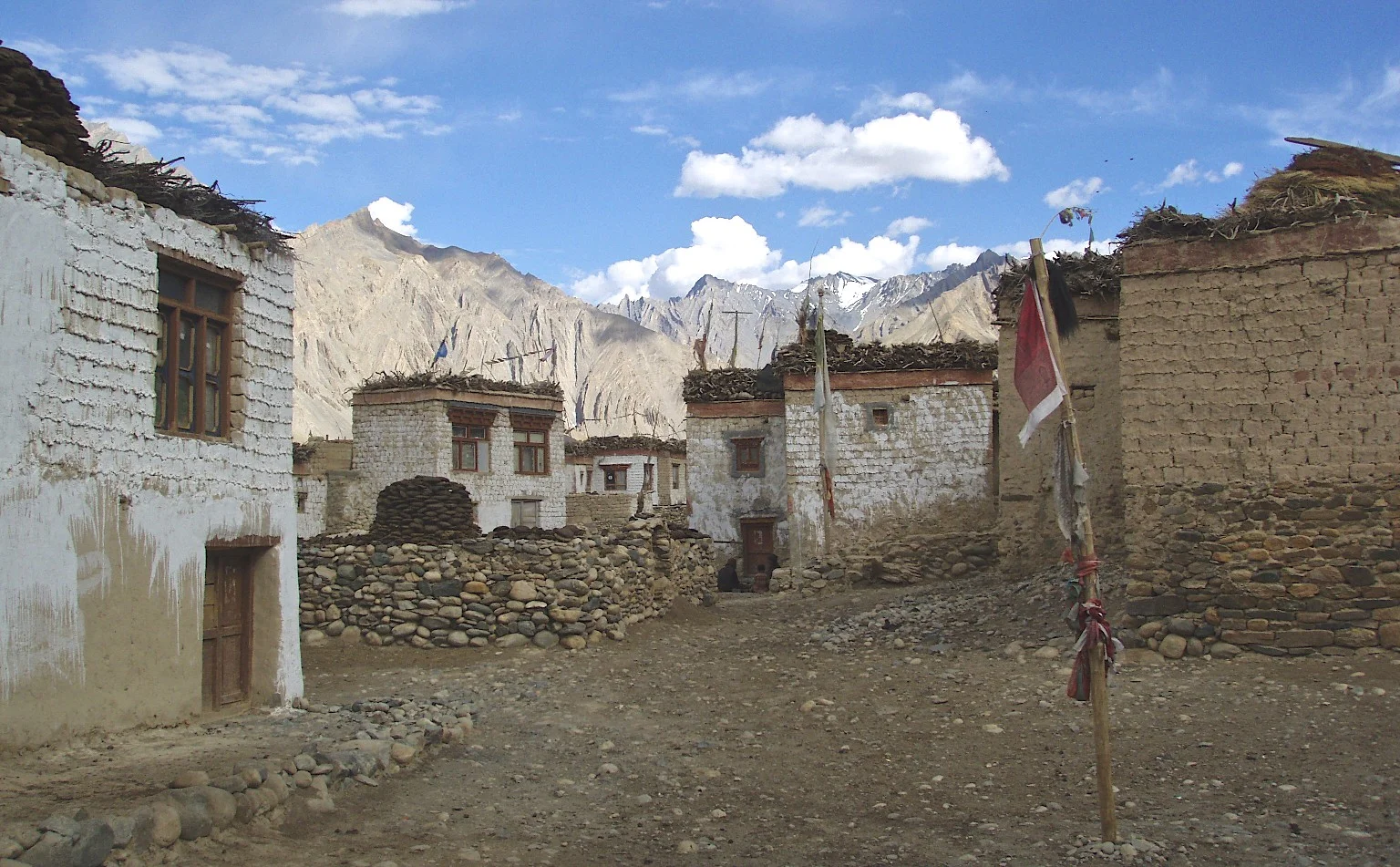
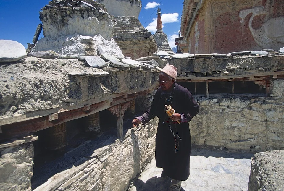
From the teahouse in Thyangbo, we walked to Thame on a good trail with wonderful view of Khumbu peaks in front of us.  On the way, we stopped at a local gompa that was well taken care of with numerous prayer flags fluttering in the wind.  From the terrace of the gompa, the backdrop of Mt. Thamserku 6,618m and Mt. Kangtega 6,783m dominated the view.  Two huge peaks, very steep and standing tall above the Dudh Khola valley in bright sunshine and clear sky.  In Thame, we stayed in a teahouse owned by a Guinness record holder who climbed Everest 21 times.  He now lives in the US.  His certificates were displayed on the wall of the dining hall.  The teahouse was very clean, well built and organized.  Thame was very built up and developed compared to the villages of the Rowaling Valley.  The tourist dollars were all around us and many of the teahouse owners live permanently in Europe, US or Kathmandu. 

In Thame, we parted ways with David who had to go to Lukla to catch his return flight home.  Tony and I continued on to Renjo La and Gokyo Valley.

November 4, 2010 Thame 3610m - Lungdhen 4380m

We walked up the valley that leads to the Nangpa Pass and Tibet.  On the way, we had lunch in a great teahouse run by a friendly Sherpani girl who Kumar attempted to connect with David.  Kumar claimed that we can just make the offer of marriage to her and that and she would abandon her job and go with us without hesitation.  How hard the life must be here if this is indeed the case which I found difficult to fathom?  The life in the valley is hard.  The lady we met, is up at 5 am attending to animals and fetching wood and water.  She basically runs the teahouse all on her own.  Her dad, who owns the teahouse, climbed Everest 3 times and had a little wall of fame in the dining hall.  He was a very small older man with very pleasant disposition like most people of Nepal. 

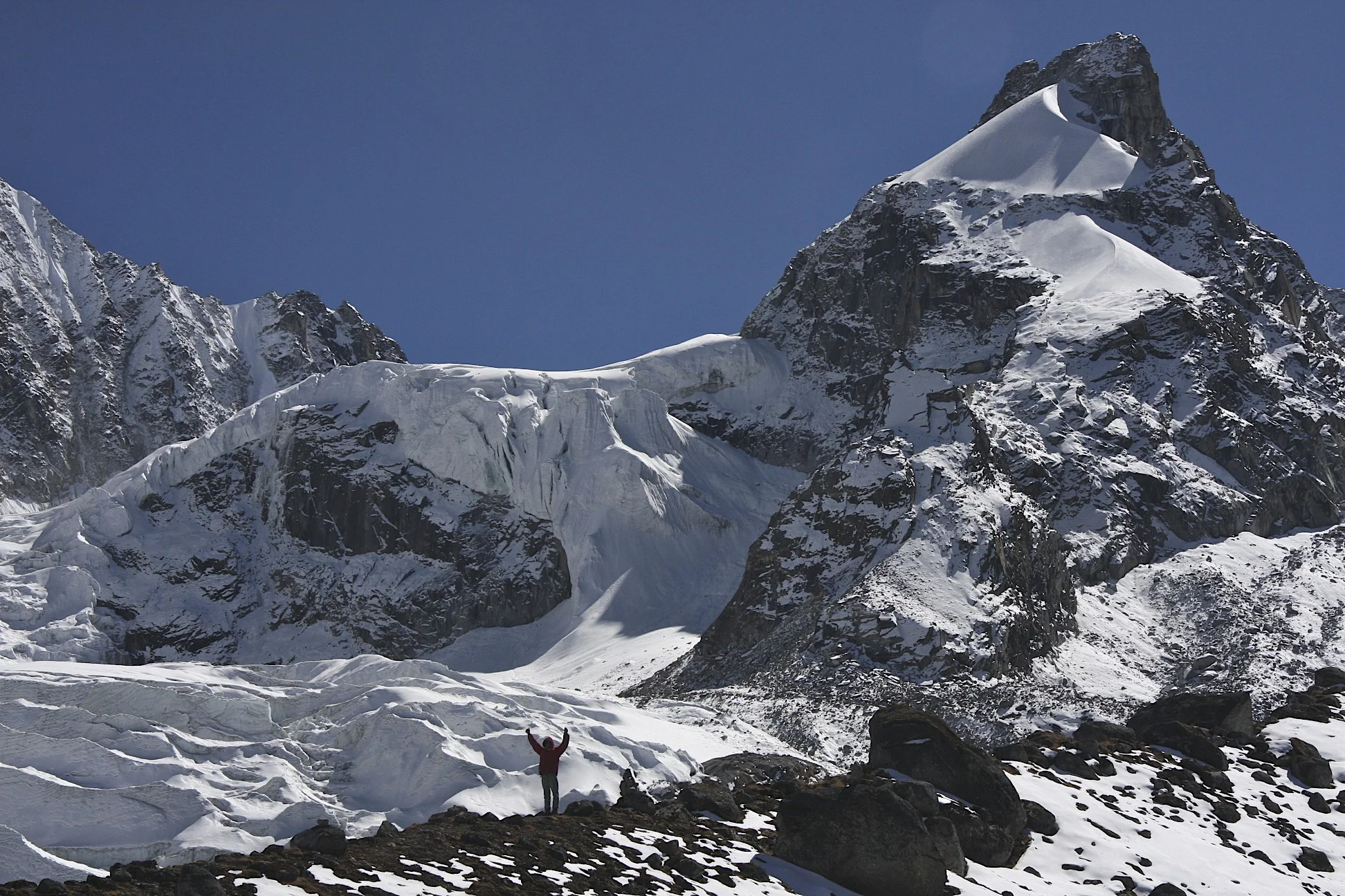
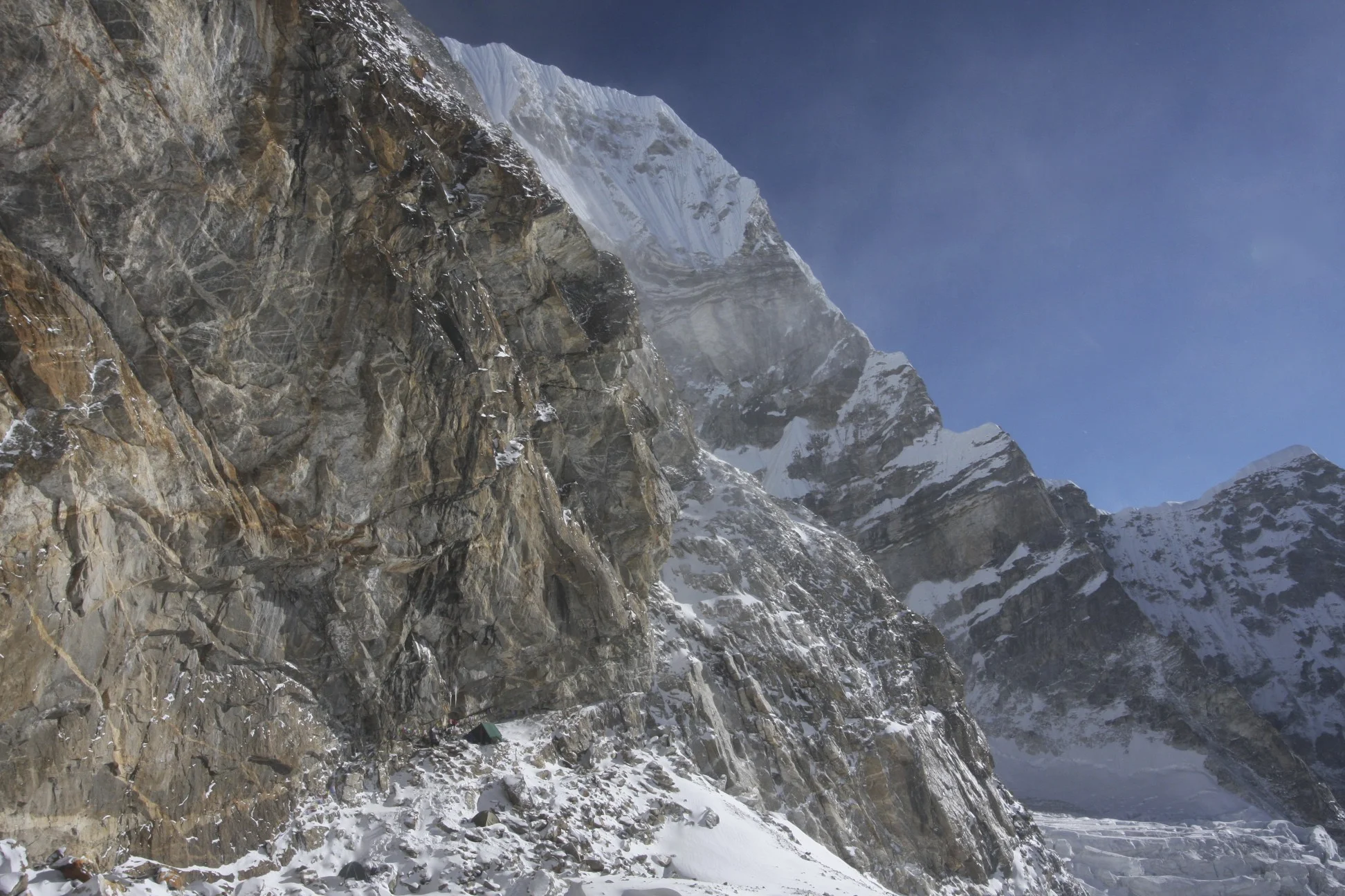
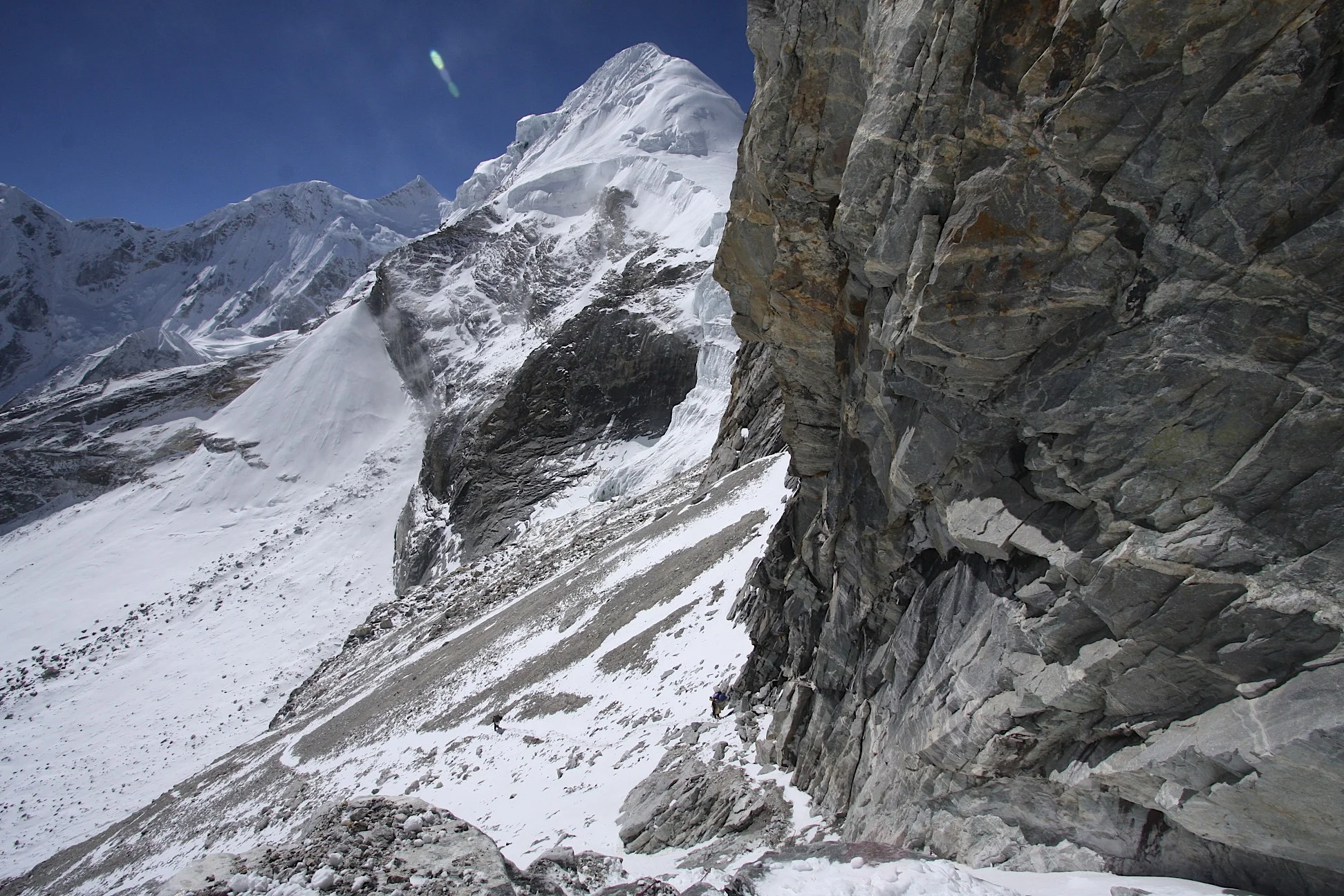
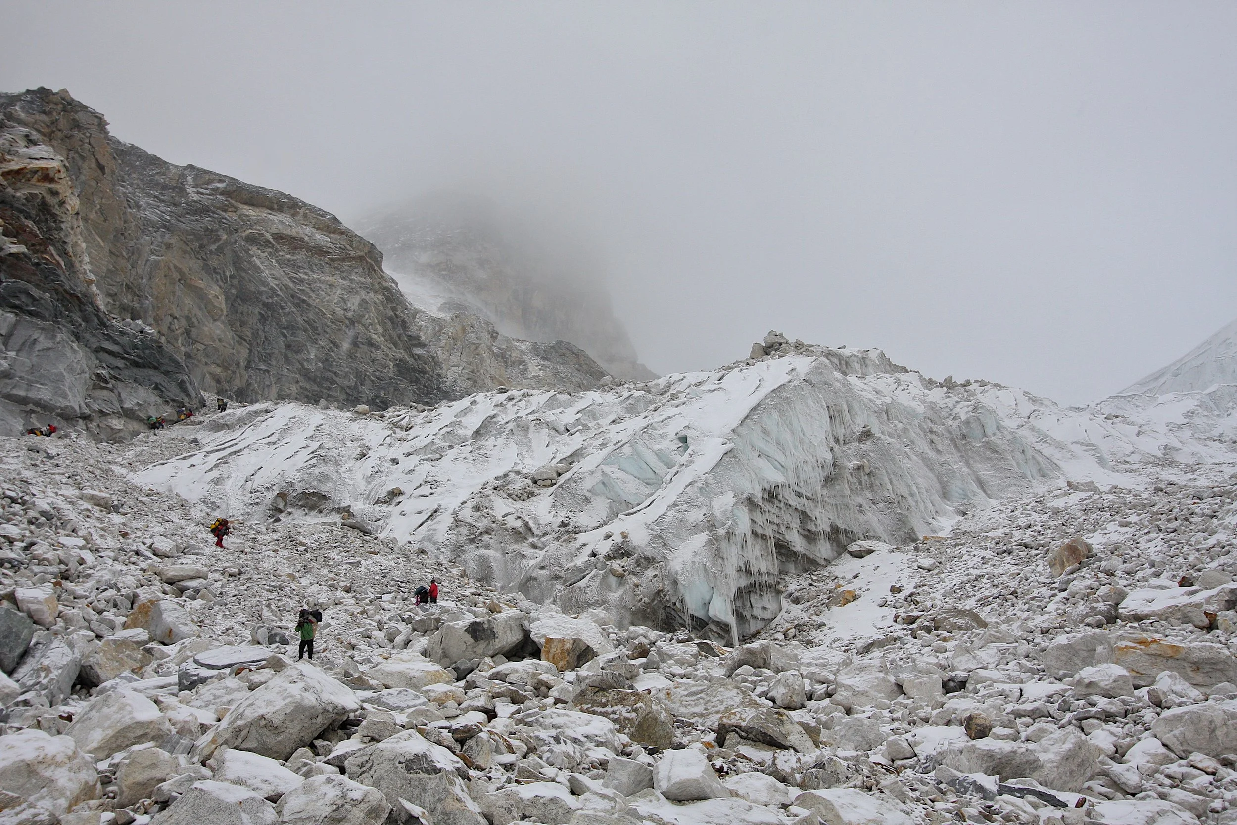
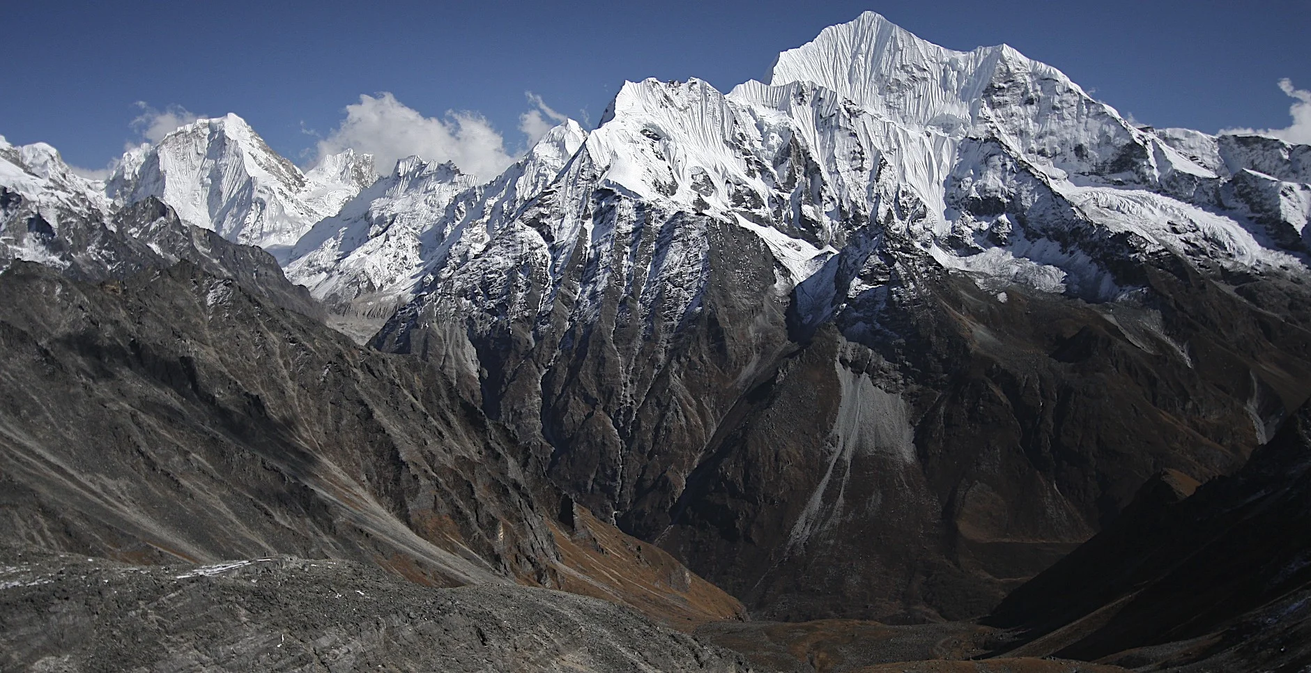
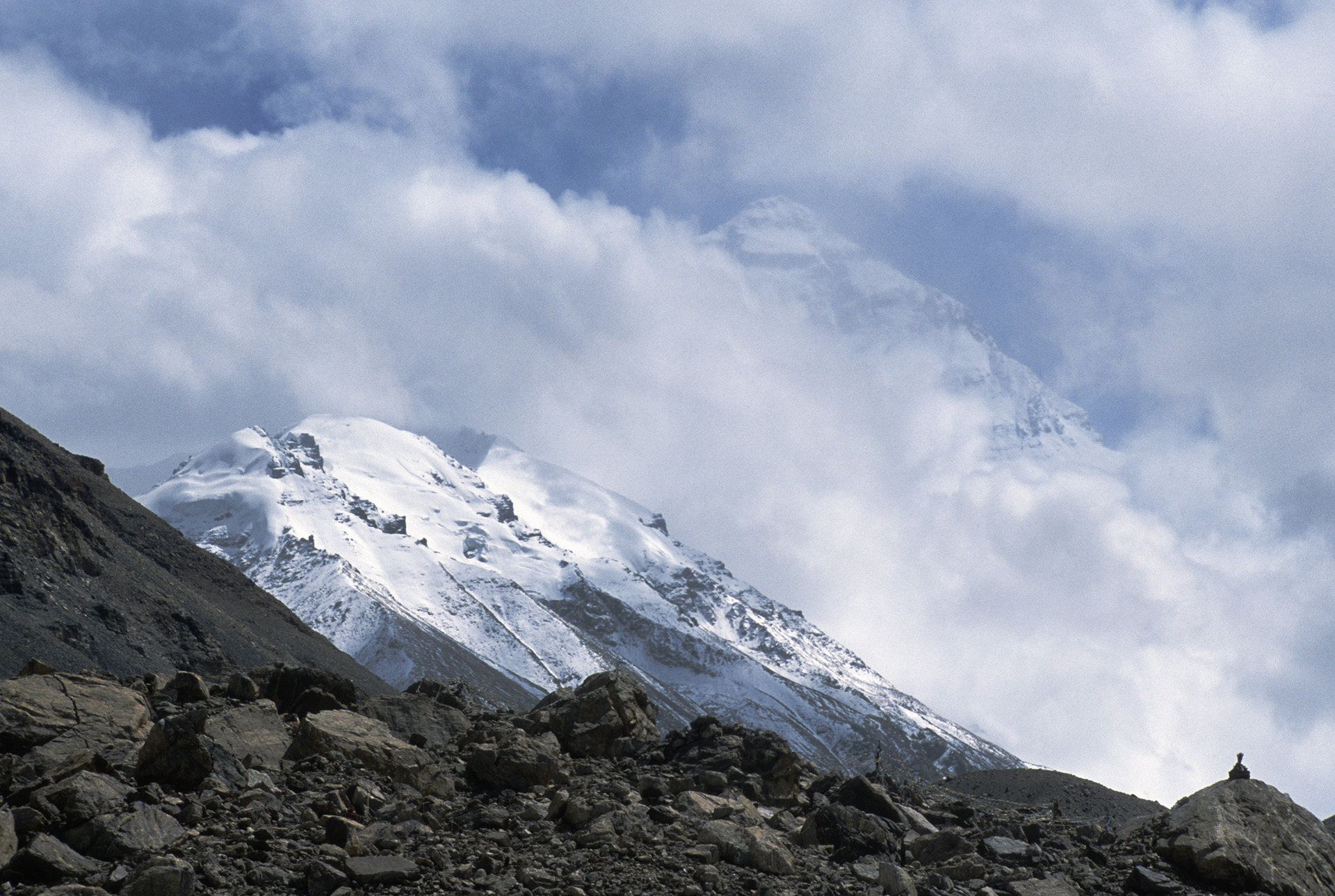
Along the way to Renjo La pass at 5,360m, we had a great view of the front of the Bhote Kosi Glacier.  I was yearning to go there and explore the valley all the way to the Nangpa La Pass.  This will have to wait for another trip though.

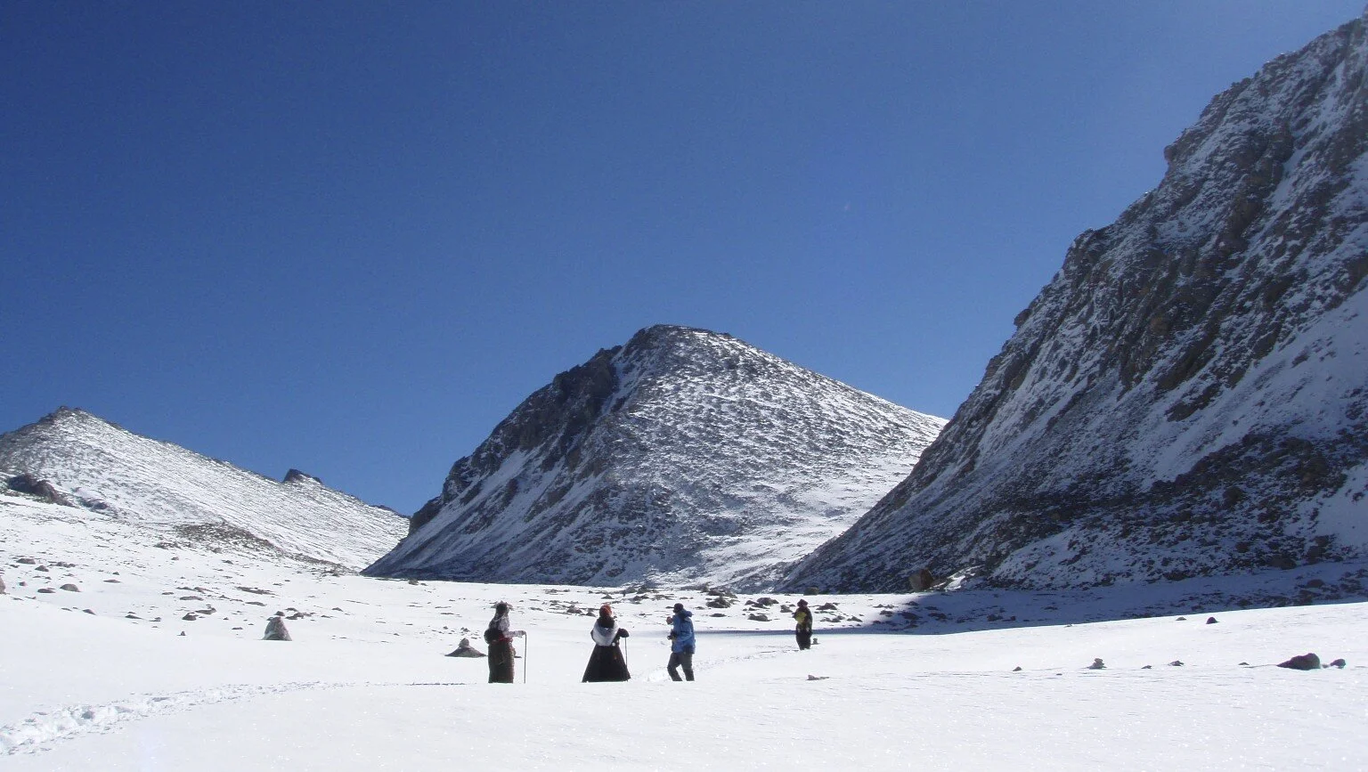
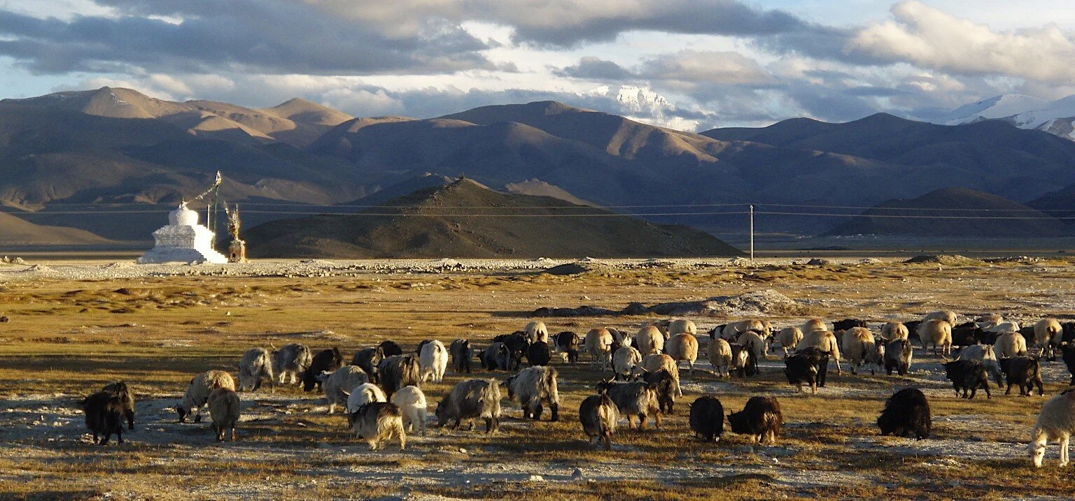
At this point, the trail turned to the east and led to the basecamp for the Renjo La pass.  The basecamp for the Renjo La pass is called Lungdhen and it is located at an elevation of 4380m.  It consists of a few teahouses built near a small lake.   The teahouse we stayed in was busy as Renjo La Pass is on a popular trekking route.

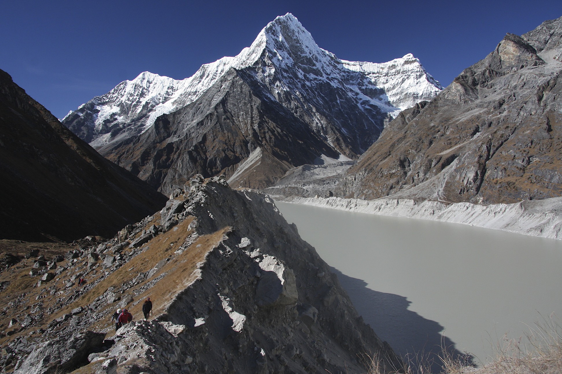
November 5, 2010 Renjo La 5,360m – Gokyo 4,750m

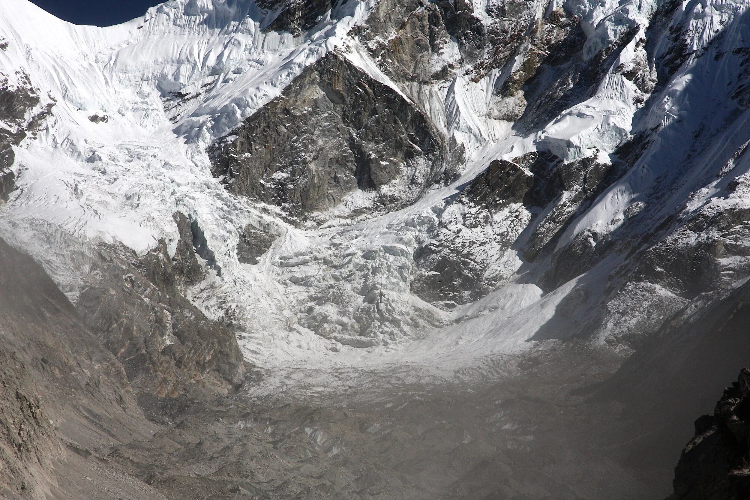
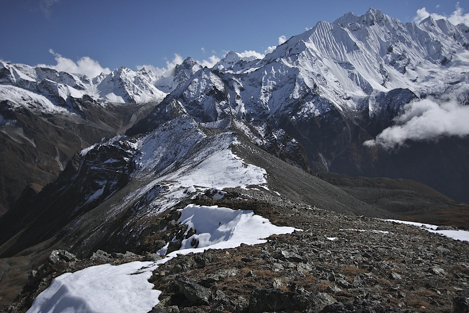
We were up early for the passing of the Renjo La at 5,360m.  This pass was much easier for us than the Teshi Labtsa.  The ascent of the pass is just a walk (with stairs) and we were already acclimatized to the altitude.   After leaving the teahouse we passed a small lake and climbed the stone stairs directly to the pass.  The pass is at an altitude of 5,360m.  From Thame we climbed 1,750m.  We moved quite fast and ended up on the pass quite early.  The views in all directions were absolutely stunning.  The weather was just perfect, sunny with no wind and almost no clouds.  To the east we could see the most magnificent Himalayan panorama ever. 

head smashed in jb 471.jpg

The Everest, Lhotse and Nuptse were dominating the skyline.  The steep south side of Lhotse wall was clearly visible.  Down below, the Ngozumba Glacier and Gokyo Village.  In the distance was Makalu, then Cholatse, Chamlang and Tamaserku.   On the opposite side of the Renjo La Pass, looking west, Tengi Tagi Rau, Menlungtse, and all the peaks lining up the Bhatekoshi Glacier were visible.  This must be the best panorama in all of the passes in the Himalaya, not only Nepal.  We spent quite a lot of time on the top of the pass admiring the views and taking photos. 

head smashed in jb 562.jpg

All the way down to Gokyo, the views were absolutely magnificent.  We passed the incredibly green Gokyo Lake that contrasted with the white fresh snow of the recent storm.  The entire surroundings were stunningly beautiful.  We stopped many times and took many photos  arriving in the Gokyo Village in late afternoon.  The original plan was to cross the Cho La pass next.  We were getting tired though and Tony decided to take a rest day.  The rest was well deserved after the Teshi Labtsa adventure, the 1,600m descent from The Pass to Thame and the 1,700m ascent from Thame to the Renjo La Pass.  It all happened in a span of a few days. 

I, on the other hand, decided to go to the north side of Cho Oyu to a spot called Ngozumba Tse (Cho Oyu basecamp) located at an altitude of 5,550m.  It would be another ascent of 800m over a distance of 12km. We spent a cold night in a comfortable teahouse with many people as we were now in one of the most popular trekking regions in Nepal.

November 6, 2010 Gokyo – Cho Oyu BC 5,550m

We left quite early to hike up to the Cho Oyu BC.  Surprisingly we were almost alone on the trail for the entire day except some climbers going to Kangchung Peak.  The wall of Cho Oyu 8,201m and Gyachung Kang 7,922m was directly ahead of us.  We walked fast on the trail along the moraine of the Ngozumba Glacier.  The higher we went the better the views.  By the time we reached the fourth lake (there are five consecutive lakes in the Gokyo valley), the views opened up.  The Ngozumba Glacier widened up at the spot where the Gaunara Glacier joins it at a 90-degree angle. 

head smashed in jb 625.jpg

To the east we could see Everest and Lhotse with the good view of the South Col and the north face.  The peaks were now very close and spectacular.  We made it to the fifth lake and the Cho Oyu BC at 5550m. The spot was outstanding.  In front of us a steep and spectacular south wall of Cho Oyu 8201m with massive glaciers flowing down. 

head smashed in jb 643.jpg

The entire area was snow covered from the recent snowstorm so the scenery was very alpine.  It was clear that one could continue on to the west to hike along the great peaks of the spine of the High Himalaya.  I wanted to linger and take it all in.  We are in a great amphitheater of the highest peaks on Earth.  The weather was spectacular and clear.  There were only limited high clouds obscuring only the very top of the peaks.  The time was running out though as it was starting to get late and we had a long way back to the teahouse.  As we were hiking back, it started to get dark. The sunset however was truly spectacular and we could admire the wall of peaks lining the Ngozumba Glacier all the way down.  We arrived in back in the teahouse after sunset.  It was another full day and a magnificent one.

November 7, 2010 Gokyo – Dhole 4110m

We left Gokyo early in the morning in a brilliant sunshine and blue sky.  We were on the main trail linking the Khumbu region with the Gokyo Valley.  The trail was busy.  We walked passed the Gokyo Lake perfectly still reflecting the surrounding peaks.  We walked by the first lake in the Gokyo Valley and down to Dhole.  We walked fast and did not stop much.  Many helicopters flew above us transporting those afflicted with the altitude issues or just tired. 

Dhole was another busy village with many teahouses that start to look all the same in this region.  They all serve the same food, have the same photos, are frequented by the same looking western and Asian trekkers going to the same places and taking the same photos. 

November 8, 2010 Dhole – Namche Bazar

An uneventful walk to Namche following the main trail network.  We walked passed the spectacular backdrop of Ama Dablam with its perfectly shaped ridges and hanging glaciers.  We arrived in Namche quite fast.  Namche was a busy spot with all the trappings of a well-oiled tourist industry:  German Bakery, horses for rent, Internet cafes, souvenir shops and calculated mamas running teahouses. 

head smashed in jb 730.jpg


November 9, 2010 Namche Bazar - Lukla

Since all Khumbu and Gokyo trails converge between Namche and Lukla, the trail to Lukla is very busy.   It is full of large groups mainly going to or from the Everest BC.  It is a long way (at least 10km) and quite boring.  Given what we have seen, the views are pleasant but nothing special.  We arrived in Lukla by the evening and checked into a hotel right by the airport.  The following day we had to reconfirm our tickets.  We spent the day admiring the landings and takeoffs from Lukla airfield (quite a spectacle).  We had good food, drinks, visited a fake Starbucks, had a haircut and just hang out.  The following day we flew out and landed in Kathmandu after 30 minutes.  An end to an epic adventure. 

I got seriously hooked on Nepal and the Himalayas…

head smashed in jb 868.jpg


Bolivia - Cordillera Real and the Atacama

For information about Licancabur and other climbing in Bolivia see here.

bolivia-physical.jpg
Bolivia_0000_map_Cordillera_Real.jpg
central-andes-of-bolivia-1-1024.jpg
La Paz and Cordillera Real

La Paz and Cordillera Real

head smashed in jb 37.jpg
La Paz

La Paz

head smashed in jb 1344.jpg
head smashed in jb 1342.jpg
The Historical centre of La PAz

The Historical centre of La PAz

head smashed in jb 571.jpg
head smashed in jb 589.jpg
head smashed in jb 594.jpg
Sorata

Sorata

head smashed in jb 20.jpg
head smashed in jb 312.jpg
head smashed in jb 1.jpg
head smashed in jb 38.jpg
head smashed in jb 65.jpg
head smashed in jb 366.jpg
head smashed in jb 348.jpg
head smashed in jb 92.jpg
head smashed in jb 375.jpg
head smashed in jb 397.jpg
head smashed in jb 399.jpg
head smashed in jb 411.jpg
head smashed in jb 418.jpg
head smashed in jb 426.jpg
head smashed in jb 436.jpg
atacama.jpg
atacama2.jpg
head smashed in jb 662.jpg
Salt co-op on the Salar Uyuni

Salt co-op on the Salar Uyuni

Local salt co-op on the Salar Uyuni

Local salt co-op on the Salar Uyuni

head smashed in jb 687.jpg
head smashed in jb 702.jpg
Salar Uyuni

Salar Uyuni

head smashed in jb 734.jpg
Volcan Cerro Tunupa 5,321m

Volcan Cerro Tunupa 5,321m

on Cerro Tunupa 5,321m

on Cerro Tunupa 5,321m

Salar Uyuni

Salar Uyuni

Military outpost in the Atacama

Military outpost in the Atacama

head smashed in jb 797.jpg
head smashed in jb 805.jpg
head smashed in jb 811.jpg
head smashed in jb 812.jpg
head smashed in jb 816.jpg
head smashed in jb 826.jpg
head smashed in jb 838.jpg
head smashed in jb 868.jpg
Vicunas

Vicunas

Atacama Desert

Atacama Desert

head smashed in jb 880.jpg
head smashed in jb 881.jpg
head smashed in jb 883.jpg
head smashed in jb 138.jpg
The Rock Tree

The Rock Tree

The Rock Tree

The Rock Tree

head smashed in jb 897.jpg
Laguna Colorada 4,278m

Laguna Colorada 4,278m

Laguna Colorada 4,278m

Laguna Colorada 4,278m

head smashed in jb 977.jpg
head smashed in jb 988.jpg
The roads of the high Atacama

The roads of the high Atacama

head smashed in jb 995.jpg
head smashed in jb 996.jpg
Laguna Verde 4,300m, Volcan Licancabur is on the right. The climb is 1,630m elevation gain.

Laguna Verde 4,300m, Volcan Licancabur is on the right. The climb is 1,630m elevation gain.

head smashed in jb 1008.jpg
The Border post between Bolivia and Chile at Laguna Verde

The Border post between Bolivia and Chile at Laguna Verde

head smashed in jb 1016.jpg
On the slopes of Licancabur Volcano

On the slopes of Licancabur Volcano

head smashed in jb 1020.jpg
Laguna Verde and Laguna Blance from the Licancabur Volcano 5,920m

Laguna Verde and Laguna Blance from the Licancabur Volcano 5,920m

head smashed in jb 1025.jpg
Licancabur summit 5,920m

Licancabur summit 5,920m

The summit of the Licancabur 5,920m

The summit of the Licancabur 5,920m

head smashed in jb 1043.jpg
head smashed in jb 1049.jpg
head smashed in jb 1052.jpg
head smashed in jb 1065.jpg
head smashed in jb 1069.jpg
head smashed in jb 1083.jpg
head smashed in jb 1090.jpg
head smashed in jb 1091.jpg
head smashed in jb 1095.jpg
head smashed in jb 1107.jpg
head smashed in jb 1136.jpg
head smashed in jb 128.jpg
head smashed in jb 1143.jpg
head smashed in jb 1148.jpg
head smashed in jb 1161.jpg
head smashed in jb 1192.jpg
head smashed in jb 1209.jpg
head smashed in jb 1210.jpg
head smashed in jb 1217.jpg
head smashed in jb 1243.jpg
head smashed in jb 1263.jpg
head smashed in jb 1266.jpg
head smashed in jb 1270.jpg
head smashed in jb 1273.jpg
head smashed in jb 1274.jpg
head smashed in jb 1291.jpg
head smashed in jb 1292.jpg
head smashed in jb 1296.jpg
head smashed in jb 1297.jpg
head smashed in jb 1300.jpg
head smashed in jb 1319.jpg
head smashed in jb 1324.jpg
head smashed in jb 88.jpg
head smashed in jb 89.jpg
head smashed in jb 106.jpg
head smashed in jb 112.jpg
head smashed in jb 18.jpg
head smashed in jb 504.jpg
head smashed in jb 103.jpg
head smashed in jb 44.jpg
head smashed in jb 230.jpg
head smashed in jb 110.jpg
head smashed in jb 279.jpg
head smashed in jb 309.jpg
head smashed in jb 258.jpg
head smashed in jb 259.jpg
head smashed in jb 443.jpg
head smashed in jb 653.jpg
head smashed in jb 1301.jpg
head smashed in jb 777.jpg
head smashed in jb 95.jpg

Langtang and Gosainkund Trip Report

October 2, 2009 to October 26, 2009 Langtang, Gosainkund and Helambu

Participants: Derek, David, Kumar, Kamsing and Suri

Trekking in the Langtang Valley (photo by David H.)

Trekking in the Langtang Valley (photo by David H.)

Since the civil war in Nepal ended in 2006, the trekking business resumed in full force. Rajendra from the Mountain Sun Valley Trekking Company organized our trip to Mt. Kailas and it was a great success.  We met Rajendra through a fellow from Germany whom we met during our 2005 trip to Pakistan.  After our trip to Mt. Kailas in 2007, we wanted to do a more involved trek into the high Himalayas.  David got bronchitis on the Mt. Kailas trek and needed to recuperate and regain his strength in order to undertake another trek to the high altitudes.  In 2009, he felt ready so we decided to go back to Nepal. 

We chose the Langtang area primarily because it would not require any flights or long jeep drives.  We basically would start trekking straight out of Kathmandu.  This was great, given our memories of cancelled flights and long drives from 2007.   Due to the proximity to Kathmandu, the cost of this trek was low (less than $2,000 each). Initially, we planned to climb Yala Peak and Naya Kanga Peak. Both mountains are over 5,000m and are great viewpoints to the entire Langtang range.  To save money, we did not have a formal permit for the trekking peaks that we wanted to climb. At the end we opted for Yala Peak.  We saved a few days of time by not climbing Naya Kanga and we used those days to explore further up the Langtang Valley to the Langtang Glacier.  

Map of Langtang valley trek.jpg

October 2, 2009 Depart Calgary

October 3, 2009 London to Delhi to Kathmandu

October 4, 2009 Kathmandu arrive from Delhi

We arrived in Kathmandu and checked into the Nirvana Garden Hotel.  The hotel was around the corner from Rajendra’s office.  On this trip, we met Kumar for the first time.  Kumar would be our guide on this trek and many subsequent ones.  We were quite excited to be there and to be trekking again. This would be my first trek in the heart of the Nepal Himalaya.  I did not consider the 2007 Kailas trip to be a true trekking adventure in the Nepal Himalaya.  In 2007, we missed a lot of great views in Western Nepal due to the horrible weather we had.  

I was very curious about the High Himalaya ever since 1996 when I saw the massive glaciers descending from the high peaks during the drive from Lhasa to Kathmandu. I remember that moment:  the peaks were hidden in the monsoon clouds and all I could see were the long tongues of ice.  It was very mystical and I wanted to go there very much.    

October 5, 2009 Sundurijal 1,450m Chisopani 2,215m

We took a jeep from the Nirvana Garden Hotel for a short drive to the trailhead in Sundarijal.  Sundarijal is a suburb of Kathmandu.  This was the shortest drive to the start of any trek ever.  We basically drove across Kathmandu.  We arrived in a large square with fruit and vegetable market after an hour of crawling through the Kathmandu traffic.  

Sam Ford Fiord 77.jpg

The trail ascended a steep and very long flight of stone stairs.  The stairs lead to Chisopani, our destination for the day. The climb was 700m and it was quite easy but hot and humid.  It was a cloudy day and the weather deteriorated the higher we climbed. It was early October and the monsoon was just ending.  Along the way we met a crazy fat American guy with a machete strapped across his belly.  He was drenched in sweat and told us that in case of an attack or robbery, he would make use of his machete.  We never saw him again. 

As we got higher, the fog became very thick and we could barely see 50m in front of us. It started to rain right after we checked into the Everest View Hotel in Chisopani (without any views due to thick fog).  The place is popular with people from Kathmandu who come here for the views of the Himalaya.

Sam Ford Fiord 82.jpg

October 6, 2009 Chisopani – Mangengoth 3,220m

Today we walked for quite a long way along the ridge that descends from the high foothills of the Langtang Range.  There were no views as it was raining quite hard.  We passed by some remaining ruins of houses destroyed during the bloody Maoist civil war.  We saw Maoist slogans painted on walls.  The particular house must have been an old check post.  

An hour before we reached the hotel, the rain intensified and I considered putting my rain gear on but I did not as I thought that it would not take that much time to get to our destination.  Without the rain gear, the monsoon rain drenched me and by the time I reached the hotel I was completely wet.  I was wondering whether the monsoon was really over as I vividly remembered our incessant and permanent rain on the Simikot trail in 2007.  I was hoping that this would not be a repeat of that experience. 

In the hotel in Mangengoth, the rooms were quite atmospheric with baby blue walls and Chinese photo collages on the walls. These posters are totally tasteless but they provide a much-needed splash of color in these otherwise drab surroundings.  It rained for the remainder of the day and night.  

Sam Ford Fiord 98.jpg

October 7, 2009 Mangengoth – Ghopte 3,430m – Suryakunda 3,700m

In the morning, the rain stopped.  It was still overcast and foggy.  Again no views in either direction.  David told me about the great views from a similar ridge he hiked en route to Paldor. The view was supposed to extend quite far on both sides revealing a panorama of the Himalaya.  

We had lunch at Ghopte at 3,430m.  By the time we left there, the clouds started to lift a little.  We left the ridge and the trail took a sharp turn to the left (west) to ascend to Suryakunda.  We passed some spectacular waterfalls that looked quite enchanting in the fog.  We arrived in Suryakunda in late afternoon. 

<untitled> 23.jpg

Suryakunda is where the Thai Airways plane crashed in 1992:

“Flight 311 departed Bangkok at 10:30 local time. It was scheduled to arrive in Kathmandu at 12:55 Nepal Standard Time.[After crossing into Nepalese airspace the pilots contacted air traffic control and were cleared for an instrument approach from the south called the "Sierra VOR Circling Approach" for Runway 20. Nepalese ATC at the time was not equipped with radar.

Shortly after reporting the Sierra fix ten miles south of the Kathmandu VOR, the aircraft called ATC asking for a diversion to CalcuttaIndia because of a "technical problem".[Before ATC could reply, the flight rescinded their previous transmission. The flight was then cleared for a straight-in Sierra approach to Runway 02 and told to report leaving 9,500 feet (2,896 m). The captain asked numerous times for the winds and visibility at the airport, but ATC merely told him that Runway 02 was available. 

A number of frustrating and misleading communications (due partly to language problems and partly to the inexperience of the air traffic controller, who was a trainee with only nine months on the job) ensued between air traffic control and the pilots regarding Flight 311's altitude and distance from the airport. The captain asked four times for permission to turn left, but after receiving no firm reply to his requests he announced that he was turning right and climbed the aircraft to flight level 200. The controller handling Flight 311 assumed from the flight's transmissions that the aircraft had called off the approach and was turning to the south, and he therefore cleared the aircraft to 11,500 feet (3,505 m), an altitude that would have been safe in the area south of the airport. The flight descended back to 11,500 feet, went through a 360-degree turn, passed over the airport northbound, and crashed on a steep rock face in a remote area of the Langtang National Park at an altitude of 11,500 feet”

The crash claimed the life of the son of the mayor of Winnipeg. I remember reading about it. The owner of the hotel that we stayed at remembered the crash.  After the plane crashed, the locals searched the bodies for cash and valuables before the police and army arrived.  His hotel was full of parts and pieces of the airplane.  I asked him to give me one of the parts of the airplane that was really a piece of mangled steel.  

In the late afternoon, the clouds started to part and revealed a great panorama of the Himalayan foothills down below.  The rocks surrounding us were quite steep and overgrown with vegetation.  The clouds that formed lower down in the lowlands had now an intense orange hew.  They looked like orange towers in the sky.  We could also see the glow of the lights of Kathmandu lower down. 

October 8, 2009 Suryakunda – Gosainkund Lakes, 4380m

We started in nice sunshine and climbed up to a high pass at 4,165m called Laurbina Pass. At the pass, there were numerous prayer flags.  We were the only party on the trail and had the pass to ourselves.  From the pass we could see a chain of lakes down below. These lakes are apparently holy to the followers of Hinduism and receive pilgrims in late August.    We took photos and admired the great view from the pass.  To the north west of us we could see the main lake of Gosainkund.  Beyond the ridge flanking the lake, we should be able to see mountains of the Manaslu Range and the Annapurna but due to the afternoon clouds we could not see anything.  We descended down to the lake.  As the trail approached the lake, we passed by some Hindu shrines with bells and symbols of Hinduism.  The clouds were now moving in and we made it to the hotel above the lake shore.  

2008-11-06 at 03-07-47.jpg

After late lunch, I took a walk around the Gosainkund Lake.  I was alone and it was strange to have the entire area to myself. The path around the lake is a pilgrimage route and it is supposed to be auspicious to make the round.  The path is marked with many prayer flags, simple chortens and memorials.  The views were great and the lake was crystal clear.  I had a great view of the setting sun and multi colored clouds reflecting in the lake.  

October 9, 2009 Gosainkund – Laurbina 3900m

2008-11-06 at 22-51-21.jpg

As we left the hotel by the lake, we walked along a rocky path that dropped steeply to the valley below.  The river flowing down in the valley below started at the Gosainkund Lake.  Once we turned the corner along the trail, a great panorama of the Himalayan peaks opened before us.  It was very impressive!  We descended a little lower to a small Buddhist shrine on the promontory with the best view.   The shrine was surrounded by tall poles with prayer flags.  

From that point, we could see the Ganesh Peaks almost directly ahead.  To the left the snow and ice-covered ridge of Langtang Lirung ascended to the clouds above.  The peaks in Tibet, far away lined the horizon between Langtang Lirung and the Ganesh Peaks.  For a short while we could also see the Manaslu Himal and part of the Annapurna Range but they soon became covered by clouds.  

2008-11-06 at 23-56-01.jpg
2008-11-07 at 00-02-26.jpg

We spent quite a while at the viewpoint and took many photos with a zoom lens. The sky was clear, there was little wind and it was magnificent!  After we got enough of the views, we descended to a small hotel at Laurbina at 3,900m.  Laurbina is a collection a few tea houses serving pilgrims and trekkers alike.  It is located right above the tree line with great views to the valleys and peaks below.  The valley of the Langtang River that we would be following into the high mountains was visible below on the right.  On the left, behind the ridge was the Valley of Trisuli River.  The Trisuli River Valley is one of the main valleys connecting Nepal to Tibet and China.    

October 10, 2009 Laurbina 3900m

The day was totally overcast and we were entirely in the cloud.  We could see absolutely nothing.  Since we had the time, we decided to take a day off and wait out the bad weather as we had enough of walking in the clouds and rain.  We spent the day in the kitchen of a small hotel eating and chatting.  The break gave us an opportunity to get to know Kumar better.  He was a really nice guy always smiling and very positive and attentive. Kamsing was his neighbor from the same village and Suri was his cousin.  Suri did not speak any English.  I would get to know the three of them much better in 2011 on the trek around Manaslu and Annapurna. 

<untitled> 4.jpg

October 11, 2009 Laurbina - Syabru 2210m

In the morning, the weather cleared up and we could see the high mountains again, especially Langtang Lirung.  We started our steep descent to the Langtang River long way below.  It was down, down, down.  I thought that it would be quite a workout to be doing this trail in the opposite direction.  

As we walked lower, the forests of thick old trees with monkeys gave way to fields and houses.  The area was quite populated and we walked through many clusters of farms along the way. 

In late afternoon, we reached Syabru Village.  Syabru is a village built on a ridge.  This was the Upper Syabru as the Lower Syabru is in the Trisuli Valley and is the road head for the bus to Kathmandu.  Upper Syabru Village consisted of a long row of rickety houses. We had a great view of the Langtang Valley from our hotel.  The hotel owner claimed to be a Lama and promised to put me in touch with a local shaman.  This never materialized to my disappointment.  

2008-11-08 at 03-57-09.jpg

I had a great encounter with a shaman in 1996 in Kathmandu when I was in Nepal for the first time.  Patricia Cory, my accidental travel companion at that time was on a mission to find healers offering alternative treatments for her terminal patients from Italy.    We ended up visiting a shaman who gave us a performance of his powers in Kathmandu. It was a very powerful experience. 

Since the Goisakund is known for religious pilgrimages, I thought that maybe, there would be shamans in the villages below the lake. 

October 12, 2009 Syabru – Lama Hotel 2410m

From Syabru, the trail follows the Langtang River that is the main drainage of the Langtang Himal and starts at the Langtang Glacier.   The trail dropped down to the Langtang River.  We crossed a long suspension bridge and followed the trail in the thick jungle to the collection of teahouses in a settlement called Bamboo.  We had lunch there.  It was hot and humid.  We dipped our feet in the cold Langtang River for temporary relief from the heat.  The river was quite turbulent as the descend grade is quite steep at this point.   The valley was very narrow and deep.  We could not see anything except the steep walls across the river.  

After the trail started to climb up and ended in the village of Lama Hotel.  It was another collection of teahouses.  We were now on the main Langtang Valley trekking route and the teahouses were bigger and busier.  Given the proximity to Kathmandu, this is one of the most accessible and popular treks in Nepal.  We walked for another forty minutes to a small settlement with one teahouse where we stayed for the night.  The teahouse was located among huge old trees by the Langtang River. The riverbed was full of huge boulders that rolled down from the mountains during nasty landslides.  

October 13, 2009 Lama Hotel – Langtang – Kyanjin Gompa 3,730m

We started early and hit the Langtang trail checkpoint early in the morning.  We presented our trekking permits and continued up to the Langtang Village.  Langtang Village is located directly below the south face of Langtang Lirung.  The glaciers and snows above are not visible as the steep walls of the mountain obscure the view.   The glacier above terminates in the rocky funnel that looms over the village below. 

The village is a collection of stone huts spread in the broad valley.   From Langtang Village, one can see Ganchempo and other snowy peaks of the High Himalaya at the end of the valley.  It was starting to get exciting to be entering the realm of the high mountains.  We stopped there for lunch and I made a quick expensive call home.  The weather was now sold: blue sky, sunshine and hot.  

<untitled> 8.jpg

After lunch and basking in the hot sun outside the teahouse, we started our final part of the walk to Kyanjin Gompa.  We walked by some impressive and long Mani walls.  We also passed some curious contraptions:  Buddhist prayer wheels run by a water mill powered by water flow redirected from the stream above.  This is lazy Buddhism! 

As we neared Kyanjin Gompa in late afternoon, the sun was getting lower and soon would hide behind the mountains.  The valley was now opening up but the surrounding mountains were also higher and steeper.  Just before the village, we climbed a small hill from which we had a fabulous view of the open valley, the Langtang River and Kyanjin Gompa below.  Towering over the valley and illuminated by the late afternoon sun, were the snowy peaks of the High Langtang Himal partially obstructed by the afternoon clouds.  All peaks had snow and glaciers and were over 6,000m high.  The vista was absolutely fantastic and it all looked very atmospheric. To the left of us was the terminus of the Langtang Lirung Glacier.  Kyanjin Gompa must be one of the most beautiful villages in the entire Himalaya. 

We descended the small hill to the village below passing a small temple (gompa) and the local cheese factory.   

After dinner, I took a walk to the moraines above the gompa with a fine view of the East Ridge of Langtang Lirung.  The last rays of the setting sun illuminated the high mountain.  It felt like we were finally among the high peaks that we came here to see.  

October 14, 2009 Kyanjin Gompa 3,730m

We needed to acclimatize for our climb of the Yala Peak. Yala Peak is 5,500m high and it would take us two days to do the climb.  For our acclimatization, we had a choice to go to the base camp of Langtang Lirung or climb the hills above the village for magnificent views of the surrounding mountains.  Unbeknown to us, Tomas Humar was climbing Langtang Lirung and he was in the base camp at that time.  Unfortunately he died on that climb two weeks after. 

Finally we decided to for a walk to the hills above the village to 4,500m.  The view to the Langtang Lirung was very impressive as it is one of the major peaks in the Himalayan chain.  We could also see the way to the Yala Peak and the climbing route to Naya Kanga across the valley.  

After our walk, Kumar negotiated assistance of a local guide to help us with the Yala Peak climb.  Since we did not have a permit, we needed to pay off a local goon. For a while, it looked like we would not be able to do it but I guess it was all part of the negotiation. 

October 15, 2009 Kyanjin Gompa – Yala BC 4,800m

We left in late morning and climbed back up the hill above Kyanjin Gompa. We traversed a long slope and arrived at the Yala Peak BC in late afternoon.  We camped in a yak pasture with threatening Yaks all around us.  In the evening, we had a fabulous sunset with great colours for photography. 

October 16, 2009 Yala Peak 5,580m

We got up around 5.30 and left the camp at first light.  We had clear weather and great sunrise with white peaks all around. The snow line was at 5000m making everything look very alpine.  We climbed for a few hours and arrived at the rocky outcrop that is the main summit in late morning.  In order to gain the main summit, we needed to traverse a short section along a steep ridge dropping to the Shalbachum Glacier below.  It was quite beautiful.  We finally arrived at the summit at 5,580m.  The view from the summit was outstanding.  We could see the Shalbachum Glacier below, Shishapangma peaking from behind the ridge across, Penthang Karpo Ri, Langshisa Ri and Langshisa Glacier directly ahead.  We could also see the peaks across the Langtang Valley with Naya Kanga and Ganja La Pass.  To the west, we could see the entire bulk of Langtang Lirung.  We had a beautiful weather and very good visibility.  We took many photos and lingered on the summit for quite some time.  We were the only people there.  The fine weather held for the remainder of the day.  As the afternoon approached, we descended back to the BC retracing our steps on the snow and glacier with fantastic views all around.   It is such a beautiful valley! 

Yala Peak is the highest point along the rocky ridge

Yala Peak is the highest point along the rocky ridge

Yala Peak (the point on the ricky ridge) and Langtang Lirung behind

Yala Peak (the point on the ricky ridge) and Langtang Lirung behind

2008-11-11 at 03-43-48.jpg
2008-10-16 at 22-53-22.jpg
2008-11-13 at 02-53-15.jpg

October 17, 2009 Yala BC – Langshisa Kharka 4,160m

Instead of walking back to Kyanjing Gompa, we decided to drop down the slope to the east to arrive at Langshisa Kharka.  We descended down a slope all the way to the Langtang River and then followed the river to Langshisa Kharka.  We arrived there around 2pm.  Right before the Langshisa Kharka, we stopped at a small viewpoint and got the first glimpse of the Langtang Glacier.  We did not realize that the glacier is 10km away from the campsite and that it also continues for another 15 km to its terminus.  

2008-11-14 at 08-19-51.jpg

Deceived by how close it seemed, we decided to go to the Langtang Glacier for the afternoon walk.  Of course the distances here are very deceptive due to the scale of the terrain. We left the camp at 2.30 pm (it gets dark around 6 and it was 10 km to get there with a 600m elevation gain). We arrived at the snout of the Langtang Glacier at very late afternoon.  We had a fabulous sunset on Langshisa Ri Peak 6,427m and Penthang Kharpo Ri directly across the Langtang Glacier.  

Suddenly we realized that we were both wearing our sunglasses and did not have our regular glasses with us!  It was getting dark and we could not see very well with our dark lenses.  We got caught in the dark and thankfully Kumar came with the flashlight to meet us.  I was just following Kamsing’s runners that had a reflective stripe.  Without glasses I could not see the many rocks that dotted the trail.  With the glasses I could not see them either so I was screwed both ways!  We got to camp tired.  It was a fabulous sortie though into a beautiful valley that would warrant further exploration had we had more time. 

According to David’s recollection of events:-): “this is an entirely fictitious account (above)! What actually happened is that 4 of us went to see the glacier: you, me, Kumar and Kamsing. It happened that you and Kamsing were far ahead of me and Kumar. Kumar and I realised at a certain point that we would have to turn back to avoid walking in the dark, but no amount of waving and shouting could attract your attention, so we were forced to continue to avoid getting further separated. Thus we ended up night walking in the Himalaya. “We could not see very well…” Understatement! I could not see at all! I had to hold Kumar’s arm to find the way and avoid obstacles. It was not Kumar but the one who stayed behind - Suri? - who came with the flashlight. I remember that to your credit you did acknowledge that it was all your fault. I was not happy.” But it gave us something to remember forever!

Langtang Glacier and Shishapangma in Tibet (photo from 2018 trip - see 2018 year)

Langtang Glacier and Shishapangma in Tibet (photo from 2018 trip - see 2018 year)

October 18, 2009 Langshisa Kharka – Kyanjin Gompa 

Today we had a long walk back to Kyanjing Gompa; it seemed long, as we were tired.

We walked in the windy and sandy riverbed.  Small loose rocks were whipped up by the wind.  David got sick as he was quite under dressed for the weather. We arrived at Kyanjin Gompa in the afternoon and the valley was filled with clouds.  I guess we were very lucky with fine weather during our Yala Peak adventure. 

In Kyanjin Gompa we stayed at the same hotel.  The hotel has a very nice lady working in the kitchen with a nice kid helper. We also met some Danes who told us that Denmark is an unhappy place.  I gave them my “Trekking in the Langtang” book.  In the afternoon we wandered to the cheese factory to buy some local yak cheese.

October 19, 2009 Kyanjin Gompa – Lama Hotel

The walk down the valley was fast and easy as we were well acclimatized by this time. Since we were retracing our steps, the walk seemed long.  It was mainly through a forest with no views.  It seemed, as it would never end!  The trail had a lot of small ups and downs.  We could not find any rooms at the first village so we needed to carry on to the next camp.  There I met a German man who had been to Nepal 11 times (I was shocked and thought how could he visit the same place so many times.  Little did I suspect that I would catch the same bug!).

Sam Ford Fiord 557.jpg

October 20, 2009 Lama Hotel – Syabrubesi

Again, the walk was down along the same path in beautiful hot weather.  We walked in very narrow valley all the way to the Trisuli River.  At some spots we had great views back up the valley with white peaks barely visible above the green lush forest.  

We had a relaxing lunch at Pahare Hotel and arrived in the village of Syabrubesi in late afternoon.  The surroundings were lush and green. We walked through more signs of the recent civil war. We were happy to be done and celebrated our conclusion to the trek with a cold beer.  I had no plans to come back to Nepal at that time.   We had a nice trek but Pakistan seemed better but unfortunately more dangerous.

2008-10-21 at 01-29-36.jpg
Sam Ford Fiord 581.jpg

October 21, 2009 Syabrubesi – Kathmandu

We took a long jeep ride back to Kathmandu stopping at a beautifully restored farm (The Famous Farm in Nuwakot, near Trisuli Bazaar. http://thefamousfarm.com). We had nice views to the valley below with high peaks on the horizon.  We passed by many overloaded buses on dirt roads.  We arrived in KTM after dark. The road had numerous switchbacks and although the distance was only 60km, it took the entire day to drive.

2008-10-21 at 03-08-20.jpg

October 22, 2009 Kathmandu – shopping, Pilgrim bookshop, food at the restaurant run by the disabled.   

October 23, 2009 – Kathmandu– Delhi on Air India

October, 23 – October 25, 2009 – India - Agra

October 26, 2009 – Depart for Canada

Elevation gain:             Ktm – Gaoisakund – 2930m

                                    Syabru – Kyanjin 1520m

                                    Kyanjin – hills 770m

                                    Kyanjin – Yala 1850m

                                    Langshisa – Langtang Gl 500m


Total elevation gain: 7,570m

Distance: 170 km

Langtang Valley, Gosainkund Photos - Nepal

The Langtang National Park. Our route followed the Langtang Khola with the trek up the Yala Peak 5,520m.

The Langtang National Park. Our route followed the Langtang Khola with the trek up the Yala Peak 5,520m.

We came up from Kathmandu via Ghost, Gosainkuda Lakes, Syabru, Bamboo, Langtang Village, to Langshisa Kharka. We then hiked up to the Langtang Glacier but lack of time did not allow for further exploration. The trek was around 170km in total distanc…

We came up from Kathmandu via Ghost, Gosainkuda Lakes, Syabru, Bamboo, Langtang Village, to Langshisa Kharka. We then hiked up to the Langtang Glacier but lack of time did not allow for further exploration. The trek was around 170km in total distance covered (excluding the Yala Peak portion).

Langshisa Ri 6,733m

Langshisa Ri 6,733m

See photos of the Yala Peak climb

2008-11-05 at 04-36-28.jpg
Hiking up to Ghopte

Hiking up to Ghopte

Kamsing at the Gosainkunda Lakes at Laurebina Pass, 4,664m

Kamsing at the Gosainkunda Lakes at Laurebina Pass, 4,664m

Gosainkunda Lake is one of the holiest places in Nepal with large pilgrimages arriving in August.

Gosainkunda Lake is one of the holiest places in Nepal with large pilgrimages arriving in August.

Gosainkunda Lakes

Gosainkunda Lakes

<untitled> 4.jpg
2008-11-06 at 02-56-33.jpg
Langtang II 6,596m (left) and Langtang Lirung 7,227m (right)

Langtang II 6,596m (left) and Langtang Lirung 7,227m (right)

The portion of the Langtang Himmal in this photo is in Tibet (China).

The portion of the Langtang Himmal in this photo is in Tibet (China).

Ganesh Himal

Ganesh Himal

Ganesh Himal

Ganesh Himal

2008-11-06 at 23-56-01.jpg
2008-11-07 at 00-05-33.jpg
Langtang Lirung

Langtang Lirung

Sam Ford Fiord 183.jpg
<untitled> 8.jpg
<untitled> 9.jpg
2008-11-08 at 03-07-27.jpg
Water powered prayer wheel.

Water powered prayer wheel.

Sam Ford Fiord 210.jpg
Sam Ford Fiord 215.jpg
Langtang Village buried by the earthquake of 2014 by the avalanche from the glacier visible above the rocky cliffs.

Langtang Village buried by the earthquake of 2014 by the avalanche from the glacier visible above the rocky cliffs.

The final stretch of the trail to Kyanjing Gompa.

The final stretch of the trail to Kyanjing Gompa.

2008-11-10 at 04-52-25.jpg
2008-11-10 at 05-11-26.jpg
Kyanjing Gompa

Kyanjing Gompa

Sam Ford Fiord 296.jpg
Sam Ford Fiord 313.jpg
Sam Ford Fiord 226.jpg
Hiking above Kyanjing Gompa

Hiking above Kyanjing Gompa

Langtang Lirung Glacier and basecamp. The tent of late Tomasz Humar is visible by the moraine in the centre. He died a few days after this photo was taken on the rocky slopes of Langtang Lirung above the BC on the ridge visible on the left side of t…

Langtang Lirung Glacier and basecamp. The tent of late Tomasz Humar is visible by the moraine in the centre. He died a few days after this photo was taken on the rocky slopes of Langtang Lirung above the BC on the ridge visible on the left side of the photo.

Langtang Lirung

Langtang Lirung

Langtang Lirung

Langtang Lirung

Langtang Range

Langtang Range

Mani Wall in Kyanjing Gomba

Mani Wall in Kyanjing Gomba

Approach to Yala Peak

Approach to Yala Peak

Ganchempo 6,387m

Ganchempo 6,387m

2008-11-12 at 08-14-15.jpg
2008-11-12 at 09-09-18.jpg
Ganchempo in beautiful sunset light from Yala Peak BC.

Ganchempo in beautiful sunset light from Yala Peak BC.

langtang lirung 55.jpg

Yala Peak

Yala Peak

Yala Peak

Yala Peak

2008-11-13 at 04-27-16.jpg
The view from Yala Peak to Langtang Lirung

The view from Yala Peak to Langtang Lirung

Yala ridge

Yala ridge

2008-11-13 at 03-00-53.jpg
David, me and Kamsing

David, me and Kamsing

IMG_0363.jpeg
The view towards Tillman Pass and Langshisa Glacier

The view towards Tillman Pass and Langshisa Glacier

Closeup of Langshisa Glacier. The Tilman Pass is on the right (not visible).

Closeup of Langshisa Glacier. The Tilman Pass is on the right (not visible).

2008-11-13%20at%2002-56-46_captions-2.jpeg
2008-11-13 at 04-17-45.jpg
Descending from Yala Peak. The Langtang Valley below.

Descending from Yala Peak. The Langtang Valley below.

2008-11-13 at 06-05-49.jpg
2008-11-13 at 06-06-02.jpg
Langtang River and Langshisa Ri on the horizon

Langtang River and Langshisa Ri on the horizon

Langshisa Ri Mountain

Langshisa Ri Mountain

Langtang Glacier and Langshisa Ri Mountain.

Langtang Glacier and Langshisa Ri Mountain.

Langtang Glacier and Pemthang Karpo Ri Mountain.

Langtang Glacier and Pemthang Karpo Ri Mountain.

The Langtang Valley

The Langtang Valley

The Langtang Valley

The Langtang Valley

Going back to Kathmandu after hiking down the Langtang Valley.

Going back to Kathmandu after hiking down the Langtang Valley.

Local transport on the Langtang to Kathmandu road

Local transport on the Langtang to Kathmandu road

Kluane NP, Donjek Glacier in the Yukon, Canada

kluane 1.gif

One of the most popular hikes for wilderness enthusiasts is the Donjek Route. Rising over the vast alpine of the Burwash Uplands and then descending to the toe of the Donjek Glacier, this hike typifies "pristine mountain wilderness". This route is a recommended 8 - 10 day trip that starts where the Duke River meets the Alaska Highway. It then travels southwest over Hoge Pass to the Donjek River before turning southeast past the Donjek glacier to Bighorn Creek. From this point the route turns northeast rising over Atlas pass then continuing on to the Duke River and finally following Copper Joe Creek (still marked as Halfreed Creek on some maps) out to the Highway. The estimated map distance from where the Alaska Highway crosses the Duke River, to where Copper Joe Creek meets the highway, via the following described route, is approximately 100-120 km. About ½ of this route is outside the park boundaries. The route follows creek and river drainage for the most part with some sections along an old road, horse and wildlife trails, and some sections, without any obvious trail at all. (source: Parks Canada).

donjek 2.png
P1020821 - 2008-08-21 at 14-12-19.jpg
P1020783 - 2008-08-21 at 10-32-18.jpg
P1030165 - 2008-08-25 at 13-34-47.jpg
P1030183 - 2008-08-25 at 14-02-28.jpg
P1020856 - 2008-08-21 at 19-05-35.jpg
P1020792 - 2008-08-21 at 11-03-37.jpg
P1020825 - 2008-08-21 at 14-16-45.jpg
P1020913 - 2008-08-22 at 18-54-39.jpg
P1020964 - 2008-08-22 at 19-26-47.jpg
P1030062 - 2008-08-23 at 14-27-38.jpg
P1030069 - 2008-08-23 at 16-21-19.jpg
P1030075 - 2008-08-24 at 16-51-54.jpg
P1030084 - 2008-08-25 at 10-12-48.jpg
P1030115 - 2008-08-25 at 11-45-55.jpg
P1030183 - 2008-08-25 at 14-02-28.jpg
P1030236 - 2008-08-25 at 14-44-35.jpg
P1030249 - 2008-08-25 at 14-51-19.jpg
P1030263 - 2008-08-25 at 15-19-45.jpg
P1030273 - 2008-08-25 at 17-55-48.jpg
P1030341 - 2008-08-26 at 15-39-55.jpg
river 1 - 2008-08-26 at 12-57-50.jpg
P1030353 - 2008-08-26 at 17-58-08.jpg
P1030366 - 2008-08-27 at 12-46-17.jpg
P1030369 - 2008-08-27 at 14-42-34.jpg
P1030373 - 2008-08-27 at 14-51-51.jpg

Ruwenzori Mountains of the Moon in Uganda

Straddling the border of DR Congo and Uganda, the Rwenzoris form the tallest mountain range on the African continent. Their nickname, the Mountains of the Moon, goes back almost 2000 years, given by Alexandrian geographer Claudius Ptolemy who gathered geographical information from Arab traders about this mysterious snow-capped mountain chain in the heart of Africa. It was explorer Henry Morton-Stanley in the late 19th-century who confirmed the existence of these mountains and more appropriately adopted the name Rwenjura, meaning rainmaker which has now been corrupted into Rwenzori. The highest point of the range is the glaciated Margherita Peak at 5109 metres, the fourth highest in Africa.

ff384b135936fb6ddb641bbde9226264.jpg
map_of_uganda.jpg
The trek is about 10 days and covers a distance of 50 km. It traverses 2 passes around 4,500m/ Along the way, it is possible to ascend Mt. Speke and Mt. Margarita. Although not long, the trek is strenuous due to the challenging terrain.

The trek is about 10 days and covers a distance of 50 km. It traverses 2 passes around 4,500m/ Along the way, it is possible to ascend Mt. Speke and Mt. Margarita. Although not long, the trek is strenuous due to the challenging terrain.

Mt. Margarita 5.109m

Mt. Margarita 5.109m

<untitled> 48.jpg
<untitled> 16.jpg

The trek starts in the mountain hamlet of Nyakalengija, nestled on the banks of the roaring Mubuku River. There’s a lot of commotion in the village with the arrival of a group mzungus, as westerners are collectively known as in East Africa. Mountain tourism is the main reason for foreigners to visit, and usually means an army of porters is recruited to haul equipment and supplies up the mountain. It’s a rare job opportunity that attracts scores of people from the entire valley.

<untitled> 94.jpg
<untitled> 5.jpg
<untitled> 9.jpg
<untitled> 12.jpg
<untitled> 46.jpg
scan-1838-wf.jpg
<untitled> 47.jpg
John Matte Hut 3,505m

John Matte Hut 3,505m

<untitled> 72.jpg
Mt. Margarita 5,109m from John Matte Hut

Mt. Margarita 5,109m from John Matte Hut

<untitled> 77.jpg
<untitled> 83.jpg
<untitled> 91.jpg
<untitled> 95.jpg
<untitled> 99.jpg
<untitled> 59.jpg
<untitled> 103.jpg

This is the route that the famous 1906 expedition followed, led by the Duke of Abruzzi. It’s hard to imagine how these pioneers found their way through this uncharted territory, hacking their way through the thick jungle. They managed to climb all major Rwenzori peaks including Margherita Peak, an incredible feat considering there was hardly any knowledge about these mountains.

The final approach to the pass runs through open moorland with the green stacks of the Giant Lobelia’s poking out of the bog. On our right, the black rocky spine of Mount Baker, named after explorer Samuel Baker and the third highest mountain in the range.

<untitled> 104.jpg
<untitled> 82.jpg
<untitled> 93 (1).jpg
reflections8-jpg.jpg
ruwenzori3-jpg.jpg
<untitled> 105.jpg
<untitled> 111.jpg
<untitled> 115.jpg
<untitled> 118.jpg
Approaching Lake Bujuku

Approaching Lake Bujuku

<untitled> 126.jpg
<untitled> 128.jpg
<untitled> 119 (1).jpg
<untitled> 132.jpg
<untitled> 113.jpg
untitled 104.jpg
untitled 19 (2).jpg
<untitled> 15.jpg
<untitled> 32.jpg
<untitled> 18.jpg
<untitled> 30.jpg
mud, mud and more mud

mud, mud and more mud

Mt. Margarita 5,109m

Mt. Margarita 5,109m

Mt. Alexandra from Mt. Speke

Mt. Alexandra from Mt. Speke

Mt. Margarita 5,109m from Mt. Speke

Mt. Margarita 5,109m from Mt. Speke

On Mt. Speke

On Mt. Speke

Mt. Speke 4,890m

Mt. Speke 4,890m

<untitled> 165.jpg
<untitled> 169.jpg
Mt. Speke

Mt. Speke

<untitled> 172.jpg
<untitled> 178.jpg
<untitled> 180.jpg
Bigo Hut 3,400m

Bigo Hut 3,400m

Lake Bujuku on the way to Mt. Margarita

Lake Bujuku on the way to Mt. Margarita

<untitled> 189.jpg
<untitled> 192.jpg
View from Elena Hut 4,500m

View from Elena Hut 4,500m

<untitled> 207.jpg
Mt. Baker from Elena Hut

Mt. Baker from Elena Hut

Mt. Margatita 5,109 from Elena Hut

Mt. Margatita 5,109 from Elena Hut

<untitled> 214.jpg
<untitled> 215.jpg
Sherpa of Uganda

Sherpa of Uganda

Mt. Baker from the Margarita Glacier

Mt. Baker from the Margarita Glacier

Mt. Margarita

Mt. Margarita

<untitled> 221.jpg
walkway-jpg.jpg
Summit ridge of Mt. Margarita

Summit ridge of Mt. Margarita

Mt. Alexandra from Mt. Margarita 5,083m

Mt. Alexandra from Mt. Margarita 5,083m

<untitled> 234.jpg
View into DRC (Congo)

View into DRC (Congo)

<untitled> 245.jpg
<untitled> 266.jpg
<untitled> 269.jpg
<untitled> 270.jpg
<untitled> 274.jpg
<untitled> 283.jpg
<untitled> 289.jpg
<untitled> 295.jpg
<untitled> 287.jpg
<untitled> 291.jpg
<untitled> 292.jpg
<untitled> 293.jpg
<untitled> 295.jpg
<untitled> 296.jpg
<untitled> 300.jpg
<untitled> 307.jpg
<untitled> 309.jpg
<untitled> 308.jpg
<untitled> 321.jpg
<untitled> 324.jpg
<untitled> 332.jpg
<untitled> 333.jpg
<untitled> 337.jpg
<untitled> 338.jpg

Mt. Kailash, Simikot to Kailash in Tibet Photos

The 6,714m high Mt. Kailash raises above the Plane of Burang and has is the world's most holy place at the same time that it is the least visited. Hindus believe Mt.Kailash to be the abode of Lord Shiva. The Jains call the mountain Astapada and believe it to be the place where Rishaba, the first of the twenty-four Tirthankaras attained liberation. Followers of Bon, Tibet's pre-Buddhist, shamanistic religion, call the mountain Tise and believe it to be the seat of the Sky Goddess Sipaimen. The Buddha is believed to have magically visited Kailash in the 5th century BC.  Tibetan Buddhists call the mountain Kang Rimpoche, the 'Precious One of Glacial Snow', and regard it as the dwelling place of Demchog and his consort, Dorje Phagmo. Three hills rising near Kang Rimpoche are believed to be the homes of the the Bodhisatvas Manjushri, Vajrapani, and Avalokiteshvara. 

Kailash-Trekking-via-Simikot.jpg
Mt. Kailash, the mountains in the border of Nepal/India/China and Gurla Mandata

Mt. Kailash, the mountains in the border of Nepal/India/China and Gurla Mandata

Lake Manasarovar and Mt. Gurla Mandata

Lake Manasarovar and Mt. Gurla Mandata

Swayambhunath or "The Monkey Temple" in Kathmandu

Swayambhunath or "The Monkey Temple" in Kathmandu

scan-087-wf.jpg
Human skull at the Kathmandu market

Human skull at the Kathmandu market

Swayambhunath or The Monkey Temple in Kathmandu

Swayambhunath or The Monkey Temple in Kathmandu

Kathmandu

Kathmandu

Swayambhunath or The Monkey Temple in Kathmandu

Swayambhunath or The Monkey Temple in Kathmandu

In the Tibetan part of Kathmandu

In the Tibetan part of Kathmandu

Swayambhunath or The Monkey Temple in Kathmandu

Swayambhunath or The Monkey Temple in Kathmandu

Nepalganj

Nepalganj

Flying to Simikot

Flying to Simikot

<untitled> 1.jpg
<untitled> 37.jpg
Simikot dirt airstrip

Simikot dirt airstrip

Simikot

Simikot

The start of the trail to China from Simikot

The start of the trail to China from Simikot

Western Nepal - a village close to Simikot

Western Nepal - a village close to Simikot

<untitled> 21.jpg
<untitled> 34.jpg
scan-099-wf.jpg
The distinct look of people from Western Nepal

The distinct look of people from Western Nepal

scan-104-wf.jpg
scan-107-wf.jpg
scan-108-wf.jpg
scan-109-wf.jpg
Salt traders - little goats carry bags with salt from Tibet

Salt traders - little goats carry bags with salt from Tibet

scan-112-wf.jpg
scan-113-wf.jpg
scan-114-wf.jpg
The traders use horses and mules for their trade with Tibet

The traders use horses and mules for their trade with Tibet

Navigating steep trails can be difficult for the mules

Navigating steep trails can be difficult for the mules

Hospitality along the trail

Hospitality along the trail

Smoking a traditional pipe

Smoking a traditional pipe

Smoking something stronger than the traditional pipe

Smoking something stronger than the traditional pipe

<untitled> 17.jpg
scan-121.jpg
<untitled> 26.jpg
Goat herder

Goat herder

scan-111.jpg
At the military checkpost - we are approaching the border area close to China

At the military checkpost - we are approaching the border area close to China

scan-124-wf.jpg
Dinner time - it was very wet and cold. We were all very appreciative of little heat.

Dinner time - it was very wet and cold. We were all very appreciative of little heat.

We had wet and cold conditions. Also muddy!

We had wet and cold conditions. Also muddy!

<untitled> 4.jpg
<untitled> 24 2.jpg
<untitled> 18.jpg
The approach to the Nara La Pass, the mud and rain turned into snow and ice.

The approach to the Nara La Pass, the mud and rain turned into snow and ice.

<untitled> 24.jpg
Top of the pass - wideout and blowing wind

Top of the pass - wideout and blowing wind

Nara La Pass 4,507m - the last pass in Nepal. The traders use Yaks to transport goods from Tibet to Nepal

Nara La Pass 4,507m - the last pass in Nepal. The traders use Yaks to transport goods from Tibet to Nepal

Nara La Pass 4,507m and the caravan of yaks returning from Tibet.

Nara La Pass 4,507m and the caravan of yaks returning from Tibet.

<untitled> 30.jpg
<untitled> 34.jpg
We arrived in Hilsa cold and wet.

We arrived in Hilsa cold and wet.

<untitled> 1.jpg
Descent from Nara La Pass 4,507m to Hilsa, the border outpost in Nepal

Descent from Nara La Pass 4,507m to Hilsa, the border outpost in Nepal

Hilsa and the bridge to China

Hilsa and the bridge to China

Bridge to China

Bridge to China

<untitled> 36.jpg
Local porters lining up for work with Indian pilgrims.

Local porters lining up for work with Indian pilgrims.

Tibetan roads back then. The road from Hilsa to Burang.

Tibetan roads back then. The road from Hilsa to Burang.

<untitled> 64.jpg
<untitled> 66.jpg
scan-152.jpg
The Himalayas on the border of Nepal, India and China

The Himalayas on the border of Nepal, India and China

scan-148-wf.jpg
An old stupa and the Himalayas on the border with Nepal, India and China

An old stupa and the Himalayas on the border with Nepal, India and China

Dhaulagari 6,838m in Western Nepal on the border of Nepal, China and India

Dhaulagari 6,838m in Western Nepal on the border of Nepal, China and India

Jokopahar 6,744m in Western Nepal on the broder of Nepal, Tibet and India

Jokopahar 6,744m in Western Nepal on the broder of Nepal, Tibet and India

The Chinese outpost of Burang

The Chinese outpost of Burang

Gurla Mandata

Gurla Mandata

Lake Rakshastal at 4,590m which is connected to Lake Manasarovar

Lake Rakshastal at 4,590m which is connected to Lake Manasarovar

Lake Rakshastal at 4,590m which is connected to Lake Manasarovar

Lake Rakshastal at 4,590m which is connected to Lake Manasarovar

<untitled> 26 2.jpg
Lake Manasarovar at 4,590m. According to the Hindus, the lake was first created in the mind of the Lord Brahma after which he manifested on Earth.

Lake Manasarovar at 4,590m. According to the Hindus, the lake was first created in the mind of the Lord Brahma after which he manifested on Earth.

Lake Manasarovar. The Buddhists beleive that this is where the Lord Buddha was conceived. The lake has a few monasteries on its shores, the most famous is the ancient Chiu Gompa built on a steep hill overlooking the lake. Swimming in the lake is sup…

Lake Manasarovar. The Buddhists beleive that this is where the Lord Buddha was conceived. The lake has a few monasteries on its shores, the most famous is the ancient Chiu Gompa built on a steep hill overlooking the lake. Swimming in the lake is supposed to wash away all the sins. Many Indian pilgrims come to this lake to swim.

Lake Manasarovar and the barren hills of Tibet

Lake Manasarovar and the barren hills of Tibet

Lake Manasarovar

Lake Manasarovar

The stupas and a lone guesthouse on the hills overlooking Lake Manasarovar

The stupas and a lone guesthouse on the hills overlooking Lake Manasarovar

scan-167-wf.jpg
Chiu Gompa built in the 8th century.

Chiu Gompa built in the 8th century.

Chiu Gompa

Chiu Gompa

<untitled> 33.jpg
<untitled> 36 2.jpg
Chiu Gompa - the main gate

Chiu Gompa - the main gate

<untitled> 46.jpg
Chiu Pompa

Chiu Pompa

<untitled> 88.jpg
Prayer flags above the Chiu Gompa.

Prayer flags above the Chiu Gompa.

The solitary monk at the Chiu Gompa who showed us around.

The solitary monk at the Chiu Gompa who showed us around.

Inside the Chiu Gompa

Inside the Chiu Gompa

The view from Chiu Gompa. Mt Kailash was in the clouds.

The view from Chiu Gompa. Mt Kailash was in the clouds.

<untitled> 48.jpg
The view of the Lake Mansowar from Chiu Gompa

The view of the Lake Mansowar from Chiu Gompa

scan-175-wf.jpg
<untitled> 87.jpg
The stupas overlooking Lake Manasarovar. The stones have inscriptions of Buddhist prayers (they are called Mani Stones). The yak horns are also carved with prayer inscriptions (Om Mani Padme Hum).

The stupas overlooking Lake Manasarovar. The stones have inscriptions of Buddhist prayers (they are called Mani Stones). The yak horns are also carved with prayer inscriptions (Om Mani Padme Hum).

Mani stones on the shore of Lake Marasoravar

Mani stones on the shore of Lake Marasoravar

Prayer wheels

Prayer wheels

scan-180-wf.jpg
An old prayer wheel powered by wind blades. The silence is broken by the sound of the wind and the squeaks of the wind-powered prayer wheel. For one of the holiest places on Earth it had a very remote and secluded feel.

An old prayer wheel powered by wind blades. The silence is broken by the sound of the wind and the squeaks of the wind-powered prayer wheel. For one of the holiest places on Earth it had a very remote and secluded feel.

The symbol of Tibetan Buddhism. Emptiness and the wind.

The symbol of Tibetan Buddhism. Emptiness and the wind.

Endless horizons

Endless horizons

<untitled> 65.jpg
The endless horizon of Western Tibet - a very special place - Nanda Devi is very close. It is another holy mountain located on the Indian side of the range.

The endless horizon of Western Tibet - a very special place - Nanda Devi is very close. It is another holy mountain located on the Indian side of the range.

scan-186-wf.jpg
scan-187-wf.jpg
Our camp at Lake Mansowar

Our camp at Lake Mansowar

Gurla Mandata

Gurla Mandata

Darchen

Darchen

Darchen and our hotel.

Darchen and our hotel.

The ceremonial area of Mt. Kailash.

The ceremonial area of Mt. Kailash.

<untitled> 24.jpg
<untitled> 34 2.jpg
2007-09-29 at 21-40-38.jpg
Mt. Kailash. A place where the sky burial ceremonies are performed. A sky burial is a dismemberment of a dead body with knifes and feeding it to the vultures. In this part of Tibet, there is no wood to burn the dead.

Mt. Kailash. A place where the sky burial ceremonies are performed. A sky burial is a dismemberment of a dead body with knifes and feeding it to the vultures. In this part of Tibet, there is no wood to burn the dead.

Mt. Kailash on the right. The beginning of the outer Kora.

Mt. Kailash on the right. The beginning of the outer Kora.

One of a few monasteries dotting Mt. Kailash.

One of a few monasteries dotting Mt. Kailash.

Mount Kailash, the western flank.

Mount Kailash, the western flank.

Mt. Kailash - western flank. It has these unreal rock formations.

Mt. Kailash - western flank. It has these unreal rock formations.

<untitled> 1 2.jpg
<untitled> 3.jpg
<untitled> 6 2.jpg
<untitled> 10.jpg
<untitled> 11 2.jpg
The yaks carrying supplies to the monastery at the back side (north) of Mt. Kailash.

The yaks carrying supplies to the monastery at the back side (north) of Mt. Kailash.

<untitled> 12.jpg
A tea house on the Kora of Mt. Kailash.

A tea house on the Kora of Mt. Kailash.

<untitled> 14 2.jpg
Om Mani Padme Hum - approaching the north side of Mt. Kailash

Om Mani Padme Hum - approaching the north side of Mt. Kailash

The Dirapuk Monastery at the north side of Mt. Kailash.

The Dirapuk Monastery at the north side of Mt. Kailash.

Mount Kailash north side

Mount Kailash north side

At the Dirapuk monastery at the north side of Mount Kailash at 5,080m.

At the Dirapuk monastery at the north side of Mount Kailash at 5,080m.

<untitled> 25.jpg
At the Dirapuk Monastery, a typical western Tibetan attire and facial features of the Tibetan Khampa (nomad).

At the Dirapuk Monastery, a typical western Tibetan attire and facial features of the Tibetan Khampa (nomad).

Young monks at the Dirapuk Monastery

Young monks at the Dirapuk Monastery

2007-09-30 at 18-06-02.jpg
North/North east side of Mount Kailash at sunrise

North/North east side of Mount Kailash at sunrise

Mt. Kailash - north east face

Mt. Kailash - north east face

The north face of Mt. Kailash

The north face of Mt. Kailash

Last view of Mt. Kailash from the north

Last view of Mt. Kailash from the north

Along the Kora of Mt. Kailash

Along the Kora of Mt. Kailash

<untitled> 49.jpg
<untitled> 66.jpg
Mt Kailash in the distance

Mt Kailash in the distance

At the Lake Mansowar

At the Lake Mansowar

2007-10-01 at 17-53-55.jpg
Roads in western Tbet back then...We had many flat tires.

Roads in western Tbet back then...We had many flat tires.

Gurla Mandata

Gurla Mandata

The North face of Mt. Kailash

The North face of Mt. Kailash

The plane of Burang and the Gurla Mandata massif

The plane of Burang and the Gurla Mandata massif

A Tibetan monk on the Mt. Kailash kora

A Tibetan monk on the Mt. Kailash kora

A Tibetan monk/pilgrim approaching the Dolma La Pass at 5,648m

A Tibetan monk/pilgrim approaching the Dolma La Pass at 5,648m

Tibetan pilgrims on the kora of Mt. Kailash

Tibetan pilgrims on the kora of Mt. Kailash

The view of the Langtang Range from Tibet near Lake Paiku Tso

The view of the Langtang Range from Tibet near Lake Paiku Tso

Old Tingri close to Cho Oyu

Old Tingri close to Cho Oyu

Tibet

2007-10-05 at 21-39-50.jpg
Burang, Tibet

Burang, Tibet

Burang, Tibet

Burang, Tibet

Darchen, Tibet.  Mt. Kailash in the distance.

Darchen, Tibet. Mt. Kailash in the distance.

Darchen, Tibet

Darchen, Tibet

Darchen, Tibet.  Gurla Mandata is in the distance.

Darchen, Tibet. Gurla Mandata is in the distance.

Lake Mansowar and Gurla Mandata

Lake Mansowar and Gurla Mandata

Pit stop by Lake Mansowar.

Pit stop by Lake Mansowar.

Close to Mt. Kailash on the Plane of Burang.

Close to Mt. Kailash on the Plane of Burang.

Plane of Burang and Girl Mandata

Plane of Burang and Girl Mandata

In Western Tibet

In Western Tibet

Western Tibet

Western Tibet

2007-10-02 at 18-05-07.jpg
2007-10-02 at 19-13-20.jpg
2007-10-02 at 18-06-12.jpg
2007-10-02 at 19-13-53.jpg
2007-10-02 at 20-30-01.jpg
2007-10-02 at 23-22-07.jpg
2007-10-03 at 01-04-38.jpg
2007-10-03 at 01-04-48.jpg
2007-10-03 at 02-15-07.jpg
2007-10-03 at 03-38-53.jpg
2007-10-03 at 20-55-25.jpg
2007-10-03 at 21-16-46.jpg
2007-10-03 at 22-33-15.jpg
2007-10-03 at 22-33-23.jpg
The Langtang Range from the Tibetan side. The large mountain on the left is Gang Beng Chen 7,281m

The Langtang Range from the Tibetan side. The large mountain on the left is Gang Beng Chen 7,281m

Pilgrims on the way to Mt. Kailash

Pilgrims on the way to Mt. Kailash

2007-10-04 at 02-36-34.jpg
2007-10-04 at 02-37-00.jpg
2007-10-04 at 03-26-33.jpg
2007-10-04 at 03-26-37.jpg
2007-10-04 at 03-26-44.jpg
2007-10-05 at 03-36-23.jpg
2007-10-05 at 04-14-23.jpg
2007-10-05 at 04-20-25.jpg
2007-10-05 at 04-27-14.jpg
2007-10-05 at 04-28-30.jpg
2007-10-05 at 04-31-55.jpg
scan-1182-wf.jpg
scan-1183-wf.jpg
Near Tingri

Near Tingri

scan-1186-wf.jpg
2007-10-05 at 21-46-24.jpg
2007-10-05 at 21-40-11.jpg
2007-10-05 at 21-40-37.jpg
2007-10-05 at 21-42-29.jpg
Everest Basecamp area in Tibet

Everest Basecamp area in Tibet

Mt. Everest

Mt. Everest

The Chinese side of Everest

The Chinese side of Everest

Old mediation caves close to Everest

Old mediation caves close to Everest

Old meditation cave close to the Rongbuk Monastery

Old meditation cave close to the Rongbuk Monastery

2007-10-04 at 22-07-41.jpg
2007-10-04 at 22-30-32.jpg
2007-10-04 at 22-41-59.jpg
Rongbuk Monastery on the north side of Mt. Everest

Rongbuk Monastery on the north side of Mt. Everest

2007-10-05 at 00-23-18.jpg
2007-10-05 at 00-14-47.jpg
Rongbuk Monastery

Rongbuk Monastery

Rongbuk Monastery close to North side of Everest

Rongbuk Monastery close to North side of Everest

2007-10-05 at 00-26-44.jpg
North of Shishapangma

North of Shishapangma

2007-10-05 at 21-04-25.jpg
scan-1202-wf.jpg
Mt. Everest from Tibet

Mt. Everest from Tibet

scan-1200-wf.jpg
scan-1201-wf.jpg
2007-10-05 at 04-34-05.jpg
2007-10-05 at 04-35-11.jpg
2007-10-05 at 04-40-29.jpg
2007-10-05 at 04-41-40.jpg
2007-10-05 at 04-46-08.jpg
Approaching the Langtang Range

Approaching the Langtang Range

Gang Beng Chen 7281m and the Tibetan Plateau

Gang Beng Chen 7281m and the Tibetan Plateau

scan-1207-wf.jpg
scan-1208-wf.jpg
scan-1209-wf.jpg
scan-1210-wf.jpg
Somewhere north of the Nepal Mustang

Somewhere north of the Nepal Mustang

scan-1213-wf.jpg
The Himalaya Range from the Tibetan Plateau. The mountains on the horizon are the Domodar Himal close to Mustang in Nepal.

The Himalaya Range from the Tibetan Plateau. The mountains on the horizon are the Domodar Himal close to Mustang in Nepal.

The Dolpo Himalaya seen from Tibet

The Dolpo Himalaya seen from Tibet

scan-1259-wf.jpg
The Himalaya from Tibet

The Himalaya from Tibet

scan-1260-wf.jpg
Gurla Mandata and Lake Manasovar

Gurla Mandata and Lake Manasovar

Gurla Mandata

Gurla Mandata

prayer flags mansovar 2.jpg
Mt. Kailash and the Plain of Burang

Mt. Kailash and the Plain of Burang

The Pass between Nepal and Tibet along the Friendship Highway

The Pass between Nepal and Tibet along the Friendship Highway

scan-1332-wf.jpg
Mt. Kailash

Mt. Kailash

Mt. Kailash

Mt. Kailash

Lake Mansovar

Lake Mansovar

<untitled> 53.jpg
<untitled> 64.jpg
Lake Mansovar

Lake Mansovar

2007-10-01 at 03-25-27.jpg
Gurla Mandata

Gurla Mandata

On the way to north side of Everest

On the way to north side of Everest

2007-10-04 at 20-35-52.jpg
2007-10-04 at 20-38-06.jpg
2007-10-04 at 20-38-10.jpg
2007-10-04 at 20-38-30.jpg
2007-10-04 at 19-45-01.jpg
Close to Cho Oyu

Close to Cho Oyu

The Langtang Range from Tibet

The Langtang Range from Tibet

2007-10-04 at 04-25-52.jpg
2007-10-04 at 04-26-09.jpg
2007-10-04 at 04-26-18.jpg
2007-10-04 at 04-29-02.jpg
2007-10-04 at 04-31-03.jpg
2007-10-04 at 04-33-19.jpg
2007-10-04 at 04-36-02.jpg
2007-10-04 at 05-22-31.jpg
2007-10-04 at 18-13-38.jpg
2007-10-05 at 18-51-57.jpg
2007-10-05 at 18-53-52.jpg
2007-10-05 at 22-51-31.jpg
2007-10-06 at 00-09-18.jpg
2007-10-06 at 03-51-30.jpg

Syria

syria-map.jpg
IMG_1142 - 2007-02-17 at 03-09-58.jpg
beduin singer - 2007-02-16 at 16-57-18.jpg
Umayyad Mosque in Damascus

Umayyad Mosque in Damascus

Umayyad Mosque in Damascus

Umayyad Mosque in Damascus

Umayyad Mosque in Dmascus

Umayyad Mosque in Dmascus

mosque at night - 2007-02-18 at 14-05-19.jpg
suq in snow - 2007-02-18 at 14-52-50.jpg
The Souq of Damascus

The Souq of Damascus

Umayyad Mosque

Umayyad Mosque

Umayyad Mosque

Umayyad Mosque

IMG_1689 - 2007-02-19 at 06-19-36.jpg
womanin mosque - 2007-02-19 at 06-32-23.jpg
nut man - 2007-02-19 at 08-05-20.jpg
The place where the head of John the Baptist is held, inside the Umayyad Mosque. Built in the year 706 on the site of early Christian temple dedicated to John the Baptist.

The place where the head of John the Baptist is held, inside the Umayyad Mosque. Built in the year 706 on the site of early Christian temple dedicated to John the Baptist.

Umayyad Mosque

Umayyad Mosque

IMG_1748 - 2007-02-19 at 06-51-24.jpg
Umayyad Mosque

Umayyad Mosque

IMG_1776 - 2007-02-19 at 07-05-35.jpg
IMG_1779 - 2007-02-19 at 07-11-00.jpg
IMG_1788 - 2007-02-19 at 07-14-18.jpg
IMG_1804 - 2007-02-19 at 07-24-58.jpg
The souq of Damascus

The souq of Damascus

IMG_1819 - 2007-02-19 at 07-42-08.jpg
IMG_1820 - 2007-02-19 at 07-42-29.jpg
IMG_1842 - 2007-02-19 at 08-02-28.jpg
IMG_1843 - 2007-02-19 at 08-02-45.jpg
Damascus

Damascus

IMG_1868 - 2007-02-19 at 10-59-52.jpg
IMG_1869 - 2007-02-19 at 11-00-00.jpg
Palmyra - the ancient Silk Road city

Palmyra - the ancient Silk Road city

Palmyra

Palmyra

The citadel of Palmyra

The citadel of Palmyra

IMG_1124 - 2007-02-17 at 03-02-04.jpg
IMG_1125 - 2007-02-17 at 03-02-39.jpg
IMG_1142 - 2007-02-17 at 03-09-58.jpg
IMG_1150 - 2007-02-17 at 03-11-51.jpg
IMG_1158 - 2007-02-17 at 03-22-34.jpg
IMG_1164 - 2007-02-17 at 03-24-41.jpg
IMG_1168 - 2007-02-17 at 03-27-42.jpg
IMG_1172 - 2007-02-17 at 03-28-38.jpg
IMG_1173 - 2007-02-17 at 03-28-41.jpg
IMG_1177 - 2007-02-17 at 03-29-57.jpg
IMG_1192 - 2007-02-17 at 04-16-14.jpg
IMG_1193 - 2007-02-17 at 04-25-04.jpg
IMG_1211 - 2007-02-17 at 04-42-47.jpg
IMG_1216 - 2007-02-17 at 04-46-16.jpg
IMG_1229 - 2007-02-17 at 06-29-21.jpg
IMG_1232 - 2007-02-17 at 06-30-22.jpg
IMG_1234 - 2007-02-17 at 06-30-50.jpg
IMG_1236 - 2007-02-17 at 06-31-56.jpg
The Temple of Bel built in 32 AD

The Temple of Bel built in 32 AD

The Temple of Bel

The Temple of Bel

The Temple of Bel built in 32 AD and destroyed in 2015

The Temple of Bel built in 32 AD and destroyed in 2015

IMG_1247 - 2007-02-17 at 06-39-36.jpg
IMG_1250 - 2007-02-17 at 06-40-53.jpg
IMG_1253 - 2007-02-17 at 06-41-55.jpg
Arch of Triumph destroyed in 2015

Arch of Triumph destroyed in 2015

IMG_1279 - 2007-02-17 at 07-07-22.jpg
Palmyra Theatre destroyed in 2015

Palmyra Theatre destroyed in 2015

IMG_1287 - 2007-02-17 at 07-19-39.jpg
IMG_1294 - 2007-02-17 at 07-24-46.jpg
IMG_1301 - 2007-02-17 at 07-29-05.jpg
IMG_2021 - 2007-02-21 at 02-16-55.jpg
IMG_2033 - 2007-02-21 at 02-21-18.jpg
IMG_2041 - 2007-02-21 at 02-28-31.jpg
The Baths of Diocletian

The Baths of Diocletian

IMG_2061 - 2007-02-21 at 02-36-29.jpg
IMG_2066 - 2007-02-21 at 02-37-38.jpg
IMG_2070 - 2007-02-21 at 02-39-18.jpg
IMG_2078 - 2007-02-21 at 02-44-23.jpg
IMG_2081 - 2007-02-21 at 02-45-12.jpg
IMG_2085 - 2007-02-21 at 02-50-47.jpg
IMG_2098 - 2007-02-21 at 02-58-51.jpg
Valley of Tombs

Valley of Tombs

IMG_2111 - 2007-02-21 at 03-06-44.jpg
IMG_2116 - 2007-02-21 at 03-07-54.jpg
IMG_2119 - 2007-02-21 at 03-14-54.jpg
IMG_2140 - 2007-02-21 at 05-12-16.jpg
IMG_2147 - 2007-02-21 at 05-14-25.jpg
IMG_2172 - 2007-02-21 at 05-46-25.jpg
IMG_2173 - 2007-02-21 at 05-47-40.jpg
IMG_2181 - 2007-02-21 at 06-00-18.jpg
IMG_2186 - 2007-02-21 at 06-05-01.jpg
Crusader's castle Crack de Chavalier

Crusader's castle Crack de Chavalier

IMG_1311 - 2007-02-17 at 10-30-45.jpg
2007-02-17 at 10-55-53.jpg
IMG_1352 - 2007-02-17 at 11-11-28.jpg
IMG_1361 - 2007-02-17 at 11-15-42.jpg
IMG_1372 - 2007-02-17 at 11-19-06.jpg
IMG_1385 - 2007-02-17 at 11-28-34.jpg
IMG_1409 - 2007-02-18 at 06-16-03.jpg
Some of the oldest Christian churches in the world are in Syria. Some were built during the times of the apostles.

Some of the oldest Christian churches in the world are in Syria. Some were built during the times of the apostles.

IMG_1856 - 2007-02-19 at 09-05-24.jpg
The ancient Roman city of Bosra

The ancient Roman city of Bosra

IMG_1913 - 2007-02-20 at 04-23-00.jpg
IMG_1922 - 2007-02-20 at 04-28-15.jpg
IMG_1925 - 2007-02-20 at 04-29-09.jpg
IMG_1928 - 2007-02-20 at 04-30-23.jpg
IMG_1929 - 2007-02-20 at 04-33-11.jpg
IMG_1934 - 2007-02-20 at 04-36-45.jpg
IMG_1949 - 2007-02-20 at 05-11-45.jpg
The Roman theatre built in year 150 AD

The Roman theatre built in year 150 AD

IMG_1974 - 2007-02-20 at 05-54-20.jpg
IMG_1978 - 2007-02-20 at 05-55-24.jpg
IMG_1984 - 2007-02-20 at 05-59-59.jpg
IMG_1986 - 2007-02-20 at 06-01-06.jpg
IMG_1991 - 2007-02-20 at 06-05-22.jpg
The ancient Roman City of Apamea established in 300 BC.

The ancient Roman City of Apamea established in 300 BC.

Roman city of Apamea

Roman city of Apamea

The great colonnade built in 300BC.

The great colonnade built in 300BC.

IMG_2223 - 2007-02-21 at 11-18-46.jpg
IMG_2230 - 2007-02-21 at 11-22-08.jpg
IMG_2233 - 2007-02-21 at 11-26-31.jpg
IMG_2240 - 2007-02-21 at 11-27-39.jpg
IMG_2243 - 2007-02-21 at 11-29-29.jpg
IMG_2244 - 2007-02-21 at 11-30-21.jpg
IMG_2250 - 2007-02-21 at 11-32-36.jpg
IMG_2264 - 2007-02-21 at 11-38-49.jpg
Aleppo

Aleppo

IMG_2325 - 2007-02-22 at 04-02-26.jpg
The Aleppo Citadel

The Aleppo Citadel

IMG_2355 - 2007-02-22 at 04-43-47.jpg
IMG_2364 - 2007-02-22 at 04-53-58.jpg
Aleppo

Aleppo

IMG_2366 - 2007-02-22 at 05-15-44.jpg
The Great Mosque of Aleppo built in the year 717. The minaret was built in the year 1090. It was destroyed recently.

The Great Mosque of Aleppo built in the year 717. The minaret was built in the year 1090. It was destroyed recently.

IMG_2374 - 2007-02-22 at 07-36-13.jpg
IMG_2378 - 2007-02-22 at 07-38-45.jpg
IMG_2382 - 2007-02-22 at 07-41-14.jpg
IMG_2391 - 2007-02-22 at 07-55-31.jpg
IMG_2411 - 2007-02-22 at 08-36-32.jpg
IMG_2414 - 2007-02-22 at 08-38-56.jpg
The souq of Aleppo.

The souq of Aleppo.

The souq of Aleppo.

The souq of Aleppo.

IMG_2439 - 2007-02-22 at 10-21-14.jpg
IMG_2457 - 2007-02-22 at 11-40-09.jpg
IMG_2450 - 2007-02-22 at 10-43-18.jpg
IMG_1853.jpg
Inside one of the old Roman houses.

Inside one of the old Roman houses.

India - North

india 2.gif
New Delhi

New Delhi

New Nehli - Old Fort

New Nehli - Old Fort

Old Fort of New Delhi

Old Fort of New Delhi

Personal space - non existent at the New Delhi fort

Personal space - non existent at the New Delhi fort

scan-726-wf.jpg
scan-728-wf.jpg
scan-731-wf.jpg
scan-732-wf.jpg
New Delhi

New Delhi

New Delhi

New Delhi

New Dehli

New Dehli

New Dehli

New Dehli

New Delhi

New Delhi

New Delhi main railway station - a fascinating cross road of Indian cultures and people

New Delhi main railway station - a fascinating cross road of Indian cultures and people

head smashed in jb 71.jpg
head smashed in jb 107.jpg
head smashed in jb 120.jpg
head smashed in jb 138.jpg
New Delhi

New Delhi

head smashed in jb 237.jpg
The stylist and his assistant

The stylist and his assistant

Dr Vimla to the rescue!

Dr Vimla to the rescue!

New Delhi

New Delhi

Back streets of Old New Delhi

Back streets of Old New Delhi

head smashed in jb 267.jpg
head smashed in jb 305.jpg
Shave time!

Shave time!

Camel parking in New Delhi

Camel parking in New Delhi

head smashed in jb 315.jpg
head smashed in jb 319.jpg
At the market in New Delhi

At the market in New Delhi

head smashed in jb 334.jpg
head smashed in jb 219.jpg
head smashed in jb 221.jpg
head smashed in jb 409.jpg
head smashed in jb 411.jpg
head smashed in jb 336.jpg
At the market in New Delhi

At the market in New Delhi

This kid had amazing European features with blue eyes

This kid had amazing European features with blue eyes

At the animal market in New Delhi - very easy going people

At the animal market in New Delhi - very easy going people

head smashed in jb 358.jpg
head smashed in jb 385.jpg
head smashed in jb 398.jpg
New Delhi

New Delhi

Agra

Agra

Agra

Agra

Agra

Agra

langtang lirung 78.jpg
2008-11-21 at 00-33-49.jpg
2008-11-21 at 00-39-31.jpg
2008-11-21 at 01-19-09.jpg
2008-11-21 at 01-21-32.jpg
2008-11-21 at 01-49-16.jpg
2008-11-21 at 01-50-16.jpg
2008-11-21 at 02-05-14.jpg
On the road in India

On the road in India

scan-1542-wf.jpg
Main mosque in New Delhi

Main mosque in New Delhi

Main Mosque in New Delhi

Main Mosque in New Delhi

scan-1551-wf.jpg
Main mosque in New Delhi

Main mosque in New Delhi

Main Mosque in New Delhi

Main Mosque in New Delhi

Old Mosque in New Dehli

Old Mosque in New Dehli

Varanasi

Varanasi

Varanasi

Varanasi

Ghats of Varanasi

Ghats of Varanasi

Holy Ganga in Varanasi

Holy Ganga in Varanasi

Varanasi

Varanasi

scan-1509-wf.jpg
Waiting for cremation in Varanasi

Waiting for cremation in Varanasi

scan-1516-wf.jpg
Ganga

Ganga

Ganga in Varanasi

Ganga in Varanasi

scan-1521-wf.jpg
scan-1522-wf.jpg
scan-1524-wf.jpg
scan-1526-wf.jpg
Preparing for cremation in Varanasi.

Preparing for cremation in Varanasi.

scan-1532-wf.jpg
Varanasi

Varanasi

scan-1534-wf.jpg
Varanasi

Varanasi

scan-1543-wf.jpg
scan-1544-wf.jpg
scan-1546-wf.jpg
Varanasi

Varanasi

langtang lirung 96.jpg
scan-1549-wf.jpg
Ladakh - traditional outfits

Ladakh - traditional outfits

Traditional outfits of Ladakh

Traditional outfits of Ladakh

scan-843-wf.jpg
scan-844-wf.jpg
scan-845-wf.jpg
scan-852-wf.jpg
scan-855-wf.jpg
scan-856-wf.jpg
Matura, the birth place of Lord Krishna

Matura, the birth place of Lord Krishna

Matura is full of fascinating people - pilgrims and wanderers

Matura is full of fascinating people - pilgrims and wanderers

Hard life - this can not be good for you…

Hard life - this can not be good for you…

Matura - keeping up with the scriptures

Matura - keeping up with the scriptures

Tea vendor in Matura

Tea vendor in Matura

He was trying to hypnotize me :-)

He was trying to hypnotize me :-)

Lord Krishna rules Matura

Lord Krishna rules Matura

Matura

Matura

The birthplace of ShriKrishna

The birthplace of ShriKrishna

Krishna fashions

Krishna fashions

Matura

Matura

Matura

Matura

Matura, selling tika

Matura, selling tika

Street food in Matura, not the healthiest but very cheap

Street food in Matura, not the healthiest but very cheap

Matura

Matura

Zanskar Ladakh Traverse in India

india 2.gif
India 1.gif
trek_map_zanskar_lamayuru_darcha.png
trek_elev_zanskar_lamayuru_darcha_all.png
scan-724-wf.jpg
<untitled> 8 (2).jpg
scan-861-wf.jpg
scan-736-wf.jpg
scan-738-wf.jpg
scan-740-wf.jpg
scan-741-wf.jpg
Saffron Seller in Manali

Saffron Seller in Manali

The road from Manali to Dacha - our starting point

The road from Manali to Dacha - our starting point

On the way to Darcha

On the way to Darcha

Darcha, our starting point

Darcha, our starting point

The Himalaya around Darcha

The Himalaya around Darcha

scan-745-wf.jpg
scan-746-wf.jpg
Climbing to Shingo La

Climbing to Shingo La

scan-747-wf.jpg
Shingo La 5,062m

Shingo La 5,062m

Shingo La 5,062m

Shingo La 5,062m

Descending from Shingo La to Lakung

Descending from Shingo La to Lakung

View towards Lakung

View towards Lakung

A friendly tea house in Lakung

A friendly tea house in Lakung

On the way to Lakung, descent from Shingo La with Mt. Guburajon 5, 320m behind

On the way to Lakung, descent from Shingo La with Mt. Guburajon 5, 320m behind

Descent from Shingo La not he way to Lakung

Descent from Shingo La not he way to Lakung

Approaching Lakung

Approaching Lakung

Lakung Village

Lakung Village

Lakung Mani Wall

Lakung Mani Wall

Lakung Village, the first village after Shingo La. Mt. Gumburajon 5,320m dominates the horizon.

Lakung Village, the first village after Shingo La. Mt. Gumburajon 5,320m dominates the horizon.

Lakung Village with Mt. Guburajon on the horizon.

Lakung Village with Mt. Guburajon on the horizon.

Lakung Village

Lakung Village

Mani Wall in Lakung Village

Mani Wall in Lakung Village

Approaching Changpa Tsetan

Approaching Changpa Tsetan

Approaching Purne

Approaching Purne

The incredible Phuktal Gompa where we spent the night.

The incredible Phuktal Gompa where we spent the night.

The Phuktal Gompa is literally built into the mountain.

The Phuktal Gompa is literally built into the mountain.

scan-767-wf.jpg
In Phuktal Gompa.

In Phuktal Gompa.

Phuktal Gompa

Phuktal Gompa

Phuktal Gompa

Phuktal Gompa

scan-772-wf.jpg
<untitled> 30.jpg
scan-773-wf.jpg
Padum

Padum

Karsha Monastery at 3,662m

Karsha Monastery at 3,662m

Karsha Monastery

Karsha Monastery

The view from Karsha Monastery

The view from Karsha Monastery

Karsha

Karsha

In the Lamayuru Gompa

In the Lamayuru Gompa

In Karsha Monastery

In Karsha Monastery

Karsha Konastery

Karsha Konastery

The fields around Karsha from Karsha Monastery.

The fields around Karsha from Karsha Monastery.

Karsha

Karsha

<untitled> 16 (1).jpg
On the way from Karsha to Pishu

On the way from Karsha to Pishu

Between Karsha and Pishu

Between Karsha and Pishu

Leaving Karsha

Leaving Karsha

<untitled> 7 (1).jpg
Pishu Village

Pishu Village

Mountains around Pishu Village

Mountains around Pishu Village

Between Pishu and Hanamur

Between Pishu and Hanamur

Between Pishu and Hanamur

Between Pishu and Hanamur

<untitled> 15.jpg
The view from Hanuma La 4,724m with Lingshed below.

The view from Hanuma La 4,724m with Lingshed below.

The view of Lingshed Monastery from Hanuma La 4,724m

The view of Lingshed Monastery from Hanuma La 4,724m

Descent from Hanuma La 4,724m to Lingshed.

Descent from Hanuma La 4,724m to Lingshed.

Fields around Lingshed 3,882m

Fields around Lingshed 3,882m

Lingshed 3,882m

Lingshed 3,882m

Lingshed 3,882m

Lingshed 3,882m

Lingshed Monastery 3,882m

Lingshed Monastery 3,882m

Lingshed Monastery 3,882m

Lingshed Monastery 3,882m

Lingshed Monastery

Lingshed Monastery

scan-816-wf.jpg
Karsha Monastery

Karsha Monastery

Lingshed Monastery

Lingshed Monastery

Our camp in Pishu Village

Our camp in Pishu Village

Around Darcha

Around Darcha

Around Darcha

Around Darcha

Karsha

Karsha

Descent from Shingo La

Descent from Shingo La

Descent from Shingo La

Descent from Shingo La

Karsha

Karsha

View from Karsha

View from Karsha

Around Pishu

Around Pishu

Between Tabley and Purne

Between Tabley and Purne

Between Tabley and Purne

Between Tabley and Purne

<untitled> 25.jpg
Pishu Village

Pishu Village

Lingshed

Lingshed

Lingshed Monastery

Lingshed Monastery

Lingshed Monastery

Lingshed Monastery

Lingshed Monastery

Lingshed Monastery

Lingshed Monastery

Lingshed Monastery

Singge La 5,009m

Singge La 5,009m

scan-824-wf.jpg
Singge La 5,009m looking towards Photoksar Village

Singge La 5,009m looking towards Photoksar Village

Descending from Singge La 5,009m

Descending from Singge La 5,009m

SirSir La 4,852m

SirSir La 4,852m

SirSir La 4,852m

SirSir La 4,852m

SirSir La 4,852m

SirSir La 4,852m

The view from SirSir La 4,852m

The view from SirSir La 4,852m

Descent from SirSir Pass to Hannupatta

Descent from SirSir Pass to Hannupatta

Between Hannupatta and Phengila

Between Hannupatta and Phengila

Road construction between Hannupatta and Phengila

Road construction between Hannupatta and Phengila

Lamayuru

Lamayuru

scan-842-wf.jpg
Lamayuru - waiting for Rimpoche

Lamayuru - waiting for Rimpoche

scan-843-wf.jpg
scan-844-wf.jpg
In Lamayuru Monastery

In Lamayuru Monastery

In Leh

In Leh

Leh

Leh

<untitled> 53.jpg
<untitled> 54.jpg
scan-838-wf.jpg
scan-839-wf.jpg
scan-840-wf.jpg
scan-855-wf.jpg
<untitled> 49.jpg
scan-857-wf.jpg
<untitled> 7 (3).jpg
<untitled> 57.jpg
<untitled> 56.jpg
Leh

Leh

Leh with Stok Kangri Behind me.

Leh with Stok Kangri Behind me.

Leh

Leh

Mali - Timbuktu and Djenne

WestAfricaMap.gif
mali-political-map-capital-bamako-national-borders-most-important-cities-rivers-lakes-vector-illustration-32988135.jpg
scan-1938-wf.jpg
scan-898-wf.jpg
scan-899-wf.jpg
scan-901-wf.jpg
scan-902-wf.jpg
scan-903-wf.jpg

M. Cocheteaux, the French Resident Administrator of the Mopti region, directed the construction of the Great Mosque in 1935. This new mosque was built on the site of a previous one dating from 1908. He is credited with its design as well, basing his efforts on the Great Mosque of Djenne, which had been reconstructed about thirty years earlier. Imitating this "Sudanese" style was a priority for Cocheteaux, but his design is significantly more vertical and symmetrical than Djenne and other regional mosques. The Resident Administrator was also keenly aware of the tourist experience of approaching and viewing the Mosque. Cocheteaux even built two nearly identical facades with this in mind, maintaining the mosque's orientation towards Mecca and its position in the urban environment while creating dramatic views from the city and the river.

scan-908-wf.jpg

The Great Mosque of Djenné is the greatest achievement of Sudano-Sahelian architecture (Sudano-Sahelian refers to the Sudanian and Sahel grassland of West Africa). It is also the largest mud-built structure in the world. Djenné was founded between 800 and 1250 C.E., and it flourished as a great center of commerce, learning, and Islam, which had been practiced from the beginning of the 13th century. Soon thereafter, the Great Mosque became one of the most important buildings in town primarily because it became a political symbol for local residents and for colonial powers like the French who took control of Mali in 1892. Over the centuries, the Great Mosque has become the epicenter of the religious and cultural life of Mali, and the community of Djenné. It is also the site of a unique annual festival called the Crepissage de la Grand Mosquée (Plastering of the Great Mosque).

scan-2008-wf.jpg
scan-1986-wf.jpg

The Great Mosque that we see today is its third reconstruction, completed in 1907. According to legend, the original Great Mosque was probably erected in the 13th century, when King Koi Konboro—Djenné’s twenty-sixth ruler and its first Muslim sultan (king)—decided to use local materials and traditional design techniques to build a place of Muslim worship in town. King Konboro’s successors and the town’s rulers added two towers to the mosque and surrounded the main building with a wall. The mosque compound continued to expand over the centuries, and by the 16th century, popular accounts claimed half of Djenné’s population could fit in the mosque’s galleries.

scan-1900-wf.jpg
scan-1974-wf.jpg
scan-1999-wf.jpg

At the top of the pillars are conical extensions with ostrich eggs placed at the very top—symbol of fertility and purity in the Malian region. Timber beams throughout the exterior are both decorative and structural. These elements also function as scaffolding for the re-plastering of the mosque during the annual festival of the Crepissage. Compared to images and descriptions of the previous buildings, the present Great Mosque includes several innovations such as a special court reserved for women and a principal entrance with earthen pillars, that signal the graves of two local religious leaders.

scan-2009-wf.jpg
scan-910-wf.jpg
scan-911-wf.jpg
scan-913-wf.jpg
scan-914-wf.jpg
scan-916-wf.jpg
The entry into the Djenne Mosque is forbidden for non Muslims.  However, for 500CFA Cadieux we were granted access.  Unfortunately half way through our tour, the imam made an appearance and we had to run for our lives not to be scolded or worst.

The entry into the Djenne Mosque is forbidden for non Muslims. However, for 500CFA Cadieux we were granted access. Unfortunately half way through our tour, the imam made an appearance and we had to run for our lives not to be scolded or worst.

The inner courtyard of the great mosque of Djenne

The inner courtyard of the great mosque of Djenne

scan-921-wf.jpg
scan-997-wf.jpg
Luck for us, we were in Djenne on the market day.  It was a busy place with many people hiking in from surrounding villages.

Luck for us, we were in Djenne on the market day. It was a busy place with many people hiking in from surrounding villages.

Kola nuts are the currency of the Sahel.  Kola nuts are used as a religious object and sacred offering during prayers, ancestor veneration, and significant life events, such as naming ceremonies, weddings, and funerals.  They were used as a form of …

Kola nuts are the currency of the Sahel. Kola nuts are used as a religious object and sacred offering during prayers, ancestor veneration, and significant life events, such as naming ceremonies, weddings, and funerals. They were used as a form of currency in such West African groups as the Malinke and Bambara of Mali and Senegal. They are still used as such today in certain situations such as in negotiation over bride prices or as a form of a respect or host gift to the elders of a village should one move to a village or enter a business arrangement with the village.

scan-1973-wf.jpg
scan-1980-wf.jpg
Market day in Djenne

Market day in Djenne

scan-1972-wf.jpg
The Djenné Manuscript Library&nbsp;is housed in a handsome two-storey traditional Djenné mud building just to the south of the Great Mosque.  It was built in 2006 with the support of the European Community Fund and the Embassy of the United States o…

The Djenné Manuscript Library is housed in a handsome two-storey traditional Djenné mud building just to the south of the Great Mosque. It was built in 2006 with the support of the European Community Fund and the Embassy of the United States of America. In 2007, a management committee made up of notable Djenné residents was put in place; their task was to ensure that the library remained the property of the whole population of Djenné, and continued to provide a safe repository for the manuscripts from private family collections. The deposited manuscripts remained the property of their owners. The library is therefore a public space housing private collections: an original model, entirely different from that of Timbuktu which has in the region of fifty small separate private family libraries which are housed in the individual homes of the collectors.


Mount Hombori, the highest point in Mali

Mount Hombori, the highest point in Mali

Hombori village and Mount Hombori

Hombori village and Mount Hombori

Tuareg Tribesmen in the Sahara

Tuareg Tribesmen in the Sahara

Preparing for the evening prayer.  Sahara desert near Timbuktu.

Preparing for the evening prayer. Sahara desert near Timbuktu.

Evening prayer

Evening prayer

Timbuktu - town square.  Djingareyber mosque main minaret is behind.

Timbuktu - town square. Djingareyber mosque main minaret is behind.

scan-930-wf.jpg
A Tuareg tribesman

A Tuareg tribesman

scan-932-wf.jpg

Located at the gateway to the Sahara desert, within the confines of the fertile zone of the Sudan  and in an exceptionally  propitious site near to the river, Timbuktu is one of the cities of Africa whose name is the most heavily charged with history.

Founded in the 5th century, the economic and cultural apogee of Timbuktu came about during the15th and 16th centuries. It was an important centre for the diffusion of Islamic culture with the University of Sankore, with 180 Koranic schools and 25,000 students. It was also a crossroads and an important market place where the trading of manuscripts was negotiated,  and salt from Teghaza in the north, gold was sold, and cattle and grain from the south.

The Djingareyber Mosque, the initial construction of which dates back to Sultan Kankan Moussa, returning from a pilgrimage to Mecca, was rebuilt and enlarged between 1570 and 1583 by the Imam Al Aqib, the Qadi of Timbuktu, who added all the southern part and the wall surrounding the cemetery located to the west. The central minaret dominates the city and is one of the most visible landmarks of the urban landscape of Timbuktu.

Built in the 14th century, the Sankore Mosque was, like the Djingareyber Mosque, restored by the Imam Al Aqib between 1578 and 1582. He had the sanctuary demolished and rebuilt according to the dimensions of the Kaaba of the Mecca.

The Sidi Yahia Mosque, to the south of the Sankore Mosque, was built around 1400 by the marabout Sheik El Moktar Hamalla in anticipation of a holy man who appeared forty years later in the person of Cherif Sidi Yahia, who was then chosen as Imam. The mosque was restored in 1577-1578 by the Imam Al Aqib.

The three big Mosques of Djingareyber, Sankore and Sidi Yahia, sixteen mausoleums and holy public places, still bear witness to this prestigious past. The mosques are exceptional examples of earthen architecture and of traditional maintenance techniques, which continue to the present time.

scan-1998-wf.jpg

The Djinguereber Mosque is a famous learning center of Mali built in 1327, and cited as Djingareyber or Djingarey Ber in various languages. Its design is accredited to Abu Es Haq es Saheli who was paid 200 kg (40,000 mithqals) of gold by Musa I of Mali, emperor of the Mali Empire. According to Ibn Khaldun, one of the best known sources for 14th century Mali, al-Sahili was given 12,000 mithkals of gold dust for his designing and building of the djinguereber in Timbuktu.

Djingareyber mosque

Djingareyber mosque

Djingareyber mosque

Djingareyber mosque

Djingareyber mosque

Djingareyber mosque

Traditional door of Timbactu

Traditional door of Timbactu

scan-994-wf.jpg
scan-996-wf.jpg
A Tuareg camp in the desert

A Tuareg camp in the desert