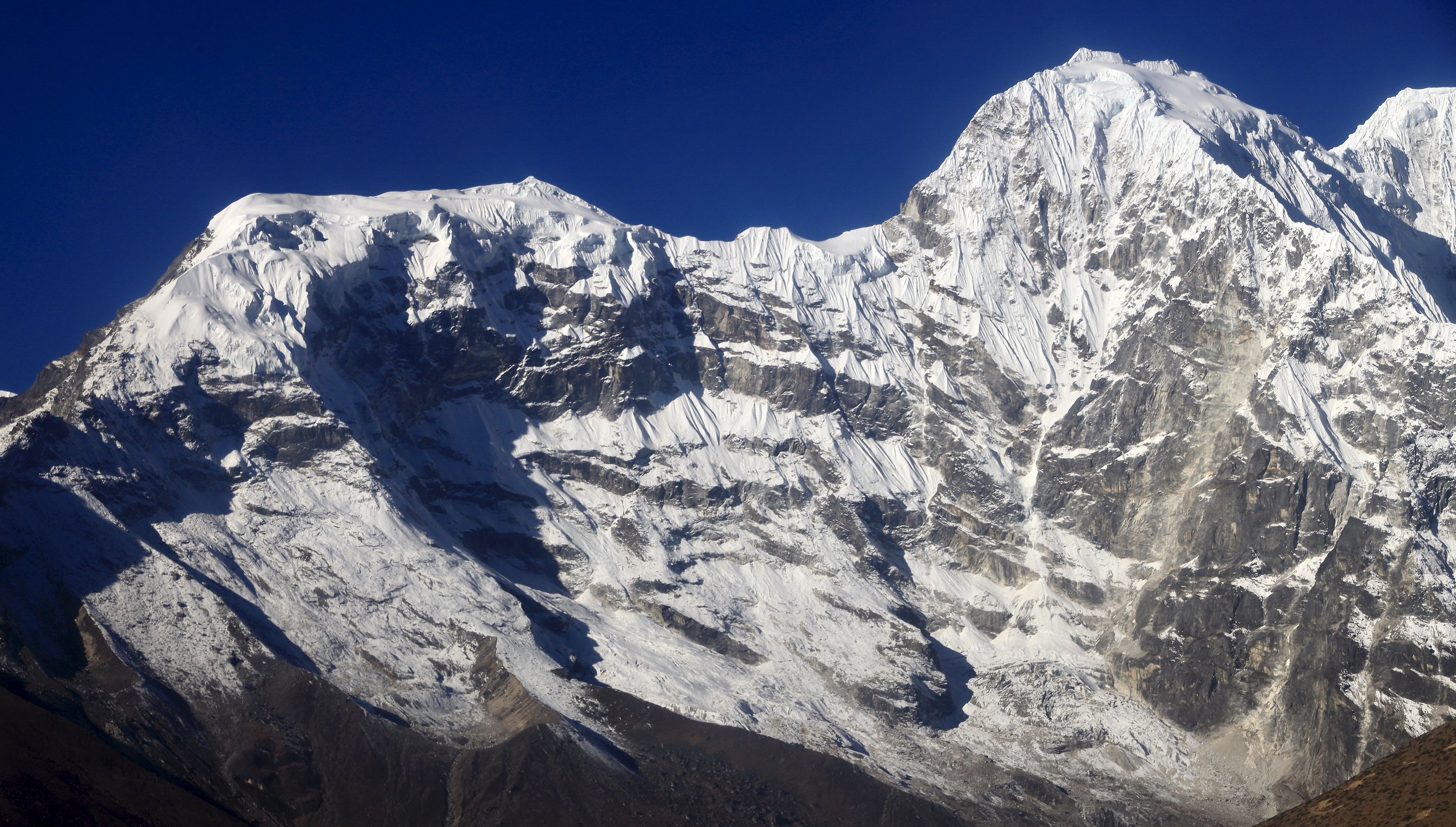
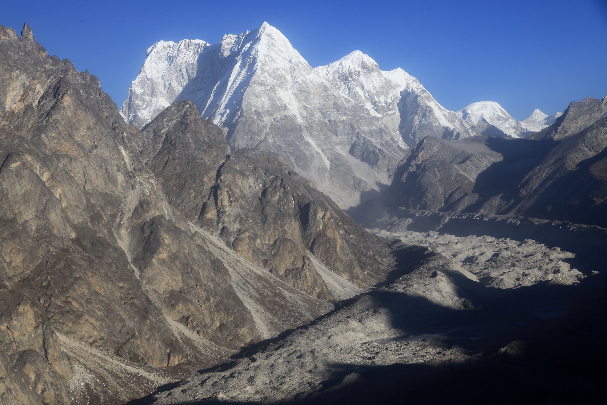
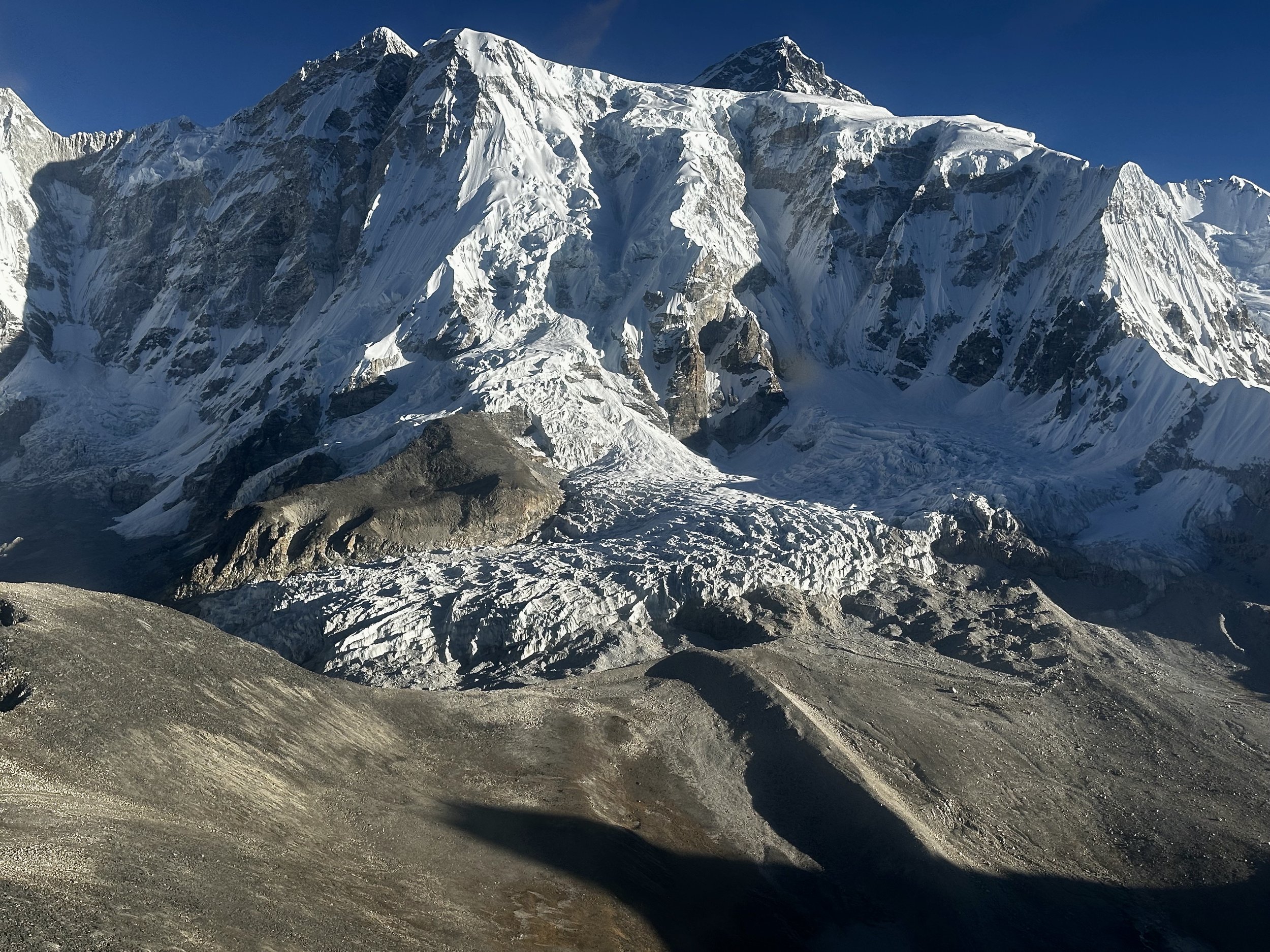
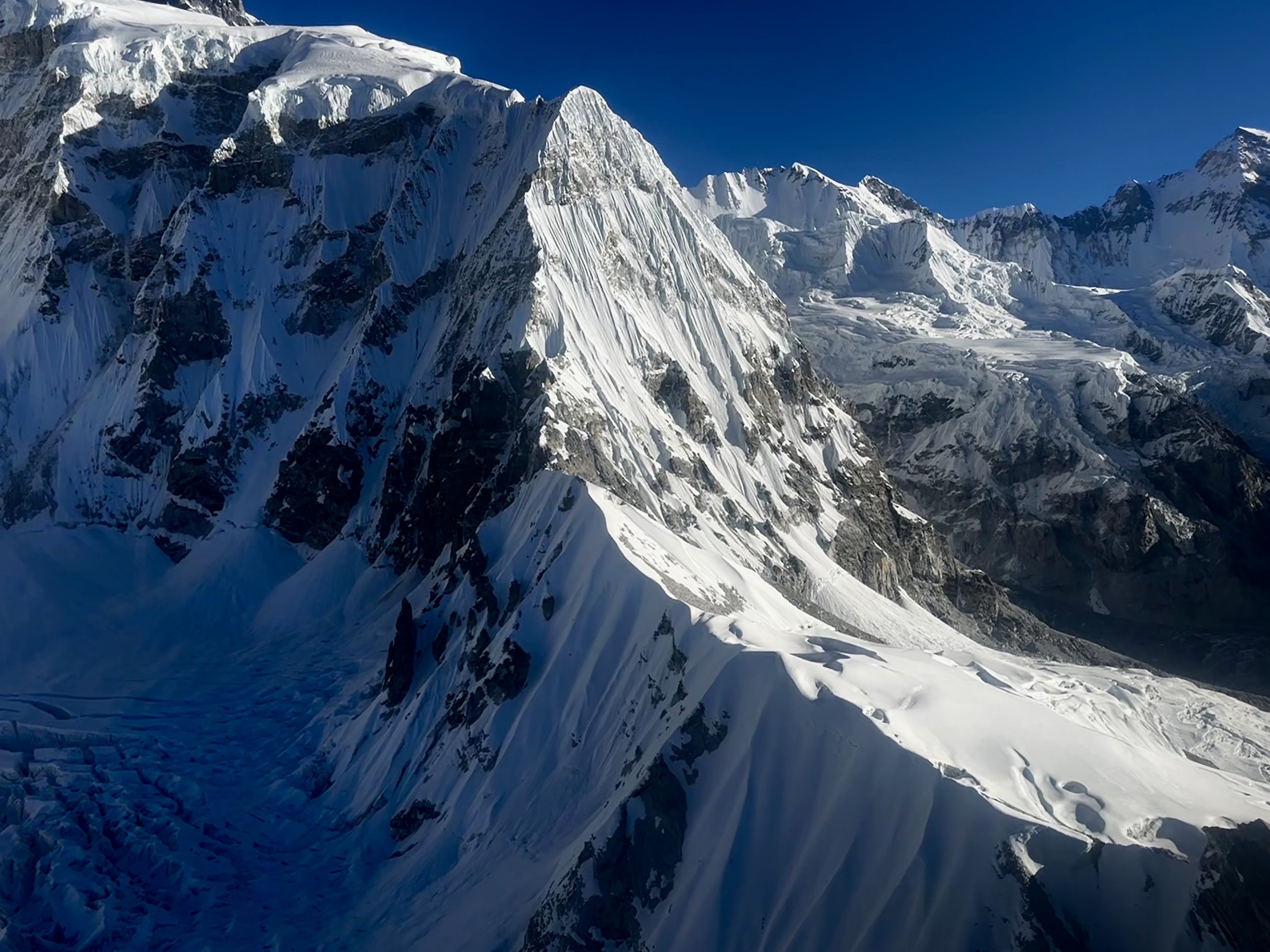
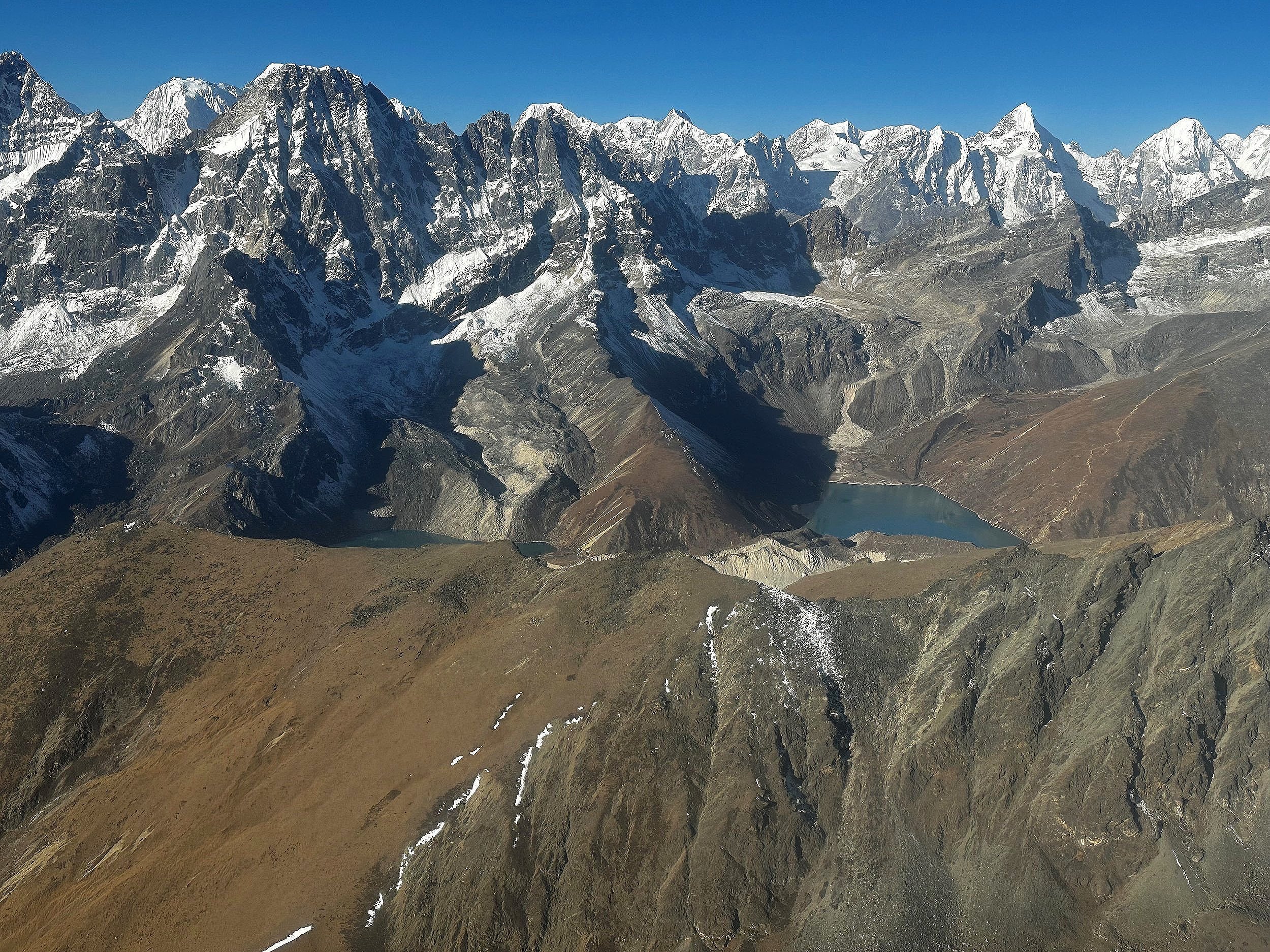
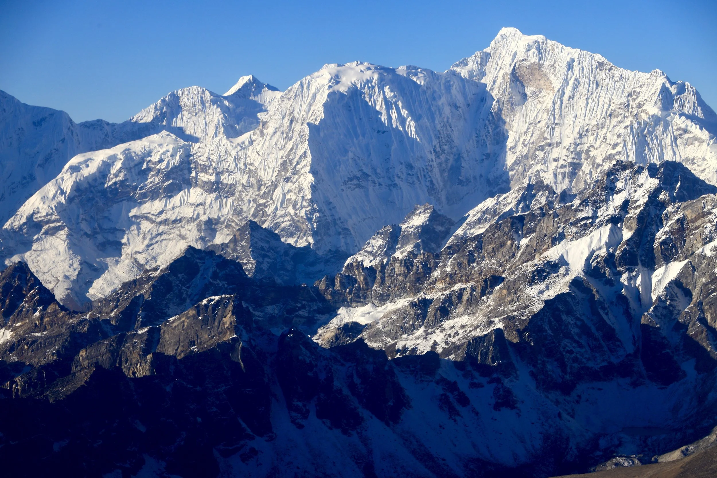
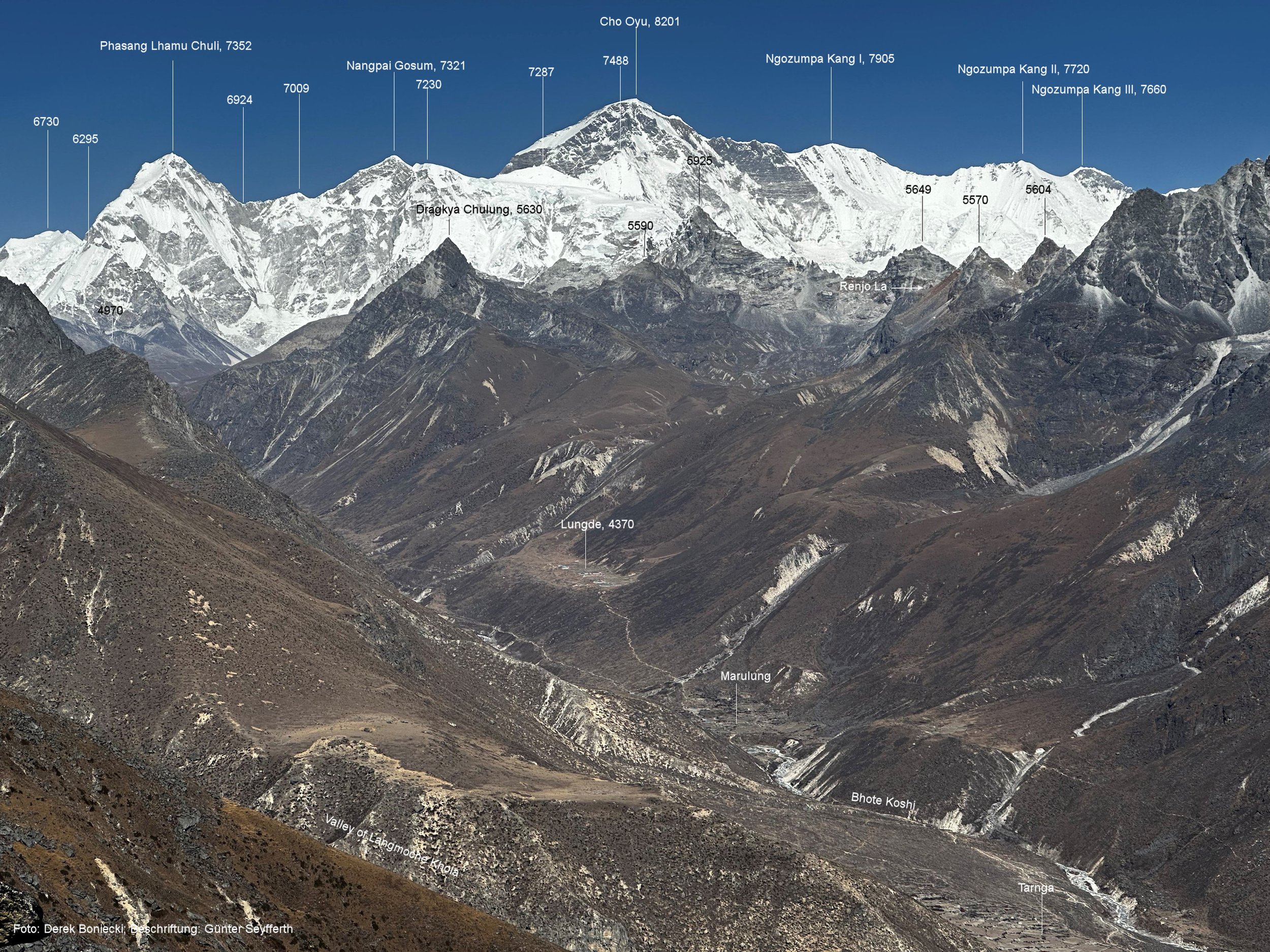
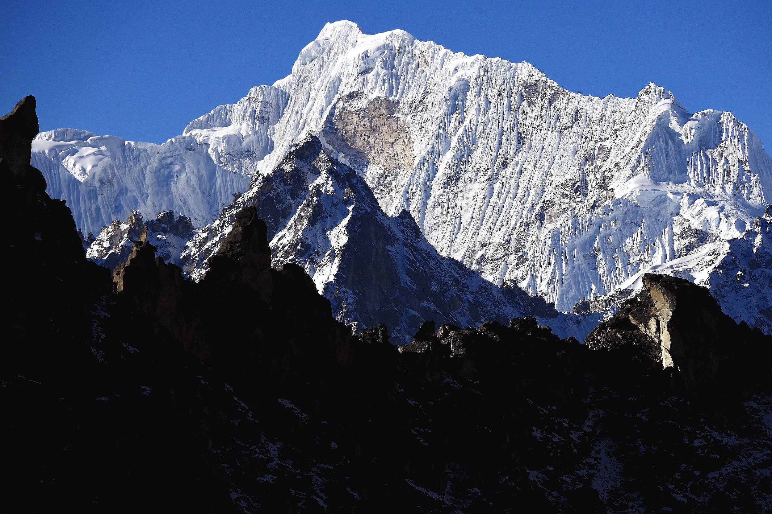
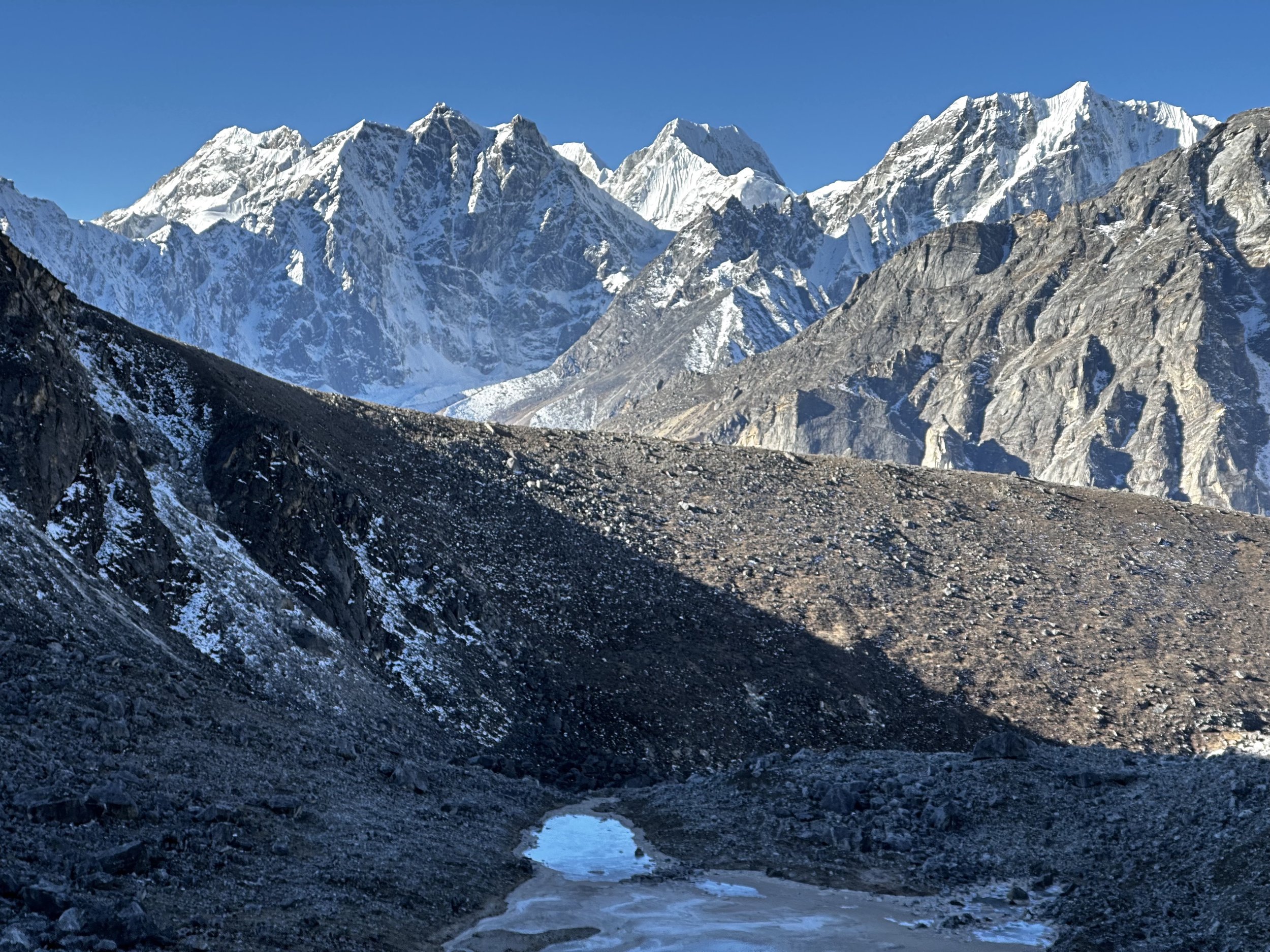
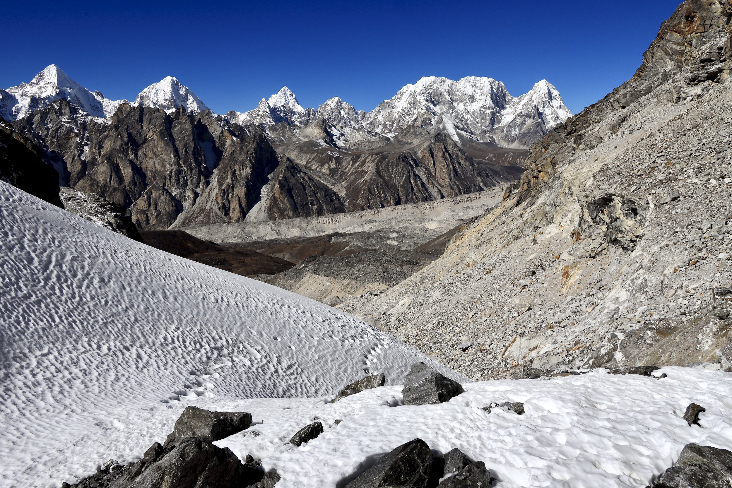
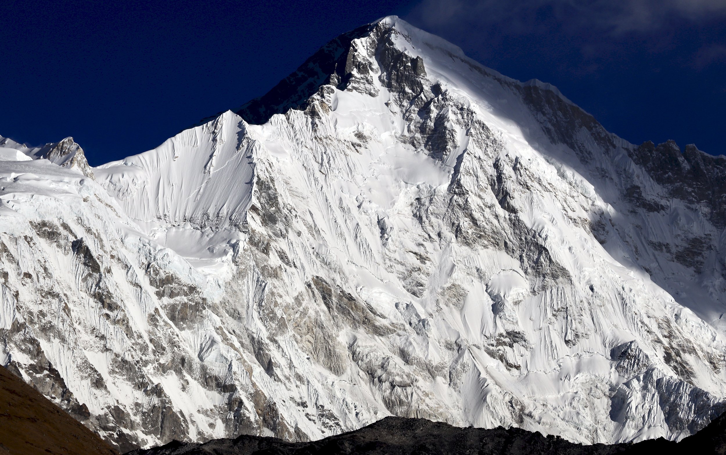
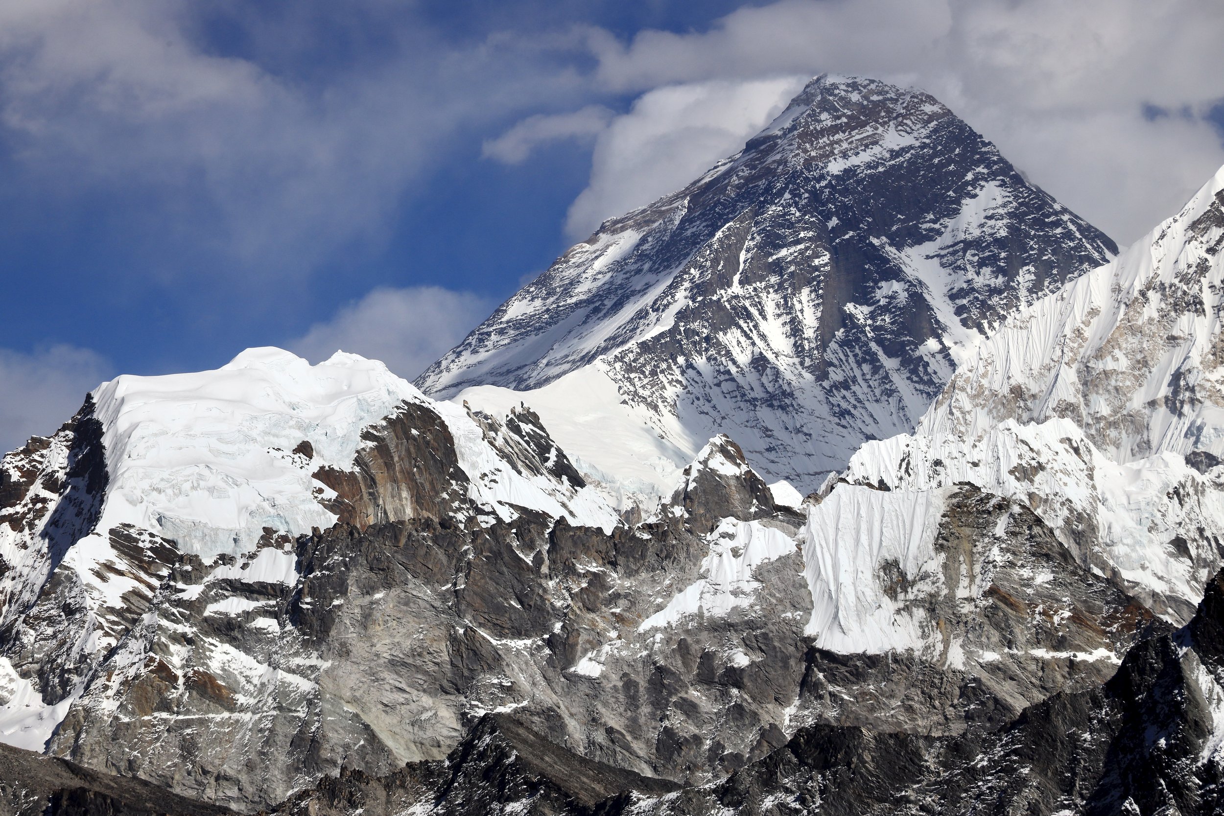
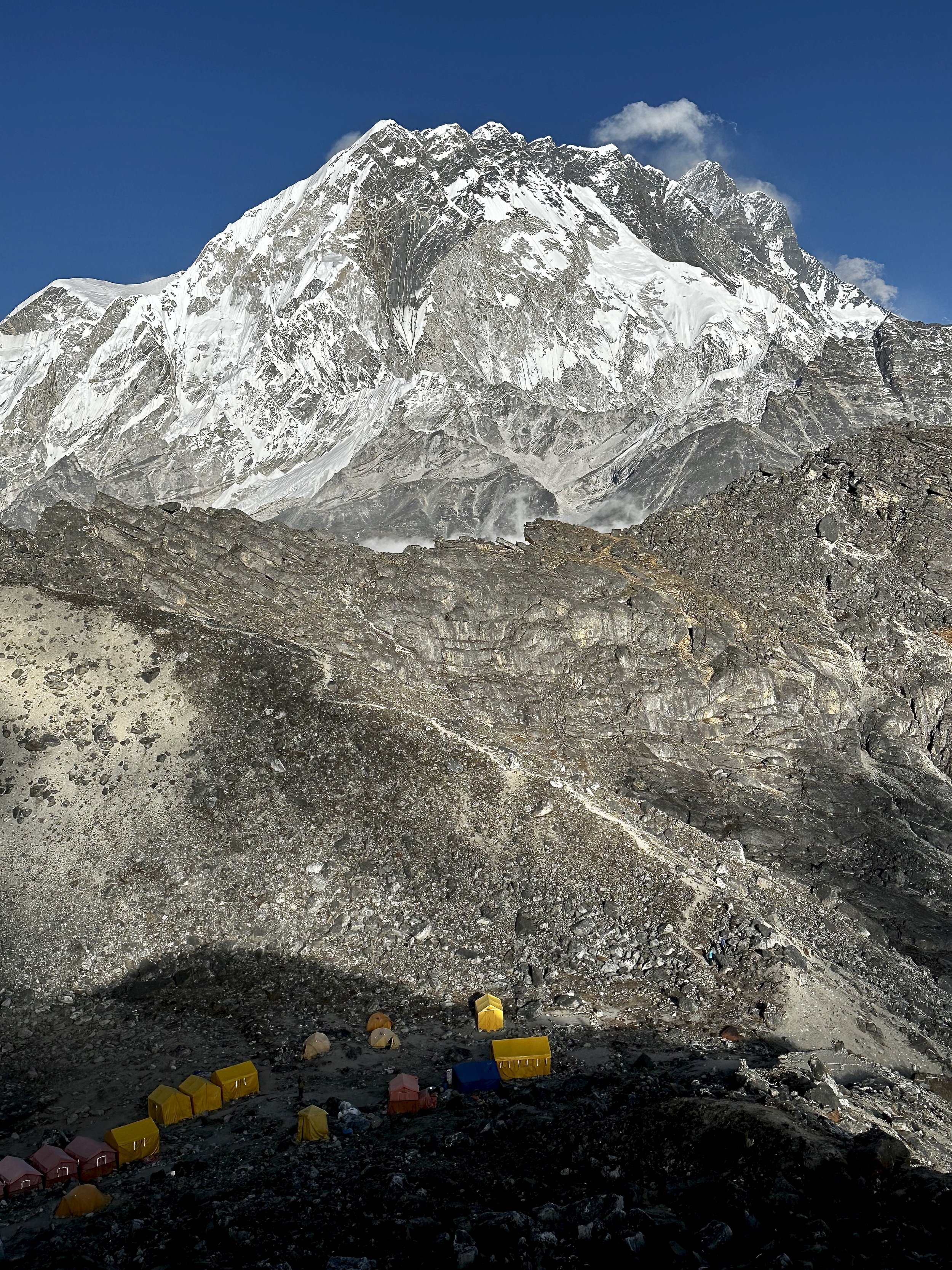
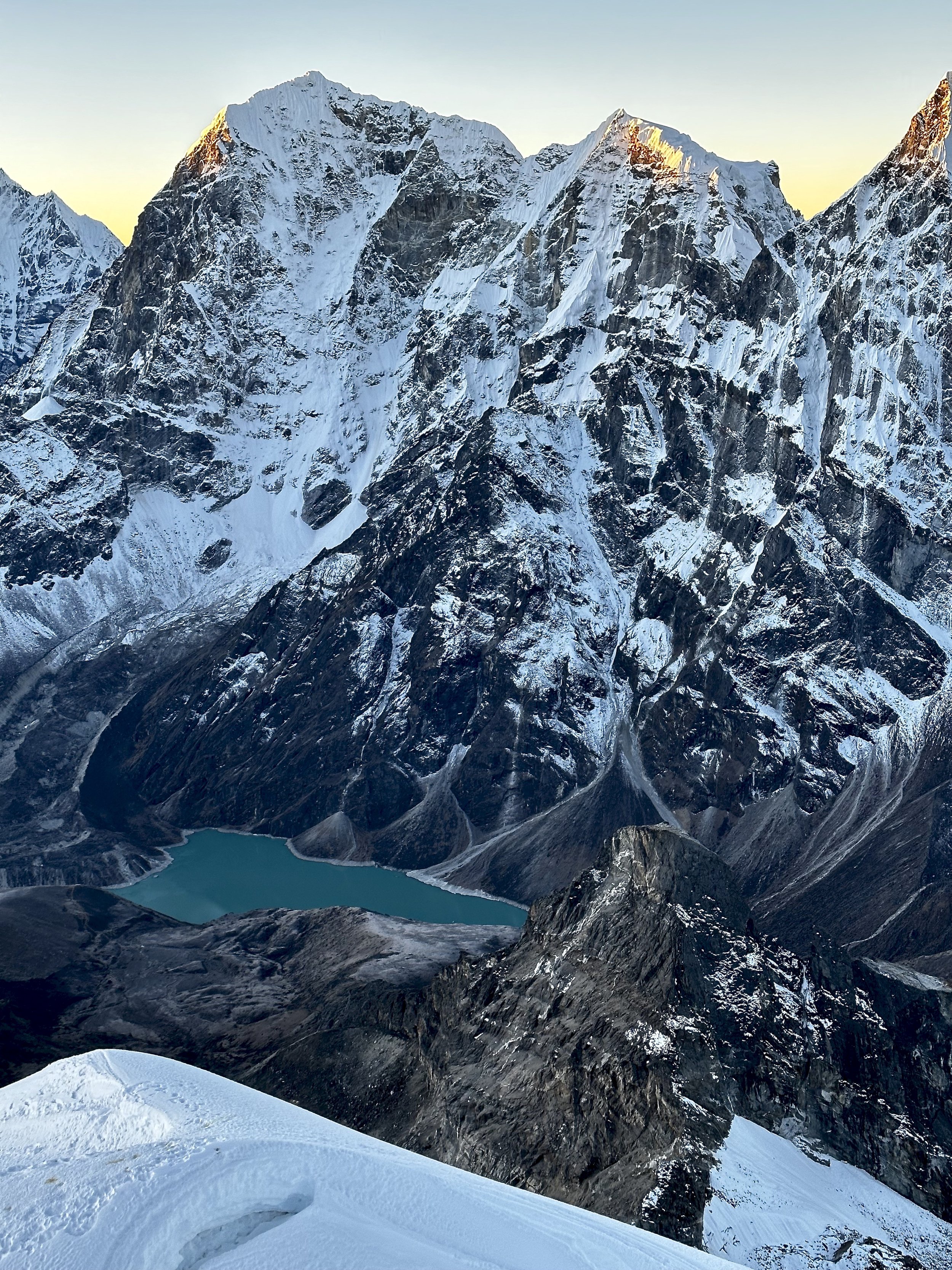
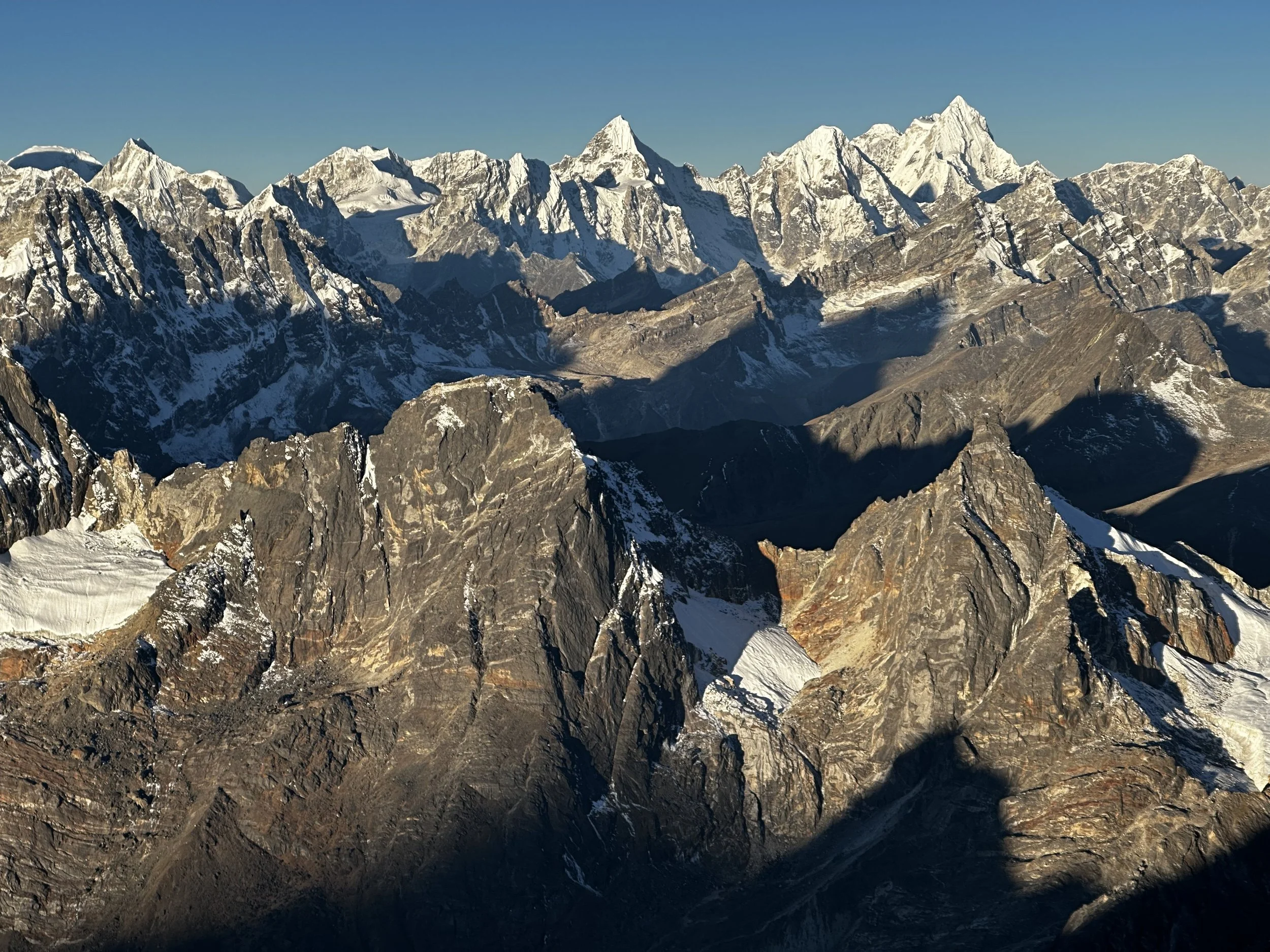
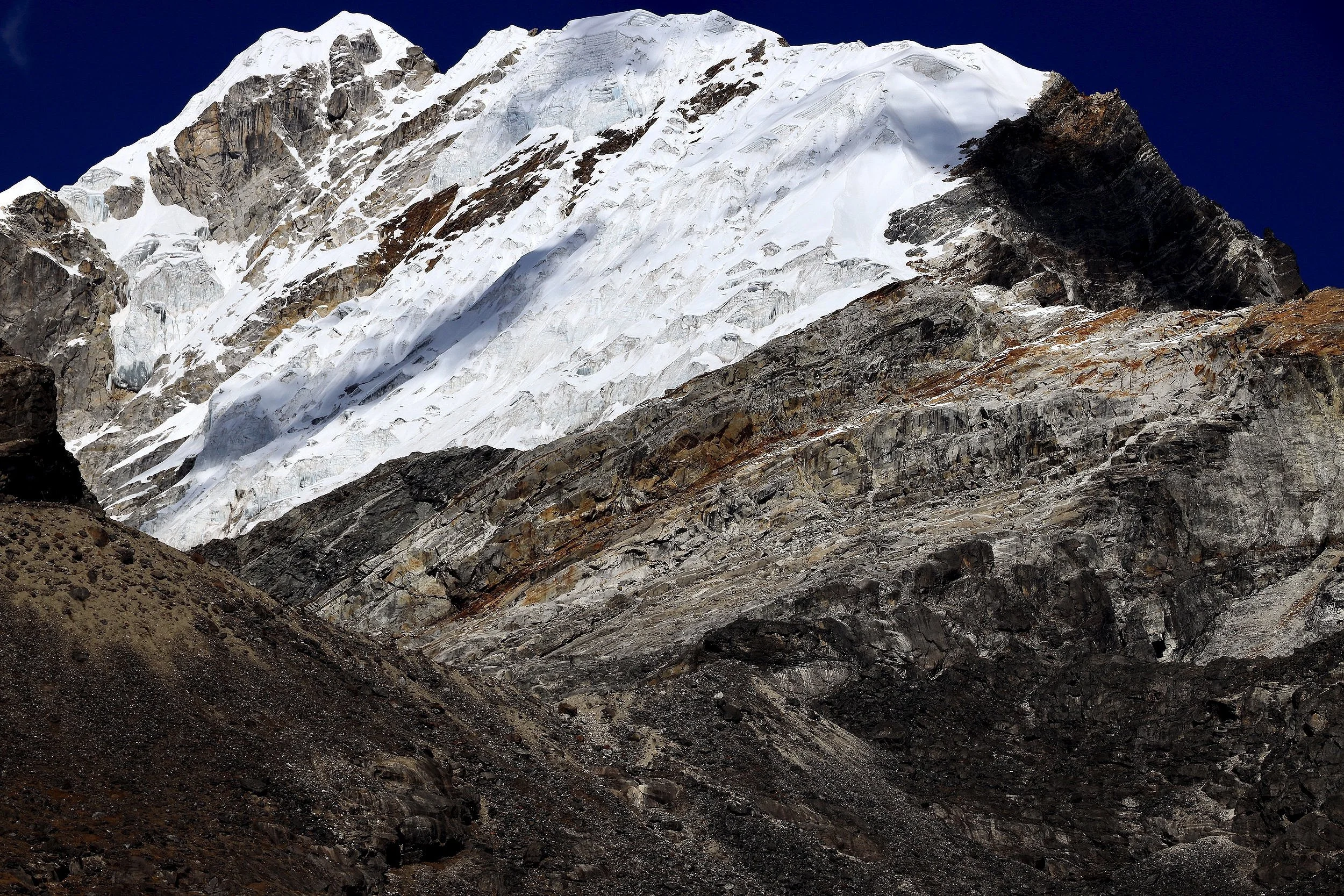
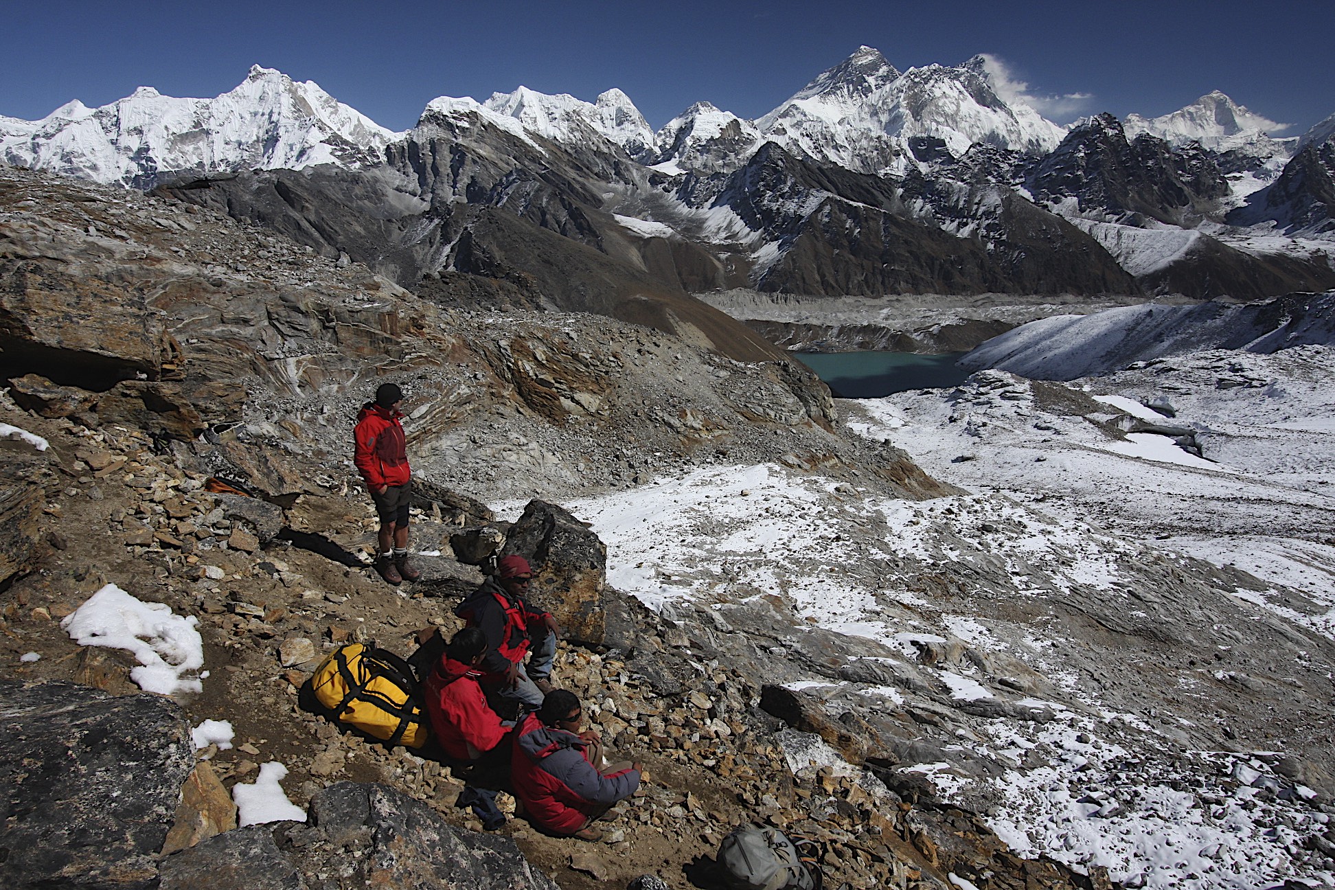
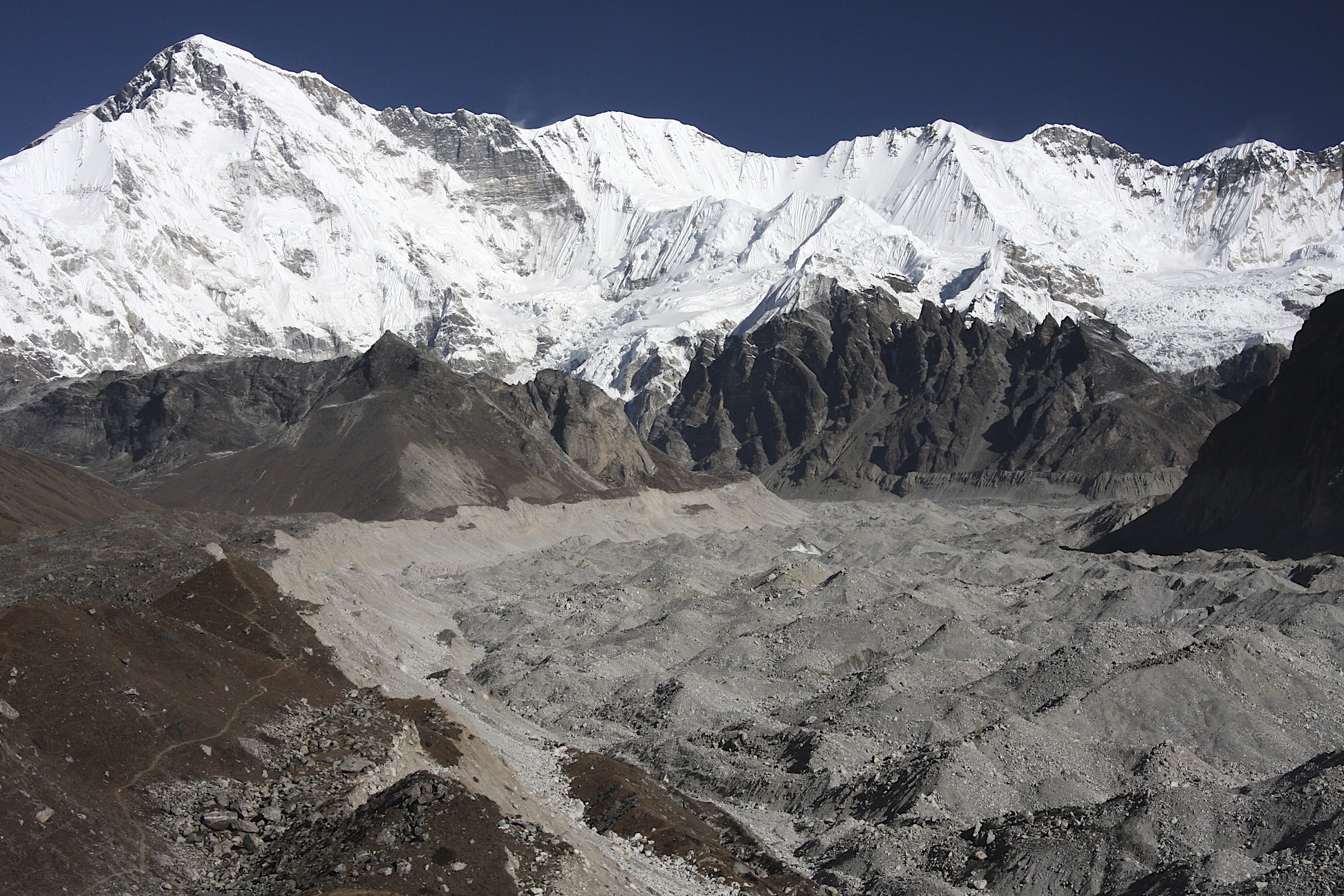
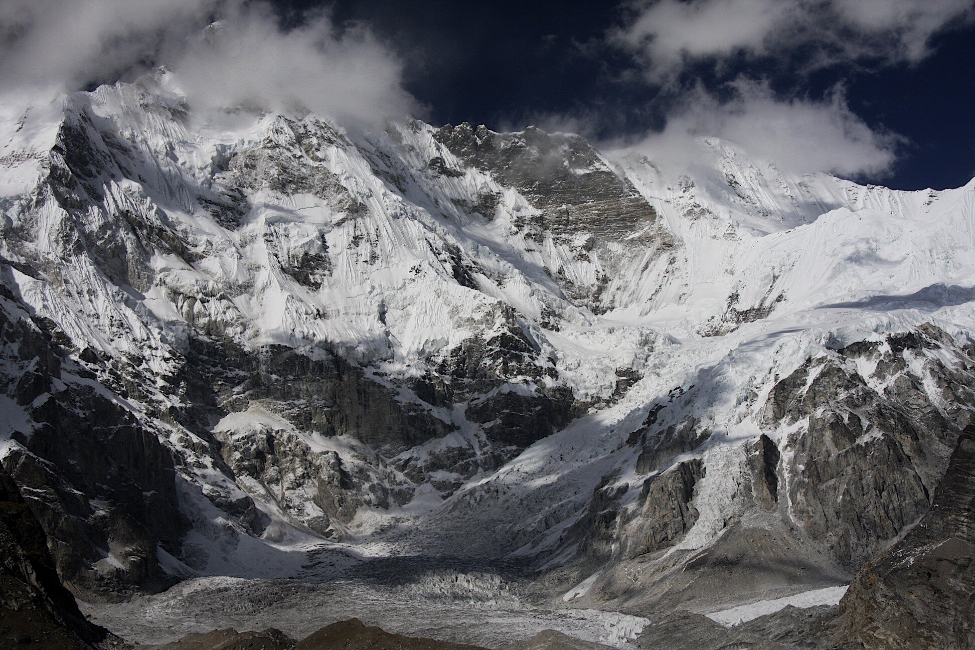
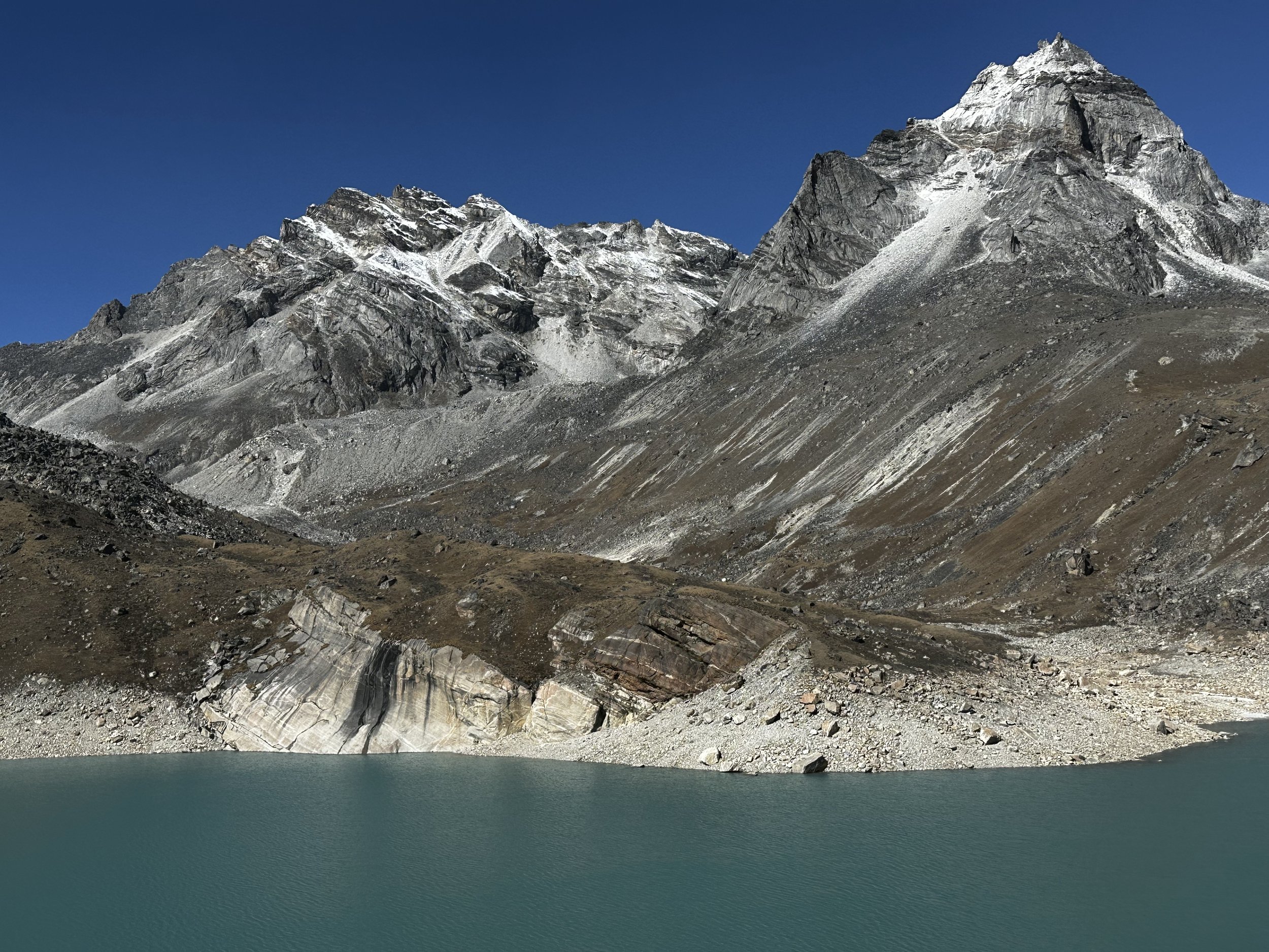
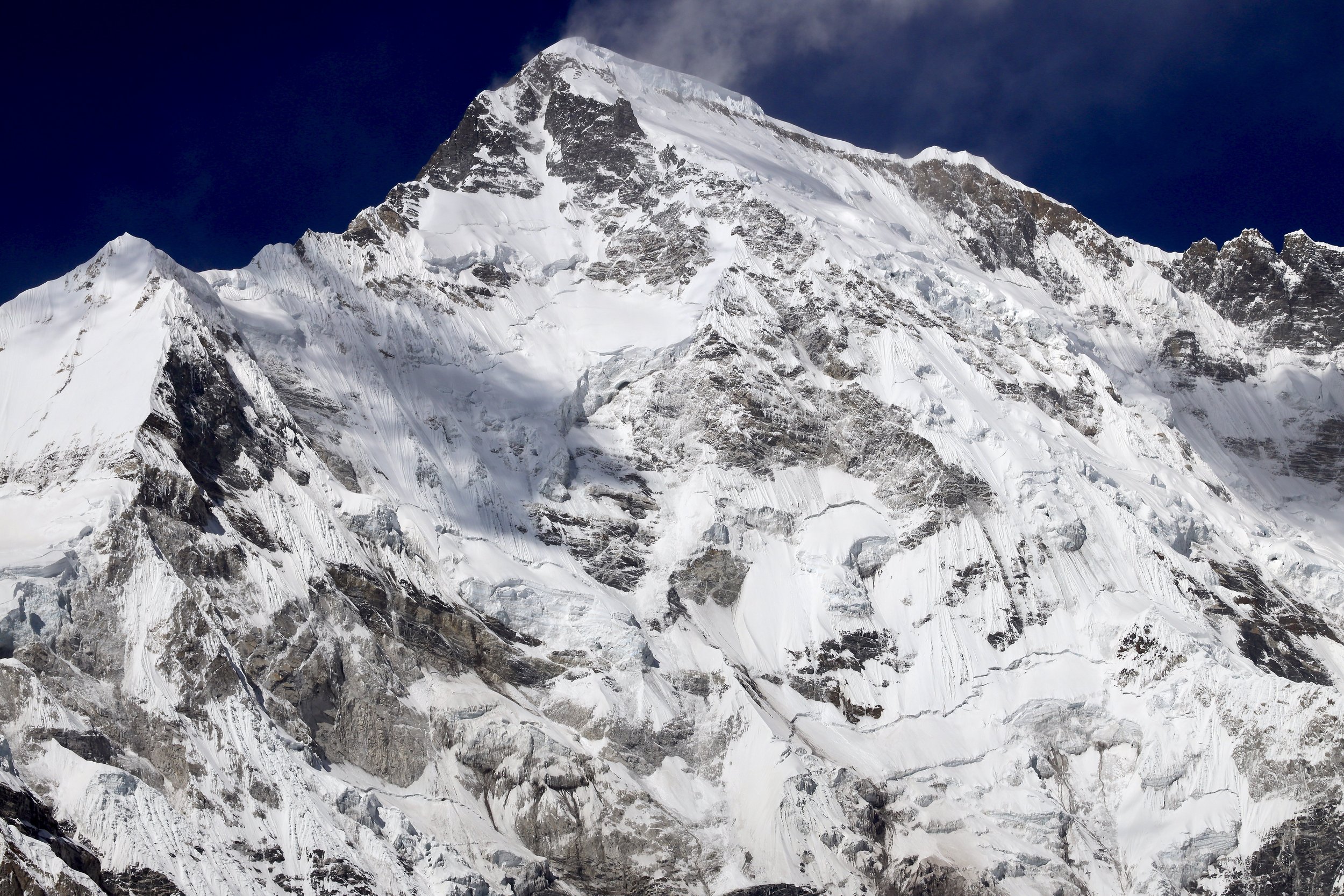
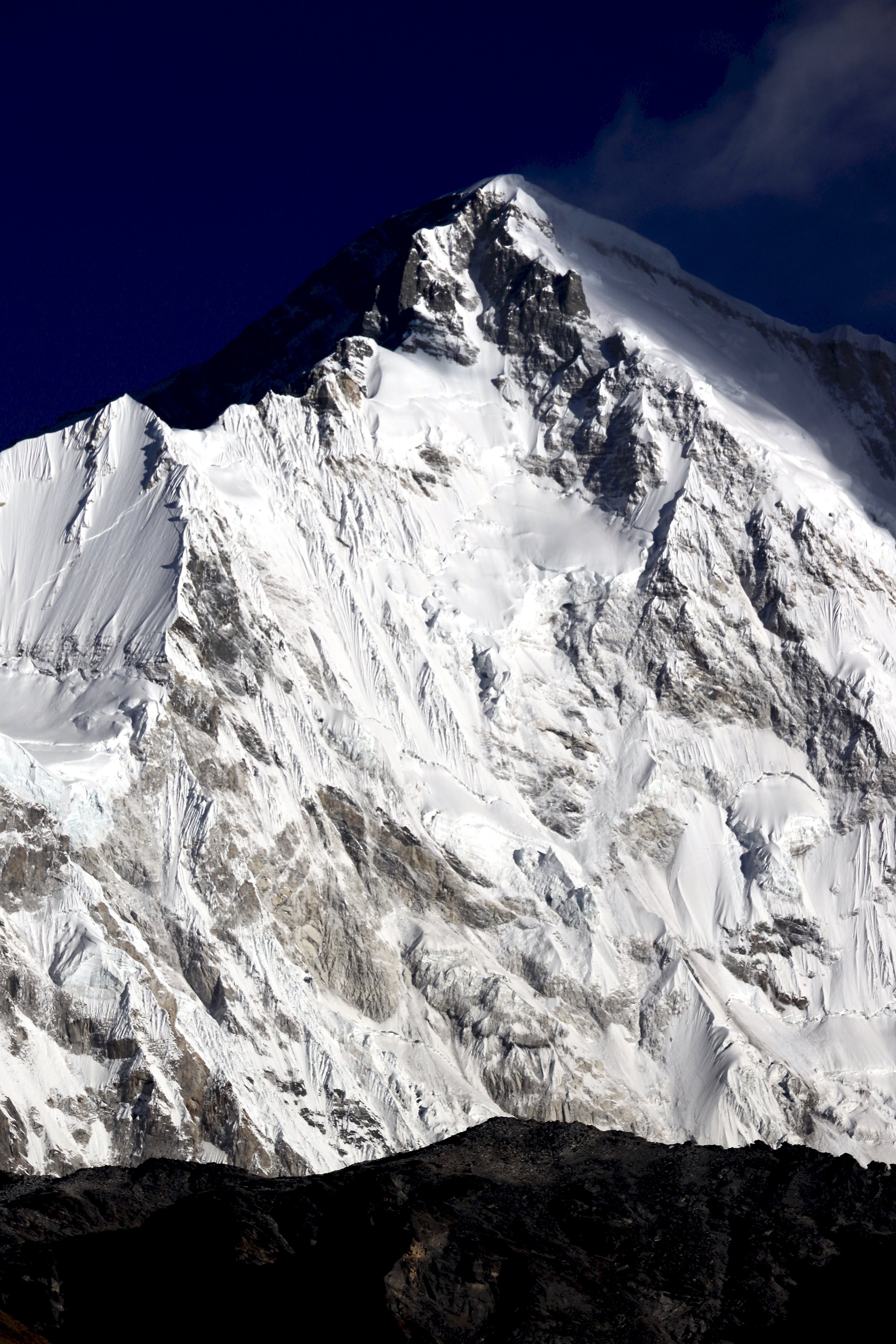
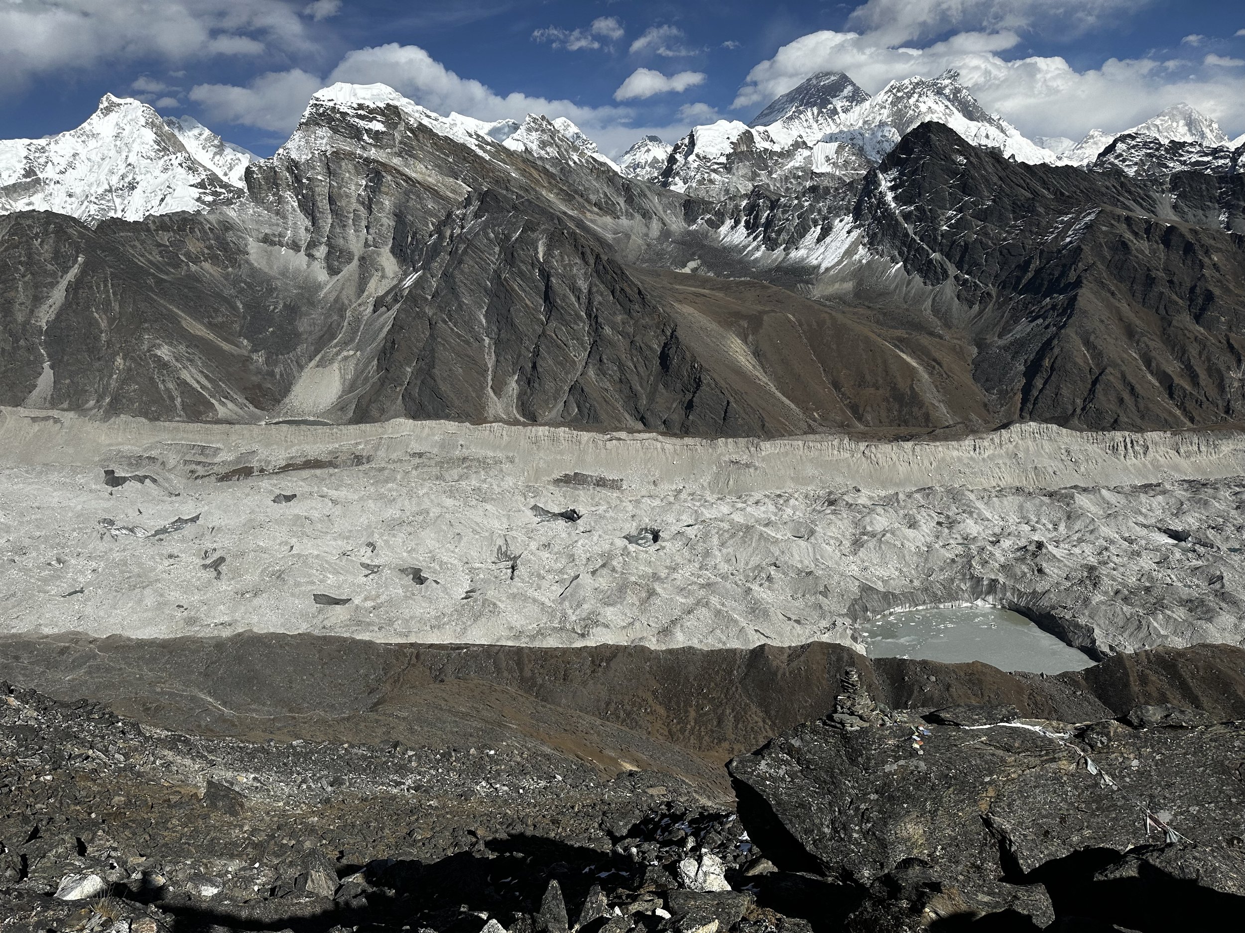
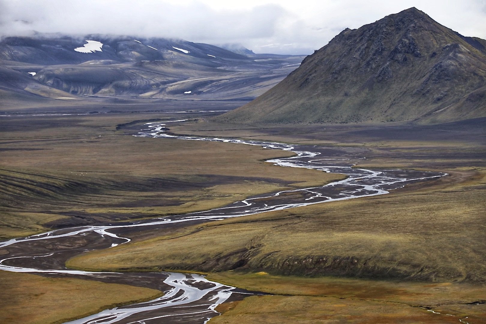
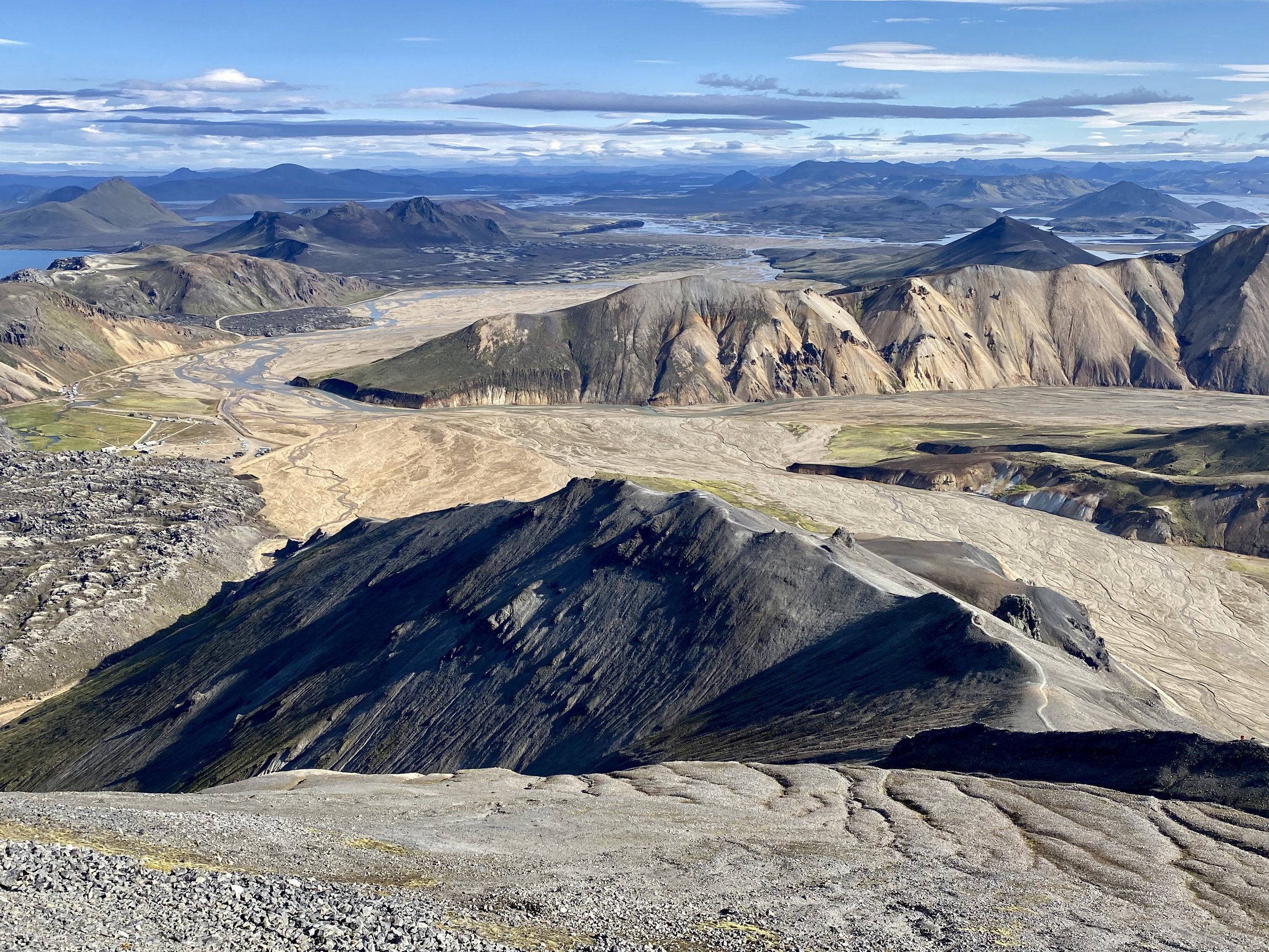
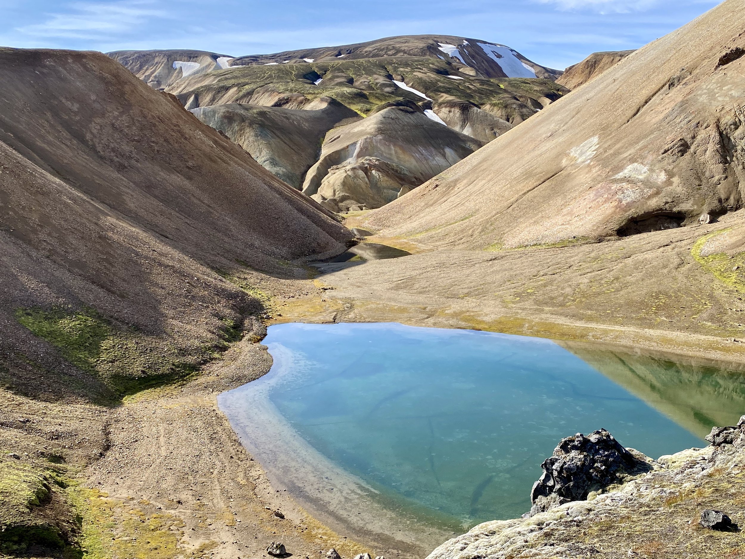
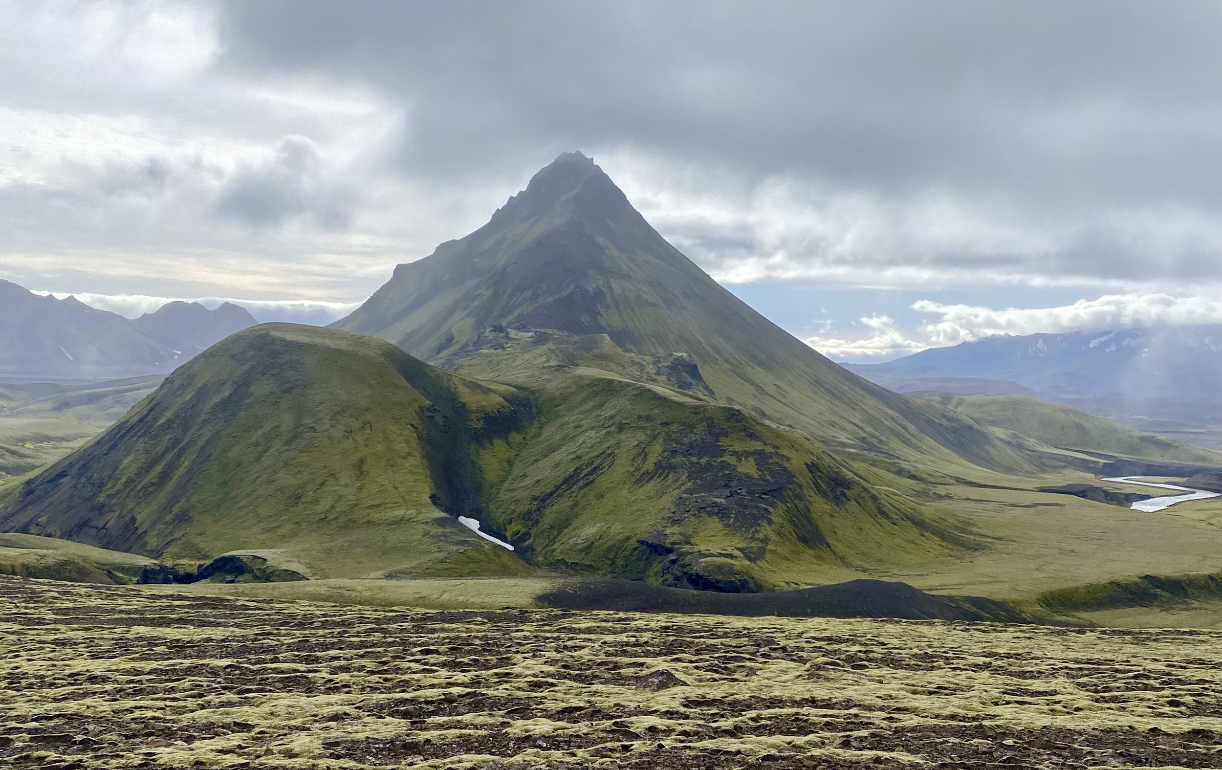
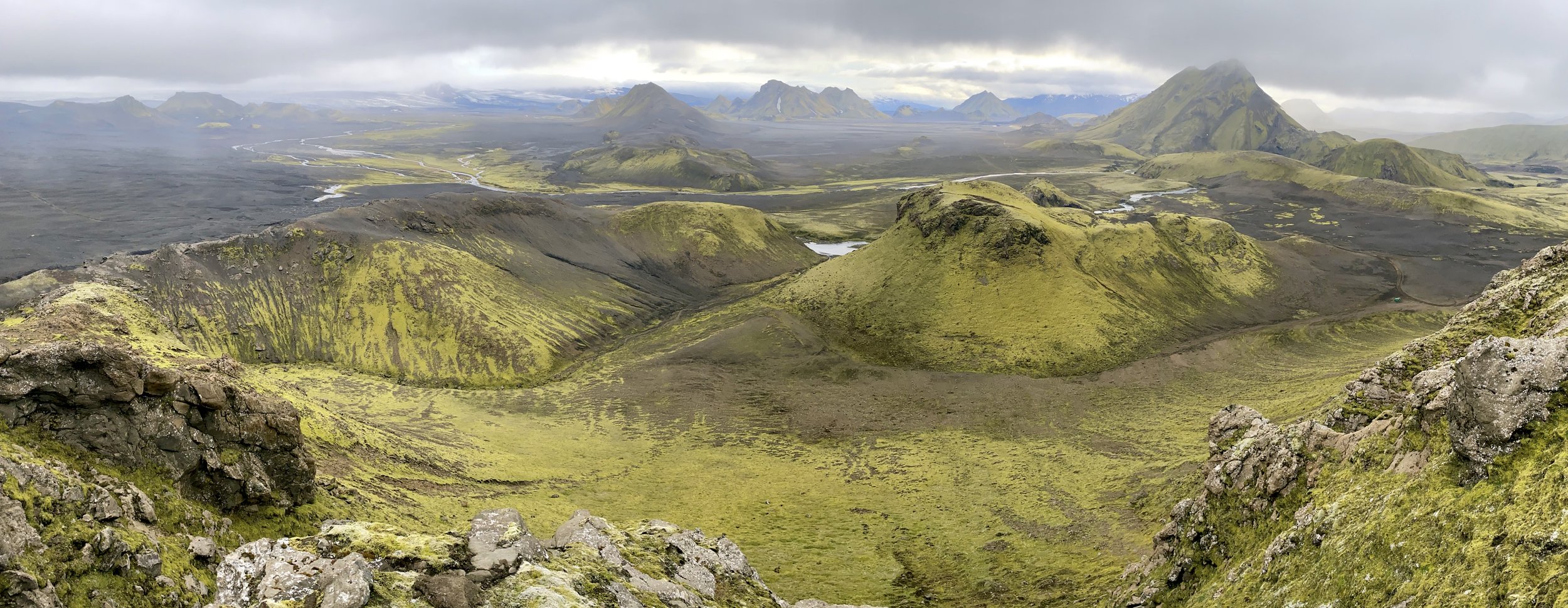
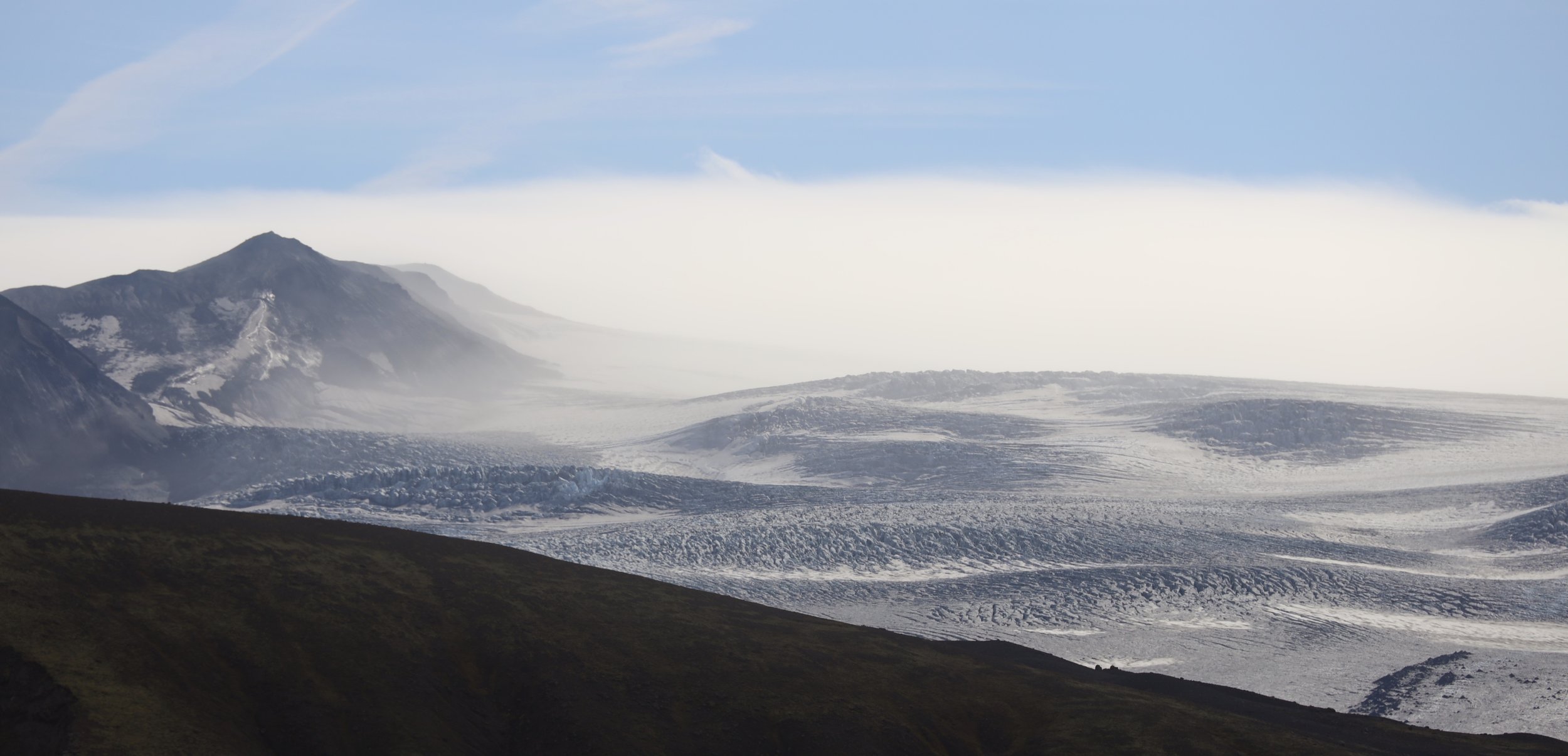
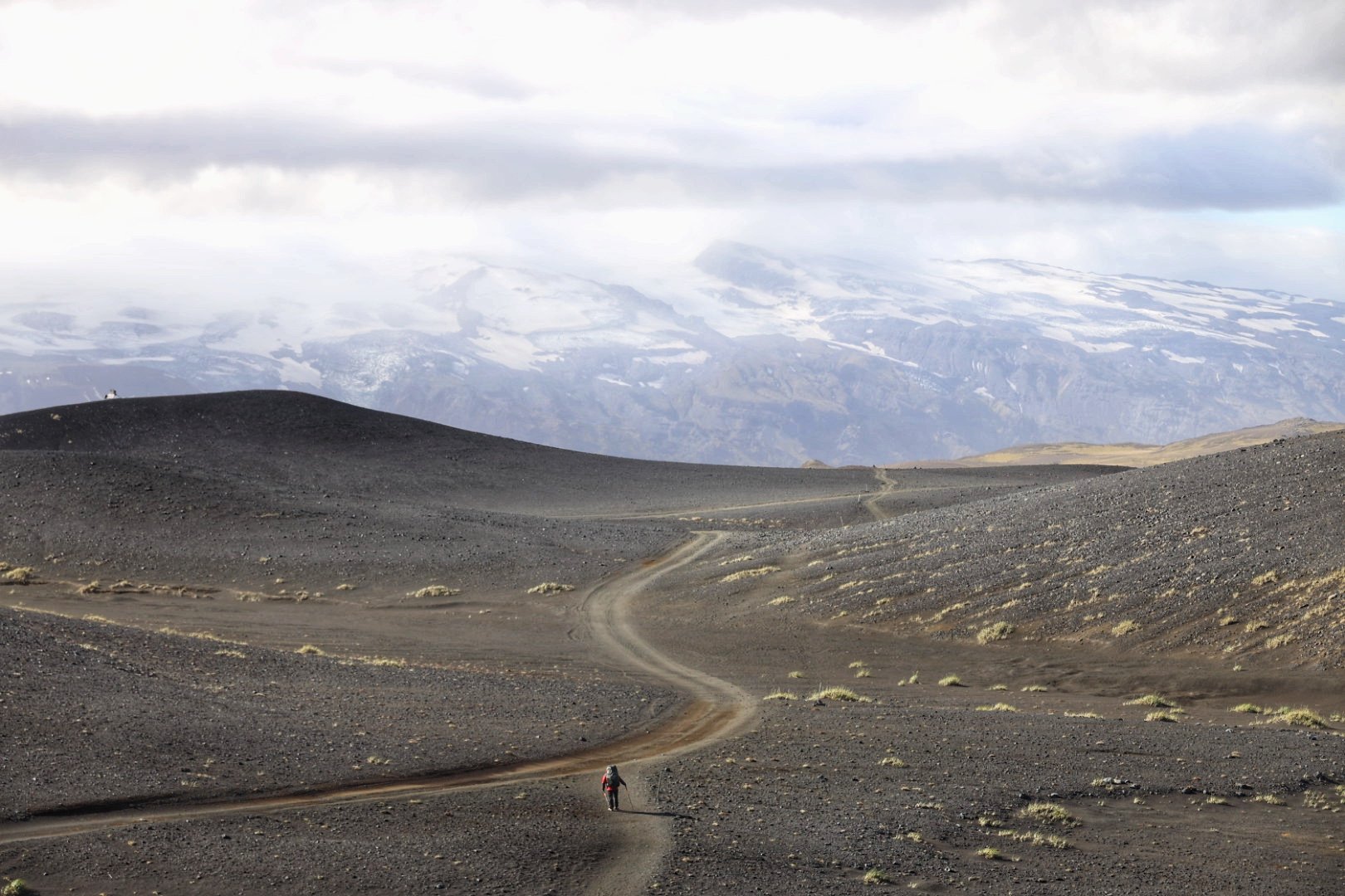
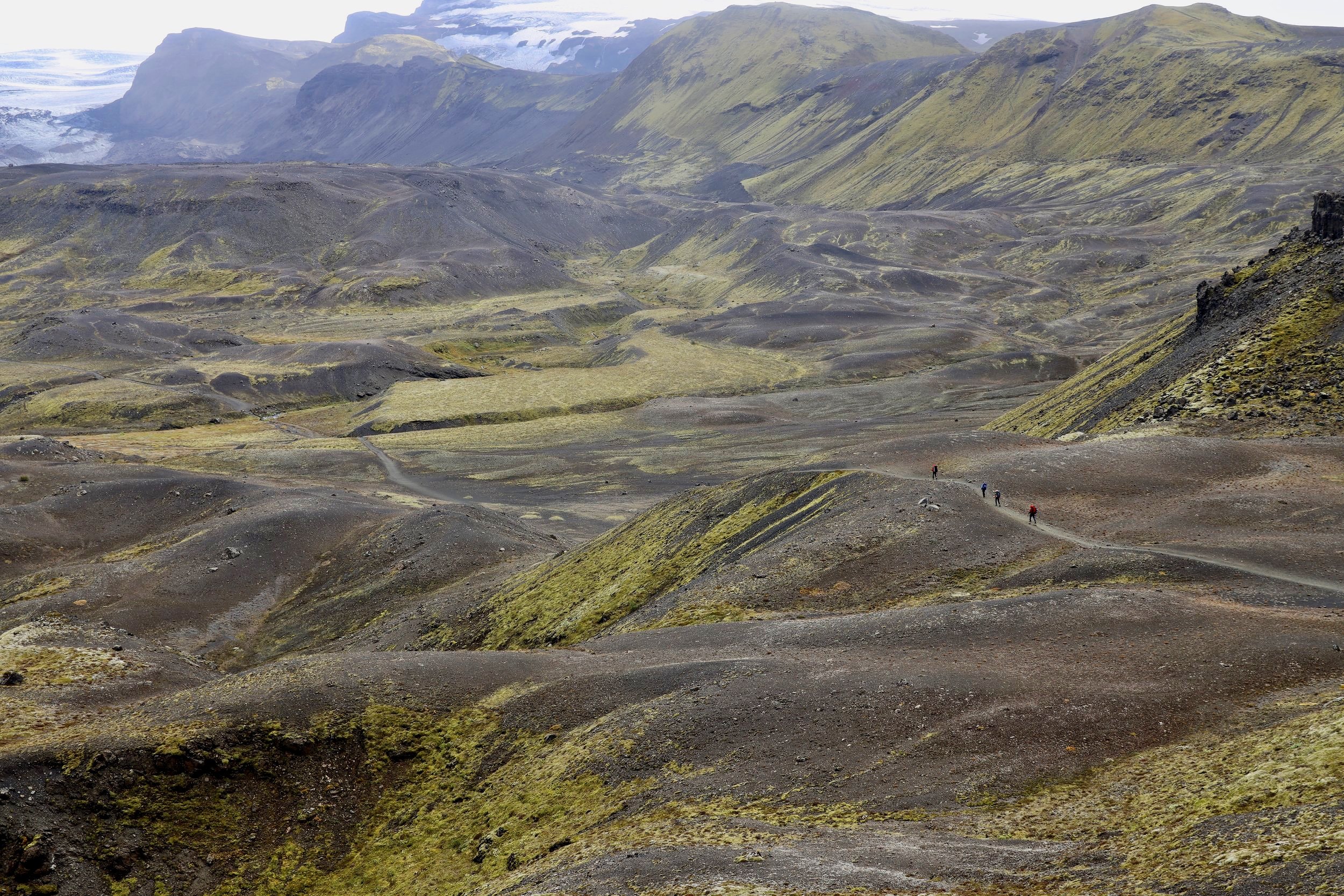
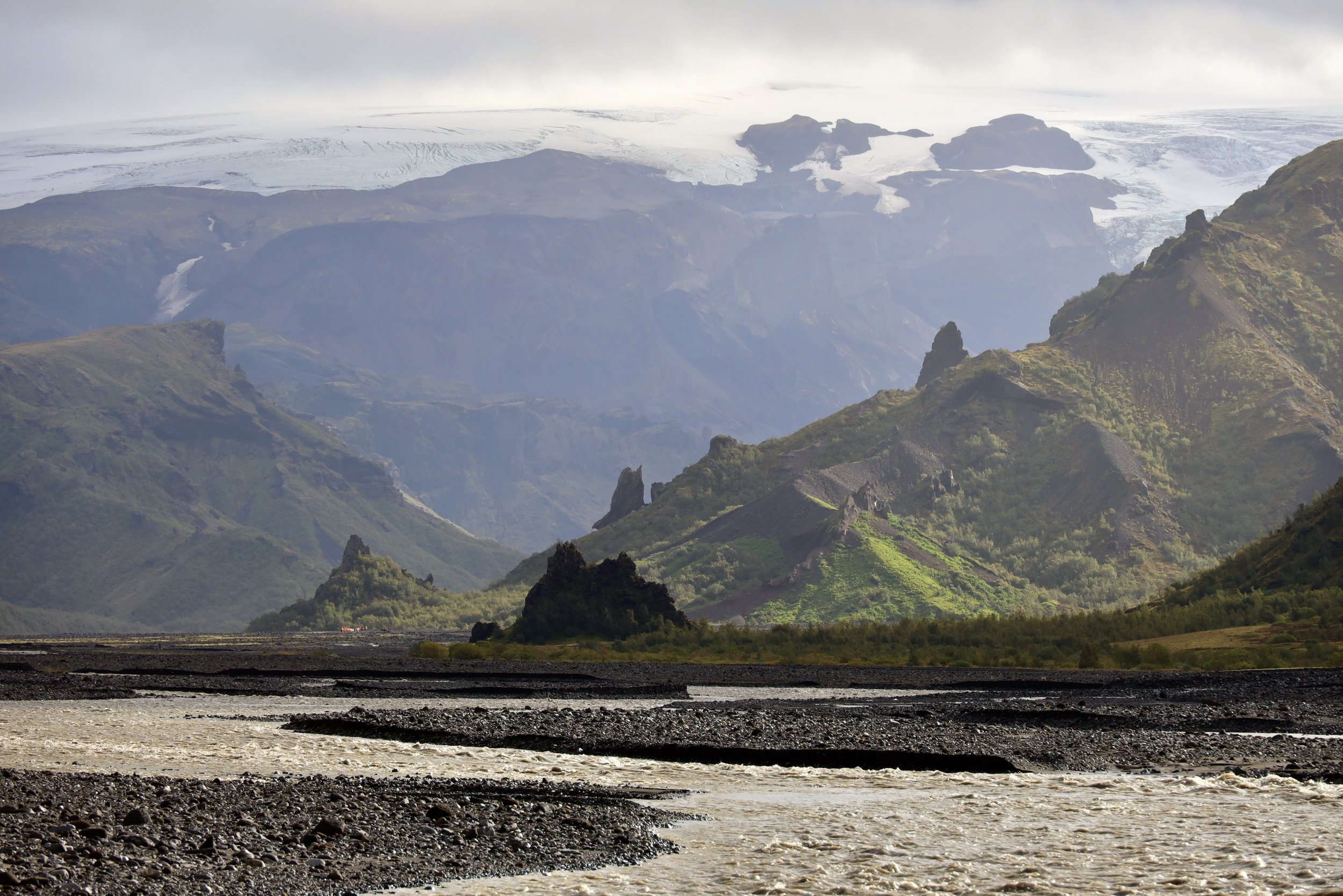
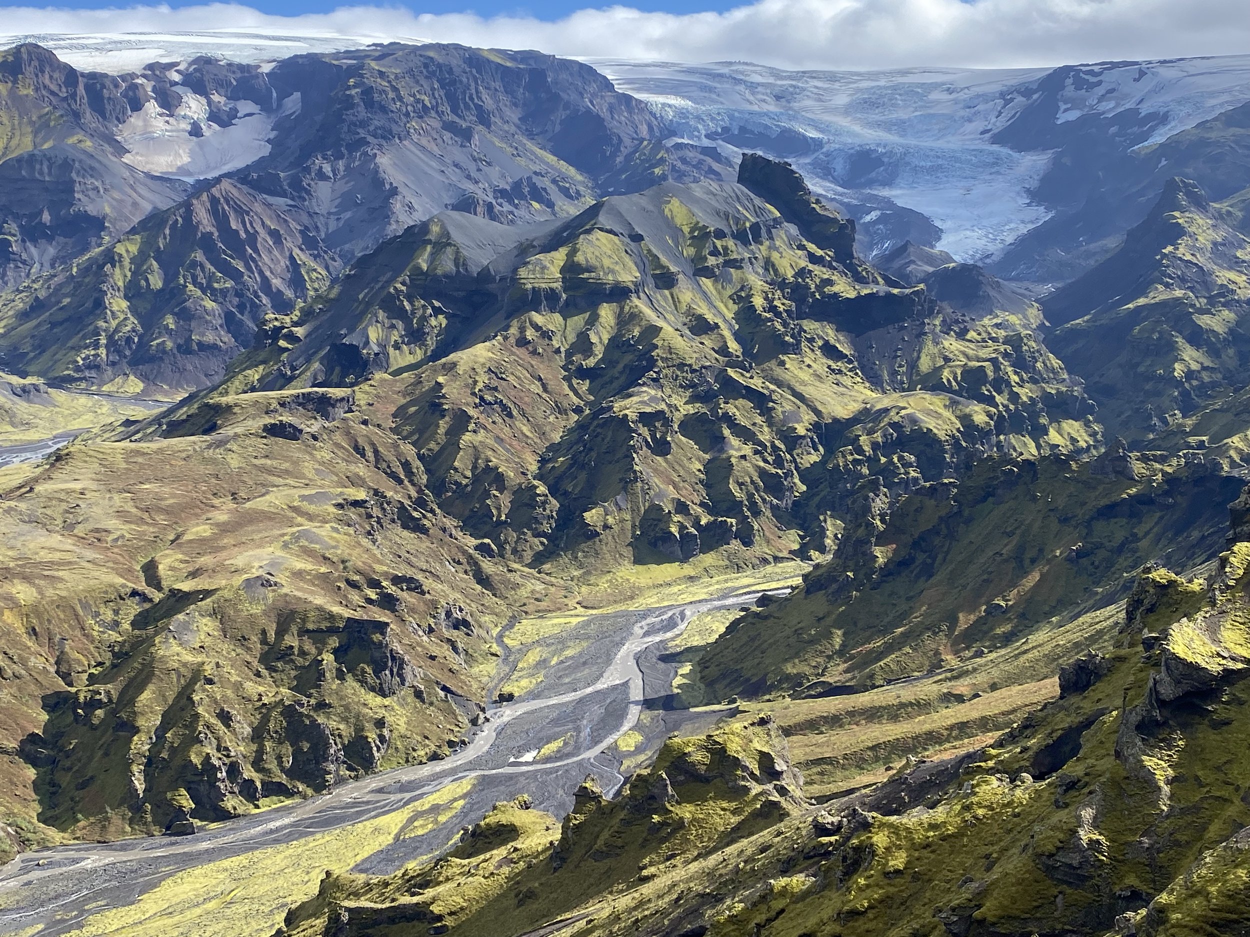
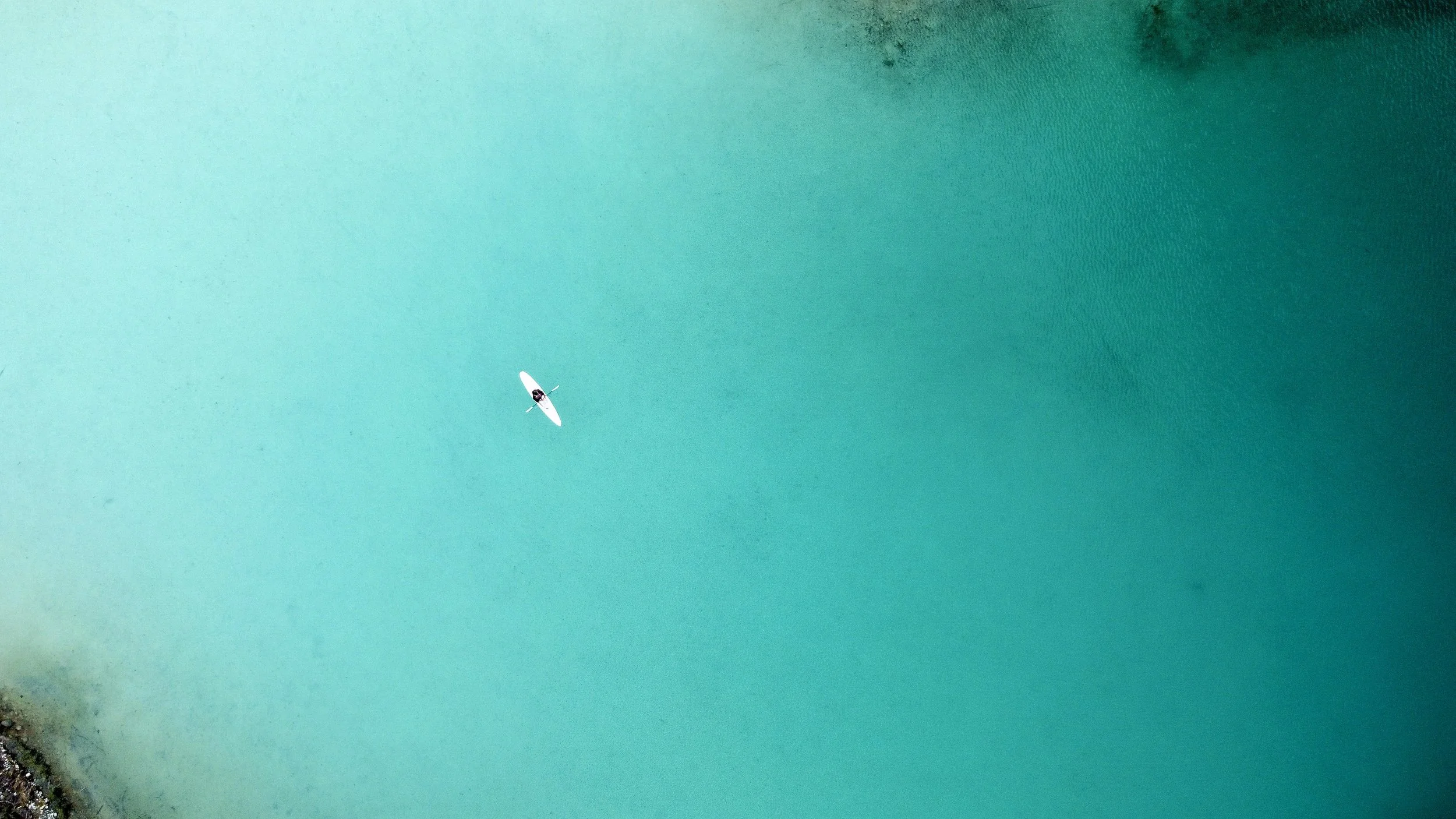
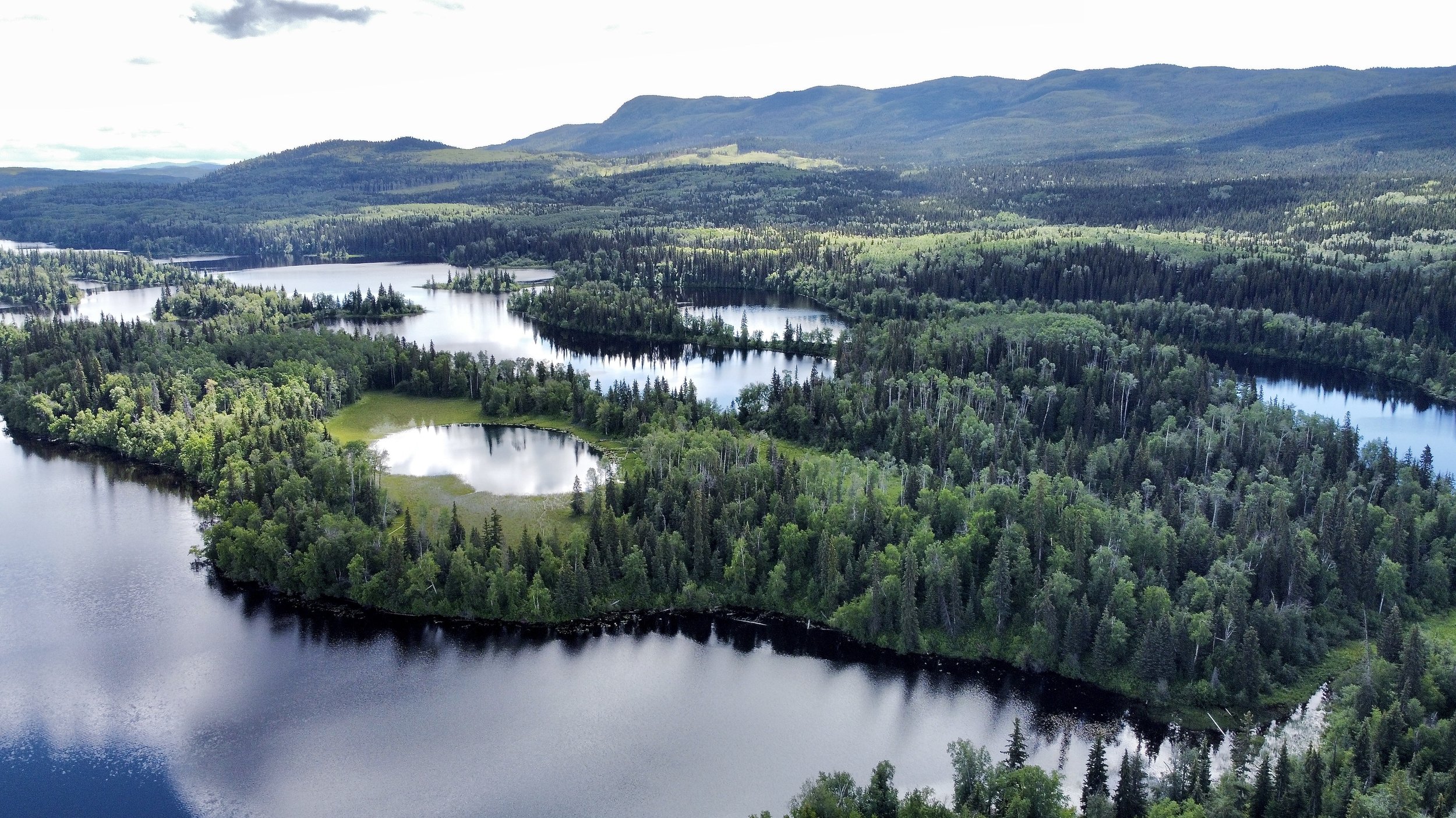
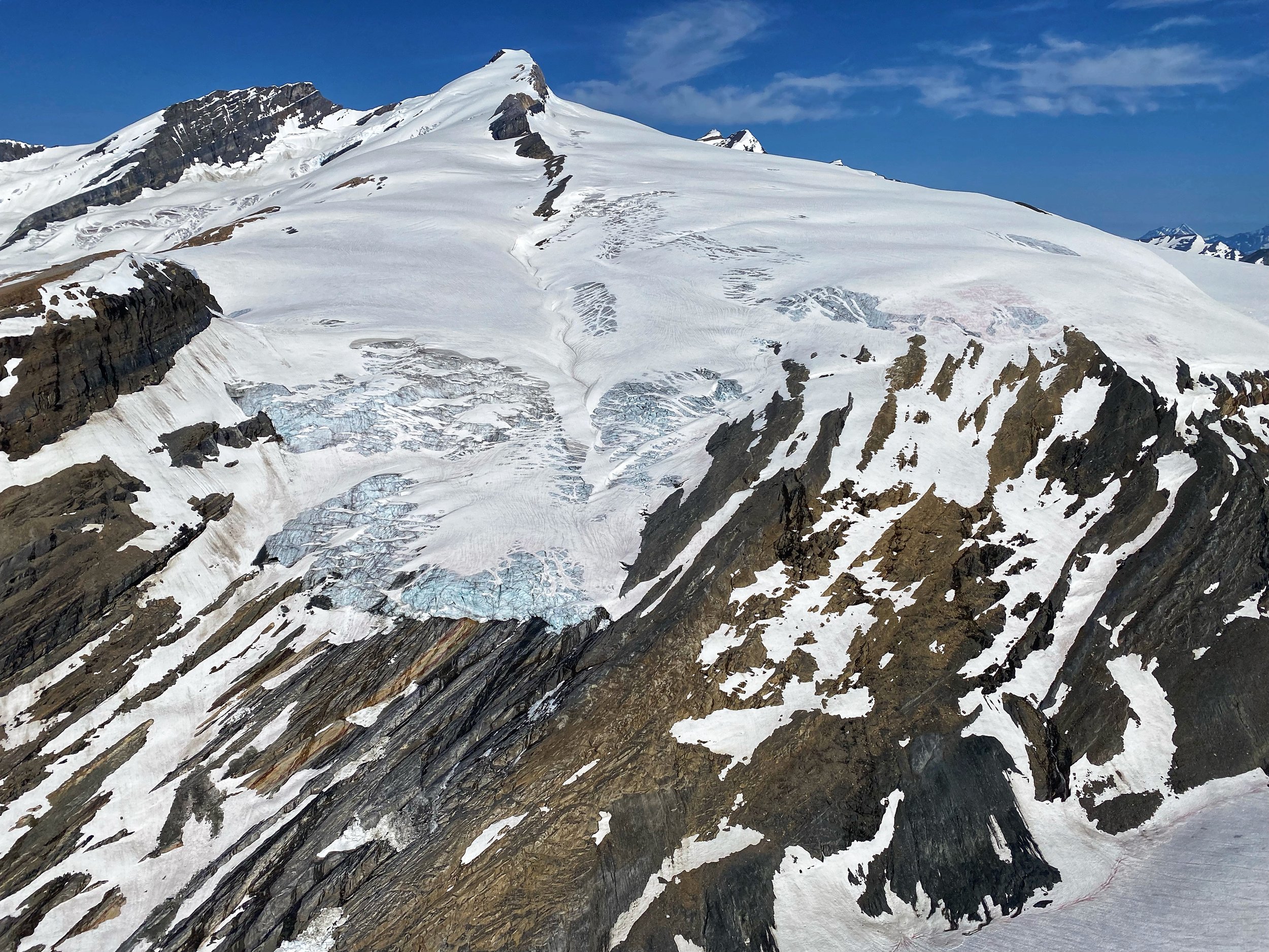
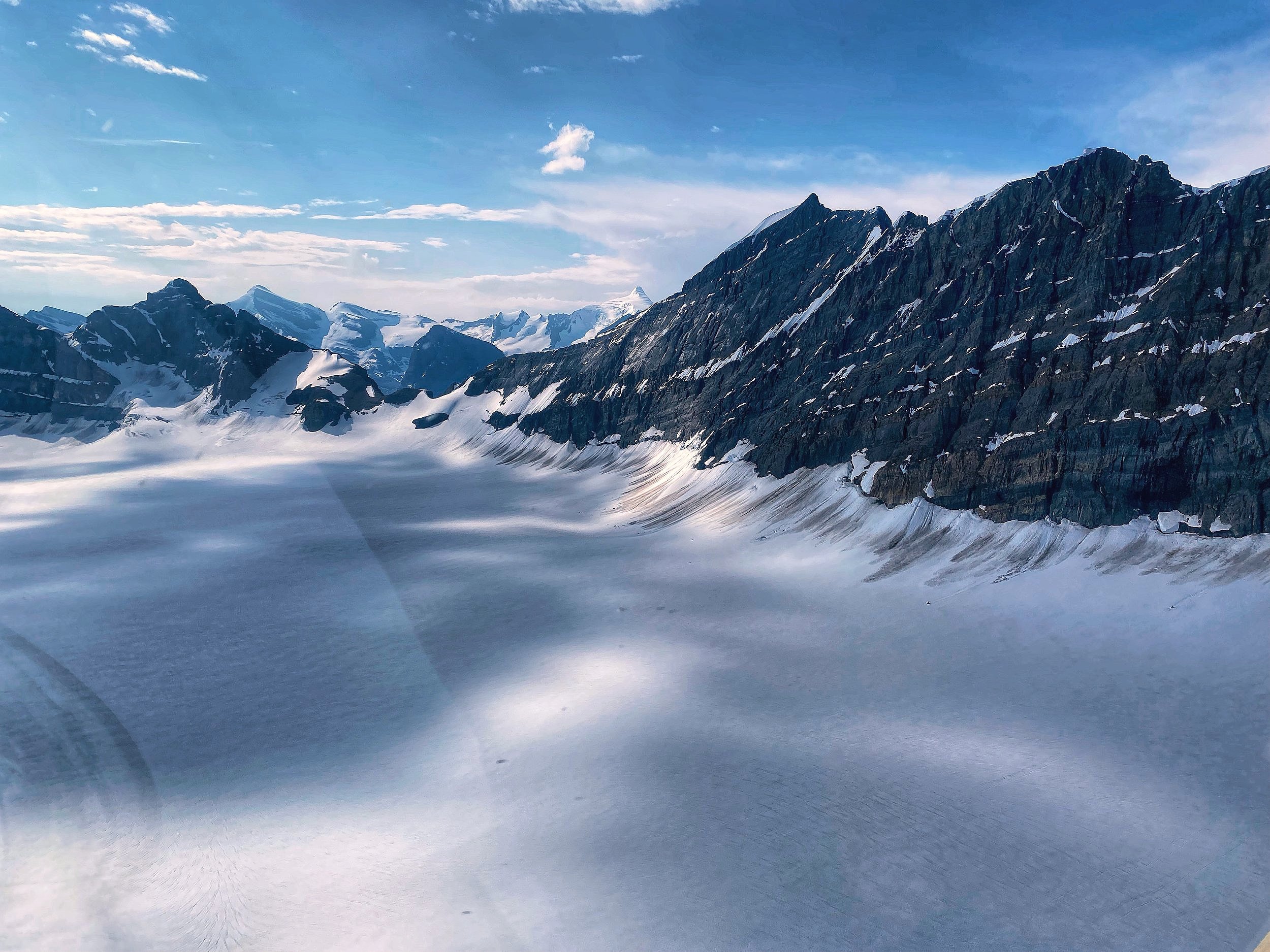
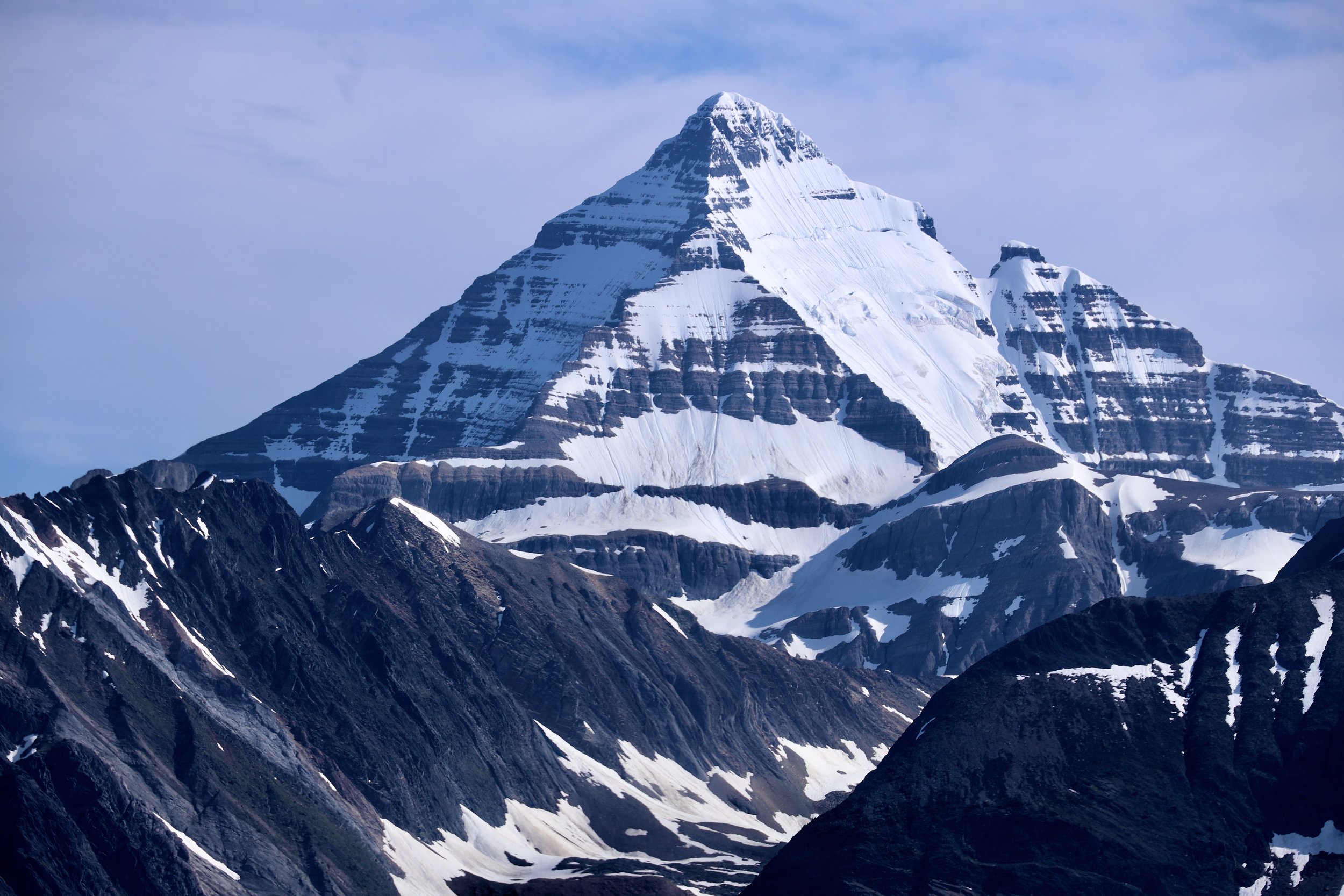
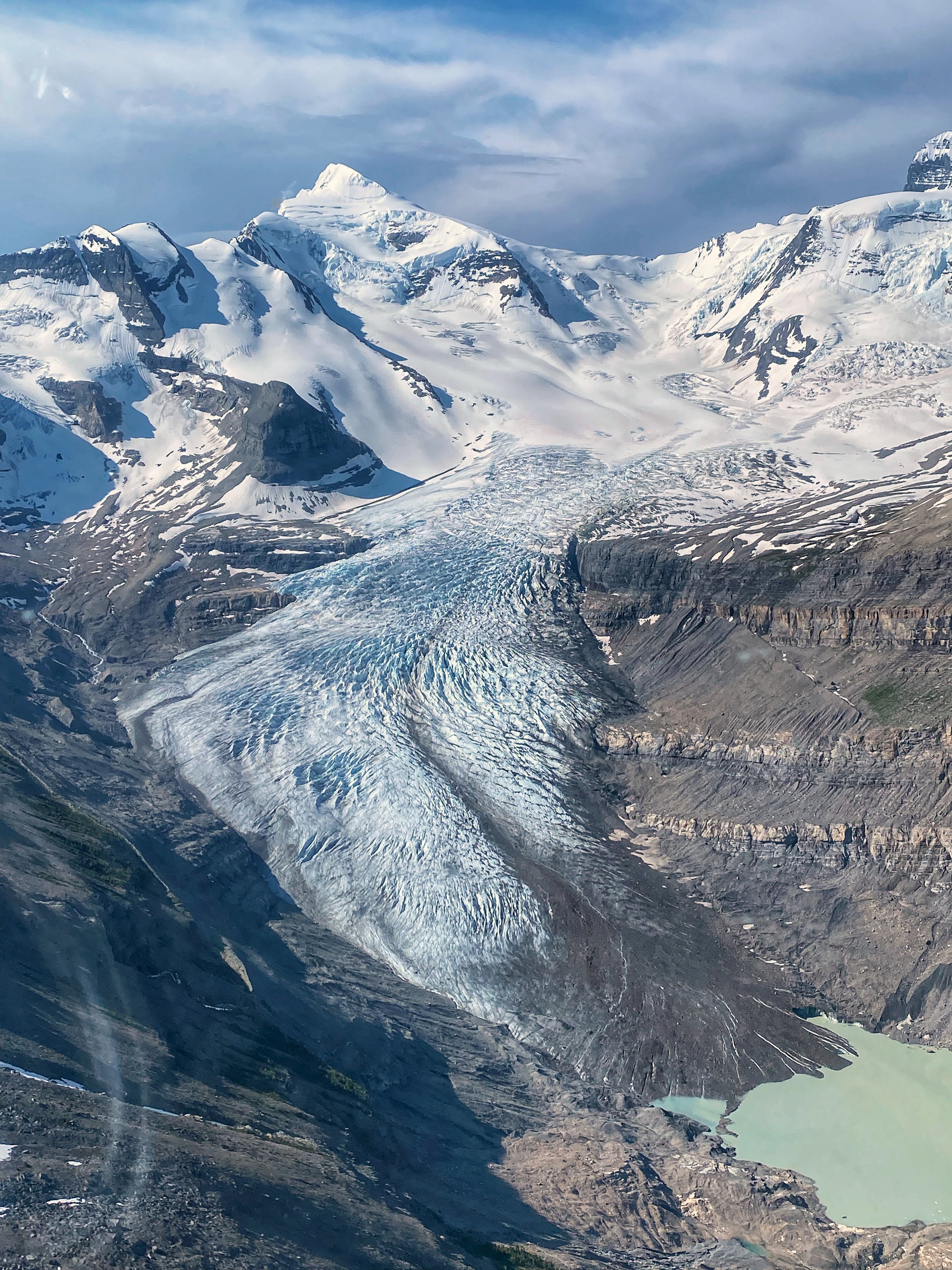
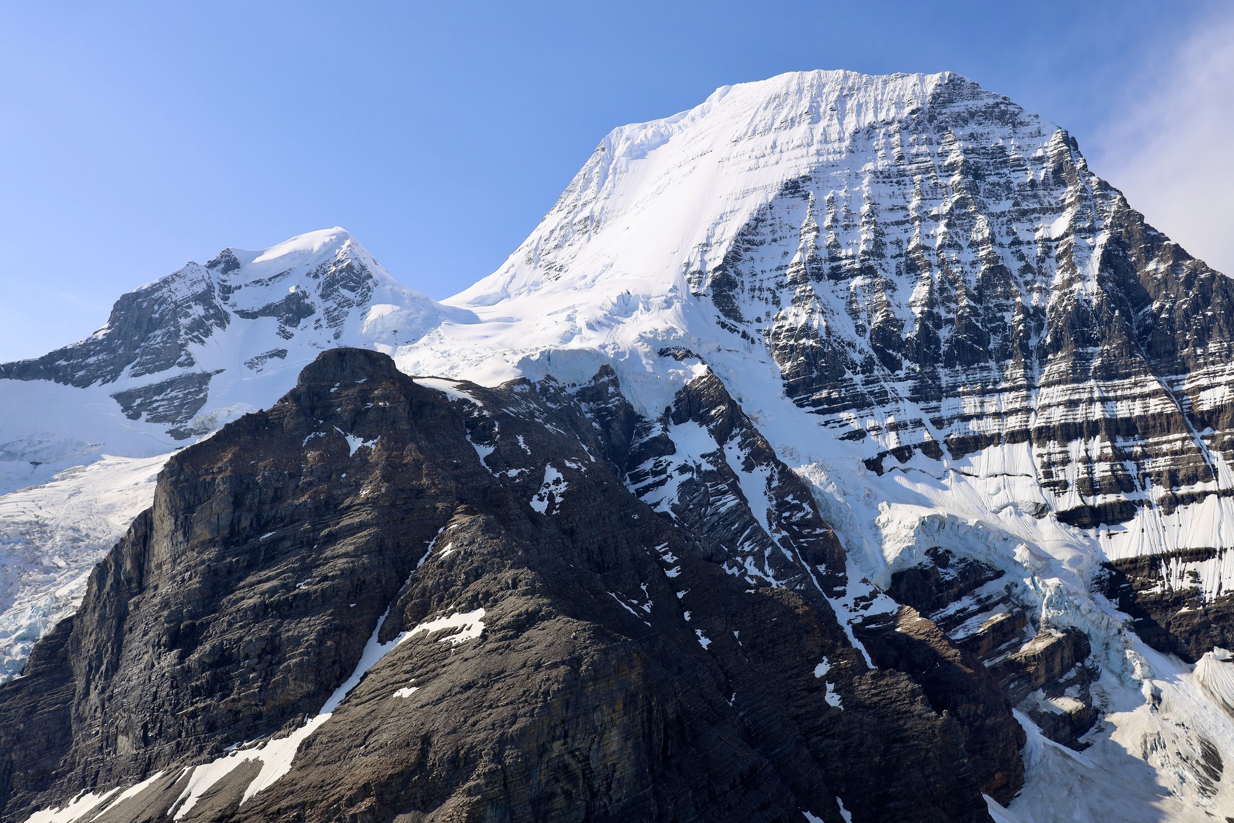
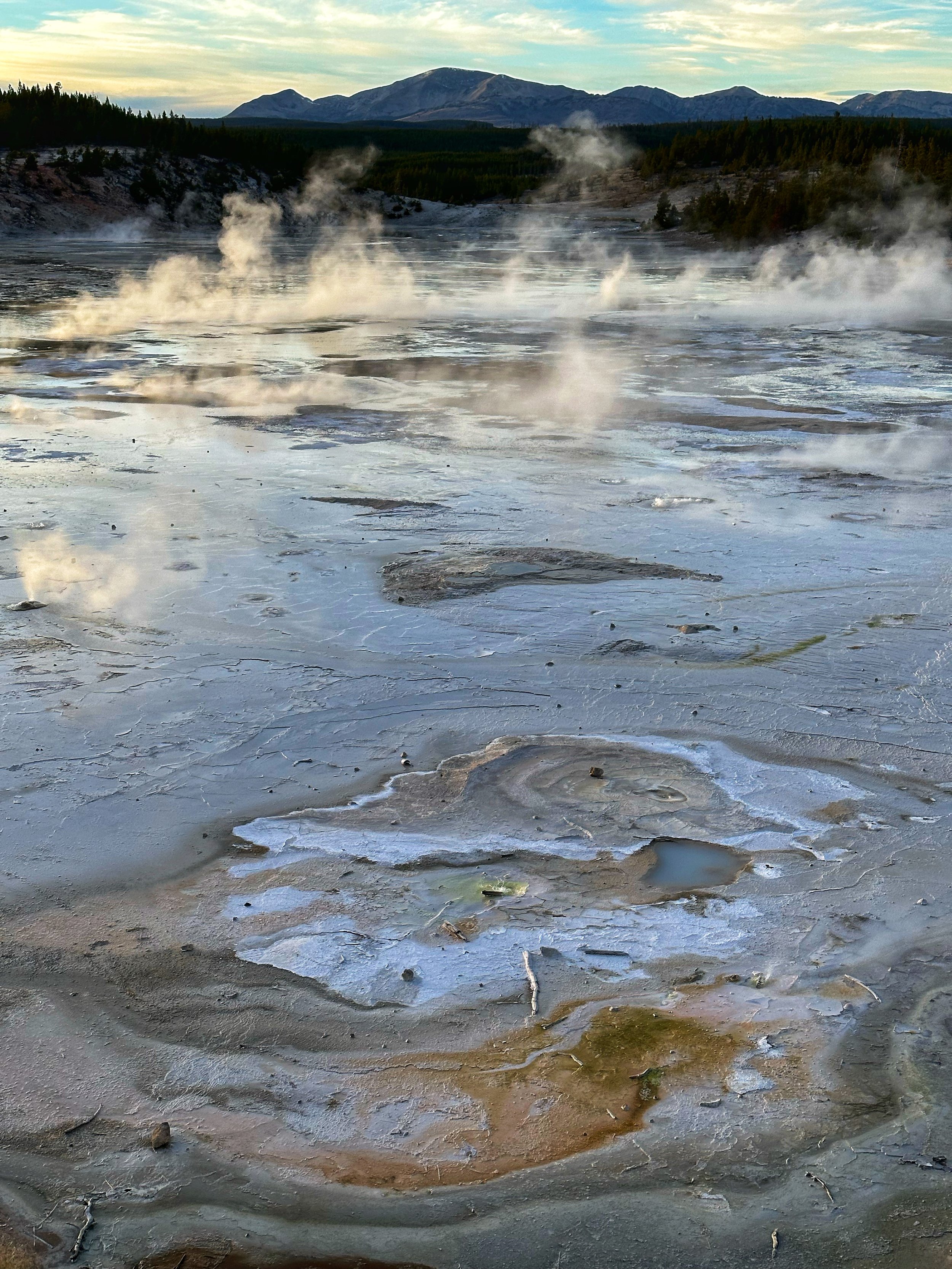
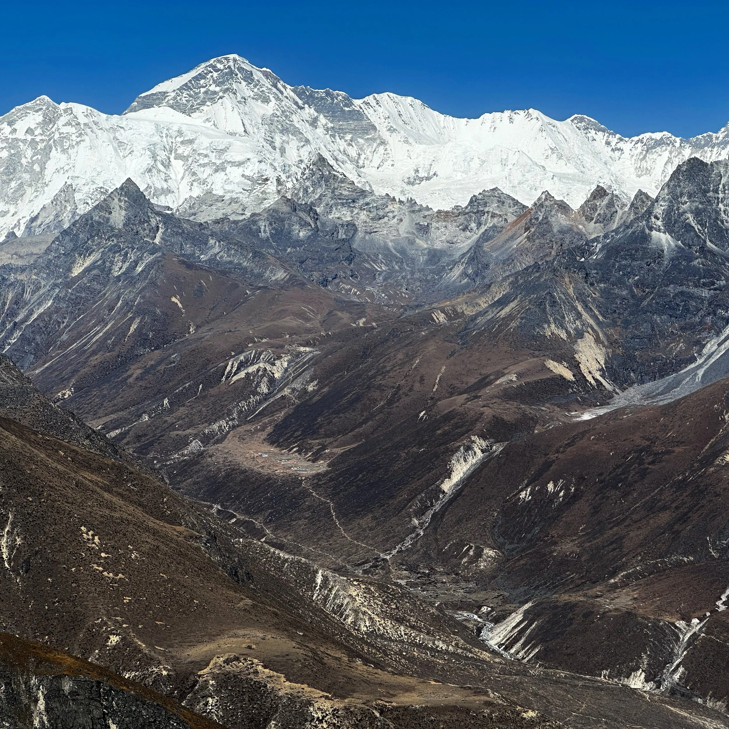
Cho Oyu - Sumna Pass is on the bottom centre of the photo.

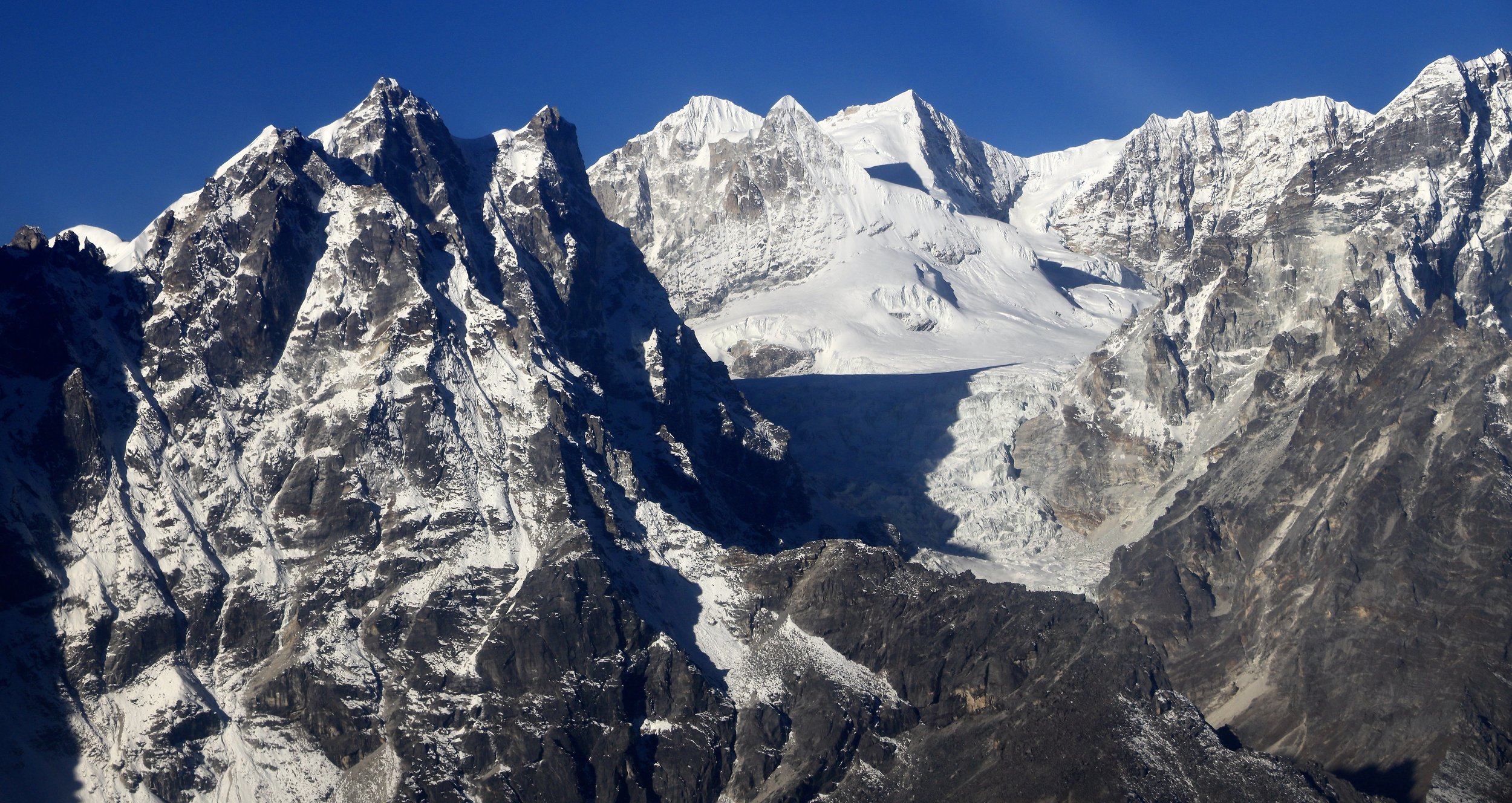
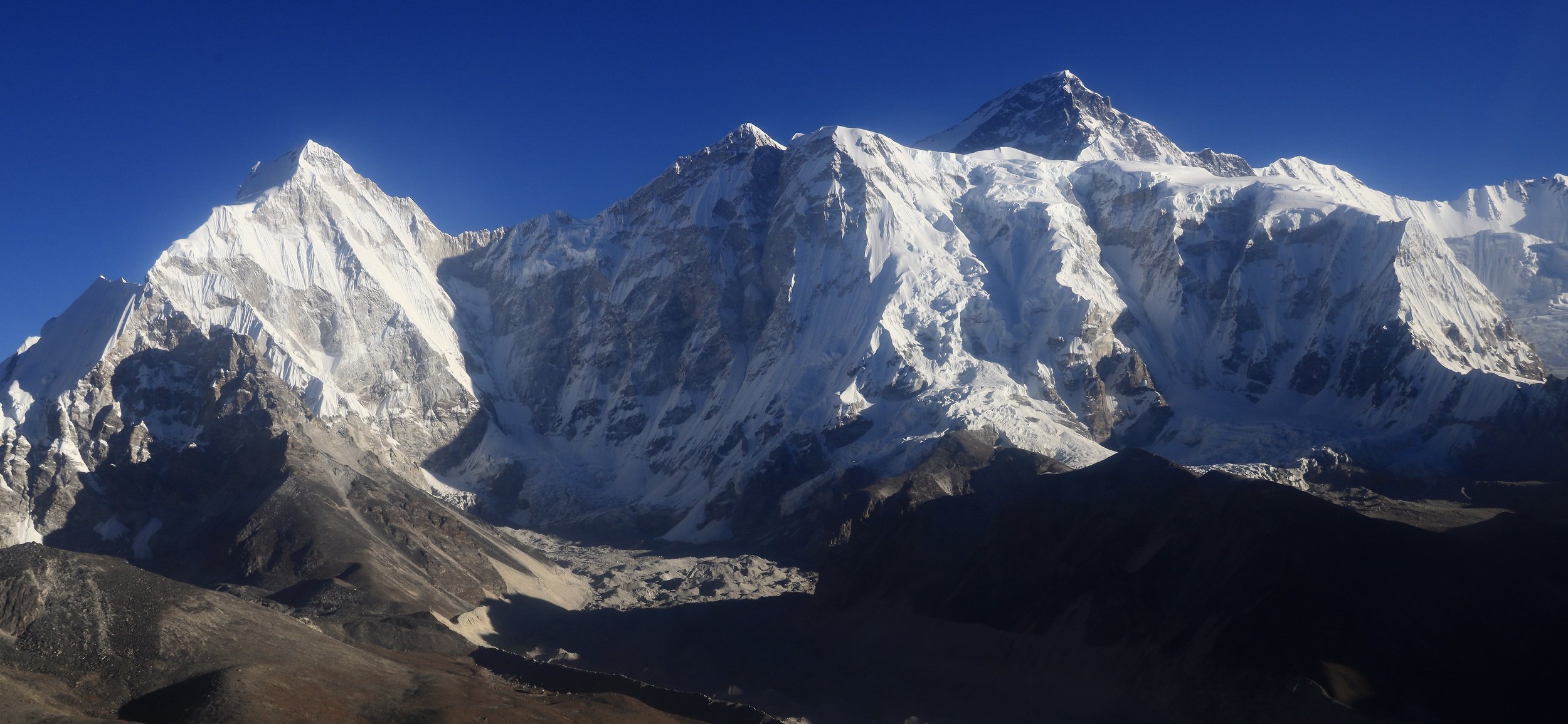
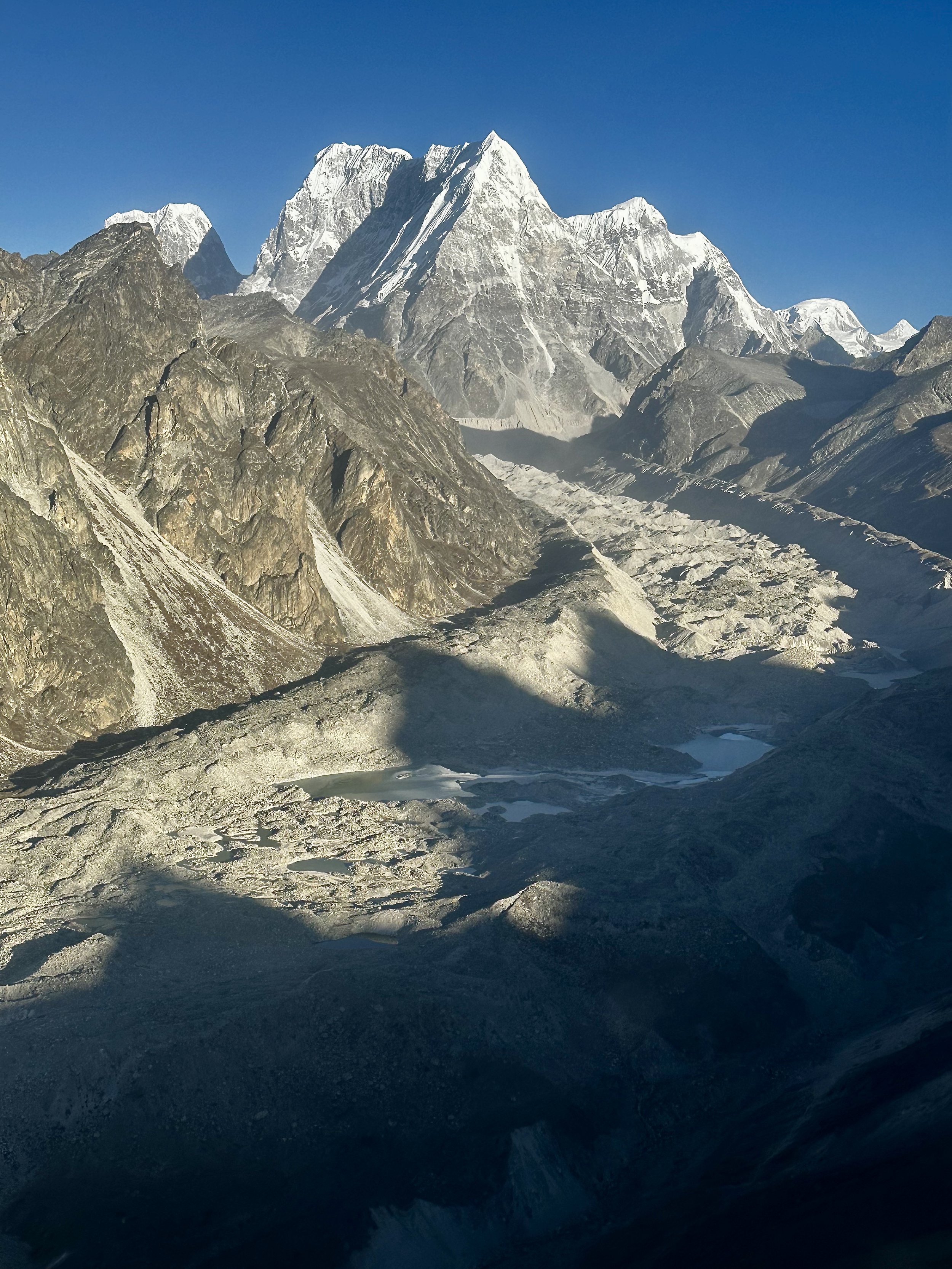
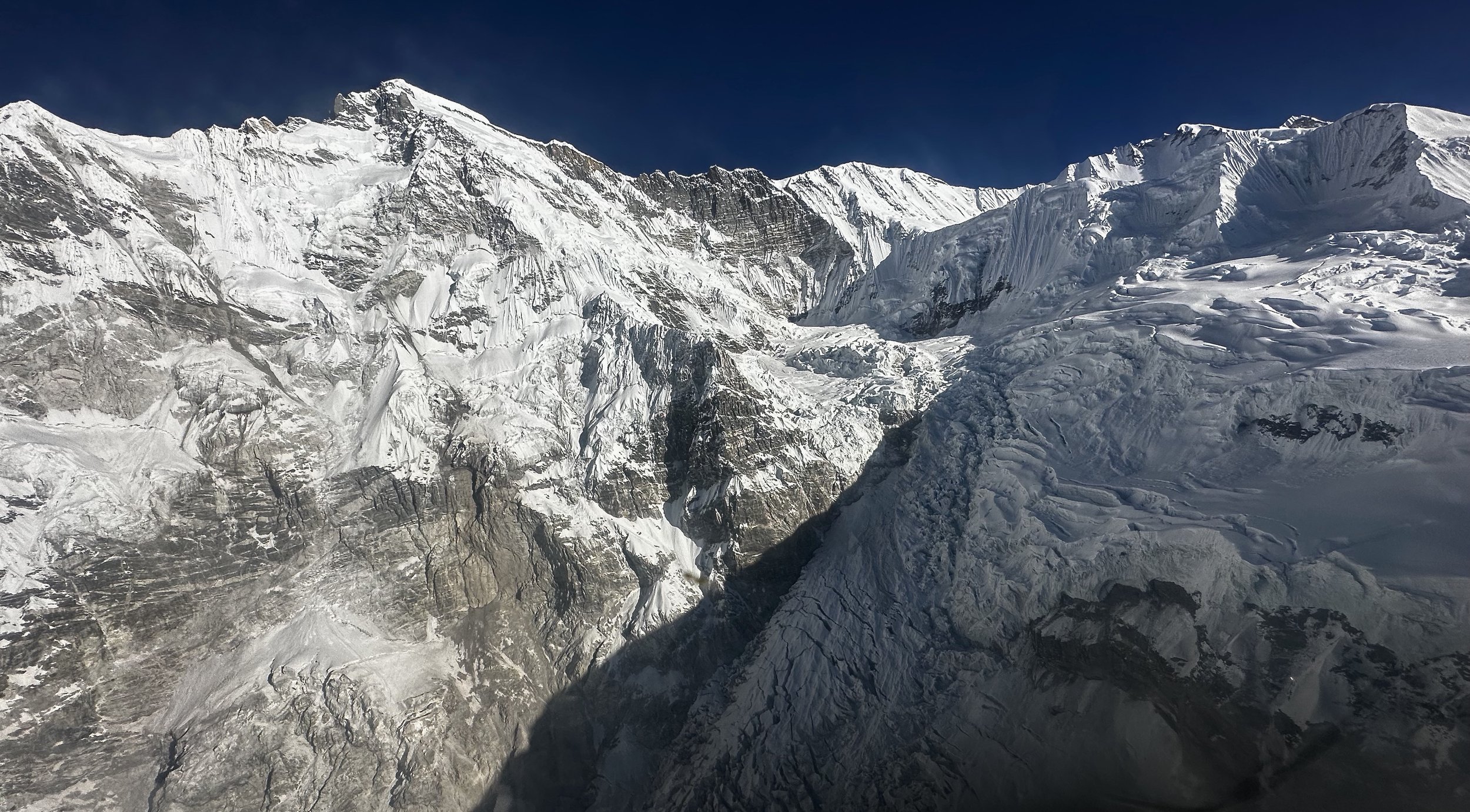
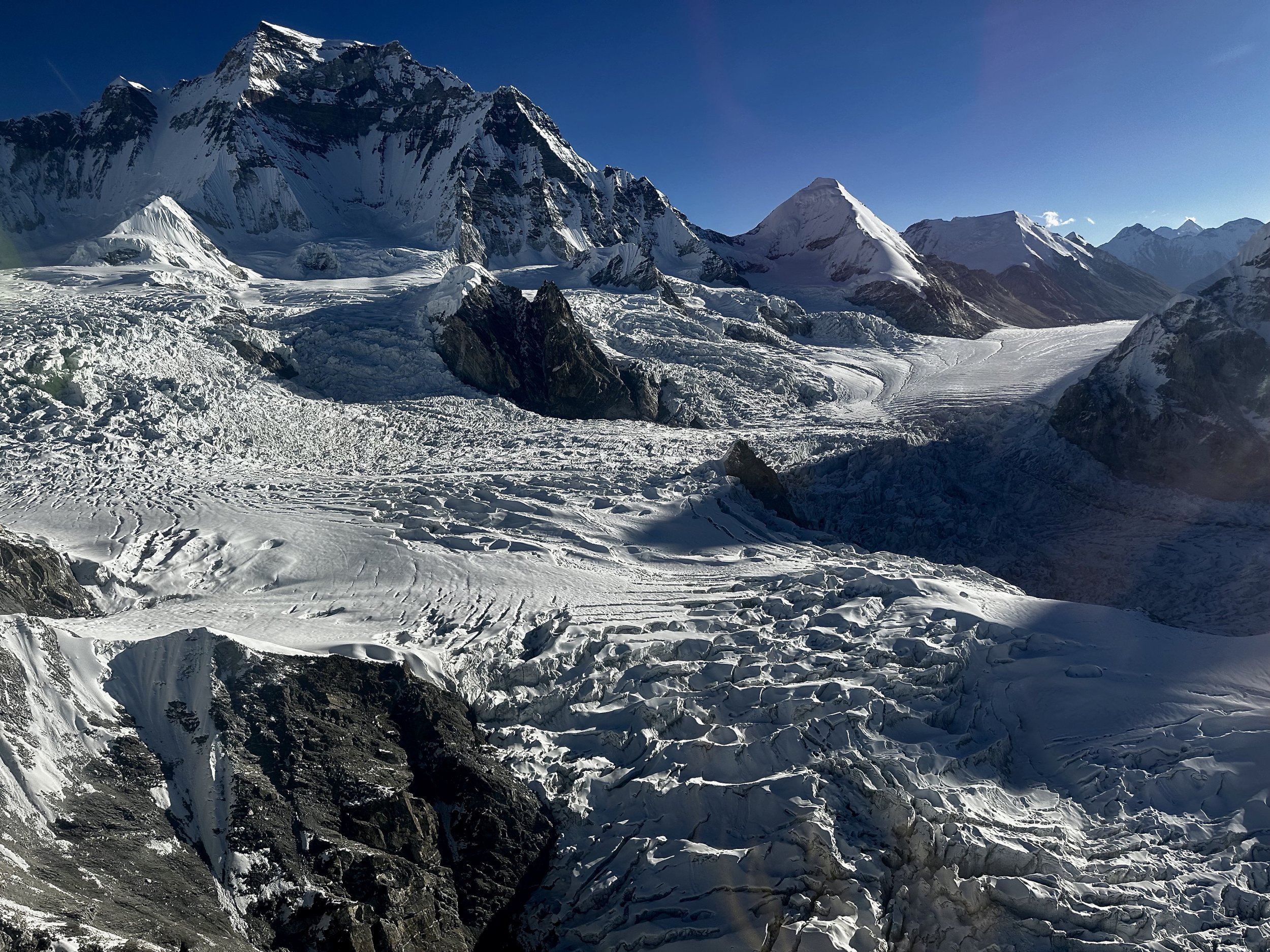
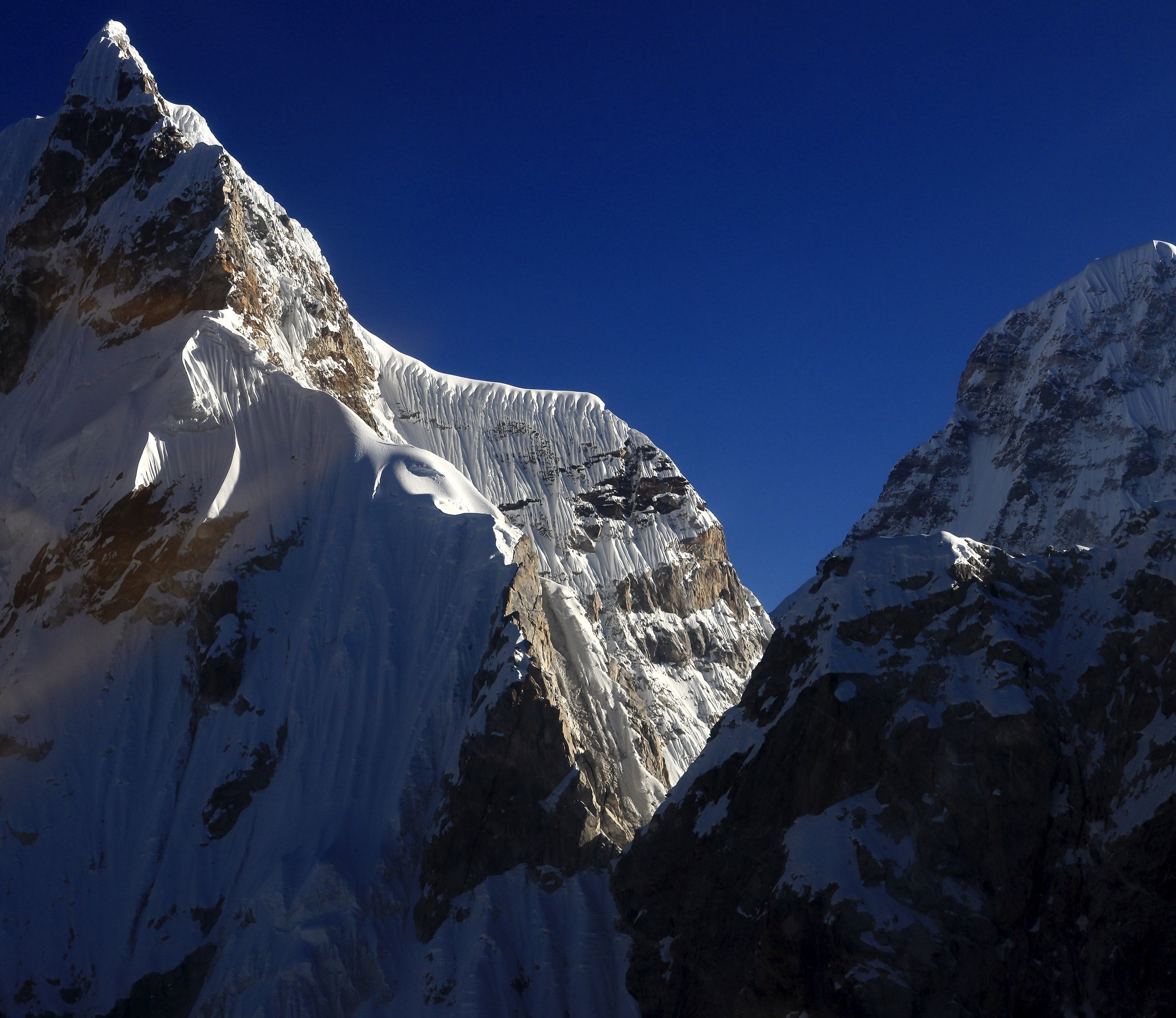
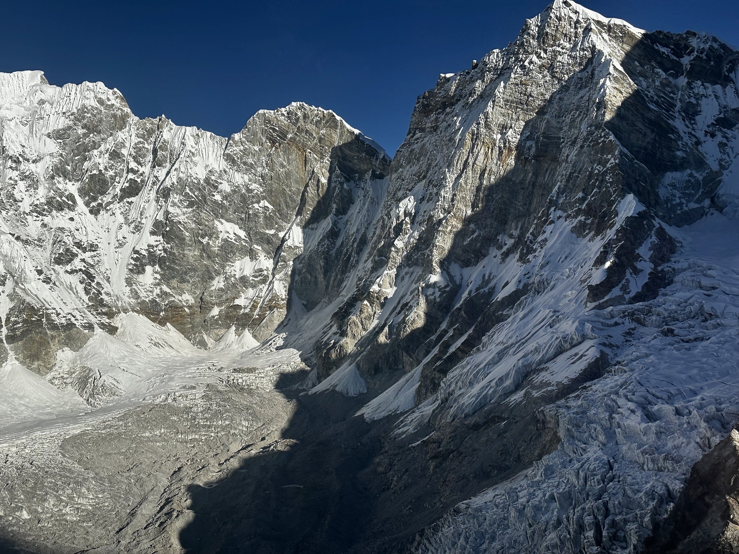
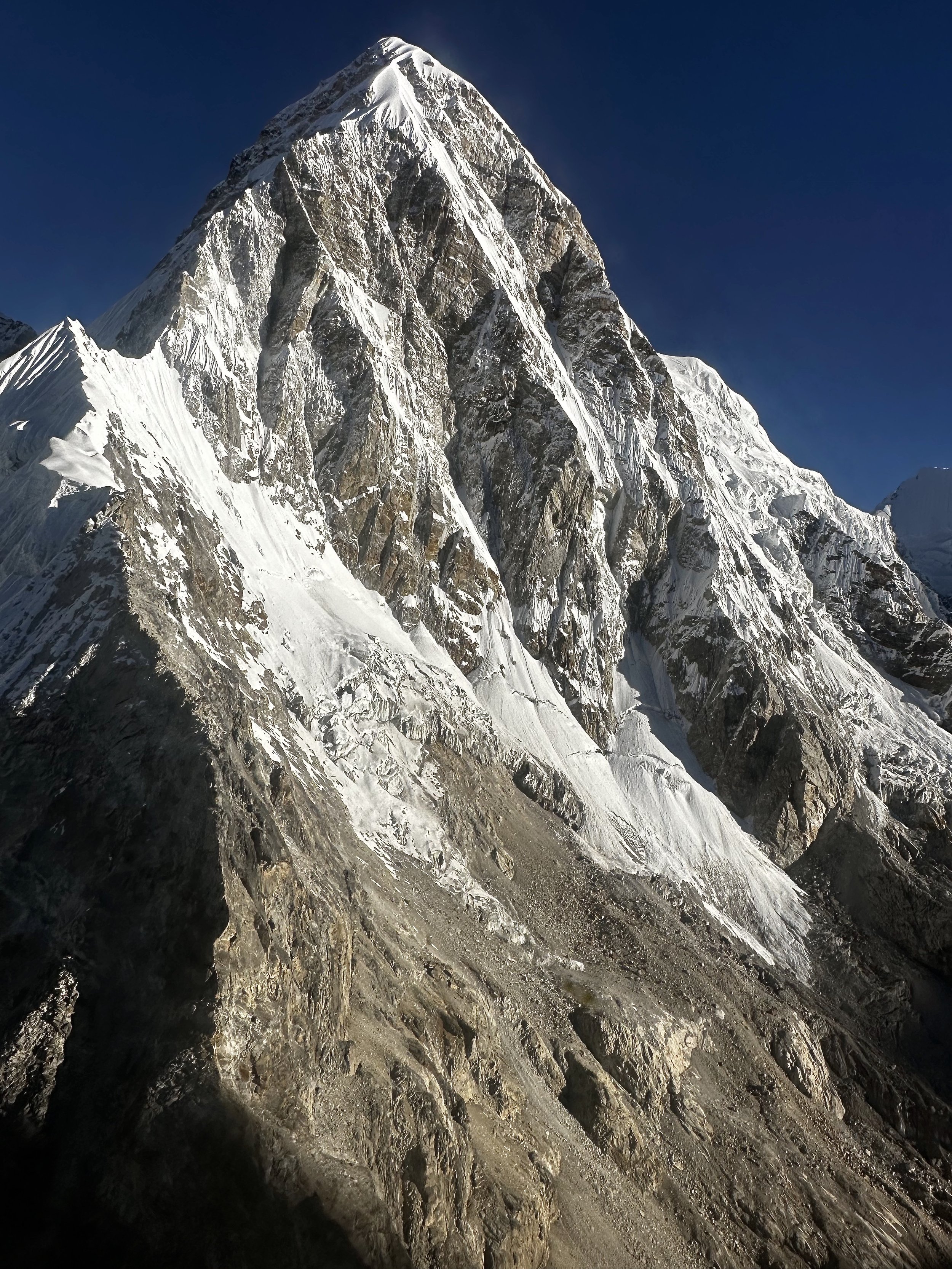
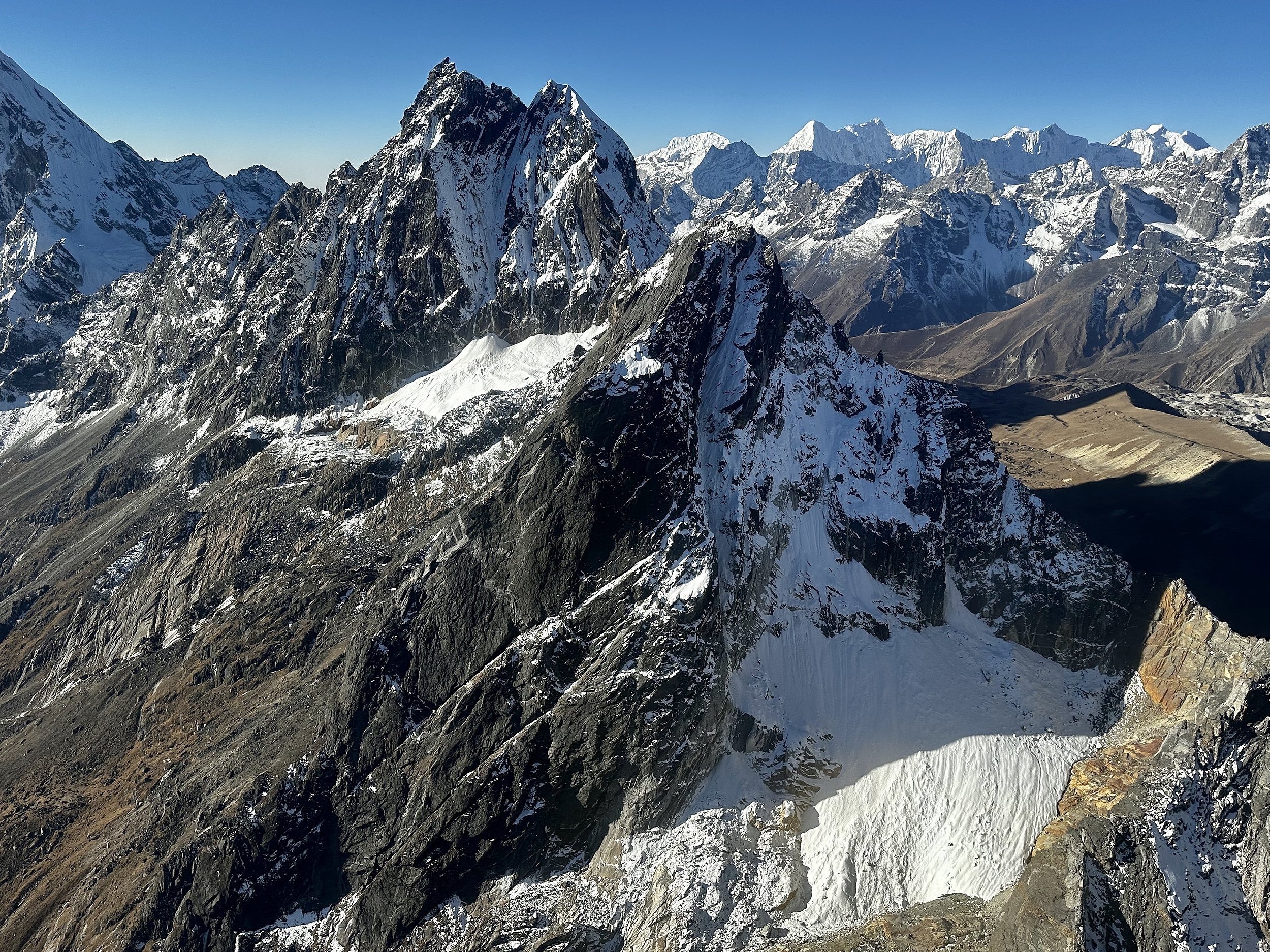
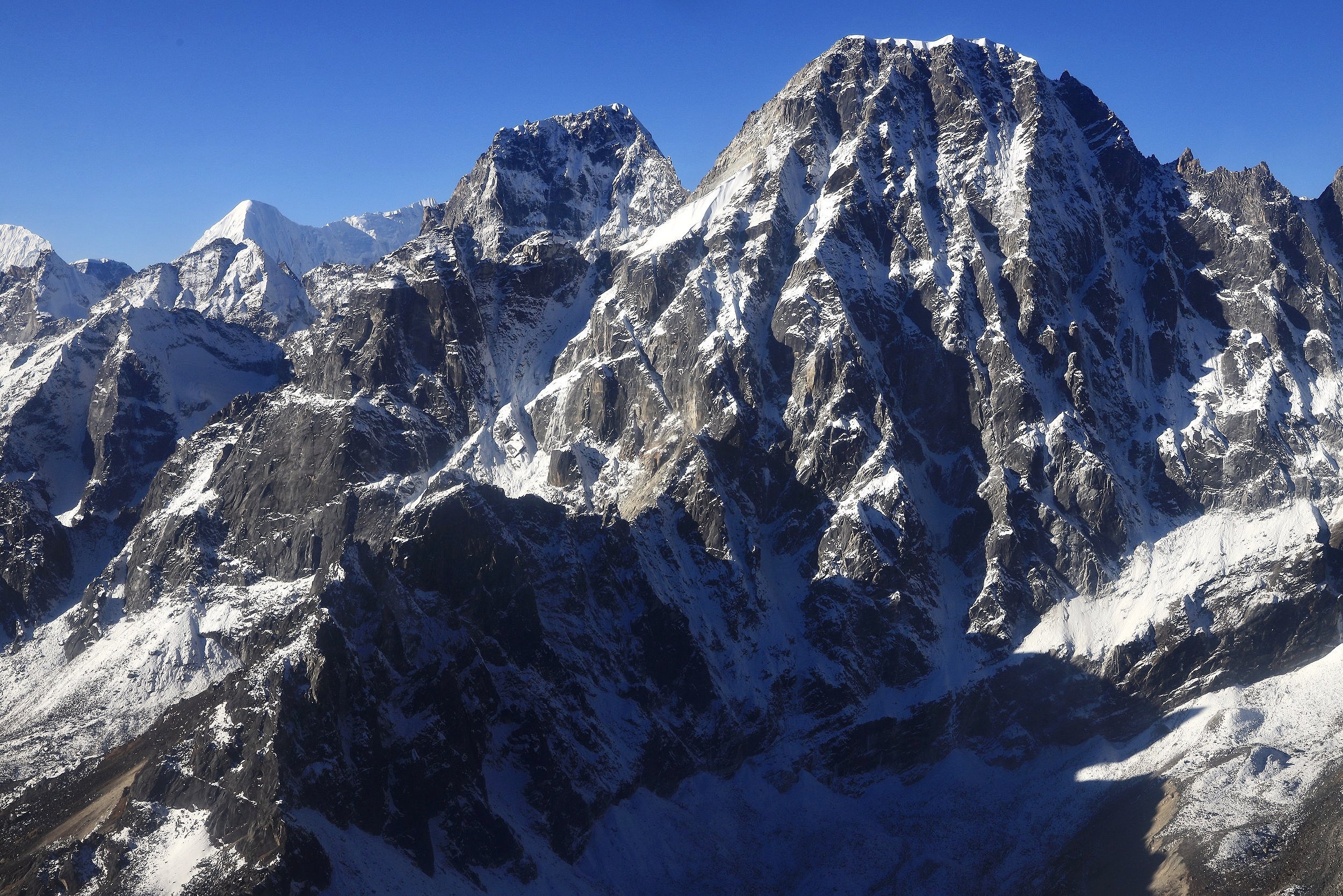
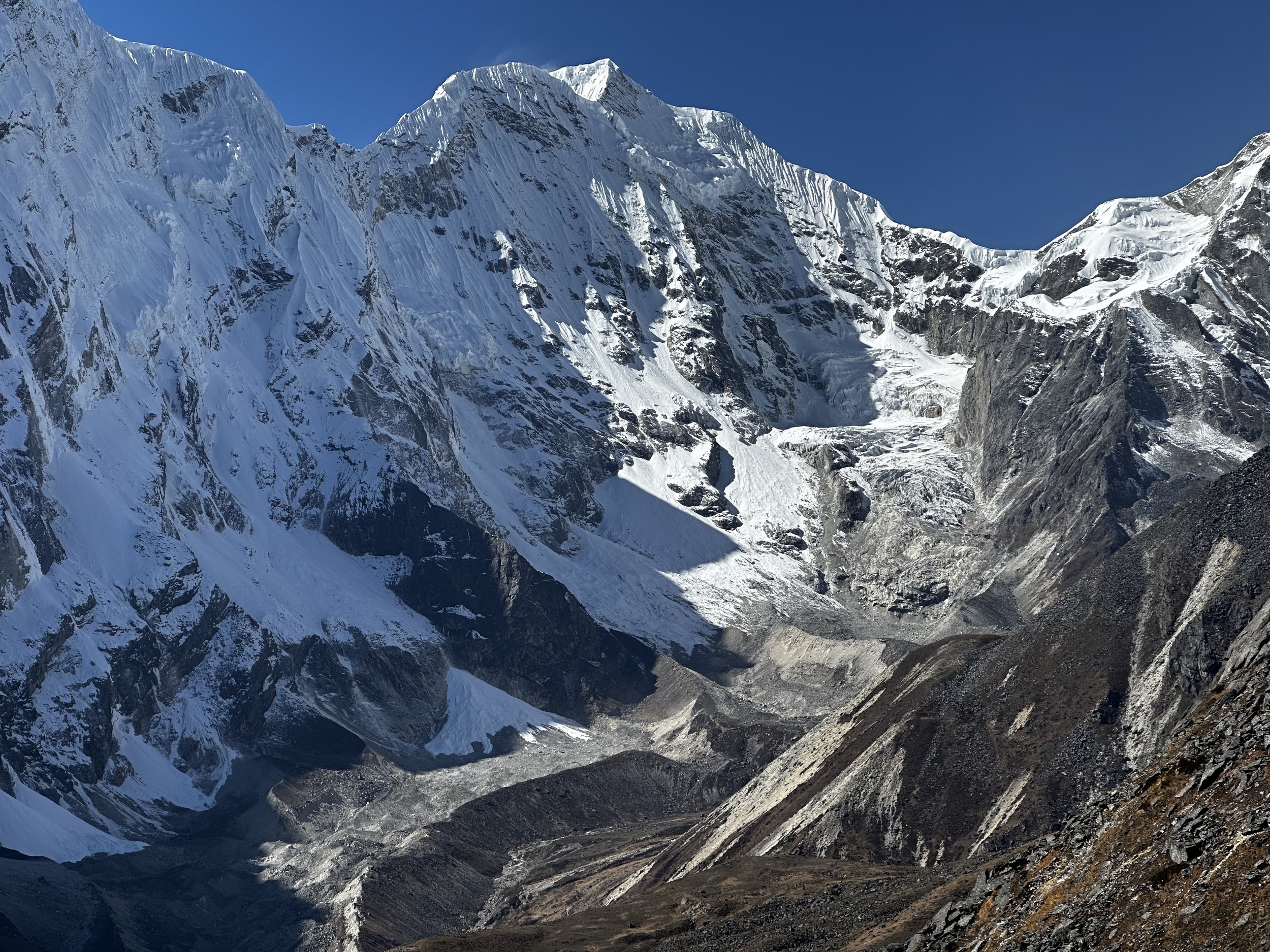
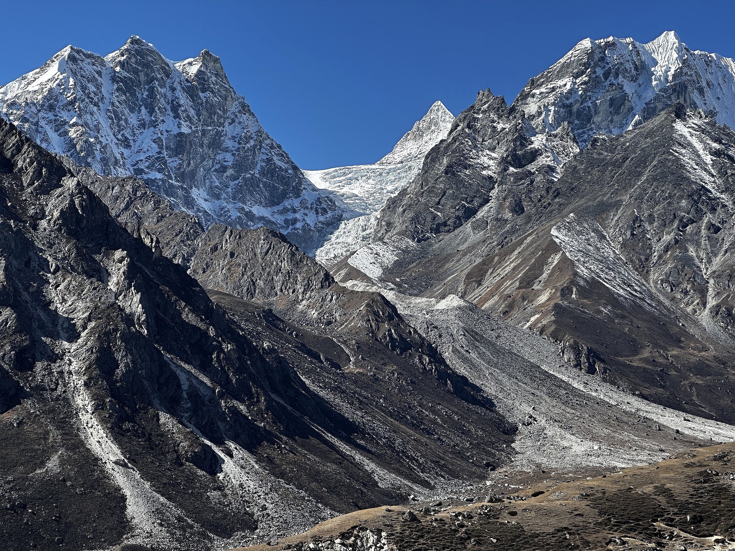
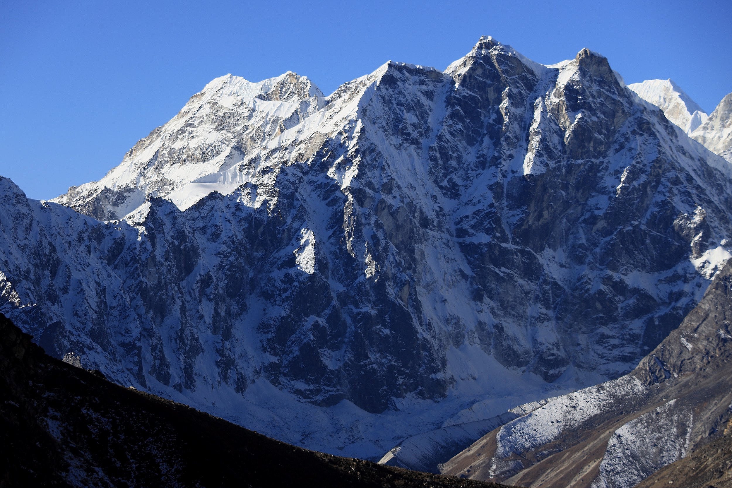
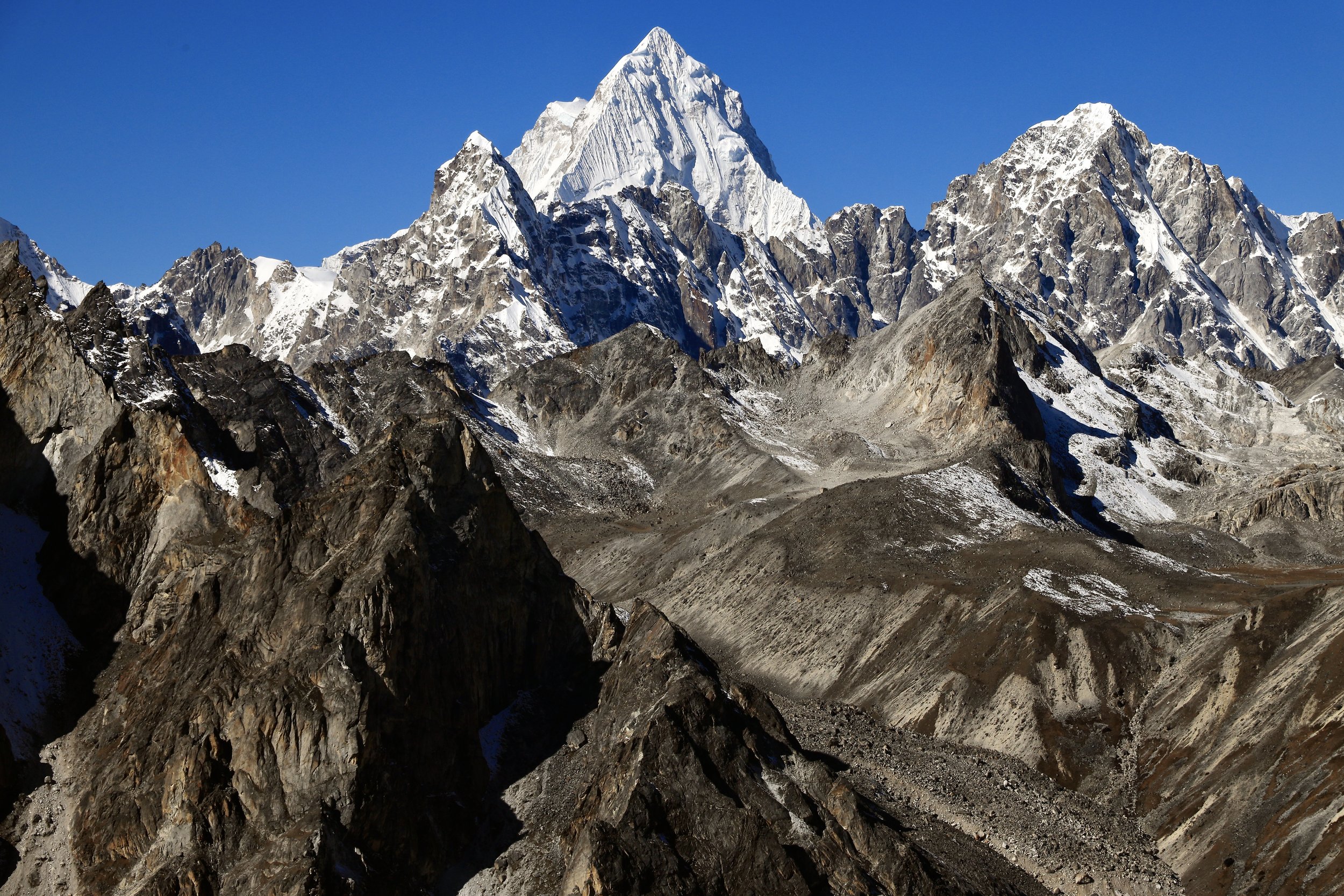
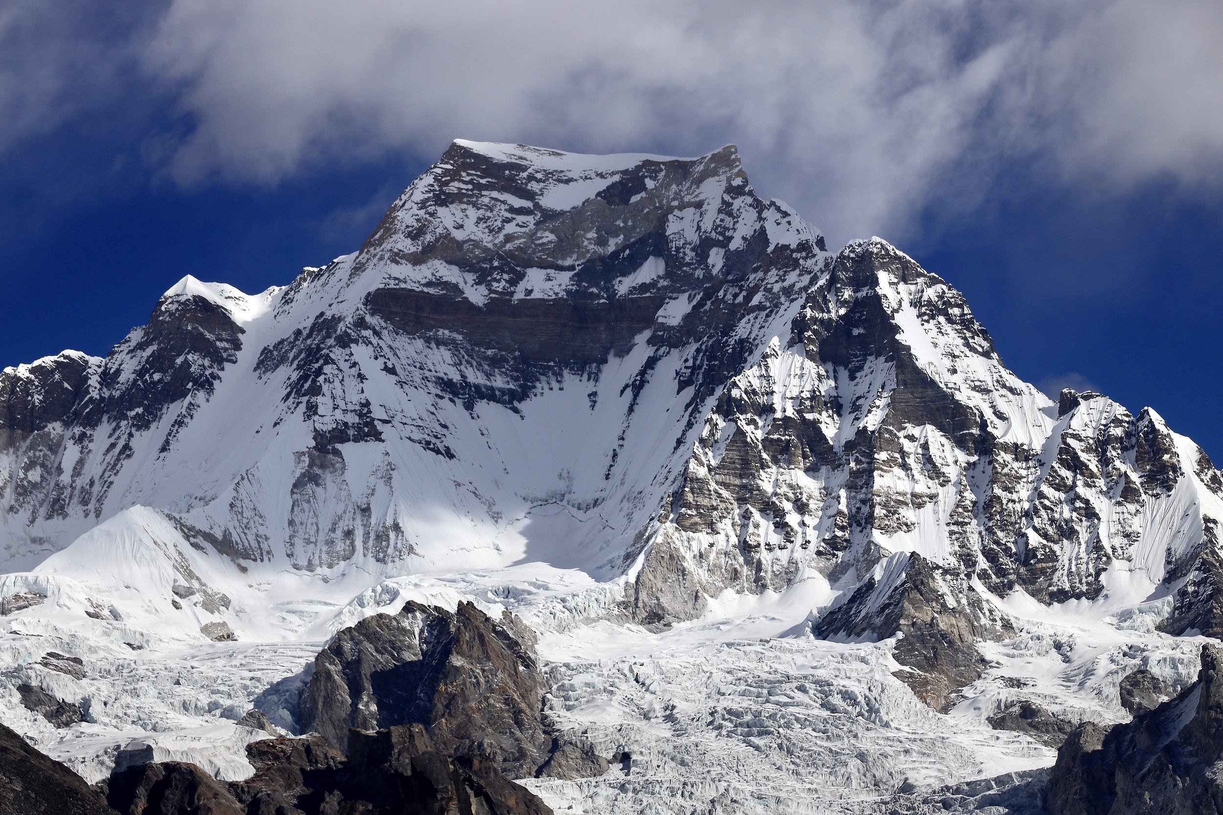
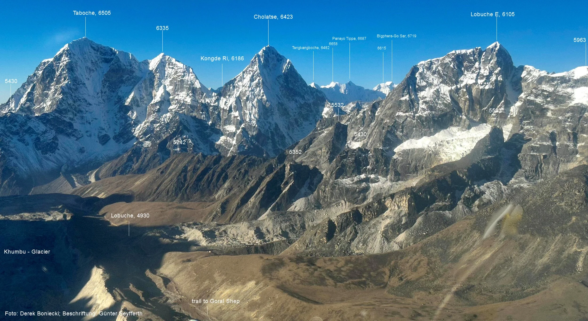
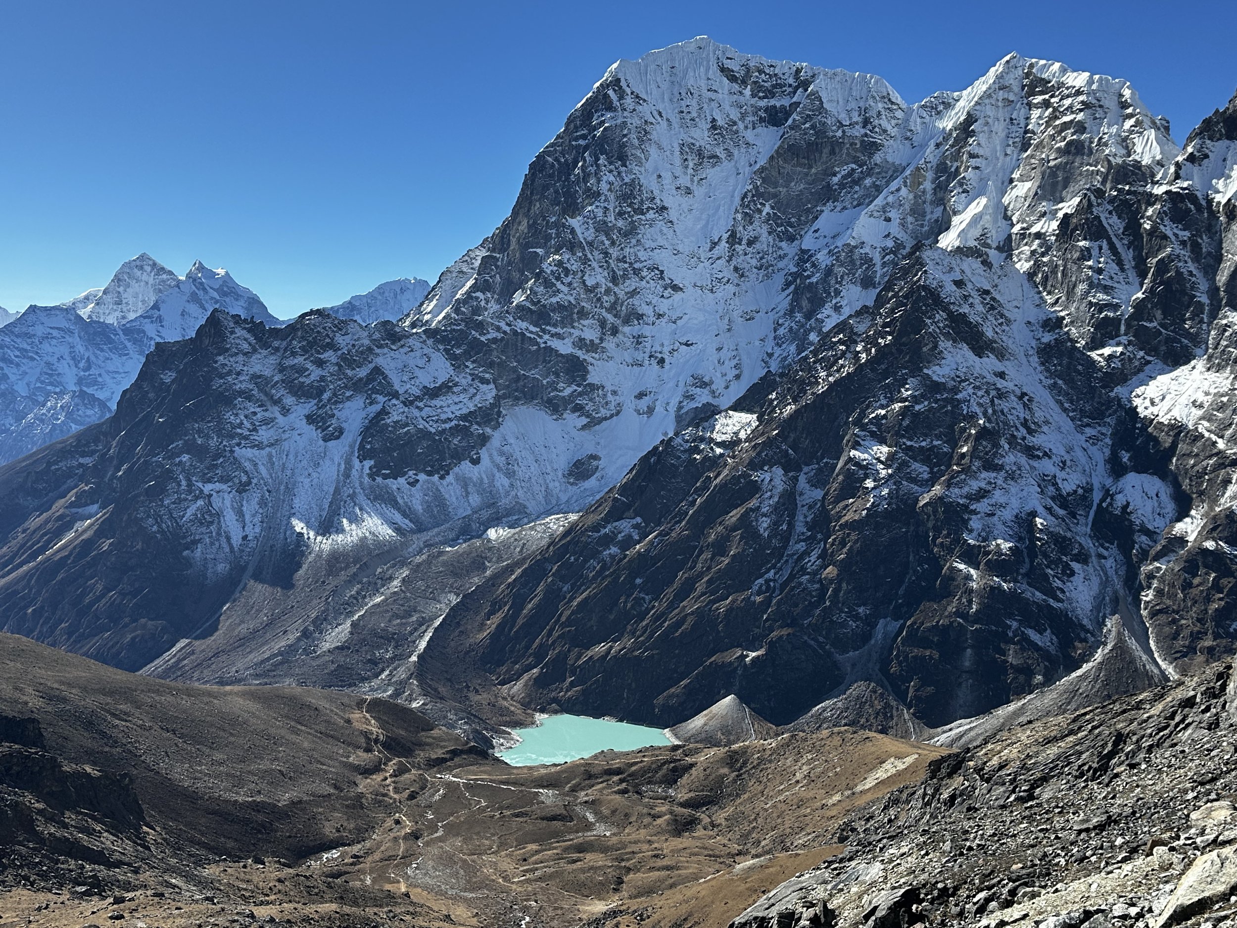
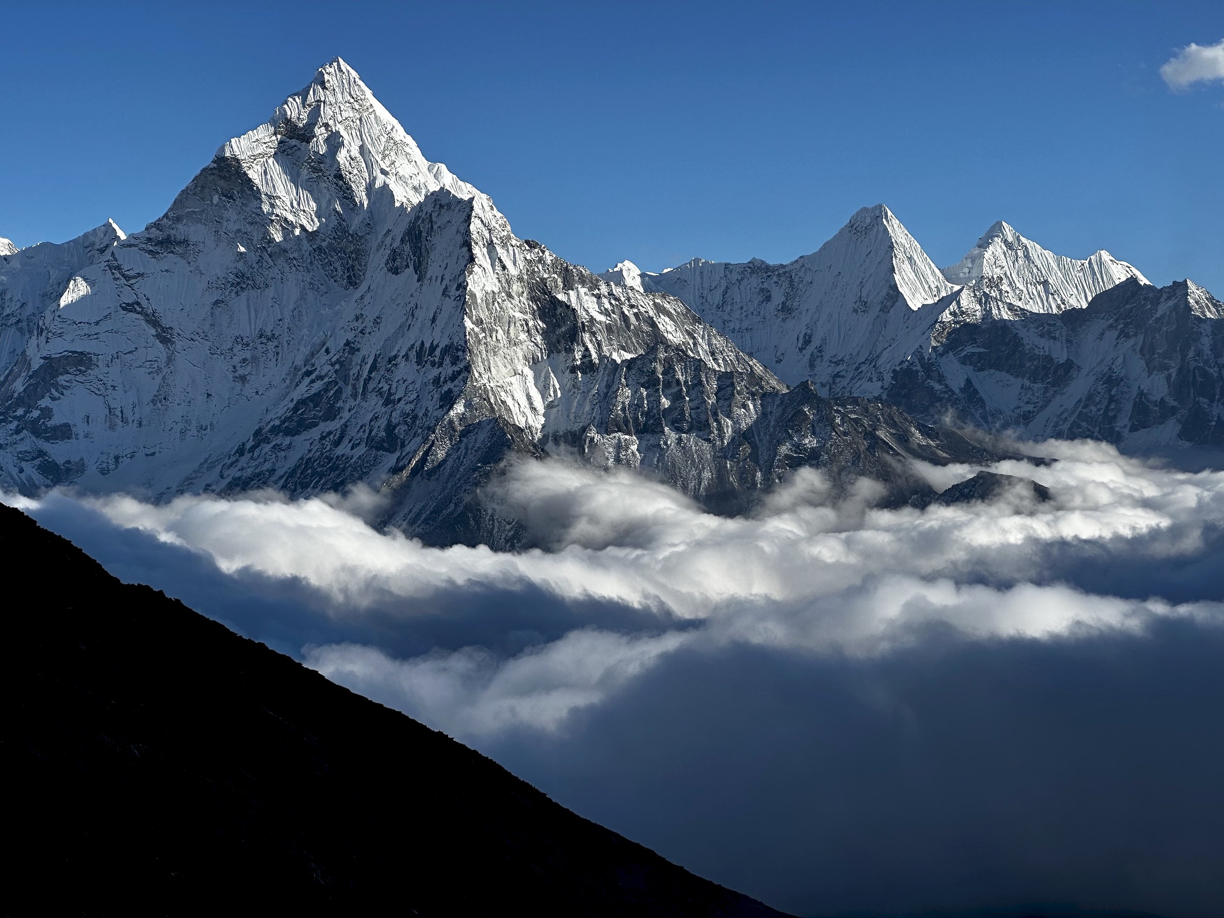
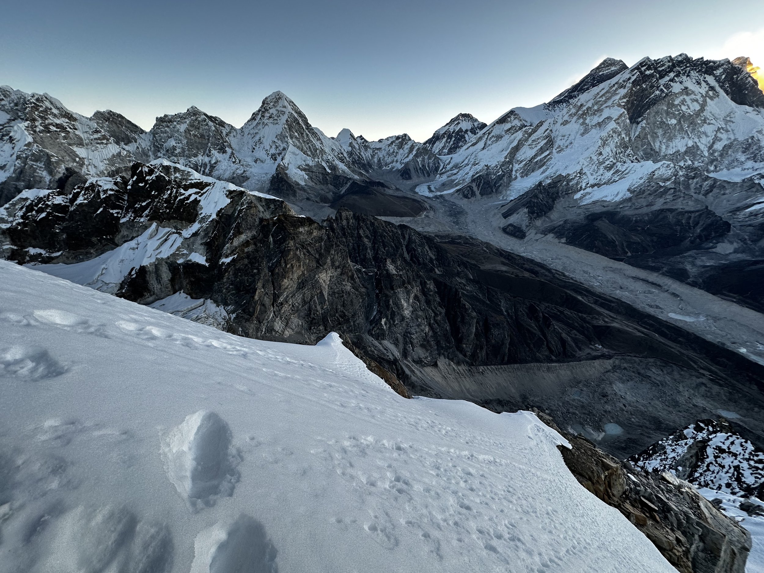
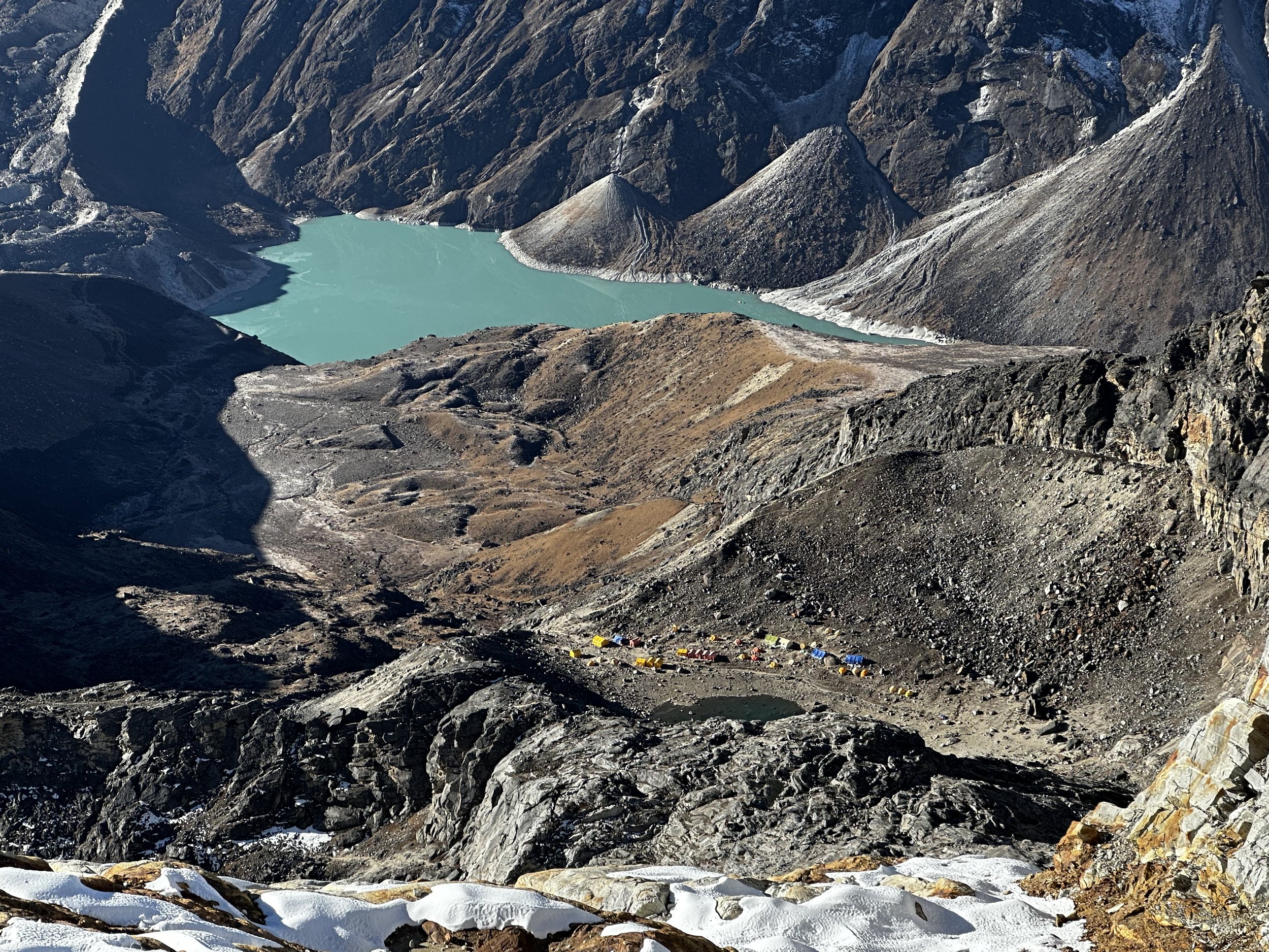
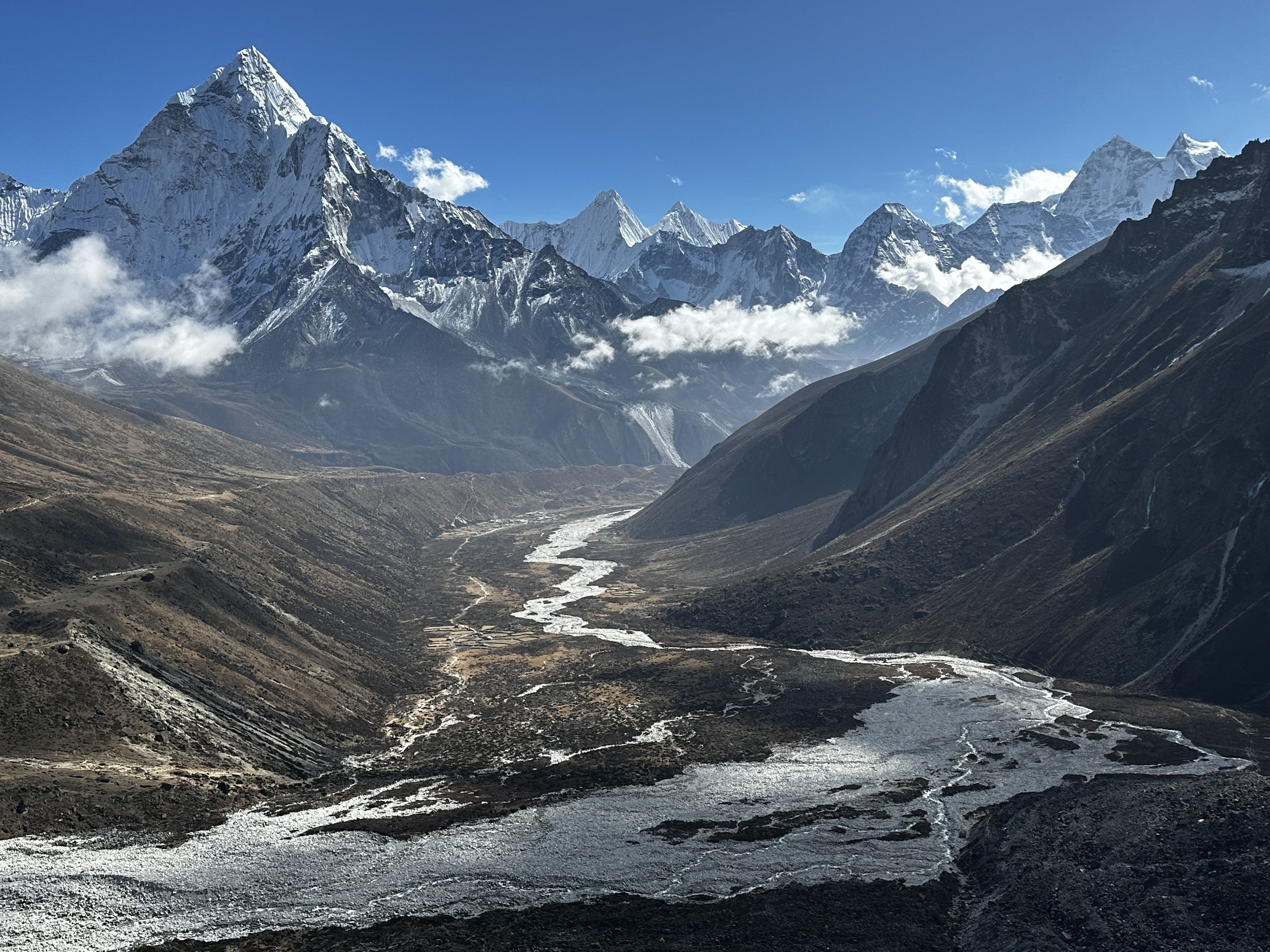
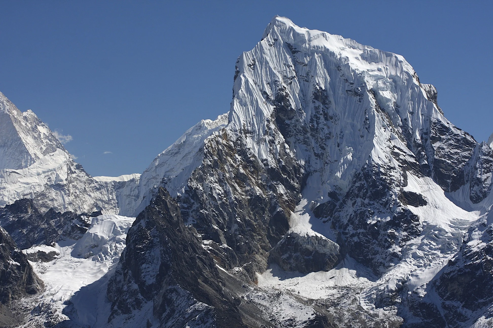
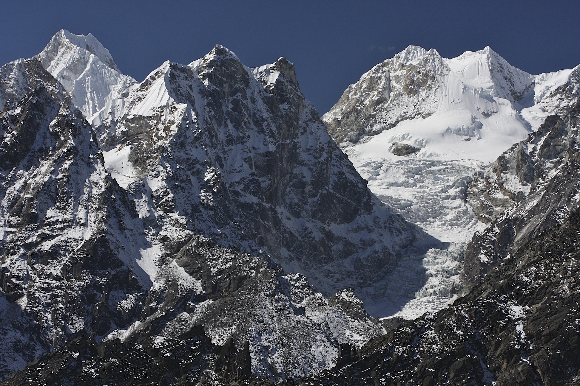
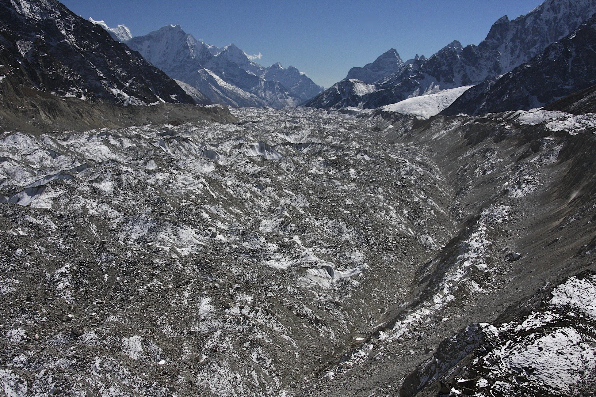
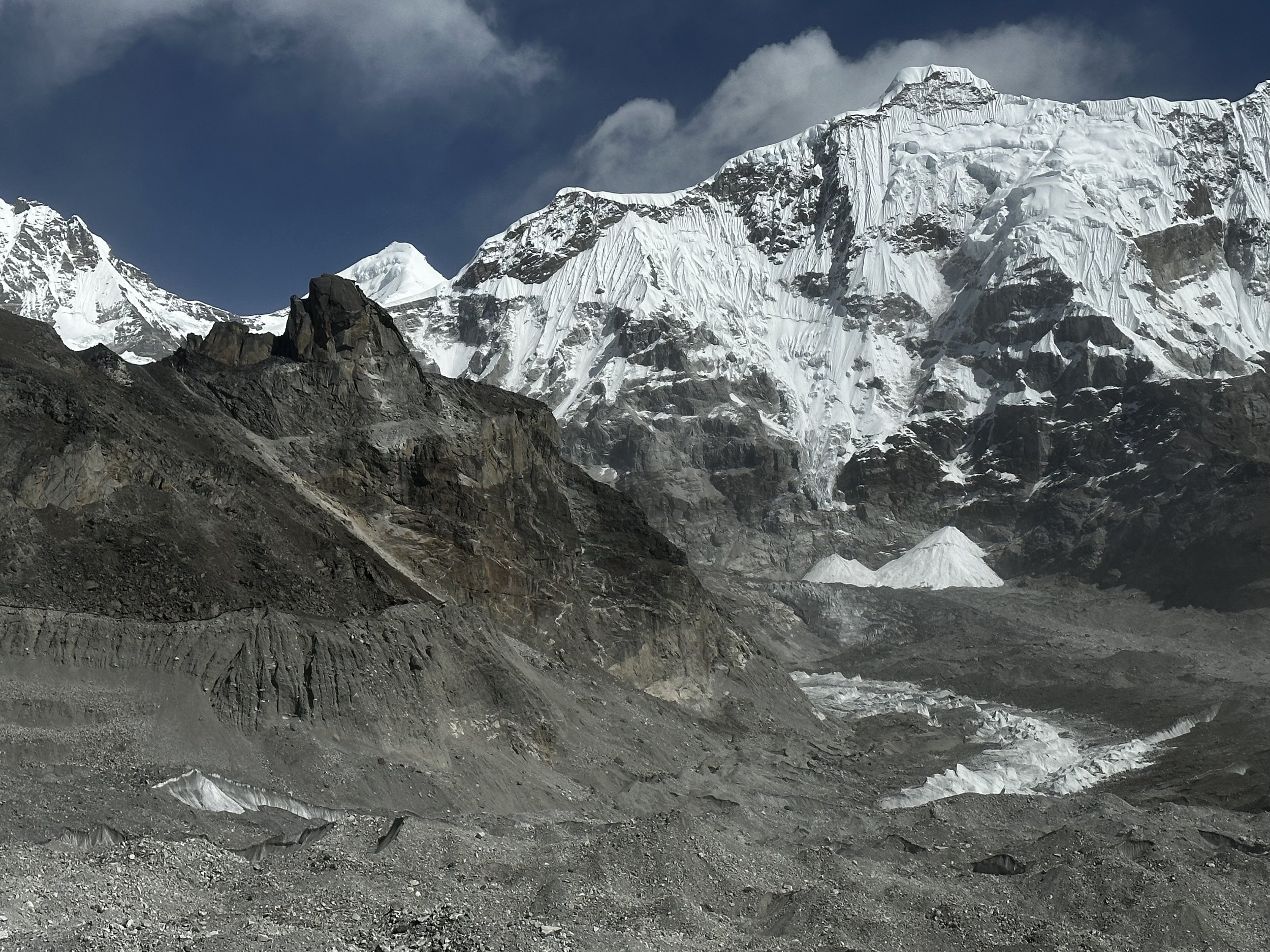
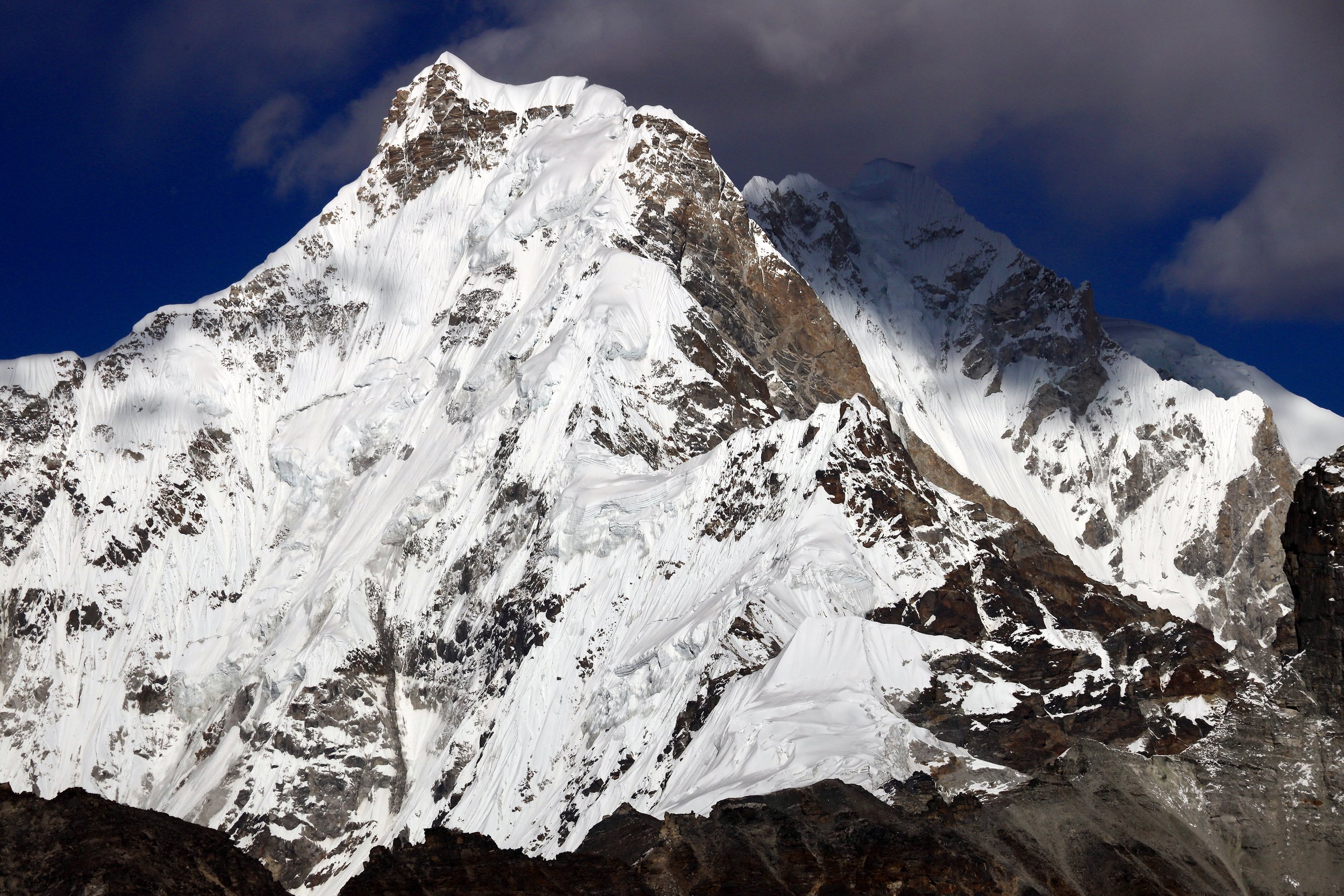
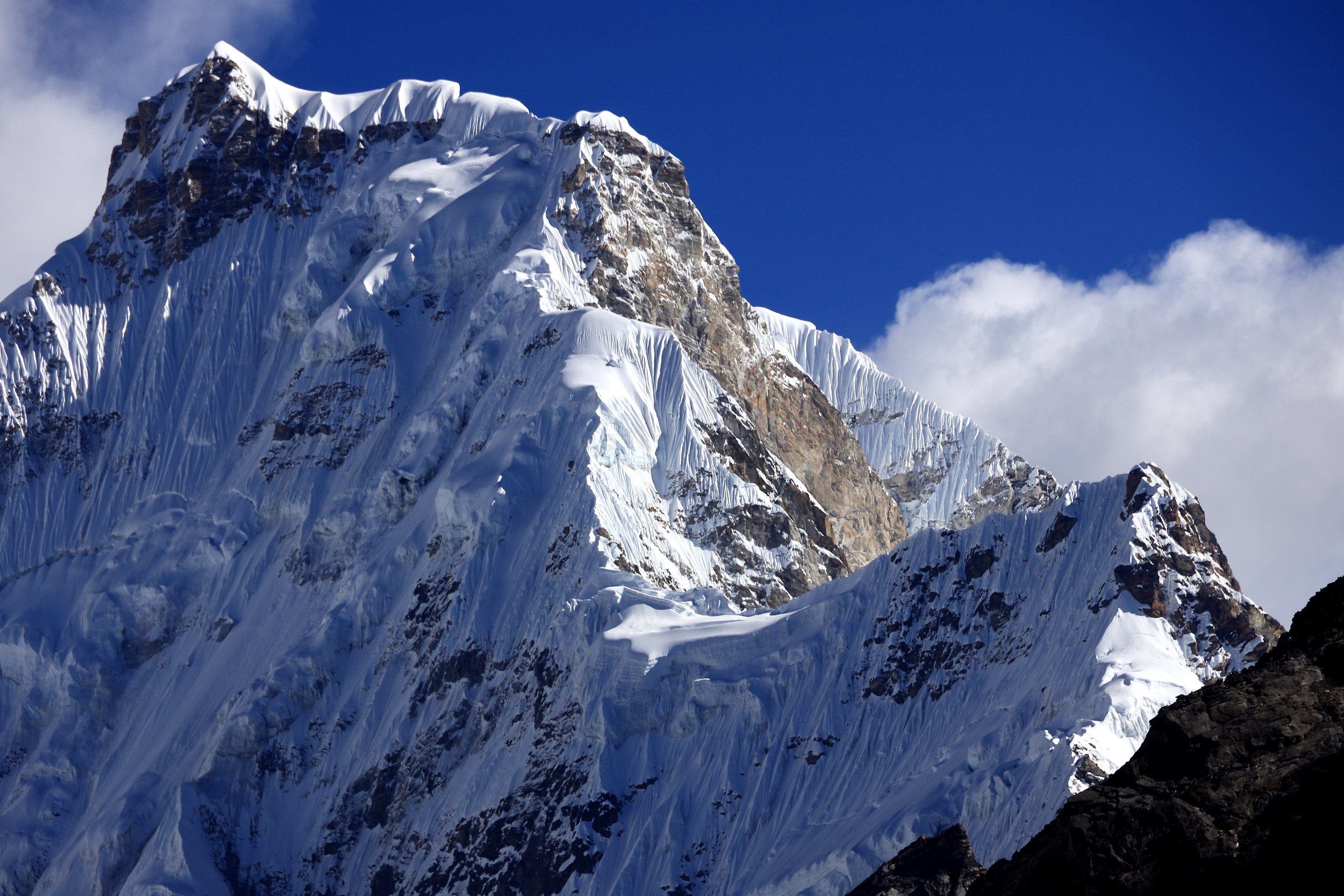
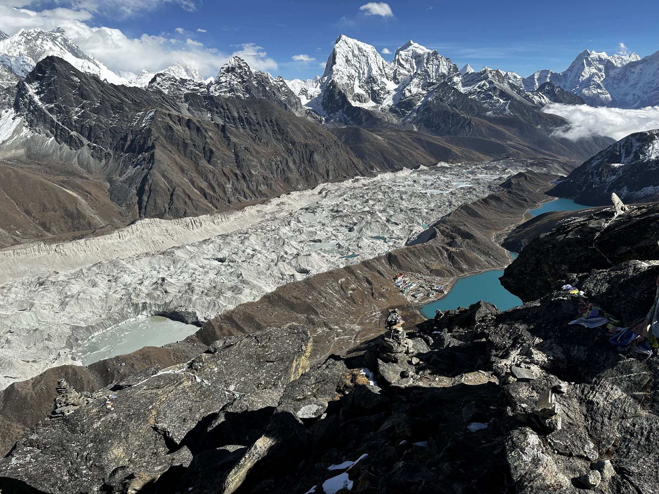
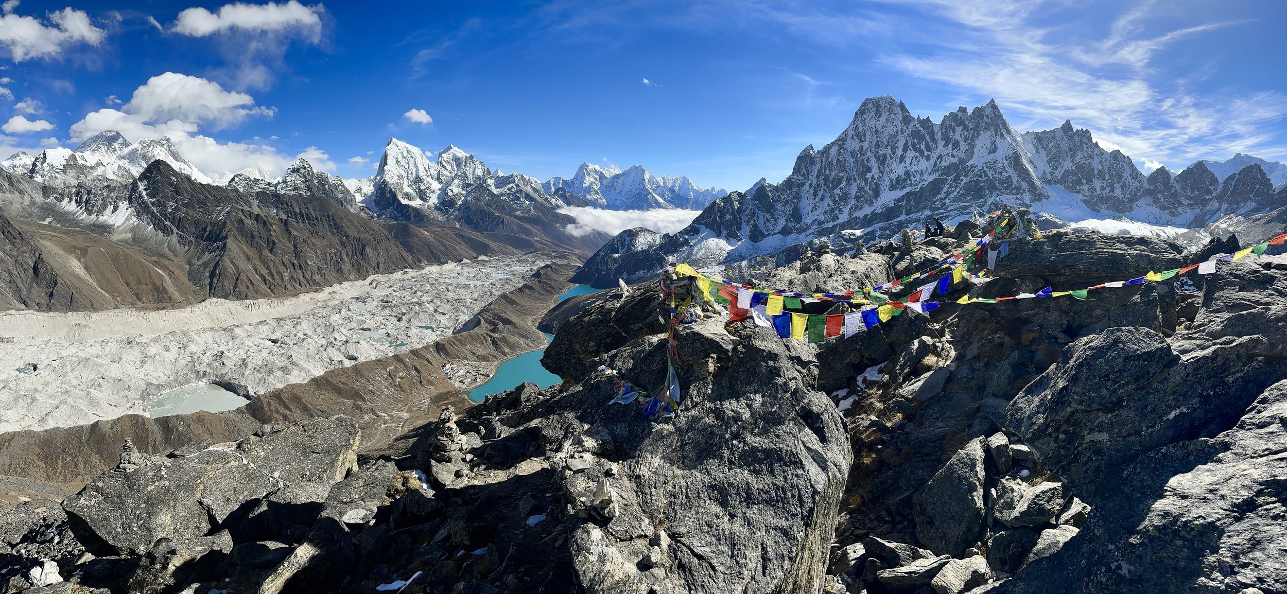
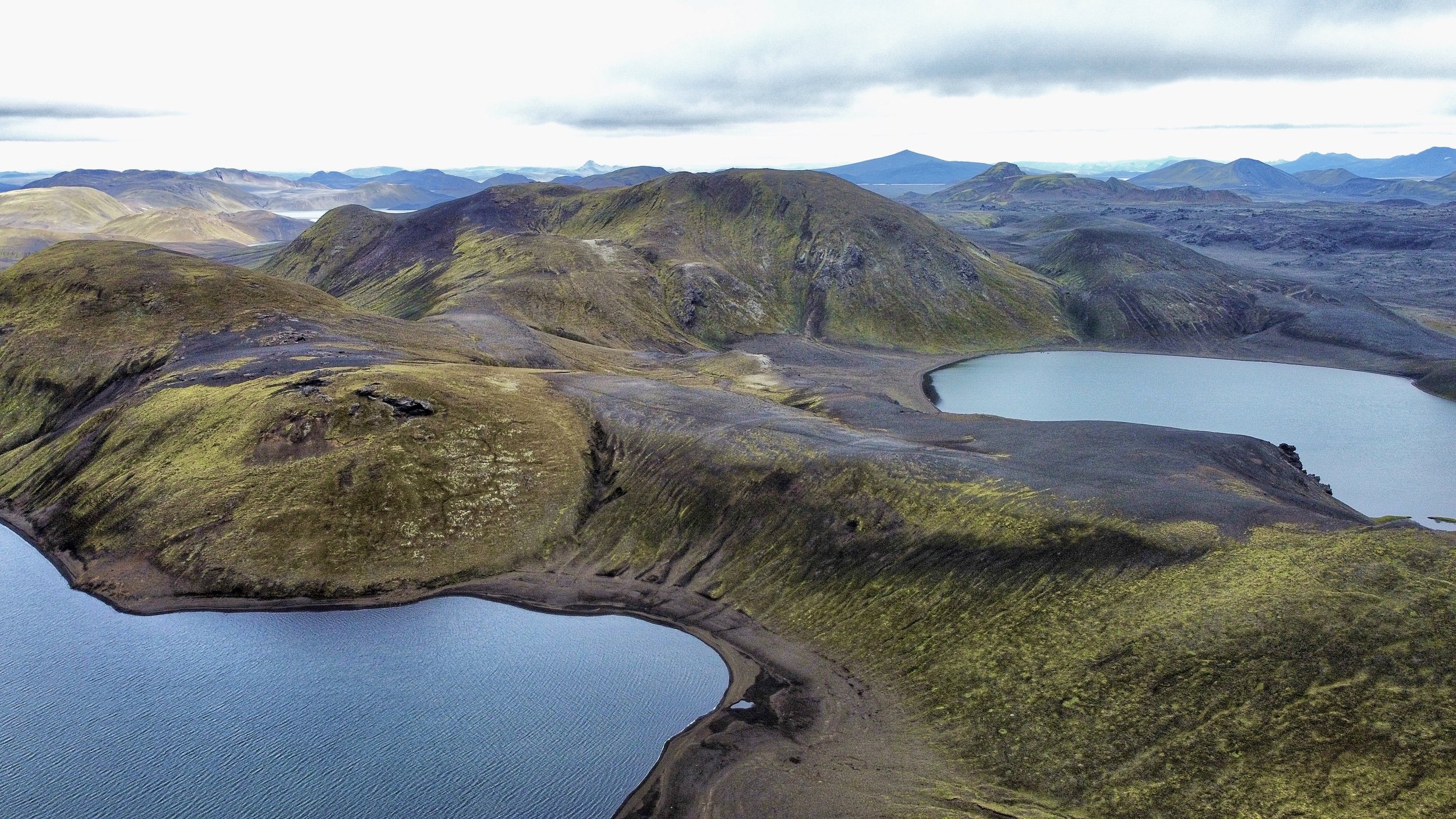
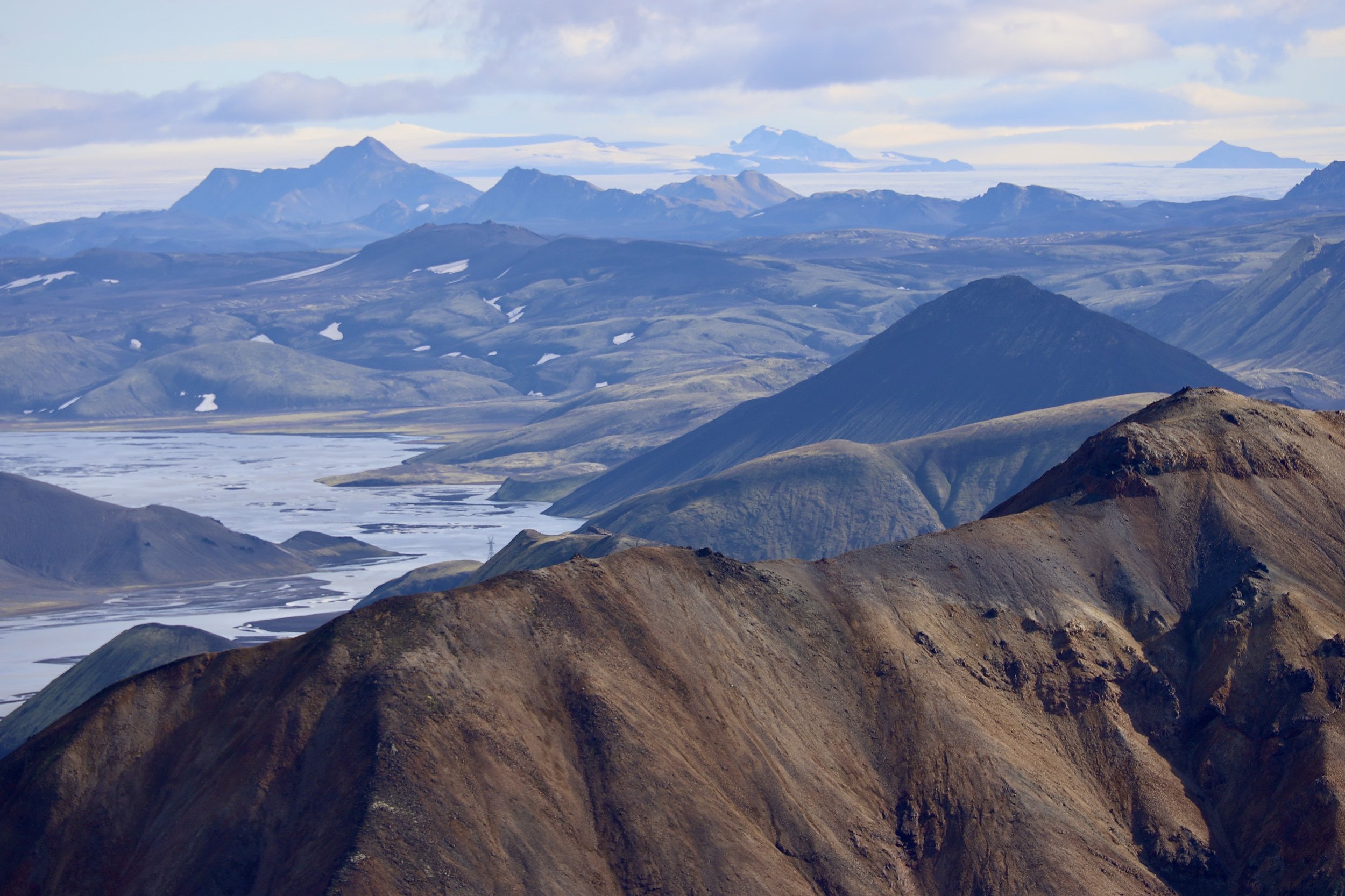
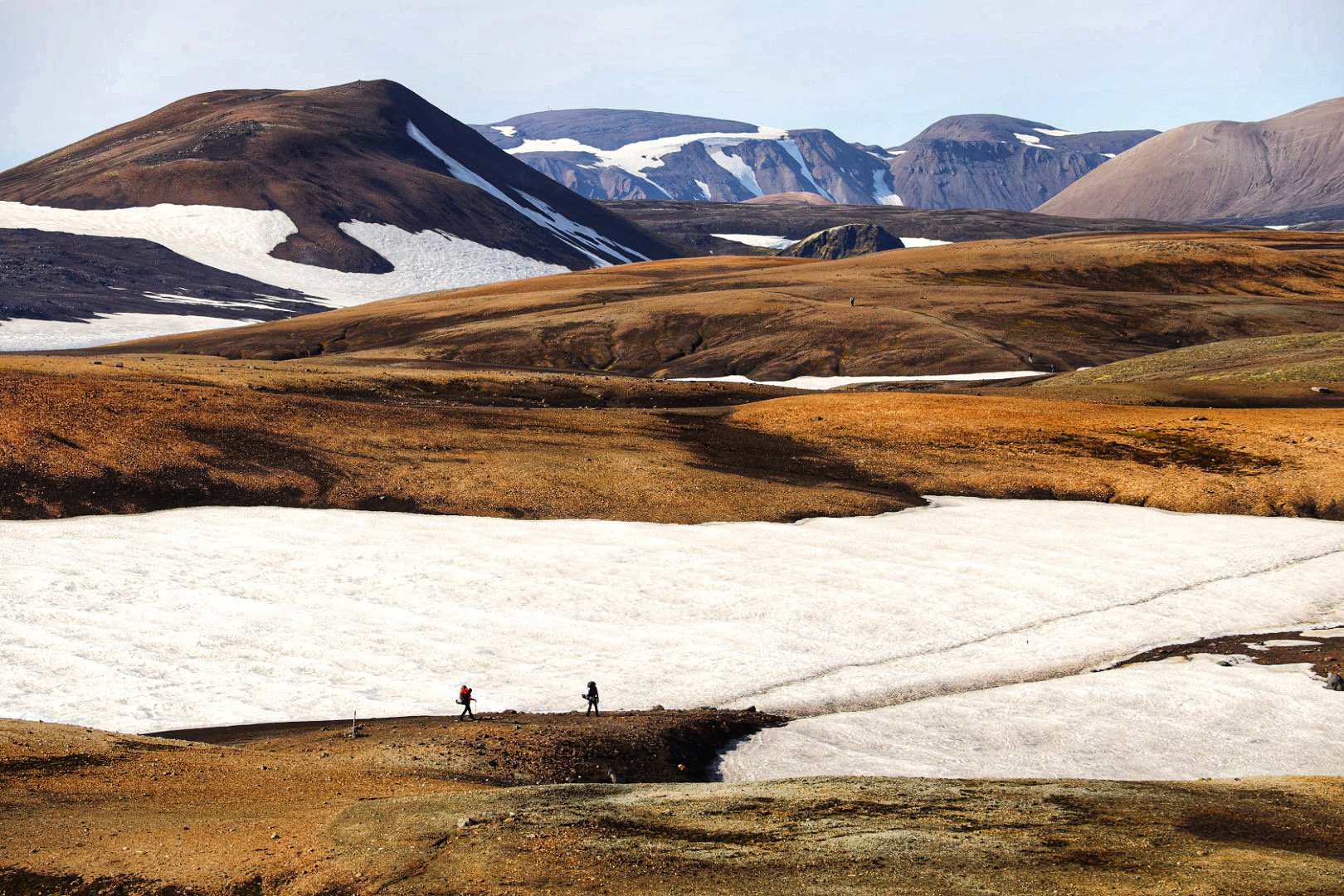
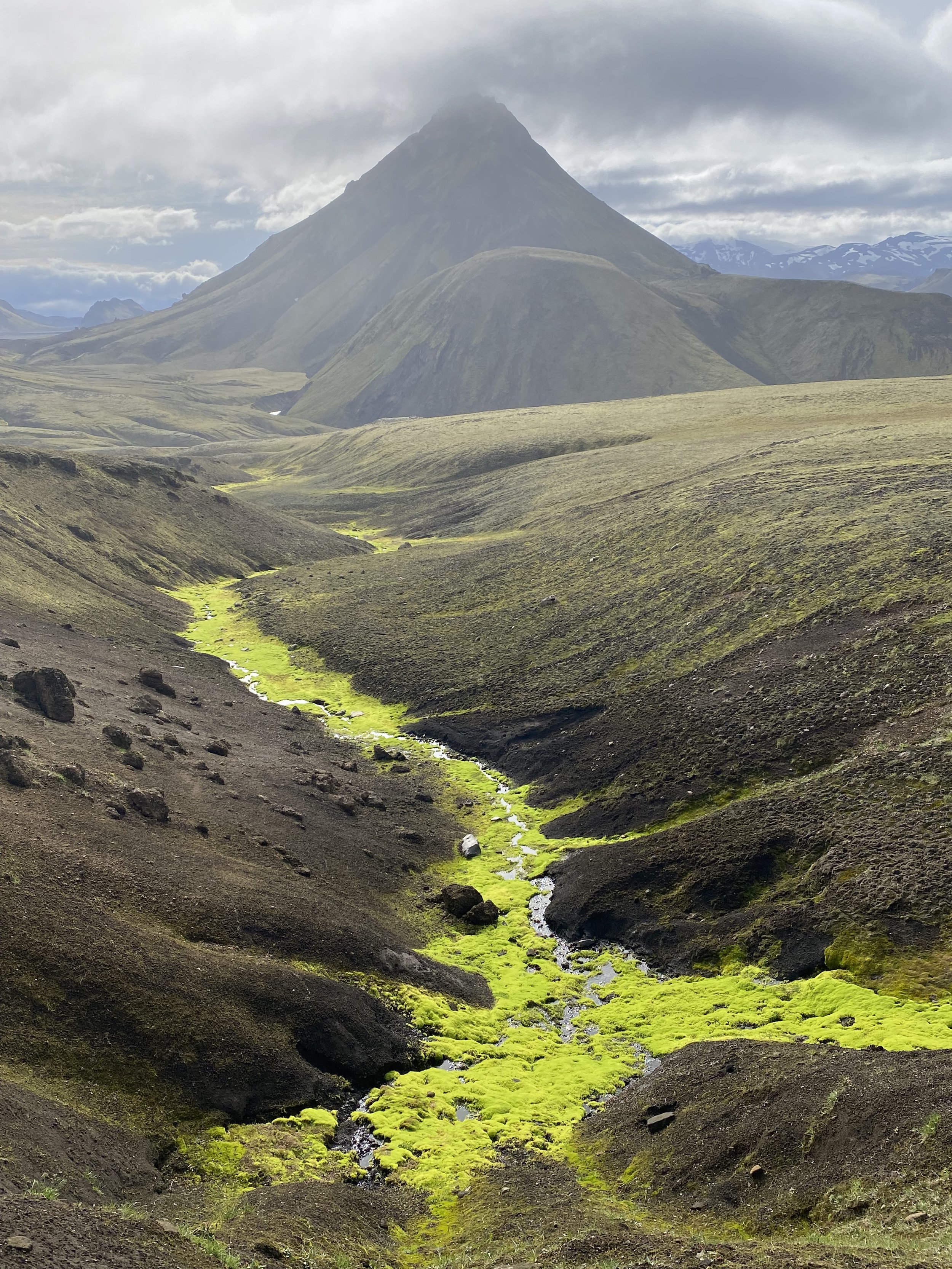
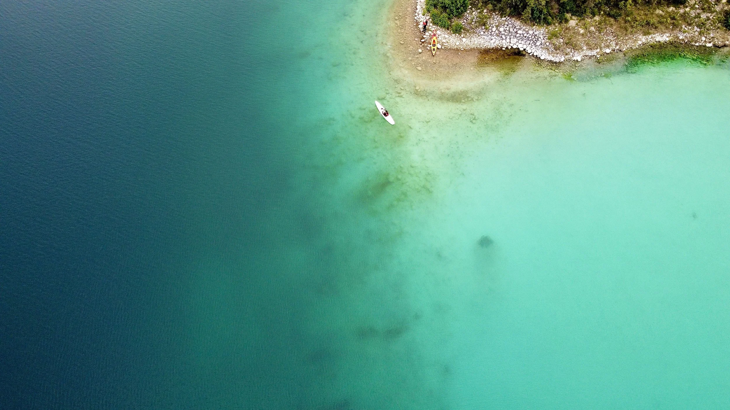
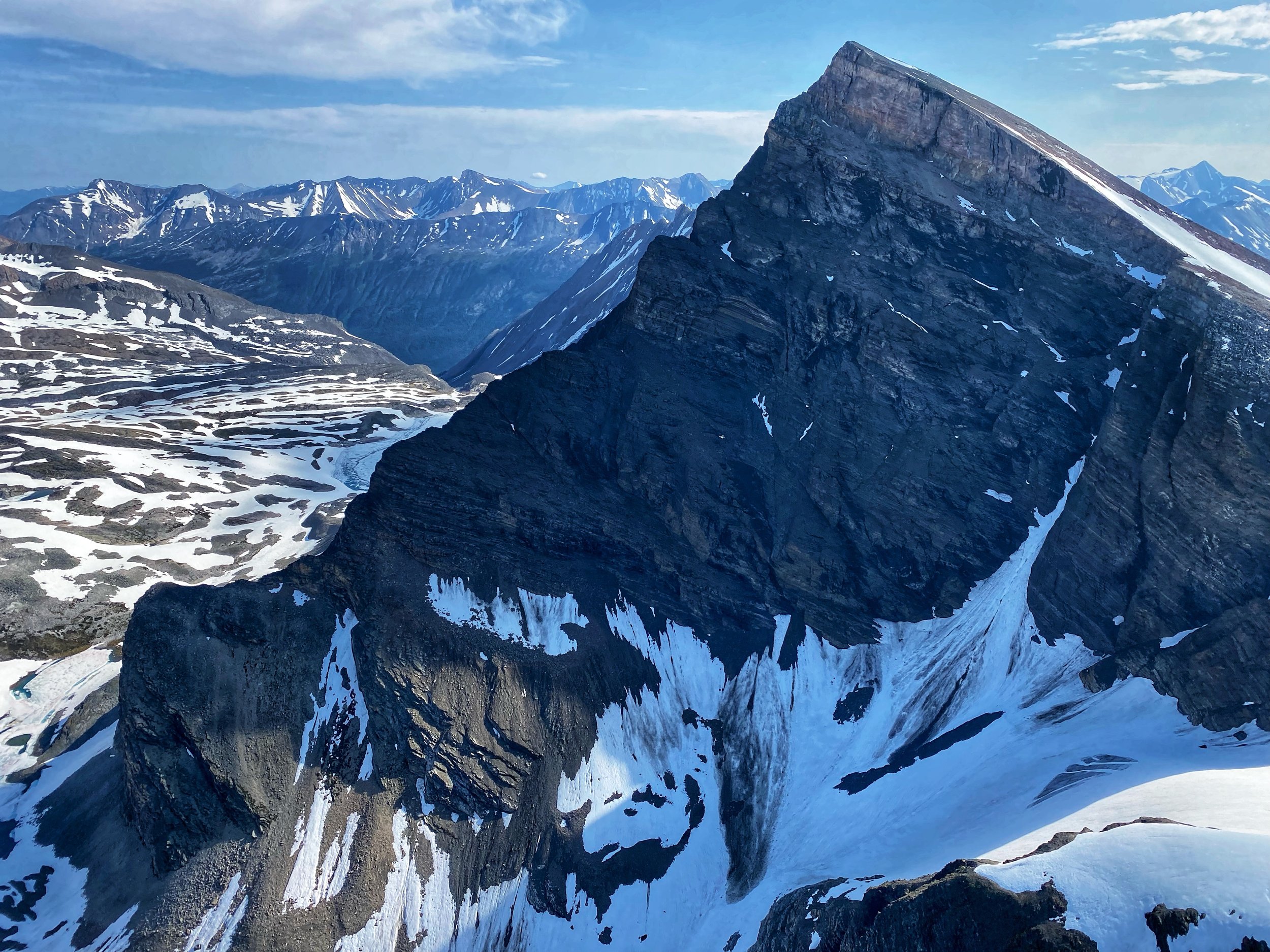
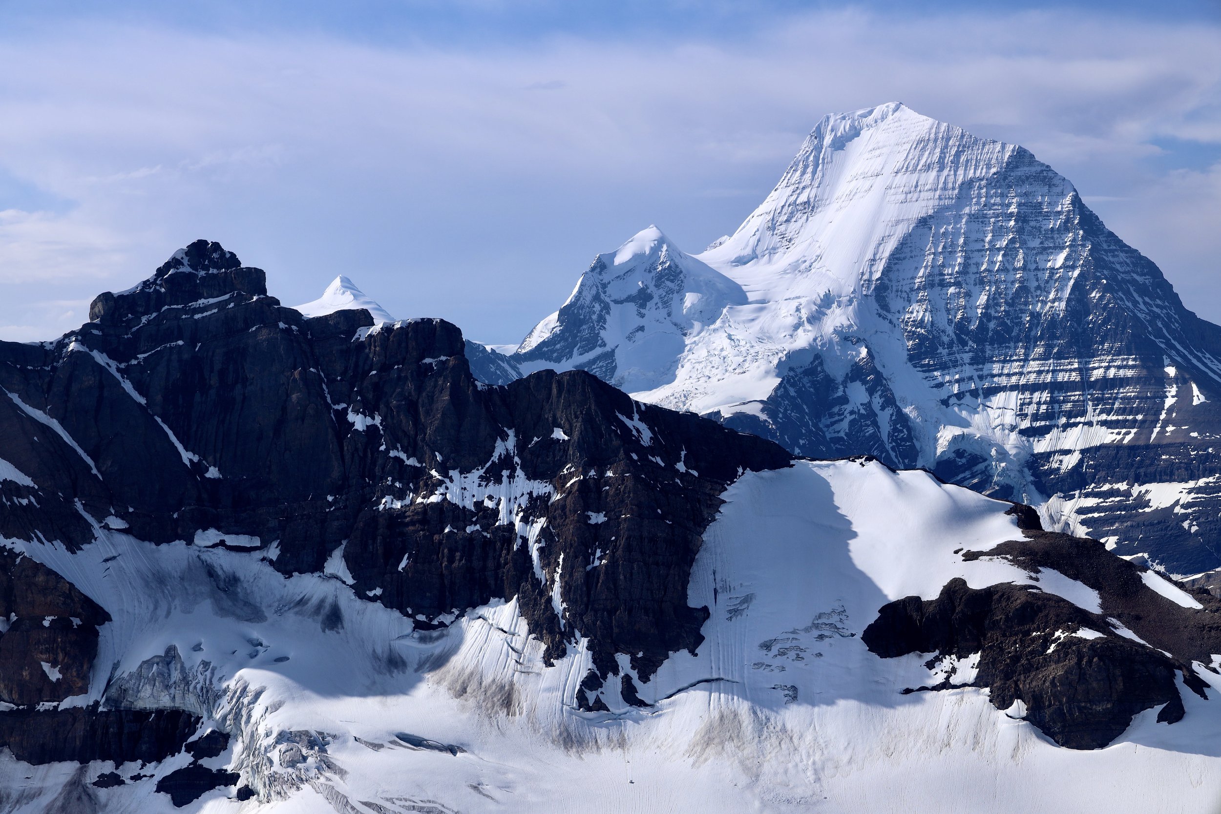
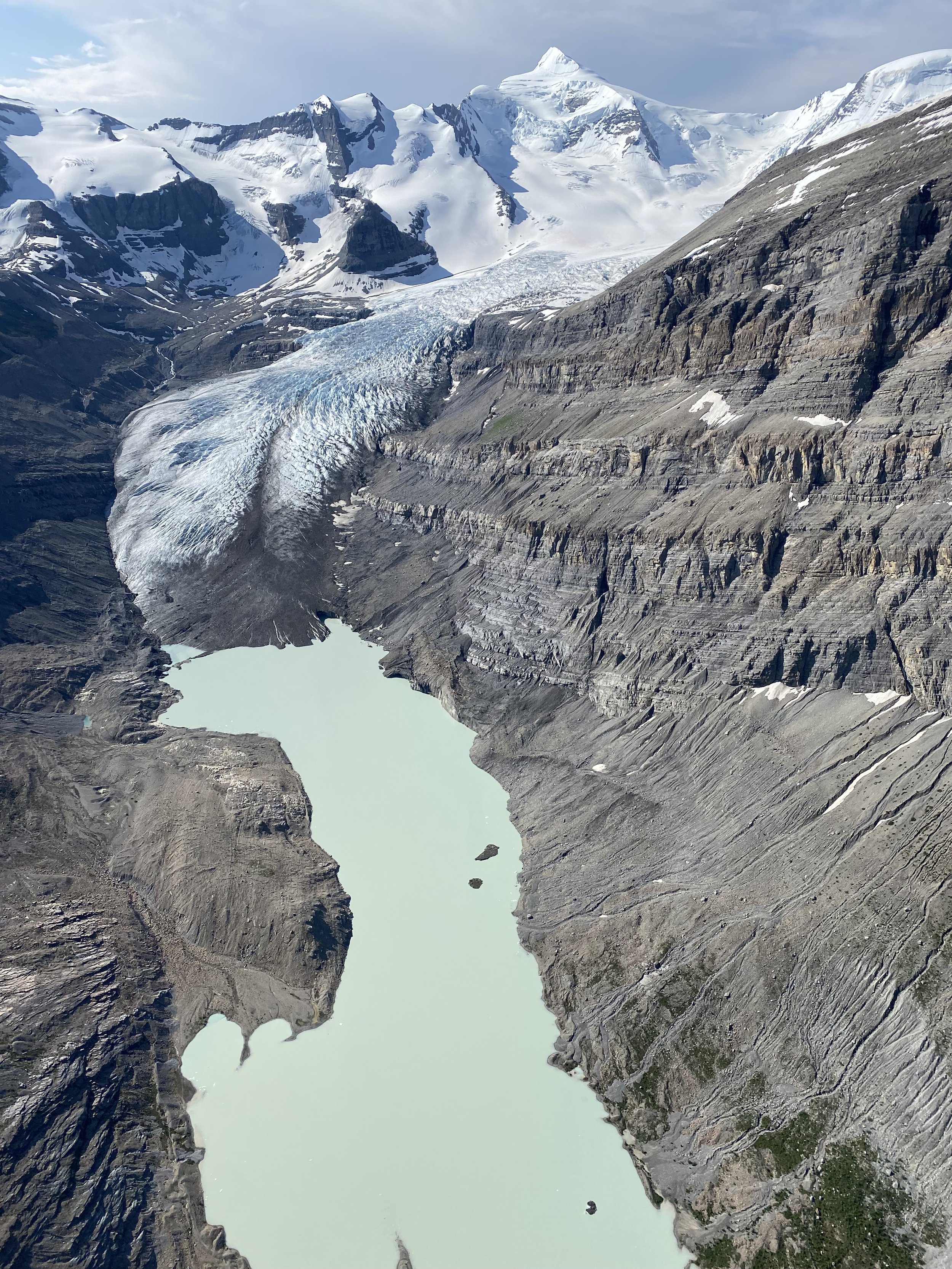
The Khumbu Valley. Lobuche Peak is on the centre left of the photo. Look for the green lake!
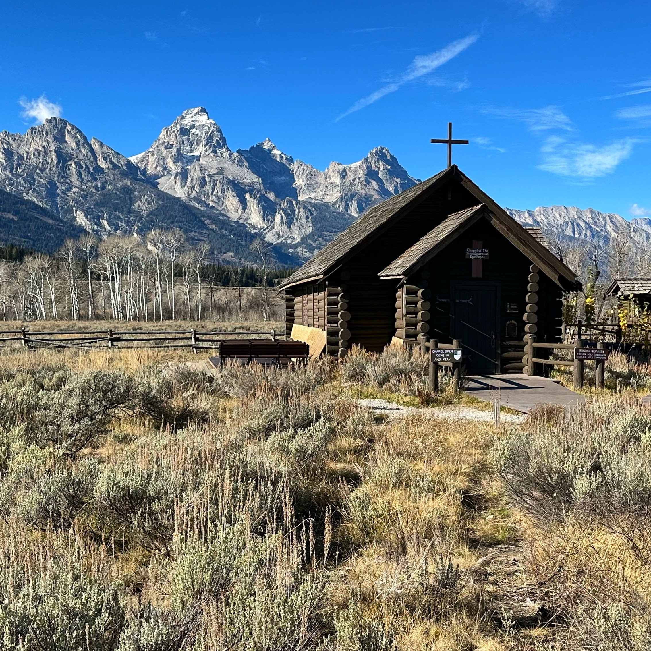
Oct 30, 2022 Kathmandu – Lukla -Manjo
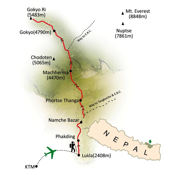
This was the most last-minute unplanned trip to Nepal so far. I made all the arrangements within 3 weeks prior to departure without a specific plan and only with a general idea of where to go: West Khumbu.
I arrived in Kathmandu at 6pm after rather uneventful flight from Doha. The arrival hall was all new and the process of obtaining on-arrival visa has been simplified by the availability of an online prefilling of the necessary forms. It felt so special to be back here after the uncertainty of the past two years. The insanity of the covid restrictions had put my future visits to Nepal and Himalaya in doubt. Thankfully, things seem to have returned to normal at least in Nepal.
After clearing the customs and retrieving my bags, I met Rajedra and we went to his office through congested and crowded streets of Kathmandu (it was also the rush hour). I noticed that there were many more motorbikes in the streets and the pollution seemed thicker. I was tired and jet lagged so I did not hang around too long and retired to the hotel next door pretty early. I had to get up at 2 am to catch a flight to Lukla from Ramanchap which is 4 to 5 hours away by car.
I got up at 2am without much difficulty due to jet lag. I managed to squeeze in 6 hours of sleep punctuated by the quarreling couple right outside my window. On the ride to Ramanchap (from where the flights to Lukla now leave), although tired, I did not pass out. Tek, my guide and the driver showed up at 3am and off we went. We drove through rarely seen empty streets of Kathmandu and stopped for some tea at a halfway point where a young teenage girl shared with me her plans and dreams for the future. It is strange that the most popular short haul flight in Nepal would be moved to so inconveniently located small airport so far away from Kathmandu. We followed a river valley which, at dawn revealed its beauty. The sunrise was quite spectacular with a blanked of orange clouds moving up the valleys below. At 6am we arrived at the small airport which was already crowded with other tourists and their Nepali crews. Most of them must have spent the night in one the few zero-star hotels near the runway. We checked in with Sita Air and the waiting started. We got some tea and breakfast in a makeshift restaurant serving the waiting crowd. Although the ticked was for a specific departure time, in reality, the flights operate on first come first depart basis. It turned out that we were almost last in line and had to wait until after 10am for our turn. The wait was rather boring, in a large concrete hall. I was thankful that the tourism numbers are still down otherwise the wait would have been much longer. I passed the time by watching the planes come and take off.
Finally, our turn came, and we were off for the 20 min flight to Lukla. The views from the flight are spectacular. We were approaching the highest peaks in the world. The weather was clear and the view of the Rowaling peaks was awe inspiring. It was a satisfying feeling knowing that I walked across these mountains already. As we approached Lukla, Mount Everest was visible in the far distance. I was so happy to be back here after the insanity of the last two years. It felt like coming home in a way. Although I saw and walked among these mountains before, I was so excited to see them as if I was here for the first time. During the flight I was sitting directly behind the cockpit and as we approached Lukla for landing I had a perfect view of the inclined runway. Unfortunately, the militant flight attendant prevented any photo taking. The planned road will eliminate one of the biggest thrills of arriving in the Khumbu: the landing in Lukla. And it is apparently coming soon!
After landing in Lukla and stopping to watch the planes land and take off, we ended up in a small teahouse next to the runway. We had a good lunch basking in the hot sun, repacked and left around 2pm. At this point I still had no clear idea of our plan or things that we would do. I was not even sure what was the destination for the day. Namche seemed too far but I wanted to arrive in Thame as soon as possible. Thame is at 3800m which is perfect for acclimatization. Namche is at 3400m which is too low. Our intimal plan was to trek to Nangpa La. Two days before I left home, Rajendra sent me a climbing permit for Lobuche East which gave me another option. Lobuche East is a little far from Nangpa La so we would need time to get there and climb it. It also makes the return walk to Lukla longer. As we walked along, it became obvious that we did not have enough time to go to Nangpa La and climb the Lobuche East in 15 days. Obviously Tek did not know what to say as he had no idea of the plan either. All I knew was that I had the Lobuche permit, no idea when to climb it and no idea exactly where it was. The Lobuche idea popped up a couple of days before I left Calgary, so I did not even had time to plan for it. We also had no idea of the way to Nangpa La and whether it was even possible to get there as the traffic from Tibet ended a decade ago.
We had a chat over dinner and decided that Lobuche would be a good objective but to do it we would drop Nangpa La. That’s all we agreed on, the rest we would play by ear. Considering that the porters had no climbing gear (crampons or good boots), we concluded that Nangpa La may be too much especially not knowing if the glacier was even passable. Nangpa La could have snow, crevasses, there could be no trail etc. The porters, as usual had only running shoes and sweatpants.
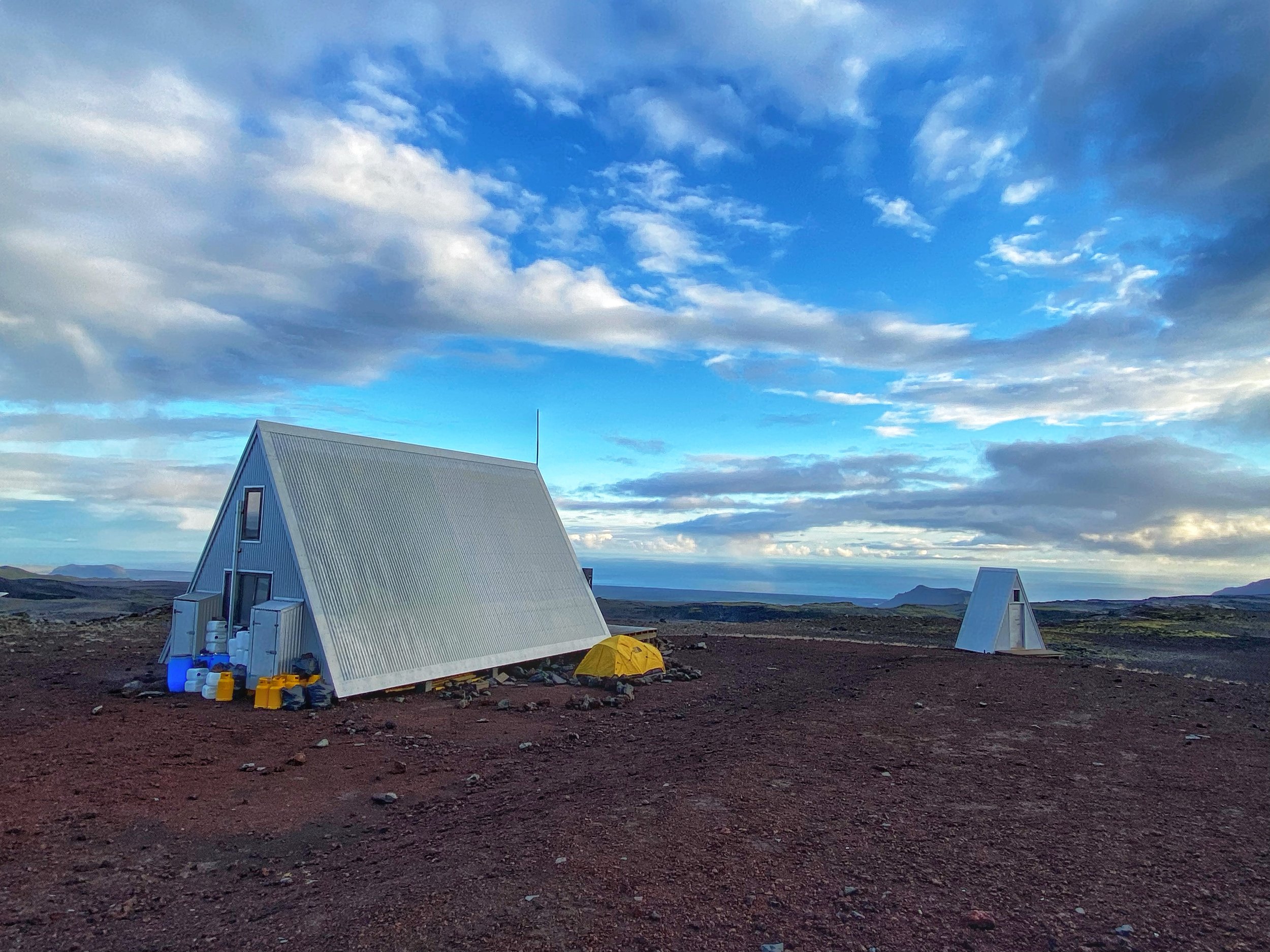
After walking for a few hours, we decided that Manjo would be our stop for the day. In Manjo we stayed in a nice teahouse whose owner climbed Everest 5 times. I was tired from a couple of sleepless nights, so I retired to bed at 7. It has been a long day!
November 1 Manjo 2600m to Thame 3800m
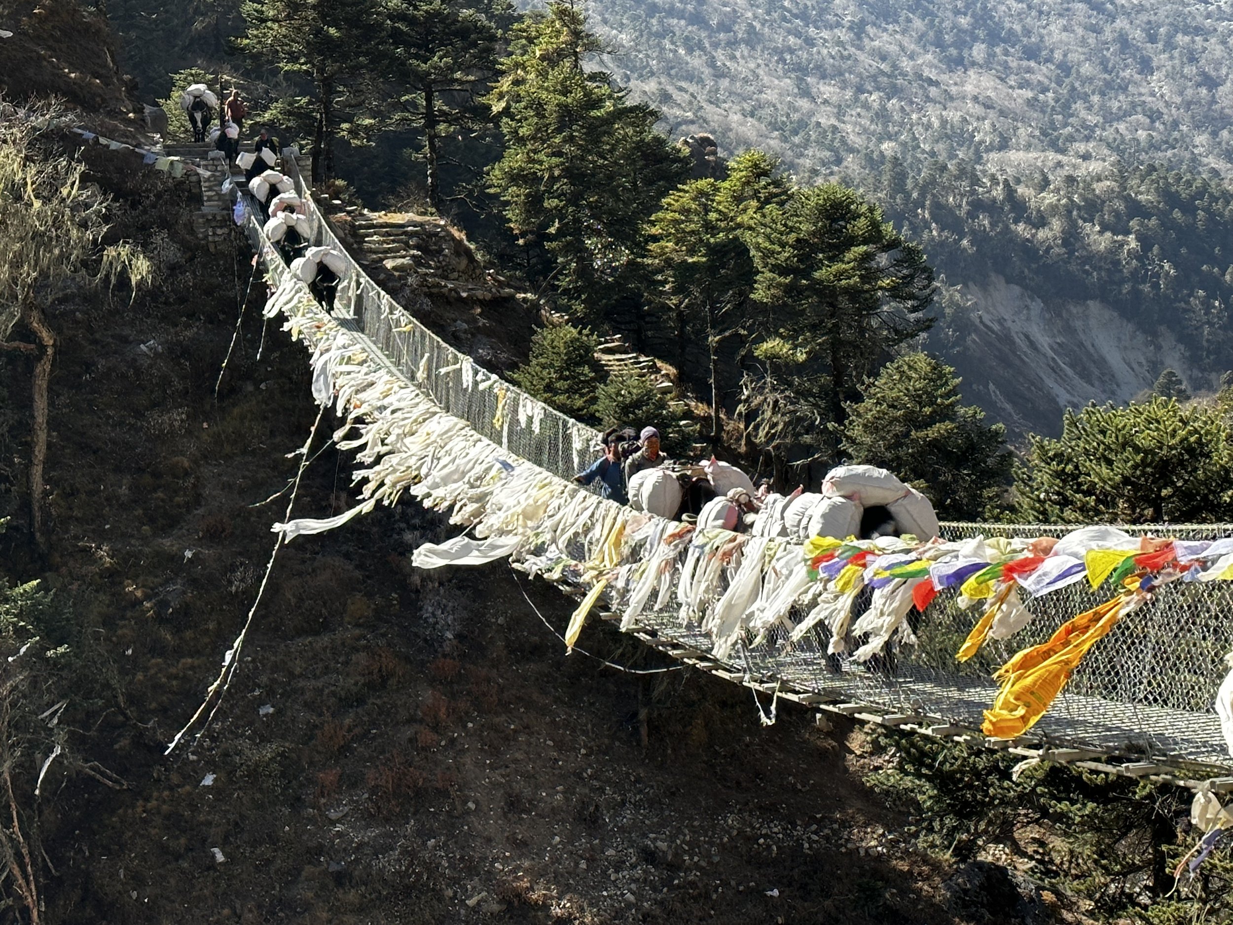
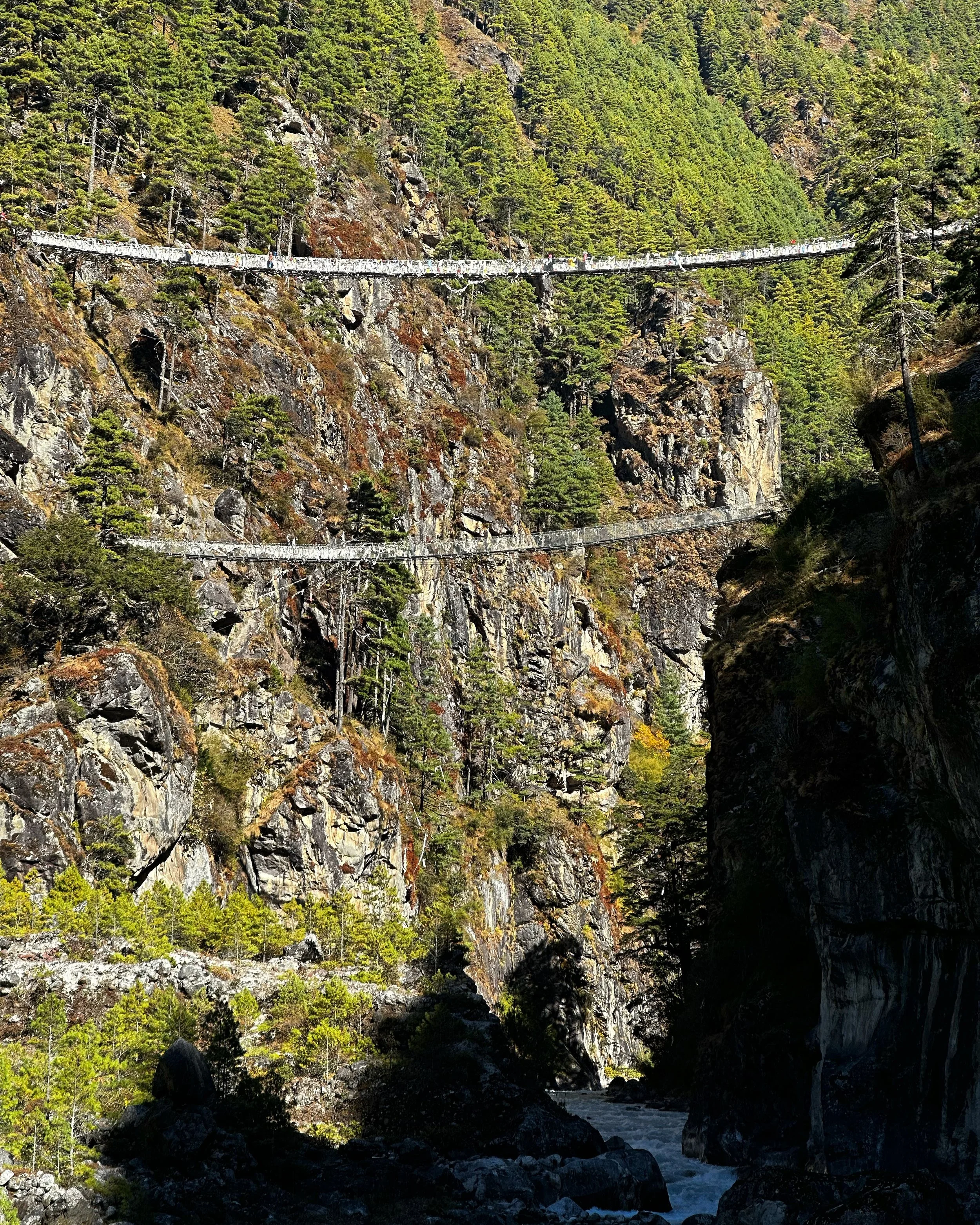
The walk from Manjo to Namche is all uphill. We started the day in Manjo at 2600m and ended up at 3800m in Thame. The trail crosses a cool hanging bridge and climbs a steep long hill all the way to Namche. We made it to Namche in 2 hours and stopped there for lunch. On the way, I met a porter who was carrying 100kg of Coca Cola. The man was the same age as me. I have seen hard working porters like him many times but each time I feel really sad to meet them.
I arrived in Namche before noon and waited for Tek in the first teahouse with a patio that I came across. It was nice to be here again. Namche felt rather empty and quiet for this time of the year. In Namche we stopped for a long lunch at a hotel next to the Gomba. There I tried to hire a heli for an hour ride but it turned out to be an impossible task (despite many helicopters constantly flying around). The Khumbu Helicopter flight was on my bucket list and I regrated not doing it on one of my earlier visits. The owner tried to contact a heli company in Lukla. After agreeing to our initial request, they started changing times, routes, prices etc. They did not know the key mountains along the route. It smelled fishy and we left it at that. After 2 pm we bailed and left for Thame.
We arrived in Thame to an empty Everest Summiteers Lodge. This is the same hotel where I stayed with Tony in 2010. The trail from Namche to Thame was all new for me. From the trail, we had beautiful views back to Tamaserku and Kangtega. I was getting tired at the end of the walk as we started to climb quite high for my second day on the trail (Thame is at 3800m so we gained 1400m of elevation in two days). Since we were walking quite late in the day, the valley was in the shade but the high mountains behind us were glowing in the light of the afternoon sun. The trail was not busy at all, the villages we passed though were all empty. There were very few tourists if any really. The teahouse owner in Manjo said that the business was down and has not yet recovered to the pre covid levels. I could clearly see it. Usually, the Khumbu is overflowing with trekkers and climbers but this time it felt empty.
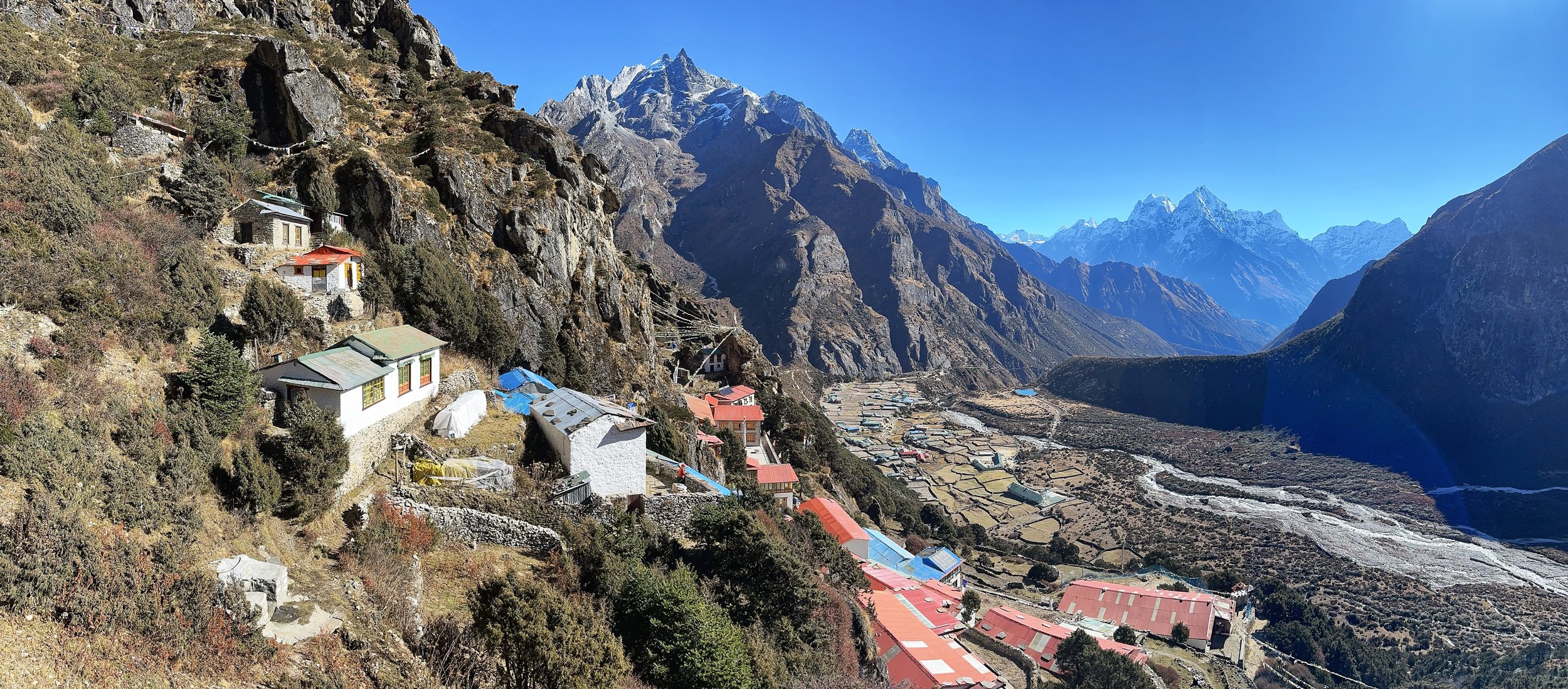
Thame
The following day I wanted to go on an acclimatization hike to Sundar Peak at 5000m. I did not want to waste time by sitting around and a climb to 5000m would speed up the acclimatization process. I felt that there still may be a chance to go to the high pass from Nangpa Glacier to the 6th Gokyo Lake and we needed to find a local Sherpa who would know the way. Our plan (if we even had a specific one at this point) was very unpredictable and it all felt very unstructured. Not a bad thing but we had to use our time wisely as we had only 15 days here. Regardless of our final destination, a good acclimatization was key for any further exploration of valleys beyond Thame.
November 2, Thame 3800m Sundar Peak 5000m
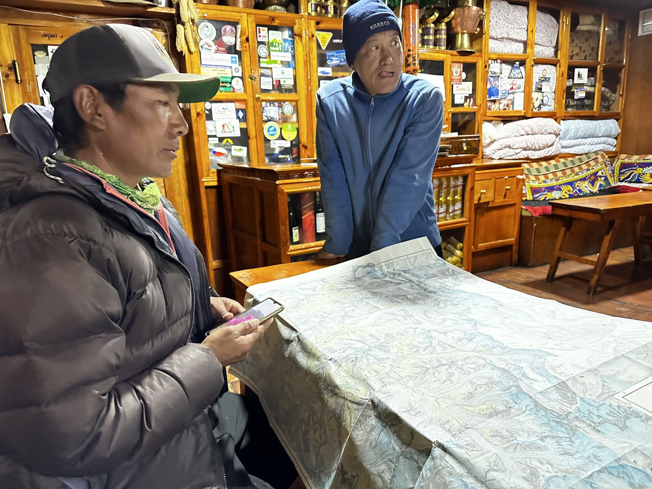
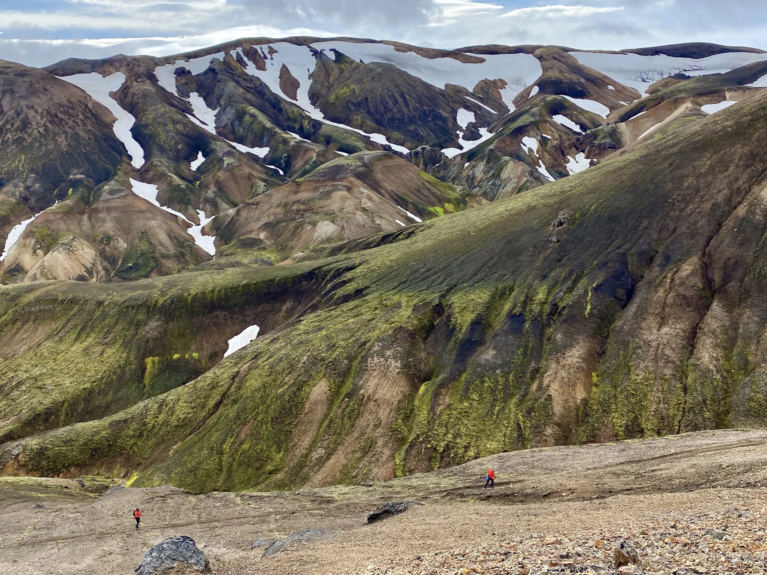
After arriving in Thame we asked the teahouse owner whether he knew of a pass between the Cho Oyu BC (on Thame side) to the 6th Gokyo Lake. To our surprise they said that there was a way called a Sumna Pass but we would have to take a local Sherpa guide to show us the way. I got quite excited about the prospect of doing a seldom crossed new pass in the Khumbu that I did not even know existed.
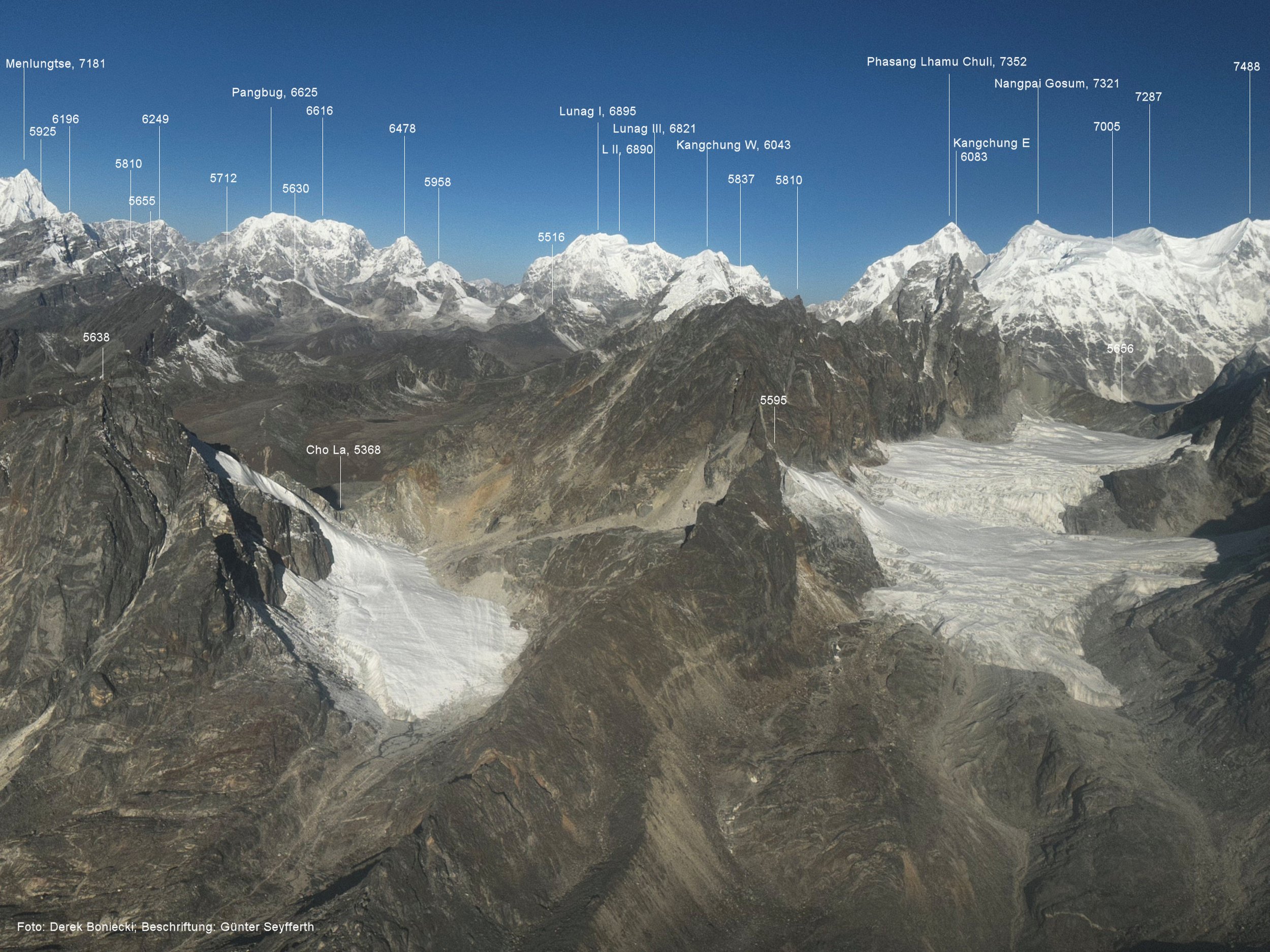
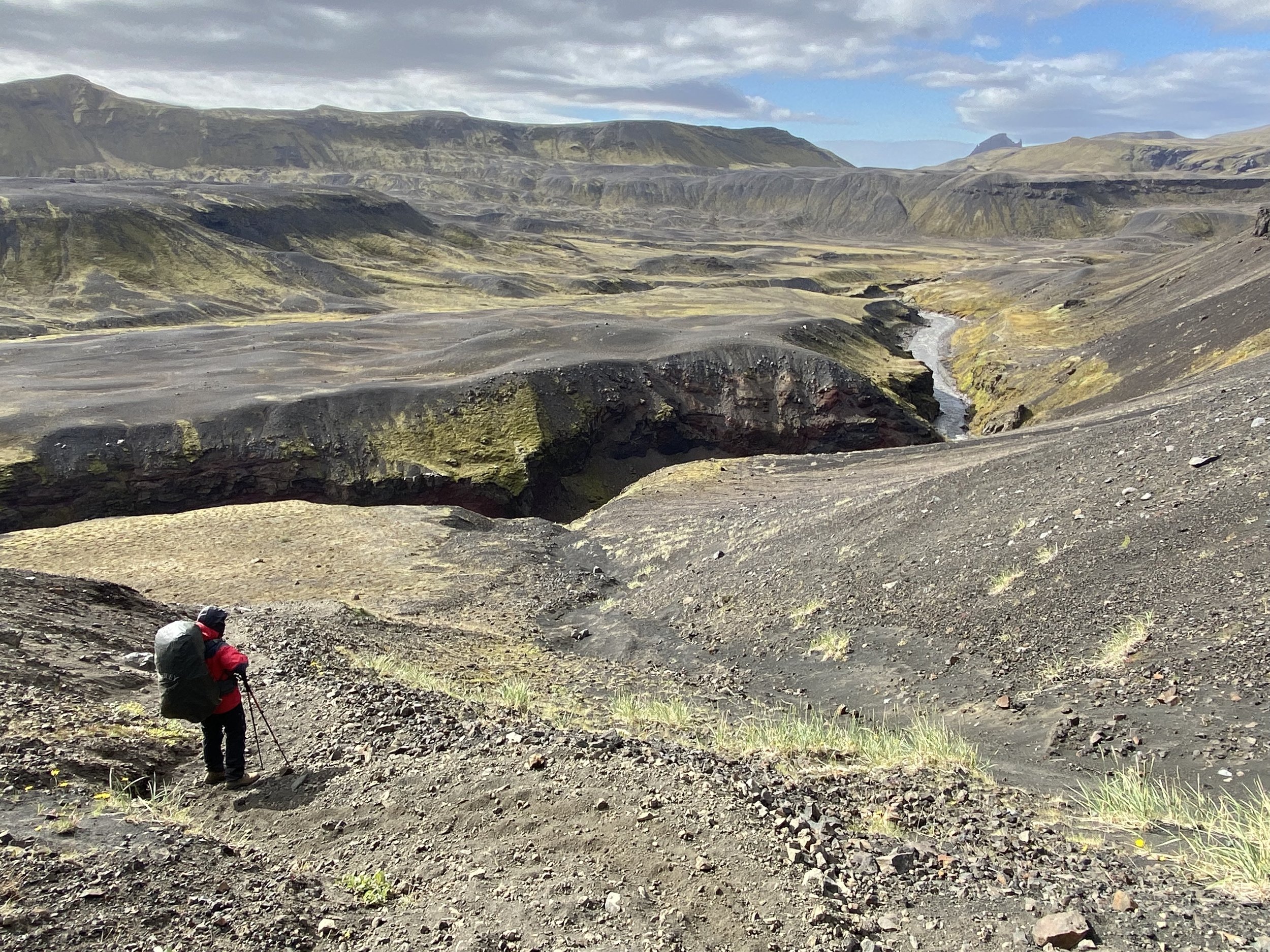
We met with the Sherpa guide (a 18 times Everest summiteer) who just returned from an autumn attempt on the south wall of Cho Oyu. He told us that there is a way from the Cho Oyu BC to the 6th lake but that way is too steep for porters with no climbing equipment. He confirmed that the Sumna Pass was a good alternative and it would take us far up the Nangpa Valley. I was happy not to go over the Ranjola Pass again, the pass that we did in 2010. Sumna Pass was all new territory and it would take us close to the Nangpa and Lunag Glaciers which were of interest to me. I was very curious about this part of the Khumbu for a long time. It is the least frequented area by trekkers and climbers and has many unclimbed and often unnamed peaks.

Planning our route in Thame
Our new guide asked for a fee which seemed very reasonable to me. He would be with us between 4 to 6 days. Tek was not very keen on paying the Sherpa guide and felt that he was encroaching on his territory. I convinced Tek that it was a wise move to take the local man to show us the way as no one in our party had been there. Despite Tek’s initial objections he was later quite happy that we had the local help. Having local help was like an insurance policy for all of us. If something was to happen to any of us, we had extra help. This was especially important considering how poorly equipped our porters were. The Sherpa told us that it would take 5 to 6 days to cross the pass. It took 4. We had all the necessary camping gear and food.
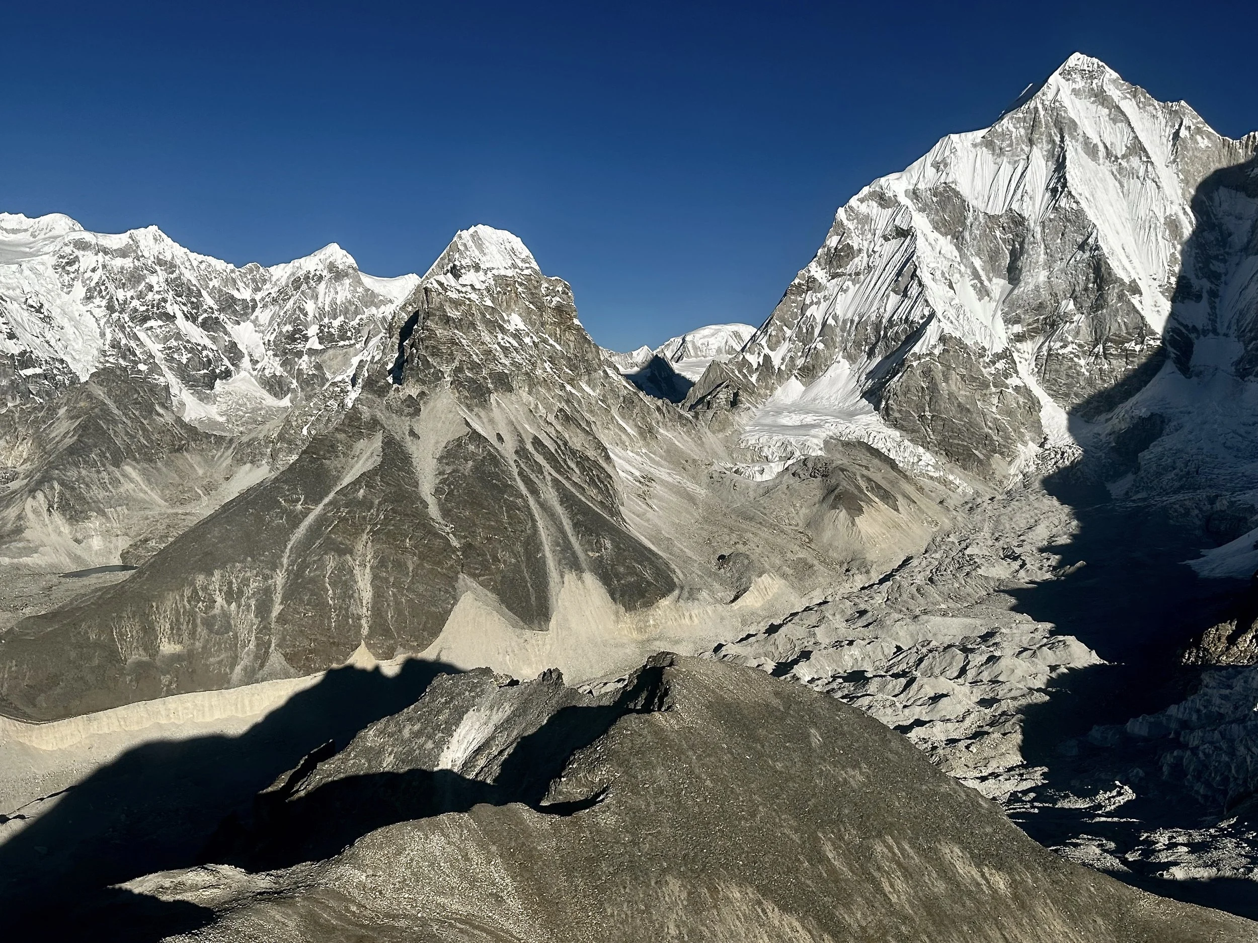
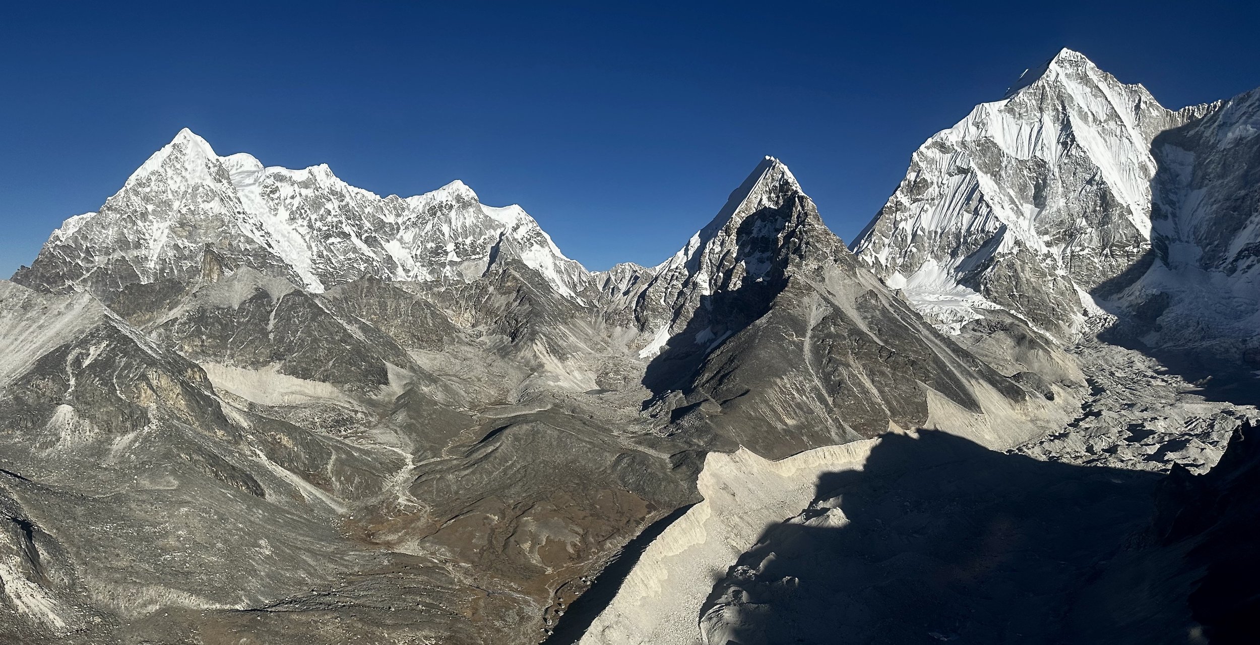
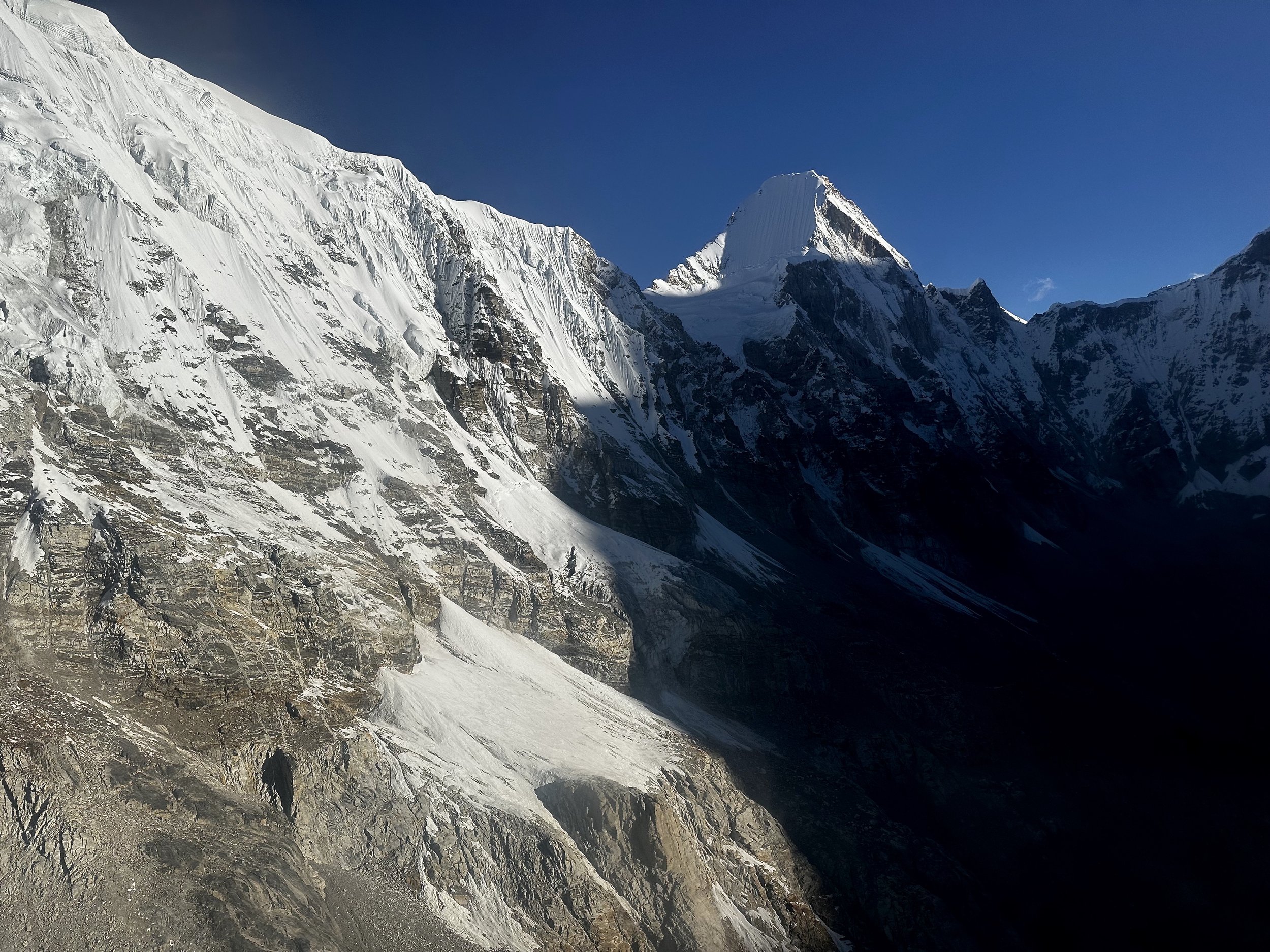
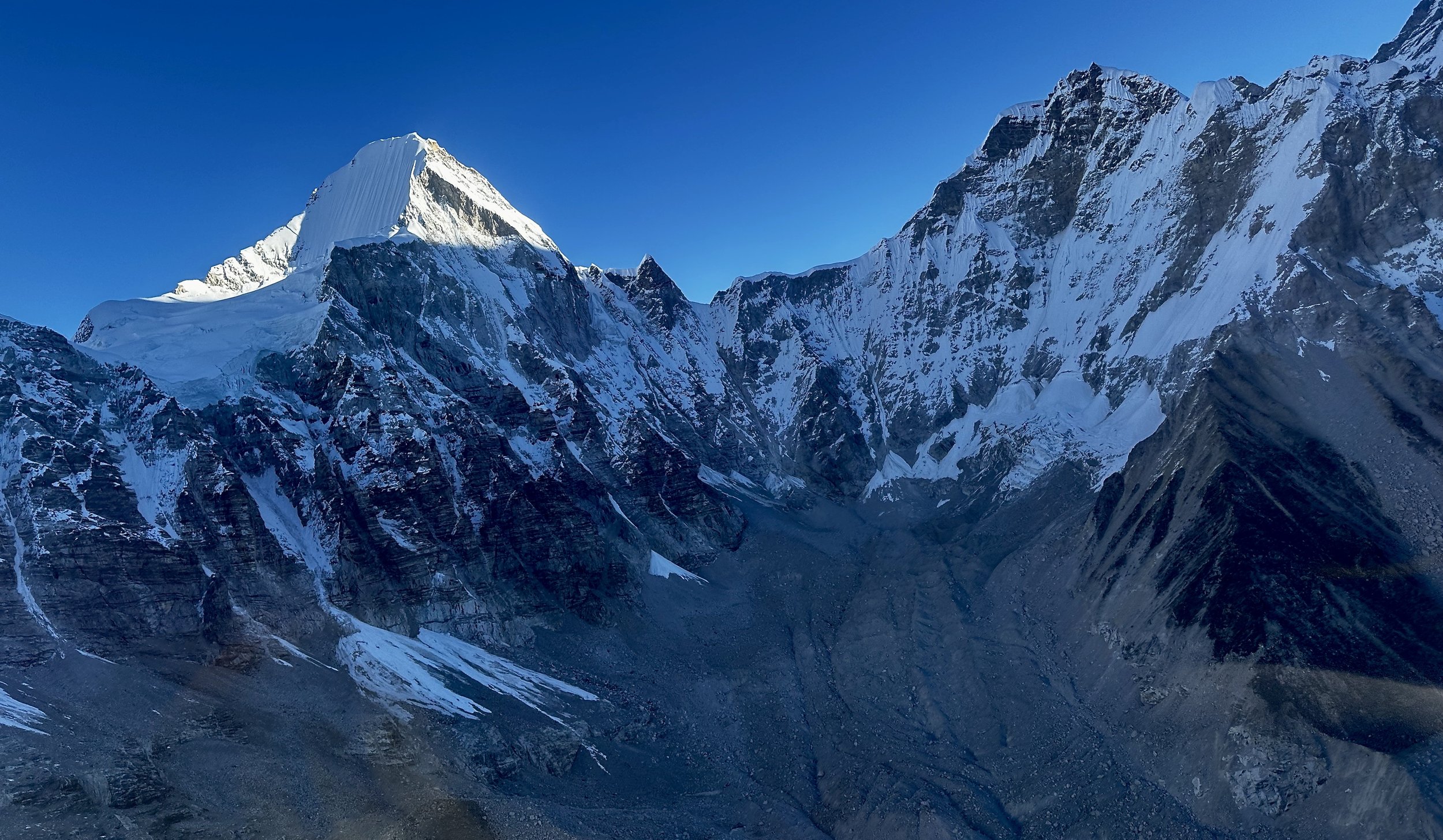
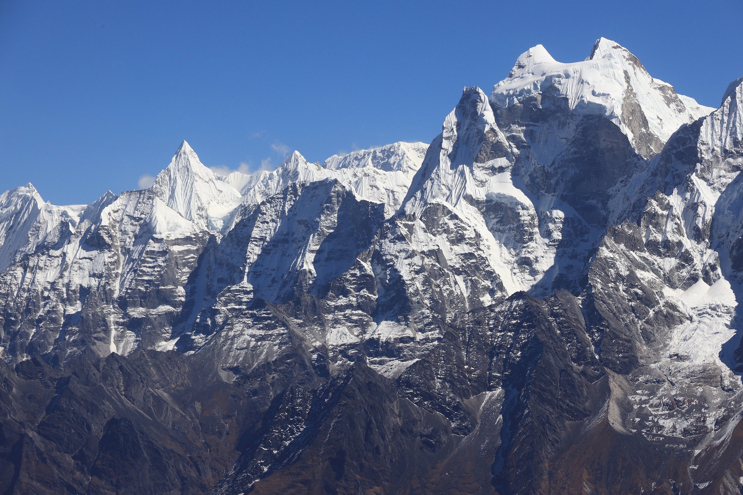
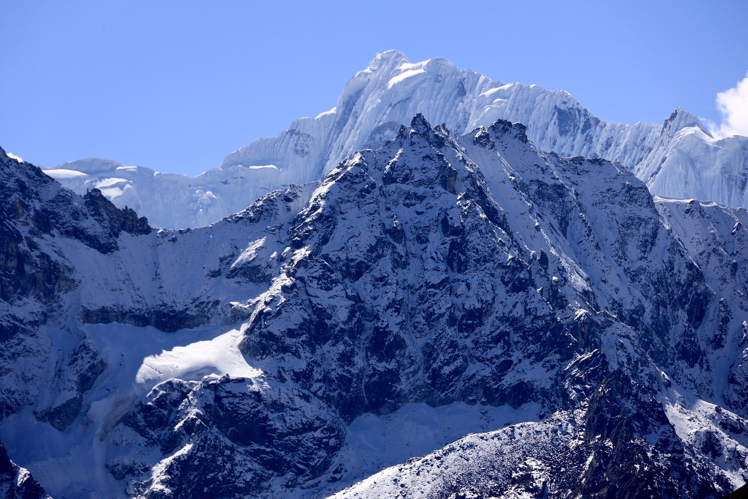
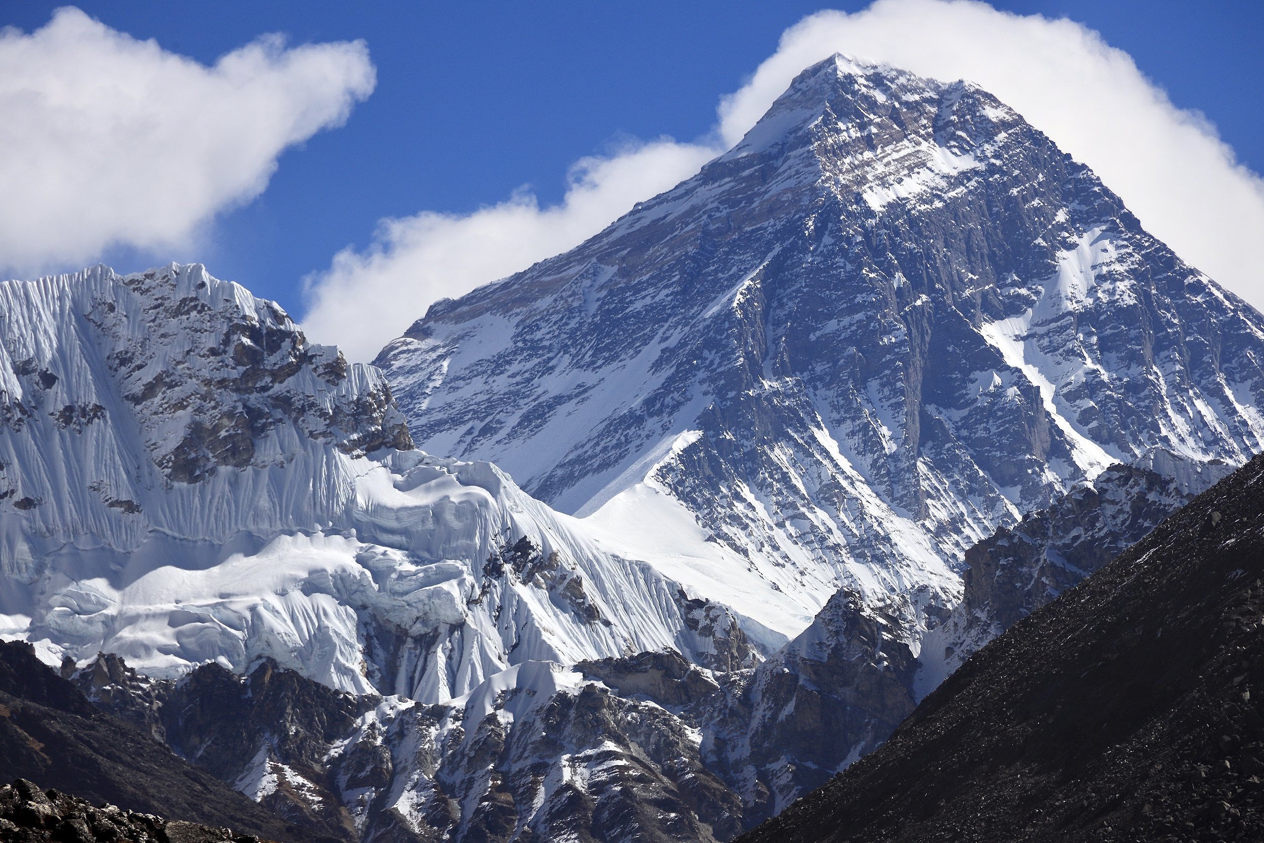
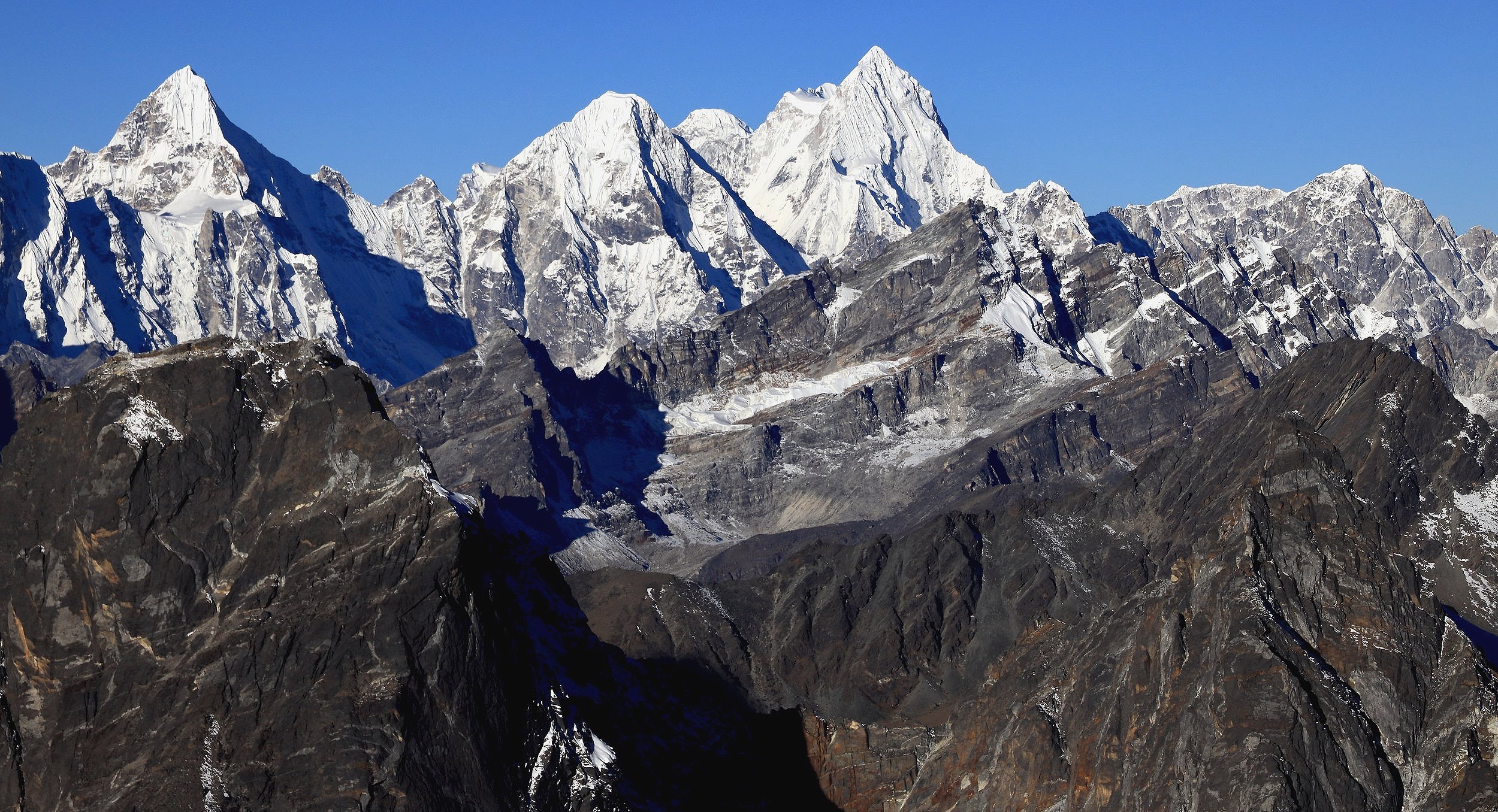
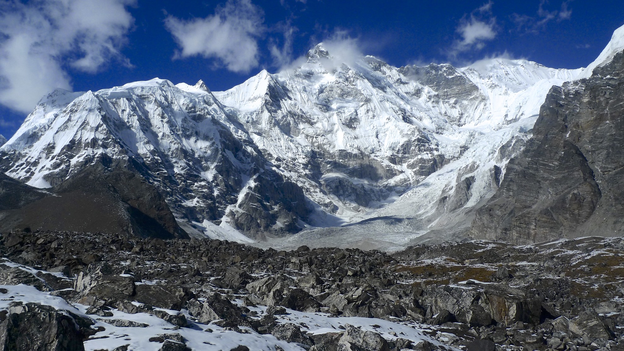
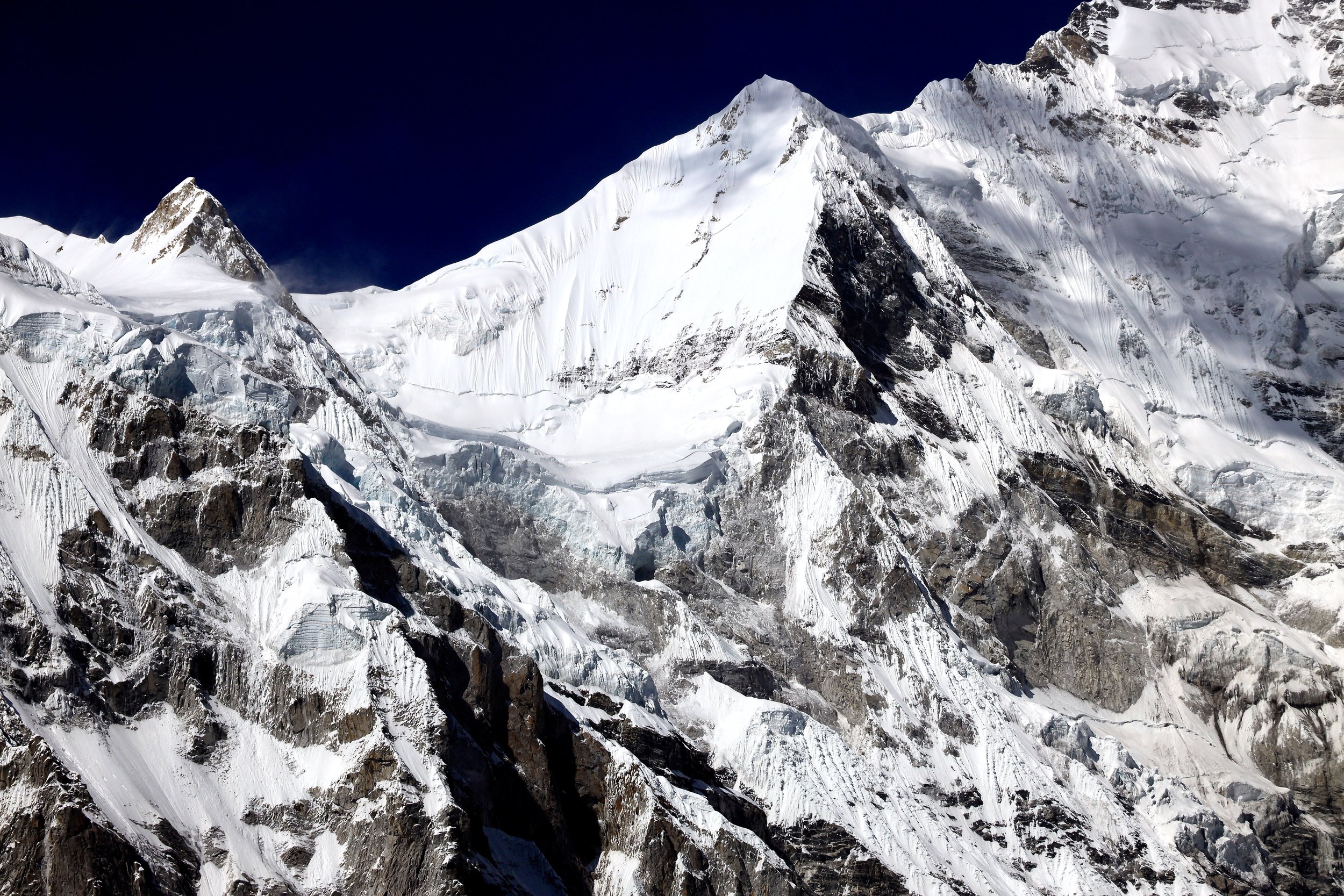
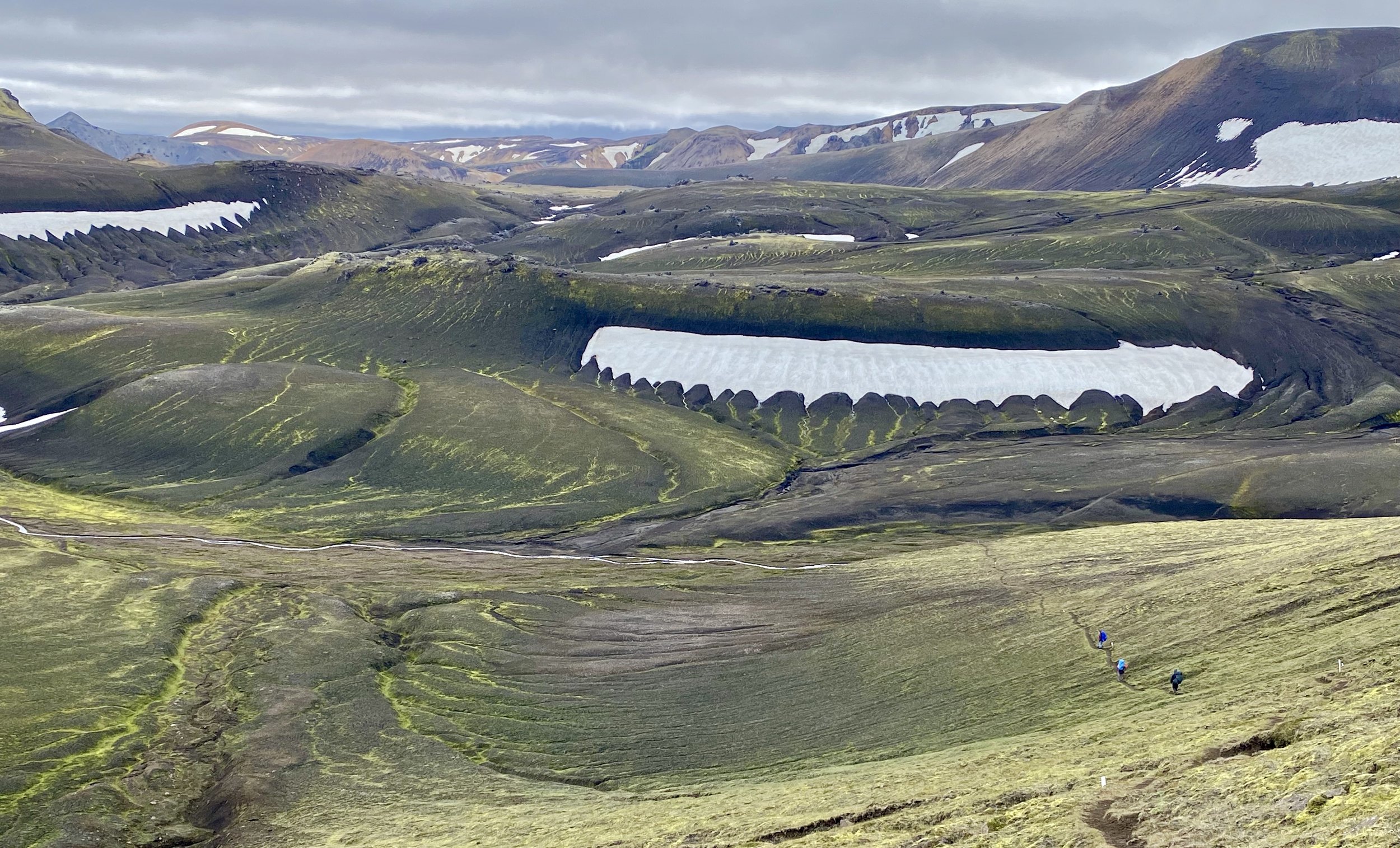
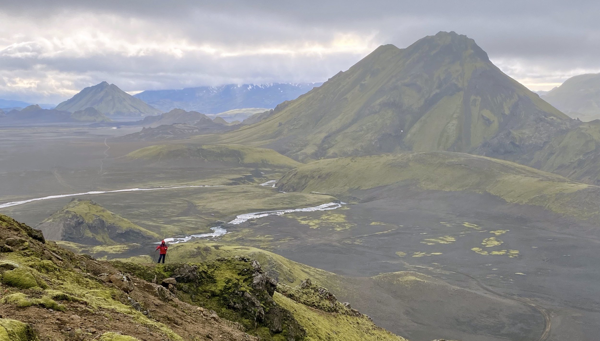
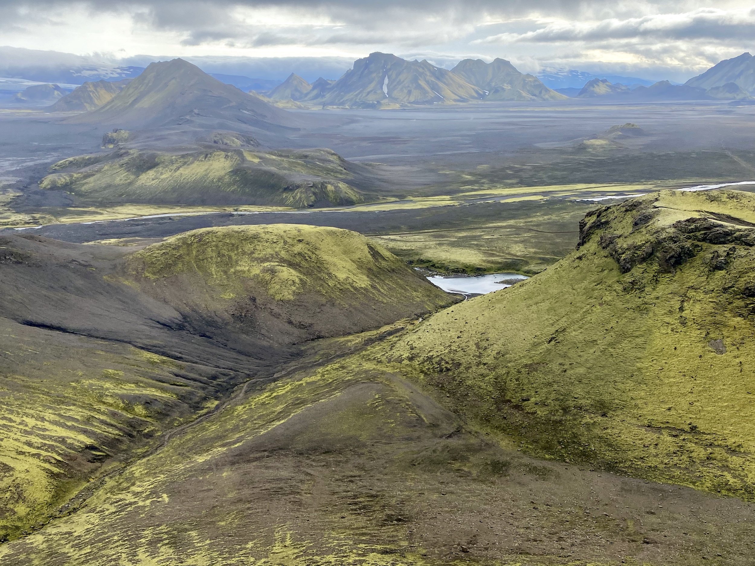
Sundar Peak view - looking north up the Thame Valley
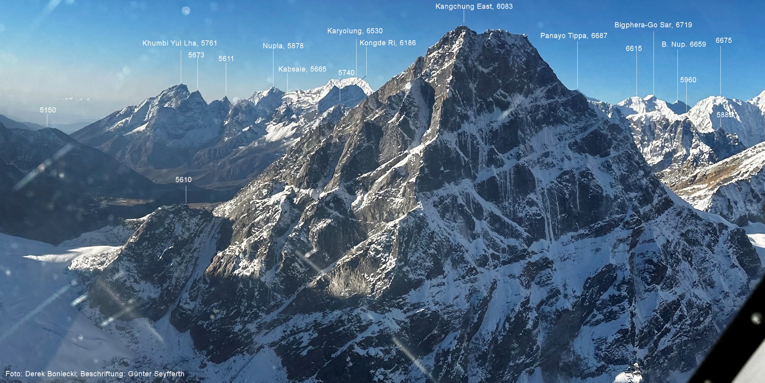
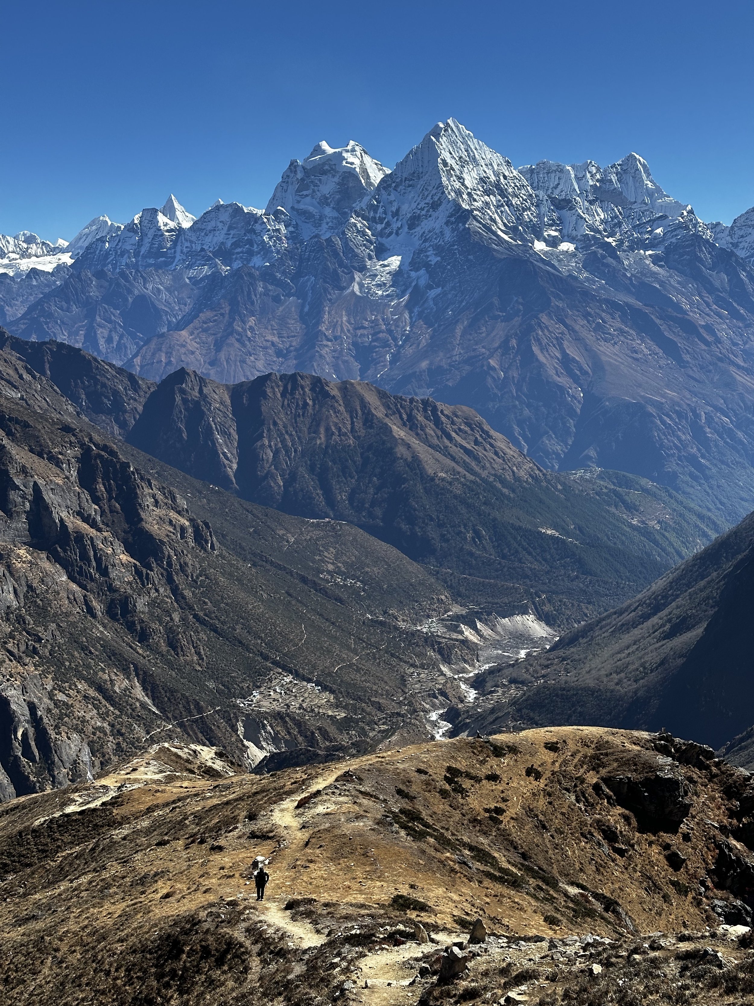
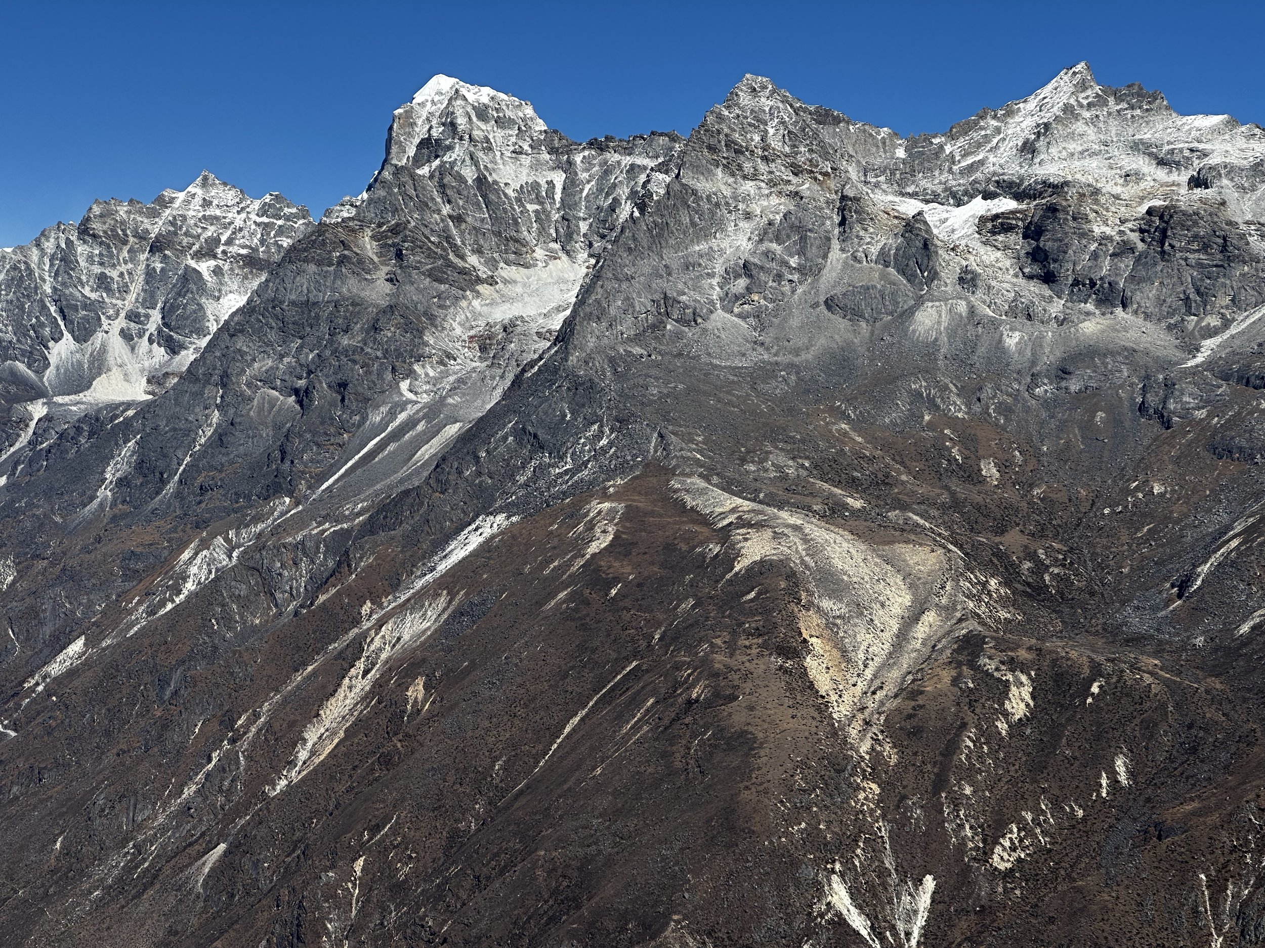
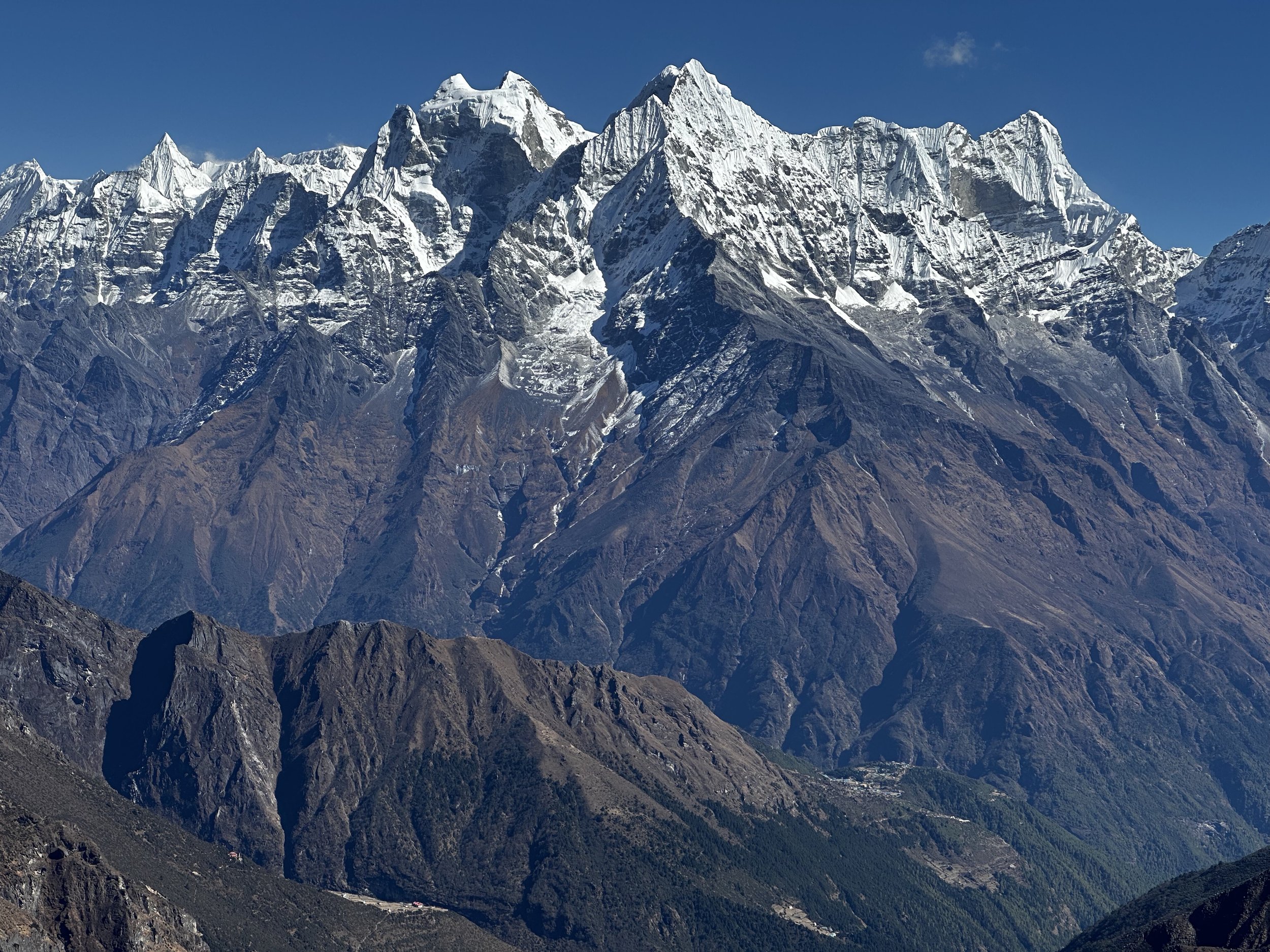
Given our plans, the acclimatization hike to Sundar Peak was now quite important. The hike was not easy from the elevation perspective as the day before we were at 2400m in Lukla and the day before that at 1200m in Kathmandu. Step by hard step we proceeded higher all the way to the summit ridge and the top. Sundar Peak is a fantastic viewpoint as it is strategically situated at the confluence of 2 valleys: Thame Valley and the Teshi Labtsa Valley. The mountains lining up the Teshi Labtsa Valley are very close and are 1000m higher than the summit of the Sundar Peak. These mountains are very steep and rise vertically into the sky. From the top, looking north up the Thame Valley, you can see Jasemba, Cho Oyu and other high peaks on the Nepal/Tiber border. Looking towards Namche, the panorama includes Ama Dablam and all the peaks above Namche.
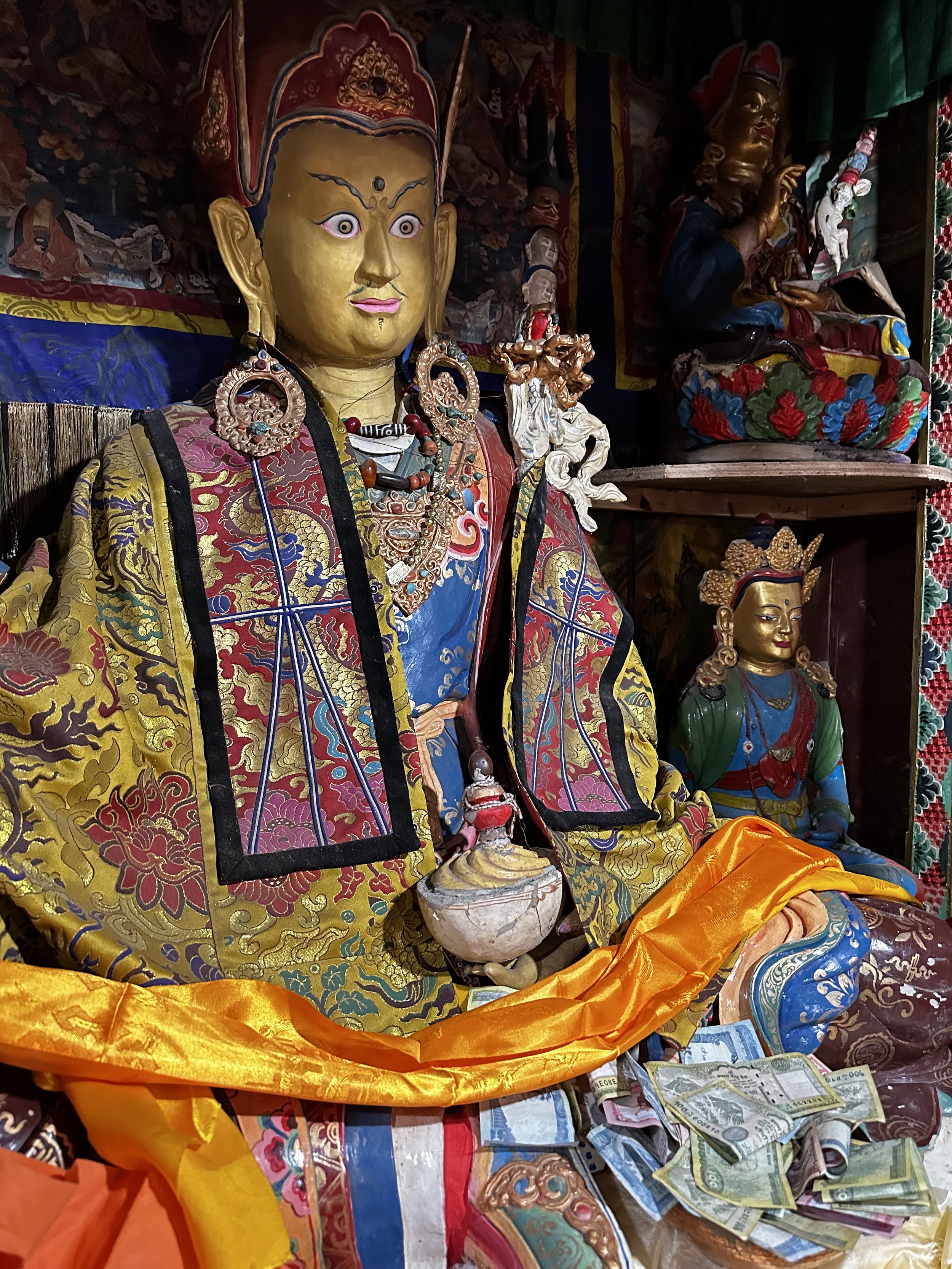
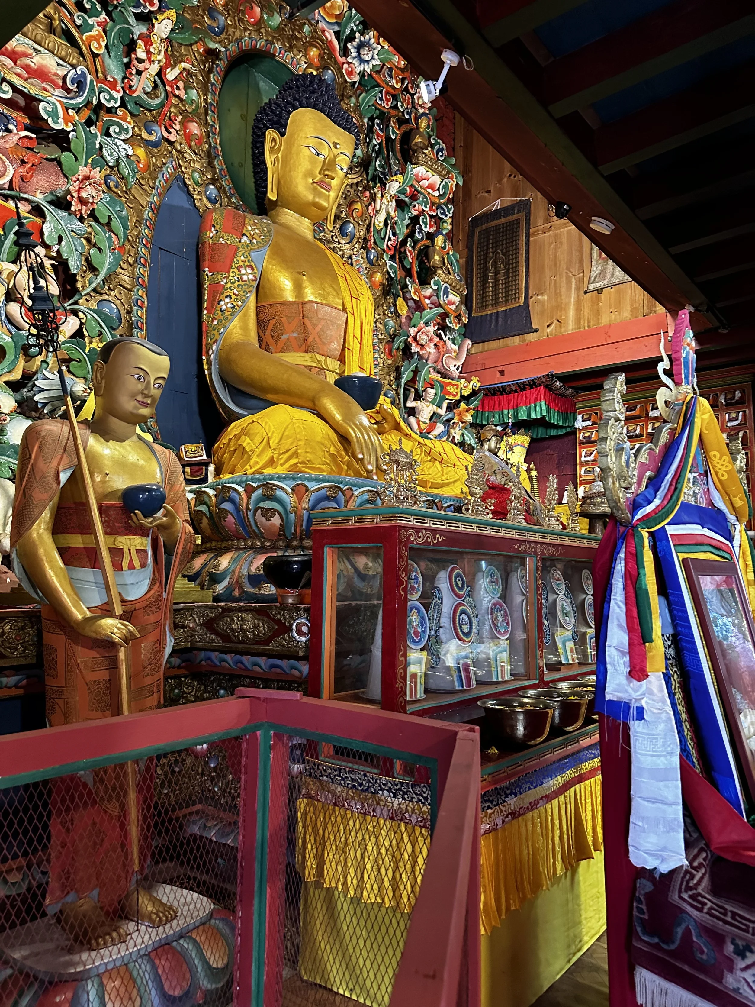
On the way up we run into a crazy dude from Holland who was going up in sandals. His feet were quite butchered from the rocks and were all wrapped up in tape and bandages. We had perfect weather on top with great visibility and no wind. The mountain true top was little further ahead but it was across a steep rocky ridge for which we neither had the energy or equipment. The view towards the Teshi Labtsa pass was also fantastic. I was happy to have crossed this pass back in 2010. I was so happy to be on top of a small Himalayan peak again, I felt like I was released from a tight chain. The descent was fast with beautiful views all the way down. We were back in the hotel before 4pm. On the way we visited the Thame Gomba and got a private viewing of the main prayer hall. By the time we arrived at Thame, Rajendra called Tek and asked if we wanted to do a heli ride at 5pm. I felt that it was too late for that but asked if 7 am the following day would work.
November 3, 2022 Thame - AyrE 4500m
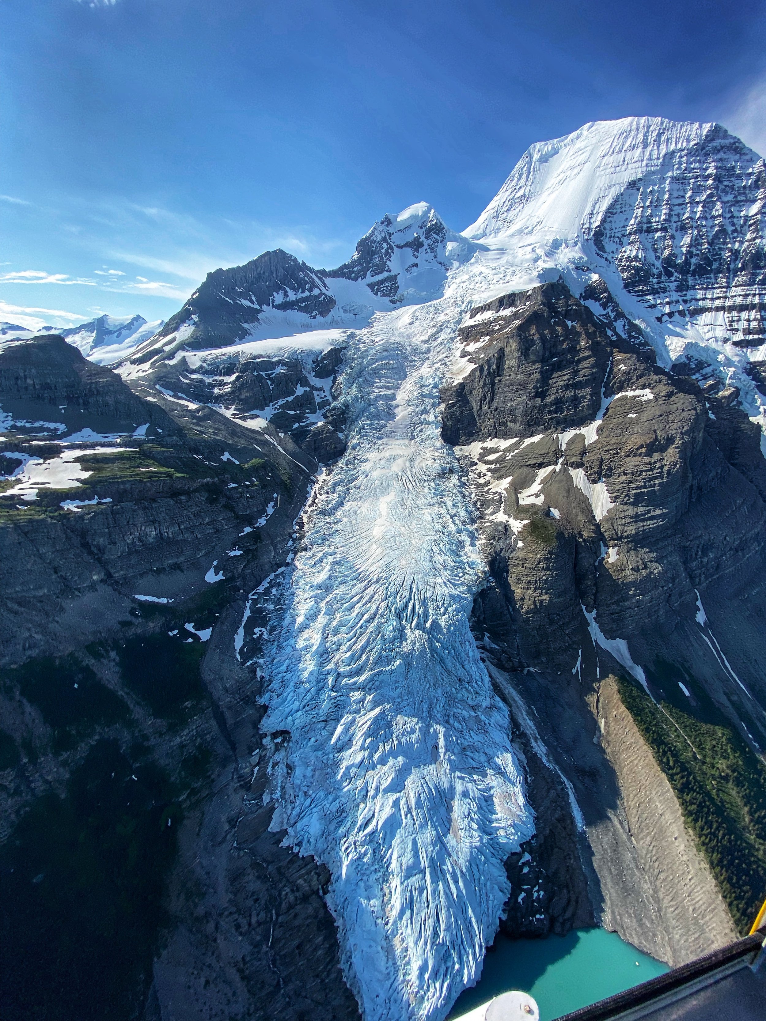
Last night I had a bad night sleep. It is a combination of high elevation and the adrenaline from the hike. I went to bed at 8pm and woke up at 11.30pm with two horses loudly ringing their bells right outside my window. I had to get up, go outside and throw some rocks at them to chase them away. A Sherpani lady from the house next to the hotel joined me as she could not sleep either. Finally, we managed to chase them away and they did not come back. I woke up again at 3am and then 6. At 6.30 Tek frantically run into my room and told me to get up as the heli was coming at 7 for the tour. I grabbed my camera, my phone and the jacket. We walked to the heli pad and waited in the cold morning shade for 45 min. The heli from Dynasty Air came as promised (Thank you Rajendra!). The Nepali pilot was extremely nice and knowledgeable of the terrain. He also knew exactly where I wanted to go which was great as I had very specific route in mind. The weather was perfect, no clouds and no wind.
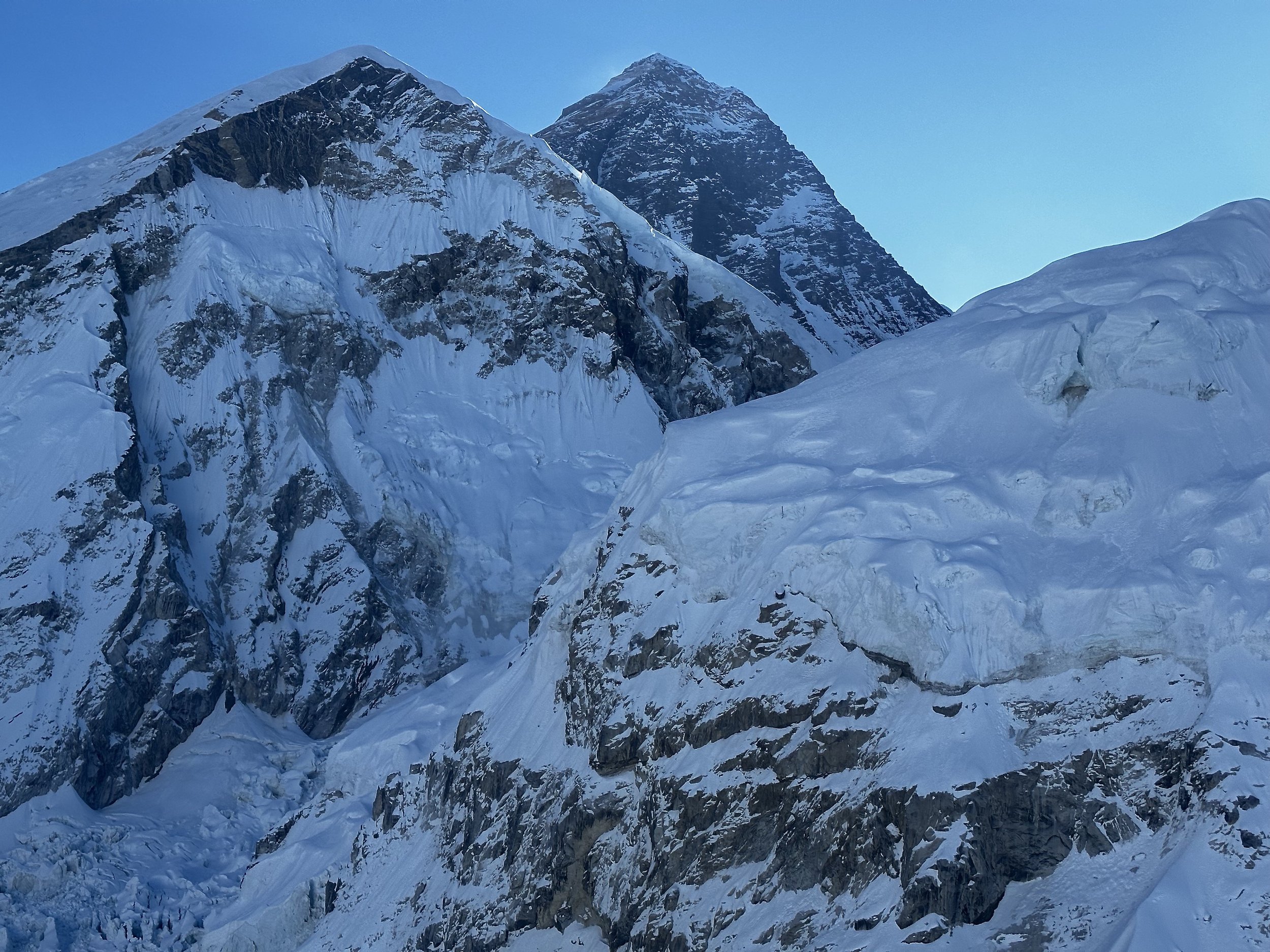
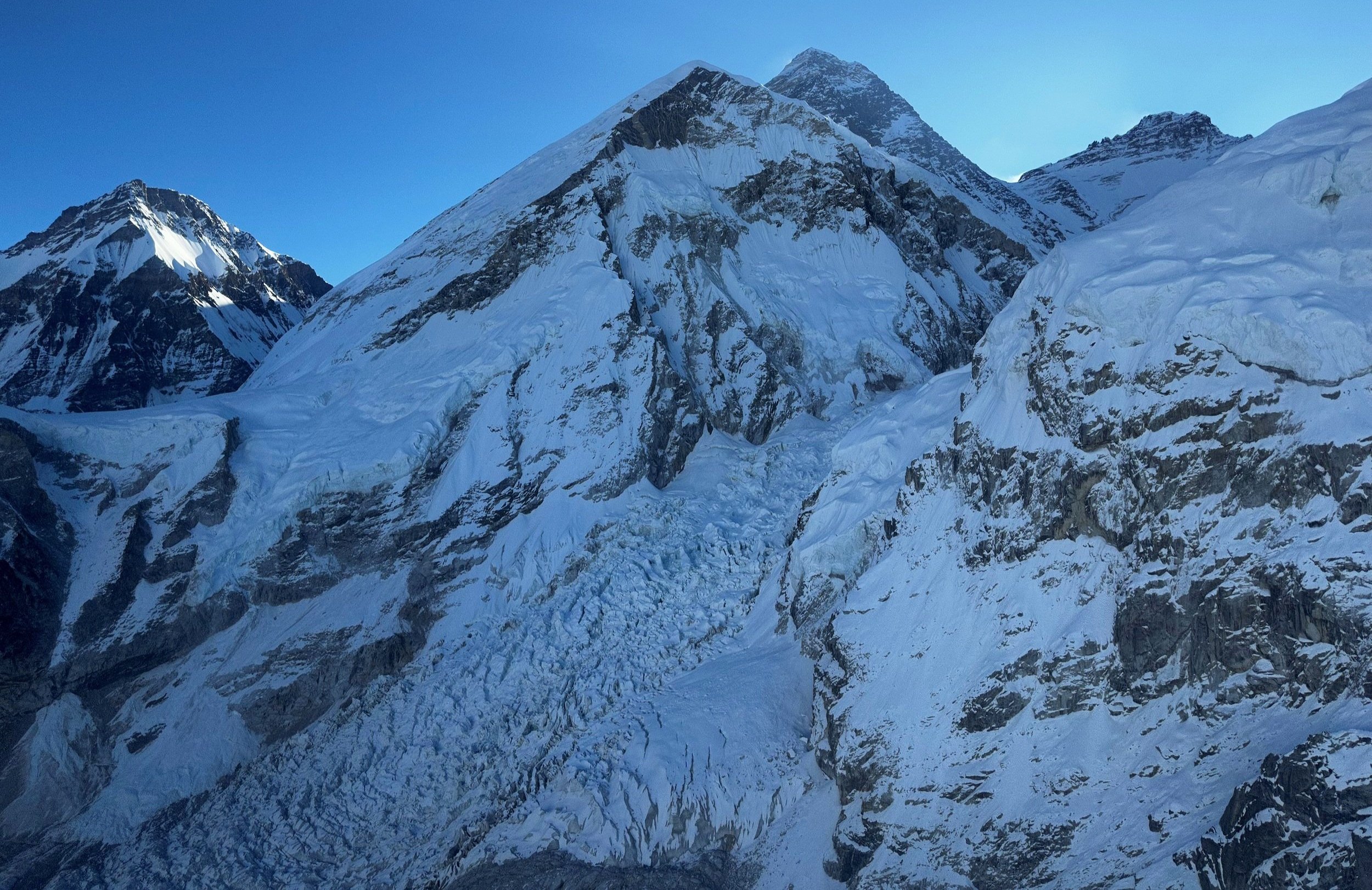
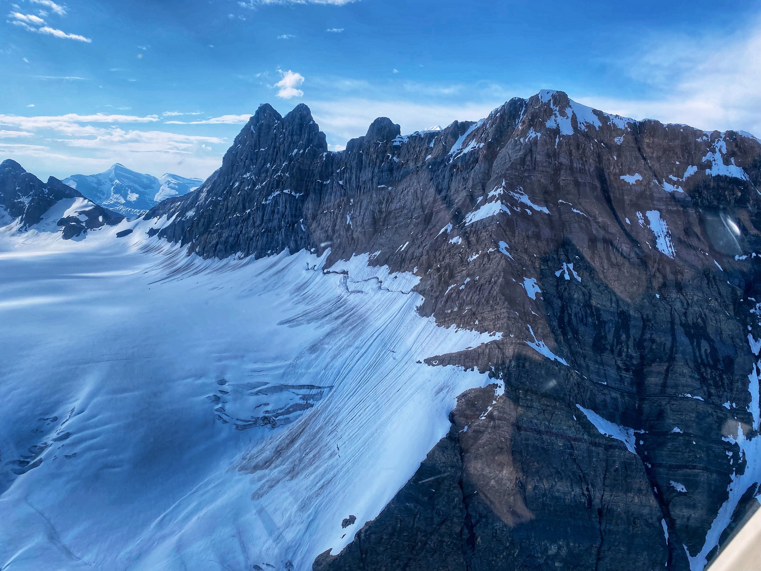
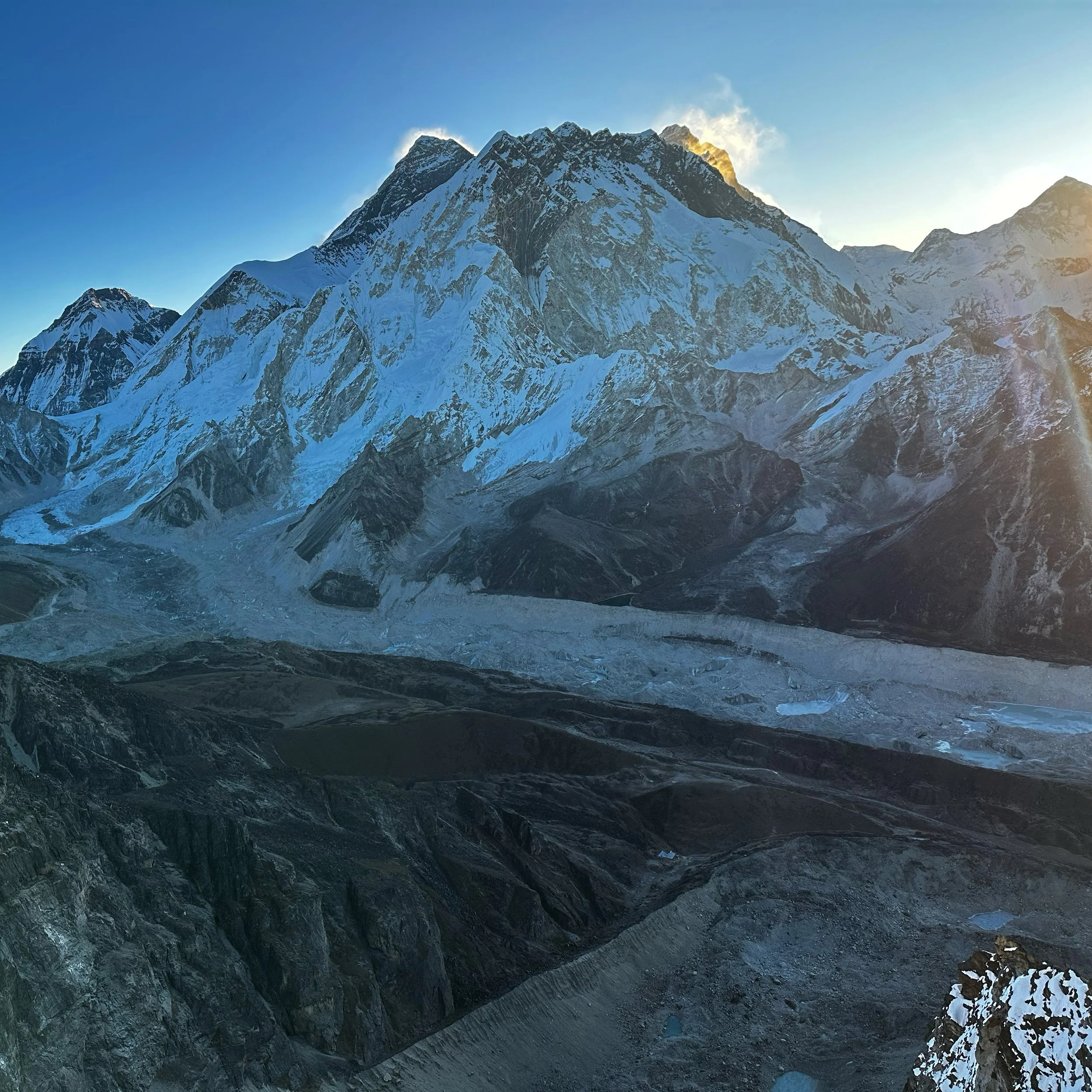
What can I say? Every heli experience is fantastic for me but flying in the highest mountains in the world is beyond words. I was in heaven, speechless and completely absorbed in the experience. The weather was perfect, clear with no wind. We started up Thame Valley along the peaks of the East Rowaling north of Tengi Ragi Tau, then to Lunag Glacier and Lunag Peaks, we then turned right to Jasemba and Cho Oyu. We flew so close to the wall of Cho Oyu at 21,000 feet it felt as we could touch it. We flew above massive, crevassed glaciers, across ridges and beside massive peaks. We flew above the Chongri Pass, to Pumori, above the Everest icefall. We then turned back west and flew above the ridge of Lobuche Peak on with we could see climbers going up (at this point I did not have a plan to climb it and it was my first time seeing it). As it turned out, I would be on it just a week later. Then we crossed Cho La Pass, Renjo La Pass and descended back to Thame Valley. It was absolutely spectacular and maybe even better than the Annapurna flight as we covered more territory and flew so close to various famous peaks. It was truly once in a lifetime experience, but I would do it again!
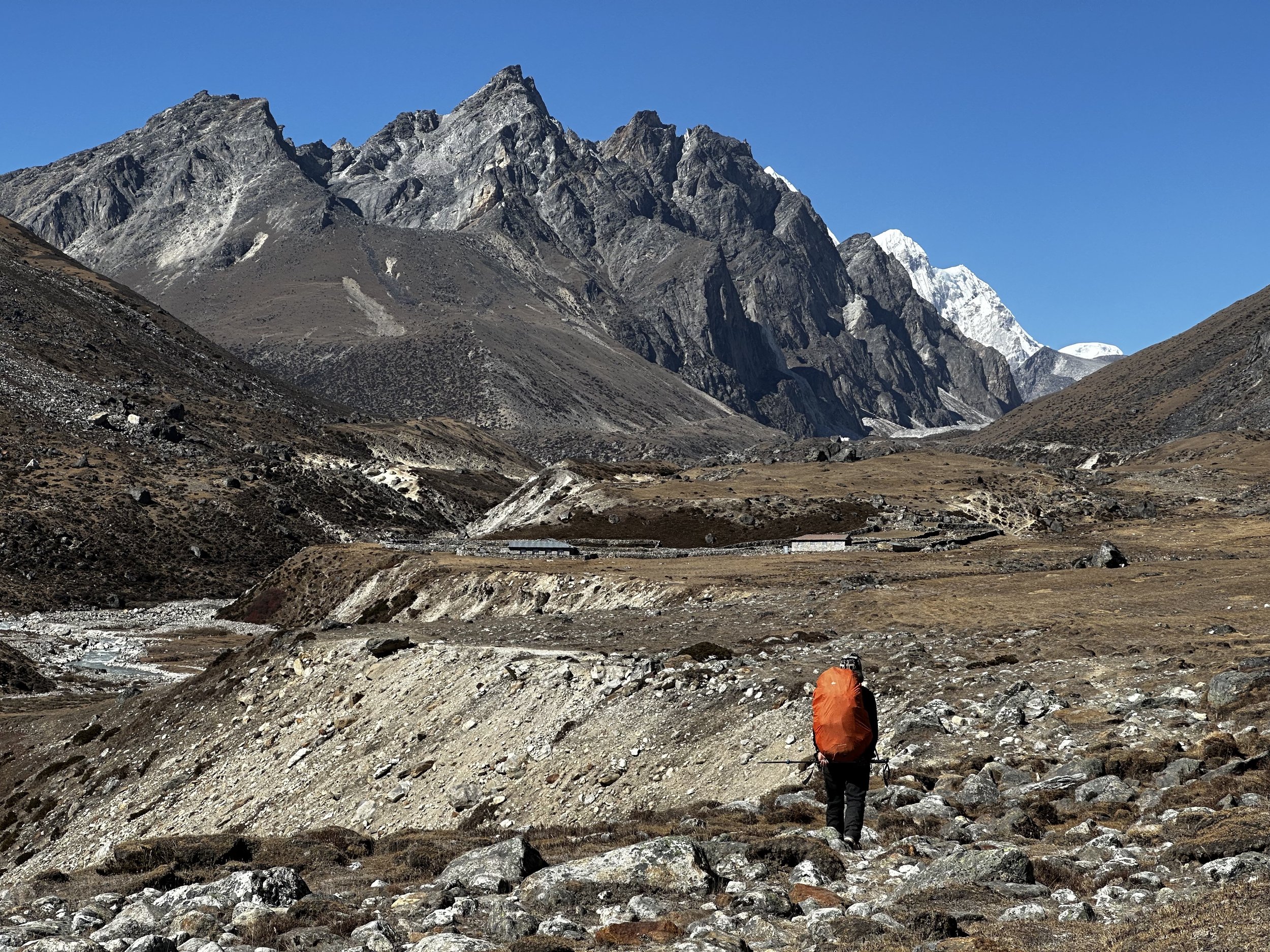
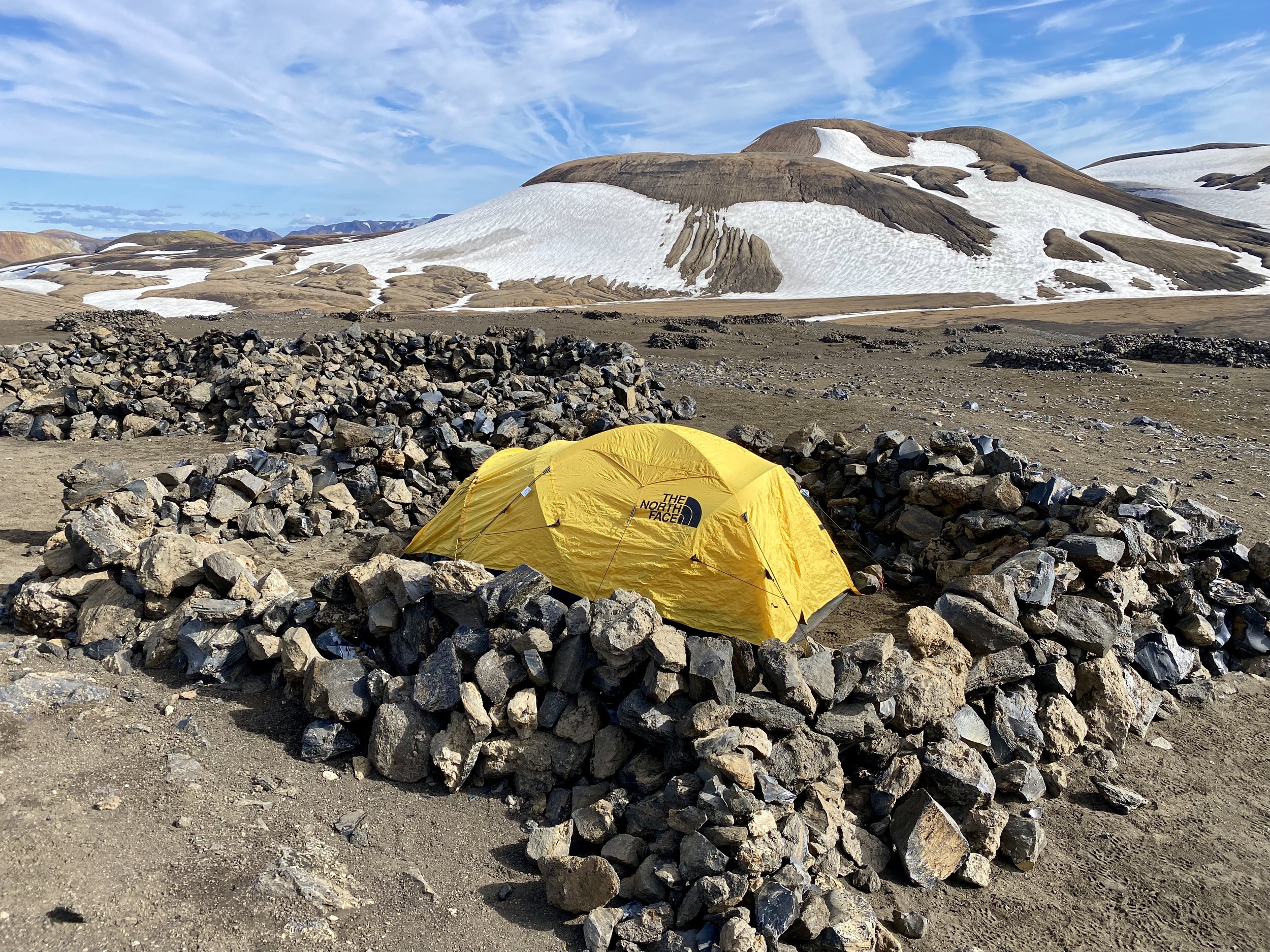
After this spectacular experience we had breakfast and started the 12 km walk to Ayre Teahouse, the last teahouse before the Sumna Pass. We stopped on the way for tea at a teahouse of a guy we visited 10 years before. He did not remember me of course but I did remember him. We were now at 4500m. It felt harder to walk at this elevation as I was not yet acclimatized. We arrived in Ayre teahouse in the early afternoon. We were the only guests. Our Thame Sherpa guide would come later that day. I rested a little in the empty and cold dining room as I was quite tired. I was hoping that sleep would normalize my cycle.
November 4, 2022 Ayre – Sumna Pass BC 5000m
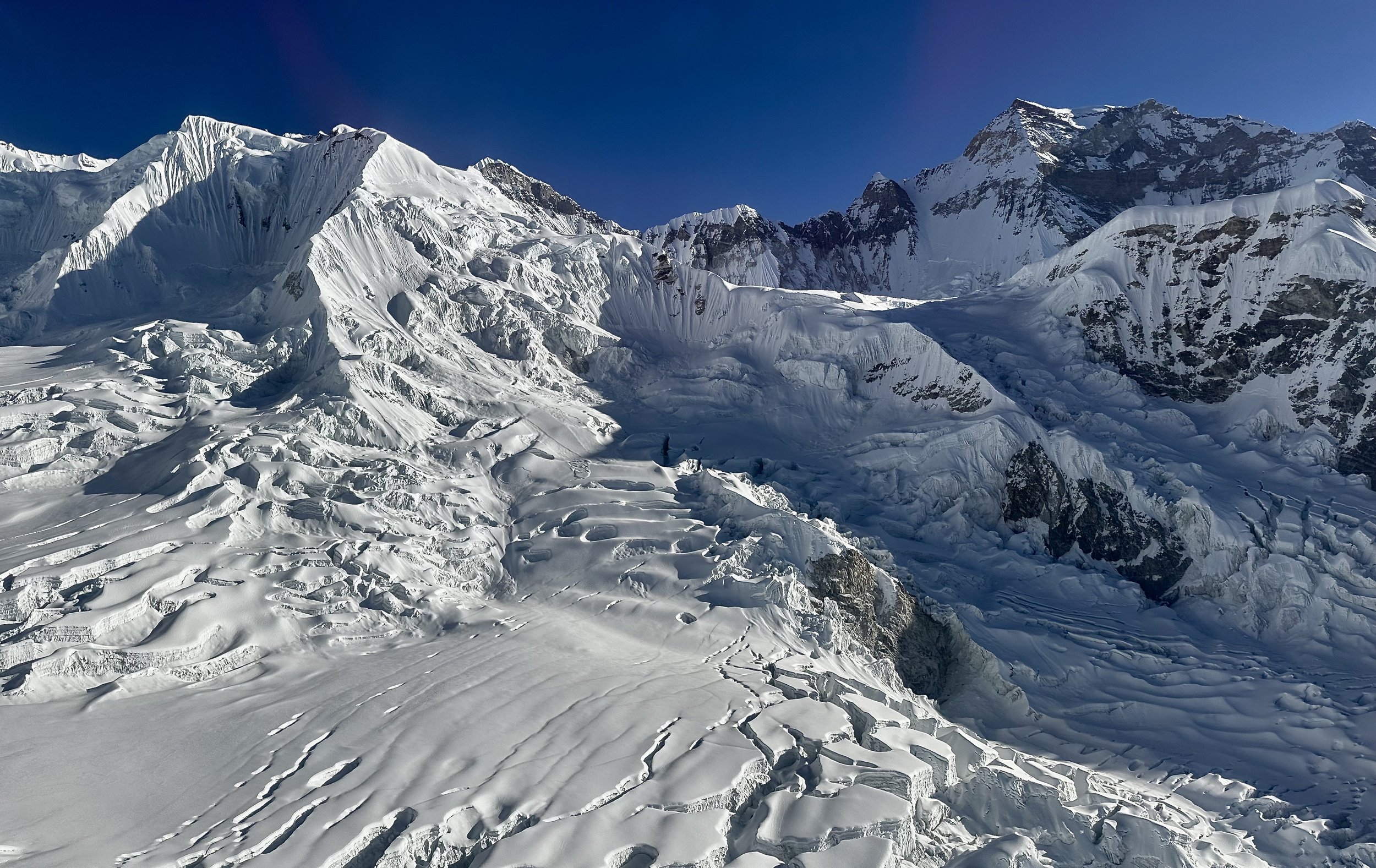
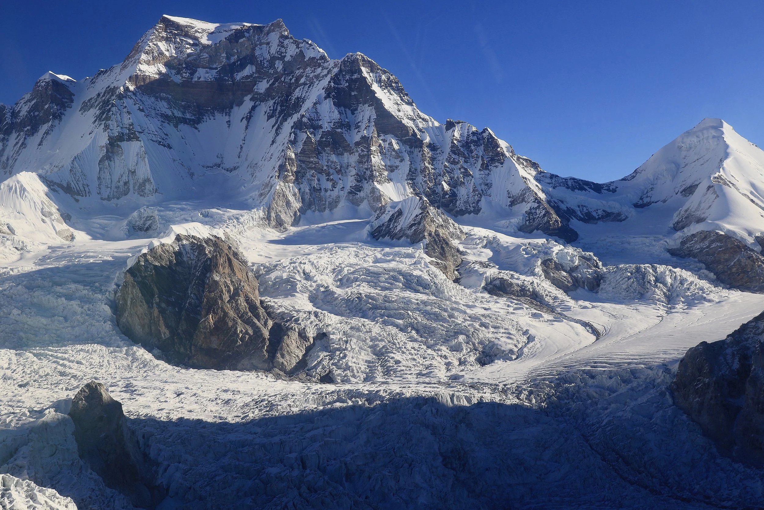
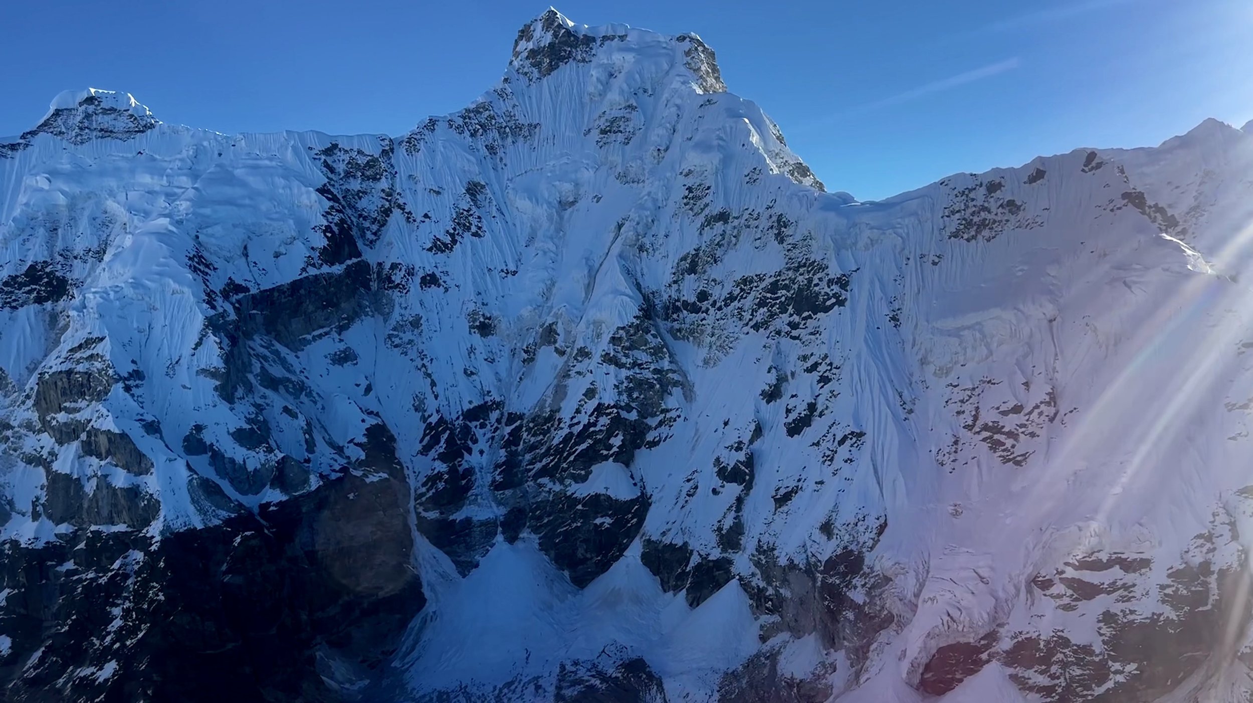
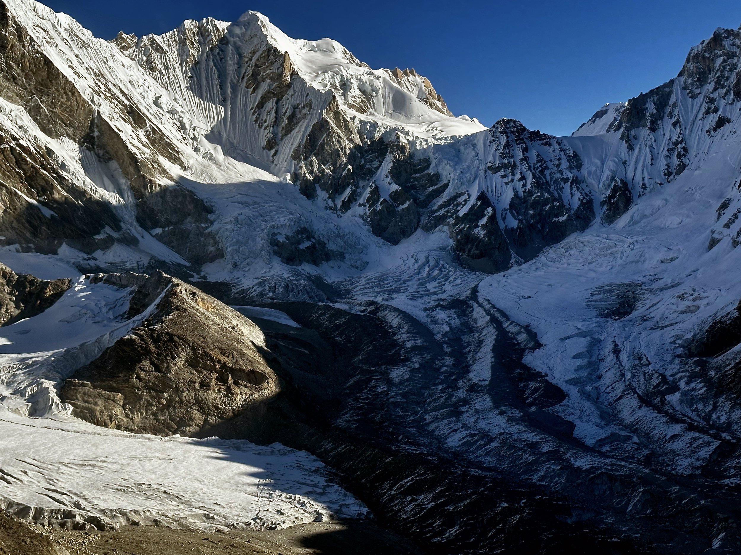
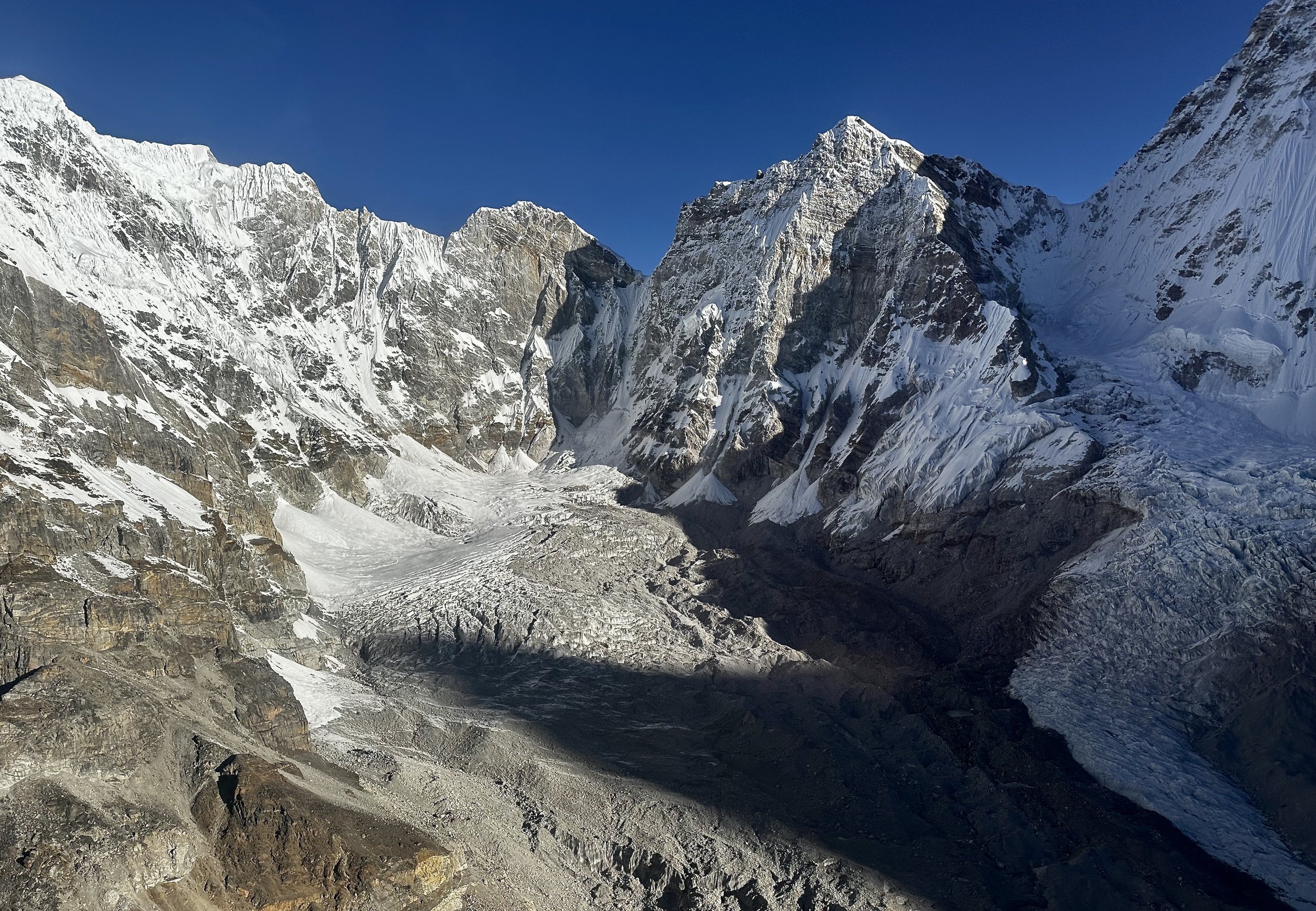
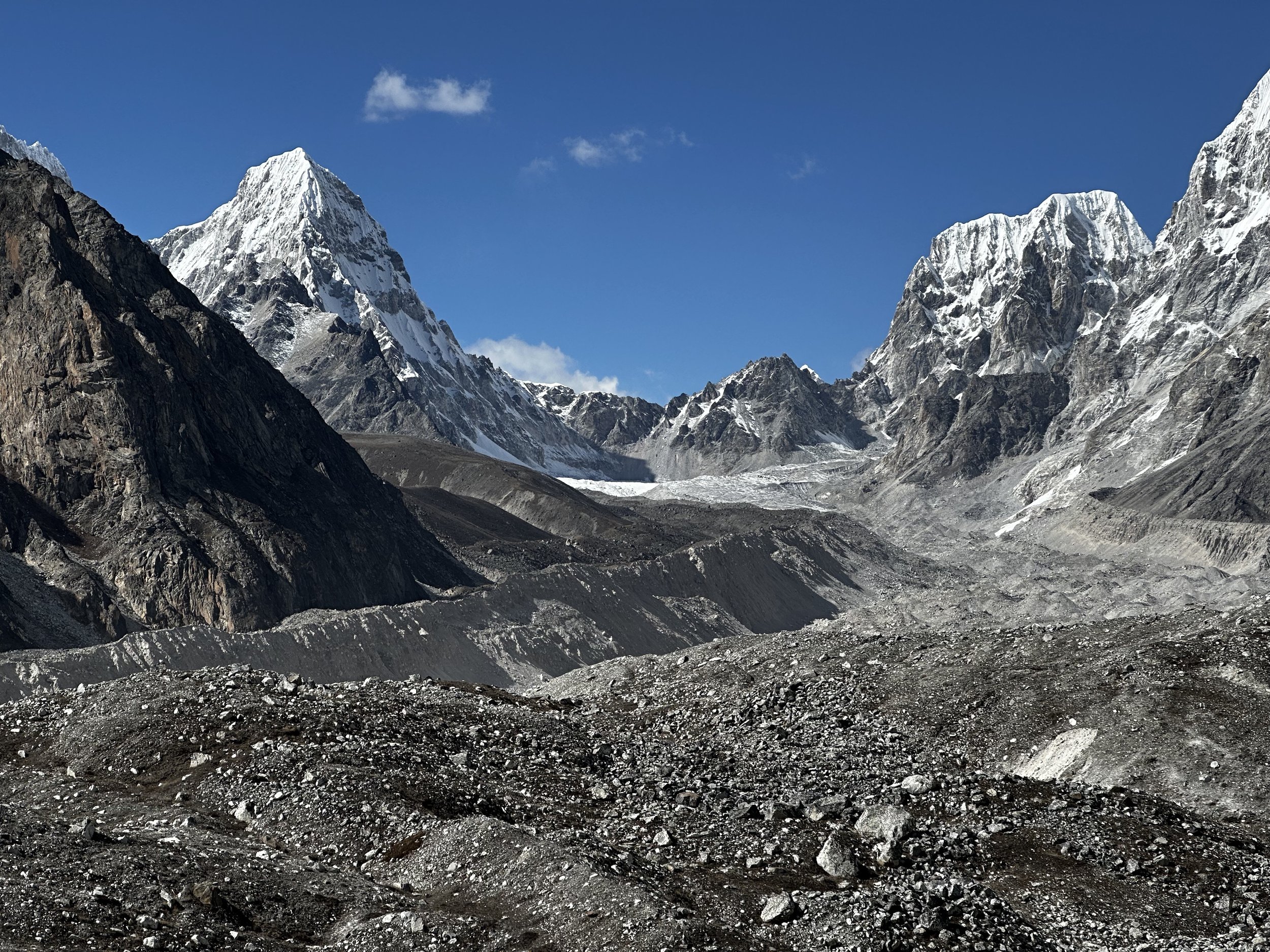
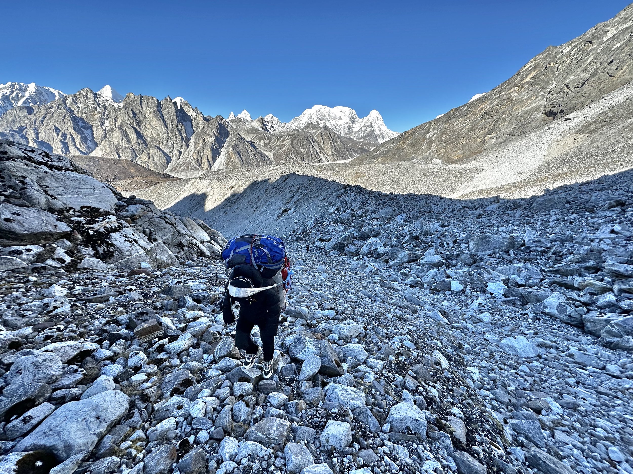
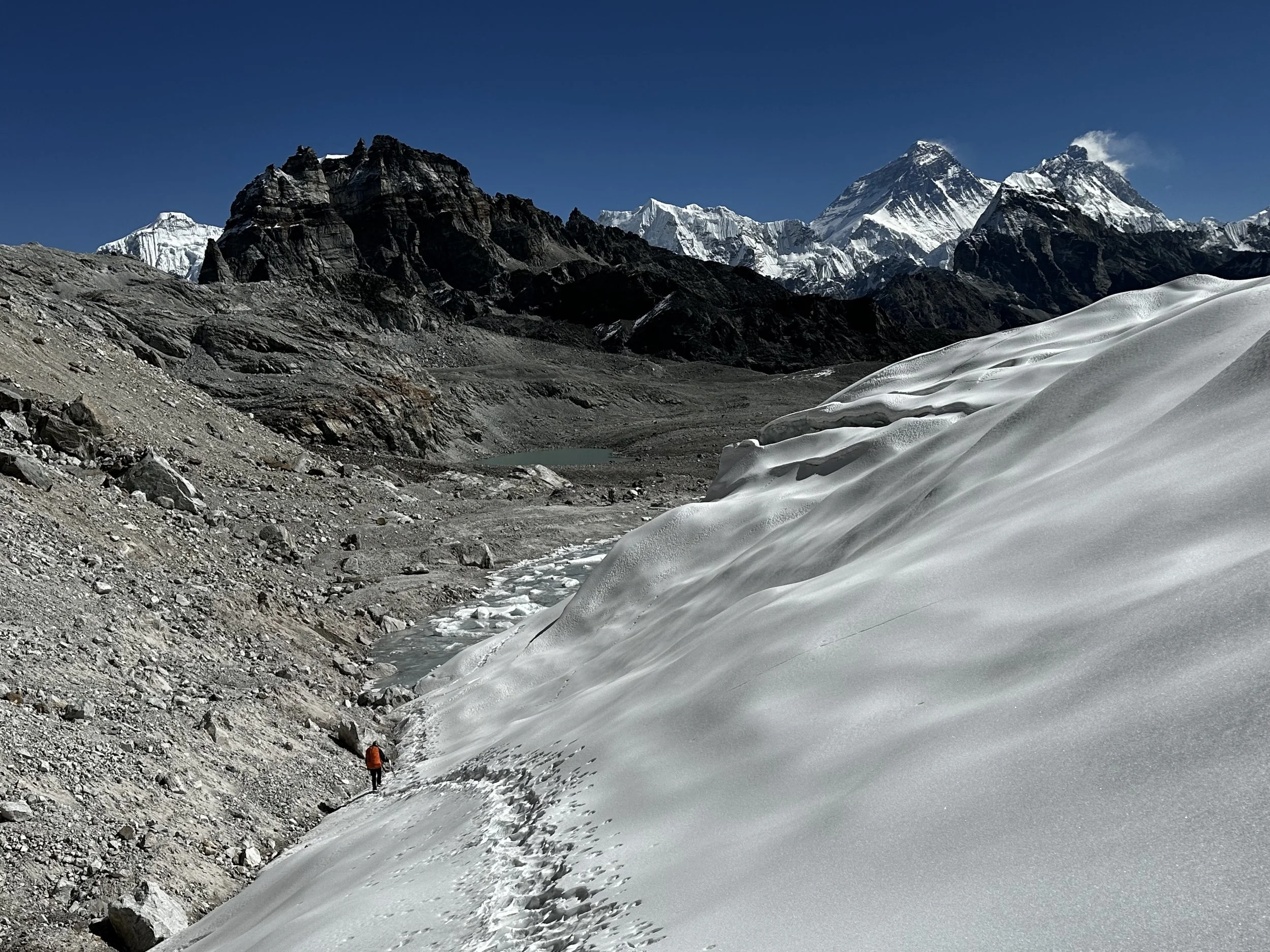
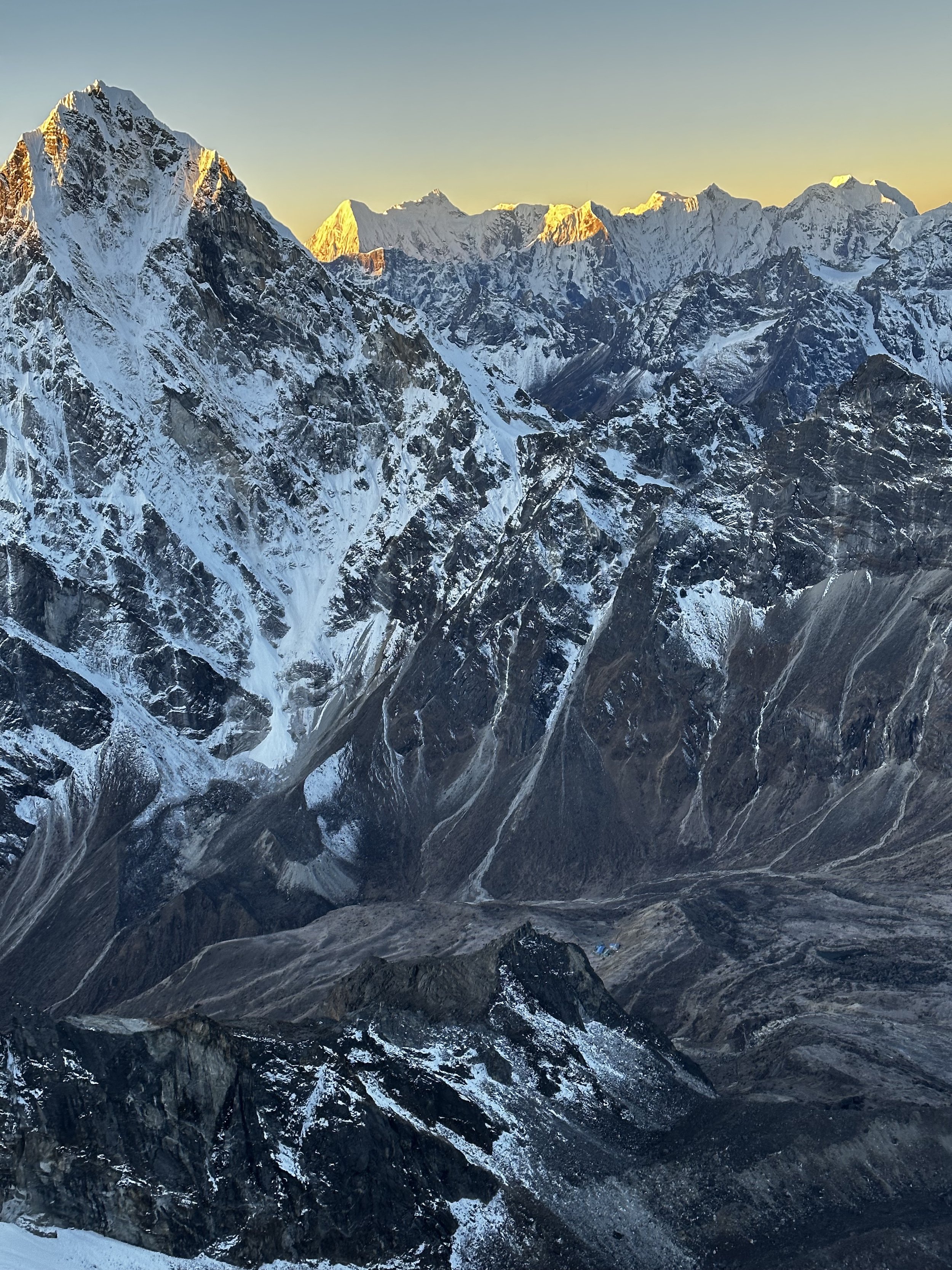
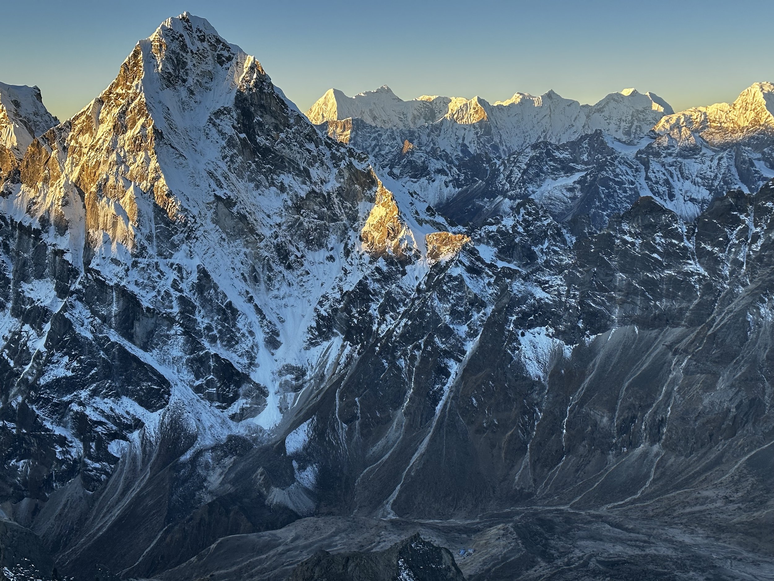
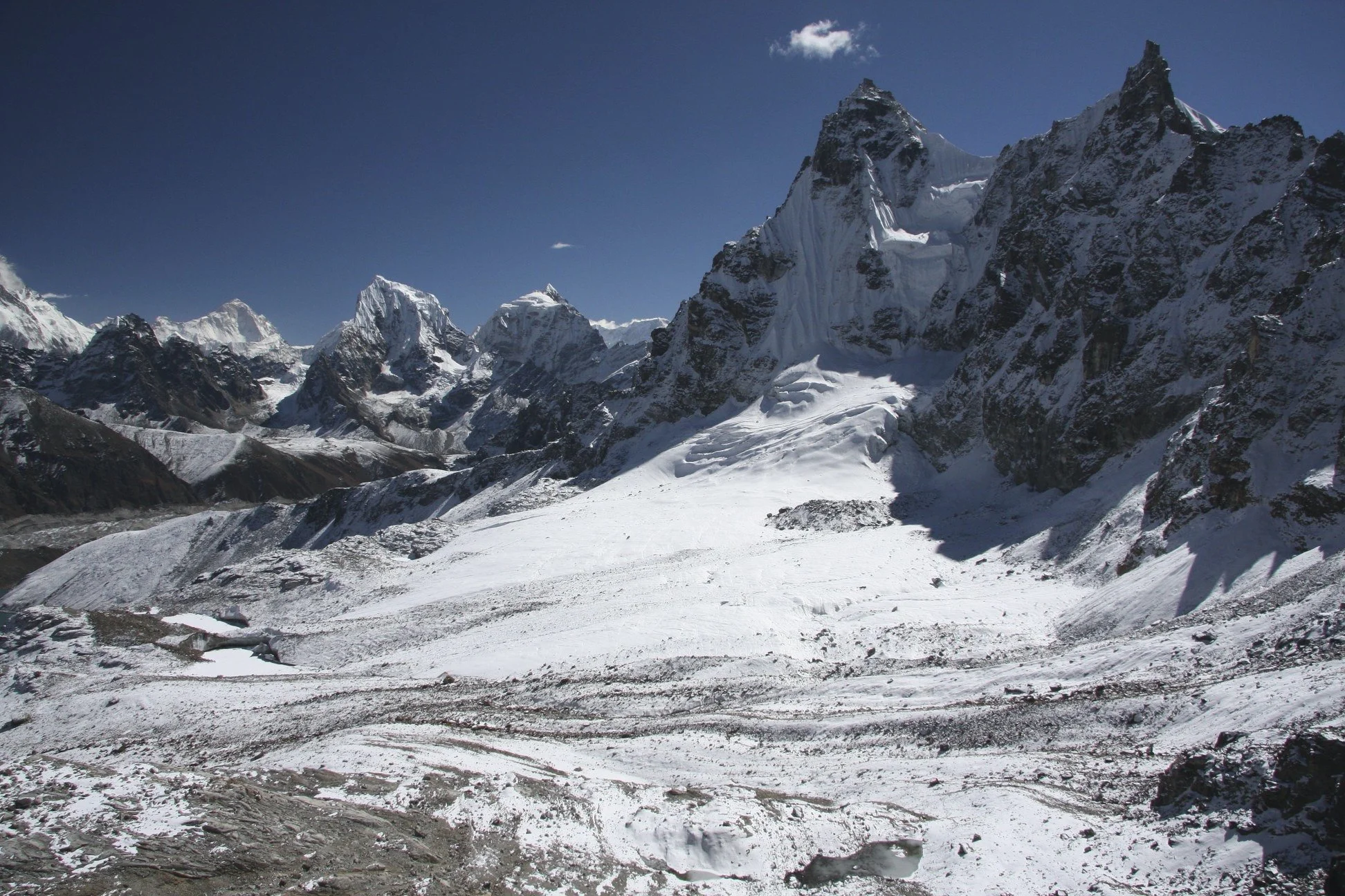
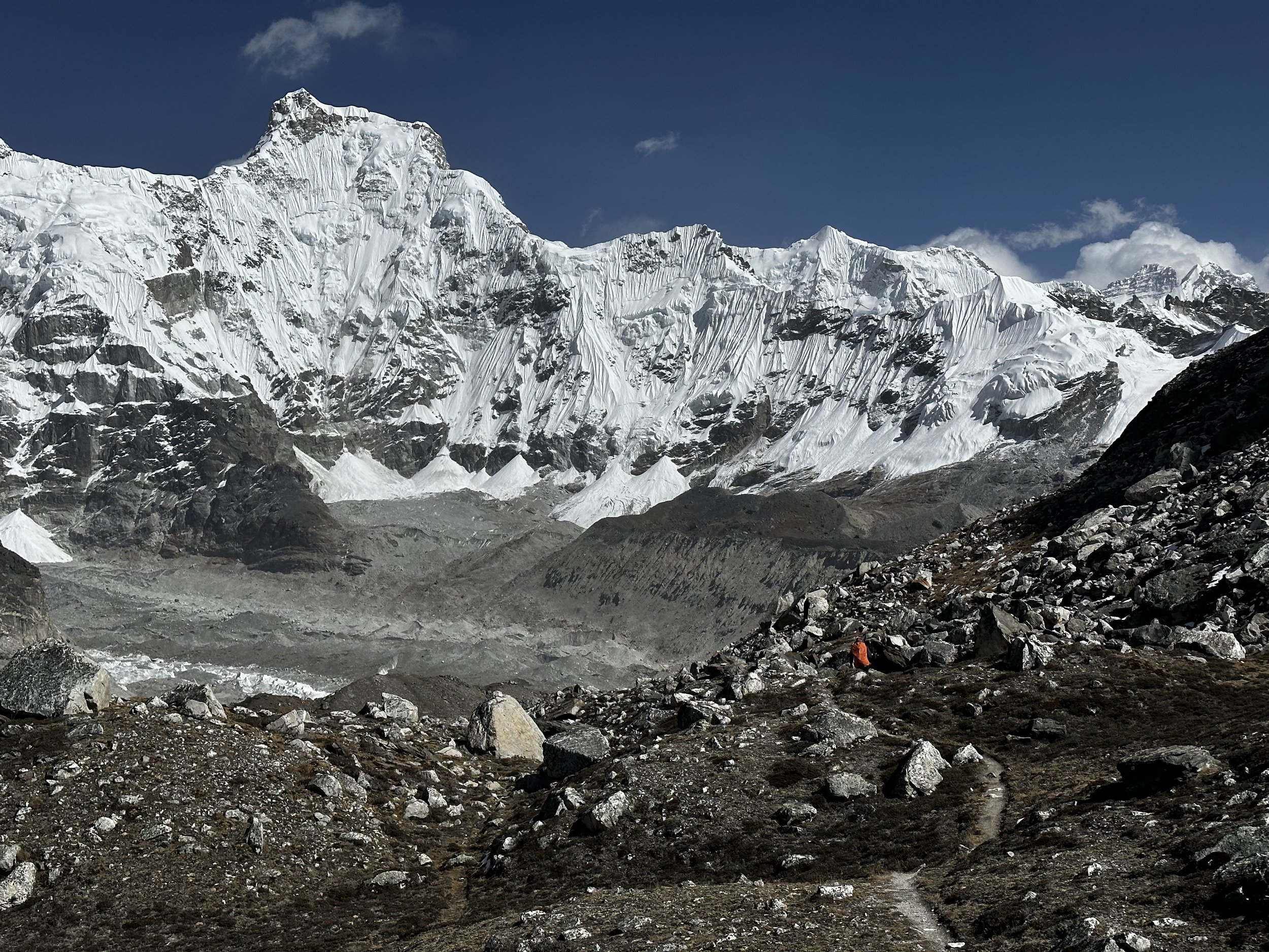
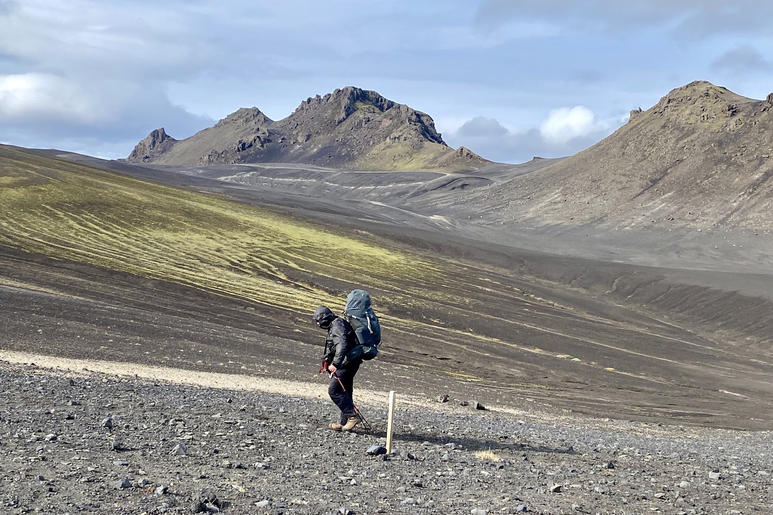
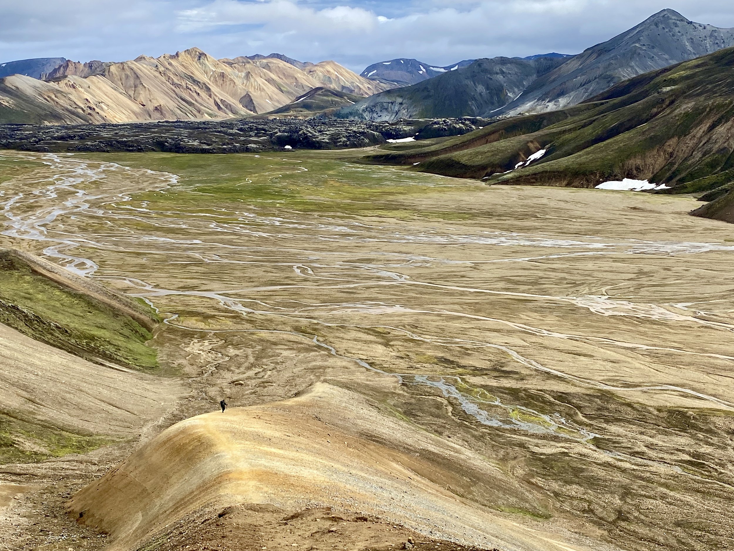
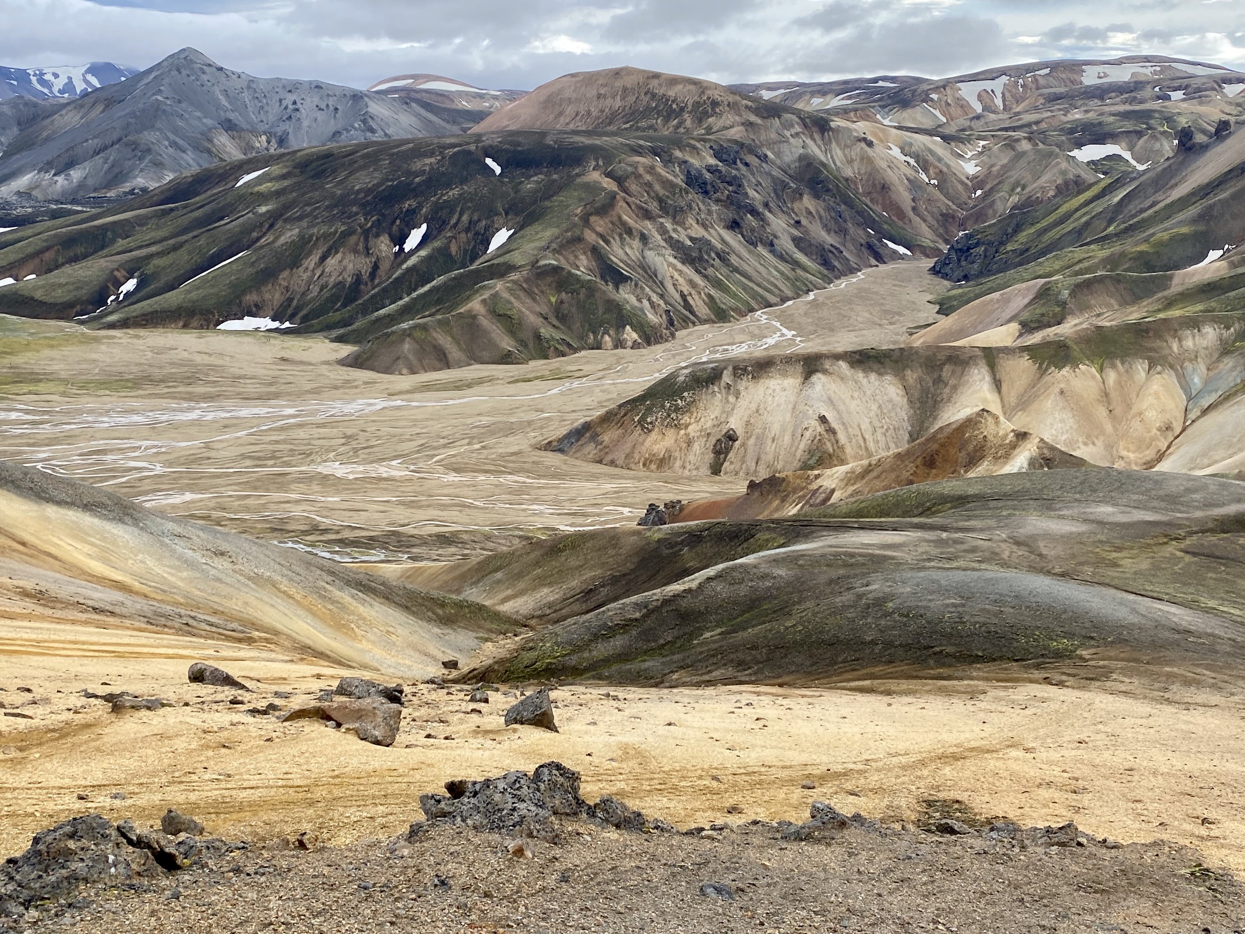
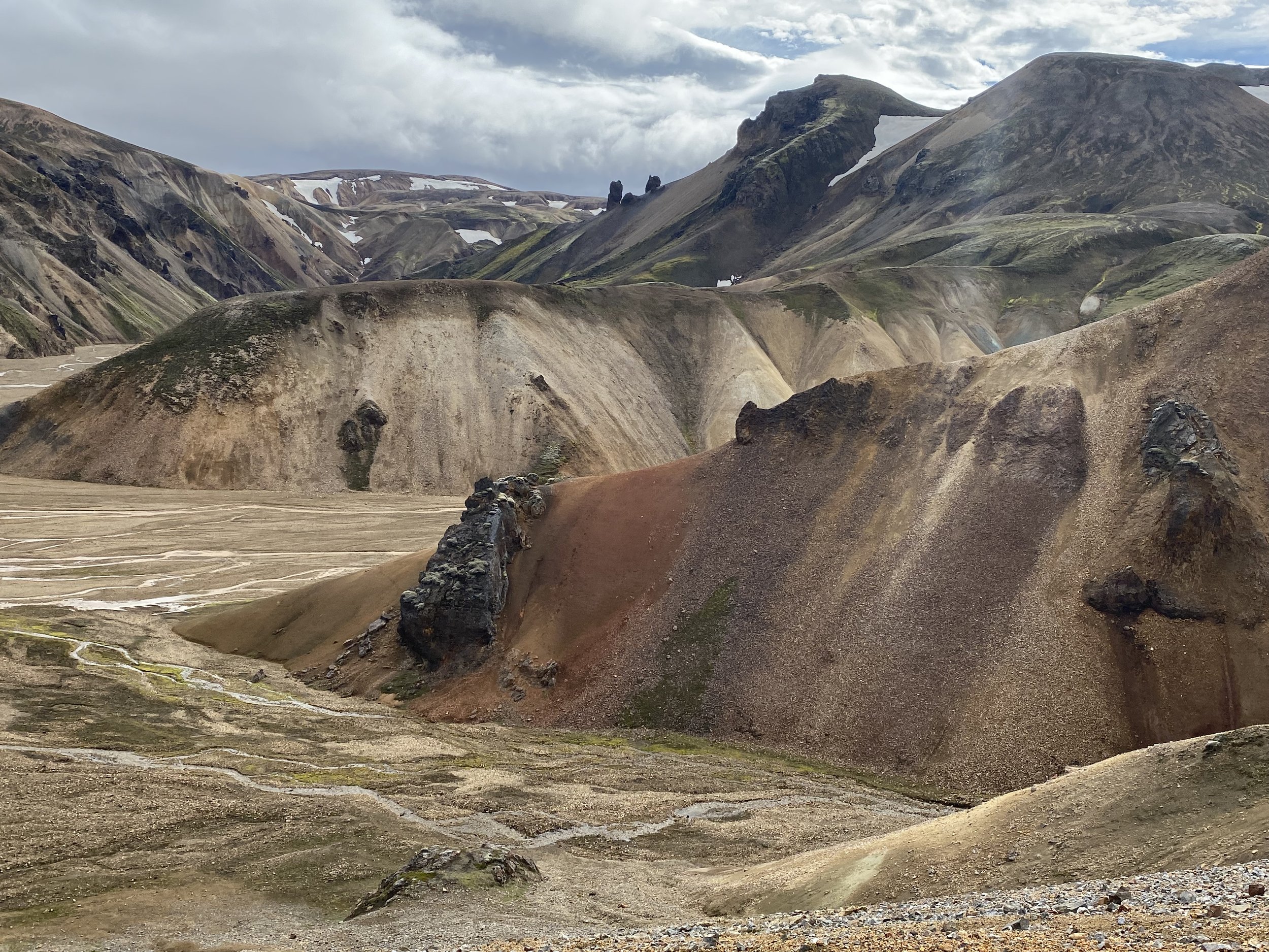
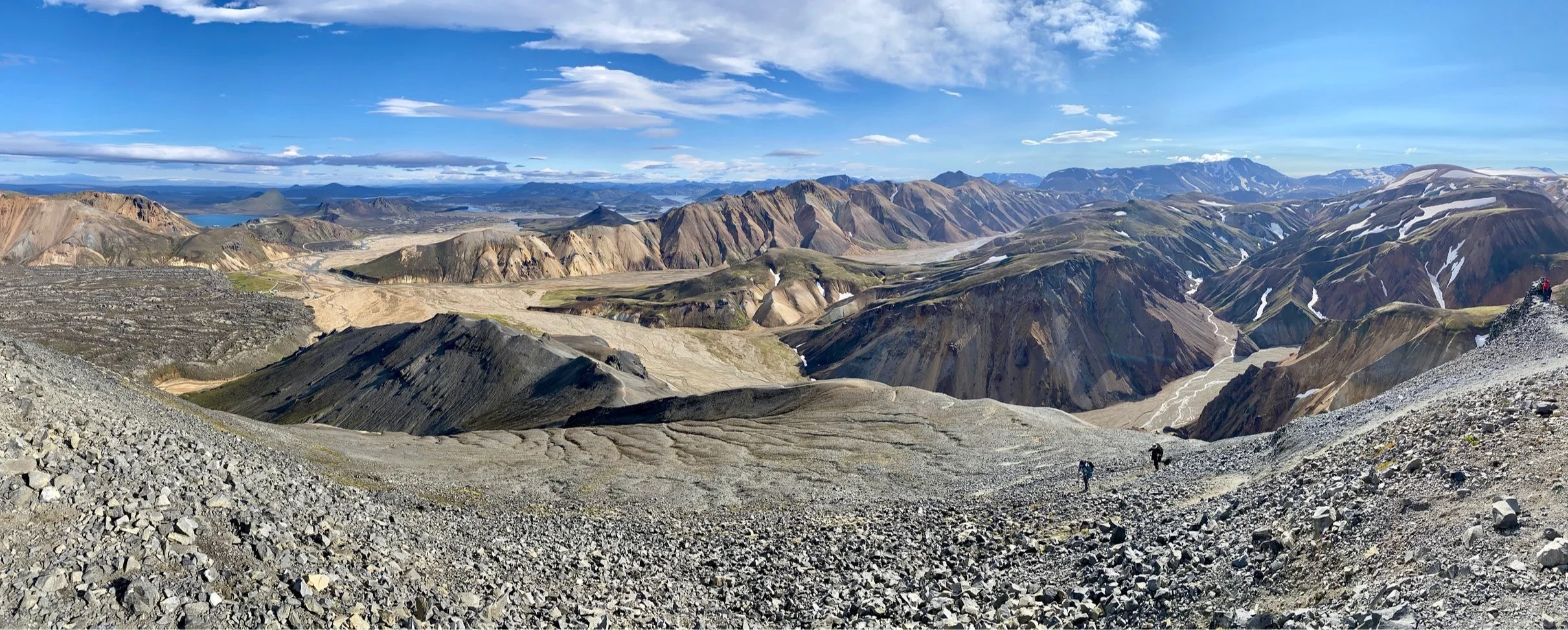
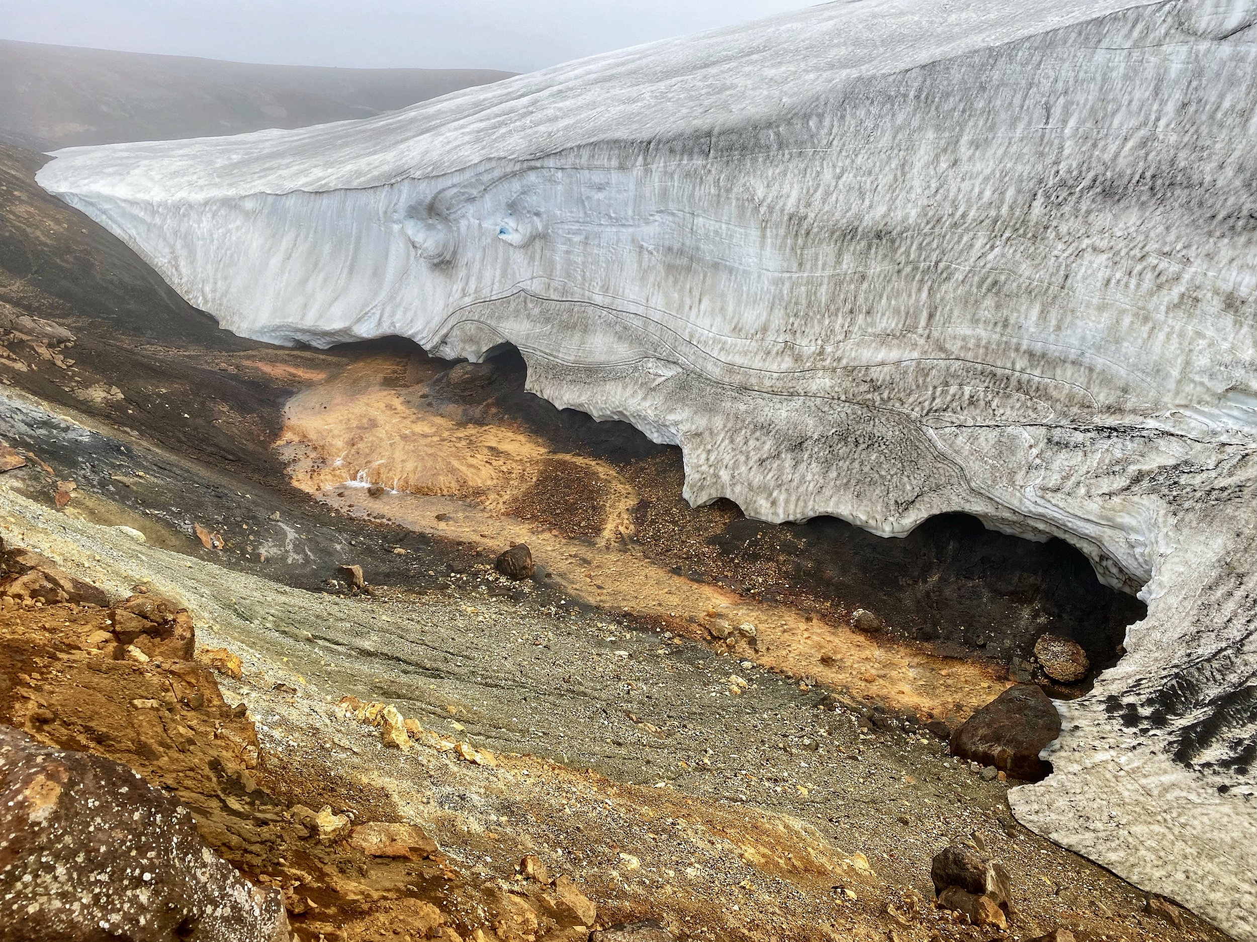
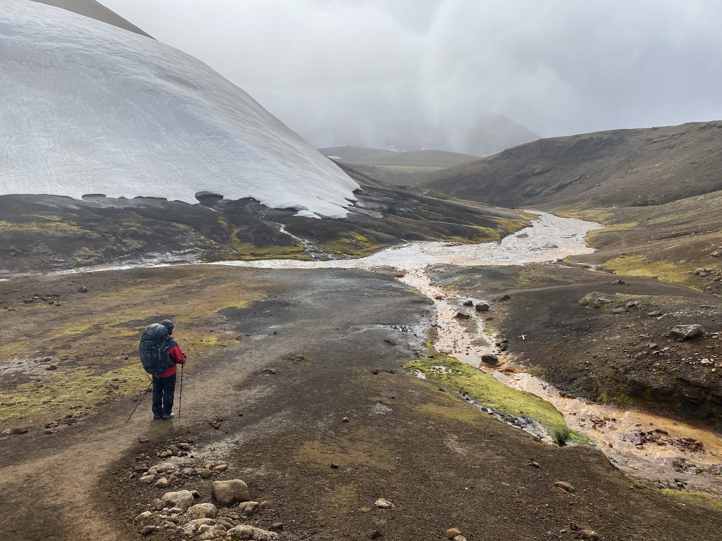
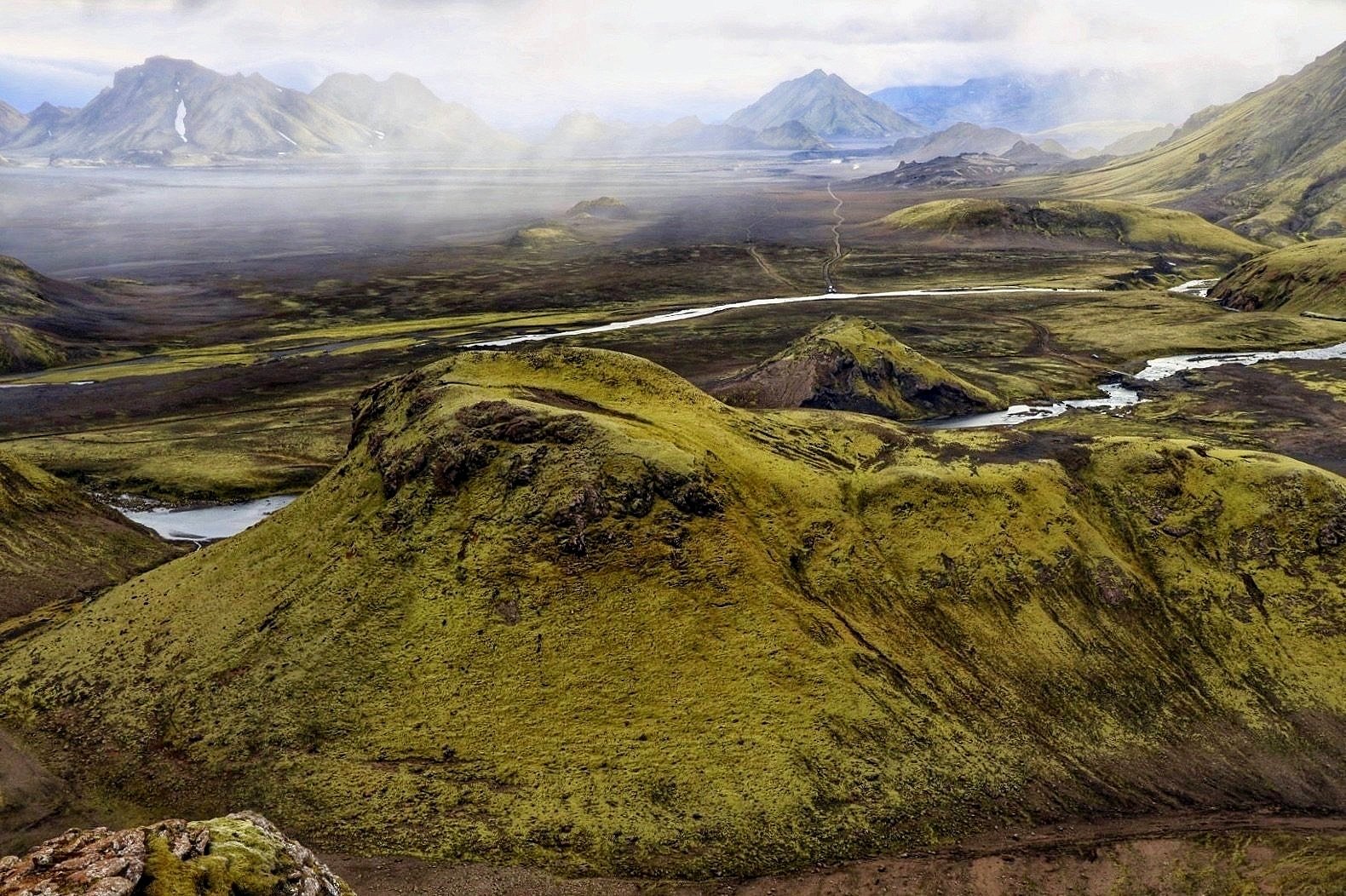
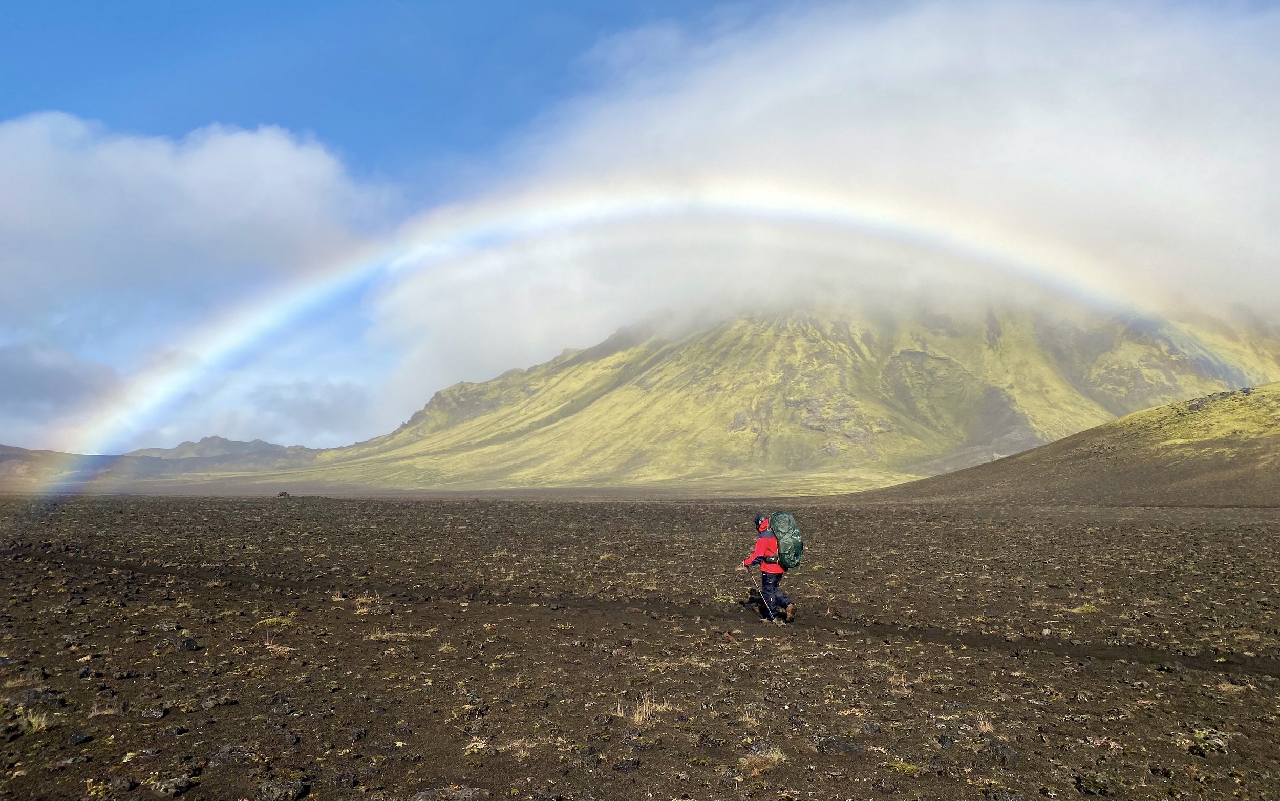
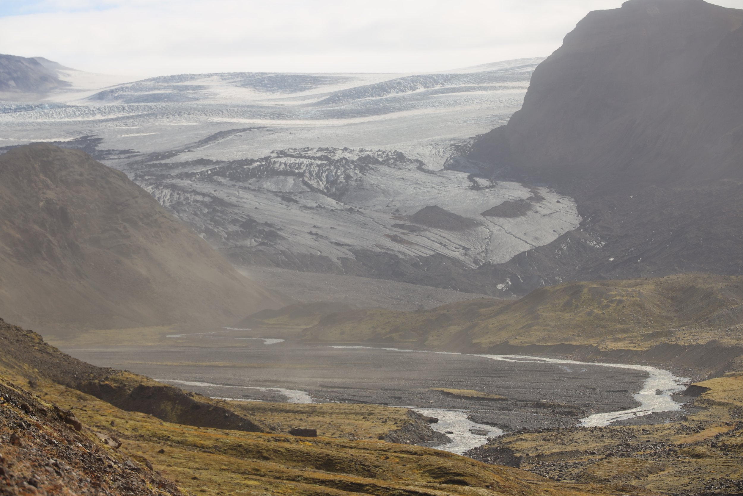
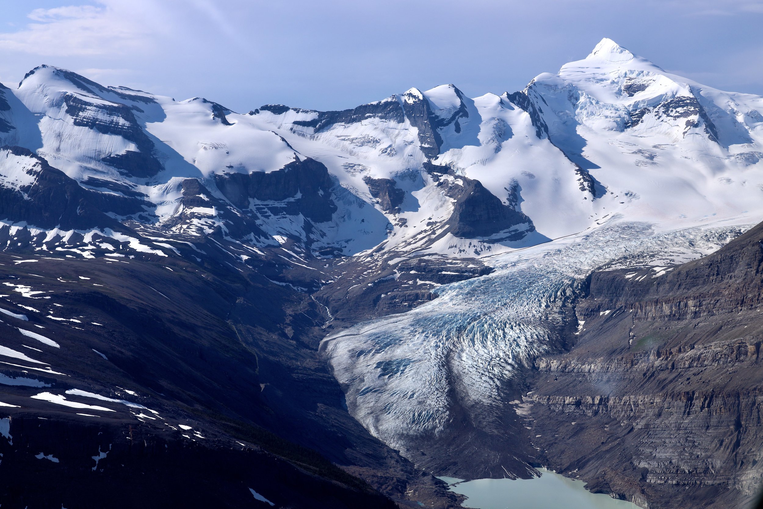
Today was a phenomenal day (again). It was the kind of trekking that makes one return and do it over and over again. We started our walk up the Nangpa Glacier Valley which was all new to me. As we ascended, the mountain panoramas started to unravel one after another. The valley has many side glaciers connecting to it with numerous unnamed peaks around 6000m. These peaks were very impressive, steep and covered with snow and ice. We then approached the terminus of the Nangpa Glacier and proceeded on the west ablation valley. Across the glacier was a high ridge crowned by pointy rocky spires reminding me of the small sliver of the Baltoro Glacier in Pakistan. We were now at 5000m and my progress was slow as was not used to the elevation. As we went further and higher, Lunag 1, Jasemba and Cho Oyu emerged in one giant sweeping panorama. We flew over this very area in the helicopter the day before but it looked more spectacular from the ground level and we had time to soak in the scenery.
We turned a corner and another 6000m peak emerged in front of us. This peak towers over the basecamp for the Sumna Pass. From the moraine above the basecamp the view was even better. Long and massive glaciers and huge mountains surrounding them are visible all around. We could also see the Sumna Pass and the surrounding mountains that we would ascend the next day. It did not look as simple and easy as Tek was trying to tell me in Thame. Later, even he admitted that it was a good idea to hire the local help. Nima, our Sherpa guide climbed Everest 18 times, Cho Oyu 3 times and Kangchenjunga once. He lives in Thame with 4 kids and 12 yaks and is in his early 40s. He likes climbing and works for a US company called Madison Expeditions. He also works for a Nepali outfit called Pioneering Adventures which organized the winter Cho Oyu climb. He just returned from the attempt on the south face of Cho Oyu trying to establish a commercial route from Nepal as China is closed. He said that the Nepal side is very dangerous with avalanche danger and very steep. I felt quite ecstatic to be here among all the giants that I was looking at on Google Earth during forced covid internment. It was a magnificent spot and there was nobody there beside us. I hoped that our pass crossing was clear and safe.
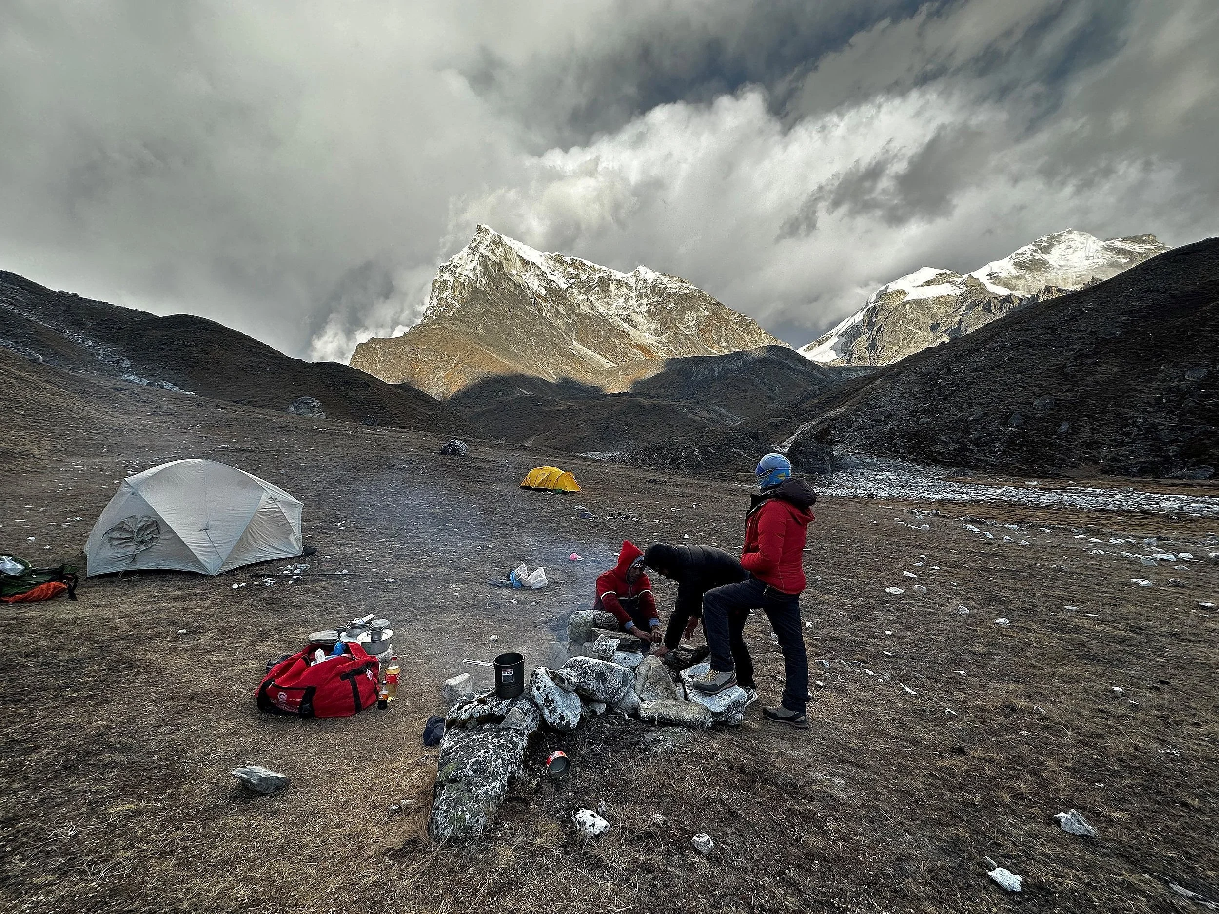
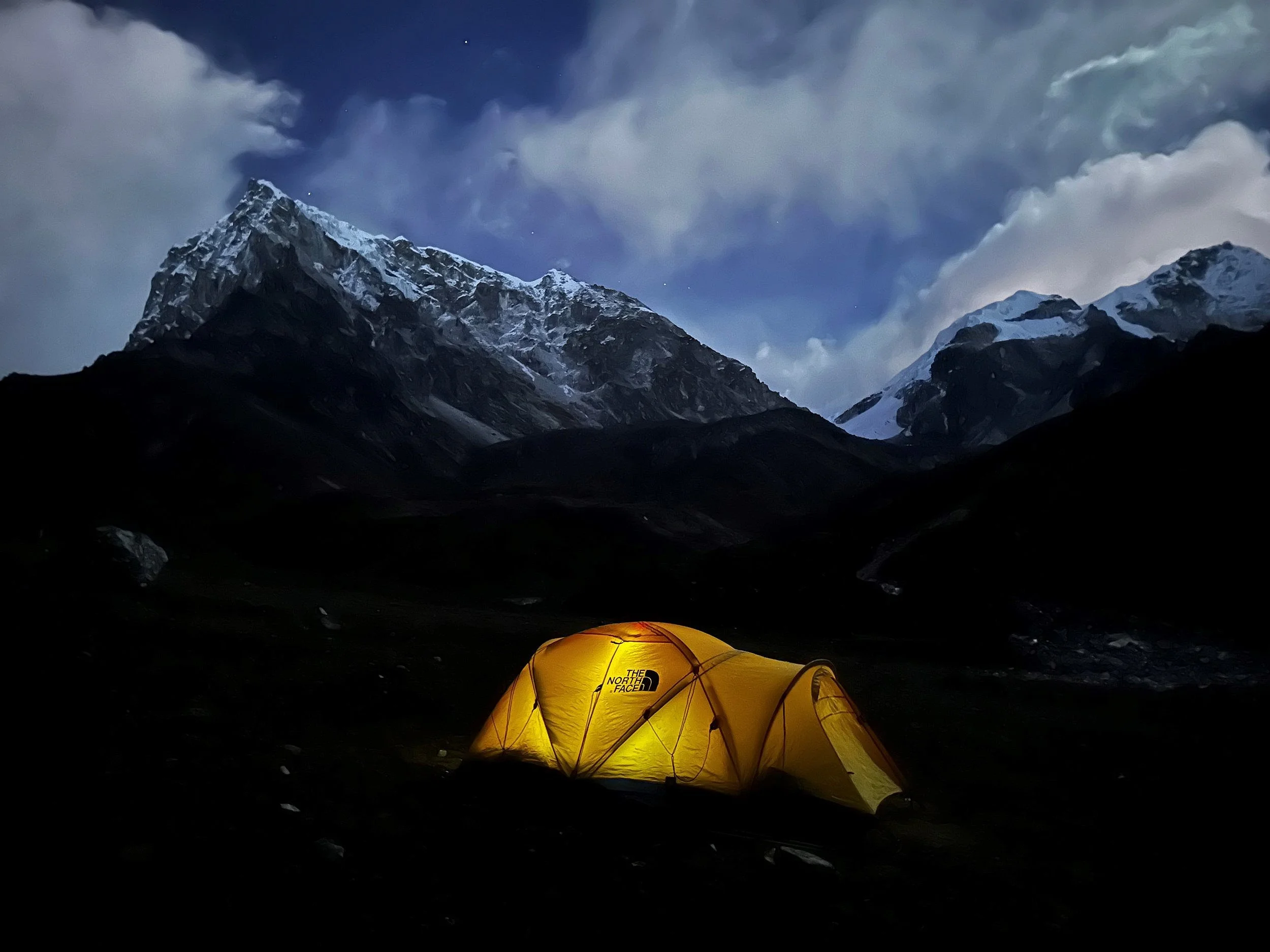
I thought that this option was more exciting than just trekking to Nangpa La and back (although if I had time I would want to go there as well). As consolation, we could see most of the spectacular scenery of the Nangpa Glacier from where we were. We retired to bed early as the sun hid behind the surrounding peaks and moraines around 3pm. It got instantly cold. Since I was tired anyway, my warm sleeping bag seemed very inviting. The night was cold but clear with bright moon. I could see the mountains illuminated in the bright silver light when I stepped outside of the tent in the night.
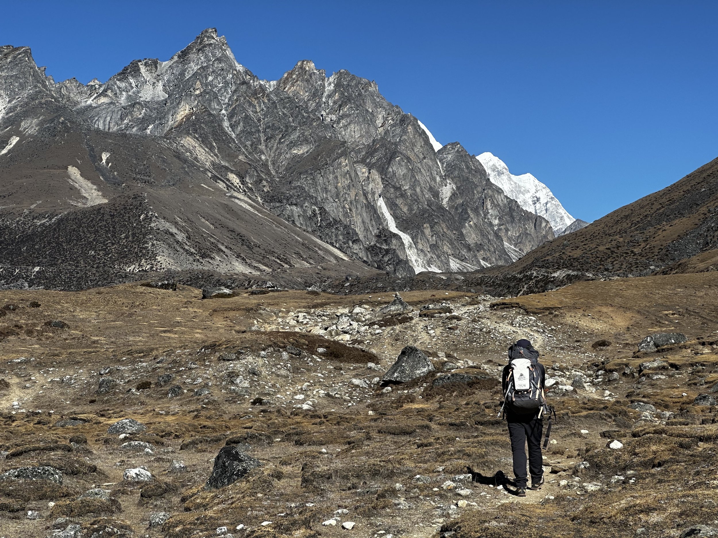
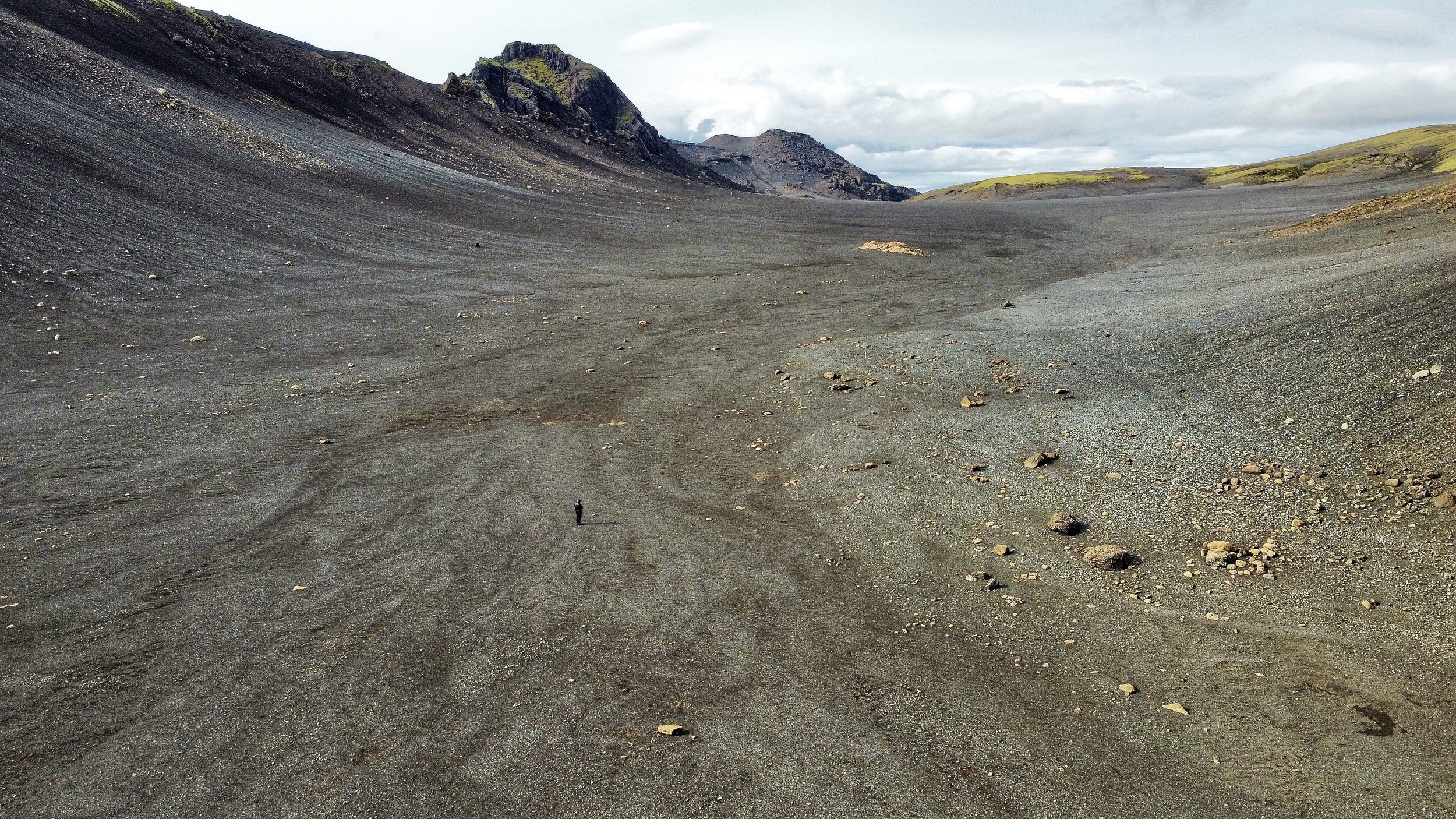
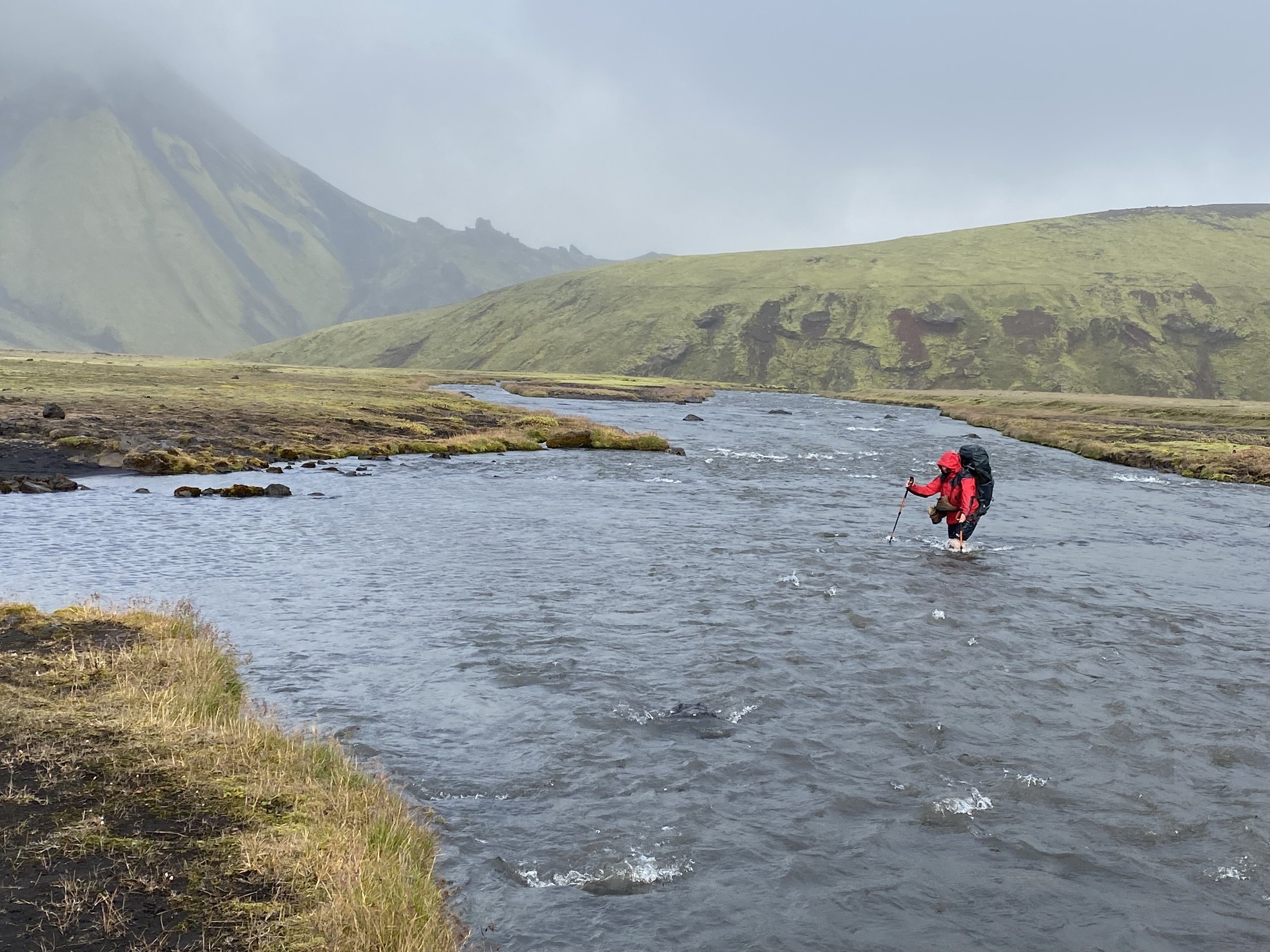
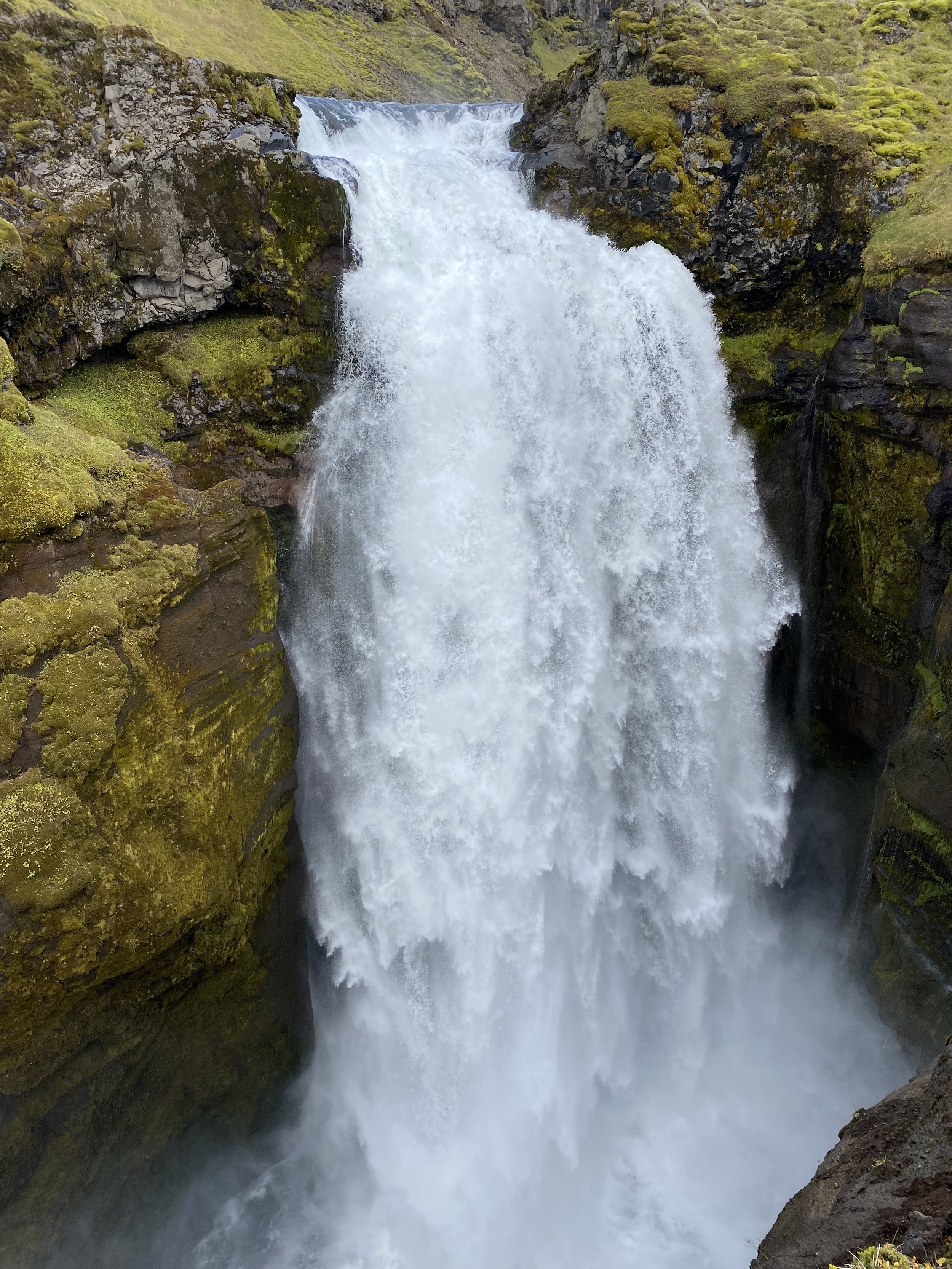
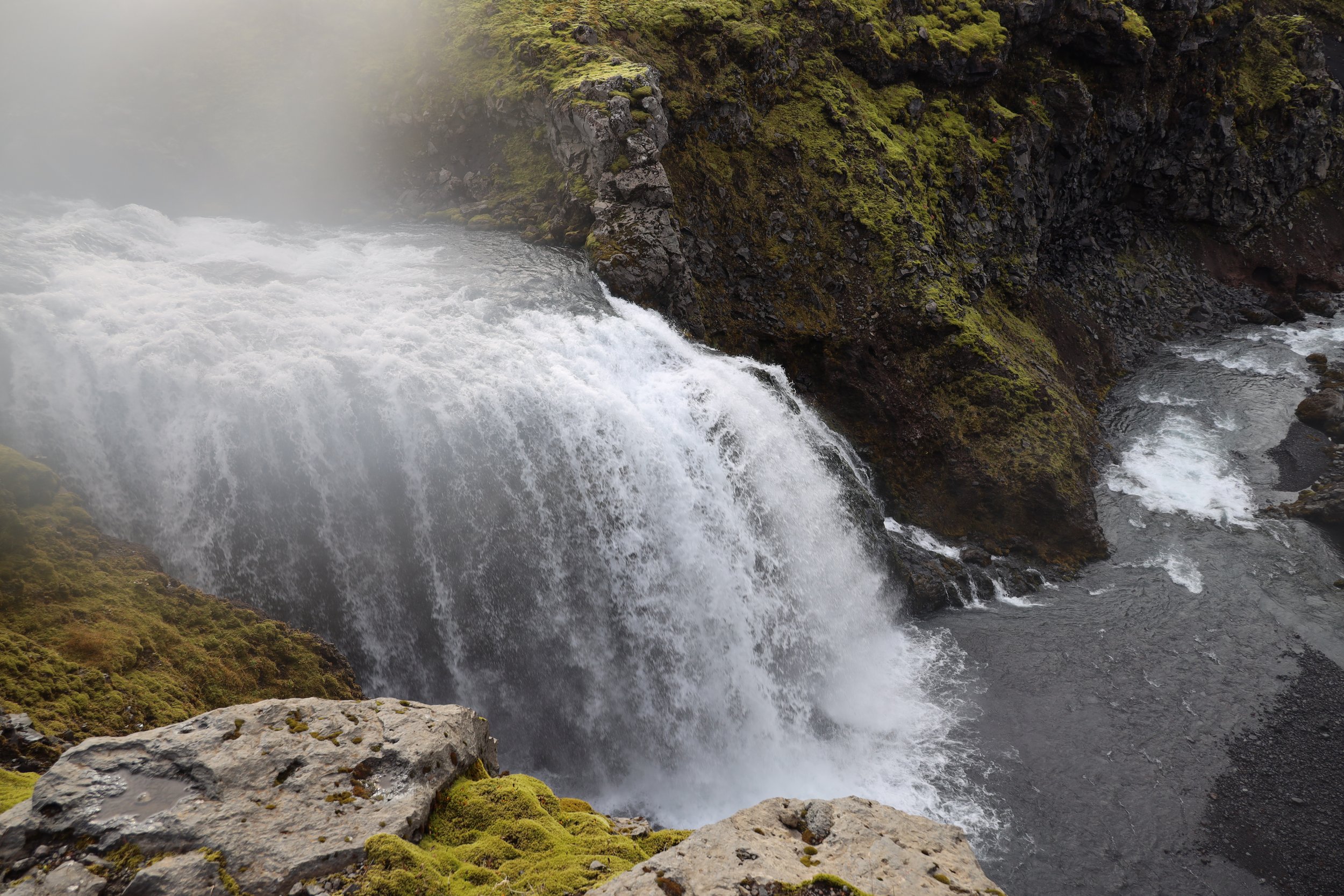
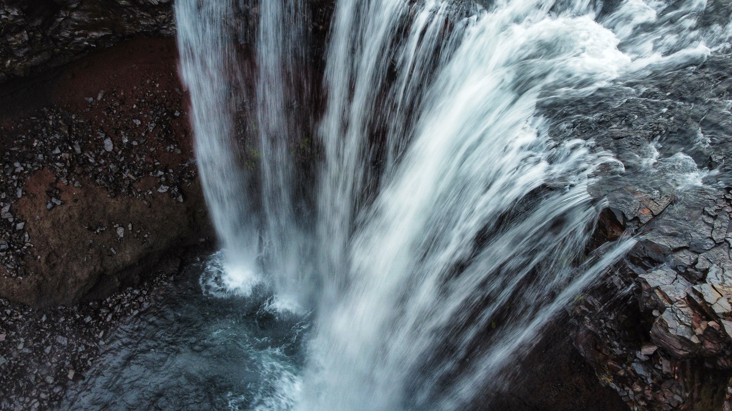
November 5, 2022 Sumna Pass 5450m
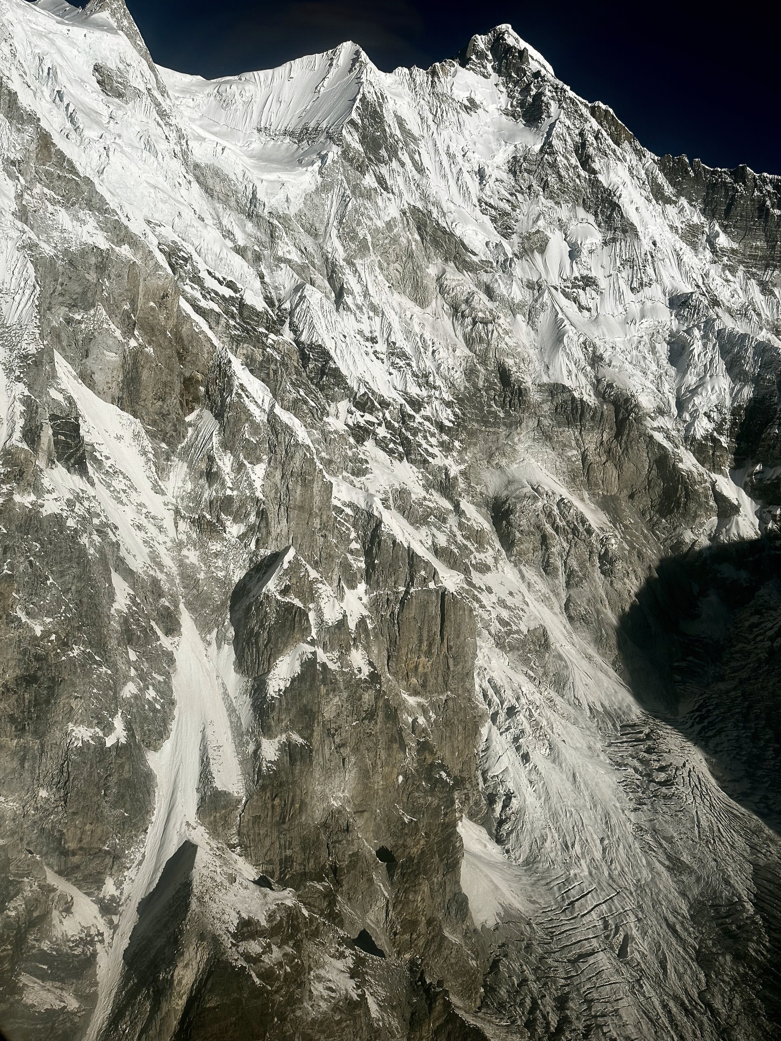
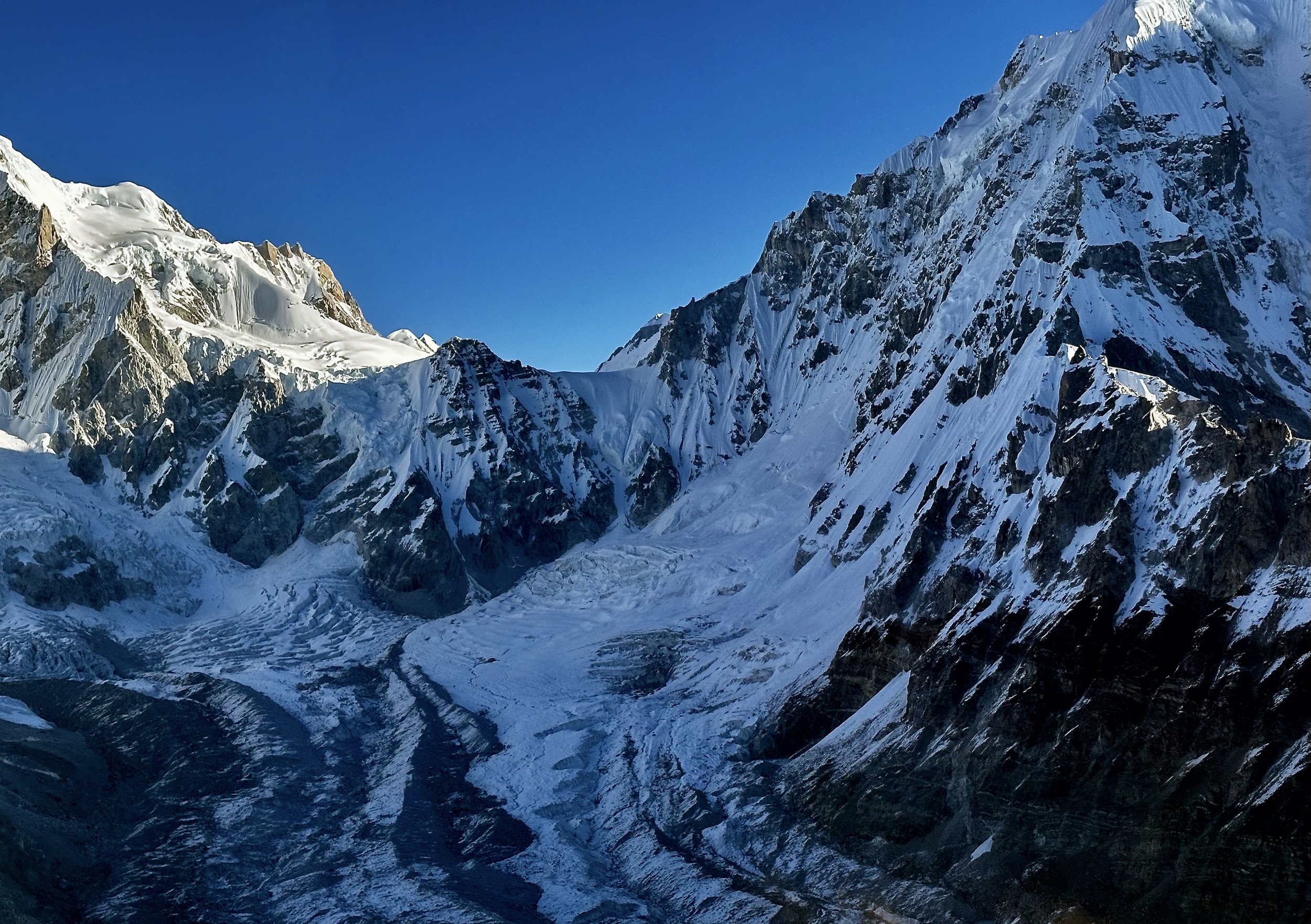
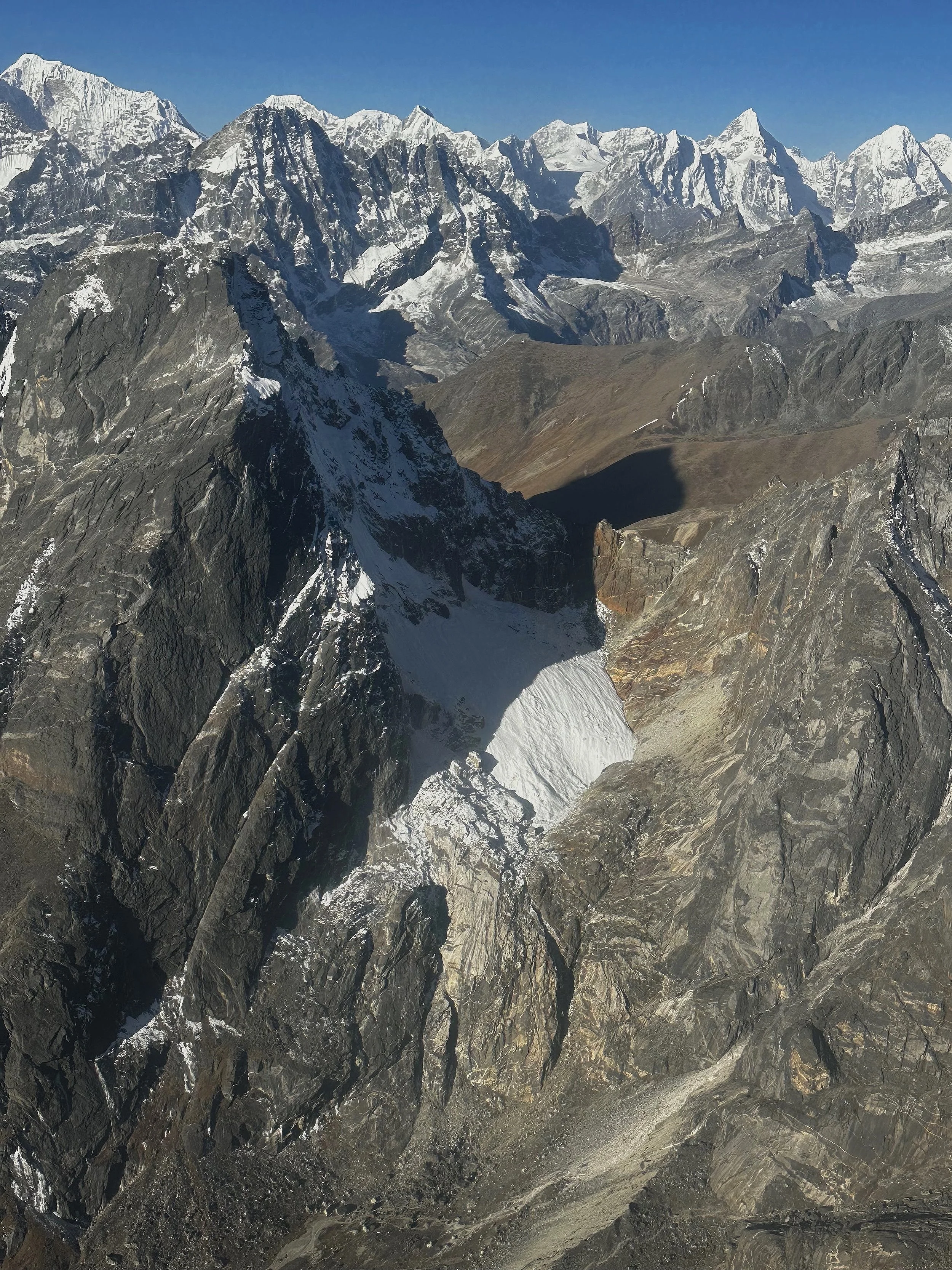
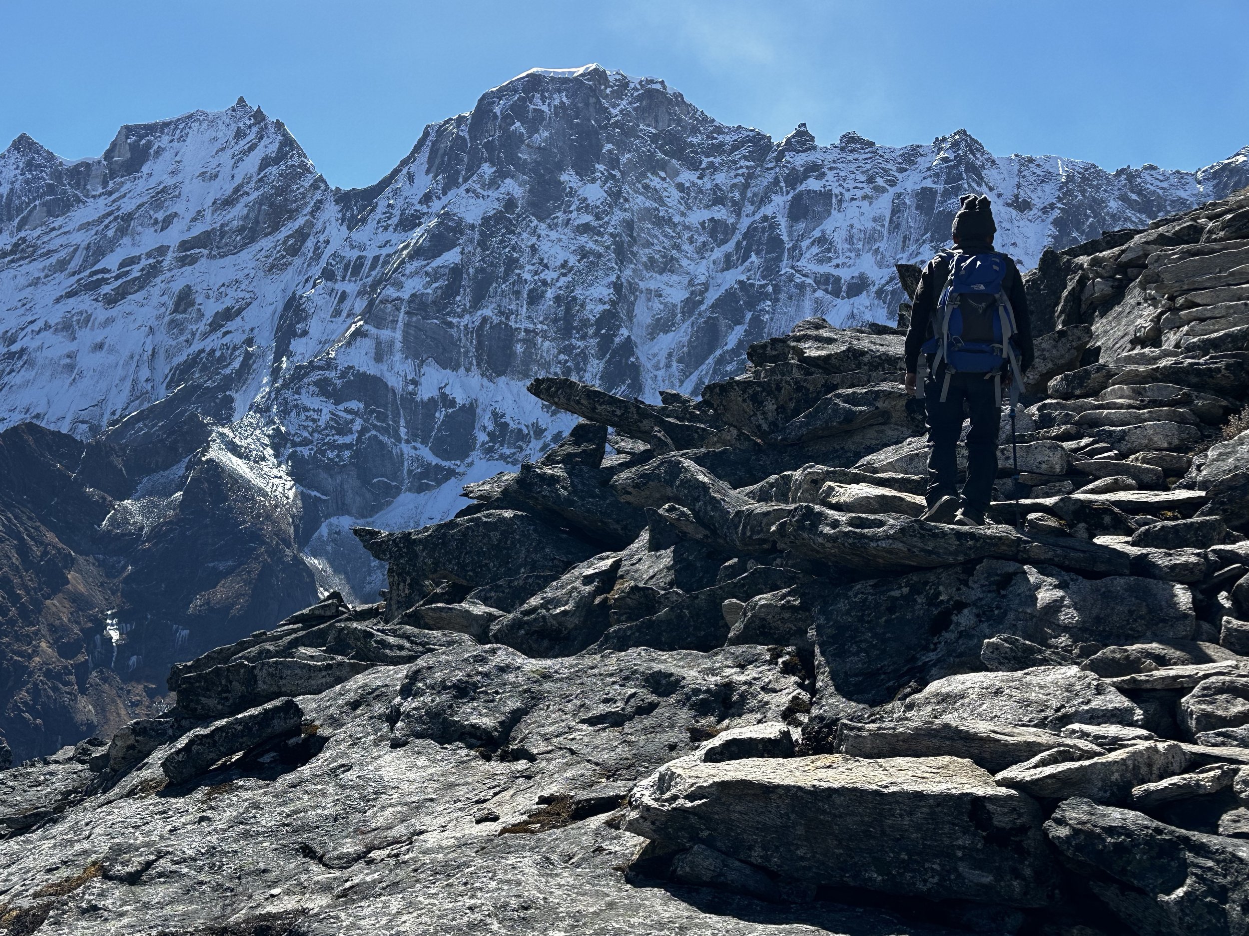
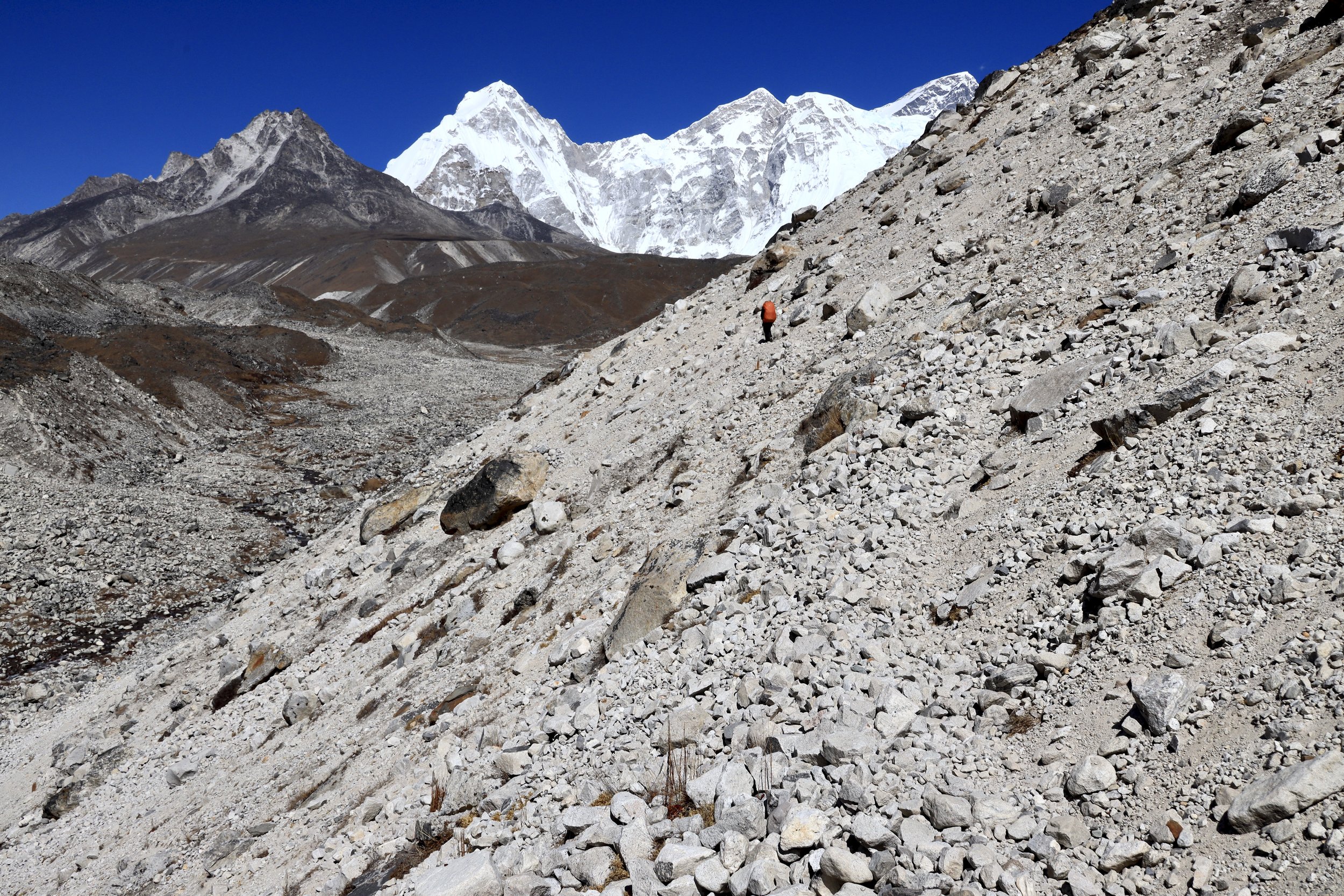
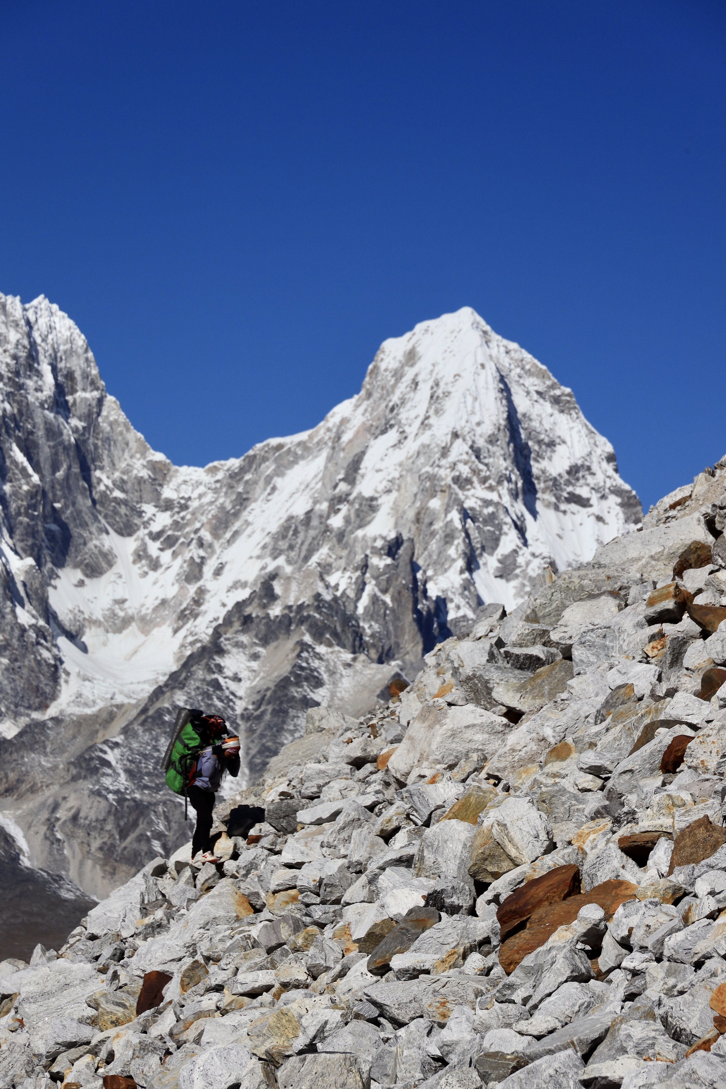
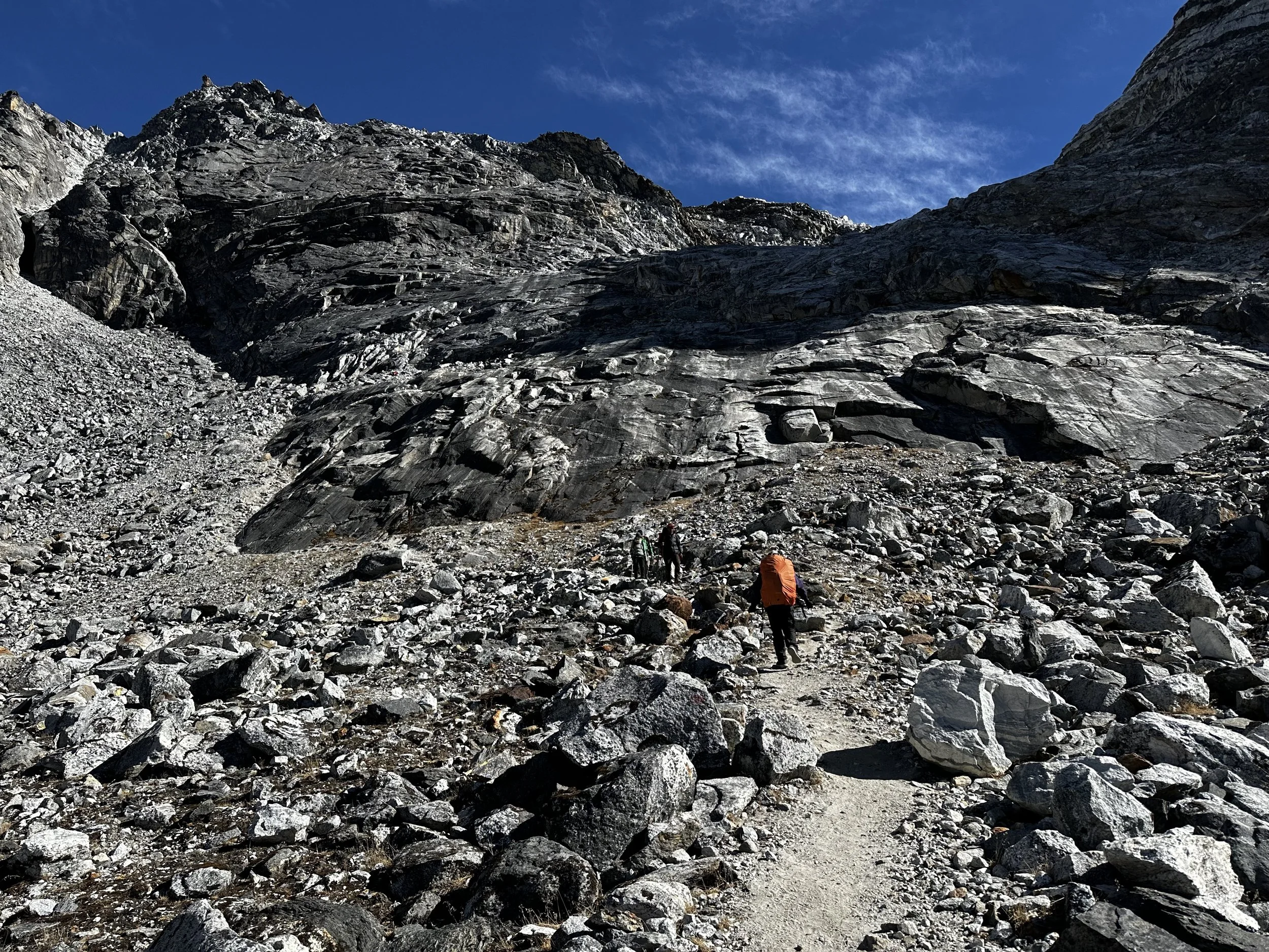
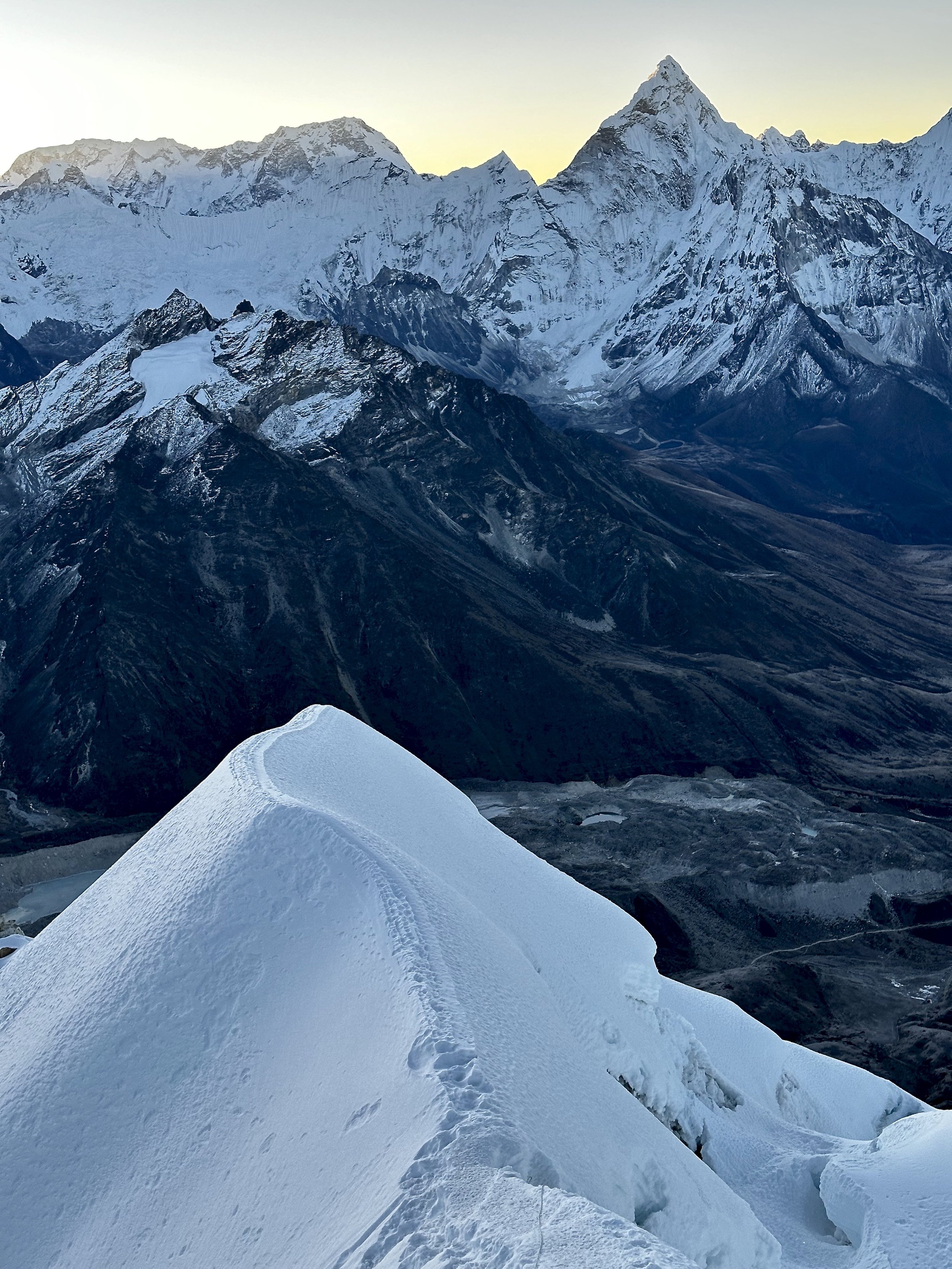
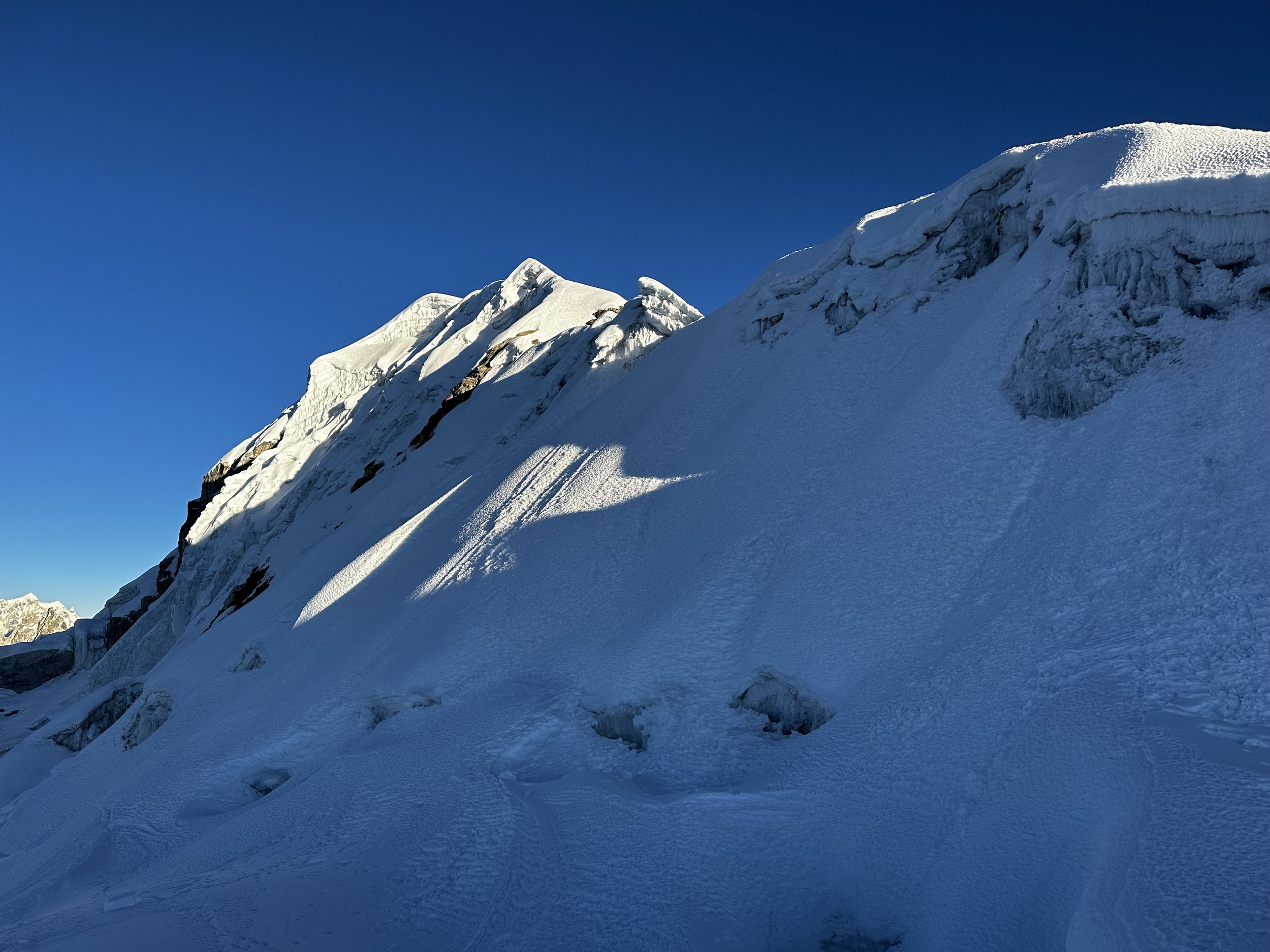
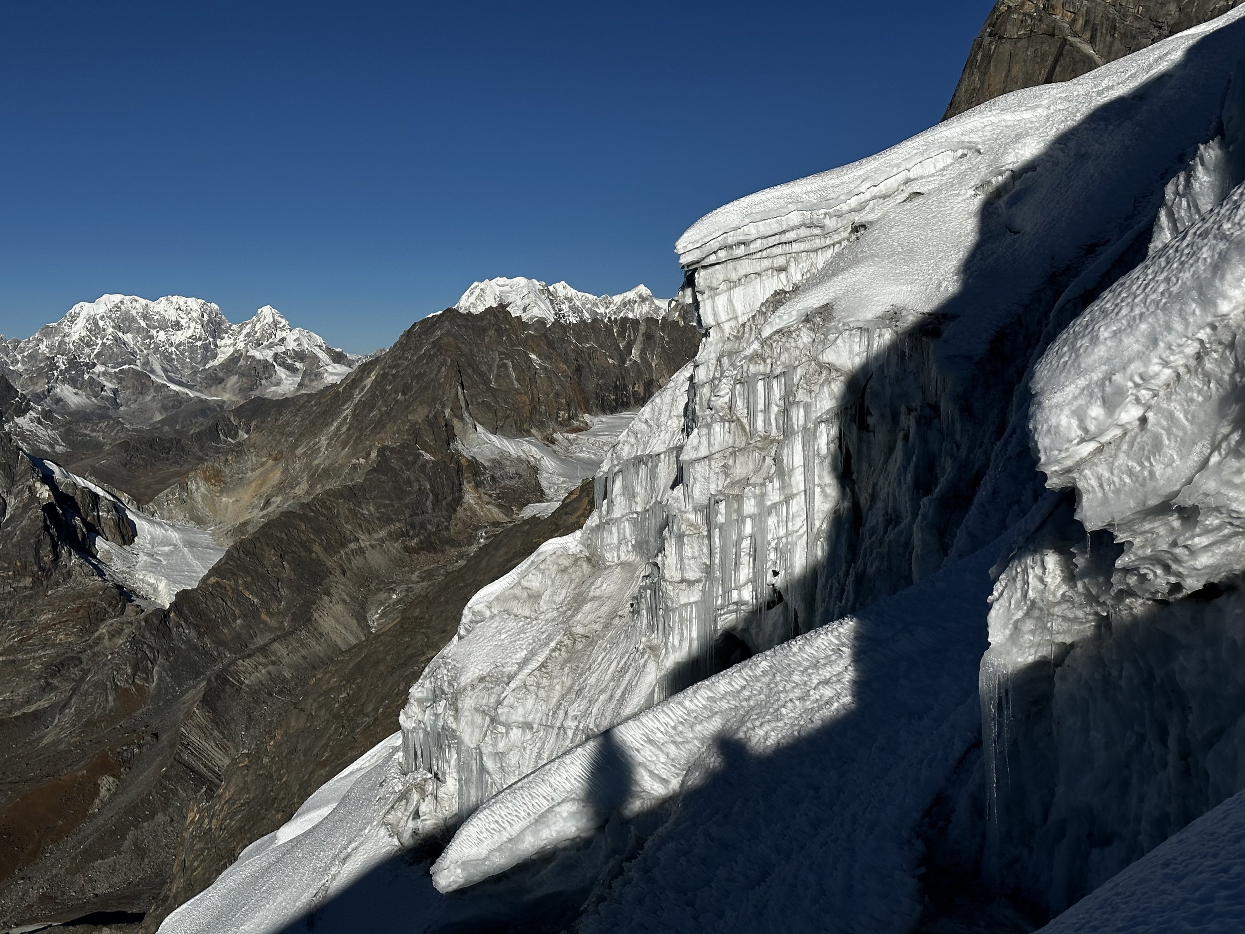
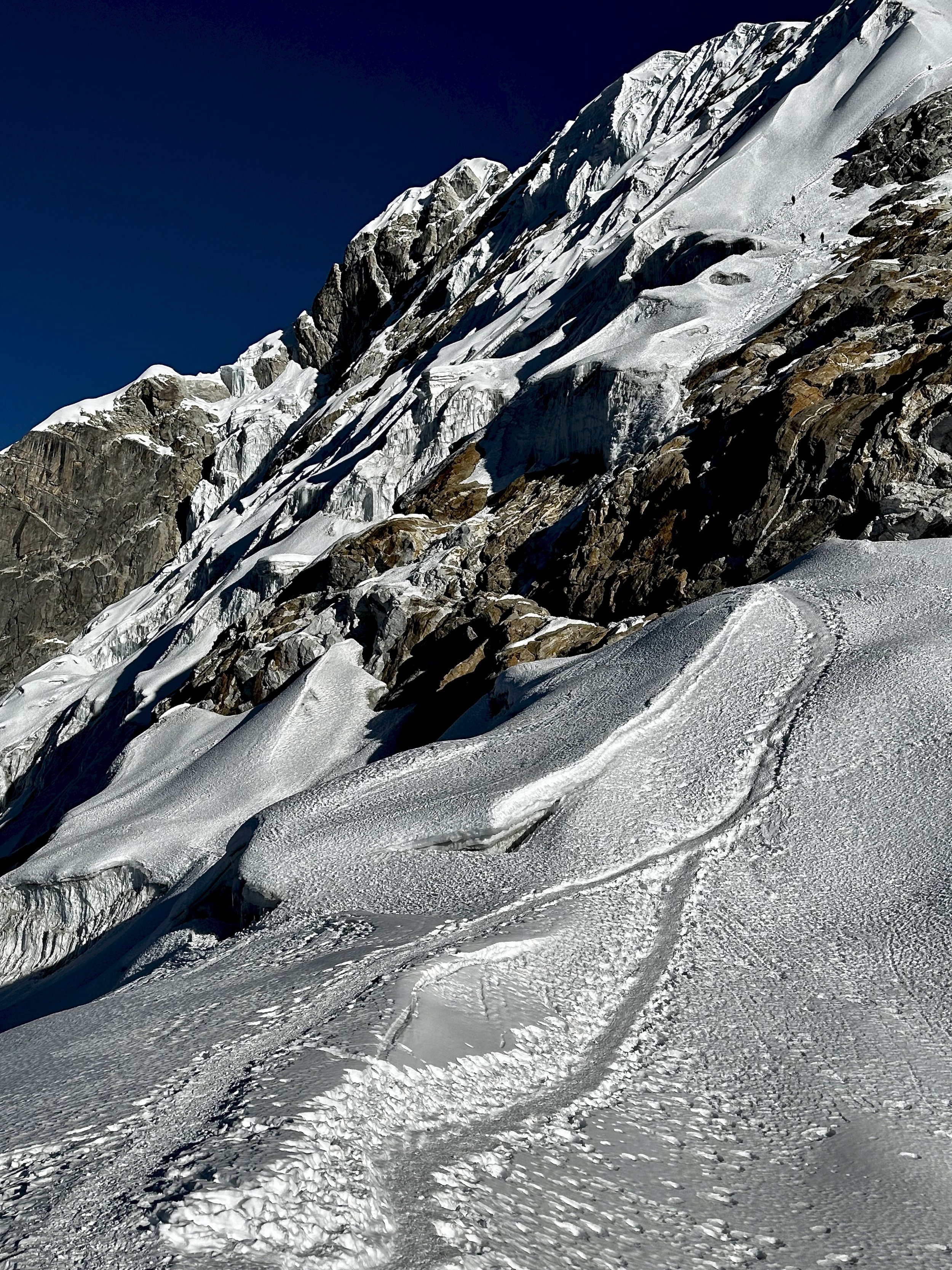
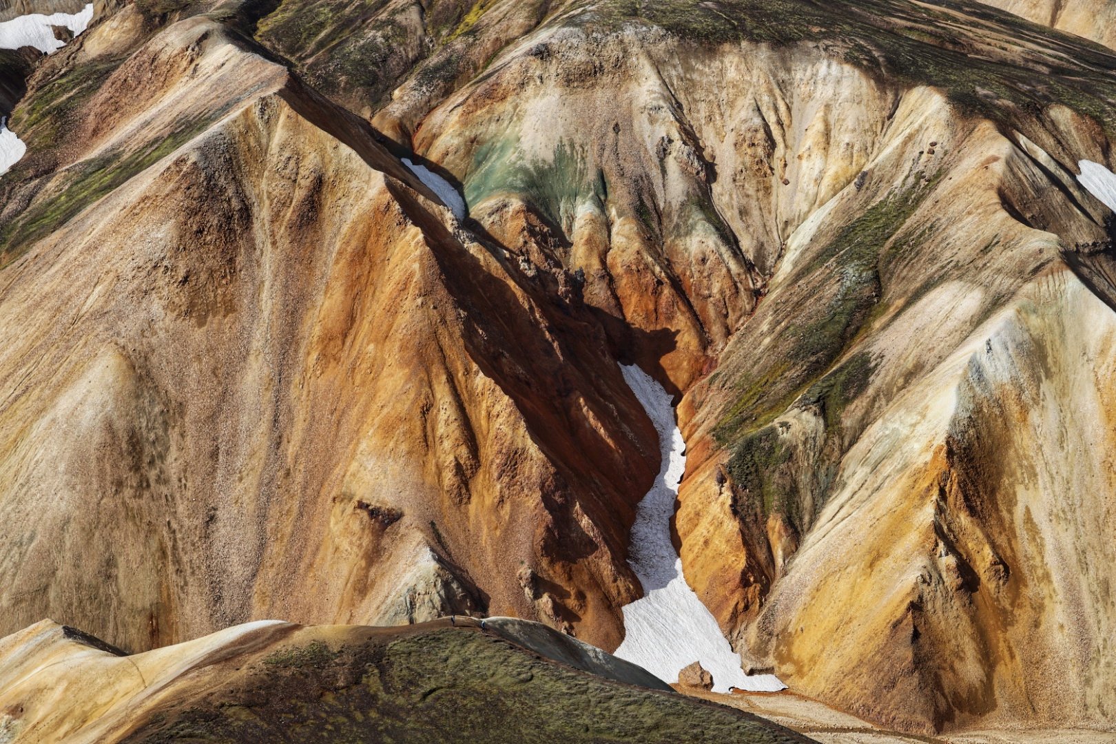
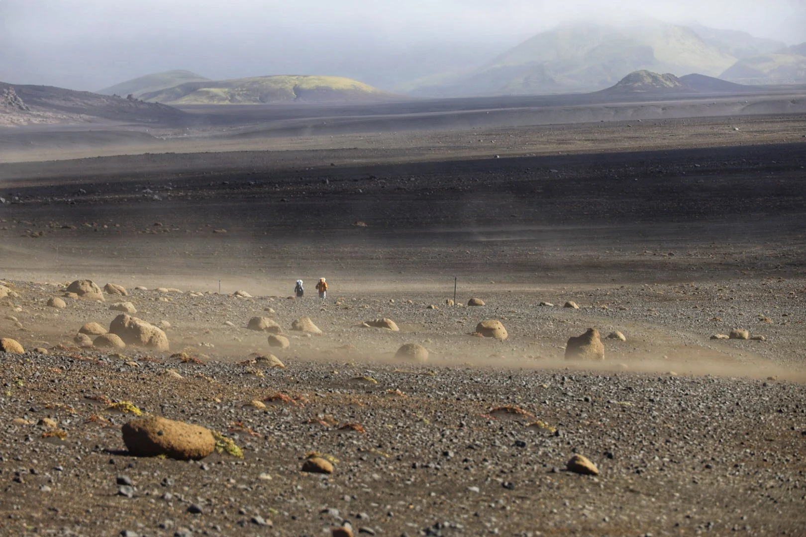
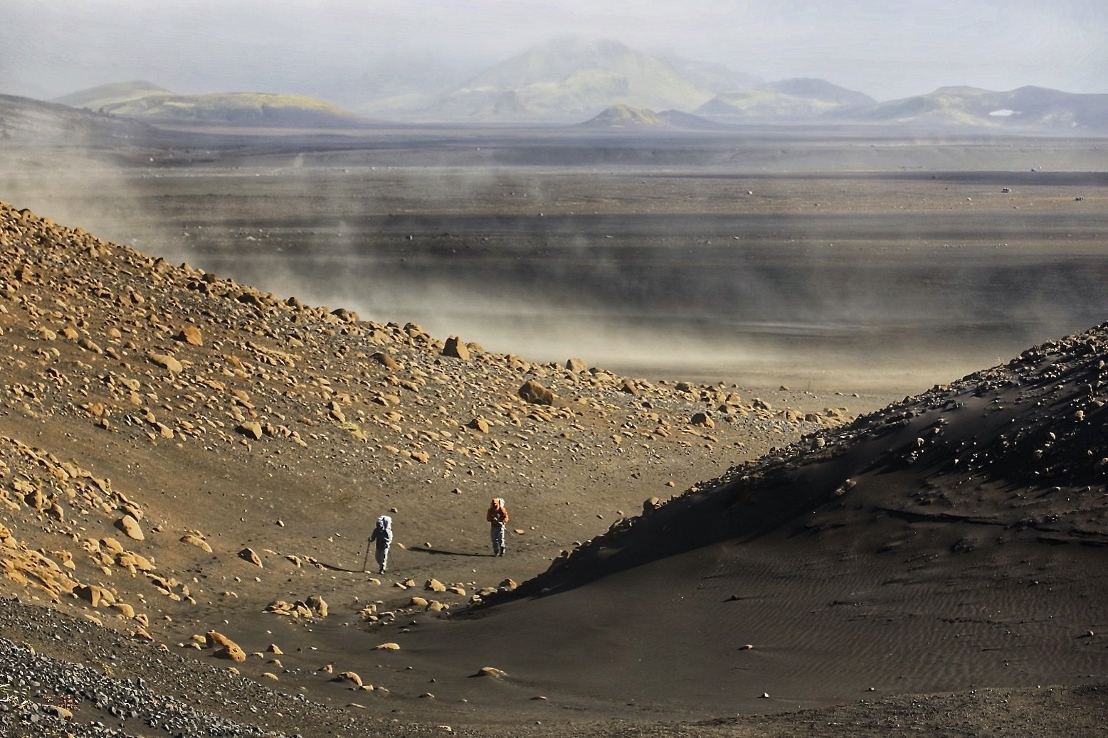
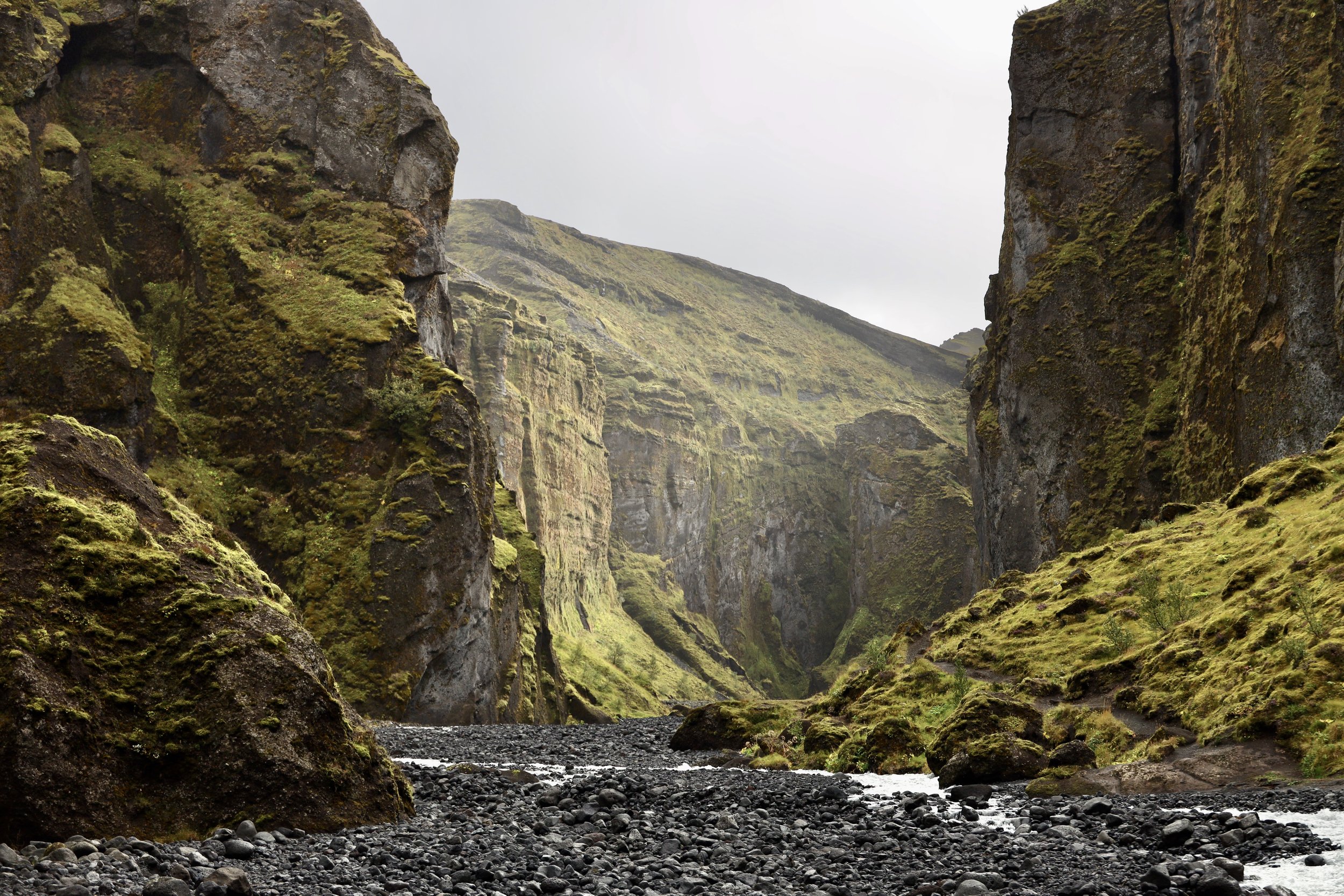
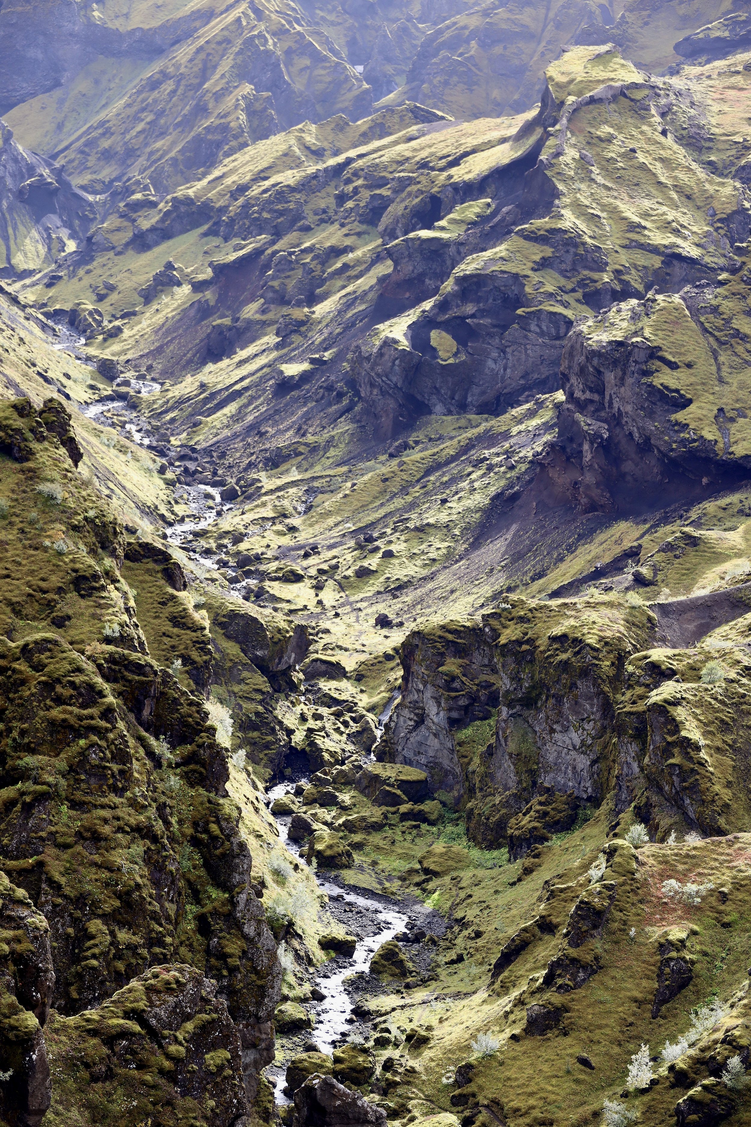
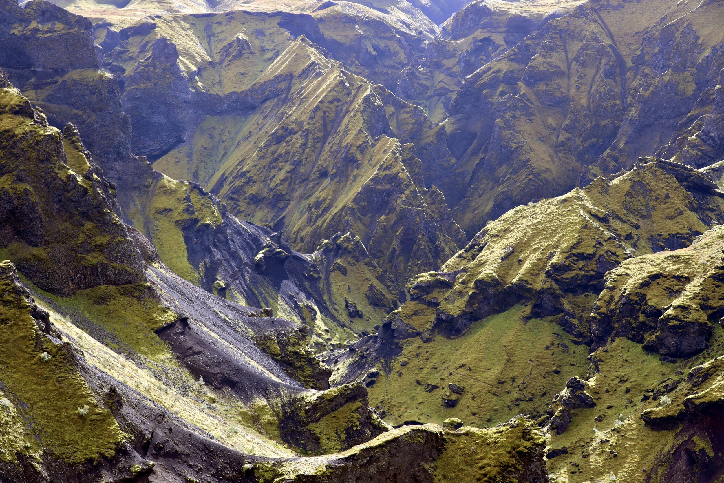
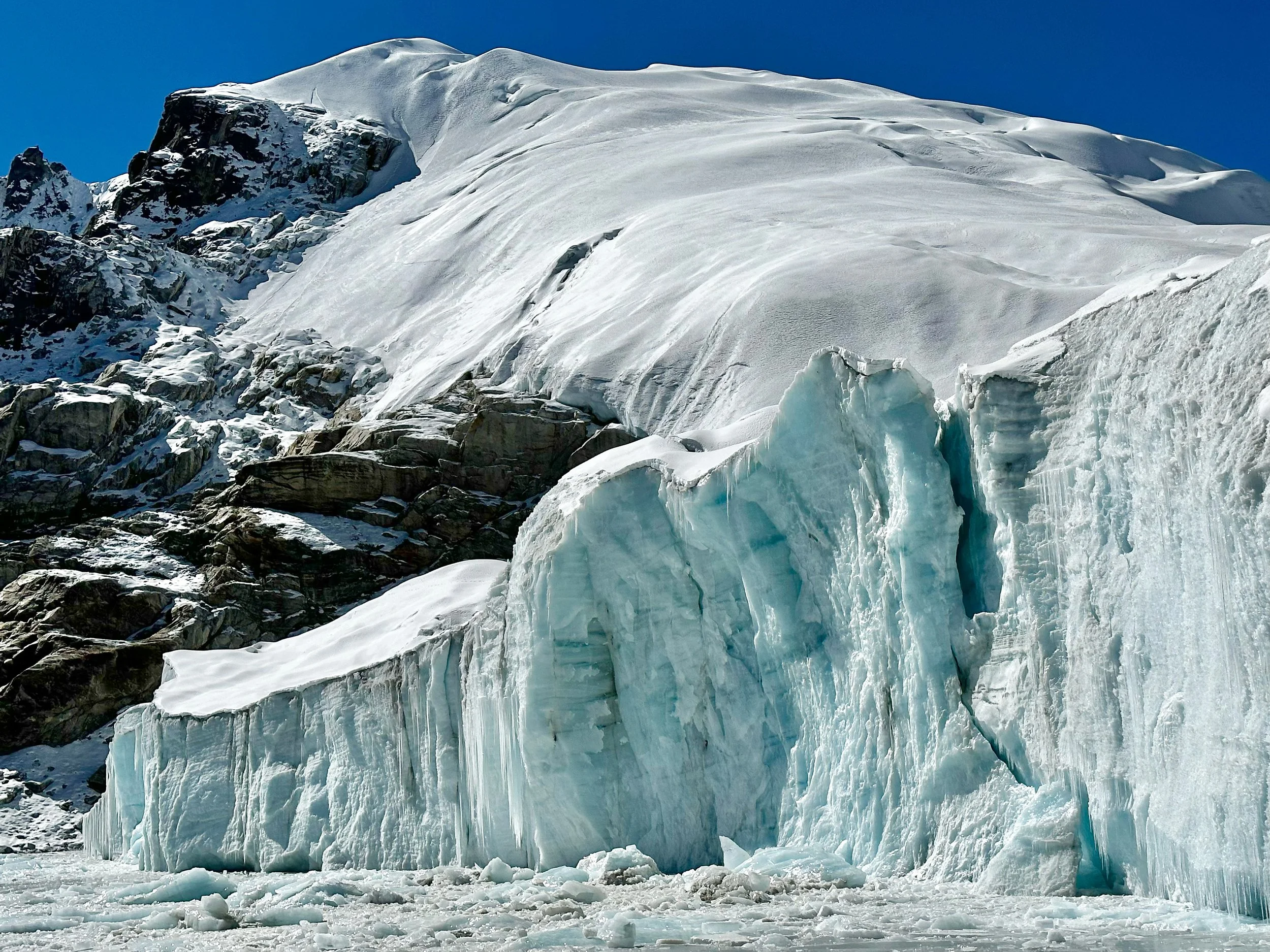
The night in the tent at basecamp was quite cold. Everything inside the tent was covered in frost from condensation. We got up at 7am, had some Chinese noodles and coffee and started walking up soon thereafter. Our Sherpa guide claimed that the pass was easy but it was not easy in my opinion. First of all, there is no trail so one needs to know the general direction of the pass. We started walking up some old moraines but soon had to navigate extensive boulder slopes that got progressively steeper. 45-degree slopes were covered in loose rocks that kept sliding from under our feet. The porters seemed to struggle with loads as the ground was quite unstable. Higher up we climbed some rocky outcrops and got onto a small glacier. We proceeded on the glacier and walked up to a narrow chimney between the rock and ice which culminated at the pass. The pass is a small and narrow cleft with Mount Everest crowning the view to the east and Dragnag Ri in Rowaling dominating the view to the west. To the west, the view was quite spectacular with all the peaks of upper Rowaling visible. We could see the pointy Menlungtse in Tibet, the tallest mountain in the range. The Nangpa Glacier was now quite far below us. I felt very happy to see this part of Khumbu close and personal. I saw these mountains in Vertical Magazine and on other photos and they always intrigued me. I was also happy to cross a pass that was not frequented by many. It had a sense of novelty and exploration of the new territory. I felt that the climb was tough partly due to the altitude but also due to the loose terrain. This was my first time above 5400m and I felt it. On the way up, I had to stop frequently just to catch my breath. We climbed to the pass in 3 hours.

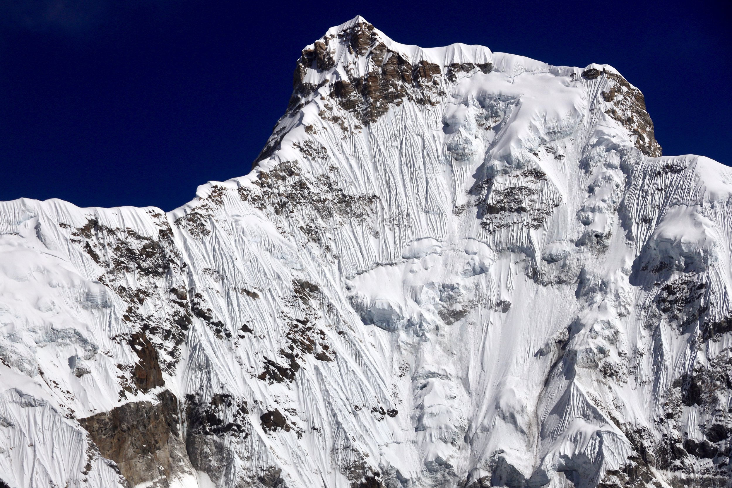
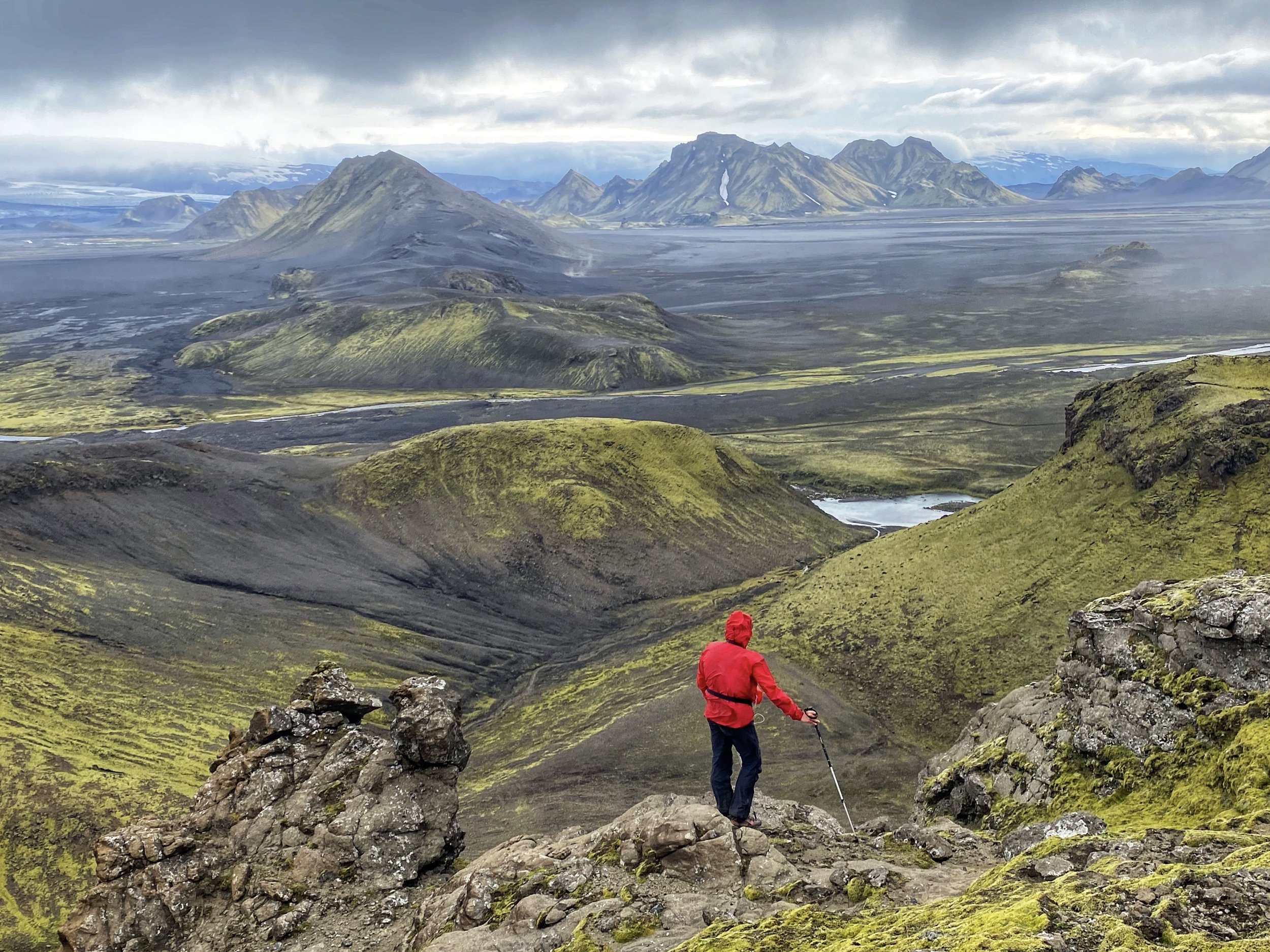
Ascending the loose slopes to the Sumna Pass
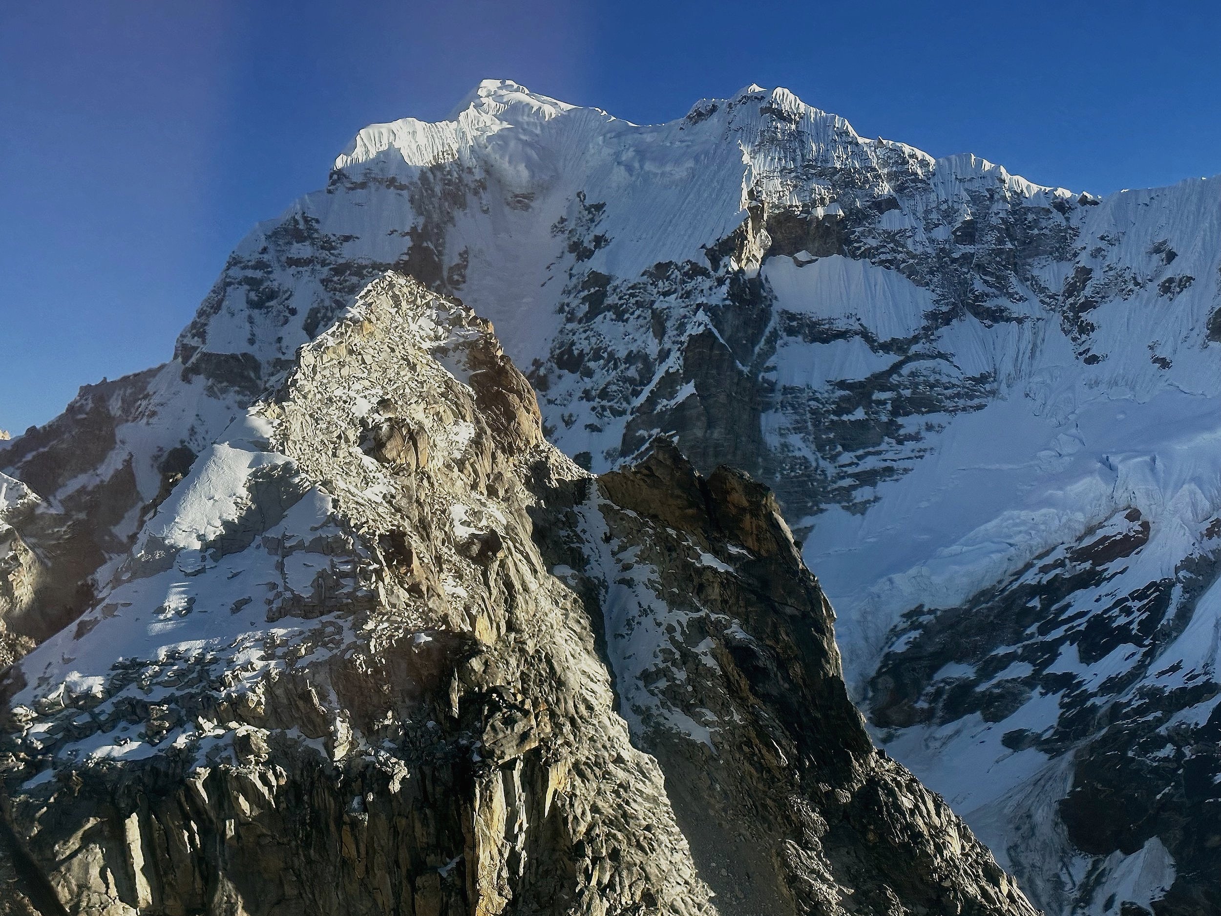
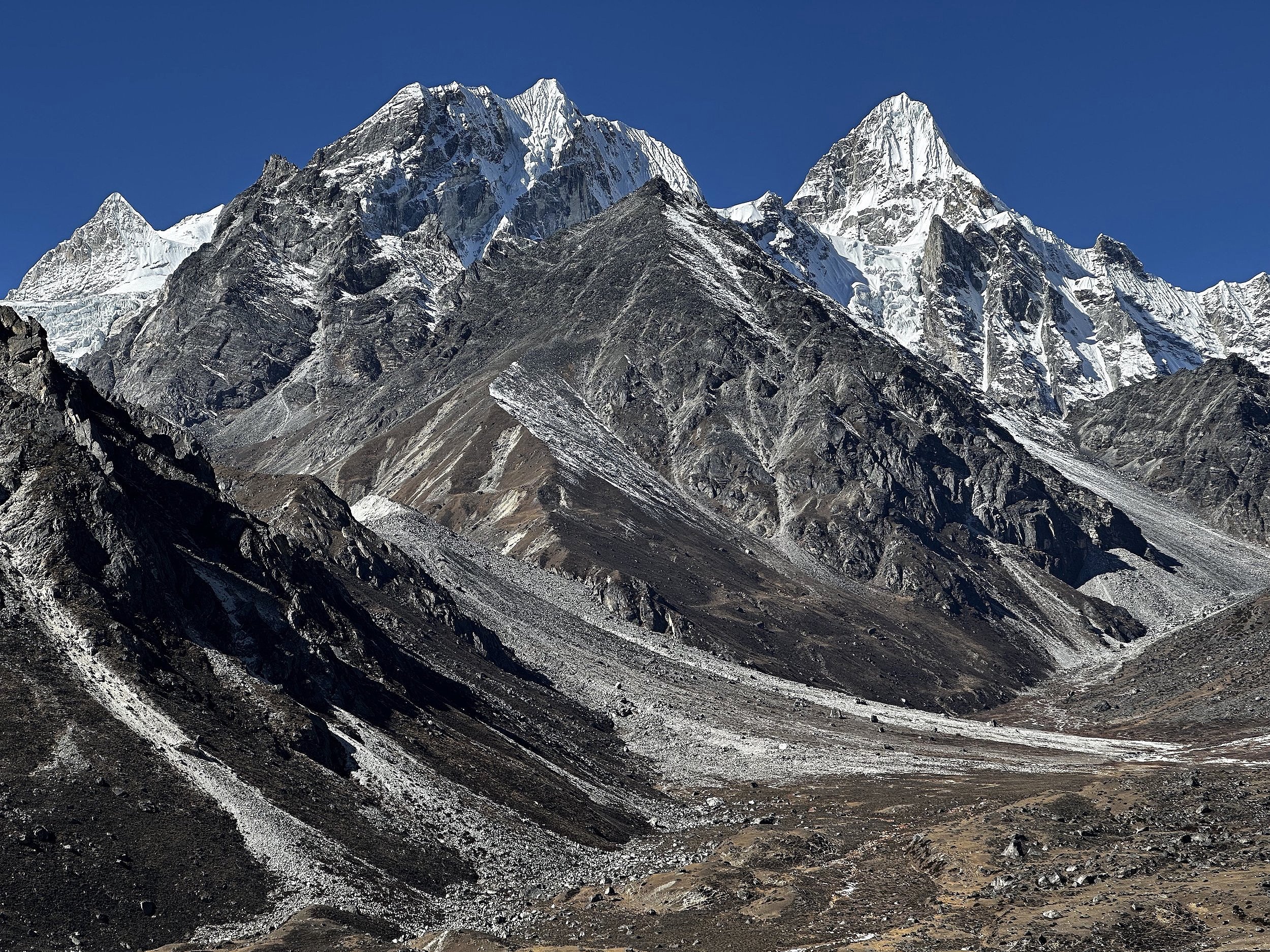
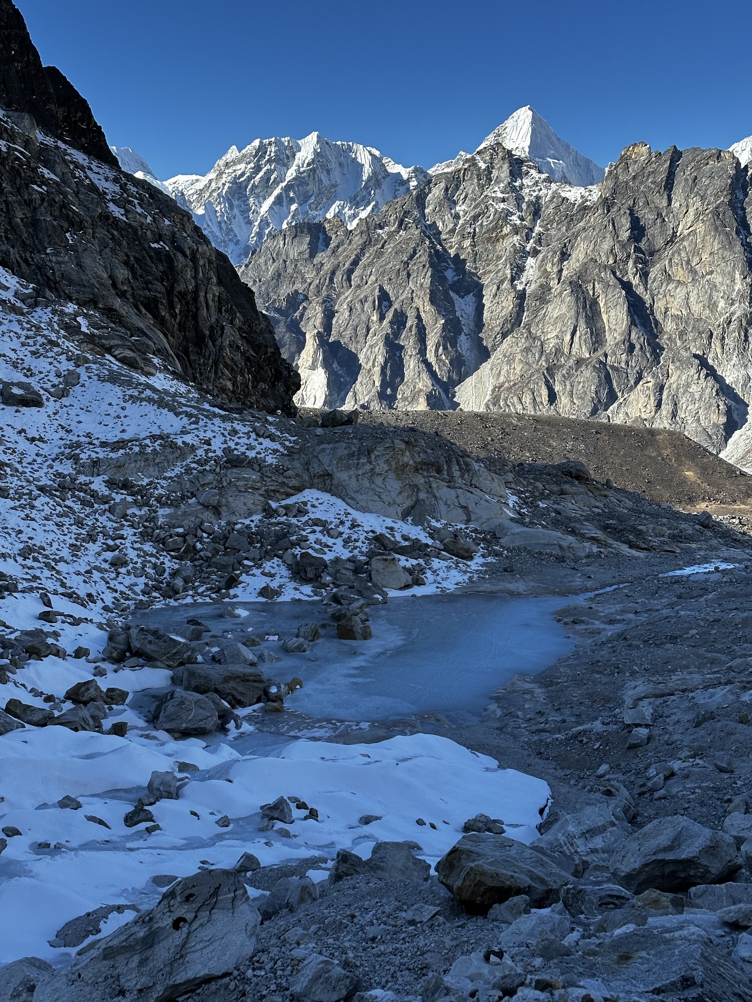
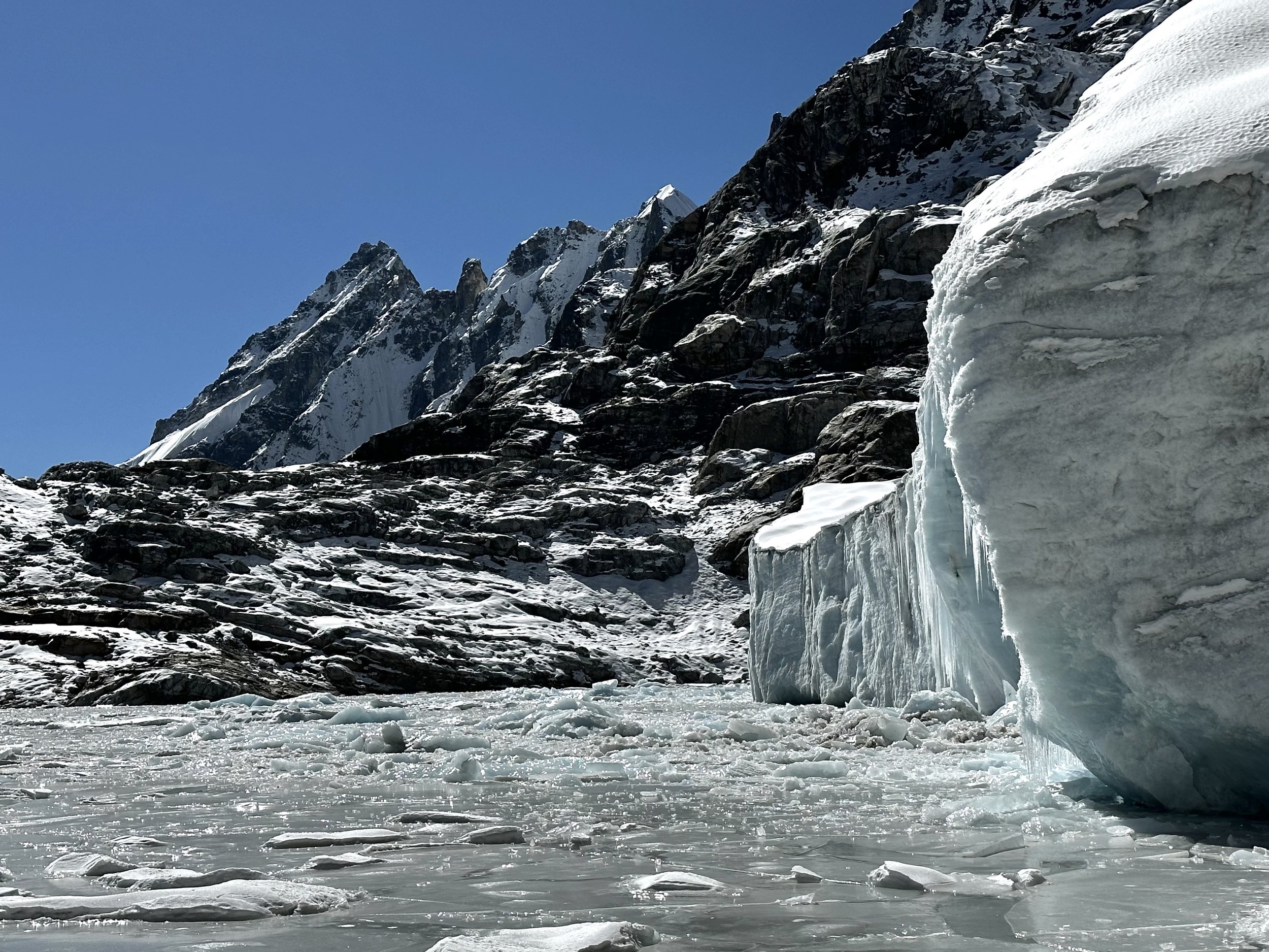
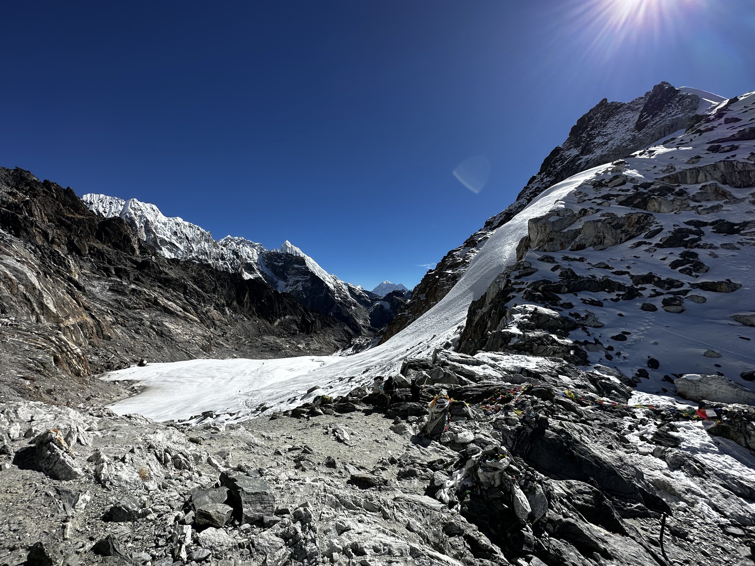
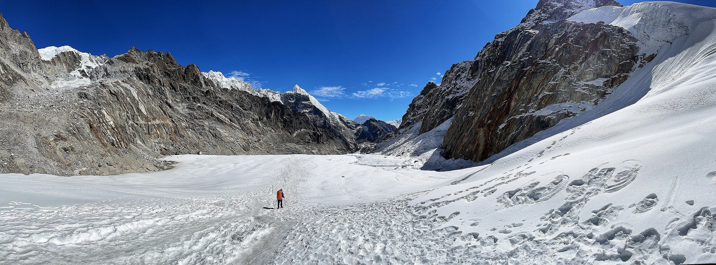
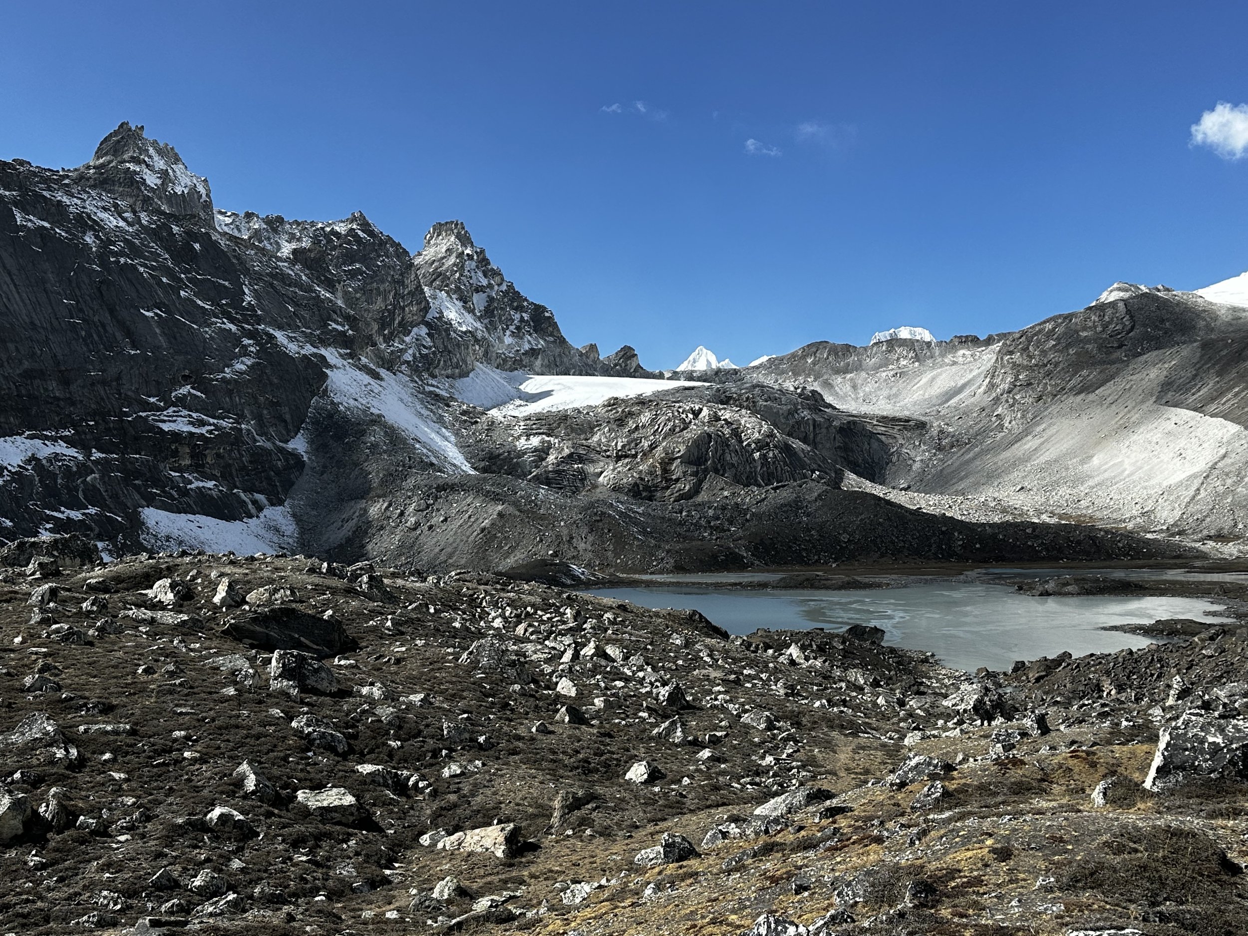
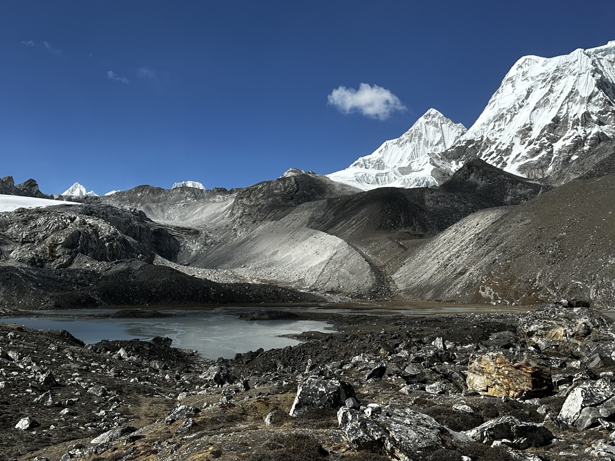
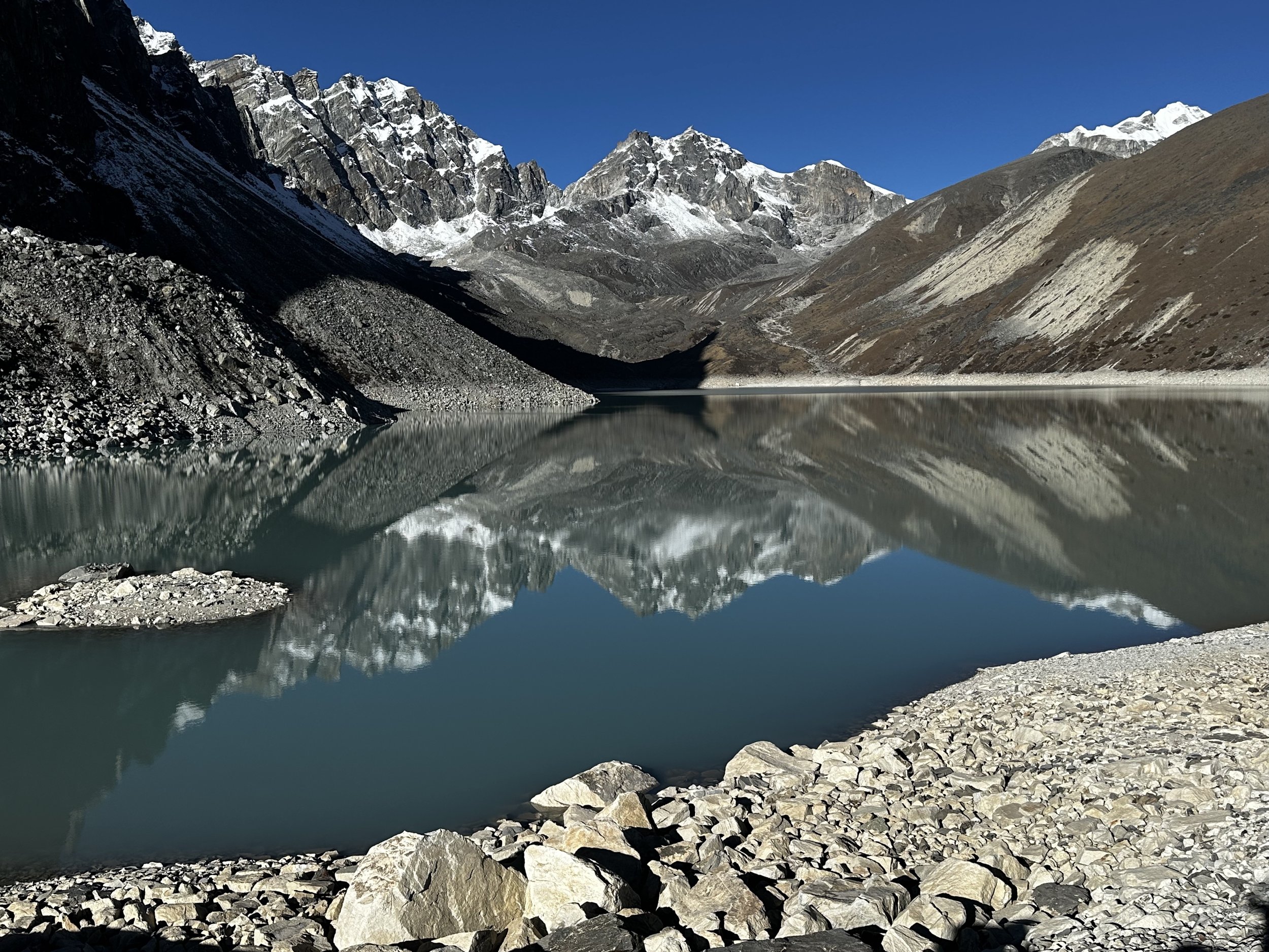
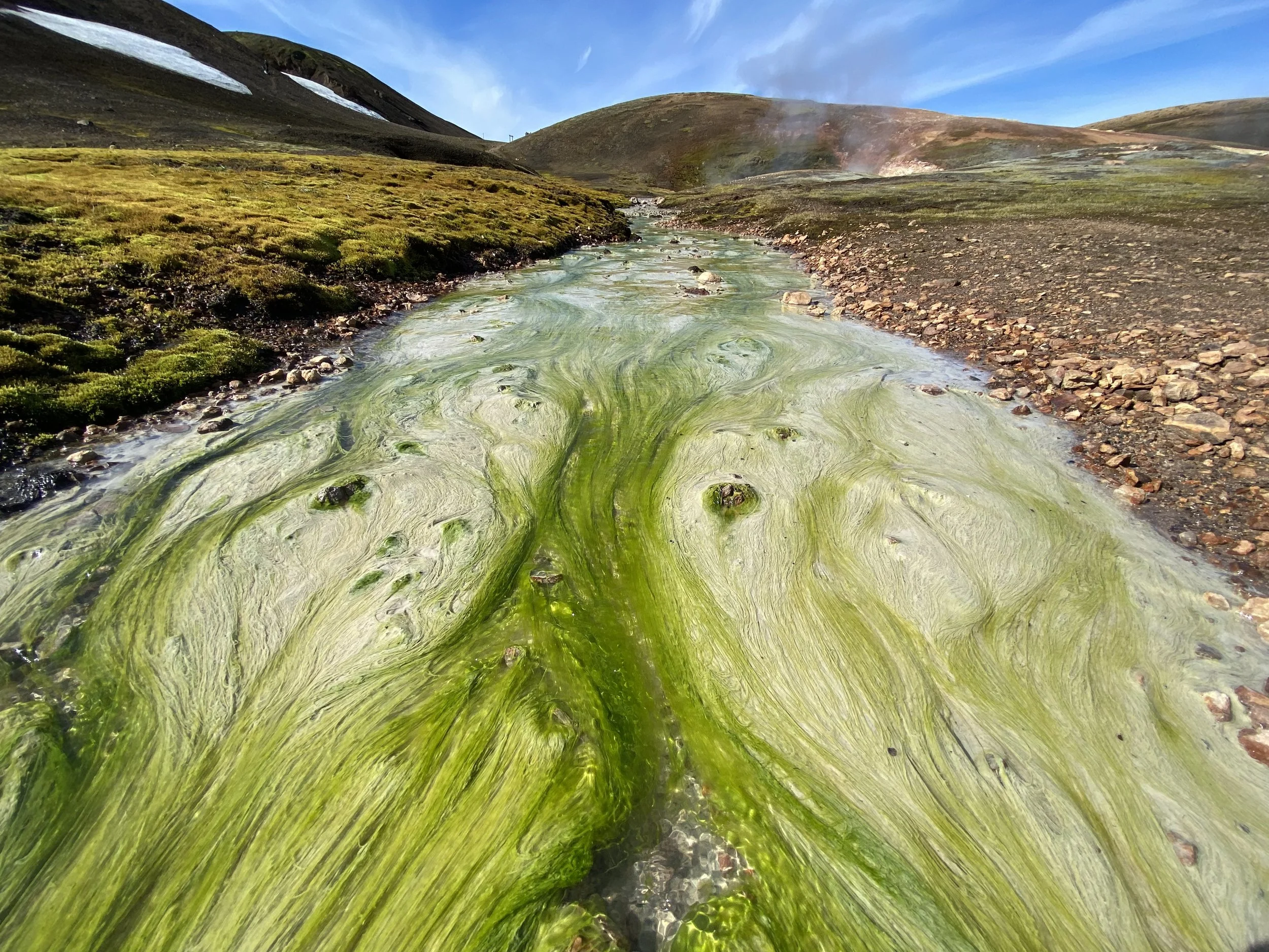
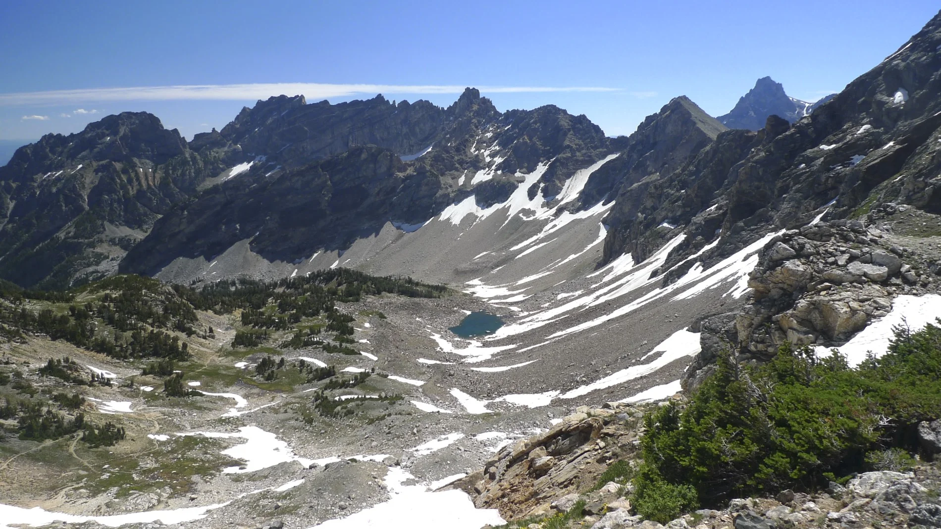
The descent started on the glacier which terminated at a small glacial lake where the glacier broke up in impressive seracs. From the glacier lake it was quite a long way to the fourth Gokyo Lake where we would camp. We arrived at the bottom of the valley on the Gokyo side, and the lake was still a long way off. We had to go all the way around it as, of course, the camping spot was as far as possible. The calm lake was beautiful turquoise colour and was surrounded by jagged black rocky peaks. We had beautiful weather, no wind and it was relatively warm in the sun. By the time we got to the lake I was quite bagged and had to stop frequently to rest. One of the porters joined me in rest stops as he was having hard time with the altitude as well. It is amazing how exhausting the altitude makes one feel. I still had enough energy though to enjoy the magnificent views and the area though. We were alone and saw no one for 3 days now. We could see the beautiful and striking Cholatse on the other side of the lake and as we approached our camping spot, Cho Oyu came into view.
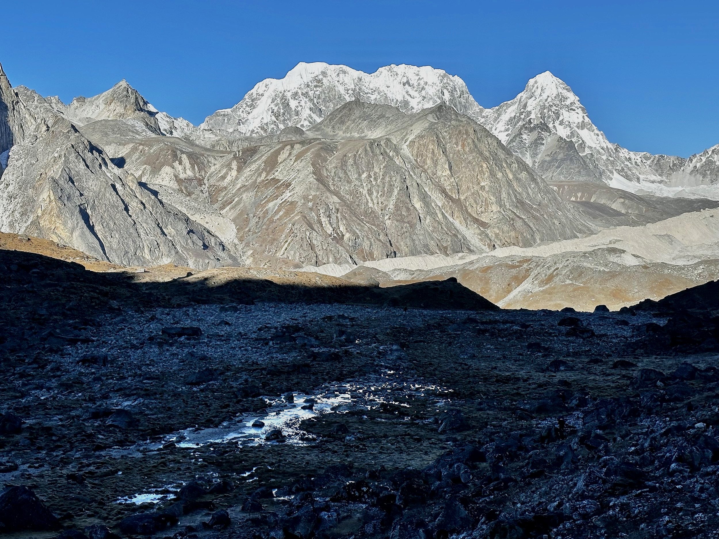
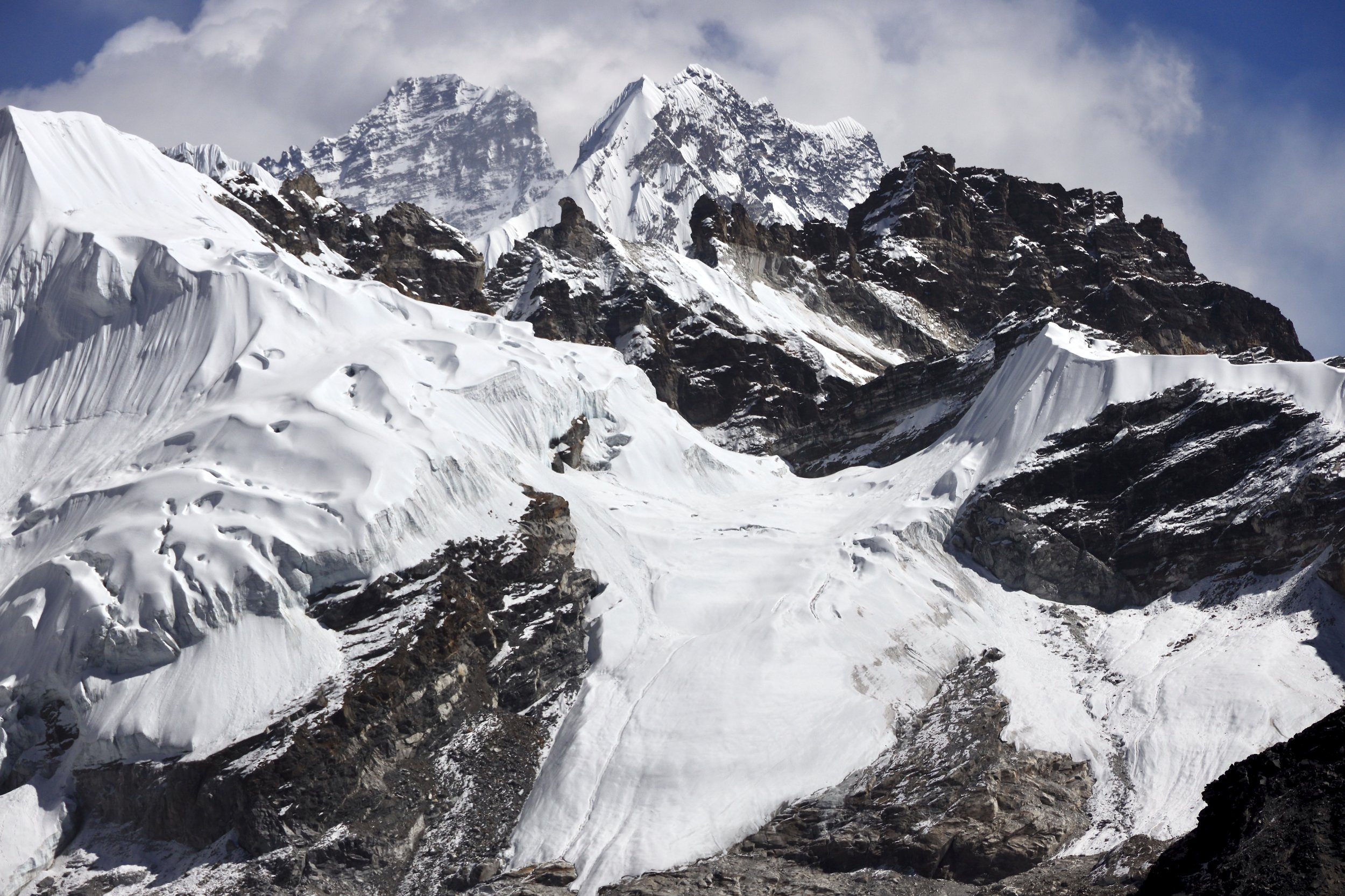
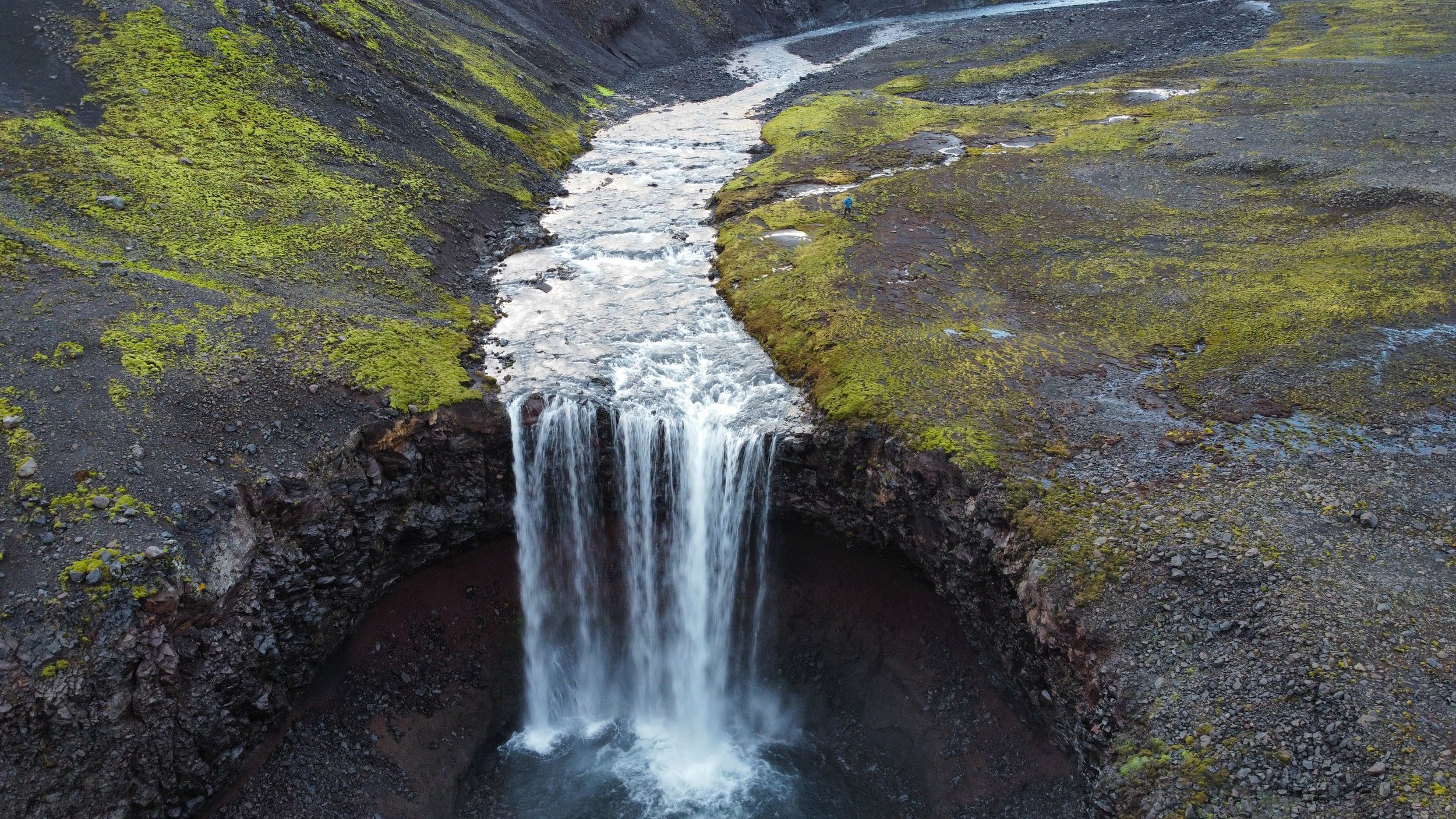
Small glacier of the Sunma Pass
At this point all I wanted to do was to lie down and not move any more. Tek brought me some garlic soup and a massive plate of pasta with cheese. I was quite hungry as all I had all day was a cup of Chinese noodles in the morning. Around 3, the sun set for the day behind the rocky spires and it immediately got quite cold. It was another cold and bright moon night in the tent. I was so tired though that I did not even notice.
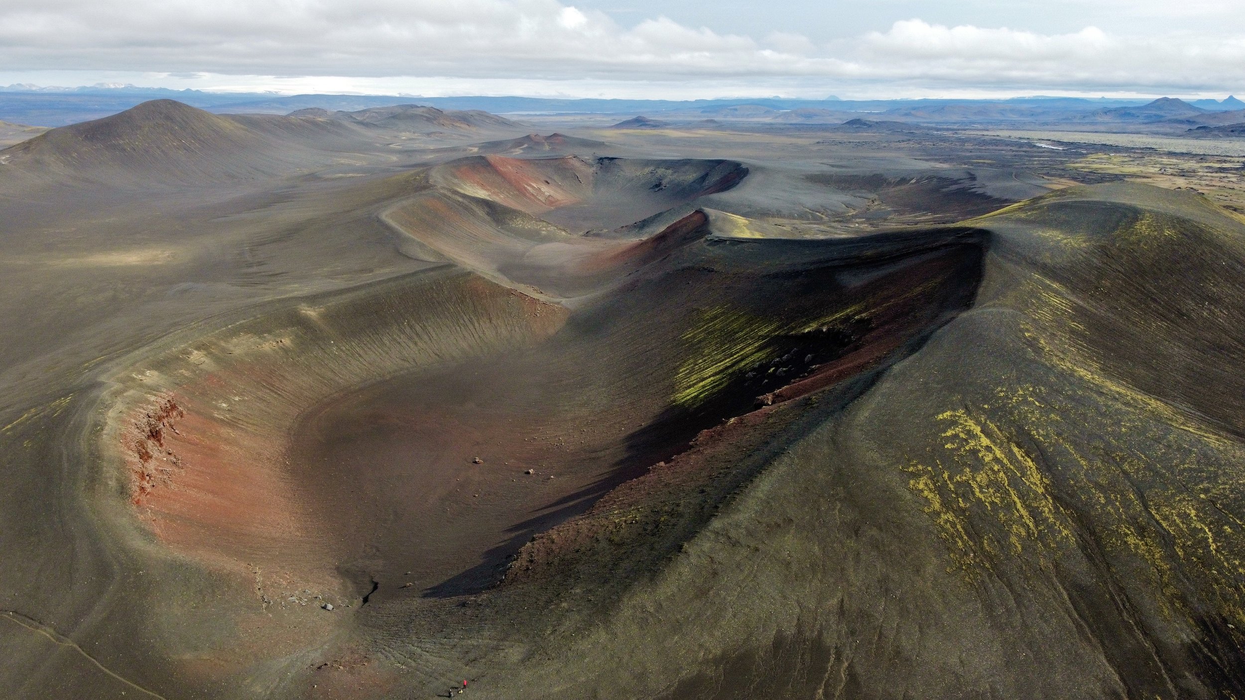
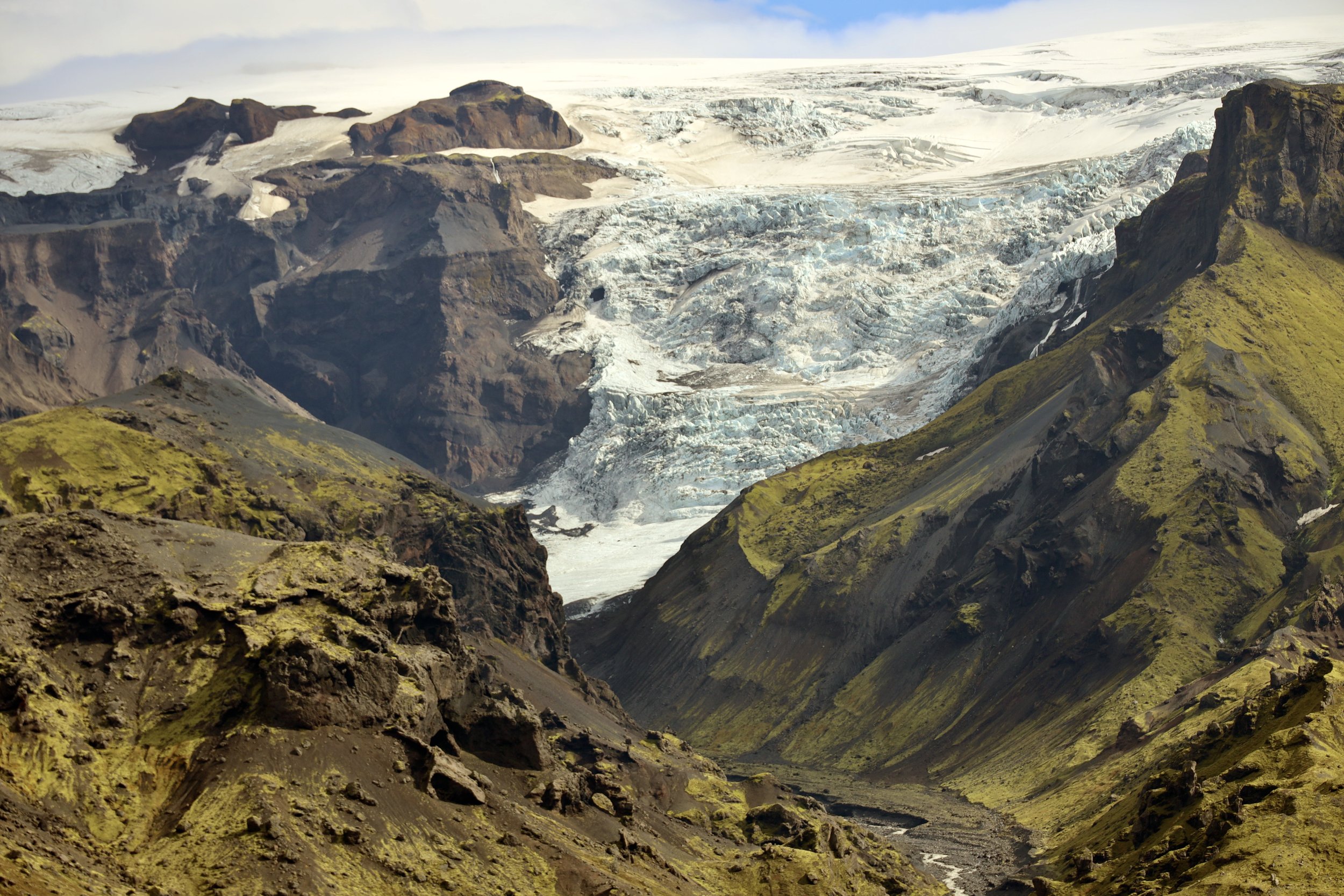
November 6, 2022 Cho Oyu BC 5300m
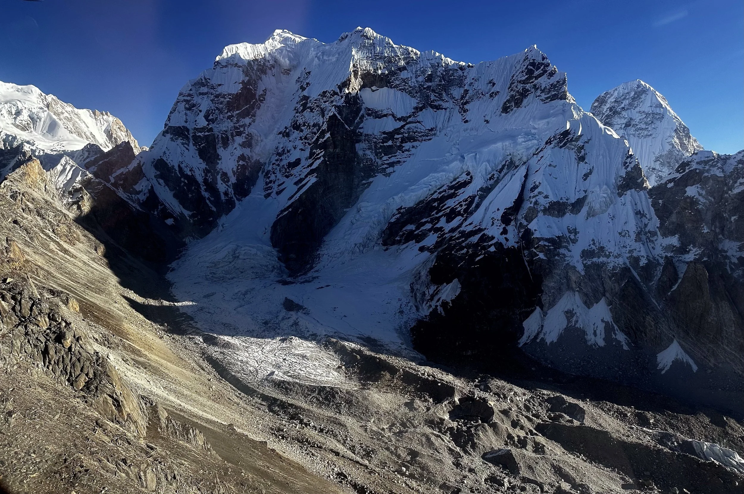
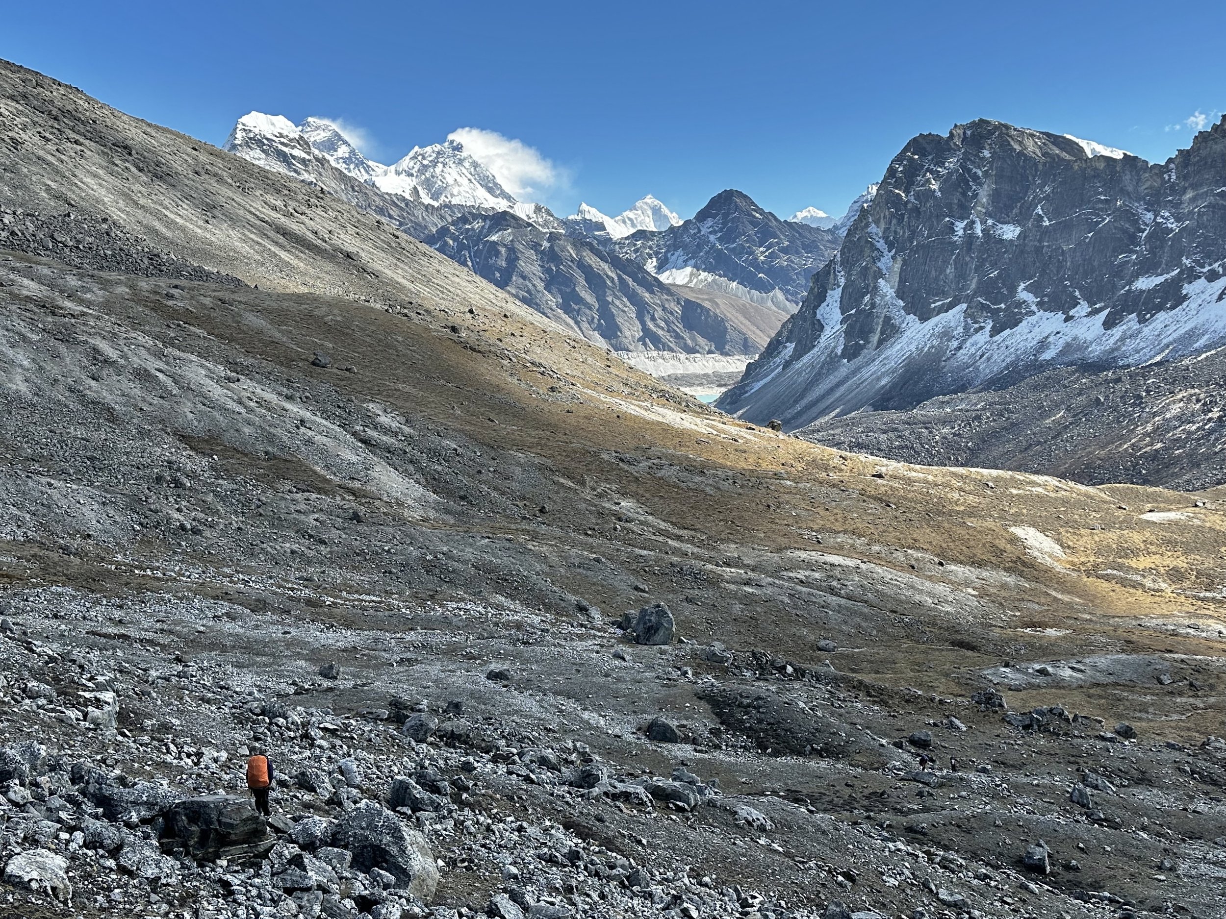
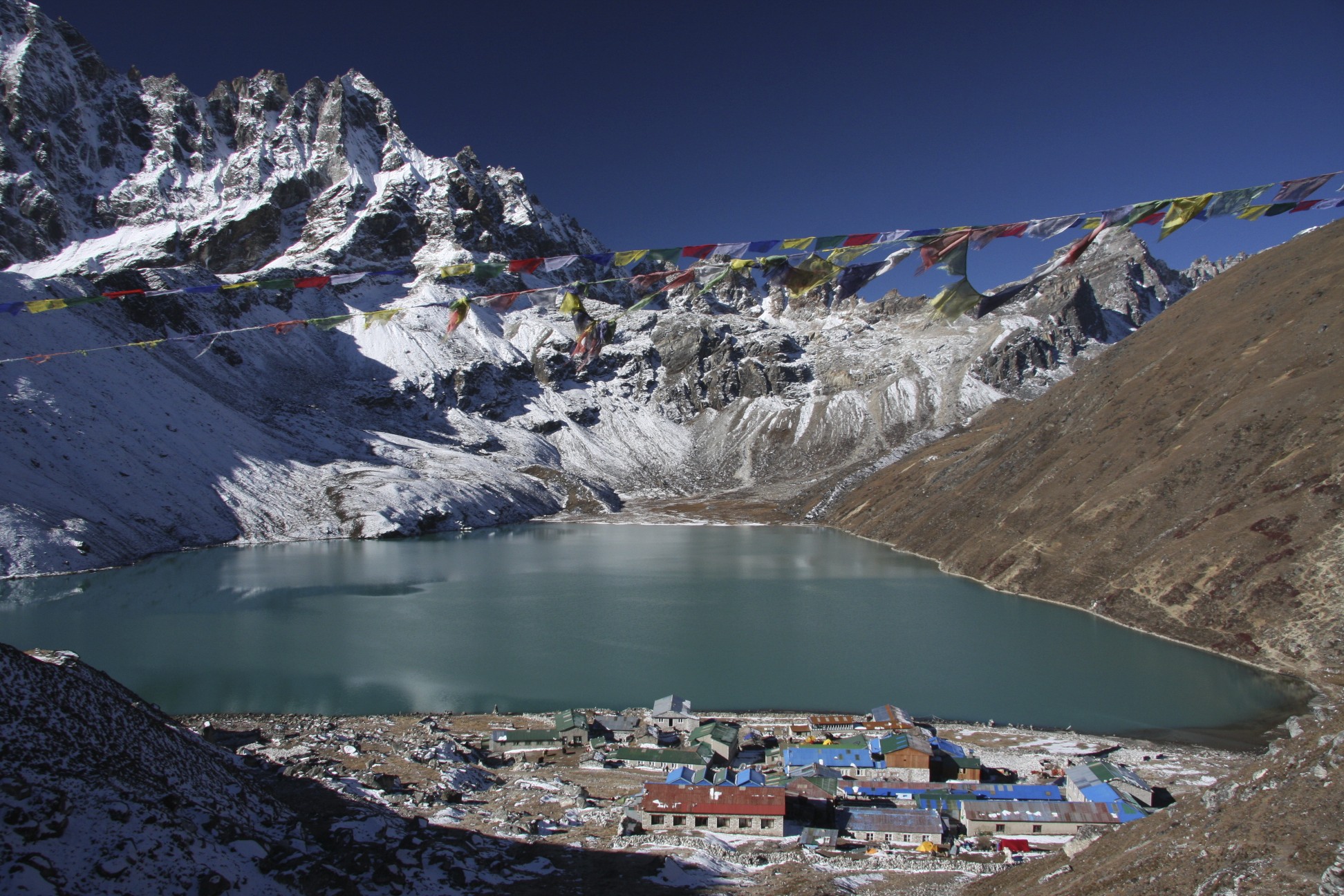
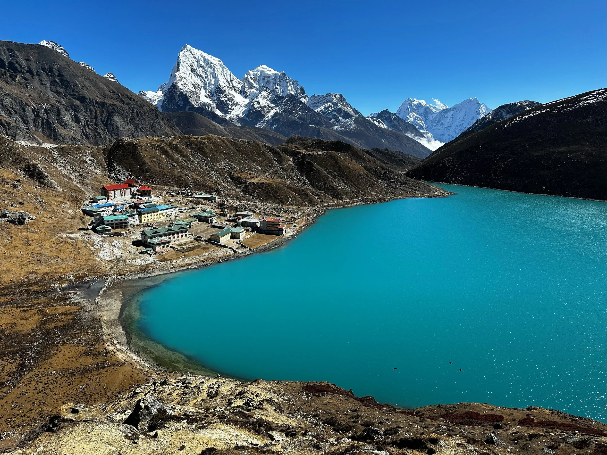
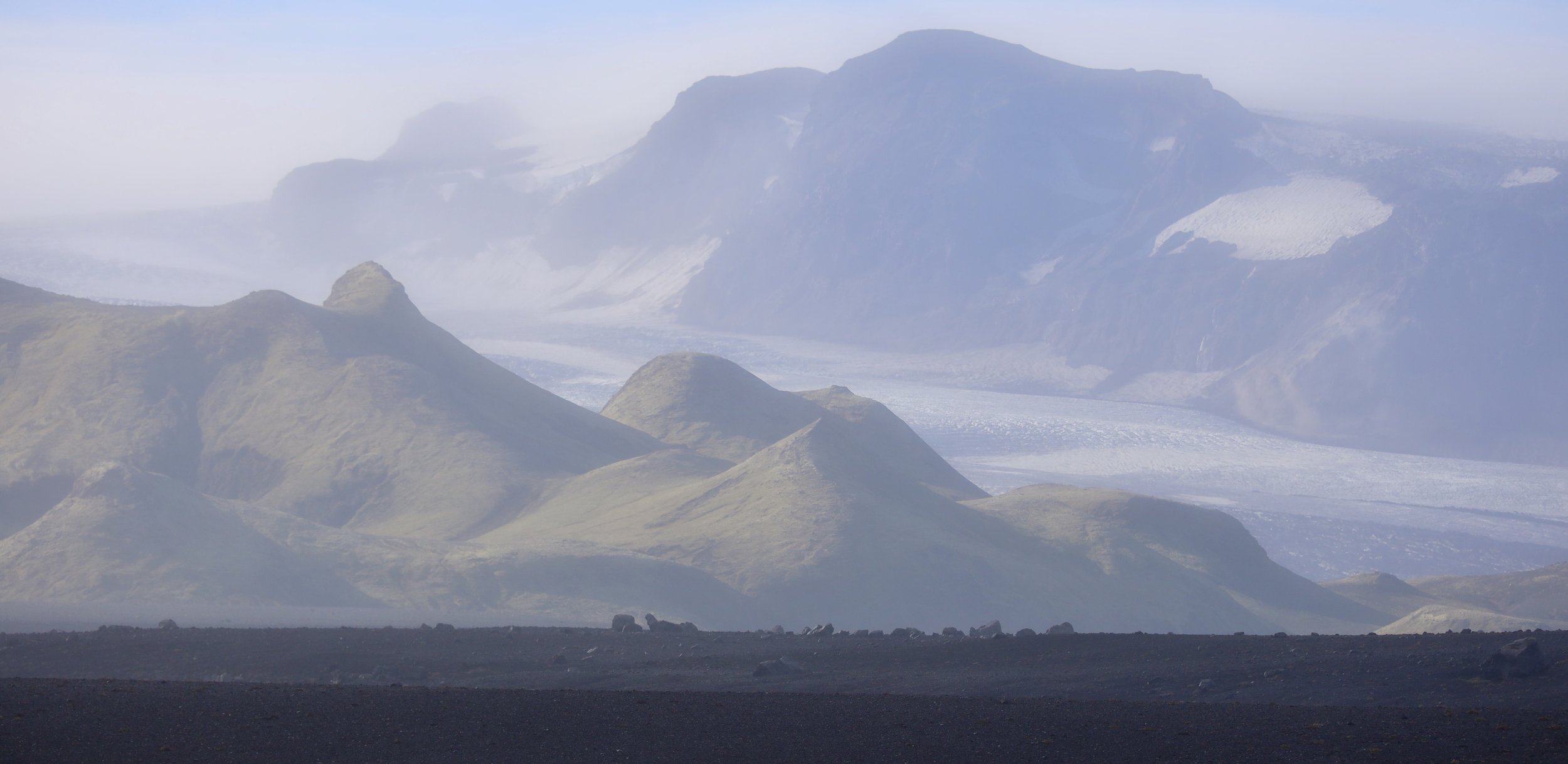
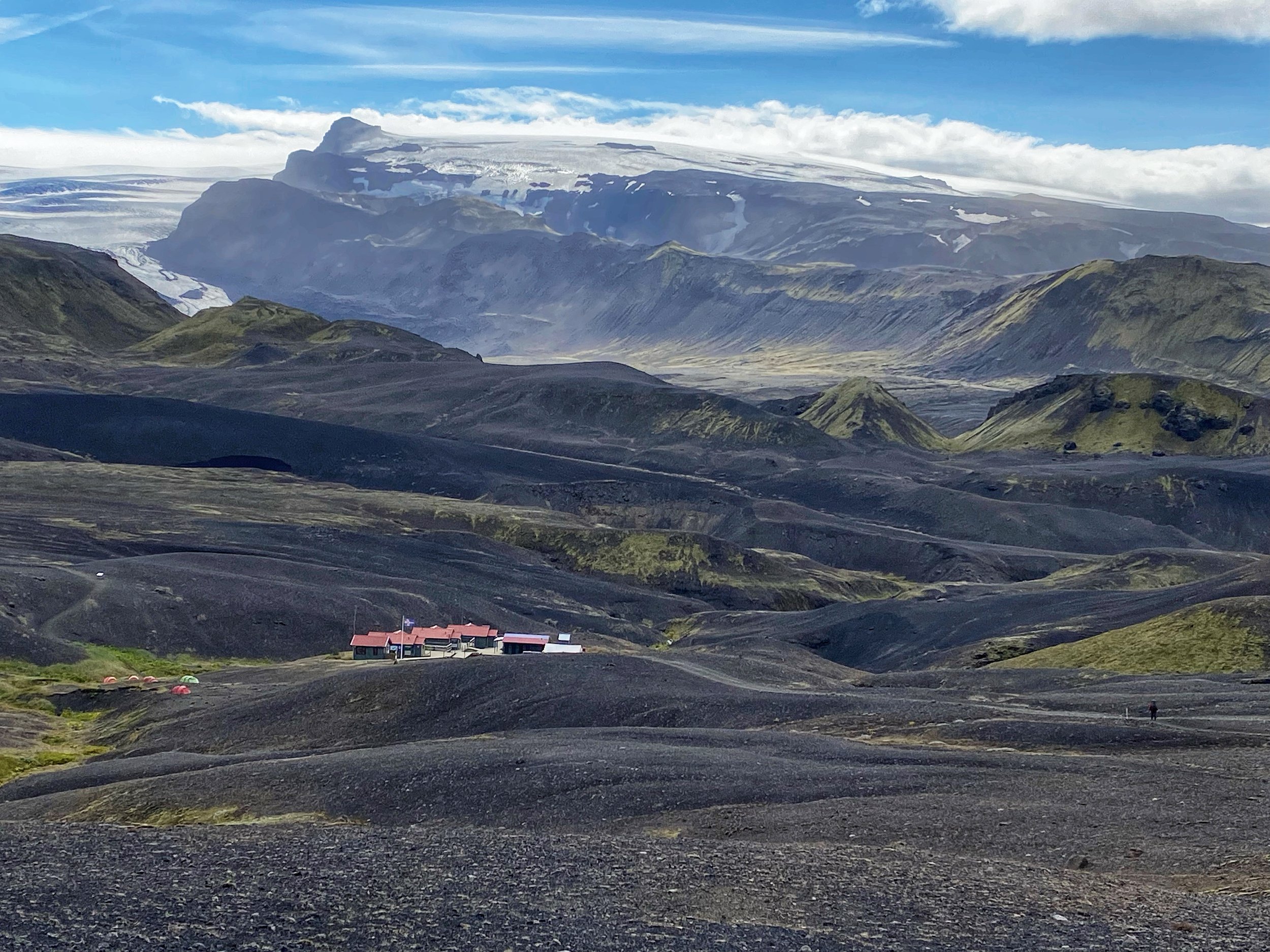
The Cho Oyu BC is my favorite spot in the Gokyo Valley and perhaps in the entire Khumbu. The BC is at the 6th Gokyo Lake and surprisingly most trekkers never make it there. It is a spectacular amphitheater of 7000-8000m peaks. In my opinion, it is more spectacular than the Annapurna Sanctuary. Originally, I wanted to camp there and spend a day or two exploring this fantastic area. Unfortunately, we did not have enough time for that if there was to be any chance of climbing Lobuche Peak.
The distance to the BC from our camp was 10km+ each way and we had to ascend 700m to get there. I did not realize that this was longer and higher than our Sumna Pass day. I was there once with Kumar in 2010 and the area was so impressive that I wanted to go there again. Tek was never there and for whatever reason he seemed very apprehensive and uneasy about going there with me. He was rushing to get there and rushing to get back to Gokyo.
The Cho Oyu BC is at an altitude of 5300m. It is surrounded by some of the highest mountains in the Himalaya in a giant cirque. I was tired and it felt like a grind to get there. We have been hiking non-stop for over a week now. It was worth the effort though as the place is truly spectacular. At this point I felt that I had no energy for Lobuche Peak and should just forget it. I kept flipping back and forward with my plan which, I am sure, annoyed and maybe amused Tek. We had another week left and it included time for getting back to Lukla. I did not want to go too crazy and exhaust myself running around Kumbu. We had to cross Cho La, maybe go to Everest BC and then make our way back to Lukla. I did not feel that my acclimatization was sufficient for 6100m which is the altitude of Lobuche Peak.
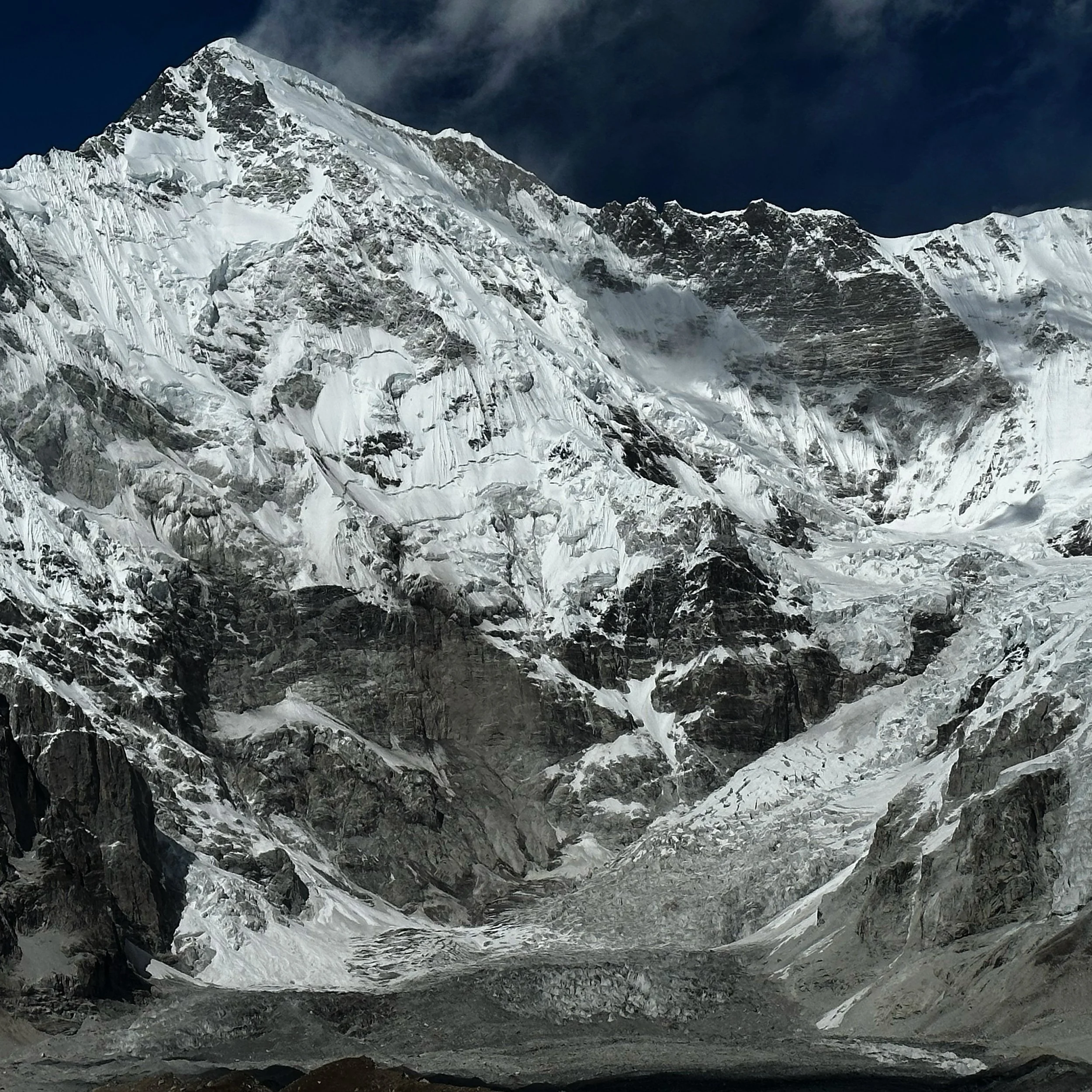
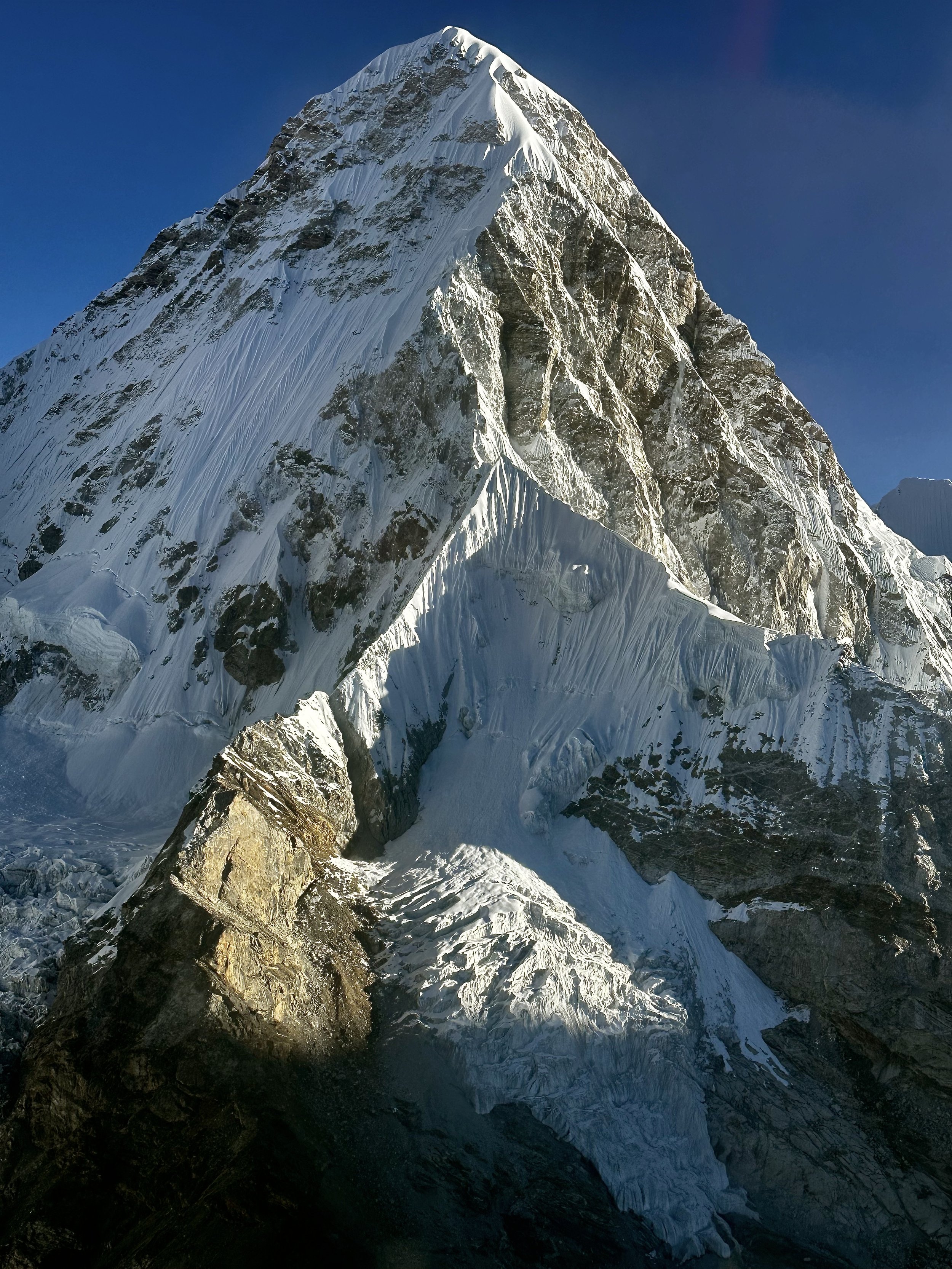
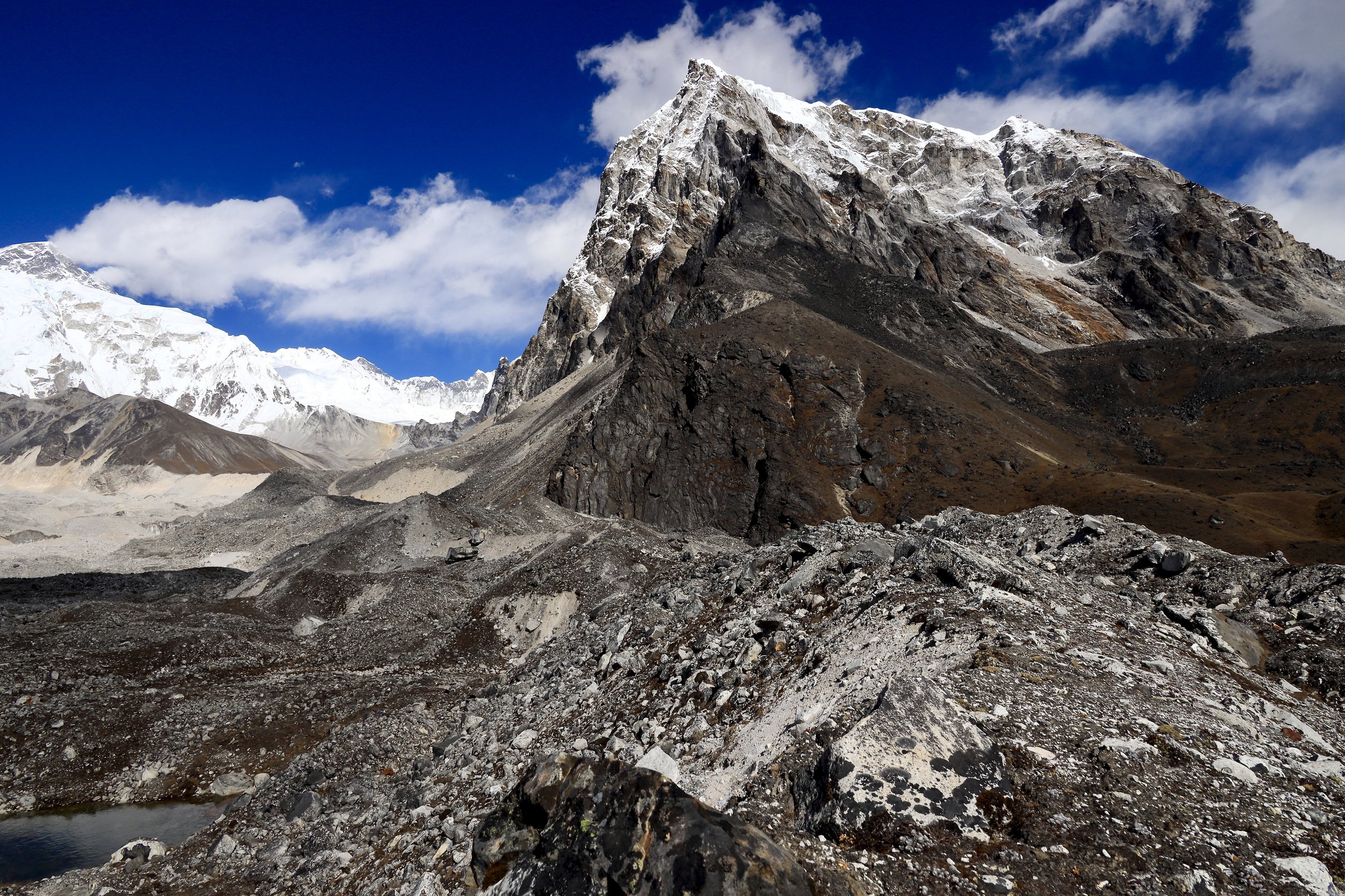
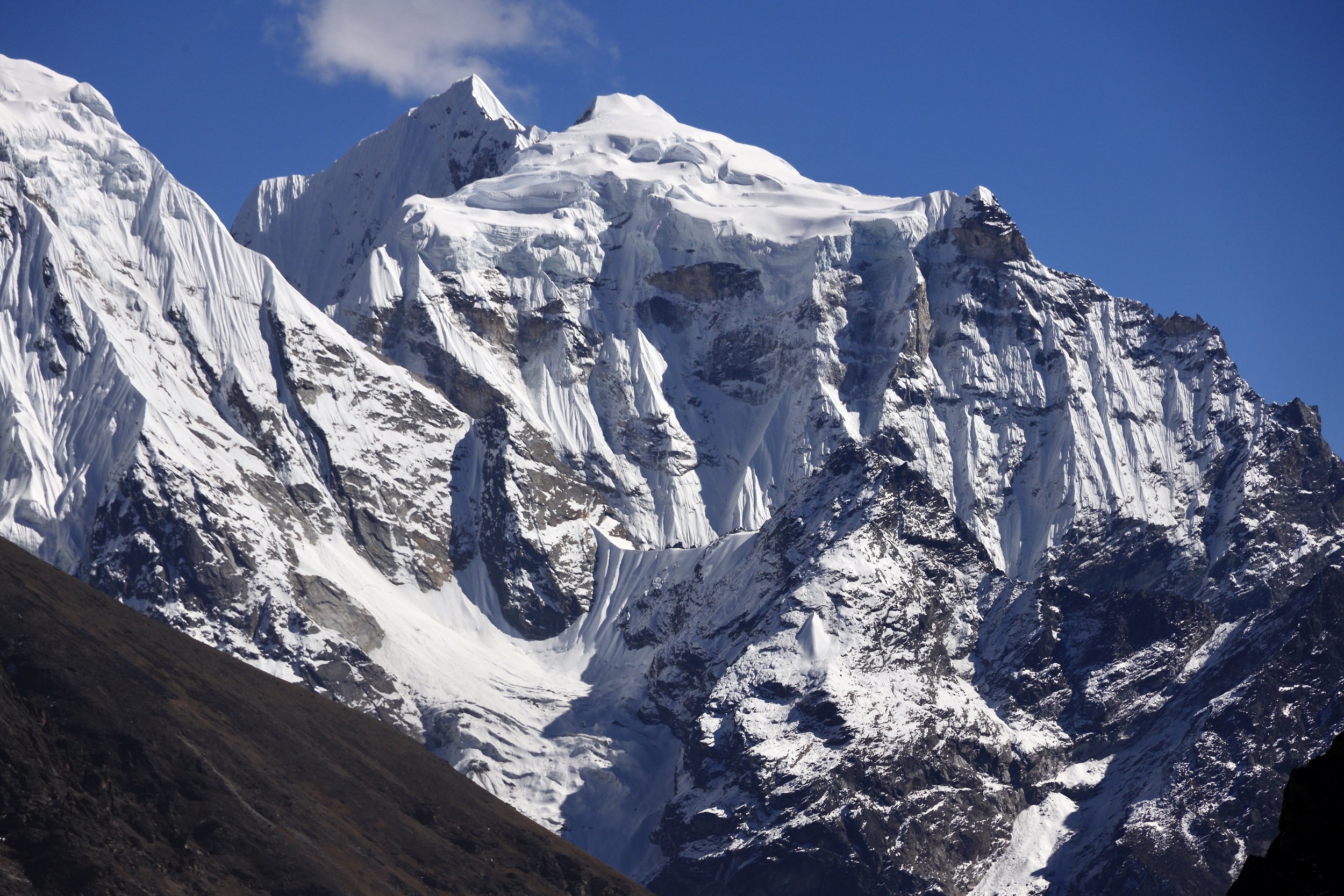
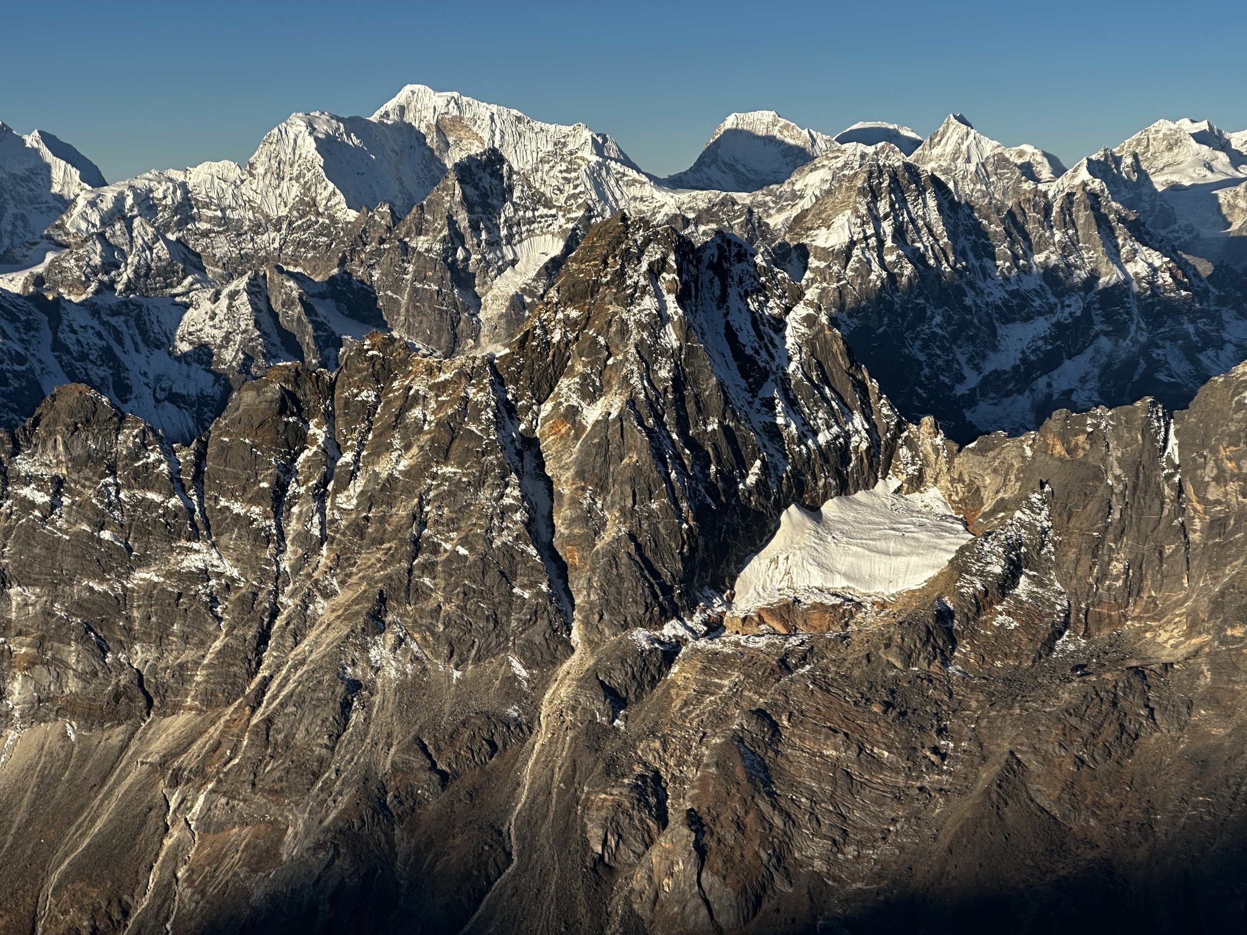
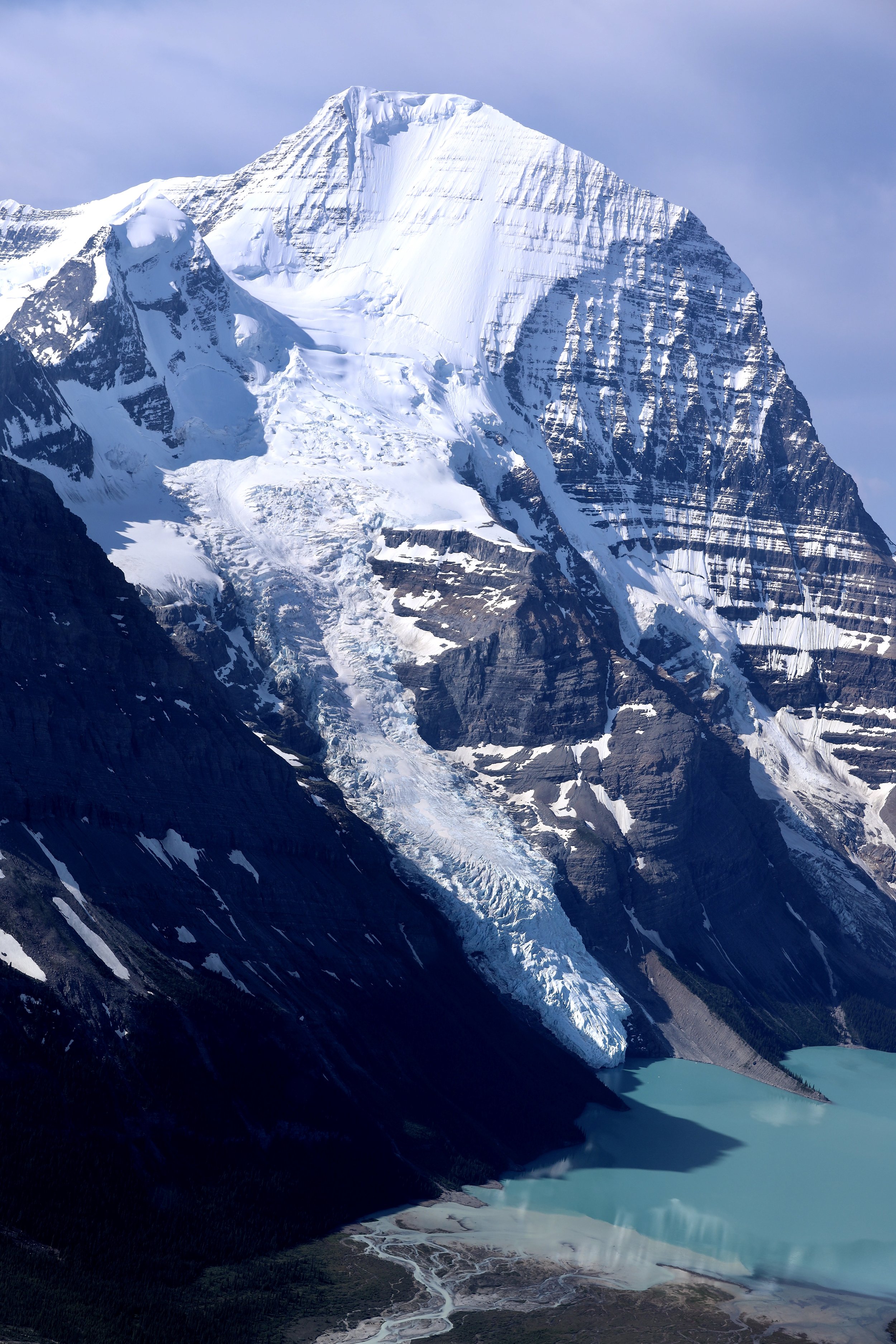
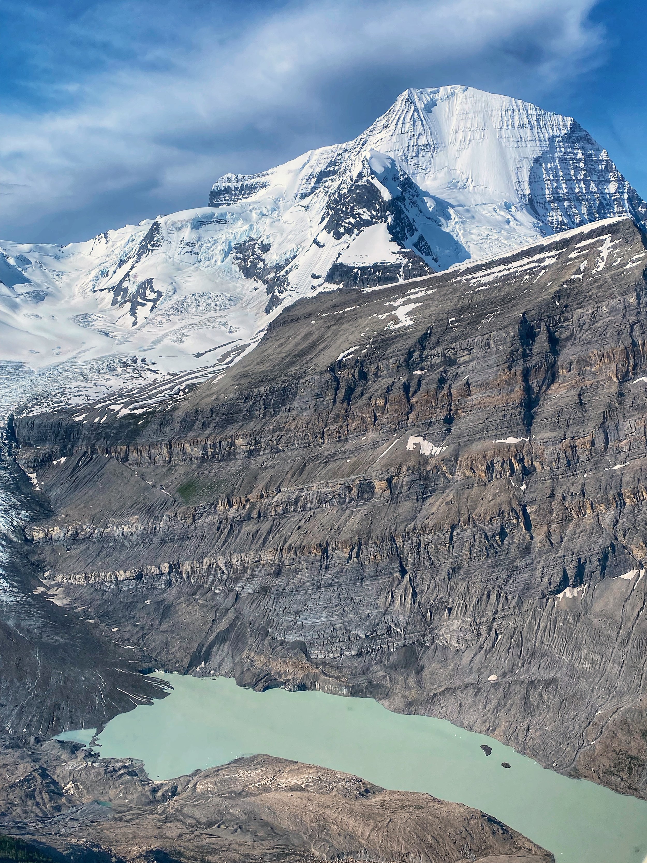
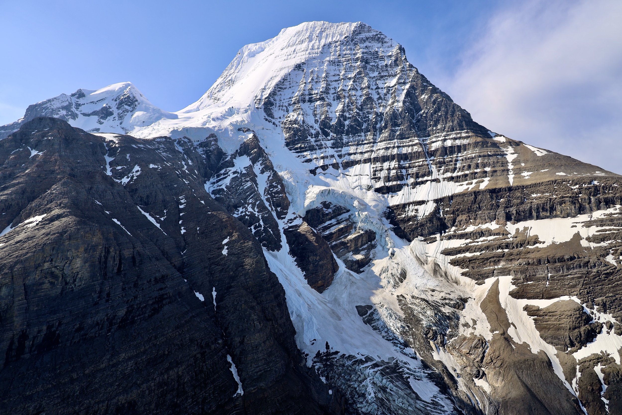
Cho Oyu from the Sixth Gokyo Lake
November 7, 2022 Gokyo Ri and Gokyo rest day (not quite)
I had a shitty night again, waking up in the middle of the night and not being able to get back to sleep. This altitude was not getting along with me or I wanted to get acclimatized faster than my body allowed. I also have developed nasty coughing fits that intensified during the night when I was horizontal. I always forget about the shitty side effect of high altitude: tiredness, poor sleep, no appetite – all those things wear one down and make catching cold easier. I was not the only one as most people I met had coughing problems. Some so bad that they required antibiotics or evacuation.
At Gokyo I met the tea house owner Tensing, he told me about the challenges of running a business in this part of the world and especially during covid. I could relate. I was supposed to have a day off in Gokyo, relax and rest. Instead, I climbed up Gokyo Ri and quite fast to boot (1,5 hrs and 40 min down). I could not resist as the trail was clearly visible from the dining room and just looked easy. I made it to the top in bright sunshine and to my surprise, I run into a dog on the summit. Tensing told me that during covid when there were no tourists, the dogs would eat each other. Savage.
The views from Gokyo Ri were spectacular. I had perfect weather, sunny, no wind, no clouds except the scenic ones far down the valley rolling up in the afternoon heat. I thought that the view from Gokyo Ri was better than Renjo La. Renjo La was visible from the top of Gokyp Ri also has a fantastic view but it is enclosed by rocky outcrops limiting the viewing radius. From Gokyo Ri, one could see Cho Oyu wall, Everest, Lhotse, Makalu and many other peaks of the Khumbu including the star of the show: the handsome Cholatse. I am glad that I did come up there especially given that I had time to do so. I lingered alone on top for a long while, walked further up along the ridge to a true top at almost 5500m. Another good acclimatization hike. The effort was becoming easier and faster. It took me 40min to get back to the lodge. I basically run down the trail as there was no one on it. The views were excellent all the way to the lake.
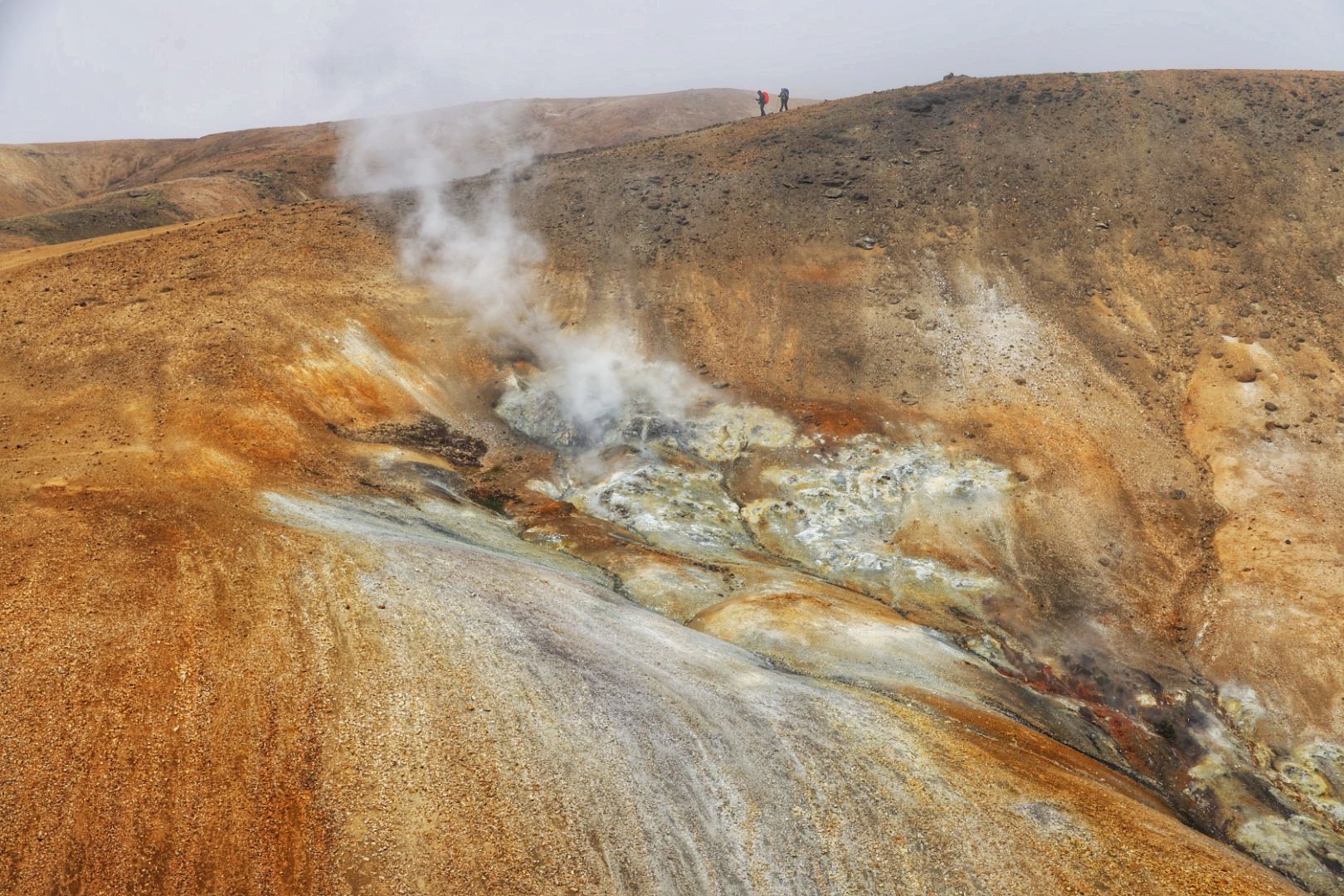
November 8, 2022 Tangnang – Cho La Pass BC 4750m
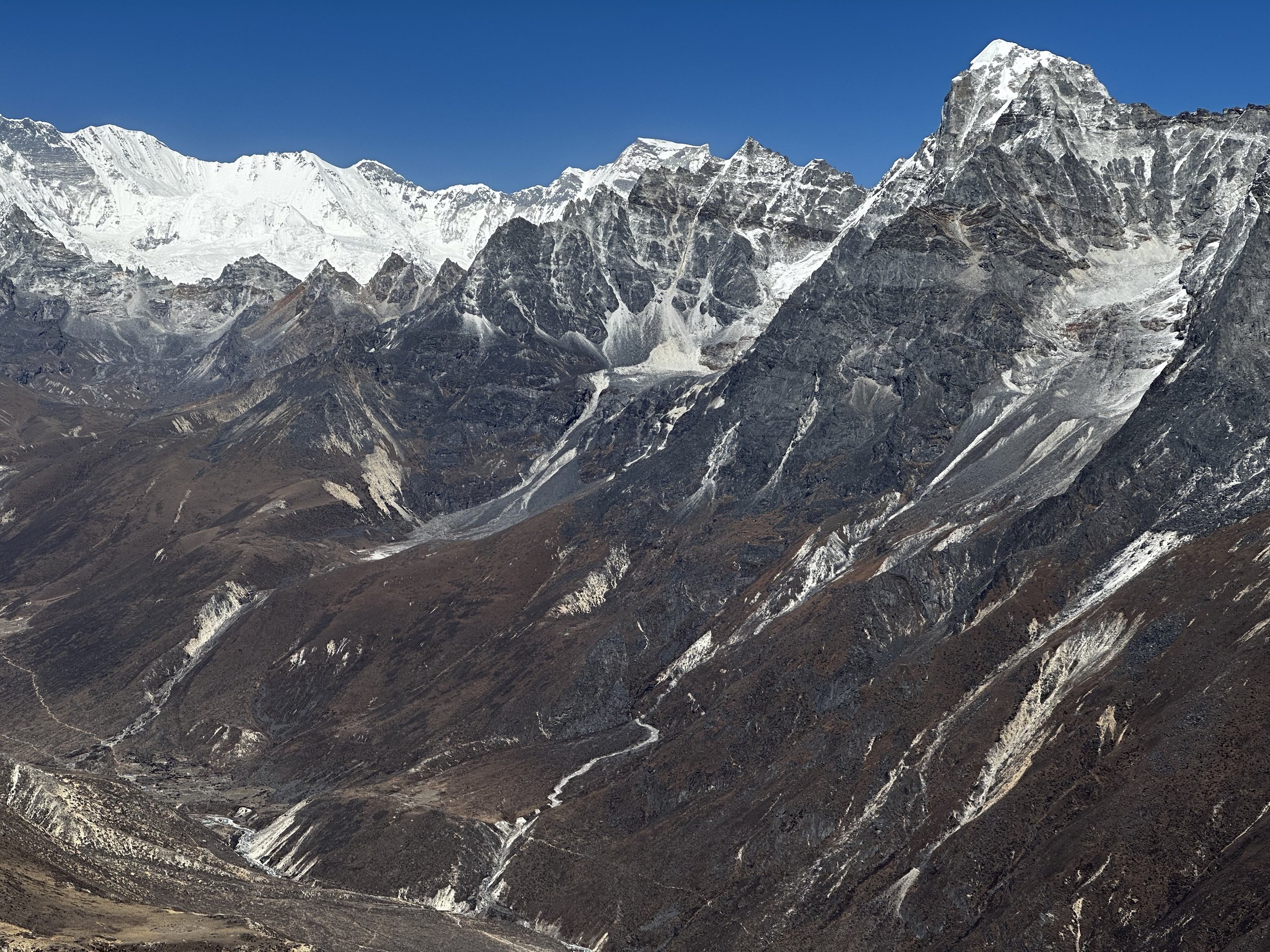
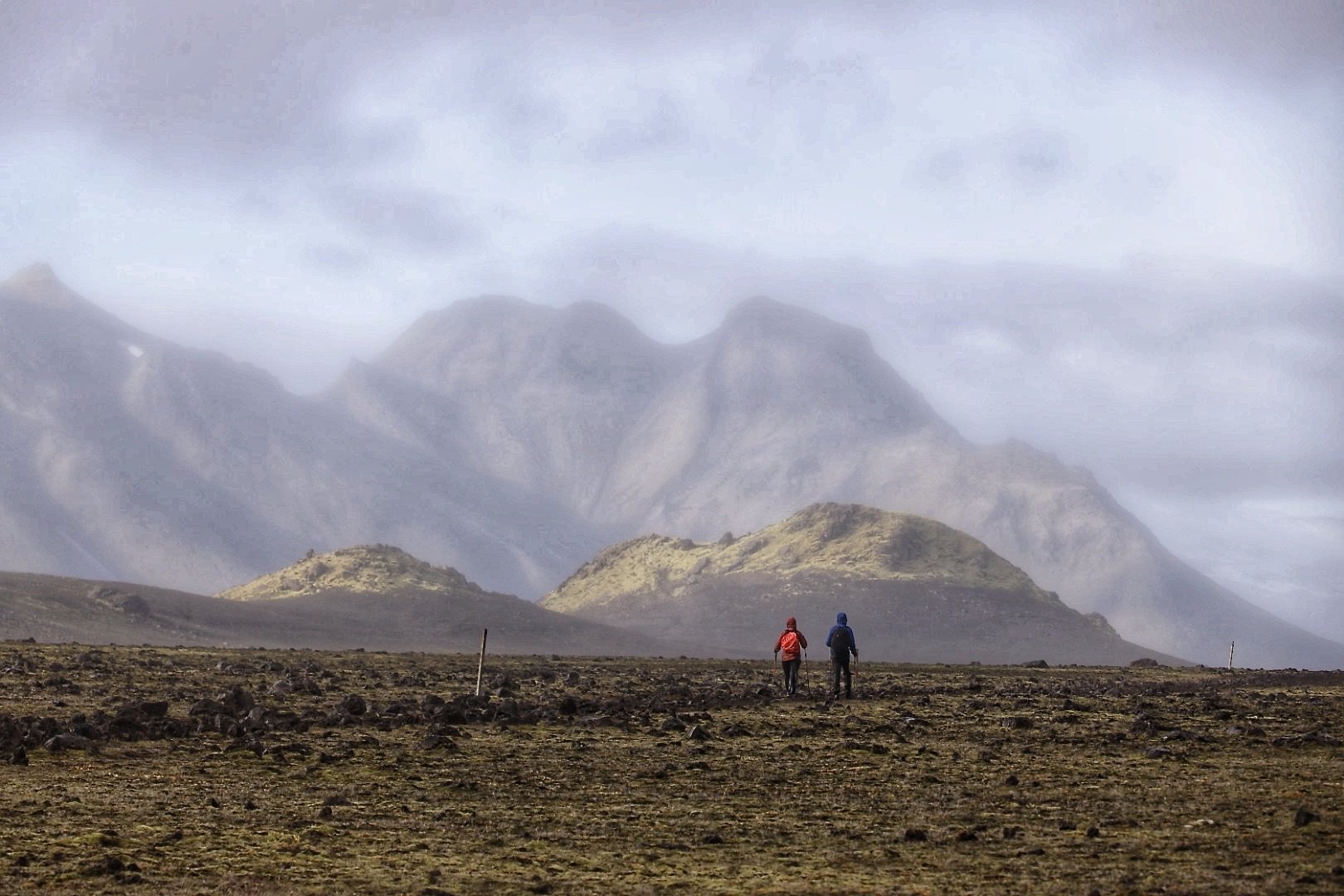
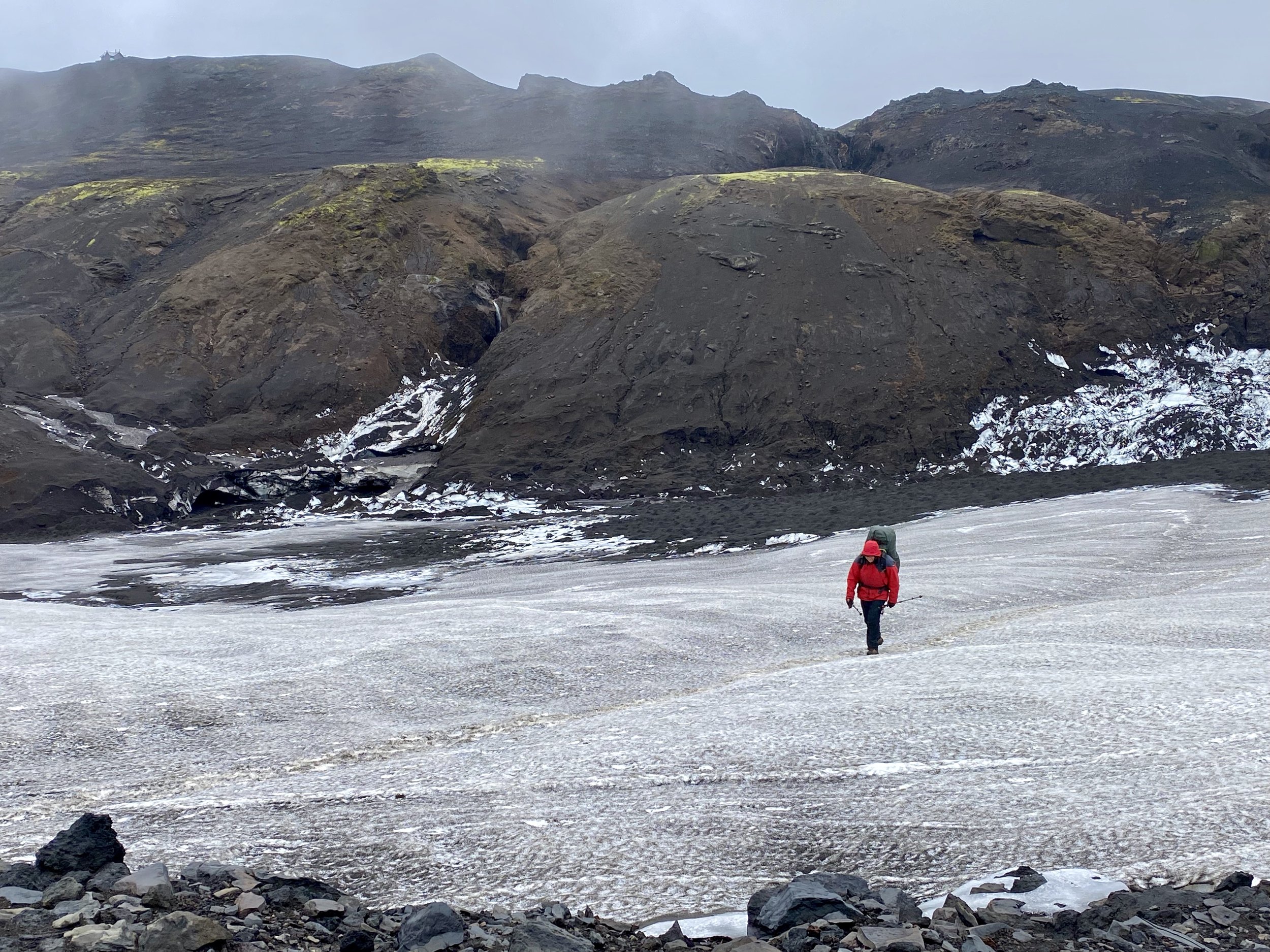
We left Gokyo and immediately climbed a small hill of the side moraine and descended onto the Ngzumba Glacier. The path was straight forward and the crossing was about 2 km long. The trail is well used but changes occasionally with the movements of the glacier. The glacier had numerous melt lakes on it indicating that it was melting fast. After my Gokyo Ri excursion, I had a poor night sleep again so my enjoyment of the glacier crossing was minimal. I am sure that after a good night sleep I would enjoy my surroundings much more. We took less than 2 hours to cross the glacier and arrived in an empty teahouse in Tangnang. I had the rest of the day to relax and get some needed rest. This was quite fine as we really did not have a true day off yet.
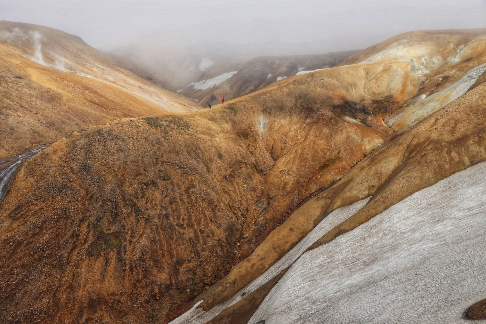
November 9 Cho La Pass – Dzongla
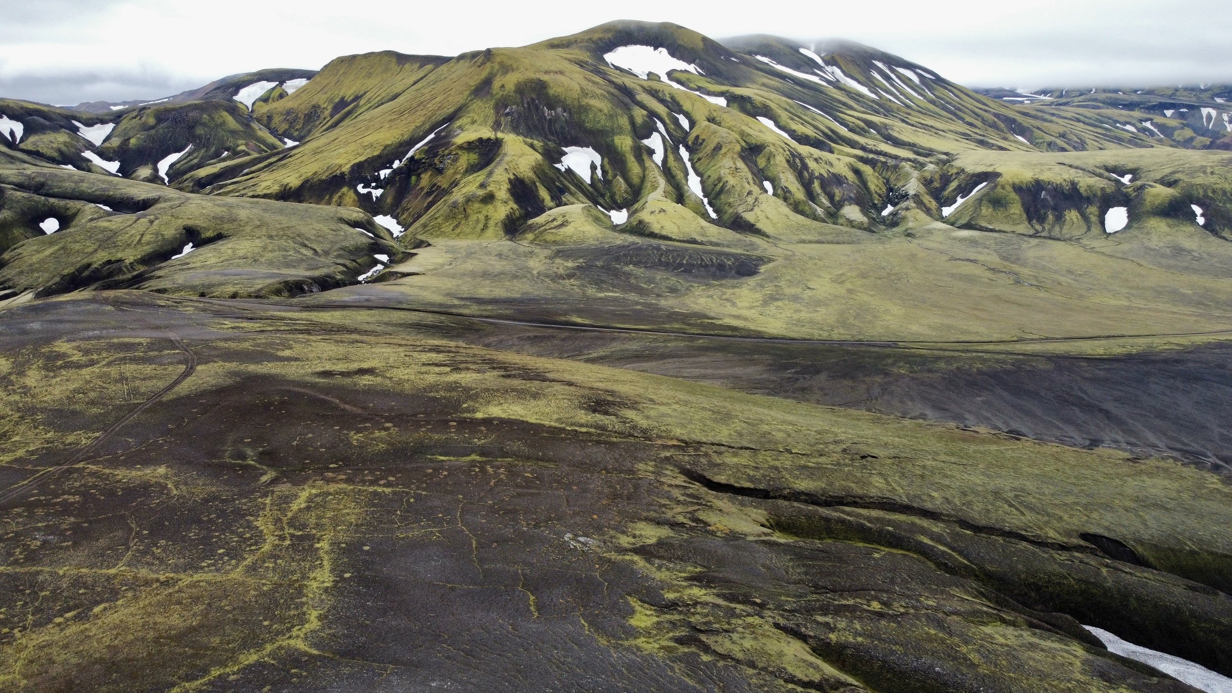
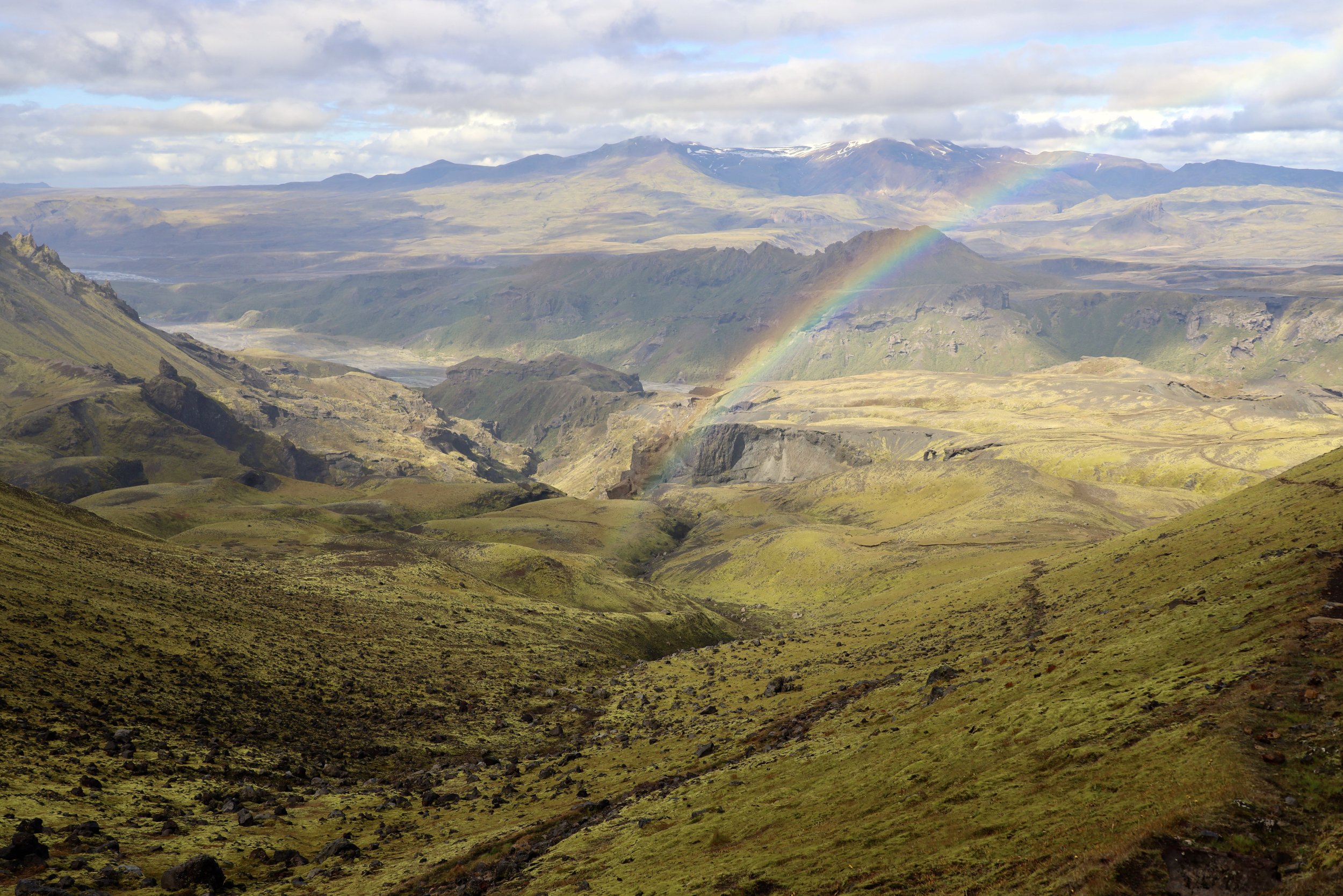
We got up early and started walking around 7.30am through a cold narrow shaded canyon. The canyon went on for quite a while. As we walked up we passed many people who were staying in other teahouses in Tangnang. We then climbed onto what appeared to be an old moraine from where we looked back at the Ngzumba Glacier and the peaks next to the Renjo La Pass. We run into many people at this point resting and taking in the views. We passed them all and arrived at the headwall of the Cho La Pass well ahead of the crowd. The headwall, although steep in places was just a walk – big slabs with a path carved into them and protected by a handrail. After a short and easy ascent we arrived on the pass. The pass was crowded with people coming from the other side. It was here that I concluded that Everest BC and Kala Patar is not for me due to the crowds. We lingered on the pass for quite a while and enjoyed sunny windless weather. We had tea, took photos and waited for everyone to leave. We then walked down the glacier and to the village of Dzongla. The views of Cholatse from the trail were stunning – what a beautiful mountain. It was so nice and warm that we took an hour nap in the sun on the grass patch half way down.
I did not realize that Lobuche was so close to Cho La and Cholatse. I had a good look at Lobuche East, which turned out to be our next objective although I did not make my final decision until after lunch in Dzongla. In Dzongla, I met a nice German fellow and talking with him passed the time nicely. I told Tek about Lobuche climb and he made all the inquires and arrangements for the next day’s adventure.
November 10 Dzongla - Lobuche East high Camp
After seeing the crowds on Cho La pass and feeling quite strong after the crossing I decided to go for the Lobuche Peak instead of going to Everest BC and Kala Patar. I had a good night sleep and some rest and felt very strong and well acclimatized. The weather was perfect. I thought that since I had the permit, why not give it a try. If I could’t do it, I would turn around but at least I would try.
I told Tek in Dzongla that I wanted to do it. He made the arrangements, and we went directly to the high camp. Our original plan was to go to Lobuche village first and sort things there, but this turned out to be unnecessary. The trail from Dzongla was quite spectacular skirting the Cho Lake and the steep faces of Cholatse and Taboche. We then veered off north and ascended 500m to the Lobuche East high camp. The high camp is a semi-permanent camp with the manager, cooks and various guides for hire. It is a well oiled machine processing trekkers in a fast and efficient manner.
Tek negotiated with the camp boss and we hired a guide for the climb along with the tent and meals for $400 all in. Perhaps a steep price but I felt that I was already there and it was a last minute decision anyway. I have not really talked to the guide assigned to me after our arrival except a brief inspection of my gear. The camp boss also lent me a jumar for $10. I have never used a jumar before on fixed ropes. I think that climbing on fixed ropes is not real climbing, it is like following a handrail without the possibility of falling. It takes the entire mental stress out of climbing and one can relax and enjoy the process. I think that the rope fixers are the real climbers and the ones hanging onto the fixed ropes are just trekkers at altitude.
I hang out at the high camp, had some good meals and enjoyed the beautiful views of the cloud covered valley. I asked an American guide who was also there about the conditions, and he told me that they were excellent, the snow was fantastic and due to the traffic the trail was well worn. He also told me about couple of steep sections requiring repelling but nothing serious. His comments put my mind at ease, and I was actually looking forward to the experience without stressing over it. 5 pm dinner and off to bed.
November 11 Lobuche East – Periche
I got up at 1 am after a quite good night sleep. I went to bed at 5 pm after a dinner and fell asleep pretty fast knowing that I would be getting up so early. The tent I was assigned had a luxurious bed and the sleep was very comfortable.
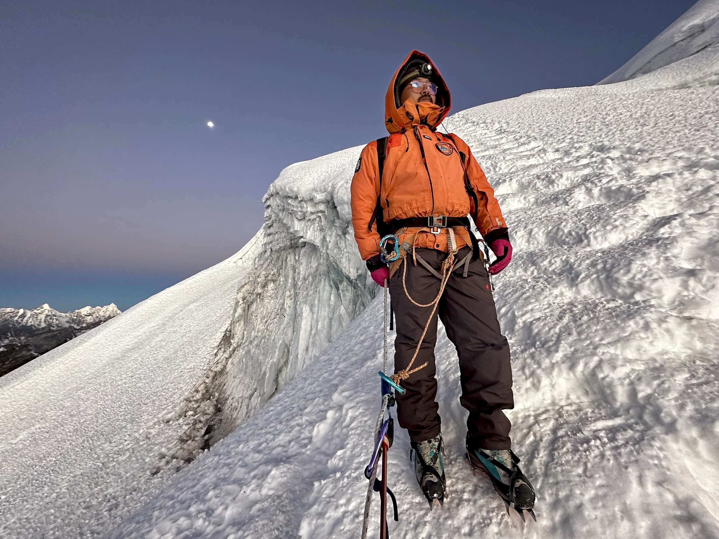
We left the dining tent last at 2am after many other people already started the climb. We quickly passed them all and ended up ahead of the pack. Thankfully we had full moon that illuminated the surroundings like a big lamp allowing us to see everything. It was cold, minus 20C or lower and I was glad for my heavy winter jacket, two pairs of long jones and good gloves. I learned on Ancohuma and Orizaba that altitude and cold do not go well together.
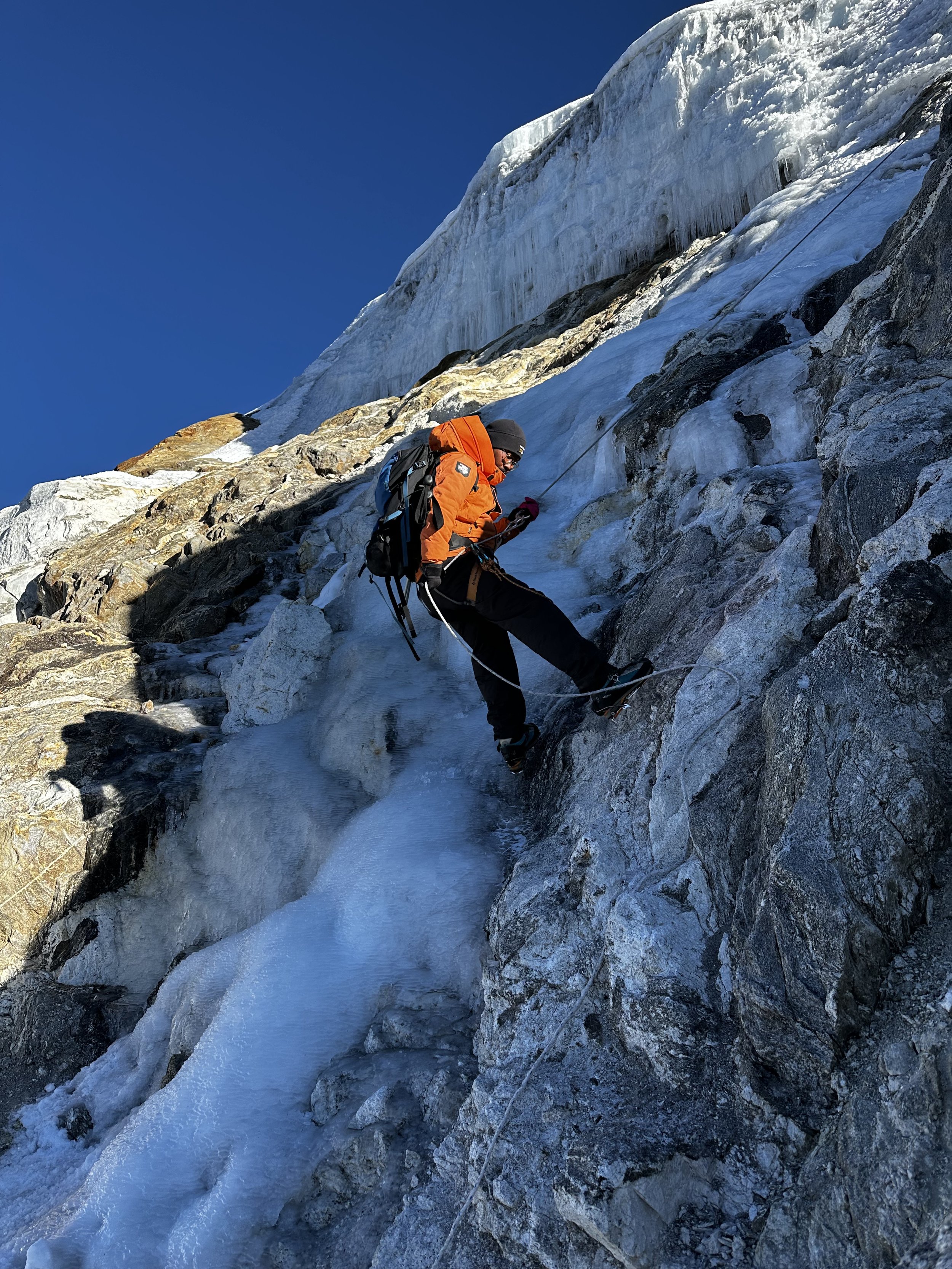
We continued our ascent and the terrain was in parts so steep that we needed to use fixed ropes that were already in place. At first, we climbed on long rocky slabs and ledges which are easy when dry. We made good progress to the first snow where we needed to put on crampons. Since it was dark and cold we were moving quite fast. Despite my heavy boots, the bottoms of my feet were getting cold. I was looking for the first sign of the sun but it was still black on the eastern horizon. Every time I stopped, I was getting cold and had to keep moving up just to stay warm.
Finally, a thin orange glow appeared on the eastern horizon but now we were around 30 minutes from the top. With the glow, the surroundings started to take on color. At first a dull silver and as the sun came closer to the horizon, soft yellow and then orange. After some steep snow and ice sections (I remember looking down and realizing how steep it was and how self arrest would be difficult) we arrived at the final small vertical icy wall delivering us onto the summit ridge. We passed some wild ice formations, ice ledges and crevasses. The upper section of the mountain is a large glacier. Once on the trekker’s summit, my guide did not want to linger and he seemed to be in a rush to get down. It was barely 6.30 am and there was no one behind us for a long, long way. On the way up, we were passed by two other people but this was very near the summit and they seemed to be in the same rush to get down. My guide claimed that he wanted to avoid congestion on the fixed ropes. I felt that I did not even had time to enjoy the summit. In retrospect Iw ould have gone further along the ridge but that would require getting off the fixed ropes and doing some real climbing. I don’t think that my guide was up for it. Furthermore he had no time as his next gig was waiting. I did understand not wanting to wait for people to ascend fixed ropes though.
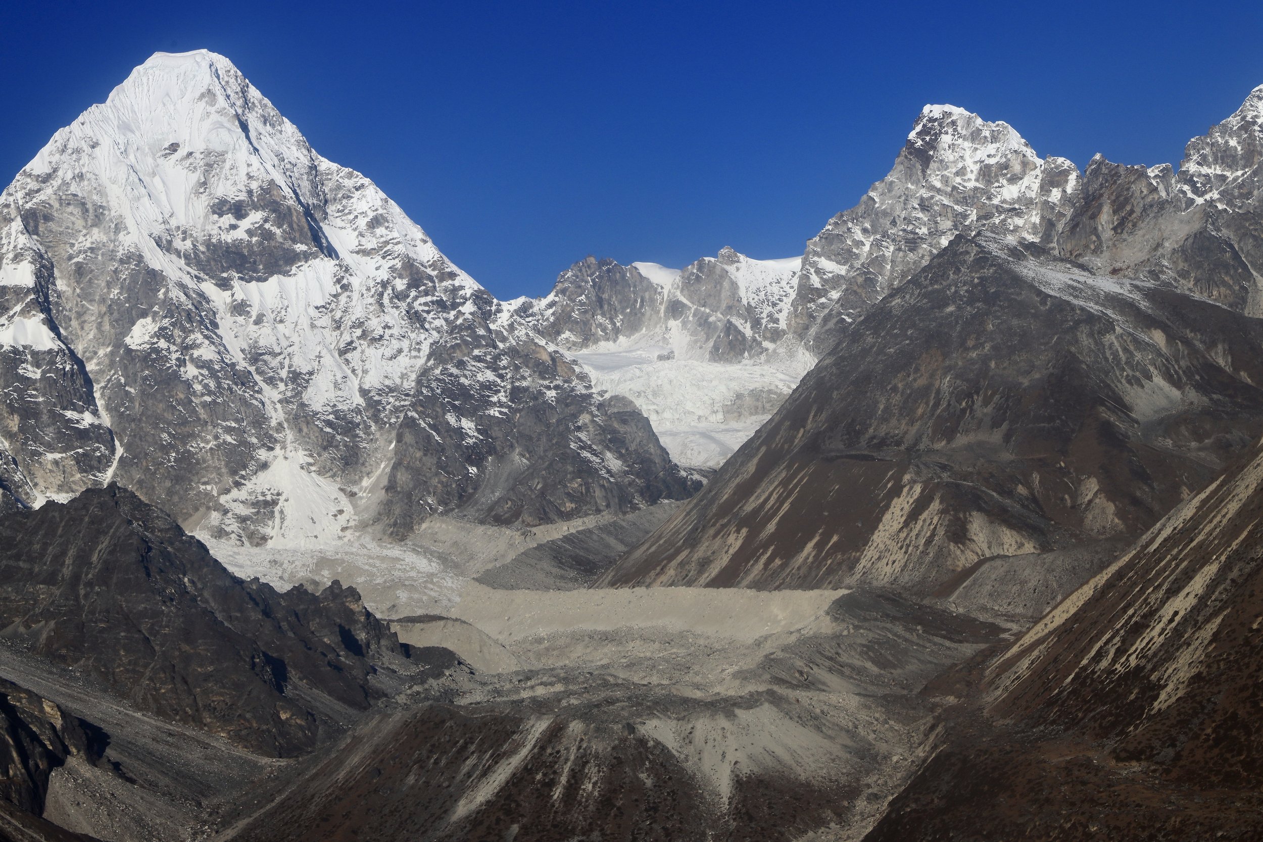
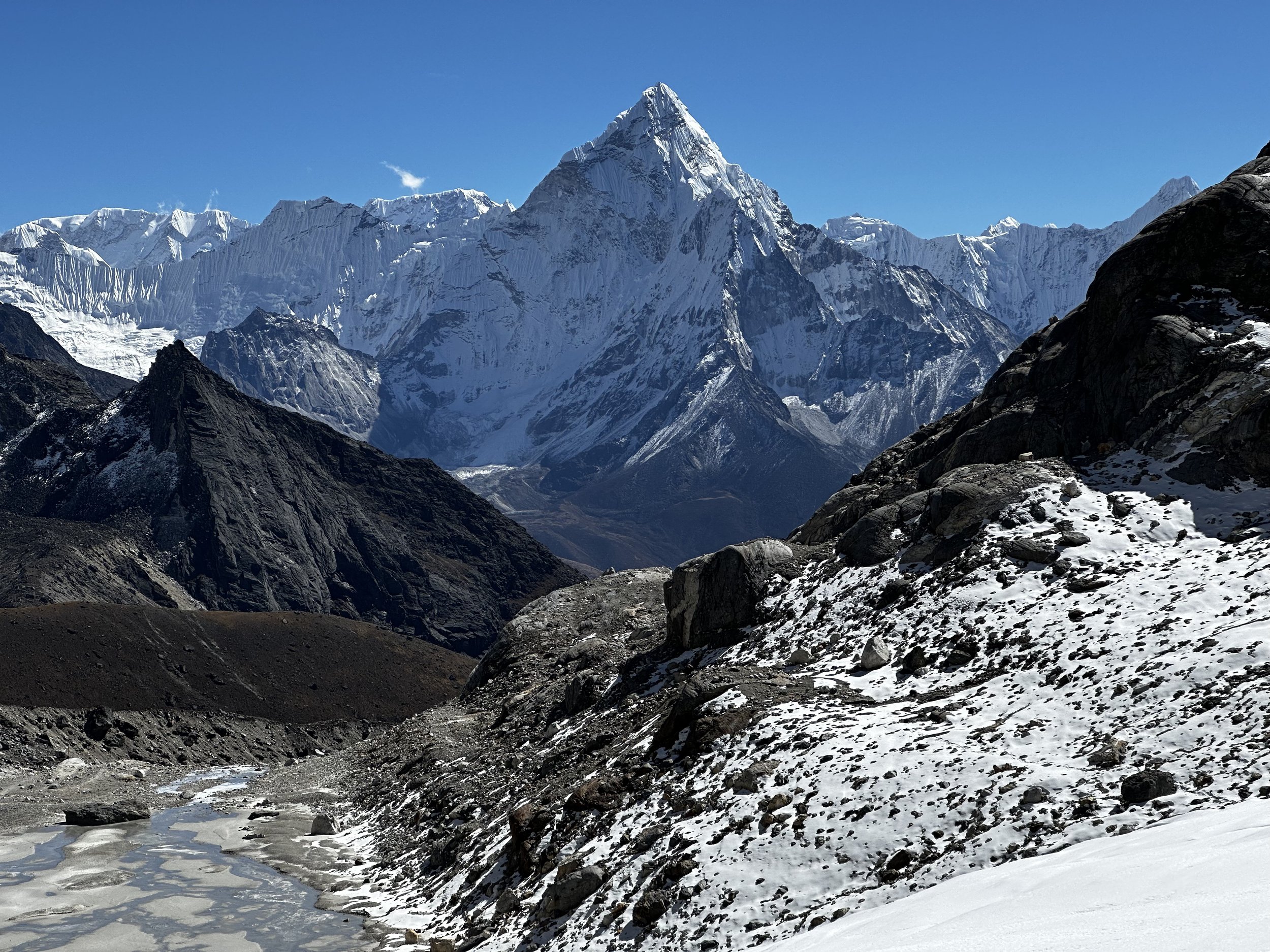
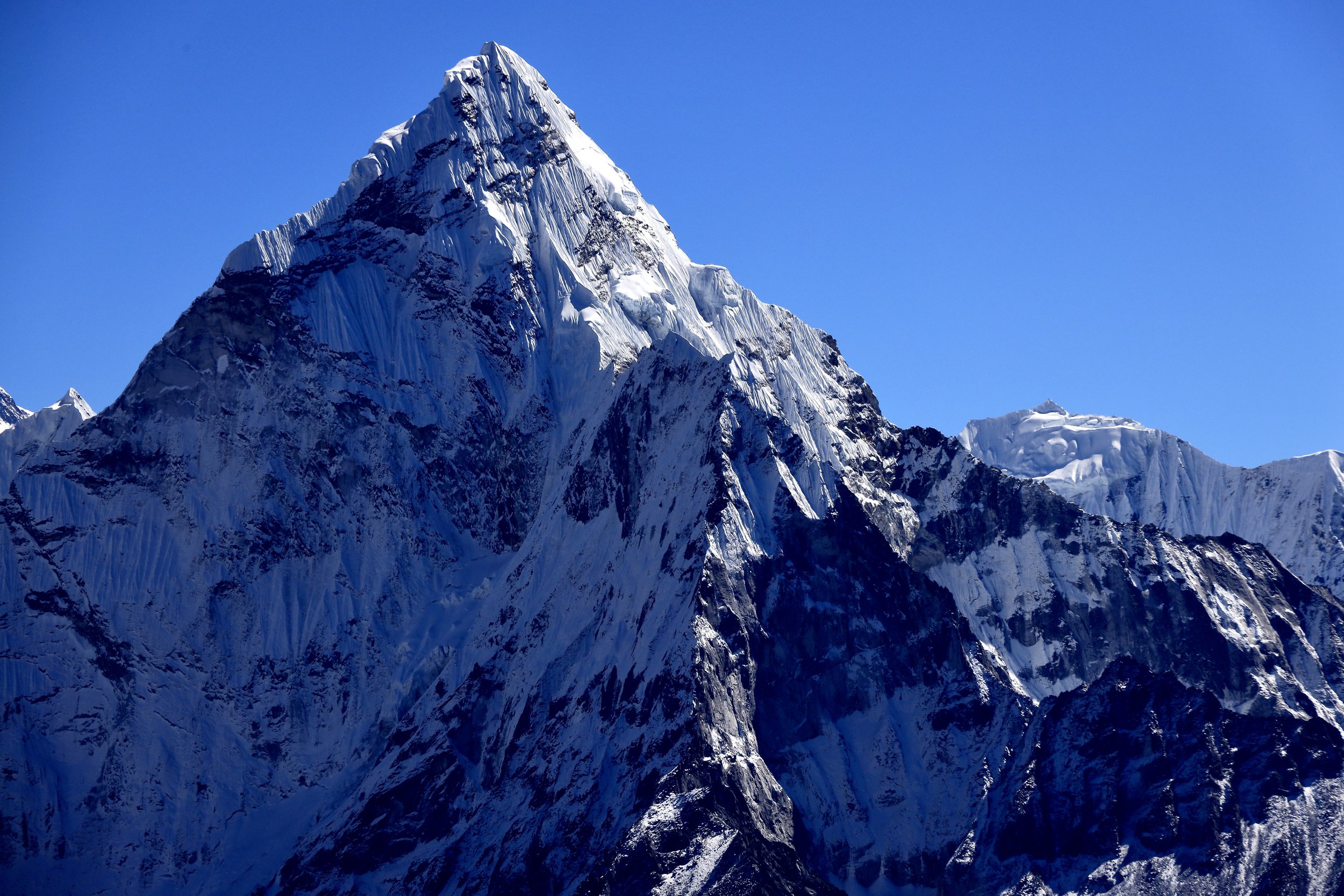
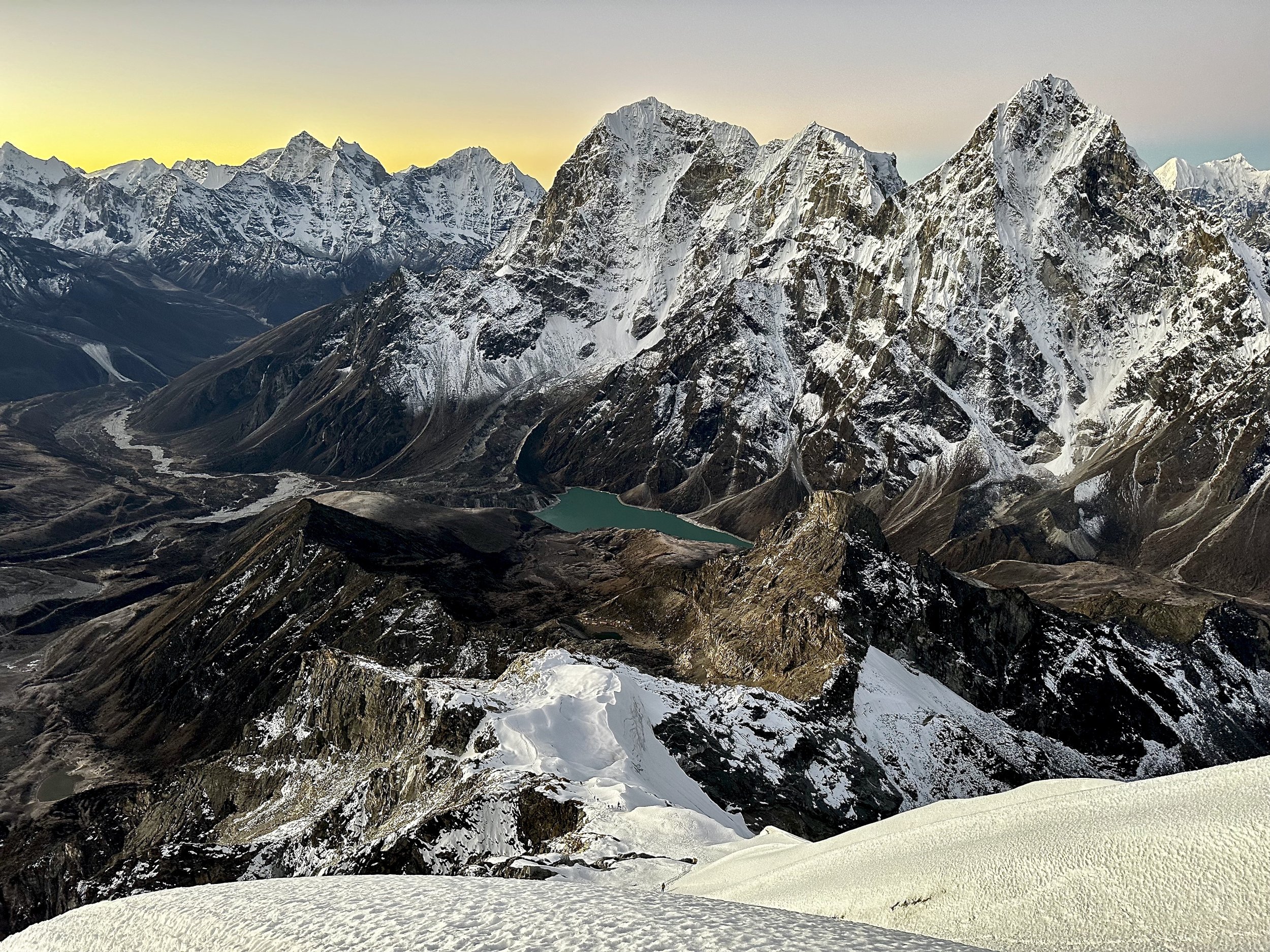
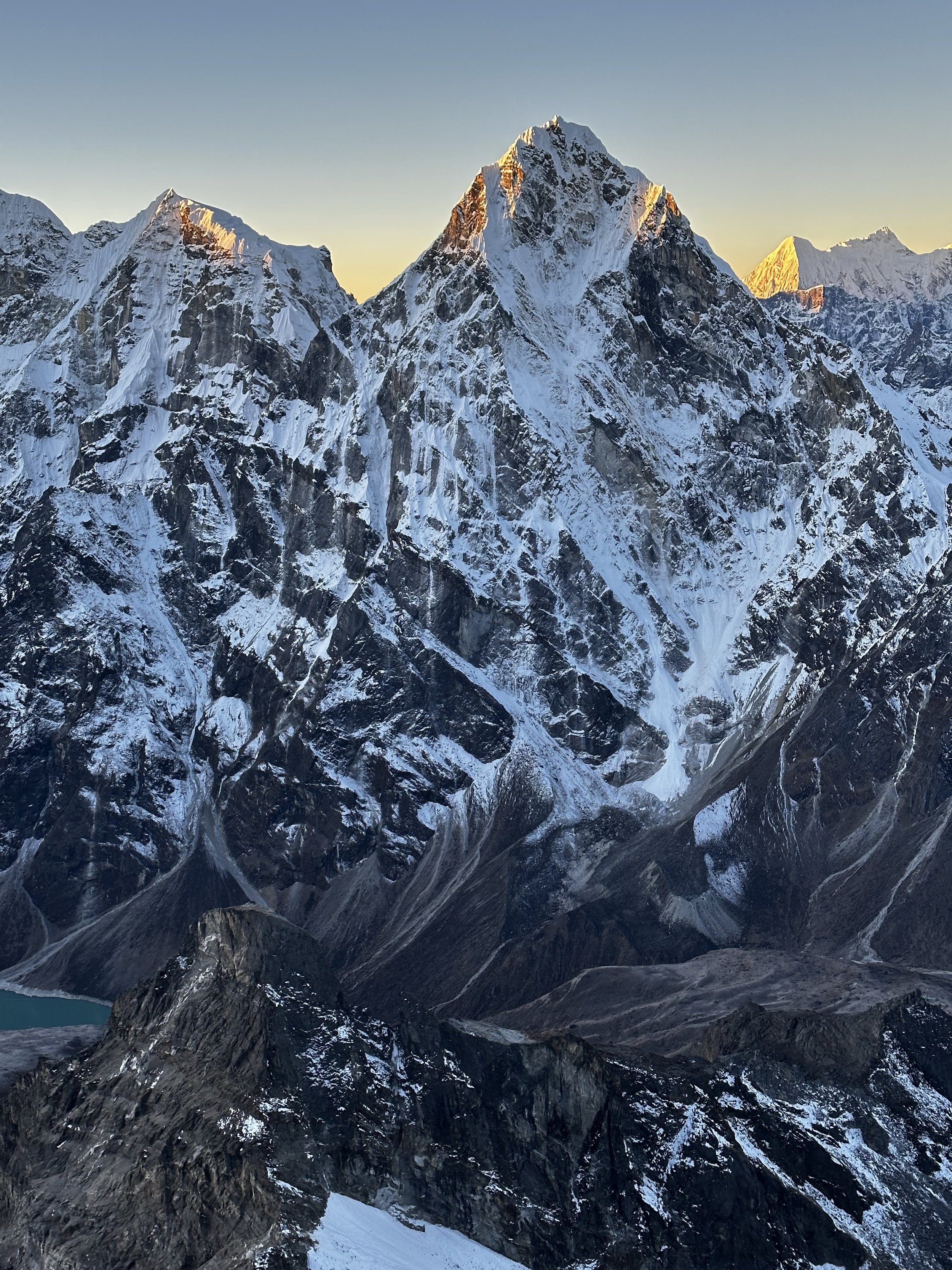
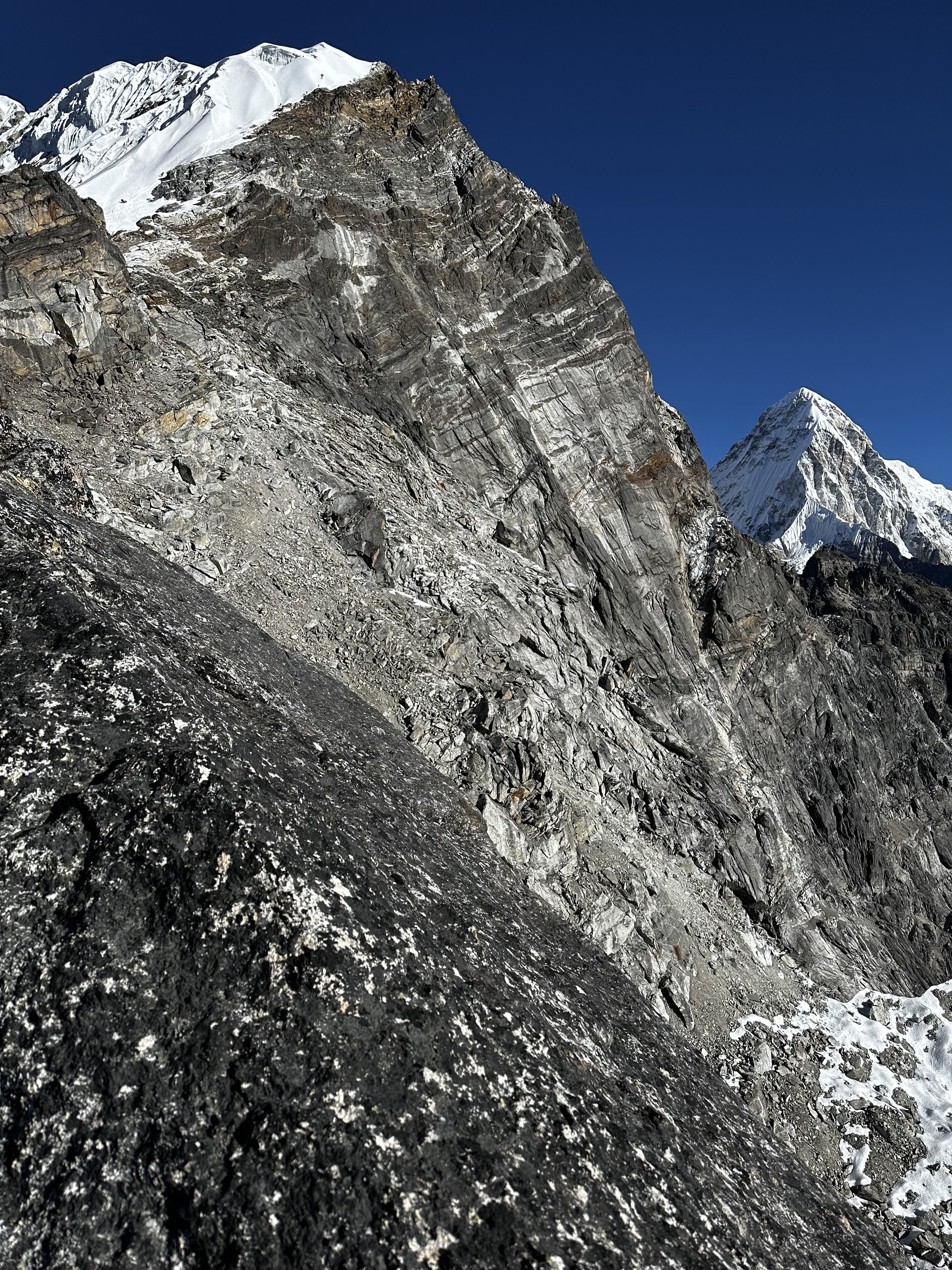
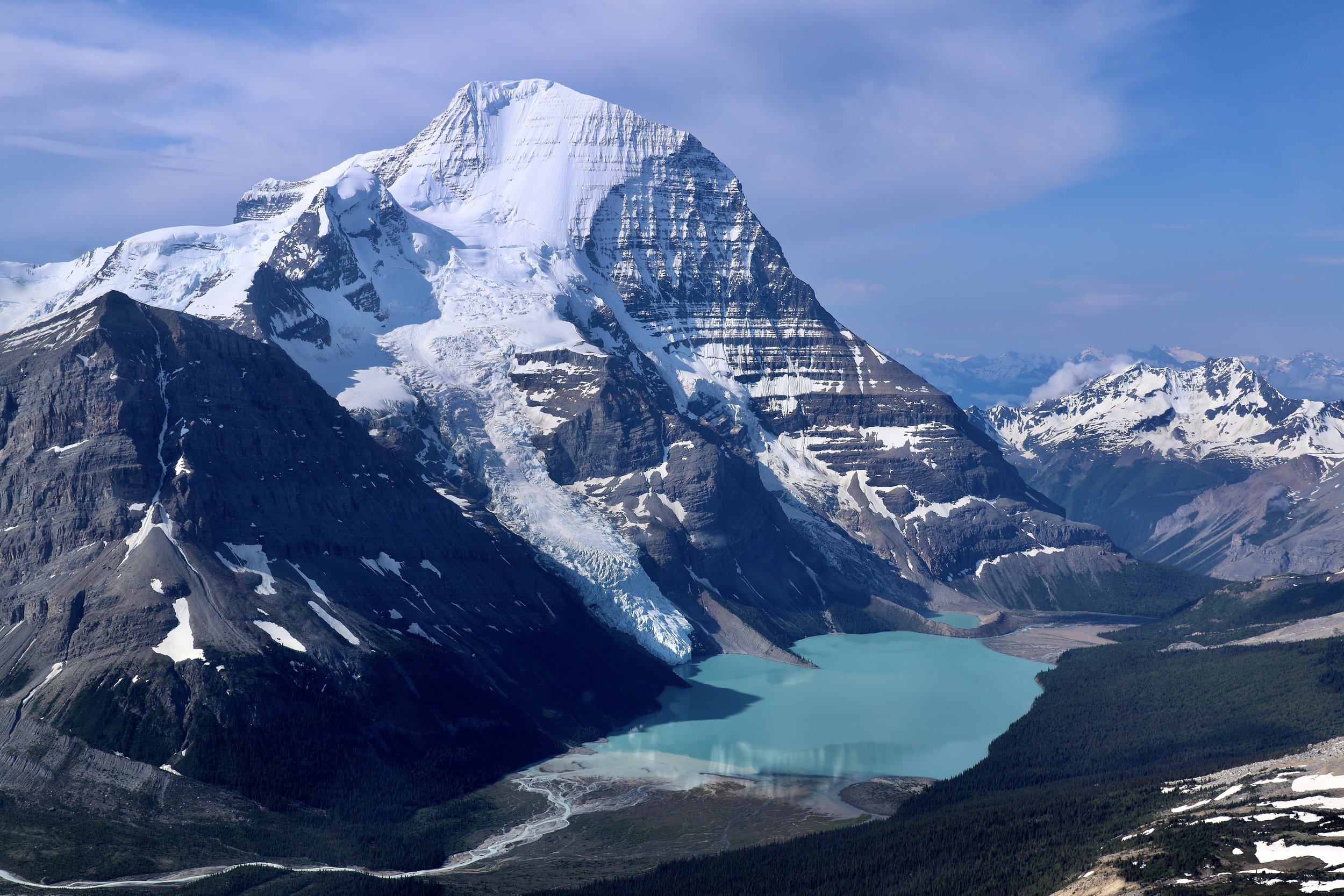
Nuptse, Everest and Lhotse from Lobuche East
As the sun rose, the magnificence of our surroundings came to full view. I was looking at the panorama, but it did not feel real. I felt as if I was in a movie set and that the view was painted. It was absolutely stunning with the colors of the rising sun, from yellow sky above Ama Dablam, to shades of orange and full explosion of the rising sun from behind Makalu. The sun was illuminating the tops of higher mountains far in the distance all the way to Shisha Pangma. Everything looked so different in this early morning light. We had fantastic visibility and no wind. It is a very special time of the day, and it was very much worth the effort to be there for the sunrise. When the sun rose from behind Makalu it was truly magical. One of those moments that lingers in memory for a long time after. The view was truly alpine and impressive. Cholatse was so close and our elevation was not far from its summit. I was so happy to be there and to have made the last-minute decision to do this climb. The entire trip was all very unplanned, spontaneous and the final chapter, the ascent of Lobuche East exceeded my expectations, especially the sunrise. It felt very satisfying and special to be there.
The way down was very fast, we followed the good trail, the fixed lines provided safety and we were back down at the crampon point in no time. We had to repel one steep section of about 20m due to ice covering the rocks underneath. My guide wanted to depart for Island Peak asap so he was in a rush. I would have lingered and taken some more photos, but I had to go down. We ascended in the night so I was not sure what was the correct way down and there was no one else coming down behind us. All in all we were back in the tent at 8.30am. It took us 4.5 hr to get up and 1.5 hrs to get down. We were in the tent before the other groups got to the top. I think that the ease and speed of our outing was all attributed to prior two weeks of acclimatization. After having scrambled two 5000m + peaks and two 5000+ passes the altitude of 6000+m was not as difficult.
After the climb I rested a little, had some food and we left the high camp for Pheriche at 11am. By that time no one had returned yet. The walk to Periche took 3 hours, down all the way. We walked by another tea house packed with trekkers heading in various directions. Now we were back on the main Everest BC highway. From Periche you can see Lobuche Peak standing tall at the head of the valley.

Magnificent Cholatse from high on Lobuche East at sunrise. On the right, far below are the rooftops of Dzongla teahouse.
November 12 and 13 Namche Bazar
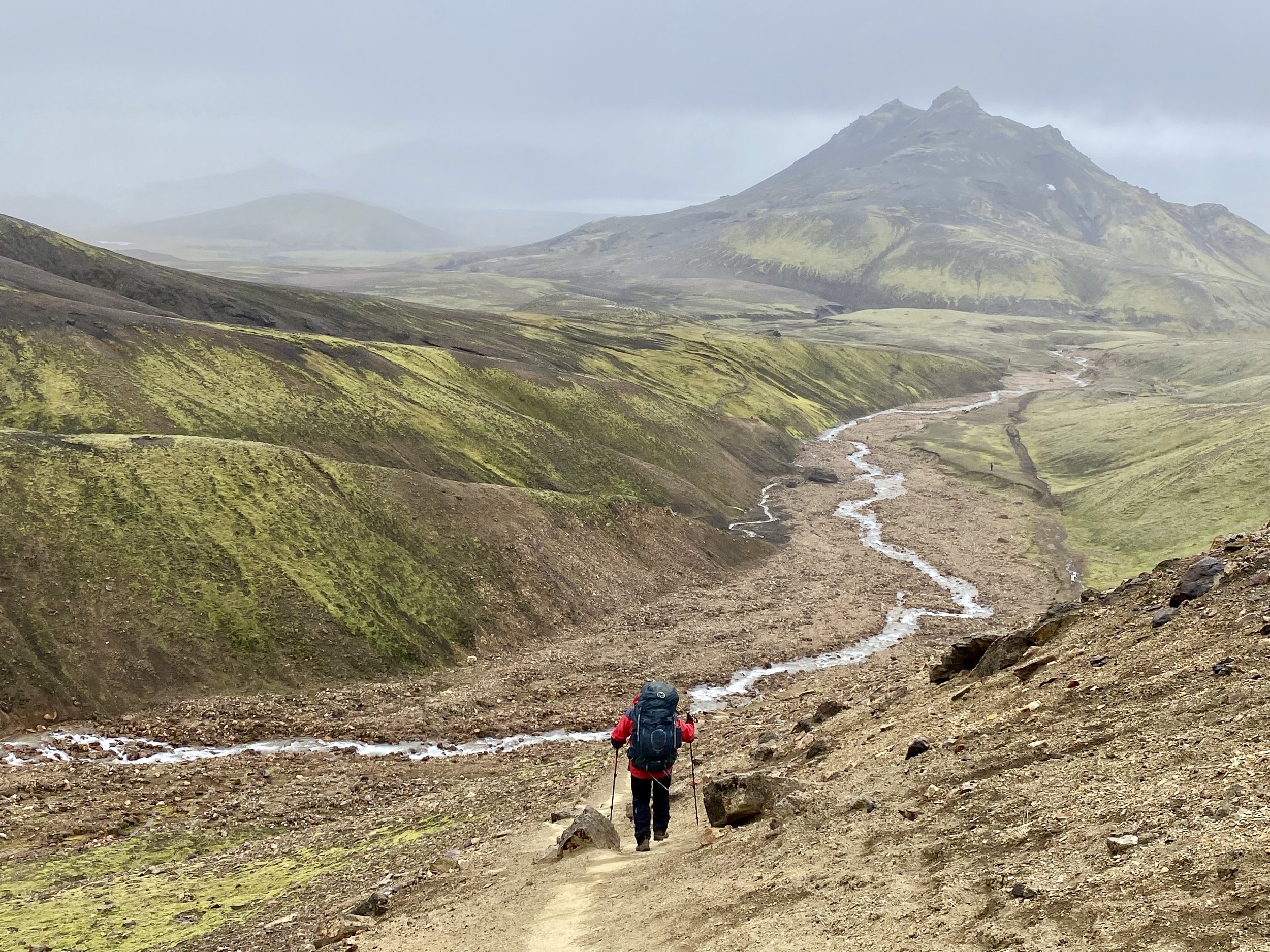
We just did the 22 km walk from Pheriche to Namche in one long day. Today’s walk had the end-of -the-trip feel to it. It is quite surprising to me how much we have packed into the 2-week period here. The climb of Lobuche was a bonus and a fantastic treat but in all honesty all the days preceding it built to it allowing me to do it fast and easy. In a way it was good not to have a solid plan and to take the trip day by day. On the way to Namche we stopped in Tangboche and it was empty compared to my 2010 visit. We even visited the gomba and we had it all to ourselves. The descent from Tangboche is 800m down down down on a dusty trail. The trail from Tangboche to Namche was rather empty and for long sections we did not run into any people. We spent an entire day in Namche, did some shopping and just rested. Namche has the best outdoor climbing stores in Nepal. It was nice to regroup and catch my breath before the long walk to Lukla.
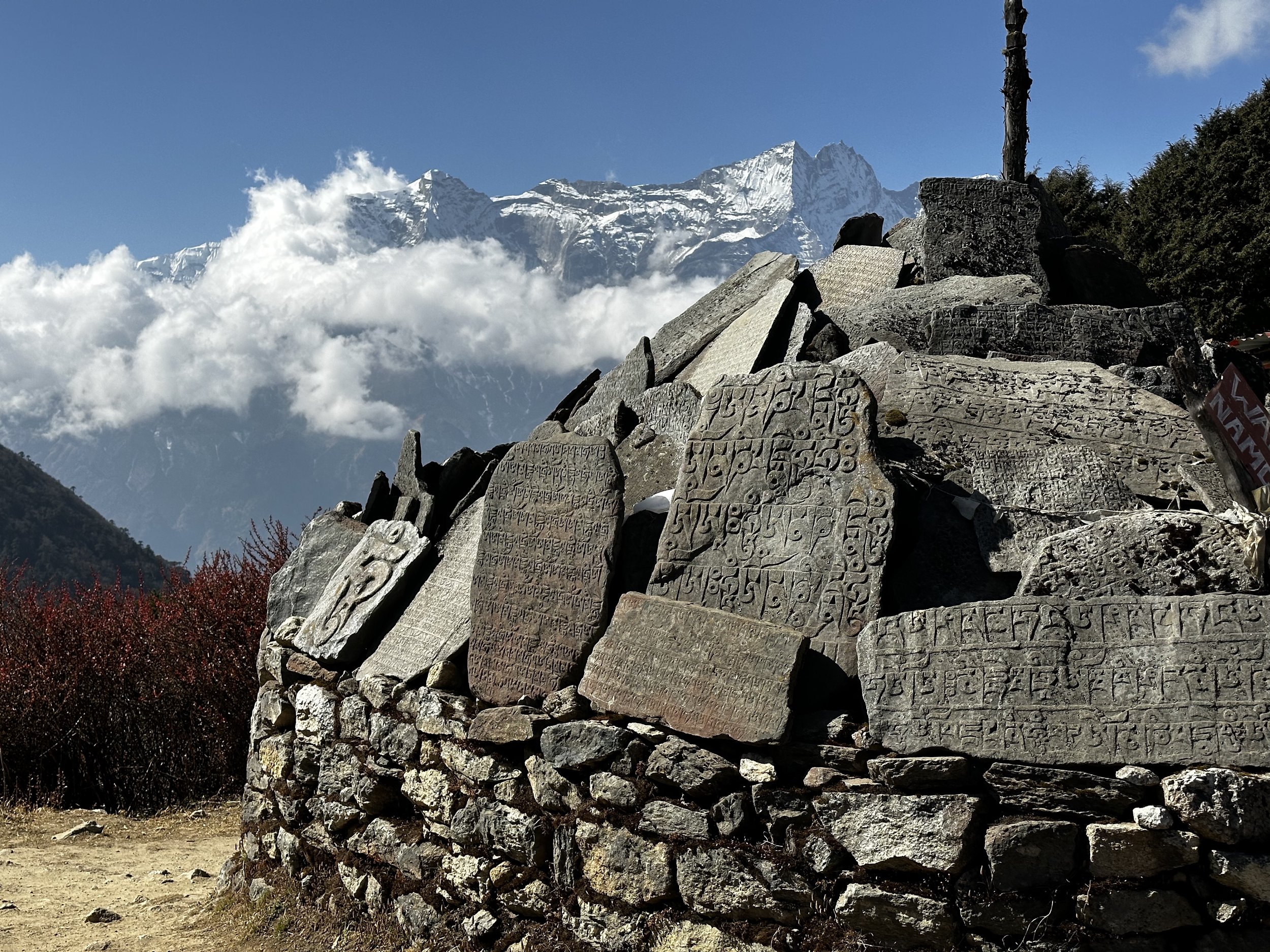
The mani stones on the trail between Pheriche and Tangboche
November 14 Lukla
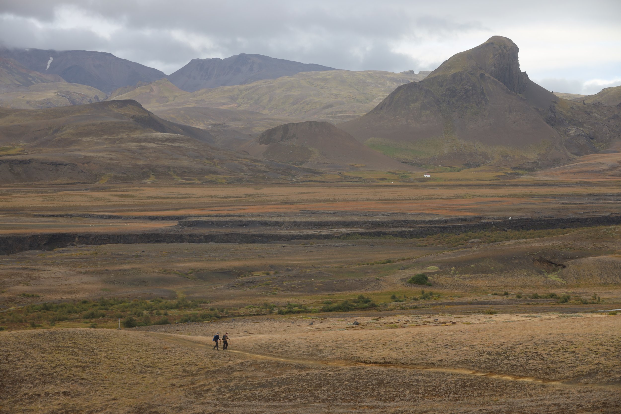
We walked 21 km from Namche to Lukla in one long day. Soon after we left Namche we run into many people running the Everest Marathon. There were also mule caravans delivering goods to villages further up the valley. There was dust everywhere and it reminded me of the 2012 experience. After the halfway point between Namche and Lukla everyone disappeared, and the trail became empty. When we approached Lukla, I had to make the final push uphill and the tiredness made my progress slow. We checked into Paradise Lodge and retired to bed early.
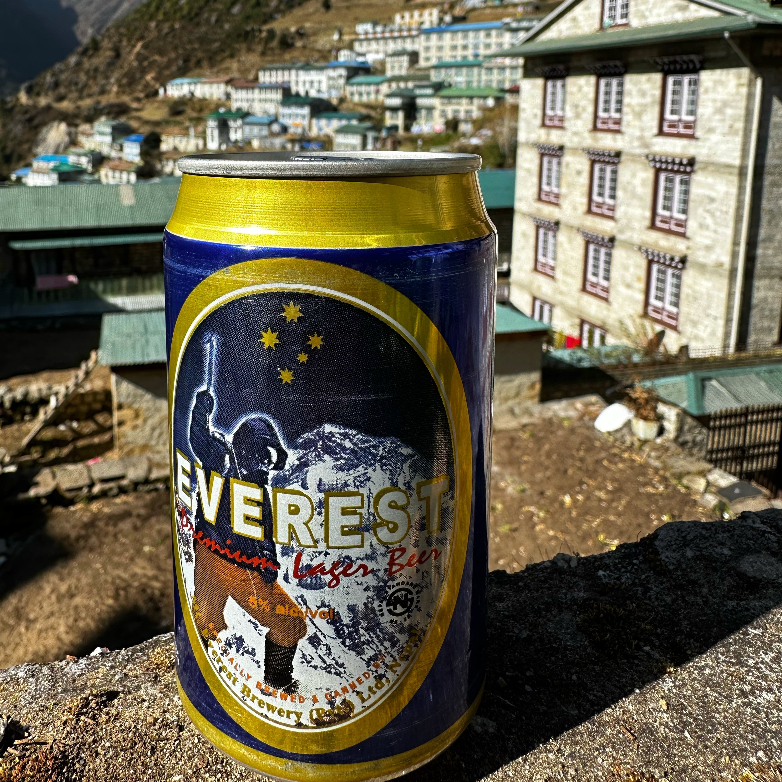
Namche - a well earned cold Everest beer
Nov 15 Kathmandu
The flight from Lukla to Kathmandu was the last one of that day. Thankfully we did not have to fly to Ramanchep and endure the 5-hour drive along with the rush hour Kathmandu traffic. The flight was very bumpy, but we landed safely in Kathmandu at 2 pm. That flight is always exciting and the takeoff on the runway slanted down is exhilarating. It is such a contrast to be thrown from the serenity and beauty of the high Himalaya to the crowds and pollution of Kathmandu. An unfortunate pitstop on the way to and from the peaks. Another fantastic trip, planned last minute, short but full of excitement. Here is the summary:
Distance covered – 165km
Total elevation climbed – 9230m up and then same down
13 days on the trail, my shortest trip in Nepal…
Max Elevation 6100m
Passes: Sunam Pass 5400ma and Cho La 5400m
Mountains: Sundar, Gokyo Ri and Lobuche East