
Great thanks to Evgeny Androssov, our guide who made this trip a reality for us! It was a pleasure (again) to share this experience with my long-time trekking buddy David.
In August of 2019, we traveled to explore the volcanic landscapes of Kamchatka in Eastern Russia. Volcanoes are not the only reason to go to Kamchatka. Many people go there for fishing and hunting as well. It is also known for its hot springs and senatoria.
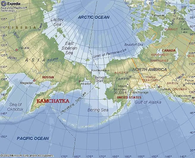
Kamchatka is quite remote and it was closed to all tourists until 1992 due to militarily sensitive areas. The landscapes of this peninsula are very unique not only in Russia but the world. Volcanoes are Kamchatka’s biggest attraction and you can see them even before you land in Petropawlowsk-Kamchatsky, the capital city of the region. Since the region has only one main road, getting to some of the remote volcanoes requires planning and can get quite expensive.
Our primary goal was to explore the large Kluchewskaya Cluster National Park. The Park is located 600 km from Petropawlowsk-Kamchatsky and it takes around 10 hours of non-stop driving on progressively deteriorating roads to get there. The final stretch from the main road to the park is on old Soviet logging tracks (one of the primary industries of the region back in the USSR days). The experience of the driver and the quality of the 4x4 are very important as getting stuck in this remote region could basically put an end to the trip. Thanks to Evgeny, our industrious guide, we engaged the help of Sergey, a former hydrologist who worked in the region and knows the forest tracks very well.
Another minor annoyance are the mosquitos and very unpredictable weather (prolonged periods of rain and strong tent-damaging winds). One needs luck to be able to see the beautiful views that Kamchatka has to offer. We were very lucky indeed.

On the Kamchatka Peninsula, there are over 200 volcanoes, 30 of which are active and erupt frequently.

There only one road on the Peninsula. Thankfully it takes you to some beautiful places!
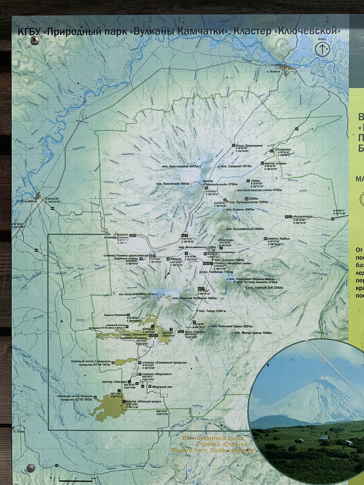
The map of the trails inside the Kluchevsky Cluster Park. Our journey was 120 km long, one of the longest in the park. One can also ascend most of the volcanic peaks without major difficulties except the weather.

The summit cone of one of the volcanoes near Petropawlowsk-Kamchatsky from the landing airplane. I was so excited to be in this mysterious land!

Kamchatka - wild and green - looks splendid!

The modern airport of Petropawlowsk-Kamchatsky.

On the road from Petropawlowsk-Kamchatsky to the trail. It is a long drive through pristine tajga forests full of bears and mosquitoes.


The Kamchatka River is the largest river on the peninsula. You can see the Volcano Kameny above the tajga forest. It is at least 80 km away through the mosquito infested tajga.

The Kamchatka River

The Kamchatka River and the Kluchewskaya group of volcanoes from the drone. Photo by Evgeny Androssov.

The Kamchatka River from the drone. Photo by Evgeny Androssov.

The Kluchewskaya Sobka 4,750m Volcano and Krestowski Volcano 4,057m and the endless taiga forest from the drone. We had to drive through this forest first to get to the trails. Photo by Evgeny Androssov.

Driving through the taiga - home to billions of mosquitoes!

The old Soviet logging roads can be quite challenging. We helped out the Nissan to get out of the mud. Some of the old tracks have been further damaged by the Tolbachik eruptions in 2012. The local drivers just cut alternative tracks through the thick bush. The roads are not maintained.


Some larger groups charter these industrial KAMAZ trucks. A KAMAZ truck can take up to 20 passengers and it costs 3,500 Euro for the round trip from Petropawlowsk-Kamchatsky. We met a few large Russian groups that traveled this way. Some were overlanders and some were trekking in the park. The KAMAZ drivers deflate the tires to handle the tracks.

Our starting point. We started at the Stolnik hut. The forrest track ends here and it is walking from this point on. The large cone of the Ostry Tolbachik Volcano towers above the camp. See the ubiquitous mosquito in the photo frame!

The simple shelters provide a welcome escape from the frequent and intense rain. The air temperature can vary by a lot in the matter of hours. The Ostry Tolbachik 3,672m dominates the view.

Our first view of the Ostry Tolbachik Volcano 3,672m.

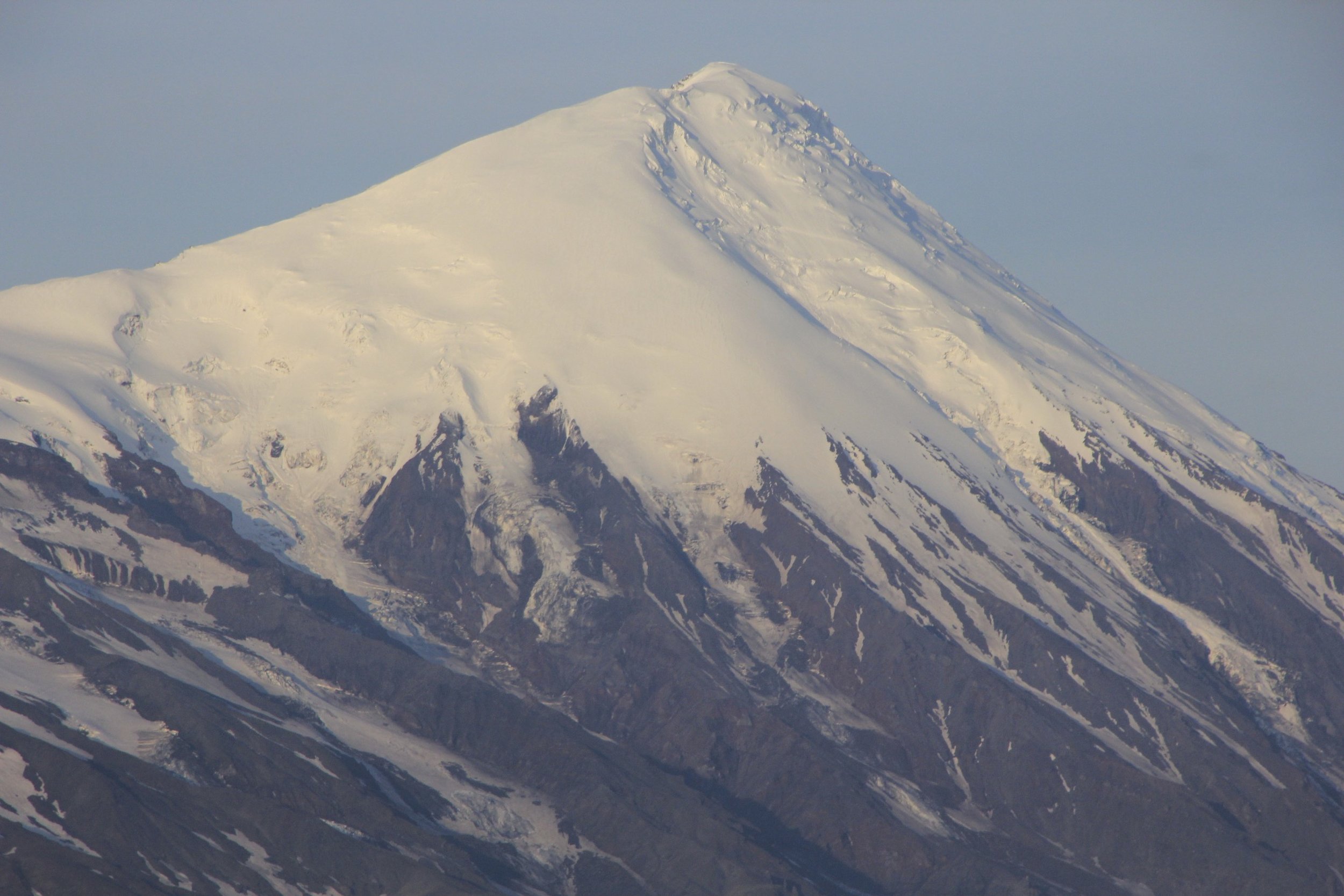
On the left is the distant Kluchewska Volcano 4,750m (the highest active volcano in Eurasia). On the right is Kamen Volcano 4,580m, more imposing and with permanent snow. The Kluchewskaya has no snow as it is active and hot.

The beautiful tundra and the Ostry Tolbachik Volcano. The little cones in the photo are picked by the locals for medicinal purposes. They are boiled and often mixed with tea or alcohol to create a healing concoction.

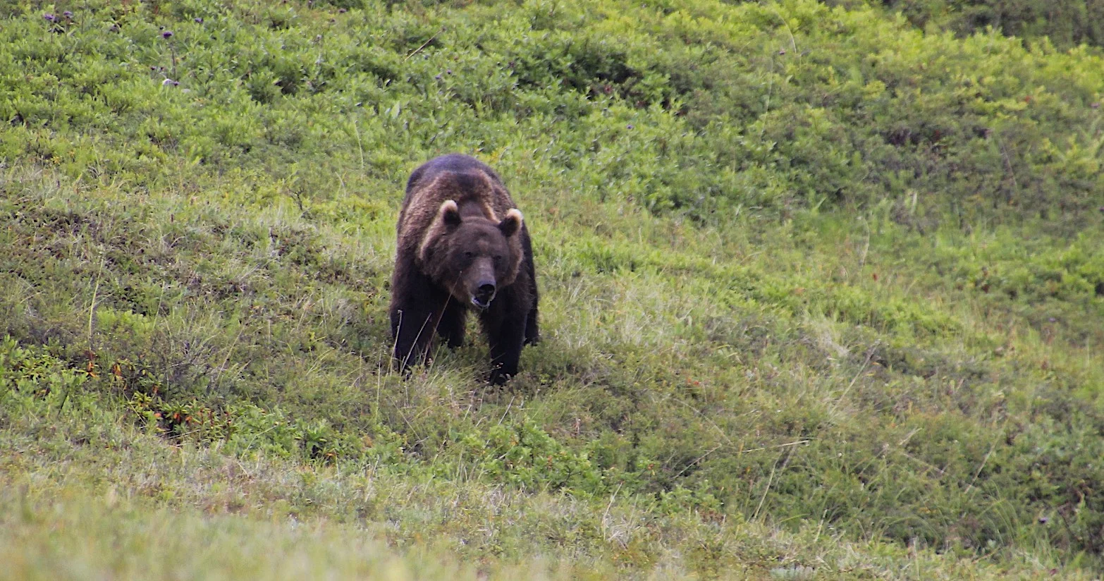
During our first day we had two bear encounters. We almost walked into one young bear (he run away promptly) and this old one came quite close to our camp checking us out. He lingered around eating berries but eventually left and went on. We have not seen any other bears after that but they sure came close to our tents during the night.


Best seen from the distance!

Beautiful surroundings of the lower parts of the Kluchewskaya Park.

Our first view of the Bezimienny Volcano.

Bezimienny Volcano in the distance

Evgeny Androssov, our guide, is an outdoorsman from Moscow who works as a guide in Kamchatka and other interesting places in Russia.

That day, we trekked for 18 km along the Tolbachik massif. We walked through some beautiful old lava fields with bizarre formations. The contrast between black soil and green vegetation was very striking.

Old lava fields and towers.

Volcanic bombs from ancient eruptions The black soil seems to be very fertile for various kinds of mosses.

The water made these deep channels and caverns in the soft volcanic rock. There is a narrow slot canyon that one can walk trough during the dry periods.

This slot canyon is about 20m deep and quite narrow.

Bizarre and high lava formations. This one was at least 10m high!


Easy walking through beautiful surroundings. If the weather is good of course.


The vast land and a volcanic desert.

Lower slopes of the Tolbachik Volcano. The old lava fields stretch over wide area.

Ahead is the small mountain pass we need to cross to get to the base of the Bezimienny Volcano.

Rain and drizzle were our companions (photo by Evgeny Androssov). Good rain gear is essential.

On our way to the base of the Bezimienny Volcano, we had to cross a small pass. We were carrying 50-60lb packs so any “up” was hard work.

Old Soviet geo marker on top of the small pass that we had to cross.

In some areas snow lingers all year round. The summers are very short here and it can snow at any time of the year. Walking on these snow fields was tricky as sometimes there was a hidden channel of melt water. It was easy to punch right through and fall into a wet crevice.

The weather did not look good, and we were supposed to be going up a volcano the next day!

Apparently there are volcanoes behind this cloud!

Zimina Volcano is ahead. Often, the peaks were obscured by low clouds.

The Volcano Zimina 3,081m seen from the basecamp of Bezimienny during the evening.

Bezimienny Volcano exploded violently in 1956. It was very unexpected as the volcano was considered dormant. The explosion was extremely violent and the ash cloud circled the planet twice. After that event, the Soviet volcanologists started to study the caldera. This hut belongs to the Volcanology Institute of the Russia Academy of Sciences. It is no longer in use and provides shelter for hikers and trekkers and serves as a basecamp for the Bezimienny Volcano.

Miraculously the weather cleared and we decided to ascend the Volcano Bezimienny 2,882m. It is active and the smoke is rising from the caldera. The ascent is quite steep in places and walking on sand and loose small rocks can be challenging.

Shiveluch Volcano, 3,283m is 80km away! It is the northernmost active volcano of Kamchatka that exploded quite recently in 2019. The volcano has the greatest edifice of all volcanos (70 x 40km). It consists of Old Shiveluch and New Shiveluch with newly formed lava dome 500m high. The wide caldera on the opposite side of the mountain is 9km wide. It erupts twice a year. It also has catastrophic eruptions every 100 years or so.

The fantastic views extending over the park. From let to right: Volcan Ostry Zimina 2,743m, Volcano Ovalny Zimina 3,081m, Volcano Udina 2,921m, Volcano Plotsky Tolbachik 3,085m and Volcano Ostry Tolbachik 3,672m.

Ostra Zimina 2,743m and Ovalna Zimina 3,081m. In the distance, Udina 2,921m.

The Zimina Volcanoes

Ovalnaya Zimina 3,081m
Ostry Tolbachik 3,672m

The edge of the active crater of the Bezimienny Volcano. The lava dome, 100m higher was steaming and seemed unstable to climb. Not worth the risk for another 100m of elevation gain. We had the drone to provide us with a peak into the crater, thanks to Evgeny who carried it in a separate pack!

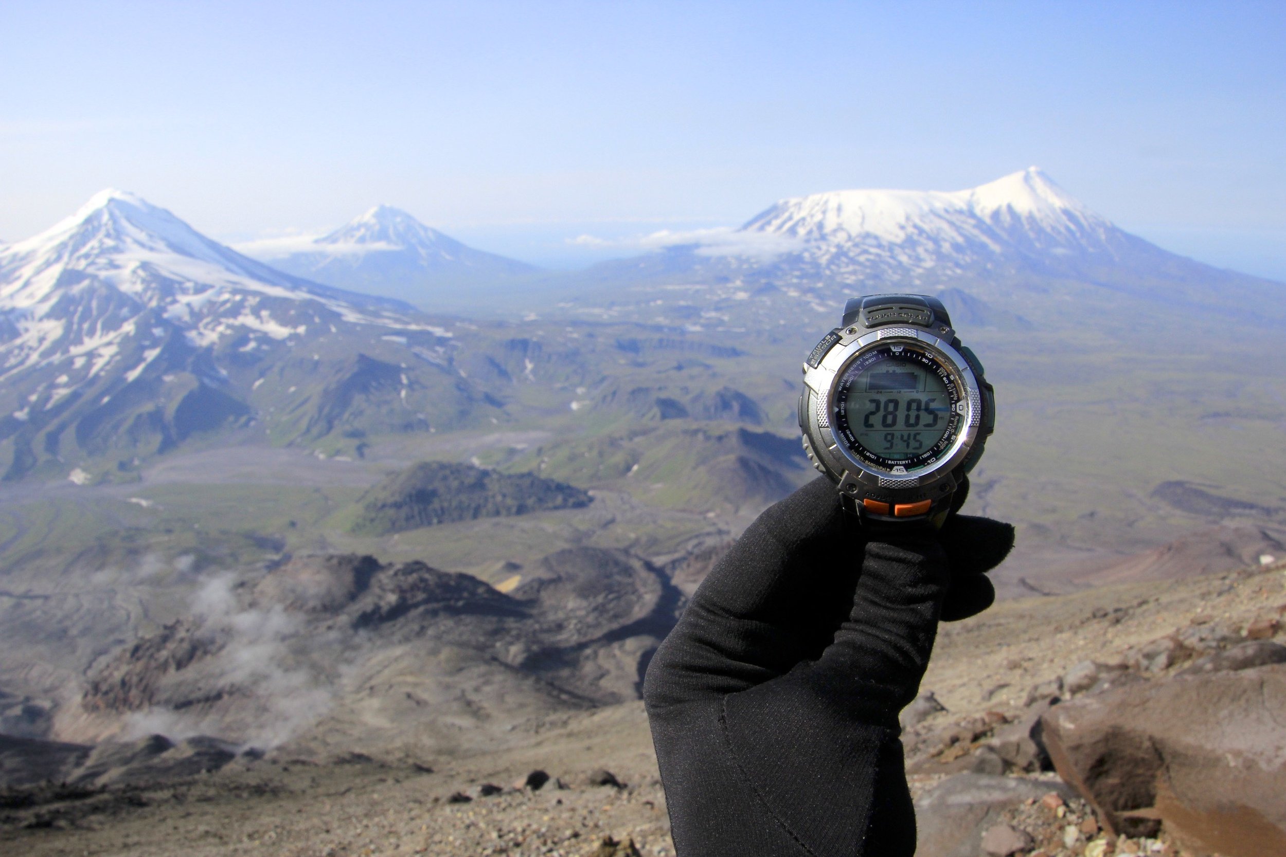
The view from the edge of the crater. The final 200m is steep and loose. We were very lucky to have such clear day!

Our trekking route between the volcanoes.
The height of the crater.

Evgeny and I from the drone (photo by Evgeny Androssov). We spent 3 hours on top taking in the incredible panorama!


Evgeny’s drone - max height has been reached but the volcanoes still tower above!

Drone photo by Evgeny Androssov. The Volcano Kamen 4,580m and active Kluchewskaya 4,750m, they are very impressive! Between these two volcanoes, there is a pass at an elevation of 3,000m from where an ascend can be made. The trick is to get there in good weather.

The rim of the crater, this is as high as we could go without descending into the crater itself.

Drone photo by Evgeny Androssov. This is the crater of the lava dome of the Bezimienny Volcano. It would be a tricky ascent given numerous active vents and ash.

Drone photo by Evgeny Androssov. Active crater of the Bezimienny Volcano. We could smell the smoke from the crater as we were hiking up the mountain.

Drone photo by Evgeny Androssov. The crater of the Bezimienny Volcano seen from the opposite side to us. The height of this “new” dome is 500m. It grew out of the larger crater formed by a large explosion in 1955. It is like a mountain giving birth to another mountain.

View over the park and half of our trekking route. We basically started on the extreme right and circled the Tolbachik Volcanoes (the mountain on the right).

The smoking crater of the Bezimienny Volcano and the Kamienny Volcano towering above it. The Kamenny is obscured by volcanic ash.

The upper part of the active crater of Bezimienny.

Kamienny Volcano 4,580m.

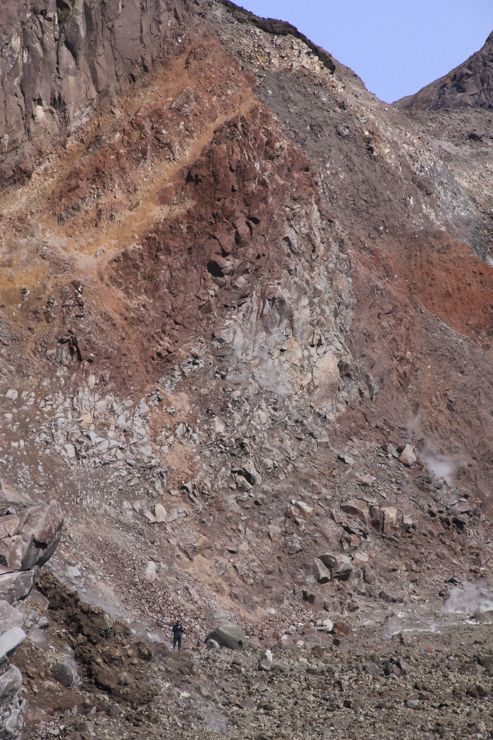
The active lava dome of the Bezimienny Volcano. The sulfur fumaroles were very active and smoke would come out with varied intensity.

The outer shell of the volcanic dome of the Bezimienny Volcano with active sulphuric fumaroles.

The old volcanic craters seen from the top of Bezimienny and the view of the small pass we had to cross the day before.

The Tolbachik Volcano. We were going to climb the Plotsky Tolbachik but decided not to due to inclement weather.

Evgeny is dwarfed by the walls of the crater.
Evgeny inside the crater of the Bezimienny Volcano. The ground and the rocks were quite hot. There were a lot of fumaroles on the bottom of the crater.

Interesting colors in the lower section of the Bezimienny Volcano.

The lower slopes of the Tolbachik Volcano.

The beautiful camping spot on the Fields of Mars (Massive Pole)

Bezimienny and Kamen seen from the campsite called The field of Mars (Marsove Pole).

The view of the volcanic ash cloud from the crater of Bezimienny at sunrise.

The campsite at the Marsove Pole. I think that this spot is the most beautiful of all the campsites in the park.

The park has these shelters at each campsite to provide an escape from the rain for cooking and warming up by the fire.

The Field of Mars and the high volcanoes of the Kluchewskaya Cluster.


Ascending the Tolbachik Pass.

Tolbachik Pass with Kamen and Bezimienny behind.

The Tolbachik Pass is an excellent view point from which all the major volcanoes of the park can be seen. From left to right: Ushkowsky Volcano 3,943, Krestowky Volcano 4,057m, Kamenny 4,580m, smoky Bezimienny 2,800m, Ziminna 3,081m, Udina 2,921m and Plotsky and Ostry Tolbachik 3,085k and 3,672m.

Drone photo by Evgeny Androssov. Ushkowsky V 3,943m and Krestowsky V 4,057m (left). Kamenny V and Bezimienny V (right).

The view of Plotsky and Ostry Tolbachik Volcano from the pass.

Early morning on the Tolbachik Pass. We were lucky again to have such nice weather. The weather changed later that day and remained rainy and overcast for the rest of our stay in the park.

Ushkovsky Volcano together with Krestovsky Volcano are the biggest volcanic massif in Kamchatka. It is 3,943m high and 4,057m high and the base is 70 x 40km.

I am standing on top of a small mound. The Udina Volcano towers in the distance. That day we hiked to its base some 15km away. The large open space had no water, yet it is covered with flowers and vegetation! We were looking for streams all day and could only find water from the snow melt at the base of the Udina Volcano. Apparently all water flows underground in the old lava channels. The porous volcanic rock is conducive to existence of underground rivers.

As we went further away from the large volcanoes, we could see them better in their full majesty. Kamenny, Kluchewskaya and Bezimienny. Notice the 500m high dome of the Bezimienny Volcano that grew from the crater after the 1955 explosion.

Hiking down from the Tolbachik Pass.

Going towards the Udina Volcano. Our plan was to go for 8km but we ended up doing twice as much due to lack of water and a suitable camping spot.


Fellow trekkers camping at the base of the Zimina Volcano.

The Kamenny Volcano and the active Kluchewskaya.

Volcano Bezimienny that we climbed, looks so small in front of the 4,500+ giants! The Bezimienny Volcano is very similar in its nature to Mt. St. Helen in Washington State, USA. Both had very similar explosive eruptions and both have large lava domes forming inside their craters. Volcanologists study the behavior of Bezimienny to predict the explosions of Mt. St. Helen. Volcano Bezimienny exploded on March 30, 1955 submerging the entire area in darkness. The cloud of ash rose to 45km and burned all trees in the 25km radius. The blast created a 700m deep crater 1.3 x 2.8km large. Over the past decade, the dome inside the crater rose to the height of 500m.

The 4,750m high Kluchewskaya Volcano is the largest volcano in Eurasia. It is the most powerful and most productive in Kamchatka. It erupts 60 million tons of rock per year! Powerful eruptions occur every 25 years. The volcano started growing from 1,700m 3,000 years ago. Now it is 4,750m high.

Taking it all in!

A dwarf species of rhododendron flower during the short summer.

The base of the Udina Volcano and our camping spot for the day!

Another hut built by the Soviet volcanologists. Sadly, the old Soviet books from the hut are used as a fire starter. The hut provides extremely rustic shelter from the wind and rain.


These ground squirrels were everywhere and were unafraid of people. They were very plump!

Distant Sredinny Range one of the two main mountain ranges of the Kamchatka Peninsula. It is rugged and remote with no road access.


There are extensive fresh lava fields on the opposite side of the Tolbachik Volcano from where we started. They were formed during the 2012-2013 eruptions. The Tolbachik Volcano is the only volcano outside Hawaii that erupts through fissures and not from the main crater.

Small waterfall over red volcanic rock.
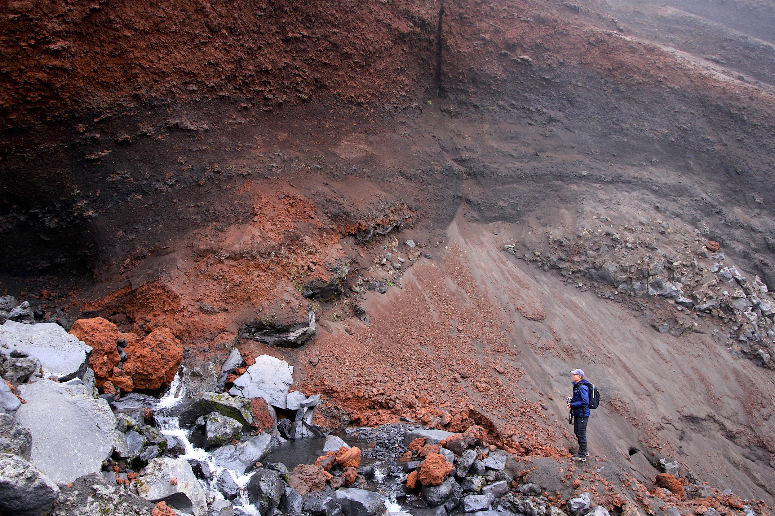
The exposed volcanic rock

The Udina Volcano and the black soil of the Tolbachik lava fields.

Hiking towards the Tolbachik Volcano.

The basecamp of the Tolbachik Volcano is 100km away from the main road. It is accessible via an old logging track and many people come to climb the volcano. It is a desolate place without vegetation and is covered in volcanic dust and old lava. The wind here was so strong that it damaged two of our tents (one completely). The basecamp is also home to the “Inspector” - the Park warden.

The Inspectos’s hut. One can obtain maps and commemorative pins. The inspector also collects fees for the use of the kitchen facilities by large groups.

Our camp before the wind storm. The wind got so intense that I had to move my tent to a more sheltered spot. The small green tent got totally trashed by the wind.

My tent taking a beating during the wind and rain storm. The lava rocks provided solid anchors as it was impossible to peg the tent in the volcanic sand. I was quite amazed that the tent withstood the onslaught while all the other tents got blown away or trashed. I was fully prepared for the poles to snap as the wind “flattened” the tent on top of me during the gusts.

We spent the day exploring the extensive lava fields and old volcanic craters. It was all very fascinating! The cooled lava made wonderful formations. Some looked like coiled rope or roots of trees. We walked through lava caves and lava tubes. Many areas are still active and, in some places, the ground temperature is in excess of 100C!

The edge of the lava flow. The lava moved very slowly and just “froze” once it cooled.

Wild lava formations

The volcanic plugs sticking from the field of ash.

Fresh lava field. We were often walking on top of lava channels. I was concerned to break through. The lava is very sharp and hard and can cut through like a knife. It is also very easy to walk on as the surface is abrasive and provides excellent footing. The lava is black on top but has numerous shades of reds and browns underneath. It forms beautiful shapes like glass art. If placed in an art gallery, many people would not be able to guess what it was.

Negotiating the extensive lava fields. Photo by Evgeny Androssov.

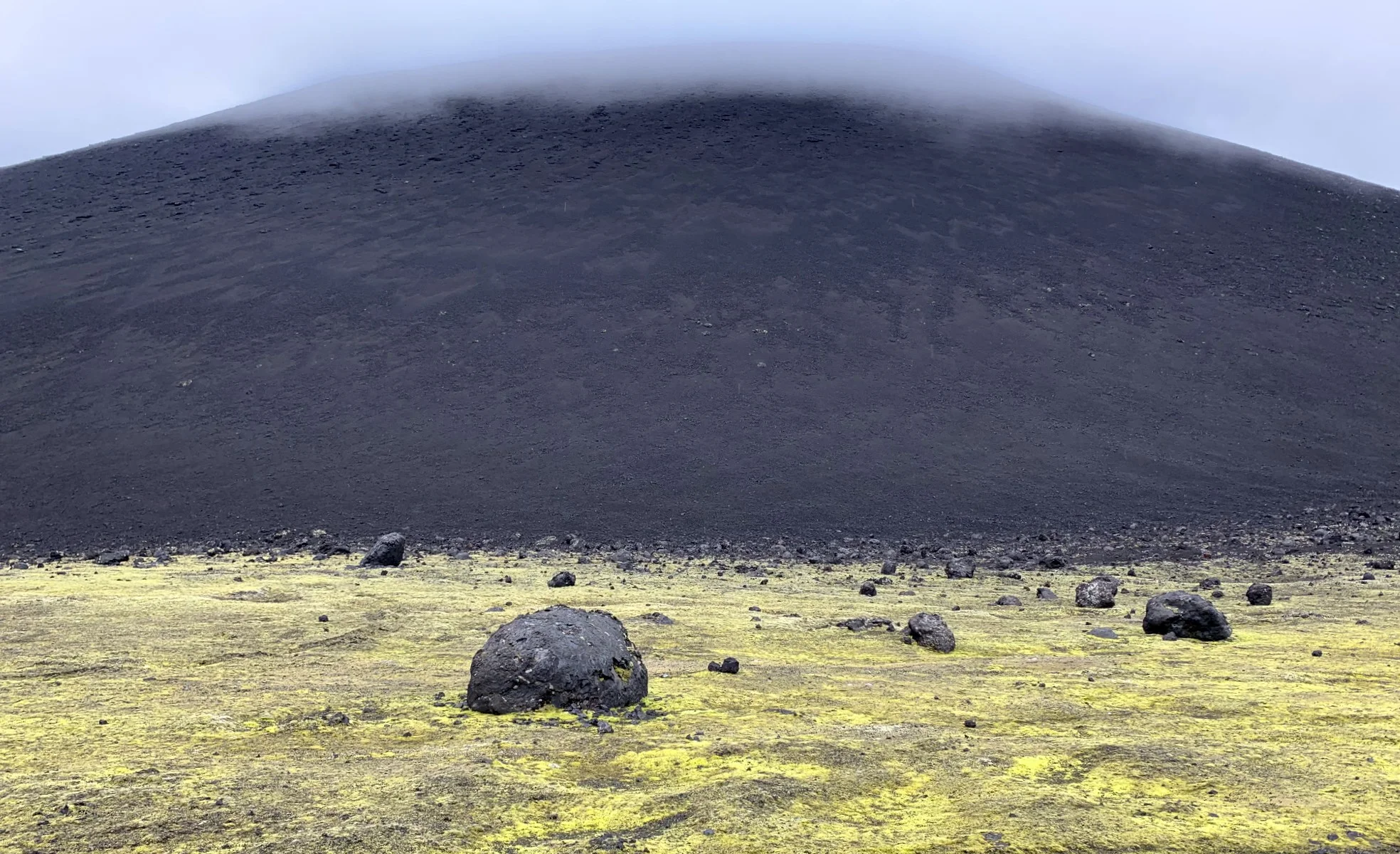
When the color of lava was yellowish, it usually indicated a hot and active area. The ground was more brittle in those spots.
The ground was hot enough to warm up and dry our wet gloves.

Incredible lava formations.

The distant hills are the active volcanic craters that were the epicenter of the most recent eruption in 2012-2013.

Frozen lava

As the lava cooled the carbon exposed to oxygen remained black. Underneath the lava has different colours.


Inside a volcanic bomb the lava is like a frozen sticky glue but hard like a rock.

Incredible colours of the volcanic rock near an active area.

Exploring lava caves - huge caverns that held liquid magma during the 2012-2013 eruptions.

Inside the lava cave.

Evgeny marching to the top of the lava crater. Notice the basecamp on the left.

The pumice rock is very light but walking uphill on it can be hard as it slides from under the feet.

Brittle volcanic rock. Still hot.

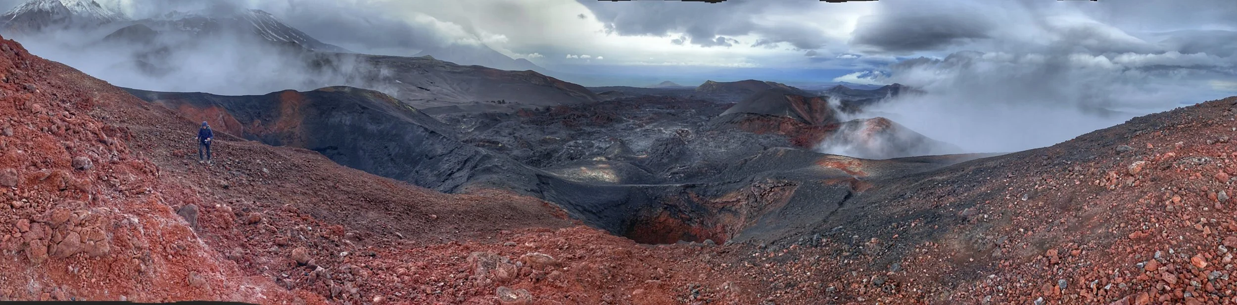
The slopes of a volcanic crater. What an incredible place!

Fresh volcanic crater. It is still hot!

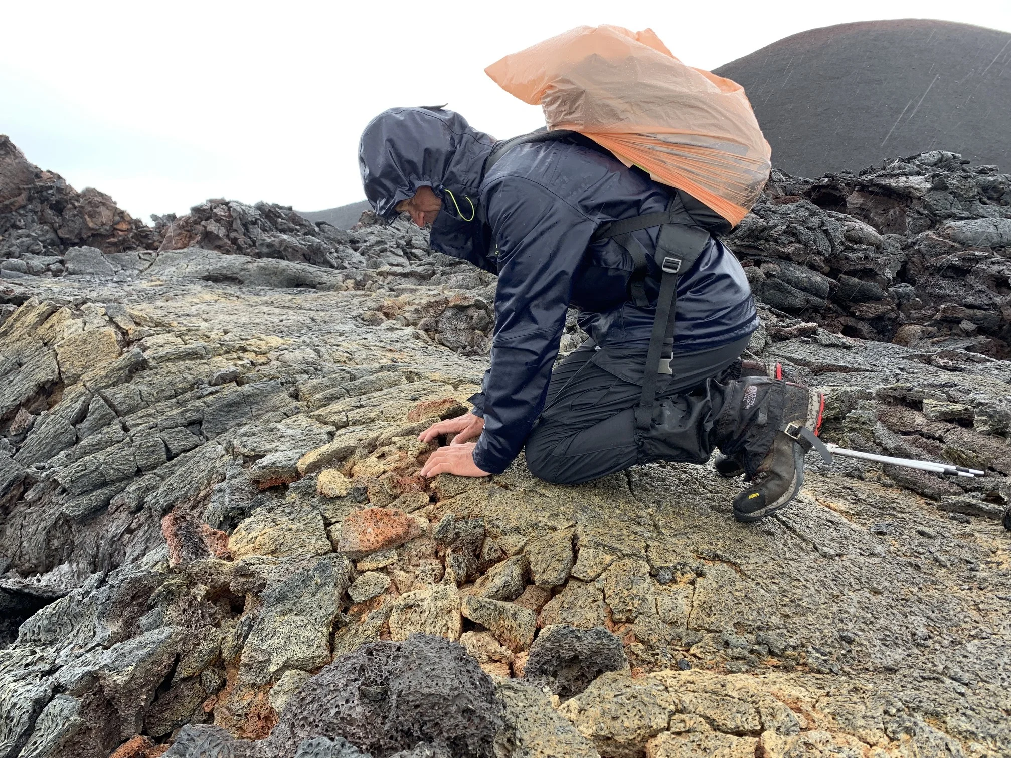
Despite the rain, we really enjoyed exploring this area; it was a kaleidoscope of colors.

Drone photo by Evgeny Androssov


Many craters of the recent Tolbachik eruption. Notice David in a red jacket standing above the crater. It gives the sense of scale of the vastness of this area. In the distance is the Udina Volcano.

One of the craters.


The slopes of the Tolbachik Volcano obscured by the clouds. Poor weather and lack of visibility prevented us from going to the top although it was our plan.

The volcanic crater in front of the Tolbachik Volcano.

Walking on ash created by the 2012-2013 eruptions.

Our final day of trekking. We walked through a volcanic desert. It truly felt as if we were on another planet. It was very desolate.


Like walking on another planet! This place of “nothing” went on for over 20km!

Just ash and volcanic sand - not a trace of vegetation is sight. This was completely different from the other side of the mountain.
Massive volcanic bombs. Some of them were size of a small car! The crater above exploded in the 1970s. I hiked to the top of it and the crater is still active with smoke and hot areas.


We were waiting for Sergei, our driver, and I hiked up to the top of a volcanic cone next to the shelter. From the top, the desolate landscape spreads out as far as the eye can see. I hiked to the top to warm up as we are getting really cold in the mist and rain.

Old Soviet “Zil” adapted to overland travel. According to the driver, there are not many original parts from the old truck left on it.

Another volcanic lava flow from an old crater. This lava flow dates back to 1970s. It is old for us but very recent in geological terms.

Multitude of colours inside the volcanic crater.

A lava bomb

Lava rocks and moss.

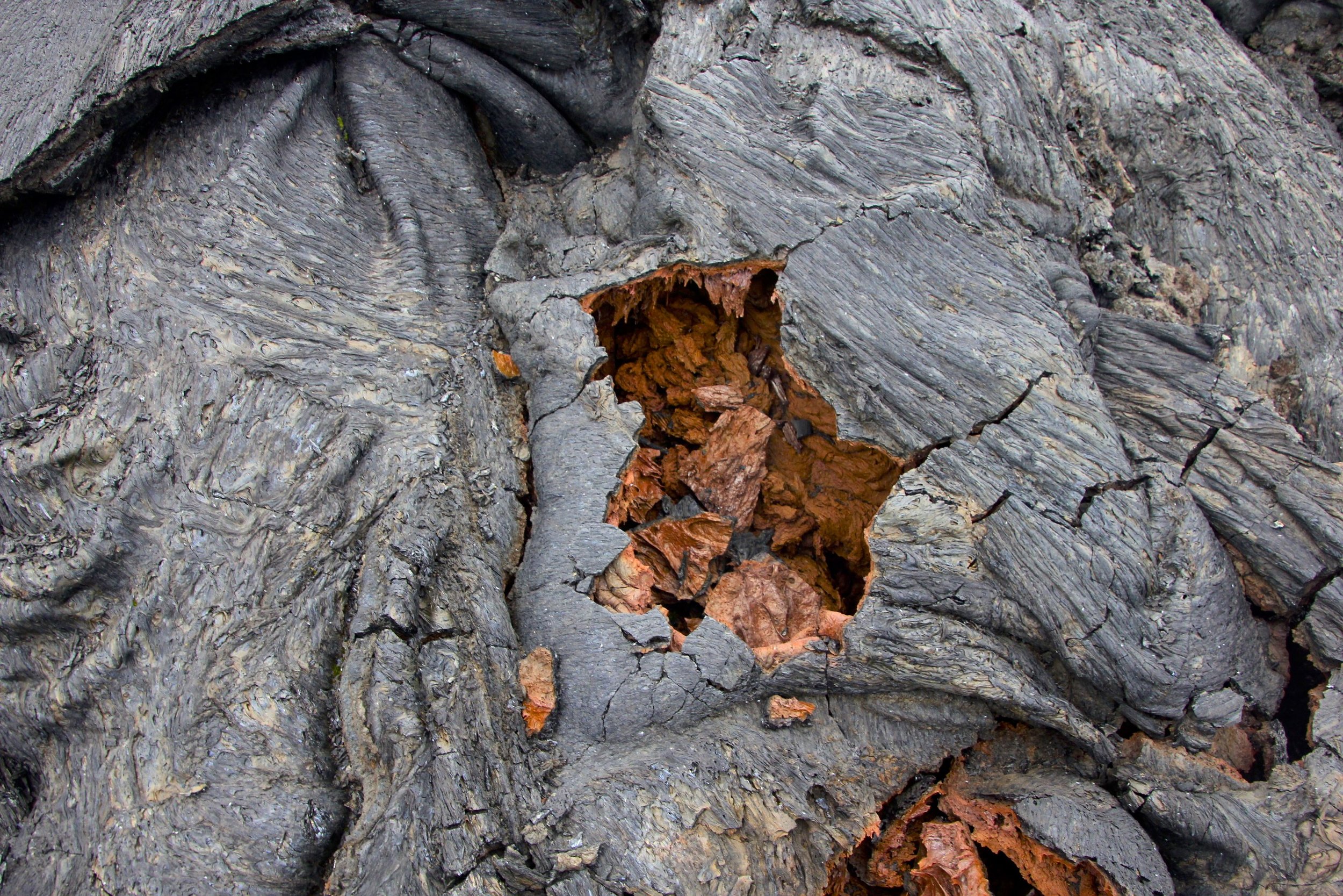
Our final stop in the park was in the Dead Forest. The forest was killed by the volcanic eruption leaving only charred tree trunks. The life is returning though and the forest is regrowing.


A wreck of a Soviet helicopter belonging to the Russian Academy of Science that crashed here in the 1970s.

The Dead Forest


Sergiey, a true Kamchatka man. He met us after our 10 day hike with beer, home baked salmon, samogon and other goodies! He knows a lot about Kamchatka, the geology of the land, the history and the stories of the people of the region. He can also drive through some pretty remote and obscure tracks that are almost fully overgrown by the Tajga. He is equipped for all eventualities. He had a chainsaw in his truck and used it to clear fallen trees from barely visible forest roads. He provided us with some good tips and suggestions. Thanks to him we saw places that otherwise we would not have visited.

A wall of lava advancing through the tajga. The lava is higher than the trees!

Marveling at the extensive lava flow.

Massive lava field

Massive lava field dwarfing the forest. The height and volume of the lava is staggering.

The lava mowing down the forest just “froze” in its tracks. The eruption happened during winter and because of this, the forest did not burn down.

Drone photo by Evgeny Androssov of the massive lava field

Drone photo by Evgeny Androssov - notice our car in the bottom centre
