
The Grand Mustang Circuit is a combination of the Annapurna Circuit (or what is left of it), the classic Mustang trek, the Terila Trek and the trek trough the Naar/Phu region. To finish things off in “style”, we returned to the starting point via Kangla Pass. The total distance of this EPIC trek was 380km which we walked over 24 days. We climbed 12km in total elevation (probably descended the same) and crossed 3 passes over 5,000m and a quite a few passes over 4,000m. Half of the trek is through sparsely populated regions requiring camping and self sufficiency. It is a spectacular route through some of the most culturally interesting areas of the Buddhist Nepal with a thriving culture. Again, many thanks to the Mountain Sun Valley and Rajendra for putting this together.
It is not technically difficult but it is long. It also has a lot of ups and downs, especially in the Mustang region, where one has to constantly climb into and out of river gorges that cut through the landscape. The trek offers spectacular scenery that is very different from what I have seen in other parts of Nepal. It is a truly unique experience both visually and culturally.
This part of the trek took us to more remote part of Mustang and more spectacular. We left Mustang by ascending the remote Terla Pass. The pass is 40km from the last village in Mustang and 40km from Naar. It takes between 6 to 8 days to cross this pass between the two villages. There is an alternative route further north through the Saribung pass. The route requires glacier crossing for which we did not have proper equipment. The Saribug Pass route is of the same distance and ends in the village of Phu. The Saribung Pass is 400m higher from our maximum elevation reached.

See the Teri La Page with Annotations and Maps on www.Himalaya-Info.org

The walkway in the sky! We followed this trail at the altitude of 4100m. The views were quite incredible.


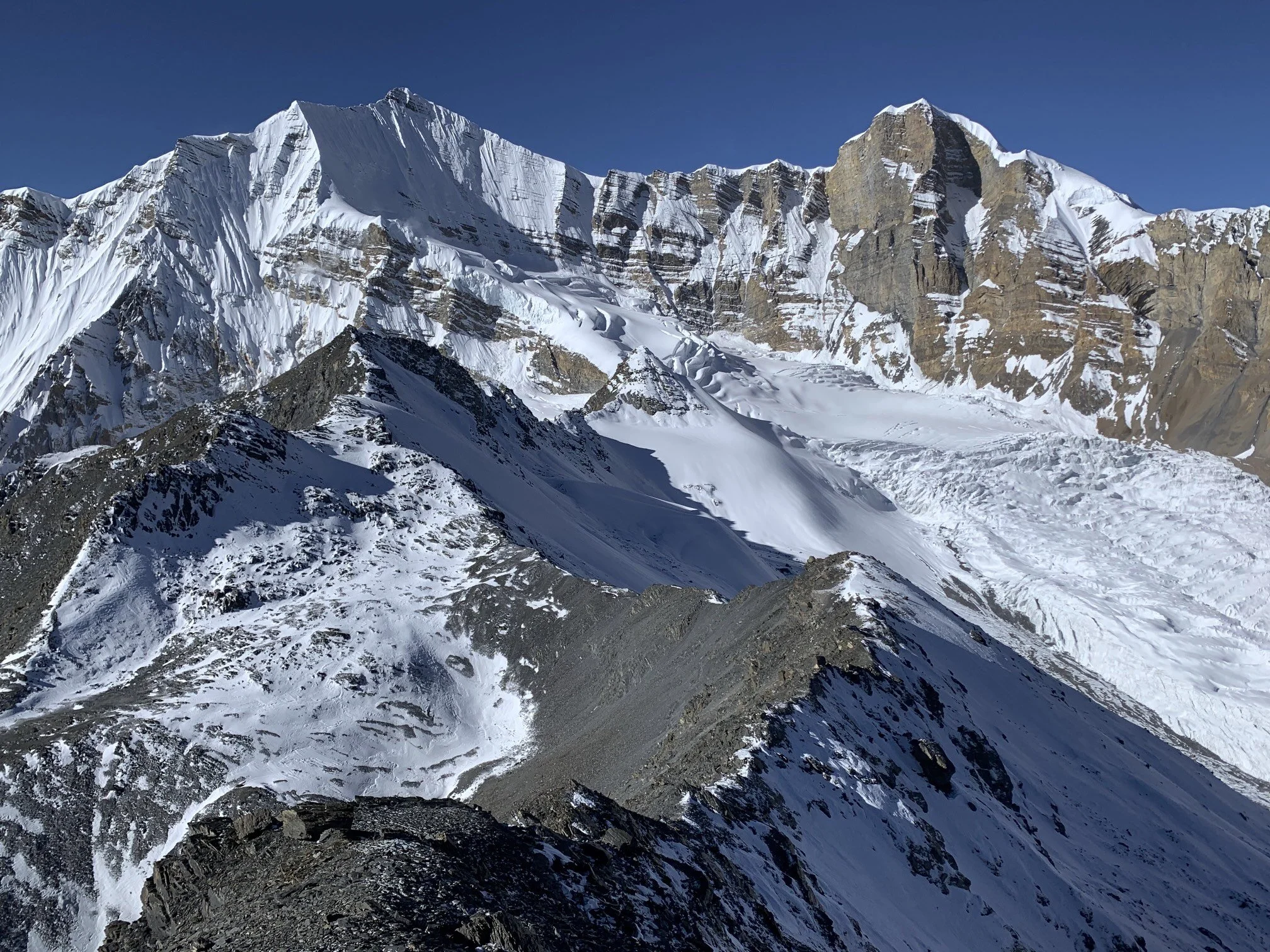
Looking towards the Annapurna Range

The Valley of Kali Gandaki


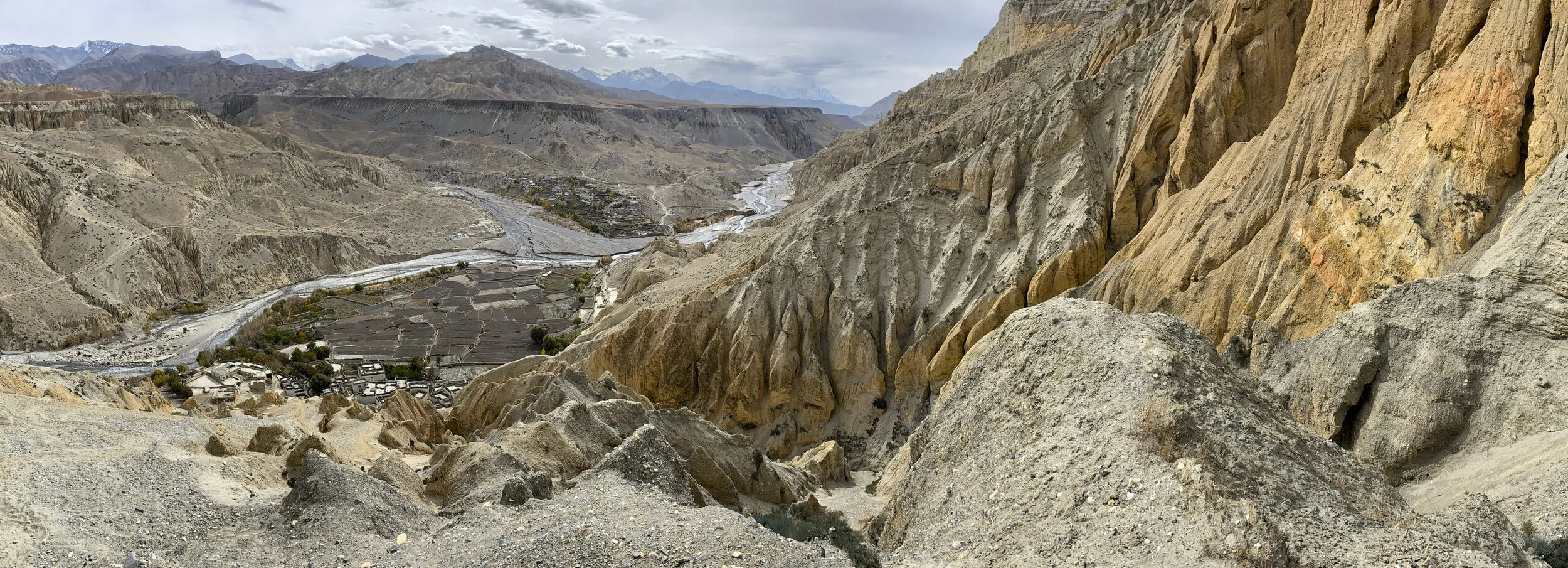
The village of Dhi is below us at the elevation of 3390m. From Dhi we ascended the valley of Puyung River to Yara.


The Puyung River valley is full of Saligrams. We spent a few hors looking for the fossils and found a boat load! Some of them were quite spectacular.

As we ascended the Puyung River valley the cliffs got higher and the canyon became narrower.

As we approached Yara, the magnificent organ pipes (over 100m tall) came into view. There were numerous caves carved into the pillars. I wish we had more time to explore them further.

The fantastic towers of Yara.


The surroundings of the Yara village are quite unique.

The village of Yara.

Life in Yara

From Yara we ventured further up the valley to explore some famous cave temples. We passed the village of Ghara along the way.


The Luri Gompa and Luri Monastary (4060m)

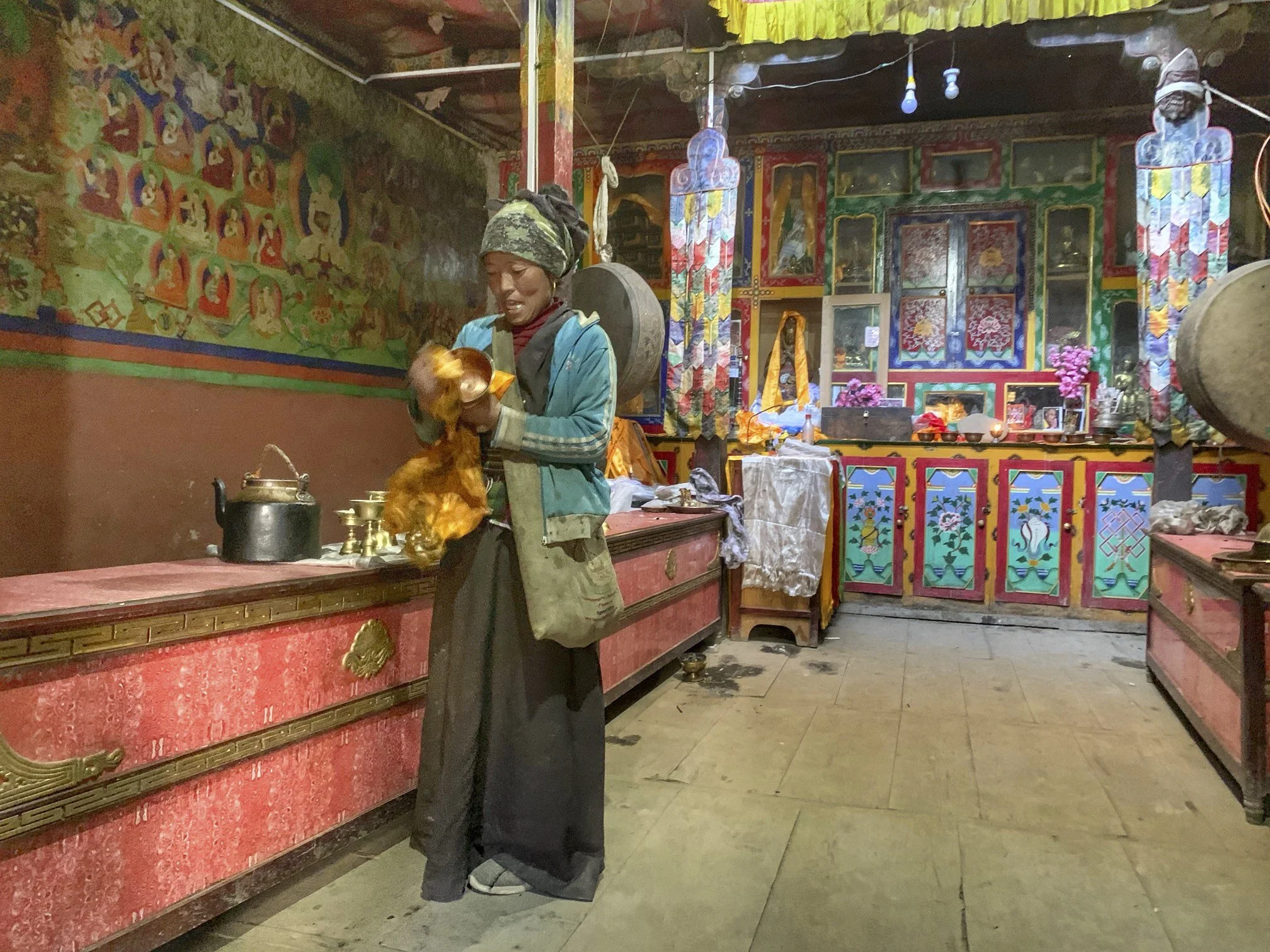
The Luri Gompa is built on top of the rocky outcrop like a birds nest. The gompa is also known as “the sanctuary of a white chorten”. There is an actual white chorten built inside the cave.


The entrance to the Luri Cave

Old murals at the entrance to the cave temple.


The white chorten inside the cave temple. The paintings above the shorted date to 13th century.


The view from the Luri Cave to the Luri Nunnery.


The Luri Nunnery
The key keeper of the Luri Cave and Luri Nunnery. There are no permanent monks in the cave or the nunnery.

The Tashi Kabum Cave. The key has to be obtained from the Yara village and if one person takes it, no other people can visit at the same time/day. Thankfully, very few people venture out here.
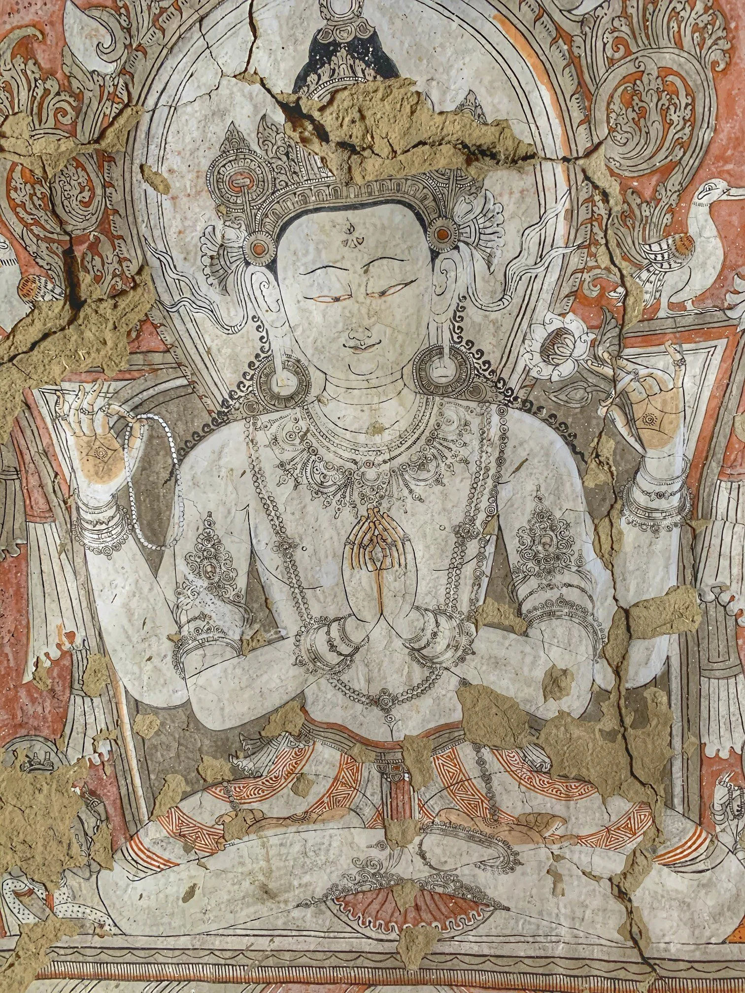
The murals of the Tashi Kabum cave. The murals date to 13th century.

The 13th century painting of a monk in Tashi Kabum cave.

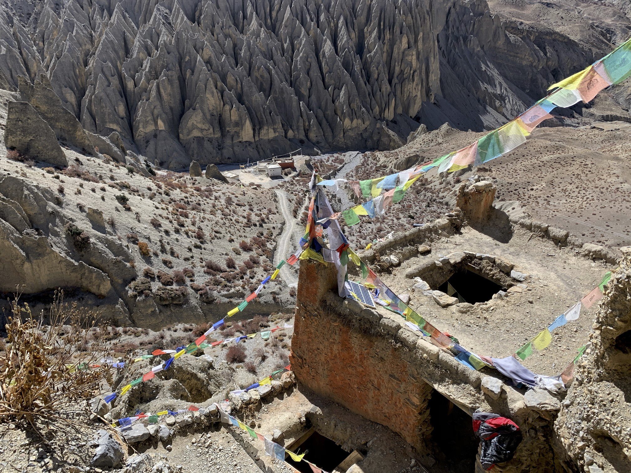
The valley around the Tashi Kabum cave is full of caves.

The valley of Puyung River.


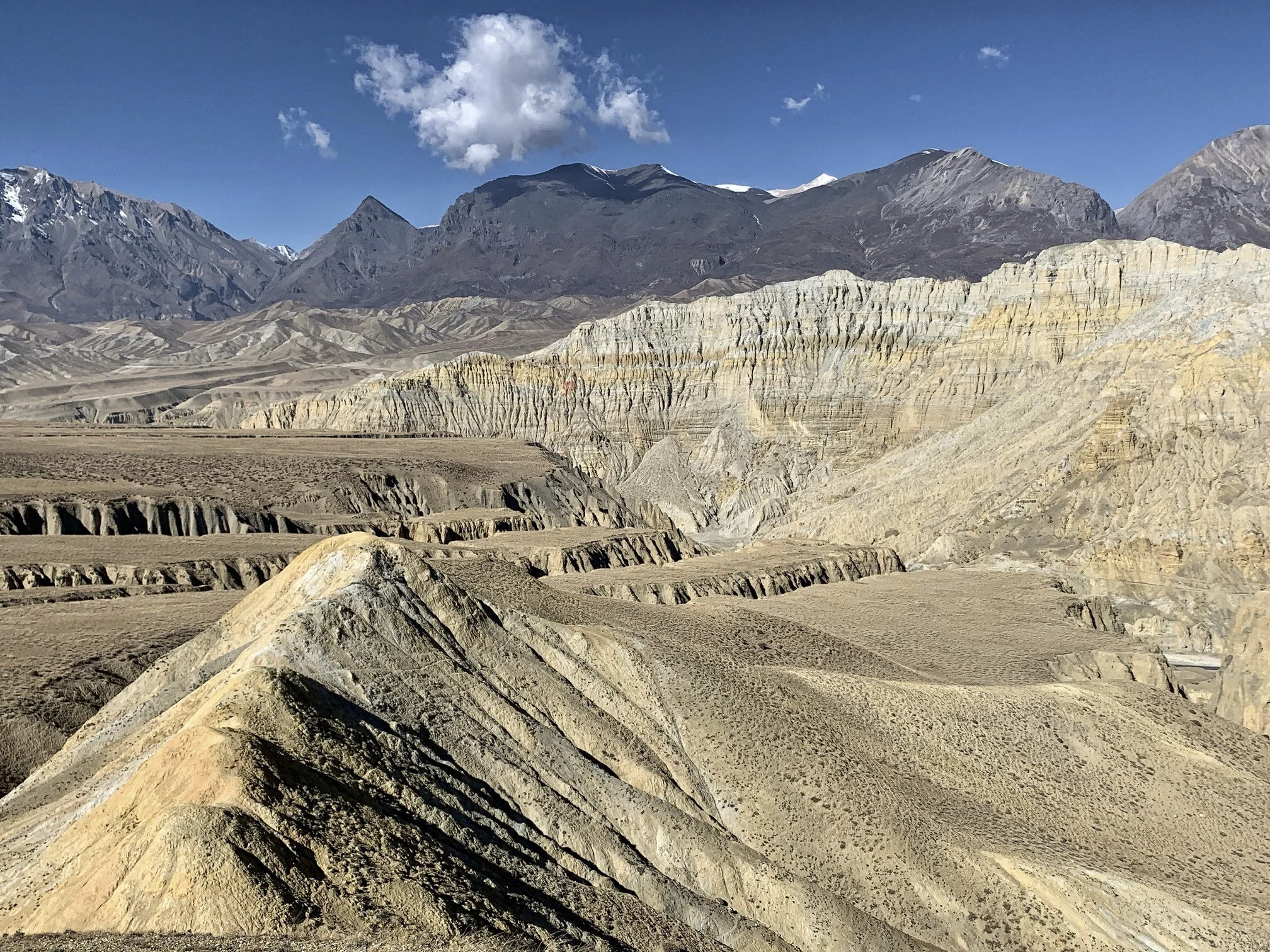
The cliffs of Yara. We had to climb to the top of the plateau and then traverse numerous river valleys to get closer to the trail to Teri La Pass.

Looking down from the plateau above Yara.

for a sense of scale notice the person standing on top of the cliffs.

Looking down to Yara.


Looking down to the Valley of Kali Gandaki.
As we walked towards Tange, the scenery became very impressive!


The valley of Dhechyang River


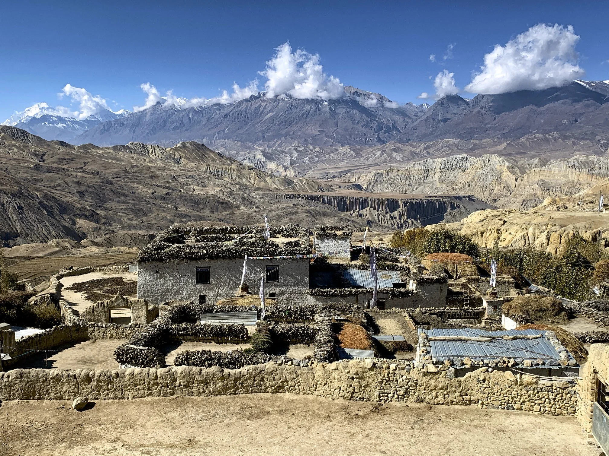
Mustang - looking south-west with Dhaulagiri 1 on the horizon.


Looking south from the trail to Tangey with Dhaulagiri 1 on the horizon.

The valley of Tannge River

The village of Tangey and the Terila Pass approach on the horizon above the village.


Tangey Village

The magnificent chortens of the Tangey Village

Tangey 3240m. Terila Pass is 2.5km above us!

The biggest group of chortens in Mustang. There are 17 chortens in the group and numerous mani stones.

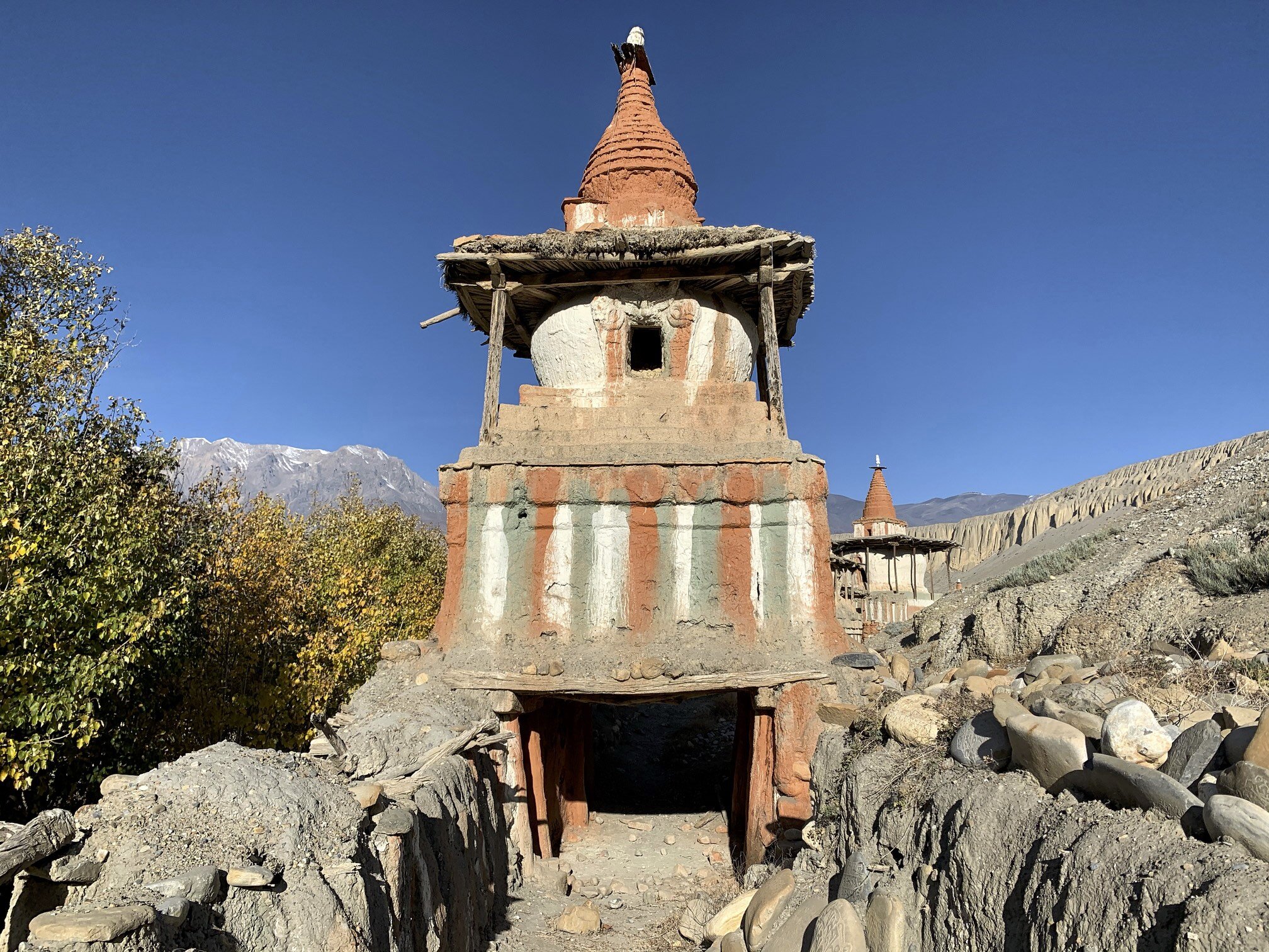
The gate chorten of the group. The murals inside the chorten date back to 15th century.

Very old prayer wheel

A beautifully carved mani stone


On the way to Terila Pass. We left the village of Tangey below.

As we got higher we could see the entire Upper Mustang below us.

Looking south with Dhaulagiri 1 on the horizon.

Looking back to where we came from - Upper Mustang and the mountains of Dolpo.

Camp 1 on the way to Terila Pass at 4000m

We camped close to the local herders with large number of goats.

The Dhaulagiri Himal and the herder’s camp below.
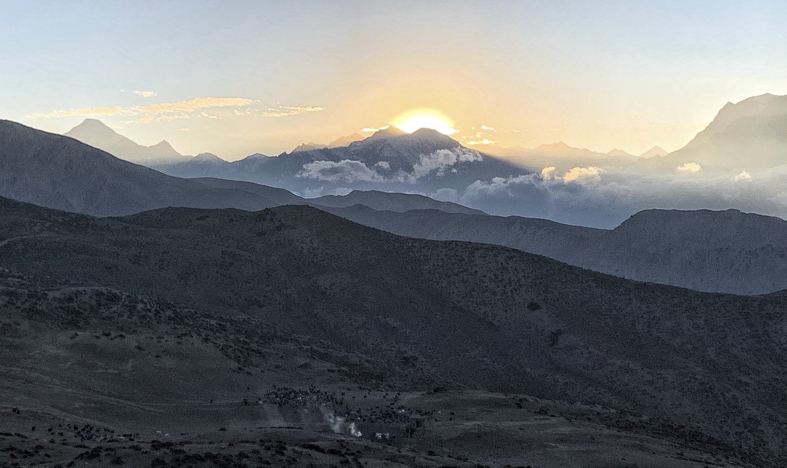
Sunset over Dhaulagiri.


Scoping out the way to Terila Pass. We had to descend from his small pass only to reclimb the lost altitude plus more!


Between camp 2 and camp 3 on the way to Terila Pass at 5000m


Approaching the basecamp for the Terila Pass at 5000m


The basecamp for the Terila Pass at 5000m


Approaching the Terila Pass 5600m

Terila Pass at 5600m

The view from 5800m above the Terila Pass. The view from the hills above the pass was much more impressive. We could see all the way to Manaslu.

Terila Pass

My inaccurate altimeter. Add another 160m.


Go to Part 4 Terila Pass to Chame via Naar and Kangla Pass