
Ancohuma is the highest peak of the northern part of the Cordillera Real Range. It is 6,427m high. It was our main reason for coming on this trip. It is a six day round trip excursion from the town of Sorata (140km from La Paz). The route has 3 camps: at 4,000m, 5,100m and 5,450m. The climb is not technical (via normal route) but it is LONG! The glacier is also very crevassed and the hidden slots present a real danger so being roped up is a must. We had fantastic weather and very good conditions. We were stopped 150m from the summit by a large crevasse that was too dangerous to navigate for us. Never the less, it was a fabulous experience and a great adventure!
The locals believe that the gringoes go to the top to find gold. According to them, there is a little lake on top of Ancohuma with gold deposits in it and we are on the mission to get it. Why would anyone go up there otherwise?


The road from La Paz to Sorata. The town of Sorata is at an altitude of 2,800m. I was there in 2010 and always wanted to come back to climb Ancohuma.

The Illampu/Ancohuma massif. The beautiful Illampu towers over the road below.

Another view of the Ancohuma/Illampu massif. Ancohuma is the round summit on the left. The massif consists of many sub peaks and many glaciers.
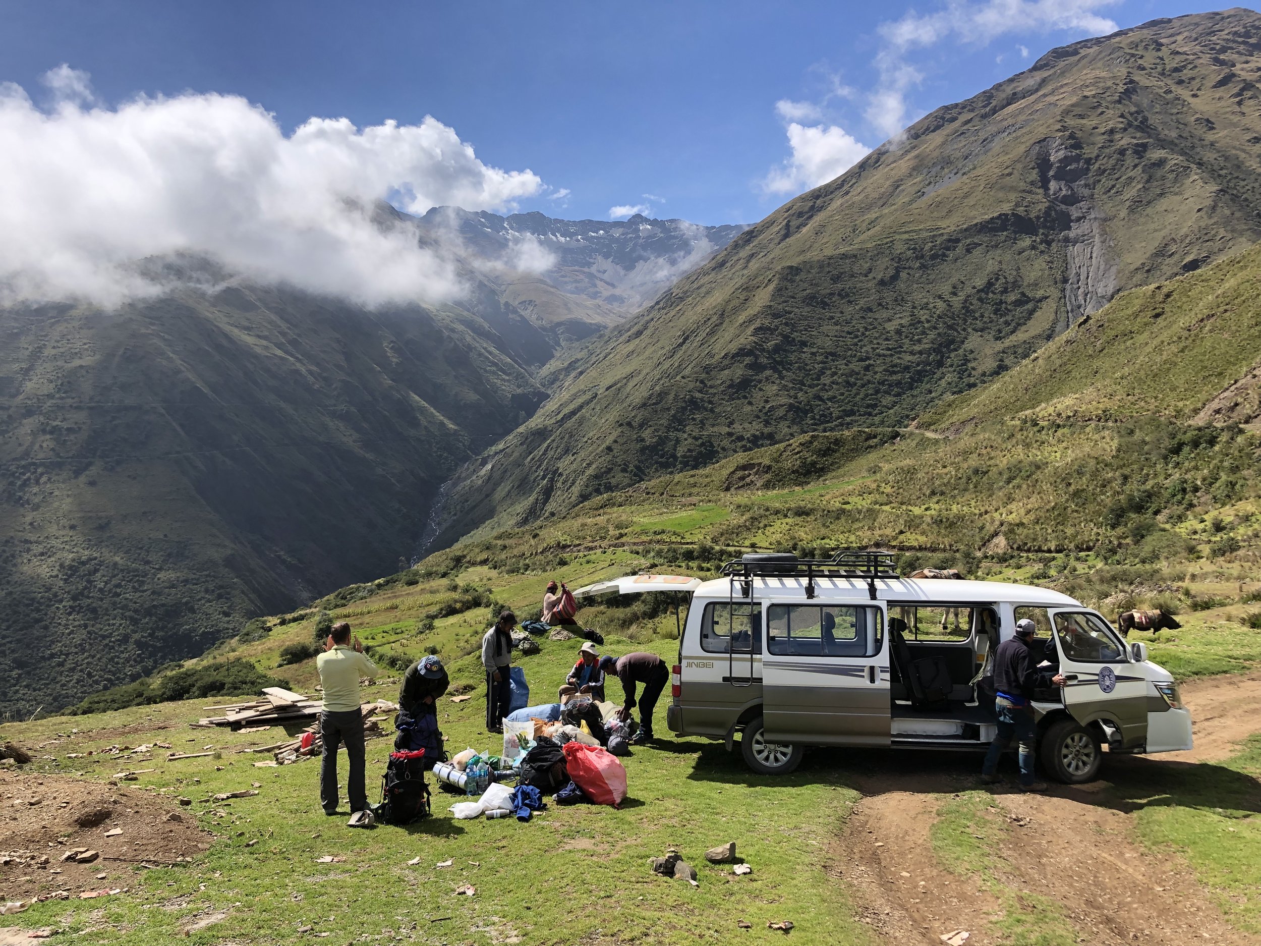
The road ends and the walking starts. We had mules help carry our stuff to the first camp.
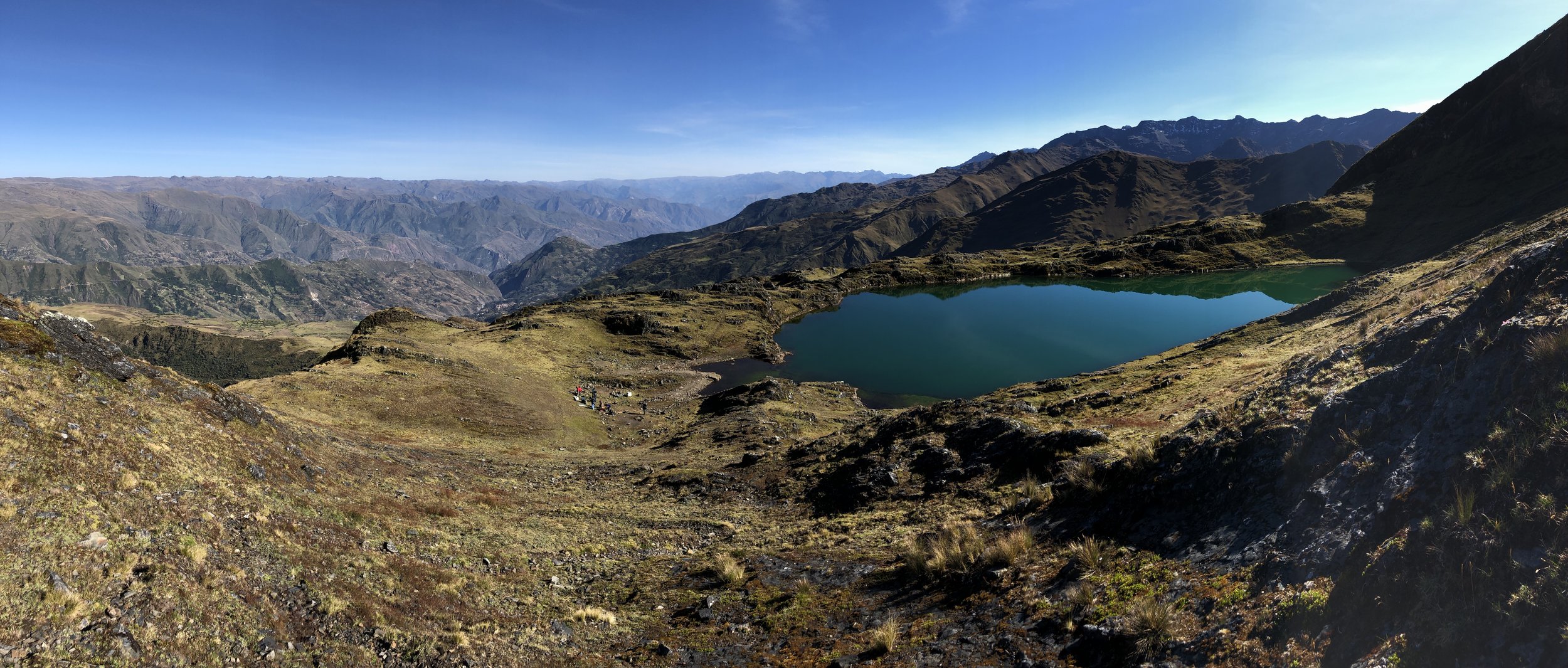
The first camp at Laguna Chillata at 4000m. It is a beautiful and clear lake which is sacred to the local people.

Our camp at Laguna Chillata.

Then the clouds rolled in and we did not see anything until the morning.

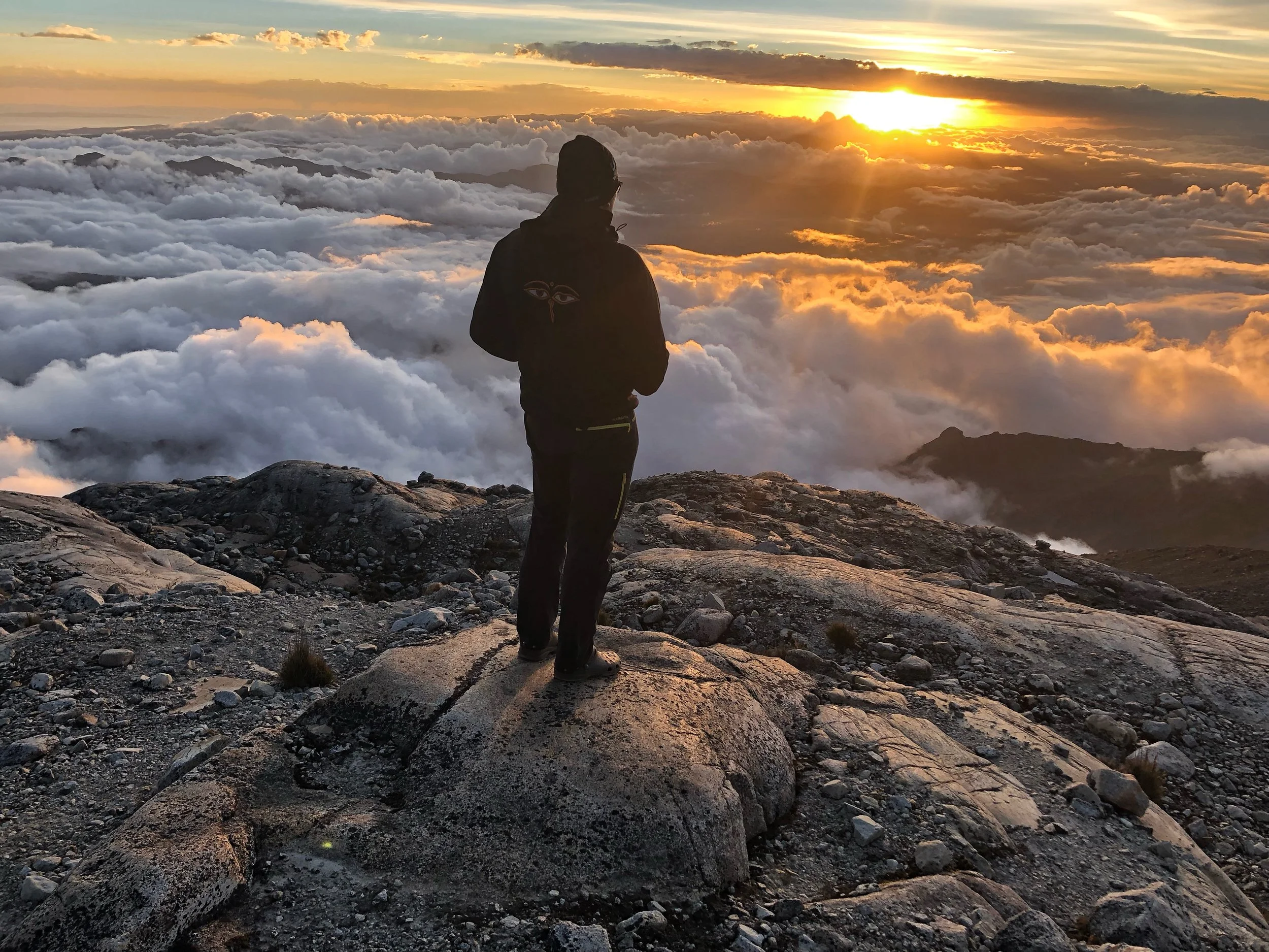
The fantastic panorama at sunset from Laguna Glaciar. You are standing literally at the edge of the world looking over the Altiplano and the Lake Titikaka.

Looking over the Royal Range from Laguna Glaciar.


The trail between camp 1 and camp 2. We could not use mules on this section and had to rely on porters.

These are the trail sections impassible for the animals.

A small pass at 4,300m.

Approaching Laguna Glaciar. Pico Schultze towers above. We are now entering the world of glaciers and moraines.

Beautiful Pico Schultze is right in front. We saw a few condors circling above and checking us out.

Our camp at Laguna Glaciar at 5,100m. This is a very beautiful spot with high Andes all around. This is how far we made it in 2010. I always wanted to come back and explore more of this fantastic corner of the Cordillera Real.

Laguna Glaciar and Illampu. Illampu is the most difficult mountain to climb in the entire range. The standard climbing route is on the opposite side of the mountain.

Compare the glacial retreat to my photo from 2010 (click)! The icefall between Illampu and Ancohuma. In a decade, the glacier moved back considerably. The melting of the glaciers makes the climbing more difficult as crevasses open up making routes impassible.

The upper section of Illampu. The glacial changes make the climbing more challenging,

Sunset on Illampu. This is the star mountain of the entire area.

Drone photo of the Laguna Glaciar and Illampu.

Laguna Glaciar


Ancohuma from the moraines around the basecamp

The trail from Laguna Glaciar to the High Camp at 5,450m. We are now on permanent snow/ice.

The views were getting quite spectacular as we approached the high camp.

One of our porters approaching the high camp. Illampu is in the distance.


The high camp is on the edge of the high moraine. It is a fantastic spot with great views. There are a few flat platforms for tents.

Looking down to the Altiplano from 5,350m near the high camp.

Panoramic view from the door of our tent.

The altitude of the high camp. My altimiter is off by 180m so it is really 5,465m.

The high camp.

Our camp! What a view!

Illampu

We would soon be well above this peak on the way to Ancohuma.

We had to negotiate this maze of ice - not too difficult as you could see the obstacles. The real challenge was higher up where everything was flat and snow covered!


Gregorio scouting the route for the following night. We wanted to follow our own trail and not wander in the dark.


At sunrise we were above the ice maze and on the large plateau. This part was the most dangerous for the hidden crevasses.

Illampu at sunrise.

Plodding up. It was so very cold! My water froze in my pack. We were waiting for the sun to come out but it would be a long time. Once the sun came out, the temperature shift was 50C! It became unbearably hot and the glacial radiation was very intense.

Well above 6,000m. Approaching the final section fo the climb. the summit is just above us.


The summit part of the mountain. We are 150m below the summit.

Looking down to where we came from.

Coming close the the summit ridge.

This is where we encountered the impassible crevasse. We made the decision to bail.


Looking down to our route. The camp is well below!


The rocky summit that towers over the Laguna Glaciar is now very small and well below us.

Add 180m - our approximate high point.

One of the hidden crevasses… Rope is an absolute must!

Working our way across one of the crevices with the summit bulk of Ancohuma behind.


Illampu


Our camp is on the lower left by the last rocky outcrop

Illampu

Our camp from the glacier


Going back to Laguna Glaciar

Above Laguna Glaciar


Our small team; Gregorio, Ricardo, Gilles and I


Lake Titikaka from 5,000m


Back where the plants grow!

And just like that, it is all over! Until the next time! It was a fabulous adventure yet again.