Pakistan 2023 Trip Report Part 1 - Choktoi Glacier

I have been trying to organize a return trip to Pakistan for 10 years.  Now, here I am, I am finally going! The process of organizing this trip was quite involved. 

July 10, 2023 Skardu

I had a night connection from Doha to Islamabad.  My flight departed Doha at 2 am and arrived at 7 am.  Effectively, this was my second night without sleep due to flying.  I was tired when I arrived in Pakistan.

Ghulam met me at the airport in Islamabad.  We have not seen each other for 18 years!  We had a nice cup of tea in the arrivals terminal and then went to Ghulam’s house where I stayed for the night.  I caught a bug during the inbound trip and developed a sinus infection.  This is not what you would want right before hitting the mountains and higher altitudes! 

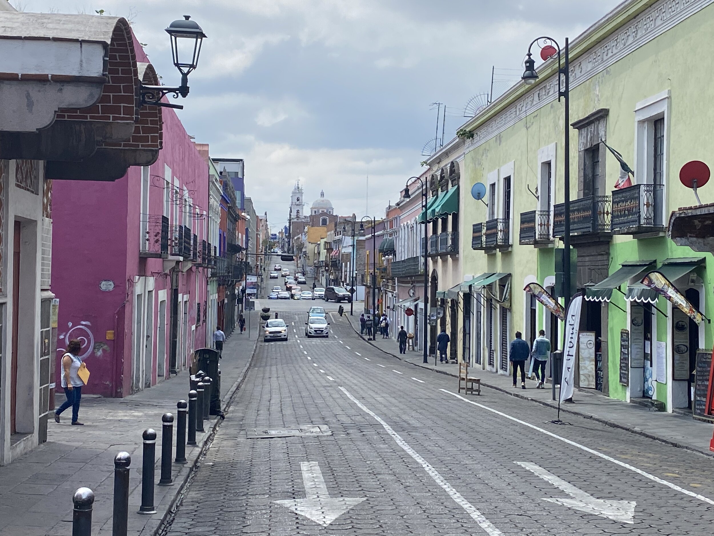
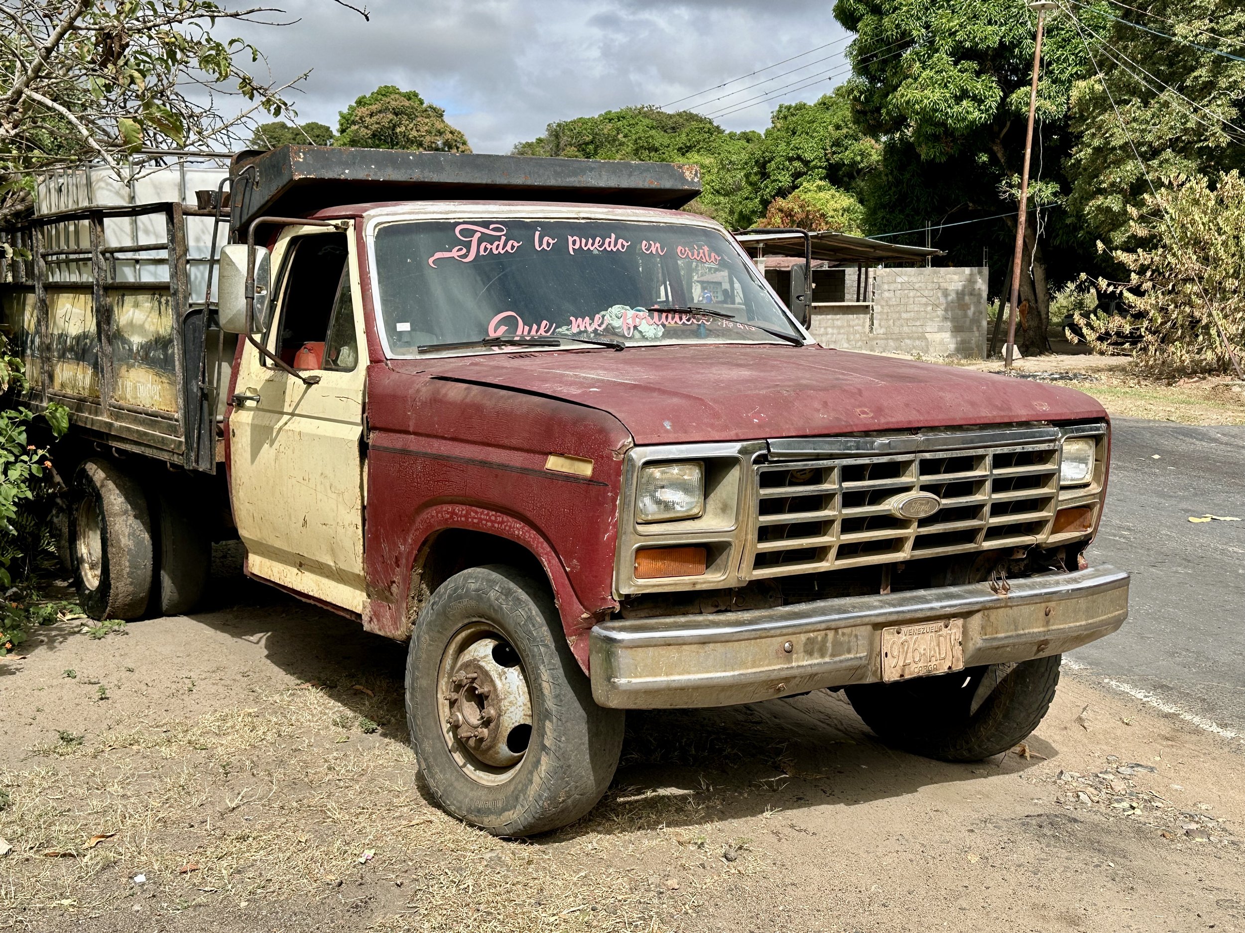
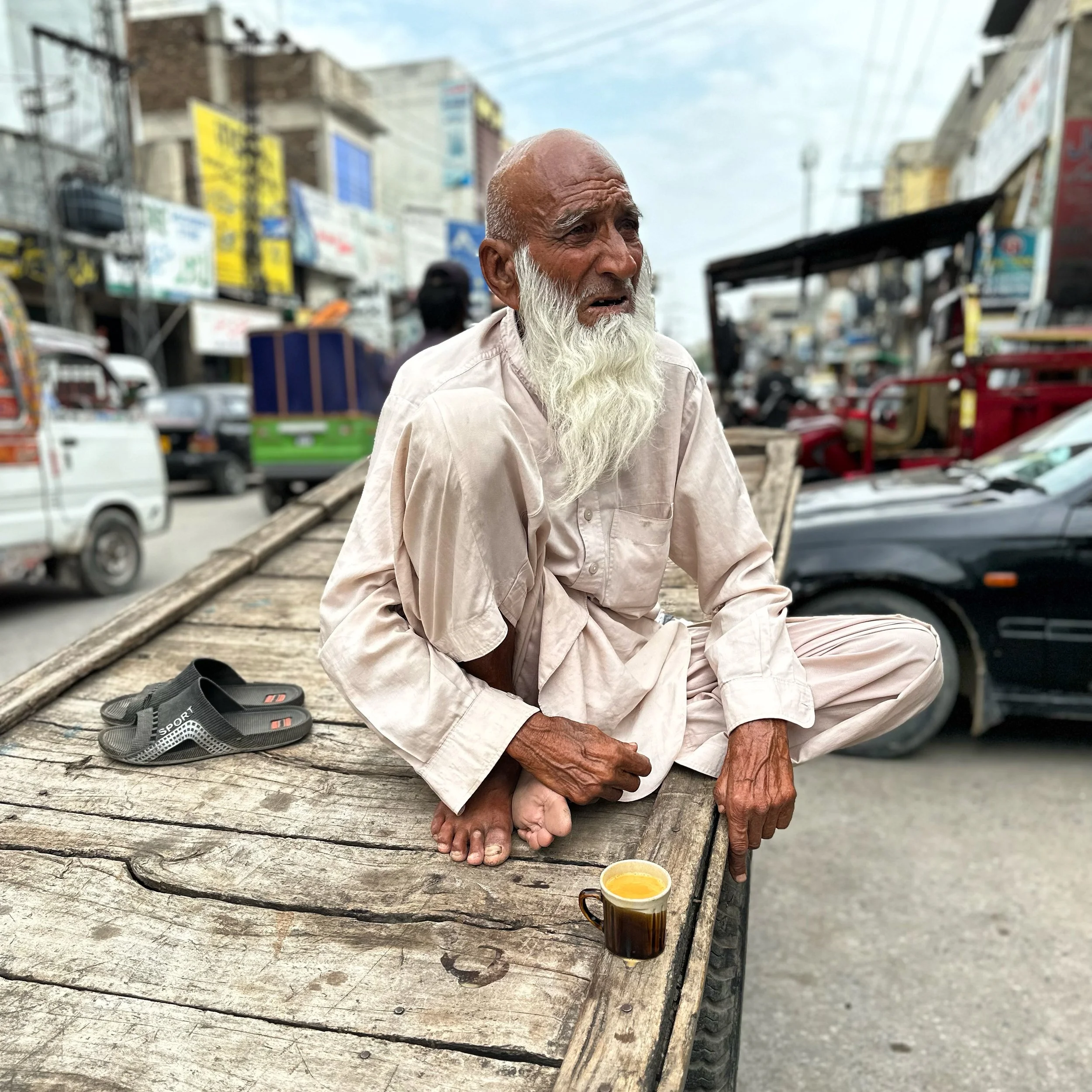
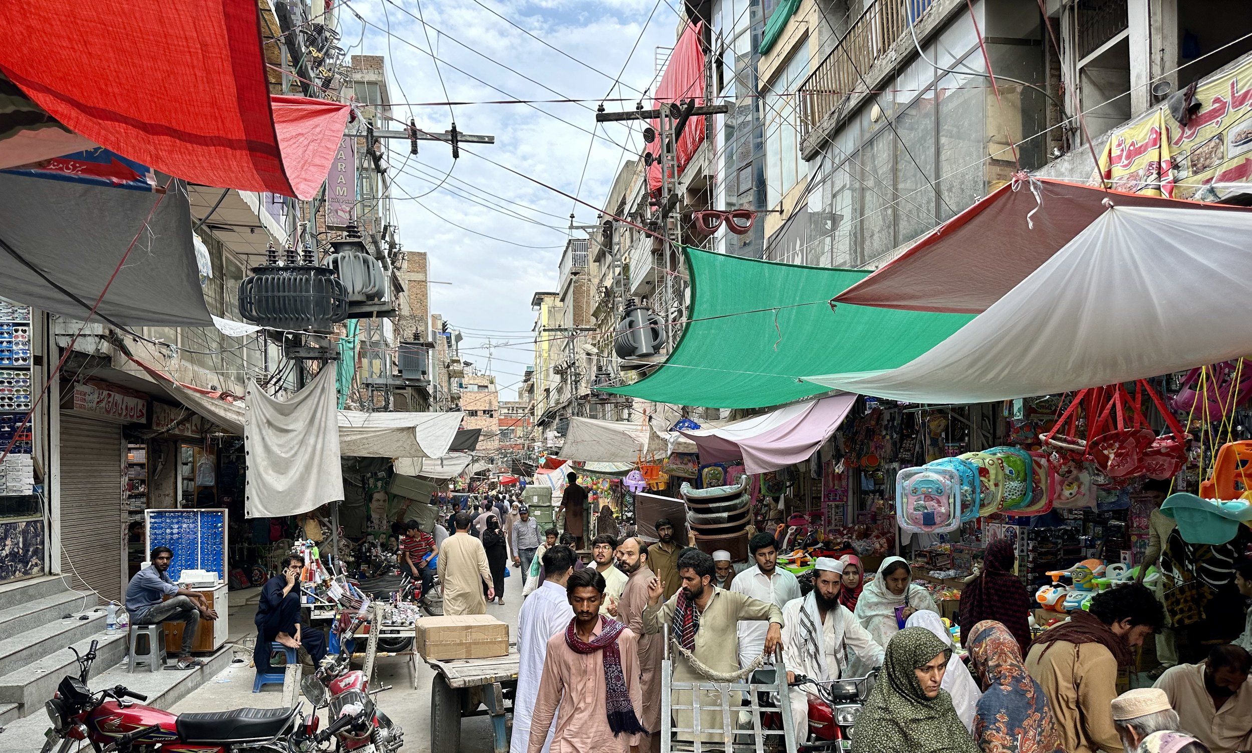
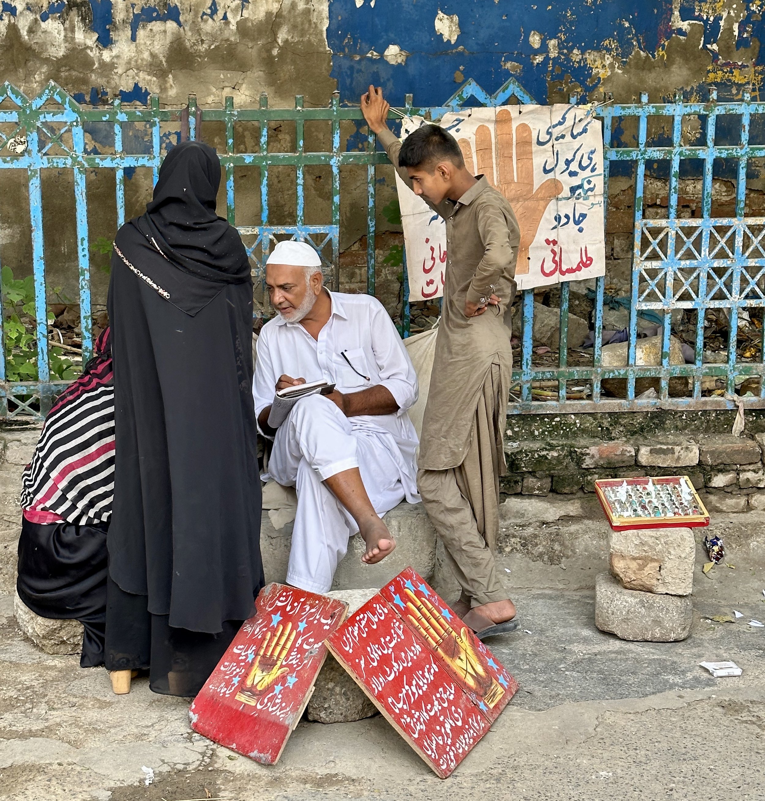
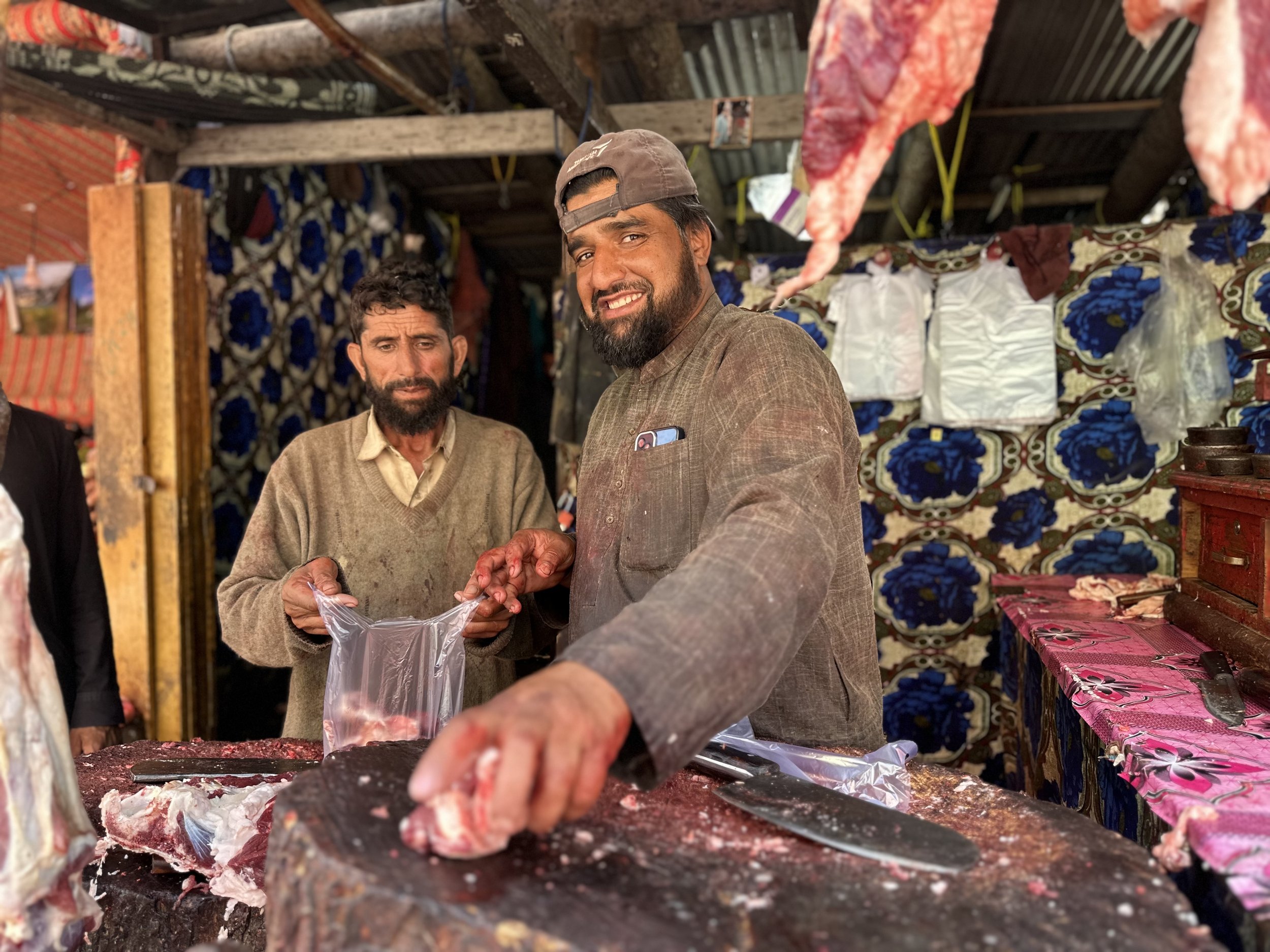
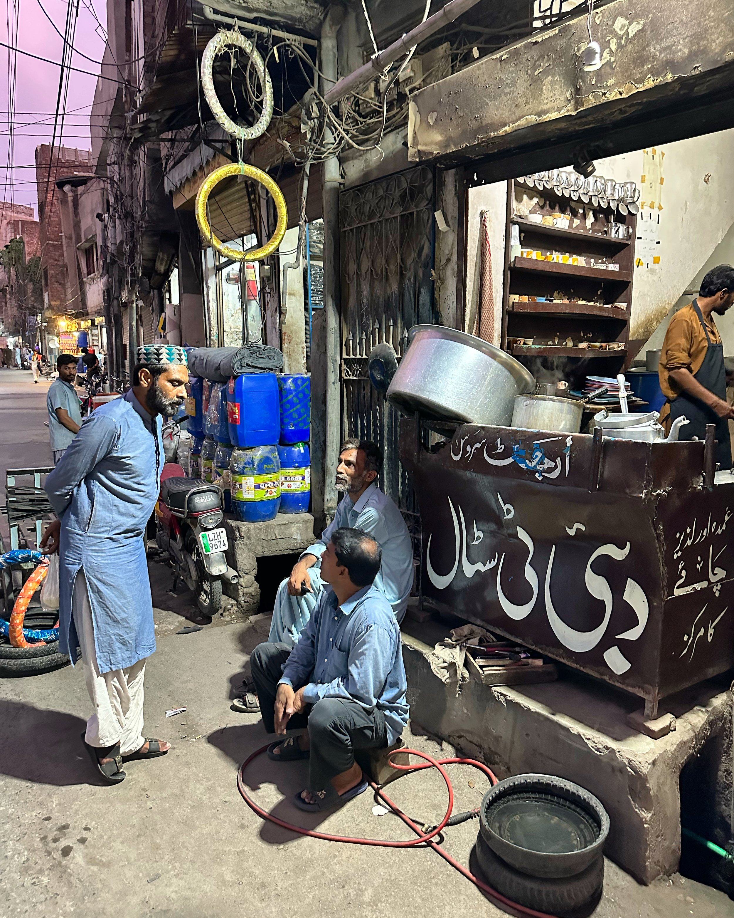
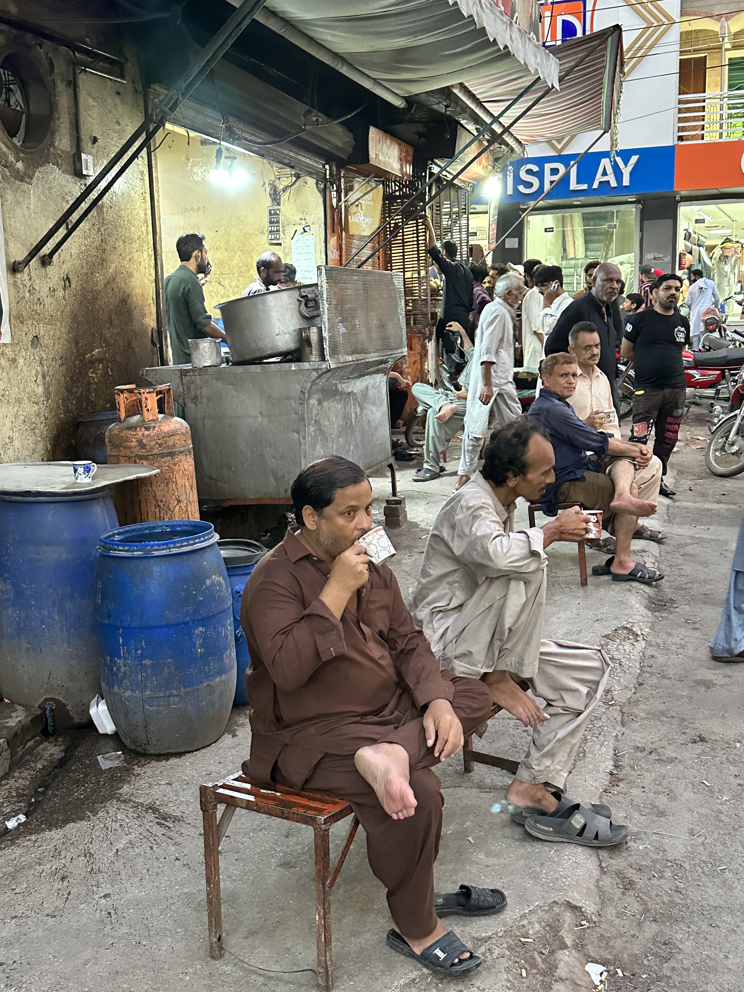
I rested during the morning and early afternoon and tried to get over the cold by taking some medications.  Given my short stay in Islamabad I also wanted to visit Rawalpindi Raja Bazar.  I enjoy the chaos and the hustle and bustle of the old Rawalpindi.  I was surprised with the abundance of western junk food and sodas at the Bazar.  There were a lot of people, cars and motorcycles and the resultant noise and commotion.  The market was great, a typical Asian market with everything available for sale.  I even run into local transvestites looking for cash donations.   I took a few photos, but I was so tired and felt quite sick so I did not enjoy it as much as I should.  Ghulam and I walked quite some distance and ended up at the far end of the bazar.  To return to our starting point, we took a newly built train/bus that runs on an elevated platform.  The entire visit to the bazar felt different from my first visit to Islamabad in 2001.   

After the quick tour of the bazar, we went to the Kabul Restaurant in Islamabad for some good skewers and Afghani bread.    The restaurant has delicious food but because of the jetlag and my cold I could not really enjoy it fully either.  After the supper, I was very tired and went straight to bed.  We had a long, two-day drive to Skardu ahead of us! 

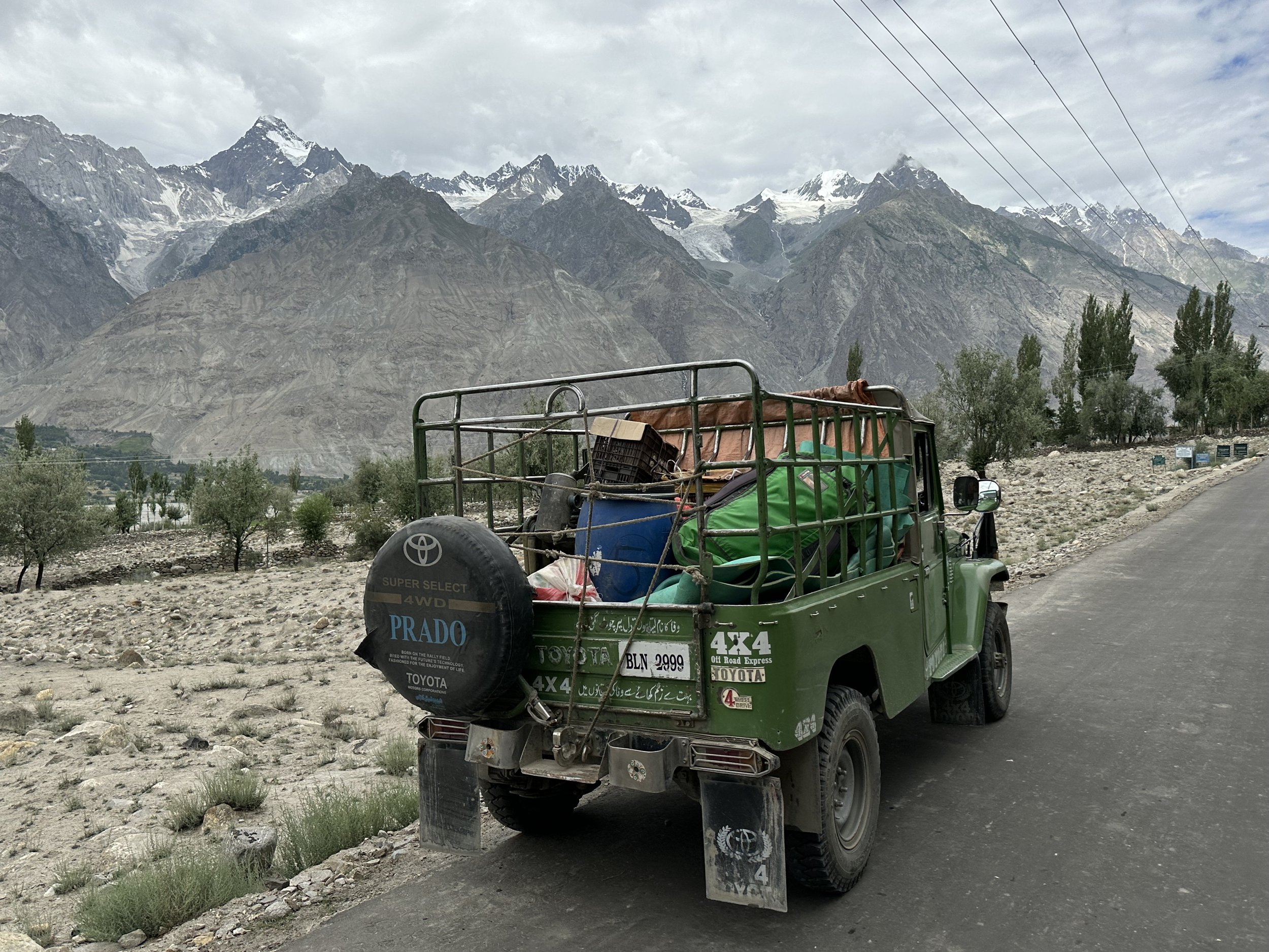
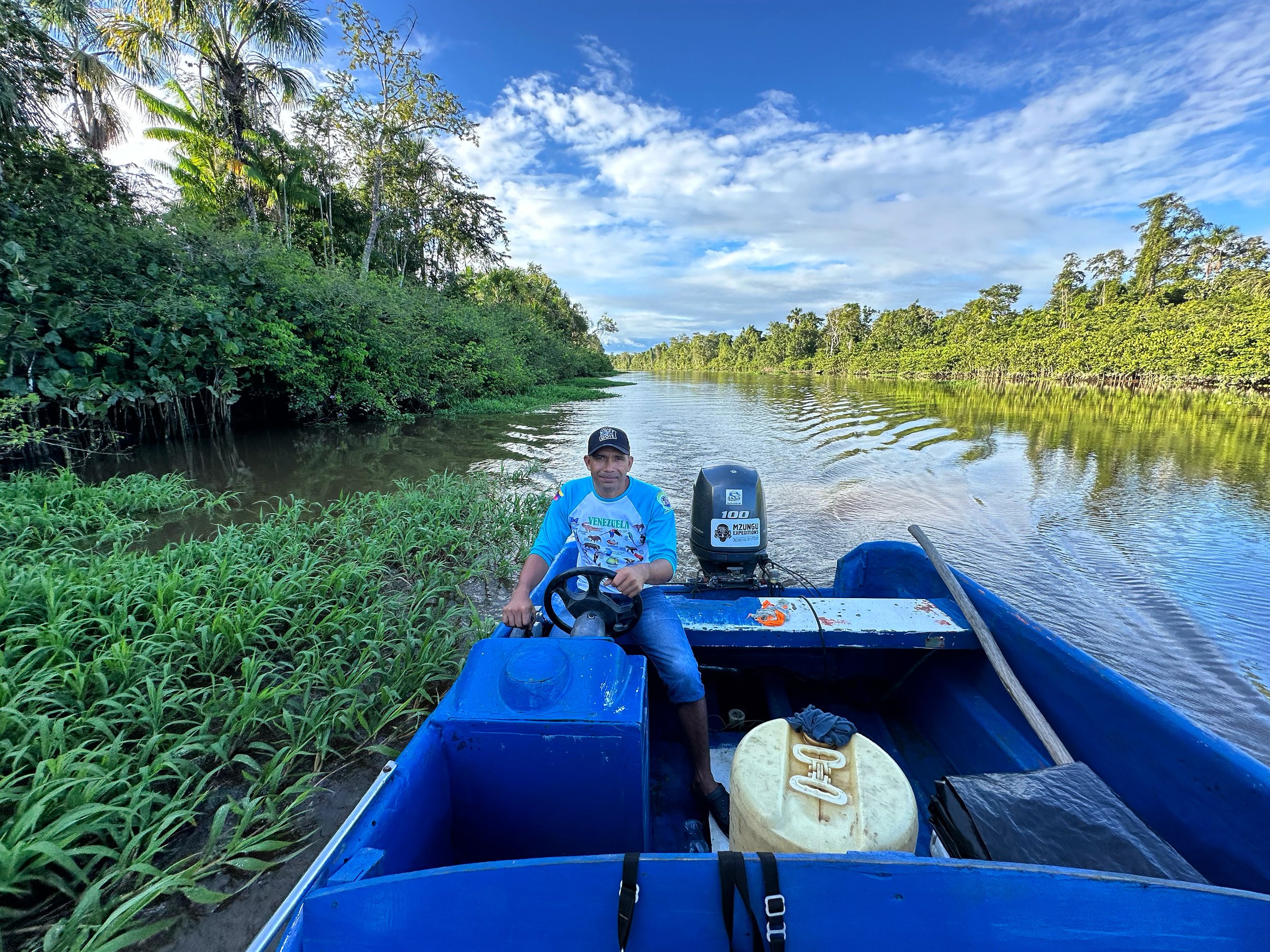
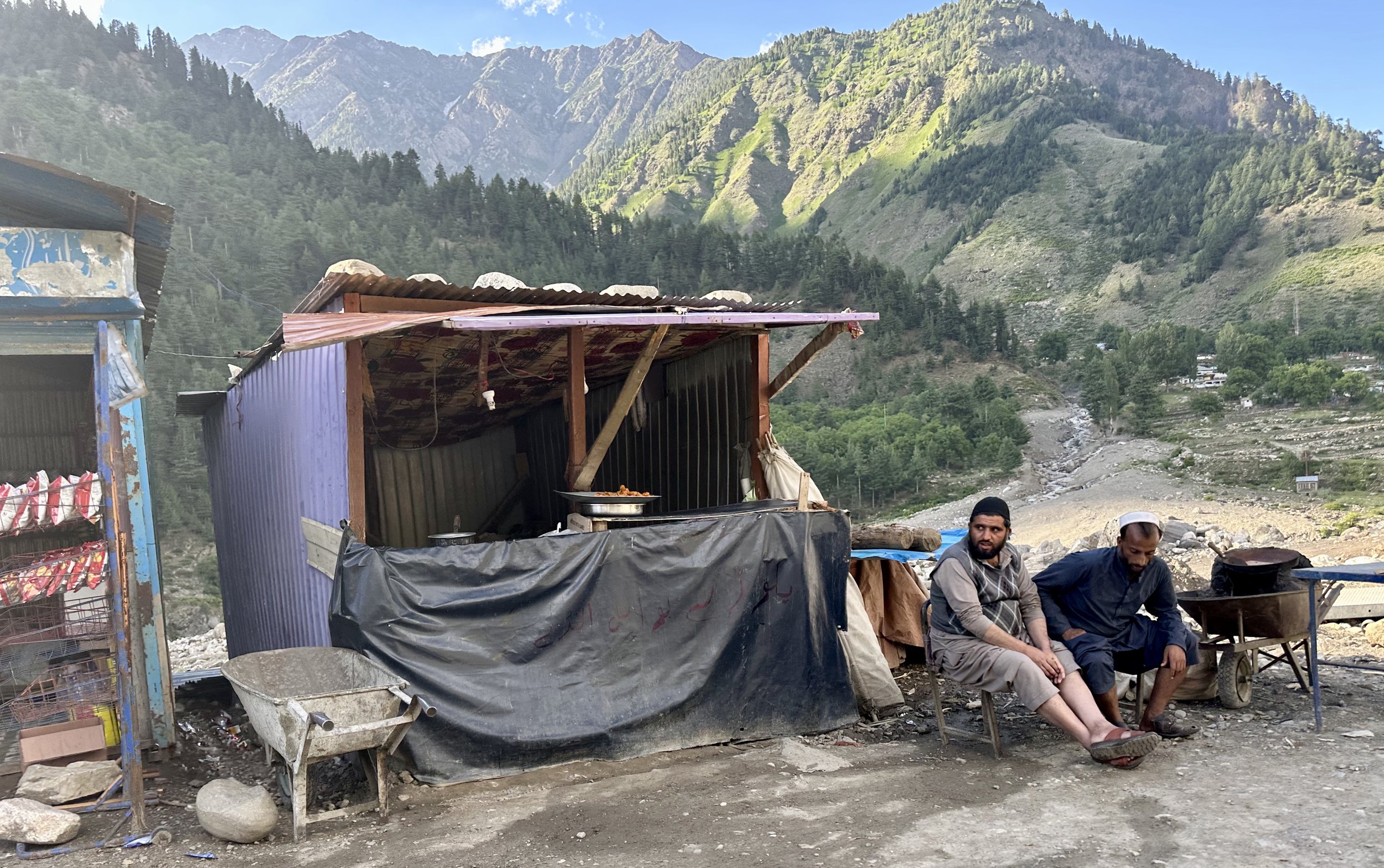
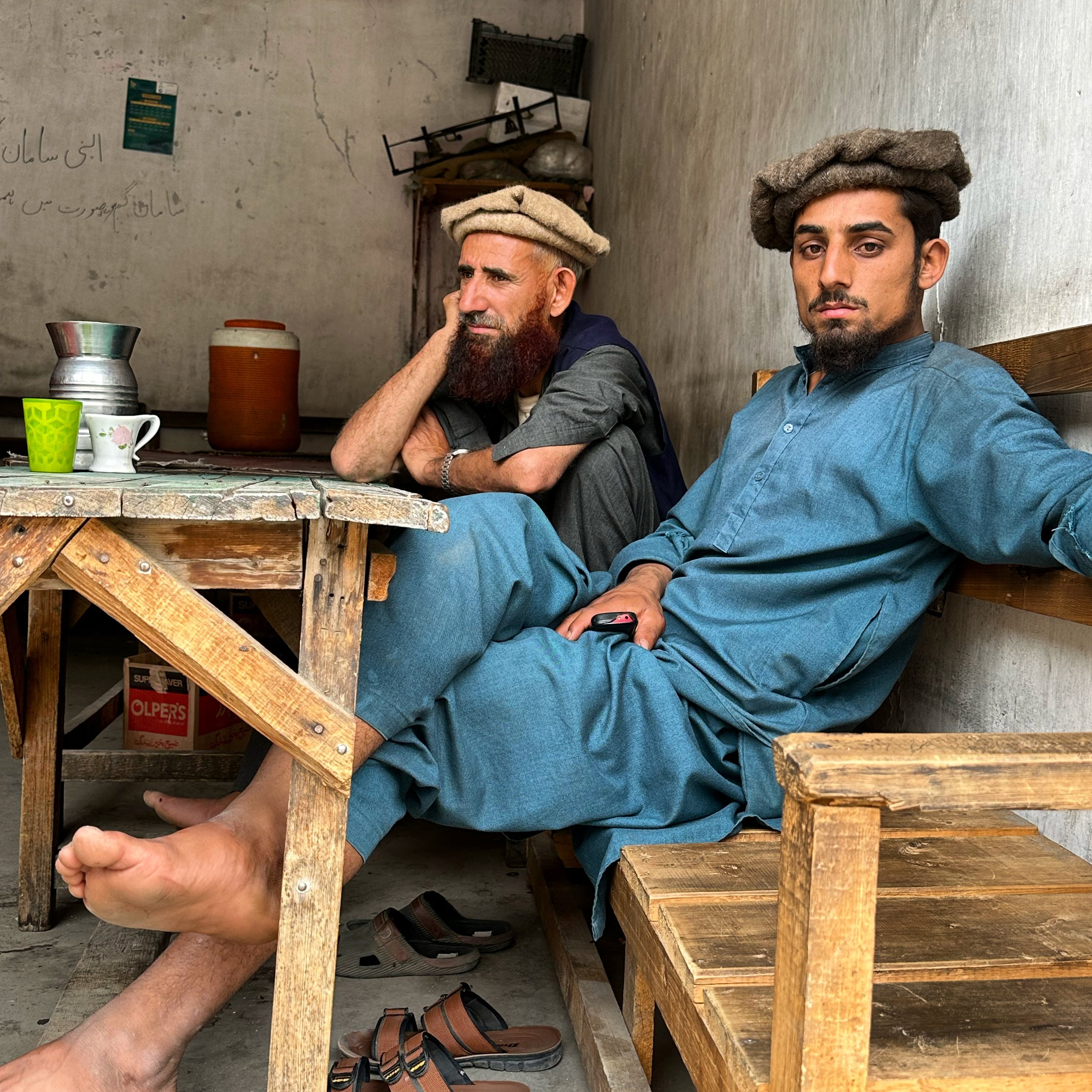
In the morning I felt much better.  Amazing what a good night sleep can do!  Ghulam hired a private car.  We left Islamabad on a modern highway and drove in the direction of Peshawar.    What a difference from the old Great Trunk Road from 2005!  I must admit that the old road was more charming.  After Abbottabad we joined the Naran/Babusar Pass road.  It was busy as many domestic tourists were going to the Naran Valley (Pakistan’s chic mountain resort).  On the way, we took a detour to buy big bags of onions and tomatoes.  Apparently Skardu has some transportation problems affecting the availability of onions.  Ghulam and the driver bought enough onions and tomatoes to last them for a year!   The detour provided me with an opportunity to take interesting photos of the local men. 

The Naran road was all new to me.  In 2005 this valley was considered too dangerous for tourists, and everyone took the Karakorum Highway instead.  Now, Naran has been built up and serves as the closest mountain retreat from the heat of the low-lying Punjab mega cities. 

The Pakistani middle class must be quite numerous judging from the number of cars and people heading to Naran.  Our driver was like a Formula 1 driver:  speeding whenever he could, overusing his horn and not following the rules of the road.  At one spot, mid-way up the Naran Valley, we were slowed down at a Chinese Dam construction site.  The road around the construction site was in a state of chaos.  The traffic was being diverted to a temporary road to bypass the construction resulting in a big delay. 

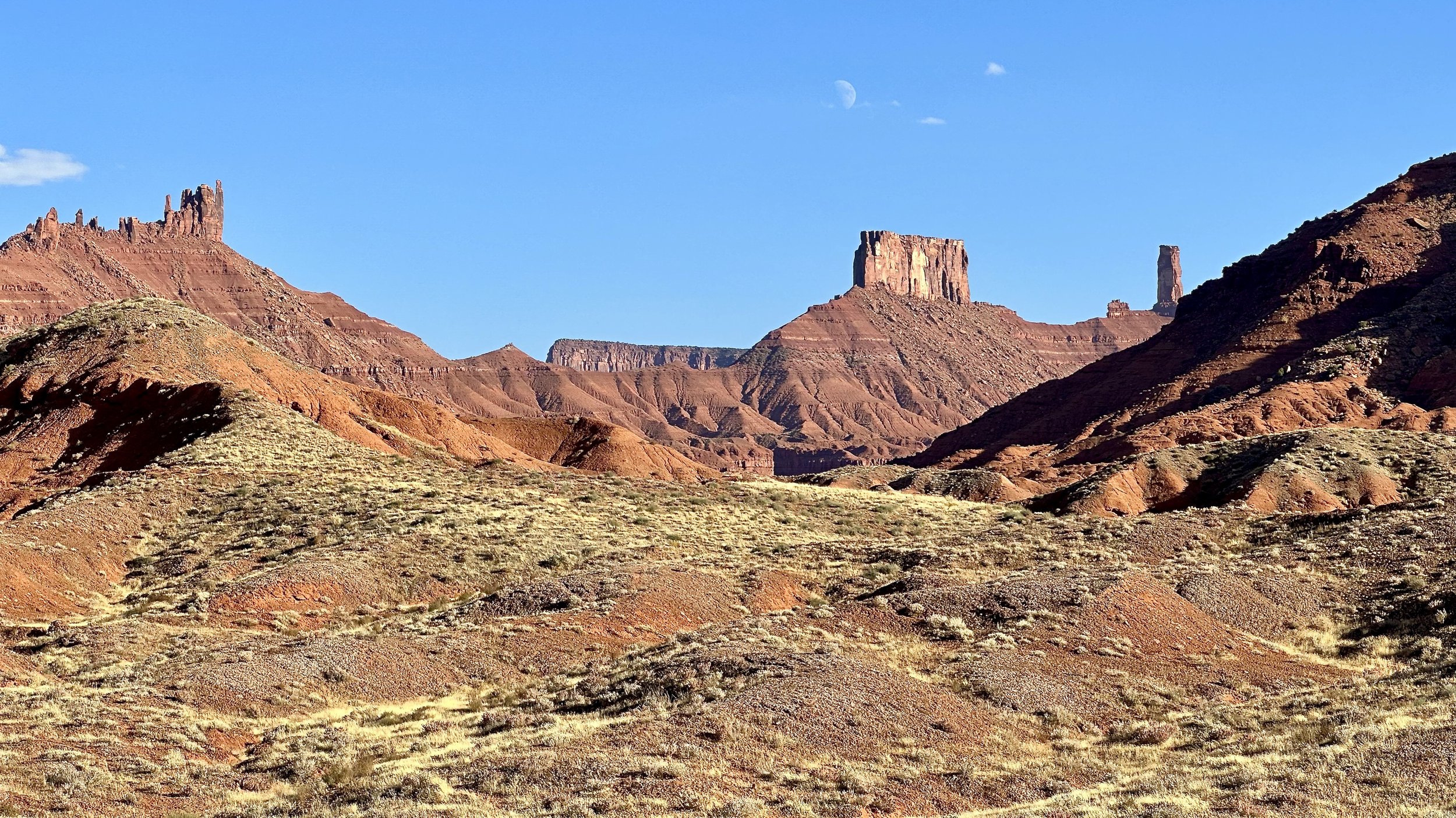
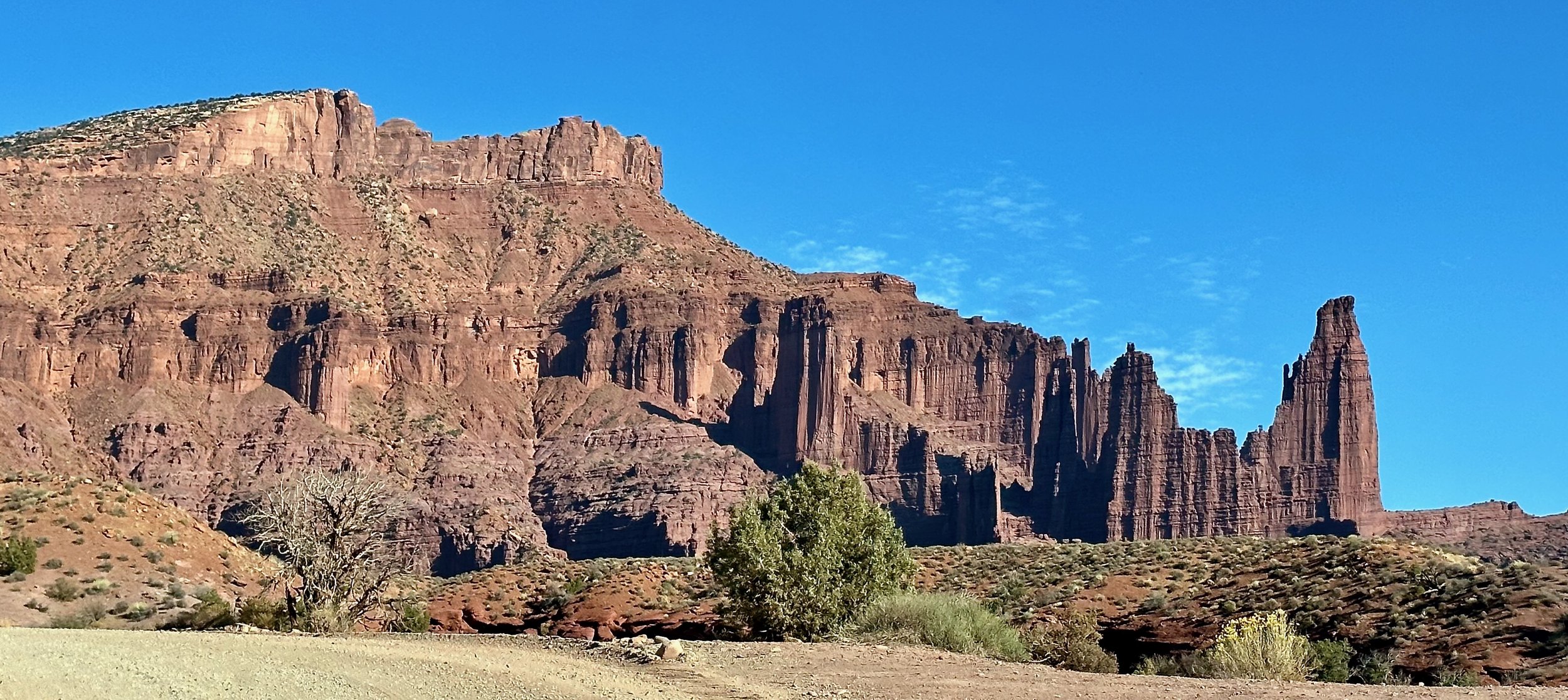
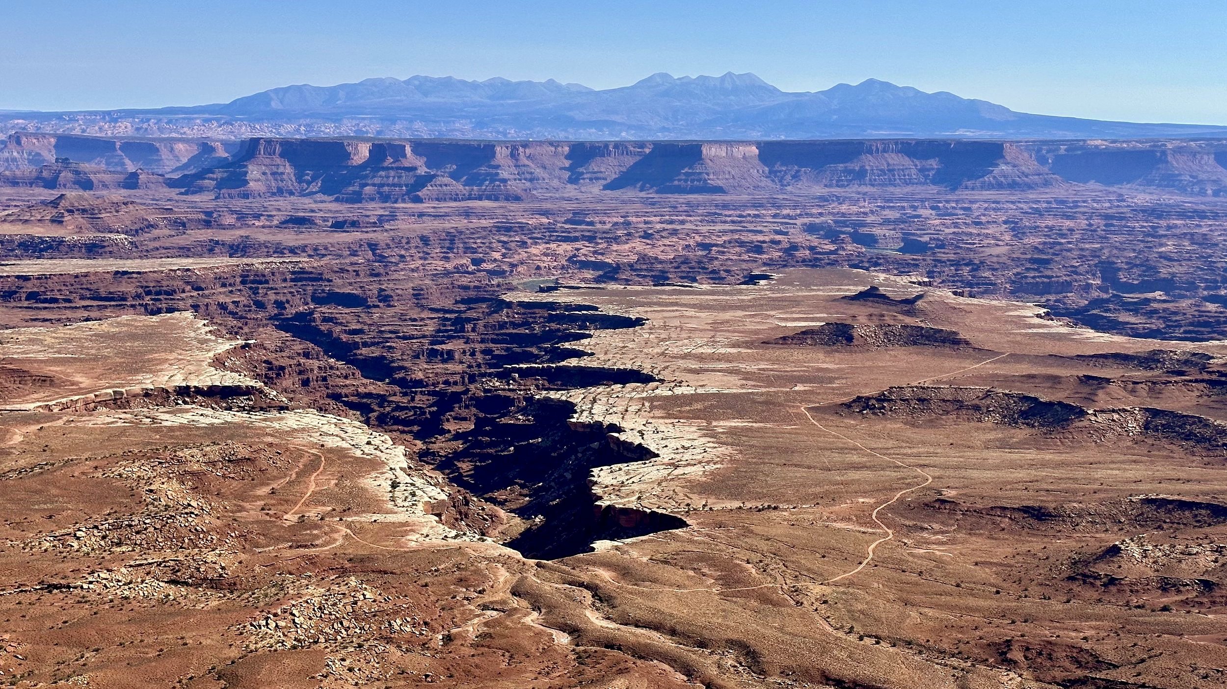
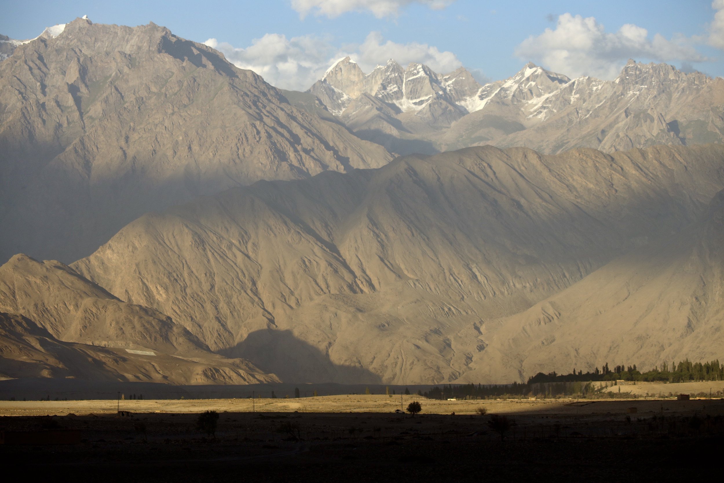
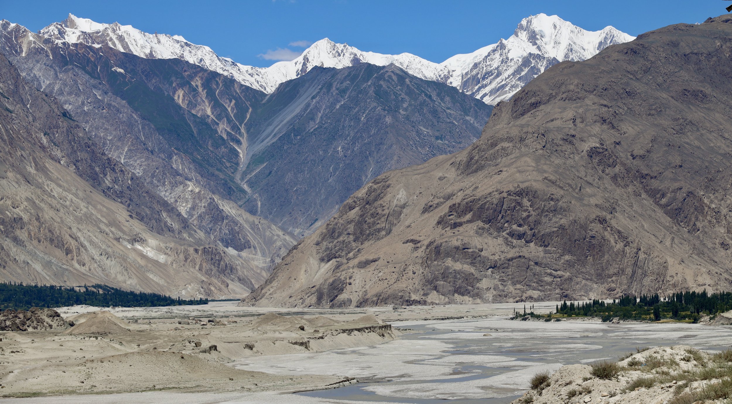
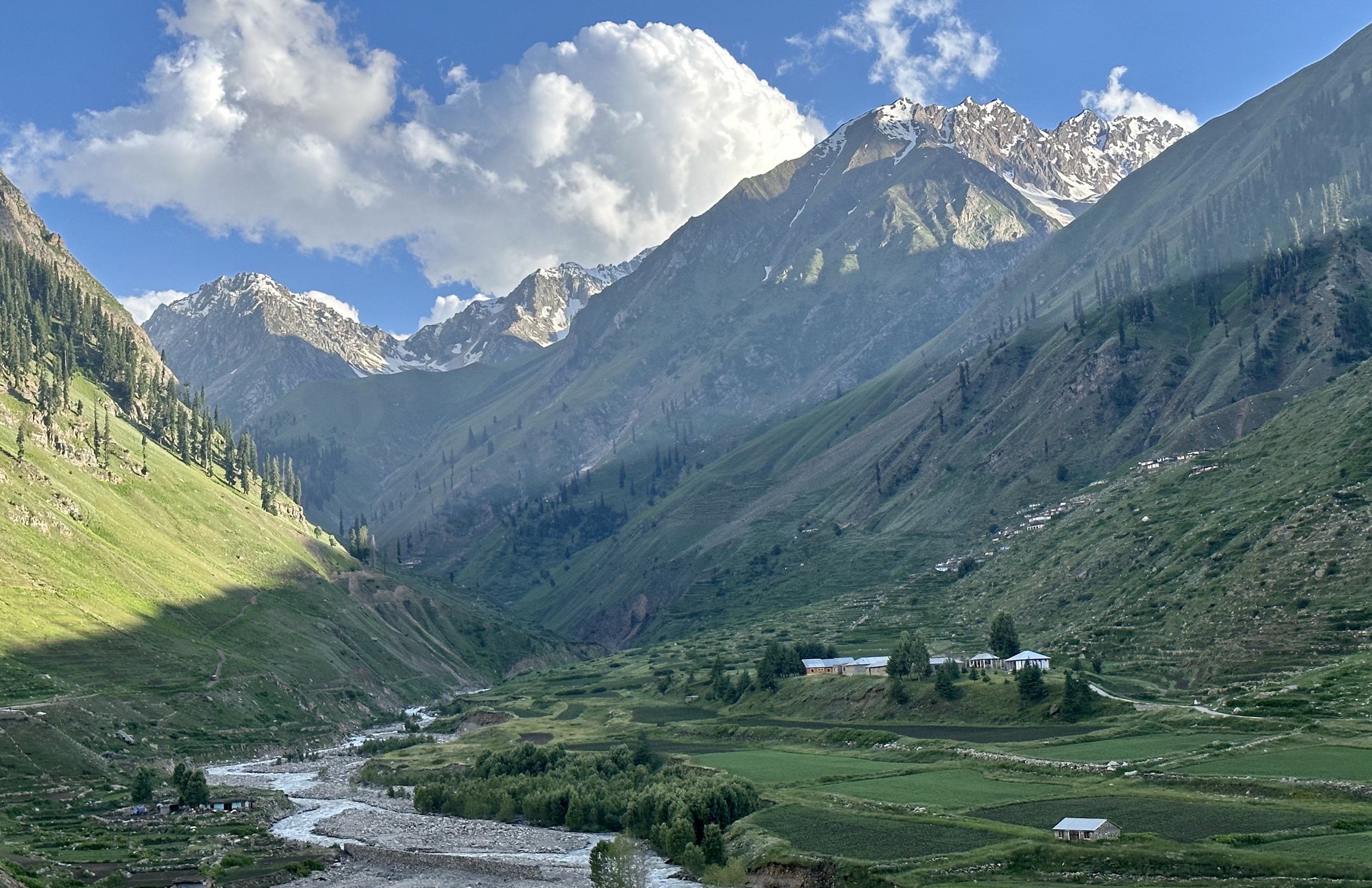
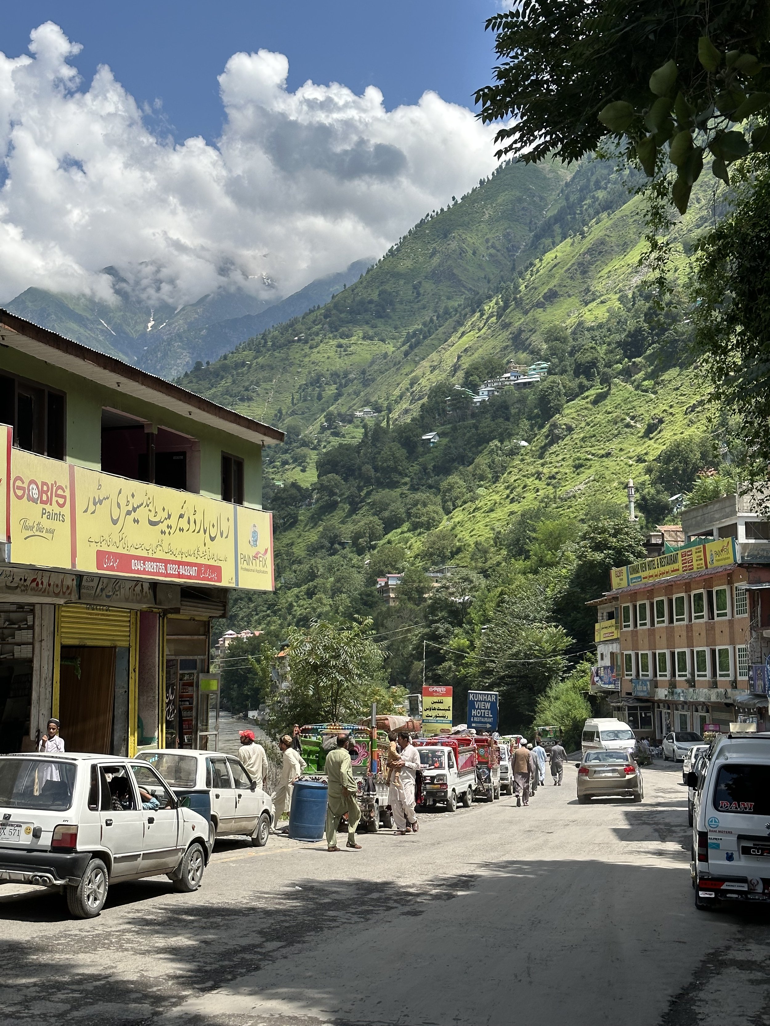
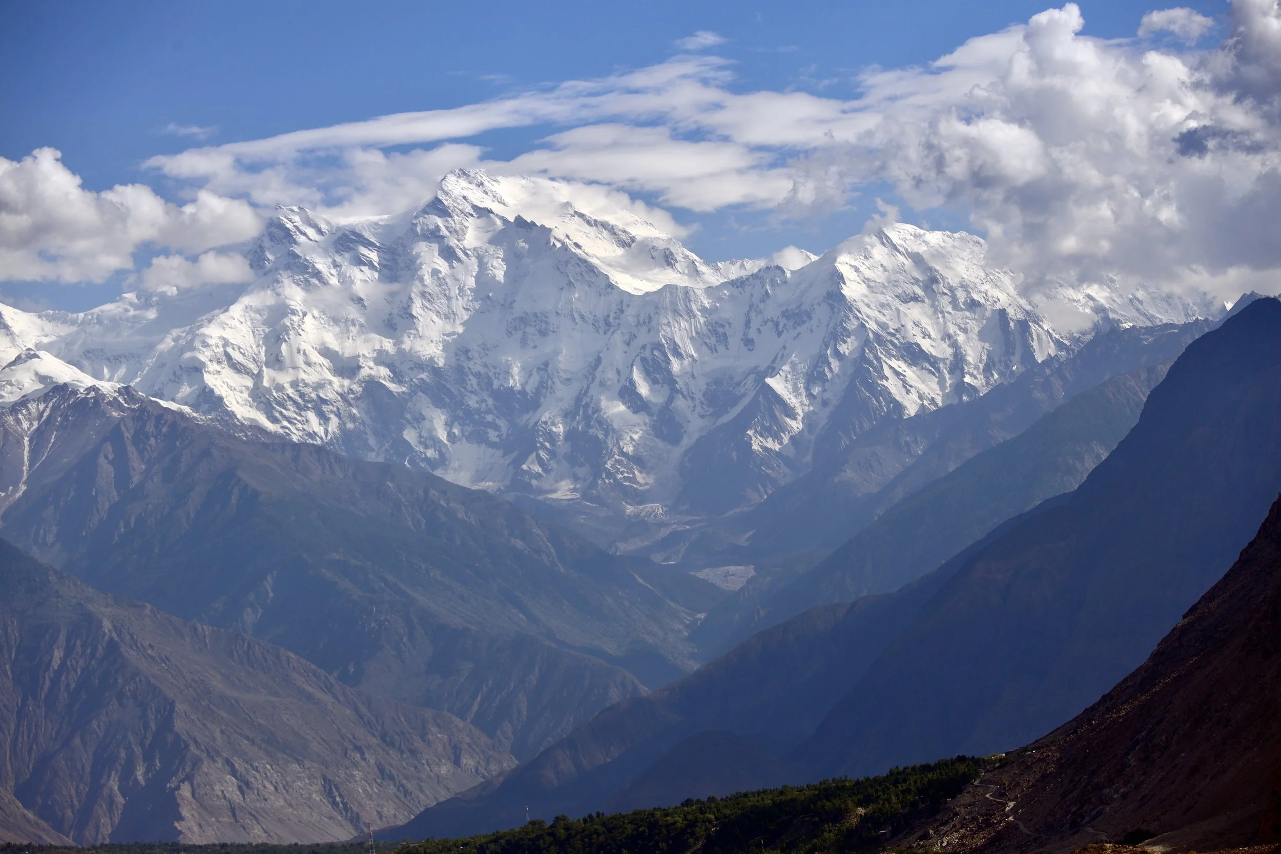
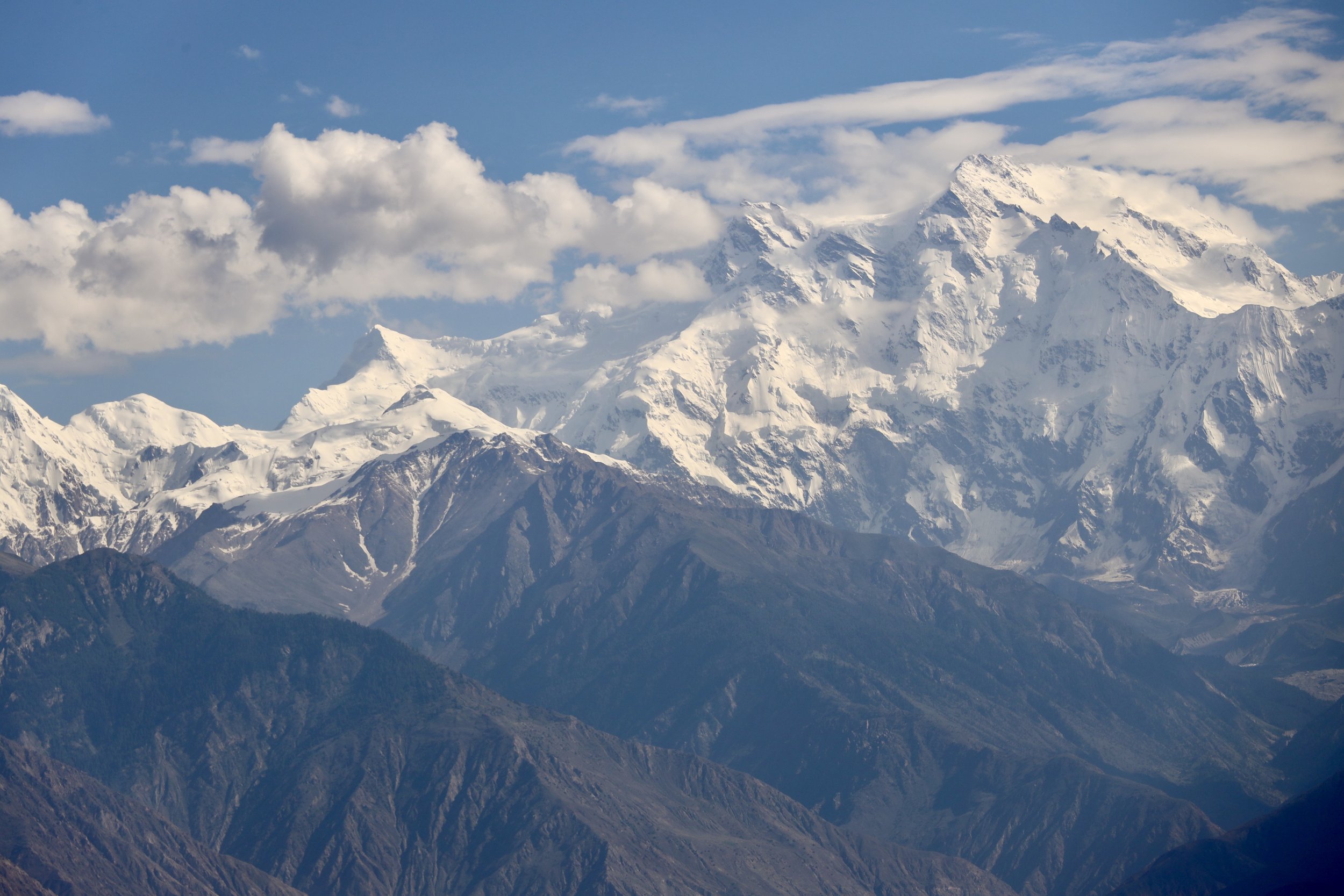
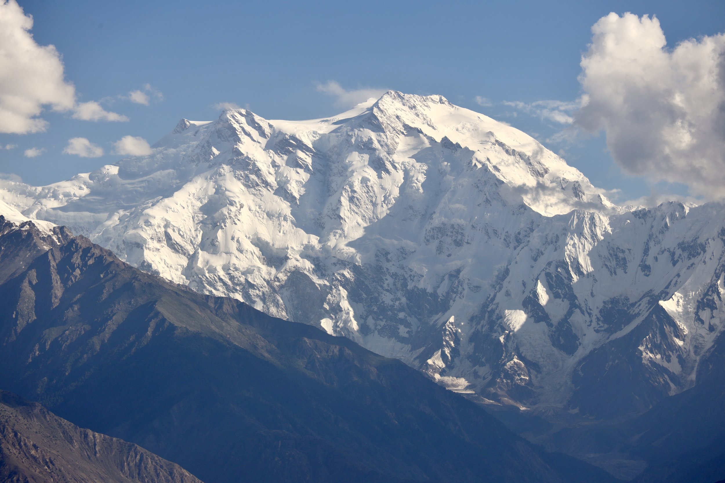
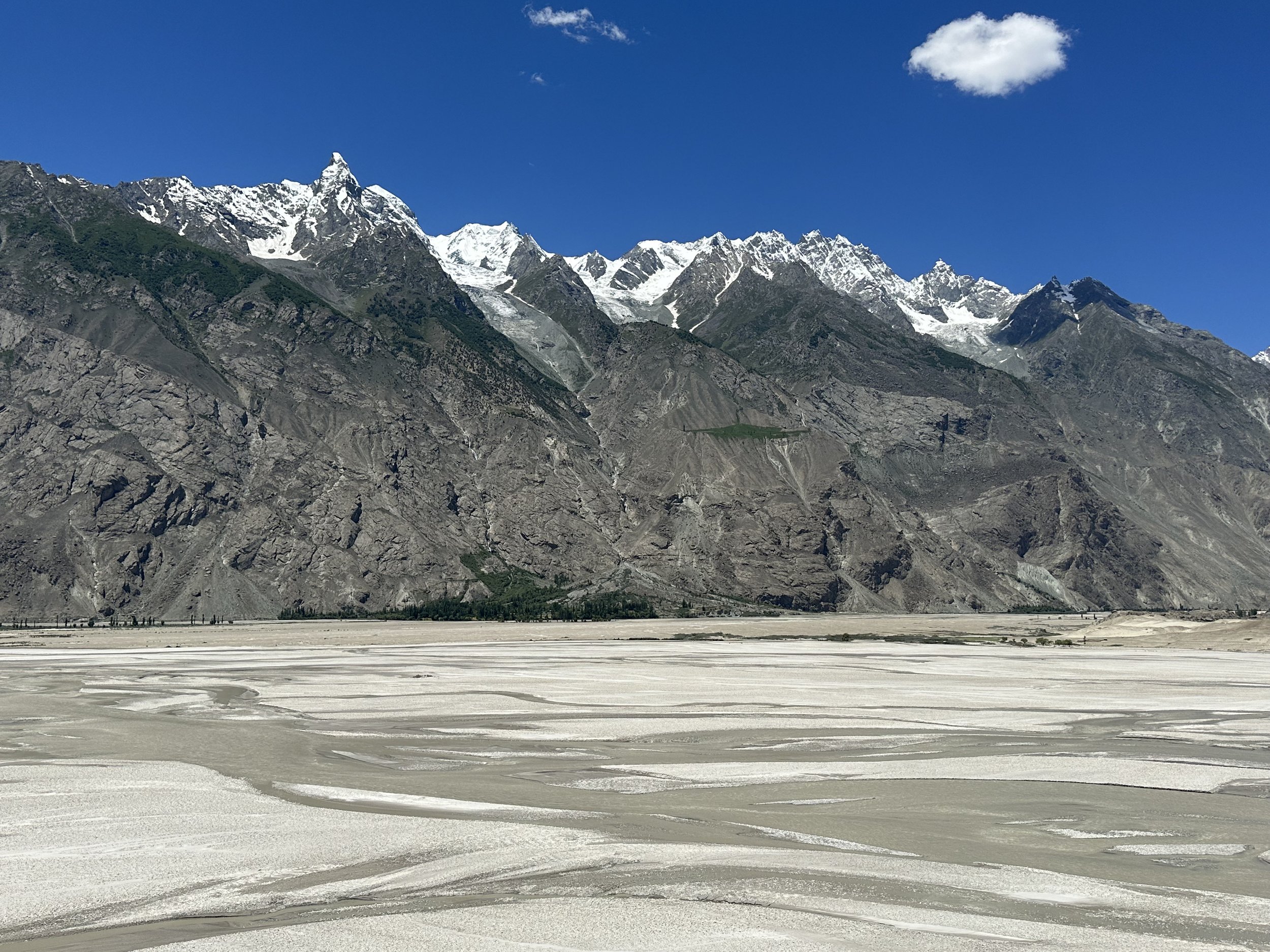
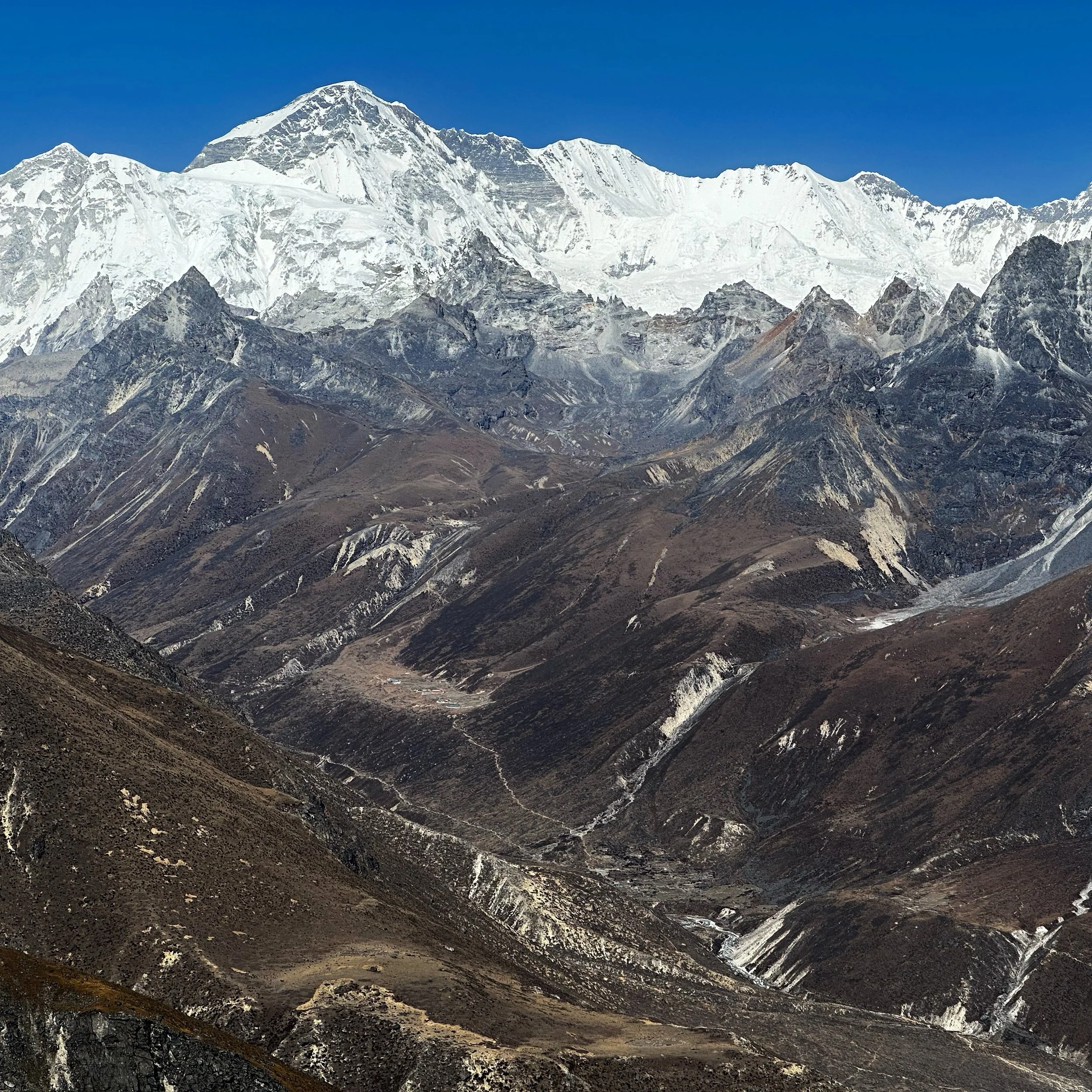
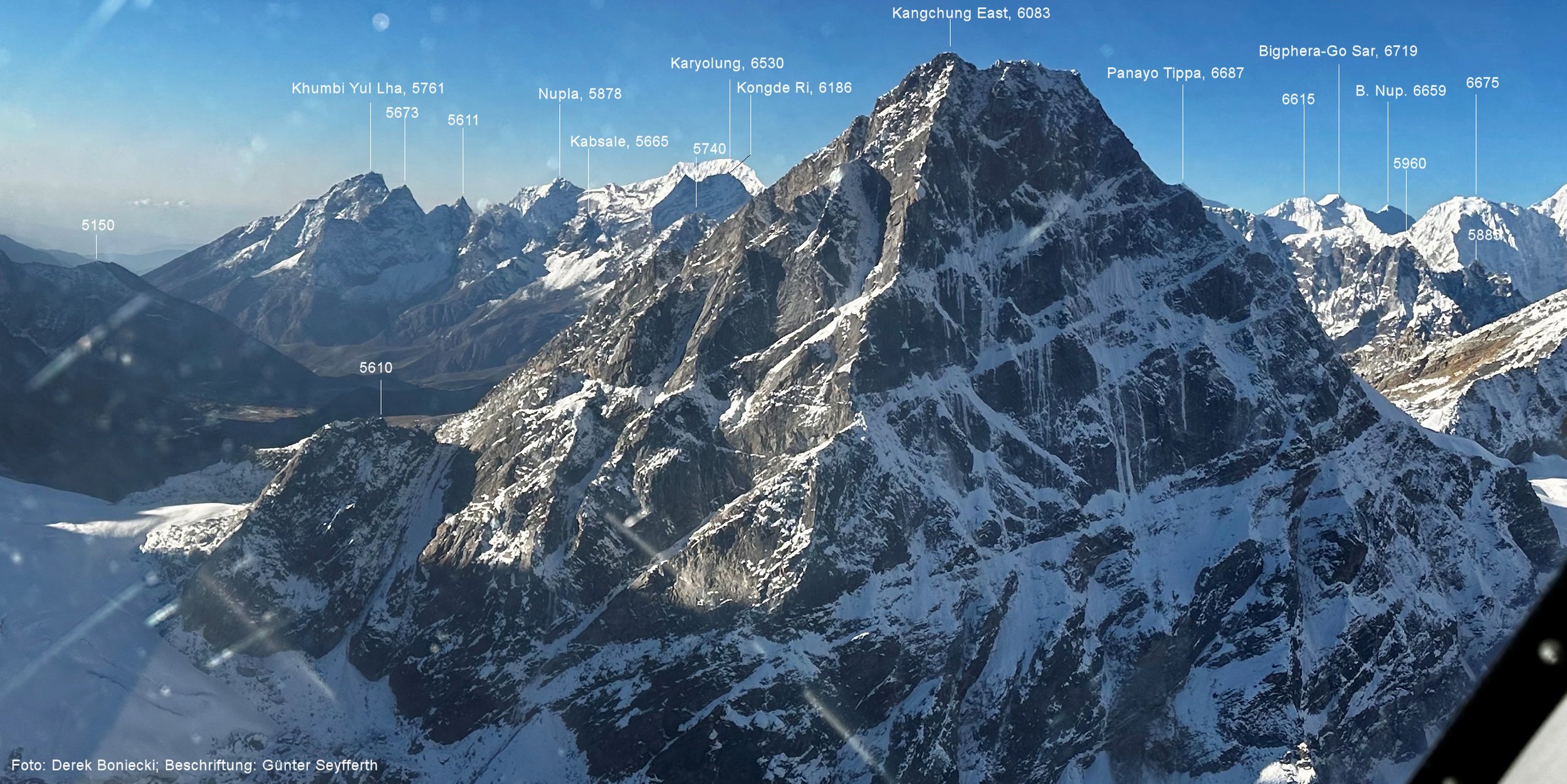
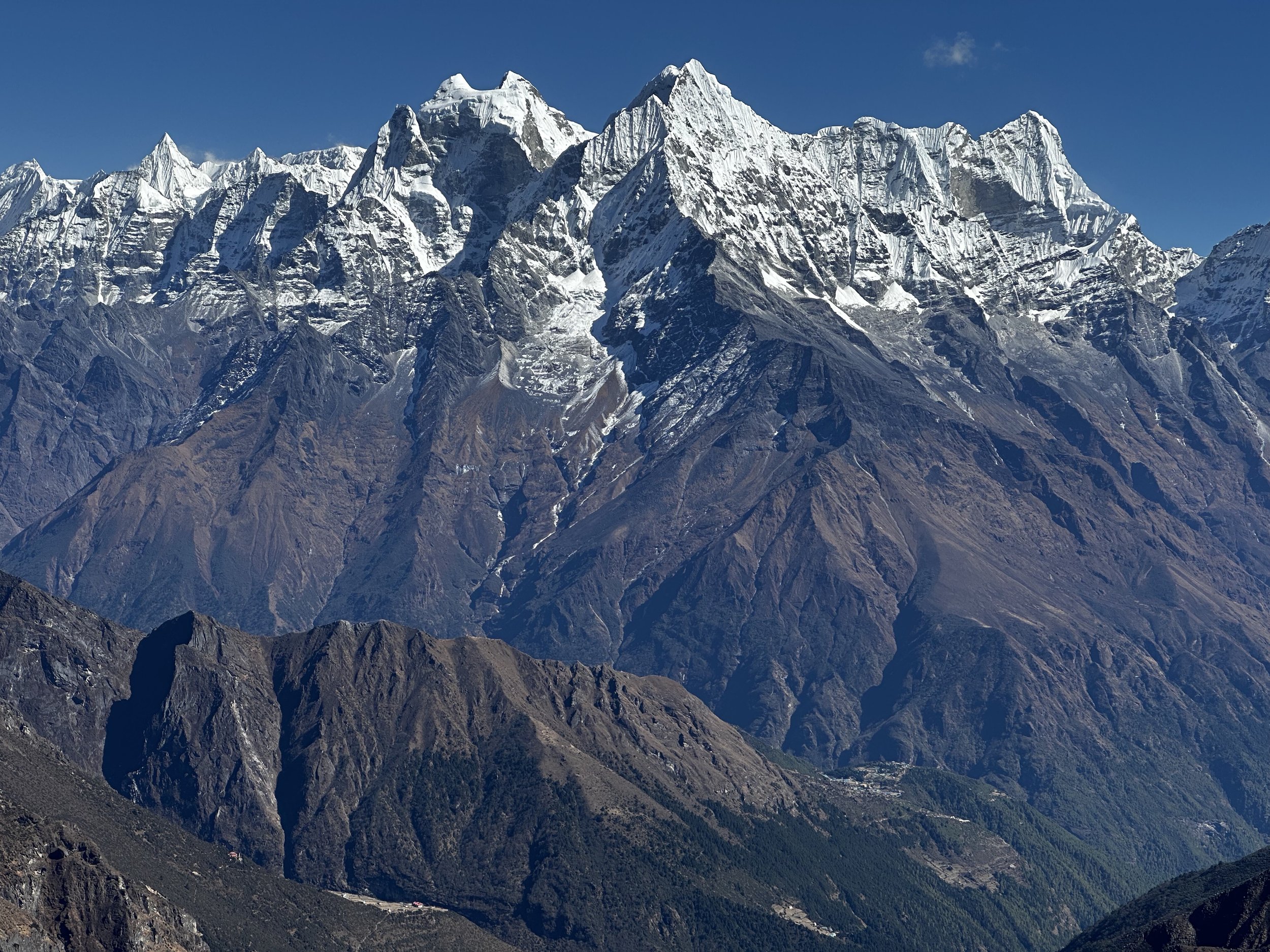
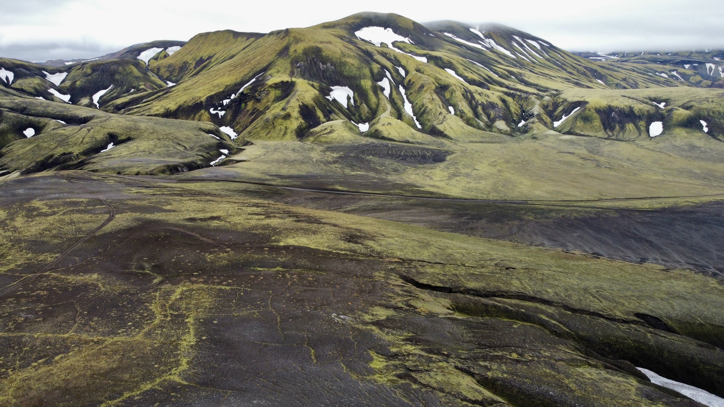
As we progressed along the Naran Valley, the scenery became grander and increasingly mountainous.  We could see snow-capped mountains on the horizon far away.  These peaks form part of the Himalayan Range.  We were now surrounded by 4000m hills covered in lush pine forests and a lot of development!  As we approached the town of Naran, there were more and more hotels, resorts and restaurants.  There were a lot of tourists, and the traffic was bad.  It was hardly a spot to relax. 

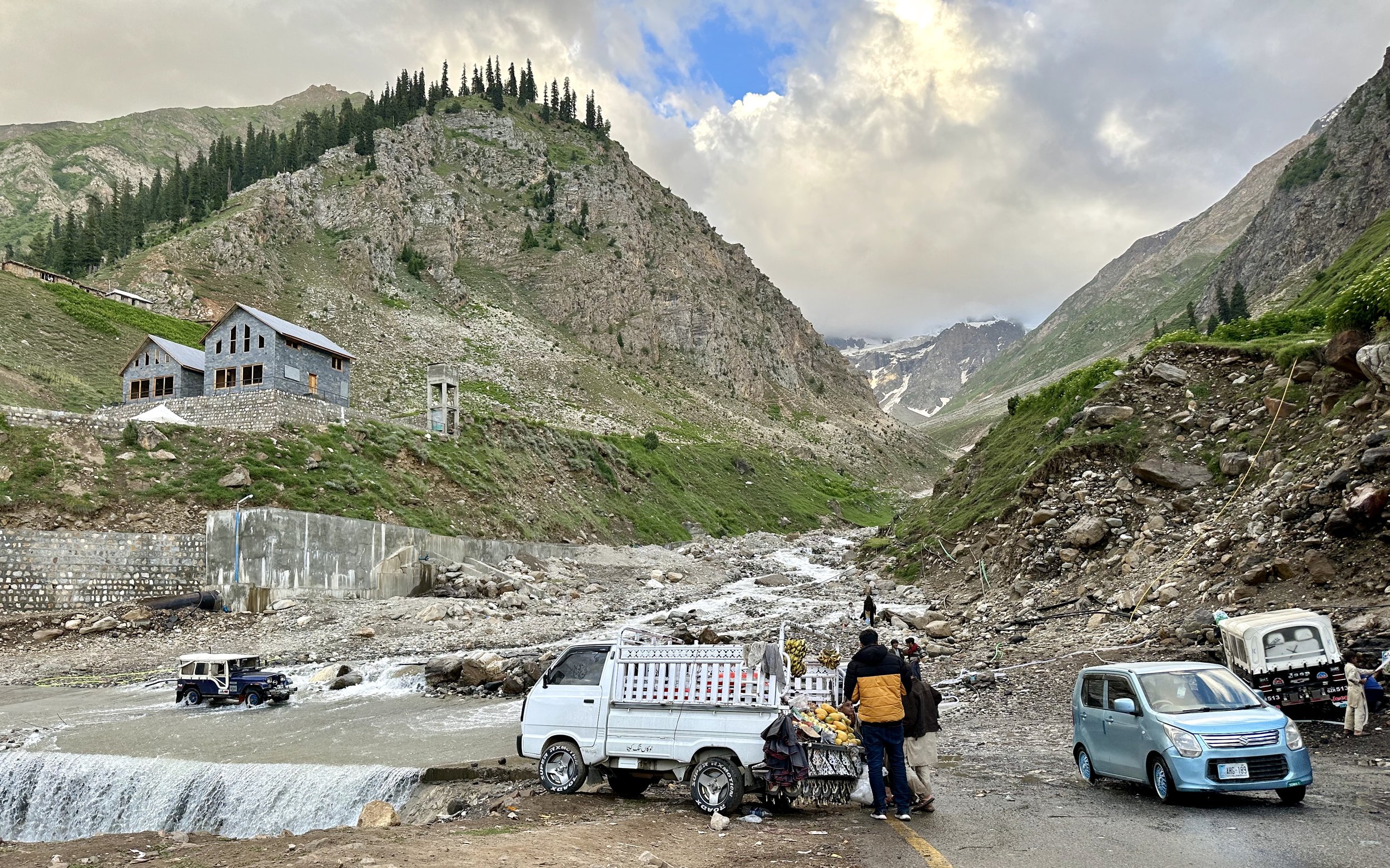
We arrived in Naran around 5pm and had a dinner for which I had no appetite, in one of the large hotels.   We tried to find a place to overnight, but everything was booked up.  We continued to Babusar Pass at 4000m.  Despite speeding, we arrived at the pass in the dark which was unfortunate as the scenery from the Pass would be interesting to see.  There were still large patches of snow on the pass, and it was much colder which gives an idea of the amount of snowfall in this area during the winter and spring.  

From the pass we descended endless switchbacks to the Kagan Valley and stayed in the old PTDC Guesthouse where we were the only guests.  The rooms were nice, cold but comfortable.  In the morning we continued to Chilas through a scenic Kagan Valley with old villages clinging to the steep valley.  This is a Pashtun area, and the people look different.    Their villages look medieval.   I would have liked to stop for some photos, but our driver was racing at full speed.  By the time I saw something interesting, we were already 5 km ahead.

On exiting the Kagan Valley, we stopped at a police checkpoint where a curious policeman was quite inquisitive about my trip.  

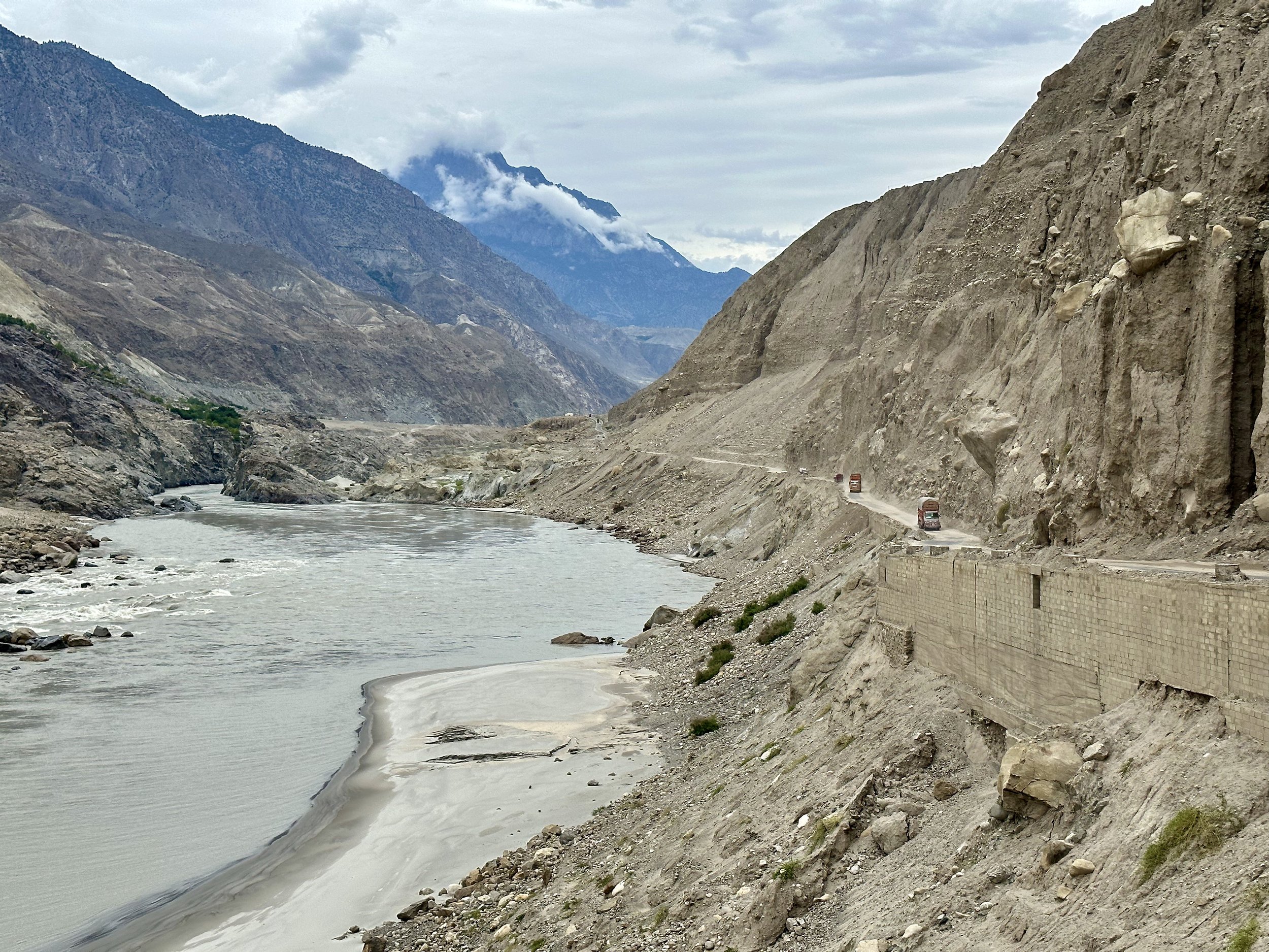
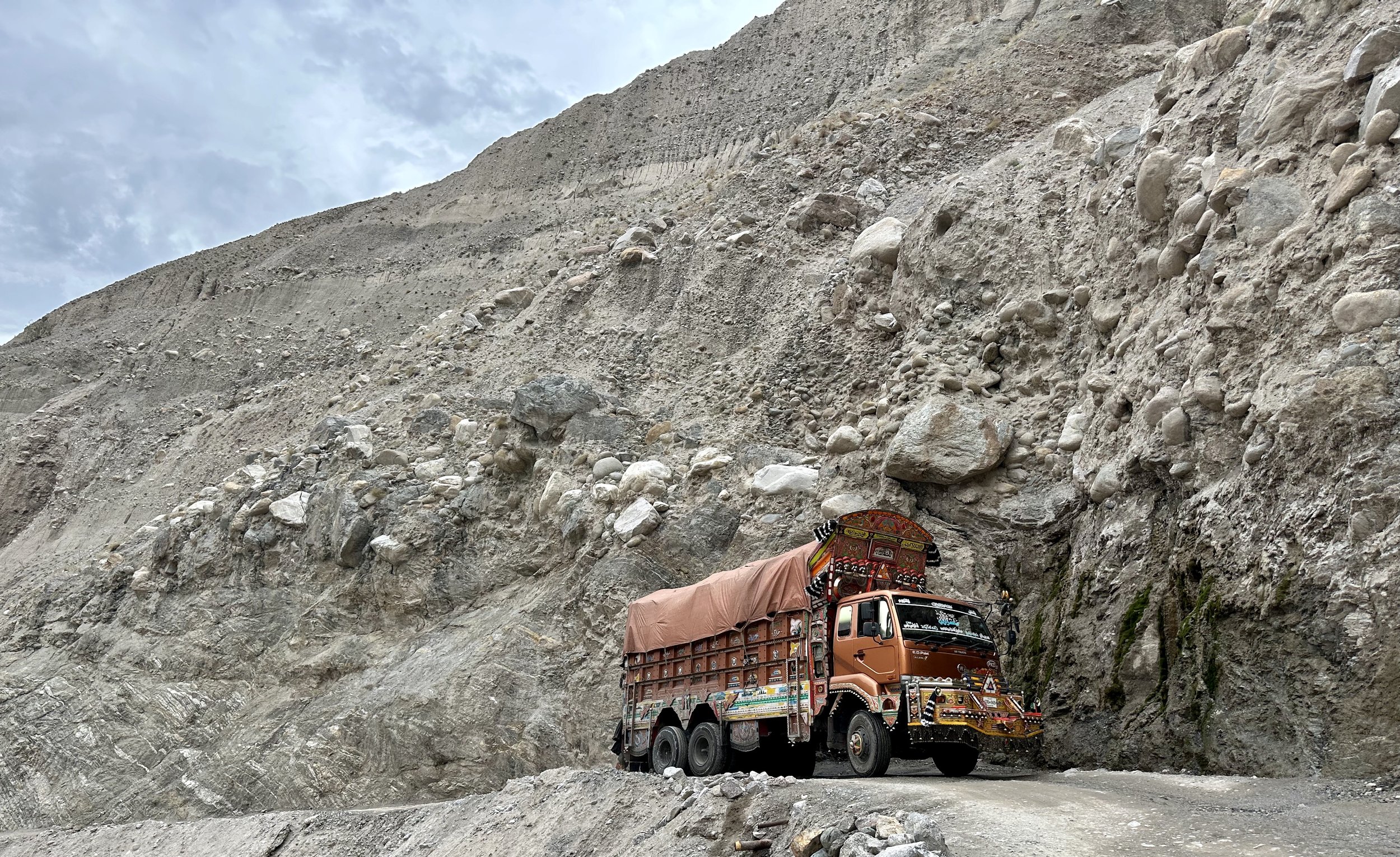
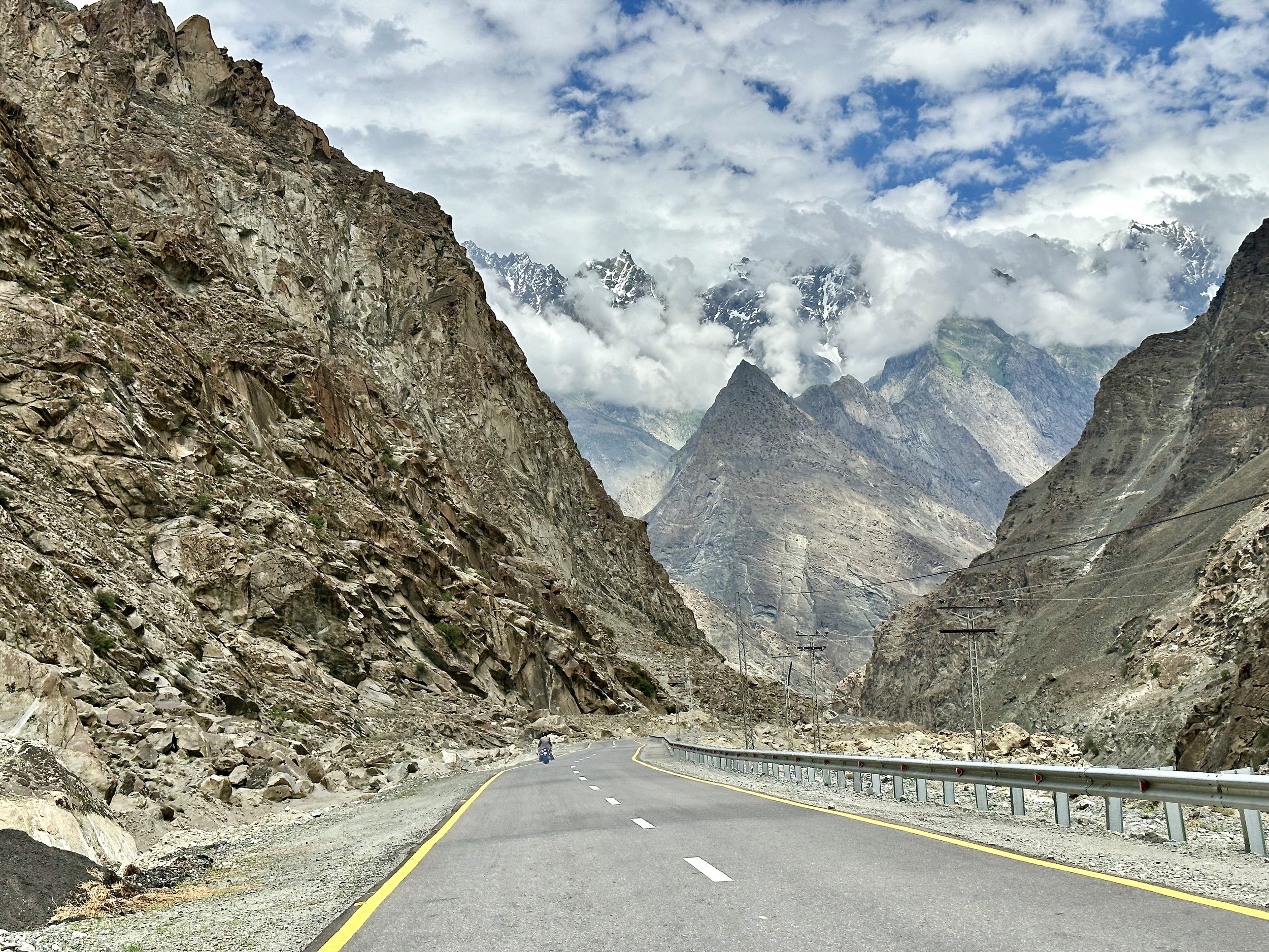
In Chilas we rejoined the old Karakoram Highway and it started to feel somewhat familiar.  I really like this drive and I think it is much more interesting than flying.  It gives you time to transition from the city to the mountains.  It passes though some interesting villages and towns and the scenery is spectacular.  I felt happy to be back on the KKH and in Northern Pakistan.  The road has been vastly improved and our driver took good advantage of it by speeding up to 120km/h (this would be impossible in 2005). 

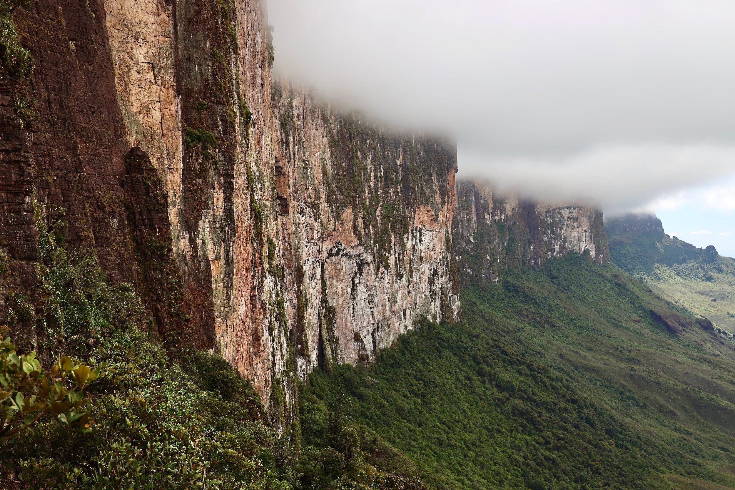
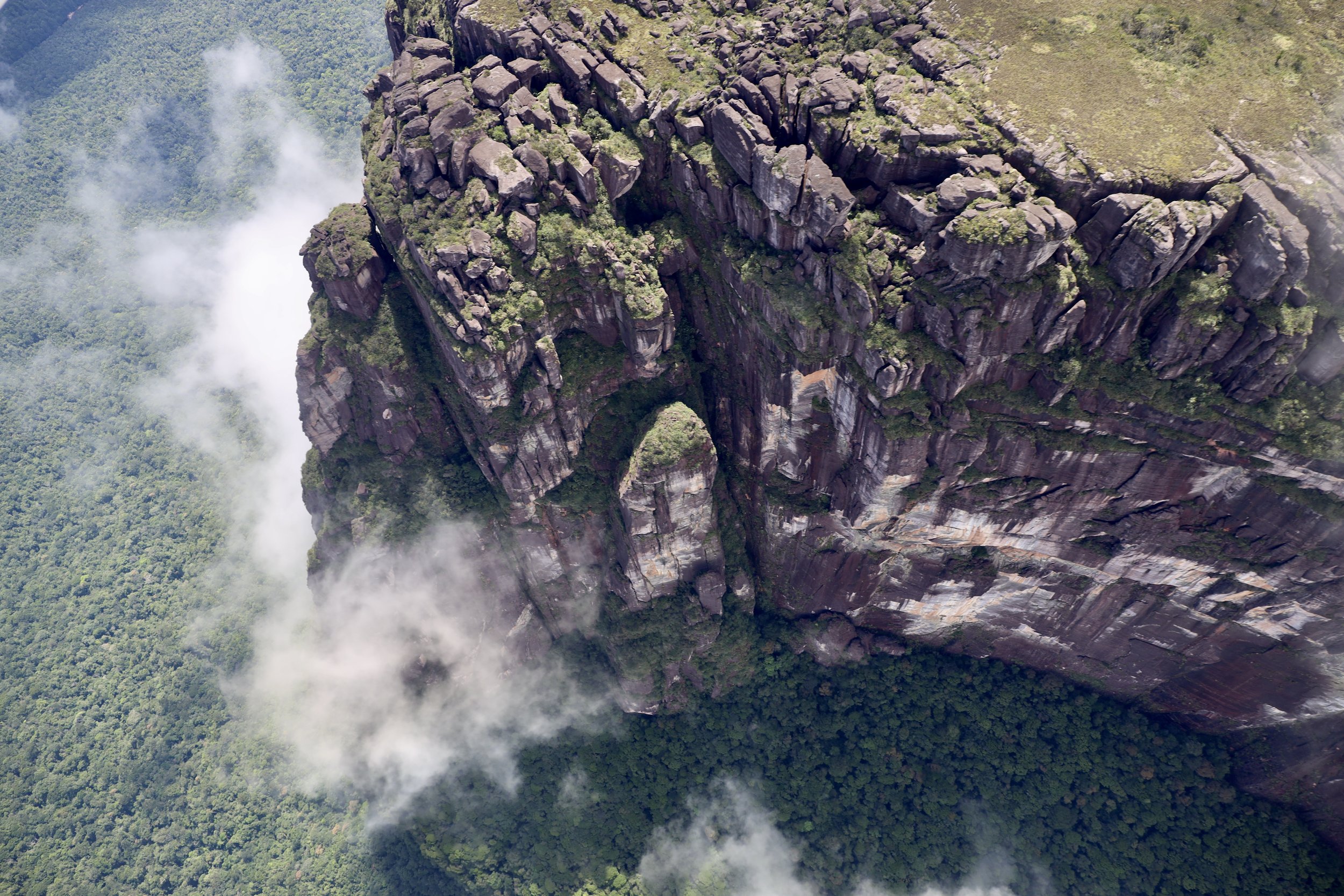
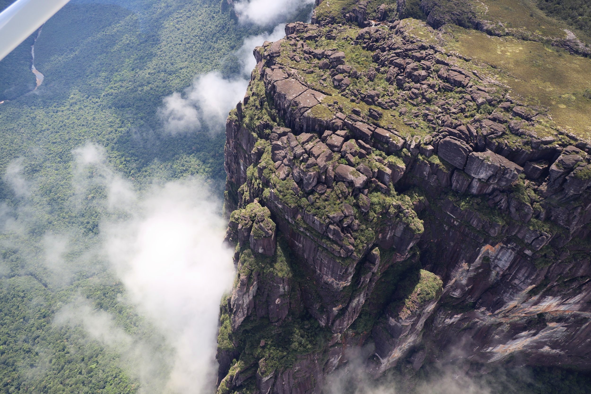
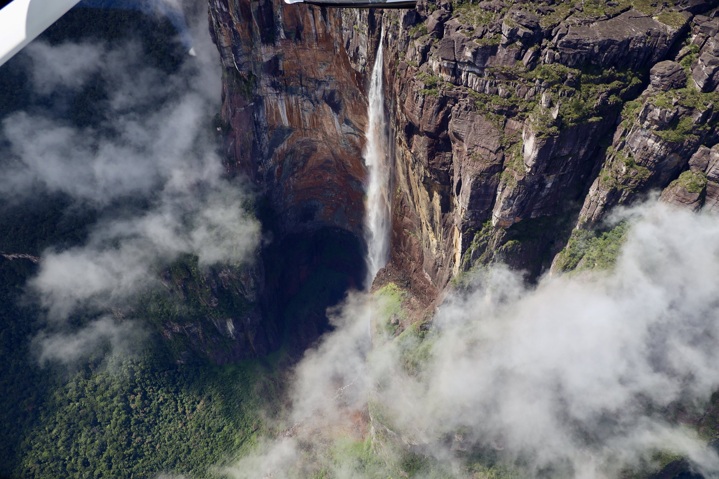
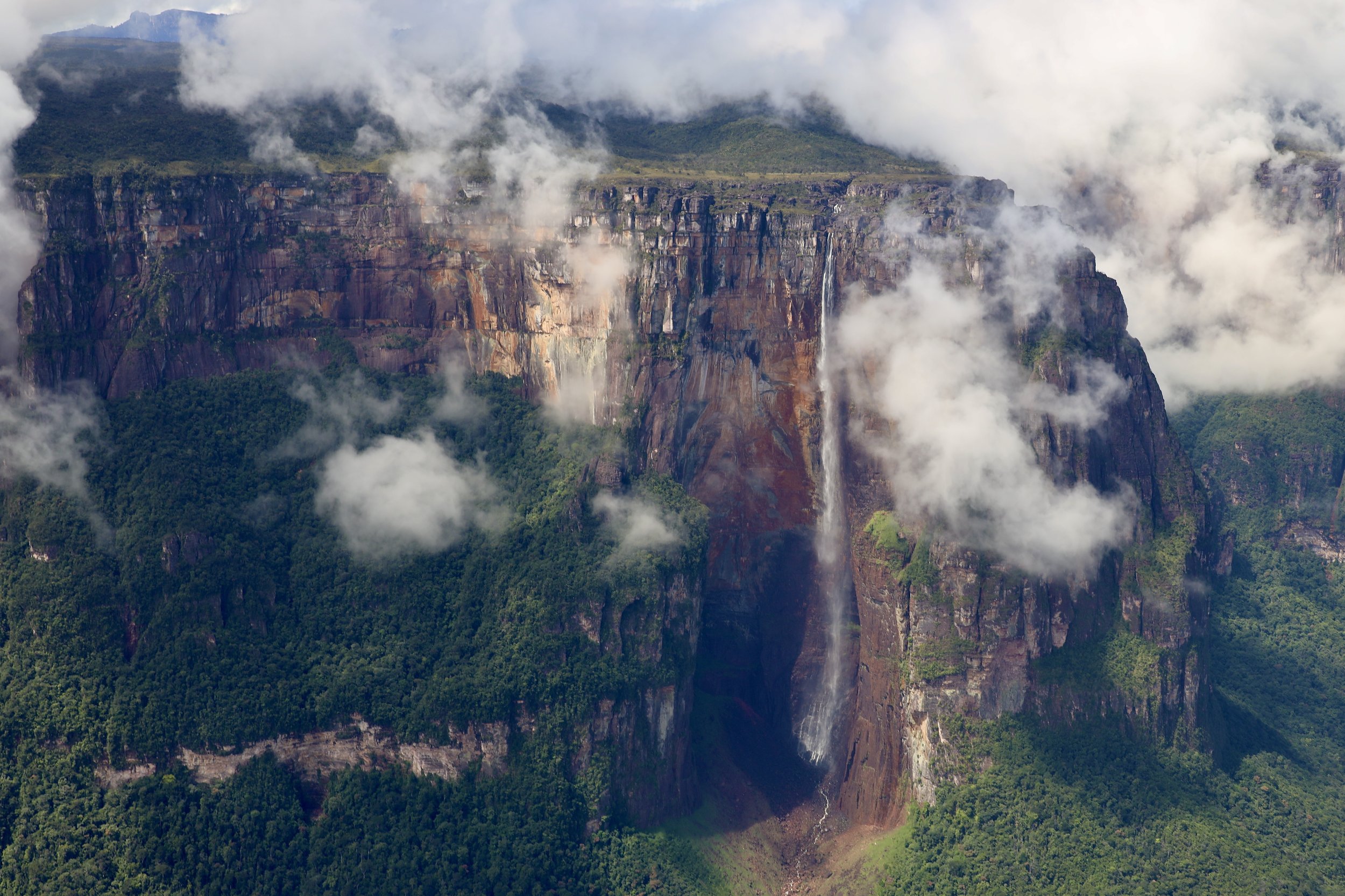
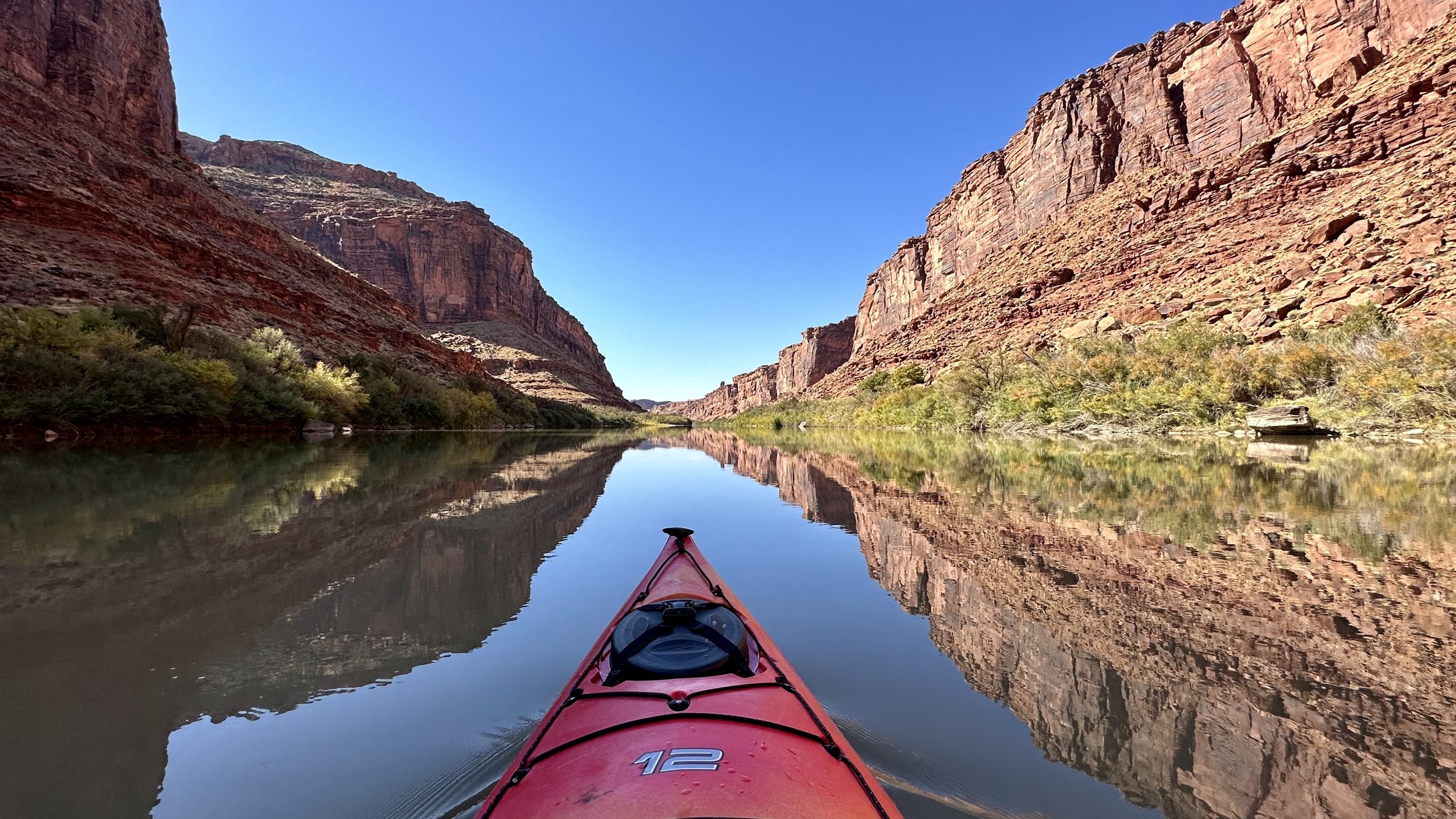
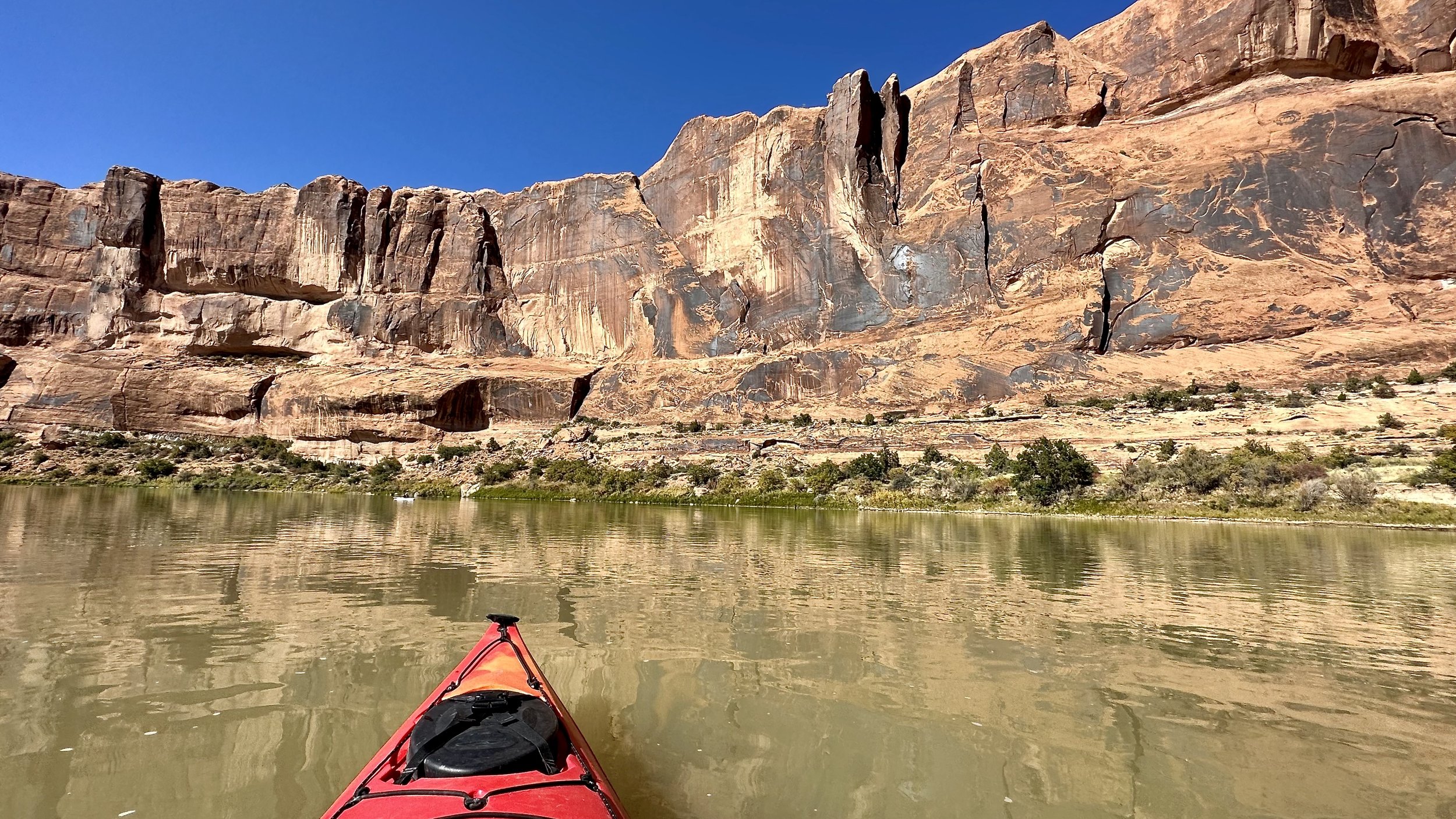
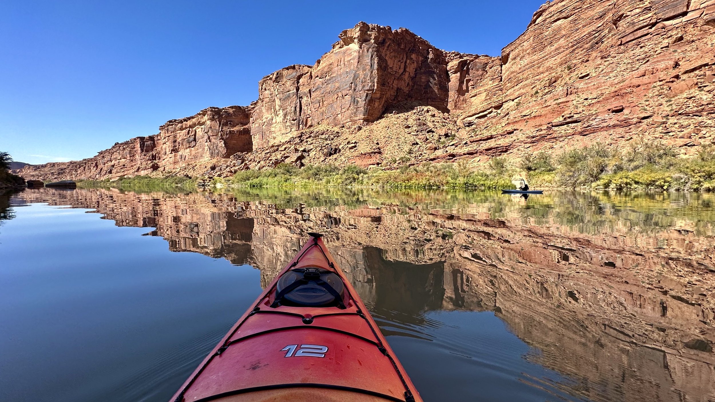
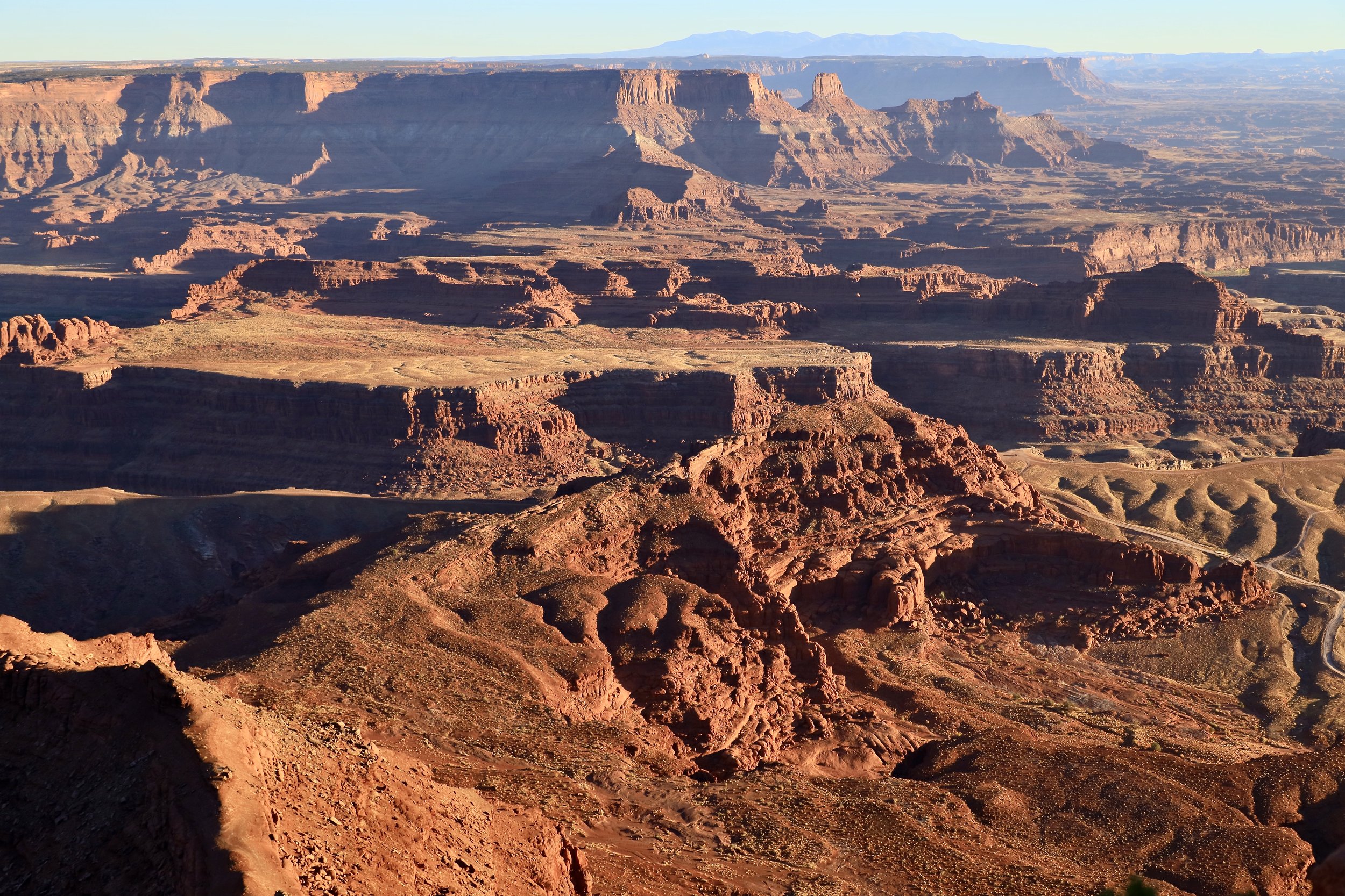
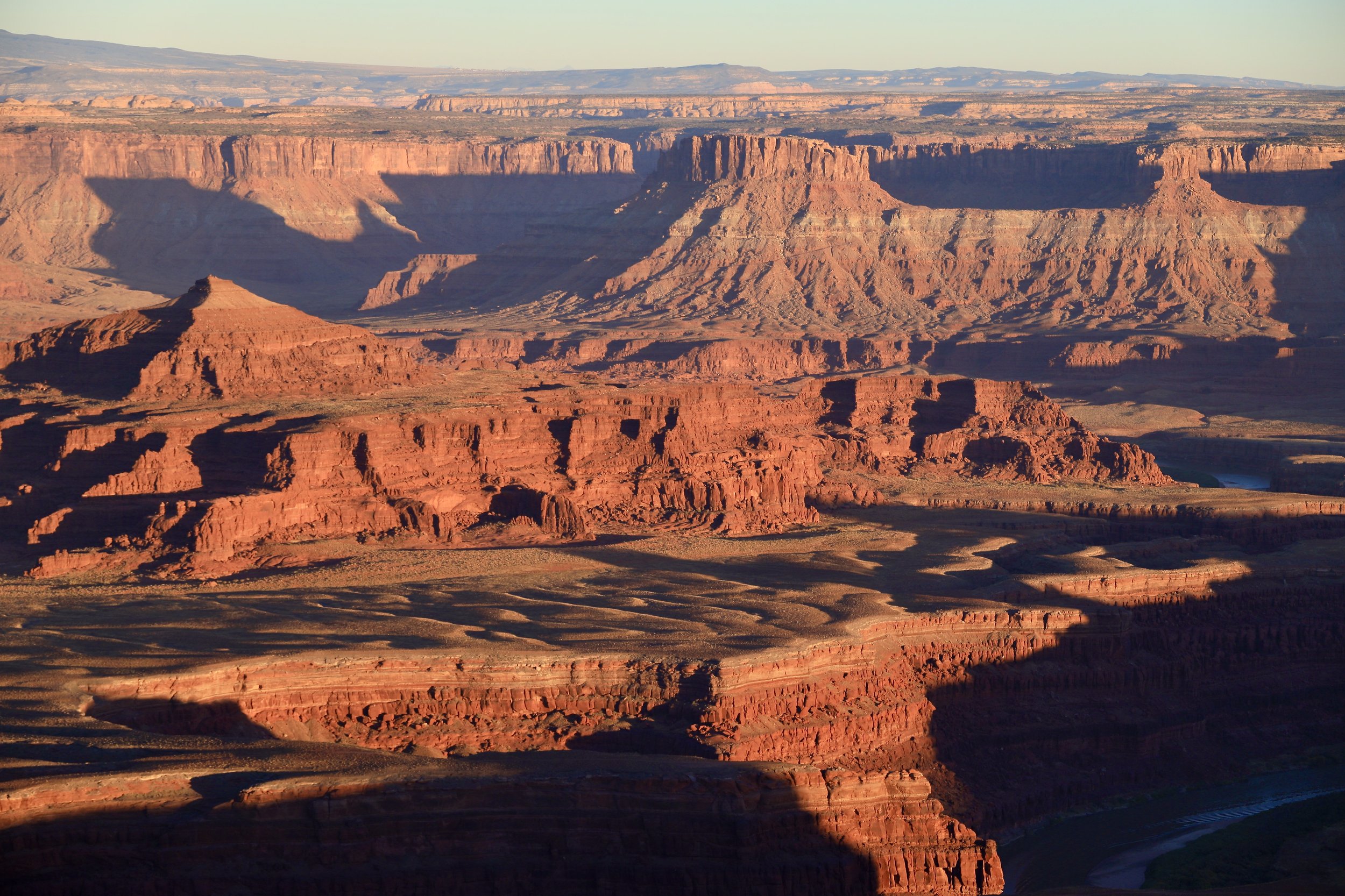
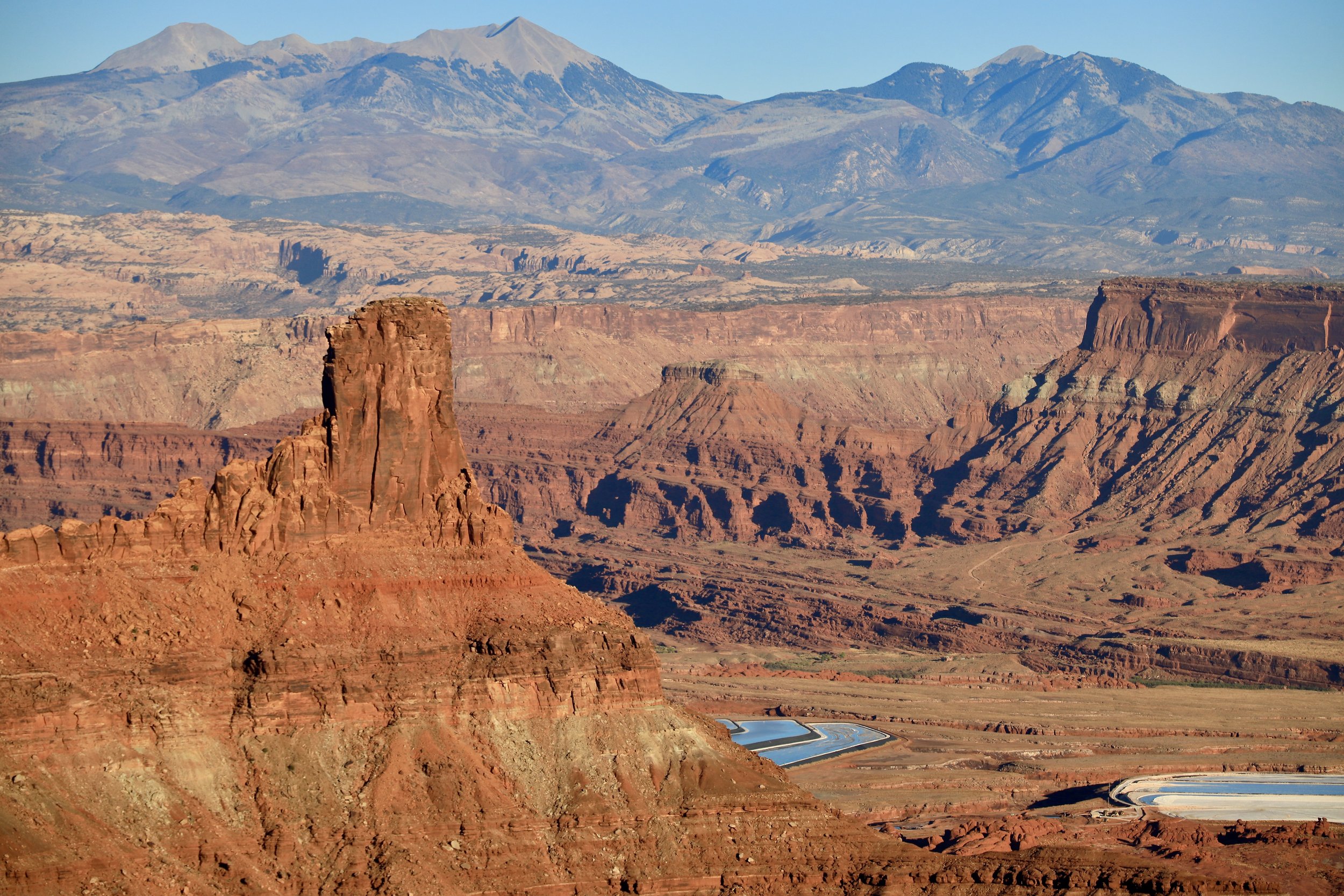
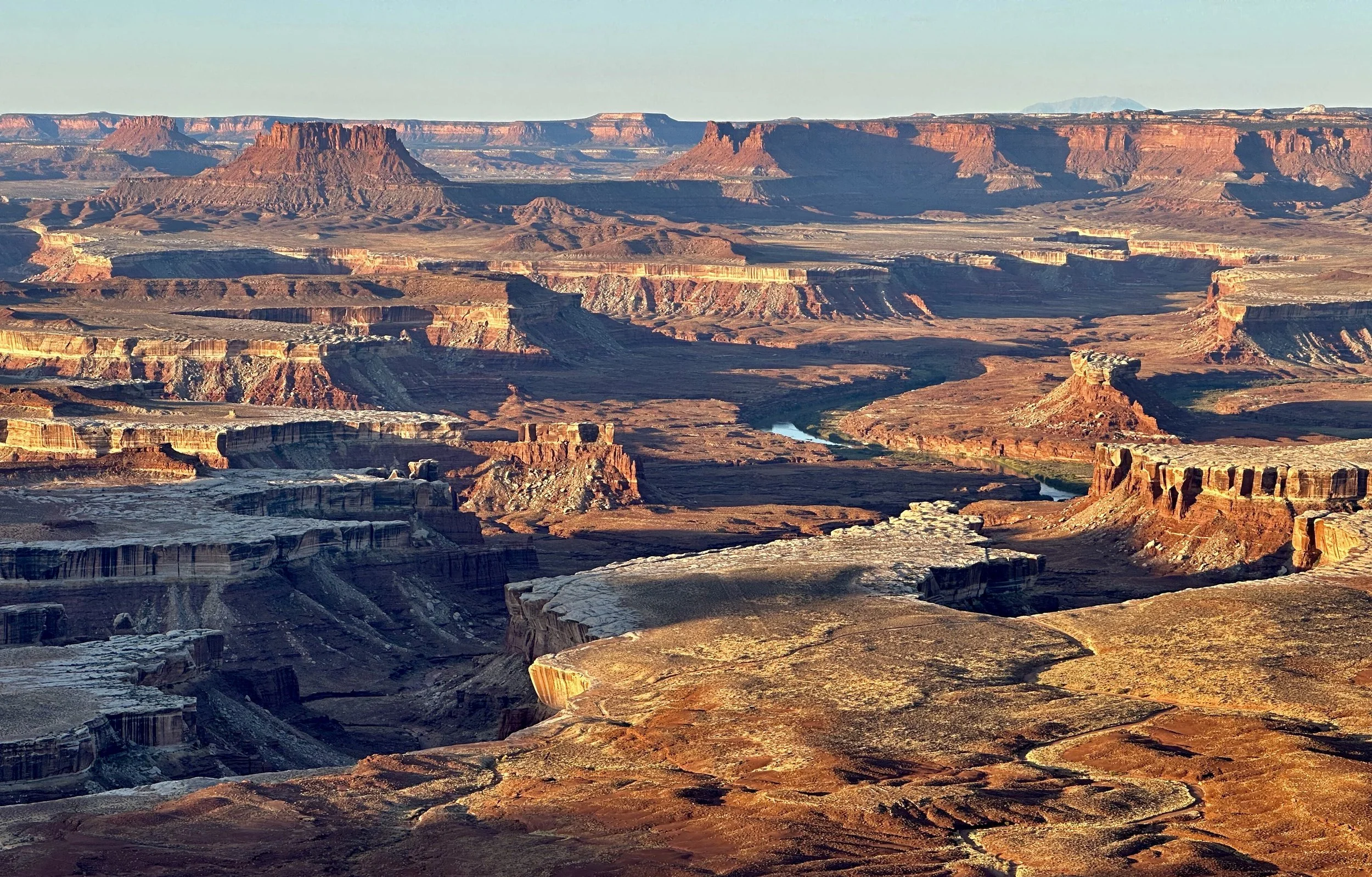
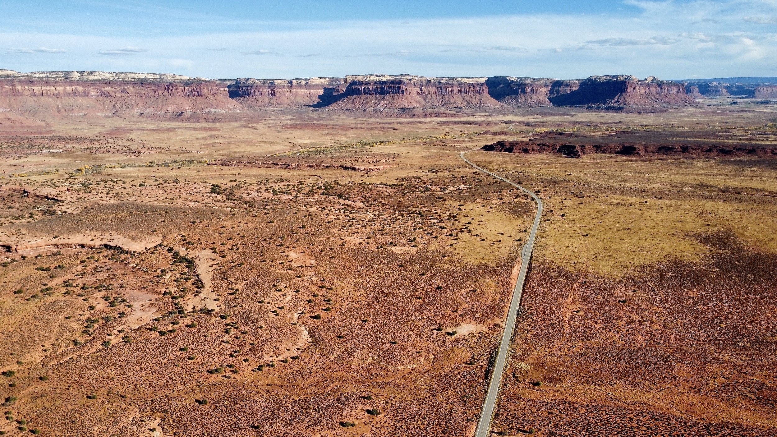
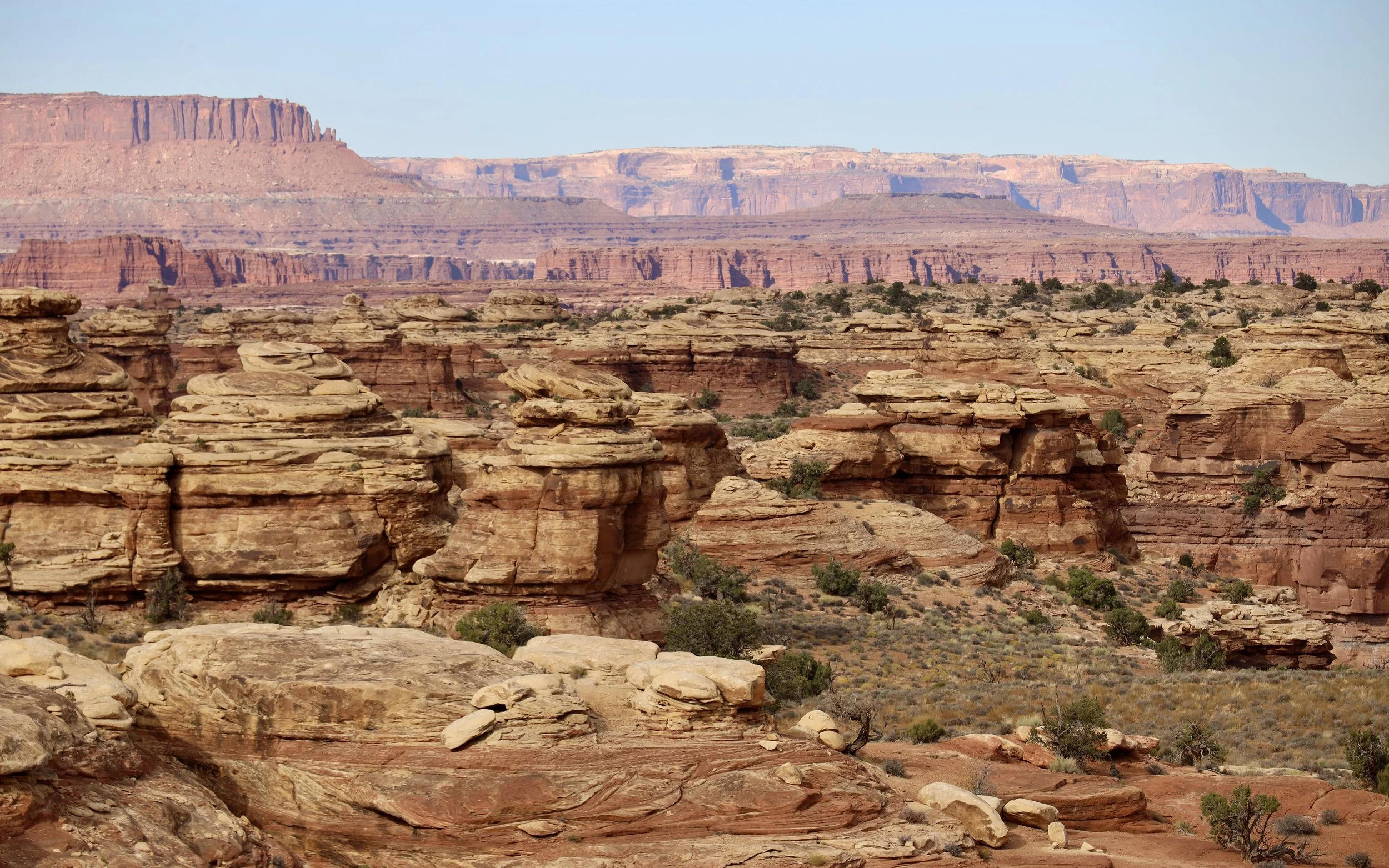
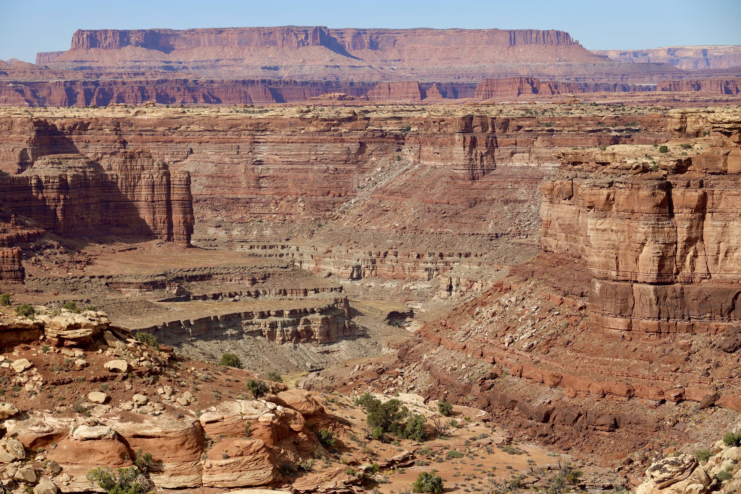
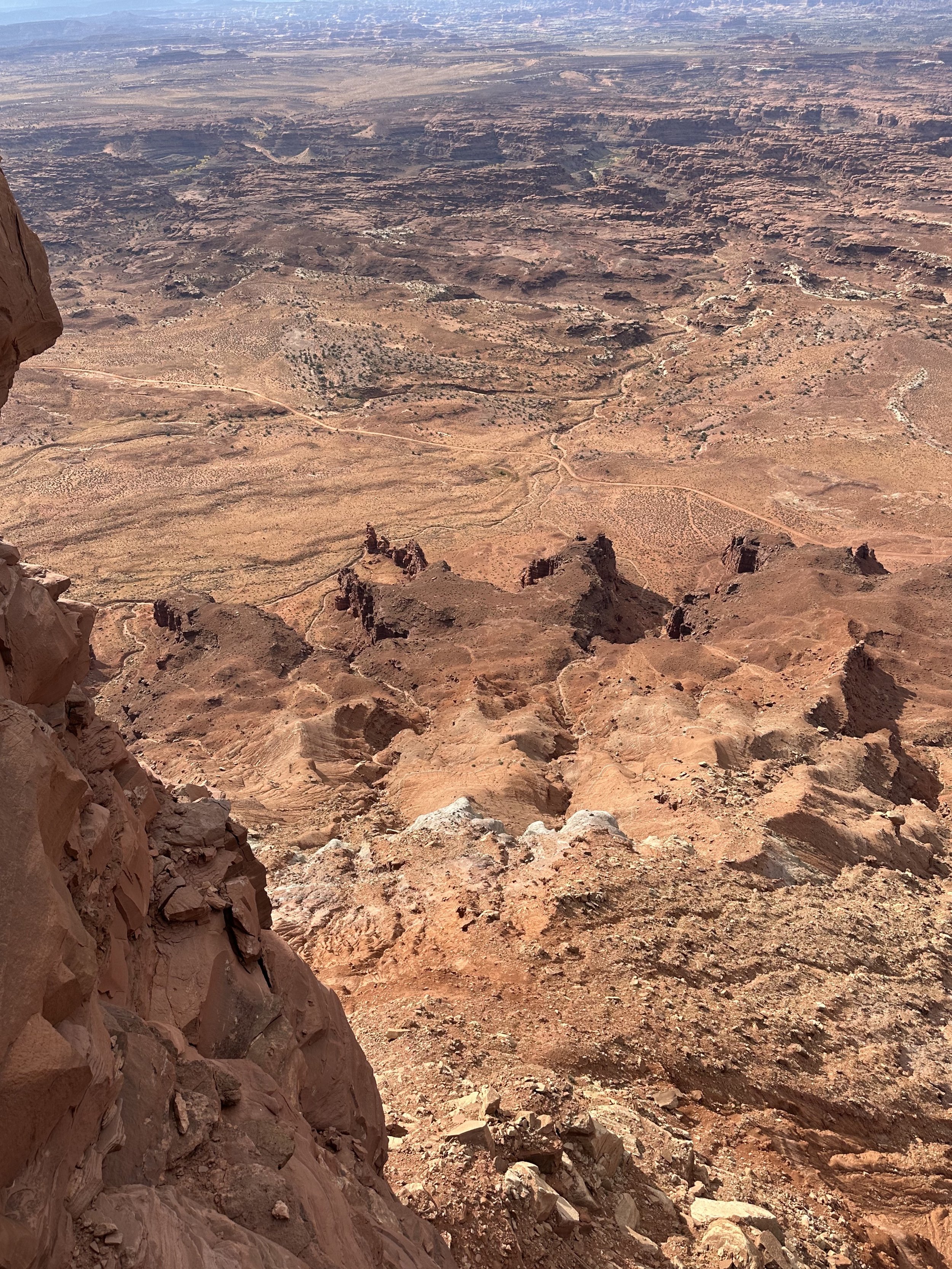
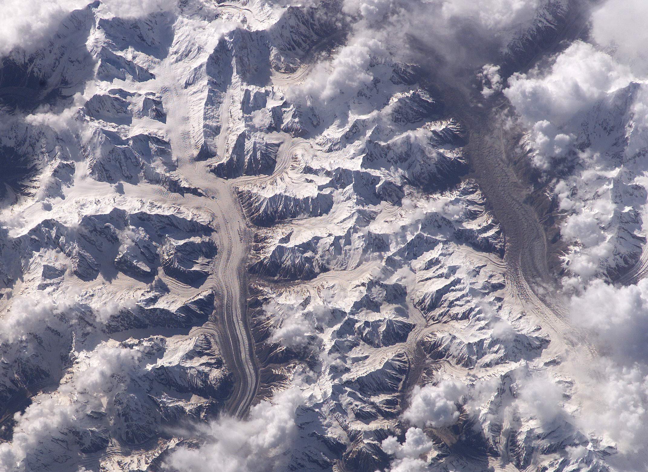
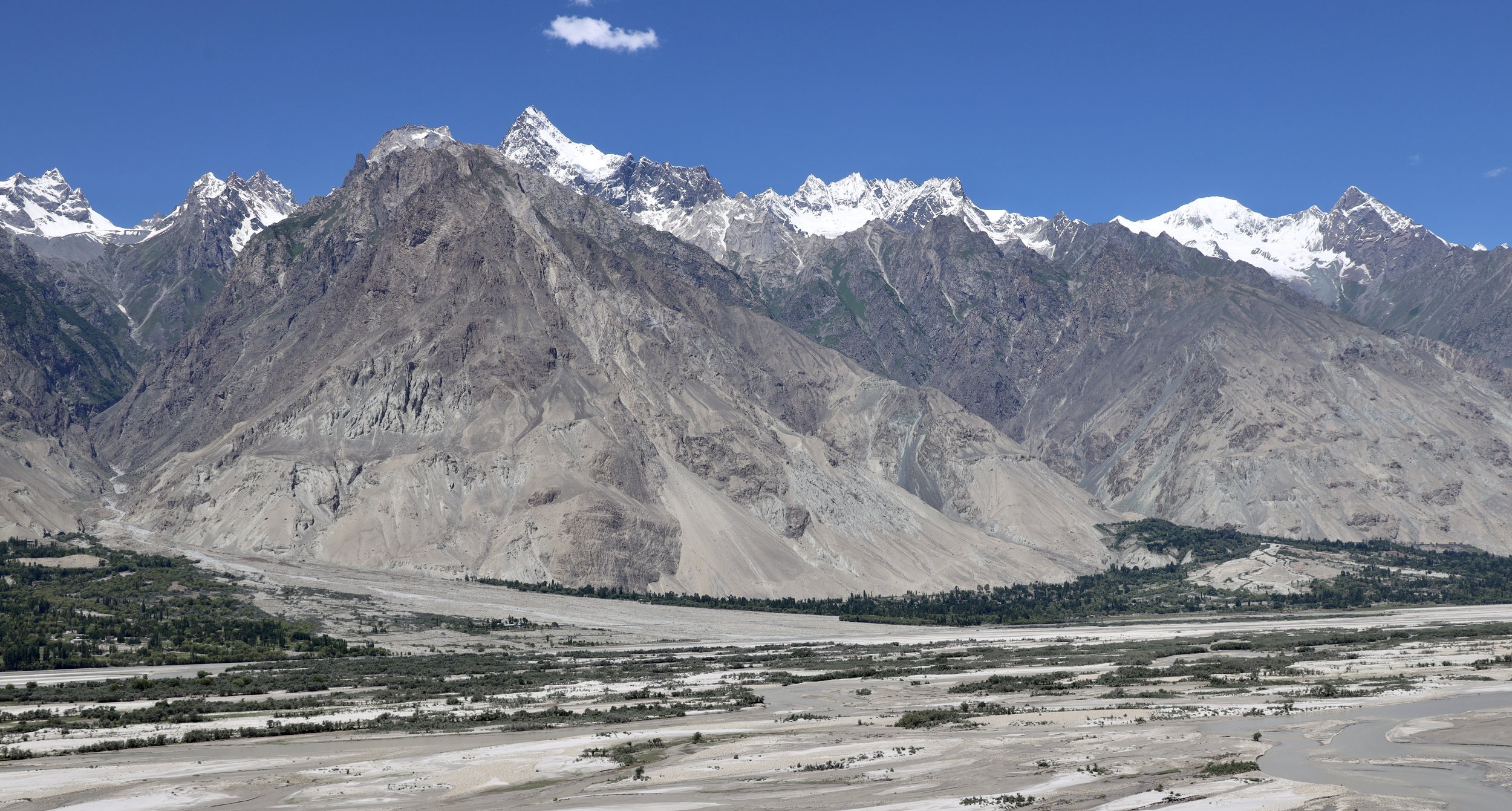
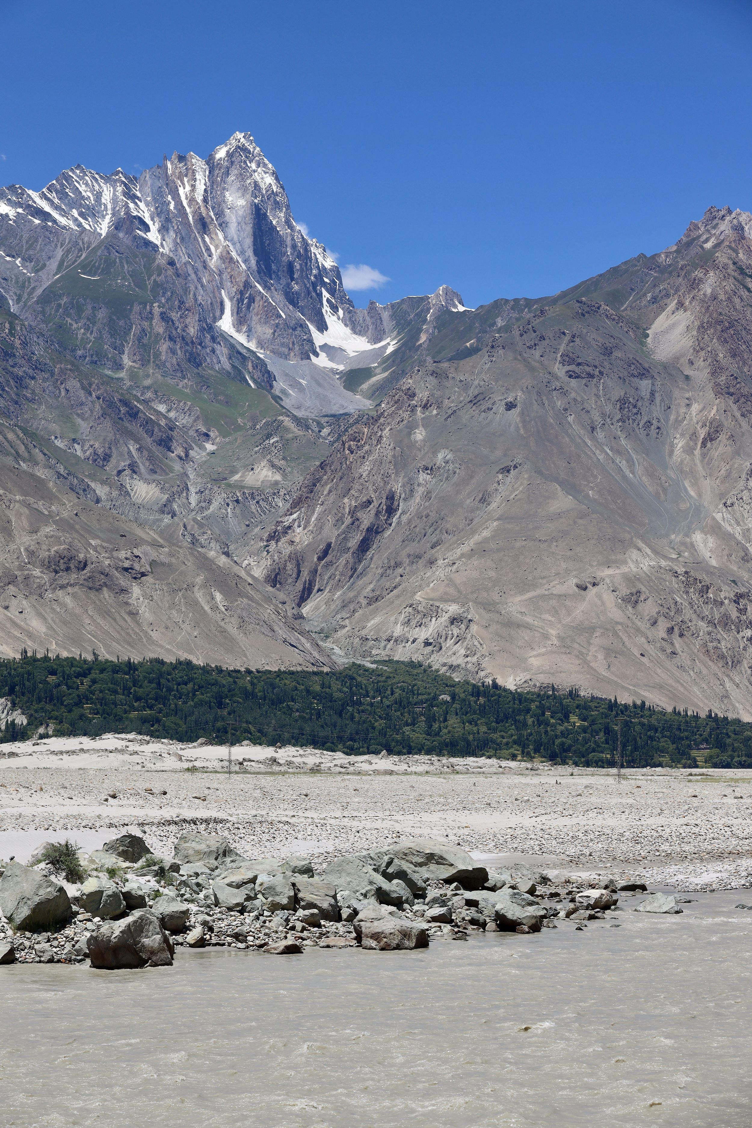
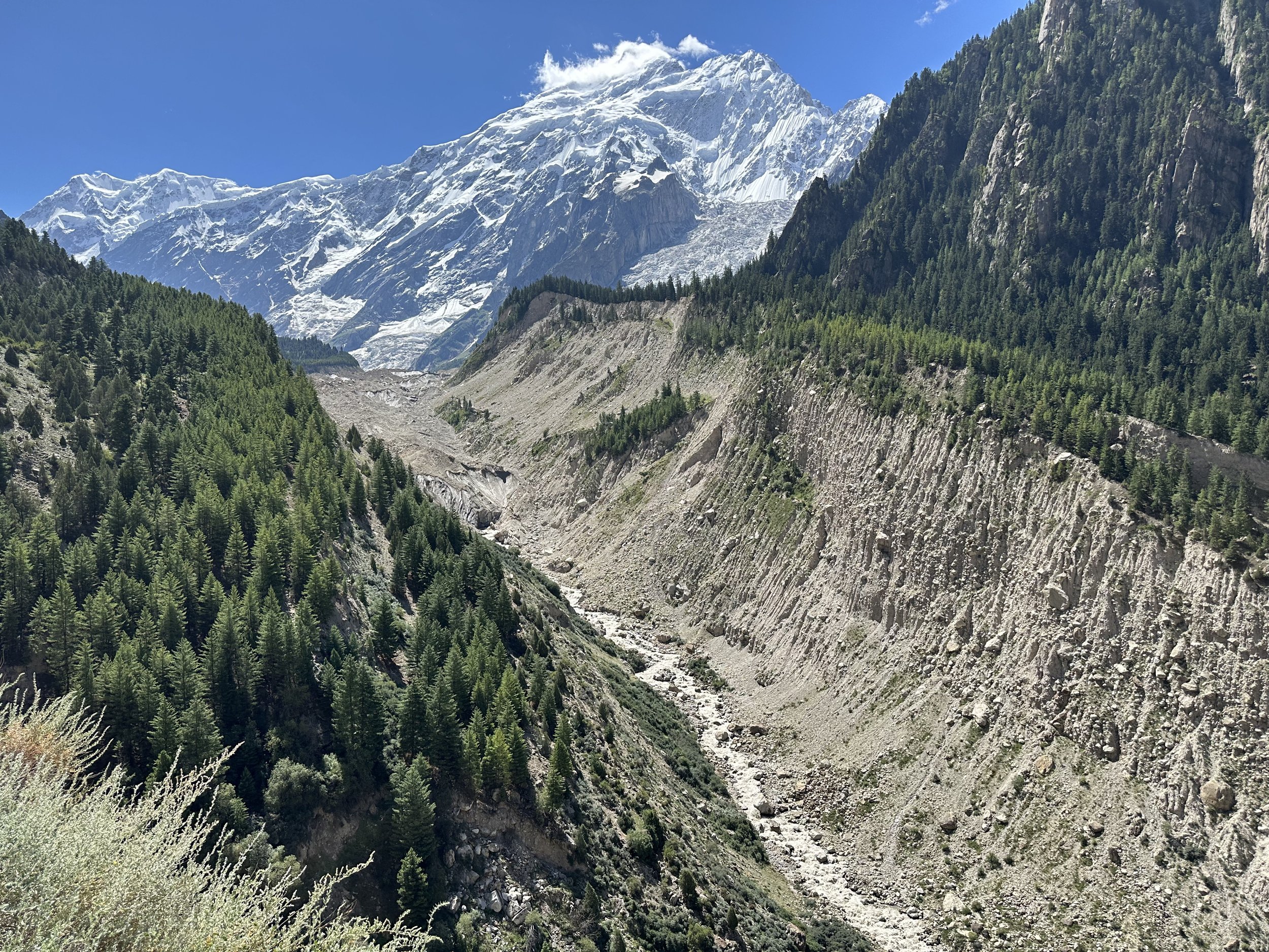
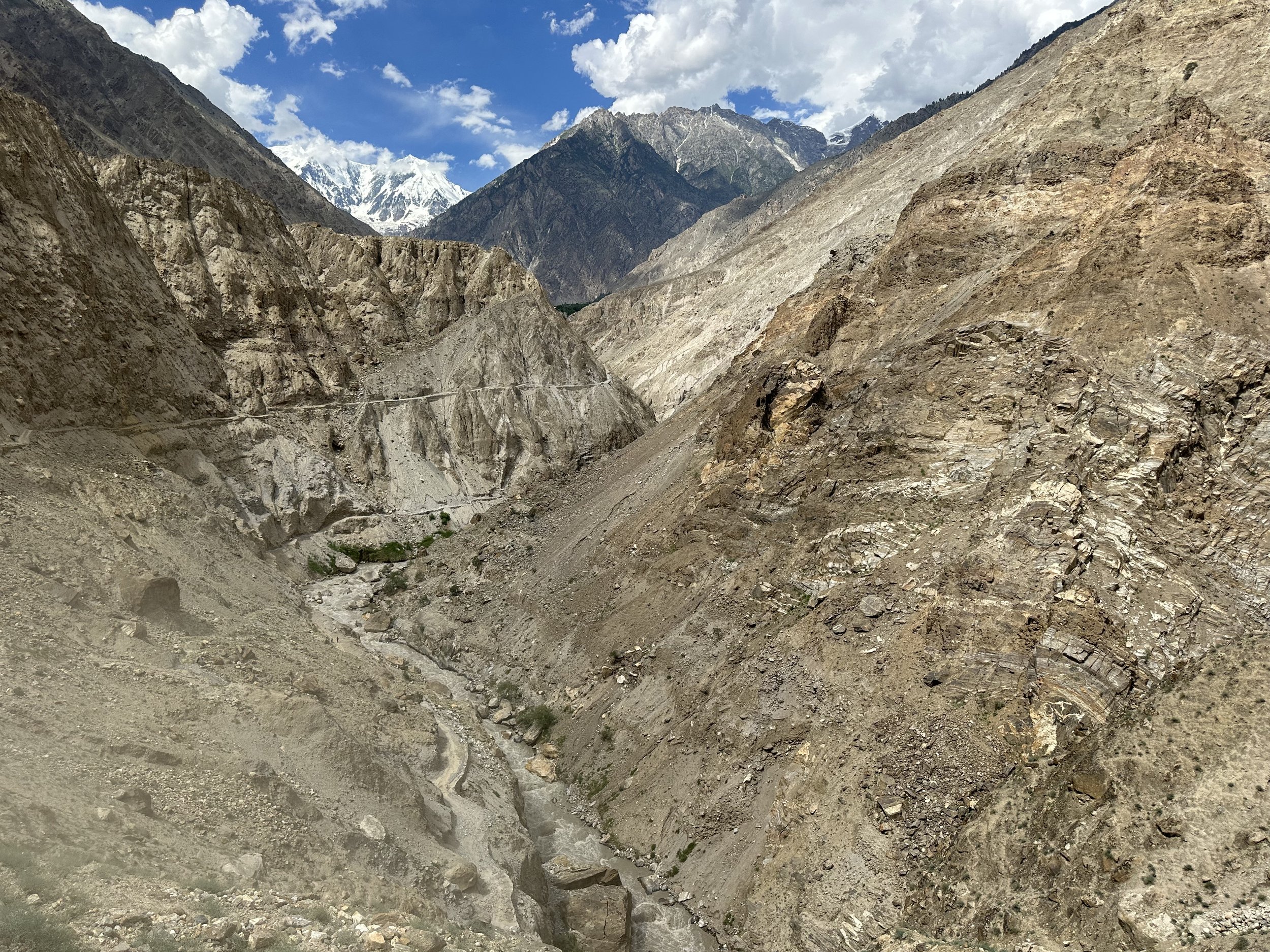
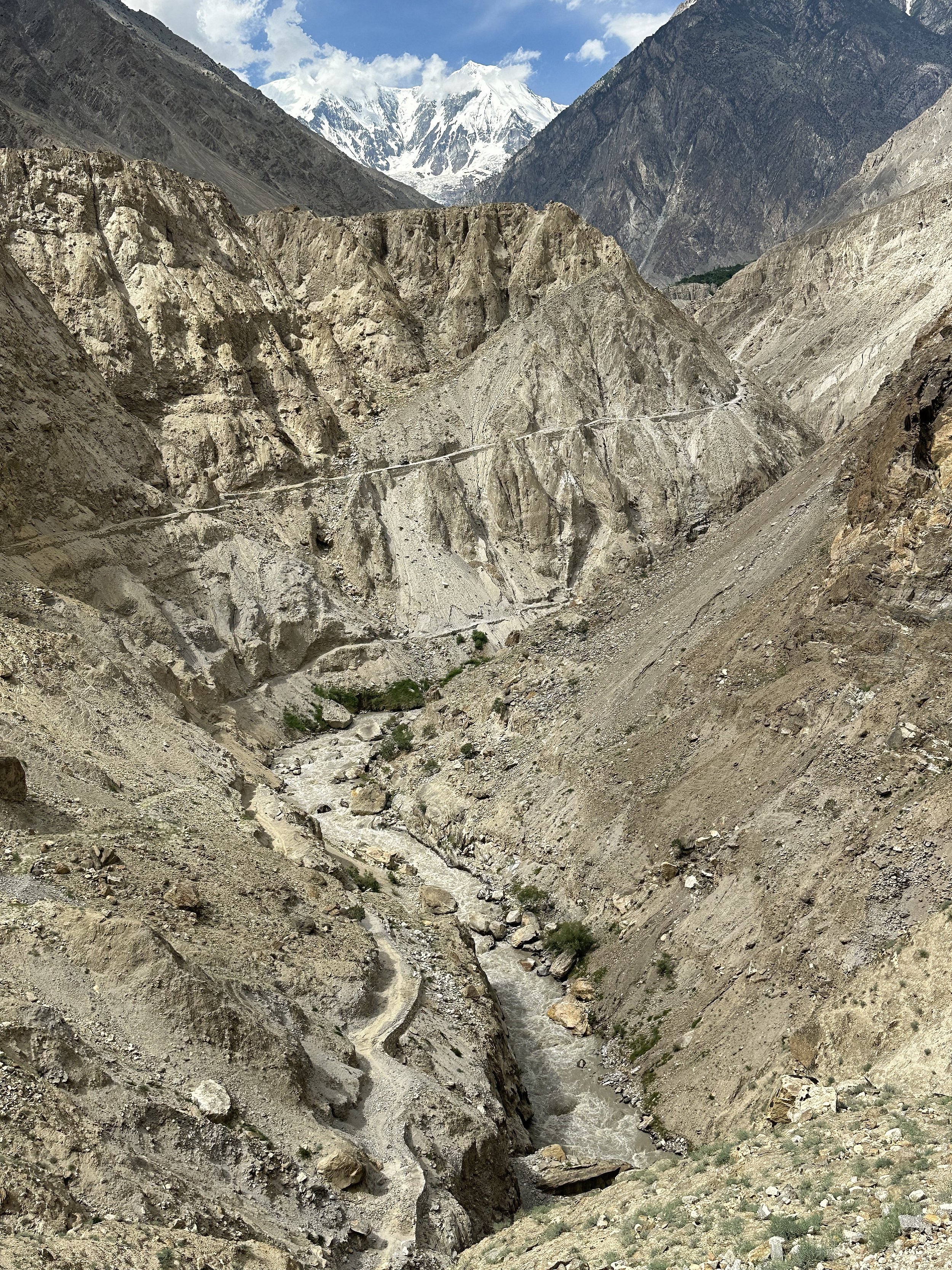
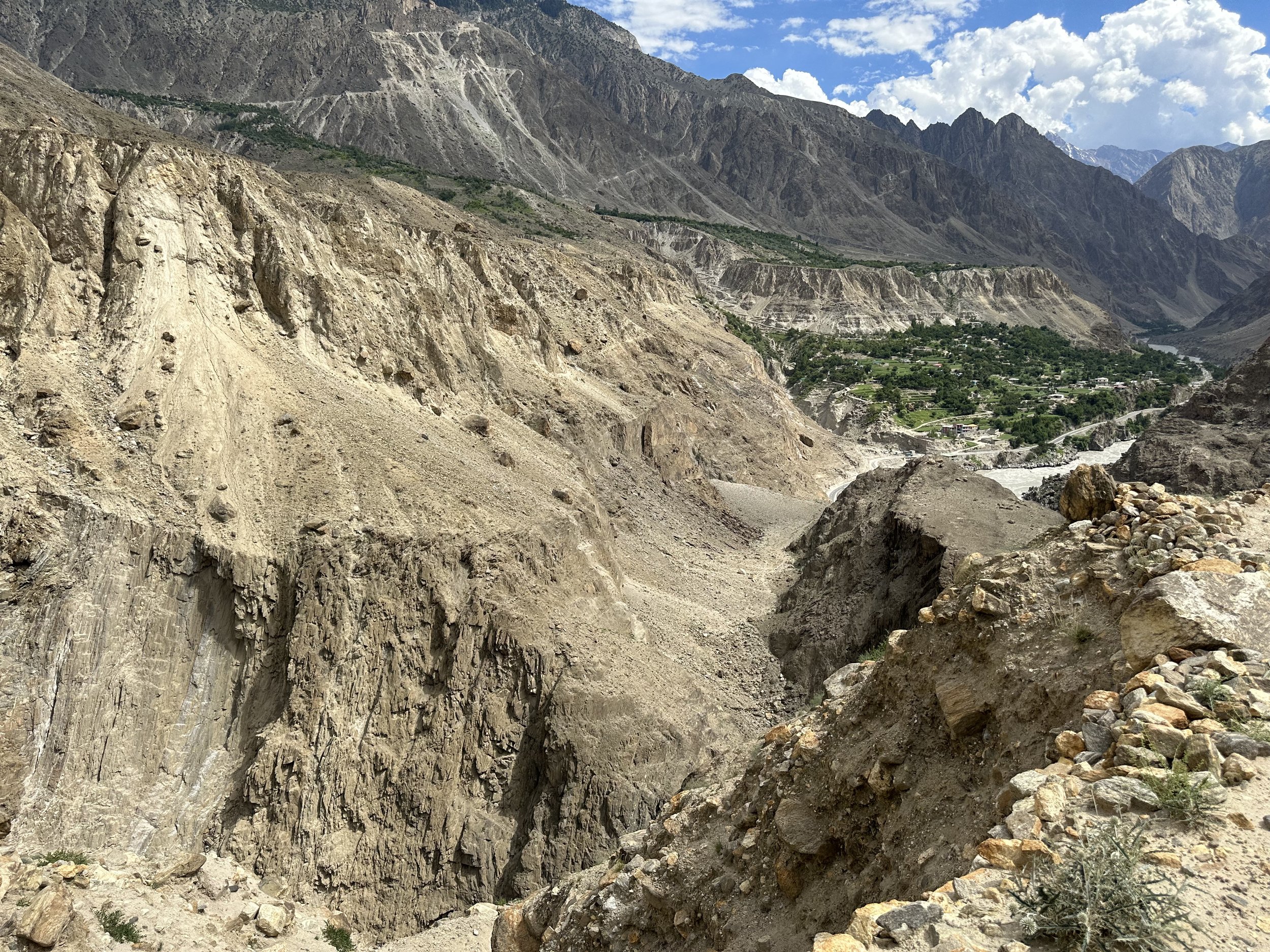
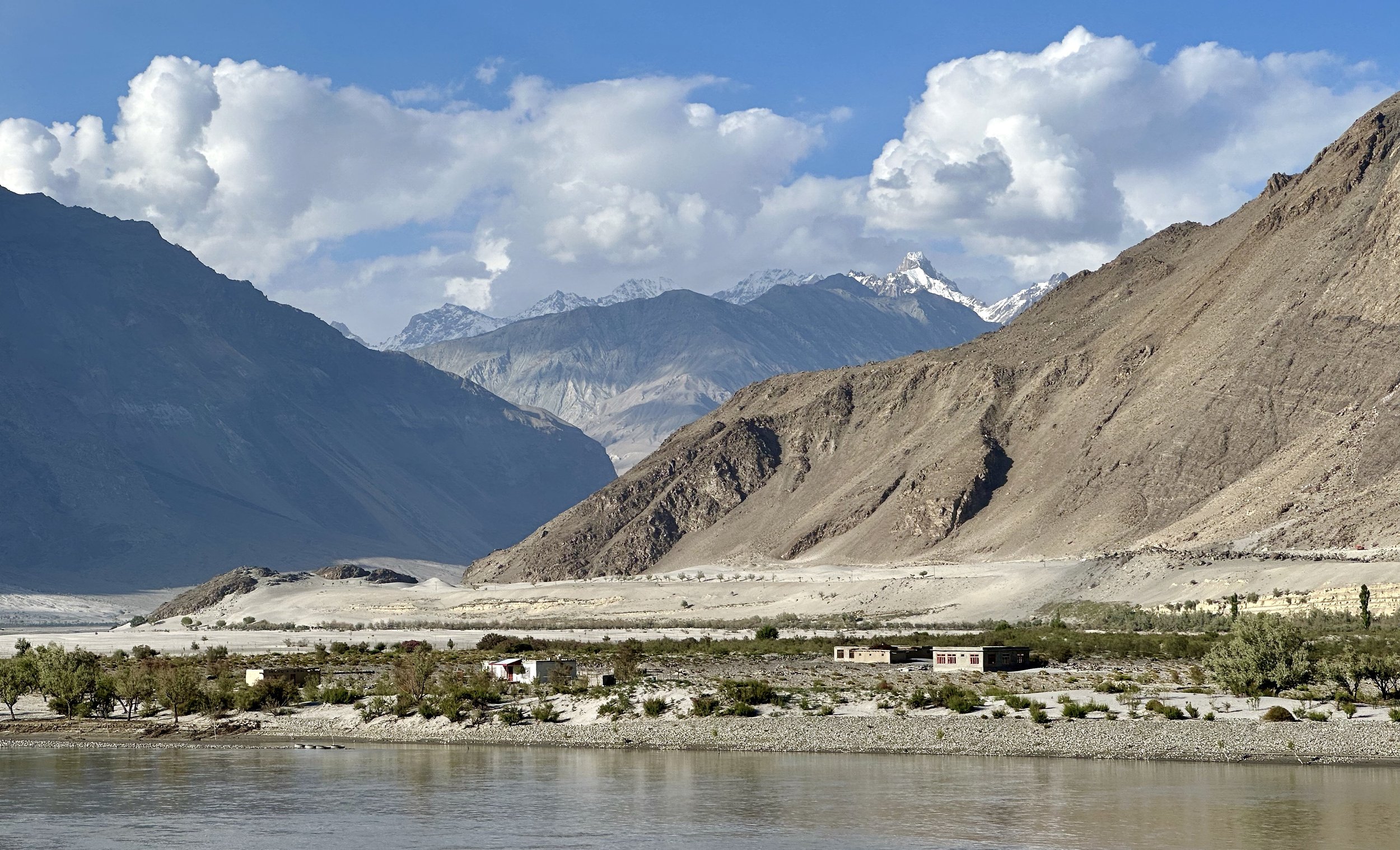
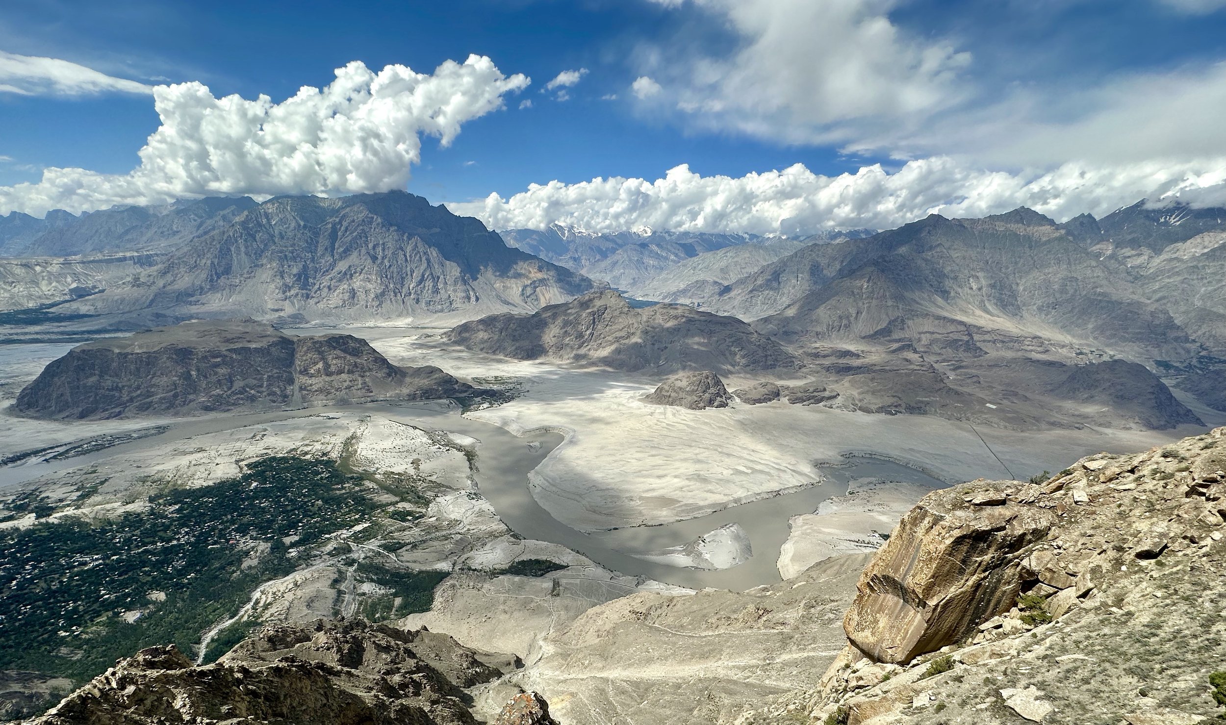
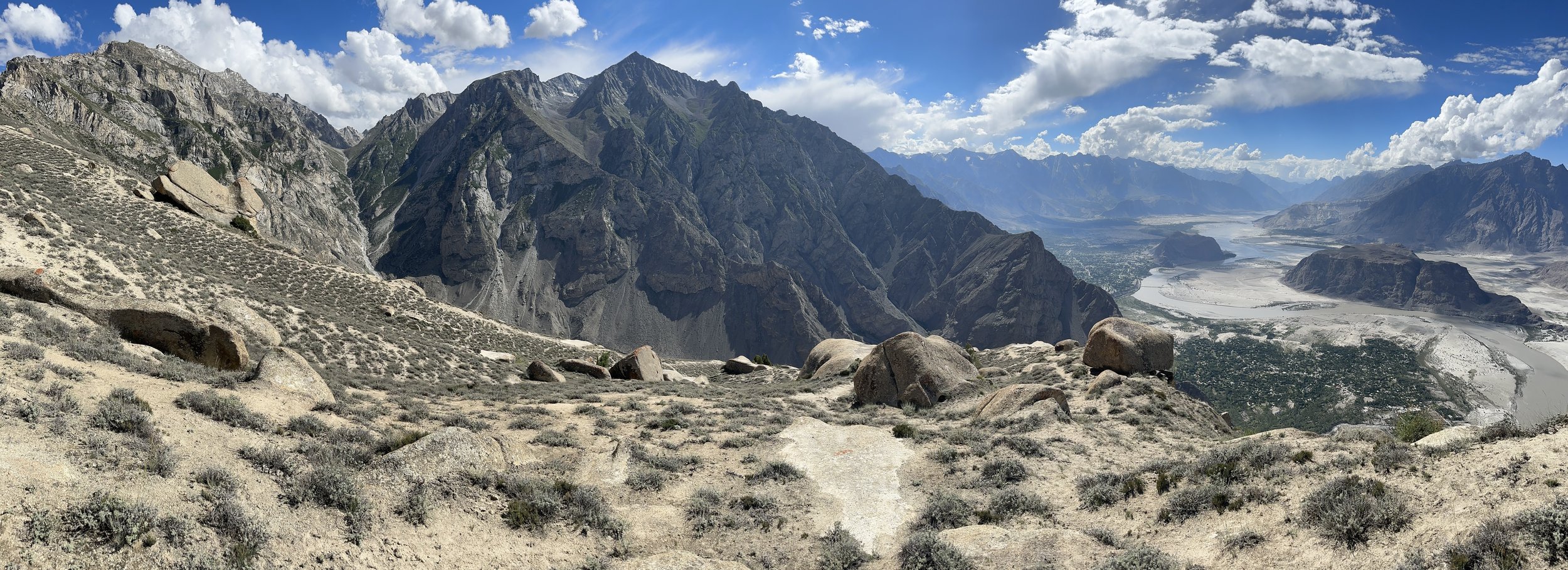
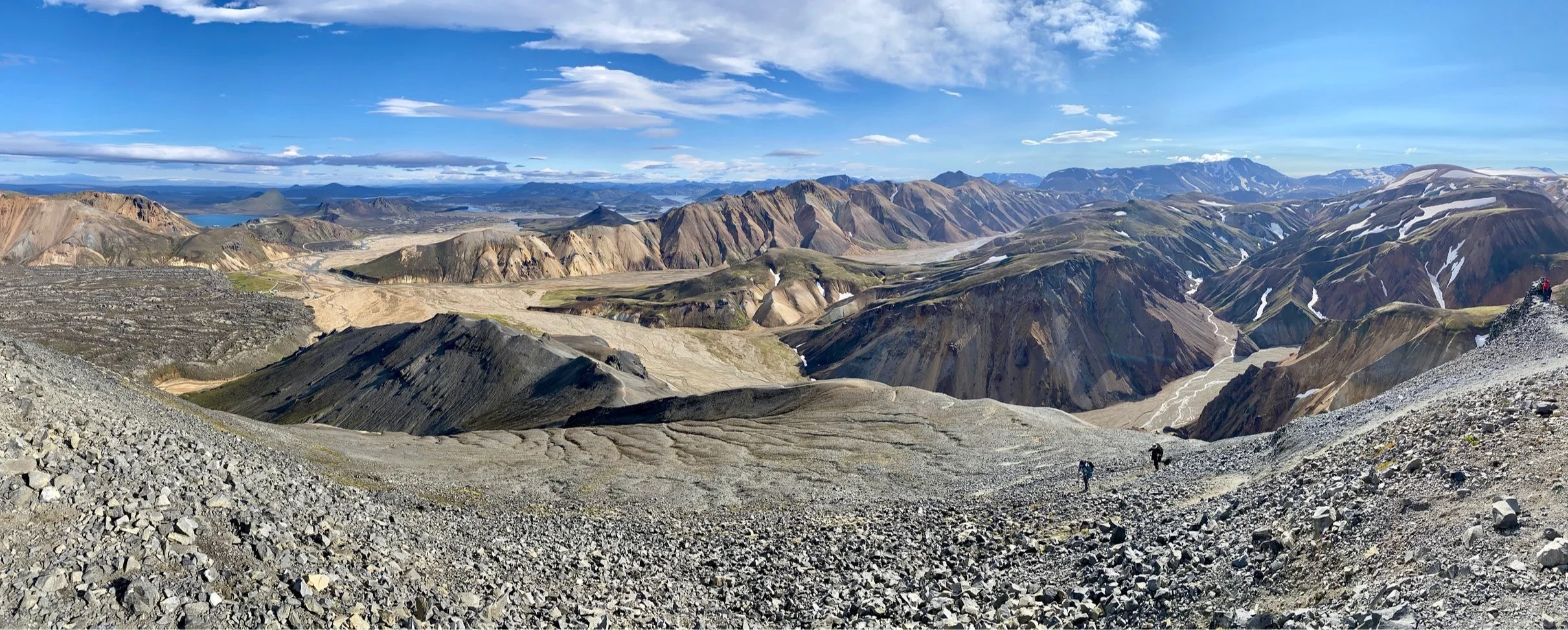
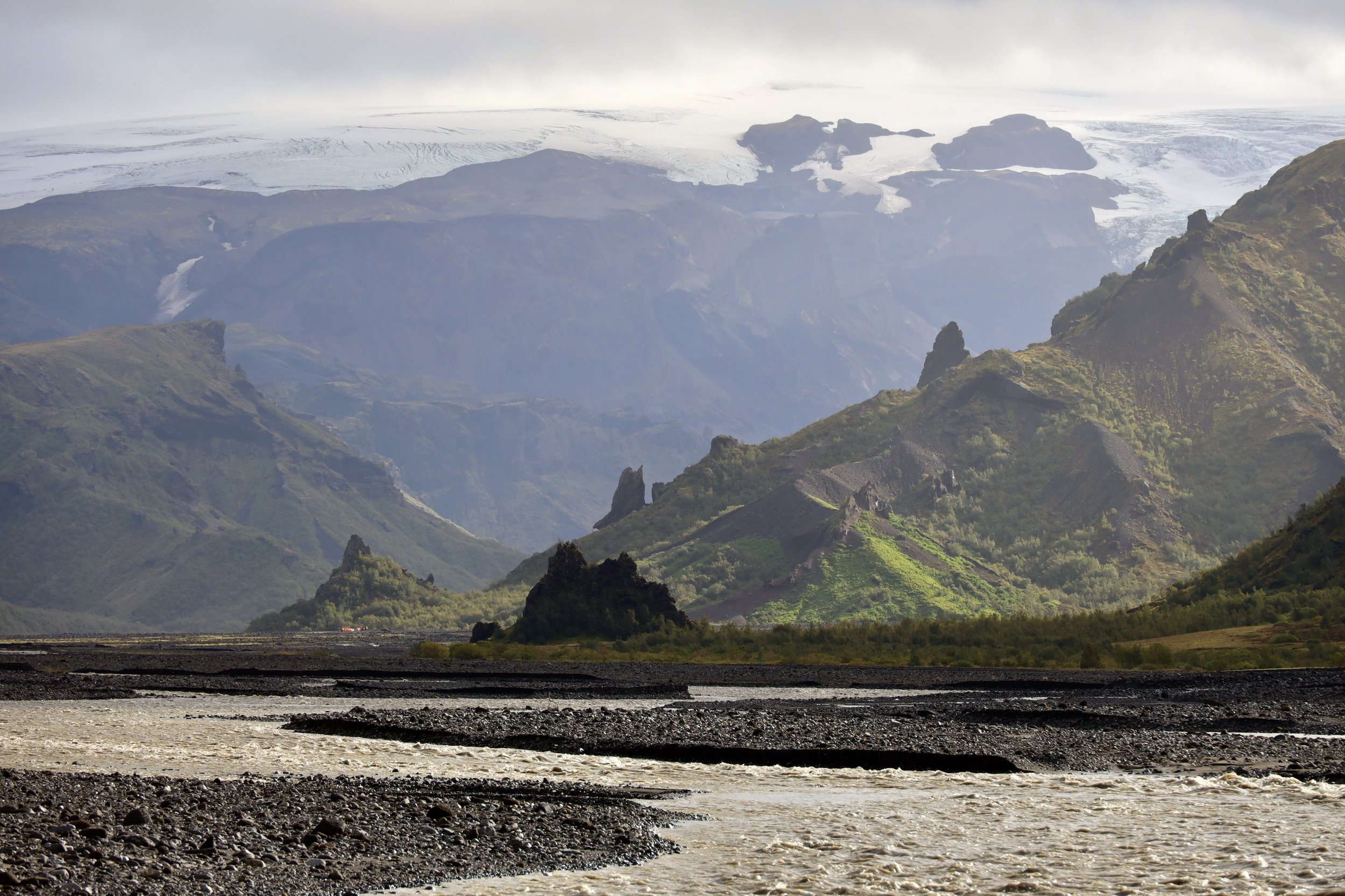
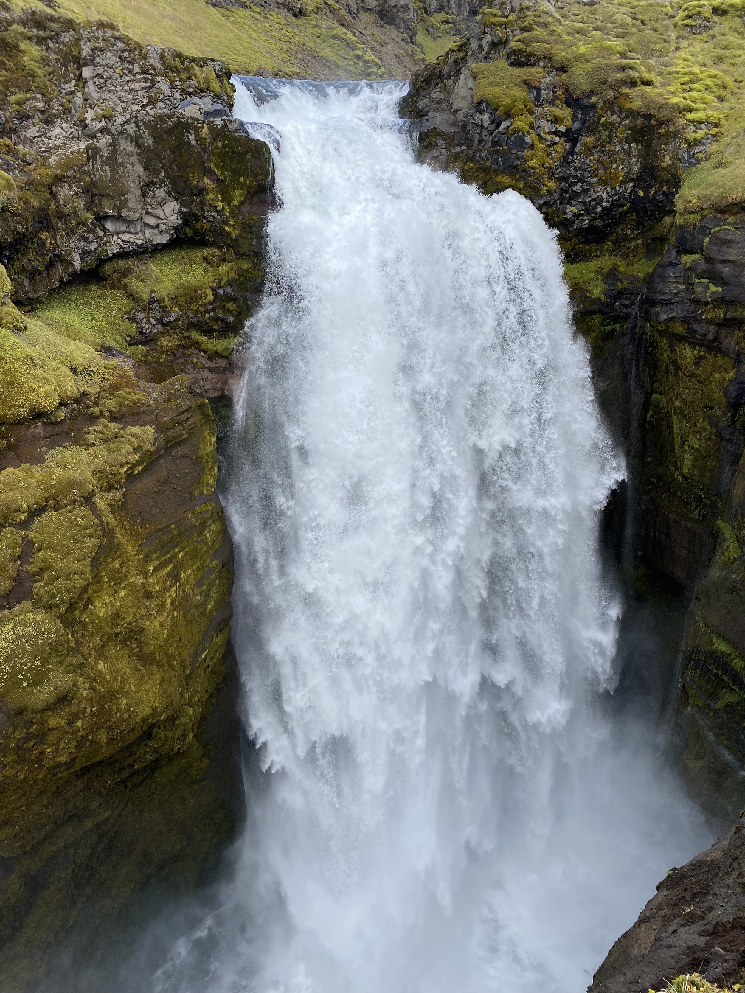
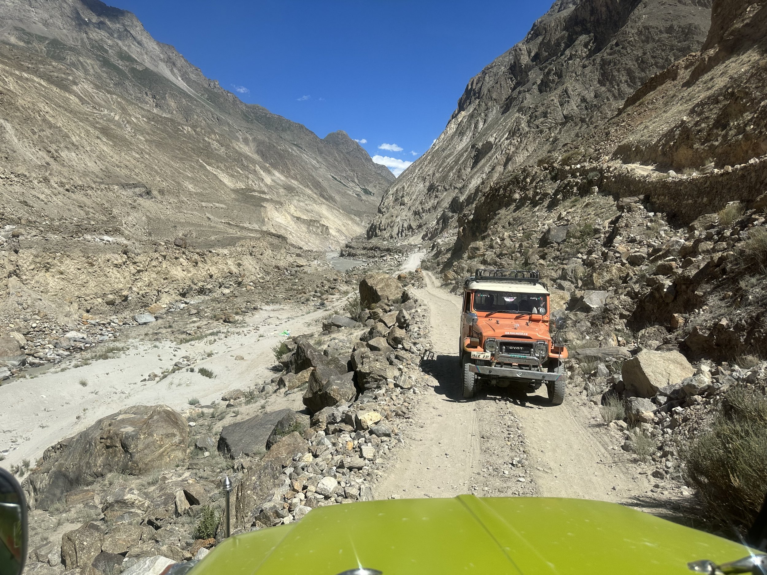
The Jaglot – Skardu section is 160km long and follows the Indus River gorge.   The new road is better for driving but worst for scenery and lacks the dramatic tight corners and overhanging rocky outcrops.  There are also very few spots to pull over for photos.  Although the scenery is spectacular, it is hard to capture it on film.  The road is lined with vertical cliffs with snow covered mountains towering above.  We passed Sasso, the exit point from the Haramosh Pass where we would end up in a few weeks.  The driver was going way too fast to enjoy the scenery and take any good photos.  By 2 pm we were in Skardu.  Total driving time was 11 hrs yesterday and 6 hrs today. 

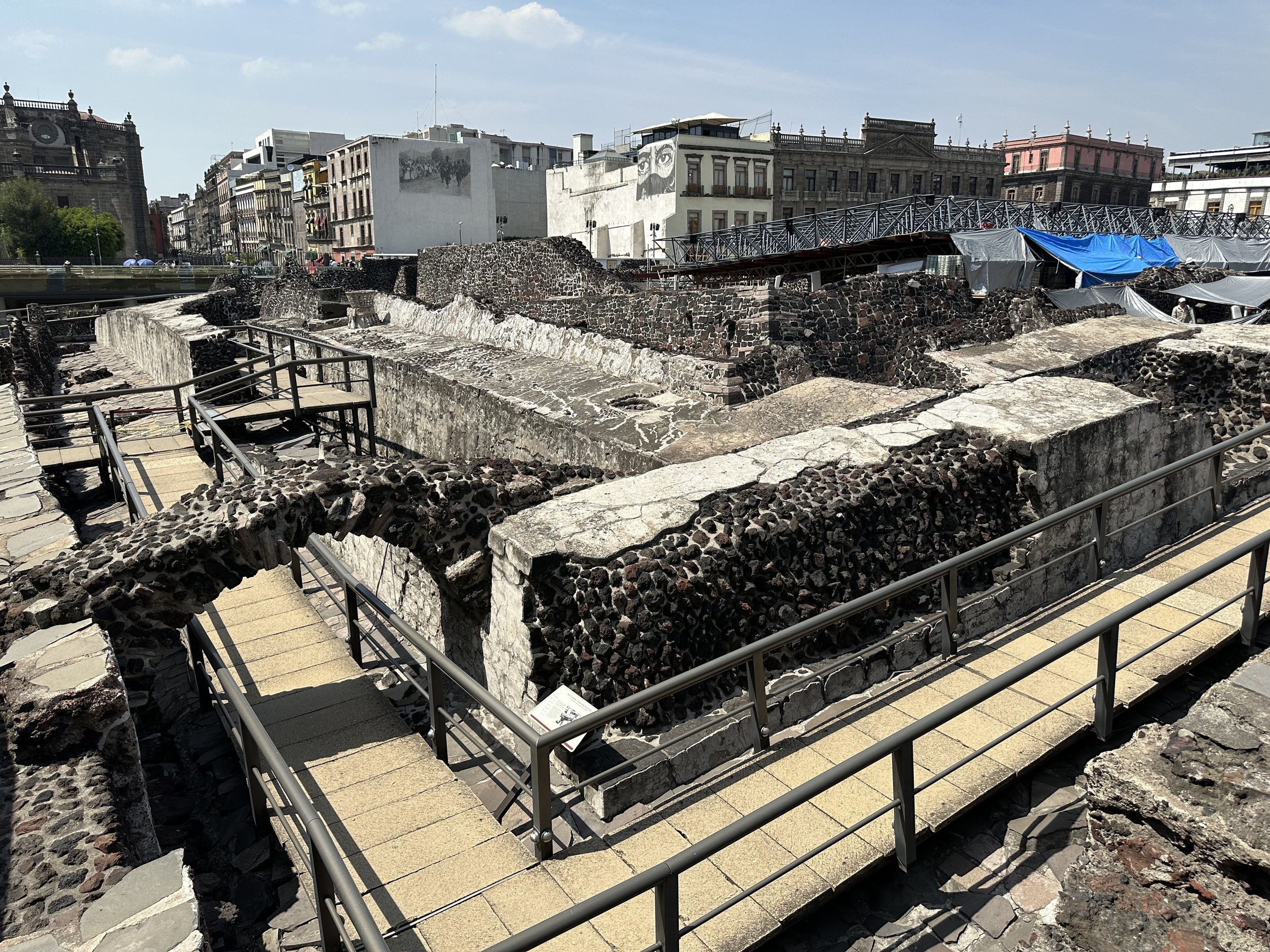
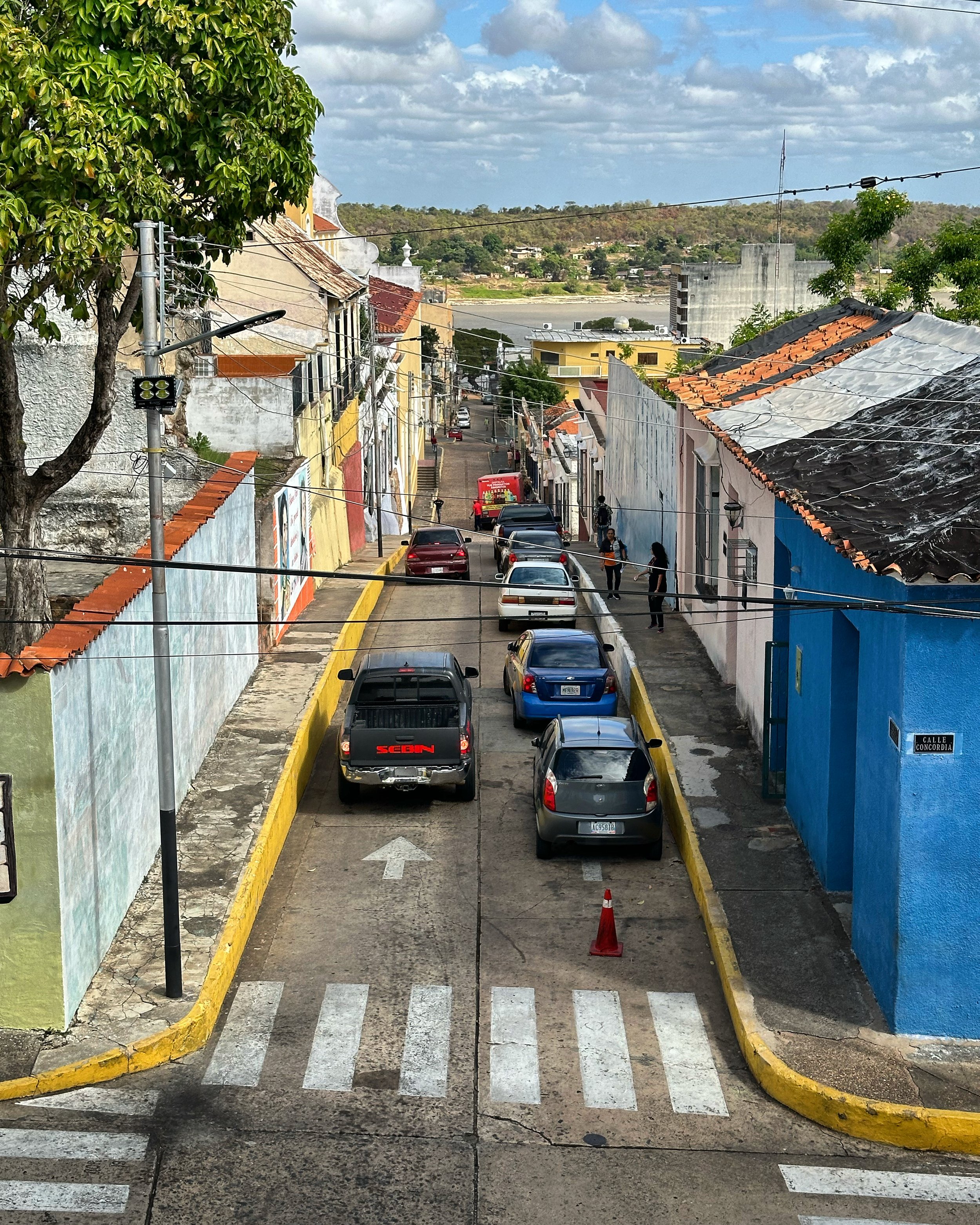
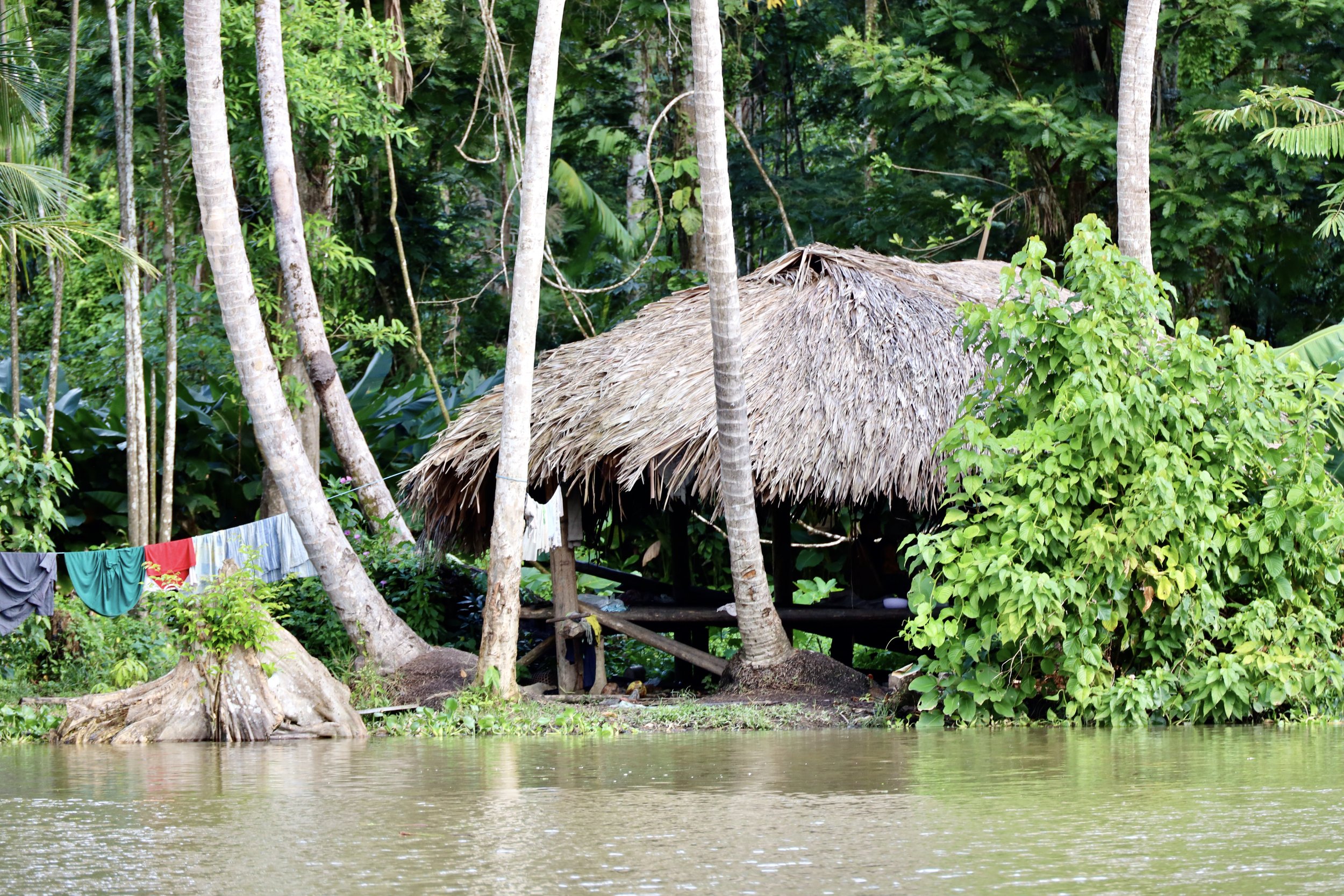
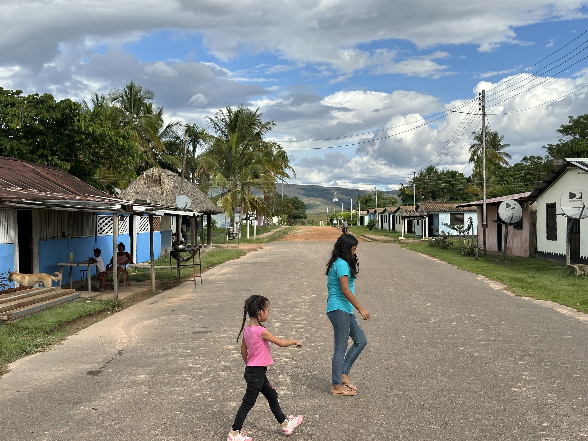
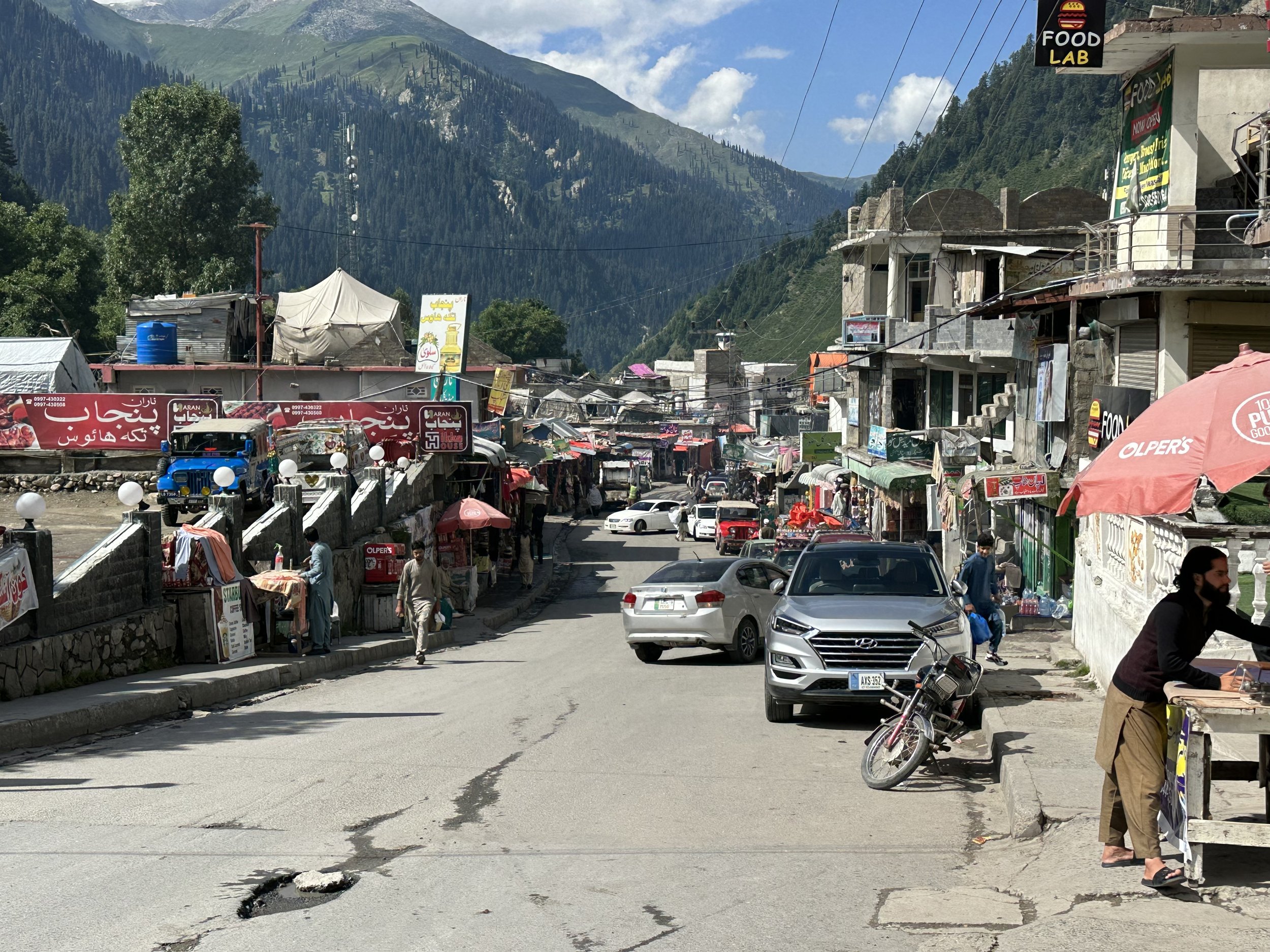
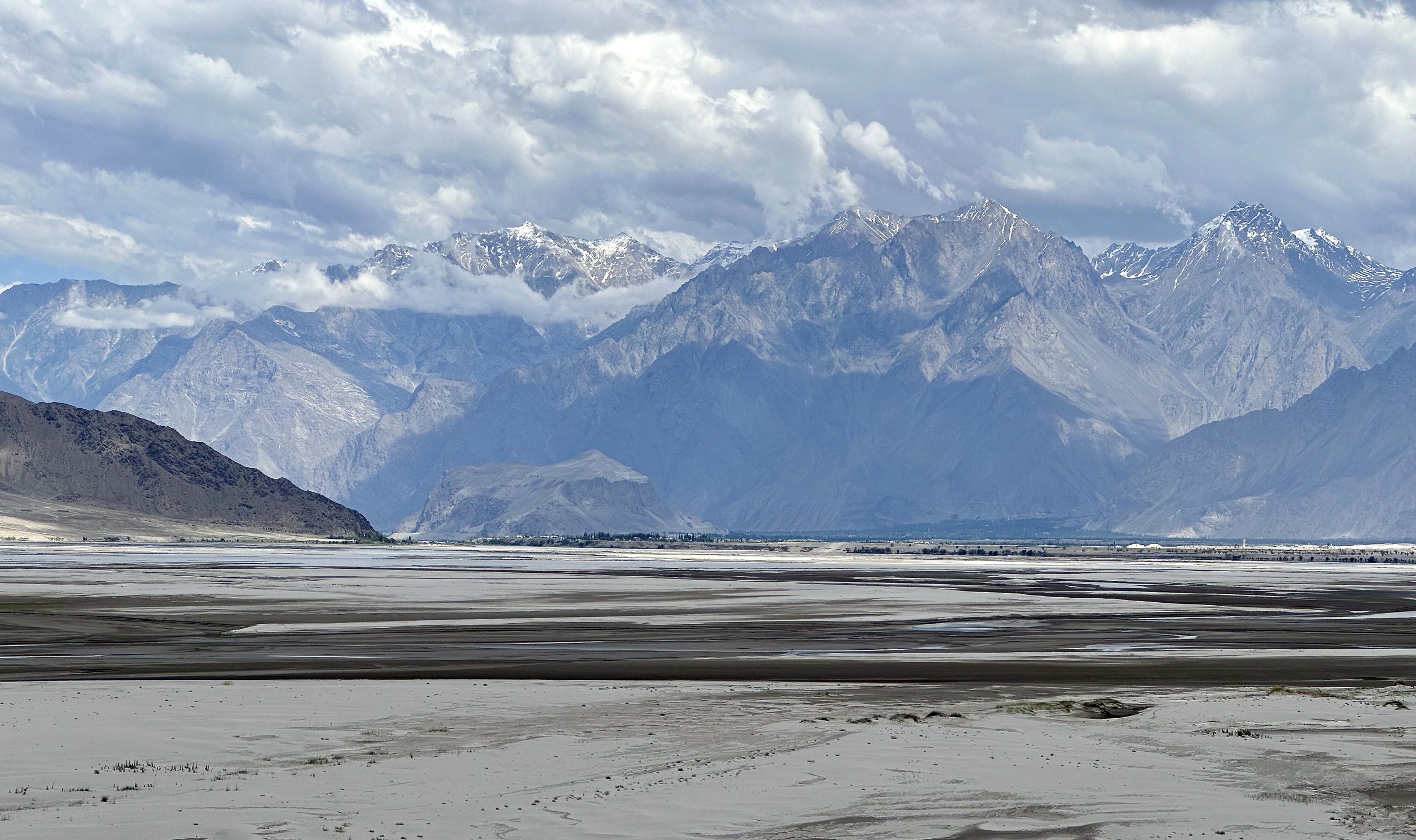
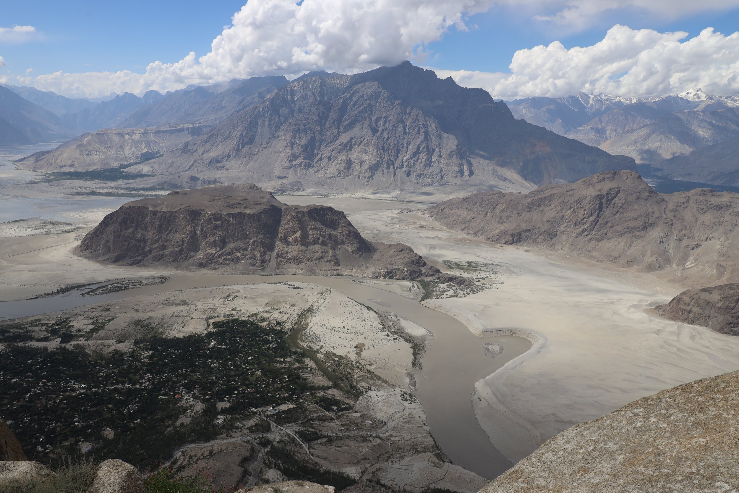
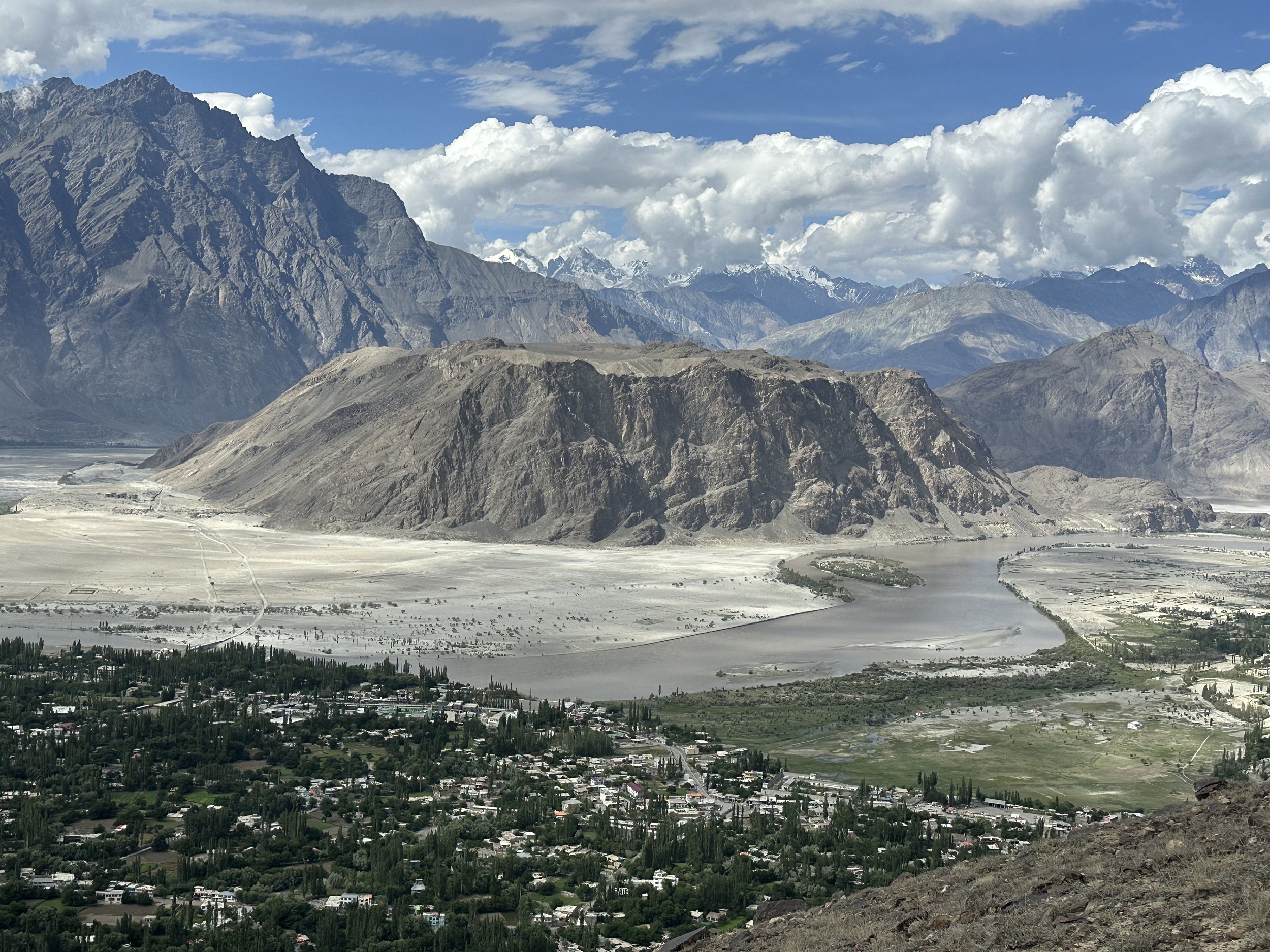
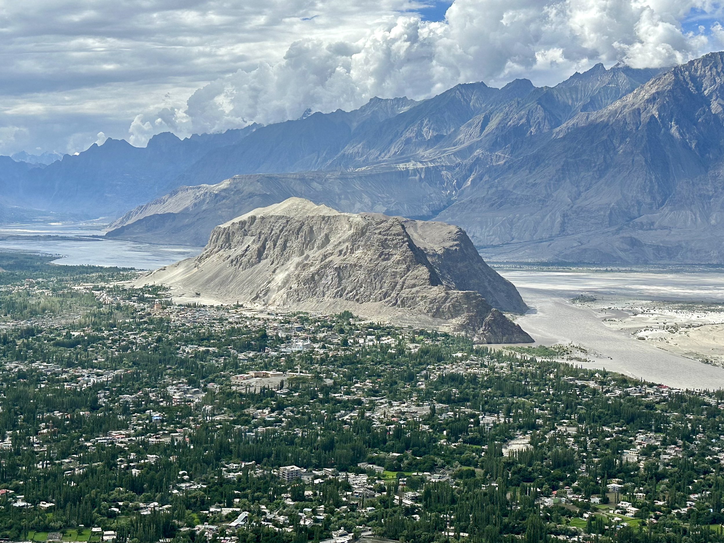
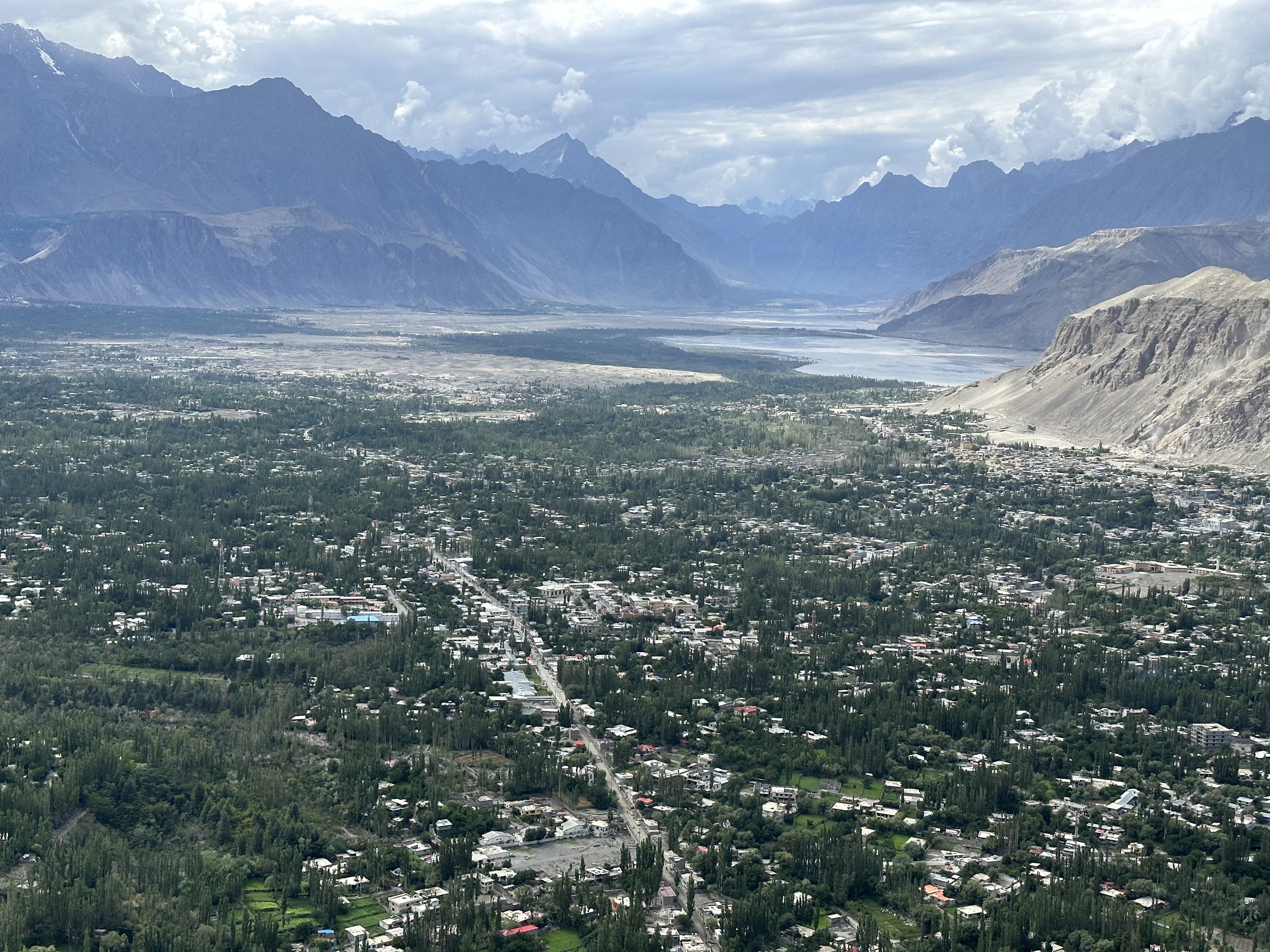
My first impression of Skardu after such a long time was that it has grown a lot!  I did not recognize it.  It felt very dusty, crowded and chaotic with many concrete buildings in various stages of completion.  It was not very inviting to walk around, and I have not ventured out on my own at all.  It was tiring just to look at it.  We stopped for lunch at a hotel run by Ghulam’s friend.  Ghulam called ahead and asked for a meal with as little grease as possible to which they obliged with good results.   After lunch it was a quick drive to Ghulam’s beautiful house.  The house fronts as a guest house and has a palatial feel to it. The compound is surrounded by a lush garden and high walls separating it from the chaos of the outside world.   

July 11, 2023 Skardu

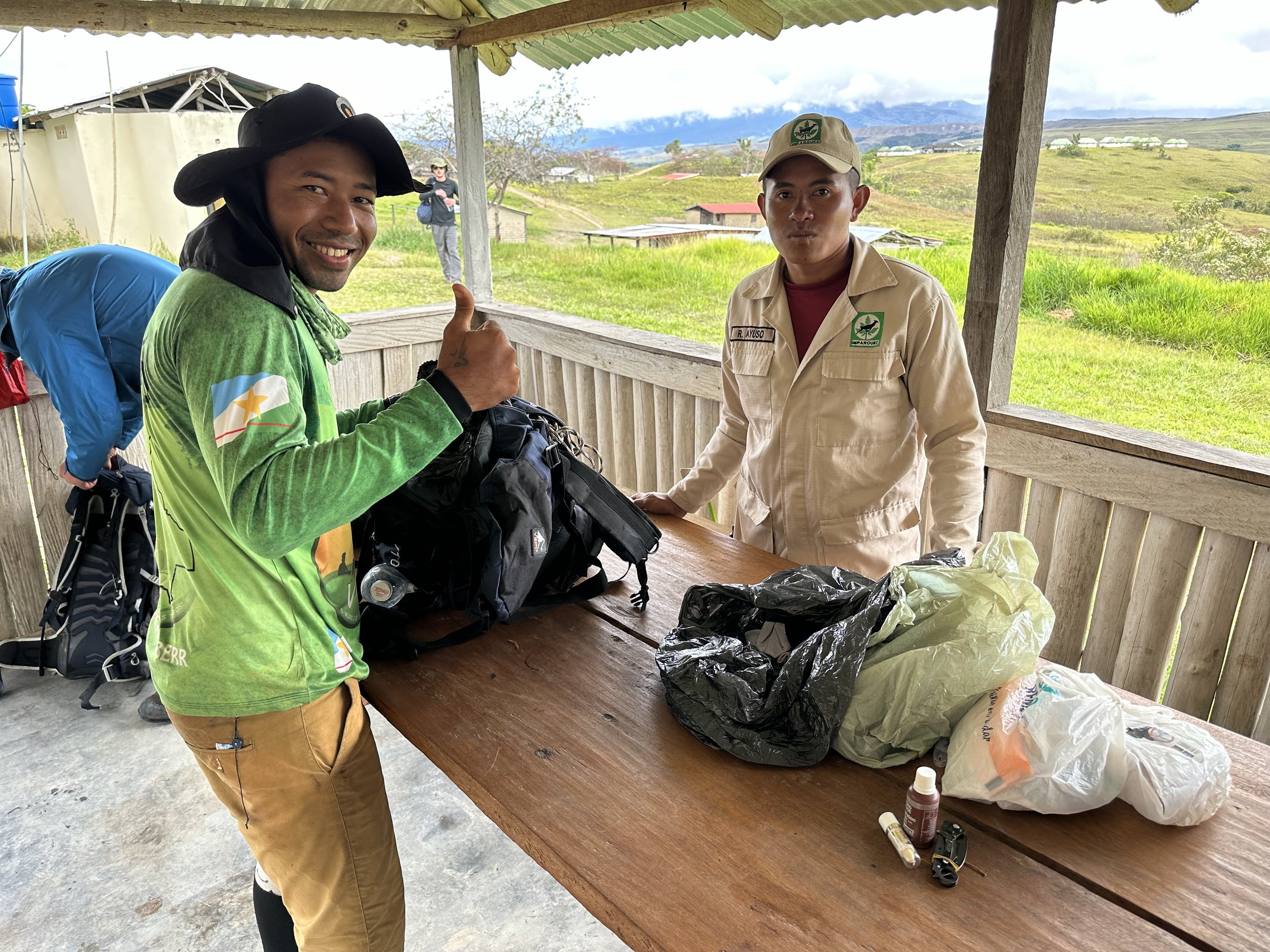
In the morning I met Essan, my guide for both treks of this trip.  Essan is from Shigar Valley and has experience in all aspects of mountain work.  He worked as a cook, high altitude porter and a trekking guide. He worked with Artur Hajzer and Marcin Kaczkan during the tragic expedition to G2 during which Hajzer lost his life.  He told me some interesting stories about that experience.  He assured me that he visited all the areas that we were going to visit and was familiar with the routes and the terrain.  Essan was entrusted with organizing all the permits and logistics.  In the early afternoon we had to go to the Ministry of Tourism office to finalize the permits and sign some papers.  According to the permits, I was both the Tour Leader and the only Tour member.  As a tour leader I had to sign the promise that all tour members would obey all the rules and in case of non-compliance, I would be held responsible as the tour leader.  In order to complete the permit process, I had to get photos taken and return them to the office.   In addition to the requirements of the Tourism Office, we had to send a multitude of documents to the Military Command for more permits as we were travelling in the Pak-China border zone.  I received all the permits by 10pm and we were supposed to leave the next day at 7 am. 

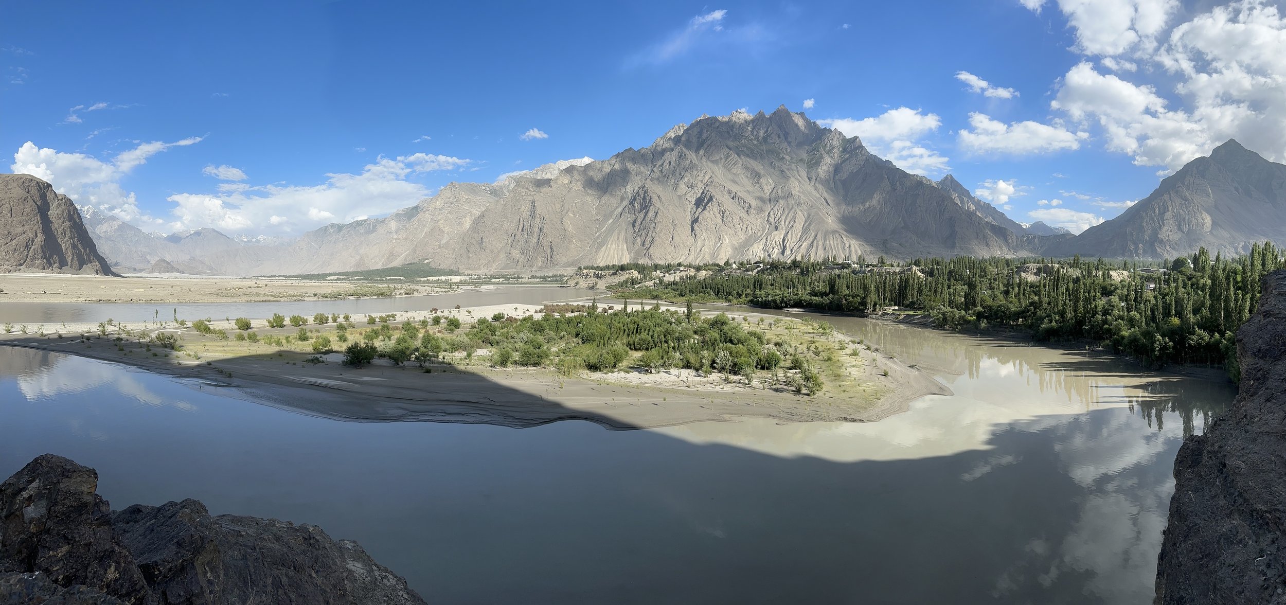
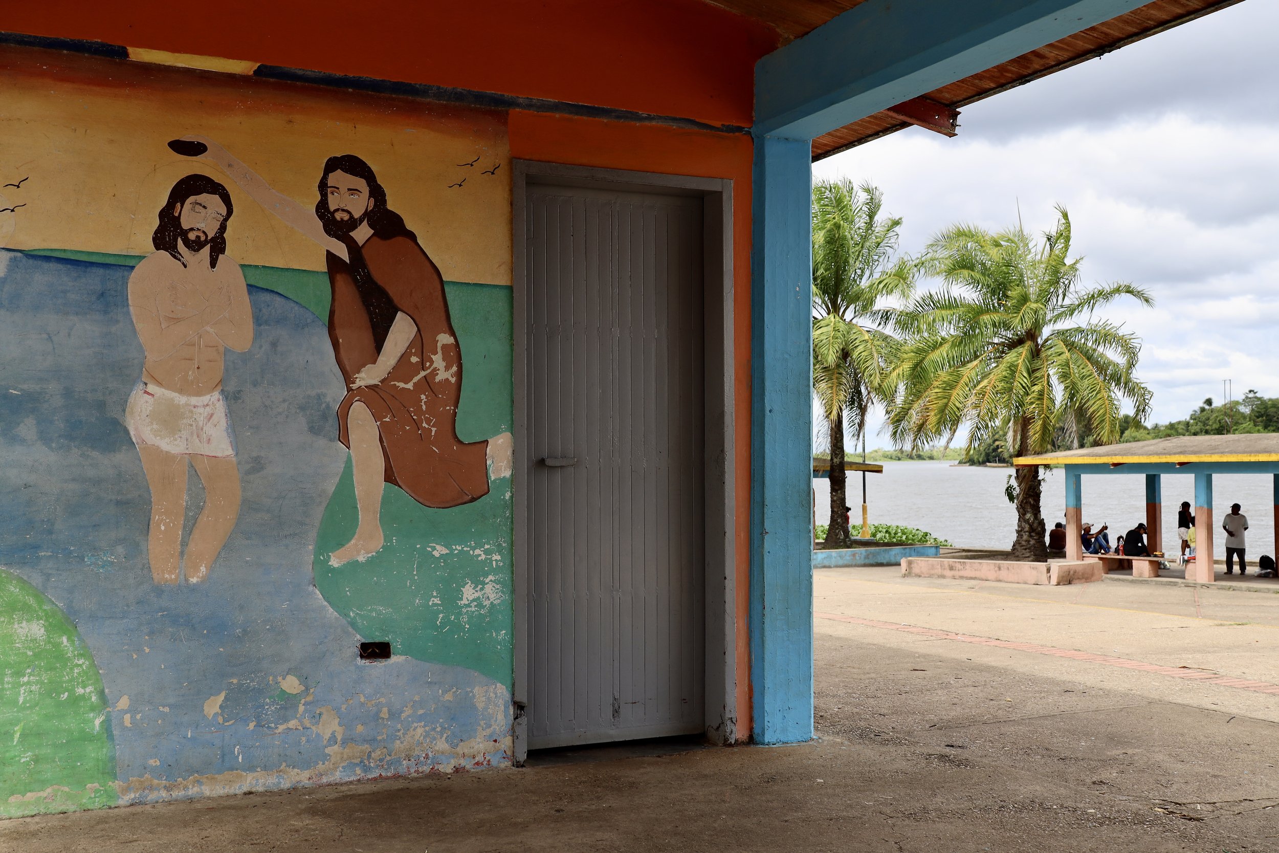
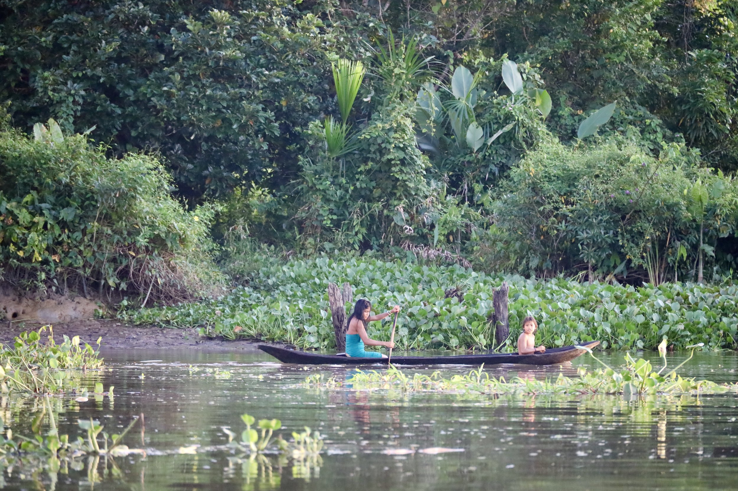
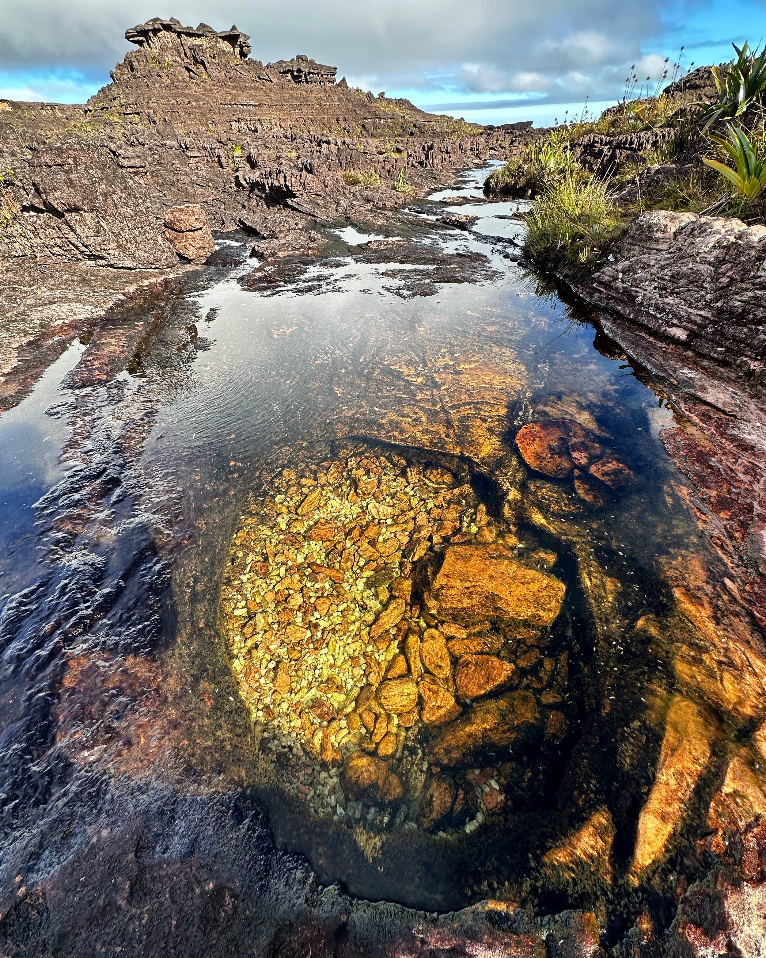
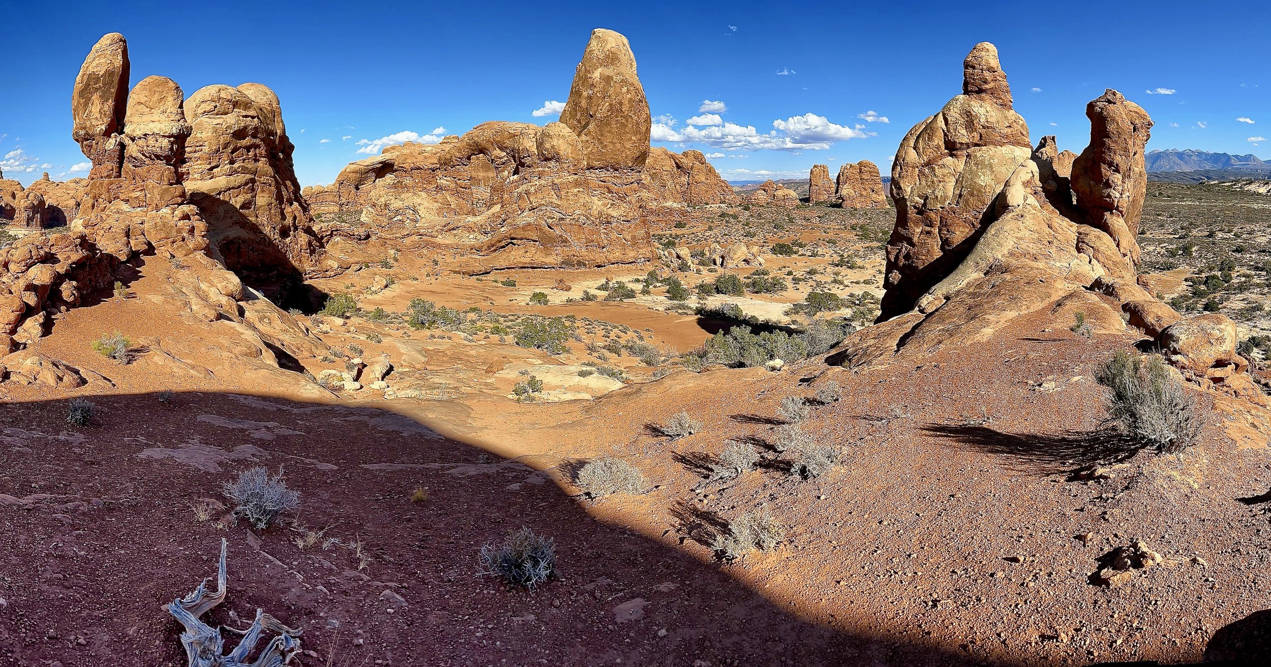
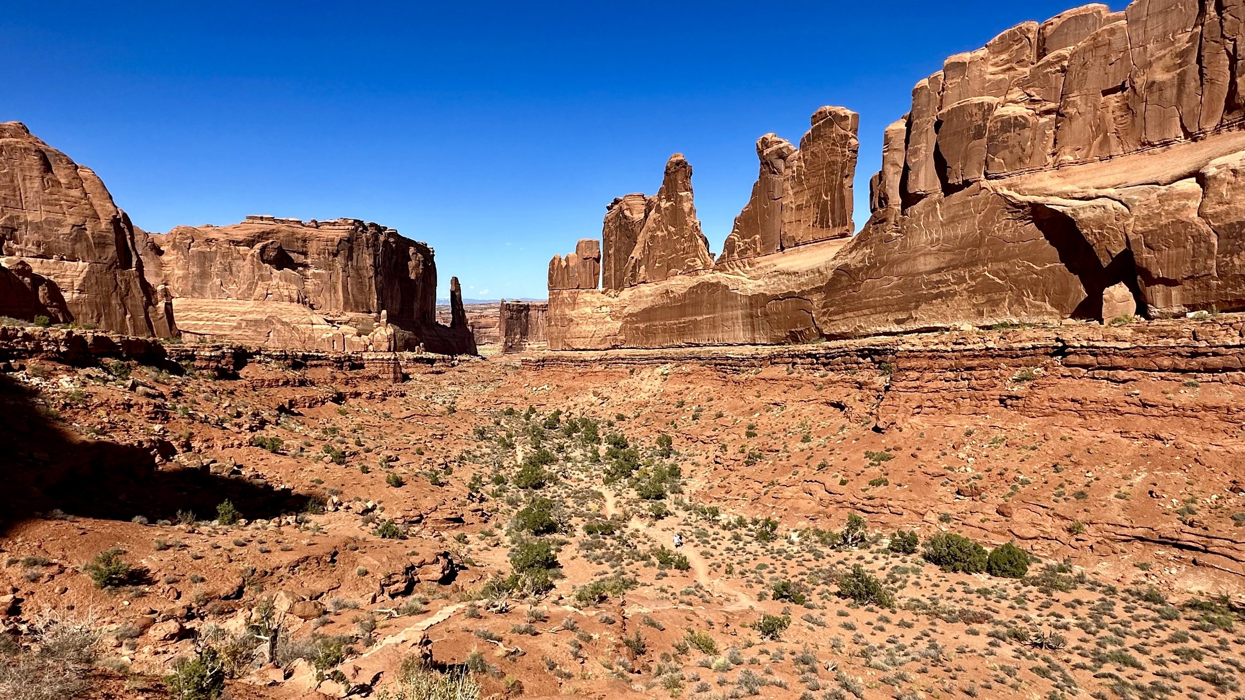
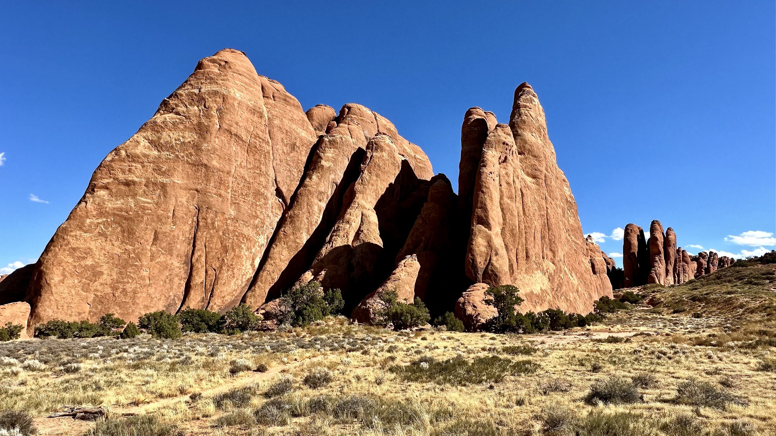
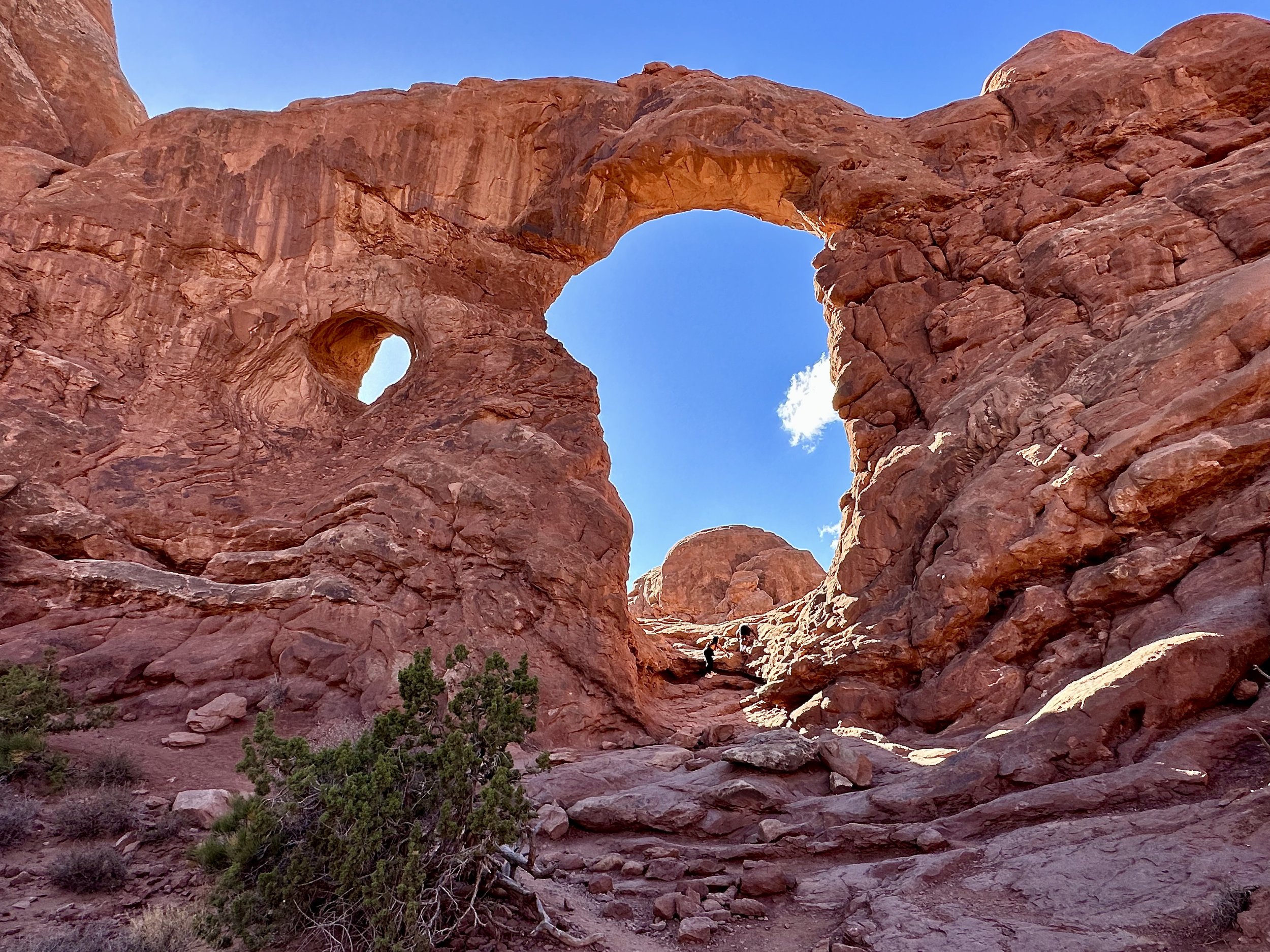
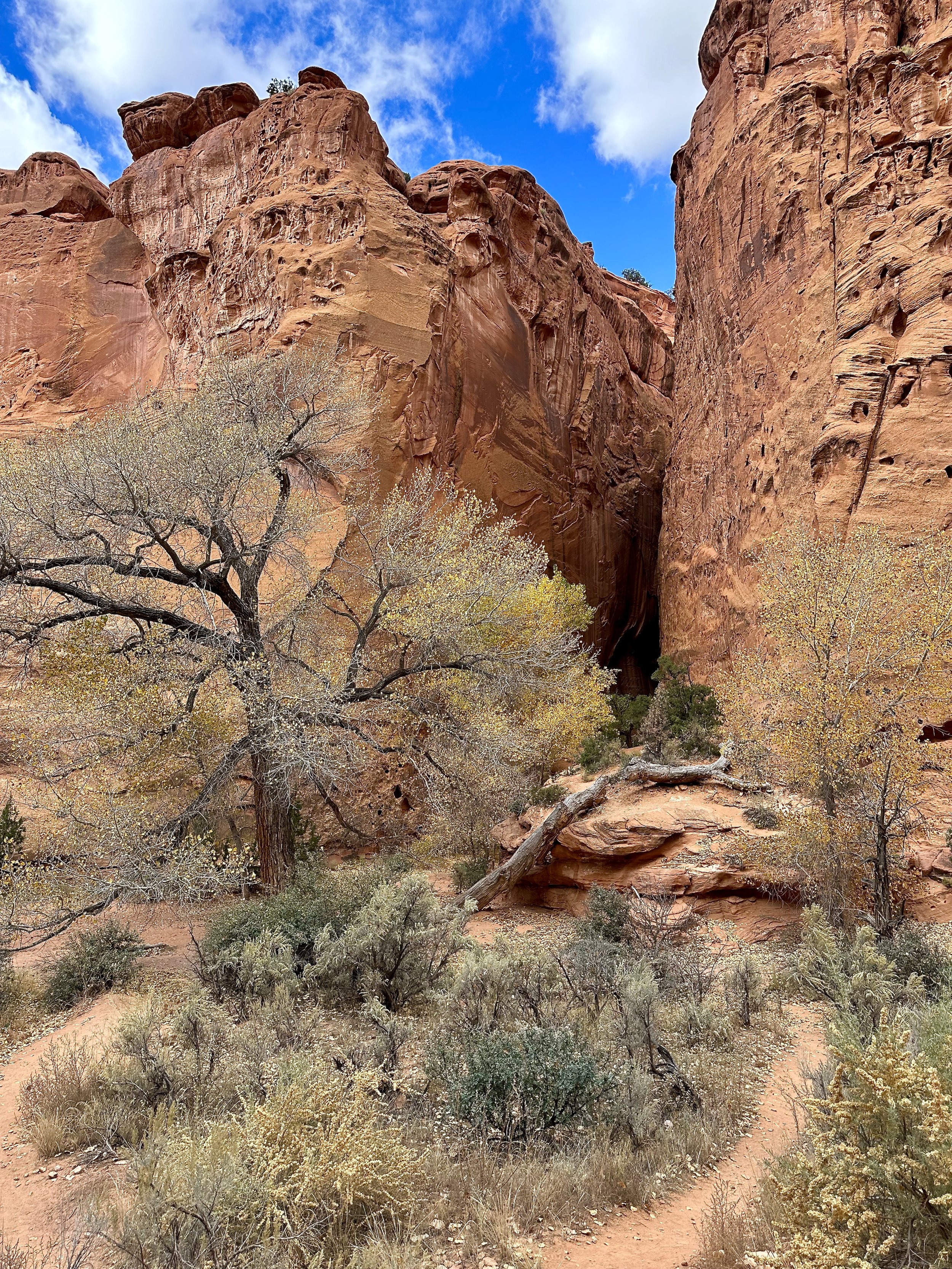
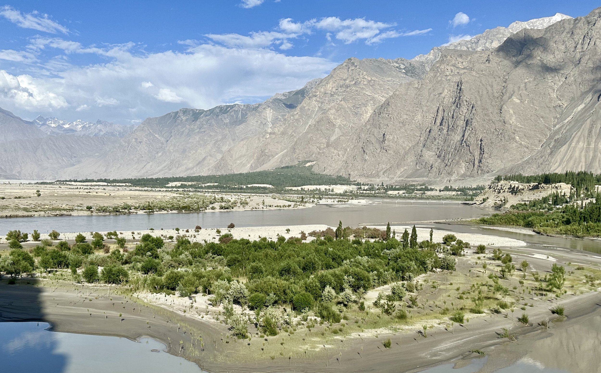
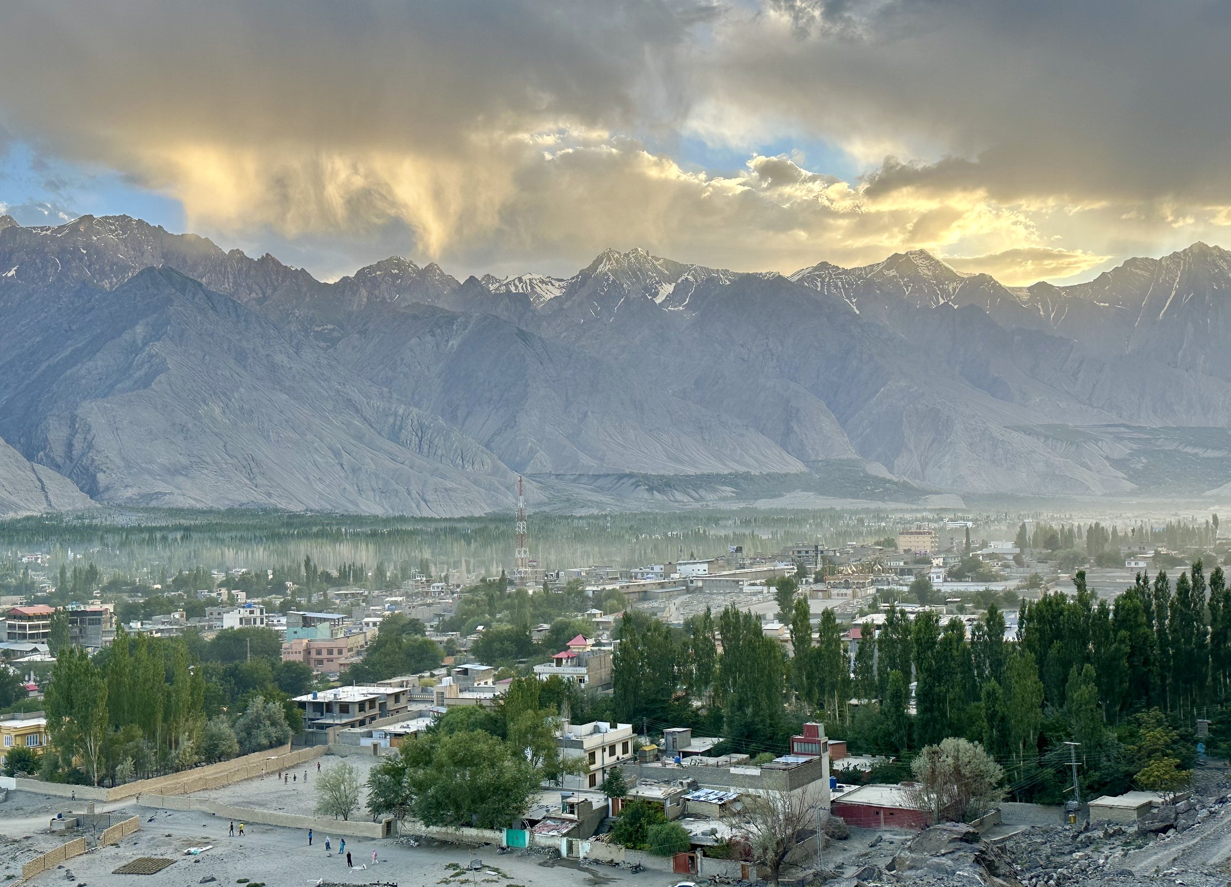
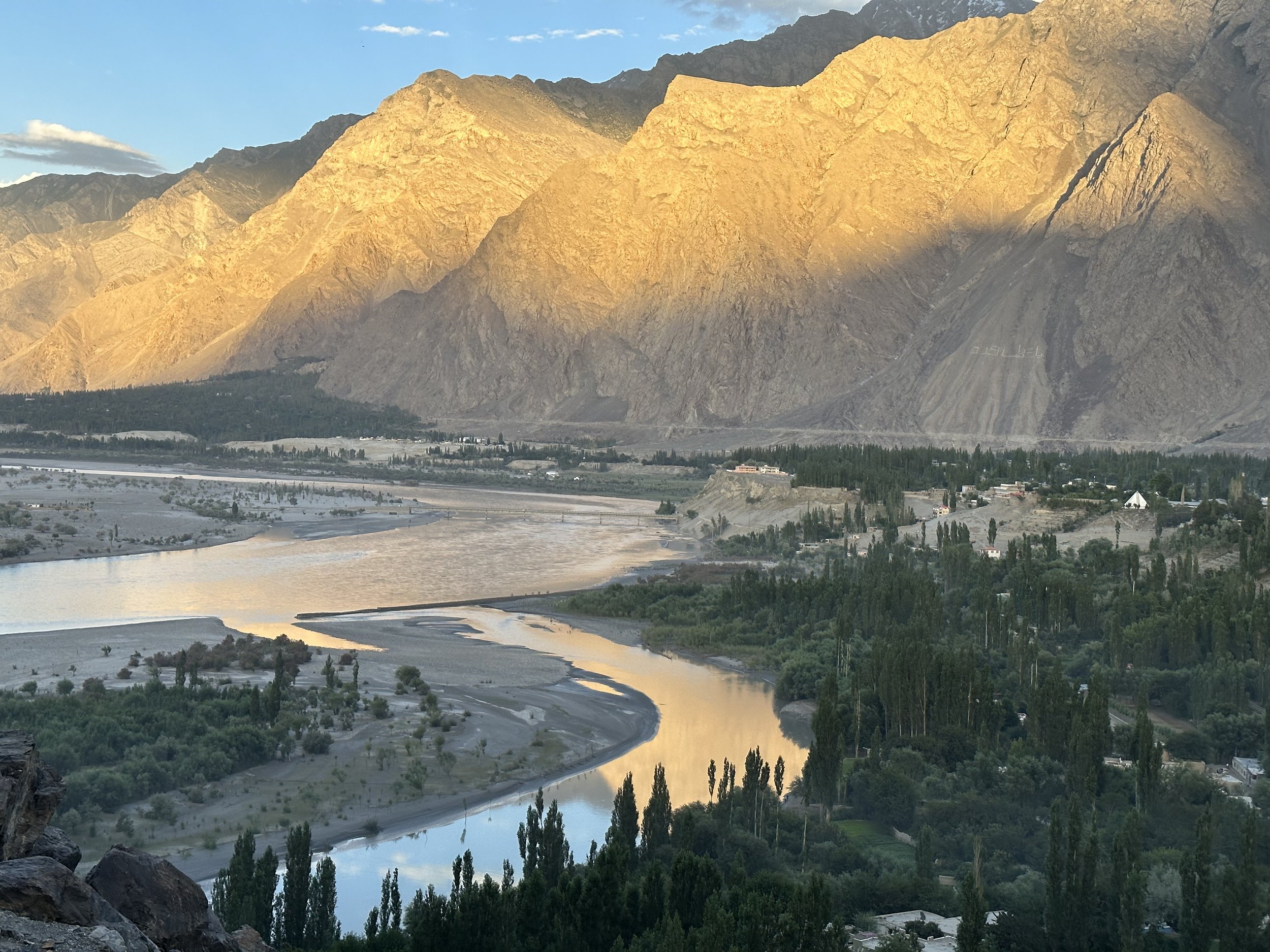
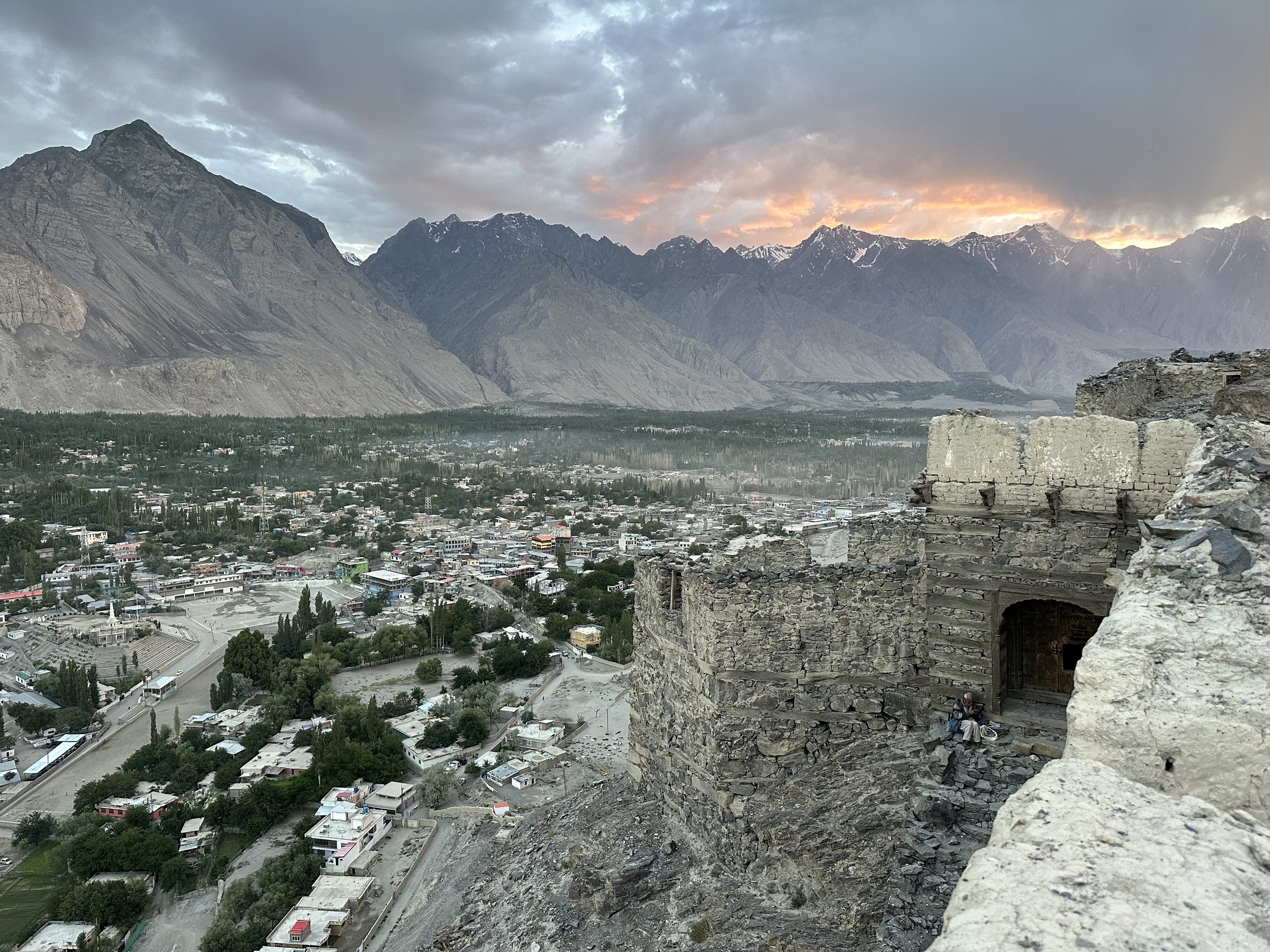
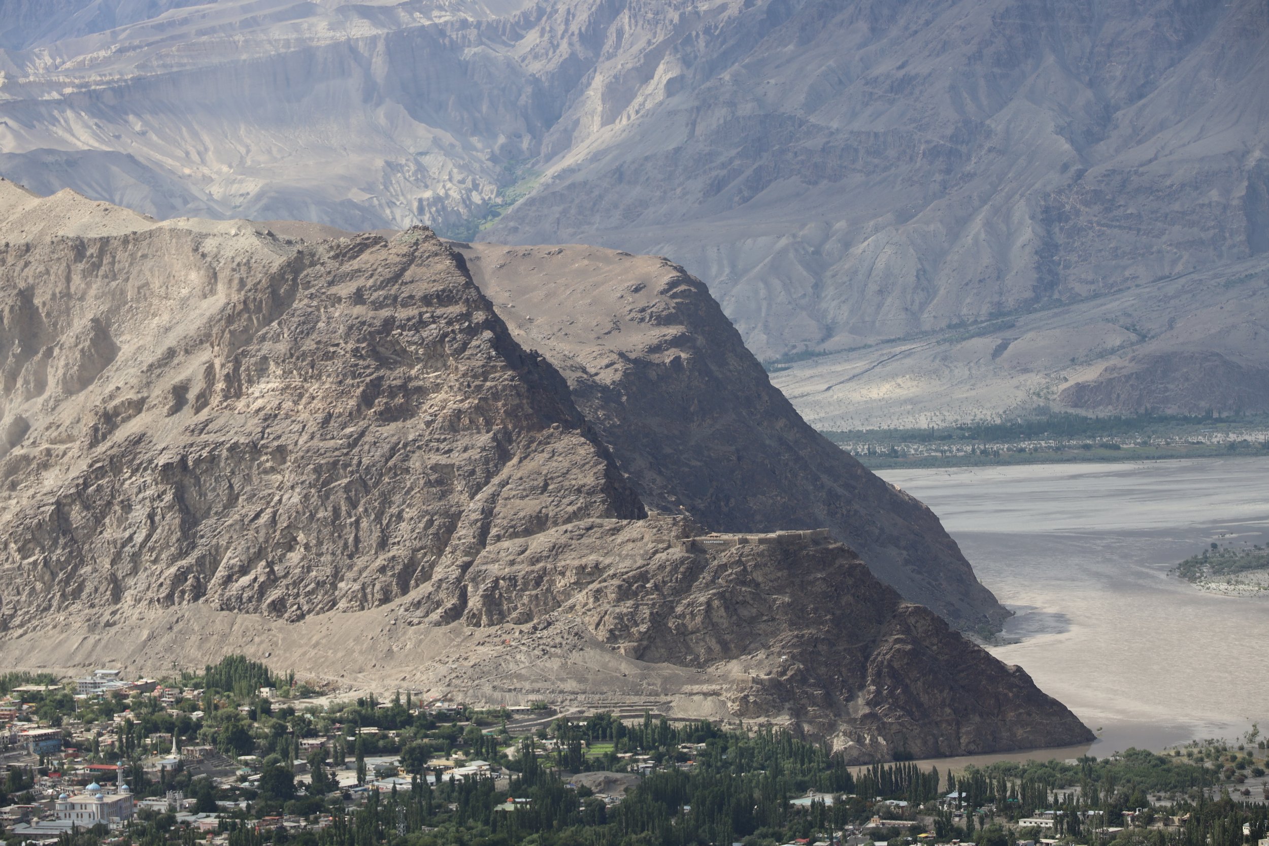
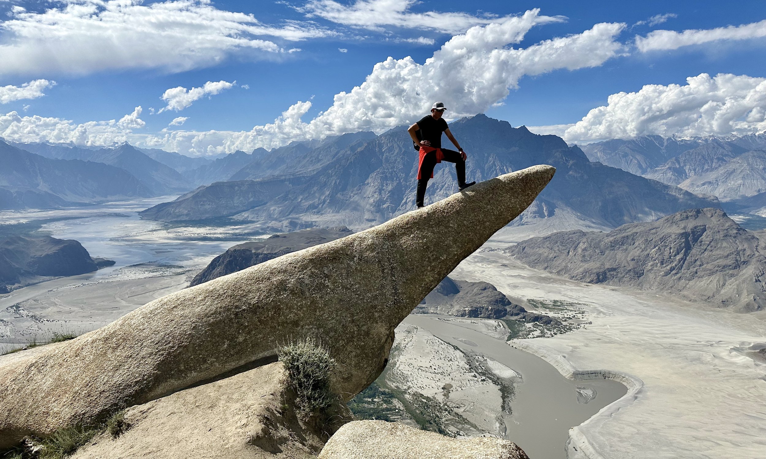
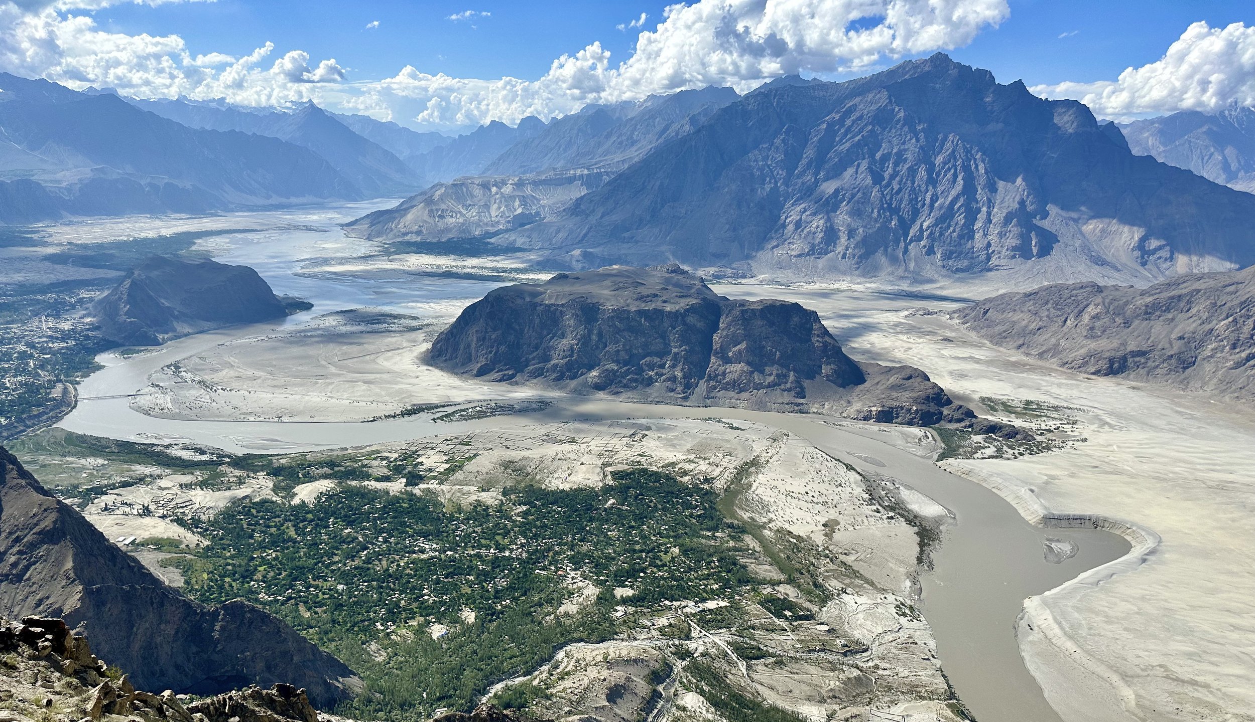
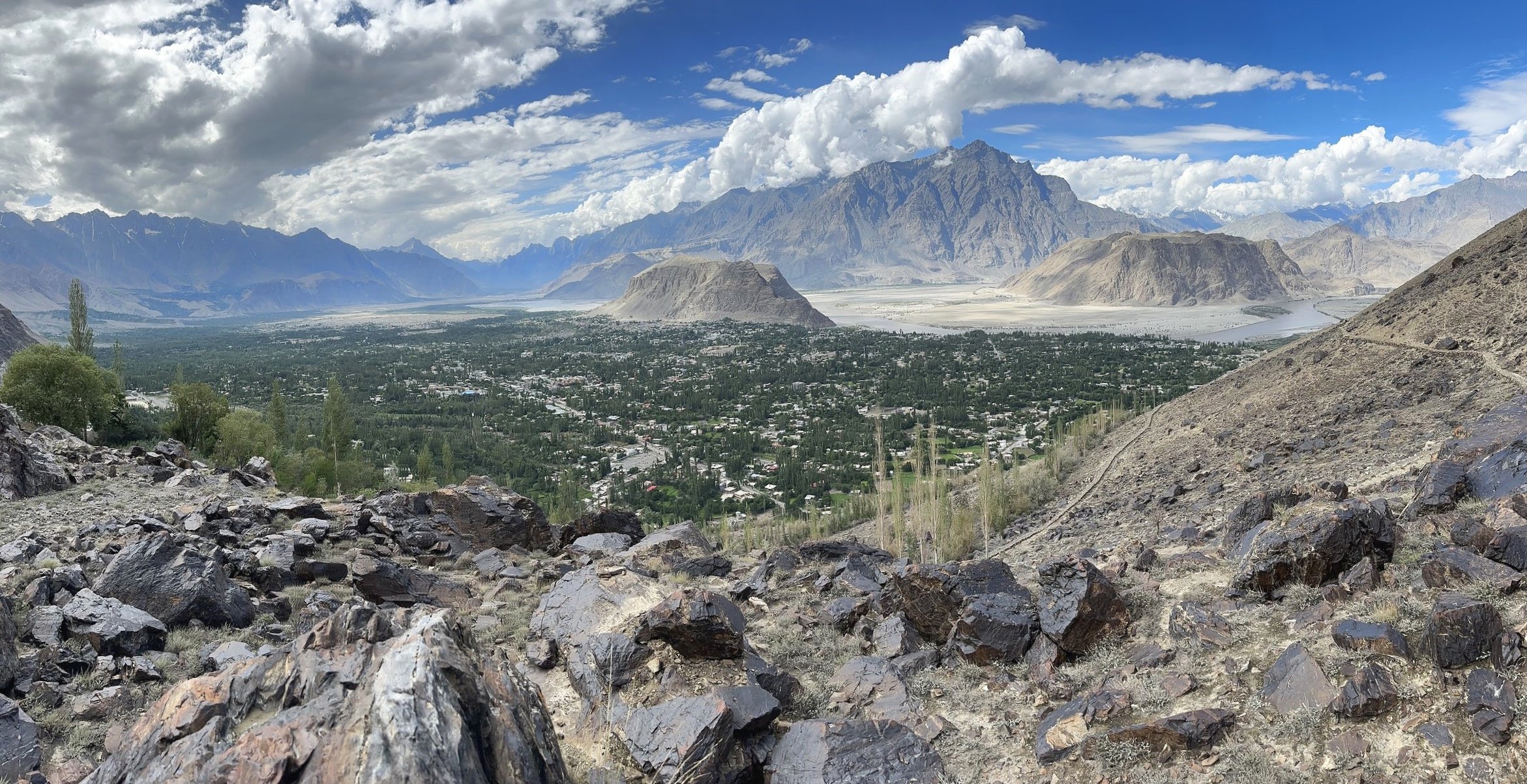
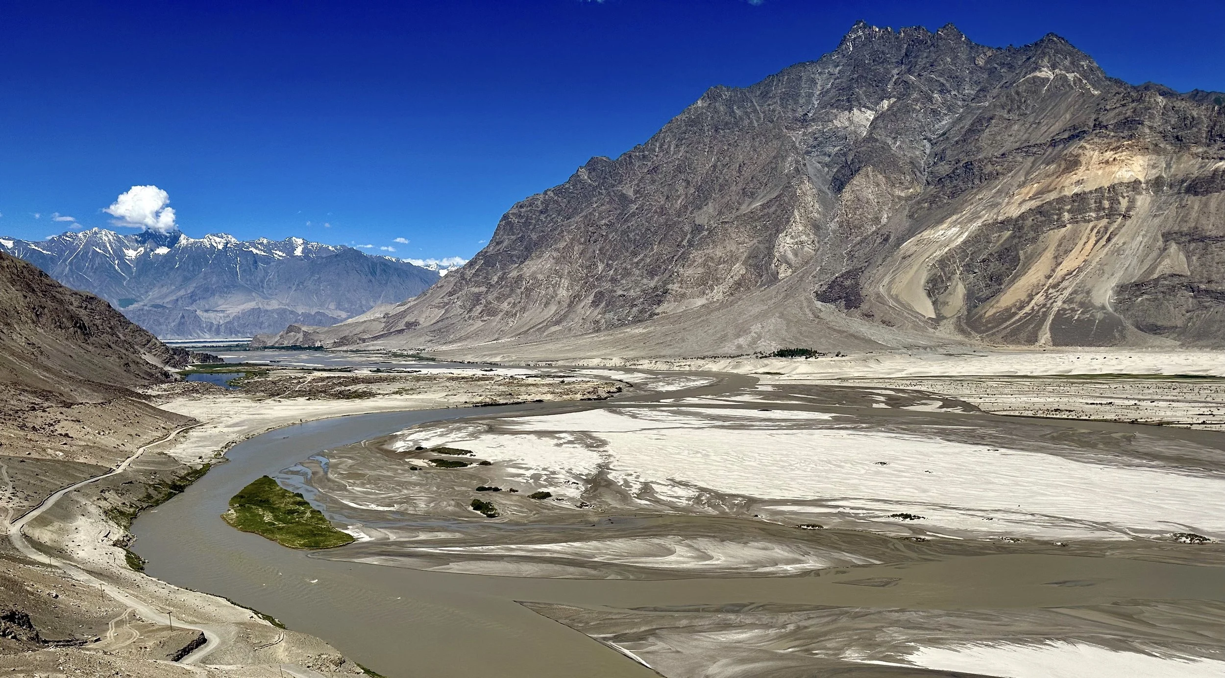
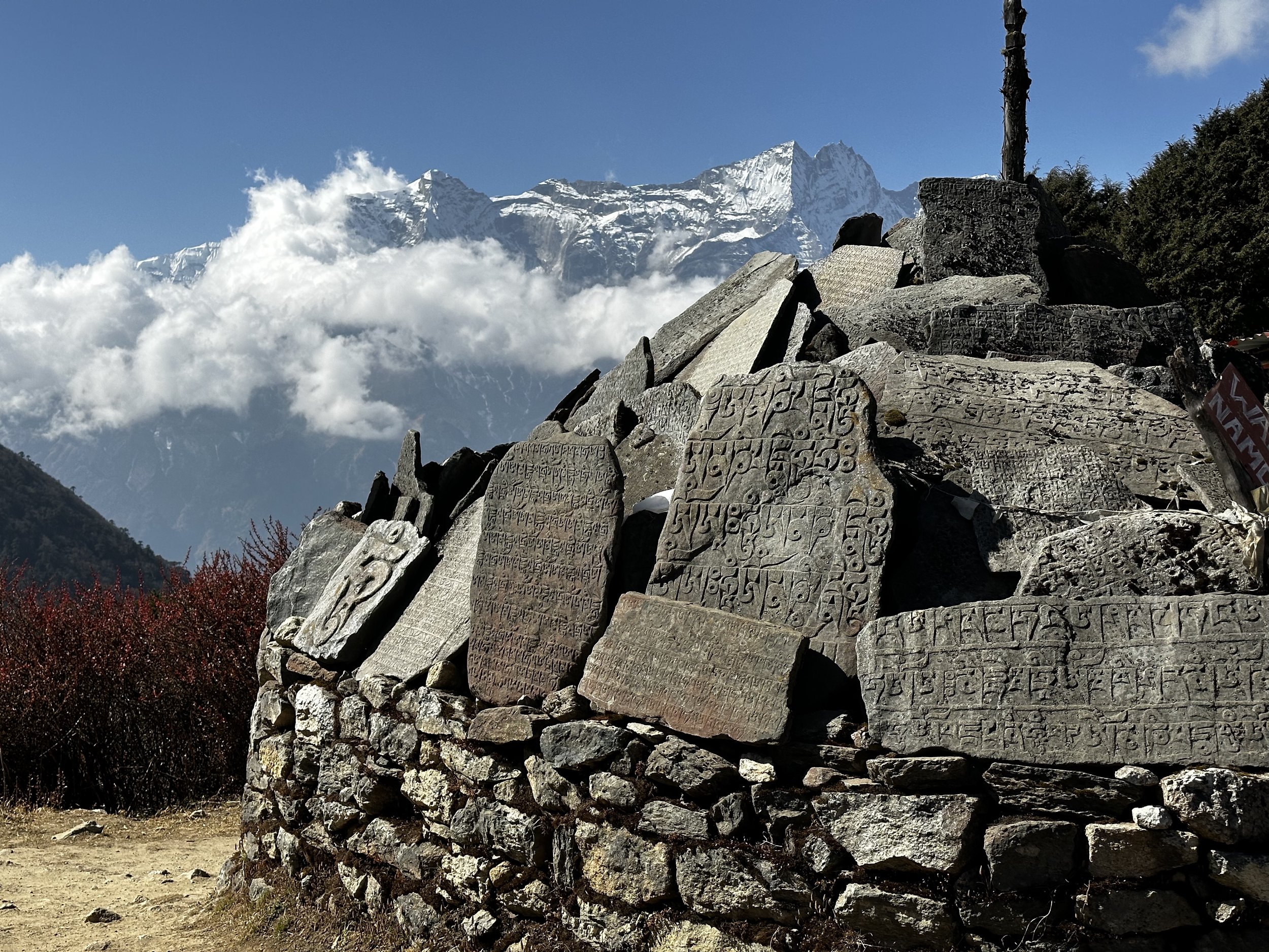
While all the offices were working their permit magic, Ghulam’s son and I went to the Skardu Fort and a place called Organic Village which is situated behind the Fort on the banks of the Indus River.  It is a nice walk with a different views of the Indus River and the surrounding mountains.  I took some great photos of the Indus River Valley in the late afternoon sun.  We had some fresh mangoes on the bank of the Indus and enjoyed the beautiful afternoon.  On the way back we climbed to the Fort for a good view of Skardu in the sunset accompanied by the cacophony of the evening prayer calls coming simultaneously from dozen mosques below.   The multitude of calls made them indistinguishable and resulted in one big noise. 

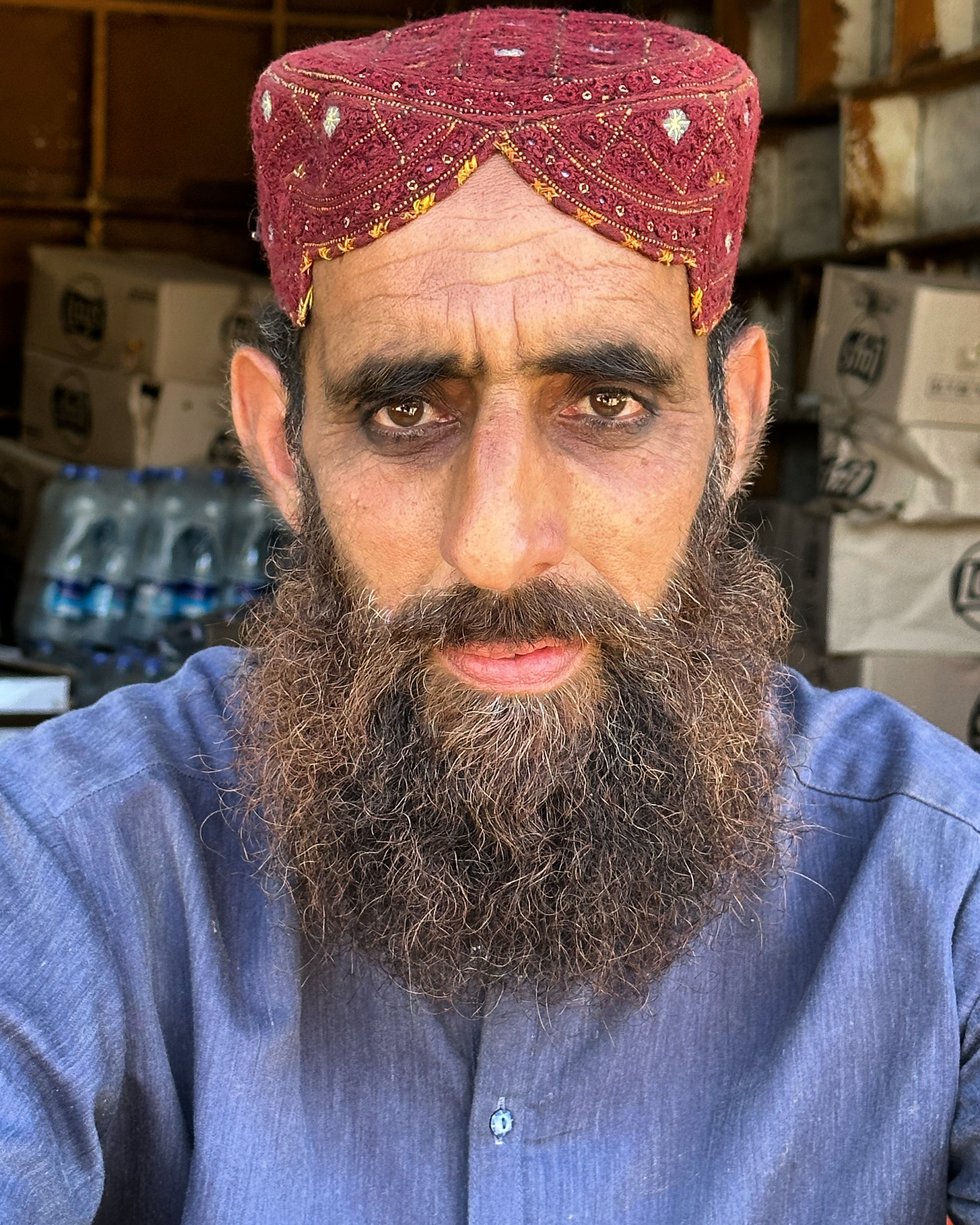
On the way to the fort, I met a teacher from the Gilgit Military School who was a very kind man.   He paid for my ticket to the fort, and we took some photos and videos together.  On the way up I also met many Pakistanis that were very interested in talking to me and wanted to take photos.  I guess there are not too many tourists here.   After the trip to the Fort, I had a good, although late dinner with Ghulam and got ready for the 7 am start the next day.  I repacked and left some things behind. 

July 12, 2023 Skardu – Askole

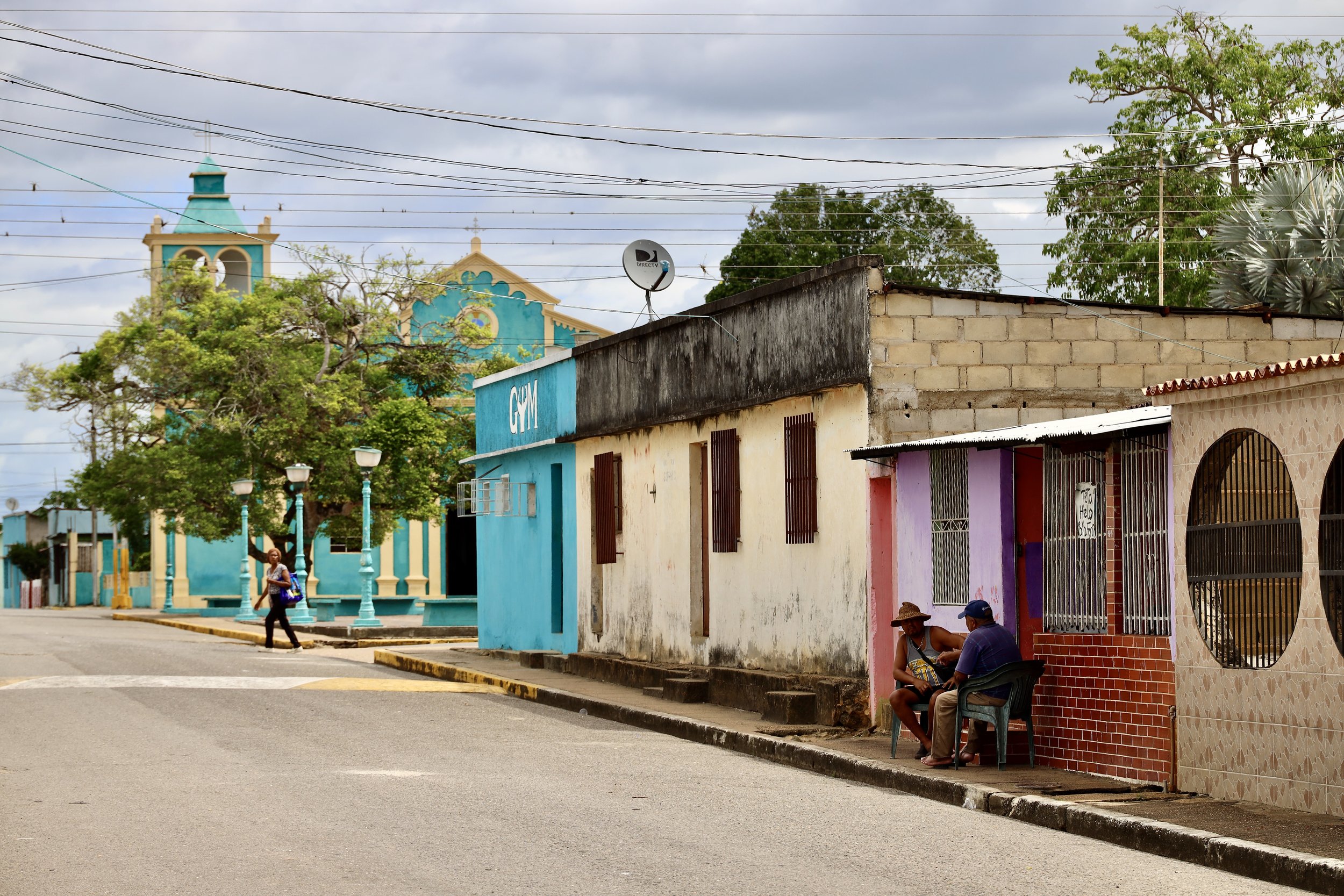
Our trip to Askole started at 8.40 am.  We picked up Essan in Skardu and purchased additional supplies along the way.  Skardu was hot, busy and dusty and it felt good to leave it behind.  Skardu has expanded a lot, it is a medium size city now.  The infrastructure can’t cope with the pace of the development and water and electricity shortages are common.  

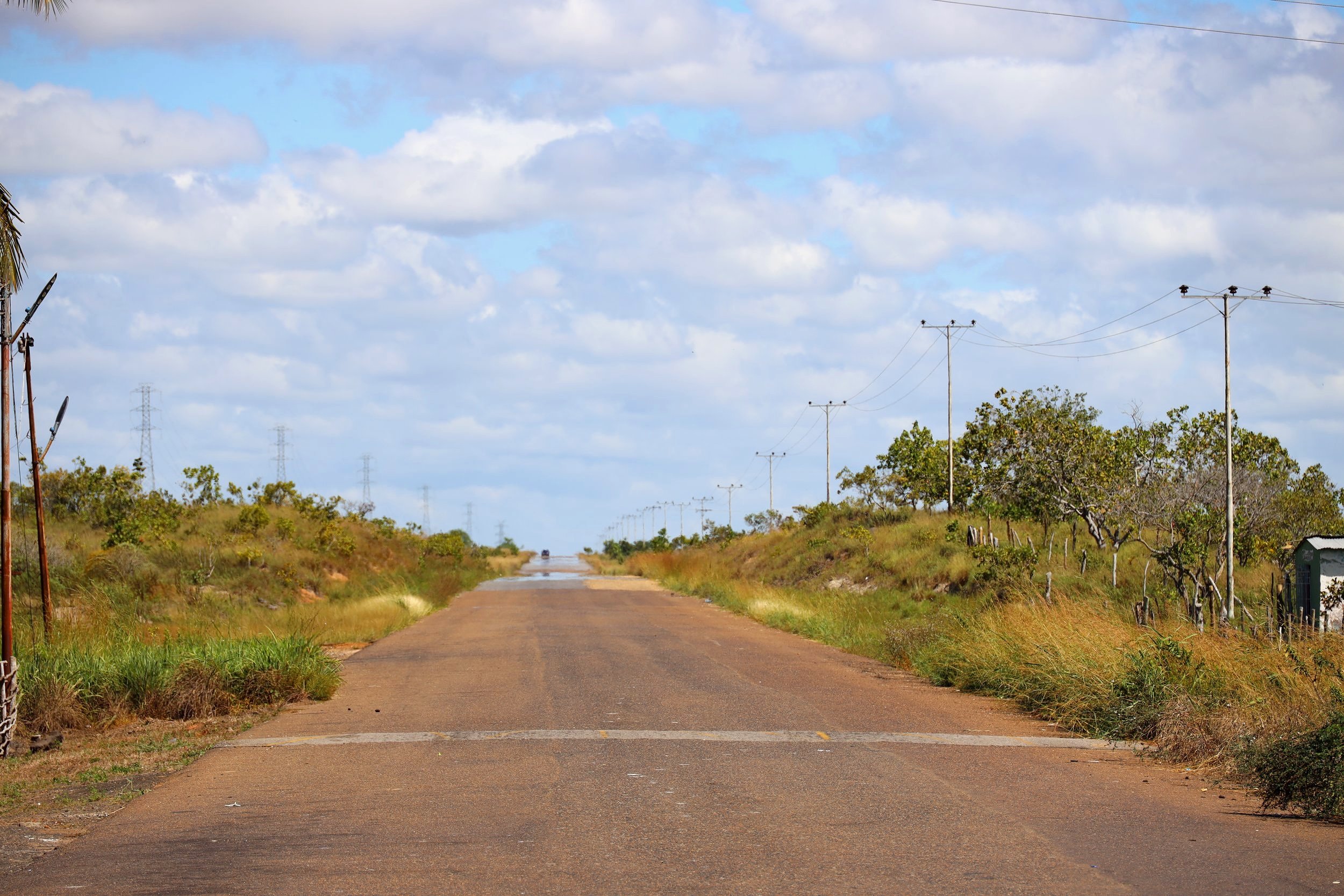
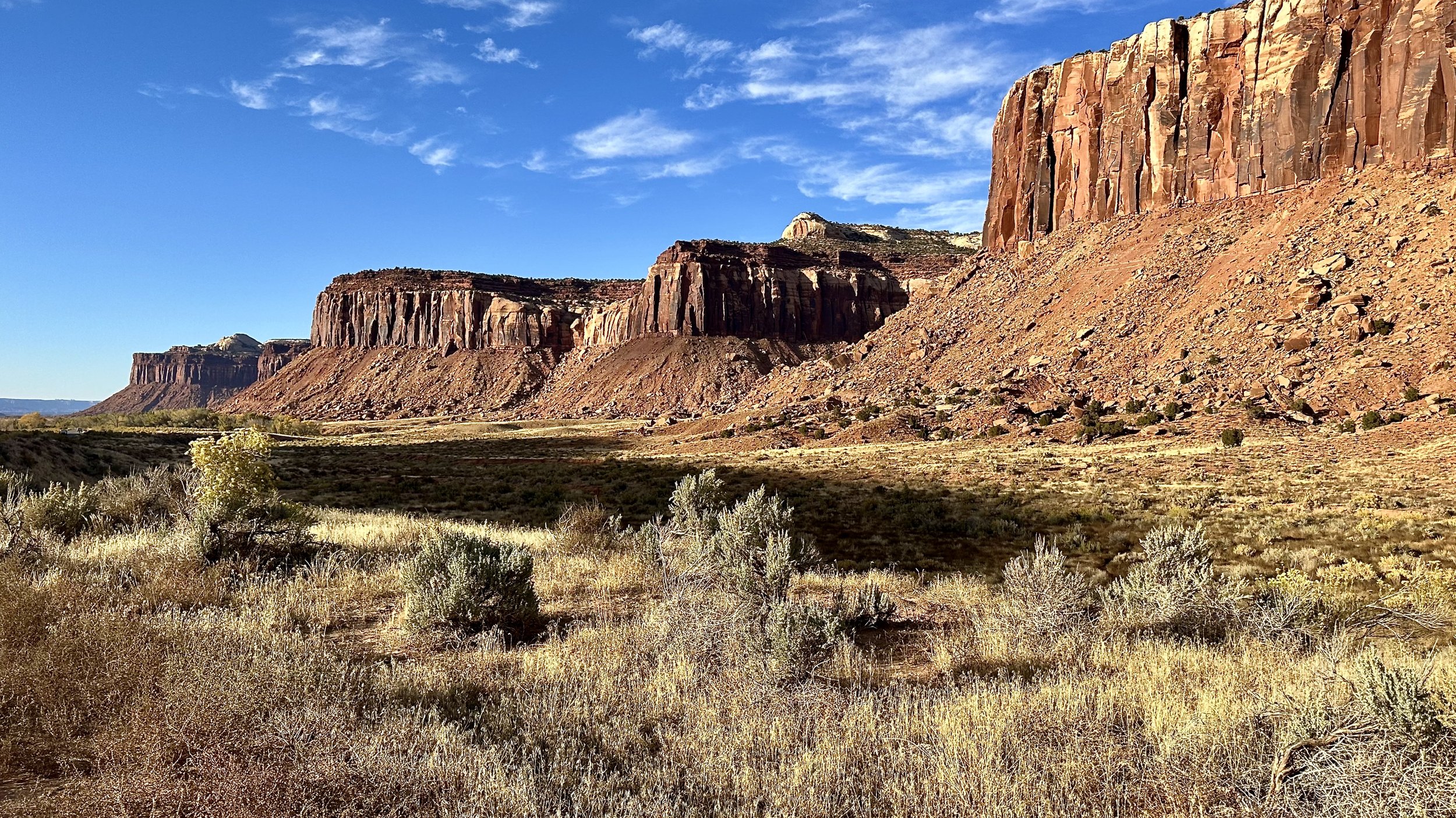
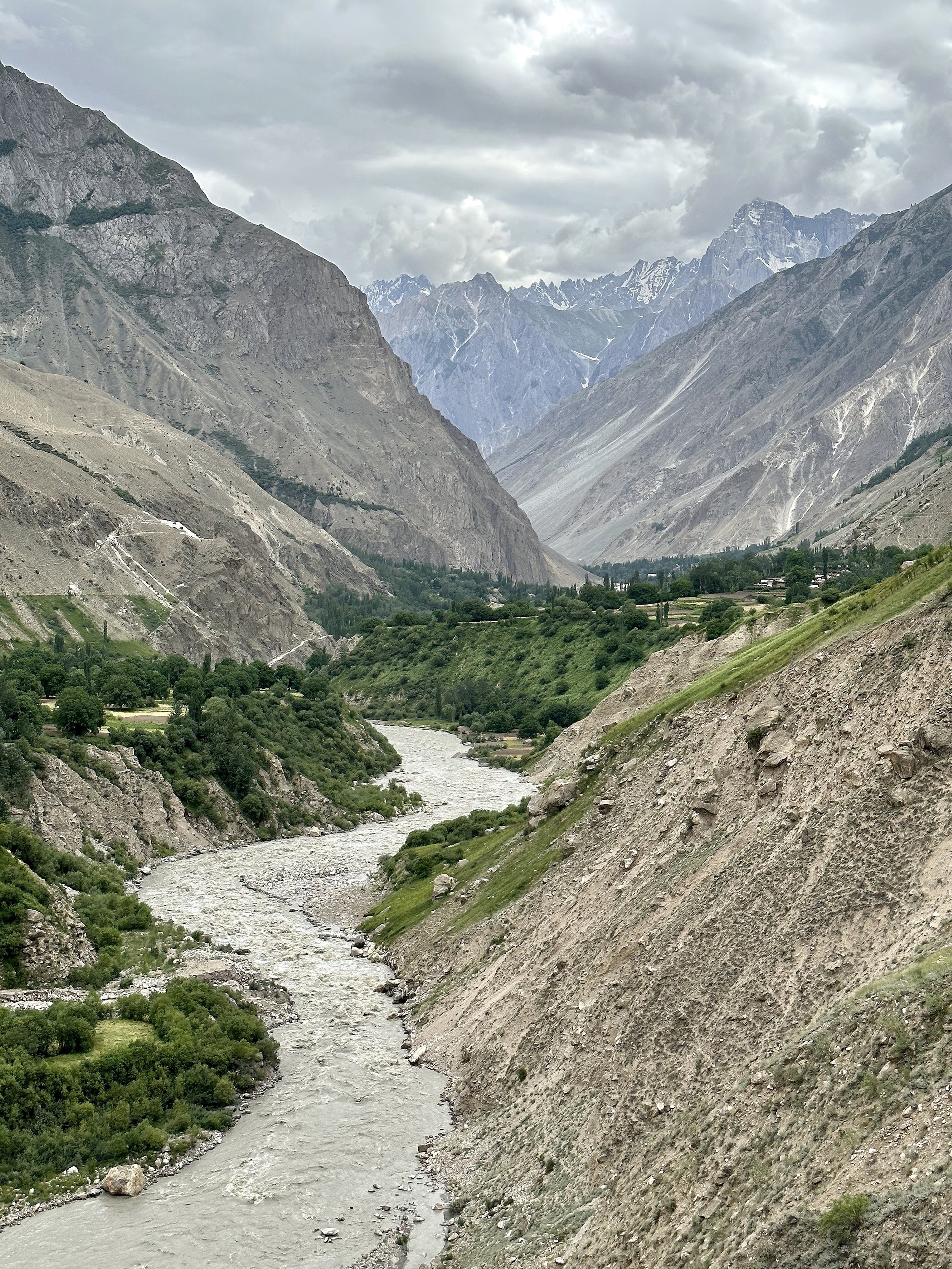
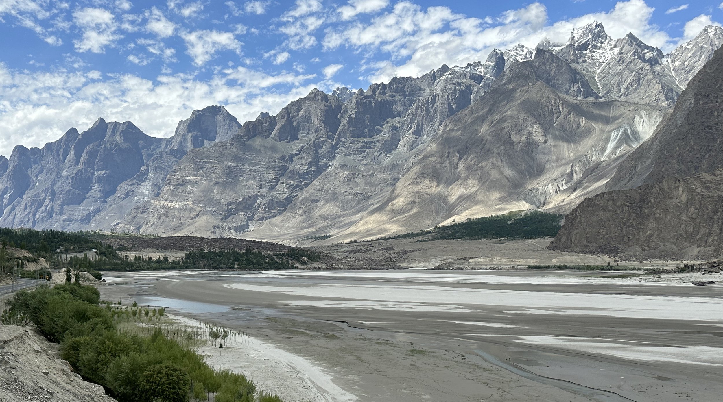
The drive to Askole takes now only 7 hours as the road has been improved.  It is now paved all the way to Shigar and after that it is still much better than it was before.  The road was paved to enable numerous visitors access to the valley.  The Shigar Fort has been converted into a luxury hotel and the amenities have improved along with the development in the area.   

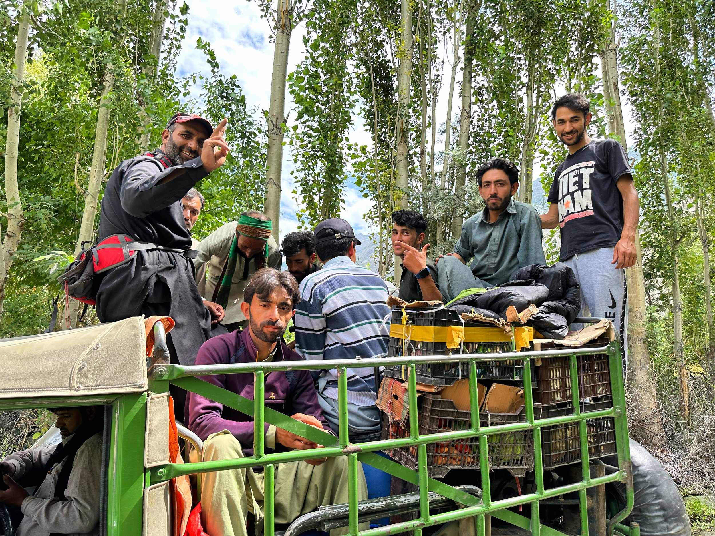
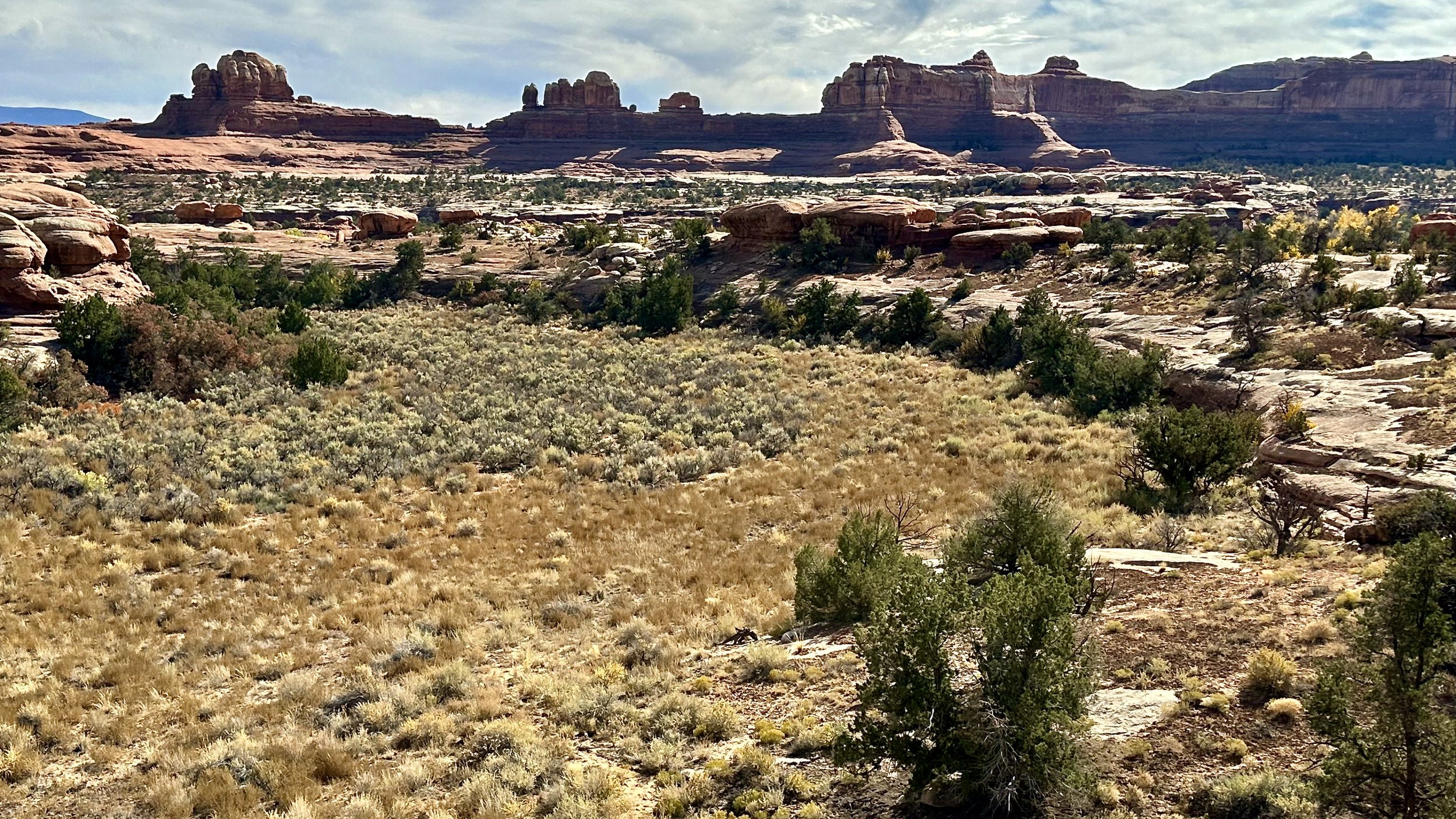
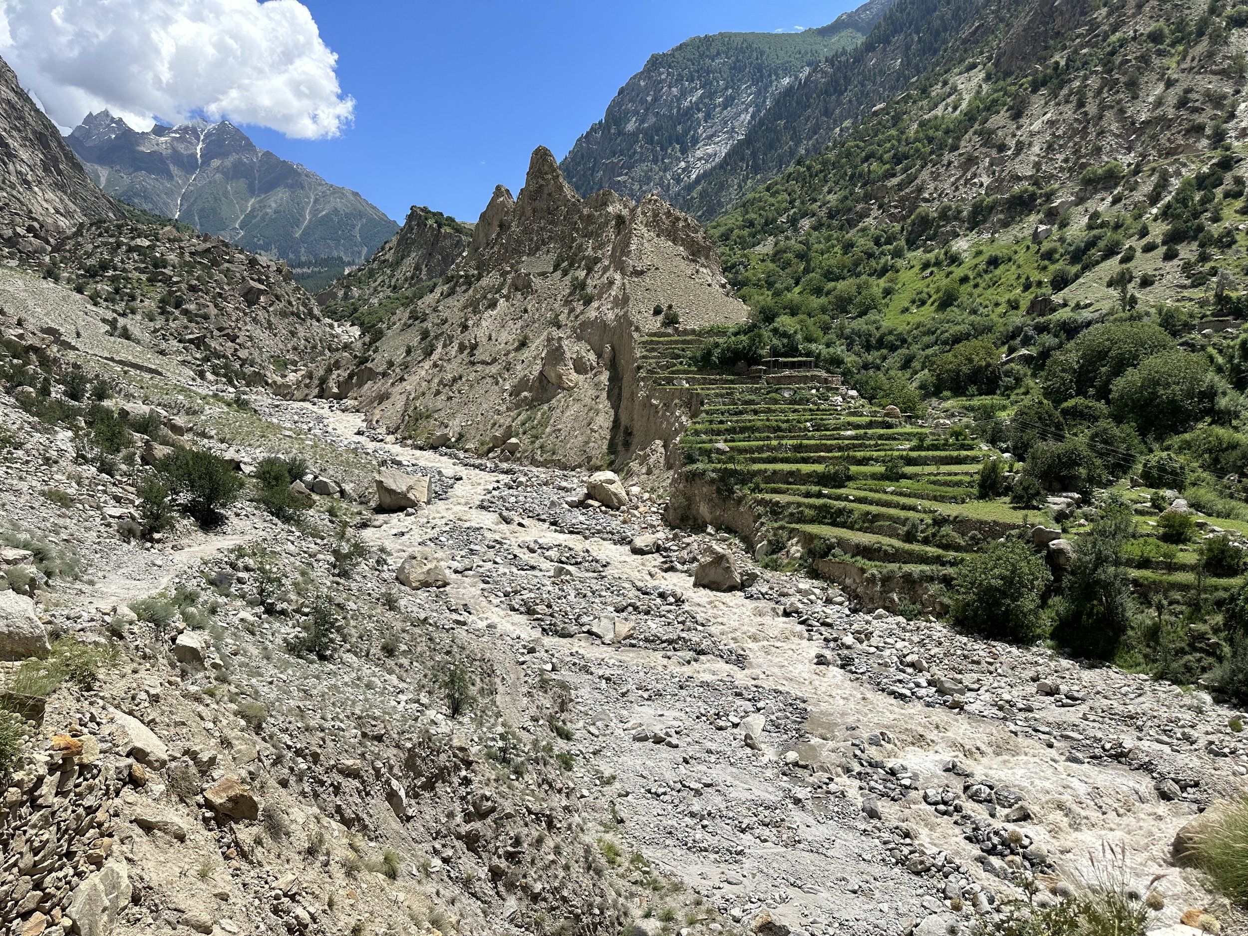
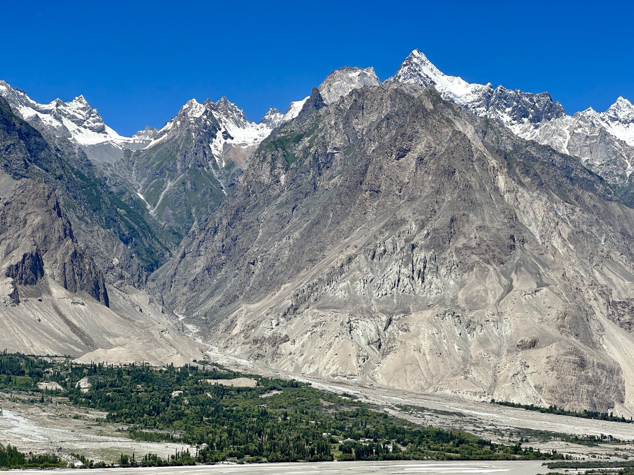
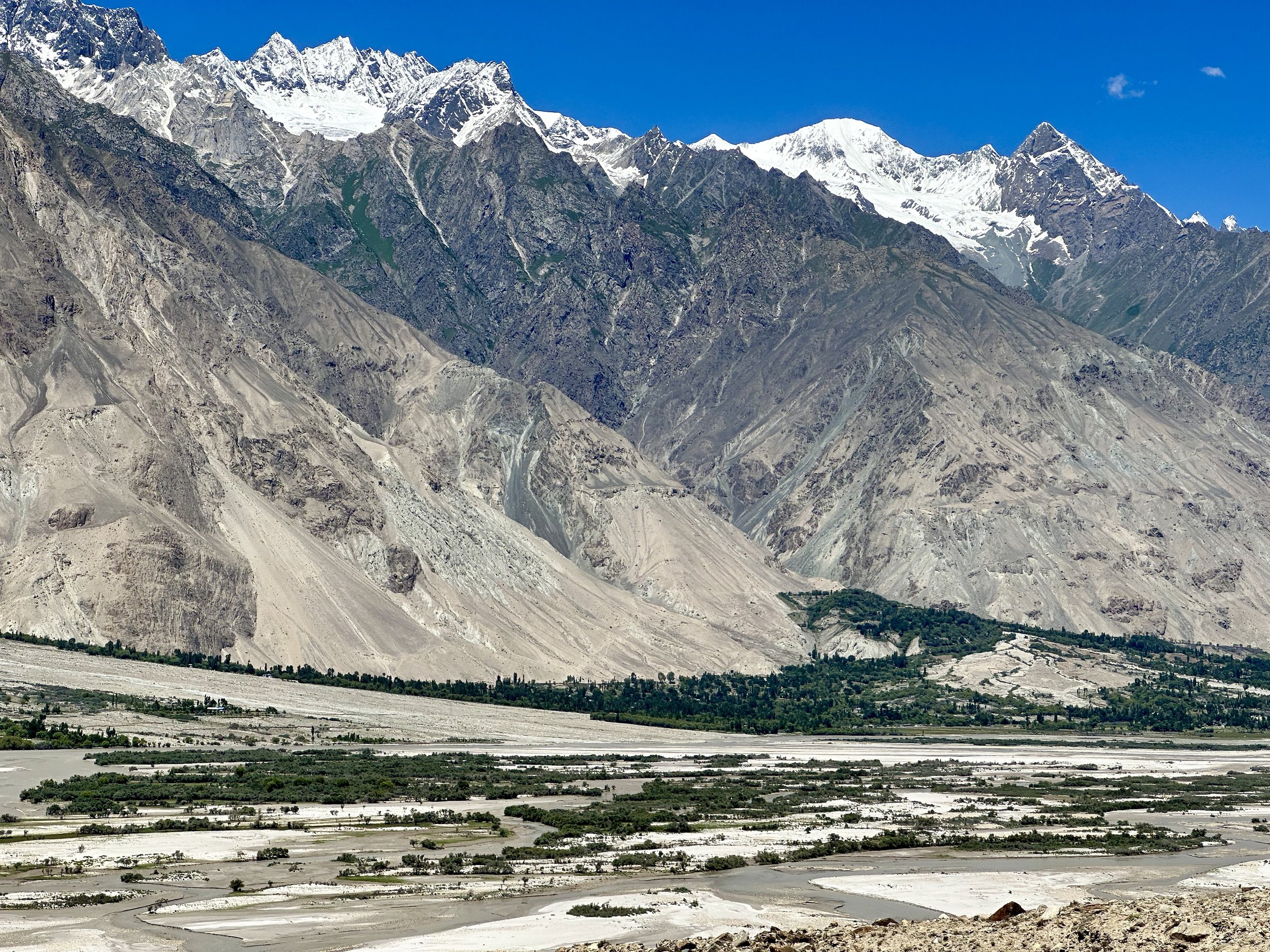
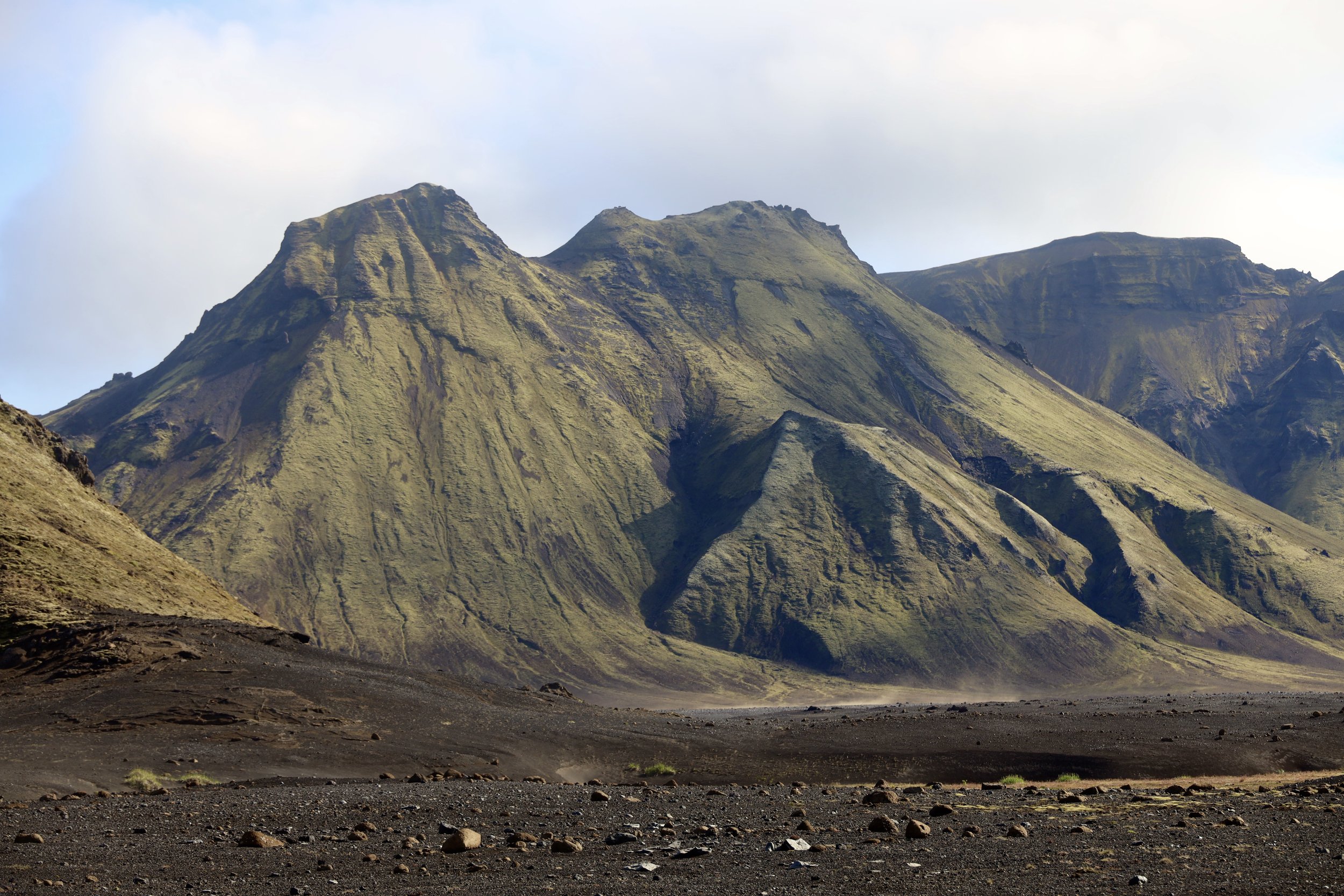
Shigar Valley is very beautiful.  It is full of green fields with snow-capped mountains above the many villages on the Shigar River.  We stopped in Shigar to check out the 150-year-old mosque.  Its appearance is quite reminiscent of the Central Asian mosques that I saw in Xinjiang.  In Dasso we picked up additional porters.  Most of them came from Tissar village on the opposite side of the Shigar River.  I crossed this river on the way to Arando on the second leg of the journey two weeks later. 

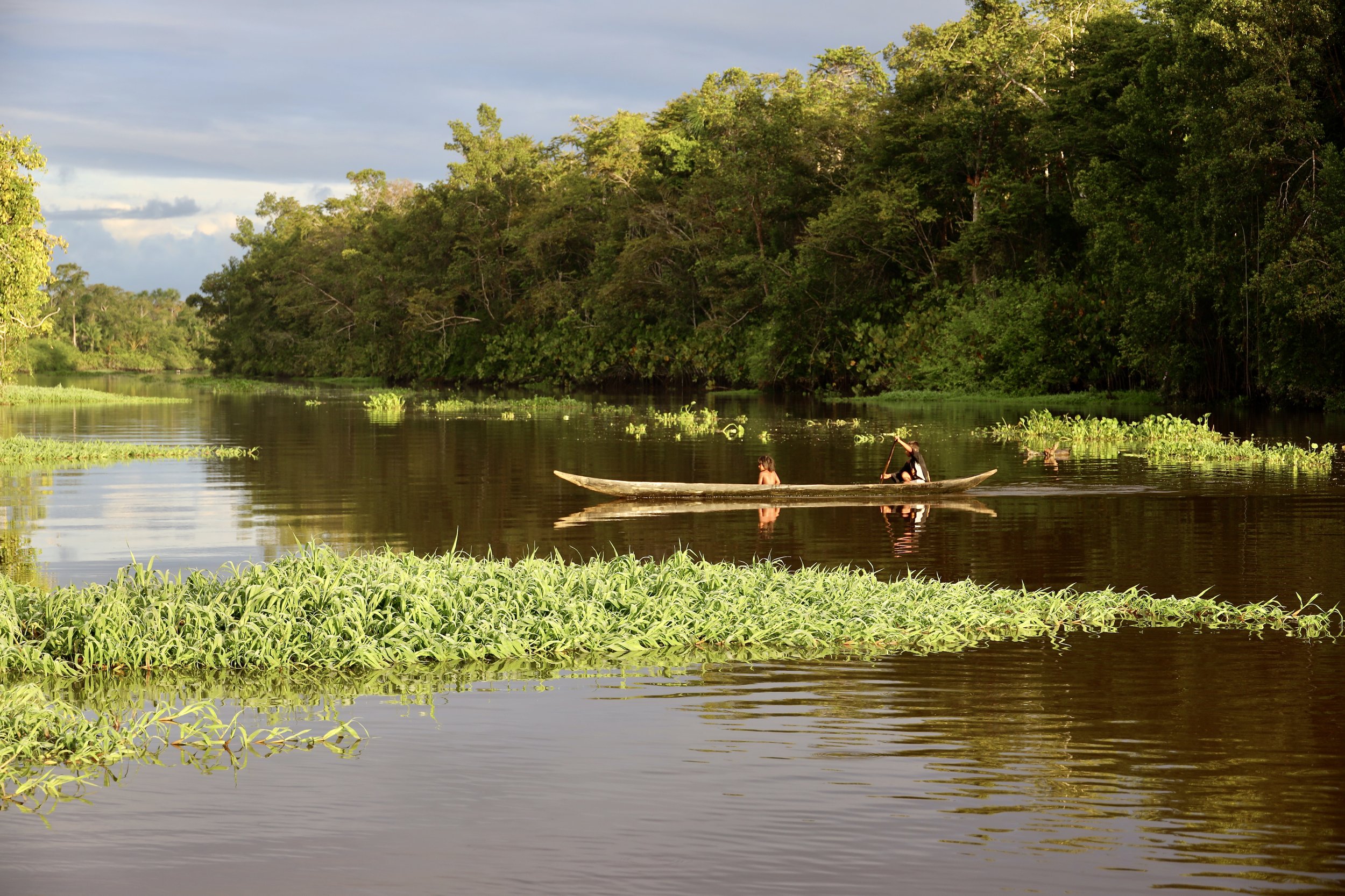
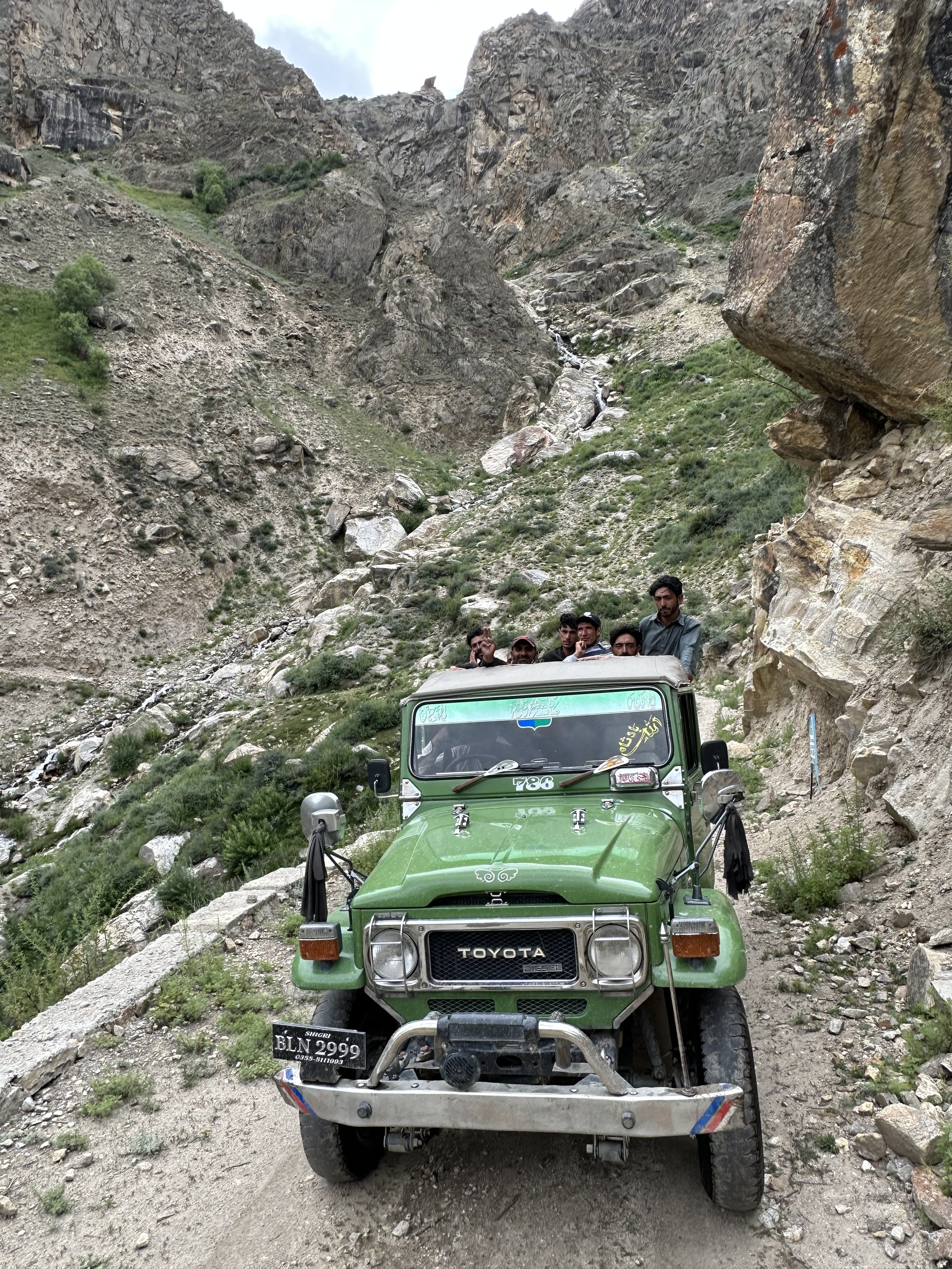
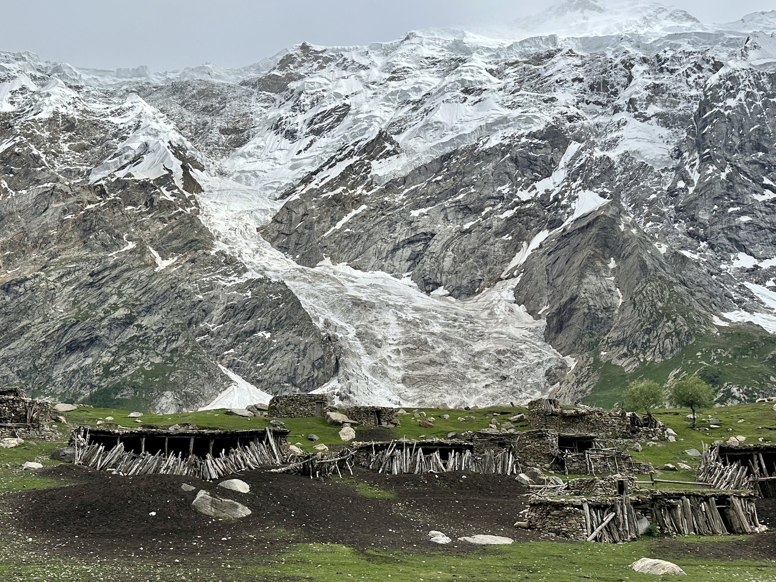
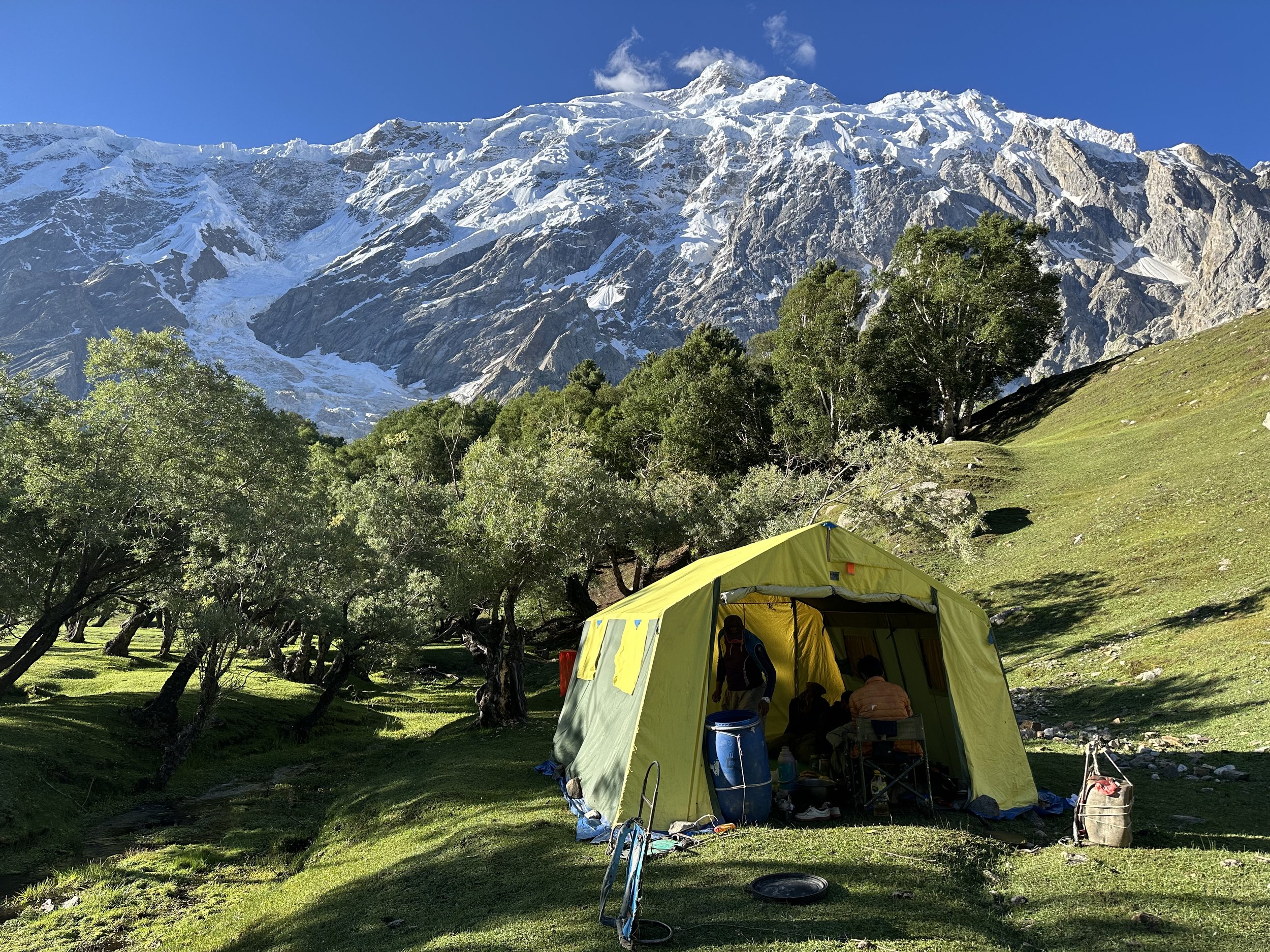
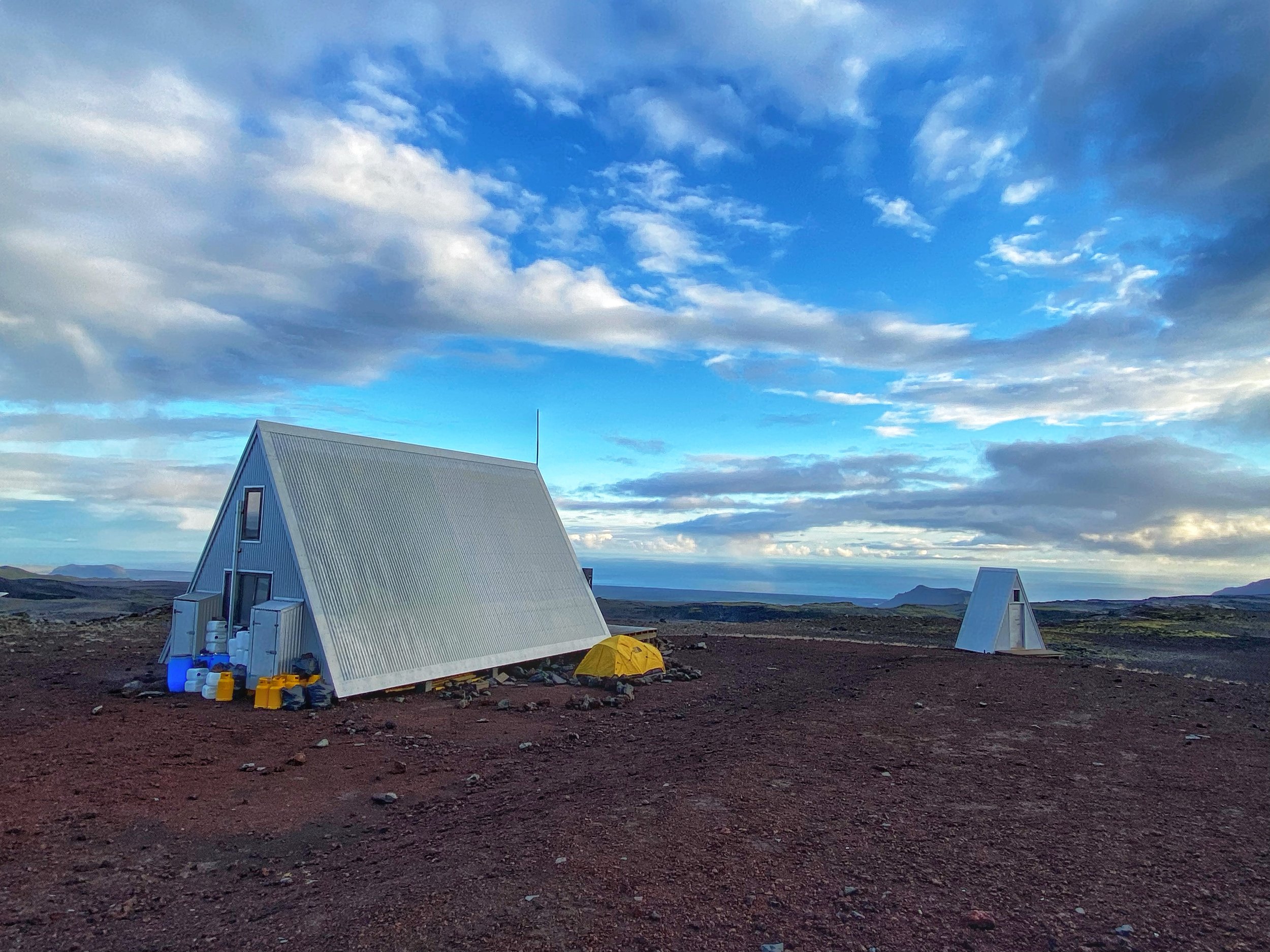
The road we were on is very dramatic.  It follows the Braldu River gorge.  The Braldu River is the main drainage of the massive glacier system of the Central Karakorum Range.  There were 10 of us in the jeep – Iqbal, porters, Essan and me.  The weather was perfect and the scenery beautiful all the way to Askole.   The grandeur of the Karakorum was on full display.   The drive seemed much faster than in 2005 and we did not have to stop to cross any rivers or streams.  We arrived in Askole at 4 pm at a tidy new campsite located at the edge of the village.  The campsite is run by the village association, and it has toilets, water source, garbage cans and a shelter for porters.   We pitched our tents and sorted the gear.  Ghulam ‘s new tent was the size of a Tajma Hall!  It is very comfortable for one person.  Askole also changed a lot.   It has concrete buildings, a few shops, a hotel and a couple of real streets.  It also has a museum displaying some local culture.   I also saw many women this time, which was unheard of in 2001 or 2005.  People look much better, wearing clean clothing and looking healthier. 

We spent the afternoon in Askole, walked around, took photos with local men and visited the museum.  Some large trekking groups arrived after us.  One of them was Polish.  They were all going to K2 which apparently became quite a popular trek by the Karakorum standards.    Later I met them again and learned that they had not been able to cross the Ghondogoro La pass due to bad conditions.

In the evening, the Askole chief came to visit us.  He knows Iqbal (Iqbal worked in Askole for a while for an NGO).  The Chief heard that we were going to the Choktoi Glacier and the Latok 1 basecamp.  He showed us some books (in a state of total disintegration) of the Latok Peaks published and given to him by the Huber brothers.  The Panamagh and Choktoi drainage is popular with the locals for ibex hunting.  People venture there even in winter when the ibex come down to the valley.   We had a delicious dinner and a good chat into the late hours of the evening.   

July 13, 2023 Askole – Camp 1, 20km 400m

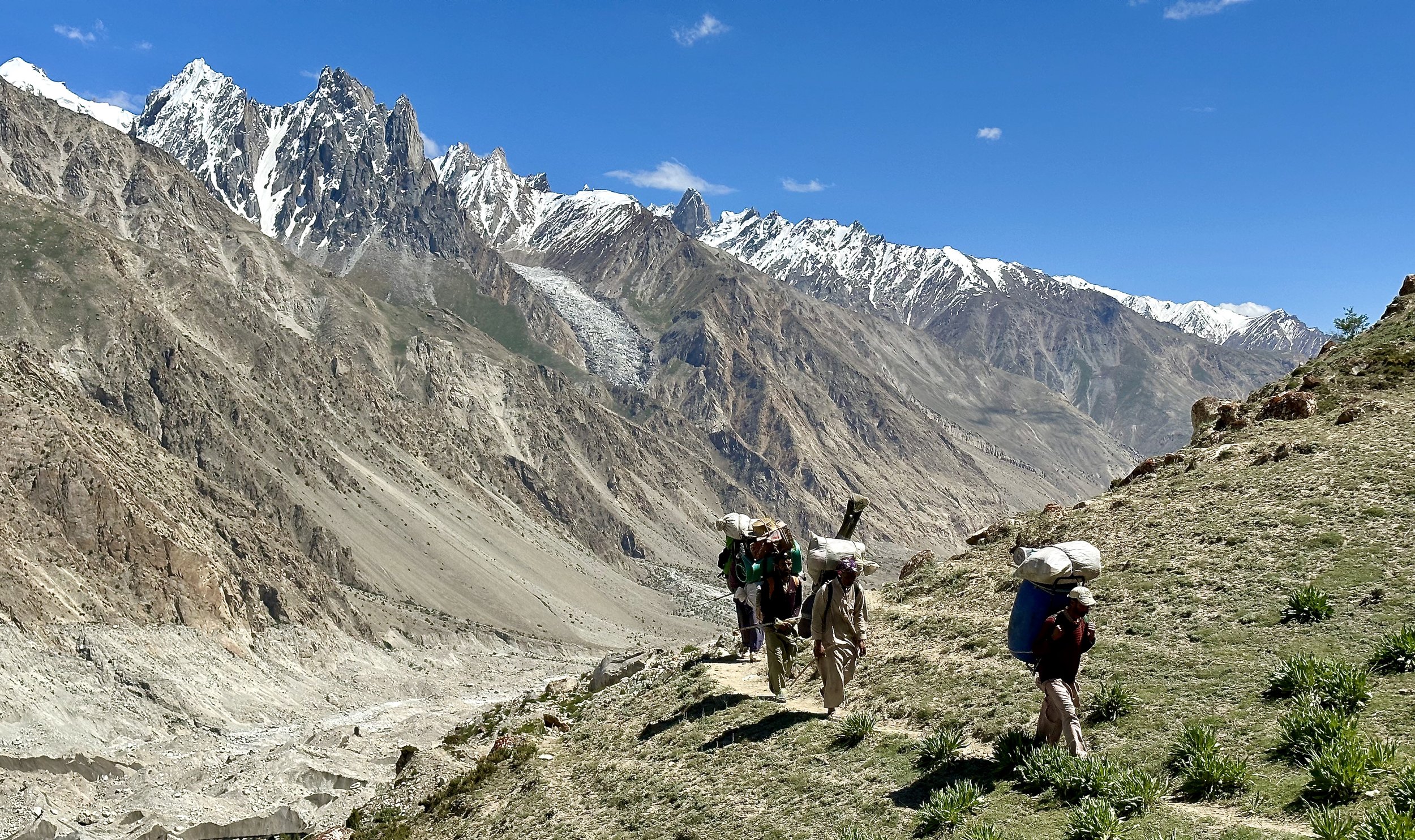
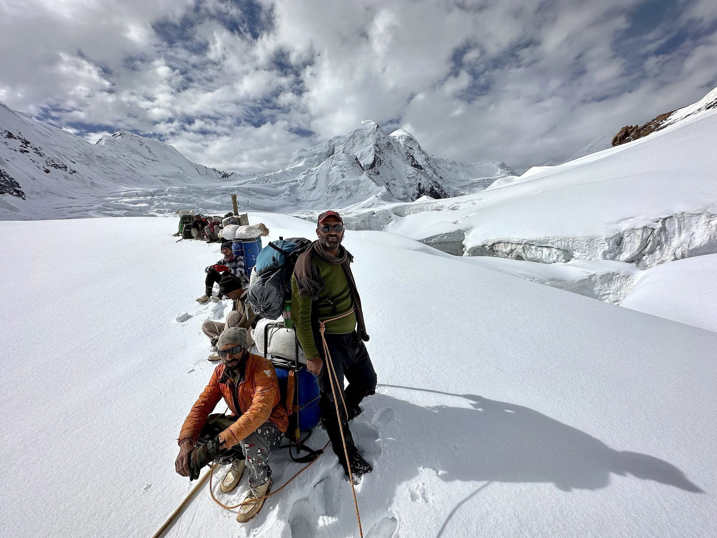
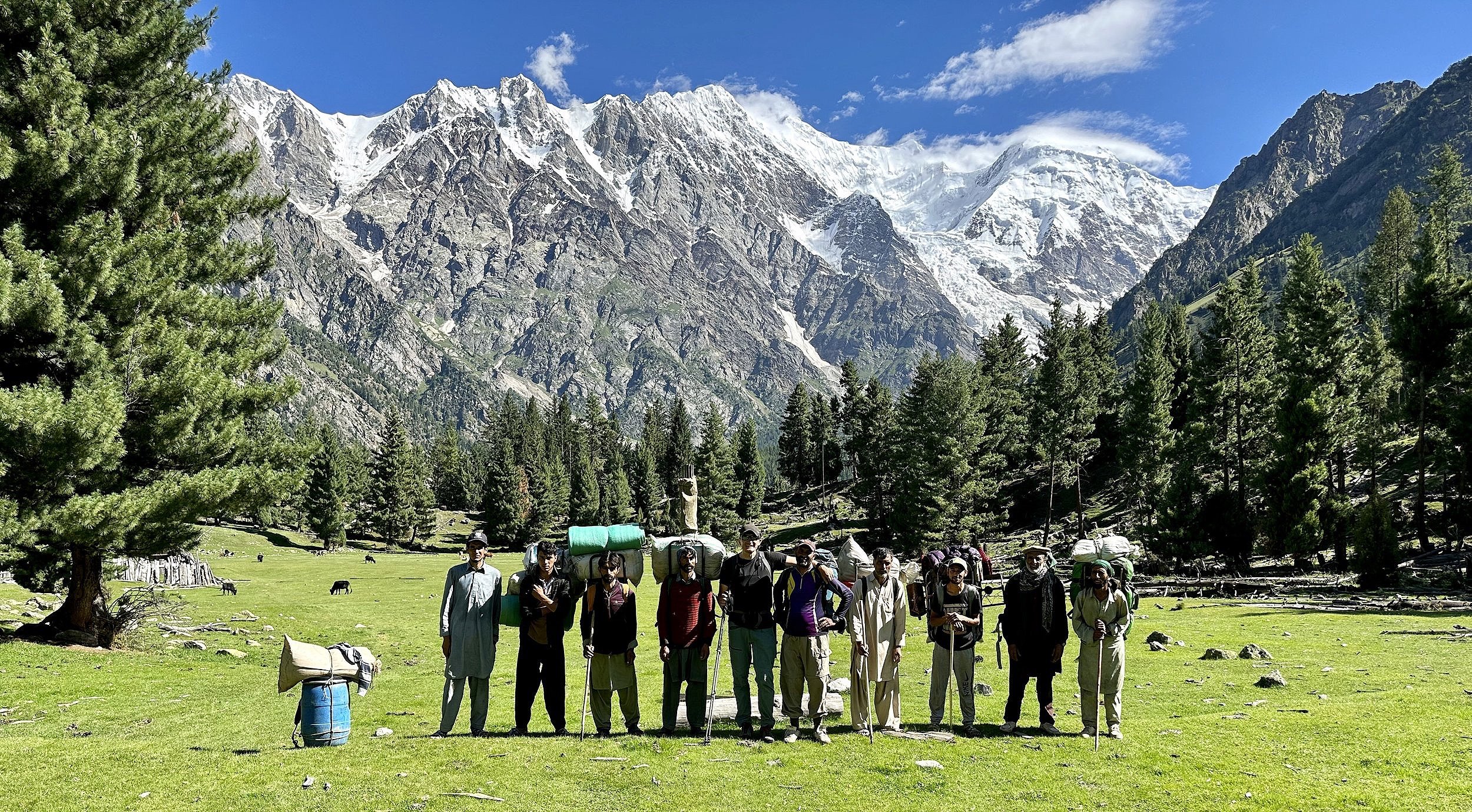
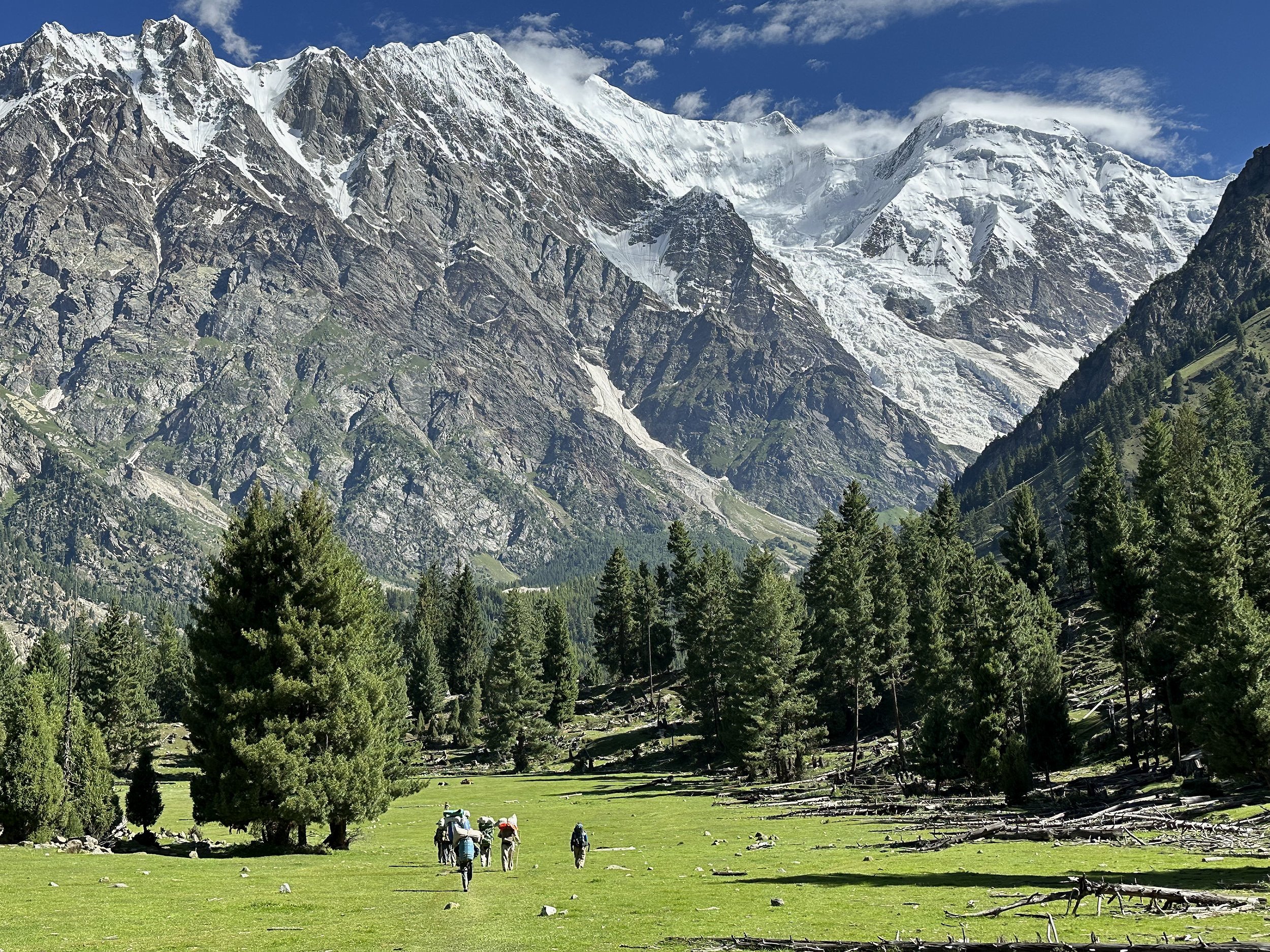
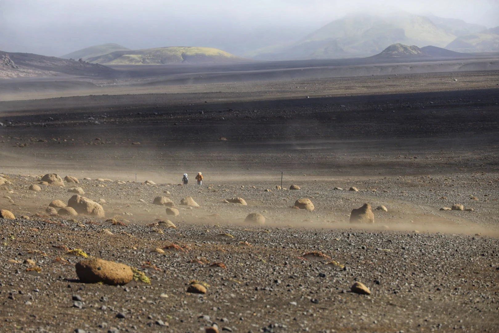
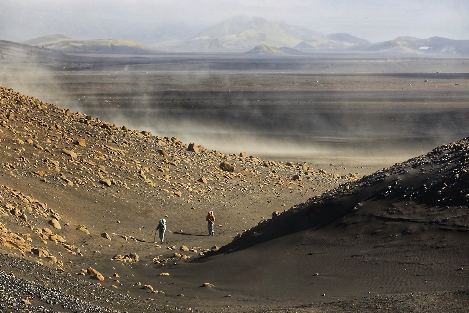
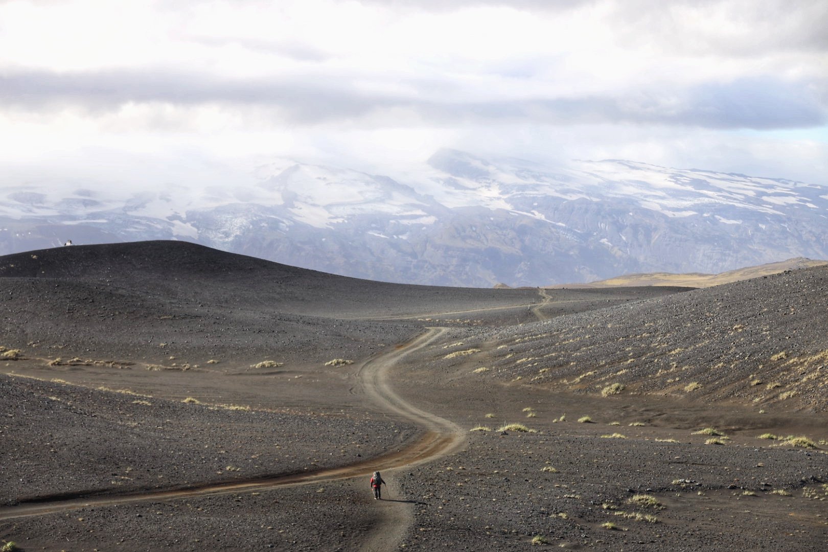
Today is the first day of trekking.  I got up at 5 am to start early and to avoid the 40C heat.  The process of organizing 15 porters and 5 horses took some time.  It is difficult for me to believe that all this gear and supplies is just to facilitate one person’s trek.  

We left at 7 am and walked initially on the Askole-Jula jeep track.  We had to detour into the National Park office to register my name.  This is a new development as I am not sure if the National Park even existed in 2001 or 2005. 

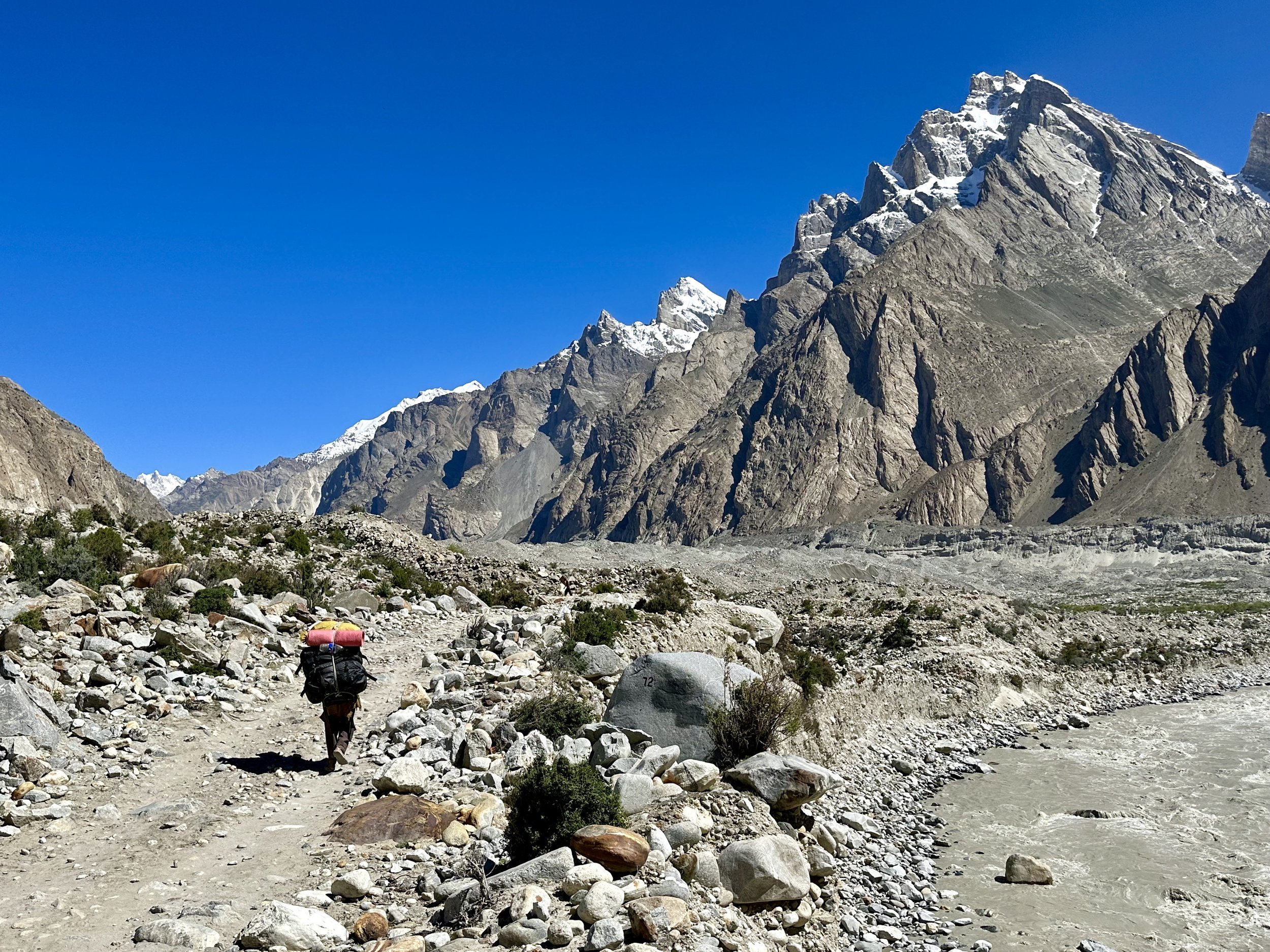
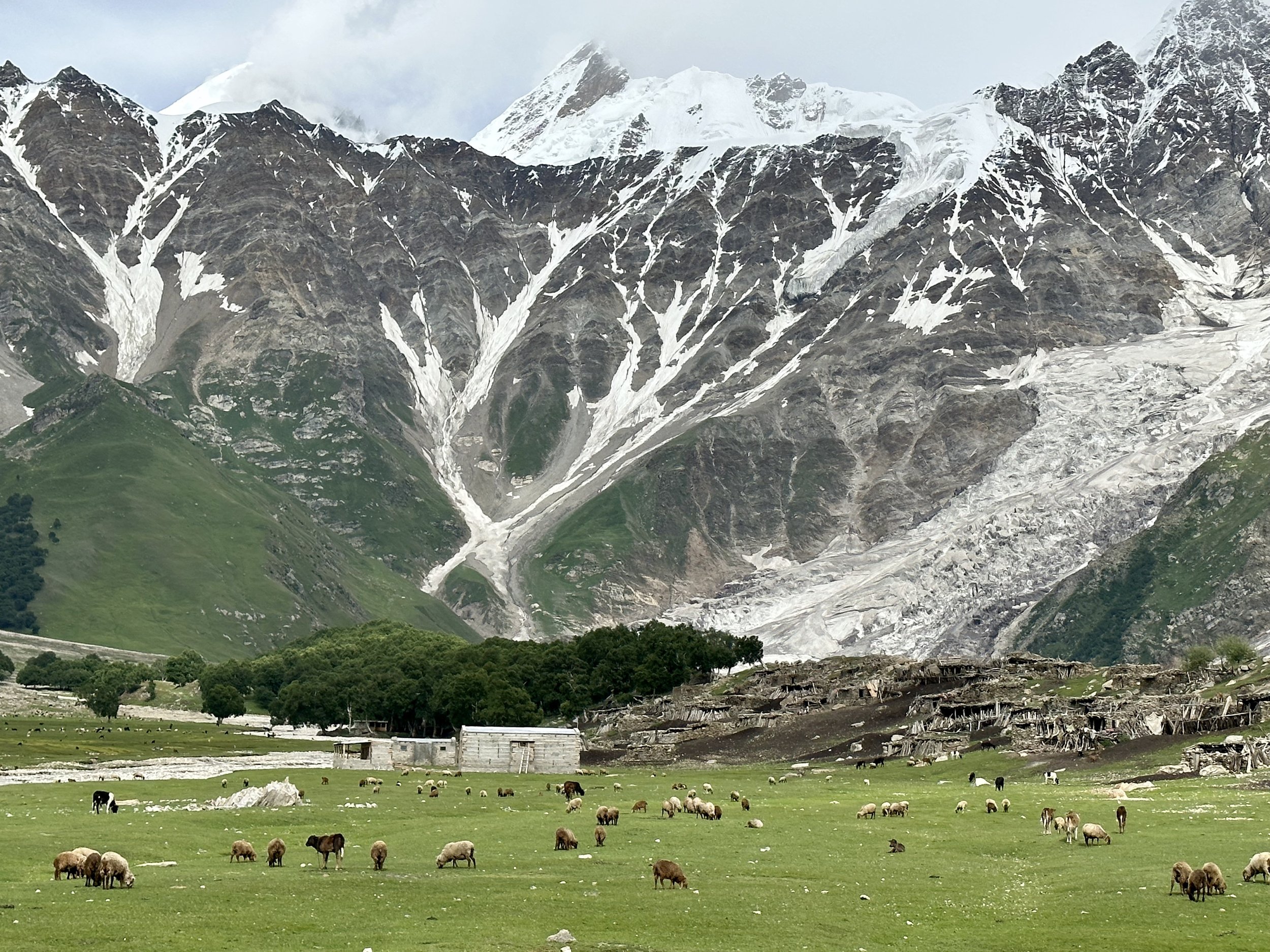
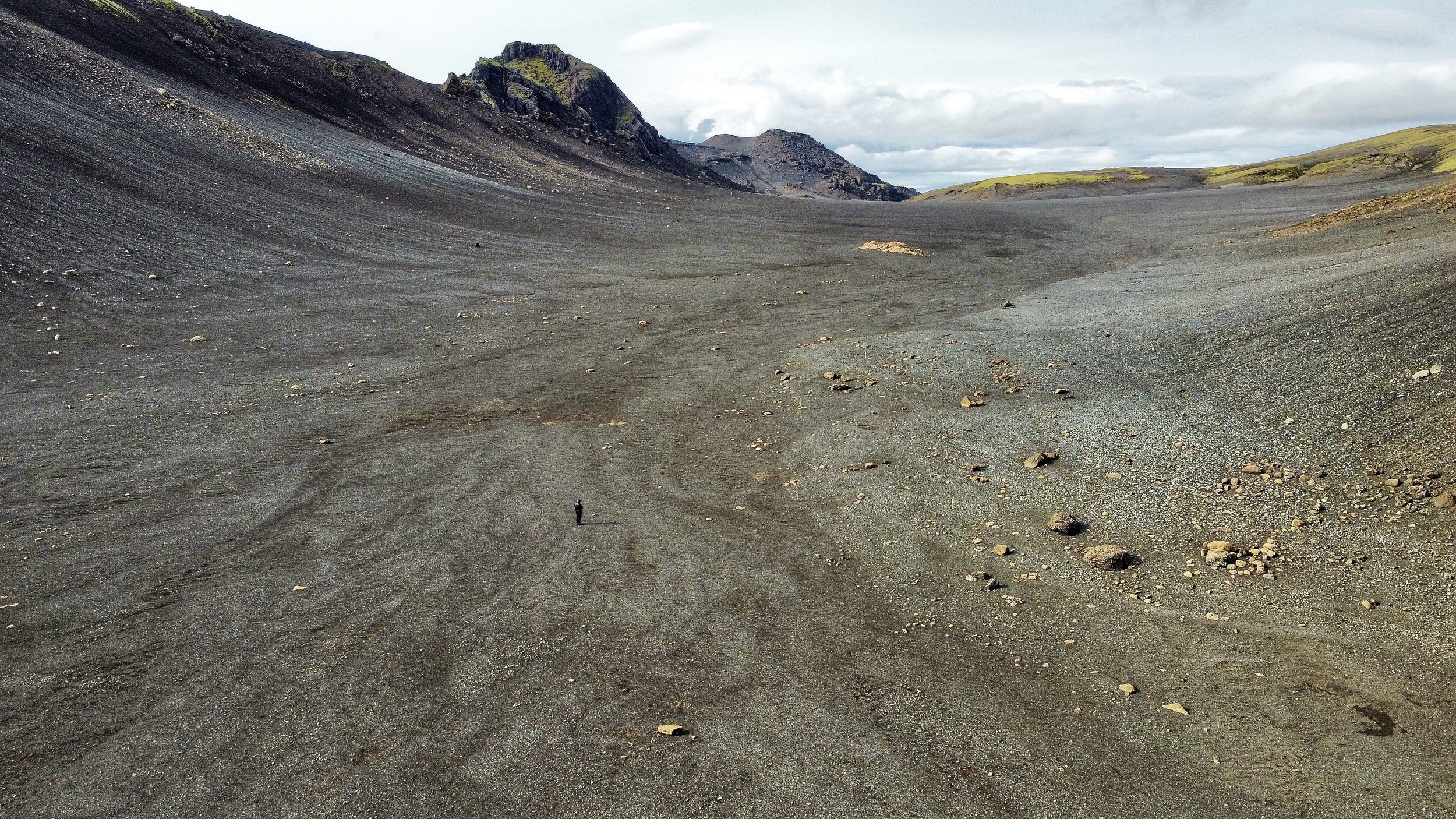
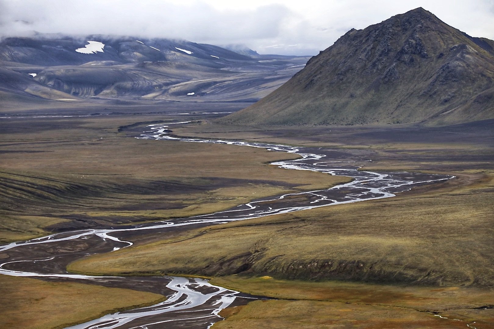
The army attempted to expand the road but were defeated by the river flowing from the Biaffo Glacier.  The river took out the jeep bridge making the road impassable.  We had a lunch break at the Karaphong camp by the snout of the Biaffo Glacier.  The scenery looked familiar.  This was the third time on this section of the trek for me.  As the day went on the heat started to increase and by early afternoon it was 40C, just as I remembered it!  It is difficult to walk in the heat with strong warm wind speeding up the dehydration process.  We had a few breaks in the scarce shade and finally reached the first camp at 2 pm.  We camped in the narrow canyon of the Panamagh River, loud and turbulent from volume of the melt from the massive glaciers up the valley.  The water in the river was a brown mess not suitable for drinking or even washing.  The potable water is sourced from a small stream nearby.   Although there are numerous glaciers, water suitable for drinking is always an issue here.   The Karakorum is a high-altitude desert.

Essan, my guide is a nice, no-nonsense kind of guy.  He is a carpenter by trade, lives in Tissar, has 5 kids and a wife.   His English is OK but not sufficient for any meaningful conversation.  He has 2 kitchen helpers (I established later that one of them was his son and the other, Aslam was married to his wife’s sister).  They also help him with English when he is lost for words. 

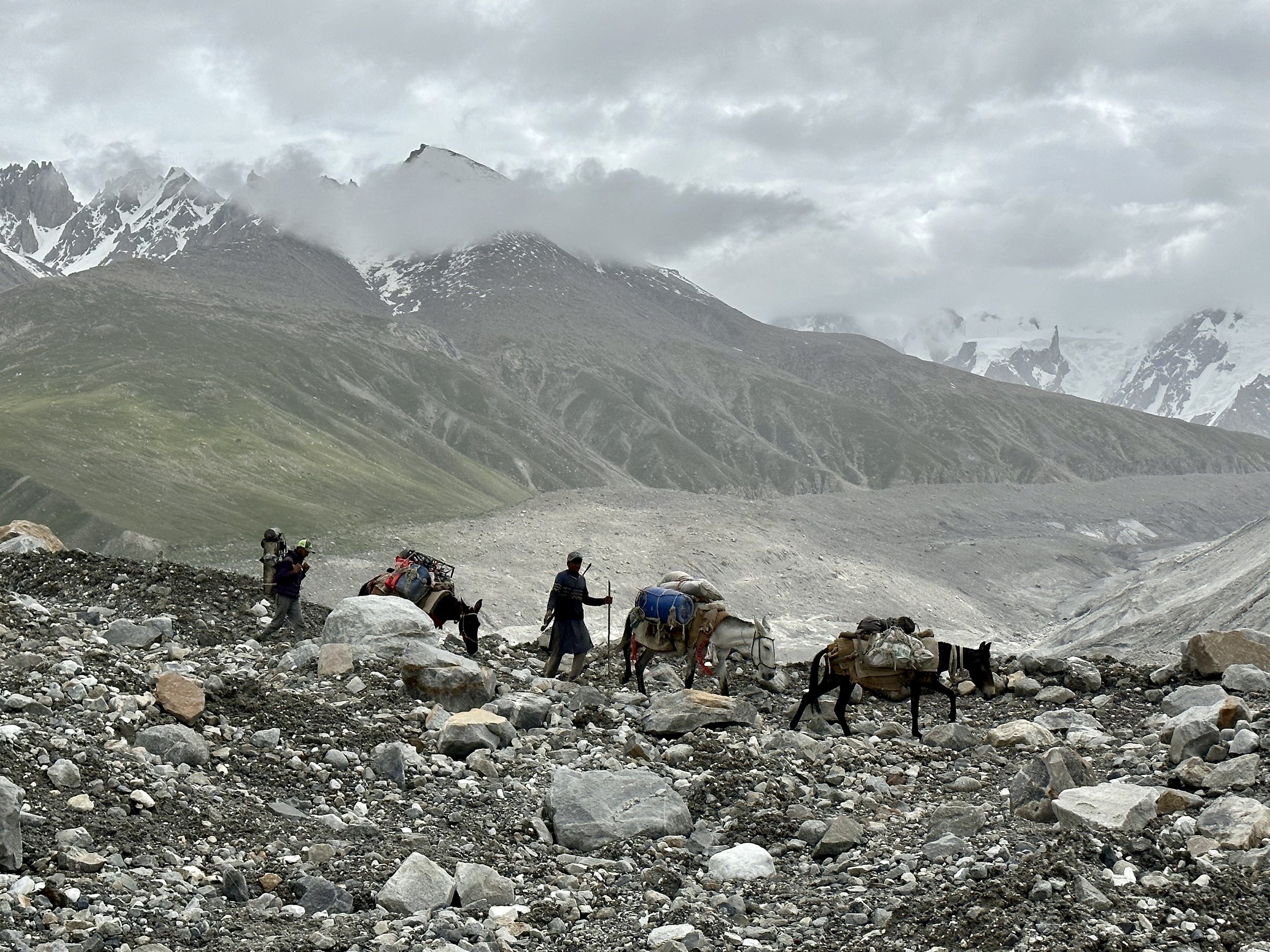
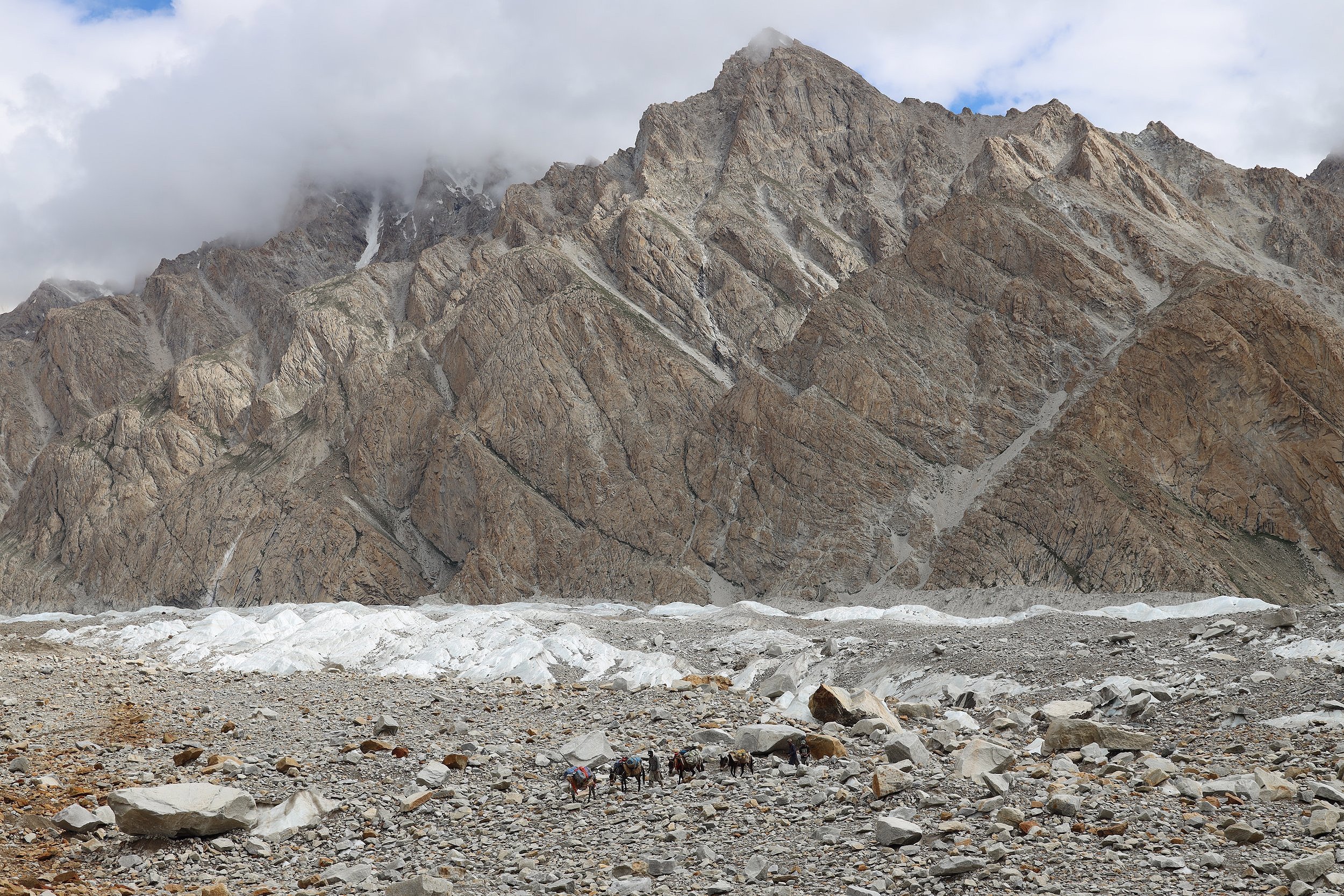
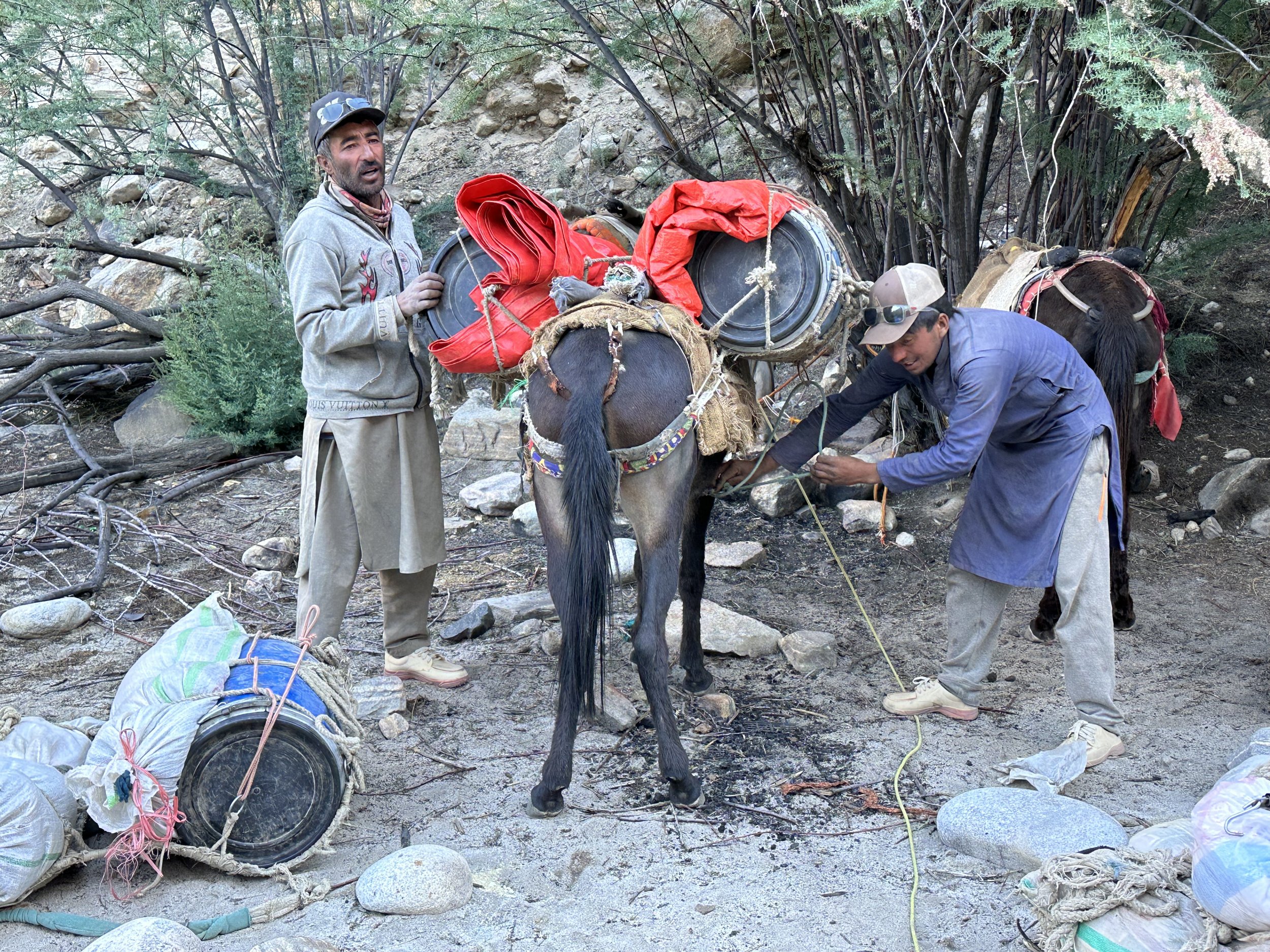
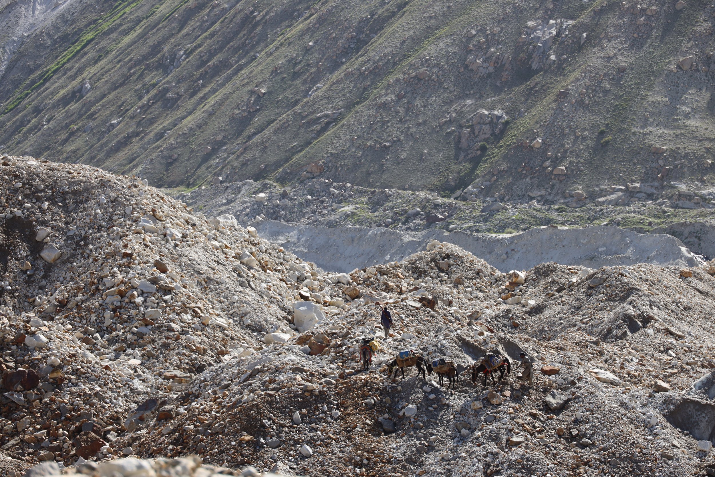
The horse men from Askole were also quite nice.  One had a fake LV hoodie with the word “Danger” written on it.  I nicknamed him the “Danger Man”.  He also carried and old gun for hunting opportunities during our stops.  This is a big ibex grazing area.  Since there are very few people, the animals are easier to spot and hunt.  We had 5 small horses that carried quite a lot of our supplies.   These horses crossed some incredible terrain.  I was very surprised to see that horses can navigate glacial terrain so efficiently. 

I was quite tired after today’s walk due to the heat.  Tomorrow is supposed to be less walking in the heat and perhaps we can be better organized to leave early.   

July 14, 2023 Camp 1 – Camp 2, 7 hrs 18.5 km 1000m elevation gain

Today was supposed to be shorter and easier but it turned out to be longer and harder.  This was to be the case for most days here.  I made a mistake of developing expectations for each day by asking Essan.  However, Essan’s description of what each day would bring usually would not be accurate.  I should have remembered my 2001 experience when the answer to how far the campsite was, was always 20 minutes, regardless of the actual distance ahead.

We started by following a faint trail along the Panamagh River.  I remember looking up this river valley from the first campsite on the route to K2 in 2001 and wandering what was up this valley.  Now I am going there to explore it!  How exciting! 

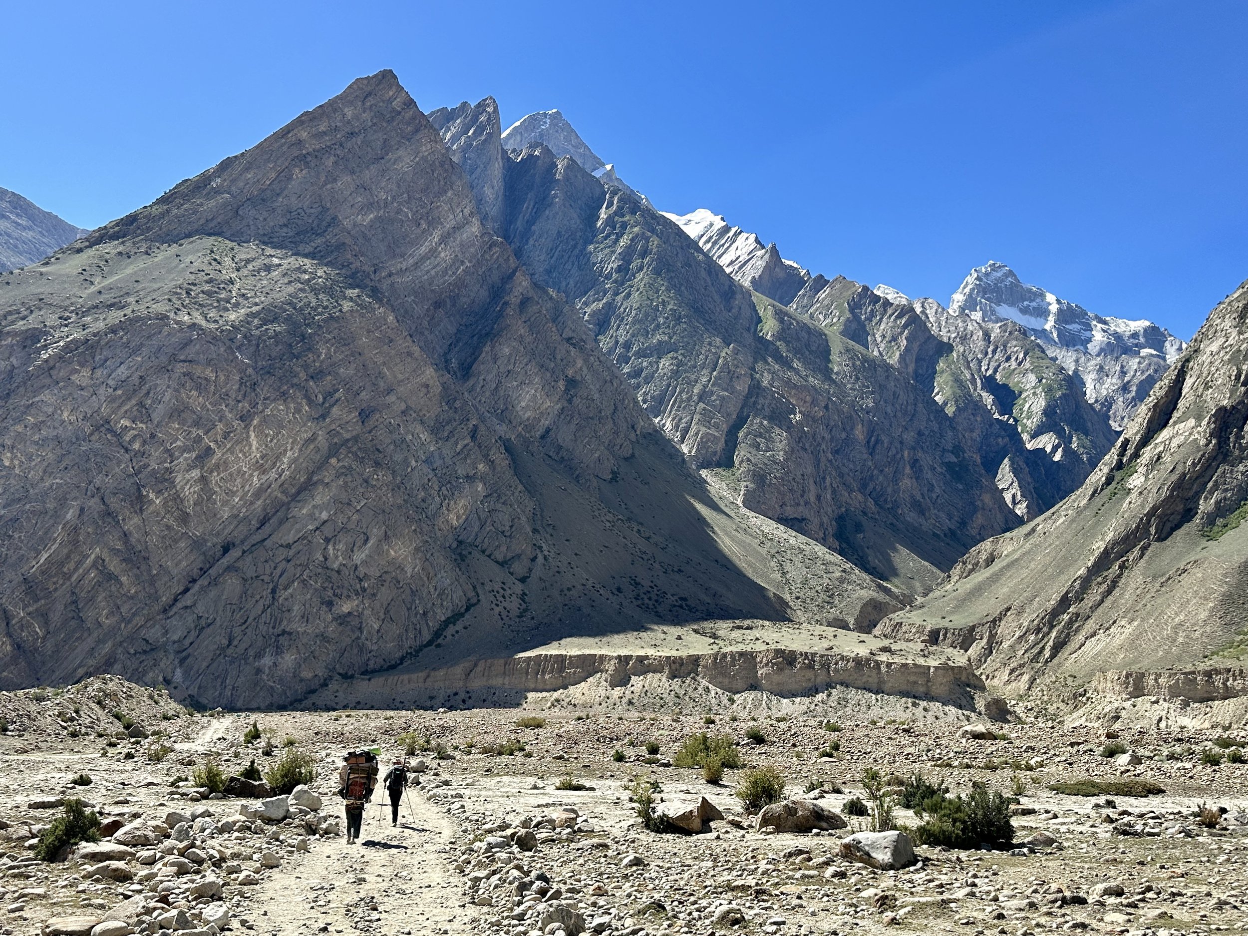
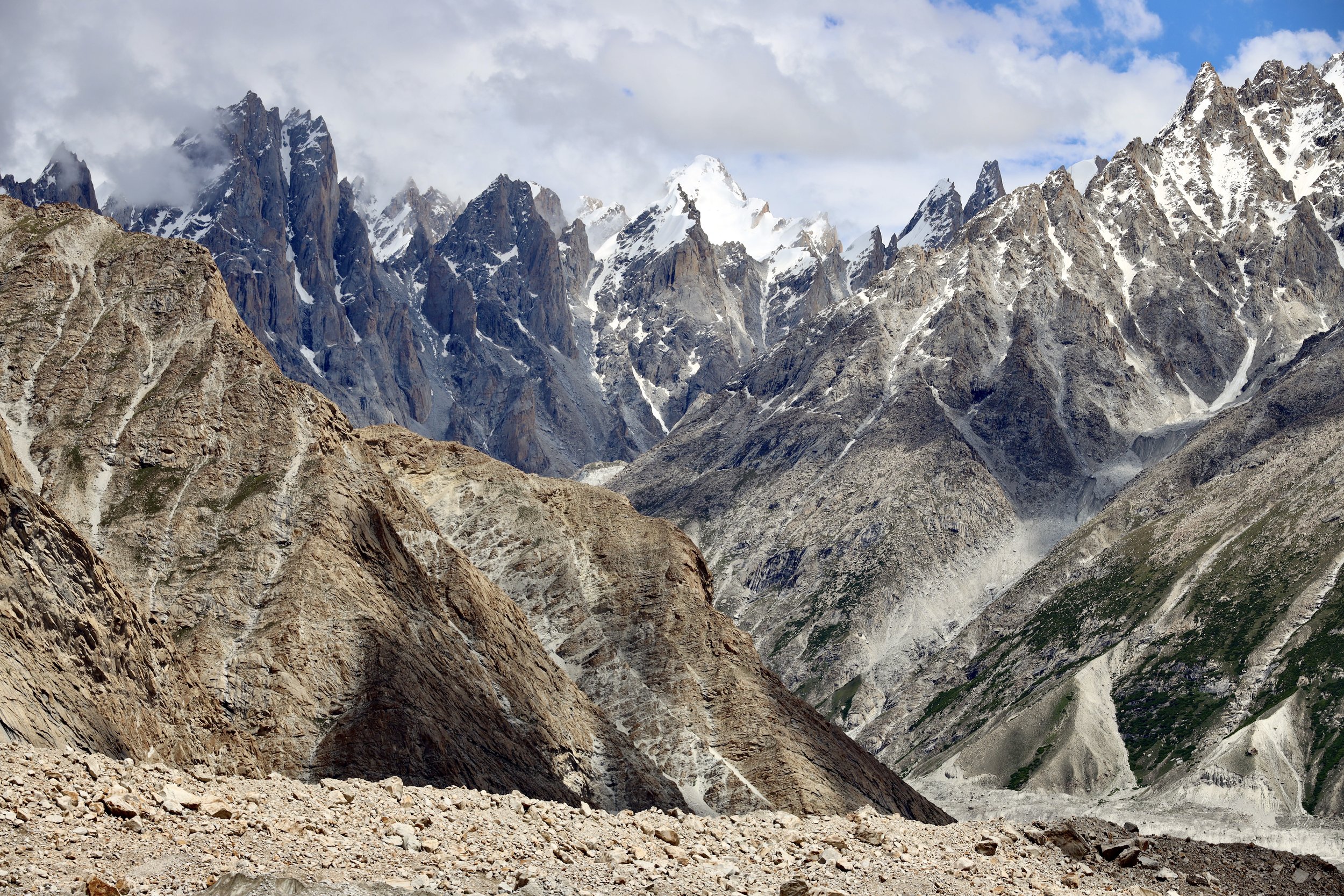
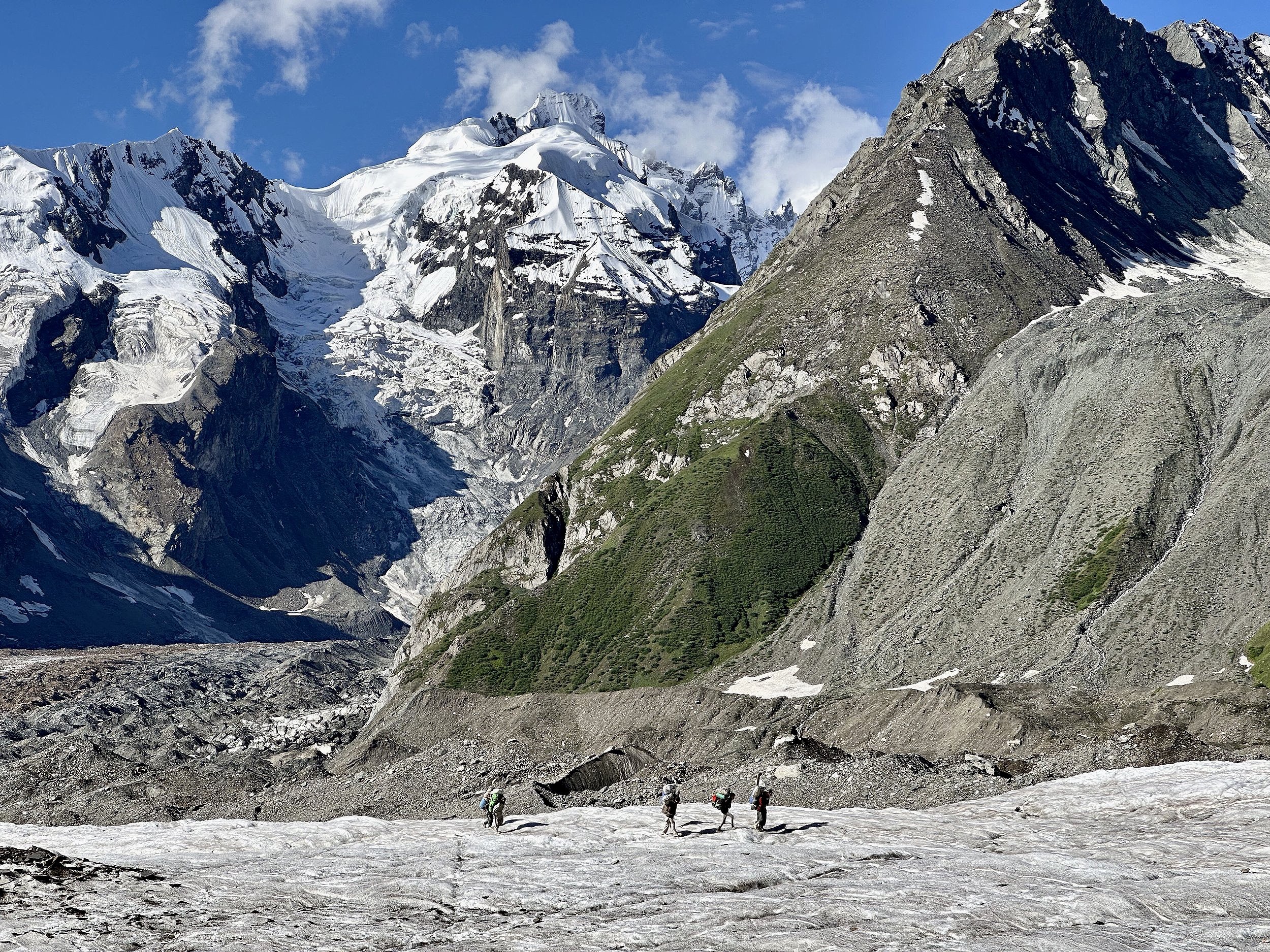
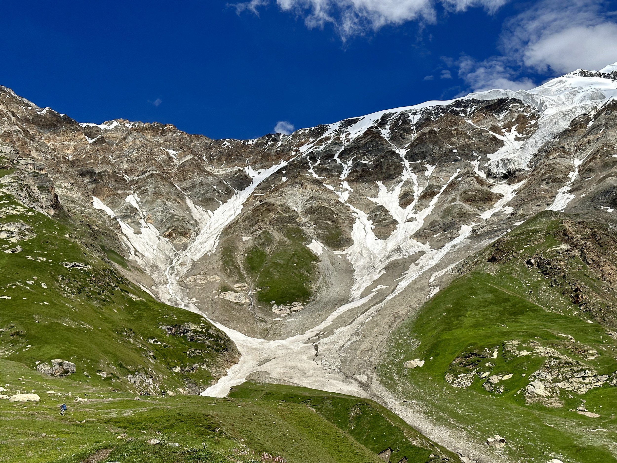
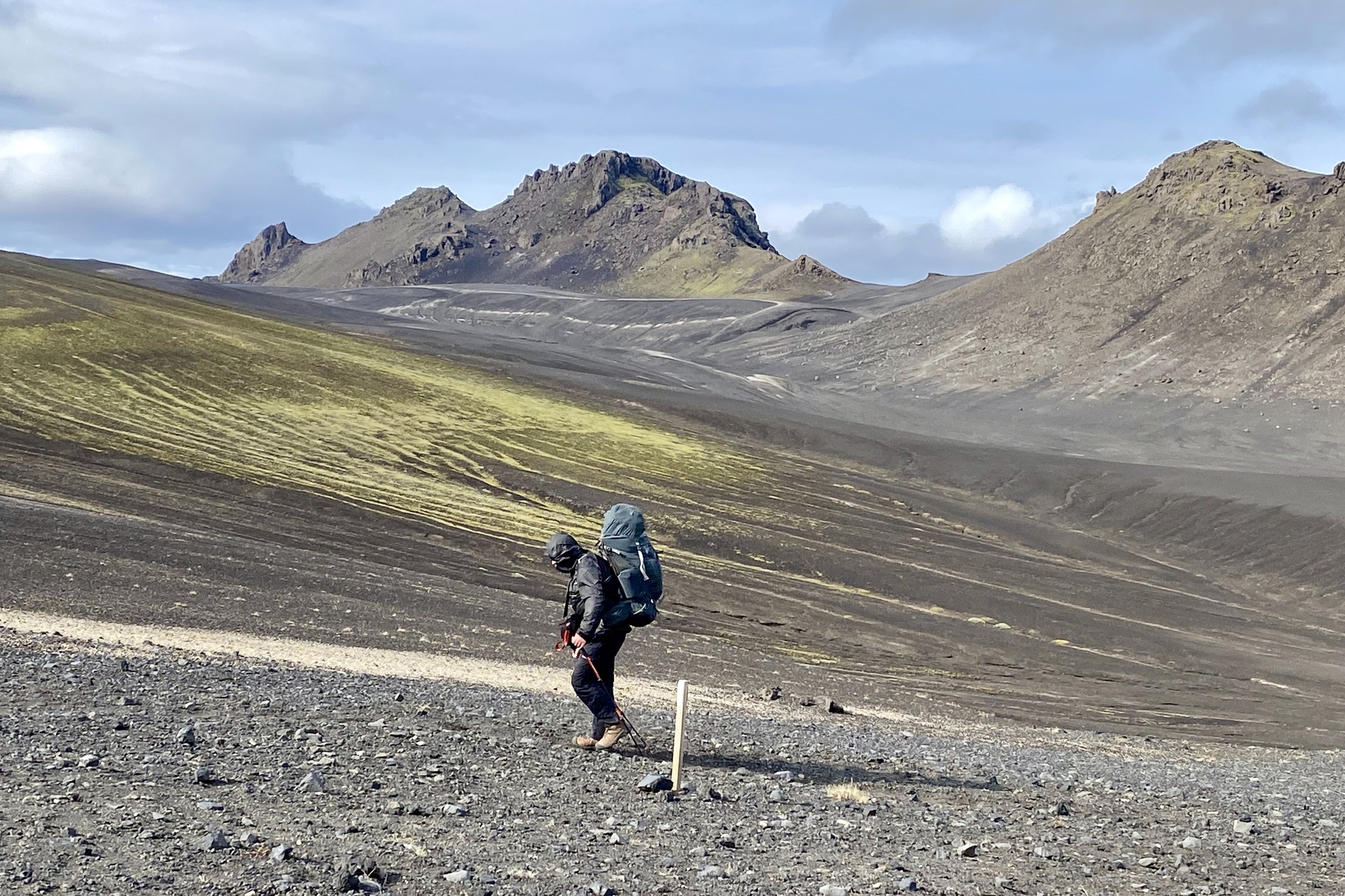
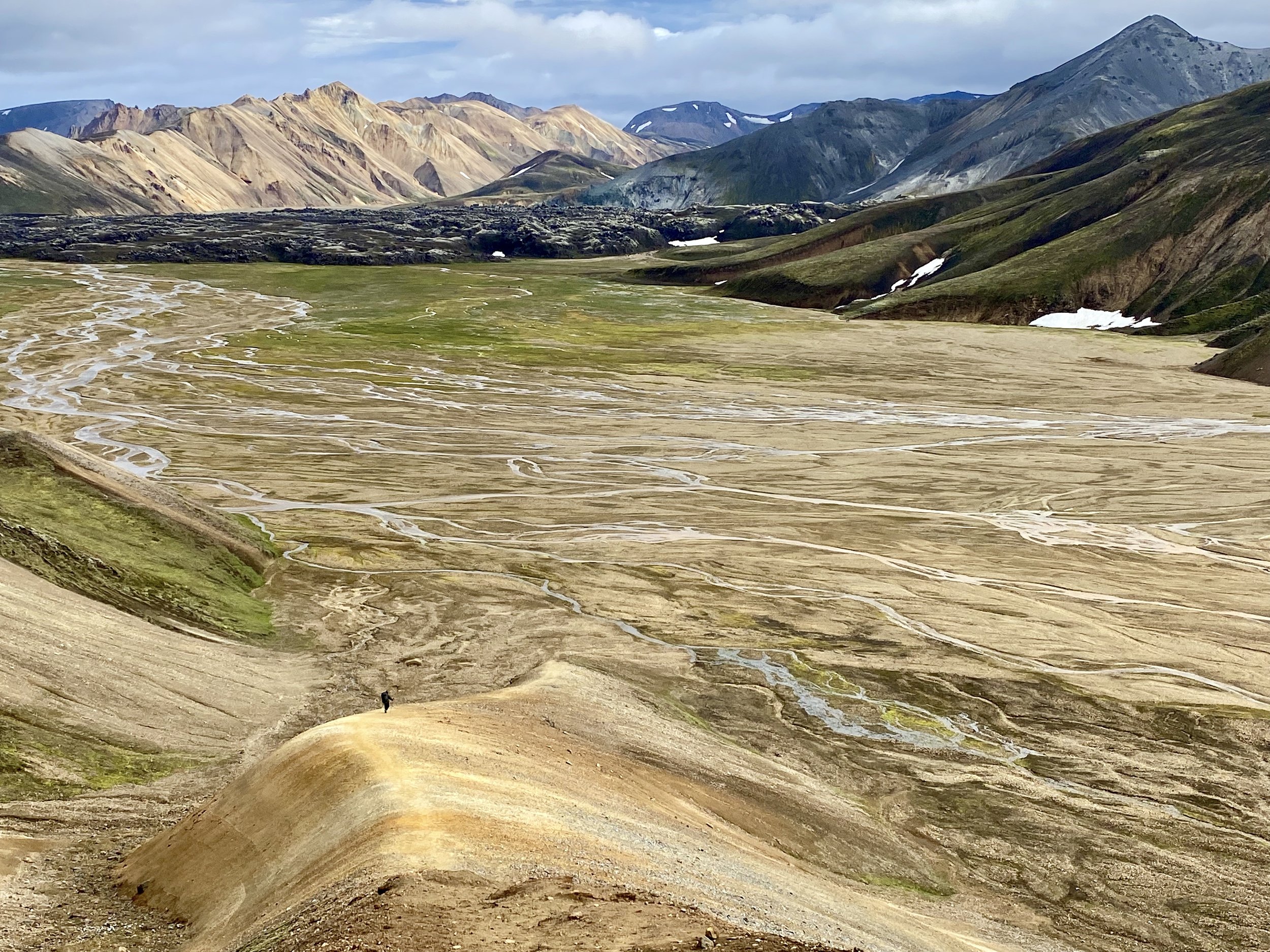
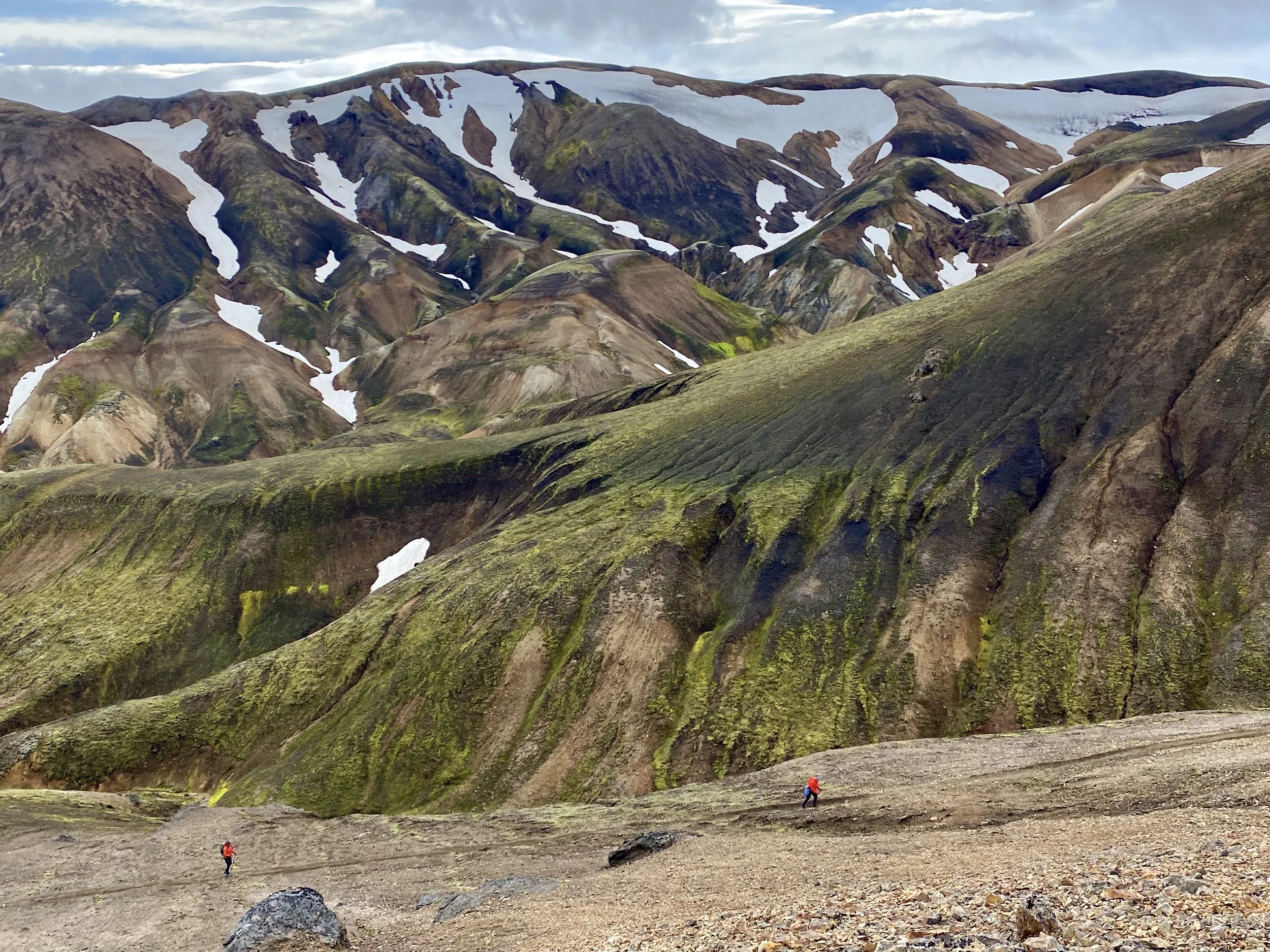
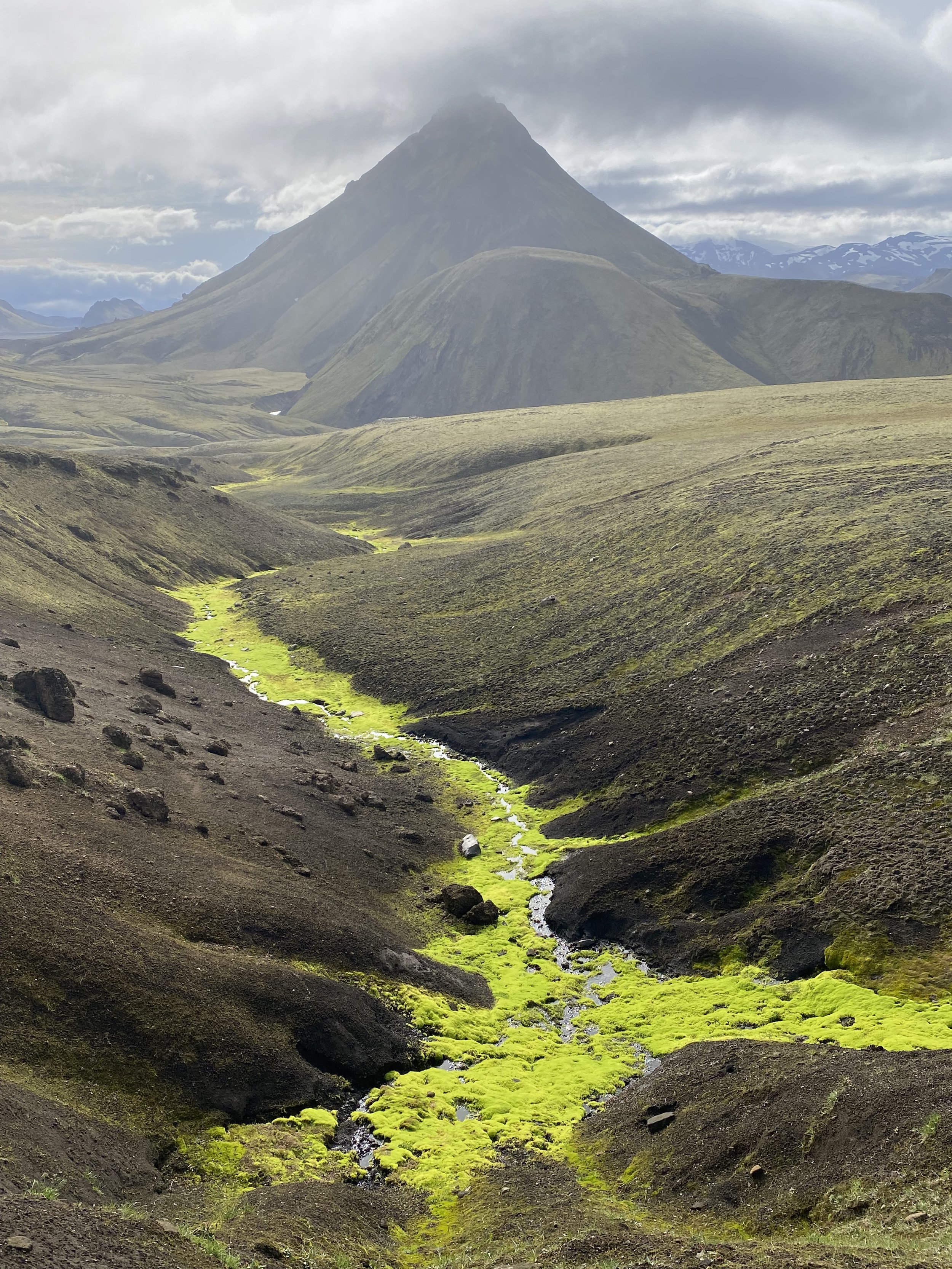
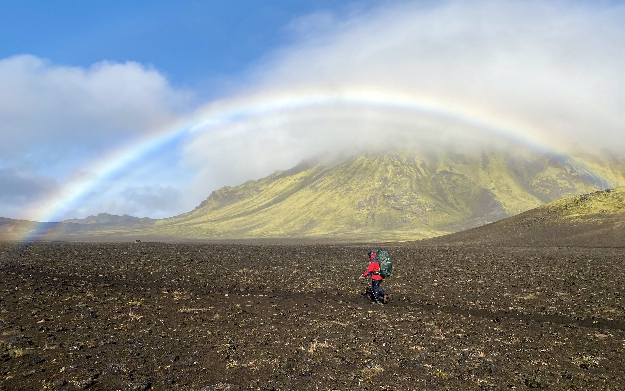
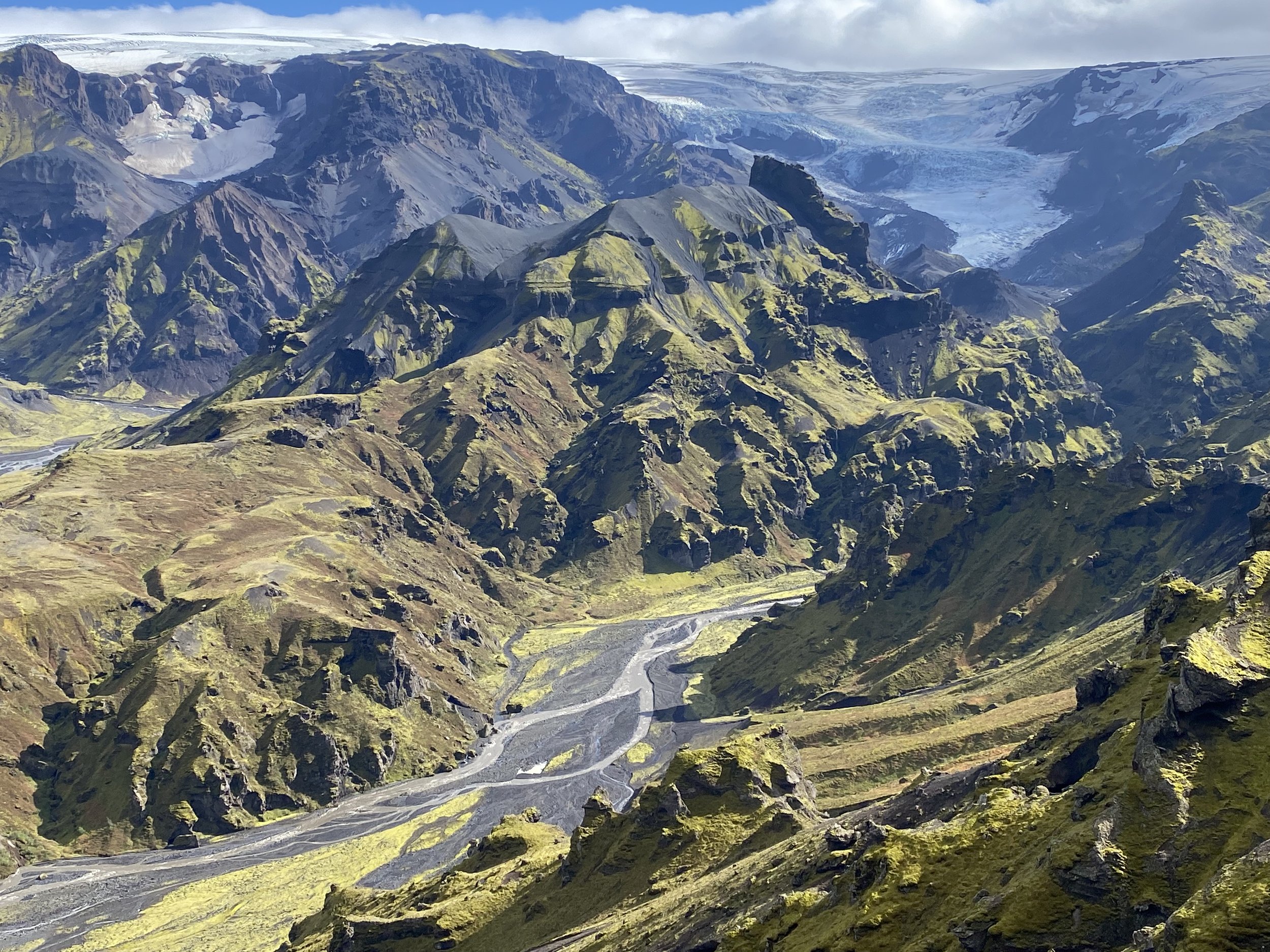
As we gained elevation, the valley opened, and the scenery became more dramatic.  We could see into the far reaches of the valley where jagged peaks came into view above massive Panamagh Glacier.  The trail crossed many side drainages formed by water draining from the peaks and glaciers above.  The drainages made deep indentations that required downclimbing and then climbing up.    There were quite a few of them that needed to be crossed.   Since we had no rain, the crossings were easy, and we did not encounter any difficulties.   At one point we had to negotiate a large, eroded cliff with loose stones and no foot holds.  The climbing on the loose ground in 40C heat was hard but it did not feel as hard as the day before.  I used a small towel soaked with cold stream water to wrap it around my neck which helped to cool down. 

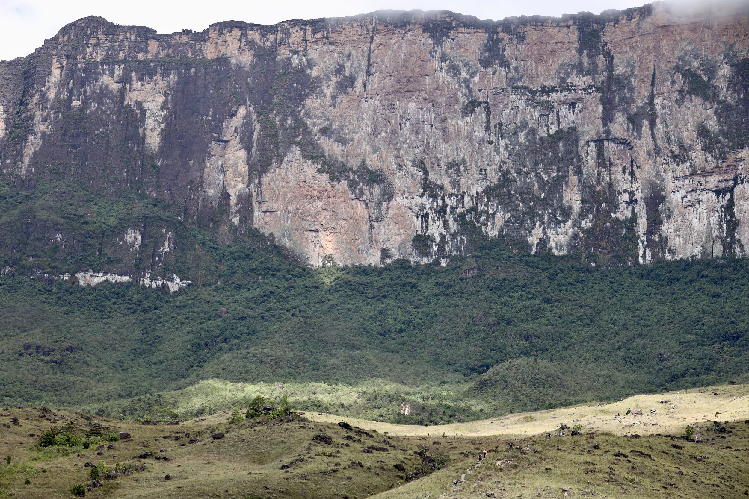
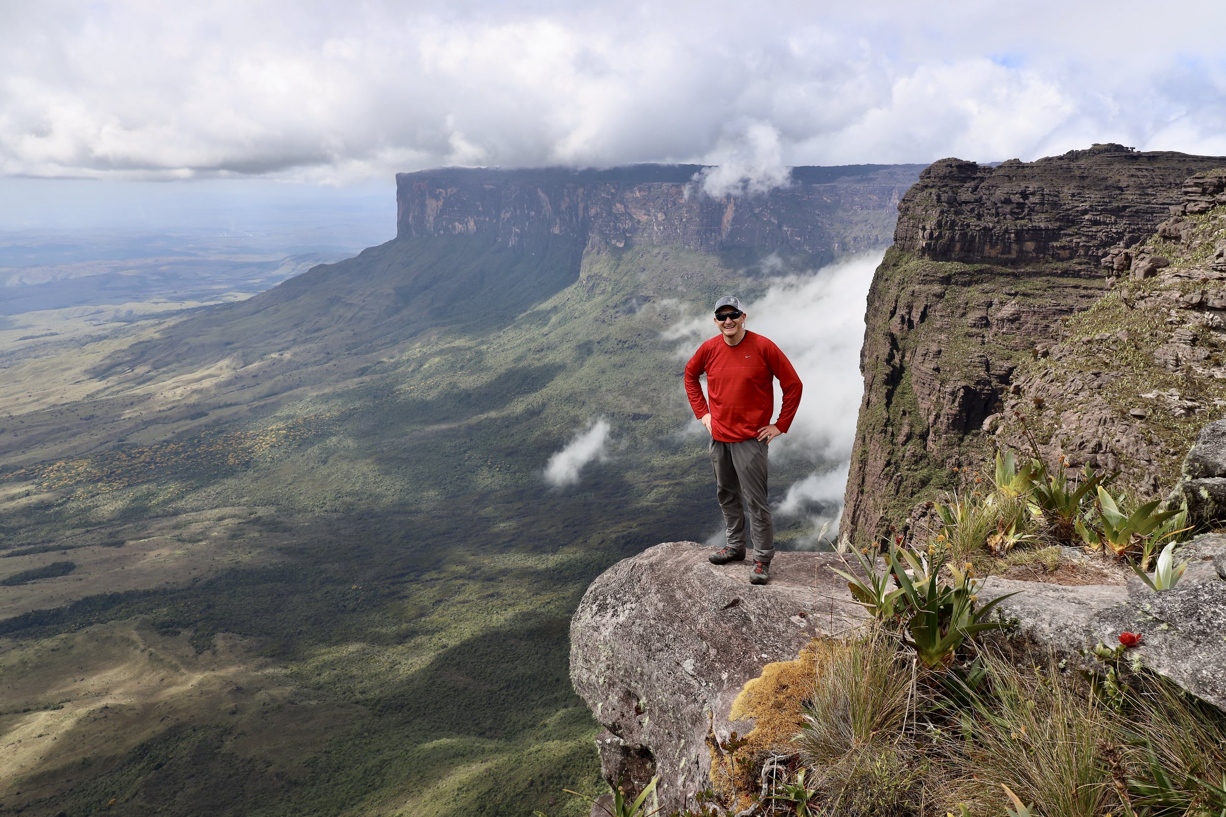
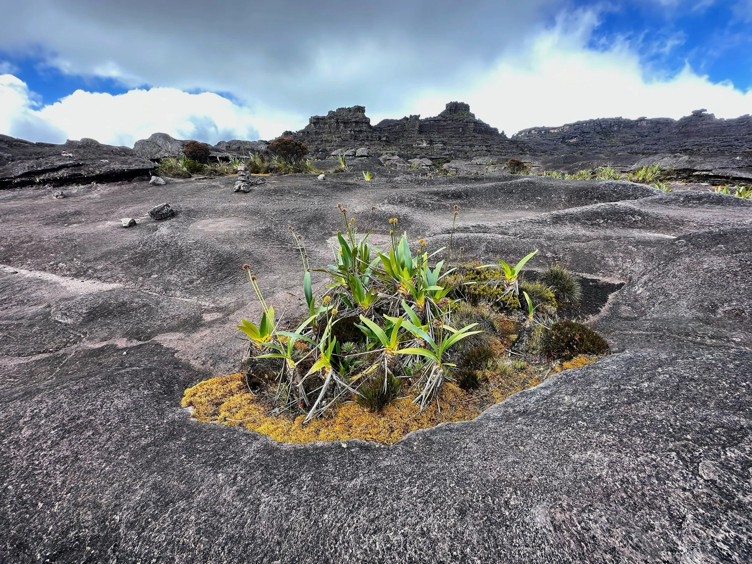
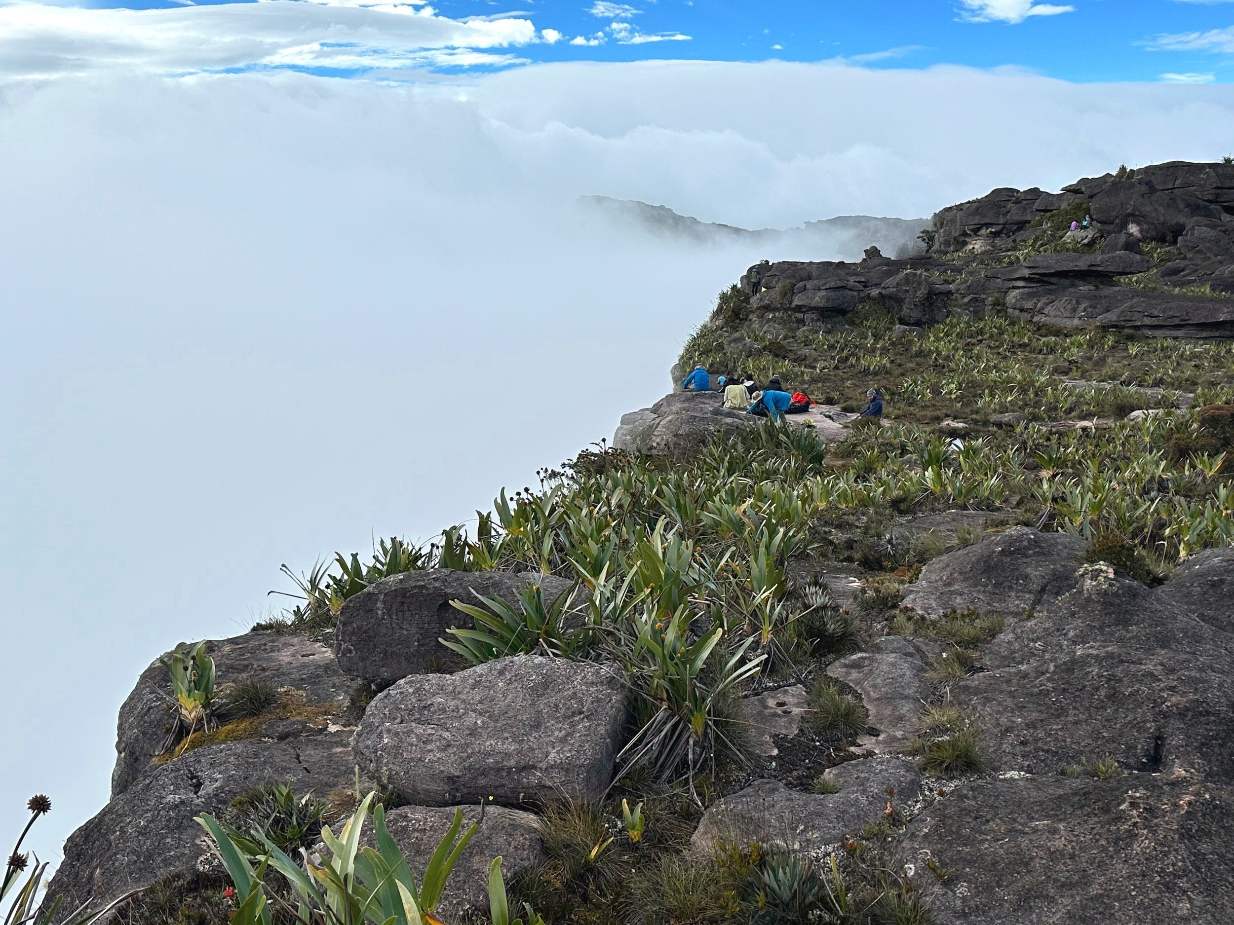
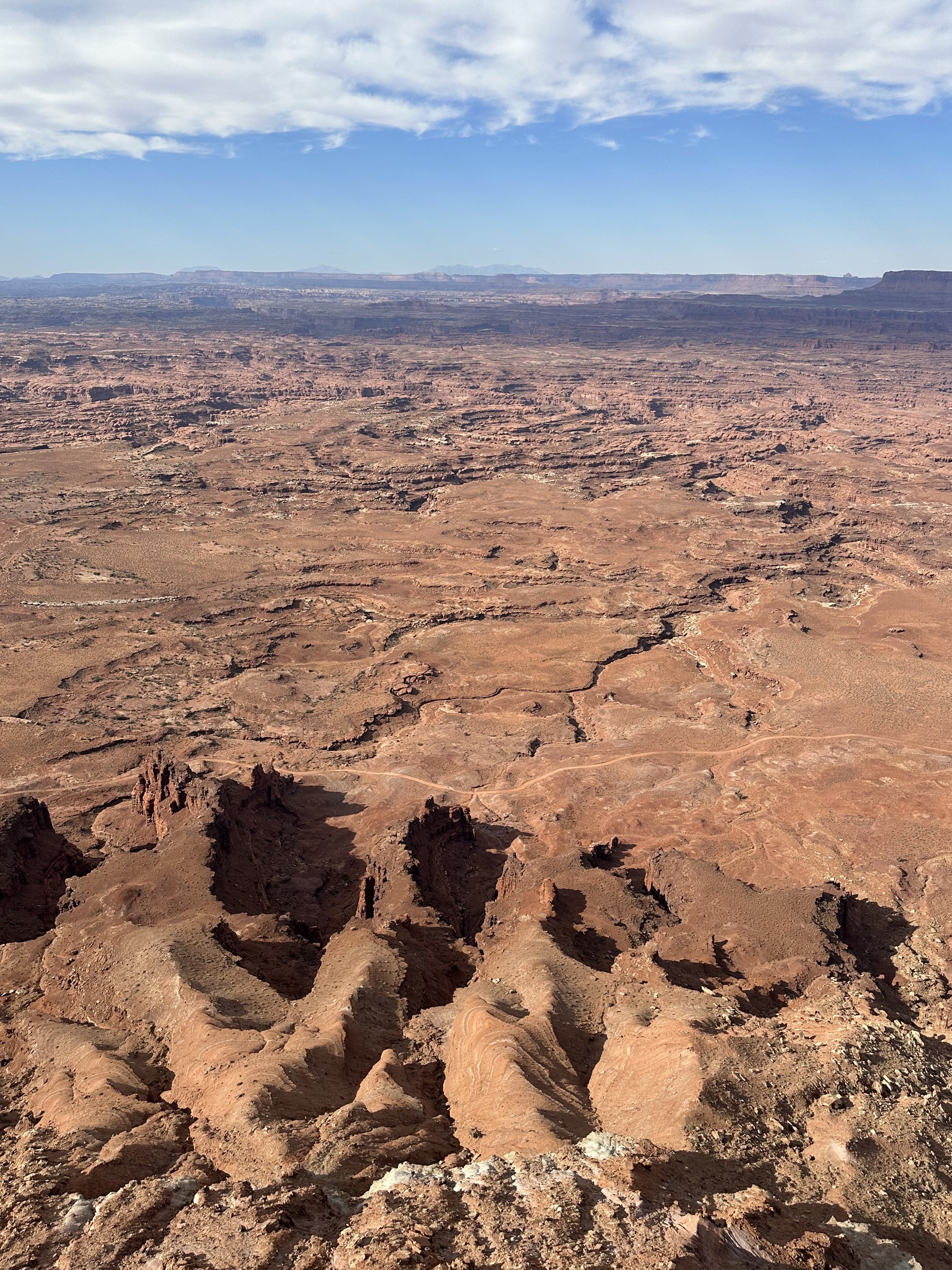
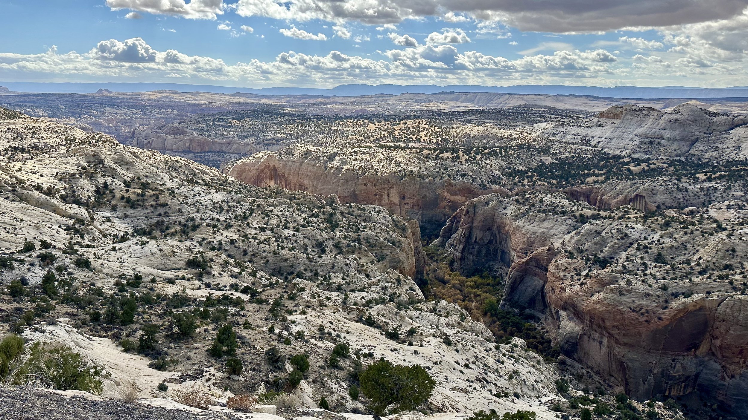
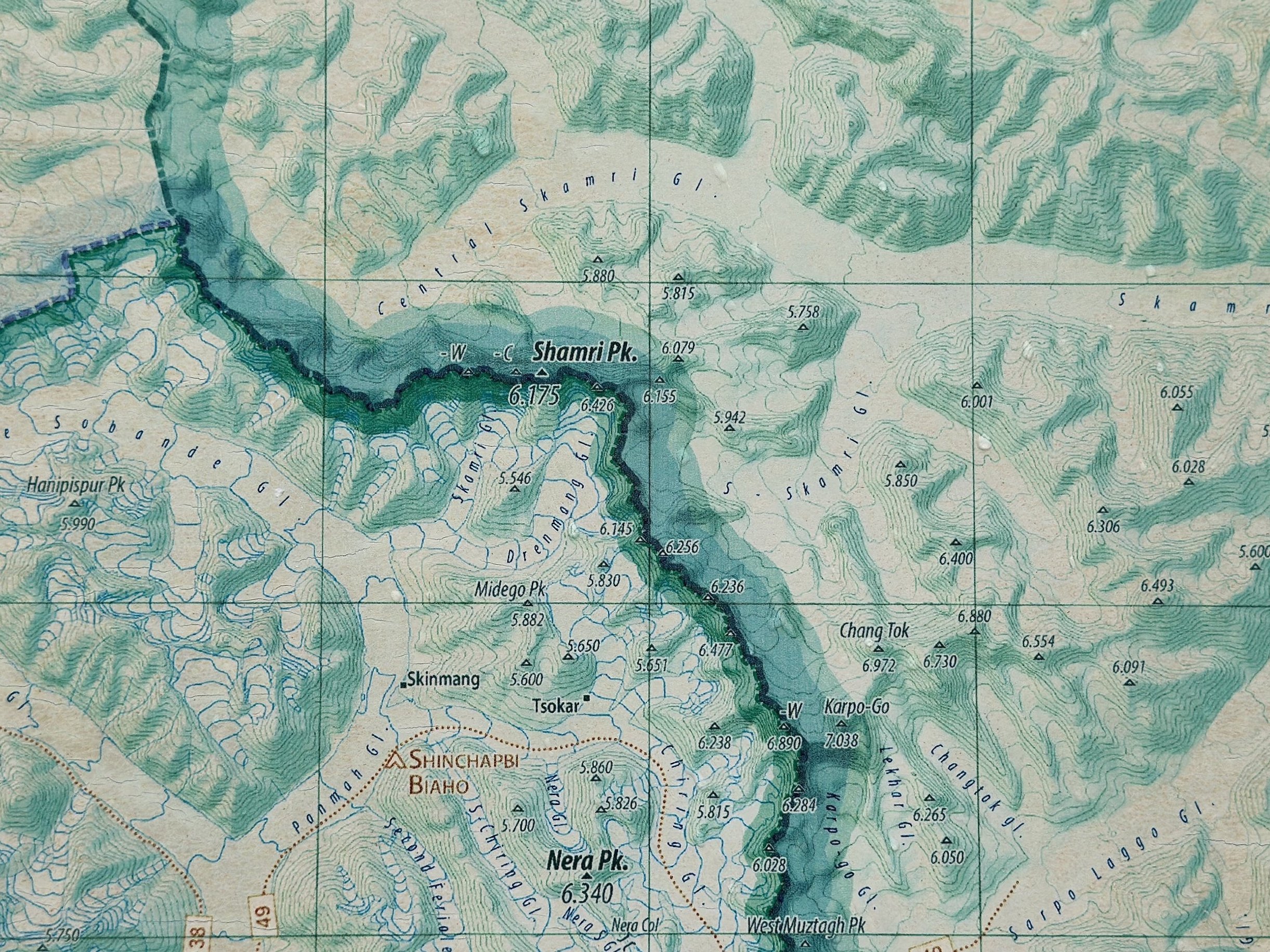
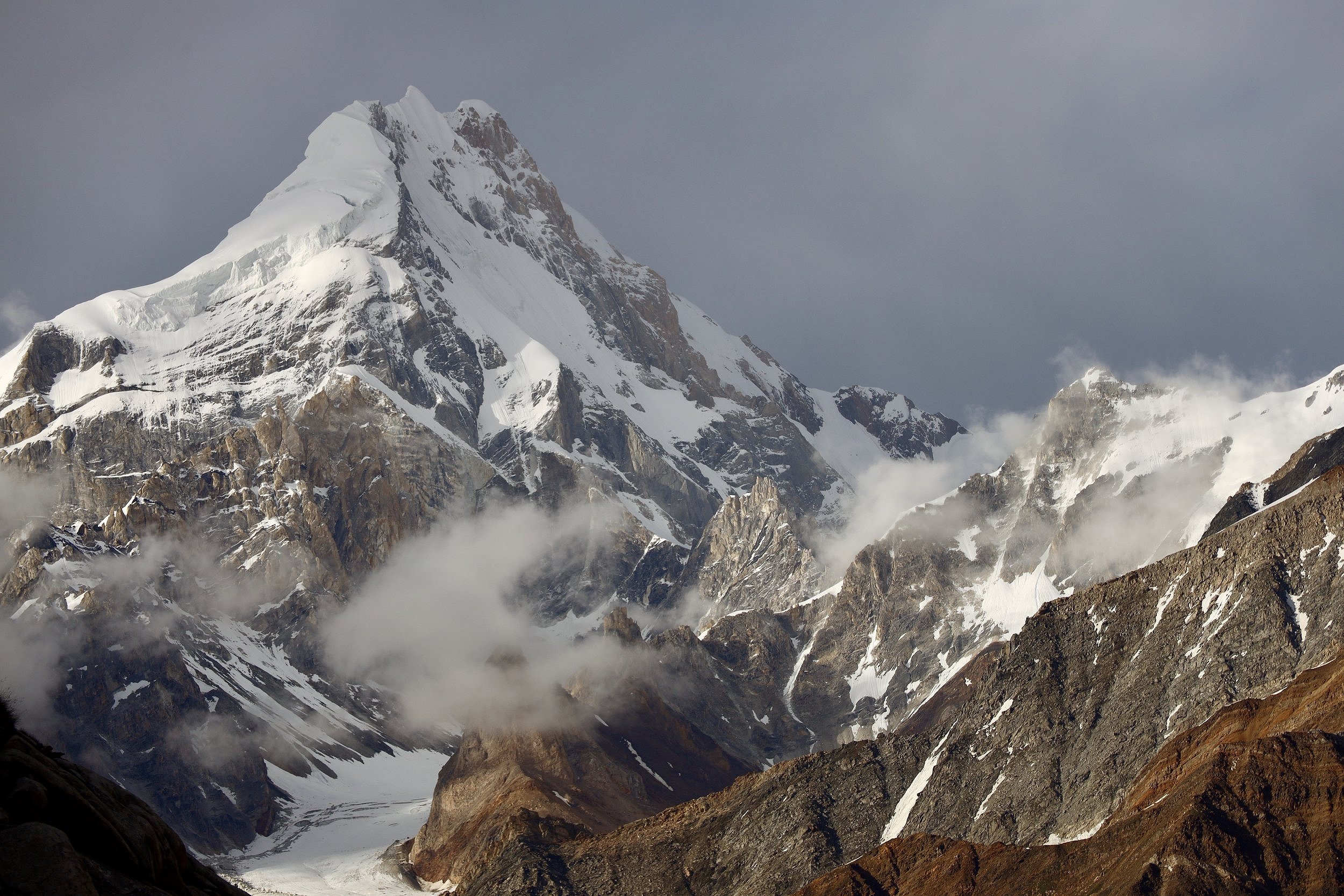
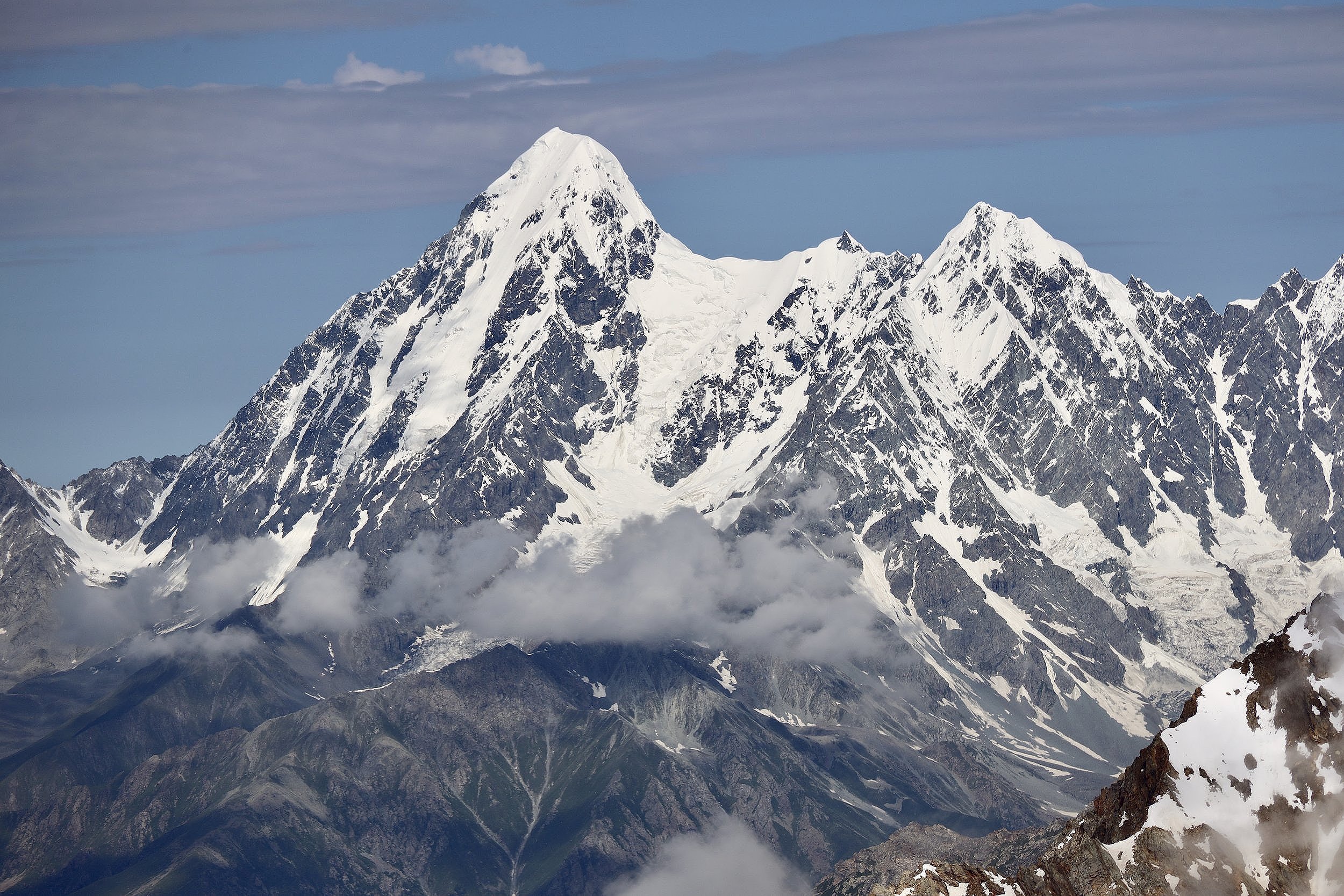
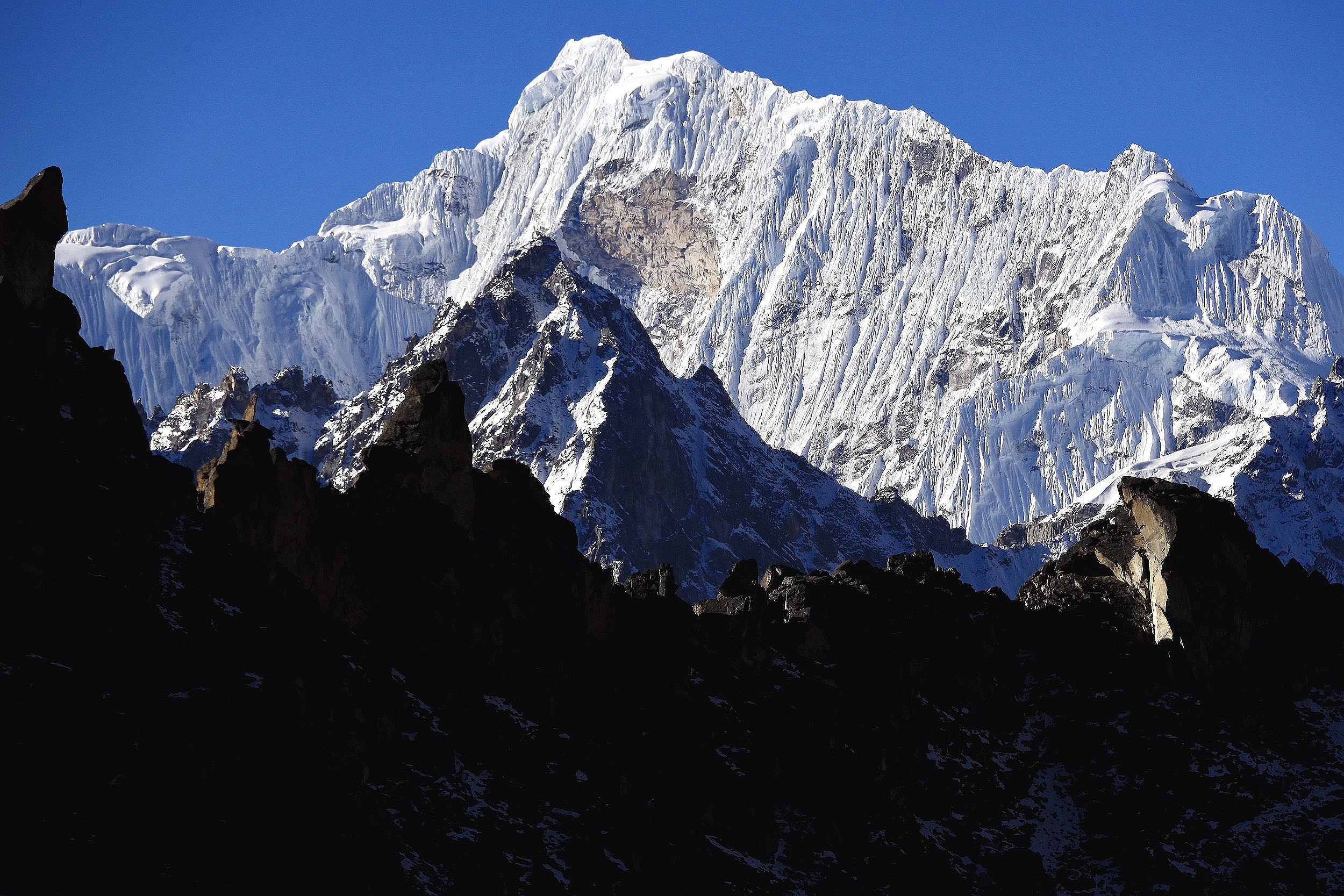
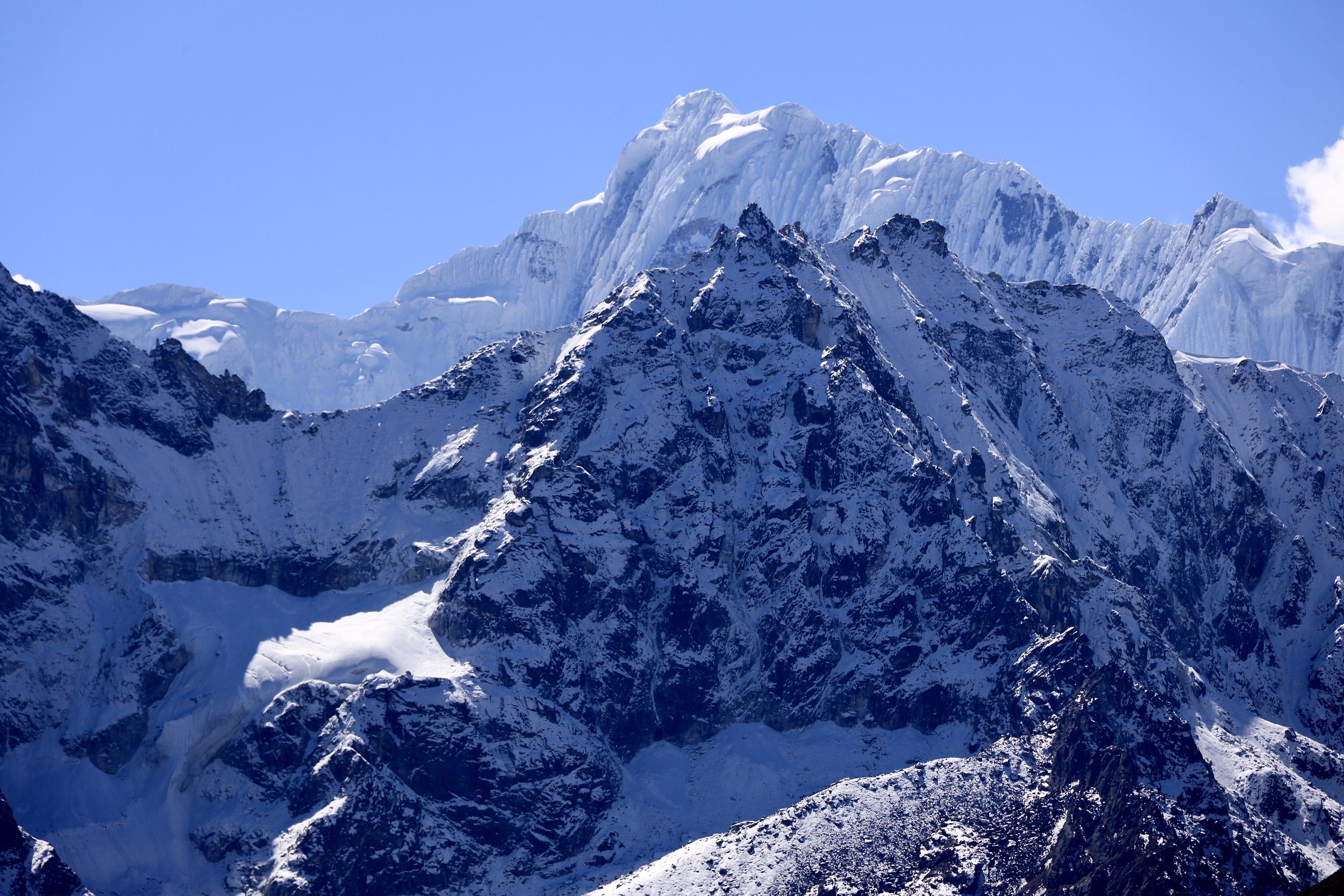
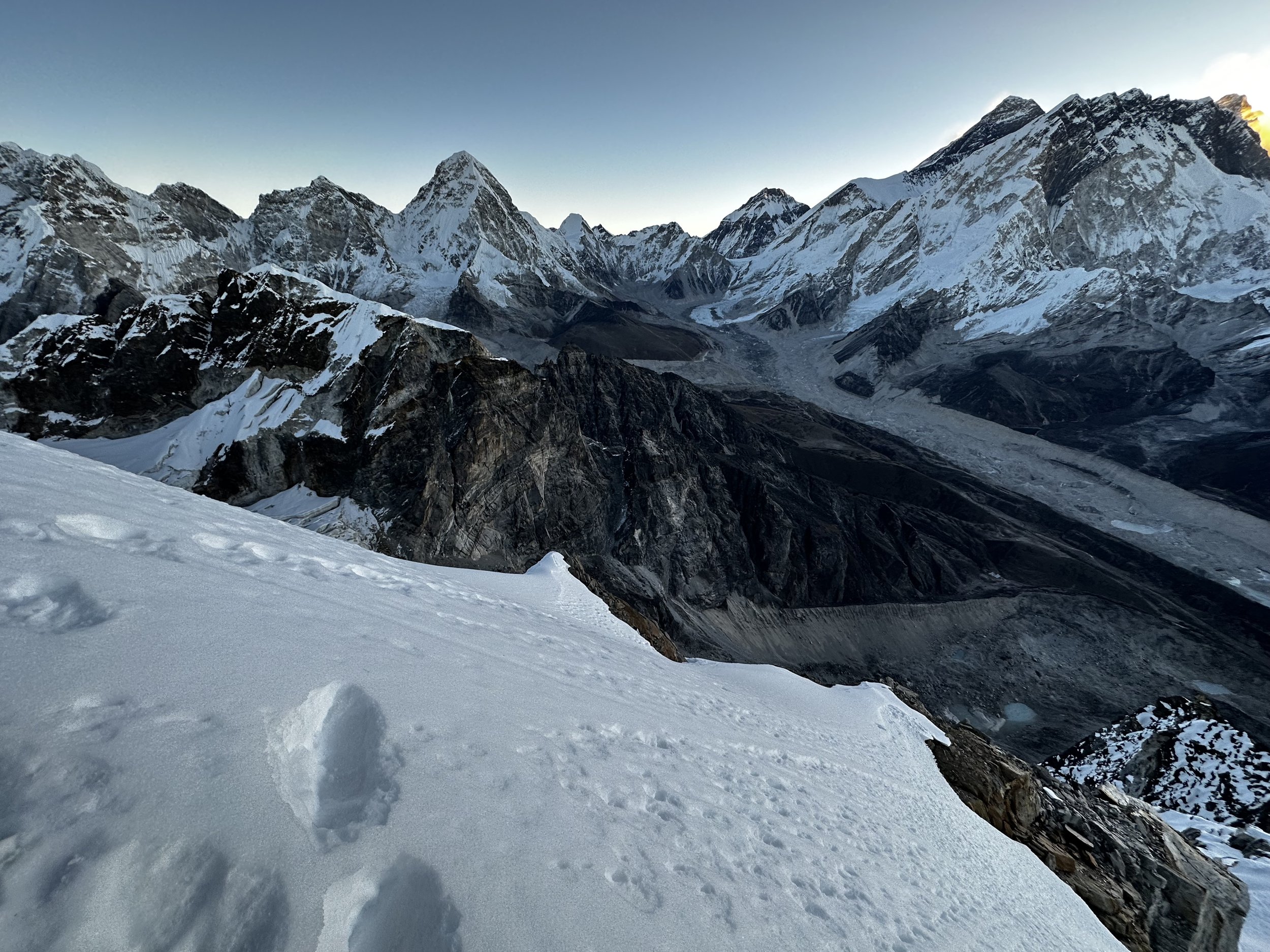
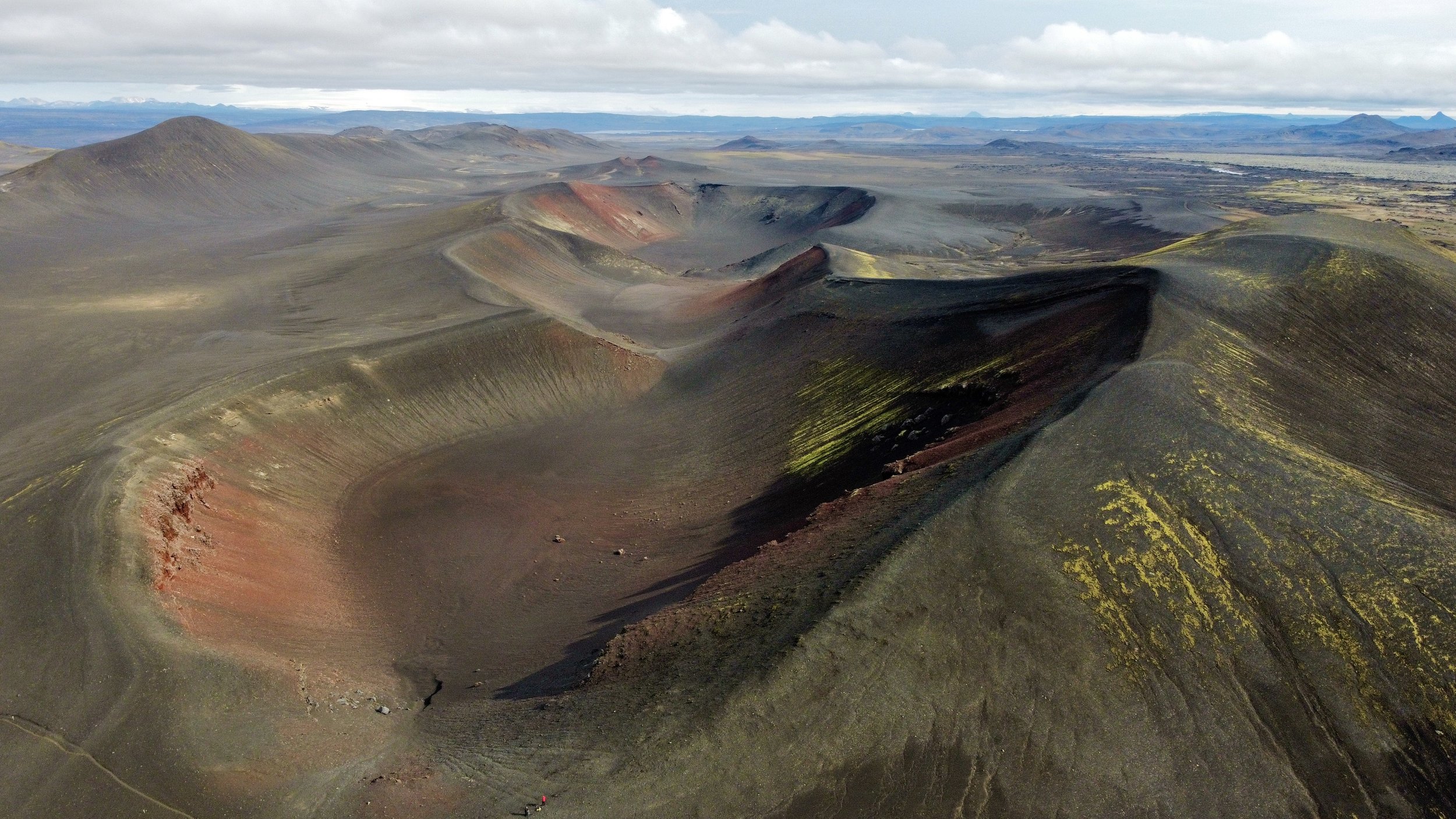
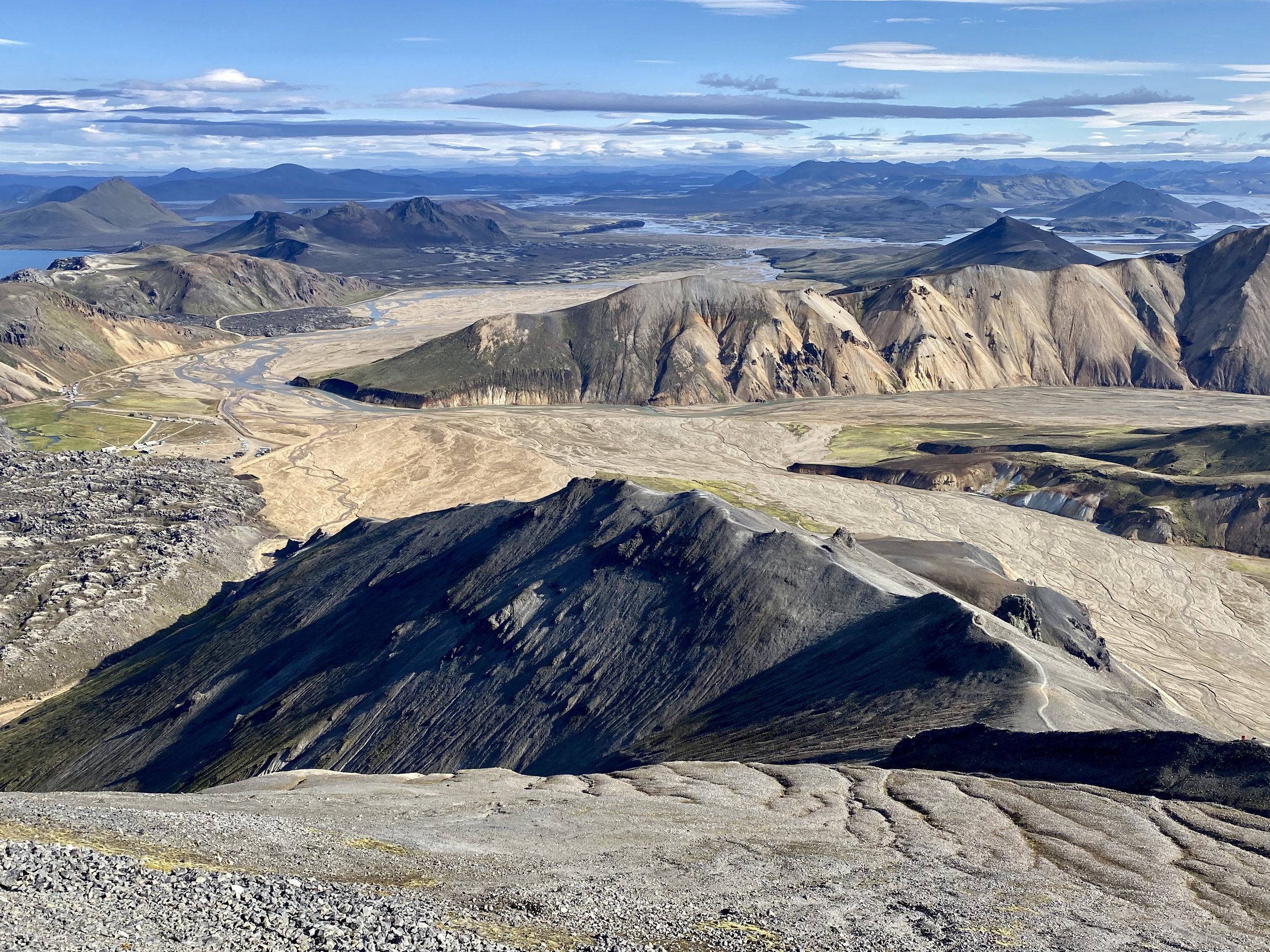
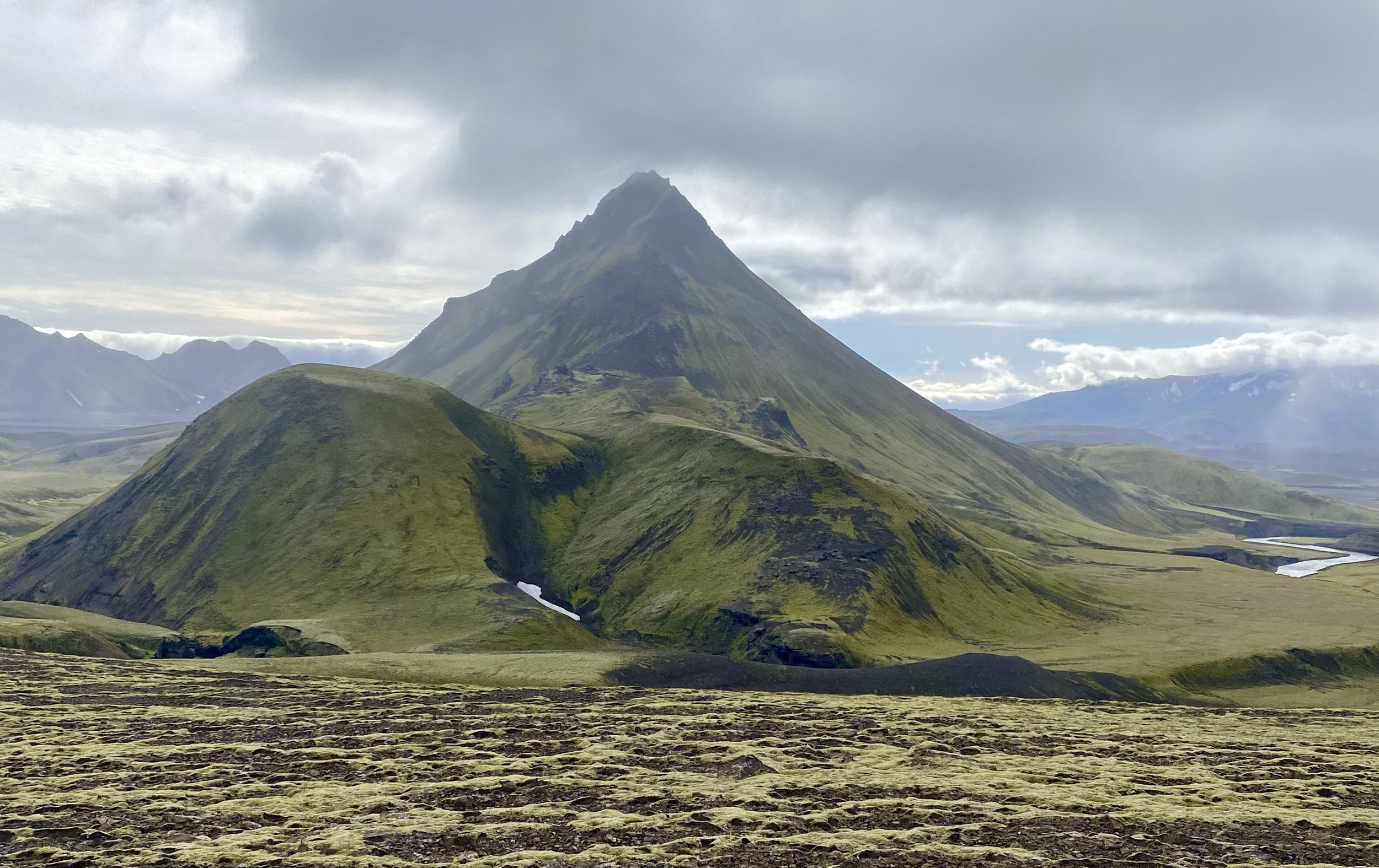
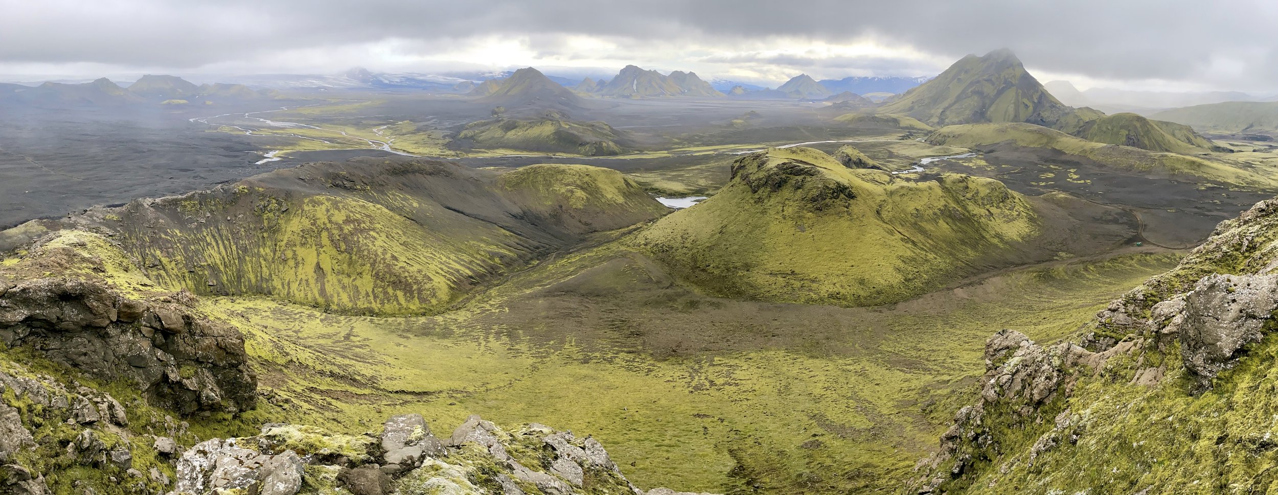
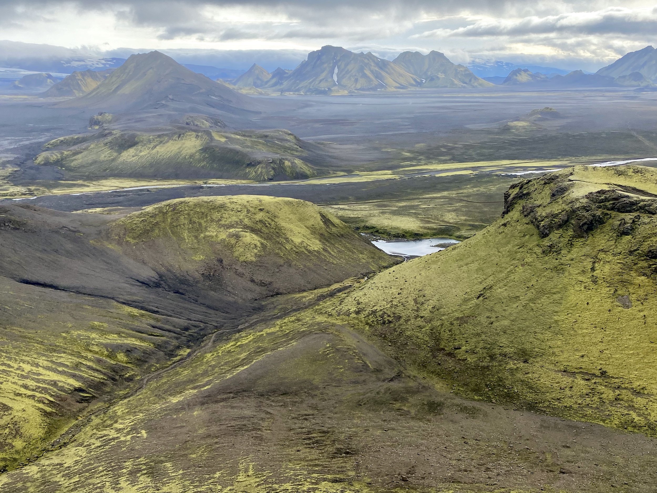
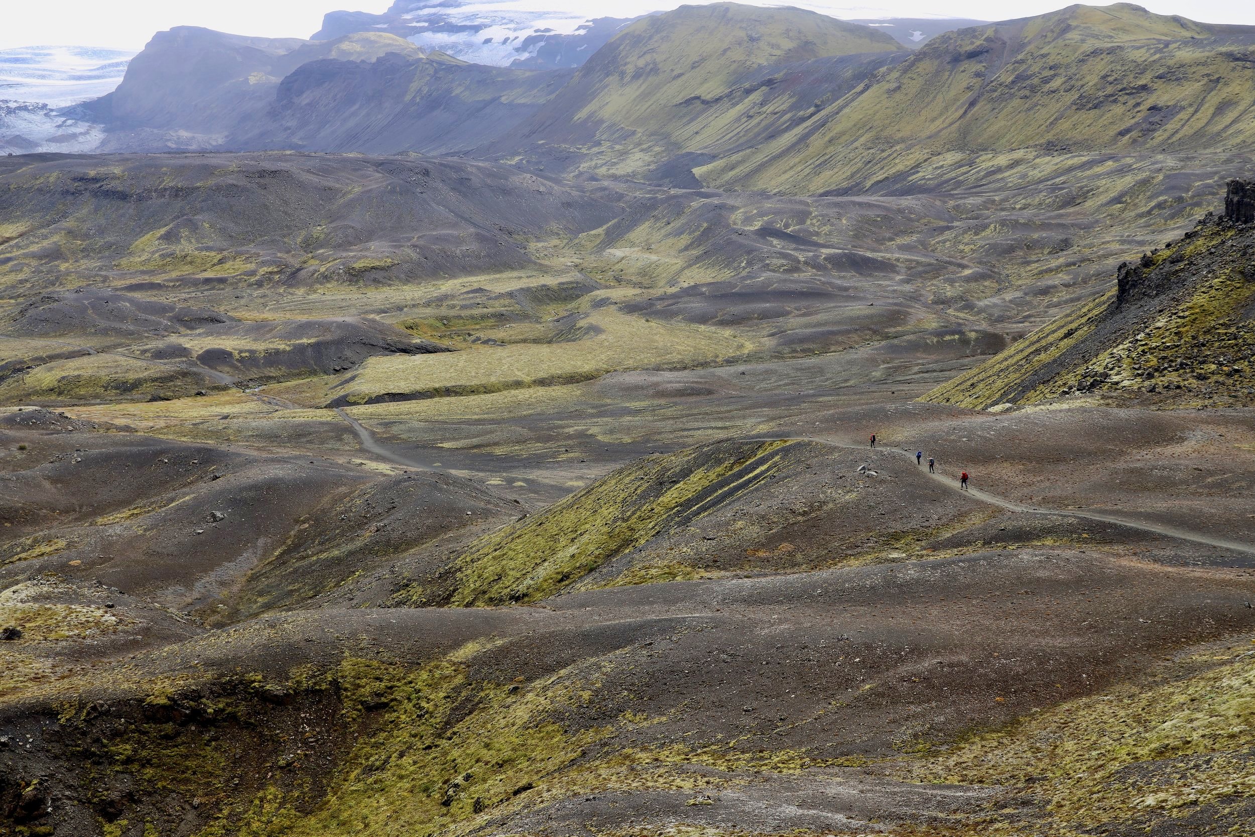
We passed the Panamagh Glacier camp site located at the frontal moraine but decided to press on further on the recommendation of the horsemen, up a hill for one more hour.  The Cow Camp as the horsemen called it, was in a spectacular location perched above the Panamagh Glacier with a commanding view of the surrounding mountains.  The snowy Skamri Peaks were visible at the head of the valley 40km away to the northwest.  This is such a spectacular area and there are no other groups or trekkers here as everyone is headed to the K2 BC.   Karakorum sees very few trekkers compared to Nepal.  Maybe a few hundred people trek here each summer compared to tens of thousands in Nepal.  This is a grand place to chill, listen to music and admire spectacular scenery.  I am so lucky and feel so happy to be back in the Karakorum and to be able to see and experience this spectacular beauty. 

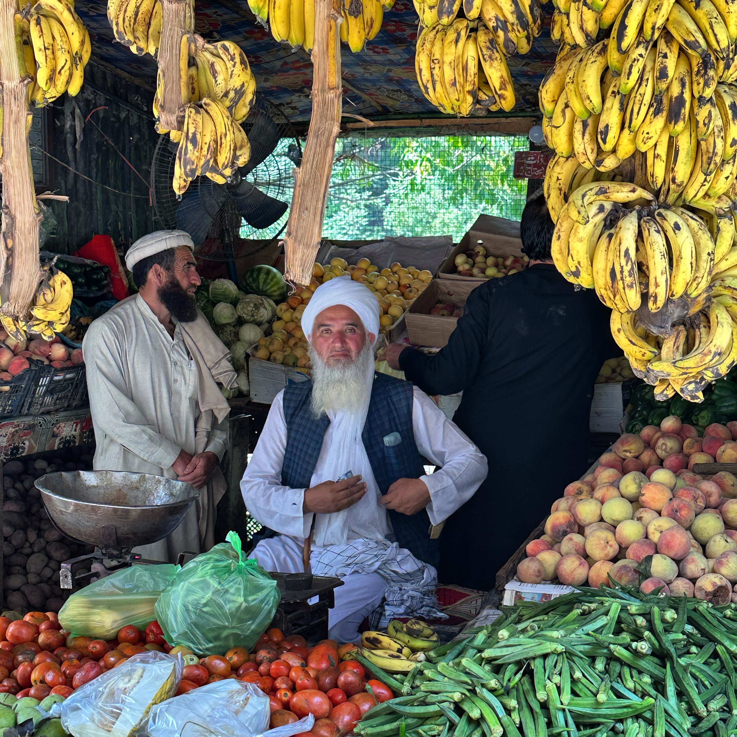
We had a good dinner of chicken in a tomato sauce.  The food so far is not greasy and quite good.  We have fresh vegetables and fruit including fresh mangoes.  The dinner is at 7, bed by 8 and wakeup at 5am.  The breakfast is at 6 and by the time I arrive for breakfast I am all packed up and ready to go.  The porters seem a good group of guys, but it feels different to be alone with 12 Baltis and to be completely dependent on them.

 July 15 Moretti Camp 4100m 8.5 km

Today was a short day.  I got up at night to pee and could not see any stars.  I thought that the good weather was over but miraculously by morning it was clear and sunny.    I am a little paranoid about the weather here.  I remember the bad weather days on previous treks. 

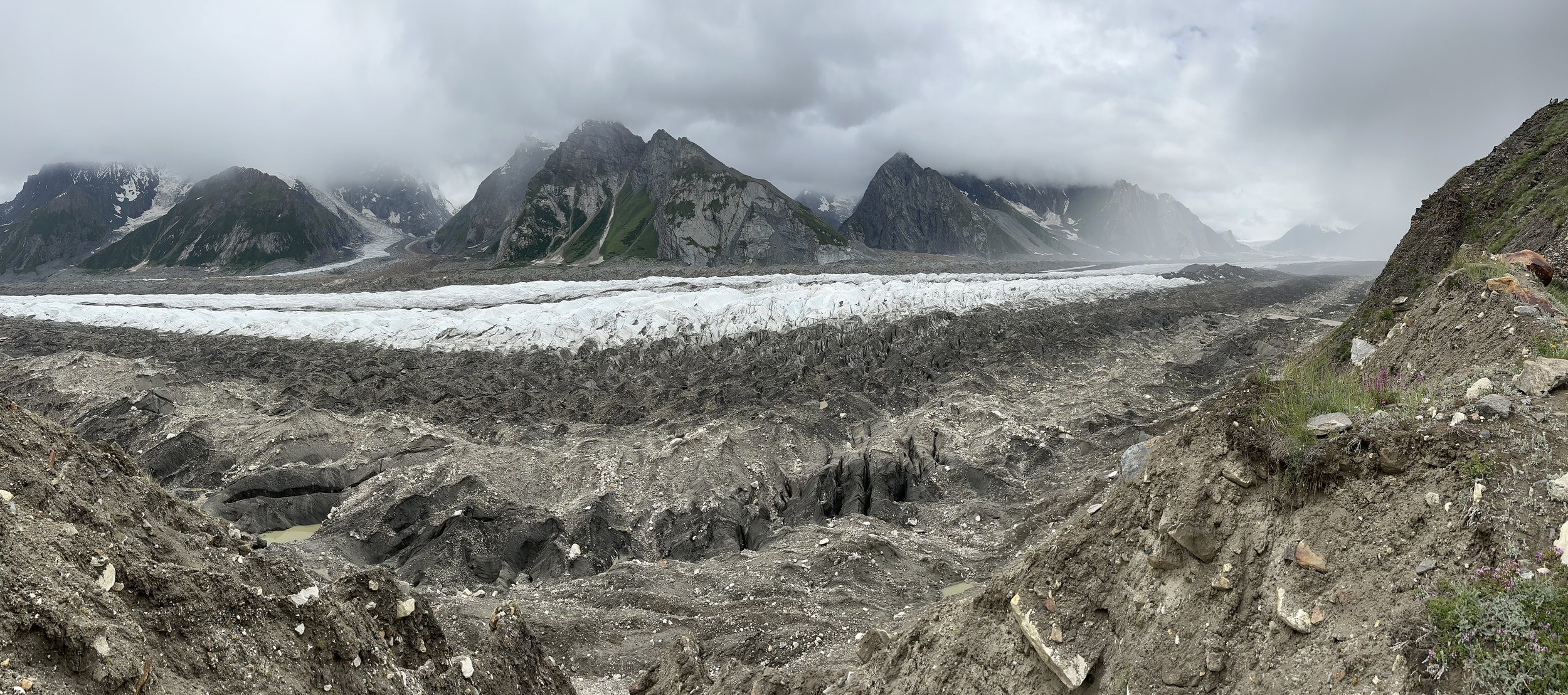
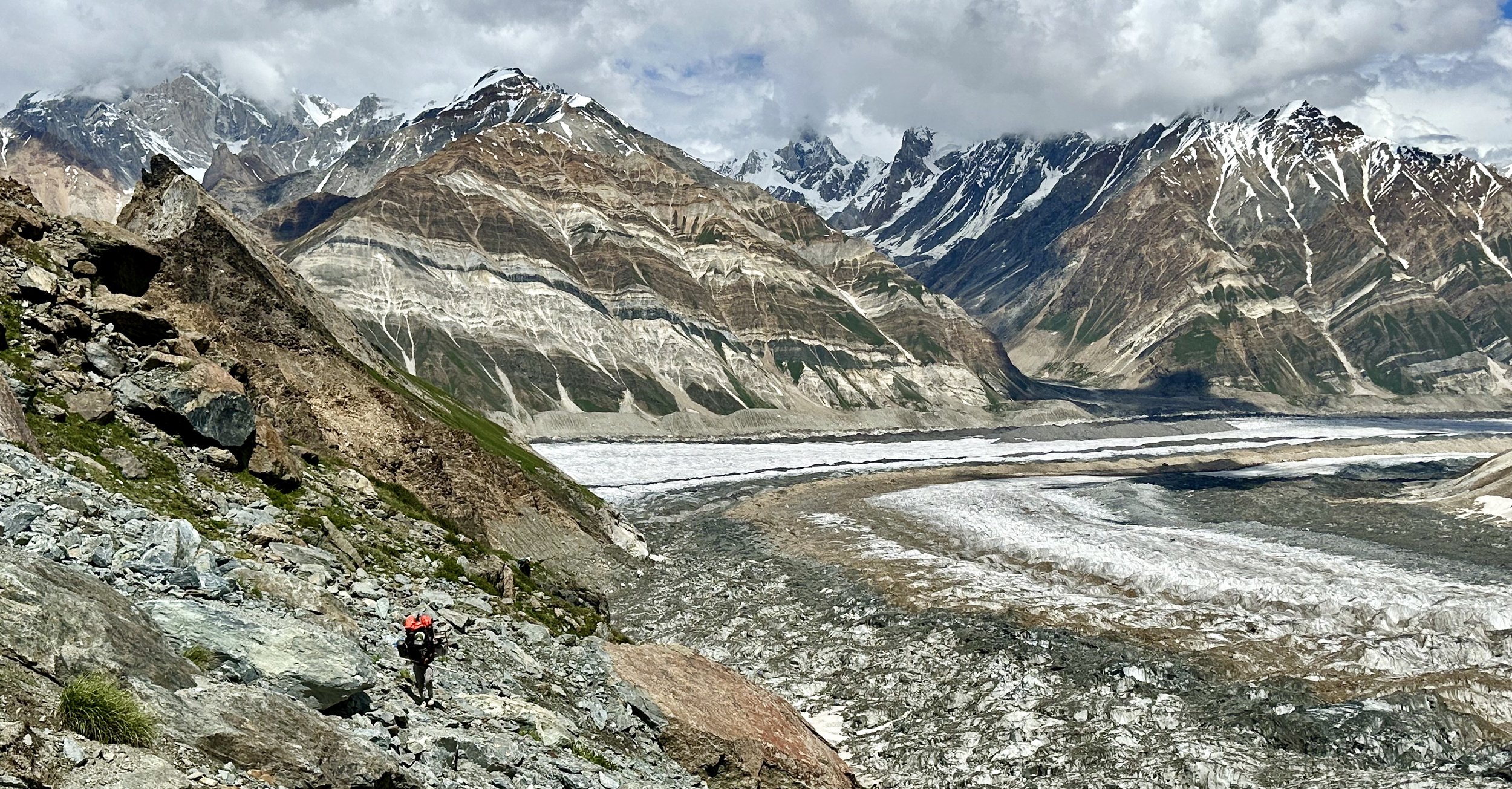
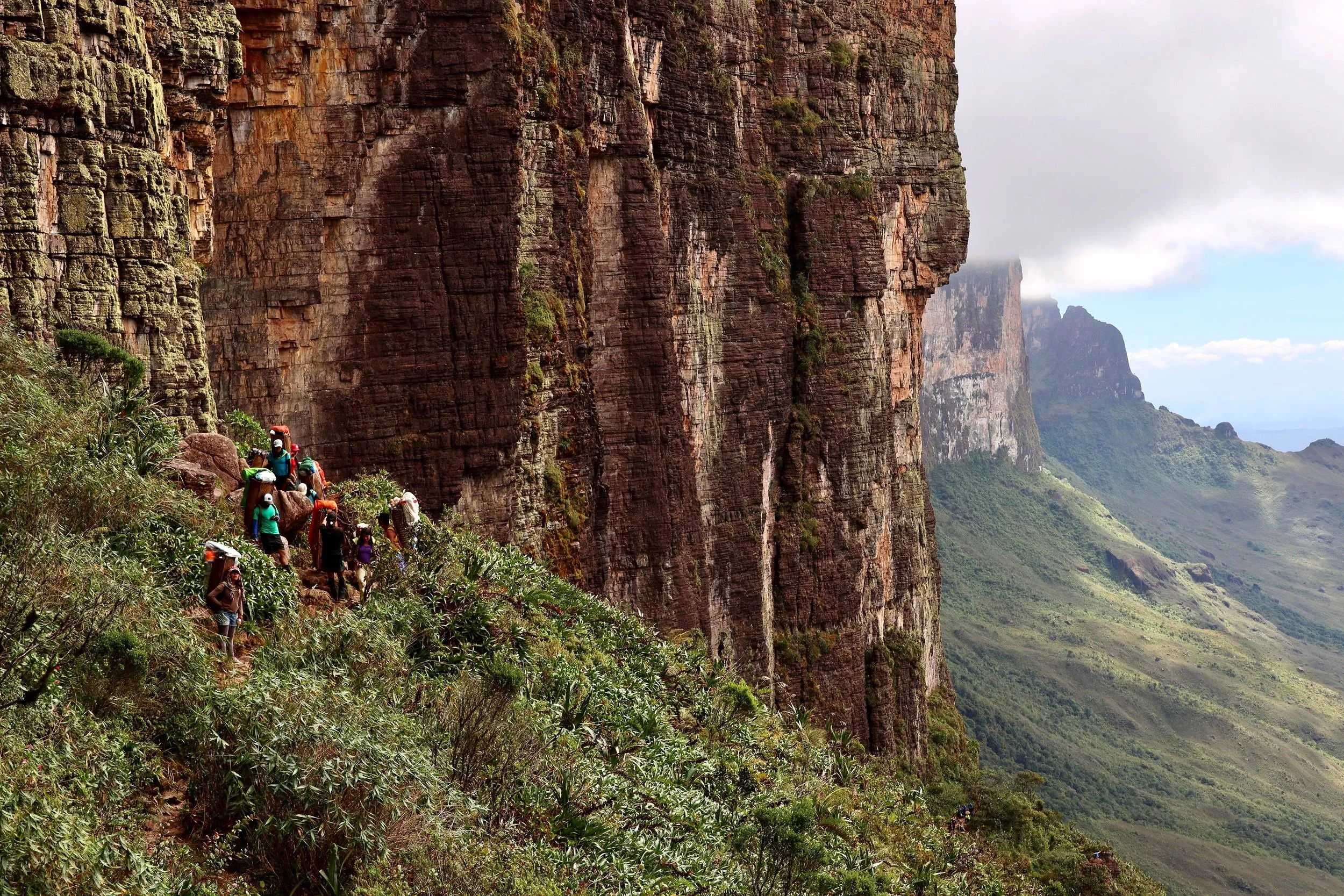
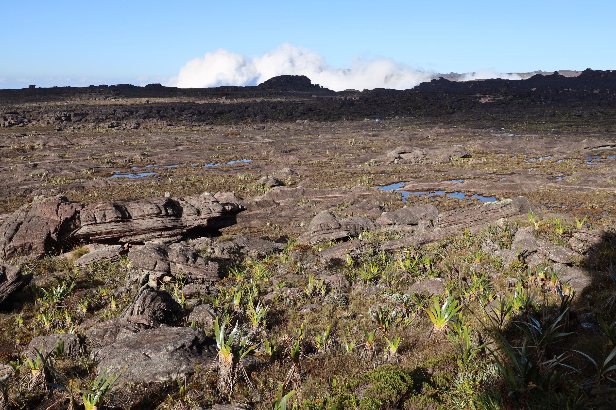
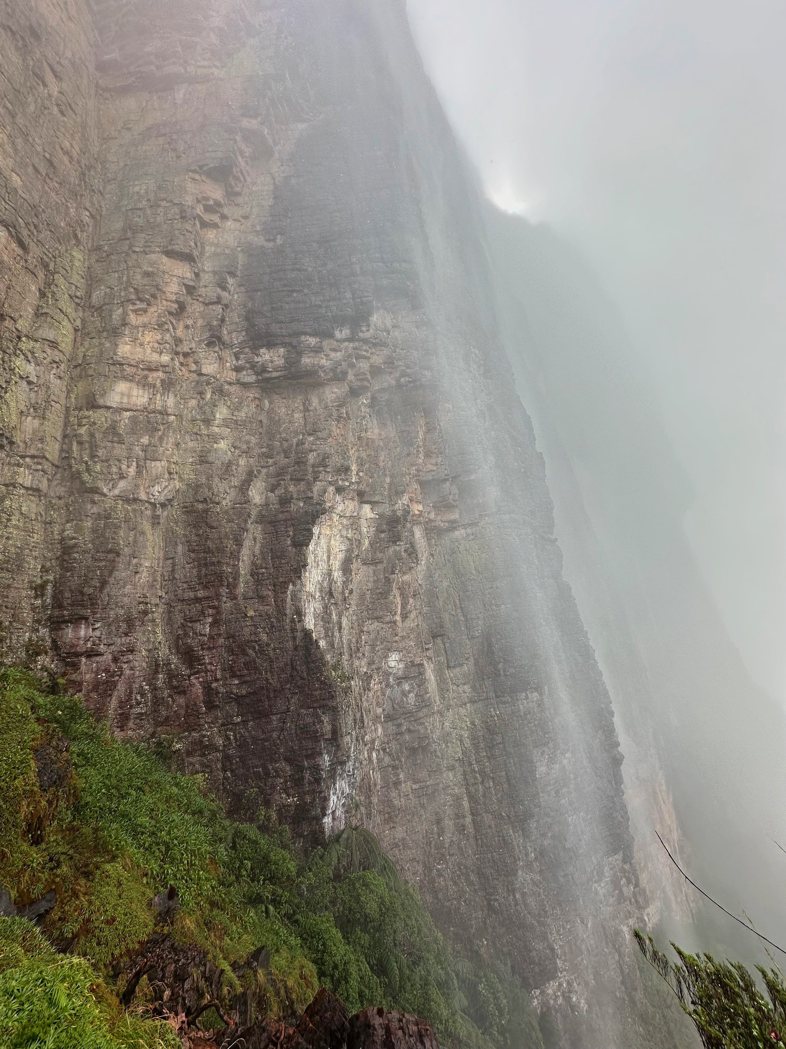
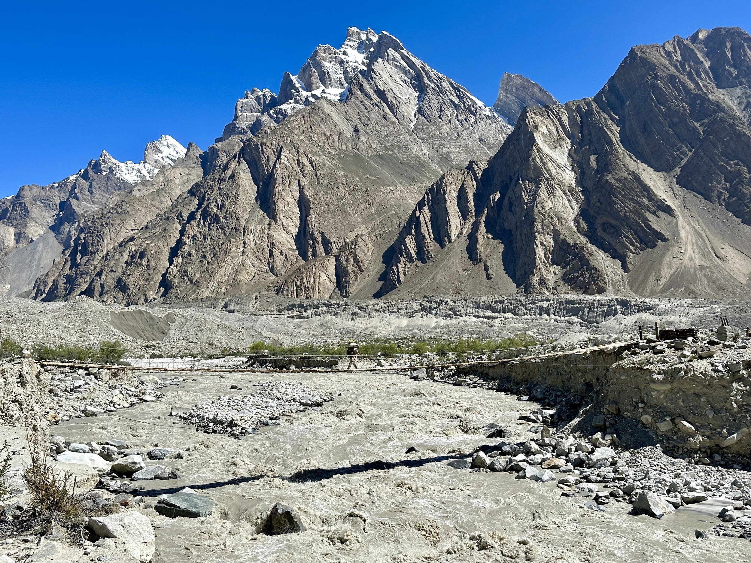
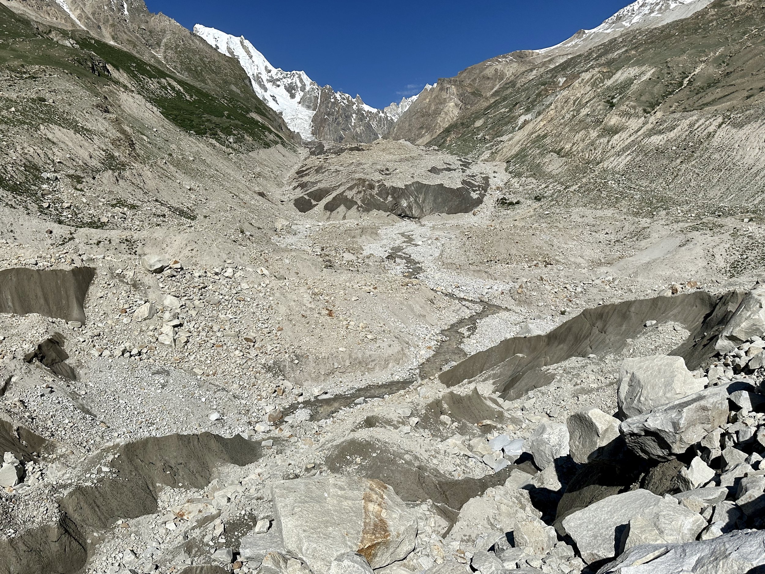
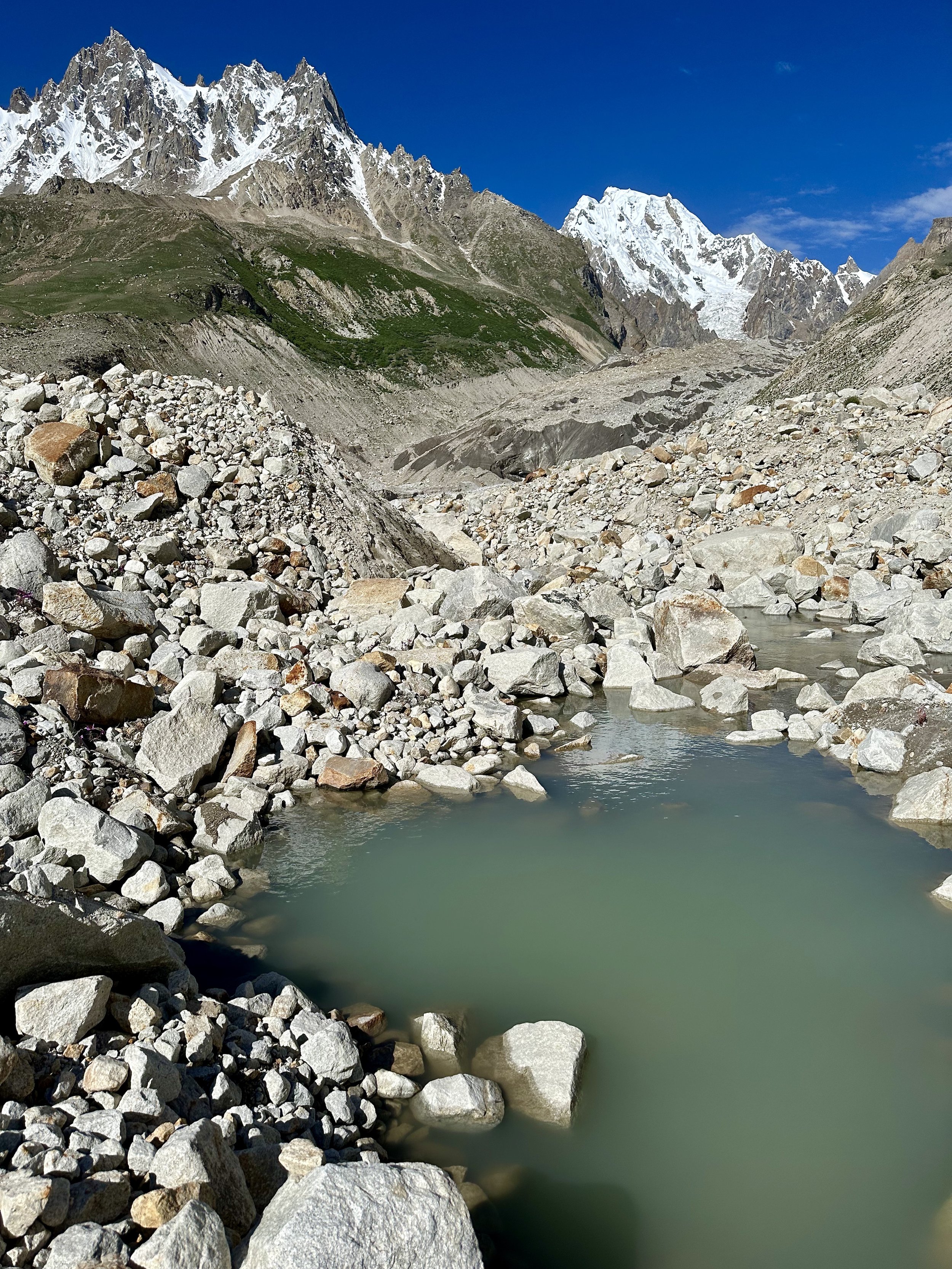
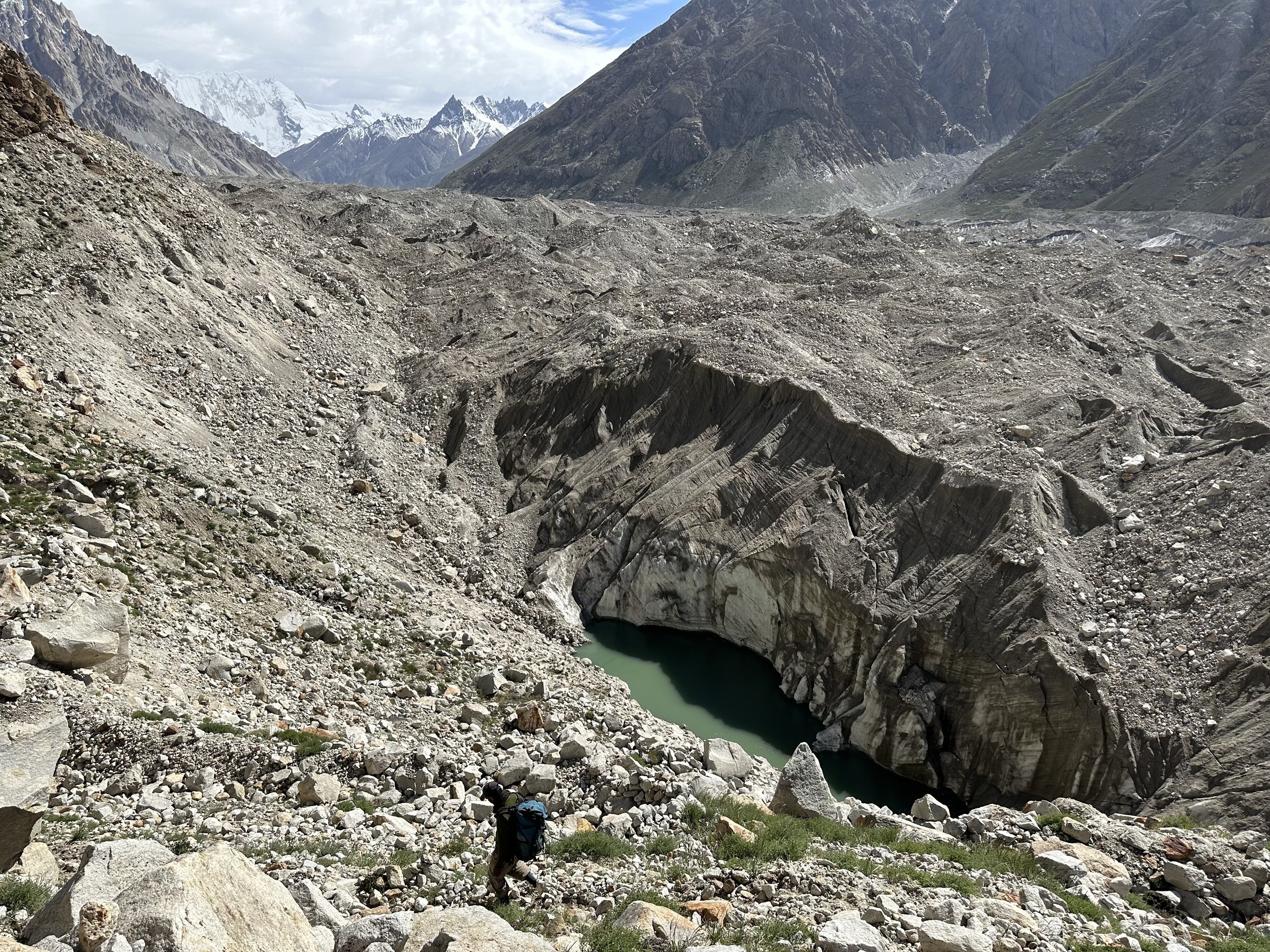
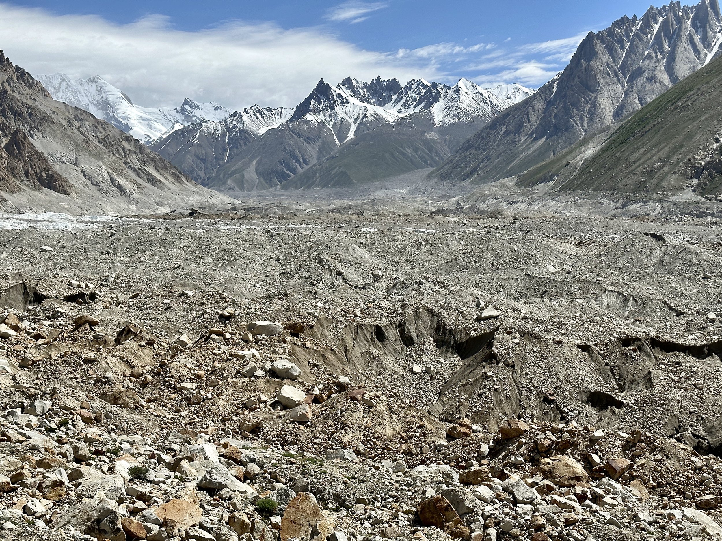
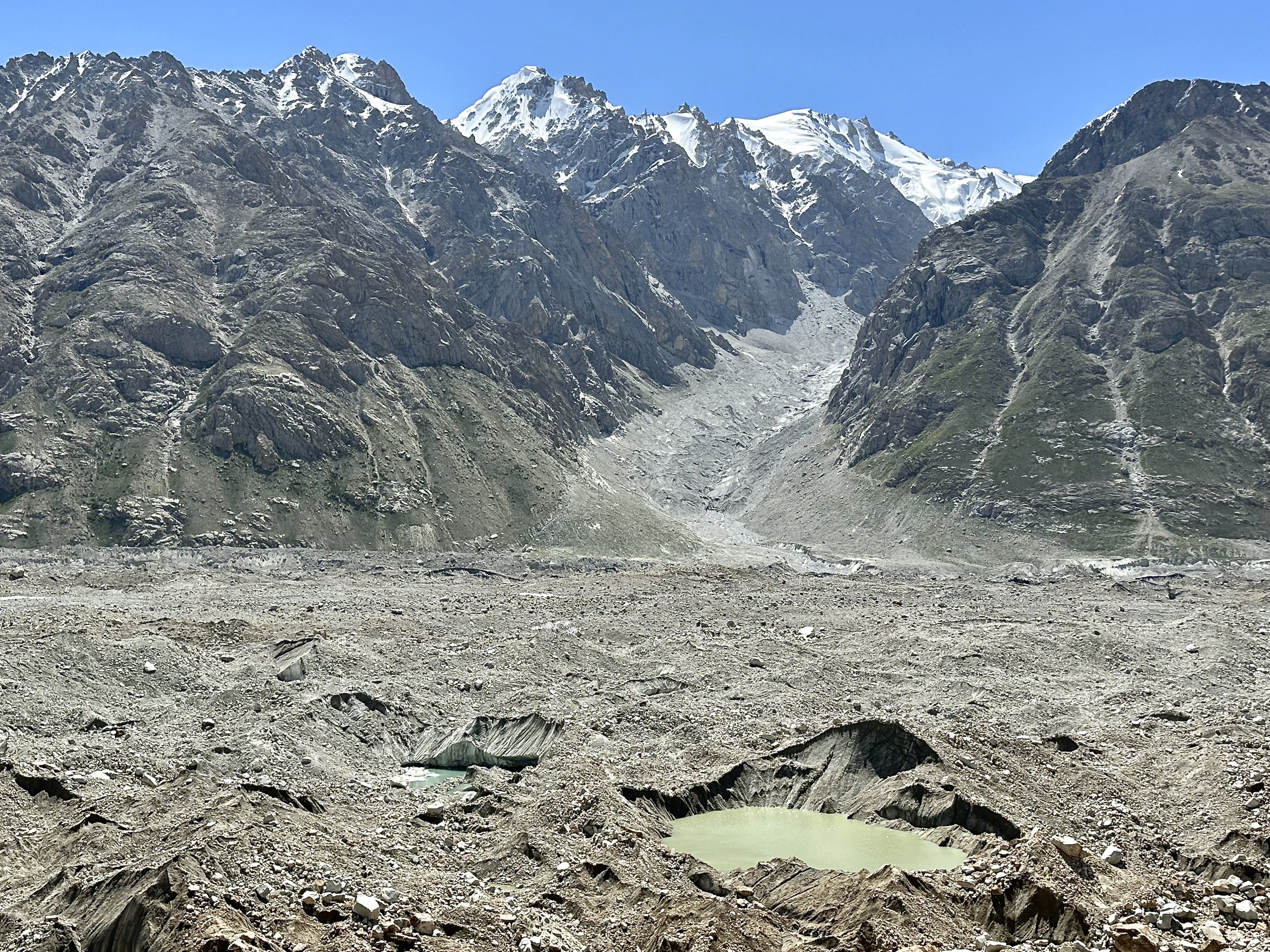
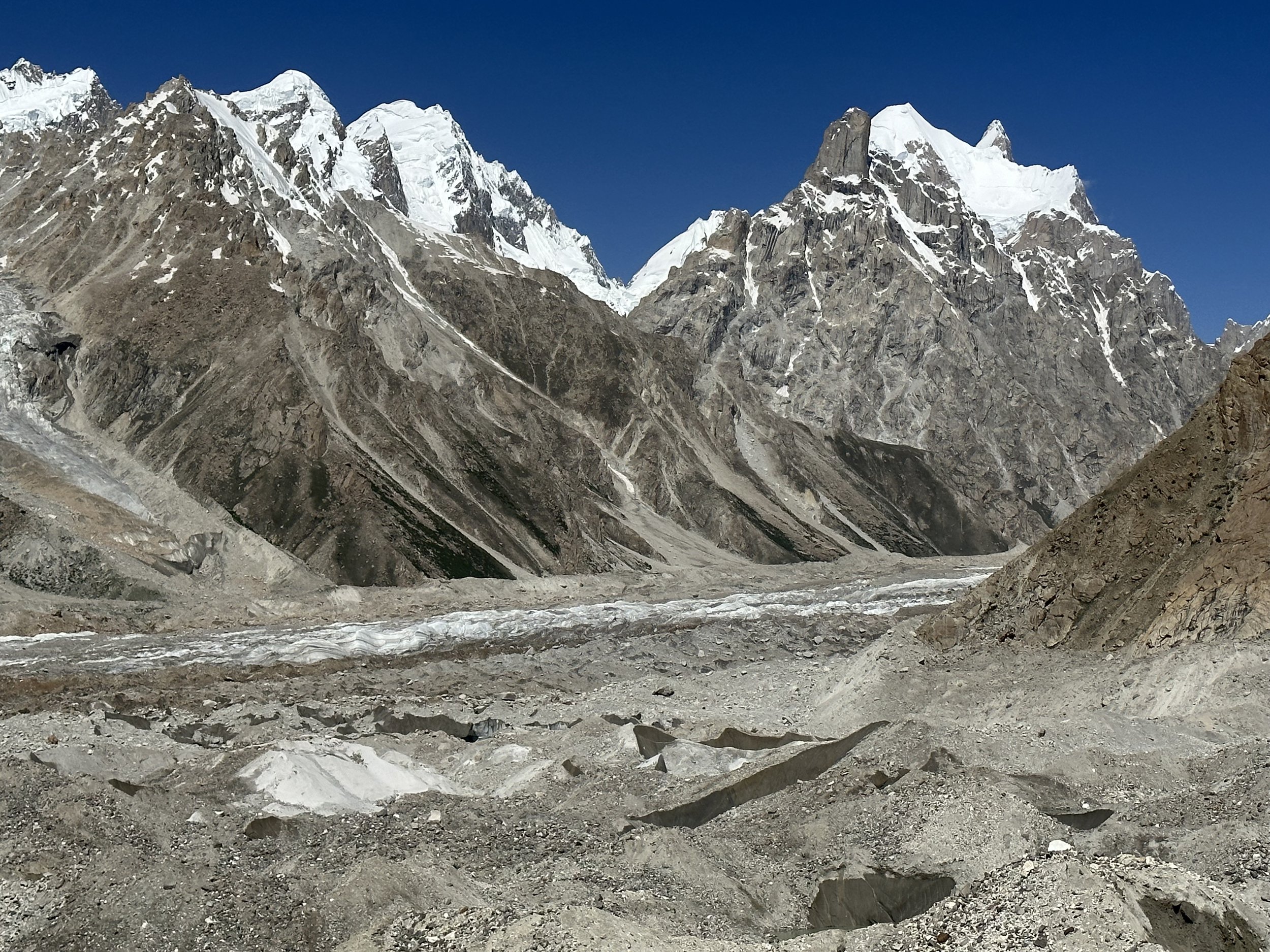
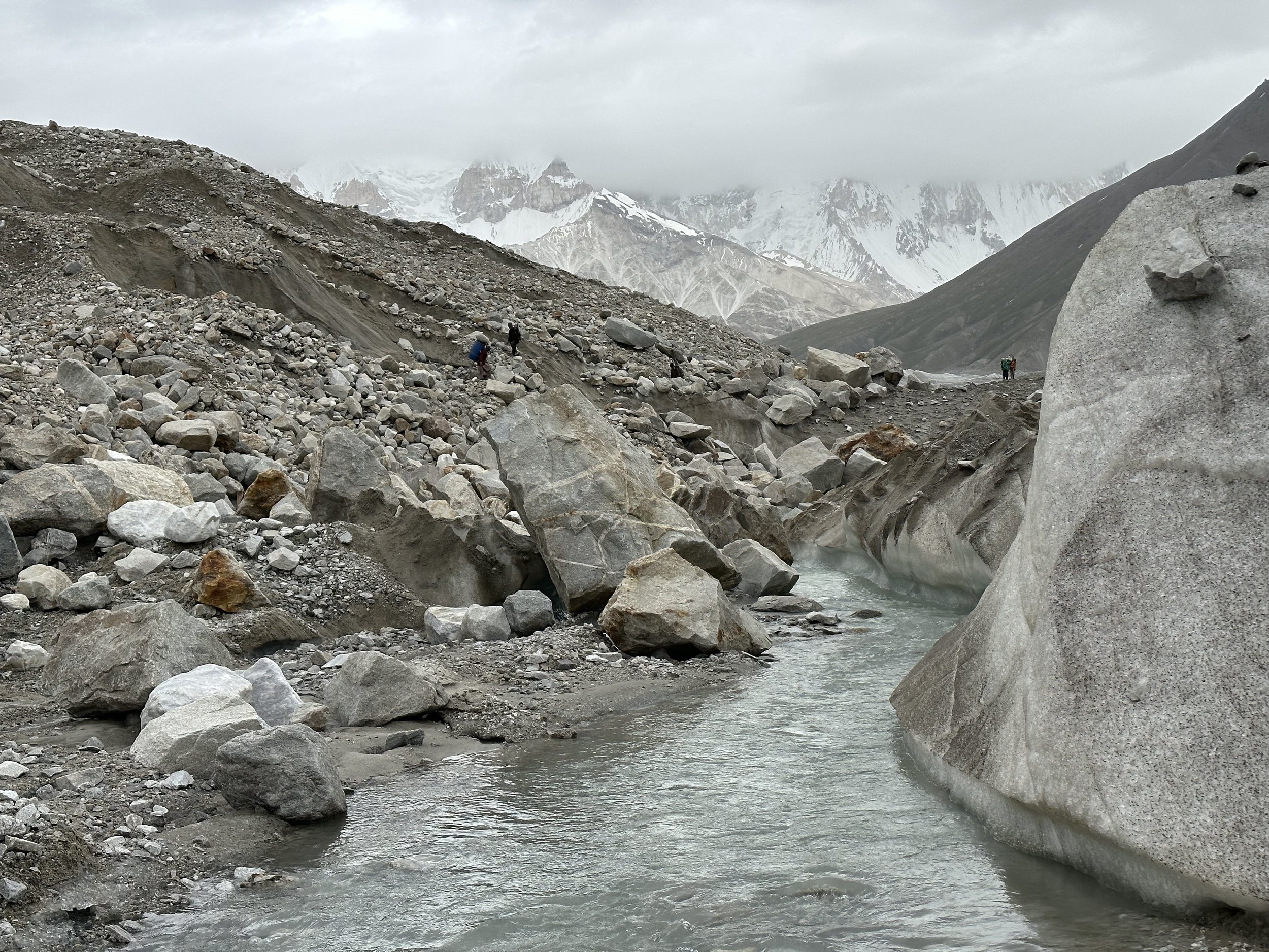
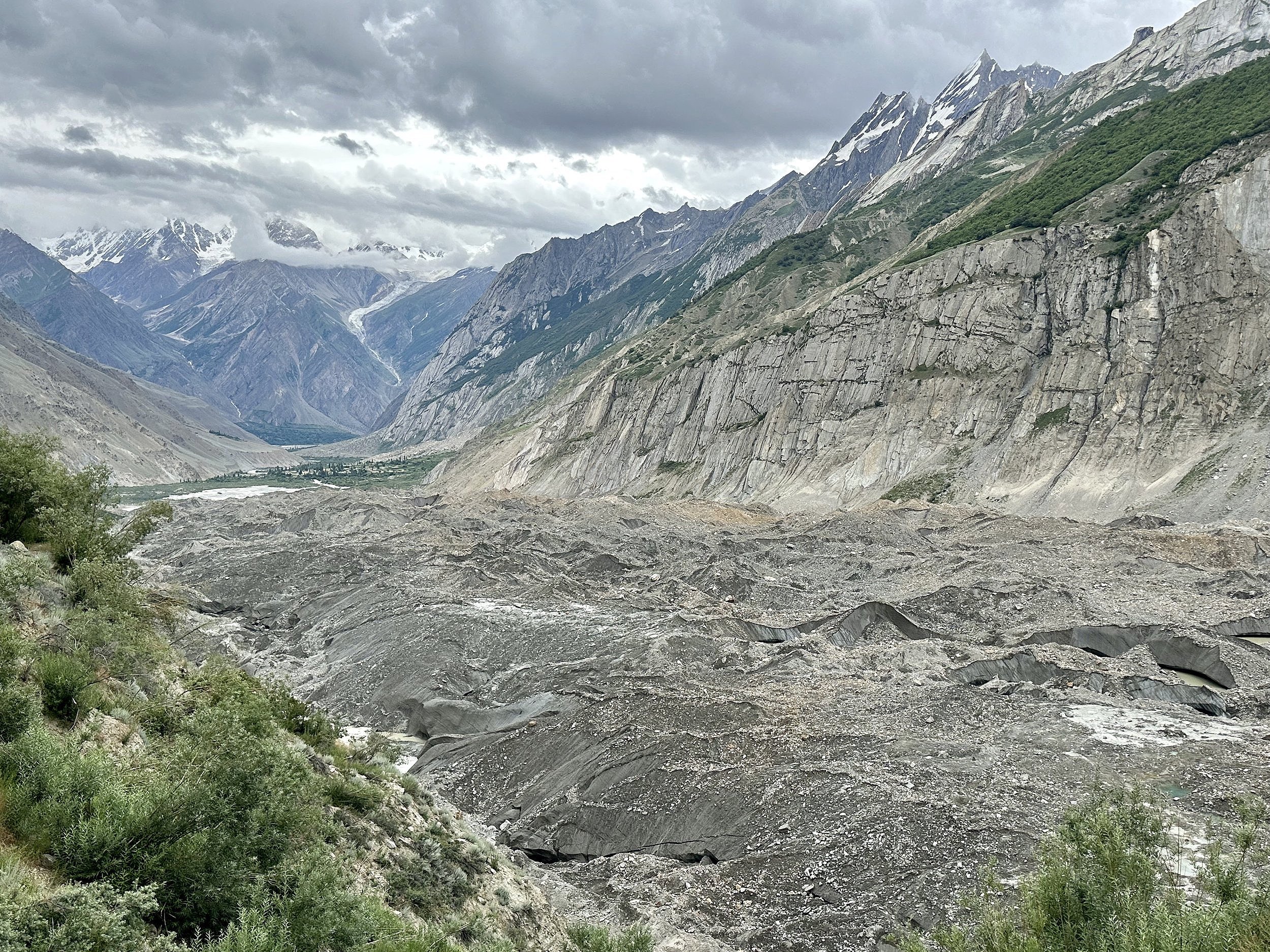
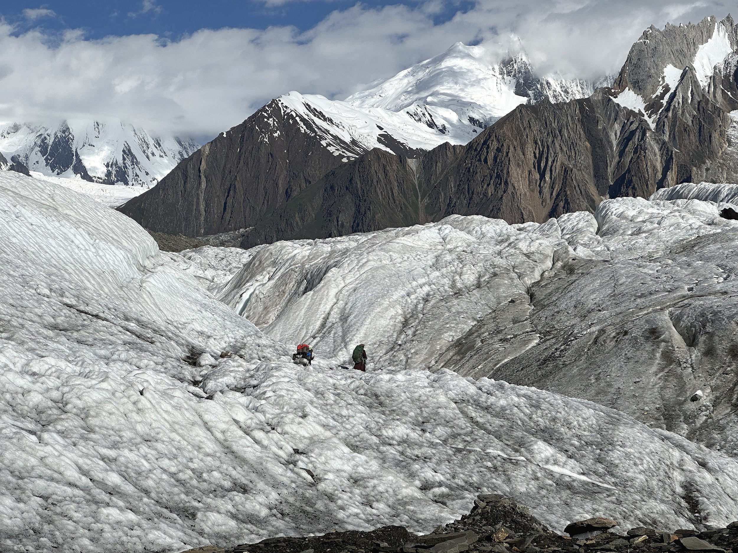
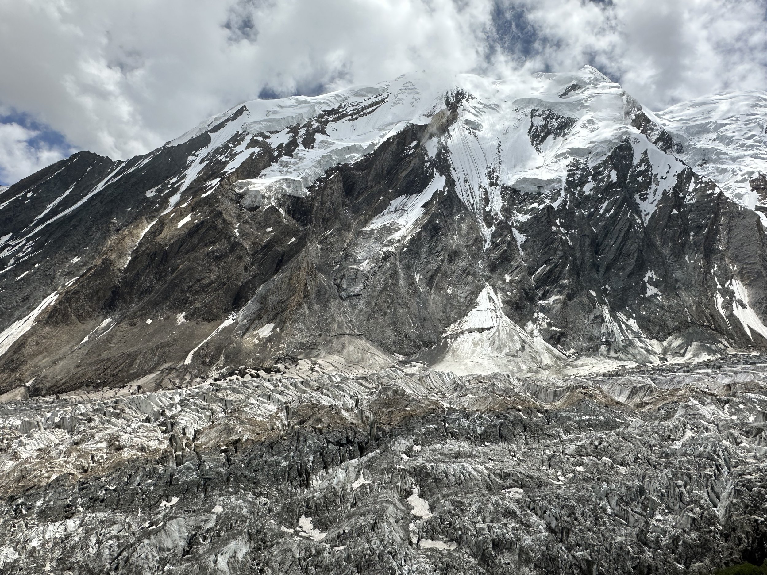
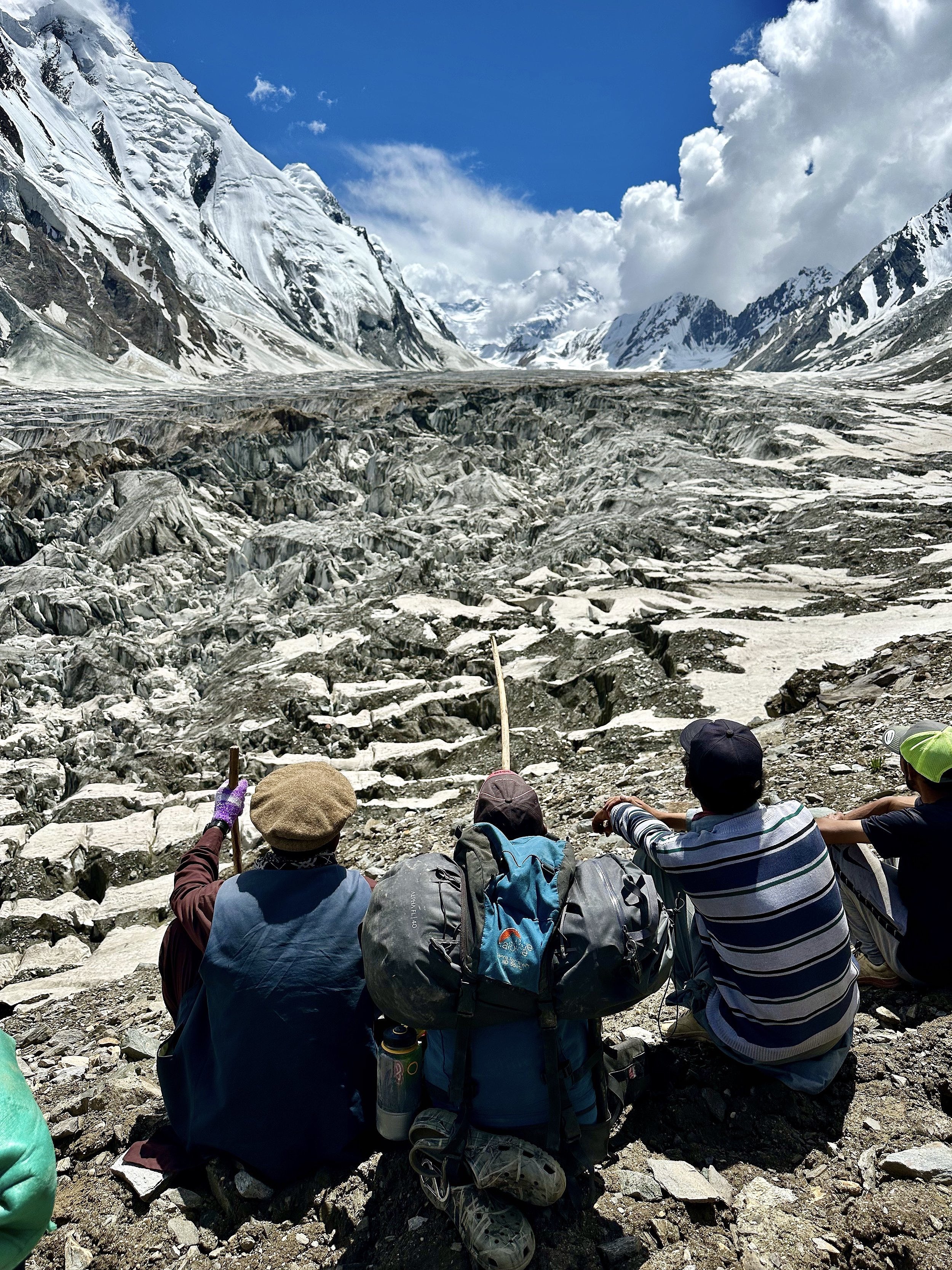
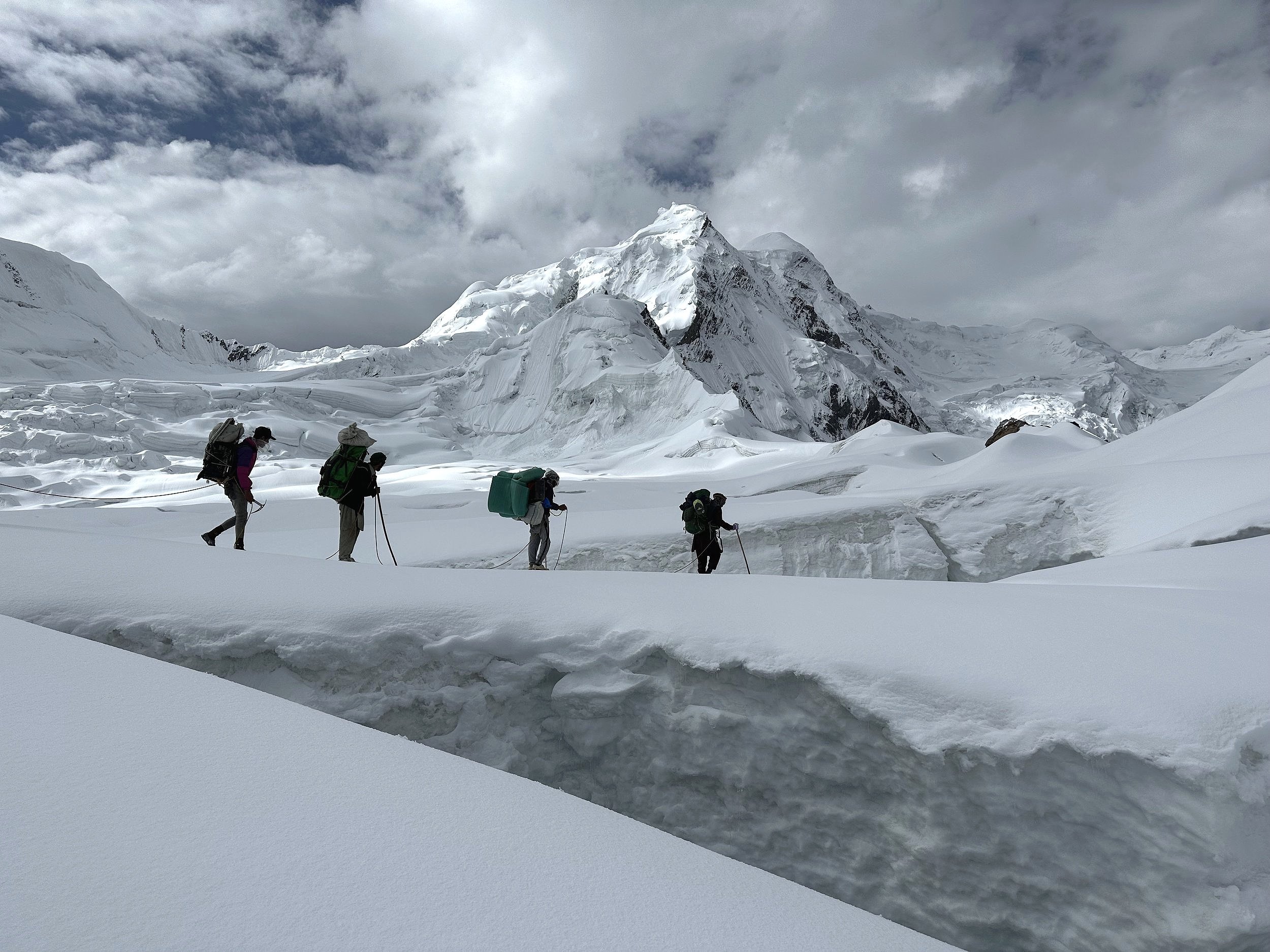
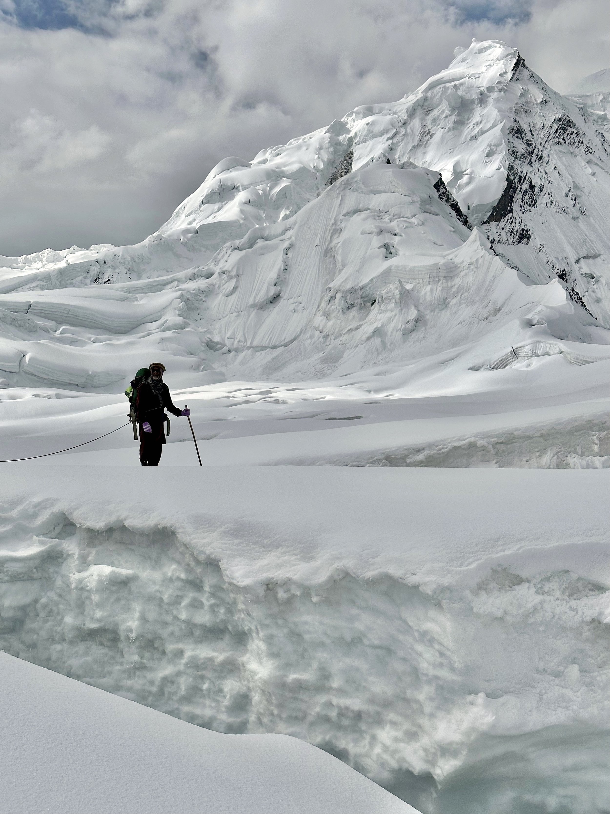
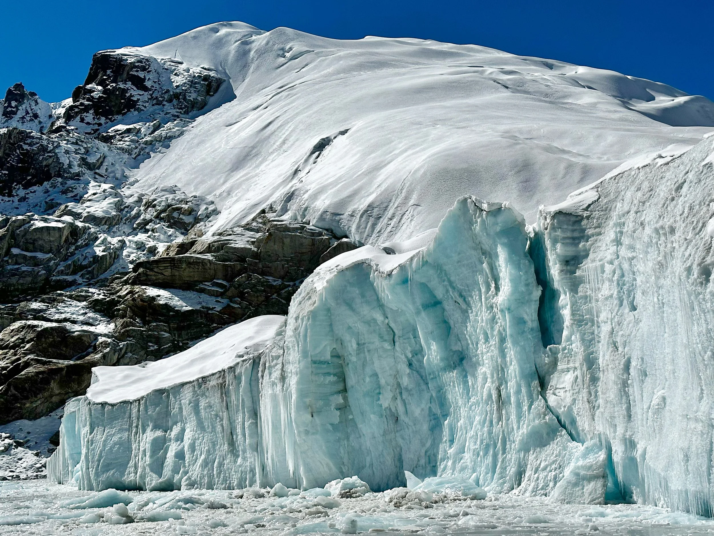
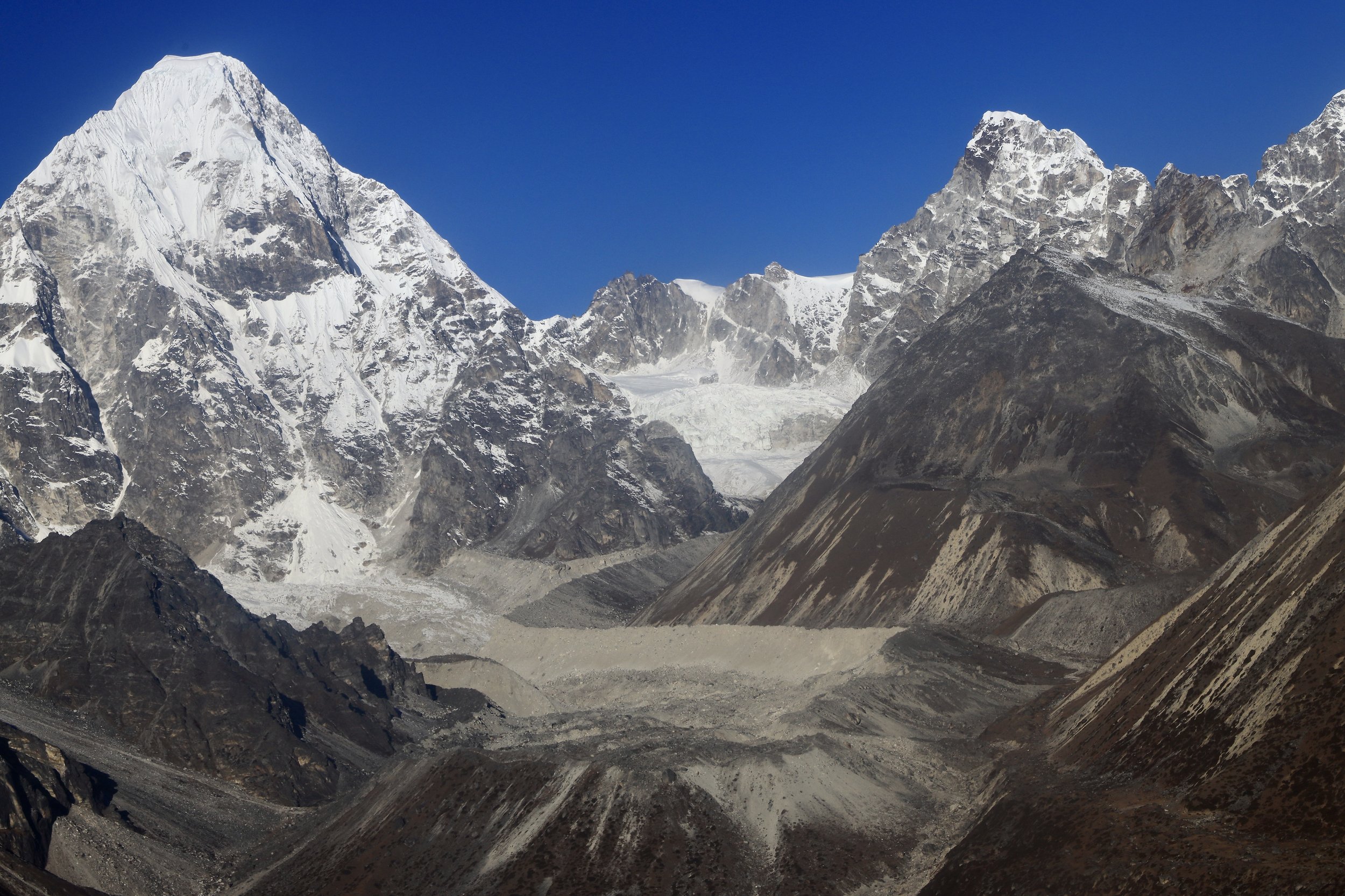
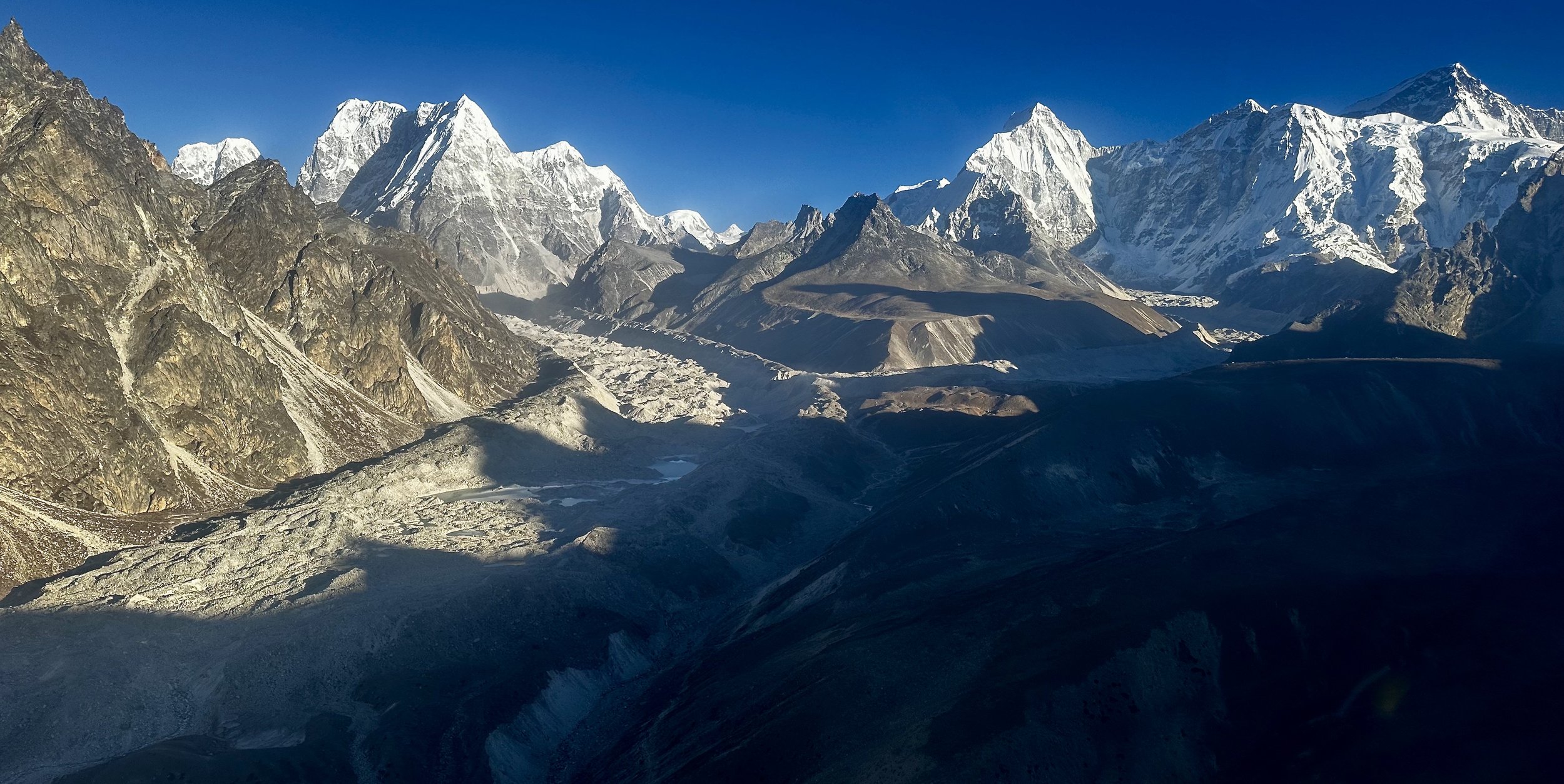
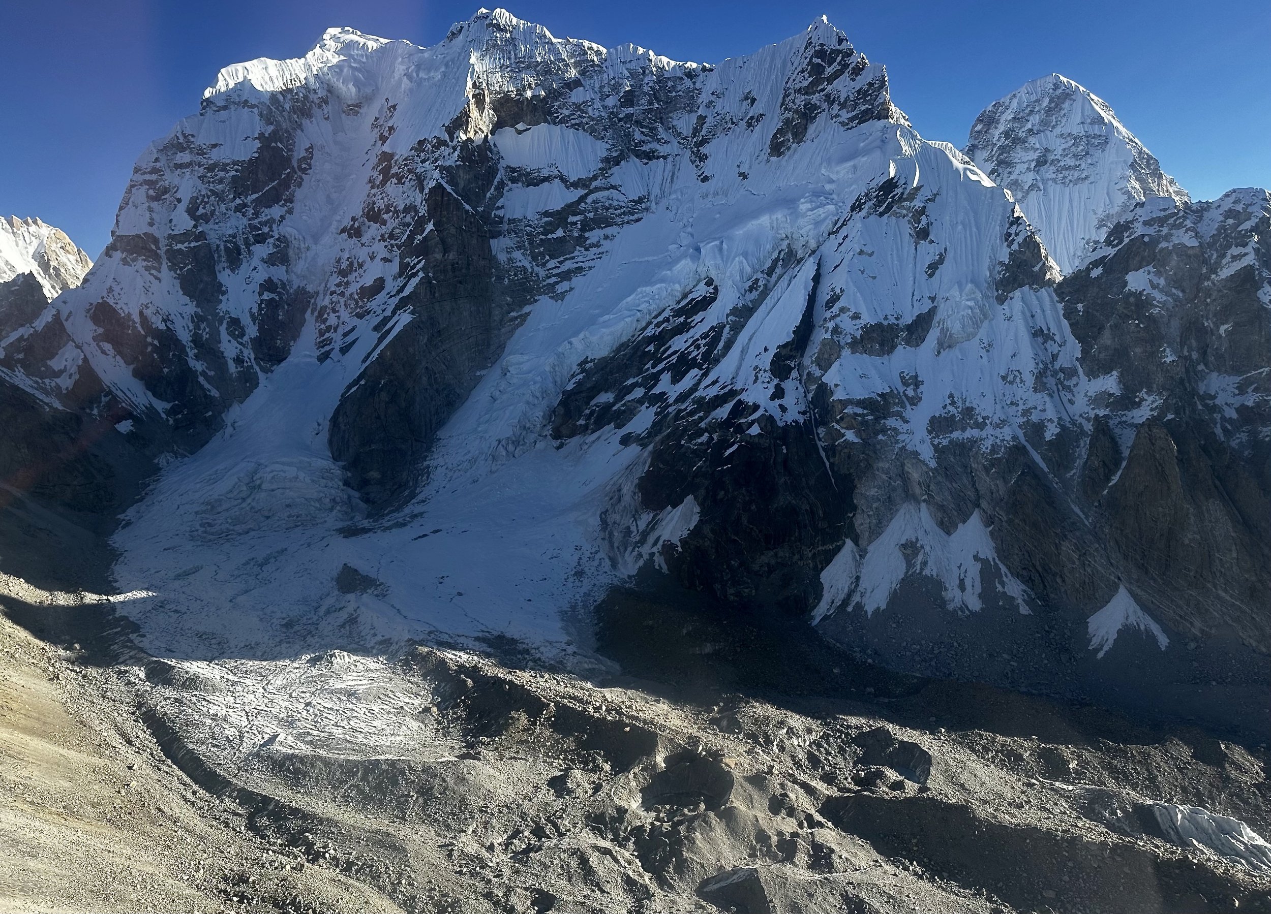
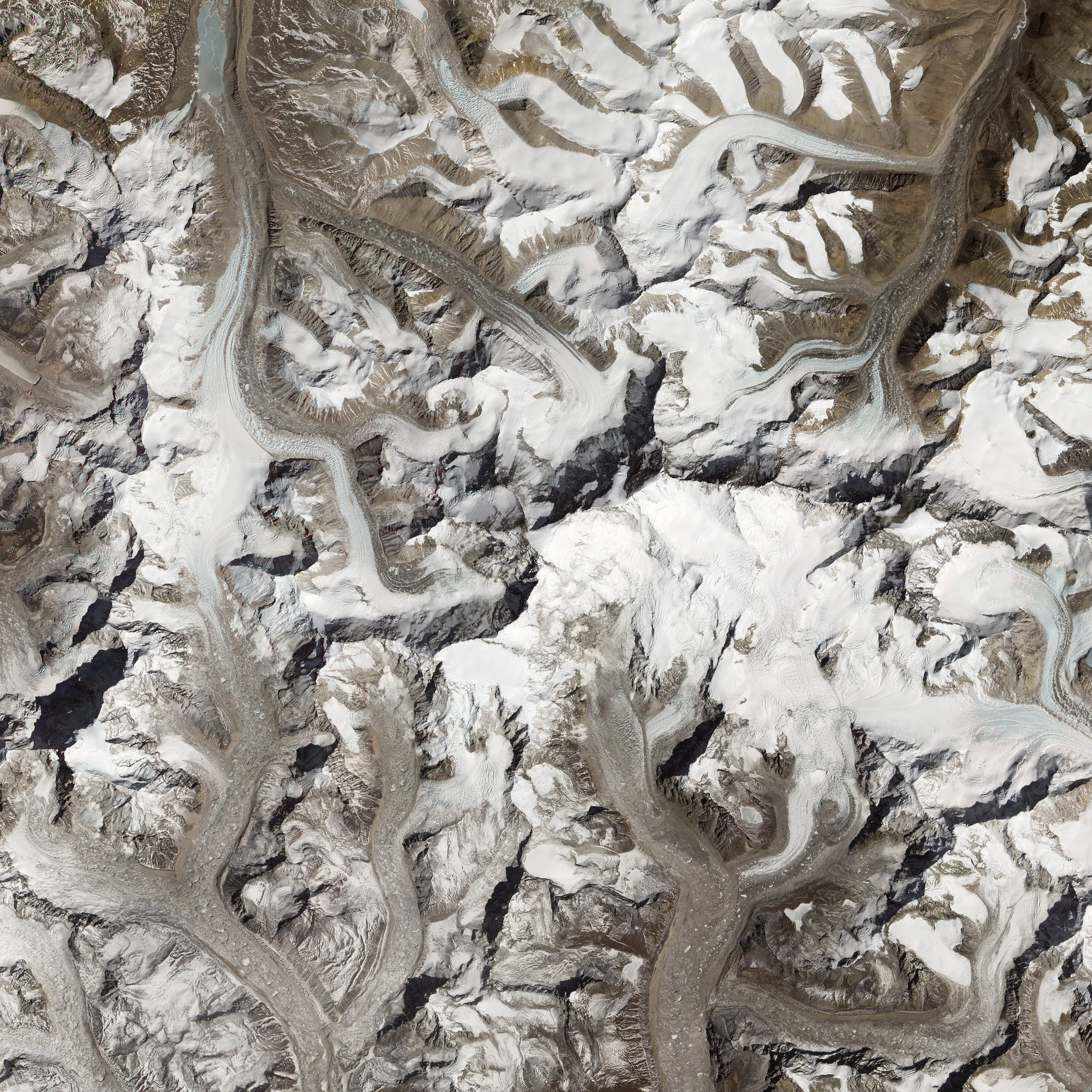
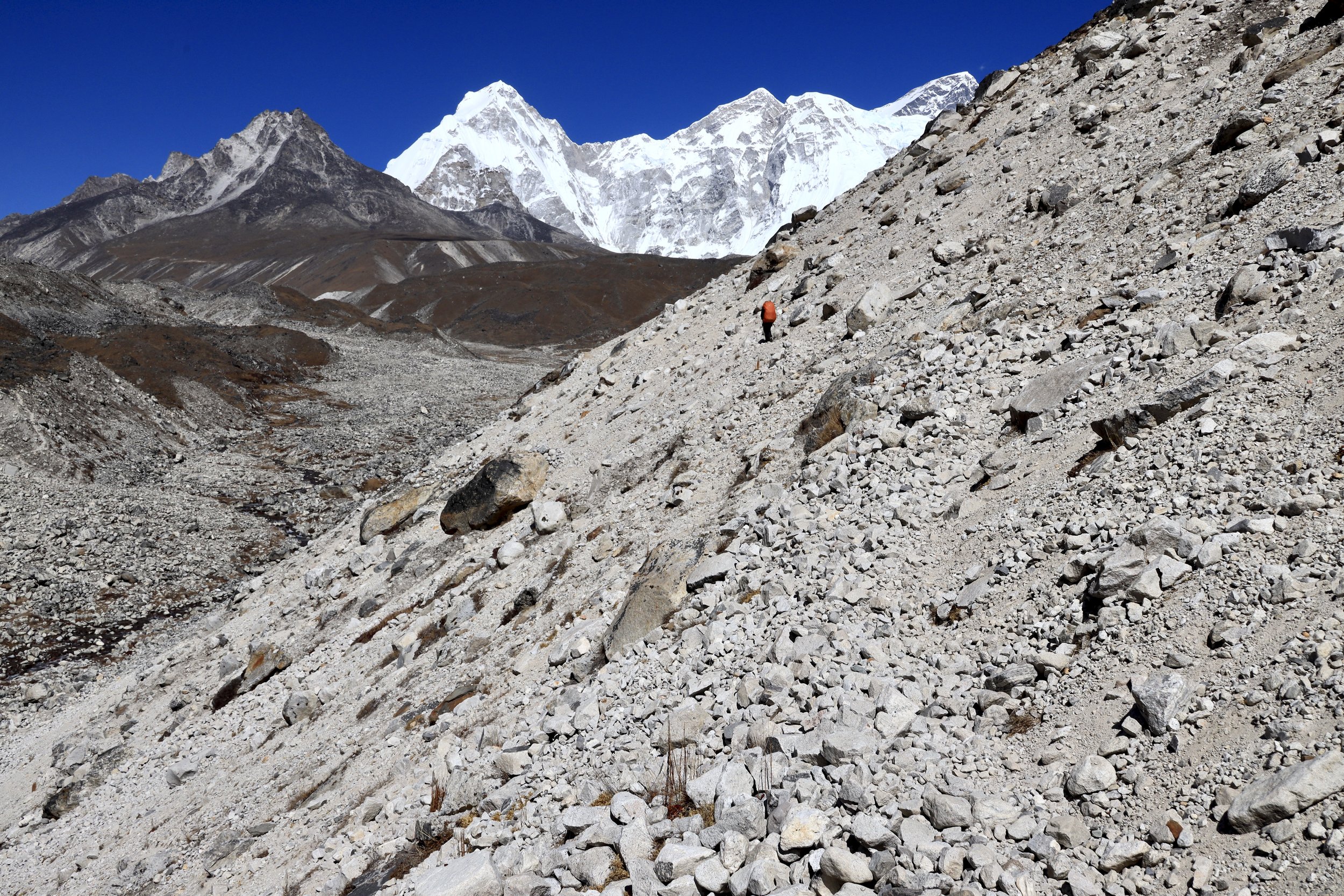
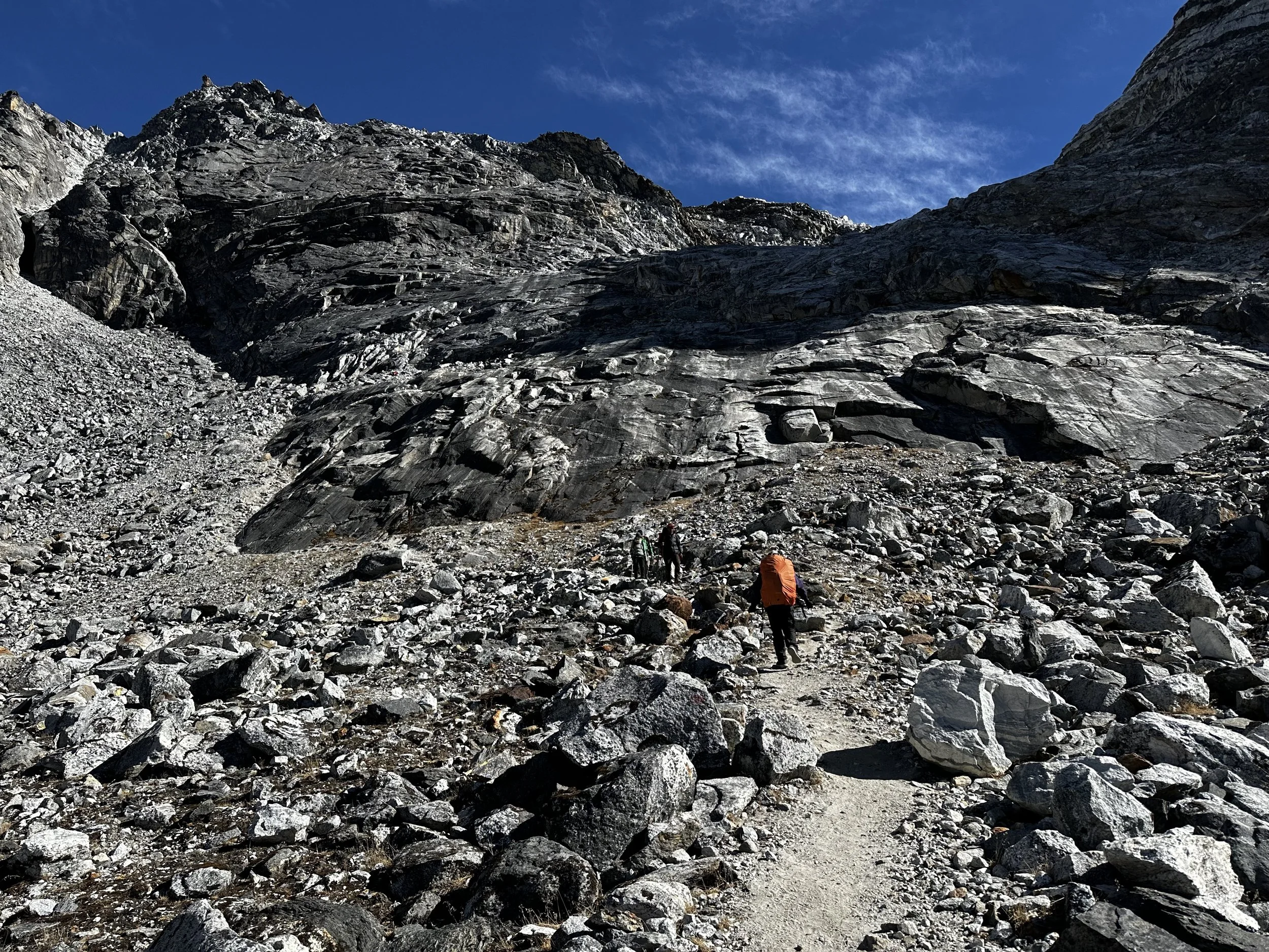
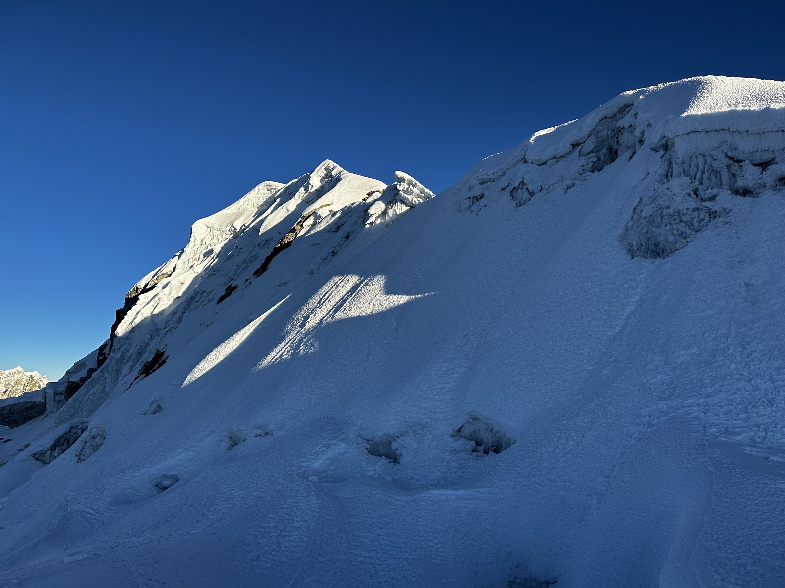
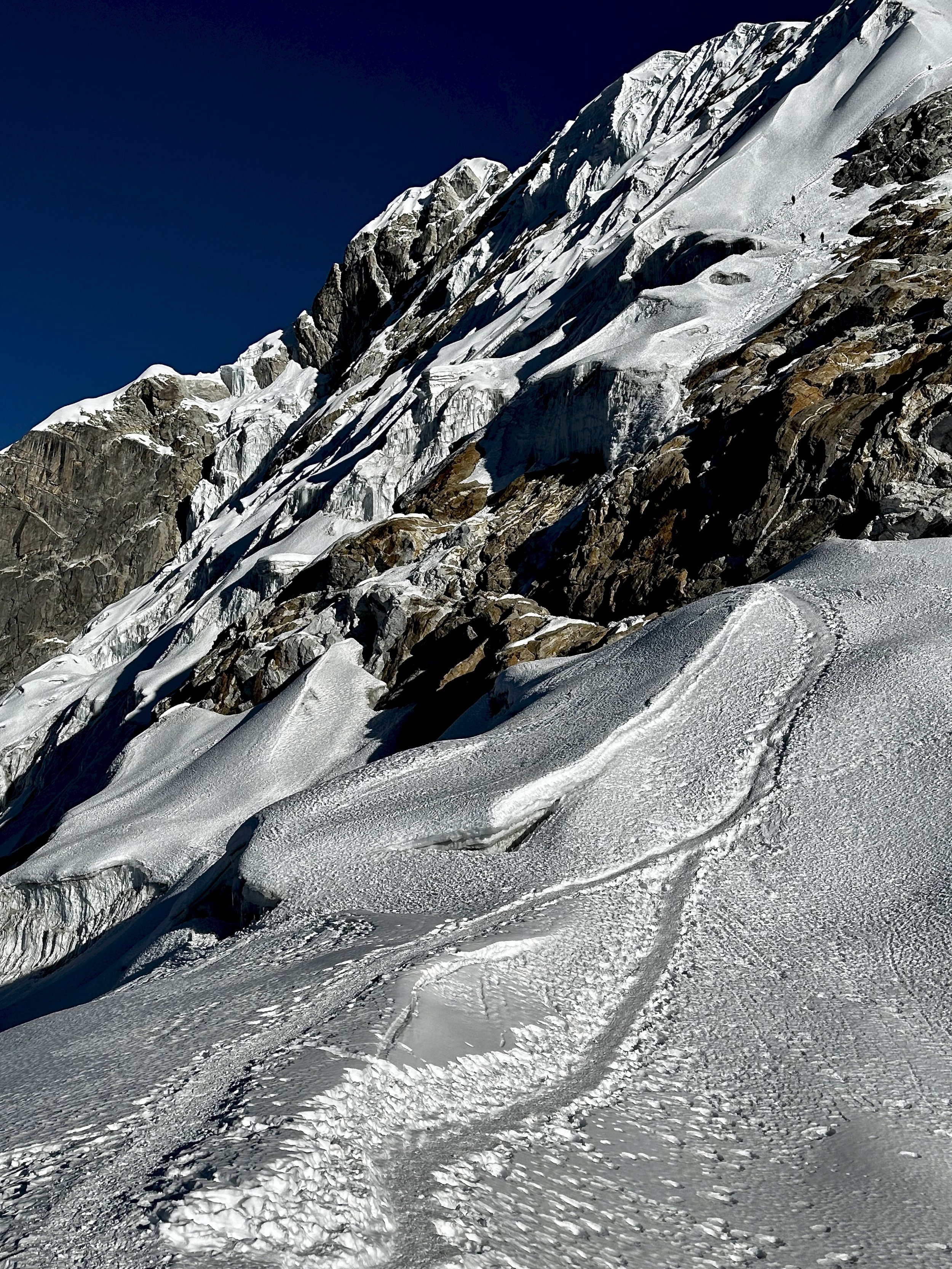
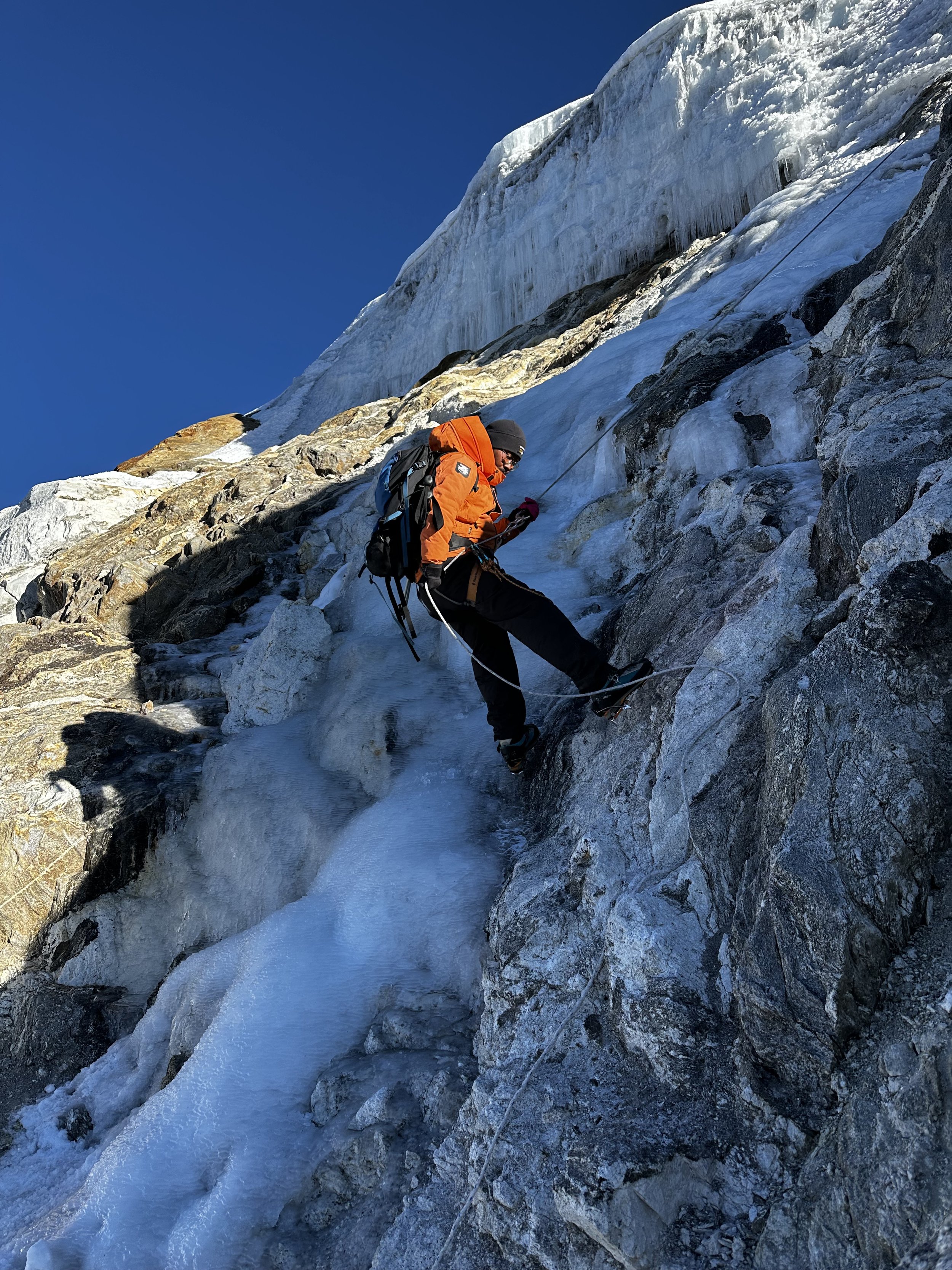
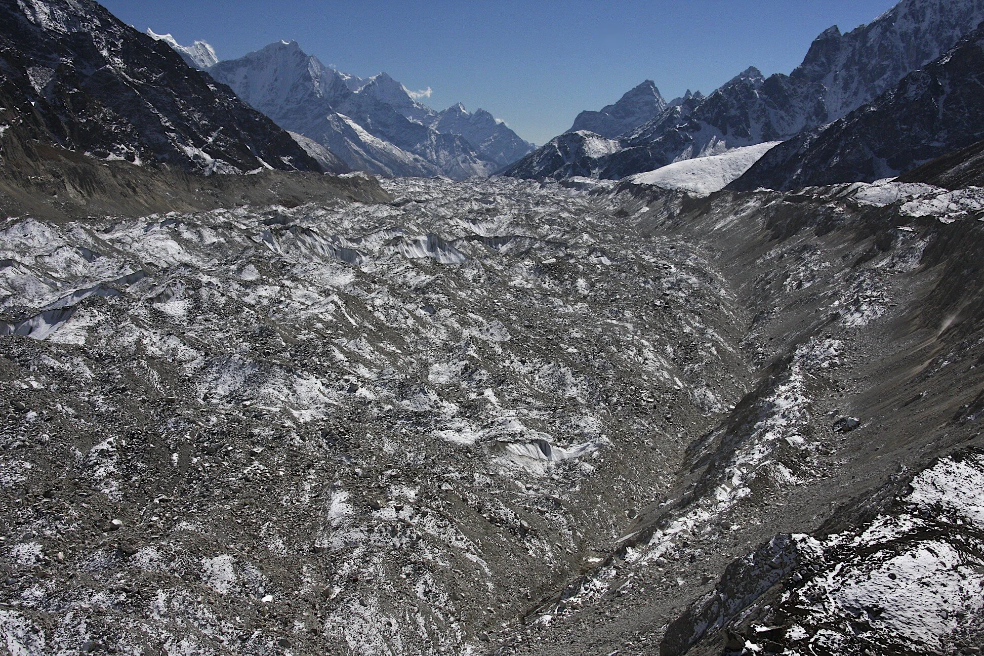
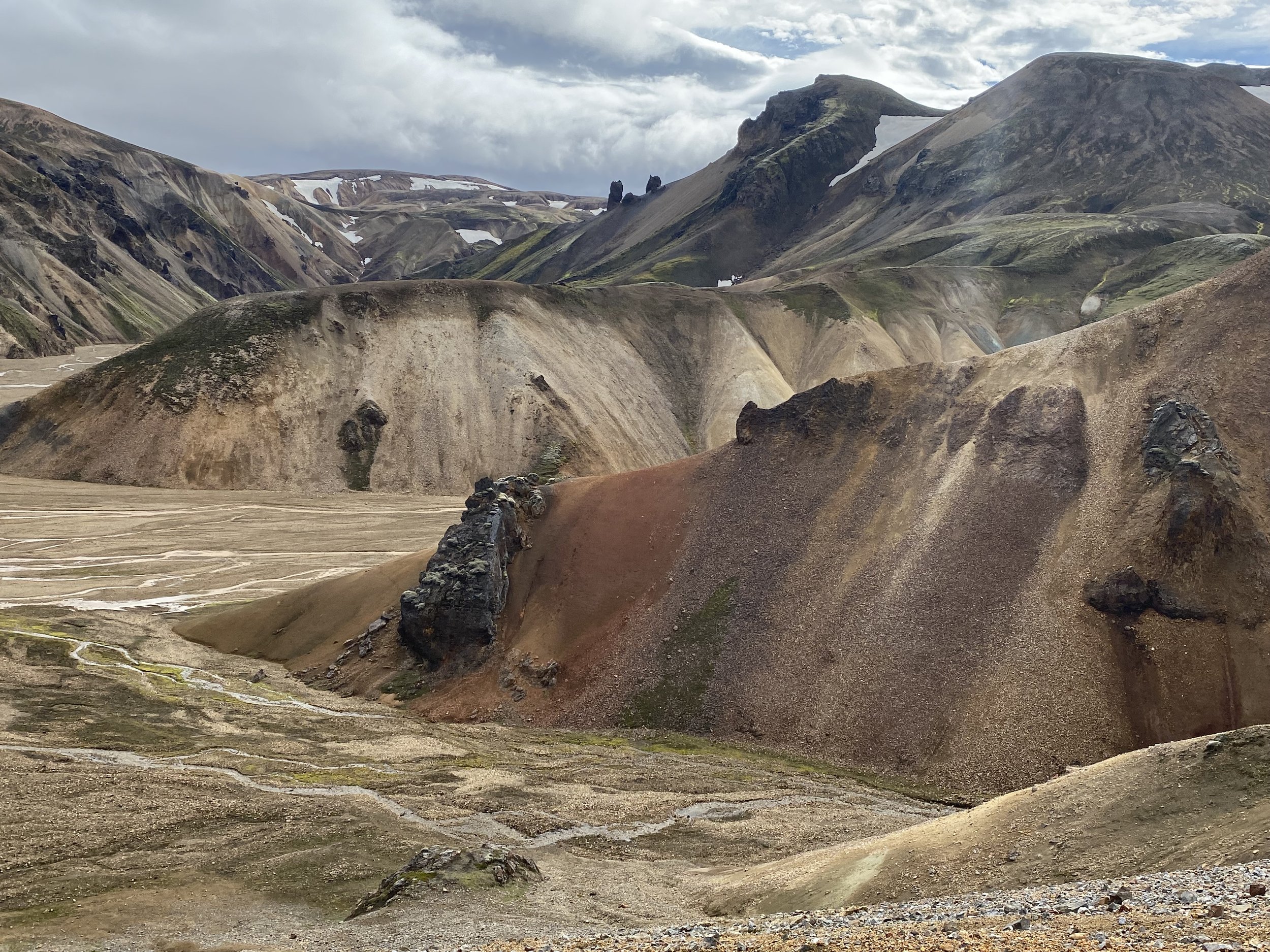
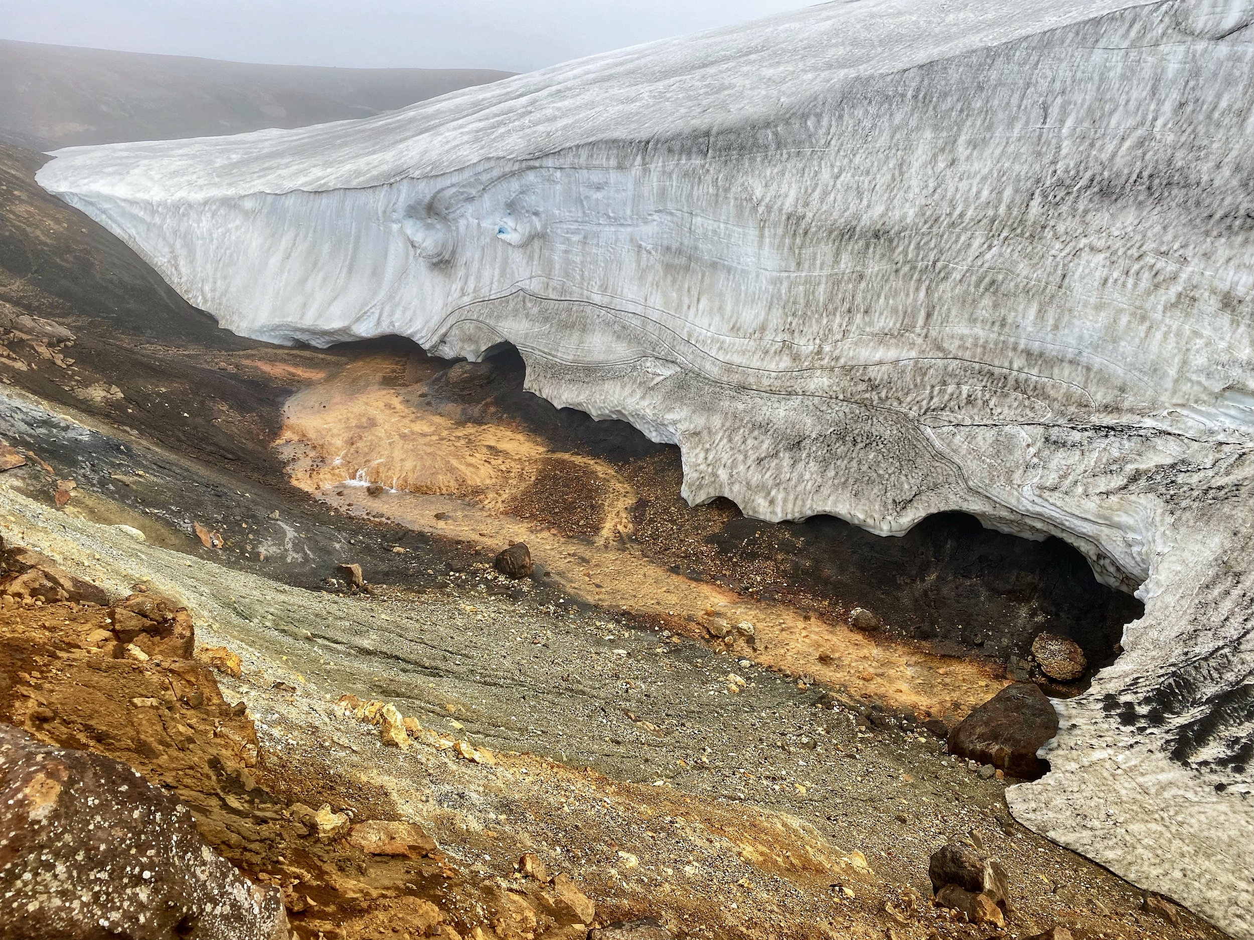
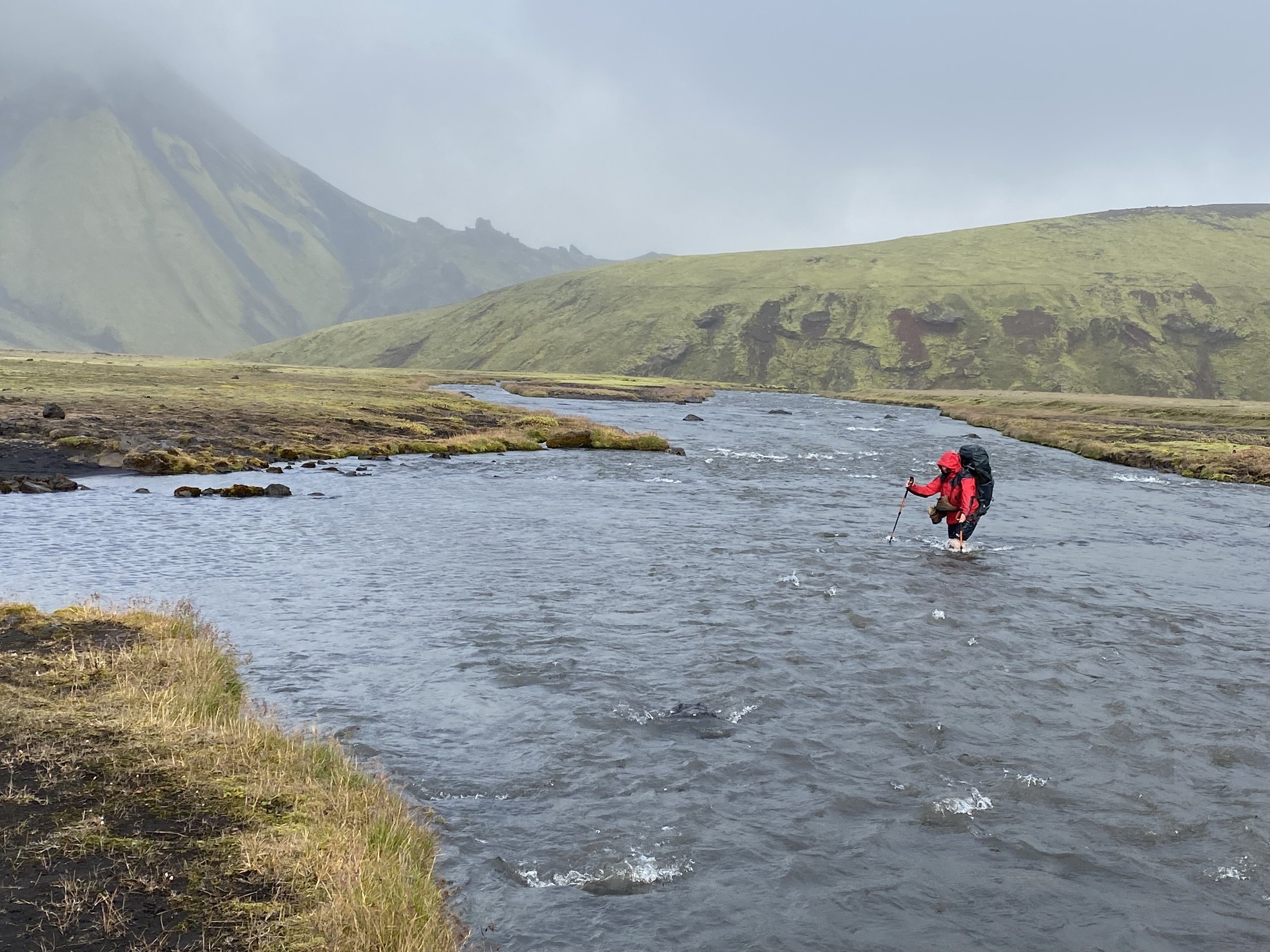
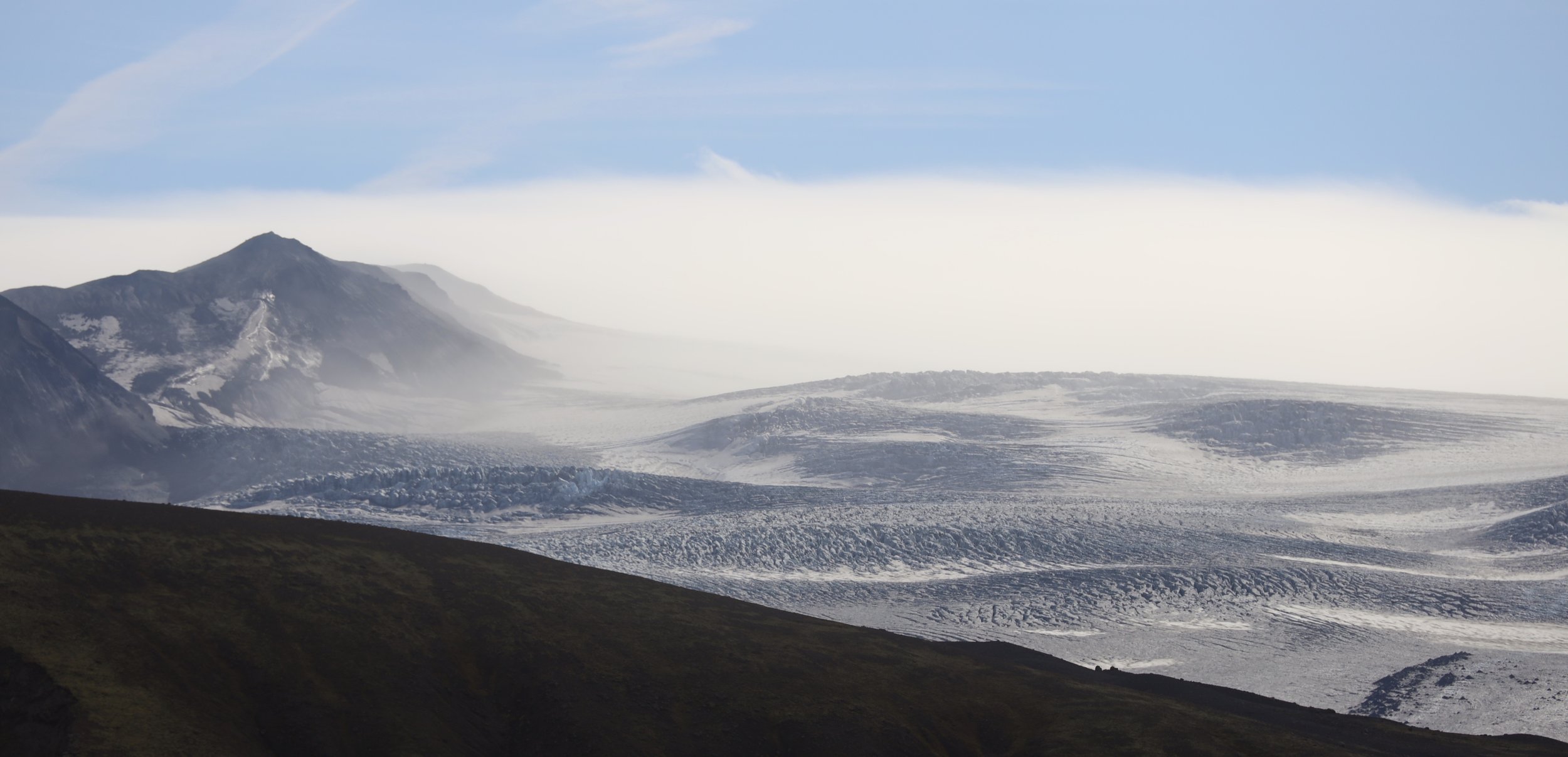
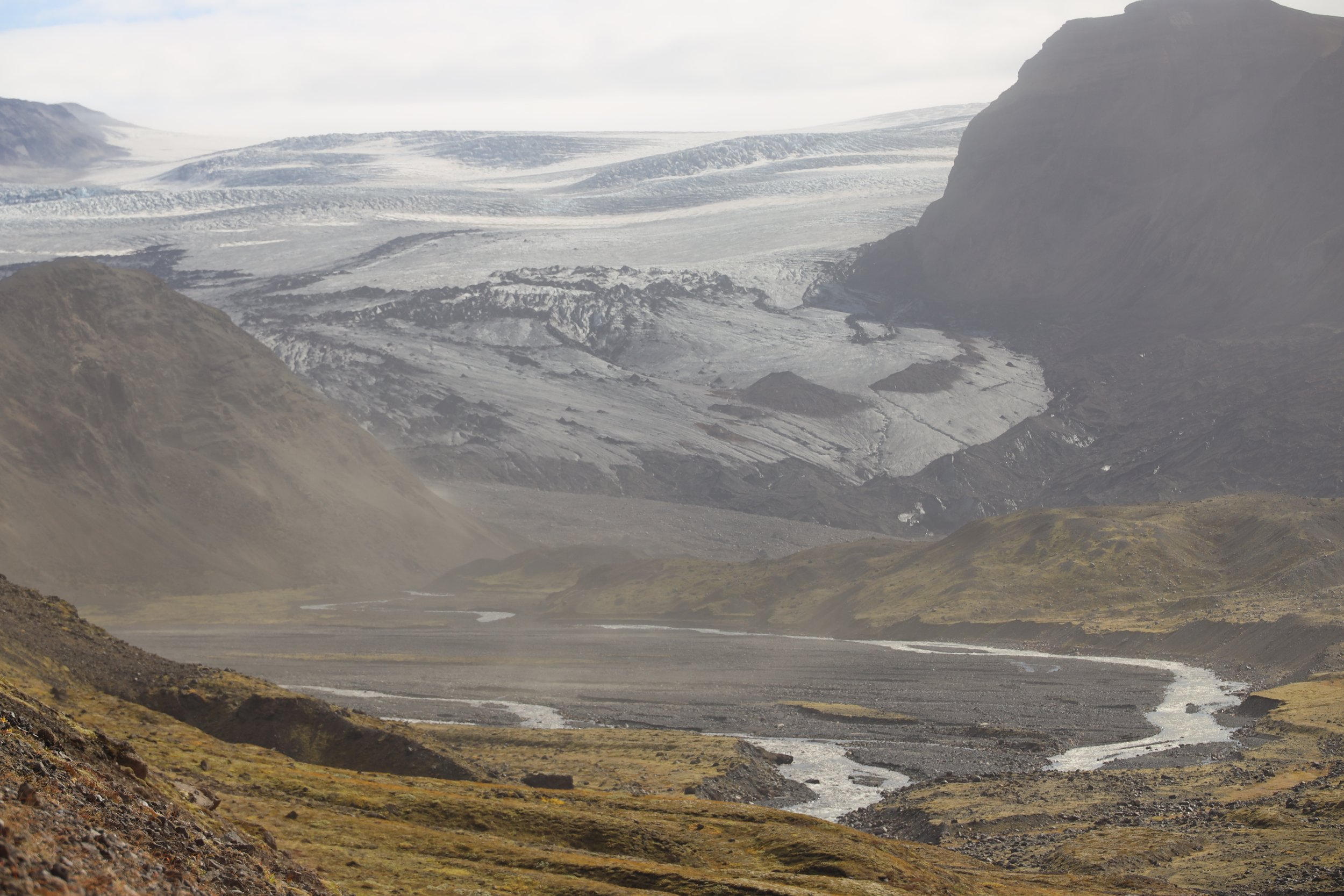
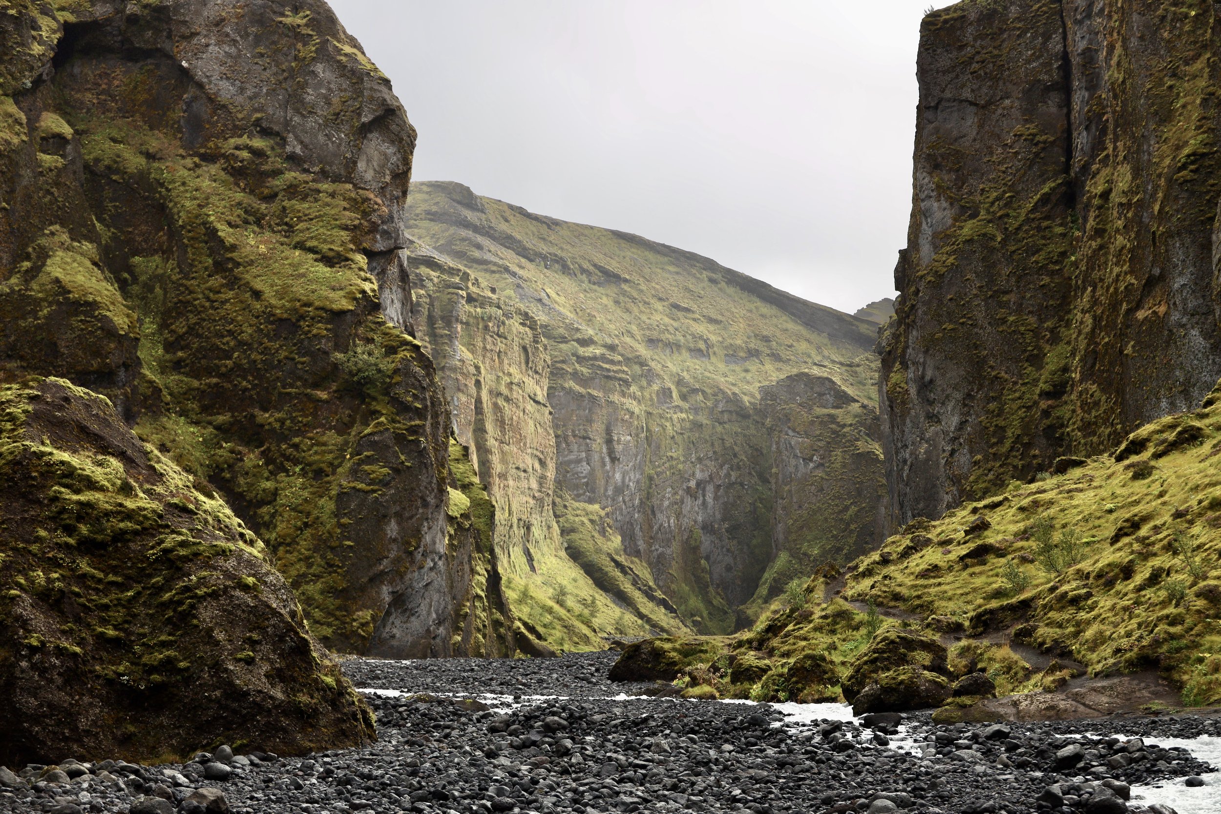
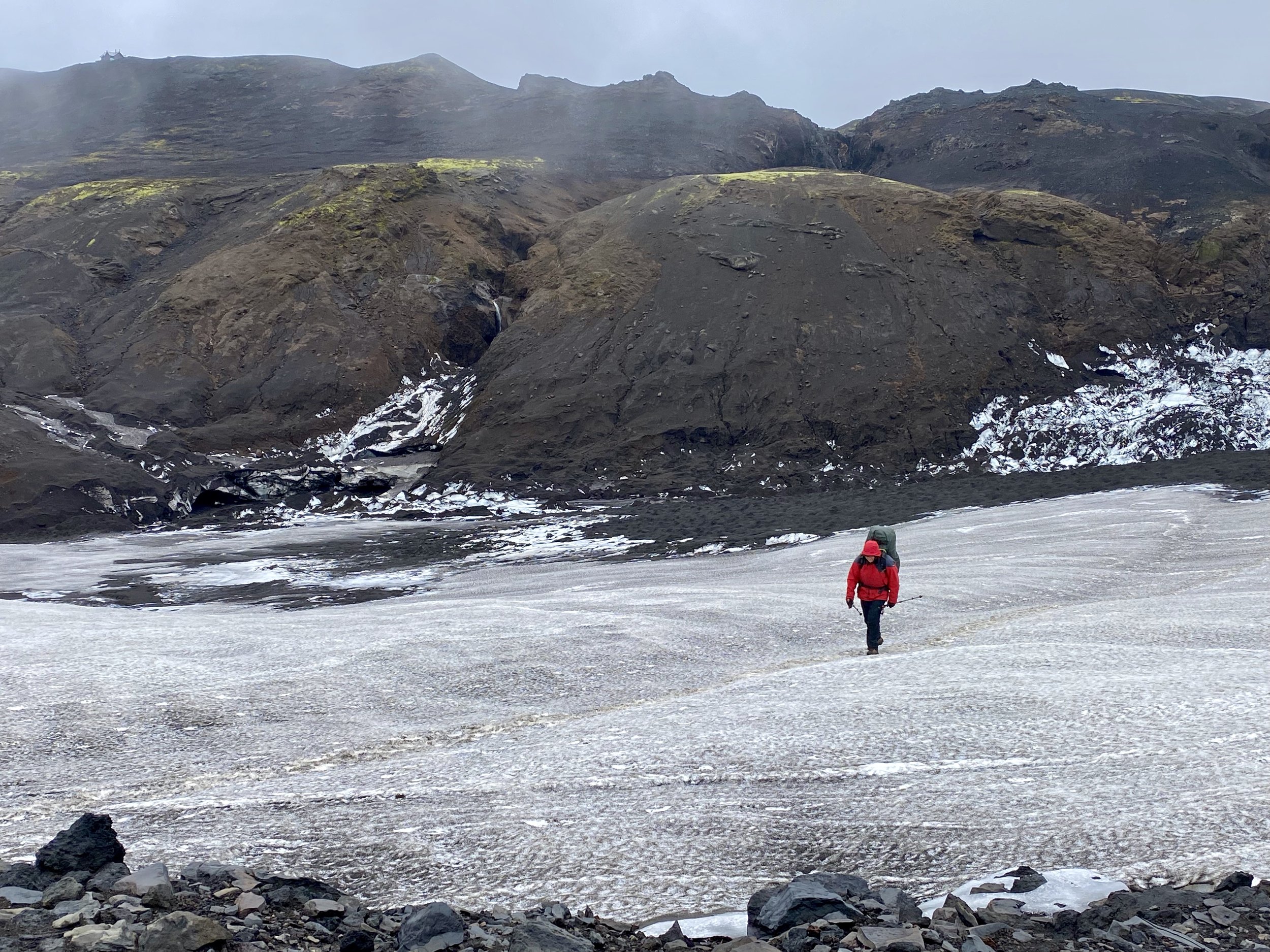
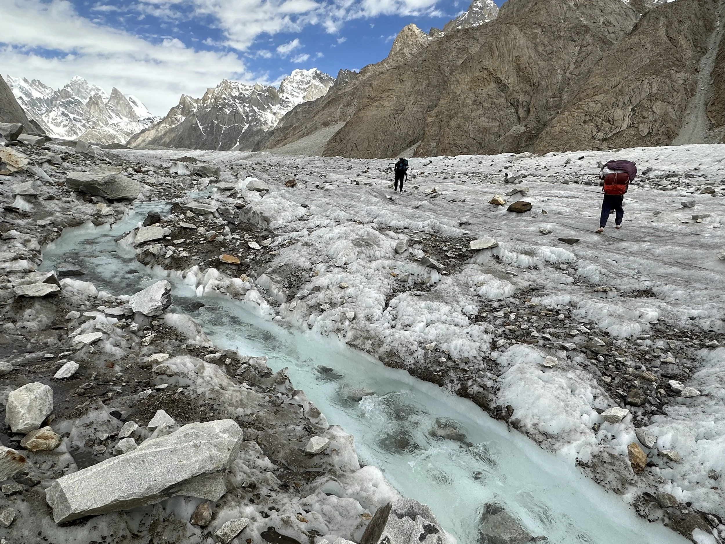
The way to our next camp was blocked by a side glacier and a river coming out if its snout.  The river did not seem very large from the distance.   Once we approached it though, the river was a brown torrent of cold water too dangerous to cross, even first thing in the morning.  We decided to take a detour and walk over the Panamagh Glacier to the other side of the valley where we would rejoin the trail.  The detour was my re-introduction to the world of jumbled ice and loose rocks – the world I would be experiencing for the next three weeks.   Unlike the Baltoro Glacier, there are no trails on glaciers here. 

The river disappeared under the Panamagh Glacier, so we had to climb over the glacier to bypass it.   The glacier is a jumbled mess of rocks some as large as houses precariously balancing on top of one another.  Some boulders sit on top of ice ridges and will slide with a small push or disturbance.  It does not look difficult, but it is tedious and slow.  Each step must be carefully placed as a slip could result in a twisted ankle or a broken leg.  Each rock is precariously balanced on another rock or ice ridge.  The off-trail glacier travel means negotiating boulders in a maze of ice passages. 

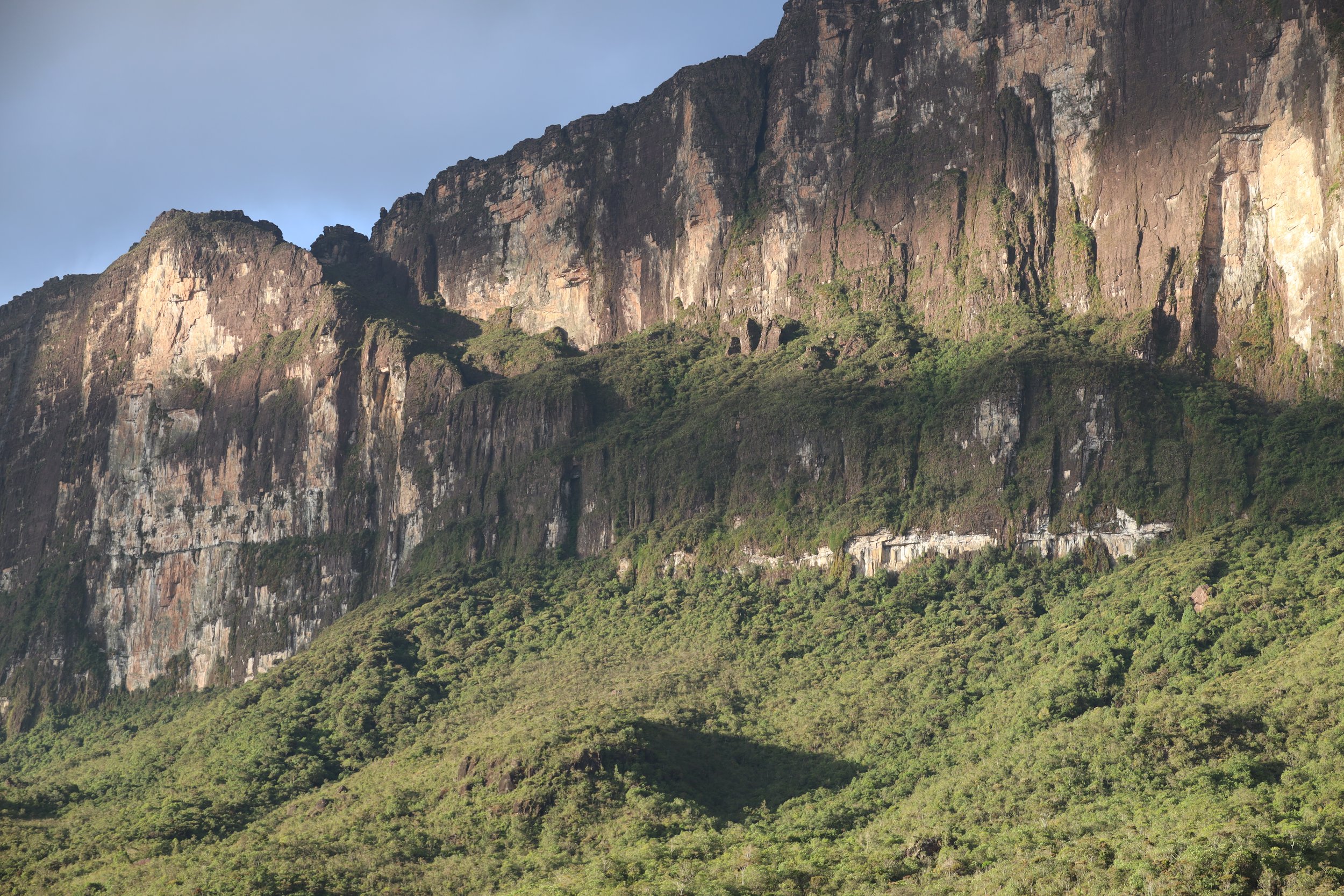
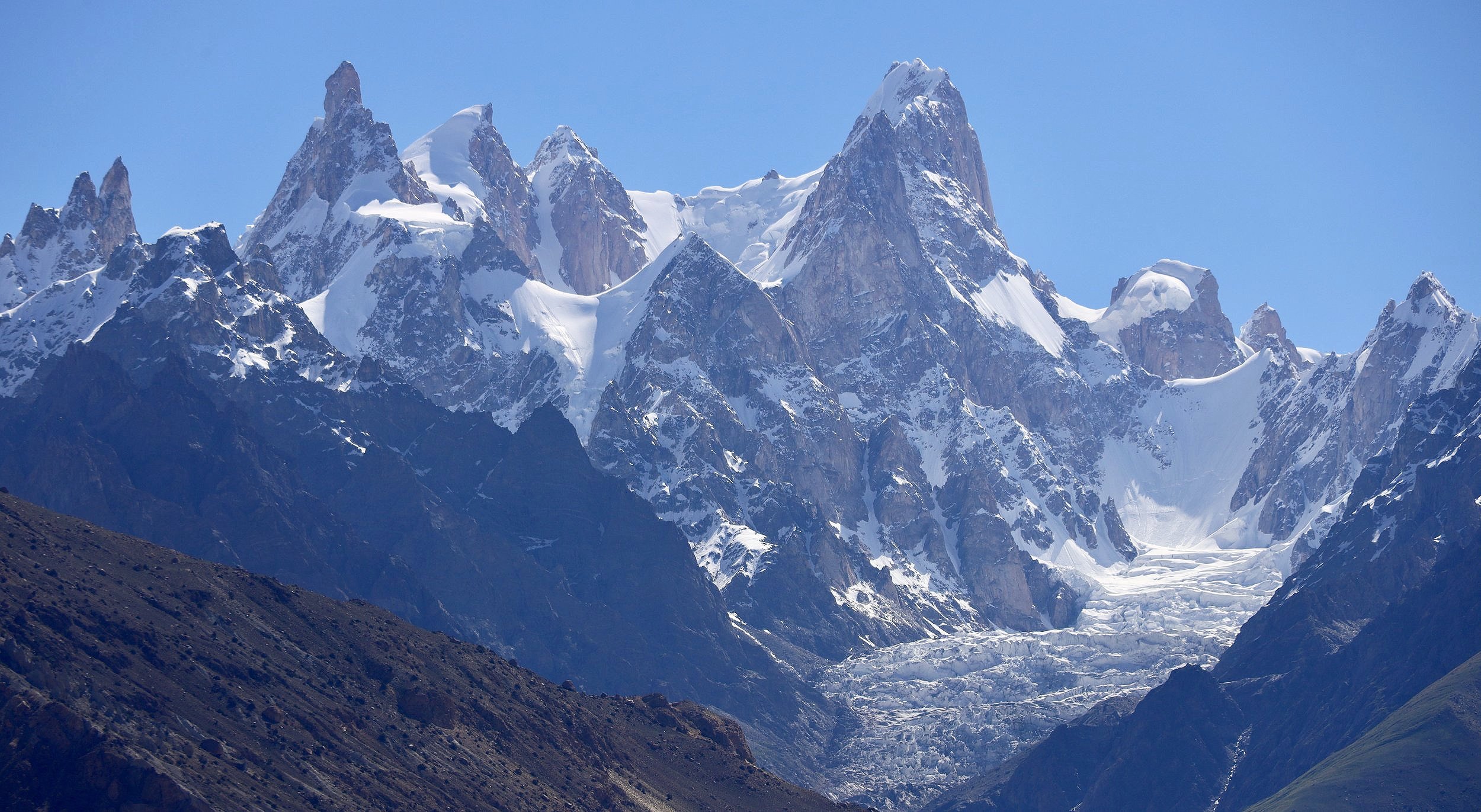
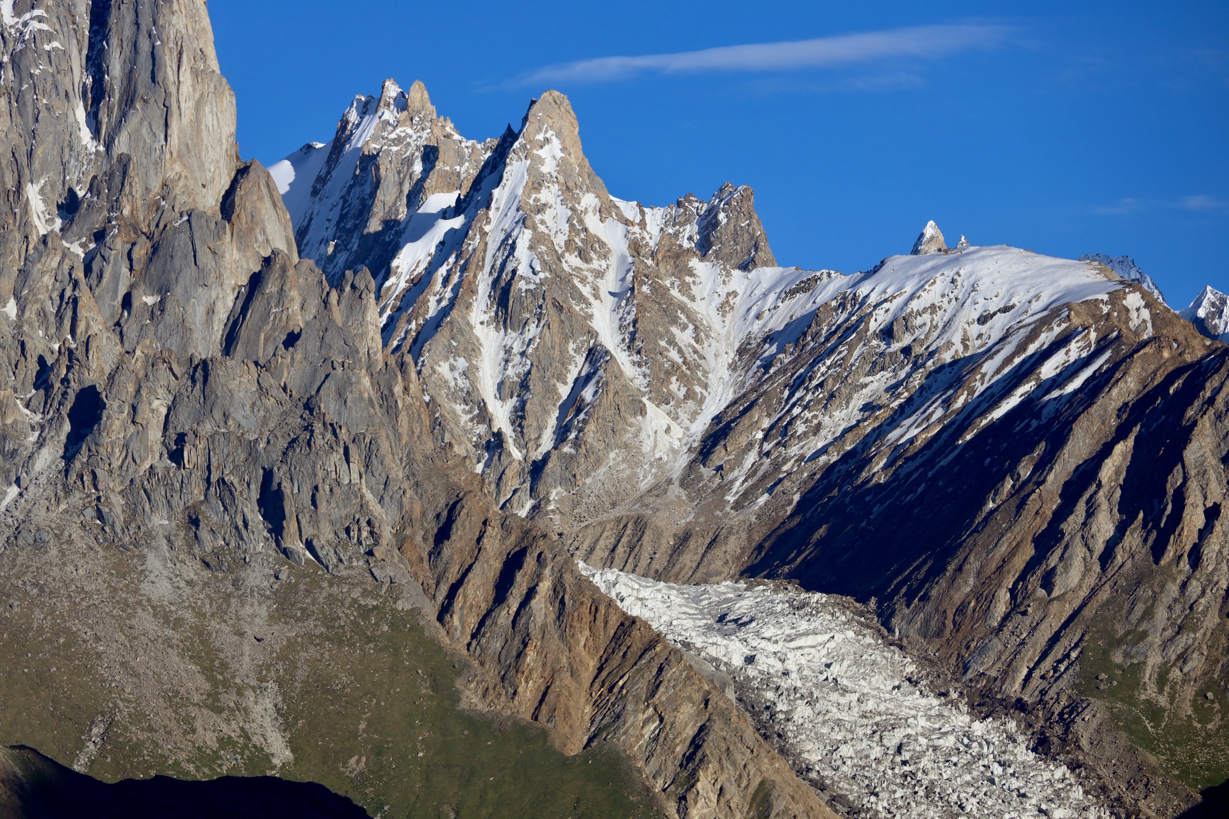
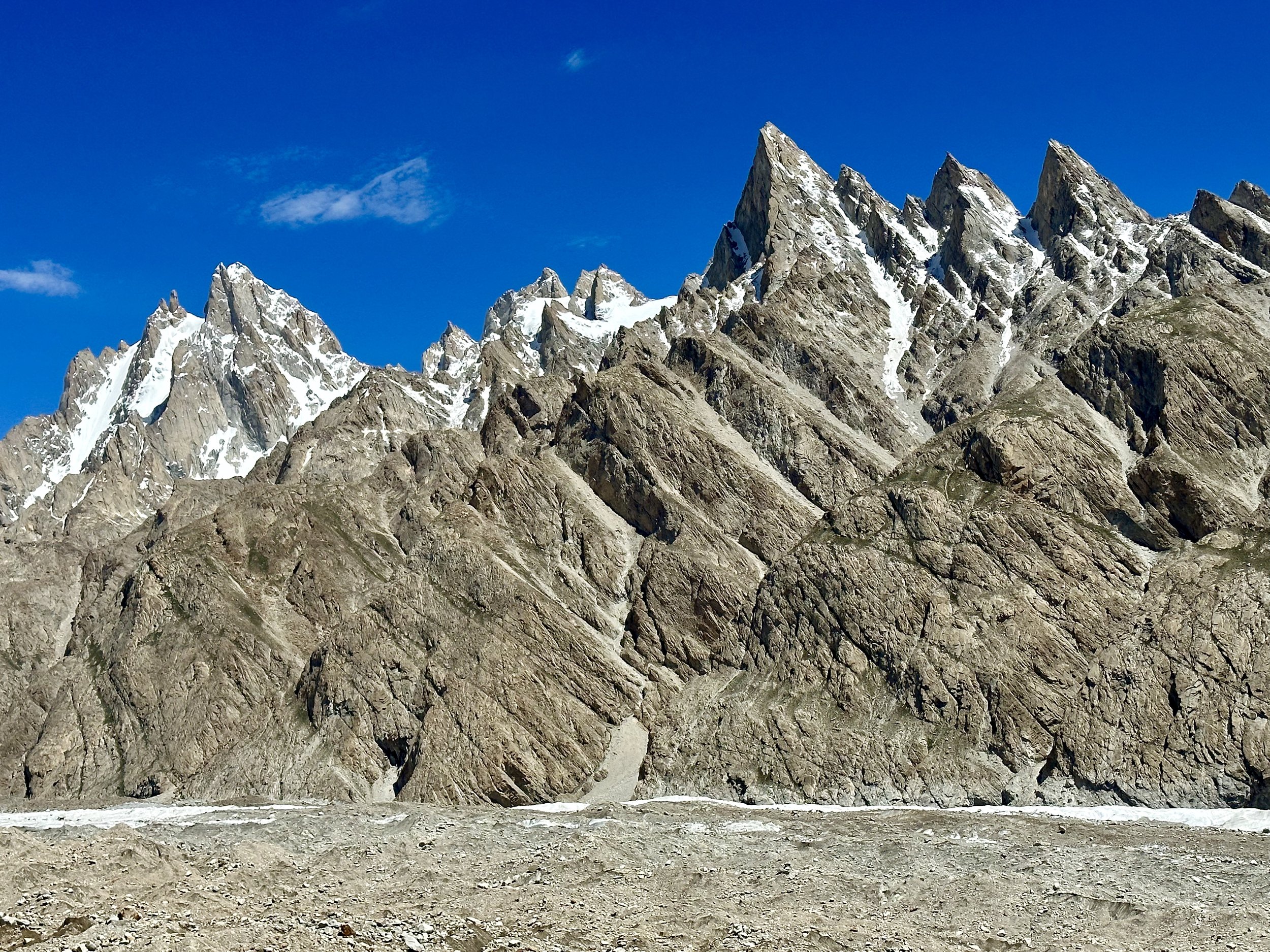
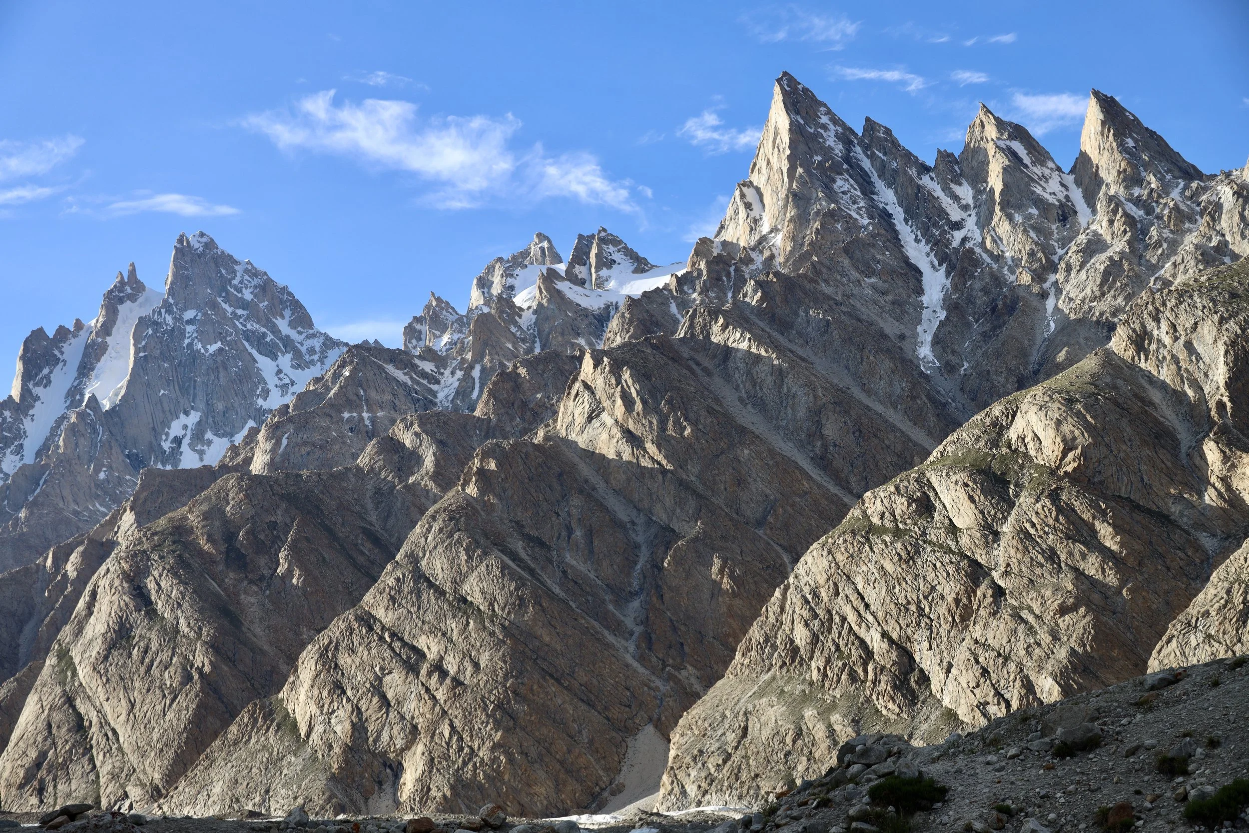
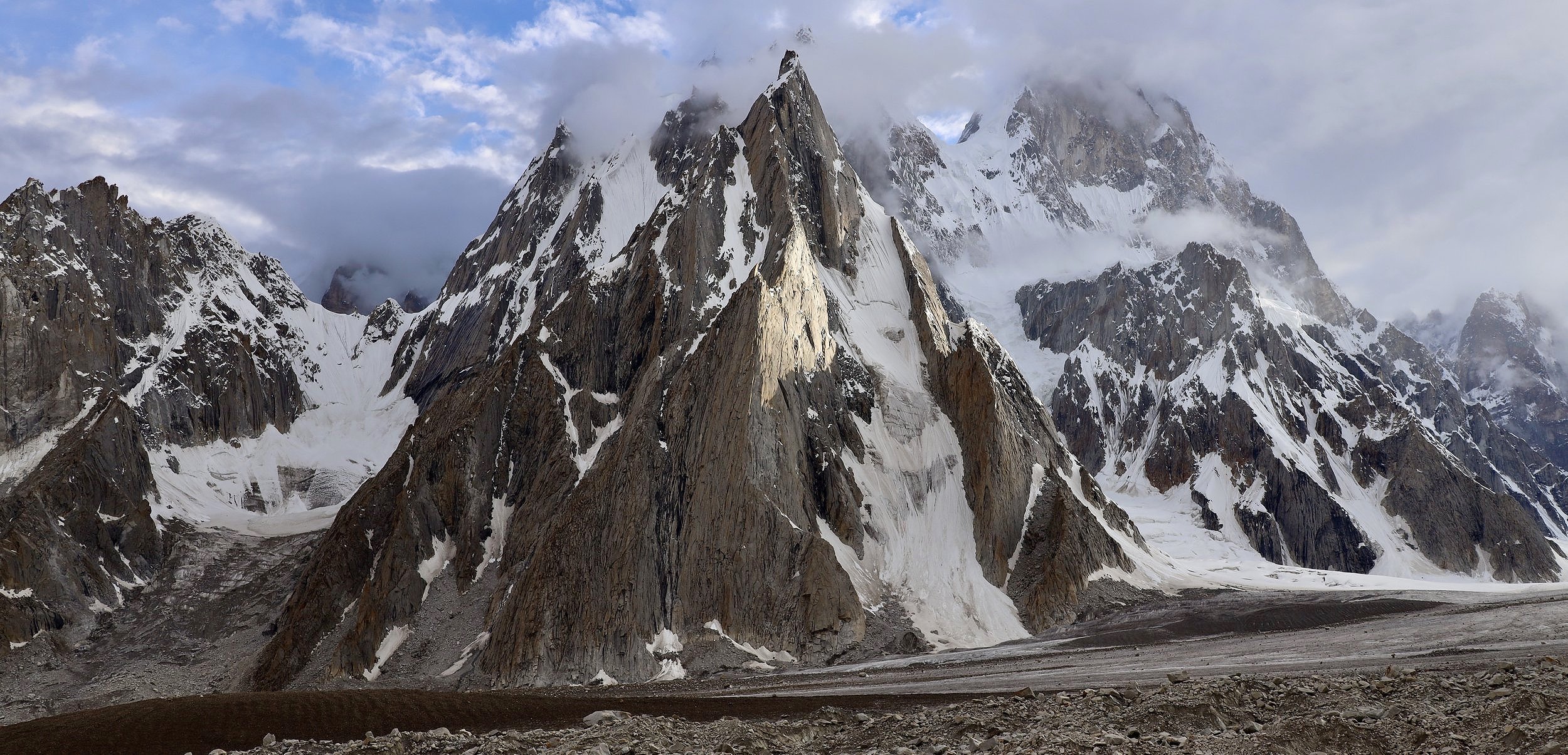
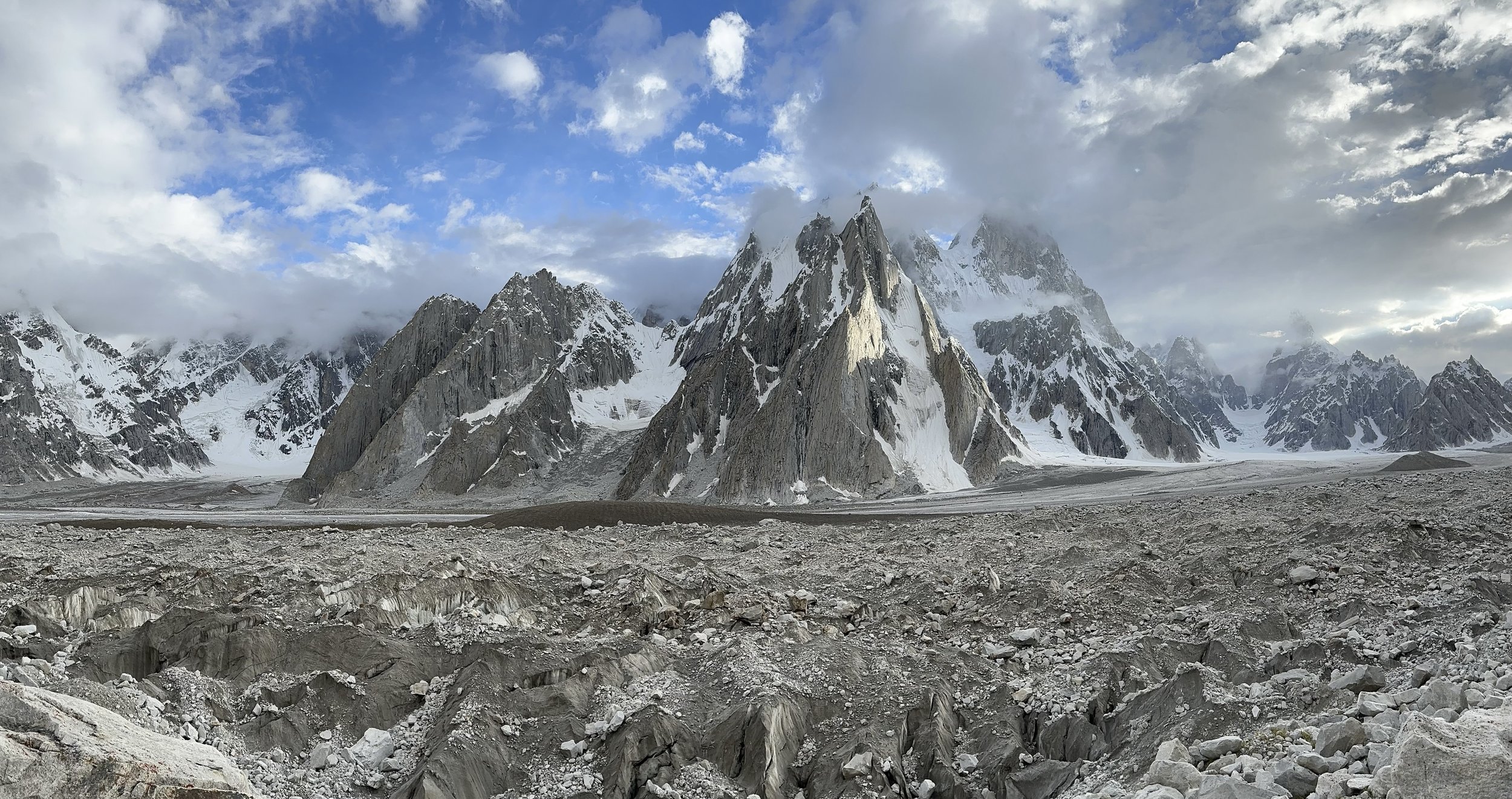
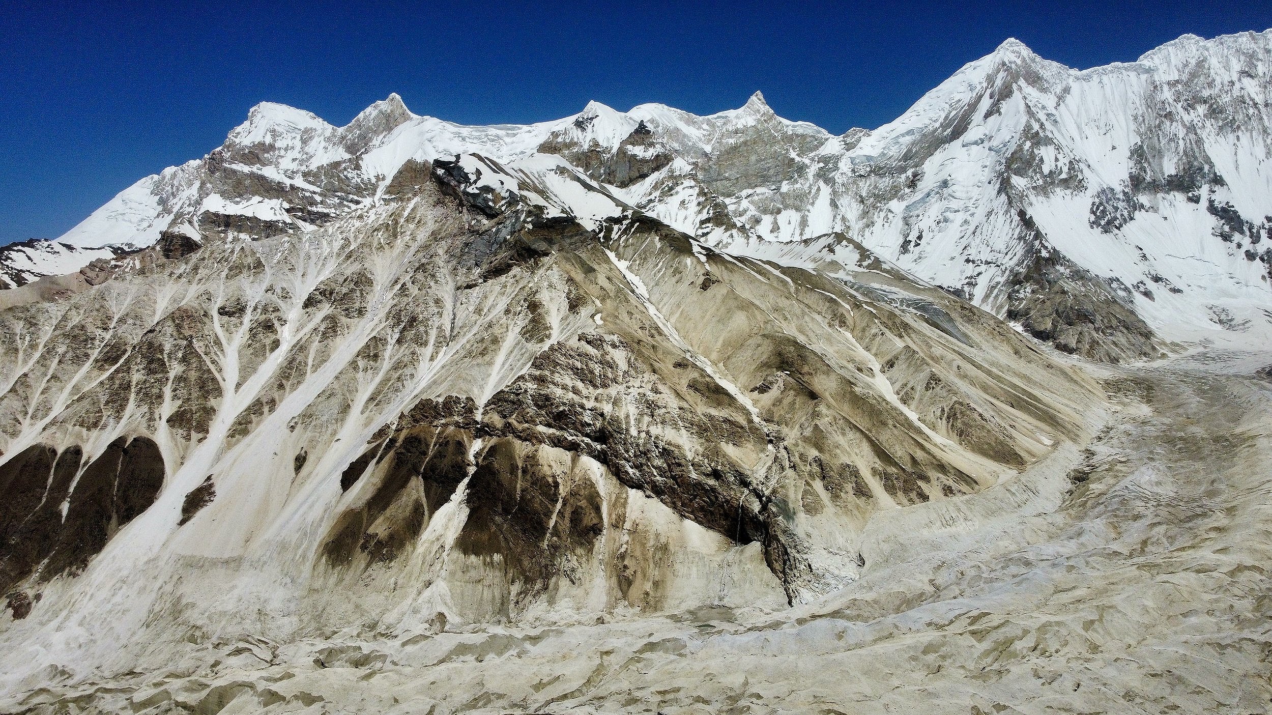
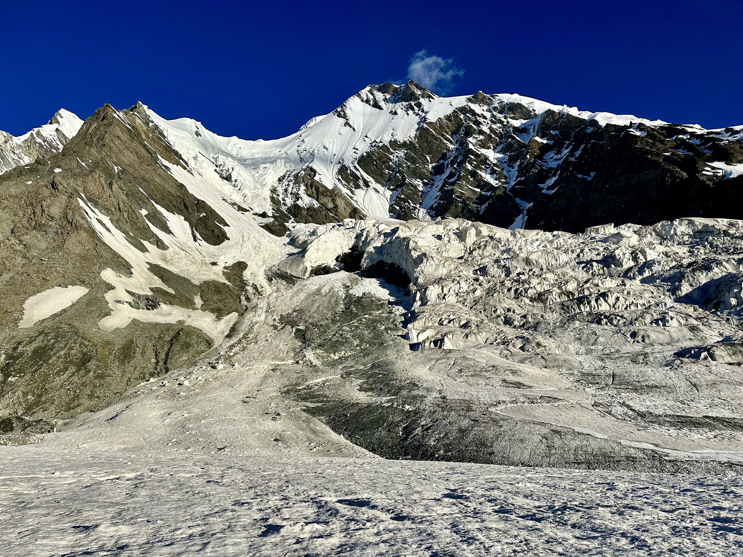
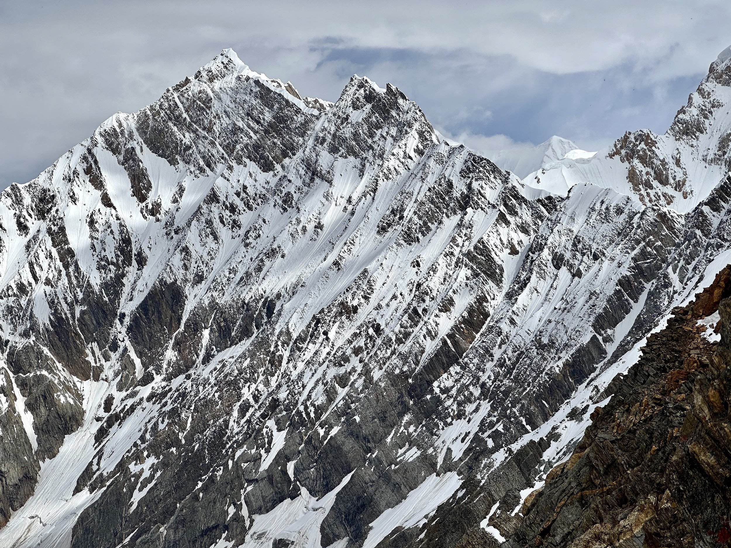
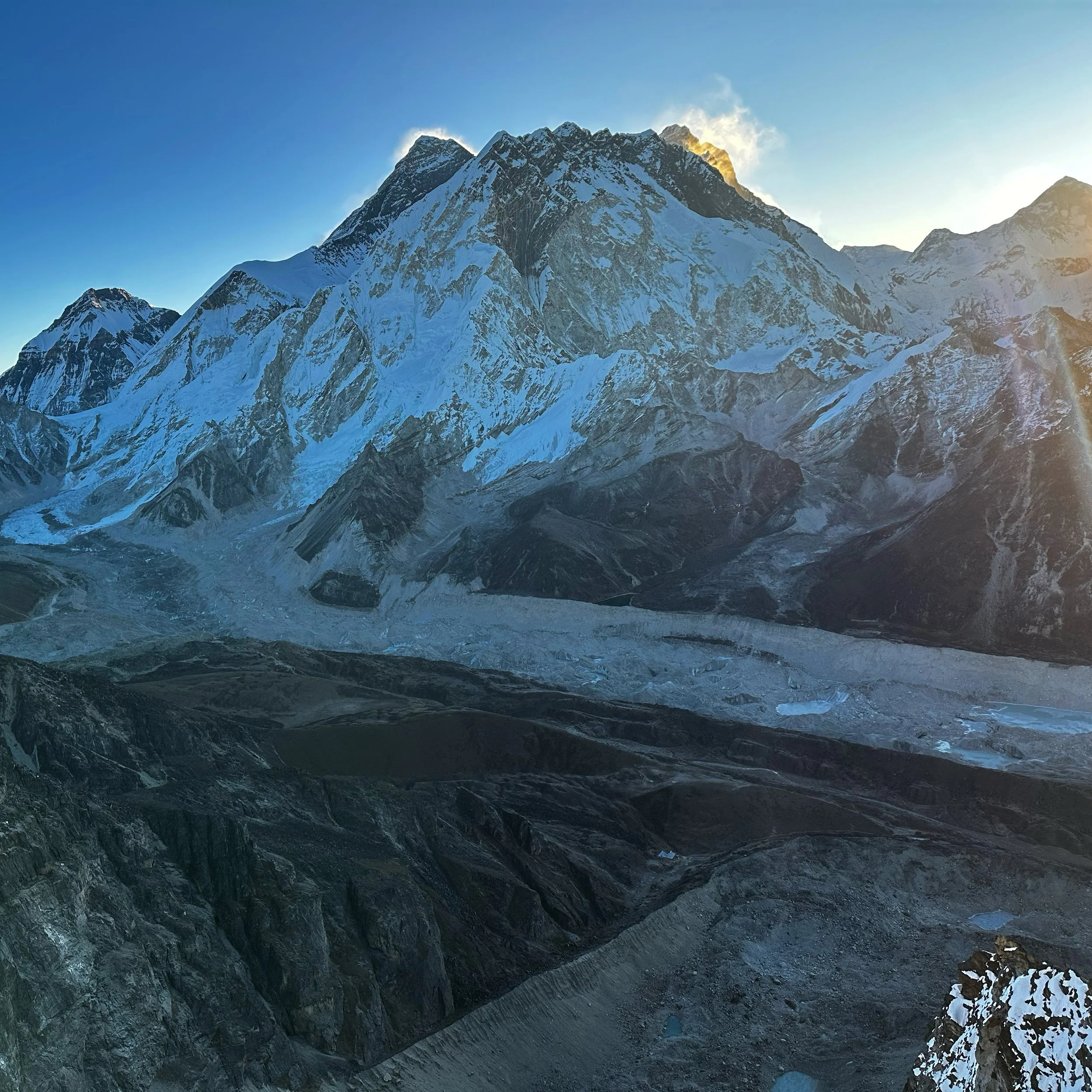
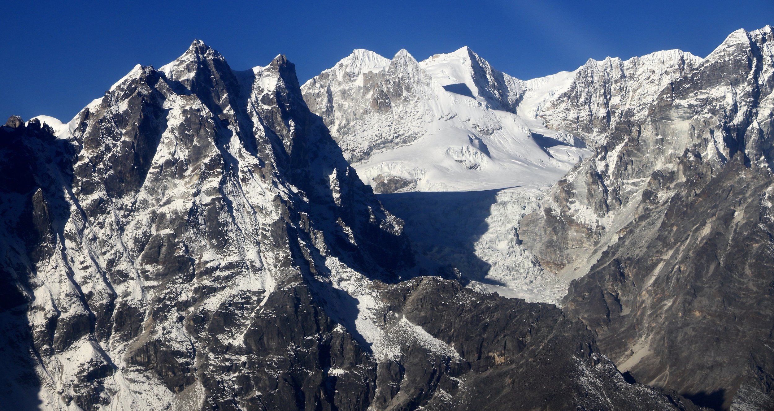
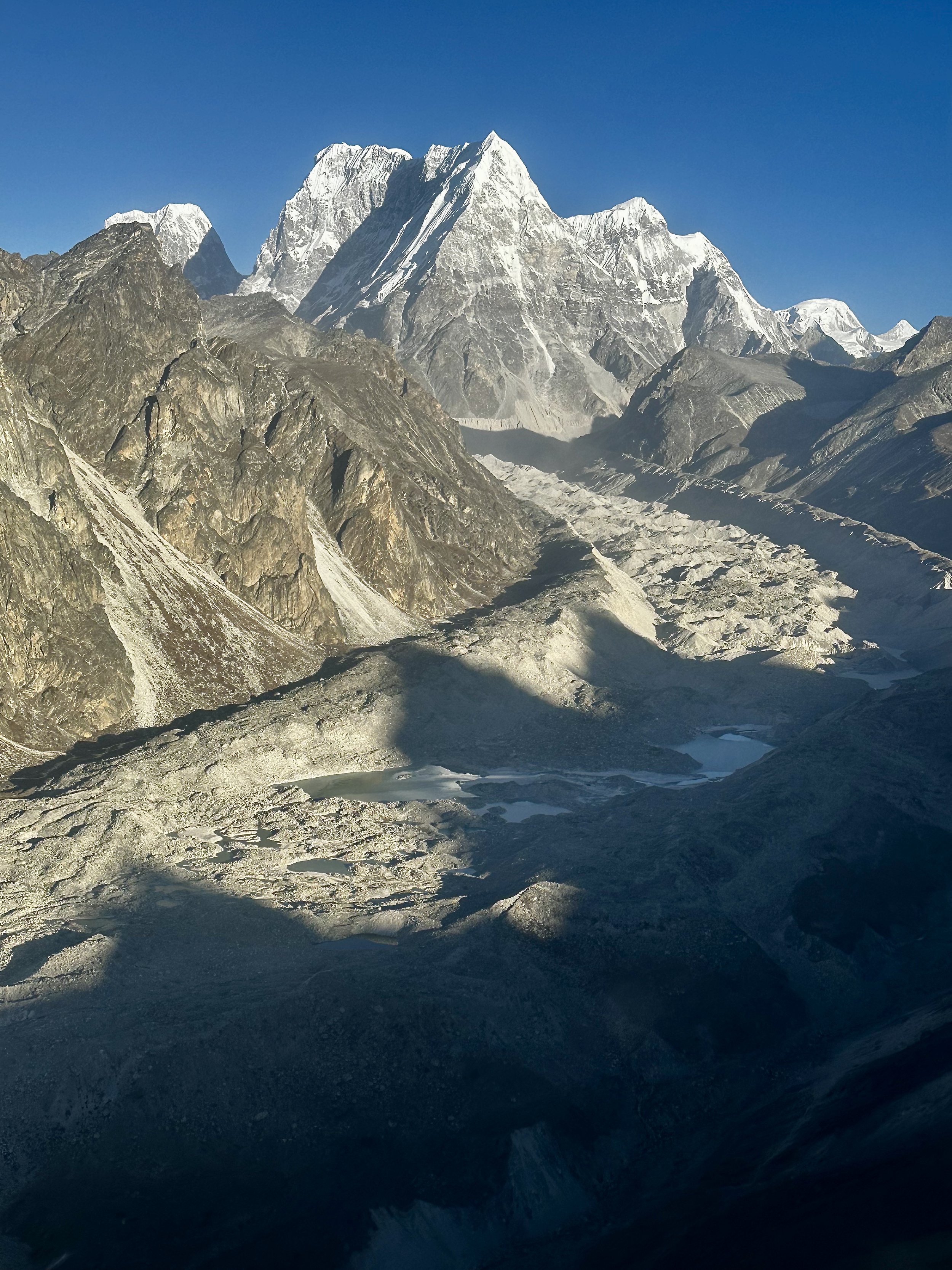
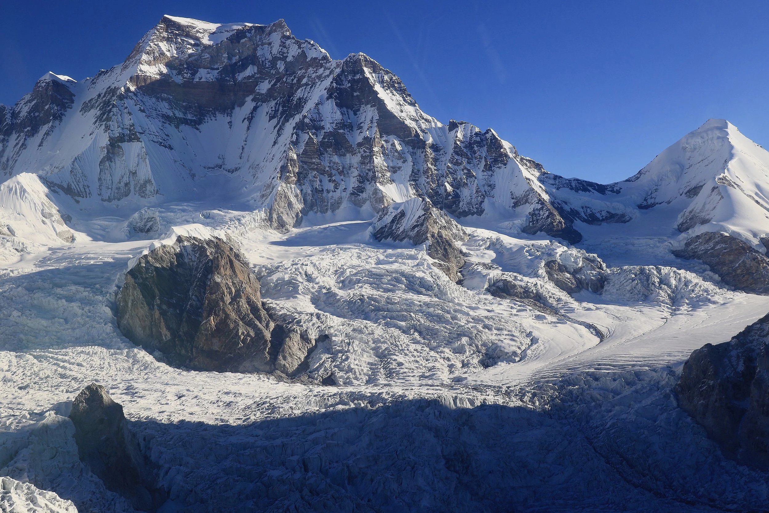
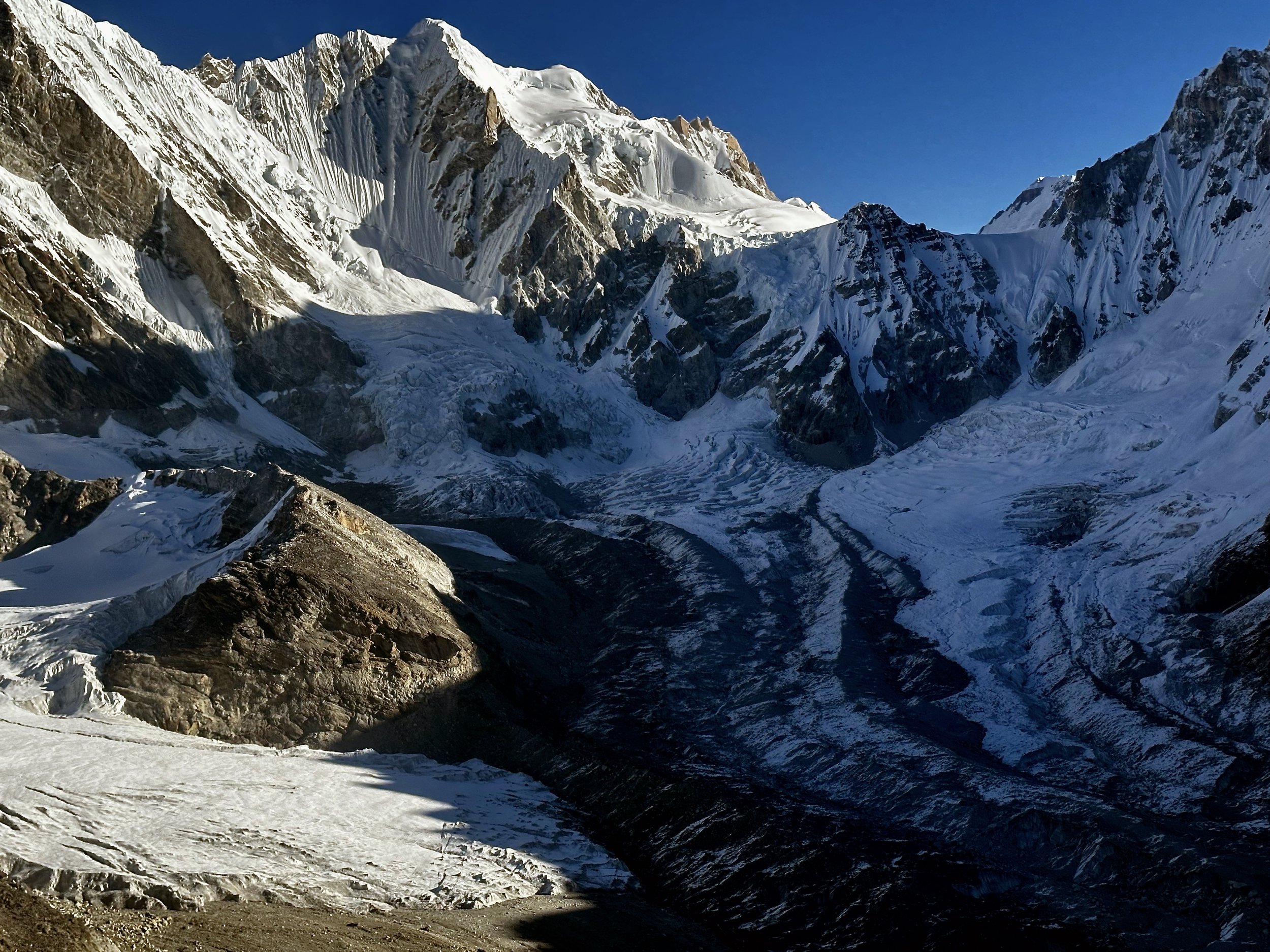
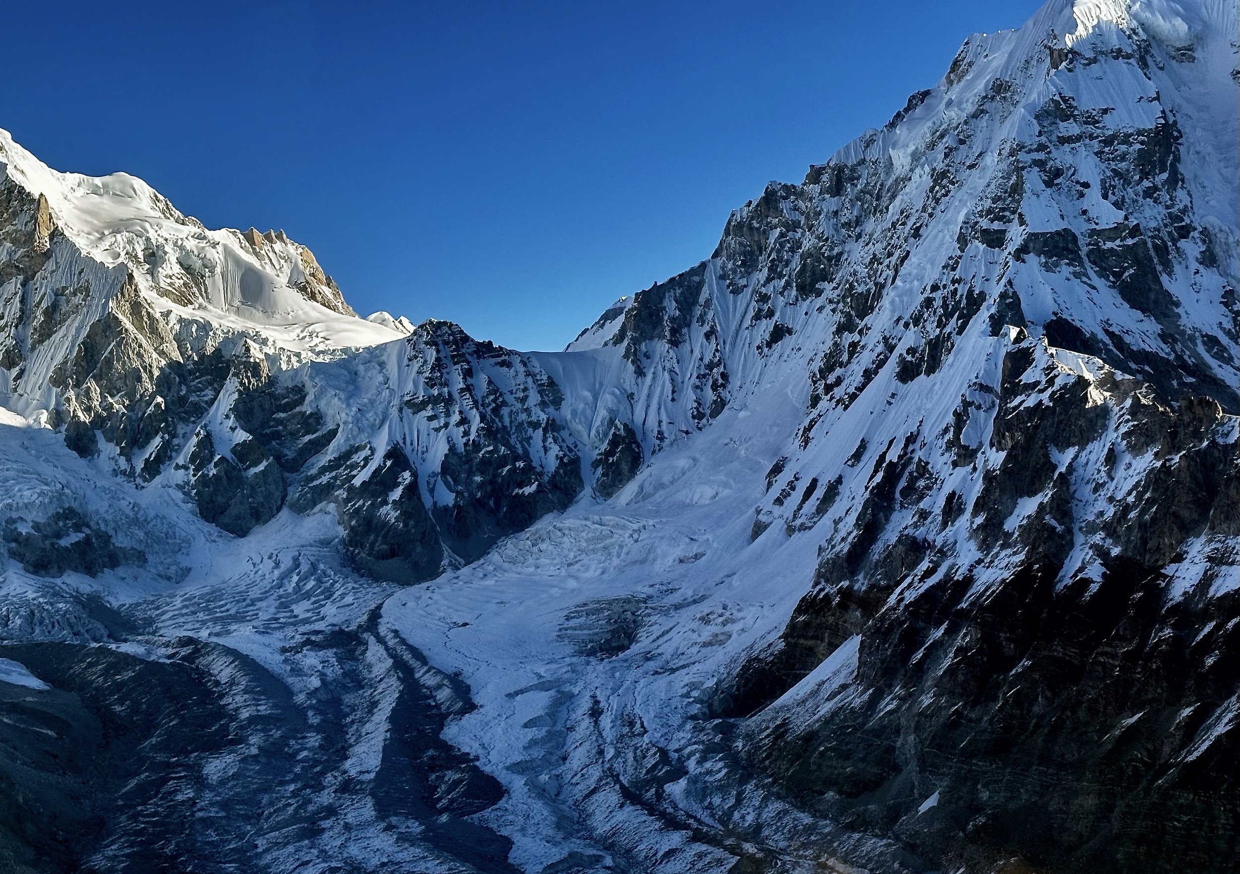
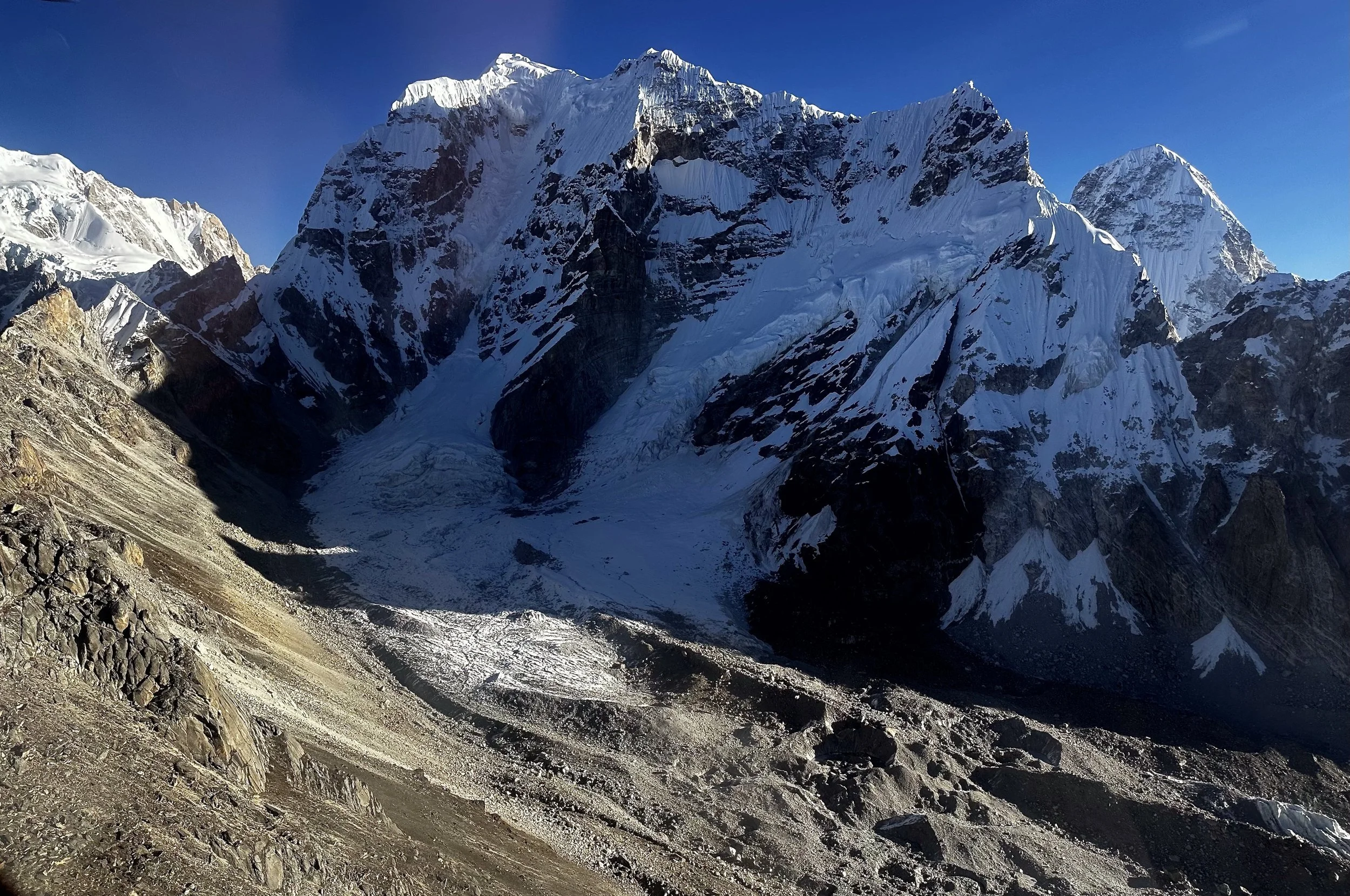
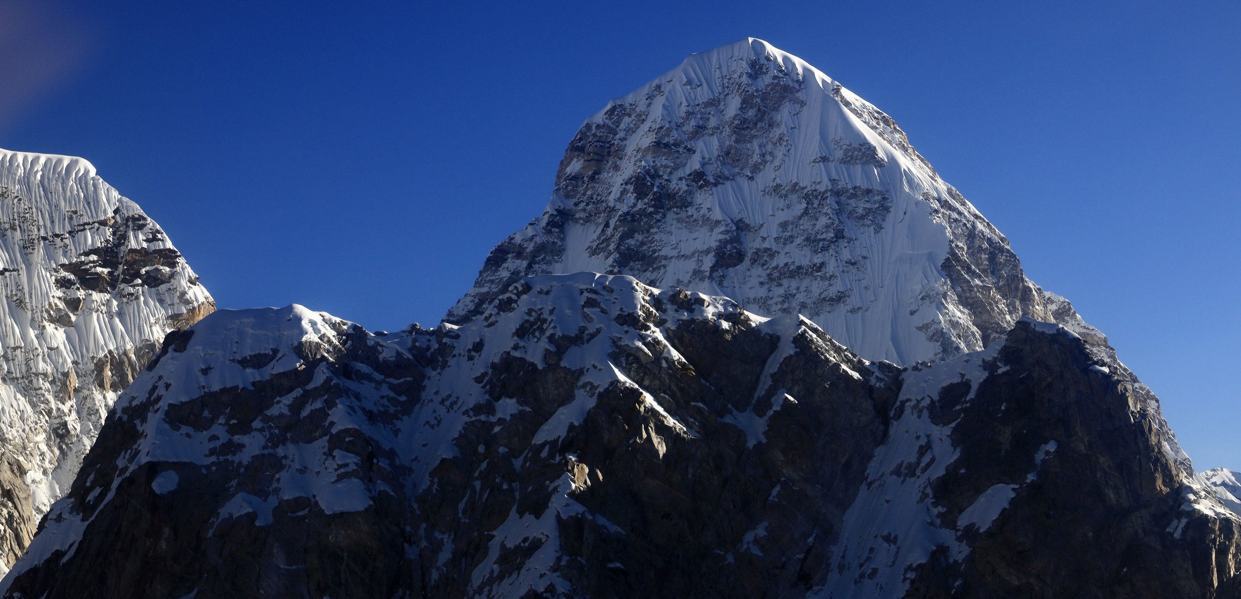
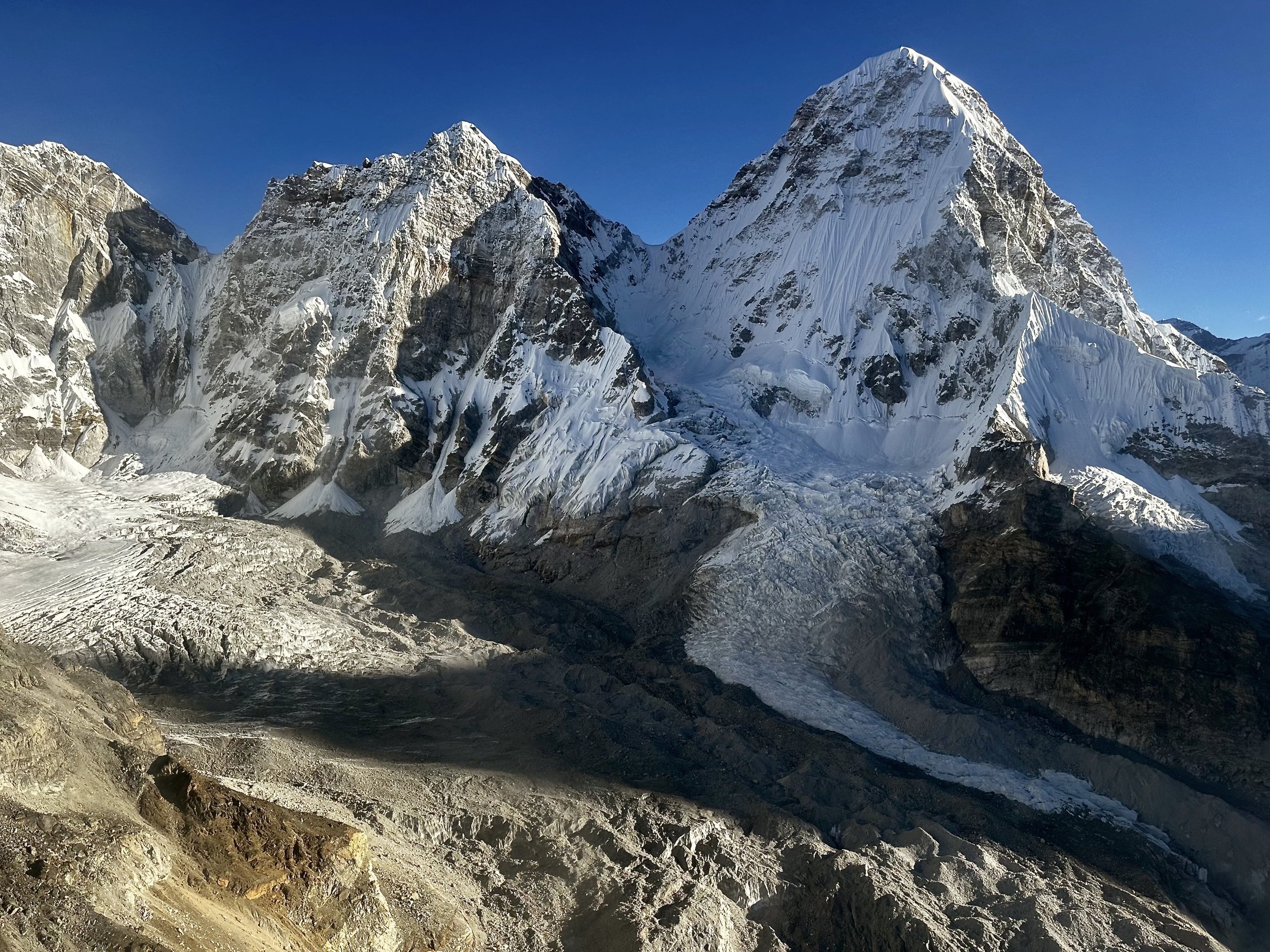
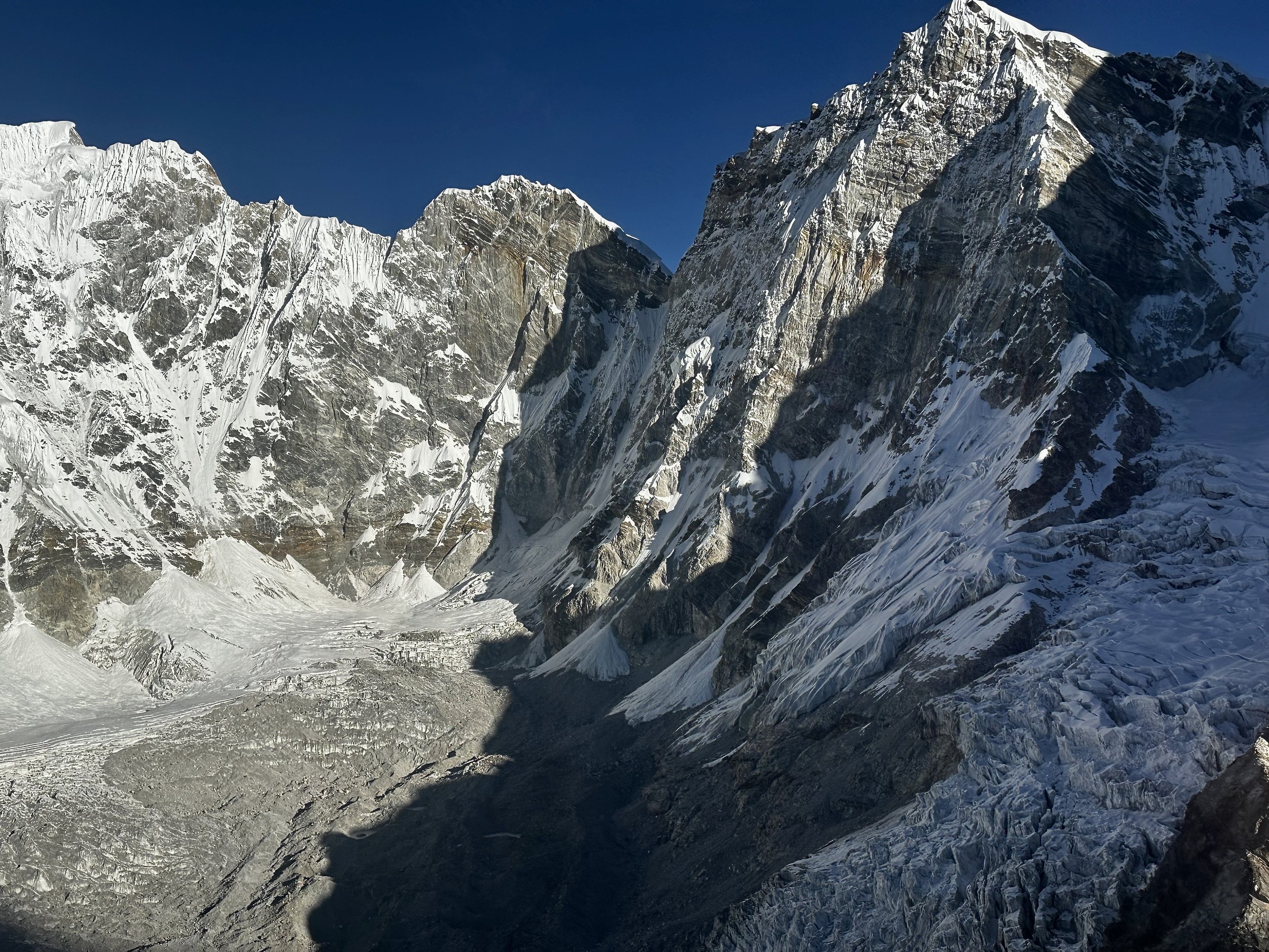
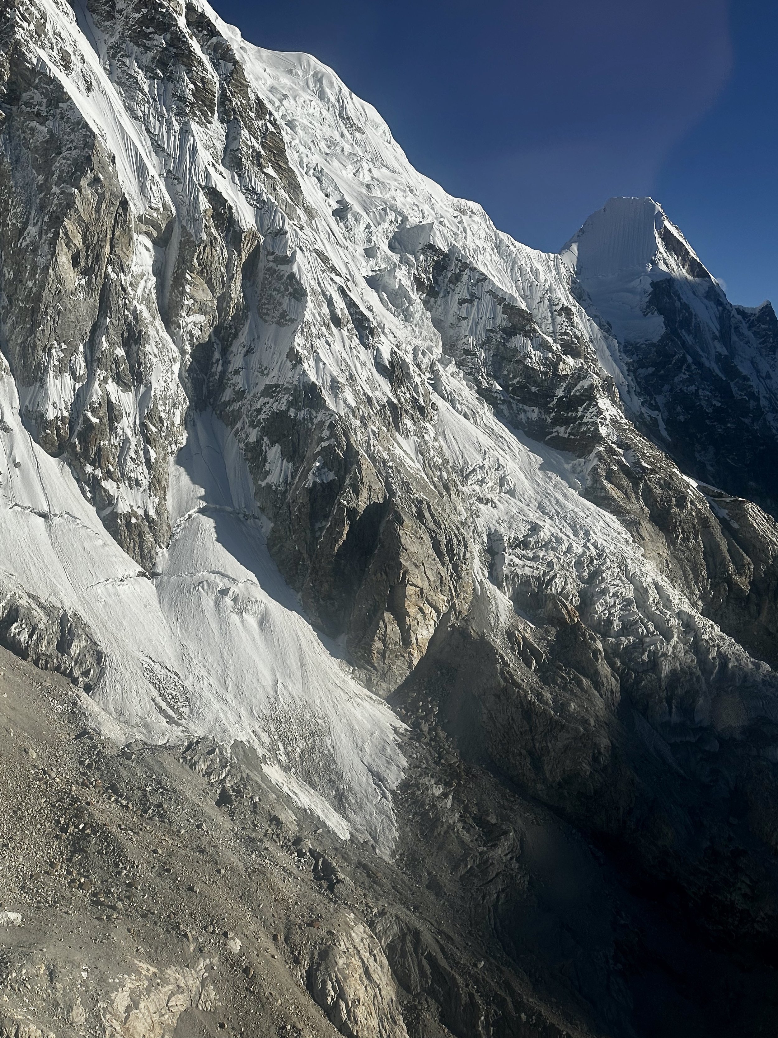
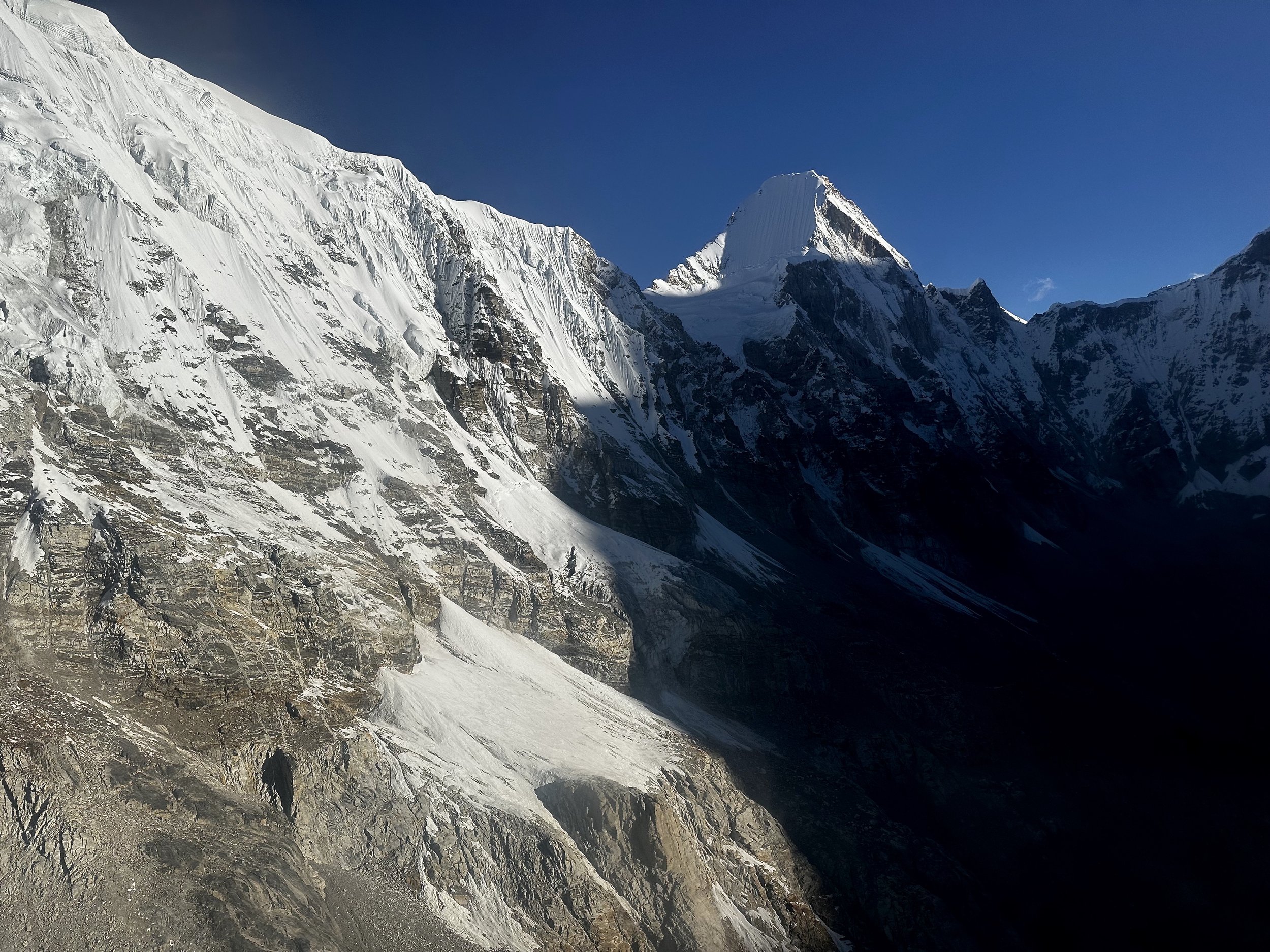
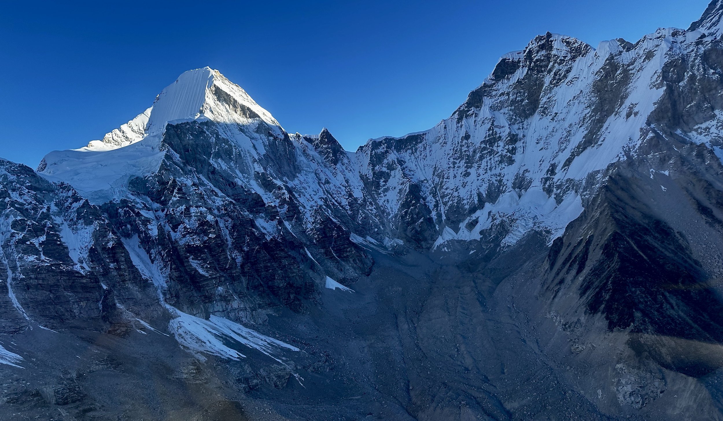
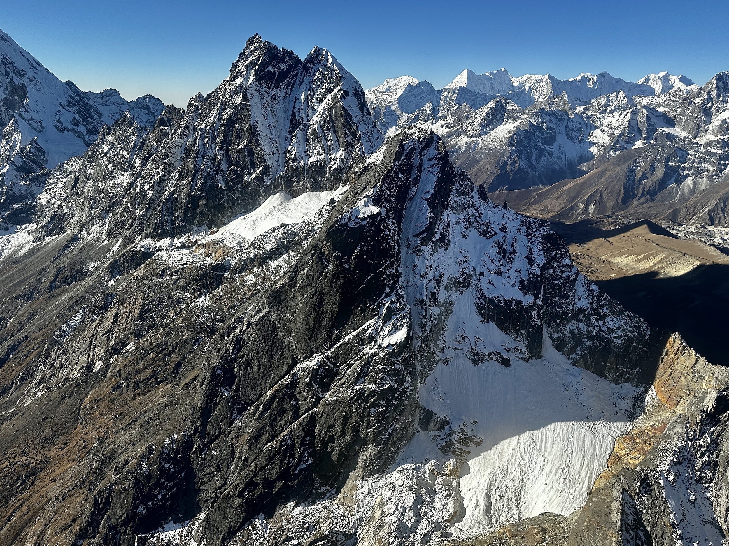
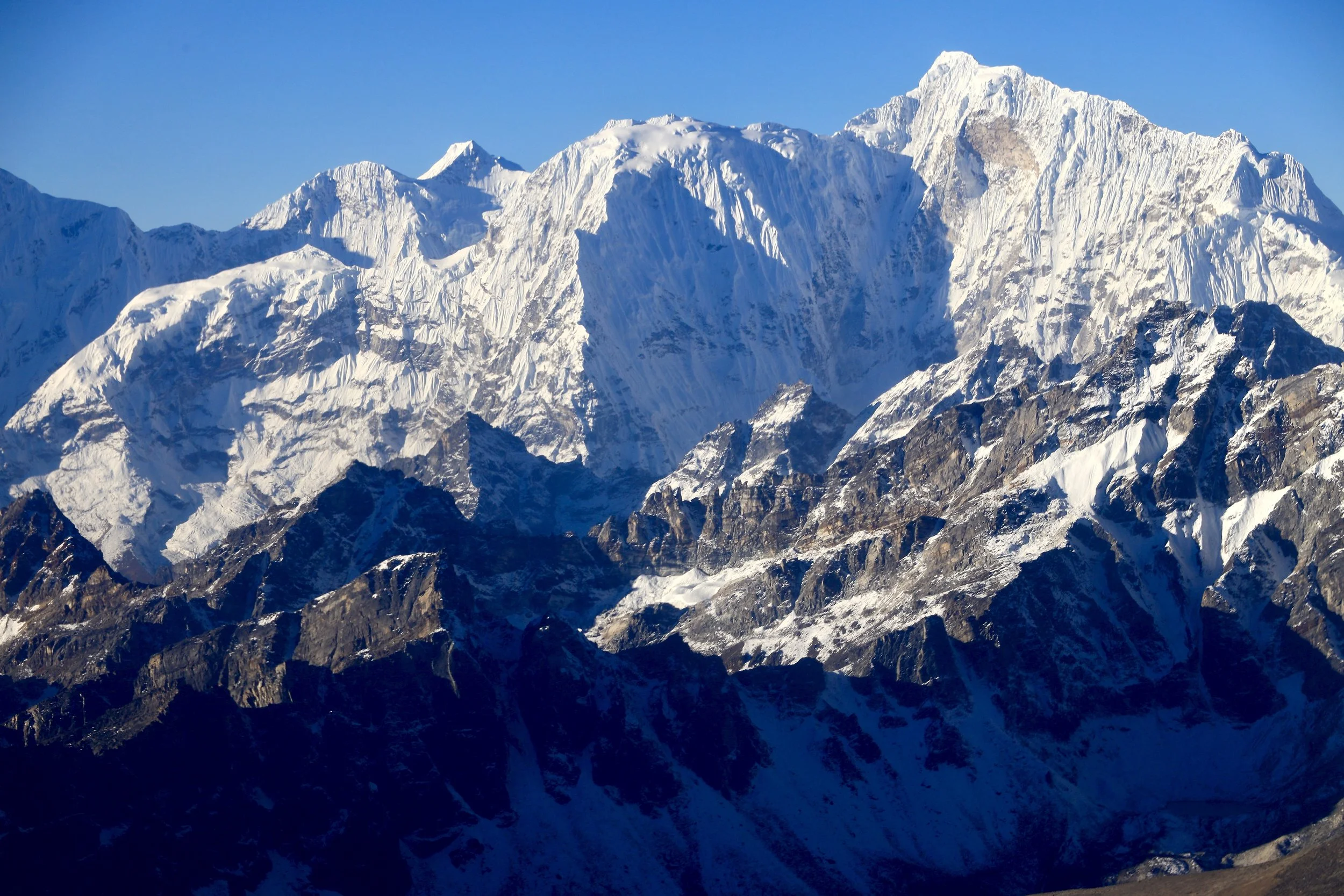
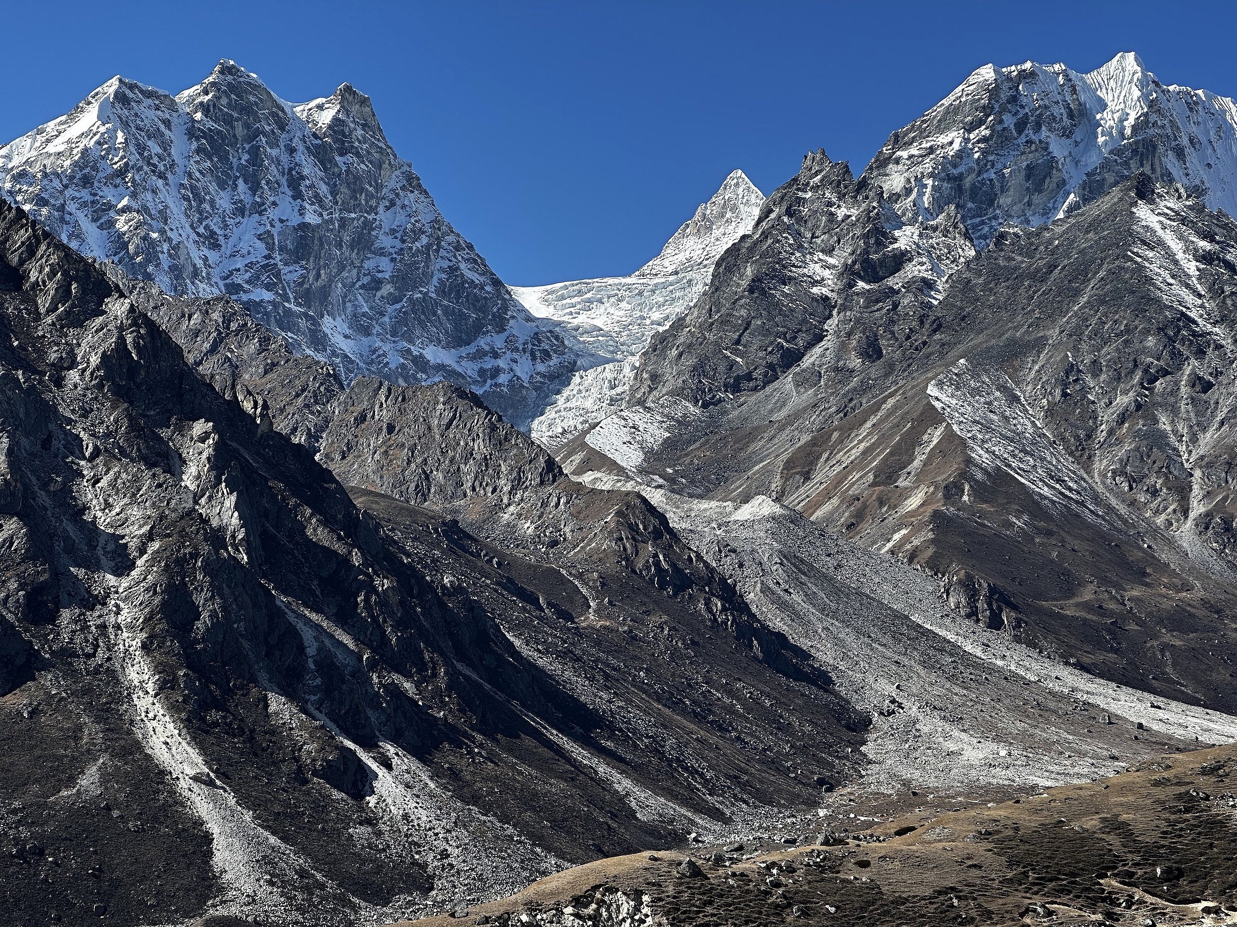
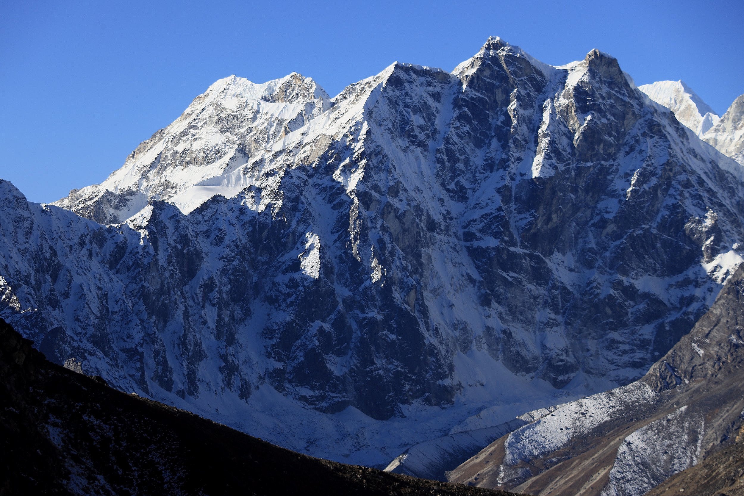
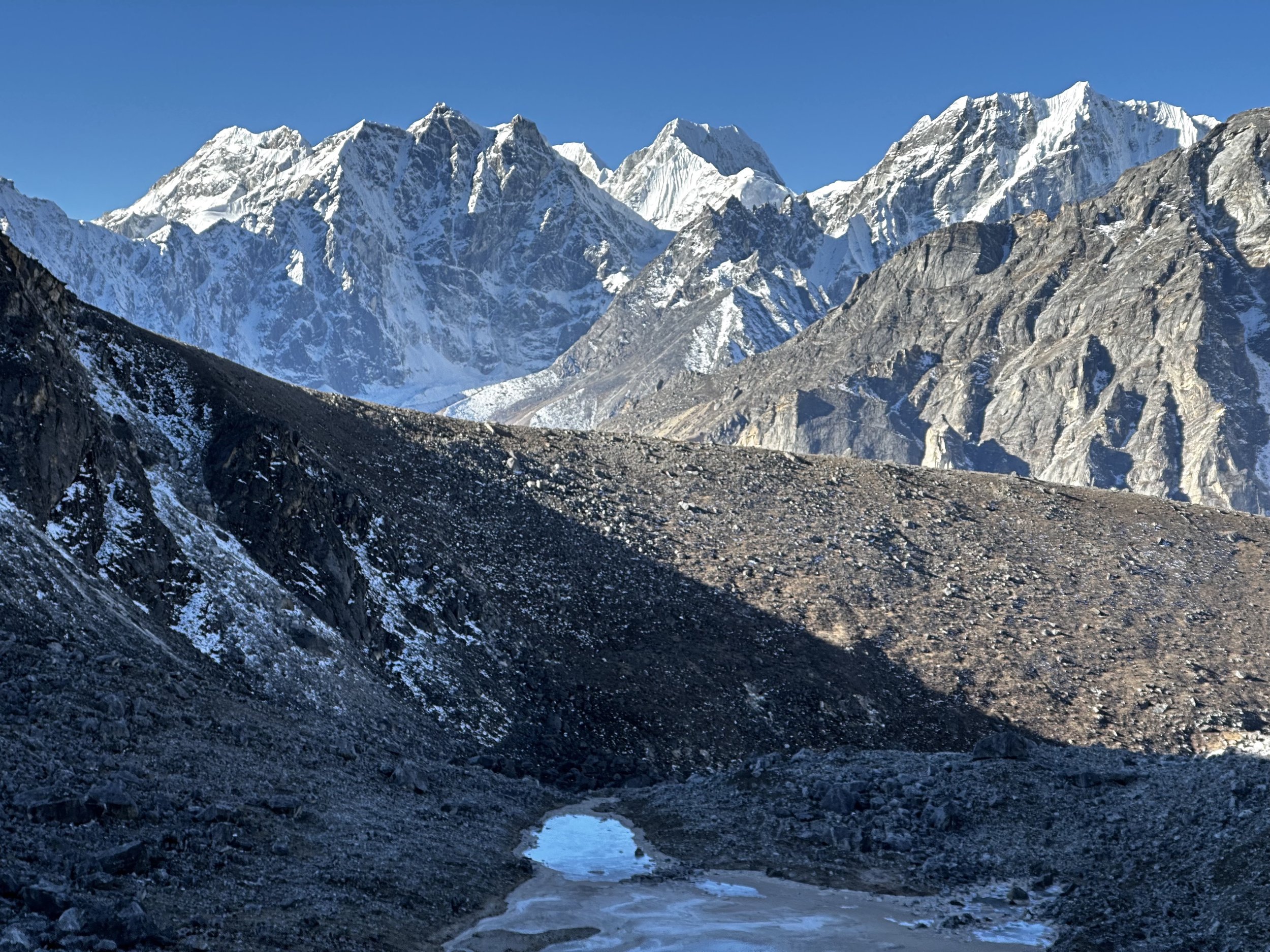
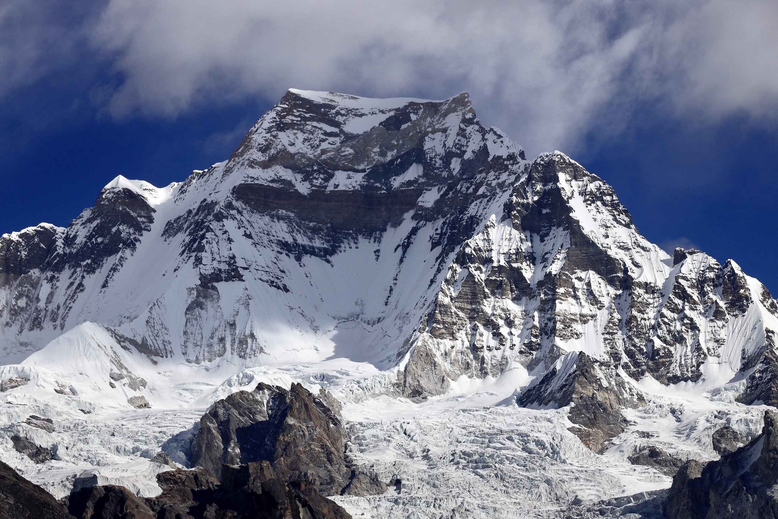
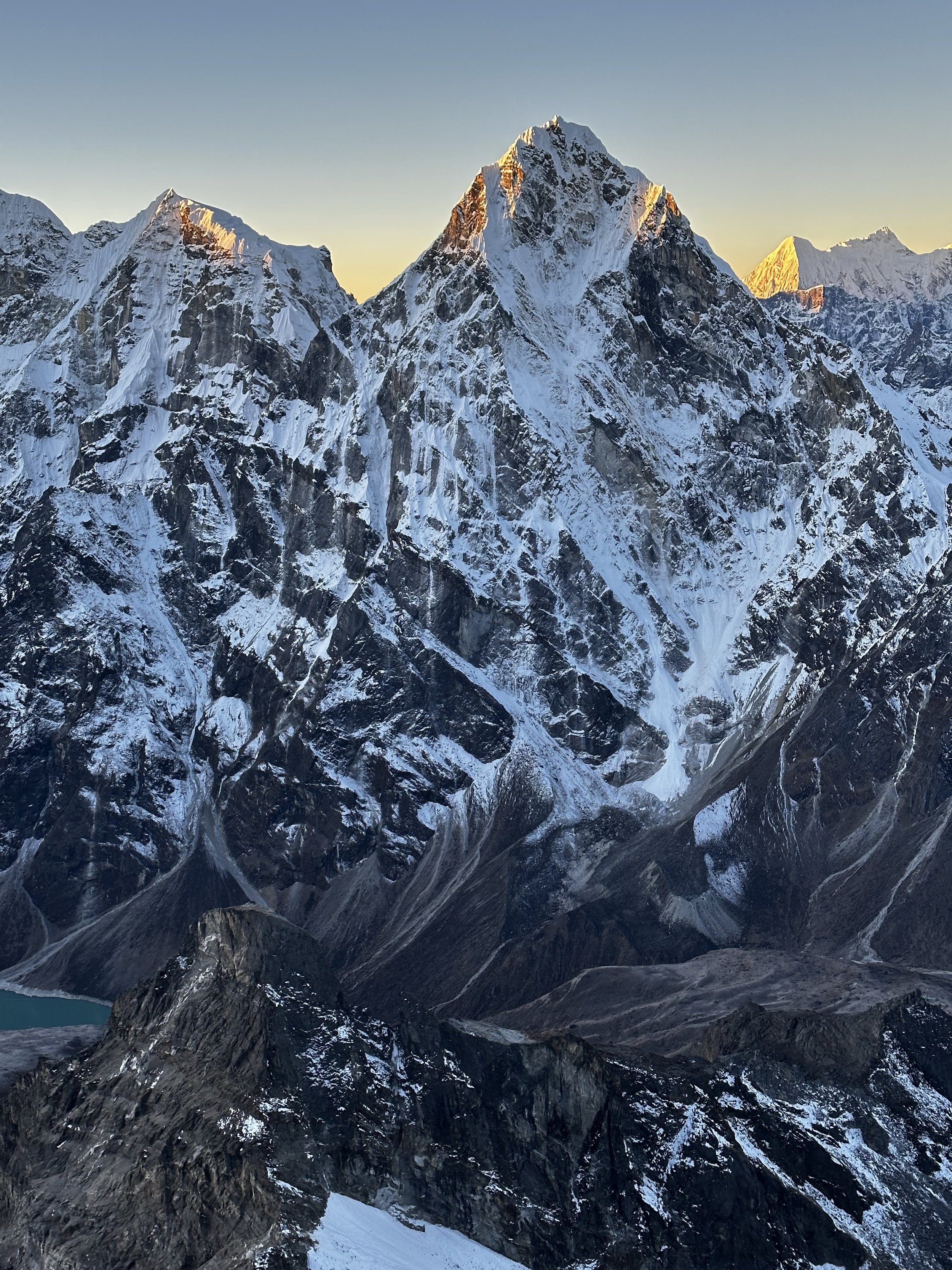
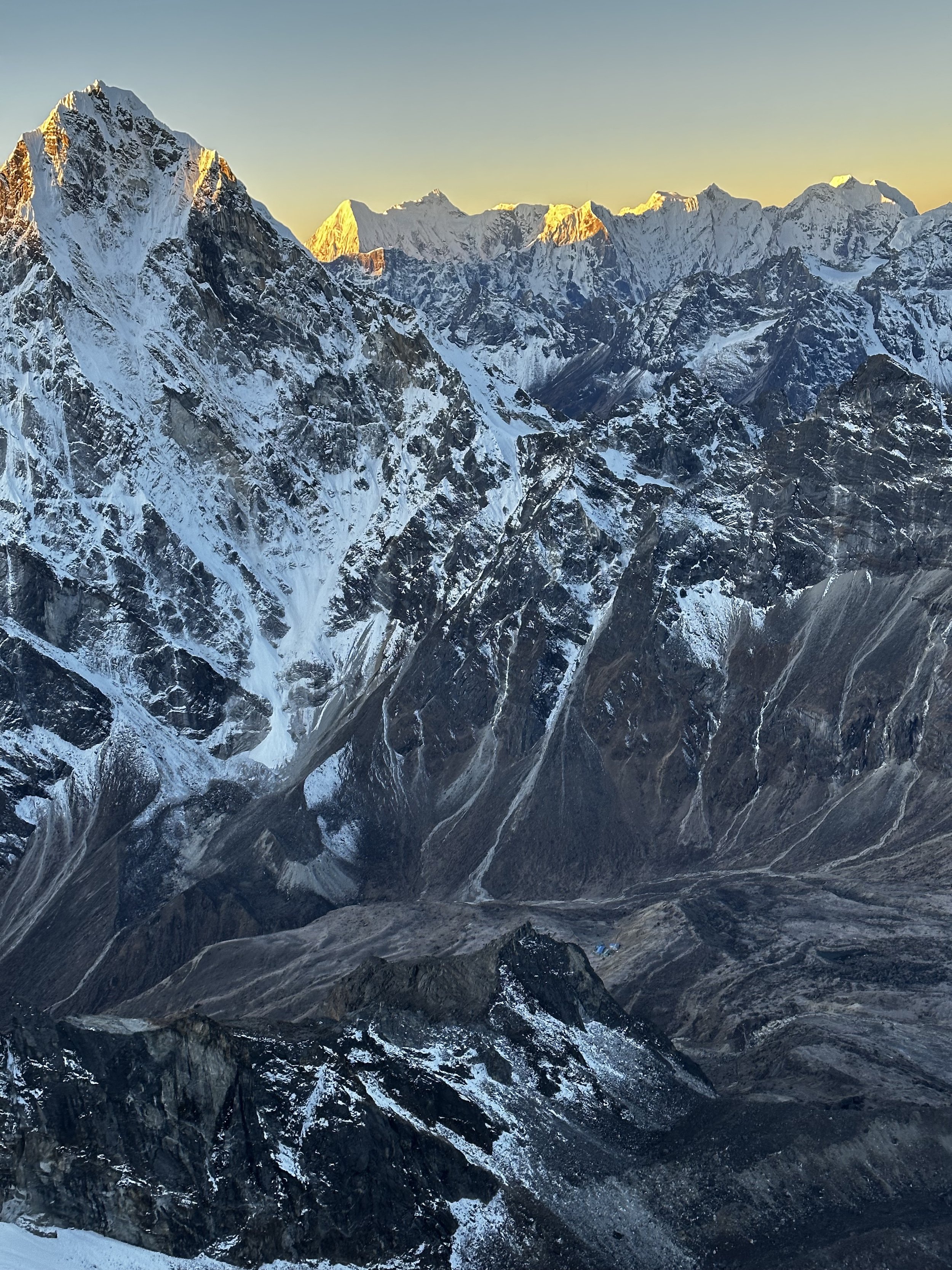
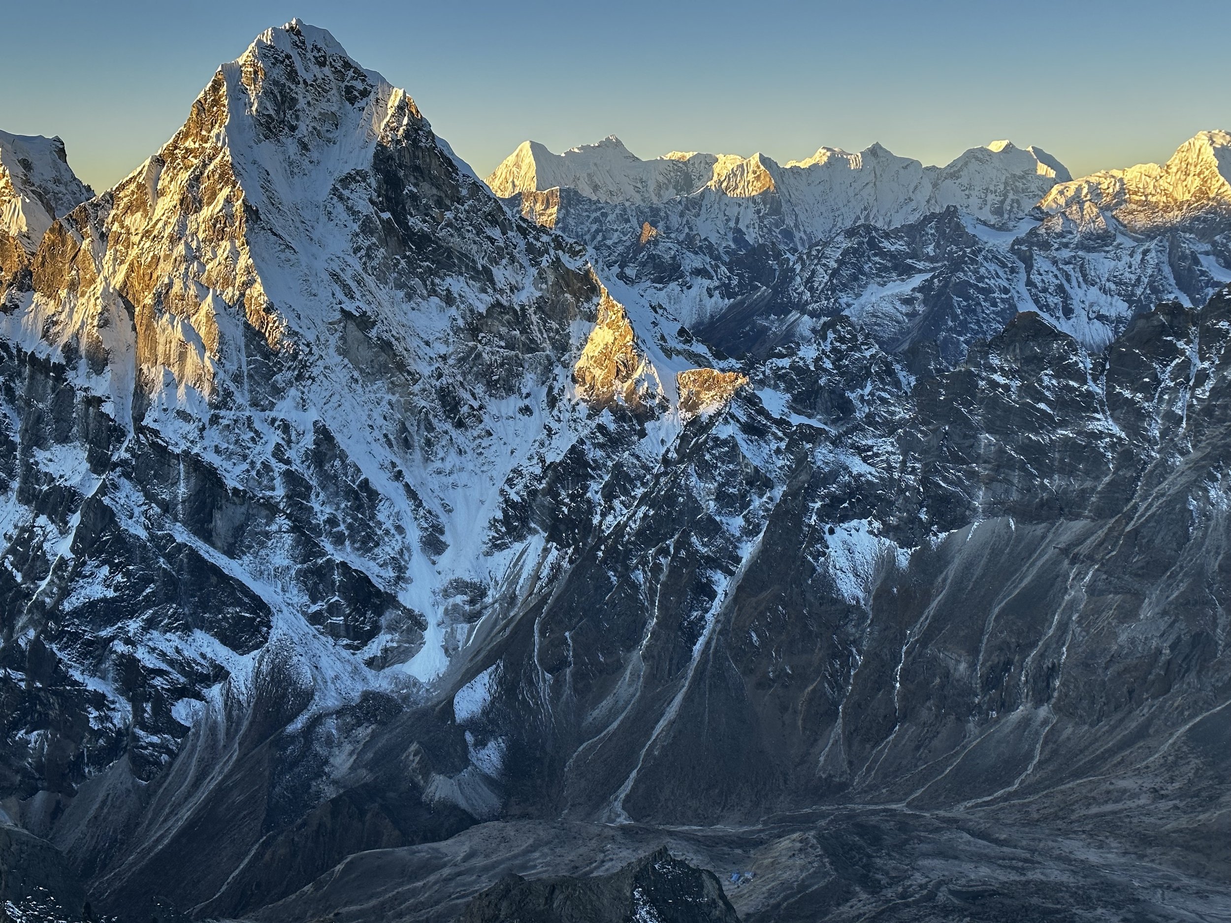
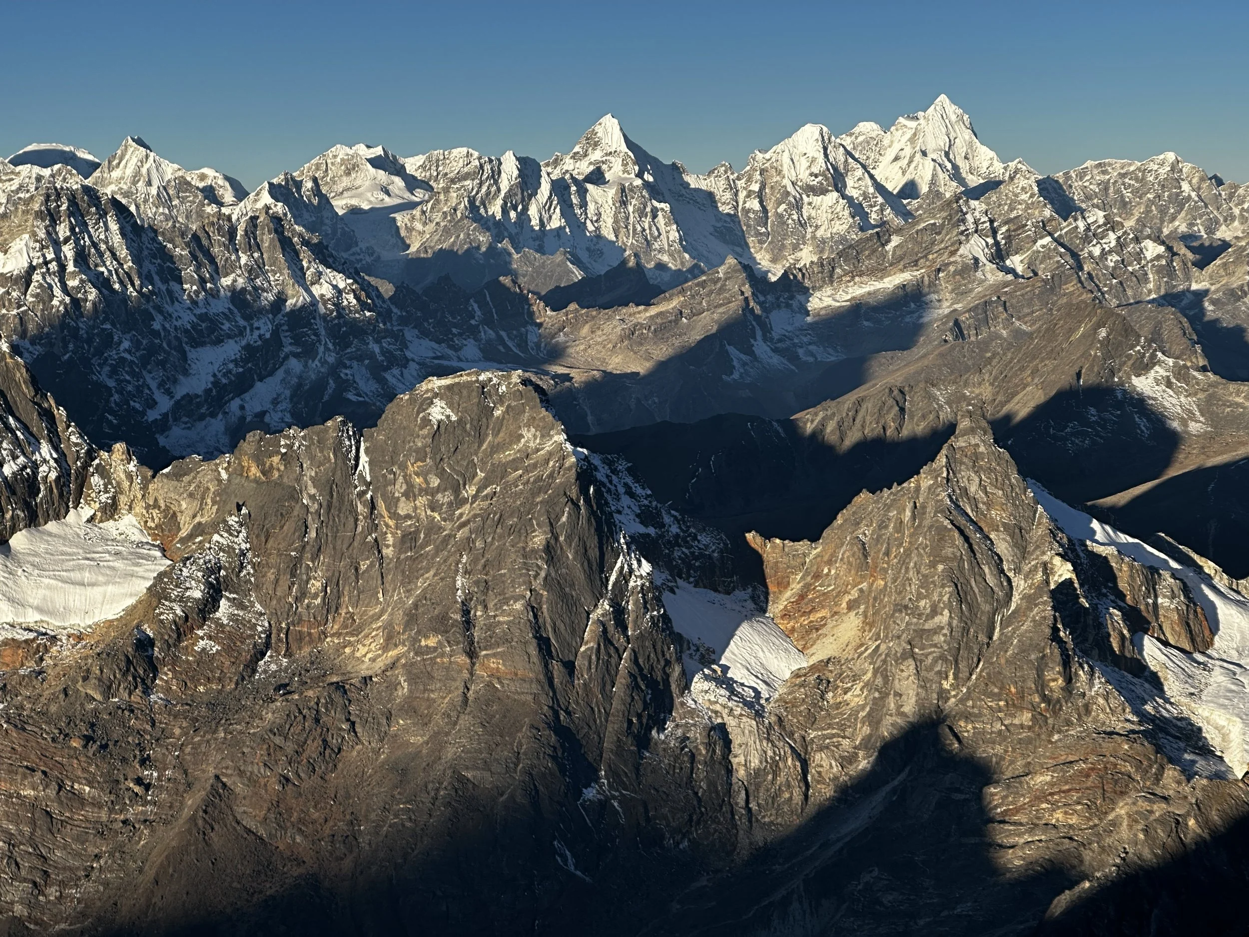
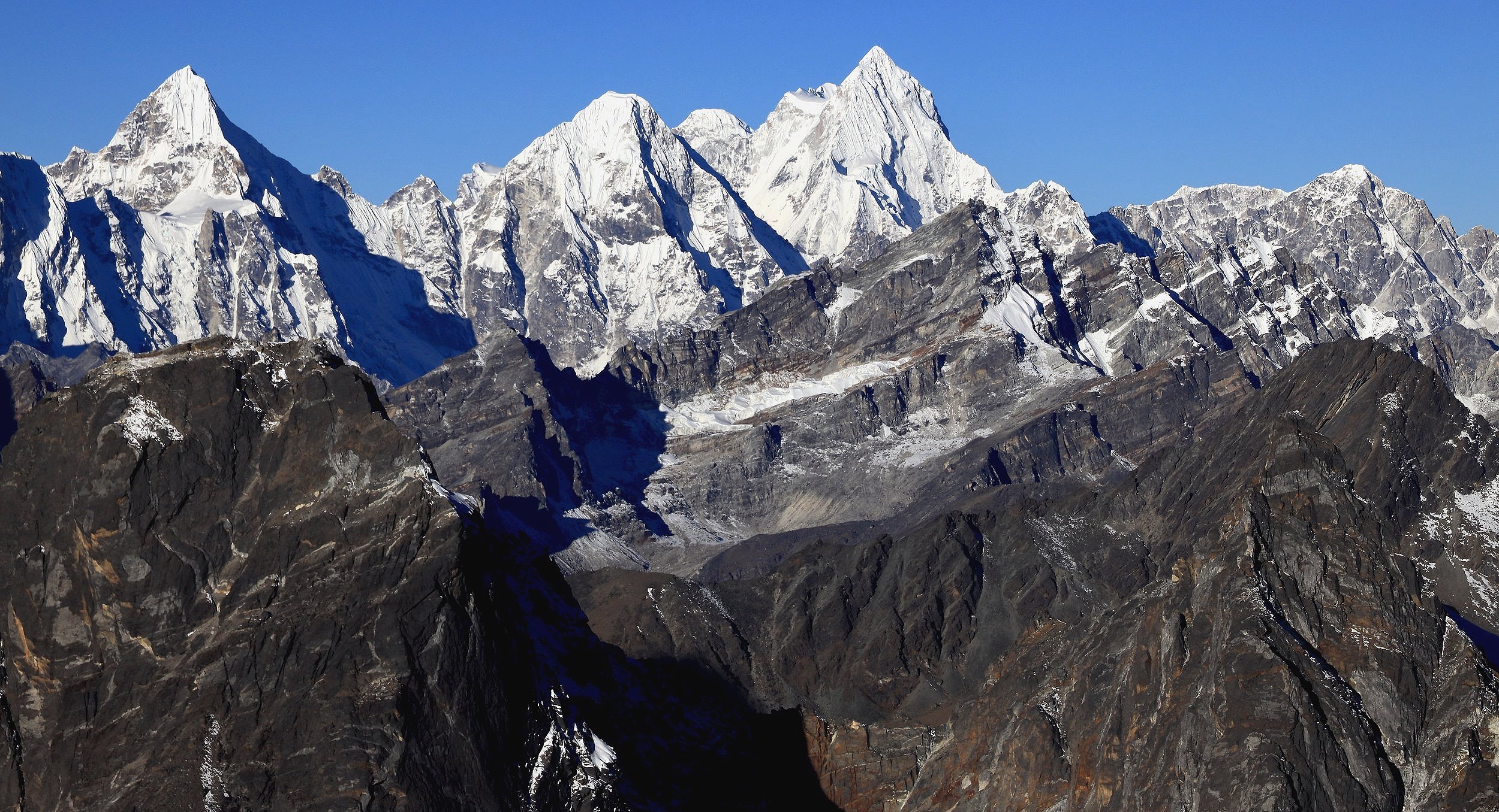
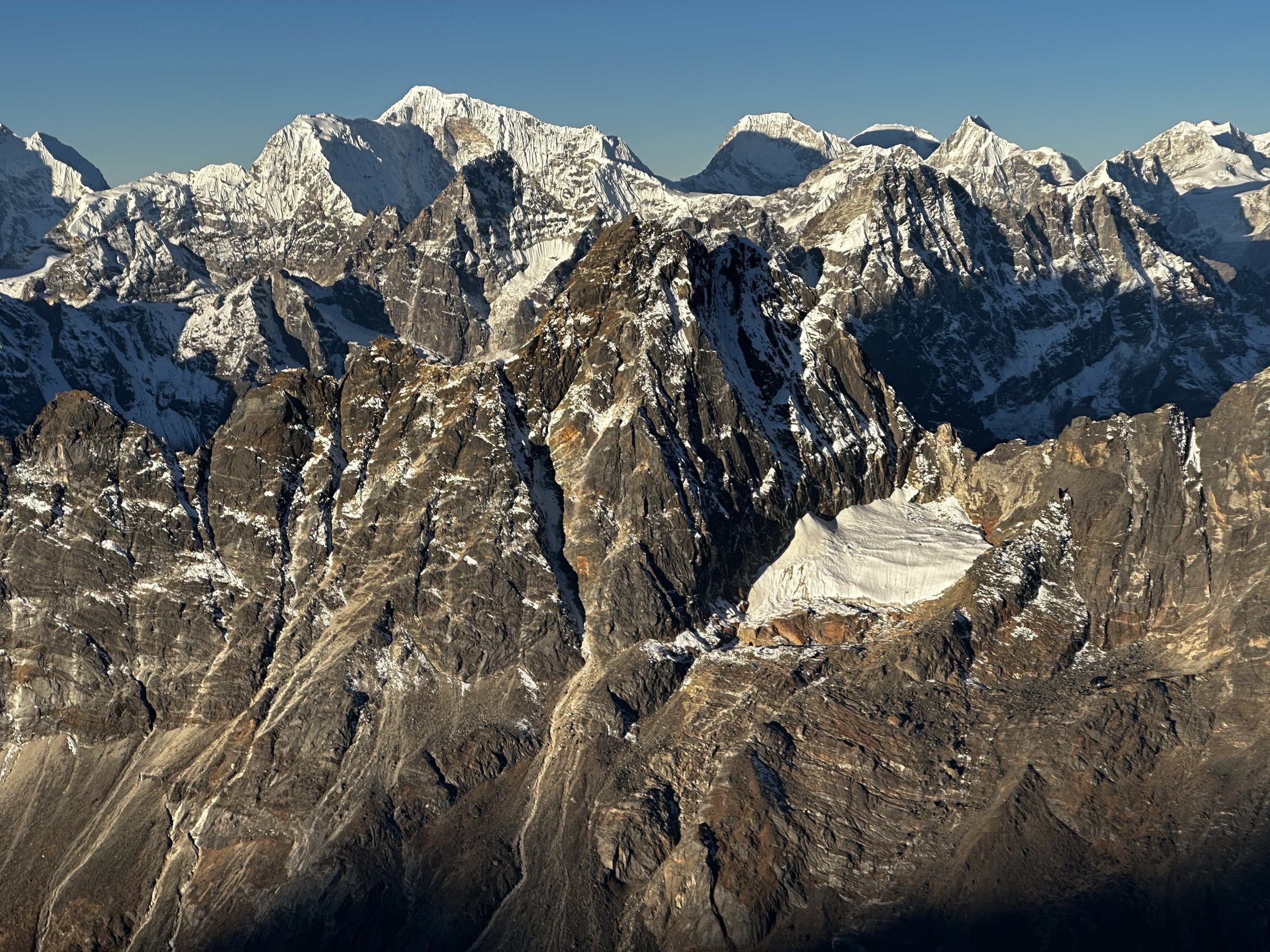
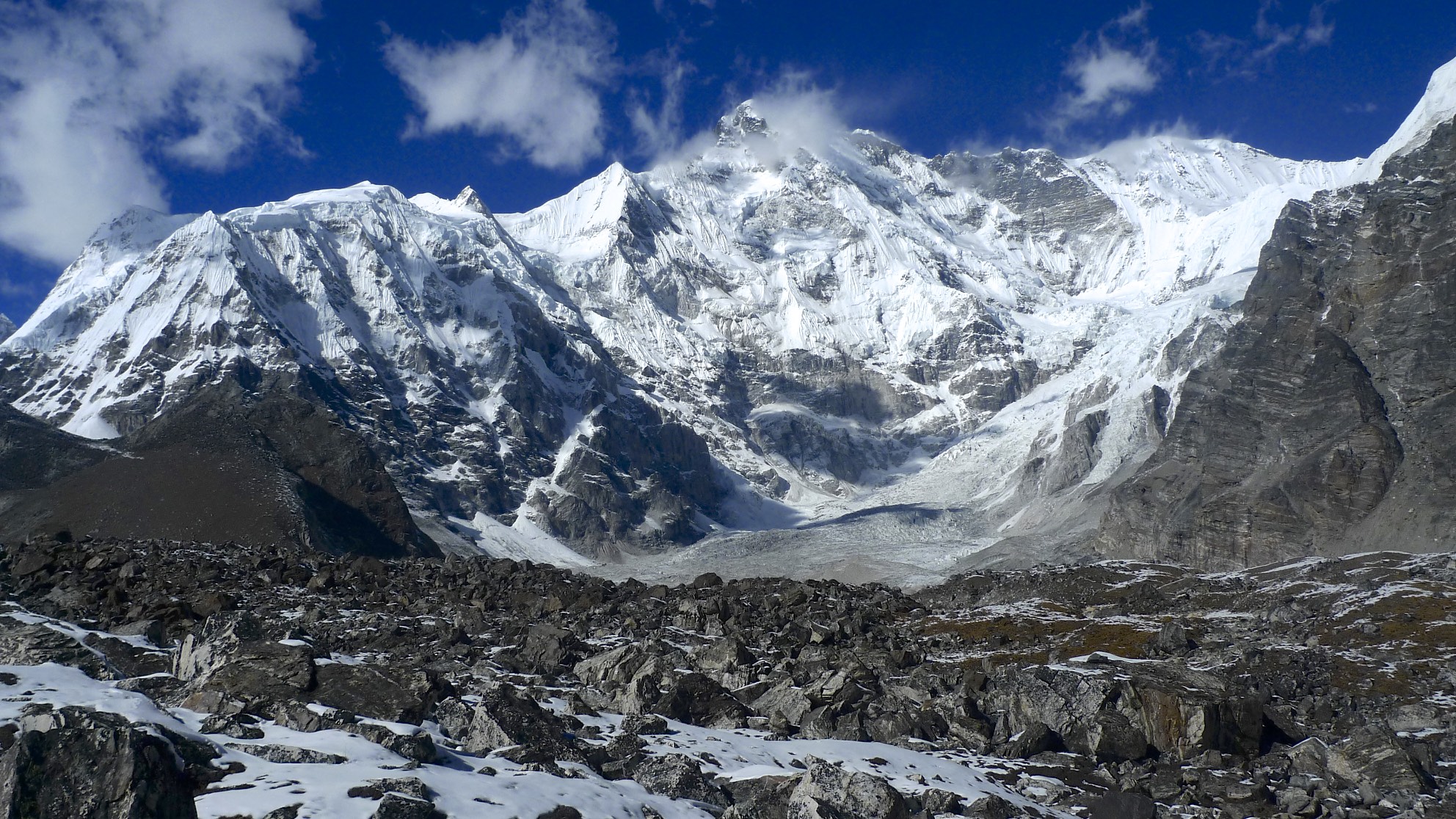
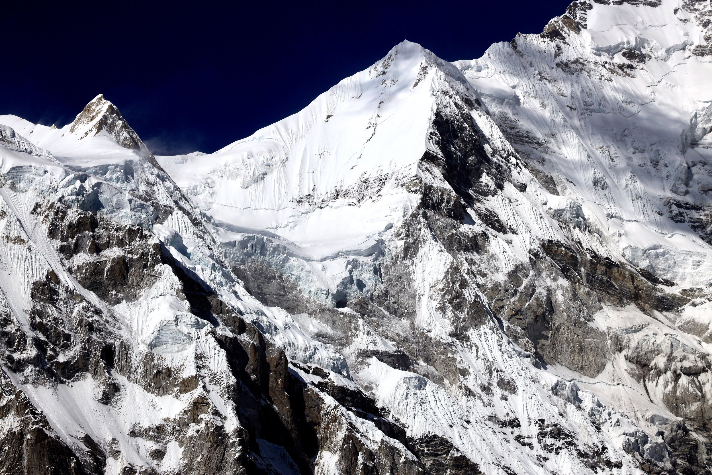
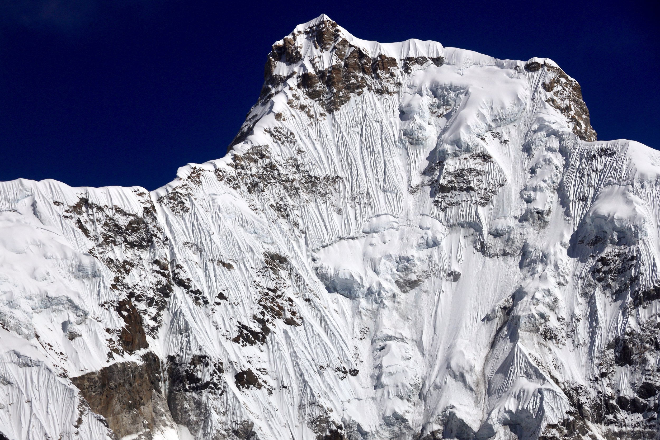
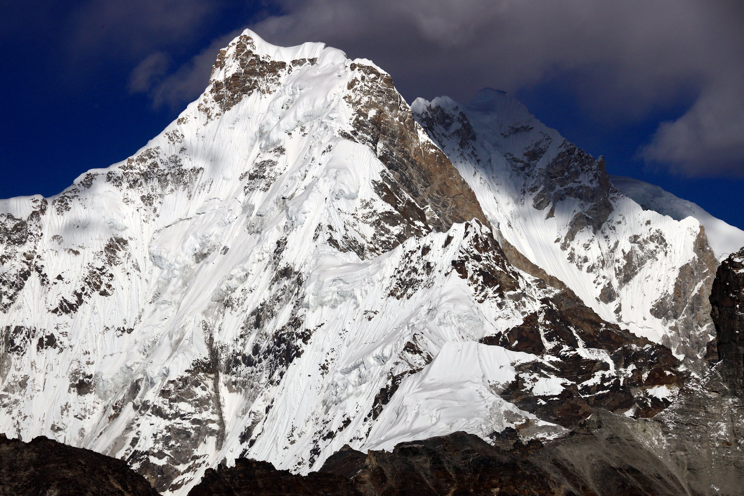
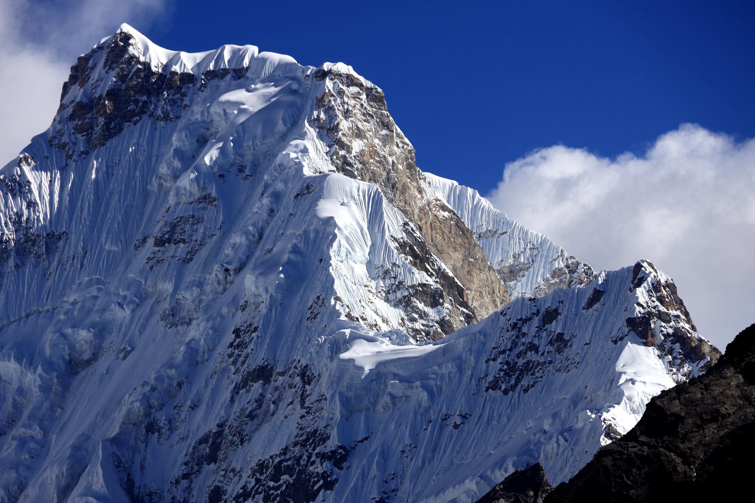
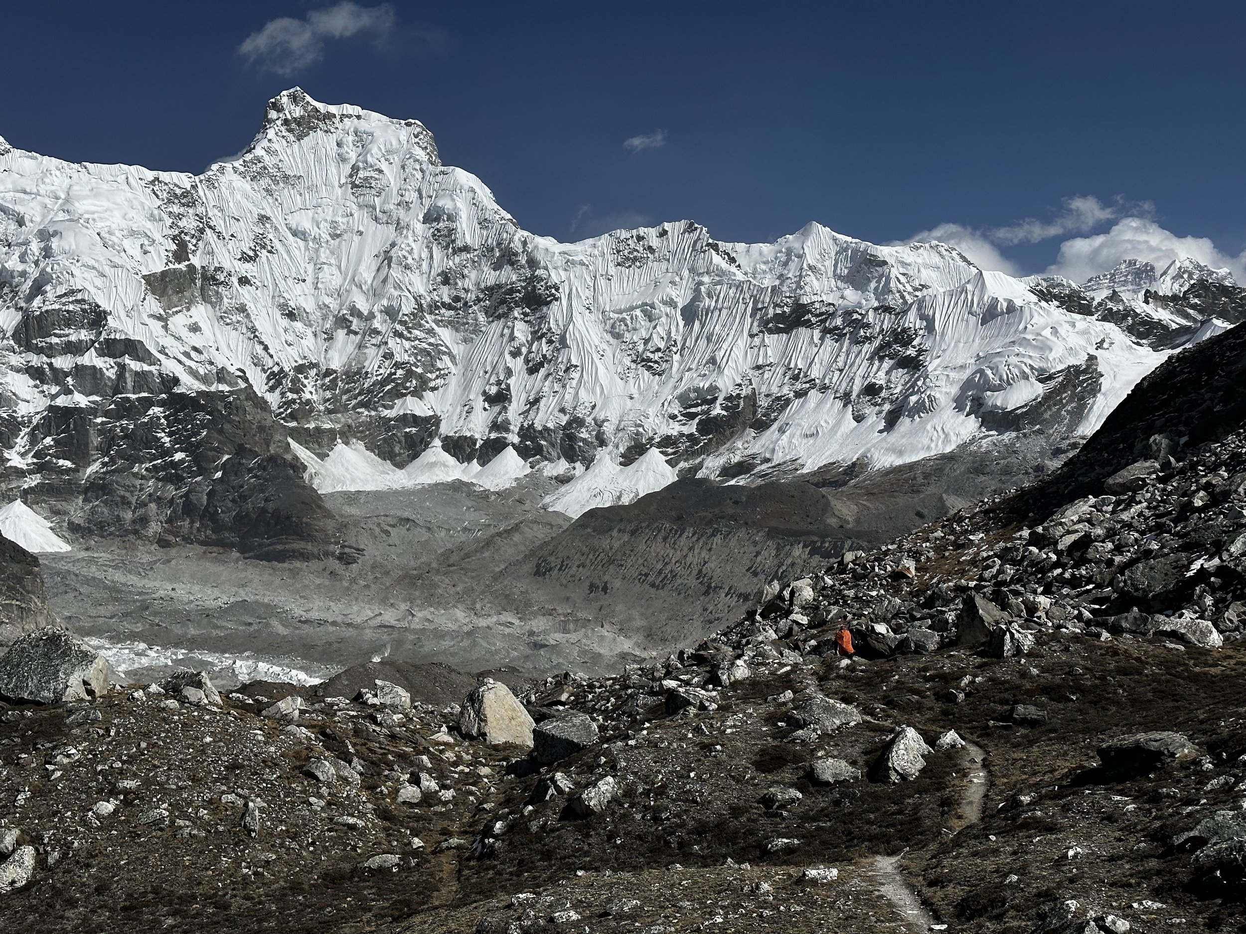
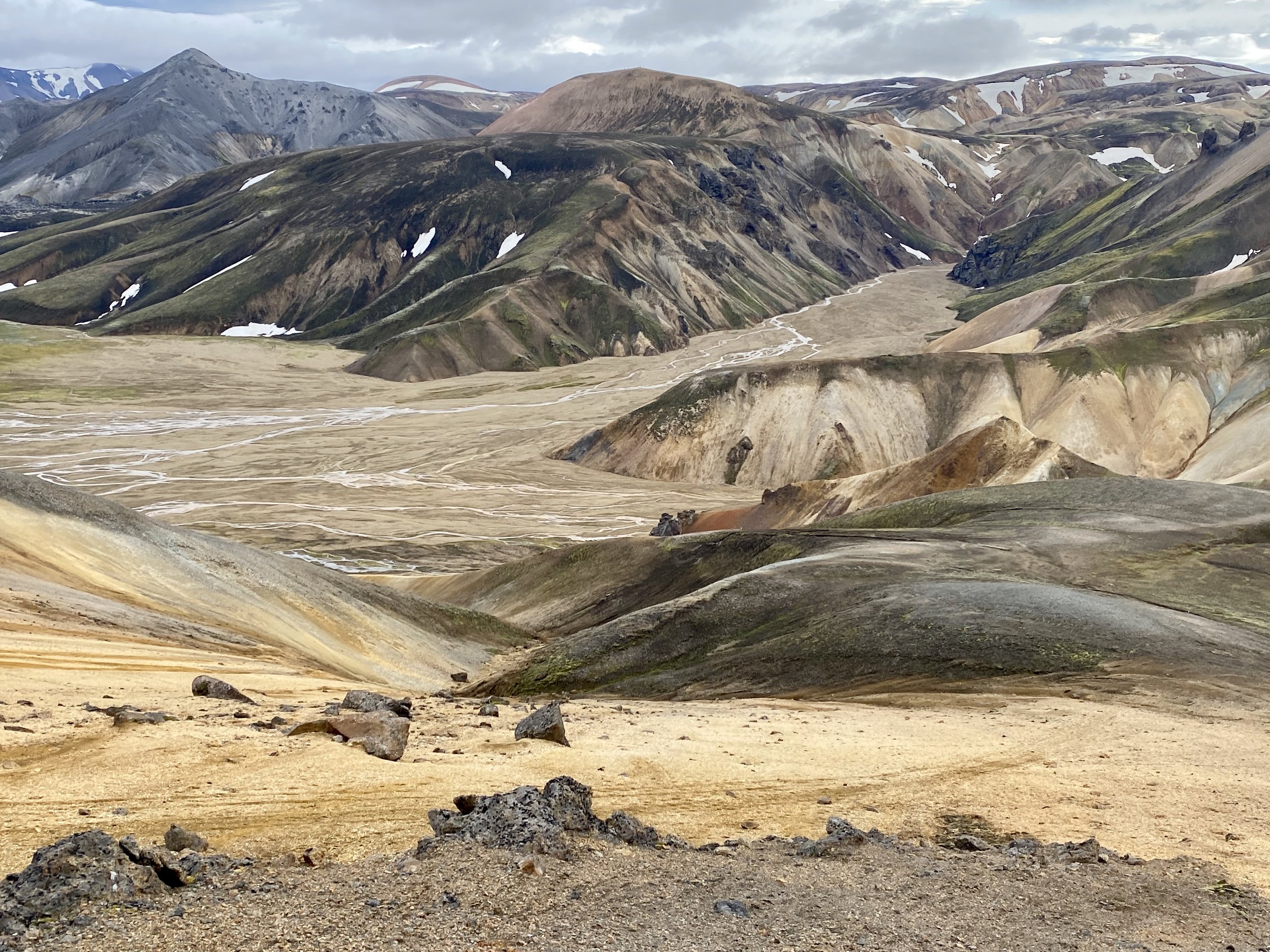
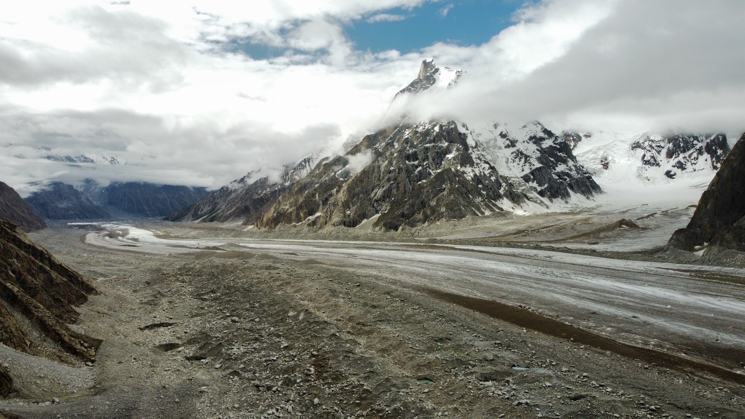
This bypass added at least one hour to our day but since the distance was short, it did not matter.  Once we reached the other side, we ascended a grassy hill and regained the trail.  The trail went along and above the glacier with spectacular views.  Absolutely stunning.  As we approached the Moretti Camp, the teeth like peaks on the north side of the Choktoi Glacier came into view.   The panorama was stunning:  sharp, steep towers line the surrounding glaciers.  These do not look like normal mountains but like dinosaur teeth. 

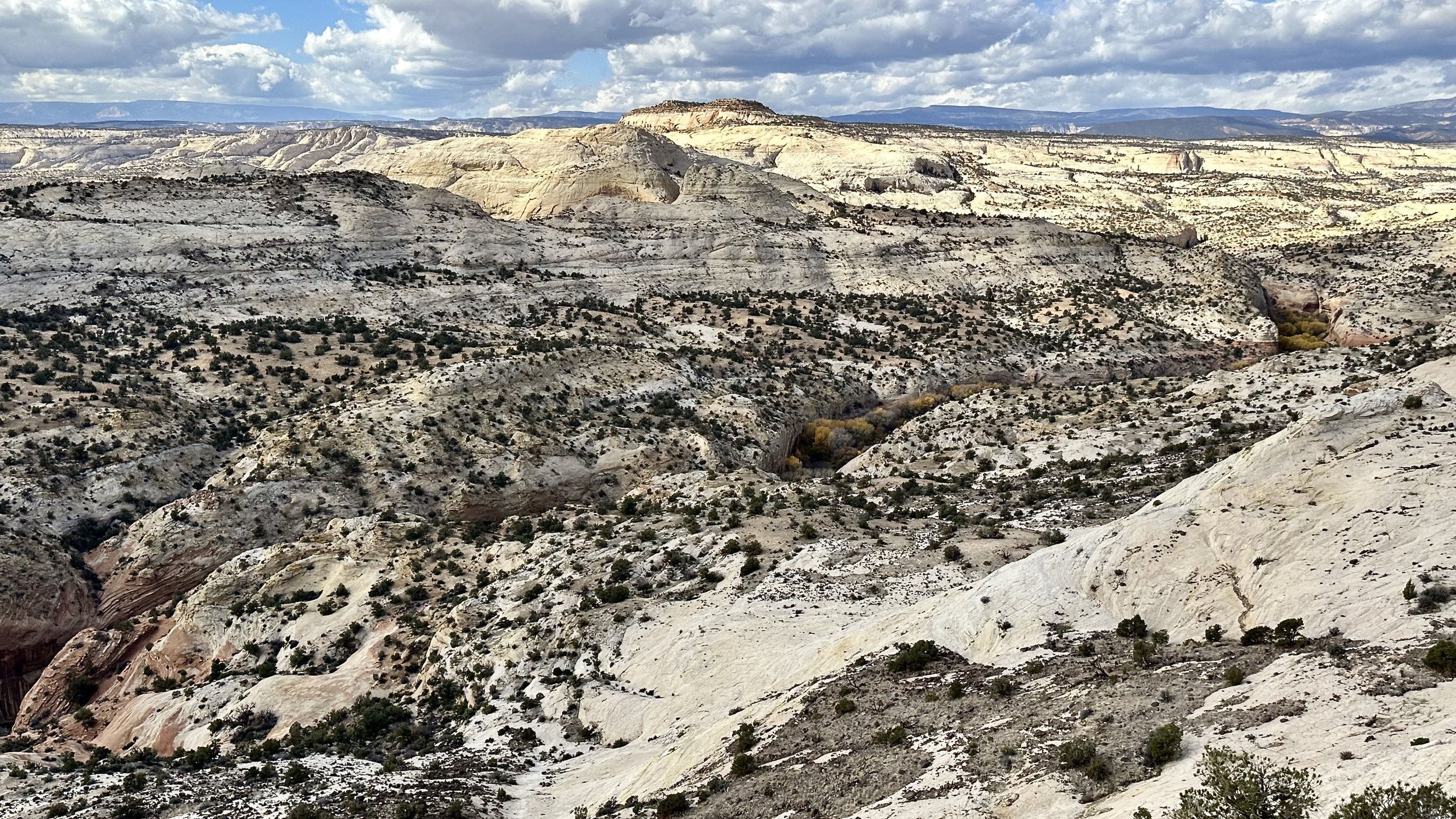
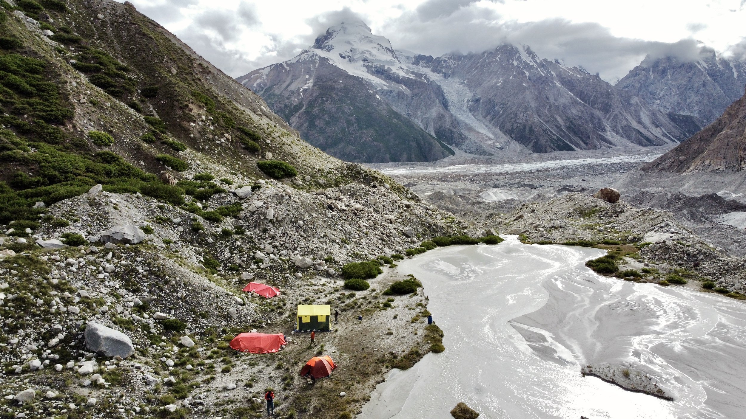
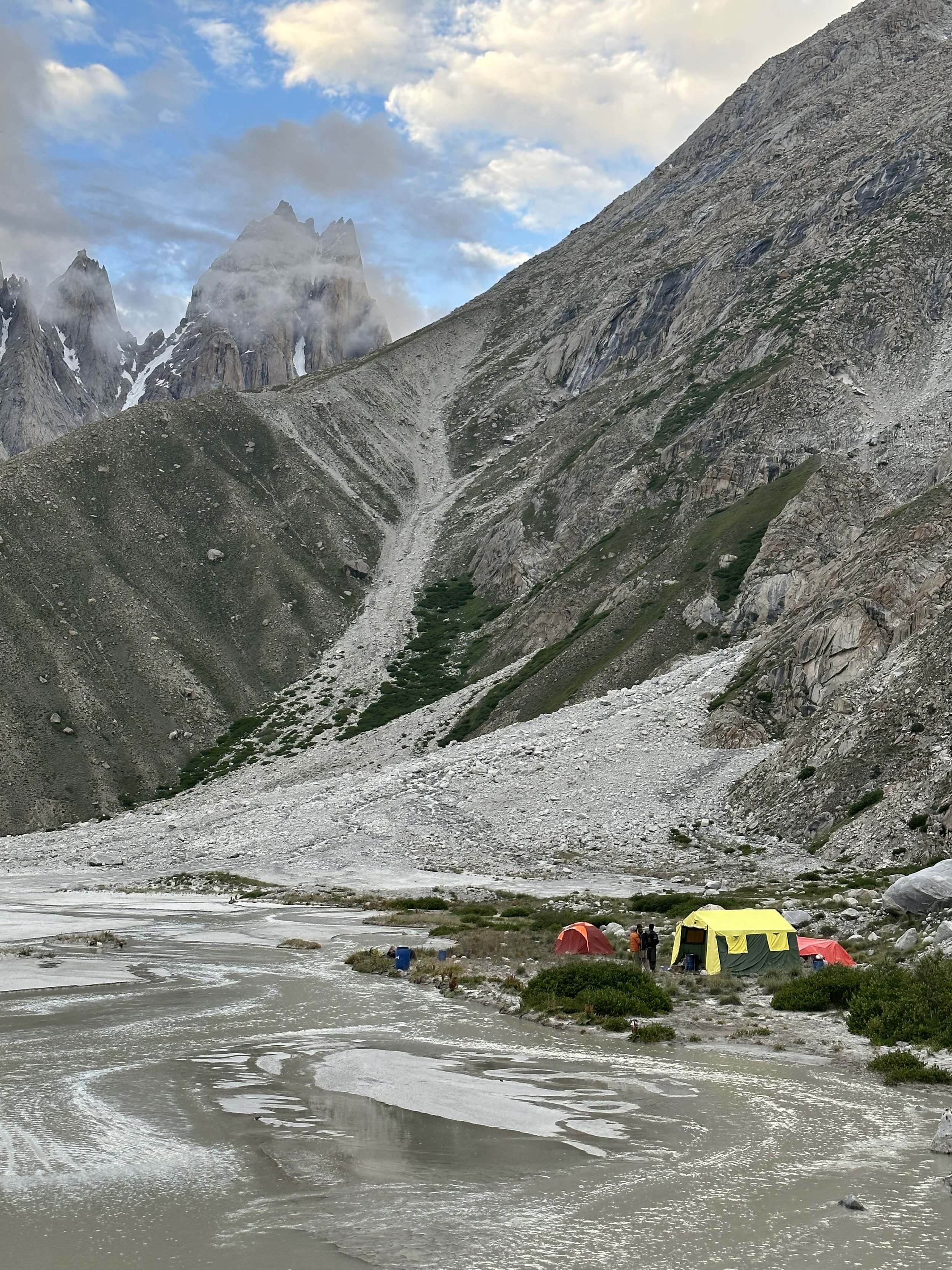
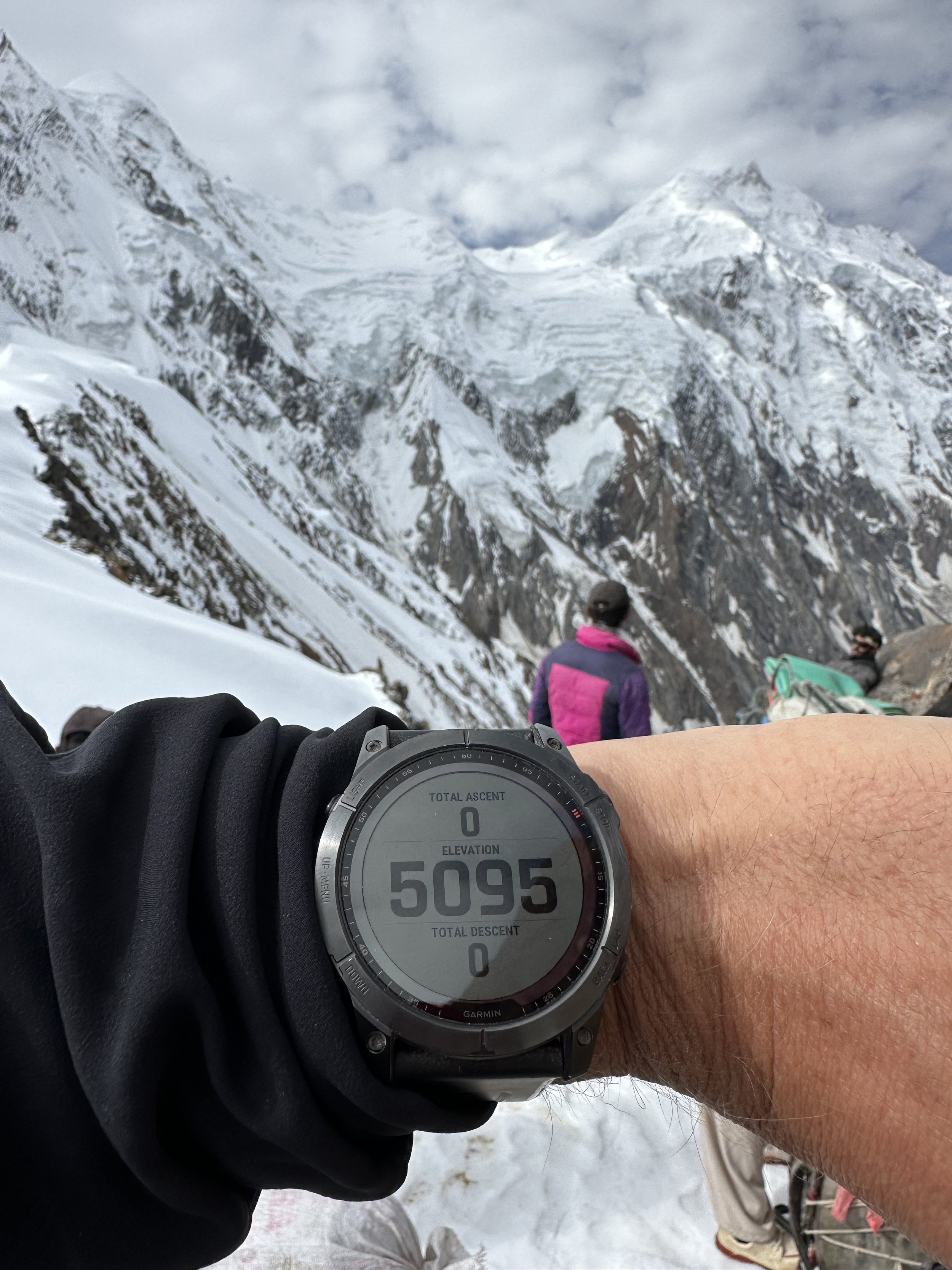
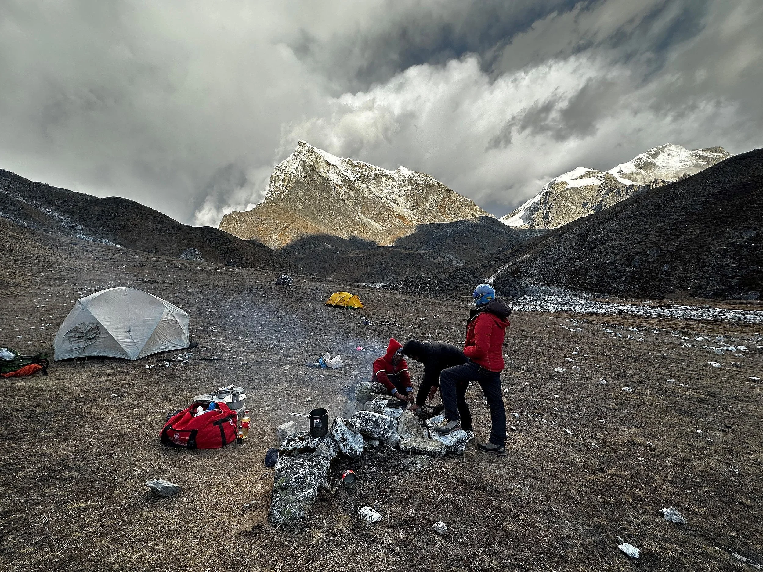
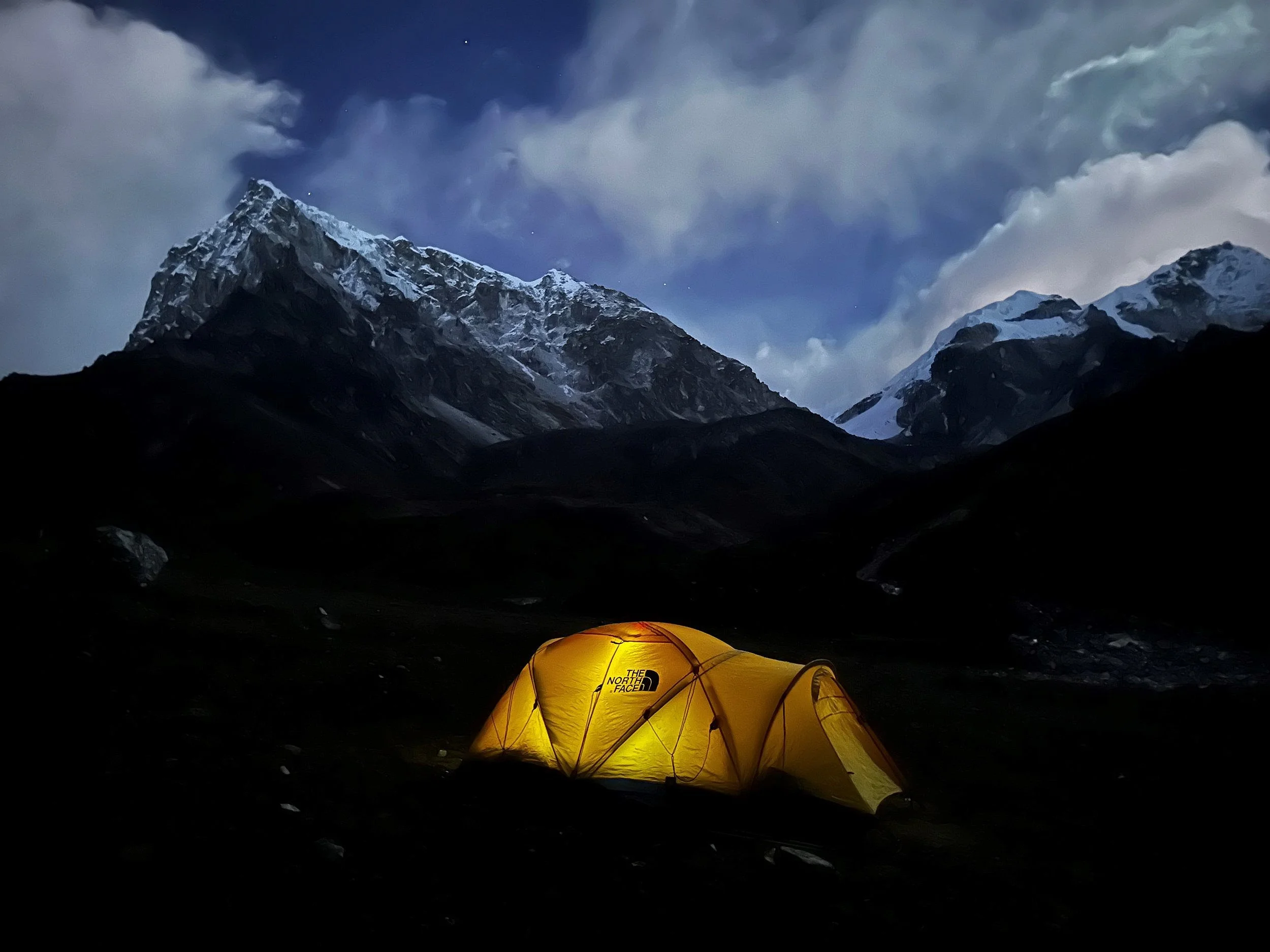
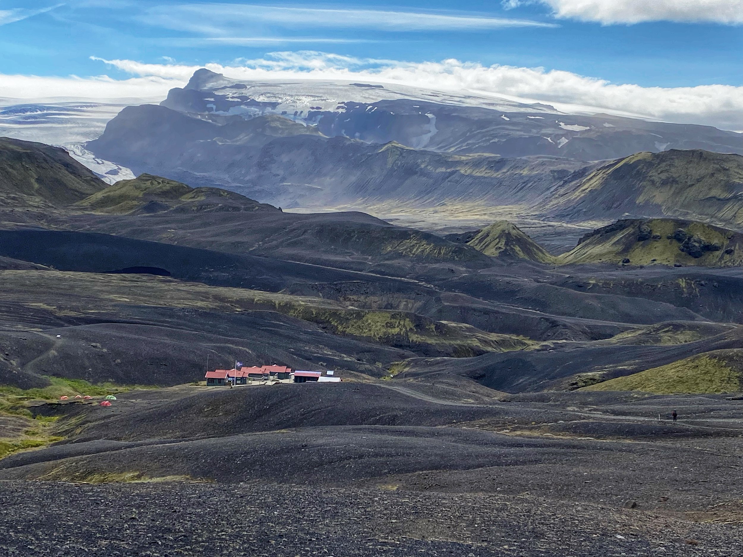
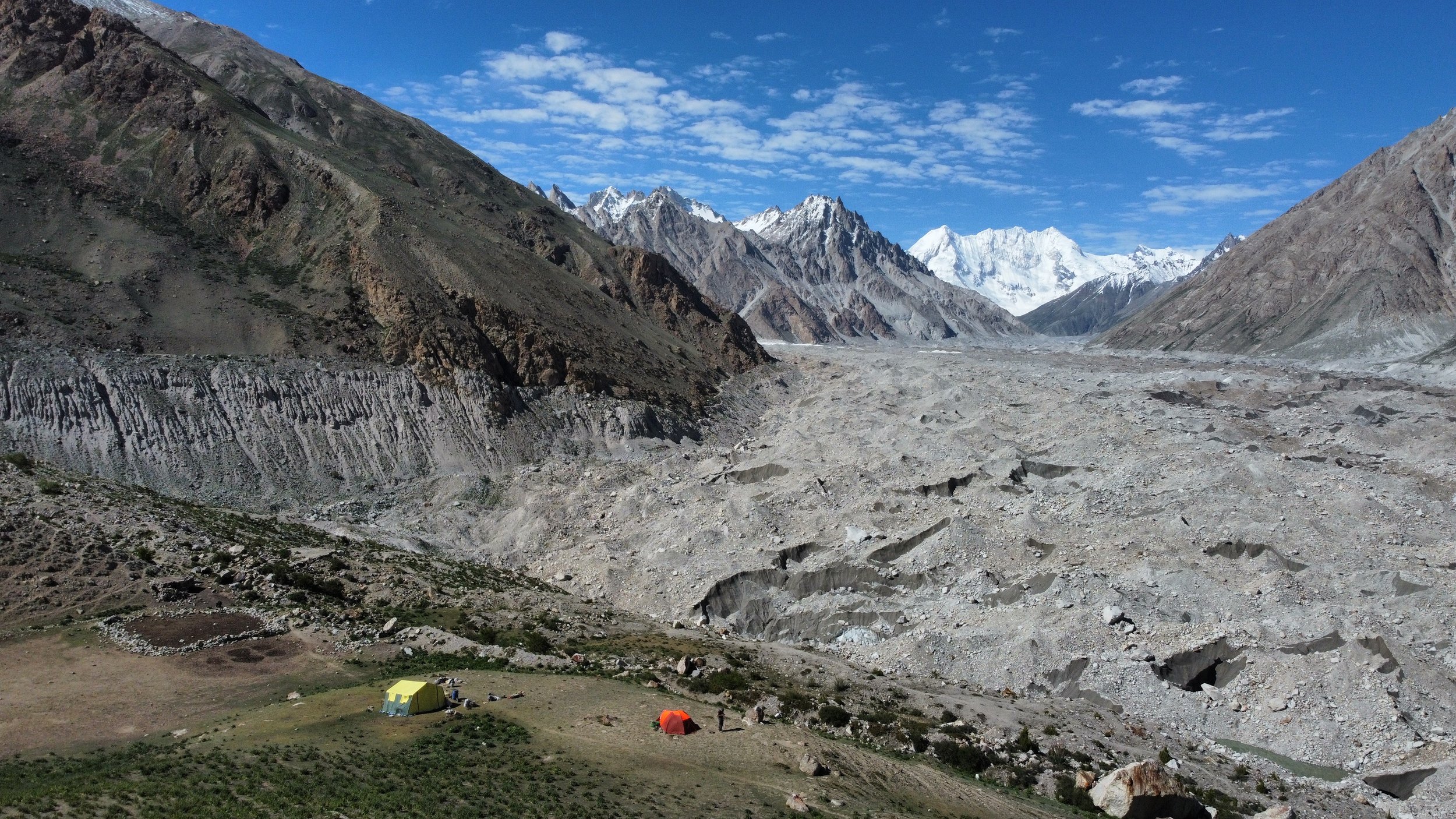
The Moretti Camp is in a spectacular setting at the confluence of the Choktoi and Panamagh Glaciers with freshwater stream running through it.  The stream originates from the small hanging glacier above the camp that we could see.  The camp was hidden behind a side moraine of the Choktoi Glacier.  We were now 4 hours away from the Latok BC.   We arrived at the campsite at 10am so I had the entire day to enjoy the magnificence surrounding us. 

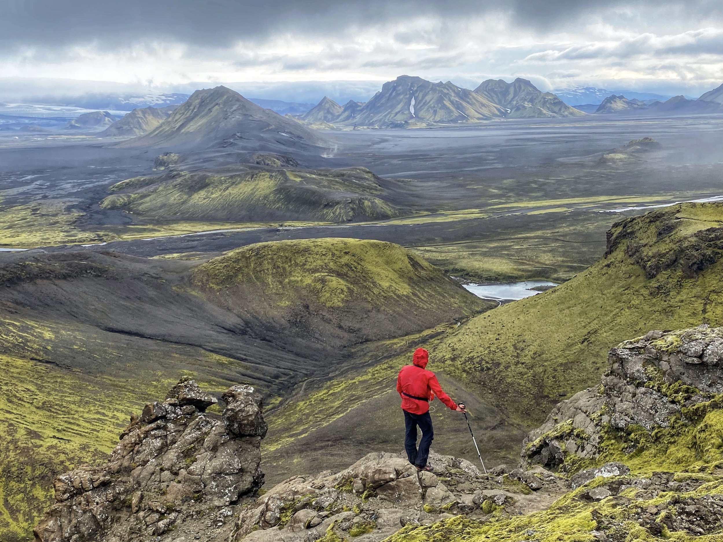
I climbed the hill behind the camp to get a commanding view of the area and our camp.  The terrain here is very big and dramatic.  What looks near is actually 10-15 or 40 km away involving walking on challenging terrain and, so far, in the heat.  It is hard to get a sense of scale as everything is big.  It is also hard to believe that one can get a heat stroke walking on a massive glacier.  It is all very spectacular!  Tomorrow we are going to the Latok BC and I hope that the weather does not change.  At least for one more day. Ominously, in the evening though, some high clouds appeared and made me worried that the weather was about to change. 

July 16, Latok BC, 12 km each way 400m gain

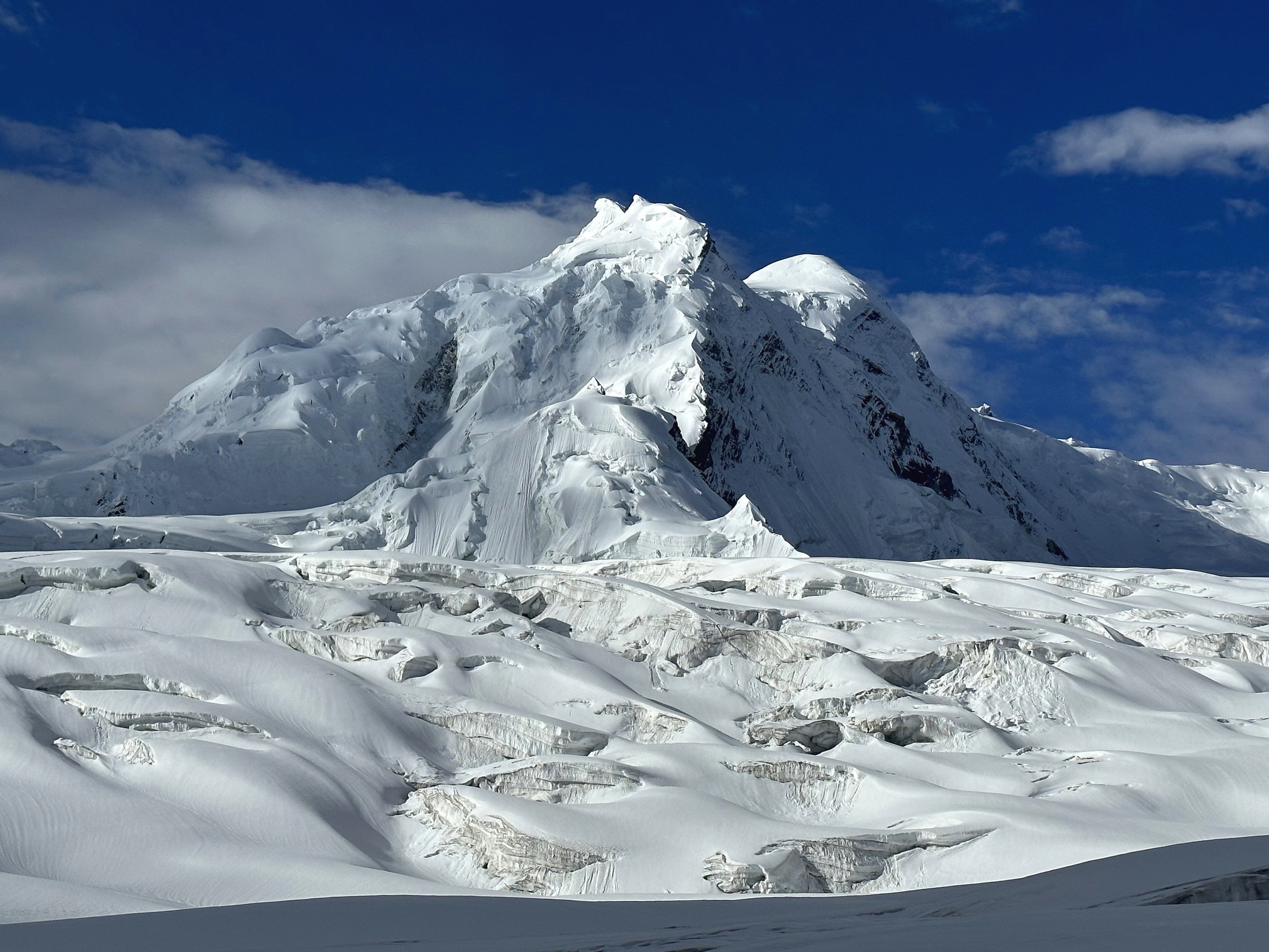
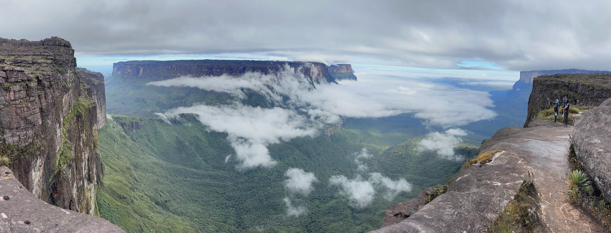
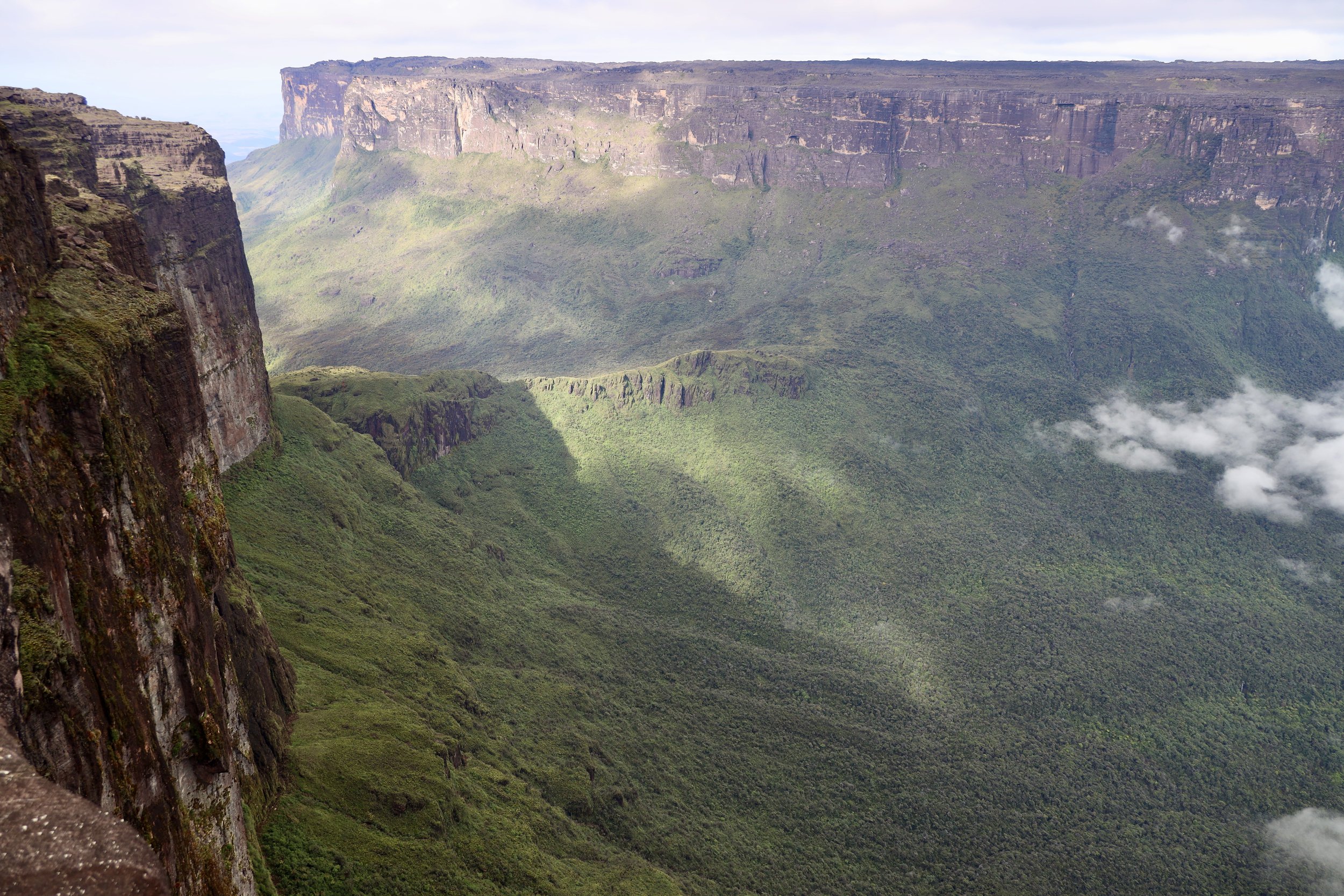
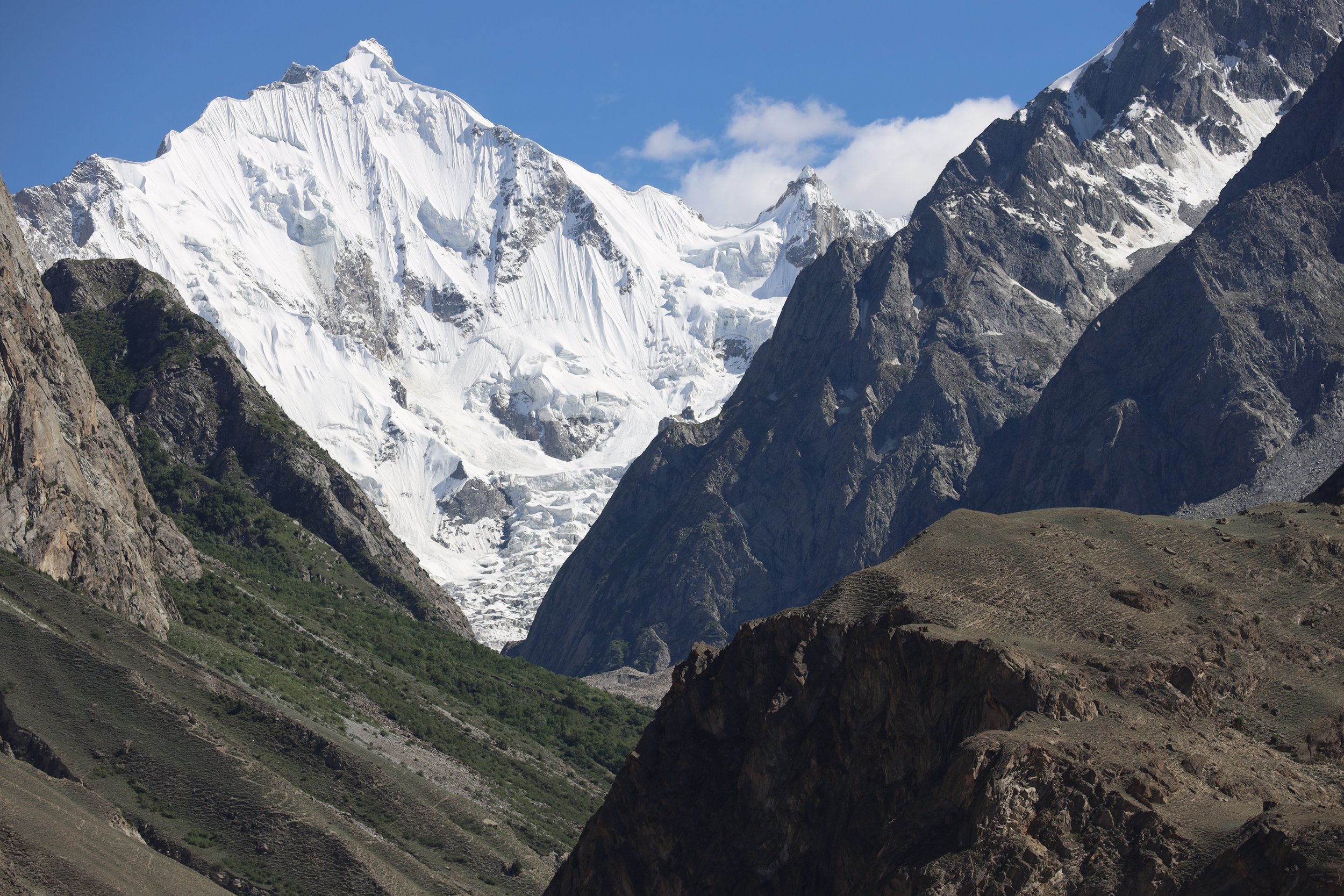
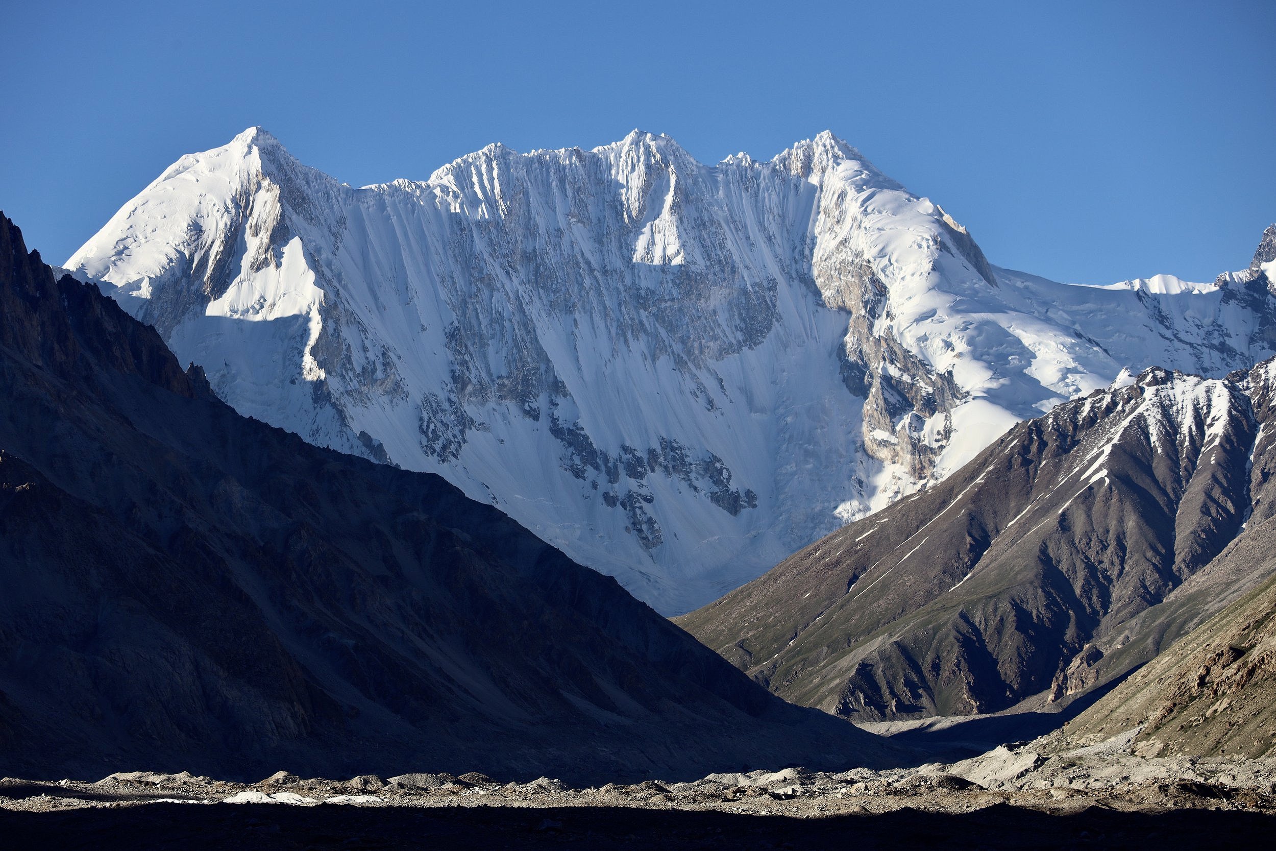
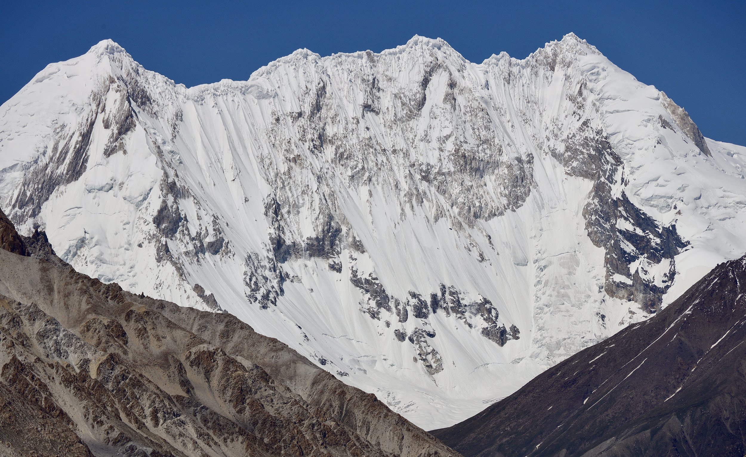
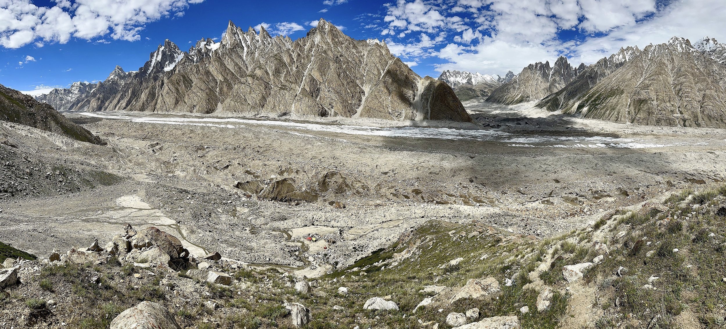
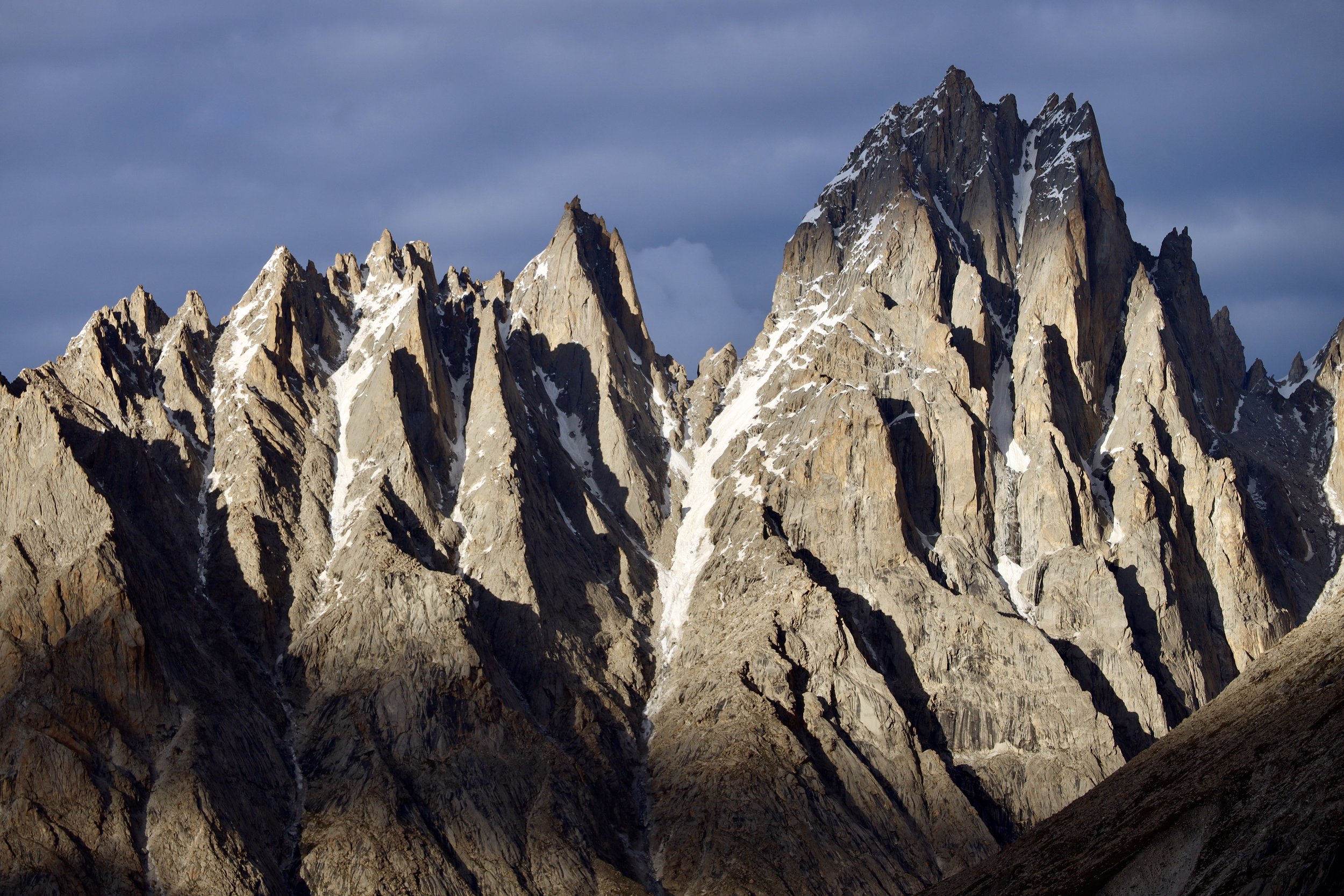
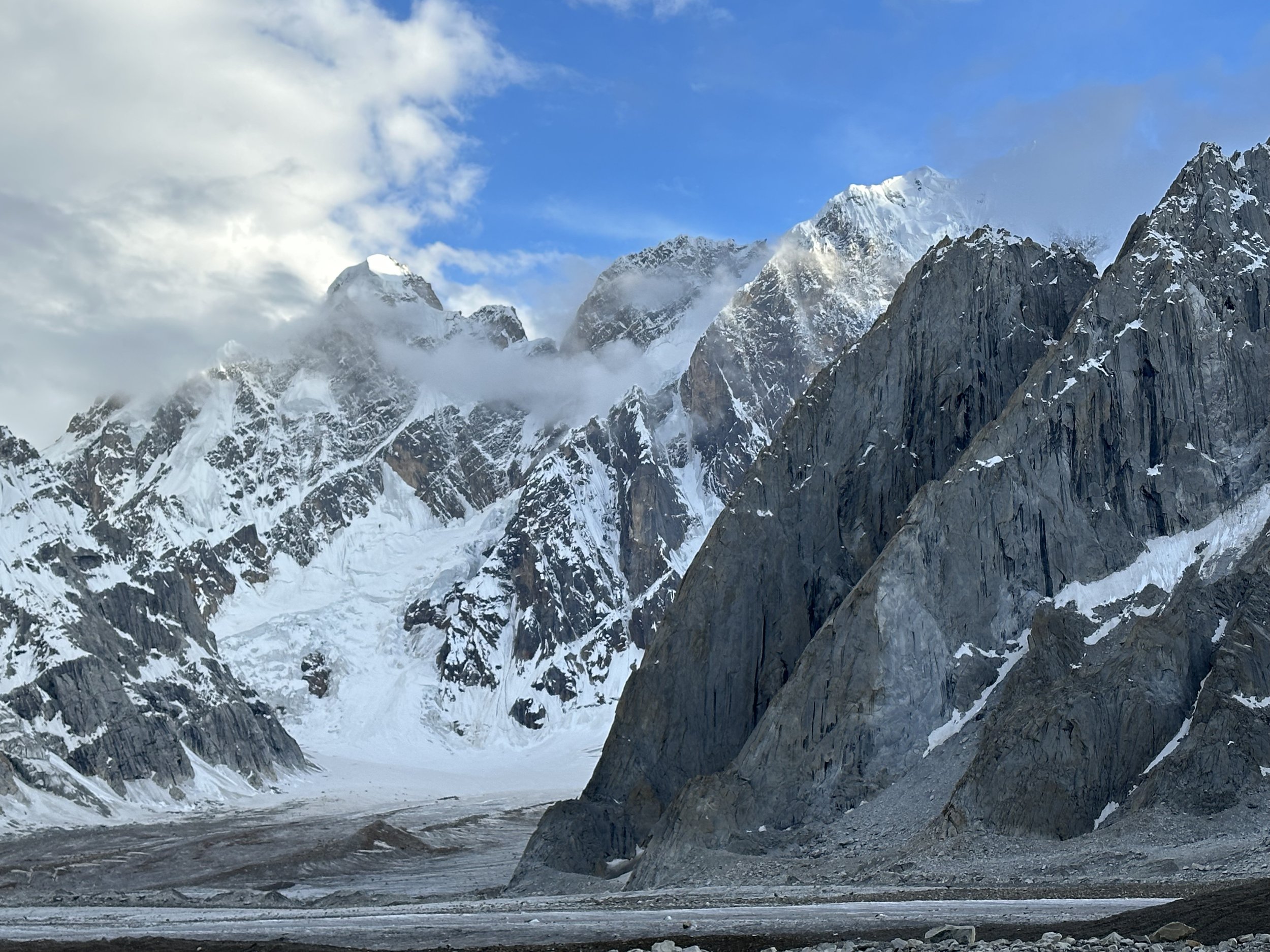
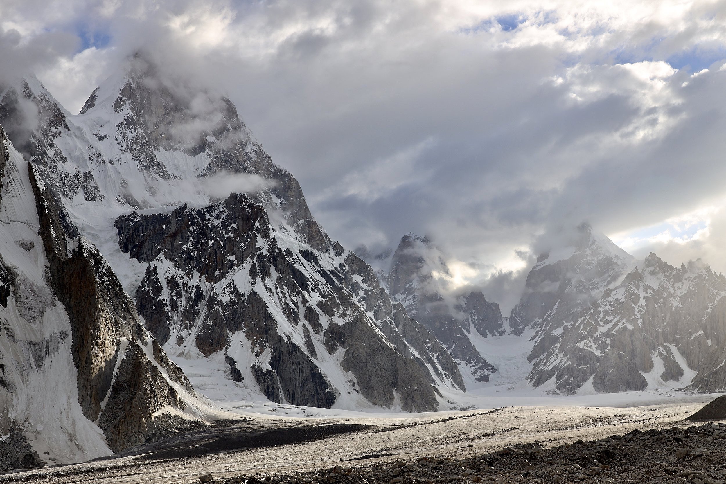
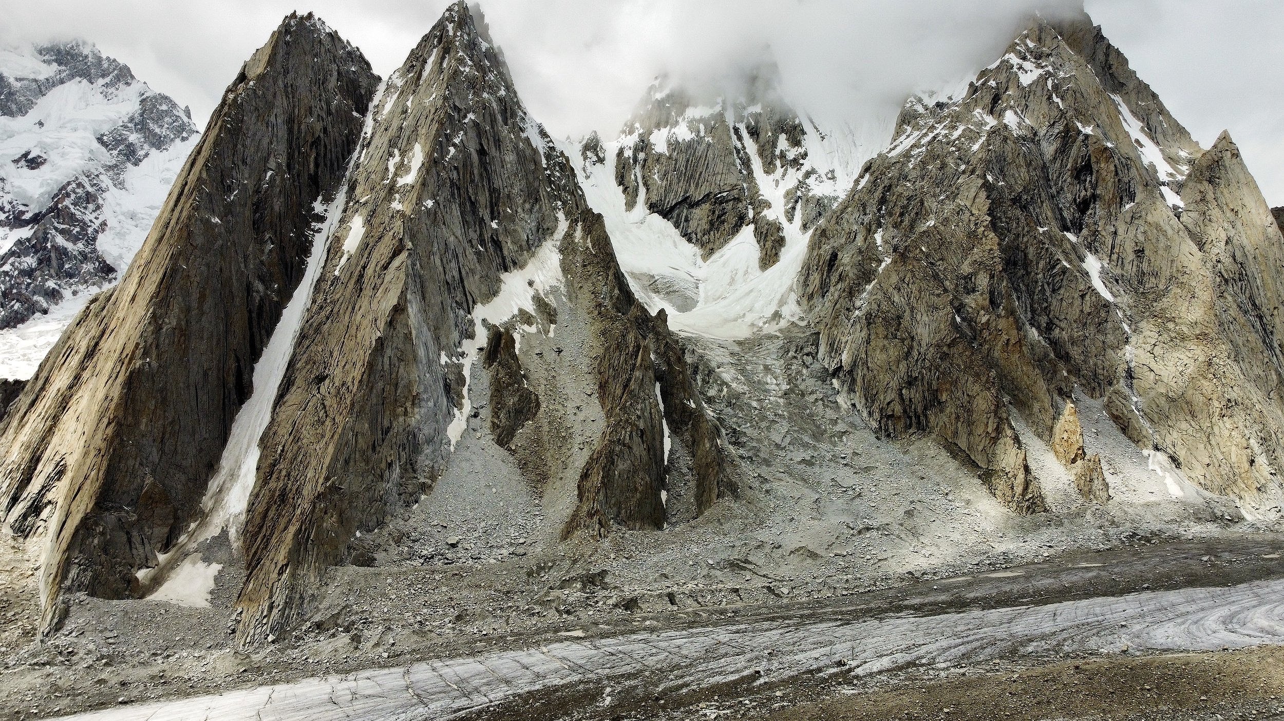
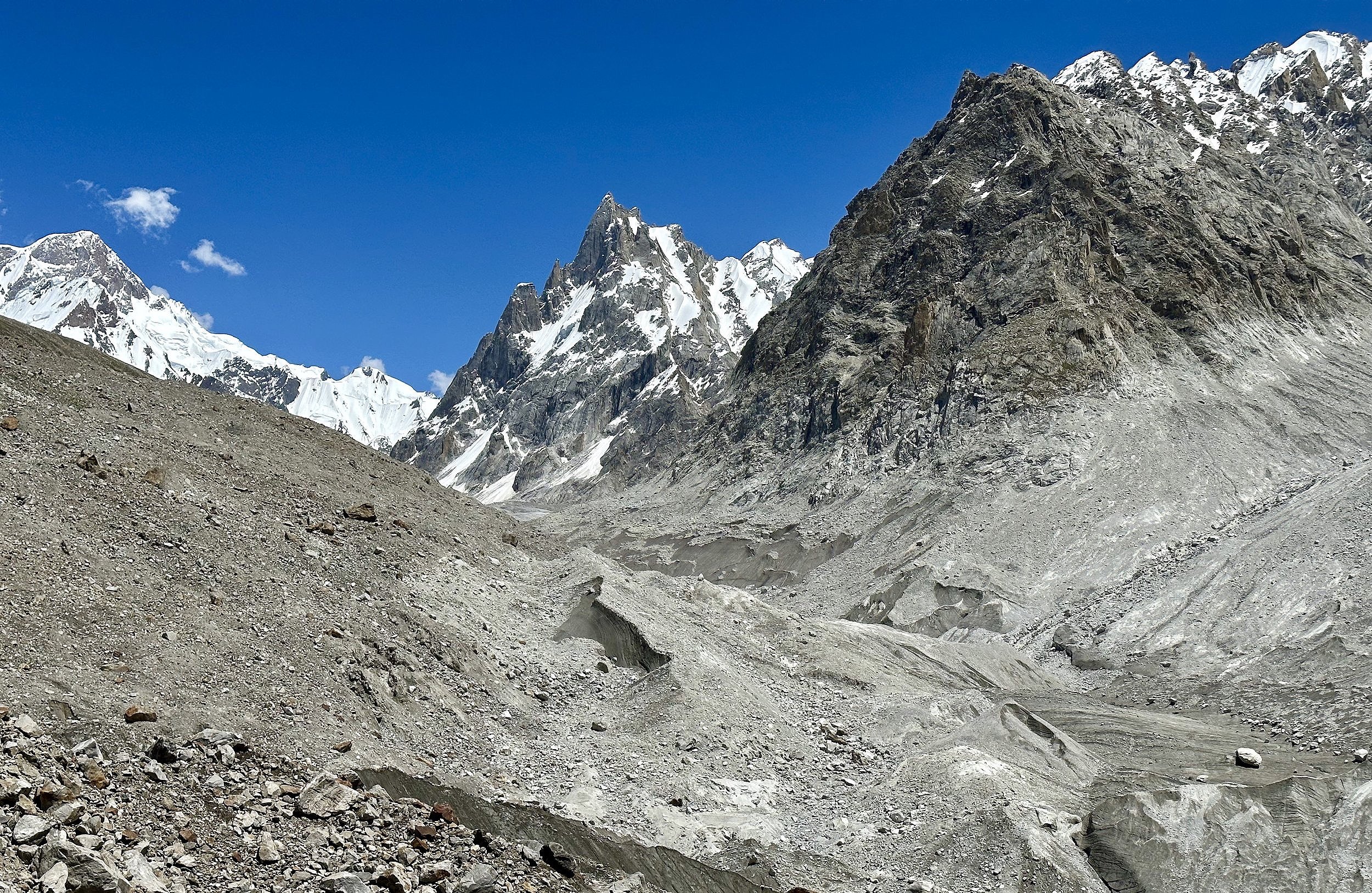
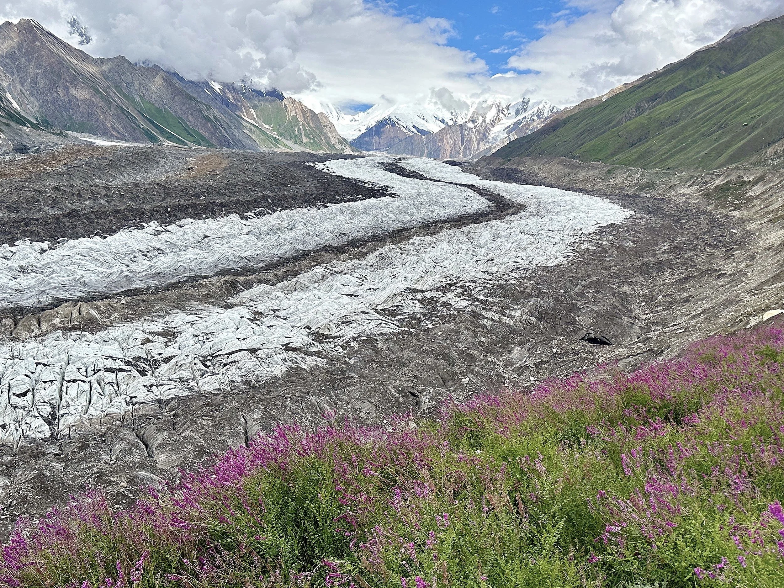
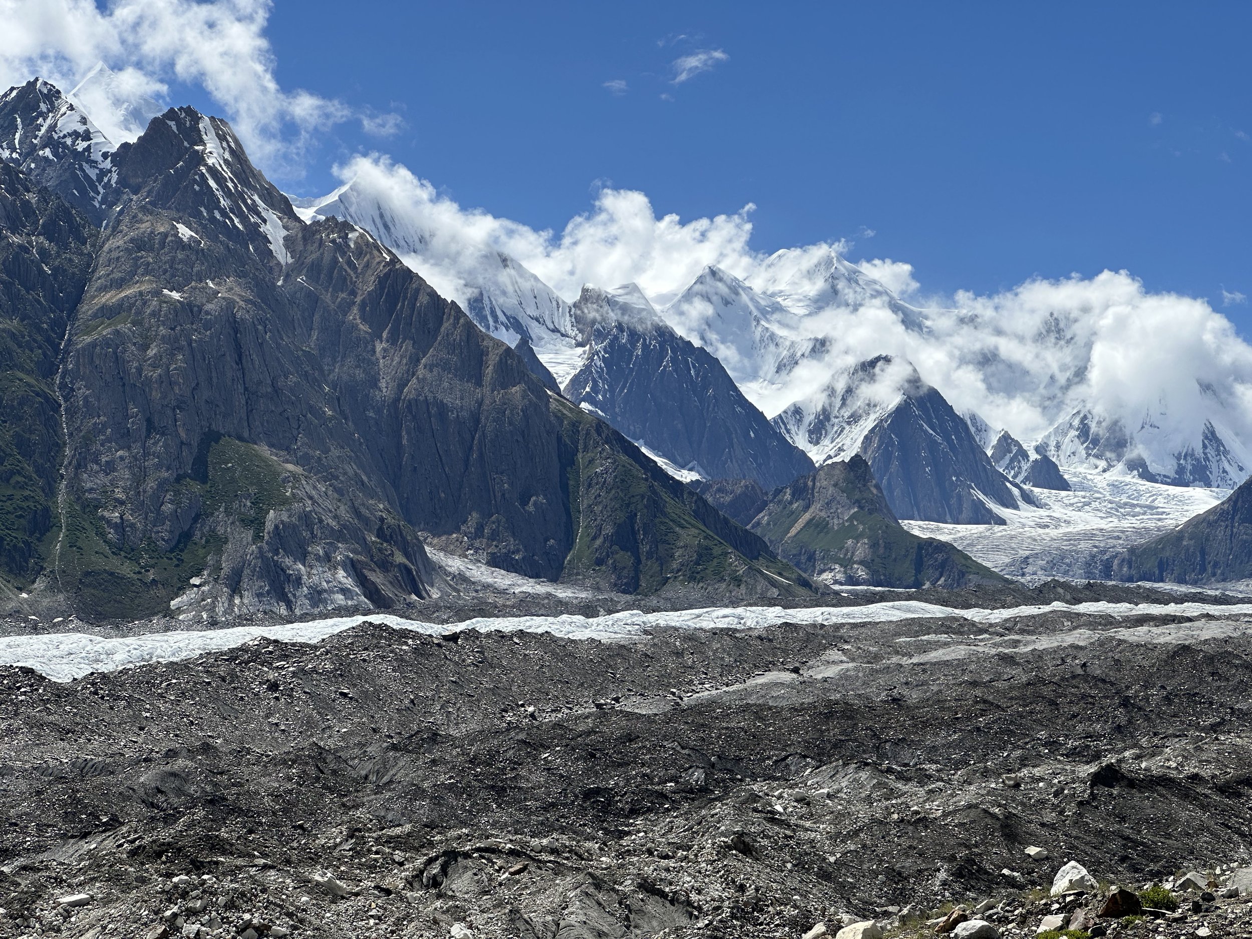
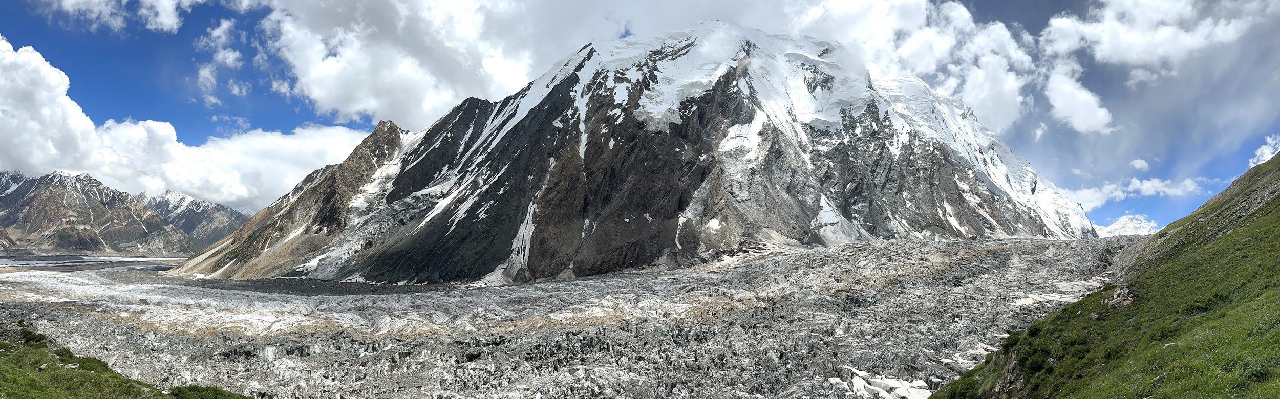
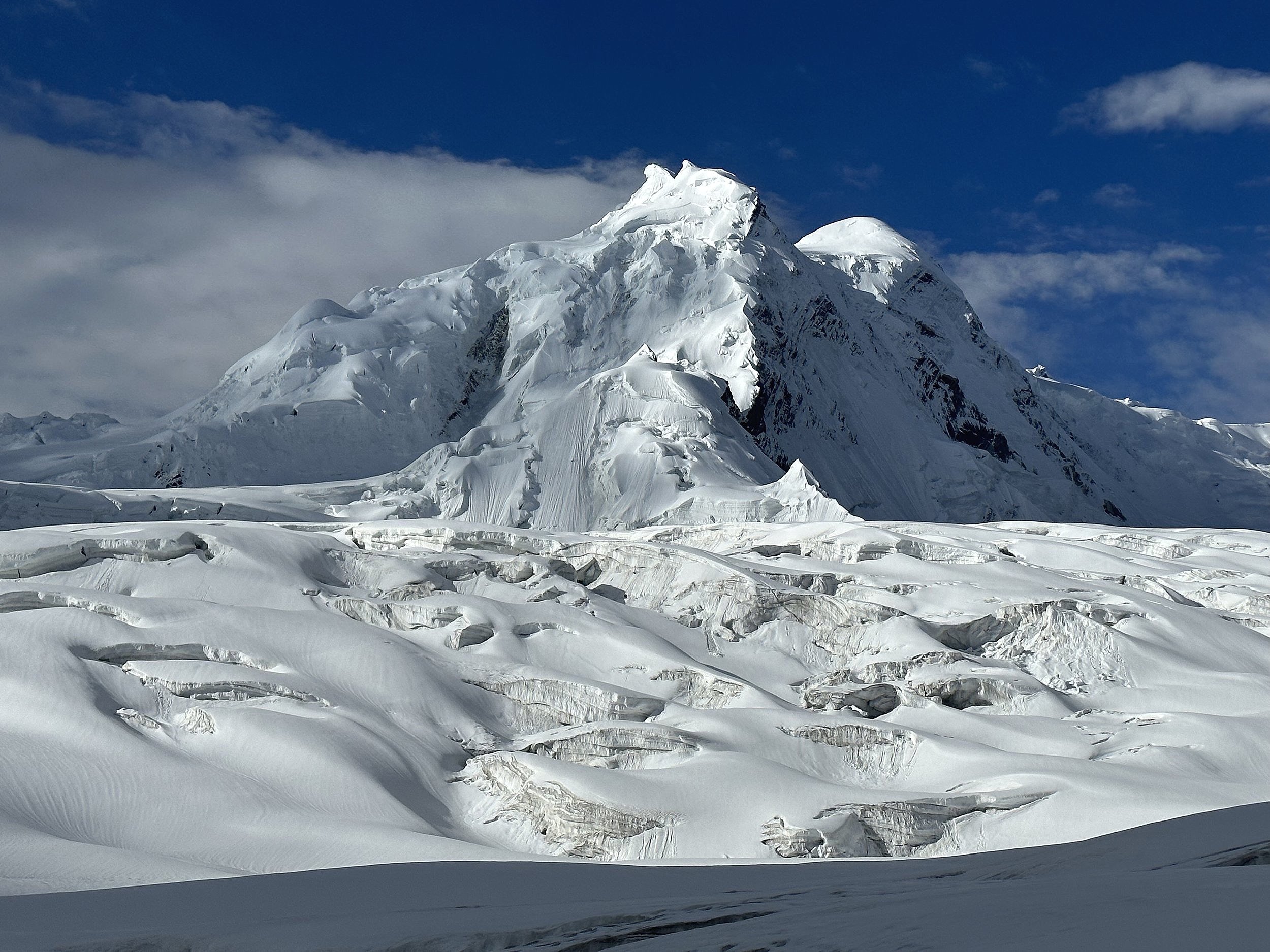
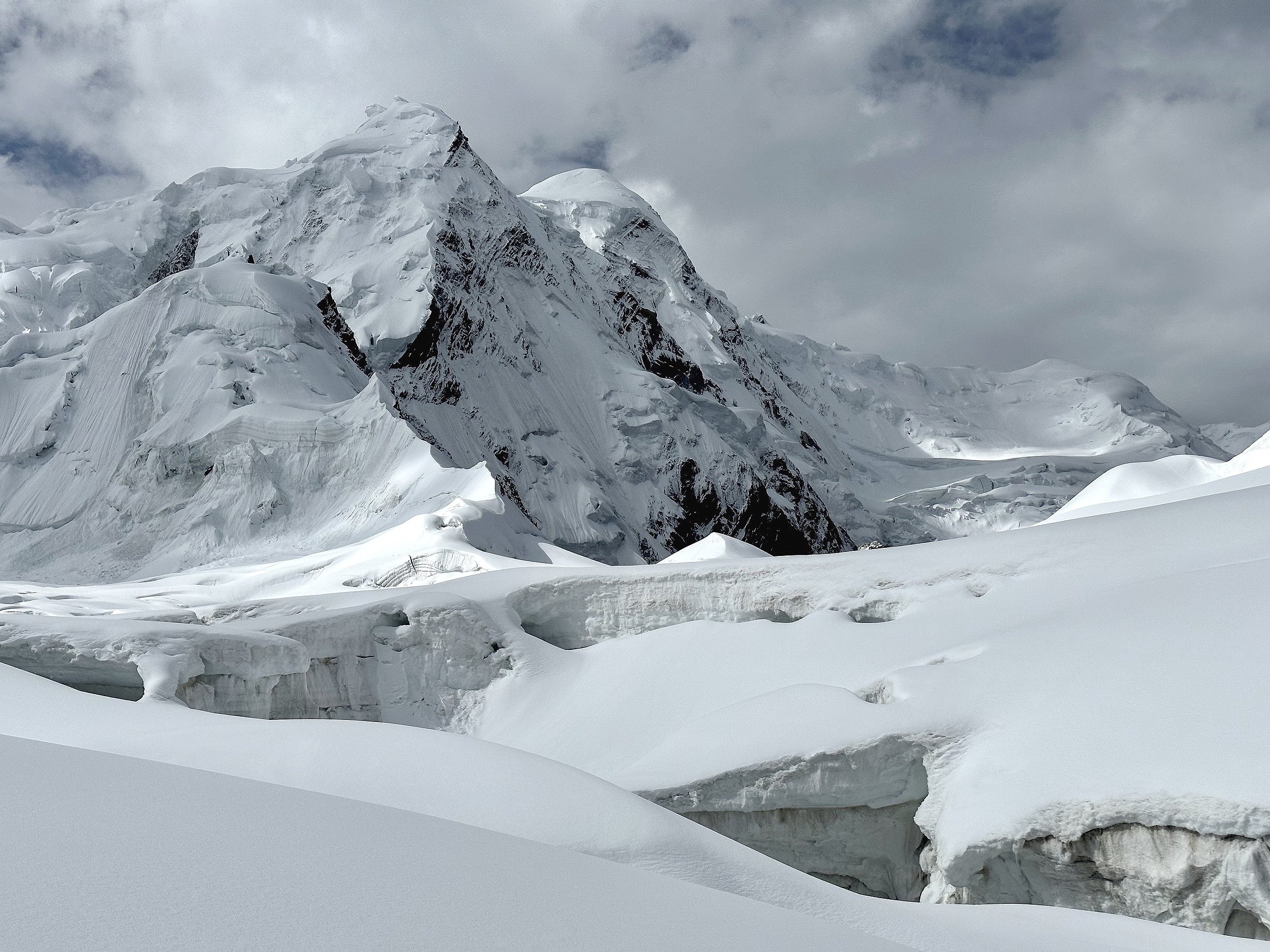
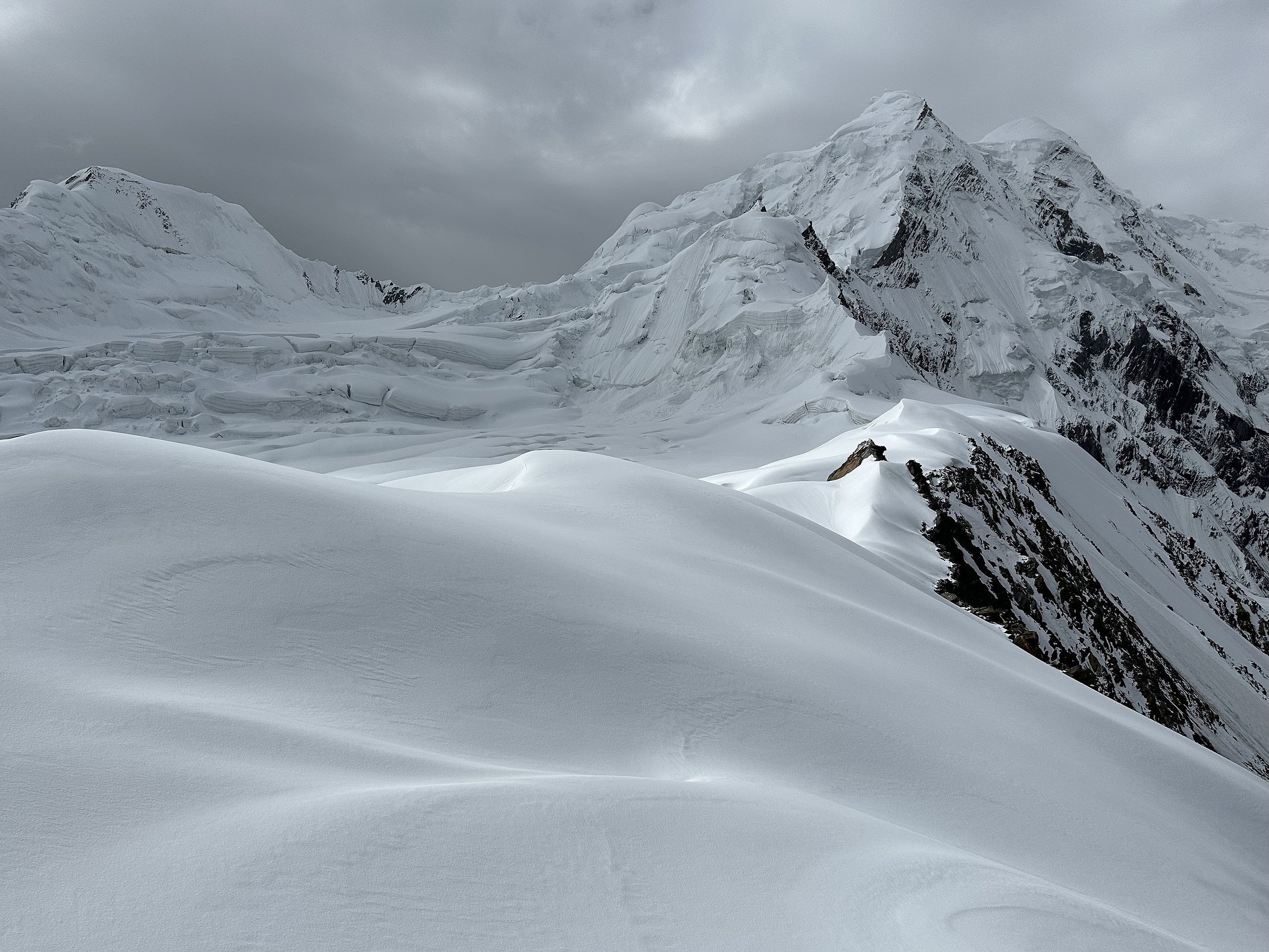
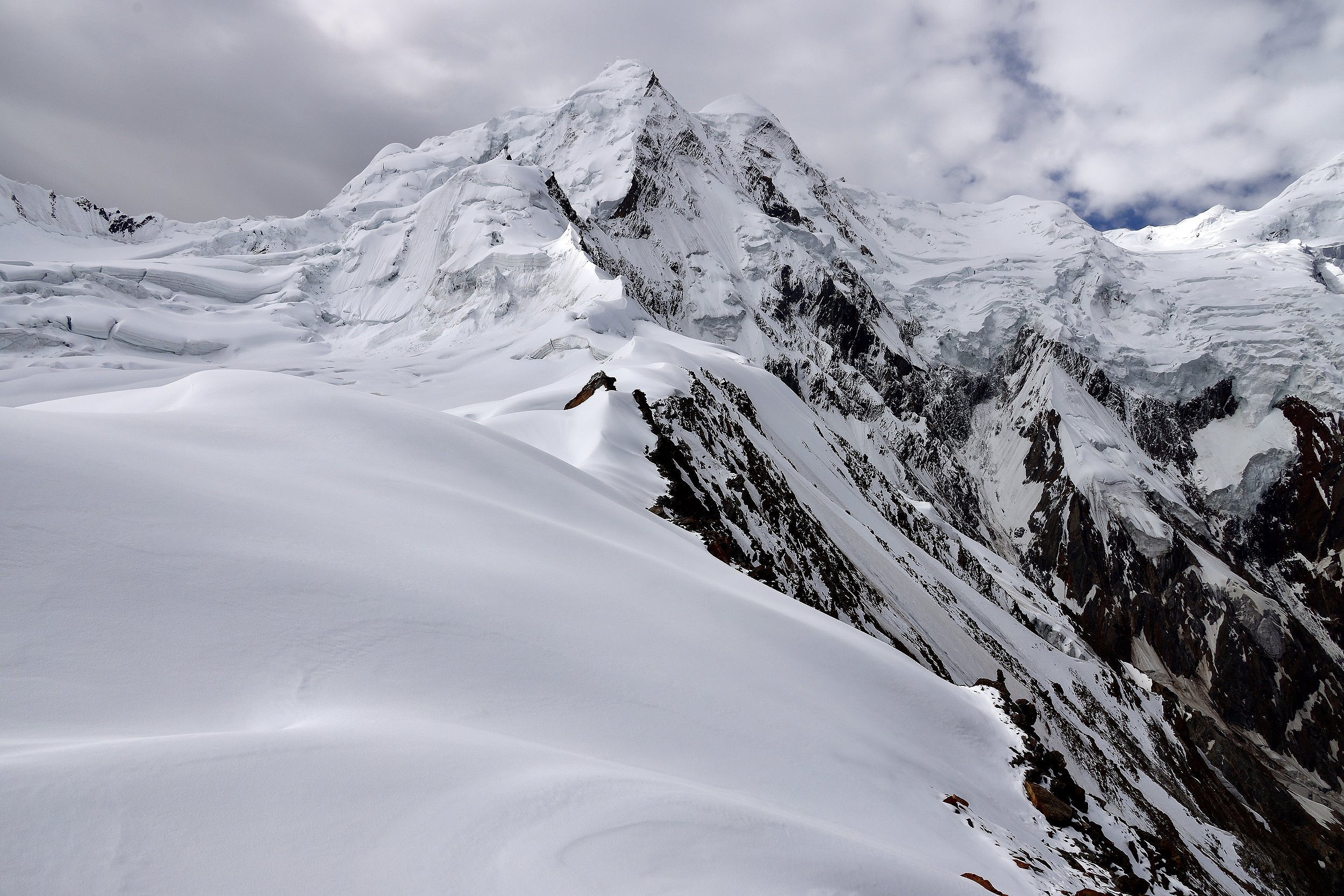
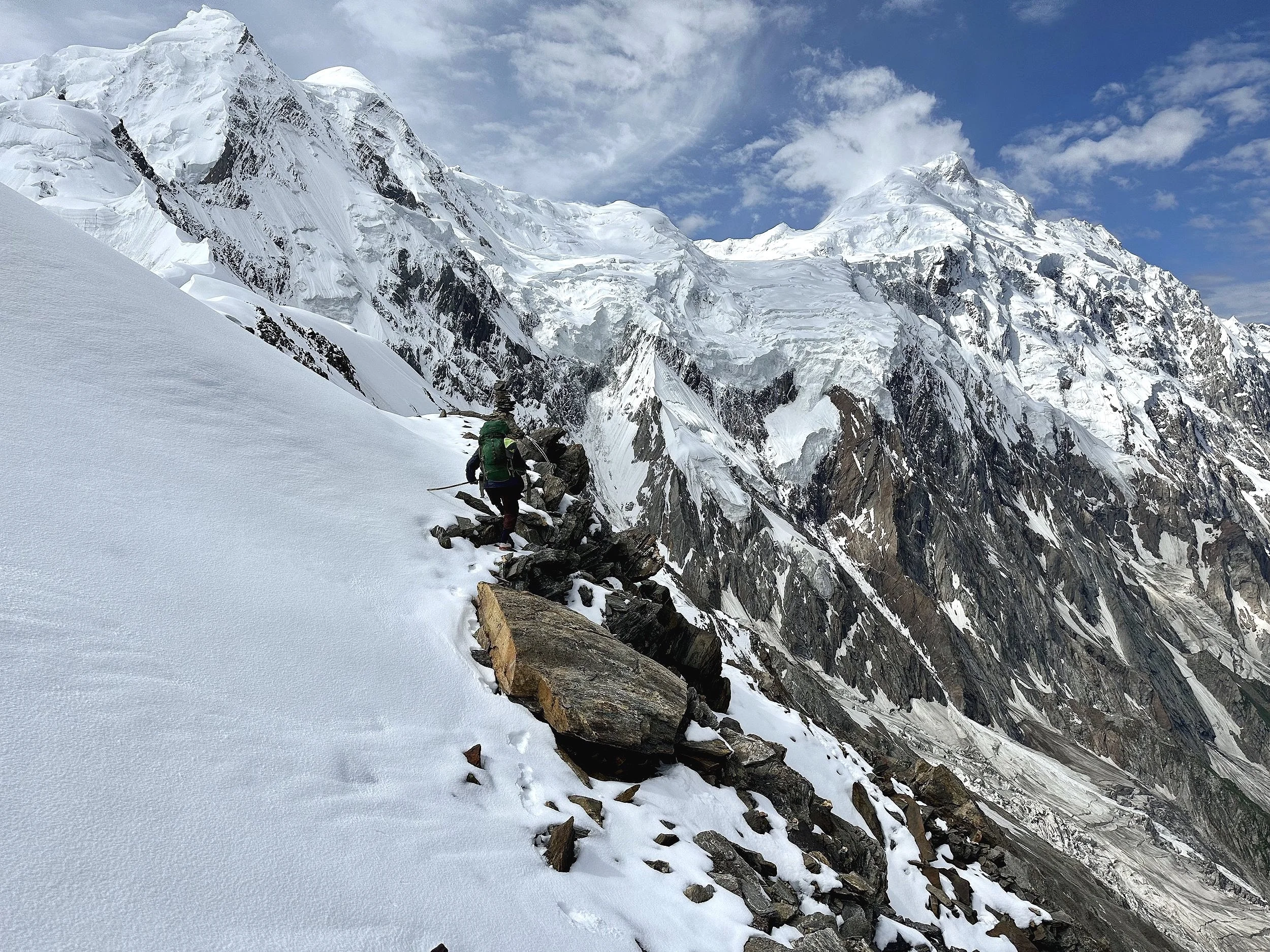
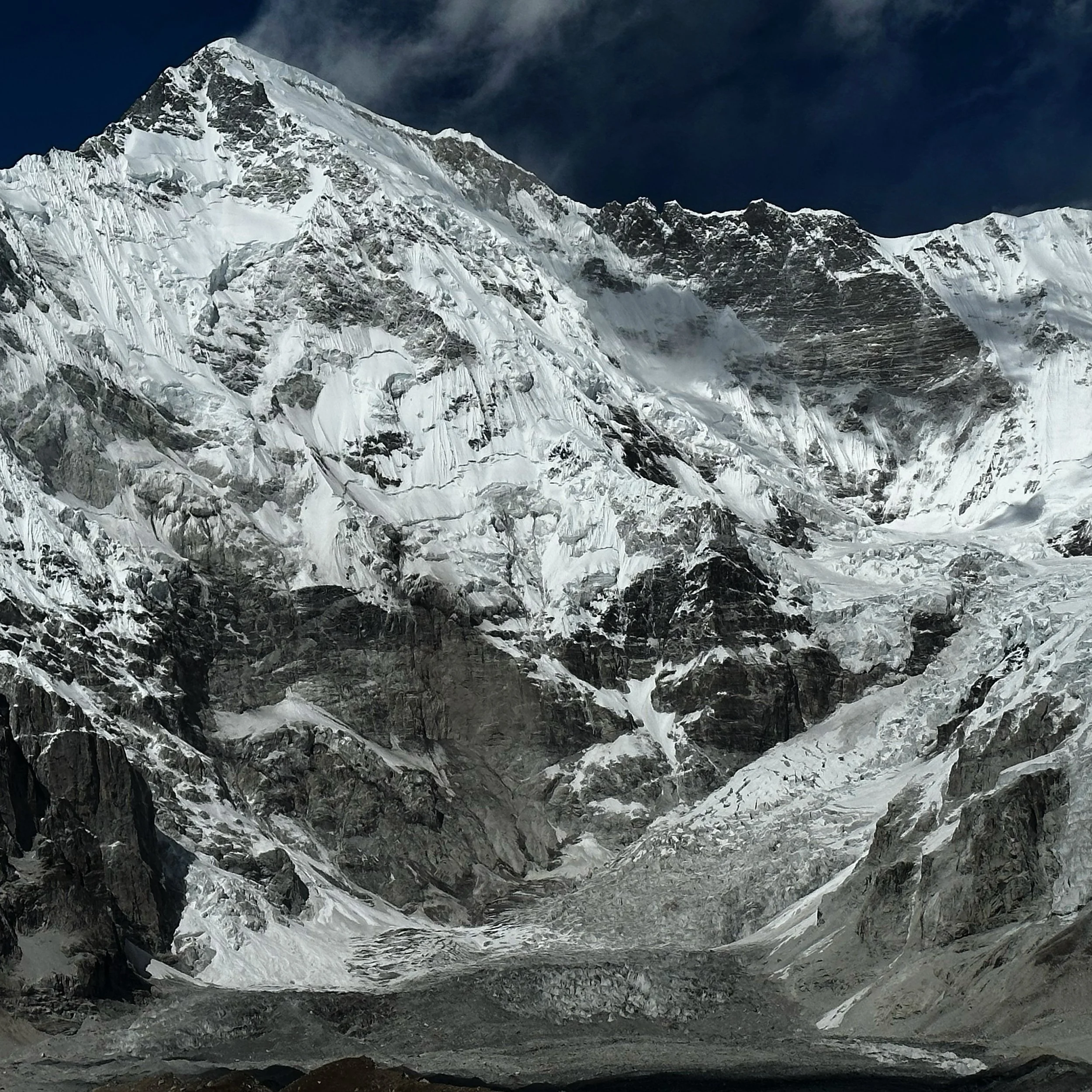
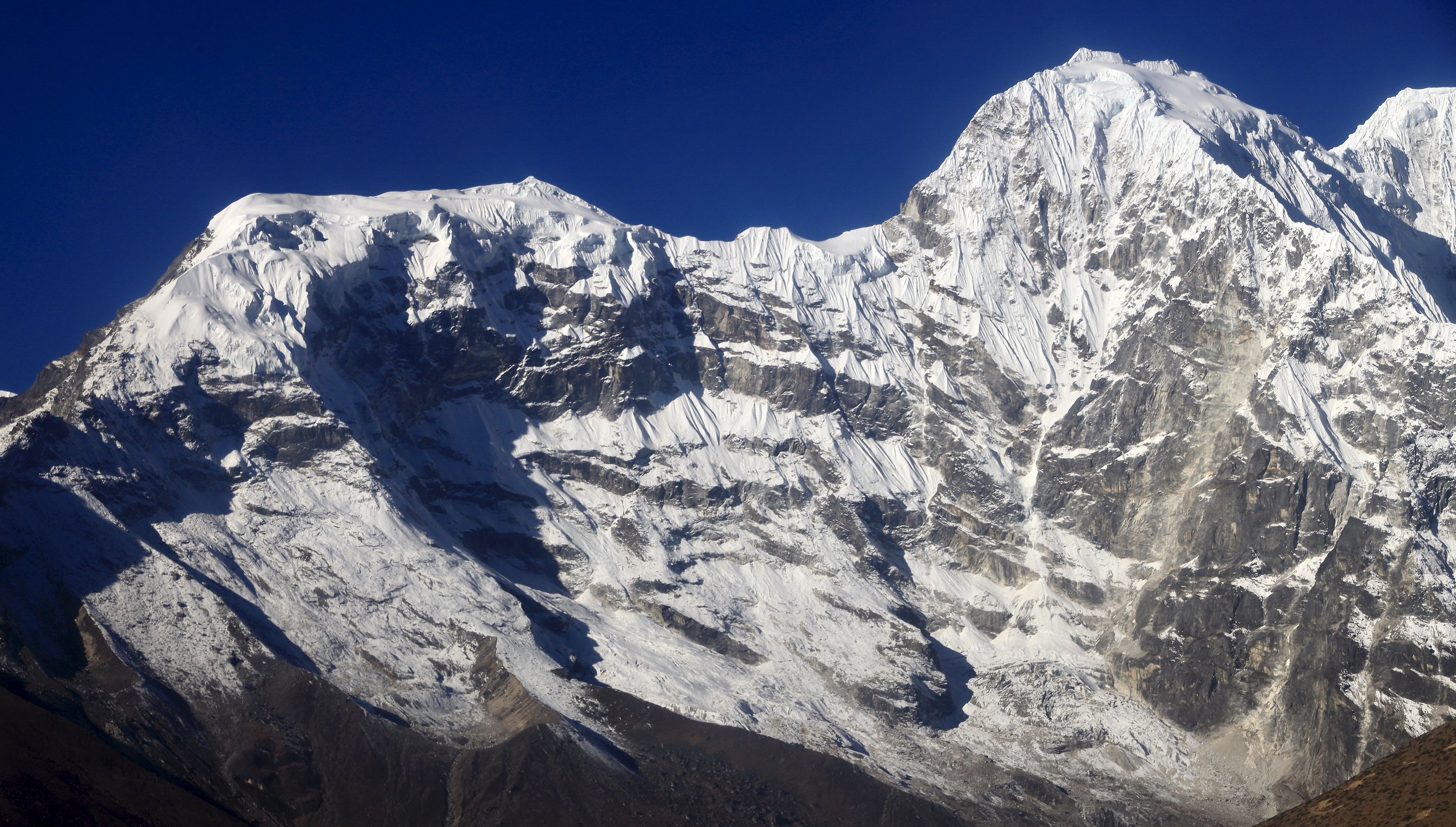
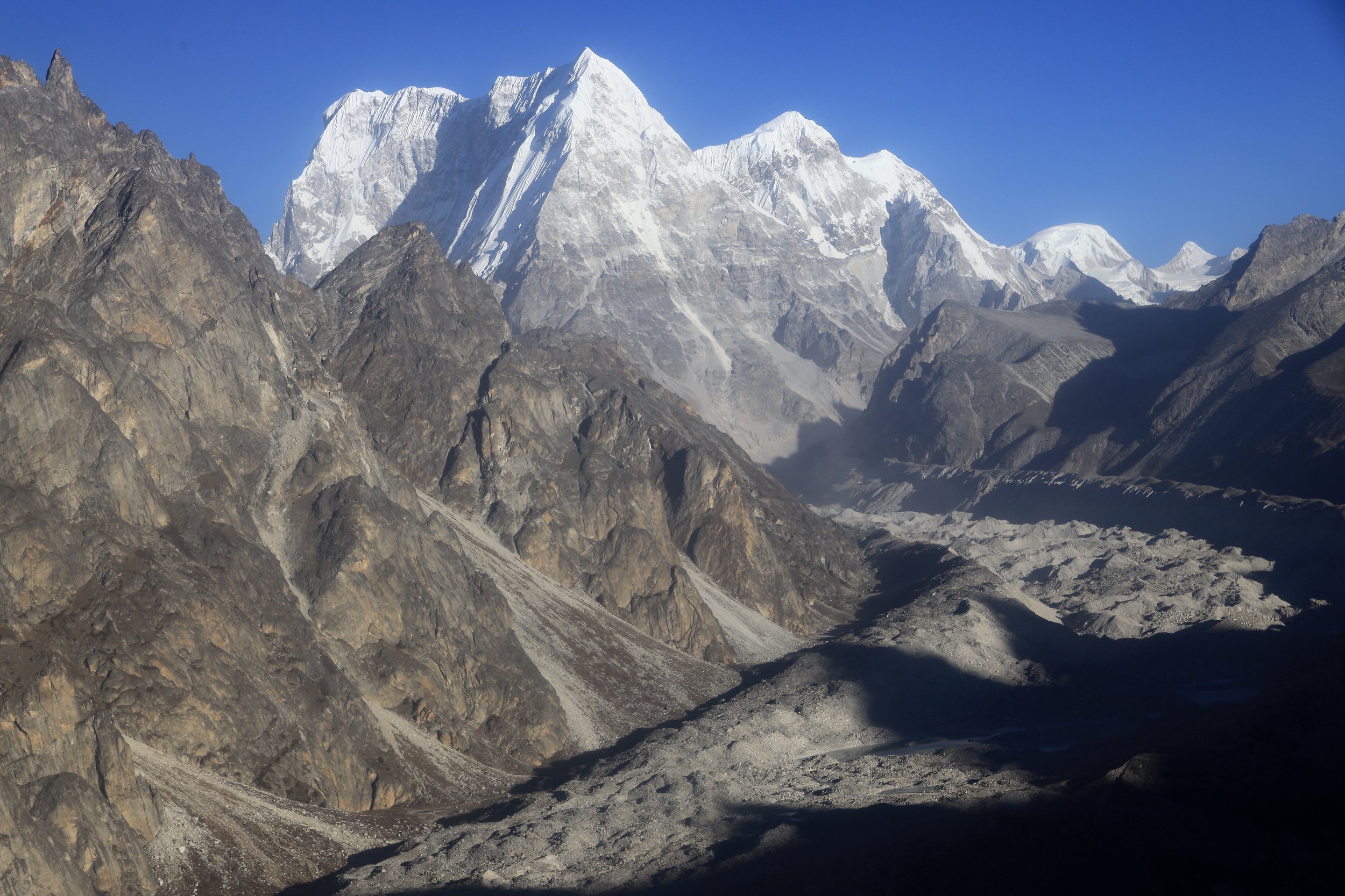
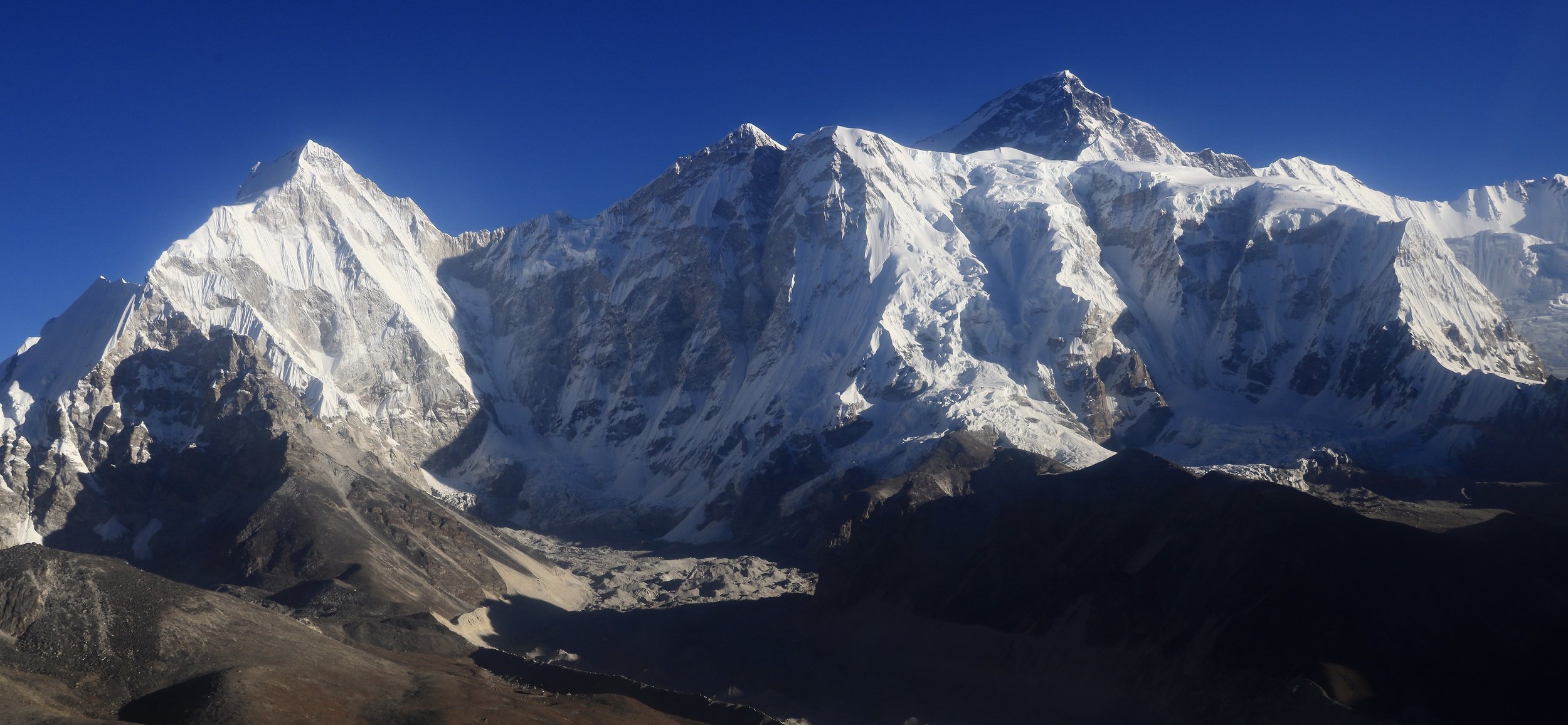
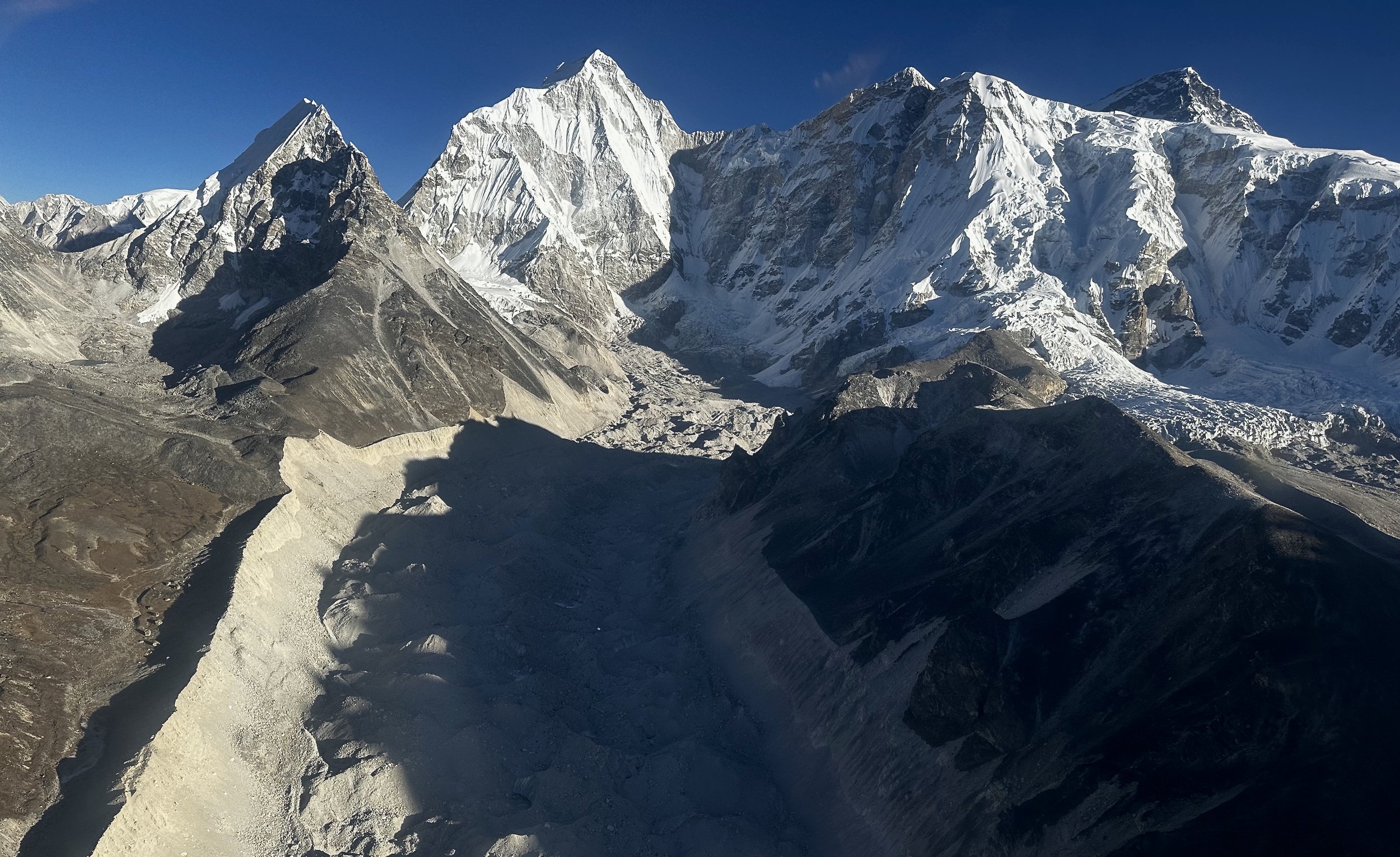
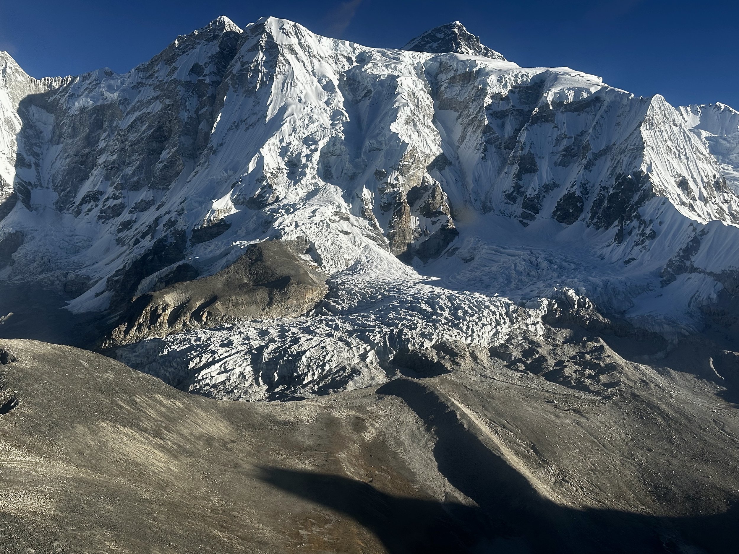
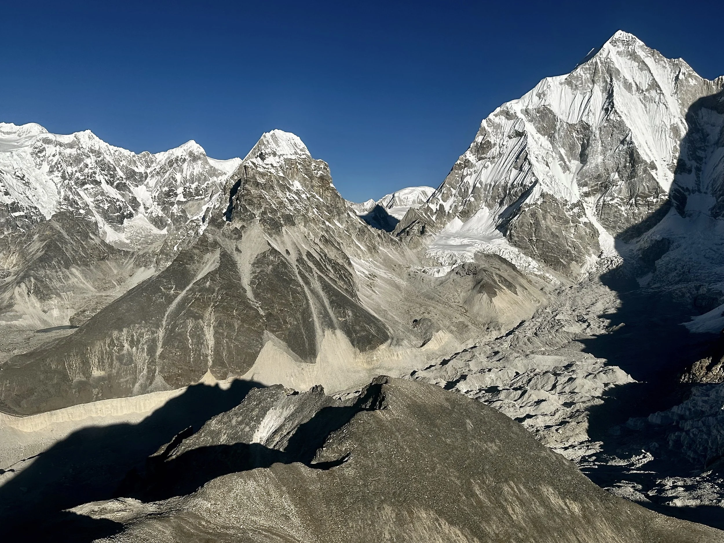
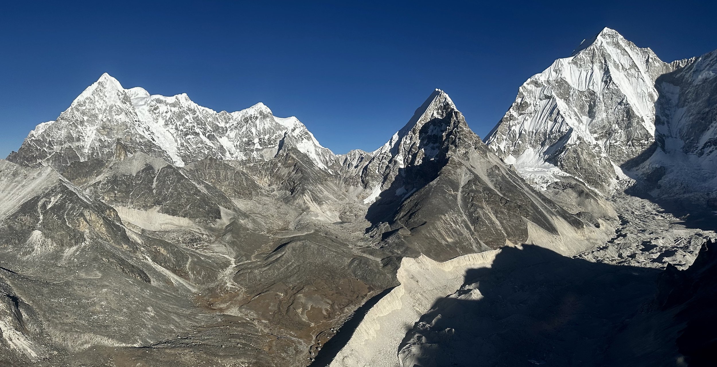
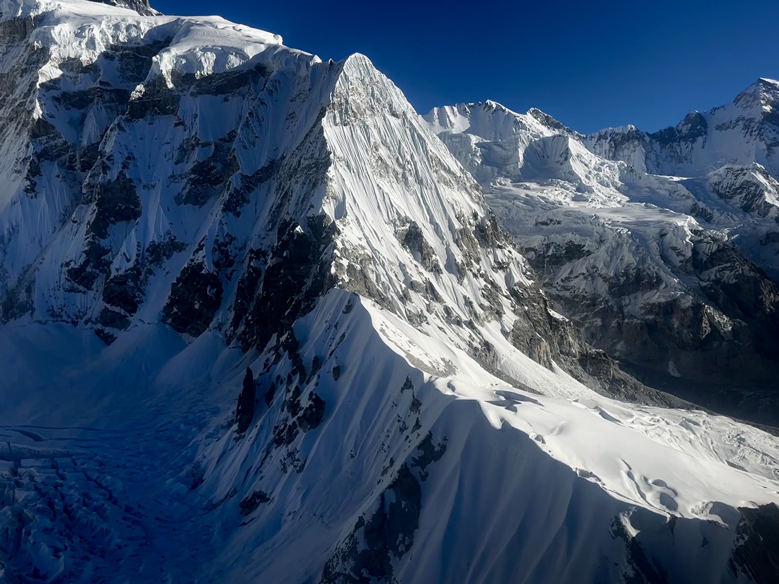
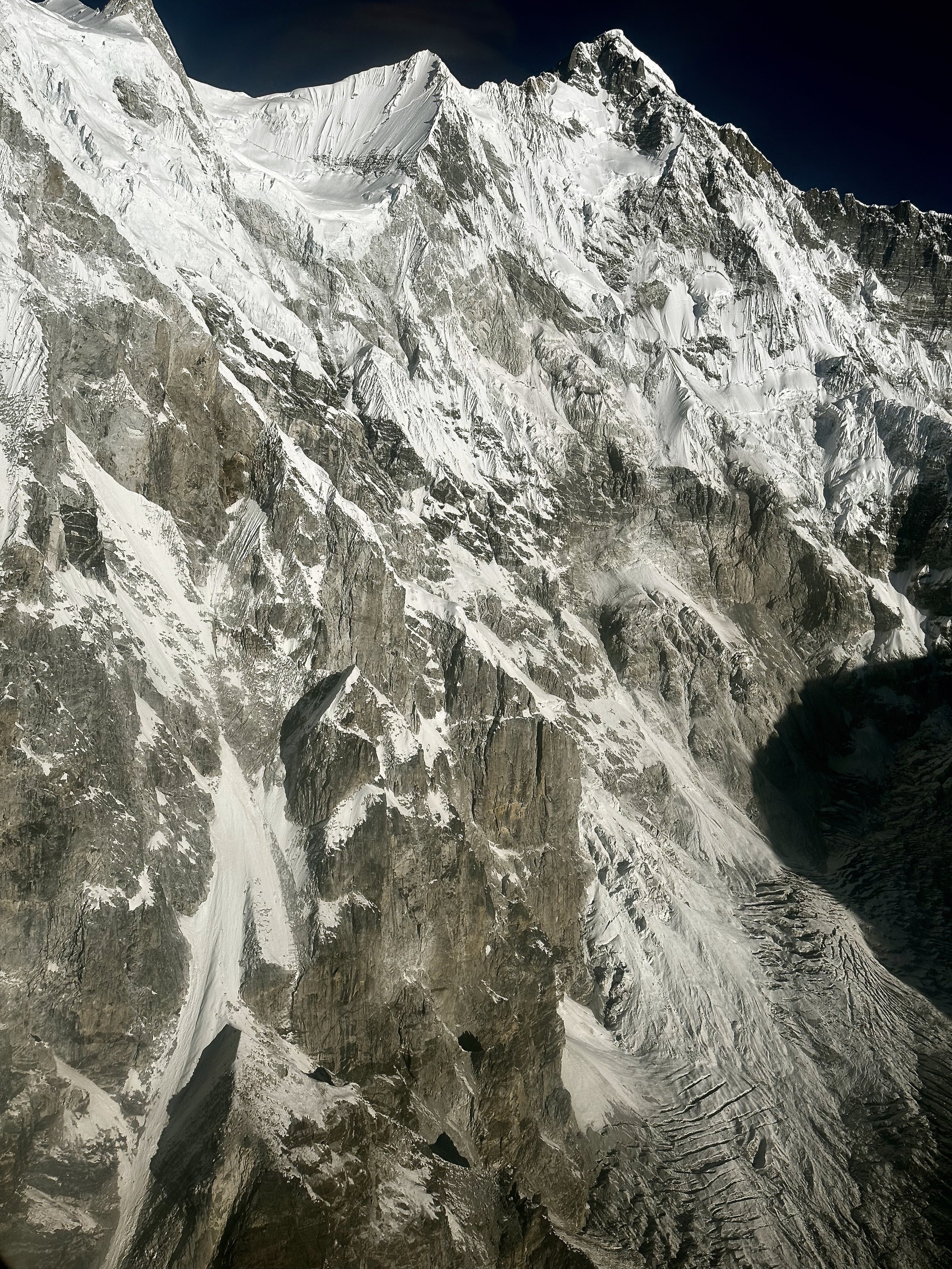
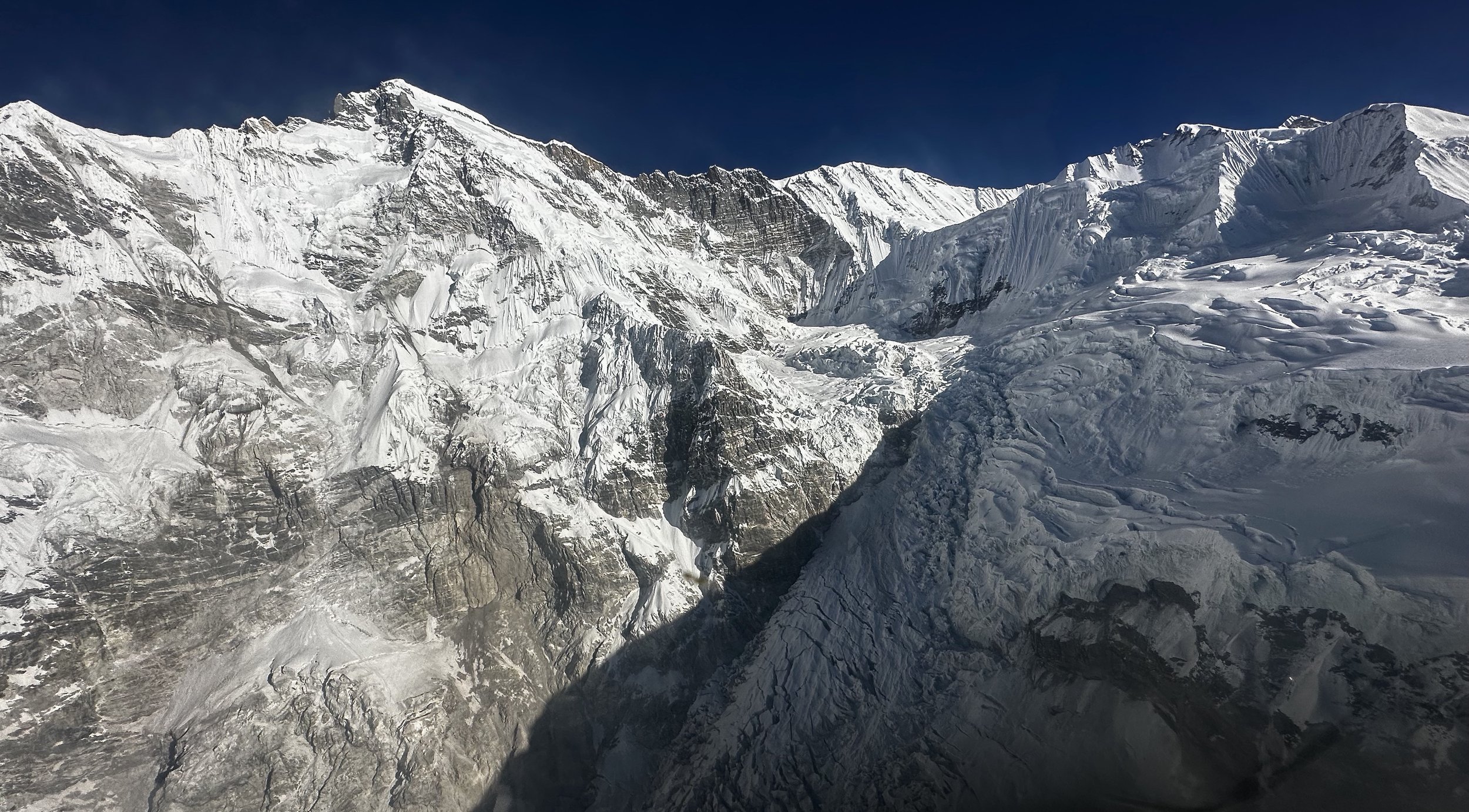
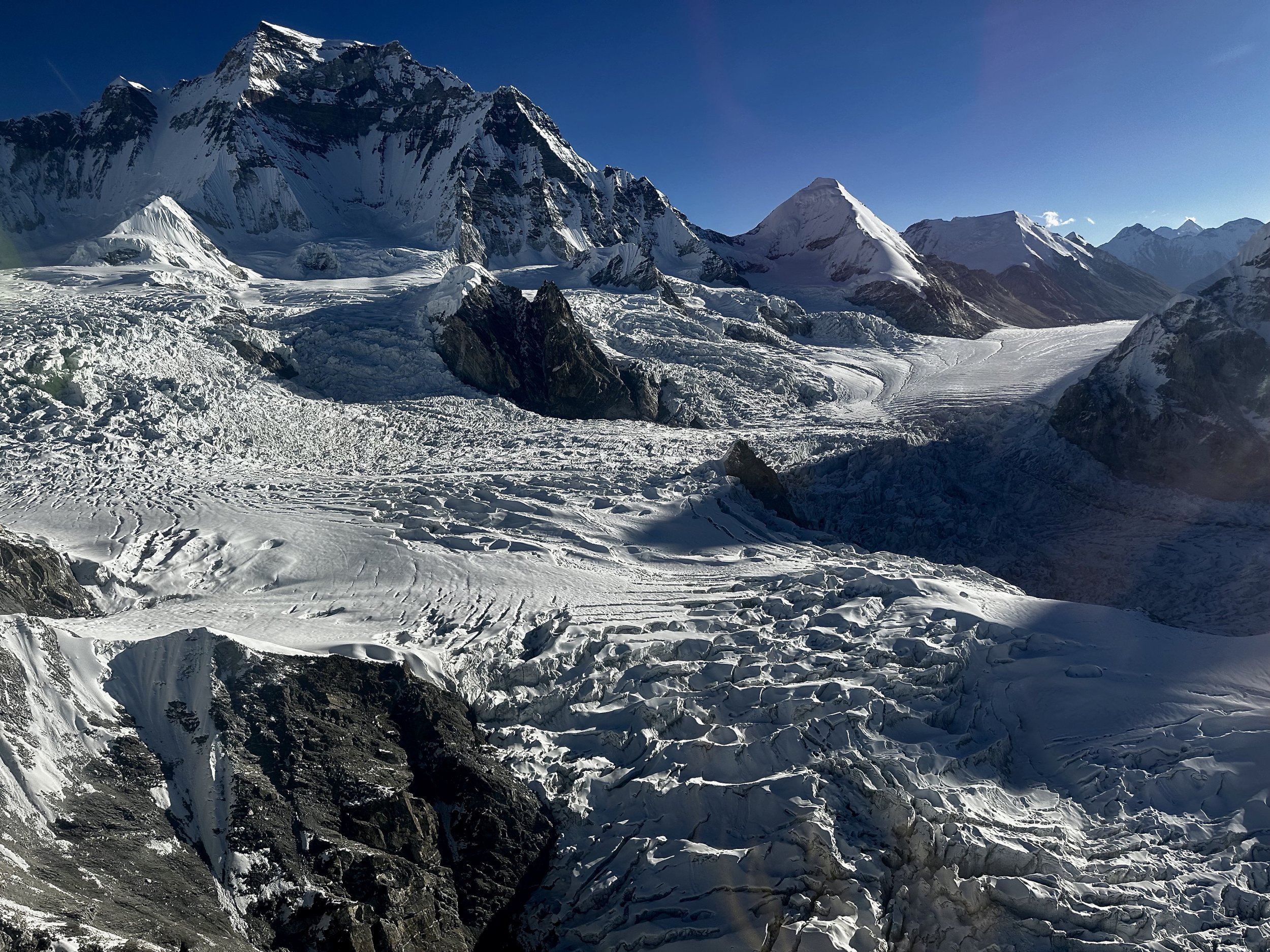
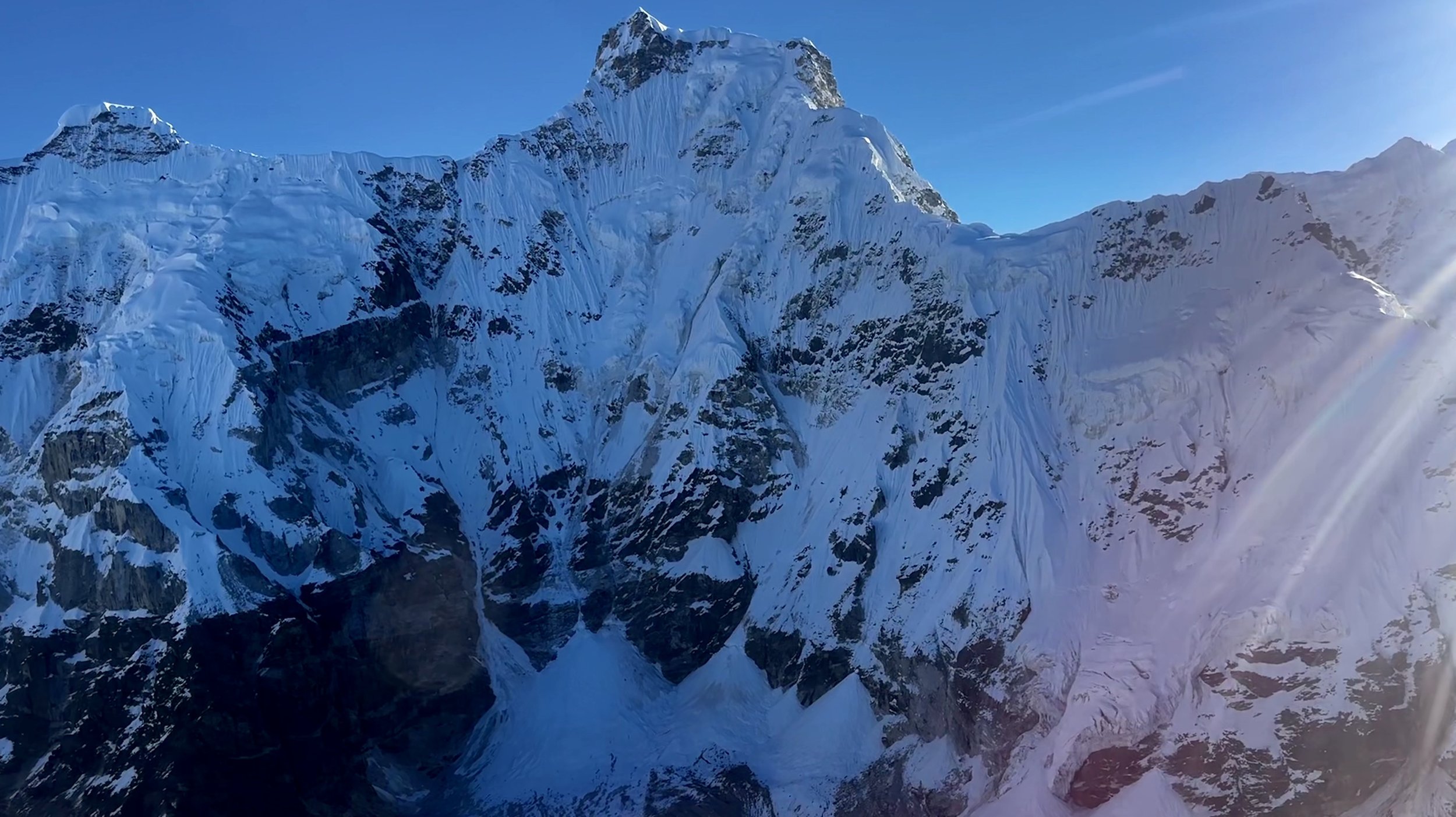
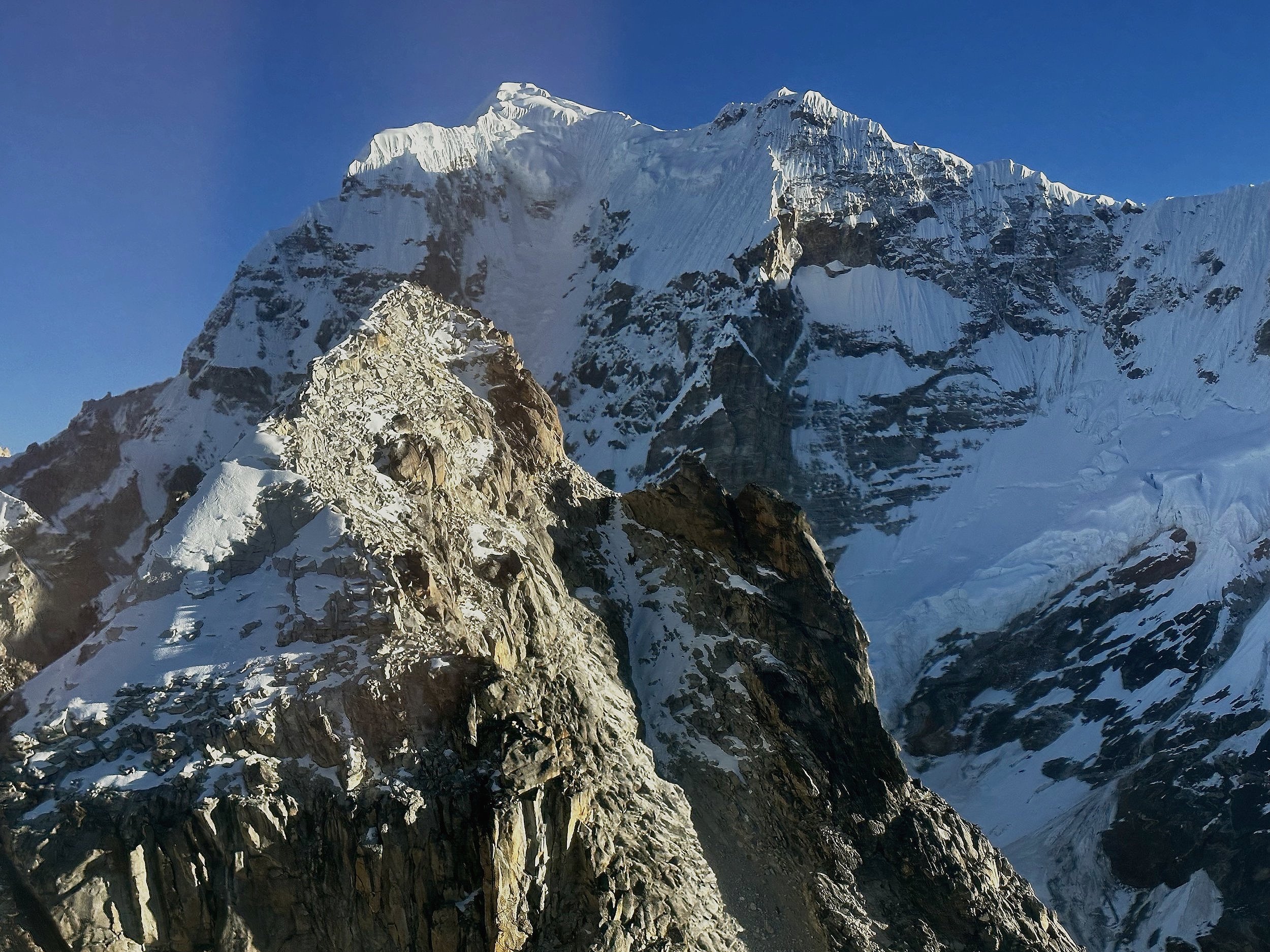
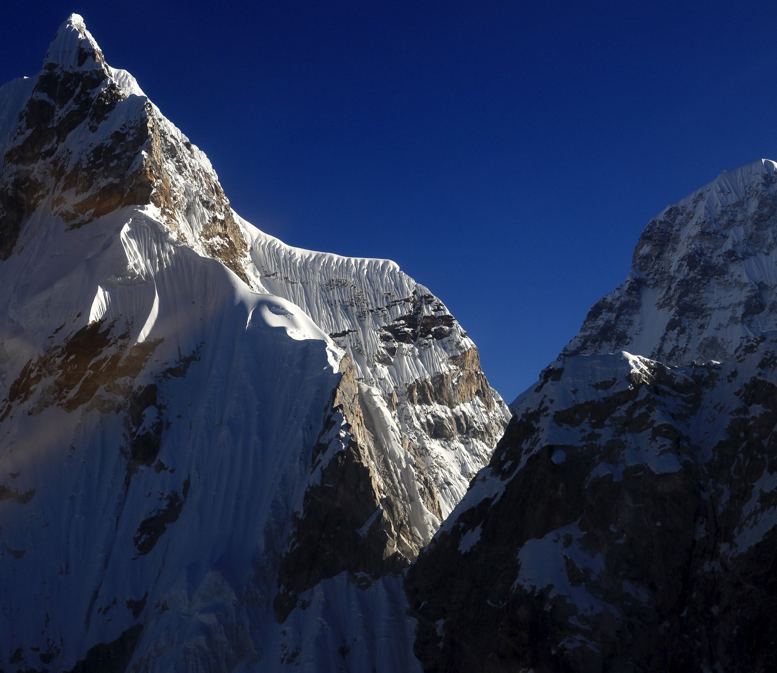
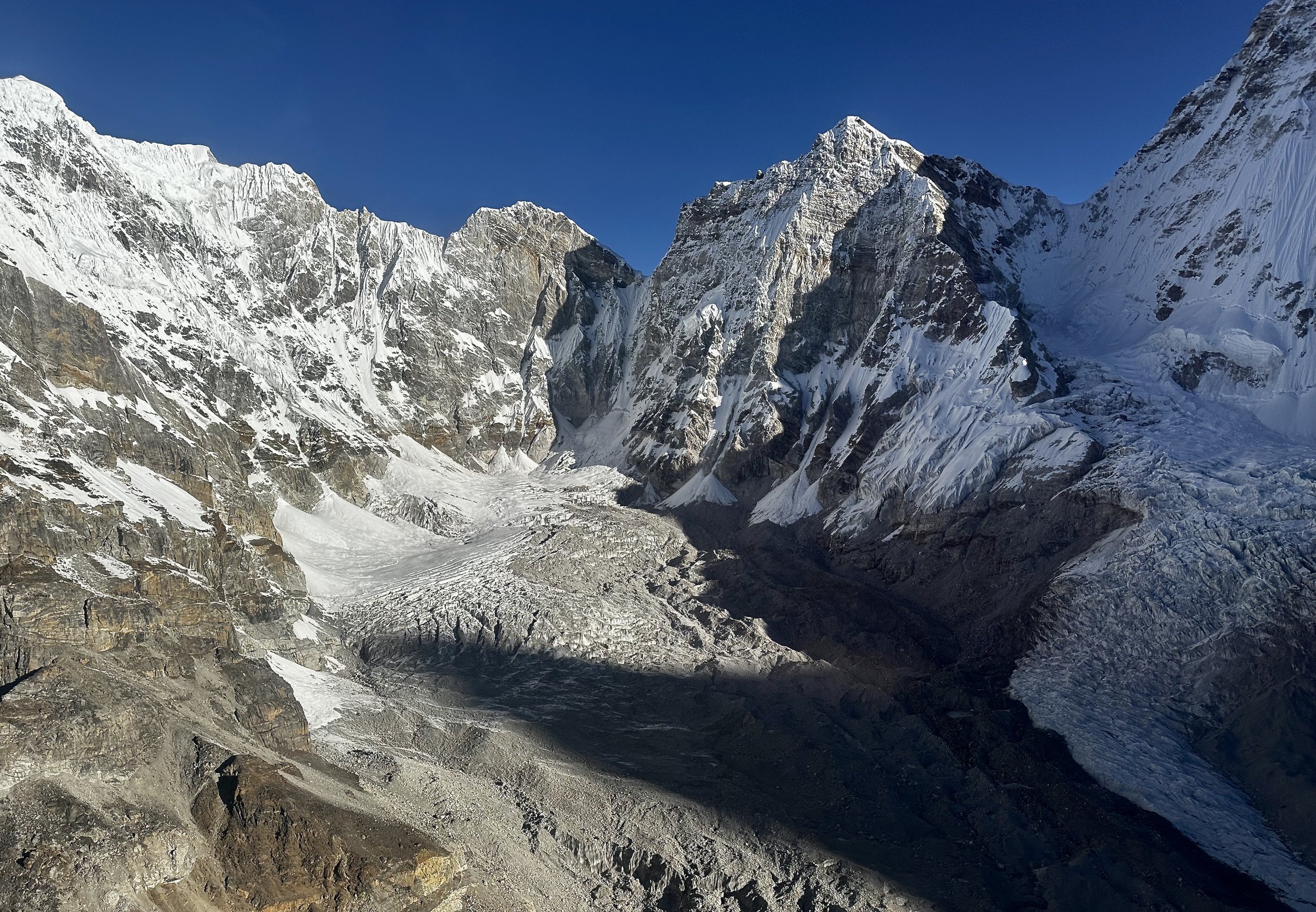
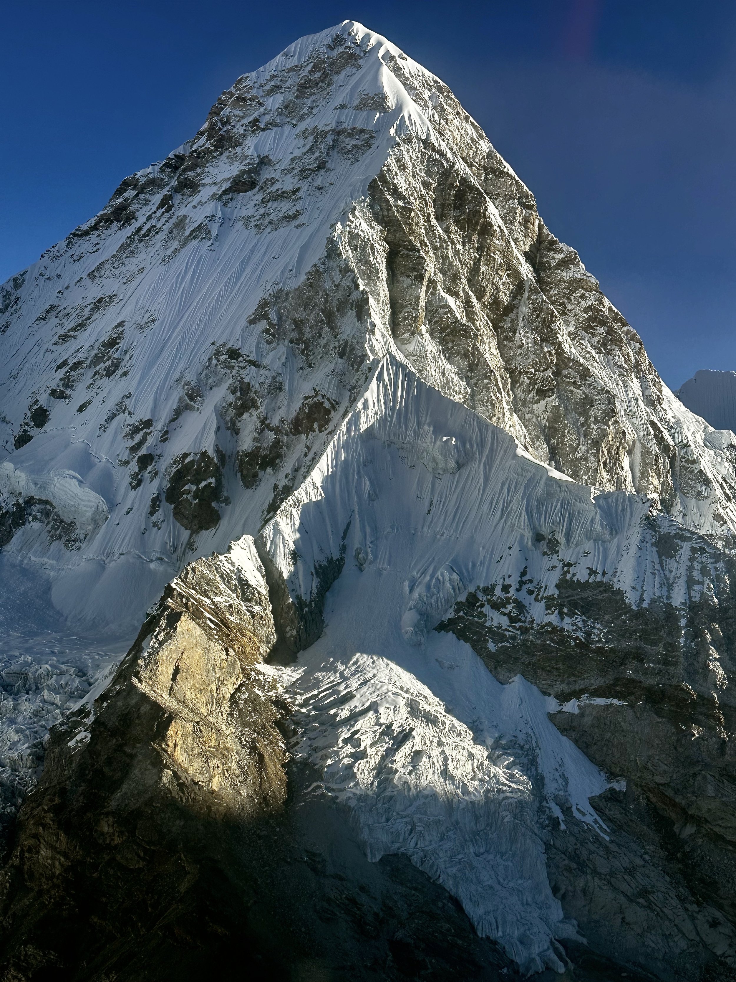
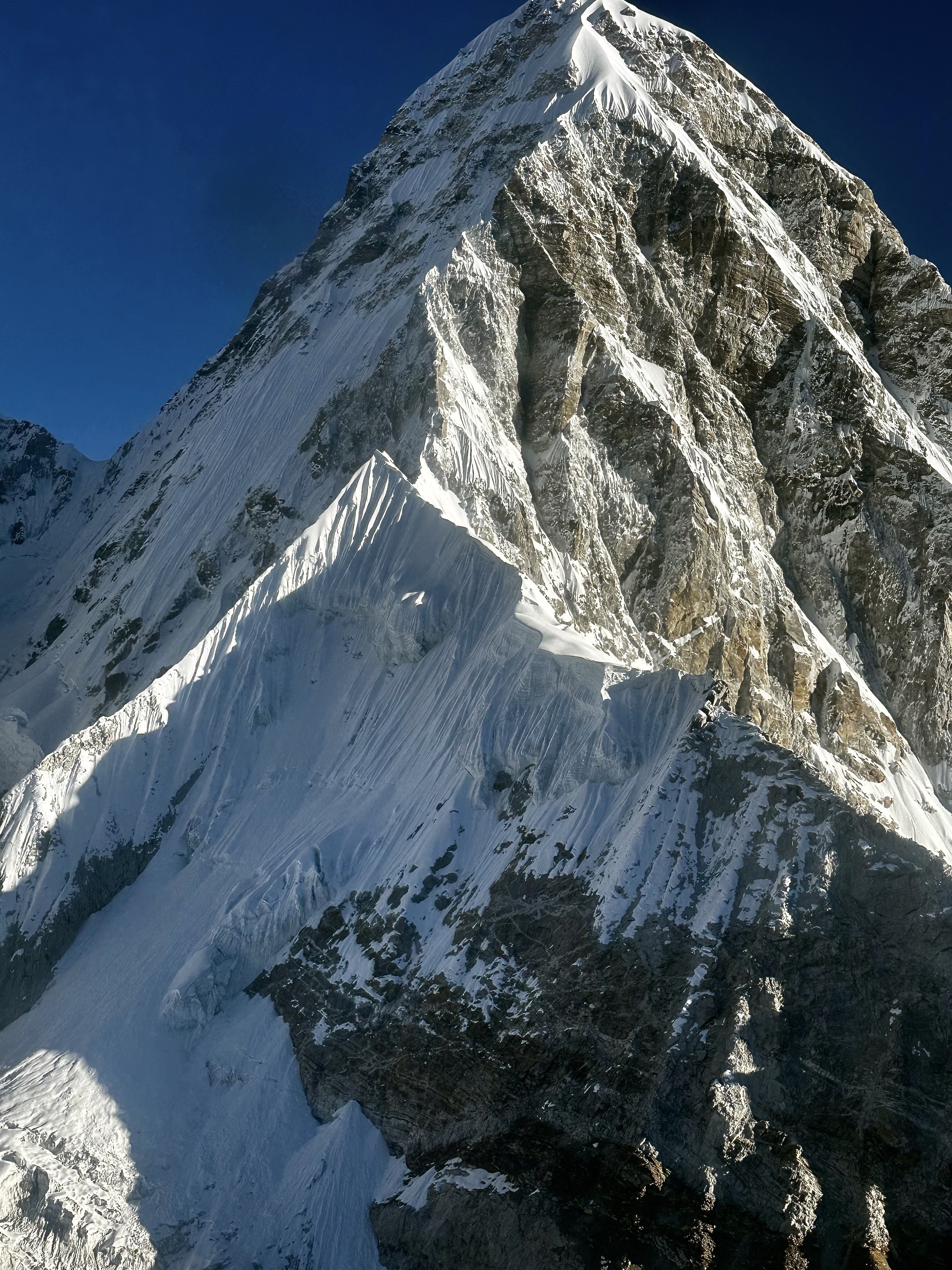
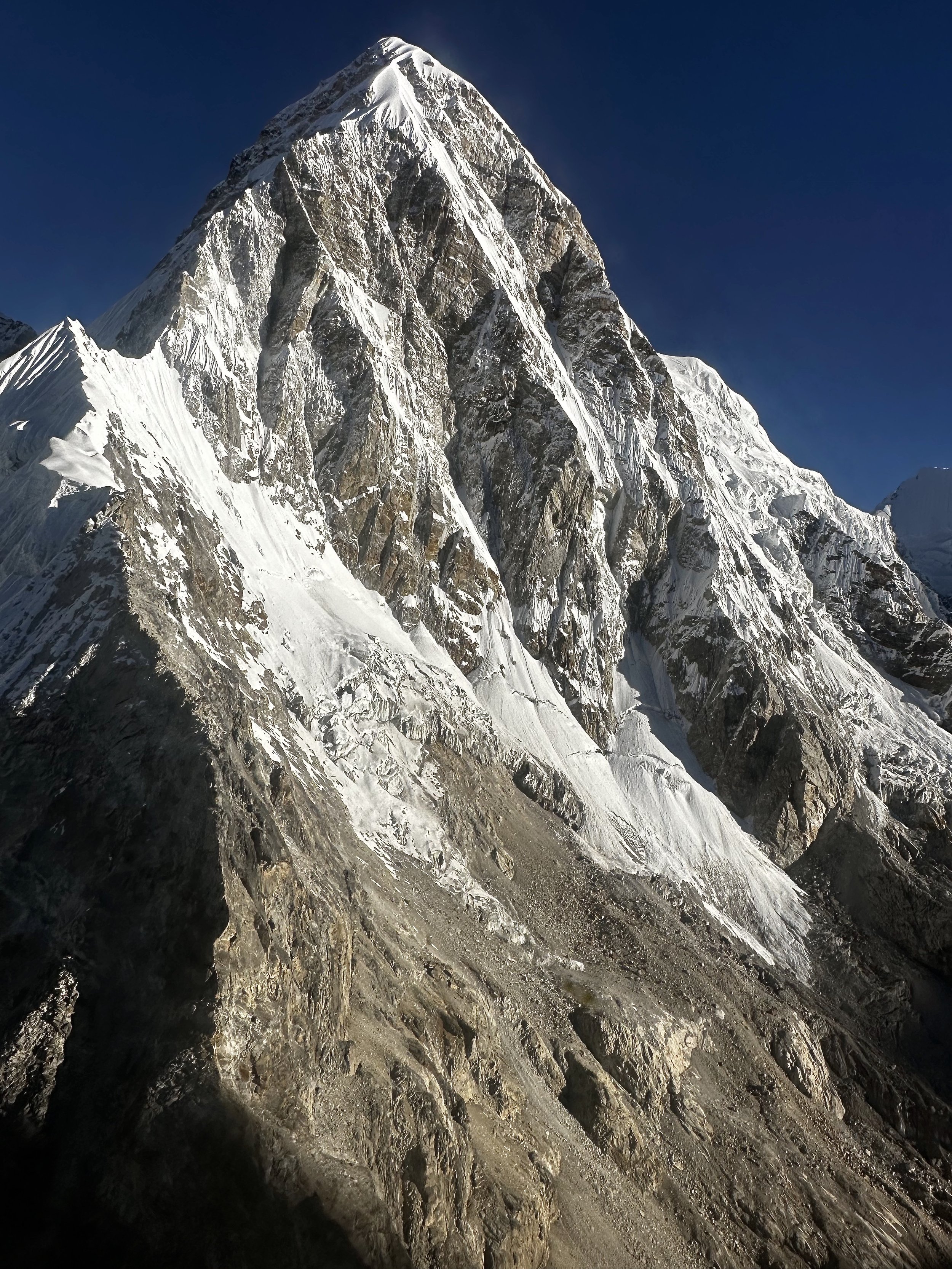
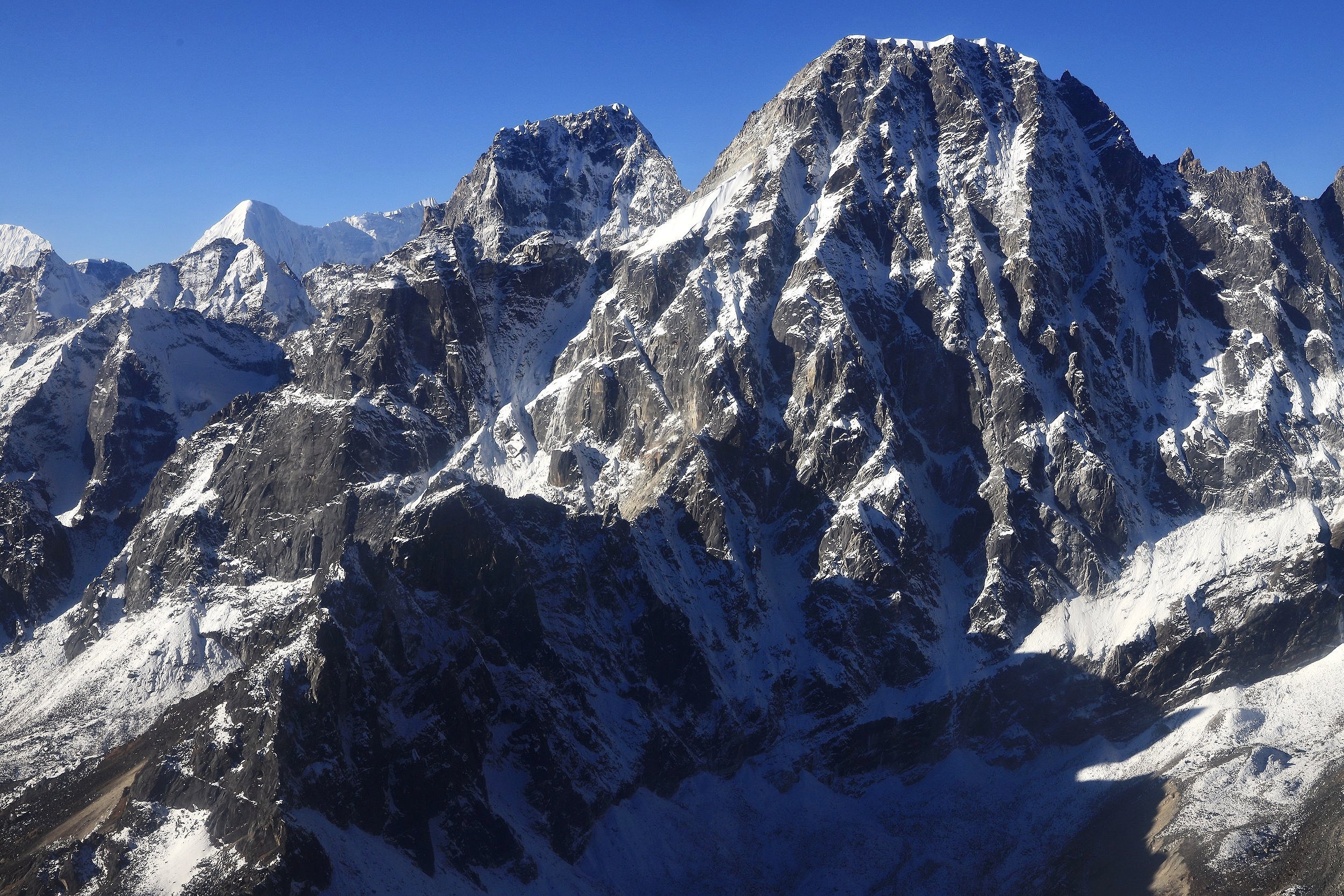
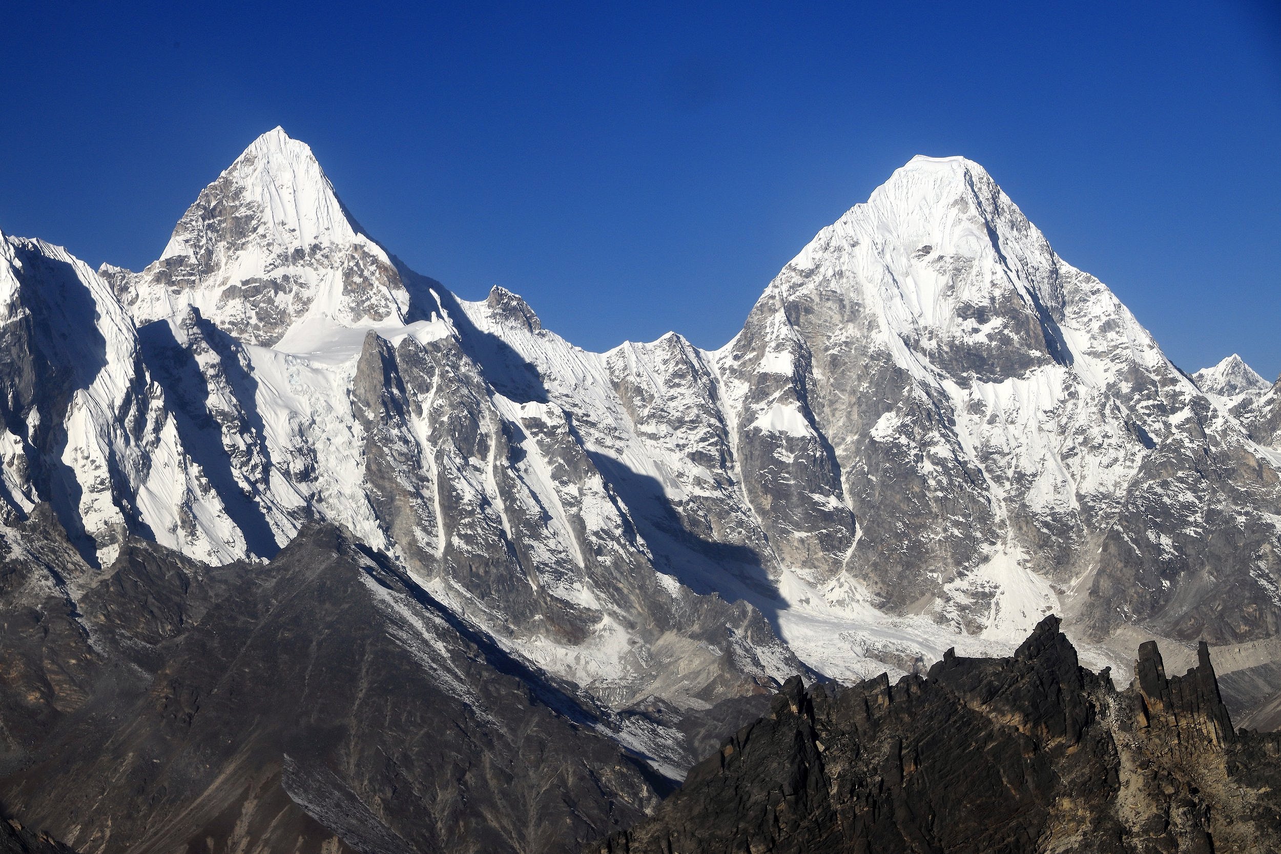
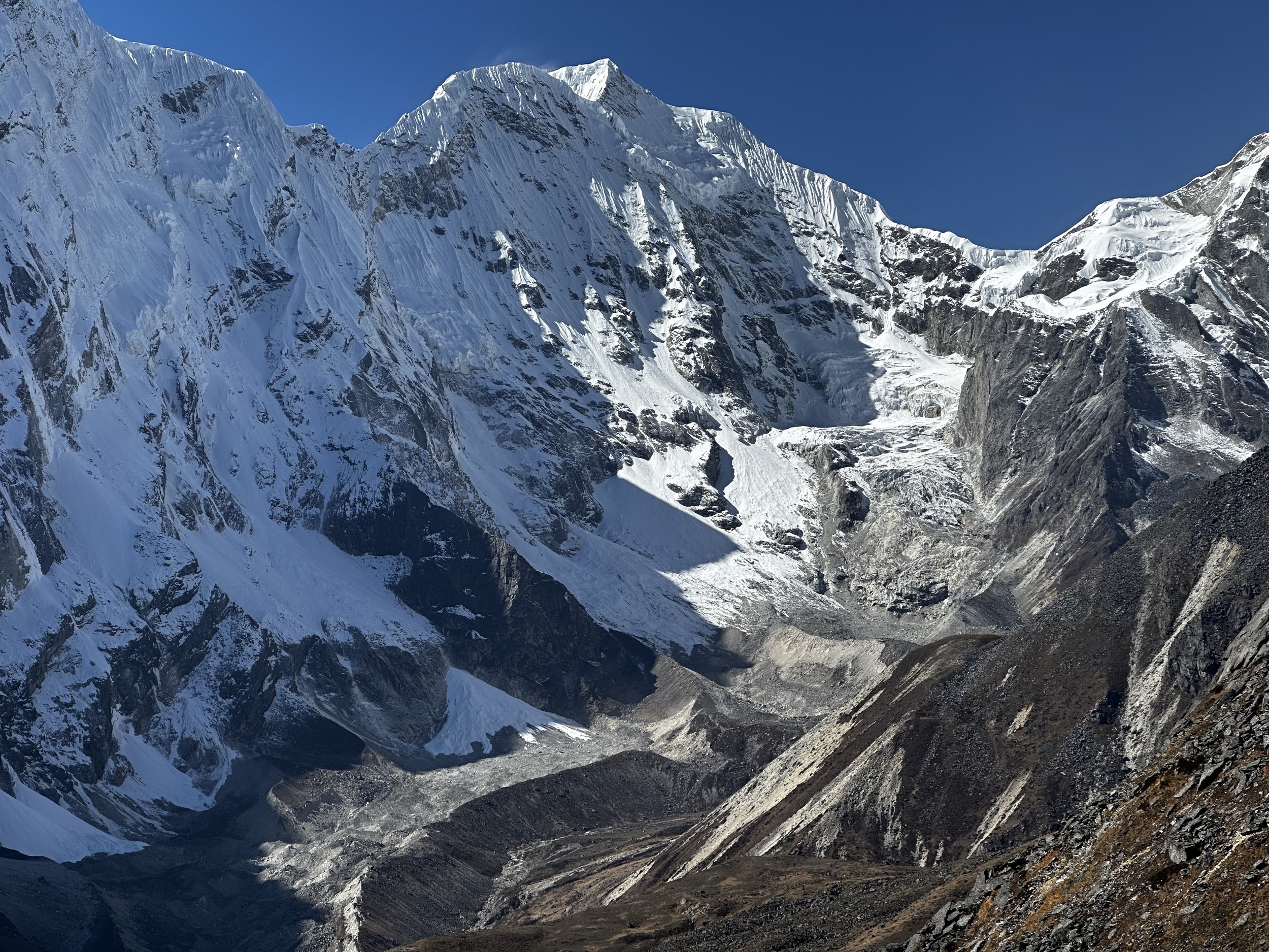
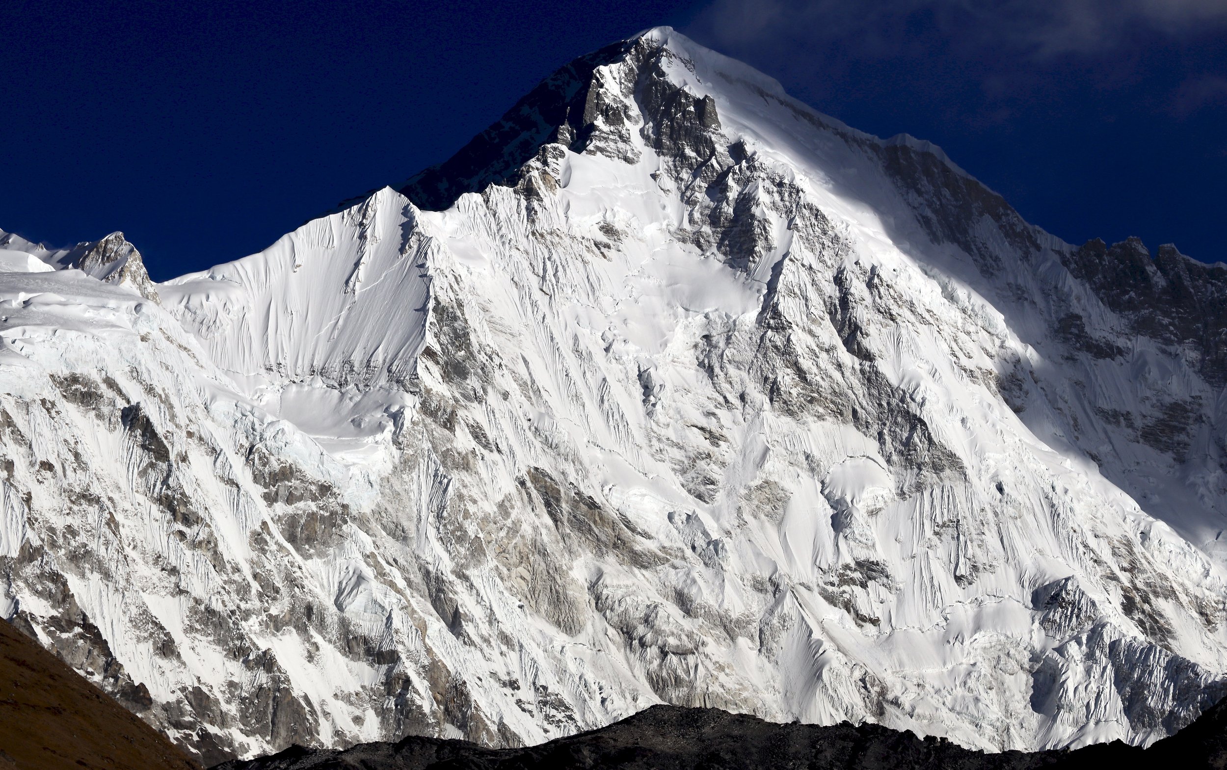
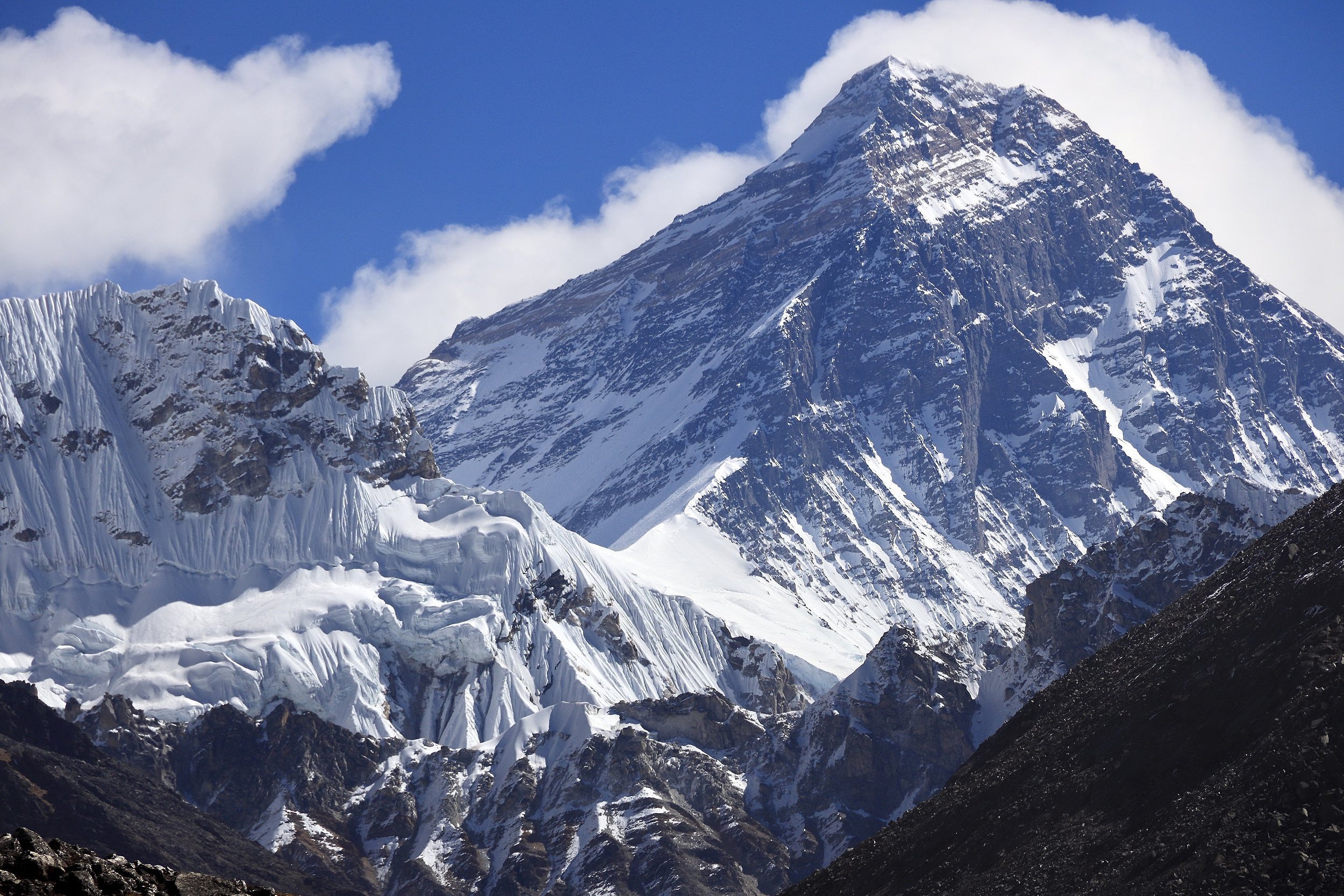
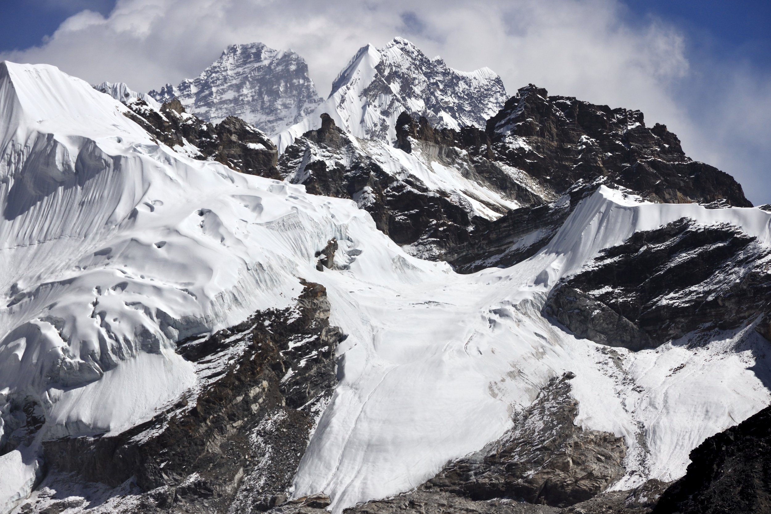
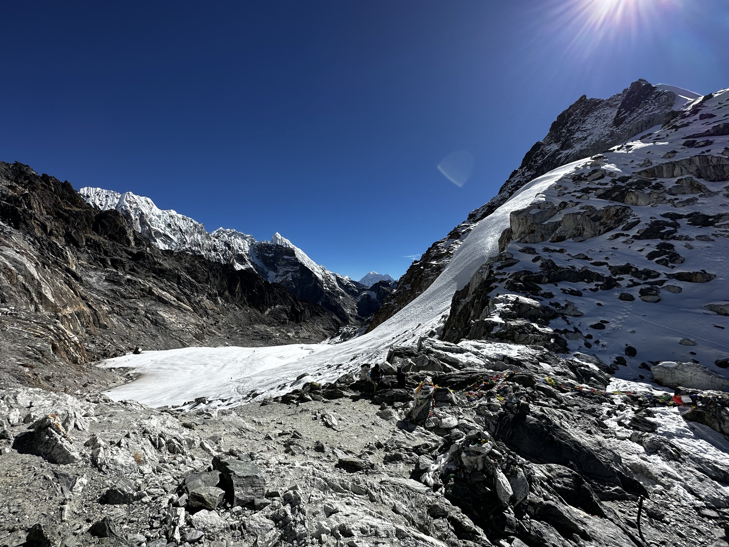
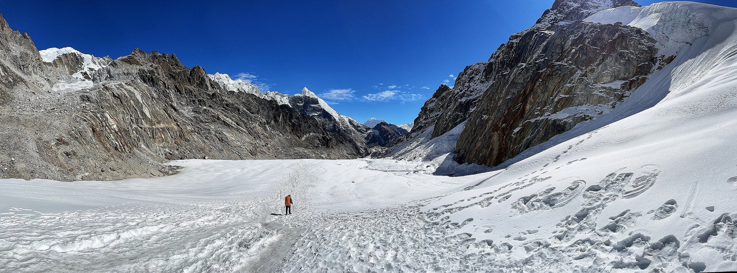
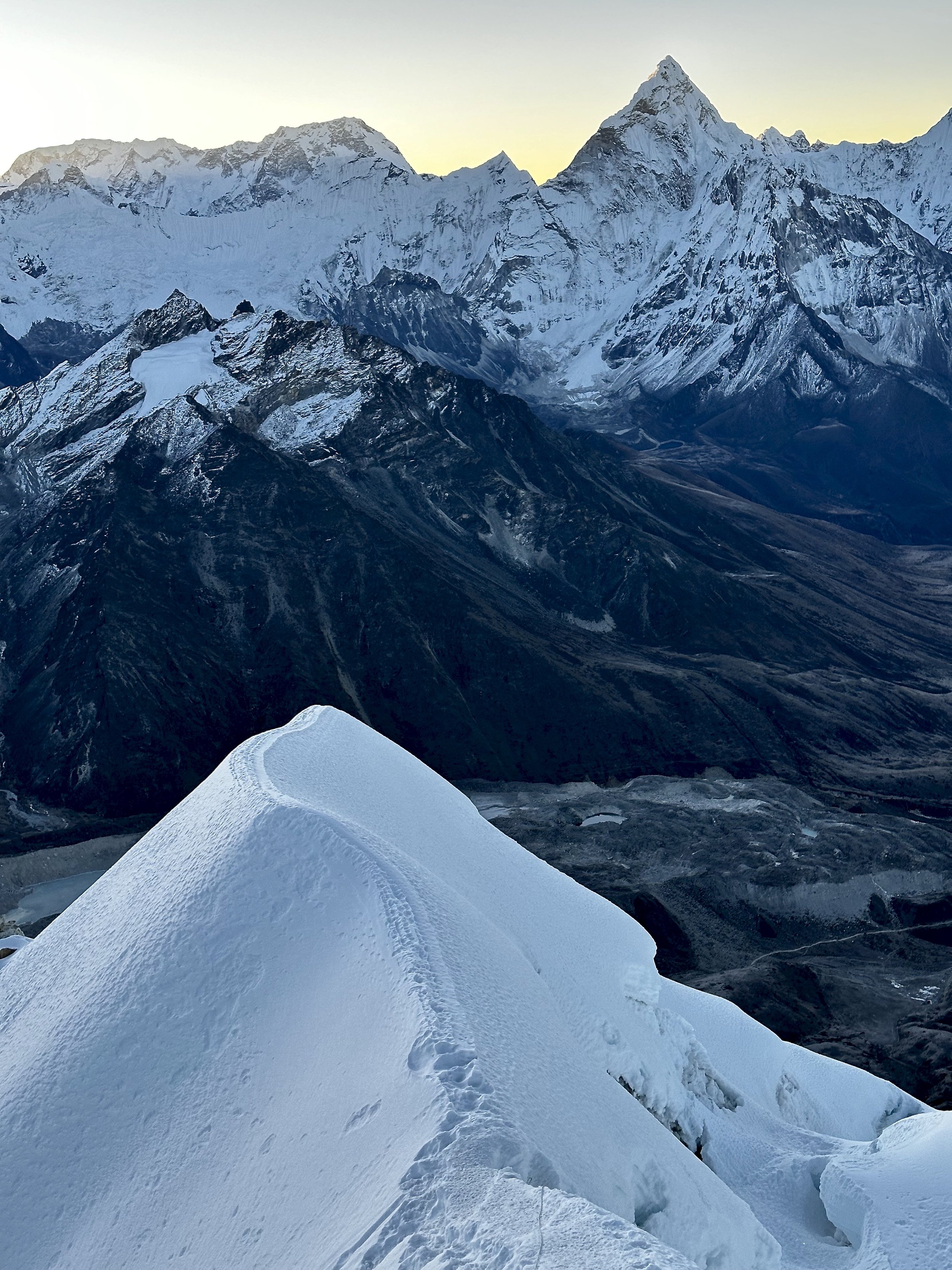
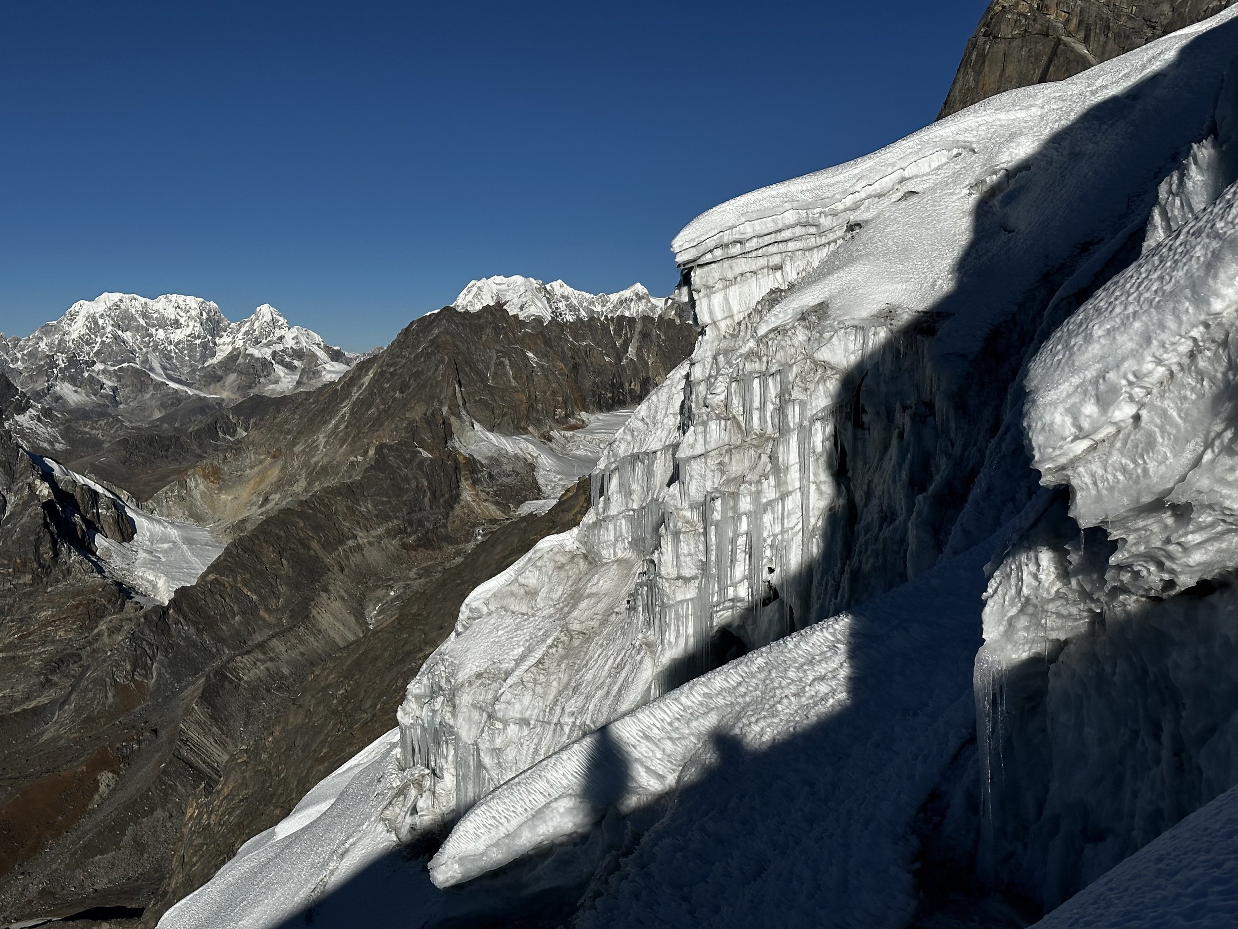
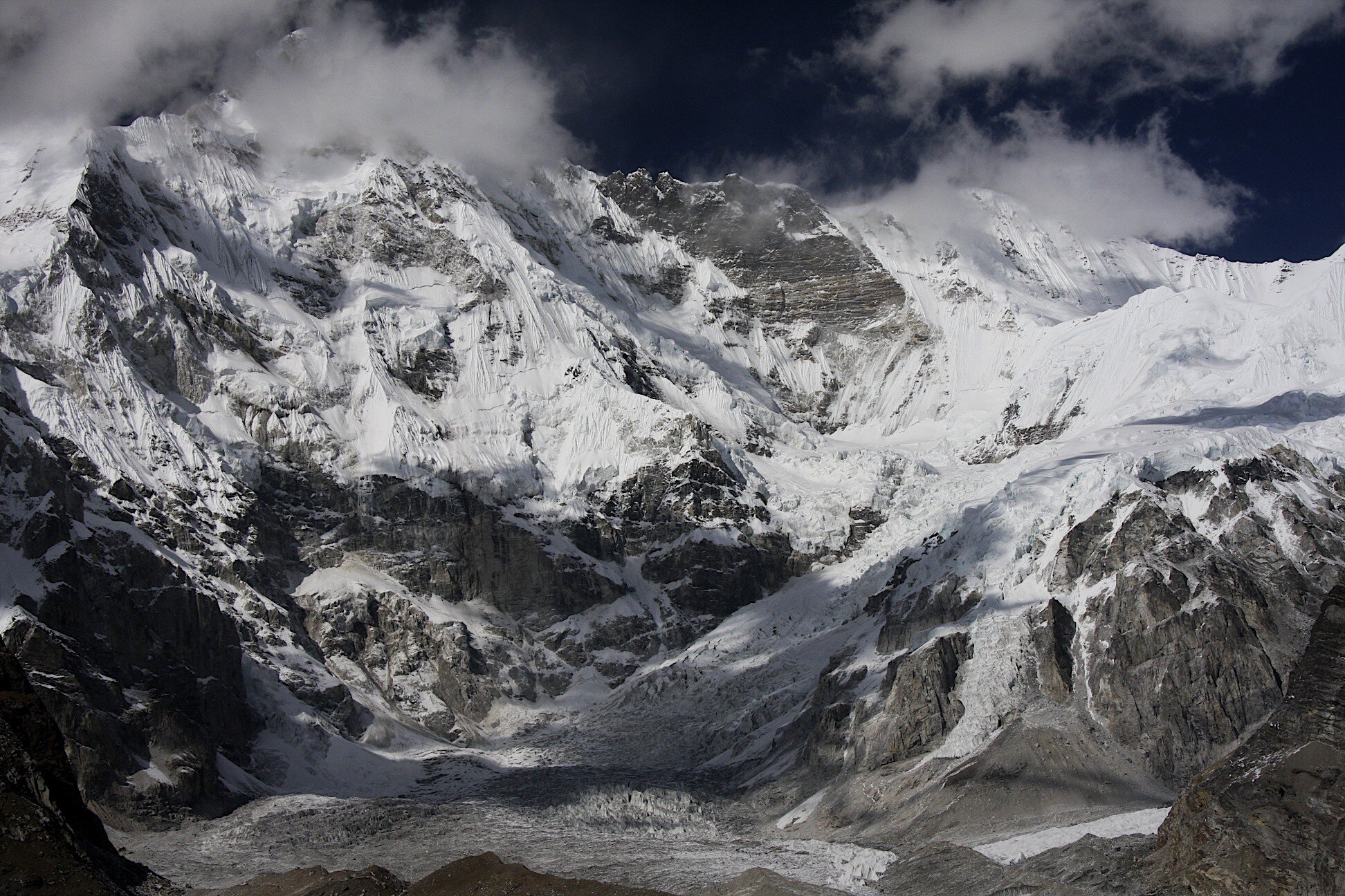
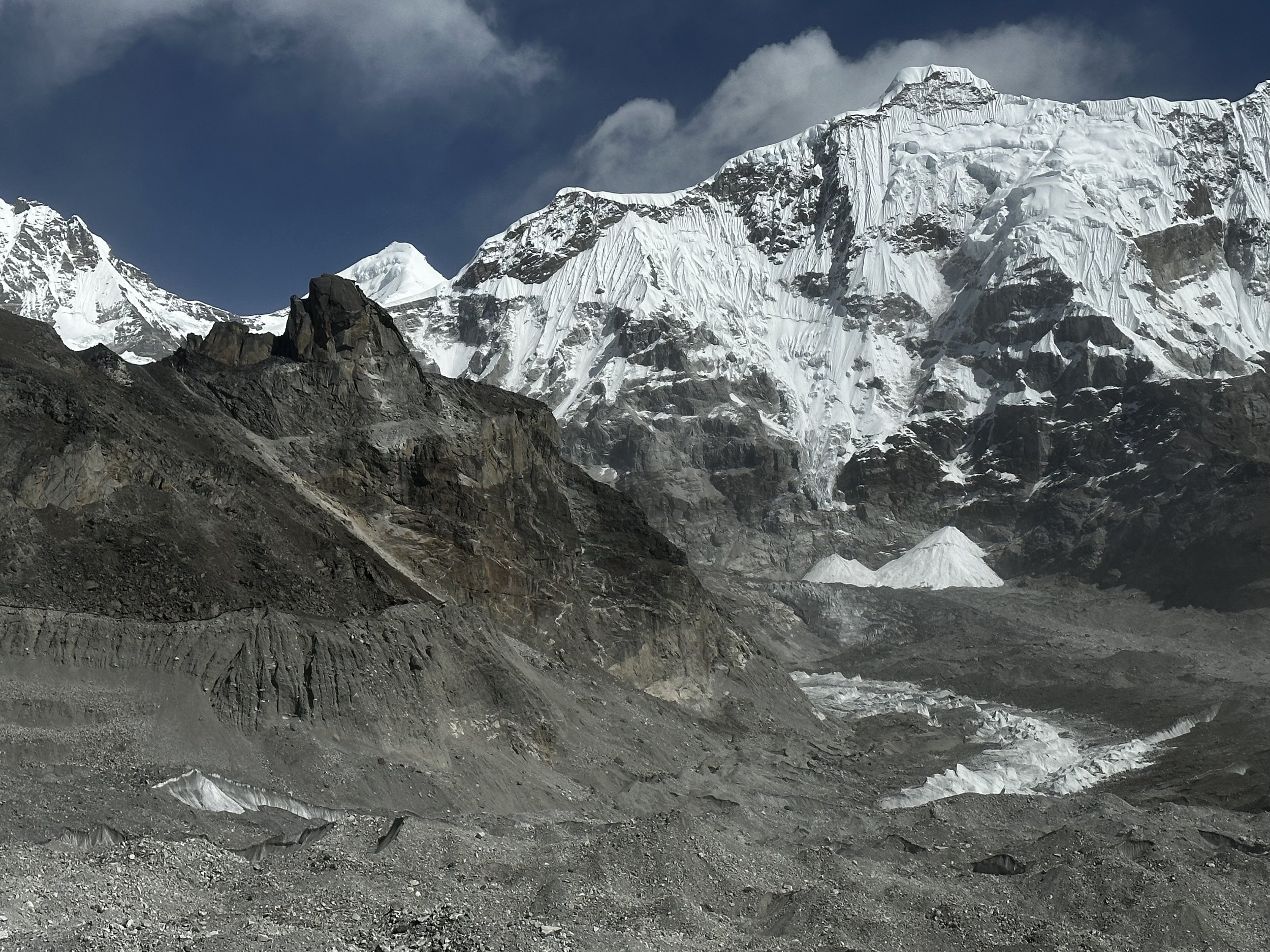
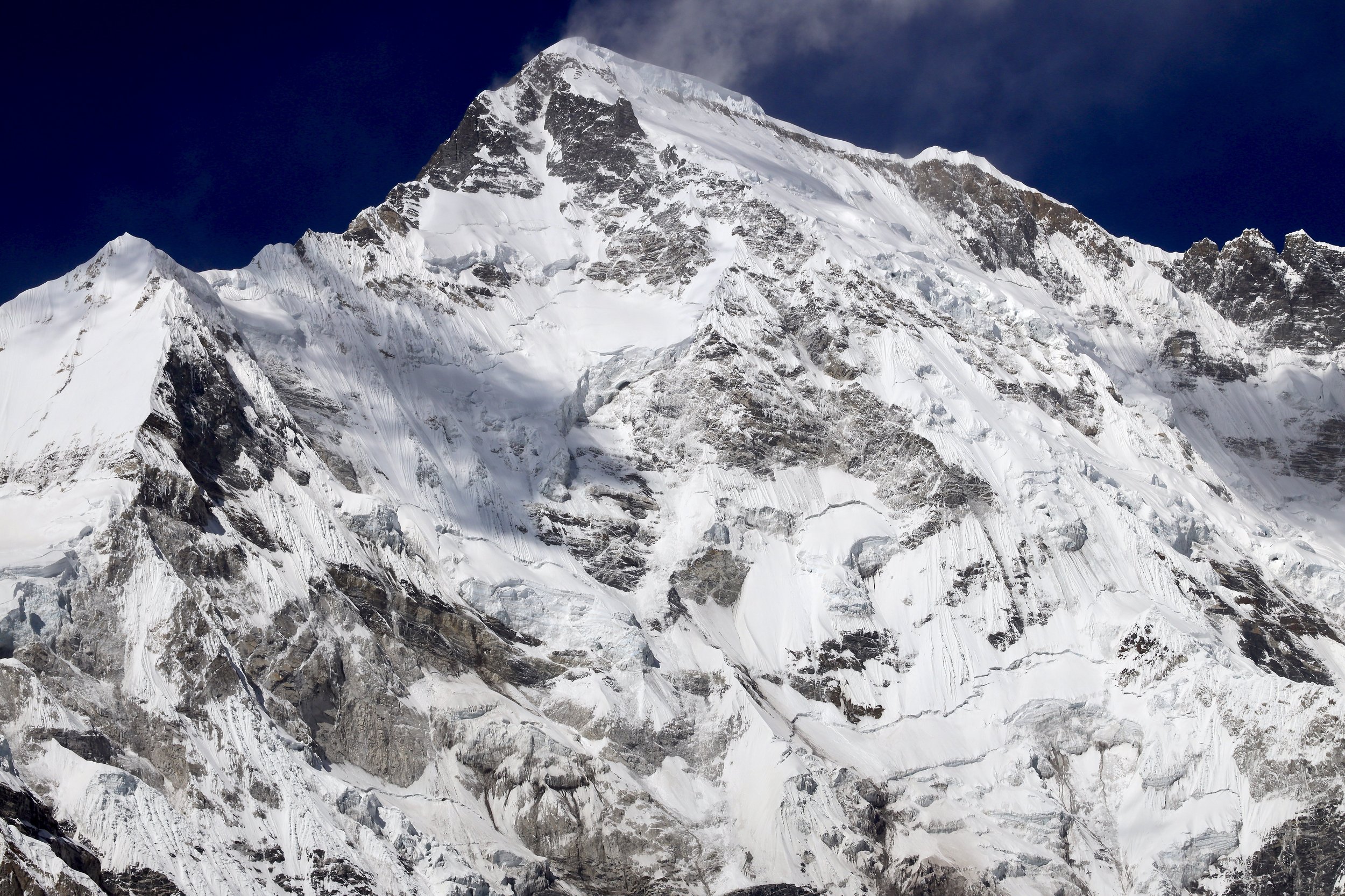
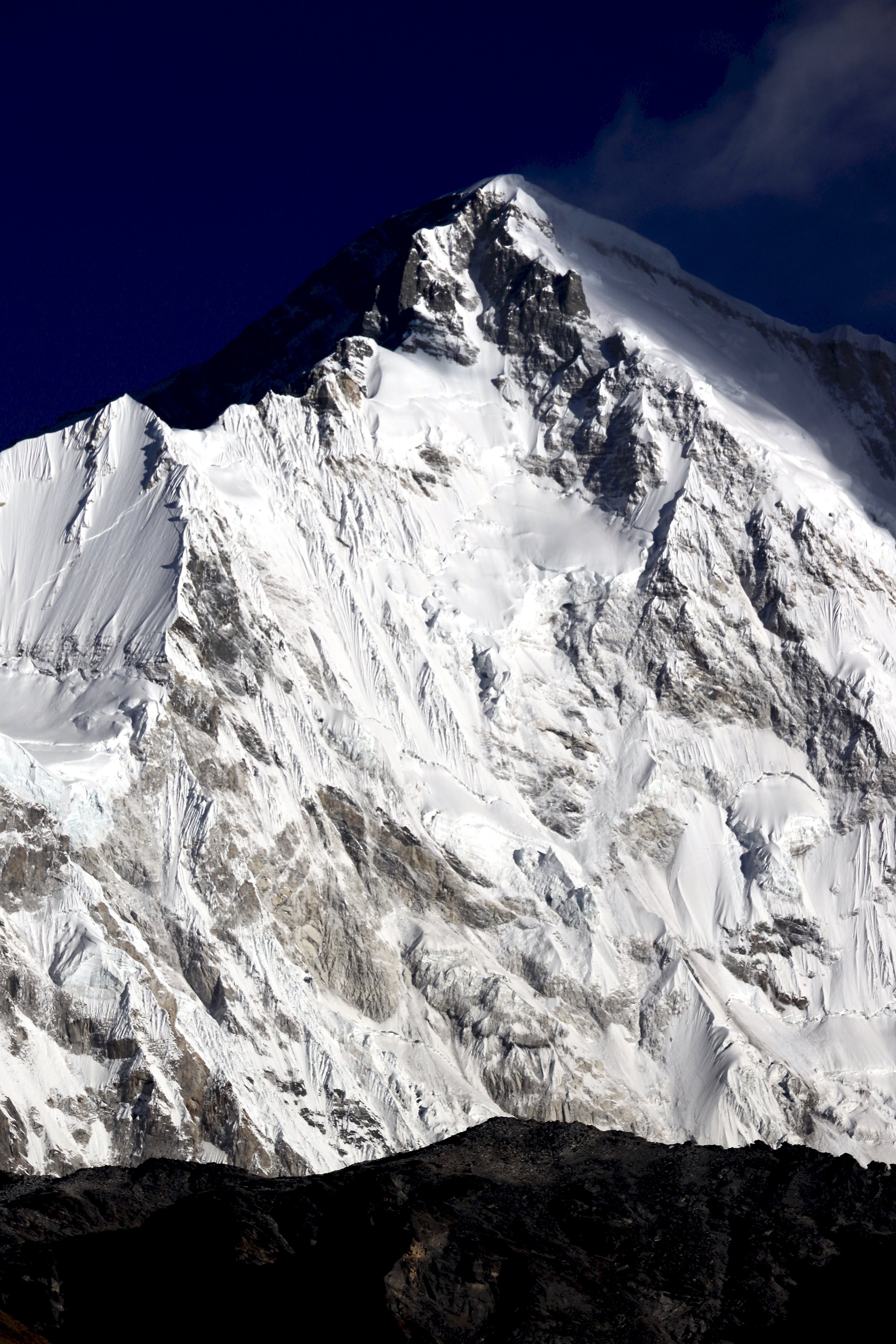
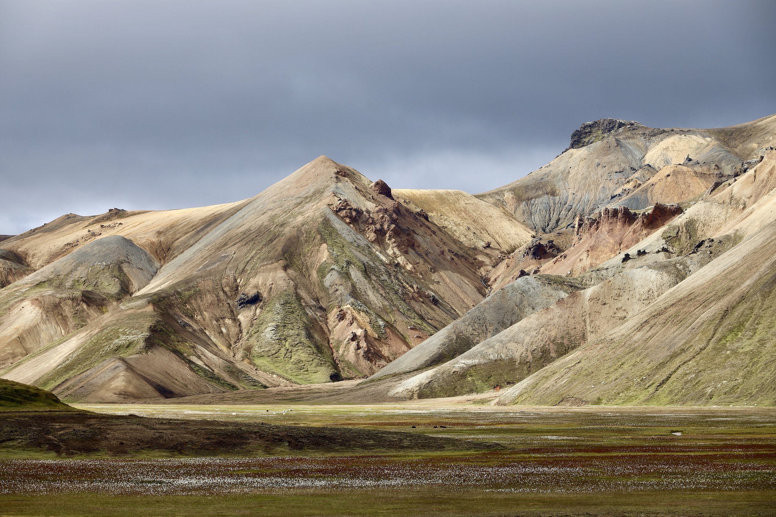
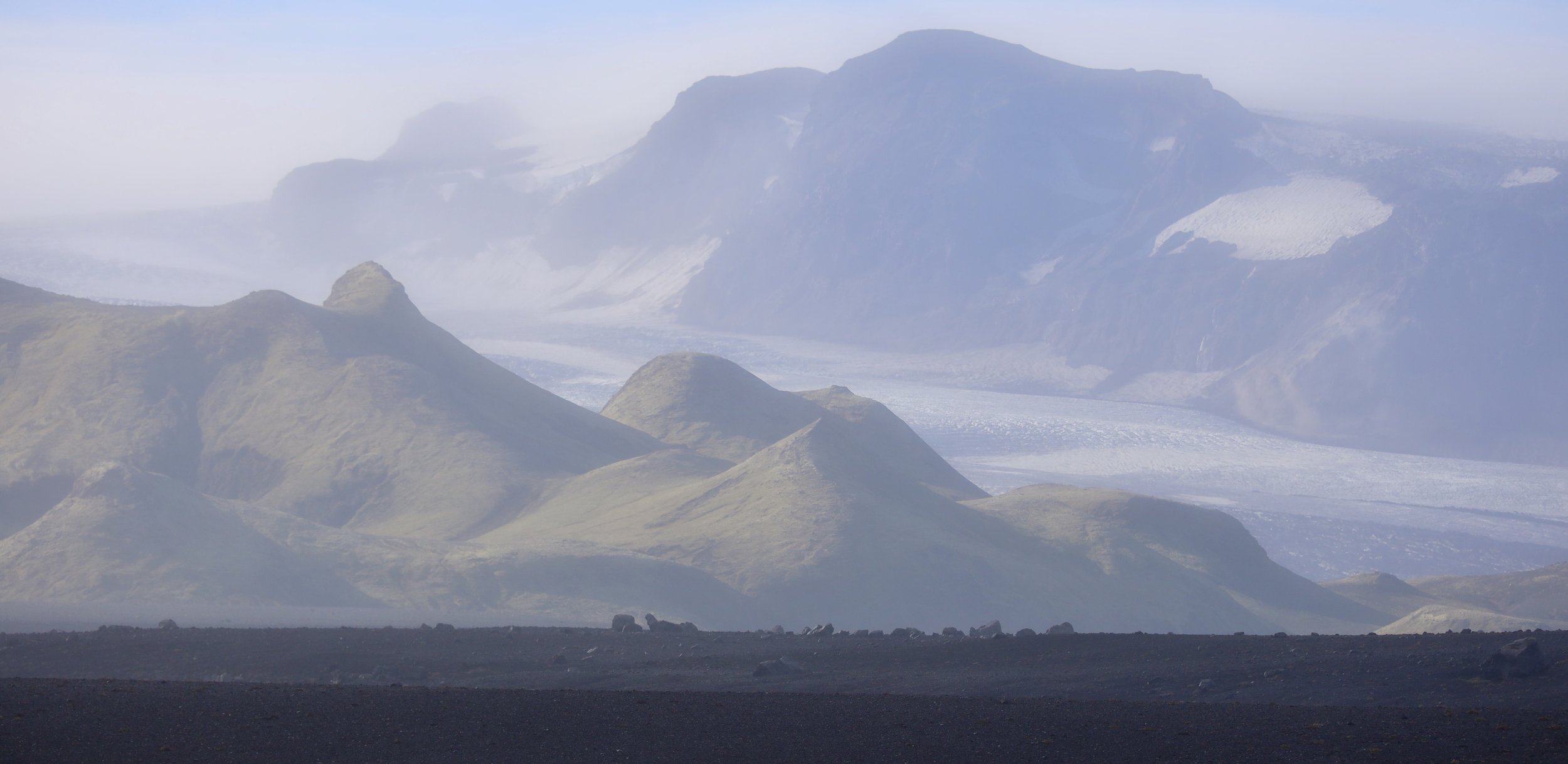
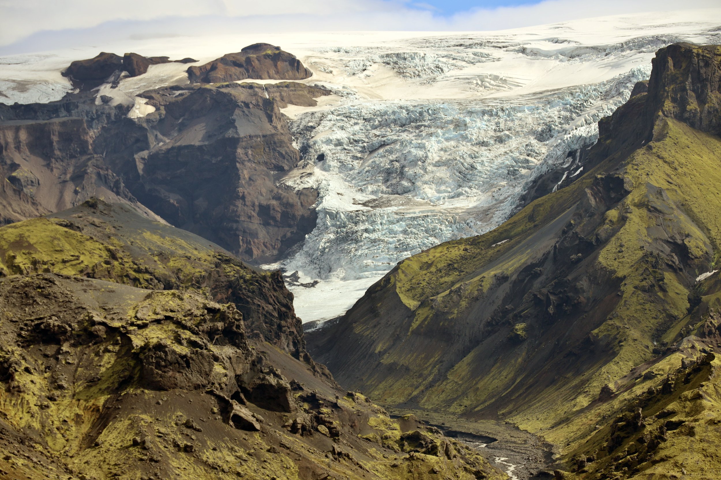
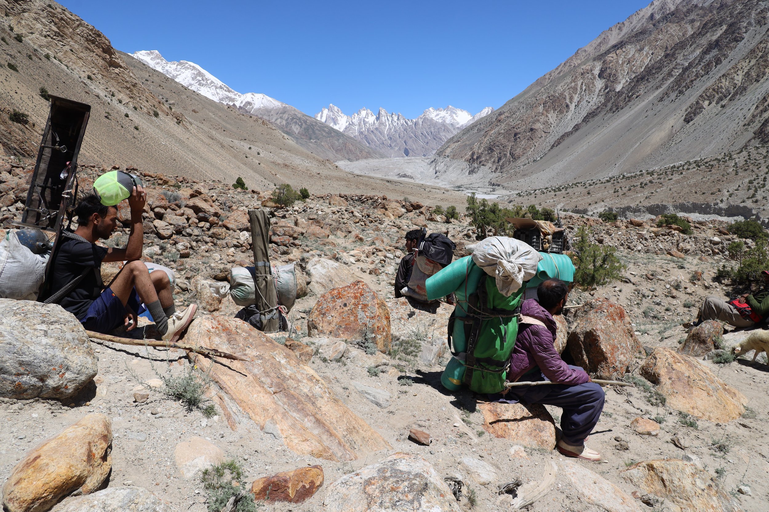
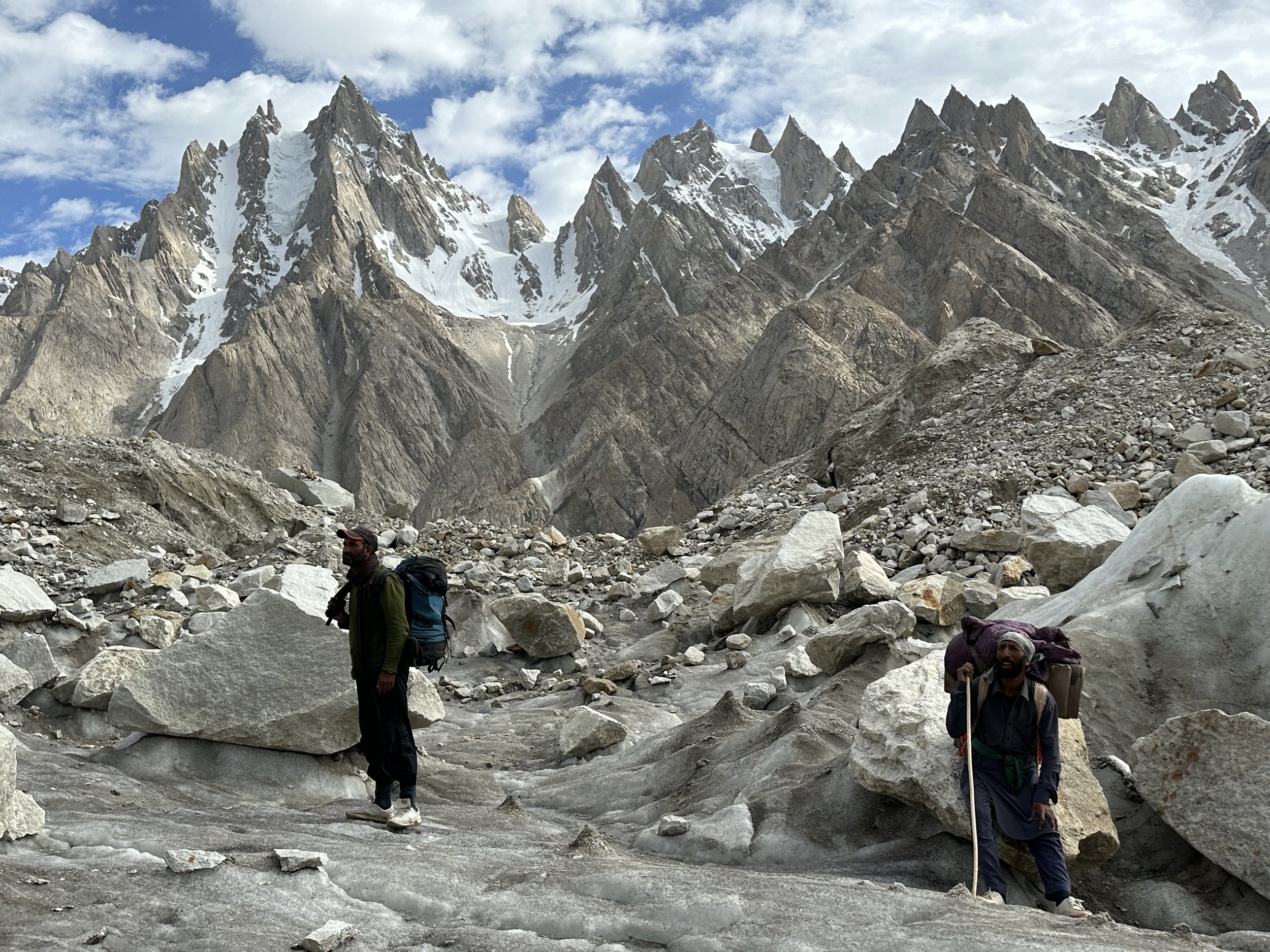
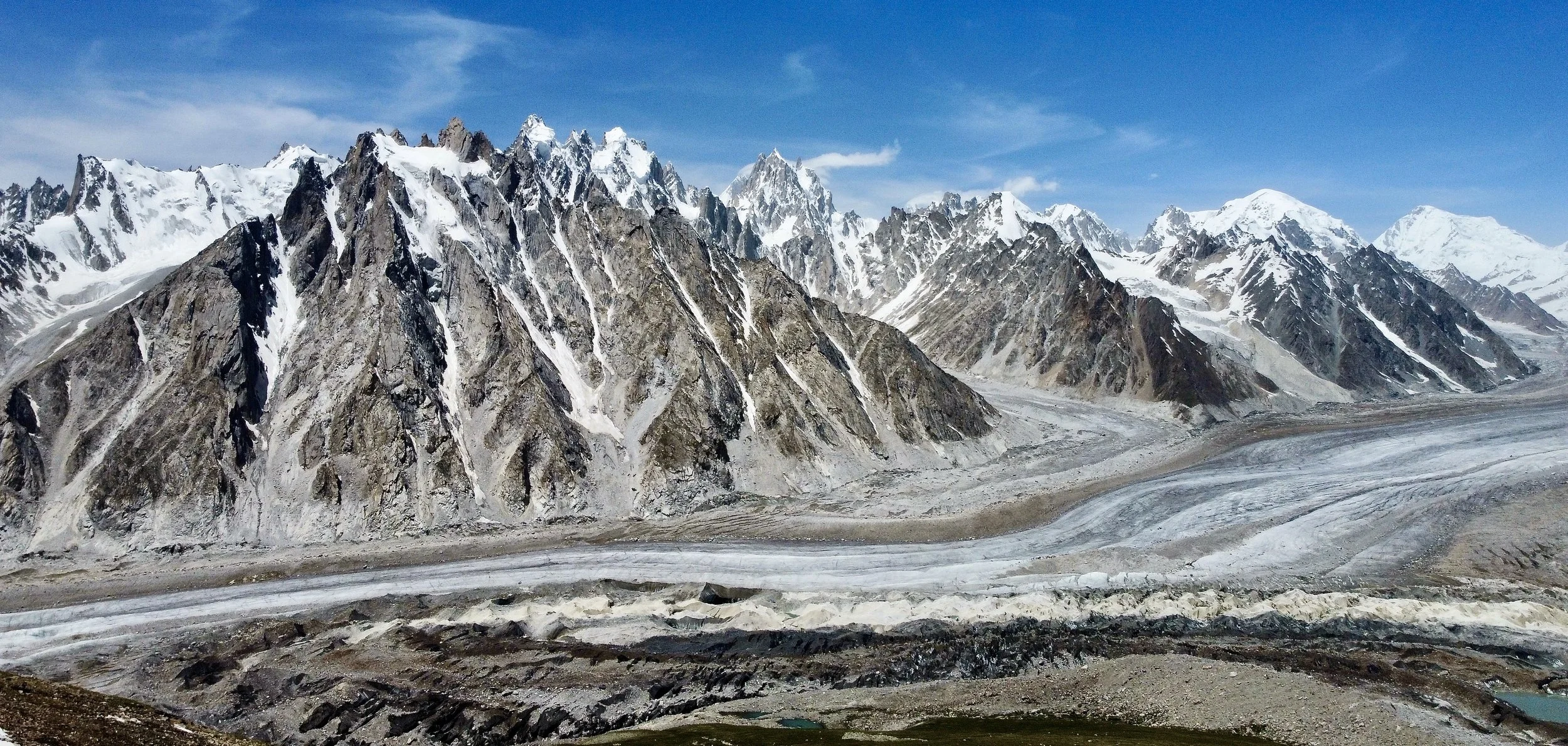
For the overnight trip to the Latok BC I took my own tent.  We also took enough food for one night.  When we left the weather was sunny and clear.  As we started our ascent up the Choktoi Glacier it started to cloud over but we still had good visibility of the spectacular mountains at the head of the Choktoi Glacier, the teeth like towers on the north side and the Latok 4 on the south side.  The summit of Latok 3 was hidden in the clouds.  The walk was fairly flat.  We started on the side moraine, then descended onto the jumbled Choktoi Glacier which made walking more challenging.  Slowly, we made our way to the middle of the glacier onto the white ice highway.  As we continued, the scenery got more and more spectacular.  The mountains lining up the upper Choktoi Glacier are just amazing, triangular towers so sharp, one next to the other.  We passed by Latok 4 and 3 with the walls like bastions of a medieval castle just 100 times larger.   Each of the Latoks had large icefall and glacier descending from it.   All peaks of the Latok group are surrounded by dragon teeth mountains and towers, such a foreboding sight. 

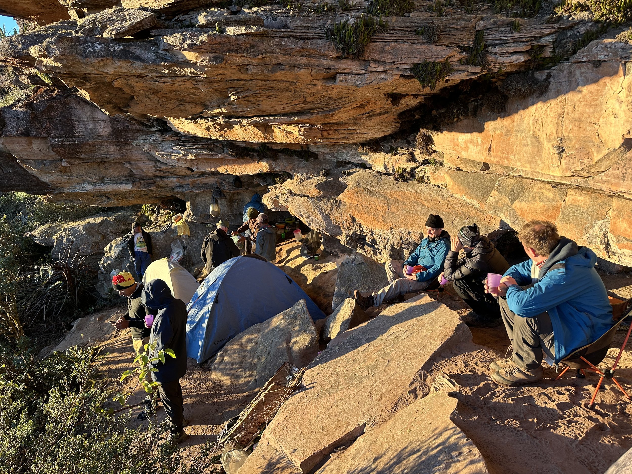
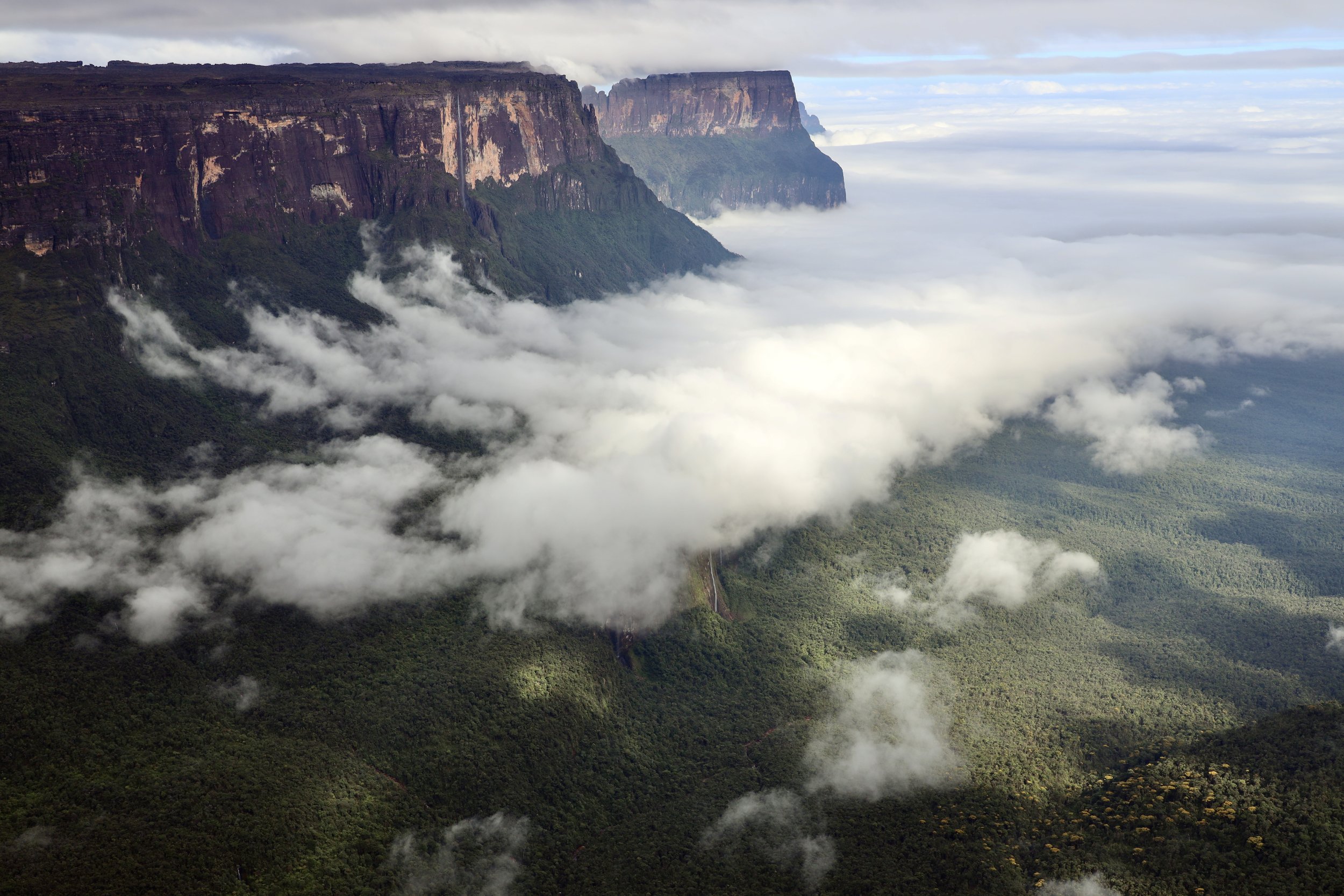
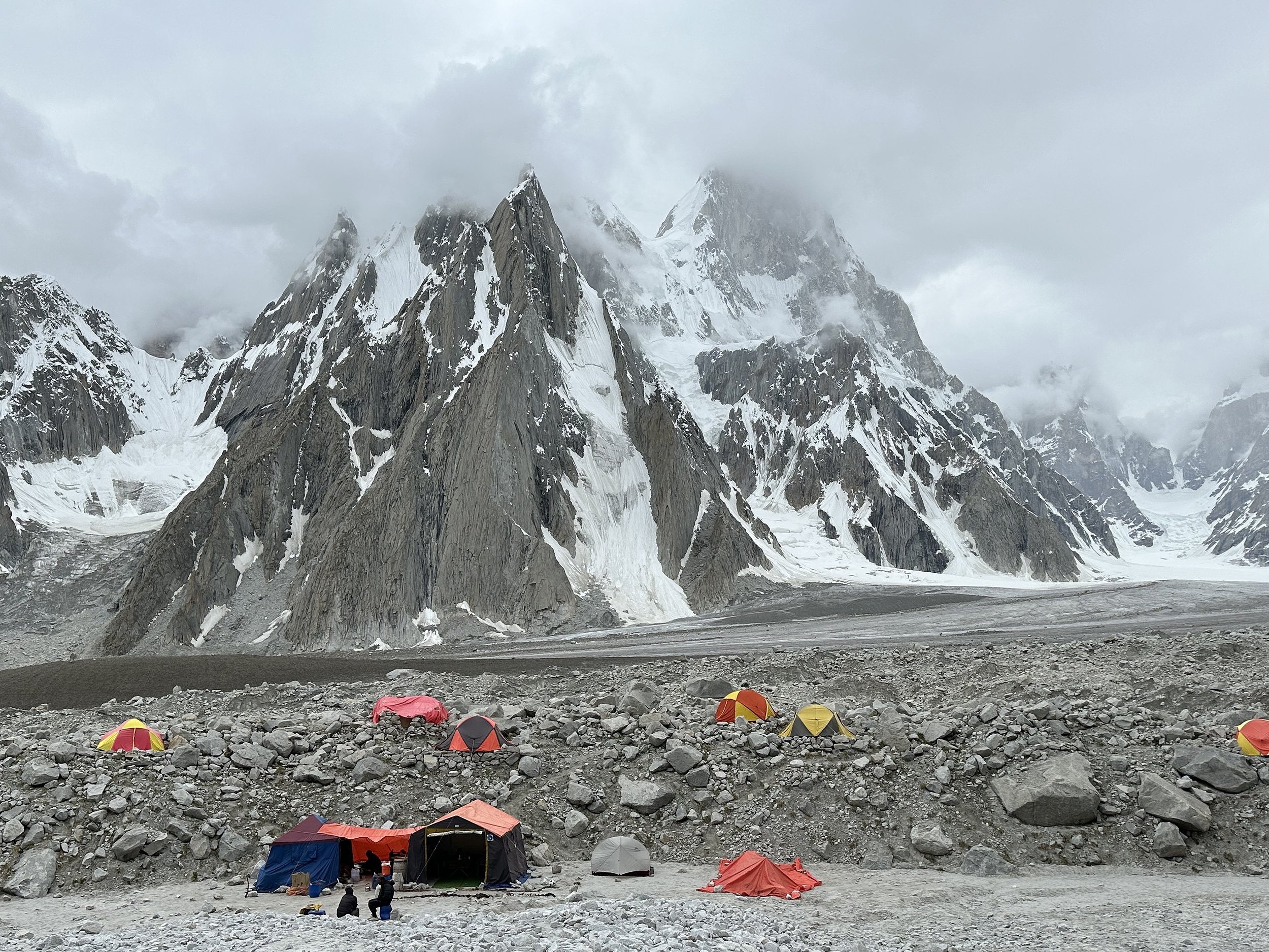
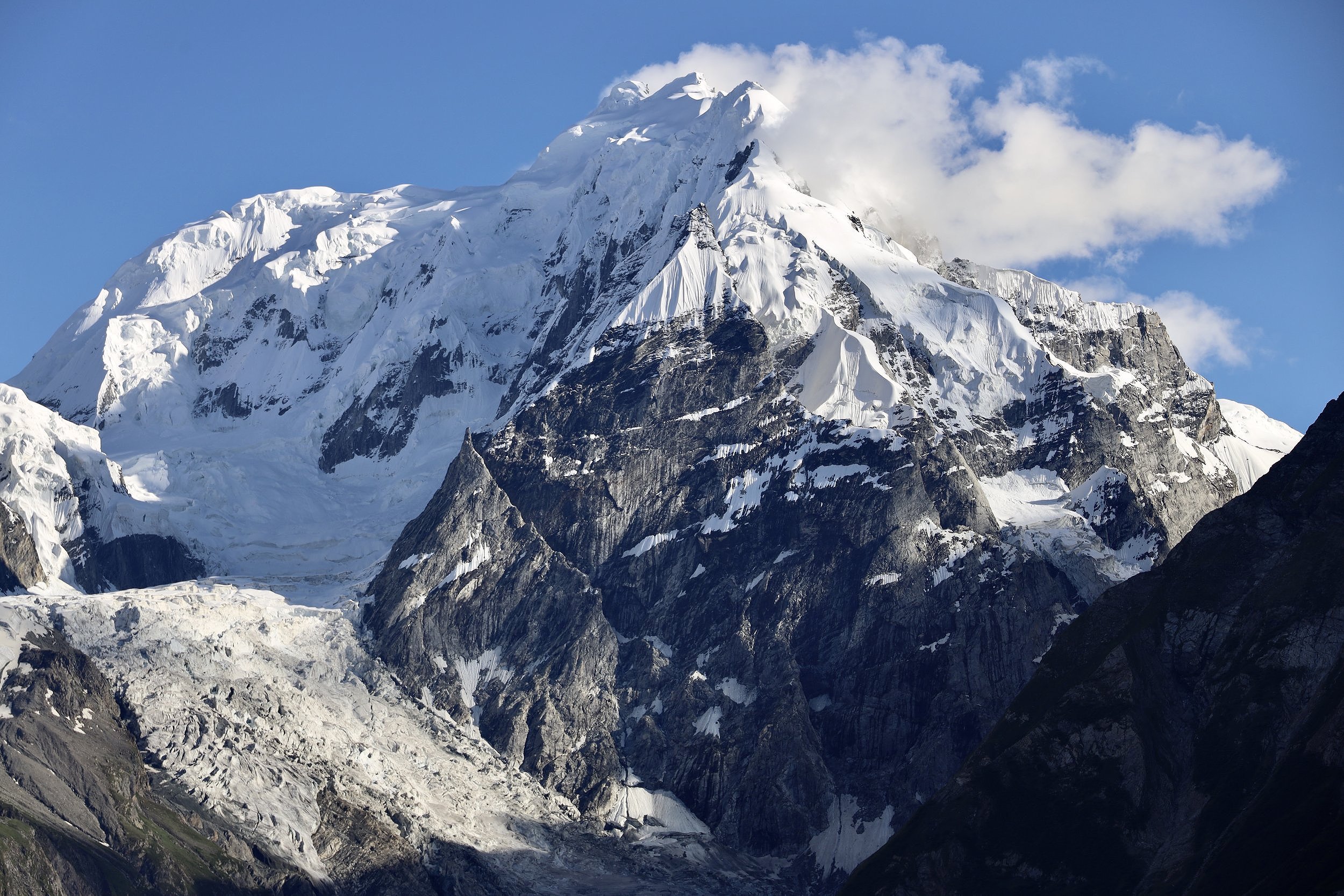
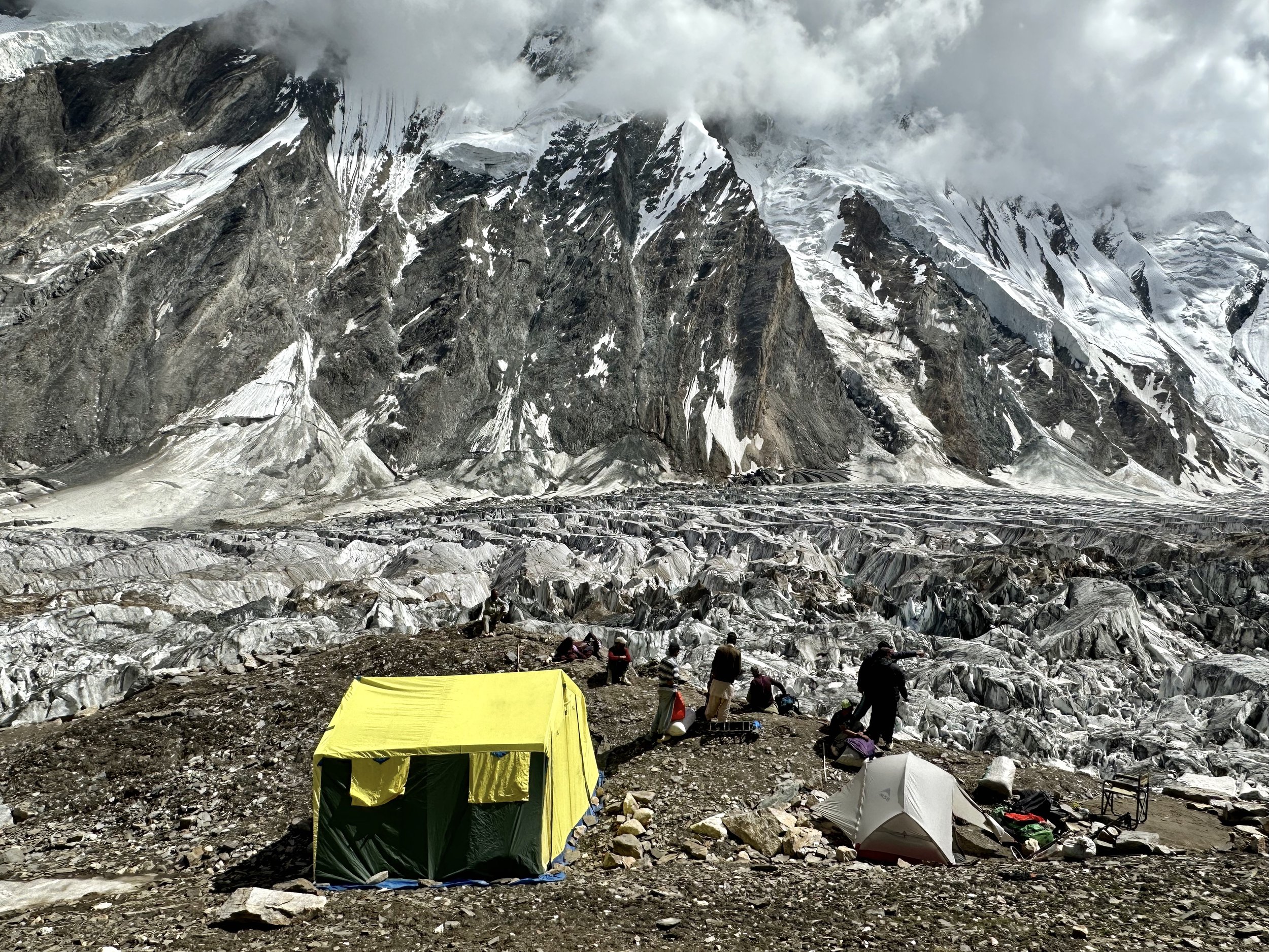
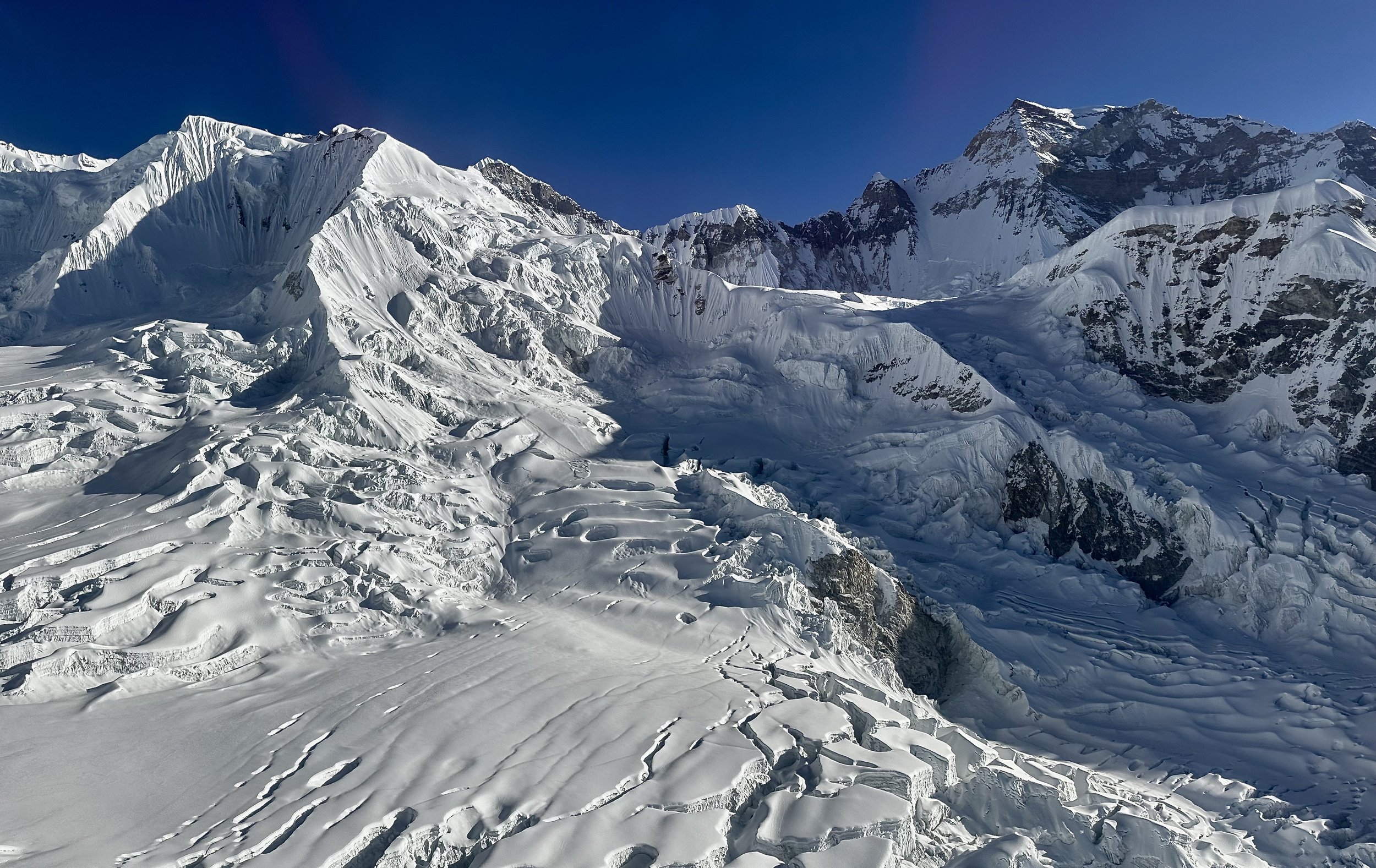
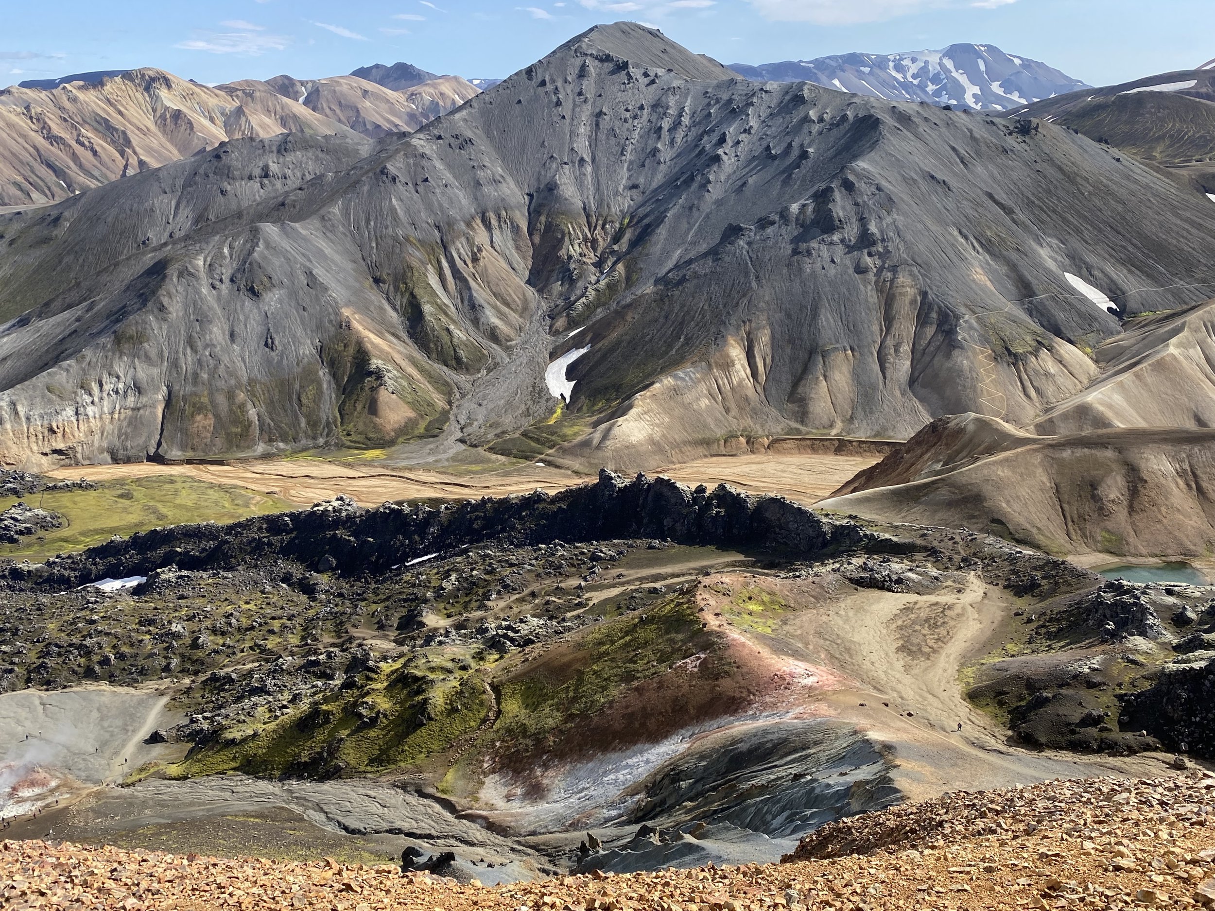
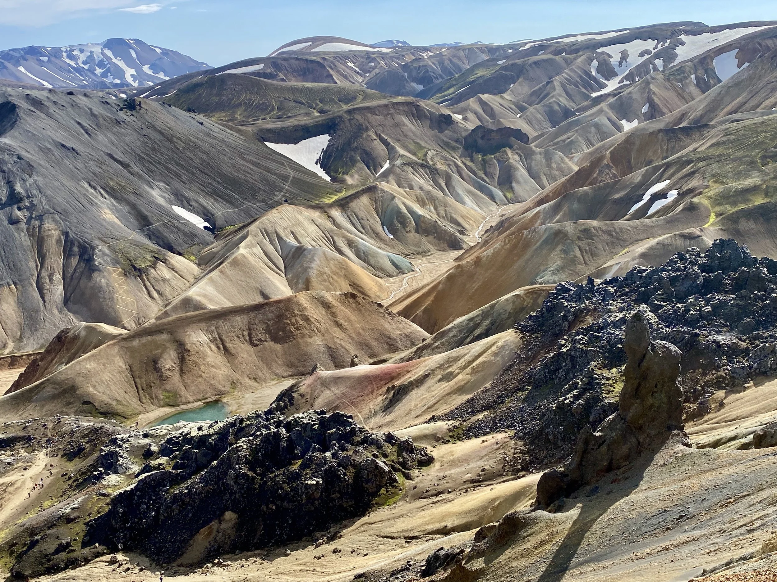
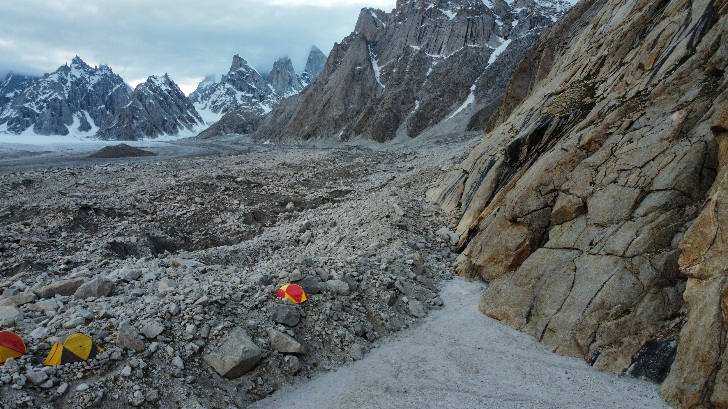
As we approached the BC, we had to leave the ice highway and climb up a small rocky lateral moraine.  The BC was hidden behind this lateral moraine.   When we arrived in the BC the clouds already obscured the view of Latok 1 and the Ogre.    I was disappointed but there was nothing I could do.  There was a climbing party in the basecamp, so we were not alone.  As we arrived, two climbers were leaving for their attempt on Ogre 1.  We had a brief chat.  The leader, François Cazanelli (a famous and very accomplished Italian climber), invited me in and offered their camp to us.  This was extreme hospitality!  He even offered us their tents.  I had my own tent so there was no need to use someone else’s.   I pitched my tent and had a delicious lunch.  Even with the overcast conditions, it was such a spectacular place to be in.  The location of the BC is very dramatic: perched above the Choktoi Glacier with 180-degree view of all the Latok Peaks and the Ogre1 and 2.  A magnificent panorama.

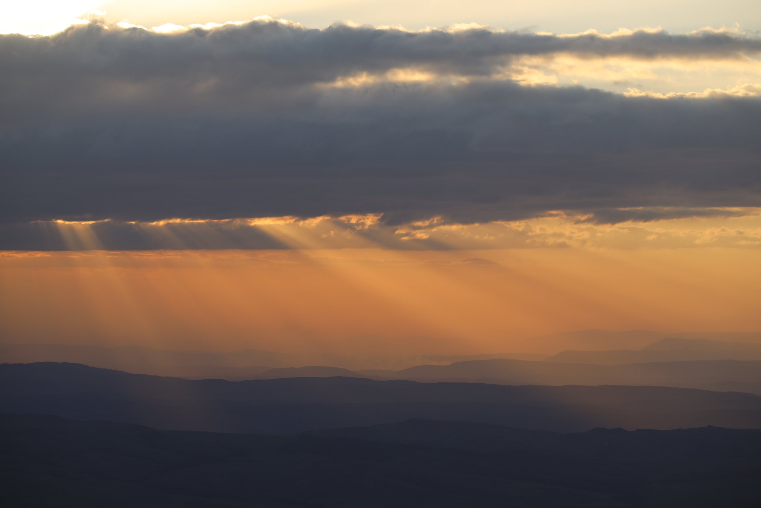
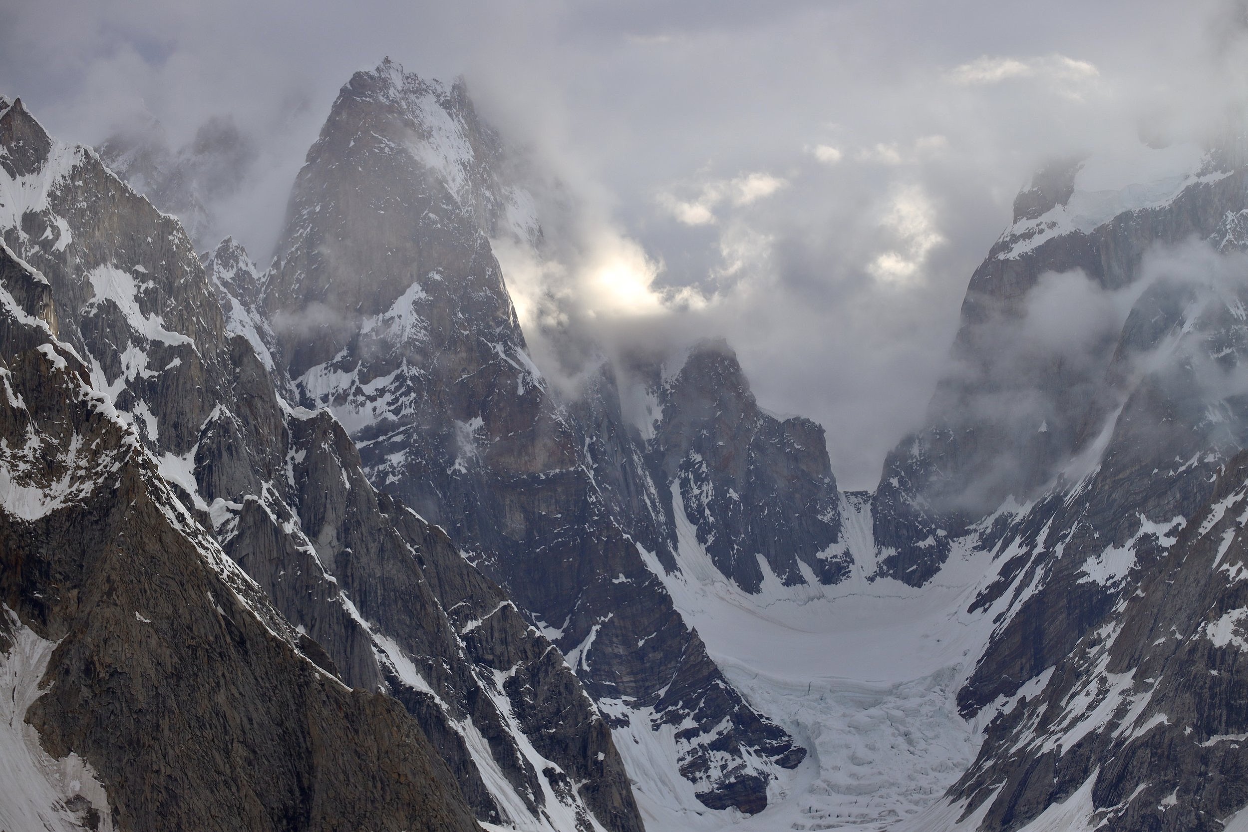
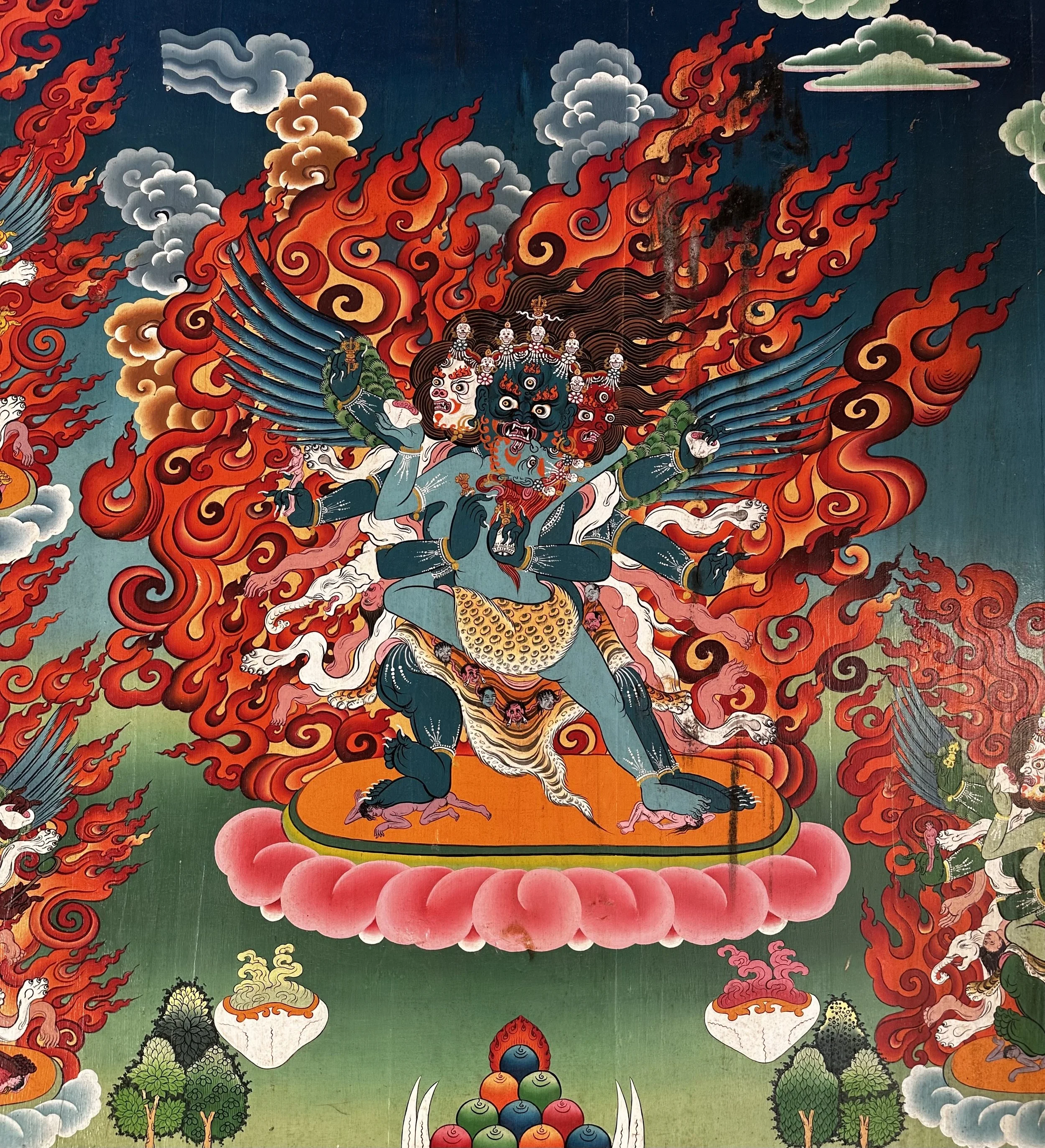
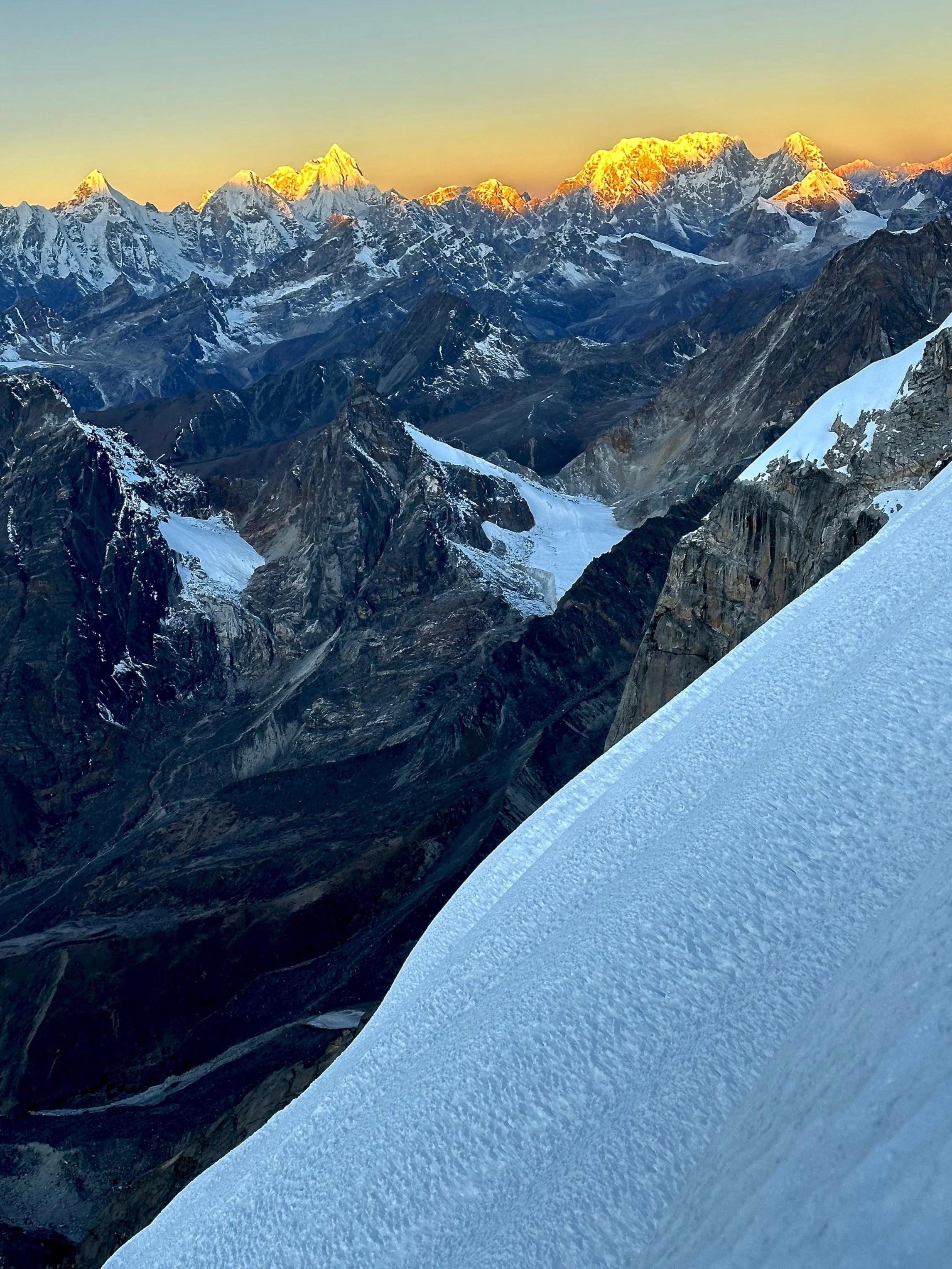
In the evening, the clouds parted, and the scenery became the photographer’s dream.  The  dramatic clouds with sun rays bursting through made the scenery very photogenic.  In a way it was much more spectacular than a clear blue sky – very mysterious and dramatic.   I was thinking about the documentary I saw on YouTube called “Impossible is not Forever”.  The documentary is about the accident on the Latok 1 that killed Sergei Glazunov.  Another recent accident on Ogre 2 killed two famous and accomplished Americans: Kyle Dempster and Scott Adamson.  Their bodies were sill somewhere on the mountain as none of them was ever found.   

After my photo fest, I chatted with the Pakistani liaison officer of the European expedition.  He was a nice young guy who volunteered to be here.  He is an aviation electronics engineer who wanted to see the high Karakorum mountains and working with the mountaineering expedition provided him with this opportunity.  He was taking drone shots and showed me some footage taken in clear weather.  Of course, it was all very spectacular. 

It rained heavy all night and despite the forecast for clear sky it just got progressively worst in the night.  It was too bad, but I was not too stressed as there was nothing that I do.

July 17, 2023 Walk back to Moretti Camp 12 km 400m down

We got up early to overcast sky and drizzle.  Around 7 am the four Europeans arrived from their attempt on Ogre 1 all wet, cold and miserable.  They complained about the bad conditions, it was too warm, there was a lot of unconsolidated snow.  The distance from the BC where we were, to the Ogre’s icefall is 10 km.  It takes 5 hours on foot and skis to cover this distance.  The climb up the Ogre involves gaining a 6000m col between Ogre 1 and 2.  The climbing to the Col is not too bad, but the conditions make it dangerous.  Francois is a mountain guide from Cervinia area of Italy (Italian side of Matterhorn).  He climbed K2 and Nanga Parbat without O2 the year prior.  He and his friends were extremely friendly and hospitable.  I was the first and only foreigner that they saw during their stay in the BC.

In order to see the entire face of Latok 1 it is necessary to go for a few more hours up the Choktoi Glacier as the peak is really hidden around the bend.  The entire Latok/Ogre group is very well hidden and requires a considerable effort to reach.  The camp closest to the mountain has too much snow and is very difficult to reach without skis (even in mid-July).  The Ogre climb involves a long approach on skis (5 hours), then night climb through the icefall (at night everything is frozen, so it is safer), then a climb to the col between Ogre 1 and 2 and then the real climbing starts.   The entire adventure requires minimum 6 days of good weather but the weather windows here are short and unpredictable.  The Europeans never had such a long weather window.  The route is exposed to rockfall, avalanches and crevasses on the approach.  The guys have been sitting here for 3 weeks already and it did not look promising.  Climbing here requires patience and good spirits.    It is easy to get discouraged with bad weather and boredom.   I think that August is the proper month to come here.  July is too early and there is too much snow higher up.

Around lunch time the clouds parted a little, but Latok 1 was still covered by a thick layer of clouds.  The weather did not look promising to justify staying here for another night, so we started our return journey right after lunch.  We had a nice walk down.  I flew the drone for some great shots of the Choktoi Glacier.  It then became quite hot.  What a change in the weather from 5C to 30C in a short time.   In retrospect, we should have stayed another night in the BC.  An important lesson learned:  do not rush and be patient!

July 18, Moretti Camp to Nobande Sobande 18.5km 7.5 hrs 400m up and 400m down

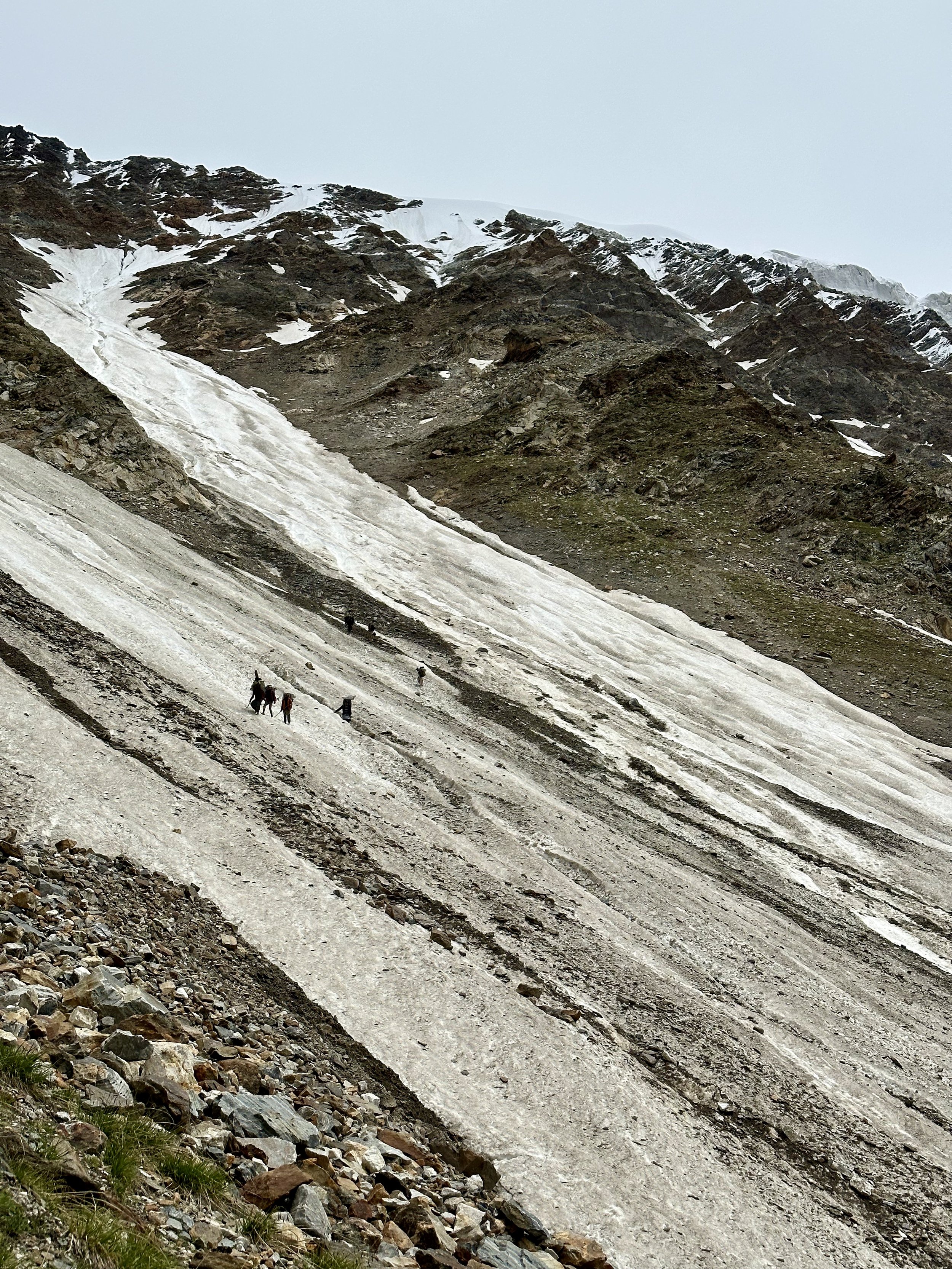
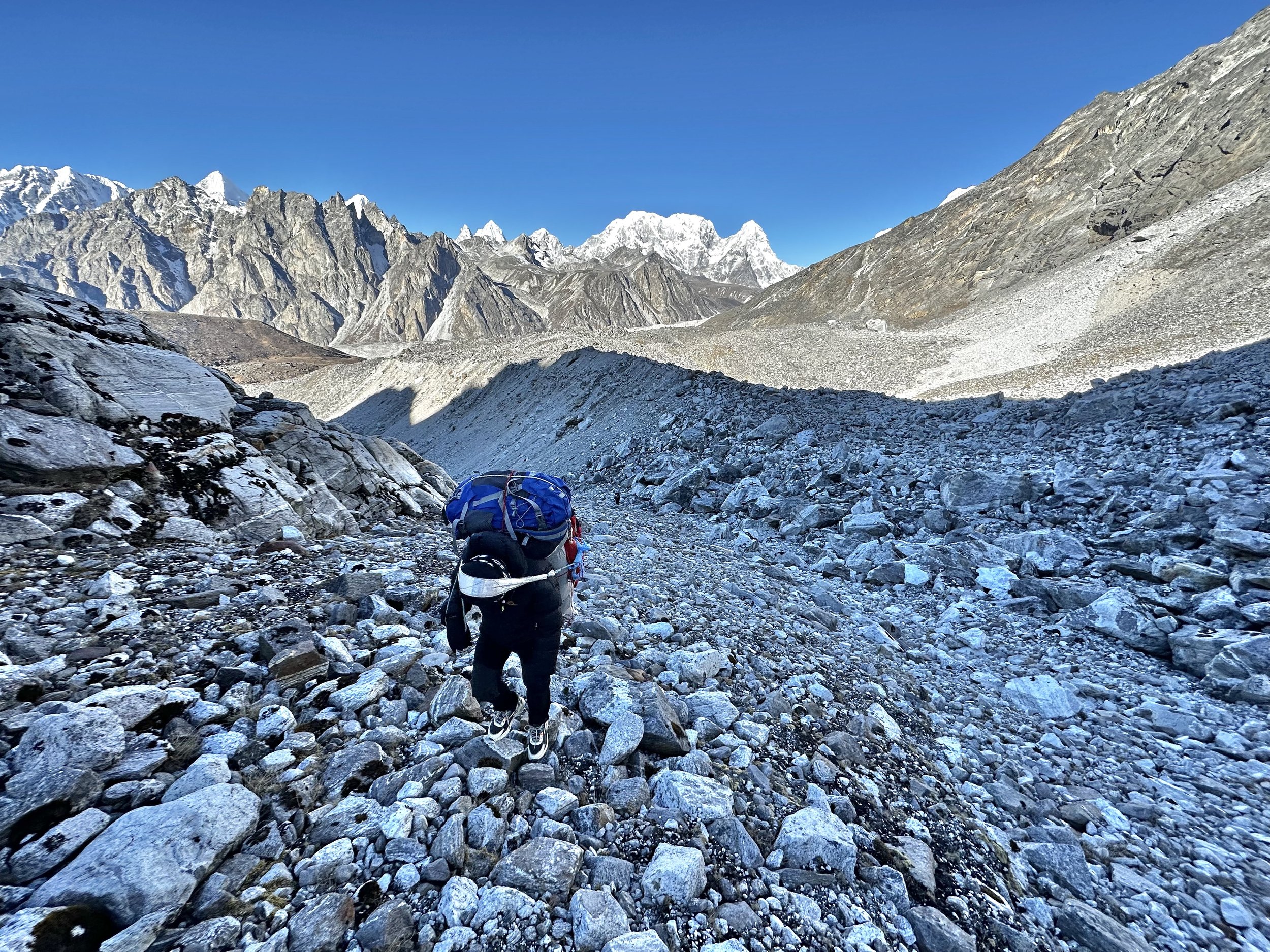
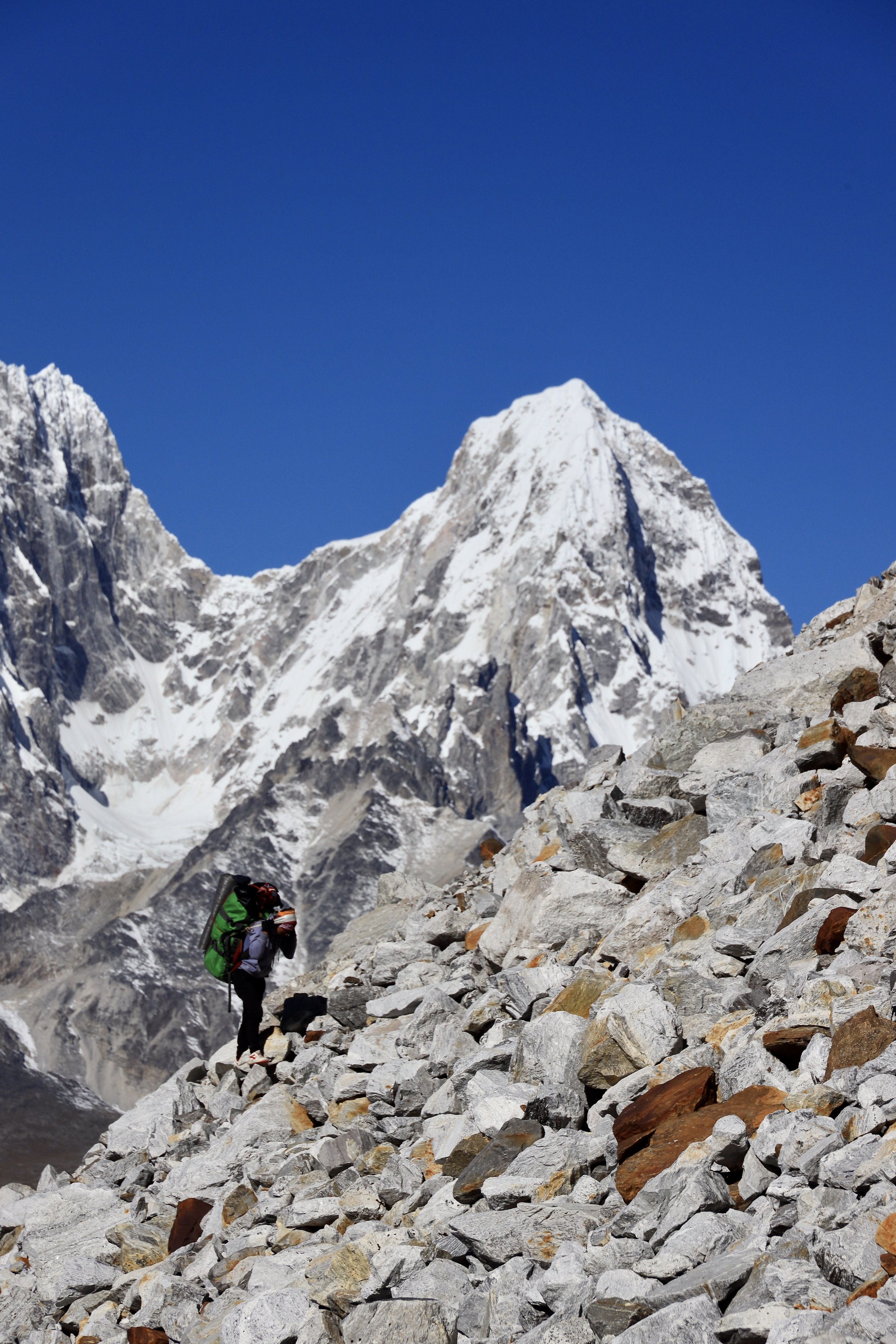
Today we started early.  We packed up the camp and followed the path across the glacier that the horsemen scouted the day before.  They wanted to ensure safe passage for the loaded horses.  I was not expecting to spend the entire day boulder hopping on this massive glacier, but this is what happened. 

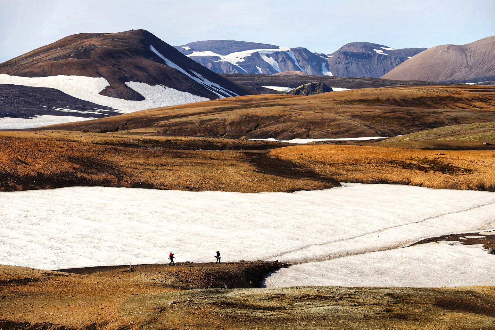
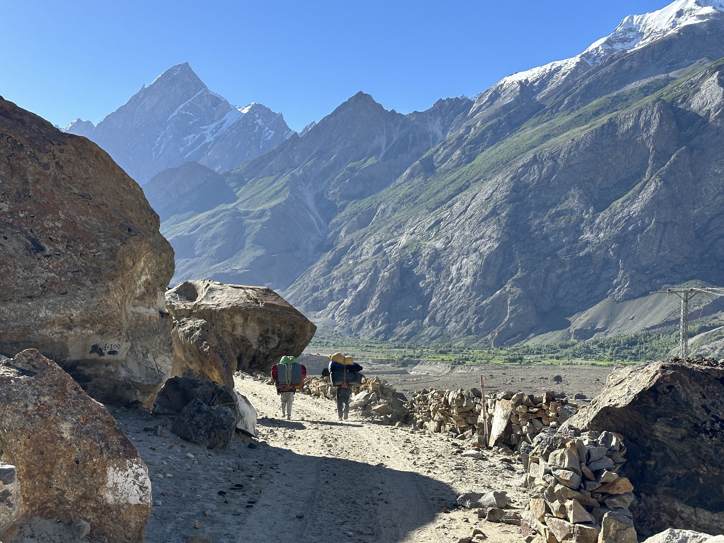
We crossed the 4 km wide Panamagh Glacier.  According to Essan, there was supposed to be a path to follow on the other side.  The path only lasted for 20 min and after that we had to descend onto a side glacier connected to Nobande Sobande Glacier (NS).  We then spent next 4 hours boulder hopping, going up and down large ice fins slowly making our way towards the next camp.  It was quite exhausting in the heat of the day, and our progress was slow.  We had to watch each step carefully as the boulders we were walking on were just piled up on top of one another.  We ended up climbing some challenging sections with large stones ready to dislodge every minute.  The fact that 5 horses crossed this glacier is quite astonishing! After 7 hours or so I started to get quite tired and had to stop now and again.  It was good that we had water as I drank more than 4 liters. 

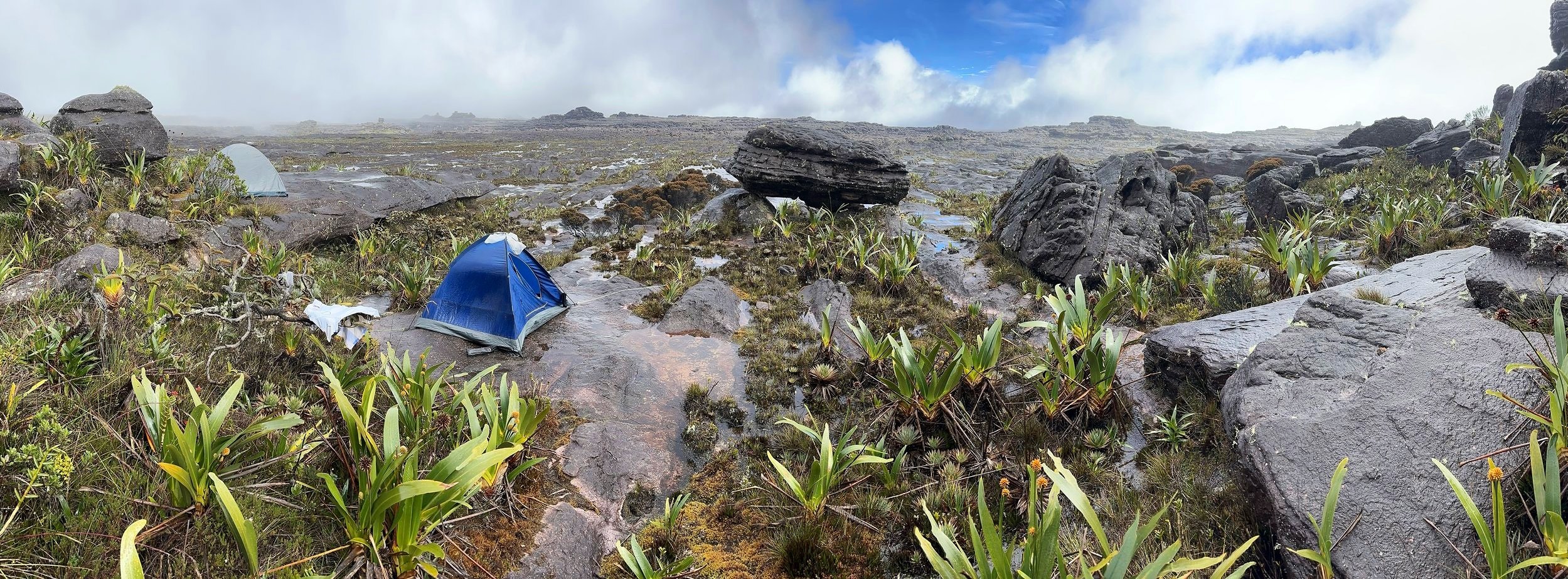
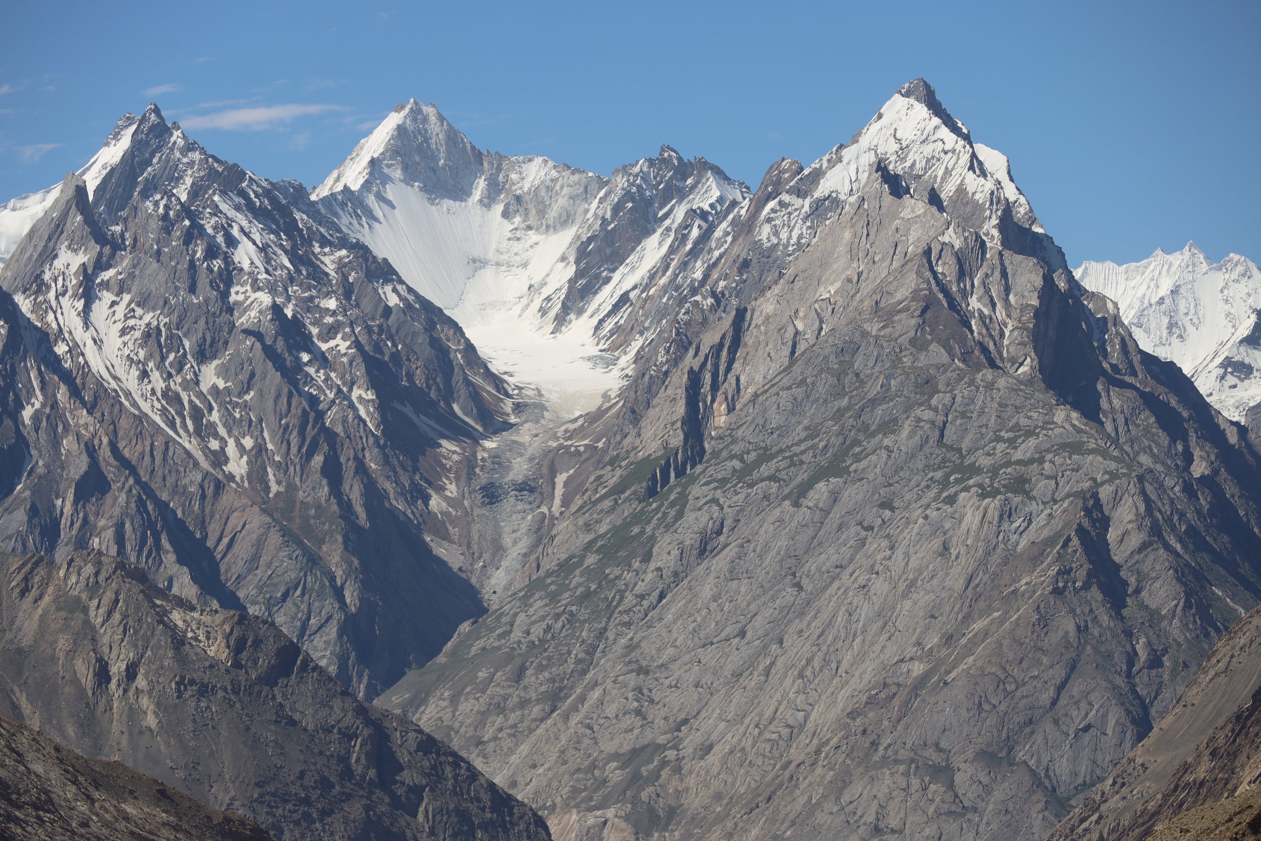
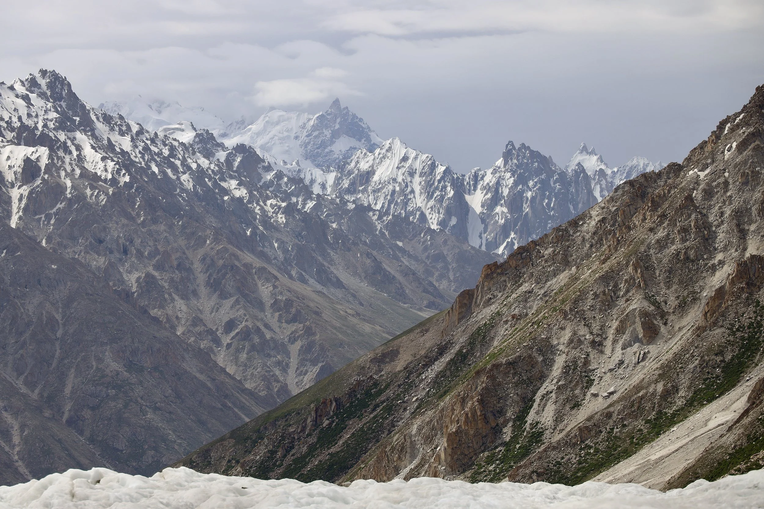
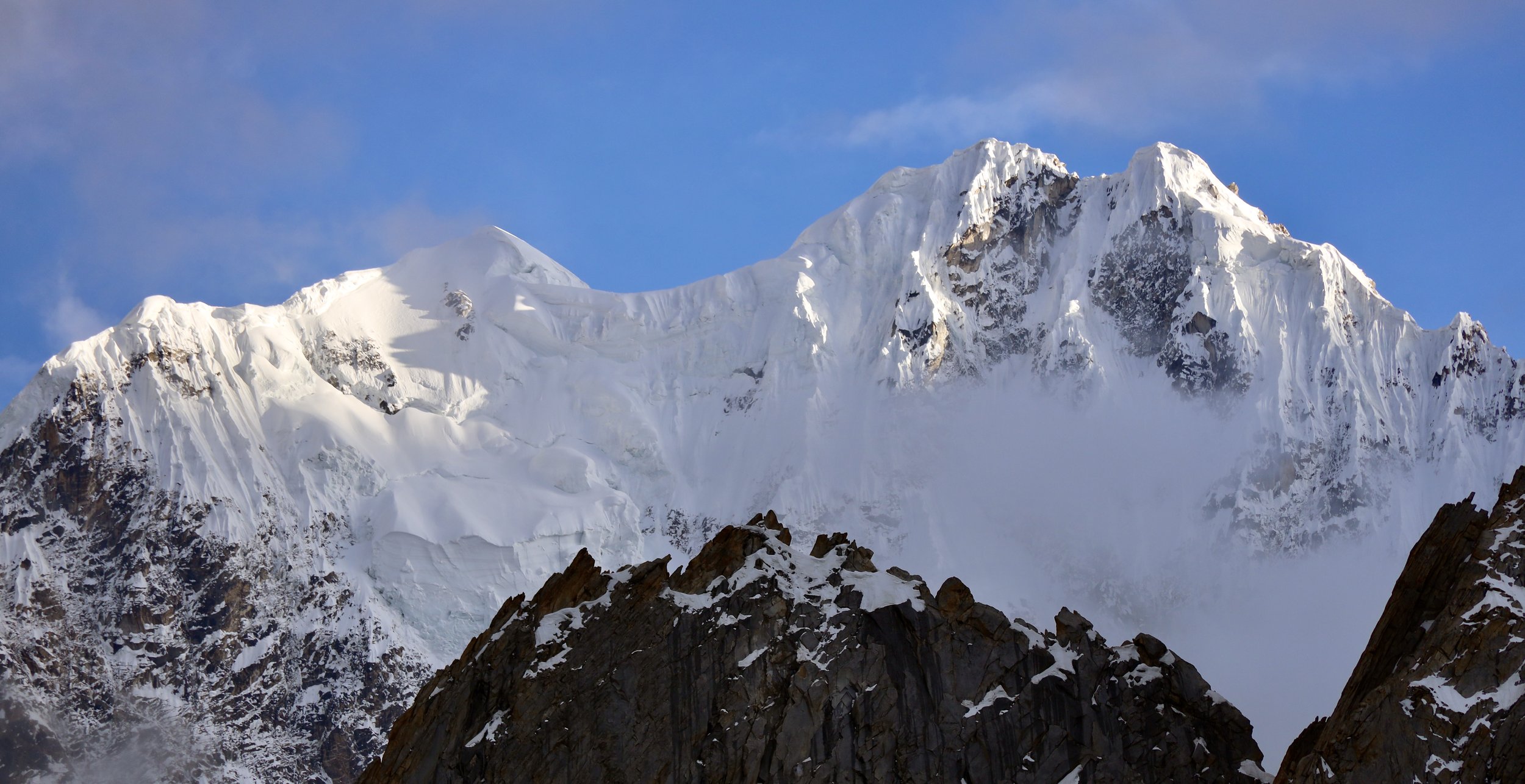
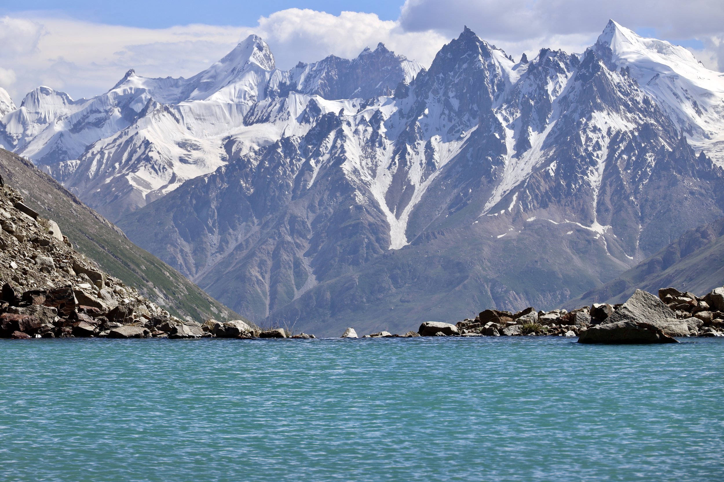
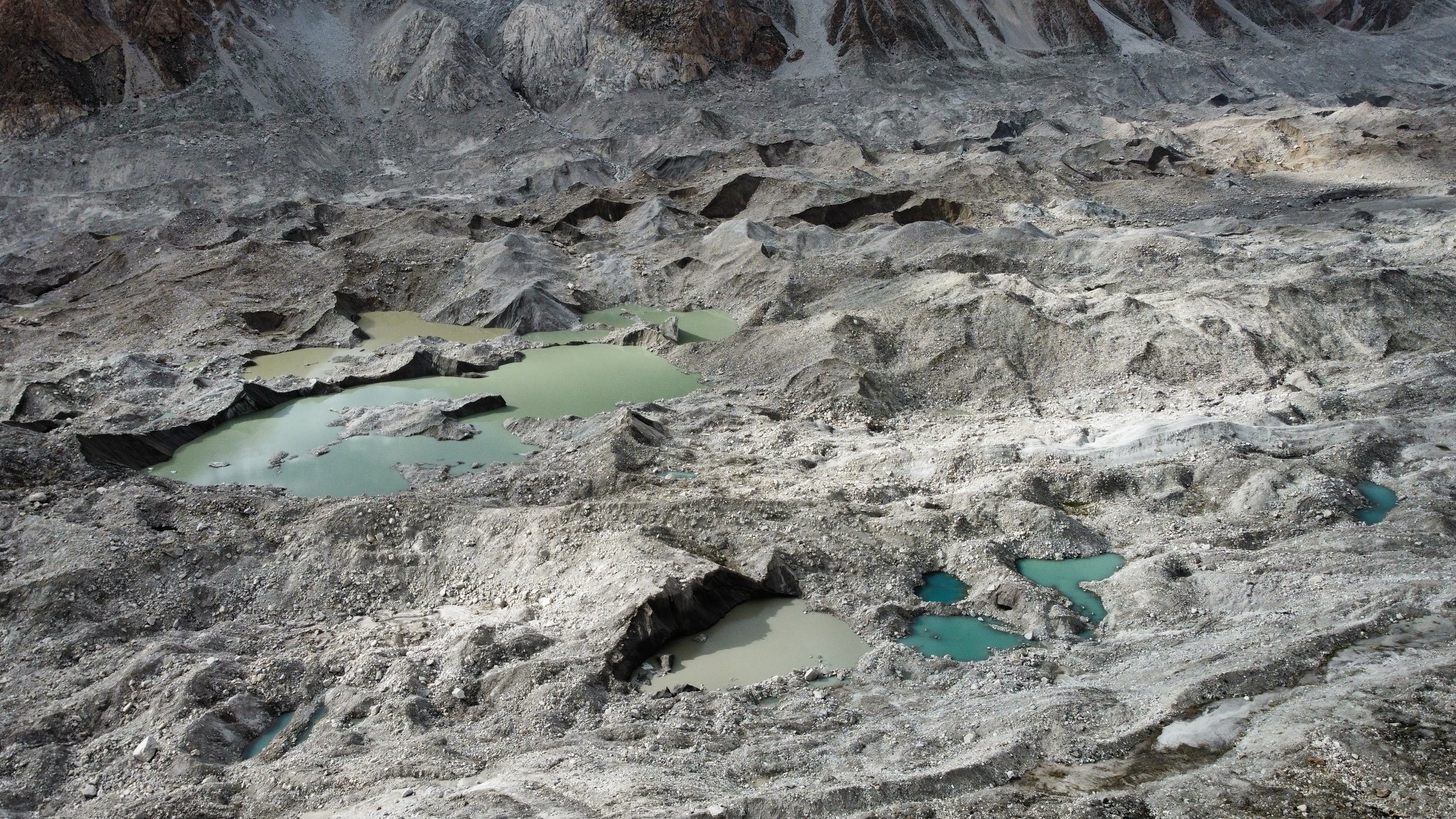
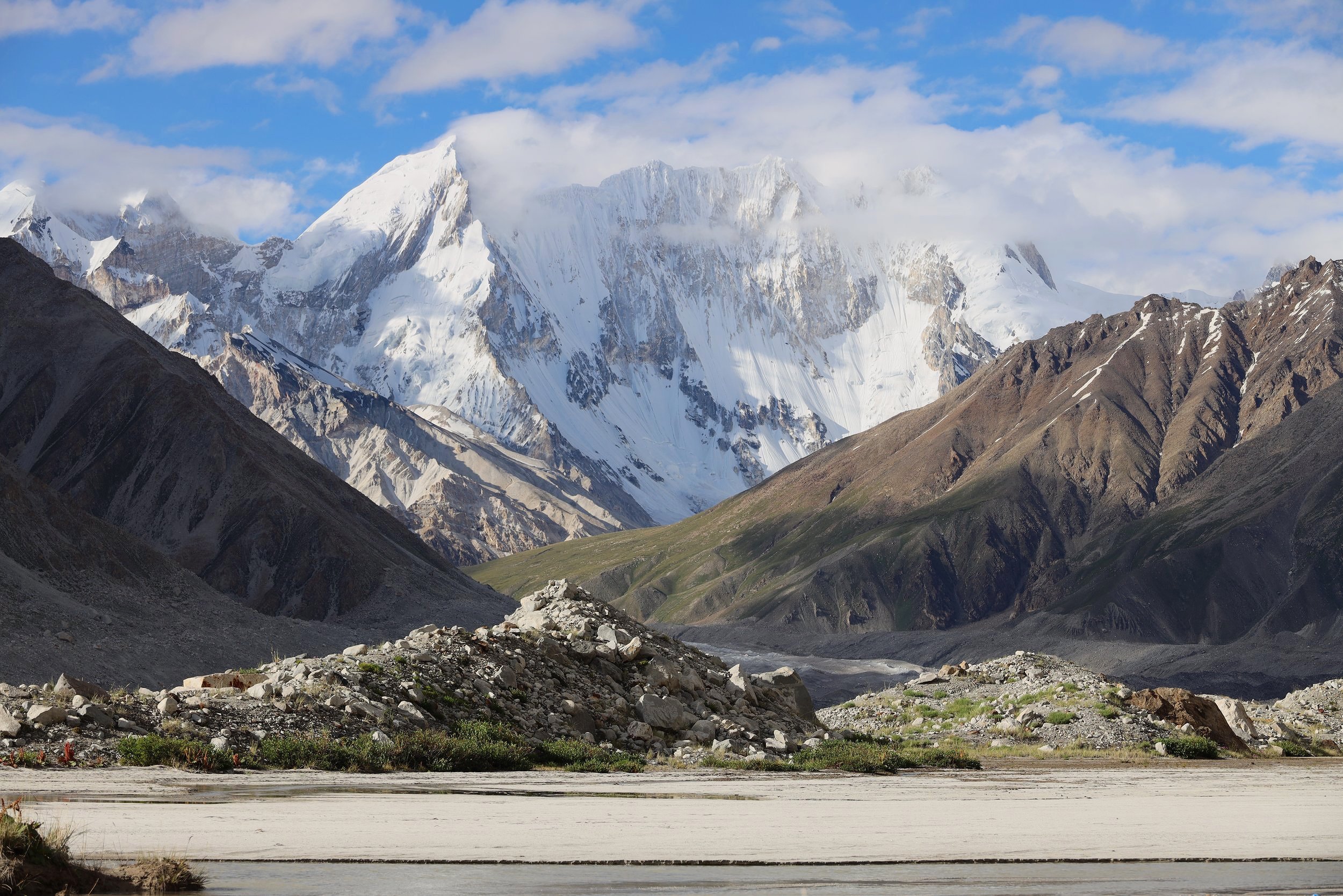
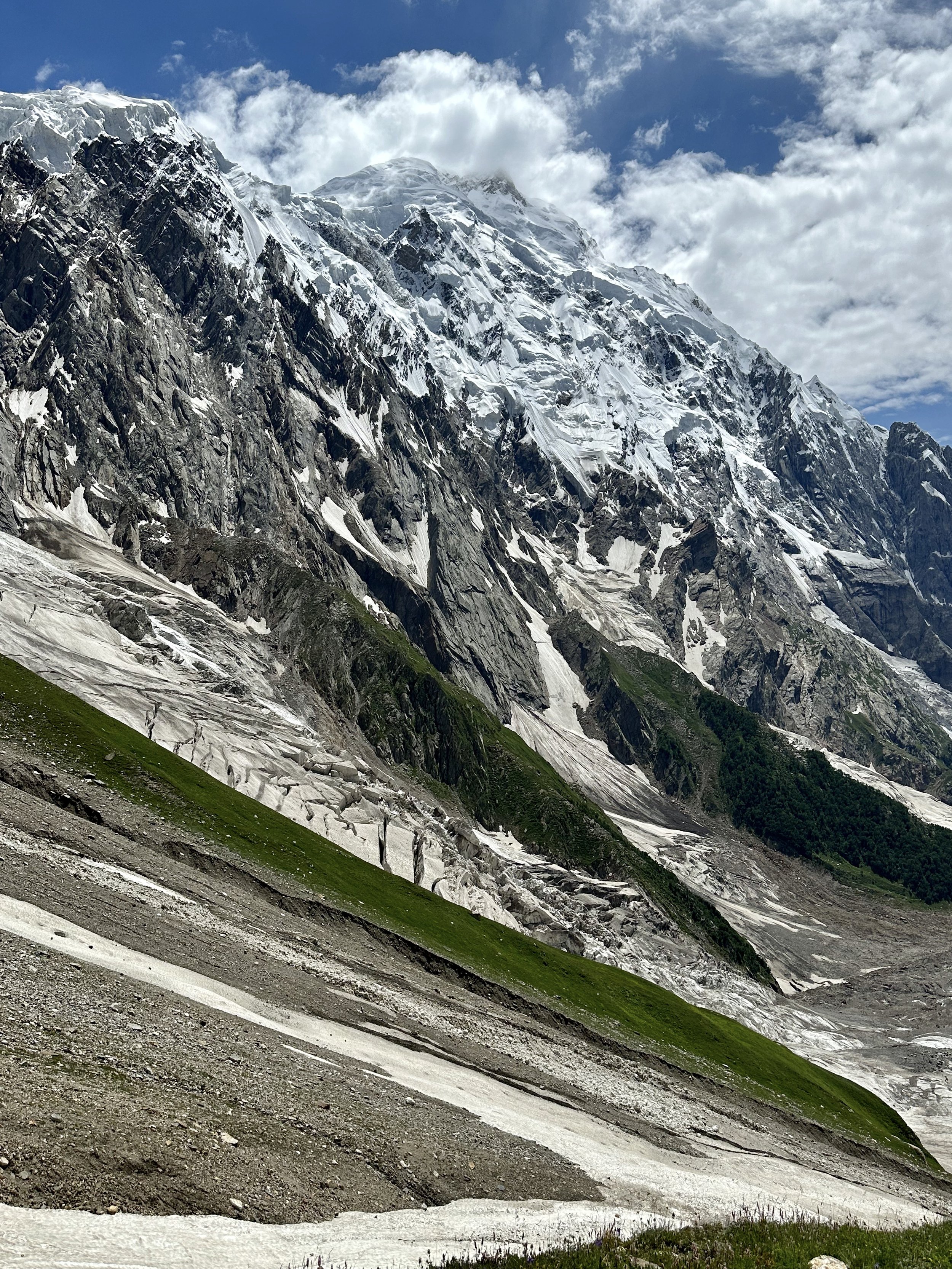
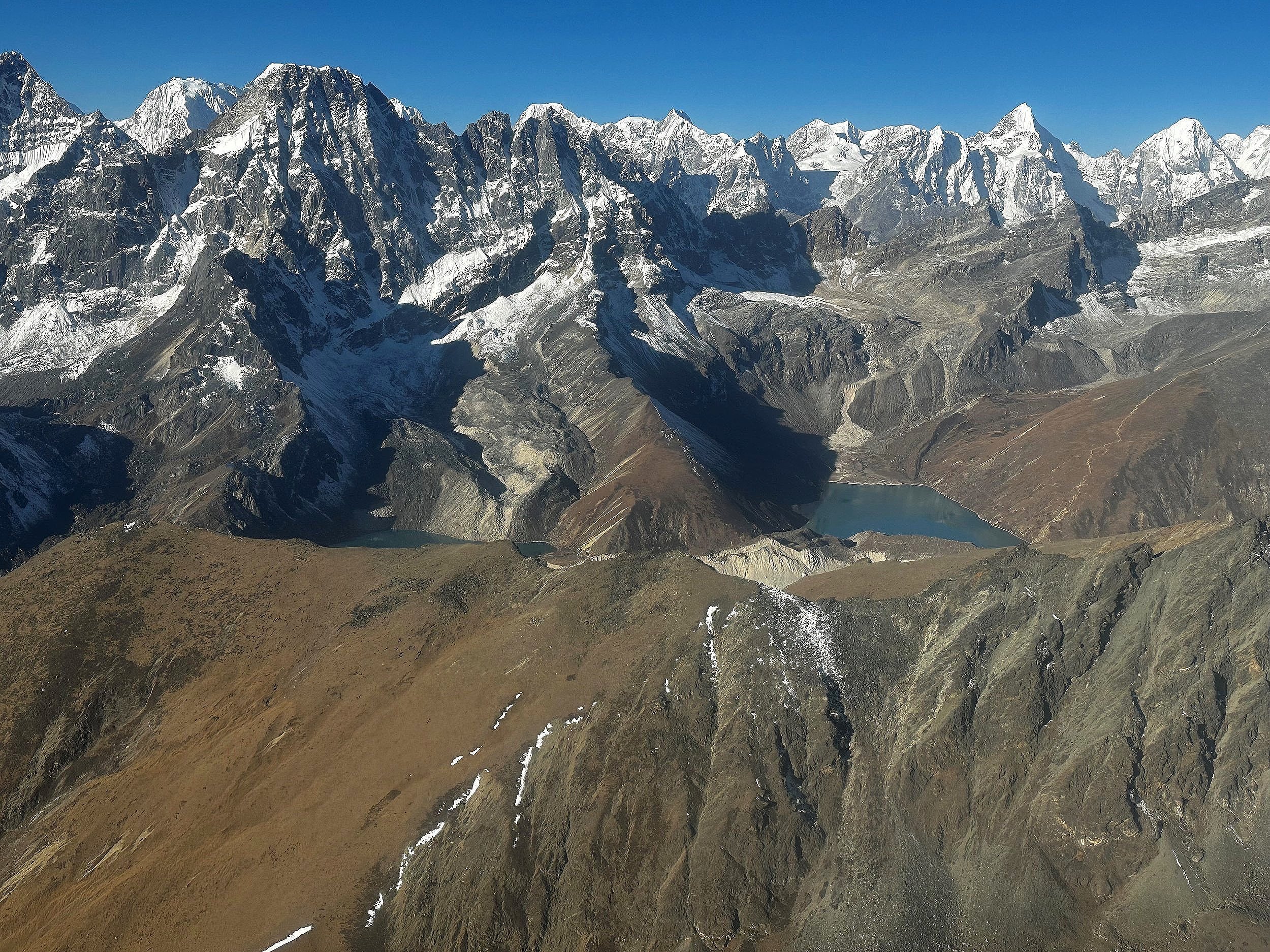
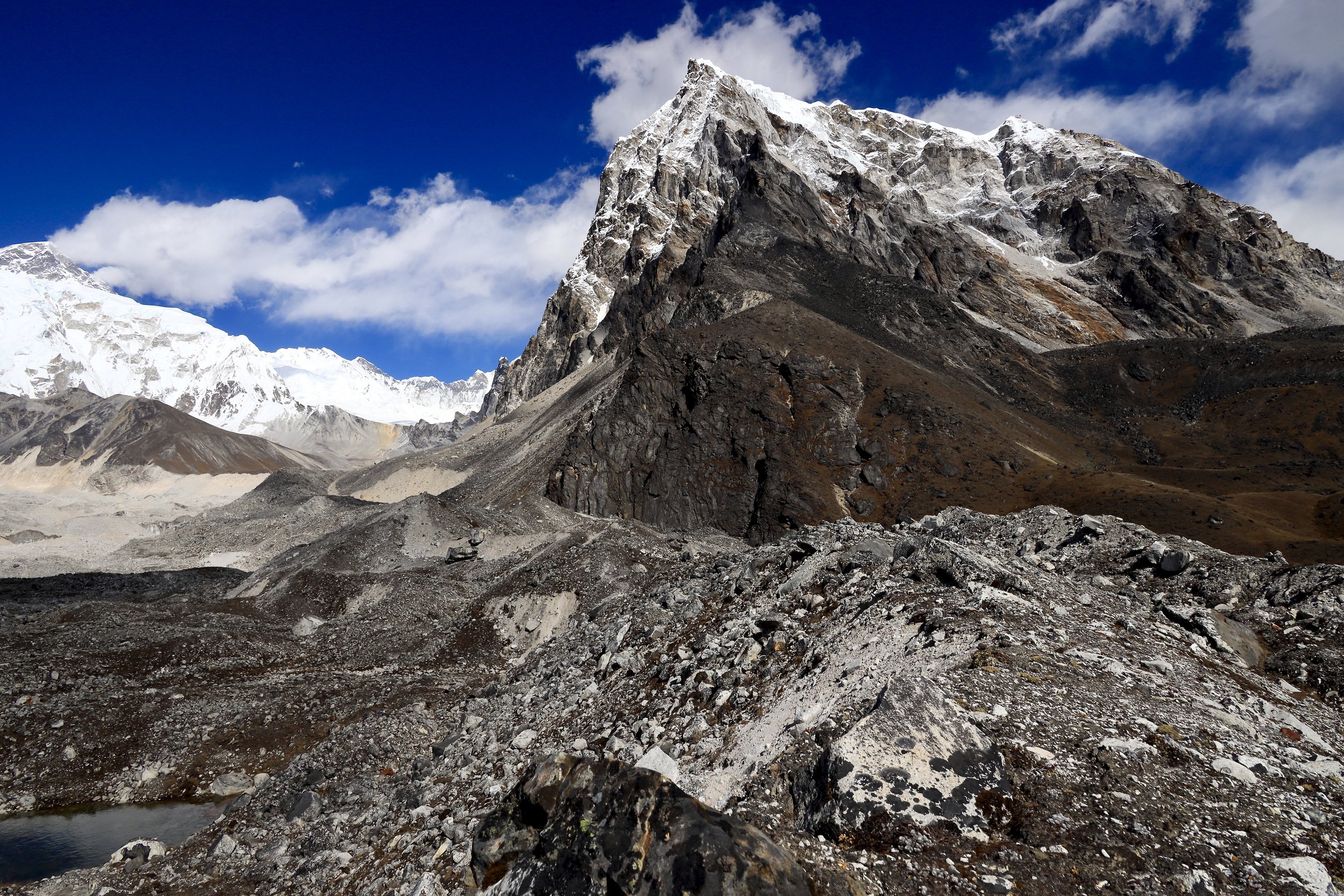
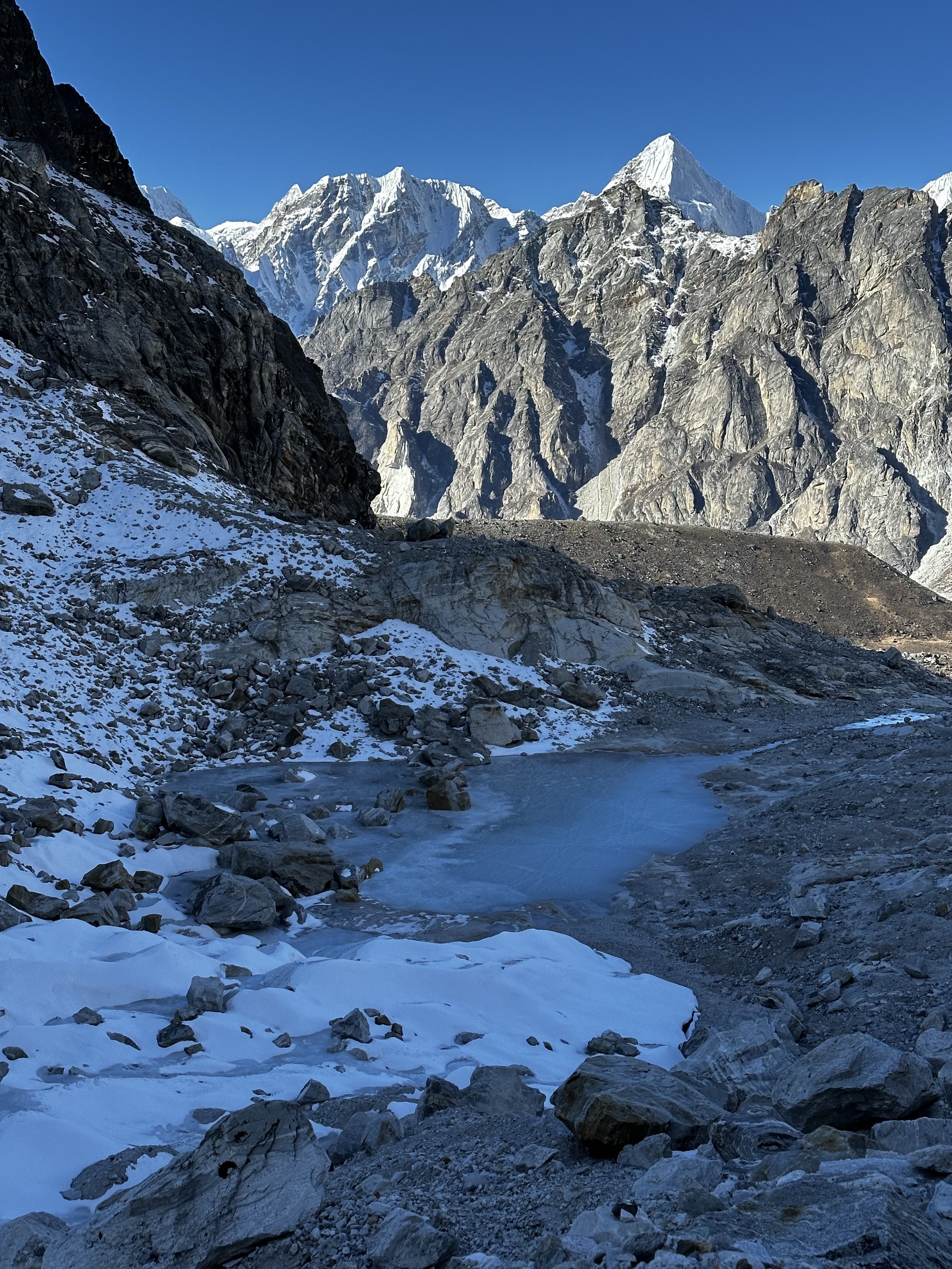
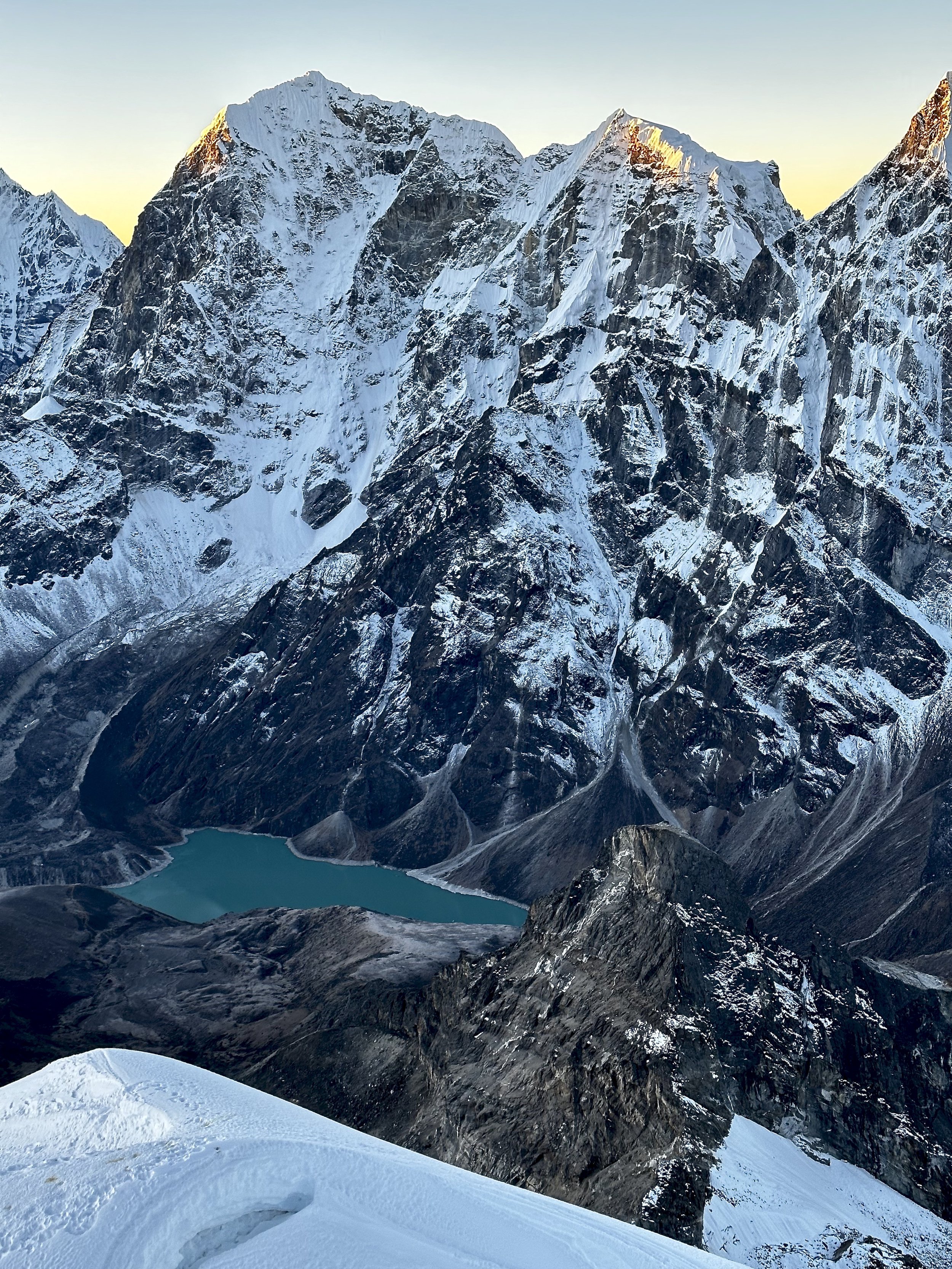
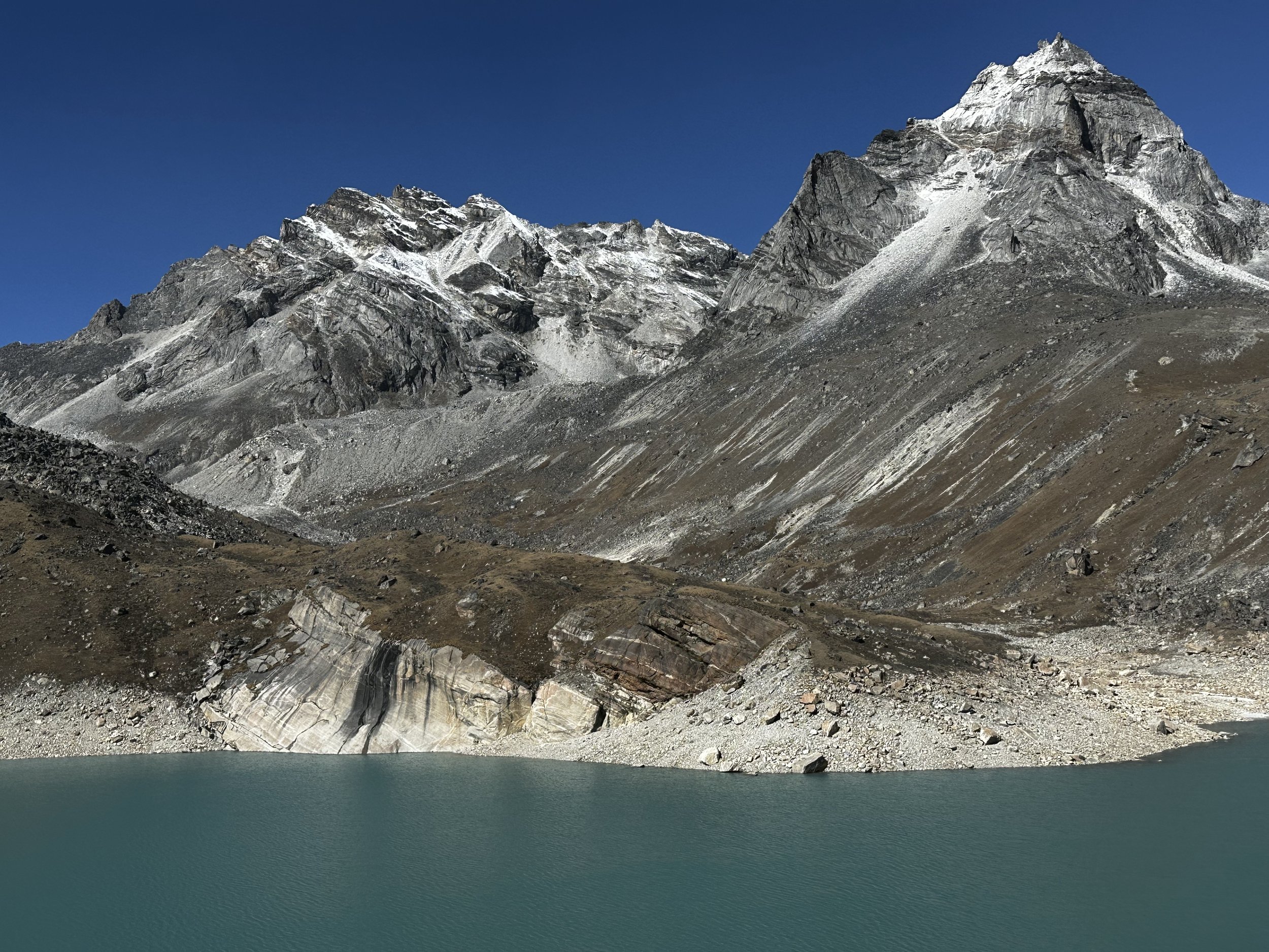
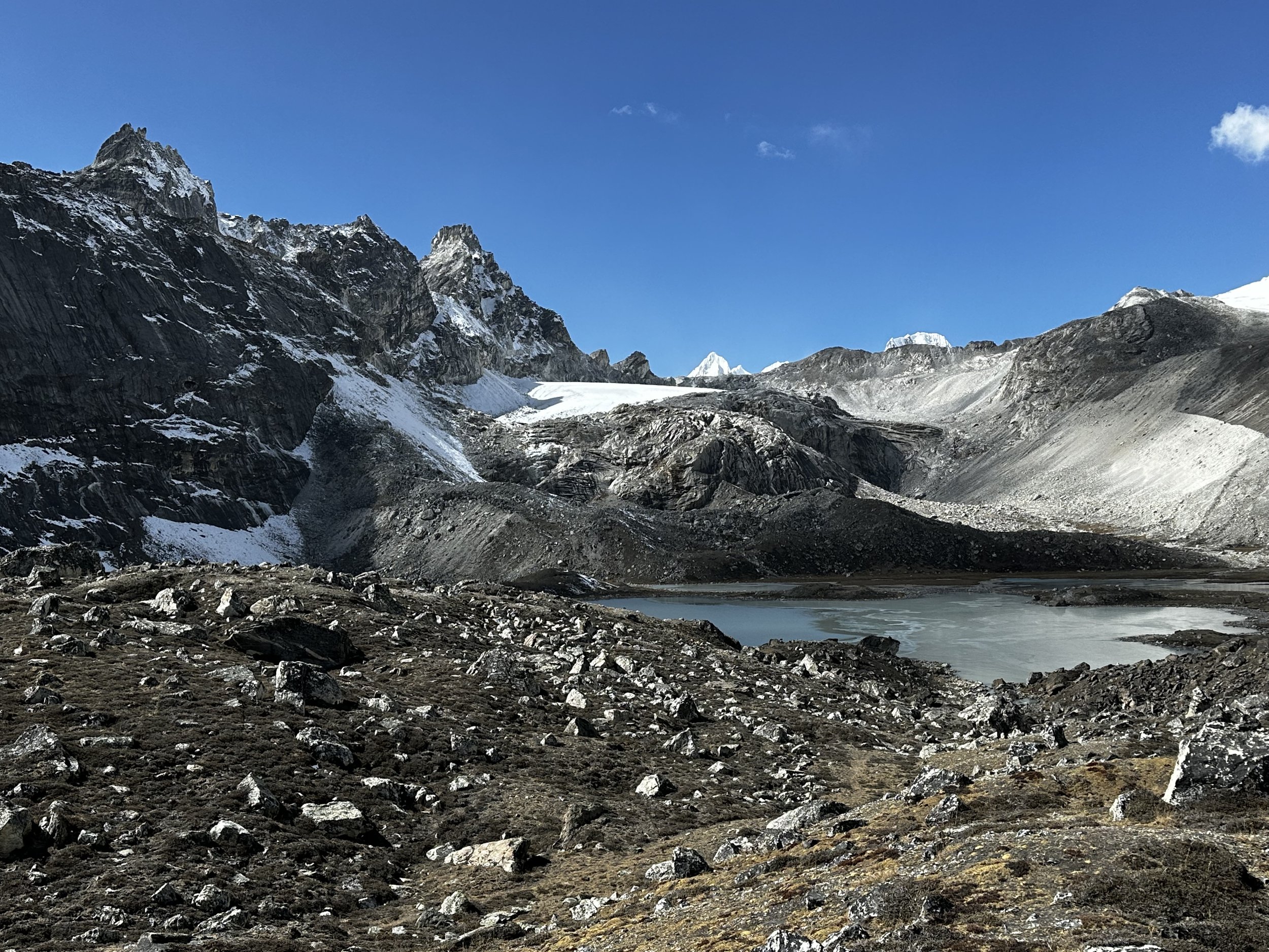
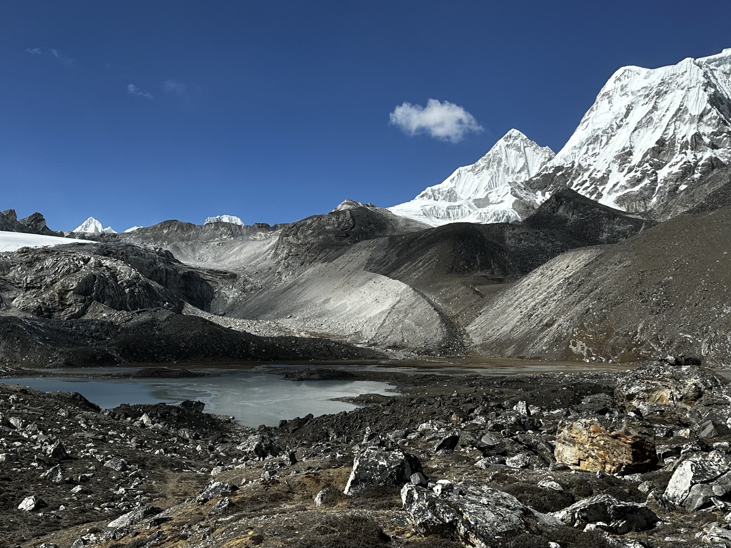
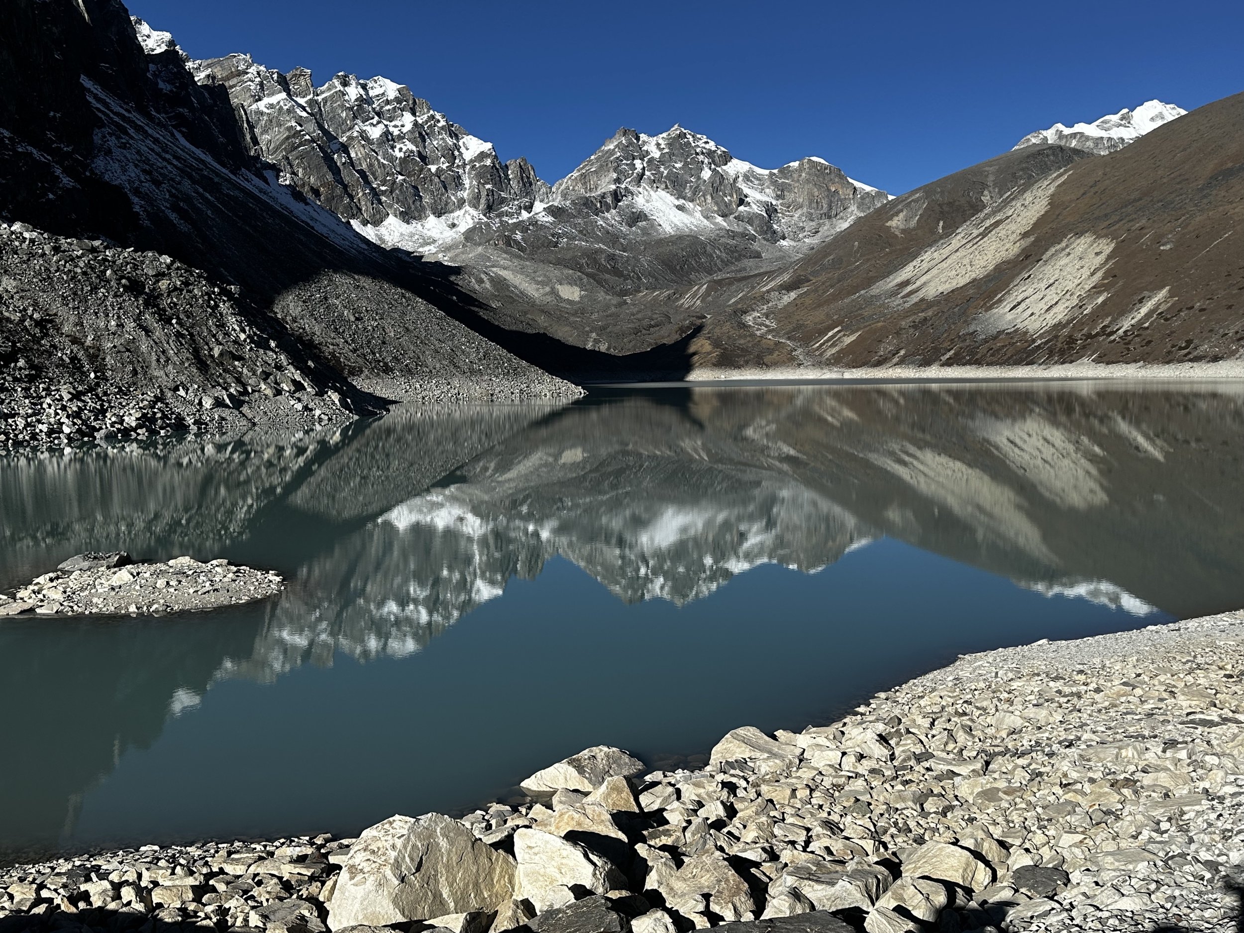
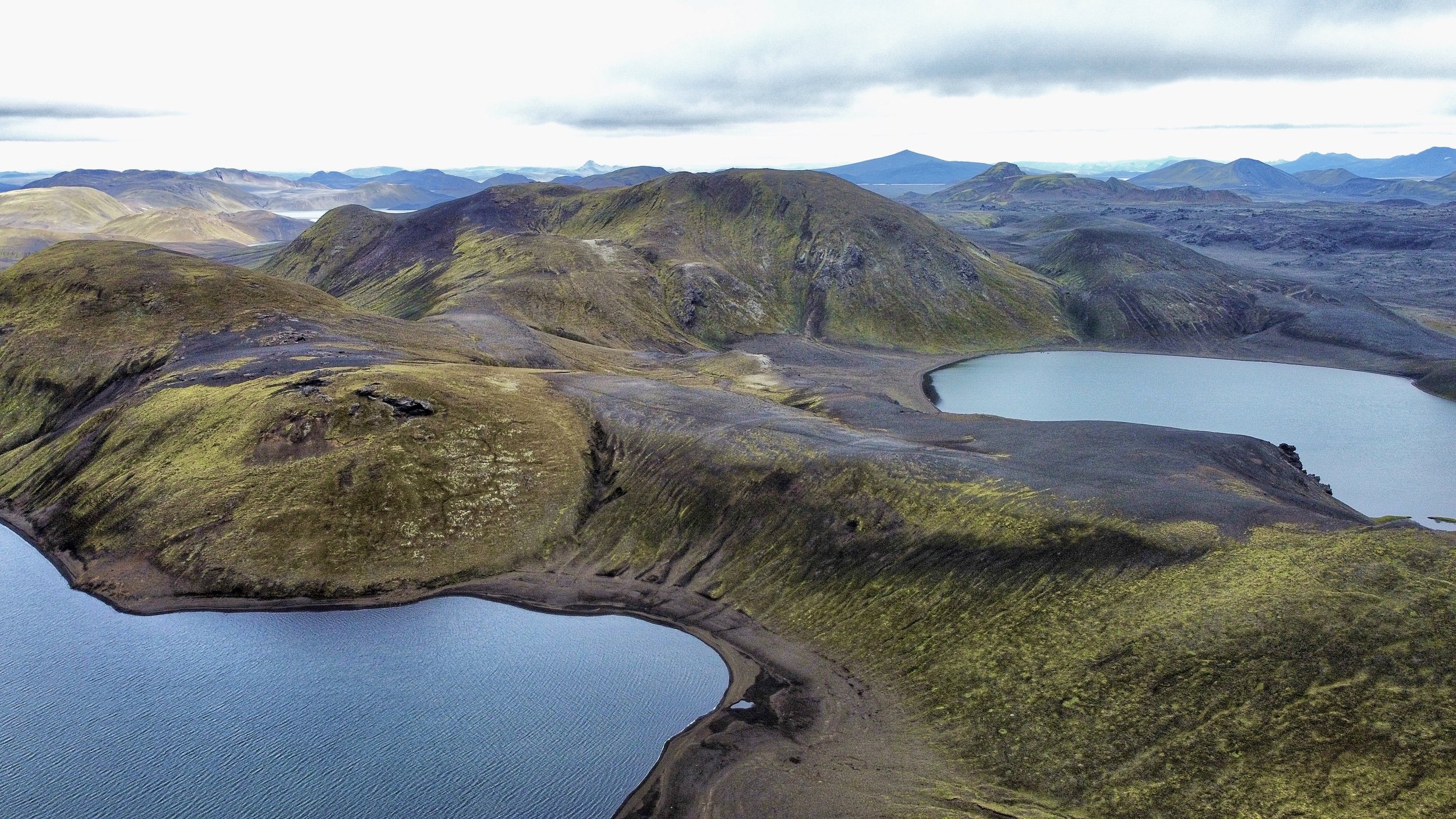
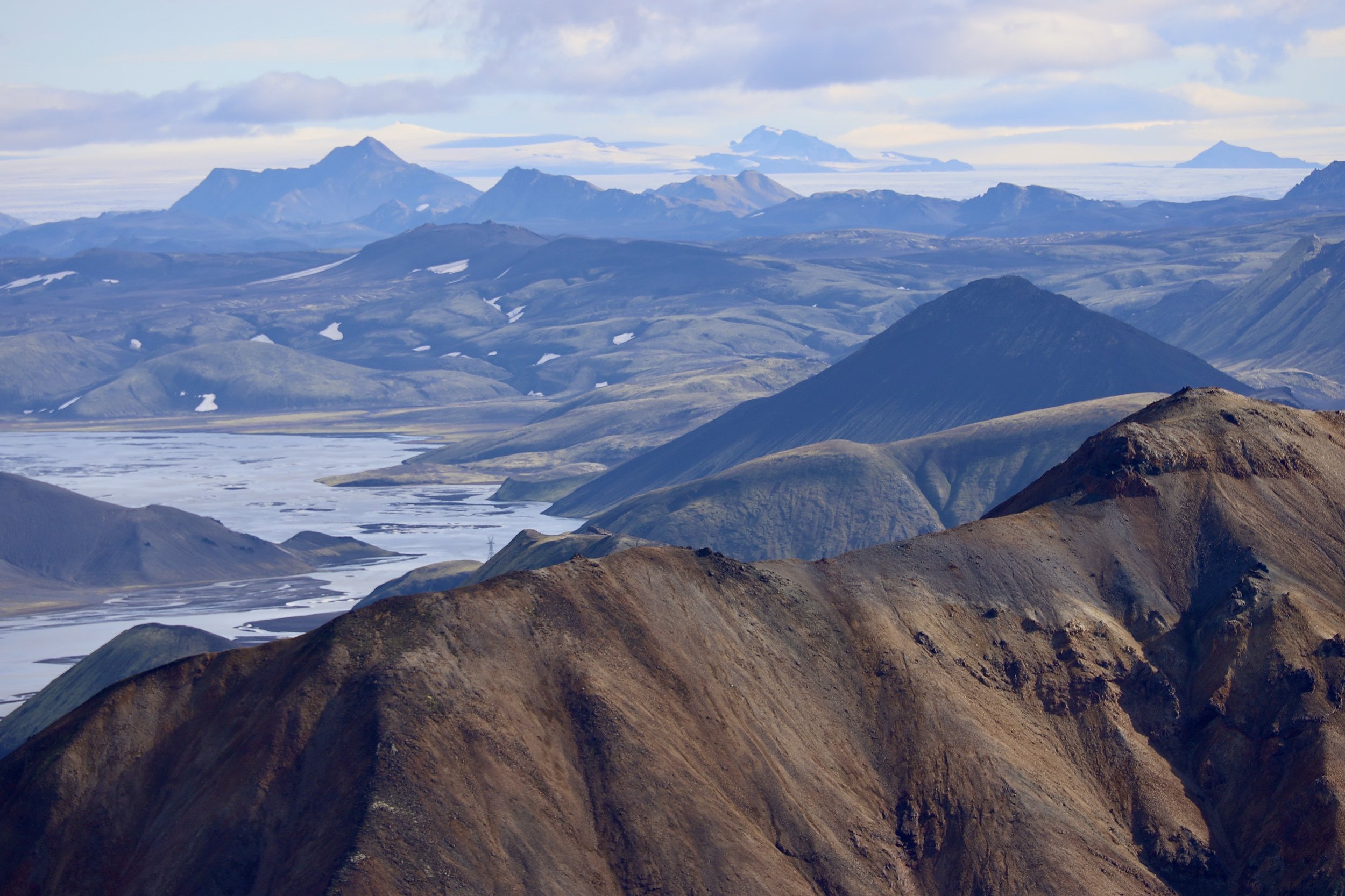
After the final steep climb up the side moraine, we finally arrived in a beautiful campsite situated between green lakes.   We were now quite close to the massive wall of the Skamri Peak.  The Skamri Glacier originates from this mountain on the Chinese (north) side.  I saw the glacier and the mountain in the distance from the vicinity of the K2 Chinese BC in China in 2016.  Our camp is as spectacular as all the other camps so far.  It is too bad that I am so tired and can’t just hop around the surrounding hills.  Perhaps I am still not sufficiently acclimatized or maybe I have some lingering effects from the cold. 

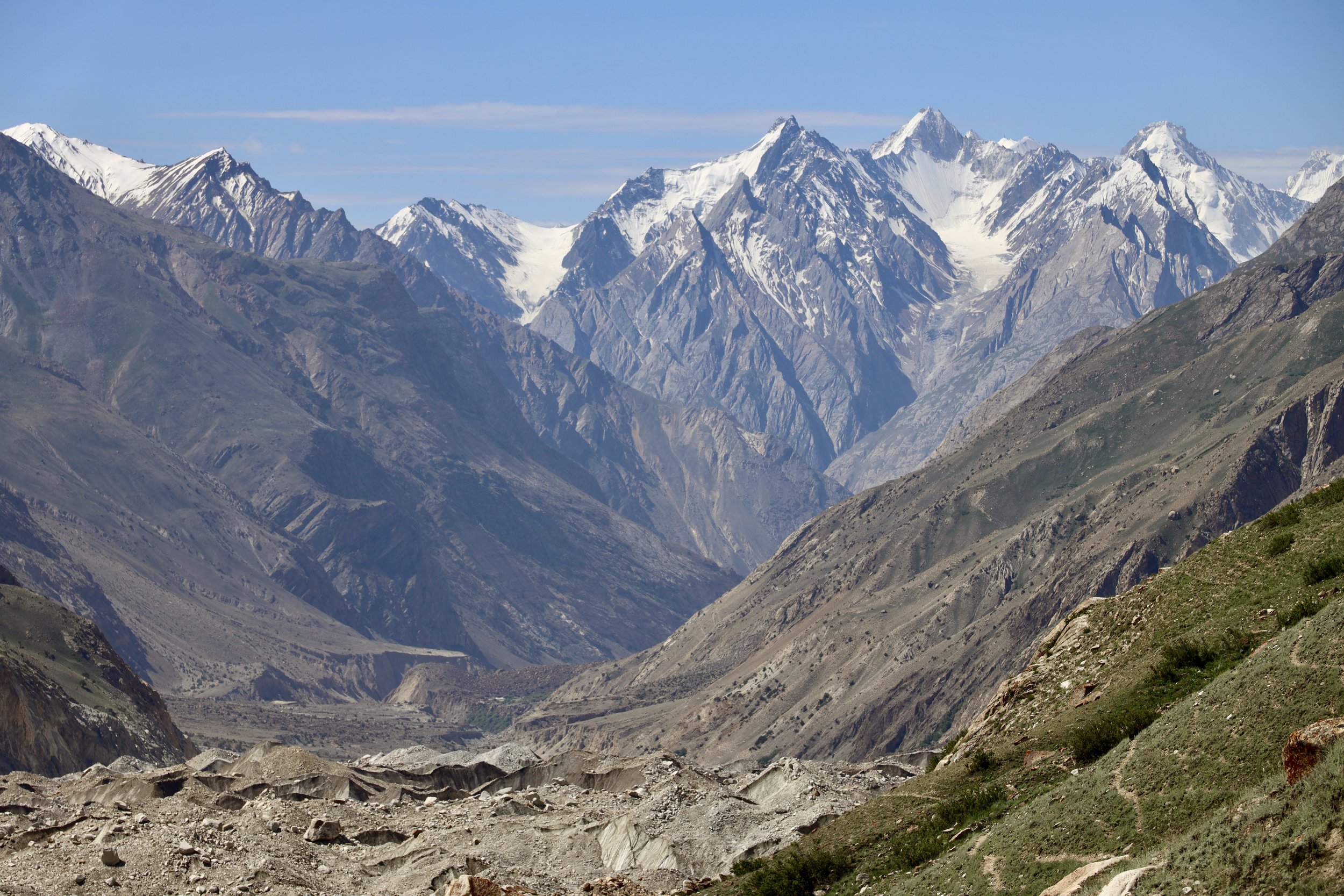
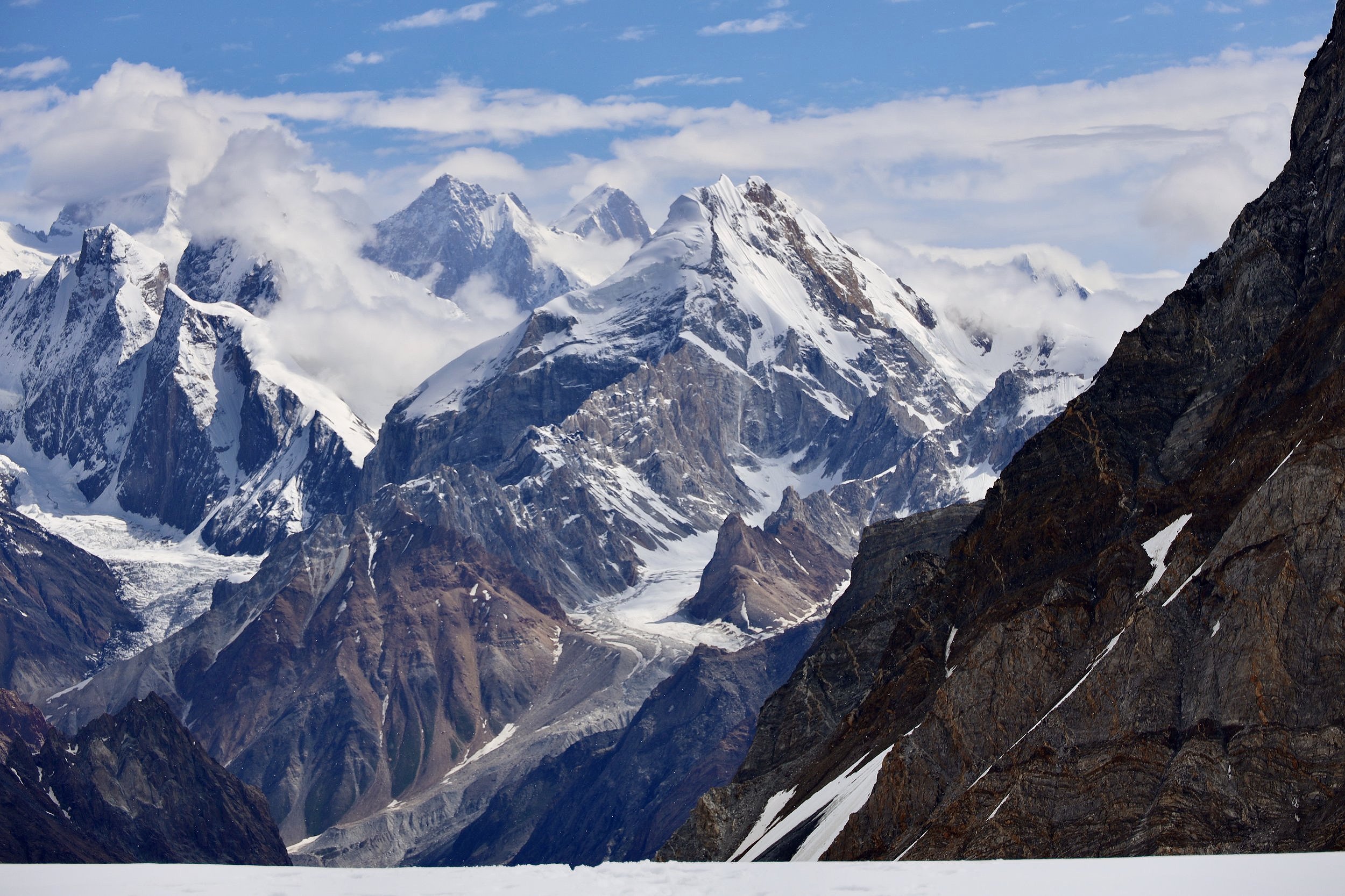
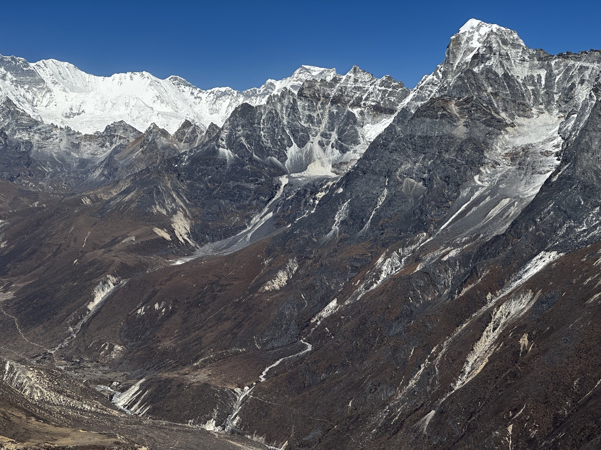
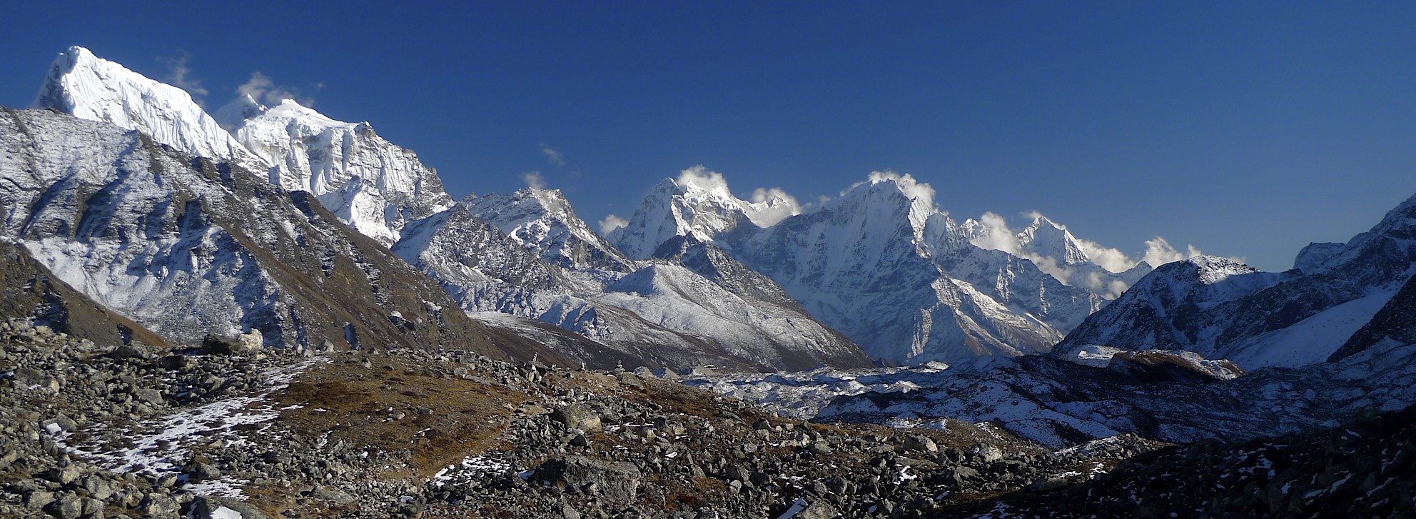
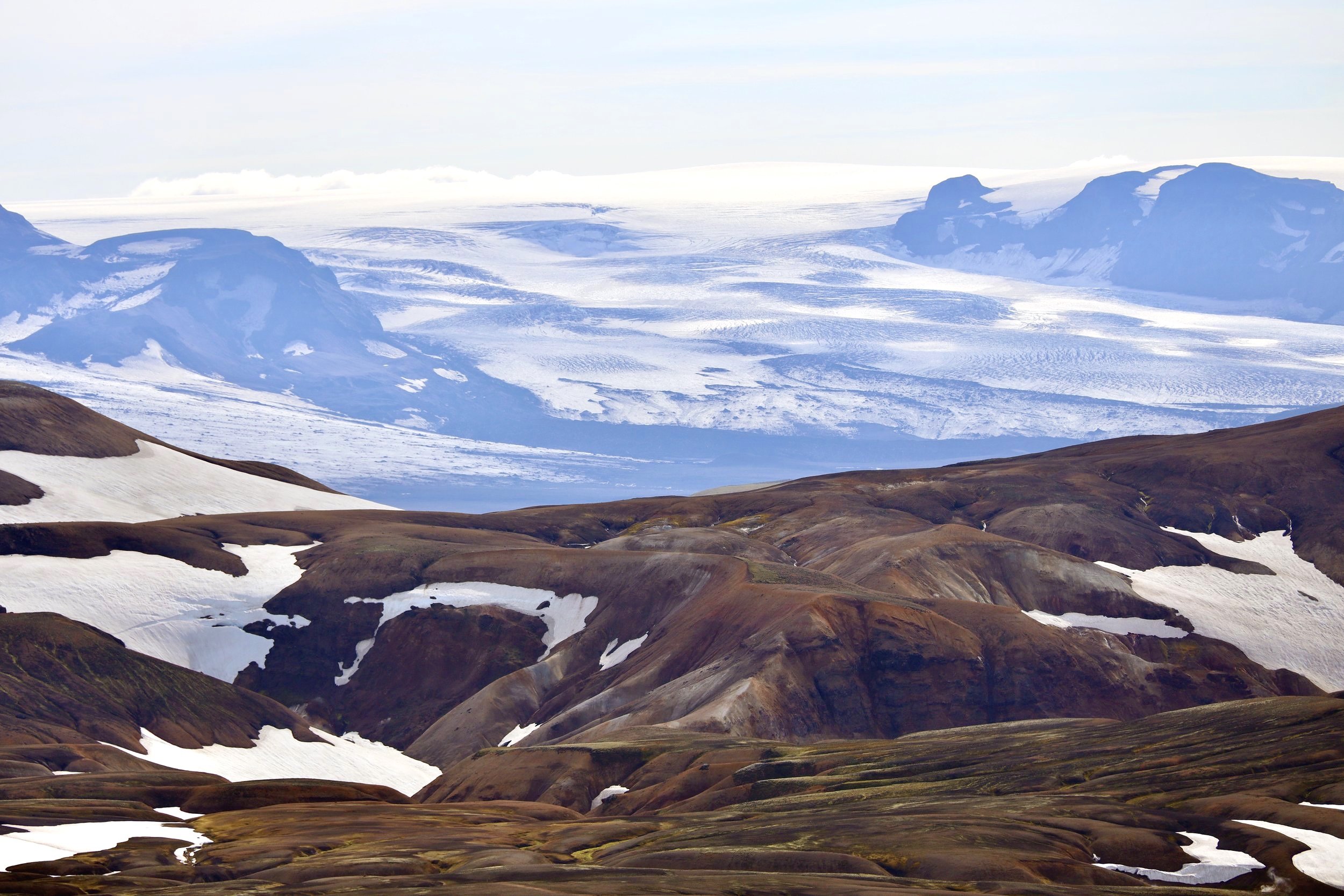
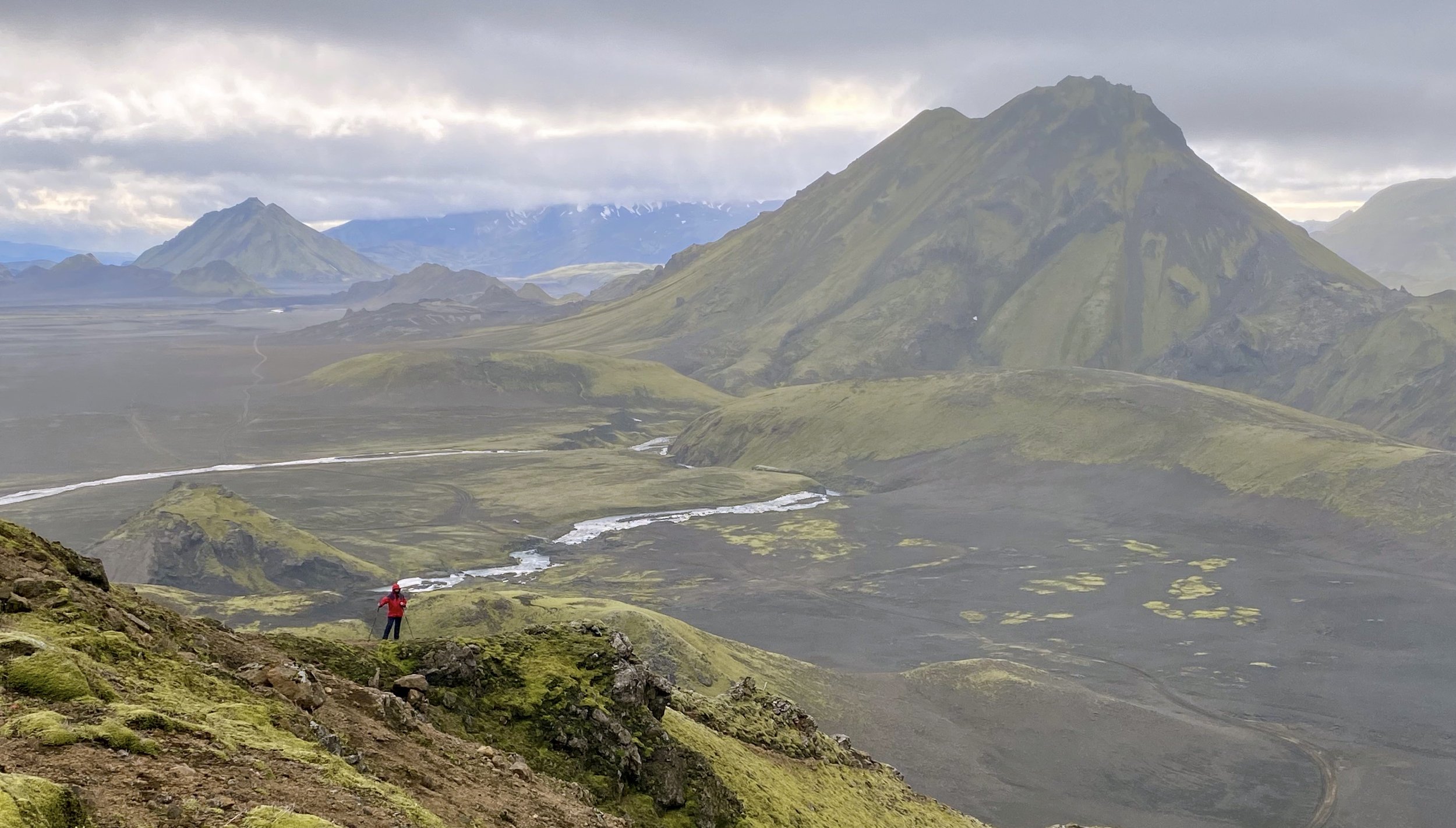
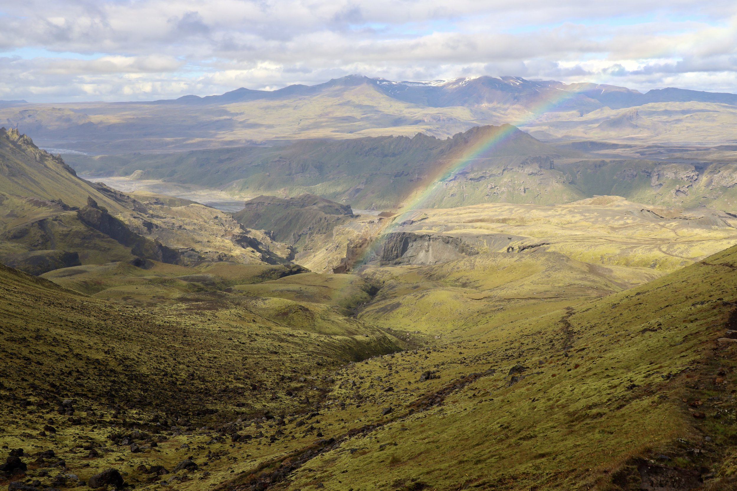
Our camp is located at the bend of the NS Glacier and the surrounding hills (5000m + mountains really) offer magnificent vistas.  Looking towards the Moretti Camp from the day before, we can see the mountains along the Panamagh Glacier, now 40 km away.  Looking up the NS glacier, we can see the peaks on the Chinese border and the NS glacier turning west and snaking its way up to the Skamla Pass and the Snow Lake.   

July 19 rest day Nobande Sobande climb to 5100m

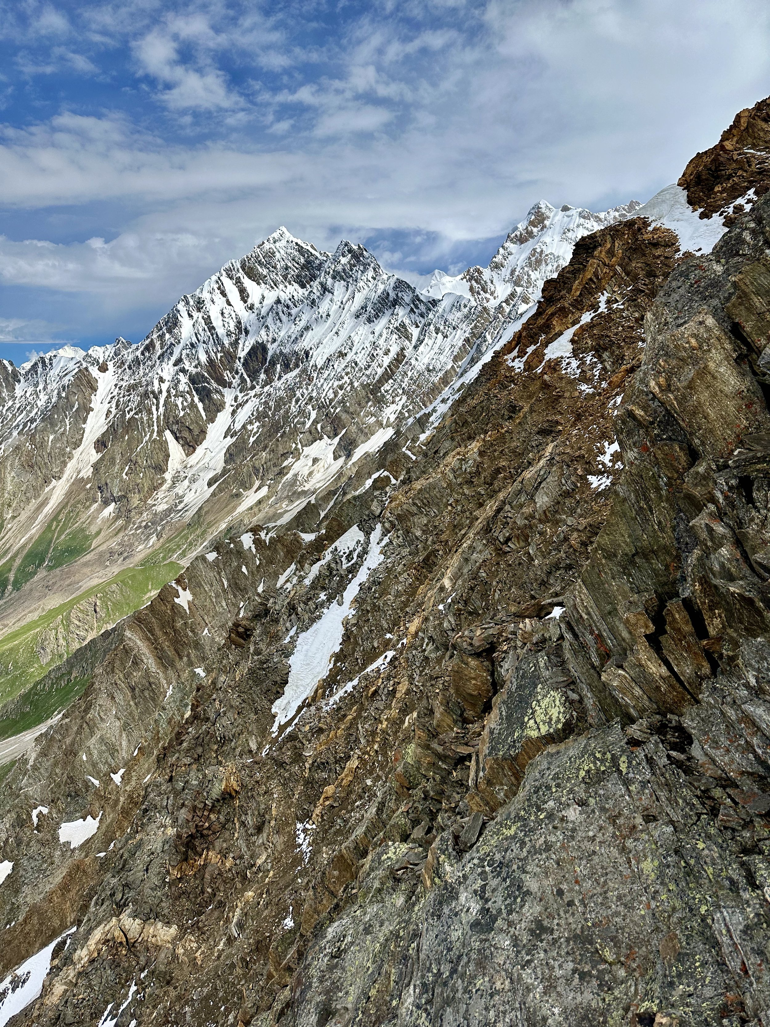
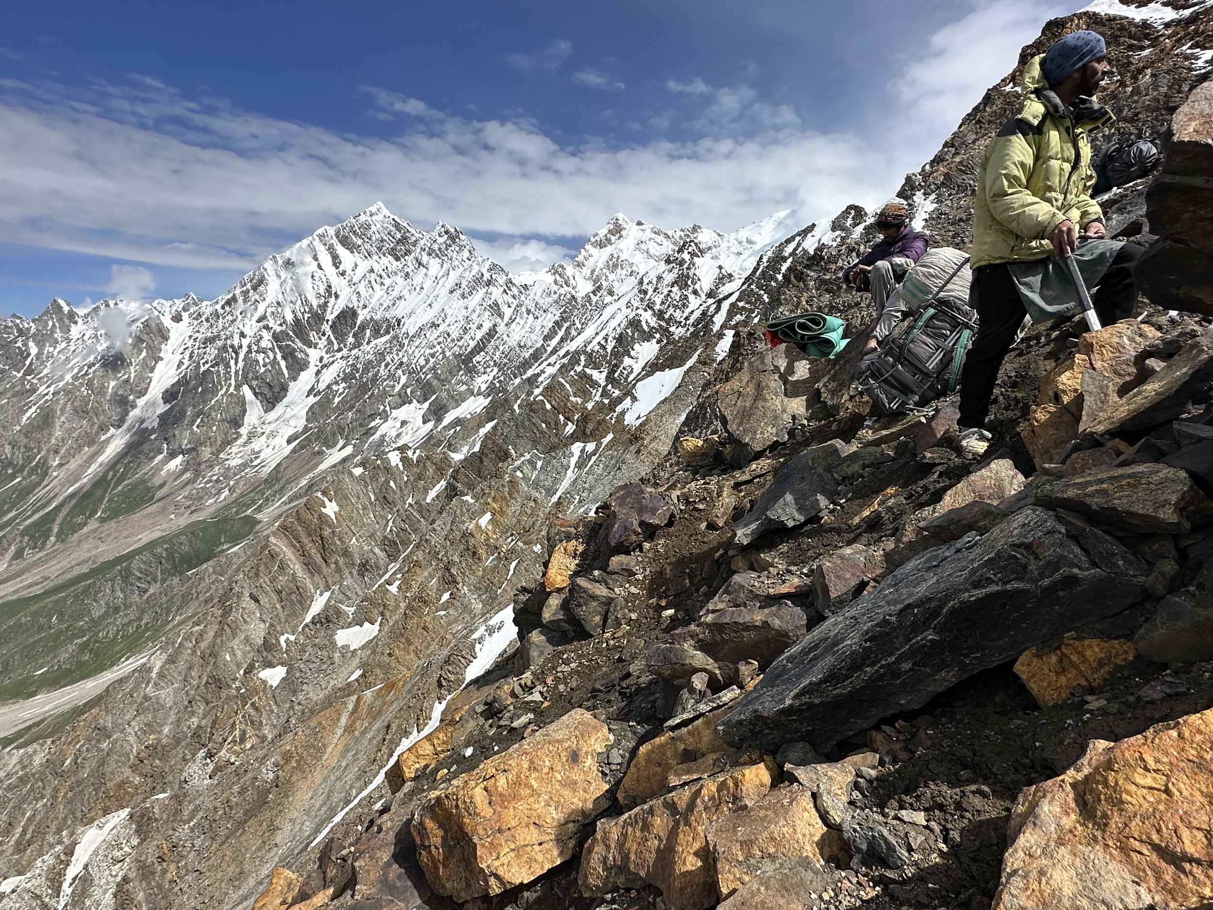
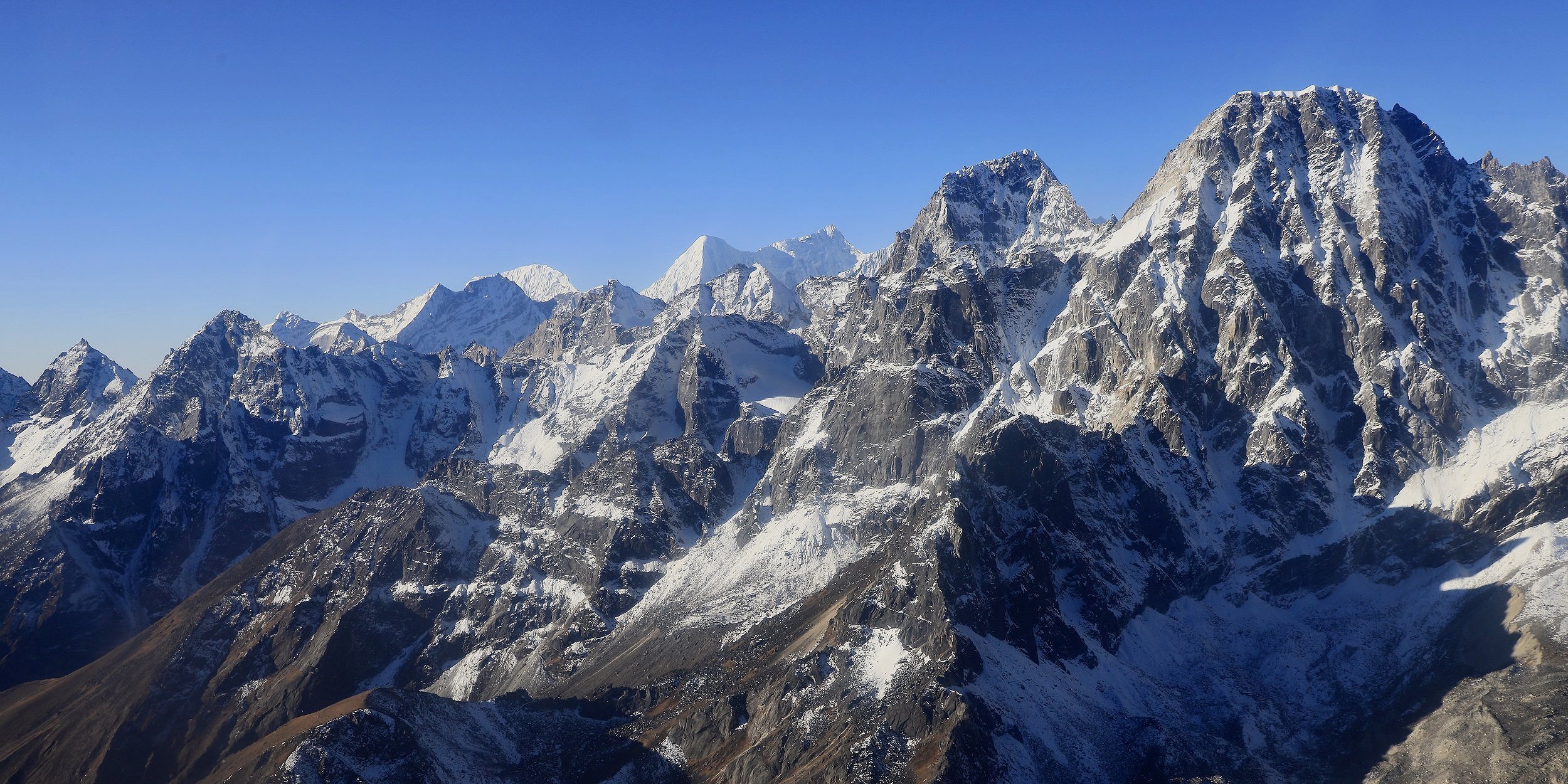
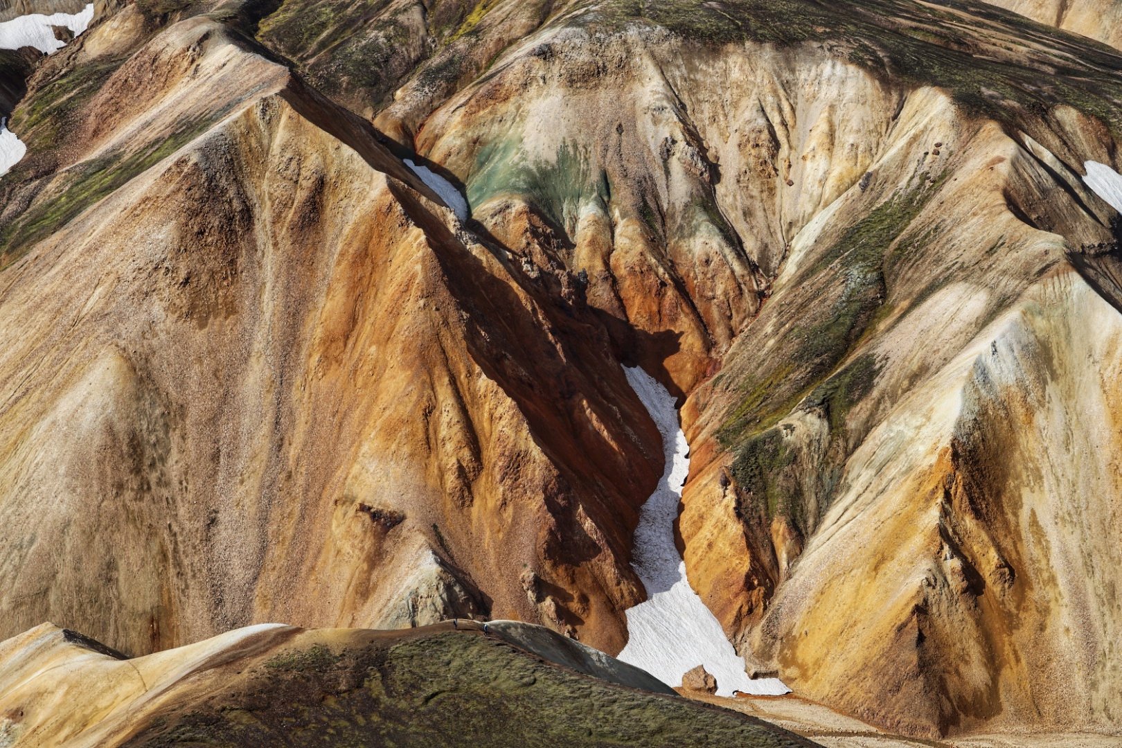
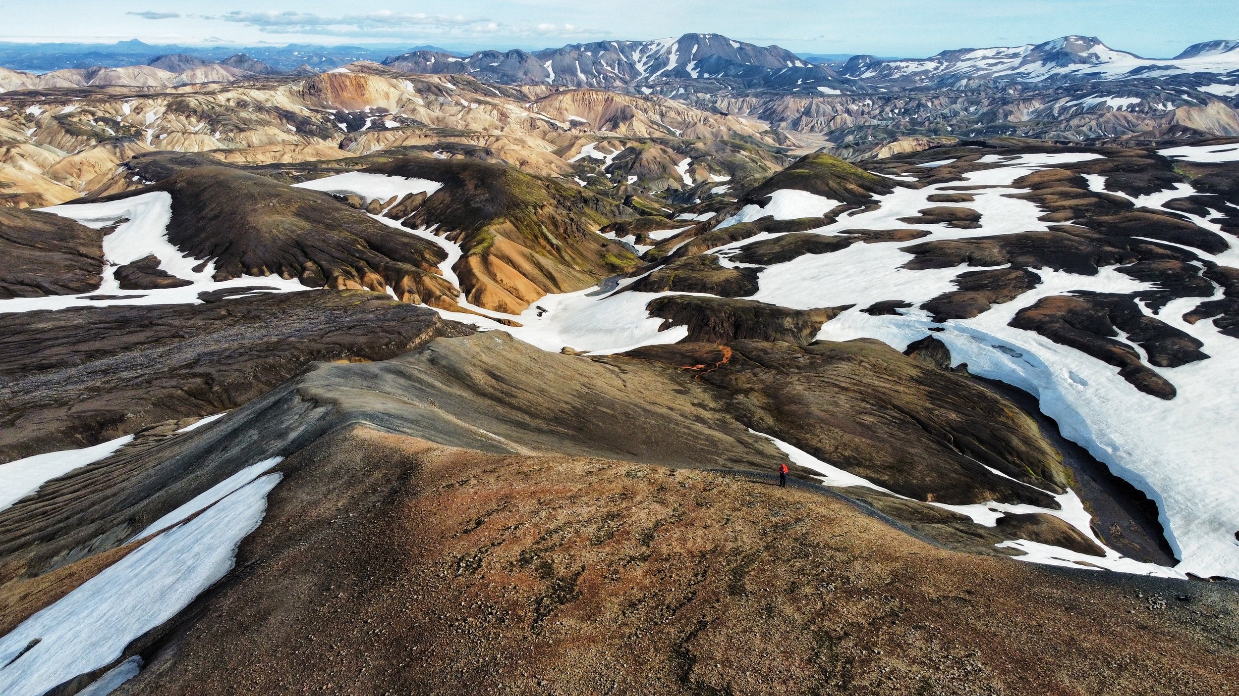
Today was a much-needed rest day after yesterday’s 18km slog.  In late morning, Aslam and I walked to the viewpoint not far from the camp.  We climbed halfway up a 5,800m mountain behind the camp and it was a tough going (lack of acclimatization?).  The effort was very much worth it as the views were spectacular.  At 5,000m we hit the snow line.  Aslam was totally underdressed, and I did not want to go further into the snow.  Since the spot was sheltered from the wind, I could fly the drone for some dramatic photos of the Nobande Sobande Glacier and Skamri Peaks.  The terrain here is so huge.  We were right at the edge of the Nobande Sobande Glacier.  I couldn’t see the Biarcheldi Tower though and getting to its base required another two days of glacier travel.  The upper glacier is full of snow so we probably could not even get there without skis.  The porters were wearing running shoes and had no winter gear.  You would think that the exploration of this kind requires the entire party to be equipped with minimal gear for glacier and snow travel.  We seemed to be unprepared for snow covered glaciers.  However, we did cross the Haramosh Pass with the same guys and with no better equipment that we had here, so my initial assessment was incorrect.  I also do not seem to be well acclimatized yet so two more days on the glacier seemed like hard work.  I was happy with where we got though.  It was all unknown territory for me.   Furthermore, the weather was turning again so slogging up the glacier in the clouds did not seem like an attractive alternative. 

The weather in the Karakoram is very variable, it changes often, it rains a lot.  Luck, patience and time are required to be able to see the views and the spectacular surroundings.  Glacier travel, fickle weather and elevation make this trek a tough one and I felt it.    The Ogre climbing party spent the entire month waiting for a good weather window that never came.    I think that July is too early to do these trips here.  August is much better and solid month.   By September it may be snowing.   So effectively, the season here is about six to eight weeks long.

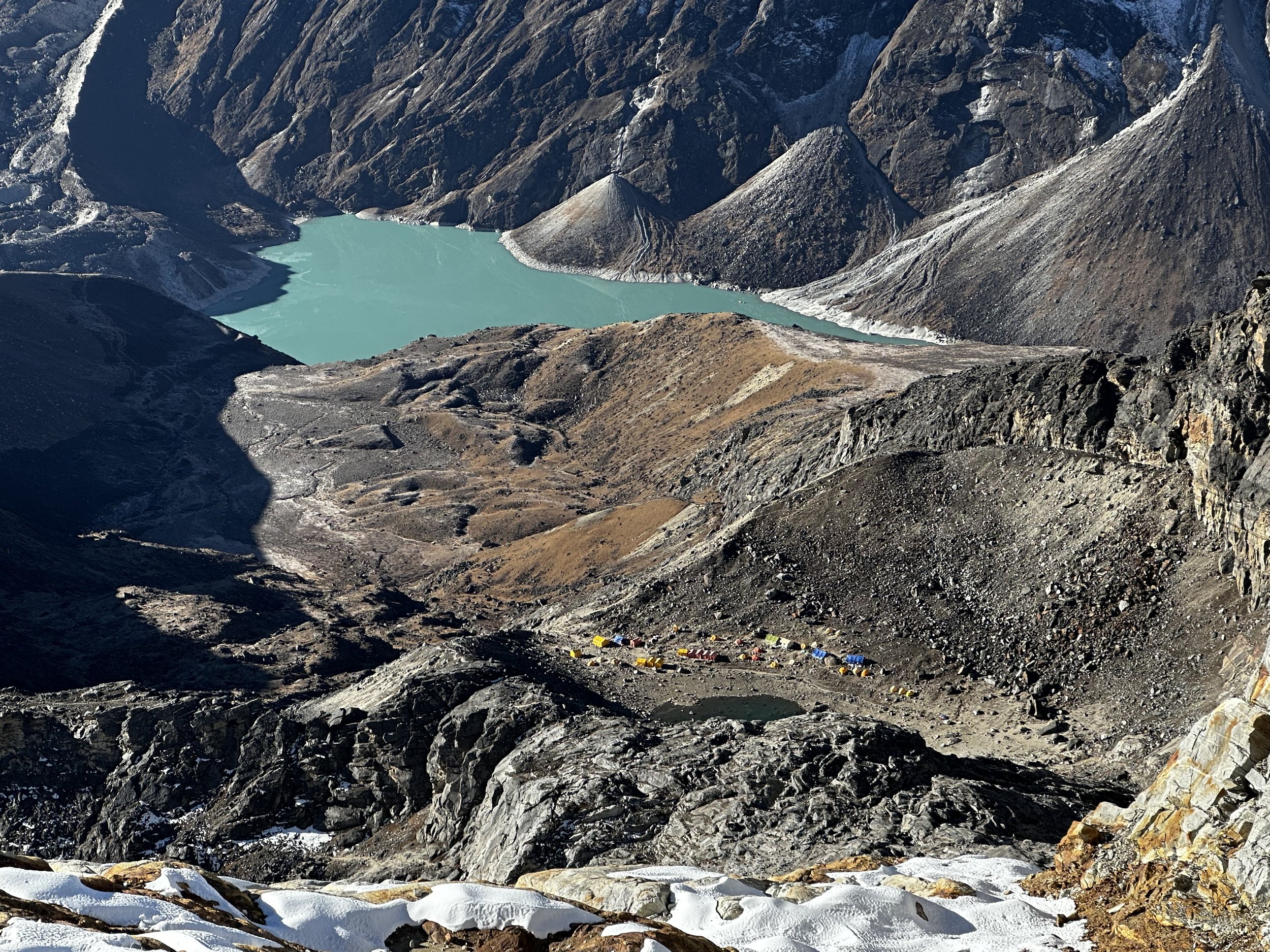
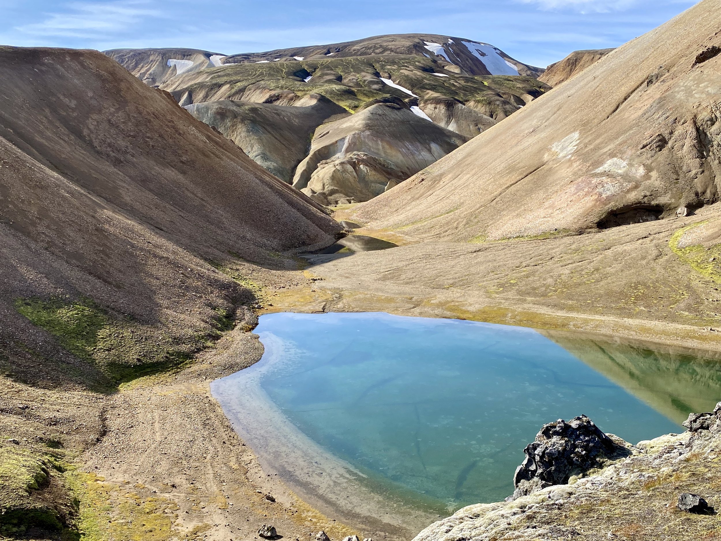
 After our excursion, I spent the afternoon exploring the lakes around the camp and taking some drone photos.  The lakes have fantastic emerald-green water that contrasts with the snow-capped mountains.

July 20, 2023 Lake camp to Sandy camp 10km

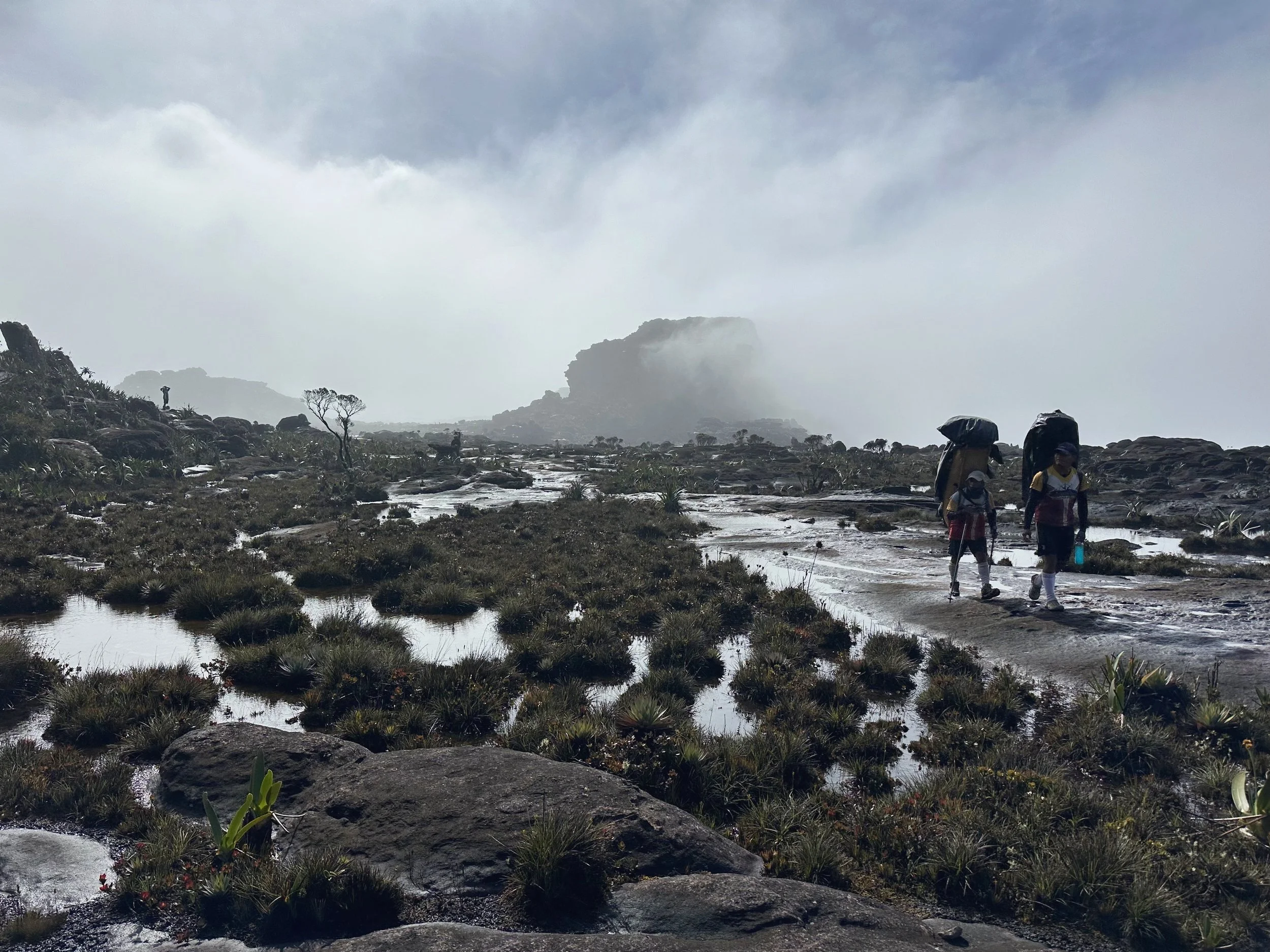
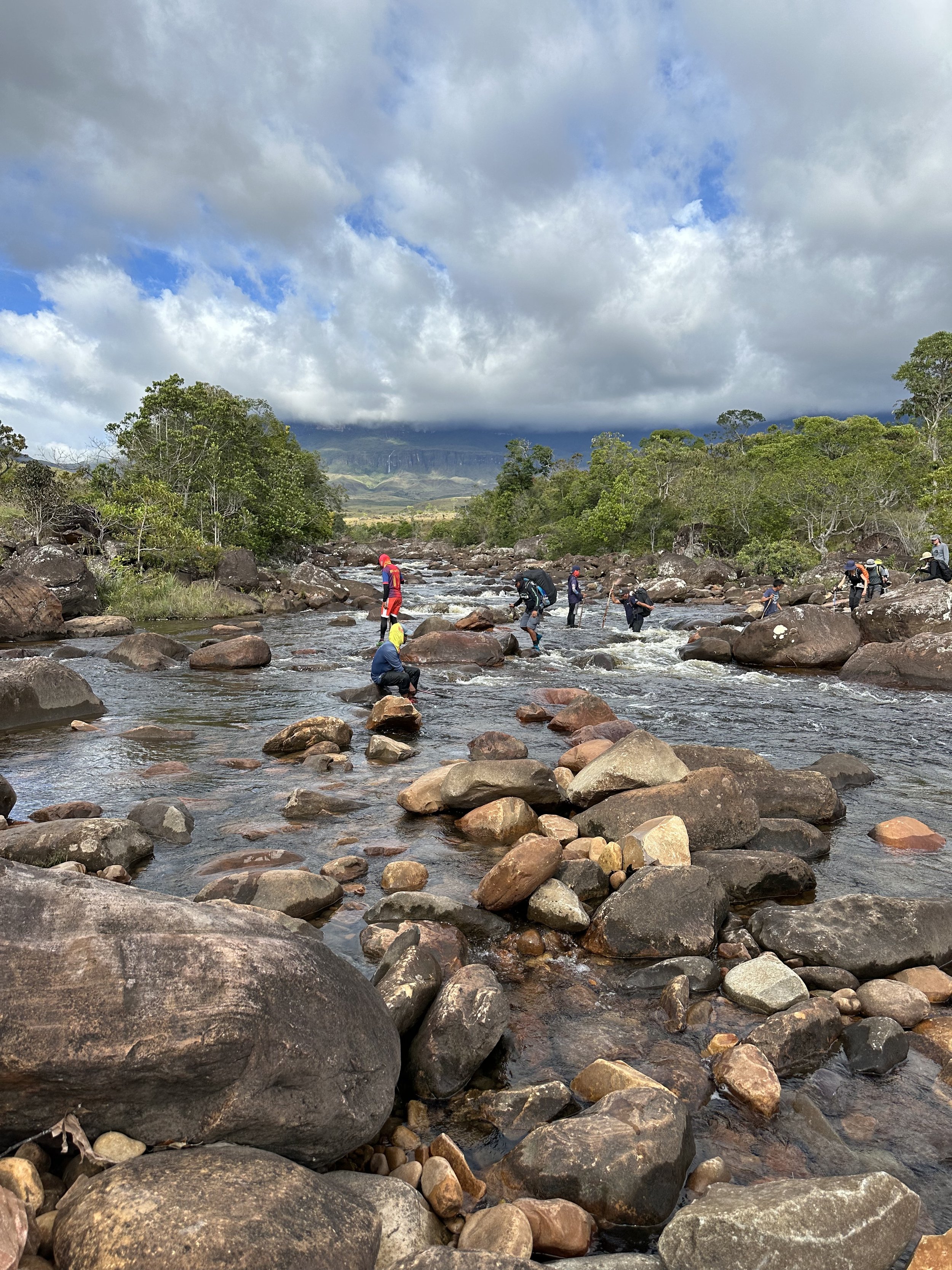
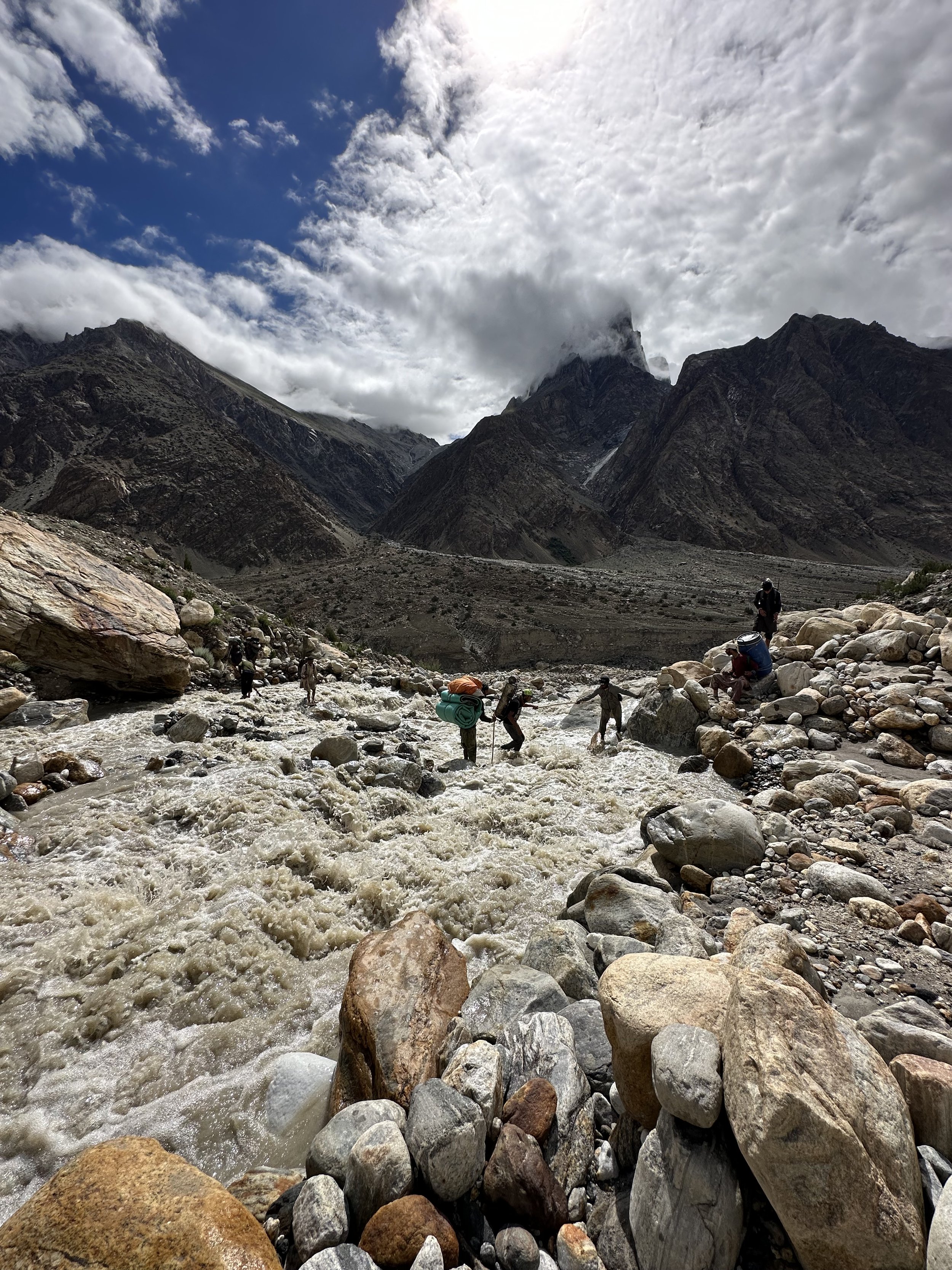
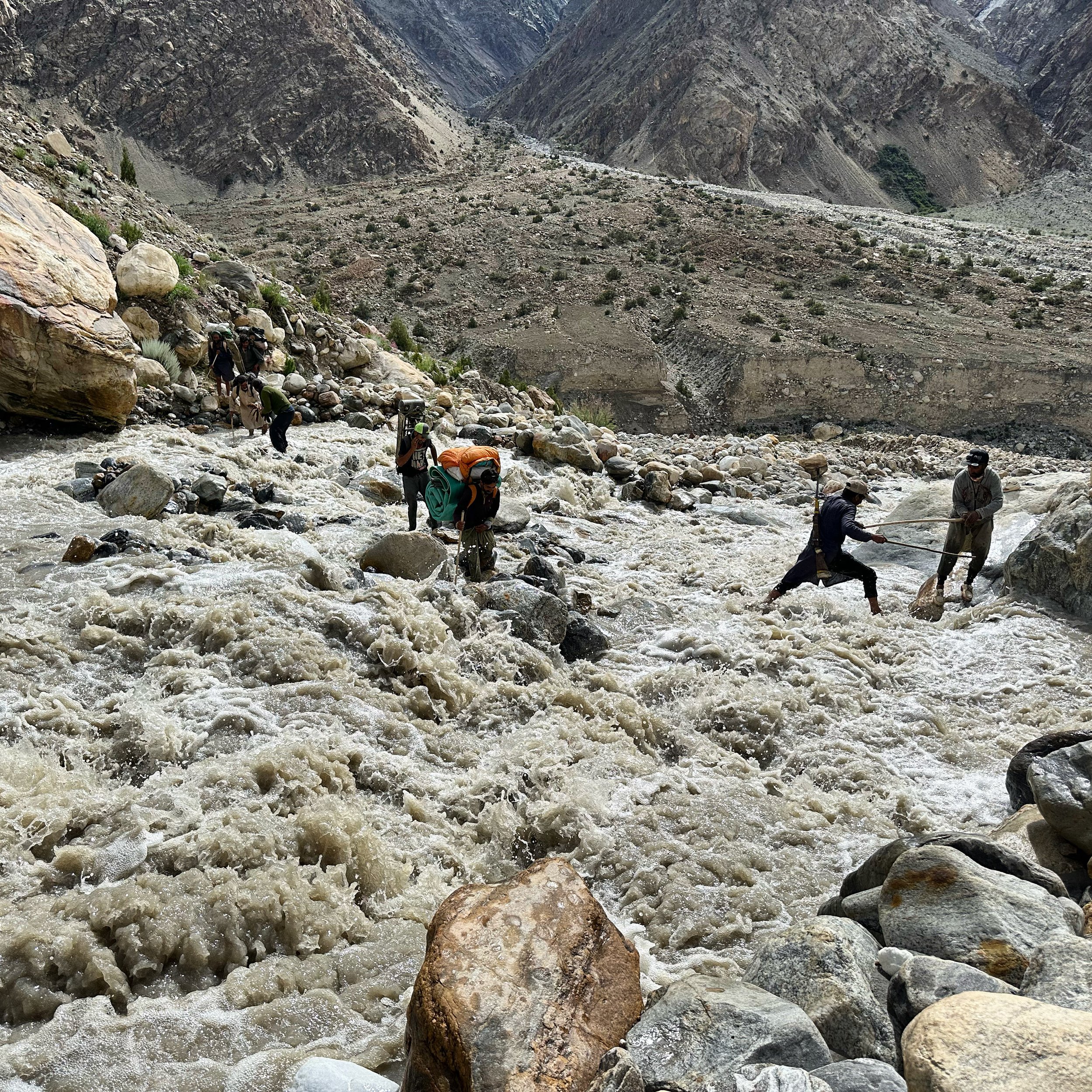
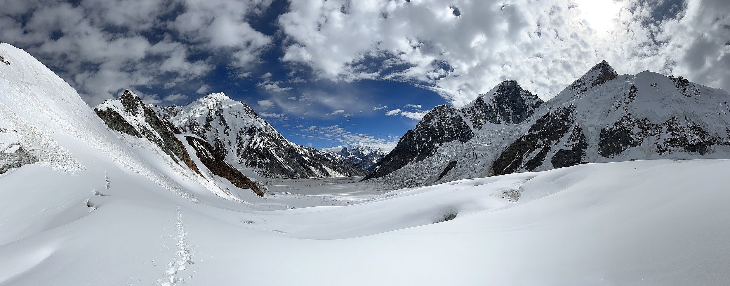
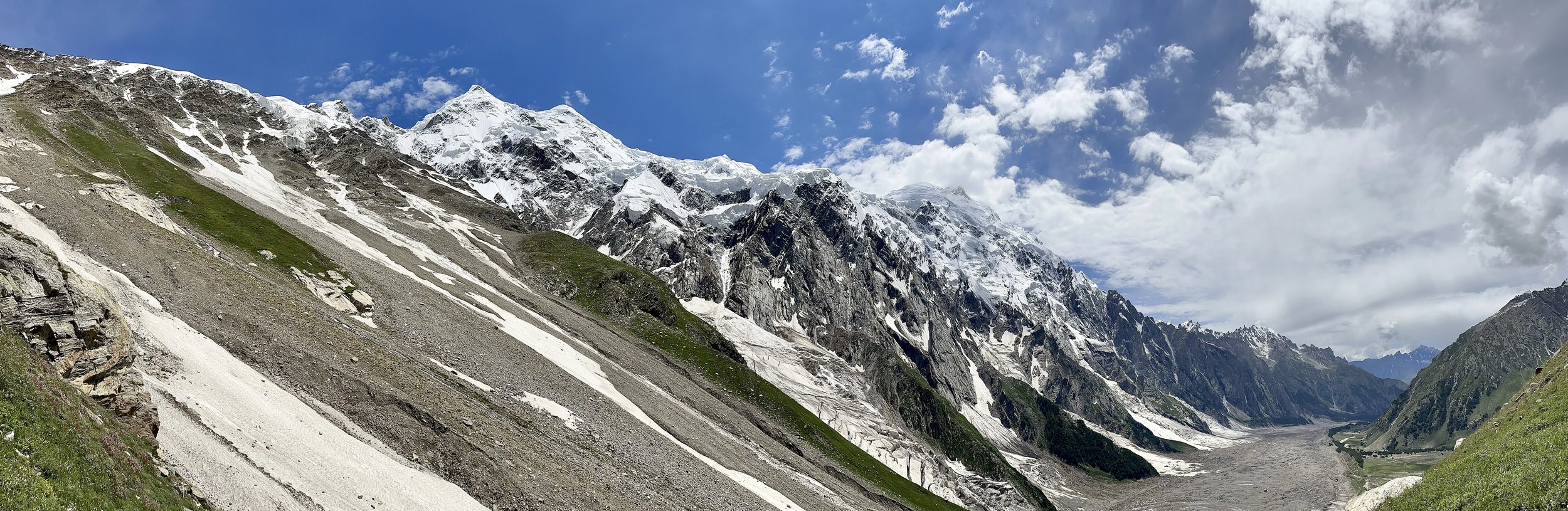
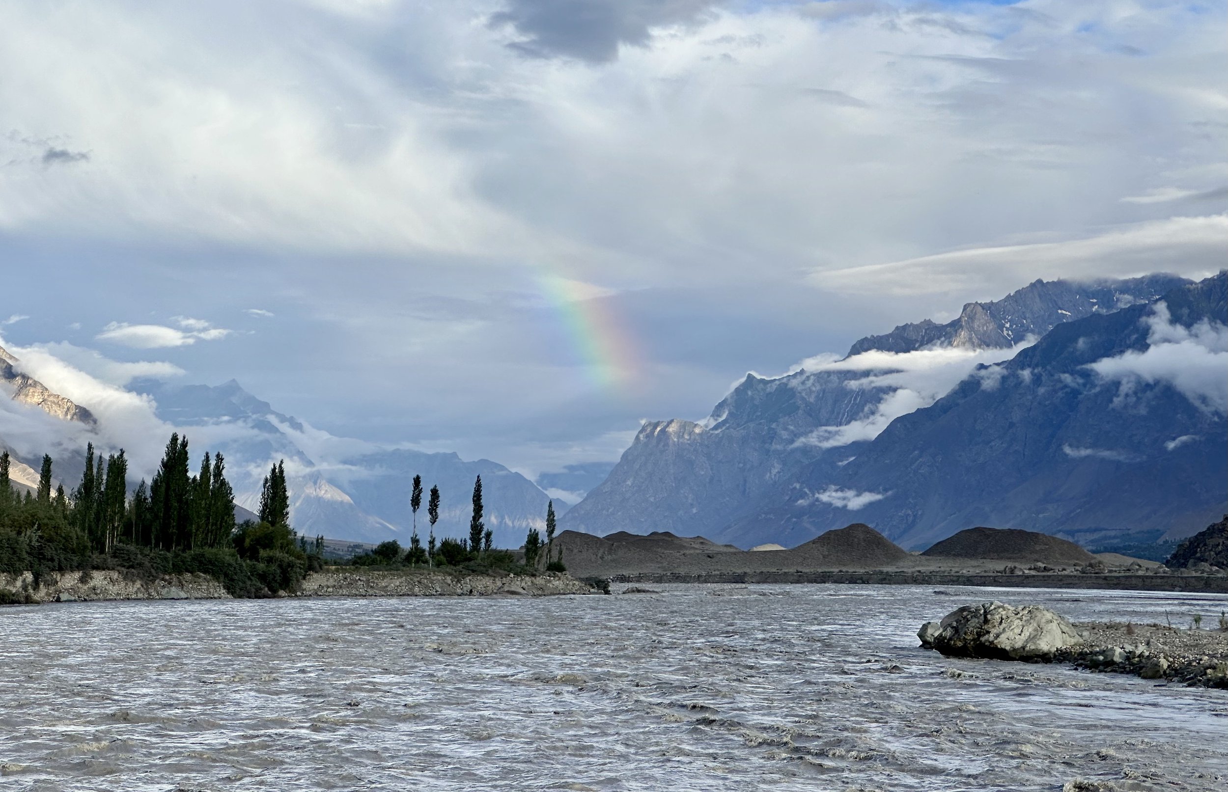
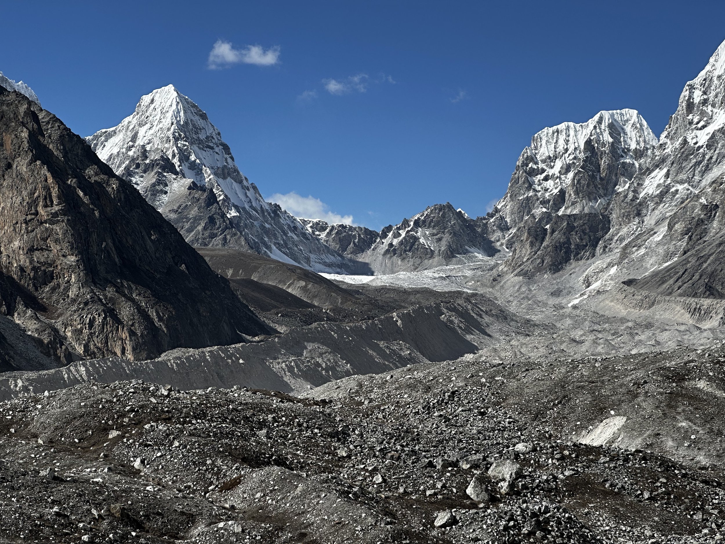
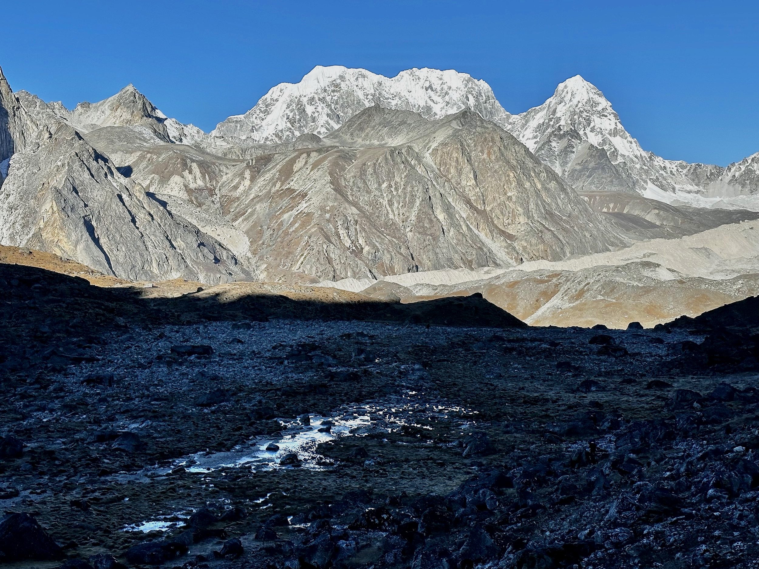
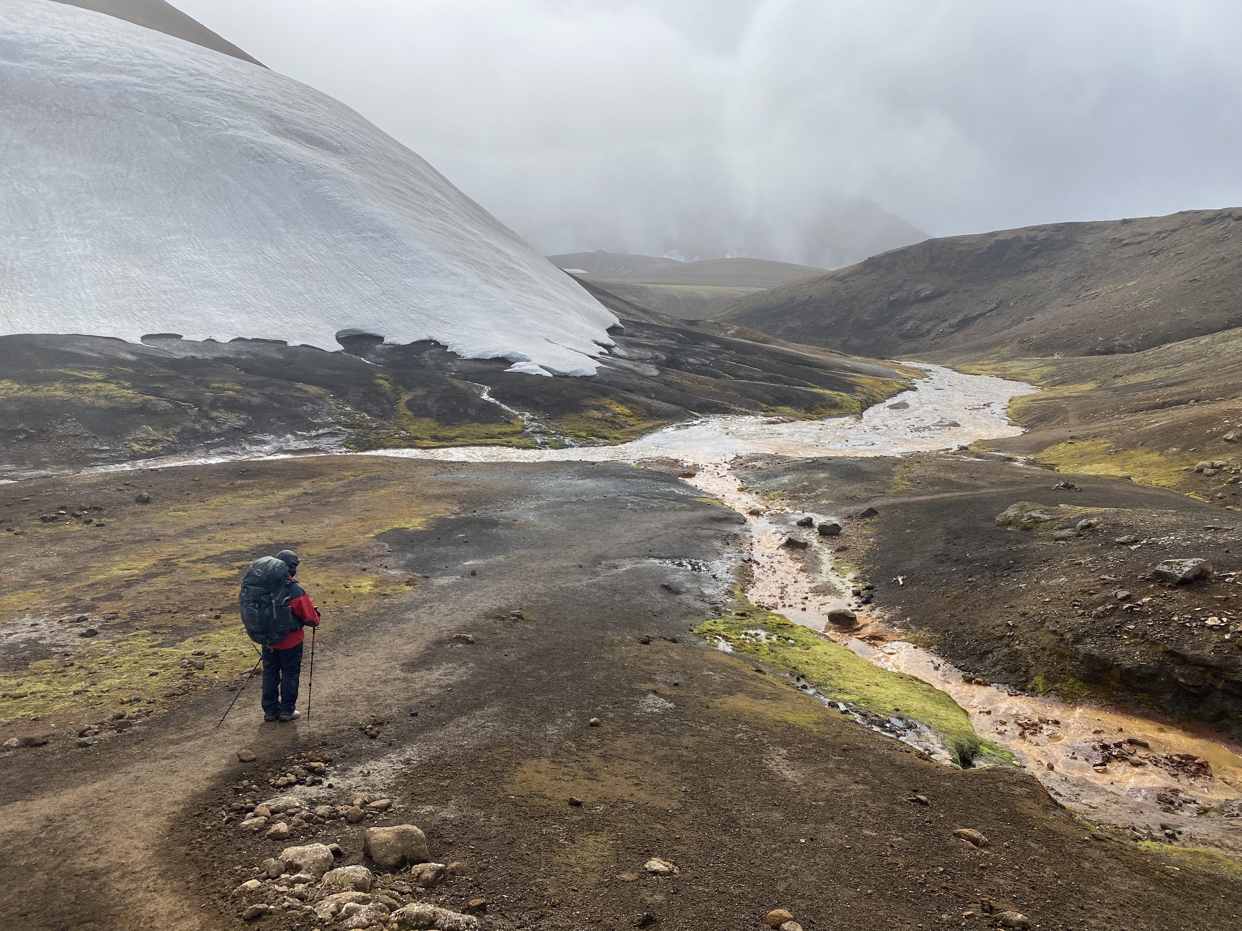
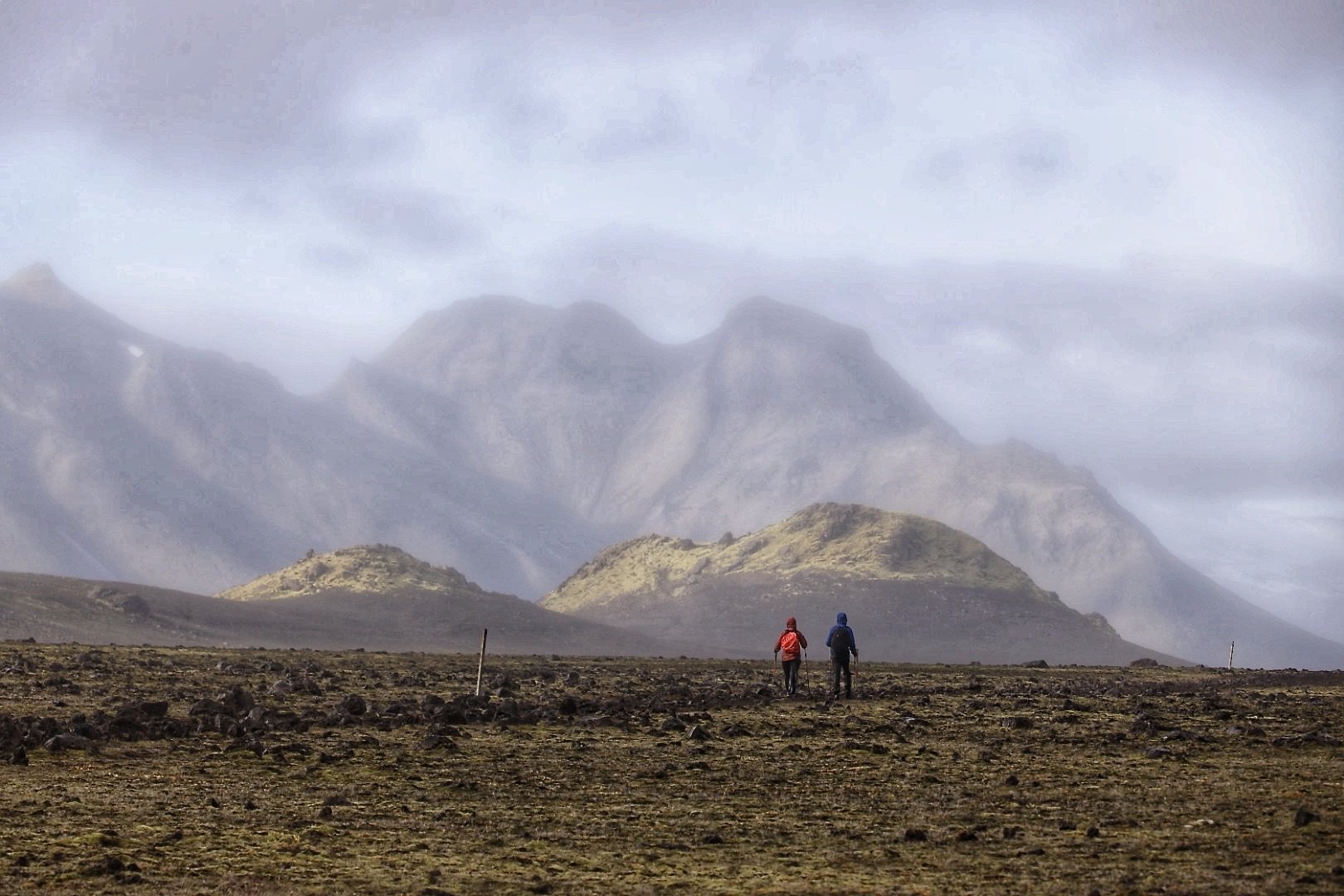
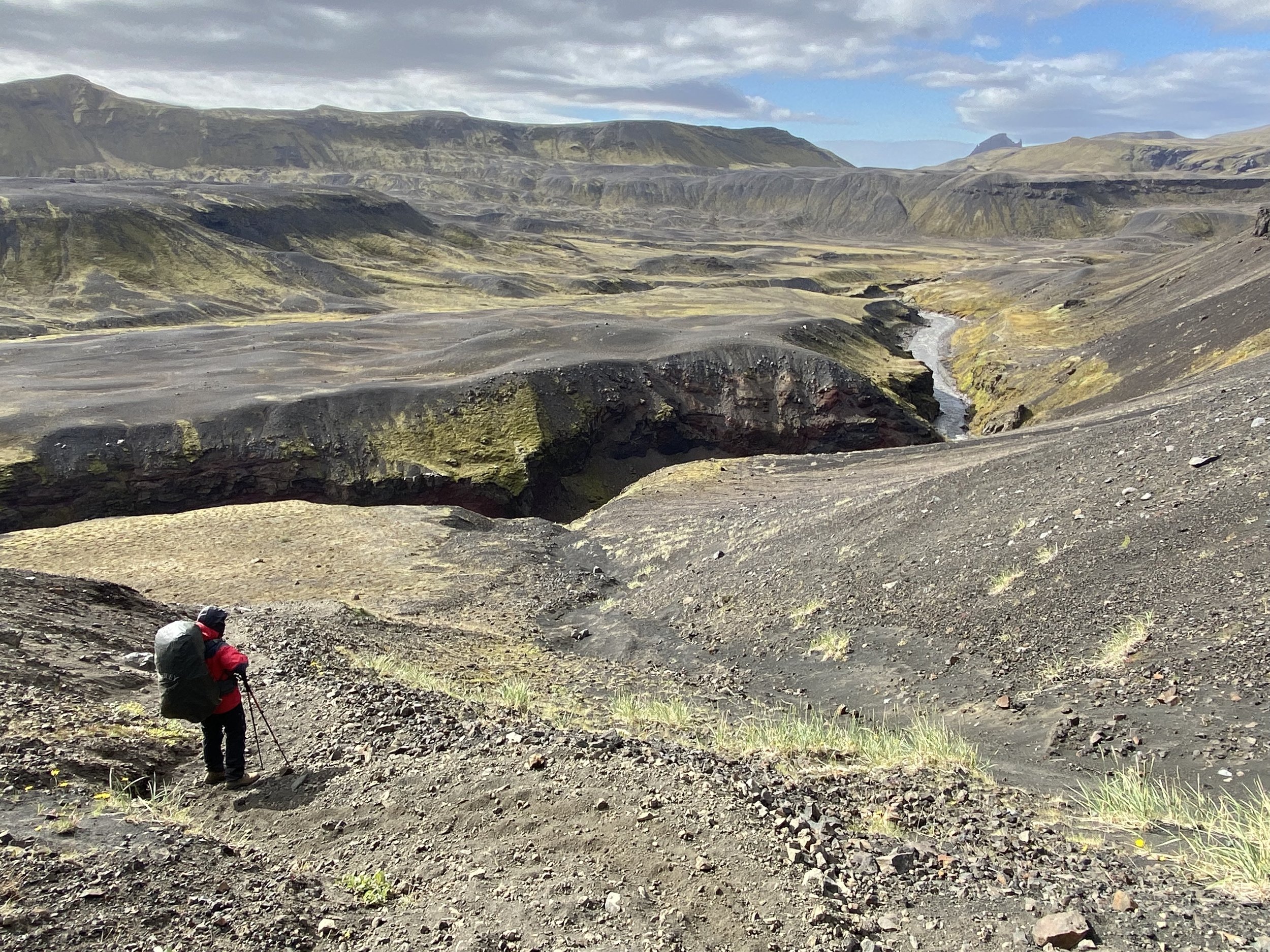
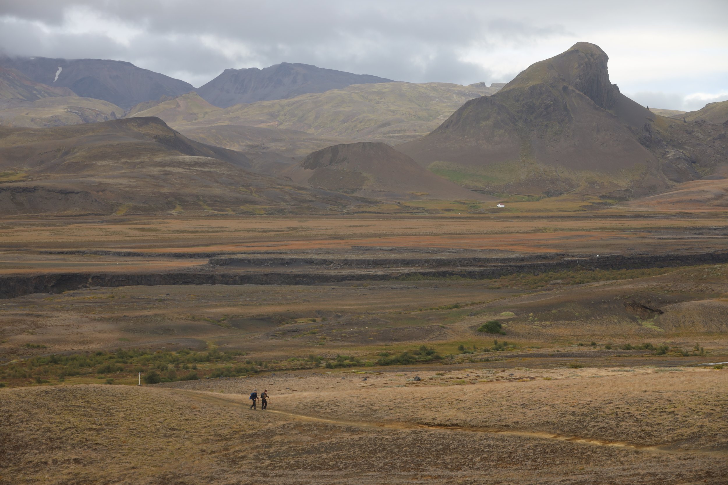
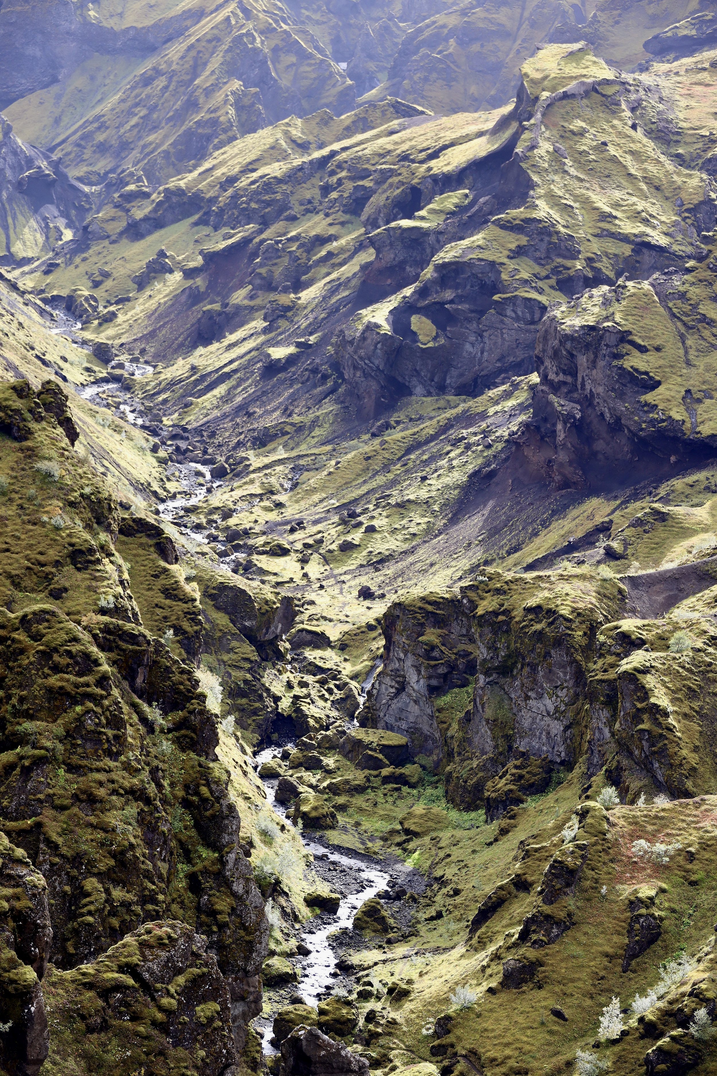
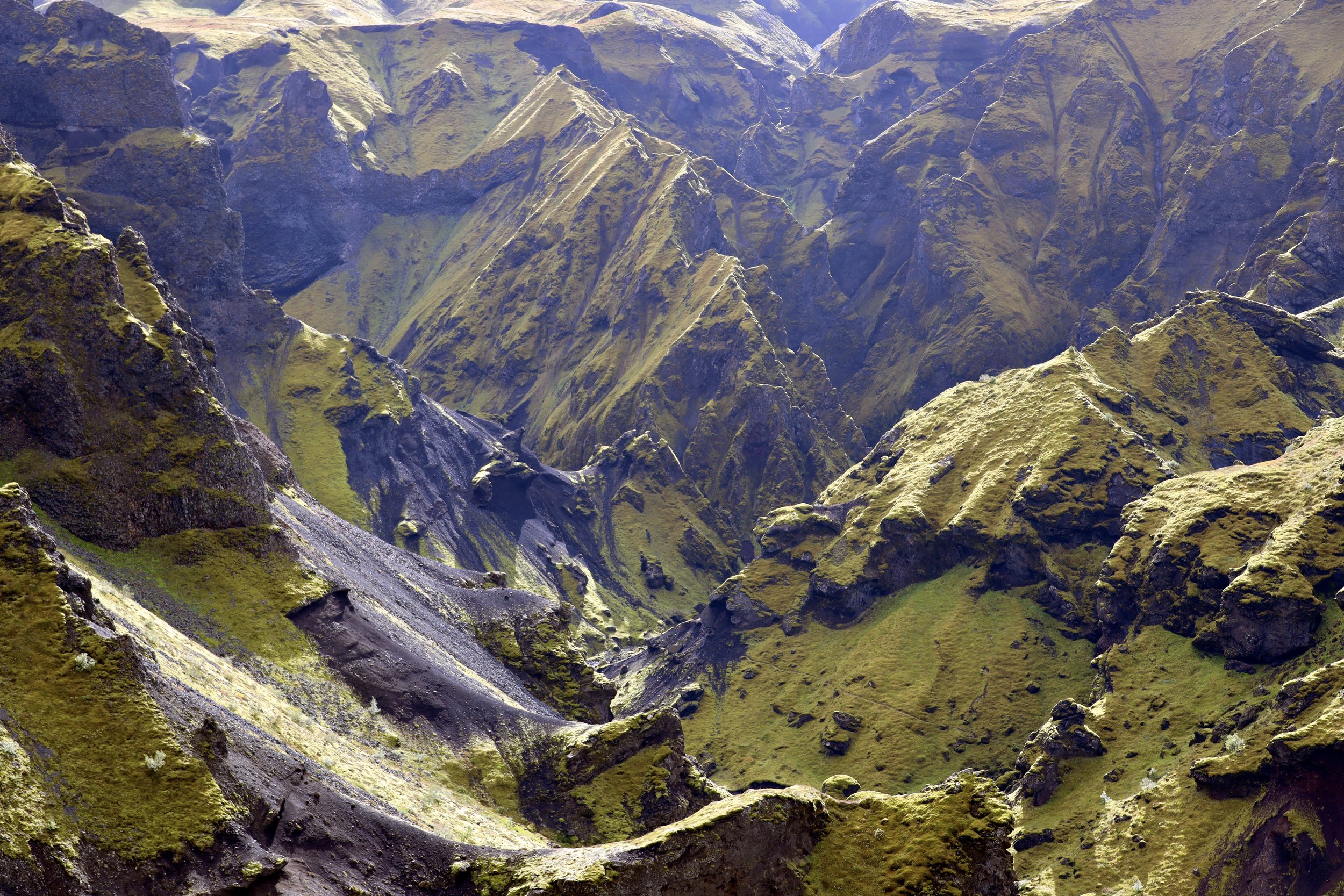
The day is overcast and grey.  The summits of the surrounding mountains are obscured by low clouds.  It seems like it is going to drizzle.  We need to descend onto the NS Glacier but the moraine next to our camp drops off too steeply for the horses.  It takes an hour and some backtracking to finally locate a suitable descent route.  Walking on these massive glaciers is exhausting.  The surface of the glacier is a series of ice ridges as hard as concrete covered in loose gravel and boulders of various sizes from pebbles to car size.  Each step must be tested as a slip could result in a broken bone or a twisted ankle.  Even descending is sometimes tricky, and one must be very careful not to slip.   What is remarkable is that the horses go with us through this maze.  There are no trails here and this truly feels like an exploratory trek.   The NB glacier has rivers flowing on top of it like all the other large Karakorum Glaciers.  Crossing them is not always straight forward.  Sometimes the rivers form canyons tens of meters deep that need to be crossed or bypassed.  All of it adds up to quite an effort of climbing and descending in order to advance forward.   One needs to navigate carefully through the obstacles on the glacier as not to end up on the wrong side of a river or a canyon.   Route finding is time consuming and tiring. 

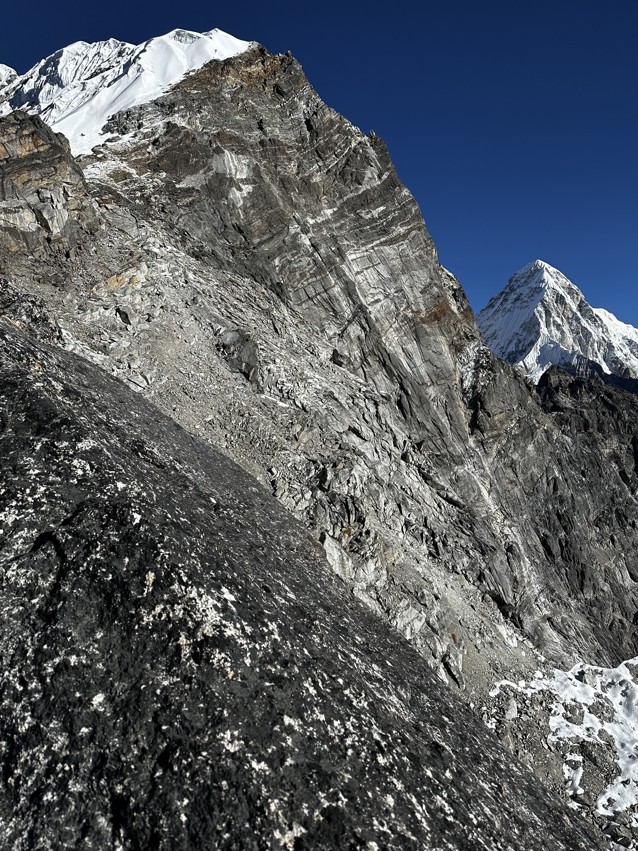
The Karakorum Mountain Range is remote, but this particular glacial system feels far away from the beaten track.  On the other side of the mountains that we were passing by is China and the glaciers that we saw during the K2 North trek.  All the area on the Chinese side is closed off to trekking and remains truly wild.  I am privileged to visit these places with so much grandeur and beauty on display.   It is not easy to walk on this difficult terrain but the magnificent mountain scenery on such grand scale makes up for the effort.  Unfortunately, from the very beginning of this trip I had some sort of sinus infection making me feel tired and sluggish.  Maybe going lower will help to get rid of it.  It has been annoying as I do not have enough energy for exploration after we arrive in the camp.   At this point, walking along the glaciers is hard enough for me. 

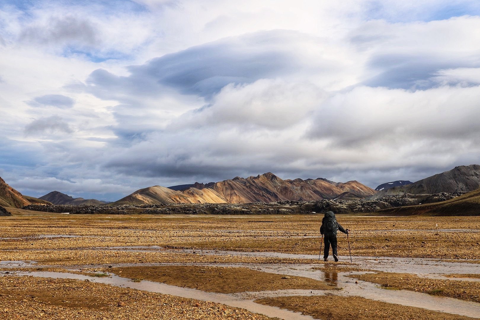
We walked for 10km and arrived at the sandy camp after 4 hours.  It started to rain and Essan wanted to push on.  I insisted that we stop at the sandy camp as we are supposed to enjoy the surroundings and not run through them.  The horseman wanted to go further to get home sooner.  I insisted that we stop to wait out the rain and wind.  We had a real mountain storm on top of us by the time we arrived in the camp.  It would be better to wait it out inside a dry tent and warm sleeping bag.  So far were lucky with the weather as we saw everything that we came to see.   It was only on the way back that the weather shifted.  The ominous clouds above the lake camp yesterday were a good sign of the change in the weather. 

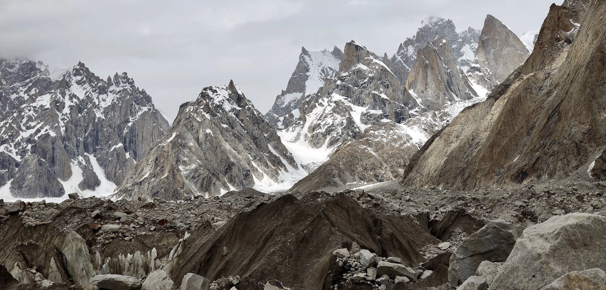
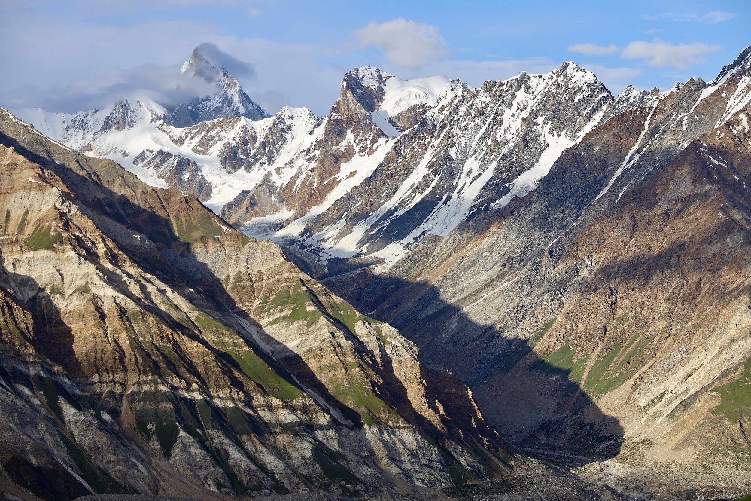
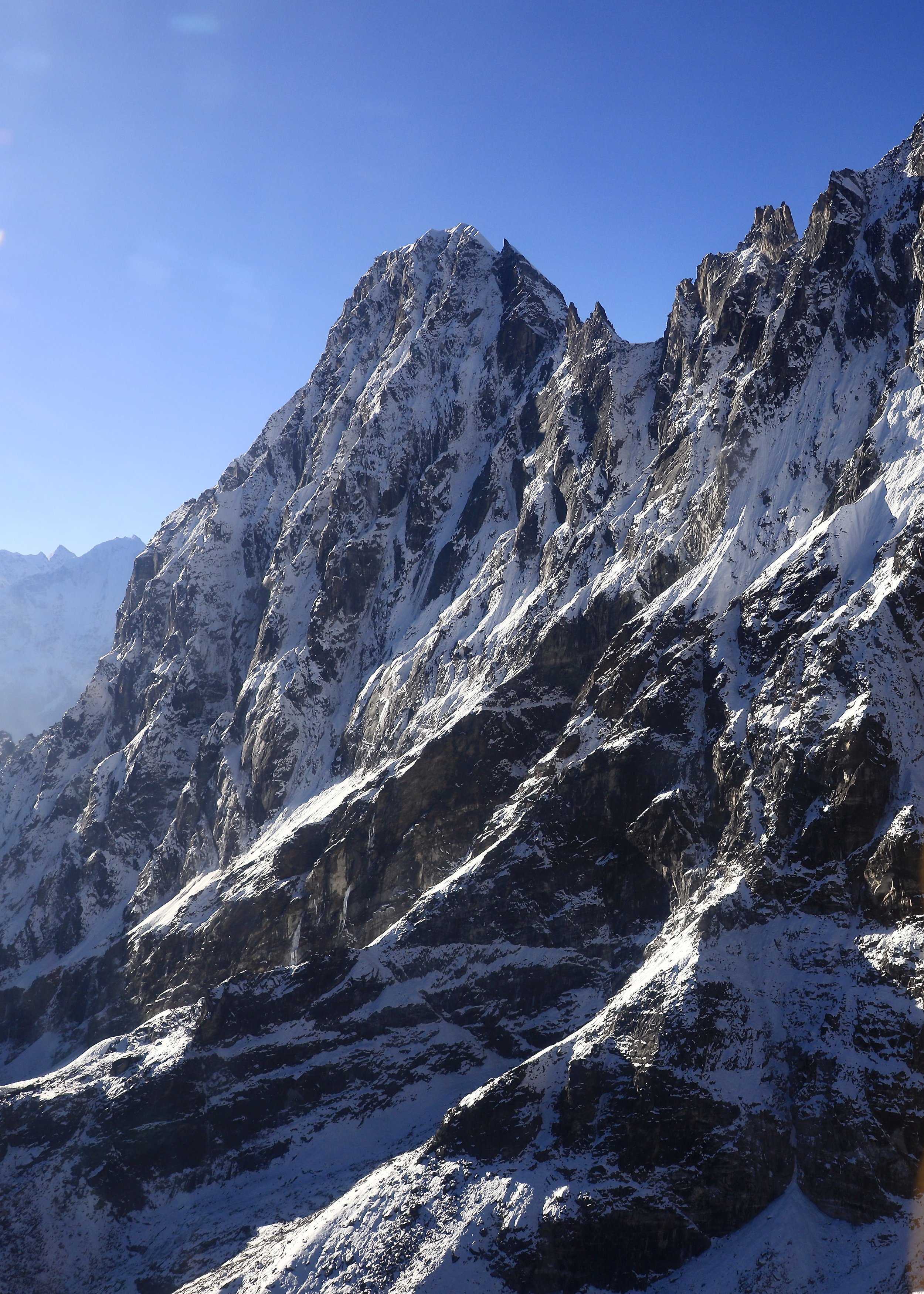
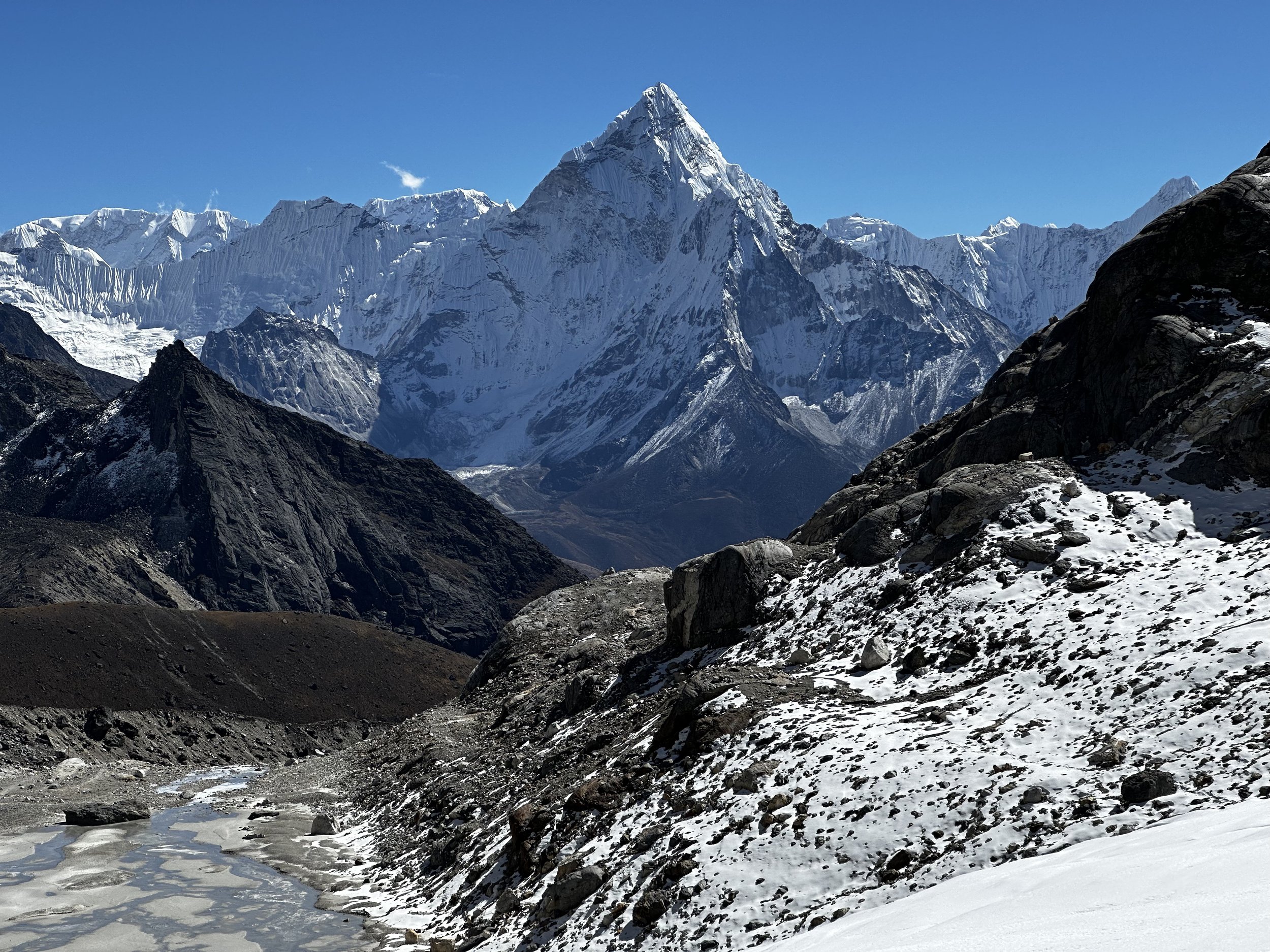
From the sandy camp we could see Latok 3 and 4 covered by dark stormy clouds.  The scenery was very dramatic and imposing.  We were camped next to huge rock towers that I photographed from the Moretti Camp.

In the afternoon it cleared up somewhat and I could fly the drone.  I got some great photos of the NS Glacier.  Everyone hid in the mess tent or under tarps to wait out the bad weather.    It is such a different experience from Nepal.   More remote, challenging and with changeable weather.  

July 21, 2023 Cow Camp 12.5 km

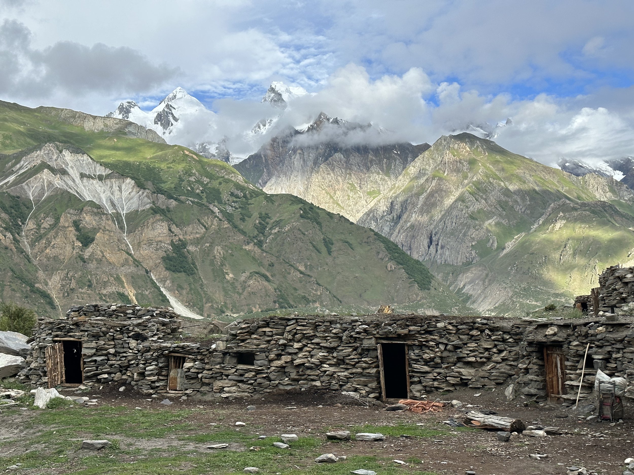
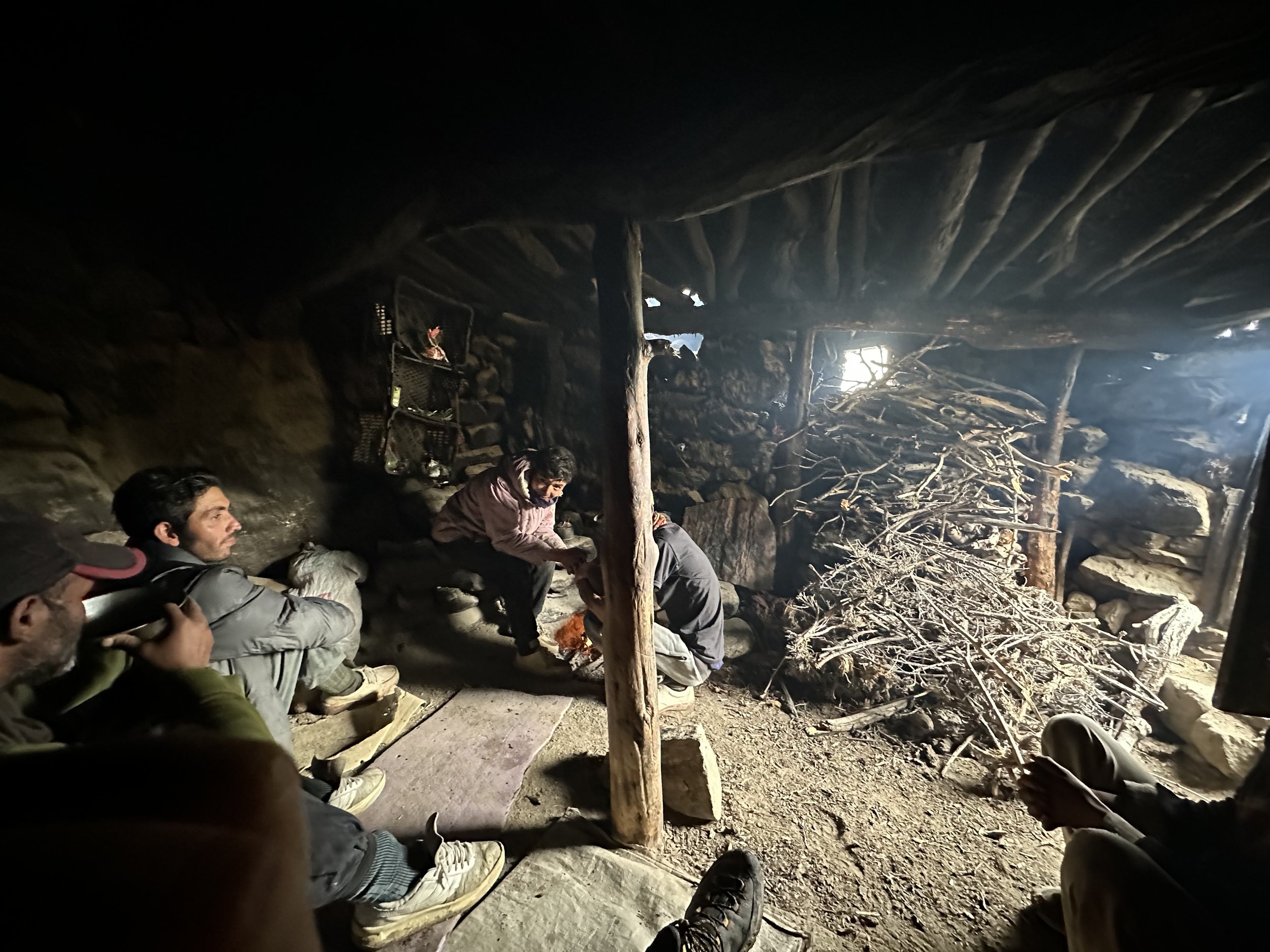
We started early yet again and descended onto the Panamagh Glacier right away.  This time we crossed the Panamagh and Choktoi Glaciers for 5 km.  The crossing was tedious, dangerous and tiring as usual.   It started raining heavily during the walk.  We had to navigate again around the glacial river that forced us to bypass it on the way in.  The last short glacier crossing of our odyssey here was tedious with large boulders the size of cars.  I was tired.  After the crossing, we climbed up a steep hill to the stone huts of the Cow Camp.   We were invited into one of the huts by the Askole man who was guarding the cow pasture.  The Askole men take turns to look after their livestock grazing above the Cow Camp. They stay in pairs for a week.  The stone hut is a dark and smoky shelter but provides warmth and dryness during inclement weather.    In this harsh and unforgiving environment, the stone hut feels like a palace.  We had good warm tea which put smiles back on our faces.   

The horsemen fell behind as the horses could not cross the glacier and had to brave the raging river to get to the Cow Camp.  They said that the water was up to their waists on crossing due to the heavy rains.  They arrived at the stone shelter wet and tired.  These guys are so tough and resilient.  I truly admire them for their simplicity and resourcefulness. 

After tea and some rest in the stone shelter, we descended for another 20 min to a nice campsite with good grass for the horses and fresh water.  As soon as we set up the camp it started raining again and continued for the rest of the day and night.  It rained heavily without stopping until 5am.  The sound of the rain falling on the tent was almost hypnotic and it felt good listening to it from inside my dry and warm sleeping bag. 

July 22 Cow Camp - River Camp 18km

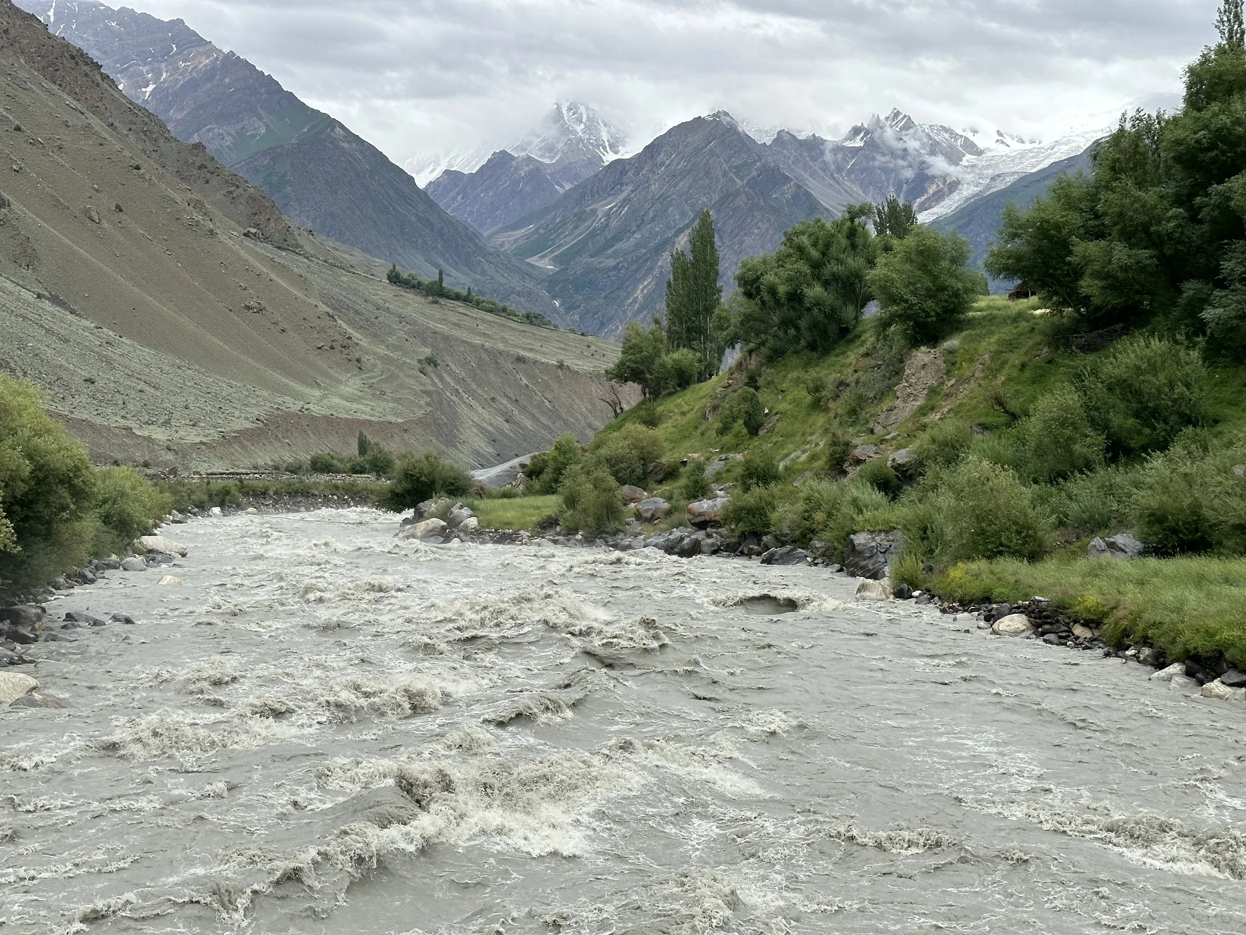
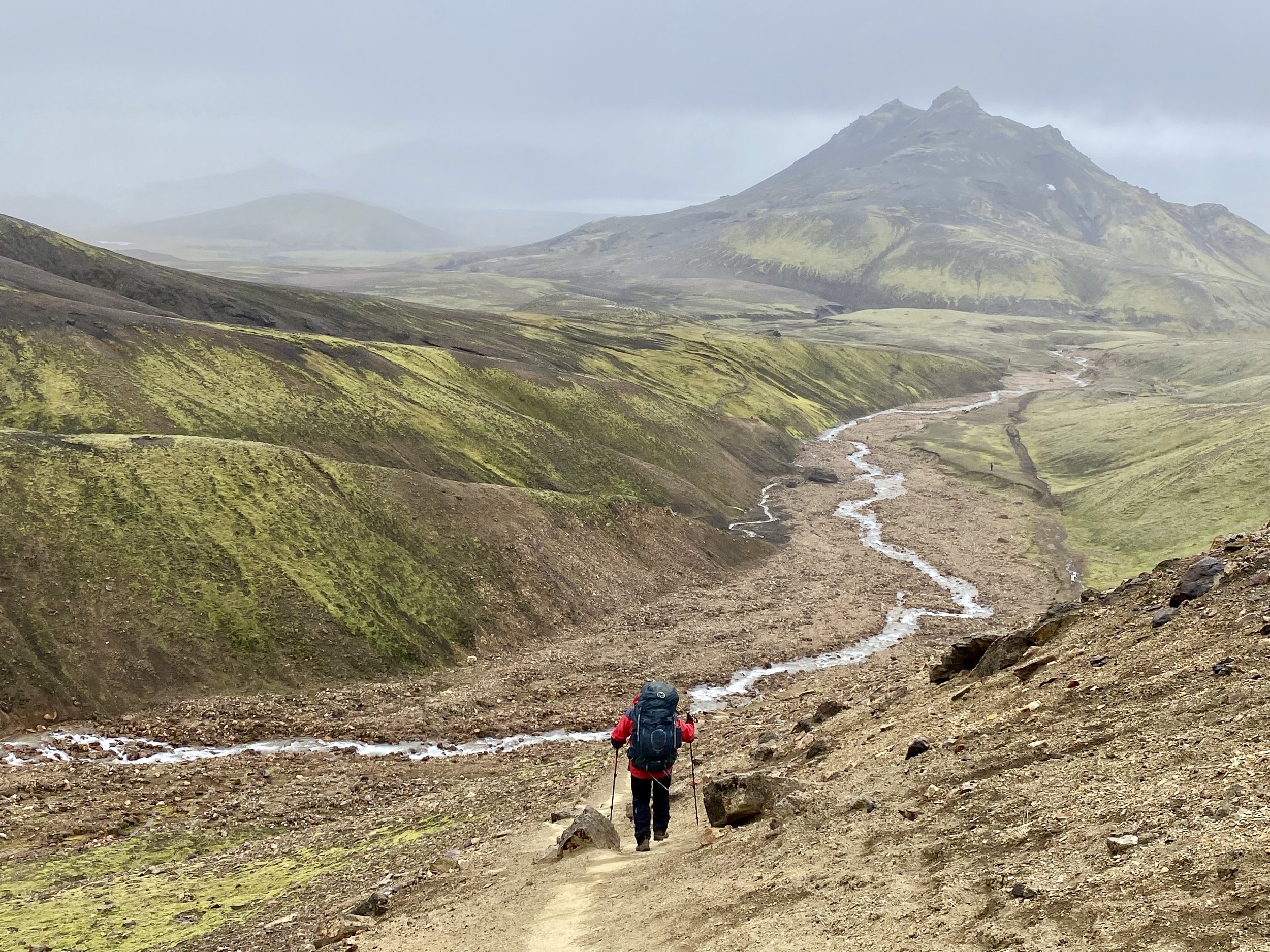
Today did not rain and it was overcast so we walked without the heat which we experienced on the walk in.  It was a pleasant and relatively flat walk out.   We had to climb one big hill and cross numerous side channels now full of turbulent water from the overnight rains.   The water in the Panamagh River is also very high and turbulent.  This is such a raw environment. 

I had to take my boots off to cross the small tributaries that did not give us any problems on the walk in.  The raging torrent of the rivers can be intimidating and falling in would be quite unpleasant.  The walk was 900 vertical meters down over the distance of 18 km, so it felt easier than on the way in.  Only in one place we had a steep long climb up to bypass the eroding banks of the Panamagh River which would be even more dangerous after the rains.   Aside from the Ogre climbers we have not encountered anyone on the entire trek. 

We had a nice tea break in the small green oasis and arrived back in the gorge camp in the early afternoon.  After lunch, two Americans arrived with their crew.  They were en route to attempt a climb on Latok 4 and seemed completely unaware and ignorant of the seriousness of their objective.  They had 10 days to get to the mountain, climb it and return to Askole.  They have never seen it, not even a photo.  Their only info was from Google Earth.   They crossed Ghondogoro La to acclimatize.  Nice guys but seemed totally out of their element.  The Americans were very hospitable, and it was nice to have a conversation in proper English again.

It started to rain and continued all night and into the morning.   The Panamagh River was very loud and turbulent after the rains with the roar of the rapids revibrating from the walls of this narrow gorge.   The high vertical wall behind our camp was a conglomerate of mud and large rocks.  I was crossing my fingers that the rocks would not dislodge and shower on us during the night. 

July 23 Gorge Camp, Askole – Tissar 21.5 km 4.5 hr all in the rain

Got up early.  Breakfast at 5.30 am.  Everyone is eager to go home.  We left the camp in the rain and marched for 21 km to Askole without stopping.  It took us 4.5 hours.  It was a truly miserable day with low clouds, non-stop drizzle enough to make everything wet.  On the way we crossed the very turbulent Biaffo River and walked along the swollen Braldu River.  If one fell in this river that would be it.  Essan told me that the year prior couple of porters fell in never to be seen again.  The mountains were obscured by low clouds so there was no visibility.  We did not see anyone going in the opposite direction. 

When we got to Askole, Essan wanted to continue to his village of Tissar right away.  They wanted to go home, all wet and tired.  It seemed like a reasonable plan considering the rain and wet campsite as the alternative.  We did the tip ceremony with applause and necessary performance.  I find the tipping part crass and frankly hate it, but it is a part of the deal here.  I wish I could just pay them higher wage and avoid all the tipping nonsense. 

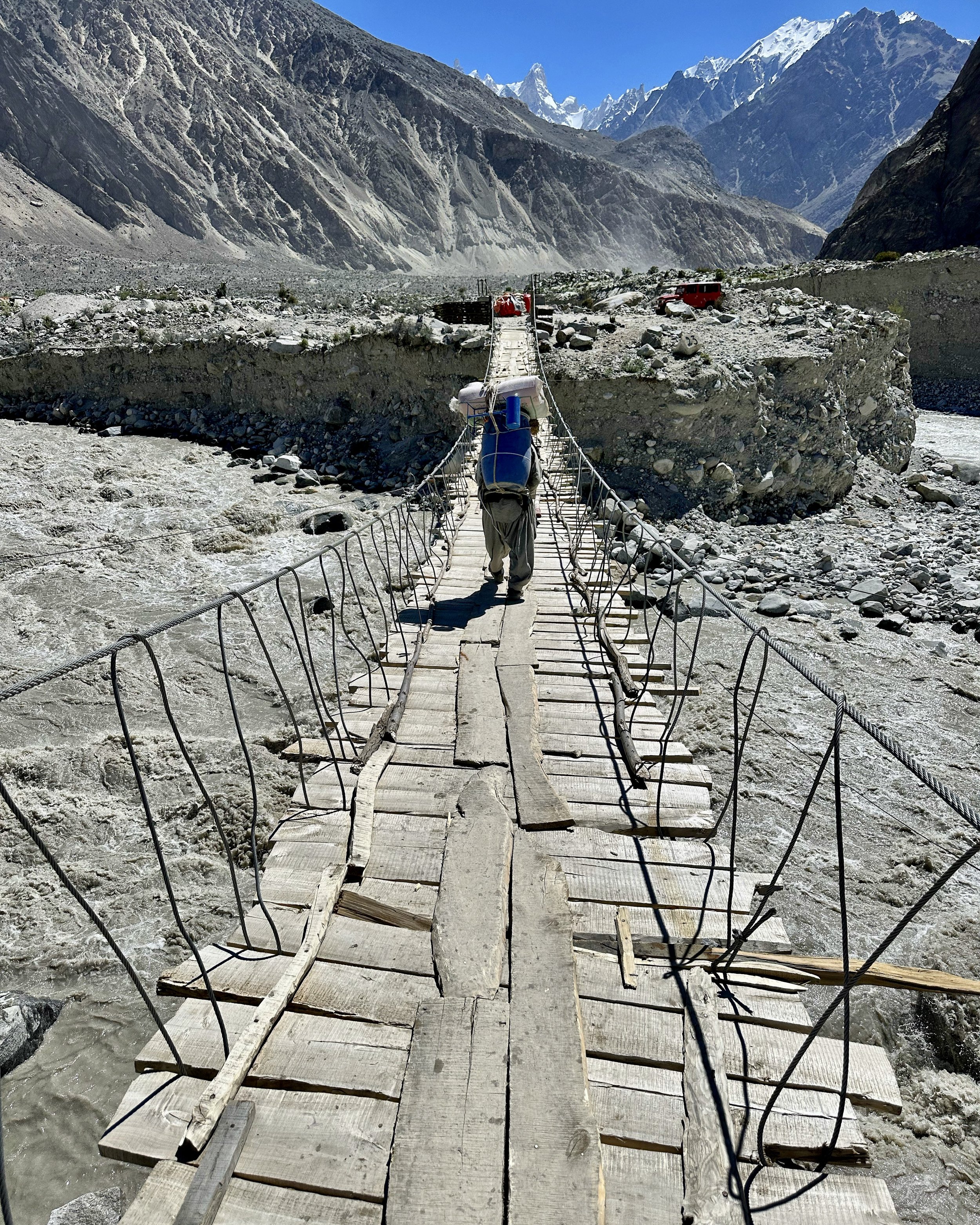
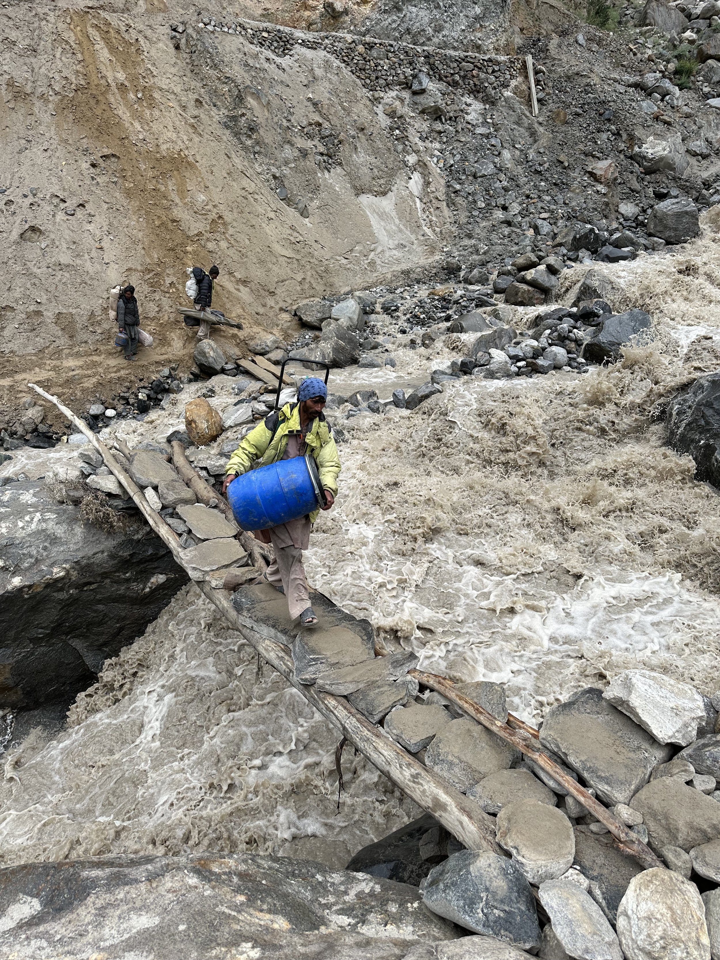
We left Askole in a jeep in pouring rain around 2 pm.  Our destination was Tissar and everyone wanted to get home after the first leg of the trek.  Everyone was eager considering that a big Muslim festival of Ashura was under way.   Tissar is a halfway point between Askole and Skardu.  The porters did not cover our cargo on the open bed of the jeep, and everything was wet soon after we left.   The porters were also all wet but no one complained or cared.    After 1.5 hours after we left Askole we arrived at a torrent of water that took out a bridge and made it impossible for our jeep to cross. We needed to unload all cargo, transport it across the torrent on a makeshift bridge and change jeeps.  The locals constructed the bridge and charged for each crossing.  Very entrepreneurial folk.    The ferrying of our loads reminded me of our Tibet/Nepal experience in 1996.  

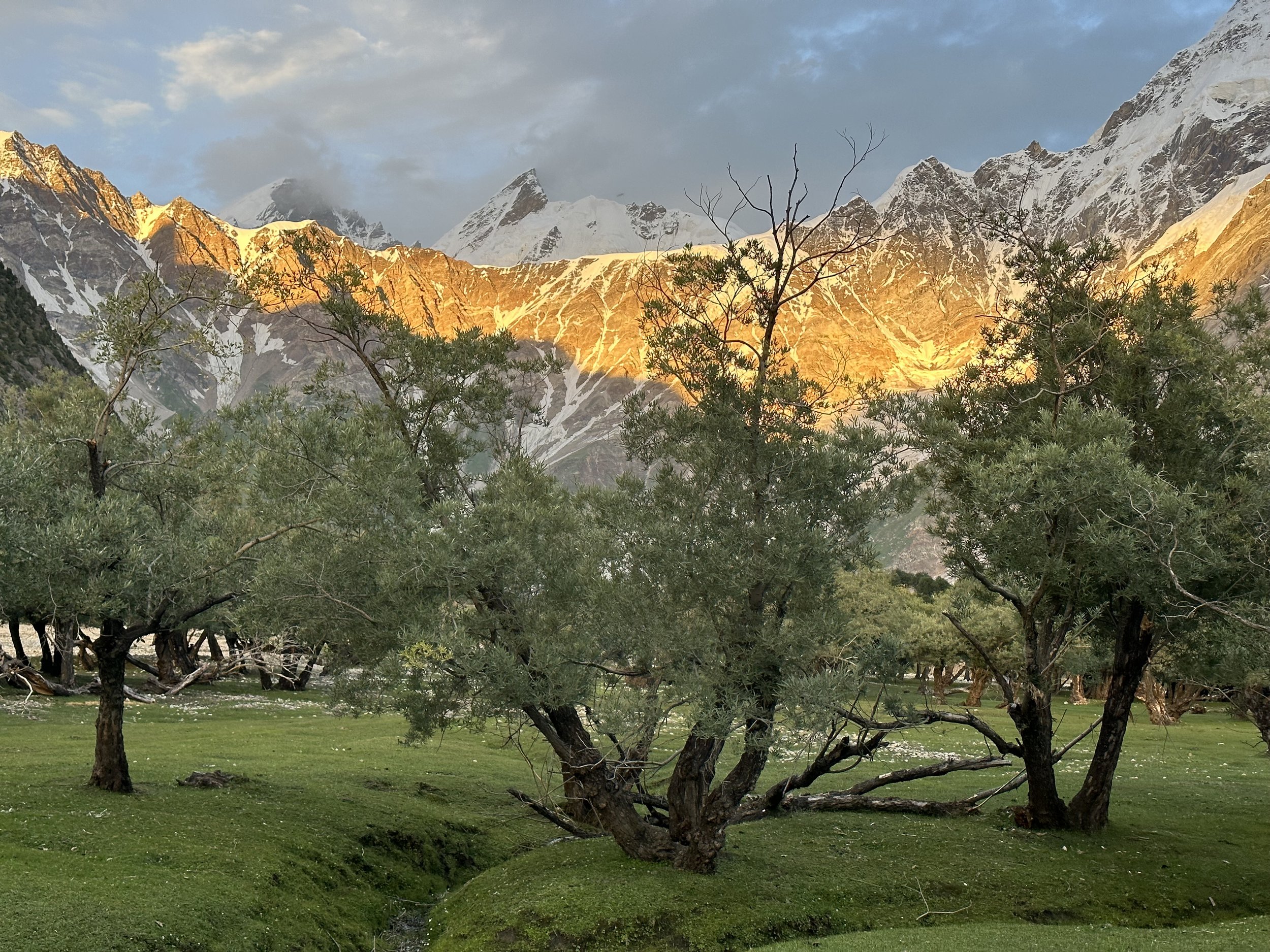
On the way to Tissar, we stopped in a restaurant that we visited on the way up.  The owner’s son, very nice chap who is unfortunately mute, was selling rocks and crystals.  We arrived in Tissar around sunset.   We checked into Aslam’s house.  Aslam was the guide’s assistant and as it turns out also his relative.  The house was very impressive, large and well appointed.  Aslam lives with his wife, new baby and old father.   The great room was like a hall with carpets and pillows put against the wall.  We could charge phones and dry our wet clothing and items.  It was interesting to stay in a local house and see how the Baltis live.  Alsam introduced me to his wife, new baby and the mother-in-law.  This is the first and only time that I met Balti women in a small village.  They share the house as a family which is super nice.   The house and the village have a lot of kids and I am a big curio to them all.  I am so giant compared to the small Baltis.  They were all very nice and welcoming people.  I was sharing this great hall of a room with our driver. 

Once you stay at someone’s house, hear their life story and meet their family you lose the anonymity of a tourist.   This kind of an experience is not possible in a group setting.  Only trekking alone allows for this kind of connection.  It is the same way in Nepal for me. 

So far this has been a wild trip, and everything was new (except Askole – it was not new but definitely changed).   

July 25 Skardu

We drove back from Tissar in fine weather on south side of the Shigar River.  Again, a new perspective and experience.   The higher mountain summits were still in the clouds.  This year’s weather seems very fickle, but I feel lucky to have had some fine days mainly on the Choktoi Glacier.  I hope for a few more sunny days during my next leg of this journey.  Given that my time is limited, and I am constrained by the flight back home, I do not have the luxury to wait out the bad weather. 

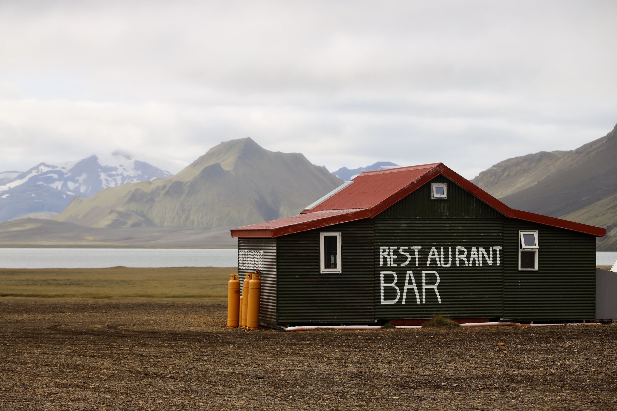
On the way to Skardu we stopped at the renovated Shigar Fort, now a five-star hotel which was booked months in advance.  The fort is beautiful but the town which it is in is a dusty armpit and it is far away from anywhere.   There is way too much development in the Shigar Valley.  There are ugly concrete hotels everywhere, many of them only half finished.  All these hotels are competing for the tourist money from the local tourists that come here in droves (compared to 2001 and 2005).  I am curious how much time will pass before this part of Pakistan will be like Namche Bazar and the Everest region of Nepal.   Already, there seem to be many more large groups going to the K2 BC compared to 20 years ago.  When I was here in 2001, we were the only group of 6.  Now Askole has a hotel already.  More people will mean more development.  But the Karakorum is fighting back:  roadblocks, bad weather, altitude, landslides etc.  It is still a very wild and remote place.   One must wander, whom are these hotels built for really?  The season here is only 2 months long at best, the roads are often blocked, flights cancelled.  The visitors are concerned about safety.  There seems to be no planning or logic around this wave of development.   


Pakistan 2023 Trip Report Part 2 – Haramosh La 5,200m

July 28 Arando 15km 800m gain

We left at 9 am for Arando.  It was the height of the Ashura Muslim Festival and everything was closed.   The weather was overcast and with everything closed and no people around, it seemed a little grim.  Everyone we met was dressed in black. The entire festival is a solemn affair and not very cheerful to visitors.  It felt like attending a funeral.  It is what is it is but from a tourism perspective maybe it is not the best time to visit.  Because of this festival no one works, everything is closed, there are no cars on the roads, there are no drivers for hire, there are no porters available.  The entire affair lasts 12 days and it is smack in the middle of their 2-months long tourist season. 

We drove down the Shigar Valley again and purchased some live chickens, fuel and other supplies on the way.  There were very few cars or jeeps on the road.  In Dasso we crossed the Shigar River and drove to Tissar, Essan’s home village.  Essan invited us to his home for lunch.  He hired the same crew plus his shop assistant as we were short on porters. Essan’s brother was visiting from Iran with his family.  The brother is an Islamic scholar and works in Quam, Iran in a madrassa.  We were seated in a large room, on the floor with pillows for support.  The food was served on the floor on a plastic mat like in the camp.  

After lunch we moved on to Arando.  We stopped at a commercial hot spring which was a little dirty and unkept.  There was garbage in the water and the pools were used as a communal bath.  We then drove on a narrow and exposed dirt road to Arando. The views were great but there was big exposure to the river below taking the focus away from the enjoyment of the surroundings. The road was quite terrible in places and the jeep tilted dangerously over the sharp drop off to the river a few hundred meters below.  During a few short sections, I was afraid that the 4x4 would flip over and roll to the raging river.  Thankfully, the drive from Tissar to Arando was not too long and after 2.5 hours of shaking we arrived in the campsite on the outskirts of Arando village.   It was cloudy and on the verge of raining, so it did not feel pleasant to be outside.  As a matter of fact, it soon started to rain steadily.   I pitched my tent and after dinner went to bed.  The crew held night prayers to commemorate Imam Hussain. 

The next day, we got up early.  It was raining on and off.  The mountains were obscured by low grey clouds, and it felt somber.  We packed up and were short one or two porters due to the festival which was now in its final and most important stage.  No one wanted to work and even if some individuals did the peer pressure in the village would prevent them from accepting work during the festival.  Conformity is strong here in these small villages.  

From the small campsite (I think developed by the Czechs) we walked a short distance to the medieval village of Arando.   The village has the end of the world feel to it.  A lot of men gathered around to witness my guide’s futile efforts to hire a porter or two.  There were all these able men, but the ancient Hussain from 500 years before stood between them and a job.  Women were all dressed in black and were leaving bowls of rice on the ground.  Random men would swoop down and eat the food.  All this in pouring rain.  These were some strange customs for me to witness.

Not being able to hire anyone, we left for the first camp site.  We walked across the turbulent river which emerges from the Chomolugma Glacier nearby.  We started the long climb for 700 vertical meters to the first campsite.  The walk was 15 km long following the frontal section of the Chomolugma Glacier.  This is another massive glacier of the Karakorum running parallel to the Hispar Glacier.   Some peaks were visible, but overall, it was overcast and grey.  The rain would come on and off.  We stopped for tea along the way and a passing man gave us good cheese.  We arrived in the camp around 2 pm.    Once we set up our camp it started to rain, and it rained for the next 3 hours. 


July 29 Forced rest day – rain

Today it rained 20 hours straight.  It started around 8 pm last night and it went on until noon of the following day.  During the night the rain was very intense with lightening and strong wind.   

Trekking in Pakistan as compared to Nepal is rough.   The weather is very unstable and changes all the time.  Pakistan does not have a nice weather period like Nepal.  During the rain you get pinned down in the tent.   There are no tea houses, and you cannot dry anything until the sun comes out again.  The rain makes it for some long hours in the tiny tent.    We were camped in a cow enclosure with a lot of cow shit around.  The cow shit meant a lot of flies.  The flies would get into the tent by dozens, and I could not leave the door open.   The flies also get into the kitchen and get into everything that is lying around uncovered which is most of our food.   It does not make it for an appetizing ambiance in the food tent.

Since we left Arando, the weather has been poor.  The forecast calls for improvement, but the forecasts have been notoriously wrong here.  The big issue for me is not being able to cross the pass and having to walk back to Arando and Skardu.  Such return journey would require more time to be able to catch my flight home from Islamabad.  The crossing of the pass is much faster, but it cannot be done in poor weather or after heavy snow fall.  As we progress on, I am running the mental math calculating the days needed and the ultimate turn around point.  I find this uncertainty quite stressful.   No one knows the conditions of the pass until we get there. 

It is truly a wild country with some wild people.  It grinds you down slowly.  Mentally I find it tough to have the rain all day with nothing to do, not even a conversation as I am alone here.  I think that trekking in Nepal is a summer holiday compared to Pakistan.  Here is remote, wild and very unforgiving.  Like someone said:  the Karakorum is either heaven or hell.  But it is also a total adventure in the most spectacular mountain range in the world.  There are no other people, no one.  Nepal is overrun with trekkers and climbers.  No so here.  There is only serious mountaineering and trekking in Pakistan.  The Nepalese understand the western expectations of the mountain Shangri-La and make the experience of visiting their country a version of it.   Pakistan is as it is, you adjust to it not the other way around.    I like both for different reasons, but I am drawn more to the Karakorum then the Himalaya.

July 30 Bolocho Camp 18.5 km

We got up early again.  The weather and the forecast look promising with some morning clouds.   In the morning, we packed up and left quickly.  The clouds were still obscuring the mountains, but the visibility was definitely improving.  The walk was flat and easy following the large glacier.  After 10 km we had to descend onto the broken and chaotic Chomolugma Glacier to bypass a large and powerful creek gorge that gouged its way through the mountain side.   As we progressed, I noticed dark clouds on the horizon in the valley below slowly chasing us up the glacier.  Is the forecast wrong again?!  After km 15 we descended back onto the glacier and then the storm hit us with full force.  Heavy rain, I quickly had to put on my gortex pants and jacket.  Porters were all wet.  I was seriously concerned about our prospects.  How can we cross the Haramosh Pass when everyone is wet? They have no change of clothing. Is there too much snow higher up?  If we go too far, our retreat will be much longer.  The possibility of crossing was becoming more and more uncertain in my mind.  This added to my foul mood, the weather, the dirt and I was so tired.  It was 18.5 km day, long walk.  If we had to retreat, it would be all for nothing.  I think that lack of proper food was also affecting me, I couldn’t eat, I had no appetite and I had poor recovery.  I was not sure why!?  Essan was constantly nagging me to eat more but I just couldn’t, I gaged.  I couldn’t pinpoint the reason why my appetite was so poor.  Ultimately, I lost 23 lb on this trip in one month.  More than 10% of my body weight!

We pitched the tents in a small muddy campsite called Bolocho.  Bolocho is located behind the lateral moraine of the Chomolugma Glacier.  I set up the tent and lied down.  I was thinking about whether this would be a successful trek considering the weather.   Should we go back to Arando?  I was calculating in my head the number of days required in order to catch my flight back home.  The window was narrowing, and the decision had to be made. 

As I was resting, within one hour the weather went from full on rain to clear blue sky.  Wow!  Finally, we could see the surrounding mountains and everyone’s spirit lifted.  I climbed the moraine, and all the crew was already there enjoying the warm sun and drying out.  In the distance the 7000m giants Leila, Spantik, Mulubiting.   It was a beautiful view from the top of the moraine.  Everyone was drying their wet clothing and blankets.  General mood improved, and it looked like tomorrow we were continuing even though I was so tired.   

July 31 Haramosh La Basecamp 12 km 4400m

The plan was to get to the Leila basecamp which we could see across the glacier.    It was supposed to be an easy 3-hour day.  I was looking forward to an easy day.  As it turned out, nothing was easy.  

First, we had to cross the Chomolugma Glacier and join the Haramosh Glacier which connects with the Chomolugma.  This was the easy part, the white glacier highway.  We followed it for an hour or so.  The Spantik BC was visible in the distance. 

The difficulties started at the confluence of the Chomolugma and Haramosh Glaciers.  The area was a jumbled mess of ice ridges and crevasses.  Really jumbled and fragmented.  We had to cross this mess carefully to get to the hillside which would allow us to bypass the chaotic icefall looming ahead and blocking the access to the upper Haramosh Glacier.  We exited the broken glacier, climbed up a steep hill and stopped for a tea on a grassy hillside.  I thought that I was done with glaciers after the first trek!  The memories of boulder hopping on the Nobande Sobande were too fresh.  We had tea and on the insistence of Essan, I had some noodle soup that I puked out soon afterwards.  Essan watched me puke it out with bewilderment, but I told him that I was not hungry.  Just couldn’t eat, the chapattis tasted gross with Happy Cow cheese.      After the tea, big climb up, up, up.  The views of the icefall and the towering white mountains were incredible.  This was absolutely wild and spectacular area.  We were walking on beautiful green grass full of summer flowers.  I was tied and it dulled the enjoyment.  As we climbed higher, we came across a cave camp of folk from Kutwal Valley looking for precious stones in the mountains above.  They were super nice, friendly and welcoming guys.  They were staying in a hillside cave with various chambers covered with plastic tarp.  They made us tea and we rested with them for a while. 

They advised us to stay at the Haramosh La bc another 20 min away.   This made me very happy.  Essan the guide wanted to go to the pass and said that it was only 2 more hours (it was 12 km in reality).   It would have been 7 hours in soft snow and bad conditions.  I insisted that we stay in the base camp although fresh water was a little bit of an issue.  What a campsite it was!  Wow!  Perched like an eagle’s nest on the edge of the Haramosh Glacier icefall.  The views were absolutely spectacular and exceeded my expectations.  It made all the effort worth it.   From our campsite, the pass was still 10-12 km away.  Essan hired a man from Arando to show us the way. 

We settled in the camp with anticipation of the crossing which looked more certain by the hour.  The plan was to wake up at 2 am and be on the way by 4 am.  The gem people came to see us for dinner and reassured us that the descend was safe (ie no snow or ice issues so we would not need a fixed rope which we did not have anyway).  This made the crossing almost certain. 

August 1 Haramosh La to Kutwal Lake 5200m 20 km

I woke up at 2am, it was a clear night with full moon.  I could see million stars and the milky way.  I was looking forward to the crossing and going down.  I was tired but had to carry on as it was the fastest way out of there. I did not want to retrace my steps back to Arando and Skardu.  We had some tea and small amount of food in the mess tent at 3 am.  The porters made the usual chapatis for the day ahead.   I did not eat much because it was the middle of the night, I was tired, and I did not have the appetite. 

We packed up and started by walking in the dark up the hill right behind the camp to bypass the jumbled icefall.  At 5.30 am we could turn off the head lamps as we could see the lay of the land.  After bypassing the icefall, we gained the upper glacier.  At first the glacier was easy to walk on with some visible crevasses.  The ice was hard and grippy.  The distances here are so deceiving.  Only when we saw the porters far away, we could appreciate the scale of the terrain.  The sun finally came out from behind Haramosh 2.  It was a brilliant day but not clear!  We walked by Leila Peak on the right and Haramosh 2 and the left, both faces foreshortened and encased in massive icefalls.  Incredible scenery.  Hard to believe that it was real and that I was there. 

It was a good climb from 4400 to 5200m.  I was in surprisingly good shape considering my earlier struggle.  We walked fast and caught up to the porters.  There was another icefall ahead between us and the pass.  The ice was all broken up and fragmented with massive holes.   There were hidden crevasses as the entire upper glacier was snow covered.  We roped up before the final stretch of heavily crevassed section before the pass.   The porters were wearing pinguin pyjamas and plastic shoes.  The rope was mandatory.   There were 10 of us on a 50m rope.  The Arando man was in the lead probing the way in the snow.   He was fast, efficient and confident. 

Ahead was the heavily glaciated Mani Peak glowing in the morning sun and next to it was the 7000m Haramosh after which the pass is named.  The mountains were on another scale of imposing.  Large, glaciated and steep. 

Before we roped up, I asked the crew to walk slow and stop from time to time just in case the altitude got to me.  We were all roped up together so if one person wanted to stop, we all stopped.  I did not feel overly tired or in need of rest though.  Some guys punched through snow but nothing serious.  It was sunny and bright but heavy clouds rolled above Haramosh Peak.  Aslam forgot his sunglasses and put a plastic bag over his head to avoid the snow blindness. 

Finally, we got to the pass.  What a grand place, what a view!  The drop to the other side was 2 km straight down to the valley below.  It looked very steep, but it did not intimidate me.   In front of us was the massive Mani Peak and next to it was the Haramosh Mountain.  Leila 2 and subsidiary summits were on the right.  We could not see Leila 1 from the pass itself but could see Leila 2 and 3.  We were in the middle of a mountain cirque surrounded by high peaks and massive glaciers.  The Mani Glacier flows down to the Kutwal Valley like a river.  From the pass we could see the Kutwal Lake (our destination for the day).   We could also see Rakaposhi far away on the right.  Looking back where we came from, we could see the peaks separating Chomolugma valley from the Hispar Glacier valley.  This is the wild side of the Karakorum – spectacular and seldom visited! 

The Arando man, Hassan, scoped out the safest descent route.  It is a long way down and in the absence of snow, falling rocks were the main problem.  The plan was to go down diagonally to avoid triggering rockfall on one another.  The descent looked steep, but I felt that it was very doable.  The Haramosh La reminded me a little of the Mesocanto Pass in Annapurna, Nepal, but it was much higher and longer.   The descant was 1500m or more. 

The views of the surrounding peaks were also on another level.  What a place!  I was not even that tired now.  Not hungry, I couldn’t eat more chapatis.  The porters boiled water and made some tea with sugar.  We stayed 30 minutes or so on the pass and decided to move on.  The porters were a little freaked out about the steepness of the slope. 

We started our descent towards a little cairn slightly lower down the snowy crest of the pass.   Then Hussain, the pink gloved Arando man went straight down a snow ridge without a rope with steep drops on both sides.  It was maybe a 50-100m descent.  He kicked steps in the snow quite confidently and called for us to follow.  This section freaked out the porters as they had loads to contend with and no boots.  The descent on the arête felt airy and exposed.  The porters, assisted by Essan, slowly made their way down.  After the initial snow section, the descent was a never-ending series of side traverses on rocky spurs and ridges.  It was smart to do it this way to avoid the relentless rockfall on this insanely loose slope.  Every step dislodged a rock that cascaded down 1500m.  It was tiring and relentless.  One had to pay attention to every step.  At one point I grabbed a large boulder for balance and quickly dislodged it as it was delicately perched on top of another loose rock.  The large boulder almost crashed my foot but thankfully I jumped out of it way and it rolled down the slope to the valley far below.   The descent went on and on.  We had to regroup and wait for everyone to continue together.  Everyone was tired and eager to get down.  Almost at the end of the slope, we had to cross some large and wide snow gullies.  They were quite steep and in order to cross them diagonally steps needed to be kicked in.  For me with the mountaineering boots it was OK, but the porters struggled with their plastic shoes.   One of them lost his balance and started sliding down.  It did look scary for a moment until, thankfully, he arrested his fall.   The weather cleared up to  perfect, and the views were amazing.   It was hard to enjoy the surroundings though as everyone was concentrating on the tricky descent.  It was one of those days that is remembered forever though. 

Finally, we got down to the green grass and the rockfall danger was now behind us.   I was tired but we still had a way to go to reach the Kutwal Lake.  We were now at a spot where everyone could relax and make some tea.   We could also refill the empty water bottles with deliciously cold fresh water.  After an hour of rest, it was another 5 km to Kutwal Lake. 

When we reached the pastures below, the porters bought a goat (I bought a goat) for a celebratory feast planned for that evening.  The valley was full of animals and people from villages down the Kutwal Valley.  This area is a summer pasture in spectacular surroundings with lots of fresh water from the surrounding glaciers and plenty of green grass for the animals.   This upper valley is dominated by the massive Haramosh Mountain that towers 4000m above the glacier and dislodges avalanches as soon as the morning sun hits its frozen slopes.  The ice avalanches cascade to the glacier below producing a big plume of snowy dust. 

In the evening, the happy and excited porters killed and cooked the goat.  The goat was boiled and had a rancid smell to it.  I could not eat it.  The smell of the boiled goat made me gag.  The porters were quite happy though and relieved to be down on green grass and done with danger.  There were a lot of grasshoppers in this camp.  They got into everything, and the tent needed to be zipped up.  In the evening some local young guy brought fresh kefir to us.  The locals were quite intrigued to have a foreigner here as not many make it to the valley or cross the pass.  This pass does not see many crossings at all although some Pakistanis trek to the Kutwal Lake.  It is known as one of the most beautiful spots in the Karakorum.   A group of Pakistani ladies crossed the Haramosh Pass a month before us, and made it to the national news.  I was very happy to have done this pass.  It was on my to do list for a decade and the YouTube video I saw was spectacular but not as spectacular as the real thing.  I was very happy with myself, and the effort required to do it was worth it. 

Essan said that there was no more descending from here to the jeep.  In reality, it was another 1500m down.   

August 2 The last day of walking 12 km

I was happy that it was the final day of walking.  I was told that it was only 3 hours to the jeeps. 

The scenery around Kutwal Lake is spectacular.  The massive, glaciated wall of Haramosh dominates the valley.  The wall is exposed to the hot sun which results in frequent avalanches cascading to the glacier below.  On the north side is the huge Malubitng Mountain and another very high and steep glaciated wall.  The valleys are full of large green trees and summer pastures for the villagers from down valley.  This area is also remote and does not receive many visitors.   We went down, down, down.  Another 1500m down.  As we descended it became hotter and hotter.  We took a break in a small village where a local girl served us tea and we had fresh apricots from a nearby tree. 

Essan offered to take my bag and I took him up on it as I was so drained by the heat.  It was close to 40C, and the heat was amplified by the surrounding rocks radiating it back into the canyon we were following.  The canyon was narrow, dry and hot.  There was very little water for drinking.  We were following a jeep track that was blocked with a landslide ahead.

I was so happy to be going down as I was both physically and mentally spent.  

I thought that Pakistan would be an easy trip but both treks were hard.  Each in its own way.  The uncertainty of the weather, the challenging glacial terrain, lack of appetite, the glaciers, boulders etc.  What a crazy, hard but grand adventure!  It challenged me physically and mentally.  I learned quite a bit from this experience and satisfied my yearning for the Karakorum.   This was my fourth trek in this range.  I am sure it is not the last one.

We descended to a village with jeeps.  The landslides took out a large chunk of the dirt road, so we had to cover extra distance to reach the village with transportation.  We were supposed to meet our driver in that village.  When we got there, there was no one waiting for us, and we had to hire a local jeep to take us down.   

We packed up and started our drive.  After 40 min or so we met our driver that Iqbal arranged for us.  Consequently, we had to let the local guy go but he demanded full payment and the entire situation escalated to a standoff.  He blocked the road and Essan had to negotiate hard to pass.  We finally reached an agreement and continued on.  The road was absolutely stunning.  The weather was brilliant.  The drop offs to the bottom of the valley must have been 1km or more.  This road is considered as one of the most dangerous in the Karakorum.  It was very spectacular dry country with high glaciated mountains towering above it all in the distance.  After driving down for an hour and a half we reached the Jaglot-Skardu road. 

I contacted Ghulam on Inreach the day before about our meeting point and arrival time.  However, when we got to the arranged point, he was not there.  We decided to wait for him in a small roadside eatery where we did the tip ceremony with the commensurate clapping and speeches.  I was prepared this time and after an hour of waiting Ghulam arrived. 

The plan was to drive to Naran.  We passed the spectacular Nanga Parbat viewpoint.   On the way I bought some fruit from kids by the side of the road and got a bad stomach bug from it.  I spent the entire night in Naran on the toilet!  Such was the conclusion of this grand adventure.   

Total Distance of both treks: 240km


Central Mexico - Mexico City, Puebla and Teotihuacan

Mexico City or CDMX is the heart of Mexico. With 30 million people, it is the size of a small country. It is home to an incredible variety of interesting things to see and do. The city has been built on top of the capital of the Aztec Empire, Templo Mayor. The entire old section of Mexico City is one large archeological site with new discoveries being made every year.

The city is home of very vibrant cultural scene with something for everyone. It is also home to one of the greatest Anthropological and Archeological museums in the world. The massive volcanoes in the vicinity of the City offer fantastic climbing and hiking opportunities.

Only 50 km away is the mysterious archeological site of Teotihuacan with massive pyramids of the Sun and Moon. The origin of this ancient civilization predating the Aztecs is unknown. After visiting Mexico City for the first time in 2021 (during my excursion to Pico Orizaba), I was so impressed that i returned for a longer stay in 2024. I am sure it is not my last time visiting this wonderful place.

Teotihuacan is an ancient Mesoamerican city located 30 miles (50 km) northeast of modern-day Mexico City. The city, which was designated a UNESCO World Heritage Site in 1987, was settled as early as 400 B.C. and became the most powerful and influential city in the region by 400 A.D. By the time the Aztecs found the city in the 1400s and named it Teotihuacan (meaning “the place where the gods were created”), the city had been abandoned for centuries. Teotihuacan’s origins, history, and culture largely remain a mystery. (www.history.com)

Teotihuacan is an ancient Mesoamerican city located 30 miles (50 km) northeast of modern-day Mexico City. The city, which was designated a UNESCO World Heritage Site in 1987, was settled as early as 400 B.C. and became the most powerful and influential city in the region by 400 A.D. By the time the Aztecs found the city in the 1400s and named it Teotihuacan (meaning “the place where the gods were created”), the city had been abandoned for centuries. Teotihuacan’s origins, history, and culture largely remain a mystery. (www.history.com)

Teotihuacan (also written Teotihuacán) is arranged in a grid layout that covers about 8 square miles (20 square kilometers). It contains around 2,000 single-story apartment compounds, as well as various pyramids, plazas, temples and palaces of nobles and priests.The main buildings of Teotihuacan are connected by the Avenue of the Dead (or Miccaotli in the Aztec language Nahuatl). The Avenue of the Dead is a 130-foot- (40-meter-) wide, 1.5-mile- (2.4-km-) long road that’s oriented slightly east (15.5 degrees) of true north and points directly at the nearby sacred peak of Cerro Gordo, an extinct volcano. (www.history.com)

Teotihuacan (also written Teotihuacán) is arranged in a grid layout that covers about 8 square miles (20 square kilometers). It contains around 2,000 single-story apartment compounds, as well as various pyramids, plazas, temples and palaces of nobles and priests.

The main buildings of Teotihuacan are connected by the Avenue of the Dead (or Miccaotli in the Aztec language Nahuatl). The Avenue of the Dead is a 130-foot- (40-meter-) wide, 1.5-mile- (2.4-km-) long road that’s oriented slightly east (15.5 degrees) of true north and points directly at the nearby sacred peak of Cerro Gordo, an extinct volcano. (www.history.com)

teotihuacan-city-plan.jpg
IMG_3226.jpeg
Temple of Quetzalcoatl (the Feathered Serpent).

Temple of Quetzalcoatl (the Feathered Serpent).

The city contains several large, important structures: The Pyramid of the Moon, the Pyramid of the Sun, the Ciudadela (“Citadel”) and the Temple of Quetzalcoatl (the Feathered Serpent).Surrounded by smaller pyramids and platforms, the Pyramid of the Moon is situated at the northern end of the Avenue of the Dead and faces south. Standing at 140-feet (43-meters) high with a base measuring 426 by 511 feet (130 by 156 meters), the Pyramid of the Moon is the second largest structure in Teotihuacan.

The city contains several large, important structures: The Pyramid of the Moon, the Pyramid of the Sun, the Ciudadela (“Citadel”) and the Temple of Quetzalcoatl (the Feathered Serpent).

Surrounded by smaller pyramids and platforms, the Pyramid of the Moon is situated at the northern end of the Avenue of the Dead and faces south. Standing at 140-feet (43-meters) high with a base measuring 426 by 511 feet (130 by 156 meters), the Pyramid of the Moon is the second largest structure in Teotihuacan.

Less than half a mile south of the Pyramid of the Moon stands the largest structure in Teotihuacan, the Pyramid of the Sun. Facing west, the pyramid stands at 216 feet (66 meters) with a base measuring approximately 720 by 760 feet (220 by 230 meters).  Lining the immense Avenue of the Dead, the unique group of sacred monuments and places of worship in Teotihuacan (the Pyramids of the Sun, the Moon and Quetzalcoatl and the Palaces of Quetzalmariposa, the Jaguars, of Yayahuala and others) constitutes an outstanding example of a pre-Columbian ceremonial center.

Less than half a mile south of the Pyramid of the Moon stands the largest structure in Teotihuacan, the Pyramid of the Sun. Facing west, the pyramid stands at 216 feet (66 meters) with a base measuring approximately 720 by 760 feet (220 by 230 meters). Lining the immense Avenue of the Dead, the unique group of sacred monuments and places of worship in Teotihuacan (the Pyramids of the Sun, the Moon and Quetzalcoatl and the Palaces of Quetzalmariposa, the Jaguars, of Yayahuala and others) constitutes an outstanding example of a pre-Columbian ceremonial center.

IMG_3275.jpeg
Teotihuacan had a hierarchical society. Large palaces surround the pyramids. The homes of the ruling class were decorated with colorful murals and intricate carvings. Thousands of smaller standardized apartment compounds spread around the city in a grid. The similarity of these buildings and their careful placement suggest that a powerful ruling class directed their construction. Most of these apartments held extended families, which produced the city's trade goods, like obsidian tools, in their homes.

Teotihuacan had a hierarchical society. Large palaces surround the pyramids. The homes of the ruling class were decorated with colorful murals and intricate carvings. Thousands of smaller standardized apartment compounds spread around the city in a grid. The similarity of these buildings and their careful placement suggest that a powerful ruling class directed their construction. Most of these apartments held extended families, which produced the city's trade goods, like obsidian tools, in their homes.

Little is known about the language, politics, culture and religion of the Teotihuacan people. They had a glyph-based written language, but it may have been limited to dates and names.The art and architecture of the city shows it was a polytheistic society, with the primary deity being the Great Goddess of Teotihuacan, which is depicted as a spider goddess. Other deities include Quetzalcoatl (a vegetation god whose meaning changed in subsequent civilizations), the rain god Tlaloc, and the god of spring Xipe Totec, among others.

Little is known about the language, politics, culture and religion of the Teotihuacan people. They had a glyph-based written language, but it may have been limited to dates and names.

The art and architecture of the city shows it was a polytheistic society, with the primary deity being the Great Goddess of Teotihuacan, which is depicted as a spider goddess. Other deities include Quetzalcoatl (a vegetation god whose meaning changed in subsequent civilizations), the rain god Tlaloc, and the god of spring Xipe Totec, among others.

One of the very few original murals in Teotihuacan remaining in its original place.  The mural depicts a jaguar.

One of the very few original murals in Teotihuacan remaining in its original place. The mural depicts a jaguar.

Chalchiuhtlicue  ("jade" and cuēitl  "skirt") "She of the Jade Skirt", is an Aztec deity of water, rivers, seas, streams, storms, and baptism. Chalchiuhtlicue is associated with fertility and she is the patroness of childbirth. Chalchiuhtlicue was highly revered in Aztec culture at the time of the Spanish conquest and she was an important deity figure in the Postclassic Aztec realm of central Mexico. Chalchiuhtlicue belongs to a larger group of Aztec rain gods and she is closely related to another Aztec water god, Chalchiuhtlatonal.

Chalchiuhtlicue ("jade" and cuēitl "skirt") "She of the Jade Skirt", is an Aztec deity of water, rivers, seas, streams, storms, and baptism. Chalchiuhtlicue is associated with fertility and she is the patroness of childbirth. Chalchiuhtlicue was highly revered in Aztec culture at the time of the Spanish conquest and she was an important deity figure in the Postclassic Aztec realm of central Mexico. Chalchiuhtlicue belongs to a larger group of Aztec rain gods and she is closely related to another Aztec water god, Chalchiuhtlatonal.

Mexico City

Mexico City

Museo Soumaya, a Modern Art museum in Mexico City

Museo Soumaya, a Modern Art museum in Mexico City

Museo Jumex - modern art museum with a great coffee shop

Museo Jumex - modern art museum with a great coffee shop

Mexico City - in the old city

Mexico City - in the old city

The history of the Metropolitan Cathedral’s creation spans three centuries, from 1573-1813. So it makes sense that the architecture is an amalgamation of the three distinct styles which dominated during the lengthy process of its construction; Baroque, Neo-Classic and Neo-Renaissance. Prompted in 1544 by a need to replace the original church that formerly occupied the site following the conquest of Aztec hub Tenochtitlán, not even three centuries of development could make sure the foundations were sufficiently resilient. The cathedral – much like the rest of Mexico City – gradually sinks year after year into the shifting lake upon which it was built.The impressive bell towers are of Xalapan design and house a total of twenty-five bells. The largest of these, Santa Maria de Guadalupe, weighs in at 13,000 kilos.

The history of the Metropolitan Cathedral’s creation spans three centuries, from 1573-1813. So it makes sense that the architecture is an amalgamation of the three distinct styles which dominated during the lengthy process of its construction; Baroque, Neo-Classic and Neo-Renaissance. Prompted in 1544 by a need to replace the original church that formerly occupied the site following the conquest of Aztec hub Tenochtitlán, not even three centuries of development could make sure the foundations were sufficiently resilient. The cathedral – much like the rest of Mexico City – gradually sinks year after year into the shifting lake upon which it was built.

The impressive bell towers are of Xalapan design and house a total of twenty-five bells. The largest of these, Santa Maria de Guadalupe, weighs in at 13,000 kilos.

Numerous works of art, religious relics and crypts adorn every orifice, including in the sixteen chapels. Gold coats every surface and towering ceilings add to the grandeur of the Altars of Forgiveness and of the Kings. The Altar of Forgiveness was damaged in a 1967 fire along with the Americas’ biggest 18th century organs. This fire led to the discovery of previously hidden treasures, including over fifty paintings, historical documents concerning Hernán Cortes and the burial place of first governor of Veracruz, Miguel Barrigan.

Numerous works of art, religious relics and crypts adorn every orifice, including in the sixteen chapels. Gold coats every surface and towering ceilings add to the grandeur of the Altars of Forgiveness and of the Kings. The Altar of Forgiveness was damaged in a 1967 fire along with the Americas’ biggest 18th century organs. This fire led to the discovery of previously hidden treasures, including over fifty paintings, historical documents concerning Hernán Cortes and the burial place of first governor of Veracruz, Miguel Barrigan.

The Crypt of the Archbishops is located below the floor of the cathedral beneath the Altar of the Kings. The entrance to the crypt from the cathedral is guarded by a large wooden door behind which descends a winding yellow staircase. Just past the inner entrance is a Mexica-style stone skull. It was incorporated as an offering into the base of a cenotaph to Juan de Zumárraga, the first archbishop of Mexico. Zumárraga was considered to be a benefactor of the Indians, protecting them against the abuses of their Spanish overlords.

The Crypt of the Archbishops is located below the floor of the cathedral beneath the Altar of the Kings. The entrance to the crypt from the cathedral is guarded by a large wooden door behind which descends a winding yellow staircase. Just past the inner entrance is a Mexica-style stone skull. It was incorporated as an offering into the base of a cenotaph to Juan de Zumárraga, the first archbishop of Mexico. Zumárraga was considered to be a benefactor of the Indians, protecting them against the abuses of their Spanish overlords.

The Templo Mayor (was the main temple of the Mexica people in their capital city of Tenochtitlan, which is now Mexico City.  The temple was called the Huēyi Teōcalli in the Nahuatl language. It was dedicated simultaneously to Huitzilopochtli, god of war, and Tlaloc, god of rain and agriculture, each of which had a shrine at the top of the pyramid with separate staircases. The spire in the center of the adjacent image was devoted to Quetzalcoatl in his form as the wind god, Ehecatl. The Great Temple devoted to Huitzilopochtli and Tlaloc, measuring approximately 100 by 80 m (328 by 262 ft) at its base, dominated the Sacred Precinct. Construction of the first temple began sometime after 1325, and it was rebuilt six times. The temple was destroyed by the Spanish in 1521 to make way for the new cathedral.[

The Templo Mayor (was the main temple of the Mexica people in their capital city of Tenochtitlan, which is now Mexico City. The temple was called the Huēyi Teōcalli in the Nahuatl language. It was dedicated simultaneously to Huitzilopochtli, god of war, and Tlaloc, god of rain and agriculture, each of which had a shrine at the top of the pyramid with separate staircases. The spire in the center of the adjacent image was devoted to Quetzalcoatl in his form as the wind god, Ehecatl. The Great Temple devoted to Huitzilopochtli and Tlaloc, measuring approximately 100 by 80 m (328 by 262 ft) at its base, dominated the Sacred Precinct. Construction of the first temple began sometime after 1325, and it was rebuilt six times. The temple was destroyed by the Spanish in 1521 to make way for the new cathedral.[

The Templo Mayor

The Templo Mayor

In the main square of Mexico City

In the main square of Mexico City

IMG_0964.jpeg
A purification ceremony by a shaman.

A purification ceremony by a shaman.

The shamans offer various healings.

The shamans offer various healings.

The workshop of a shaman.

The workshop of a shaman.

The incredible Museum of Anthropology in Mexico City

The incredible Museum of Anthropology in Mexico City

The beautiful fountain in the Museum of Anthropology

The beautiful fountain in the Museum of Anthropology

Recreation of Mayan Ruins in the Museum of Anthropology

Recreation of Mayan Ruins in the Museum of Anthropology

The Olmec colossal heads are stone representations of human heads sculpted from large basalt boulders. They range in height from 1.17 to 3.4 metres (3.8 to 11.2 ft). The heads date from at least 900 BC and are a distinctive feature of the Olmec civilization of ancient Mesoamerica. All portray mature individuals with fleshy cheeks, flat noses, and slightly crossed eyes; their physical characteristics correspond to a type that is still common among the inhabitants of Tabasco and Veracruz. The backs of the monuments often are flat. The boulders were brought from the Sierra de Los Tuxtlas mountains of Veracruz. Given that the extremely large slabs of stone used in their production were transported over large distances (over 150 kilometres (93 mi)), requiring a great deal of human effort and resources, it is thought that the monuments represent portraits of powerful individual Olmec rulers. Each of the known examples has a distinctive headdress. The heads were variously arranged in lines or groups at major Olmec centres, but the method and logistics used to transport the stone to these sites remain unclear. They all display distinctive headgear and one theory is that these were worn as protective helmets, maybe worn for war or to take part in a ceremonial Mesoamerican ballgame.The Olmecs were the first inhabitants of the Americas to construct monumental architecture and to settle in towns and cities. They were also the first people in the Americas to develop a sophisticated style of stone sculpture. In the first decade of the 21st century evidence emerged of Olmec writing, with the earliest examples of Olmec hieroglyphs dating to around 650 BC. Examples of script have been found on roller stamps and stone artefacts; the texts are short and have been partially deciphered based on their similarity to other Mesoamerican scripts. The evidence of complex society developing in the Olmec heartland has led to the Olmecs being regarded as the "Mother Culture" of Mesoamerica, although this concept remains controversial.

The Olmec colossal heads are stone representations of human heads sculpted from large basalt boulders. They range in height from 1.17 to 3.4 metres (3.8 to 11.2 ft). The heads date from at least 900 BC and are a distinctive feature of the Olmec civilization of ancient Mesoamerica. All portray mature individuals with fleshy cheeks, flat noses, and slightly crossed eyes; their physical characteristics correspond to a type that is still common among the inhabitants of Tabasco and Veracruz. The backs of the monuments often are flat. The boulders were brought from the Sierra de Los Tuxtlas mountains of Veracruz. Given that the extremely large slabs of stone used in their production were transported over large distances (over 150 kilometres (93 mi)), requiring a great deal of human effort and resources, it is thought that the monuments represent portraits of powerful individual Olmec rulers. Each of the known examples has a distinctive headdress. The heads were variously arranged in lines or groups at major Olmec centres, but the method and logistics used to transport the stone to these sites remain unclear. They all display distinctive headgear and one theory is that these were worn as protective helmets, maybe worn for war or to take part in a ceremonial Mesoamerican ballgame.

The Olmecs were the first inhabitants of the Americas to construct monumental architecture and to settle in towns and cities. They were also the first people in the Americas to develop a sophisticated style of stone sculpture. In the first decade of the 21st century evidence emerged of Olmec writing, with the earliest examples of Olmec hieroglyphs dating to around 650 BC. Examples of script have been found on roller stamps and stone artefacts; the texts are short and have been partially deciphered based on their similarity to other Mesoamerican scripts. The evidence of complex society developing in the Olmec heartland has led to the Olmecs being regarded as the "Mother Culture" of Mesoamerica, although this concept remains controversial.

Pakal was buried in a colossal sarcophagus in the largest of Palenque's stepped pyramid structures, the building called Bʼolon Yej Teʼ Naah "House of the Nine Sharpened Spears"in Classic Maya and now known as the Temple of the Inscriptions. Though Palenque had been examined by archaeologists before, the secret to opening his tomb — closed off by a stone slab with stone plugs in the holes, which had until then escaped the attention of archaeologists—was discovered by Mexican archaeologist Alberto Ruz Lhuillier in 1948. It took four years to clear the rubble from the stairway leading down to Pakal's tomb, but it was finally uncovered in 1952. His skeletal remains were still lying in his coffin, wearing a jade mask and bead necklaces, surrounded by sculptures and stucco reliefs depicting the ruler's transition to divinity and figures from Maya mythology. Traces of pigment show that these were once colorfully painted, common of much Maya sculpture at the time.[

Pakal was buried in a colossal sarcophagus in the largest of Palenque's stepped pyramid structures, the building called Bʼolon Yej Teʼ Naah "House of the Nine Sharpened Spears"in Classic Maya and now known as the Temple of the Inscriptions. Though Palenque had been examined by archaeologists before, the secret to opening his tomb — closed off by a stone slab with stone plugs in the holes, which had until then escaped the attention of archaeologists—was discovered by Mexican archaeologist Alberto Ruz Lhuillier in 1948. It took four years to clear the rubble from the stairway leading down to Pakal's tomb, but it was finally uncovered in 1952. His skeletal remains were still lying in his coffin, wearing a jade mask and bead necklaces, surrounded by sculptures and stucco reliefs depicting the ruler's transition to divinity and figures from Maya mythology. Traces of pigment show that these were once colorfully painted, common of much Maya sculpture at the time.[

IMG_0669.jpeg
The iconography from the burial stone of Pacal.  Pakal's tomb has been the subject of ancient astronaut hypotheses since its appearance in Erich von Däniken's 1968 best-seller Chariots of the Gods? Von Däniken reproduced a d…

The iconography from the burial stone of Pacal. Pakal's tomb has been the subject of ancient astronaut hypotheses since its appearance in Erich von Däniken's 1968 best-seller Chariots of the Gods? Von Däniken reproduced a drawing of the sarcophagus lid, incorrectly labeling it as being from "Copán" and comparing Pacal's pose to that of Project Mercury astronauts in the 1960s. Von Däniken interprets drawings underneath him as rockets, and offers it as possible evidence of an extraterrestrial influence on the ancient Maya.

In the center of that frame is a man sitting, bending forward. He has a mask on his nose, he uses his two hands to manipulate some controls, and the heel of his left foot is on a kind of pedal with different adjustments. The rear portion is separated from him; he is sitting on a complicated chair, and outside of this whole frame, you see a little flame like an exhaust.

Burial mask of Pakal

Burial mask of Pakal

The Aztec sun stone (Spanish: Piedra del Sol) is a late post-classic Mexica sculpture housed in the National Anthropology Museum in Mexico City, and is perhaps the most famous work of Mexica sculpture. It measures 358 centimetres (141 in) in diameter and 98 centimetres (39 in) thick, and weighs 24,590 kg (54,210 lb). Shortly after the Spanish conquest, the monolithic sculpture was buried in the Zócalo, the main square of Mexico City. It was rediscovered on 17 December 1790 during repairs on the Mexico City Cathedral. Following its rediscovery, the sun stone was mounted on an exterior wall of the cathedral, where it remained until 1885. Early scholars initially thought that the stone was carved in the 1470s, though modern research suggests that it was carved some time between 1502 and 1521

The Aztec sun stone (Spanish: Piedra del Sol) is a late post-classic Mexica sculpture housed in the National Anthropology Museum in Mexico City, and is perhaps the most famous work of Mexica sculpture. It measures 358 centimetres (141 in) in diameter and 98 centimetres (39 in) thick, and weighs 24,590 kg (54,210 lb). Shortly after the Spanish conquest, the monolithic sculpture was buried in the Zócalo, the main square of Mexico City. It was rediscovered on 17 December 1790 during repairs on the Mexico City Cathedral. Following its rediscovery, the sun stone was mounted on an exterior wall of the cathedral, where it remained until 1885. Early scholars initially thought that the stone was carved in the 1470s, though modern research suggests that it was carved some time between 1502 and 1521

IMG_0673.jpeg
Mictlantecuhtli was considered 6 feet (1.8 m) tall and was depicted as a blood-spattered skeleton or a person wearing a toothy skull.  Although his head was typically a skull, his eye sockets did contain eyeballs. His headdress was shown decorated with owl feathers and paper banners and he wore a necklace of human eyeballs,while his earspools were made from human bones.He was not the only Aztec god to be depicted in this fashion, as numerous other deities had skulls for heads or else wore clothing or decorations that incorporated bones and skulls. In the Aztec world, skeletal imagery was a symbol of fertility, health and abundance, alluding to the close symbolic links between life and death. He was often depicted wearing sandals as a symbol of his high rank as Lord of Mictlan. His arms were frequently depicted raised in an aggressive gesture, showing that he was ready to tear apart the dead as they entered his presence. In the Aztec codices, Mictlantecuhtli is often depicted with his skeletal jaw open to receive the stars that descend into him during the daytime.

Mictlantecuhtli was considered 6 feet (1.8 m) tall and was depicted as a blood-spattered skeleton or a person wearing a toothy skull. Although his head was typically a skull, his eye sockets did contain eyeballs. His headdress was shown decorated with owl feathers and paper banners and he wore a necklace of human eyeballs,while his earspools were made from human bones.

He was not the only Aztec god to be depicted in this fashion, as numerous other deities had skulls for heads or else wore clothing or decorations that incorporated bones and skulls. In the Aztec world, skeletal imagery was a symbol of fertility, health and abundance, alluding to the close symbolic links between life and death. He was often depicted wearing sandals as a symbol of his high rank as Lord of Mictlan. His arms were frequently depicted raised in an aggressive gesture, showing that he was ready to tear apart the dead as they entered his presence. In the Aztec codices, Mictlantecuhtli is often depicted with his skeletal jaw open to receive the stars that descend into him during the daytime.

Mictlāntēcutli, meaning "Lord of Mictlan"), in Aztec mythology, is a god of the dead and the king of Mictlan (Chicunauhmictlan), the lowest and northernmost section of the underworld. He is one of the principal gods of the Aztecs and is the most prominent of several gods and goddesses of death and the underworld. The worship of Mictlantecuhtli sometimes involved ritual cannibalism, with human flesh being consumed in and around the temple. Other names given to Mictlantecuhtli include Ixpuztec (“Broken Face”), Nextepehua (“Scatterer of Ashes”), and Tzontemoc (“He Who Lowers His Head”).Two life-size clay statues of Mictlantecuhtli were found marking the entrances to the House of Eagles to the north of the Great Temple of Tenochtitlan.

Mictlāntēcutli, meaning "Lord of Mictlan"), in Aztec mythology, is a god of the dead and the king of Mictlan (Chicunauhmictlan), the lowest and northernmost section of the underworld. He is one of the principal gods of the Aztecs and is the most prominent of several gods and goddesses of death and the underworld. The worship of Mictlantecuhtli sometimes involved ritual cannibalism, with human flesh being consumed in and around the temple. Other names given to Mictlantecuhtli include Ixpuztec (“Broken Face”), Nextepehua (“Scatterer of Ashes”), and Tzontemoc (“He Who Lowers His Head”).

Two life-size clay statues of Mictlantecuhtli were found marking the entrances to the House of Eagles to the north of the Great Temple of Tenochtitlan.

There were several different ways these sacrifices occurred. The most common ways were decapitation and heart removal. Dedication to a new building or new ruler required a human sacrifice. Many of these were depicted in Maya artwork and sometimes took place after the victim was tortured (beaten, scalped, burned, etc.). If the sacrifice happened through heart removal it took place in the courtyard of the temple or summit of the pyramid-temple. The person was painted blue and wore a headdress while being held down by four attendants representing the cardinal directions. The nacom, or official, used a sacrificial knife to cut into the victims chest and pull out the heart. He then would pass the heart to the priest, known as the chilan, where then the blood would be smeared onto the image of the god. Once this occurred, the body was thrown down the steps and skinned by assistant priests but the hands and feet were left alone. The chilan then wore the skin of the victim and performed a ritual dance of rebirth.

There were several different ways these sacrifices occurred. The most common ways were decapitation and heart removal. Dedication to a new building or new ruler required a human sacrifice. Many of these were depicted in Maya artwork and sometimes took place after the victim was tortured (beaten, scalped, burned, etc.). If the sacrifice happened through heart removal it took place in the courtyard of the temple or summit of the pyramid-temple. The person was painted blue and wore a headdress while being held down by four attendants representing the cardinal directions. The nacom, or official, used a sacrificial knife to cut into the victims chest and pull out the heart. He then would pass the heart to the priest, known as the chilan, where then the blood would be smeared onto the image of the god. Once this occurred, the body was thrown down the steps and skinned by assistant priests but the hands and feet were left alone. The chilan then wore the skin of the victim and performed a ritual dance of rebirth.

Officially known as the "Templo Expiatorio a Cristo Rey," the first structure of the old basilica was begun in 1695 and it was not finished until 1709. The major architect was Pedro de Arrieta. It is characterized by its doric interior and marble statues of Fray Juan de Zumárraga, archbishop at the time it was started, and Juan Diego, the peasant who saw the vision of the Virgin Mary. These are featured in the altarpiece that originally held the image of Our Lady of Guadalupe. (That altarpiece matches a similar one in the older chapel higher on the hill, which features the archangels Gabriel and Michael). The church was granted basilica status by Pope Pius X in 1904.The icon of Juan Diego's cloak was housed in this church from 1709 to 1974. In 1921 a bomb planted in a flower vase near the altar by an anticlerical terrorist exploded, causing great damage to the interior of the building. (In memory of this incident, the New Basilica displays an iron crucifix called "the attempt on Christ".) The cloak survived undamaged.As much of Mexico City is built upon the dried lakebed of Lake Texcoco, the land was unstable and the old basilica was sinking. A new, more spacious basilica was built.

Officially known as the "Templo Expiatorio a Cristo Rey," the first structure of the old basilica was begun in 1695 and it was not finished until 1709. The major architect was Pedro de Arrieta. It is characterized by its doric interior and marble statues of Fray Juan de Zumárraga, archbishop at the time it was started, and Juan Diego, the peasant who saw the vision of the Virgin Mary. These are featured in the altarpiece that originally held the image of Our Lady of Guadalupe. (That altarpiece matches a similar one in the older chapel higher on the hill, which features the archangels Gabriel and Michael). The church was granted basilica status by Pope Pius X in 1904.

The icon of Juan Diego's cloak was housed in this church from 1709 to 1974. In 1921 a bomb planted in a flower vase near the altar by an anticlerical terrorist exploded, causing great damage to the interior of the building. (In memory of this incident, the New Basilica displays an iron crucifix called "the attempt on Christ".) The cloak survived undamaged.

As much of Mexico City is built upon the dried lakebed of Lake Texcoco, the land was unstable and the old basilica was sinking. A new, more spacious basilica was built.

The Basilica of Our Lady of Guadalupe (Spanish: Basílica de Nuestra Señora de Guadalupe) is a Roman Catholic church, basilica, and National shrine of Mexico which houses the cloak containing the image of Our Lady of Guadalupe. The 1709 shrine was built in the North of Mexico City near the hill of Tepeyac, where the Virgin Mary is believed to have appeared to Saint Juan Diego Cuauhtlatoatzin. The basilica structure which now contains Juan Diego's cloak was completed in 1974.This site is also known as La Villa de Guadalupe or, in a more popular sense, La Villa, and has several churches and related buildings.One of the most important pilgrimage sites of Catholicism, the basilica and tilma (cloak) are visited by several million people every year, especially around 12 December, Our Lady of Guadalupe's Feast day.

The Basilica of Our Lady of Guadalupe (Spanish: Basílica de Nuestra Señora de Guadalupe) is a Roman Catholic church, basilica, and National shrine of Mexico which houses the cloak containing the image of Our Lady of Guadalupe. The 1709 shrine was built in the North of Mexico City near the hill of Tepeyac, where the Virgin Mary is believed to have appeared to Saint Juan Diego Cuauhtlatoatzin. The basilica structure which now contains Juan Diego's cloak was completed in 1974.

This site is also known as La Villa de Guadalupe or, in a more popular sense, La Villa, and has several churches and related buildings.

One of the most important pilgrimage sites of Catholicism, the basilica and tilma (cloak) are visited by several million people every year, especially around 12 December, Our Lady of Guadalupe's Feast day.

Our Lady of Guadalupe in the basilica in Mexico City

Our Lady of Guadalupe

The Church of San Francisco Acatepec in Cholula

The Church of San Francisco Acatepec in Cholula

The Church of San Francisco Acatepec in Cholula

The Church of San Francisco Acatepec in Cholula

The interior of the Church of San Francisco Acatepec in Cholula

The interior of the Church of San Francisco Acatepec in Cholula

Mercado Central in Cholula

Mercado Central in Cholula

Mercado Central of Cholula - Medicinal Herbs

Mercado Central of Cholula - Medicinal Herbs

One of many churches in Cholula

One of many churches in Cholula

The San Gabriel church and friary in Cholula, Puebla, was established in 1529 by the Order of Friar Minors, OFM, Franciscans, on top of the destroyed temple to Quetzalcoatl with evangelization as its initial purpose. The current complex was built in the 1540s, beginning with the Capilla Real in 1540.

The San Gabriel church and friary in Cholula, Puebla, was established in 1529 by the Order of Friar Minors, OFM, Franciscans, on top of the destroyed temple to Quetzalcoatl with evangelization as its initial purpose. The current complex was built in the 1540s, beginning with the Capilla Real in 1540.

Old tombstones by the St. Gabriel Church in Cholula.

Old tombstones by the St. Gabriel Church in Cholula.

Puebla, also known in Spanish as Puebla de Zaragoza, formally Heroica Puebla de Zaragoza and in colonial times as Puebla de los Ángeles, is the seat of Puebla Municipality, the capital and largest city of the state of Puebla, and the second largest in colonial Mexico and the richest Catholic diocese.The historical and cultural value of Puebla's architecture is a major reason the city was chosen as a UNESCO World Heritage Site. Various styles and techniques such as Baroque, Renaissance and Classic are represented here in over 5,000 buildings included in the catalogue. The historic centre is filled with churches, monasteries, mansions and the like, mostly done in gray cantera stone, red brick and decorated with multicolored tiles. Puebla is also considered to be the "cradle of Mexican Baroque" both in architecture and in the decorative arts, and one of the five most important colonial cities in Mexico.

Puebla, also known in Spanish as Puebla de Zaragoza, formally Heroica Puebla de Zaragoza and in colonial times as Puebla de los Ángeles, is the seat of Puebla Municipality, the capital and largest city of the state of Puebla, and the second largest in colonial Mexico and the richest Catholic diocese.

The historical and cultural value of Puebla's architecture is a major reason the city was chosen as a UNESCO World Heritage Site. Various styles and techniques such as Baroque, Renaissance and Classic are represented here in over 5,000 buildings included in the catalogue. The historic centre is filled with churches, monasteries, mansions and the like, mostly done in gray cantera stone, red brick and decorated with multicolored tiles. Puebla is also considered to be the "cradle of Mexican Baroque" both in architecture and in the decorative arts, and one of the five most important colonial cities in Mexico.

Beautiful Puebla

Beautiful Puebla

Food market in Puebla

Food market in Puebla

Puebla

Puebla

Museo Apmaro in Puebla

Museo Apmaro in Puebla

Puebla

Puebla

IMG_0037.jpeg
Amazing colours of Puebla

Amazing colours of Puebla

IMG_9931.jpeg
IMG_0028.jpeg
IMG_9374 2.jpeg
MPFY7782.jpeg
Delicious street food in Puebla by Dona Rita!

Delicious street food in Puebla by Dona Rita!

IMG_9997.jpeg
JYVN9791.jpeg
IMG_0639.jpeg
IMG_0086.jpeg
IMG_0105.jpeg
The Chapel of the Virgen del Rosario is the chapel attached to the Church of Santo Domingo in the city of Puebla, Puebla, Mexico. Work of the 17th century, summit of the New Spanish Baroque, was described in its time as the Eighth Wonder of the World. by Friar Diego de Gorozpe, in a print of 1690, regarded like this for a long time in the New Spain, as well as La Casa de Oro (The Golden House) and Domus Aurea. It is one of the most prominent examples of the New Spanish Baroque and one of the greatest artistic-religious achievements in Mexico. It is a chapel full of symbolisms, where each element represents something related to the Catholicism and Dominican Order.

The Chapel of the Virgen del Rosario is the chapel attached to the Church of Santo Domingo in the city of Puebla, Puebla, Mexico. Work of the 17th century, summit of the New Spanish Baroque, was described in its time as the Eighth Wonder of the World. by Friar Diego de Gorozpe, in a print of 1690, regarded like this for a long time in the New Spain, as well as La Casa de Oro (The Golden House) and Domus Aurea. It is one of the most prominent examples of the New Spanish Baroque and one of the greatest artistic-religious achievements in Mexico. It is a chapel full of symbolisms, where each element represents something related to the Catholicism and Dominican Order.

The cult of the Our Lady of the Rosary was promoted by the Dominican Order, who dedicated in each of their convents a chapel to their devotion. In Mexico it was no exception when the first religious of the order arrived in 1526, but it was not until the year of 1531 when they began the construction of their first important church in Puebla, which is also dedicated to the Archangel Michael however the Chapel of the Rosario was conceived until 1650 and completed and consecrated on 16 April 1690.It was the first in Mexico dedicated to the Our Lady of the Rosary. Its construction served a double purpose: to worship the Virgin and teach the faithful the prayer of the Holy Rosary.

The cult of the Our Lady of the Rosary was promoted by the Dominican Order, who dedicated in each of their convents a chapel to their devotion. In Mexico it was no exception when the first religious of the order arrived in 1526, but it was not until the year of 1531 when they began the construction of their first important church in Puebla, which is also dedicated to the Archangel Michael however the Chapel of the Rosario was conceived until 1650 and completed and consecrated on 16 April 1690.

It was the first in Mexico dedicated to the Our Lady of the Rosary. Its construction served a double purpose: to worship the Virgin and teach the faithful the prayer of the Holy Rosary.

The Dome is full of important symbolism:

The Dome is full of important symbolism:

(a) In the dome, the Divine Grace (Gratia Divina) carries in its hands the palm leaf that symbolizes martyrdom, and the laurel branch of victory. Grace, without which there is no valid virtue, represents the origin of everything divine on earth; it is accompanied with the gifts of the Holy Spirit:(b) Understanding (Spiritus Intellectus)(c) Fortitude (Spiritus Fortitudinis)(d) Piety (Spiritus Pietatis)(e) Fear of God (Spiritus Timoris)(f) Knowledge (Spiritus Scientiae)(g) Counsel (Spiritus Consilii) and(h) Wisdom (Spirit Sapientiae), qualities represented by female figures. Through these symbols one learns that having faith, hope and charity, being in grace and receiving the essential gifts, one can reach the supreme wisdom, represented by the dove of the Holy Spirit, which in the dome is shown wrapped between clouds and rays.

(a) In the dome, the Divine Grace (Gratia Divina) carries in its hands the palm leaf that symbolizes martyrdom, and the laurel branch of victory. Grace, without which there is no valid virtue, represents the origin of everything divine on earth; it is accompanied with the gifts of the Holy Spirit:

(b) Understanding (Spiritus Intellectus)

(c) Fortitude (Spiritus Fortitudinis)

(d) Piety (Spiritus Pietatis)

(e) Fear of God (Spiritus Timoris)

(f) Knowledge (Spiritus Scientiae)

(g) Counsel (Spiritus Consilii) and

(h) Wisdom (Spirit Sapientiae), qualities represented by female figures. Through these symbols one learns that having faith, hope and charity, being in grace and receiving the essential gifts, one can reach the supreme wisdom, represented by the dove of the Holy Spirit, which in the dome is shown wrapped between clouds and rays.

IMG_0236.jpeg
The common image of Our Lady of Guadalupe in the streets of Puebla.

The common image of Our Lady of Guadalupe in the streets of Puebla.

IMG_9657.jpeg
IMG_9644.jpeg
IMG_0075.jpeg
Folk dance in the streets of Puebla.

Folk dance in the streets of Puebla.

Puebla folk dancer

Puebla folk dancer

A friendly musician in the streets of Puebla.

A friendly musician in the streets of Puebla.

A ball store - it will probably disappear with the owner…

A ball store - it will probably disappear with the owner…

Rural Mexico is full of amazing sights!

Rural Mexico is full of amazing sights!

Venezuela - Orinoco River Delta

Orinoco Delta part of this trip was a filler between the Roraima and Angel Falls. I did not have any expectations prior to visiting the Delta. I visited the Amazon River around Manaus and enjoyed the experience. I thought that the visit to the Orinoco River would be something similar. I could not have been more wrong! The Orinoco Delta was as good as the Roraima trek or Angel Falls but for different reasons, First and foremost it was the indigenous Warao People that made the biggest impression on me. They were so nice, kind and welcoming. They also seem to have maintained their way of life in this crazy and chaotic world, which is astonishing! Their surroundings and lifestyle stand in sharp contrast to the rest of Venezuela and the rest of the world for that matter. It was truly a different world to experience.

Second, the Delta’s nature is untamed and is very different from the Amazon Basin. The Amazon region around Manaus is full of boats and marine traffic. The Delta is an empty, huge conglomerate of islands, channels and passages (30,000 sq km large!). There is no or very very little commercial boat traffic. It is a large swamp with millions of birds and plants and spectacular sunsets. There are other animals but more difficult to see. Tropical rains roll in and out and the nights are full of bird, insect and amphibian sounds. It is truly a magical place. Since our lodge, Orinoco Queen, (one of the only 3 operational lodges in the entire region) was situated in the middle of the thick forest, the sounds of the jungle were all around us. The lodges are small and cater to very few people who visit here. Our place had space for 8 and was being expanded to accommodate 14.

Last, the exploration of the Delta is an endless adventure. The amount passages and waterways is amazing. We were only 1 hr by boat from the Atlantic Ocean and the river was subject to the tides flooding the mangrove forests and low lying jungle. I would like to spend more time in the Delta learning about the animals, the jungle and the way of life of the Warao people. I hope to return one day! Again, a big THANK YOU to the staff at the Orinoco Queen and Ben from Osprey Expeditions for making this happen!

The GPS location of the Orinoco Queen Lodge - our basecamp for exploration the Orinoco River Delta.

Ciudad Bolivar - a very pretty town of 300k inhabitants located on the banks of the Orinoco. Mr. Bolivar spend some time here in 1817 and did some war planning that led to the independence of Venezuela. There are many things Bolivar here and actually the story of his life is quite interesting. He was one of the old time romantic dreamers that devoted his life to the idea and paid dearly for it. He died disillusioned in poverty and isolation at at 47. He sure left a mark on the world though.

Ciudad Bolivar, the historical centre is very nice to walk around. Since Venezuela is not really a tourist hub, there are no coffee shops or souvenir stalls. The people we met were extremely happy to see us and very welcoming. We got royal treatment and a grand tour!

Ciudad Bolivar - a very charming place.

Beautiful architecture of the old town.

The Orinoco

El Comandante with a potato (or yuca) in Ciudad Bolivar.

Somewhere in rural Bolivar State.

Empanadas and Arepas

Little coffee shop north of Puerto Ordaz on the way to the Orinoco Delta.

The road to the Delta. It was HOT!

Rural Venezuela in the Orinoco River Delta

Little village in the Delta were we were picked up by the motor boat.

Dressed in their Sunday best! A very nice couple on their way from church.

A small shrine by the roadside in the Delta region. Notice the small statue of the doctor. Blessed Jose Gregorio Hernandez is not yet a saint but was venerated by Pope John Paull II, now Saint John Paul II, in 1986. Jose was Venezuelan and worked as a physician, often known to treat patients even though they could not afford to pay for his services. He lived in the late 19th Century and was a brilliant medical student. He was selected to travel to France where he expanded on his extensive medical knowledge. He was devoted to teaching, medicine and religious studies. Twice, he sought to enter the Priesthood but his poor health prevented him form being officially ordained. He was a tireless caregiver and  would always go out of his way to help his patients. Sadly, he was hit by a car and died while on his way to deliver medicine to a patient in need. Many have invoked his name in prayer and healing miracles have been attributed to his name. He is well-known and revered throughout Latin America and Spain. 

A small grocery store

Fish market in the Delta. The fish come from the Atlantic Ocean and are transported by boat to this market.

The small fish market in the Delta

Welcome to the Orinoco River Delta!

Making our way to the Orinoco Queen Lodge. A well hidden gem in one of the channels of the Orinoco Delta.

The Warao People make crafts from the Moriche Palm and balsa wood. The palm provides material not only for the excellent hammocks but for their huts, tools, household implements and wine. When tourists come to the lodge, it does not take long for the locals to make an appearance with their crafts. The sale of crafts provides them with a source of income. Considering a very limited amount of visitors, it is all on a very small scale.

The Warao are also called the Canoe People are Venezuela’s second largest indigenous group. There are around 25,000 of them. They live in dwellings by river banks in open-sided wooden huts and live mostly off fishing. “Wa” means canoe and also means people. They use large trees to build the canoes with axes and fire. They learn how to use it from very early age and are excellent canoeists. The wooden boat is very tippy, I tried it and it was not easy to operate.

The Warao are renowned for their basketry and woodcarvings. Their chinchorros (hammocks) are made from the fibre of the moriche palm and are renowned for quality and durability.

We spent the time in the Delta exploring it by boat. Our guide, Clemente, was very skilled in spotting animals which were well camouflaged in the trees and shrubs.

a 4 year old in a canoe

teenage alligator

Walking through the swampy forrest

These palm leafs are used for roofs of the indigenous huts

Our guide Clemente from the Orinoco Queen Lodge

Venezuela - Mount Roraima Trek 2810m

Mount Roraima, also known as Roraima Tepui or simply Roraima, is a magnificent tabletop mountain located in South America, specifically at the tripoint between Venezuela, Brazil, and Guyana. It is part of the larger Pakaraima Mountain range and is one of the most famous natural landmarks in the region. It stands at an elevation of approximately 2,810 meters (9,219 feet) and covers an area of around 31 square kilometers (12 square miles). The mountain features sheer vertical cliffs on all sides, giving it a striking and unique appearance. The summit of Mount Roraima is an otherworldly landscape characterized by unique flora and fauna. It is home to numerous endemic species, including carnivorous plants, orchids, and several rare bird species. The tabletop summit creates a distinct ecosystem that has been isolated for centuries. The surrounding region is known as the Gran Sabana, or the Great Savanna. The Gran Sabana is also home to indigenous communities, primarily the Pemon people, who have inhabited the region for centuries.

The trip to the top of Roraima is an easy multi day hike. It was on my radar for a very long time but given the situation in Venezuela the timing had to be right. Thanks to Ben from Osprey Expeditions, the trip was a great success.

What makes Roraima interesting is the remote location of the mountain and its geographical characteristics. The weather is highly changeable and the scenery is spectacular in sunshine or rain. The top of the mountain is like another world. It feels like sleeping on the roof of a really high building with million stars overhead. The Tepuis are very different from any other mountains in the world and the entire experience is definitely worth time and effort. I was looking for dinosaurs on the top but I only found tarantulas and meat eating plants!

We were lucky to have a few days of good weather so that we could enjoy the beautiful views along the way and from the top. Given the highly changeable weather, it is a little of a gamble to come all this way and end up hiking in thick mist. Just something to keep in mind…

Mount Roraima, along with other 220 tepuis in the region, is a result of unique geological processes that occurred over millions of years.

Tepui Formation: Tepuis are ancient table-top mountains characterized by steep vertical walls and flat, plateau-like summits. They are part of the larger Guiana Shield, a geological formation that covers parts of Venezuela, Brazil, Guyana, and Suriname. The Guiana Shield is composed of Precambrian rocks, which are some of the oldest rocks on Earth.

Erosion and Uplift: The formation of Mount Roraima began around two billion years ago. Erosion and weathering processes gradually wore away the surrounding rocks, leaving behind isolated sandstone plateaus. Over time, tectonic uplift events caused these plateaus to rise, resulting in the formation of the tepuis.

The road from Puerto Ordaz to Roraima

It took us the entire day to drive south to Roraima from Puerto Ordaz.

Driving from Puerto Ordaz to Roraima we passed through many mining settlements. Each settlement was like the “Wild West” of Venezuela’s gold and diamond mining region.

Entering the highlands of southern Venezuela

Affter many hours of driving south, we arrived at the famous bridge over the Cuyuni River was designed by Gustave Eiffel. It was impounded by Venezuela as a payment for mooring fees of a stranded ship off the coast of the Atlantic. The bridge was destined for another location and ended up in Venezuela by accident. The jungle is slowly reclaiming it.

The small and sleepy village of Yuruani, staging point for the Roraima trek

The Pemon checklist for Roraima. We needed to fill out some registers and pay a small fee to the community.

The Gran Sabana and the Tepuis from the road to Paraitepui

The starting point of the trek - the Pemon village of Paraitepui. The Tepui (“flat mountain” in the Pemon langauage) on the left is Kukenan Tepui. Mount Roraima is on the right. It seems that clouds crown the summits of the tepuis permanently.

Kukenan Tepui 2650m and Roraima 2810m. Roraima is 35 km away. The climb up the Kukenan Tepui is very different from Roraima. It is more technical as there are no easy access points from any side.

First day’s walk is 14km. It feels longer due to the intense sun and nasty bugs. The puri puri bugs are the worst. The Deet spray does not seem to deter them and they attack all exposed skin. Thankfully, there are some water sources along the way and we could drink straight from the streams without filtering or purifying the water first.

Kukenan Tepui and the pass between it and Roraima. Beyond the pass are hundreds of miles of tropical mountain forest and jungle, producing steam and moisture that “flow” into the Gran Sabana.

The beautiful Kukenan Tepui. There are 8 Tepuis in a line that can be seen from this viewpoint. The range is called Eastern Tepuis and contains the highest table mountains in the Canaima National Park, Guyana and Brazil. Roraima is also the second highest peak in Brazil after Pico Neblina (3000m) deep in the Amazon on the border with Colombia.

From left to right: Ilu i Tramen Tepui (2700m), the pointy Karaurin Tepui (2500m), Yuruani Tepui (2400m), Kukenan Tepui (2650m), Roraima (2810m) and the one on the right is in Brasil: Mei Assipi Tepui (2500m).

Kukenan Tepui in the evening mist. The second highest waterfall in the world (610m) forms on this mountain during the rainy season.

The views of the Kukenan Tepui from our first camp. The Kukenan Tepui was first climbed in 1963. It was climbed from the pass between Kukenan and Roraima. The top of the Tepui is similar to Roraima and contains similar flora and fauna.

This is a fantastic camp with a cold beer stall and great views.

Kukenan Tepui means “brown waters” in the Pemon language.

The top of Kukenan Tepui is full of strange rock formations creating an elaborate labyrinth of passages. It is easy to get lost and disoriented especially after the mist descends onto the mountain.

The views of Kukenan Tepui from camp 1.

A wonderful cold waterfall on the Kukenan River provides an escape from the heat.

Mount Roraima is in the background.

The misty Mount Roraima

The grasses of the Gran Sabana.

Local Pemon people are working as porters and guides. They use interesting baskets for transporting the goods for the treks. It is impossible to hike up Roraima without their assistance or permission.

Beautiful views from Camp 2. The climate is influenced by the trade winds from the Atlantic carrying moisture and the equatorial winds that are more dry. The summits of the tepuis experience extreme temperatures, very hot during the day with intense solar radiation and almost freezing at night.

Roraima’s vertical wall

The hikers are dwarfed by the sheer walls of Roraima.

The Ramp used to ascend the mountain.

The closeup of the Ramp and the Pass of Tears (Paso de las lagrimas).

Our small team. 5 very adventurous Danes and me. From left to right: Janick, Marianne, Jan, me, Fleming and Michel.

Camp 2 and the de facto basecamp for Roraima.

Beautiful sunset over the Gran Sabana.

Ascending Roraima with the imposing wall ahead. The initial ascend to gain the ramp is quite steep. Once at the wall, one needs to ask the mountain for permission for safe passage - a Pemon custom.

Once on the Ramp, the angle eases considerably.

Walking on the Ramp along the vertical walls of Roraima.

The view of the Kukenan Tepui from the Pass of Tears. I think it was named for numerous waterfalls which form after the rains.

The final section of the Ramp leading to the entrance to the summit plateau.

The Ramp, on the way down it became a river bed fed by numerous waterfalls from the top of Roraima.

The narrow section of the Ramp. It was full of waterfalls on the way down.

Finally at the top of the Ramp although not at the top of the mountain. We were very lucky with the weather!

The cliffs of Roraima from the top of the Ramp.

The towering cliffs of Roraima. See the people below for scale!

Exiting the Ramp onto the summit plateau.

Strange rock formations at the entrance to the summit plateau.

The plants on the summit of Roraima cling to life in crevices to escape being washed away by heavy rains. Almost all of the plants are unique to the tepuis and over half are known only on Roraima.

This plant is only known from the Highlands of Guyana.

The top of Roraima, it is another world!

Now we are on top of the Roraima plateau. The weather changes very fast and rain/drizzle/fog are common.

Strange world of Roraima. Whatever water does not flow away, it pools in the crevices on the summit.

The top of Roraima. It looks flat but the terrain is full of fissures and rocky crevices. It is actually a lot of effort to get through this maze and it is very easy to get lost, especially in the fog which is very common.

Our camp for the 3 nights we spent on the summit of Roraima.

Beautiful sunrise on top of Roraima

The cave kitchen

Our camp

Our camping spot. The rock overhang provides a good shelter from continuous rain.

Strange rock formations. No fossils were ever found on the summit indicating the connection to the ancient continent of Gondwana.

The carnivorous Sundew. The leaves have sticky tentacles that trap small insects. This is one of the plants known only from the Tepuis.

Carnivorous terrestrial Pitcher Plant only known from the Tepuis. Red veined pitcher leaves are buckets that collect rain water and trap insects which eventually drown.

The freezing cold Jacuzzies on top of Roraima.

The beautiful vista from the Window lookout. There is nothing but thick jungle all the way to Guyana.

Timelapse video of the pass between Roraima and Kukenan Tepuis

The Window lookout

Waterfalls on the Kukenan Tepui.

The pass between Kukenan Tepui and Roraima.

Kukenan Tepui from Roraima.

Looking down from the edge of Roraima’s plateau.

Looking down the cliff from the Window lookout on Roraima.

The Window lookout

The Maverick Point 2810 - the true summit of Roraima.

The edge of Roraima with the sea of clouds below. The tepuis generate their own local weather patterns: thermal flows of air resulting from intense radiation heating of sunlit cliff faces suck up moist air from forests below to condense on the summit. Therefore, the Tepuis are so often capped by a crown of clouds.

Top of Roraima

The barren top of Roraima is like another planet.

On a clear day, the night sky is spectacular. There is no light pollution for hundreds of miles.

The stars were amazing.

Strange rock formations on top of Roraima.

After 24 hours of continuous rain everything was saturated but we could also look forward to the spectacular waterfalls on the way down the mountain. The clouds were rolling in from the forests below and dumping misty rain all day and all night long. It was also quite windy. The temperature dropped to 2C and we were all quite cold in the thin sleeping bags. It was quite a contrast from 30C on the way up! The misty and rainy weather prevented us from walking to the triple border point (an 8 hour hike there and back from our camp).

The flying turtle

Misty Roraima

The exit from the summit plateau of the Roraima Tepui to the Ramp.

Descending into the mist with the sound of waterfalls that we soon had to cross.

We experienced both faces of Roraima: the sunny and the misty. They were both beautiful and very different.

Large waterfalls formed after the heavy rains.

We all got thoroughly soaked walking under waterfalls. It was warm though so no issues and everything dried pretty fast.

The Ramp in the mist.

Mount Roraima after heavy rains

The misty Roraima

Crossing the Kekunan River. The river rose by one foot after the rains.

The Gran Sabana

At the end of the trek, the park’s staff searches everyone’s bags for rocks, crystals and plants. You are not allowed to take anything out.

Our group at the end of the trek.

The village of Yuruani, just a road stop on the way from Brazil (60km away) to Puerto Ordaz in Venezuela (580kms away). From the border of Brazil, it is another 3 hours to Bella Vista and another 10 hours to Manaus. Roraima is really in the middle of nowhere.

Kama Falls, Gran Sabana

Yuruani Falls, Gran Sabana

Venezuela - Angel Falls

Angel Falls waterfall is located in the Guiana Highlands in Bolívar state, southeastern Venezuela, on the Churún River, a tributary of the Caroní, 160 miles (260 km) southeast of Ciudad Bolívar. The highest waterfall in the world, the cataract drops 3,212 feet (979 metres) and is 500 feet (150 metres) wide at the base. It leaps from a flat-topped plateau, Auyán-Tepuí (“Devils Mountain”), barely making contact with the sheer face. The falls are located in Canaima National Park, and, because of the dense jungle surrounding the falls, they are best seen from the air.

The falls, first sighted by outsiders in the 1930s, were named for James Angel, an American adventurer who crash-landed his plane on a nearby mesa in 1937. In late 2009 Venezuelan Pres. Hugo Chávez declared that the falls should be referred to as Kerepakupai Merú, an Indigenous name.

The trip to Venezuela is not complete without a visit to Angel Falls. It is the journey to reach the falls that is probably more interesting than the destination itself (although the falls is spectacular in every way). The journey involves a boat ride up the Caroni and then Churun Rivers. The ride is against the current so the narrow boat has to fight the rapids and the strong river. The falls is located deep in the beautiful forest among the Tepuis inside the Canaima National Park. The Pemon people operate all the trips up the river from the village of Canaima.

Thanks to Ben from Osprey Expeditions and our guide Carlos for the very enjoyable experience in one of the most amazing places on our beautiful planet.

The very large Auyan Tepui. It is 700 Square Kms in size and its walls have a vertical relief of almost 1000m!

The falls, which cascade from the top of Auyantepui in the remote Gran Sabana region of Venezuela, were not known to the outside world until Jimmie Angel flew over them on November 16, 1933 while searching for a valuable ore bed.

On October 9, 1937, he returned to the falls with the intention of landing. On board his Flamingo monoplane were his second wife Marie, Gustavo Heny, and Miguel Delgado, Heny's gardener. He attempted a landing, but despite a successful touchdown, his aircraft El Rio Caroní nose-dived when it hit soft ground at the end of its landing run. The wheels sank in the mud, making take-off impossible.

The passengers were unharmed but had to trek across difficult terrain and with low food supplies for 11 days to make their way off the tepui and down to the nearest settlement at Kamarata. When word of their exploits got out, international interest in the Gran Sabana region increased dramatically, leading to in-depth scientific exploration in the following years.

His aircraft remained atop Auyantepui until 1970, when it was disassembled and brought down by Venezuelan military helicopters. Today, an El Rio Caroní can be seen outside the airport terminal at Ciudad Bolívar. The airplane was re-assembled in the city of Maracay's aviation museum

The small air strip in El Manteco from where we traveled to the village of Canaima.

Canaima National Park

The views from our flight to Canaima.

Canaima airstrip

Canaima Village

Beautiful Canaima Lagoon

Canaima Village

Canaima Village

Caroni River near Canaima

The large Auyan Tepui can be seen in the distance. We had to portage sections of the river to avoid the rapids and to lighten the boat to get across.

Caroni River

The rapids on the Caroni River

Caroni River

The Auyan Tepui

The Auyan Tepui and the Caroni River

The smaller but more turbulent Churun River

Working the way up the Churun River

Final section of the river before Angel Falls

This is the first sighting of Angel Falls as you clear the last bend of the Churun river. Spectacular!

The spectacular Angel Falls from the distance

The mesmerizing Angel Falls

Hiking up the the falls foreshortens it. It is difficult to appreciate the height of the drop. It is best seen from the air.

Standing at the viewpoint for the Angel Falls.

Angel Falls right before sunrise

Sunrise on Angel Falls

The Auyan Tepui from the air. The flight from Canaima is 45 min and the scenery is very spectacular!

The top of Auyan Tepui

Auyan Tepui

Looking down the wall of the Auyan Tepui

Angel Falls

The Angel Falls is well hidden and not visible until the airplane is in front of it.

A 1000m drop!

The steep walls of the Auyan Tepui.

The river of Angel Falls

Churun River. The location of the jungle camp for hiking to the base of Angel Falls. The location of the camp is in the white squares among the trees by the river.

Churun River and the camp.

Angel Falls

Angel Falls

Churun River

Churun River

Churun River

Churun River

The Caroni and Churun Rivers

Caroni River

The tepuis near the village of Canaima

Southern Utah

Southern Utah is like one giant National Park. One can spend months in this area. It has excellent hiking, climbing, mountain biking and kayaking opportunities. There is so much to see and do that photos really do not do it justice. An off road vehicle provides access to more remote areas which are also less crowded. The remote areas are very remote and one needs to be self sufficient. Desert roads spread out for tens of miles and hiking for help could be very difficult. It is really impossible to see it all on one trip. The summers are too hot so the best time to visit is in the fall or spring. The following parts of Southern Utah have their own page on this website:

Bryce National Park

Zion National Park

Paria Canyon

One of the many abandoned homesteads in Southern Utah

On the Colorado River near Moab

Colorado River

Colorado River

The Priest and the Nuns near Castle Valley

Fisher Towers

Spectacular Fisher Towers. The highest tower is 1000ft high!

Corona Arch is at the end of an easy 3 mile hike.

Corona Arch

Corona Arch

Bowtie Pothole Arch on the way to Corona Arch

Spectacular view of the Canyonlands National Park from the Dead Horse Point Overlook

Dead Horse Point Overlook

Dead Horse Point Overlook

Dead Horse Point Overlook

Dead Horse Point Overlook

Dead Horse Point Overlook

Dead Horse Point Overlook at sunset

Mesa Arch at sunrise

Mesa Arch at sunrise

Mesa Arch at sunrise

Mesa Arch at sunrise

Canyonlands National Park

Canyonlands National Park - Island in the Sky

Canyonlands National Park - Island in the Sky

Canyonlands National Park - Island in the Sky

Canyonlands National Park - Island in the Sky

Canyonlands National Park - Island in the Sky

Canyonlands National Park - Island in the Sky

Bear Ears

It is a desert after all and you can encounter many kinds of rattlesnakes

Canyonlands National Park - Needles Area

Canyonlands National Park - Needles Area

Canyonlands National Park - Needles Area

Indian Creek

Indian Creek

Indian Creek

Canyonlands, The Needles Area

Canyonlands, The Needles Area

Canyonlands National Park, Needles Overlook

Canyonlands National Park, The Needles

Easy hiking around the Needles

Indian Creek

Canyonlands National Park, Needles Overlook

Arches National Park

Arches National Park, The Delicate Arch

Arches National Park, The Delicate Arch

Arches National Park, The Delicate Arch

Arches National Park, Double Arch

Arches National Park, Double Arch

Arches National Park, Double Arch

Arches National Park

Arches National Park

Arches National Park

Arches National Park

Sand Dune Arch

Arches National Park, Turret Arch

Arches National Park, Turret Arch

Arches National Park, The Windows

Natural Bridges National Monument, trail to the Sipapu Bridge

Sipapu Bridge

Sipapu Bridge

Sipapu Bridge

Sipapu Bridge

Owachomo Bridge

Owachomo Bridge

spectacular desert scenery

Near Glen Reservoir. Unfortunately the Reservoir is dry.

Grand Staircase Escalante

Grand Staircase Escalante

Grand Staircase Escalante

Capitol Reef National Park

Capitol Reef National Park

Capitol Reef National Park

Capitol Reef National Park

Capitol Reef National Park

Capitol Reef National Park

Grand Staircase Escalante

Grand Staircase Escalante

Big Rock Candy Mountain

Big Rock Candy Mountain

Great Himalaya Trail - Summary of Completed Sections

Great_Himalaya_Trail_Stylised_Map_Poster.jpg

This is an ongoing project for me and it gives me a good reason to return to one of my favourite regions in the world. I have been trekking in the Himalaya since 2001. So far, I have completed the following sections and crossed the following high passes of the Karakoram, the Zanskar and the Himalaya Ranges (The Great Himalaya Trail, situated in Nepal, is only a subset of this larger and longer journey). Click on each link for the trip report and photos:

Nepal Himalaya Treks (2,100km) and main passes:

1.     Kangchendzonga Himal 250km, Selele Pass 4,290m

2.     Makalu Himal 80km, Shiphton Pass 4,000m, Sherpani Col 6,180m and West Col 6,135m

3.     Khumbu Himal – East 60 km, Amphu Labtsa Pass 5,845m

4. Khumbu Himal Central - ChoLa Pass 5,400m and Lobuche Peak 6,000m

5. Khumbu Himal West - Sunder Peak 5,000m and Sumna Pass 5,480m

6.     Kumbu Himal  - West 100km, Gokyo Ri 5,400m and RenjoLa 5,360m

7.     Rowaling Himal 100km, Teshi Labtsa Pass 5,800m, YalungLa 5,300m

8.     Langtang Himal 200km via Ganjala Pass 5,130m and Tilman Pass 5,300m

9. Ganesh Himal/Langtang and Yala Peak 170km, LaurebinaLa 4,610m

10.   Manaslu Himal 140km, Larkya Pass 5,125m

11. Annapurna Himal North - Thorongla Pass 5,436 m

12.   Annapurna Himal – North 140km, Mesocanto Pass 5,230m

13.   Annapurna Himal - South 65km

14. Mustang/Damodar Himal Terilla Pass/Naar Kangla Pass 380km via TeriLa 5,600m, KangLa 5,325m, 380km

15.  Dhaulagiri Himal 110km, French Pass 5,150m and Dhampus Pass 5,150m

16.  Far West Nepal Simikot to Mt. Kailash and Tibet 100km, NaraLa Pass 4,507m

Karakoram treks and passes in Pakistan and China (775km):

1.    K2 BC South from Pakistan Baltoro Glacier 115km, Ghondogoro La 5,640m

2.    Biafo and Hispar Glaciers 132km, Hispar Pass 5,151m

3.    K2 BC North from China Shakskam Valley and K2 Glacier 278km, Aghil Pass 4,805m

4. Pahamagh, Nobande Sobande Choktoi Glaciers 155km

5. Haramosh La 5,200m 85km

  1. India treks and passes (291km):

1.    Grand Zanskar Traverse (Darcha to Lamayuru) 291km, Shingo La 5,090m, Murgum La 4,000m, Singee La 5,000, Sirsi La 4,900m

region-map-1050.jpg
5EBE7775-AA8B-4EE9-AEC8-9D838F707EEC.JPG


Pakistan Choktoi, Nobande Sobande and Panamagh Glaciers

This trip was 10 years overdue. I was planning to visit this area of the Karakorum in 2013 but the Nanga Parbat shooting ended my trip before it even started. The main interest of this area is of course, the Choktoi Glacier and the fabulous Latok Peaks. The weather in this corner of the Karakorum is notoriously fickle. This entire conglomerate of glaciers is massive in scale. There are no paths and most of the travel is on glaciers. Thankfully the camps are all in the side valleys. Although there is not a lot of elevation gain per se, i was climbing up and down all day long every day. The biggest challenge is walking on glaciers and trying not to slip on loose rocks that cover the surface. It is not an easy terrain but the views and complete lack of other people make up for it. It is absolutely wild and “undiscovered” corner of the Karakorum Range.

My secondary objective was to gain acclimatization for the Haramosh La crossing at 5,200m. The elevation gain on Haramosh La is very rapid and therefore, good acclimatization is mandatory. I spent 2 weeks over 4000m on this trek so it gave me a good base acclimatization for crossing the Haramosh La.

Thanks to Adventure Karakoram Pakistan and Ghulam from Mountain Travels Pakistan for their assistance, hospitality and great service!

An overview of the mountains of northern Pakistan. These are not Himalayas but Karakoram, a separate mountain range.

The closeup of the Panamagh, Nobande Sobande and Choktoi glacier system.

We were on the other side of this peak and Skamri Glacier on the China K2 trek in 2016.

An overview of the Chinese side of the Karakorum on the north side of the Baltoro Glacier and Panmagh Glacier.

Biafo, Choktoi and Nobande Sobande Glaciers

The long glacier on the left is Biaffo. Choktoi Glacier runs parallel in the middle/right of the photo. Nobande Sobande is on the far right.

Every trip of this sort starts with a mountain of permits and papers!

A mural in Skardu commemorating mountaineers who died in the winder attempt on K2 in 2021.

Skardu and the Indus River

Skardu

Skardu

Indus River near Skardu from the road to Shigar Valley.

Mountains above Askole

Mountains above the snout of the Biafo Glacier. We passed by the Biafo Glacier during the first day of the trek. Biafo Glacier is only 3 hours from Askole, the second last village in the valley.

The bridge over the Biafo River.

Approaching the Biafo Glacier. Benta Brakk (the Ogre) is visible on the horizon.

Biafo River and the snout of the Biafo Glacier

We are heading towards the Jola camp, the first camp of the K2 trek. After the Jola camp, we turned north and have not seen anyone else for two weeks.

Paju Peak spires from the trail to Jola camp.

Looking south from the trail to the Panmagh Glacier.

Mountains near Jola camp

Dumord Vallley. Panmah Glacier ahead.

In the Dumord River valley.

The peaks above the Dumord River Valley

The massive Panmagh Glacier. The glacier is 4 km wide. Skamri Peaks can be seen on the horizon. They form the border between Pakistan and China.

A relatively small side glacier connecting the north side of the Latok group to the Panmagh Glacier. The river flowing out of it was so turbulent that we had to traverse the Panmagh Glacier to bypass it.

Looking back at the small glacier and the satellite peaks of the Latok group from the Panmagh Glacier.

On the Panmagh Glacier.

Negotiating the Panmagh Glacier

Panmagh Glacier

Panmagh Glacier. Skamri Peaks are on the horizon.

Looking across the Panmagh Glacier.

Side moraine of the Panmah Glacier

Approaching our camp at the confluence of the Panmagh and Choktoi glaciers.

Interesting rock towers above the Choktoi Glacier.

Looking over the Panmagh Glacier with Skamri Peaks on the horizon. The Skamri Peaks are 45km away.

Panmagh Glacier and Dumord River Valley

Skamri Peak

Skamri Peak

Our camp on the Choktoi Glacier.

Choktoi Glacier camp.

Choktoi Glacier and our camp. The Latok and Ogre Basecamps are 12 km up the Choktoi Glacier. The Choktoi Peak dominates the view.

The confluence of the Choktoi and Panmagh Glaciers.

The confluence of the Choktoi and Panmagh Glaciers. Our camp is visible below in the centre.

Typical rock formations of the Karakoram range.

On the Choktoi Glacier heading to the Latok bc.

Latok 4 6470m

Latok 4

Latok 4

The lower section of Latok 3

The rock towers at the end of the Choktoi Glacier. The shark fin-like peak is the Biarcheldi Tower.

Latok 3 6915m

Latok 3 6915m

Latok 3 6915m

Choktoi Glacier

Peaks along the Panmagh Glacier. Looking down from the Choktoi Glacier.

Choktoi Glacier

Choktoi Glacier, the tall peak is Baintha Ahrta 6370m

Choktoi Glacier. The peak on the left is Beintha Kabata 6260m.

Beautiful light on the towers at the head of the Choktoi Glacier from the Latok/Ogre bc.

Latok 1 with its summit hiding in the clouds 7145m from Latok/Ogre bc.

The fabulous panorama of the Choktoi Glacier and Latok and Ogre peaks from Latok 1/Ogre bc.

The snowy ridge of Latok 3 6,949m

Ogre 2 and The Ogre

Ogre 2 6885m

Ogre 2 6885m

The Col between Ogre 1 and Ogre 2

Ogre 2 6885m and the Ogre 7270m

Ogre 2 and Ogre 1. The col between the peaks is at 6000m. Its base is 12 km away! The scale of the terrain here is enormous.

Latok 4

Latok 4

The Latok/Ogre bc. In the bc. there was a 4 men European team trying to climb the Ogre 1. After waiting for one month for good weather window, they wrapped up the expedition.

Latok 4 (the highest snow peak on the right) and the Choktoi Glacier

Latok 4 - just shy of 6500m in elevation.

The upper section of the Choktoi Glacier.

Choktoi Glacier and Latok bc (on the curve of the glacier on the right side).

Incredible rock formations of the Latok 4/Latok 2 area.

Choktoi Glacier and the Latok Group.

The challenging terrain of the Choktoi Glacier.

Choktoi Glacier and the Latok 4 cirque.

Choktoi Glacier

Negotiating the jumbled Choktoi Glacier.

Nearing the confluence of the Panmagh and Choktoi Glaciers.

Looking north east from the Choktoi Glacier to the peaks above the Panmagh Glacier.

The confluence of the Choktoi and Panmagh Glaciers. Looking up the Choktoi towards the Latok/Ogre bc.

Latok 4 (left) and Latok 3 (right) . The sharp pointy summit of Latok 1 is visible behind Latok 3.

Latok 4 and Latok 3

Chiring Glacier

Peaks along the Chiring Glacier

Our camp on Panmagh Glacier

Our camp on the Panmagh Glacier at the confluence with the Nobande Sobande Glacier. Skamri Peak dominates the skyline.

Skamri Peaks

Looking south from our camp at the Panmagh Glacier.

Panmagh Glacier - looking south where we came from.

Looking up the Nobande Sobande Glacier towards Snow Lake from 5000m.

Upper Nobande Sobande Glacier

Hanispur 5875m

The incredible views along the Nobande Sobande Glacier

The pointy Choktoi Peak (left)

Choktoi Peak 6150m

Looking south down the Panmagh/Nobande Sobande Glaciers from 5000m.

Rock and snow formations above the Nobande Sobande Glacier.

Skamri Peak forms the border between Pakistan and China.

Skamri Peak and Skamri Glacier.

Upper reach of the Drenmang Glacier which connects to the Nobande Sobande Glacier.

Peaks along the Drenmang Glacier forming the border between Pakistan and China.

Upper reach of the Drenmang Glacier

6000m peaks above the Drenmang Glacier

Skamri

Skamri

On the Panamagh Glacier

The confluence of the Chiring and Panamagh Glaciers.

Panamagh Glacier

Panmagh Glacier

Panmagh Glacier

Our camp called “no wood camp” on the side of the Panamagh Glacier

No Wood camp

No Wood camp

Skamri from the Sandy Camp

Moody light on the Latok peaks and Choktoi Glacier.

Crossing the Choktoi Glacier

Taking a break from the rain in the herders hut for some warm tea and cheer.

After the rains, even small streams that we crossed without any problems on the way in became raging rivers.

Looking back at the Panmagh Glacier.

Small streams turning into raging rivers!

Back In Shigar Valley

Village of Tissar, the home of my crew

Our team: 7 porters, the guide and two horsemen from Askole. The famous “Danger Man” is third from the right! Equally famous Mansoor is the first from the left.

Pakistan Haramosh La 5,150m

Haramosh La is one of the more challenging passes to cross in the Karakoram. It is situated in the Lesser Karakoram Range but there is NOTHING lesser about it. The altitude is gained very rapidly (from 2000m to 5200m in 3 days), the ascent is dotted with crevasses and the descent is a 1500m drop on day 1 and another 1500m on day 2. The descent slope is a 50 degree mass of loose rocks that just wait to be dislodged and catapult down to the valley. One has to descent the slope diagonally to avoid dropping rocks on anyone in the party. We had a very competent local guide Hussain from Arando. He was incredibly fast, strong and knew the best way up the Haramosh Glacier and down to the Kutwal Valley. The upper section is quite steep but nothing overly serious. The loose terrain was the biggest challenge with a large group of porters. If the upper section is iced up or snow covered, a fixed rope would be required. We were fortunate to have dry conditions.

The temperature went from -10C on top of the pass to +45C at 2200m in the narrow valley. The ever changing and unpredictable weather adds to the challenge as the pass can only be crossed in clear weather. Crossing it is a snowstorm or rain would be quite dangerous on the descent. It is not a popular trek and the pass is crossed very rarely (once or twice per year, in a good year). I had it on my radar since 2013 and I finally made it. It is an incredible place with absolutely stunning scenery. Not easy to get to but definitely worth the effort.

Thanks to Adventure Karakoram Pakistan and Ghulam from Mountain Travels Pakistan for their assistance, hospitality and great service!

The overview of the Lesser Karakorum. Rakaposhi, Haramosh and Diran are situated in that range. All are over 7000m high.

Map of the Haramosh Glacier and Haramosh La (lower left).

Starting point of the trek is Arando, a 6 hr drive from Skardu.

Map of Chogolugma Glacier, Haramosh Glacier and Haramosh La.

The long glacier on the left is Chogolugma. The Glacier on the right is Hispar. Haramosh Glacier is on the left side flowing into the Chogolugma Glacier in the middle left of the photo.

The Indus River and Shigar Valley

Shigar Valley

Shigar Valley

Shigar Valley

Shigar Valley

Shigar Valley

Shigar Valley

The confluence of Shigar and Basha Rivers. We are going into the valley ahead. The road to Askole turns right.

Basha River Valley. The high mountain on the right is Bargincho 5790m.

Driving to Arando

Camp 1 in Arando

Negotiating with porters in Arando

Arando, bridge over Basha River

Arando

Arando, Basha River

Arando is very close to the terminal moraine of the Chomolugma Glacier and the source of the Basha River.

Arando village in the distance

The terminal moraine of the Chomolugma Glacier

We climbed quite high on day 2. Day 3 and 4 we stayed put to wait out the rain.

The road to Arando and Basha River

Arando village and the terminus of the Chgolugma Glacier.

Our first camp on the Chogolugma Glacier. We stayed here for two nights to wait out the rain, Sine it is a cow pasture we had hundreds of flies in our tents.

Chomolugma Glacier

Day 5 was long but flat march along the Chomolugma Glacier.

A beautiful flower filled side moraine of the Chogolugma Glacier. Spantik is directly ahead.

Second East Haramosh Glacier and Paraber Peak 6,315m.

Chomolugma Glacier with Malubitung Peak 7453m on the horizon.

Chomolugma Glacier

On the Chomolugma Glacier

Chomolugma Glacier

Malubiting 7453m

Upper Chomolugma Glacier

Malubiting 7453m

Haramosh 2 with its summit in the cloud.

Spantik is right in front. You can see the ascent ridge and the entire route of the climb.

Chomolugma Glacier

On Haramosh Glacier

On Haramosh Glacier.

Haramosh Glacier. We had to bypass the heavily crevassed frontal section of the Haramosh Glacier.

Haramosh Glacier

The confluence of the Haramosh and Chomolugma Glaciers.

Sgari Glacier and Bolocho 1 (high peak on the left 5850m).

Bolocho 1

The heavily crevassed Haramosh Glacier.

Haramosh Glacier

Our incredible camp on the Haramosh Glacier. This is the bc for the Pass.

Pointing at the pass 12 km away and another 1000m up along the upper reaches of the Haramosh Glacier.

Early morning on the upper Haramosh Glacier

Haramosh 2 6666m and Mani Peak 6685m with he Haramosh La 5150m ahead.

The sunrise on the Haramosh Glacier

Sunrise on Haramosh 1 7406m.

Laila Peak icefall with Laila Peak 6986m above.

Haramosh 2 6666m.

Haramosh 2

Mani Pk and Haramosh La. See the porters for scale.

Taking a break before roping up on the Haramosh Glacier.

Laila 1 Peak 6985m

Unnamed Peak along the upper Haramosh Glacier.

Laila 1 Peak 6985m and behind, Laila 2 6765m

Sun halo on Haramosh 2

Mani Pk and the icefall that we had to cross to get to Haramosh La

Looking down the Haramosh Glacier. Laila Pk on the left and Haramosh 2 on the right.

Mountains of the Hispar Glacier area above the Chgolugma Glacier

Haramosh 2 from Haramosh La

Haramosh La. Haramosh 1 is on the right.

Add another 100m

Mountains above Haramosh La

Mani Pk and Haramosh La

Haramosh La, Mni Pk and Haramosh Pk.

Mani Pk 6685m and Haramosh La 5200m

Mani Pk 6685m, Haramosh La and the steep descent slope

Haramosh 1 Pk 7,406 and the descent slope from Haramosh La.

My guide Essan and my guide’s guide Hassan from Arando.

Mani Glacier and the Kutwal Valley. Kutwal Lake (our destination for the day) is 1500m below and 8 km away.

Laila 2 and Rakaposhi on the horizon.

In the distance on the right is Rakaposhi 7788m

Bilchar Dobani 6134m

Rakaposhi on the right in the distance

Laila 3 6375m from Haramosh La

The descent slope. Laila 3 and Laila 2 tower over our route.

The porters had to be extra careful with the loads.

The descent is quite steep at the top

The grade of the descent slope

Haramosh La 5150m and Haramosh Mountain 7409m ( on the right).

Hassan the guide from Arando is looking up to check on the the descending porters.

Coming down Haramosh La. Mani Glacier is below.

Hassan has balls of steel - no rope or ice axe, in plastic shoes with steep drop-offs on both sides. I was watching this and slowly realizing that I was next to follow him.

Haramosh 1 Mountain 7409m half way down from the pass.

Lower section of the descent slope. We descended from the top of the pass diagonally to avoid rockfall. The slope was very loose and we sent rocks flying many times. Crossing the snow gullies in plastic shoes was quite challenging for the porters but no rope was used at any point.

Mani Pk and Haramosh from the descent of the Haramosh La

Mani Pk and the Haramosh La from the bottom of our descend route.

Haramosh 1 Mountain and the head of the Kutwal Valley.

Haramosh La 5150m and our descent route.

Haramosh 1 Mt 7409m

Haramosh La

Beautiful sunset on the Haramosh La from our camp at the Kutwal Lake.

The camp at the Kutwal Lake with Haramosh 1 towering above.

The beautiful but small Kutwal Lake and Haramosh 1.

Our Haramosh La team with Malubiting 7453m behind.

The incredible scenery of the Kutwal Valley. Malubiting West 7458m (centre), Malubiting Centre and East 6970m (right). The glacier flowing from Malubiting is Baskal Glacier. What an incredible place!

Pastures of the upper Kutwal Valley

Haramosh 1 and the terminal moraine of the Mani Glacier.

The crazy road to the KKH!

Looking up-valley with Miar 2and 3 dominating the skyline.

Miar 2 6,790m and 3 Mt 6,635m and the crazy road to Sassi and the KKH.

Sasso and the KKH can be seen below. KKH follows the Indus River Valley

Sasso and the KKH.

Pakistan - Skardu, Mansoor Rock, Pindi, Lahore, KKH and Kagan Valley

It is very strange that a country with such poor reputation as a tourist destination is one of the friendliest places on this planet. Its people are very welcoming, genuinely interested in visitors and super friendly. Its landscapes are some of the most amazing on earth. And yet, there are very very few tourists. This has not changed since 2005, the last time I visited. Pakistan does not feel like a place made for tourists. It is real, raw and exciting. The experience of visiting Pakistan is intense. There is no other place like it.

Taking a tea break in Rawalpindi bazar.

The Royal bazar in Rawalpindi

The animal market at the Rawalpindi bazar.

A fortune teller at the Rawalpindi bazar.

Kagan Valley - the westernmost part of the Himalayan range.

Kagan Valley, the road to Babusar Pass

A food stall in the Kagan Valley

The beautiful Kagan Valley

Naran in Kagan Valley

Kagan Valley

Kagan Valley

Kagan Valley

Public transport

Karakoram Highway near Chilas

Karakoram Highway

The Jaglot - Skardu section of the Karakoram Highway

Jaglot - Skardu road

In Chilas on the Karakoram Highway

Along the Karakoram Highway

Nanga Parbat massif from the Karakoram Highway

The Indus Valley near Skardu from the Karakoram Highway

Nanga Parbat

Nanga Parbat

Nanga Parbat

Indus Valley near Skardu

Indus near Skardu

Skardu

Confluence of Shigar River and Indus near Skardu

Skardu

Skardu

Karpocho Fort in Skardu

Kachura Fort in Skardu

Main mosque in Skardu

Skardu

Skardu and the Indus Valley

Skardu from the hike to Masur Rock

Skardu from the hike to Masur Rock

Skardu from the hike to Masur Rock

Mansur Rock

Mansur Rock

Indus River and the Karakoram Mountains from Mansur Rock

Skardu and the Indus from Mansur Rock

Shigar Valley

Shigar Valley

Shigar Valley

Shigar Valley

Shigar Valley

Shigar Valley. The confluence of Braldu and Shigar Rivers

Shigar Valley

Shigar Valley

Old Fort Lahore

Badshahi Mosque in Lahore

Lahore

Lahore

Lahore

Old Fort Lahore

Streets of Old Lahore

Old Lahore

Food capital of Pakistan - in Old Lahore

One of the city gates in Old Lahore

Street tea house in Old Lahore

A tea shop on Old Lahore

Street food in Old Lahore

Old Lahore Bazar

City Gate in Old Lahore

Nepal Solukhumbu - Sumna Pass and Lobuche East trip summary

Cho Oyu - Sumna Pass is on the bottom centre of the photo.

The Khumbu Valley. Lobuche Peak is on the centre left of the photo. Look for the green lake!

Oct 30, 2022 Kathmandu – Lukla -Manjo

This was the most last-minute unplanned trip to Nepal so far.  I made all the arrangements within 3 weeks prior to departure without a specific plan and only with a general idea of where to go:  West Khumbu. 

I arrived in Kathmandu at 6pm after rather uneventful flight from Doha.  The arrival hall was all new and the process of obtaining on-arrival visa has been simplified by the availability of an online prefilling of the necessary forms.  It felt so special to be back here after the uncertainty of the past two years.  The insanity of the covid restrictions had put my future visits to Nepal and Himalaya in doubt.  Thankfully, things seem to have returned to normal at least in Nepal. 

After clearing the customs and retrieving my bags, I met Rajedra and we went to his office through congested and crowded streets of Kathmandu (it was also the rush hour).  I noticed that there were many more motorbikes in the streets and the pollution seemed thicker.  I was tired and jet lagged so I did not hang around too long and retired to the hotel next door pretty early.  I had to get up at 2 am to catch a flight to Lukla from Ramanchap which is 4 to 5 hours away by car. 

I got up at 2am without much difficulty due to jet lag.  I managed to squeeze in 6 hours of sleep punctuated by the quarreling couple right outside my window.  On the ride to Ramanchap (from where the flights to Lukla now leave), although tired, I did not pass out.  Tek, my guide and the driver showed up at 3am and off we went.  We drove through rarely seen empty streets of Kathmandu and stopped for some tea at a halfway point where a young teenage girl shared with me her plans and dreams for the future.  It is strange that the most popular short haul flight in Nepal would be moved to so inconveniently located small airport so far away from Kathmandu.   We followed a river valley which, at dawn revealed its beauty.  The sunrise was quite spectacular with a blanked of orange clouds moving up the valleys below.  At 6am we arrived at the small airport which was already crowded with other tourists and their Nepali crews.  Most of them must have spent the night in one the few zero-star hotels near the runway.  We checked in with Sita Air and the waiting started.  We got some tea and breakfast in a makeshift restaurant serving the waiting crowd.  Although the ticked was for a specific departure time, in reality, the flights operate on first come first depart basis.  It turned out that we were almost last in line and had to wait until after 10am for our turn.  The wait was rather boring, in a large concrete hall.  I was thankful that the tourism numbers are still down otherwise the wait would have been much longer.  I passed the time by watching the planes come and take off.   

Finally, our turn came, and we were off for the 20 min flight to Lukla.  The views from the flight are spectacular.  We were approaching the highest peaks in the world.  The weather was clear and the view of the Rowaling peaks was awe inspiring.  It was a satisfying feeling knowing that I walked across these mountains already. As we approached Lukla, Mount Everest was visible in the far distance.  I was so happy to be back here after the insanity of the last two years.  It felt like coming home in a way.  Although I saw and walked among these mountains before, I was so excited to see them as if I was here for the first time.  During the flight I was sitting directly behind the cockpit and as we approached Lukla for landing I had a perfect view of the inclined runway.  Unfortunately, the militant flight attendant prevented any photo taking.  The planned road will eliminate one of the biggest thrills of arriving in the Khumbu: the landing in Lukla.  And it is apparently coming soon! 

After landing in Lukla and stopping to watch the planes land and take off, we ended up in a small teahouse next to the runway.   We had a good lunch basking in the hot sun, repacked and left around 2pm.  At this point I still had no clear idea of our plan or things that we would do.  I was not even sure what was the destination for the day.  Namche seemed too far but I wanted to arrive in Thame as soon as possible.  Thame is at 3800m which is perfect for acclimatization.  Namche is at 3400m which is too low.  Our intimal plan was to trek to Nangpa La.  Two days before I left home, Rajendra sent me a climbing permit for Lobuche East which gave me another option.  Lobuche East is a little far from Nangpa La so we would need time to get there and climb it.  It also makes the return walk to Lukla longer.  As we walked along, it became obvious that we did not have enough time to go to Nangpa La and climb the Lobuche East in 15 days.    Obviously Tek did not know what to say as he had no idea of the plan either.  All I knew was that I had the Lobuche permit, no idea when to climb it and no idea exactly where it was.  The Lobuche idea popped up a couple of days before I left Calgary, so I did not even had time to plan for it.  We also had no idea of the way to Nangpa La and whether it was even possible to get there as the traffic from Tibet ended a decade ago.   

We had a chat over dinner and decided that Lobuche would be a good objective but to do it we would drop Nangpa La.   That’s all we agreed on, the rest we would play by ear.  Considering that the porters had no climbing gear (crampons or good boots), we concluded that Nangpa La may be too much especially not knowing if the glacier was even passable.  Nangpa La could have snow, crevasses, there could be no trail etc.  The porters, as usual had only running shoes and sweatpants. 

After walking for a few hours, we decided that Manjo would be our stop for the day.  In Manjo we stayed in a nice teahouse whose owner climbed Everest 5 times.  I was tired from a couple of sleepless nights, so I retired to bed at 7.  It has been a long day!

November 1 Manjo 2600m to Thame 3800m

The walk from Manjo to Namche is all uphill.  We started the day in Manjo at 2600m and ended up at 3800m in Thame.  The trail crosses a cool hanging bridge and climbs a steep long hill all the way to Namche.  We made it to Namche in 2 hours and stopped there for lunch.  On the way, I met a porter who was carrying 100kg of Coca Cola.  The man was the same age as me.  I have seen hard working porters like him many times but each time I feel really sad to meet them. 

I arrived in Namche before noon and waited for Tek in the first teahouse with a patio that I came across.  It was nice to be here again.  Namche felt rather empty and quiet for this time of the year.  In Namche we stopped for a long lunch at a hotel next to the Gomba.  There I tried to hire a heli for an hour ride but it turned out to be an impossible task (despite many helicopters constantly flying around).  The Khumbu Helicopter flight was on my bucket list and I regrated not doing it on one of my earlier visits. The owner tried to contact a heli company in Lukla.  After agreeing to our initial request, they started changing times, routes, prices etc.  They did not know the key mountains along the route.  It smelled fishy and we left it at that.  After 2 pm we bailed and left for Thame.

We arrived in Thame to an empty Everest Summiteers Lodge.  This is the same hotel where I stayed with Tony in 2010.   The trail from Namche to Thame was all new for me.  From the trail, we had beautiful views back to Tamaserku and Kangtega.  I was getting tired at the end of the walk as we started to climb quite high for my second day on the trail (Thame is at 3800m so we gained 1400m of elevation in two days). Since we were walking quite late in the day, the valley was in the shade but the high mountains behind us were glowing in the light of the afternoon sun.  The trail was not busy at all, the villages we passed though were all empty.  There were very few tourists if any really.  The teahouse owner in Manjo said that the business was down and has not yet recovered to the pre covid levels.   I could clearly see it.  Usually, the Khumbu is overflowing with trekkers and climbers but this time it felt empty.    

Thame

The following day I wanted to go on an acclimatization hike to Sundar Peak at 5000m.  I did not want to waste time by sitting around and a climb to 5000m would speed up the acclimatization process. I felt that there still may be a chance to go to the high pass from Nangpa Glacier to the 6th Gokyo Lake and we needed to find a local Sherpa who would know the way.  Our plan (if we even had a specific one at this point) was very unpredictable and it all felt very unstructured.  Not a bad thing but we had to use our time wisely as we had only 15 days here.  Regardless of our final destination, a good acclimatization was key for any further exploration of valleys beyond Thame.    

November 2, Thame 3800m Sundar Peak 5000m 

After arriving in Thame we asked the teahouse owner whether he knew of a pass between the Cho Oyu BC (on Thame side) to the 6th Gokyo Lake.  To our surprise they said that there was a way called a Sumna Pass but we would have to take a local Sherpa guide to show us the way.  I got quite excited about the prospect of doing a seldom crossed new pass in the Khumbu that I did not even know existed.  

We met with the Sherpa guide (a 18 times Everest summiteer) who just returned from an autumn  attempt on the south wall of Cho Oyu.  He told us that there is a way from the Cho Oyu BC to the 6th lake but that way is too steep for porters with no climbing equipment.  He confirmed that the Sumna Pass was a good alternative and it would take us far up the Nangpa Valley.  I was happy not to go over the Ranjola Pass again, the pass that we did in 2010.  Sumna Pass was all new territory and it would take us close to the Nangpa and Lunag Glaciers which were of interest to me.  I was very curious about this part of the Khumbu for a long time.  It is the least frequented area by trekkers and climbers and has many unclimbed and often unnamed peaks.   

Planning our route in Thame

Our new guide asked for a fee which seemed very reasonable to me. He would be with us between 4 to 6 days.  Tek was not very keen on paying the Sherpa guide and felt that he was encroaching on his territory.  I convinced Tek that it was a wise move to take the local man to show us the way as no one in our party had been there.  Despite Tek’s initial objections he was later quite happy that we had the local help.  Having local help was like an insurance policy for all of us.  If something was to happen to any of us, we had extra help.  This was especially important considering how poorly equipped our porters were.  The Sherpa told us that it would take 5 to 6 days to cross the pass.  It took 4.  We had all the necessary camping gear and food. 

Sundar Peak view - looking north up the Thame Valley

Given our plans, the acclimatization hike to Sundar Peak was now quite important.  The hike was not easy from the elevation perspective as the day before we were at 2400m in Lukla and the day before that at 1200m in Kathmandu.  Step by hard step we proceeded higher all the way to the summit ridge and the top.  Sundar Peak is a fantastic viewpoint as it is strategically situated at the confluence of 2 valleys:  Thame Valley and the Teshi Labtsa Valley.  The mountains lining up the Teshi Labtsa Valley are very close and are 1000m higher than the summit of the Sundar Peak.  These mountains are very steep and rise vertically into the sky.  From the top, looking north up the Thame Valley, you can see Jasemba, Cho Oyu and other high peaks on the Nepal/Tiber border.  Looking towards Namche, the panorama includes Ama Dablam and all the peaks above Namche. 

On the way up we run into a crazy dude from Holland who was going up in sandals.  His feet were quite butchered from the rocks and were all wrapped up in tape and bandages.  We had perfect weather on top with great visibility and no wind.  The mountain true top was little further ahead but it was across a steep rocky ridge for which we neither had the energy or equipment.  The view towards the Teshi Labtsa pass was also fantastic.  I was happy to have crossed this pass back in 2010.   I was so happy to be on top of a small Himalayan peak again, I felt like I was released from a tight chain.  The descent was fast with beautiful views all the way down.   We were back in the hotel before 4pm.  On the way we visited the Thame Gomba and got a private viewing of the main prayer hall.  By the time we arrived at Thame, Rajendra called Tek and asked if we wanted to do a heli ride at 5pm.  I felt that it was too late for that but asked if 7 am the following day would work. 

November 3, 2022 Thame  - AyrE 4500m

Last night I had a bad night sleep.  It is a combination of high elevation and the adrenaline from the hike.  I went to bed at 8pm and woke up at 11.30pm with two horses loudly ringing their bells right outside my window.  I had to get up, go outside and throw some rocks at them to chase them away.  A Sherpani lady from the house next to the hotel joined me as she could not sleep either.   Finally, we managed to chase them away and they did not come back.  I woke up again at 3am and then 6. At 6.30 Tek frantically run into my room and told me to get up as the heli was coming at 7 for the tour.  I grabbed my camera, my phone and the jacket.  We walked to the heli pad and waited in the cold morning shade for 45 min.  The heli from Dynasty Air came as promised (Thank you Rajendra!).  The Nepali pilot was extremely nice and knowledgeable of the terrain.  He also knew exactly where I wanted to go which was great as I had very specific route in mind.   The weather was perfect, no clouds and no wind.

What can I say?  Every heli experience is fantastic for me but flying in the highest mountains in the world is beyond words.  I was in heaven, speechless and completely absorbed in the experience.  The weather was perfect, clear with no wind.  We started up Thame Valley along the peaks of the East Rowaling north of Tengi Ragi Tau, then to Lunag Glacier and Lunag Peaks, we then turned right to Jasemba and Cho Oyu.  We flew so close to the wall of Cho Oyu at 21,000 feet it felt as we could touch it.  We flew above massive, crevassed glaciers, across ridges and beside massive peaks.  We flew above the Chongri Pass, to Pumori, above the Everest icefall.  We then turned back west and flew above the ridge of Lobuche Peak on with we could see climbers going up (at this point I did not have a plan to climb it and it was my first time seeing it).  As it turned out, I would be on it just a week later.  Then we crossed Cho La Pass, Renjo La Pass and descended back to Thame Valley.  It was absolutely spectacular and maybe even better than the Annapurna flight as we covered more territory and flew so close to various famous peaks.  It was truly once in a lifetime experience, but I would do it again!

After this spectacular experience we had breakfast and started the 12 km walk to Ayre Teahouse, the last teahouse before the Sumna Pass.  We stopped on the way for tea at a teahouse of a guy we visited 10 years before.  He did not remember me of course but I did remember him.  We were now at 4500m.  It felt harder to walk at this elevation as I was not yet acclimatized.  We arrived in Ayre teahouse in the early afternoon.  We were the only guests.  Our Thame Sherpa guide would come later that day.  I rested a little in the empty and cold dining room as I was quite tired.  I was hoping that sleep would normalize my cycle. 

November 4, 2022 Ayre – Sumna Pass BC 5000m

Today was a phenomenal day (again).  It was the kind of trekking that makes one return and do it over and over again.   We started our walk up the Nangpa Glacier Valley which was all new to me.  As we ascended, the mountain panoramas started to unravel one after another.  The valley has many side glaciers connecting to it with numerous unnamed peaks around 6000m.   These peaks were very impressive, steep and covered with snow and ice.  We then approached the terminus of the Nangpa Glacier and proceeded on the west ablation valley.   Across the glacier was a high ridge crowned by pointy rocky spires reminding me of the small sliver of the Baltoro Glacier in Pakistan.  We were now at 5000m and my progress was slow as was not used to the elevation.  As we went further and higher, Lunag 1, Jasemba and Cho Oyu emerged in one giant sweeping panorama.   We flew over this very area in the helicopter the day before but it looked more spectacular from the ground level and we had time to soak in the scenery. 

We turned a corner and another 6000m peak emerged in front of us.  This peak towers over the basecamp for the Sumna Pass.  From the moraine above the basecamp the view was even better.  Long and massive glaciers and huge mountains surrounding them are visible all around.  We could also see the Sumna Pass and the surrounding mountains that we would ascend the next day.  It did not look as simple and easy as Tek was trying to tell me in Thame.  Later, even he admitted that it was a good idea to hire the local help.  Nima, our Sherpa guide climbed Everest 18 times, Cho Oyu 3 times and Kangchenjunga once.  He lives in Thame with 4 kids and 12 yaks and is in his early 40s.   He likes climbing  and works for a US company called Madison Expeditions.   He also works for a Nepali outfit called Pioneering Adventures which organized the winter Cho Oyu climb. He just returned from the attempt on the south face of Cho Oyu trying to establish a commercial route from Nepal as China is closed.   He said that the Nepal side is very dangerous with avalanche danger and very steep.  I felt quite ecstatic to be here among all the giants that I was looking at on Google Earth during forced covid internment.  It was a magnificent spot and there was nobody there beside us.  I hoped that our pass crossing was clear and safe. 

I thought that this option was more exciting than just trekking to Nangpa La and back (although if I had time I would want to go there as well).  As consolation, we could see most of the spectacular scenery of the Nangpa Glacier from where we were.   We retired to bed early as the sun hid behind the surrounding peaks and moraines around 3pm.  It got instantly cold.  Since I was tired anyway, my warm sleeping bag seemed very inviting.  The night was cold but clear with bright moon.  I could see the mountains illuminated in the bright silver light when I stepped outside of the tent in the night.

November 5, 2022 Sumna Pass 5450m

The night in the tent at basecamp was quite cold.  Everything inside the tent was covered in frost from condensation.  We got up at 7am, had some Chinese noodles and coffee and started walking up soon thereafter.  Our Sherpa guide claimed that the pass was easy but it was not easy in my opinion.  First of all, there is no trail so one needs to know the general direction of the pass.  We started walking up some old moraines but soon had to navigate extensive boulder slopes that got progressively steeper.  45-degree slopes were covered in loose rocks that kept sliding from under our feet.   The porters seemed to struggle with loads as the ground was quite unstable.   Higher up we climbed some rocky outcrops and got onto a small glacier.  We proceeded on the glacier and walked up to a narrow chimney between the rock and ice which culminated at the pass.  The pass is a small and narrow cleft with Mount Everest crowning the view to the east and Dragnag Ri in Rowaling dominating the view to the west.  To the west, the view was quite spectacular with all the peaks of upper Rowaling visible.  We could see the pointy Menlungtse in Tibet, the tallest mountain in the range.  The Nangpa Glacier was now quite far below us.   I felt very happy to see this part of Khumbu close and personal.  I saw these mountains in Vertical Magazine and on other photos and they always intrigued me.   I was also happy to cross a pass that was not frequented by many.  It had a sense of novelty and exploration of the new territory.  I felt that the climb was tough partly due to the altitude but also due to the loose terrain.  This was my first time above 5400m and I felt it.  On the way up, I had to stop frequently just to catch my breath.  We climbed to the pass in 3 hours.   

Ascending the loose slopes to the Sumna Pass

The descent started on the glacier which terminated at a small glacial lake where the glacier broke up in impressive seracs.   From the glacier lake it was quite a long way to the fourth Gokyo Lake where we would camp.  We arrived at the bottom of the valley on the Gokyo side, and the lake was still a long way off.  We had to go all the way around it as, of course, the camping spot was as far as possible.  The calm lake was beautiful turquoise colour and was surrounded by jagged black rocky peaks.  We had beautiful weather, no wind and it was relatively warm in the sun.  By the time we got to the lake I was quite bagged and had to stop frequently to rest.  One of the porters joined me in rest stops as he was having hard time with the altitude as well.  It is amazing how exhausting the altitude makes one feel.  I still had enough energy though to enjoy the magnificent views and the area though.  We were alone and saw no one for 3 days now.  We could see the beautiful and striking Cholatse on the other side of the lake and as we approached our camping spot, Cho Oyu came into view. 

Small glacier of the Sunma Pass

At this point all I wanted to do was to lie down and not move any more.  Tek brought me some garlic soup and a massive plate of pasta with cheese.   I was quite hungry as all I had all day was a cup of Chinese noodles in the morning.  Around 3, the sun set for the day behind the rocky spires and it immediately got quite cold.  It was another cold and bright moon night in the tent.  I was so tired though that I did not even notice. 

November 6, 2022 Cho Oyu BC 5300m

The Cho Oyu BC is my favorite spot in the Gokyo Valley and perhaps in the entire Khumbu.  The BC is at the 6th Gokyo Lake and surprisingly most trekkers never make it there.  It is a spectacular amphitheater of 7000-8000m peaks.  In my opinion, it is more spectacular than the Annapurna Sanctuary.  Originally, I wanted to camp there and spend a day or two exploring this fantastic area.  Unfortunately, we did not have enough time for that if there was to be any chance of climbing Lobuche Peak. 

The distance to the BC from our camp was 10km+ each way and we had to ascend 700m to get there.  I did not realize that this was longer and higher than our Sumna Pass day.  I was there once with Kumar in 2010 and the area was so impressive that I wanted to go there again.  Tek was never there and for whatever reason he seemed very apprehensive and uneasy about going there with me.  He was rushing to get there and rushing to get back to Gokyo.   

The Cho Oyu BC is at an altitude of 5300m.  It is surrounded by some of the highest mountains in the Himalaya in a giant cirque.  I was tired and it felt like a grind to get there.  We have been hiking non-stop for over a week now.  It was worth the effort though as the place is truly spectacular.   At this point I felt that I had no energy for Lobuche Peak and should just forget it.   I kept flipping back and forward with my plan which, I am sure, annoyed and maybe amused Tek.  We had another week left and it included time for getting back to Lukla.  I did not want to go too crazy and exhaust myself running around Kumbu.   We had to cross Cho La, maybe go to Everest BC and then make our way back to Lukla.  I did not feel that my acclimatization was sufficient for 6100m which is the altitude of Lobuche Peak. 

Cho Oyu from the Sixth Gokyo Lake


November 7, 2022 Gokyo Ri and Gokyo rest day (not quite)

I had a shitty night again, waking up in the middle of the night and not being able to get back to sleep.  This altitude was not getting along with me or I wanted to get acclimatized faster than my body allowed.  I also have developed nasty coughing fits that intensified during the night when I was horizontal.  I always forget about the shitty side effect of high altitude:  tiredness, poor sleep, no appetite – all those things wear one down and make catching cold easier.  I was not the only one as most people I met had coughing problems.  Some so bad that they required antibiotics or evacuation. 

At Gokyo I met the tea house owner Tensing, he told me about the challenges of running  a business in this part of the world and especially during covid.  I could relate.  I was supposed to have a day off in Gokyo, relax and rest.  Instead, I climbed up Gokyo Ri and quite fast to boot (1,5 hrs and 40 min down).  I could not resist as the trail was clearly visible from the dining room and just looked easy.  I made it to the top in bright sunshine and to my surprise, I run into a dog on the summit.  Tensing told me that during covid when there were no tourists, the dogs would eat each other.  Savage. 

The views from Gokyo Ri were spectacular.  I had perfect weather, sunny, no wind, no clouds except the scenic ones far down the valley rolling up in the afternoon heat.   I thought that the view from Gokyo Ri was better than Renjo La.  Renjo La was visible from the top of Gokyp Ri also has a fantastic view but it is enclosed by rocky outcrops limiting the viewing radius.  From Gokyo Ri, one could see Cho Oyu wall, Everest, Lhotse, Makalu and many other peaks of the Khumbu including the star of the show: the handsome Cholatse.  I am glad that I did come up there especially given that I had time to do so.  I lingered alone on top for a long while, walked further up along the ridge to a true top at almost 5500m.  Another good acclimatization hike.  The effort was becoming easier and faster.  It took me 40min to get back to the lodge.  I basically run down the trail as there was no one on it.  The views were excellent all the way to the lake.  

November 8, 2022 Tangnang – Cho La Pass BC 4750m

We left Gokyo  and immediately climbed a small hill of the side moraine and descended onto the Ngzumba Glacier.  The path was straight forward and the crossing was about 2 km long.  The trail is well used but changes occasionally with the movements of the glacier.  The glacier had numerous melt lakes on it indicating that it was melting fast.  After my Gokyo Ri excursion, I had a poor night sleep again so my enjoyment of the glacier crossing was minimal. I am sure that after a good night sleep I would enjoy my surroundings much more.  We took less than 2 hours to cross the glacier and arrived in an empty teahouse in Tangnang.  I had the rest of the day to relax and get some needed rest.  This was quite fine as we really did not have a true day off yet.   

November 9  Cho La Pass – Dzongla

We got up early and started walking around 7.30am through a cold narrow shaded canyon.  The canyon went on for quite a while.  As we walked up we passed many people who were staying in other teahouses in Tangnang.  We then climbed onto what appeared to be an old moraine from where we looked back at the Ngzumba Glacier and the peaks next to the Renjo La Pass.  We run into many people at this point resting and taking in the views.  We passed them all and arrived at the headwall of the Cho La Pass well ahead of the crowd.  The headwall, although steep in places was just  a walk – big slabs with a path carved into them and protected by a handrail.  After a short and easy ascent we arrived on the pass.  The pass was crowded with people coming from the other side.  It was here that I concluded that Everest BC and Kala Patar is not for me due to the crowds.  We lingered on the pass for quite a while and enjoyed sunny windless weather.   We had tea, took photos and waited for everyone to leave.  We then walked down the glacier and to the village of Dzongla.  The views of Cholatse from the trail were stunning – what a beautiful mountain.   It was so nice and warm that we took an hour nap in the sun on the grass patch half way down.  

I did not realize that Lobuche was so close to Cho La and Cholatse.  I had a good look at Lobuche East, which turned out to be our next objective although I did not make my final decision until after lunch in Dzongla.  In Dzongla, I met a nice German fellow and talking with him passed the time nicely.  I told Tek about Lobuche climb and he made all the inquires and arrangements for the next day’s adventure.   

November 10 Dzongla - Lobuche East high Camp

After seeing the crowds on Cho La pass and feeling quite strong after the crossing I decided to go for the Lobuche Peak instead of going to Everest BC and Kala Patar.  I had a good night sleep and some rest and felt very strong and well acclimatized.  The weather was perfect.  I thought that since I had the permit, why not give it a try.  If I could’t do it, I would turn around but at least I would try. 

I told Tek in Dzongla that I wanted to do it.  He made the arrangements, and we went directly to the high camp.  Our original plan was to go to Lobuche village first and sort things there, but this turned out to be unnecessary.  The trail from Dzongla was quite spectacular skirting the Cho Lake and the steep faces of Cholatse and Taboche.  We then veered off north and ascended 500m to the Lobuche East high camp.  The high camp is a semi-permanent camp with the manager, cooks and various guides for hire.  It is a well oiled machine processing trekkers in a fast and efficient manner.

Tek negotiated with the camp boss and we hired a guide for the climb along with the tent and meals for $400 all in.  Perhaps a steep price but I felt that I was already there and it was a last minute decision anyway.   I have not really talked to the guide assigned to me after our arrival except a brief inspection of my gear. The camp boss also lent me a jumar for $10.  I have never used a jumar before on fixed ropes.  I think that climbing on fixed ropes is not real climbing, it is like following a handrail without the possibility of falling.  It takes the entire mental stress out of climbing and one can relax and enjoy the process.  I think that the rope fixers are the real climbers and the ones hanging onto the fixed ropes are just trekkers at altitude.   

I hang out at the high camp, had some good meals and enjoyed the beautiful views of the cloud covered valley.  I asked an American guide who was also there about the conditions, and he told me that they were excellent, the snow was fantastic and due to the traffic the trail was well worn.  He also told me about couple of steep sections requiring repelling but nothing serious.  His comments put my mind at ease, and I was actually looking forward to the experience without stressing over it.    5 pm dinner and off to bed. 

November 11 Lobuche East – Periche

I got up at 1 am after a quite good night sleep.  I went to bed at 5 pm after a dinner and fell asleep pretty fast knowing that I would be getting up so early.  The tent I was assigned had a luxurious bed and the sleep was very comfortable.   

We left the dining tent last at 2am after many other people already started the climb.  We quickly passed them all and ended up ahead of the pack.  Thankfully we had full moon that illuminated the surroundings like a big lamp allowing us to see everything.  It was cold, minus 20C or lower and I was glad for my heavy winter jacket, two pairs of long jones and good gloves.   I learned on Ancohuma and Orizaba that altitude and cold do not go well together. 

We continued our ascent and the terrain was in parts so steep that we needed to use fixed ropes that were already in place.   At first, we climbed on long rocky slabs and ledges which are easy when dry.  We made good progress to the first snow where we needed to put on crampons.  Since it was dark and cold we were moving quite fast.  Despite my heavy boots, the bottoms of my feet were getting cold. I was looking for the first sign of the sun but it was still black on the eastern horizon.  Every time I stopped, I was getting cold and had to keep moving up just to stay warm. 

Finally, a thin orange glow appeared on the eastern horizon but now we were around 30 minutes from the top.  With the glow, the surroundings started to take on color. At first a dull silver and as the sun came closer to the horizon, soft yellow and then orange. After some steep snow and ice sections (I remember looking down and realizing how steep it was and how self arrest would be difficult) we arrived at the final small vertical icy wall delivering us onto the summit ridge.  We passed some wild ice formations, ice ledges and crevasses.  The upper section of the mountain is a large glacier.  Once on the trekker’s summit, my guide did not want to linger and he seemed to be in a rush to get down.  It was barely 6.30 am and there was no one behind us for a long, long way.  On the way up, we were passed by two other people but this was very near the summit and they seemed to be in the same rush to get down.  My guide claimed that he wanted to avoid congestion on the fixed ropes.   I felt that I did not even had time to enjoy the summit.   In retrospect Iw ould have gone further along the ridge but that would require getting off the fixed ropes and doing some real climbing. I don’t think that my guide was up for it. Furthermore he had no time as his next gig was waiting. I did understand not wanting to wait for people to ascend fixed ropes though. 

Nuptse, Everest and Lhotse from Lobuche East

As the sun rose, the magnificence of our surroundings came to full view.  I was looking at the panorama, but it did not feel real.  I felt as if I was in a movie set and that the view was painted.  It was absolutely stunning with the colors of the rising sun, from yellow sky above Ama Dablam, to shades of orange and full explosion of the rising sun from behind Makalu.  The sun was illuminating the tops of higher mountains far in the distance all the way to Shisha Pangma.   Everything looked so different in this early morning light.  We had fantastic visibility and no wind.  It is a very special time of the day, and it was very much worth the effort to be there for the sunrise.  When the sun rose from behind Makalu it was truly magical.  One of those moments that lingers in memory for a long time after.   The view was truly alpine and impressive. Cholatse was so close and our elevation was not far from its summit. I was so happy to be there and to have made the last-minute decision to do this climb.  The entire trip was all very unplanned, spontaneous and the final chapter, the ascent of Lobuche East exceeded my expectations, especially the sunrise.  It felt very satisfying and special to be there.

The way down was very fast, we followed the good trail, the fixed lines provided safety and we were back down at the crampon point in no time.   We had to repel one steep section of about 20m due to ice covering the rocks underneath.  My guide wanted to depart for Island Peak asap so he was in a rush.  I would have lingered and taken some more photos, but I had to go down.  We ascended in the night so I was not sure what was the correct way down and there was no one else coming down behind us.   All in all we were back in the tent at 8.30am.  It took us 4.5 hr to get up and 1.5 hrs to get down.  We were in the tent before the other groups got to the top.  I think that the ease and speed of our outing was all attributed to prior two weeks of acclimatization.  After having scrambled two 5000m + peaks and two 5000+ passes the altitude of 6000+m was not as difficult. 

After the climb I rested a little, had some food and we left the high camp for Pheriche at 11am.    By that time no one had returned yet.  The walk to Periche took 3 hours, down all the way.  We walked by another tea house packed with trekkers heading in various directions.  Now we were back on the main Everest BC highway.  From Periche you can see Lobuche Peak standing tall at the head of the valley. 

Magnificent Cholatse from high on Lobuche East at sunrise. On the right, far below are the rooftops of Dzongla teahouse.

November 12 and 13 Namche Bazar

We just did the 22 km walk from Pheriche to Namche in one long day.  Today’s walk had the end-of -the-trip feel to it.  It is quite surprising to me how much we have packed into the 2-week period here.  The climb of Lobuche was a bonus and a fantastic treat but in all honesty all the days preceding it built to it allowing me to do it fast and easy.   In a way it was good not to have a solid plan and to take the trip day by day.   On the way to Namche we stopped in Tangboche and it was empty compared to my 2010 visit.  We even visited the gomba and we had it all to ourselves.  The descent from Tangboche is 800m down down down on a dusty trail.  The trail from Tangboche to Namche was rather empty and for long sections we did not run into any people.   We spent an entire day in Namche, did some shopping and just rested.  Namche has the best outdoor climbing stores in Nepal. It was nice to regroup and catch my breath before the long walk to Lukla. 

The mani stones on the trail between Pheriche and Tangboche

November 14 Lukla

We walked 21 km from Namche to Lukla in one long day.   Soon after we left Namche we run into many people running the Everest Marathon.  There were also mule caravans delivering goods to villages further up the valley.   There was dust everywhere and it reminded me of the 2012 experience.   After the halfway point between Namche and Lukla everyone disappeared, and the trail became empty.   When we approached Lukla, I had to make the final push uphill and the tiredness made my progress slow.  We checked into Paradise Lodge and retired to bed early.

Namche - a well earned cold Everest beer

Nov 15 Kathmandu 

The flight from Lukla to Kathmandu was the last one of that day.  Thankfully we did not have to fly to Ramanchep and endure the 5-hour drive along with the rush hour Kathmandu traffic.   The flight was very bumpy, but we landed safely in Kathmandu at 2 pm.  That flight is always exciting and the takeoff on the runway slanted down is exhilarating.   It is such a contrast to be thrown from the serenity and beauty of the high Himalaya to the crowds and pollution of Kathmandu.  An unfortunate pitstop on the way to and from the peaks.  Another fantastic trip, planned last minute, short but full of excitement.  Here is the summary:

Distance covered – 165km

Total elevation climbed – 9230m up and then same down

13 days on the trail, my shortest trip in Nepal…

Max Elevation 6100m

Passes:  Sunam Pass 5400ma and Cho La 5400m

Mountains:  Sundar, Gokyo Ri and Lobuche East

Nepal Khumbu from the Air - From Jasemba to Pumori along the Cho Oyu Wall

During the COVID shutdowns I had doubts whether I would ever visit Nepal again which was rather depressing. One of the regrets I had, was not doing a helicopter tour of the Khumbu area. Helicopter flyovers provide a completely different perspective from climbing or trekking and provide fantastic opportunities for mountain photography.

Thankfully, the COVID shutdowns relaxed and I could again travel to Nepal in 2022. The Khumbu was not busy and definitely not at tourist levels as pre-Covid. Thanks to Rajendra from Mountain Sun Valley, I was able to do the helicopter flight. When I contemplated doing this, I had a very specific route in mind which surprisengly was not easy to organize. Normally, the helicopter flyovers focus on Everest and Everest BC but I was interested in the area of the Nangpa Glacier and along the West Khumbu bordering Rowaling Valley. I also wanted to fly along the Cho Oyu - Pumori wall. We later covered the entire helicopter route on foot.

You can see the annotated photos here: www.himalaya-info.org/Khumbu_Helicopter.htm

The flight route. Map curtesy of: www.himalaya-info.org/Khumbu_Helicopter.htm

Moving up the Thame Valley towards the confluence of the Bhore Glacier and Lumsumna Glacier. The tall point mountain is Lunag 1 6907. The mountain behind Lunag is Nzacampa 6797m. Nangpa La is visible on the right.

Tengi Ragi Tau from the east

Tengi Ragi Tau

Tengi Ragi Tau

Dragnag Ri 6757m

On the left is Khang Karpo 6646m. Chule Glacier and Menlung Glacier.

Lunag Glacier and Mahalangur Himal. The pointy mountain is Lunag 1.

Lunag 1

Awesome rock towers along the Nangpa Glacier

Khang Karpo 6646m

Jasemba (left 7350m), Chamar 7287m (centre) and Cho Oyu 8201m right

Lunak Glacier and Jobo Lecoultre 6,590m. The pointy peaks Pangbuk 6750m.

Confluence of the Nangpa Glacier and Lumsumna Glacier. The basecamp of Sumna Pass is in the shadow on the right.

Lumsumna Glacier, Jasemba and Cho Oyu

Bhole Koshi Glacier, Lunag 1 and Little Lunag.

Chamar and Cho Oyu 8201m

Jasemba and Chamar

Chamar 7287m

Jasemba, Chamar and Cho Oyu

Jasemba

Jasemba 7350m (on the right)

Mahalangur Himal on the left and Jasemba on the right

Jasemba

Chamar 7287m and top of Cho Oyu on the right

The pointy ridge end is 5802m high. It is the start of the summit ridge of Cho Oyu.

Cho Oyu

Massive south wall of Cho Oyu

Cho Oyu

Cho Oyu south wall

Cho Oyu south wall

South side of Cho Oyu. The mountain on the right is Ngo Jumba Kan 7664m.

We gained some altitude and are now at 21000 feet. The mountain on the right is Gyachungkang 7922m.

Gyachungkang 7922m

Gyachungkang on the left, West Rongbuk Glacier and Chakung on the right (lower part of it)

Gyachungkang

Chakung 7029

Chakung on the left and Chumbu 6859m on the right

Chakung 7029 on the left/centre. Upper section of the Gaunara Glacier.

Gaunara Glacier and Chumbu 6859m

Chakung 7029m and Gaunara Glacier

Chakung and upper Gaunara Glacier

Chumbu 6859m

Chongri Pass and Chumbu 6859m. Pumori can be seen on the right. The glacier is Changri Nup.

Chumbu

Pumori

Changri Pass

Chumbu and Pumori tower above Changri Nup Glacier

The rocky ridge of Chumbu. Pumori 7165m on the right. The glacier coming off Pumori is Changri Shar Glacier.

The wall of Chumbu

West aspect of Pumori

Changri Shar Glacier

Pumori 7165m

Pumori

East aspect of Chumbu and Changri Shar Glacier

Pumori

Pumori

Pumori and Lingtren 6749m

Pumori 7165m

Pumori

Lingtren 6749m

Lingtren and Everest BC

Everest, Everest Icefall, Lhotse and Nuptse - the giants of the Himalaya

Mt. Everest

Nuptse 7861m

Taboche (left) 6367m, Cholatse (centre) 6335m and Lobuche East 6,119m

Chola Pass area

Chola Pass 5420m

Mountains to the south of Chola Pass

Cholatse and the trail down from Cho La Pass

Cholatse (left) and the rocky spires above the Cho La Pass

Looking north towards Jasemba and Cho Oyu from above the Cho La Pass

Gokyo and Renjola Pass

Gokyo and Renjola Pass

Renjola Pass

Renjola Pass

Mountains above Gokyo Valley south of Renjola

Phari Lapcha 6077m south of Renjola Pass

Phari Lapcha 6077m

Tengi Ragi Tau

Dragnag Ri (left) 6757m and Khang Karpo 6646m

Nepal Solukhumbu Sundar Peak 5000m and Sumna Pass 5400m

For quite a while I was curious if there was a passage from the Lumsumna Glacier (by Jasemba) to the 6th Gokyo Lake and the Cho Oyu BC. When I arrived in Thame, we were asking the local Sherpa who climbed on Nepal side of Cho Oyu if the passage was possible. He told us that the passage does exist but the way is too difficult for the porters unless they have proper climbing gear. He also told us that there was an easier way roughly in the same area. The Sumna Pass was supposed to be the easier (although longer) way. There is no trail as the pass is not used frequently but it was in the area of my interest so we decided to give it a try. It is a fantastic trek through one of the more remote regions of the Khumbu. The views are fabulous and the sense of isolation is uncommon for the busy Khumbu valleys. The trip takes four days and it requires camping equipment as Aye is the last tea house along the way. A local guide is recommended as there is no trail and the way through the boulder fields and small glaciers can be confusing. Thanks to Rajendra and the Mountain Sun Valley for making this happen.

satellite image of Cho Oyu

On the trail from Lukla to Namche

Between Lukla and Thame

Gomba In Namche

Namche Gomba

Namche

Namche

Between Namche and Thame

Between Namche and Thame

Thame Gomba

Thame

Thame

Thame Gomba

Thame

Sundar Peak is ideal for acclimatization. It is right above Thame. It is 5000m high and has 1250m ascent.

Since the mountain is strategically located, it provides panoramic views to the mountains above Namche and upt he Thame Valley all the way to Cho Oyu and the Tibet border.

Mountains along the valley leading to Teshi Labtsa Pass

Mountains along the valley leading to Teshi Labtsa Pass

Looking north

Even Mt. Everest makes an appearance

Upper Thame Valley

Panchermo is visible on center right

Panchermo

Following the upper Thame Valley to the tea house of Aye

Aye is coming up. Passed this point it is camping only.

Planning our route in Thame

Aye and the mountains next to Renjola

Aye teahouse - 6 am and starting the fire

Passed Aye, we are heading towards the Nangpa Glacier

Rock towers above Aye

Dingjung Ri 6757m and Khang Karpo 6646m

Phenomenal mountains of the north Rowaling. Dingjung Ri and Dragnag Ri.

Dragnag Ri 6757 and Khang Karpo 6646m

Nangpa Glacier and Jesemba on the right

First view of Lunag 1

Nangpa Glacier

Nangpa Glacier and Lunag 1

Jasemba 7352 and Nangpai Gosum

Lunag 1

Sumna Ri 6000m

Sumna Ri and Sunma Pass (low snow indent between the mountains)

Jasemba, Nangpa Gosum, Cho Oyu and Gyachungkang Kang - the spectacular wall of Himalaya giants.

Pankbuk North 6750 (left), little Lunag 6300 and Lunag 1 6907m

Pankbuk North and Little Lunag

Little Lunag and Lunag 1

Lunag 1

Little Lunag

Lunag 1

Looking back south at Dragnag Ri bordering the Rowaling

Spectacular Tengi Ragi Tau 6901m from he north-east. This peak towers above Teshi Labtsa Pass. The pointy Arye Ri 5967m is in front of it.

Cho Oyu

The peak next to Sumna Pass (nameless)

Looking down the Nangpa Glacier where we came from.

Lunag 1

Our camp for Sumna Pass. The pass can is visible on the left (the cleft between the mountains).

Pano of the Sunma Pass bc

The south wall of Cho Oyu where the Sherpa are trying to put up a commercial climbing route.

Looking down to Nangpa Glacier and Jobo Lecoultre

looking down the Lunag Glacier

There is no path to the pass and the glacier moraine is full of loose builders.

working our way up the loose boulder slope

The views are becoming spectacular.

The peaks of the upper Rowaling and Menlungtse Basin

Jobo Lecoultre and Pankbuk North

The glacier leading to the pass

The mountains in Tibet including Menlungtse are now visible on the horizon

Menlungtse in Tibet

Menlungtse in Tibet

Sumna Pass 5400m

Looking down from near the pass

Looking west from Sumna Pass

Sumna Pass 5400 - view west

East side of Sumna Pass

Sumna Pass from the air. The Menlungtse is the pointy peak on the left.

Sumna Pass is the indent between the mountains in the lower left (on the glacier). Photo is taken from the air. Lunag 1 is on the left and Jasemba on the right.

Closeup of the Sumna Pass from the air

Closeup of the Sumna Pass

Mount Everest, Lhotse and Makalu from Sumna Pass. You can even see the pointy Lobuche East!

Lhotse, Makalu, Baruntse and Chamlang are all visible. The view from the Sumna Pass.

Everest and Lhotse

North aspect of Mount Everest

Makalu

Looking back at our descent from Sunmna Pass

A little lake with impressive ice at the foot of the Sumna Pass Glacier

Sumna Pass Glacier

Old glacial bed on the way from Sumna Pass

Descending towards the Gokyo Lakes from Sumna Pass

Cholatse

Cholatse

Cho Oyu

Cho Oyu

Nepal Solukhumbu Chola Pass 5450m Lobuche East 6090m

Lobuche East Peak is strategically located at the confluence of 3 valleys. It provides panoramic view of the Everest Basecamp, the Khumbu Glacier Valley and the valley leading to the Cho La Pass. If properly acclimatized, the climb of Lobuche is not long or difficult. Majority of problems arise due to poor acclimatization. The peak is just over 20,000 feet high. The Sherpas run an efficient operation at the high camp. I just showed up, rented the tent, paid for food and for the guide and that was all. A guide is necessary as the climb starts in the middle of the night and it would be difficult to find the way in the dark. We were super lucky to have full moon and no wind (although it was quite cold).

Thanks to Rajendra and Tek from Mountain Sun Valley Treks and Expeditions for organizing this for me. I could not have done it without their help (as always!).

Everest Glacier and Lhotse from space. Lobuche Peak is on the left centre (see the green lake).

Lobuche East is on the right. At the end of the clip you can see the climbers.

Lobuche East and Lobuche Glacier on the right. The pointy mountain in the centre is Cholatse.

Crossing Ngzumba Glacier from Gokyo to Cho La Pass

Ngzumba Glacier

Ngzumba Glacier

Looking back at Ngzumba Glacier

Cho La Pass in the distance. It is the saddle in the middle of the photo.

Walking up to Cho La Pass from Ngzumba Glacier

Kangchung Peaks

Kangchung Peak

Final climb to Cho La Pass

Cho La Pass 5450m

Chola Pass from heli. You can also see RnjoLa Pass and Sumna Pass (log snow slope on the right)

The rocky spires above the Chola Pass from heli

Tobuche and Cholatse and the trail down from Cho la Pass

Cho La Pass Glacier. Lobuche Peak is the pointy mountain on the left.

ChoLa Pass Glacier and Lobuche Peak

The true elevation is 5450m

View west from the Cho La Pass to the West (direction of RenjoLa Pass)

Cho La Pass 5450m

Cho La Pass Glacier

Cho La Pass glacier - no crampons required

Ama Dablam

Ama Dablam

Ama Dablam

Lobuche East

Lobuche West and East

Cholatse

Cholatse at sunrise

Cholatse

Cholatse

En route to Lobuche high camp. Tobuche Peak and Chola Tso Lake.

View from high camp

High Camp at 5200m

High camp, it’s all set up - you can just show up. The Sherpas will give you a tent, food and provide guiding services. It is all very efficient.

Lobuche East, the way up is along the right ridge.

Nuptse and Lhotse above the Lobuche East high camp.

Evening view of Ama Dablam from the high camp.

Tobuche and Cholatse from 5600m

Putting on crampons for the upper part of the mountain

First light on Lhotse

When it became light we were already quite high - looking south-west

Steeper upper sections of the mountain

My young Sherpa guide

Tobuche and Cholatse from near 6000m.

The slope steepens significantly near the top.

The Khumbu Valley and pointy Ama Dablam. Thamaserku is in the distance.

Mount Everest, Nuptse and Lhotse

Summit Ridge. The first rays of sun emerging from behind Makalu (left). From left to right: Baruntse, Chamlang, Ama Dablam.

Summit Ridge. The distant peak with sun on it to the right of the summit is Cho Oyu.

View to Mt. Everest BC and Pumori.

The pointy Mt. Pumori

Mt. Cholatse

Views west from near the summit. Lunag can be seen in the distance.

View south from near the summit. Tengi Ragi Tau glows in the light of the rising sun,

Menlungtse is on the right on the horizon.

Menlungtse and Jobo Rinjang low in the sunrise.

On the horizon are the peaks above the valley leading to the Teshi Labtsa Pass.

Kangtega, Tamaserku and Kusum Kangri

Chamlang and Ama Dablam

The teahouse of Dzongla is way down in the valley (blue roof is visible).

Lobuche Glacier and sunrise on Mt. Cho Oyu.

Mount Pumori

Closeup of Pumori

Sunrise on the summit ridge at 6.30 am. Everest, Nuptse and Lhotse and to the left of the rising sun.

Pumori, Kala Patar and Everest BC. This is the closest I got to the actual BC.

Closeup of the upper Khumbu Glacier

My Sherpa guide - Nimal Sherpa

Sunrise on Cholatse

The summit Ridge of the mountain

Typical glacier formations for this region of the Himalaya. Cho La Pass is on the left.

Views West. Cho La Pass is visible below.

This is the view from helicopter at roughly the same altitude

View West towards Rowaling and Manlungtse

Menlungtse

Views south down the Khumbu Valley. Pheriche is visible in the valley below.

The view of the Khumbu Glacier from the helicopter

Mount Everest, Nuptse and Lhotse

Mount Makalu in the distance

Upper part of the mountain

Upper part of the moutain. Give you the idea of steepness.

One of the more technical sections of the mountain

Everest, Nuptse and Lhotse

Steep wall of Lobuche and Pumori

High camp on Lubuche at 5200m

The high camp

Lobuche from Pheriche village

Lhotse Shar

Lhotse Shar

Ama Dablam

Renjola La 5360m Gokyo Ri 5450m, and Cho Oyu BC Photos

We went to the Gokyo Valley via the Renjo La Pass, continued on to the Cho You South base camp and walked all the way back to Lukla.

This post is from 2010 and 2022 trips. In 2010 we went to the Gokyo Valley via the Renjo La Pass after crossing Teshi Labtsa Pass, continued on to the Cho Oyu South base camp and walked all the way back to Lukla. In 2022, we also went to Cho Oyu BC, Gokyo Ri and continued on to Cho La Pass, Lobuche East Peak and then out to Lukla via Khumbu Valley. Thanks to Rajendra from Mountain Sun Valley for organizing this trip in 2010 and 2022.

Gokyo-Valley-Trek.jpg

Takeoff from the Lukla Airstrip - the gateway to the Khumbu Valley

The view of the takeoff from Lukla from the airplane

Everest and Lhotse from the Renjo La Pass

Everest and Lhotse from the Renjo La Pass

Way to the Nangpa La Pass

Ascending the Renjo La Pass from the west.

The magnificent panorama from the Renjo La Pass. Mt. Everest, Nuptse and Lhotse dominate the view. On the right, far in the distance is Mt. Makalu.

The magnificent panorama from the Renjo La Pass. Mt. Everest, Nuptse and Lhotse dominate the view. On the right, far in the distance is Mt. Makalu.

The view towards Makalu, Cholatse and Chamlang from the Renjo La Pass

Mt. Everest with South summit clearly visible.

Mt. Everest with South summit clearly visible.

Nuptse and Lhotse

Nuptse and Lhotse

Makalu

Makalu

Cholatse

Cholatse

Chamlang sticks out from behind the ridge.

Chamlang sticks out from behind the ridge.

North side (Tibet) and north ridge of Mt. Everest

North side (Tibet) and north ridge of Mt. Everest

Renjo La Pass

Renjo La Pass

Descend from Renjo La Pass towards Gokyo

Descend from Renjo La Pass towards Gokyo

View west from Renjo La Pass

View west from Renjo La Pass

head smashed in jb 517.jpg
head smashed in jb 518.jpg
head smashed in jb 519.jpg
head smashed in jb 520.jpg
head smashed in jb 524.jpg
head smashed in jb 537.jpg
head smashed in jb 579.jpg
head smashed in jb 590.jpg
Gokyo Lake and Cho Oyu

Gokyo Lake and Cho Oyu

Cho Oyu from Gokyo

Cho Oyu from Gokyo

Gokyo

Gokyo

Cho Oyu and upper Ngozumpa Glacier, the longest glacier in Nepal

Cho Oyu and upper Ngozumpa Glacier, the longest glacier in Nepal

head smashed in jb 603.jpg
head smashed in jb 608.jpg
Everest and Lhotse from upper Ngozumpa Glacier. On the left is the Changri Pass.

Everest and Lhotse from upper Ngozumpa Glacier. On the left is the Changri Pass.

head smashed in jb 616.jpg
head smashed in jb 618.jpg
head smashed in jb 621.jpg
Ngozumpa Glacier - looking south

Ngozumpa Glacier - looking south

head smashed in jb 623.jpg
head smashed in jb 625.jpg
Mt. Nuptse

Mt. Nuptse

Everest

Everest

Cho Oyu

Cho Oyu

Cho Oyu BC abd Panch Pokari

Cho Oyu BC abd Panch Pokari

Cho Oyu south face

Cho Oyu south face

IMG_1288.jpeg
Cho Oyu

Cho Oyu

Cho Oyu

Cho Oyu

Cho Oyu

Cho Oyu

Cho Oyu

Cho Oyu

head smashed in jb 659.jpg
IMG_1251.jpeg
IMG_1256.jpeg
head smashed in jb 177.jpg
head smashed in jb 189.jpg
head smashed in jb 190.jpg

Mt. Everest and Lhotse

On the way to Cho Oyu BC

Ngzumba Glacier

6th Gokyo Lake

6th Gokyo Lake and Jasemba

Cho Oyu

Kangshung Peaks

Top of Gokyo Ri

Gokyo

Gokyo

Gokyo from Gokyo Ri

Everest and Lhotse from Gokyo Ri

Cholatse

Cholatse

Cho Oyu from Gokyo Ri

Renjo La from Gokyo Ri

Sumna Pass from Gokyo Ri

Gokyo Ri elevation (add another 100m)

head smashed in jb 666.jpg
head smashed in jb 671.jpg
head smashed in jb 674.jpg
head smashed in jb 720.jpg
head smashed in jb 721.jpg
head smashed in jb 710.jpg
head smashed in jb 729.jpg
Ama Dablam

Ama Dablam

Ama Dablam the summit pyramid

Ama Dablam the summit pyramid

The Teshi Labtsa Pass from above Namche

The Teshi Labtsa Pass from above Namche

head smashed in jb 775.jpg
head smashed in jb 811.jpg
head smashed in jb 829.jpg
head smashed in jb 847.jpg
Lula airstrip

Lula airstrip

head smashed in jb 868.jpg
head smashed in jb 901.jpg
head smashed in jb 961.jpg
head smashed in jb 987.jpg
head smashed in jb 992.jpg
head smashed in jb 1007.jpg
head smashed in jb 1008.jpg
head smashed in jb 1034.jpg

Iceland - Hellismannaleid, Laugavegur and Fimmvorduhals Trails

In late August of 2022, I walked the 160km trail from Rupnavalley to Skogar. The trail passes through many very different landscapes and surroundings. The trail is very well marked and maintained. What makes this trail challenging is the unpredictable weather, crazy wind and quite substantial amount of climbing (7000m of ascent and descend). Carrying all provisions for 10 days along with the tent and supplies adds to the effort. The reward is the scenery which is like nowhere else on Earth. Iceland is a land in the forming stage, the surroundings are very dynamic and at times seem alive. It is a land of many contrasts, fantastic light and epic vistas.

We started in Rupnavalleir. We divided the journey into 3 sections: Rjupnavalley to Landmannlaugar (57km), Landmannlaugar to Prosmork (56km), and Prosmork to Skogar (30km). We ascended as many small mountains that we could for areal views of the surrounding terrain. All the side trips added another 20-30km and a large gain of elevation. Overall we gained and lost around 7000m of elevation.

The sign wall at the beginning of our trek. Our first stop is Afangagil 19km away. It is a good warmup with a full pack!

This map shows the overview of the mid section of the trek from Lanmannlaugar to Prosmork. From Prosmork we then crossed the pass between the two glaciated peaks: Myrdalsjokull and Eyjafjallajokul. The red dots mark the location the huts and camping sites.

Tindfjallajokul Volcano 1462m. We crossed large volcanic sand plateaus at the base of this volcano.

The scenery on the section from Afangagil to Landmannalaugar

The view from above the campsite on the second day of the trek.

The view from a very exposed and windy ridge towards Landmannalaugar

The area around Landmannalaugar warrants exploration. We hiked to the top of Mt. Blahnukur, then Brennisteinsalda and returned via the Vondugil Valley. All in all it took us a full day.

The top of Mt. Blahnukur

On the way to Hoskuldsskali, a steady climb of 700m.

This campsite is known for bad weather and high winds. The protective walls at the campsite show how fierce the wind can be. Thankfully we had a calm night.

From Hoskuldsskali we hiked to Hvanngil. The weather changed for the worst. It was still beautiful despite the rain and occasional fog.

Hot water flowing from under the glacier.

Approaching Lake Alftavatn

The mountain ridge above Hvanngil

Hvanngil

Hvanngil. The trail can be seen on the right hand side. In order to avoid the oncoming storm, we hiked 30km from Hvanngil to Prosmork. We were told by the warden at Hvanngil that it was dangerous to hike on exposed terrain during the storm. We decided to combine two days into one and take two days off during the storm.